IMO 9234587
Vessel information
Detected Events (41)
- Zone: Black Sea Sanctioned Vessel Monitoring Zone
- Duration: 3h 59m
- Data Points: 34 AIS positions
- Period: 2026-06-09T02:08:10+00:00 to 2026-06-09T06:07:20+00:00
Show Raw Evidence JSON
{
    "zone_id": "discovered_025",
    "zone_name": "Black Sea Sanctioned Vessel Monitoring Zone",
    "dwell_minutes": 239.19999999999998863131622783839702606201171875,
    "points_in_zone": 34,
    "first_point": {
        "ts": "2026-06-09T02:08:10+00:00",
        "lat": 36.25205330000000003565219230949878692626953125,
        "lon": 15.3423183000000005193896868149749934673309326171875
    },
    "last_point": {
        "ts": "2026-06-09T06:07:20+00:00",
        "lat": 36.45532999999999645979187334887683391571044921875,
        "lon": 14.4876383000000004130924935452640056610107421875
    }
}- Zone: Discovered Hotspot discovered_227
- Duration: 1h 19m
- Data Points: 15 AIS positions
- Period: 2026-06-08T15:33:56+00:00 to 2026-06-08T16:53:06+00:00
Show Raw Evidence JSON
{
    "zone_id": "discovered_227",
    "zone_name": "Discovered Hotspot discovered_227",
    "dwell_minutes": 79.2000000000000028421709430404007434844970703125,
    "points_in_zone": 15,
    "first_point": {
        "ts": "2026-06-08T15:33:56+00:00",
        "lat": 35.67345329999999847814251552335917949676513671875,
        "lon": 17.64632329999999882375050219707190990447998046875
    },
    "last_point": {
        "ts": "2026-06-08T16:53:06+00:00",
        "lat": 35.74872669999999885703800828196108341217041015625,
        "lon": 17.37573499999999881993062444962561130523681640625
    }
}- Zone: Eastern Mediterranean Monitoring Zone
- Duration: 1h 25m
- Data Points: 19 AIS positions
- Period: 2026-06-05T22:21:03+00:00 to 2026-06-05T23:46:58+00:00
Show Raw Evidence JSON
{
    "zone_id": "discovered_020",
    "zone_name": "Eastern Mediterranean Monitoring Zone",
    "dwell_minutes": 85.900000000000005684341886080801486968994140625,
    "points_in_zone": 19,
    "first_point": {
        "ts": "2026-06-05T22:21:03+00:00",
        "lat": 32.1225400000000007594280759803950786590576171875,
        "lon": 31.424299999999998789235178264789283275604248046875
    },
    "last_point": {
        "ts": "2026-06-05T23:46:58+00:00",
        "lat": 32.29001329999999825304257683455944061279296875,
        "lon": 31.16988669999999927995304460637271404266357421875
    }
}- Zone: Eastern Mediterranean Monitoring Zone
- Duration: 3h 46m
- Data Points: 22 AIS positions
- Period: 2026-06-05T20:00:13+00:00 to 2026-06-05T23:46:58+00:00
Show Raw Evidence JSON
{
    "zone_id": "discovered_020",
    "zone_name": "Eastern Mediterranean Monitoring Zone",
    "dwell_minutes": 226.80000000000001136868377216160297393798828125,
    "points_in_zone": 22,
    "first_point": {
        "ts": "2026-06-05T20:00:13+00:00",
        "lat": 31.849256700000001529815563117153942584991455078125,
        "lon": 31.829029999999999489546098629944026470184326171875
    },
    "last_point": {
        "ts": "2026-06-05T23:46:58+00:00",
        "lat": 32.29001329999999825304257683455944061279296875,
        "lon": 31.16988669999999927995304460637271404266357421875
    }
}- Zone: Eastern Mediterranean Monitoring Zone
- Duration: 4h 46m
- Data Points: 48 AIS positions
- Period: 2026-06-05T19:00:33+00:00 to 2026-06-05T23:46:58+00:00
Show Raw Evidence JSON
{
    "zone_id": "discovered_020",
    "zone_name": "Eastern Mediterranean Monitoring Zone",
    "dwell_minutes": 286.3999999999999772626324556767940521240234375,
    "points_in_zone": 48,
    "first_point": {
        "ts": "2026-06-05T19:00:33+00:00",
        "lat": 31.738189999999999457713784067891538143157958984375,
        "lon": 31.996379999999998489101926679722964763641357421875
    },
    "last_point": {
        "ts": "2026-06-05T23:46:58+00:00",
        "lat": 32.29001329999999825304257683455944061279296875,
        "lon": 31.16988669999999927995304460637271404266357421875
    }
}- Zone: Eastern Mediterranean Monitoring Zone
- Duration: 5h 43m
- Data Points: 69 AIS positions
- Period: 2026-06-05T18:03:05+00:00 to 2026-06-05T23:46:58+00:00
Show Raw Evidence JSON
{
    "zone_id": "discovered_020",
    "zone_name": "Eastern Mediterranean Monitoring Zone",
    "dwell_minutes": 343.8999999999999772626324556767940521240234375,
    "points_in_zone": 69,
    "first_point": {
        "ts": "2026-06-05T18:03:05+00:00",
        "lat": 31.61470669999999927313183434307575225830078125,
        "lon": 32.1409833000000020319930627010762691497802734375
    },
    "last_point": {
        "ts": "2026-06-05T23:46:58+00:00",
        "lat": 32.29001329999999825304257683455944061279296875,
        "lon": 31.16988669999999927995304460637271404266357421875
    }
}- Zone: Eastern Mediterranean Monitoring Zone
- Duration: 6h 32m
- Data Points: 85 AIS positions
- Period: 2026-06-05T17:14:25+00:00 to 2026-06-05T23:46:58+00:00
Show Raw Evidence JSON
{
    "zone_id": "discovered_020",
    "zone_name": "Eastern Mediterranean Monitoring Zone",
    "dwell_minutes": 392.6000000000000227373675443232059478759765625,
    "points_in_zone": 85,
    "first_point": {
        "ts": "2026-06-05T17:14:25+00:00",
        "lat": 31.503016699999999872261469135992228984832763671875,
        "lon": 32.25441670000000016216290532611310482025146484375
    },
    "last_point": {
        "ts": "2026-06-05T23:46:58+00:00",
        "lat": 32.29001329999999825304257683455944061279296875,
        "lon": 31.16988669999999927995304460637271404266357421875
    }
}- Zone: Eastern Mediterranean Monitoring Zone
- Duration: 6h 37m
- Data Points: 92 AIS positions
- Period: 2026-06-05T16:51:43+00:00 to 2026-06-05T23:29:38+00:00
Show Raw Evidence JSON
{
    "zone_id": "discovered_020",
    "zone_name": "Eastern Mediterranean Monitoring Zone",
    "dwell_minutes": 397.8999999999999772626324556767940521240234375,
    "points_in_zone": 92,
    "first_point": {
        "ts": "2026-06-05T16:51:43+00:00",
        "lat": 31.481113300000000521094989380799233913421630859375,
        "lon": 32.33149999999999835154085303656756877899169921875
    },
    "last_point": {
        "ts": "2026-06-05T23:29:38+00:00",
        "lat": 32.25646669999999716083038947544991970062255859375,
        "lon": 31.22060330000000050176822696812450885772705078125
    }
}- Zone: Eastern Mediterranean Monitoring Zone
- Duration: 6h 33m
- Data Points: 100 AIS positions
- Period: 2026-06-05T15:55:43+00:00 to 2026-06-05T22:29:11+00:00
Show Raw Evidence JSON
{
    "zone_id": "discovered_020",
    "zone_name": "Eastern Mediterranean Monitoring Zone",
    "dwell_minutes": 393.5,
    "points_in_zone": 100,
    "first_point": {
        "ts": "2026-06-05T15:55:43+00:00",
        "lat": 31.367439999999998434532244573347270488739013671875,
        "lon": 32.38566329999999737765392637811601161956787109375
    },
    "last_point": {
        "ts": "2026-06-05T22:29:11+00:00",
        "lat": 32.13933999999999713281795266084372997283935546875,
        "lon": 31.400279999999998636894815717823803424835205078125
    }
}- Zone: Eastern Mediterranean Monitoring Zone
- Duration: 5h 59m
- Data Points: 136 AIS positions
- Period: 2026-06-05T14:18:05+00:00 to 2026-06-05T20:17:43+00:00
Show Raw Evidence JSON
{
    "zone_id": "discovered_020",
    "zone_name": "Eastern Mediterranean Monitoring Zone",
    "dwell_minutes": 359.6000000000000227373675443232059478759765625,
    "points_in_zone": 136,
    "first_point": {
        "ts": "2026-06-05T14:18:05+00:00",
        "lat": 31.124759999999998427711034310050308704376220703125,
        "lon": 32.3154966999999970767021295614540576934814453125
    },
    "last_point": {
        "ts": "2026-06-05T20:17:43+00:00",
        "lat": 31.881620000000001624584911041893064975738525390625,
        "lon": 31.781136700000001127364157582633197307586669921875
    }
}- Gap Duration: 5h 16m
- Last Seen: 2026-03-21T15:30:29+00:00 at 36.6490, 26.7479 (Zone: discovered_084)
- Next Seen: 2026-03-21T20:46:47+00:00 at 35.8687, 27.4170
🛰️ Gap Corroboration
These are snapshots that may corroborate presence during the gap. They do not reconstruct a continuous route.
SAR Imagery (Sentinel-1)
Status: ✓ Snapshot available
SAR snapshot available for review
Scene: S1A_IW_GRDH_1SDV_20260321T160704_20260321T160729_063728_08031B_5119_COG • Time: 2026-03-21T16:07:04.508817Z
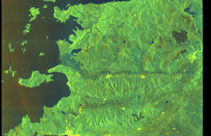
SAR coverage thumbnail
VIIRS Thermal Anomaly
Status: ✗ No detections
No VIIRS thermal/light detections in corridor
Show Raw Evidence JSON
{
    "gap_minutes": 316.30000000000001136868377216160297393798828125,
    "last_seen": {
        "ts": "2026-03-21T15:30:29+00:00",
        "lat": 36.64898670000000180380084202624857425689697265625,
        "lon": 26.7478933000000012043528840877115726470947265625,
        "sog": 11.0999999999999996447286321199499070644378662109375,
        "zone_id": "discovered_084"
    },
    "next_seen": {
        "ts": "2026-03-21T20:46:47+00:00",
        "lat": 35.868729999999999336068867705762386322021484375,
        "lon": 27.416985000000000383124643121846020221710205078125,
        "zone_ids": [
            "discovered_078"
        ]
    },
    "gap_enrichment": {
        "status": "done",
        "corridor": {
            "start": {
                "lat": 36.64898670000000180380084202624857425689697265625,
                "lon": 26.7478933000000012043528840877115726470947265625,
                "ts": "2026-03-21T15:30:29+00:00"
            },
            "end": {
                "lat": 35.868729999999999336068867705762386322021484375,
                "lon": 27.416985000000000383124643121846020221710205078125,
                "ts": "2026-03-21T20:46:47+00:00"
            },
            "bbox": {
                "min_lat": 35.68854999999999932924765744246542453765869140625,
                "min_lon": 26.524443000000001546823114040307700634002685546875,
                "max_lat": 36.8291669999999982110239216126501560211181640625,
                "max_lon": 27.64043600000000111549525172449648380279541015625
            },
            "buffer_km": 20
        },
        "sar": {
            "status": "snapshot",
            "scene_id": "S1A_IW_GRDH_1SDV_20260321T160704_20260321T160729_063728_08031B_5119_COG",
            "scene_time": "2026-03-21T16:07:04.508817Z",
            "platform": "sentinel-1a",
            "assets": {
                "preview_url": "https:\/\/fleetleaks.com\/wp-content\/uploads\/fleetleaks-evidence\/sar-imagery\/2026\/03\/event_250436_thumbnail_20260321210010.png",
                "stored_path": "\/home\/fleetleaks\/public_html\/wp-content\/uploads\/fleetleaks-evidence\/sar-imagery\/2026\/03\/event_250436_thumbnail_20260321210010.png",
                "source": "copernicus_dataspace"
            },
            "notes": "SAR snapshot available for review"
        },
        "viirs": {
            "status": "not_found",
            "notes": "No VIIRS thermal\/light detections in corridor"
        },
        "searched_at": "2026-03-21T21:00:02.143163+00:00"
    }
}- Zone: discovered_084
- Duration: 1h 26m
- Data Points: 18 AIS positions
- Period: 2026-03-21T14:03:39+00:00 to 2026-03-21T15:30:29+00:00
Show Raw Evidence JSON
{
    "zone_id": "discovered_084",
    "zone_name": "Norwegian Sea Surveillance Zone",
    "dwell_minutes": 86.7999999999999971578290569595992565155029296875,
    "points_in_zone": 18,
    "first_point": {
        "ts": "2026-03-21T14:03:39+00:00",
        "lat": 36.89392000000000138015820994041860103607177734375,
        "lon": 26.62945500000000009777068044058978557586669921875
    },
    "last_point": {
        "ts": "2026-03-21T15:30:29+00:00",
        "lat": 36.64898670000000180380084202624857425689697265625,
        "lon": 26.7478933000000012043528840877115726470947265625
    }
}- Zone: discovered_084
- Duration: 2h 26m
- Data Points: 67 AIS positions
- Period: 2026-03-21T13:04:18+00:00 to 2026-03-21T15:30:29+00:00
Show Raw Evidence JSON
{
    "zone_id": "discovered_084",
    "zone_name": "Norwegian Sea Surveillance Zone",
    "dwell_minutes": 146.19999999999998863131622783839702606201171875,
    "points_in_zone": 67,
    "first_point": {
        "ts": "2026-03-21T13:04:18+00:00",
        "lat": 37.05660329999999902383933658711612224578857421875,
        "lon": 26.536010000000000985664883046410977840423583984375
    },
    "last_point": {
        "ts": "2026-03-21T15:30:29+00:00",
        "lat": 36.64898670000000180380084202624857425689697265625,
        "lon": 26.7478933000000012043528840877115726470947265625
    }
}- Zone: discovered_084
- Duration: 2h 42m
- Data Points: 70 AIS positions
- Period: 2026-03-21T12:48:17+00:00 to 2026-03-21T15:30:29+00:00
Show Raw Evidence JSON
{
    "zone_id": "discovered_084",
    "zone_name": "Norwegian Sea Surveillance Zone",
    "dwell_minutes": 162.19999999999998863131622783839702606201171875,
    "points_in_zone": 70,
    "first_point": {
        "ts": "2026-03-21T12:48:17+00:00",
        "lat": 37.09587499999999948840923025272786617279052734375,
        "lon": 26.499694999999999112105797394178807735443115234375
    },
    "last_point": {
        "ts": "2026-03-21T15:30:29+00:00",
        "lat": 36.64898670000000180380084202624857425689697265625,
        "lon": 26.7478933000000012043528840877115726470947265625
    }
}- Zone: Novorossiysk/Sheskharis Terminal
- Duration: 1h 17m
- Data Points: 3 AIS positions
- Period: 2026-03-12T16:02:30+00:00 to 2026-03-12T17:19:45+00:00
Show Raw Evidence JSON
{
    "zone_id": "russia_novorossiysk",
    "zone_name": "Novorossiysk\/Sheskharis Terminal",
    "dwell_minutes": 77.2000000000000028421709430404007434844970703125,
    "points_in_zone": 3,
    "first_point": {
        "ts": "2026-03-12T16:02:30+00:00",
        "lat": 44.7322199999999980946085997857153415679931640625,
        "lon": 37.7936466999999964855305734090507030487060546875
    },
    "last_point": {
        "ts": "2026-03-12T17:19:45+00:00",
        "lat": 44.73367669999999662877598893828690052032470703125,
        "lon": 37.7907000000000010686562745831906795501708984375
    }
}- Zone: Novorossiysk/Sheskharis Terminal
- Duration: 3h 8m
- Data Points: 4 AIS positions
- Period: 2026-03-12T05:01:28+00:00 to 2026-03-12T08:09:53+00:00
Show Raw Evidence JSON
{
    "zone_id": "russia_novorossiysk",
    "zone_name": "Novorossiysk\/Sheskharis Terminal",
    "dwell_minutes": 188.400000000000005684341886080801486968994140625,
    "points_in_zone": 4,
    "first_point": {
        "ts": "2026-03-12T05:01:28+00:00",
        "lat": 44.72138000000000346290107700042426586151123046875,
        "lon": 37.77787000000000006139089236967265605926513671875
    },
    "last_point": {
        "ts": "2026-03-12T08:09:53+00:00",
        "lat": 44.73122670000000056234057410620152950286865234375,
        "lon": 37.79704670000000277241269941441714763641357421875
    }
}- Zone: Novorossiysk/Sheskharis Terminal
- Duration: 3h 9m
- Data Points: 5 AIS positions
- Period: 2026-03-12T04:59:56+00:00 to 2026-03-12T08:09:53+00:00
Show Raw Evidence JSON
{
    "zone_id": "russia_novorossiysk",
    "zone_name": "Novorossiysk\/Sheskharis Terminal",
    "dwell_minutes": 189.900000000000005684341886080801486968994140625,
    "points_in_zone": 5,
    "first_point": {
        "ts": "2026-03-12T04:59:56+00:00",
        "lat": 44.72346999999999894725988269783556461334228515625,
        "lon": 37.7992167000000023335815058089792728424072265625
    },
    "last_point": {
        "ts": "2026-03-12T08:09:53+00:00",
        "lat": 44.73122670000000056234057410620152950286865234375,
        "lon": 37.79704670000000277241269941441714763641357421875
    }
}- Gap Duration: 5h 52m
- Last Seen: 2026-03-11T23:07:28+00:00 at 44.6615, 37.9073 (Zone: Novorossiysk/Sheskharis Terminal)
- Next Seen: 2026-03-12T04:59:56+00:00 at 44.7235, 37.7992
🛰️ Gap Corroboration
These are snapshots that may corroborate presence during the gap. They do not reconstruct a continuous route.
SAR Imagery (Sentinel-1)
Status: ✗ No SAR coverage
No Sentinel-1 scenes covering corridor and time window
VIIRS Thermal Anomaly
Status: ✓ Signal detected
4 thermal/light anomalies detected
Detections: 4 thermal anomalies
View detections
| Location | Brightness | Time |
|---|---|---|
| 44.7352, 37.8118 | 304.1 K | 2026-03-11T22:54:00+00:00 |
| 44.7352, 37.8101 | 299.5 K | 2026-03-11T22:54:00+00:00 |
| 44.7377, 37.8132 | 299.2 K | 2026-03-12T03:05:00+00:00 |
| 44.8457, 37.6688 | 295.3 K | 2026-03-11T22:54:00+00:00 |
Show Raw Evidence JSON
{
    "gap_minutes": 352.5,
    "last_seen": {
        "ts": "2026-03-11T23:07:28+00:00",
        "lat": 44.66149999999999664623828721232712268829345703125,
        "lon": 37.907330000000001746229827404022216796875,
        "sog": 20.5,
        "zone_id": "russia_novorossiysk"
    },
    "next_seen": {
        "ts": "2026-03-12T04:59:56+00:00",
        "lat": 44.72346999999999894725988269783556461334228515625,
        "lon": 37.7992167000000023335815058089792728424072265625,
        "zone_ids": [
            "russia_novorossiysk"
        ]
    },
    "gap_enrichment": {
        "status": "done",
        "corridor": {
            "start": {
                "lat": 44.66149999999999664623828721232712268829345703125,
                "lon": 37.907330000000001746229827404022216796875,
                "ts": "2026-03-11T23:07:28+00:00"
            },
            "end": {
                "lat": 44.72346999999999894725988269783556461334228515625,
                "lon": 37.7992167000000023335815058089792728424072265625,
                "ts": "2026-03-12T04:59:56+00:00"
            },
            "bbox": {
                "min_lat": 44.4813199999999966394170769490301609039306640625,
                "min_lon": 37.545760000000001355147105641663074493408203125,
                "max_lat": 44.903649999999998954081092961132526397705078125,
                "max_lon": 38.160786999999999125066096894443035125732421875
            },
            "buffer_km": 20
        },
        "sar": {
            "status": "not_found",
            "notes": "No Sentinel-1 scenes covering corridor and time window"
        },
        "viirs": {
            "status": "signal",
            "dataset": "VIIRS_SNPP",
            "detection_count": 4,
            "top_detections": [
                {
                    "lat": 44.73523999999999745114109828136861324310302734375,
                    "lon": 37.811790000000002009983290918171405792236328125,
                    "brightness": 304.08999999999997498889570124447345733642578125,
                    "frp": 0.8000000000000000444089209850062616169452667236328125,
                    "confidence": "n",
                    "acq_date": "2026-03-11",
                    "acq_time": "2254",
                    "satellite": "N",
                    "daynight": "N",
                    "acq_datetime": "2026-03-11T22:54:00+00:00"
                },
                {
                    "lat": 44.73516000000000047975845518521964550018310546875,
                    "lon": 37.81013999999999697365637985058128833770751953125,
                    "brightness": 299.5,
                    "frp": 1.810000000000000053290705182007513940334320068359375,
                    "confidence": "n",
                    "acq_date": "2026-03-11",
                    "acq_time": "2254",
                    "satellite": "N",
                    "daynight": "N",
                    "acq_datetime": "2026-03-11T22:54:00+00:00"
                },
                {
                    "lat": 44.73767000000000138015820994041860103607177734375,
                    "lon": 37.81322999999999723286236985586583614349365234375,
                    "brightness": 299.1499999999999772626324556767940521240234375,
                    "frp": 0.60999999999999998667732370449812151491641998291015625,
                    "confidence": "n",
                    "acq_date": "2026-03-12",
                    "acq_time": "35",
                    "satellite": "N",
                    "daynight": "N",
                    "acq_datetime": "2026-03-12T03:05:00+00:00"
                },
                {
                    "lat": 44.84566000000000229874785873107612133026123046875,
                    "lon": 37.6688199999999966394170769490301609039306640625,
                    "brightness": 295.33999999999997498889570124447345733642578125,
                    "frp": 0.7800000000000000266453525910037569701671600341796875,
                    "confidence": "n",
                    "acq_date": "2026-03-11",
                    "acq_time": "2254",
                    "satellite": "N",
                    "daynight": "N",
                    "acq_datetime": "2026-03-11T22:54:00+00:00"
                }
            ],
            "notes": "4 thermal\/light anomalies detected"
        },
        "searched_at": "2026-03-12T05:15:01.417710+00:00"
    }
}- Zone: Novorossiysk/Sheskharis Terminal
- Duration: 6h 1m
- Data Points: 8 AIS positions
- Period: 2026-03-11T23:01:49+00:00 to 2026-03-12T05:03:32+00:00
Show Raw Evidence JSON
{
    "zone_id": "russia_novorossiysk",
    "zone_name": "Novorossiysk\/Sheskharis Terminal",
    "dwell_minutes": 361.69999999999998863131622783839702606201171875,
    "points_in_zone": 8,
    "first_point": {
        "ts": "2026-03-11T23:01:49+00:00",
        "lat": 44.7187100000000015143086784519255161285400390625,
        "lon": 37.79278330000000352129063685424625873565673828125
    },
    "last_point": {
        "ts": "2026-03-12T05:03:32+00:00",
        "lat": 44.727896700000002283559297211468219757080078125,
        "lon": 37.781796700000001010266714729368686676025390625
    }
}- Zone: Novorossiysk/Sheskharis Terminal
- Duration: 6h 33m
- Data Points: 11 AIS positions
- Period: 2026-03-11T22:30:12+00:00 to 2026-03-12T05:03:32+00:00
Show Raw Evidence JSON
{
    "zone_id": "russia_novorossiysk",
    "zone_name": "Novorossiysk\/Sheskharis Terminal",
    "dwell_minutes": 393.30000000000001136868377216160297393798828125,
    "points_in_zone": 11,
    "first_point": {
        "ts": "2026-03-11T22:30:12+00:00",
        "lat": 44.6743833000000023503162083216011524200439453125,
        "lon": 37.87608329999999767778717796318233013153076171875
    },
    "last_point": {
        "ts": "2026-03-12T05:03:32+00:00",
        "lat": 44.727896700000002283559297211468219757080078125,
        "lon": 37.781796700000001010266714729368686676025390625
    }
}- Gap Duration: 5h 25m
- Last Seen: 2026-03-11T16:41:04+00:00 at 44.7292, 37.7979 (Zone: Novorossiysk/Sheskharis Terminal)
- Next Seen: 2026-03-11T22:06:29+00:00 at 44.7121, 37.7868
🛰️ Gap Corroboration
These are snapshots that may corroborate presence during the gap. They do not reconstruct a continuous route.
SAR Imagery (Sentinel-1)
Status: ✗ No SAR coverage
No Sentinel-1 scenes covering corridor and time window
VIIRS Thermal Anomaly
Status: ✗ No detections
No VIIRS thermal/light detections in corridor
Show Raw Evidence JSON
{
    "gap_minutes": 325.3999999999999772626324556767940521240234375,
    "last_seen": {
        "ts": "2026-03-11T16:41:04+00:00",
        "lat": 44.72921670000000204936441150493919849395751953125,
        "lon": 37.79789670000000256777639151550829410552978515625,
        "sog": 52.39999999999999857891452847979962825775146484375,
        "zone_id": "russia_novorossiysk"
    },
    "next_seen": {
        "ts": "2026-03-11T22:06:29+00:00",
        "lat": 44.712126699999998891144059598445892333984375,
        "lon": 37.78681329999999860547177377156913280487060546875,
        "zone_ids": [
            "russia_novorossiysk"
        ]
    },
    "gap_enrichment": {
        "status": "not_found",
        "corridor": {
            "start": {
                "lat": 44.72921670000000204936441150493919849395751953125,
                "lon": 37.79789670000000256777639151550829410552978515625,
                "ts": "2026-03-11T16:41:04+00:00"
            },
            "end": {
                "lat": 44.712126699999998891144059598445892333984375,
                "lon": 37.78681329999999860547177377156913280487060546875,
                "ts": "2026-03-11T22:06:29+00:00"
            },
            "bbox": {
                "min_lat": 44.53194700000000239015207625925540924072265625,
                "min_lon": 37.53323300000000273257683147676289081573486328125,
                "max_lat": 44.9093969999999984565874910913407802581787109375,
                "max_lon": 38.05147699999999844067133381031453609466552734375
            },
            "buffer_km": 20
        },
        "sar": {
            "status": "not_found",
            "notes": "No Sentinel-1 scenes covering corridor and time window"
        },
        "viirs": {
            "status": "not_found",
            "notes": "No VIIRS thermal\/light detections in corridor"
        },
        "searched_at": "2026-03-11T22:15:01.557977+00:00"
    }
}- Zone: Novorossiysk/Sheskharis Terminal
- Duration: 5h 36m
- Data Points: 9 AIS positions
- Period: 2026-03-11T16:40:24+00:00 to 2026-03-11T22:16:50+00:00
Show Raw Evidence JSON
{
    "zone_id": "russia_novorossiysk",
    "zone_name": "Novorossiysk\/Sheskharis Terminal",
    "dwell_minutes": 336.3999999999999772626324556767940521240234375,
    "points_in_zone": 9,
    "first_point": {
        "ts": "2026-03-11T16:40:24+00:00",
        "lat": 44.73241329999999749134076409973204135894775390625,
        "lon": 37.785359999999997171471477486193180084228515625
    },
    "last_point": {
        "ts": "2026-03-11T22:16:50+00:00",
        "lat": 44.509326700000002574597601778805255889892578125,
        "lon": 38.0099732999999986304828780703246593475341796875
    }
}- Zone: Novorossiysk/Sheskharis Terminal
- Duration: 1h 48m
- Data Points: 3 AIS positions
- Period: 2026-03-11T14:52:26+00:00 to 2026-03-11T16:41:04+00:00
Show Raw Evidence JSON
{
    "zone_id": "russia_novorossiysk",
    "zone_name": "Novorossiysk\/Sheskharis Terminal",
    "dwell_minutes": 108.599999999999994315658113919198513031005859375,
    "points_in_zone": 3,
    "first_point": {
        "ts": "2026-03-11T14:52:26+00:00",
        "lat": 44.7331300000000027239366318099200725555419921875,
        "lon": 37.78553000000000139380063046701252460479736328125
    },
    "last_point": {
        "ts": "2026-03-11T16:41:04+00:00",
        "lat": 44.72921670000000204936441150493919849395751953125,
        "lon": 37.79789670000000256777639151550829410552978515625
    }
}- Zone: Novorossiysk/Sheskharis Terminal
- Duration: 1h 17m
- Data Points: 6 AIS positions
- Period: 2026-03-11T12:53:24+00:00 to 2026-03-11T14:10:38+00:00
Show Raw Evidence JSON
{
    "zone_id": "russia_novorossiysk",
    "zone_name": "Novorossiysk\/Sheskharis Terminal",
    "dwell_minutes": 77.2000000000000028421709430404007434844970703125,
    "points_in_zone": 6,
    "first_point": {
        "ts": "2026-03-11T12:53:24+00:00",
        "lat": 44.68314670000000177196852746419608592987060546875,
        "lon": 37.88157000000000351747075910679996013641357421875
    },
    "last_point": {
        "ts": "2026-03-11T14:10:38+00:00",
        "lat": 44.527140000000002828528522513806819915771484375,
        "lon": 38.02397669999999862966433283872902393341064453125
    }
}- Zone: Novorossiysk/Sheskharis Terminal
- Duration: 1h 31m
- Data Points: 10 AIS positions
- Period: 2026-03-11T10:04:20+00:00 to 2026-03-11T11:36:03+00:00
Show Raw Evidence JSON
{
    "zone_id": "russia_novorossiysk",
    "zone_name": "Novorossiysk\/Sheskharis Terminal",
    "dwell_minutes": 91.7000000000000028421709430404007434844970703125,
    "points_in_zone": 10,
    "first_point": {
        "ts": "2026-03-11T10:04:20+00:00",
        "lat": 44.733243299999998043858795426785945892333984375,
        "lon": 37.78618329999999758683770778588950634002685546875
    },
    "last_point": {
        "ts": "2026-03-11T11:36:03+00:00",
        "lat": 44.71561669999999821811798028647899627685546875,
        "lon": 37.8034200000000026875568437390029430389404296875
    }
}- Zone: Novorossiysk/Sheskharis Terminal
- Duration: 1h 49m
- Data Points: 12 AIS positions
- Period: 2026-03-11T09:46:08+00:00 to 2026-03-11T11:36:03+00:00
Show Raw Evidence JSON
{
    "zone_id": "russia_novorossiysk",
    "zone_name": "Novorossiysk\/Sheskharis Terminal",
    "dwell_minutes": 109.900000000000005684341886080801486968994140625,
    "points_in_zone": 12,
    "first_point": {
        "ts": "2026-03-11T09:46:08+00:00",
        "lat": 44.73233330000000051995812100358307361602783203125,
        "lon": 37.7829167000000012421878636814653873443603515625
    },
    "last_point": {
        "ts": "2026-03-11T11:36:03+00:00",
        "lat": 44.71561669999999821811798028647899627685546875,
        "lon": 37.8034200000000026875568437390029430389404296875
    }
}- Zone: Novorossiysk/Sheskharis Terminal
- Duration: 1h 31m
- Data Points: 4 AIS positions
- Period: 2026-03-11T05:51:46+00:00 to 2026-03-11T07:22:54+00:00
Show Raw Evidence JSON
{
    "zone_id": "russia_novorossiysk",
    "zone_name": "Novorossiysk\/Sheskharis Terminal",
    "dwell_minutes": 91.099999999999994315658113919198513031005859375,
    "points_in_zone": 4,
    "first_point": {
        "ts": "2026-03-11T05:51:46+00:00",
        "lat": 44.73436670000000248137439484708011150360107421875,
        "lon": 37.78082330000000155223460751585662364959716796875
    },
    "last_point": {
        "ts": "2026-03-11T07:22:54+00:00",
        "lat": 44.7122499999999973852027324028313159942626953125,
        "lon": 37.83017000000000251702658715657889842987060546875
    }
}- Zone: Novorossiysk/Sheskharis Terminal
- Duration: 2h 24m
- Data Points: 5 AIS positions
- Period: 2026-03-11T04:58:05+00:00 to 2026-03-11T07:22:54+00:00
Show Raw Evidence JSON
{
    "zone_id": "russia_novorossiysk",
    "zone_name": "Novorossiysk\/Sheskharis Terminal",
    "dwell_minutes": 144.80000000000001136868377216160297393798828125,
    "points_in_zone": 5,
    "first_point": {
        "ts": "2026-03-11T04:58:05+00:00",
        "lat": 44.73290329999999670462784706614911556243896484375,
        "lon": 37.780900000000002592059900052845478057861328125
    },
    "last_point": {
        "ts": "2026-03-11T07:22:54+00:00",
        "lat": 44.7122499999999973852027324028313159942626953125,
        "lon": 37.83017000000000251702658715657889842987060546875
    }
}- Zone: Novorossiysk/Sheskharis Terminal
- Duration: 6h 19m
- Data Points: 7 AIS positions
- Period: 2026-03-11T01:03:54+00:00 to 2026-03-11T07:22:54+00:00
Show Raw Evidence JSON
{
    "zone_id": "russia_novorossiysk",
    "zone_name": "Novorossiysk\/Sheskharis Terminal",
    "dwell_minutes": 379,
    "points_in_zone": 7,
    "first_point": {
        "ts": "2026-03-11T01:03:54+00:00",
        "lat": 44.73156999999999783312887302599847316741943359375,
        "lon": 37.78028330000000067911969381384551525115966796875
    },
    "last_point": {
        "ts": "2026-03-11T07:22:54+00:00",
        "lat": 44.7122499999999973852027324028313159942626953125,
        "lon": 37.83017000000000251702658715657889842987060546875
    }
}- Zone: Novorossiysk/Sheskharis Terminal
- Duration: 6h 30m
- Data Points: 7 AIS positions
- Period: 2026-03-11T00:45:55+00:00 to 2026-03-11T07:16:15+00:00
Show Raw Evidence JSON
{
    "zone_id": "russia_novorossiysk",
    "zone_name": "Novorossiysk\/Sheskharis Terminal",
    "dwell_minutes": 390.30000000000001136868377216160297393798828125,
    "points_in_zone": 7,
    "first_point": {
        "ts": "2026-03-11T00:45:55+00:00",
        "lat": 44.73169999999999646433934685774147510528564453125,
        "lon": 37.7801333000000028050635592080652713775634765625
    },
    "last_point": {
        "ts": "2026-03-11T07:16:15+00:00",
        "lat": 44.514673299999998334897099994122982025146484375,
        "lon": 38.00699670000000196523615159094333648681640625
    }
}- Zone: discovered_163
- Duration: 1h 49m
- Data Points: 20 AIS positions
- Period: 2026-03-02T22:19:59+00:00 to 2026-03-03T00:09:35+00:00
Show Raw Evidence JSON
{
    "zone_id": "discovered_163",
    "zone_name": "Black Sea Sanctions Monitoring Zone",
    "dwell_minutes": 109.599999999999994315658113919198513031005859375,
    "points_in_zone": 20,
    "first_point": {
        "ts": "2026-03-02T22:19:59+00:00",
        "lat": 41.49876330000000024256223696283996105194091796875,
        "lon": 30.0121232999999989488060236908495426177978515625
    },
    "last_point": {
        "ts": "2026-03-03T00:09:35+00:00",
        "lat": 41.62951670000000348181856679730117321014404296875,
        "lon": 30.49990999999999985448084771633148193359375
    }
}- Zone: Eastern Mediterranean Sanctioned Vessel Zone
- Duration: 1h 26m
- Data Points: 71 AIS positions
- Period: 2026-03-02T20:00:39+00:00 to 2026-03-02T21:27:09+00:00
Show Raw Evidence JSON
{
    "zone_id": "discovered_018",
    "zone_name": "Western Black Sea Sanctioned Vessel Zone",
    "dwell_minutes": 86.5,
    "points_in_zone": 71,
    "first_point": {
        "ts": "2026-03-02T20:00:39+00:00",
        "lat": 41.3330500000000000682121026329696178436279296875,
        "lon": 29.41826329999999956044121063314378261566162109375
    },
    "last_point": {
        "ts": "2026-03-02T21:27:09+00:00",
        "lat": 41.43416330000000158406692207790911197662353515625,
        "lon": 29.7847833000000008496499503962695598602294921875
    }
}- Zone: Bosphorus/Dardanelles Approach
- Duration: 1h 19m
- Data Points: 64 AIS positions
- Period: 2026-03-02T19:00:10+00:00 to 2026-03-02T20:19:20+00:00
Show Raw Evidence JSON
{
    "zone_id": "osint_bosphorus",
    "zone_name": "Bosphorus\/Dardanelles Approach",
    "dwell_minutes": 79.2000000000000028421709430404007434844970703125,
    "points_in_zone": 64,
    "first_point": {
        "ts": "2026-03-02T19:00:10+00:00",
        "lat": 41.2590833000000003494278644211590290069580078125,
        "lon": 29.168343300000000084537532529793679714202880859375
    },
    "last_point": {
        "ts": "2026-03-02T20:19:20+00:00",
        "lat": 41.35374329999999787332853884436190128326416015625,
        "lon": 29.4970332999999982348526827991008758544921875
    }
}- Zone: Eastern Mediterranean Sanctioned Vessel Zone
- Duration: 2h 27m
- Data Points: 116 AIS positions
- Period: 2026-03-02T19:00:10+00:00 to 2026-03-02T21:27:09+00:00
Show Raw Evidence JSON
{
    "zone_id": "discovered_018",
    "zone_name": "Western Black Sea Sanctioned Vessel Zone",
    "dwell_minutes": 147,
    "points_in_zone": 116,
    "first_point": {
        "ts": "2026-03-02T19:00:10+00:00",
        "lat": 41.2590833000000003494278644211590290069580078125,
        "lon": 29.168343300000000084537532529793679714202880859375
    },
    "last_point": {
        "ts": "2026-03-02T21:27:09+00:00",
        "lat": 41.43416330000000158406692207790911197662353515625,
        "lon": 29.7847833000000008496499503962695598602294921875
    }
}- Zone: Eastern Mediterranean Sanctioned Vessel Zone
- Duration: 2h 51m
- Data Points: 135 AIS positions
- Period: 2026-03-02T18:35:51+00:00 to 2026-03-02T21:27:09+00:00
Show Raw Evidence JSON
{
    "zone_id": "discovered_018",
    "zone_name": "Western Black Sea Sanctioned Vessel Zone",
    "dwell_minutes": 171.30000000000001136868377216160297393798828125,
    "points_in_zone": 135,
    "first_point": {
        "ts": "2026-03-02T18:35:51+00:00",
        "lat": 41.2012466999999986683178576640784740447998046875,
        "lon": 29.109809999999999519104676437564194202423095703125
    },
    "last_point": {
        "ts": "2026-03-02T21:27:09+00:00",
        "lat": 41.43416330000000158406692207790911197662353515625,
        "lon": 29.7847833000000008496499503962695598602294921875
    }
}- Zone: Bosphorus/Dardanelles Approach
- Duration: 1h 43m
- Data Points: 83 AIS positions
- Period: 2026-03-02T18:35:51+00:00 to 2026-03-02T20:19:20+00:00
Show Raw Evidence JSON
{
    "zone_id": "osint_bosphorus",
    "zone_name": "Bosphorus\/Dardanelles Approach",
    "dwell_minutes": 103.5,
    "points_in_zone": 83,
    "first_point": {
        "ts": "2026-03-02T18:35:51+00:00",
        "lat": 41.2012466999999986683178576640784740447998046875,
        "lon": 29.109809999999999519104676437564194202423095703125
    },
    "last_point": {
        "ts": "2026-03-02T20:19:20+00:00",
        "lat": 41.35374329999999787332853884436190128326416015625,
        "lon": 29.4970332999999982348526827991008758544921875
    }
}- Zone: Bosphorus/Dardanelles Approach
- Duration: 3h 19m
- Data Points: 86 AIS positions
- Period: 2026-03-02T17:00:21+00:00 to 2026-03-02T20:19:20+00:00
Show Raw Evidence JSON
{
    "zone_id": "osint_bosphorus",
    "zone_name": "Bosphorus\/Dardanelles Approach",
    "dwell_minutes": 199,
    "points_in_zone": 86,
    "first_point": {
        "ts": "2026-03-02T17:00:21+00:00",
        "lat": 40.9989699999999999135980033315718173980712890625,
        "lon": 28.99902670000000171057763509452342987060546875
    },
    "last_point": {
        "ts": "2026-03-02T20:19:20+00:00",
        "lat": 41.35374329999999787332853884436190128326416015625,
        "lon": 29.4970332999999982348526827991008758544921875
    }
}- Zone: Bosphorus/Dardanelles Approach
- Duration: 4h 18m
- Data Points: 103 AIS positions
- Period: 2026-03-02T16:01:21+00:00 to 2026-03-02T20:19:20+00:00
Show Raw Evidence JSON
{
    "zone_id": "osint_bosphorus",
    "zone_name": "Bosphorus\/Dardanelles Approach",
    "dwell_minutes": 258,
    "points_in_zone": 103,
    "first_point": {
        "ts": "2026-03-02T16:01:21+00:00",
        "lat": 40.90908999999999906549419392831623554229736328125,
        "lon": 28.9695032999999995126927387900650501251220703125
    },
    "last_point": {
        "ts": "2026-03-02T20:19:20+00:00",
        "lat": 41.35374329999999787332853884436190128326416015625,
        "lon": 29.4970332999999982348526827991008758544921875
    }
}- Zone: Bosphorus/Dardanelles Approach
- Duration: 4h 55m
- Data Points: 117 AIS positions
- Period: 2026-03-02T15:23:51+00:00 to 2026-03-02T20:19:20+00:00
Show Raw Evidence JSON
{
    "zone_id": "osint_bosphorus",
    "zone_name": "Bosphorus\/Dardanelles Approach",
    "dwell_minutes": 295.5,
    "points_in_zone": 117,
    "first_point": {
        "ts": "2026-03-02T15:23:51+00:00",
        "lat": 40.87582330000000041536623029969632625579833984375,
        "lon": 28.917923300000001773923941073007881641387939453125
    },
    "last_point": {
        "ts": "2026-03-02T20:19:20+00:00",
        "lat": 41.35374329999999787332853884436190128326416015625,
        "lon": 29.4970332999999982348526827991008758544921875
    }
}- Zone: Central Atlantic Surveillance Zone
- Duration: 1h 23m
- Data Points: 34 AIS positions
- Period: 2026-02-28T08:03:36+00:00 to 2026-02-28T09:26:56+00:00
Show Raw Evidence JSON
{
    "zone_id": "discovered_088",
    "zone_name": "Central Atlantic Surveillance Zone",
    "dwell_minutes": 83.2999999999999971578290569595992565155029296875,
    "points_in_zone": 34,
    "first_point": {
        "ts": "2026-02-28T08:03:36+00:00",
        "lat": 37.7261232999999975845639710314571857452392578125,
        "lon": 24.231913299999998656630850746296346187591552734375
    },
    "last_point": {
        "ts": "2026-02-28T09:26:56+00:00",
        "lat": 37.82755329999999815981936990283429622650146484375,
        "lon": 24.4887532999999990579453879036009311676025390625
    }
}- Zone: Central Mediterranean Sanctioned Vessel Zone
- Duration: 1h 10m
- Data Points: 9 AIS positions
- Period: 2026-02-06T10:26:41+00:00 to 2026-02-06T11:36:40+00:00
Show Raw Evidence JSON
{
    "zone_id": "discovered_023",
    "zone_name": "Central Aegean Monitoring Zone",
    "dwell_minutes": 70,
    "points_in_zone": 9,
    "first_point": {
        "ts": "2026-02-06T10:26:41+00:00",
        "lat": 37.27951329999999785513864480890333652496337890625,
        "lon": 23.763721700000001391117621096782386302947998046875
    },
    "last_point": {
        "ts": "2026-02-06T11:36:40+00:00",
        "lat": 37.47213330000000297559381579048931598663330078125,
        "lon": 23.75862670000000065329004428349435329437255859375
    }
}Recent Position Data
| Time (UTC) | Lat | Lon | Speed | Course | Zone |
|---|---|---|---|---|---|
| Jun 9 06:07 | 36.4553 | 14.4876 | 10.7 kn | 288.2° | Black Sea Sanctioned Vessel Monitoring Zone |
| Jun 9 06:06 | 36.4542 | 14.4918 | 10.7 kn | 288.6° | Black Sea Sanctioned Vessel Monitoring Zone |
| Jun 9 06:03 | 36.4517 | 14.5011 | 10.7 kn | 288.5° | Black Sea Sanctioned Vessel Monitoring Zone |
| Jun 9 06:01 | 36.4503 | 14.5064 | 10.7 kn | 288.5° | Black Sea Sanctioned Vessel Monitoring Zone |
| Jun 9 05:57 | 36.4455 | 14.5238 | 10.6 kn | 288.7° | Black Sea Sanctioned Vessel Monitoring Zone |
| Jun 9 05:51 | 36.4405 | 14.5424 | 10.6 kn | 288.5° | Black Sea Sanctioned Vessel Monitoring Zone |
| Jun 9 05:42 | 36.4318 | 14.5747 | 10.5 kn | 288.1° | Black Sea Sanctioned Vessel Monitoring Zone |
| Jun 9 05:30 | 36.4210 | 14.6155 | 10.5 kn | 288.2° | Black Sea Sanctioned Vessel Monitoring Zone |
| Jun 9 05:27 | 36.4184 | 14.6252 | 10.5 kn | 287.7° | Black Sea Sanctioned Vessel Monitoring Zone |
| Jun 9 05:25 | 36.4165 | 14.6327 | 10.5 kn | 288.2° | Black Sea Sanctioned Vessel Monitoring Zone |
| Jun 9 05:20 | 36.4121 | 14.6493 | 10.5 kn | 288.0° | Black Sea Sanctioned Vessel Monitoring Zone |
| Jun 9 05:18 | 36.4105 | 14.6557 | 10.5 kn | 287.7° | Black Sea Sanctioned Vessel Monitoring Zone |
| Jun 9 05:17 | 36.4096 | 14.6592 | 10.5 kn | 287.5° | Black Sea Sanctioned Vessel Monitoring Zone |
| Jun 9 05:15 | 36.4077 | 14.6667 | 10.5 kn | 287.0° | Black Sea Sanctioned Vessel Monitoring Zone |
| Jun 9 05:13 | 36.4056 | 14.6748 | 10.5 kn | 287.5° | Black Sea Sanctioned Vessel Monitoring Zone |
| Jun 9 05:02 | 36.3959 | 14.7138 | 10.6 kn | 287.0° | Black Sea Sanctioned Vessel Monitoring Zone |
| Jun 9 04:47 | 36.3832 | 14.7671 | 10.6 kn | 285.4° | Black Sea Sanctioned Vessel Monitoring Zone |
| Jun 9 04:34 | 36.3724 | 14.8108 | 10.6 kn | 287.7° | Black Sea Sanctioned Vessel Monitoring Zone |
| Jun 9 04:32 | 36.3701 | 14.8195 | 10.6 kn | 286.9° | Black Sea Sanctioned Vessel Monitoring Zone |
| Jun 9 04:30 | 36.3687 | 14.8253 | 10.7 kn | 286.9° | Black Sea Sanctioned Vessel Monitoring Zone |
Showing 20 of 100 recent positions.
Data Source
Vessel observed through FleetLeaks' AIS monitoring system in zones of interest. Identity and position data derived from AIS broadcasts and public maritime databases.
Disclaimer: AIS data can be spoofed or falsified. Vessel identities should be independently verified before making compliance decisions.