IMO 9246798
Vessel information
Vessel Name
GOLDEN GLORY
IMO Number
9246798
MMSI
477630700
Vessel Type
Tanker - Hazard B
Flag
🇭🇰 HONG KONG
Call Sign
VRTS6
Length
183 m
Beam
32 m
Detected Events (24)
Zone Dwell
Eastern Mediterranean Monitoring Zone
- Zone: Eastern Mediterranean Monitoring Zone
- Duration: 3h 6m
- Data Points: 3 AIS positions
- Period: 2026-06-09T02:59:46+00:00 to 2026-06-09T06:06:27+00:00
Show Raw Evidence JSON
{
    "zone_id": "discovered_020",
    "zone_name": "Eastern Mediterranean Monitoring Zone",
    "dwell_minutes": 186.69999999999998863131622783839702606201171875,
    "points_in_zone": 3,
    "first_point": {
        "ts": "2026-06-09T02:59:46+00:00",
        "lat": 31.364566700000001020498530124314129352569580078125,
        "lon": 32.30020999999999986584953148849308490753173828125
    },
    "last_point": {
        "ts": "2026-06-09T06:06:27+00:00",
        "lat": 31.476578299999999899227987043559551239013671875,
        "lon": 32.3258732999999978119376464746892452239990234375
    }
}
Methodology: 2026.01.18
Zone Dwell
Eastern Mediterranean Monitoring Zone
- Zone: Eastern Mediterranean Monitoring Zone
- Duration: 4h 54m
- Data Points: 3 AIS positions
- Period: 2026-06-08T22:11:45+00:00 to 2026-06-09T03:05:44+00:00
Show Raw Evidence JSON
{
    "zone_id": "discovered_020",
    "zone_name": "Eastern Mediterranean Monitoring Zone",
    "dwell_minutes": 294,
    "points_in_zone": 3,
    "first_point": {
        "ts": "2026-06-08T22:11:45+00:00",
        "lat": 31.36463669999999837045834283344447612762451171875,
        "lon": 32.2988399999999984402165864594280719757080078125
    },
    "last_point": {
        "ts": "2026-06-09T03:05:44+00:00",
        "lat": 31.364609999999998990460881032049655914306640625,
        "lon": 32.30016169999999675610524718649685382843017578125
    }
}
Methodology: 2026.01.18
Ais Gap🛰️✓
Eastern Mediterranean Monitoring Zone
- Gap Duration: 5h 20m
- Last Seen: 2026-06-08T16:51:29+00:00 at 31.3632, 32.3046 (Zone: Eastern Mediterranean Monitoring Zone)
- Next Seen: 2026-06-08T22:11:45+00:00 at 31.3646, 32.2988
🛰️ Gap Corroboration
Imagery Available
These are snapshots that may corroborate presence during the gap. They do not reconstruct a continuous route.
SAR Imagery (Sentinel-1)
Status: ✓ Snapshot available
SAR snapshot available for review
Scene: S1A_IW_GRDH_1SDV_20260608T155646_20260608T155711_064880_082CFB_48CC_COG • Time: 2026-06-08T15:56:46.578142Z
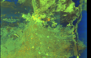
SAR coverage thumbnail
VIIRS Thermal Anomaly
Status: ✗ No detections
No VIIRS thermal/light detections in corridor
Show Raw Evidence JSON
{
    "gap_minutes": 320.30000000000001136868377216160297393798828125,
    "last_seen": {
        "ts": "2026-06-08T16:51:29+00:00",
        "lat": 31.363233300000000980389813776127994060516357421875,
        "lon": 32.3045800000000014051693142391741275787353515625,
        "sog": 2.20000000000000017763568394002504646778106689453125,
        "zone_id": "discovered_020"
    },
    "next_seen": {
        "ts": "2026-06-08T22:11:45+00:00",
        "lat": 31.36463669999999837045834283344447612762451171875,
        "lon": 32.2988399999999984402165864594280719757080078125,
        "zone_ids": [
            "discovered_020"
        ]
    },
    "gap_enrichment": {
        "status": "done",
        "corridor": {
            "start": {
                "lat": 31.363233300000000980389813776127994060516357421875,
                "lon": 32.3045800000000014051693142391741275787353515625,
                "ts": "2026-06-08T16:51:29+00:00"
            },
            "end": {
                "lat": 31.36463669999999837045834283344447612762451171875,
                "lon": 32.2988399999999984402165864594280719757080078125,
                "ts": "2026-06-08T22:11:45+00:00"
            },
            "bbox": {
                "min_lat": 31.183053000000001020453055389225482940673828125,
                "min_lon": 32.08782599999999973761077853851020336151123046875,
                "max_lat": 31.544816999999998330395101220346987247467041015625,
                "max_lon": 32.51559400000000010777512216009199619293212890625
            },
            "buffer_km": 20
        },
        "sar": {
            "status": "snapshot",
            "scene_id": "S1A_IW_GRDH_1SDV_20260608T155646_20260608T155711_064880_082CFB_48CC_COG",
            "scene_time": "2026-06-08T15:56:46.578142Z",
            "platform": "sentinel-1a",
            "assets": {
                "preview_url": "https:\/\/fleetleaks.com\/wp-content\/uploads\/fleetleaks-evidence\/sar-imagery\/2026\/06\/event_707073_thumbnail_20260608223011.png",
                "stored_path": "\/home\/fleetleaks\/public_html\/wp-content\/uploads\/fleetleaks-evidence\/sar-imagery\/2026\/06\/event_707073_thumbnail_20260608223011.png",
                "source": "copernicus_dataspace"
            },
            "notes": "SAR snapshot available for review"
        },
        "viirs": {
            "status": "not_found",
            "notes": "No VIIRS thermal\/light detections in corridor"
        },
        "searched_at": "2026-06-08T22:30:07.438863+00:00"
    }
}
Methodology: 2026.01.18
Zone Dwell
Eastern Mediterranean Monitoring Zone
- Zone: Eastern Mediterranean Monitoring Zone
- Duration: 5h 28m
- Data Points: 5 AIS positions
- Period: 2026-06-08T16:43:29+00:00 to 2026-06-08T22:11:45+00:00
Show Raw Evidence JSON
{
    "zone_id": "discovered_020",
    "zone_name": "Eastern Mediterranean Monitoring Zone",
    "dwell_minutes": 328.30000000000001136868377216160297393798828125,
    "points_in_zone": 5,
    "first_point": {
        "ts": "2026-06-08T16:43:29+00:00",
        "lat": 31.360756699999999597139321849681437015533447265625,
        "lon": 32.3116050000000001318767317570745944976806640625
    },
    "last_point": {
        "ts": "2026-06-08T22:11:45+00:00",
        "lat": 31.36463669999999837045834283344447612762451171875,
        "lon": 32.2988399999999984402165864594280719757080078125
    }
}
Methodology: 2026.01.18
Zone Dwell
Eastern Mediterranean Monitoring Zone
- Zone: Eastern Mediterranean Monitoring Zone
- Duration: 1h 37m
- Data Points: 8 AIS positions
- Period: 2026-06-08T15:14:28+00:00 to 2026-06-08T16:51:29+00:00
Show Raw Evidence JSON
{
    "zone_id": "discovered_020",
    "zone_name": "Eastern Mediterranean Monitoring Zone",
    "dwell_minutes": 97,
    "points_in_zone": 8,
    "first_point": {
        "ts": "2026-06-08T15:14:28+00:00",
        "lat": 31.212811699999999603960532112978398799896240234375,
        "lon": 32.3410932999999971571014611981809139251708984375
    },
    "last_point": {
        "ts": "2026-06-08T16:51:29+00:00",
        "lat": 31.363233300000000980389813776127994060516357421875,
        "lon": 32.3045800000000014051693142391741275787353515625
    }
}
Methodology: 2026.01.18
Zone Dwell
Eastern Mediterranean Monitoring Zone
- Zone: Eastern Mediterranean Monitoring Zone
- Duration: 3h 22m
- Data Points: 13 AIS positions
- Period: 2026-06-08T13:28:39+00:00 to 2026-06-08T16:51:29+00:00
Show Raw Evidence JSON
{
    "zone_id": "discovered_020",
    "zone_name": "Eastern Mediterranean Monitoring Zone",
    "dwell_minutes": 202.80000000000001136868377216160297393798828125,
    "points_in_zone": 13,
    "first_point": {
        "ts": "2026-06-08T13:28:39+00:00",
        "lat": 30.954041700000001213766154251061379909515380859375,
        "lon": 32.3130816999999979088897816836833953857421875
    },
    "last_point": {
        "ts": "2026-06-08T16:51:29+00:00",
        "lat": 31.363233300000000980389813776127994060516357421875,
        "lon": 32.3045800000000014051693142391741275787353515625
    }
}
Methodology: 2026.01.18
Zone Dwell
discovered_016
- Zone: discovered_016
- Duration: 1h 42m
- Data Points: 12 AIS positions
- Period: 2026-04-25T22:00:03+00:00 to 2026-04-25T23:42:01+00:00
Show Raw Evidence JSON
{
    "zone_id": "discovered_016",
    "zone_name": "Eastern Mediterranean Monitoring Zone",
    "dwell_minutes": 102,
    "points_in_zone": 12,
    "first_point": {
        "ts": "2026-04-25T22:00:03+00:00",
        "lat": 31.414224999999998289013092289678752422332763671875,
        "lon": 32.44410330000000186601027962751686573028564453125
    },
    "last_point": {
        "ts": "2026-04-25T23:42:01+00:00",
        "lat": 31.413979999999998682369550806470215320587158203125,
        "lon": 32.44400499999999709643816458992660045623779296875
    }
}
Methodology: 2026.01.18
Loiter
discovered_016
- Duration: 1h 42m
- Radius: 19 meters
- Data Points: 12 AIS positions
- Centroid: 31.4141, 32.4441
- Zone: discovered_016
Show Raw Evidence JSON
{
    "radius_m": 18.5,
    "duration_minutes": 102,
    "points": 12,
    "centroid": {
        "lat": 31.4141376416666702198199345730245113372802734375,
        "lon": 32.44406984999999821184246684424579143524169921875
    },
    "bbox": {
        "min_lat": 31.413979999999998682369550806470215320587158203125,
        "min_lon": 32.44398830000000089057721197605133056640625,
        "max_lat": 31.4142532999999986031980370171368122100830078125,
        "max_lon": 32.444113299999997934719431214034557342529296875
    },
    "zone_id": "discovered_016"
}
Methodology: 2026.01.18
Zone Dwell
discovered_016
- Zone: discovered_016
- Duration: 2h 30m
- Data Points: 20 AIS positions
- Period: 2026-04-25T21:12:02+00:00 to 2026-04-25T23:42:01+00:00
Show Raw Evidence JSON
{
    "zone_id": "discovered_016",
    "zone_name": "Eastern Mediterranean Monitoring Zone",
    "dwell_minutes": 150,
    "points_in_zone": 20,
    "first_point": {
        "ts": "2026-04-25T21:12:02+00:00",
        "lat": 31.4141800000000017689671949483454227447509765625,
        "lon": 32.44406500000000193040250451304018497467041015625
    },
    "last_point": {
        "ts": "2026-04-25T23:42:01+00:00",
        "lat": 31.413979999999998682369550806470215320587158203125,
        "lon": 32.44400499999999709643816458992660045623779296875
    }
}
Methodology: 2026.01.18
Loiter
discovered_016
- Duration: 2h 30m
- Radius: 24 meters
- Data Points: 20 AIS positions
- Centroid: 31.4142, 32.4441
- Zone: discovered_016
Show Raw Evidence JSON
{
    "radius_m": 24.39999999999999857891452847979962825775146484375,
    "duration_minutes": 150,
    "points": 20,
    "centroid": {
        "lat": 31.41418725499999453631971846334636211395263671875,
        "lon": 32.44409007499999830770320841111242771148681640625
    },
    "bbox": {
        "min_lat": 31.413979999999998682369550806470215320587158203125,
        "min_lon": 32.44398830000000089057721197605133056640625,
        "max_lat": 31.414294999999999191686583799310028553009033203125,
        "max_lon": 32.44414830000000193876985576935112476348876953125
    },
    "zone_id": "discovered_016"
}
Methodology: 2026.01.18
Zone Dwell
discovered_016
- Zone: discovered_016
- Duration: 3h 41m
- Data Points: 21 AIS positions
- Period: 2026-04-25T20:00:04+00:00 to 2026-04-25T23:42:01+00:00
Show Raw Evidence JSON
{
    "zone_id": "discovered_016",
    "zone_name": "Eastern Mediterranean Monitoring Zone",
    "dwell_minutes": 221.900000000000005684341886080801486968994140625,
    "points_in_zone": 21,
    "first_point": {
        "ts": "2026-04-25T20:00:04+00:00",
        "lat": 31.413895000000000123918653116561472415924072265625,
        "lon": 32.44395829999999847359504201449453830718994140625
    },
    "last_point": {
        "ts": "2026-04-25T23:42:01+00:00",
        "lat": 31.413979999999998682369550806470215320587158203125,
        "lon": 32.44400499999999709643816458992660045623779296875
    }
}
Methodology: 2026.01.18
Loiter
discovered_016
- Duration: 3h 41m
- Radius: 33 meters
- Data Points: 21 AIS positions
- Centroid: 31.4142, 32.4441
- Zone: discovered_016
Show Raw Evidence JSON
{
    "radius_m": 33.10000000000000142108547152020037174224853515625,
    "duration_minutes": 221.900000000000005684341886080801486968994140625,
    "points": 21,
    "centroid": {
        "lat": 31.414173338095235266109739313833415508270263671875,
        "lon": 32.44408379999999425535861519165337085723876953125
    },
    "bbox": {
        "min_lat": 31.413895000000000123918653116561472415924072265625,
        "min_lon": 32.44395829999999847359504201449453830718994140625,
        "max_lat": 31.414294999999999191686583799310028553009033203125,
        "max_lon": 32.44414830000000193876985576935112476348876953125
    },
    "zone_id": "discovered_016"
}
Methodology: 2026.01.18
Zone Dwell
discovered_016
- Zone: discovered_016
- Duration: 3h 54m
- Data Points: 22 AIS positions
- Period: 2026-04-25T19:48:01+00:00 to 2026-04-25T23:42:01+00:00
Show Raw Evidence JSON
{
    "zone_id": "discovered_016",
    "zone_name": "Eastern Mediterranean Monitoring Zone",
    "dwell_minutes": 234,
    "points_in_zone": 22,
    "first_point": {
        "ts": "2026-04-25T19:48:01+00:00",
        "lat": 31.41384670000000056688804761506617069244384765625,
        "lon": 32.44395999999999702367858844809234142303466796875
    },
    "last_point": {
        "ts": "2026-04-25T23:42:01+00:00",
        "lat": 31.413979999999998682369550806470215320587158203125,
        "lon": 32.44400499999999709643816458992660045623779296875
    }
}
Methodology: 2026.01.18
Loiter
discovered_016
- Duration: 3h 54m
- Radius: 36 meters
- Data Points: 22 AIS positions
- Centroid: 31.4142, 32.4441
- Zone: discovered_016
Show Raw Evidence JSON
{
    "radius_m": 36.39999999999999857891452847979962825775146484375,
    "duration_minutes": 234,
    "points": 22,
    "centroid": {
        "lat": 31.4141584909090880728399497456848621368408203125,
        "lon": 32.44407817272726646251612692140042781829833984375
    },
    "bbox": {
        "min_lat": 31.41384670000000056688804761506617069244384765625,
        "min_lon": 32.44395829999999847359504201449453830718994140625,
        "max_lat": 31.414294999999999191686583799310028553009033203125,
        "max_lon": 32.44414830000000193876985576935112476348876953125
    },
    "zone_id": "discovered_016"
}
Methodology: 2026.01.18
Zone Dwell
discovered_016
- Zone: discovered_016
- Duration: 5h 41m
- Data Points: 25 AIS positions
- Period: 2026-04-25T18:00:04+00:00 to 2026-04-25T23:42:01+00:00
Show Raw Evidence JSON
{
    "zone_id": "discovered_016",
    "zone_name": "Eastern Mediterranean Monitoring Zone",
    "dwell_minutes": 341.8999999999999772626324556767940521240234375,
    "points_in_zone": 25,
    "first_point": {
        "ts": "2026-04-25T18:00:04+00:00",
        "lat": 31.413709999999998245812093955464661121368408203125,
        "lon": 32.44392669999999867513906792737543582916259765625
    },
    "last_point": {
        "ts": "2026-04-25T23:42:01+00:00",
        "lat": 31.413979999999998682369550806470215320587158203125,
        "lon": 32.44400499999999709643816458992660045623779296875
    }
}
Methodology: 2026.01.18
Loiter
discovered_016
- Duration: 5h 41m
- Radius: 47 meters
- Data Points: 25 AIS positions
- Centroid: 31.4141, 32.4441
- Zone: discovered_016
Show Raw Evidence JSON
{
    "radius_m": 46.7999999999999971578290569595992565155029296875,
    "duration_minutes": 341.8999999999999772626324556767940521240234375,
    "points": 25,
    "centroid": {
        "lat": 31.414105072000001683818481978960335254669189453125,
        "lon": 32.44406152399999854196721571497619152069091796875
    },
    "bbox": {
        "min_lat": 31.4136917000000011057636584155261516571044921875,
        "min_lon": 32.44392669999999867513906792737543582916259765625,
        "max_lat": 31.414294999999999191686583799310028553009033203125,
        "max_lon": 32.44414830000000193876985576935112476348876953125
    },
    "zone_id": "discovered_016"
}
Methodology: 2026.01.18
Zone Dwell
discovered_016
- Zone: discovered_016
- Duration: 6h 27m
- Data Points: 28 AIS positions
- Period: 2026-04-25T17:15:02+00:00 to 2026-04-25T23:42:01+00:00
Show Raw Evidence JSON
{
    "zone_id": "discovered_016",
    "zone_name": "Eastern Mediterranean Monitoring Zone",
    "dwell_minutes": 387,
    "points_in_zone": 28,
    "first_point": {
        "ts": "2026-04-25T17:15:02+00:00",
        "lat": 31.413489999999999469082467840053141117095947265625,
        "lon": 32.44391999999999853798726690001785755157470703125
    },
    "last_point": {
        "ts": "2026-04-25T23:42:01+00:00",
        "lat": 31.413979999999998682369550806470215320587158203125,
        "lon": 32.44400499999999709643816458992660045623779296875
    }
}
Methodology: 2026.01.18
Loiter
discovered_016
- Duration: 6h 27m
- Radius: 64 meters
- Data Points: 28 AIS positions
- Centroid: 31.4141, 32.4440
- Zone: discovered_016
Show Raw Evidence JSON
{
    "radius_m": 63.7000000000000028421709430404007434844970703125,
    "duration_minutes": 387,
    "points": 28,
    "centroid": {
        "lat": 31.414053814285718857490792288444936275482177734375,
        "lon": 32.44404618214286273314428399316966533660888671875
    },
    "bbox": {
        "min_lat": 31.413489999999999469082467840053141117095947265625,
        "min_lon": 32.44391499999999695091901230625808238983154296875,
        "max_lat": 31.414294999999999191686583799310028553009033203125,
        "max_lon": 32.44414830000000193876985576935112476348876953125
    },
    "zone_id": "discovered_016"
}
Methodology: 2026.01.18
Zone Dwell
discovered_016
- Zone: discovered_016
- Duration: 5h 59m
- Data Points: 10 AIS positions
- Period: 2026-04-25T14:00:50+00:00 to 2026-04-25T20:00:04+00:00
Show Raw Evidence JSON
{
    "zone_id": "discovered_016",
    "zone_name": "Eastern Mediterranean Monitoring Zone",
    "dwell_minutes": 359.19999999999998863131622783839702606201171875,
    "points_in_zone": 10,
    "first_point": {
        "ts": "2026-04-25T14:00:50+00:00",
        "lat": 31.41433500000000123009158414788544178009033203125,
        "lon": 32.4446149999999988722265698015689849853515625
    },
    "last_point": {
        "ts": "2026-04-25T20:00:04+00:00",
        "lat": 31.413895000000000123918653116561472415924072265625,
        "lon": 32.44395829999999847359504201449453830718994140625
    }
}
Methodology: 2026.01.18
Loiter
discovered_016
- Duration: 5h 59m
- Radius: 78 meters
- Data Points: 10 AIS positions
- Centroid: 31.4138, 32.4440
- Zone: discovered_016
Show Raw Evidence JSON
{
    "radius_m": 78.2999999999999971578290569595992565155029296875,
    "duration_minutes": 359.19999999999998863131622783839702606201171875,
    "points": 10,
    "centroid": {
        "lat": 31.41383117000000169127815752290189266204833984375,
        "lon": 32.4440376600000064399864641018211841583251953125
    },
    "bbox": {
        "min_lat": 31.413489999999999469082467840053141117095947265625,
        "min_lon": 32.44391499999999695091901230625808238983154296875,
        "max_lat": 31.41433500000000123009158414788544178009033203125,
        "max_lon": 32.4446149999999988722265698015689849853515625
    },
    "zone_id": "discovered_016"
}
Methodology: 2026.01.18
Loiter
discovered_016
- Duration: 6h 38m
- Radius: 1,392 meters
- Data Points: 21 AIS positions
- Centroid: 31.4161, 32.4429
- Zone: discovered_016
Show Raw Evidence JSON
{
    "radius_m": 1391.5,
    "duration_minutes": 398.8999999999999772626324556767940521240234375,
    "points": 21,
    "centroid": {
        "lat": 31.416105071428575001846184022724628448486328125,
        "lon": 32.44288872857142536076935357414186000823974609375
    },
    "bbox": {
        "min_lat": 31.413489999999999469082467840053141117095947265625,
        "min_lon": 32.4344166999999998779458110220730304718017578125,
        "max_lat": 31.426338300000001169109964394010603427886962890625,
        "max_lon": 32.4461299999999965848473948426544666290283203125
    },
    "zone_id": "discovered_016"
}
Methodology: 2026.01.18
Zone Dwell
discovered_016
- Zone: discovered_016
- Duration: 6h 38m
- Data Points: 21 AIS positions
- Period: 2026-04-25T13:21:11+00:00 to 2026-04-25T20:00:04+00:00
Show Raw Evidence JSON
{
    "zone_id": "discovered_016",
    "zone_name": "Eastern Mediterranean Monitoring Zone",
    "dwell_minutes": 398.8999999999999772626324556767940521240234375,
    "points_in_zone": 21,
    "first_point": {
        "ts": "2026-04-25T13:21:11+00:00",
        "lat": 31.426338300000001169109964394010603427886962890625,
        "lon": 32.4344166999999998779458110220730304718017578125
    },
    "last_point": {
        "ts": "2026-04-25T20:00:04+00:00",
        "lat": 31.413895000000000123918653116561472415924072265625,
        "lon": 32.44395829999999847359504201449453830718994140625
    }
}
Methodology: 2026.01.18
Zone Dwell
discovered_016
- Zone: discovered_016
- Duration: 6h 10m
- Data Points: 37 AIS positions
- Period: 2026-04-25T12:10:56+00:00 to 2026-04-25T18:21:03+00:00
Show Raw Evidence JSON
{
    "zone_id": "discovered_016",
    "zone_name": "Eastern Mediterranean Monitoring Zone",
    "dwell_minutes": 370.1000000000000227373675443232059478759765625,
    "points_in_zone": 37,
    "first_point": {
        "ts": "2026-04-25T12:10:56+00:00",
        "lat": 31.44975000000000164845914696343243122100830078125,
        "lon": 32.3007867000000032930984161794185638427734375
    },
    "last_point": {
        "ts": "2026-04-25T18:21:03+00:00",
        "lat": 31.41373829999999855999703868292272090911865234375,
        "lon": 32.44392830000000316204022965393960475921630859375
    }
}
Methodology: 2026.01.18
Zone Dwell
discovered_016
- Zone: discovered_016
- Duration: 6h 30m
- Data Points: 42 AIS positions
- Period: 2026-04-25T11:50:06+00:00 to 2026-04-25T18:21:03+00:00
Show Raw Evidence JSON
{
    "zone_id": "discovered_016",
    "zone_name": "Eastern Mediterranean Monitoring Zone",
    "dwell_minutes": 390.8999999999999772626324556767940521240234375,
    "points_in_zone": 42,
    "first_point": {
        "ts": "2026-04-25T11:50:06+00:00",
        "lat": 31.48658329999999949677658150903880596160888671875,
        "lon": 32.2885449999999991632648743689060211181640625
    },
    "last_point": {
        "ts": "2026-04-25T18:21:03+00:00",
        "lat": 31.41373829999999855999703868292272090911865234375,
        "lon": 32.44392830000000316204022965393960475921630859375
    }
}
Methodology: 2026.01.18
Recent Position Data
| Time (UTC) | Lat | Lon | Speed | Course | Zone |
|---|---|---|---|---|---|
| Jun 9 06:06 | 31.4766 | 32.3259 | 10.8 kn | 1.2° | Eastern Mediterranean Monitoring Zone |
| Jun 9 03:05 | 31.3646 | 32.3002 | 0.0 kn | 308.4° | Eastern Mediterranean Monitoring Zone |
| Jun 9 02:59 | 31.3646 | 32.3002 | 0.0 kn | 354.5° | Eastern Mediterranean Monitoring Zone |
| Jun 8 22:11 | 31.3646 | 32.2988 | 0.0 kn | 297.8° | Eastern Mediterranean Monitoring Zone |
| Jun 8 16:51 | 31.3632 | 32.3046 | 2.2 kn | 301.1° | Eastern Mediterranean Monitoring Zone |
| Jun 8 16:49 | 31.3625 | 32.3060 | 2.6 kn | 300.9° | Eastern Mediterranean Monitoring Zone |
| Jun 8 16:46 | 31.3614 | 32.3085 | 3.5 kn | 286.7° | Eastern Mediterranean Monitoring Zone |
| Jun 8 16:43 | 31.3608 | 32.3116 | 3.0 kn | 281.6° | Eastern Mediterranean Monitoring Zone |
| Jun 8 15:33 | 31.2610 | 32.3549 | 9.8 kn | 11.6° | Eastern Mediterranean Monitoring Zone |
| Jun 8 15:18 | 31.2230 | 32.3443 | 8.5 kn | 15.0° | Eastern Mediterranean Monitoring Zone |
| Jun 8 15:15 | 31.2161 | 32.3421 | 8.2 kn | 15.2° | Eastern Mediterranean Monitoring Zone |
| Jun 8 15:14 | 31.2128 | 32.3411 | 8.2 kn | 15.0° | Eastern Mediterranean Monitoring Zone |
| Jun 8 13:48 | 31.0119 | 32.3109 | 10.4 kn | 357.2° | Eastern Mediterranean Monitoring Zone |
| Jun 8 13:37 | 30.9791 | 32.3124 | 10.5 kn | 359.0° | Port Said/Suez Approach |
| Jun 8 13:33 | 30.9688 | 32.3127 | 10.5 kn | 358.6° | Port Said/Suez Approach |
| Jun 8 13:31 | 30.9629 | 32.3128 | 10.5 kn | 358.9° | Port Said/Suez Approach |
| Jun 8 13:28 | 30.9540 | 32.3131 | 10.6 kn | 358.1° | Port Said/Suez Approach |
| Apr 28 23:38 | 29.2538 | 32.6928 | 8.9 kn | 154.3° | Port Said/Suez Approach |
| Apr 28 23:33 | 29.2654 | 32.6865 | 8.9 kn | 154.2° | Port Said/Suez Approach |
| Apr 28 23:26 | 29.2818 | 32.6772 | 9.0 kn | 155.3° | Port Said/Suez Approach |
Showing 20 of 90 recent positions.
Data Source
Vessel observed through FleetLeaks' AIS monitoring system in zones of interest. Identity and position data derived from AIS broadcasts and public maritime databases.
Disclaimer: AIS data can be spoofed or falsified. Vessel identities should be independently verified before making compliance decisions.