IMO 9839739
Vessel information
Detected Events (100)
- Zone: English Channel Surveillance Zone
- Duration: 2h 14m
- Data Points: 78 AIS positions
- Period: 2026-06-09T02:57:53+00:00 to 2026-06-09T05:12:06+00:00
Show Raw Evidence JSON
{
    "zone_id": "discovered_112",
    "zone_name": "English Channel Surveillance Zone",
    "dwell_minutes": 134.19999999999998863131622783839702606201171875,
    "points_in_zone": 78,
    "first_point": {
        "ts": "2026-06-09T02:57:53+00:00",
        "lat": 55.72699829999999820984157850034534931182861328125,
        "lon": 16.304075000000000983391146291978657245635986328125
    },
    "last_point": {
        "ts": "2026-06-09T05:12:06+00:00",
        "lat": 55.86687669999999883430064073763787746429443359375,
        "lon": 17.281144999999998645989762735553085803985595703125
    }
}- Zone: Archipelago Sea Monitoring Zone
- Duration: 1h 6m
- Data Points: 33 AIS positions
- Period: 2026-06-09T01:01:29+00:00 to 2026-06-09T02:08:05+00:00
Show Raw Evidence JSON
{
    "zone_id": "discovered_005",
    "zone_name": "Archipelago Sea Monitoring Zone",
    "dwell_minutes": 66.599999999999994315658113919198513031005859375,
    "points_in_zone": 33,
    "first_point": {
        "ts": "2026-06-09T01:01:29+00:00",
        "lat": 55.60024829999999695928636356256902217864990234375,
        "lon": 15.4264799999999997481836544466204941272735595703125
    },
    "last_point": {
        "ts": "2026-06-09T02:08:05+00:00",
        "lat": 55.6776832999999982121153152547776699066162109375,
        "lon": 15.925038300000000646150510874576866626739501953125
    }
}- Zone: Archipelago Sea Monitoring Zone
- Duration: 2h 5m
- Data Points: 67 AIS positions
- Period: 2026-06-09T00:02:36+00:00 to 2026-06-09T02:08:05+00:00
Show Raw Evidence JSON
{
    "zone_id": "discovered_005",
    "zone_name": "Archipelago Sea Monitoring Zone",
    "dwell_minutes": 125.5,
    "points_in_zone": 67,
    "first_point": {
        "ts": "2026-06-09T00:02:36+00:00",
        "lat": 55.49112170000000077152435551397502422332763671875,
        "lon": 15.0051199999999997913846527808345854282379150390625
    },
    "last_point": {
        "ts": "2026-06-09T02:08:05+00:00",
        "lat": 55.6776832999999982121153152547776699066162109375,
        "lon": 15.925038300000000646150510874576866626739501953125
    }
}- Zone: Archipelago Sea Monitoring Zone
- Duration: 3h 7m
- Data Points: 105 AIS positions
- Period: 2026-06-08T23:00:37+00:00 to 2026-06-09T02:08:05+00:00
Show Raw Evidence JSON
{
    "zone_id": "discovered_005",
    "zone_name": "Archipelago Sea Monitoring Zone",
    "dwell_minutes": 187.5,
    "points_in_zone": 105,
    "first_point": {
        "ts": "2026-06-08T23:00:37+00:00",
        "lat": 55.35228670000000050777089199982583522796630859375,
        "lon": 14.6079332999999991216100170277059078216552734375
    },
    "last_point": {
        "ts": "2026-06-09T02:08:05+00:00",
        "lat": 55.6776832999999982121153152547776699066162109375,
        "lon": 15.925038300000000646150510874576866626739501953125
    }
}- Zone: Archipelago Sea Monitoring Zone
- Duration: 4h 3m
- Data Points: 140 AIS positions
- Period: 2026-06-08T22:04:48+00:00 to 2026-06-09T02:08:05+00:00
Show Raw Evidence JSON
{
    "zone_id": "discovered_005",
    "zone_name": "Archipelago Sea Monitoring Zone",
    "dwell_minutes": 243.30000000000001136868377216160297393798828125,
    "points_in_zone": 140,
    "first_point": {
        "ts": "2026-06-08T22:04:48+00:00",
        "lat": 55.1588866999999964946255204267799854278564453125,
        "lon": 14.3519117000000004935600372846238315105438232421875
    },
    "last_point": {
        "ts": "2026-06-09T02:08:05+00:00",
        "lat": 55.6776832999999982121153152547776699066162109375,
        "lon": 15.925038300000000646150510874576866626739501953125
    }
}- Zone: Archipelago Sea Monitoring Zone
- Duration: 5h 2m
- Data Points: 153 AIS positions
- Period: 2026-06-08T21:05:59+00:00 to 2026-06-09T02:08:05+00:00
Show Raw Evidence JSON
{
    "zone_id": "discovered_005",
    "zone_name": "Archipelago Sea Monitoring Zone",
    "dwell_minutes": 302.1000000000000227373675443232059478759765625,
    "points_in_zone": 153,
    "first_point": {
        "ts": "2026-06-08T21:05:59+00:00",
        "lat": 54.984340000000003101376933045685291290283203125,
        "lon": 14.0463617000000002832393874996341764926910400390625
    },
    "last_point": {
        "ts": "2026-06-09T02:08:05+00:00",
        "lat": 55.6776832999999982121153152547776699066162109375,
        "lon": 15.925038300000000646150510874576866626739501953125
    }
}- Gap Duration: 4h 45m
- Last Seen: 2026-06-08T16:20:58+00:00 at 54.5393, 12.2608 (Zone: Alboran Sea Surveillance Zone)
- Next Seen: 2026-06-08T21:05:59+00:00 at 54.9843, 14.0464
🛰️ Gap Corroboration
These are snapshots that may corroborate presence during the gap. They do not reconstruct a continuous route.
SAR Imagery (Sentinel-1)
Status: ✓ Snapshot available
SAR snapshot available for review
Scene: S1C_IW_GRDH_1SDV_20260608T165208_20260608T165233_008017_0104EB_5DC7_COG • Time: 2026-06-08T16:52:08.977886Z
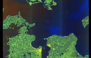
SAR coverage thumbnail
VIIRS Thermal Anomaly
Status: ✗ No detections
No VIIRS thermal/light detections in corridor
Show Raw Evidence JSON
{
    "gap_minutes": 285,
    "last_seen": {
        "ts": "2026-06-08T16:20:58+00:00",
        "lat": 54.53933669999999978017513058148324489593505859375,
        "lon": 12.26076330000000069730958784930408000946044921875,
        "sog": 9.4000000000000003552713678800500929355621337890625,
        "zone_id": "discovered_103"
    },
    "next_seen": {
        "ts": "2026-06-08T21:05:59+00:00",
        "lat": 54.984340000000003101376933045685291290283203125,
        "lon": 14.0463617000000002832393874996341764926910400390625,
        "zone_ids": [
            "discovered_005"
        ]
    },
    "gap_enrichment": {
        "status": "done",
        "corridor": {
            "start": {
                "lat": 54.53933669999999978017513058148324489593505859375,
                "lon": 12.26076330000000069730958784930408000946044921875,
                "ts": "2026-06-08T16:20:58+00:00"
            },
            "end": {
                "lat": 54.984340000000003101376933045685291290283203125,
                "lon": 14.0463617000000002832393874996341764926910400390625,
                "ts": "2026-06-08T21:05:59+00:00"
            },
            "bbox": {
                "min_lat": 54.35915700000000327918314724229276180267333984375,
                "min_lon": 11.948479999999999989768184605054557323455810546875,
                "max_lat": 55.16452000000000310819814330898225307464599609375,
                "max_lon": 14.358644999999999214423951343633234500885009765625
            },
            "buffer_km": 20
        },
        "sar": {
            "status": "snapshot",
            "scene_id": "S1C_IW_GRDH_1SDV_20260608T165208_20260608T165233_008017_0104EB_5DC7_COG",
            "scene_time": "2026-06-08T16:52:08.977886Z",
            "platform": "sentinel-1c",
            "assets": {
                "preview_url": "https:\/\/fleetleaks.com\/wp-content\/uploads\/fleetleaks-evidence\/sar-imagery\/2026\/06\/event_706641_thumbnail_20260608211507.png",
                "stored_path": "\/home\/fleetleaks\/public_html\/wp-content\/uploads\/fleetleaks-evidence\/sar-imagery\/2026\/06\/event_706641_thumbnail_20260608211507.png",
                "source": "copernicus_dataspace"
            },
            "notes": "SAR snapshot available for review"
        },
        "viirs": {
            "status": "not_found",
            "notes": "No VIIRS thermal\/light detections in corridor"
        },
        "searched_at": "2026-06-08T21:15:02.048755+00:00"
    }
}- Zone: Alboran Sea Surveillance Zone
- Duration: 1h 19m
- Data Points: 44 AIS positions
- Period: 2026-06-08T15:02:01+00:00 to 2026-06-08T16:20:58+00:00
Show Raw Evidence JSON
{
    "zone_id": "discovered_103",
    "zone_name": "Alboran Sea Surveillance Zone",
    "dwell_minutes": 79,
    "points_in_zone": 44,
    "first_point": {
        "ts": "2026-06-08T15:02:01+00:00",
        "lat": 54.407319999999998572093318216502666473388671875,
        "lon": 11.8866932999999992404127624467946588993072509765625
    },
    "last_point": {
        "ts": "2026-06-08T16:20:58+00:00",
        "lat": 54.53933669999999978017513058148324489593505859375,
        "lon": 12.26076330000000069730958784930408000946044921875
    }
}- Zone: Alboran Sea Surveillance Zone
- Duration: 1h 58m
- Data Points: 66 AIS positions
- Period: 2026-06-08T14:22:36+00:00 to 2026-06-08T16:20:58+00:00
Show Raw Evidence JSON
{
    "zone_id": "discovered_103",
    "zone_name": "Alboran Sea Surveillance Zone",
    "dwell_minutes": 118.400000000000005684341886080801486968994140625,
    "points_in_zone": 66,
    "first_point": {
        "ts": "2026-06-08T14:22:36+00:00",
        "lat": 54.45596830000000210247890208847820758819580078125,
        "lon": 11.62143329999999963320078677497804164886474609375
    },
    "last_point": {
        "ts": "2026-06-08T16:20:58+00:00",
        "lat": 54.53933669999999978017513058148324489593505859375,
        "lon": 12.26076330000000069730958784930408000946044921875
    }
}- Gap Duration: 4h 26m
- Last Seen: 2026-06-08T09:56:29+00:00 at 55.1773, 11.0235 (Zone: Eastern Zealand Monitoring Zone)
- Next Seen: 2026-06-08T14:22:36+00:00 at 54.4560, 11.6214
🛰️ Gap Corroboration
These are snapshots that may corroborate presence during the gap. They do not reconstruct a continuous route.
SAR Imagery (Sentinel-1)
Status: ✓ Snapshot available
SAR snapshot available for review
Scene: S1C_IW_GRDH_1SDV_20260608T054028_20260608T054053_008010_0104A8_5F61_COG • Time: 2026-06-08T05:40:28.517979Z
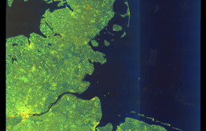
SAR coverage thumbnail
VIIRS Thermal Anomaly
Status: ✗ No detections
No VIIRS thermal/light detections in corridor
Show Raw Evidence JSON
{
    "gap_minutes": 266.1000000000000227373675443232059478759765625,
    "last_seen": {
        "ts": "2026-06-08T09:56:29+00:00",
        "lat": 55.177328299999999217106960713863372802734375,
        "lon": 11.023546700000000697627910994924604892730712890625,
        "sog": 14.300000000000000710542735760100185871124267578125,
        "zone_id": "discovered_089"
    },
    "next_seen": {
        "ts": "2026-06-08T14:22:36+00:00",
        "lat": 54.45596830000000210247890208847820758819580078125,
        "lon": 11.62143329999999963320078677497804164886474609375,
        "zone_ids": [
            "discovered_103"
        ]
    },
    "gap_enrichment": {
        "status": "done",
        "corridor": {
            "start": {
                "lat": 55.177328299999999217106960713863372802734375,
                "lon": 11.023546700000000697627910994924604892730712890625,
                "ts": "2026-06-08T09:56:29+00:00"
            },
            "end": {
                "lat": 54.45596830000000210247890208847820758819580078125,
                "lon": 11.62143329999999963320078677497804164886474609375,
                "ts": "2026-06-08T14:22:36+00:00"
            },
            "bbox": {
                "min_lat": 54.27578799999999858982846490107476711273193359375,
                "min_lon": 10.7108399999999992502353052259422838687896728515625,
                "max_lat": 55.35750800000000282352630165405571460723876953125,
                "max_lon": 11.9341399999999993042365531437098979949951171875
            },
            "buffer_km": 20
        },
        "sar": {
            "status": "snapshot",
            "scene_id": "S1C_IW_GRDH_1SDV_20260608T054028_20260608T054053_008010_0104A8_5F61_COG",
            "scene_time": "2026-06-08T05:40:28.517979Z",
            "platform": "sentinel-1c",
            "assets": {
                "preview_url": "https:\/\/fleetleaks.com\/wp-content\/uploads\/fleetleaks-evidence\/sar-imagery\/2026\/06\/event_704200_thumbnail_20260608144506.png",
                "stored_path": "\/home\/fleetleaks\/public_html\/wp-content\/uploads\/fleetleaks-evidence\/sar-imagery\/2026\/06\/event_704200_thumbnail_20260608144506.png",
                "source": "copernicus_dataspace"
            },
            "notes": "SAR snapshot available for review"
        },
        "viirs": {
            "status": "not_found",
            "notes": "No VIIRS thermal\/light detections in corridor"
        },
        "searched_at": "2026-06-08T14:45:02.166258+00:00"
    }
}- Zone: Danish Straits/Skagerrak
- Duration: 1h 15m
- Data Points: 40 AIS positions
- Period: 2026-06-08T00:00:30+00:00 to 2026-06-08T01:15:41+00:00
Show Raw Evidence JSON
{
    "zone_id": "osint_danish_straits",
    "zone_name": "Danish Straits\/Skagerrak",
    "dwell_minutes": 75.2000000000000028421709430404007434844970703125,
    "points_in_zone": 40,
    "first_point": {
        "ts": "2026-06-08T00:00:30+00:00",
        "lat": 57.31656000000000261707100435160100460052490234375,
        "lon": 11.517856699999999392503013950772583484649658203125
    },
    "last_point": {
        "ts": "2026-06-08T01:15:41+00:00",
        "lat": 57.00136330000000128848114400170743465423583984375,
        "lon": 11.718788299999999935607775114476680755615234375
    }
}- Zone: Danish Straits/Skagerrak
- Duration: 2h 13m
- Data Points: 75 AIS positions
- Period: 2026-06-07T23:02:07+00:00 to 2026-06-08T01:15:41+00:00
Show Raw Evidence JSON
{
    "zone_id": "osint_danish_straits",
    "zone_name": "Danish Straits\/Skagerrak",
    "dwell_minutes": 133.599999999999994315658113919198513031005859375,
    "points_in_zone": 75,
    "first_point": {
        "ts": "2026-06-07T23:02:07+00:00",
        "lat": 57.542568299999999226201907731592655181884765625,
        "lon": 11.3096666999999992953007676987908780574798583984375
    },
    "last_point": {
        "ts": "2026-06-08T01:15:41+00:00",
        "lat": 57.00136330000000128848114400170743465423583984375,
        "lon": 11.718788299999999935607775114476680755615234375
    }
}- Zone: Danish Straits/Skagerrak
- Duration: 3h 14m
- Data Points: 106 AIS positions
- Period: 2026-06-07T22:00:54+00:00 to 2026-06-08T01:15:41+00:00
Show Raw Evidence JSON
{
    "zone_id": "osint_danish_straits",
    "zone_name": "Danish Straits\/Skagerrak",
    "dwell_minutes": 194.80000000000001136868377216160297393798828125,
    "points_in_zone": 106,
    "first_point": {
        "ts": "2026-06-07T22:00:54+00:00",
        "lat": 57.73299670000000105574144981801509857177734375,
        "lon": 10.9612166999999995908865457749925553798675537109375
    },
    "last_point": {
        "ts": "2026-06-08T01:15:41+00:00",
        "lat": 57.00136330000000128848114400170743465423583984375,
        "lon": 11.718788299999999935607775114476680755615234375
    }
}- Zone: Danish Straits/Skagerrak
- Duration: 4h 12m
- Data Points: 137 AIS positions
- Period: 2026-06-07T21:03:21+00:00 to 2026-06-08T01:15:41+00:00
Show Raw Evidence JSON
{
    "zone_id": "osint_danish_straits",
    "zone_name": "Danish Straits\/Skagerrak",
    "dwell_minutes": 252.30000000000001136868377216160297393798828125,
    "points_in_zone": 137,
    "first_point": {
        "ts": "2026-06-07T21:03:21+00:00",
        "lat": 57.80823670000000191748767974786460399627685546875,
        "lon": 10.650835000000000718500814400613307952880859375
    },
    "last_point": {
        "ts": "2026-06-08T01:15:41+00:00",
        "lat": 57.00136330000000128848114400170743465423583984375,
        "lon": 11.718788299999999935607775114476680755615234375
    }
}- Zone: Danish Straits/Skagerrak
- Duration: 5h 13m
- Data Points: 172 AIS positions
- Period: 2026-06-07T20:01:51+00:00 to 2026-06-08T01:15:41+00:00
Show Raw Evidence JSON
{
    "zone_id": "osint_danish_straits",
    "zone_name": "Danish Straits\/Skagerrak",
    "dwell_minutes": 313.80000000000001136868377216160297393798828125,
    "points_in_zone": 172,
    "first_point": {
        "ts": "2026-06-07T20:01:51+00:00",
        "lat": 57.796165000000002009983290918171405792236328125,
        "lon": 10.2862150000000003302602635812945663928985595703125
    },
    "last_point": {
        "ts": "2026-06-08T01:15:41+00:00",
        "lat": 57.00136330000000128848114400170743465423583984375,
        "lon": 11.718788299999999935607775114476680755615234375
    }
}- Zone: Danish Straits/Skagerrak
- Duration: 6h 7m
- Data Points: 188 AIS positions
- Period: 2026-06-07T19:07:57+00:00 to 2026-06-08T01:15:41+00:00
Show Raw Evidence JSON
{
    "zone_id": "osint_danish_straits",
    "zone_name": "Danish Straits\/Skagerrak",
    "dwell_minutes": 367.69999999999998863131622783839702606201171875,
    "points_in_zone": 188,
    "first_point": {
        "ts": "2026-06-07T19:07:57+00:00",
        "lat": 57.79366499999999717829268774949014186859130859375,
        "lon": 10.00182829999999967185431160032749176025390625
    },
    "last_point": {
        "ts": "2026-06-08T01:15:41+00:00",
        "lat": 57.00136330000000128848114400170743465423583984375,
        "lon": 11.718788299999999935607775114476680755615234375
    }
}- Zone: North Sea Surveillance Zone
- Duration: 1h 52m
- Data Points: 34 AIS positions
- Period: 2026-06-07T18:03:40+00:00 to 2026-06-07T19:55:51+00:00
Show Raw Evidence JSON
{
    "zone_id": "discovered_128",
    "zone_name": "North Sea Surveillance Zone",
    "dwell_minutes": 112.2000000000000028421709430404007434844970703125,
    "points_in_zone": 34,
    "first_point": {
        "ts": "2026-06-07T18:03:40+00:00",
        "lat": 57.779134999999996580299921333789825439453125,
        "lon": 9.665846699999999458441379829309880733489990234375
    },
    "last_point": {
        "ts": "2026-06-07T19:55:51+00:00",
        "lat": 57.7958483000000029505827114917337894439697265625,
        "lon": 10.2524032999999992199491316569037735462188720703125
    }
}- Zone: North Sea Surveillance Zone
- Duration: 2h 41m
- Data Points: 49 AIS positions
- Period: 2026-06-07T17:14:41+00:00 to 2026-06-07T19:55:51+00:00
Show Raw Evidence JSON
{
    "zone_id": "discovered_128",
    "zone_name": "North Sea Surveillance Zone",
    "dwell_minutes": 161.19999999999998863131622783839702606201171875,
    "points_in_zone": 49,
    "first_point": {
        "ts": "2026-06-07T17:14:41+00:00",
        "lat": 57.76077670000000097161318990401923656463623046875,
        "lon": 9.2783400000000000318323145620524883270263671875
    },
    "last_point": {
        "ts": "2026-06-07T19:55:51+00:00",
        "lat": 57.7958483000000029505827114917337894439697265625,
        "lon": 10.2524032999999992199491316569037735462188720703125
    }
}- Zone: Baltic Sea Sanctioned Vessel Zone
- Duration: 1h 43m
- Data Points: 28 AIS positions
- Period: 2026-06-07T16:05:40+00:00 to 2026-06-07T17:49:35+00:00
Show Raw Evidence JSON
{
    "zone_id": "discovered_027",
    "zone_name": "Baltic Sea Sanctioned Vessel Zone",
    "dwell_minutes": 103.900000000000005684341886080801486968994140625,
    "points_in_zone": 28,
    "first_point": {
        "ts": "2026-06-07T16:05:40+00:00",
        "lat": 57.71949330000000344398358720354735851287841796875,
        "lon": 8.700585000000000235331754083745181560516357421875
    },
    "last_point": {
        "ts": "2026-06-07T17:49:35+00:00",
        "lat": 57.776358299999998280327417887747287750244140625,
        "lon": 9.5575250000000000483169060316868126392364501953125
    }
}- Zone: Eastern Mediterranean Sanctions Monitoring Zone
- Duration: 2h 36m
- Data Points: 45 AIS positions
- Period: 2026-02-05T06:00:53+00:00 to 2026-02-05T08:37:21+00:00
Show Raw Evidence JSON
{
    "zone_id": "discovered_029",
    "zone_name": "Kaliningrad Maritime Surveillance Zone",
    "dwell_minutes": 156.5,
    "points_in_zone": 45,
    "first_point": {
        "ts": "2026-02-05T06:00:53+00:00",
        "lat": 34.59770499999999771034708828665316104888916015625,
        "lon": 33.573301700000001801527105271816253662109375
    },
    "last_point": {
        "ts": "2026-02-05T08:37:21+00:00",
        "lat": 34.52998670000000203117451746948063373565673828125,
        "lon": 33.2956367000000028610884328372776508331298828125
    }
}- Zone: Eastern Mediterranean Sanctions Monitoring Zone
- Duration: 3h 35m
- Data Points: 77 AIS positions
- Period: 2026-02-05T05:01:40+00:00 to 2026-02-05T08:37:21+00:00
Show Raw Evidence JSON
{
    "zone_id": "discovered_029",
    "zone_name": "Kaliningrad Maritime Surveillance Zone",
    "dwell_minutes": 215.69999999999998863131622783839702606201171875,
    "points_in_zone": 77,
    "first_point": {
        "ts": "2026-02-05T05:01:40+00:00",
        "lat": 34.5468699999999984129317454062402248382568359375,
        "lon": 33.524806699999999182182364165782928466796875
    },
    "last_point": {
        "ts": "2026-02-05T08:37:21+00:00",
        "lat": 34.52998670000000203117451746948063373565673828125,
        "lon": 33.2956367000000028610884328372776508331298828125
    }
}- Duration: 1h 42m
- Radius: 803 meters
- Data Points: 41 AIS positions
- Centroid: 34.5479, 33.5249
- Zone: Eastern Mediterranean Sanctions Monitoring Zone
Show Raw Evidence JSON
{
    "radius_m": 803.299999999999954525264911353588104248046875,
    "duration_minutes": 102.2999999999999971578290569595992565155029296875,
    "points": 41,
    "centroid": {
        "lat": 34.54793256341464058323253993876278400421142578125,
        "lon": 33.52485581219512056350140483118593692779541015625
    },
    "bbox": {
        "min_lat": 34.544921700000003284003469161689281463623046875,
        "min_lon": 33.51802169999999847505023353733122348785400390625,
        "max_lat": 34.554793300000000044747139327228069305419921875,
        "max_lon": 33.52837670000000258596628555096685886383056640625
    },
    "zone_id": "discovered_029"
}- Zone: Eastern Mediterranean Sanctions Monitoring Zone
- Duration: 4h 36m
- Data Points: 99 AIS positions
- Period: 2026-02-05T04:00:34+00:00 to 2026-02-05T08:37:21+00:00
Show Raw Evidence JSON
{
    "zone_id": "discovered_029",
    "zone_name": "Kaliningrad Maritime Surveillance Zone",
    "dwell_minutes": 276.80000000000001136868377216160297393798828125,
    "points_in_zone": 99,
    "first_point": {
        "ts": "2026-02-05T04:00:34+00:00",
        "lat": 34.5504217000000011239535524509847164154052734375,
        "lon": 33.52837670000000258596628555096685886383056640625
    },
    "last_point": {
        "ts": "2026-02-05T08:37:21+00:00",
        "lat": 34.52998670000000203117451746948063373565673828125,
        "lon": 33.2956367000000028610884328372776508331298828125
    }
}- Duration: 2h 12m
- Radius: 1,162 meters
- Data Points: 53 AIS positions
- Centroid: 34.5489, 33.5259
- Zone: Eastern Mediterranean Sanctions Monitoring Zone
Show Raw Evidence JSON
{
    "radius_m": 1162,
    "duration_minutes": 132.599999999999994315658113919198513031005859375,
    "points": 53,
    "centroid": {
        "lat": 34.54885339622641282630866044200956821441650390625,
        "lon": 33.52585154150943935746909119188785552978515625
    },
    "bbox": {
        "min_lat": 34.544921700000003284003469161689281463623046875,
        "min_lon": 33.51802169999999847505023353733122348785400390625,
        "max_lat": 34.5592333000000024867404135875403881072998046875,
        "max_lon": 33.53033500000000088903107098303735256195068359375
    },
    "zone_id": "discovered_029"
}- Minimum Distance: 22 meters
- Average Distance: 51 meters
- Duration: 42 minutes
- Period: 2026-02-05T03:05:45+00:00 to 2026-02-05T03:48:14+00:00
- Vessel A Avg Speed: 0.4 knots
- Vessel B Avg Speed: 0.3 knots
- Zone: Eastern Mediterranean Sanctions Monitoring Zone
Confidence Analysis
Moderate-confidence STS candidate. Two tankers (RED MARAUDER and LOXLEY) maintained close proximity (min 22m, avg 51m) for 42 minutes. Both vessels were slow-moving (avg speeds 0.3 and 0.3 knots). The stable separation distance suggests deliberate parallel positioning typical of cargo transfer. Event occurred in Kaliningrad Maritime Surveillance Zone, a known STS activity area.
View scoring breakdown
| Factor | Score | Detail |
|---|---|---|
| Distance Tightness | 25/25 | Min distance 22m, avg 51m |
| Duration | 5/25 | Duration 42 minutes |
| Speed Stability | 20/20 | both nearly stationary; very stable speeds |
| Distance Consistency | 12/15 | Distance variance ±32m |
| Isolation | 5/10 | Isolation data not available |
| Context | 5/5 | In monitored zone: Kaliningrad Maritime Surveillance Zone |
Show Raw Evidence JSON
{
    "vessel_a": {
        "mmsi": 563100600,
        "imo": 9839739,
        "name": "RED MARAUDER",
        "flag": "Singapore"
    },
    "vessel_b": {
        "mmsi": 563022900,
        "imo": 9798636,
        "name": "LOXLEY",
        "flag": "SINGAPORE"
    },
    "min_distance_m": 22.39999999999999857891452847979962825775146484375,
    "avg_distance_m": 50.7999999999999971578290569595992565155029296875,
    "distance_consistency_m": 31.699999999999999289457264239899814128875732421875,
    "duration_minutes": 42.5,
    "overlap_duration_s": 2549,
    "speed_a_avg": 0.34999999999999997779553950749686919152736663818359375,
    "speed_a_std": 0.059999999999999997779553950749686919152736663818359375,
    "speed_b_avg": 0.299999999999999988897769753748434595763683319091796875,
    "speed_b_std": 0,
    "speed_summary": {
        "vessel_a": {
            "avg_sog": 0.34999999999999997779553950749686919152736663818359375,
            "max_sog": 0.5
        },
        "vessel_b": {
            "avg_sog": 0.299999999999999988897769753748434595763683319091796875,
            "max_sog": 0.299999999999999988897769753748434595763683319091796875
        }
    },
    "time_window": {
        "start": "2026-02-05T03:05:45+00:00",
        "end": "2026-02-05T03:48:14+00:00"
    },
    "points_count": {
        "vessel_a": 15,
        "vessel_b": 15
    },
    "zone_id": "discovered_029",
    "zone_name": "Kaliningrad Maritime Surveillance Zone",
    "score": {
        "value": 72,
        "components": {
            "distance_tightness": {
                "score": 25,
                "max": 25,
                "detail": "Min distance 22m, avg 51m"
            },
            "duration": {
                "score": 5,
                "max": 25,
                "detail": "Duration 42 minutes"
            },
            "speed_stability": {
                "score": 20,
                "max": 20,
                "detail": "both nearly stationary; very stable speeds"
            },
            "distance_consistency": {
                "score": 12,
                "max": 15,
                "detail": "Distance variance \u00b132m"
            },
            "isolation": {
                "score": 5,
                "max": 10,
                "detail": "Isolation data not available"
            },
            "context": {
                "score": 5,
                "max": 5,
                "detail": "In monitored zone: Kaliningrad Maritime Surveillance Zone"
            }
        },
        "summary": "Moderate-confidence STS candidate. Two tankers (RED MARAUDER and LOXLEY) maintained close proximity (min 22m, avg 51m) for 42 minutes. Both vessels were slow-moving (avg speeds 0.3 and 0.3 knots). The stable separation distance suggests deliberate parallel positioning typical of cargo transfer. Event occurred in Kaliningrad Maritime Surveillance Zone, a known STS activity area."
    }
}- Zone: Eastern Mediterranean Sanctions Monitoring Zone
- Duration: 5h 31m
- Data Points: 118 AIS positions
- Period: 2026-02-05T03:05:45+00:00 to 2026-02-05T08:37:21+00:00
Show Raw Evidence JSON
{
    "zone_id": "discovered_029",
    "zone_name": "Kaliningrad Maritime Surveillance Zone",
    "dwell_minutes": 331.6000000000000227373675443232059478759765625,
    "points_in_zone": 118,
    "first_point": {
        "ts": "2026-02-05T03:05:45+00:00",
        "lat": 34.55422829999999834171831025741994380950927734375,
        "lon": 33.531976700000001301305019296705722808837890625
    },
    "last_point": {
        "ts": "2026-02-05T08:37:21+00:00",
        "lat": 34.52998670000000203117451746948063373565673828125,
        "lon": 33.2956367000000028610884328372776508331298828125
    }
}- Zone: Eastern Mediterranean Sanctions Monitoring Zone
- Duration: 6h 35m
- Data Points: 139 AIS positions
- Period: 2026-02-05T02:01:32+00:00 to 2026-02-05T08:37:21+00:00
Show Raw Evidence JSON
{
    "zone_id": "discovered_029",
    "zone_name": "Kaliningrad Maritime Surveillance Zone",
    "dwell_minutes": 395.80000000000001136868377216160297393798828125,
    "points_in_zone": 139,
    "first_point": {
        "ts": "2026-02-05T02:01:32+00:00",
        "lat": 34.558819999999997207851265557110309600830078125,
        "lon": 33.53462830000000138852556119672954082489013671875
    },
    "last_point": {
        "ts": "2026-02-05T08:37:21+00:00",
        "lat": 34.52998670000000203117451746948063373565673828125,
        "lon": 33.2956367000000028610884328372776508331298828125
    }
}- Duration: 3h 45m
- Radius: 1,170 meters
- Data Points: 83 AIS positions
- Centroid: 34.5514, 33.5284
- Zone: Eastern Mediterranean Sanctions Monitoring Zone
Show Raw Evidence JSON
{
    "radius_m": 1170.09999999999990905052982270717620849609375,
    "duration_minutes": 225.19999999999998863131622783839702606201171875,
    "points": 83,
    "centroid": {
        "lat": 34.55142058192770804225801839493215084075927734375,
        "lon": 33.52841937951807693707451107911765575408935546875
    },
    "bbox": {
        "min_lat": 34.544921700000003284003469161689281463623046875,
        "min_lon": 33.51802169999999847505023353733122348785400390625,
        "max_lat": 34.56179670000000214713509194552898406982421875,
        "max_lon": 33.53462830000000138852556119672954082489013671875
    },
    "zone_id": "discovered_029"
}- Minimum Distance: 6 meters
- Average Distance: 48 meters
- Duration: 43 minutes
- Period: 2026-02-05T01:47:52+00:00 to 2026-02-05T02:31:11+00:00
- Vessel A Avg Speed: 0.3 knots
- Vessel B Avg Speed: 0.3 knots
- Zone: Eastern Mediterranean Sanctions Monitoring Zone
Confidence Analysis
Moderate-confidence STS candidate. Two tankers (RED MARAUDER and LOXLEY) maintained close proximity (min 6m, avg 48m) for 43 minutes. Both vessels were slow-moving (avg speeds 0.3 and 0.3 knots). The stable separation distance suggests deliberate parallel positioning typical of cargo transfer. Event occurred in Kaliningrad Maritime Surveillance Zone, a known STS activity area.
View scoring breakdown
| Factor | Score | Detail |
|---|---|---|
| Distance Tightness | 25/25 | Min distance 6m, avg 48m |
| Duration | 5/25 | Duration 43 minutes |
| Speed Stability | 20/20 | both nearly stationary; very stable speeds |
| Distance Consistency | 15/15 | Distance variance ±29m |
| Isolation | 5/10 | Isolation data not available |
| Context | 5/5 | In monitored zone: Kaliningrad Maritime Surveillance Zone |
Show Raw Evidence JSON
{
    "vessel_a": {
        "mmsi": 563100600,
        "imo": 9839739,
        "name": "RED MARAUDER",
        "flag": "Singapore"
    },
    "vessel_b": {
        "mmsi": 563022900,
        "imo": 9798636,
        "name": "LOXLEY",
        "flag": "SINGAPORE"
    },
    "min_distance_m": 6,
    "avg_distance_m": 47.5,
    "distance_consistency_m": 29,
    "duration_minutes": 43.2999999999999971578290569595992565155029296875,
    "overlap_duration_s": 2599,
    "speed_a_avg": 0.2800000000000000266453525910037569701671600341796875,
    "speed_a_std": 0.05000000000000000277555756156289135105907917022705078125,
    "speed_b_avg": 0.2600000000000000088817841970012523233890533447265625,
    "speed_b_std": 0.05000000000000000277555756156289135105907917022705078125,
    "speed_summary": {
        "vessel_a": {
            "avg_sog": 0.2800000000000000266453525910037569701671600341796875,
            "max_sog": 0.40000000000000002220446049250313080847263336181640625
        },
        "vessel_b": {
            "avg_sog": 0.2600000000000000088817841970012523233890533447265625,
            "max_sog": 0.299999999999999988897769753748434595763683319091796875
        }
    },
    "time_window": {
        "start": "2026-02-05T01:47:52+00:00",
        "end": "2026-02-05T02:31:11+00:00"
    },
    "points_count": {
        "vessel_a": 18,
        "vessel_b": 18
    },
    "zone_id": "discovered_029",
    "zone_name": "Kaliningrad Maritime Surveillance Zone",
    "score": {
        "value": 75,
        "components": {
            "distance_tightness": {
                "score": 25,
                "max": 25,
                "detail": "Min distance 6m, avg 48m"
            },
            "duration": {
                "score": 5,
                "max": 25,
                "detail": "Duration 43 minutes"
            },
            "speed_stability": {
                "score": 20,
                "max": 20,
                "detail": "both nearly stationary; very stable speeds"
            },
            "distance_consistency": {
                "score": 15,
                "max": 15,
                "detail": "Distance variance \u00b129m"
            },
            "isolation": {
                "score": 5,
                "max": 10,
                "detail": "Isolation data not available"
            },
            "context": {
                "score": 5,
                "max": 5,
                "detail": "In monitored zone: Kaliningrad Maritime Surveillance Zone"
            }
        },
        "summary": "Moderate-confidence STS candidate. Two tankers (RED MARAUDER and LOXLEY) maintained close proximity (min 6m, avg 48m) for 43 minutes. Both vessels were slow-moving (avg speeds 0.3 and 0.3 knots). The stable separation distance suggests deliberate parallel positioning typical of cargo transfer. Event occurred in Kaliningrad Maritime Surveillance Zone, a known STS activity area."
    }
}- Zone: Eastern Mediterranean Sanctions Monitoring Zone
- Duration: 6h 39m
- Data Points: 136 AIS positions
- Period: 2026-02-05T01:50:02+00:00 to 2026-02-05T08:29:00+00:00
Show Raw Evidence JSON
{
    "zone_id": "discovered_029",
    "zone_name": "Kaliningrad Maritime Surveillance Zone",
    "dwell_minutes": 399,
    "points_in_zone": 136,
    "first_point": {
        "ts": "2026-02-05T01:50:02+00:00",
        "lat": 34.55972669999999880019458942115306854248046875,
        "lon": 33.53462329999999980145730660296976566314697265625
    },
    "last_point": {
        "ts": "2026-02-05T08:29:00+00:00",
        "lat": 34.53829170000000203799572773277759552001953125,
        "lon": 33.33787000000000233512764680199325084686279296875
    }
}- Duration: 3h 56m
- Radius: 1,156 meters
- Data Points: 88 AIS positions
- Centroid: 34.5519, 33.5288
- Zone: Eastern Mediterranean Sanctions Monitoring Zone
Show Raw Evidence JSON
{
    "radius_m": 1155.5,
    "duration_minutes": 236.69999999999998863131622783839702606201171875,
    "points": 88,
    "centroid": {
        "lat": 34.55187325795453290311343153007328510284423828125,
        "lon": 33.528771478409083783844835124909877777099609375
    },
    "bbox": {
        "min_lat": 34.544921700000003284003469161689281463623046875,
        "min_lon": 33.51802169999999847505023353733122348785400390625,
        "max_lat": 34.56179670000000214713509194552898406982421875,
        "max_lon": 33.53462830000000138852556119672954082489013671875
    },
    "zone_id": "discovered_029"
}- Zone: Eastern Mediterranean Sanctions Monitoring Zone
- Duration: 5h 59m
- Data Points: 147 AIS positions
- Period: 2026-02-05T00:01:36+00:00 to 2026-02-05T06:00:53+00:00
Show Raw Evidence JSON
{
    "zone_id": "discovered_029",
    "zone_name": "Kaliningrad Maritime Surveillance Zone",
    "dwell_minutes": 359.30000000000001136868377216160297393798828125,
    "points_in_zone": 147,
    "first_point": {
        "ts": "2026-02-05T00:01:36+00:00",
        "lat": 34.56829830000000214340616366825997829437255859375,
        "lon": 33.5339917000000014013494364917278289794921875
    },
    "last_point": {
        "ts": "2026-02-05T06:00:53+00:00",
        "lat": 34.59770499999999771034708828665316104888916015625,
        "lon": 33.573301700000001801527105271816253662109375
    }
}- Duration: 4h 16m
- Radius: 1,173 meters
- Data Points: 96 AIS positions
- Centroid: 34.5553, 33.5314
- Zone: Eastern Mediterranean Sanctions Monitoring Zone
Show Raw Evidence JSON
{
    "radius_m": 1172.700000000000045474735088646411895751953125,
    "duration_minutes": 256,
    "points": 96,
    "centroid": {
        "lat": 34.55528395937499652745827916078269481658935546875,
        "lon": 33.53139954895831209569223574362695217132568359375
    },
    "bbox": {
        "min_lat": 34.54639499999999685542206862010061740875244140625,
        "min_lon": 33.524484999999998535713530145585536956787109375,
        "max_lat": 34.56428170000000221762093133293092250823974609375,
        "max_lon": 33.53462830000000138852556119672954082489013671875
    },
    "zone_id": "discovered_029"
}- Zone: Eastern Mediterranean Sanctions Monitoring Zone
- Duration: 6h 30m
- Data Points: 161 AIS positions
- Period: 2026-02-04T23:30:44+00:00 to 2026-02-05T06:00:53+00:00
Show Raw Evidence JSON
{
    "zone_id": "discovered_029",
    "zone_name": "Kaliningrad Maritime Surveillance Zone",
    "dwell_minutes": 390.1000000000000227373675443232059478759765625,
    "points_in_zone": 161,
    "first_point": {
        "ts": "2026-02-04T23:30:44+00:00",
        "lat": 34.57009000000000042973624658770859241485595703125,
        "lon": 33.532634999999999081410351209342479705810546875
    },
    "last_point": {
        "ts": "2026-02-05T06:00:53+00:00",
        "lat": 34.59770499999999771034708828665316104888916015625,
        "lon": 33.573301700000001801527105271816253662109375
    }
}- Duration: 4h 32m
- Radius: 1,188 meters
- Data Points: 107 AIS positions
- Centroid: 34.5591, 33.5329
- Zone: Eastern Mediterranean Sanctions Monitoring Zone
Show Raw Evidence JSON
{
    "radius_m": 1188.200000000000045474735088646411895751953125,
    "duration_minutes": 272.69999999999998863131622783839702606201171875,
    "points": 107,
    "centroid": {
        "lat": 34.55913094859812417780631221830844879150390625,
        "lon": 33.532886294392511672413093037903308868408203125
    },
    "bbox": {
        "min_lat": 34.54945169999999876608853810466825962066650390625,
        "min_lon": 33.5273432999999982939698384143412113189697265625,
        "max_lat": 34.56908829999999710480551584623754024505615234375,
        "max_lon": 33.53462830000000138852556119672954082489013671875
    },
    "zone_id": "discovered_029"
}- Minimum Distance: 10 meters
- Average Distance: 73 meters
- Duration: 1h 4m
- Period: 2026-02-04T22:04:56+00:00 to 2026-02-04T23:08:53+00:00
- Vessel A Avg Speed: 0.5 knots
- Vessel B Avg Speed: 0.5 knots
- Zone: Eastern Mediterranean Sanctions Monitoring Zone
Confidence Analysis
High-confidence STS candidate. Two tankers (RED MARAUDER and LOXLEY) maintained close proximity (min 10m, avg 72m) for 64 minutes. Both vessels were slow-moving (avg speeds 0.5 and 0.5 knots). The stable separation distance suggests deliberate parallel positioning typical of cargo transfer. Event occurred in Kaliningrad Maritime Surveillance Zone, a known STS activity area.
View scoring breakdown
| Factor | Score | Detail |
|---|---|---|
| Distance Tightness | 25/25 | Min distance 10m, avg 72m |
| Duration | 15/25 | Duration 64 minutes |
| Speed Stability | 18/20 | both very slow; very stable speeds |
| Distance Consistency | 12/15 | Distance variance ±47m |
| Isolation | 5/10 | Isolation data not available |
| Context | 5/5 | In monitored zone: Kaliningrad Maritime Surveillance Zone |
Show Raw Evidence JSON
{
    "vessel_a": {
        "mmsi": 563100600,
        "imo": 9839739,
        "name": "RED MARAUDER",
        "flag": "Singapore"
    },
    "vessel_b": {
        "mmsi": 563022900,
        "imo": 9798636,
        "name": "LOXLEY",
        "flag": "SINGAPORE"
    },
    "min_distance_m": 9.5,
    "avg_distance_m": 72.5,
    "distance_consistency_m": 47.2999999999999971578290569595992565155029296875,
    "duration_minutes": 64,
    "overlap_duration_s": 3837,
    "speed_a_avg": 0.5300000000000000266453525910037569701671600341796875,
    "speed_a_std": 0.179999999999999993338661852249060757458209991455078125,
    "speed_b_avg": 0.450000000000000011102230246251565404236316680908203125,
    "speed_b_std": 0.200000000000000011102230246251565404236316680908203125,
    "speed_summary": {
        "vessel_a": {
            "avg_sog": 0.5300000000000000266453525910037569701671600341796875,
            "max_sog": 0.8000000000000000444089209850062616169452667236328125
        },
        "vessel_b": {
            "avg_sog": 0.450000000000000011102230246251565404236316680908203125,
            "max_sog": 0.59999999999999997779553950749686919152736663818359375
        }
    },
    "time_window": {
        "start": "2026-02-04T22:04:56+00:00",
        "end": "2026-02-04T23:08:53+00:00"
    },
    "points_count": {
        "vessel_a": 30,
        "vessel_b": 30
    },
    "zone_id": "discovered_029",
    "zone_name": "Kaliningrad Maritime Surveillance Zone",
    "score": {
        "value": 80,
        "components": {
            "distance_tightness": {
                "score": 25,
                "max": 25,
                "detail": "Min distance 10m, avg 72m"
            },
            "duration": {
                "score": 15,
                "max": 25,
                "detail": "Duration 64 minutes"
            },
            "speed_stability": {
                "score": 18,
                "max": 20,
                "detail": "both very slow; very stable speeds"
            },
            "distance_consistency": {
                "score": 12,
                "max": 15,
                "detail": "Distance variance \u00b147m"
            },
            "isolation": {
                "score": 5,
                "max": 10,
                "detail": "Isolation data not available"
            },
            "context": {
                "score": 5,
                "max": 5,
                "detail": "In monitored zone: Kaliningrad Maritime Surveillance Zone"
            }
        },
        "summary": "High-confidence STS candidate. Two tankers (RED MARAUDER and LOXLEY) maintained close proximity (min 10m, avg 72m) for 64 minutes. Both vessels were slow-moving (avg speeds 0.5 and 0.5 knots). The stable separation distance suggests deliberate parallel positioning typical of cargo transfer. Event occurred in Kaliningrad Maritime Surveillance Zone, a known STS activity area."
    }
}- Duration: 4h 36m
- Radius: 1,185 meters
- Data Points: 114 AIS positions
- Centroid: 34.5639, 33.5334
- Zone: Eastern Mediterranean Sanctions Monitoring Zone
Show Raw Evidence JSON
{
    "radius_m": 1185.40000000000009094947017729282379150390625,
    "duration_minutes": 276,
    "points": 114,
    "centroid": {
        "lat": 34.56392121403509776200735359452664852142333984375,
        "lon": 33.53335368421053175325141637586057186126708984375
    },
    "bbox": {
        "min_lat": 34.55337829999999854635461815632879734039306640625,
        "min_lon": 33.52854169999999811579982633702456951141357421875,
        "max_lat": 34.57107830000000348036337527446448802947998046875,
        "max_lon": 33.53462830000000138852556119672954082489013671875
    },
    "zone_id": "discovered_029"
}- Zone: Eastern Mediterranean Sanctions Monitoring Zone
- Duration: 6h 36m
- Data Points: 158 AIS positions
- Period: 2026-02-04T22:51:16+00:00 to 2026-02-05T05:27:26+00:00
Show Raw Evidence JSON
{
    "zone_id": "discovered_029",
    "zone_name": "Kaliningrad Maritime Surveillance Zone",
    "dwell_minutes": 396.19999999999998863131622783839702606201171875,
    "points_in_zone": 158,
    "first_point": {
        "ts": "2026-02-04T22:51:16+00:00",
        "lat": 34.57078829999999669553290004841983318328857421875,
        "lon": 33.52978829999999987876435625366866588592529296875
    },
    "last_point": {
        "ts": "2026-02-05T05:27:26+00:00",
        "lat": 34.5449516999999985955582815222442150115966796875,
        "lon": 33.52300170000000179015842149965465068817138671875
    }
}- Duration: 6h 17m
- Radius: 1,657 meters
- Data Points: 160 AIS positions
- Centroid: 34.5638, 33.5297
- Zone: Eastern Mediterranean Sanctions Monitoring Zone
Show Raw Evidence JSON
{
    "radius_m": 1656.90000000000009094947017729282379150390625,
    "duration_minutes": 377.80000000000001136868377216160297393798828125,
    "points": 160,
    "centroid": {
        "lat": 34.5638387100000130658372654579579830169677734375,
        "lon": 33.52969468687501120029992307536303997039794921875
    },
    "bbox": {
        "min_lat": 34.55337829999999854635461815632879734039306640625,
        "min_lon": 33.51344830000000030167939257808029651641845703125,
        "max_lat": 34.57107830000000348036337527446448802947998046875,
        "max_lon": 33.53462830000000138852556119672954082489013671875
    },
    "zone_id": "discovered_029"
}- Zone: Eastern Mediterranean Sanctions Monitoring Zone
- Duration: 6h 33m
- Data Points: 162 AIS positions
- Period: 2026-02-04T21:51:46+00:00 to 2026-02-05T04:25:35+00:00
Show Raw Evidence JSON
{
    "zone_id": "discovered_029",
    "zone_name": "Kaliningrad Maritime Surveillance Zone",
    "dwell_minutes": 393.80000000000001136868377216160297393798828125,
    "points_in_zone": 162,
    "first_point": {
        "ts": "2026-02-04T21:51:46+00:00",
        "lat": 34.5638732999999973571902955882251262664794921875,
        "lon": 33.5206950000000034606273402459919452667236328125
    },
    "last_point": {
        "ts": "2026-02-05T04:25:35+00:00",
        "lat": 34.54933170000000330901457346044480800628662109375,
        "lon": 33.52721669999999676292645744979381561279296875
    }
}- Duration: 6h 26m
- Radius: 1,782 meters
- Data Points: 164 AIS positions
- Centroid: 34.5637, 33.5293
- Zone: Eastern Mediterranean Sanctions Monitoring Zone
Show Raw Evidence JSON
{
    "radius_m": 1781.5,
    "duration_minutes": 386.6000000000000227373675443232059478759765625,
    "points": 164,
    "centroid": {
        "lat": 34.5636630810975731264989008195698261260986328125,
        "lon": 33.529277935975613900154712609946727752685546875
    },
    "bbox": {
        "min_lat": 34.55337829999999854635461815632879734039306640625,
        "min_lon": 33.512083300000000463114702142775058746337890625,
        "max_lat": 34.57107830000000348036337527446448802947998046875,
        "max_lon": 33.53462830000000138852556119672954082489013671875
    },
    "zone_id": "discovered_029"
}- Zone: Eastern Mediterranean Sanctions Monitoring Zone
- Duration: 6h 35m
- Data Points: 166 AIS positions
- Period: 2026-02-04T20:51:43+00:00 to 2026-02-05T03:26:54+00:00
Show Raw Evidence JSON
{
    "zone_id": "discovered_029",
    "zone_name": "Kaliningrad Maritime Surveillance Zone",
    "dwell_minutes": 395.19999999999998863131622783839702606201171875,
    "points_in_zone": 166,
    "first_point": {
        "ts": "2026-02-04T20:51:43+00:00",
        "lat": 34.55621000000000009322320693172514438629150390625,
        "lon": 33.512083300000000463114702142775058746337890625
    },
    "last_point": {
        "ts": "2026-02-05T03:26:54+00:00",
        "lat": 34.55270170000000007348717190325260162353515625,
        "lon": 33.5307099999999991268850862979888916015625
    }
}- Duration: 2h 4m
- Radius: 1,252 meters
- Data Points: 56 AIS positions
- Centroid: 34.5572, 33.5130
- Zone: Eastern Mediterranean Sanctions Monitoring Zone
Show Raw Evidence JSON
{
    "radius_m": 1252,
    "duration_minutes": 124.7000000000000028421709430404007434844970703125,
    "points": 56,
    "centroid": {
        "lat": 34.55724824642856418677183683030307292938232421875,
        "lon": 33.5129629982142915878284838981926441192626953125
    },
    "bbox": {
        "min_lat": 34.54962499999999891997504164464771747589111328125,
        "min_lon": 33.5029032999999998310158844105899333953857421875,
        "max_lat": 34.5648766999999992322045727632939815521240234375,
        "max_lon": 33.521891699999997626946424134075641632080078125
    },
    "zone_id": "discovered_029"
}- Zone: Eastern Mediterranean Sanctions Monitoring Zone
- Duration: 6h 37m
- Data Points: 175 AIS positions
- Period: 2026-02-04T19:51:13+00:00 to 2026-02-05T02:28:40+00:00
Show Raw Evidence JSON
{
    "zone_id": "discovered_029",
    "zone_name": "Kaliningrad Maritime Surveillance Zone",
    "dwell_minutes": 397.3999999999999772626324556767940521240234375,
    "points_in_zone": 175,
    "first_point": {
        "ts": "2026-02-04T19:51:13+00:00",
        "lat": 34.54919170000000150366759044118225574493408203125,
        "lon": 33.5022067000000021153027773834764957427978515625
    },
    "last_point": {
        "ts": "2026-02-05T02:28:40+00:00",
        "lat": 34.556528299999996534097590483725070953369140625,
        "lon": 33.53379830000000083600752986967563629150390625
    }
}- Duration: 2h 2m
- Radius: 1,269 meters
- Data Points: 52 AIS positions
- Centroid: 34.5508, 33.5041
- Zone: Eastern Mediterranean Sanctions Monitoring Zone
Show Raw Evidence JSON
{
    "radius_m": 1268.5,
    "duration_minutes": 122.7000000000000028421709430404007434844970703125,
    "points": 52,
    "centroid": {
        "lat": 34.550775186538459138319012708961963653564453125,
        "lon": 33.50407800961537674311330192722380161285400390625
    },
    "bbox": {
        "min_lat": 34.5444150000000007594280759803950786590576171875,
        "min_lon": 33.49259330000000289828676613979041576385498046875,
        "max_lat": 34.55758999999999758756530354730784893035888671875,
        "max_lon": 33.5137332999999983940142556093633174896240234375
    },
    "zone_id": "discovered_029"
}- Zone: Eastern Mediterranean Sanctions Monitoring Zone
- Duration: 6h 38m
- Data Points: 172 AIS positions
- Period: 2026-02-04T18:50:50+00:00 to 2026-02-05T01:29:20+00:00
Show Raw Evidence JSON
{
    "zone_id": "discovered_029",
    "zone_name": "Kaliningrad Maritime Surveillance Zone",
    "dwell_minutes": 398.5,
    "points_in_zone": 172,
    "first_point": {
        "ts": "2026-02-04T18:50:50+00:00",
        "lat": 34.54377170000000063510015024803578853607177734375,
        "lon": 33.4907017000000024609107640571892261505126953125
    },
    "last_point": {
        "ts": "2026-02-05T01:29:20+00:00",
        "lat": 34.561156699999997954364516772329807281494140625,
        "lon": 33.5344649999999973033482092432677745819091796875
    }
}- Minimum Distance: 26 meters
- Average Distance: 77 meters
- Duration: 38 minutes
- Period: 2026-02-04T17:18:34+00:00 to 2026-02-04T17:57:03+00:00
- Vessel A Avg Speed: 0.6 knots
- Vessel B Avg Speed: 0.6 knots
- Zone: Eastern Mediterranean Sanctions Monitoring Zone
Confidence Analysis
Moderate-confidence STS candidate. Two tankers (RED MARAUDER and LOXLEY) maintained close proximity (min 26m, avg 77m) for 38 minutes. Both vessels were slow-moving (avg speeds 0.6 and 0.6 knots). Moderate distance variation observed during the encounter. Event occurred in Kaliningrad Maritime Surveillance Zone, a known STS activity area.
View scoring breakdown
| Factor | Score | Detail |
|---|---|---|
| Distance Tightness | 25/25 | Min distance 26m, avg 77m |
| Duration | 5/25 | Duration 38 minutes |
| Speed Stability | 18/20 | both very slow; very stable speeds |
| Distance Consistency | 8/15 | Distance variance ±57m |
| Isolation | 5/10 | Isolation data not available |
| Context | 5/5 | In monitored zone: Kaliningrad Maritime Surveillance Zone |
🛰️ Satellite Corroboration
No satellite imagery for this time/location
No Sentinel-1 scenes covering AOI and time window
Show Raw Evidence JSON
{
    "vessel_a": {
        "mmsi": 563100600,
        "imo": 9839739,
        "name": "RED MARAUDER",
        "flag": "Singapore"
    },
    "vessel_b": {
        "mmsi": 563022900,
        "imo": 9798636,
        "name": "LOXLEY",
        "flag": "SINGAPORE"
    },
    "min_distance_m": 26.10000000000000142108547152020037174224853515625,
    "avg_distance_m": 77.400000000000005684341886080801486968994140625,
    "distance_consistency_m": 56.7999999999999971578290569595992565155029296875,
    "duration_minutes": 38.5,
    "overlap_duration_s": 2309,
    "speed_a_avg": 0.61999999999999999555910790149937383830547332763671875,
    "speed_a_std": 0.1000000000000000055511151231257827021181583404541015625,
    "speed_b_avg": 0.57999999999999996003197111349436454474925994873046875,
    "speed_b_std": 0.0899999999999999966693309261245303787291049957275390625,
    "speed_summary": {
        "vessel_a": {
            "avg_sog": 0.61999999999999999555910790149937383830547332763671875,
            "max_sog": 0.8000000000000000444089209850062616169452667236328125
        },
        "vessel_b": {
            "avg_sog": 0.57999999999999996003197111349436454474925994873046875,
            "max_sog": 0.6999999999999999555910790149937383830547332763671875
        }
    },
    "time_window": {
        "start": "2026-02-04T17:18:34+00:00",
        "end": "2026-02-04T17:57:03+00:00"
    },
    "points_count": {
        "vessel_a": 17,
        "vessel_b": 17
    },
    "zone_id": "discovered_029",
    "zone_name": "Kaliningrad Maritime Surveillance Zone",
    "score": {
        "value": 66,
        "components": {
            "distance_tightness": {
                "score": 25,
                "max": 25,
                "detail": "Min distance 26m, avg 77m"
            },
            "duration": {
                "score": 5,
                "max": 25,
                "detail": "Duration 38 minutes"
            },
            "speed_stability": {
                "score": 18,
                "max": 20,
                "detail": "both very slow; very stable speeds"
            },
            "distance_consistency": {
                "score": 8,
                "max": 15,
                "detail": "Distance variance \u00b157m"
            },
            "isolation": {
                "score": 5,
                "max": 10,
                "detail": "Isolation data not available"
            },
            "context": {
                "score": 5,
                "max": 5,
                "detail": "In monitored zone: Kaliningrad Maritime Surveillance Zone"
            }
        },
        "summary": "Moderate-confidence STS candidate. Two tankers (RED MARAUDER and LOXLEY) maintained close proximity (min 26m, avg 77m) for 38 minutes. Both vessels were slow-moving (avg speeds 0.6 and 0.6 knots). Moderate distance variation observed during the encounter. Event occurred in Kaliningrad Maritime Surveillance Zone, a known STS activity area."
    },
    "sar": {
        "status": "not_found",
        "centroid": {
            "lat": 34.5393346999999977242623572237789630889892578125,
            "lon": 33.47500769999999903347998042590916156768798828125
        },
        "time_window": {
            "start_ts": "2026-02-04T17:18:34+00:00",
            "end_ts": "2026-02-04T17:57:03+00:00"
        },
        "searched_at": "2026-02-04T20:30:04.823309+00:00",
        "notes": "No Sentinel-1 scenes covering AOI and time window"
    }
}- Duration: 1h 49m
- Radius: 1,160 meters
- Data Points: 43 AIS positions
- Centroid: 34.5435, 33.4893
- Zone: Eastern Mediterranean Sanctions Monitoring Zone
Show Raw Evidence JSON
{
    "radius_m": 1159.799999999999954525264911353588104248046875,
    "duration_minutes": 109.2999999999999971578290569595992565155029296875,
    "points": 43,
    "centroid": {
        "lat": 34.54352739767441704543671221472322940826416015625,
        "lon": 33.48927197906977681896023568697273731231689453125
    },
    "bbox": {
        "min_lat": 34.5398100000000027876012609340250492095947265625,
        "min_lon": 33.47786500000000131649358081631362438201904296875,
        "max_lat": 34.54822500000000218278728425502777099609375,
        "max_lon": 33.50056000000000011596057447604835033416748046875
    },
    "zone_id": "discovered_029"
}- Zone: Eastern Mediterranean Sanctions Monitoring Zone
- Duration: 6h 37m
- Data Points: 171 AIS positions
- Period: 2026-02-04T17:50:33+00:00 to 2026-02-05T00:28:23+00:00
Show Raw Evidence JSON
{
    "zone_id": "discovered_029",
    "zone_name": "Kaliningrad Maritime Surveillance Zone",
    "dwell_minutes": 397.80000000000001136868377216160297393798828125,
    "points_in_zone": 171,
    "first_point": {
        "ts": "2026-02-04T17:50:33+00:00",
        "lat": 34.5397133000000025049303076229989528656005859375,
        "lon": 33.4774416999999999688952811993658542633056640625
    },
    "last_point": {
        "ts": "2026-02-05T00:28:23+00:00",
        "lat": 34.56616999999999961801222525537014007568359375,
        "lon": 33.53440499999999957481122692115604877471923828125
    }
}- Duration: 1h 54m
- Radius: 1,176 meters
- Data Points: 48 AIS positions
- Centroid: 34.5404, 33.4787
- Zone: Eastern Mediterranean Sanctions Monitoring Zone
Show Raw Evidence JSON
{
    "radius_m": 1175.90000000000009094947017729282379150390625,
    "duration_minutes": 114.099999999999994315658113919198513031005859375,
    "points": 48,
    "centroid": {
        "lat": 34.54035787916667032959594507701694965362548828125,
        "lon": 33.47870045208332356878599966876208782196044921875
    },
    "bbox": {
        "min_lat": 34.5381900000000001682565198279917240142822265625,
        "min_lon": 33.4661617000000006783011485822498798370361328125,
        "max_lat": 34.54377170000000063510015024803578853607177734375,
        "max_lon": 33.4907017000000024609107640571892261505126953125
    },
    "zone_id": "discovered_029"
}- Zone: Eastern Mediterranean Sanctions Monitoring Zone
- Duration: 6h 31m
- Data Points: 166 AIS positions
- Period: 2026-02-04T16:56:42+00:00 to 2026-02-04T23:28:34+00:00
Show Raw Evidence JSON
{
    "zone_id": "discovered_029",
    "zone_name": "Kaliningrad Maritime Surveillance Zone",
    "dwell_minutes": 391.8999999999999772626324556767940521240234375,
    "points_in_zone": 166,
    "first_point": {
        "ts": "2026-02-04T16:56:42+00:00",
        "lat": 34.5381900000000001682565198279917240142822265625,
        "lon": 33.4661617000000006783011485822498798370361328125
    },
    "last_point": {
        "ts": "2026-02-04T23:28:34+00:00",
        "lat": 34.5701549999999997453414835035800933837890625,
        "lon": 33.53251499999999651890902896411716938018798828125
    }
}- Duration: 2 hours
- Radius: 1,444 meters
- Data Points: 44 AIS positions
- Centroid: 34.5386, 33.4664
- Zone: Eastern Mediterranean Sanctions Monitoring Zone
Show Raw Evidence JSON
{
    "radius_m": 1444.299999999999954525264911353588104248046875,
    "duration_minutes": 120.2000000000000028421709430404007434844970703125,
    "points": 44,
    "centroid": {
        "lat": 34.538557877272722862471709959208965301513671875,
        "lon": 33.46642583409090576651578885503113269805908203125
    },
    "bbox": {
        "min_lat": 34.53793830000000042446117731742560863494873046875,
        "min_lon": 33.4507100000000008321876521222293376922607421875,
        "max_lat": 34.5401082999999999856299837119877338409423828125,
        "max_lon": 33.47881000000000284444467979483306407928466796875
    },
    "zone_id": "discovered_029"
}- Zone: Eastern Mediterranean Sanctions Monitoring Zone
- Duration: 6h 38m
- Data Points: 160 AIS positions
- Period: 2026-02-04T15:50:42+00:00 to 2026-02-04T22:28:52+00:00
Show Raw Evidence JSON
{
    "zone_id": "discovered_029",
    "zone_name": "Kaliningrad Maritime Surveillance Zone",
    "dwell_minutes": 398.19999999999998863131622783839702606201171875,
    "points_in_zone": 160,
    "first_point": {
        "ts": "2026-02-04T15:50:42+00:00",
        "lat": 34.53789669999999745186869404278695583343505859375,
        "lon": 33.448908299999999371721060015261173248291015625
    },
    "last_point": {
        "ts": "2026-02-04T22:28:52+00:00",
        "lat": 34.5683767000000017333150026388466358184814453125,
        "lon": 33.5263283000000029687726055271923542022705078125
    }
}- Zone: Eastern Mediterranean Sanctions Monitoring Zone
- Duration: 6h 39m
- Data Points: 159 AIS positions
- Period: 2026-02-04T14:50:21+00:00 to 2026-02-04T21:29:43+00:00
Show Raw Evidence JSON
{
    "zone_id": "discovered_029",
    "zone_name": "Kaliningrad Maritime Surveillance Zone",
    "dwell_minutes": 399.3999999999999772626324556767940521240234375,
    "points_in_zone": 159,
    "first_point": {
        "ts": "2026-02-04T14:50:21+00:00",
        "lat": 34.53611829999999827123247087001800537109375,
        "lon": 33.43246330000000199333953787572681903839111328125
    },
    "last_point": {
        "ts": "2026-02-04T21:29:43+00:00",
        "lat": 34.56110670000000339996404363773763179779052734375,
        "lon": 33.51761499999999927013050182722508907318115234375
    }
}- Duration: 1h 31m
- Radius: 1,164 meters
- Data Points: 41 AIS positions
- Centroid: 34.5365, 33.4370
- Zone: Eastern Mediterranean Sanctions Monitoring Zone
Show Raw Evidence JSON
{
    "radius_m": 1164.40000000000009094947017729282379150390625,
    "duration_minutes": 91.7000000000000028421709430404007434844970703125,
    "points": 41,
    "centroid": {
        "lat": 34.53654877804877543212569435127079486846923828125,
        "lon": 33.43702459756097056242651888169348239898681640625
    },
    "bbox": {
        "min_lat": 34.53397499999999809006112627685070037841796875,
        "min_lon": 33.425984999999997171471477486193180084228515625,
        "max_lat": 34.5379132999999995945472619496285915374755859375,
        "max_lon": 33.4496017000000023244865587912499904632568359375
    },
    "zone_id": "discovered_029"
}- Minimum Distance: 10 meters
- Average Distance: 66 meters
- Duration: 1h 3m
- Period: 2026-02-04T13:22:41+00:00 to 2026-02-04T14:26:33+00:00
- Vessel A Avg Speed: 0.6 knots
- Vessel B Avg Speed: 0.6 knots
- Zone: Eastern Mediterranean Sanctions Monitoring Zone
Confidence Analysis
Moderate-confidence STS candidate. Two tankers (RED MARAUDER and LOXLEY) maintained close proximity (min 10m, avg 66m) for 64 minutes. Both vessels were slow-moving (avg speeds 0.6 and 0.6 knots). Moderate distance variation observed during the encounter. Event occurred in Kaliningrad Maritime Surveillance Zone, a known STS activity area.
View scoring breakdown
| Factor | Score | Detail |
|---|---|---|
| Distance Tightness | 25/25 | Min distance 10m, avg 66m |
| Duration | 15/25 | Duration 64 minutes |
| Speed Stability | 18/20 | both very slow; very stable speeds |
| Distance Consistency | 8/15 | Distance variance ±51m |
| Isolation | 5/10 | Isolation data not available |
| Context | 5/5 | In monitored zone: Kaliningrad Maritime Surveillance Zone |
Show Raw Evidence JSON
{
    "vessel_a": {
        "mmsi": 563100600,
        "imo": 9839739,
        "name": "RED MARAUDER",
        "flag": "Singapore"
    },
    "vessel_b": {
        "mmsi": 563022900,
        "imo": 9798636,
        "name": "LOXLEY",
        "flag": "SINGAPORE"
    },
    "min_distance_m": 10.4000000000000003552713678800500929355621337890625,
    "avg_distance_m": 66.2000000000000028421709430404007434844970703125,
    "distance_consistency_m": 50.60000000000000142108547152020037174224853515625,
    "duration_minutes": 63.89999999999999857891452847979962825775146484375,
    "overlap_duration_s": 3832,
    "speed_a_avg": 0.64000000000000001332267629550187848508358001708984375,
    "speed_a_std": 0.14000000000000001332267629550187848508358001708984375,
    "speed_b_avg": 0.56999999999999995115018691649311222136020660400390625,
    "speed_b_std": 0.1600000000000000033306690738754696212708950042724609375,
    "speed_summary": {
        "vessel_a": {
            "avg_sog": 0.64000000000000001332267629550187848508358001708984375,
            "max_sog": 1
        },
        "vessel_b": {
            "avg_sog": 0.56999999999999995115018691649311222136020660400390625,
            "max_sog": 0.90000000000000002220446049250313080847263336181640625
        }
    },
    "time_window": {
        "start": "2026-02-04T13:22:41+00:00",
        "end": "2026-02-04T14:26:33+00:00"
    },
    "points_count": {
        "vessel_a": 29,
        "vessel_b": 29
    },
    "zone_id": "discovered_029",
    "zone_name": "Kaliningrad Maritime Surveillance Zone",
    "score": {
        "value": 76,
        "components": {
            "distance_tightness": {
                "score": 25,
                "max": 25,
                "detail": "Min distance 10m, avg 66m"
            },
            "duration": {
                "score": 15,
                "max": 25,
                "detail": "Duration 64 minutes"
            },
            "speed_stability": {
                "score": 18,
                "max": 20,
                "detail": "both very slow; very stable speeds"
            },
            "distance_consistency": {
                "score": 8,
                "max": 15,
                "detail": "Distance variance \u00b151m"
            },
            "isolation": {
                "score": 5,
                "max": 10,
                "detail": "Isolation data not available"
            },
            "context": {
                "score": 5,
                "max": 5,
                "detail": "In monitored zone: Kaliningrad Maritime Surveillance Zone"
            }
        },
        "summary": "Moderate-confidence STS candidate. Two tankers (RED MARAUDER and LOXLEY) maintained close proximity (min 10m, avg 66m) for 64 minutes. Both vessels were slow-moving (avg speeds 0.6 and 0.6 knots). Moderate distance variation observed during the encounter. Event occurred in Kaliningrad Maritime Surveillance Zone, a known STS activity area."
    }
}- Zone: Eastern Mediterranean Sanctions Monitoring Zone
- Duration: 6h 38m
- Data Points: 159 AIS positions
- Period: 2026-02-04T13:50:44+00:00 to 2026-02-04T20:29:31+00:00
Show Raw Evidence JSON
{
    "zone_id": "discovered_029",
    "zone_name": "Kaliningrad Maritime Surveillance Zone",
    "dwell_minutes": 398.80000000000001136868377216160297393798828125,
    "points_in_zone": 159,
    "first_point": {
        "ts": "2026-02-04T13:50:44+00:00",
        "lat": 34.53099670000000287473085336387157440185546875,
        "lon": 33.42131830000000292102413368411362171173095703125
    },
    "last_point": {
        "ts": "2026-02-04T20:29:31+00:00",
        "lat": 34.55342499999999716919774073176085948944091796875,
        "lon": 33.508516700000001264925231225788593292236328125
    }
}- Duration: 1h 38m
- Radius: 1,162 meters
- Data Points: 45 AIS positions
- Centroid: 34.5350, 33.4306
- Zone: Eastern Mediterranean Sanctions Monitoring Zone
Show Raw Evidence JSON
{
    "radius_m": 1161.90000000000009094947017729282379150390625,
    "duration_minutes": 98.5,
    "points": 45,
    "centroid": {
        "lat": 34.53499325777777784196587163023650646209716796875,
        "lon": 33.4306084444444451264644158072769641876220703125
    },
    "bbox": {
        "min_lat": 34.53099670000000287473085336387157440185546875,
        "min_lon": 33.42131830000000292102413368411362171173095703125,
        "max_lat": 34.5376049999999992223820299841463565826416015625,
        "max_lon": 33.4428649999999976216713548637926578521728515625
    },
    "zone_id": "discovered_029"
}- Duration: 2h 21m
- Radius: 1,980 meters
- Data Points: 63 AIS positions
- Centroid: 34.5287, 33.4246
- Zone: Eastern Mediterranean Sanctions Monitoring Zone
Show Raw Evidence JSON
{
    "radius_m": 1979.5,
    "duration_minutes": 141.19999999999998863131622783839702606201171875,
    "points": 63,
    "centroid": {
        "lat": 34.528703328571424435722292400896549224853515625,
        "lon": 33.42459719206349433306968421675264835357666015625
    },
    "bbox": {
        "min_lat": 34.51815500000000014324541552923619747161865234375,
        "min_lon": 33.41795499999999918827597866766154766082763671875,
        "max_lat": 34.53633330000000256632119999267160892486572265625,
        "max_lon": 33.4448517000000009602445061318576335906982421875
    },
    "zone_id": "discovered_029"
}- Zone: Eastern Mediterranean Sanctions Monitoring Zone
- Duration: 6h 38m
- Data Points: 159 AIS positions
- Period: 2026-02-04T12:51:42+00:00 to 2026-02-04T19:29:41+00:00
Show Raw Evidence JSON
{
    "zone_id": "discovered_029",
    "zone_name": "Kaliningrad Maritime Surveillance Zone",
    "dwell_minutes": 398,
    "points_in_zone": 159,
    "first_point": {
        "ts": "2026-02-04T12:51:42+00:00",
        "lat": 34.51815500000000014324541552923619747161865234375,
        "lon": 33.4219532999999984212990966625511646270751953125
    },
    "last_point": {
        "ts": "2026-02-04T19:29:41+00:00",
        "lat": 34.5470083000000016681951819919049739837646484375,
        "lon": 33.49833170000000137633833219297230243682861328125
    }
}- Zone: Eastern Mediterranean Sanctions Monitoring Zone
- Duration: 6h 37m
- Data Points: 163 AIS positions
- Period: 2026-02-04T11:51:33+00:00 to 2026-02-04T18:29:16+00:00
Show Raw Evidence JSON
{
    "zone_id": "discovered_029",
    "zone_name": "Kaliningrad Maritime Surveillance Zone",
    "dwell_minutes": 397.69999999999998863131622783839702606201171875,
    "points_in_zone": 163,
    "first_point": {
        "ts": "2026-02-04T11:51:33+00:00",
        "lat": 34.53555329999999656820364180020987987518310546875,
        "lon": 33.51138499999999709189069108106195926666259765625
    },
    "last_point": {
        "ts": "2026-02-04T18:29:16+00:00",
        "lat": 34.542163299999998571365722455084323883056640625,
        "lon": 33.48601670000000041227394831366837024688720703125
    }
}- Zone: Eastern Mediterranean Sanctions Monitoring Zone
- Duration: 6h 35m
- Data Points: 162 AIS positions
- Period: 2026-02-04T10:53:03+00:00 to 2026-02-04T17:28:43+00:00
Show Raw Evidence JSON
{
    "zone_id": "discovered_029",
    "zone_name": "Kaliningrad Maritime Surveillance Zone",
    "dwell_minutes": 395.69999999999998863131622783839702606201171875,
    "points_in_zone": 162,
    "first_point": {
        "ts": "2026-02-04T10:53:03+00:00",
        "lat": 34.55586000000000268528310698457062244415283203125,
        "lon": 33.6089132999999975481841829605400562286376953125
    },
    "last_point": {
        "ts": "2026-02-04T17:28:43+00:00",
        "lat": 34.5388149999999995998223312199115753173828125,
        "lon": 33.47300829999999649544406565837562084197998046875
    }
}- Zone: Eastern Mediterranean Sanctions Monitoring Zone
- Duration: 6h 37m
- Data Points: 156 AIS positions
- Period: 2026-02-04T09:50:53+00:00 to 2026-02-04T16:28:50+00:00
Show Raw Evidence JSON
{
    "zone_id": "discovered_029",
    "zone_name": "Kaliningrad Maritime Surveillance Zone",
    "dwell_minutes": 397.8999999999999772626324556767940521240234375,
    "points_in_zone": 156,
    "first_point": {
        "ts": "2026-02-04T09:50:53+00:00",
        "lat": 34.5642399999999980764187057502567768096923828125,
        "lon": 33.55129170000000016216290532611310482025146484375
    },
    "last_point": {
        "ts": "2026-02-04T16:28:50+00:00",
        "lat": 34.53811830000000071549948188476264476776123046875,
        "lon": 33.4595199999999977080733515322208404541015625
    }
}- Zone: Eastern Mediterranean Sanctions Monitoring Zone
- Duration: 6h 39m
- Data Points: 154 AIS positions
- Period: 2026-02-04T08:50:12+00:00 to 2026-02-04T15:29:13+00:00
Show Raw Evidence JSON
{
    "zone_id": "discovered_029",
    "zone_name": "Kaliningrad Maritime Surveillance Zone",
    "dwell_minutes": 399,
    "points_in_zone": 154,
    "first_point": {
        "ts": "2026-02-04T08:50:12+00:00",
        "lat": 34.551361700000001064836396835744380950927734375,
        "lon": 33.46059670000000352274582837708294391632080078125
    },
    "last_point": {
        "ts": "2026-02-04T15:29:13+00:00",
        "lat": 34.5376049999999992223820299841463565826416015625,
        "lon": 33.4428649999999976216713548637926578521728515625
    }
}- Zone: Eastern Mediterranean Sanctions Monitoring Zone
- Duration: 6h 37m
- Data Points: 152 AIS positions
- Period: 2026-02-04T07:51:05+00:00 to 2026-02-04T14:28:34+00:00
Show Raw Evidence JSON
{
    "zone_id": "discovered_029",
    "zone_name": "Kaliningrad Maritime Surveillance Zone",
    "dwell_minutes": 397.5,
    "points_in_zone": 152,
    "first_point": {
        "ts": "2026-02-04T07:51:05+00:00",
        "lat": 34.53888500000000050249582272954285144805908203125,
        "lon": 33.3955950000000001409716787748038768768310546875
    },
    "last_point": {
        "ts": "2026-02-04T14:28:34+00:00",
        "lat": 34.53457999999999827878127689473330974578857421875,
        "lon": 33.42740330000000170684870681725442409515380859375
    }
}- Zone: Eastern Mediterranean Sanctions Monitoring Zone
- Duration: 6h 38m
- Data Points: 152 AIS positions
- Period: 2026-02-04T06:51:05+00:00 to 2026-02-04T13:29:25+00:00
Show Raw Evidence JSON
{
    "zone_id": "discovered_029",
    "zone_name": "Kaliningrad Maritime Surveillance Zone",
    "dwell_minutes": 398.30000000000001136868377216160297393798828125,
    "points_in_zone": 152,
    "first_point": {
        "ts": "2026-02-04T06:51:05+00:00",
        "lat": 34.5417766999999997779013938270509243011474609375,
        "lon": 33.3948749999999989768184605054557323455810546875
    },
    "last_point": {
        "ts": "2026-02-04T13:29:25+00:00",
        "lat": 34.52774500000000301724867313168942928314208984375,
        "lon": 33.41935000000000144382283906452357769012451171875
    }
}- Duration: 2h 1m
- Radius: 1,471 meters
- Data Points: 41 AIS positions
- Centroid: 34.5397, 33.3974
- Zone: Eastern Mediterranean Sanctions Monitoring Zone
Show Raw Evidence JSON
{
    "radius_m": 1471,
    "duration_minutes": 121.7999999999999971578290569595992565155029296875,
    "points": 41,
    "centroid": {
        "lat": 34.53965057317073927833916968666017055511474609375,
        "lon": 33.39742109756097221406889730133116245269775390625
    },
    "bbox": {
        "min_lat": 34.53150000000000119371179607696831226348876953125,
        "min_lon": 33.38217829999999963774826028384268283843994140625,
        "max_lat": 34.54404170000000107165760709904134273529052734375,
        "max_lon": 33.40914169999999927540557109750807285308837890625
    },
    "zone_id": "discovered_029"
}- Duration: 2h 9m
- Radius: 1,549 meters
- Data Points: 43 AIS positions
- Centroid: 34.5398, 33.3959
- Zone: Eastern Mediterranean Sanctions Monitoring Zone
Show Raw Evidence JSON
{
    "radius_m": 1549.09999999999990905052982270717620849609375,
    "duration_minutes": 129.19999999999998863131622783839702606201171875,
    "points": 43,
    "centroid": {
        "lat": 34.53982608604651005634877947159111499786376953125,
        "lon": 33.3959449232558114317725994624197483062744140625
    },
    "bbox": {
        "min_lat": 34.53150000000000119371179607696831226348876953125,
        "min_lon": 33.3795716999999996232872945256531238555908203125,
        "max_lat": 34.54404170000000107165760709904134273529052734375,
        "max_lon": 33.406114999999999781721271574497222900390625
    },
    "zone_id": "discovered_029"
}- Zone: Eastern Mediterranean Sanctions Monitoring Zone
- Duration: 6h 38m
- Data Points: 138 AIS positions
- Period: 2026-02-04T05:50:53+00:00 to 2026-02-04T12:29:23+00:00
Show Raw Evidence JSON
{
    "zone_id": "discovered_029",
    "zone_name": "Kaliningrad Maritime Surveillance Zone",
    "dwell_minutes": 398.5,
    "points_in_zone": 138,
    "first_point": {
        "ts": "2026-02-04T05:50:53+00:00",
        "lat": 34.54320830000000341897248290479183197021484375,
        "lon": 33.3795716999999996232872945256531238555908203125
    },
    "last_point": {
        "ts": "2026-02-04T12:29:23+00:00",
        "lat": 34.5239516999999977997504174709320068359375,
        "lon": 33.4514233000000018591890693642199039459228515625
    }
}- Duration: 2h 41m
- Radius: 2,564 meters
- Data Points: 56 AIS positions
- Centroid: 34.5403, 33.3830
- Zone: Eastern Mediterranean Sanctions Monitoring Zone
Show Raw Evidence JSON
{
    "radius_m": 2564.40000000000009094947017729282379150390625,
    "duration_minutes": 161,
    "points": 56,
    "centroid": {
        "lat": 34.54034323750000368136170436628162860870361328125,
        "lon": 33.38301785892858930537840933538973331451416015625
    },
    "bbox": {
        "min_lat": 34.5345133000000004130924935452640056610107421875,
        "min_lon": 33.3740600000000000591171556152403354644775390625,
        "max_lat": 34.54404170000000107165760709904134273529052734375,
        "max_lon": 33.4100499999999982492226990871131420135498046875
    },
    "zone_id": "discovered_029"
}- Zone: Eastern Mediterranean Sanctions Monitoring Zone
- Duration: 6h 36m
- Data Points: 138 AIS positions
- Period: 2026-02-04T04:52:01+00:00 to 2026-02-04T11:28:46+00:00
Show Raw Evidence JSON
{
    "zone_id": "discovered_029",
    "zone_name": "Kaliningrad Maritime Surveillance Zone",
    "dwell_minutes": 396.80000000000001136868377216160297393798828125,
    "points_in_zone": 138,
    "first_point": {
        "ts": "2026-02-04T04:52:01+00:00",
        "lat": 34.5395850000000024238033802248537540435791015625,
        "lon": 33.37718830000000025393092073500156402587890625
    },
    "last_point": {
        "ts": "2026-02-04T11:28:46+00:00",
        "lat": 34.542523299999999153442331589758396148681640625,
        "lon": 33.5465032999999976937033352442085742950439453125
    }
}- Zone: Eastern Mediterranean Sanctions Monitoring Zone
- Duration: 6h 34m
- Data Points: 145 AIS positions
- Period: 2026-02-04T03:51:22+00:00 to 2026-02-04T10:26:02+00:00
Show Raw Evidence JSON
{
    "zone_id": "discovered_029",
    "zone_name": "Kaliningrad Maritime Surveillance Zone",
    "dwell_minutes": 394.69999999999998863131622783839702606201171875,
    "points_in_zone": 145,
    "first_point": {
        "ts": "2026-02-04T03:51:22+00:00",
        "lat": 34.53161329999999651363395969383418560028076171875,
        "lon": 33.45458670000000012123564374633133411407470703125
    },
    "last_point": {
        "ts": "2026-02-04T10:26:02+00:00",
        "lat": 34.57003329999999863275661482475697994232177734375,
        "lon": 33.6056099999999986494003678672015666961669921875
    }
}- Zone: Eastern Mediterranean Sanctions Monitoring Zone
- Duration: 6h 35m
- Data Points: 159 AIS positions
- Period: 2026-02-04T02:50:17+00:00 to 2026-02-04T09:25:57+00:00
Show Raw Evidence JSON
{
    "zone_id": "discovered_029",
    "zone_name": "Kaliningrad Maritime Surveillance Zone",
    "dwell_minutes": 395.69999999999998863131622783839702606201171875,
    "points_in_zone": 159,
    "first_point": {
        "ts": "2026-02-04T02:50:17+00:00",
        "lat": 34.38811170000000316804289468564093112945556640625,
        "lon": 33.6293466999999992594894138164818286895751953125
    },
    "last_point": {
        "ts": "2026-02-04T09:25:57+00:00",
        "lat": 34.558819999999997207851265557110309600830078125,
        "lon": 33.51261670000000236768755712546408176422119140625
    }
}- Zone: Eastern Mediterranean Sanctions Monitoring Zone
- Duration: 1h 23m
- Data Points: 47 AIS positions
- Period: 2026-02-02T05:01:06+00:00 to 2026-02-02T06:24:39+00:00
Show Raw Evidence JSON
{
    "zone_id": "discovered_029",
    "zone_name": "Kaliningrad Maritime Surveillance Zone",
    "dwell_minutes": 83.5,
    "points_in_zone": 47,
    "first_point": {
        "ts": "2026-02-02T05:01:06+00:00",
        "lat": 34.48072830000000266181814367882907390594482421875,
        "lon": 33.37116830000000078371158451773226261138916015625
    },
    "last_point": {
        "ts": "2026-02-02T06:24:39+00:00",
        "lat": 34.2400482999999979938365868292748928070068359375,
        "lon": 33.391351700000001301305019296705722808837890625
    }
}- Zone: Eastern Mediterranean Sanctions Monitoring Zone
- Duration: 2h 23m
- Data Points: 74 AIS positions
- Period: 2026-02-02T04:00:48+00:00 to 2026-02-02T06:24:39+00:00
Show Raw Evidence JSON
{
    "zone_id": "discovered_029",
    "zone_name": "Kaliningrad Maritime Surveillance Zone",
    "dwell_minutes": 143.80000000000001136868377216160297393798828125,
    "points_in_zone": 74,
    "first_point": {
        "ts": "2026-02-02T04:00:48+00:00",
        "lat": 34.53166829999999976053004502318799495697021484375,
        "lon": 33.411619999999999208739609457552433013916015625
    },
    "last_point": {
        "ts": "2026-02-02T06:24:39+00:00",
        "lat": 34.2400482999999979938365868292748928070068359375,
        "lon": 33.391351700000001301305019296705722808837890625
    }
}- Minimum Distance: 25 meters
- Average Distance: 63 meters
- Duration: 1h 22m
- Period: 2026-02-02T03:01:14+00:00 to 2026-02-02T04:23:54+00:00
- Vessel A Avg Speed: 1.0 knots
- Vessel B Avg Speed: 1.0 knots
- Zone: Eastern Mediterranean Sanctions Monitoring Zone
Confidence Analysis
Moderate-confidence STS candidate. Two tankers (PASCO STAR and RED MARAUDER) maintained close proximity (min 25m, avg 63m) for 83 minutes. Both vessels were slow-moving (avg speeds 1.0 and 1.0 knots). The stable separation distance suggests deliberate parallel positioning typical of cargo transfer. Event occurred in Kaliningrad Maritime Surveillance Zone, a known STS activity area.
View scoring breakdown
| Factor | Score | Detail |
|---|---|---|
| Distance Tightness | 25/25 | Min distance 25m, avg 63m |
| Duration | 15/25 | Duration 83 minutes |
| Speed Stability | 15/20 | both slow; very stable speeds |
| Distance Consistency | 12/15 | Distance variance ±31m |
| Isolation | 5/10 | Isolation data not available |
| Context | 5/5 | In monitored zone: Kaliningrad Maritime Surveillance Zone |
🛰️ Satellite Corroboration
No satellite imagery for this time/location
No Sentinel-1 scenes covering AOI and time window
Show Raw Evidence JSON
{
    "vessel_a": {
        "mmsi": 352004810,
        "imo": 9247807,
        "name": "PASCO STAR",
        "flag": "Panama"
    },
    "vessel_b": {
        "mmsi": 563100600,
        "imo": 9839739,
        "name": "RED MARAUDER",
        "flag": "Singapore"
    },
    "min_distance_m": 25,
    "avg_distance_m": 63.10000000000000142108547152020037174224853515625,
    "distance_consistency_m": 30.800000000000000710542735760100185871124267578125,
    "duration_minutes": 82.7000000000000028421709430404007434844970703125,
    "overlap_duration_s": 4960,
    "speed_a_avg": 0.95999999999999996447286321199499070644378662109375,
    "speed_a_std": 0.1000000000000000055511151231257827021181583404541015625,
    "speed_b_avg": 1.020000000000000017763568394002504646778106689453125,
    "speed_b_std": 0.0899999999999999966693309261245303787291049957275390625,
    "speed_summary": {
        "vessel_a": {
            "avg_sog": 0.95999999999999996447286321199499070644378662109375,
            "max_sog": 1.1999999999999999555910790149937383830547332763671875
        },
        "vessel_b": {
            "avg_sog": 1.020000000000000017763568394002504646778106689453125,
            "max_sog": 1.1999999999999999555910790149937383830547332763671875
        }
    },
    "time_window": {
        "start": "2026-02-02T03:01:14+00:00",
        "end": "2026-02-02T04:23:54+00:00"
    },
    "points_count": {
        "vessel_a": 34,
        "vessel_b": 34
    },
    "zone_id": "discovered_029",
    "zone_name": "Kaliningrad Maritime Surveillance Zone",
    "score": {
        "value": 77,
        "components": {
            "distance_tightness": {
                "score": 25,
                "max": 25,
                "detail": "Min distance 25m, avg 63m"
            },
            "duration": {
                "score": 15,
                "max": 25,
                "detail": "Duration 83 minutes"
            },
            "speed_stability": {
                "score": 15,
                "max": 20,
                "detail": "both slow; very stable speeds"
            },
            "distance_consistency": {
                "score": 12,
                "max": 15,
                "detail": "Distance variance \u00b131m"
            },
            "isolation": {
                "score": 5,
                "max": 10,
                "detail": "Isolation data not available"
            },
            "context": {
                "score": 5,
                "max": 5,
                "detail": "In monitored zone: Kaliningrad Maritime Surveillance Zone"
            }
        },
        "summary": "Moderate-confidence STS candidate. Two tankers (PASCO STAR and RED MARAUDER) maintained close proximity (min 25m, avg 63m) for 83 minutes. Both vessels were slow-moving (avg speeds 1.0 and 1.0 knots). The stable separation distance suggests deliberate parallel positioning typical of cargo transfer. Event occurred in Kaliningrad Maritime Surveillance Zone, a known STS activity area."
    },
    "sar": {
        "status": "not_found",
        "centroid": {
            "lat": 34.525686100000001488297129981219768524169921875,
            "lon": 33.41029040000000094323695520870387554168701171875
        },
        "time_window": {
            "start_ts": "2026-02-02T03:01:14+00:00",
            "end_ts": "2026-02-02T04:23:54+00:00"
        },
        "searched_at": "2026-02-02T10:15:06.839383+00:00",
        "notes": "No Sentinel-1 scenes covering AOI and time window"
    }
}- Zone: Eastern Mediterranean Sanctions Monitoring Zone
- Duration: 3h 24m
- Data Points: 89 AIS positions
- Period: 2026-02-02T03:00:35+00:00 to 2026-02-02T06:24:39+00:00
Show Raw Evidence JSON
{
    "zone_id": "discovered_029",
    "zone_name": "Kaliningrad Maritime Surveillance Zone",
    "dwell_minutes": 204.099999999999994315658113919198513031005859375,
    "points_in_zone": 89,
    "first_point": {
        "ts": "2026-02-02T03:00:35+00:00",
        "lat": 34.5144700000000028694557840935885906219482421875,
        "lon": 33.4086750000000023419488570652902126312255859375
    },
    "last_point": {
        "ts": "2026-02-02T06:24:39+00:00",
        "lat": 34.2400482999999979938365868292748928070068359375,
        "lon": 33.391351700000001301305019296705722808837890625
    }
}- Minimum Distance: 25 meters
- Average Distance: 55 meters
- Duration: 2h 22m
- Period: 2026-02-02T02:01:36+00:00 to 2026-02-02T04:23:54+00:00
- Vessel A Avg Speed: 0.9 knots
- Vessel B Avg Speed: 1.0 knots
- Zone: Eastern Mediterranean Sanctions Monitoring Zone
Confidence Analysis
High-confidence STS candidate. Two tankers (PASCO STAR and RED MARAUDER) maintained close proximity (min 25m, avg 55m) for 142 minutes. Both vessels were slow-moving (avg speeds 0.9 and 1.0 knots). The stable separation distance suggests deliberate parallel positioning typical of cargo transfer. Event occurred in Kaliningrad Maritime Surveillance Zone, a known STS activity area.
View scoring breakdown
| Factor | Score | Detail |
|---|---|---|
| Distance Tightness | 25/25 | Min distance 25m, avg 55m |
| Duration | 25/25 | Duration 142 minutes |
| Speed Stability | 15/20 | both slow; very stable speeds |
| Distance Consistency | 15/15 | Distance variance ±28m |
| Isolation | 5/10 | Isolation data not available |
| Context | 5/5 | In monitored zone: Kaliningrad Maritime Surveillance Zone |
🛰️ Satellite Corroboration
No satellite imagery for this time/location
No Sentinel-1 scenes covering AOI and time window
Show Raw Evidence JSON
{
    "vessel_a": {
        "mmsi": 352004810,
        "imo": 9247807,
        "name": "PASCO STAR",
        "flag": "Panama"
    },
    "vessel_b": {
        "mmsi": 563100600,
        "imo": 9839739,
        "name": "RED MARAUDER",
        "flag": "Singapore"
    },
    "min_distance_m": 25,
    "avg_distance_m": 55.10000000000000142108547152020037174224853515625,
    "distance_consistency_m": 27.60000000000000142108547152020037174224853515625,
    "duration_minutes": 142.30000000000001136868377216160297393798828125,
    "overlap_duration_s": 8538,
    "speed_a_avg": 0.939999999999999946709294817992486059665679931640625,
    "speed_a_std": 0.1000000000000000055511151231257827021181583404541015625,
    "speed_b_avg": 1.020000000000000017763568394002504646778106689453125,
    "speed_b_std": 0.0899999999999999966693309261245303787291049957275390625,
    "speed_summary": {
        "vessel_a": {
            "avg_sog": 0.939999999999999946709294817992486059665679931640625,
            "max_sog": 1.1999999999999999555910790149937383830547332763671875
        },
        "vessel_b": {
            "avg_sog": 1.020000000000000017763568394002504646778106689453125,
            "max_sog": 1.1999999999999999555910790149937383830547332763671875
        }
    },
    "time_window": {
        "start": "2026-02-02T02:01:36+00:00",
        "end": "2026-02-02T04:23:54+00:00"
    },
    "points_count": {
        "vessel_a": 56,
        "vessel_b": 56
    },
    "zone_id": "discovered_029",
    "zone_name": "Kaliningrad Maritime Surveillance Zone",
    "score": {
        "value": 90,
        "components": {
            "distance_tightness": {
                "score": 25,
                "max": 25,
                "detail": "Min distance 25m, avg 55m"
            },
            "duration": {
                "score": 25,
                "max": 25,
                "detail": "Duration 142 minutes"
            },
            "speed_stability": {
                "score": 15,
                "max": 20,
                "detail": "both slow; very stable speeds"
            },
            "distance_consistency": {
                "score": 15,
                "max": 15,
                "detail": "Distance variance \u00b128m"
            },
            "isolation": {
                "score": 5,
                "max": 10,
                "detail": "Isolation data not available"
            },
            "context": {
                "score": 5,
                "max": 5,
                "detail": "In monitored zone: Kaliningrad Maritime Surveillance Zone"
            }
        },
        "summary": "High-confidence STS candidate. Two tankers (PASCO STAR and RED MARAUDER) maintained close proximity (min 25m, avg 55m) for 142 minutes. Both vessels were slow-moving (avg speeds 0.9 and 1.0 knots). The stable separation distance suggests deliberate parallel positioning typical of cargo transfer. Event occurred in Kaliningrad Maritime Surveillance Zone, a known STS activity area."
    },
    "sar": {
        "status": "not_found",
        "centroid": {
            "lat": 34.51831419999999894798747845925390720367431640625,
            "lon": 33.41038489999999683277565054595470428466796875
        },
        "time_window": {
            "start_ts": "2026-02-02T02:01:36+00:00",
            "end_ts": "2026-02-02T04:23:54+00:00"
        },
        "searched_at": "2026-02-02T09:15:07.077900+00:00",
        "notes": "No Sentinel-1 scenes covering AOI and time window"
    }
}- Zone: Eastern Mediterranean Sanctions Monitoring Zone
- Duration: 4h 23m
- Data Points: 113 AIS positions
- Period: 2026-02-02T02:00:57+00:00 to 2026-02-02T06:24:39+00:00
Show Raw Evidence JSON
{
    "zone_id": "discovered_029",
    "zone_name": "Kaliningrad Maritime Surveillance Zone",
    "dwell_minutes": 263.69999999999998863131622783839702606201171875,
    "points_in_zone": 113,
    "first_point": {
        "ts": "2026-02-02T02:00:57+00:00",
        "lat": 34.4989149999999966667019180022180080413818359375,
        "lon": 33.41409829999999914207364781759679317474365234375
    },
    "last_point": {
        "ts": "2026-02-02T06:24:39+00:00",
        "lat": 34.2400482999999979938365868292748928070068359375,
        "lon": 33.391351700000001301305019296705722808837890625
    }
}- Minimum Distance: 25 meters
- Average Distance: 52 meters
- Duration: 3h 10m
- Period: 2026-02-02T01:13:36+00:00 to 2026-02-02T04:23:54+00:00
- Vessel A Avg Speed: 1.0 knots
- Vessel B Avg Speed: 1.0 knots
- Zone: Eastern Mediterranean Sanctions Monitoring Zone
Confidence Analysis
High-confidence STS candidate. Two tankers (PASCO STAR and RED MARAUDER) maintained close proximity (min 25m, avg 52m) for 190 minutes. Both vessels were slow-moving (avg speeds 0.9 and 1.0 knots). The stable separation distance suggests deliberate parallel positioning typical of cargo transfer. Event occurred in Kaliningrad Maritime Surveillance Zone, a known STS activity area.
View scoring breakdown
| Factor | Score | Detail |
|---|---|---|
| Distance Tightness | 25/25 | Min distance 25m, avg 52m |
| Duration | 25/25 | Duration 190 minutes |
| Speed Stability | 15/20 | both slow; very stable speeds |
| Distance Consistency | 15/15 | Distance variance ±25m |
| Isolation | 5/10 | Isolation data not available |
| Context | 5/5 | In monitored zone: Kaliningrad Maritime Surveillance Zone |
🛰️ Satellite Corroboration
No satellite imagery for this time/location
No Sentinel-1 scenes covering AOI and time window
Show Raw Evidence JSON
{
    "vessel_a": {
        "mmsi": 352004810,
        "imo": 9247807,
        "name": "PASCO STAR",
        "flag": "Panama"
    },
    "vessel_b": {
        "mmsi": 563100600,
        "imo": 9839739,
        "name": "RED MARAUDER",
        "flag": "Singapore"
    },
    "min_distance_m": 25,
    "avg_distance_m": 52.2999999999999971578290569595992565155029296875,
    "distance_consistency_m": 25.10000000000000142108547152020037174224853515625,
    "duration_minutes": 190.30000000000001136868377216160297393798828125,
    "overlap_duration_s": 11418,
    "speed_a_avg": 0.9499999999999999555910790149937383830547332763671875,
    "speed_a_std": 0.1000000000000000055511151231257827021181583404541015625,
    "speed_b_avg": 1.020000000000000017763568394002504646778106689453125,
    "speed_b_std": 0.08000000000000000166533453693773481063544750213623046875,
    "speed_summary": {
        "vessel_a": {
            "avg_sog": 0.9499999999999999555910790149937383830547332763671875,
            "max_sog": 1.1999999999999999555910790149937383830547332763671875
        },
        "vessel_b": {
            "avg_sog": 1.020000000000000017763568394002504646778106689453125,
            "max_sog": 1.1999999999999999555910790149937383830547332763671875
        }
    },
    "time_window": {
        "start": "2026-02-02T01:13:36+00:00",
        "end": "2026-02-02T04:23:54+00:00"
    },
    "points_count": {
        "vessel_a": 67,
        "vessel_b": 67
    },
    "zone_id": "discovered_029",
    "zone_name": "Kaliningrad Maritime Surveillance Zone",
    "score": {
        "value": 90,
        "components": {
            "distance_tightness": {
                "score": 25,
                "max": 25,
                "detail": "Min distance 25m, avg 52m"
            },
            "duration": {
                "score": 25,
                "max": 25,
                "detail": "Duration 190 minutes"
            },
            "speed_stability": {
                "score": 15,
                "max": 20,
                "detail": "both slow; very stable speeds"
            },
            "distance_consistency": {
                "score": 15,
                "max": 15,
                "detail": "Distance variance \u00b125m"
            },
            "isolation": {
                "score": 5,
                "max": 10,
                "detail": "Isolation data not available"
            },
            "context": {
                "score": 5,
                "max": 5,
                "detail": "In monitored zone: Kaliningrad Maritime Surveillance Zone"
            }
        },
        "summary": "High-confidence STS candidate. Two tankers (PASCO STAR and RED MARAUDER) maintained close proximity (min 25m, avg 52m) for 190 minutes. Both vessels were slow-moving (avg speeds 0.9 and 1.0 knots). The stable separation distance suggests deliberate parallel positioning typical of cargo transfer. Event occurred in Kaliningrad Maritime Surveillance Zone, a known STS activity area."
    },
    "sar": {
        "status": "not_found",
        "centroid": {
            "lat": 34.51413519999999834908521734178066253662109375,
            "lon": 33.411549100000001999433152377605438232421875
        },
        "time_window": {
            "start_ts": "2026-02-02T01:13:36+00:00",
            "end_ts": "2026-02-02T04:23:54+00:00"
        },
        "searched_at": "2026-02-02T07:15:10.923148+00:00",
        "notes": "No Sentinel-1 scenes covering AOI and time window"
    }
}- Zone: Eastern Mediterranean Sanctions Monitoring Zone
- Duration: 5h 24m
- Data Points: 139 AIS positions
- Period: 2026-02-02T01:00:17+00:00 to 2026-02-02T06:24:39+00:00
Show Raw Evidence JSON
{
    "zone_id": "discovered_029",
    "zone_name": "Kaliningrad Maritime Surveillance Zone",
    "dwell_minutes": 324.3999999999999772626324556767940521240234375,
    "points_in_zone": 139,
    "first_point": {
        "ts": "2026-02-02T01:00:17+00:00",
        "lat": 34.483288299999998116618371568620204925537109375,
        "lon": 33.42455499999999801730155013501644134521484375
    },
    "last_point": {
        "ts": "2026-02-02T06:24:39+00:00",
        "lat": 34.2400482999999979938365868292748928070068359375,
        "lon": 33.391351700000001301305019296705722808837890625
    }
}- Minimum Distance: 25 meters
- Average Distance: 54 meters
- Duration: 4h 19m
- Period: 2026-02-02T00:04:36+00:00 to 2026-02-02T04:23:54+00:00
- Vessel A Avg Speed: 1.0 knots
- Vessel B Avg Speed: 1.0 knots
- Zone: Eastern Mediterranean Sanctions Monitoring Zone
Confidence Analysis
High-confidence STS candidate. Two tankers (PASCO STAR and RED MARAUDER) maintained close proximity (min 25m, avg 54m) for 259 minutes. Both vessels were slow-moving (avg speeds 1.0 and 1.0 knots). The stable separation distance suggests deliberate parallel positioning typical of cargo transfer. Event occurred in Kaliningrad Maritime Surveillance Zone, a known STS activity area.
View scoring breakdown
| Factor | Score | Detail |
|---|---|---|
| Distance Tightness | 25/25 | Min distance 25m, avg 54m |
| Duration | 25/25 | Duration 259 minutes |
| Speed Stability | 15/20 | both slow; very stable speeds |
| Distance Consistency | 15/15 | Distance variance ±27m |
| Isolation | 5/10 | Isolation data not available |
| Context | 5/5 | In monitored zone: Kaliningrad Maritime Surveillance Zone |
🛰️ Satellite Corroboration
No satellite imagery for this time/location
No Sentinel-1 scenes covering AOI and time window
Show Raw Evidence JSON
{
    "vessel_a": {
        "mmsi": 352004810,
        "imo": 9247807,
        "name": "PASCO STAR",
        "flag": "Panama"
    },
    "vessel_b": {
        "mmsi": 563100600,
        "imo": 9839739,
        "name": "RED MARAUDER",
        "flag": "Singapore"
    },
    "min_distance_m": 25,
    "avg_distance_m": 53.5,
    "distance_consistency_m": 26.89999999999999857891452847979962825775146484375,
    "duration_minutes": 259.30000000000001136868377216160297393798828125,
    "overlap_duration_s": 15558,
    "speed_a_avg": 0.95999999999999996447286321199499070644378662109375,
    "speed_a_std": 0.1000000000000000055511151231257827021181583404541015625,
    "speed_b_avg": 1.020000000000000017763568394002504646778106689453125,
    "speed_b_std": 0.08000000000000000166533453693773481063544750213623046875,
    "speed_summary": {
        "vessel_a": {
            "avg_sog": 0.95999999999999996447286321199499070644378662109375,
            "max_sog": 1.1999999999999999555910790149937383830547332763671875
        },
        "vessel_b": {
            "avg_sog": 1.020000000000000017763568394002504646778106689453125,
            "max_sog": 1.1999999999999999555910790149937383830547332763671875
        }
    },
    "time_window": {
        "start": "2026-02-02T00:04:36+00:00",
        "end": "2026-02-02T04:23:54+00:00"
    },
    "points_count": {
        "vessel_a": 68,
        "vessel_b": 68
    },
    "zone_id": "discovered_029",
    "zone_name": "Kaliningrad Maritime Surveillance Zone",
    "score": {
        "value": 90,
        "components": {
            "distance_tightness": {
                "score": 25,
                "max": 25,
                "detail": "Min distance 25m, avg 54m"
            },
            "duration": {
                "score": 25,
                "max": 25,
                "detail": "Duration 259 minutes"
            },
            "speed_stability": {
                "score": 15,
                "max": 20,
                "detail": "both slow; very stable speeds"
            },
            "distance_consistency": {
                "score": 15,
                "max": 15,
                "detail": "Distance variance \u00b127m"
            },
            "isolation": {
                "score": 5,
                "max": 10,
                "detail": "Isolation data not available"
            },
            "context": {
                "score": 5,
                "max": 5,
                "detail": "In monitored zone: Kaliningrad Maritime Surveillance Zone"
            }
        },
        "summary": "High-confidence STS candidate. Two tankers (PASCO STAR and RED MARAUDER) maintained close proximity (min 25m, avg 54m) for 259 minutes. Both vessels were slow-moving (avg speeds 1.0 and 1.0 knots). The stable separation distance suggests deliberate parallel positioning typical of cargo transfer. Event occurred in Kaliningrad Maritime Surveillance Zone, a known STS activity area."
    },
    "sar": {
        "status": "not_found",
        "centroid": {
            "lat": 34.51345810000000113859641714952886104583740234375,
            "lon": 33.41190449999999856345311854965984821319580078125
        },
        "time_window": {
            "start_ts": "2026-02-02T00:04:36+00:00",
            "end_ts": "2026-02-02T04:23:54+00:00"
        },
        "searched_at": "2026-02-02T06:45:06.604191+00:00",
        "notes": "No Sentinel-1 scenes covering AOI and time window"
    }
}- Zone: Eastern Mediterranean Sanctions Monitoring Zone
- Duration: 6h 22m
- Data Points: 162 AIS positions
- Period: 2026-02-02T00:02:08+00:00 to 2026-02-02T06:24:39+00:00
Show Raw Evidence JSON
{
    "zone_id": "discovered_029",
    "zone_name": "Kaliningrad Maritime Surveillance Zone",
    "dwell_minutes": 382.5,
    "points_in_zone": 162,
    "first_point": {
        "ts": "2026-02-02T00:02:08+00:00",
        "lat": 34.467168299999997316263034008443355560302734375,
        "lon": 33.436419999999998253770172595977783203125
    },
    "last_point": {
        "ts": "2026-02-02T06:24:39+00:00",
        "lat": 34.2400482999999979938365868292748928070068359375,
        "lon": 33.391351700000001301305019296705722808837890625
    }
}- Minimum Distance: 25 meters
- Average Distance: 52 meters
- Duration: 5h 22m
- Period: 2026-02-01T23:01:31+00:00 to 2026-02-02T04:23:54+00:00
- Vessel A Avg Speed: 1.0 knots
- Vessel B Avg Speed: 1.1 knots
- Zone: Eastern Mediterranean Sanctions Monitoring Zone
Confidence Analysis
High-confidence STS candidate. Two tankers (PASCO STAR and RED MARAUDER) maintained close proximity (min 25m, avg 52m) for 322 minutes. Both vessels were slow-moving (avg speeds 1.0 and 1.1 knots). The stable separation distance suggests deliberate parallel positioning typical of cargo transfer. Event occurred in Kaliningrad Maritime Surveillance Zone, a known STS activity area.
View scoring breakdown
| Factor | Score | Detail |
|---|---|---|
| Distance Tightness | 25/25 | Min distance 25m, avg 52m |
| Duration | 25/25 | Duration 322 minutes |
| Speed Stability | 15/20 | both slow; very stable speeds |
| Distance Consistency | 15/15 | Distance variance ±24m |
| Isolation | 5/10 | Isolation data not available |
| Context | 5/5 | In monitored zone: Kaliningrad Maritime Surveillance Zone |
🛰️ Satellite Corroboration
No satellite imagery for this time/location
No Sentinel-1 scenes covering AOI and time window
Show Raw Evidence JSON
{
    "vessel_a": {
        "mmsi": 352004810,
        "imo": 9247807,
        "name": "PASCO STAR",
        "flag": "Panama"
    },
    "vessel_b": {
        "mmsi": 563100600,
        "imo": 9839739,
        "name": "RED MARAUDER",
        "flag": "Singapore"
    },
    "min_distance_m": 25,
    "avg_distance_m": 51.7999999999999971578290569595992565155029296875,
    "distance_consistency_m": 23.89999999999999857891452847979962825775146484375,
    "duration_minutes": 322.3999999999999772626324556767940521240234375,
    "overlap_duration_s": 19343,
    "speed_a_avg": 0.979999999999999982236431605997495353221893310546875,
    "speed_a_std": 0.11999999999999999555910790149937383830547332763671875,
    "speed_b_avg": 1.0500000000000000444089209850062616169452667236328125,
    "speed_b_std": 0.11000000000000000055511151231257827021181583404541015625,
    "speed_summary": {
        "vessel_a": {
            "avg_sog": 0.979999999999999982236431605997495353221893310546875,
            "max_sog": 1.1999999999999999555910790149937383830547332763671875
        },
        "vessel_b": {
            "avg_sog": 1.0500000000000000444089209850062616169452667236328125,
            "max_sog": 1.5
        }
    },
    "time_window": {
        "start": "2026-02-01T23:01:31+00:00",
        "end": "2026-02-02T04:23:54+00:00"
    },
    "points_count": {
        "vessel_a": 81,
        "vessel_b": 81
    },
    "zone_id": "discovered_029",
    "zone_name": "Kaliningrad Maritime Surveillance Zone",
    "score": {
        "value": 90,
        "components": {
            "distance_tightness": {
                "score": 25,
                "max": 25,
                "detail": "Min distance 25m, avg 52m"
            },
            "duration": {
                "score": 25,
                "max": 25,
                "detail": "Duration 322 minutes"
            },
            "speed_stability": {
                "score": 15,
                "max": 20,
                "detail": "both slow; very stable speeds"
            },
            "distance_consistency": {
                "score": 15,
                "max": 15,
                "detail": "Distance variance \u00b124m"
            },
            "isolation": {
                "score": 5,
                "max": 10,
                "detail": "Isolation data not available"
            },
            "context": {
                "score": 5,
                "max": 5,
                "detail": "In monitored zone: Kaliningrad Maritime Surveillance Zone"
            }
        },
        "summary": "High-confidence STS candidate. Two tankers (PASCO STAR and RED MARAUDER) maintained close proximity (min 25m, avg 52m) for 322 minutes. Both vessels were slow-moving (avg speeds 1.0 and 1.1 knots). The stable separation distance suggests deliberate parallel positioning typical of cargo transfer. Event occurred in Kaliningrad Maritime Surveillance Zone, a known STS activity area."
    },
    "sar": {
        "status": "not_found",
        "centroid": {
            "lat": 34.504392400000000407089828513562679290771484375,
            "lon": 33.416634700000003022068995051085948944091796875
        },
        "time_window": {
            "start_ts": "2026-02-01T23:01:31+00:00",
            "end_ts": "2026-02-02T04:23:54+00:00"
        },
        "searched_at": "2026-02-02T06:15:04.601030+00:00",
        "notes": "No Sentinel-1 scenes covering AOI and time window"
    }
}- Zone: Eastern Mediterranean Sanctions Monitoring Zone
- Duration: 6h 31m
- Data Points: 166 AIS positions
- Period: 2026-02-01T23:53:03+00:00 to 2026-02-02T06:24:39+00:00
Show Raw Evidence JSON
{
    "zone_id": "discovered_029",
    "zone_name": "Kaliningrad Maritime Surveillance Zone",
    "dwell_minutes": 391.6000000000000227373675443232059478759765625,
    "points_in_zone": 166,
    "first_point": {
        "ts": "2026-02-01T23:53:03+00:00",
        "lat": 34.4643032999999974208549247123301029205322265625,
        "lon": 33.437995000000000800355337560176849365234375
    },
    "last_point": {
        "ts": "2026-02-02T06:24:39+00:00",
        "lat": 34.2400482999999979938365868292748928070068359375,
        "lon": 33.391351700000001301305019296705722808837890625
    }
}- Minimum Distance: 8 meters
- Average Distance: 51 meters
- Duration: 6h 21m
- Period: 2026-02-01T22:02:31+00:00 to 2026-02-02T04:23:54+00:00
- Vessel A Avg Speed: 0.9 knots
- Vessel B Avg Speed: 1.0 knots
- Zone: Eastern Mediterranean Sanctions Monitoring Zone
Confidence Analysis
High-confidence STS candidate. Two tankers (PASCO STAR and RED MARAUDER) maintained close proximity (min 8m, avg 51m) for 381 minutes. Both vessels were slow-moving (avg speeds 0.9 and 1.0 knots). The stable separation distance suggests deliberate parallel positioning typical of cargo transfer. Event occurred in Kaliningrad Maritime Surveillance Zone, a known STS activity area.
View scoring breakdown
| Factor | Score | Detail |
|---|---|---|
| Distance Tightness | 25/25 | Min distance 8m, avg 51m |
| Duration | 25/25 | Duration 381 minutes |
| Speed Stability | 18/20 | both very slow; very stable speeds |
| Distance Consistency | 15/15 | Distance variance ±23m |
| Isolation | 5/10 | Isolation data not available |
| Context | 5/5 | In monitored zone: Kaliningrad Maritime Surveillance Zone |
🛰️ Satellite Corroboration
No satellite imagery for this time/location
No Sentinel-1 scenes covering AOI and time window
Show Raw Evidence JSON
{
    "vessel_a": {
        "mmsi": 352004810,
        "imo": 9247807,
        "name": "PASCO STAR",
        "flag": "Panama"
    },
    "vessel_b": {
        "mmsi": 563100600,
        "imo": 9839739,
        "name": "RED MARAUDER",
        "flag": "Singapore"
    },
    "min_distance_m": 8.4000000000000003552713678800500929355621337890625,
    "avg_distance_m": 51.10000000000000142108547152020037174224853515625,
    "distance_consistency_m": 23.300000000000000710542735760100185871124267578125,
    "duration_minutes": 381.3999999999999772626324556767940521240234375,
    "overlap_duration_s": 22883,
    "speed_a_avg": 0.89000000000000001332267629550187848508358001708984375,
    "speed_a_std": 0.2399999999999999911182158029987476766109466552734375,
    "speed_b_avg": 0.95999999999999996447286321199499070644378662109375,
    "speed_b_std": 0.2399999999999999911182158029987476766109466552734375,
    "speed_summary": {
        "vessel_a": {
            "avg_sog": 0.89000000000000001332267629550187848508358001708984375,
            "max_sog": 1.1999999999999999555910790149937383830547332763671875
        },
        "vessel_b": {
            "avg_sog": 0.95999999999999996447286321199499070644378662109375,
            "max_sog": 1.5
        }
    },
    "time_window": {
        "start": "2026-02-01T22:02:31+00:00",
        "end": "2026-02-02T04:23:54+00:00"
    },
    "points_count": {
        "vessel_a": 102,
        "vessel_b": 102
    },
    "zone_id": "discovered_029",
    "zone_name": "Kaliningrad Maritime Surveillance Zone",
    "score": {
        "value": 93,
        "components": {
            "distance_tightness": {
                "score": 25,
                "max": 25,
                "detail": "Min distance 8m, avg 51m"
            },
            "duration": {
                "score": 25,
                "max": 25,
                "detail": "Duration 381 minutes"
            },
            "speed_stability": {
                "score": 18,
                "max": 20,
                "detail": "both very slow; very stable speeds"
            },
            "distance_consistency": {
                "score": 15,
                "max": 15,
                "detail": "Distance variance \u00b123m"
            },
            "isolation": {
                "score": 5,
                "max": 10,
                "detail": "Isolation data not available"
            },
            "context": {
                "score": 5,
                "max": 5,
                "detail": "In monitored zone: Kaliningrad Maritime Surveillance Zone"
            }
        },
        "summary": "High-confidence STS candidate. Two tankers (PASCO STAR and RED MARAUDER) maintained close proximity (min 8m, avg 51m) for 381 minutes. Both vessels were slow-moving (avg speeds 0.9 and 1.0 knots). The stable separation distance suggests deliberate parallel positioning typical of cargo transfer. Event occurred in Kaliningrad Maritime Surveillance Zone, a known STS activity area."
    },
    "sar": {
        "status": "not_found",
        "centroid": {
            "lat": 34.49180549999999811916495673358440399169921875,
            "lon": 33.4229686999999984209352987818419933319091796875
        },
        "time_window": {
            "start_ts": "2026-02-01T22:02:31+00:00",
            "end_ts": "2026-02-02T04:23:54+00:00"
        },
        "searched_at": "2026-02-02T05:00:09.838426+00:00",
        "notes": "No Sentinel-1 scenes covering AOI and time window"
    }
}- Zone: Eastern Mediterranean Sanctions Monitoring Zone
- Duration: 6h 37m
- Data Points: 160 AIS positions
- Period: 2026-02-01T22:51:47+00:00 to 2026-02-02T05:29:28+00:00
Show Raw Evidence JSON
{
    "zone_id": "discovered_029",
    "zone_name": "Kaliningrad Maritime Surveillance Zone",
    "dwell_minutes": 397.69999999999998863131622783839702606201171875,
    "points_in_zone": 160,
    "first_point": {
        "ts": "2026-02-01T22:51:47+00:00",
        "lat": 34.4469916999999981044311425648629665374755859375,
        "lon": 33.44513669999999905257936916314065456390380859375
    },
    "last_point": {
        "ts": "2026-02-02T05:29:28+00:00",
        "lat": 34.3699299999999965393726597540080547332763671875,
        "lon": 33.3697250000000025238477974198758602142333984375
    }
}- Duration: 1h 30m
- Radius: 1,141 meters
- Data Points: 33 AIS positions
- Centroid: 34.4481, 33.4452
- Zone: Eastern Mediterranean Sanctions Monitoring Zone
Show Raw Evidence JSON
{
    "radius_m": 1141.299999999999954525264911353588104248046875,
    "duration_minutes": 90.7000000000000028421709430404007434844970703125,
    "points": 33,
    "centroid": {
        "lat": 34.4481265757575698671644204296171665191650390625,
        "lon": 33.44516904545454138997229165397584438323974609375
    },
    "bbox": {
        "min_lat": 34.4399216999999993049641489051282405853271484375,
        "min_lon": 33.4414067000000017060301615856587886810302734375,
        "max_lat": 34.4579317000000031612216844223439693450927734375,
        "max_lon": 33.44965669999999846595528651960194110870361328125
    },
    "zone_id": "discovered_029"
}- Duration: 1h 38m
- Radius: 1,147 meters
- Data Points: 34 AIS positions
- Centroid: 34.4474, 33.4456
- Zone: Eastern Mediterranean Sanctions Monitoring Zone
Show Raw Evidence JSON
{
    "radius_m": 1146.90000000000009094947017729282379150390625,
    "duration_minutes": 98.5,
    "points": 34,
    "centroid": {
        "lat": 34.4473548617647082892290200106799602508544921875,
        "lon": 33.4455512294117767169154831208288669586181640625
    },
    "bbox": {
        "min_lat": 34.43988999999999833789843250997364521026611328125,
        "min_lon": 33.44159830000000255267877946607768535614013671875,
        "max_lat": 34.457161700000000337240635417401790618896484375,
        "max_lon": 33.44979169999999868423401494510471820831298828125
    },
    "zone_id": "discovered_029"
}- Minimum Distance: 8 meters
- Average Distance: 51 meters
- Duration: 6h 32m
- Period: 2026-02-01T21:51:23+00:00 to 2026-02-02T04:23:54+00:00
- Vessel A Avg Speed: 0.9 knots
- Vessel B Avg Speed: 0.9 knots
- Zone: Eastern Mediterranean Sanctions Monitoring Zone
Confidence Analysis
High-confidence STS candidate. Two tankers (PASCO STAR and RED MARAUDER) maintained close proximity (min 8m, avg 51m) for 392 minutes. Both vessels were slow-moving (avg speeds 0.8 and 0.9 knots). The stable separation distance suggests deliberate parallel positioning typical of cargo transfer. Event occurred in Kaliningrad Maritime Surveillance Zone, a known STS activity area.
View scoring breakdown
| Factor | Score | Detail |
|---|---|---|
| Distance Tightness | 25/25 | Min distance 8m, avg 51m |
| Duration | 25/25 | Duration 392 minutes |
| Speed Stability | 18/20 | both very slow; very stable speeds |
| Distance Consistency | 15/15 | Distance variance ±23m |
| Isolation | 5/10 | Isolation data not available |
| Context | 5/5 | In monitored zone: Kaliningrad Maritime Surveillance Zone |
Show Raw Evidence JSON
{
    "vessel_a": {
        "mmsi": 352004810,
        "imo": 9247807,
        "name": "PASCO STAR",
        "flag": "Panama"
    },
    "vessel_b": {
        "mmsi": 563100600,
        "imo": 9839739,
        "name": "RED MARAUDER",
        "flag": "Singapore"
    },
    "min_distance_m": 8.4000000000000003552713678800500929355621337890625,
    "avg_distance_m": 50.89999999999999857891452847979962825775146484375,
    "distance_consistency_m": 22.800000000000000710542735760100185871124267578125,
    "duration_minutes": 392.5,
    "overlap_duration_s": 23551,
    "speed_a_avg": 0.84999999999999997779553950749686919152736663818359375,
    "speed_a_std": 0.299999999999999988897769753748434595763683319091796875,
    "speed_b_avg": 0.92000000000000003996802888650563545525074005126953125,
    "speed_b_std": 0.299999999999999988897769753748434595763683319091796875,
    "speed_summary": {
        "vessel_a": {
            "avg_sog": 0.84999999999999997779553950749686919152736663818359375,
            "max_sog": 1.1999999999999999555910790149937383830547332763671875
        },
        "vessel_b": {
            "avg_sog": 0.92000000000000003996802888650563545525074005126953125,
            "max_sog": 1.5
        }
    },
    "time_window": {
        "start": "2026-02-01T21:51:23+00:00",
        "end": "2026-02-02T04:23:54+00:00"
    },
    "points_count": {
        "vessel_a": 107,
        "vessel_b": 107
    },
    "zone_id": "discovered_029",
    "zone_name": "Kaliningrad Maritime Surveillance Zone",
    "score": {
        "value": 93,
        "components": {
            "distance_tightness": {
                "score": 25,
                "max": 25,
                "detail": "Min distance 8m, avg 51m"
            },
            "duration": {
                "score": 25,
                "max": 25,
                "detail": "Duration 392 minutes"
            },
            "speed_stability": {
                "score": 18,
                "max": 20,
                "detail": "both very slow; very stable speeds"
            },
            "distance_consistency": {
                "score": 15,
                "max": 15,
                "detail": "Distance variance \u00b123m"
            },
            "isolation": {
                "score": 5,
                "max": 10,
                "detail": "Isolation data not available"
            },
            "context": {
                "score": 5,
                "max": 5,
                "detail": "In monitored zone: Kaliningrad Maritime Surveillance Zone"
            }
        },
        "summary": "High-confidence STS candidate. Two tankers (PASCO STAR and RED MARAUDER) maintained close proximity (min 8m, avg 51m) for 392 minutes. Both vessels were slow-moving (avg speeds 0.8 and 0.9 knots). The stable separation distance suggests deliberate parallel positioning typical of cargo transfer. Event occurred in Kaliningrad Maritime Surveillance Zone, a known STS activity area."
    }
}- Zone: Eastern Mediterranean Sanctions Monitoring Zone
- Duration: 6h 38m
- Data Points: 143 AIS positions
- Period: 2026-02-01T21:50:49+00:00 to 2026-02-02T04:29:17+00:00
Show Raw Evidence JSON
{
    "zone_id": "discovered_029",
    "zone_name": "Kaliningrad Maritime Surveillance Zone",
    "dwell_minutes": 398.5,
    "points_in_zone": 143,
    "first_point": {
        "ts": "2026-02-01T21:50:49+00:00",
        "lat": 34.43992999999999682358975405804812908172607421875,
        "lon": 33.44979169999999868423401494510471820831298828125
    },
    "last_point": {
        "ts": "2026-02-02T04:29:17+00:00",
        "lat": 34.53664169999999700166881666518747806549072265625,
        "lon": 33.41772329999999868732629693113267421722412109375
    }
}- Minimum Distance: 8 meters
- Average Distance: 50 meters
- Duration: 6h 33m
- Period: 2026-02-01T20:53:15+00:00 to 2026-02-02T03:26:55+00:00
- Vessel A Avg Speed: 0.8 knots
- Vessel B Avg Speed: 0.9 knots
- Zone: Eastern Mediterranean Sanctions Monitoring Zone
Confidence Analysis
High-confidence STS candidate. Two tankers (PASCO STAR and RED MARAUDER) maintained close proximity (min 8m, avg 50m) for 394 minutes. Both vessels were slow-moving (avg speeds 0.8 and 0.9 knots). The stable separation distance suggests deliberate parallel positioning typical of cargo transfer. Event occurred in Kaliningrad Maritime Surveillance Zone, a known STS activity area.
View scoring breakdown
| Factor | Score | Detail |
|---|---|---|
| Distance Tightness | 25/25 | Min distance 8m, avg 50m |
| Duration | 25/25 | Duration 394 minutes |
| Speed Stability | 15/20 | both very slow; stable speeds |
| Distance Consistency | 15/15 | Distance variance ±20m |
| Isolation | 5/10 | Isolation data not available |
| Context | 5/5 | In monitored zone: Kaliningrad Maritime Surveillance Zone |
Show Raw Evidence JSON
{
    "vessel_a": {
        "mmsi": 352004810,
        "imo": 9247807,
        "name": "PASCO STAR",
        "flag": "Panama"
    },
    "vessel_b": {
        "mmsi": 563100600,
        "imo": 9839739,
        "name": "RED MARAUDER",
        "flag": "Singapore"
    },
    "min_distance_m": 8.4000000000000003552713678800500929355621337890625,
    "avg_distance_m": 50,
    "distance_consistency_m": 19.699999999999999289457264239899814128875732421875,
    "duration_minutes": 393.69999999999998863131622783839702606201171875,
    "overlap_duration_s": 23620,
    "speed_a_avg": 0.8000000000000000444089209850062616169452667236328125,
    "speed_a_std": 0.39000000000000001332267629550187848508358001708984375,
    "speed_b_avg": 0.89000000000000001332267629550187848508358001708984375,
    "speed_b_std": 0.38000000000000000444089209850062616169452667236328125,
    "speed_summary": {
        "vessel_a": {
            "avg_sog": 0.8000000000000000444089209850062616169452667236328125,
            "max_sog": 1.899999999999999911182158029987476766109466552734375
        },
        "vessel_b": {
            "avg_sog": 0.89000000000000001332267629550187848508358001708984375,
            "max_sog": 1.899999999999999911182158029987476766109466552734375
        }
    },
    "time_window": {
        "start": "2026-02-01T20:53:15+00:00",
        "end": "2026-02-02T03:26:55+00:00"
    },
    "points_count": {
        "vessel_a": 109,
        "vessel_b": 109
    },
    "zone_id": "discovered_029",
    "zone_name": "Kaliningrad Maritime Surveillance Zone",
    "score": {
        "value": 90,
        "components": {
            "distance_tightness": {
                "score": 25,
                "max": 25,
                "detail": "Min distance 8m, avg 50m"
            },
            "duration": {
                "score": 25,
                "max": 25,
                "detail": "Duration 394 minutes"
            },
            "speed_stability": {
                "score": 15,
                "max": 20,
                "detail": "both very slow; stable speeds"
            },
            "distance_consistency": {
                "score": 15,
                "max": 15,
                "detail": "Distance variance \u00b120m"
            },
            "isolation": {
                "score": 5,
                "max": 10,
                "detail": "Isolation data not available"
            },
            "context": {
                "score": 5,
                "max": 5,
                "detail": "In monitored zone: Kaliningrad Maritime Surveillance Zone"
            }
        },
        "summary": "High-confidence STS candidate. Two tankers (PASCO STAR and RED MARAUDER) maintained close proximity (min 8m, avg 50m) for 394 minutes. Both vessels were slow-moving (avg speeds 0.8 and 0.9 knots). The stable separation distance suggests deliberate parallel positioning typical of cargo transfer. Event occurred in Kaliningrad Maritime Surveillance Zone, a known STS activity area."
    }
}- Duration: 2h 48m
- Radius: 1,781 meters
- Data Points: 54 AIS positions
- Centroid: 34.4462, 33.4441
- Zone: Eastern Mediterranean Sanctions Monitoring Zone
Show Raw Evidence JSON
{
    "radius_m": 1780.5,
    "duration_minutes": 168.900000000000005684341886080801486968994140625,
    "points": 54,
    "centroid": {
        "lat": 34.44615283888889933905375073663890361785888671875,
        "lon": 33.4440894148148117892560549080371856689453125
    },
    "bbox": {
        "min_lat": 34.43988999999999833789843250997364521026611328125,
        "min_lon": 33.42639170000000348181856679730117321014404296875,
        "max_lat": 34.45642670000000151731001096777617931365966796875,
        "max_lon": 33.44979670000000027130226953886449337005615234375
    },
    "zone_id": "discovered_029"
}- Zone: Eastern Mediterranean Sanctions Monitoring Zone
- Duration: 6h 35m
- Data Points: 142 AIS positions
- Period: 2026-02-01T20:52:06+00:00 to 2026-02-02T03:27:16+00:00
Show Raw Evidence JSON
{
    "zone_id": "discovered_029",
    "zone_name": "Kaliningrad Maritime Surveillance Zone",
    "dwell_minutes": 395.19999999999998863131622783839702606201171875,
    "points_in_zone": 142,
    "first_point": {
        "ts": "2026-02-01T20:52:06+00:00",
        "lat": 34.446986699999996517362887971103191375732421875,
        "lon": 33.4368333000000035326593206264078617095947265625
    },
    "last_point": {
        "ts": "2026-02-02T03:27:16+00:00",
        "lat": 34.5217650000000020327206584624946117401123046875,
        "lon": 33.40919170000000093523340183310210704803466796875
    }
}- Minimum Distance: 8 meters
- Average Distance: 54 meters
- Duration: 6h 24m
- Period: 2026-02-01T19:02:41+00:00 to 2026-02-02T01:27:16+00:00
- Vessel A Avg Speed: 0.7 knots
- Vessel B Avg Speed: 0.8 knots
- Zone: Eastern Mediterranean Sanctions Monitoring Zone
Confidence Analysis
High-confidence STS candidate. Two tankers (PASCO STAR and RED MARAUDER) maintained close proximity (min 8m, avg 54m) for 385 minutes. Both vessels were slow-moving (avg speeds 0.7 and 0.8 knots). The stable separation distance suggests deliberate parallel positioning typical of cargo transfer. Event occurred in Kaliningrad Maritime Surveillance Zone, a known STS activity area.
View scoring breakdown
| Factor | Score | Detail |
|---|---|---|
| Distance Tightness | 25/25 | Min distance 8m, avg 54m |
| Duration | 25/25 | Duration 385 minutes |
| Speed Stability | 15/20 | both very slow; stable speeds |
| Distance Consistency | 15/15 | Distance variance ±28m |
| Isolation | 5/10 | Isolation data not available |
| Context | 5/5 | In monitored zone: Kaliningrad Maritime Surveillance Zone |
🛰️ Satellite Corroboration
No satellite imagery for this time/location
No Sentinel-1 scenes covering AOI and time window
Show Raw Evidence JSON
{
    "vessel_a": {
        "mmsi": 352004810,
        "imo": 9247807,
        "name": "PASCO STAR",
        "flag": "Panama"
    },
    "vessel_b": {
        "mmsi": 563100600,
        "imo": 9839739,
        "name": "RED MARAUDER",
        "flag": "Singapore"
    },
    "min_distance_m": 8.4000000000000003552713678800500929355621337890625,
    "avg_distance_m": 54.2000000000000028421709430404007434844970703125,
    "distance_consistency_m": 27.800000000000000710542735760100185871124267578125,
    "duration_minutes": 384.6000000000000227373675443232059478759765625,
    "overlap_duration_s": 23075,
    "speed_a_avg": 0.7399999999999999911182158029987476766109466552734375,
    "speed_a_std": 0.4899999999999999911182158029987476766109466552734375,
    "speed_b_avg": 0.81999999999999995115018691649311222136020660400390625,
    "speed_b_std": 0.479999999999999982236431605997495353221893310546875,
    "speed_summary": {
        "vessel_a": {
            "avg_sog": 0.7399999999999999911182158029987476766109466552734375,
            "max_sog": 2
        },
        "vessel_b": {
            "avg_sog": 0.81999999999999995115018691649311222136020660400390625,
            "max_sog": 1.899999999999999911182158029987476766109466552734375
        }
    },
    "time_window": {
        "start": "2026-02-01T19:02:41+00:00",
        "end": "2026-02-02T01:27:16+00:00"
    },
    "points_count": {
        "vessel_a": 72,
        "vessel_b": 72
    },
    "zone_id": "discovered_029",
    "zone_name": "Kaliningrad Maritime Surveillance Zone",
    "score": {
        "value": 90,
        "components": {
            "distance_tightness": {
                "score": 25,
                "max": 25,
                "detail": "Min distance 8m, avg 54m"
            },
            "duration": {
                "score": 25,
                "max": 25,
                "detail": "Duration 385 minutes"
            },
            "speed_stability": {
                "score": 15,
                "max": 20,
                "detail": "both very slow; stable speeds"
            },
            "distance_consistency": {
                "score": 15,
                "max": 15,
                "detail": "Distance variance \u00b128m"
            },
            "isolation": {
                "score": 5,
                "max": 10,
                "detail": "Isolation data not available"
            },
            "context": {
                "score": 5,
                "max": 5,
                "detail": "In monitored zone: Kaliningrad Maritime Surveillance Zone"
            }
        },
        "summary": "High-confidence STS candidate. Two tankers (PASCO STAR and RED MARAUDER) maintained close proximity (min 8m, avg 54m) for 385 minutes. Both vessels were slow-moving (avg speeds 0.7 and 0.8 knots). The stable separation distance suggests deliberate parallel positioning typical of cargo transfer. Event occurred in Kaliningrad Maritime Surveillance Zone, a known STS activity area."
    },
    "sar": {
        "status": "not_found",
        "centroid": {
            "lat": 34.45105699999999870897227083332836627960205078125,
            "lon": 33.43889980000000150539563037455081939697265625
        },
        "time_window": {
            "start_ts": "2026-02-01T19:02:41+00:00",
            "end_ts": "2026-02-02T01:27:16+00:00"
        },
        "searched_at": "2026-02-02T02:15:01.654602+00:00",
        "notes": "No Sentinel-1 scenes covering AOI and time window"
    }
}- Zone: Eastern Mediterranean Sanctions Monitoring Zone
- Duration: 6h 38m
- Data Points: 149 AIS positions
- Period: 2026-02-01T19:51:08+00:00 to 2026-02-02T02:29:51+00:00
Show Raw Evidence JSON
{
    "zone_id": "discovered_029",
    "zone_name": "Kaliningrad Maritime Surveillance Zone",
    "dwell_minutes": 398.69999999999998863131622783839702606201171875,
    "points_in_zone": 149,
    "first_point": {
        "ts": "2026-02-01T19:51:08+00:00",
        "lat": 34.49429330000000248901415034197270870208740234375,
        "lon": 33.3677550000000024965629563666880130767822265625
    },
    "last_point": {
        "ts": "2026-02-02T02:29:51+00:00",
        "lat": 34.5065833000000026231646188534796237945556640625,
        "lon": 33.410353299999997034319676458835601806640625
    }
}- Minimum Distance: 8 meters
- Average Distance: 54 meters
- Duration: 6h 35m
- Period: 2026-02-01T18:52:03+00:00 to 2026-02-02T01:27:16+00:00
- Vessel A Avg Speed: 0.7 knots
- Vessel B Avg Speed: 0.8 knots
- Zone: Eastern Mediterranean Sanctions Monitoring Zone
Confidence Analysis
High-confidence STS candidate. Two tankers (PASCO STAR and RED MARAUDER) maintained close proximity (min 8m, avg 54m) for 395 minutes. Both vessels were slow-moving (avg speeds 0.7 and 0.8 knots). The stable separation distance suggests deliberate parallel positioning typical of cargo transfer. Event occurred in Kaliningrad Maritime Surveillance Zone, a known STS activity area.
View scoring breakdown
| Factor | Score | Detail |
|---|---|---|
| Distance Tightness | 25/25 | Min distance 8m, avg 54m |
| Duration | 25/25 | Duration 395 minutes |
| Speed Stability | 15/20 | both very slow; stable speeds |
| Distance Consistency | 15/15 | Distance variance ±27m |
| Isolation | 5/10 | Isolation data not available |
| Context | 5/5 | In monitored zone: Kaliningrad Maritime Surveillance Zone |
Show Raw Evidence JSON
{
    "vessel_a": {
        "mmsi": 352004810,
        "imo": 9247807,
        "name": "PASCO STAR",
        "flag": "Panama"
    },
    "vessel_b": {
        "mmsi": 563100600,
        "imo": 9839739,
        "name": "RED MARAUDER",
        "flag": "Singapore"
    },
    "min_distance_m": 8.4000000000000003552713678800500929355621337890625,
    "avg_distance_m": 53.89999999999999857891452847979962825775146484375,
    "distance_consistency_m": 27,
    "duration_minutes": 395.19999999999998863131622783839702606201171875,
    "overlap_duration_s": 23713,
    "speed_a_avg": 0.7199999999999999733546474089962430298328399658203125,
    "speed_a_std": 0.479999999999999982236431605997495353221893310546875,
    "speed_b_avg": 0.8000000000000000444089209850062616169452667236328125,
    "speed_b_std": 0.4699999999999999733546474089962430298328399658203125,
    "speed_summary": {
        "vessel_a": {
            "avg_sog": 0.7199999999999999733546474089962430298328399658203125,
            "max_sog": 2
        },
        "vessel_b": {
            "avg_sog": 0.8000000000000000444089209850062616169452667236328125,
            "max_sog": 1.899999999999999911182158029987476766109466552734375
        }
    },
    "time_window": {
        "start": "2026-02-01T18:52:03+00:00",
        "end": "2026-02-02T01:27:16+00:00"
    },
    "points_count": {
        "vessel_a": 77,
        "vessel_b": 77
    },
    "zone_id": "discovered_029",
    "zone_name": "Kaliningrad Maritime Surveillance Zone",
    "score": {
        "value": 90,
        "components": {
            "distance_tightness": {
                "score": 25,
                "max": 25,
                "detail": "Min distance 8m, avg 54m"
            },
            "duration": {
                "score": 25,
                "max": 25,
                "detail": "Duration 395 minutes"
            },
            "speed_stability": {
                "score": 15,
                "max": 20,
                "detail": "both very slow; stable speeds"
            },
            "distance_consistency": {
                "score": 15,
                "max": 15,
                "detail": "Distance variance \u00b127m"
            },
            "isolation": {
                "score": 5,
                "max": 10,
                "detail": "Isolation data not available"
            },
            "context": {
                "score": 5,
                "max": 5,
                "detail": "In monitored zone: Kaliningrad Maritime Surveillance Zone"
            }
        },
        "summary": "High-confidence STS candidate. Two tankers (PASCO STAR and RED MARAUDER) maintained close proximity (min 8m, avg 54m) for 395 minutes. Both vessels were slow-moving (avg speeds 0.7 and 0.8 knots). The stable separation distance suggests deliberate parallel positioning typical of cargo transfer. Event occurred in Kaliningrad Maritime Surveillance Zone, a known STS activity area."
    }
}- Zone: Eastern Mediterranean Sanctions Monitoring Zone
- Duration: 6h 37m
- Data Points: 150 AIS positions
- Period: 2026-02-01T18:50:47+00:00 to 2026-02-02T01:28:37+00:00
Show Raw Evidence JSON
{
    "zone_id": "discovered_029",
    "zone_name": "Kaliningrad Maritime Surveillance Zone",
    "dwell_minutes": 397.80000000000001136868377216160297393798828125,
    "points_in_zone": 150,
    "first_point": {
        "ts": "2026-02-01T18:50:47+00:00",
        "lat": 34.51284170000000273148543783463537693023681640625,
        "lon": 33.3197966999999977133484208025038242340087890625
    },
    "last_point": {
        "ts": "2026-02-02T01:28:37+00:00",
        "lat": 34.49061499999999824694896233268082141876220703125,
        "lon": 33.41885500000000064346750150434672832489013671875
    }
}- Duration: 1h 30m
- Radius: 1,166 meters
- Data Points: 40 AIS positions
- Centroid: 34.5092, 33.3194
- Zone: Eastern Mediterranean Sanctions Monitoring Zone
Show Raw Evidence JSON
{
    "radius_m": 1165.59999999999990905052982270717620849609375,
    "duration_minutes": 90.2000000000000028421709430404007434844970703125,
    "points": 40,
    "centroid": {
        "lat": 34.5092127099999999018109519965946674346923828125,
        "lon": 33.31943178750000100762918009422719478607177734375
    },
    "bbox": {
        "min_lat": 34.5014733000000006768459570594131946563720703125,
        "min_lon": 33.31778829999999658184606232680380344390869140625,
        "max_lat": 34.51963169999999792025846545584499835968017578125,
        "max_lon": 33.3200649999999995998223312199115753173828125
    },
    "zone_id": "discovered_029"
}- Minimum Distance: 8 meters
- Average Distance: 53 meters
- Duration: 6h 32m
- Period: 2026-02-01T17:32:35+00:00 to 2026-02-02T00:04:36+00:00
- Vessel A Avg Speed: 0.7 knots
- Vessel B Avg Speed: 0.7 knots
- Zone: Eastern Mediterranean Sanctions Monitoring Zone
Confidence Analysis
High-confidence STS candidate. Two tankers (PASCO STAR and RED MARAUDER) maintained close proximity (min 8m, avg 53m) for 392 minutes. Both vessels were slow-moving (avg speeds 0.7 and 0.7 knots). The stable separation distance suggests deliberate parallel positioning typical of cargo transfer. Event occurred in Kaliningrad Maritime Surveillance Zone, a known STS activity area.
View scoring breakdown
| Factor | Score | Detail |
|---|---|---|
| Distance Tightness | 25/25 | Min distance 8m, avg 53m |
| Duration | 25/25 | Duration 392 minutes |
| Speed Stability | 15/20 | both very slow; stable speeds |
| Distance Consistency | 15/15 | Distance variance ±22m |
| Isolation | 5/10 | Isolation data not available |
| Context | 5/5 | In monitored zone: Kaliningrad Maritime Surveillance Zone |
🛰️ Satellite Corroboration
No satellite imagery for this time/location
No Sentinel-1 scenes covering AOI and time window
Show Raw Evidence JSON
{
    "vessel_a": {
        "mmsi": 352004810,
        "imo": 9247807,
        "name": "PASCO STAR",
        "flag": "Panama"
    },
    "vessel_b": {
        "mmsi": 563100600,
        "imo": 9839739,
        "name": "RED MARAUDER",
        "flag": "Singapore"
    },
    "min_distance_m": 8.4000000000000003552713678800500929355621337890625,
    "avg_distance_m": 52.7999999999999971578290569595992565155029296875,
    "distance_consistency_m": 22.39999999999999857891452847979962825775146484375,
    "duration_minutes": 392,
    "overlap_duration_s": 23521,
    "speed_a_avg": 0.66000000000000003108624468950438313186168670654296875,
    "speed_a_std": 0.409999999999999975575093458246556110680103302001953125,
    "speed_b_avg": 0.7199999999999999733546474089962430298328399658203125,
    "speed_b_std": 0.40000000000000002220446049250313080847263336181640625,
    "speed_summary": {
        "vessel_a": {
            "avg_sog": 0.66000000000000003108624468950438313186168670654296875,
            "max_sog": 2
        },
        "vessel_b": {
            "avg_sog": 0.7199999999999999733546474089962430298328399658203125,
            "max_sog": 1.899999999999999911182158029987476766109466552734375
        }
    },
    "time_window": {
        "start": "2026-02-01T17:32:35+00:00",
        "end": "2026-02-02T00:04:36+00:00"
    },
    "points_count": {
        "vessel_a": 110,
        "vessel_b": 110
    },
    "zone_id": "discovered_029",
    "zone_name": "Kaliningrad Maritime Surveillance Zone",
    "score": {
        "value": 90,
        "components": {
            "distance_tightness": {
                "score": 25,
                "max": 25,
                "detail": "Min distance 8m, avg 53m"
            },
            "duration": {
                "score": 25,
                "max": 25,
                "detail": "Duration 392 minutes"
            },
            "speed_stability": {
                "score": 15,
                "max": 20,
                "detail": "both very slow; stable speeds"
            },
            "distance_consistency": {
                "score": 15,
                "max": 15,
                "detail": "Distance variance \u00b122m"
            },
            "isolation": {
                "score": 5,
                "max": 10,
                "detail": "Isolation data not available"
            },
            "context": {
                "score": 5,
                "max": 5,
                "detail": "In monitored zone: Kaliningrad Maritime Surveillance Zone"
            }
        },
        "summary": "High-confidence STS candidate. Two tankers (PASCO STAR and RED MARAUDER) maintained close proximity (min 8m, avg 53m) for 392 minutes. Both vessels were slow-moving (avg speeds 0.7 and 0.7 knots). The stable separation distance suggests deliberate parallel positioning typical of cargo transfer. Event occurred in Kaliningrad Maritime Surveillance Zone, a known STS activity area."
    },
    "sar": {
        "status": "not_found",
        "centroid": {
            "lat": 34.47440950000000015052137314341962337493896484375,
            "lon": 33.38376939999999848396328161470592021942138671875
        },
        "time_window": {
            "start_ts": "2026-02-01T17:02:35+00:00",
            "end_ts": "2026-02-02T00:04:36+00:00"
        },
        "searched_at": "2026-02-02T00:15:07.452972+00:00",
        "notes": "No Sentinel-1 scenes covering AOI and time window"
    }
}Recent Position Data
| Time (UTC) | Lat | Lon | Speed | Course | Zone |
|---|---|---|---|---|---|
| Jun 9 08:40 | 56.2457 | 18.6948 | 15.7 kn | 59.7° | Brittany Channel Surveillance Zone |
| Jun 9 08:09 | 56.1769 | 18.4843 | 15.7 kn | 58.9° | Southeast Aegean Monitoring Zone |
| Jun 9 07:58 | 56.1534 | 18.4143 | 15.7 kn | 58.7° | Southeast Aegean Monitoring Zone |
| Jun 9 07:47 | 56.1282 | 18.3396 | 15.7 kn | 58.5° | Southeast Aegean Monitoring Zone |
| Jun 9 05:12 | 55.8669 | 17.2811 | 14.9 kn | 76.7° | English Channel Surveillance Zone |
| Jun 9 05:11 | 55.8659 | 17.2740 | 14.9 kn | 76.4° | English Channel Surveillance Zone |
| Jun 9 05:10 | 55.8650 | 17.2669 | 15.0 kn | 76.3° | English Channel Surveillance Zone |
| Jun 9 05:07 | 55.8627 | 17.2501 | 15.0 kn | 75.8° | English Channel Surveillance Zone |
| Jun 9 05:04 | 55.8596 | 17.2272 | 15.0 kn | 76.3° | English Channel Surveillance Zone |
| Jun 9 05:03 | 55.8585 | 17.2193 | 15.1 kn | 76.2° | English Channel Surveillance Zone |
| Jun 9 05:02 | 55.8575 | 17.2120 | 15.1 kn | 76.7° | English Channel Surveillance Zone |
| Jun 9 05:01 | 55.8566 | 17.2049 | 15.0 kn | 76.6° | English Channel Surveillance Zone |
| Jun 9 04:59 | 55.8550 | 17.1933 | 15.1 kn | 76.3° | English Channel Surveillance Zone |
| Jun 9 04:58 | 55.8536 | 17.1826 | 15.0 kn | 76.2° | English Channel Surveillance Zone |
| Jun 9 04:54 | 55.8494 | 17.1512 | 15.2 kn | 76.8° | English Channel Surveillance Zone |
| Jun 9 04:53 | 55.8485 | 17.1441 | 15.1 kn | 77.0° | English Channel Surveillance Zone |
| Jun 9 04:52 | 55.8475 | 17.1367 | 15.2 kn | 76.9° | English Channel Surveillance Zone |
| Jun 9 04:48 | 55.8443 | 17.1135 | 15.1 kn | 76.4° | English Channel Surveillance Zone |
| Jun 9 04:47 | 55.8432 | 17.1051 | 15.1 kn | 76.5° | English Channel Surveillance Zone |
| Jun 9 04:44 | 55.8405 | 17.0847 | 15.1 kn | 77.2° | English Channel Surveillance Zone |
Showing 20 of 100 recent positions.
Data Source
Vessel observed through FleetLeaks' AIS monitoring system in zones of interest. Identity and position data derived from AIS broadcasts and public maritime databases.
Disclaimer: AIS data can be spoofed or falsified. Vessel identities should be independently verified before making compliance decisions.