IMO 9241695
Vessel information
Detected Events (49)
- Duration: 1h 42m
- Radius: 1,486 meters
- Data Points: 22 AIS positions
- Centroid: 42.7520, 29.0872
- Zone: Western Black Sea Sanction Monitoring Zone
Show Raw Evidence JSON
{
    "radius_m": 1485.700000000000045474735088646411895751953125,
    "duration_minutes": 102.7000000000000028421709430404007434844970703125,
    "points": 22,
    "centroid": {
        "lat": 42.7520103000000091242327471263706684112548828125,
        "lon": 29.08721537727272021811586455442011356353759765625
    },
    "bbox": {
        "min_lat": 42.738636700000000701038516126573085784912109375,
        "min_lon": 29.085886699999999649435267201624810695648193359375,
        "max_lat": 42.76185170000000113077476271428167819976806640625,
        "max_lon": 29.089259999999999450892573804594576358795166015625
    },
    "zone_id": "discovered_042"
}- Duration: 1h 31m
- Radius: 1,150 meters
- Data Points: 29 AIS positions
- Centroid: 42.7299, 29.0935
- Zone: Western Black Sea Sanction Monitoring Zone
Show Raw Evidence JSON
{
    "radius_m": 1150.299999999999954525264911353588104248046875,
    "duration_minutes": 91,
    "points": 29,
    "centroid": {
        "lat": 42.7299492517241361611013417132198810577392578125,
        "lon": 29.093475003448279636586448759771883487701416015625
    },
    "bbox": {
        "min_lat": 42.722853299999997034319676458835601806640625,
        "min_lon": 29.086849999999998317434801720082759857177734375,
        "max_lat": 42.73908000000000129148247651755809783935546875,
        "max_lon": 29.100186699999998296561898314394056797027587890625
    },
    "zone_id": "discovered_042"
}- Duration: 1h 36m
- Radius: 1,139 meters
- Data Points: 30 AIS positions
- Centroid: 42.7274, 29.0957
- Zone: Western Black Sea Sanction Monitoring Zone
Show Raw Evidence JSON
{
    "radius_m": 1139.40000000000009094947017729282379150390625,
    "duration_minutes": 96.5,
    "points": 30,
    "centroid": {
        "lat": 42.7273947733333301357561140321195125579833984375,
        "lon": 29.095673003333335060460740351118147373199462890625
    },
    "bbox": {
        "min_lat": 42.72003500000000286718204733915627002716064453125,
        "min_lon": 29.088653300000000712088876753114163875579833984375,
        "max_lat": 42.7362499999999982946974341757595539093017578125,
        "max_lon": 29.1027883000000002766682882793247699737548828125
    },
    "zone_id": "discovered_042"
}- Zone: Western Black Sea Sanction Monitoring Zone
- Duration: 6h 13m
- Data Points: 105 AIS positions
- Period: 2026-06-15T05:04:07+00:00 to 2026-06-15T11:17:26+00:00
Show Raw Evidence JSON
{
    "zone_id": "discovered_042",
    "zone_name": "Western Black Sea Sanction Monitoring Zone",
    "dwell_minutes": 373.30000000000001136868377216160297393798828125,
    "points_in_zone": 105,
    "first_point": {
        "ts": "2026-06-15T05:04:07+00:00",
        "lat": 42.714848299999999881038093008100986480712890625,
        "lon": 29.1073650000000014870238373987376689910888671875
    },
    "last_point": {
        "ts": "2026-06-15T11:17:26+00:00",
        "lat": 42.9321316999999993413439369760453701019287109375,
        "lon": 28.815760000000000928821464185602962970733642578125
    }
}- Duration: 2h 1m
- Radius: 1,158 meters
- Data Points: 33 AIS positions
- Centroid: 42.7219, 29.1007
- Zone: Western Black Sea Sanction Monitoring Zone
Show Raw Evidence JSON
{
    "radius_m": 1157.799999999999954525264911353588104248046875,
    "duration_minutes": 121.2000000000000028421709430404007434844970703125,
    "points": 33,
    "centroid": {
        "lat": 42.721866112121205105722765438258647918701171875,
        "lon": 29.1007326272727340210622060112655162811279296875
    },
    "bbox": {
        "min_lat": 42.7138599999999968304109643213450908660888671875,
        "min_lon": 29.092361700000001434318619430996477603912353515625,
        "max_lat": 42.730265000000002828528522513806819915771484375,
        "max_lon": 29.1084732999999999947249307297170162200927734375
    },
    "zone_id": "discovered_042"
}- Zone: Western Black Sea Sanction Monitoring Zone
- Duration: 6h 35m
- Data Points: 110 AIS positions
- Period: 2026-06-15T04:41:46+00:00 to 2026-06-15T11:17:26+00:00
Show Raw Evidence JSON
{
    "zone_id": "discovered_042",
    "zone_name": "Western Black Sea Sanction Monitoring Zone",
    "dwell_minutes": 395.69999999999998863131622783839702606201171875,
    "points_in_zone": 110,
    "first_point": {
        "ts": "2026-06-15T04:41:46+00:00",
        "lat": 42.71245830000000154313966049812734127044677734375,
        "lon": 29.1097682999999989306161296553909778594970703125
    },
    "last_point": {
        "ts": "2026-06-15T11:17:26+00:00",
        "lat": 42.9321316999999993413439369760453701019287109375,
        "lon": 28.815760000000000928821464185602962970733642578125
    }
}- Duration: 2h 13m
- Radius: 1,149 meters
- Data Points: 36 AIS positions
- Centroid: 42.7147, 29.1076
- Zone: Western Black Sea Sanction Monitoring Zone
Show Raw Evidence JSON
{
    "radius_m": 1149.40000000000009094947017729282379150390625,
    "duration_minutes": 133.30000000000001136868377216160297393798828125,
    "points": 36,
    "centroid": {
        "lat": 42.71471901944445193066712818108499050140380859375,
        "lon": 29.107557308333330325922361225821077823638916015625
    },
    "bbox": {
        "min_lat": 42.7069283000000012862074072472751140594482421875,
        "min_lon": 29.099750000000000227373675443232059478759765625,
        "max_lat": 42.72331669999999803621903993189334869384765625,
        "max_lon": 29.114668300000001721627995721064507961273193359375
    },
    "zone_id": "discovered_042"
}- Zone: Western Black Sea Sanction Monitoring Zone
- Duration: 6h 34m
- Data Points: 106 AIS positions
- Period: 2026-06-15T03:52:47+00:00 to 2026-06-15T10:27:37+00:00
Show Raw Evidence JSON
{
    "zone_id": "discovered_042",
    "zone_name": "Western Black Sea Sanction Monitoring Zone",
    "dwell_minutes": 394.80000000000001136868377216160297393798828125,
    "points_in_zone": 106,
    "first_point": {
        "ts": "2026-06-15T03:52:47+00:00",
        "lat": 42.70632830000000268455551122315227985382080078125,
        "lon": 29.11545170000000126719896798022091388702392578125
    },
    "last_point": {
        "ts": "2026-06-15T10:27:37+00:00",
        "lat": 42.89034500000000349473339156247675418853759765625,
        "lon": 28.964058300000001366925062029622495174407958984375
    }
}- Duration: 2h 14m
- Radius: 1,135 meters
- Data Points: 41 AIS positions
- Centroid: 42.7070, 29.1155
- Zone: Western Black Sea Sanction Monitoring Zone
Show Raw Evidence JSON
{
    "radius_m": 1135.40000000000009094947017729282379150390625,
    "duration_minutes": 134.30000000000001136868377216160297393798828125,
    "points": 41,
    "centroid": {
        "lat": 42.706985480487816175809712149202823638916015625,
        "lon": 29.115530397560977604598519974388182163238525390625
    },
    "bbox": {
        "min_lat": 42.7000699999999966394170769490301609039306640625,
        "min_lon": 29.10714829999999864185156184248626232147216796875,
        "max_lat": 42.71512500000000045474735088646411895751953125,
        "max_lon": 29.124236700000000865884430822916328907012939453125
    },
    "zone_id": "discovered_042"
}- Zone: Western Black Sea Sanction Monitoring Zone
- Duration: 6h 37m
- Data Points: 108 AIS positions
- Period: 2026-06-15T02:51:46+00:00 to 2026-06-15T09:29:16+00:00
Show Raw Evidence JSON
{
    "zone_id": "discovered_042",
    "zone_name": "Western Black Sea Sanction Monitoring Zone",
    "dwell_minutes": 397.5,
    "points_in_zone": 108,
    "first_point": {
        "ts": "2026-06-15T02:51:46+00:00",
        "lat": 42.7000699999999966394170769490301609039306640625,
        "lon": 29.124236700000000865884430822916328907012939453125
    },
    "last_point": {
        "ts": "2026-06-15T09:29:16+00:00",
        "lat": 42.78347000000000122099663713015615940093994140625,
        "lon": 29.077110000000001122089088312350213527679443359375
    }
}- Zone: Western Black Sea Sanction Monitoring Zone
- Duration: 6h 33m
- Data Points: 104 AIS positions
- Period: 2026-06-15T01:52:46+00:00 to 2026-06-15T08:26:26+00:00
Show Raw Evidence JSON
{
    "zone_id": "discovered_042",
    "zone_name": "Western Black Sea Sanction Monitoring Zone",
    "dwell_minutes": 393.69999999999998863131622783839702606201171875,
    "points_in_zone": 104,
    "first_point": {
        "ts": "2026-06-15T01:52:46+00:00",
        "lat": 42.69391829999999998790372046642005443572998046875,
        "lon": 29.1329233000000016318153939209878444671630859375
    },
    "last_point": {
        "ts": "2026-06-15T08:26:26+00:00",
        "lat": 42.750190000000003465174813754856586456298828125,
        "lon": 29.086130000000000705995262251235544681549072265625
    }
}- Duration: 2h 21m
- Radius: 1,216 meters
- Data Points: 42 AIS positions
- Centroid: 42.7015, 29.1223
- Zone: Western Black Sea Sanction Monitoring Zone
Show Raw Evidence JSON
{
    "radius_m": 1216.299999999999954525264911353588104248046875,
    "duration_minutes": 141.19999999999998863131622783839702606201171875,
    "points": 42,
    "centroid": {
        "lat": 42.7015380119047591733760782517492771148681640625,
        "lon": 29.122263880952374393018544651567935943603515625
    },
    "bbox": {
        "min_lat": 42.69391829999999998790372046642005443572998046875,
        "min_lon": 29.112758299999999422880136989988386631011962890625,
        "max_lat": 42.70895999999999759211277705617249011993408203125,
        "max_lon": 29.1329233000000016318153939209878444671630859375
    },
    "zone_id": "discovered_042"
}- Duration: 2h 7m
- Radius: 1,122 meters
- Data Points: 38 AIS positions
- Centroid: 42.6939, 29.1335
- Zone: Western Black Sea Sanction Monitoring Zone
Show Raw Evidence JSON
{
    "radius_m": 1122.200000000000045474735088646411895751953125,
    "duration_minutes": 127,
    "points": 38,
    "centroid": {
        "lat": 42.6938694289473659182476694695651531219482421875,
        "lon": 29.133513947368417262850925908423960208892822265625
    },
    "bbox": {
        "min_lat": 42.68842500000000228510543820448219776153564453125,
        "min_lon": 29.1234232999999989033312886022031307220458984375,
        "max_lat": 42.7006999999999976580511429347097873687744140625,
        "max_lon": 29.14276830000000018117134459316730499267578125
    },
    "zone_id": "discovered_042"
}- Zone: Western Black Sea Sanction Monitoring Zone
- Duration: 6h 34m
- Data Points: 115 AIS positions
- Period: 2026-06-15T00:50:45+00:00 to 2026-06-15T07:24:56+00:00
Show Raw Evidence JSON
{
    "zone_id": "discovered_042",
    "zone_name": "Western Black Sea Sanction Monitoring Zone",
    "dwell_minutes": 394.19999999999998863131622783839702606201171875,
    "points_in_zone": 115,
    "first_point": {
        "ts": "2026-06-15T00:50:45+00:00",
        "lat": 42.68842500000000228510543820448219776153564453125,
        "lon": 29.14276830000000018117134459316730499267578125
    },
    "last_point": {
        "ts": "2026-06-15T07:24:56+00:00",
        "lat": 42.7362499999999982946974341757595539093017578125,
        "lon": 29.088653300000000712088876753114163875579833984375
    }
}- Zone: Western Black Sea Sanction Monitoring Zone
- Duration: 6h 33m
- Data Points: 95 AIS positions
- Period: 2026-06-14T23:01:22+00:00 to 2026-06-15T05:35:07+00:00
Show Raw Evidence JSON
{
    "zone_id": "discovered_042",
    "zone_name": "Western Black Sea Sanction Monitoring Zone",
    "dwell_minutes": 393.80000000000001136868377216160297393798828125,
    "points_in_zone": 95,
    "first_point": {
        "ts": "2026-06-14T23:01:22+00:00",
        "lat": 42.68003999999999820147422724403440952301025390625,
        "lon": 29.15872999999999848341758479364216327667236328125
    },
    "last_point": {
        "ts": "2026-06-15T05:35:07+00:00",
        "lat": 42.718351699999999482315615750849246978759765625,
        "lon": 29.104086699999999865440258872695267200469970703125
    }
}- Zone: Western Black Sea Sanction Monitoring Zone
- Duration: 6h 31m
- Data Points: 95 AIS positions
- Period: 2026-06-14T22:57:22+00:00 to 2026-06-15T05:29:07+00:00
Show Raw Evidence JSON
{
    "zone_id": "discovered_042",
    "zone_name": "Western Black Sea Sanction Monitoring Zone",
    "dwell_minutes": 391.80000000000001136868377216160297393798828125,
    "points_in_zone": 95,
    "first_point": {
        "ts": "2026-06-14T22:57:22+00:00",
        "lat": 42.6796599999999983765519573353230953216552734375,
        "lon": 29.159318299999998913563103997148573398590087890625
    },
    "last_point": {
        "ts": "2026-06-15T05:29:07+00:00",
        "lat": 42.71770500000000225782059715129435062408447265625,
        "lon": 29.104621699999999151486917980946600437164306640625
    }
}- Zone: Western Black Sea Sanction Monitoring Zone
- Duration: 6h 36m
- Data Points: 71 AIS positions
- Period: 2026-06-14T21:10:52+00:00 to 2026-06-15T03:47:26+00:00
Show Raw Evidence JSON
{
    "zone_id": "discovered_042",
    "zone_name": "Western Black Sea Sanction Monitoring Zone",
    "dwell_minutes": 396.6000000000000227373675443232059478759765625,
    "points_in_zone": 71,
    "first_point": {
        "ts": "2026-06-14T21:10:52+00:00",
        "lat": 42.66942999999999841520548216067254543304443359375,
        "lon": 29.16834000000000060026650317013263702392578125
    },
    "last_point": {
        "ts": "2026-06-15T03:47:26+00:00",
        "lat": 42.7057750000000027057467377744615077972412109375,
        "lon": 29.116240000000001231228452525101602077484130859375
    }
}- Zone: Western Black Sea Sanction Monitoring Zone
- Duration: 6h 39m
- Data Points: 72 AIS positions
- Period: 2026-06-14T20:50:12+00:00 to 2026-06-15T03:29:37+00:00
Show Raw Evidence JSON
{
    "zone_id": "discovered_042",
    "zone_name": "Western Black Sea Sanction Monitoring Zone",
    "dwell_minutes": 399.3999999999999772626324556767940521240234375,
    "points_in_zone": 72,
    "first_point": {
        "ts": "2026-06-14T20:50:12+00:00",
        "lat": 42.66709329999999766869223094545304775238037109375,
        "lon": 29.169418300000000243699105340056121349334716796875
    },
    "last_point": {
        "ts": "2026-06-15T03:29:37+00:00",
        "lat": 42.70393500000000130967237055301666259765625,
        "lon": 29.118901699999998555767888319678604602813720703125
    }
}- Duration: 1h 33m
- Radius: 1,327 meters
- Data Points: 29 AIS positions
- Centroid: 42.6630, 29.1719
- Zone: Western Black Sea Sanction Monitoring Zone
Show Raw Evidence JSON
{
    "radius_m": 1327.200000000000045474735088646411895751953125,
    "duration_minutes": 93.2999999999999971578290569595992565155029296875,
    "points": 29,
    "centroid": {
        "lat": 42.6629986793103483933009556494653224945068359375,
        "lon": 29.1719480999999944970113574527204036712646484375
    },
    "bbox": {
        "min_lat": 42.6519483000000008132701623253524303436279296875,
        "min_lon": 29.16736829999999969231794239021837711334228515625,
        "max_lat": 42.67230330000000293466655421070754528045654296875,
        "max_lon": 29.178103300000000075442585512064397335052490234375
    },
    "zone_id": "discovered_042"
}- Zone: Western Black Sea Sanction Monitoring Zone
- Duration: 6h 32m
- Data Points: 70 AIS positions
- Period: 2026-06-14T19:54:32+00:00 to 2026-06-15T02:26:57+00:00
Show Raw Evidence JSON
{
    "zone_id": "discovered_042",
    "zone_name": "Western Black Sea Sanction Monitoring Zone",
    "dwell_minutes": 392.3999999999999772626324556767940521240234375,
    "points_in_zone": 70,
    "first_point": {
        "ts": "2026-06-14T19:54:32+00:00",
        "lat": 42.65406500000000278305378742516040802001953125,
        "lon": 29.177073299999999989040588843636214733123779296875
    },
    "last_point": {
        "ts": "2026-06-15T02:26:57+00:00",
        "lat": 42.69742670000000117624949780292809009552001953125,
        "lon": 29.128053300000001257785697816871106624603271484375
    }
}- Zone: Western Black Sea Sanction Monitoring Zone
- Duration: 6h 36m
- Data Points: 74 AIS positions
- Period: 2026-06-14T18:52:42+00:00 to 2026-06-15T01:29:26+00:00
Show Raw Evidence JSON
{
    "zone_id": "discovered_042",
    "zone_name": "Western Black Sea Sanction Monitoring Zone",
    "dwell_minutes": 396.69999999999998863131622783839702606201171875,
    "points_in_zone": 74,
    "first_point": {
        "ts": "2026-06-14T18:52:42+00:00",
        "lat": 42.63701669999999666060830350033938884735107421875,
        "lon": 29.181696699999999822239260538481175899505615234375
    },
    "last_point": {
        "ts": "2026-06-15T01:29:26+00:00",
        "lat": 42.69177499999999980673237587325274944305419921875,
        "lon": 29.136624999999998664179656771011650562286376953125
    }
}- Zone: Western Black Sea Sanction Monitoring Zone
- Duration: 6h 37m
- Data Points: 70 AIS positions
- Period: 2026-06-14T17:51:42+00:00 to 2026-06-15T00:29:06+00:00
Show Raw Evidence JSON
{
    "zone_id": "discovered_042",
    "zone_name": "Western Black Sea Sanction Monitoring Zone",
    "dwell_minutes": 397.3999999999999772626324556767940521240234375,
    "points_in_zone": 70,
    "first_point": {
        "ts": "2026-06-14T17:51:42+00:00",
        "lat": 42.6213867000000021789674065075814723968505859375,
        "lon": 29.18563329999999922392817097716033458709716796875
    },
    "last_point": {
        "ts": "2026-06-15T00:29:06+00:00",
        "lat": 42.6863766999999967310941428877413272857666015625,
        "lon": 29.145758300000000673435351927764713764190673828125
    }
}- Zone: Western Black Sea Sanction Monitoring Zone
- Duration: 6h 33m
- Data Points: 92 AIS positions
- Period: 2026-06-14T16:30:43+00:00 to 2026-06-14T23:03:42+00:00
Show Raw Evidence JSON
{
    "zone_id": "discovered_042",
    "zone_name": "Western Black Sea Sanction Monitoring Zone",
    "dwell_minutes": 393,
    "points_in_zone": 92,
    "first_point": {
        "ts": "2026-06-14T16:30:43+00:00",
        "lat": 42.6003649999999964848029776476323604583740234375,
        "lon": 29.19536000000000086629370343871414661407470703125
    },
    "last_point": {
        "ts": "2026-06-14T23:03:42+00:00",
        "lat": 42.68026499999999856527210795320570468902587890625,
        "lon": 29.158384999999999109832060639746487140655517578125
    }
}- Zone: Western Black Sea Sanction Monitoring Zone
- Duration: 6h 18m
- Data Points: 118 AIS positions
- Period: 2026-06-14T15:01:22+00:00 to 2026-06-14T21:19:30+00:00
Show Raw Evidence JSON
{
    "zone_id": "discovered_042",
    "zone_name": "Western Black Sea Sanction Monitoring Zone",
    "dwell_minutes": 378.1000000000000227373675443232059478759765625,
    "points_in_zone": 118,
    "first_point": {
        "ts": "2026-06-14T15:01:22+00:00",
        "lat": 42.5754400000000003956301952712237834930419921875,
        "lon": 29.20781170000000059872036217711865901947021484375
    },
    "last_point": {
        "ts": "2026-06-14T21:19:30+00:00",
        "lat": 42.67053829999999692290657549165189266204833984375,
        "lon": 29.16736829999999969231794239021837711334228515625
    }
}- Zone: Western Black Sea Sanction Monitoring Zone
- Duration: 6h 38m
- Data Points: 124 AIS positions
- Period: 2026-06-14T14:41:22+00:00 to 2026-06-14T21:19:30+00:00
Show Raw Evidence JSON
{
    "zone_id": "discovered_042",
    "zone_name": "Western Black Sea Sanction Monitoring Zone",
    "dwell_minutes": 398.1000000000000227373675443232059478759765625,
    "points_in_zone": 124,
    "first_point": {
        "ts": "2026-06-14T14:41:22+00:00",
        "lat": 42.57021999999999906094672041945159435272216796875,
        "lon": 29.21076670000000063964762375690042972564697265625
    },
    "last_point": {
        "ts": "2026-06-14T21:19:30+00:00",
        "lat": 42.67053829999999692290657549165189266204833984375,
        "lon": 29.16736829999999969231794239021837711334228515625
    }
}- Zone: Western Black Sea Sanction Monitoring Zone
- Duration: 6h 35m
- Data Points: 121 AIS positions
- Period: 2026-06-14T13:51:22+00:00 to 2026-06-14T20:27:03+00:00
Show Raw Evidence JSON
{
    "zone_id": "discovered_042",
    "zone_name": "Western Black Sea Sanction Monitoring Zone",
    "dwell_minutes": 395.69999999999998863131622783839702606201171875,
    "points_in_zone": 121,
    "first_point": {
        "ts": "2026-06-14T13:51:22+00:00",
        "lat": 42.55955829999999906476659816689789295196533203125,
        "lon": 29.216313299999999486544766114093363285064697265625
    },
    "last_point": {
        "ts": "2026-06-14T20:27:03+00:00",
        "lat": 42.6621032999999982848748913966119289398193359375,
        "lon": 29.1723649999999992132870829664170742034912109375
    }
}- Duration: 1h 32m
- Radius: 1,142 meters
- Data Points: 29 AIS positions
- Centroid: 42.5588, 29.2163
- Zone: Western Black Sea Sanction Monitoring Zone
Show Raw Evidence JSON
{
    "radius_m": 1141.90000000000009094947017729282379150390625,
    "duration_minutes": 92.7000000000000028421709430404007434844970703125,
    "points": 29,
    "centroid": {
        "lat": 42.5587769448275849981655483134090900421142578125,
        "lon": 29.216280755172409300257641007192432880401611328125
    },
    "bbox": {
        "min_lat": 42.549368299999997589111444540321826934814453125,
        "min_lon": 29.211703299999999927649696473963558673858642578125,
        "max_lat": 42.568483299999996916085365228354930877685546875,
        "max_lon": 29.219926699999998476187101914547383785247802734375
    },
    "zone_id": "discovered_042"
}- Zone: Western Black Sea Sanction Monitoring Zone
- Duration: 6h 36m
- Data Points: 122 AIS positions
- Period: 2026-06-14T12:53:42+00:00 to 2026-06-14T19:29:52+00:00
Show Raw Evidence JSON
{
    "zone_id": "discovered_042",
    "zone_name": "Western Black Sea Sanction Monitoring Zone",
    "dwell_minutes": 396.19999999999998863131622783839702606201171875,
    "points_in_zone": 122,
    "first_point": {
        "ts": "2026-06-14T12:53:42+00:00",
        "lat": 42.5479050000000000864019966684281826019287109375,
        "lon": 29.220528300000001564740159665234386920928955078125
    },
    "last_point": {
        "ts": "2026-06-14T19:29:52+00:00",
        "lat": 42.647300000000001318767317570745944976806640625,
        "lon": 29.17999830000000116569935926236212253570556640625
    }
}- Duration: 1h 32m
- Radius: 1,099 meters
- Data Points: 29 AIS positions
- Centroid: 42.5574, 29.2169
- Zone: Western Black Sea Sanction Monitoring Zone
Show Raw Evidence JSON
{
    "radius_m": 1098.90000000000009094947017729282379150390625,
    "duration_minutes": 92,
    "points": 29,
    "centroid": {
        "lat": 42.55741855517241134521100320853292942047119140625,
        "lon": 29.2168622517241374225704930722713470458984375
    },
    "bbox": {
        "min_lat": 42.5479050000000000864019966684281826019287109375,
        "min_lon": 29.21268669999999900710463407449424266815185546875,
        "max_lat": 42.56665000000000276259015663526952266693115234375,
        "max_lon": 29.220528300000001564740159665234386920928955078125
    },
    "zone_id": "discovered_042"
}- Gap Duration: 4h 36m
- Last Seen: 2026-06-13T21:38:22+00:00 at 40.9344, 28.9798 (Zone: Bosphorus/Dardanelles Approach)
- Next Seen: 2026-06-14T02:15:03+00:00 at 41.6563, 29.2752
🛰️ Gap Corroboration
These are snapshots that may corroborate presence during the gap. They do not reconstruct a continuous route.
SAR Imagery (Sentinel-1)
Status: ✗ No SAR coverage
No Sentinel-1 scenes covering corridor and time window
VIIRS Thermal Anomaly
Status: ✗ No detections
No VIIRS thermal/light detections in corridor
Show Raw Evidence JSON
{
    "gap_minutes": 276.69999999999998863131622783839702606201171875,
    "last_seen": {
        "ts": "2026-06-13T21:38:22+00:00",
        "lat": 40.93435670000000214940882869996130466461181640625,
        "lon": 28.97983169999999830679371370933949947357177734375,
        "sog": 10.800000000000000710542735760100185871124267578125,
        "zone_id": "osint_bosphorus"
    },
    "next_seen": {
        "ts": "2026-06-14T02:15:03+00:00",
        "lat": 41.656305000000003246896085329353809356689453125,
        "lon": 29.275234999999998564135239575989544391632080078125,
        "zone_ids": [
            "discovered_024",
            "discovered_033"
        ]
    },
    "gap_enrichment": {
        "status": "not_found",
        "corridor": {
            "start": {
                "lat": 40.93435670000000214940882869996130466461181640625,
                "lon": 28.97983169999999830679371370933949947357177734375,
                "ts": "2026-06-13T21:38:22+00:00"
            },
            "end": {
                "lat": 41.656305000000003246896085329353809356689453125,
                "lon": 29.275234999999998564135239575989544391632080078125,
                "ts": "2026-06-14T02:15:03+00:00"
            },
            "bbox": {
                "min_lat": 40.754176999999998542989487759768962860107421875,
                "min_lon": 28.740013000000001142097971751354634761810302734375,
                "max_lat": 41.83648500000000325371729559265077114105224609375,
                "max_lon": 29.51505399999999923466020845808088779449462890625
            },
            "buffer_km": 20
        },
        "sar": {
            "status": "not_found",
            "notes": "No Sentinel-1 scenes covering corridor and time window"
        },
        "viirs": {
            "status": "not_found",
            "notes": "No VIIRS thermal\/light detections in corridor"
        },
        "searched_at": "2026-06-14T02:30:01.640032+00:00"
    }
}- Zone: Bosphorus/Dardanelles Approach
- Duration: 3h 46m
- Data Points: 8 AIS positions
- Period: 2026-06-11T07:08:01+00:00 to 2026-06-11T10:54:21+00:00
Show Raw Evidence JSON
{
    "zone_id": "osint_bosphorus",
    "zone_name": "Bosphorus\/Dardanelles Approach",
    "dwell_minutes": 226.30000000000001136868377216160297393798828125,
    "points_in_zone": 8,
    "first_point": {
        "ts": "2026-06-11T07:08:01+00:00",
        "lat": 40.7367483000000021320374798960983753204345703125,
        "lon": 28.65491829999999850997483008541166782379150390625
    },
    "last_point": {
        "ts": "2026-06-11T10:54:21+00:00",
        "lat": 40.72100329999999956953615765087306499481201171875,
        "lon": 29.34976999999999947021933621726930141448974609375
    }
}- Zone: Bosphorus/Dardanelles Approach
- Duration: 4h 22m
- Data Points: 14 AIS positions
- Period: 2026-06-11T06:32:21+00:00 to 2026-06-11T10:54:21+00:00
Show Raw Evidence JSON
{
    "zone_id": "osint_bosphorus",
    "zone_name": "Bosphorus\/Dardanelles Approach",
    "dwell_minutes": 262,
    "points_in_zone": 14,
    "first_point": {
        "ts": "2026-06-11T06:32:21+00:00",
        "lat": 40.7411383000000029142029234208166599273681640625,
        "lon": 28.5124066999999996596670825965702533721923828125
    },
    "last_point": {
        "ts": "2026-06-11T10:54:21+00:00",
        "lat": 40.72100329999999956953615765087306499481201171875,
        "lon": 29.34976999999999947021933621726930141448974609375
    }
}- Zone: Eastern Gulf of Finland Monitoring Zone
- Duration: 1h 25m
- Data Points: 17 AIS positions
- Period: 2026-06-08T16:00:43+00:00 to 2026-06-08T17:26:03+00:00
Show Raw Evidence JSON
{
    "zone_id": "discovered_098",
    "zone_name": "Eastern Gulf of Finland Monitoring Zone",
    "dwell_minutes": 85.2999999999999971578290569595992565155029296875,
    "points_in_zone": 17,
    "first_point": {
        "ts": "2026-06-08T16:00:43+00:00",
        "lat": 37.2735100000000016962076188065111637115478515625,
        "lon": 25.967496700000001652597347856499254703521728515625
    },
    "last_point": {
        "ts": "2026-06-08T17:26:03+00:00",
        "lat": 37.5227866999999974950696923770010471343994140625,
        "lon": 25.78265830000000136124072014354169368743896484375
    }
}- Zone: Eastern Gulf of Finland Monitoring Zone
- Duration: 2h 18m
- Data Points: 48 AIS positions
- Period: 2026-06-08T15:07:32+00:00 to 2026-06-08T17:26:03+00:00
Show Raw Evidence JSON
{
    "zone_id": "discovered_098",
    "zone_name": "Eastern Gulf of Finland Monitoring Zone",
    "dwell_minutes": 138.5,
    "points_in_zone": 48,
    "first_point": {
        "ts": "2026-06-08T15:07:32+00:00",
        "lat": 37.1361466999999976223989506252110004425048828125,
        "lon": 26.09028500000000150293999467976391315460205078125
    },
    "last_point": {
        "ts": "2026-06-08T17:26:03+00:00",
        "lat": 37.5227866999999974950696923770010471343994140625,
        "lon": 25.78265830000000136124072014354169368743896484375
    }
}- Zone: Eastern Gulf of Finland Monitoring Zone
- Duration: 2h 28m
- Data Points: 49 AIS positions
- Period: 2026-06-08T14:57:23+00:00 to 2026-06-08T17:26:03+00:00
Show Raw Evidence JSON
{
    "zone_id": "discovered_098",
    "zone_name": "Eastern Gulf of Finland Monitoring Zone",
    "dwell_minutes": 148.69999999999998863131622783839702606201171875,
    "points_in_zone": 49,
    "first_point": {
        "ts": "2026-06-08T14:57:23+00:00",
        "lat": 37.108665000000002009983290918171405792236328125,
        "lon": 26.1120149999999995316102285869419574737548828125
    },
    "last_point": {
        "ts": "2026-06-08T17:26:03+00:00",
        "lat": 37.5227866999999974950696923770010471343994140625,
        "lon": 25.78265830000000136124072014354169368743896484375
    }
}- Zone: Northeast Aegean Monitoring Zone
- Duration: 1h 17m
- Data Points: 31 AIS positions
- Period: 2026-06-08T14:35:13+00:00 to 2026-06-08T15:52:22+00:00
Show Raw Evidence JSON
{
    "zone_id": "discovered_107",
    "zone_name": "Northeast Aegean Monitoring Zone",
    "dwell_minutes": 77.2000000000000028421709430404007434844970703125,
    "points_in_zone": 31,
    "first_point": {
        "ts": "2026-06-08T14:35:13+00:00",
        "lat": 37.0482482999999973571902955882251262664794921875,
        "lon": 26.160464999999998525481714750640094280242919921875
    },
    "last_point": {
        "ts": "2026-06-08T15:52:22+00:00",
        "lat": 37.25162999999999868805389269255101680755615234375,
        "lon": 25.987165000000000958380041993223130702972412109375
    }
}- Zone: Northeast Aegean Monitoring Zone
- Duration: 2h 33m
- Data Points: 34 AIS positions
- Period: 2026-06-08T13:19:02+00:00 to 2026-06-08T15:52:22+00:00
Show Raw Evidence JSON
{
    "zone_id": "discovered_107",
    "zone_name": "Northeast Aegean Monitoring Zone",
    "dwell_minutes": 153.30000000000001136868377216160297393798828125,
    "points_in_zone": 34,
    "first_point": {
        "ts": "2026-06-08T13:19:02+00:00",
        "lat": 36.8554783000000014681063476018607616424560546875,
        "lon": 26.3569032999999990352080203592777252197265625
    },
    "last_point": {
        "ts": "2026-06-08T15:52:22+00:00",
        "lat": 37.25162999999999868805389269255101680755615234375,
        "lon": 25.987165000000000958380041993223130702972412109375
    }
}- Gap Duration: 6h 24m
- Last Seen: 2026-06-08T06:54:32+00:00 at 35.8875, 27.4443 (Zone: Southeast Aegean Monitoring Zone)
- Next Seen: 2026-06-08T13:19:02+00:00 at 36.8555, 26.3569
🛰️ Gap Corroboration
These are snapshots that may corroborate presence during the gap. They do not reconstruct a continuous route.
SAR Imagery (Sentinel-1)
Status: ✓ Snapshot available
SAR snapshot available for review
Scene: S1C_IW_GRDH_1SDV_20260608T040652_20260608T040717_008009_0104A2_C267_COG • Time: 2026-06-08T04:06:52.860742Z
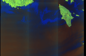
SAR coverage thumbnail
VIIRS Thermal Anomaly
Status: ✗ No detections
No VIIRS thermal/light detections in corridor
Show Raw Evidence JSON
{
    "gap_minutes": 384.5,
    "last_seen": {
        "ts": "2026-06-08T06:54:32+00:00",
        "lat": 35.88747169999999897527231951244175434112548828125,
        "lon": 27.4442549999999982901499606668949127197265625,
        "sog": 11.699999999999999289457264239899814128875732421875,
        "zone_id": "discovered_075"
    },
    "next_seen": {
        "ts": "2026-06-08T13:19:02+00:00",
        "lat": 36.8554783000000014681063476018607616424560546875,
        "lon": 26.3569032999999990352080203592777252197265625,
        "zone_ids": [
            "discovered_107"
        ]
    },
    "gap_enrichment": {
        "status": "done",
        "corridor": {
            "start": {
                "lat": 35.88747169999999897527231951244175434112548828125,
                "lon": 27.4442549999999982901499606668949127197265625,
                "ts": "2026-06-08T06:54:32+00:00"
            },
            "end": {
                "lat": 36.8554783000000014681063476018607616424560546875,
                "lon": 26.3569032999999990352080203592777252197265625,
                "ts": "2026-06-08T13:19:02+00:00"
            },
            "bbox": {
                "min_lat": 35.70729200000000247428033617325127124786376953125,
                "min_lon": 26.13313000000000130285116028971970081329345703125,
                "max_lat": 37.0356579999999979690983309410512447357177734375,
                "max_lon": 27.668029000000000650061338092200458049774169921875
            },
            "buffer_km": 20
        },
        "sar": {
            "status": "snapshot",
            "scene_id": "S1C_IW_GRDH_1SDV_20260608T040652_20260608T040717_008009_0104A2_C267_COG",
            "scene_time": "2026-06-08T04:06:52.860742Z",
            "platform": "sentinel-1c",
            "assets": {
                "preview_url": "https:\/\/fleetleaks.com\/wp-content\/uploads\/fleetleaks-evidence\/sar-imagery\/2026\/06\/event_703850_thumbnail_20260608133008.png",
                "stored_path": "\/home\/fleetleaks\/public_html\/wp-content\/uploads\/fleetleaks-evidence\/sar-imagery\/2026\/06\/event_703850_thumbnail_20260608133008.png",
                "source": "copernicus_dataspace"
            },
            "notes": "SAR snapshot available for review"
        },
        "viirs": {
            "status": "not_found",
            "notes": "No VIIRS thermal\/light detections in corridor"
        },
        "searched_at": "2026-06-08T13:30:02.043548+00:00"
    }
}- Zone: discovered_014
- Duration: 1h 57m
- Data Points: 22 AIS positions
- Period: 2026-03-18T12:05:06+00:00 to 2026-03-18T14:02:08+00:00
Show Raw Evidence JSON
{
    "zone_id": "discovered_014",
    "zone_name": "Western Pomerania Monitoring Zone",
    "dwell_minutes": 117,
    "points_in_zone": 22,
    "first_point": {
        "ts": "2026-03-18T12:05:06+00:00",
        "lat": 31.371886700000001013677319861017167568206787109375,
        "lon": 32.30897499999999666897565475665032863616943359375
    },
    "last_point": {
        "ts": "2026-03-18T14:02:08+00:00",
        "lat": 31.37160000000000081854523159563541412353515625,
        "lon": 32.30876169999999802939782966859638690948486328125
    }
}- Duration: 1h 57m
- Radius: 21 meters
- Data Points: 22 AIS positions
- Centroid: 31.3718, 32.3088
- Zone: discovered_014
Show Raw Evidence JSON
{
    "radius_m": 20.699999999999999289457264239899814128875732421875,
    "duration_minutes": 117,
    "points": 22,
    "centroid": {
        "lat": 31.3717559136363632887878338806331157684326171875,
        "lon": 32.3088193227272739704858395271003246307373046875
    },
    "bbox": {
        "min_lat": 31.37160000000000081854523159563541412353515625,
        "min_lon": 32.30870999999999781948645249940454959869384765625,
        "max_lat": 31.371886700000001013677319861017167568206787109375,
        "max_lon": 32.30897499999999666897565475665032863616943359375
    },
    "zone_id": "discovered_014"
}- Duration: 2h 51m
- Radius: 22 meters
- Data Points: 31 AIS positions
- Centroid: 31.3718, 32.3089
- Zone: discovered_014
Show Raw Evidence JSON
{
    "radius_m": 22.39999999999999857891452847979962825775146484375,
    "duration_minutes": 171.30000000000001136868377216160297393798828125,
    "points": 31,
    "centroid": {
        "lat": 31.371784793548386005568318068981170654296875,
        "lon": 32.3088565064516188840570976026356220245361328125
    },
    "bbox": {
        "min_lat": 31.37160000000000081854523159563541412353515625,
        "min_lon": 32.30870999999999781948645249940454959869384765625,
        "max_lat": 31.37194170000000070785972638987004756927490234375,
        "max_lon": 32.30905500000000074578565545380115509033203125
    },
    "zone_id": "discovered_014"
}- Zone: discovered_014
- Duration: 2h 51m
- Data Points: 31 AIS positions
- Period: 2026-03-18T11:10:52+00:00 to 2026-03-18T14:02:08+00:00
Show Raw Evidence JSON
{
    "zone_id": "discovered_014",
    "zone_name": "Western Pomerania Monitoring Zone",
    "dwell_minutes": 171.30000000000001136868377216160297393798828125,
    "points_in_zone": 31,
    "first_point": {
        "ts": "2026-03-18T11:10:52+00:00",
        "lat": 31.37171169999999875699359108693897724151611328125,
        "lon": 32.30890000000000128466126625426113605499267578125
    },
    "last_point": {
        "ts": "2026-03-18T14:02:08+00:00",
        "lat": 31.37160000000000081854523159563541412353515625,
        "lon": 32.30876169999999802939782966859638690948486328125
    }
}- Zone: discovered_014
- Duration: 3h 57m
- Data Points: 33 AIS positions
- Period: 2026-03-18T10:04:40+00:00 to 2026-03-18T14:02:08+00:00
Show Raw Evidence JSON
{
    "zone_id": "discovered_014",
    "zone_name": "Western Pomerania Monitoring Zone",
    "dwell_minutes": 237.5,
    "points_in_zone": 33,
    "first_point": {
        "ts": "2026-03-18T10:04:40+00:00",
        "lat": 31.39535000000000053432813729159533977508544921875,
        "lon": 32.2959000000000031604940886609256267547607421875
    },
    "last_point": {
        "ts": "2026-03-18T14:02:08+00:00",
        "lat": 31.37160000000000081854523159563541412353515625,
        "lon": 32.30876169999999802939782966859638690948486328125
    }
}- Zone: discovered_014
- Duration: 4h 44m
- Data Points: 41 AIS positions
- Period: 2026-03-18T09:18:10+00:00 to 2026-03-18T14:02:08+00:00
Show Raw Evidence JSON
{
    "zone_id": "discovered_014",
    "zone_name": "Western Pomerania Monitoring Zone",
    "dwell_minutes": 284,
    "points_in_zone": 41,
    "first_point": {
        "ts": "2026-03-18T09:18:10+00:00",
        "lat": 31.471115000000001060698195942677557468414306640625,
        "lon": 32.2549599999999969668351695872843265533447265625
    },
    "last_point": {
        "ts": "2026-03-18T14:02:08+00:00",
        "lat": 31.37160000000000081854523159563541412353515625,
        "lon": 32.30876169999999802939782966859638690948486328125
    }
}- Zone: discovered_014
- Duration: 6h 29m
- Data Points: 24 AIS positions
- Period: 2026-03-18T06:11:51+00:00 to 2026-03-18T12:41:03+00:00
Show Raw Evidence JSON
{
    "zone_id": "discovered_014",
    "zone_name": "Western Pomerania Monitoring Zone",
    "dwell_minutes": 389.19999999999998863131622783839702606201171875,
    "points_in_zone": 24,
    "first_point": {
        "ts": "2026-03-18T06:11:51+00:00",
        "lat": 31.875485000000001178932507173158228397369384765625,
        "lon": 31.7607517000000001416992745362222194671630859375
    },
    "last_point": {
        "ts": "2026-03-18T12:41:03+00:00",
        "lat": 31.371790000000000731006366549991071224212646484375,
        "lon": 32.30881670000000127629391499795019626617431640625
    }
}- Zone: discovered_014
- Duration: 6h 30m
- Data Points: 17 AIS positions
- Period: 2026-03-18T04:46:10+00:00 to 2026-03-18T11:16:50+00:00
Show Raw Evidence JSON
{
    "zone_id": "discovered_014",
    "zone_name": "Western Pomerania Monitoring Zone",
    "dwell_minutes": 390.69999999999998863131622783839702606201171875,
    "points_in_zone": 17,
    "first_point": {
        "ts": "2026-03-18T04:46:10+00:00",
        "lat": 32.0685399999999987130649969913065433502197265625,
        "lon": 31.533970000000000055706550483591854572296142578125
    },
    "last_point": {
        "ts": "2026-03-18T11:16:50+00:00",
        "lat": 31.37180169999999890251274337060749530792236328125,
        "lon": 32.3089633000000020501829567365348339080810546875
    }
}- Zone: discovered_014
- Duration: 6h 28m
- Data Points: 20 AIS positions
- Period: 2026-03-18T03:43:43+00:00 to 2026-03-18T10:11:54+00:00
Show Raw Evidence JSON
{
    "zone_id": "discovered_014",
    "zone_name": "Western Pomerania Monitoring Zone",
    "dwell_minutes": 388.19999999999998863131622783839702606201171875,
    "points_in_zone": 20,
    "first_point": {
        "ts": "2026-03-18T03:43:43+00:00",
        "lat": 32.21433830000000142490534926764667034149169921875,
        "lon": 31.362950000000001438138497178442776203155517578125
    },
    "last_point": {
        "ts": "2026-03-18T10:11:54+00:00",
        "lat": 31.381634999999999280362317222170531749725341796875,
        "lon": 32.3003666999999978770574671216309070587158203125
    }
}- Zone: discovered_084
- Duration: 1h 39m
- Data Points: 4 AIS positions
- Period: 2026-03-16T21:16:50+00:00 to 2026-03-16T22:56:11+00:00
Show Raw Evidence JSON
{
    "zone_id": "discovered_084",
    "zone_name": "Norwegian Sea Surveillance Zone",
    "dwell_minutes": 99.2999999999999971578290569595992565155029296875,
    "points_in_zone": 4,
    "first_point": {
        "ts": "2026-03-16T21:16:50+00:00",
        "lat": 36.719521700000001374064595438539981842041015625,
        "lon": 26.46697830000000095651557785458862781524658203125
    },
    "last_point": {
        "ts": "2026-03-16T22:56:11+00:00",
        "lat": 36.46538170000000178561094799079000949859619140625,
        "lon": 26.756776699999999635792846675030887126922607421875
    }
}- Gap Duration: 4h 22m
- Last Seen: 2026-03-16T16:54:30+00:00 at 37.4668, 25.8315 (Zone: Northwest Iberian Sea Monitoring Zone)
- Next Seen: 2026-03-16T21:16:50+00:00 at 36.7195, 26.4670
🛰️ Gap Corroboration
These are snapshots that may corroborate presence during the gap. They do not reconstruct a continuous route.
SAR Imagery (Sentinel-1)
Status: ✗ No SAR coverage
No Sentinel-1 scenes covering corridor and time window
VIIRS Thermal Anomaly
Status: ✗ No detections
No VIIRS thermal/light detections in corridor
Show Raw Evidence JSON
{
    "gap_minutes": 262.30000000000001136868377216160297393798828125,
    "last_seen": {
        "ts": "2026-03-16T16:54:30+00:00",
        "lat": 37.46676670000000086702129920013248920440673828125,
        "lon": 25.831495000000000317186277243308722972869873046875,
        "sog": 12.0999999999999996447286321199499070644378662109375,
        "zone_id": "discovered_087"
    },
    "next_seen": {
        "ts": "2026-03-16T21:16:50+00:00",
        "lat": 36.719521700000001374064595438539981842041015625,
        "lon": 26.46697830000000095651557785458862781524658203125,
        "zone_ids": [
            "discovered_084"
        ]
    },
    "gap_enrichment": {
        "status": "not_found",
        "corridor": {
            "start": {
                "lat": 37.46676670000000086702129920013248920440673828125,
                "lon": 25.831495000000000317186277243308722972869873046875,
                "ts": "2026-03-16T16:54:30+00:00"
            },
            "end": {
                "lat": 36.719521700000001374064595438539981842041015625,
                "lon": 26.46697830000000095651557785458862781524658203125,
                "ts": "2026-03-16T21:16:50+00:00"
            },
            "bbox": {
                "min_lat": 36.53934199999999776764525449834764003753662109375,
                "min_lon": 25.605608000000000146201273309998214244842529296875,
                "max_lat": 37.6469469999999972742443787865340709686279296875,
                "max_lon": 26.692865000000001174385033664293587207794189453125
            },
            "buffer_km": 20
        },
        "sar": {
            "status": "not_found",
            "notes": "No Sentinel-1 scenes covering corridor and time window"
        },
        "viirs": {
            "status": "not_found",
            "notes": "No VIIRS thermal\/light detections in corridor"
        },
        "searched_at": "2026-03-16T21:30:01.441427+00:00"
    }
}Recent Position Data
| Time (UTC) | Lat | Lon | Speed | Course | Zone |
|---|---|---|---|---|---|
| Jun 15 11:17 | 42.9321 | 28.8158 | 8.3 kn | 294.3° | Western Black Sea Sanction Monitoring Zone |
| Jun 15 11:16 | 42.9312 | 28.8186 | 8.3 kn | 293.9° | Western Black Sea Sanction Monitoring Zone |
| Jun 15 11:15 | 42.9301 | 28.8220 | 8.3 kn | 294.5° | Western Black Sea Sanction Monitoring Zone |
| Jun 15 11:13 | 42.9282 | 28.8277 | 8.3 kn | 294.2° | Western Black Sea Sanction Monitoring Zone |
| Jun 15 11:12 | 42.9272 | 28.8306 | 8.4 kn | 294.1° | Western Black Sea Sanction Monitoring Zone |
| Jun 15 11:11 | 42.9263 | 28.8335 | 8.4 kn | 294.3° | Western Black Sea Sanction Monitoring Zone |
| Jun 15 11:10 | 42.9253 | 28.8364 | 8.4 kn | 294.7° | Western Black Sea Sanction Monitoring Zone |
| Jun 15 11:03 | 42.9190 | 28.8564 | 8.5 kn | 290.5° | Western Black Sea Sanction Monitoring Zone |
| Jun 15 11:00 | 42.9164 | 28.8659 | 8.4 kn | 290.5° | Western Black Sea Sanction Monitoring Zone |
| Jun 15 10:58 | 42.9147 | 28.8720 | 8.4 kn | 290.4° | Western Black Sea Sanction Monitoring Zone |
| Jun 15 10:57 | 42.9138 | 28.8754 | 8.4 kn | 290.7° | Western Black Sea Sanction Monitoring Zone |
| Jun 15 10:55 | 42.9126 | 28.8794 | 8.4 kn | 290.8° | Western Black Sea Sanction Monitoring Zone |
| Jun 15 10:51 | 42.9087 | 28.8933 | 8.5 kn | 290.7° | Western Black Sea Sanction Monitoring Zone |
| Jun 15 10:45 | 42.9036 | 28.9113 | 8.4 kn | 290.8° | Western Black Sea Sanction Monitoring Zone |
| Jun 15 10:42 | 42.9019 | 28.9176 | 8.4 kn | 291.0° | Western Black Sea Sanction Monitoring Zone |
| Jun 15 10:41 | 42.9009 | 28.9211 | 8.3 kn | 291.2° | Western Black Sea Sanction Monitoring Zone |
| Jun 15 10:40 | 42.8998 | 28.9247 | 8.4 kn | 291.6° | Western Black Sea Sanction Monitoring Zone |
| Jun 15 10:39 | 42.8989 | 28.9277 | 8.4 kn | 291.8° | Western Black Sea Sanction Monitoring Zone |
| Jun 15 10:38 | 42.8978 | 28.9315 | 8.4 kn | 291.2° | Western Black Sea Sanction Monitoring Zone |
| Jun 15 10:27 | 42.8903 | 28.9641 | 8.3 kn | 287.0° | Western Black Sea Sanction Monitoring Zone |
Showing 20 of 100 recent positions.
Data Source
Vessel observed through FleetLeaks' AIS monitoring system in zones of interest. Identity and position data derived from AIS broadcasts and public maritime databases.
Disclaimer: AIS data can be spoofed or falsified. Vessel identities should be independently verified before making compliance decisions.