IMO 9413004
Vessel information
Sanction Status
⚠️ This vessel is sanctioned.
Detected Events (100)
- Zone: Eastern Mediterranean Monitoring Zone
- Duration: 5h 3m
- Data Points: 16 AIS positions
- Period: 2026-06-06T15:04:21+00:00 to 2026-06-06T20:07:49+00:00
Show Raw Evidence JSON
{
    "zone_id": "discovered_020",
    "zone_name": "Eastern Mediterranean Monitoring Zone",
    "dwell_minutes": 303.5,
    "points_in_zone": 16,
    "first_point": {
        "ts": "2026-06-06T15:04:21+00:00",
        "lat": 31.617599999999999482724888366647064685821533203125,
        "lon": 32.35111669999999861602191231213510036468505859375
    },
    "last_point": {
        "ts": "2026-06-06T20:07:49+00:00",
        "lat": 31.617450000000001608668753760866820812225341796875,
        "lon": 32.35083329999999790516085340641438961029052734375
    }
}- Duration: 5h 3m
- Radius: 40 meters
- Data Points: 16 AIS positions
- Centroid: 31.6176, 32.3512
- Zone: Eastern Mediterranean Monitoring Zone
Show Raw Evidence JSON
{
    "radius_m": 40.2000000000000028421709430404007434844970703125,
    "duration_minutes": 303.5,
    "points": 16,
    "centroid": {
        "lat": 31.617578118750003568493411876261234283447265625,
        "lon": 32.351229168749995324105839245021343231201171875
    },
    "bbox": {
        "min_lat": 31.617450000000001608668753760866820812225341796875,
        "min_lon": 32.35083329999999790516085340641438961029052734375,
        "max_lat": 31.617733300000001150920070358552038669586181640625,
        "max_lon": 32.35156669999999934361767373047769069671630859375
    },
    "zone_id": "discovered_020"
}- Zone: Eastern Mediterranean Monitoring Zone
- Duration: 6h 6m
- Data Points: 37 AIS positions
- Period: 2026-06-06T14:00:59+00:00 to 2026-06-06T20:07:49+00:00
Show Raw Evidence JSON
{
    "zone_id": "discovered_020",
    "zone_name": "Eastern Mediterranean Monitoring Zone",
    "dwell_minutes": 366.80000000000001136868377216160297393798828125,
    "points_in_zone": 37,
    "first_point": {
        "ts": "2026-06-06T14:00:59+00:00",
        "lat": 31.617850000000000676436684443615376949310302734375,
        "lon": 32.3493500000000011596057447604835033416748046875
    },
    "last_point": {
        "ts": "2026-06-06T20:07:49+00:00",
        "lat": 31.617450000000001608668753760866820812225341796875,
        "lon": 32.35083329999999790516085340641438961029052734375
    }
}- Duration: 6h 6m
- Radius: 847 meters
- Data Points: 37 AIS positions
- Centroid: 31.6177, 32.3510
- Zone: Eastern Mediterranean Monitoring Zone
Show Raw Evidence JSON
{
    "radius_m": 847.299999999999954525264911353588104248046875,
    "duration_minutes": 366.80000000000001136868377216160297393798828125,
    "points": 37,
    "centroid": {
        "lat": 31.6176887405405437903027632273733615875244140625,
        "lon": 32.3510481999999939262124826200306415557861328125
    },
    "bbox": {
        "min_lat": 31.614433300000001736407284624874591827392578125,
        "min_lon": 32.3493500000000011596057447604835033416748046875,
        "max_lat": 31.6224500000000006139089236967265605926513671875,
        "max_lon": 32.3580333000000024412656784988939762115478515625
    },
    "zone_id": "discovered_020"
}- Zone: Eastern Mediterranean Monitoring Zone
- Duration: 6h 27m
- Data Points: 41 AIS positions
- Period: 2026-06-06T13:39:59+00:00 to 2026-06-06T20:07:49+00:00
Show Raw Evidence JSON
{
    "zone_id": "discovered_020",
    "zone_name": "Eastern Mediterranean Monitoring Zone",
    "dwell_minutes": 387.80000000000001136868377216160297393798828125,
    "points_in_zone": 41,
    "first_point": {
        "ts": "2026-06-06T13:39:59+00:00",
        "lat": 31.618050000000000210320649784989655017852783203125,
        "lon": 32.34908329999999665460563846863806247711181640625
    },
    "last_point": {
        "ts": "2026-06-06T20:07:49+00:00",
        "lat": 31.617450000000001608668753760866820812225341796875,
        "lon": 32.35083329999999790516085340641438961029052734375
    }
}- Duration: 6h 27m
- Radius: 859 meters
- Data Points: 41 AIS positions
- Centroid: 31.6177, 32.3509
- Zone: Eastern Mediterranean Monitoring Zone
Show Raw Evidence JSON
{
    "radius_m": 859.299999999999954525264911353588104248046875,
    "duration_minutes": 387.80000000000001136868377216160297393798828125,
    "points": 41,
    "centroid": {
        "lat": 31.617714229268297998487469158135354518890380859375,
        "lon": 32.35086422682926610150389024056494235992431640625
    },
    "bbox": {
        "min_lat": 31.614433300000001736407284624874591827392578125,
        "min_lon": 32.34908329999999665460563846863806247711181640625,
        "max_lat": 31.6224500000000006139089236967265605926513671875,
        "max_lon": 32.3580333000000024412656784988939762115478515625
    },
    "zone_id": "discovered_020"
}- Zone: Eastern Mediterranean Monitoring Zone
- Duration: 5h 39m
- Data Points: 49 AIS positions
- Period: 2026-06-06T12:09:59+00:00 to 2026-06-06T17:49:20+00:00
Show Raw Evidence JSON
{
    "zone_id": "discovered_020",
    "zone_name": "Eastern Mediterranean Monitoring Zone",
    "dwell_minutes": 339.3999999999999772626324556767940521240234375,
    "points_in_zone": 49,
    "first_point": {
        "ts": "2026-06-06T12:09:59+00:00",
        "lat": 31.617799999999999016608853708021342754364013671875,
        "lon": 32.34958329999999904202923062257468700408935546875
    },
    "last_point": {
        "ts": "2026-06-06T17:49:20+00:00",
        "lat": 31.617483299999999957208274281583726406097412109375,
        "lon": 32.35111669999999861602191231213510036468505859375
    }
}- Duration: 5h 39m
- Radius: 885 meters
- Data Points: 49 AIS positions
- Centroid: 31.6178, 32.3505
- Zone: Eastern Mediterranean Monitoring Zone
Show Raw Evidence JSON
{
    "radius_m": 885.299999999999954525264911353588104248046875,
    "duration_minutes": 339.3999999999999772626324556767940521240234375,
    "points": 49,
    "centroid": {
        "lat": 31.617794555102040732208479312248528003692626953125,
        "lon": 32.35045305918365698971683741547167301177978515625
    },
    "bbox": {
        "min_lat": 31.614433300000001736407284624874591827392578125,
        "min_lon": 32.34899999999999664623828721232712268829345703125,
        "max_lat": 31.6224500000000006139089236967265605926513671875,
        "max_lon": 32.3580333000000024412656784988939762115478515625
    },
    "zone_id": "discovered_020"
}- Zone: Eastern Mediterranean Monitoring Zone
- Duration: 6h 33m
- Data Points: 51 AIS positions
- Period: 2026-06-06T11:16:01+00:00 to 2026-06-06T17:49:20+00:00
Show Raw Evidence JSON
{
    "zone_id": "discovered_020",
    "zone_name": "Eastern Mediterranean Monitoring Zone",
    "dwell_minutes": 393.30000000000001136868377216160297393798828125,
    "points_in_zone": 51,
    "first_point": {
        "ts": "2026-06-06T11:16:01+00:00",
        "lat": 31.618500000000000937916411203332245349884033203125,
        "lon": 32.34850000000000136424205265939235687255859375
    },
    "last_point": {
        "ts": "2026-06-06T17:49:20+00:00",
        "lat": 31.617483299999999957208274281583726406097412109375,
        "lon": 32.35111669999999861602191231213510036468505859375
    }
}- Duration: 6h 33m
- Radius: 890 meters
- Data Points: 51 AIS positions
- Centroid: 31.6178, 32.3504
- Zone: Eastern Mediterranean Monitoring Zone
Show Raw Evidence JSON
{
    "radius_m": 889.6000000000000227373675443232059478759765625,
    "duration_minutes": 393.30000000000001136868377216160297393798828125,
    "points": 51,
    "centroid": {
        "lat": 31.617819605882349520697971456684172153472900390625,
        "lon": 32.3503767960784216484171338379383087158203125
    },
    "bbox": {
        "min_lat": 31.614433300000001736407284624874591827392578125,
        "min_lon": 32.34850000000000136424205265939235687255859375,
        "max_lat": 31.6224500000000006139089236967265605926513671875,
        "max_lon": 32.3580333000000024412656784988939762115478515625
    },
    "zone_id": "discovered_020"
}- Zone: Eastern Mediterranean Monitoring Zone
- Duration: 6h 36m
- Data Points: 57 AIS positions
- Period: 2026-06-06T10:30:59+00:00 to 2026-06-06T17:07:20+00:00
Show Raw Evidence JSON
{
    "zone_id": "discovered_020",
    "zone_name": "Eastern Mediterranean Monitoring Zone",
    "dwell_minutes": 396.3999999999999772626324556767940521240234375,
    "points_in_zone": 57,
    "first_point": {
        "ts": "2026-06-06T10:30:59+00:00",
        "lat": 31.61818329999999832580215297639369964599609375,
        "lon": 32.3488167000000004236426320858299732208251953125
    },
    "last_point": {
        "ts": "2026-06-06T17:07:20+00:00",
        "lat": 31.617483299999999957208274281583726406097412109375,
        "lon": 32.35111669999999861602191231213510036468505859375
    }
}- Duration: 6h 36m
- Radius: 902 meters
- Data Points: 57 AIS positions
- Centroid: 31.6179, 32.3502
- Zone: Eastern Mediterranean Monitoring Zone
Show Raw Evidence JSON
{
    "radius_m": 902.200000000000045474735088646411895751953125,
    "duration_minutes": 396.3999999999999772626324556767940521240234375,
    "points": 57,
    "centroid": {
        "lat": 31.617871928070172771185752935707569122314453125,
        "lon": 32.350172512280693126740516163408756256103515625
    },
    "bbox": {
        "min_lat": 31.614433300000001736407284624874591827392578125,
        "min_lon": 32.34850000000000136424205265939235687255859375,
        "max_lat": 31.6224500000000006139089236967265605926513671875,
        "max_lon": 32.3580333000000024412656784988939762115478515625
    },
    "zone_id": "discovered_020"
}- Zone: Eastern Mediterranean Monitoring Zone
- Duration: 6h 27m
- Data Points: 59 AIS positions
- Period: 2026-06-06T09:54:59+00:00 to 2026-06-06T16:22:20+00:00
Show Raw Evidence JSON
{
    "zone_id": "discovered_020",
    "zone_name": "Eastern Mediterranean Monitoring Zone",
    "dwell_minutes": 387.3999999999999772626324556767940521240234375,
    "points_in_zone": 59,
    "first_point": {
        "ts": "2026-06-06T09:54:59+00:00",
        "lat": 31.6182000000000016370904631912708282470703125,
        "lon": 32.3488167000000004236426320858299732208251953125
    },
    "last_point": {
        "ts": "2026-06-06T16:22:20+00:00",
        "lat": 31.617683299999999491092239622958004474639892578125,
        "lon": 32.35156669999999934361767373047769069671630859375
    }
}- Duration: 6h 27m
- Radius: 913 meters
- Data Points: 59 AIS positions
- Centroid: 31.6179, 32.3500
- Zone: Eastern Mediterranean Monitoring Zone
Show Raw Evidence JSON
{
    "radius_m": 912.5,
    "duration_minutes": 387.3999999999999772626324556767940521240234375,
    "points": 59,
    "centroid": {
        "lat": 31.617919208474571490796733996830880641937255859375,
        "lon": 32.3500048016949079965343116782605648040771484375
    },
    "bbox": {
        "min_lat": 31.614433300000001736407284624874591827392578125,
        "min_lon": 32.34850000000000136424205265939235687255859375,
        "max_lat": 31.6224500000000006139089236967265605926513671875,
        "max_lon": 32.3580333000000024412656784988939762115478515625
    },
    "zone_id": "discovered_020"
}- Zone: Eastern Mediterranean Monitoring Zone
- Duration: 6h 27m
- Data Points: 57 AIS positions
- Period: 2026-06-06T08:36:54+00:00 to 2026-06-06T15:04:21+00:00
Show Raw Evidence JSON
{
    "zone_id": "discovered_020",
    "zone_name": "Eastern Mediterranean Monitoring Zone",
    "dwell_minutes": 387.3999999999999772626324556767940521240234375,
    "points_in_zone": 57,
    "first_point": {
        "ts": "2026-06-06T08:36:54+00:00",
        "lat": 31.621111700000000155341695062816143035888671875,
        "lon": 32.35088999999999970214048516936600208282470703125
    },
    "last_point": {
        "ts": "2026-06-06T15:04:21+00:00",
        "lat": 31.617599999999999482724888366647064685821533203125,
        "lon": 32.35111669999999861602191231213510036468505859375
    }
}- Duration: 6h 27m
- Radius: 916 meters
- Data Points: 57 AIS positions
- Centroid: 31.6181, 32.3498
- Zone: Eastern Mediterranean Monitoring Zone
Show Raw Evidence JSON
{
    "radius_m": 916.299999999999954525264911353588104248046875,
    "duration_minutes": 387.3999999999999772626324556767940521240234375,
    "points": 57,
    "centroid": {
        "lat": 31.618147749122801570820229244418442249298095703125,
        "lon": 32.34978748596490305544648435898125171661376953125
    },
    "bbox": {
        "min_lat": 31.614433300000001736407284624874591827392578125,
        "min_lon": 32.34806669999999684250724385492503643035888671875,
        "max_lat": 31.6224500000000006139089236967265605926513671875,
        "max_lon": 32.3580333000000024412656784988939762115478515625
    },
    "zone_id": "discovered_020"
}- Zone: Eastern Mediterranean Monitoring Zone
- Duration: 6h 38m
- Data Points: 44 AIS positions
- Period: 2026-06-06T07:30:59+00:00 to 2026-06-06T14:09:18+00:00
Show Raw Evidence JSON
{
    "zone_id": "discovered_020",
    "zone_name": "Eastern Mediterranean Monitoring Zone",
    "dwell_minutes": 398.30000000000001136868377216160297393798828125,
    "points_in_zone": 44,
    "first_point": {
        "ts": "2026-06-06T07:30:59+00:00",
        "lat": 31.6211167000000017424099496565759181976318359375,
        "lon": 32.3513166999999981499058776535093784332275390625
    },
    "last_point": {
        "ts": "2026-06-06T14:09:18+00:00",
        "lat": 31.617666700000000901127350516617298126220703125,
        "lon": 32.34966670000000021900632418692111968994140625
    }
}- Duration: 6h 38m
- Radius: 341 meters
- Data Points: 44 AIS positions
- Centroid: 31.6186, 32.3493
- Zone: Eastern Mediterranean Monitoring Zone
Show Raw Evidence JSON
{
    "radius_m": 341.3999999999999772626324556767940521240234375,
    "duration_minutes": 398.30000000000001136868377216160297393798828125,
    "points": 44,
    "centroid": {
        "lat": 31.6185570454545512575350585393607616424560546875,
        "lon": 32.34931693409091479907147004269063472747802734375
    },
    "bbox": {
        "min_lat": 31.617650000000001142552719102241098880767822265625,
        "min_lon": 32.34806669999999684250724385492503643035888671875,
        "max_lat": 31.6211167000000017424099496565759181976318359375,
        "max_lon": 32.3513166999999981499058776535093784332275390625
    },
    "zone_id": "discovered_020"
}- Zone: Eastern Mediterranean Monitoring Zone
- Duration: 6h 37m
- Data Points: 39 AIS positions
- Period: 2026-06-06T06:50:15+00:00 to 2026-06-06T13:28:03+00:00
Show Raw Evidence JSON
{
    "zone_id": "discovered_020",
    "zone_name": "Eastern Mediterranean Monitoring Zone",
    "dwell_minutes": 397.80000000000001136868377216160297393798828125,
    "points_in_zone": 39,
    "first_point": {
        "ts": "2026-06-06T06:50:15+00:00",
        "lat": 31.621383300000001526086634839884936809539794921875,
        "lon": 32.35085000000000121644916362129151821136474609375
    },
    "last_point": {
        "ts": "2026-06-06T13:28:03+00:00",
        "lat": 31.61803330000000045174601837061345577239990234375,
        "lon": 32.34904999999999830606611794792115688323974609375
    }
}- Duration: 6h 37m
- Radius: 314 meters
- Data Points: 39 AIS positions
- Centroid: 31.6190, 32.3495
- Zone: Eastern Mediterranean Monitoring Zone
Show Raw Evidence JSON
{
    "radius_m": 314.3999999999999772626324556767940521240234375,
    "duration_minutes": 397.80000000000001136868377216160297393798828125,
    "points": 39,
    "centroid": {
        "lat": 31.619013928205138341809288249351084232330322265625,
        "lon": 32.34947979230769732339467736892402172088623046875
    },
    "bbox": {
        "min_lat": 31.6177832999999992580342222936451435089111328125,
        "min_lon": 32.34806669999999684250724385492503643035888671875,
        "max_lat": 31.621383300000001526086634839884936809539794921875,
        "max_lon": 32.35146670000000312938936986029148101806640625
    },
    "zone_id": "discovered_020"
}- Zone: Eastern Mediterranean Monitoring Zone
- Duration: 6h 30m
- Data Points: 25 AIS positions
- Period: 2026-06-06T04:21:46+00:00 to 2026-06-06T10:51:59+00:00
Show Raw Evidence JSON
{
    "zone_id": "discovered_020",
    "zone_name": "Eastern Mediterranean Monitoring Zone",
    "dwell_minutes": 390.19999999999998863131622783839702606201171875,
    "points_in_zone": 25,
    "first_point": {
        "ts": "2026-06-06T04:21:46+00:00",
        "lat": 31.620349999999998402699930011294782161712646484375,
        "lon": 32.3494333000000011679730960167944431304931640625
    },
    "last_point": {
        "ts": "2026-06-06T10:51:59+00:00",
        "lat": 31.61818329999999832580215297639369964599609375,
        "lon": 32.3488167000000004236426320858299732208251953125
    }
}- Duration: 6h 30m
- Radius: 246 meters
- Data Points: 25 AIS positions
- Centroid: 31.6196, 32.3497
- Zone: Eastern Mediterranean Monitoring Zone
Show Raw Evidence JSON
{
    "radius_m": 246,
    "duration_minutes": 390.19999999999998863131622783839702606201171875,
    "points": 25,
    "centroid": {
        "lat": 31.619646399999993491292116232216358184814453125,
        "lon": 32.34971581200000656508564134128391742706298828125
    },
    "bbox": {
        "min_lat": 31.618166699999999735837263870052993297576904296875,
        "min_lon": 32.34806669999999684250724385492503643035888671875,
        "max_lat": 31.621383300000001526086634839884936809539794921875,
        "max_lon": 32.35146670000000312938936986029148101806640625
    },
    "zone_id": "discovered_020"
}- Zone: Eastern Mediterranean Monitoring Zone
- Duration: 4h 21m
- Data Points: 6 AIS positions
- Period: 2026-06-06T00:00:26+00:00 to 2026-06-06T04:21:46+00:00
Show Raw Evidence JSON
{
    "zone_id": "discovered_020",
    "zone_name": "Eastern Mediterranean Monitoring Zone",
    "dwell_minutes": 261.30000000000001136868377216160297393798828125,
    "points_in_zone": 6,
    "first_point": {
        "ts": "2026-06-06T00:00:26+00:00",
        "lat": 31.621083299999998672547008027322590351104736328125,
        "lon": 32.34915000000000162572177941910922527313232421875
    },
    "last_point": {
        "ts": "2026-06-06T04:21:46+00:00",
        "lat": 31.620349999999998402699930011294782161712646484375,
        "lon": 32.3494333000000011679730960167944431304931640625
    }
}- Zone: Eastern Mediterranean Monitoring Zone
- Duration: 5h 17m
- Data Points: 15 AIS positions
- Period: 2026-06-05T23:04:15+00:00 to 2026-06-06T04:21:46+00:00
Show Raw Evidence JSON
{
    "zone_id": "discovered_020",
    "zone_name": "Eastern Mediterranean Monitoring Zone",
    "dwell_minutes": 317.5,
    "points_in_zone": 15,
    "first_point": {
        "ts": "2026-06-05T23:04:15+00:00",
        "lat": 31.62098329999999890560502535663545131683349609375,
        "lon": 32.34908329999999665460563846863806247711181640625
    },
    "last_point": {
        "ts": "2026-06-06T04:21:46+00:00",
        "lat": 31.620349999999998402699930011294782161712646484375,
        "lon": 32.3494333000000011679730960167944431304931640625
    }
}- Duration: 5h 17m
- Radius: 81 meters
- Data Points: 15 AIS positions
- Centroid: 31.6210, 32.3491
- Zone: Eastern Mediterranean Monitoring Zone
Show Raw Evidence JSON
{
    "radius_m": 80.900000000000005684341886080801486968994140625,
    "duration_minutes": 317.5,
    "points": 15,
    "centroid": {
        "lat": 31.621029986666666644623546744696795940399169921875,
        "lon": 32.3491244333333298754951101727783679962158203125
    },
    "bbox": {
        "min_lat": 31.620349999999998402699930011294782161712646484375,
        "min_lon": 32.348849999999998772182152606546878814697265625,
        "max_lat": 31.621333299999999866258804104290902614593505859375,
        "max_lon": 32.3494333000000011679730960167944431304931640625
    },
    "zone_id": "discovered_020"
}- Zone: Eastern Mediterranean Monitoring Zone
- Duration: 6h 2m
- Data Points: 20 AIS positions
- Period: 2026-06-05T22:19:15+00:00 to 2026-06-06T04:21:46+00:00
Show Raw Evidence JSON
{
    "zone_id": "discovered_020",
    "zone_name": "Eastern Mediterranean Monitoring Zone",
    "dwell_minutes": 362.5,
    "points_in_zone": 20,
    "first_point": {
        "ts": "2026-06-05T22:19:15+00:00",
        "lat": 31.617116700000000406589606427587568759918212890625,
        "lon": 32.34944999999999737383404863066971302032470703125
    },
    "last_point": {
        "ts": "2026-06-06T04:21:46+00:00",
        "lat": 31.620349999999998402699930011294782161712646484375,
        "lon": 32.3494333000000011679730960167944431304931640625
    }
}- Duration: 6h 2m
- Radius: 411 meters
- Data Points: 20 AIS positions
- Centroid: 31.6208, 32.3491
- Zone: Eastern Mediterranean Monitoring Zone
Show Raw Evidence JSON
{
    "radius_m": 411.3999999999999772626324556767940521240234375,
    "duration_minutes": 362.5,
    "points": 20,
    "centroid": {
        "lat": 31.62081665500000582369466428644955158233642578125,
        "lon": 32.34912332499999365609255619347095489501953125
    },
    "bbox": {
        "min_lat": 31.617116700000000406589606427587568759918212890625,
        "min_lon": 32.348849999999998772182152606546878814697265625,
        "max_lat": 31.621333299999999866258804104290902614593505859375,
        "max_lon": 32.34944999999999737383404863066971302032470703125
    },
    "zone_id": "discovered_020"
}- Zone: Eastern Mediterranean Monitoring Zone
- Duration: 3h 26m
- Data Points: 20 AIS positions
- Period: 2026-06-05T20:52:18+00:00 to 2026-06-06T00:18:28+00:00
Show Raw Evidence JSON
{
    "zone_id": "discovered_020",
    "zone_name": "Eastern Mediterranean Monitoring Zone",
    "dwell_minutes": 206.19999999999998863131622783839702606201171875,
    "points_in_zone": 20,
    "first_point": {
        "ts": "2026-06-05T20:52:18+00:00",
        "lat": 31.619949999999999334931999328546226024627685546875,
        "lon": 32.34835000000000349018591805361211299896240234375
    },
    "last_point": {
        "ts": "2026-06-06T00:18:28+00:00",
        "lat": 31.621166699999999849524101591669023036956787109375,
        "lon": 32.349299999999999499777914024889469146728515625
    }
}- Duration: 3h 26m
- Radius: 410 meters
- Data Points: 20 AIS positions
- Centroid: 31.6208, 32.3491
- Zone: Eastern Mediterranean Monitoring Zone
Show Raw Evidence JSON
{
    "radius_m": 409.6000000000000227373675443232059478759765625,
    "duration_minutes": 206.19999999999998863131622783839702606201171875,
    "points": 20,
    "centroid": {
        "lat": 31.62079665499999947542164591141045093536376953125,
        "lon": 32.349069159999999101273715496063232421875
    },
    "bbox": {
        "min_lat": 31.617116700000000406589606427587568759918212890625,
        "min_lon": 32.34835000000000349018591805361211299896240234375,
        "max_lat": 31.621333299999999866258804104290902614593505859375,
        "max_lon": 32.34944999999999737383404863066971302032470703125
    },
    "zone_id": "discovered_020"
}- Zone: Eastern Mediterranean Monitoring Zone
- Duration: 6h 35m
- Data Points: 21 AIS positions
- Period: 2026-06-05T17:43:17+00:00 to 2026-06-06T00:18:28+00:00
Show Raw Evidence JSON
{
    "zone_id": "discovered_020",
    "zone_name": "Eastern Mediterranean Monitoring Zone",
    "dwell_minutes": 395.19999999999998863131622783839702606201171875,
    "points_in_zone": 21,
    "first_point": {
        "ts": "2026-06-05T17:43:17+00:00",
        "lat": 31.618133300000000218688001041300594806671142578125,
        "lon": 32.3488167000000004236426320858299732208251953125
    },
    "last_point": {
        "ts": "2026-06-06T00:18:28+00:00",
        "lat": 31.621166699999999849524101591669023036956787109375,
        "lon": 32.349299999999999499777914024889469146728515625
    }
}- Duration: 6h 35m
- Radius: 396 meters
- Data Points: 21 AIS positions
- Centroid: 31.6207, 32.3491
- Zone: Eastern Mediterranean Monitoring Zone
Show Raw Evidence JSON
{
    "radius_m": 395.69999999999998863131622783839702606201171875,
    "duration_minutes": 395.19999999999998863131622783839702606201171875,
    "points": 21,
    "centroid": {
        "lat": 31.620669828571426052121751126833260059356689453125,
        "lon": 32.3490571380952331992375547997653484344482421875
    },
    "bbox": {
        "min_lat": 31.617116700000000406589606427587568759918212890625,
        "min_lon": 32.34835000000000349018591805361211299896240234375,
        "max_lat": 31.621333299999999866258804104290902614593505859375,
        "max_lon": 32.34944999999999737383404863066971302032470703125
    },
    "zone_id": "discovered_020"
}- Zone: Eastern Mediterranean Monitoring Zone
- Duration: 6h 34m
- Data Points: 13 AIS positions
- Period: 2026-06-05T16:52:52+00:00 to 2026-06-05T23:27:26+00:00
Show Raw Evidence JSON
{
    "zone_id": "discovered_020",
    "zone_name": "Eastern Mediterranean Monitoring Zone",
    "dwell_minutes": 394.6000000000000227373675443232059478759765625,
    "points_in_zone": 13,
    "first_point": {
        "ts": "2026-06-05T16:52:52+00:00",
        "lat": 31.61804169999999913898136583156883716583251953125,
        "lon": 32.34891329999999953770384308882057666778564453125
    },
    "last_point": {
        "ts": "2026-06-05T23:27:26+00:00",
        "lat": 31.62095000000000055706550483591854572296142578125,
        "lon": 32.34908329999999665460563846863806247711181640625
    }
}- Duration: 6h 34m
- Radius: 340 meters
- Data Points: 13 AIS positions
- Centroid: 31.6202, 32.3490
- Zone: Eastern Mediterranean Monitoring Zone
Show Raw Evidence JSON
{
    "radius_m": 340,
    "duration_minutes": 394.6000000000000227373675443232059478759765625,
    "points": 13,
    "centroid": {
        "lat": 31.620160884615383878326611011289060115814208984375,
        "lon": 32.34901640000000355712472810409963130950927734375
    },
    "bbox": {
        "min_lat": 31.617116700000000406589606427587568759918212890625,
        "min_lon": 32.34835000000000349018591805361211299896240234375,
        "max_lat": 31.621083299999998672547008027322590351104736328125,
        "max_lon": 32.34944999999999737383404863066971302032470703125
    },
    "zone_id": "discovered_020"
}- Minimum Distance: 2 meters
- Average Distance: 15 meters
- Duration: 34 minutes
- Period: 2026-06-05T15:59:49+00:00 to 2026-06-05T16:33:56+00:00
- Vessel A Avg Speed: 0.2 knots
- Vessel B Avg Speed: 0.0 knots
- Zone: Eastern Mediterranean Surveillance Zone
Confidence Analysis
Moderate-confidence STS candidate. Two tankers (MUMBAI and HORAE) maintained close proximity (min 2m, avg 15m) for 34 minutes. Both vessels were slow-moving (avg speeds 0.2 and 0.0 knots). The stable separation distance suggests deliberate parallel positioning typical of cargo transfer. Event occurred in Eastern Mediterranean Surveillance Zone, a known STS activity area.
View scoring breakdown
| Factor | Score | Detail |
|---|---|---|
| Distance Tightness | 25/25 | Min distance 2m, avg 15m |
| Duration | 5/25 | Duration 34 minutes |
| Speed Stability | 17/20 | both nearly stationary; stable speeds |
| Distance Consistency | 15/15 | Distance variance ±12m |
| Isolation | 5/10 | Isolation data not available |
| Context | 5/5 | In monitored zone: Eastern Mediterranean Surveillance Zone |
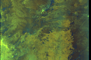
🛰️ Satellite Corroboration
Satellite imagery available but requires review
Preview available for manual review

Show Raw Evidence JSON
{
    "vessel_a": {
        "mmsi": 352002651,
        "imo": 9242338,
        "name": "MUMBAI",
        "flag": "PANAMA"
    },
    "vessel_b": {
        "mmsi": 352179000,
        "imo": 9413004,
        "name": "HORAE",
        "flag": "Panama"
    },
    "min_distance_m": 1.5,
    "avg_distance_m": 14.800000000000000710542735760100185871124267578125,
    "distance_consistency_m": 12.5,
    "duration_minutes": 34.10000000000000142108547152020037174224853515625,
    "overlap_duration_s": 2047,
    "speed_a_avg": 0.1700000000000000122124532708767219446599483489990234375,
    "speed_a_std": 0.409999999999999975575093458246556110680103302001953125,
    "speed_b_avg": 0.0299999999999999988897769753748434595763683319091796875,
    "speed_b_std": 0.08000000000000000166533453693773481063544750213623046875,
    "speed_summary": {
        "vessel_a": {
            "avg_sog": 0.1700000000000000122124532708767219446599483489990234375,
            "max_sog": 1
        },
        "vessel_b": {
            "avg_sog": 0.0299999999999999988897769753748434595763683319091796875,
            "max_sog": 0.200000000000000011102230246251565404236316680908203125
        }
    },
    "time_window": {
        "start": "2026-06-05T15:59:49+00:00",
        "end": "2026-06-05T16:33:56+00:00"
    },
    "points_count": {
        "vessel_a": 6,
        "vessel_b": 6
    },
    "zone_id": "discovered_138",
    "zone_name": "Eastern Mediterranean Surveillance Zone",
    "score": {
        "value": 72,
        "components": {
            "distance_tightness": {
                "score": 25,
                "max": 25,
                "detail": "Min distance 2m, avg 15m"
            },
            "duration": {
                "score": 5,
                "max": 25,
                "detail": "Duration 34 minutes"
            },
            "speed_stability": {
                "score": 17,
                "max": 20,
                "detail": "both nearly stationary; stable speeds"
            },
            "distance_consistency": {
                "score": 15,
                "max": 15,
                "detail": "Distance variance \u00b112m"
            },
            "isolation": {
                "score": 5,
                "max": 10,
                "detail": "Isolation data not available"
            },
            "context": {
                "score": 5,
                "max": 5,
                "detail": "In monitored zone: Eastern Mediterranean Surveillance Zone"
            }
        },
        "summary": "Moderate-confidence STS candidate. Two tankers (MUMBAI and HORAE) maintained close proximity (min 2m, avg 15m) for 34 minutes. Both vessels were slow-moving (avg speeds 0.2 and 0.0 knots). The stable separation distance suggests deliberate parallel positioning typical of cargo transfer. Event occurred in Eastern Mediterranean Surveillance Zone, a known STS activity area."
    },
    "sar": {
        "status": "inconclusive",
        "centroid": {
            "lat": 31.71714730000000059817466535605490207672119140625,
            "lon": 35.99935769999999735091478214599192142486572265625
        },
        "time_window": {
            "start_ts": "2026-06-05T15:50:13+00:00",
            "end_ts": "2026-06-05T16:33:56+00:00"
        },
        "searched_at": "2026-06-05T18:00:17.793533+00:00",
        "scene_id": "S1A_IW_GRDH_1SDV_20260605T153229_20260605T153254_064836_082B70_3862_COG",
        "scene_datetime": "2026-06-05T15:32:29.825574Z",
        "platform": "sentinel-1a",
        "bbox": {
            "min_lon": 35.8118630000000024438122636638581752777099609375,
            "min_lat": 30.863133999999998735574990860186517238616943359375,
            "max_lon": 38.8217240000000032296156859956681728363037109375,
            "max_lat": 32.77985000000000326281224261038005352020263671875
        },
        "assets": {
            "preview_url": "https:\/\/fleetleaks.com\/wp-content\/uploads\/fleetleaks-evidence\/sar-imagery\/2026\/06\/event_680292_thumbnail_20260605180021.png",
            "stored_path": "\/home\/fleetleaks\/public_html\/wp-content\/uploads\/fleetleaks-evidence\/sar-imagery\/2026\/06\/event_680292_thumbnail_20260605180021.png",
            "source": "copernicus_dataspace"
        },
        "notes": "Preview available for manual review"
    }
}- Minimum Distance: 1 meters
- Average Distance: 16 meters
- Duration: 42 minutes
- Period: 2026-06-05T15:50:13+00:00 to 2026-06-05T16:32:13+00:00
- Vessel A Avg Speed: 0.0 knots
- Vessel B Avg Speed: 0.0 knots
- Zone: Eastern Mediterranean Surveillance Zone
Confidence Analysis
Moderate-confidence STS candidate. Two tankers (HORAE and PERSEAS) maintained close proximity (min 1m, avg 16m) for 42 minutes. Both vessels were slow-moving (avg speeds 0.0 and 0.0 knots). The stable separation distance suggests deliberate parallel positioning typical of cargo transfer. Event occurred in Eastern Mediterranean Surveillance Zone, a known STS activity area.
View scoring breakdown
| Factor | Score | Detail |
|---|---|---|
| Distance Tightness | 25/25 | Min distance 1m, avg 16m |
| Duration | 5/25 | Duration 42 minutes |
| Speed Stability | 20/20 | both nearly stationary; very stable speeds |
| Distance Consistency | 15/15 | Distance variance ±9m |
| Isolation | 5/10 | Isolation data not available |
| Context | 5/5 | In monitored zone: Eastern Mediterranean Surveillance Zone |
🛰️ Satellite Corroboration
Satellite imagery available but requires review
Preview available for manual review

Show Raw Evidence JSON
{
    "vessel_a": {
        "mmsi": 352179000,
        "imo": 9413004,
        "name": "HORAE",
        "flag": "Panama"
    },
    "vessel_b": {
        "mmsi": 636026393,
        "imo": 9326811,
        "name": "PERSEAS",
        "flag": "LIBERIA"
    },
    "min_distance_m": 1,
    "avg_distance_m": 16.199999999999999289457264239899814128875732421875,
    "distance_consistency_m": 9.0999999999999996447286321199499070644378662109375,
    "duration_minutes": 42,
    "overlap_duration_s": 2520,
    "speed_a_avg": 0.0299999999999999988897769753748434595763683319091796875,
    "speed_a_std": 0.08000000000000000166533453693773481063544750213623046875,
    "speed_b_avg": 0.040000000000000000832667268468867405317723751068115234375,
    "speed_b_std": 0.05000000000000000277555756156289135105907917022705078125,
    "speed_summary": {
        "vessel_a": {
            "avg_sog": 0.0299999999999999988897769753748434595763683319091796875,
            "max_sog": 0.200000000000000011102230246251565404236316680908203125
        },
        "vessel_b": {
            "avg_sog": 0.040000000000000000832667268468867405317723751068115234375,
            "max_sog": 0.1000000000000000055511151231257827021181583404541015625
        }
    },
    "time_window": {
        "start": "2026-06-05T15:50:13+00:00",
        "end": "2026-06-05T16:32:13+00:00"
    },
    "points_count": {
        "vessel_a": 12,
        "vessel_b": 12
    },
    "zone_id": "discovered_138",
    "zone_name": "Eastern Mediterranean Surveillance Zone",
    "score": {
        "value": 75,
        "components": {
            "distance_tightness": {
                "score": 25,
                "max": 25,
                "detail": "Min distance 1m, avg 16m"
            },
            "duration": {
                "score": 5,
                "max": 25,
                "detail": "Duration 42 minutes"
            },
            "speed_stability": {
                "score": 20,
                "max": 20,
                "detail": "both nearly stationary; very stable speeds"
            },
            "distance_consistency": {
                "score": 15,
                "max": 15,
                "detail": "Distance variance \u00b19m"
            },
            "isolation": {
                "score": 5,
                "max": 10,
                "detail": "Isolation data not available"
            },
            "context": {
                "score": 5,
                "max": 5,
                "detail": "In monitored zone: Eastern Mediterranean Surveillance Zone"
            }
        },
        "summary": "Moderate-confidence STS candidate. Two tankers (HORAE and PERSEAS) maintained close proximity (min 1m, avg 16m) for 42 minutes. Both vessels were slow-moving (avg speeds 0.0 and 0.0 knots). The stable separation distance suggests deliberate parallel positioning typical of cargo transfer. Event occurred in Eastern Mediterranean Surveillance Zone, a known STS activity area."
    },
    "sar": {
        "status": "inconclusive",
        "centroid": {
            "lat": 31.717130000000000933368937694467604160308837890625,
            "lon": 35.9993180000000023710526875220239162445068359375
        },
        "time_window": {
            "start_ts": "2026-06-05T15:50:13+00:00",
            "end_ts": "2026-06-05T16:32:13+00:00"
        },
        "searched_at": "2026-06-05T18:30:18.763657+00:00",
        "scene_id": "S1A_IW_GRDH_1SDV_20260605T153229_20260605T153254_064836_082B70_3862_COG",
        "scene_datetime": "2026-06-05T15:32:29.825574Z",
        "platform": "sentinel-1a",
        "bbox": {
            "min_lon": 35.8118630000000024438122636638581752777099609375,
            "min_lat": 30.863133999999998735574990860186517238616943359375,
            "max_lon": 38.8217240000000032296156859956681728363037109375,
            "max_lat": 32.77985000000000326281224261038005352020263671875
        },
        "assets": {
            "preview_url": "https:\/\/fleetleaks.com\/wp-content\/uploads\/fleetleaks-evidence\/sar-imagery\/2026\/06\/event_680302_thumbnail_20260605183022.png",
            "stored_path": "\/home\/fleetleaks\/public_html\/wp-content\/uploads\/fleetleaks-evidence\/sar-imagery\/2026\/06\/event_680302_thumbnail_20260605183022.png",
            "source": "copernicus_dataspace"
        },
        "notes": "Preview available for manual review"
    }
}- Minimum Distance: 1 meters
- Average Distance: 12 meters
- Duration: 48 minutes
- Period: 2026-06-05T15:43:41+00:00 to 2026-06-05T16:32:13+00:00
- Vessel A Avg Speed: 0.0 knots
- Vessel B Avg Speed: 0.2 knots
- Zone: Eastern Mediterranean Surveillance Zone
Confidence Analysis
High-confidence STS candidate. Two tankers (HORAE and SEAGAS MAJOR) maintained close proximity (min 1m, avg 12m) for 48 minutes. Both vessels were slow-moving (avg speeds 0.0 and 0.2 knots). The stable separation distance suggests deliberate parallel positioning typical of cargo transfer. Event occurred in Eastern Mediterranean Surveillance Zone, a known STS activity area.
View scoring breakdown
| Factor | Score | Detail |
|---|---|---|
| Distance Tightness | 25/25 | Min distance 1m, avg 12m |
| Duration | 10/25 | Duration 48 minutes |
| Speed Stability | 20/20 | both nearly stationary; very stable speeds |
| Distance Consistency | 15/15 | Distance variance ±10m |
| Isolation | 5/10 | Isolation data not available |
| Context | 5/5 | In monitored zone: Eastern Mediterranean Surveillance Zone |
Show Raw Evidence JSON
{
    "vessel_a": {
        "mmsi": 352179000,
        "imo": 9413004,
        "name": "HORAE",
        "flag": "Panama"
    },
    "vessel_b": {
        "mmsi": 636016188,
        "imo": 9135793,
        "name": "SEAGAS MAJOR",
        "flag": "LIBERIA"
    },
    "min_distance_m": 0.6999999999999999555910790149937383830547332763671875,
    "avg_distance_m": 11.9000000000000003552713678800500929355621337890625,
    "distance_consistency_m": 9.9000000000000003552713678800500929355621337890625,
    "duration_minutes": 48.5,
    "overlap_duration_s": 2912,
    "speed_a_avg": 0.0299999999999999988897769753748434595763683319091796875,
    "speed_a_std": 0.070000000000000006661338147750939242541790008544921875,
    "speed_b_avg": 0.190000000000000002220446049250313080847263336181640625,
    "speed_b_std": 0.11999999999999999555910790149937383830547332763671875,
    "speed_summary": {
        "vessel_a": {
            "avg_sog": 0.0299999999999999988897769753748434595763683319091796875,
            "max_sog": 0.200000000000000011102230246251565404236316680908203125
        },
        "vessel_b": {
            "avg_sog": 0.190000000000000002220446049250313080847263336181640625,
            "max_sog": 0.40000000000000002220446049250313080847263336181640625
        }
    },
    "time_window": {
        "start": "2026-06-05T15:43:41+00:00",
        "end": "2026-06-05T16:32:13+00:00"
    },
    "points_count": {
        "vessel_a": 14,
        "vessel_b": 14
    },
    "zone_id": "discovered_138",
    "zone_name": "Eastern Mediterranean Surveillance Zone",
    "score": {
        "value": 80,
        "components": {
            "distance_tightness": {
                "score": 25,
                "max": 25,
                "detail": "Min distance 1m, avg 12m"
            },
            "duration": {
                "score": 10,
                "max": 25,
                "detail": "Duration 48 minutes"
            },
            "speed_stability": {
                "score": 20,
                "max": 20,
                "detail": "both nearly stationary; very stable speeds"
            },
            "distance_consistency": {
                "score": 15,
                "max": 15,
                "detail": "Distance variance \u00b110m"
            },
            "isolation": {
                "score": 5,
                "max": 10,
                "detail": "Isolation data not available"
            },
            "context": {
                "score": 5,
                "max": 5,
                "detail": "In monitored zone: Eastern Mediterranean Surveillance Zone"
            }
        },
        "summary": "High-confidence STS candidate. Two tankers (HORAE and SEAGAS MAJOR) maintained close proximity (min 1m, avg 12m) for 48 minutes. Both vessels were slow-moving (avg speeds 0.0 and 0.2 knots). The stable separation distance suggests deliberate parallel positioning typical of cargo transfer. Event occurred in Eastern Mediterranean Surveillance Zone, a known STS activity area."
    }
}- Minimum Distance: 2 meters
- Average Distance: 14 meters
- Duration: 34 minutes
- Period: 2026-06-05T15:43:41+00:00 to 2026-06-05T16:18:09+00:00
- Vessel A Avg Speed: 0.0 knots
- Vessel B Avg Speed: 0.0 knots
- Zone: Eastern Mediterranean Surveillance Zone
Confidence Analysis
Moderate-confidence STS candidate. Two tankers (HORAE and DENVER) maintained close proximity (min 2m, avg 14m) for 34 minutes. Both vessels were slow-moving (avg speeds 0.0 and 0.0 knots). The stable separation distance suggests deliberate parallel positioning typical of cargo transfer. Event occurred in Eastern Mediterranean Surveillance Zone, a known STS activity area.
View scoring breakdown
| Factor | Score | Detail |
|---|---|---|
| Distance Tightness | 25/25 | Min distance 2m, avg 14m |
| Duration | 5/25 | Duration 34 minutes |
| Speed Stability | 20/20 | both nearly stationary; very stable speeds |
| Distance Consistency | 15/15 | Distance variance ±10m |
| Isolation | 5/10 | Isolation data not available |
| Context | 5/5 | In monitored zone: Eastern Mediterranean Surveillance Zone |
🛰️ Satellite Corroboration
Satellite imagery available but requires review
Preview available for manual review

Show Raw Evidence JSON
{
    "vessel_a": {
        "mmsi": 352179000,
        "imo": 9413004,
        "name": "HORAE",
        "flag": "Panama"
    },
    "vessel_b": {
        "mmsi": 667001964,
        "imo": 9382712,
        "name": "DENVER",
        "flag": "SIERRA LEONE"
    },
    "min_distance_m": 1.899999999999999911182158029987476766109466552734375,
    "avg_distance_m": 13.5,
    "distance_consistency_m": 10.4000000000000003552713678800500929355621337890625,
    "duration_minutes": 34.5,
    "overlap_duration_s": 2068,
    "speed_a_avg": 0.0200000000000000004163336342344337026588618755340576171875,
    "speed_a_std": 0.070000000000000006661338147750939242541790008544921875,
    "speed_b_avg": 0.0299999999999999988897769753748434595763683319091796875,
    "speed_b_std": 0.05000000000000000277555756156289135105907917022705078125,
    "speed_summary": {
        "vessel_a": {
            "avg_sog": 0.0200000000000000004163336342344337026588618755340576171875,
            "max_sog": 0.200000000000000011102230246251565404236316680908203125
        },
        "vessel_b": {
            "avg_sog": 0.0299999999999999988897769753748434595763683319091796875,
            "max_sog": 0.1000000000000000055511151231257827021181583404541015625
        }
    },
    "time_window": {
        "start": "2026-06-05T15:43:41+00:00",
        "end": "2026-06-05T16:18:09+00:00"
    },
    "points_count": {
        "vessel_a": 9,
        "vessel_b": 9
    },
    "zone_id": "discovered_138",
    "zone_name": "Eastern Mediterranean Surveillance Zone",
    "score": {
        "value": 75,
        "components": {
            "distance_tightness": {
                "score": 25,
                "max": 25,
                "detail": "Min distance 2m, avg 14m"
            },
            "duration": {
                "score": 5,
                "max": 25,
                "detail": "Duration 34 minutes"
            },
            "speed_stability": {
                "score": 20,
                "max": 20,
                "detail": "both nearly stationary; very stable speeds"
            },
            "distance_consistency": {
                "score": 15,
                "max": 15,
                "detail": "Distance variance \u00b110m"
            },
            "isolation": {
                "score": 5,
                "max": 10,
                "detail": "Isolation data not available"
            },
            "context": {
                "score": 5,
                "max": 5,
                "detail": "In monitored zone: Eastern Mediterranean Surveillance Zone"
            }
        },
        "summary": "Moderate-confidence STS candidate. Two tankers (HORAE and DENVER) maintained close proximity (min 2m, avg 14m) for 34 minutes. Both vessels were slow-moving (avg speeds 0.0 and 0.0 knots). The stable separation distance suggests deliberate parallel positioning typical of cargo transfer. Event occurred in Eastern Mediterranean Surveillance Zone, a known STS activity area."
    },
    "sar": {
        "status": "inconclusive",
        "centroid": {
            "lat": 31.717119499999999021611074567772448062896728515625,
            "lon": 35.99933039999999806468622409738600254058837890625
        },
        "time_window": {
            "start_ts": "2026-06-05T15:43:41+00:00",
            "end_ts": "2026-06-05T16:18:09+00:00"
        },
        "searched_at": "2026-06-05T17:00:21.403316+00:00",
        "scene_id": "S1A_IW_GRDH_1SDV_20260605T153229_20260605T153254_064836_082B70_3862_COG",
        "scene_datetime": "2026-06-05T15:32:29.825574Z",
        "platform": "sentinel-1a",
        "bbox": {
            "min_lon": 35.8118630000000024438122636638581752777099609375,
            "min_lat": 30.863133999999998735574990860186517238616943359375,
            "max_lon": 38.8217240000000032296156859956681728363037109375,
            "max_lat": 32.77985000000000326281224261038005352020263671875
        },
        "assets": {
            "preview_url": "https:\/\/fleetleaks.com\/wp-content\/uploads\/fleetleaks-evidence\/sar-imagery\/2026\/06\/event_680220_thumbnail_20260605170025.png",
            "stored_path": "\/home\/fleetleaks\/public_html\/wp-content\/uploads\/fleetleaks-evidence\/sar-imagery\/2026\/06\/event_680220_thumbnail_20260605170025.png",
            "source": "copernicus_dataspace"
        },
        "notes": "Preview available for manual review"
    }
}- Minimum Distance: 3 meters
- Average Distance: 80 meters
- Duration: 48 minutes
- Period: 2026-06-05T15:43:41+00:00 to 2026-06-05T16:32:13+00:00
- Vessel A Avg Speed: 0.0 knots
- Vessel B Avg Speed: 0.1 knots
- Zone: Eastern Mediterranean Surveillance Zone
Confidence Analysis
Moderate-confidence STS candidate. Two tankers (HORAE and SAMBA) maintained close proximity (min 3m, avg 80m) for 48 minutes. Both vessels were slow-moving (avg speeds 0.0 and 0.1 knots). Event occurred in Eastern Mediterranean Surveillance Zone, a known STS activity area.
View scoring breakdown
| Factor | Score | Detail |
|---|---|---|
| Distance Tightness | 25/25 | Min distance 3m, avg 80m |
| Duration | 10/25 | Duration 48 minutes |
| Speed Stability | 20/20 | both nearly stationary; very stable speeds |
| Distance Consistency | 5/15 | Distance variance ±122m |
| Isolation | 5/10 | Isolation data not available |
| Context | 5/5 | In monitored zone: Eastern Mediterranean Surveillance Zone |
🛰️ Satellite Corroboration
Satellite imagery available but requires review
Preview available for manual review

Show Raw Evidence JSON
{
    "vessel_a": {
        "mmsi": 352179000,
        "imo": 9413004,
        "name": "HORAE",
        "flag": "Panama"
    },
    "vessel_b": {
        "mmsi": 538011921,
        "imo": 9310305,
        "name": "SAMBA",
        "flag": "Marshall Is"
    },
    "min_distance_m": 2.600000000000000088817841970012523233890533447265625,
    "avg_distance_m": 79.900000000000005684341886080801486968994140625,
    "distance_consistency_m": 121.900000000000005684341886080801486968994140625,
    "duration_minutes": 48.5,
    "overlap_duration_s": 2912,
    "speed_a_avg": 0.0299999999999999988897769753748434595763683319091796875,
    "speed_a_std": 0.070000000000000006661338147750939242541790008544921875,
    "speed_b_avg": 0.11000000000000000055511151231257827021181583404541015625,
    "speed_b_std": 0.2600000000000000088817841970012523233890533447265625,
    "speed_summary": {
        "vessel_a": {
            "avg_sog": 0.0299999999999999988897769753748434595763683319091796875,
            "max_sog": 0.200000000000000011102230246251565404236316680908203125
        },
        "vessel_b": {
            "avg_sog": 0.11000000000000000055511151231257827021181583404541015625,
            "max_sog": 1
        }
    },
    "time_window": {
        "start": "2026-06-05T15:43:41+00:00",
        "end": "2026-06-05T16:32:13+00:00"
    },
    "points_count": {
        "vessel_a": 14,
        "vessel_b": 14
    },
    "zone_id": "discovered_138",
    "zone_name": "Eastern Mediterranean Surveillance Zone",
    "score": {
        "value": 70,
        "components": {
            "distance_tightness": {
                "score": 25,
                "max": 25,
                "detail": "Min distance 3m, avg 80m"
            },
            "duration": {
                "score": 10,
                "max": 25,
                "detail": "Duration 48 minutes"
            },
            "speed_stability": {
                "score": 20,
                "max": 20,
                "detail": "both nearly stationary; very stable speeds"
            },
            "distance_consistency": {
                "score": 5,
                "max": 15,
                "detail": "Distance variance \u00b1122m"
            },
            "isolation": {
                "score": 5,
                "max": 10,
                "detail": "Isolation data not available"
            },
            "context": {
                "score": 5,
                "max": 5,
                "detail": "In monitored zone: Eastern Mediterranean Surveillance Zone"
            }
        },
        "summary": "Moderate-confidence STS candidate. Two tankers (HORAE and SAMBA) maintained close proximity (min 3m, avg 80m) for 48 minutes. Both vessels were slow-moving (avg speeds 0.0 and 0.1 knots). Event occurred in Eastern Mediterranean Surveillance Zone, a known STS activity area."
    },
    "sar": {
        "status": "inconclusive",
        "centroid": {
            "lat": 31.716901899999999869805833441205322742462158203125,
            "lon": 35.9998168999999990091964718885719776153564453125
        },
        "time_window": {
            "start_ts": "2026-06-05T15:43:41+00:00",
            "end_ts": "2026-06-05T16:32:13+00:00"
        },
        "searched_at": "2026-06-05T17:15:01.472058+00:00",
        "scene_id": "S1A_IW_GRDH_1SDV_20260605T153229_20260605T153254_064836_082B70_3862_COG",
        "scene_datetime": "2026-06-05T15:32:29.825574Z",
        "platform": "sentinel-1a",
        "bbox": {
            "min_lon": 35.8118630000000024438122636638581752777099609375,
            "min_lat": 30.863133999999998735574990860186517238616943359375,
            "max_lon": 38.8217240000000032296156859956681728363037109375,
            "max_lat": 32.77985000000000326281224261038005352020263671875
        },
        "assets": {
            "preview_url": "https:\/\/fleetleaks.com\/wp-content\/uploads\/fleetleaks-evidence\/sar-imagery\/2026\/06\/event_680221_thumbnail_20260605171505.png",
            "stored_path": "\/home\/fleetleaks\/public_html\/wp-content\/uploads\/fleetleaks-evidence\/sar-imagery\/2026\/06\/event_680221_thumbnail_20260605171505.png",
            "source": "copernicus_dataspace"
        },
        "notes": "Preview available for manual review"
    }
}- Minimum Distance: 1 meters
- Average Distance: 9 meters
- Duration: 44 minutes
- Period: 2026-06-05T15:43:41+00:00 to 2026-06-05T16:27:57+00:00
- Vessel A Avg Speed: 0.0 knots
- Vessel B Avg Speed: 0.1 knots
- Zone: Eastern Mediterranean Surveillance Zone
Confidence Analysis
Moderate-confidence STS candidate. Two tankers (HORAE and GAZ HORIZON) maintained close proximity (min 1m, avg 9m) for 44 minutes. Both vessels were slow-moving (avg speeds 0.0 and 0.1 knots). The stable separation distance suggests deliberate parallel positioning typical of cargo transfer. Event occurred in Eastern Mediterranean Surveillance Zone, a known STS activity area.
View scoring breakdown
| Factor | Score | Detail |
|---|---|---|
| Distance Tightness | 25/25 | Min distance 1m, avg 9m |
| Duration | 5/25 | Duration 44 minutes |
| Speed Stability | 20/20 | both nearly stationary; very stable speeds |
| Distance Consistency | 15/15 | Distance variance ±9m |
| Isolation | 5/10 | Isolation data not available |
| Context | 5/5 | In monitored zone: Eastern Mediterranean Surveillance Zone |
🛰️ Satellite Corroboration
Satellite imagery available but requires review
Preview available for manual review
Show Raw Evidence JSON
{
    "vessel_a": {
        "mmsi": 352179000,
        "imo": 9413004,
        "name": "HORAE",
        "flag": "Panama"
    },
    "vessel_b": {
        "mmsi": 538007915,
        "imo": 9572563,
        "name": "GAZ HORIZON",
        "flag": "Marshall Is"
    },
    "min_distance_m": 1.1999999999999999555910790149937383830547332763671875,
    "avg_distance_m": 8.699999999999999289457264239899814128875732421875,
    "distance_consistency_m": 8.800000000000000710542735760100185871124267578125,
    "duration_minutes": 44.2999999999999971578290569595992565155029296875,
    "overlap_duration_s": 2656,
    "speed_a_avg": 0.0299999999999999988897769753748434595763683319091796875,
    "speed_a_std": 0.08000000000000000166533453693773481063544750213623046875,
    "speed_b_avg": 0.05000000000000000277555756156289135105907917022705078125,
    "speed_b_std": 0.14000000000000001332267629550187848508358001708984375,
    "speed_summary": {
        "vessel_a": {
            "avg_sog": 0.0299999999999999988897769753748434595763683319091796875,
            "max_sog": 0.200000000000000011102230246251565404236316680908203125
        },
        "vessel_b": {
            "avg_sog": 0.05000000000000000277555756156289135105907917022705078125,
            "max_sog": 0.5
        }
    },
    "time_window": {
        "start": "2026-06-05T15:43:41+00:00",
        "end": "2026-06-05T16:27:57+00:00"
    },
    "points_count": {
        "vessel_a": 13,
        "vessel_b": 13
    },
    "zone_id": "discovered_138",
    "zone_name": "Eastern Mediterranean Surveillance Zone",
    "score": {
        "value": 75,
        "components": {
            "distance_tightness": {
                "score": 25,
                "max": 25,
                "detail": "Min distance 1m, avg 9m"
            },
            "duration": {
                "score": 5,
                "max": 25,
                "detail": "Duration 44 minutes"
            },
            "speed_stability": {
                "score": 20,
                "max": 20,
                "detail": "both nearly stationary; very stable speeds"
            },
            "distance_consistency": {
                "score": 15,
                "max": 15,
                "detail": "Distance variance \u00b19m"
            },
            "isolation": {
                "score": 5,
                "max": 10,
                "detail": "Isolation data not available"
            },
            "context": {
                "score": 5,
                "max": 5,
                "detail": "In monitored zone: Eastern Mediterranean Surveillance Zone"
            }
        },
        "summary": "Moderate-confidence STS candidate. Two tankers (HORAE and GAZ HORIZON) maintained close proximity (min 1m, avg 9m) for 44 minutes. Both vessels were slow-moving (avg speeds 0.0 and 0.1 knots). The stable separation distance suggests deliberate parallel positioning typical of cargo transfer. Event occurred in Eastern Mediterranean Surveillance Zone, a known STS activity area."
    },
    "sar": {
        "status": "inconclusive",
        "centroid": {
            "lat": 31.71713129999999836172719369642436504364013671875,
            "lon": 35.99935289999999810106601216830313205718994140625
        },
        "time_window": {
            "start_ts": "2026-06-05T15:43:41+00:00",
            "end_ts": "2026-06-05T16:27:57+00:00"
        },
        "searched_at": "2026-06-05T17:15:06.750694+00:00",
        "scene_id": "S1A_IW_GRDH_1SDV_20260605T153229_20260605T153254_064836_082B70_3862_COG",
        "scene_datetime": "2026-06-05T15:32:29.825574Z",
        "platform": "sentinel-1a",
        "bbox": {
            "min_lon": 35.8118630000000024438122636638581752777099609375,
            "min_lat": 30.863133999999998735574990860186517238616943359375,
            "max_lon": 38.8217240000000032296156859956681728363037109375,
            "max_lat": 32.77985000000000326281224261038005352020263671875
        },
        "assets": {
            "preview_url": "https:\/\/fleetleaks.com\/wp-content\/uploads\/fleetleaks-evidence\/sar-imagery\/2026\/06\/event_680222_thumbnail_20260605171510.png",
            "stored_path": "\/home\/fleetleaks\/public_html\/wp-content\/uploads\/fleetleaks-evidence\/sar-imagery\/2026\/06\/event_680222_thumbnail_20260605171510.png",
            "source": "copernicus_dataspace"
        },
        "notes": "Preview available for manual review"
    }
}- Minimum Distance: 2 meters
- Average Distance: 14 meters
- Duration: 48 minutes
- Period: 2026-06-05T15:43:41+00:00 to 2026-06-05T16:32:13+00:00
- Vessel A Avg Speed: 0.0 knots
- Vessel B Avg Speed: 0.0 knots
- Zone: Eastern Mediterranean Surveillance Zone
Confidence Analysis
High-confidence STS candidate. Two tankers (HORAE and BLUE ROSE) maintained close proximity (min 2m, avg 14m) for 48 minutes. Both vessels were slow-moving (avg speeds 0.0 and 0.0 knots). The stable separation distance suggests deliberate parallel positioning typical of cargo transfer. Event occurred in Eastern Mediterranean Surveillance Zone, a known STS activity area.
View scoring breakdown
| Factor | Score | Detail |
|---|---|---|
| Distance Tightness | 25/25 | Min distance 2m, avg 14m |
| Duration | 10/25 | Duration 48 minutes |
| Speed Stability | 20/20 | both nearly stationary; very stable speeds |
| Distance Consistency | 15/15 | Distance variance ±19m |
| Isolation | 5/10 | Isolation data not available |
| Context | 5/5 | In monitored zone: Eastern Mediterranean Surveillance Zone |
🛰️ Satellite Corroboration
Satellite imagery available but requires review
Preview available for manual review

Show Raw Evidence JSON
{
    "vessel_a": {
        "mmsi": 352179000,
        "imo": 9413004,
        "name": "HORAE",
        "flag": "Panama"
    },
    "vessel_b": {
        "mmsi": 538002561,
        "imo": 9335915,
        "name": "BLUE ROSE",
        "flag": "MARSHALL ISLANDS"
    },
    "min_distance_m": 1.5,
    "avg_distance_m": 14.0999999999999996447286321199499070644378662109375,
    "distance_consistency_m": 18.60000000000000142108547152020037174224853515625,
    "duration_minutes": 48.5,
    "overlap_duration_s": 2912,
    "speed_a_avg": 0.0299999999999999988897769753748434595763683319091796875,
    "speed_a_std": 0.070000000000000006661338147750939242541790008544921875,
    "speed_b_avg": 0.01000000000000000020816681711721685132943093776702880859375,
    "speed_b_std": 0.040000000000000000832667268468867405317723751068115234375,
    "speed_summary": {
        "vessel_a": {
            "avg_sog": 0.0299999999999999988897769753748434595763683319091796875,
            "max_sog": 0.200000000000000011102230246251565404236316680908203125
        },
        "vessel_b": {
            "avg_sog": 0.01000000000000000020816681711721685132943093776702880859375,
            "max_sog": 0.1000000000000000055511151231257827021181583404541015625
        }
    },
    "time_window": {
        "start": "2026-06-05T15:43:41+00:00",
        "end": "2026-06-05T16:32:13+00:00"
    },
    "points_count": {
        "vessel_a": 14,
        "vessel_b": 14
    },
    "zone_id": "discovered_138",
    "zone_name": "Eastern Mediterranean Surveillance Zone",
    "score": {
        "value": 80,
        "components": {
            "distance_tightness": {
                "score": 25,
                "max": 25,
                "detail": "Min distance 2m, avg 14m"
            },
            "duration": {
                "score": 10,
                "max": 25,
                "detail": "Duration 48 minutes"
            },
            "speed_stability": {
                "score": 20,
                "max": 20,
                "detail": "both nearly stationary; very stable speeds"
            },
            "distance_consistency": {
                "score": 15,
                "max": 15,
                "detail": "Distance variance \u00b119m"
            },
            "isolation": {
                "score": 5,
                "max": 10,
                "detail": "Isolation data not available"
            },
            "context": {
                "score": 5,
                "max": 5,
                "detail": "In monitored zone: Eastern Mediterranean Surveillance Zone"
            }
        },
        "summary": "High-confidence STS candidate. Two tankers (HORAE and BLUE ROSE) maintained close proximity (min 2m, avg 14m) for 48 minutes. Both vessels were slow-moving (avg speeds 0.0 and 0.0 knots). The stable separation distance suggests deliberate parallel positioning typical of cargo transfer. Event occurred in Eastern Mediterranean Surveillance Zone, a known STS activity area."
    },
    "sar": {
        "status": "inconclusive",
        "centroid": {
            "lat": 31.717101799999998235080056474544107913970947265625,
            "lon": 35.99937849999999883721102378331124782562255859375
        },
        "time_window": {
            "start_ts": "2026-06-05T15:43:41+00:00",
            "end_ts": "2026-06-05T16:32:13+00:00"
        },
        "searched_at": "2026-06-05T17:15:11.151878+00:00",
        "scene_id": "S1A_IW_GRDH_1SDV_20260605T153229_20260605T153254_064836_082B70_3862_COG",
        "scene_datetime": "2026-06-05T15:32:29.825574Z",
        "platform": "sentinel-1a",
        "bbox": {
            "min_lon": 35.8118630000000024438122636638581752777099609375,
            "min_lat": 30.863133999999998735574990860186517238616943359375,
            "max_lon": 38.8217240000000032296156859956681728363037109375,
            "max_lat": 32.77985000000000326281224261038005352020263671875
        },
        "assets": {
            "preview_url": "https:\/\/fleetleaks.com\/wp-content\/uploads\/fleetleaks-evidence\/sar-imagery\/2026\/06\/event_680223_thumbnail_20260605171514.png",
            "stored_path": "\/home\/fleetleaks\/public_html\/wp-content\/uploads\/fleetleaks-evidence\/sar-imagery\/2026\/06\/event_680223_thumbnail_20260605171514.png",
            "source": "copernicus_dataspace"
        },
        "notes": "Preview available for manual review"
    }
}- Minimum Distance: 1 meters
- Average Distance: 10 meters
- Duration: 34 minutes
- Period: 2026-06-05T15:47:59+00:00 to 2026-06-05T16:22:01+00:00
- Vessel A Avg Speed: 0.1 knots
- Vessel B Avg Speed: 0.0 knots
- Zone: Eastern Mediterranean Surveillance Zone
Confidence Analysis
Moderate-confidence STS candidate. Two tankers (CRYSTAL ODYSSEY and HORAE) maintained close proximity (min 1m, avg 10m) for 34 minutes. Both vessels were slow-moving (avg speeds 0.1 and 0.0 knots). The stable separation distance suggests deliberate parallel positioning typical of cargo transfer. Event occurred in Eastern Mediterranean Surveillance Zone, a known STS activity area.
View scoring breakdown
| Factor | Score | Detail |
|---|---|---|
| Distance Tightness | 25/25 | Min distance 1m, avg 10m |
| Duration | 5/25 | Duration 34 minutes |
| Speed Stability | 20/20 | both nearly stationary; very stable speeds |
| Distance Consistency | 15/15 | Distance variance ±12m |
| Isolation | 5/10 | Isolation data not available |
| Context | 5/5 | In monitored zone: Eastern Mediterranean Surveillance Zone |
🛰️ Satellite Corroboration
Satellite imagery available but requires review
Preview available for manual review

Show Raw Evidence JSON
{
    "vessel_a": {
        "mmsi": 563259200,
        "imo": 9997177,
        "name": "CRYSTAL ODYSSEY",
        "flag": "SINGAPORE"
    },
    "vessel_b": {
        "mmsi": 352179000,
        "imo": 9413004,
        "name": "HORAE",
        "flag": "Panama"
    },
    "min_distance_m": 0.59999999999999997779553950749686919152736663818359375,
    "avg_distance_m": 9.9000000000000003552713678800500929355621337890625,
    "distance_consistency_m": 12.0999999999999996447286321199499070644378662109375,
    "duration_minutes": 34,
    "overlap_duration_s": 2042,
    "speed_a_avg": 0.08000000000000000166533453693773481063544750213623046875,
    "speed_a_std": 0.200000000000000011102230246251565404236316680908203125,
    "speed_b_avg": 0,
    "speed_b_std": 0,
    "speed_summary": {
        "vessel_a": {
            "avg_sog": 0.08000000000000000166533453693773481063544750213623046875,
            "max_sog": 0.5
        },
        "vessel_b": {
            "avg_sog": 0,
            "max_sog": 0
        }
    },
    "time_window": {
        "start": "2026-06-05T15:47:59+00:00",
        "end": "2026-06-05T16:22:01+00:00"
    },
    "points_count": {
        "vessel_a": 6,
        "vessel_b": 6
    },
    "zone_id": "discovered_138",
    "zone_name": "Eastern Mediterranean Surveillance Zone",
    "score": {
        "value": 75,
        "components": {
            "distance_tightness": {
                "score": 25,
                "max": 25,
                "detail": "Min distance 1m, avg 10m"
            },
            "duration": {
                "score": 5,
                "max": 25,
                "detail": "Duration 34 minutes"
            },
            "speed_stability": {
                "score": 20,
                "max": 20,
                "detail": "both nearly stationary; very stable speeds"
            },
            "distance_consistency": {
                "score": 15,
                "max": 15,
                "detail": "Distance variance \u00b112m"
            },
            "isolation": {
                "score": 5,
                "max": 10,
                "detail": "Isolation data not available"
            },
            "context": {
                "score": 5,
                "max": 5,
                "detail": "In monitored zone: Eastern Mediterranean Surveillance Zone"
            }
        },
        "summary": "Moderate-confidence STS candidate. Two tankers (CRYSTAL ODYSSEY and HORAE) maintained close proximity (min 1m, avg 10m) for 34 minutes. Both vessels were slow-moving (avg speeds 0.1 and 0.0 knots). The stable separation distance suggests deliberate parallel positioning typical of cargo transfer. Event occurred in Eastern Mediterranean Surveillance Zone, a known STS activity area."
    },
    "sar": {
        "status": "inconclusive",
        "centroid": {
            "lat": 31.717132299999999389683580375276505947113037109375,
            "lon": 35.99936629999999837536961422301828861236572265625
        },
        "time_window": {
            "start_ts": "2026-06-05T15:43:41+00:00",
            "end_ts": "2026-06-05T16:22:01+00:00"
        },
        "searched_at": "2026-06-05T18:00:13.246806+00:00",
        "scene_id": "S1A_IW_GRDH_1SDV_20260605T153229_20260605T153254_064836_082B70_3862_COG",
        "scene_datetime": "2026-06-05T15:32:29.825574Z",
        "platform": "sentinel-1a",
        "bbox": {
            "min_lon": 35.8118630000000024438122636638581752777099609375,
            "min_lat": 30.863133999999998735574990860186517238616943359375,
            "max_lon": 38.8217240000000032296156859956681728363037109375,
            "max_lat": 32.77985000000000326281224261038005352020263671875
        },
        "assets": {
            "preview_url": "https:\/\/fleetleaks.com\/wp-content\/uploads\/fleetleaks-evidence\/sar-imagery\/2026\/06\/event_680291_thumbnail_20260605180016.png",
            "stored_path": "\/home\/fleetleaks\/public_html\/wp-content\/uploads\/fleetleaks-evidence\/sar-imagery\/2026\/06\/event_680291_thumbnail_20260605180016.png",
            "source": "copernicus_dataspace"
        },
        "notes": "Preview available for manual review"
    }
}- Minimum Distance: 1 meters
- Average Distance: 9 meters
- Duration: 48 minutes
- Period: 2026-06-05T15:43:41+00:00 to 2026-06-05T16:32:13+00:00
- Vessel A Avg Speed: 0.0 knots
- Vessel B Avg Speed: 0.1 knots
- Zone: Eastern Mediterranean Surveillance Zone
Confidence Analysis
High-confidence STS candidate. Two tankers (HORAE and BOBCAT) maintained close proximity (min 1m, avg 9m) for 48 minutes. Both vessels were slow-moving (avg speeds 0.0 and 0.1 knots). The stable separation distance suggests deliberate parallel positioning typical of cargo transfer. Event occurred in Eastern Mediterranean Surveillance Zone, a known STS activity area.
View scoring breakdown
| Factor | Score | Detail |
|---|---|---|
| Distance Tightness | 25/25 | Min distance 1m, avg 9m |
| Duration | 10/25 | Duration 48 minutes |
| Speed Stability | 20/20 | both nearly stationary; very stable speeds |
| Distance Consistency | 15/15 | Distance variance ±10m |
| Isolation | 5/10 | Isolation data not available |
| Context | 5/5 | In monitored zone: Eastern Mediterranean Surveillance Zone |
🛰️ Satellite Corroboration
Satellite imagery available but requires review
Preview available for manual review

Show Raw Evidence JSON
{
    "vessel_a": {
        "mmsi": 352179000,
        "imo": 9413004,
        "name": "HORAE",
        "flag": "Panama"
    },
    "vessel_b": {
        "mmsi": 461000234,
        "imo": 9422457,
        "name": "BOBCAT",
        "flag": "Oman"
    },
    "min_distance_m": 1,
    "avg_distance_m": 9.4000000000000003552713678800500929355621337890625,
    "distance_consistency_m": 9.699999999999999289457264239899814128875732421875,
    "duration_minutes": 48.5,
    "overlap_duration_s": 2912,
    "speed_a_avg": 0.0299999999999999988897769753748434595763683319091796875,
    "speed_a_std": 0.070000000000000006661338147750939242541790008544921875,
    "speed_b_avg": 0.0899999999999999966693309261245303787291049957275390625,
    "speed_b_std": 0.1499999999999999944488848768742172978818416595458984375,
    "speed_summary": {
        "vessel_a": {
            "avg_sog": 0.0299999999999999988897769753748434595763683319091796875,
            "max_sog": 0.200000000000000011102230246251565404236316680908203125
        },
        "vessel_b": {
            "avg_sog": 0.0899999999999999966693309261245303787291049957275390625,
            "max_sog": 0.40000000000000002220446049250313080847263336181640625
        }
    },
    "time_window": {
        "start": "2026-06-05T15:43:41+00:00",
        "end": "2026-06-05T16:32:13+00:00"
    },
    "points_count": {
        "vessel_a": 14,
        "vessel_b": 14
    },
    "zone_id": "discovered_138",
    "zone_name": "Eastern Mediterranean Surveillance Zone",
    "score": {
        "value": 80,
        "components": {
            "distance_tightness": {
                "score": 25,
                "max": 25,
                "detail": "Min distance 1m, avg 9m"
            },
            "duration": {
                "score": 10,
                "max": 25,
                "detail": "Duration 48 minutes"
            },
            "speed_stability": {
                "score": 20,
                "max": 20,
                "detail": "both nearly stationary; very stable speeds"
            },
            "distance_consistency": {
                "score": 15,
                "max": 15,
                "detail": "Distance variance \u00b110m"
            },
            "isolation": {
                "score": 5,
                "max": 10,
                "detail": "Isolation data not available"
            },
            "context": {
                "score": 5,
                "max": 5,
                "detail": "In monitored zone: Eastern Mediterranean Surveillance Zone"
            }
        },
        "summary": "High-confidence STS candidate. Two tankers (HORAE and BOBCAT) maintained close proximity (min 1m, avg 9m) for 48 minutes. Both vessels were slow-moving (avg speeds 0.0 and 0.1 knots). The stable separation distance suggests deliberate parallel positioning typical of cargo transfer. Event occurred in Eastern Mediterranean Surveillance Zone, a known STS activity area."
    },
    "sar": {
        "status": "inconclusive",
        "centroid": {
            "lat": 31.71712839999999999918145476840436458587646484375,
            "lon": 35.9993733000000020183506421744823455810546875
        },
        "time_window": {
            "start_ts": "2026-06-05T15:43:41+00:00",
            "end_ts": "2026-06-05T16:32:13+00:00"
        },
        "searched_at": "2026-06-05T18:15:01.434555+00:00",
        "scene_id": "S1A_IW_GRDH_1SDV_20260605T153229_20260605T153254_064836_082B70_3862_COG",
        "scene_datetime": "2026-06-05T15:32:29.825574Z",
        "platform": "sentinel-1a",
        "bbox": {
            "min_lon": 35.8118630000000024438122636638581752777099609375,
            "min_lat": 30.863133999999998735574990860186517238616943359375,
            "max_lon": 38.8217240000000032296156859956681728363037109375,
            "max_lat": 32.77985000000000326281224261038005352020263671875
        },
        "assets": {
            "preview_url": "https:\/\/fleetleaks.com\/wp-content\/uploads\/fleetleaks-evidence\/sar-imagery\/2026\/06\/event_680293_thumbnail_20260605181506.png",
            "stored_path": "\/home\/fleetleaks\/public_html\/wp-content\/uploads\/fleetleaks-evidence\/sar-imagery\/2026\/06\/event_680293_thumbnail_20260605181506.png",
            "source": "copernicus_dataspace"
        },
        "notes": "Preview available for manual review"
    }
}- Zone: Eastern Mediterranean Surveillance Zone
- Duration: 1 hours
- Data Points: 21 AIS positions
- Period: 2026-06-05T15:43:41+00:00 to 2026-06-05T16:44:12+00:00
Show Raw Evidence JSON
{
    "zone_id": "discovered_138",
    "zone_name": "Eastern Mediterranean Surveillance Zone",
    "dwell_minutes": 60.5,
    "points_in_zone": 21,
    "first_point": {
        "ts": "2026-06-05T15:43:41+00:00",
        "lat": 31.71711669999999827496139914728701114654541015625,
        "lon": 35.99936670000000304980858345516026020050048828125
    },
    "last_point": {
        "ts": "2026-06-05T16:44:12+00:00",
        "lat": 31.715316699999998917292032274417579174041748046875,
        "lon": 35.9987167000000027883288566954433917999267578125
    }
}- Minimum Distance: 48 meters
- Average Distance: 113 meters
- Duration: 48 minutes
- Period: 2026-06-05T15:43:10+00:00 to 2026-06-05T16:31:09+00:00
- Vessel A Avg Speed: 0.2 knots
- Vessel B Avg Speed: 0.0 knots
- Zone: Eastern Mediterranean Surveillance Zone
Confidence Analysis
Moderate-confidence STS candidate. Two tankers (AHINOS and HORAE) maintained close proximity (min 48m, avg 113m) for 48 minutes. Both vessels were slow-moving (avg speeds 0.2 and 0.0 knots). Moderate distance variation observed during the encounter. Event occurred in Eastern Mediterranean Surveillance Zone, a known STS activity area.
View scoring breakdown
| Factor | Score | Detail |
|---|---|---|
| Distance Tightness | 25/25 | Min distance 48m, avg 113m |
| Duration | 10/25 | Duration 48 minutes |
| Speed Stability | 20/20 | both nearly stationary; very stable speeds |
| Distance Consistency | 8/15 | Distance variance ±57m |
| Isolation | 5/10 | Isolation data not available |
| Context | 5/5 | In monitored zone: Eastern Mediterranean Surveillance Zone |
🛰️ Satellite Corroboration
Satellite imagery available but requires review
Preview available for manual review

Show Raw Evidence JSON
{
    "vessel_a": {
        "mmsi": 636024537,
        "imo": 9328144,
        "name": "AHINOS",
        "flag": "Liberia"
    },
    "vessel_b": {
        "mmsi": 352179000,
        "imo": 9413004,
        "name": "HORAE",
        "flag": "Panama"
    },
    "min_distance_m": 48.10000000000000142108547152020037174224853515625,
    "avg_distance_m": 112.900000000000005684341886080801486968994140625,
    "distance_consistency_m": 57,
    "duration_minutes": 48,
    "overlap_duration_s": 2879,
    "speed_a_avg": 0.1600000000000000033306690738754696212708950042724609375,
    "speed_a_std": 0.25,
    "speed_b_avg": 0,
    "speed_b_std": 0,
    "speed_summary": {
        "vessel_a": {
            "avg_sog": 0.1600000000000000033306690738754696212708950042724609375,
            "max_sog": 0.59999999999999997779553950749686919152736663818359375
        },
        "vessel_b": {
            "avg_sog": 0,
            "max_sog": 0
        }
    },
    "time_window": {
        "start": "2026-06-05T15:43:10+00:00",
        "end": "2026-06-05T16:31:09+00:00"
    },
    "points_count": {
        "vessel_a": 5,
        "vessel_b": 5
    },
    "zone_id": "discovered_138",
    "zone_name": "Eastern Mediterranean Surveillance Zone",
    "score": {
        "value": 73,
        "components": {
            "distance_tightness": {
                "score": 25,
                "max": 25,
                "detail": "Min distance 48m, avg 113m"
            },
            "duration": {
                "score": 10,
                "max": 25,
                "detail": "Duration 48 minutes"
            },
            "speed_stability": {
                "score": 20,
                "max": 20,
                "detail": "both nearly stationary; very stable speeds"
            },
            "distance_consistency": {
                "score": 8,
                "max": 15,
                "detail": "Distance variance \u00b157m"
            },
            "isolation": {
                "score": 5,
                "max": 10,
                "detail": "Isolation data not available"
            },
            "context": {
                "score": 5,
                "max": 5,
                "detail": "In monitored zone: Eastern Mediterranean Surveillance Zone"
            }
        },
        "summary": "Moderate-confidence STS candidate. Two tankers (AHINOS and HORAE) maintained close proximity (min 48m, avg 113m) for 48 minutes. Both vessels were slow-moving (avg speeds 0.2 and 0.0 knots). Moderate distance variation observed during the encounter. Event occurred in Eastern Mediterranean Surveillance Zone, a known STS activity area."
    },
    "sar": {
        "status": "inconclusive",
        "centroid": {
            "lat": 31.717409700000001038233676808886229991912841796875,
            "lon": 35.99919849999999854617271921597421169281005859375
        },
        "time_window": {
            "start_ts": "2026-06-05T15:43:10+00:00",
            "end_ts": "2026-06-05T16:31:09+00:00"
        },
        "searched_at": "2026-06-05T21:30:14.335531+00:00",
        "scene_id": "S1A_IW_GRDH_1SDV_20260605T153229_20260605T153254_064836_082B70_3862_COG",
        "scene_datetime": "2026-06-05T15:32:29.825574Z",
        "platform": "sentinel-1a",
        "bbox": {
            "min_lon": 35.8118630000000024438122636638581752777099609375,
            "min_lat": 30.863133999999998735574990860186517238616943359375,
            "max_lon": 38.8217240000000032296156859956681728363037109375,
            "max_lat": 32.77985000000000326281224261038005352020263671875
        },
        "assets": {
            "preview_url": "https:\/\/fleetleaks.com\/wp-content\/uploads\/fleetleaks-evidence\/sar-imagery\/2026\/06\/event_681517_thumbnail_20260605213017.png",
            "stored_path": "\/home\/fleetleaks\/public_html\/wp-content\/uploads\/fleetleaks-evidence\/sar-imagery\/2026\/06\/event_681517_thumbnail_20260605213017.png",
            "source": "copernicus_dataspace"
        },
        "notes": "Preview available for manual review"
    }
}- Minimum Distance: 1 meters
- Average Distance: 8 meters
- Duration: 34 minutes
- Period: 2026-06-05T15:43:41+00:00 to 2026-06-05T16:18:09+00:00
- Vessel A Avg Speed: 0.0 knots
- Vessel B Avg Speed: 0.0 knots
- Zone: Eastern Mediterranean Surveillance Zone
Confidence Analysis
Moderate-confidence STS candidate. Two tankers (HORAE and NEW LEGEND) maintained close proximity (min 1m, avg 8m) for 34 minutes. Both vessels were slow-moving (avg speeds 0.0 and 0.0 knots). The stable separation distance suggests deliberate parallel positioning typical of cargo transfer. Event occurred in Eastern Mediterranean Surveillance Zone, a known STS activity area.
View scoring breakdown
| Factor | Score | Detail |
|---|---|---|
| Distance Tightness | 25/25 | Min distance 1m, avg 8m |
| Duration | 5/25 | Duration 34 minutes |
| Speed Stability | 20/20 | both nearly stationary; very stable speeds |
| Distance Consistency | 15/15 | Distance variance ±10m |
| Isolation | 5/10 | Isolation data not available |
| Context | 5/5 | In monitored zone: Eastern Mediterranean Surveillance Zone |
🛰️ Satellite Corroboration
Satellite imagery available but requires review
Preview available for manual review

Show Raw Evidence JSON
{
    "vessel_a": {
        "mmsi": 352179000,
        "imo": 9413004,
        "name": "HORAE",
        "flag": "Panama"
    },
    "vessel_b": {
        "mmsi": 636017774,
        "imo": 9230505,
        "name": "NEW LEGEND",
        "flag": "Liberia"
    },
    "min_distance_m": 1.100000000000000088817841970012523233890533447265625,
    "avg_distance_m": 8.199999999999999289457264239899814128875732421875,
    "distance_consistency_m": 9.5999999999999996447286321199499070644378662109375,
    "duration_minutes": 34.5,
    "overlap_duration_s": 2068,
    "speed_a_avg": 0.0200000000000000004163336342344337026588618755340576171875,
    "speed_a_std": 0.070000000000000006661338147750939242541790008544921875,
    "speed_b_avg": 0.01000000000000000020816681711721685132943093776702880859375,
    "speed_b_std": 0.0299999999999999988897769753748434595763683319091796875,
    "speed_summary": {
        "vessel_a": {
            "avg_sog": 0.0200000000000000004163336342344337026588618755340576171875,
            "max_sog": 0.200000000000000011102230246251565404236316680908203125
        },
        "vessel_b": {
            "avg_sog": 0.01000000000000000020816681711721685132943093776702880859375,
            "max_sog": 0.1000000000000000055511151231257827021181583404541015625
        }
    },
    "time_window": {
        "start": "2026-06-05T15:43:41+00:00",
        "end": "2026-06-05T16:18:09+00:00"
    },
    "points_count": {
        "vessel_a": 9,
        "vessel_b": 9
    },
    "zone_id": "discovered_138",
    "zone_name": "Eastern Mediterranean Surveillance Zone",
    "score": {
        "value": 75,
        "components": {
            "distance_tightness": {
                "score": 25,
                "max": 25,
                "detail": "Min distance 1m, avg 8m"
            },
            "duration": {
                "score": 5,
                "max": 25,
                "detail": "Duration 34 minutes"
            },
            "speed_stability": {
                "score": 20,
                "max": 20,
                "detail": "both nearly stationary; very stable speeds"
            },
            "distance_consistency": {
                "score": 15,
                "max": 15,
                "detail": "Distance variance \u00b110m"
            },
            "isolation": {
                "score": 5,
                "max": 10,
                "detail": "Isolation data not available"
            },
            "context": {
                "score": 5,
                "max": 5,
                "detail": "In monitored zone: Eastern Mediterranean Surveillance Zone"
            }
        },
        "summary": "Moderate-confidence STS candidate. Two tankers (HORAE and NEW LEGEND) maintained close proximity (min 1m, avg 8m) for 34 minutes. Both vessels were slow-moving (avg speeds 0.0 and 0.0 knots). The stable separation distance suggests deliberate parallel positioning typical of cargo transfer. Event occurred in Eastern Mediterranean Surveillance Zone, a known STS activity area."
    },
    "sar": {
        "status": "inconclusive",
        "centroid": {
            "lat": 31.71714779999999933579601929523050785064697265625,
            "lon": 35.99936420000000225627445615828037261962890625
        },
        "time_window": {
            "start_ts": "2026-06-05T15:42:54+00:00",
            "end_ts": "2026-06-05T16:18:09+00:00"
        },
        "searched_at": "2026-06-05T17:00:07.540900+00:00",
        "scene_id": "S1A_IW_GRDH_1SDV_20260605T153229_20260605T153254_064836_082B70_3862_COG",
        "scene_datetime": "2026-06-05T15:32:29.825574Z",
        "platform": "sentinel-1a",
        "bbox": {
            "min_lon": 35.8118630000000024438122636638581752777099609375,
            "min_lat": 30.863133999999998735574990860186517238616943359375,
            "max_lon": 38.8217240000000032296156859956681728363037109375,
            "max_lat": 32.77985000000000326281224261038005352020263671875
        },
        "assets": {
            "preview_url": "https:\/\/fleetleaks.com\/wp-content\/uploads\/fleetleaks-evidence\/sar-imagery\/2026\/06\/event_680217_thumbnail_20260605170011.png",
            "stored_path": "\/home\/fleetleaks\/public_html\/wp-content\/uploads\/fleetleaks-evidence\/sar-imagery\/2026\/06\/event_680217_thumbnail_20260605170011.png",
            "source": "copernicus_dataspace"
        },
        "notes": "Preview available for manual review"
    }
}- Zone: Eastern Mediterranean Monitoring Zone
- Duration: 1h 18m
- Data Points: 12 AIS positions
- Period: 2026-06-05T14:22:22+00:00 to 2026-06-05T15:41:11+00:00
Show Raw Evidence JSON
{
    "zone_id": "discovered_020",
    "zone_name": "Eastern Mediterranean Monitoring Zone",
    "dwell_minutes": 78.7999999999999971578290569595992565155029296875,
    "points_in_zone": 12,
    "first_point": {
        "ts": "2026-06-05T14:22:22+00:00",
        "lat": 31.6177500000000009094947017729282379150390625,
        "lon": 32.34936669999999736546669737435877323150634765625
    },
    "last_point": {
        "ts": "2026-06-05T15:41:11+00:00",
        "lat": 31.617889999999999162128005991689860820770263671875,
        "lon": 32.34890500000000201907823793590068817138671875
    }
}- Minimum Distance: 1 meters
- Average Distance: 9 meters
- Duration: 2h 31m
- Period: 2026-06-05T14:06:25+00:00 to 2026-06-05T16:37:57+00:00
- Vessel A Avg Speed: 0.0 knots
- Vessel B Avg Speed: 0.0 knots
- Zone: Eastern Mediterranean Surveillance Zone
Confidence Analysis
High-confidence STS candidate. Two tankers (TRANS FJORD and HORAE) maintained close proximity (min 1m, avg 9m) for 152 minutes. Both vessels were slow-moving (avg speeds 0.0 and 0.0 knots). The stable separation distance suggests deliberate parallel positioning typical of cargo transfer. Event occurred in Eastern Mediterranean Surveillance Zone, a known STS activity area.
View scoring breakdown
| Factor | Score | Detail |
|---|---|---|
| Distance Tightness | 25/25 | Min distance 1m, avg 9m |
| Duration | 25/25 | Duration 152 minutes |
| Speed Stability | 20/20 | both nearly stationary; very stable speeds |
| Distance Consistency | 15/15 | Distance variance ±6m |
| Isolation | 5/10 | Isolation data not available |
| Context | 5/5 | In monitored zone: Eastern Mediterranean Surveillance Zone |
🛰️ Satellite Corroboration
Satellite imagery available but requires review
Preview available for manual review

Show Raw Evidence JSON
{
    "vessel_a": {
        "mmsi": 352003272,
        "imo": 9956939,
        "name": "TRANS FJORD",
        "flag": "Panama"
    },
    "vessel_b": {
        "mmsi": 352179000,
        "imo": 9413004,
        "name": "HORAE",
        "flag": "Panama"
    },
    "min_distance_m": 1.100000000000000088817841970012523233890533447265625,
    "avg_distance_m": 8.800000000000000710542735760100185871124267578125,
    "distance_consistency_m": 5.9000000000000003552713678800500929355621337890625,
    "duration_minutes": 151.5,
    "overlap_duration_s": 9092,
    "speed_a_avg": 0,
    "speed_a_std": 0,
    "speed_b_avg": 0.0299999999999999988897769753748434595763683319091796875,
    "speed_b_std": 0.070000000000000006661338147750939242541790008544921875,
    "speed_summary": {
        "vessel_a": {
            "avg_sog": 0,
            "max_sog": 0
        },
        "vessel_b": {
            "avg_sog": 0.0299999999999999988897769753748434595763683319091796875,
            "max_sog": 0.200000000000000011102230246251565404236316680908203125
        }
    },
    "time_window": {
        "start": "2026-06-05T14:06:25+00:00",
        "end": "2026-06-05T16:37:57+00:00"
    },
    "points_count": {
        "vessel_a": 8,
        "vessel_b": 8
    },
    "zone_id": "discovered_138",
    "zone_name": "Eastern Mediterranean Surveillance Zone",
    "score": {
        "value": 95,
        "components": {
            "distance_tightness": {
                "score": 25,
                "max": 25,
                "detail": "Min distance 1m, avg 9m"
            },
            "duration": {
                "score": 25,
                "max": 25,
                "detail": "Duration 152 minutes"
            },
            "speed_stability": {
                "score": 20,
                "max": 20,
                "detail": "both nearly stationary; very stable speeds"
            },
            "distance_consistency": {
                "score": 15,
                "max": 15,
                "detail": "Distance variance \u00b16m"
            },
            "isolation": {
                "score": 5,
                "max": 10,
                "detail": "Isolation data not available"
            },
            "context": {
                "score": 5,
                "max": 5,
                "detail": "In monitored zone: Eastern Mediterranean Surveillance Zone"
            }
        },
        "summary": "High-confidence STS candidate. Two tankers (TRANS FJORD and HORAE) maintained close proximity (min 1m, avg 9m) for 152 minutes. Both vessels were slow-moving (avg speeds 0.0 and 0.0 knots). The stable separation distance suggests deliberate parallel positioning typical of cargo transfer. Event occurred in Eastern Mediterranean Surveillance Zone, a known STS activity area."
    },
    "sar": {
        "status": "inconclusive",
        "centroid": {
            "lat": 31.71711549999999846249920665286481380462646484375,
            "lon": 35.9993750000000005684341886080801486968994140625
        },
        "time_window": {
            "start_ts": "2026-06-05T14:06:25+00:00",
            "end_ts": "2026-06-05T16:37:57+00:00"
        },
        "searched_at": "2026-06-05T21:45:01.371796+00:00",
        "scene_id": "S1A_IW_GRDH_1SDV_20260605T153229_20260605T153254_064836_082B70_3862_COG",
        "scene_datetime": "2026-06-05T15:32:29.825574Z",
        "platform": "sentinel-1a",
        "bbox": {
            "min_lon": 35.8118630000000024438122636638581752777099609375,
            "min_lat": 30.863133999999998735574990860186517238616943359375,
            "max_lon": 38.8217240000000032296156859956681728363037109375,
            "max_lat": 32.77985000000000326281224261038005352020263671875
        },
        "assets": {
            "preview_url": "https:\/\/fleetleaks.com\/wp-content\/uploads\/fleetleaks-evidence\/sar-imagery\/2026\/06\/event_681519_thumbnail_20260605214506.png",
            "stored_path": "\/home\/fleetleaks\/public_html\/wp-content\/uploads\/fleetleaks-evidence\/sar-imagery\/2026\/06\/event_681519_thumbnail_20260605214506.png",
            "source": "copernicus_dataspace"
        },
        "notes": "Preview available for manual review"
    }
}- Minimum Distance: 1 meters
- Average Distance: 76 meters
- Duration: 2h 25m
- Period: 2026-06-05T14:05:17+00:00 to 2026-06-05T16:30:44+00:00
- Vessel A Avg Speed: 0.1 knots
- Vessel B Avg Speed: 0.0 knots
- Zone: Eastern Mediterranean Surveillance Zone
Confidence Analysis
High-confidence STS candidate. Two tankers (SAMBA and HORAE) maintained close proximity (min 1m, avg 76m) for 145 minutes. Both vessels were slow-moving (avg speeds 0.1 and 0.0 knots). Event occurred in Eastern Mediterranean Surveillance Zone, a known STS activity area.
View scoring breakdown
| Factor | Score | Detail |
|---|---|---|
| Distance Tightness | 25/25 | Min distance 1m, avg 76m |
| Duration | 25/25 | Duration 145 minutes |
| Speed Stability | 20/20 | both nearly stationary; very stable speeds |
| Distance Consistency | 5/15 | Distance variance ±124m |
| Isolation | 5/10 | Isolation data not available |
| Context | 5/5 | In monitored zone: Eastern Mediterranean Surveillance Zone |
Show Raw Evidence JSON
{
    "vessel_a": {
        "mmsi": 538011921,
        "imo": 9310305,
        "name": "SAMBA",
        "flag": "Marshall Is"
    },
    "vessel_b": {
        "mmsi": 352179000,
        "imo": 9413004,
        "name": "HORAE",
        "flag": "Panama"
    },
    "min_distance_m": 1.1999999999999999555910790149937383830547332763671875,
    "avg_distance_m": 75.7999999999999971578290569595992565155029296875,
    "distance_consistency_m": 124,
    "duration_minutes": 145.400000000000005684341886080801486968994140625,
    "overlap_duration_s": 8727,
    "speed_a_avg": 0.1000000000000000055511151231257827021181583404541015625,
    "speed_a_std": 0.2600000000000000088817841970012523233890533447265625,
    "speed_b_avg": 0.0299999999999999988897769753748434595763683319091796875,
    "speed_b_std": 0.070000000000000006661338147750939242541790008544921875,
    "speed_summary": {
        "vessel_a": {
            "avg_sog": 0.1000000000000000055511151231257827021181583404541015625,
            "max_sog": 1
        },
        "vessel_b": {
            "avg_sog": 0.0299999999999999988897769753748434595763683319091796875,
            "max_sog": 0.200000000000000011102230246251565404236316680908203125
        }
    },
    "time_window": {
        "start": "2026-06-05T14:05:17+00:00",
        "end": "2026-06-05T16:30:44+00:00"
    },
    "points_count": {
        "vessel_a": 14,
        "vessel_b": 14
    },
    "zone_id": "discovered_138",
    "zone_name": "Eastern Mediterranean Surveillance Zone",
    "score": {
        "value": 85,
        "components": {
            "distance_tightness": {
                "score": 25,
                "max": 25,
                "detail": "Min distance 1m, avg 76m"
            },
            "duration": {
                "score": 25,
                "max": 25,
                "detail": "Duration 145 minutes"
            },
            "speed_stability": {
                "score": 20,
                "max": 20,
                "detail": "both nearly stationary; very stable speeds"
            },
            "distance_consistency": {
                "score": 5,
                "max": 15,
                "detail": "Distance variance \u00b1124m"
            },
            "isolation": {
                "score": 5,
                "max": 10,
                "detail": "Isolation data not available"
            },
            "context": {
                "score": 5,
                "max": 5,
                "detail": "In monitored zone: Eastern Mediterranean Surveillance Zone"
            }
        },
        "summary": "High-confidence STS candidate. Two tankers (SAMBA and HORAE) maintained close proximity (min 1m, avg 76m) for 145 minutes. Both vessels were slow-moving (avg speeds 0.1 and 0.0 knots). Event occurred in Eastern Mediterranean Surveillance Zone, a known STS activity area."
    }
}- Zone: Eastern Mediterranean Monitoring Zone
- Duration: 1h 50m
- Data Points: 15 AIS positions
- Period: 2026-06-05T12:10:59+00:00 to 2026-06-05T14:01:34+00:00
Show Raw Evidence JSON
{
    "zone_id": "discovered_020",
    "zone_name": "Eastern Mediterranean Monitoring Zone",
    "dwell_minutes": 110.599999999999994315658113919198513031005859375,
    "points_in_zone": 15,
    "first_point": {
        "ts": "2026-06-05T12:10:59+00:00",
        "lat": 31.617516699999999474357537110336124897003173828125,
        "lon": 32.34998329999999810979716130532324314117431640625
    },
    "last_point": {
        "ts": "2026-06-05T14:01:34+00:00",
        "lat": 31.617711700000000973886926658451557159423828125,
        "lon": 32.3494366999999982681401888839900493621826171875
    }
}- Duration: 1h 50m
- Radius: 208 meters
- Data Points: 15 AIS positions
- Centroid: 31.6176, 32.3495
- Zone: Eastern Mediterranean Monitoring Zone
Show Raw Evidence JSON
{
    "radius_m": 207.599999999999994315658113919198513031005859375,
    "duration_minutes": 110.599999999999994315658113919198513031005859375,
    "points": 15,
    "centroid": {
        "lat": 31.6176074533333348881569691002368927001953125,
        "lon": 32.34950465333333369244428467936813831329345703125
    },
    "bbox": {
        "min_lat": 31.6159999999999996589394868351519107818603515625,
        "min_lon": 32.34838330000000183872543857432901859283447265625,
        "max_lat": 31.618333299999999752571966382674872875213623046875,
        "max_lon": 32.34998329999999810979716130532324314117431640625
    },
    "zone_id": "discovered_020"
}- Zone: Eastern Mediterranean Monitoring Zone
- Duration: 2h 55m
- Data Points: 26 AIS positions
- Period: 2026-06-05T11:06:09+00:00 to 2026-06-05T14:01:34+00:00
Show Raw Evidence JSON
{
    "zone_id": "discovered_020",
    "zone_name": "Eastern Mediterranean Monitoring Zone",
    "dwell_minutes": 175.400000000000005684341886080801486968994140625,
    "points_in_zone": 26,
    "first_point": {
        "ts": "2026-06-05T11:06:09+00:00",
        "lat": 31.61749999999999971578290569595992565155029296875,
        "lon": 32.3504999999999967030817060731351375579833984375
    },
    "last_point": {
        "ts": "2026-06-05T14:01:34+00:00",
        "lat": 31.617711700000000973886926658451557159423828125,
        "lon": 32.3494366999999982681401888839900493621826171875
    }
}- Duration: 2h 55m
- Radius: 222 meters
- Data Points: 26 AIS positions
- Centroid: 31.6175, 32.3499
- Zone: Eastern Mediterranean Monitoring Zone
Show Raw Evidence JSON
{
    "radius_m": 221.599999999999994315658113919198513031005859375,
    "duration_minutes": 175.400000000000005684341886080801486968994140625,
    "points": 26,
    "centroid": {
        "lat": 31.61754474615384680191709776408970355987548828125,
        "lon": 32.3498656307692300515554961748421192169189453125
    },
    "bbox": {
        "min_lat": 31.6159999999999996589394868351519107818603515625,
        "min_lon": 32.34838330000000183872543857432901859283447265625,
        "max_lat": 31.618333299999999752571966382674872875213623046875,
        "max_lon": 32.3509999999999990905052982270717620849609375
    },
    "zone_id": "discovered_020"
}- Zone: Eastern Mediterranean Monitoring Zone
- Duration: 3h 59m
- Data Points: 37 AIS positions
- Period: 2026-06-05T10:02:35+00:00 to 2026-06-05T14:01:34+00:00
Show Raw Evidence JSON
{
    "zone_id": "discovered_020",
    "zone_name": "Eastern Mediterranean Monitoring Zone",
    "dwell_minutes": 239,
    "points_in_zone": 37,
    "first_point": {
        "ts": "2026-06-05T10:02:35+00:00",
        "lat": 31.61755000000000137561073643155395984649658203125,
        "lon": 32.3505832999999967114490573294460773468017578125
    },
    "last_point": {
        "ts": "2026-06-05T14:01:34+00:00",
        "lat": 31.617711700000000973886926658451557159423828125,
        "lon": 32.3494366999999982681401888839900493621826171875
    }
}- Duration: 3h 59m
- Radius: 233 meters
- Data Points: 37 AIS positions
- Centroid: 31.6175, 32.3501
- Zone: Eastern Mediterranean Monitoring Zone
Show Raw Evidence JSON
{
    "radius_m": 233.099999999999994315658113919198513031005859375,
    "duration_minutes": 239,
    "points": 37,
    "centroid": {
        "lat": 31.617525181081074236999484128318727016448974609375,
        "lon": 32.350074359459455308751785196363925933837890625
    },
    "bbox": {
        "min_lat": 31.6159999999999996589394868351519107818603515625,
        "min_lon": 32.34838330000000183872543857432901859283447265625,
        "max_lat": 31.618333299999999752571966382674872875213623046875,
        "max_lon": 32.3509999999999990905052982270717620849609375
    },
    "zone_id": "discovered_020"
}- Zone: Eastern Mediterranean Monitoring Zone
- Duration: 4h 58m
- Data Points: 45 AIS positions
- Period: 2026-06-05T09:02:46+00:00 to 2026-06-05T14:01:34+00:00
Show Raw Evidence JSON
{
    "zone_id": "discovered_020",
    "zone_name": "Eastern Mediterranean Monitoring Zone",
    "dwell_minutes": 298.80000000000001136868377216160297393798828125,
    "points_in_zone": 45,
    "first_point": {
        "ts": "2026-06-05T09:02:46+00:00",
        "lat": 31.617683299999999491092239622958004474639892578125,
        "lon": 32.3506000000000000227373675443232059478759765625
    },
    "last_point": {
        "ts": "2026-06-05T14:01:34+00:00",
        "lat": 31.617711700000000973886926658451557159423828125,
        "lon": 32.3494366999999982681401888839900493621826171875
    }
}- Duration: 4h 58m
- Radius: 237 meters
- Data Points: 45 AIS positions
- Centroid: 31.6175, 32.3501
- Zone: Eastern Mediterranean Monitoring Zone
Show Raw Evidence JSON
{
    "radius_m": 236.80000000000001136868377216160297393798828125,
    "duration_minutes": 298.80000000000001136868377216160297393798828125,
    "points": 45,
    "centroid": {
        "lat": 31.617515888888874542317353188991546630859375,
        "lon": 32.3501415111111185751724406145513057708740234375
    },
    "bbox": {
        "min_lat": 31.6159999999999996589394868351519107818603515625,
        "min_lon": 32.34838330000000183872543857432901859283447265625,
        "max_lat": 31.618333299999999752571966382674872875213623046875,
        "max_lon": 32.3509999999999990905052982270717620849609375
    },
    "zone_id": "discovered_020"
}- Zone: Eastern Mediterranean Monitoring Zone
- Duration: 5h 52m
- Data Points: 53 AIS positions
- Period: 2026-06-05T08:08:46+00:00 to 2026-06-05T14:01:34+00:00
Show Raw Evidence JSON
{
    "zone_id": "discovered_020",
    "zone_name": "Eastern Mediterranean Monitoring Zone",
    "dwell_minutes": 352.80000000000001136868377216160297393798828125,
    "points_in_zone": 53,
    "first_point": {
        "ts": "2026-06-05T08:08:46+00:00",
        "lat": 31.62063330000000149766492540948092937469482421875,
        "lon": 32.3515833000000014862962416373193264007568359375
    },
    "last_point": {
        "ts": "2026-06-05T14:01:34+00:00",
        "lat": 31.617711700000000973886926658451557159423828125,
        "lon": 32.3494366999999982681401888839900493621826171875
    }
}- Duration: 5h 52m
- Radius: 343 meters
- Data Points: 53 AIS positions
- Centroid: 31.6177, 32.3504
- Zone: Eastern Mediterranean Monitoring Zone
Show Raw Evidence JSON
{
    "radius_m": 343,
    "duration_minutes": 352.80000000000001136868377216160297393798828125,
    "points": 53,
    "centroid": {
        "lat": 31.617718205660370500709177576936781406402587890625,
        "lon": 32.3503729811320823728237883187830448150634765625
    },
    "bbox": {
        "min_lat": 31.6159999999999996589394868351519107818603515625,
        "min_lon": 32.34838330000000183872543857432901859283447265625,
        "max_lat": 31.62063330000000149766492540948092937469482421875,
        "max_lon": 32.35241669999999913898136583156883716583251953125
    },
    "zone_id": "discovered_020"
}- Zone: Eastern Mediterranean Monitoring Zone
- Duration: 6h 1m
- Data Points: 54 AIS positions
- Period: 2026-06-05T07:59:48+00:00 to 2026-06-05T14:01:34+00:00
Show Raw Evidence JSON
{
    "zone_id": "discovered_020",
    "zone_name": "Eastern Mediterranean Monitoring Zone",
    "dwell_minutes": 361.80000000000001136868377216160297393798828125,
    "points_in_zone": 54,
    "first_point": {
        "ts": "2026-06-05T07:59:48+00:00",
        "lat": 31.6208333000000010315488907508552074432373046875,
        "lon": 32.35121670000000193567757378332316875457763671875
    },
    "last_point": {
        "ts": "2026-06-05T14:01:34+00:00",
        "lat": 31.617711700000000973886926658451557159423828125,
        "lon": 32.3494366999999982681401888839900493621826171875
    }
}- Duration: 6h 1m
- Radius: 348 meters
- Data Points: 54 AIS positions
- Centroid: 31.6178, 32.3504
- Zone: Eastern Mediterranean Monitoring Zone
Show Raw Evidence JSON
{
    "radius_m": 348,
    "duration_minutes": 361.80000000000001136868377216160297393798828125,
    "points": 54,
    "centroid": {
        "lat": 31.617775892592586473028859472833573818206787109375,
        "lon": 32.35038860555556539111421443521976470947265625
    },
    "bbox": {
        "min_lat": 31.6159999999999996589394868351519107818603515625,
        "min_lon": 32.34838330000000183872543857432901859283447265625,
        "max_lat": 31.6208333000000010315488907508552074432373046875,
        "max_lon": 32.35241669999999913898136583156883716583251953125
    },
    "zone_id": "discovered_020"
}- Zone: Eastern Mediterranean Monitoring Zone
- Duration: 6h 37m
- Data Points: 52 AIS positions
- Period: 2026-06-05T06:50:46+00:00 to 2026-06-05T13:28:00+00:00
Show Raw Evidence JSON
{
    "zone_id": "discovered_020",
    "zone_name": "Eastern Mediterranean Monitoring Zone",
    "dwell_minutes": 397.19999999999998863131622783839702606201171875,
    "points_in_zone": 52,
    "first_point": {
        "ts": "2026-06-05T06:50:46+00:00",
        "lat": 31.620966700000000315640136250294744968414306640625,
        "lon": 32.34966670000000021900632418692111968994140625
    },
    "last_point": {
        "ts": "2026-06-05T13:28:00+00:00",
        "lat": 31.618333299999999752571966382674872875213623046875,
        "lon": 32.349483300000002827800926752388477325439453125
    }
}- Duration: 6h 37m
- Radius: 348 meters
- Data Points: 52 AIS positions
- Centroid: 31.6179, 32.3504
- Zone: Eastern Mediterranean Monitoring Zone
Show Raw Evidence JSON
{
    "radius_m": 347.6000000000000227373675443232059478759765625,
    "duration_minutes": 397.19999999999998863131622783839702606201171875,
    "points": 52,
    "centroid": {
        "lat": 31.617902176923077917081172927282750606536865234375,
        "lon": 32.3504409230769311989206471480429172515869140625
    },
    "bbox": {
        "min_lat": 31.6159999999999996589394868351519107818603515625,
        "min_lon": 32.34838330000000183872543857432901859283447265625,
        "max_lat": 31.620966700000000315640136250294744968414306640625,
        "max_lon": 32.35241669999999913898136583156883716583251953125
    },
    "zone_id": "discovered_020"
}- Zone: Eastern Mediterranean Monitoring Zone
- Duration: 6h 34m
- Data Points: 30 AIS positions
- Period: 2026-06-05T03:25:22+00:00 to 2026-06-05T09:59:55+00:00
Show Raw Evidence JSON
{
    "zone_id": "discovered_020",
    "zone_name": "Eastern Mediterranean Monitoring Zone",
    "dwell_minutes": 394.6000000000000227373675443232059478759765625,
    "points_in_zone": 30,
    "first_point": {
        "ts": "2026-06-05T03:25:22+00:00",
        "lat": 31.62013329999999911024133325554430484771728515625,
        "lon": 32.34851669999999757010300527326762676239013671875
    },
    "last_point": {
        "ts": "2026-06-05T09:59:55+00:00",
        "lat": 31.61704999999999898818714427761733531951904296875,
        "lon": 32.35031670000000048048605094663798809051513671875
    }
}- Duration: 6h 34m
- Radius: 258 meters
- Data Points: 30 AIS positions
- Centroid: 31.6194, 32.3503
- Zone: Eastern Mediterranean Monitoring Zone
Show Raw Evidence JSON
{
    "radius_m": 257.69999999999998863131622783839702606201171875,
    "duration_minutes": 394.6000000000000227373675443232059478759765625,
    "points": 30,
    "centroid": {
        "lat": 31.6193738799999977118204697035253047943115234375,
        "lon": 32.35032611666667179406431387178599834442138671875
    },
    "bbox": {
        "min_lat": 31.61704999999999898818714427761733531951904296875,
        "min_lon": 32.34851669999999757010300527326762676239013671875,
        "max_lat": 31.620966700000000315640136250294744968414306640625,
        "max_lon": 32.35241669999999913898136583156883716583251953125
    },
    "zone_id": "discovered_020"
}- Zone: Eastern Mediterranean Monitoring Zone
- Duration: 6h 31m
- Data Points: 26 AIS positions
- Period: 2026-06-05T02:34:20+00:00 to 2026-06-05T09:05:46+00:00
Show Raw Evidence JSON
{
    "zone_id": "discovered_020",
    "zone_name": "Eastern Mediterranean Monitoring Zone",
    "dwell_minutes": 391.3999999999999772626324556767940521240234375,
    "points_in_zone": 26,
    "first_point": {
        "ts": "2026-06-05T02:34:20+00:00",
        "lat": 31.620149999999998868815964669920504093170166015625,
        "lon": 32.34870000000000089812601800076663494110107421875
    },
    "last_point": {
        "ts": "2026-06-05T09:05:46+00:00",
        "lat": 31.617650000000001142552719102241098880767822265625,
        "lon": 32.3505832999999967114490573294460773468017578125
    }
}- Duration: 6h 31m
- Radius: 277 meters
- Data Points: 26 AIS positions
- Centroid: 31.6199, 32.3502
- Zone: Eastern Mediterranean Monitoring Zone
Show Raw Evidence JSON
{
    "radius_m": 276.8999999999999772626324556767940521240234375,
    "duration_minutes": 391.3999999999999772626324556767940521240234375,
    "points": 26,
    "centroid": {
        "lat": 31.61988524615384221760905347764492034912109375,
        "lon": 32.35017949230769573887300794012844562530517578125
    },
    "bbox": {
        "min_lat": 31.617650000000001142552719102241098880767822265625,
        "min_lon": 32.34851669999999757010300527326762676239013671875,
        "max_lat": 31.620966700000000315640136250294744968414306640625,
        "max_lon": 32.35241669999999913898136583156883716583251953125
    },
    "zone_id": "discovered_020"
}- Zone: Eastern Mediterranean Monitoring Zone
- Duration: 4h 18m
- Data Points: 9 AIS positions
- Period: 2026-06-04T23:07:19+00:00 to 2026-06-05T03:25:22+00:00
Show Raw Evidence JSON
{
    "zone_id": "discovered_020",
    "zone_name": "Eastern Mediterranean Monitoring Zone",
    "dwell_minutes": 258.1000000000000227373675443232059478759765625,
    "points_in_zone": 9,
    "first_point": {
        "ts": "2026-06-04T23:07:19+00:00",
        "lat": 31.618533299999999286455931724049150943756103515625,
        "lon": 32.34861670000000088975866674445569515228271484375
    },
    "last_point": {
        "ts": "2026-06-05T03:25:22+00:00",
        "lat": 31.62013329999999911024133325554430484771728515625,
        "lon": 32.34851669999999757010300527326762676239013671875
    }
}- Zone: Eastern Mediterranean Monitoring Zone
- Duration: 6h 21m
- Data Points: 12 AIS positions
- Period: 2026-06-04T21:04:21+00:00 to 2026-06-05T03:25:22+00:00
Show Raw Evidence JSON
{
    "zone_id": "discovered_020",
    "zone_name": "Eastern Mediterranean Monitoring Zone",
    "dwell_minutes": 381,
    "points_in_zone": 12,
    "first_point": {
        "ts": "2026-06-04T21:04:21+00:00",
        "lat": 31.618333299999999752571966382674872875213623046875,
        "lon": 32.34875000000000255795384873636066913604736328125
    },
    "last_point": {
        "ts": "2026-06-05T03:25:22+00:00",
        "lat": 31.62013329999999911024133325554430484771728515625,
        "lon": 32.34851669999999757010300527326762676239013671875
    }
}- Duration: 6h 21m
- Radius: 108 meters
- Data Points: 12 AIS positions
- Centroid: 31.6192, 32.3486
- Zone: Eastern Mediterranean Monitoring Zone
Show Raw Evidence JSON
{
    "radius_m": 108.400000000000005684341886080801486968994140625,
    "duration_minutes": 381,
    "points": 12,
    "centroid": {
        "lat": 31.619190275000004675121090258471667766571044921875,
        "lon": 32.34863473333333416803725413046777248382568359375
    },
    "bbox": {
        "min_lat": 31.618333299999999752571966382674872875213623046875,
        "min_lon": 32.34851669999999757010300527326762676239013671875,
        "max_lat": 31.620166699999998627390596084296703338623046875,
        "max_lon": 32.34875000000000255795384873636066913604736328125
    },
    "zone_id": "discovered_020"
}- Zone: Eastern Mediterranean Monitoring Zone
- Duration: 6h 32m
- Data Points: 14 AIS positions
- Period: 2026-06-04T20:53:06+00:00 to 2026-06-05T03:25:22+00:00
Show Raw Evidence JSON
{
    "zone_id": "discovered_020",
    "zone_name": "Eastern Mediterranean Monitoring Zone",
    "dwell_minutes": 392.30000000000001136868377216160297393798828125,
    "points_in_zone": 14,
    "first_point": {
        "ts": "2026-06-04T20:53:06+00:00",
        "lat": 31.61840000000000117097442853264510631561279296875,
        "lon": 32.34870000000000089812601800076663494110107421875
    },
    "last_point": {
        "ts": "2026-06-05T03:25:22+00:00",
        "lat": 31.62013329999999911024133325554430484771728515625,
        "lon": 32.34851669999999757010300527326762676239013671875
    }
}- Duration: 6h 32m
- Radius: 121 meters
- Data Points: 14 AIS positions
- Centroid: 31.6191, 32.3486
- Zone: Eastern Mediterranean Monitoring Zone
Show Raw Evidence JSON
{
    "radius_m": 121.2999999999999971578290569595992565155029296875,
    "duration_minutes": 392.30000000000001136868377216160297393798828125,
    "points": 14,
    "centroid": {
        "lat": 31.619073807142857646113043301738798618316650390625,
        "lon": 32.3486440571428630619266186840832233428955078125
    },
    "bbox": {
        "min_lat": 31.618333299999999752571966382674872875213623046875,
        "min_lon": 32.34851669999999757010300527326762676239013671875,
        "max_lat": 31.620166699999998627390596084296703338623046875,
        "max_lon": 32.34875000000000255795384873636066913604736328125
    },
    "zone_id": "discovered_020"
}- Zone: Eastern Mediterranean Monitoring Zone
- Duration: 1h 57m
- Data Points: 19 AIS positions
- Period: 2026-06-04T18:04:59+00:00 to 2026-06-04T20:01:59+00:00
Show Raw Evidence JSON
{
    "zone_id": "discovered_020",
    "zone_name": "Eastern Mediterranean Monitoring Zone",
    "dwell_minutes": 117,
    "points_in_zone": 19,
    "first_point": {
        "ts": "2026-06-04T18:04:59+00:00",
        "lat": 31.618050000000000210320649784989655017852783203125,
        "lon": 32.348866700000002083470462821424007415771484375
    },
    "last_point": {
        "ts": "2026-06-04T20:01:59+00:00",
        "lat": 31.6182000000000016370904631912708282470703125,
        "lon": 32.3487166999999971039869706146419048309326171875
    }
}- Duration: 1h 57m
- Radius: 35 meters
- Data Points: 19 AIS positions
- Centroid: 31.6180, 32.3490
- Zone: Eastern Mediterranean Monitoring Zone
Show Raw Evidence JSON
{
    "radius_m": 34.7000000000000028421709430404007434844970703125,
    "duration_minutes": 117,
    "points": 19,
    "centroid": {
        "lat": 31.617991221052637484945080359466373920440673828125,
        "lon": 32.3489885947368378538158140145242214202880859375
    },
    "bbox": {
        "min_lat": 31.617850000000000676436684443615376949310302734375,
        "min_lon": 32.3487166999999971039869706146419048309326171875,
        "max_lat": 31.6182000000000016370904631912708282470703125,
        "max_lon": 32.34909999999999996589394868351519107818603515625
    },
    "zone_id": "discovered_020"
}- Zone: Eastern Mediterranean Monitoring Zone
- Duration: 2h 48m
- Data Points: 27 AIS positions
- Period: 2026-06-04T17:13:59+00:00 to 2026-06-04T20:01:59+00:00
Show Raw Evidence JSON
{
    "zone_id": "discovered_020",
    "zone_name": "Eastern Mediterranean Monitoring Zone",
    "dwell_minutes": 168,
    "points_in_zone": 27,
    "first_point": {
        "ts": "2026-06-04T17:13:59+00:00",
        "lat": 31.6177500000000009094947017729282379150390625,
        "lon": 32.349316700000002811066224239766597747802734375
    },
    "last_point": {
        "ts": "2026-06-04T20:01:59+00:00",
        "lat": 31.6182000000000016370904631912708282470703125,
        "lon": 32.3487166999999971039869706146419048309326171875
    }
}- Duration: 2h 48m
- Radius: 39 meters
- Data Points: 27 AIS positions
- Centroid: 31.6180, 32.3490
- Zone: Eastern Mediterranean Monitoring Zone
Show Raw Evidence JSON
{
    "radius_m": 38.7000000000000028421709430404007434844970703125,
    "duration_minutes": 168,
    "points": 27,
    "centroid": {
        "lat": 31.617968514814808855817318544723093509674072265625,
        "lon": 32.3489987666666678478577523492276668548583984375
    },
    "bbox": {
        "min_lat": 31.6177500000000009094947017729282379150390625,
        "min_lon": 32.3487166999999971039869706146419048309326171875,
        "max_lat": 31.6182000000000016370904631912708282470703125,
        "max_lon": 32.349316700000002811066224239766597747802734375
    },
    "zone_id": "discovered_020"
}- Zone: Eastern Mediterranean Monitoring Zone
- Duration: 3h 24m
- Data Points: 28 AIS positions
- Period: 2026-06-04T16:37:59+00:00 to 2026-06-04T20:01:59+00:00
Show Raw Evidence JSON
{
    "zone_id": "discovered_020",
    "zone_name": "Eastern Mediterranean Monitoring Zone",
    "dwell_minutes": 204,
    "points_in_zone": 28,
    "first_point": {
        "ts": "2026-06-04T16:37:59+00:00",
        "lat": 31.617766700000000668069333187304437160491943359375,
        "lon": 32.34936669999999736546669737435877323150634765625
    },
    "last_point": {
        "ts": "2026-06-04T20:01:59+00:00",
        "lat": 31.6182000000000016370904631912708282470703125,
        "lon": 32.3487166999999971039869706146419048309326171875
    }
}- Duration: 3h 24m
- Radius: 40 meters
- Data Points: 28 AIS positions
- Centroid: 31.6180, 32.3490
- Zone: Eastern Mediterranean Monitoring Zone
Show Raw Evidence JSON
{
    "radius_m": 40,
    "duration_minutes": 204,
    "points": 28,
    "centroid": {
        "lat": 31.617961307142849136653239838778972625732421875,
        "lon": 32.34901190714285945659867138601839542388916015625
    },
    "bbox": {
        "min_lat": 31.6177500000000009094947017729282379150390625,
        "min_lon": 32.3487166999999971039869706146419048309326171875,
        "max_lat": 31.6182000000000016370904631912708282470703125,
        "max_lon": 32.34936669999999736546669737435877323150634765625
    },
    "zone_id": "discovered_020"
}- Zone: Eastern Mediterranean Monitoring Zone
- Duration: 4h 54m
- Data Points: 35 AIS positions
- Period: 2026-06-04T15:07:58+00:00 to 2026-06-04T20:01:59+00:00
Show Raw Evidence JSON
{
    "zone_id": "discovered_020",
    "zone_name": "Eastern Mediterranean Monitoring Zone",
    "dwell_minutes": 294,
    "points_in_zone": 35,
    "first_point": {
        "ts": "2026-06-04T15:07:58+00:00",
        "lat": 31.617650000000001142552719102241098880767822265625,
        "lon": 32.34960000000000235331754083745181560516357421875
    },
    "last_point": {
        "ts": "2026-06-04T20:01:59+00:00",
        "lat": 31.6182000000000016370904631912708282470703125,
        "lon": 32.3487166999999971039869706146419048309326171875
    }
}- Duration: 4h 54m
- Radius: 55 meters
- Data Points: 35 AIS positions
- Centroid: 31.6179, 32.3491
- Zone: Eastern Mediterranean Monitoring Zone
Show Raw Evidence JSON
{
    "radius_m": 55.2000000000000028421709430404007434844970703125,
    "duration_minutes": 294,
    "points": 35,
    "centroid": {
        "lat": 31.617907137142850615418865345418453216552734375,
        "lon": 32.34910190857143419407293549738824367523193359375
    },
    "bbox": {
        "min_lat": 31.61763330000000138397808768786489963531494140625,
        "min_lon": 32.3487166999999971039869706146419048309326171875,
        "max_lat": 31.6182000000000016370904631912708282470703125,
        "max_lon": 32.34960000000000235331754083745181560516357421875
    },
    "zone_id": "discovered_020"
}- Zone: Eastern Mediterranean Monitoring Zone
- Duration: 6 hours
- Data Points: 44 AIS positions
- Period: 2026-06-04T14:01:59+00:00 to 2026-06-04T20:01:59+00:00
Show Raw Evidence JSON
{
    "zone_id": "discovered_020",
    "zone_name": "Eastern Mediterranean Monitoring Zone",
    "dwell_minutes": 360,
    "points_in_zone": 44,
    "first_point": {
        "ts": "2026-06-04T14:01:59+00:00",
        "lat": 31.617599999999999482724888366647064685821533203125,
        "lon": 32.34966670000000021900632418692111968994140625
    },
    "last_point": {
        "ts": "2026-06-04T20:01:59+00:00",
        "lat": 31.6182000000000016370904631912708282470703125,
        "lon": 32.3487166999999971039869706146419048309326171875
    }
}- Duration: 6 hours
- Radius: 58 meters
- Data Points: 44 AIS positions
- Centroid: 31.6179, 32.3492
- Zone: Eastern Mediterranean Monitoring Zone
Show Raw Evidence JSON
{
    "radius_m": 57.5,
    "duration_minutes": 360,
    "points": 44,
    "centroid": {
        "lat": 31.617872720454545998336470802314579486846923828125,
        "lon": 32.349150759090917972571332938969135284423828125
    },
    "bbox": {
        "min_lat": 31.617599999999999482724888366647064685821533203125,
        "min_lon": 32.3487166999999971039869706146419048309326171875,
        "max_lat": 31.6182000000000016370904631912708282470703125,
        "max_lon": 32.34966670000000021900632418692111968994140625
    },
    "zone_id": "discovered_020"
}- Zone: Eastern Mediterranean Monitoring Zone
- Duration: 6h 30m
- Data Points: 47 AIS positions
- Period: 2026-06-04T13:31:58+00:00 to 2026-06-04T20:01:59+00:00
Show Raw Evidence JSON
{
    "zone_id": "discovered_020",
    "zone_name": "Eastern Mediterranean Monitoring Zone",
    "dwell_minutes": 390,
    "points_in_zone": 47,
    "first_point": {
        "ts": "2026-06-04T13:31:58+00:00",
        "lat": 31.6176999999999992496668710373342037200927734375,
        "lon": 32.34960000000000235331754083745181560516357421875
    },
    "last_point": {
        "ts": "2026-06-04T20:01:59+00:00",
        "lat": 31.6182000000000016370904631912708282470703125,
        "lon": 32.3487166999999971039869706146419048309326171875
    }
}- Duration: 6h 30m
- Radius: 58 meters
- Data Points: 47 AIS positions
- Centroid: 31.6179, 32.3492
- Zone: Eastern Mediterranean Monitoring Zone
Show Raw Evidence JSON
{
    "radius_m": 58.39999999999999857891452847979962825775146484375,
    "duration_minutes": 390,
    "points": 47,
    "centroid": {
        "lat": 31.617857087234039425993614713661372661590576171875,
        "lon": 32.3491836893617090709085459820926189422607421875
    },
    "bbox": {
        "min_lat": 31.617566700000001134185367845930159091949462890625,
        "min_lon": 32.3487166999999971039869706146419048309326171875,
        "max_lat": 31.6182000000000016370904631912708282470703125,
        "max_lon": 32.3497167000000018788341549225151538848876953125
    },
    "zone_id": "discovered_020"
}- Zone: Eastern Mediterranean Monitoring Zone
- Duration: 6h 37m
- Data Points: 49 AIS positions
- Period: 2026-06-04T12:42:32+00:00 to 2026-06-04T19:19:59+00:00
Show Raw Evidence JSON
{
    "zone_id": "discovered_020",
    "zone_name": "Eastern Mediterranean Monitoring Zone",
    "dwell_minutes": 397.3999999999999772626324556767940521240234375,
    "points_in_zone": 49,
    "first_point": {
        "ts": "2026-06-04T12:42:32+00:00",
        "lat": 31.6176166999999992412995197810232639312744140625,
        "lon": 32.349750000000000227373675443232059478759765625
    },
    "last_point": {
        "ts": "2026-06-04T19:19:59+00:00",
        "lat": 31.61795000000000044337866711430251598358154296875,
        "lon": 32.348933299999998780549503862857818603515625
    }
}- Duration: 6h 37m
- Radius: 52 meters
- Data Points: 49 AIS positions
- Centroid: 31.6178, 32.3493
- Zone: Eastern Mediterranean Monitoring Zone
Show Raw Evidence JSON
{
    "radius_m": 51.5,
    "duration_minutes": 397.3999999999999772626324556767940521240234375,
    "points": 49,
    "centroid": {
        "lat": 31.6178115632653060629309038631618022918701171875,
        "lon": 32.34925782653061077098755049519240856170654296875
    },
    "bbox": {
        "min_lat": 31.617566700000001134185367845930159091949462890625,
        "min_lon": 32.348866700000002083470462821424007415771484375,
        "max_lat": 31.618050000000000210320649784989655017852783203125,
        "max_lon": 32.349750000000000227373675443232059478759765625
    },
    "zone_id": "discovered_020"
}- Zone: Eastern Mediterranean Monitoring Zone
- Duration: 6h 28m
- Data Points: 48 AIS positions
- Period: 2026-06-04T11:57:34+00:00 to 2026-06-04T18:25:59+00:00
Show Raw Evidence JSON
{
    "zone_id": "discovered_020",
    "zone_name": "Eastern Mediterranean Monitoring Zone",
    "dwell_minutes": 388.3999999999999772626324556767940521240234375,
    "points_in_zone": 48,
    "first_point": {
        "ts": "2026-06-04T11:57:34+00:00",
        "lat": 31.6176999999999992496668710373342037200927734375,
        "lon": 32.34949999999999903366187936626374721527099609375
    },
    "last_point": {
        "ts": "2026-06-04T18:25:59+00:00",
        "lat": 31.617850000000000676436684443615376949310302734375,
        "lon": 32.34908329999999665460563846863806247711181640625
    }
}- Duration: 6h 28m
- Radius: 59 meters
- Data Points: 48 AIS positions
- Centroid: 31.6177, 32.3494
- Zone: Eastern Mediterranean Monitoring Zone
Show Raw Evidence JSON
{
    "radius_m": 59.2999999999999971578290569595992565155029296875,
    "duration_minutes": 388.3999999999999772626324556767940521240234375,
    "points": 48,
    "centroid": {
        "lat": 31.617748264583330097821090021170675754547119140625,
        "lon": 32.34938333541666821702165179885923862457275390625
    },
    "bbox": {
        "min_lat": 31.617566700000001134185367845930159091949462890625,
        "min_lon": 32.348866700000002083470462821424007415771484375,
        "max_lat": 31.618050000000000210320649784989655017852783203125,
        "max_lon": 32.3498000000000018872015061788260936737060546875
    },
    "zone_id": "discovered_020"
}- Zone: Eastern Mediterranean Monitoring Zone
- Duration: 6h 35m
- Data Points: 46 AIS positions
- Period: 2026-06-04T10:50:37+00:00 to 2026-06-04T17:25:58+00:00
Show Raw Evidence JSON
{
    "zone_id": "discovered_020",
    "zone_name": "Eastern Mediterranean Monitoring Zone",
    "dwell_minutes": 395.3999999999999772626324556767940521240234375,
    "points_in_zone": 46,
    "first_point": {
        "ts": "2026-06-04T10:50:37+00:00",
        "lat": 31.617733300000001150920070358552038669586181640625,
        "lon": 32.34949999999999903366187936626374721527099609375
    },
    "last_point": {
        "ts": "2026-06-04T17:25:58+00:00",
        "lat": 31.6177832999999992580342222936451435089111328125,
        "lon": 32.34918329999999997426129993982613086700439453125
    }
}- Duration: 6h 35m
- Radius: 35 meters
- Data Points: 46 AIS positions
- Centroid: 31.6177, 32.3495
- Zone: Eastern Mediterranean Monitoring Zone
Show Raw Evidence JSON
{
    "radius_m": 34.7000000000000028421709430404007434844970703125,
    "duration_minutes": 395.3999999999999772626324556767940521240234375,
    "points": 46,
    "centroid": {
        "lat": 31.617697826086949675072901300154626369476318359375,
        "lon": 32.3494920304347743922335212118923664093017578125
    },
    "bbox": {
        "min_lat": 31.617566700000001134185367845930159091949462890625,
        "min_lon": 32.34918329999999997426129993982613086700439453125,
        "max_lat": 31.61786670000000043501131585799157619476318359375,
        "max_lon": 32.3498000000000018872015061788260936737060546875
    },
    "zone_id": "discovered_020"
}- Zone: Eastern Mediterranean Monitoring Zone
- Duration: 6h 29m
- Data Points: 51 AIS positions
- Period: 2026-06-04T09:14:38+00:00 to 2026-06-04T15:43:59+00:00
Show Raw Evidence JSON
{
    "zone_id": "discovered_020",
    "zone_name": "Eastern Mediterranean Monitoring Zone",
    "dwell_minutes": 389.3999999999999772626324556767940521240234375,
    "points_in_zone": 51,
    "first_point": {
        "ts": "2026-06-04T09:14:38+00:00",
        "lat": 31.617883299999999024976204964332282543182373046875,
        "lon": 32.34915000000000162572177941910922527313232421875
    },
    "last_point": {
        "ts": "2026-06-04T15:43:59+00:00",
        "lat": 31.6176999999999992496668710373342037200927734375,
        "lon": 32.3494333000000011679730960167944431304931640625
    }
}- Duration: 6h 29m
- Radius: 39 meters
- Data Points: 51 AIS positions
- Centroid: 31.6177, 32.3495
- Zone: Eastern Mediterranean Monitoring Zone
Show Raw Evidence JSON
{
    "radius_m": 39,
    "duration_minutes": 389.3999999999999772626324556767940521240234375,
    "points": 51,
    "centroid": {
        "lat": 31.61771209019607198342782794497907161712646484375,
        "lon": 32.3494754921568556937927496619522571563720703125
    },
    "bbox": {
        "min_lat": 31.617566700000001134185367845930159091949462890625,
        "min_lon": 32.34911670000000327718225889839231967926025390625,
        "max_lat": 31.617916699999998542125467793084681034088134765625,
        "max_lon": 32.3498000000000018872015061788260936737060546875
    },
    "zone_id": "discovered_020"
}- Zone: Eastern Mediterranean Monitoring Zone
- Duration: 6h 35m
- Data Points: 45 AIS positions
- Period: 2026-06-04T08:20:38+00:00 to 2026-06-04T14:55:58+00:00
Show Raw Evidence JSON
{
    "zone_id": "discovered_020",
    "zone_name": "Eastern Mediterranean Monitoring Zone",
    "dwell_minutes": 395.30000000000001136868377216160297393798828125,
    "points_in_zone": 45,
    "first_point": {
        "ts": "2026-06-04T08:20:38+00:00",
        "lat": 31.61781669999999877518348512239754199981689453125,
        "lon": 32.3492499999999978399500832892954349517822265625
    },
    "last_point": {
        "ts": "2026-06-04T14:55:58+00:00",
        "lat": 31.617733300000001150920070358552038669586181640625,
        "lon": 32.34946670000000068512235884554684162139892578125
    }
}- Duration: 6h 35m
- Radius: 38 meters
- Data Points: 45 AIS positions
- Centroid: 31.6177, 32.3495
- Zone: Eastern Mediterranean Monitoring Zone
Show Raw Evidence JSON
{
    "radius_m": 38.39999999999999857891452847979962825775146484375,
    "duration_minutes": 395.30000000000001136868377216160297393798828125,
    "points": 45,
    "centroid": {
        "lat": 31.61771777999999955000021145679056644439697265625,
        "lon": 32.349472593333331360554439015686511993408203125
    },
    "bbox": {
        "min_lat": 31.617566700000001134185367845930159091949462890625,
        "min_lon": 32.34911670000000327718225889839231967926025390625,
        "max_lat": 31.617916699999998542125467793084681034088134765625,
        "max_lon": 32.3498000000000018872015061788260936737060546875
    },
    "zone_id": "discovered_020"
}- Zone: Eastern Mediterranean Monitoring Zone
- Duration: 6h 27m
- Data Points: 48 AIS positions
- Period: 2026-06-04T07:55:05+00:00 to 2026-06-04T14:22:59+00:00
Show Raw Evidence JSON
{
    "zone_id": "discovered_020",
    "zone_name": "Eastern Mediterranean Monitoring Zone",
    "dwell_minutes": 387.8999999999999772626324556767940521240234375,
    "points_in_zone": 48,
    "first_point": {
        "ts": "2026-06-04T07:55:05+00:00",
        "lat": 31.61755000000000137561073643155395984649658203125,
        "lon": 32.34940000000000281943357549607753753662109375
    },
    "last_point": {
        "ts": "2026-06-04T14:22:59+00:00",
        "lat": 31.617799999999999016608853708021342754364013671875,
        "lon": 32.349299999999999499777914024889469146728515625
    }
}- Duration: 6h 27m
- Radius: 37 meters
- Data Points: 48 AIS positions
- Centroid: 31.6177, 32.3494
- Zone: Eastern Mediterranean Monitoring Zone
Show Raw Evidence JSON
{
    "radius_m": 37.2000000000000028421709430404007434844970703125,
    "duration_minutes": 387.8999999999999772626324556767940521240234375,
    "points": 48,
    "centroid": {
        "lat": 31.617723683333341710977038019336760044097900390625,
        "lon": 32.34944500208333550972383818589150905609130859375
    },
    "bbox": {
        "min_lat": 31.61755000000000137561073643155395984649658203125,
        "min_lon": 32.34911670000000327718225889839231967926025390625,
        "max_lat": 31.617916699999998542125467793084681034088134765625,
        "max_lon": 32.3498000000000018872015061788260936737060546875
    },
    "zone_id": "discovered_020"
}- Zone: Eastern Mediterranean Monitoring Zone
- Duration: 6h 24m
- Data Points: 49 AIS positions
- Period: 2026-06-04T06:49:38+00:00 to 2026-06-04T13:13:51+00:00
Show Raw Evidence JSON
{
    "zone_id": "discovered_020",
    "zone_name": "Eastern Mediterranean Monitoring Zone",
    "dwell_minutes": 384.19999999999998863131622783839702606201171875,
    "points_in_zone": 49,
    "first_point": {
        "ts": "2026-06-04T06:49:38+00:00",
        "lat": 31.618116700000001628723111934959888458251953125,
        "lon": 32.3487999999999971123543218709528446197509765625
    },
    "last_point": {
        "ts": "2026-06-04T13:13:51+00:00",
        "lat": 31.617650000000001142552719102241098880767822265625,
        "lon": 32.34958329999999904202923062257468700408935546875
    }
}- Duration: 6h 24m
- Radius: 77 meters
- Data Points: 49 AIS positions
- Centroid: 31.6178, 32.3493
- Zone: Eastern Mediterranean Monitoring Zone
Show Raw Evidence JSON
{
    "radius_m": 77.2000000000000028421709430404007434844970703125,
    "duration_minutes": 384.19999999999998863131622783839702606201171875,
    "points": 49,
    "centroid": {
        "lat": 31.6177983714285772975927102379500865936279296875,
        "lon": 32.34931653265306294997571967542171478271484375
    },
    "bbox": {
        "min_lat": 31.61755000000000137561073643155395984649658203125,
        "min_lon": 32.34866670000000254958649748004972934722900390625,
        "max_lat": 31.618216700000001395665094605647027492523193359375,
        "max_lon": 32.3498000000000018872015061788260936737060546875
    },
    "zone_id": "discovered_020"
}- Zone: Eastern Mediterranean Monitoring Zone
- Duration: 1h 42m
- Data Points: 4 AIS positions
- Period: 2026-06-03T23:31:41+00:00 to 2026-06-04T01:13:41+00:00
Show Raw Evidence JSON
{
    "zone_id": "discovered_020",
    "zone_name": "Eastern Mediterranean Monitoring Zone",
    "dwell_minutes": 102,
    "points_in_zone": 4,
    "first_point": {
        "ts": "2026-06-03T23:31:41+00:00",
        "lat": 31.619450000000000500222085975110530853271484375,
        "lon": 32.34811669999999850233507459051907062530517578125
    },
    "last_point": {
        "ts": "2026-06-04T01:13:41+00:00",
        "lat": 31.619949999999999334931999328546226024627685546875,
        "lon": 32.348133300000000645013642497360706329345703125
    }
}- Gap Duration: 4h 4m
- Last Seen: 2026-06-03T19:26:44+00:00 at 31.6190, 32.3481 (Zone: Eastern Mediterranean Monitoring Zone)
- Next Seen: 2026-06-03T23:31:41+00:00 at 31.6195, 32.3481
🛰️ Gap Corroboration
These are snapshots that may corroborate presence during the gap. They do not reconstruct a continuous route.
SAR Imagery (Sentinel-1)
Status: ✗ No SAR coverage
No Sentinel-1 scenes covering corridor and time window
VIIRS Thermal Anomaly
Status: ✗ No detections
No VIIRS thermal/light detections in corridor
Show Raw Evidence JSON
{
    "gap_minutes": 244.900000000000005684341886080801486968994140625,
    "last_seen": {
        "ts": "2026-06-03T19:26:44+00:00",
        "lat": 31.6189667000000014240868040360510349273681640625,
        "lon": 32.348133300000000645013642497360706329345703125,
        "sog": 6.5999999999999996447286321199499070644378662109375,
        "zone_id": "discovered_020"
    },
    "next_seen": {
        "ts": "2026-06-03T23:31:41+00:00",
        "lat": 31.619450000000000500222085975110530853271484375,
        "lon": 32.34811669999999850233507459051907062530517578125,
        "zone_ids": [
            "discovered_020"
        ]
    },
    "gap_enrichment": {
        "status": "not_found",
        "corridor": {
            "start": {
                "lat": 31.6189667000000014240868040360510349273681640625,
                "lon": 32.348133300000000645013642497360706329345703125,
                "ts": "2026-06-03T19:26:44+00:00"
            },
            "end": {
                "lat": 31.619450000000000500222085975110530853271484375,
                "lon": 32.34811669999999850233507459051907062530517578125,
                "ts": "2026-06-03T23:31:41+00:00"
            },
            "bbox": {
                "min_lat": 31.438787000000001370381141896359622478485107421875,
                "min_lon": 32.136526000000003477907739579677581787109375,
                "max_lat": 31.79963000000000050704329623840749263763427734375,
                "max_lon": 32.5597240000000027748683351092040538787841796875
            },
            "buffer_km": 20
        },
        "sar": {
            "status": "not_found",
            "notes": "No Sentinel-1 scenes covering corridor and time window"
        },
        "viirs": {
            "status": "not_found",
            "notes": "No VIIRS thermal\/light detections in corridor"
        },
        "searched_at": "2026-06-03T23:45:01.945951+00:00"
    }
}- Zone: Eastern Mediterranean Monitoring Zone
- Duration: 6h 9m
- Data Points: 7 AIS positions
- Period: 2026-06-03T19:03:53+00:00 to 2026-06-04T01:13:41+00:00
Show Raw Evidence JSON
{
    "zone_id": "discovered_020",
    "zone_name": "Eastern Mediterranean Monitoring Zone",
    "dwell_minutes": 369.80000000000001136868377216160297393798828125,
    "points_in_zone": 7,
    "first_point": {
        "ts": "2026-06-03T19:03:53+00:00",
        "lat": 31.618533299999999286455931724049150943756103515625,
        "lon": 32.34828329999999851906977710314095020294189453125
    },
    "last_point": {
        "ts": "2026-06-04T01:13:41+00:00",
        "lat": 31.619949999999999334931999328546226024627685546875,
        "lon": 32.348133300000000645013642497360706329345703125
    }
}Recent Position Data
| Time (UTC) | Lat | Lon | Speed | Course | Zone |
|---|---|---|---|---|---|
| Jun 6 20:07 | 31.6175 | 32.3508 | 0.1 kn | 217.0° | Eastern Mediterranean Monitoring Zone |
| Jun 6 20:01 | 31.6175 | 32.3509 | 0.1 kn | 236.0° | Eastern Mediterranean Monitoring Zone |
| Jun 6 19:49 | 31.6175 | 32.3510 | 0.0 kn | 196.0° | Eastern Mediterranean Monitoring Zone |
| Jun 6 19:31 | 31.6176 | 32.3509 | 0.0 kn | 218.0° | Eastern Mediterranean Monitoring Zone |
| Jun 6 17:49 | 31.6175 | 32.3511 | 0.0 kn | 247.0° | Eastern Mediterranean Monitoring Zone |
| Jun 6 17:07 | 31.6175 | 32.3511 | 0.1 kn | 241.0° | Eastern Mediterranean Monitoring Zone |
| Jun 6 16:52 | 31.6176 | 32.3514 | 0.0 kn | 54.0° | Eastern Mediterranean Monitoring Zone |
| Jun 6 16:37 | 31.6175 | 32.3510 | 0.8 kn | 246.0° | Eastern Mediterranean Monitoring Zone |
| Jun 6 16:22 | 31.6177 | 32.3516 | 0.0 kn | 33.0° | Eastern Mediterranean Monitoring Zone |
| Jun 6 16:16 | 31.6177 | 32.3515 | 0.1 kn | 99.0° | Eastern Mediterranean Monitoring Zone |
| Jun 6 16:01 | 31.6176 | 32.3513 | 0.0 kn | 233.0° | Eastern Mediterranean Monitoring Zone |
| Jun 6 15:52 | 31.6176 | 32.3516 | 0.0 kn | 96.0° | Eastern Mediterranean Monitoring Zone |
| Jun 6 15:43 | 31.6177 | 32.3515 | 0.0 kn | 64.0° | Eastern Mediterranean Monitoring Zone |
| Jun 6 15:16 | 31.6177 | 32.3515 | 0.0 kn | 70.0° | Eastern Mediterranean Monitoring Zone |
| Jun 6 15:10 | 31.6177 | 32.3513 | 0.1 kn | 59.0° | Eastern Mediterranean Monitoring Zone |
| Jun 6 15:04 | 31.6176 | 32.3511 | 0.1 kn | 56.0° | Eastern Mediterranean Monitoring Zone |
| Jun 6 14:46 | 31.6178 | 32.3506 | 0.1 kn | 108.0° | Eastern Mediterranean Monitoring Zone |
| Jun 6 14:43 | 31.6178 | 32.3505 | 0.2 kn | 115.0° | Eastern Mediterranean Monitoring Zone |
| Jun 6 14:42 | 31.6146 | 32.3538 | 98.9 kn | 137.0° | Eastern Mediterranean Monitoring Zone |
| Jun 6 14:40 | 31.6161 | 32.3521 | 99.8 kn | 137.0° | Eastern Mediterranean Monitoring Zone |
Showing 20 of 100 recent positions.
Data Source
Vessel observed through FleetLeaks' AIS monitoring system in zones of interest. Identity and position data derived from AIS broadcasts and public maritime databases.
Disclaimer: AIS data can be spoofed or falsified. Vessel identities should be independently verified before making compliance decisions.