IMO 9847114
Vessel information
Detected Events (58)
- Zone: Eastern Mediterranean Monitoring Zone
- Duration: 1h 12m
- Data Points: 13 AIS positions
- Period: 2026-06-04T21:02:54+00:00 to 2026-06-04T22:15:33+00:00
Show Raw Evidence JSON
{
    "zone_id": "discovered_090",
    "zone_name": "Eastern Mediterranean Monitoring Zone",
    "dwell_minutes": 72.7000000000000028421709430404007434844970703125,
    "points_in_zone": 13,
    "first_point": {
        "ts": "2026-06-04T21:02:54+00:00",
        "lat": 57.95489669999999904348442214541137218475341796875,
        "lon": 20.24174670000000020309016690589487552642822265625
    },
    "last_point": {
        "ts": "2026-06-04T22:15:33+00:00",
        "lat": 57.72723500000000029785951483063399791717529296875,
        "lon": 20.073036699999999399324224214069545269012451171875
    }
}- Zone: Brittany Channel Surveillance Zone
- Duration: 5h 47m
- Data Points: 92 AIS positions
- Period: 2026-06-04T21:02:54+00:00 to 2026-06-05T02:49:53+00:00
Show Raw Evidence JSON
{
    "zone_id": "discovered_072",
    "zone_name": "Brittany Channel Surveillance Zone",
    "dwell_minutes": 347,
    "points_in_zone": 92,
    "first_point": {
        "ts": "2026-06-04T21:02:54+00:00",
        "lat": 57.95489669999999904348442214541137218475341796875,
        "lon": 20.24174670000000020309016690589487552642822265625
    },
    "last_point": {
        "ts": "2026-06-05T02:49:53+00:00",
        "lat": 56.9189132999999998219209373928606510162353515625,
        "lon": 19.307390000000001606395017006434500217437744140625
    }
}- Zone: Archipelago Sea Surveillance Zone
- Duration: 1h 4m
- Data Points: 37 AIS positions
- Period: 2026-06-04T13:02:14+00:00 to 2026-06-04T14:07:02+00:00
Show Raw Evidence JSON
{
    "zone_id": "discovered_006",
    "zone_name": "Archipelago Sea Surveillance Zone",
    "dwell_minutes": 64.7999999999999971578290569595992565155029296875,
    "points_in_zone": 37,
    "first_point": {
        "ts": "2026-06-04T13:02:14+00:00",
        "lat": 59.27841000000000093450580607168376445770263671875,
        "lon": 21.905421700000001550279193907044827938079833984375
    },
    "last_point": {
        "ts": "2026-06-04T14:07:02+00:00",
        "lat": 59.1354017000000027337591745890676975250244140625,
        "lon": 21.592588299999999179590304265730082988739013671875
    }
}- Zone: Archipelago Sea Surveillance Zone
- Duration: 2h 4m
- Data Points: 65 AIS positions
- Period: 2026-06-04T12:02:13+00:00 to 2026-06-04T14:07:02+00:00
Show Raw Evidence JSON
{
    "zone_id": "discovered_006",
    "zone_name": "Archipelago Sea Surveillance Zone",
    "dwell_minutes": 124.7999999999999971578290569595992565155029296875,
    "points_in_zone": 65,
    "first_point": {
        "ts": "2026-06-04T12:02:13+00:00",
        "lat": 59.3974249999999983629095368087291717529296875,
        "lon": 22.21379830000000055179043556563556194305419921875
    },
    "last_point": {
        "ts": "2026-06-04T14:07:02+00:00",
        "lat": 59.1354017000000027337591745890676975250244140625,
        "lon": 21.592588299999999179590304265730082988739013671875
    }
}- Zone: Archipelago Sea Surveillance Zone
- Duration: 3h 4m
- Data Points: 91 AIS positions
- Period: 2026-06-04T11:02:24+00:00 to 2026-06-04T14:07:02+00:00
Show Raw Evidence JSON
{
    "zone_id": "discovered_006",
    "zone_name": "Archipelago Sea Surveillance Zone",
    "dwell_minutes": 184.599999999999994315658113919198513031005859375,
    "points_in_zone": 91,
    "first_point": {
        "ts": "2026-06-04T11:02:24+00:00",
        "lat": 59.51937170000000065783751779235899448394775390625,
        "lon": 22.51682170000000127174644148908555507659912109375
    },
    "last_point": {
        "ts": "2026-06-04T14:07:02+00:00",
        "lat": 59.1354017000000027337591745890676975250244140625,
        "lon": 21.592588299999999179590304265730082988739013671875
    }
}- Zone: Archipelago Sea Surveillance Zone
- Duration: 4h 5m
- Data Points: 116 AIS positions
- Period: 2026-06-04T10:01:53+00:00 to 2026-06-04T14:07:02+00:00
Show Raw Evidence JSON
{
    "zone_id": "discovered_006",
    "zone_name": "Archipelago Sea Surveillance Zone",
    "dwell_minutes": 245.19999999999998863131622783839702606201171875,
    "points_in_zone": 116,
    "first_point": {
        "ts": "2026-06-04T10:01:53+00:00",
        "lat": 59.577044999999998253770172595977783203125,
        "lon": 22.8933932999999996127371559850871562957763671875
    },
    "last_point": {
        "ts": "2026-06-04T14:07:02+00:00",
        "lat": 59.1354017000000027337591745890676975250244140625,
        "lon": 21.592588299999999179590304265730082988739013671875
    }
}- Zone: Archipelago Sea Surveillance Zone
- Duration: 5h 5m
- Data Points: 147 AIS positions
- Period: 2026-06-04T09:01:23+00:00 to 2026-06-04T14:07:02+00:00
Show Raw Evidence JSON
{
    "zone_id": "discovered_006",
    "zone_name": "Archipelago Sea Surveillance Zone",
    "dwell_minutes": 305.6000000000000227373675443232059478759765625,
    "points_in_zone": 147,
    "first_point": {
        "ts": "2026-06-04T09:01:23+00:00",
        "lat": 59.6280550000000033605829230509698390960693359375,
        "lon": 23.271243299999998299654180300422012805938720703125
    },
    "last_point": {
        "ts": "2026-06-04T14:07:02+00:00",
        "lat": 59.1354017000000027337591745890676975250244140625,
        "lon": 21.592588299999999179590304265730082988739013671875
    }
}- Zone: Archipelago Sea Surveillance Zone
- Duration: 5h 50m
- Data Points: 171 AIS positions
- Period: 2026-06-04T08:16:44+00:00 to 2026-06-04T14:07:02+00:00
Show Raw Evidence JSON
{
    "zone_id": "discovered_006",
    "zone_name": "Archipelago Sea Surveillance Zone",
    "dwell_minutes": 350.30000000000001136868377216160297393798828125,
    "points_in_zone": 171,
    "first_point": {
        "ts": "2026-06-04T08:16:44+00:00",
        "lat": 59.66859000000000179397829924710094928741455078125,
        "lon": 23.551261700000001297894414165057241916656494140625
    },
    "last_point": {
        "ts": "2026-06-04T14:07:02+00:00",
        "lat": 59.1354017000000027337591745890676975250244140625,
        "lon": 21.592588299999999179590304265730082988739013671875
    }
}- Zone: Central Mediterranean Surveillance Zone
- Duration: 1h 7m
- Data Points: 39 AIS positions
- Period: 2026-06-04T05:48:03+00:00 to 2026-06-04T06:55:04+00:00
Show Raw Evidence JSON
{
    "zone_id": "discovered_130",
    "zone_name": "Central Mediterranean Surveillance Zone",
    "dwell_minutes": 67,
    "points_in_zone": 39,
    "first_point": {
        "ts": "2026-06-04T05:48:03+00:00",
        "lat": 59.79425169999999667425072402693331241607666015625,
        "lon": 24.49369169999999940046109259128570556640625
    },
    "last_point": {
        "ts": "2026-06-04T06:55:04+00:00",
        "lat": 59.74261829999999662277332390658557415008544921875,
        "lon": 24.06770829999999961046341923065483570098876953125
    }
}- Zone: Baltic Exit/Tallinn Approach
- Duration: 1h 59m
- Data Points: 57 AIS positions
- Period: 2026-06-04T03:00:34+00:00 to 2026-06-04T04:59:43+00:00
Show Raw Evidence JSON
{
    "zone_id": "russia_baltic_transit",
    "zone_name": "Baltic Exit\/Tallinn Approach",
    "dwell_minutes": 119.2000000000000028421709430404007434844970703125,
    "points_in_zone": 57,
    "first_point": {
        "ts": "2026-06-04T03:00:34+00:00",
        "lat": 59.94584830000000152949723997153341770172119140625,
        "lon": 25.5283782999999999674400896765291690826416015625
    },
    "last_point": {
        "ts": "2026-06-04T04:59:43+00:00",
        "lat": 59.83152830000000221843947656452655792236328125,
        "lon": 24.8030882999999988669515005312860012054443359375
    }
}- Zone: Baltic Exit/Tallinn Approach
- Duration: 2h 58m
- Data Points: 91 AIS positions
- Period: 2026-06-04T02:01:22+00:00 to 2026-06-04T04:59:43+00:00
Show Raw Evidence JSON
{
    "zone_id": "russia_baltic_transit",
    "zone_name": "Baltic Exit\/Tallinn Approach",
    "dwell_minutes": 178.30000000000001136868377216160297393798828125,
    "points_in_zone": 91,
    "first_point": {
        "ts": "2026-06-04T02:01:22+00:00",
        "lat": 60.1216399999999993042365531437098979949951171875,
        "lon": 25.652101699999999340207068598829209804534912109375
    },
    "last_point": {
        "ts": "2026-06-04T04:59:43+00:00",
        "lat": 59.83152830000000221843947656452655792236328125,
        "lon": 24.8030882999999988669515005312860012054443359375
    }
}- Zone: Baltic Exit/Tallinn Approach
- Duration: 3h 19m
- Data Points: 102 AIS positions
- Period: 2026-06-04T01:40:34+00:00 to 2026-06-04T04:59:43+00:00
Show Raw Evidence JSON
{
    "zone_id": "russia_baltic_transit",
    "zone_name": "Baltic Exit\/Tallinn Approach",
    "dwell_minutes": 199.19999999999998863131622783839702606201171875,
    "points_in_zone": 102,
    "first_point": {
        "ts": "2026-06-04T01:40:34+00:00",
        "lat": 60.19148500000000012732925824820995330810546875,
        "lon": 25.622354999999998881321516819298267364501953125
    },
    "last_point": {
        "ts": "2026-06-04T04:59:43+00:00",
        "lat": 59.83152830000000221843947656452655792236328125,
        "lon": 24.8030882999999988669515005312860012054443359375
    }
}- Zone: Baltic Exit/Tallinn Approach
- Duration: 1h 49m
- Data Points: 50 AIS positions
- Period: 2026-06-02T13:00:53+00:00 to 2026-06-02T14:50:44+00:00
Show Raw Evidence JSON
{
    "zone_id": "russia_baltic_transit",
    "zone_name": "Baltic Exit\/Tallinn Approach",
    "dwell_minutes": 109.7999999999999971578290569595992565155029296875,
    "points_in_zone": 50,
    "first_point": {
        "ts": "2026-06-02T13:00:53+00:00",
        "lat": 59.939470000000000027284841053187847137451171875,
        "lon": 25.528009999999998314024196588434278964996337890625
    },
    "last_point": {
        "ts": "2026-06-02T14:50:44+00:00",
        "lat": 60.19939500000000265345079242251813411712646484375,
        "lon": 25.61449329999999946494426694698631763458251953125
    }
}- Zone: Baltic Exit/Tallinn Approach
- Duration: 2h 49m
- Data Points: 72 AIS positions
- Period: 2026-06-02T12:01:13+00:00 to 2026-06-02T14:50:44+00:00
Show Raw Evidence JSON
{
    "zone_id": "russia_baltic_transit",
    "zone_name": "Baltic Exit\/Tallinn Approach",
    "dwell_minutes": 169.5,
    "points_in_zone": 72,
    "first_point": {
        "ts": "2026-06-02T12:01:13+00:00",
        "lat": 59.83259670000000340905899065546691417694091796875,
        "lon": 25.42207330000000098380041890777647495269775390625
    },
    "last_point": {
        "ts": "2026-06-02T14:50:44+00:00",
        "lat": 60.19939500000000265345079242251813411712646484375,
        "lon": 25.61449329999999946494426694698631763458251953125
    }
}- Zone: Baltic Exit/Tallinn Approach
- Duration: 3h 50m
- Data Points: 103 AIS positions
- Period: 2026-06-02T11:00:13+00:00 to 2026-06-02T14:50:44+00:00
Show Raw Evidence JSON
{
    "zone_id": "russia_baltic_transit",
    "zone_name": "Baltic Exit\/Tallinn Approach",
    "dwell_minutes": 230.5,
    "points_in_zone": 103,
    "first_point": {
        "ts": "2026-06-02T11:00:13+00:00",
        "lat": 59.80080670000000253594407695345580577850341796875,
        "lon": 25.11392000000000024328983272425830364227294921875
    },
    "last_point": {
        "ts": "2026-06-02T14:50:44+00:00",
        "lat": 60.19939500000000265345079242251813411712646484375,
        "lon": 25.61449329999999946494426694698631763458251953125
    }
}- Zone: Baltic Exit/Tallinn Approach
- Duration: 4h 46m
- Data Points: 129 AIS positions
- Period: 2026-06-02T10:03:53+00:00 to 2026-06-02T14:50:44+00:00
Show Raw Evidence JSON
{
    "zone_id": "russia_baltic_transit",
    "zone_name": "Baltic Exit\/Tallinn Approach",
    "dwell_minutes": 286.8999999999999772626324556767940521240234375,
    "points_in_zone": 129,
    "first_point": {
        "ts": "2026-06-02T10:03:53+00:00",
        "lat": 59.7675516999999985046088113449513912200927734375,
        "lon": 24.8053850000000011277734301984310150146484375
    },
    "last_point": {
        "ts": "2026-06-02T14:50:44+00:00",
        "lat": 60.19939500000000265345079242251813411712646484375,
        "lon": 25.61449329999999946494426694698631763458251953125
    }
}- Zone: Central Mediterranean Surveillance Zone
- Duration: 1h 28m
- Data Points: 46 AIS positions
- Period: 2026-06-02T08:25:33+00:00 to 2026-06-02T09:53:43+00:00
Show Raw Evidence JSON
{
    "zone_id": "discovered_130",
    "zone_name": "Central Mediterranean Surveillance Zone",
    "dwell_minutes": 88.2000000000000028421709430404007434844970703125,
    "points_in_zone": 46,
    "first_point": {
        "ts": "2026-06-02T08:25:33+00:00",
        "lat": 59.69471329999999653637132723815739154815673828125,
        "lon": 24.1823499999999995679900166578590869903564453125
    },
    "last_point": {
        "ts": "2026-06-02T09:53:43+00:00",
        "lat": 59.760795000000001664375304244458675384521484375,
        "lon": 24.7370982999999995399775798432528972625732421875
    }
}- Zone: Archipelago Sea Surveillance Zone
- Duration: 1h 49m
- Data Points: 59 AIS positions
- Period: 2026-06-02T05:02:53+00:00 to 2026-06-02T06:52:43+00:00
Show Raw Evidence JSON
{
    "zone_id": "discovered_006",
    "zone_name": "Archipelago Sea Surveillance Zone",
    "dwell_minutes": 109.7999999999999971578290569595992565155029296875,
    "points_in_zone": 59,
    "first_point": {
        "ts": "2026-06-02T05:02:53+00:00",
        "lat": 59.45552169999999847505023353733122348785400390625,
        "lon": 22.849119999999999208739609457552433013916015625
    },
    "last_point": {
        "ts": "2026-06-02T06:52:43+00:00",
        "lat": 59.58379670000000061236278270371258258819580078125,
        "lon": 23.571761699999999706278686062432825565338134765625
    }
}- Zone: Archipelago Sea Surveillance Zone
- Duration: 2h 44m
- Data Points: 77 AIS positions
- Period: 2026-06-02T04:08:43+00:00 to 2026-06-02T06:52:43+00:00
Show Raw Evidence JSON
{
    "zone_id": "discovered_006",
    "zone_name": "Archipelago Sea Surveillance Zone",
    "dwell_minutes": 164,
    "points_in_zone": 77,
    "first_point": {
        "ts": "2026-06-02T04:08:43+00:00",
        "lat": 59.38696999999999803776518092490732669830322265625,
        "lon": 22.491551699999998703560777357779443264007568359375
    },
    "last_point": {
        "ts": "2026-06-02T06:52:43+00:00",
        "lat": 59.58379670000000061236278270371258258819580078125,
        "lon": 23.571761699999999706278686062432825565338134765625
    }
}- Zone: Archipelago Sea Surveillance Zone
- Duration: 3h 51m
- Data Points: 114 AIS positions
- Period: 2026-06-02T03:01:13+00:00 to 2026-06-02T06:52:43+00:00
Show Raw Evidence JSON
{
    "zone_id": "discovered_006",
    "zone_name": "Archipelago Sea Surveillance Zone",
    "dwell_minutes": 231.5,
    "points_in_zone": 114,
    "first_point": {
        "ts": "2026-06-02T03:01:13+00:00",
        "lat": 59.23978000000000321279003401286900043487548828125,
        "lon": 22.116478300000000700720192980952560901641845703125
    },
    "last_point": {
        "ts": "2026-06-02T06:52:43+00:00",
        "lat": 59.58379670000000061236278270371258258819580078125,
        "lon": 23.571761699999999706278686062432825565338134765625
    }
}- Zone: Archipelago Sea Surveillance Zone
- Duration: 4h 51m
- Data Points: 144 AIS positions
- Period: 2026-06-02T02:01:23+00:00 to 2026-06-02T06:52:43+00:00
Show Raw Evidence JSON
{
    "zone_id": "discovered_006",
    "zone_name": "Archipelago Sea Surveillance Zone",
    "dwell_minutes": 291.30000000000001136868377216160297393798828125,
    "points_in_zone": 144,
    "first_point": {
        "ts": "2026-06-02T02:01:23+00:00",
        "lat": 59.09734830000000016525518731214106082916259765625,
        "lon": 21.8008133000000015044861356727778911590576171875
    },
    "last_point": {
        "ts": "2026-06-02T06:52:43+00:00",
        "lat": 59.58379670000000061236278270371258258819580078125,
        "lon": 23.571761699999999706278686062432825565338134765625
    }
}- Zone: Archipelago Sea Surveillance Zone
- Duration: 5h 36m
- Data Points: 164 AIS positions
- Period: 2026-06-02T01:16:14+00:00 to 2026-06-02T06:52:43+00:00
Show Raw Evidence JSON
{
    "zone_id": "discovered_006",
    "zone_name": "Archipelago Sea Surveillance Zone",
    "dwell_minutes": 336.5,
    "points_in_zone": 164,
    "first_point": {
        "ts": "2026-06-02T01:16:14+00:00",
        "lat": 58.9708049999999985857357387430965900421142578125,
        "lon": 21.60031670000000048048605094663798809051513671875
    },
    "last_point": {
        "ts": "2026-06-02T06:52:43+00:00",
        "lat": 59.58379670000000061236278270371258258819580078125,
        "lon": 23.571761699999999706278686062432825565338134765625
    }
}- Gap Duration: 6h 6m
- Last Seen: 2026-06-01T19:09:33+00:00 at 57.8454, 20.2466 (Zone: Brittany Channel Surveillance Zone)
- Next Seen: 2026-06-02T01:16:14+00:00 at 58.9708, 21.6003
🛰️ Gap Corroboration
These are snapshots that may corroborate presence during the gap. They do not reconstruct a continuous route.
SAR Imagery (Sentinel-1)
Status: ✓ Snapshot available
SAR snapshot available for review
Scene: S1A_IW_GRDH_1SDV_20260601T161253_20260601T161318_064778_08296C_7C66_COG • Time: 2026-06-01T16:12:53.099249Z
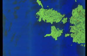
SAR coverage thumbnail
VIIRS Thermal Anomaly
Status: ✗ No detections
No VIIRS thermal/light detections in corridor
Show Raw Evidence JSON
{
    "gap_minutes": 366.69999999999998863131622783839702606201171875,
    "last_seen": {
        "ts": "2026-06-01T19:09:33+00:00",
        "lat": 57.845404999999999517967808060348033905029296875,
        "lon": 20.24658170000000012578311725519597530364990234375,
        "sog": 12.9000000000000003552713678800500929355621337890625,
        "zone_id": "discovered_072"
    },
    "next_seen": {
        "ts": "2026-06-02T01:16:14+00:00",
        "lat": 58.9708049999999985857357387430965900421142578125,
        "lon": 21.60031670000000048048605094663798809051513671875,
        "zone_ids": [
            "discovered_006"
        ]
    },
    "gap_enrichment": {
        "status": "done",
        "corridor": {
            "start": {
                "lat": 57.845404999999999517967808060348033905029296875,
                "lon": 20.24658170000000012578311725519597530364990234375,
                "ts": "2026-06-01T19:09:33+00:00"
            },
            "end": {
                "lat": 58.9708049999999985857357387430965900421142578125,
                "lon": 21.60031670000000048048605094663798809051513671875,
                "ts": "2026-06-02T01:16:14+00:00"
            },
            "bbox": {
                "min_lat": 57.66522499999999951114659779705107212066650390625,
                "min_lon": 19.902637999999999607325662509538233280181884765625,
                "max_lat": 59.15098499999999859255694900639355182647705078125,
                "max_lon": 21.9442599999999998772182152606546878814697265625
            },
            "buffer_km": 20
        },
        "sar": {
            "status": "snapshot",
            "scene_id": "S1A_IW_GRDH_1SDV_20260601T161253_20260601T161318_064778_08296C_7C66_COG",
            "scene_time": "2026-06-01T16:12:53.099249Z",
            "platform": "sentinel-1a",
            "assets": {
                "preview_url": "https:\/\/fleetleaks.com\/wp-content\/uploads\/fleetleaks-evidence\/sar-imagery\/2026\/06\/event_651518_thumbnail_20260602013016.png",
                "stored_path": "\/home\/fleetleaks\/public_html\/wp-content\/uploads\/fleetleaks-evidence\/sar-imagery\/2026\/06\/event_651518_thumbnail_20260602013016.png",
                "source": "copernicus_dataspace"
            },
            "notes": "SAR snapshot available for review"
        },
        "viirs": {
            "status": "not_found",
            "notes": "No VIIRS thermal\/light detections in corridor"
        },
        "searched_at": "2026-06-02T01:30:12.823968+00:00"
    }
}- Gap Duration: 6h 6m
- Last Seen: 2026-06-01T19:09:33+00:00 at 57.8454, 20.2466 (Zone: Eastern Mediterranean Monitoring Zone)
- Next Seen: 2026-06-02T01:16:14+00:00 at 58.9708, 21.6003
🛰️ Gap Corroboration
These are snapshots that may corroborate presence during the gap. They do not reconstruct a continuous route.
SAR Imagery (Sentinel-1)
Status: ✓ Snapshot available
SAR snapshot available for review
Scene: S1A_IW_GRDH_1SDV_20260601T161253_20260601T161318_064778_08296C_7C66_COG • Time: 2026-06-01T16:12:53.099249Z

SAR coverage thumbnail
VIIRS Thermal Anomaly
Status: ✗ No detections
No VIIRS thermal/light detections in corridor
Show Raw Evidence JSON
{
    "gap_minutes": 366.69999999999998863131622783839702606201171875,
    "last_seen": {
        "ts": "2026-06-01T19:09:33+00:00",
        "lat": 57.845404999999999517967808060348033905029296875,
        "lon": 20.24658170000000012578311725519597530364990234375,
        "sog": 12.9000000000000003552713678800500929355621337890625,
        "zone_id": "discovered_090"
    },
    "next_seen": {
        "ts": "2026-06-02T01:16:14+00:00",
        "lat": 58.9708049999999985857357387430965900421142578125,
        "lon": 21.60031670000000048048605094663798809051513671875,
        "zone_ids": [
            "discovered_006"
        ]
    },
    "gap_enrichment": {
        "status": "done",
        "corridor": {
            "start": {
                "lat": 57.845404999999999517967808060348033905029296875,
                "lon": 20.24658170000000012578311725519597530364990234375,
                "ts": "2026-06-01T19:09:33+00:00"
            },
            "end": {
                "lat": 58.9708049999999985857357387430965900421142578125,
                "lon": 21.60031670000000048048605094663798809051513671875,
                "ts": "2026-06-02T01:16:14+00:00"
            },
            "bbox": {
                "min_lat": 57.66522499999999951114659779705107212066650390625,
                "min_lon": 19.902637999999999607325662509538233280181884765625,
                "max_lat": 59.15098499999999859255694900639355182647705078125,
                "max_lon": 21.9442599999999998772182152606546878814697265625
            },
            "buffer_km": 20
        },
        "sar": {
            "status": "snapshot",
            "scene_id": "S1A_IW_GRDH_1SDV_20260601T161253_20260601T161318_064778_08296C_7C66_COG",
            "scene_time": "2026-06-01T16:12:53.099249Z",
            "platform": "sentinel-1a",
            "assets": {
                "preview_url": "https:\/\/fleetleaks.com\/wp-content\/uploads\/fleetleaks-evidence\/sar-imagery\/2026\/06\/event_651519_thumbnail_20260602013011.png",
                "stored_path": "\/home\/fleetleaks\/public_html\/wp-content\/uploads\/fleetleaks-evidence\/sar-imagery\/2026\/06\/event_651519_thumbnail_20260602013011.png",
                "source": "copernicus_dataspace"
            },
            "notes": "SAR snapshot available for review"
        },
        "viirs": {
            "status": "not_found",
            "notes": "No VIIRS thermal\/light detections in corridor"
        },
        "searched_at": "2026-06-02T01:30:08.252132+00:00"
    }
}- Zone: Brittany Channel Surveillance Zone
- Duration: 1h 7m
- Data Points: 18 AIS positions
- Period: 2026-06-01T18:02:12+00:00 to 2026-06-01T19:09:33+00:00
Show Raw Evidence JSON
{
    "zone_id": "discovered_072",
    "zone_name": "Brittany Channel Surveillance Zone",
    "dwell_minutes": 67.2999999999999971578290569595992565155029296875,
    "points_in_zone": 18,
    "first_point": {
        "ts": "2026-06-01T18:02:12+00:00",
        "lat": 57.6295817000000027974238037131726741790771484375,
        "lon": 20.051258300000000645013642497360706329345703125
    },
    "last_point": {
        "ts": "2026-06-01T19:09:33+00:00",
        "lat": 57.845404999999999517967808060348033905029296875,
        "lon": 20.24658170000000012578311725519597530364990234375
    }
}- Zone: Brittany Channel Surveillance Zone
- Duration: 2h 7m
- Data Points: 29 AIS positions
- Period: 2026-06-01T17:01:53+00:00 to 2026-06-01T19:09:33+00:00
Show Raw Evidence JSON
{
    "zone_id": "discovered_072",
    "zone_name": "Brittany Channel Surveillance Zone",
    "dwell_minutes": 127.7000000000000028421709430404007434844970703125,
    "points_in_zone": 29,
    "first_point": {
        "ts": "2026-06-01T17:01:53+00:00",
        "lat": 57.4364182999999997036866261623799800872802734375,
        "lon": 19.87200500000000147338141687214374542236328125
    },
    "last_point": {
        "ts": "2026-06-01T19:09:33+00:00",
        "lat": 57.845404999999999517967808060348033905029296875,
        "lon": 20.24658170000000012578311725519597530364990234375
    }
}- Zone: Brittany Channel Surveillance Zone
- Duration: 3h 7m
- Data Points: 50 AIS positions
- Period: 2026-06-01T16:02:34+00:00 to 2026-06-01T19:09:33+00:00
Show Raw Evidence JSON
{
    "zone_id": "discovered_072",
    "zone_name": "Brittany Channel Surveillance Zone",
    "dwell_minutes": 187,
    "points_in_zone": 50,
    "first_point": {
        "ts": "2026-06-01T16:02:34+00:00",
        "lat": 57.2464183000000019774233805947005748748779296875,
        "lon": 19.69713829999999887832018430344760417938232421875
    },
    "last_point": {
        "ts": "2026-06-01T19:09:33+00:00",
        "lat": 57.845404999999999517967808060348033905029296875,
        "lon": 20.24658170000000012578311725519597530364990234375
    }
}- Zone: Brittany Channel Surveillance Zone
- Duration: 4h 4m
- Data Points: 84 AIS positions
- Period: 2026-06-01T15:05:13+00:00 to 2026-06-01T19:09:33+00:00
Show Raw Evidence JSON
{
    "zone_id": "discovered_072",
    "zone_name": "Brittany Channel Surveillance Zone",
    "dwell_minutes": 244.30000000000001136868377216160297393798828125,
    "points_in_zone": 84,
    "first_point": {
        "ts": "2026-06-01T15:05:13+00:00",
        "lat": 57.06239500000000219870344153605401515960693359375,
        "lon": 19.527856700000000955697032622992992401123046875
    },
    "last_point": {
        "ts": "2026-06-01T19:09:33+00:00",
        "lat": 57.845404999999999517967808060348033905029296875,
        "lon": 20.24658170000000012578311725519597530364990234375
    }
}- Zone: Brittany Channel Surveillance Zone
- Duration: 4h 35m
- Data Points: 95 AIS positions
- Period: 2026-06-01T14:33:53+00:00 to 2026-06-01T19:09:33+00:00
Show Raw Evidence JSON
{
    "zone_id": "discovered_072",
    "zone_name": "Brittany Channel Surveillance Zone",
    "dwell_minutes": 275.69999999999998863131622783839702606201171875,
    "points_in_zone": 95,
    "first_point": {
        "ts": "2026-06-01T14:33:53+00:00",
        "lat": 56.96043329999999826895873411558568477630615234375,
        "lon": 19.43478999999999956571627990342676639556884765625
    },
    "last_point": {
        "ts": "2026-06-01T19:09:33+00:00",
        "lat": 57.845404999999999517967808060348033905029296875,
        "lon": 20.24658170000000012578311725519597530364990234375
    }
}- Zone: Brittany Channel Surveillance Zone
- Duration: 6h 8m
- Data Points: 108 AIS positions
- Period: 2026-06-01T13:01:13+00:00 to 2026-06-01T19:09:33+00:00
Show Raw Evidence JSON
{
    "zone_id": "discovered_072",
    "zone_name": "Brittany Channel Surveillance Zone",
    "dwell_minutes": 368.30000000000001136868377216160297393798828125,
    "points_in_zone": 108,
    "first_point": {
        "ts": "2026-06-01T13:01:13+00:00",
        "lat": 56.6586233000000021320374798960983753204345703125,
        "lon": 19.16053169999999994388417690061032772064208984375
    },
    "last_point": {
        "ts": "2026-06-01T19:09:33+00:00",
        "lat": 57.845404999999999517967808060348033905029296875,
        "lon": 20.24658170000000012578311725519597530364990234375
    }
}- Zone: Brittany Channel Surveillance Zone
- Duration: 6h 15m
- Data Points: 111 AIS positions
- Period: 2026-06-01T12:54:12+00:00 to 2026-06-01T19:09:33+00:00
Show Raw Evidence JSON
{
    "zone_id": "discovered_072",
    "zone_name": "Brittany Channel Surveillance Zone",
    "dwell_minutes": 375.3999999999999772626324556767940521240234375,
    "points_in_zone": 111,
    "first_point": {
        "ts": "2026-06-01T12:54:12+00:00",
        "lat": 56.63605170000000299523890134878456592559814453125,
        "lon": 19.140316699999999627834768034517765045166015625
    },
    "last_point": {
        "ts": "2026-06-01T19:09:33+00:00",
        "lat": 57.845404999999999517967808060348033905029296875,
        "lon": 20.24658170000000012578311725519597530364990234375
    }
}- Zone: Archipelago Sea Monitoring Zone
- Duration: 1h 52m
- Data Points: 65 AIS positions
- Period: 2026-06-01T01:01:02+00:00 to 2026-06-01T02:53:12+00:00
Show Raw Evidence JSON
{
    "zone_id": "discovered_005",
    "zone_name": "Archipelago Sea Monitoring Zone",
    "dwell_minutes": 112.2000000000000028421709430404007434844970703125,
    "points_in_zone": 65,
    "first_point": {
        "ts": "2026-06-01T01:01:02+00:00",
        "lat": 55.5525717000000014422766980715095996856689453125,
        "lon": 15.2092383000000008763663572608493268489837646484375
    },
    "last_point": {
        "ts": "2026-06-01T02:53:12+00:00",
        "lat": 55.65366000000000212821760214865207672119140625,
        "lon": 15.9077233000000006768459570594131946563720703125
    }
}- Zone: Archipelago Sea Monitoring Zone
- Duration: 2h 49m
- Data Points: 88 AIS positions
- Period: 2026-06-01T00:03:23+00:00 to 2026-06-01T02:53:12+00:00
Show Raw Evidence JSON
{
    "zone_id": "discovered_005",
    "zone_name": "Archipelago Sea Monitoring Zone",
    "dwell_minutes": 169.80000000000001136868377216160297393798828125,
    "points_in_zone": 88,
    "first_point": {
        "ts": "2026-06-01T00:03:23+00:00",
        "lat": 55.414005000000003064997144974768161773681640625,
        "lon": 14.936171699999999162855601753108203411102294921875
    },
    "last_point": {
        "ts": "2026-06-01T02:53:12+00:00",
        "lat": 55.65366000000000212821760214865207672119140625,
        "lon": 15.9077233000000006768459570594131946563720703125
    }
}- Zone: Archipelago Sea Monitoring Zone
- Duration: 3h 33m
- Data Points: 109 AIS positions
- Period: 2026-05-31T23:19:52+00:00 to 2026-06-01T02:53:12+00:00
Show Raw Evidence JSON
{
    "zone_id": "discovered_005",
    "zone_name": "Archipelago Sea Monitoring Zone",
    "dwell_minutes": 213.30000000000001136868377216160297393798828125,
    "points_in_zone": 109,
    "first_point": {
        "ts": "2026-05-31T23:19:52+00:00",
        "lat": 55.33485170000000152867869473993778228759765625,
        "lon": 14.7275133000000000293994162348099052906036376953125
    },
    "last_point": {
        "ts": "2026-06-01T02:53:12+00:00",
        "lat": 55.65366000000000212821760214865207672119140625,
        "lon": 15.9077233000000006768459570594131946563720703125
    }
}- Zone: Archipelago Sea Monitoring Zone
- Duration: 5h 15m
- Data Points: 110 AIS positions
- Period: 2026-05-31T21:37:32+00:00 to 2026-06-01T02:53:12+00:00
Show Raw Evidence JSON
{
    "zone_id": "discovered_005",
    "zone_name": "Archipelago Sea Monitoring Zone",
    "dwell_minutes": 315.69999999999998863131622783839702606201171875,
    "points_in_zone": 110,
    "first_point": {
        "ts": "2026-05-31T21:37:32+00:00",
        "lat": 55.09909329999999982874214765615761280059814453125,
        "lon": 14.2767283000000002601836968096904456615447998046875
    },
    "last_point": {
        "ts": "2026-06-01T02:53:12+00:00",
        "lat": 55.65366000000000212821760214865207672119140625,
        "lon": 15.9077233000000006768459570594131946563720703125
    }
}- Gap Duration: 6h 17m
- Last Seen: 2026-05-31T15:20:04+00:00 at 54.6251, 12.3432 (Zone: Southern Baltic Surveillance Zone)
- Next Seen: 2026-05-31T21:37:32+00:00 at 55.0991, 14.2767
🛰️ Gap Corroboration
These are snapshots that may corroborate presence during the gap. They do not reconstruct a continuous route.
SAR Imagery (Sentinel-1)
Status: ✗ No SAR coverage
No Sentinel-1 scenes covering corridor and time window
VIIRS Thermal Anomaly
Status: ✗ No detections
No VIIRS thermal/light detections in corridor
Show Raw Evidence JSON
{
    "gap_minutes": 377.5,
    "last_seen": {
        "ts": "2026-05-31T15:20:04+00:00",
        "lat": 54.625055000000003246896085329353809356689453125,
        "lon": 12.3431633000000005040419637225568294525146484375,
        "sog": 9.300000000000000710542735760100185871124267578125,
        "zone_id": "discovered_093"
    },
    "next_seen": {
        "ts": "2026-05-31T21:37:32+00:00",
        "lat": 55.09909329999999982874214765615761280059814453125,
        "lon": 14.2767283000000002601836968096904456615447998046875,
        "zone_ids": [
            "discovered_005"
        ]
    },
    "gap_enrichment": {
        "status": "not_found",
        "corridor": {
            "start": {
                "lat": 54.625055000000003246896085329353809356689453125,
                "lon": 12.3431633000000005040419637225568294525146484375,
                "ts": "2026-05-31T15:20:04+00:00"
            },
            "end": {
                "lat": 55.09909329999999982874214765615761280059814453125,
                "lon": 14.2767283000000002601836968096904456615447998046875,
                "ts": "2026-05-31T21:37:32+00:00"
            },
            "bbox": {
                "min_lat": 54.44487500000000324007487506605684757232666015625,
                "min_lon": 12.0301039999999996865653884015046060085296630859375,
                "max_lat": 55.2792730000000034351614885963499546051025390625,
                "max_lon": 14.5897869999999993950723364832811057567596435546875
            },
            "buffer_km": 20
        },
        "sar": {
            "status": "not_found",
            "notes": "No Sentinel-1 scenes covering corridor and time window"
        },
        "viirs": {
            "status": "not_found",
            "notes": "No VIIRS thermal\/light detections in corridor"
        },
        "searched_at": "2026-05-31T21:45:01.678954+00:00"
    }
}- Zone: Southern Baltic Surveillance Zone
- Duration: 1h 19m
- Data Points: 17 AIS positions
- Period: 2026-05-31T14:00:22+00:00 to 2026-05-31T15:20:04+00:00
Show Raw Evidence JSON
{
    "zone_id": "discovered_093",
    "zone_name": "Southern Baltic Surveillance Zone",
    "dwell_minutes": 79.7000000000000028421709430404007434844970703125,
    "points_in_zone": 17,
    "first_point": {
        "ts": "2026-05-31T14:00:22+00:00",
        "lat": 54.41622499999999718056642450392246246337890625,
        "lon": 12.1549382999999995291773302596993744373321533203125
    },
    "last_point": {
        "ts": "2026-05-31T15:20:04+00:00",
        "lat": 54.625055000000003246896085329353809356689453125,
        "lon": 12.3431633000000005040419637225568294525146484375
    }
}- Zone: Southern Baltic Surveillance Zone
- Duration: 2h 19m
- Data Points: 44 AIS positions
- Period: 2026-05-31T13:00:12+00:00 to 2026-05-31T15:20:04+00:00
Show Raw Evidence JSON
{
    "zone_id": "discovered_093",
    "zone_name": "Southern Baltic Surveillance Zone",
    "dwell_minutes": 139.900000000000005684341886080801486968994140625,
    "points_in_zone": 44,
    "first_point": {
        "ts": "2026-05-31T13:00:12+00:00",
        "lat": 54.41620830000000097470547189004719257354736328125,
        "lon": 11.8138466999999991458025760948657989501953125
    },
    "last_point": {
        "ts": "2026-05-31T15:20:04+00:00",
        "lat": 54.625055000000003246896085329353809356689453125,
        "lon": 12.3431633000000005040419637225568294525146484375
    }
}- Zone: Southern Baltic Surveillance Zone
- Duration: 2h 36m
- Data Points: 55 AIS positions
- Period: 2026-05-31T12:43:53+00:00 to 2026-05-31T15:20:04+00:00
Show Raw Evidence JSON
{
    "zone_id": "discovered_093",
    "zone_name": "Southern Baltic Surveillance Zone",
    "dwell_minutes": 156.19999999999998863131622783839702606201171875,
    "points_in_zone": 55,
    "first_point": {
        "ts": "2026-05-31T12:43:53+00:00",
        "lat": 54.43363000000000084810380940325558185577392578125,
        "lon": 11.724406699999999403871697722934186458587646484375
    },
    "last_point": {
        "ts": "2026-05-31T15:20:04+00:00",
        "lat": 54.625055000000003246896085329353809356689453125,
        "lon": 12.3431633000000005040419637225568294525146484375
    }
}- Gap Duration: 5h 46m
- Last Seen: 2026-05-31T06:57:12+00:00 at 55.1758, 11.0320 (Zone: English Channel Surveillance Zone)
- Next Seen: 2026-05-31T12:43:53+00:00 at 54.4336, 11.7244
🛰️ Gap Corroboration
These are snapshots that may corroborate presence during the gap. They do not reconstruct a continuous route.
SAR Imagery (Sentinel-1)
Status: ✗ No SAR coverage
No Sentinel-1 scenes covering corridor and time window
VIIRS Thermal Anomaly
Status: ✗ No detections
No VIIRS thermal/light detections in corridor
Show Raw Evidence JSON
{
    "gap_minutes": 346.69999999999998863131622783839702606201171875,
    "last_seen": {
        "ts": "2026-05-31T06:57:12+00:00",
        "lat": 55.17578830000000067457222030498087406158447265625,
        "lon": 11.031954999999999955662133288569748401641845703125,
        "sog": 11.800000000000000710542735760100185871124267578125,
        "zone_id": "discovered_077"
    },
    "next_seen": {
        "ts": "2026-05-31T12:43:53+00:00",
        "lat": 54.43363000000000084810380940325558185577392578125,
        "lon": 11.724406699999999403871697722934186458587646484375,
        "zone_ids": [
            "discovered_093"
        ]
    },
    "gap_enrichment": {
        "status": "not_found",
        "corridor": {
            "start": {
                "lat": 55.17578830000000067457222030498087406158447265625,
                "lon": 11.031954999999999955662133288569748401641845703125,
                "ts": "2026-05-31T06:57:12+00:00"
            },
            "end": {
                "lat": 54.43363000000000084810380940325558185577392578125,
                "lon": 11.724406699999999403871697722934186458587646484375,
                "ts": "2026-05-31T12:43:53+00:00"
            },
            "bbox": {
                "min_lat": 54.2534500000000008412825991399586200714111328125,
                "min_lon": 10.7193400000000007565859050373546779155731201171875,
                "max_lat": 55.35596799999999717556420364417135715484619140625,
                "max_lon": 12.037020999999999304463926819153130054473876953125
            },
            "buffer_km": 20
        },
        "sar": {
            "status": "not_found",
            "notes": "No Sentinel-1 scenes covering corridor and time window"
        },
        "viirs": {
            "status": "not_found",
            "notes": "No VIIRS thermal\/light detections in corridor"
        },
        "searched_at": "2026-05-31T13:00:01.737740+00:00"
    }
}- Zone: English Channel Surveillance Zone
- Duration: 1h 2m
- Data Points: 28 AIS positions
- Period: 2026-05-31T05:54:42+00:00 to 2026-05-31T06:57:12+00:00
Show Raw Evidence JSON
{
    "zone_id": "discovered_077",
    "zone_name": "English Channel Surveillance Zone",
    "dwell_minutes": 62.5,
    "points_in_zone": 28,
    "first_point": {
        "ts": "2026-05-31T05:54:42+00:00",
        "lat": 55.35590330000000136578819365240633487701416015625,
        "lon": 11.0315166999999991759295880910940468311309814453125
    },
    "last_point": {
        "ts": "2026-05-31T06:57:12+00:00",
        "lat": 55.17578830000000067457222030498087406158447265625,
        "lon": 11.031954999999999955662133288569748401641845703125
    }
}- Zone: Northwest Iberian Sea Monitoring Zone
- Duration: 1h 59m
- Data Points: 34 AIS positions
- Period: 2026-05-31T04:00:43+00:00 to 2026-05-31T05:59:43+00:00
Show Raw Evidence JSON
{
    "zone_id": "discovered_087",
    "zone_name": "Northwest Iberian Sea Monitoring Zone",
    "dwell_minutes": 119,
    "points_in_zone": 34,
    "first_point": {
        "ts": "2026-05-31T04:00:43+00:00",
        "lat": 55.69287669999999934589141048491001129150390625,
        "lon": 10.7800533000000005046103979111649096012115478515625
    },
    "last_point": {
        "ts": "2026-05-31T05:59:43+00:00",
        "lat": 55.3394382999999976391336531378328800201416015625,
        "lon": 11.0314032999999991346840033656917512416839599609375
    }
}- Zone: Northwest Iberian Sea Monitoring Zone
- Duration: 2h 57m
- Data Points: 68 AIS positions
- Period: 2026-05-31T03:02:33+00:00 to 2026-05-31T05:59:43+00:00
Show Raw Evidence JSON
{
    "zone_id": "discovered_087",
    "zone_name": "Northwest Iberian Sea Monitoring Zone",
    "dwell_minutes": 177.19999999999998863131622783839702606201171875,
    "points_in_zone": 68,
    "first_point": {
        "ts": "2026-05-31T03:02:33+00:00",
        "lat": 55.872804999999999608917278237640857696533203125,
        "lon": 10.8117333000000002130036591552197933197021484375
    },
    "last_point": {
        "ts": "2026-05-31T05:59:43+00:00",
        "lat": 55.3394382999999976391336531378328800201416015625,
        "lon": 11.0314032999999991346840033656917512416839599609375
    }
}- Zone: Northwest Iberian Sea Monitoring Zone
- Duration: 3h 59m
- Data Points: 105 AIS positions
- Period: 2026-05-31T02:00:22+00:00 to 2026-05-31T05:59:43+00:00
Show Raw Evidence JSON
{
    "zone_id": "discovered_087",
    "zone_name": "Northwest Iberian Sea Monitoring Zone",
    "dwell_minutes": 239.30000000000001136868377216160297393798828125,
    "points_in_zone": 105,
    "first_point": {
        "ts": "2026-05-31T02:00:22+00:00",
        "lat": 56.00141169999999846140781301073729991912841796875,
        "lon": 11.0485632999999996428641679813154041767120361328125
    },
    "last_point": {
        "ts": "2026-05-31T05:59:43+00:00",
        "lat": 55.3394382999999976391336531378328800201416015625,
        "lon": 11.0314032999999991346840033656917512416839599609375
    }
}- Zone: Northwest Iberian Sea Monitoring Zone
- Duration: 4h 37m
- Data Points: 129 AIS positions
- Period: 2026-05-31T01:22:42+00:00 to 2026-05-31T05:59:43+00:00
Show Raw Evidence JSON
{
    "zone_id": "discovered_087",
    "zone_name": "Northwest Iberian Sea Monitoring Zone",
    "dwell_minutes": 277,
    "points_in_zone": 129,
    "first_point": {
        "ts": "2026-05-31T01:22:42+00:00",
        "lat": 56.10545830000000222526068682782351970672607421875,
        "lon": 11.1402367000000008800952855381183326244354248046875
    },
    "last_point": {
        "ts": "2026-05-31T05:59:43+00:00",
        "lat": 55.3394382999999976391336531378328800201416015625,
        "lon": 11.0314032999999991346840033656917512416839599609375
    }
}- Gap Duration: 5h 30m
- Last Seen: 2026-05-30T19:52:13+00:00 at 57.0665, 11.6732 (Zone: Danish Straits/Skagerrak)
- Next Seen: 2026-05-31T01:22:42+00:00 at 56.1055, 11.1402
🛰️ Gap Corroboration
These are snapshots that may corroborate presence during the gap. They do not reconstruct a continuous route.
SAR Imagery (Sentinel-1)
Status: ✗ No SAR coverage
No Sentinel-1 scenes covering corridor and time window
VIIRS Thermal Anomaly
Status: ✗ No detections
No VIIRS thermal/light detections in corridor
Show Raw Evidence JSON
{
    "gap_minutes": 330.5,
    "last_seen": {
        "ts": "2026-05-30T19:52:13+00:00",
        "lat": 57.066491700000000264481059275567531585693359375,
        "lon": 11.6731932999999994393647284596227109432220458984375,
        "sog": 12.5999999999999996447286321199499070644378662109375,
        "zone_id": "osint_danish_straits"
    },
    "next_seen": {
        "ts": "2026-05-31T01:22:42+00:00",
        "lat": 56.10545830000000222526068682782351970672607421875,
        "lon": 11.1402367000000008800952855381183326244354248046875,
        "zone_ids": [
            "discovered_087"
        ]
    },
    "gap_enrichment": {
        "status": "not_found",
        "corridor": {
            "start": {
                "lat": 57.066491700000000264481059275567531585693359375,
                "lon": 11.6731932999999994393647284596227109432220458984375,
                "ts": "2026-05-30T19:52:13+00:00"
            },
            "end": {
                "lat": 56.10545830000000222526068682782351970672607421875,
                "lon": 11.1402367000000008800952855381183326244354248046875,
                "ts": "2026-05-31T01:22:42+00:00"
            },
            "bbox": {
                "min_lat": 55.92527799999999871261024964042007923126220703125,
                "min_lon": 10.8130439999999996558699422166682779788970947265625,
                "max_lat": 57.24667199999999667170413886196911334991455078125,
                "max_lon": 12.0003860000000006635900717810727655887603759765625
            },
            "buffer_km": 20
        },
        "sar": {
            "status": "not_found",
            "notes": "No Sentinel-1 scenes covering corridor and time window"
        },
        "viirs": {
            "status": "not_found",
            "notes": "No VIIRS thermal\/light detections in corridor"
        },
        "searched_at": "2026-05-31T01:45:01.246665+00:00"
    }
}- Zone: Danish Straits/Skagerrak
- Duration: 1h 50m
- Data Points: 54 AIS positions
- Period: 2026-05-30T18:01:52+00:00 to 2026-05-30T19:52:13+00:00
Show Raw Evidence JSON
{
    "zone_id": "osint_danish_straits",
    "zone_name": "Danish Straits\/Skagerrak",
    "dwell_minutes": 110.2999999999999971578290569595992565155029296875,
    "points_in_zone": 54,
    "first_point": {
        "ts": "2026-05-30T18:01:52+00:00",
        "lat": 57.425178299999998898783815093338489532470703125,
        "lon": 11.4465950000000002972910806420259177684783935546875
    },
    "last_point": {
        "ts": "2026-05-30T19:52:13+00:00",
        "lat": 57.066491700000000264481059275567531585693359375,
        "lon": 11.6731932999999994393647284596227109432220458984375
    }
}- Zone: Danish Straits/Skagerrak
- Duration: 2h 51m
- Data Points: 89 AIS positions
- Period: 2026-05-30T17:00:53+00:00 to 2026-05-30T19:52:13+00:00
Show Raw Evidence JSON
{
    "zone_id": "osint_danish_straits",
    "zone_name": "Danish Straits\/Skagerrak",
    "dwell_minutes": 171.30000000000001136868377216160297393798828125,
    "points_in_zone": 89,
    "first_point": {
        "ts": "2026-05-30T17:00:53+00:00",
        "lat": 57.58559170000000193567757378332316875457763671875,
        "lon": 11.2012882999999998645535015384666621685028076171875
    },
    "last_point": {
        "ts": "2026-05-30T19:52:13+00:00",
        "lat": 57.066491700000000264481059275567531585693359375,
        "lon": 11.6731932999999994393647284596227109432220458984375
    }
}- Zone: Danish Straits/Skagerrak
- Duration: 3h 51m
- Data Points: 124 AIS positions
- Period: 2026-05-30T16:00:32+00:00 to 2026-05-30T19:52:13+00:00
Show Raw Evidence JSON
{
    "zone_id": "osint_danish_straits",
    "zone_name": "Danish Straits\/Skagerrak",
    "dwell_minutes": 231.69999999999998863131622783839702606201171875,
    "points_in_zone": 124,
    "first_point": {
        "ts": "2026-05-30T16:00:32+00:00",
        "lat": 57.7383932999999984758687787689268589019775390625,
        "lon": 10.9274366999999994476411302457563579082489013671875
    },
    "last_point": {
        "ts": "2026-05-30T19:52:13+00:00",
        "lat": 57.066491700000000264481059275567531585693359375,
        "lon": 11.6731932999999994393647284596227109432220458984375
    }
}- Zone: Danish Straits/Skagerrak
- Duration: 4h 48m
- Data Points: 158 AIS positions
- Period: 2026-05-30T15:03:23+00:00 to 2026-05-30T19:52:13+00:00
Show Raw Evidence JSON
{
    "zone_id": "osint_danish_straits",
    "zone_name": "Danish Straits\/Skagerrak",
    "dwell_minutes": 288.80000000000001136868377216160297393798828125,
    "points_in_zone": 158,
    "first_point": {
        "ts": "2026-05-30T15:03:23+00:00",
        "lat": 57.80657999999999674400896765291690826416015625,
        "lon": 10.6045867000000004765070116263814270496368408203125
    },
    "last_point": {
        "ts": "2026-05-30T19:52:13+00:00",
        "lat": 57.066491700000000264481059275567531585693359375,
        "lon": 11.6731932999999994393647284596227109432220458984375
    }
}- Zone: Danish Straits/Skagerrak
- Duration: 5h 49m
- Data Points: 190 AIS positions
- Period: 2026-05-30T14:03:04+00:00 to 2026-05-30T19:52:13+00:00
Show Raw Evidence JSON
{
    "zone_id": "osint_danish_straits",
    "zone_name": "Danish Straits\/Skagerrak",
    "dwell_minutes": 349.1000000000000227373675443232059478759765625,
    "points_in_zone": 190,
    "first_point": {
        "ts": "2026-05-30T14:03:04+00:00",
        "lat": 57.79444000000000158934199134819209575653076171875,
        "lon": 10.244988299999999270539774443022906780242919921875
    },
    "last_point": {
        "ts": "2026-05-30T19:52:13+00:00",
        "lat": 57.066491700000000264481059275567531585693359375,
        "lon": 11.6731932999999994393647284596227109432220458984375
    }
}- Zone: Danish Straits/Skagerrak
- Duration: 6h 25m
- Data Points: 197 AIS positions
- Period: 2026-05-30T13:27:12+00:00 to 2026-05-30T19:52:13+00:00
Show Raw Evidence JSON
{
    "zone_id": "osint_danish_straits",
    "zone_name": "Danish Straits\/Skagerrak",
    "dwell_minutes": 385,
    "points_in_zone": 197,
    "first_point": {
        "ts": "2026-05-30T13:27:12+00:00",
        "lat": 57.78398829999999719575498602353036403656005859375,
        "lon": 10.03396000000000043428372009657323360443115234375
    },
    "last_point": {
        "ts": "2026-05-30T19:52:13+00:00",
        "lat": 57.066491700000000264481059275567531585693359375,
        "lon": 11.6731932999999994393647284596227109432220458984375
    }
}- Zone: Northern Baltic Sea Surveillance Zone
- Duration: 1h 1m
- Data Points: 19 AIS positions
- Period: 2026-05-30T13:03:04+00:00 to 2026-05-30T14:04:53+00:00
Show Raw Evidence JSON
{
    "zone_id": "discovered_111",
    "zone_name": "Northern Baltic Sea Surveillance Zone",
    "dwell_minutes": 61.7999999999999971578290569595992565155029296875,
    "points_in_zone": 19,
    "first_point": {
        "ts": "2026-05-30T13:03:04+00:00",
        "lat": 57.77844329999999928304532659240067005157470703125,
        "lon": 9.89244000000000056616045185364782810211181640625
    },
    "last_point": {
        "ts": "2026-05-30T14:04:53+00:00",
        "lat": 57.794939999999996871338225901126861572265625,
        "lon": 10.255633299999999508145265281200408935546875
    }
}- Zone: Northern Baltic Sea Surveillance Zone
- Duration: 2h 4m
- Data Points: 32 AIS positions
- Period: 2026-05-30T12:00:24+00:00 to 2026-05-30T14:04:53+00:00
Show Raw Evidence JSON
{
    "zone_id": "discovered_111",
    "zone_name": "Northern Baltic Sea Surveillance Zone",
    "dwell_minutes": 124.5,
    "points_in_zone": 32,
    "first_point": {
        "ts": "2026-05-30T12:00:24+00:00",
        "lat": 57.75270330000000029713191906921565532684326171875,
        "lon": 9.53051669999999973015292198397219181060791015625
    },
    "last_point": {
        "ts": "2026-05-30T14:04:53+00:00",
        "lat": 57.794939999999996871338225901126861572265625,
        "lon": 10.255633299999999508145265281200408935546875
    }
}- Zone: Northern Baltic Sea Surveillance Zone
- Duration: 2h 54m
- Data Points: 40 AIS positions
- Period: 2026-05-30T11:10:23+00:00 to 2026-05-30T14:04:53+00:00
Show Raw Evidence JSON
{
    "zone_id": "discovered_111",
    "zone_name": "Northern Baltic Sea Surveillance Zone",
    "dwell_minutes": 174.5,
    "points_in_zone": 40,
    "first_point": {
        "ts": "2026-05-30T11:10:23+00:00",
        "lat": 57.7444550000000020872903405688703060150146484375,
        "lon": 9.2895682999999991125150700099766254425048828125
    },
    "last_point": {
        "ts": "2026-05-30T14:04:53+00:00",
        "lat": 57.794939999999996871338225901126861572265625,
        "lon": 10.255633299999999508145265281200408935546875
    }
}- Zone: Black Sea Sanctioned Vessel Monitoring Zone
- Duration: 1h 6m
- Data Points: 13 AIS positions
- Period: 2026-05-30T11:01:55+00:00 to 2026-05-30T12:08:34+00:00
Show Raw Evidence JSON
{
    "zone_id": "discovered_025",
    "zone_name": "Black Sea Sanctioned Vessel Monitoring Zone",
    "dwell_minutes": 66.7000000000000028421709430404007434844970703125,
    "points_in_zone": 13,
    "first_point": {
        "ts": "2026-05-30T11:01:55+00:00",
        "lat": 57.7456533000000007405105861835181713104248046875,
        "lon": 9.234068300000000562022250960581004619598388671875
    },
    "last_point": {
        "ts": "2026-05-30T12:08:34+00:00",
        "lat": 57.75790669999999948913682601414620876312255859375,
        "lon": 9.5665066999999996966153048560954630374908447265625
    }
}- Zone: Black Sea Sanctioned Vessel Monitoring Zone
- Duration: 2h 6m
- Data Points: 21 AIS positions
- Period: 2026-05-30T10:01:44+00:00 to 2026-05-30T12:08:34+00:00
Show Raw Evidence JSON
{
    "zone_id": "discovered_025",
    "zone_name": "Black Sea Sanctioned Vessel Monitoring Zone",
    "dwell_minutes": 126.7999999999999971578290569595992565155029296875,
    "points_in_zone": 21,
    "first_point": {
        "ts": "2026-05-30T10:01:44+00:00",
        "lat": 57.72741669999999913898136583156883716583251953125,
        "lon": 8.848851700000000874979377840645611286163330078125
    },
    "last_point": {
        "ts": "2026-05-30T12:08:34+00:00",
        "lat": 57.75790669999999948913682601414620876312255859375,
        "lon": 9.5665066999999996966153048560954630374908447265625
    }
}- Zone: Black Sea Sanctioned Vessel Monitoring Zone
- Duration: 2h 30m
- Data Points: 31 AIS positions
- Period: 2026-05-30T09:37:42+00:00 to 2026-05-30T12:08:34+00:00
Show Raw Evidence JSON
{
    "zone_id": "discovered_025",
    "zone_name": "Black Sea Sanctioned Vessel Monitoring Zone",
    "dwell_minutes": 150.900000000000005684341886080801486968994140625,
    "points_in_zone": 31,
    "first_point": {
        "ts": "2026-05-30T09:37:42+00:00",
        "lat": 57.7208150000000017598722479306161403656005859375,
        "lon": 8.7070732999999993495521266595460474491119384765625
    },
    "last_point": {
        "ts": "2026-05-30T12:08:34+00:00",
        "lat": 57.75790669999999948913682601414620876312255859375,
        "lon": 9.5665066999999996966153048560954630374908447265625
    }
}Recent Position Data
| Time (UTC) | Lat | Lon | Speed | Course | Zone |
|---|---|---|---|---|---|
| Jun 5 02:49 | 56.9189 | 19.3074 | 11.9 kn | 208.7° | Brittany Channel Surveillance Zone |
| Jun 5 02:48 | 56.9237 | 19.3122 | 11.9 kn | 208.4° | Brittany Channel Surveillance Zone |
| Jun 5 02:46 | 56.9276 | 19.3161 | 12.0 kn | 208.6° | Brittany Channel Surveillance Zone |
| Jun 5 02:45 | 56.9324 | 19.3208 | 12.0 kn | 208.7° | Brittany Channel Surveillance Zone |
| Jun 5 02:43 | 56.9373 | 19.3257 | 11.9 kn | 208.8° | Brittany Channel Surveillance Zone |
| Jun 5 02:41 | 56.9420 | 19.3306 | 11.9 kn | 208.9° | Brittany Channel Surveillance Zone |
| Jun 5 02:39 | 56.9488 | 19.3374 | 11.9 kn | 209.4° | Brittany Channel Surveillance Zone |
| Jun 5 02:38 | 56.9526 | 19.3414 | 11.9 kn | 209.2° | Brittany Channel Surveillance Zone |
| Jun 5 02:34 | 56.9639 | 19.3531 | 11.8 kn | 209.4° | Brittany Channel Surveillance Zone |
| Jun 5 02:32 | 56.9696 | 19.3590 | 11.8 kn | 209.6° | Brittany Channel Surveillance Zone |
| Jun 5 02:26 | 56.9847 | 19.3748 | 11.8 kn | 210.1° | Brittany Channel Surveillance Zone |
| Jun 5 02:25 | 56.9893 | 19.3796 | 11.8 kn | 210.2° | Brittany Channel Surveillance Zone |
| Jun 5 02:22 | 56.9978 | 19.3887 | 11.8 kn | 209.8° | Brittany Channel Surveillance Zone |
| Jun 5 02:04 | 57.0493 | 19.4419 | 11.8 kn | 207.7° | Brittany Channel Surveillance Zone |
| Jun 5 01:59 | 57.0638 | 19.4559 | 11.8 kn | 207.9° | Brittany Channel Surveillance Zone |
| Jun 5 01:55 | 57.0734 | 19.4652 | 11.8 kn | 208.0° | Brittany Channel Surveillance Zone |
| Jun 5 01:52 | 57.0842 | 19.4757 | 11.9 kn | 207.8° | Brittany Channel Surveillance Zone |
| Jun 5 01:48 | 57.0939 | 19.4851 | 11.9 kn | 207.8° | Brittany Channel Surveillance Zone |
| Jun 5 01:46 | 57.0998 | 19.4907 | 11.9 kn | 207.8° | Brittany Channel Surveillance Zone |
| Jun 5 01:45 | 57.1027 | 19.4936 | 11.9 kn | 207.8° | Brittany Channel Surveillance Zone |
Showing 20 of 100 recent positions.
Data Source
Vessel observed through FleetLeaks' AIS monitoring system in zones of interest. Identity and position data derived from AIS broadcasts and public maritime databases.
Disclaimer: AIS data can be spoofed or falsified. Vessel identities should be independently verified before making compliance decisions.