IMO 9755725
Vessel information
Detected Events (4)
- Gap Duration: 5h 2m
- Last Seen: 2026-01-20T02:46:17+00:00 at 36.6019, -8.9596 (Zone: Atlantic Midway Monitoring Zone)
- Next Seen: 2026-01-20T07:48:57+00:00 at 37.2396, -9.3670
🛰️ Gap Corroboration
These are snapshots that may corroborate presence during the gap. They do not reconstruct a continuous route.
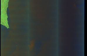
SAR Imagery (Sentinel-1)
Status: ✓ Snapshot available
SAR snapshot available for review
Scene: S1A_IW_GRDH_1SDV_20260120T064345_20260120T064410_062847_07E24B_6272_COG • Time: 2026-01-20T06:43:45.345617Z

SAR coverage thumbnail
VIIRS Thermal Anomaly
Status: ✗ No detections
No VIIRS thermal/light detections in corridor
Show Raw Evidence JSON
{
    "gap_minutes": 302.69999999999998863131622783839702606201171875,
    "last_seen": {
        "ts": "2026-01-20T02:46:17+00:00",
        "lat": 36.60191999999999978854248183779418468475341796875,
        "lon": -8.9596099999999996299493432161398231983184814453125,
        "sog": 10.199999999999999289457264239899814128875732421875,
        "zone_id": "discovered_079"
    },
    "next_seen": {
        "ts": "2026-01-20T07:48:57+00:00",
        "lat": 37.23959500000000133468347485177218914031982421875,
        "lon": -9.366949999999999221245161606930196285247802734375,
        "zone_ids": [
            "discovered_079"
        ]
    },
    "gap_enrichment": {
        "status": "done",
        "corridor": {
            "start": {
                "lat": 36.60191999999999978854248183779418468475341796875,
                "lon": -8.9596099999999996299493432161398231983184814453125,
                "ts": "2026-01-20T02:46:17+00:00"
            },
            "end": {
                "lat": 37.23959500000000133468347485177218914031982421875,
                "lon": -9.366949999999999221245161606930196285247802734375,
                "ts": "2026-01-20T07:48:57+00:00"
            },
            "bbox": {
                "min_lat": 36.421739999999999781721271574497222900390625,
                "min_lon": -9.5923250000000006565414878423325717449188232421875,
                "max_lat": 37.4197750000000013415046851150691509246826171875,
                "max_lon": -8.7342349999999999710098563809879124164581298828125
            },
            "buffer_km": 20
        },
        "sar": {
            "status": "snapshot",
            "scene_id": "S1A_IW_GRDH_1SDV_20260120T064345_20260120T064410_062847_07E24B_6272_COG",
            "scene_time": "2026-01-20T06:43:45.345617Z",
            "platform": "sentinel-1a",
            "assets": {
                "preview_url": "https:\/\/fleetleaks.com\/wp-content\/uploads\/fleetleaks-evidence\/sar-imagery\/2026\/01\/event_8018_thumbnail_20260123004529.png",
                "stored_path": "\/home\/fleetleaks\/public_html\/wp-content\/uploads\/fleetleaks-evidence\/sar-imagery\/2026\/01\/event_8018_thumbnail_20260123004529.png",
                "source": "copernicus_dataspace"
            },
            "notes": "SAR snapshot available for review"
        },
        "viirs": {
            "status": "not_found",
            "notes": "No VIIRS thermal\/light detections in corridor"
        },
        "searched_at": "2026-01-23T00:45:26.082328+00:00"
    }
}- Gap Duration: 5h 2m
- Last Seen: 2026-01-20T02:46:17+00:00 at 36.6019, -8.9596 (Zone: Western Black Sea Sanction Monitoring Zone)
- Next Seen: 2026-01-20T07:48:57+00:00 at 37.2396, -9.3670
🛰️ Gap Corroboration
These are snapshots that may corroborate presence during the gap. They do not reconstruct a continuous route.
SAR Imagery (Sentinel-1)
Status: ✓ Snapshot available
SAR snapshot available for review
Scene: S1A_IW_GRDH_1SDV_20260120T064345_20260120T064410_062847_07E24B_6272_COG • Time: 2026-01-20T06:43:45.345617Z
SAR coverage thumbnail
VIIRS Thermal Anomaly
Status: ✗ No detections
No VIIRS thermal/light detections in corridor
Show Raw Evidence JSON
{
    "gap_minutes": 302.69999999999998863131622783839702606201171875,
    "last_seen": {
        "ts": "2026-01-20T02:46:17+00:00",
        "lat": 36.60191999999999978854248183779418468475341796875,
        "lon": -8.9596099999999996299493432161398231983184814453125,
        "sog": 10.199999999999999289457264239899814128875732421875,
        "zone_id": "discovered_042"
    },
    "next_seen": {
        "ts": "2026-01-20T07:48:57+00:00",
        "lat": 37.23959500000000133468347485177218914031982421875,
        "lon": -9.366949999999999221245161606930196285247802734375,
        "zone_ids": [
            "discovered_079"
        ]
    },
    "gap_enrichment": {
        "status": "done",
        "corridor": {
            "start": {
                "lat": 36.60191999999999978854248183779418468475341796875,
                "lon": -8.9596099999999996299493432161398231983184814453125,
                "ts": "2026-01-20T02:46:17+00:00"
            },
            "end": {
                "lat": 37.23959500000000133468347485177218914031982421875,
                "lon": -9.366949999999999221245161606930196285247802734375,
                "ts": "2026-01-20T07:48:57+00:00"
            },
            "bbox": {
                "min_lat": 36.421739999999999781721271574497222900390625,
                "min_lon": -9.5923250000000006565414878423325717449188232421875,
                "max_lat": 37.4197750000000013415046851150691509246826171875,
                "max_lon": -8.7342349999999999710098563809879124164581298828125
            },
            "buffer_km": 20
        },
        "sar": {
            "status": "snapshot",
            "scene_id": "S1A_IW_GRDH_1SDV_20260120T064345_20260120T064410_062847_07E24B_6272_COG",
            "scene_time": "2026-01-20T06:43:45.345617Z",
            "platform": "sentinel-1a",
            "assets": {
                "preview_url": "https:\/\/fleetleaks.com\/wp-content\/uploads\/fleetleaks-evidence\/sar-imagery\/2026\/01\/event_8017_thumbnail_20260123004534.png",
                "stored_path": "\/home\/fleetleaks\/public_html\/wp-content\/uploads\/fleetleaks-evidence\/sar-imagery\/2026\/01\/event_8017_thumbnail_20260123004534.png",
                "source": "copernicus_dataspace"
            },
            "notes": "SAR snapshot available for review"
        },
        "viirs": {
            "status": "not_found",
            "notes": "No VIIRS thermal\/light detections in corridor"
        },
        "searched_at": "2026-01-23T00:45:30.827640+00:00"
    }
}- Zone: Atlantic Midway Monitoring Zone
- Duration: 6h 1m
- Data Points: 31 AIS positions
- Period: 2026-01-20T02:19:18+00:00 to 2026-01-20T08:20:46+00:00
Show Raw Evidence JSON
{
    "zone_id": "discovered_079",
    "zone_name": "Atlantic Midway Monitoring Zone",
    "dwell_minutes": 361.5,
    "points_in_zone": 31,
    "first_point": {
        "ts": "2026-01-20T02:19:18+00:00",
        "lat": 36.57457500000000294448909698985517024993896484375,
        "lon": -8.8686500000000005883293852093629539012908935546875
    },
    "last_point": {
        "ts": "2026-01-20T08:20:46+00:00",
        "lat": 37.3222583000000014408215065486729145050048828125,
        "lon": -9.3068782999999992711082086316309869289398193359375
    }
}- Zone: Western Black Sea Sanction Monitoring Zone
- Duration: 1h 13m
- Data Points: 23 AIS positions
- Period: 2026-01-20T01:32:58+00:00 to 2026-01-20T02:46:17+00:00
Show Raw Evidence JSON
{
    "zone_id": "discovered_042",
    "zone_name": "Atlantic Iberian Monitoring Zone",
    "dwell_minutes": 73.2999999999999971578290569595992565155029296875,
    "points_in_zone": 23,
    "first_point": {
        "ts": "2026-01-20T01:32:58+00:00",
        "lat": 36.52927170000000245408955379389226436614990234375,
        "lon": -8.7122367000000000558657120564021170139312744140625
    },
    "last_point": {
        "ts": "2026-01-20T02:46:17+00:00",
        "lat": 36.60191999999999978854248183779418468475341796875,
        "lon": -8.9596099999999996299493432161398231983184814453125
    }
}Data Source
Vessel observed through FleetLeaks' AIS monitoring system in zones of interest. Identity and position data derived from AIS broadcasts and public maritime databases.
Disclaimer: AIS data can be spoofed or falsified. Vessel identities should be independently verified before making compliance decisions.