IMO 9388780
Vessel information
Vessel Name
BAI LU
IMO Number
9388780
MMSI
631010073
Vessel Type
Tanker
Flag
🇬🇶 EQUATORIAL GUINEA
Call Sign
3CAN30
Length
245 m
Beam
42 m
Sanction Status
⚠️ This vessel is sanctioned.
Detected Events (22)
Zone Dwell
Brittany Channel Surveillance Zone
- Zone: Brittany Channel Surveillance Zone
- Duration: 1h 25m
- Data Points: 7 AIS positions
- Period: 2026-06-03T04:12:48+00:00 to 2026-06-03T05:38:29+00:00
Show Raw Evidence JSON
{
    "zone_id": "discovered_072",
    "zone_name": "Brittany Channel Surveillance Zone",
    "dwell_minutes": 85.7000000000000028421709430404007434844970703125,
    "points_in_zone": 7,
    "first_point": {
        "ts": "2026-06-03T04:12:48+00:00",
        "lat": 56.593203299999998989733285270631313323974609375,
        "lon": 18.987308299999998695284375571645796298980712890625
    },
    "last_point": {
        "ts": "2026-06-03T05:38:29+00:00",
        "lat": 56.33926000000000300360625260509550571441650390625,
        "lon": 18.671285000000001019770934362895786762237548828125
    }
}
Methodology: 2026.01.18
Zone Dwell
Brittany Channel Surveillance Zone
- Zone: Brittany Channel Surveillance Zone
- Duration: 2h 35m
- Data Points: 15 AIS positions
- Period: 2026-06-03T03:03:16+00:00 to 2026-06-03T05:38:29+00:00
Show Raw Evidence JSON
{
    "zone_id": "discovered_072",
    "zone_name": "Brittany Channel Surveillance Zone",
    "dwell_minutes": 155.19999999999998863131622783839702606201171875,
    "points_in_zone": 15,
    "first_point": {
        "ts": "2026-06-03T03:03:16+00:00",
        "lat": 56.8172866999999968129486660473048686981201171875,
        "lon": 19.209971700000000538466338184662163257598876953125
    },
    "last_point": {
        "ts": "2026-06-03T05:38:29+00:00",
        "lat": 56.33926000000000300360625260509550571441650390625,
        "lon": 18.671285000000001019770934362895786762237548828125
    }
}
Methodology: 2026.01.18
Zone Dwell
Brittany Channel Surveillance Zone
- Zone: Brittany Channel Surveillance Zone
- Duration: 3h 35m
- Data Points: 43 AIS positions
- Period: 2026-06-03T02:03:17+00:00 to 2026-06-03T05:38:29+00:00
Show Raw Evidence JSON
{
    "zone_id": "discovered_072",
    "zone_name": "Brittany Channel Surveillance Zone",
    "dwell_minutes": 215.19999999999998863131622783839702606201171875,
    "points_in_zone": 43,
    "first_point": {
        "ts": "2026-06-03T02:03:17+00:00",
        "lat": 57.0105649999999997135091689415276050567626953125,
        "lon": 19.396131700000001529815563117153942584991455078125
    },
    "last_point": {
        "ts": "2026-06-03T05:38:29+00:00",
        "lat": 56.33926000000000300360625260509550571441650390625,
        "lon": 18.671285000000001019770934362895786762237548828125
    }
}
Methodology: 2026.01.18
Zone Dwell
Brittany Channel Surveillance Zone
- Zone: Brittany Channel Surveillance Zone
- Duration: 4h 37m
- Data Points: 57 AIS positions
- Period: 2026-06-03T01:01:28+00:00 to 2026-06-03T05:38:29+00:00
Show Raw Evidence JSON
{
    "zone_id": "discovered_072",
    "zone_name": "Brittany Channel Surveillance Zone",
    "dwell_minutes": 277,
    "points_in_zone": 57,
    "first_point": {
        "ts": "2026-06-03T01:01:28+00:00",
        "lat": 57.210246699999999009378370828926563262939453125,
        "lon": 19.595176699999999669898897991515696048736572265625
    },
    "last_point": {
        "ts": "2026-06-03T05:38:29+00:00",
        "lat": 56.33926000000000300360625260509550571441650390625,
        "lon": 18.671285000000001019770934362895786762237548828125
    }
}
Methodology: 2026.01.18
Zone Dwell
Brittany Channel Surveillance Zone
- Zone: Brittany Channel Surveillance Zone
- Duration: 5h 37m
- Data Points: 96 AIS positions
- Period: 2026-06-03T00:01:09+00:00 to 2026-06-03T05:38:29+00:00
Show Raw Evidence JSON
{
    "zone_id": "discovered_072",
    "zone_name": "Brittany Channel Surveillance Zone",
    "dwell_minutes": 337.30000000000001136868377216160297393798828125,
    "points_in_zone": 96,
    "first_point": {
        "ts": "2026-06-03T00:01:09+00:00",
        "lat": 57.4068316999999979088897816836833953857421875,
        "lon": 19.79250329999999991059667081572115421295166015625
    },
    "last_point": {
        "ts": "2026-06-03T05:38:29+00:00",
        "lat": 56.33926000000000300360625260509550571441650390625,
        "lon": 18.671285000000001019770934362895786762237548828125
    }
}
Methodology: 2026.01.18
Zone Dwell
Brittany Channel Surveillance Zone
- Zone: Brittany Channel Surveillance Zone
- Duration: 6h 37m
- Data Points: 126 AIS positions
- Period: 2026-06-02T23:00:59+00:00 to 2026-06-03T05:38:29+00:00
Show Raw Evidence JSON
{
    "zone_id": "discovered_072",
    "zone_name": "Brittany Channel Surveillance Zone",
    "dwell_minutes": 397.5,
    "points_in_zone": 126,
    "first_point": {
        "ts": "2026-06-02T23:00:59+00:00",
        "lat": 57.60246829999999818028300069272518157958984375,
        "lon": 19.993141699999998905923348502255976200103759765625
    },
    "last_point": {
        "ts": "2026-06-03T05:38:29+00:00",
        "lat": 56.33926000000000300360625260509550571441650390625,
        "lon": 18.671285000000001019770934362895786762237548828125
    }
}
Methodology: 2026.01.18
Zone Dwell
Brittany Channel Surveillance Zone
- Zone: Brittany Channel Surveillance Zone
- Duration: 6h 35m
- Data Points: 127 AIS positions
- Period: 2026-06-02T22:53:28+00:00 to 2026-06-03T05:29:18+00:00
Show Raw Evidence JSON
{
    "zone_id": "discovered_072",
    "zone_name": "Brittany Channel Surveillance Zone",
    "dwell_minutes": 395.80000000000001136868377216160297393798828125,
    "points_in_zone": 127,
    "first_point": {
        "ts": "2026-06-02T22:53:28+00:00",
        "lat": 57.62693999999999761030267109163105487823486328125,
        "lon": 20.0172850000000011050360626541078090667724609375
    },
    "last_point": {
        "ts": "2026-06-03T05:29:18+00:00",
        "lat": 56.35926500000000061163518694229423999786376953125,
        "lon": 18.7190149999999988494892022572457790374755859375
    }
}
Methodology: 2026.01.18
Zone Dwell
Brittany Channel Surveillance Zone
- Zone: Brittany Channel Surveillance Zone
- Duration: 6h 36m
- Data Points: 138 AIS positions
- Period: 2026-06-02T21:23:09+00:00 to 2026-06-03T03:59:08+00:00
Show Raw Evidence JSON
{
    "zone_id": "discovered_072",
    "zone_name": "Brittany Channel Surveillance Zone",
    "dwell_minutes": 396,
    "points_in_zone": 138,
    "first_point": {
        "ts": "2026-06-02T21:23:09+00:00",
        "lat": 57.9189300000000031332092476077377796173095703125,
        "lon": 20.31440669999999926176315057091414928436279296875
    },
    "last_point": {
        "ts": "2026-06-03T03:59:08+00:00",
        "lat": 56.63675330000000229802026296965777873992919921875,
        "lon": 19.032206699999999699457475799135863780975341796875
    }
}
Methodology: 2026.01.18
Zone Dwell
Eastern Mediterranean Monitoring Zone
- Zone: Eastern Mediterranean Monitoring Zone
- Duration: 1h 8m
- Data Points: 11 AIS positions
- Period: 2026-06-02T21:17:49+00:00 to 2026-06-02T22:26:28+00:00
Show Raw Evidence JSON
{
    "zone_id": "discovered_090",
    "zone_name": "Eastern Mediterranean Monitoring Zone",
    "dwell_minutes": 68.7000000000000028421709430404007434844970703125,
    "points_in_zone": 11,
    "first_point": {
        "ts": "2026-06-02T21:17:49+00:00",
        "lat": 57.93655170000000254049155046232044696807861328125,
        "lon": 20.331624999999998948396751075051724910736083984375
    },
    "last_point": {
        "ts": "2026-06-02T22:26:28+00:00",
        "lat": 57.71419999999999816964191268198192119598388671875,
        "lon": 20.105806699999998699013303848914802074432373046875
    }
}
Methodology: 2026.01.18
Zone Dwell
Eastern Mediterranean Monitoring Zone
- Zone: Eastern Mediterranean Monitoring Zone
- Duration: 2h 21m
- Data Points: 12 AIS positions
- Period: 2026-06-02T20:04:49+00:00 to 2026-06-02T22:26:28+00:00
Show Raw Evidence JSON
{
    "zone_id": "discovered_090",
    "zone_name": "Eastern Mediterranean Monitoring Zone",
    "dwell_minutes": 141.69999999999998863131622783839702606201171875,
    "points_in_zone": 12,
    "first_point": {
        "ts": "2026-06-02T20:04:49+00:00",
        "lat": 58.1749099999999970123099046759307384490966796875,
        "lon": 20.566643299999999072724676807411015033721923828125
    },
    "last_point": {
        "ts": "2026-06-02T22:26:28+00:00",
        "lat": 57.71419999999999816964191268198192119598388671875,
        "lon": 20.105806699999998699013303848914802074432373046875
    }
}
Methodology: 2026.01.18
Zone Dwell
Eastern Mediterranean Monitoring Zone
- Zone: Eastern Mediterranean Monitoring Zone
- Duration: 3h 2m
- Data Points: 14 AIS positions
- Period: 2026-06-02T19:23:38+00:00 to 2026-06-02T22:26:28+00:00
Show Raw Evidence JSON
{
    "zone_id": "discovered_090",
    "zone_name": "Eastern Mediterranean Monitoring Zone",
    "dwell_minutes": 182.80000000000001136868377216160297393798828125,
    "points_in_zone": 14,
    "first_point": {
        "ts": "2026-06-02T19:23:38+00:00",
        "lat": 58.3229816999999997051418176852166652679443359375,
        "lon": 20.61303170000000051231836550869047641754150390625
    },
    "last_point": {
        "ts": "2026-06-02T22:26:28+00:00",
        "lat": 57.71419999999999816964191268198192119598388671875,
        "lon": 20.105806699999998699013303848914802074432373046875
    }
}
Methodology: 2026.01.18
Ais Gap🛰️✓
Archipelago Sea Surveillance Zone
- Gap Duration: 4h 31m
- Last Seen: 2026-06-02T14:52:39+00:00 at 59.1527, 21.5933 (Zone: Archipelago Sea Surveillance Zone)
- Next Seen: 2026-06-02T19:23:38+00:00 at 58.3230, 20.6130
🛰️ Gap Corroboration
Imagery Available
These are snapshots that may corroborate presence during the gap. They do not reconstruct a continuous route.
SAR Imagery (Sentinel-1)
Status: ✓ Snapshot available
SAR snapshot available for review
Scene: S1C_IW_GRDH_1SDV_20260602T160405_20260602T160430_007929_0101F2_1475_COG • Time: 2026-06-02T16:04:05.491584Z
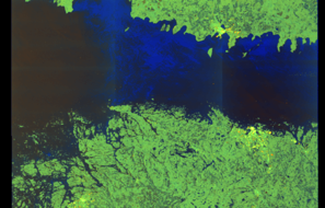
SAR coverage thumbnail
VIIRS Thermal Anomaly
Status: ✗ No detections
No VIIRS thermal/light detections in corridor
Show Raw Evidence JSON
{
    "gap_minutes": 271,
    "last_seen": {
        "ts": "2026-06-02T14:52:39+00:00",
        "lat": 59.15273169999999680612745578400790691375732421875,
        "lon": 21.593293299999999135252437554299831390380859375,
        "sog": 12.800000000000000710542735760100185871124267578125,
        "zone_id": "discovered_006"
    },
    "next_seen": {
        "ts": "2026-06-02T19:23:38+00:00",
        "lat": 58.3229816999999997051418176852166652679443359375,
        "lon": 20.61303170000000051231836550869047641754150390625,
        "zone_ids": [
            "discovered_090"
        ]
    },
    "gap_enrichment": {
        "status": "done",
        "corridor": {
            "start": {
                "lat": 59.15273169999999680612745578400790691375732421875,
                "lon": 21.593293299999999135252437554299831390380859375,
                "ts": "2026-06-02T14:52:39+00:00"
            },
            "end": {
                "lat": 58.3229816999999997051418176852166652679443359375,
                "lon": 20.61303170000000051231836550869047641754150390625,
                "ts": "2026-06-02T19:23:38+00:00"
            },
            "bbox": {
                "min_lat": 58.1428020000000032041498343460261821746826171875,
                "min_lon": 20.2658330000000006521077011711895465850830078125,
                "max_lat": 59.33291200000000031877789297141134738922119140625,
                "max_lon": 21.94049199999999899546310189180076122283935546875
            },
            "buffer_km": 20
        },
        "sar": {
            "status": "snapshot",
            "scene_id": "S1C_IW_GRDH_1SDV_20260602T160405_20260602T160430_007929_0101F2_1475_COG",
            "scene_time": "2026-06-02T16:04:05.491584Z",
            "platform": "sentinel-1c",
            "assets": {
                "preview_url": "https:\/\/fleetleaks.com\/wp-content\/uploads\/fleetleaks-evidence\/sar-imagery\/2026\/06\/event_658281_thumbnail_20260602194507.png",
                "stored_path": "\/home\/fleetleaks\/public_html\/wp-content\/uploads\/fleetleaks-evidence\/sar-imagery\/2026\/06\/event_658281_thumbnail_20260602194507.png",
                "source": "copernicus_dataspace"
            },
            "notes": "SAR snapshot available for review"
        },
        "viirs": {
            "status": "not_found",
            "notes": "No VIIRS thermal\/light detections in corridor"
        },
        "searched_at": "2026-06-02T19:45:02.082639+00:00"
    }
}
Methodology: 2026.01.18
Zone Dwell
Archipelago Sea Surveillance Zone
- Zone: Archipelago Sea Surveillance Zone
- Duration: 1h 51m
- Data Points: 49 AIS positions
- Period: 2026-06-02T13:01:29+00:00 to 2026-06-02T14:52:39+00:00
Show Raw Evidence JSON
{
    "zone_id": "discovered_006",
    "zone_name": "Archipelago Sea Surveillance Zone",
    "dwell_minutes": 111.2000000000000028421709430404007434844970703125,
    "points_in_zone": 49,
    "first_point": {
        "ts": "2026-06-02T13:01:29+00:00",
        "lat": 59.39863170000000280879248748533427715301513671875,
        "lon": 22.197113300000001601119947736151516437530517578125
    },
    "last_point": {
        "ts": "2026-06-02T14:52:39+00:00",
        "lat": 59.15273169999999680612745578400790691375732421875,
        "lon": 21.593293299999999135252437554299831390380859375
    }
}
Methodology: 2026.01.18
Zone Dwell
Archipelago Sea Surveillance Zone
- Zone: Archipelago Sea Surveillance Zone
- Duration: 2h 52m
- Data Points: 82 AIS positions
- Period: 2026-06-02T12:00:19+00:00 to 2026-06-02T14:52:39+00:00
Show Raw Evidence JSON
{
    "zone_id": "discovered_006",
    "zone_name": "Archipelago Sea Surveillance Zone",
    "dwell_minutes": 172.30000000000001136868377216160297393798828125,
    "points_in_zone": 82,
    "first_point": {
        "ts": "2026-06-02T12:00:19+00:00",
        "lat": 59.5000883000000015954356058500707149505615234375,
        "lon": 22.568058300000000571117197978310286998748779296875
    },
    "last_point": {
        "ts": "2026-06-02T14:52:39+00:00",
        "lat": 59.15273169999999680612745578400790691375732421875,
        "lon": 21.593293299999999135252437554299831390380859375
    }
}
Methodology: 2026.01.18
Zone Dwell
Archipelago Sea Surveillance Zone
- Zone: Archipelago Sea Surveillance Zone
- Duration: 3h 52m
- Data Points: 107 AIS positions
- Period: 2026-06-02T11:00:18+00:00 to 2026-06-02T14:52:39+00:00
Show Raw Evidence JSON
{
    "zone_id": "discovered_006",
    "zone_name": "Archipelago Sea Surveillance Zone",
    "dwell_minutes": 232.30000000000001136868377216160297393798828125,
    "points_in_zone": 107,
    "first_point": {
        "ts": "2026-06-02T11:00:18+00:00",
        "lat": 59.57472169999999778156052343547344207763671875,
        "lon": 22.965520000000001488160705775953829288482666015625
    },
    "last_point": {
        "ts": "2026-06-02T14:52:39+00:00",
        "lat": 59.15273169999999680612745578400790691375732421875,
        "lon": 21.593293299999999135252437554299831390380859375
    }
}
Methodology: 2026.01.18
Zone Dwell
Archipelago Sea Surveillance Zone
- Zone: Archipelago Sea Surveillance Zone
- Duration: 4h 49m
- Data Points: 130 AIS positions
- Period: 2026-06-02T10:03:19+00:00 to 2026-06-02T14:52:39+00:00
Show Raw Evidence JSON
{
    "zone_id": "discovered_006",
    "zone_name": "Archipelago Sea Surveillance Zone",
    "dwell_minutes": 289.30000000000001136868377216160297393798828125,
    "points_in_zone": 130,
    "first_point": {
        "ts": "2026-06-02T10:03:19+00:00",
        "lat": 59.638339999999999463398125953972339630126953125,
        "lon": 23.346135000000000303543856716714799404144287109375
    },
    "last_point": {
        "ts": "2026-06-02T14:52:39+00:00",
        "lat": 59.15273169999999680612745578400790691375732421875,
        "lon": 21.593293299999999135252437554299831390380859375
    }
}
Methodology: 2026.01.18
Zone Dwell
Archipelago Sea Surveillance Zone
- Zone: Archipelago Sea Surveillance Zone
- Duration: 5h 19m
- Data Points: 144 AIS positions
- Period: 2026-06-02T09:33:39+00:00 to 2026-06-02T14:52:39+00:00
Show Raw Evidence JSON
{
    "zone_id": "discovered_006",
    "zone_name": "Archipelago Sea Surveillance Zone",
    "dwell_minutes": 319,
    "points_in_zone": 144,
    "first_point": {
        "ts": "2026-06-02T09:33:39+00:00",
        "lat": 59.66844329999999985147951520048081874847412109375,
        "lon": 23.547374999999998834709913353435695171356201171875
    },
    "last_point": {
        "ts": "2026-06-02T14:52:39+00:00",
        "lat": 59.15273169999999680612745578400790691375732421875,
        "lon": 21.593293299999999135252437554299831390380859375
    }
}
Methodology: 2026.01.18
Zone Dwell
Baltic Exit/Tallinn Approach
- Zone: Baltic Exit/Tallinn Approach
- Duration: 1h 27m
- Data Points: 55 AIS positions
- Period: 2026-06-02T05:02:09+00:00 to 2026-06-02T06:29:29+00:00
Show Raw Evidence JSON
{
    "zone_id": "russia_baltic_transit",
    "zone_name": "Baltic Exit\/Tallinn Approach",
    "dwell_minutes": 87.2999999999999971578290569595992565155029296875,
    "points_in_zone": 55,
    "first_point": {
        "ts": "2026-06-02T05:02:09+00:00",
        "lat": 59.89591999999999671899786335416138172149658203125,
        "lon": 25.42717499999999830606611794792115688323974609375
    },
    "last_point": {
        "ts": "2026-06-02T06:29:29+00:00",
        "lat": 59.8366716999999965764800435863435268402099609375,
        "lon": 24.81488829999999978781488607637584209442138671875
    }
}
Methodology: 2026.01.18
Zone Dwell
Baltic Exit/Tallinn Approach
- Zone: Baltic Exit/Tallinn Approach
- Duration: 2h 28m
- Data Points: 88 AIS positions
- Period: 2026-06-02T04:01:18+00:00 to 2026-06-02T06:29:29+00:00
Show Raw Evidence JSON
{
    "zone_id": "russia_baltic_transit",
    "zone_name": "Baltic Exit\/Tallinn Approach",
    "dwell_minutes": 148.19999999999998863131622783839702606201171875,
    "points_in_zone": 88,
    "first_point": {
        "ts": "2026-06-02T04:01:18+00:00",
        "lat": 59.933864999999997280610841698944568634033203125,
        "lon": 25.85992329999999839174051885493099689483642578125
    },
    "last_point": {
        "ts": "2026-06-02T06:29:29+00:00",
        "lat": 59.8366716999999965764800435863435268402099609375,
        "lon": 24.81488829999999978781488607637584209442138671875
    }
}
Methodology: 2026.01.18
Zone Dwell
Baltic Exit/Tallinn Approach
- Zone: Baltic Exit/Tallinn Approach
- Duration: 3h 26m
- Data Points: 117 AIS positions
- Period: 2026-06-02T03:03:09+00:00 to 2026-06-02T06:29:29+00:00
Show Raw Evidence JSON
{
    "zone_id": "russia_baltic_transit",
    "zone_name": "Baltic Exit\/Tallinn Approach",
    "dwell_minutes": 206.30000000000001136868377216160297393798828125,
    "points_in_zone": 117,
    "first_point": {
        "ts": "2026-06-02T03:03:09+00:00",
        "lat": 59.9889466999999996232872945256531238555908203125,
        "lon": 26.2663016999999996414771885611116886138916015625
    },
    "last_point": {
        "ts": "2026-06-02T06:29:29+00:00",
        "lat": 59.8366716999999965764800435863435268402099609375,
        "lon": 24.81488829999999978781488607637584209442138671875
    }
}
Methodology: 2026.01.18
Zone Dwell
Baltic Exit/Tallinn Approach
- Zone: Baltic Exit/Tallinn Approach
- Duration: 3h 59m
- Data Points: 137 AIS positions
- Period: 2026-06-02T02:29:57+00:00 to 2026-06-02T06:29:29+00:00
Show Raw Evidence JSON
{
    "zone_id": "russia_baltic_transit",
    "zone_name": "Baltic Exit\/Tallinn Approach",
    "dwell_minutes": 239.5,
    "points_in_zone": 137,
    "first_point": {
        "ts": "2026-06-02T02:29:57+00:00",
        "lat": 60.0164316999999982726876623928546905517578125,
        "lon": 26.496011700000000388399712392129004001617431640625
    },
    "last_point": {
        "ts": "2026-06-02T06:29:29+00:00",
        "lat": 59.8366716999999965764800435863435268402099609375,
        "lon": 24.81488829999999978781488607637584209442138671875
    }
}
Methodology: 2026.01.18
Zone Dwell
Ust-Luga Terminal Complex
- Zone: Ust-Luga Terminal Complex
- Duration: 2h 42m
- Data Points: 2 AIS positions
- Period: 2026-06-01T07:40:55+00:00 to 2026-06-01T10:22:54+00:00
Show Raw Evidence JSON
{
    "zone_id": "russia_ust_luga",
    "zone_name": "Ust-Luga Terminal Complex",
    "dwell_minutes": 162,
    "points_in_zone": 2,
    "first_point": {
        "ts": "2026-06-01T07:40:55+00:00",
        "lat": 59.81315670000000039863152778707444667816162109375,
        "lon": 28.410309999999999064357325551100075244903564453125
    },
    "last_point": {
        "ts": "2026-06-01T10:22:54+00:00",
        "lat": 59.813029999999997698978404514491558074951171875,
        "lon": 28.409793300000000471072780783288180828094482421875
    }
}
Methodology: 2026.01.18
Recent Position Data
| Time (UTC) | Lat | Lon | Speed | Course | Zone |
|---|---|---|---|---|---|
| Jun 3 15:35 | 55.0826 | 15.6126 | 12.5 kn | 225.3° | Archipelago Sea Monitoring Zone |
| Jun 3 15:34 | 55.0858 | 15.6186 | 12.5 kn | 226.6° | Archipelago Sea Monitoring Zone |
| Jun 3 06:06 | 56.2842 | 18.5210 | 13.1 kn | 237.9° | discovered_085 |
| Jun 3 06:04 | 56.2881 | 18.5320 | 13.1 kn | 237.7° | discovered_085 |
| Jun 3 05:57 | 56.3007 | 18.5677 | 13.0 kn | 237.3° | discovered_085 |
| Jun 3 05:56 | 56.3037 | 18.5759 | 13.0 kn | 237.9° | discovered_085 |
| Jun 3 05:54 | 56.3069 | 18.5851 | 13.0 kn | 236.9° | discovered_085 |
| Jun 3 05:53 | 56.3093 | 18.5914 | 13.0 kn | 235.4° | discovered_085 |
| Jun 3 05:50 | 56.3152 | 18.6065 | 13.0 kn | 235.5° | discovered_085 |
| Jun 3 05:38 | 56.3393 | 18.6713 | 13.0 kn | 235.2° | Southern Black Sea Surveillance Zone |
| Jun 3 05:36 | 56.3433 | 18.6807 | 13.0 kn | 231.5° | Southern Black Sea Surveillance Zone |
| Jun 3 05:34 | 56.3485 | 18.6928 | 13.0 kn | 233.8° | Southern Black Sea Surveillance Zone |
| Jun 3 05:29 | 56.3593 | 18.7190 | 13.1 kn | 231.6° | Southern Black Sea Surveillance Zone |
| Jun 3 05:22 | 56.3752 | 18.7561 | 13.1 kn | 230.5° | Southern Black Sea Surveillance Zone |
| Jun 3 05:20 | 56.3783 | 18.7625 | 13.0 kn | 227.9° | Southern Black Sea Surveillance Zone |
| Jun 3 04:12 | 56.5932 | 18.9873 | 13.1 kn | 209.5° | Southern Black Sea Surveillance Zone |
| Jun 3 03:59 | 56.6368 | 19.0322 | 13.2 kn | 210.2° | Southern Black Sea Surveillance Zone |
| Jun 3 03:29 | 56.7332 | 19.1273 | 13.3 kn | 205.7° | Southern Black Sea Surveillance Zone |
| Jun 3 03:28 | 56.7365 | 19.1303 | 13.3 kn | 207.3° | Southern Black Sea Surveillance Zone |
| Jun 3 03:27 | 56.7398 | 19.1335 | 13.3 kn | 209.1° | Southern Black Sea Surveillance Zone |
Showing 20 of 100 recent positions.
Data Source
Vessel observed through FleetLeaks' AIS monitoring system in zones of interest. Identity and position data derived from AIS broadcasts and public maritime databases.
Disclaimer: AIS data can be spoofed or falsified. Vessel identities should be independently verified before making compliance decisions.