IMO 9328326
Vessel information
Detected Events (100)
- Zone: Bosphorus/Dardanelles Approach
- Duration: 3h 33m
- Data Points: 50 AIS positions
- Period: 2026-06-15T07:48:44+00:00 to 2026-06-15T11:22:13+00:00
Show Raw Evidence JSON
{
    "zone_id": "osint_bosphorus",
    "zone_name": "Bosphorus\/Dardanelles Approach",
    "dwell_minutes": 213.5,
    "points_in_zone": 50,
    "first_point": {
        "ts": "2026-06-15T07:48:44+00:00",
        "lat": 40.95747999999999677811501896940171718597412109375,
        "lon": 28.946709999999999496367308893240988254547119140625
    },
    "last_point": {
        "ts": "2026-06-15T11:22:13+00:00",
        "lat": 40.868103300000001354419509880244731903076171875,
        "lon": 28.501173300000001376020009047351777553558349609375
    }
}- Zone: Istanbul Black Sea Surveillance Zone
- Duration: 3h 42m
- Data Points: 6 AIS positions
- Period: 2026-06-14T21:12:18+00:00 to 2026-06-15T00:55:05+00:00
Show Raw Evidence JSON
{
    "zone_id": "discovered_024",
    "zone_name": "Istanbul Black Sea Surveillance Zone",
    "dwell_minutes": 222.80000000000001136868377216160297393798828125,
    "points_in_zone": 6,
    "first_point": {
        "ts": "2026-06-14T21:12:18+00:00",
        "lat": 41.5352467000000018515493138693273067474365234375,
        "lon": 29.224346700000001675334715400822460651397705078125
    },
    "last_point": {
        "ts": "2026-06-15T00:55:05+00:00",
        "lat": 41.48237329999999900564944255165755748748779296875,
        "lon": 29.284300000000001773514668457210063934326171875
    }
}- Zone: Istanbul Black Sea Surveillance Zone
- Duration: 4h 54m
- Data Points: 12 AIS positions
- Period: 2026-06-14T20:00:28+00:00 to 2026-06-15T00:55:05+00:00
Show Raw Evidence JSON
{
    "zone_id": "discovered_024",
    "zone_name": "Istanbul Black Sea Surveillance Zone",
    "dwell_minutes": 294.6000000000000227373675443232059478759765625,
    "points_in_zone": 12,
    "first_point": {
        "ts": "2026-06-14T20:00:28+00:00",
        "lat": 41.725993299999998953353497199714183807373046875,
        "lon": 29.190599999999999880628820392303168773651123046875
    },
    "last_point": {
        "ts": "2026-06-15T00:55:05+00:00",
        "lat": 41.48237329999999900564944255165755748748779296875,
        "lon": 29.284300000000001773514668457210063934326171875
    }
}- Zone: Istanbul Black Sea Surveillance Zone
- Duration: 5h 35m
- Data Points: 32 AIS positions
- Period: 2026-06-14T19:19:26+00:00 to 2026-06-15T00:55:05+00:00
Show Raw Evidence JSON
{
    "zone_id": "discovered_024",
    "zone_name": "Istanbul Black Sea Surveillance Zone",
    "dwell_minutes": 335.6000000000000227373675443232059478759765625,
    "points_in_zone": 32,
    "first_point": {
        "ts": "2026-06-14T19:19:26+00:00",
        "lat": 41.84904000000000223735696636140346527099609375,
        "lon": 29.21497000000000099362296168692409992218017578125
    },
    "last_point": {
        "ts": "2026-06-15T00:55:05+00:00",
        "lat": 41.48237329999999900564944255165755748748779296875,
        "lon": 29.284300000000001773514668457210063934326171875
    }
}- Zone: Black Sea Sanctioned Vessel Monitoring Zone
- Duration: 2h 7m
- Data Points: 55 AIS positions
- Period: 2026-06-14T18:00:37+00:00 to 2026-06-14T20:07:57+00:00
Show Raw Evidence JSON
{
    "zone_id": "discovered_033",
    "zone_name": "Black Sea Sanctioned Vessel Monitoring Zone",
    "dwell_minutes": 127.2999999999999971578290569595992565155029296875,
    "points_in_zone": 55,
    "first_point": {
        "ts": "2026-06-14T18:00:37+00:00",
        "lat": 42.08229330000000345535227097570896148681640625,
        "lon": 29.27006000000000085492501966655254364013671875
    },
    "last_point": {
        "ts": "2026-06-14T20:07:57+00:00",
        "lat": 41.70358329999999824622136657126247882843017578125,
        "lon": 29.186403299999998495195541181601583957672119140625
    }
}- Zone: Black Sea Sanctioned Vessel Monitoring Zone
- Duration: 3h 5m
- Data Points: 77 AIS positions
- Period: 2026-06-14T17:02:58+00:00 to 2026-06-14T20:07:57+00:00
Show Raw Evidence JSON
{
    "zone_id": "discovered_033",
    "zone_name": "Black Sea Sanctioned Vessel Monitoring Zone",
    "dwell_minutes": 185,
    "points_in_zone": 77,
    "first_point": {
        "ts": "2026-06-14T17:02:58+00:00",
        "lat": 42.25095999999999918372850515879690647125244140625,
        "lon": 29.30621670000000023037500795908272266387939453125
    },
    "last_point": {
        "ts": "2026-06-14T20:07:57+00:00",
        "lat": 41.70358329999999824622136657126247882843017578125,
        "lon": 29.186403299999998495195541181601583957672119140625
    }
}- Zone: Black Sea Sanctioned Vessel Monitoring Zone
- Duration: 3h 42m
- Data Points: 94 AIS positions
- Period: 2026-06-14T16:25:27+00:00 to 2026-06-14T20:07:57+00:00
Show Raw Evidence JSON
{
    "zone_id": "discovered_033",
    "zone_name": "Black Sea Sanctioned Vessel Monitoring Zone",
    "dwell_minutes": 222.5,
    "points_in_zone": 94,
    "first_point": {
        "ts": "2026-06-14T16:25:27+00:00",
        "lat": 42.35871670000000221989466808736324310302734375,
        "lon": 29.3313433000000003403329174034297466278076171875
    },
    "last_point": {
        "ts": "2026-06-14T20:07:57+00:00",
        "lat": 41.70358329999999824622136657126247882843017578125,
        "lon": 29.186403299999998495195541181601583957672119140625
    }
}- Zone: Western Black Sea Sanction Monitoring Zone
- Duration: 1h 39m
- Data Points: 46 AIS positions
- Period: 2026-06-14T15:00:37+00:00 to 2026-06-14T16:40:27+00:00
Show Raw Evidence JSON
{
    "zone_id": "discovered_042",
    "zone_name": "Western Black Sea Sanction Monitoring Zone",
    "dwell_minutes": 99.7999999999999971578290569595992565155029296875,
    "points_in_zone": 46,
    "first_point": {
        "ts": "2026-06-14T15:00:37+00:00",
        "lat": 42.60030330000000020618244889192283153533935546875,
        "lon": 29.38550000000000039790393202565610408782958984375
    },
    "last_point": {
        "ts": "2026-06-14T16:40:27+00:00",
        "lat": 42.31597670000000022128006094135344028472900390625,
        "lon": 29.3210499999999996134647517465054988861083984375
    }
}- Zone: Western Black Sea Sanction Monitoring Zone
- Duration: 2h 36m
- Data Points: 76 AIS positions
- Period: 2026-06-14T14:03:37+00:00 to 2026-06-14T16:40:27+00:00
Show Raw Evidence JSON
{
    "zone_id": "discovered_042",
    "zone_name": "Western Black Sea Sanction Monitoring Zone",
    "dwell_minutes": 156.80000000000001136868377216160297393798828125,
    "points_in_zone": 76,
    "first_point": {
        "ts": "2026-06-14T14:03:37+00:00",
        "lat": 42.76409670000000318168531521223485469818115234375,
        "lon": 29.4142666999999988775016390718519687652587890625
    },
    "last_point": {
        "ts": "2026-06-14T16:40:27+00:00",
        "lat": 42.31597670000000022128006094135344028472900390625,
        "lon": 29.3210499999999996134647517465054988861083984375
    }
}- Zone: Western Black Sea Sanction Monitoring Zone
- Duration: 2h 43m
- Data Points: 78 AIS positions
- Period: 2026-06-14T13:56:57+00:00 to 2026-06-14T16:40:27+00:00
Show Raw Evidence JSON
{
    "zone_id": "discovered_042",
    "zone_name": "Western Black Sea Sanction Monitoring Zone",
    "dwell_minutes": 163.5,
    "points_in_zone": 78,
    "first_point": {
        "ts": "2026-06-14T13:56:57+00:00",
        "lat": 42.78328669999999789297362440265715122222900390625,
        "lon": 29.417359999999998620978658436797559261322021484375
    },
    "last_point": {
        "ts": "2026-06-14T16:40:27+00:00",
        "lat": 42.31597670000000022128006094135344028472900390625,
        "lon": 29.3210499999999996134647517465054988861083984375
    }
}- Zone: Western Black Sea Sanction Monitoring Zone
- Duration: 4h 26m
- Data Points: 80 AIS positions
- Period: 2026-06-14T12:14:07+00:00 to 2026-06-14T16:40:27+00:00
Show Raw Evidence JSON
{
    "zone_id": "discovered_042",
    "zone_name": "Western Black Sea Sanction Monitoring Zone",
    "dwell_minutes": 266.30000000000001136868377216160297393798828125,
    "points_in_zone": 80,
    "first_point": {
        "ts": "2026-06-14T12:14:07+00:00",
        "lat": 43.08070670000000035315679269842803478240966796875,
        "lon": 29.491123300000001705711838440038263797760009765625
    },
    "last_point": {
        "ts": "2026-06-14T16:40:27+00:00",
        "lat": 42.31597670000000022128006094135344028472900390625,
        "lon": 29.3210499999999996134647517465054988861083984375
    }
}- Zone: Western Black Sea Sanction Monitoring Zone
- Duration: 1h 22m
- Data Points: 20 AIS positions
- Period: 2026-06-10T00:01:05+00:00 to 2026-06-10T01:23:47+00:00
Show Raw Evidence JSON
{
    "zone_id": "discovered_042",
    "zone_name": "Western Black Sea Sanction Monitoring Zone",
    "dwell_minutes": 82.7000000000000028421709430404007434844970703125,
    "points_in_zone": 20,
    "first_point": {
        "ts": "2026-06-10T00:01:05+00:00",
        "lat": 42.36137000000000085719875642098486423492431640625,
        "lon": 29.469886699999999990495780366472899913787841796875
    },
    "last_point": {
        "ts": "2026-06-10T01:23:47+00:00",
        "lat": 42.62967330000000032441676012240350246429443359375,
        "lon": 29.59798669999999987112460075877606868743896484375
    }
}- Zone: Western Black Sea Sanction Monitoring Zone
- Duration: 1h 35m
- Data Points: 25 AIS positions
- Period: 2026-06-09T23:48:48+00:00 to 2026-06-10T01:23:47+00:00
Show Raw Evidence JSON
{
    "zone_id": "discovered_042",
    "zone_name": "Western Black Sea Sanction Monitoring Zone",
    "dwell_minutes": 95,
    "points_in_zone": 25,
    "first_point": {
        "ts": "2026-06-09T23:48:48+00:00",
        "lat": 42.321989999999999554347596131265163421630859375,
        "lon": 29.4525967000000008511051419191062450408935546875
    },
    "last_point": {
        "ts": "2026-06-10T01:23:47+00:00",
        "lat": 42.62967330000000032441676012240350246429443359375,
        "lon": 29.59798669999999987112460075877606868743896484375
    }
}- Gap Duration: 4h 4m
- Last Seen: 2026-06-09T15:59:28+00:00 at 40.9352, 28.9757 (Zone: Bosphorus/Dardanelles Approach)
- Next Seen: 2026-06-09T20:03:44+00:00 at 41.5797, 29.2847
🛰️ Gap Corroboration
These are snapshots that may corroborate presence during the gap. They do not reconstruct a continuous route.
SAR Imagery (Sentinel-1)
Status: ✗ No SAR coverage
No Sentinel-1 scenes covering corridor and time window
VIIRS Thermal Anomaly
Status: ✗ No detections
No VIIRS thermal/light detections in corridor
Show Raw Evidence JSON
{
    "gap_minutes": 244.30000000000001136868377216160297393798828125,
    "last_seen": {
        "ts": "2026-06-09T15:59:28+00:00",
        "lat": 40.93515000000000014779288903810083866119384765625,
        "lon": 28.9756967000000003054083208553493022918701171875,
        "sog": 6.5,
        "zone_id": "osint_bosphorus"
    },
    "next_seen": {
        "ts": "2026-06-09T20:03:44+00:00",
        "lat": 41.5796966999999995096004568040370941162109375,
        "lon": 29.284736699999999842702891328372061252593994140625,
        "zone_ids": [
            "discovered_024"
        ]
    },
    "gap_enrichment": {
        "status": "not_found",
        "corridor": {
            "start": {
                "lat": 40.93515000000000014779288903810083866119384765625,
                "lon": 28.9756967000000003054083208553493022918701171875,
                "ts": "2026-06-09T15:59:28+00:00"
            },
            "end": {
                "lat": 41.5796966999999995096004568040370941162109375,
                "lon": 29.284736699999999842702891328372061252593994140625,
                "ts": "2026-06-09T20:03:44+00:00"
            },
            "bbox": {
                "min_lat": 40.7549700000000001409716787748038768768310546875,
                "min_lon": 28.736017000000000365389496437273919582366943359375,
                "max_lat": 41.7598770000000030222508939914405345916748046875,
                "max_lon": 29.524415999999998660996425314806401729583740234375
            },
            "buffer_km": 20
        },
        "sar": {
            "status": "not_found",
            "notes": "No Sentinel-1 scenes covering corridor and time window"
        },
        "viirs": {
            "status": "not_found",
            "notes": "No VIIRS thermal\/light detections in corridor"
        },
        "searched_at": "2026-06-09T20:15:14.343963+00:00"
    }
}- Zone: North Sea Surveillance Zone
- Duration: 1h 36m
- Data Points: 9 AIS positions
- Period: 2026-06-08T04:16:00+00:00 to 2026-06-08T05:52:42+00:00
Show Raw Evidence JSON
{
    "zone_id": "discovered_116",
    "zone_name": "North Sea Surveillance Zone",
    "dwell_minutes": 96.7000000000000028421709430404007434844970703125,
    "points_in_zone": 9,
    "first_point": {
        "ts": "2026-06-08T04:16:00+00:00",
        "lat": 37.6790400000000005320544005371630191802978515625,
        "lon": 24.528678299999999268266037688590586185455322265625
    },
    "last_point": {
        "ts": "2026-06-08T05:52:42+00:00",
        "lat": 37.97324669999999713354554842226207256317138671875,
        "lon": 24.644980000000000330828697769902646541595458984375
    }
}- Zone: North Sea Surveillance Zone
- Duration: 2h 22m
- Data Points: 16 AIS positions
- Period: 2026-06-08T03:30:33+00:00 to 2026-06-08T05:52:42+00:00
Show Raw Evidence JSON
{
    "zone_id": "discovered_116",
    "zone_name": "North Sea Surveillance Zone",
    "dwell_minutes": 142.19999999999998863131622783839702606201171875,
    "points_in_zone": 16,
    "first_point": {
        "ts": "2026-06-08T03:30:33+00:00",
        "lat": 37.5500933000000003403329174034297466278076171875,
        "lon": 24.44191500000000161207935889251530170440673828125
    },
    "last_point": {
        "ts": "2026-06-08T05:52:42+00:00",
        "lat": 37.97324669999999713354554842226207256317138671875,
        "lon": 24.644980000000000330828697769902646541595458984375
    }
}- Zone: North Sea Surveillance Zone
- Duration: 3h 12m
- Data Points: 20 AIS positions
- Period: 2026-06-08T02:40:16+00:00 to 2026-06-08T05:52:42+00:00
Show Raw Evidence JSON
{
    "zone_id": "discovered_116",
    "zone_name": "North Sea Surveillance Zone",
    "dwell_minutes": 192.400000000000005684341886080801486968994140625,
    "points_in_zone": 20,
    "first_point": {
        "ts": "2026-06-08T02:40:16+00:00",
        "lat": 37.424953299999998534985934384167194366455078125,
        "lon": 24.29908830000000108384483610279858112335205078125
    },
    "last_point": {
        "ts": "2026-06-08T05:52:42+00:00",
        "lat": 37.97324669999999713354554842226207256317138671875,
        "lon": 24.644980000000000330828697769902646541595458984375
    }
}- Gap Duration: 4h 50m
- Last Seen: 2026-06-07T21:36:57+00:00 at 36.6169, 23.4985 (Zone: Laconian Gulf STS Zone)
- Next Seen: 2026-06-08T02:27:27+00:00 at 37.3900, 24.2662
🛰️ Gap Corroboration
These are snapshots that may corroborate presence during the gap. They do not reconstruct a continuous route.
SAR Imagery (Sentinel-1)
Status: ✗ No SAR coverage
No Sentinel-1 scenes covering corridor and time window
VIIRS Thermal Anomaly
Status: ✗ No detections
No VIIRS thermal/light detections in corridor
Show Raw Evidence JSON
{
    "gap_minutes": 290.5,
    "last_seen": {
        "ts": "2026-06-07T21:36:57+00:00",
        "lat": 36.61691330000000021982486941851675510406494140625,
        "lon": 23.498463300000000941736288950778543949127197265625,
        "sog": 12.300000000000000710542735760100185871124267578125,
        "zone_id": "osint_laconian_gulf"
    },
    "next_seen": {
        "ts": "2026-06-08T02:27:27+00:00",
        "lat": 37.389960000000002082742867060005664825439453125,
        "lon": 24.26622330000000005156834959052503108978271484375,
        "zone_ids": [
            "discovered_029"
        ]
    },
    "gap_enrichment": {
        "status": "not_found",
        "corridor": {
            "start": {
                "lat": 36.61691330000000021982486941851675510406494140625,
                "lon": 23.498463300000000941736288950778543949127197265625,
                "ts": "2026-06-07T21:36:57+00:00"
            },
            "end": {
                "lat": 37.389960000000002082742867060005664825439453125,
                "lon": 24.26622330000000005156834959052503108978271484375,
                "ts": "2026-06-08T02:27:27+00:00"
            },
            "bbox": {
                "min_lat": 36.43673299999999670717443223111331462860107421875,
                "min_lon": 23.27284300000000172303771250881254673004150390625,
                "max_lat": 37.57014000000000208956407732330262660980224609375,
                "max_lon": 24.4918440000000003919922164641320705413818359375
            },
            "buffer_km": 20
        },
        "sar": {
            "status": "not_found",
            "notes": "No Sentinel-1 scenes covering corridor and time window"
        },
        "viirs": {
            "status": "not_found",
            "notes": "No VIIRS thermal\/light detections in corridor"
        },
        "searched_at": "2026-06-08T02:45:01.327577+00:00"
    }
}- Zone: Laconian Gulf STS Zone
- Duration: 1h 10m
- Data Points: 10 AIS positions
- Period: 2026-06-07T20:26:59+00:00 to 2026-06-07T21:36:57+00:00
Show Raw Evidence JSON
{
    "zone_id": "osint_laconian_gulf",
    "zone_name": "Laconian Gulf STS Zone",
    "dwell_minutes": 70,
    "points_in_zone": 10,
    "first_point": {
        "ts": "2026-06-07T20:26:59+00:00",
        "lat": 36.445103299999999535430106334388256072998046875,
        "lon": 23.284949999999998482280716416426002979278564453125
    },
    "last_point": {
        "ts": "2026-06-07T21:36:57+00:00",
        "lat": 36.61691330000000021982486941851675510406494140625,
        "lon": 23.498463300000000941736288950778543949127197265625
    }
}- Zone: Black Sea Sanctioned Vessel Monitoring Zone
- Duration: 1h 27m
- Data Points: 34 AIS positions
- Period: 2026-06-06T13:00:42+00:00 to 2026-06-06T14:28:11+00:00
Show Raw Evidence JSON
{
    "zone_id": "discovered_025",
    "zone_name": "Black Sea Sanctioned Vessel Monitoring Zone",
    "dwell_minutes": 87.5,
    "points_in_zone": 34,
    "first_point": {
        "ts": "2026-06-06T13:00:42+00:00",
        "lat": 36.37409000000000247609932557679712772369384765625,
        "lon": 15.0627367000000003116610969300381839275360107421875
    },
    "last_point": {
        "ts": "2026-06-06T14:28:11+00:00",
        "lat": 36.37725999999999970668795867823064327239990234375,
        "lon": 15.4457299999999992934363035601563751697540283203125
    }
}- Zone: Black Sea Sanctioned Vessel Monitoring Zone
- Duration: 2h 25m
- Data Points: 61 AIS positions
- Period: 2026-06-06T12:02:29+00:00 to 2026-06-06T14:28:11+00:00
Show Raw Evidence JSON
{
    "zone_id": "discovered_025",
    "zone_name": "Black Sea Sanctioned Vessel Monitoring Zone",
    "dwell_minutes": 145.69999999999998863131622783839702606201171875,
    "points_in_zone": 61,
    "first_point": {
        "ts": "2026-06-06T12:02:29+00:00",
        "lat": 36.37884669999999687206582166254520416259765625,
        "lon": 14.8118417000000004435378286871127784252166748046875
    },
    "last_point": {
        "ts": "2026-06-06T14:28:11+00:00",
        "lat": 36.37725999999999970668795867823064327239990234375,
        "lon": 15.4457299999999992934363035601563751697540283203125
    }
}- Zone: Black Sea Sanctioned Vessel Monitoring Zone
- Duration: 3h 27m
- Data Points: 82 AIS positions
- Period: 2026-06-06T11:00:23+00:00 to 2026-06-06T14:28:11+00:00
Show Raw Evidence JSON
{
    "zone_id": "discovered_025",
    "zone_name": "Black Sea Sanctioned Vessel Monitoring Zone",
    "dwell_minutes": 207.80000000000001136868377216160297393798828125,
    "points_in_zone": 82,
    "first_point": {
        "ts": "2026-06-06T11:00:23+00:00",
        "lat": 36.40198670000000191748767974786460399627685546875,
        "lon": 14.54689330000000069276211434043943881988525390625
    },
    "last_point": {
        "ts": "2026-06-06T14:28:11+00:00",
        "lat": 36.37725999999999970668795867823064327239990234375,
        "lon": 15.4457299999999992934363035601563751697540283203125
    }
}- Zone: Black Sea Sanctioned Vessel Monitoring Zone
- Duration: 3h 56m
- Data Points: 90 AIS positions
- Period: 2026-06-06T10:31:23+00:00 to 2026-06-06T14:28:11+00:00
Show Raw Evidence JSON
{
    "zone_id": "discovered_025",
    "zone_name": "Black Sea Sanctioned Vessel Monitoring Zone",
    "dwell_minutes": 236.80000000000001136868377216160297393798828125,
    "points_in_zone": 90,
    "first_point": {
        "ts": "2026-06-06T10:31:23+00:00",
        "lat": 36.43001670000000302707121591083705425262451171875,
        "lon": 14.42572499999999990905052982270717620849609375
    },
    "last_point": {
        "ts": "2026-06-06T14:28:11+00:00",
        "lat": 36.37725999999999970668795867823064327239990234375,
        "lon": 15.4457299999999992934363035601563751697540283203125
    }
}- Zone: Atlantic Iberian Monitoring Zone
- Duration: 1h 2m
- Data Points: 20 AIS positions
- Period: 2026-05-24T16:39:21+00:00 to 2026-05-24T17:41:20+00:00
Show Raw Evidence JSON
{
    "zone_id": "discovered_011",
    "zone_name": "Atlantic Iberian Monitoring Zone",
    "dwell_minutes": 62,
    "points_in_zone": 20,
    "first_point": {
        "ts": "2026-05-24T16:39:21+00:00",
        "lat": 36.07128999999999763304003863595426082611083984375,
        "lon": -7.7316833000000002584783942438662052154541015625
    },
    "last_point": {
        "ts": "2026-05-24T17:41:20+00:00",
        "lat": 36.0255599999999986948751029558479785919189453125,
        "lon": -7.54942500000000027426949600339867174625396728515625
    }
}- Zone: Atlantic Iberian Monitoring Zone
- Duration: 2h 40m
- Data Points: 26 AIS positions
- Period: 2026-05-24T15:00:41+00:00 to 2026-05-24T17:41:20+00:00
Show Raw Evidence JSON
{
    "zone_id": "discovered_011",
    "zone_name": "Atlantic Iberian Monitoring Zone",
    "dwell_minutes": 160.69999999999998863131622783839702606201171875,
    "points_in_zone": 26,
    "first_point": {
        "ts": "2026-05-24T15:00:41+00:00",
        "lat": 36.15829670000000106711013359017670154571533203125,
        "lon": -8.040884999999999394049154943786561489105224609375
    },
    "last_point": {
        "ts": "2026-05-24T17:41:20+00:00",
        "lat": 36.0255599999999986948751029558479785919189453125,
        "lon": -7.54942500000000027426949600339867174625396728515625
    }
}- Zone: Atlantic Iberian Monitoring Zone
- Duration: 3h 38m
- Data Points: 50 AIS positions
- Period: 2026-05-24T14:02:55+00:00 to 2026-05-24T17:41:20+00:00
Show Raw Evidence JSON
{
    "zone_id": "discovered_011",
    "zone_name": "Atlantic Iberian Monitoring Zone",
    "dwell_minutes": 218.400000000000005684341886080801486968994140625,
    "points_in_zone": 50,
    "first_point": {
        "ts": "2026-05-24T14:02:55+00:00",
        "lat": 36.21595669999999955734892864711582660675048828125,
        "lon": -8.22089330000000018117134459316730499267578125
    },
    "last_point": {
        "ts": "2026-05-24T17:41:20+00:00",
        "lat": 36.0255599999999986948751029558479785919189453125,
        "lon": -7.54942500000000027426949600339867174625396728515625
    }
}- Zone: Atlantic Iberian Monitoring Zone
- Duration: 4h 39m
- Data Points: 90 AIS positions
- Period: 2026-05-24T13:01:27+00:00 to 2026-05-24T17:41:20+00:00
Show Raw Evidence JSON
{
    "zone_id": "discovered_011",
    "zone_name": "Atlantic Iberian Monitoring Zone",
    "dwell_minutes": 279.8999999999999772626324556767940521240234375,
    "points_in_zone": 90,
    "first_point": {
        "ts": "2026-05-24T13:01:27+00:00",
        "lat": 36.27294330000000144309524330310523509979248046875,
        "lon": -8.413360000000000837871994008310139179229736328125
    },
    "last_point": {
        "ts": "2026-05-24T17:41:20+00:00",
        "lat": 36.0255599999999986948751029558479785919189453125,
        "lon": -7.54942500000000027426949600339867174625396728515625
    }
}- Zone: Atlantic Iberian Monitoring Zone
- Duration: 5h 41m
- Data Points: 125 AIS positions
- Period: 2026-05-24T12:00:09+00:00 to 2026-05-24T17:41:20+00:00
Show Raw Evidence JSON
{
    "zone_id": "discovered_011",
    "zone_name": "Atlantic Iberian Monitoring Zone",
    "dwell_minutes": 341.19999999999998863131622783839702606201171875,
    "points_in_zone": 125,
    "first_point": {
        "ts": "2026-05-24T12:00:09+00:00",
        "lat": 36.32340669999999960282366373576223850250244140625,
        "lon": -8.6161033000000006865093382657505571842193603515625
    },
    "last_point": {
        "ts": "2026-05-24T17:41:20+00:00",
        "lat": 36.0255599999999986948751029558479785919189453125,
        "lon": -7.54942500000000027426949600339867174625396728515625
    }
}- Zone: Atlantic Iberian Monitoring Zone
- Duration: 6h 9m
- Data Points: 140 AIS positions
- Period: 2026-05-24T11:32:07+00:00 to 2026-05-24T17:41:20+00:00
Show Raw Evidence JSON
{
    "zone_id": "discovered_011",
    "zone_name": "Atlantic Iberian Monitoring Zone",
    "dwell_minutes": 369.19999999999998863131622783839702606201171875,
    "points_in_zone": 140,
    "first_point": {
        "ts": "2026-05-24T11:32:07+00:00",
        "lat": 36.34489330000000251175151788629591464996337890625,
        "lon": -8.70763170000000030768205760978162288665771484375
    },
    "last_point": {
        "ts": "2026-05-24T17:41:20+00:00",
        "lat": 36.0255599999999986948751029558479785919189453125,
        "lon": -7.54942500000000027426949600339867174625396728515625
    }
}- Gap Duration: 4h 8m
- Last Seen: 2026-05-23T23:52:58+00:00 at 37.9140, -9.9644 (Zone: Öresund Surveillance Zone)
- Next Seen: 2026-05-24T04:01:06+00:00 at 37.1735, -9.7476
🛰️ Gap Corroboration
These are snapshots that may corroborate presence during the gap. They do not reconstruct a continuous route.
SAR Imagery (Sentinel-1)
Status: ✗ No SAR coverage
No Sentinel-1 scenes covering corridor and time window
VIIRS Thermal Anomaly
Status: ✗ No detections
No VIIRS thermal/light detections in corridor
Show Raw Evidence JSON
{
    "gap_minutes": 248.099999999999994315658113919198513031005859375,
    "last_seen": {
        "ts": "2026-05-23T23:52:58+00:00",
        "lat": 37.9139832999999981666405801661312580108642578125,
        "lon": -9.964446699999999879082679399289190769195556640625,
        "sog": 10.800000000000000710542735760100185871124267578125,
        "zone_id": "discovered_056"
    },
    "next_seen": {
        "ts": "2026-05-24T04:01:06+00:00",
        "lat": 37.17347000000000178943082573823630809783935546875,
        "lon": -9.747633300000000389218257623724639415740966796875,
        "zone_ids": [
            "discovered_056"
        ]
    },
    "gap_enrichment": {
        "status": "not_found",
        "corridor": {
            "start": {
                "lat": 37.9139832999999981666405801661312580108642578125,
                "lon": -9.964446699999999879082679399289190769195556640625,
                "ts": "2026-05-23T23:52:58+00:00"
            },
            "end": {
                "lat": 37.17347000000000178943082573823630809783935546875,
                "lon": -9.747633300000000389218257623724639415740966796875,
                "ts": "2026-05-24T04:01:06+00:00"
            },
            "bbox": {
                "min_lat": 36.9932900000000017826096154749393463134765625,
                "min_lon": -10.191691999999999751480572740547358989715576171875,
                "max_lat": 38.09416300000000177305992110632359981536865234375,
                "max_lon": -9.520388000000000516820364282466471195220947265625
            },
            "buffer_km": 20
        },
        "sar": {
            "status": "not_found",
            "notes": "No Sentinel-1 scenes covering corridor and time window"
        },
        "viirs": {
            "status": "not_found",
            "notes": "No VIIRS thermal\/light detections in corridor"
        },
        "searched_at": "2026-05-24T04:15:02.120050+00:00"
    }
}- Gap Duration: 4h 8m
- Last Seen: 2026-05-23T23:52:58+00:00 at 37.9140, -9.9644 (Zone: Central Baltic Monitoring Zone)
- Next Seen: 2026-05-24T04:01:06+00:00 at 37.1735, -9.7476
🛰️ Gap Corroboration
These are snapshots that may corroborate presence during the gap. They do not reconstruct a continuous route.
SAR Imagery (Sentinel-1)
Status: ✗ No SAR coverage
No Sentinel-1 scenes covering corridor and time window
VIIRS Thermal Anomaly
Status: ✗ No detections
No VIIRS thermal/light detections in corridor
Show Raw Evidence JSON
{
    "gap_minutes": 248.099999999999994315658113919198513031005859375,
    "last_seen": {
        "ts": "2026-05-23T23:52:58+00:00",
        "lat": 37.9139832999999981666405801661312580108642578125,
        "lon": -9.964446699999999879082679399289190769195556640625,
        "sog": 10.800000000000000710542735760100185871124267578125,
        "zone_id": "discovered_067"
    },
    "next_seen": {
        "ts": "2026-05-24T04:01:06+00:00",
        "lat": 37.17347000000000178943082573823630809783935546875,
        "lon": -9.747633300000000389218257623724639415740966796875,
        "zone_ids": [
            "discovered_056"
        ]
    },
    "gap_enrichment": {
        "status": "not_found",
        "corridor": {
            "start": {
                "lat": 37.9139832999999981666405801661312580108642578125,
                "lon": -9.964446699999999879082679399289190769195556640625,
                "ts": "2026-05-23T23:52:58+00:00"
            },
            "end": {
                "lat": 37.17347000000000178943082573823630809783935546875,
                "lon": -9.747633300000000389218257623724639415740966796875,
                "ts": "2026-05-24T04:01:06+00:00"
            },
            "bbox": {
                "min_lat": 36.9932900000000017826096154749393463134765625,
                "min_lon": -10.191691999999999751480572740547358989715576171875,
                "max_lat": 38.09416300000000177305992110632359981536865234375,
                "max_lon": -9.520388000000000516820364282466471195220947265625
            },
            "buffer_km": 20
        },
        "sar": {
            "status": "not_found",
            "notes": "No Sentinel-1 scenes covering corridor and time window"
        },
        "viirs": {
            "status": "not_found",
            "notes": "No VIIRS thermal\/light detections in corridor"
        },
        "searched_at": "2026-05-24T04:15:04.663289+00:00"
    }
}- Zone: Öresund Surveillance Zone
- Duration: 4h 18m
- Data Points: 5 AIS positions
- Period: 2026-05-23T23:42:49+00:00 to 2026-05-24T04:01:06+00:00
Show Raw Evidence JSON
{
    "zone_id": "discovered_056",
    "zone_name": "\u00d6resund Surveillance Zone",
    "dwell_minutes": 258.30000000000001136868377216160297393798828125,
    "points_in_zone": 5,
    "first_point": {
        "ts": "2026-05-23T23:42:49+00:00",
        "lat": 37.943673300000000381260178983211517333984375,
        "lon": -9.9749482999999994348172549507580697536468505859375
    },
    "last_point": {
        "ts": "2026-05-24T04:01:06+00:00",
        "lat": 37.17347000000000178943082573823630809783935546875,
        "lon": -9.747633300000000389218257623724639415740966796875
    }
}- Zone: Central Baltic Monitoring Zone
- Duration: 1h 52m
- Data Points: 40 AIS positions
- Period: 2026-05-23T22:00:38+00:00 to 2026-05-23T23:52:58+00:00
Show Raw Evidence JSON
{
    "zone_id": "discovered_067",
    "zone_name": "Central Baltic Monitoring Zone",
    "dwell_minutes": 112.2999999999999971578290569595992565155029296875,
    "points_in_zone": 40,
    "first_point": {
        "ts": "2026-05-23T22:00:38+00:00",
        "lat": 38.24907329999999916481101536191999912261962890625,
        "lon": -10.0647582999999993802475728443823754787445068359375
    },
    "last_point": {
        "ts": "2026-05-23T23:52:58+00:00",
        "lat": 37.9139832999999981666405801661312580108642578125,
        "lon": -9.964446699999999879082679399289190769195556640625
    }
}- Zone: Central Baltic Monitoring Zone
- Duration: 2h 7m
- Data Points: 49 AIS positions
- Period: 2026-05-23T21:45:59+00:00 to 2026-05-23T23:52:58+00:00
Show Raw Evidence JSON
{
    "zone_id": "discovered_067",
    "zone_name": "Central Baltic Monitoring Zone",
    "dwell_minutes": 127,
    "points_in_zone": 49,
    "first_point": {
        "ts": "2026-05-23T21:45:59+00:00",
        "lat": 38.29345670000000012578311725519597530364990234375,
        "lon": -10.0768199999999996663291312870569527149200439453125
    },
    "last_point": {
        "ts": "2026-05-23T23:52:58+00:00",
        "lat": 37.9139832999999981666405801661312580108642578125,
        "lon": -9.964446699999999879082679399289190769195556640625
    }
}- Zone: Norwegian Sea Surveillance Zone
- Duration: 1h 22m
- Data Points: 63 AIS positions
- Period: 2026-05-23T21:00:40+00:00 to 2026-05-23T22:23:10+00:00
Show Raw Evidence JSON
{
    "zone_id": "discovered_108",
    "zone_name": "Norwegian Sea Surveillance Zone",
    "dwell_minutes": 82.5,
    "points_in_zone": 63,
    "first_point": {
        "ts": "2026-05-23T21:00:40+00:00",
        "lat": 38.427993299999997134364093653857707977294921875,
        "lon": -10.1154150000000004894218363915570080280303955078125
    },
    "last_point": {
        "ts": "2026-05-23T22:23:10+00:00",
        "lat": 38.18153670000000232676029554568231105804443359375,
        "lon": -10.0467150000000007281641956069506704807281494140625
    }
}- Zone: Norwegian Sea Surveillance Zone
- Duration: 1h 57m
- Data Points: 92 AIS positions
- Period: 2026-05-23T20:25:39+00:00 to 2026-05-23T22:23:10+00:00
Show Raw Evidence JSON
{
    "zone_id": "discovered_108",
    "zone_name": "Norwegian Sea Surveillance Zone",
    "dwell_minutes": 117.5,
    "points_in_zone": 92,
    "first_point": {
        "ts": "2026-05-23T20:25:39+00:00",
        "lat": 38.5320166999999997869963408447802066802978515625,
        "lon": -10.1459767000000002923343345173634588718414306640625
    },
    "last_point": {
        "ts": "2026-05-23T22:23:10+00:00",
        "lat": 38.18153670000000232676029554568231105804443359375,
        "lon": -10.0467150000000007281641956069506704807281494140625
    }
}- Zone: Central Atlantic Monitoring Zone
- Duration: 1h 55m
- Data Points: 66 AIS positions
- Period: 2026-05-23T19:02:41+00:00 to 2026-05-23T20:57:40+00:00
Show Raw Evidence JSON
{
    "zone_id": "discovered_105",
    "zone_name": "Central Atlantic Monitoring Zone",
    "dwell_minutes": 115,
    "points_in_zone": 66,
    "first_point": {
        "ts": "2026-05-23T19:02:41+00:00",
        "lat": 38.7837133000000022775566321797668933868408203125,
        "lon": -10.19588830000000001518856151960790157318115234375
    },
    "last_point": {
        "ts": "2026-05-23T20:57:40+00:00",
        "lat": 38.43679999999999807869244250468909740447998046875,
        "lon": -10.118095000000000283080225926823914051055908203125
    }
}- Zone: Central Atlantic Monitoring Zone
- Duration: 2h 43m
- Data Points: 92 AIS positions
- Period: 2026-05-23T18:14:11+00:00 to 2026-05-23T20:57:40+00:00
Show Raw Evidence JSON
{
    "zone_id": "discovered_105",
    "zone_name": "Central Atlantic Monitoring Zone",
    "dwell_minutes": 163.5,
    "points_in_zone": 92,
    "first_point": {
        "ts": "2026-05-23T18:14:11+00:00",
        "lat": 38.933729999999997062332113273441791534423828125,
        "lon": -10.19904999999999972715158946812152862548828125
    },
    "last_point": {
        "ts": "2026-05-23T20:57:40+00:00",
        "lat": 38.43679999999999807869244250468909740447998046875,
        "lon": -10.118095000000000283080225926823914051055908203125
    }
}- Zone: Central Atlantic Monitoring Zone
- Duration: 3h 25m
- Data Points: 94 AIS positions
- Period: 2026-05-23T17:32:42+00:00 to 2026-05-23T20:57:40+00:00
Show Raw Evidence JSON
{
    "zone_id": "discovered_105",
    "zone_name": "Central Atlantic Monitoring Zone",
    "dwell_minutes": 205,
    "points_in_zone": 94,
    "first_point": {
        "ts": "2026-05-23T17:32:42+00:00",
        "lat": 39.06260329999999925121301203034818172454833984375,
        "lon": -10.1993317000000001115722625399939715862274169921875
    },
    "last_point": {
        "ts": "2026-05-23T20:57:40+00:00",
        "lat": 38.43679999999999807869244250468909740447998046875,
        "lon": -10.118095000000000283080225926823914051055908203125
    }
}- Zone: Northwest Iberian Sea Monitoring Zone
- Duration: 1h 20m
- Data Points: 11 AIS positions
- Period: 2026-05-21T02:06:56+00:00 to 2026-05-21T03:27:03+00:00
Show Raw Evidence JSON
{
    "zone_id": "discovered_073",
    "zone_name": "Northwest Iberian Sea Monitoring Zone",
    "dwell_minutes": 80.099999999999994315658113919198513031005859375,
    "points_in_zone": 11,
    "first_point": {
        "ts": "2026-05-21T02:06:56+00:00",
        "lat": 49.17383670000000250865923590026795864105224609375,
        "lon": -5.105064999999999741930878371931612491607666015625
    },
    "last_point": {
        "ts": "2026-05-21T03:27:03+00:00",
        "lat": 49.055779999999998608473106287419795989990234375,
        "lon": -5.39356170000000023634356693946756422519683837890625
    }
}- Zone: Unknown Maritime Surveillance Zone
- Duration: 1h 15m
- Data Points: 27 AIS positions
- Period: 2026-05-20T04:00:54+00:00 to 2026-05-20T05:15:52+00:00
Show Raw Evidence JSON
{
    "zone_id": "discovered_110",
    "zone_name": "Unknown Maritime Surveillance Zone",
    "dwell_minutes": 75,
    "points_in_zone": 27,
    "first_point": {
        "ts": "2026-05-20T04:00:54+00:00",
        "lat": 50.4628500000000030922819860279560089111328125,
        "lon": -0.36522670000000001522266757092438638210296630859375
    },
    "last_point": {
        "ts": "2026-05-20T05:15:52+00:00",
        "lat": 50.3911700000000024601831682957708835601806640625,
        "lon": -0.74005829999999994672776892912224866449832916259765625
    }
}- Zone: Unknown Maritime Surveillance Zone
- Duration: 2h 14m
- Data Points: 62 AIS positions
- Period: 2026-05-20T03:01:14+00:00 to 2026-05-20T05:15:52+00:00
Show Raw Evidence JSON
{
    "zone_id": "discovered_110",
    "zone_name": "Unknown Maritime Surveillance Zone",
    "dwell_minutes": 134.599999999999994315658113919198513031005859375,
    "points_in_zone": 62,
    "first_point": {
        "ts": "2026-05-20T03:01:14+00:00",
        "lat": 50.511026700000002165324985980987548828125,
        "lon": -0.09533999999999999419575402725968160666525363922119140625
    },
    "last_point": {
        "ts": "2026-05-20T05:15:52+00:00",
        "lat": 50.3911700000000024601831682957708835601806640625,
        "lon": -0.74005829999999994672776892912224866449832916259765625
    }
}- Zone: Unknown Maritime Surveillance Zone
- Duration: 3h 14m
- Data Points: 85 AIS positions
- Period: 2026-05-20T02:01:36+00:00 to 2026-05-20T05:15:52+00:00
Show Raw Evidence JSON
{
    "zone_id": "discovered_110",
    "zone_name": "Unknown Maritime Surveillance Zone",
    "dwell_minutes": 194.30000000000001136868377216160297393798828125,
    "points_in_zone": 85,
    "first_point": {
        "ts": "2026-05-20T02:01:36+00:00",
        "lat": 50.55476329999999762776496936567127704620361328125,
        "lon": 0.15206500000000000571986902286880649626255035400390625
    },
    "last_point": {
        "ts": "2026-05-20T05:15:52+00:00",
        "lat": 50.3911700000000024601831682957708835601806640625,
        "lon": -0.74005829999999994672776892912224866449832916259765625
    }
}- Zone: Unknown Maritime Surveillance Zone
- Duration: 4h 10m
- Data Points: 115 AIS positions
- Period: 2026-05-20T01:05:10+00:00 to 2026-05-20T05:15:52+00:00
Show Raw Evidence JSON
{
    "zone_id": "discovered_110",
    "zone_name": "Unknown Maritime Surveillance Zone",
    "dwell_minutes": 250.69999999999998863131622783839702606201171875,
    "points_in_zone": 115,
    "first_point": {
        "ts": "2026-05-20T01:05:10+00:00",
        "lat": 50.5939699999999987767296261154115200042724609375,
        "lon": 0.36078500000000002234656903965515084564685821533203125
    },
    "last_point": {
        "ts": "2026-05-20T05:15:52+00:00",
        "lat": 50.3911700000000024601831682957708835601806640625,
        "lon": -0.74005829999999994672776892912224866449832916259765625
    }
}- Zone: discovered_118
- Duration: 1h 39m
- Data Points: 41 AIS positions
- Period: 2026-05-20T00:00:17+00:00 to 2026-05-20T01:39:48+00:00
Show Raw Evidence JSON
{
    "zone_id": "discovered_118",
    "zone_name": "English Channel Surveillance Zone",
    "dwell_minutes": 99.5,
    "points_in_zone": 41,
    "first_point": {
        "ts": "2026-05-20T00:00:17+00:00",
        "lat": 50.62968000000000046156856114976108074188232421875,
        "lon": 0.57923670000000004876028469880111515522003173828125
    },
    "last_point": {
        "ts": "2026-05-20T01:39:48+00:00",
        "lat": 50.5701432999999980211214278824627399444580078125,
        "lon": 0.235548299999999988241228265906102024018764495849609375
    }
}- Zone: discovered_118
- Duration: 2h 26m
- Data Points: 50 AIS positions
- Period: 2026-05-19T23:13:12+00:00 to 2026-05-20T01:39:48+00:00
Show Raw Evidence JSON
{
    "zone_id": "discovered_118",
    "zone_name": "English Channel Surveillance Zone",
    "dwell_minutes": 146.599999999999994315658113919198513031005859375,
    "points_in_zone": 50,
    "first_point": {
        "ts": "2026-05-19T23:13:12+00:00",
        "lat": 50.66801000000000243517206399701535701751708984375,
        "lon": 0.728661699999999967758412822149693965911865234375
    },
    "last_point": {
        "ts": "2026-05-20T01:39:48+00:00",
        "lat": 50.5701432999999980211214278824627399444580078125,
        "lon": 0.235548299999999988241228265906102024018764495849609375
    }
}- Zone: discovered_118
- Duration: 3h 11m
- Data Points: 51 AIS positions
- Period: 2026-05-19T22:28:15+00:00 to 2026-05-20T01:39:48+00:00
Show Raw Evidence JSON
{
    "zone_id": "discovered_118",
    "zone_name": "English Channel Surveillance Zone",
    "dwell_minutes": 191.599999999999994315658113919198513031005859375,
    "points_in_zone": 51,
    "first_point": {
        "ts": "2026-05-19T22:28:15+00:00",
        "lat": 50.732356699999996862970874644815921783447265625,
        "lon": 0.855161700000000024601831682957708835601806640625
    },
    "last_point": {
        "ts": "2026-05-20T01:39:48+00:00",
        "lat": 50.5701432999999980211214278824627399444580078125,
        "lon": 0.235548299999999988241228265906102024018764495849609375
    }
}- Zone: Archipelago Sea Sanction Zone
- Duration: 1h 57m
- Data Points: 60 AIS positions
- Period: 2026-05-19T18:03:24+00:00 to 2026-05-19T20:00:40+00:00
Show Raw Evidence JSON
{
    "zone_id": "discovered_002",
    "zone_name": "Archipelago Sea Sanction Zone",
    "dwell_minutes": 117.2999999999999971578290569595992565155029296875,
    "points_in_zone": 60,
    "first_point": {
        "ts": "2026-05-19T18:03:24+00:00",
        "lat": 51.2508066999999982726876623928546905517578125,
        "lon": 1.7739849999999999230482217171811498701572418212890625
    },
    "last_point": {
        "ts": "2026-05-19T20:00:40+00:00",
        "lat": 51.024349999999998317434801720082759857177734375,
        "lon": 1.3631683000000001104723423850373364984989166259765625
    }
}- Zone: Archipelago Sea Sanction Zone
- Duration: 2h 23m
- Data Points: 69 AIS positions
- Period: 2026-05-19T17:37:04+00:00 to 2026-05-19T20:00:40+00:00
Show Raw Evidence JSON
{
    "zone_id": "discovered_002",
    "zone_name": "Archipelago Sea Sanction Zone",
    "dwell_minutes": 143.599999999999994315658113919198513031005859375,
    "points_in_zone": 69,
    "first_point": {
        "ts": "2026-05-19T17:37:04+00:00",
        "lat": 51.3132666999999997869963408447802066802978515625,
        "lon": 1.8231333000000000676976696922793053090572357177734375
    },
    "last_point": {
        "ts": "2026-05-19T20:00:40+00:00",
        "lat": 51.024349999999998317434801720082759857177734375,
        "lon": 1.3631683000000001104723423850373364984989166259765625
    }
}- Zone: North Sea Surveillance Zone
- Duration: 1h 2m
- Data Points: 12 AIS positions
- Period: 2026-05-17T22:20:21+00:00 to 2026-05-17T23:22:54+00:00
Show Raw Evidence JSON
{
    "zone_id": "discovered_119",
    "zone_name": "North Sea Surveillance Zone",
    "dwell_minutes": 62.5,
    "points_in_zone": 12,
    "first_point": {
        "ts": "2026-05-17T22:20:21+00:00",
        "lat": 57.48624670000000236314008361659944057464599609375,
        "lon": 8.6195132999999994893869370571337640285491943359375
    },
    "last_point": {
        "ts": "2026-05-17T23:22:54+00:00",
        "lat": 57.391019999999997480699676088988780975341796875,
        "lon": 8.345813299999999657075022696517407894134521484375
    }
}- Zone: Black Sea Sanctioned Vessel Monitoring Zone
- Duration: 1h 51m
- Data Points: 32 AIS positions
- Period: 2026-05-17T20:00:36+00:00 to 2026-05-17T21:52:14+00:00
Show Raw Evidence JSON
{
    "zone_id": "discovered_025",
    "zone_name": "Black Sea Sanctioned Vessel Monitoring Zone",
    "dwell_minutes": 111.599999999999994315658113919198513031005859375,
    "points_in_zone": 32,
    "first_point": {
        "ts": "2026-05-17T20:00:36+00:00",
        "lat": 57.68890669999999687433955841697752475738525390625,
        "lon": 9.2454683000000006387608664226718246936798095703125
    },
    "last_point": {
        "ts": "2026-05-17T21:52:14+00:00",
        "lat": 57.52710669999999737456164439208805561065673828125,
        "lon": 8.74111669999999918445610092021524906158447265625
    }
}- Zone: Black Sea Sanctioned Vessel Monitoring Zone
- Duration: 2h 42m
- Data Points: 44 AIS positions
- Period: 2026-05-17T19:09:20+00:00 to 2026-05-17T21:52:14+00:00
Show Raw Evidence JSON
{
    "zone_id": "discovered_025",
    "zone_name": "Black Sea Sanctioned Vessel Monitoring Zone",
    "dwell_minutes": 162.900000000000005684341886080801486968994140625,
    "points_in_zone": 44,
    "first_point": {
        "ts": "2026-05-17T19:09:20+00:00",
        "lat": 57.7756600000000020145307644270360469818115234375,
        "lon": 9.470078300000000837144398246891796588897705078125
    },
    "last_point": {
        "ts": "2026-05-17T21:52:14+00:00",
        "lat": 57.52710669999999737456164439208805561065673828125,
        "lon": 8.74111669999999918445610092021524906158447265625
    }
}- Zone: Black Sea Sanctioned Vessel Monitoring Zone
- Duration: 3h 4m
- Data Points: 47 AIS positions
- Period: 2026-05-17T18:47:42+00:00 to 2026-05-17T21:52:14+00:00
Show Raw Evidence JSON
{
    "zone_id": "discovered_025",
    "zone_name": "Black Sea Sanctioned Vessel Monitoring Zone",
    "dwell_minutes": 184.5,
    "points_in_zone": 47,
    "first_point": {
        "ts": "2026-05-17T18:47:42+00:00",
        "lat": 57.80964000000000169166014529764652252197265625,
        "lon": 9.5692550000000000665068000671453773975372314453125
    },
    "last_point": {
        "ts": "2026-05-17T21:52:14+00:00",
        "lat": 57.52710669999999737456164439208805561065673828125,
        "lon": 8.74111669999999918445610092021524906158447265625
    }
}- Zone: Northern Baltic Sea Surveillance Zone
- Duration: 1h 53m
- Data Points: 27 AIS positions
- Period: 2026-05-17T18:00:34+00:00 to 2026-05-17T19:54:25+00:00
Show Raw Evidence JSON
{
    "zone_id": "discovered_111",
    "zone_name": "Northern Baltic Sea Surveillance Zone",
    "dwell_minutes": 113.7999999999999971578290569595992565155029296875,
    "points_in_zone": 27,
    "first_point": {
        "ts": "2026-05-17T18:00:34+00:00",
        "lat": 57.837393300000002227534423582255840301513671875,
        "lon": 9.8152533000000001806029104045592248439788818359375
    },
    "last_point": {
        "ts": "2026-05-17T19:54:25+00:00",
        "lat": 57.69901999999999731016941950656473636627197265625,
        "lon": 9.2724866999999999706005837651900947093963623046875
    }
}- Zone: Northern Baltic Sea Surveillance Zone
- Duration: 2h 46m
- Data Points: 39 AIS positions
- Period: 2026-05-17T17:07:37+00:00 to 2026-05-17T19:54:25+00:00
Show Raw Evidence JSON
{
    "zone_id": "discovered_111",
    "zone_name": "Northern Baltic Sea Surveillance Zone",
    "dwell_minutes": 166.80000000000001136868377216160297393798828125,
    "points_in_zone": 39,
    "first_point": {
        "ts": "2026-05-17T17:07:37+00:00",
        "lat": 57.84426669999999859328454476781189441680908203125,
        "lon": 10.1162849999999995276311892666853964328765869140625
    },
    "last_point": {
        "ts": "2026-05-17T19:54:25+00:00",
        "lat": 57.69901999999999731016941950656473636627197265625,
        "lon": 9.2724866999999999706005837651900947093963623046875
    }
}- Zone: Northern Baltic Sea Surveillance Zone
- Duration: 3h 4m
- Data Points: 44 AIS positions
- Period: 2026-05-17T16:49:58+00:00 to 2026-05-17T19:54:25+00:00
Show Raw Evidence JSON
{
    "zone_id": "discovered_111",
    "zone_name": "Northern Baltic Sea Surveillance Zone",
    "dwell_minutes": 184.400000000000005684341886080801486968994140625,
    "points_in_zone": 44,
    "first_point": {
        "ts": "2026-05-17T16:49:58+00:00",
        "lat": 57.84678000000000253066900768317282199859619140625,
        "lon": 10.214001700000000738555172574706375598907470703125
    },
    "last_point": {
        "ts": "2026-05-17T19:54:25+00:00",
        "lat": 57.69901999999999731016941950656473636627197265625,
        "lon": 9.2724866999999999706005837651900947093963623046875
    }
}- Zone: Danish Straits/Skagerrak
- Duration: 1h 22m
- Data Points: 16 AIS positions
- Period: 2026-05-17T16:00:06+00:00 to 2026-05-17T17:22:06+00:00
Show Raw Evidence JSON
{
    "zone_id": "osint_danish_straits",
    "zone_name": "Danish Straits\/Skagerrak",
    "dwell_minutes": 82,
    "points_in_zone": 16,
    "first_point": {
        "ts": "2026-05-17T16:00:06+00:00",
        "lat": 57.84985999999999961573848850093781948089599609375,
        "lon": 10.490339999999999776036929688416421413421630859375
    },
    "last_point": {
        "ts": "2026-05-17T17:22:06+00:00",
        "lat": 57.8424933000000009997165761888027191162109375,
        "lon": 10.034588299999999350120560848154127597808837890625
    }
}- Zone: Danish Straits/Skagerrak
- Duration: 2h 19m
- Data Points: 33 AIS positions
- Period: 2026-05-17T15:02:19+00:00 to 2026-05-17T17:22:06+00:00
Show Raw Evidence JSON
{
    "zone_id": "osint_danish_straits",
    "zone_name": "Danish Straits\/Skagerrak",
    "dwell_minutes": 139.80000000000001136868377216160297393798828125,
    "points_in_zone": 33,
    "first_point": {
        "ts": "2026-05-17T15:02:19+00:00",
        "lat": 57.8226666999999991958247846923768520355224609375,
        "lon": 10.7917617000000003457671482465229928493499755859375
    },
    "last_point": {
        "ts": "2026-05-17T17:22:06+00:00",
        "lat": 57.8424933000000009997165761888027191162109375,
        "lon": 10.034588299999999350120560848154127597808837890625
    }
}- Zone: Danish Straits/Skagerrak
- Duration: 3h 18m
- Data Points: 67 AIS positions
- Period: 2026-05-17T14:03:32+00:00 to 2026-05-17T17:22:06+00:00
Show Raw Evidence JSON
{
    "zone_id": "osint_danish_straits",
    "zone_name": "Danish Straits\/Skagerrak",
    "dwell_minutes": 198.599999999999994315658113919198513031005859375,
    "points_in_zone": 67,
    "first_point": {
        "ts": "2026-05-17T14:03:32+00:00",
        "lat": 57.70815329999999931942511466331779956817626953125,
        "lon": 10.663026699999999635792846675030887126922607421875
    },
    "last_point": {
        "ts": "2026-05-17T17:22:06+00:00",
        "lat": 57.8424933000000009997165761888027191162109375,
        "lon": 10.034588299999999350120560848154127597808837890625
    }
}- Zone: Danish Straits/Skagerrak
- Duration: 3h 48m
- Data Points: 75 AIS positions
- Period: 2026-05-17T13:33:13+00:00 to 2026-05-17T17:22:06+00:00
Show Raw Evidence JSON
{
    "zone_id": "osint_danish_straits",
    "zone_name": "Danish Straits\/Skagerrak",
    "dwell_minutes": 228.900000000000005684341886080801486968994140625,
    "points_in_zone": 75,
    "first_point": {
        "ts": "2026-05-17T13:33:13+00:00",
        "lat": 57.6923000000000030240698833949863910675048828125,
        "lon": 10.6001949999999993679011822678148746490478515625
    },
    "last_point": {
        "ts": "2026-05-17T17:22:06+00:00",
        "lat": 57.8424933000000009997165761888027191162109375,
        "lon": 10.034588299999999350120560848154127597808837890625
    }
}- Zone: Danish Straits/Skagerrak
- Duration: 5h 15m
- Data Points: 79 AIS positions
- Period: 2026-05-17T12:06:20+00:00 to 2026-05-17T17:22:06+00:00
Show Raw Evidence JSON
{
    "zone_id": "osint_danish_straits",
    "zone_name": "Danish Straits\/Skagerrak",
    "dwell_minutes": 315.80000000000001136868377216160297393798828125,
    "points_in_zone": 79,
    "first_point": {
        "ts": "2026-05-17T12:06:20+00:00",
        "lat": 57.6935799999999971987563185393810272216796875,
        "lon": 10.601684999999999803321770741604268550872802734375
    },
    "last_point": {
        "ts": "2026-05-17T17:22:06+00:00",
        "lat": 57.8424933000000009997165761888027191162109375,
        "lon": 10.034588299999999350120560848154127597808837890625
    }
}- Zone: Danish Straits/Skagerrak
- Duration: 5h 57m
- Data Points: 83 AIS positions
- Period: 2026-05-17T11:24:24+00:00 to 2026-05-17T17:22:06+00:00
Show Raw Evidence JSON
{
    "zone_id": "osint_danish_straits",
    "zone_name": "Danish Straits\/Skagerrak",
    "dwell_minutes": 357.69999999999998863131622783839702606201171875,
    "points_in_zone": 83,
    "first_point": {
        "ts": "2026-05-17T11:24:24+00:00",
        "lat": 57.693319999999999936335370875895023345947265625,
        "lon": 10.6026016999999992407310855924151837825775146484375
    },
    "last_point": {
        "ts": "2026-05-17T17:22:06+00:00",
        "lat": 57.8424933000000009997165761888027191162109375,
        "lon": 10.034588299999999350120560848154127597808837890625
    }
}- Duration: 2h 27m
- Radius: 922 meters
- Data Points: 13 AIS positions
- Centroid: 57.6933, 10.6055
- Zone: Danish Straits/Skagerrak
Show Raw Evidence JSON
{
    "radius_m": 921.5,
    "duration_minutes": 147.69999999999998863131622783839702606201171875,
    "points": 13,
    "centroid": {
        "lat": 57.69334154615383880582157871685922145843505859375,
        "lon": 10.6054778307692298966458110953681170940399169921875
    },
    "bbox": {
        "min_lat": 57.69199330000000003337845555506646633148193359375,
        "min_lon": 10.6001949999999993679011822678148746490478515625,
        "max_lat": 57.695026699999999664214556105434894561767578125,
        "max_lon": 10.620606699999999733563527115620672702789306640625
    },
    "zone_id": "osint_danish_straits"
}- Duration: 6h 7m
- Radius: 966 meters
- Data Points: 16 AIS positions
- Centroid: 57.6931, 10.6048
- Zone: Danish Straits/Skagerrak
Show Raw Evidence JSON
{
    "radius_m": 965.799999999999954525264911353588104248046875,
    "duration_minutes": 367.8999999999999772626324556767940521240234375,
    "points": 16,
    "centroid": {
        "lat": 57.69314000624999749788912595249712467193603515625,
        "lon": 10.6048005312500013275212040753103792667388916015625
    },
    "bbox": {
        "min_lat": 57.69198000000000092768459580838680267333984375,
        "min_lon": 10.6001949999999993679011822678148746490478515625,
        "max_lat": 57.695026699999999664214556105434894561767578125,
        "max_lon": 10.620606699999999733563527115620672702789306640625
    },
    "zone_id": "osint_danish_straits"
}- Zone: Danish Straits/Skagerrak
- Duration: 6h 35m
- Data Points: 29 AIS positions
- Period: 2026-05-17T07:44:08+00:00 to 2026-05-17T14:19:51+00:00
Show Raw Evidence JSON
{
    "zone_id": "osint_danish_straits",
    "zone_name": "Danish Straits\/Skagerrak",
    "dwell_minutes": 395.69999999999998863131622783839702606201171875,
    "points_in_zone": 29,
    "first_point": {
        "ts": "2026-05-17T07:44:08+00:00",
        "lat": 57.69198000000000092768459580838680267333984375,
        "lon": 10.601308299999999462670530192553997039794921875
    },
    "last_point": {
        "ts": "2026-05-17T14:19:51+00:00",
        "lat": 57.71097329999999914207364781759679317474365234375,
        "lon": 10.752340000000000230784280574880540370941162109375
    }
}- Zone: Danish Straits/Skagerrak
- Duration: 6h 30m
- Data Points: 44 AIS positions
- Period: 2026-05-17T06:20:37+00:00 to 2026-05-17T12:51:16+00:00
Show Raw Evidence JSON
{
    "zone_id": "osint_danish_straits",
    "zone_name": "Danish Straits\/Skagerrak",
    "dwell_minutes": 390.6000000000000227373675443232059478759765625,
    "points_in_zone": 44,
    "first_point": {
        "ts": "2026-05-17T06:20:37+00:00",
        "lat": 57.68542000000000058435034588910639286041259765625,
        "lon": 10.95928669999999982564986567012965679168701171875
    },
    "last_point": {
        "ts": "2026-05-17T12:51:16+00:00",
        "lat": 57.6935466999999988502167980186641216278076171875,
        "lon": 10.601233300000000525642462889663875102996826171875
    }
}- Zone: Danish Straits/Skagerrak
- Duration: 6h 31m
- Data Points: 63 AIS positions
- Period: 2026-05-17T05:40:30+00:00 to 2026-05-17T12:12:19+00:00
Show Raw Evidence JSON
{
    "zone_id": "osint_danish_straits",
    "zone_name": "Danish Straits\/Skagerrak",
    "dwell_minutes": 391.80000000000001136868377216160297393798828125,
    "points_in_zone": 63,
    "first_point": {
        "ts": "2026-05-17T05:40:30+00:00",
        "lat": 57.65321329999999733217919128946959972381591796875,
        "lon": 11.10926500000000061163518694229423999786376953125
    },
    "last_point": {
        "ts": "2026-05-17T12:12:19+00:00",
        "lat": 57.693573299999997061604517512023448944091796875,
        "lon": 10.601594999999999657802618457935750484466552734375
    }
}- Zone: Danish Straits/Skagerrak
- Duration: 6h 33m
- Data Points: 88 AIS positions
- Period: 2026-05-17T04:50:34+00:00 to 2026-05-17T11:24:24+00:00
Show Raw Evidence JSON
{
    "zone_id": "osint_danish_straits",
    "zone_name": "Danish Straits\/Skagerrak",
    "dwell_minutes": 393.80000000000001136868377216160297393798828125,
    "points_in_zone": 88,
    "first_point": {
        "ts": "2026-05-17T04:50:34+00:00",
        "lat": 57.59053999999999717829268774949014186859130859375,
        "lon": 11.26864330000000080644895206205546855926513671875
    },
    "last_point": {
        "ts": "2026-05-17T11:24:24+00:00",
        "lat": 57.693319999999999936335370875895023345947265625,
        "lon": 10.6026016999999992407310855924151837825775146484375
    }
}- Zone: Danish Straits/Skagerrak
- Duration: 4h 49m
- Data Points: 156 AIS positions
- Period: 2026-05-17T03:00:05+00:00 to 2026-05-17T07:49:58+00:00
Show Raw Evidence JSON
{
    "zone_id": "osint_danish_straits",
    "zone_name": "Danish Straits\/Skagerrak",
    "dwell_minutes": 289.8999999999999772626324556767940521240234375,
    "points_in_zone": 156,
    "first_point": {
        "ts": "2026-05-17T03:00:05+00:00",
        "lat": 57.38756670000000070785972638987004756927490234375,
        "lon": 11.5226349999999992945731719373725354671478271484375
    },
    "last_point": {
        "ts": "2026-05-17T07:49:58+00:00",
        "lat": 57.69257999999999952933649183250963687896728515625,
        "lon": 10.6025016999999994737891029217280447483062744140625
    }
}- Zone: Danish Straits/Skagerrak
- Duration: 5h 48m
- Data Points: 195 AIS positions
- Period: 2026-05-17T02:01:51+00:00 to 2026-05-17T07:49:58+00:00
Show Raw Evidence JSON
{
    "zone_id": "osint_danish_straits",
    "zone_name": "Danish Straits\/Skagerrak",
    "dwell_minutes": 348.1000000000000227373675443232059478759765625,
    "points_in_zone": 195,
    "first_point": {
        "ts": "2026-05-17T02:01:51+00:00",
        "lat": 57.2279132999999973208105075173079967498779296875,
        "lon": 11.623418300000000868976712808944284915924072265625
    },
    "last_point": {
        "ts": "2026-05-17T07:49:58+00:00",
        "lat": 57.69257999999999952933649183250963687896728515625,
        "lon": 10.6025016999999994737891029217280447483062744140625
    }
}- Zone: Danish Straits/Skagerrak
- Duration: 6h 38m
- Data Points: 230 AIS positions
- Period: 2026-05-17T01:11:06+00:00 to 2026-05-17T07:49:58+00:00
Show Raw Evidence JSON
{
    "zone_id": "osint_danish_straits",
    "zone_name": "Danish Straits\/Skagerrak",
    "dwell_minutes": 398.8999999999999772626324556767940521240234375,
    "points_in_zone": 230,
    "first_point": {
        "ts": "2026-05-17T01:11:06+00:00",
        "lat": 57.09020000000000294448909698985517024993896484375,
        "lon": 11.7200167000000003980630935984663665294647216796875
    },
    "last_point": {
        "ts": "2026-05-17T07:49:58+00:00",
        "lat": 57.69257999999999952933649183250963687896728515625,
        "lon": 10.6025016999999994737891029217280447483062744140625
    }
}- Zone: Danish Straits/Skagerrak
- Duration: 6h 32m
- Data Points: 240 AIS positions
- Period: 2026-05-17T00:50:08+00:00 to 2026-05-17T07:22:20+00:00
Show Raw Evidence JSON
{
    "zone_id": "osint_danish_straits",
    "zone_name": "Danish Straits\/Skagerrak",
    "dwell_minutes": 392.19999999999998863131622783839702606201171875,
    "points_in_zone": 240,
    "first_point": {
        "ts": "2026-05-17T00:50:08+00:00",
        "lat": 57.03421999999999769670466776005923748016357421875,
        "lon": 11.7562982999999992017592376214452087879180908203125
    },
    "last_point": {
        "ts": "2026-05-17T07:22:20+00:00",
        "lat": 57.69857999999999975671016727574169635772705078125,
        "lon": 10.6521150000000002222577677457593381404876708984375
    }
}- Zone: Skagerrak Monitoring Zone
- Duration: 1h 16m
- Data Points: 42 AIS positions
- Period: 2026-05-17T00:00:50+00:00 to 2026-05-17T01:16:55+00:00
Show Raw Evidence JSON
{
    "zone_id": "discovered_063",
    "zone_name": "Skagerrak Monitoring Zone",
    "dwell_minutes": 76.099999999999994315658113919198513031005859375,
    "points_in_zone": 42,
    "first_point": {
        "ts": "2026-05-17T00:00:50+00:00",
        "lat": 56.90561999999999898136593401432037353515625,
        "lon": 11.8371116999999994590098140179179608821868896484375
    },
    "last_point": {
        "ts": "2026-05-17T01:16:55+00:00",
        "lat": 57.10542670000000242680471274070441722869873046875,
        "lon": 11.7085983000000002363094608881510794162750244140625
    }
}- Zone: Skagerrak Monitoring Zone
- Duration: 2h 14m
- Data Points: 70 AIS positions
- Period: 2026-05-16T23:02:36+00:00 to 2026-05-17T01:16:55+00:00
Show Raw Evidence JSON
{
    "zone_id": "discovered_063",
    "zone_name": "Skagerrak Monitoring Zone",
    "dwell_minutes": 134.30000000000001136868377216160297393798828125,
    "points_in_zone": 70,
    "first_point": {
        "ts": "2026-05-16T23:02:36+00:00",
        "lat": 56.75481330000000212976374314166605472564697265625,
        "lon": 11.9282117000000003059767550439573824405670166015625
    },
    "last_point": {
        "ts": "2026-05-17T01:16:55+00:00",
        "lat": 57.10542670000000242680471274070441722869873046875,
        "lon": 11.7085983000000002363094608881510794162750244140625
    }
}- Zone: Southern Öresund Surveillance Zone
- Duration: 1h 27m
- Data Points: 54 AIS positions
- Period: 2026-05-16T22:06:52+00:00 to 2026-05-16T23:34:32+00:00
Show Raw Evidence JSON
{
    "zone_id": "discovered_003",
    "zone_name": "Southern \u00d6resund Surveillance Zone",
    "dwell_minutes": 87.7000000000000028421709430404007434844970703125,
    "points_in_zone": 54,
    "first_point": {
        "ts": "2026-05-16T22:06:52+00:00",
        "lat": 56.623660000000000991349224932491779327392578125,
        "lon": 11.8253132999999994723339113988913595676422119140625
    },
    "last_point": {
        "ts": "2026-05-16T23:34:32+00:00",
        "lat": 56.837479999999999336068867705762386322021484375,
        "lon": 11.87943500000000085492501966655254364013671875
    }
}- Zone: Skagerrak Monitoring Zone
- Duration: 3h 12m
- Data Points: 107 AIS positions
- Period: 2026-05-16T22:04:31+00:00 to 2026-05-17T01:16:55+00:00
Show Raw Evidence JSON
{
    "zone_id": "discovered_063",
    "zone_name": "Skagerrak Monitoring Zone",
    "dwell_minutes": 192.400000000000005684341886080801486968994140625,
    "points_in_zone": 107,
    "first_point": {
        "ts": "2026-05-16T22:04:31+00:00",
        "lat": 56.61835330000000254813130595721304416656494140625,
        "lon": 11.817724999999999369038050645031034946441650390625
    },
    "last_point": {
        "ts": "2026-05-17T01:16:55+00:00",
        "lat": 57.10542670000000242680471274070441722869873046875,
        "lon": 11.7085983000000002363094608881510794162750244140625
    }
}- Gap Duration: 4h 2m
- Last Seen: 2026-05-16T18:01:45+00:00 at 56.0655, 11.1445 (Zone: Northwest Iberian Sea Monitoring Zone)
- Next Seen: 2026-05-16T22:04:31+00:00 at 56.6184, 11.8177
🛰️ Gap Corroboration
These are snapshots that may corroborate presence during the gap. They do not reconstruct a continuous route.
SAR Imagery (Sentinel-1)
Status: ✓ Snapshot available
SAR snapshot available for review
Scene: S1D_IW_GRDH_1SDV_20260516T165242_20260516T165307_002812_004C57_91F0_COG • Time: 2026-05-16T16:52:42.569818Z
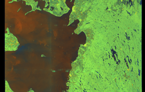
SAR coverage thumbnail
VIIRS Thermal Anomaly
Status: ✗ No detections
No VIIRS thermal/light detections in corridor
Show Raw Evidence JSON
{
    "gap_minutes": 242.80000000000001136868377216160297393798828125,
    "last_seen": {
        "ts": "2026-05-16T18:01:45+00:00",
        "lat": 56.06545330000000149084371514618396759033203125,
        "lon": 11.144481700000000046202330850064754486083984375,
        "sog": 10.699999999999999289457264239899814128875732421875,
        "zone_id": "discovered_087"
    },
    "next_seen": {
        "ts": "2026-05-16T22:04:31+00:00",
        "lat": 56.61835330000000254813130595721304416656494140625,
        "lon": 11.817724999999999369038050645031034946441650390625,
        "zone_ids": [
            "discovered_063"
        ]
    },
    "gap_enrichment": {
        "status": "done",
        "corridor": {
            "start": {
                "lat": 56.06545330000000149084371514618396759033203125,
                "lon": 11.144481700000000046202330850064754486083984375,
                "ts": "2026-05-16T18:01:45+00:00"
            },
            "end": {
                "lat": 56.61835330000000254813130595721304416656494140625,
                "lon": 11.817724999999999369038050645031034946441650390625,
                "ts": "2026-05-16T22:04:31+00:00"
            },
            "bbox": {
                "min_lat": 55.8852729999999979781932779587805271148681640625,
                "min_lon": 10.819385000000000474074113299138844013214111328125,
                "max_lat": 56.79853299999999904912328929640352725982666015625,
                "max_lon": 12.1428220000000006706386557198129594326019287109375
            },
            "buffer_km": 20
        },
        "sar": {
            "status": "snapshot",
            "scene_id": "S1D_IW_GRDH_1SDV_20260516T165242_20260516T165307_002812_004C57_91F0_COG",
            "scene_time": "2026-05-16T16:52:42.569818Z",
            "platform": "sentinel-1d",
            "assets": {
                "preview_url": "https:\/\/fleetleaks.com\/wp-content\/uploads\/fleetleaks-evidence\/sar-imagery\/2026\/05\/event_556215_thumbnail_20260516221506.png",
                "stored_path": "\/home\/fleetleaks\/public_html\/wp-content\/uploads\/fleetleaks-evidence\/sar-imagery\/2026\/05\/event_556215_thumbnail_20260516221506.png",
                "source": "copernicus_dataspace"
            },
            "notes": "SAR snapshot available for review"
        },
        "viirs": {
            "status": "not_found",
            "notes": "No VIIRS thermal\/light detections in corridor"
        },
        "searched_at": "2026-05-16T22:15:01.615056+00:00"
    }
}- Zone: Northwest Iberian Sea Monitoring Zone
- Duration: 2h 1m
- Data Points: 59 AIS positions
- Period: 2026-05-16T16:00:32+00:00 to 2026-05-16T18:01:45+00:00
Show Raw Evidence JSON
{
    "zone_id": "discovered_087",
    "zone_name": "Northwest Iberian Sea Monitoring Zone",
    "dwell_minutes": 121.2000000000000028421709430404007434844970703125,
    "points_in_zone": 59,
    "first_point": {
        "ts": "2026-05-16T16:00:32+00:00",
        "lat": 55.771306699999996681071934290230274200439453125,
        "lon": 10.81878999999999990677679306827485561370849609375
    },
    "last_point": {
        "ts": "2026-05-16T18:01:45+00:00",
        "lat": 56.06545330000000149084371514618396759033203125,
        "lon": 11.144481700000000046202330850064754486083984375
    }
}- Zone: Northwest Iberian Sea Monitoring Zone
- Duration: 3 hours
- Data Points: 91 AIS positions
- Period: 2026-05-16T15:00:59+00:00 to 2026-05-16T18:01:45+00:00
Show Raw Evidence JSON
{
    "zone_id": "discovered_087",
    "zone_name": "Northwest Iberian Sea Monitoring Zone",
    "dwell_minutes": 180.80000000000001136868377216160297393798828125,
    "points_in_zone": 91,
    "first_point": {
        "ts": "2026-05-16T15:00:59+00:00",
        "lat": 55.5956867000000016787453205324709415435791015625,
        "lon": 10.8235717000000004617277227225713431835174560546875
    },
    "last_point": {
        "ts": "2026-05-16T18:01:45+00:00",
        "lat": 56.06545330000000149084371514618396759033203125,
        "lon": 11.144481700000000046202330850064754486083984375
    }
}- Zone: Northwest Iberian Sea Monitoring Zone
- Duration: 3h 53m
- Data Points: 119 AIS positions
- Period: 2026-05-16T14:07:55+00:00 to 2026-05-16T18:01:45+00:00
Show Raw Evidence JSON
{
    "zone_id": "discovered_087",
    "zone_name": "Northwest Iberian Sea Monitoring Zone",
    "dwell_minutes": 233.80000000000001136868377216160297393798828125,
    "points_in_zone": 119,
    "first_point": {
        "ts": "2026-05-16T14:07:55+00:00",
        "lat": 55.45647000000000303998604067601263523101806640625,
        "lon": 10.9394550000000005951505954726599156856536865234375
    },
    "last_point": {
        "ts": "2026-05-16T18:01:45+00:00",
        "lat": 56.06545330000000149084371514618396759033203125,
        "lon": 11.144481700000000046202330850064754486083984375
    }
}- Zone: Northwest Iberian Sea Monitoring Zone
- Duration: 4h 45m
- Data Points: 125 AIS positions
- Period: 2026-05-16T13:16:40+00:00 to 2026-05-16T18:01:45+00:00
Show Raw Evidence JSON
{
    "zone_id": "discovered_087",
    "zone_name": "Northwest Iberian Sea Monitoring Zone",
    "dwell_minutes": 285.1000000000000227373675443232059478759765625,
    "points_in_zone": 125,
    "first_point": {
        "ts": "2026-05-16T13:16:40+00:00",
        "lat": 55.32473329999999833717083674855530261993408203125,
        "lon": 11.0411632999999991255890563479624688625335693359375
    },
    "last_point": {
        "ts": "2026-05-16T18:01:45+00:00",
        "lat": 56.06545330000000149084371514618396759033203125,
        "lon": 11.144481700000000046202330850064754486083984375
    }
}- Zone: English Channel Surveillance Zone
- Duration: 1h 36m
- Data Points: 42 AIS positions
- Period: 2026-05-16T12:00:39+00:00 to 2026-05-16T13:37:07+00:00
Show Raw Evidence JSON
{
    "zone_id": "discovered_077",
    "zone_name": "English Channel Surveillance Zone",
    "dwell_minutes": 96.5,
    "points_in_zone": 42,
    "first_point": {
        "ts": "2026-05-16T12:00:39+00:00",
        "lat": 55.10178330000000102018020697869360446929931640625,
        "lon": 11.044914999999999594137989333830773830413818359375
    },
    "last_point": {
        "ts": "2026-05-16T13:37:07+00:00",
        "lat": 55.3839033000000000583895598538219928741455078125,
        "lon": 11.0218399999999991933918863651342689990997314453125
    }
}- Zone: English Channel Surveillance Zone
- Duration: 2h 12m
- Data Points: 62 AIS positions
- Period: 2026-05-16T11:24:13+00:00 to 2026-05-16T13:37:07+00:00
Show Raw Evidence JSON
{
    "zone_id": "discovered_077",
    "zone_name": "English Channel Surveillance Zone",
    "dwell_minutes": 132.900000000000005684341886080801486968994140625,
    "points_in_zone": 62,
    "first_point": {
        "ts": "2026-05-16T11:24:13+00:00",
        "lat": 54.98381330000000133395587909035384654998779296875,
        "lon": 11.01942999999999983629095368087291717529296875
    },
    "last_point": {
        "ts": "2026-05-16T13:37:07+00:00",
        "lat": 55.3839033000000000583895598538219928741455078125,
        "lon": 11.0218399999999991933918863651342689990997314453125
    }
}- Gap Duration: 4h 53m
- Last Seen: 2026-05-16T06:31:09+00:00 at 54.4626, 11.7254 (Zone: Southern Baltic Surveillance Zone)
- Next Seen: 2026-05-16T11:24:13+00:00 at 54.9838, 11.0194
🛰️ Gap Corroboration
These are snapshots that may corroborate presence during the gap. They do not reconstruct a continuous route.
SAR Imagery (Sentinel-1)
Status: ✓ Snapshot available
SAR snapshot available for review
Scene: S1D_IW_GRDH_1SDV_20260516T054037_20260516T054102_002805_004C18_4F39_COG • Time: 2026-05-16T05:40:37.055681Z
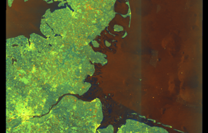
SAR coverage thumbnail
VIIRS Thermal Anomaly
Status: ✗ No detections
No VIIRS thermal/light detections in corridor
Show Raw Evidence JSON
{
    "gap_minutes": 293.1000000000000227373675443232059478759765625,
    "last_seen": {
        "ts": "2026-05-16T06:31:09+00:00",
        "lat": 54.46264670000000052141331252641975879669189453125,
        "lon": 11.7253966999999992282255334430374205112457275390625,
        "sog": 10.5999999999999996447286321199499070644378662109375,
        "zone_id": "discovered_093"
    },
    "next_seen": {
        "ts": "2026-05-16T11:24:13+00:00",
        "lat": 54.98381330000000133395587909035384654998779296875,
        "lon": 11.01942999999999983629095368087291717529296875,
        "zone_ids": [
            "discovered_077"
        ]
    },
    "gap_enrichment": {
        "status": "done",
        "corridor": {
            "start": {
                "lat": 54.46264670000000052141331252641975879669189453125,
                "lon": 11.7253966999999992282255334430374205112457275390625,
                "ts": "2026-05-16T06:31:09+00:00"
            },
            "end": {
                "lat": 54.98381330000000133395587909035384654998779296875,
                "lon": 11.01942999999999983629095368087291717529296875,
                "ts": "2026-05-16T11:24:13+00:00"
            },
            "bbox": {
                "min_lat": 54.2824669999999969149939715862274169921875,
                "min_lon": 10.7074440000000006278924047364853322505950927734375,
                "max_lat": 55.16399299999999783494786242954432964324951171875,
                "max_lon": 12.0373830000000001660964699112810194492340087890625
            },
            "buffer_km": 20
        },
        "sar": {
            "status": "snapshot",
            "scene_id": "S1D_IW_GRDH_1SDV_20260516T054037_20260516T054102_002805_004C18_4F39_COG",
            "scene_time": "2026-05-16T05:40:37.055681Z",
            "platform": "sentinel-1d",
            "assets": {
                "preview_url": "https:\/\/fleetleaks.com\/wp-content\/uploads\/fleetleaks-evidence\/sar-imagery\/2026\/05\/event_553820_thumbnail_20260516113008.png",
                "stored_path": "\/home\/fleetleaks\/public_html\/wp-content\/uploads\/fleetleaks-evidence\/sar-imagery\/2026\/05\/event_553820_thumbnail_20260516113008.png",
                "source": "copernicus_dataspace"
            },
            "notes": "SAR snapshot available for review"
        },
        "viirs": {
            "status": "not_found",
            "notes": "No VIIRS thermal\/light detections in corridor"
        },
        "searched_at": "2026-05-16T11:30:04.524285+00:00"
    }
}- Zone: Southern Baltic Surveillance Zone
- Duration: 1h 30m
- Data Points: 56 AIS positions
- Period: 2026-05-16T05:00:58+00:00 to 2026-05-16T06:31:09+00:00
Show Raw Evidence JSON
{
    "zone_id": "discovered_093",
    "zone_name": "Southern Baltic Surveillance Zone",
    "dwell_minutes": 90.2000000000000028421709430404007434844970703125,
    "points_in_zone": 56,
    "first_point": {
        "ts": "2026-05-16T05:00:58+00:00",
        "lat": 54.45506329999999906021912465803325176239013671875,
        "lon": 12.1728982999999999492501956410706043243408203125
    },
    "last_point": {
        "ts": "2026-05-16T06:31:09+00:00",
        "lat": 54.46264670000000052141331252641975879669189453125,
        "lon": 11.7253966999999992282255334430374205112457275390625
    }
}- Zone: Southern Baltic Surveillance Zone
- Duration: 2h 1m
- Data Points: 72 AIS positions
- Period: 2026-05-16T04:30:01+00:00 to 2026-05-16T06:31:09+00:00
Show Raw Evidence JSON
{
    "zone_id": "discovered_093",
    "zone_name": "Southern Baltic Surveillance Zone",
    "dwell_minutes": 121.099999999999994315658113919198513031005859375,
    "points_in_zone": 72,
    "first_point": {
        "ts": "2026-05-16T04:30:01+00:00",
        "lat": 54.54646000000000327645466313697397708892822265625,
        "lon": 12.2127517000000000990667103906162083148956298828125
    },
    "last_point": {
        "ts": "2026-05-16T06:31:09+00:00",
        "lat": 54.46264670000000052141331252641975879669189453125,
        "lon": 11.7253966999999992282255334430374205112457275390625
    }
}- Zone: discovered_034
- Duration: 1h 6m
- Data Points: 36 AIS positions
- Period: 2026-05-15T03:05:00+00:00 to 2026-05-15T04:11:04+00:00
Show Raw Evidence JSON
{
    "zone_id": "discovered_034",
    "zone_name": "Gda\u0144sk Maritime Surveillance Zone",
    "dwell_minutes": 66.099999999999994315658113919198513031005859375,
    "points_in_zone": 36,
    "first_point": {
        "ts": "2026-05-15T03:05:00+00:00",
        "lat": 54.85262999999999777855919091962277889251708984375,
        "lon": 19.147106699999998369321474456228315830230712890625
    },
    "last_point": {
        "ts": "2026-05-15T04:11:04+00:00",
        "lat": 54.915846700000003011155058629810810089111328125,
        "lon": 18.805211700000000973886926658451557159423828125
    }
}- Zone: discovered_034
- Duration: 2h 7m
- Data Points: 60 AIS positions
- Period: 2026-05-15T02:03:17+00:00 to 2026-05-15T04:11:04+00:00
Show Raw Evidence JSON
{
    "zone_id": "discovered_034",
    "zone_name": "Gda\u0144sk Maritime Surveillance Zone",
    "dwell_minutes": 127.7999999999999971578290569595992565155029296875,
    "points_in_zone": 60,
    "first_point": {
        "ts": "2026-05-15T02:03:17+00:00",
        "lat": 54.78835670000000135360096464864909648895263671875,
        "lon": 19.461099999999998289013092289678752422332763671875
    },
    "last_point": {
        "ts": "2026-05-15T04:11:04+00:00",
        "lat": 54.915846700000003011155058629810810089111328125,
        "lon": 18.805211700000000973886926658451557159423828125
    }
}- Zone: discovered_034
- Duration: 3h 3m
- Data Points: 87 AIS positions
- Period: 2026-05-15T01:07:21+00:00 to 2026-05-15T04:11:04+00:00
Show Raw Evidence JSON
{
    "zone_id": "discovered_034",
    "zone_name": "Gda\u0144sk Maritime Surveillance Zone",
    "dwell_minutes": 183.69999999999998863131622783839702606201171875,
    "points_in_zone": 87,
    "first_point": {
        "ts": "2026-05-15T01:07:21+00:00",
        "lat": 54.7029399999999981218934408389031887054443359375,
        "lon": 19.732028299999999632063918397761881351470947265625
    },
    "last_point": {
        "ts": "2026-05-15T04:11:04+00:00",
        "lat": 54.915846700000003011155058629810810089111328125,
        "lon": 18.805211700000000973886926658451557159423828125
    }
}- Zone: discovered_034
- Duration: 3h 16m
- Data Points: 88 AIS positions
- Period: 2026-05-15T00:54:21+00:00 to 2026-05-15T04:11:04+00:00
Show Raw Evidence JSON
{
    "zone_id": "discovered_034",
    "zone_name": "Gda\u0144sk Maritime Surveillance Zone",
    "dwell_minutes": 196.69999999999998863131622783839702606201171875,
    "points_in_zone": 88,
    "first_point": {
        "ts": "2026-05-15T00:54:21+00:00",
        "lat": 54.68106329999999815072442288510501384735107421875,
        "lon": 19.79237499999999982946974341757595539093017578125
    },
    "last_point": {
        "ts": "2026-05-15T04:11:04+00:00",
        "lat": 54.915846700000003011155058629810810089111328125,
        "lon": 18.805211700000000973886926658451557159423828125
    }
}- Zone: discovered_034
- Duration: 1h 39m
- Data Points: 55 AIS positions
- Period: 2026-05-11T04:02:07+00:00 to 2026-05-11T05:41:25+00:00
Show Raw Evidence JSON
{
    "zone_id": "discovered_034",
    "zone_name": "Gda\u0144sk Maritime Surveillance Zone",
    "dwell_minutes": 99.2999999999999971578290569595992565155029296875,
    "points_in_zone": 55,
    "first_point": {
        "ts": "2026-05-11T04:02:07+00:00",
        "lat": 54.90098669999999714264049543999135494232177734375,
        "lon": 18.9072417000000001507942215539515018463134765625
    },
    "last_point": {
        "ts": "2026-05-11T05:41:25+00:00",
        "lat": 55.0332300000000032014213502407073974609375,
        "lon": 19.64401170000000007576090865768492221832275390625
    }
}- Zone: discovered_034
- Duration: 1h 58m
- Data Points: 60 AIS positions
- Period: 2026-05-11T03:43:28+00:00 to 2026-05-11T05:41:25+00:00
Show Raw Evidence JSON
{
    "zone_id": "discovered_034",
    "zone_name": "Gda\u0144sk Maritime Surveillance Zone",
    "dwell_minutes": 118,
    "points_in_zone": 60,
    "first_point": {
        "ts": "2026-05-11T03:43:28+00:00",
        "lat": 54.921999999999997044142219237983226776123046875,
        "lon": 18.801964999999999150759322219528257846832275390625
    },
    "last_point": {
        "ts": "2026-05-11T05:41:25+00:00",
        "lat": 55.0332300000000032014213502407073974609375,
        "lon": 19.64401170000000007576090865768492221832275390625
    }
}- Zone: English Channel Surveillance Zone
- Duration: 1h 53m
- Data Points: 66 AIS positions
- Period: 2026-05-10T08:00:14+00:00 to 2026-05-10T09:54:01+00:00
Show Raw Evidence JSON
{
    "zone_id": "discovered_004",
    "zone_name": "English Channel Surveillance Zone",
    "dwell_minutes": 113.7999999999999971578290569595992565155029296875,
    "points_in_zone": 66,
    "first_point": {
        "ts": "2026-05-10T08:00:14+00:00",
        "lat": 55.44879670000000260188244283199310302734375,
        "lon": 12.6740666999999991304548530024476349353790283203125
    },
    "last_point": {
        "ts": "2026-05-10T09:54:01+00:00",
        "lat": 55.2172800000000023601387511007487773895263671875,
        "lon": 12.999558300000000343743522535078227519989013671875
    }
}- Zone: English Channel Surveillance Zone
- Duration: 2h 53m
- Data Points: 97 AIS positions
- Period: 2026-05-10T07:00:39+00:00 to 2026-05-10T09:54:01+00:00
Show Raw Evidence JSON
{
    "zone_id": "discovered_004",
    "zone_name": "English Channel Surveillance Zone",
    "dwell_minutes": 173.400000000000005684341886080801486968994140625,
    "points_in_zone": 97,
    "first_point": {
        "ts": "2026-05-10T07:00:39+00:00",
        "lat": 55.614159999999998262865119613707065582275390625,
        "lon": 12.6970299999999998163957570795901119709014892578125
    },
    "last_point": {
        "ts": "2026-05-10T09:54:01+00:00",
        "lat": 55.2172800000000023601387511007487773895263671875,
        "lon": 12.999558300000000343743522535078227519989013671875
    }
}- Zone: English Channel Surveillance Zone
- Duration: 3h 22m
- Data Points: 118 AIS positions
- Period: 2026-05-10T06:31:33+00:00 to 2026-05-10T09:54:01+00:00
Show Raw Evidence JSON
{
    "zone_id": "discovered_004",
    "zone_name": "English Channel Surveillance Zone",
    "dwell_minutes": 202.5,
    "points_in_zone": 118,
    "first_point": {
        "ts": "2026-05-10T06:31:33+00:00",
        "lat": 55.6984800000000035424818634055554866790771484375,
        "lon": 12.6861300000000003507238943711854517459869384765625
    },
    "last_point": {
        "ts": "2026-05-10T09:54:01+00:00",
        "lat": 55.2172800000000023601387511007487773895263671875,
        "lon": 12.999558300000000343743522535078227519989013671875
    }
}- Zone: Southern Öresund Surveillance Zone
- Duration: 2h 1m
- Data Points: 76 AIS positions
- Period: 2026-05-10T03:00:12+00:00 to 2026-05-10T05:01:29+00:00
Show Raw Evidence JSON
{
    "zone_id": "discovered_003",
    "zone_name": "Southern \u00d6resund Surveillance Zone",
    "dwell_minutes": 121.2999999999999971578290569595992565155029296875,
    "points_in_zone": 76,
    "first_point": {
        "ts": "2026-05-10T03:00:12+00:00",
        "lat": 56.266379999999998062776285223662853240966796875,
        "lon": 12.348478300000000018599166651256382465362548828125
    },
    "last_point": {
        "ts": "2026-05-10T05:01:29+00:00",
        "lat": 55.9690666999999990594005794264376163482666015625,
        "lon": 12.6293433000000003829654815490357577800750732421875
    }
}- Zone: Southern Öresund Surveillance Zone
- Duration: 2h 59m
- Data Points: 113 AIS positions
- Period: 2026-05-10T02:02:18+00:00 to 2026-05-10T05:01:29+00:00
Show Raw Evidence JSON
{
    "zone_id": "discovered_003",
    "zone_name": "Southern \u00d6resund Surveillance Zone",
    "dwell_minutes": 179.19999999999998863131622783839702606201171875,
    "points_in_zone": 113,
    "first_point": {
        "ts": "2026-05-10T02:02:18+00:00",
        "lat": 56.43878670000000141726559377275407314300537109375,
        "lon": 12.268918299999999277360984706319868564605712890625
    },
    "last_point": {
        "ts": "2026-05-10T05:01:29+00:00",
        "lat": 55.9690666999999990594005794264376163482666015625,
        "lon": 12.6293433000000003829654815490357577800750732421875
    }
}- Zone: Southern Öresund Surveillance Zone
- Duration: 4 hours
- Data Points: 152 AIS positions
- Period: 2026-05-10T01:01:25+00:00 to 2026-05-10T05:01:29+00:00
Show Raw Evidence JSON
{
    "zone_id": "discovered_003",
    "zone_name": "Southern \u00d6resund Surveillance Zone",
    "dwell_minutes": 240.099999999999994315658113919198513031005859375,
    "points_in_zone": 152,
    "first_point": {
        "ts": "2026-05-10T01:01:25+00:00",
        "lat": 56.61937999999999959754859446547925472259521484375,
        "lon": 12.188063299999999600231603835709393024444580078125
    },
    "last_point": {
        "ts": "2026-05-10T05:01:29+00:00",
        "lat": 55.9690666999999990594005794264376163482666015625,
        "lon": 12.6293433000000003829654815490357577800750732421875
    }
}- Zone: Southern Öresund Surveillance Zone
- Duration: 4h 58m
- Data Points: 174 AIS positions
- Period: 2026-05-10T00:02:47+00:00 to 2026-05-10T05:01:29+00:00
Show Raw Evidence JSON
{
    "zone_id": "discovered_003",
    "zone_name": "Southern \u00d6resund Surveillance Zone",
    "dwell_minutes": 298.69999999999998863131622783839702606201171875,
    "points_in_zone": 174,
    "first_point": {
        "ts": "2026-05-10T00:02:47+00:00",
        "lat": 56.72413999999999845158527023158967494964599609375,
        "lon": 12.141516700000000383852238883264362812042236328125
    },
    "last_point": {
        "ts": "2026-05-10T05:01:29+00:00",
        "lat": 55.9690666999999990594005794264376163482666015625,
        "lon": 12.6293433000000003829654815490357577800750732421875
    }
}- Zone: Southern Öresund Surveillance Zone
- Duration: 6 hours
- Data Points: 194 AIS positions
- Period: 2026-05-09T23:00:54+00:00 to 2026-05-10T05:01:29+00:00
Show Raw Evidence JSON
{
    "zone_id": "discovered_003",
    "zone_name": "Southern \u00d6resund Surveillance Zone",
    "dwell_minutes": 360.6000000000000227373675443232059478759765625,
    "points_in_zone": 194,
    "first_point": {
        "ts": "2026-05-09T23:00:54+00:00",
        "lat": 56.83771999999999735564415459521114826202392578125,
        "lon": 12.0879767000000004628645910997875034809112548828125
    },
    "last_point": {
        "ts": "2026-05-10T05:01:29+00:00",
        "lat": 55.9690666999999990594005794264376163482666015625,
        "lon": 12.6293433000000003829654815490357577800750732421875
    }
}Recent Position Data
| Time (UTC) | Lat | Lon | Speed | Course | Zone |
|---|---|---|---|---|---|
| Jun 15 11:22 | 40.8681 | 28.5012 | 11.0 kn | 260.1° | Bosphorus/Dardanelles Approach |
| Jun 15 11:13 | 40.8723 | 28.5354 | 10.8 kn | 260.7° | Bosphorus/Dardanelles Approach |
| Jun 15 11:09 | 40.8741 | 28.5498 | 10.8 kn | 260.2° | Bosphorus/Dardanelles Approach |
| Jun 15 11:08 | 40.8746 | 28.5538 | 10.8 kn | 261.5° | Bosphorus/Dardanelles Approach |
| Jun 15 10:50 | 40.8840 | 28.6247 | 10.6 kn | 257.4° | Bosphorus/Dardanelles Approach |
| Jun 15 10:48 | 40.8850 | 28.6311 | 10.6 kn | 257.0° | Bosphorus/Dardanelles Approach |
| Jun 15 10:47 | 40.8860 | 28.6368 | 10.6 kn | 257.1° | Bosphorus/Dardanelles Approach |
| Jun 15 10:46 | 40.8867 | 28.6412 | 10.6 kn | 256.6° | Bosphorus/Dardanelles Approach |
| Jun 15 10:45 | 40.8874 | 28.6449 | 10.6 kn | 256.5° | Bosphorus/Dardanelles Approach |
| Jun 15 10:43 | 40.8883 | 28.6500 | 10.6 kn | 257.1° | Bosphorus/Dardanelles Approach |
| Jun 15 10:42 | 40.8890 | 28.6545 | 10.7 kn | 257.4° | Bosphorus/Dardanelles Approach |
| Jun 15 10:38 | 40.8917 | 28.6698 | 10.8 kn | 256.6° | Bosphorus/Dardanelles Approach |
| Jun 15 10:37 | 40.8926 | 28.6751 | 10.8 kn | 257.0° | Bosphorus/Dardanelles Approach |
| Jun 15 10:36 | 40.8932 | 28.6790 | 11.0 kn | 257.2° | Bosphorus/Dardanelles Approach |
| Jun 15 10:35 | 40.8941 | 28.6843 | 11.1 kn | 257.5° | Bosphorus/Dardanelles Approach |
| Jun 15 10:29 | 40.8977 | 28.7061 | 11.5 kn | 258.6° | Bosphorus/Dardanelles Approach |
| Jun 15 10:28 | 40.8984 | 28.7108 | 11.5 kn | 258.7° | Bosphorus/Dardanelles Approach |
| Jun 15 10:27 | 40.8990 | 28.7150 | 11.6 kn | 258.2° | Bosphorus/Dardanelles Approach |
| Jun 15 10:20 | 40.9030 | 28.7447 | 11.8 kn | 260.6° | Bosphorus/Dardanelles Approach |
| Jun 15 10:19 | 40.9034 | 28.7490 | 11.7 kn | 262.4° | Bosphorus/Dardanelles Approach |
Showing 20 of 100 recent positions.
Data Source
Vessel observed through FleetLeaks' AIS monitoring system in zones of interest. Identity and position data derived from AIS broadcasts and public maritime databases.
Disclaimer: AIS data can be spoofed or falsified. Vessel identities should be independently verified before making compliance decisions.