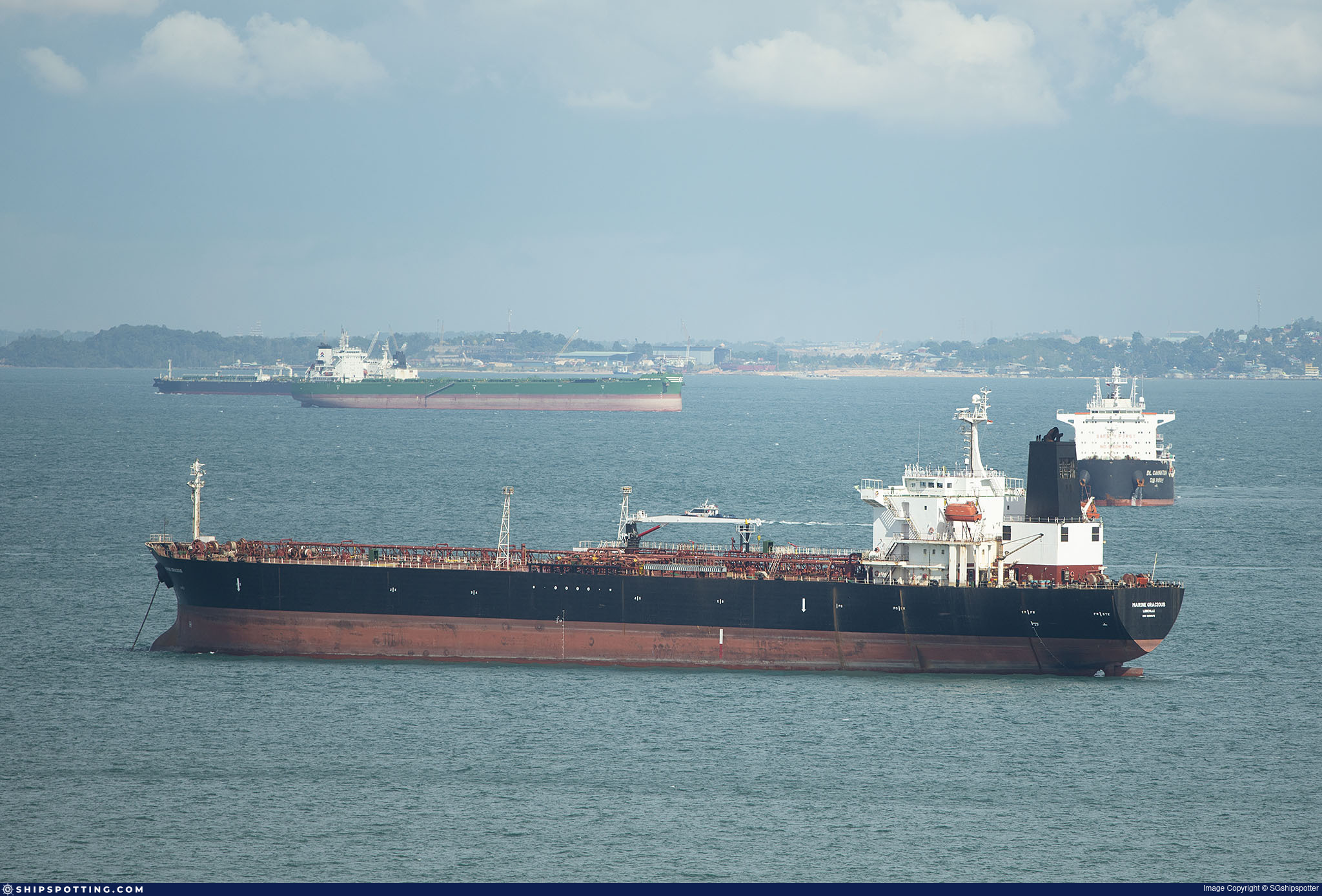
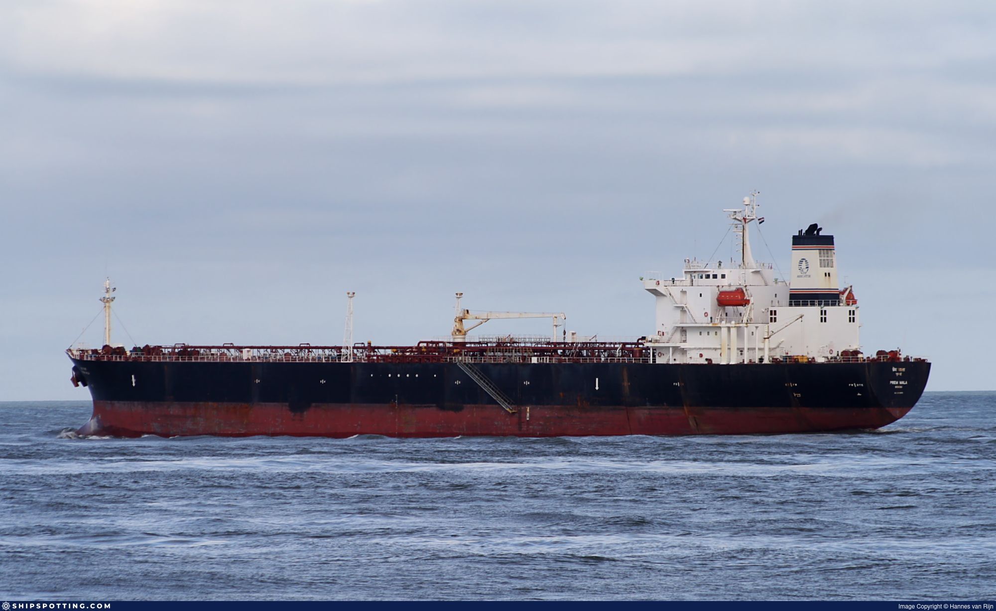
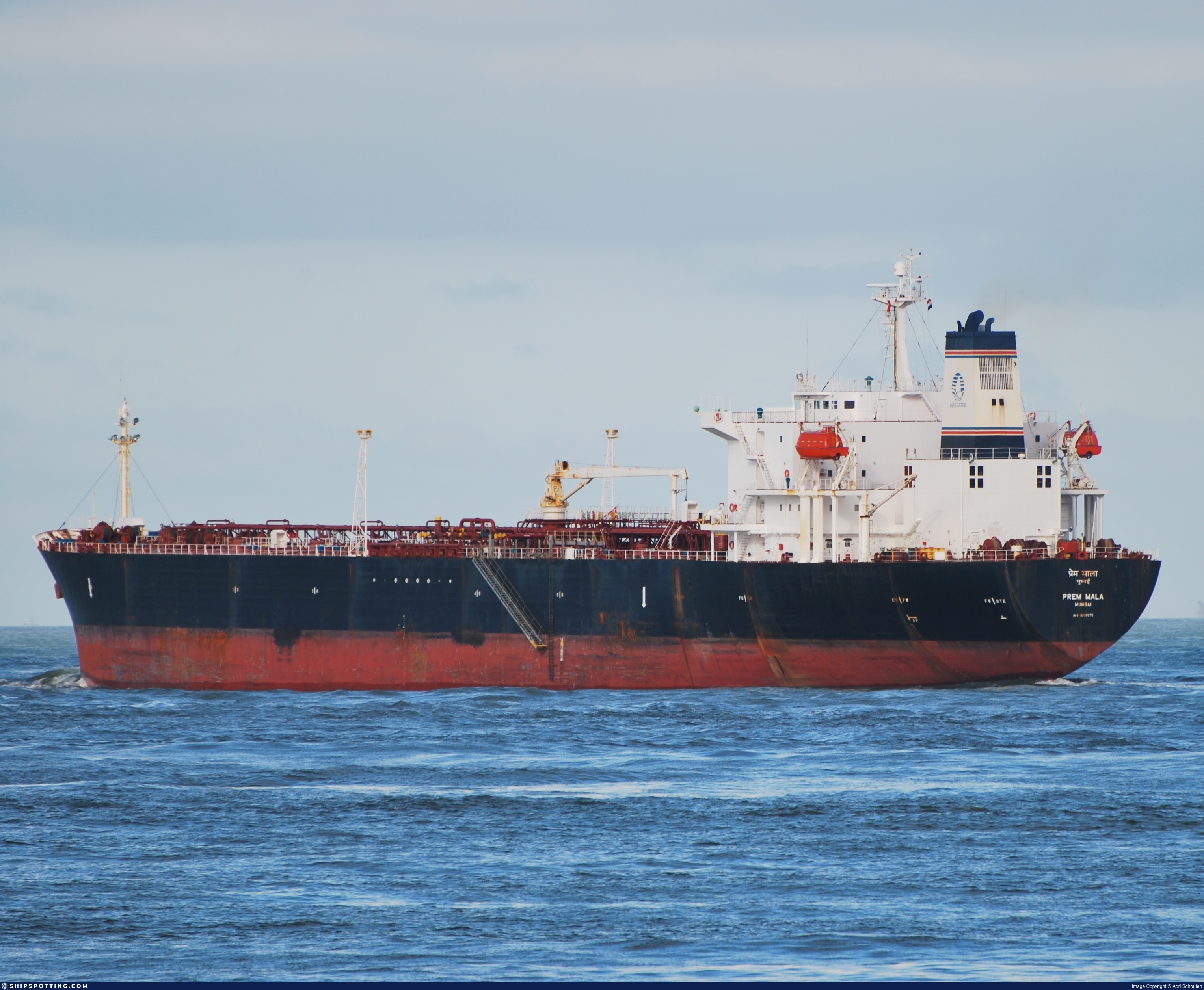
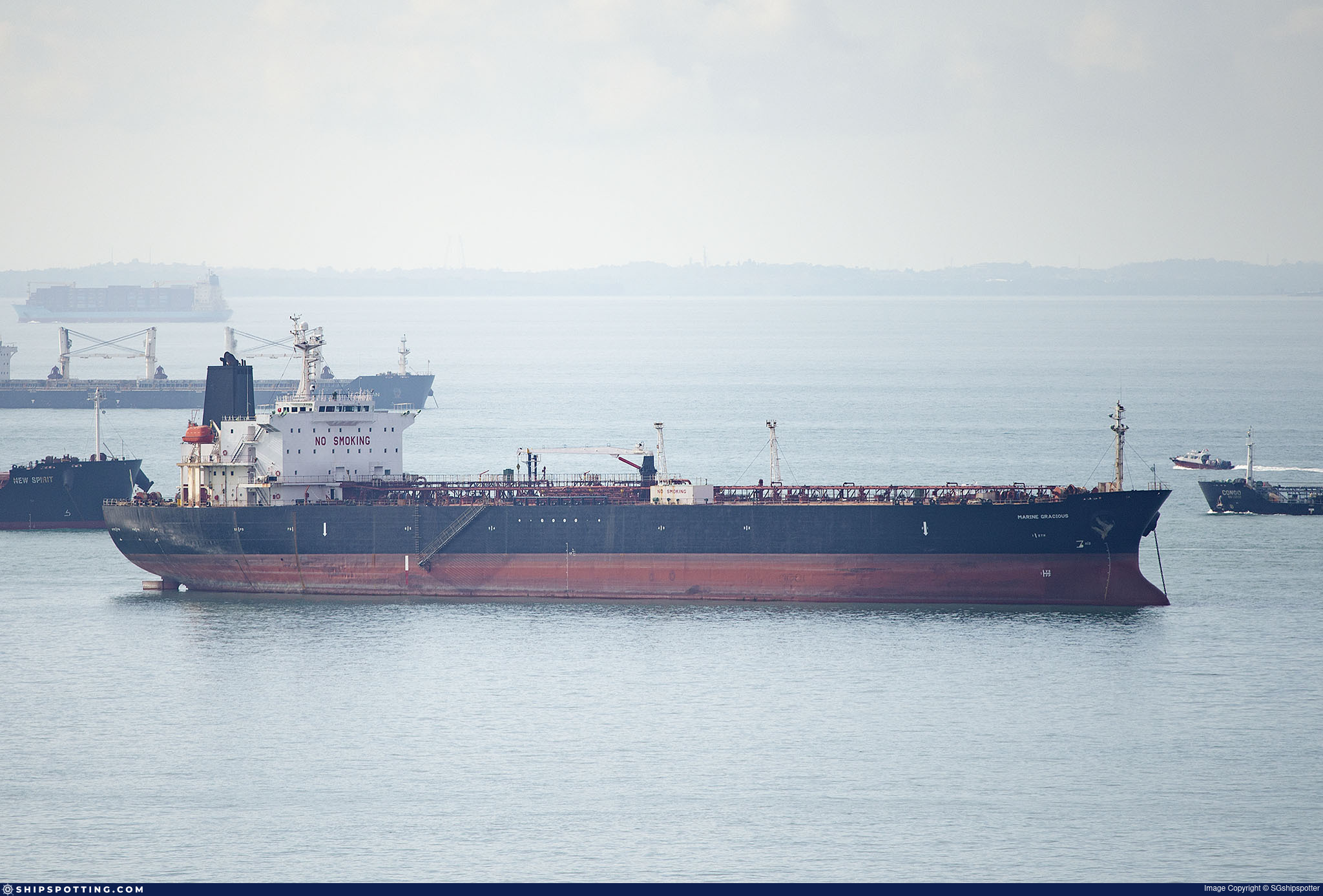
IMO 9209972
Vessel information
Sanctioned by
Company & Ownership
Management & Operations
Classification & Safety
Port State Control (PSC) Inspections
Survey Renewal & Certificates
| Code | Type | Issuer | Issued | Expires |
|---|---|---|---|---|
| 510 | Safety Management Certificate | Indian Register of Shipping (150) | 28/04/2021 | 21/04/2026 |
| 533 | Maritime Labour Certificate | Indian Register of Shipping (150) | 02/02/2021 | 23/01/2026 |
Programs & Notes
EU Russia Sanctions – Shadow Fleet | AU vessel designations (DFAT) | SEMA (Canada) — vessel designations | The Russia (Sanctions) (EU Exit) Regulations 2019
DateOfListing: 2025-02-25 || DateDesignated: 2025-02-24 | Shipping sanctions: (see “Other information”) | Shipping sanctions: a specified ship is prohibited from being provided with access to or having its master or pilot cause it to enter a port in the UK, may have its registration on the UK Ship Register terminated, and a master or pilot of a specified ship may be given a port barring direction, a detention direction, and a port entry direction or a movement direction. | IMO 9209972 (“TEMIRO”) is involved in activity whose object or effect is to destabilise Ukraine or undermine or threaten the territorial integrity, sovereignty or independence of Ukraine or to obtain a benefit from or support the Government of Russia. Namely, TEMIRO is involved in carrying oil or oil products that originated in Russia from Russia to a third country.
Vessel Changes
AIS Events
26 events detected • 1 zone • Last: Feb 16, 2026
- Duration: 2h 3m
- Radius: 26 meters
- Data Points: 22 AIS positions
- Centroid: 31.5220, 32.3820
- Zone: Baltic Sea Surveillance Zone
Show Raw Evidence JSON
{
    "radius_m": 26.10000000000000142108547152020037174224853515625,
    "duration_minutes": 123,
    "points": 22,
    "centroid": {
        "lat": 31.52204075909090619234120822511613368988037109375,
        "lon": 32.381954686363627615719451569020748138427734375
    },
    "bbox": {
        "min_lat": 31.521886699999999592591848340816795825958251953125,
        "min_lon": 32.381720000000001391526893712580204010009765625,
        "max_lat": 31.52217830000000020618244889192283153533935546875,
        "max_lon": 32.38217829999999963774826028384268283843994140625
    },
    "zone_id": "discovered_015"
}- Zone: Baltic Sea Surveillance Zone
- Duration: 2h 3m
- Data Points: 22 AIS positions
- Period: 2026-02-16T17:02:55+00:00 to 2026-02-16T19:05:55+00:00
Show Raw Evidence JSON
{
    "zone_id": "discovered_015",
    "zone_name": "Delta of the Nile Monitoring Zone",
    "dwell_minutes": 123,
    "points_in_zone": 22,
    "first_point": {
        "ts": "2026-02-16T17:02:55+00:00",
        "lat": 31.521950000000000358113538823090493679046630859375,
        "lon": 32.3817566999999968402335071004927158355712890625
    },
    "last_point": {
        "ts": "2026-02-16T19:05:55+00:00",
        "lat": 31.52217830000000020618244889192283153533935546875,
        "lon": 32.38217829999999963774826028384268283843994140625
    }
}- Duration: 2h 57m
- Radius: 32 meters
- Data Points: 32 AIS positions
- Centroid: 31.5220, 32.3819
- Zone: Baltic Sea Surveillance Zone
Show Raw Evidence JSON
{
    "radius_m": 31.60000000000000142108547152020037174224853515625,
    "duration_minutes": 177,
    "points": 32,
    "centroid": {
        "lat": 31.52201994687499819747245055623352527618408203125,
        "lon": 32.3819015093749982270310283638536930084228515625
    },
    "bbox": {
        "min_lat": 31.52187500000000142108547152020037174224853515625,
        "min_lon": 32.38165670000000062600520323030650615692138671875,
        "max_lat": 31.52217830000000020618244889192283153533935546875,
        "max_lon": 32.38217829999999963774826028384268283843994140625
    },
    "zone_id": "discovered_015"
}- Zone: Baltic Sea Surveillance Zone
- Duration: 2h 57m
- Data Points: 32 AIS positions
- Period: 2026-02-16T16:08:55+00:00 to 2026-02-16T19:05:55+00:00
Show Raw Evidence JSON
{
    "zone_id": "discovered_015",
    "zone_name": "Delta of the Nile Monitoring Zone",
    "dwell_minutes": 177,
    "points_in_zone": 32,
    "first_point": {
        "ts": "2026-02-16T16:08:55+00:00",
        "lat": 31.52192000000000149384504766203463077545166015625,
        "lon": 32.3817049999999966303221299313008785247802734375
    },
    "last_point": {
        "ts": "2026-02-16T19:05:55+00:00",
        "lat": 31.52217830000000020618244889192283153533935546875,
        "lon": 32.38217829999999963774826028384268283843994140625
    }
}- Duration: 3h 45m
- Radius: 64 meters
- Data Points: 38 AIS positions
- Centroid: 31.5220, 32.3819
- Zone: Baltic Sea Surveillance Zone
Show Raw Evidence JSON
{
    "radius_m": 63.7000000000000028421709430404007434844970703125,
    "duration_minutes": 225,
    "points": 38,
    "centroid": {
        "lat": 31.52202346315788616948339040391147136688232421875,
        "lon": 32.381875128947370967580354772508144378662109375
    },
    "bbox": {
        "min_lat": 31.52169500000000113004716695286333560943603515625,
        "min_lon": 32.38132499999999680539986002258956432342529296875,
        "max_lat": 31.522259999999999280362317222170531749725341796875,
        "max_lon": 32.38217829999999963774826028384268283843994140625
    },
    "zone_id": "discovered_015"
}- Zone: Baltic Sea Surveillance Zone
- Duration: 3h 45m
- Data Points: 38 AIS positions
- Period: 2026-02-16T15:20:55+00:00 to 2026-02-16T19:05:55+00:00
Show Raw Evidence JSON
{
    "zone_id": "discovered_015",
    "zone_name": "Delta of the Nile Monitoring Zone",
    "dwell_minutes": 225,
    "points_in_zone": 38,
    "first_point": {
        "ts": "2026-02-16T15:20:55+00:00",
        "lat": 31.52222499999999882902557146735489368438720703125,
        "lon": 32.38213999999999970214048516936600208282470703125
    },
    "last_point": {
        "ts": "2026-02-16T19:05:55+00:00",
        "lat": 31.52217830000000020618244889192283153533935546875,
        "lon": 32.38217829999999963774826028384268283843994140625
    }
}- Zone: Baltic Sea Surveillance Zone
- Duration: 6h 35m
- Data Points: 7 AIS positions
- Period: 2026-02-16T09:23:59+00:00 to 2026-02-16T15:59:55+00:00
Show Raw Evidence JSON
{
    "zone_id": "discovered_015",
    "zone_name": "Delta of the Nile Monitoring Zone",
    "dwell_minutes": 395.8999999999999772626324556767940521240234375,
    "points_in_zone": 7,
    "first_point": {
        "ts": "2026-02-16T09:23:59+00:00",
        "lat": 31.52383499999999827423380338586866855621337890625,
        "lon": 32.3786582999999978937921696342527866363525390625
    },
    "last_point": {
        "ts": "2026-02-16T15:59:55+00:00",
        "lat": 31.521906699999998835437509114854037761688232421875,
        "lon": 32.3814100000000024692781153135001659393310546875
    }
}- Zone: Baltic Sea Surveillance Zone
- Duration: 6h 33m
- Data Points: 9 AIS positions
- Period: 2026-02-16T08:53:57+00:00 to 2026-02-16T15:26:55+00:00
Show Raw Evidence JSON
{
    "zone_id": "discovered_015",
    "zone_name": "Delta of the Nile Monitoring Zone",
    "dwell_minutes": 393,
    "points_in_zone": 9,
    "first_point": {
        "ts": "2026-02-16T08:53:57+00:00",
        "lat": 31.524364999999999525925886700861155986785888671875,
        "lon": 32.37872829999999879646566114388406276702880859375
    },
    "last_point": {
        "ts": "2026-02-16T15:26:55+00:00",
        "lat": 31.522259999999999280362317222170531749725341796875,
        "lon": 32.38195329999999927395037957467138767242431640625
    }
}- Duration: 2h 48m
- Radius: 51 meters
- Data Points: 12 AIS positions
- Centroid: 31.5242, 32.3787
- Zone: Baltic Sea Surveillance Zone
Show Raw Evidence JSON
{
    "radius_m": 51.10000000000000142108547152020037174224853515625,
    "duration_minutes": 168.099999999999994315658113919198513031005859375,
    "points": 12,
    "centroid": {
        "lat": 31.524202916666666851597256027162075042724609375,
        "lon": 32.3786554083333300013691768981516361236572265625
    },
    "bbox": {
        "min_lat": 31.523786699999998717203197884373366832733154296875,
        "min_lon": 32.37842330000000146128513733856379985809326171875,
        "max_lat": 31.524398300000001427179086022078990936279296875,
        "max_lon": 32.37879000000000218051354750059545040130615234375
    },
    "zone_id": "discovered_015"
}- Zone: Baltic Sea Surveillance Zone
- Duration: 2h 48m
- Data Points: 12 AIS positions
- Period: 2026-02-16T06:35:56+00:00 to 2026-02-16T09:23:59+00:00
Show Raw Evidence JSON
{
    "zone_id": "discovered_015",
    "zone_name": "Delta of the Nile Monitoring Zone",
    "dwell_minutes": 168.099999999999994315658113919198513031005859375,
    "points_in_zone": 12,
    "first_point": {
        "ts": "2026-02-16T06:35:56+00:00",
        "lat": 31.523786699999998717203197884373366832733154296875,
        "lon": 32.37842330000000146128513733856379985809326171875
    },
    "last_point": {
        "ts": "2026-02-16T09:23:59+00:00",
        "lat": 31.52383499999999827423380338586866855621337890625,
        "lon": 32.3786582999999978937921696342527866363525390625
    }
}- Zone: Baltic Sea Surveillance Zone
- Duration: 5h 18m
- Data Points: 6 AIS positions
- Period: 2026-02-16T01:32:55+00:00 to 2026-02-16T06:50:55+00:00
Show Raw Evidence JSON
{
    "zone_id": "discovered_015",
    "zone_name": "Delta of the Nile Monitoring Zone",
    "dwell_minutes": 318,
    "points_in_zone": 6,
    "first_point": {
        "ts": "2026-02-16T01:32:55+00:00",
        "lat": 31.52410330000000016070771380327641963958740234375,
        "lon": 32.3784883000000007768903742544353008270263671875
    },
    "last_point": {
        "ts": "2026-02-16T06:50:55+00:00",
        "lat": 31.523903300000000626823748461902141571044921875,
        "lon": 32.3785400000000009868017514236271381378173828125
    }
}- Zone: Baltic Sea Surveillance Zone
- Duration: 4h 30m
- Data Points: 7 AIS positions
- Period: 2026-02-15T21:14:55+00:00 to 2026-02-16T01:44:55+00:00
Show Raw Evidence JSON
{
    "zone_id": "discovered_015",
    "zone_name": "Delta of the Nile Monitoring Zone",
    "dwell_minutes": 270,
    "points_in_zone": 7,
    "first_point": {
        "ts": "2026-02-15T21:14:55+00:00",
        "lat": 31.523451699999998965040504117496311664581298828125,
        "lon": 32.37833499999999986584953148849308490753173828125
    },
    "last_point": {
        "ts": "2026-02-16T01:44:55+00:00",
        "lat": 31.5238982999999990397554938681423664093017578125,
        "lon": 32.37839170000000166282916325144469738006591796875
    }
}- Duration: 5h 27m
- Radius: 59 meters
- Data Points: 11 AIS positions
- Centroid: 31.5236, 32.3784
- Zone: Baltic Sea Surveillance Zone
Show Raw Evidence JSON
{
    "radius_m": 59.10000000000000142108547152020037174224853515625,
    "duration_minutes": 327,
    "points": 11,
    "centroid": {
        "lat": 31.52358347272727456811480806209146976470947265625,
        "lon": 32.37835091818181609824023325927555561065673828125
    },
    "bbox": {
        "min_lat": 31.5231883000000010497387847863137722015380859375,
        "min_lon": 32.37826499999999896317603997886180877685546875,
        "max_lat": 31.52410499999999871079126023687422275543212890625,
        "max_lon": 32.3784883000000007768903742544353008270263671875
    },
    "zone_id": "discovered_015"
}- Zone: Baltic Sea Surveillance Zone
- Duration: 5h 27m
- Data Points: 11 AIS positions
- Period: 2026-02-15T20:17:55+00:00 to 2026-02-16T01:44:55+00:00
Show Raw Evidence JSON
{
    "zone_id": "discovered_015",
    "zone_name": "Delta of the Nile Monitoring Zone",
    "dwell_minutes": 327,
    "points_in_zone": 11,
    "first_point": {
        "ts": "2026-02-15T20:17:55+00:00",
        "lat": 31.523258299999998399698597495444118976593017578125,
        "lon": 32.37830000000000296722646453417837619781494140625
    },
    "last_point": {
        "ts": "2026-02-16T01:44:55+00:00",
        "lat": 31.5238982999999990397554938681423664093017578125,
        "lon": 32.37839170000000166282916325144469738006591796875
    }
}- Zone: Baltic Sea Surveillance Zone
- Duration: 1h 56m
- Data Points: 6 AIS positions
- Period: 2026-02-08T21:02:40+00:00 to 2026-02-08T22:59:32+00:00
Show Raw Evidence JSON
{
    "zone_id": "discovered_015",
    "zone_name": "Delta of the Nile Monitoring Zone",
    "dwell_minutes": 116.900000000000005684341886080801486968994140625,
    "points_in_zone": 6,
    "first_point": {
        "ts": "2026-02-08T21:02:40+00:00",
        "lat": 31.522929999999998784687704755924642086029052734375,
        "lon": 32.382153299999998807834344916045665740966796875
    },
    "last_point": {
        "ts": "2026-02-08T22:59:32+00:00",
        "lat": 31.522826699999999533474692725576460361480712890625,
        "lon": 32.3820649999999972123987390659749507904052734375
    }
}- Minimum Distance: 19 meters
- Average Distance: 23 meters
- Duration: 1h 10m
- Period: 2026-02-08T20:04:12+00:00 to 2026-02-08T21:15:01+00:00
- Vessel A Avg Speed: 0.0 knots
- Vessel B Avg Speed: 0.0 knots
- Zone: Baltic Sea Surveillance Zone
Confidence Analysis
High-confidence STS candidate. Two tankers (BARENTS and TEMIRO) maintained close proximity (min 19m, avg 22m) for 71 minutes. Both vessels were slow-moving (avg speeds 0.0 and 0.0 knots). The stable separation distance suggests deliberate parallel positioning typical of cargo transfer. Event occurred in Delta of the Nile Monitoring Zone, a known STS activity area.
View scoring breakdown
| Factor | Score | Detail |
|---|---|---|
| Distance Tightness | 25/25 | Min distance 19m, avg 22m |
| Duration | 15/25 | Duration 71 minutes |
| Speed Stability | 20/20 | both nearly stationary; very stable speeds |
| Distance Consistency | 15/15 | Distance variance ±2m |
| Isolation | 5/10 | Isolation data not available |
| Context | 5/5 | In monitored zone: Delta of the Nile Monitoring Zone |
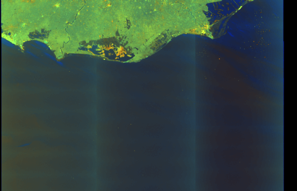
🛰️ Satellite Corroboration
Satellite imagery available but requires review
Preview available for manual review
Show Raw Evidence JSON
{
    "vessel_a": {
        "mmsi": 273279830,
        "imo": 9384447,
        "name": "BARENTS",
        "flag": "Russia"
    },
    "vessel_b": {
        "mmsi": 613579000,
        "imo": 9209972,
        "name": "TEMIRO",
        "flag": "CAMEROON"
    },
    "min_distance_m": 19.300000000000000710542735760100185871124267578125,
    "avg_distance_m": 22.5,
    "distance_consistency_m": 2.20000000000000017763568394002504646778106689453125,
    "duration_minutes": 70.7999999999999971578290569595992565155029296875,
    "overlap_duration_s": 4249,
    "speed_a_avg": 0.0200000000000000004163336342344337026588618755340576171875,
    "speed_a_std": 0.040000000000000000832667268468867405317723751068115234375,
    "speed_b_avg": 0,
    "speed_b_std": 0,
    "speed_summary": {
        "vessel_a": {
            "avg_sog": 0.0200000000000000004163336342344337026588618755340576171875,
            "max_sog": 0.1000000000000000055511151231257827021181583404541015625
        },
        "vessel_b": {
            "avg_sog": 0,
            "max_sog": 0
        }
    },
    "time_window": {
        "start": "2026-02-08T20:04:12+00:00",
        "end": "2026-02-08T21:15:01+00:00"
    },
    "points_count": {
        "vessel_a": 19,
        "vessel_b": 19
    },
    "zone_id": "discovered_015",
    "zone_name": "Delta of the Nile Monitoring Zone",
    "score": {
        "value": 85,
        "components": {
            "distance_tightness": {
                "score": 25,
                "max": 25,
                "detail": "Min distance 19m, avg 22m"
            },
            "duration": {
                "score": 15,
                "max": 25,
                "detail": "Duration 71 minutes"
            },
            "speed_stability": {
                "score": 20,
                "max": 20,
                "detail": "both nearly stationary; very stable speeds"
            },
            "distance_consistency": {
                "score": 15,
                "max": 15,
                "detail": "Distance variance \u00b12m"
            },
            "isolation": {
                "score": 5,
                "max": 10,
                "detail": "Isolation data not available"
            },
            "context": {
                "score": 5,
                "max": 5,
                "detail": "In monitored zone: Delta of the Nile Monitoring Zone"
            }
        },
        "summary": "High-confidence STS candidate. Two tankers (BARENTS and TEMIRO) maintained close proximity (min 19m, avg 22m) for 71 minutes. Both vessels were slow-moving (avg speeds 0.0 and 0.0 knots). The stable separation distance suggests deliberate parallel positioning typical of cargo transfer. Event occurred in Delta of the Nile Monitoring Zone, a known STS activity area."
    },
    "sar": {
        "status": "inconclusive",
        "centroid": {
            "lat": 31.523038700000000744694261811673641204833984375,
            "lon": 32.382229899999998679049895144999027252197265625
        },
        "time_window": {
            "start_ts": "2026-02-08T20:04:12+00:00",
            "end_ts": "2026-02-08T21:15:01+00:00"
        },
        "searched_at": "2026-02-09T02:45:04.546925+00:00",
        "scene_id": "S1A_IW_GRDH_1SDV_20260208T155713_20260208T155738_063130_07EC93_2DF5_COG",
        "scene_datetime": "2026-02-08T15:57:13.893064Z",
        "platform": "sentinel-1a",
        "bbox": {
            "min_lon": 29.60492500000000148929757415316998958587646484375,
            "min_lat": 30.91008599999999972851583152078092098236083984375,
            "max_lon": 32.69040300000000343061401508748531341552734375,
            "max_lat": 32.83729199999999792680682730861008167266845703125
        },
        "assets": {
            "preview_url": "https:\/\/fleetleaks.com\/wp-content\/uploads\/fleetleaks-evidence\/sar-imagery\/2026\/02\/event_83438_thumbnail_20260209024509.png",
            "stored_path": "\/home\/fleetleaks\/public_html\/wp-content\/uploads\/fleetleaks-evidence\/sar-imagery\/2026\/02\/event_83438_thumbnail_20260209024509.png",
            "source": "copernicus_dataspace"
        },
        "notes": "Preview available for manual review"
    }
}- Duration: 2h 56m
- Radius: 18 meters
- Data Points: 17 AIS positions
- Centroid: 31.5229, 32.3821
- Zone: Baltic Sea Surveillance Zone
Show Raw Evidence JSON
{
    "radius_m": 18.39999999999999857891452847979962825775146484375,
    "duration_minutes": 176.900000000000005684341886080801486968994140625,
    "points": 17,
    "centroid": {
        "lat": 31.522946276470587889662056113593280315399169921875,
        "lon": 32.3821130352941253249809960834681987762451171875
    },
    "bbox": {
        "min_lat": 31.522805000000001740545485517941415309906005859375,
        "min_lon": 32.3819950000000034151526051573455333709716796875,
        "max_lat": 31.523088300000001282796802115626633167266845703125,
        "max_lon": 32.38221999999999667352312826551496982574462890625
    },
    "zone_id": "discovered_015"
}- Zone: Baltic Sea Surveillance Zone
- Duration: 2h 56m
- Data Points: 17 AIS positions
- Period: 2026-02-08T20:02:40+00:00 to 2026-02-08T22:59:32+00:00
Show Raw Evidence JSON
{
    "zone_id": "discovered_015",
    "zone_name": "Delta of the Nile Monitoring Zone",
    "dwell_minutes": 176.900000000000005684341886080801486968994140625,
    "points_in_zone": 17,
    "first_point": {
        "ts": "2026-02-08T20:02:40+00:00",
        "lat": 31.52294499999999999317878973670303821563720703125,
        "lon": 32.382063299999998662315192632377147674560546875
    },
    "last_point": {
        "ts": "2026-02-08T22:59:32+00:00",
        "lat": 31.522826699999999533474692725576460361480712890625,
        "lon": 32.3820649999999972123987390659749507904052734375
    }
}- Minimum Distance: 19 meters
- Average Distance: 23 meters
- Duration: 2h 2m
- Period: 2026-02-08T19:12:39+00:00 to 2026-02-08T21:15:01+00:00
- Vessel A Avg Speed: 0.0 knots
- Vessel B Avg Speed: 0.0 knots
- Zone: Baltic Sea Surveillance Zone
Confidence Analysis
High-confidence STS candidate. Two tankers (BARENTS and TEMIRO) maintained close proximity (min 19m, avg 23m) for 122 minutes. Both vessels were slow-moving (avg speeds 0.0 and 0.0 knots). The stable separation distance suggests deliberate parallel positioning typical of cargo transfer. Event occurred in Delta of the Nile Monitoring Zone, a known STS activity area.
View scoring breakdown
| Factor | Score | Detail |
|---|---|---|
| Distance Tightness | 25/25 | Min distance 19m, avg 23m |
| Duration | 25/25 | Duration 122 minutes |
| Speed Stability | 20/20 | both nearly stationary; very stable speeds |
| Distance Consistency | 15/15 | Distance variance ±2m |
| Isolation | 5/10 | Isolation data not available |
| Context | 5/5 | In monitored zone: Delta of the Nile Monitoring Zone |
Show Raw Evidence JSON
{
    "vessel_a": {
        "mmsi": 273279830,
        "imo": 9384447,
        "name": "BARENTS",
        "flag": "Russia"
    },
    "vessel_b": {
        "mmsi": 613579000,
        "imo": 9209972,
        "name": "TEMIRO",
        "flag": "CAMEROON"
    },
    "min_distance_m": 19.300000000000000710542735760100185871124267578125,
    "avg_distance_m": 23,
    "distance_consistency_m": 2.20000000000000017763568394002504646778106689453125,
    "duration_minutes": 122.400000000000005684341886080801486968994140625,
    "overlap_duration_s": 7342,
    "speed_a_avg": 0.0200000000000000004163336342344337026588618755340576171875,
    "speed_a_std": 0.040000000000000000832667268468867405317723751068115234375,
    "speed_b_avg": 0,
    "speed_b_std": 0,
    "speed_summary": {
        "vessel_a": {
            "avg_sog": 0.0200000000000000004163336342344337026588618755340576171875,
            "max_sog": 0.1000000000000000055511151231257827021181583404541015625
        },
        "vessel_b": {
            "avg_sog": 0,
            "max_sog": 0
        }
    },
    "time_window": {
        "start": "2026-02-08T19:12:39+00:00",
        "end": "2026-02-08T21:15:01+00:00"
    },
    "points_count": {
        "vessel_a": 26,
        "vessel_b": 26
    },
    "zone_id": "discovered_015",
    "zone_name": "Delta of the Nile Monitoring Zone",
    "score": {
        "value": 95,
        "components": {
            "distance_tightness": {
                "score": 25,
                "max": 25,
                "detail": "Min distance 19m, avg 23m"
            },
            "duration": {
                "score": 25,
                "max": 25,
                "detail": "Duration 122 minutes"
            },
            "speed_stability": {
                "score": 20,
                "max": 20,
                "detail": "both nearly stationary; very stable speeds"
            },
            "distance_consistency": {
                "score": 15,
                "max": 15,
                "detail": "Distance variance \u00b12m"
            },
            "isolation": {
                "score": 5,
                "max": 10,
                "detail": "Isolation data not available"
            },
            "context": {
                "score": 5,
                "max": 5,
                "detail": "In monitored zone: Delta of the Nile Monitoring Zone"
            }
        },
        "summary": "High-confidence STS candidate. Two tankers (BARENTS and TEMIRO) maintained close proximity (min 19m, avg 23m) for 122 minutes. Both vessels were slow-moving (avg speeds 0.0 and 0.0 knots). The stable separation distance suggests deliberate parallel positioning typical of cargo transfer. Event occurred in Delta of the Nile Monitoring Zone, a known STS activity area."
    }
}- Duration: 3h 47m
- Radius: 19 meters
- Data Points: 22 AIS positions
- Centroid: 31.5229, 32.3821
- Zone: Baltic Sea Surveillance Zone
Show Raw Evidence JSON
{
    "radius_m": 19.199999999999999289457264239899814128875732421875,
    "duration_minutes": 227.900000000000005684341886080801486968994140625,
    "points": 22,
    "centroid": {
        "lat": 31.522948713636356643519320641644299030303955078125,
        "lon": 32.382124613636364074409357272088527679443359375
    },
    "bbox": {
        "min_lat": 31.522805000000001740545485517941415309906005859375,
        "min_lon": 32.3819950000000034151526051573455333709716796875,
        "max_lat": 31.523088300000001282796802115626633167266845703125,
        "max_lon": 32.38221999999999667352312826551496982574462890625
    },
    "zone_id": "discovered_015"
}- Zone: Baltic Sea Surveillance Zone
- Duration: 3h 47m
- Data Points: 22 AIS positions
- Period: 2026-02-08T19:11:40+00:00 to 2026-02-08T22:59:32+00:00
Show Raw Evidence JSON
{
    "zone_id": "discovered_015",
    "zone_name": "Delta of the Nile Monitoring Zone",
    "dwell_minutes": 227.900000000000005684341886080801486968994140625,
    "points_in_zone": 22,
    "first_point": {
        "ts": "2026-02-08T19:11:40+00:00",
        "lat": 31.522929999999998784687704755924642086029052734375,
        "lon": 32.38215000000000287627699435688555240631103515625
    },
    "last_point": {
        "ts": "2026-02-08T22:59:32+00:00",
        "lat": 31.522826699999999533474692725576460361480712890625,
        "lon": 32.3820649999999972123987390659749507904052734375
    }
}- Zone: Baltic Sea Surveillance Zone
- Duration: 1h 36m
- Data Points: 6 AIS positions
- Period: 2026-02-07T22:07:59+00:00 to 2026-02-07T23:43:59+00:00
Show Raw Evidence JSON
{
    "zone_id": "discovered_015",
    "zone_name": "Delta of the Nile Monitoring Zone",
    "dwell_minutes": 96,
    "points_in_zone": 6,
    "first_point": {
        "ts": "2026-02-07T22:07:59+00:00",
        "lat": 31.52317169999999890706021687947213649749755859375,
        "lon": 32.3823000000000007503331289626657962799072265625
    },
    "last_point": {
        "ts": "2026-02-07T23:43:59+00:00",
        "lat": 31.524184999999999234887582133524119853973388671875,
        "lon": 32.3824699999999978672349243424832820892333984375
    }
}- Duration: 2h 6m
- Radius: 64 meters
- Data Points: 17 AIS positions
- Centroid: 31.5328, 32.3078
- Zone: Baltic Sea Surveillance Zone
Show Raw Evidence JSON
{
    "radius_m": 63.60000000000000142108547152020037174224853515625,
    "duration_minutes": 126,
    "points": 17,
    "centroid": {
        "lat": 31.532821664705881659074293565936386585235595703125,
        "lon": 32.30783314117646654040072462521493434906005859375
    },
    "bbox": {
        "min_lat": 31.532636700000001184207576443441212177276611328125,
        "min_lon": 32.30756999999999834471964277327060699462890625,
        "max_lat": 31.533210000000000405862010666169226169586181640625,
        "max_lon": 32.30832670000000206300683203153312206268310546875
    },
    "zone_id": "discovered_015"
}- Zone: Baltic Sea Surveillance Zone
- Duration: 2h 6m
- Data Points: 17 AIS positions
- Period: 2026-02-05T23:01:14+00:00 to 2026-02-06T01:07:14+00:00
Show Raw Evidence JSON
{
    "zone_id": "discovered_015",
    "zone_name": "Delta of the Nile Monitoring Zone",
    "dwell_minutes": 126,
    "points_in_zone": 17,
    "first_point": {
        "ts": "2026-02-05T23:01:14+00:00",
        "lat": 31.53265329999999977417246554978191852569580078125,
        "lon": 32.30759499999999917463355814106762409210205078125
    },
    "last_point": {
        "ts": "2026-02-06T01:07:14+00:00",
        "lat": 31.5330517000000014604665921069681644439697265625,
        "lon": 32.30821999999999860619936953298747539520263671875
    }
}- Duration: 3 hours
- Radius: 72 meters
- Data Points: 23 AIS positions
- Centroid: 31.5328, 32.3078
- Zone: Baltic Sea Surveillance Zone
Show Raw Evidence JSON
{
    "radius_m": 72.099999999999994315658113919198513031005859375,
    "duration_minutes": 180,
    "points": 23,
    "centroid": {
        "lat": 31.532763978260870629810597165487706661224365234375,
        "lon": 32.30777413478261905765975825488567352294921875
    },
    "bbox": {
        "min_lat": 31.53248669999999975743776303716003894805908203125,
        "min_lon": 32.30749999999999744204615126363933086395263671875,
        "max_lat": 31.533210000000000405862010666169226169586181640625,
        "max_lon": 32.30832670000000206300683203153312206268310546875
    },
    "zone_id": "discovered_015"
}- Zone: Baltic Sea Surveillance Zone
- Duration: 3 hours
- Data Points: 23 AIS positions
- Period: 2026-02-05T22:07:14+00:00 to 2026-02-06T01:07:14+00:00
Show Raw Evidence JSON
{
    "zone_id": "discovered_015",
    "zone_name": "Delta of the Nile Monitoring Zone",
    "dwell_minutes": 180,
    "points_in_zone": 23,
    "first_point": {
        "ts": "2026-02-05T22:07:14+00:00",
        "lat": 31.53248669999999975743776303716003894805908203125,
        "lon": 32.30749999999999744204615126363933086395263671875
    },
    "last_point": {
        "ts": "2026-02-06T01:07:14+00:00",
        "lat": 31.5330517000000014604665921069681644439697265625,
        "lon": 32.30821999999999860619936953298747539520263671875
    }
}Source snapshot
| Sanctioner | As of | Entity ID |
|---|---|---|
| 🇬🇧 UK | 2025-09-29 | 9209972 |
We mirror official lists; always verify at the source.
Sanctioned on the same day
- Achilles · IMO 9368223 🇦🇺 AU🇨🇦 CA🇪🇺 EU🇳🇿 NZ🇬🇧 UK
- Astral · IMO 9274800 🇦🇺 AU🇨🇦 CA🇪🇺 EU🇳🇿 NZ🇬🇧 UK
- Bai Lu · IMO 9388780 🇦🇺 AU🇨🇦 CA🇪🇺 EU🇳🇿 NZ🇬🇧 UK
- DALVA · IMO 9378620 🇦🇺 AU🇨🇦 CA🇪🇺 EU🇳🇿 NZ🇬🇧 UK
- Destan · IMO 9388766 🇦🇺 AU🇨🇦 CA🇪🇺 EU🇳🇿 NZ🇬🇧 UK
- Ederra · IMO 9258026 🇦🇺 AU🇨🇦 CA🇪🇺 EU🇳🇿 NZ🇬🇧 UK
- ELYTE · IMO 9345623 🇦🇺 AU🇨🇦 CA🇪🇺 EU🇳🇿 NZ🇬🇧 UK
- FLORA 1 · IMO 9307815 🇦🇺 AU🇨🇦 CA🇪🇺 EU🇳🇿 NZ🇬🇧 UK