IMO 9256028
Vessel information
Vessel Name
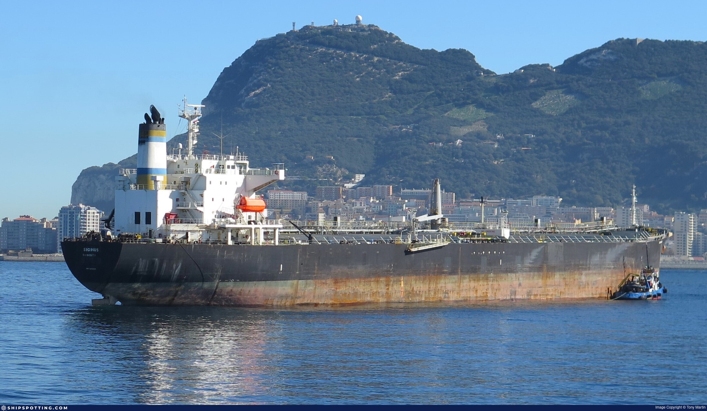
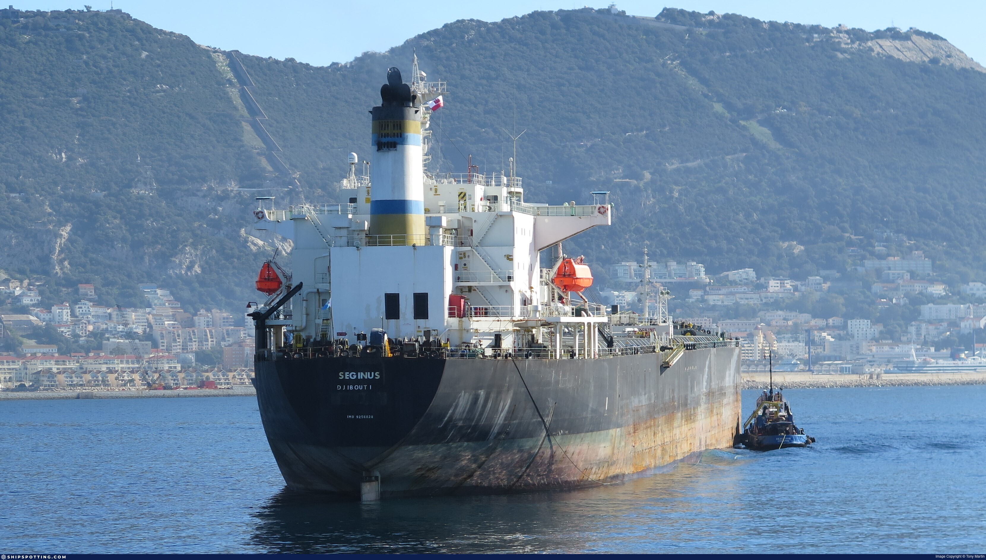
Seginus View name history 📜
IMO Number
9256028
MMSI
352004634
Vessel Type
Oil Products Tanker | Navire-citerne pour produits pétroliers
Flag
🇨🇲 Cameroon View flag history 📜
Call Sign
3E6915
Gross Tonnage
39,085 GT
Year Built
2003
Sanctioned by
Company & Ownership
Sewelo Maritime Co
IMO Company: 6457551
Address
C/O: Bluewave Shipping Co Office 1905, 19th Floor, Haware Infotech Park, Sector 30A, Vashi, Navi Mumbai, Maharashtra, 410210, India.
Status
Active
Fleet
1.0 owner, 0.0 operator, 0.0 manager, 0.0 beneficial
Management & Operations
ISM Manager
TRACE MARINE SHIPPING SA
Unit 605, A Wing, Kukreja Plaza, Sector 11, CBD Belapur, Navi Mumbai, Maharashtra, 400614, India.
Commercial Manager
TRU MARINE LTD
Office 1905, 19th Floor, Haware Infotech Park, Sector 30A, Vashi, Navi Mumbai, Maharashtra, 410210, India.
Registered Owner
SEWELO MARITIME CO
Room S068, 2nd Floor, Capital Plaza, 61-65, Chatham Road South, Tsim Sha Tsui, Kowloon, Hong Kong, China.
Classification & Safety
Current Classification
Russian Maritime Register of Shipping
Delivered
Port State Control (PSC) Inspections
Risk Level
LOW
Last 36 Months
4
Inspections
Last Inspection
📍 Istanbul
📅 2025-12-04
Survey Renewal & Certificates
| Code | Type | Issuer | Issued | Expires |
|---|---|---|---|---|
| 502 | Cargo Ship Safety Equipment | International Register of Shipping (151) | 11/01/2024 | 19/03/2028 |
| 503 | Cargo Ship Safety Radio | International Register of Shipping (151) | 11/01/2024 | 19/03/2028 |
Programs & Notes
EU Russia Sanctions – Shadow Fleet | SEMA (Canada) — vessel designations | The Russia (Sanctions) (EU Exit) Regulations 2019
DateOfListing: 2025-07-20
Vessel Changes

AIS Events
39 events detected • 5 zones • Last: Apr 14, 2026
Zone Dwell
Central Mediterranean Sanctions Monitoring Zone
Apr 14, 2026 07:08 UTC
80.0%
- Zone: Central Mediterranean Sanctions Monitoring Zone
- Duration: 3h 38m
- Data Points: 2 AIS positions
- Period: 2026-04-14T07:08:50+00:00 to 2026-04-14T10:47:47+00:00
Show Raw Evidence JSON
{
    "zone_id": "discovered_016",
    "zone_name": "Eastern Mediterranean Monitoring Zone",
    "dwell_minutes": 218.900000000000005684341886080801486968994140625,
    "points_in_zone": 2,
    "first_point": {
        "ts": "2026-04-14T07:08:50+00:00",
        "lat": 31.45153330000000124755388242192566394805908203125,
        "lon": 32.38948330000000197514964384026825428009033203125
    },
    "last_point": {
        "ts": "2026-04-14T10:47:47+00:00",
        "lat": 30.94545000000000101181285572238266468048095703125,
        "lon": 32.3133667000000031066520023159682750701904296875
    }
}
Zone Dwell
Central Atlantic Surveillance Zone
Mar 28, 2026 20:11 UTC
80.0%
- Zone: Central Atlantic Surveillance Zone
- Duration: 1h 8m
- Data Points: 18 AIS positions
- Period: 2026-03-28T20:11:48+00:00 to 2026-03-28T21:20:28+00:00
Show Raw Evidence JSON
{
    "zone_id": "discovered_014",
    "zone_name": "Western Pomerania Monitoring Zone",
    "dwell_minutes": 68.7000000000000028421709430404007434844970703125,
    "points_in_zone": 18,
    "first_point": {
        "ts": "2026-03-28T20:11:48+00:00",
        "lat": 31.52298329999999992878656485117971897125244140625,
        "lon": 32.37771670000000057143552112393081188201904296875
    },
    "last_point": {
        "ts": "2026-03-28T21:20:28+00:00",
        "lat": 31.52338329999999899655449553392827510833740234375,
        "lon": 32.3780000000000001136868377216160297393798828125
    }
}
Zone Dwell
Central Atlantic Surveillance Zone
Mar 18, 2026 14:00 UTC
80.0%
- Zone: Central Atlantic Surveillance Zone
- Duration: 2h 34m
- Data Points: 3 AIS positions
- Period: 2026-03-18T14:00:45+00:00 to 2026-03-18T16:35:03+00:00
Show Raw Evidence JSON
{
    "zone_id": "discovered_014",
    "zone_name": "Western Pomerania Monitoring Zone",
    "dwell_minutes": 154.30000000000001136868377216160297393798828125,
    "points_in_zone": 3,
    "first_point": {
        "ts": "2026-03-18T14:00:45+00:00",
        "lat": 31.582866700000000292902768705971539020538330078125,
        "lon": 32.3114666999999968766132951714098453521728515625
    },
    "last_point": {
        "ts": "2026-03-18T16:35:03+00:00",
        "lat": 31.58123330000000095196810434572398662567138671875,
        "lon": 32.31309999999999860165189602412283420562744140625
    }
}
Loiter
Central Atlantic Surveillance Zone
Mar 18, 2026 13:00 UTC
75.0%
- Duration: 3h 34m
- Radius: 223 meters
- Data Points: 18 AIS positions
- Centroid: 31.5828, 32.3116
- Zone: Central Atlantic Surveillance Zone
Show Raw Evidence JSON
{
    "radius_m": 223.400000000000005684341886080801486968994140625,
    "duration_minutes": 214.400000000000005684341886080801486968994140625,
    "points": 18,
    "centroid": {
        "lat": 31.58279720555555769578859326429665088653564453125,
        "lon": 32.311616677777777795199654065072536468505859375
    },
    "bbox": {
        "min_lat": 31.58123330000000095196810434572398662567138671875,
        "min_lon": 32.31131669999999900255716056562960147857666015625,
        "max_lat": 31.583349999999999369038050645031034946441650390625,
        "max_lon": 32.31309999999999860165189602412283420562744140625
    },
    "zone_id": "discovered_014"
}
Zone Dwell
Central Atlantic Surveillance Zone
Mar 18, 2026 13:00 UTC
80.0%
- Zone: Central Atlantic Surveillance Zone
- Duration: 3h 34m
- Data Points: 18 AIS positions
- Period: 2026-03-18T13:00:41+00:00 to 2026-03-18T16:35:03+00:00
Show Raw Evidence JSON
{
    "zone_id": "discovered_014",
    "zone_name": "Western Pomerania Monitoring Zone",
    "dwell_minutes": 214.400000000000005684341886080801486968994140625,
    "points_in_zone": 18,
    "first_point": {
        "ts": "2026-03-18T13:00:41+00:00",
        "lat": 31.583349999999999369038050645031034946441650390625,
        "lon": 32.31141670000000232221282203681766986846923828125
    },
    "last_point": {
        "ts": "2026-03-18T16:35:03+00:00",
        "lat": 31.58123330000000095196810434572398662567138671875,
        "lon": 32.31309999999999860165189602412283420562744140625
    }
}
Loiter
Central Atlantic Surveillance Zone
Mar 18, 2026 12:00 UTC
75.0%
- Duration: 4h 34m
- Radius: 237 meters
- Data Points: 28 AIS positions
- Centroid: 31.5829, 32.3116
- Zone: Central Atlantic Surveillance Zone
Show Raw Evidence JSON
{
    "radius_m": 237.099999999999994315658113919198513031005859375,
    "duration_minutes": 274.8999999999999772626324556767940521240234375,
    "points": 28,
    "centroid": {
        "lat": 31.58294522857142538896368932910263538360595703125,
        "lon": 32.3116023892857100463515962474048137664794921875
    },
    "bbox": {
        "min_lat": 31.58123330000000095196810434572398662567138671875,
        "min_lon": 32.31131669999999900255716056562960147857666015625,
        "max_lat": 31.5839500000000015234036254696547985076904296875,
        "max_lon": 32.31309999999999860165189602412283420562744140625
    },
    "zone_id": "discovered_014"
}
Zone Dwell
Central Atlantic Surveillance Zone
Mar 18, 2026 12:00 UTC
80.0%
- Zone: Central Atlantic Surveillance Zone
- Duration: 4h 34m
- Data Points: 28 AIS positions
- Period: 2026-03-18T12:00:09+00:00 to 2026-03-18T16:35:03+00:00
Show Raw Evidence JSON
{
    "zone_id": "discovered_014",
    "zone_name": "Western Pomerania Monitoring Zone",
    "dwell_minutes": 274.8999999999999772626324556767940521240234375,
    "points_in_zone": 28,
    "first_point": {
        "ts": "2026-03-18T12:00:09+00:00",
        "lat": 31.58288329999999888286765781231224536895751953125,
        "lon": 32.31148329999999901929186307825148105621337890625
    },
    "last_point": {
        "ts": "2026-03-18T16:35:03+00:00",
        "lat": 31.58123330000000095196810434572398662567138671875,
        "lon": 32.31309999999999860165189602412283420562744140625
    }
}
Loiter
Central Atlantic Surveillance Zone
Mar 18, 2026 11:18 UTC
75.0%
- Duration: 5h 16m
- Radius: 236 meters
- Data Points: 39 AIS positions
- Centroid: 31.5829, 32.3116
- Zone: Central Atlantic Surveillance Zone
Show Raw Evidence JSON
{
    "radius_m": 235.80000000000001136868377216160297393798828125,
    "duration_minutes": 316.6000000000000227373675443232059478759765625,
    "points": 39,
    "centroid": {
        "lat": 31.582909397435887655092301429249346256256103515625,
        "lon": 32.31157137692307657061974168755114078521728515625
    },
    "bbox": {
        "min_lat": 31.58123330000000095196810434572398662567138671875,
        "min_lon": 32.31131669999999900255716056562960147857666015625,
        "max_lat": 31.5839500000000015234036254696547985076904296875,
        "max_lon": 32.31309999999999860165189602412283420562744140625
    },
    "zone_id": "discovered_014"
}
Zone Dwell
Central Atlantic Surveillance Zone
Mar 18, 2026 11:18 UTC
80.0%
- Zone: Central Atlantic Surveillance Zone
- Duration: 5h 16m
- Data Points: 39 AIS positions
- Period: 2026-03-18T11:18:27+00:00 to 2026-03-18T16:35:03+00:00
Show Raw Evidence JSON
{
    "zone_id": "discovered_014",
    "zone_name": "Western Pomerania Monitoring Zone",
    "dwell_minutes": 316.6000000000000227373675443232059478759765625,
    "points_in_zone": 39,
    "first_point": {
        "ts": "2026-03-18T11:18:27+00:00",
        "lat": 31.582616699999999099190972629003226757049560546875,
        "lon": 32.31145000000000067075234255753457546234130859375
    },
    "last_point": {
        "ts": "2026-03-18T16:35:03+00:00",
        "lat": 31.58123330000000095196810434572398662567138671875,
        "lon": 32.31309999999999860165189602412283420562744140625
    }
}
Loiter
Central Atlantic Surveillance Zone
Mar 18, 2026 10:02 UTC
75.0%
- Duration: 6h 32m
- Radius: 221 meters
- Data Points: 52 AIS positions
- Centroid: 31.5828, 32.3117
- Zone: Central Atlantic Surveillance Zone
Show Raw Evidence JSON
{
    "radius_m": 221.099999999999994315658113919198513031005859375,
    "duration_minutes": 392.6000000000000227373675443232059478759765625,
    "points": 52,
    "centroid": {
        "lat": 31.5828044846153801472610211931169033050537109375,
        "lon": 32.31166635384615659631890594027936458587646484375
    },
    "bbox": {
        "min_lat": 31.58123330000000095196810434572398662567138671875,
        "min_lon": 32.31131669999999900255716056562960147857666015625,
        "max_lat": 31.5839500000000015234036254696547985076904296875,
        "max_lon": 32.31309999999999860165189602412283420562744140625
    },
    "zone_id": "discovered_014"
}
Zone Dwell
Central Atlantic Surveillance Zone
Mar 18, 2026 10:02 UTC
80.0%
- Zone: Central Atlantic Surveillance Zone
- Duration: 6h 32m
- Data Points: 52 AIS positions
- Period: 2026-03-18T10:02:30+00:00 to 2026-03-18T16:35:03+00:00
Show Raw Evidence JSON
{
    "zone_id": "discovered_014",
    "zone_name": "Western Pomerania Monitoring Zone",
    "dwell_minutes": 392.6000000000000227373675443232059478759765625,
    "points_in_zone": 52,
    "first_point": {
        "ts": "2026-03-18T10:02:30+00:00",
        "lat": 31.58265000000000100044417195022106170654296875,
        "lon": 32.31195000000000305817593471147119998931884765625
    },
    "last_point": {
        "ts": "2026-03-18T16:35:03+00:00",
        "lat": 31.58123330000000095196810434572398662567138671875,
        "lon": 32.31309999999999860165189602412283420562744140625
    }
}
Loiter
Central Atlantic Surveillance Zone
Mar 18, 2026 09:11 UTC
75.0%
- Duration: 4h 49m
- Radius: 169 meters
- Data Points: 63 AIS positions
- Centroid: 31.5828, 32.3117
- Zone: Central Atlantic Surveillance Zone
Show Raw Evidence JSON
{
    "radius_m": 168.900000000000005684341886080801486968994140625,
    "duration_minutes": 289.19999999999998863131622783839702606201171875,
    "points": 63,
    "centroid": {
        "lat": 31.582801587301585044542662217281758785247802734375,
        "lon": 32.3116984190476301819217042066156864166259765625
    },
    "bbox": {
        "min_lat": 31.58231669999999979836502461694180965423583984375,
        "min_lon": 32.31131669999999900255716056562960147857666015625,
        "max_lat": 31.5839500000000015234036254696547985076904296875,
        "max_lon": 32.312866700000000719228410162031650543212890625
    },
    "zone_id": "discovered_014"
}
Zone Dwell
Central Atlantic Surveillance Zone
Mar 18, 2026 09:11 UTC
80.0%
- Zone: Central Atlantic Surveillance Zone
- Duration: 4h 49m
- Data Points: 63 AIS positions
- Period: 2026-03-18T09:11:31+00:00 to 2026-03-18T14:00:45+00:00
Show Raw Evidence JSON
{
    "zone_id": "discovered_014",
    "zone_name": "Western Pomerania Monitoring Zone",
    "dwell_minutes": 289.19999999999998863131622783839702606201171875,
    "points_in_zone": 63,
    "first_point": {
        "ts": "2026-03-18T09:11:31+00:00",
        "lat": 31.58236670000000145819285535253584384918212890625,
        "lon": 32.31219999999999714646037318743765354156494140625
    },
    "last_point": {
        "ts": "2026-03-18T14:00:45+00:00",
        "lat": 31.582866700000000292902768705971539020538330078125,
        "lon": 32.3114666999999968766132951714098453521728515625
    }
}
Loiter
Central Atlantic Surveillance Zone
Mar 18, 2026 08:01 UTC
75.0%
- Duration: 5h 59m
- Radius: 481 meters
- Data Points: 69 AIS positions
- Centroid: 31.5828, 32.3118
- Zone: Central Atlantic Surveillance Zone
Show Raw Evidence JSON
{
    "radius_m": 480.5,
    "duration_minutes": 359.6000000000000227373675443232059478759765625,
    "points": 69,
    "centroid": {
        "lat": 31.58282198115941952210050658322870731353759765625,
        "lon": 32.3118033869565266513745882548391819000244140625
    },
    "bbox": {
        "min_lat": 31.58231669999999979836502461694180965423583984375,
        "min_lon": 32.31131669999999900255716056562960147857666015625,
        "max_lat": 31.585049999999998959765434847213327884674072265625,
        "max_lon": 32.31680000000000063664629124104976654052734375
    },
    "zone_id": "discovered_014"
}
Zone Dwell
Central Atlantic Surveillance Zone
Mar 18, 2026 08:01 UTC
80.0%
- Zone: Central Atlantic Surveillance Zone
- Duration: 5h 59m
- Data Points: 69 AIS positions
- Period: 2026-03-18T08:01:10+00:00 to 2026-03-18T14:00:45+00:00
Show Raw Evidence JSON
{
    "zone_id": "discovered_014",
    "zone_name": "Western Pomerania Monitoring Zone",
    "dwell_minutes": 359.6000000000000227373675443232059478759765625,
    "points_in_zone": 69,
    "first_point": {
        "ts": "2026-03-18T08:01:10+00:00",
        "lat": 31.58231669999999979836502461694180965423583984375,
        "lon": 32.31161670000000185609678737819194793701171875
    },
    "last_point": {
        "ts": "2026-03-18T14:00:45+00:00",
        "lat": 31.582866700000000292902768705971539020538330078125,
        "lon": 32.3114666999999968766132951714098453521728515625
    }
}
Loiter
Central Atlantic Surveillance Zone
Mar 18, 2026 07:32 UTC
75.0%
- Duration: 6h 27m
- Radius: 478 meters
- Data Points: 75 AIS positions
- Centroid: 31.5828, 32.3118
- Zone: Central Atlantic Surveillance Zone
Show Raw Evidence JSON
{
    "radius_m": 478.30000000000001136868377216160297393798828125,
    "duration_minutes": 387.8999999999999772626324556767940521240234375,
    "points": 75,
    "centroid": {
        "lat": 31.582768734666668564159408560954034328460693359375,
        "lon": 32.31183693866666573057955247350037097930908203125
    },
    "bbox": {
        "min_lat": 31.582016700000000497539076604880392551422119140625,
        "min_lon": 32.31131669999999900255716056562960147857666015625,
        "max_lat": 31.585049999999998959765434847213327884674072265625,
        "max_lon": 32.31680000000000063664629124104976654052734375
    },
    "zone_id": "discovered_014"
}
Zone Dwell
Central Atlantic Surveillance Zone
Mar 18, 2026 07:32 UTC
80.0%
- Zone: Central Atlantic Surveillance Zone
- Duration: 6h 27m
- Data Points: 75 AIS positions
- Period: 2026-03-18T07:32:50+00:00 to 2026-03-18T14:00:45+00:00
Show Raw Evidence JSON
{
    "zone_id": "discovered_014",
    "zone_name": "Western Pomerania Monitoring Zone",
    "dwell_minutes": 387.8999999999999772626324556767940521240234375,
    "points_in_zone": 75,
    "first_point": {
        "ts": "2026-03-18T07:32:50+00:00",
        "lat": 31.582371699999999492547431145794689655303955078125,
        "lon": 32.31201999999999685542206862010061740875244140625
    },
    "last_point": {
        "ts": "2026-03-18T14:00:45+00:00",
        "lat": 31.582866700000000292902768705971539020538330078125,
        "lon": 32.3114666999999968766132951714098453521728515625
    }
}
Loiter
Central Atlantic Surveillance Zone
Mar 18, 2026 02:56 UTC
75.0%
- Duration: 6h 30m
- Radius: 430 meters
- Data Points: 18 AIS positions
- Centroid: 31.5826, 32.3124
- Zone: Central Atlantic Surveillance Zone
Show Raw Evidence JSON
{
    "radius_m": 430.19999999999998863131622783839702606201171875,
    "duration_minutes": 390.19999999999998863131622783839702606201171875,
    "points": 18,
    "centroid": {
        "lat": 31.582579916666677632974824518896639347076416015625,
        "lon": 32.31240203333333482760281185619533061981201171875
    },
    "bbox": {
        "min_lat": 31.582016700000000497539076604880392551422119140625,
        "min_lon": 32.31161670000000185609678737819194793701171875,
        "max_lat": 31.585049999999998959765434847213327884674072265625,
        "max_lon": 32.31680000000000063664629124104976654052734375
    },
    "zone_id": "discovered_014"
}
Zone Dwell
Central Atlantic Surveillance Zone
Mar 18, 2026 02:56 UTC
80.0%
- Zone: Central Atlantic Surveillance Zone
- Duration: 6h 30m
- Data Points: 18 AIS positions
- Period: 2026-03-18T02:56:20+00:00 to 2026-03-18T09:26:30+00:00
Show Raw Evidence JSON
{
    "zone_id": "discovered_014",
    "zone_name": "Western Pomerania Monitoring Zone",
    "dwell_minutes": 390.19999999999998863131622783839702606201171875,
    "points_in_zone": 18,
    "first_point": {
        "ts": "2026-03-18T02:56:20+00:00",
        "lat": 31.582750000000000767386154620908200740814208984375,
        "lon": 32.3119999999999976125764078460633754730224609375
    },
    "last_point": {
        "ts": "2026-03-18T09:26:30+00:00",
        "lat": 31.58248329999999981509972712956368923187255859375,
        "lon": 32.3119999999999976125764078460633754730224609375
    }
}
Zone Dwell
Dodecanese Sea Monitoring Zone
Feb 26, 2026 07:50 UTC
80.0%
- Zone: Dodecanese Sea Monitoring Zone
- Duration: 1h 16m
- Data Points: 7 AIS positions
- Period: 2026-02-26T07:50:40+00:00 to 2026-02-26T09:07:20+00:00
Show Raw Evidence JSON
{
    "zone_id": "discovered_069",
    "zone_name": "Dodecanese Sea Monitoring Zone",
    "dwell_minutes": 76.7000000000000028421709430404007434844970703125,
    "points_in_zone": 7,
    "first_point": {
        "ts": "2026-02-26T07:50:40+00:00",
        "lat": 36.68984999999999985220711096189916133880615234375,
        "lon": 26.66465000000000173940861714072525501251220703125
    },
    "last_point": {
        "ts": "2026-02-26T09:07:20+00:00",
        "lat": 36.48530000000000228510543820448219776153564453125,
        "lon": 26.7735832999999985304384608753025531768798828125
    }
}
Zone Dwell
Southern Kattegat Surveillance Zone
Feb 26, 2026 07:50 UTC
80.0%
- Zone: Southern Kattegat Surveillance Zone
- Duration: 1h 55m
- Data Points: 17 AIS positions
- Period: 2026-02-26T07:50:40+00:00 to 2026-02-26T09:46:01+00:00
Show Raw Evidence JSON
{
    "zone_id": "discovered_084",
    "zone_name": "Norwegian Sea Surveillance Zone",
    "dwell_minutes": 115.2999999999999971578290569595992565155029296875,
    "points_in_zone": 17,
    "first_point": {
        "ts": "2026-02-26T07:50:40+00:00",
        "lat": 36.68984999999999985220711096189916133880615234375,
        "lon": 26.66465000000000173940861714072525501251220703125
    },
    "last_point": {
        "ts": "2026-02-26T09:46:01+00:00",
        "lat": 36.39436669999999907076926319859921932220458984375,
        "lon": 26.85278329999999868960003368556499481201171875
    }
}
Zone Dwell
Dodecanese Sea Monitoring Zone
Feb 26, 2026 06:00 UTC
80.0%
- Zone: Dodecanese Sea Monitoring Zone
- Duration: 3h 7m
- Data Points: 57 AIS positions
- Period: 2026-02-26T06:00:19+00:00 to 2026-02-26T09:07:20+00:00
Show Raw Evidence JSON
{
    "zone_id": "discovered_069",
    "zone_name": "Dodecanese Sea Monitoring Zone",
    "dwell_minutes": 187,
    "points_in_zone": 57,
    "first_point": {
        "ts": "2026-02-26T06:00:19+00:00",
        "lat": 37.01555830000000213431121665053069591522216796875,
        "lon": 26.576938299999998349676388897933065891265869140625
    },
    "last_point": {
        "ts": "2026-02-26T09:07:20+00:00",
        "lat": 36.48530000000000228510543820448219776153564453125,
        "lon": 26.7735832999999985304384608753025531768798828125
    }
}
Zone Dwell
Dodecanese Sea Monitoring Zone
Feb 26, 2026 05:09 UTC
80.0%
- Zone: Dodecanese Sea Monitoring Zone
- Duration: 3h 57m
- Data Points: 92 AIS positions
- Period: 2026-02-26T05:09:39+00:00 to 2026-02-26T09:07:20+00:00
Show Raw Evidence JSON
{
    "zone_id": "discovered_069",
    "zone_name": "Dodecanese Sea Monitoring Zone",
    "dwell_minutes": 237.69999999999998863131622783839702606201171875,
    "points_in_zone": 92,
    "first_point": {
        "ts": "2026-02-26T05:09:39+00:00",
        "lat": 37.11257169999999661058609490282833576202392578125,
        "lon": 26.43712000000000017507773009128868579864501953125
    },
    "last_point": {
        "ts": "2026-02-26T09:07:20+00:00",
        "lat": 36.48530000000000228510543820448219776153564453125,
        "lon": 26.7735832999999985304384608753025531768798828125
    }
}
Zone Dwell
Bosphorus/Dardanelles Approach
Feb 20, 2026 13:04 UTC
80.0%
- Zone: Bosphorus/Dardanelles Approach
- Duration: 3h 15m
- Data Points: 10 AIS positions
- Period: 2026-02-20T13:04:18+00:00 to 2026-02-20T16:19:54+00:00
Show Raw Evidence JSON
{
    "zone_id": "osint_bosphorus",
    "zone_name": "Bosphorus\/Dardanelles Approach",
    "dwell_minutes": 195.599999999999994315658113919198513031005859375,
    "points_in_zone": 10,
    "first_point": {
        "ts": "2026-02-20T13:04:18+00:00",
        "lat": 40.9413167000000015605110093019902706146240234375,
        "lon": 28.78359999999999985220711096189916133880615234375
    },
    "last_point": {
        "ts": "2026-02-20T16:19:54+00:00",
        "lat": 40.91756670000000184472810360603034496307373046875,
        "lon": 28.793099999999999027977537480182945728302001953125
    }
}
Zone Dwell
Bosphorus/Dardanelles Approach
Feb 20, 2026 08:07 UTC
80.0%
- Zone: Bosphorus/Dardanelles Approach
- Duration: 5h 9m
- Data Points: 6 AIS positions
- Period: 2026-02-20T08:07:17+00:00 to 2026-02-20T13:16:17+00:00
Show Raw Evidence JSON
{
    "zone_id": "osint_bosphorus",
    "zone_name": "Bosphorus\/Dardanelles Approach",
    "dwell_minutes": 309,
    "points_in_zone": 6,
    "first_point": {
        "ts": "2026-02-20T08:07:17+00:00",
        "lat": 40.94315000000000281943357549607753753662109375,
        "lon": 28.785733300000000411955625168047845363616943359375
    },
    "last_point": {
        "ts": "2026-02-20T13:16:17+00:00",
        "lat": 40.94104999999999705551090301014482975006103515625,
        "lon": 28.783550000000001745092959026806056499481201171875
    }
}
Zone Dwell
Bosphorus/Dardanelles Approach
Feb 20, 2026 07:40 UTC
80.0%
- Zone: Bosphorus/Dardanelles Approach
- Duration: 5h 36m
- Data Points: 7 AIS positions
- Period: 2026-02-20T07:40:16+00:00 to 2026-02-20T13:16:17+00:00
Show Raw Evidence JSON
{
    "zone_id": "osint_bosphorus",
    "zone_name": "Bosphorus\/Dardanelles Approach",
    "dwell_minutes": 336,
    "points_in_zone": 7,
    "first_point": {
        "ts": "2026-02-20T07:40:16+00:00",
        "lat": 40.94311669999999736546669737435877323150634765625,
        "lon": 28.785366700000000861336957314051687717437744140625
    },
    "last_point": {
        "ts": "2026-02-20T13:16:17+00:00",
        "lat": 40.94104999999999705551090301014482975006103515625,
        "lon": 28.783550000000001745092959026806056499481201171875
    }
}
Zone Dwell
Bosphorus/Dardanelles Approach
Feb 20, 2026 06:01 UTC
80.0%
- Zone: Bosphorus/Dardanelles Approach
- Duration: 6h 27m
- Data Points: 7 AIS positions
- Period: 2026-02-20T06:37:15+00:00 to 2026-02-20T13:04:18+00:00
Show Raw Evidence JSON
{
    "zone_id": "osint_bosphorus",
    "zone_name": "Bosphorus\/Dardanelles Approach",
    "dwell_minutes": 387.1000000000000227373675443232059478759765625,
    "points_in_zone": 7,
    "first_point": {
        "ts": "2026-02-20T06:37:15+00:00",
        "lat": 40.941883300000000645013642497360706329345703125,
        "lon": 28.783983299999999161400410230271518230438232421875
    },
    "last_point": {
        "ts": "2026-02-20T13:04:18+00:00",
        "lat": 40.9413167000000015605110093019902706146240234375,
        "lon": 28.78359999999999985220711096189916133880615234375
    }
}
Zone Dwell
Bosphorus/Dardanelles Approach
Feb 20, 2026 05:25 UTC
80.0%
- Zone: Bosphorus/Dardanelles Approach
- Duration: 3h 8m
- Data Points: 9 AIS positions
- Period: 2026-02-20T05:25:18+00:00 to 2026-02-20T08:34:15+00:00
Show Raw Evidence JSON
{
    "zone_id": "osint_bosphorus",
    "zone_name": "Bosphorus\/Dardanelles Approach",
    "dwell_minutes": 188.900000000000005684341886080801486968994140625,
    "points_in_zone": 9,
    "first_point": {
        "ts": "2026-02-20T05:25:18+00:00",
        "lat": 40.9406833000000034417098504491150379180908203125,
        "lon": 28.78356670000000150366759044118225574493408203125
    },
    "last_point": {
        "ts": "2026-02-20T08:34:15+00:00",
        "lat": 40.94324999999999903366187936626374721527099609375,
        "lon": 28.78628330000000090649336925707757472991943359375
    }
}
Zone Dwell
Bosphorus/Dardanelles Approach
Feb 19, 2026 16:34 UTC
80.0%
- Zone: Bosphorus/Dardanelles Approach
- Duration: 1h 39m
- Data Points: 4 AIS positions
- Period: 2026-02-19T16:34:16+00:00 to 2026-02-19T18:13:19+00:00
Show Raw Evidence JSON
{
    "zone_id": "osint_bosphorus",
    "zone_name": "Bosphorus\/Dardanelles Approach",
    "dwell_minutes": 99,
    "points_in_zone": 4,
    "first_point": {
        "ts": "2026-02-19T16:34:16+00:00",
        "lat": 40.94069999999999964757080306299030780792236328125,
        "lon": 28.782599999999998630073605454526841640472412109375
    },
    "last_point": {
        "ts": "2026-02-19T18:13:19+00:00",
        "lat": 40.94153330000000323707354255020618438720703125,
        "lon": 28.782599999999998630073605454526841640472412109375
    }
}
Zone Dwell
Bosphorus/Dardanelles Approach
Feb 19, 2026 15:31 UTC
80.0%
- Zone: Bosphorus/Dardanelles Approach
- Duration: 2h 42m
- Data Points: 6 AIS positions
- Period: 2026-02-19T15:31:19+00:00 to 2026-02-19T18:13:19+00:00
Show Raw Evidence JSON
{
    "zone_id": "osint_bosphorus",
    "zone_name": "Bosphorus\/Dardanelles Approach",
    "dwell_minutes": 162,
    "points_in_zone": 6,
    "first_point": {
        "ts": "2026-02-19T15:31:19+00:00",
        "lat": 40.9406000000000034333424991928040981292724609375,
        "lon": 28.782566700000000281534084933809936046600341796875
    },
    "last_point": {
        "ts": "2026-02-19T18:13:19+00:00",
        "lat": 40.94153330000000323707354255020618438720703125,
        "lon": 28.782599999999998630073605454526841640472412109375
    }
}
Loiter
Bosphorus/Dardanelles Approach
Feb 19, 2026 13:01 UTC
75.0%
- Duration: 5h 12m
- Radius: 52 meters
- Data Points: 10 AIS positions
- Centroid: 40.9411, 28.7826
- Zone: Bosphorus/Dardanelles Approach
Show Raw Evidence JSON
{
    "radius_m": 52.10000000000000142108547152020037174224853515625,
    "duration_minutes": 312,
    "points": 10,
    "centroid": {
        "lat": 40.94106833000000023048414732329547405242919921875,
        "lon": 28.78259835000000066429493017494678497314453125
    },
    "bbox": {
        "min_lat": 40.9406000000000034333424991928040981292724609375,
        "min_lon": 28.7824667000000005145921022631227970123291015625,
        "max_lat": 40.94153330000000323707354255020618438720703125,
        "max_lon": 28.78269999999999839701558812521398067474365234375
    },
    "zone_id": "osint_bosphorus"
}
Zone Dwell
Bosphorus/Dardanelles Approach
Feb 19, 2026 13:01 UTC
80.0%
- Zone: Bosphorus/Dardanelles Approach
- Duration: 5h 12m
- Data Points: 10 AIS positions
- Period: 2026-02-19T13:01:17+00:00 to 2026-02-19T18:13:19+00:00
Show Raw Evidence JSON
{
    "zone_id": "osint_bosphorus",
    "zone_name": "Bosphorus\/Dardanelles Approach",
    "dwell_minutes": 312,
    "points_in_zone": 10,
    "first_point": {
        "ts": "2026-02-19T13:01:17+00:00",
        "lat": 40.9412999999999982492226990871131420135498046875,
        "lon": 28.78269999999999839701558812521398067474365234375
    },
    "last_point": {
        "ts": "2026-02-19T18:13:19+00:00",
        "lat": 40.94153330000000323707354255020618438720703125,
        "lon": 28.782599999999998630073605454526841640472412109375
    }
}
Loiter
Bosphorus/Dardanelles Approach
Feb 19, 2026 12:22 UTC
75.0%
- Duration: 5h 51m
- Radius: 57 meters
- Data Points: 12 AIS positions
- Centroid: 40.9411, 28.7826
- Zone: Bosphorus/Dardanelles Approach
Show Raw Evidence JSON
{
    "radius_m": 57.10000000000000142108547152020037174224853515625,
    "duration_minutes": 351,
    "points": 12,
    "centroid": {
        "lat": 40.94111249999999557758201262913644313812255859375,
        "lon": 28.782613908333331664834986440837383270263671875
    },
    "bbox": {
        "min_lat": 40.9406000000000034333424991928040981292724609375,
        "min_lon": 28.7824667000000005145921022631227970123291015625,
        "max_lat": 40.94153330000000323707354255020618438720703125,
        "max_lon": 28.78271670000000170830389834009110927581787109375
    },
    "zone_id": "osint_bosphorus"
}
Zone Dwell
Bosphorus/Dardanelles Approach
Feb 19, 2026 12:22 UTC
80.0%
- Zone: Bosphorus/Dardanelles Approach
- Duration: 5h 51m
- Data Points: 12 AIS positions
- Period: 2026-02-19T12:22:19+00:00 to 2026-02-19T18:13:19+00:00
Show Raw Evidence JSON
{
    "zone_id": "osint_bosphorus",
    "zone_name": "Bosphorus\/Dardanelles Approach",
    "dwell_minutes": 351,
    "points_in_zone": 12,
    "first_point": {
        "ts": "2026-02-19T12:22:19+00:00",
        "lat": 40.9413667000000032203388400375843048095703125,
        "lon": 28.78266670000000004847606760449707508087158203125
    },
    "last_point": {
        "ts": "2026-02-19T18:13:19+00:00",
        "lat": 40.94153330000000323707354255020618438720703125,
        "lon": 28.782599999999998630073605454526841640472412109375
    }
}
Loiter
Bosphorus/Dardanelles Approach
Feb 19, 2026 10:49 UTC
75.0%
- Duration: 6h 27m
- Radius: 92 meters
- Data Points: 12 AIS positions
- Centroid: 40.9411, 28.7826
- Zone: Bosphorus/Dardanelles Approach
Show Raw Evidence JSON
{
    "radius_m": 92.400000000000005684341886080801486968994140625,
    "duration_minutes": 387,
    "points": 12,
    "centroid": {
        "lat": 40.94114861666665916573037975467741489410400390625,
        "lon": 28.782633349999997562917997129261493682861328125
    },
    "bbox": {
        "min_lat": 40.9406000000000034333424991928040981292724609375,
        "min_lon": 28.7824667000000005145921022631227970123291015625,
        "max_lat": 40.94196670000000182199073606170713901519775390625,
        "max_lon": 28.78283330000000006521077011711895465850830078125
    },
    "zone_id": "osint_bosphorus"
}
Zone Dwell
Bosphorus/Dardanelles Approach
Feb 19, 2026 10:49 UTC
80.0%
- Zone: Bosphorus/Dardanelles Approach
- Duration: 6h 27m
- Data Points: 12 AIS positions
- Period: 2026-02-19T10:49:17+00:00 to 2026-02-19T17:16:18+00:00
Show Raw Evidence JSON
{
    "zone_id": "osint_bosphorus",
    "zone_name": "Bosphorus\/Dardanelles Approach",
    "dwell_minutes": 387,
    "points_in_zone": 12,
    "first_point": {
        "ts": "2026-02-19T10:49:17+00:00",
        "lat": 40.94196670000000182199073606170713901519775390625,
        "lon": 28.78283330000000006521077011711895465850830078125
    },
    "last_point": {
        "ts": "2026-02-19T17:16:18+00:00",
        "lat": 40.941266699999999900683178566396236419677734375,
        "lon": 28.7824667000000005145921022631227970123291015625
    }
}
Zone Dwell
Bosphorus/Dardanelles Approach
Feb 19, 2026 08:13 UTC
80.0%
- Zone: Bosphorus/Dardanelles Approach
- Duration: 5h 39m
- Data Points: 8 AIS positions
- Period: 2026-02-19T08:13:17+00:00 to 2026-02-19T13:52:19+00:00
Show Raw Evidence JSON
{
    "zone_id": "osint_bosphorus",
    "zone_name": "Bosphorus\/Dardanelles Approach",
    "dwell_minutes": 339,
    "points_in_zone": 8,
    "first_point": {
        "ts": "2026-02-19T08:13:17+00:00",
        "lat": 40.94180000000000063664629124104976654052734375,
        "lon": 28.78275000000000005684341886080801486968994140625
    },
    "last_point": {
        "ts": "2026-02-19T13:52:19+00:00",
        "lat": 40.9413167000000015605110093019902706146240234375,
        "lon": 28.782566700000000281534084933809936046600341796875
    }
}
Zone Dwell
Bosphorus/Dardanelles Approach
Feb 19, 2026 05:06 UTC
80.0%
- Zone: Bosphorus/Dardanelles Approach
- Duration: 5h 42m
- Data Points: 9 AIS positions
- Period: 2026-02-19T05:06:33+00:00 to 2026-02-19T10:49:17+00:00
Show Raw Evidence JSON
{
    "zone_id": "osint_bosphorus",
    "zone_name": "Bosphorus\/Dardanelles Approach",
    "dwell_minutes": 342.69999999999998863131622783839702606201171875,
    "points_in_zone": 9,
    "first_point": {
        "ts": "2026-02-19T05:06:33+00:00",
        "lat": 40.93395000000000294448909698985517024993896484375,
        "lon": 28.787749999999999062083588796667754650115966796875
    },
    "last_point": {
        "ts": "2026-02-19T10:49:17+00:00",
        "lat": 40.94196670000000182199073606170713901519775390625,
        "lon": 28.78283330000000006521077011711895465850830078125
    }
}
Zone Dwell
Bosphorus/Dardanelles Approach
Feb 19, 2026 04:42 UTC
80.0%
- Zone: Bosphorus/Dardanelles Approach
- Duration: 6h 6m
- Data Points: 11 AIS positions
- Period: 2026-02-19T04:42:43+00:00 to 2026-02-19T10:49:17+00:00
Show Raw Evidence JSON
{
    "zone_id": "osint_bosphorus",
    "zone_name": "Bosphorus\/Dardanelles Approach",
    "dwell_minutes": 366.6000000000000227373675443232059478759765625,
    "points_in_zone": 11,
    "first_point": {
        "ts": "2026-02-19T04:42:43+00:00",
        "lat": 40.9126667000000026064299163408577442169189453125,
        "lon": 28.7868500000000011596057447604835033416748046875
    },
    "last_point": {
        "ts": "2026-02-19T10:49:17+00:00",
        "lat": 40.94196670000000182199073606170713901519775390625,
        "lon": 28.78283330000000006521077011711895465850830078125
    }
}