
IMO 9311610
Vessel information
Vessel Name
TORX View name history 📜
IMO Number
9311610
MMSI
352005255
Vessel Type
Oil Tanker | Pétrolier
Flag
🇷🇺 Russia View flag history 📜
Call Sign
3E8395
Gross Tonnage
87,146 GT
Year Built
2006
Sanctioned by
Company & Ownership
Shiva Shipping Ltd
IMO Company: 0137837
Address
Aarti Chambers, 102, La Ciotat, Mont Fleuri, Mahe Island Seychelles.
Status
Active
Fleet
1.0 owner, 1.0 operator, 1.0 manager, 0.0 beneficial
Management & Operations
ISM Manager
CREST MARITIME PTE LTD
08-10, Zervex, 8, Ubi Road 2, Singapore 408538
Commercial Manager
SHIVA SHIPPING LTD
Aarti Chambers, 102, La Ciotat, Mont Fleuri, Mahe Island Seychelles.
Registered Owner
SHIVA SHIPPING LTD
Aarti Chambers, 102, La Ciotat, Mont Fleuri, Mahe Island Seychelles.
Classification & Safety
Current Classification
DNV-GL (ex DNV) (IACS)
Delivered
Port State Control (PSC) Inspections
Risk Level
LOW
Last 36 Months
2
Inspections
Last Inspection
📍 Yingkou
📅 2025-08-13
Programs & Notes
EU Russia Sanctions – Shadow Fleet | SEMA (Canada) — vessel designations | Russia Sanctions Act 2022 (NZ) | The Russia (Sanctions) (EU Exit) Regulations 2019
Vessel Changes
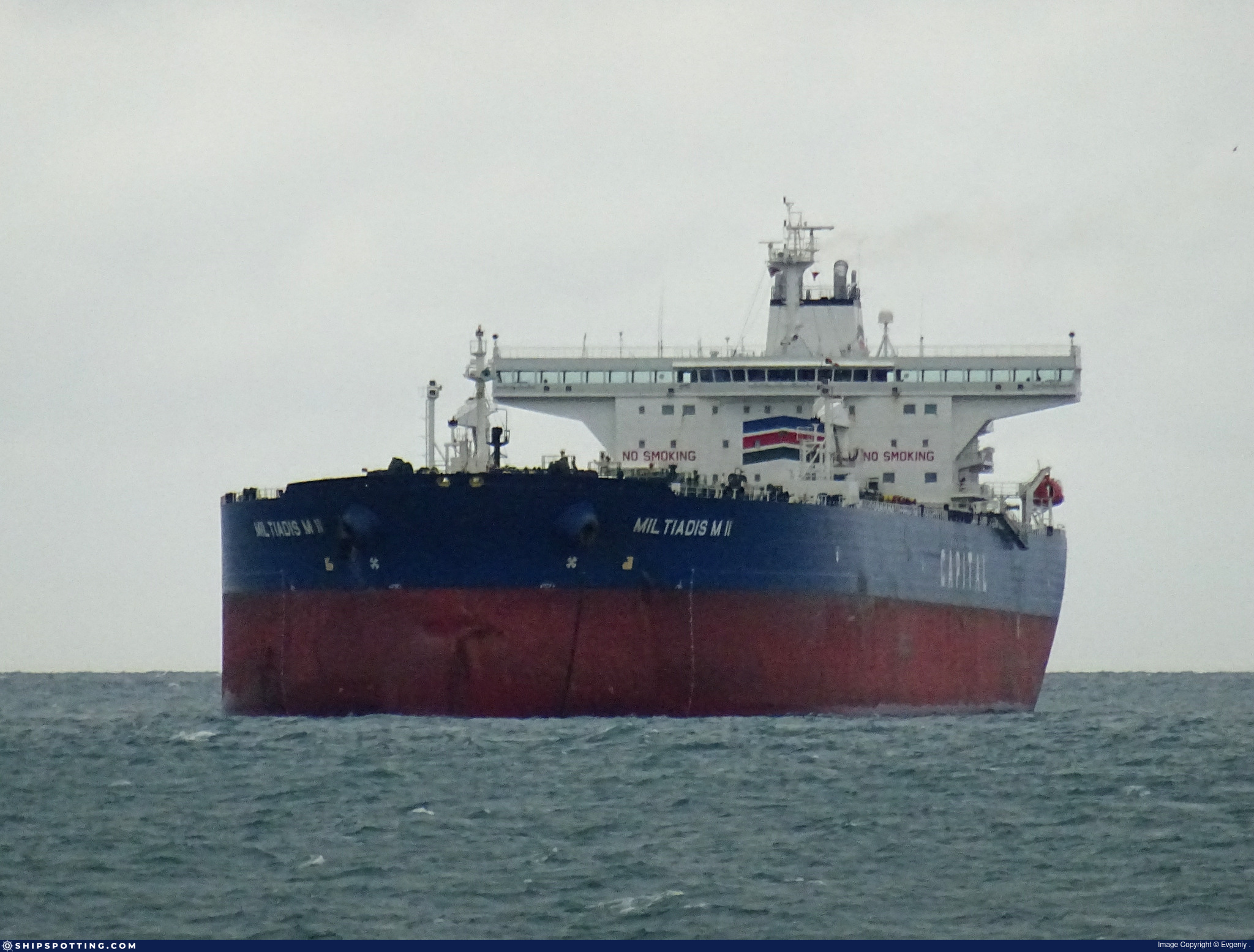
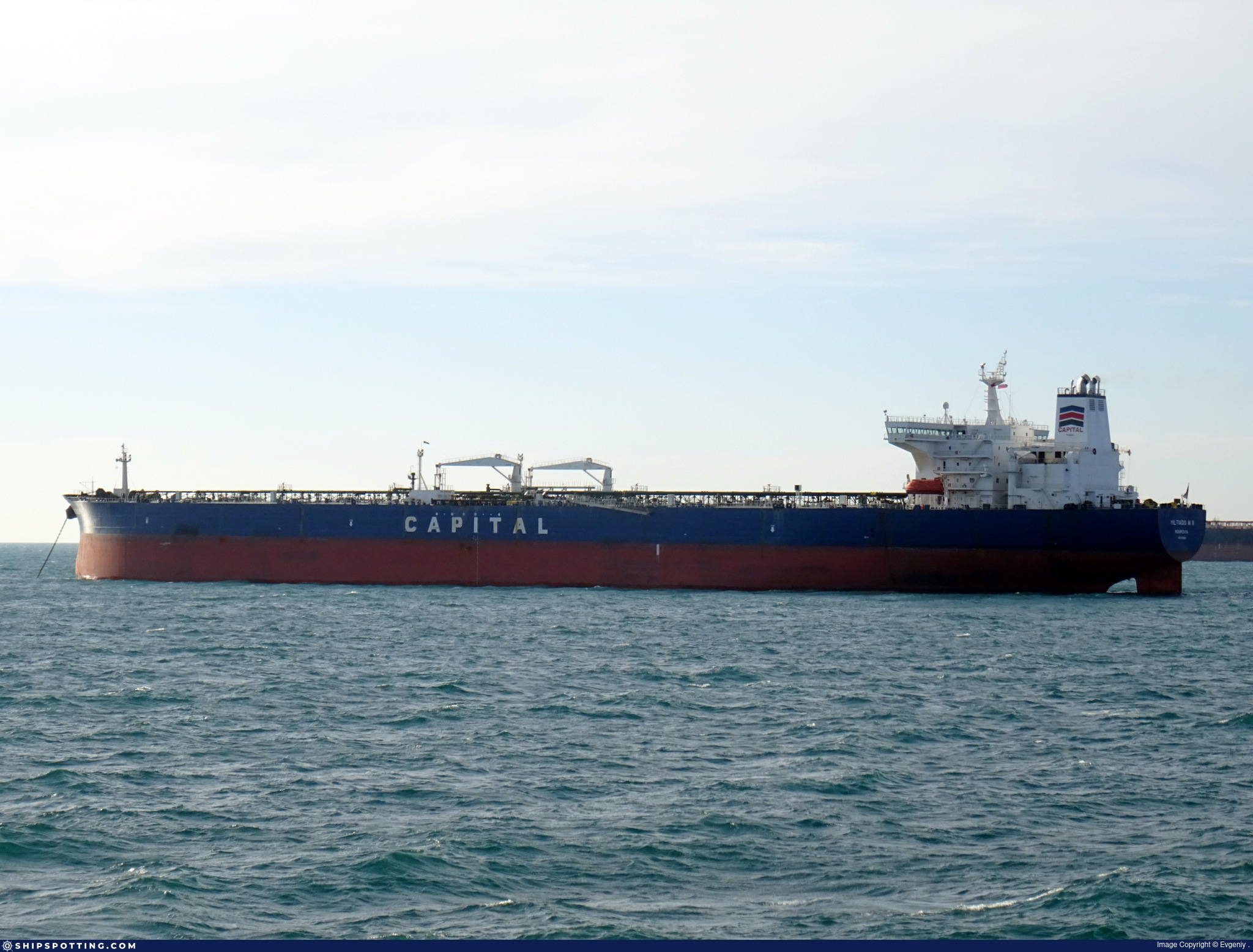
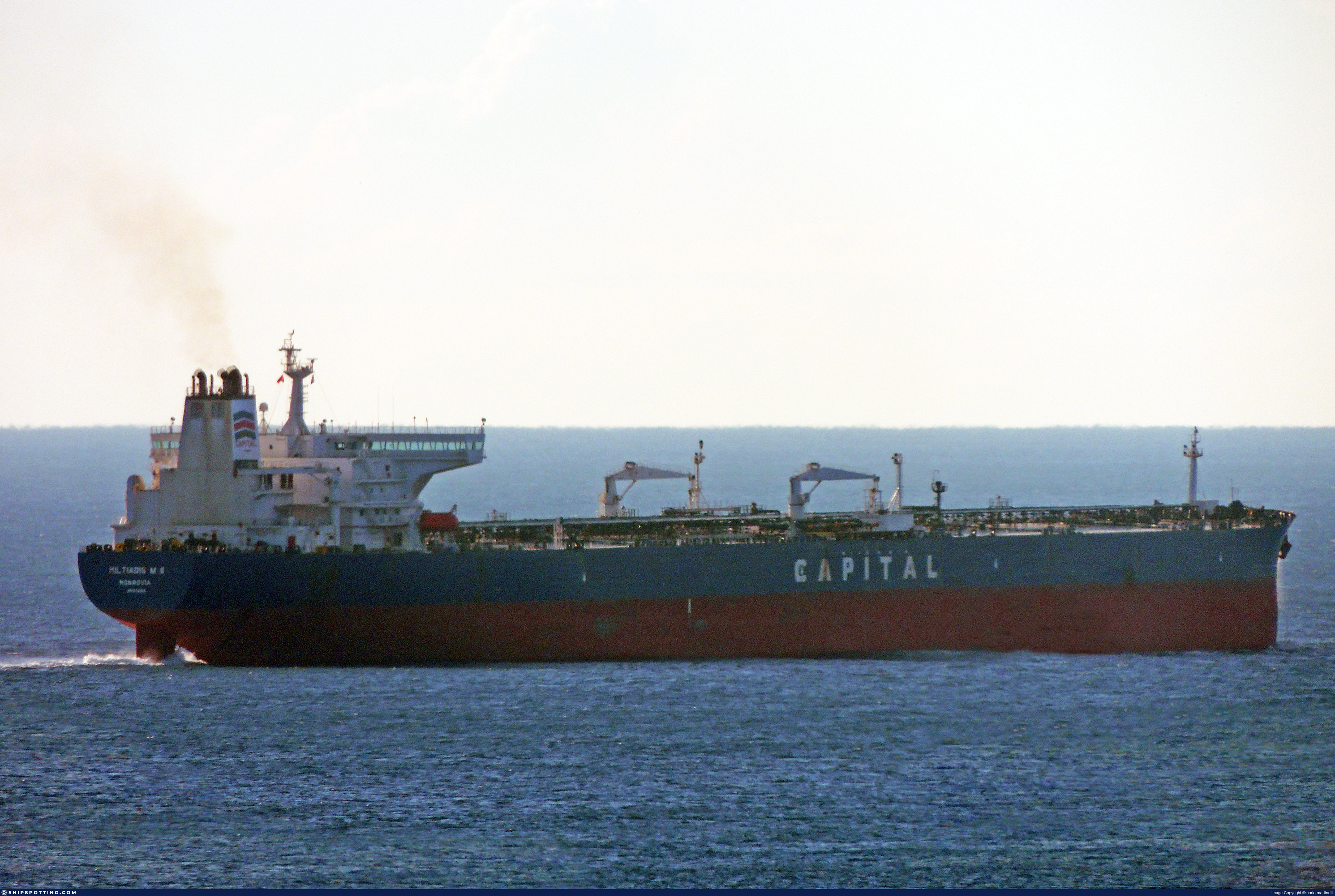
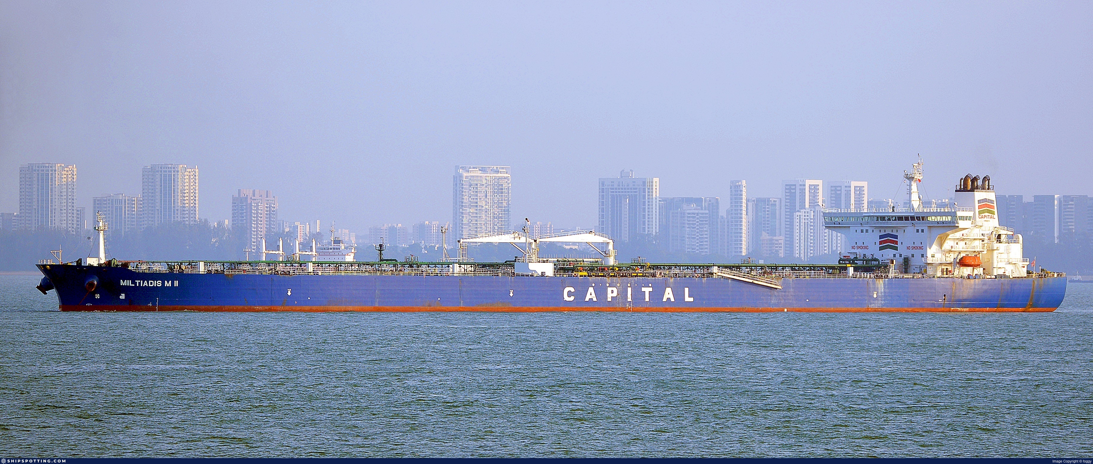
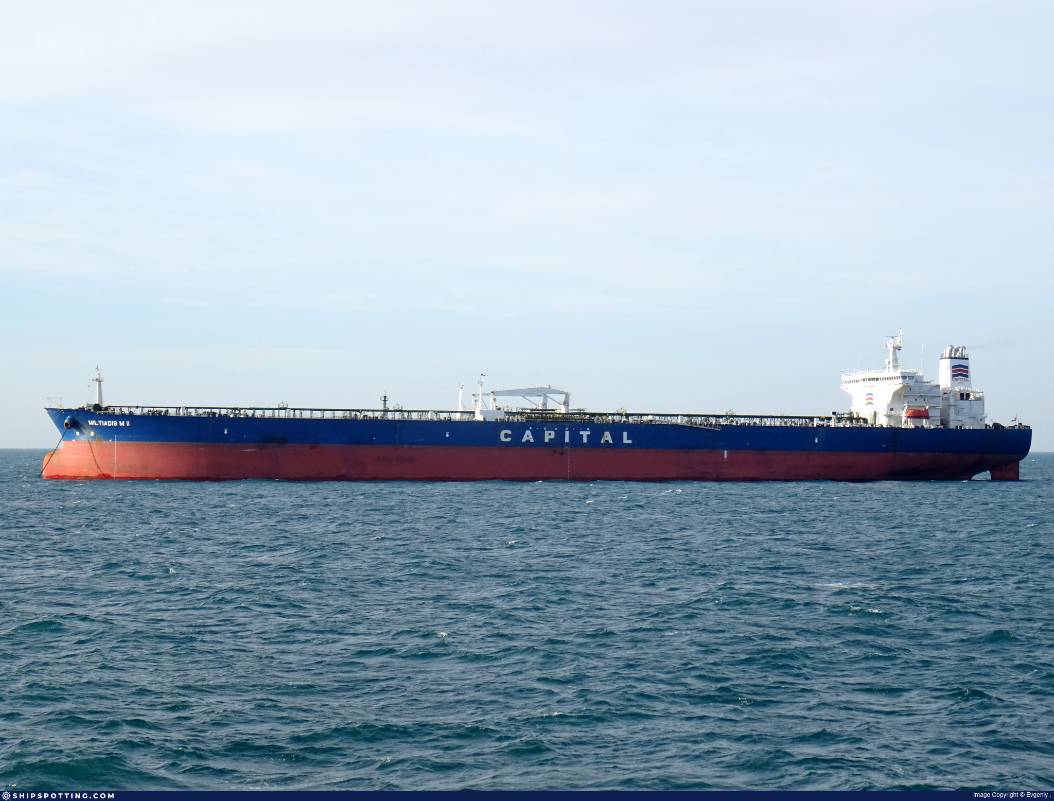
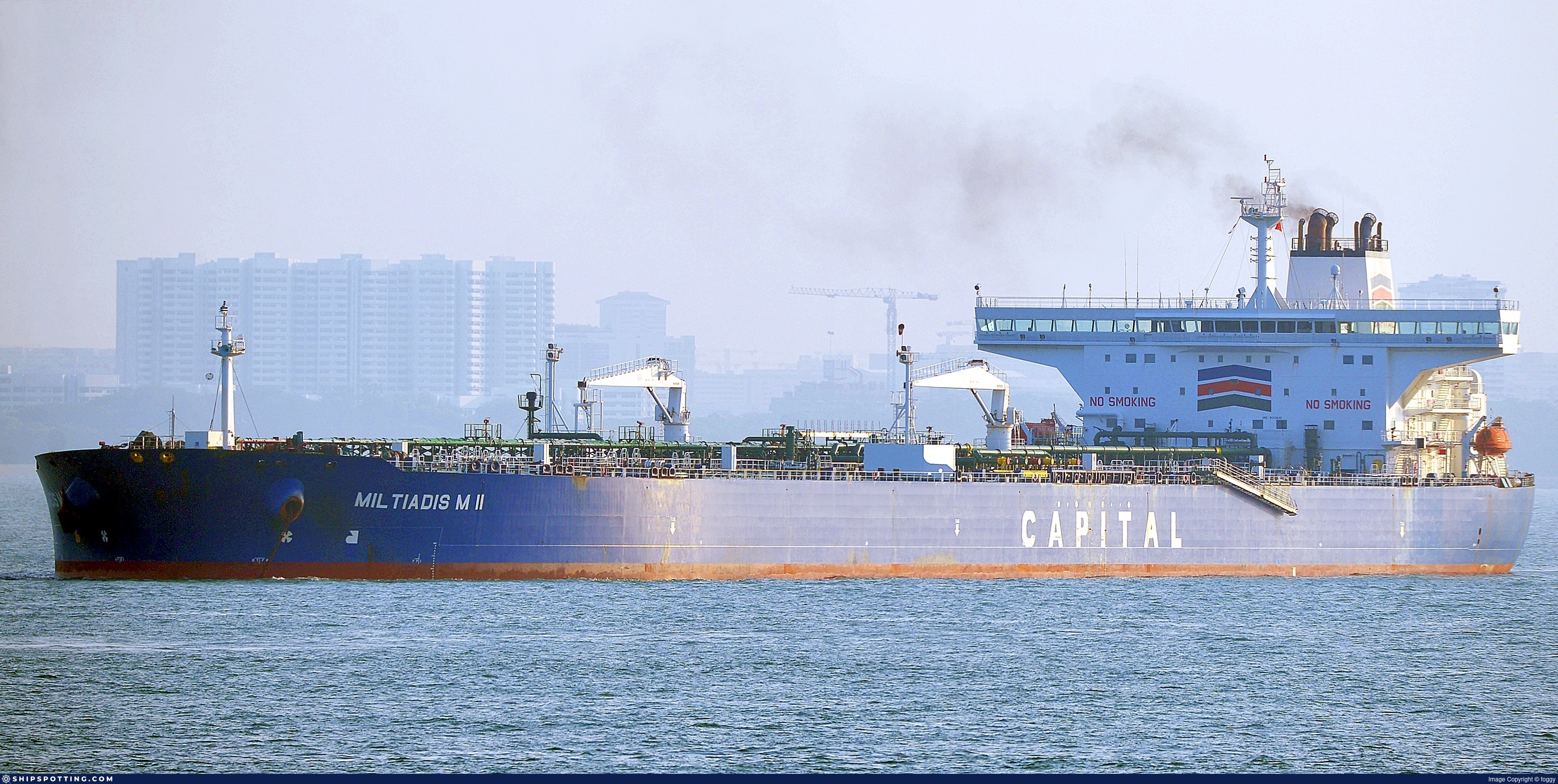
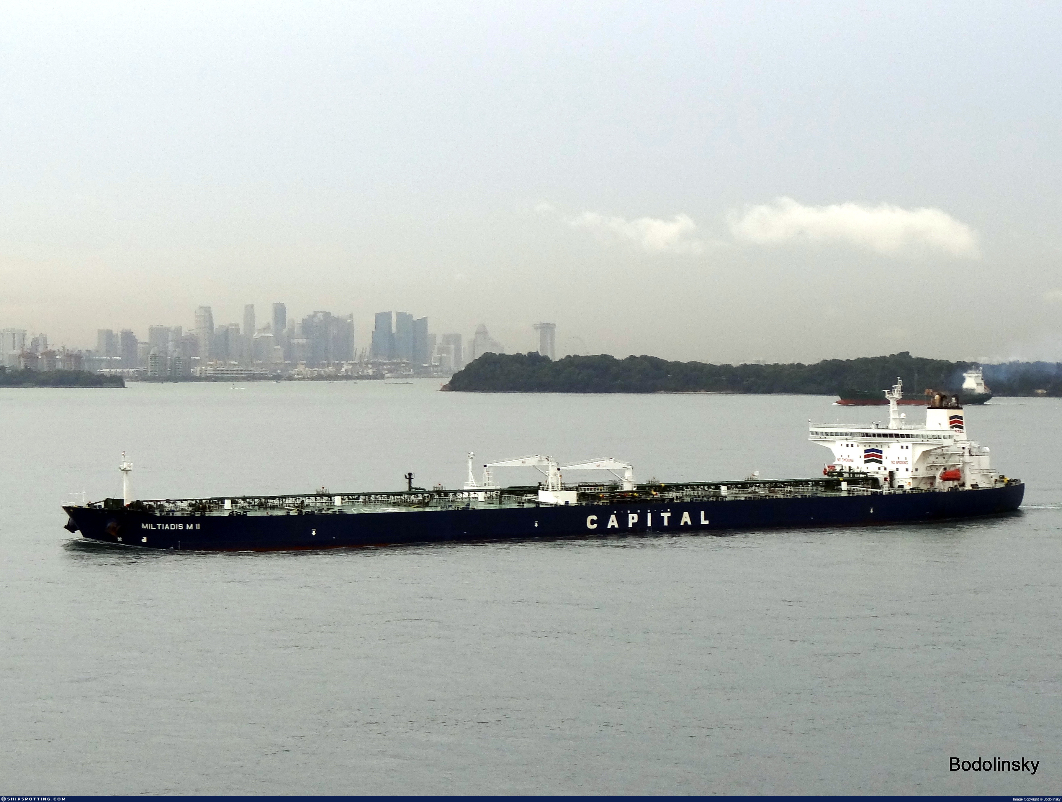 🔄 Owner
UMNENGA II (now TORX)
IMO 9311610
MILTIADIS M II CARRIERS CORP
→
UMNENGA SHIPPING INC
Dec 9, 2021
AIS Events
39 events detected • 8 zones • Last: Oct 12, 2026
Zone Dwell
Northern Sea of Japan Surveillance Zone
Oct 12, 2026 03:24 UTC
80.0%
- Zone: Northern Sea of Japan Surveillance Zone
- Duration: 1h 42m
- Data Points: 12 AIS positions
- Period: 2026-10-12T03:24:43+00:00 to 2026-10-12T05:07:33+00:00
Show Raw Evidence JSON
{
    "zone_id": "discovered_115",
    "zone_name": "Northern Sea of Japan Surveillance Zone",
    "dwell_minutes": 102.7999999999999971578290569595992565155029296875,
    "points_in_zone": 12,
    "first_point": {
        "ts": "2026-10-12T03:24:43+00:00",
        "lat": 45.711866700000001628723111934959888458251953125,
        "lon": 143.31198330000000851214281283318996429443359375
    },
    "last_point": {
        "ts": "2026-10-12T05:07:33+00:00",
        "lat": 45.822333299999996825135895051062107086181640625,
        "lon": 143.73978329999999914434738457202911376953125
    }
}
Zone Dwell
Northern Sea of Japan Surveillance Zone
Oct 12, 2026 02:59 UTC
80.0%
- Zone: Northern Sea of Japan Surveillance Zone
- Duration: 2h 8m
- Data Points: 13 AIS positions
- Period: 2026-10-12T02:59:13+00:00 to 2026-10-12T05:07:33+00:00
Show Raw Evidence JSON
{
    "zone_id": "discovered_115",
    "zone_name": "Northern Sea of Japan Surveillance Zone",
    "dwell_minutes": 128.30000000000001136868377216160297393798828125,
    "points_in_zone": 13,
    "first_point": {
        "ts": "2026-10-12T02:59:13+00:00",
        "lat": 45.68999999999999772626324556767940521240234375,
        "lon": 143.2090167000000064945197664201259613037109375
    },
    "last_point": {
        "ts": "2026-10-12T05:07:33+00:00",
        "lat": 45.822333299999996825135895051062107086181640625,
        "lon": 143.73978329999999914434738457202911376953125
    }
}
Ais Gap🛰️✓
Northern Tsushima Strait Monitoring Zone
Oct 11, 2026 21:26 UTC
70.0%
- Gap Duration: 5h 33m
- Last Seen: 2026-10-11T21:26:11+00:00 at 45.6812, 141.7473 (Zone: Northern Tsushima Strait Monitoring Zone)
- Next Seen: 2026-10-12T02:59:13+00:00 at 45.6900, 143.2090
🛰️ Gap Corroboration
Imagery Available
These are snapshots that may corroborate presence during the gap. They do not reconstruct a continuous route.
SAR Imagery (Sentinel-1)
Status: ✓ Snapshot available
SAR snapshot available for review
Scene: S1C_IW_GRDH_1SDV_20261011T204754_20261011T204827_009842_0139D5_1FF9_COG • Time: 2026-10-11T20:47:54.766672Z
SAR coverage thumbnail
VIIRS Thermal Anomaly
Status: ✗ No detections
No VIIRS thermal/light detections in corridor
Show Raw Evidence JSON
{
    "gap_minutes": 333,
    "last_seen": {
        "ts": "2026-10-11T21:26:11+00:00",
        "lat": 45.6811833000000007132257451303303241729736328125,
        "lon": 141.74731669999999894571374170482158660888671875,
        "sog": 12,
        "zone_id": "discovered_064"
    },
    "next_seen": {
        "ts": "2026-10-12T02:59:13+00:00",
        "lat": 45.68999999999999772626324556767940521240234375,
        "lon": 143.2090167000000064945197664201259613037109375,
        "zone_ids": [
            "discovered_115"
        ]
    },
    "gap_enrichment": {
        "status": "done",
        "corridor": {
            "start": {
                "lat": 45.6811833000000007132257451303303241729736328125,
                "lon": 141.74731669999999894571374170482158660888671875,
                "ts": "2026-10-11T21:26:11+00:00"
            },
            "end": {
                "lat": 45.68999999999999772626324556767940521240234375,
                "lon": 143.2090167000000064945197664201259613037109375,
                "ts": "2026-10-12T02:59:13+00:00"
            },
            "bbox": {
                "min_lat": 45.501002999999997200575307942926883697509765625,
                "min_lon": 141.48939899999999170177034102380275726318359375,
                "max_lat": 45.87017999999999773308445583097636699676513671875,
                "max_lon": 143.466935000000006539266905747354030609130859375
            },
            "buffer_km": 20
        },
        "sar": {
            "status": "snapshot",
            "scene_id": "S1C_IW_GRDH_1SDV_20261011T204754_20261011T204827_009842_0139D5_1FF9_COG",
            "scene_time": "2026-10-11T20:47:54.766672Z",
            "platform": "sentinel-1c",
            "assets": {
                "preview_url": "https:\/\/fleetleaks.com\/wp-content\/uploads\/fleetleaks-evidence\/sar-imagery\/2026\/10\/event_1498474_thumbnail_20261012030009.png",
                "stored_path": "\/home\/fleetleaks\/public_html\/wp-content\/uploads\/fleetleaks-evidence\/sar-imagery\/2026\/10\/event_1498474_thumbnail_20261012030009.png",
                "source": "copernicus_dataspace"
            },
            "notes": "SAR snapshot available for review"
        },
        "viirs": {
            "status": "not_found",
            "notes": "No VIIRS thermal\/light detections in corridor"
        },
        "searched_at": "2026-10-12T03:00:04.401180+00:00"
    }
}
Zone Dwell
Northern Tsushima Strait Monitoring Zone
Oct 11, 2026 20:21 UTC
80.0%
- Zone: Northern Tsushima Strait Monitoring Zone
- Duration: 1h 4m
- Data Points: 8 AIS positions
- Period: 2026-10-11T20:21:40+00:00 to 2026-10-11T21:26:11+00:00
Show Raw Evidence JSON
{
    "zone_id": "discovered_064",
    "zone_name": "Northern Tsushima Strait Monitoring Zone",
    "dwell_minutes": 64.5,
    "points_in_zone": 8,
    "first_point": {
        "ts": "2026-10-11T20:21:40+00:00",
        "lat": 45.73910000000000053432813729159533977508544921875,
        "lon": 141.4644332999999960520653985440731048583984375
    },
    "last_point": {
        "ts": "2026-10-11T21:26:11+00:00",
        "lat": 45.6811833000000007132257451303303241729736328125,
        "lon": 141.74731669999999894571374170482158660888671875
    }
}
Zone Dwell
Peruvian Coastal Surveillance Zone
Jul 15, 2026 02:03 UTC
80.0%
- Zone: Peruvian Coastal Surveillance Zone
- Duration: 1h 49m
- Data Points: 13 AIS positions
- Period: 2026-07-15T02:03:12+00:00 to 2026-07-15T03:52:23+00:00
Show Raw Evidence JSON
{
    "zone_id": "discovered_206",
    "zone_name": "Central Taiwan Maritime Surveillance Zone",
    "dwell_minutes": 109.2000000000000028421709430404007434844970703125,
    "points_in_zone": 13,
    "first_point": {
        "ts": "2026-07-15T02:03:12+00:00",
        "lat": 24.627050000000000551381162949837744235992431640625,
        "lon": 122.475383300000004282992449589073657989501953125
    },
    "last_point": {
        "ts": "2026-07-15T03:52:23+00:00",
        "lat": 24.842999999999999971578290569595992565155029296875,
        "lon": 122.5545333000000027823261916637420654296875
    }
}
Zone Dwell
Peruvian Coastal Surveillance Zone
Jul 15, 2026 01:30 UTC
80.0%
- Zone: Peruvian Coastal Surveillance Zone
- Duration: 2h 21m
- Data Points: 18 AIS positions
- Period: 2026-07-15T01:30:50+00:00 to 2026-07-15T03:52:23+00:00
Show Raw Evidence JSON
{
    "zone_id": "discovered_206",
    "zone_name": "Central Taiwan Maritime Surveillance Zone",
    "dwell_minutes": 141.599999999999994315658113919198513031005859375,
    "points_in_zone": 18,
    "first_point": {
        "ts": "2026-07-15T01:30:50+00:00",
        "lat": 24.543383299999998570228854077868163585662841796875,
        "lon": 122.4290667000000070174792199395596981048583984375
    },
    "last_point": {
        "ts": "2026-07-15T03:52:23+00:00",
        "lat": 24.842999999999999971578290569595992565155029296875,
        "lon": 122.5545333000000027823261916637420654296875
    }
}
Zone Dwell
Peruvian Coastal Surveillance Zone
Jul 15, 2026 00:59 UTC
80.0%
- Zone: Peruvian Coastal Surveillance Zone
- Duration: 2h 53m
- Data Points: 19 AIS positions
- Period: 2026-07-15T00:59:02+00:00 to 2026-07-15T03:52:23+00:00
Show Raw Evidence JSON
{
    "zone_id": "discovered_206",
    "zone_name": "Central Taiwan Maritime Surveillance Zone",
    "dwell_minutes": 173.30000000000001136868377216160297393798828125,
    "points_in_zone": 19,
    "first_point": {
        "ts": "2026-07-15T00:59:02+00:00",
        "lat": 24.438216700000001679882188909687101840972900390625,
        "lon": 122.353166700000002720116754062473773956298828125
    },
    "last_point": {
        "ts": "2026-07-15T03:52:23+00:00",
        "lat": 24.842999999999999971578290569595992565155029296875,
        "lon": 122.5545333000000027823261916637420654296875
    }
}
Zone Dwell
Crimean Peninsula Surveillance Zone
May 19, 2026 05:22 UTC
80.0%
- Zone: Crimean Peninsula Surveillance Zone
- Duration: 1h 45m
- Data Points: 17 AIS positions
- Period: 2026-05-19T05:22:11+00:00 to 2026-05-19T07:07:10+00:00
Show Raw Evidence JSON
{
    "zone_id": "discovered_086",
    "zone_name": "Eastern Mediterranean Sanctioned Vessel Zone",
    "dwell_minutes": 105,
    "points_in_zone": 17,
    "first_point": {
        "ts": "2026-05-19T05:22:11+00:00",
        "lat": 36.7692667000000028565409593284130096435546875,
        "lon": 26.68931669999999911624399828724563121795654296875
    },
    "last_point": {
        "ts": "2026-05-19T07:07:10+00:00",
        "lat": 36.44666670000000152640495798550546169281005859375,
        "lon": 26.770733299999999843521436559967696666717529296875
    }
}
Zone Dwell
Crimean Peninsula Surveillance Zone
May 19, 2026 04:01 UTC
80.0%
- Zone: Crimean Peninsula Surveillance Zone
- Duration: 3h 5m
- Data Points: 30 AIS positions
- Period: 2026-05-19T04:01:50+00:00 to 2026-05-19T07:07:10+00:00
Show Raw Evidence JSON
{
    "zone_id": "discovered_086",
    "zone_name": "Eastern Mediterranean Sanctioned Vessel Zone",
    "dwell_minutes": 185.30000000000001136868377216160297393798828125,
    "points_in_zone": 30,
    "first_point": {
        "ts": "2026-05-19T04:01:50+00:00",
        "lat": 37.02040000000000219415596802718937397003173828125,
        "lon": 26.670249999999999346300683100707828998565673828125
    },
    "last_point": {
        "ts": "2026-05-19T07:07:10+00:00",
        "lat": 36.44666670000000152640495798550546169281005859375,
        "lon": 26.770733299999999843521436559967696666717529296875
    }
}
Zone Dwell
Crimean Peninsula Surveillance Zone
May 19, 2026 03:00 UTC
80.0%
- Zone: Crimean Peninsula Surveillance Zone
- Duration: 4h 6m
- Data Points: 57 AIS positions
- Period: 2026-05-19T03:00:30+00:00 to 2026-05-19T07:07:10+00:00
Show Raw Evidence JSON
{
    "zone_id": "discovered_086",
    "zone_name": "Eastern Mediterranean Sanctioned Vessel Zone",
    "dwell_minutes": 246.69999999999998863131622783839702606201171875,
    "points_in_zone": 57,
    "first_point": {
        "ts": "2026-05-19T03:00:30+00:00",
        "lat": 37.12736499999999750798451714217662811279296875,
        "lon": 26.48395000000000010231815394945442676544189453125
    },
    "last_point": {
        "ts": "2026-05-19T07:07:10+00:00",
        "lat": 36.44666670000000152640495798550546169281005859375,
        "lon": 26.770733299999999843521436559967696666717529296875
    }
}
Zone Dwell
Crimean Peninsula Surveillance Zone
May 19, 2026 02:00 UTC
80.0%
- Zone: Crimean Peninsula Surveillance Zone
- Duration: 5h 6m
- Data Points: 83 AIS positions
- Period: 2026-05-19T02:00:41+00:00 to 2026-05-19T07:07:10+00:00
Show Raw Evidence JSON
{
    "zone_id": "discovered_086",
    "zone_name": "Eastern Mediterranean Sanctioned Vessel Zone",
    "dwell_minutes": 306.5,
    "points_in_zone": 83,
    "first_point": {
        "ts": "2026-05-19T02:00:41+00:00",
        "lat": 37.2206316999999984318492352031171321868896484375,
        "lon": 26.282364999999998644852894358336925506591796875
    },
    "last_point": {
        "ts": "2026-05-19T07:07:10+00:00",
        "lat": 36.44666670000000152640495798550546169281005859375,
        "lon": 26.770733299999999843521436559967696666717529296875
    }
}
Zone Dwell
Crimean Peninsula Surveillance Zone
May 19, 2026 01:44 UTC
80.0%
- Zone: Crimean Peninsula Surveillance Zone
- Duration: 5h 22m
- Data Points: 88 AIS positions
- Period: 2026-05-19T01:44:21+00:00 to 2026-05-19T07:07:10+00:00
Show Raw Evidence JSON
{
    "zone_id": "discovered_086",
    "zone_name": "Eastern Mediterranean Sanctioned Vessel Zone",
    "dwell_minutes": 322.80000000000001136868377216160297393798828125,
    "points_in_zone": 88,
    "first_point": {
        "ts": "2026-05-19T01:44:21+00:00",
        "lat": 37.24669999999999703277353546582162380218505859375,
        "lon": 26.227131700000001046646502800285816192626953125
    },
    "last_point": {
        "ts": "2026-05-19T07:07:10+00:00",
        "lat": 36.44666670000000152640495798550546169281005859375,
        "lon": 26.770733299999999843521436559967696666717529296875
    }
}
Zone Dwell
Central Atlantic Surveillance Zone
May 19, 2026 00:00 UTC
80.0%
- Zone: Central Atlantic Surveillance Zone
- Duration: 1h 35m
- Data Points: 38 AIS positions
- Period: 2026-05-19T00:00:21+00:00 to 2026-05-19T01:36:10+00:00
Show Raw Evidence JSON
{
    "zone_id": "discovered_088",
    "zone_name": "Central Atlantic Surveillance Zone",
    "dwell_minutes": 95.7999999999999971578290569595992565155029296875,
    "points_in_zone": 38,
    "first_point": {
        "ts": "2026-05-19T00:00:21+00:00",
        "lat": 37.419364999999999099600245244801044464111328125,
        "lon": 25.87349999999999994315658113919198513031005859375
    },
    "last_point": {
        "ts": "2026-05-19T01:36:10+00:00",
        "lat": 37.2597650000000015779733075760304927825927734375,
        "lon": 26.198831699999999500505509786307811737060546875
    }
}
Zone Dwell
Central Atlantic Surveillance Zone
May 18, 2026 23:18 UTC
80.0%
- Zone: Central Atlantic Surveillance Zone
- Duration: 2h 17m
- Data Points: 45 AIS positions
- Period: 2026-05-18T23:18:31+00:00 to 2026-05-19T01:36:10+00:00
Show Raw Evidence JSON
{
    "zone_id": "discovered_088",
    "zone_name": "Central Atlantic Surveillance Zone",
    "dwell_minutes": 137.69999999999998863131622783839702606201171875,
    "points_in_zone": 45,
    "first_point": {
        "ts": "2026-05-18T23:18:31+00:00",
        "lat": 37.5389832999999981666405801661312580108642578125,
        "lon": 25.852883299999998456542016356252133846282958984375
    },
    "last_point": {
        "ts": "2026-05-19T01:36:10+00:00",
        "lat": 37.2597650000000015779733075760304927825927734375,
        "lon": 26.198831699999999500505509786307811737060546875
    }
}
Zone Dwell
Bosphorus/Dardanelles Approach
May 16, 2026 18:36 UTC
80.0%
- Zone: Bosphorus/Dardanelles Approach
- Duration: 2h 28m
- Data Points: 18 AIS positions
- Period: 2026-05-16T18:36:57+00:00 to 2026-05-16T21:05:37+00:00
Show Raw Evidence JSON
{
    "zone_id": "osint_bosphorus",
    "zone_name": "Bosphorus\/Dardanelles Approach",
    "dwell_minutes": 148.69999999999998863131622783839702606201171875,
    "points_in_zone": 18,
    "first_point": {
        "ts": "2026-05-16T18:36:57+00:00",
        "lat": 40.92181670000000082154656411148607730865478515625,
        "lon": 28.796299999999998675548340543173253536224365234375
    },
    "last_point": {
        "ts": "2026-05-16T21:05:37+00:00",
        "lat": 40.91461670000000339086909662000834941864013671875,
        "lon": 28.7093832999999989397110766731202602386474609375
    }
}
Zone Dwell
Bosphorus/Dardanelles Approach
May 16, 2026 17:00 UTC
80.0%
- Zone: Bosphorus/Dardanelles Approach
- Duration: 4h 4m
- Data Points: 29 AIS positions
- Period: 2026-05-16T17:00:56+00:00 to 2026-05-16T21:05:37+00:00
Show Raw Evidence JSON
{
    "zone_id": "osint_bosphorus",
    "zone_name": "Bosphorus\/Dardanelles Approach",
    "dwell_minutes": 244.69999999999998863131622783839702606201171875,
    "points_in_zone": 29,
    "first_point": {
        "ts": "2026-05-16T17:00:56+00:00",
        "lat": 40.9318999999999988403942552395164966583251953125,
        "lon": 28.889083299999999354668034357018768787384033203125
    },
    "last_point": {
        "ts": "2026-05-16T21:05:37+00:00",
        "lat": 40.91461670000000339086909662000834941864013671875,
        "lon": 28.7093832999999989397110766731202602386474609375
    }
}
Zone Dwell
Bosphorus/Dardanelles Approach
May 16, 2026 16:10 UTC
80.0%
- Zone: Bosphorus/Dardanelles Approach
- Duration: 4h 55m
- Data Points: 48 AIS positions
- Period: 2026-05-16T16:10:36+00:00 to 2026-05-16T21:05:37+00:00
Show Raw Evidence JSON
{
    "zone_id": "osint_bosphorus",
    "zone_name": "Bosphorus\/Dardanelles Approach",
    "dwell_minutes": 295,
    "points_in_zone": 48,
    "first_point": {
        "ts": "2026-05-16T16:10:36+00:00",
        "lat": 41.0035333000000008496499503962695598602294921875,
        "lon": 28.99453330000000050858943723142147064208984375
    },
    "last_point": {
        "ts": "2026-05-16T21:05:37+00:00",
        "lat": 40.91461670000000339086909662000834941864013671875,
        "lon": 28.7093832999999989397110766731202602386474609375
    }
}
Zone Dwell
discovered_022
May 15, 2026 20:01 UTC
80.0%
- Zone: discovered_022
- Duration: 1h 28m
- Data Points: 19 AIS positions
- Period: 2026-05-15T20:01:31+00:00 to 2026-05-15T21:30:04+00:00
Show Raw Evidence JSON
{
    "zone_id": "discovered_022",
    "zone_name": "Black Sea Sanctioned Vessel Monitoring Zone",
    "dwell_minutes": 88.5,
    "points_in_zone": 19,
    "first_point": {
        "ts": "2026-05-15T20:01:31+00:00",
        "lat": 41.501249999999998863131622783839702606201171875,
        "lon": 29.09261670000000066238499130122363567352294921875
    },
    "last_point": {
        "ts": "2026-05-15T21:30:04+00:00",
        "lat": 41.5041666999999989684511092491447925567626953125,
        "lon": 29.1242333000000002130036591552197933197021484375
    }
}
Zone Dwell
discovered_022
May 15, 2026 19:52 UTC
80.0%
- Zone: discovered_022
- Duration: 1h 37m
- Data Points: 22 AIS positions
- Period: 2026-05-15T19:52:12+00:00 to 2026-05-15T21:30:04+00:00
Show Raw Evidence JSON
{
    "zone_id": "discovered_022",
    "zone_name": "Black Sea Sanctioned Vessel Monitoring Zone",
    "dwell_minutes": 97.900000000000005684341886080801486968994140625,
    "points_in_zone": 22,
    "first_point": {
        "ts": "2026-05-15T19:52:12+00:00",
        "lat": 41.50073330000000026984707801602780818939208984375,
        "lon": 29.0891333000000003039531293325126171112060546875
    },
    "last_point": {
        "ts": "2026-05-15T21:30:04+00:00",
        "lat": 41.5041666999999989684511092491447925567626953125,
        "lon": 29.1242333000000002130036591552197933197021484375
    }
}
Zone Dwell
discovered_022
May 15, 2026 18:00 UTC
80.0%
- Zone: discovered_022
- Duration: 3h 29m
- Data Points: 30 AIS positions
- Period: 2026-05-15T18:00:27+00:00 to 2026-05-15T21:30:04+00:00
Show Raw Evidence JSON
{
    "zone_id": "discovered_022",
    "zone_name": "Black Sea Sanctioned Vessel Monitoring Zone",
    "dwell_minutes": 209.599999999999994315658113919198513031005859375,
    "points_in_zone": 30,
    "first_point": {
        "ts": "2026-05-15T18:00:27+00:00",
        "lat": 41.48683330000000069048837758600711822509765625,
        "lon": 29.050583299999999553620000369846820831298828125
    },
    "last_point": {
        "ts": "2026-05-15T21:30:04+00:00",
        "lat": 41.5041666999999989684511092491447925567626953125,
        "lon": 29.1242333000000002130036591552197933197021484375
    }
}
Zone Dwell
discovered_022
May 15, 2026 17:00 UTC
80.0%
- Zone: discovered_022
- Duration: 4h 29m
- Data Points: 51 AIS positions
- Period: 2026-05-15T17:00:27+00:00 to 2026-05-15T21:30:04+00:00
Show Raw Evidence JSON
{
    "zone_id": "discovered_022",
    "zone_name": "Black Sea Sanctioned Vessel Monitoring Zone",
    "dwell_minutes": 269.6000000000000227373675443232059478759765625,
    "points_in_zone": 51,
    "first_point": {
        "ts": "2026-05-15T17:00:27+00:00",
        "lat": 41.47708329999999676829247619025409221649169921875,
        "lon": 29.031716700000000486170392832718789577484130859375
    },
    "last_point": {
        "ts": "2026-05-15T21:30:04+00:00",
        "lat": 41.5041666999999989684511092491447925567626953125,
        "lon": 29.1242333000000002130036591552197933197021484375
    }
}
Zone Dwell
Bosphorus/Dardanelles Approach
May 15, 2026 17:00 UTC
80.0%
- Zone: Bosphorus/Dardanelles Approach
- Duration: 1h 17m
- Data Points: 29 AIS positions
- Period: 2026-05-15T17:00:27+00:00 to 2026-05-15T18:17:36+00:00
Show Raw Evidence JSON
{
    "zone_id": "osint_bosphorus",
    "zone_name": "Bosphorus\/Dardanelles Approach",
    "dwell_minutes": 77.2000000000000028421709430404007434844970703125,
    "points_in_zone": 29,
    "first_point": {
        "ts": "2026-05-15T17:00:27+00:00",
        "lat": 41.47708329999999676829247619025409221649169921875,
        "lon": 29.031716700000000486170392832718789577484130859375
    },
    "last_point": {
        "ts": "2026-05-15T18:17:36+00:00",
        "lat": 41.48935000000000172803993336856365203857421875,
        "lon": 29.056233299999998820339897065423429012298583984375
    }
}
Zone Dwell
discovered_022
May 15, 2026 16:00 UTC
80.0%
- Zone: discovered_022
- Duration: 5h 29m
- Data Points: 72 AIS positions
- Period: 2026-05-15T16:00:48+00:00 to 2026-05-15T21:30:04+00:00
Show Raw Evidence JSON
{
    "zone_id": "discovered_022",
    "zone_name": "Black Sea Sanctioned Vessel Monitoring Zone",
    "dwell_minutes": 329.30000000000001136868377216160297393798828125,
    "points_in_zone": 72,
    "first_point": {
        "ts": "2026-05-15T16:00:48+00:00",
        "lat": 41.46608330000000108839230961166322231292724609375,
        "lon": 29.017700000000001381295078317634761333465576171875
    },
    "last_point": {
        "ts": "2026-05-15T21:30:04+00:00",
        "lat": 41.5041666999999989684511092491447925567626953125,
        "lon": 29.1242333000000002130036591552197933197021484375
    }
}
Zone Dwell
Bosphorus/Dardanelles Approach
May 15, 2026 16:00 UTC
80.0%
- Zone: Bosphorus/Dardanelles Approach
- Duration: 2h 16m
- Data Points: 50 AIS positions
- Period: 2026-05-15T16:00:48+00:00 to 2026-05-15T18:17:36+00:00
Show Raw Evidence JSON
{
    "zone_id": "osint_bosphorus",
    "zone_name": "Bosphorus\/Dardanelles Approach",
    "dwell_minutes": 136.80000000000001136868377216160297393798828125,
    "points_in_zone": 50,
    "first_point": {
        "ts": "2026-05-15T16:00:48+00:00",
        "lat": 41.46608330000000108839230961166322231292724609375,
        "lon": 29.017700000000001381295078317634761333465576171875
    },
    "last_point": {
        "ts": "2026-05-15T18:17:36+00:00",
        "lat": 41.48935000000000172803993336856365203857421875,
        "lon": 29.056233299999998820339897065423429012298583984375
    }
}
Zone Dwell
discovered_022
May 15, 2026 15:02 UTC
80.0%
- Zone: discovered_022
- Duration: 6h 27m
- Data Points: 89 AIS positions
- Period: 2026-05-15T15:02:16+00:00 to 2026-05-15T21:30:04+00:00
Show Raw Evidence JSON
{
    "zone_id": "discovered_022",
    "zone_name": "Black Sea Sanctioned Vessel Monitoring Zone",
    "dwell_minutes": 387.80000000000001136868377216160297393798828125,
    "points_in_zone": 89,
    "first_point": {
        "ts": "2026-05-15T15:02:16+00:00",
        "lat": 41.45746669999999767242115922272205352783203125,
        "lon": 29.00956670000000059417288866825401782989501953125
    },
    "last_point": {
        "ts": "2026-05-15T21:30:04+00:00",
        "lat": 41.5041666999999989684511092491447925567626953125,
        "lon": 29.1242333000000002130036591552197933197021484375
    }
}
Zone Dwell
Bosphorus/Dardanelles Approach
May 15, 2026 15:02 UTC
80.0%
- Zone: Bosphorus/Dardanelles Approach
- Duration: 3h 15m
- Data Points: 67 AIS positions
- Period: 2026-05-15T15:02:16+00:00 to 2026-05-15T18:17:36+00:00
Show Raw Evidence JSON
{
    "zone_id": "osint_bosphorus",
    "zone_name": "Bosphorus\/Dardanelles Approach",
    "dwell_minutes": 195.30000000000001136868377216160297393798828125,
    "points_in_zone": 67,
    "first_point": {
        "ts": "2026-05-15T15:02:16+00:00",
        "lat": 41.45746669999999767242115922272205352783203125,
        "lon": 29.00956670000000059417288866825401782989501953125
    },
    "last_point": {
        "ts": "2026-05-15T18:17:36+00:00",
        "lat": 41.48935000000000172803993336856365203857421875,
        "lon": 29.056233299999998820339897065423429012298583984375
    }
}
Loiter
discovered_022
May 15, 2026 14:42 UTC
75.0%
- Duration: 1h 33m
- Radius: 1,195 meters
- Data Points: 31 AIS positions
- Centroid: 41.4621, 29.0144
- Zone: discovered_022
Show Raw Evidence JSON
{
    "radius_m": 1195,
    "duration_minutes": 93.400000000000005684341886080801486968994140625,
    "points": 31,
    "centroid": {
        "lat": 41.46211398387097091244868352077901363372802734375,
        "lon": 29.01439784838709812220258754678070545196533203125
    },
    "bbox": {
        "min_lat": 41.45259999999999678266249247826635837554931640625,
        "min_lon": 29.007716699999999576675691059790551662445068359375,
        "max_lat": 41.47061670000000077607182902283966541290283203125,
        "max_lon": 29.0223332999999996673068380914628505706787109375
    },
    "zone_id": "discovered_022"
}
Loiter
Bosphorus/Dardanelles Approach
May 15, 2026 14:42 UTC
75.0%
- Duration: 1h 33m
- Radius: 1,195 meters
- Data Points: 31 AIS positions
- Centroid: 41.4621, 29.0144
- Zone: Bosphorus/Dardanelles Approach
Show Raw Evidence JSON
{
    "radius_m": 1195,
    "duration_minutes": 93.400000000000005684341886080801486968994140625,
    "points": 31,
    "centroid": {
        "lat": 41.46211398387097091244868352077901363372802734375,
        "lon": 29.01439784838709812220258754678070545196533203125
    },
    "bbox": {
        "min_lat": 41.45259999999999678266249247826635837554931640625,
        "min_lon": 29.007716699999999576675691059790551662445068359375,
        "max_lat": 41.47061670000000077607182902283966541290283203125,
        "max_lon": 29.0223332999999996673068380914628505706787109375
    },
    "zone_id": "osint_bosphorus"
}
Zone Dwell
discovered_022
May 15, 2026 14:01 UTC
80.0%
- Zone: discovered_022
- Duration: 6h 30m
- Data Points: 99 AIS positions
- Period: 2026-05-15T14:34:05+00:00 to 2026-05-15T21:04:22+00:00
Show Raw Evidence JSON
{
    "zone_id": "discovered_022",
    "zone_name": "Black Sea Sanctioned Vessel Monitoring Zone",
    "dwell_minutes": 390.30000000000001136868377216160297393798828125,
    "points_in_zone": 99,
    "first_point": {
        "ts": "2026-05-15T14:34:05+00:00",
        "lat": 41.4512332999999983940142556093633174896240234375,
        "lon": 29.018350000000001642774805077351629734039306640625
    },
    "last_point": {
        "ts": "2026-05-15T21:04:22+00:00",
        "lat": 41.5041666999999989684511092491447925567626953125,
        "lon": 29.11540000000000105728759081102907657623291015625
    }
}
Zone Dwell
Bosphorus/Dardanelles Approach
May 15, 2026 14:01 UTC
80.0%
- Zone: Bosphorus/Dardanelles Approach
- Duration: 4h 16m
- Data Points: 88 AIS positions
- Period: 2026-05-15T14:01:05+00:00 to 2026-05-15T18:17:36+00:00
Show Raw Evidence JSON
{
    "zone_id": "osint_bosphorus",
    "zone_name": "Bosphorus\/Dardanelles Approach",
    "dwell_minutes": 256.5,
    "points_in_zone": 88,
    "first_point": {
        "ts": "2026-05-15T14:01:05+00:00",
        "lat": 41.45028330000000238442225963808596134185791015625,
        "lon": 29.061916700000001156922735390253365039825439453125
    },
    "last_point": {
        "ts": "2026-05-15T18:17:36+00:00",
        "lat": 41.48935000000000172803993336856365203857421875,
        "lon": 29.056233299999998820339897065423429012298583984375
    }
}
Zone Dwell
Bosphorus/Dardanelles Approach
May 15, 2026 13:01 UTC
80.0%
- Zone: Bosphorus/Dardanelles Approach
- Duration: 5h 16m
- Data Points: 109 AIS positions
- Period: 2026-05-15T13:01:27+00:00 to 2026-05-15T18:17:36+00:00
Show Raw Evidence JSON
{
    "zone_id": "osint_bosphorus",
    "zone_name": "Bosphorus\/Dardanelles Approach",
    "dwell_minutes": 316.1000000000000227373675443232059478759765625,
    "points_in_zone": 109,
    "first_point": {
        "ts": "2026-05-15T13:01:27+00:00",
        "lat": 41.4202250000000020691004465334117412567138671875,
        "lon": 29.177279999999999660076355212368071079254150390625
    },
    "last_point": {
        "ts": "2026-05-15T18:17:36+00:00",
        "lat": 41.48935000000000172803993336856365203857421875,
        "lon": 29.056233299999998820339897065423429012298583984375
    }
}
Zone Dwell
discovered_022
May 15, 2026 13:01 UTC
80.0%
- Zone: discovered_022
- Duration: 6h 38m
- Data Points: 104 AIS positions
- Period: 2026-05-15T13:51:07+00:00 to 2026-05-15T20:29:42+00:00
Show Raw Evidence JSON
{
    "zone_id": "discovered_022",
    "zone_name": "Black Sea Sanctioned Vessel Monitoring Zone",
    "dwell_minutes": 398.6000000000000227373675443232059478759765625,
    "points_in_zone": 104,
    "first_point": {
        "ts": "2026-05-15T13:51:07+00:00",
        "lat": 41.44760000000000133013600134290754795074462890625,
        "lon": 29.08441669999999845686033950187265872955322265625
    },
    "last_point": {
        "ts": "2026-05-15T20:29:42+00:00",
        "lat": 41.50288330000000058817022363655269145965576171875,
        "lon": 29.102850000000000108002495835535228252410888671875
    }
}
Zone Dwell
discovered_022
May 15, 2026 12:02 UTC
80.0%
- Zone: discovered_022
- Duration: 6h 15m
- Data Points: 129 AIS positions
- Period: 2026-05-15T12:02:27+00:00 to 2026-05-15T18:17:36+00:00
Show Raw Evidence JSON
{
    "zone_id": "discovered_022",
    "zone_name": "Black Sea Sanctioned Vessel Monitoring Zone",
    "dwell_minutes": 375.1000000000000227373675443232059478759765625,
    "points_in_zone": 129,
    "first_point": {
        "ts": "2026-05-15T12:02:27+00:00",
        "lat": 41.39368329999999929214027361012995243072509765625,
        "lon": 29.3106666999999987410774338059127330780029296875
    },
    "last_point": {
        "ts": "2026-05-15T18:17:36+00:00",
        "lat": 41.48935000000000172803993336856365203857421875,
        "lon": 29.056233299999998820339897065423429012298583984375
    }
}
Zone Dwell
Bosphorus/Dardanelles Approach
May 15, 2026 12:02 UTC
80.0%
- Zone: Bosphorus/Dardanelles Approach
- Duration: 6h 15m
- Data Points: 129 AIS positions
- Period: 2026-05-15T12:02:27+00:00 to 2026-05-15T18:17:36+00:00
Show Raw Evidence JSON
{
    "zone_id": "osint_bosphorus",
    "zone_name": "Bosphorus\/Dardanelles Approach",
    "dwell_minutes": 375.1000000000000227373675443232059478759765625,
    "points_in_zone": 129,
    "first_point": {
        "ts": "2026-05-15T12:02:27+00:00",
        "lat": 41.39368329999999929214027361012995243072509765625,
        "lon": 29.3106666999999987410774338059127330780029296875
    },
    "last_point": {
        "ts": "2026-05-15T18:17:36+00:00",
        "lat": 41.48935000000000172803993336856365203857421875,
        "lon": 29.056233299999998820339897065423429012298583984375
    }
}
Zone Dwell
Bosphorus/Dardanelles Approach
May 15, 2026 11:12 UTC
80.0%
- Zone: Bosphorus/Dardanelles Approach
- Duration: 6h 37m
- Data Points: 131 AIS positions
- Period: 2026-05-15T11:40:18+00:00 to 2026-05-15T18:17:36+00:00
Show Raw Evidence JSON
{
    "zone_id": "osint_bosphorus",
    "zone_name": "Bosphorus\/Dardanelles Approach",
    "dwell_minutes": 397.30000000000001136868377216160297393798828125,
    "points_in_zone": 131,
    "first_point": {
        "ts": "2026-05-15T11:40:18+00:00",
        "lat": 41.38083329999999904202923062257468700408935546875,
        "lon": 29.367483299999999957208274281583726406097412109375
    },
    "last_point": {
        "ts": "2026-05-15T18:17:36+00:00",
        "lat": 41.48935000000000172803993336856365203857421875,
        "lon": 29.056233299999998820339897065423429012298583984375
    }
}
Zone Dwell
discovered_022
May 15, 2026 11:00 UTC
80.0%
- Zone: discovered_022
- Duration: 6h 37m
- Data Points: 131 AIS positions
- Period: 2026-05-15T11:40:18+00:00 to 2026-05-15T18:17:36+00:00
Show Raw Evidence JSON
{
    "zone_id": "discovered_022",
    "zone_name": "Black Sea Sanctioned Vessel Monitoring Zone",
    "dwell_minutes": 397.30000000000001136868377216160297393798828125,
    "points_in_zone": 131,
    "first_point": {
        "ts": "2026-05-15T11:40:18+00:00",
        "lat": 41.38083329999999904202923062257468700408935546875,
        "lon": 29.367483299999999957208274281583726406097412109375
    },
    "last_point": {
        "ts": "2026-05-15T18:17:36+00:00",
        "lat": 41.48935000000000172803993336856365203857421875,
        "lon": 29.056233299999998820339897065423429012298583984375
    }
}
Zone Dwell
discovered_022
May 15, 2026 10:06 UTC
80.0%
- Zone: discovered_022
- Duration: 6h 36m
- Data Points: 136 AIS positions
- Period: 2026-05-15T10:52:26+00:00 to 2026-05-15T17:29:19+00:00
Show Raw Evidence JSON
{
    "zone_id": "discovered_022",
    "zone_name": "Black Sea Sanctioned Vessel Monitoring Zone",
    "dwell_minutes": 396.8999999999999772626324556767940521240234375,
    "points_in_zone": 136,
    "first_point": {
        "ts": "2026-05-15T10:52:26+00:00",
        "lat": 41.3694832999999988487616064958274364471435546875,
        "lon": 29.579216699999999917736204224638640880584716796875
    },
    "last_point": {
        "ts": "2026-05-15T17:29:19+00:00",
        "lat": 41.4816332999999985986505635082721710205078125,
        "lon": 29.040266700000000099635144579224288463592529296875
    }
}
Zone Dwell
Southeast Aegean Monitoring Zone
Apr 1, 2026 12:17 UTC
80.0%
- Zone: Southeast Aegean Monitoring Zone
- Duration: 1h 37m
- Data Points: 47 AIS positions
- Period: 2026-04-01T12:17:59+00:00 to 2026-04-01T13:55:19+00:00
Show Raw Evidence JSON
{
    "zone_id": "discovered_083",
    "zone_name": "Southeast Aegean Monitoring Zone",
    "dwell_minutes": 97.2999999999999971578290569595992565155029296875,
    "points_in_zone": 47,
    "first_point": {
        "ts": "2026-04-01T12:17:59+00:00",
        "lat": 36.8506067000000001598891685716807842254638671875,
        "lon": 26.693853300000000672298483550548553466796875
    },
    "last_point": {
        "ts": "2026-04-01T13:55:19+00:00",
        "lat": 37.10832169999999763376763439737260341644287109375,
        "lon": 26.538154999999999716919774073176085948944091796875
    }
}
Zone Dwell
Southeast Aegean Monitoring Zone
Apr 1, 2026 11:59 UTC
80.0%
- Zone: Southeast Aegean Monitoring Zone
- Duration: 1h 55m
- Data Points: 48 AIS positions
- Period: 2026-04-01T11:59:59+00:00 to 2026-04-01T13:55:19+00:00
Show Raw Evidence JSON
{
    "zone_id": "discovered_083",
    "zone_name": "Southeast Aegean Monitoring Zone",
    "dwell_minutes": 115.2999999999999971578290569595992565155029296875,
    "points_in_zone": 48,
    "first_point": {
        "ts": "2026-04-01T11:59:59+00:00",
        "lat": 36.793239999999997280610841698944568634033203125,
        "lon": 26.69758829999999960591594572179019451141357421875
    },
    "last_point": {
        "ts": "2026-04-01T13:55:19+00:00",
        "lat": 37.10832169999999763376763439737260341644287109375,
        "lon": 26.538154999999999716919774073176085948944091796875
    }
}Sanctioned on the same day
- Aura Maris · IMO 9347308 🇪🇺 EU🇬🇧 UK
- Clean Ocean · IMO 9637492 🇬🇧 UK
- Clean Planet · IMO 9637507 🇬🇧 UK
- Clean Vision · IMO 9655456 🇬🇧 UK
- Hitit · IMO 9311751 🇪🇺 EU🇬🇧 UK
- KAMELOT · IMO 9265873 🇪🇺 EU🇬🇧 UK
- MAGNOLIYA · IMO 9293997 🇪🇺 EU🇬🇧 UK
- Mandala · IMO 9299135 🇬🇧 UK