IMO 9538177
Vessel information
Detected Events (100)
- Zone: English Channel Monitoring Zone
- Duration: 1h 42m
- Data Points: 45 AIS positions
- Period: 2026-07-19T22:02:14+00:00 to 2026-07-19T23:44:44+00:00
Show Raw Evidence JSON
{
    "zone_id": "discovered_143",
    "zone_name": "English Channel Monitoring Zone",
    "dwell_minutes": 102.5,
    "points_in_zone": 45,
    "first_point": {
        "ts": "2026-07-19T22:02:14+00:00",
        "lat": 50.3880199999999973670128383673727512359619140625,
        "lon": 0.37794329999999998204174289639922790229320526123046875
    },
    "last_point": {
        "ts": "2026-07-19T23:44:44+00:00",
        "lat": 50.464533299999999371721060015261173248291015625,
        "lon": 0.89859670000000002598739001768990419805049896240234375
    }
}- Zone: English Channel Monitoring Zone
- Duration: 1h 45m
- Data Points: 46 AIS positions
- Period: 2026-07-19T21:59:05+00:00 to 2026-07-19T23:44:44+00:00
Show Raw Evidence JSON
{
    "zone_id": "discovered_143",
    "zone_name": "English Channel Monitoring Zone",
    "dwell_minutes": 105.7000000000000028421709430404007434844970703125,
    "points_in_zone": 46,
    "first_point": {
        "ts": "2026-07-19T21:59:05+00:00",
        "lat": 50.385463299999997843769961036741733551025390625,
        "lon": 0.3628082999999999724849431004258804023265838623046875
    },
    "last_point": {
        "ts": "2026-07-19T23:44:44+00:00",
        "lat": 50.464533299999999371721060015261173248291015625,
        "lon": 0.89859670000000002598739001768990419805049896240234375
    }
}- Zone: Malacca Strait Sanctioned Vessel Zone
- Duration: 1h 43m
- Data Points: 26 AIS positions
- Period: 2026-07-19T20:01:13+00:00 to 2026-07-19T21:44:34+00:00
Show Raw Evidence JSON
{
    "zone_id": "discovered_131",
    "zone_name": "Malacca Strait Sanctioned Vessel Zone",
    "dwell_minutes": 103.2999999999999971578290569595992565155029296875,
    "points_in_zone": 26,
    "first_point": {
        "ts": "2026-07-19T20:01:13+00:00",
        "lat": 50.30880499999999955207385937683284282684326171875,
        "lon": -0.1797333000000000124973809079165221191942691802978515625
    },
    "last_point": {
        "ts": "2026-07-19T21:44:34+00:00",
        "lat": 50.3728933000000012043528840877115726470947265625,
        "lon": 0.294218299999999988170173992330092005431652069091796875
    }
}- Zone: Malacca Strait Sanctioned Vessel Zone
- Duration: 2h 35m
- Data Points: 46 AIS positions
- Period: 2026-07-19T19:09:25+00:00 to 2026-07-19T21:44:34+00:00
Show Raw Evidence JSON
{
    "zone_id": "discovered_131",
    "zone_name": "Malacca Strait Sanctioned Vessel Zone",
    "dwell_minutes": 155.19999999999998863131622783839702606201171875,
    "points_in_zone": 46,
    "first_point": {
        "ts": "2026-07-19T19:09:25+00:00",
        "lat": 50.31565830000000261179593508131802082061767578125,
        "lon": -0.40963830000000001074766942110727541148662567138671875
    },
    "last_point": {
        "ts": "2026-07-19T21:44:34+00:00",
        "lat": 50.3728933000000012043528840877115726470947265625,
        "lon": 0.294218299999999988170173992330092005431652069091796875
    }
}- Zone: Malacca Strait Sanctioned Vessel Zone
- Duration: 3h 42m
- Data Points: 66 AIS positions
- Period: 2026-07-19T18:02:35+00:00 to 2026-07-19T21:44:34+00:00
Show Raw Evidence JSON
{
    "zone_id": "discovered_131",
    "zone_name": "Malacca Strait Sanctioned Vessel Zone",
    "dwell_minutes": 222,
    "points_in_zone": 66,
    "first_point": {
        "ts": "2026-07-19T18:02:35+00:00",
        "lat": 50.4208100000000030149749363772571086883544921875,
        "lon": -0.64609000000000005314859663485549390316009521484375
    },
    "last_point": {
        "ts": "2026-07-19T21:44:34+00:00",
        "lat": 50.3728933000000012043528840877115726470947265625,
        "lon": 0.294218299999999988170173992330092005431652069091796875
    }
}- Zone: Malacca Strait Sanctioned Vessel Zone
- Duration: 4h 43m
- Data Points: 72 AIS positions
- Period: 2026-07-19T17:01:02+00:00 to 2026-07-19T21:44:34+00:00
Show Raw Evidence JSON
{
    "zone_id": "discovered_131",
    "zone_name": "Malacca Strait Sanctioned Vessel Zone",
    "dwell_minutes": 283.5,
    "points_in_zone": 72,
    "first_point": {
        "ts": "2026-07-19T17:01:02+00:00",
        "lat": 50.561458299999998189377947710454463958740234375,
        "lon": -0.83247499999999996500577026381506584584712982177734375
    },
    "last_point": {
        "ts": "2026-07-19T21:44:34+00:00",
        "lat": 50.3728933000000012043528840877115726470947265625,
        "lon": 0.294218299999999988170173992330092005431652069091796875
    }
}- Zone: Malacca Strait Sanctioned Vessel Zone
- Duration: 5h 3m
- Data Points: 74 AIS positions
- Period: 2026-07-19T16:41:22+00:00 to 2026-07-19T21:44:34+00:00
Show Raw Evidence JSON
{
    "zone_id": "discovered_131",
    "zone_name": "Malacca Strait Sanctioned Vessel Zone",
    "dwell_minutes": 303.19999999999998863131622783839702606201171875,
    "points_in_zone": 74,
    "first_point": {
        "ts": "2026-07-19T16:41:22+00:00",
        "lat": 50.60359170000000261779860011301934719085693359375,
        "lon": -0.88964169999999997973105791970738209784030914306640625
    },
    "last_point": {
        "ts": "2026-07-19T21:44:34+00:00",
        "lat": 50.3728933000000012043528840877115726470947265625,
        "lon": 0.294218299999999988170173992330092005431652069091796875
    }
}- Zone: Malacca Strait Sanctioned Vessel Zone
- Duration: 1h 27m
- Data Points: 29 AIS positions
- Period: 2026-07-12T08:09:04+00:00 to 2026-07-12T09:36:05+00:00
Show Raw Evidence JSON
{
    "zone_id": "discovered_131",
    "zone_name": "Malacca Strait Sanctioned Vessel Zone",
    "dwell_minutes": 87,
    "points_in_zone": 29,
    "first_point": {
        "ts": "2026-07-12T08:09:04+00:00",
        "lat": 50.35410329999999845540514797903597354888916015625,
        "lon": -0.9384582999999999675111439501051791012287139892578125
    },
    "last_point": {
        "ts": "2026-07-12T09:36:05+00:00",
        "lat": 50.59681830000000246627678279764950275421142578125,
        "lon": -0.99257669999999997845208099533920176327228546142578125
    }
}- Zone: Malacca Strait Sanctioned Vessel Zone
- Duration: 2h 35m
- Data Points: 43 AIS positions
- Period: 2026-07-12T07:01:05+00:00 to 2026-07-12T09:36:05+00:00
Show Raw Evidence JSON
{
    "zone_id": "discovered_131",
    "zone_name": "Malacca Strait Sanctioned Vessel Zone",
    "dwell_minutes": 155,
    "points_in_zone": 43,
    "first_point": {
        "ts": "2026-07-12T07:01:05+00:00",
        "lat": 50.173186700000002247179509140551090240478515625,
        "lon": -1.0404766999999999210757550827111117541790008544921875
    },
    "last_point": {
        "ts": "2026-07-12T09:36:05+00:00",
        "lat": 50.59681830000000246627678279764950275421142578125,
        "lon": -0.99257669999999997845208099533920176327228546142578125
    }
}- Zone: Malacca Strait Sanctioned Vessel Zone
- Duration: 3h 33m
- Data Points: 58 AIS positions
- Period: 2026-07-12T06:02:34+00:00 to 2026-07-12T09:36:05+00:00
Show Raw Evidence JSON
{
    "zone_id": "discovered_131",
    "zone_name": "Malacca Strait Sanctioned Vessel Zone",
    "dwell_minutes": 213.5,
    "points_in_zone": 58,
    "first_point": {
        "ts": "2026-07-12T06:02:34+00:00",
        "lat": 50.11665330000000295740392175503075122833251953125,
        "lon": -1.3596999999999999086952584548271261155605316162109375
    },
    "last_point": {
        "ts": "2026-07-12T09:36:05+00:00",
        "lat": 50.59681830000000246627678279764950275421142578125,
        "lon": -0.99257669999999997845208099533920176327228546142578125
    }
}- Zone: Malacca Strait Sanctioned Vessel Zone
- Duration: 4h 31m
- Data Points: 63 AIS positions
- Period: 2026-07-12T05:04:26+00:00 to 2026-07-12T09:36:05+00:00
Show Raw Evidence JSON
{
    "zone_id": "discovered_131",
    "zone_name": "Malacca Strait Sanctioned Vessel Zone",
    "dwell_minutes": 271.6000000000000227373675443232059478759765625,
    "points_in_zone": 63,
    "first_point": {
        "ts": "2026-07-12T05:04:26+00:00",
        "lat": 50.059993300000002136584953404963016510009765625,
        "lon": -1.6846650000000000790834064900991506874561309814453125
    },
    "last_point": {
        "ts": "2026-07-12T09:36:05+00:00",
        "lat": 50.59681830000000246627678279764950275421142578125,
        "lon": -0.99257669999999997845208099533920176327228546142578125
    }
}- Zone: Southern Öresund Monitoring Zone
- Duration: 1h 12m
- Data Points: 7 AIS positions
- Period: 2026-07-12T03:25:25+00:00 to 2026-07-12T04:37:45+00:00
Show Raw Evidence JSON
{
    "zone_id": "discovered_066",
    "zone_name": "Southern \u00d6resund Monitoring Zone",
    "dwell_minutes": 72.2999999999999971578290569595992565155029296875,
    "points_in_zone": 7,
    "first_point": {
        "ts": "2026-07-12T03:25:25+00:00",
        "lat": 49.9339032999999972162186168134212493896484375,
        "lon": -2.20547499999999985220711096189916133880615234375
    },
    "last_point": {
        "ts": "2026-07-12T04:37:45+00:00",
        "lat": 50.03172829999999748906702734529972076416015625,
        "lon": -1.833236700000000052312998377601616084575653076171875
    }
}- Zone: Unknown Maritime Surveillance Zone
- Duration: 1h 28m
- Data Points: 23 AIS positions
- Period: 2026-07-12T02:04:05+00:00 to 2026-07-12T03:32:45+00:00
Show Raw Evidence JSON
{
    "zone_id": "discovered_110",
    "zone_name": "Unknown Maritime Surveillance Zone",
    "dwell_minutes": 88.7000000000000028421709430404007434844970703125,
    "points_in_zone": 23,
    "first_point": {
        "ts": "2026-07-12T02:04:05+00:00",
        "lat": 49.84803169999999994388417690061032772064208984375,
        "lon": -2.588276700000000207779748961911536753177642822265625
    },
    "last_point": {
        "ts": "2026-07-12T03:32:45+00:00",
        "lat": 49.943258299999996552287484519183635711669921875,
        "lon": -2.168776700000000001722355591482482850551605224609375
    }
}- Zone: Unknown Maritime Surveillance Zone
- Duration: 2h 25m
- Data Points: 40 AIS positions
- Period: 2026-07-12T01:07:04+00:00 to 2026-07-12T03:32:45+00:00
Show Raw Evidence JSON
{
    "zone_id": "discovered_110",
    "zone_name": "Unknown Maritime Surveillance Zone",
    "dwell_minutes": 145.69999999999998863131622783839702606201171875,
    "points_in_zone": 40,
    "first_point": {
        "ts": "2026-07-12T01:07:04+00:00",
        "lat": 49.80855170000000242680471274070441722869873046875,
        "lon": -2.831858299999999939444705887581221759319305419921875
    },
    "last_point": {
        "ts": "2026-07-12T03:32:45+00:00",
        "lat": 49.943258299999996552287484519183635711669921875,
        "lon": -2.168776700000000001722355591482482850551605224609375
    }
}- Zone: Unknown Maritime Surveillance Zone
- Duration: 3h 21m
- Data Points: 56 AIS positions
- Period: 2026-07-12T00:10:54+00:00 to 2026-07-12T03:32:45+00:00
Show Raw Evidence JSON
{
    "zone_id": "discovered_110",
    "zone_name": "Unknown Maritime Surveillance Zone",
    "dwell_minutes": 201.80000000000001136868377216160297393798828125,
    "points_in_zone": 56,
    "first_point": {
        "ts": "2026-07-12T00:10:54+00:00",
        "lat": 49.76019170000000002573870006017386913299560546875,
        "lon": -3.050969999999999959783281155978329479694366455078125
    },
    "last_point": {
        "ts": "2026-07-12T03:32:45+00:00",
        "lat": 49.943258299999996552287484519183635711669921875,
        "lon": -2.168776700000000001722355591482482850551605224609375
    }
}- Zone: Unknown Maritime Surveillance Zone
- Duration: 3h 33m
- Data Points: 57 AIS positions
- Period: 2026-07-11T23:59:05+00:00 to 2026-07-12T03:32:45+00:00
Show Raw Evidence JSON
{
    "zone_id": "discovered_110",
    "zone_name": "Unknown Maritime Surveillance Zone",
    "dwell_minutes": 213.69999999999998863131622783839702606201171875,
    "points_in_zone": 57,
    "first_point": {
        "ts": "2026-07-11T23:59:05+00:00",
        "lat": 49.74752000000000151658241520635783672332763671875,
        "lon": -3.094011699999999809307382747647352516651153564453125
    },
    "last_point": {
        "ts": "2026-07-12T03:32:45+00:00",
        "lat": 49.943258299999996552287484519183635711669921875,
        "lon": -2.168776700000000001722355591482482850551605224609375
    }
}- Zone: Central Russian Monitoring Zone
- Duration: 1h 10m
- Data Points: 24 AIS positions
- Period: 2026-07-11T23:03:46+00:00 to 2026-07-12T00:14:15+00:00
Show Raw Evidence JSON
{
    "zone_id": "discovered_100",
    "zone_name": "Central Russian Monitoring Zone",
    "dwell_minutes": 70.5,
    "points_in_zone": 24,
    "first_point": {
        "ts": "2026-07-11T23:03:46+00:00",
        "lat": 49.67637330000000162044671014882624149322509765625,
        "lon": -3.289653299999999891412016950198449194431304931640625
    },
    "last_point": {
        "ts": "2026-07-12T00:14:15+00:00",
        "lat": 49.76373670000000259960870607756078243255615234375,
        "lon": -3.0386033000000001180751496576704084873199462890625
    }
}- Zone: Central Russian Monitoring Zone
- Duration: 2h 10m
- Data Points: 38 AIS positions
- Period: 2026-07-11T22:03:44+00:00 to 2026-07-12T00:14:15+00:00
Show Raw Evidence JSON
{
    "zone_id": "discovered_100",
    "zone_name": "Central Russian Monitoring Zone",
    "dwell_minutes": 130.5,
    "points_in_zone": 38,
    "first_point": {
        "ts": "2026-07-11T22:03:44+00:00",
        "lat": 49.593666699999999991632648743689060211181640625,
        "lon": -3.498568300000000075300476964912377297878265380859375
    },
    "last_point": {
        "ts": "2026-07-12T00:14:15+00:00",
        "lat": 49.76373670000000259960870607756078243255615234375,
        "lon": -3.0386033000000001180751496576704084873199462890625
    }
}- Zone: Central Russian Monitoring Zone
- Duration: 3h 12m
- Data Points: 56 AIS positions
- Period: 2026-07-11T21:01:35+00:00 to 2026-07-12T00:14:15+00:00
Show Raw Evidence JSON
{
    "zone_id": "discovered_100",
    "zone_name": "Central Russian Monitoring Zone",
    "dwell_minutes": 192.69999999999998863131622783839702606201171875,
    "points_in_zone": 56,
    "first_point": {
        "ts": "2026-07-11T21:01:35+00:00",
        "lat": 49.50337669999999690162439947016537189483642578125,
        "lon": -3.7122817000000001286252881982363760471343994140625
    },
    "last_point": {
        "ts": "2026-07-12T00:14:15+00:00",
        "lat": 49.76373670000000259960870607756078243255615234375,
        "lon": -3.0386033000000001180751496576704084873199462890625
    }
}- Zone: Central Russian Monitoring Zone
- Duration: 4h 12m
- Data Points: 69 AIS positions
- Period: 2026-07-11T20:01:25+00:00 to 2026-07-12T00:14:15+00:00
Show Raw Evidence JSON
{
    "zone_id": "discovered_100",
    "zone_name": "Central Russian Monitoring Zone",
    "dwell_minutes": 252.80000000000001136868377216160297393798828125,
    "points_in_zone": 69,
    "first_point": {
        "ts": "2026-07-11T20:01:25+00:00",
        "lat": 49.42594170000000275422280537895858287811279296875,
        "lon": -3.9278349999999999653255144949071109294891357421875
    },
    "last_point": {
        "ts": "2026-07-12T00:14:15+00:00",
        "lat": 49.76373670000000259960870607756078243255615234375,
        "lon": -3.0386033000000001180751496576704084873199462890625
    }
}- Zone: Central Russian Monitoring Zone
- Duration: 5h 10m
- Data Points: 78 AIS positions
- Period: 2026-07-11T19:03:45+00:00 to 2026-07-12T00:14:15+00:00
Show Raw Evidence JSON
{
    "zone_id": "discovered_100",
    "zone_name": "Central Russian Monitoring Zone",
    "dwell_minutes": 310.5,
    "points_in_zone": 78,
    "first_point": {
        "ts": "2026-07-11T19:03:45+00:00",
        "lat": 49.34548170000000055779310059733688831329345703125,
        "lon": -4.13079329999999966815948937437497079372406005859375
    },
    "last_point": {
        "ts": "2026-07-12T00:14:15+00:00",
        "lat": 49.76373670000000259960870607756078243255615234375,
        "lon": -3.0386033000000001180751496576704084873199462890625
    }
}- Zone: Central Russian Monitoring Zone
- Duration: 6h 1m
- Data Points: 85 AIS positions
- Period: 2026-07-11T18:12:24+00:00 to 2026-07-12T00:14:15+00:00
Show Raw Evidence JSON
{
    "zone_id": "discovered_100",
    "zone_name": "Central Russian Monitoring Zone",
    "dwell_minutes": 361.8999999999999772626324556767940521240234375,
    "points_in_zone": 85,
    "first_point": {
        "ts": "2026-07-11T18:12:24+00:00",
        "lat": 49.2755767000000020061634131707251071929931640625,
        "lon": -4.31543499999999990990318110561929643154144287109375
    },
    "last_point": {
        "ts": "2026-07-12T00:14:15+00:00",
        "lat": 49.76373670000000259960870607756078243255615234375,
        "lon": -3.0386033000000001180751496576704084873199462890625
    }
}- Zone: Central Russian Monitoring Zone
- Duration: 6h 25m
- Data Points: 86 AIS positions
- Period: 2026-07-11T17:33:13+00:00 to 2026-07-11T23:59:05+00:00
Show Raw Evidence JSON
{
    "zone_id": "discovered_100",
    "zone_name": "Central Russian Monitoring Zone",
    "dwell_minutes": 385.8999999999999772626324556767940521240234375,
    "points_in_zone": 86,
    "first_point": {
        "ts": "2026-07-11T17:33:13+00:00",
        "lat": 49.220539999999999736246536485850811004638671875,
        "lon": -4.46025829999999956498868414200842380523681640625
    },
    "last_point": {
        "ts": "2026-07-11T23:59:05+00:00",
        "lat": 49.74752000000000151658241520635783672332763671875,
        "lon": -3.094011699999999809307382747647352516651153564453125
    }
}- Zone: Central Russian Monitoring Zone
- Duration: 6h 36m
- Data Points: 68 AIS positions
- Period: 2026-07-11T16:21:33+00:00 to 2026-07-11T22:58:05+00:00
Show Raw Evidence JSON
{
    "zone_id": "discovered_100",
    "zone_name": "Central Russian Monitoring Zone",
    "dwell_minutes": 396.5,
    "points_in_zone": 68,
    "first_point": {
        "ts": "2026-07-11T16:21:33+00:00",
        "lat": 49.11903829999999970823409967124462127685546875,
        "lon": -4.728835000000000121644916362129151821136474609375
    },
    "last_point": {
        "ts": "2026-07-11T22:58:05+00:00",
        "lat": 49.66839329999999819165168446488678455352783203125,
        "lon": -3.30951500000000020662582755903713405132293701171875
    }
}- Zone: Central Russian Monitoring Zone
- Duration: 6h 32m
- Data Points: 66 AIS positions
- Period: 2026-07-11T15:54:13+00:00 to 2026-07-11T22:26:35+00:00
Show Raw Evidence JSON
{
    "zone_id": "discovered_100",
    "zone_name": "Central Russian Monitoring Zone",
    "dwell_minutes": 392.3999999999999772626324556767940521240234375,
    "points_in_zone": 66,
    "first_point": {
        "ts": "2026-07-11T15:54:13+00:00",
        "lat": 49.07882000000000033423930290155112743377685546875,
        "lon": -4.83209499999999980701659296755678951740264892578125
    },
    "last_point": {
        "ts": "2026-07-11T22:26:35+00:00",
        "lat": 49.62295999999999907004166743718087673187255859375,
        "lon": -3.417316700000000206927097678999416530132293701171875
    }
}- Zone: Southern Baltic Surveillance Zone
- Duration: 1h 46m
- Data Points: 29 AIS positions
- Period: 2026-07-11T13:02:53+00:00 to 2026-07-11T14:49:22+00:00
Show Raw Evidence JSON
{
    "zone_id": "discovered_093",
    "zone_name": "Southern Baltic Surveillance Zone",
    "dwell_minutes": 106.5,
    "points_in_zone": 29,
    "first_point": {
        "ts": "2026-07-11T13:02:53+00:00",
        "lat": 48.81535170000000078971424954943358898162841796875,
        "lon": -5.5275400000000001199396137963049113750457763671875
    },
    "last_point": {
        "ts": "2026-07-11T14:49:22+00:00",
        "lat": 48.98241329999999749134076409973204135894775390625,
        "lon": -5.08992999999999984339638103847391903400421142578125
    }
}- Zone: Southern Baltic Surveillance Zone
- Duration: 2h 39m
- Data Points: 41 AIS positions
- Period: 2026-07-11T12:09:33+00:00 to 2026-07-11T14:49:22+00:00
Show Raw Evidence JSON
{
    "zone_id": "discovered_093",
    "zone_name": "Southern Baltic Surveillance Zone",
    "dwell_minutes": 159.80000000000001136868377216160297393798828125,
    "points_in_zone": 41,
    "first_point": {
        "ts": "2026-07-11T12:09:33+00:00",
        "lat": 48.708871700000003102104528807103633880615234375,
        "lon": -5.67010829999999987904857334797270596027374267578125
    },
    "last_point": {
        "ts": "2026-07-11T14:49:22+00:00",
        "lat": 48.98241329999999749134076409973204135894775390625,
        "lon": -5.08992999999999984339638103847391903400421142578125
    }
}- Zone: Southern Baltic Surveillance Zone
- Duration: 4h 42m
- Data Points: 49 AIS positions
- Period: 2026-07-11T10:07:22+00:00 to 2026-07-11T14:49:22+00:00
Show Raw Evidence JSON
{
    "zone_id": "discovered_093",
    "zone_name": "Southern Baltic Surveillance Zone",
    "dwell_minutes": 282,
    "points_in_zone": 49,
    "first_point": {
        "ts": "2026-07-11T10:07:22+00:00",
        "lat": 48.36357000000000283534973277710378170013427734375,
        "lon": -5.954914999999999736246536485850811004638671875
    },
    "last_point": {
        "ts": "2026-07-11T14:49:22+00:00",
        "lat": 48.98241329999999749134076409973204135894775390625,
        "lon": -5.08992999999999984339638103847391903400421142578125
    }
}- Zone: Southern Baltic Surveillance Zone
- Duration: 4h 54m
- Data Points: 51 AIS positions
- Period: 2026-07-11T09:55:12+00:00 to 2026-07-11T14:49:22+00:00
Show Raw Evidence JSON
{
    "zone_id": "discovered_093",
    "zone_name": "Southern Baltic Surveillance Zone",
    "dwell_minutes": 294.19999999999998863131622783839702606201171875,
    "points_in_zone": 51,
    "first_point": {
        "ts": "2026-07-11T09:55:12+00:00",
        "lat": 48.33021500000000258978616329841315746307373046875,
        "lon": -5.9837100000000003063860276597552001476287841796875
    },
    "last_point": {
        "ts": "2026-07-11T14:49:22+00:00",
        "lat": 48.98241329999999749134076409973204135894775390625,
        "lon": -5.08992999999999984339638103847391903400421142578125
    }
}- Zone: Southern Baltic Surveillance Zone
- Duration: 6h 4m
- Data Points: 54 AIS positions
- Period: 2026-07-11T08:44:43+00:00 to 2026-07-11T14:49:22+00:00
Show Raw Evidence JSON
{
    "zone_id": "discovered_093",
    "zone_name": "Southern Baltic Surveillance Zone",
    "dwell_minutes": 364.6000000000000227373675443232059478759765625,
    "points_in_zone": 54,
    "first_point": {
        "ts": "2026-07-11T08:44:43+00:00",
        "lat": 48.1350867000000022244421415962278842926025390625,
        "lon": -6.14270500000000030382807381101883947849273681640625
    },
    "last_point": {
        "ts": "2026-07-11T14:49:22+00:00",
        "lat": 48.98241329999999749134076409973204135894775390625,
        "lon": -5.08992999999999984339638103847391903400421142578125
    }
}- Zone: Central Baltic Monitoring Zone
- Duration: 3h 43m
- Data Points: 8 AIS positions
- Period: 2026-07-11T05:16:43+00:00 to 2026-07-11T08:59:47+00:00
Show Raw Evidence JSON
{
    "zone_id": "discovered_067",
    "zone_name": "Central Baltic Monitoring Zone",
    "dwell_minutes": 223.099999999999994315658113919198513031005859375,
    "points_in_zone": 8,
    "first_point": {
        "ts": "2026-07-11T05:16:43+00:00",
        "lat": 47.6008599999999972851583152078092098236083984375,
        "lon": -6.576563300000000111822373582981526851654052734375
    },
    "last_point": {
        "ts": "2026-07-11T08:59:47+00:00",
        "lat": 48.17660500000000212139639188535511493682861328125,
        "lon": -6.10864169999999973015292198397219181060791015625
    }
}- Zone: Central Atlantic Monitoring Zone
- Duration: 1h 51m
- Data Points: 21 AIS positions
- Period: 2026-07-09T10:02:43+00:00 to 2026-07-09T11:53:42+00:00
Show Raw Evidence JSON
{
    "zone_id": "discovered_049",
    "zone_name": "Central Atlantic Monitoring Zone",
    "dwell_minutes": 111,
    "points_in_zone": 21,
    "first_point": {
        "ts": "2026-07-09T10:02:43+00:00",
        "lat": 40.04173999999999722376742283813655376434326171875,
        "lon": -9.955095000000000027284841053187847137451171875
    },
    "last_point": {
        "ts": "2026-07-09T11:53:42+00:00",
        "lat": 40.3825199999999995270627550780773162841796875,
        "lon": -9.9527982999999995428197507862932980060577392578125
    }
}- Zone: Central Atlantic Monitoring Zone
- Duration: 1h 54m
- Data Points: 22 AIS positions
- Period: 2026-07-09T09:59:42+00:00 to 2026-07-09T11:53:42+00:00
Show Raw Evidence JSON
{
    "zone_id": "discovered_049",
    "zone_name": "Central Atlantic Monitoring Zone",
    "dwell_minutes": 114,
    "points_in_zone": 22,
    "first_point": {
        "ts": "2026-07-09T09:59:42+00:00",
        "lat": 40.0320832999999964840753818862140178680419921875,
        "lon": -9.95494670000000070331225288100540637969970703125
    },
    "last_point": {
        "ts": "2026-07-09T11:53:42+00:00",
        "lat": 40.3825199999999995270627550780773162841796875,
        "lon": -9.9527982999999995428197507862932980060577392578125
    }
}- Zone: Northwest Iberian Sea Monitoring Zone
- Duration: 1h 27m
- Data Points: 29 AIS positions
- Period: 2026-07-08T23:04:12+00:00 to 2026-07-09T00:31:13+00:00
Show Raw Evidence JSON
{
    "zone_id": "discovered_087",
    "zone_name": "Northwest Iberian Sea Monitoring Zone",
    "dwell_minutes": 87,
    "points_in_zone": 29,
    "first_point": {
        "ts": "2026-07-08T23:04:12+00:00",
        "lat": 38.03387000000000028876456781290471553802490234375,
        "lon": -9.754156699999999347028278862126171588897705078125
    },
    "last_point": {
        "ts": "2026-07-09T00:31:13+00:00",
        "lat": 38.28824670000000196523615159094333648681640625,
        "lon": -9.8272983000000007081098374328576028347015380859375
    }
}- Zone: Northwest Iberian Sea Monitoring Zone
- Duration: 2h 19m
- Data Points: 40 AIS positions
- Period: 2026-07-08T22:11:32+00:00 to 2026-07-09T00:31:13+00:00
Show Raw Evidence JSON
{
    "zone_id": "discovered_087",
    "zone_name": "Northwest Iberian Sea Monitoring Zone",
    "dwell_minutes": 139.69999999999998863131622783839702606201171875,
    "points_in_zone": 40,
    "first_point": {
        "ts": "2026-07-08T22:11:32+00:00",
        "lat": 37.88213830000000115205693873576819896697998046875,
        "lon": -9.7073816999999991139702615328133106231689453125
    },
    "last_point": {
        "ts": "2026-07-09T00:31:13+00:00",
        "lat": 38.28824670000000196523615159094333648681640625,
        "lon": -9.8272983000000007081098374328576028347015380859375
    }
}- Zone: Northwest Iberian Sea Monitoring Zone
- Duration: 3h 7m
- Data Points: 53 AIS positions
- Period: 2026-07-08T21:24:13+00:00 to 2026-07-09T00:31:13+00:00
Show Raw Evidence JSON
{
    "zone_id": "discovered_087",
    "zone_name": "Northwest Iberian Sea Monitoring Zone",
    "dwell_minutes": 187,
    "points_in_zone": 53,
    "first_point": {
        "ts": "2026-07-08T21:24:13+00:00",
        "lat": 37.74287000000000347199602401815354824066162109375,
        "lon": -9.6704849999999993315213941968977451324462890625
    },
    "last_point": {
        "ts": "2026-07-09T00:31:13+00:00",
        "lat": 38.28824670000000196523615159094333648681640625,
        "lon": -9.8272983000000007081098374328576028347015380859375
    }
}- Zone: Brittany Channel Monitoring Zone
- Duration: 1h 6m
- Data Points: 20 AIS positions
- Period: 2026-07-08T21:24:13+00:00 to 2026-07-08T22:30:32+00:00
Show Raw Evidence JSON
{
    "zone_id": "discovered_081",
    "zone_name": "Brittany Channel Monitoring Zone",
    "dwell_minutes": 66.2999999999999971578290569595992565155029296875,
    "points_in_zone": 20,
    "first_point": {
        "ts": "2026-07-08T21:24:13+00:00",
        "lat": 37.74287000000000347199602401815354824066162109375,
        "lon": -9.6704849999999993315213941968977451324462890625
    },
    "last_point": {
        "ts": "2026-07-08T22:30:32+00:00",
        "lat": 37.9372699999999980491338646970689296722412109375,
        "lon": -9.7243583000000004545881893136538565158843994140625
    }
}- Zone: Brittany Channel Monitoring Zone
- Duration: 2h 24m
- Data Points: 33 AIS positions
- Period: 2026-07-08T20:06:23+00:00 to 2026-07-08T22:30:32+00:00
Show Raw Evidence JSON
{
    "zone_id": "discovered_081",
    "zone_name": "Brittany Channel Monitoring Zone",
    "dwell_minutes": 144.19999999999998863131622783839702606201171875,
    "points_in_zone": 33,
    "first_point": {
        "ts": "2026-07-08T20:06:23+00:00",
        "lat": 37.51071499999999758756530354730784893035888671875,
        "lon": -9.60182999999999964302332955412566661834716796875
    },
    "last_point": {
        "ts": "2026-07-08T22:30:32+00:00",
        "lat": 37.9372699999999980491338646970689296722412109375,
        "lon": -9.7243583000000004545881893136538565158843994140625
    }
}- Zone: Brittany Channel Monitoring Zone
- Duration: 3h 28m
- Data Points: 57 AIS positions
- Period: 2026-07-08T19:02:03+00:00 to 2026-07-08T22:30:32+00:00
Show Raw Evidence JSON
{
    "zone_id": "discovered_081",
    "zone_name": "Brittany Channel Monitoring Zone",
    "dwell_minutes": 208.5,
    "points_in_zone": 57,
    "first_point": {
        "ts": "2026-07-08T19:02:03+00:00",
        "lat": 37.3247817000000026155248633585870265960693359375,
        "lon": -9.540066700000000565751179237850010395050048828125
    },
    "last_point": {
        "ts": "2026-07-08T22:30:32+00:00",
        "lat": 37.9372699999999980491338646970689296722412109375,
        "lon": -9.7243583000000004545881893136538565158843994140625
    }
}- Zone: Brittany Channel Monitoring Zone
- Duration: 4h 20m
- Data Points: 65 AIS positions
- Period: 2026-07-08T18:09:43+00:00 to 2026-07-08T22:30:32+00:00
Show Raw Evidence JSON
{
    "zone_id": "discovered_081",
    "zone_name": "Brittany Channel Monitoring Zone",
    "dwell_minutes": 260.80000000000001136868377216160297393798828125,
    "points_in_zone": 65,
    "first_point": {
        "ts": "2026-07-08T18:09:43+00:00",
        "lat": 37.1737432999999981575456331484019756317138671875,
        "lon": -9.4958167000000006652271622442640364170074462890625
    },
    "last_point": {
        "ts": "2026-07-08T22:30:32+00:00",
        "lat": 37.9372699999999980491338646970689296722412109375,
        "lon": -9.7243583000000004545881893136538565158843994140625
    }
}- Zone: Brittany Channel Monitoring Zone
- Duration: 5h 28m
- Data Points: 75 AIS positions
- Period: 2026-07-08T17:01:53+00:00 to 2026-07-08T22:30:32+00:00
Show Raw Evidence JSON
{
    "zone_id": "discovered_081",
    "zone_name": "Brittany Channel Monitoring Zone",
    "dwell_minutes": 328.6000000000000227373675443232059478759765625,
    "points_in_zone": 75,
    "first_point": {
        "ts": "2026-07-08T17:01:53+00:00",
        "lat": 36.9743799999999964711605571210384368896484375,
        "lon": -9.4347200000000004393996277940459549427032470703125
    },
    "last_point": {
        "ts": "2026-07-08T22:30:32+00:00",
        "lat": 37.9372699999999980491338646970689296722412109375,
        "lon": -9.7243583000000004545881893136538565158843994140625
    }
}- Zone: Brittany Channel Monitoring Zone
- Duration: 6h 16m
- Data Points: 88 AIS positions
- Period: 2026-07-08T16:14:14+00:00 to 2026-07-08T22:30:32+00:00
Show Raw Evidence JSON
{
    "zone_id": "discovered_081",
    "zone_name": "Brittany Channel Monitoring Zone",
    "dwell_minutes": 376.30000000000001136868377216160297393798828125,
    "points_in_zone": 88,
    "first_point": {
        "ts": "2026-07-08T16:14:14+00:00",
        "lat": 36.83647500000000007958078640513122081756591796875,
        "lon": -9.3906583000000001248963599209673702716827392578125
    },
    "last_point": {
        "ts": "2026-07-08T22:30:32+00:00",
        "lat": 37.9372699999999980491338646970689296722412109375,
        "lon": -9.7243583000000004545881893136538565158843994140625
    }
}- Zone: Western Mediterranean Surveillance Zone
- Duration: 1h 41m
- Data Points: 25 AIS positions
- Period: 2026-07-08T16:00:34+00:00 to 2026-07-08T17:41:53+00:00
Show Raw Evidence JSON
{
    "zone_id": "discovered_013",
    "zone_name": "Western Mediterranean Surveillance Zone",
    "dwell_minutes": 101.2999999999999971578290569595992565155029296875,
    "points_in_zone": 25,
    "first_point": {
        "ts": "2026-07-08T16:00:34+00:00",
        "lat": 36.80567169999999777019183966331183910369873046875,
        "lon": -9.3550050000000002370370566495694220066070556640625
    },
    "last_point": {
        "ts": "2026-07-08T17:41:53+00:00",
        "lat": 37.09216500000000138470568344928324222564697265625,
        "lon": -9.4707050000000005951505954726599156856536865234375
    }
}- Zone: Strait of Gibraltar Surveillance Zone
- Duration: 1h 51m
- Data Points: 39 AIS positions
- Period: 2026-07-08T15:04:53+00:00 to 2026-07-08T16:56:34+00:00
Show Raw Evidence JSON
{
    "zone_id": "discovered_118",
    "zone_name": "Strait of Gibraltar Surveillance Zone",
    "dwell_minutes": 111.7000000000000028421709430404007434844970703125,
    "points_in_zone": 39,
    "first_point": {
        "ts": "2026-07-08T15:04:53+00:00",
        "lat": 36.68829000000000206682670977897942066192626953125,
        "lon": -9.2035967000000002968818080262281000614166259765625
    },
    "last_point": {
        "ts": "2026-07-08T16:56:34+00:00",
        "lat": 36.95892500000000069348971010185778141021728515625,
        "lon": -9.4296600000000001529087967355735599994659423828125
    }
}- Zone: Western Mediterranean Surveillance Zone
- Duration: 2h 37m
- Data Points: 48 AIS positions
- Period: 2026-07-08T15:04:53+00:00 to 2026-07-08T17:41:53+00:00
Show Raw Evidence JSON
{
    "zone_id": "discovered_013",
    "zone_name": "Western Mediterranean Surveillance Zone",
    "dwell_minutes": 157,
    "points_in_zone": 48,
    "first_point": {
        "ts": "2026-07-08T15:04:53+00:00",
        "lat": 36.68829000000000206682670977897942066192626953125,
        "lon": -9.2035967000000002968818080262281000614166259765625
    },
    "last_point": {
        "ts": "2026-07-08T17:41:53+00:00",
        "lat": 37.09216500000000138470568344928324222564697265625,
        "lon": -9.4707050000000005951505954726599156856536865234375
    }
}- Zone: Strait of Gibraltar Surveillance Zone
- Duration: 1h 59m
- Data Points: 40 AIS positions
- Period: 2026-07-08T14:56:42+00:00 to 2026-07-08T16:56:34+00:00
Show Raw Evidence JSON
{
    "zone_id": "discovered_118",
    "zone_name": "Strait of Gibraltar Surveillance Zone",
    "dwell_minutes": 119.900000000000005684341886080801486968994140625,
    "points_in_zone": 40,
    "first_point": {
        "ts": "2026-07-08T14:56:42+00:00",
        "lat": 36.6797100000000000363797880709171295166015625,
        "lon": -9.1745266999999994794734448078088462352752685546875
    },
    "last_point": {
        "ts": "2026-07-08T16:56:34+00:00",
        "lat": 36.95892500000000069348971010185778141021728515625,
        "lon": -9.4296600000000001529087967355735599994659423828125
    }
}- Zone: Western Mediterranean Surveillance Zone
- Duration: 3h 35m
- Data Points: 60 AIS positions
- Period: 2026-07-08T14:06:04+00:00 to 2026-07-08T17:41:53+00:00
Show Raw Evidence JSON
{
    "zone_id": "discovered_013",
    "zone_name": "Western Mediterranean Surveillance Zone",
    "dwell_minutes": 215.80000000000001136868377216160297393798828125,
    "points_in_zone": 60,
    "first_point": {
        "ts": "2026-07-08T14:06:04+00:00",
        "lat": 36.637484999999998080966179259121417999267578125,
        "lon": -8.991434999999999178044163272716104984283447265625
    },
    "last_point": {
        "ts": "2026-07-08T17:41:53+00:00",
        "lat": 37.09216500000000138470568344928324222564697265625,
        "lon": -9.4707050000000005951505954726599156856536865234375
    }
}- Zone: Western Mediterranean Surveillance Zone
- Duration: 4h 41m
- Data Points: 76 AIS positions
- Period: 2026-07-08T13:00:06+00:00 to 2026-07-08T17:41:53+00:00
Show Raw Evidence JSON
{
    "zone_id": "discovered_013",
    "zone_name": "Western Mediterranean Surveillance Zone",
    "dwell_minutes": 281.80000000000001136868377216160297393798828125,
    "points_in_zone": 76,
    "first_point": {
        "ts": "2026-07-08T13:00:06+00:00",
        "lat": 36.583806699999996681071934290230274200439453125,
        "lon": -8.748586700000000604404704063199460506439208984375
    },
    "last_point": {
        "ts": "2026-07-08T17:41:53+00:00",
        "lat": 37.09216500000000138470568344928324222564697265625,
        "lon": -9.4707050000000005951505954726599156856536865234375
    }
}- Zone: Western Mediterranean Surveillance Zone
- Duration: 5h 37m
- Data Points: 97 AIS positions
- Period: 2026-07-08T12:04:32+00:00 to 2026-07-08T17:41:53+00:00
Show Raw Evidence JSON
{
    "zone_id": "discovered_013",
    "zone_name": "Western Mediterranean Surveillance Zone",
    "dwell_minutes": 337.3999999999999772626324556767940521240234375,
    "points_in_zone": 97,
    "first_point": {
        "ts": "2026-07-08T12:04:32+00:00",
        "lat": 36.53847999999999984765963745303452014923095703125,
        "lon": -8.542293300000000755289875087328255176544189453125
    },
    "last_point": {
        "ts": "2026-07-08T17:41:53+00:00",
        "lat": 37.09216500000000138470568344928324222564697265625,
        "lon": -9.4707050000000005951505954726599156856536865234375
    }
}- Zone: Western Mediterranean Surveillance Zone
- Duration: 6h 30m
- Data Points: 122 AIS positions
- Period: 2026-07-08T11:11:53+00:00 to 2026-07-08T17:41:53+00:00
Show Raw Evidence JSON
{
    "zone_id": "discovered_013",
    "zone_name": "Western Mediterranean Surveillance Zone",
    "dwell_minutes": 390,
    "points_in_zone": 122,
    "first_point": {
        "ts": "2026-07-08T11:11:53+00:00",
        "lat": 36.49253329999999806432242621667683124542236328125,
        "lon": -8.3433100000000006701839083689264953136444091796875
    },
    "last_point": {
        "ts": "2026-07-08T17:41:53+00:00",
        "lat": 37.09216500000000138470568344928324222564697265625,
        "lon": -9.4707050000000005951505954726599156856536865234375
    }
}- Zone: Western Mediterranean Surveillance Zone
- Duration: 6h 28m
- Data Points: 127 AIS positions
- Period: 2026-07-08T10:57:41+00:00 to 2026-07-08T17:26:13+00:00
Show Raw Evidence JSON
{
    "zone_id": "discovered_013",
    "zone_name": "Western Mediterranean Surveillance Zone",
    "dwell_minutes": 388.5,
    "points_in_zone": 127,
    "first_point": {
        "ts": "2026-07-08T10:57:41+00:00",
        "lat": 36.4796400000000033969627111218869686126708984375,
        "lon": -8.287878299999999143210516194812953472137451171875
    },
    "last_point": {
        "ts": "2026-07-08T17:26:13+00:00",
        "lat": 37.045743299999998043858795426785945892333984375,
        "lon": -9.4568867000000000899717633728869259357452392578125
    }
}- Zone: Western Mediterranean Surveillance Zone
- Duration: 6h 33m
- Data Points: 138 AIS positions
- Period: 2026-07-08T09:51:12+00:00 to 2026-07-08T16:25:04+00:00
Show Raw Evidence JSON
{
    "zone_id": "discovered_013",
    "zone_name": "Western Mediterranean Surveillance Zone",
    "dwell_minutes": 393.8999999999999772626324556767940521240234375,
    "points_in_zone": 138,
    "first_point": {
        "ts": "2026-07-08T09:51:12+00:00",
        "lat": 36.423709999999999809006112627685070037841796875,
        "lon": -8.034440000000000026147972675971686840057373046875
    },
    "last_point": {
        "ts": "2026-07-08T16:25:04+00:00",
        "lat": 36.8661282999999997400664142332971096038818359375,
        "lon": -9.4051500000000007872813512221910059452056884765625
    }
}- Zone: Western Mediterranean Surveillance Zone
- Duration: 6h 36m
- Data Points: 134 AIS positions
- Period: 2026-07-08T08:50:03+00:00 to 2026-07-08T15:26:34+00:00
Show Raw Evidence JSON
{
    "zone_id": "discovered_013",
    "zone_name": "Western Mediterranean Surveillance Zone",
    "dwell_minutes": 396.5,
    "points_in_zone": 134,
    "first_point": {
        "ts": "2026-07-08T08:50:03+00:00",
        "lat": 36.37022999999999939291228656657040119171142578125,
        "lon": -7.80001669999999958093894747435115277767181396484375
    },
    "last_point": {
        "ts": "2026-07-08T15:26:34+00:00",
        "lat": 36.7333883000000014362740330398082733154296875,
        "lon": -9.262396700000000038244252209551632404327392578125
    }
}- Zone: Western Mediterranean Surveillance Zone
- Duration: 6h 37m
- Data Points: 137 AIS positions
- Period: 2026-07-08T07:52:32+00:00 to 2026-07-08T14:29:33+00:00
Show Raw Evidence JSON
{
    "zone_id": "discovered_013",
    "zone_name": "Western Mediterranean Surveillance Zone",
    "dwell_minutes": 397,
    "points_in_zone": 137,
    "first_point": {
        "ts": "2026-07-08T07:52:32+00:00",
        "lat": 36.31539500000000231239027925767004489898681640625,
        "lon": -7.58658500000000035612401916296221315860748291015625
    },
    "last_point": {
        "ts": "2026-07-08T14:29:33+00:00",
        "lat": 36.6570932999999996582118910737335681915283203125,
        "lon": -9.0768916999999991190861692302860319614410400390625
    }
}- Zone: Eastern Mediterranean Monitoring Zone
- Duration: 1h 9m
- Data Points: 8 AIS positions
- Period: 2026-07-08T06:02:42+00:00 to 2026-07-08T07:11:52+00:00
Show Raw Evidence JSON
{
    "zone_id": "discovered_090",
    "zone_name": "Eastern Mediterranean Monitoring Zone",
    "dwell_minutes": 69.2000000000000028421709430404007434844970703125,
    "points_in_zone": 8,
    "first_point": {
        "ts": "2026-07-08T06:02:42+00:00",
        "lat": 36.20414670000000256777639151550829410552978515625,
        "lon": -7.16837329999999983698444339097477495670318603515625
    },
    "last_point": {
        "ts": "2026-07-08T07:11:52+00:00",
        "lat": 36.27895000000000180762071977369487285614013671875,
        "lon": -7.43898670000000006297113941400311887264251708984375
    }
}- Zone: Eastern Mediterranean Monitoring Zone
- Duration: 1h 41m
- Data Points: 15 AIS positions
- Period: 2026-07-08T05:30:22+00:00 to 2026-07-08T07:11:52+00:00
Show Raw Evidence JSON
{
    "zone_id": "discovered_090",
    "zone_name": "Eastern Mediterranean Monitoring Zone",
    "dwell_minutes": 101.5,
    "points_in_zone": 15,
    "first_point": {
        "ts": "2026-07-08T05:30:22+00:00",
        "lat": 36.174160000000000536601874046027660369873046875,
        "lon": -7.04166670000000038953658076934516429901123046875
    },
    "last_point": {
        "ts": "2026-07-08T07:11:52+00:00",
        "lat": 36.27895000000000180762071977369487285614013671875,
        "lon": -7.43898670000000006297113941400311887264251708984375
    }
}- Zone: Southern Öresund Surveillance Zone
- Duration: 1h 27m
- Data Points: 44 AIS positions
- Period: 2026-07-07T19:01:22+00:00 to 2026-07-07T20:28:52+00:00
Show Raw Evidence JSON
{
    "zone_id": "discovered_003",
    "zone_name": "Southern \u00d6resund Surveillance Zone",
    "dwell_minutes": 87.5,
    "points_in_zone": 44,
    "first_point": {
        "ts": "2026-07-07T19:01:22+00:00",
        "lat": 36.1014933000000013407770893536508083343505859375,
        "lon": -4.8561566999999996596670825965702533721923828125
    },
    "last_point": {
        "ts": "2026-07-07T20:28:52+00:00",
        "lat": 36.06412499999999710098563809879124164581298828125,
        "lon": -5.14357669999999966847781251999549567699432373046875
    }
}- Zone: Southern Öresund Surveillance Zone
- Duration: 2h 27m
- Data Points: 63 AIS positions
- Period: 2026-07-07T18:01:22+00:00 to 2026-07-07T20:28:52+00:00
Show Raw Evidence JSON
{
    "zone_id": "discovered_003",
    "zone_name": "Southern \u00d6resund Surveillance Zone",
    "dwell_minutes": 147.5,
    "points_in_zone": 63,
    "first_point": {
        "ts": "2026-07-07T18:01:22+00:00",
        "lat": 36.12714170000000279969754046760499477386474609375,
        "lon": -4.6463117000000000444970282842405140399932861328125
    },
    "last_point": {
        "ts": "2026-07-07T20:28:52+00:00",
        "lat": 36.06412499999999710098563809879124164581298828125,
        "lon": -5.14357669999999966847781251999549567699432373046875
    }
}- Zone: Southern Öresund Surveillance Zone
- Duration: 3h 27m
- Data Points: 95 AIS positions
- Period: 2026-07-07T17:01:02+00:00 to 2026-07-07T20:28:52+00:00
Show Raw Evidence JSON
{
    "zone_id": "discovered_003",
    "zone_name": "Southern \u00d6resund Surveillance Zone",
    "dwell_minutes": 207.80000000000001136868377216160297393798828125,
    "points_in_zone": 95,
    "first_point": {
        "ts": "2026-07-07T17:01:02+00:00",
        "lat": 36.15349499999999949295670376159250736236572265625,
        "lon": -4.442904999999999660076355212368071079254150390625
    },
    "last_point": {
        "ts": "2026-07-07T20:28:52+00:00",
        "lat": 36.06412499999999710098563809879124164581298828125,
        "lon": -5.14357669999999966847781251999549567699432373046875
    }
}- Zone: Southern Öresund Surveillance Zone
- Duration: 4h 24m
- Data Points: 118 AIS positions
- Period: 2026-07-07T16:04:51+00:00 to 2026-07-07T20:28:52+00:00
Show Raw Evidence JSON
{
    "zone_id": "discovered_003",
    "zone_name": "Southern \u00d6resund Surveillance Zone",
    "dwell_minutes": 264,
    "points_in_zone": 118,
    "first_point": {
        "ts": "2026-07-07T16:04:51+00:00",
        "lat": 36.17739329999999853271219762973487377166748046875,
        "lon": -4.25325169999999985748218023218214511871337890625
    },
    "last_point": {
        "ts": "2026-07-07T20:28:52+00:00",
        "lat": 36.06412499999999710098563809879124164581298828125,
        "lon": -5.14357669999999966847781251999549567699432373046875
    }
}- Zone: Southern Öresund Surveillance Zone
- Duration: 5h 26m
- Data Points: 141 AIS positions
- Period: 2026-07-07T15:02:22+00:00 to 2026-07-07T20:28:52+00:00
Show Raw Evidence JSON
{
    "zone_id": "discovered_003",
    "zone_name": "Southern \u00d6resund Surveillance Zone",
    "dwell_minutes": 326.5,
    "points_in_zone": 141,
    "first_point": {
        "ts": "2026-07-07T15:02:22+00:00",
        "lat": 36.20152499999999662350091966800391674041748046875,
        "lon": -4.03981000000000012306600183364935219287872314453125
    },
    "last_point": {
        "ts": "2026-07-07T20:28:52+00:00",
        "lat": 36.06412499999999710098563809879124164581298828125,
        "lon": -5.14357669999999966847781251999549567699432373046875
    }
}- Zone: Southern Öresund Surveillance Zone
- Duration: 6h 19m
- Data Points: 159 AIS positions
- Period: 2026-07-07T14:09:32+00:00 to 2026-07-07T20:28:52+00:00
Show Raw Evidence JSON
{
    "zone_id": "discovered_003",
    "zone_name": "Southern \u00d6resund Surveillance Zone",
    "dwell_minutes": 379.30000000000001136868377216160297393798828125,
    "points_in_zone": 159,
    "first_point": {
        "ts": "2026-07-07T14:09:32+00:00",
        "lat": 36.22669330000000087466105469502508640289306640625,
        "lon": -3.848201700000000169410441230866126716136932373046875
    },
    "last_point": {
        "ts": "2026-07-07T20:28:52+00:00",
        "lat": 36.06412499999999710098563809879124164581298828125,
        "lon": -5.14357669999999966847781251999549567699432373046875
    }
}- Zone: Southern Öresund Surveillance Zone
- Duration: 6h 38m
- Data Points: 162 AIS positions
- Period: 2026-07-07T13:50:51+00:00 to 2026-07-07T20:28:52+00:00
Show Raw Evidence JSON
{
    "zone_id": "discovered_003",
    "zone_name": "Southern \u00d6resund Surveillance Zone",
    "dwell_minutes": 398,
    "points_in_zone": 162,
    "first_point": {
        "ts": "2026-07-07T13:50:51+00:00",
        "lat": 36.23573669999999680157998227514326572418212890625,
        "lon": -3.778188300000000054978954722173511981964111328125
    },
    "last_point": {
        "ts": "2026-07-07T20:28:52+00:00",
        "lat": 36.06412499999999710098563809879124164581298828125,
        "lon": -5.14357669999999966847781251999549567699432373046875
    }
}- Zone: Southern Öresund Surveillance Zone
- Duration: 6h 33m
- Data Points: 156 AIS positions
- Period: 2026-07-07T12:52:33+00:00 to 2026-07-07T19:25:31+00:00
Show Raw Evidence JSON
{
    "zone_id": "discovered_003",
    "zone_name": "Southern \u00d6resund Surveillance Zone",
    "dwell_minutes": 393,
    "points_in_zone": 156,
    "first_point": {
        "ts": "2026-07-07T12:52:33+00:00",
        "lat": 36.26027330000000148402250488288700580596923828125,
        "lon": -3.5613367000000000217596607399173080921173095703125
    },
    "last_point": {
        "ts": "2026-07-07T19:25:31+00:00",
        "lat": 36.0908950000000032787283998914062976837158203125,
        "lon": -4.93685330000000011096972230006940662860870361328125
    }
}- Zone: Southern Öresund Surveillance Zone
- Duration: 6h 35m
- Data Points: 157 AIS positions
- Period: 2026-07-07T11:52:21+00:00 to 2026-07-07T18:27:43+00:00
Show Raw Evidence JSON
{
    "zone_id": "discovered_003",
    "zone_name": "Southern \u00d6resund Surveillance Zone",
    "dwell_minutes": 395.3999999999999772626324556767940521240234375,
    "points_in_zone": 157,
    "first_point": {
        "ts": "2026-07-07T11:52:21+00:00",
        "lat": 36.29210830000000242989699472673237323760986328125,
        "lon": -3.330028299999999941150008453405462205410003662109375
    },
    "last_point": {
        "ts": "2026-07-07T18:27:43+00:00",
        "lat": 36.1170299999999997453414835035800933837890625,
        "lon": -4.73923170000000038015741665731184184551239013671875
    }
}- Gap Duration: 4h 49m
- Last Seen: 2026-07-07T05:03:51+00:00 at 36.4979, -1.7349 (Zone: Central Mediterranean Surveillance Zone)
- Next Seen: 2026-07-07T09:53:02+00:00 at 36.3499, -2.8712
🛰️ Gap Corroboration
These are snapshots that may corroborate presence during the gap. They do not reconstruct a continuous route.
SAR Imagery (Sentinel-1)
Status: ✓ Snapshot available
SAR snapshot available for review
Scene: S1C_IW_GRDH_1SDV_20260707T060151_20260707T060216_008433_010AFA_D179_COG • Time: 2026-07-07T06:01:51.664469Z
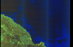
SAR coverage thumbnail
VIIRS Thermal Anomaly
Status: ✗ No detections
No VIIRS thermal/light detections in corridor
Show Raw Evidence JSON
{
    "gap_minutes": 289.19999999999998863131622783839702606201171875,
    "last_seen": {
        "ts": "2026-07-07T05:03:51+00:00",
        "lat": 36.49786329999999878737071412615478038787841796875,
        "lon": -1.7348566999999999183046384132467210292816162109375,
        "sog": 12.300000000000000710542735760100185871124267578125,
        "zone_id": "discovered_082"
    },
    "next_seen": {
        "ts": "2026-07-07T09:53:02+00:00",
        "lat": 36.34991500000000286263457383029162883758544921875,
        "lon": -2.871223300000000033804781196522526443004608154296875,
        "zone_ids": [
            "discovered_129"
        ]
    },
    "gap_enrichment": {
        "status": "done",
        "corridor": {
            "start": {
                "lat": 36.49786329999999878737071412615478038787841796875,
                "lon": -1.7348566999999999183046384132467210292816162109375,
                "ts": "2026-07-07T05:03:51+00:00"
            },
            "end": {
                "lat": 36.34991500000000286263457383029162883758544921875,
                "lon": -2.871223300000000033804781196522526443004608154296875,
                "ts": "2026-07-07T09:53:02+00:00"
            },
            "bbox": {
                "min_lat": 36.16973500000000285581336356699466705322265625,
                "min_lon": -3.0951480000000000103455022326670587062835693359375,
                "max_lat": 36.6780430000000023937900550663471221923828125,
                "max_lon": -1.510931999999999941763917377102188766002655029296875
            },
            "buffer_km": 20
        },
        "sar": {
            "status": "snapshot",
            "scene_id": "S1C_IW_GRDH_1SDV_20260707T060151_20260707T060216_008433_010AFA_D179_COG",
            "scene_time": "2026-07-07T06:01:51.664469Z",
            "platform": "sentinel-1c",
            "assets": {
                "preview_url": "https:\/\/fleetleaks.com\/wp-content\/uploads\/fleetleaks-evidence\/sar-imagery\/2026\/07\/event_862095_thumbnail_20260707101507.png",
                "stored_path": "\/home\/fleetleaks\/public_html\/wp-content\/uploads\/fleetleaks-evidence\/sar-imagery\/2026\/07\/event_862095_thumbnail_20260707101507.png",
                "source": "copernicus_dataspace"
            },
            "notes": "SAR snapshot available for review"
        },
        "viirs": {
            "status": "not_found",
            "notes": "No VIIRS thermal\/light detections in corridor"
        },
        "searched_at": "2026-07-07T10:15:01.570904+00:00"
    }
}- Zone: Central Mediterranean Surveillance Zone
- Duration: 1h 44m
- Data Points: 15 AIS positions
- Period: 2026-07-07T03:19:42+00:00 to 2026-07-07T05:03:51+00:00
Show Raw Evidence JSON
{
    "zone_id": "discovered_082",
    "zone_name": "Central Mediterranean Surveillance Zone",
    "dwell_minutes": 104.2000000000000028421709430404007434844970703125,
    "points_in_zone": 15,
    "first_point": {
        "ts": "2026-07-07T03:19:42+00:00",
        "lat": 36.55414170000000240179360844194889068603515625,
        "lon": -1.3028633000000000574658542973338626325130462646484375
    },
    "last_point": {
        "ts": "2026-07-07T05:03:51+00:00",
        "lat": 36.49786329999999878737071412615478038787841796875,
        "lon": -1.7348566999999999183046384132467210292816162109375
    }
}- Zone: Alboran Sea Surveillance Zone
- Duration: 1h 19m
- Data Points: 25 AIS positions
- Period: 2026-07-07T02:17:32+00:00 to 2026-07-07T03:36:42+00:00
Show Raw Evidence JSON
{
    "zone_id": "discovered_153",
    "zone_name": "Alboran Sea Surveillance Zone",
    "dwell_minutes": 79.2000000000000028421709430404007434844970703125,
    "points_in_zone": 25,
    "first_point": {
        "ts": "2026-07-07T02:17:32+00:00",
        "lat": 36.58329499999999967485564411617815494537353515625,
        "lon": -1.04694500000000001449507180950604379177093505859375
    },
    "last_point": {
        "ts": "2026-07-07T03:36:42+00:00",
        "lat": 36.555959999999998899511410854756832122802734375,
        "lon": -1.3749933000000000848928038976737298071384429931640625
    }
}- Zone: Alboran Sea Surveillance Zone
- Duration: 3h 30m
- Data Points: 28 AIS positions
- Period: 2026-07-07T00:06:03+00:00 to 2026-07-07T03:36:42+00:00
Show Raw Evidence JSON
{
    "zone_id": "discovered_153",
    "zone_name": "Alboran Sea Surveillance Zone",
    "dwell_minutes": 210.69999999999998863131622783839702606201171875,
    "points_in_zone": 28,
    "first_point": {
        "ts": "2026-07-07T00:06:03+00:00",
        "lat": 36.6543632999999999810825102031230926513671875,
        "lon": -0.5231966999999999590187371723004616796970367431640625
    },
    "last_point": {
        "ts": "2026-07-07T03:36:42+00:00",
        "lat": 36.555959999999998899511410854756832122802734375,
        "lon": -1.3749933000000000848928038976737298071384429931640625
    }
}- Zone: Central Atlantic Monitoring Zone
- Duration: 1h 5m
- Data Points: 17 AIS positions
- Period: 2026-07-06T23:04:22+00:00 to 2026-07-07T00:10:12+00:00
Show Raw Evidence JSON
{
    "zone_id": "discovered_105",
    "zone_name": "Central Atlantic Monitoring Zone",
    "dwell_minutes": 65.7999999999999971578290569595992565155029296875,
    "points_in_zone": 17,
    "first_point": {
        "ts": "2026-07-06T23:04:22+00:00",
        "lat": 36.686876699999999118517735041677951812744140625,
        "lon": -0.2794716999999999895720748099847696721553802490234375
    },
    "last_point": {
        "ts": "2026-07-07T00:10:12+00:00",
        "lat": 36.65220670000000069421730586327612400054931640625,
        "lon": -0.53968000000000004856559598920284770429134368896484375
    }
}- Zone: Central Atlantic Monitoring Zone
- Duration: 2h 10m
- Data Points: 31 AIS positions
- Period: 2026-07-06T22:00:03+00:00 to 2026-07-07T00:10:12+00:00
Show Raw Evidence JSON
{
    "zone_id": "discovered_105",
    "zone_name": "Central Atlantic Monitoring Zone",
    "dwell_minutes": 130.19999999999998863131622783839702606201171875,
    "points_in_zone": 31,
    "first_point": {
        "ts": "2026-07-06T22:00:03+00:00",
        "lat": 36.72032829999999847814251552335917949676513671875,
        "lon": -0.0285049999999999990885068967827464803121984004974365234375
    },
    "last_point": {
        "ts": "2026-07-07T00:10:12+00:00",
        "lat": 36.65220670000000069421730586327612400054931640625,
        "lon": -0.53968000000000004856559598920284770429134368896484375
    }
}- Zone: Central Atlantic Monitoring Zone
- Duration: 3h 7m
- Data Points: 45 AIS positions
- Period: 2026-07-06T21:02:41+00:00 to 2026-07-07T00:10:12+00:00
Show Raw Evidence JSON
{
    "zone_id": "discovered_105",
    "zone_name": "Central Atlantic Monitoring Zone",
    "dwell_minutes": 187.5,
    "points_in_zone": 45,
    "first_point": {
        "ts": "2026-07-06T21:02:41+00:00",
        "lat": 36.74907999999999930196281638927757740020751953125,
        "lon": 0.1941167000000000031345592788056819699704647064208984375
    },
    "last_point": {
        "ts": "2026-07-07T00:10:12+00:00",
        "lat": 36.65220670000000069421730586327612400054931640625,
        "lon": -0.53968000000000004856559598920284770429134368896484375
    }
}- Zone: Central Atlantic Monitoring Zone
- Duration: 4h 8m
- Data Points: 65 AIS positions
- Period: 2026-07-06T20:01:41+00:00 to 2026-07-07T00:10:12+00:00
Show Raw Evidence JSON
{
    "zone_id": "discovered_105",
    "zone_name": "Central Atlantic Monitoring Zone",
    "dwell_minutes": 248.5,
    "points_in_zone": 65,
    "first_point": {
        "ts": "2026-07-06T20:01:41+00:00",
        "lat": 36.78060669999999987567207426764070987701416015625,
        "lon": 0.434445000000000025597302055757609196007251739501953125
    },
    "last_point": {
        "ts": "2026-07-07T00:10:12+00:00",
        "lat": 36.65220670000000069421730586327612400054931640625,
        "lon": -0.53968000000000004856559598920284770429134368896484375
    }
}- Zone: Central Atlantic Monitoring Zone
- Duration: 5h 9m
- Data Points: 86 AIS positions
- Period: 2026-07-06T19:00:42+00:00 to 2026-07-07T00:10:12+00:00
Show Raw Evidence JSON
{
    "zone_id": "discovered_105",
    "zone_name": "Central Atlantic Monitoring Zone",
    "dwell_minutes": 309.5,
    "points_in_zone": 86,
    "first_point": {
        "ts": "2026-07-06T19:00:42+00:00",
        "lat": 36.81368499999999954752638586796820163726806640625,
        "lon": 0.6734649999999999803179662194452248513698577880859375
    },
    "last_point": {
        "ts": "2026-07-07T00:10:12+00:00",
        "lat": 36.65220670000000069421730586327612400054931640625,
        "lon": -0.53968000000000004856559598920284770429134368896484375
    }
}- Zone: Central Atlantic Monitoring Zone
- Duration: 6h 8m
- Data Points: 106 AIS positions
- Period: 2026-07-06T18:01:42+00:00 to 2026-07-07T00:10:12+00:00
Show Raw Evidence JSON
{
    "zone_id": "discovered_105",
    "zone_name": "Central Atlantic Monitoring Zone",
    "dwell_minutes": 368.5,
    "points_in_zone": 106,
    "first_point": {
        "ts": "2026-07-06T18:01:42+00:00",
        "lat": 36.845723300000003064269549213349819183349609375,
        "lon": 0.9036967000000000194148697119089774787425994873046875
    },
    "last_point": {
        "ts": "2026-07-07T00:10:12+00:00",
        "lat": 36.65220670000000069421730586327612400054931640625,
        "lon": -0.53968000000000004856559598920284770429134368896484375
    }
}- Zone: Central Atlantic Monitoring Zone
- Duration: 6h 22m
- Data Points: 109 AIS positions
- Period: 2026-07-06T17:47:23+00:00 to 2026-07-07T00:10:12+00:00
Show Raw Evidence JSON
{
    "zone_id": "discovered_105",
    "zone_name": "Central Atlantic Monitoring Zone",
    "dwell_minutes": 382.80000000000001136868377216160297393798828125,
    "points_in_zone": 109,
    "first_point": {
        "ts": "2026-07-06T17:47:23+00:00",
        "lat": 36.8520850000000024238033802248537540435791015625,
        "lon": 0.96027669999999998307060877777985297143459320068359375
    },
    "last_point": {
        "ts": "2026-07-07T00:10:12+00:00",
        "lat": 36.65220670000000069421730586327612400054931640625,
        "lon": -0.53968000000000004856559598920284770429134368896484375
    }
}- Zone: Central Atlantic Monitoring Zone
- Duration: 6h 39m
- Data Points: 116 AIS positions
- Period: 2026-07-06T16:50:42+00:00 to 2026-07-06T23:29:43+00:00
Show Raw Evidence JSON
{
    "zone_id": "discovered_105",
    "zone_name": "Central Atlantic Monitoring Zone",
    "dwell_minutes": 399,
    "points_in_zone": 116,
    "first_point": {
        "ts": "2026-07-06T16:50:42+00:00",
        "lat": 36.87492670000000316576915793120861053466796875,
        "lon": 1.188050000000000050448534238967113196849822998046875
    },
    "last_point": {
        "ts": "2026-07-06T23:29:43+00:00",
        "lat": 36.67363999999999890633262111805379390716552734375,
        "lon": -0.38032500000000002415845301584340631961822509765625
    }
}- Zone: Western Approaches Monitoring Zone
- Duration: 1h 13m
- Data Points: 23 AIS positions
- Period: 2026-07-06T16:01:52+00:00 to 2026-07-06T17:15:22+00:00
Show Raw Evidence JSON
{
    "zone_id": "discovered_080",
    "zone_name": "Western Approaches Monitoring Zone",
    "dwell_minutes": 73.5,
    "points_in_zone": 23,
    "first_point": {
        "ts": "2026-07-06T16:01:52+00:00",
        "lat": 36.91142669999999981200744514353573322296142578125,
        "lon": 1.378191699999999908499148659757338464260101318359375
    },
    "last_point": {
        "ts": "2026-07-06T17:15:22+00:00",
        "lat": 36.86345829999999779147401568479835987091064453125,
        "lon": 1.089311700000000104893160823849029839038848876953125
    }
}- Zone: Western Approaches Monitoring Zone
- Duration: 2h 12m
- Data Points: 37 AIS positions
- Period: 2026-07-06T15:02:31+00:00 to 2026-07-06T17:15:22+00:00
Show Raw Evidence JSON
{
    "zone_id": "discovered_080",
    "zone_name": "Western Approaches Monitoring Zone",
    "dwell_minutes": 132.80000000000001136868377216160297393798828125,
    "points_in_zone": 37,
    "first_point": {
        "ts": "2026-07-06T15:02:31+00:00",
        "lat": 36.93259499999999917463355814106762409210205078125,
        "lon": 1.6111066999999998916592858222429640591144561767578125
    },
    "last_point": {
        "ts": "2026-07-06T17:15:22+00:00",
        "lat": 36.86345829999999779147401568479835987091064453125,
        "lon": 1.089311700000000104893160823849029839038848876953125
    }
}- Zone: Western Approaches Monitoring Zone
- Duration: 2h 49m
- Data Points: 39 AIS positions
- Period: 2026-07-06T14:25:41+00:00 to 2026-07-06T17:15:22+00:00
Show Raw Evidence JSON
{
    "zone_id": "discovered_080",
    "zone_name": "Western Approaches Monitoring Zone",
    "dwell_minutes": 169.69999999999998863131622783839702606201171875,
    "points_in_zone": 39,
    "first_point": {
        "ts": "2026-07-06T14:25:41+00:00",
        "lat": 36.952100000000001500666257925331592559814453125,
        "lon": 1.754091700000000031423041946254670619964599609375
    },
    "last_point": {
        "ts": "2026-07-06T17:15:22+00:00",
        "lat": 36.86345829999999779147401568479835987091064453125,
        "lon": 1.089311700000000104893160823849029839038848876953125
    }
}- Zone: Western Approaches Monitoring Zone
- Duration: 3h 20m
- Data Points: 41 AIS positions
- Period: 2026-07-06T13:54:42+00:00 to 2026-07-06T17:15:22+00:00
Show Raw Evidence JSON
{
    "zone_id": "discovered_080",
    "zone_name": "Western Approaches Monitoring Zone",
    "dwell_minutes": 200.69999999999998863131622783839702606201171875,
    "points_in_zone": 41,
    "first_point": {
        "ts": "2026-07-06T13:54:42+00:00",
        "lat": 36.97074669999999940728230285458266735076904296875,
        "lon": 1.8747483000000000341600525644025765359401702880859375
    },
    "last_point": {
        "ts": "2026-07-06T17:15:22+00:00",
        "lat": 36.86345829999999779147401568479835987091064453125,
        "lon": 1.089311700000000104893160823849029839038848876953125
    }
}- Zone: Black Sea Sanctioned Vessel Monitoring Zone
- Duration: 1h 21m
- Data Points: 4 AIS positions
- Period: 2026-07-06T13:04:22+00:00 to 2026-07-06T14:25:41+00:00
Show Raw Evidence JSON
{
    "zone_id": "discovered_033",
    "zone_name": "Black Sea Sanctioned Vessel Monitoring Zone",
    "dwell_minutes": 81.2999999999999971578290569595992565155029296875,
    "points_in_zone": 4,
    "first_point": {
        "ts": "2026-07-06T13:04:22+00:00",
        "lat": 36.995378299999998716884874738752841949462890625,
        "lon": 2.0723932999999998827433955739252269268035888671875
    },
    "last_point": {
        "ts": "2026-07-06T14:25:41+00:00",
        "lat": 36.952100000000001500666257925331592559814453125,
        "lon": 1.754091700000000031423041946254670619964599609375
    }
}- Zone: Black Sea Sanctioned Vessel Monitoring Zone
- Duration: 1h 36m
- Data Points: 7 AIS positions
- Period: 2026-07-06T12:49:11+00:00 to 2026-07-06T14:25:41+00:00
Show Raw Evidence JSON
{
    "zone_id": "discovered_033",
    "zone_name": "Black Sea Sanctioned Vessel Monitoring Zone",
    "dwell_minutes": 96.5,
    "points_in_zone": 7,
    "first_point": {
        "ts": "2026-07-06T12:49:11+00:00",
        "lat": 37.00269999999999726014721090905368328094482421875,
        "lon": 2.13084000000000006735945135005749762058258056640625
    },
    "last_point": {
        "ts": "2026-07-06T14:25:41+00:00",
        "lat": 36.952100000000001500666257925331592559814453125,
        "lon": 1.754091700000000031423041946254670619964599609375
    }
}- Zone: Black Sea Sanctioned Vessel Monitoring Zone
- Duration: 4h 38m
- Data Points: 9 AIS positions
- Period: 2026-07-06T09:47:22+00:00 to 2026-07-06T14:25:41+00:00
Show Raw Evidence JSON
{
    "zone_id": "discovered_033",
    "zone_name": "Black Sea Sanctioned Vessel Monitoring Zone",
    "dwell_minutes": 278.30000000000001136868377216160297393798828125,
    "points_in_zone": 9,
    "first_point": {
        "ts": "2026-07-06T09:47:22+00:00",
        "lat": 37.09481329999999843494151718914508819580078125,
        "lon": 2.83033830000000019566641640267334878444671630859375
    },
    "last_point": {
        "ts": "2026-07-06T14:25:41+00:00",
        "lat": 36.952100000000001500666257925331592559814453125,
        "lon": 1.754091700000000031423041946254670619964599609375
    }
}- Gap Duration: 4h 34m
- Last Seen: 2026-06-20T23:06:43+00:00 at 34.6465, 33.2941 (Zone: Southern Black Sea Sanctioned Vessel Zone)
- Next Seen: 2026-06-21T03:41:11+00:00 at 34.4735, 32.2832
🛰️ Gap Corroboration
These are snapshots that may corroborate presence during the gap. They do not reconstruct a continuous route.
SAR Imagery (Sentinel-1)
Status: ✗ No SAR coverage
No Sentinel-1 scenes covering corridor and time window
VIIRS Thermal Anomaly
Status: ✗ No detections
No VIIRS thermal/light detections in corridor
Show Raw Evidence JSON
{
    "gap_minutes": 274.5,
    "last_seen": {
        "ts": "2026-06-20T23:06:43+00:00",
        "lat": 34.6465400000000016689227777533233165740966796875,
        "lon": 33.29406329999999769597707199864089488983154296875,
        "sog": 11.800000000000000710542735760100185871124267578125,
        "zone_id": "discovered_035"
    },
    "next_seen": {
        "ts": "2026-06-21T03:41:11+00:00",
        "lat": 34.4734916999999967401890899054706096649169921875,
        "lon": 32.28316829999999981737346388399600982666015625,
        "zone_ids": [
            "discovered_259"
        ]
    },
    "gap_enrichment": {
        "status": "not_found",
        "corridor": {
            "start": {
                "lat": 34.6465400000000016689227777533233165740966796875,
                "lon": 33.29406329999999769597707199864089488983154296875,
                "ts": "2026-06-20T23:06:43+00:00"
            },
            "end": {
                "lat": 34.4734916999999967401890899054706096649169921875,
                "lon": 32.28316829999999981737346388399600982666015625,
                "ts": "2026-06-21T03:41:11+00:00"
            },
            "bbox": {
                "min_lat": 34.2933120000000002391971065662801265716552734375,
                "min_lon": 32.064379000000002406522980891168117523193359375,
                "max_lat": 34.82672000000000167574398801662027835845947265625,
                "max_lon": 33.51285299999999978126652422361075878143310546875
            },
            "buffer_km": 20
        },
        "sar": {
            "status": "not_found",
            "notes": "No Sentinel-1 scenes covering corridor and time window"
        },
        "viirs": {
            "status": "not_found",
            "notes": "No VIIRS thermal\/light detections in corridor"
        },
        "searched_at": "2026-06-21T04:00:01.680677+00:00"
    }
}- Zone: Southern Black Sea Sanctioned Vessel Zone
- Duration: 1h 5m
- Data Points: 19 AIS positions
- Period: 2026-06-20T22:01:10+00:00 to 2026-06-20T23:06:43+00:00
Show Raw Evidence JSON
{
    "zone_id": "discovered_035",
    "zone_name": "Southern Black Sea Sanctioned Vessel Zone",
    "dwell_minutes": 65.5,
    "points_in_zone": 19,
    "first_point": {
        "ts": "2026-06-20T22:01:10+00:00",
        "lat": 34.71013330000000252084646490402519702911376953125,
        "lon": 33.3224500000000034560798667371273040771484375
    },
    "last_point": {
        "ts": "2026-06-20T23:06:43+00:00",
        "lat": 34.6465400000000016689227777533233165740966796875,
        "lon": 33.29406329999999769597707199864089488983154296875
    }
}- Zone: Southern Black Sea Sanctioned Vessel Zone
- Duration: 1h 29m
- Data Points: 21 AIS positions
- Period: 2026-06-20T21:37:10+00:00 to 2026-06-20T23:06:43+00:00
Show Raw Evidence JSON
{
    "zone_id": "discovered_035",
    "zone_name": "Southern Black Sea Sanctioned Vessel Zone",
    "dwell_minutes": 89.5,
    "points_in_zone": 21,
    "first_point": {
        "ts": "2026-06-20T21:37:10+00:00",
        "lat": 34.71015330000000176369212567806243896484375,
        "lon": 33.32245329999999938763721729628741741180419921875
    },
    "last_point": {
        "ts": "2026-06-20T23:06:43+00:00",
        "lat": 34.6465400000000016689227777533233165740966796875,
        "lon": 33.29406329999999769597707199864089488983154296875
    }
}- Zone: Southern Black Sea Sanctioned Vessel Zone
- Duration: 2h 41m
- Data Points: 23 AIS positions
- Period: 2026-06-20T20:25:12+00:00 to 2026-06-20T23:06:43+00:00
Show Raw Evidence JSON
{
    "zone_id": "discovered_035",
    "zone_name": "Southern Black Sea Sanctioned Vessel Zone",
    "dwell_minutes": 161.5,
    "points_in_zone": 23,
    "first_point": {
        "ts": "2026-06-20T20:25:12+00:00",
        "lat": 34.7101483000000001766238710843026638031005859375,
        "lon": 33.322440000000000281943357549607753753662109375
    },
    "last_point": {
        "ts": "2026-06-20T23:06:43+00:00",
        "lat": 34.6465400000000016689227777533233165740966796875,
        "lon": 33.29406329999999769597707199864089488983154296875
    }
}- Duration: 2h 17m
- Radius: 977 meters
- Data Points: 12 AIS positions
- Centroid: 34.7088, 33.3244
- Zone: Southern Black Sea Sanctioned Vessel Zone
Show Raw Evidence JSON
{
    "radius_m": 976.700000000000045474735088646411895751953125,
    "duration_minutes": 137.19999999999998863131622783839702606201171875,
    "points": 12,
    "centroid": {
        "lat": 34.70878970000000407480911235325038433074951171875,
        "lon": 33.32442138333333758737353491596877574920654296875
    },
    "bbox": {
        "min_lat": 34.70135330000000095651557785458862781524658203125,
        "min_lon": 33.322231700000003229433787055313587188720703125,
        "max_lat": 34.7103749999999990905052982270717620849609375,
        "max_lon": 33.3301282999999983758243615739047527313232421875
    },
    "zone_id": "discovered_035"
}- Zone: Southern Black Sea Sanctioned Vessel Zone
- Duration: 4h 5m
- Data Points: 29 AIS positions
- Period: 2026-06-20T19:01:10+00:00 to 2026-06-20T23:06:43+00:00
Show Raw Evidence JSON
{
    "zone_id": "discovered_035",
    "zone_name": "Southern Black Sea Sanctioned Vessel Zone",
    "dwell_minutes": 245.599999999999994315658113919198513031005859375,
    "points_in_zone": 29,
    "first_point": {
        "ts": "2026-06-20T19:01:10+00:00",
        "lat": 34.71017330000000100653778645209968090057373046875,
        "lon": 33.32246330000000256177372648380696773529052734375
    },
    "last_point": {
        "ts": "2026-06-20T23:06:43+00:00",
        "lat": 34.6465400000000016689227777533233165740966796875,
        "lon": 33.29406329999999769597707199864089488983154296875
    }
}- Duration: 3h 41m
- Radius: 1,052 meters
- Data Points: 18 AIS positions
- Centroid: 34.7092, 33.3238
- Zone: Southern Black Sea Sanctioned Vessel Zone
Show Raw Evidence JSON
{
    "radius_m": 1051.700000000000045474735088646411895751953125,
    "duration_minutes": 221.30000000000001136868377216160297393798828125,
    "points": 18,
    "centroid": {
        "lat": 34.70924396666666922328658984042704105377197265625,
        "lon": 33.3237656444444354519873741082847118377685546875
    },
    "bbox": {
        "min_lat": 34.70135330000000095651557785458862781524658203125,
        "min_lon": 33.322231700000003229433787055313587188720703125,
        "max_lat": 34.7103749999999990905052982270717620849609375,
        "max_lon": 33.3301282999999983758243615739047527313232421875
    },
    "zone_id": "discovered_035"
}- Minimum Distance: 313 meters
- Average Distance: 315 meters
- Duration: 1h 6m
- Period: 2026-06-20T18:51:13+00:00 to 2026-06-20T19:57:10+00:00
- Vessel A Avg Speed: 0.0 knots
- Vessel B Avg Speed: 0.1 knots
- Zone: Southern Black Sea Sanctioned Vessel Zone
Confidence Analysis
Moderate-confidence STS candidate. Two tankers (PACIFIC ADVENTURE and ATLAS) maintained close proximity (min 313m, avg 315m) for 66 minutes. Both vessels were slow-moving (avg speeds 0.0 and 0.1 knots). The stable separation distance suggests deliberate parallel positioning typical of cargo transfer. Event occurred in Southern Black Sea Sanctioned Vessel Zone, a known STS activity area.
View scoring breakdown
| Factor | Score | Detail |
|---|---|---|
| Distance Tightness | 10/25 | Min distance 313m, avg 315m |
| Duration | 15/25 | Duration 66 minutes |
| Speed Stability | 20/20 | both nearly stationary; very stable speeds |
| Distance Consistency | 15/15 | Distance variance ±2m |
| Isolation | 5/10 | Isolation data not available |
| Context | 5/5 | In monitored zone: Southern Black Sea Sanctioned Vessel Zone |
Show Raw Evidence JSON
{
    "vessel_a": {
        "mmsi": 311001780,
        "imo": 9326938,
        "name": "PACIFIC ADVENTURE",
        "flag": "BAHAMAS"
    },
    "vessel_b": {
        "mmsi": 311000134,
        "imo": 9538177,
        "name": "ATLAS",
        "flag": "BAHAMAS"
    },
    "min_distance_m": 313,
    "avg_distance_m": 315,
    "distance_consistency_m": 1.6999999999999999555910790149937383830547332763671875,
    "duration_minutes": 66,
    "overlap_duration_s": 3957,
    "speed_a_avg": 0,
    "speed_a_std": 0,
    "speed_b_avg": 0.059999999999999997779553950749686919152736663818359375,
    "speed_b_std": 0.05000000000000000277555756156289135105907917022705078125,
    "speed_summary": {
        "vessel_a": {
            "avg_sog": 0,
            "max_sog": 0
        },
        "vessel_b": {
            "avg_sog": 0.059999999999999997779553950749686919152736663818359375,
            "max_sog": 0.1000000000000000055511151231257827021181583404541015625
        }
    },
    "time_window": {
        "start": "2026-06-20T18:51:13+00:00",
        "end": "2026-06-20T19:57:10+00:00"
    },
    "points_count": {
        "vessel_a": 7,
        "vessel_b": 7
    },
    "zone_id": "discovered_035",
    "zone_name": "Southern Black Sea Sanctioned Vessel Zone",
    "score": {
        "value": 70,
        "components": {
            "distance_tightness": {
                "score": 10,
                "max": 25,
                "detail": "Min distance 313m, avg 315m"
            },
            "duration": {
                "score": 15,
                "max": 25,
                "detail": "Duration 66 minutes"
            },
            "speed_stability": {
                "score": 20,
                "max": 20,
                "detail": "both nearly stationary; very stable speeds"
            },
            "distance_consistency": {
                "score": 15,
                "max": 15,
                "detail": "Distance variance \u00b12m"
            },
            "isolation": {
                "score": 5,
                "max": 10,
                "detail": "Isolation data not available"
            },
            "context": {
                "score": 5,
                "max": 5,
                "detail": "In monitored zone: Southern Black Sea Sanctioned Vessel Zone"
            }
        },
        "summary": "Moderate-confidence STS candidate. Two tankers (PACIFIC ADVENTURE and ATLAS) maintained close proximity (min 313m, avg 315m) for 66 minutes. Both vessels were slow-moving (avg speeds 0.0 and 0.1 knots). The stable separation distance suggests deliberate parallel positioning typical of cargo transfer. Event occurred in Southern Black Sea Sanctioned Vessel Zone, a known STS activity area."
    }
}- Zone: Southern Black Sea Sanctioned Vessel Zone
- Duration: 4h 50m
- Data Points: 31 AIS positions
- Period: 2026-06-20T18:16:08+00:00 to 2026-06-20T23:06:43+00:00
Show Raw Evidence JSON
{
    "zone_id": "discovered_035",
    "zone_name": "Southern Black Sea Sanctioned Vessel Zone",
    "dwell_minutes": 290.6000000000000227373675443232059478759765625,
    "points_in_zone": 31,
    "first_point": {
        "ts": "2026-06-20T18:16:08+00:00",
        "lat": 34.71013500000000107093001133762300014495849609375,
        "lon": 33.3224866999999989047864801250398159027099609375
    },
    "last_point": {
        "ts": "2026-06-20T23:06:43+00:00",
        "lat": 34.6465400000000016689227777533233165740966796875,
        "lon": 33.29406329999999769597707199864089488983154296875
    }
}- Duration: 4h 26m
- Radius: 1,067 meters
- Data Points: 20 AIS positions
- Centroid: 34.7093, 33.3236
- Zone: Southern Black Sea Sanctioned Vessel Zone
Show Raw Evidence JSON
{
    "radius_m": 1066.59999999999990905052982270717620849609375,
    "duration_minutes": 266.30000000000001136868377216160297393798828125,
    "points": 20,
    "centroid": {
        "lat": 34.70933407000000414655005442909896373748779296875,
        "lon": 33.32363516499999178677171585150063037872314453125
    },
    "bbox": {
        "min_lat": 34.70135330000000095651557785458862781524658203125,
        "min_lon": 33.322231700000003229433787055313587188720703125,
        "max_lat": 34.7103749999999990905052982270717620849609375,
        "max_lon": 33.3301282999999983758243615739047527313232421875
    },
    "zone_id": "discovered_035"
}- Zone: Southern Black Sea Sanctioned Vessel Zone
- Duration: 5h 56m
- Data Points: 34 AIS positions
- Period: 2026-06-20T17:10:09+00:00 to 2026-06-20T23:06:43+00:00
Show Raw Evidence JSON
{
    "zone_id": "discovered_035",
    "zone_name": "Southern Black Sea Sanctioned Vessel Zone",
    "dwell_minutes": 356.6000000000000227373675443232059478759765625,
    "points_in_zone": 34,
    "first_point": {
        "ts": "2026-06-20T17:10:09+00:00",
        "lat": 34.7101167000000003781678969971835613250732421875,
        "lon": 33.32245329999999938763721729628741741180419921875
    },
    "last_point": {
        "ts": "2026-06-20T23:06:43+00:00",
        "lat": 34.6465400000000016689227777533233165740966796875,
        "lon": 33.29406329999999769597707199864089488983154296875
    }
}- Duration: 5h 32m
- Radius: 1,084 meters
- Data Points: 23 AIS positions
- Centroid: 34.7094, 33.3235
- Zone: Southern Black Sea Sanctioned Vessel Zone
Show Raw Evidence JSON
{
    "radius_m": 1084.299999999999954525264911353588104248046875,
    "duration_minutes": 332.30000000000001136868377216160297393798828125,
    "points": 23,
    "centroid": {
        "lat": 34.70944100434783052833154215477406978607177734375,
        "lon": 33.323482095652167345178895629942417144775390625
    },
    "bbox": {
        "min_lat": 34.70135330000000095651557785458862781524658203125,
        "min_lon": 33.322231700000003229433787055313587188720703125,
        "max_lat": 34.7103749999999990905052982270717620849609375,
        "max_lon": 33.3301282999999983758243615739047527313232421875
    },
    "zone_id": "discovered_035"
}- Minimum Distance: 313 meters
- Average Distance: 313 meters
- Duration: 1h 9m
- Period: 2026-06-20T17:06:09+00:00 to 2026-06-20T18:15:10+00:00
- Vessel A Avg Speed: 0.0 knots
- Vessel B Avg Speed: 0.0 knots
- Zone: Southern Black Sea Sanctioned Vessel Zone
Confidence Analysis
Moderate-confidence STS candidate. Two tankers (PACIFIC ADVENTURE and ATLAS) maintained close proximity (min 313m, avg 313m) for 69 minutes. Both vessels were slow-moving (avg speeds 0.0 and 0.0 knots). The stable separation distance suggests deliberate parallel positioning typical of cargo transfer. Event occurred in Southern Black Sea Sanctioned Vessel Zone, a known STS activity area.
View scoring breakdown
| Factor | Score | Detail |
|---|---|---|
| Distance Tightness | 10/25 | Min distance 313m, avg 313m |
| Duration | 15/25 | Duration 69 minutes |
| Speed Stability | 20/20 | both nearly stationary; very stable speeds |
| Distance Consistency | 15/15 | Distance variance ±1m |
| Isolation | 5/10 | Isolation data not available |
| Context | 5/5 | In monitored zone: Southern Black Sea Sanctioned Vessel Zone |
🛰️ Satellite Corroboration
No satellite imagery for this time/location
No Sentinel-1 scenes covering AOI and time window
Show Raw Evidence JSON
{
    "vessel_a": {
        "mmsi": 311001780,
        "imo": 9326938,
        "name": "PACIFIC ADVENTURE",
        "flag": "BAHAMAS"
    },
    "vessel_b": {
        "mmsi": 311000134,
        "imo": 9538177,
        "name": "ATLAS",
        "flag": "BAHAMAS"
    },
    "min_distance_m": 312.6000000000000227373675443232059478759765625,
    "avg_distance_m": 313.19999999999998863131622783839702606201171875,
    "distance_consistency_m": 0.59999999999999997779553950749686919152736663818359375,
    "duration_minutes": 69,
    "overlap_duration_s": 4141,
    "speed_a_avg": 0,
    "speed_a_std": 0,
    "speed_b_avg": 0.0299999999999999988897769753748434595763683319091796875,
    "speed_b_std": 0.059999999999999997779553950749686919152736663818359375,
    "speed_summary": {
        "vessel_a": {
            "avg_sog": 0,
            "max_sog": 0
        },
        "vessel_b": {
            "avg_sog": 0.0299999999999999988897769753748434595763683319091796875,
            "max_sog": 0.1000000000000000055511151231257827021181583404541015625
        }
    },
    "time_window": {
        "start": "2026-06-20T17:06:09+00:00",
        "end": "2026-06-20T18:15:10+00:00"
    },
    "points_count": {
        "vessel_a": 3,
        "vessel_b": 3
    },
    "zone_id": "discovered_035",
    "zone_name": "Southern Black Sea Sanctioned Vessel Zone",
    "score": {
        "value": 70,
        "components": {
            "distance_tightness": {
                "score": 10,
                "max": 25,
                "detail": "Min distance 313m, avg 313m"
            },
            "duration": {
                "score": 15,
                "max": 25,
                "detail": "Duration 69 minutes"
            },
            "speed_stability": {
                "score": 20,
                "max": 20,
                "detail": "both nearly stationary; very stable speeds"
            },
            "distance_consistency": {
                "score": 15,
                "max": 15,
                "detail": "Distance variance \u00b11m"
            },
            "isolation": {
                "score": 5,
                "max": 10,
                "detail": "Isolation data not available"
            },
            "context": {
                "score": 5,
                "max": 5,
                "detail": "In monitored zone: Southern Black Sea Sanctioned Vessel Zone"
            }
        },
        "summary": "Moderate-confidence STS candidate. Two tankers (PACIFIC ADVENTURE and ATLAS) maintained close proximity (min 313m, avg 313m) for 69 minutes. Both vessels were slow-moving (avg speeds 0.0 and 0.0 knots). The stable separation distance suggests deliberate parallel positioning typical of cargo transfer. Event occurred in Southern Black Sea Sanctioned Vessel Zone, a known STS activity area."
    },
    "sar": {
        "status": "not_found",
        "centroid": {
            "lat": 34.7089567000000016605554264970123767852783203125,
            "lon": 33.32150080000000258451109402813017368316650390625
        },
        "time_window": {
            "start_ts": "2026-06-20T17:06:09+00:00",
            "end_ts": "2026-06-20T18:15:10+00:00"
        },
        "searched_at": "2026-06-20T18:45:02.173632+00:00",
        "notes": "No Sentinel-1 scenes covering AOI and time window"
    }
}- Zone: Southern Black Sea Sanctioned Vessel Zone
- Duration: 6h 8m
- Data Points: 35 AIS positions
- Period: 2026-06-20T16:58:09+00:00 to 2026-06-20T23:06:43+00:00
Show Raw Evidence JSON
{
    "zone_id": "discovered_035",
    "zone_name": "Southern Black Sea Sanctioned Vessel Zone",
    "dwell_minutes": 368.6000000000000227373675443232059478759765625,
    "points_in_zone": 35,
    "first_point": {
        "ts": "2026-06-20T16:58:09+00:00",
        "lat": 34.71017669999999810670487931929528713226318359375,
        "lon": 33.32245499999999793772076372988522052764892578125
    },
    "last_point": {
        "ts": "2026-06-20T23:06:43+00:00",
        "lat": 34.6465400000000016689227777533233165740966796875,
        "lon": 33.29406329999999769597707199864089488983154296875
    }
}- Duration: 6h 32m
- Radius: 1,094 meters
- Data Points: 25 AIS positions
- Centroid: 34.7095, 33.3234
- Zone: Southern Black Sea Sanctioned Vessel Zone
Show Raw Evidence JSON
{
    "radius_m": 1094,
    "duration_minutes": 392.30000000000001136868377216160297393798828125,
    "points": 25,
    "centroid": {
        "lat": 34.7094994600000035234188544563949108123779296875,
        "lon": 33.323398927999988927695085294544696807861328125
    },
    "bbox": {
        "min_lat": 34.70135330000000095651557785458862781524658203125,
        "min_lon": 33.322231700000003229433787055313587188720703125,
        "max_lat": 34.7103749999999990905052982270717620849609375,
        "max_lon": 33.3301282999999983758243615739047527313232421875
    },
    "zone_id": "discovered_035"
}- Zone: Southern Black Sea Sanctioned Vessel Zone
- Duration: 6h 24m
- Data Points: 19 AIS positions
- Period: 2026-06-20T15:37:12+00:00 to 2026-06-20T22:01:10+00:00
Show Raw Evidence JSON
{
    "zone_id": "discovered_035",
    "zone_name": "Southern Black Sea Sanctioned Vessel Zone",
    "dwell_minutes": 384,
    "points_in_zone": 19,
    "first_point": {
        "ts": "2026-06-20T15:37:12+00:00",
        "lat": 34.7100932999999969297277857549488544464111328125,
        "lon": 33.32245999999999952478901832364499568939208984375
    },
    "last_point": {
        "ts": "2026-06-20T22:01:10+00:00",
        "lat": 34.71013330000000252084646490402519702911376953125,
        "lon": 33.3224500000000034560798667371273040771484375
    }
}Recent Position Data
| Time (UTC) | Lat | Lon | Speed | Course | Zone |
|---|---|---|---|---|---|
| Jul 19 23:44 | 50.4645 | 0.8986 | 12.5 kn | 64.8° | English Channel Monitoring Zone |
| Jul 19 23:43 | 50.4631 | 0.8938 | 12.5 kn | 65.1° | English Channel Monitoring Zone |
| Jul 19 23:42 | 50.4616 | 0.8888 | 12.5 kn | 65.0° | English Channel Monitoring Zone |
| Jul 19 23:40 | 50.4587 | 0.8790 | 12.5 kn | 64.6° | English Channel Monitoring Zone |
| Jul 19 23:39 | 50.4572 | 0.8740 | 12.5 kn | 64.7° | English Channel Monitoring Zone |
| Jul 19 23:37 | 50.4539 | 0.8627 | 12.4 kn | 65.1° | English Channel Monitoring Zone |
| Jul 19 23:36 | 50.4525 | 0.8578 | 12.5 kn | 68.0° | English Channel Monitoring Zone |
| Jul 19 23:31 | 50.4475 | 0.8330 | 12.5 kn | 73.6° | English Channel Monitoring Zone |
| Jul 19 23:25 | 50.4423 | 0.8025 | 12.4 kn | 74.6° | English Channel Monitoring Zone |
| Jul 19 23:23 | 50.4403 | 0.7914 | 12.4 kn | 75.1° | English Channel Monitoring Zone |
| Jul 19 23:19 | 50.4371 | 0.7722 | 12.4 kn | 74.8° | English Channel Monitoring Zone |
| Jul 19 23:18 | 50.4358 | 0.7646 | 12.4 kn | 73.8° | English Channel Monitoring Zone |
| Jul 19 23:16 | 50.4340 | 0.7541 | 12.3 kn | 78.2° | English Channel Monitoring Zone |
| Jul 19 23:15 | 50.4332 | 0.7488 | 12.4 kn | 78.1° | English Channel Monitoring Zone |
| Jul 19 23:14 | 50.4325 | 0.7435 | 12.4 kn | 78.8° | English Channel Monitoring Zone |
| Jul 19 23:13 | 50.4319 | 0.7383 | 12.4 kn | 78.6° | English Channel Monitoring Zone |
| Jul 19 23:11 | 50.4304 | 0.7260 | 12.3 kn | 79.1° | English Channel Monitoring Zone |
| Jul 19 23:08 | 50.4292 | 0.7145 | 12.3 kn | 80.6° | English Channel Monitoring Zone |
| Jul 19 23:07 | 50.4286 | 0.7084 | 12.3 kn | 80.5° | English Channel Monitoring Zone |
| Jul 19 23:06 | 50.4281 | 0.7031 | 12.3 kn | 80.2° | English Channel Monitoring Zone |
Showing 20 of 100 recent positions.
Data Source
Vessel observed through FleetLeaks' AIS monitoring system in zones of interest. Identity and position data derived from AIS broadcasts and public maritime databases.
Disclaimer: AIS data can be spoofed or falsified. Vessel identities should be independently verified before making compliance decisions.