IMO 9264465
Vessel information
Detected Events (32)
- Zone: Central Atlantic Surveillance Zone
- Duration: 1h 2m
- Data Points: 9 AIS positions
- Period: 2026-05-07T08:33:58+00:00 to 2026-05-07T09:36:08+00:00
Show Raw Evidence JSON
{
    "zone_id": "discovered_088",
    "zone_name": "Central Atlantic Surveillance Zone",
    "dwell_minutes": 62.2000000000000028421709430404007434844970703125,
    "points_in_zone": 9,
    "first_point": {
        "ts": "2026-05-07T08:33:58+00:00",
        "lat": 37.263131700000002410888555459678173065185546875,
        "lon": 26.0314699999999987767296261154115200042724609375
    },
    "last_point": {
        "ts": "2026-05-07T09:36:08+00:00",
        "lat": 37.467753299999998262137523852288722991943359375,
        "lon": 25.89793999999999840611053514294326305389404296875
    }
}- Zone: Central Atlantic Surveillance Zone
- Duration: 1h 54m
- Data Points: 20 AIS positions
- Period: 2026-05-07T07:41:28+00:00 to 2026-05-07T09:36:08+00:00
Show Raw Evidence JSON
{
    "zone_id": "discovered_088",
    "zone_name": "Central Atlantic Surveillance Zone",
    "dwell_minutes": 114.7000000000000028421709430404007434844970703125,
    "points_in_zone": 20,
    "first_point": {
        "ts": "2026-05-07T07:41:28+00:00",
        "lat": 37.0873433000000005677065928466618061065673828125,
        "lon": 26.14023329999999845085767447017133235931396484375
    },
    "last_point": {
        "ts": "2026-05-07T09:36:08+00:00",
        "lat": 37.467753299999998262137523852288722991943359375,
        "lon": 25.89793999999999840611053514294326305389404296875
    }
}- Gap Duration: 4h 59m
- Last Seen: 2026-05-07T02:07:06+00:00 at 36.2116, 27.1523 (Zone: Brittany Coast Surveillance Zone)
- Next Seen: 2026-05-07T07:06:37+00:00 at 36.9722, 26.2085
🛰️ Gap Corroboration
These are snapshots that may corroborate presence during the gap. They do not reconstruct a continuous route.
SAR Imagery (Sentinel-1)
Status: ✓ Snapshot available
SAR snapshot available for review
Scene: S1A_IW_GRDH_1SDV_20260507T042402_20260507T042427_064406_081C5E_C8B6_COG • Time: 2026-05-07T04:24:02.900801Z
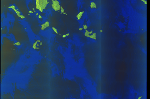
SAR coverage thumbnail
VIIRS Thermal Anomaly
Status: ✗ No detections
No VIIRS thermal/light detections in corridor
Show Raw Evidence JSON
{
    "gap_minutes": 299.5,
    "last_seen": {
        "ts": "2026-05-07T02:07:06+00:00",
        "lat": 36.211641700000001264925231225788593292236328125,
        "lon": 27.152300000000000324007487506605684757232666015625,
        "sog": 13,
        "zone_id": "discovered_070"
    },
    "next_seen": {
        "ts": "2026-05-07T07:06:37+00:00",
        "lat": 36.9721617000000009056748240254819393157958984375,
        "lon": 26.208496700000001311536834691651165485382080078125,
        "zone_ids": [
            "discovered_086"
        ]
    },
    "gap_enrichment": {
        "status": "done",
        "corridor": {
            "start": {
                "lat": 36.211641700000001264925231225788593292236328125,
                "lon": 27.152300000000000324007487506605684757232666015625,
                "ts": "2026-05-07T02:07:06+00:00"
            },
            "end": {
                "lat": 36.9721617000000009056748240254819393157958984375,
                "lon": 26.208496700000001311536834691651165485382080078125,
                "ts": "2026-05-07T07:06:37+00:00"
            },
            "bbox": {
                "min_lat": 36.03146199999999765850589028559625148773193359375,
                "min_lon": 25.98408500000000032059688237495720386505126953125,
                "max_lat": 37.15234199999999731289790361188352108001708984375,
                "max_lon": 27.3767110000000002401066012680530548095703125
            },
            "buffer_km": 20
        },
        "sar": {
            "status": "snapshot",
            "scene_id": "S1A_IW_GRDH_1SDV_20260507T042402_20260507T042427_064406_081C5E_C8B6_COG",
            "scene_time": "2026-05-07T04:24:02.900801Z",
            "platform": "sentinel-1a",
            "assets": {
                "preview_url": "https:\/\/fleetleaks.com\/wp-content\/uploads\/fleetleaks-evidence\/sar-imagery\/2026\/05\/event_494899_thumbnail_20260507071515.png",
                "stored_path": "\/home\/fleetleaks\/public_html\/wp-content\/uploads\/fleetleaks-evidence\/sar-imagery\/2026\/05\/event_494899_thumbnail_20260507071515.png",
                "source": "copernicus_dataspace"
            },
            "notes": "SAR snapshot available for review"
        },
        "viirs": {
            "status": "not_found",
            "notes": "No VIIRS thermal\/light detections in corridor"
        },
        "searched_at": "2026-05-07T07:15:11.515992+00:00"
    }
}- Zone: Brittany Coast Surveillance Zone
- Duration: 2h 4m
- Data Points: 45 AIS positions
- Period: 2026-05-07T00:03:07+00:00 to 2026-05-07T02:07:06+00:00
Show Raw Evidence JSON
{
    "zone_id": "discovered_070",
    "zone_name": "Brittany Coast Surveillance Zone",
    "dwell_minutes": 124,
    "points_in_zone": 45,
    "first_point": {
        "ts": "2026-05-07T00:03:07+00:00",
        "lat": 35.8907566999999971812940202653408050537109375,
        "lon": 27.537131699999999767669578432105481624603271484375
    },
    "last_point": {
        "ts": "2026-05-07T02:07:06+00:00",
        "lat": 36.211641700000001264925231225788593292236328125,
        "lon": 27.152300000000000324007487506605684757232666015625
    }
}- Zone: Brittany Coast Surveillance Zone
- Duration: 3h 7m
- Data Points: 52 AIS positions
- Period: 2026-05-06T23:00:07+00:00 to 2026-05-07T02:07:06+00:00
Show Raw Evidence JSON
{
    "zone_id": "discovered_070",
    "zone_name": "Brittany Coast Surveillance Zone",
    "dwell_minutes": 187,
    "points_in_zone": 52,
    "first_point": {
        "ts": "2026-05-06T23:00:07+00:00",
        "lat": 35.726190000000002555680111981928348541259765625,
        "lon": 27.711529999999999773763192933984100818634033203125
    },
    "last_point": {
        "ts": "2026-05-07T02:07:06+00:00",
        "lat": 36.211641700000001264925231225788593292236328125,
        "lon": 27.152300000000000324007487506605684757232666015625
    }
}- Zone: Brittany Coast Surveillance Zone
- Duration: 3h 13m
- Data Points: 53 AIS positions
- Period: 2026-05-06T22:54:06+00:00 to 2026-05-07T02:07:06+00:00
Show Raw Evidence JSON
{
    "zone_id": "discovered_070",
    "zone_name": "Brittany Coast Surveillance Zone",
    "dwell_minutes": 193,
    "points_in_zone": 53,
    "first_point": {
        "ts": "2026-05-06T22:54:06+00:00",
        "lat": 35.7102849999999989449861459434032440185546875,
        "lon": 27.72822670000000044865373638458549976348876953125
    },
    "last_point": {
        "ts": "2026-05-07T02:07:06+00:00",
        "lat": 36.211641700000001264925231225788593292236328125,
        "lon": 27.152300000000000324007487506605684757232666015625
    }
}- Zone: Eastern Mediterranean Sanctioned Vessel Zone
- Duration: 4h 21m
- Data Points: 3 AIS positions
- Period: 2026-05-02T14:02:42+00:00 to 2026-05-02T18:23:52+00:00
Show Raw Evidence JSON
{
    "zone_id": "discovered_018",
    "zone_name": "Eastern Mediterranean Sanctioned Vessel Zone",
    "dwell_minutes": 261.19999999999998863131622783839702606201171875,
    "points_in_zone": 3,
    "first_point": {
        "ts": "2026-05-02T14:02:42+00:00",
        "lat": 31.537189999999998946123014320619404315948486328125,
        "lon": 32.39562500000000255795384873636066913604736328125
    },
    "last_point": {
        "ts": "2026-05-02T18:23:52+00:00",
        "lat": 31.536971699999998719476934638805687427520751953125,
        "lon": 32.3956500000000033878677641041576862335205078125
    }
}- Zone: Eastern Mediterranean Sanctioned Vessel Zone
- Duration: 5h 19m
- Data Points: 17 AIS positions
- Period: 2026-05-02T13:04:13+00:00 to 2026-05-02T18:23:52+00:00
Show Raw Evidence JSON
{
    "zone_id": "discovered_018",
    "zone_name": "Eastern Mediterranean Sanctioned Vessel Zone",
    "dwell_minutes": 319.6000000000000227373675443232059478759765625,
    "points_in_zone": 17,
    "first_point": {
        "ts": "2026-05-02T13:04:13+00:00",
        "lat": 31.537253299999999711644704802893102169036865234375,
        "lon": 32.3955782999999968296833685599267482757568359375
    },
    "last_point": {
        "ts": "2026-05-02T18:23:52+00:00",
        "lat": 31.536971699999998719476934638805687427520751953125,
        "lon": 32.3956500000000033878677641041576862335205078125
    }
}- Duration: 5h 19m
- Radius: 22 meters
- Data Points: 17 AIS positions
- Centroid: 31.5372, 32.3956
- Zone: Eastern Mediterranean Sanctioned Vessel Zone
Show Raw Evidence JSON
{
    "radius_m": 22.199999999999999289457264239899814128875732421875,
    "duration_minutes": 319.6000000000000227373675443232059478759765625,
    "points": 17,
    "centroid": {
        "lat": 31.537170388235296059065149165689945220947265625,
        "lon": 32.39562097058823297857088618911802768707275390625
    },
    "bbox": {
        "min_lat": 31.536971699999998719476934638805687427520751953125,
        "min_lon": 32.39556999999999931105776340700685977935791015625,
        "max_lat": 31.537254999999998261728251236490905284881591796875,
        "max_lon": 32.3956749999999971123543218709528446197509765625
    },
    "zone_id": "discovered_018"
}- Zone: Eastern Mediterranean Sanctioned Vessel Zone
- Duration: 6h 22m
- Data Points: 32 AIS positions
- Period: 2026-05-02T12:01:42+00:00 to 2026-05-02T18:23:52+00:00
Show Raw Evidence JSON
{
    "zone_id": "discovered_018",
    "zone_name": "Eastern Mediterranean Sanctioned Vessel Zone",
    "dwell_minutes": 382.19999999999998863131622783839702606201171875,
    "points_in_zone": 32,
    "first_point": {
        "ts": "2026-05-02T12:01:42+00:00",
        "lat": 31.537561700000001252419679076410830020904541015625,
        "lon": 32.3953733000000028141585062257945537567138671875
    },
    "last_point": {
        "ts": "2026-05-02T18:23:52+00:00",
        "lat": 31.536971699999998719476934638805687427520751953125,
        "lon": 32.3956500000000033878677641041576862335205078125
    }
}- Duration: 6h 22m
- Radius: 39 meters
- Data Points: 32 AIS positions
- Centroid: 31.5373, 32.3955
- Zone: Eastern Mediterranean Sanctioned Vessel Zone
Show Raw Evidence JSON
{
    "radius_m": 38.60000000000000142108547152020037174224853515625,
    "duration_minutes": 382.19999999999998863131622783839702606201171875,
    "points": 32,
    "centroid": {
        "lat": 31.537304065624997662098394357599318027496337890625,
        "lon": 32.39552795937499496403688681311905384063720703125
    },
    "bbox": {
        "min_lat": 31.536971699999998719476934638805687427520751953125,
        "min_lon": 32.39530830000000349855326930992305278778076171875,
        "max_lat": 31.537561700000001252419679076410830020904541015625,
        "max_lon": 32.3956749999999971123543218709528446197509765625
    },
    "zone_id": "discovered_018"
}- Zone: Eastern Mediterranean Sanctioned Vessel Zone
- Duration: 6h 31m
- Data Points: 35 AIS positions
- Period: 2026-05-02T11:52:23+00:00 to 2026-05-02T18:23:52+00:00
Show Raw Evidence JSON
{
    "zone_id": "discovered_018",
    "zone_name": "Eastern Mediterranean Sanctioned Vessel Zone",
    "dwell_minutes": 391.5,
    "points_in_zone": 35,
    "first_point": {
        "ts": "2026-05-02T11:52:23+00:00",
        "lat": 31.53763670000000018944774637930095195770263671875,
        "lon": 32.3953417000000030157025321386754512786865234375
    },
    "last_point": {
        "ts": "2026-05-02T18:23:52+00:00",
        "lat": 31.536971699999998719476934638805687427520751953125,
        "lon": 32.3956500000000033878677641041576862335205078125
    }
}- Duration: 6h 31m
- Radius: 42 meters
- Data Points: 35 AIS positions
- Centroid: 31.5373, 32.3955
- Zone: Eastern Mediterranean Sanctioned Vessel Zone
Show Raw Evidence JSON
{
    "radius_m": 41.7999999999999971578290569595992565155029296875,
    "duration_minutes": 391.5,
    "points": 35,
    "centroid": {
        "lat": 31.537329148571433989900469896383583545684814453125,
        "lon": 32.39551089714285581067088060081005096435546875
    },
    "bbox": {
        "min_lat": 31.536971699999998719476934638805687427520751953125,
        "min_lon": 32.39530830000000349855326930992305278778076171875,
        "max_lat": 31.53763670000000018944774637930095195770263671875,
        "max_lon": 32.3956749999999971123543218709528446197509765625
    },
    "zone_id": "discovered_018"
}- Duration: 3h 28m
- Radius: 614 meters
- Data Points: 40 AIS positions
- Centroid: 31.5373, 32.3952
- Zone: Eastern Mediterranean Sanctioned Vessel Zone
Show Raw Evidence JSON
{
    "radius_m": 613.5,
    "duration_minutes": 208,
    "points": 40,
    "centroid": {
        "lat": 31.53732604499999325753378798253834247589111328125,
        "lon": 32.3952389100000033295145840384066104888916015625
    },
    "bbox": {
        "min_lat": 31.533023299999999977671905071474611759185791015625,
        "min_lon": 32.38915670000000091022229753434658050537109375,
        "max_lat": 31.539190000000001390390025335364043712615966796875,
        "max_lon": 32.3956749999999971123543218709528446197509765625
    },
    "zone_id": "discovered_018"
}- Zone: Eastern Mediterranean Sanctioned Vessel Zone
- Duration: 3h 48m
- Data Points: 48 AIS positions
- Period: 2026-05-02T10:16:54+00:00 to 2026-05-02T14:05:24+00:00
Show Raw Evidence JSON
{
    "zone_id": "discovered_018",
    "zone_name": "Eastern Mediterranean Sanctioned Vessel Zone",
    "dwell_minutes": 228.5,
    "points_in_zone": 48,
    "first_point": {
        "ts": "2026-05-02T10:16:54+00:00",
        "lat": 31.6052083000000010315488907508552074432373046875,
        "lon": 32.35944330000000235258994507603347301483154296875
    },
    "last_point": {
        "ts": "2026-05-02T14:05:24+00:00",
        "lat": 31.537196699999999083274815347976982593536376953125,
        "lon": 32.39560329999999765959728392772376537322998046875
    }
}- Zone: Eastern Mediterranean Sanctioned Vessel Zone
- Duration: 5h 7m
- Data Points: 49 AIS positions
- Period: 2026-05-02T08:57:52+00:00 to 2026-05-02T14:05:24+00:00
Show Raw Evidence JSON
{
    "zone_id": "discovered_018",
    "zone_name": "Eastern Mediterranean Sanctioned Vessel Zone",
    "dwell_minutes": 307.5,
    "points_in_zone": 49,
    "first_point": {
        "ts": "2026-05-02T08:57:52+00:00",
        "lat": 31.881060000000001508624336565844714641571044921875,
        "lon": 32.36168169999999832953108125366270542144775390625
    },
    "last_point": {
        "ts": "2026-05-02T14:05:24+00:00",
        "lat": 31.537196699999999083274815347976982593536376953125,
        "lon": 32.39560329999999765959728392772376537322998046875
    }
}- Zone: Eastern Mediterranean Sanctioned Vessel Zone
- Duration: 6h 23m
- Data Points: 3 AIS positions
- Period: 2026-05-02T02:34:24+00:00 to 2026-05-02T08:57:52+00:00
Show Raw Evidence JSON
{
    "zone_id": "discovered_018",
    "zone_name": "Eastern Mediterranean Sanctioned Vessel Zone",
    "dwell_minutes": 383.5,
    "points_in_zone": 3,
    "first_point": {
        "ts": "2026-05-02T02:34:24+00:00",
        "lat": 32.43549170000000003710738383233547210693359375,
        "lon": 32.29107830000000234349499805830419063568115234375
    },
    "last_point": {
        "ts": "2026-05-02T08:57:52+00:00",
        "lat": 31.881060000000001508624336565844714641571044921875,
        "lon": 32.36168169999999832953108125366270542144775390625
    }
}- Minimum Distance: 29 meters
- Average Distance: 45 meters
- Duration: 3h 26m
- Period: 2026-05-01T23:12:23+00:00 to 2026-05-02T02:38:23+00:00
- Vessel A Avg Speed: 0.8 knots
- Vessel B Avg Speed: 0.7 knots
- Zone: Eastern Mediterranean Sanctioned Vessel Zone
Confidence Analysis
High-confidence STS candidate. Two tankers (ZHENG HE 3 and NEXUS) maintained close proximity (min 29m, avg 45m) for 206 minutes. Both vessels were slow-moving (avg speeds 0.8 and 0.7 knots). The stable separation distance suggests deliberate parallel positioning typical of cargo transfer. Event occurred in Eastern Mediterranean Sanctioned Vessel Zone, a known STS activity area.
View scoring breakdown
| Factor | Score | Detail |
|---|---|---|
| Distance Tightness | 25/25 | Min distance 29m, avg 45m |
| Duration | 25/25 | Duration 206 minutes |
| Speed Stability | 18/20 | both very slow; very stable speeds |
| Distance Consistency | 15/15 | Distance variance ±26m |
| Isolation | 5/10 | Isolation data not available |
| Context | 5/5 | In monitored zone: Eastern Mediterranean Sanctioned Vessel Zone |
Show Raw Evidence JSON
{
    "vessel_a": {
        "mmsi": 311001785,
        "imo": 9264465,
        "name": "ZHENG HE 3",
        "flag": "Bahamas"
    },
    "vessel_b": {
        "mmsi": 304414000,
        "imo": 9173032,
        "name": "NEXUS",
        "flag": "Antigua Barbuda"
    },
    "min_distance_m": 29.10000000000000142108547152020037174224853515625,
    "avg_distance_m": 45,
    "distance_consistency_m": 25.60000000000000142108547152020037174224853515625,
    "duration_minutes": 206,
    "overlap_duration_s": 12360,
    "speed_a_avg": 0.75,
    "speed_a_std": 0.05000000000000000277555756156289135105907917022705078125,
    "speed_b_avg": 0.7399999999999999911182158029987476766109466552734375,
    "speed_b_std": 0.05000000000000000277555756156289135105907917022705078125,
    "speed_summary": {
        "vessel_a": {
            "avg_sog": 0.75,
            "max_sog": 0.8000000000000000444089209850062616169452667236328125
        },
        "vessel_b": {
            "avg_sog": 0.7399999999999999911182158029987476766109466552734375,
            "max_sog": 0.8000000000000000444089209850062616169452667236328125
        }
    },
    "time_window": {
        "start": "2026-05-01T23:12:23+00:00",
        "end": "2026-05-02T02:38:23+00:00"
    },
    "points_count": {
        "vessel_a": 15,
        "vessel_b": 15
    },
    "zone_id": "discovered_018",
    "zone_name": "Eastern Mediterranean Sanctioned Vessel Zone",
    "score": {
        "value": 93,
        "components": {
            "distance_tightness": {
                "score": 25,
                "max": 25,
                "detail": "Min distance 29m, avg 45m"
            },
            "duration": {
                "score": 25,
                "max": 25,
                "detail": "Duration 206 minutes"
            },
            "speed_stability": {
                "score": 18,
                "max": 20,
                "detail": "both very slow; very stable speeds"
            },
            "distance_consistency": {
                "score": 15,
                "max": 15,
                "detail": "Distance variance \u00b126m"
            },
            "isolation": {
                "score": 5,
                "max": 10,
                "detail": "Isolation data not available"
            },
            "context": {
                "score": 5,
                "max": 5,
                "detail": "In monitored zone: Eastern Mediterranean Sanctioned Vessel Zone"
            }
        },
        "summary": "High-confidence STS candidate. Two tankers (ZHENG HE 3 and NEXUS) maintained close proximity (min 29m, avg 45m) for 206 minutes. Both vessels were slow-moving (avg speeds 0.8 and 0.7 knots). The stable separation distance suggests deliberate parallel positioning typical of cargo transfer. Event occurred in Eastern Mediterranean Sanctioned Vessel Zone, a known STS activity area."
    }
}- Zone: Eastern Mediterranean Sanctioned Vessel Zone
- Duration: 3h 34m
- Data Points: 18 AIS positions
- Period: 2026-05-01T23:04:14+00:00 to 2026-05-02T02:38:23+00:00
Show Raw Evidence JSON
{
    "zone_id": "discovered_018",
    "zone_name": "Eastern Mediterranean Sanctioned Vessel Zone",
    "dwell_minutes": 214.19999999999998863131622783839702606201171875,
    "points_in_zone": 18,
    "first_point": {
        "ts": "2026-05-01T23:04:14+00:00",
        "lat": 32.4576066999999994777681422419846057891845703125,
        "lon": 32.3365466999999995323378243483603000640869140625
    },
    "last_point": {
        "ts": "2026-05-02T02:38:23+00:00",
        "lat": 32.43526669999999967330950312316417694091796875,
        "lon": 32.29000669999999928450051811523735523223876953125
    }
}- Minimum Distance: 29 meters
- Average Distance: 54 meters
- Duration: 1h 12m
- Period: 2026-05-01T22:36:28+00:00 to 2026-05-01T23:48:26+00:00
- Vessel A Avg Speed: 0.8 knots
- Vessel B Avg Speed: 0.8 knots
- Zone: Eastern Mediterranean Sanctioned Vessel Zone
Confidence Analysis
High-confidence STS candidate. Two tankers (NEXUS and ZHENG HE 3) maintained close proximity (min 29m, avg 54m) for 72 minutes. Both vessels were slow-moving (avg speeds 0.8 and 0.8 knots). The stable separation distance suggests deliberate parallel positioning typical of cargo transfer. Event occurred in Eastern Mediterranean Sanctioned Vessel Zone, a known STS activity area.
View scoring breakdown
| Factor | Score | Detail |
|---|---|---|
| Distance Tightness | 25/25 | Min distance 29m, avg 54m |
| Duration | 15/25 | Duration 72 minutes |
| Speed Stability | 18/20 | both very slow; very stable speeds |
| Distance Consistency | 12/15 | Distance variance ±46m |
| Isolation | 5/10 | Isolation data not available |
| Context | 5/5 | In monitored zone: Eastern Mediterranean Sanctioned Vessel Zone |
Show Raw Evidence JSON
{
    "vessel_a": {
        "mmsi": 304414000,
        "imo": 9173032,
        "name": "NEXUS",
        "flag": "Antigua Barbuda"
    },
    "vessel_b": {
        "mmsi": 311001785,
        "imo": 9264465,
        "name": "ZHENG HE 3",
        "flag": "Bahamas"
    },
    "min_distance_m": 29.10000000000000142108547152020037174224853515625,
    "avg_distance_m": 54,
    "distance_consistency_m": 46.10000000000000142108547152020037174224853515625,
    "duration_minutes": 72,
    "overlap_duration_s": 4318,
    "speed_a_avg": 0.75,
    "speed_a_std": 0.05000000000000000277555756156289135105907917022705078125,
    "speed_b_avg": 0.75,
    "speed_b_std": 0.05000000000000000277555756156289135105907917022705078125,
    "speed_summary": {
        "vessel_a": {
            "avg_sog": 0.75,
            "max_sog": 0.8000000000000000444089209850062616169452667236328125
        },
        "vessel_b": {
            "avg_sog": 0.75,
            "max_sog": 0.8000000000000000444089209850062616169452667236328125
        }
    },
    "time_window": {
        "start": "2026-05-01T22:36:28+00:00",
        "end": "2026-05-01T23:48:26+00:00"
    },
    "points_count": {
        "vessel_a": 25,
        "vessel_b": 25
    },
    "zone_id": "discovered_018",
    "zone_name": "Eastern Mediterranean Sanctioned Vessel Zone",
    "score": {
        "value": 80,
        "components": {
            "distance_tightness": {
                "score": 25,
                "max": 25,
                "detail": "Min distance 29m, avg 54m"
            },
            "duration": {
                "score": 15,
                "max": 25,
                "detail": "Duration 72 minutes"
            },
            "speed_stability": {
                "score": 18,
                "max": 20,
                "detail": "both very slow; very stable speeds"
            },
            "distance_consistency": {
                "score": 12,
                "max": 15,
                "detail": "Distance variance \u00b146m"
            },
            "isolation": {
                "score": 5,
                "max": 10,
                "detail": "Isolation data not available"
            },
            "context": {
                "score": 5,
                "max": 5,
                "detail": "In monitored zone: Eastern Mediterranean Sanctioned Vessel Zone"
            }
        },
        "summary": "High-confidence STS candidate. Two tankers (NEXUS and ZHENG HE 3) maintained close proximity (min 29m, avg 54m) for 72 minutes. Both vessels were slow-moving (avg speeds 0.8 and 0.8 knots). The stable separation distance suggests deliberate parallel positioning typical of cargo transfer. Event occurred in Eastern Mediterranean Sanctioned Vessel Zone, a known STS activity area."
    }
}- Zone: Eastern Mediterranean Sanctioned Vessel Zone
- Duration: 4h 33m
- Data Points: 28 AIS positions
- Period: 2026-05-01T22:04:53+00:00 to 2026-05-02T02:38:23+00:00
Show Raw Evidence JSON
{
    "zone_id": "discovered_018",
    "zone_name": "Eastern Mediterranean Sanctioned Vessel Zone",
    "dwell_minutes": 273.5,
    "points_in_zone": 28,
    "first_point": {
        "ts": "2026-05-01T22:04:53+00:00",
        "lat": 32.46932170000000184018063009716570377349853515625,
        "lon": 32.343653299999999717329046688973903656005859375
    },
    "last_point": {
        "ts": "2026-05-02T02:38:23+00:00",
        "lat": 32.43526669999999967330950312316417694091796875,
        "lon": 32.29000669999999928450051811523735523223876953125
    }
}- Duration: 1h 36m
- Radius: 1,458 meters
- Data Points: 26 AIS positions
- Centroid: 32.4578, 32.3361
- Zone: Eastern Mediterranean Sanctioned Vessel Zone
Show Raw Evidence JSON
{
    "radius_m": 1457.700000000000045474735088646411895751953125,
    "duration_minutes": 96.2000000000000028421709430404007434844970703125,
    "points": 26,
    "centroid": {
        "lat": 32.45782032692307694787814398296177387237548828125,
        "lon": 32.33614686153845951821494963951408863067626953125
    },
    "bbox": {
        "min_lat": 32.4512433000000015681507647968828678131103515625,
        "min_lon": 32.33048169999999998935891198925673961639404296875,
        "max_lat": 32.46932170000000184018063009716570377349853515625,
        "max_lon": 32.343653299999999717329046688973903656005859375
    },
    "zone_id": "discovered_018"
}- Zone: Eastern Mediterranean Sanctioned Vessel Zone
- Duration: 3h 54m
- Data Points: 14 AIS positions
- Period: 2026-05-01T05:30:23+00:00 to 2026-05-01T09:25:03+00:00
Show Raw Evidence JSON
{
    "zone_id": "discovered_018",
    "zone_name": "Eastern Mediterranean Sanctioned Vessel Zone",
    "dwell_minutes": 234.69999999999998863131622783839702606201171875,
    "points_in_zone": 14,
    "first_point": {
        "ts": "2026-05-01T05:30:23+00:00",
        "lat": 31.544636700000001638954927329905331134796142578125,
        "lon": 32.335561699999999518695403821766376495361328125
    },
    "last_point": {
        "ts": "2026-05-01T09:25:03+00:00",
        "lat": 32.34872829999999765959728392772376537322998046875,
        "lon": 32.3022849999999976944309310056269168853759765625
    }
}- Zone: Eastern Mediterranean Sanctioned Vessel Zone
- Duration: 3h 44m
- Data Points: 15 AIS positions
- Period: 2026-05-01T02:13:46+00:00 to 2026-05-01T05:58:42+00:00
Show Raw Evidence JSON
{
    "zone_id": "discovered_018",
    "zone_name": "Eastern Mediterranean Sanctioned Vessel Zone",
    "dwell_minutes": 224.900000000000005684341886080801486968994140625,
    "points_in_zone": 15,
    "first_point": {
        "ts": "2026-05-01T02:13:46+00:00",
        "lat": 31.532088300000001623857315280474722385406494140625,
        "lon": 32.34690169999999653782651876099407672882080078125
    },
    "last_point": {
        "ts": "2026-05-01T05:58:42+00:00",
        "lat": 31.613969999999998350403984659351408481597900390625,
        "lon": 32.2980299999999971305442159064114093780517578125
    }
}- Zone: discovered_016
- Duration: 4h 2m
- Data Points: 16 AIS positions
- Period: 2026-05-01T01:55:46+00:00 to 2026-05-01T05:58:42+00:00
Show Raw Evidence JSON
{
    "zone_id": "discovered_016",
    "zone_name": "Eastern Mediterranean Monitoring Zone",
    "dwell_minutes": 242.900000000000005684341886080801486968994140625,
    "points_in_zone": 16,
    "first_point": {
        "ts": "2026-05-01T01:55:46+00:00",
        "lat": 31.53188829999999853725967113859951496124267578125,
        "lon": 32.346693299999998316707205958664417266845703125
    },
    "last_point": {
        "ts": "2026-05-01T05:58:42+00:00",
        "lat": 31.613969999999998350403984659351408481597900390625,
        "lon": 32.2980299999999971305442159064114093780517578125
    }
}- Zone: Eastern Mediterranean Sanctioned Vessel Zone
- Duration: 4h 2m
- Data Points: 16 AIS positions
- Period: 2026-05-01T01:55:46+00:00 to 2026-05-01T05:58:42+00:00
Show Raw Evidence JSON
{
    "zone_id": "discovered_018",
    "zone_name": "Eastern Mediterranean Sanctioned Vessel Zone",
    "dwell_minutes": 242.900000000000005684341886080801486968994140625,
    "points_in_zone": 16,
    "first_point": {
        "ts": "2026-05-01T01:55:46+00:00",
        "lat": 31.53188829999999853725967113859951496124267578125,
        "lon": 32.346693299999998316707205958664417266845703125
    },
    "last_point": {
        "ts": "2026-05-01T05:58:42+00:00",
        "lat": 31.613969999999998350403984659351408481597900390625,
        "lon": 32.2980299999999971305442159064114093780517578125
    }
}- Zone: discovered_016
- Duration: 6h 24m
- Data Points: 5 AIS positions
- Period: 2026-04-30T19:49:46+00:00 to 2026-05-01T02:13:46+00:00
Show Raw Evidence JSON
{
    "zone_id": "discovered_016",
    "zone_name": "Eastern Mediterranean Monitoring Zone",
    "dwell_minutes": 384,
    "points_in_zone": 5,
    "first_point": {
        "ts": "2026-04-30T19:49:46+00:00",
        "lat": 31.532606699999998767225406481884419918060302734375,
        "lon": 32.3449166999999988547642715275287628173828125
    },
    "last_point": {
        "ts": "2026-05-01T02:13:46+00:00",
        "lat": 31.532088300000001623857315280474722385406494140625,
        "lon": 32.34690169999999653782651876099407672882080078125
    }
}- Zone: Dodecanese Sea Monitoring Zone
- Duration: 1h 3m
- Data Points: 51 AIS positions
- Period: 2026-02-14T05:06:28+00:00 to 2026-02-14T06:10:07+00:00
Show Raw Evidence JSON
{
    "zone_id": "discovered_069",
    "zone_name": "Dodecanese Sea Monitoring Zone",
    "dwell_minutes": 63.60000000000000142108547152020037174224853515625,
    "points_in_zone": 51,
    "first_point": {
        "ts": "2026-02-14T05:06:28+00:00",
        "lat": 37.113128299999999626379576511681079864501953125,
        "lon": 26.59512670000000156278474605642259120941162109375
    },
    "last_point": {
        "ts": "2026-02-14T06:10:07+00:00",
        "lat": 36.925375000000002501110429875552654266357421875,
        "lon": 26.67037499999999994315658113919198513031005859375
    }
}- Zone: Novorossiysk/Sheskharis Terminal
- Duration: 1h 5m
- Data Points: 10 AIS positions
- Period: 2026-02-11T01:03:45+00:00 to 2026-02-11T02:09:23+00:00
Show Raw Evidence JSON
{
    "zone_id": "russia_novorossiysk",
    "zone_name": "Novorossiysk\/Sheskharis Terminal",
    "dwell_minutes": 65.599999999999994315658113919198513031005859375,
    "points_in_zone": 10,
    "first_point": {
        "ts": "2026-02-11T01:03:45+00:00",
        "lat": 44.89526670000000052596078603528439998626708984375,
        "lon": 38.06480169999999674246282665990293025970458984375
    },
    "last_point": {
        "ts": "2026-02-11T02:09:23+00:00",
        "lat": 44.7281150000000025102053768932819366455078125,
        "lon": 37.7748100000000022191670723259449005126953125
    }
}- Zone: Novorossiysk/Sheskharis Terminal
- Duration: 1h 32m
- Data Points: 14 AIS positions
- Period: 2026-02-11T00:36:57+00:00 to 2026-02-11T02:09:23+00:00
Show Raw Evidence JSON
{
    "zone_id": "russia_novorossiysk",
    "zone_name": "Novorossiysk\/Sheskharis Terminal",
    "dwell_minutes": 92.400000000000005684341886080801486968994140625,
    "points_in_zone": 14,
    "first_point": {
        "ts": "2026-02-11T00:36:57+00:00",
        "lat": 44.7144167000000010148141882382333278656005859375,
        "lon": 37.78581669999999803621903993189334869384765625
    },
    "last_point": {
        "ts": "2026-02-11T02:09:23+00:00",
        "lat": 44.7281150000000025102053768932819366455078125,
        "lon": 37.7748100000000022191670723259449005126953125
    }
}- Gap Duration: 5h 7m
- Last Seen: 2026-01-20T06:54:27+00:00 at 36.9074, 26.6685 (Zone: Southeast Aegean Monitoring Zone)
- Next Seen: 2026-01-20T12:01:38+00:00 at 36.0119, 27.3543
🛰️ Gap Corroboration
These are snapshots that may corroborate presence during the gap. They do not reconstruct a continuous route.
SAR Imagery (Sentinel-1)
Status: ✓ Snapshot available
SAR snapshot available for review
Scene: S1C_IW_GRDH_1SDV_20260120T041509_20260120T041534_005982_00C002_D9AA_COG • Time: 2026-01-20T04:15:09.432317Z
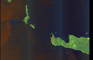
SAR coverage thumbnail
VIIRS Thermal Anomaly
Status: ✓ Signal detected
1 thermal/light anomalies detected
Detections: 1 thermal anomalies
View detections
| Location | Brightness | Time |
|---|---|---|
| 36.8207, 27.0846 | 325.7 K | 2026-01-20T11:14:00+00:00 |
Show Raw Evidence JSON
{
    "gap_minutes": 307.19999999999998863131622783839702606201171875,
    "last_seen": {
        "ts": "2026-01-20T06:54:27+00:00",
        "lat": 36.90744500000000272166289505548775196075439453125,
        "lon": 26.66849500000000006139089236967265605926513671875,
        "sog": 13.199999999999999289457264239899814128875732421875,
        "zone_id": "discovered_075"
    },
    "next_seen": {
        "ts": "2026-01-20T12:01:38+00:00",
        "lat": 36.011899999999997135091689415276050567626953125,
        "lon": 27.354293299999998367866282933391630649566650390625,
        "zone_ids": [
            "discovered_072",
            "discovered_163"
        ]
    },
    "gap_enrichment": {
        "status": "done",
        "corridor": {
            "start": {
                "lat": 36.90744500000000272166289505548775196075439453125,
                "lon": 26.66849500000000006139089236967265605926513671875,
                "ts": "2026-01-20T06:54:27+00:00"
            },
            "end": {
                "lat": 36.011899999999997135091689415276050567626953125,
                "lon": 27.354293299999998367866282933391630649566650390625,
                "ts": "2026-01-20T12:01:38+00:00"
            },
            "bbox": {
                "min_lat": 35.83171999999999712827047915197908878326416015625,
                "min_lon": 26.444466999999999501369529752992093563079833984375,
                "max_lat": 37.0876250000000027284841053187847137451171875,
                "max_lon": 27.578320999999998974772097426466643810272216796875
            },
            "buffer_km": 20
        },
        "sar": {
            "status": "snapshot",
            "scene_id": "S1C_IW_GRDH_1SDV_20260120T041509_20260120T041534_005982_00C002_D9AA_COG",
            "scene_time": "2026-01-20T04:15:09.432317Z",
            "platform": "sentinel-1c",
            "assets": {
                "preview_url": "https:\/\/fleetleaks.com\/wp-content\/uploads\/fleetleaks-evidence\/sar-imagery\/2026\/01\/event_8629_thumbnail_20260123004603.png",
                "stored_path": "\/home\/fleetleaks\/public_html\/wp-content\/uploads\/fleetleaks-evidence\/sar-imagery\/2026\/01\/event_8629_thumbnail_20260123004603.png",
                "source": "copernicus_dataspace"
            },
            "notes": "SAR snapshot available for review"
        },
        "viirs": {
            "status": "signal",
            "dataset": "VIIRS_SNPP",
            "detection_count": 1,
            "top_detections": [
                {
                    "lat": 36.82070999999999827423380338586866855621337890625,
                    "lon": 27.084559999999999746478351880796253681182861328125,
                    "brightness": 325.69999999999998863131622783839702606201171875,
                    "frp": 1.850000000000000088817841970012523233890533447265625,
                    "confidence": "n",
                    "acq_date": "2026-01-20",
                    "acq_time": "1114",
                    "satellite": "N",
                    "daynight": "D",
                    "acq_datetime": "2026-01-20T11:14:00+00:00"
                }
            ],
            "notes": "1 thermal\/light anomalies detected"
        },
        "searched_at": "2026-01-23T00:45:59.640766+00:00"
    }
}- Zone: Southeast Aegean Monitoring Zone
- Duration: 1h 4m
- Data Points: 47 AIS positions
- Period: 2026-01-20T05:50:07+00:00 to 2026-01-20T06:54:27+00:00
Show Raw Evidence JSON
{
    "zone_id": "discovered_075",
    "zone_name": "Southeast Aegean Monitoring Zone",
    "dwell_minutes": 64.2999999999999971578290569595992565155029296875,
    "points_in_zone": 47,
    "first_point": {
        "ts": "2026-01-20T05:50:07+00:00",
        "lat": 37.097638299999999844658304937183856964111328125,
        "lon": 26.591668299999998481553120655007660388946533203125
    },
    "last_point": {
        "ts": "2026-01-20T06:54:27+00:00",
        "lat": 36.90744500000000272166289505548775196075439453125,
        "lon": 26.66849500000000006139089236967265605926513671875
    }
}Recent Position Data
| Time (UTC) | Lat | Lon | Speed | Course | Zone |
|---|---|---|---|---|---|
| Jun 5 18:56 | 37.0030 | 26.6676 | 12.8 kn | 178.0° | Northeast Aegean Monitoring Zone |
| Jun 5 18:52 | 37.0155 | 26.6671 | 12.7 kn | 178.0° | Northeast Aegean Monitoring Zone |
| Jun 5 18:44 | 37.0432 | 26.6621 | 12.5 kn | 150.0° | Northeast Aegean Monitoring Zone |
| Jun 5 18:37 | 37.0611 | 26.6411 | 12.4 kn | 132.0° | Northeast Aegean Monitoring Zone |
| Jun 5 18:34 | 37.0679 | 26.6316 | 12.3 kn | 133.0° | Northeast Aegean Monitoring Zone |
| Jun 4 09:40 | 40.9429 | 28.9207 | 12.4 kn | 238.0° | Bosphorus/Dardanelles Approach |
| Jun 4 09:39 | 40.9448 | 28.9245 | 12.5 kn | 237.0° | Bosphorus/Dardanelles Approach |
| May 20 00:59 | 40.9297 | 28.9824 | 13.7 kn | 0.0° | Bosphorus/Dardanelles Approach |
| May 7 09:36 | 37.4678 | 25.8979 | 13.4 kn | 338.0° | Central Atlantic Surveillance Zone |
| May 7 09:21 | 37.4196 | 25.9240 | 13.1 kn | 335.0° | Central Atlantic Surveillance Zone |
| May 7 09:19 | 37.4130 | 25.9279 | 13.1 kn | 334.0° | Central Atlantic Surveillance Zone |
| May 7 09:07 | 37.3743 | 25.9548 | 13.4 kn | 329.0° | Central Atlantic Surveillance Zone |
| May 7 09:02 | 37.3560 | 25.9687 | 13.4 kn | 328.0° | Central Atlantic Surveillance Zone |
| May 7 08:50 | 37.3177 | 25.9967 | 13.6 kn | 331.0° | Central Atlantic Surveillance Zone |
| May 7 08:45 | 37.3013 | 26.0074 | 13.5 kn | 333.0° | Central Atlantic Surveillance Zone |
| May 7 08:42 | 37.2915 | 26.0134 | 13.4 kn | 334.0° | Central Atlantic Surveillance Zone |
| May 7 08:33 | 37.2631 | 26.0315 | 13.4 kn | 332.0° | Central Atlantic Surveillance Zone |
| May 7 07:56 | 37.1391 | 26.1062 | 13.7 kn | 334.0° | discovered_086 |
| May 7 07:53 | 37.1287 | 26.1124 | 13.7 kn | 335.0° | discovered_086 |
| May 7 07:51 | 37.1202 | 26.1177 | 13.7 kn | 334.0° | discovered_086 |
Showing 20 of 100 recent positions.
Data Source
Vessel observed through FleetLeaks' AIS monitoring system in zones of interest. Identity and position data derived from AIS broadcasts and public maritime databases.
Disclaimer: AIS data can be spoofed or falsified. Vessel identities should be independently verified before making compliance decisions.