
IMO 9930210
Vessel information
Detected Events (100)
- Zone: Mid-Atlantic Surveillance Zone
- Duration: 1h 13m
- Data Points: 13 AIS positions
- Period: 2026-10-31T07:01:08+00:00 to 2026-10-31T08:14:17+00:00
Show Raw Evidence JSON
{
    "zone_id": "discovered_048",
    "zone_name": "Mid-Atlantic Surveillance Zone",
    "dwell_minutes": 73.2000000000000028421709430404007434844970703125,
    "points_in_zone": 13,
    "first_point": {
        "ts": "2026-10-31T07:01:08+00:00",
        "lat": -33.8544083000000028960130293853580951690673828125,
        "lon": 18.358734999999999359943103627301752567291259765625
    },
    "last_point": {
        "ts": "2026-10-31T08:14:17+00:00",
        "lat": -33.6651082999999999856299837119877338409423828125,
        "lon": 18.153864999999999696456143283285200595855712890625
    }
}- Zone: Mid-Atlantic Surveillance Zone
- Duration: 2h 12m
- Data Points: 35 AIS positions
- Period: 2026-10-31T06:01:29+00:00 to 2026-10-31T08:14:17+00:00
Show Raw Evidence JSON
{
    "zone_id": "discovered_048",
    "zone_name": "Mid-Atlantic Surveillance Zone",
    "dwell_minutes": 132.80000000000001136868377216160297393798828125,
    "points_in_zone": 35,
    "first_point": {
        "ts": "2026-10-31T06:01:29+00:00",
        "lat": -33.91129500000000263071342487819492816925048828125,
        "lon": 18.437664999999999082547219586558640003204345703125
    },
    "last_point": {
        "ts": "2026-10-31T08:14:17+00:00",
        "lat": -33.6651082999999999856299837119877338409423828125,
        "lon": 18.153864999999999696456143283285200595855712890625
    }
}- Zone: Mid-Atlantic Surveillance Zone
- Duration: 3h 9m
- Data Points: 43 AIS positions
- Period: 2026-10-31T05:04:29+00:00 to 2026-10-31T08:14:17+00:00
Show Raw Evidence JSON
{
    "zone_id": "discovered_048",
    "zone_name": "Mid-Atlantic Surveillance Zone",
    "dwell_minutes": 189.80000000000001136868377216160297393798828125,
    "points_in_zone": 43,
    "first_point": {
        "ts": "2026-10-31T05:04:29+00:00",
        "lat": -33.9112932999999969752025208435952663421630859375,
        "lon": 18.437638299999999702549757785163819789886474609375
    },
    "last_point": {
        "ts": "2026-10-31T08:14:17+00:00",
        "lat": -33.6651082999999999856299837119877338409423828125,
        "lon": 18.153864999999999696456143283285200595855712890625
    }
}- Zone: Mid-Atlantic Surveillance Zone
- Duration: 3h 48m
- Data Points: 49 AIS positions
- Period: 2026-10-31T04:25:29+00:00 to 2026-10-31T08:14:17+00:00
Show Raw Evidence JSON
{
    "zone_id": "discovered_048",
    "zone_name": "Mid-Atlantic Surveillance Zone",
    "dwell_minutes": 228.80000000000001136868377216160297393798828125,
    "points_in_zone": 49,
    "first_point": {
        "ts": "2026-10-31T04:25:29+00:00",
        "lat": -33.91128330000000090649336925707757472991943359375,
        "lon": 18.437650000000001426769813406281173229217529296875
    },
    "last_point": {
        "ts": "2026-10-31T08:14:17+00:00",
        "lat": -33.6651082999999999856299837119877338409423828125,
        "lon": 18.153864999999999696456143283285200595855712890625
    }
}- Duration: 1h 59m
- Radius: 492 meters
- Data Points: 20 AIS positions
- Centroid: -33.9110, 18.4371
- Zone: Mid-Atlantic Surveillance Zone
Show Raw Evidence JSON
{
    "radius_m": 492,
    "duration_minutes": 119.7000000000000028421709430404007434844970703125,
    "points": 20,
    "centroid": {
        "lat": -33.910987070000004450776032172143459320068359375,
        "lon": 18.437094335000001166235961136408150196075439453125
    },
    "bbox": {
        "min_lat": -33.91159499999999837882569408975541591644287109375,
        "min_lon": 18.432743299999998498606146313250064849853515625,
        "max_lat": -33.90687170000000350000846083275973796844482421875,
        "max_lon": 18.437673300000000153886503539979457855224609375
    },
    "zone_id": "discovered_048"
}- Zone: Mid-Atlantic Surveillance Zone
- Duration: 5h 6m
- Data Points: 52 AIS positions
- Period: 2026-10-31T03:07:29+00:00 to 2026-10-31T08:14:17+00:00
Show Raw Evidence JSON
{
    "zone_id": "discovered_048",
    "zone_name": "Mid-Atlantic Surveillance Zone",
    "dwell_minutes": 306.80000000000001136868377216160297393798828125,
    "points_in_zone": 52,
    "first_point": {
        "ts": "2026-10-31T03:07:29+00:00",
        "lat": -33.91132669999999649235178367234766483306884765625,
        "lon": 18.437644999999999839701558812521398067474365234375
    },
    "last_point": {
        "ts": "2026-10-31T08:14:17+00:00",
        "lat": -33.6651082999999999856299837119877338409423828125,
        "lon": 18.153864999999999696456143283285200595855712890625
    }
}- Duration: 3h 17m
- Radius: 499 meters
- Data Points: 23 AIS positions
- Centroid: -33.9110, 18.4372
- Zone: Mid-Atlantic Surveillance Zone
Show Raw Evidence JSON
{
    "radius_m": 498.80000000000001136868377216160297393798828125,
    "duration_minutes": 197.69999999999998863131622783839702606201171875,
    "points": 23,
    "centroid": {
        "lat": -33.9110294826086970942924381233751773834228515625,
        "lon": 18.437165000000003800550985033623874187469482421875
    },
    "bbox": {
        "min_lat": -33.91159499999999837882569408975541591644287109375,
        "min_lon": 18.432743299999998498606146313250064849853515625,
        "max_lat": -33.90687170000000350000846083275973796844482421875,
        "max_lon": 18.437673300000000153886503539979457855224609375
    },
    "zone_id": "discovered_048"
}- Zone: Mid-Atlantic Surveillance Zone
- Duration: 6h 12m
- Data Points: 57 AIS positions
- Period: 2026-10-31T02:01:29+00:00 to 2026-10-31T08:14:17+00:00
Show Raw Evidence JSON
{
    "zone_id": "discovered_048",
    "zone_name": "Mid-Atlantic Surveillance Zone",
    "dwell_minutes": 372.80000000000001136868377216160297393798828125,
    "points_in_zone": 57,
    "first_point": {
        "ts": "2026-10-31T02:01:29+00:00",
        "lat": -33.91128669999999800666046212427318096160888671875,
        "lon": 18.437670000000000669615474180318415164947509765625
    },
    "last_point": {
        "ts": "2026-10-31T08:14:17+00:00",
        "lat": -33.6651082999999999856299837119877338409423828125,
        "lon": 18.153864999999999696456143283285200595855712890625
    }
}- Duration: 4h 23m
- Radius: 507 meters
- Data Points: 28 AIS positions
- Centroid: -33.9111, 18.4373
- Zone: Mid-Atlantic Surveillance Zone
Show Raw Evidence JSON
{
    "radius_m": 506.69999999999998863131622783839702606201171875,
    "duration_minutes": 263.6000000000000227373675443232059478759765625,
    "points": 28,
    "centroid": {
        "lat": -33.91107612142857163917142315767705440521240234375,
        "lon": 18.437252260714291907106598955579102039337158203125
    },
    "bbox": {
        "min_lat": -33.91159499999999837882569408975541591644287109375,
        "min_lon": 18.432743299999998498606146313250064849853515625,
        "max_lat": -33.90687170000000350000846083275973796844482421875,
        "max_lon": 18.437673300000000153886503539979457855224609375
    },
    "zone_id": "discovered_048"
}- Zone: Mid-Atlantic Surveillance Zone
- Duration: 6h 30m
- Data Points: 60 AIS positions
- Period: 2026-10-31T01:43:29+00:00 to 2026-10-31T08:14:17+00:00
Show Raw Evidence JSON
{
    "zone_id": "discovered_048",
    "zone_name": "Mid-Atlantic Surveillance Zone",
    "dwell_minutes": 390.80000000000001136868377216160297393798828125,
    "points_in_zone": 60,
    "first_point": {
        "ts": "2026-10-31T01:43:29+00:00",
        "lat": -33.91130170000000276786522590555250644683837890625,
        "lon": 18.437651699999999976853359839878976345062255859375
    },
    "last_point": {
        "ts": "2026-10-31T08:14:17+00:00",
        "lat": -33.6651082999999999856299837119877338409423828125,
        "lon": 18.153864999999999696456143283285200595855712890625
    }
}- Duration: 5h 17m
- Radius: 513 meters
- Data Points: 34 AIS positions
- Centroid: -33.9111, 18.4373
- Zone: Mid-Atlantic Surveillance Zone
Show Raw Evidence JSON
{
    "radius_m": 513.3999999999999772626324556767940521240234375,
    "duration_minutes": 317.6000000000000227373675443232059478759765625,
    "points": 34,
    "centroid": {
        "lat": -33.911116070588235515970154665410518646240234375,
        "lon": 18.437323382352946765649903682060539722442626953125
    },
    "bbox": {
        "min_lat": -33.91159499999999837882569408975541591644287109375,
        "min_lon": 18.432743299999998498606146313250064849853515625,
        "max_lat": -33.90687170000000350000846083275973796844482421875,
        "max_lon": 18.437673300000000153886503539979457855224609375
    },
    "zone_id": "discovered_048"
}- Zone: Mid-Atlantic Surveillance Zone
- Duration: 6h 37m
- Data Points: 59 AIS positions
- Period: 2026-10-31T00:52:29+00:00 to 2026-10-31T07:29:49+00:00
Show Raw Evidence JSON
{
    "zone_id": "discovered_048",
    "zone_name": "Mid-Atlantic Surveillance Zone",
    "dwell_minutes": 397.30000000000001136868377216160297393798828125,
    "points_in_zone": 59,
    "first_point": {
        "ts": "2026-10-31T00:52:29+00:00",
        "lat": -33.911304999999998699422576464712619781494140625,
        "lon": 18.437641700000000355430529452860355377197265625
    },
    "last_point": {
        "ts": "2026-10-31T07:29:49+00:00",
        "lat": -33.78987500000000210320649784989655017852783203125,
        "lon": 18.280090000000001282387529499828815460205078125
    }
}- Duration: 6h 8m
- Radius: 516 meters
- Data Points: 37 AIS positions
- Centroid: -33.9111, 18.4373
- Zone: Mid-Atlantic Surveillance Zone
Show Raw Evidence JSON
{
    "radius_m": 515.8999999999999772626324556767940521240234375,
    "duration_minutes": 368.6000000000000227373675443232059478759765625,
    "points": 37,
    "centroid": {
        "lat": -33.9111313432432552872342057526111602783203125,
        "lon": 18.437349864864867043934282264672219753265380859375
    },
    "bbox": {
        "min_lat": -33.91159499999999837882569408975541591644287109375,
        "min_lon": 18.432743299999998498606146313250064849853515625,
        "max_lat": -33.90687170000000350000846083275973796844482421875,
        "max_lon": 18.437673300000000153886503539979457855224609375
    },
    "zone_id": "discovered_048"
}- Minimum Distance: 489 meters
- Average Distance: 495 meters
- Duration: 36 minutes
- Period: 2026-10-30T23:13:29+00:00 to 2026-10-30T23:49:29+00:00
- Vessel A Avg Speed: 0.0 knots
- Vessel B Avg Speed: 0.0 knots
- Zone: Mid-Atlantic Surveillance Zone
Confidence Analysis
Low-confidence STS candidate - may warrant review. Two tankers (ATLANTIC NARVAL and ILITHA) maintained close proximity (min 489m, avg 494m) for 36 minutes. Both vessels were slow-moving (avg speeds 0.0 and 0.0 knots). The stable separation distance suggests deliberate parallel positioning typical of cargo transfer. Event occurred in Mid-Atlantic Surveillance Zone, a known STS activity area.
View scoring breakdown
| Factor | Score | Detail |
|---|---|---|
| Distance Tightness | 5/25 | Min distance 489m, avg 494m |
| Duration | 5/25 | Duration 36 minutes |
| Speed Stability | 20/20 | both nearly stationary; very stable speeds |
| Distance Consistency | 15/15 | Distance variance ±4m |
| Isolation | 5/10 | Isolation data not available |
| Context | 5/5 | In monitored zone: Mid-Atlantic Surveillance Zone |
🛰️ Satellite Corroboration
Satellite imagery available but requires review
Preview available for manual review
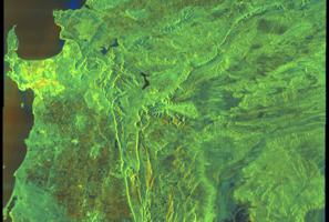
Show Raw Evidence JSON
{
    "vessel_a": {
        "mmsi": 563186800,
        "imo": 9930210,
        "name": "ATLANTIC NARVAL",
        "flag": "SINGAPORE"
    },
    "vessel_b": {
        "mmsi": 601041620,
        "imo": 9514494,
        "name": "ILITHA",
        "flag": "SOUTH AFRICA"
    },
    "min_distance_m": 489.3999999999999772626324556767940521240234375,
    "avg_distance_m": 494.5,
    "distance_consistency_m": 3.70000000000000017763568394002504646778106689453125,
    "duration_minutes": 36,
    "overlap_duration_s": 2160,
    "speed_a_avg": 0,
    "speed_a_std": 0,
    "speed_b_avg": 0,
    "speed_b_std": 0,
    "speed_summary": {
        "vessel_a": {
            "avg_sog": 0,
            "max_sog": 0
        },
        "vessel_b": {
            "avg_sog": 0,
            "max_sog": 0
        }
    },
    "time_window": {
        "start": "2026-10-30T23:13:29+00:00",
        "end": "2026-10-30T23:49:29+00:00"
    },
    "points_count": {
        "vessel_a": 6,
        "vessel_b": 6
    },
    "zone_id": "discovered_048",
    "zone_name": "Mid-Atlantic Surveillance Zone",
    "score": {
        "value": 55,
        "components": {
            "distance_tightness": {
                "score": 5,
                "max": 25,
                "detail": "Min distance 489m, avg 494m"
            },
            "duration": {
                "score": 5,
                "max": 25,
                "detail": "Duration 36 minutes"
            },
            "speed_stability": {
                "score": 20,
                "max": 20,
                "detail": "both nearly stationary; very stable speeds"
            },
            "distance_consistency": {
                "score": 15,
                "max": 15,
                "detail": "Distance variance \u00b14m"
            },
            "isolation": {
                "score": 5,
                "max": 10,
                "detail": "Isolation data not available"
            },
            "context": {
                "score": 5,
                "max": 5,
                "detail": "In monitored zone: Mid-Atlantic Surveillance Zone"
            }
        },
        "summary": "Low-confidence STS candidate - may warrant review. Two tankers (ATLANTIC NARVAL and ILITHA) maintained close proximity (min 489m, avg 494m) for 36 minutes. Both vessels were slow-moving (avg speeds 0.0 and 0.0 knots). The stable separation distance suggests deliberate parallel positioning typical of cargo transfer. Event occurred in Mid-Atlantic Surveillance Zone, a known STS activity area."
    },
    "sar": {
        "status": "inconclusive",
        "centroid": {
            "lat": -33.91305630000000093104972620494663715362548828125,
            "lon": 18.43930329999999884194039623253047466278076171875
        },
        "time_window": {
            "start_ts": "2026-10-30T23:13:29+00:00",
            "end_ts": "2026-10-30T23:49:29+00:00"
        },
        "searched_at": "2026-10-31T00:15:05.316543+00:00",
        "scene_id": "S1D_IW_GRDH_1SDV_20261030T172525_20261030T172550_005247_009F85_A09B_COG",
        "scene_datetime": "2026-10-30T17:25:25.932837Z",
        "platform": "sentinel-1d",
        "bbox": {
            "min_lon": 17.937977000000000060708771343342959880828857421875,
            "min_lat": -34.5516199999999997771737980656325817108154296875,
            "max_lon": 21.094975999999999061174094094894826412200927734375,
            "max_lat": -32.42829499999999853798726690001785755157470703125
        },
        "assets": {
            "preview_url": "https:\/\/fleetleaks.com\/wp-content\/uploads\/fleetleaks-evidence\/sar-imagery\/2026\/10\/event_1599995_thumbnail_20261031001509.png",
            "stored_path": "\/home\/fleetleaks\/public_html\/wp-content\/uploads\/fleetleaks-evidence\/sar-imagery\/2026\/10\/event_1599995_thumbnail_20261031001509.png",
            "source": "copernicus_dataspace"
        },
        "notes": "Preview available for manual review"
    }
}- Zone: Mid-Atlantic Surveillance Zone
- Duration: 6h 29m
- Data Points: 38 AIS positions
- Period: 2026-10-30T23:55:29+00:00 to 2026-10-31T06:25:08+00:00
Show Raw Evidence JSON
{
    "zone_id": "discovered_048",
    "zone_name": "Mid-Atlantic Surveillance Zone",
    "dwell_minutes": 389.6000000000000227373675443232059478759765625,
    "points_in_zone": 38,
    "first_point": {
        "ts": "2026-10-30T23:55:29+00:00",
        "lat": -33.9112999999999971123543218709528446197509765625,
        "lon": 18.43766000000000104819264379329979419708251953125
    },
    "last_point": {
        "ts": "2026-10-31T06:25:08+00:00",
        "lat": -33.90687170000000350000846083275973796844482421875,
        "lon": 18.43511000000000166210156749002635478973388671875
    }
}- Duration: 6h 29m
- Radius: 517 meters
- Data Points: 38 AIS positions
- Centroid: -33.9111, 18.4374
- Zone: Mid-Atlantic Surveillance Zone
Show Raw Evidence JSON
{
    "radius_m": 516.700000000000045474735088646411895751953125,
    "duration_minutes": 389.6000000000000227373675443232059478759765625,
    "points": 38,
    "centroid": {
        "lat": -33.911135781578963133142678998410701751708984375,
        "lon": 18.437358026315788350757429725490510463714599609375
    },
    "bbox": {
        "min_lat": -33.91159499999999837882569408975541591644287109375,
        "min_lon": 18.432743299999998498606146313250064849853515625,
        "max_lat": -33.90687170000000350000846083275973796844482421875,
        "max_lon": 18.437673300000000153886503539979457855224609375
    },
    "zone_id": "discovered_048"
}- Zone: Mid-Atlantic Surveillance Zone
- Duration: 6h 36m
- Data Points: 38 AIS positions
- Period: 2026-10-30T22:52:29+00:00 to 2026-10-31T05:28:29+00:00
Show Raw Evidence JSON
{
    "zone_id": "discovered_048",
    "zone_name": "Mid-Atlantic Surveillance Zone",
    "dwell_minutes": 396,
    "points_in_zone": 38,
    "first_point": {
        "ts": "2026-10-30T22:52:29+00:00",
        "lat": -33.9113200000000034606273402459919452667236328125,
        "lon": 18.43765330000000091104084276594221591949462890625
    },
    "last_point": {
        "ts": "2026-10-31T05:28:29+00:00",
        "lat": -33.9112932999999969752025208435952663421630859375,
        "lon": 18.437646699999998389785105246119201183319091796875
    }
}- Duration: 6h 36m
- Radius: 4 meters
- Data Points: 38 AIS positions
- Centroid: -33.9113, 18.4377
- Zone: Mid-Atlantic Surveillance Zone
Show Raw Evidence JSON
{
    "radius_m": 4.29999999999999982236431605997495353221893310546875,
    "duration_minutes": 396,
    "points": 38,
    "centroid": {
        "lat": -33.91129924736839740262439590878784656524658203125,
        "lon": 18.437652586842101953834571759216487407684326171875
    },
    "bbox": {
        "min_lat": -33.9113382999999970479620969854295253753662109375,
        "min_lon": 18.4376299999999986312104738317430019378662109375,
        "max_lat": -33.9112717000000003508830559439957141876220703125,
        "max_lon": 18.4376783000000017409547581337392330169677734375
    },
    "zone_id": "discovered_048"
}- Minimum Distance: 496 meters
- Average Distance: 498 meters
- Duration: 1 hours
- Period: 2026-10-30T21:22:20+00:00 to 2026-10-30T22:22:29+00:00
- Vessel A Avg Speed: 0.0 knots
- Vessel B Avg Speed: 0.0 knots
- Zone: Mid-Atlantic Surveillance Zone
Confidence Analysis
Moderate-confidence STS candidate. Two tankers (ILITHA and ATLANTIC NARVAL) maintained close proximity (min 496m, avg 498m) for 60 minutes. Both vessels were slow-moving (avg speeds 0.0 and 0.0 knots). The stable separation distance suggests deliberate parallel positioning typical of cargo transfer. Event occurred in Mid-Atlantic Surveillance Zone, a known STS activity area.
View scoring breakdown
| Factor | Score | Detail |
|---|---|---|
| Distance Tightness | 5/25 | Min distance 496m, avg 498m |
| Duration | 15/25 | Duration 60 minutes |
| Speed Stability | 20/20 | both nearly stationary; very stable speeds |
| Distance Consistency | 15/15 | Distance variance ±2m |
| Isolation | 5/10 | Isolation data not available |
| Context | 5/5 | In monitored zone: Mid-Atlantic Surveillance Zone |
🛰️ Satellite Corroboration
Satellite imagery available but requires review
Preview available for manual review
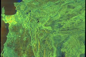
Show Raw Evidence JSON
{
    "vessel_a": {
        "mmsi": 601041620,
        "imo": 9514494,
        "name": "ILITHA",
        "flag": "SOUTH AFRICA"
    },
    "vessel_b": {
        "mmsi": 563186800,
        "imo": 9930210,
        "name": "ATLANTIC NARVAL",
        "flag": "SINGAPORE"
    },
    "min_distance_m": 495.5,
    "avg_distance_m": 497.5,
    "distance_consistency_m": 2.100000000000000088817841970012523233890533447265625,
    "duration_minutes": 60.10000000000000142108547152020037174224853515625,
    "overlap_duration_s": 3609,
    "speed_a_avg": 0,
    "speed_a_std": 0,
    "speed_b_avg": 0,
    "speed_b_std": 0,
    "speed_summary": {
        "vessel_a": {
            "avg_sog": 0,
            "max_sog": 0
        },
        "vessel_b": {
            "avg_sog": 0,
            "max_sog": 0
        }
    },
    "time_window": {
        "start": "2026-10-30T21:22:20+00:00",
        "end": "2026-10-30T22:22:29+00:00"
    },
    "points_count": {
        "vessel_a": 3,
        "vessel_b": 3
    },
    "zone_id": "discovered_048",
    "zone_name": "Mid-Atlantic Surveillance Zone",
    "score": {
        "value": 65,
        "components": {
            "distance_tightness": {
                "score": 5,
                "max": 25,
                "detail": "Min distance 496m, avg 498m"
            },
            "duration": {
                "score": 15,
                "max": 25,
                "detail": "Duration 60 minutes"
            },
            "speed_stability": {
                "score": 20,
                "max": 20,
                "detail": "both nearly stationary; very stable speeds"
            },
            "distance_consistency": {
                "score": 15,
                "max": 15,
                "detail": "Distance variance \u00b12m"
            },
            "isolation": {
                "score": 5,
                "max": 10,
                "detail": "Isolation data not available"
            },
            "context": {
                "score": 5,
                "max": 5,
                "detail": "In monitored zone: Mid-Atlantic Surveillance Zone"
            }
        },
        "summary": "Moderate-confidence STS candidate. Two tankers (ILITHA and ATLANTIC NARVAL) maintained close proximity (min 496m, avg 498m) for 60 minutes. Both vessels were slow-moving (avg speeds 0.0 and 0.0 knots). The stable separation distance suggests deliberate parallel positioning typical of cargo transfer. Event occurred in Mid-Atlantic Surveillance Zone, a known STS activity area."
    },
    "sar": {
        "status": "inconclusive",
        "centroid": {
            "lat": -33.9130535999999978002961142919957637786865234375,
            "lon": 18.43934610000000162699507200159132480621337890625
        },
        "time_window": {
            "start_ts": "2026-10-30T21:22:20+00:00",
            "end_ts": "2026-10-30T22:22:29+00:00"
        },
        "searched_at": "2026-10-31T00:30:11.197735+00:00",
        "scene_id": "S1D_IW_GRDH_1SDV_20261030T172525_20261030T172550_005247_009F85_A09B_COG",
        "scene_datetime": "2026-10-30T17:25:25.932837Z",
        "platform": "sentinel-1d",
        "bbox": {
            "min_lon": 17.937977000000000060708771343342959880828857421875,
            "min_lat": -34.5516199999999997771737980656325817108154296875,
            "max_lon": 21.094975999999999061174094094894826412200927734375,
            "max_lat": -32.42829499999999853798726690001785755157470703125
        },
        "assets": {
            "preview_url": "https:\/\/fleetleaks.com\/wp-content\/uploads\/fleetleaks-evidence\/sar-imagery\/2026\/10\/event_1600052_thumbnail_20261031003019.png",
            "stored_path": "\/home\/fleetleaks\/public_html\/wp-content\/uploads\/fleetleaks-evidence\/sar-imagery\/2026\/10\/event_1600052_thumbnail_20261031003019.png",
            "source": "copernicus_dataspace"
        },
        "notes": "Preview available for manual review"
    }
}- Zone: Mid-Atlantic Surveillance Zone
- Duration: 6h 27m
- Data Points: 34 AIS positions
- Period: 2026-10-30T21:58:29+00:00 to 2026-10-31T04:25:29+00:00
Show Raw Evidence JSON
{
    "zone_id": "discovered_048",
    "zone_name": "Mid-Atlantic Surveillance Zone",
    "dwell_minutes": 387,
    "points_in_zone": 34,
    "first_point": {
        "ts": "2026-10-30T21:58:29+00:00",
        "lat": -33.91129000000000104364517028443515300750732421875,
        "lon": 18.437670000000000669615474180318415164947509765625
    },
    "last_point": {
        "ts": "2026-10-31T04:25:29+00:00",
        "lat": -33.91128330000000090649336925707757472991943359375,
        "lon": 18.437650000000001426769813406281173229217529296875
    }
}- Duration: 6h 27m
- Radius: 4 meters
- Data Points: 34 AIS positions
- Centroid: -33.9113, 18.4377
- Zone: Mid-Atlantic Surveillance Zone
Show Raw Evidence JSON
{
    "radius_m": 3.70000000000000017763568394002504646778106689453125,
    "duration_minutes": 387,
    "points": 34,
    "centroid": {
        "lat": -33.91130043823529405244698864407837390899658203125,
        "lon": 18.43765411176470792042891844175755977630615234375
    },
    "bbox": {
        "min_lat": -33.91132999999999952933649183250963687896728515625,
        "min_lon": 18.4376299999999986312104738317430019378662109375,
        "max_lat": -33.91127329999999773235686006955802440643310546875,
        "max_lon": 18.4376783000000017409547581337392330169677734375
    },
    "zone_id": "discovered_048"
}- Zone: Mid-Atlantic Surveillance Zone
- Duration: 6h 33m
- Data Points: 39 AIS positions
- Period: 2026-10-30T20:52:29+00:00 to 2026-10-31T03:25:29+00:00
Show Raw Evidence JSON
{
    "zone_id": "discovered_048",
    "zone_name": "Mid-Atlantic Surveillance Zone",
    "dwell_minutes": 393,
    "points_in_zone": 39,
    "first_point": {
        "ts": "2026-10-30T20:52:29+00:00",
        "lat": -33.9112999999999971123543218709528446197509765625,
        "lon": 18.437651699999999976853359839878976345062255859375
    },
    "last_point": {
        "ts": "2026-10-31T03:25:29+00:00",
        "lat": -33.911304999999998699422576464712619781494140625,
        "lon": 18.4376333000000016681951819919049739837646484375
    }
}- Duration: 6h 33m
- Radius: 4 meters
- Data Points: 39 AIS positions
- Centroid: -33.9113, 18.4377
- Zone: Mid-Atlantic Surveillance Zone
Show Raw Evidence JSON
{
    "radius_m": 4,
    "duration_minutes": 393,
    "points": 39,
    "centroid": {
        "lat": -33.9113005102564102344331331551074981689453125,
        "lon": 18.437657556410254500178780290298163890838623046875
    },
    "bbox": {
        "min_lat": -33.91132999999999952933649183250963687896728515625,
        "min_lon": 18.4376299999999986312104738317430019378662109375,
        "max_lat": -33.91127329999999773235686006955802440643310546875,
        "max_lon": 18.437683299999999775309333926998078823089599609375
    },
    "zone_id": "discovered_048"
}- Zone: Mid-Atlantic Surveillance Zone
- Duration: 6h 24m
- Data Points: 41 AIS positions
- Period: 2026-10-30T19:46:29+00:00 to 2026-10-31T02:10:29+00:00
Show Raw Evidence JSON
{
    "zone_id": "discovered_048",
    "zone_name": "Mid-Atlantic Surveillance Zone",
    "dwell_minutes": 384,
    "points_in_zone": 41,
    "first_point": {
        "ts": "2026-10-30T19:46:29+00:00",
        "lat": -33.91127329999999773235686006955802440643310546875,
        "lon": 18.43765499999999946112438919954001903533935546875
    },
    "last_point": {
        "ts": "2026-10-31T02:10:29+00:00",
        "lat": -33.9112932999999969752025208435952663421630859375,
        "lon": 18.437644999999999839701558812521398067474365234375
    }
}- Duration: 6h 24m
- Radius: 4 meters
- Data Points: 41 AIS positions
- Centroid: -33.9113, 18.4377
- Zone: Mid-Atlantic Surveillance Zone
Show Raw Evidence JSON
{
    "radius_m": 3.79999999999999982236431605997495353221893310546875,
    "duration_minutes": 384,
    "points": 41,
    "centroid": {
        "lat": -33.91129828780487542871924233622848987579345703125,
        "lon": 18.437658204878051293462704052217304706573486328125
    },
    "bbox": {
        "min_lat": -33.91132999999999952933649183250963687896728515625,
        "min_lon": 18.4376299999999986312104738317430019378662109375,
        "max_lat": -33.91127329999999773235686006955802440643310546875,
        "max_lon": 18.437683299999999775309333926998078823089599609375
    },
    "zone_id": "discovered_048"
}- Duration: 6h 34m
- Radius: 291 meters
- Data Points: 42 AIS positions
- Centroid: -33.9113, 18.4376
- Zone: Mid-Atlantic Surveillance Zone
Show Raw Evidence JSON
{
    "radius_m": 290.69999999999998863131622783839702606201171875,
    "duration_minutes": 394.80000000000001136868377216160297393798828125,
    "points": 42,
    "centroid": {
        "lat": -33.9112946809523947422349010594189167022705078125,
        "lon": 18.437571421428568640976664028130471706390380859375
    },
    "bbox": {
        "min_lat": -33.9116666999999978315827320329844951629638671875,
        "min_lon": 18.434528300000000200498107005842030048370361328125,
        "max_lat": -33.91063669999999774518073536455631256103515625,
        "max_lon": 18.437683299999999775309333926998078823089599609375
    },
    "zone_id": "discovered_048"
}- Zone: Mid-Atlantic Surveillance Zone
- Duration: 6h 34m
- Data Points: 42 AIS positions
- Period: 2026-10-30T18:50:41+00:00 to 2026-10-31T01:25:29+00:00
Show Raw Evidence JSON
{
    "zone_id": "discovered_048",
    "zone_name": "Mid-Atlantic Surveillance Zone",
    "dwell_minutes": 394.80000000000001136868377216160297393798828125,
    "points_in_zone": 42,
    "first_point": {
        "ts": "2026-10-30T18:50:41+00:00",
        "lat": -33.91063669999999774518073536455631256103515625,
        "lon": 18.434528300000000200498107005842030048370361328125
    },
    "last_point": {
        "ts": "2026-10-31T01:25:29+00:00",
        "lat": -33.91131500000000187355908565223217010498046875,
        "lon": 18.43765330000000091104084276594221591949462890625
    }
}- Zone: Mid-Atlantic Surveillance Zone
- Duration: 6h 31m
- Data Points: 50 AIS positions
- Period: 2026-10-30T17:45:00+00:00 to 2026-10-31T00:16:29+00:00
Show Raw Evidence JSON
{
    "zone_id": "discovered_048",
    "zone_name": "Mid-Atlantic Surveillance Zone",
    "dwell_minutes": 391.5,
    "points_in_zone": 50,
    "first_point": {
        "ts": "2026-10-30T17:45:00+00:00",
        "lat": -33.8744166999999976042090565897524356842041015625,
        "lon": 18.38286670000000100344550446607172489166259765625
    },
    "last_point": {
        "ts": "2026-10-31T00:16:29+00:00",
        "lat": -33.91132999999999952933649183250963687896728515625,
        "lon": 18.4376682999999985668182489462196826934814453125
    }
}- Zone: Mid-Atlantic Surveillance Zone
- Duration: 6h 36m
- Data Points: 55 AIS positions
- Period: 2026-10-30T16:52:00+00:00 to 2026-10-30T23:28:29+00:00
Show Raw Evidence JSON
{
    "zone_id": "discovered_048",
    "zone_name": "Mid-Atlantic Surveillance Zone",
    "dwell_minutes": 396.5,
    "points_in_zone": 55,
    "first_point": {
        "ts": "2026-10-30T16:52:00+00:00",
        "lat": -33.89458830000000233440005104057490825653076171875,
        "lon": 18.34440000000000026147972675971686840057373046875
    },
    "last_point": {
        "ts": "2026-10-30T23:28:29+00:00",
        "lat": -33.911308300000001736407284624874591827392578125,
        "lon": 18.437651699999999976853359839878976345062255859375
    }
}- Zone: Mid-Atlantic Surveillance Zone
- Duration: 6h 26m
- Data Points: 58 AIS positions
- Period: 2026-10-30T15:58:50+00:00 to 2026-10-30T22:25:29+00:00
Show Raw Evidence JSON
{
    "zone_id": "discovered_048",
    "zone_name": "Mid-Atlantic Surveillance Zone",
    "dwell_minutes": 386.6000000000000227373675443232059478759765625,
    "points_in_zone": 58,
    "first_point": {
        "ts": "2026-10-30T15:58:50+00:00",
        "lat": -33.9576617000000027246642275713384151458740234375,
        "lon": 18.292253299999998716884874738752841949462890625
    },
    "last_point": {
        "ts": "2026-10-30T22:25:29+00:00",
        "lat": -33.91129500000000263071342487819492816925048828125,
        "lon": 18.437670000000000669615474180318415164947509765625
    }
}- Zone: Mid-Atlantic Surveillance Zone
- Duration: 6h 31m
- Data Points: 65 AIS positions
- Period: 2026-10-30T14:54:21+00:00 to 2026-10-30T21:25:29+00:00
Show Raw Evidence JSON
{
    "zone_id": "discovered_048",
    "zone_name": "Mid-Atlantic Surveillance Zone",
    "dwell_minutes": 391.1000000000000227373675443232059478759765625,
    "points_in_zone": 65,
    "first_point": {
        "ts": "2026-10-30T14:54:21+00:00",
        "lat": -34.0236433000000033644028007984161376953125,
        "lon": 18.24303330000000045174601837061345577239990234375
    },
    "last_point": {
        "ts": "2026-10-30T21:25:29+00:00",
        "lat": -33.91129500000000263071342487819492816925048828125,
        "lon": 18.4376800000000002910383045673370361328125
    }
}- Zone: Cape Peninsula Monitoring Zone
- Duration: 1h 19m
- Data Points: 22 AIS positions
- Period: 2026-10-30T13:05:05+00:00 to 2026-10-30T14:24:50+00:00
Show Raw Evidence JSON
{
    "zone_id": "discovered_225",
    "zone_name": "Cape Peninsula Monitoring Zone",
    "dwell_minutes": 79.7999999999999971578290569595992565155029296875,
    "points_in_zone": 22,
    "first_point": {
        "ts": "2026-10-30T13:05:05+00:00",
        "lat": -34.38066830000000351219568983651697635650634765625,
        "lon": 18.0856433000000009769792086444795131683349609375
    },
    "last_point": {
        "ts": "2026-10-30T14:24:50+00:00",
        "lat": -34.100155000000000882209860719740390777587890625,
        "lon": 18.187683299999999775309333926998078823089599609375
    }
}- Zone: Cape Peninsula Monitoring Zone
- Duration: 2h 16m
- Data Points: 44 AIS positions
- Period: 2026-10-30T12:08:36+00:00 to 2026-10-30T14:24:50+00:00
Show Raw Evidence JSON
{
    "zone_id": "discovered_225",
    "zone_name": "Cape Peninsula Monitoring Zone",
    "dwell_minutes": 136.19999999999998863131622783839702606201171875,
    "points_in_zone": 44,
    "first_point": {
        "ts": "2026-10-30T12:08:36+00:00",
        "lat": -34.57429669999999788387867738492786884307861328125,
        "lon": 18.183081699999998903649611747823655605316162109375
    },
    "last_point": {
        "ts": "2026-10-30T14:24:50+00:00",
        "lat": -34.100155000000000882209860719740390777587890625,
        "lon": 18.187683299999999775309333926998078823089599609375
    }
}- Zone: English Channel Surveillance Zone
- Duration: 1h 16m
- Data Points: 31 AIS positions
- Period: 2026-10-30T12:02:36+00:00 to 2026-10-30T13:18:36+00:00
Show Raw Evidence JSON
{
    "zone_id": "discovered_112",
    "zone_name": "English Channel Surveillance Zone",
    "dwell_minutes": 76,
    "points_in_zone": 31,
    "first_point": {
        "ts": "2026-10-30T12:02:36+00:00",
        "lat": -34.59108669999999818855940247885882854461669921875,
        "lon": 18.20180330000000168411133927293121814727783203125
    },
    "last_point": {
        "ts": "2026-10-30T13:18:36+00:00",
        "lat": -34.3304600000000021964297047816216945648193359375,
        "lon": 18.086014999999999730562194599770009517669677734375
    }
}- Zone: English Channel Surveillance Zone
- Duration: 2h 13m
- Data Points: 43 AIS positions
- Period: 2026-10-30T11:04:45+00:00 to 2026-10-30T13:18:36+00:00
Show Raw Evidence JSON
{
    "zone_id": "discovered_112",
    "zone_name": "English Channel Surveillance Zone",
    "dwell_minutes": 133.80000000000001136868377216160297393798828125,
    "points_in_zone": 43,
    "first_point": {
        "ts": "2026-10-30T11:04:45+00:00",
        "lat": -34.712486699999999473220668733119964599609375,
        "lon": 18.409303300000001257785697816871106624603271484375
    },
    "last_point": {
        "ts": "2026-10-30T13:18:36+00:00",
        "lat": -34.3304600000000021964297047816216945648193359375,
        "lon": 18.086014999999999730562194599770009517669677734375
    }
}- Zone: English Channel Surveillance Zone
- Duration: 3h 11m
- Data Points: 55 AIS positions
- Period: 2026-10-30T10:07:35+00:00 to 2026-10-30T13:18:36+00:00
Show Raw Evidence JSON
{
    "zone_id": "discovered_112",
    "zone_name": "English Channel Surveillance Zone",
    "dwell_minutes": 191,
    "points_in_zone": 55,
    "first_point": {
        "ts": "2026-10-30T10:07:35+00:00",
        "lat": -34.7731500000000011141310096718370914459228515625,
        "lon": 18.64933669999999921174094197340309619903564453125
    },
    "last_point": {
        "ts": "2026-10-30T13:18:36+00:00",
        "lat": -34.3304600000000021964297047816216945648193359375,
        "lon": 18.086014999999999730562194599770009517669677734375
    }
}- Zone: discovered_283
- Duration: 1h 52m
- Data Points: 12 AIS positions
- Period: 2026-09-25T13:07:04+00:00 to 2026-09-25T14:59:23+00:00
Show Raw Evidence JSON
{
    "zone_id": "discovered_283",
    "zone_name": "Discovered Hotspot discovered_283",
    "dwell_minutes": 112.2999999999999971578290569595992565155029296875,
    "points_in_zone": 12,
    "first_point": {
        "ts": "2026-09-25T13:07:04+00:00",
        "lat": 35.63137830000000150221239891834557056427001953125,
        "lon": -6.6146750000000000824229573481716215610504150390625
    },
    "last_point": {
        "ts": "2026-09-25T14:59:23+00:00",
        "lat": 35.37530000000000285353962681256234645843505859375,
        "lon": -6.9096700000000002006572685786522924900054931640625
    }
}- Zone: discovered_283
- Duration: 2h 37m
- Data Points: 31 AIS positions
- Period: 2026-09-25T12:21:33+00:00 to 2026-09-25T14:59:23+00:00
Show Raw Evidence JSON
{
    "zone_id": "discovered_283",
    "zone_name": "Discovered Hotspot discovered_283",
    "dwell_minutes": 157.80000000000001136868377216160297393798828125,
    "points_in_zone": 31,
    "first_point": {
        "ts": "2026-09-25T12:21:33+00:00",
        "lat": 35.7366717000000022608219296671450138092041015625,
        "lon": -6.49233499999999974505726640927605330944061279296875
    },
    "last_point": {
        "ts": "2026-09-25T14:59:23+00:00",
        "lat": 35.37530000000000285353962681256234645843505859375,
        "lon": -6.9096700000000002006572685786522924900054931640625
    }
}- Zone: Ceuta/Gibraltar STS Zone
- Duration: 1h 55m
- Data Points: 33 AIS positions
- Period: 2026-09-25T08:01:54+00:00 to 2026-09-25T09:57:45+00:00
Show Raw Evidence JSON
{
    "zone_id": "osint_ceuta",
    "zone_name": "Ceuta\/Gibraltar STS Zone",
    "dwell_minutes": 115.7999999999999971578290569595992565155029296875,
    "points_in_zone": 33,
    "first_point": {
        "ts": "2026-09-25T08:01:54+00:00",
        "lat": 35.993459999999998899511410854756832122802734375,
        "lon": -5.52001499999999989398702382459305226802825927734375
    },
    "last_point": {
        "ts": "2026-09-25T09:57:45+00:00",
        "lat": 35.95506499999999761030267109163105487823486328125,
        "lon": -5.9894683000000004113871909794397652149200439453125
    }
}- Zone: Ceuta/Gibraltar STS Zone
- Duration: 2h 57m
- Data Points: 58 AIS positions
- Period: 2026-09-25T07:00:35+00:00 to 2026-09-25T09:57:45+00:00
Show Raw Evidence JSON
{
    "zone_id": "osint_ceuta",
    "zone_name": "Ceuta\/Gibraltar STS Zone",
    "dwell_minutes": 177.19999999999998863131622783839702606201171875,
    "points_in_zone": 58,
    "first_point": {
        "ts": "2026-09-25T07:00:35+00:00",
        "lat": 36.097683299999999917417881079018115997314453125,
        "lon": -5.38500829999999996999804352526552975177764892578125
    },
    "last_point": {
        "ts": "2026-09-25T09:57:45+00:00",
        "lat": 35.95506499999999761030267109163105487823486328125,
        "lon": -5.9894683000000004113871909794397652149200439453125
    }
}- Zone: Ceuta/Gibraltar STS Zone
- Duration: 3h 56m
- Data Points: 71 AIS positions
- Period: 2026-09-25T06:00:56+00:00 to 2026-09-25T09:57:45+00:00
Show Raw Evidence JSON
{
    "zone_id": "osint_ceuta",
    "zone_name": "Ceuta\/Gibraltar STS Zone",
    "dwell_minutes": 236.80000000000001136868377216160297393798828125,
    "points_in_zone": 71,
    "first_point": {
        "ts": "2026-09-25T06:00:56+00:00",
        "lat": 36.1355132999999995035977917723357677459716796875,
        "lon": -5.37051829999999963405343805789016187191009521484375
    },
    "last_point": {
        "ts": "2026-09-25T09:57:45+00:00",
        "lat": 35.95506499999999761030267109163105487823486328125,
        "lon": -5.9894683000000004113871909794397652149200439453125
    }
}- Zone: Ceuta/Gibraltar STS Zone
- Duration: 4h 53m
- Data Points: 78 AIS positions
- Period: 2026-09-25T05:03:56+00:00 to 2026-09-25T09:57:45+00:00
Show Raw Evidence JSON
{
    "zone_id": "osint_ceuta",
    "zone_name": "Ceuta\/Gibraltar STS Zone",
    "dwell_minutes": 293.80000000000001136868377216160297393798828125,
    "points_in_zone": 78,
    "first_point": {
        "ts": "2026-09-25T05:03:56+00:00",
        "lat": 36.13508329999999801884769112803041934967041015625,
        "lon": -5.37048669999999983559746397077105939388275146484375
    },
    "last_point": {
        "ts": "2026-09-25T09:57:45+00:00",
        "lat": 35.95506499999999761030267109163105487823486328125,
        "lon": -5.9894683000000004113871909794397652149200439453125
    }
}- Duration: 1h 41m
- Radius: 1,109 meters
- Data Points: 15 AIS positions
- Centroid: 36.1355, -5.3735
- Zone: Ceuta/Gibraltar STS Zone
Show Raw Evidence JSON
{
    "radius_m": 1109.200000000000045474735088646411895751953125,
    "duration_minutes": 101.7999999999999971578290569595992565155029296875,
    "points": 15,
    "centroid": {
        "lat": 36.13553955333333789212701958604156970977783203125,
        "lon": -5.37346256000000099817270893254317343235015869140625
    },
    "bbox": {
        "min_lat": 36.13202170000000279515006695874035358428955078125,
        "min_lon": -5.3849967000000003025661499123089015483856201171875,
        "max_lat": 36.1379732999999987441697157919406890869140625,
        "max_lon": -5.3702050000000003393552105990238487720489501953125
    },
    "zone_id": "osint_ceuta"
}- Zone: Ceuta/Gibraltar STS Zone
- Duration: 5h 53m
- Data Points: 82 AIS positions
- Period: 2026-09-25T04:03:56+00:00 to 2026-09-25T09:57:45+00:00
Show Raw Evidence JSON
{
    "zone_id": "osint_ceuta",
    "zone_name": "Ceuta\/Gibraltar STS Zone",
    "dwell_minutes": 353.80000000000001136868377216160297393798828125,
    "points_in_zone": 82,
    "first_point": {
        "ts": "2026-09-25T04:03:56+00:00",
        "lat": 36.13537170000000031677700462751090526580810546875,
        "lon": -5.37140500000000020719426174764521420001983642578125
    },
    "last_point": {
        "ts": "2026-09-25T09:57:45+00:00",
        "lat": 35.95506499999999761030267109163105487823486328125,
        "lon": -5.9894683000000004113871909794397652149200439453125
    }
}- Duration: 2h 5m
- Radius: 1,121 meters
- Data Points: 16 AIS positions
- Centroid: 36.1355, -5.3733
- Zone: Ceuta/Gibraltar STS Zone
Show Raw Evidence JSON
{
    "radius_m": 1121.200000000000045474735088646411895751953125,
    "duration_minutes": 125.7999999999999971578290569595992565155029296875,
    "points": 16,
    "centroid": {
        "lat": 36.13550812500000830596036394126713275909423828125,
        "lon": -5.37330541875000111673443825566209852695465087890625
    },
    "bbox": {
        "min_lat": 36.13202170000000279515006695874035358428955078125,
        "min_lon": -5.3849967000000003025661499123089015483856201171875,
        "max_lat": 36.1379732999999987441697157919406890869140625,
        "max_lon": -5.3702050000000003393552105990238487720489501953125
    },
    "zone_id": "osint_ceuta"
}- Zone: Ceuta/Gibraltar STS Zone
- Duration: 6h 28m
- Data Points: 83 AIS positions
- Period: 2026-09-25T03:03:56+00:00 to 2026-09-25T09:32:15+00:00
Show Raw Evidence JSON
{
    "zone_id": "osint_ceuta",
    "zone_name": "Ceuta\/Gibraltar STS Zone",
    "dwell_minutes": 388.30000000000001136868377216160297393798828125,
    "points_in_zone": 83,
    "first_point": {
        "ts": "2026-09-25T03:03:56+00:00",
        "lat": 36.13511170000000305435605696402490139007568359375,
        "lon": -5.3709816999999997477743818308226764202117919921875
    },
    "last_point": {
        "ts": "2026-09-25T09:32:15+00:00",
        "lat": 35.9671450000000021418600226752460002899169921875,
        "lon": -5.8825216999999998535031409119255840778350830078125
    }
}- Duration: 3h 40m
- Radius: 999 meters
- Data Points: 20 AIS positions
- Centroid: 36.1356, -5.3722
- Zone: Ceuta/Gibraltar STS Zone
Show Raw Evidence JSON
{
    "radius_m": 998.6000000000000227373675443232059478759765625,
    "duration_minutes": 220.19999999999998863131622783839702606201171875,
    "points": 20,
    "centroid": {
        "lat": 36.1355840850000049613299779593944549560546875,
        "lon": -5.3722016650000004034382072859443724155426025390625
    },
    "bbox": {
        "min_lat": 36.13446669999999727451722719706594944000244140625,
        "min_lon": -5.3832100000000000505906427861191332340240478515625,
        "max_lat": 36.1379732999999987441697157919406890869140625,
        "max_lon": -5.3702050000000003393552105990238487720489501953125
    },
    "zone_id": "osint_ceuta"
}- Zone: Ceuta/Gibraltar STS Zone
- Duration: 6h 34m
- Data Points: 79 AIS positions
- Period: 2026-09-25T02:24:55+00:00 to 2026-09-25T08:59:33+00:00
Show Raw Evidence JSON
{
    "zone_id": "osint_ceuta",
    "zone_name": "Ceuta\/Gibraltar STS Zone",
    "dwell_minutes": 394.6000000000000227373675443232059478759765625,
    "points_in_zone": 79,
    "first_point": {
        "ts": "2026-09-25T02:24:55+00:00",
        "lat": 36.13501999999999725332600064575672149658203125,
        "lon": -5.3709132999999997792883732472546398639678955078125
    },
    "last_point": {
        "ts": "2026-09-25T08:59:33+00:00",
        "lat": 35.96820670000000319532773573882877826690673828125,
        "lon": -5.7366367000000000331283445120789110660552978515625
    }
}- Duration: 4h 40m
- Radius: 1,016 meters
- Data Points: 24 AIS positions
- Centroid: 36.1355, -5.3720
- Zone: Ceuta/Gibraltar STS Zone
Show Raw Evidence JSON
{
    "radius_m": 1016.1000000000000227373675443232059478759765625,
    "duration_minutes": 280.1000000000000227373675443232059478759765625,
    "points": 24,
    "centroid": {
        "lat": 36.135484170833336747818975709378719329833984375,
        "lon": -5.37199089583333400099718346609733998775482177734375
    },
    "bbox": {
        "min_lat": 36.13446669999999727451722719706594944000244140625,
        "min_lon": -5.3832100000000000505906427861191332340240478515625,
        "max_lat": 36.1379732999999987441697157919406890869140625,
        "max_lon": -5.3702050000000003393552105990238487720489501953125
    },
    "zone_id": "osint_ceuta"
}- Zone: Ceuta/Gibraltar STS Zone
- Duration: 6h 30m
- Data Points: 70 AIS positions
- Period: 2026-09-25T01:48:56+00:00 to 2026-09-25T08:19:44+00:00
Show Raw Evidence JSON
{
    "zone_id": "osint_ceuta",
    "zone_name": "Ceuta\/Gibraltar STS Zone",
    "dwell_minutes": 390.80000000000001136868377216160297393798828125,
    "points_in_zone": 70,
    "first_point": {
        "ts": "2026-09-25T01:48:56+00:00",
        "lat": 36.13496330000000256177372648380696773529052734375,
        "lon": -5.37128669999999974749016473651863634586334228515625
    },
    "last_point": {
        "ts": "2026-09-25T08:19:44+00:00",
        "lat": 35.9758216999999973495505400933325290679931640625,
        "lon": -5.5821982999999999464080246980302035808563232421875
    }
}- Duration: 5h 31m
- Radius: 1,021 meters
- Data Points: 26 AIS positions
- Centroid: 36.1355, -5.3719
- Zone: Ceuta/Gibraltar STS Zone
Show Raw Evidence JSON
{
    "radius_m": 1020.700000000000045474735088646411895751953125,
    "duration_minutes": 331.1000000000000227373675443232059478759765625,
    "points": 26,
    "centroid": {
        "lat": 36.1354671192307677074495586566627025604248046875,
        "lon": -5.37193794230769139375070153619162738323211669921875
    },
    "bbox": {
        "min_lat": 36.13446669999999727451722719706594944000244140625,
        "min_lon": -5.3832100000000000505906427861191332340240478515625,
        "max_lat": 36.1379732999999987441697157919406890869140625,
        "max_lon": -5.3702050000000003393552105990238487720489501953125
    },
    "zone_id": "osint_ceuta"
}- Zone: Ceuta/Gibraltar STS Zone
- Duration: 6h 34m
- Data Points: 47 AIS positions
- Period: 2026-09-25T00:54:56+00:00 to 2026-09-25T07:29:35+00:00
Show Raw Evidence JSON
{
    "zone_id": "osint_ceuta",
    "zone_name": "Ceuta\/Gibraltar STS Zone",
    "dwell_minutes": 394.6000000000000227373675443232059478759765625,
    "points_in_zone": 47,
    "first_point": {
        "ts": "2026-09-25T00:54:56+00:00",
        "lat": 36.1355549999999965393726597540080547332763671875,
        "lon": -5.37145829999999957493628244264982640743255615234375
    },
    "last_point": {
        "ts": "2026-09-25T07:29:35+00:00",
        "lat": 36.0213882999999981393557391129434108734130859375,
        "lon": -5.4157732999999996792439560522325336933135986328125
    }
}- Duration: 6h 13m
- Radius: 1,021 meters
- Data Points: 28 AIS positions
- Centroid: 36.1355, -5.3719
- Zone: Ceuta/Gibraltar STS Zone
Show Raw Evidence JSON
{
    "radius_m": 1021.1000000000000227373675443232059478759765625,
    "duration_minutes": 373.1000000000000227373675443232059478759765625,
    "points": 28,
    "centroid": {
        "lat": 36.13547774285714098141397698782384395599365234375,
        "lon": -5.3719341607142840899768998497165739536285400390625
    },
    "bbox": {
        "min_lat": 36.13446669999999727451722719706594944000244140625,
        "min_lon": -5.3832100000000000505906427861191332340240478515625,
        "max_lat": 36.1379732999999987441697157919406890869140625,
        "max_lon": -5.3702050000000003393552105990238487720489501953125
    },
    "zone_id": "osint_ceuta"
}- Zone: Ceuta/Gibraltar STS Zone
- Duration: 6h 30m
- Data Points: 25 AIS positions
- Period: 2026-09-24T23:30:56+00:00 to 2026-09-25T06:00:56+00:00
Show Raw Evidence JSON
{
    "zone_id": "osint_ceuta",
    "zone_name": "Ceuta\/Gibraltar STS Zone",
    "dwell_minutes": 390,
    "points_in_zone": 25,
    "first_point": {
        "ts": "2026-09-24T23:30:56+00:00",
        "lat": 36.136961700000000519139575771987438201904296875,
        "lon": -5.37321670000000040090526454150676727294921875
    },
    "last_point": {
        "ts": "2026-09-25T06:00:56+00:00",
        "lat": 36.1355132999999995035977917723357677459716796875,
        "lon": -5.37051829999999963405343805789016187191009521484375
    }
}- Duration: 6h 30m
- Radius: 252 meters
- Data Points: 25 AIS positions
- Centroid: 36.1354, -5.3713
- Zone: Ceuta/Gibraltar STS Zone
Show Raw Evidence JSON
{
    "radius_m": 251.5,
    "duration_minutes": 390,
    "points": 25,
    "centroid": {
        "lat": 36.1353738760000027241403586231172084808349609375,
        "lon": -5.37130645999999867257201913162134587764739990234375
    },
    "bbox": {
        "min_lat": 36.1349416999999988320269039832055568695068359375,
        "min_lon": -5.37331999999999965211827657185494899749755859375,
        "max_lat": 36.136961700000000519139575771987438201904296875,
        "max_lon": -5.37043669999999995212647263542748987674713134765625
    },
    "zone_id": "osint_ceuta"
}- Zone: Ceuta/Gibraltar STS Zone
- Duration: 6h 27m
- Data Points: 22 AIS positions
- Period: 2026-09-24T22:36:56+00:00 to 2026-09-25T05:03:56+00:00
Show Raw Evidence JSON
{
    "zone_id": "osint_ceuta",
    "zone_name": "Ceuta\/Gibraltar STS Zone",
    "dwell_minutes": 387,
    "points_in_zone": 22,
    "first_point": {
        "ts": "2026-09-24T22:36:56+00:00",
        "lat": 36.136241699999999354986357502639293670654296875,
        "lon": -5.372849999999999681676854379475116729736328125
    },
    "last_point": {
        "ts": "2026-09-25T05:03:56+00:00",
        "lat": 36.13508329999999801884769112803041934967041015625,
        "lon": -5.37048669999999983559746397077105939388275146484375
    }
}- Duration: 6h 27m
- Radius: 199 meters
- Data Points: 22 AIS positions
- Centroid: 36.1356, -5.3718
- Zone: Ceuta/Gibraltar STS Zone
Show Raw Evidence JSON
{
    "radius_m": 198.5,
    "duration_minutes": 387,
    "points": 22,
    "centroid": {
        "lat": 36.13564493636364005624272977001965045928955078125,
        "lon": -5.37180552272727229734528009430505335330963134765625
    },
    "bbox": {
        "min_lat": 36.1349416999999988320269039832055568695068359375,
        "min_lon": -5.37331999999999965211827657185494899749755859375,
        "max_lat": 36.136961700000000519139575771987438201904296875,
        "max_lon": -5.37048669999999983559746397077105939388275146484375
    },
    "zone_id": "osint_ceuta"
}- Zone: Ceuta/Gibraltar STS Zone
- Duration: 6h 24m
- Data Points: 22 AIS positions
- Period: 2026-09-24T21:57:56+00:00 to 2026-09-25T04:21:56+00:00
Show Raw Evidence JSON
{
    "zone_id": "osint_ceuta",
    "zone_name": "Ceuta\/Gibraltar STS Zone",
    "dwell_minutes": 384,
    "points_in_zone": 22,
    "first_point": {
        "ts": "2026-09-24T21:57:56+00:00",
        "lat": 36.1361849999999975580067257396876811981201171875,
        "lon": -5.3729183000000002579099600552581250667572021484375
    },
    "last_point": {
        "ts": "2026-09-25T04:21:56+00:00",
        "lat": 36.13504329999999953315636957995593547821044921875,
        "lon": -5.3713832999999997497297954396344721317291259765625
    }
}- Duration: 6h 24m
- Radius: 178 meters
- Data Points: 22 AIS positions
- Centroid: 36.1357, -5.3720
- Zone: Ceuta/Gibraltar STS Zone
Show Raw Evidence JSON
{
    "radius_m": 177.80000000000001136868377216160297393798828125,
    "duration_minutes": 384,
    "points": 22,
    "centroid": {
        "lat": 36.1357484954545498112565837800502777099609375,
        "lon": -5.37200536818181806353322826907970011234283447265625
    },
    "bbox": {
        "min_lat": 36.1349416999999988320269039832055568695068359375,
        "min_lon": -5.37331999999999965211827657185494899749755859375,
        "max_lat": 36.136961700000000519139575771987438201904296875,
        "max_lon": -5.3709033000000001578655428602360188961029052734375
    },
    "zone_id": "osint_ceuta"
}- Zone: Ceuta/Gibraltar STS Zone
- Duration: 6h 30m
- Data Points: 29 AIS positions
- Period: 2026-09-24T20:42:56+00:00 to 2026-09-25T03:12:56+00:00
Show Raw Evidence JSON
{
    "zone_id": "osint_ceuta",
    "zone_name": "Ceuta\/Gibraltar STS Zone",
    "dwell_minutes": 390,
    "points_in_zone": 29,
    "first_point": {
        "ts": "2026-09-24T20:42:56+00:00",
        "lat": 36.1377049999999968576958053745329380035400390625,
        "lon": -5.3732082999999999373130776803009212017059326171875
    },
    "last_point": {
        "ts": "2026-09-25T03:12:56+00:00",
        "lat": 36.13497170000000124900907394476234912872314453125,
        "lon": -5.37093000000000042604142436175607144832611083984375
    }
}- Duration: 6h 30m
- Radius: 212 meters
- Data Points: 29 AIS positions
- Centroid: 36.1364, -5.3724
- Zone: Ceuta/Gibraltar STS Zone
Show Raw Evidence JSON
{
    "radius_m": 211.900000000000005684341886080801486968994140625,
    "duration_minutes": 390,
    "points": 29,
    "centroid": {
        "lat": 36.13643667586205765474005602300167083740234375,
        "lon": -5.3724286689655169624302288866601884365081787109375
    },
    "bbox": {
        "min_lat": 36.1349416999999988320269039832055568695068359375,
        "min_lon": -5.37331999999999965211827657185494899749755859375,
        "max_lat": 36.13797000000000281261236523278057575225830078125,
        "max_lon": -5.3709033000000001578655428602360188961029052734375
    },
    "zone_id": "osint_ceuta"
}- Zone: Ceuta/Gibraltar STS Zone
- Duration: 6h 30m
- Data Points: 36 AIS positions
- Period: 2026-09-24T19:54:55+00:00 to 2026-09-25T02:24:55+00:00
Show Raw Evidence JSON
{
    "zone_id": "osint_ceuta",
    "zone_name": "Ceuta\/Gibraltar STS Zone",
    "dwell_minutes": 390,
    "points_in_zone": 36,
    "first_point": {
        "ts": "2026-09-24T19:54:55+00:00",
        "lat": 36.13862830000000059271769714541733264923095703125,
        "lon": -5.37183499999999991558752299170009791851043701171875
    },
    "last_point": {
        "ts": "2026-09-25T02:24:55+00:00",
        "lat": 36.13501999999999725332600064575672149658203125,
        "lon": -5.3709132999999997792883732472546398639678955078125
    }
}- Duration: 6h 30m
- Radius: 265 meters
- Data Points: 36 AIS positions
- Centroid: 36.1370, -5.3724
- Zone: Ceuta/Gibraltar STS Zone
Show Raw Evidence JSON
{
    "radius_m": 265.3999999999999772626324556767940521240234375,
    "duration_minutes": 390,
    "points": 36,
    "centroid": {
        "lat": 36.13702319999999446054061991162598133087158203125,
        "lon": -5.37241684444444533852447420940734446048736572265625
    },
    "bbox": {
        "min_lat": 36.1349416999999988320269039832055568695068359375,
        "min_lon": -5.37331999999999965211827657185494899749755859375,
        "max_lat": 36.13875500000000329237082041800022125244140625,
        "max_lon": -5.3709033000000001578655428602360188961029052734375
    },
    "zone_id": "osint_ceuta"
}- Zone: Ceuta/Gibraltar STS Zone
- Duration: 6h 24m
- Data Points: 42 AIS positions
- Period: 2026-09-24T18:48:56+00:00 to 2026-09-25T01:12:56+00:00
Show Raw Evidence JSON
{
    "zone_id": "osint_ceuta",
    "zone_name": "Ceuta\/Gibraltar STS Zone",
    "dwell_minutes": 384,
    "points_in_zone": 42,
    "first_point": {
        "ts": "2026-09-24T18:48:56+00:00",
        "lat": 36.1357933000000031142917578108608722686767578125,
        "lon": -5.3708366999999999080728230183012783527374267578125
    },
    "last_point": {
        "ts": "2026-09-25T01:12:56+00:00",
        "lat": 36.1355616999999966765244607813656330108642578125,
        "lon": -5.3713183000000004341245585237629711627960205078125
    }
}- Duration: 6h 24m
- Radius: 205 meters
- Data Points: 42 AIS positions
- Centroid: 36.1371, -5.3725
- Zone: Ceuta/Gibraltar STS Zone
Show Raw Evidence JSON
{
    "radius_m": 205.30000000000001136868377216160297393798828125,
    "duration_minutes": 384,
    "points": 42,
    "centroid": {
        "lat": 36.13707401190475820840219967067241668701171875,
        "lon": -5.37248257380952498607484812964685261249542236328125
    },
    "bbox": {
        "min_lat": 36.1355549999999965393726597540080547332763671875,
        "min_lon": -5.37331999999999965211827657185494899749755859375,
        "max_lat": 36.13875500000000329237082041800022125244140625,
        "max_lon": -5.3708366999999999080728230183012783527374267578125
    },
    "zone_id": "osint_ceuta"
}- Zone: Ceuta/Gibraltar STS Zone
- Duration: 6h 18m
- Data Points: 47 AIS positions
- Period: 2026-09-24T17:48:56+00:00 to 2026-09-25T00:06:56+00:00
Show Raw Evidence JSON
{
    "zone_id": "osint_ceuta",
    "zone_name": "Ceuta\/Gibraltar STS Zone",
    "dwell_minutes": 378,
    "points_in_zone": 47,
    "first_point": {
        "ts": "2026-09-24T17:48:56+00:00",
        "lat": 36.135913299999998571365722455084323883056640625,
        "lon": -5.37060500000000029530156098189763724803924560546875
    },
    "last_point": {
        "ts": "2026-09-25T00:06:56+00:00",
        "lat": 36.1364099999999979218046064488589763641357421875,
        "lon": -5.37301499999999965240249366615898907184600830078125
    }
}- Duration: 6h 18m
- Radius: 243 meters
- Data Points: 47 AIS positions
- Centroid: 36.1369, -5.3722
- Zone: Ceuta/Gibraltar STS Zone
Show Raw Evidence JSON
{
    "radius_m": 243.19999999999998863131622783839702606201171875,
    "duration_minutes": 378,
    "points": 47,
    "centroid": {
        "lat": 36.136933157446804898427217267453670501708984375,
        "lon": -5.37215747872340454449613389442674815654754638671875
    },
    "bbox": {
        "min_lat": 36.13559169999999909350663074292242527008056640625,
        "min_lon": -5.37331999999999965211827657185494899749755859375,
        "max_lat": 36.13875500000000329237082041800022125244140625,
        "max_lon": -5.3699799999999999755573298898525536060333251953125
    },
    "zone_id": "osint_ceuta"
}- Zone: Ceuta/Gibraltar STS Zone
- Duration: 6h 30m
- Data Points: 51 AIS positions
- Period: 2026-09-24T16:57:55+00:00 to 2026-09-24T23:27:55+00:00
Show Raw Evidence JSON
{
    "zone_id": "osint_ceuta",
    "zone_name": "Ceuta\/Gibraltar STS Zone",
    "dwell_minutes": 390,
    "points_in_zone": 51,
    "first_point": {
        "ts": "2026-09-24T16:57:55+00:00",
        "lat": 36.13522830000000141126292874105274677276611328125,
        "lon": -5.3703532999999996633277987712062895298004150390625
    },
    "last_point": {
        "ts": "2026-09-24T23:27:55+00:00",
        "lat": 36.13690170000000279060259344987571239471435546875,
        "lon": -5.37318329999999999557758201262913644313812255859375
    }
}- Duration: 6h 30m
- Radius: 230 meters
- Data Points: 51 AIS positions
- Centroid: 36.1367, -5.3719
- Zone: Ceuta/Gibraltar STS Zone
Show Raw Evidence JSON
{
    "radius_m": 230.30000000000001136868377216160297393798828125,
    "duration_minutes": 390,
    "points": 51,
    "centroid": {
        "lat": 36.1366890843137298361398279666900634765625,
        "lon": -5.3718930333333343440926910261623561382293701171875
    },
    "bbox": {
        "min_lat": 36.13499829999999946039679343812167644500732421875,
        "min_lon": -5.37328829999999957323097987682558596134185791015625,
        "max_lat": 36.13875500000000329237082041800022125244140625,
        "max_lon": -5.3699799999999999755573298898525536060333251953125
    },
    "zone_id": "osint_ceuta"
}- Zone: Ceuta/Gibraltar STS Zone
- Duration: 6h 27m
- Data Points: 58 AIS positions
- Period: 2026-09-24T15:45:56+00:00 to 2026-09-24T22:12:56+00:00
Show Raw Evidence JSON
{
    "zone_id": "osint_ceuta",
    "zone_name": "Ceuta\/Gibraltar STS Zone",
    "dwell_minutes": 387,
    "points_in_zone": 58,
    "first_point": {
        "ts": "2026-09-24T15:45:56+00:00",
        "lat": 36.13531329999999996971382643096148967742919921875,
        "lon": -5.370818299999999823057805770076811313629150390625
    },
    "last_point": {
        "ts": "2026-09-24T22:12:56+00:00",
        "lat": 36.13621330000000142490534926764667034149169921875,
        "lon": -5.37291329999999955902012516162358224391937255859375
    }
}- Duration: 6h 27m
- Radius: 256 meters
- Data Points: 58 AIS positions
- Centroid: 36.1364, -5.3716
- Zone: Ceuta/Gibraltar STS Zone
Show Raw Evidence JSON
{
    "radius_m": 256.3999999999999772626324556767940521240234375,
    "duration_minutes": 387,
    "points": 58,
    "centroid": {
        "lat": 36.13644571551723316815696307457983493804931640625,
        "lon": -5.37155617413792985104237232008017599582672119140625
    },
    "bbox": {
        "min_lat": 36.13499829999999946039679343812167644500732421875,
        "min_lon": -5.3732082999999999373130776803009212017059326171875,
        "max_lat": 36.13875500000000329237082041800022125244140625,
        "max_lon": -5.3699799999999999755573298898525536060333251953125
    },
    "zone_id": "osint_ceuta"
}- Zone: Ceuta/Gibraltar STS Zone
- Duration: 6h 27m
- Data Points: 62 AIS positions
- Period: 2026-09-24T14:57:56+00:00 to 2026-09-24T21:24:56+00:00
Show Raw Evidence JSON
{
    "zone_id": "osint_ceuta",
    "zone_name": "Ceuta\/Gibraltar STS Zone",
    "dwell_minutes": 387,
    "points_in_zone": 62,
    "first_point": {
        "ts": "2026-09-24T14:57:56+00:00",
        "lat": 36.1352600000000023783286451362073421478271484375,
        "lon": -5.37108000000000007645439836778677999973297119140625
    },
    "last_point": {
        "ts": "2026-09-24T21:24:56+00:00",
        "lat": 36.137529999999998153725755400955677032470703125,
        "lon": -5.37309329999999985005842972896061837673187255859375
    }
}- Duration: 6h 27m
- Radius: 275 meters
- Data Points: 62 AIS positions
- Centroid: 36.1363, -5.3714
- Zone: Ceuta/Gibraltar STS Zone
Show Raw Evidence JSON
{
    "radius_m": 275.3999999999999772626324556767940521240234375,
    "duration_minutes": 387,
    "points": 62,
    "centroid": {
        "lat": 36.13628260645162981745670549571514129638671875,
        "lon": -5.37138566935483918740601438912563025951385498046875
    },
    "bbox": {
        "min_lat": 36.13499829999999946039679343812167644500732421875,
        "min_lon": -5.3732082999999999373130776803009212017059326171875,
        "max_lat": 36.13875500000000329237082041800022125244140625,
        "max_lon": -5.3699799999999999755573298898525536060333251953125
    },
    "zone_id": "osint_ceuta"
}- Zone: Ceuta/Gibraltar STS Zone
- Duration: 6h 30m
- Data Points: 60 AIS positions
- Period: 2026-09-24T13:54:56+00:00 to 2026-09-24T20:24:56+00:00
Show Raw Evidence JSON
{
    "zone_id": "osint_ceuta",
    "zone_name": "Ceuta\/Gibraltar STS Zone",
    "dwell_minutes": 390,
    "points_in_zone": 60,
    "first_point": {
        "ts": "2026-09-24T13:54:56+00:00",
        "lat": 36.1350350000000020145307644270360469818115234375,
        "lon": -5.37140829999999969146529110730625689029693603515625
    },
    "last_point": {
        "ts": "2026-09-24T20:24:56+00:00",
        "lat": 36.138683299999996734186424873769283294677734375,
        "lon": -5.37191500000000043968384488834999501705169677734375
    }
}- Duration: 6h 30m
- Radius: 329 meters
- Data Points: 60 AIS positions
- Centroid: 36.1358, -5.3710
- Zone: Ceuta/Gibraltar STS Zone
Show Raw Evidence JSON
{
    "radius_m": 329.30000000000001136868377216160297393798828125,
    "duration_minutes": 390,
    "points": 60,
    "centroid": {
        "lat": 36.13582827666667895982754998840391635894775390625,
        "lon": -5.37104502666666672183737318846397101879119873046875
    },
    "bbox": {
        "min_lat": 36.13499829999999946039679343812167644500732421875,
        "min_lon": -5.372704999999999841975295566953718662261962890625,
        "max_lat": 36.13875500000000329237082041800022125244140625,
        "max_lon": -5.3699799999999999755573298898525536060333251953125
    },
    "zone_id": "osint_ceuta"
}- Zone: Ceuta/Gibraltar STS Zone
- Duration: 6h 36m
- Data Points: 56 AIS positions
- Period: 2026-09-24T12:51:56+00:00 to 2026-09-24T19:27:56+00:00
Show Raw Evidence JSON
{
    "zone_id": "osint_ceuta",
    "zone_name": "Ceuta\/Gibraltar STS Zone",
    "dwell_minutes": 396,
    "points_in_zone": 56,
    "first_point": {
        "ts": "2026-09-24T12:51:56+00:00",
        "lat": 36.13513830000000126574377645738422870635986328125,
        "lon": -5.37080670000000015562591215712018311023712158203125
    },
    "last_point": {
        "ts": "2026-09-24T19:27:56+00:00",
        "lat": 36.1366967000000016696503735147416591644287109375,
        "lon": -5.372704999999999841975295566953718662261962890625
    }
}- Duration: 6h 36m
- Radius: 218 meters
- Data Points: 56 AIS positions
- Centroid: 36.1354, -5.3709
- Zone: Ceuta/Gibraltar STS Zone
Show Raw Evidence JSON
{
    "radius_m": 217.69999999999998863131622783839702606201171875,
    "duration_minutes": 396,
    "points": 56,
    "centroid": {
        "lat": 36.13540571071430207439334481023252010345458984375,
        "lon": -5.37088440535714273238454552483744919300079345703125
    },
    "bbox": {
        "min_lat": 36.13499829999999946039679343812167644500732421875,
        "min_lon": -5.372704999999999841975295566953718662261962890625,
        "max_lat": 36.1366967000000016696503735147416591644287109375,
        "max_lon": -5.3699799999999999755573298898525536060333251953125
    },
    "zone_id": "osint_ceuta"
}- Zone: Ceuta/Gibraltar STS Zone
- Duration: 6h 30m
- Data Points: 54 AIS positions
- Period: 2026-09-24T11:48:56+00:00 to 2026-09-24T18:18:56+00:00
Show Raw Evidence JSON
{
    "zone_id": "osint_ceuta",
    "zone_name": "Ceuta\/Gibraltar STS Zone",
    "dwell_minutes": 390,
    "points_in_zone": 54,
    "first_point": {
        "ts": "2026-09-24T11:48:56+00:00",
        "lat": 36.13524170000000168556653079576790332794189453125,
        "lon": -5.3718433000000000987483872449956834316253662109375
    },
    "last_point": {
        "ts": "2026-09-24T18:18:56+00:00",
        "lat": 36.13563500000000061618266045115888118743896484375,
        "lon": -5.3699799999999999755573298898525536060333251953125
    }
}- Duration: 6h 30m
- Radius: 90 meters
- Data Points: 54 AIS positions
- Centroid: 36.1353, -5.3709
- Zone: Ceuta/Gibraltar STS Zone
Show Raw Evidence JSON
{
    "radius_m": 90,
    "duration_minutes": 390,
    "points": 54,
    "centroid": {
        "lat": 36.13526697037037394011349533684551715850830078125,
        "lon": -5.370870864814815348609045031480491161346435546875
    },
    "bbox": {
        "min_lat": 36.13499829999999946039679343812167644500732421875,
        "min_lon": -5.3718433000000000987483872449956834316253662109375,
        "max_lat": 36.135913299999998571365722455084323883056640625,
        "max_lon": -5.3699799999999999755573298898525536060333251953125
    },
    "zone_id": "osint_ceuta"
}- Zone: Ceuta/Gibraltar STS Zone
- Duration: 6h 30m
- Data Points: 48 AIS positions
- Period: 2026-09-24T10:36:55+00:00 to 2026-09-24T17:06:56+00:00
Show Raw Evidence JSON
{
    "zone_id": "osint_ceuta",
    "zone_name": "Ceuta\/Gibraltar STS Zone",
    "dwell_minutes": 390,
    "points_in_zone": 48,
    "first_point": {
        "ts": "2026-09-24T10:36:55+00:00",
        "lat": 36.136431700000002820161171257495880126953125,
        "lon": -5.37332500000000035100811146548949182033538818359375
    },
    "last_point": {
        "ts": "2026-09-24T17:06:56+00:00",
        "lat": 36.13511170000000305435605696402490139007568359375,
        "lon": -5.37072169999999982081817506696097552776336669921875
    }
}- Duration: 6h 30m
- Radius: 244 meters
- Data Points: 48 AIS positions
- Centroid: 36.1353, -5.3710
- Zone: Ceuta/Gibraltar STS Zone
Show Raw Evidence JSON
{
    "radius_m": 243.5,
    "duration_minutes": 390,
    "points": 48,
    "centroid": {
        "lat": 36.135273227083331448739045299589633941650390625,
        "lon": -5.37102753541666633196882685297168791294097900390625
    },
    "bbox": {
        "min_lat": 36.135033300000003464447217993438243865966796875,
        "min_lon": -5.37332500000000035100811146548949182033538818359375,
        "max_lat": 36.136431700000002820161171257495880126953125,
        "max_lon": -5.3703532999999996633277987712062895298004150390625
    },
    "zone_id": "osint_ceuta"
}- Zone: Ceuta/Gibraltar STS Zone
- Duration: 6h 33m
- Data Points: 49 AIS positions
- Period: 2026-09-24T09:42:56+00:00 to 2026-09-24T16:15:56+00:00
Show Raw Evidence JSON
{
    "zone_id": "osint_ceuta",
    "zone_name": "Ceuta\/Gibraltar STS Zone",
    "dwell_minutes": 393,
    "points_in_zone": 49,
    "first_point": {
        "ts": "2026-09-24T09:42:56+00:00",
        "lat": 36.137938300000001845546648837625980377197265625,
        "lon": -5.3729250000000003950617610826157033443450927734375
    },
    "last_point": {
        "ts": "2026-09-24T16:15:56+00:00",
        "lat": 36.13539329999999694109646952711045742034912109375,
        "lon": -5.37037500000000012079226507921703159809112548828125
    }
}- Duration: 6h 33m
- Radius: 296 meters
- Data Points: 49 AIS positions
- Centroid: 36.1357, -5.3714
- Zone: Ceuta/Gibraltar STS Zone
Show Raw Evidence JSON
{
    "radius_m": 296.1000000000000227373675443232059478759765625,
    "duration_minutes": 393,
    "points": 49,
    "centroid": {
        "lat": 36.1356826183673405239460407756268978118896484375,
        "lon": -5.37144023877551024526155742933042347431182861328125
    },
    "bbox": {
        "min_lat": 36.135033300000003464447217993438243865966796875,
        "min_lon": -5.3733316999999995999814927927218377590179443359375,
        "max_lat": 36.13815170000000165373421623371541500091552734375,
        "max_lon": -5.37037500000000012079226507921703159809112548828125
    },
    "zone_id": "osint_ceuta"
}- Zone: Ceuta/Gibraltar STS Zone
- Duration: 6h 30m
- Data Points: 40 AIS positions
- Period: 2026-09-24T08:30:55+00:00 to 2026-09-24T15:00:56+00:00
Show Raw Evidence JSON
{
    "zone_id": "osint_ceuta",
    "zone_name": "Ceuta\/Gibraltar STS Zone",
    "dwell_minutes": 390,
    "points_in_zone": 40,
    "first_point": {
        "ts": "2026-09-24T08:30:55+00:00",
        "lat": 36.13657669999999910714905126951634883880615234375,
        "lon": -5.3733082999999997042550603509880602359771728515625
    },
    "last_point": {
        "ts": "2026-09-24T15:00:56+00:00",
        "lat": 36.13522669999999692436176701448857784271240234375,
        "lon": -5.37108499999999988716581356129609048366546630859375
    }
}- Duration: 6h 30m
- Radius: 255 meters
- Data Points: 40 AIS positions
- Centroid: 36.1359, -5.3719
- Zone: Ceuta/Gibraltar STS Zone
Show Raw Evidence JSON
{
    "radius_m": 255,
    "duration_minutes": 390,
    "points": 40,
    "centroid": {
        "lat": 36.1359415024999890420076553709805011749267578125,
        "lon": -5.3719122949999995597636370803229510784149169921875
    },
    "bbox": {
        "min_lat": 36.135033300000003464447217993438243865966796875,
        "min_lon": -5.3733316999999995999814927927218377590179443359375,
        "max_lat": 36.13815170000000165373421623371541500091552734375,
        "max_lon": -5.37059670000000011214069672860205173492431640625
    },
    "zone_id": "osint_ceuta"
}- Zone: Ceuta/Gibraltar STS Zone
- Duration: 6h 33m
- Data Points: 38 AIS positions
- Period: 2026-09-24T07:45:56+00:00 to 2026-09-24T14:18:56+00:00
Show Raw Evidence JSON
{
    "zone_id": "osint_ceuta",
    "zone_name": "Ceuta\/Gibraltar STS Zone",
    "dwell_minutes": 393,
    "points_in_zone": 38,
    "first_point": {
        "ts": "2026-09-24T07:45:56+00:00",
        "lat": 36.13599500000000119825926958583295345306396484375,
        "lon": -5.3730682999999999083229340612888336181640625
    },
    "last_point": {
        "ts": "2026-09-24T14:18:56+00:00",
        "lat": 36.13521999999999678720996598713099956512451171875,
        "lon": -5.37077000000000026602720026858150959014892578125
    }
}- Duration: 6h 33m
- Radius: 232 meters
- Data Points: 38 AIS positions
- Centroid: 36.1361, -5.3722
- Zone: Ceuta/Gibraltar STS Zone
Show Raw Evidence JSON
{
    "radius_m": 231.69999999999998863131622783839702606201171875,
    "duration_minutes": 393,
    "points": 38,
    "centroid": {
        "lat": 36.1360983342105299698232556693255901336669921875,
        "lon": -5.37221868684210601685435904073528945446014404296875
    },
    "bbox": {
        "min_lat": 36.135033300000003464447217993438243865966796875,
        "min_lon": -5.37335169999999973100557326688431203365325927734375,
        "max_lat": 36.13815170000000165373421623371541500091552734375,
        "max_lon": -5.37059670000000011214069672860205173492431640625
    },
    "zone_id": "osint_ceuta"
}- Duration: 6h 36m
- Radius: 228 meters
- Data Points: 26 AIS positions
- Centroid: 36.1366, -5.3730
- Zone: Ceuta/Gibraltar STS Zone
Show Raw Evidence JSON
{
    "radius_m": 228.19999999999998863131622783839702606201171875,
    "duration_minutes": 396,
    "points": 26,
    "centroid": {
        "lat": 36.13663693076923522085053264163434505462646484375,
        "lon": -5.37297070769230789011317028780467808246612548828125
    },
    "bbox": {
        "min_lat": 36.135033300000003464447217993438243865966796875,
        "min_lon": -5.37335169999999973100557326688431203365325927734375,
        "max_lat": 36.13815170000000165373421623371541500091552734375,
        "max_lon": -5.3713832999999997497297954396344721317291259765625
    },
    "zone_id": "osint_ceuta"
}- Zone: Ceuta/Gibraltar STS Zone
- Duration: 6h 36m
- Data Points: 26 AIS positions
- Period: 2026-09-24T05:30:57+00:00 to 2026-09-24T12:06:56+00:00
Show Raw Evidence JSON
{
    "zone_id": "osint_ceuta",
    "zone_name": "Ceuta\/Gibraltar STS Zone",
    "dwell_minutes": 396,
    "points_in_zone": 26,
    "first_point": {
        "ts": "2026-09-24T05:30:57+00:00",
        "lat": 36.1355132999999995035977917723357677459716796875,
        "lon": -5.37268499999999971095121509279124438762664794921875
    },
    "last_point": {
        "ts": "2026-09-24T12:06:56+00:00",
        "lat": 36.135033300000003464447217993438243865966796875,
        "lon": -5.3713832999999997497297954396344721317291259765625
    }
}- Zone: Ceuta/Gibraltar STS Zone
- Duration: 6h 33m
- Data Points: 17 AIS positions
- Period: 2026-09-24T02:06:48+00:00 to 2026-09-24T08:39:56+00:00
Show Raw Evidence JSON
{
    "zone_id": "osint_ceuta",
    "zone_name": "Ceuta\/Gibraltar STS Zone",
    "dwell_minutes": 393.1000000000000227373675443232059478759765625,
    "points_in_zone": 17,
    "first_point": {
        "ts": "2026-09-24T02:06:48+00:00",
        "lat": 36.08294500000000226691554416902363300323486328125,
        "lon": -5.34377999999999975244691086118109524250030517578125
    },
    "last_point": {
        "ts": "2026-09-24T08:39:56+00:00",
        "lat": 36.13666500000000070258465711958706378936767578125,
        "lon": -5.37328829999999957323097987682558596134185791015625
    }
}- Zone: Ceuta/Gibraltar STS Zone
- Duration: 6h 35m
- Data Points: 15 AIS positions
- Period: 2026-09-24T01:52:34+00:00 to 2026-09-24T08:27:56+00:00
Show Raw Evidence JSON
{
    "zone_id": "osint_ceuta",
    "zone_name": "Ceuta\/Gibraltar STS Zone",
    "dwell_minutes": 395.3999999999999772626324556767940521240234375,
    "points_in_zone": 15,
    "first_point": {
        "ts": "2026-09-24T01:52:34+00:00",
        "lat": 36.07506169999999912079147179611027240753173828125,
        "lon": -5.3175600000000002864908310584723949432373046875
    },
    "last_point": {
        "ts": "2026-09-24T08:27:56+00:00",
        "lat": 36.13663999999999987267074175179004669189453125,
        "lon": -5.37335169999999973100557326688431203365325927734375
    }
}- Zone: Ceuta/Gibraltar STS Zone
- Duration: 6h 37m
- Data Points: 18 AIS positions
- Period: 2026-09-24T00:50:34+00:00 to 2026-09-24T07:27:56+00:00
Show Raw Evidence JSON
{
    "zone_id": "osint_ceuta",
    "zone_name": "Ceuta\/Gibraltar STS Zone",
    "dwell_minutes": 397.3999999999999772626324556767940521240234375,
    "points_in_zone": 18,
    "first_point": {
        "ts": "2026-09-24T00:50:34+00:00",
        "lat": 36.076965000000001282387529499828815460205078125,
        "lon": -5.27600330000000017349748304695822298526763916015625
    },
    "last_point": {
        "ts": "2026-09-24T07:27:56+00:00",
        "lat": 36.13624999999999687361196265555918216705322265625,
        "lon": -5.37324000000000001620037437533028423786163330078125
    }
}- Zone: discovered_147
- Duration: 1h 33m
- Data Points: 33 AIS positions
- Period: 2026-09-23T03:14:24+00:00 to 2026-09-23T04:47:24+00:00
Show Raw Evidence JSON
{
    "zone_id": "discovered_147",
    "zone_name": "Northwest African Maritime Corridor",
    "dwell_minutes": 93,
    "points_in_zone": 33,
    "first_point": {
        "ts": "2026-09-23T03:14:24+00:00",
        "lat": 36.4249099999999970123099046759307384490966796875,
        "lon": -2.254305000000000003268496584496460855007171630859375
    },
    "last_point": {
        "ts": "2026-09-23T04:47:24+00:00",
        "lat": 36.38938499999999720557752880267798900604248046875,
        "lon": -2.613408300000000128449073599767871201038360595703125
    }
}- Zone: discovered_147
- Duration: 2h 47m
- Data Points: 35 AIS positions
- Period: 2026-09-23T02:00:15+00:00 to 2026-09-23T04:47:24+00:00
Show Raw Evidence JSON
{
    "zone_id": "discovered_147",
    "zone_name": "Northwest African Maritime Corridor",
    "dwell_minutes": 167.19999999999998863131622783839702606201171875,
    "points_in_zone": 35,
    "first_point": {
        "ts": "2026-09-23T02:00:15+00:00",
        "lat": 36.54832329999999984693204169161617755889892578125,
        "lon": -2.013665000000000038227199183893389999866485595703125
    },
    "last_point": {
        "ts": "2026-09-23T04:47:24+00:00",
        "lat": 36.38938499999999720557752880267798900604248046875,
        "lon": -2.613408300000000128449073599767871201038360595703125
    }
}- Zone: discovered_147
- Duration: 2h 49m
- Data Points: 37 AIS positions
- Period: 2026-09-23T01:58:15+00:00 to 2026-09-23T04:47:24+00:00
Show Raw Evidence JSON
{
    "zone_id": "discovered_147",
    "zone_name": "Northwest African Maritime Corridor",
    "dwell_minutes": 169.19999999999998863131622783839702606201171875,
    "points_in_zone": 37,
    "first_point": {
        "ts": "2026-09-23T01:58:15+00:00",
        "lat": 36.55221499999999679175743949599564075469970703125,
        "lon": -2.00740169999999995553707776707597076892852783203125
    },
    "last_point": {
        "ts": "2026-09-23T04:47:24+00:00",
        "lat": 36.38938499999999720557752880267798900604248046875,
        "lon": -2.613408300000000128449073599767871201038360595703125
    }
}- Zone: discovered_147
- Duration: 4h 45m
- Data Points: 69 AIS positions
- Period: 2026-09-23T00:02:05+00:00 to 2026-09-23T04:47:24+00:00
Show Raw Evidence JSON
{
    "zone_id": "discovered_147",
    "zone_name": "Northwest African Maritime Corridor",
    "dwell_minutes": 285.30000000000001136868377216160297393798828125,
    "points_in_zone": 69,
    "first_point": {
        "ts": "2026-09-23T00:02:05+00:00",
        "lat": 36.81121499999999713281795266084372997283935546875,
        "lon": -1.6461650000000001003996885629021562635898590087890625
    },
    "last_point": {
        "ts": "2026-09-23T04:47:24+00:00",
        "lat": 36.38938499999999720557752880267798900604248046875,
        "lon": -2.613408300000000128449073599767871201038360595703125
    }
}- Zone: discovered_147
- Duration: 5h 24m
- Data Points: 89 AIS positions
- Period: 2026-09-22T23:22:55+00:00 to 2026-09-23T04:47:24+00:00
Show Raw Evidence JSON
{
    "zone_id": "discovered_147",
    "zone_name": "Northwest African Maritime Corridor",
    "dwell_minutes": 324.5,
    "points_in_zone": 89,
    "first_point": {
        "ts": "2026-09-22T23:22:55+00:00",
        "lat": 36.89977830000000125210135593079030513763427734375,
        "lon": -1.5196066999999999769244141134549863636493682861328125
    },
    "last_point": {
        "ts": "2026-09-23T04:47:24+00:00",
        "lat": 36.38938499999999720557752880267798900604248046875,
        "lon": -2.613408300000000128449073599767871201038360595703125
    }
}- Zone: Central Aegean Monitoring Zone
- Duration: 1h 57m
- Data Points: 52 AIS positions
- Period: 2026-09-15T14:00:28+00:00 to 2026-09-15T15:58:18+00:00
Show Raw Evidence JSON
{
    "zone_id": "discovered_127",
    "zone_name": "Central Aegean Monitoring Zone",
    "dwell_minutes": 117.7999999999999971578290569595992565155029296875,
    "points_in_zone": 52,
    "first_point": {
        "ts": "2026-09-15T14:00:28+00:00",
        "lat": 37.80406330000000281188476947136223316192626953125,
        "lon": 24.389971700000000254249243880622088909149169921875
    },
    "last_point": {
        "ts": "2026-09-15T15:58:18+00:00",
        "lat": 37.509236700000002429078449495136737823486328125,
        "lon": 24.11381000000000085492501966655254364013671875
    }
}- Zone: Central Aegean Monitoring Zone
- Duration: 2h 54m
- Data Points: 77 AIS positions
- Period: 2026-09-15T13:04:19+00:00 to 2026-09-15T15:58:18+00:00
Show Raw Evidence JSON
{
    "zone_id": "discovered_127",
    "zone_name": "Central Aegean Monitoring Zone",
    "dwell_minutes": 174,
    "points_in_zone": 77,
    "first_point": {
        "ts": "2026-09-15T13:04:19+00:00",
        "lat": 37.92552830000000341215127264149487018585205078125,
        "lon": 24.574034999999998518660504487343132495880126953125
    },
    "last_point": {
        "ts": "2026-09-15T15:58:18+00:00",
        "lat": 37.509236700000002429078449495136737823486328125,
        "lon": 24.11381000000000085492501966655254364013671875
    }
}- Zone: Central Aegean Monitoring Zone
- Duration: 3h 37m
- Data Points: 83 AIS positions
- Period: 2026-09-15T12:20:38+00:00 to 2026-09-15T15:58:18+00:00
Show Raw Evidence JSON
{
    "zone_id": "discovered_127",
    "zone_name": "Central Aegean Monitoring Zone",
    "dwell_minutes": 217.69999999999998863131622783839702606201171875,
    "points_in_zone": 83,
    "first_point": {
        "ts": "2026-09-15T12:20:38+00:00",
        "lat": 38.03135830000000083828126662410795688629150390625,
        "lon": 24.710683299999999462670530192553997039794921875
    },
    "last_point": {
        "ts": "2026-09-15T15:58:18+00:00",
        "lat": 37.509236700000002429078449495136737823486328125,
        "lon": 24.11381000000000085492501966655254364013671875
    }
}Recent Position Data
| Time (UTC) | Lat | Lon | Speed | Course | Zone |
|---|---|---|---|---|---|
| Oct 31 08:14 | -33.6651 | 18.1539 | 13.2 kn | 313.6° | Mid-Atlantic Surveillance Zone |
| Oct 31 08:10 | -33.6739 | 18.1653 | 13.1 kn | 313.5° | Mid-Atlantic Surveillance Zone |
| Oct 31 07:58 | -33.7075 | 18.1988 | 13.3 kn | 319.8° | Mid-Atlantic Surveillance Zone |
| Oct 31 07:54 | -33.7213 | 18.2123 | 13.0 kn | 320.7° | Mid-Atlantic Surveillance Zone |
| Oct 31 07:46 | -33.7436 | 18.2344 | 12.8 kn | 320.2° | Mid-Atlantic Surveillance Zone |
| Oct 31 07:29 | -33.7899 | 18.2801 | 12.4 kn | 321.2° | Mid-Atlantic Surveillance Zone |
| Oct 31 07:24 | -33.8048 | 18.2943 | 12.2 kn | 323.3° | Mid-Atlantic Surveillance Zone |
| Oct 31 07:16 | -33.8264 | 18.3147 | 11.7 kn | 321.9° | Mid-Atlantic Surveillance Zone |
| Oct 31 07:11 | -33.8397 | 18.3273 | 11.8 kn | 321.6° | Mid-Atlantic Surveillance Zone |
| Oct 31 07:10 | -33.8423 | 18.3298 | 11.7 kn | 320.4° | Mid-Atlantic Surveillance Zone |
| Oct 31 07:05 | -33.8533 | 18.3412 | 10.6 kn | 289.4° | Mid-Atlantic Surveillance Zone |
| Oct 31 07:04 | -33.8539 | 18.3466 | 11.3 kn | 271.8° | Mid-Atlantic Surveillance Zone |
| Oct 31 07:01 | -33.8544 | 18.3587 | 11.4 kn | 273.2° | Mid-Atlantic Surveillance Zone |
| Oct 31 06:58 | -33.8550 | 18.3705 | 11.5 kn | 273.0° | Mid-Atlantic Surveillance Zone |
| Oct 31 06:56 | -33.8554 | 18.3783 | 11.1 kn | 274.2° | Mid-Atlantic Surveillance Zone |
| Oct 31 06:54 | -33.8559 | 18.3859 | 11.1 kn | 274.0° | Mid-Atlantic Surveillance Zone |
| Oct 31 06:52 | -33.8562 | 18.3908 | 10.9 kn | 274.7° | Mid-Atlantic Surveillance Zone |
| Oct 31 06:51 | -33.8565 | 18.3970 | 10.8 kn | 270.5° | Mid-Atlantic Surveillance Zone |
| Oct 31 06:48 | -33.8583 | 18.4063 | 11.9 kn | 314.8° | Mid-Atlantic Surveillance Zone |
| Oct 31 06:46 | -33.8622 | 18.4104 | 12.0 kn | 318.7° | Mid-Atlantic Surveillance Zone |
Showing 20 of 100 recent positions.
Data Source
Vessel observed through FleetLeaks' AIS monitoring system in zones of interest. Identity and position data derived from AIS broadcasts and public maritime databases.
Disclaimer: AIS data can be spoofed or falsified. Vessel identities should be independently verified before making compliance decisions.