IMO 9674713
Vessel information
Detected Events (100)
- Gap Duration: 4h 54m
- Last Seen: 2026-07-18T03:21:43+00:00 at 37.0720, 12.1465 (Zone: Central Atlantic Monitoring Zone)
- Next Seen: 2026-07-18T08:15:52+00:00 at 37.5629, 10.9526
🛰️ Gap Corroboration
These are snapshots that may corroborate presence during the gap. They do not reconstruct a continuous route.
SAR Imagery (Sentinel-1)
Status: ✓ Snapshot available
SAR snapshot available for review
Scene: S1C_IW_GRDH_1SDV_20260718T052024_20260718T052049_008593_011046_BF5D_COG • Time: 2026-07-18T05:20:24.118246Z
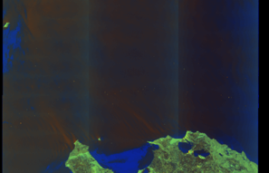
SAR coverage thumbnail
VIIRS Thermal Anomaly
Status: ✗ No detections
No VIIRS thermal/light detections in corridor
Show Raw Evidence JSON
{
    "gap_minutes": 294.1000000000000227373675443232059478759765625,
    "last_seen": {
        "ts": "2026-07-18T03:21:43+00:00",
        "lat": 37.07200499999999721012500231154263019561767578125,
        "lon": 12.1464850000000001983835318242199718952178955078125,
        "sog": 12.9000000000000003552713678800500929355621337890625,
        "zone_id": "discovered_155"
    },
    "next_seen": {
        "ts": "2026-07-18T08:15:52+00:00",
        "lat": 37.562894999999997480699676088988780975341796875,
        "lon": 10.9525500000000004519051799434237182140350341796875,
        "zone_ids": [
            "discovered_016"
        ]
    },
    "gap_enrichment": {
        "status": "done",
        "corridor": {
            "start": {
                "lat": 37.07200499999999721012500231154263019561767578125,
                "lon": 12.1464850000000001983835318242199718952178955078125,
                "ts": "2026-07-18T03:21:43+00:00"
            },
            "end": {
                "lat": 37.562894999999997480699676088988780975341796875,
                "lon": 10.9525500000000004519051799434237182140350341796875,
                "ts": "2026-07-18T08:15:52+00:00"
            },
            "bbox": {
                "min_lat": 36.8918249999999972033037920482456684112548828125,
                "min_lon": 10.72599100000000049703885451890528202056884765625,
                "max_lat": 37.74307499999999748752088635228574275970458984375,
                "max_lon": 12.37304400000000015324985724873840808868408203125
            },
            "buffer_km": 20
        },
        "sar": {
            "status": "snapshot",
            "scene_id": "S1C_IW_GRDH_1SDV_20260718T052024_20260718T052049_008593_011046_BF5D_COG",
            "scene_time": "2026-07-18T05:20:24.118246Z",
            "platform": "sentinel-1c",
            "assets": {
                "preview_url": "https:\/\/fleetleaks.com\/wp-content\/uploads\/fleetleaks-evidence\/sar-imagery\/2026\/07\/event_970582_thumbnail_20260718083018.png",
                "stored_path": "\/home\/fleetleaks\/public_html\/wp-content\/uploads\/fleetleaks-evidence\/sar-imagery\/2026\/07\/event_970582_thumbnail_20260718083018.png",
                "source": "copernicus_dataspace"
            },
            "notes": "SAR snapshot available for review"
        },
        "viirs": {
            "status": "not_found",
            "notes": "No VIIRS thermal\/light detections in corridor"
        },
        "searched_at": "2026-07-18T08:30:13.337271+00:00"
    }
}- Zone: Eastern Mediterranean Surveillance Zone
- Duration: 1h 21m
- Data Points: 20 AIS positions
- Period: 2026-07-14T17:01:57+00:00 to 2026-07-14T18:23:49+00:00
Show Raw Evidence JSON
{
    "zone_id": "discovered_041",
    "zone_name": "Eastern Mediterranean Surveillance Zone",
    "dwell_minutes": 81.900000000000005684341886080801486968994140625,
    "points_in_zone": 20,
    "first_point": {
        "ts": "2026-07-14T17:01:57+00:00",
        "lat": 34.69016500000000036152414395473897457122802734375,
        "lon": 33.355338299999999662759364582598209381103515625
    },
    "last_point": {
        "ts": "2026-07-14T18:23:49+00:00",
        "lat": 34.61995499999999736928657512180507183074951171875,
        "lon": 33.2979332999999968478732625953853130340576171875
    }
}- Zone: Eastern Mediterranean Surveillance Zone
- Duration: 2h 18m
- Data Points: 24 AIS positions
- Period: 2026-07-14T16:05:12+00:00 to 2026-07-14T18:23:49+00:00
Show Raw Evidence JSON
{
    "zone_id": "discovered_041",
    "zone_name": "Eastern Mediterranean Surveillance Zone",
    "dwell_minutes": 138.599999999999994315658113919198513031005859375,
    "points_in_zone": 24,
    "first_point": {
        "ts": "2026-07-14T16:05:12+00:00",
        "lat": 34.69008170000000035315679269842803478240966796875,
        "lon": 33.35540329999999897836460149846971035003662109375
    },
    "last_point": {
        "ts": "2026-07-14T18:23:49+00:00",
        "lat": 34.61995499999999736928657512180507183074951171875,
        "lon": 33.2979332999999968478732625953853130340576171875
    }
}- Duration: 1h 38m
- Radius: 115 meters
- Data Points: 10 AIS positions
- Centroid: 34.6899, 33.3551
- Zone: Eastern Mediterranean Surveillance Zone
Show Raw Evidence JSON
{
    "radius_m": 115.2999999999999971578290569595992565155029296875,
    "duration_minutes": 98.900000000000005684341886080801486968994140625,
    "points": 10,
    "centroid": {
        "lat": 34.689928170000001728112692944705486297607421875,
        "lon": 33.355085489999993342280504293739795684814453125
    },
    "bbox": {
        "min_lat": 34.68936000000000063892002799548208713531494140625,
        "min_lon": 33.35403170000000017125785234384238719940185546875,
        "max_lat": 34.69016500000000036152414395473897457122802734375,
        "max_lon": 33.35540329999999897836460149846971035003662109375
    },
    "zone_id": "discovered_041"
}- Zone: Eastern Mediterranean Surveillance Zone
- Duration: 3h 20m
- Data Points: 30 AIS positions
- Period: 2026-07-14T15:03:09+00:00 to 2026-07-14T18:23:49+00:00
Show Raw Evidence JSON
{
    "zone_id": "discovered_041",
    "zone_name": "Eastern Mediterranean Surveillance Zone",
    "dwell_minutes": 200.69999999999998863131622783839702606201171875,
    "points_in_zone": 30,
    "first_point": {
        "ts": "2026-07-14T15:03:09+00:00",
        "lat": 34.69044000000000238514985539950430393218994140625,
        "lon": 33.35522329999999868732629693113267421722412109375
    },
    "last_point": {
        "ts": "2026-07-14T18:23:49+00:00",
        "lat": 34.61995499999999736928657512180507183074951171875,
        "lon": 33.2979332999999968478732625953853130340576171875
    }
}- Duration: 2h 41m
- Radius: 130 meters
- Data Points: 16 AIS positions
- Centroid: 34.6900, 33.3552
- Zone: Eastern Mediterranean Surveillance Zone
Show Raw Evidence JSON
{
    "radius_m": 129.599999999999994315658113919198513031005859375,
    "duration_minutes": 161,
    "points": 16,
    "centroid": {
        "lat": 34.69002813124999562433004030026495456695556640625,
        "lon": 33.35519144999999952005964587442576885223388671875
    },
    "bbox": {
        "min_lat": 34.68936000000000063892002799548208713531494140625,
        "min_lon": 33.35403170000000017125785234384238719940185546875,
        "max_lat": 34.69044000000000238514985539950430393218994140625,
        "max_lon": 33.3554366999999984955138643272221088409423828125
    },
    "zone_id": "discovered_041"
}- Zone: Eastern Mediterranean Surveillance Zone
- Duration: 4h 19m
- Data Points: 35 AIS positions
- Period: 2026-07-14T14:03:58+00:00 to 2026-07-14T18:23:49+00:00
Show Raw Evidence JSON
{
    "zone_id": "discovered_041",
    "zone_name": "Eastern Mediterranean Surveillance Zone",
    "dwell_minutes": 259.8999999999999772626324556767940521240234375,
    "points_in_zone": 35,
    "first_point": {
        "ts": "2026-07-14T14:03:58+00:00",
        "lat": 34.69033830000000051541064749471843242645263671875,
        "lon": 33.3554816999999985682734404690563678741455078125
    },
    "last_point": {
        "ts": "2026-07-14T18:23:49+00:00",
        "lat": 34.61995499999999736928657512180507183074951171875,
        "lon": 33.2979332999999968478732625953853130340576171875
    }
}- Duration: 3h 40m
- Radius: 136 meters
- Data Points: 21 AIS positions
- Centroid: 34.6901, 33.3552
- Zone: Eastern Mediterranean Surveillance Zone
Show Raw Evidence JSON
{
    "radius_m": 136.099999999999994315658113919198513031005859375,
    "duration_minutes": 220.19999999999998863131622783839702606201171875,
    "points": 21,
    "centroid": {
        "lat": 34.69010063333333704349570325575768947601318359375,
        "lon": 33.355215233333325386411161161959171295166015625
    },
    "bbox": {
        "min_lat": 34.68936000000000063892002799548208713531494140625,
        "min_lon": 33.35403170000000017125785234384238719940185546875,
        "max_lat": 34.6904832999999968023985275067389011383056640625,
        "max_lon": 33.3554816999999985682734404690563678741455078125
    },
    "zone_id": "discovered_041"
}- Zone: Eastern Mediterranean Surveillance Zone
- Duration: 5h 22m
- Data Points: 44 AIS positions
- Period: 2026-07-14T13:01:33+00:00 to 2026-07-14T18:23:49+00:00
Show Raw Evidence JSON
{
    "zone_id": "discovered_041",
    "zone_name": "Eastern Mediterranean Surveillance Zone",
    "dwell_minutes": 322.30000000000001136868377216160297393798828125,
    "points_in_zone": 44,
    "first_point": {
        "ts": "2026-07-14T13:01:33+00:00",
        "lat": 34.68813829999999853725967113859951496124267578125,
        "lon": 33.359143299999999499050318263471126556396484375
    },
    "last_point": {
        "ts": "2026-07-14T18:23:49+00:00",
        "lat": 34.61995499999999736928657512180507183074951171875,
        "lon": 33.2979332999999968478732625953853130340576171875
    }
}- Duration: 4h 42m
- Radius: 533 meters
- Data Points: 30 AIS positions
- Centroid: 34.6895, 33.3554
- Zone: Eastern Mediterranean Surveillance Zone
Show Raw Evidence JSON
{
    "radius_m": 532.6000000000000227373675443232059478759765625,
    "duration_minutes": 282.6000000000000227373675443232059478759765625,
    "points": 30,
    "centroid": {
        "lat": 34.68951527666667544735901174135506153106689453125,
        "lon": 33.35544016000000056010321713984012603759765625
    },
    "bbox": {
        "min_lat": 34.68509829999999993788151186890900135040283203125,
        "min_lon": 33.353561700000000200816430151462554931640625,
        "max_lat": 34.6904832999999968023985275067389011383056640625,
        "max_lon": 33.359143299999999499050318263471126556396484375
    },
    "zone_id": "discovered_041"
}- Duration: 4h 46m
- Radius: 532 meters
- Data Points: 32 AIS positions
- Centroid: 34.6896, 33.3556
- Zone: Eastern Mediterranean Surveillance Zone
Show Raw Evidence JSON
{
    "radius_m": 531.8999999999999772626324556767940521240234375,
    "duration_minutes": 286.69999999999998863131622783839702606201171875,
    "points": 32,
    "centroid": {
        "lat": 34.68955749999999937926986603997647762298583984375,
        "lon": 33.355551971875001981970854103565216064453125
    },
    "bbox": {
        "min_lat": 34.68509829999999993788151186890900135040283203125,
        "min_lon": 33.353561700000000200816430151462554931640625,
        "max_lat": 34.69089670000000324989741784520447254180908203125,
        "max_lon": 33.359143299999999499050318263471126556396484375
    },
    "zone_id": "discovered_041"
}- Zone: Eastern Mediterranean Surveillance Zone
- Duration: 6h 9m
- Data Points: 51 AIS positions
- Period: 2026-07-14T12:14:03+00:00 to 2026-07-14T18:23:49+00:00
Show Raw Evidence JSON
{
    "zone_id": "discovered_041",
    "zone_name": "Eastern Mediterranean Surveillance Zone",
    "dwell_minutes": 369.80000000000001136868377216160297393798828125,
    "points_in_zone": 51,
    "first_point": {
        "ts": "2026-07-14T12:14:03+00:00",
        "lat": 34.7097217000000028974682209081947803497314453125,
        "lon": 33.32304169999999743367880000732839107513427734375
    },
    "last_point": {
        "ts": "2026-07-14T18:23:49+00:00",
        "lat": 34.61995499999999736928657512180507183074951171875,
        "lon": 33.2979332999999968478732625953853130340576171875
    }
}- Zone: Eastern Mediterranean Surveillance Zone
- Duration: 6h 19m
- Data Points: 37 AIS positions
- Period: 2026-07-14T11:08:57+00:00 to 2026-07-14T17:28:31+00:00
Show Raw Evidence JSON
{
    "zone_id": "discovered_041",
    "zone_name": "Eastern Mediterranean Surveillance Zone",
    "dwell_minutes": 379.6000000000000227373675443232059478759765625,
    "points_in_zone": 37,
    "first_point": {
        "ts": "2026-07-14T11:08:57+00:00",
        "lat": 34.7097049999999995861799106933176517486572265625,
        "lon": 33.323031700000001364969648420810699462890625
    },
    "last_point": {
        "ts": "2026-07-14T17:28:31+00:00",
        "lat": 34.6895099999999985129761626012623310089111328125,
        "lon": 33.35438500000000061618266045115888118743896484375
    }
}- Zone: Eastern Mediterranean Surveillance Zone
- Duration: 6h 31m
- Data Points: 26 AIS positions
- Period: 2026-07-14T09:04:37+00:00 to 2026-07-14T15:35:42+00:00
Show Raw Evidence JSON
{
    "zone_id": "discovered_041",
    "zone_name": "Eastern Mediterranean Surveillance Zone",
    "dwell_minutes": 391.1000000000000227373675443232059478759765625,
    "points_in_zone": 26,
    "first_point": {
        "ts": "2026-07-14T09:04:37+00:00",
        "lat": 34.7097116999999997233317117206752300262451171875,
        "lon": 33.322976699999998118073563091456890106201171875
    },
    "last_point": {
        "ts": "2026-07-14T15:35:42+00:00",
        "lat": 34.69013499999999794454197399318218231201171875,
        "lon": 33.35540329999999897836460149846971035003662109375
    }
}- Zone: Eastern Mediterranean Surveillance Zone
- Duration: 6h 16m
- Data Points: 24 AIS positions
- Period: 2026-07-14T08:19:36+00:00 to 2026-07-14T14:36:33+00:00
Show Raw Evidence JSON
{
    "zone_id": "discovered_041",
    "zone_name": "Eastern Mediterranean Surveillance Zone",
    "dwell_minutes": 376.8999999999999772626324556767940521240234375,
    "points_in_zone": 24,
    "first_point": {
        "ts": "2026-07-14T08:19:36+00:00",
        "lat": 34.7097466999999966219547786749899387359619140625,
        "lon": 33.32296500000000349928086507134139537811279296875
    },
    "last_point": {
        "ts": "2026-07-14T14:36:33+00:00",
        "lat": 34.6904832999999968023985275067389011383056640625,
        "lon": 33.35515500000000344016370945610105991363525390625
    }
}- Zone: Eastern Mediterranean Surveillance Zone
- Duration: 6h 29m
- Data Points: 23 AIS positions
- Period: 2026-07-14T07:55:33+00:00 to 2026-07-14T14:25:23+00:00
Show Raw Evidence JSON
{
    "zone_id": "discovered_041",
    "zone_name": "Eastern Mediterranean Surveillance Zone",
    "dwell_minutes": 389.80000000000001136868377216160297393798828125,
    "points_in_zone": 23,
    "first_point": {
        "ts": "2026-07-14T07:55:33+00:00",
        "lat": 34.70972830000000186601027962751686573028564453125,
        "lon": 33.323025000000001227817847393453121185302734375
    },
    "last_point": {
        "ts": "2026-07-14T14:25:23+00:00",
        "lat": 34.69028999999999740566636319272220134735107421875,
        "lon": 33.3553016999999982772351359017193317413330078125
    }
}- Zone: Eastern Mediterranean Surveillance Zone
- Duration: 5h 3m
- Data Points: 5 AIS positions
- Period: 2026-07-14T04:01:38+00:00 to 2026-07-14T09:04:37+00:00
Show Raw Evidence JSON
{
    "zone_id": "discovered_041",
    "zone_name": "Eastern Mediterranean Surveillance Zone",
    "dwell_minutes": 303,
    "points_in_zone": 5,
    "first_point": {
        "ts": "2026-07-14T04:01:38+00:00",
        "lat": 34.709751699999998209023033268749713897705078125,
        "lon": 33.32300169999999894798747845925390720367431640625
    },
    "last_point": {
        "ts": "2026-07-14T09:04:37+00:00",
        "lat": 34.7097116999999997233317117206752300262451171875,
        "lon": 33.322976699999998118073563091456890106201171875
    }
}- Zone: Eastern Mediterranean Surveillance Zone
- Duration: 5h 51m
- Data Points: 8 AIS positions
- Period: 2026-07-14T03:13:35+00:00 to 2026-07-14T09:04:37+00:00
Show Raw Evidence JSON
{
    "zone_id": "discovered_041",
    "zone_name": "Eastern Mediterranean Surveillance Zone",
    "dwell_minutes": 351,
    "points_in_zone": 8,
    "first_point": {
        "ts": "2026-07-14T03:13:35+00:00",
        "lat": 34.70976329999999876463334658183157444000244140625,
        "lon": 33.32298829999999867368387640453875064849853515625
    },
    "last_point": {
        "ts": "2026-07-14T09:04:37+00:00",
        "lat": 34.7097116999999997233317117206752300262451171875,
        "lon": 33.322976699999998118073563091456890106201171875
    }
}- Zone: Eastern Mediterranean Surveillance Zone
- Duration: 6h 36m
- Data Points: 8 AIS positions
- Period: 2026-07-14T01:43:34+00:00 to 2026-07-14T08:19:36+00:00
Show Raw Evidence JSON
{
    "zone_id": "discovered_041",
    "zone_name": "Eastern Mediterranean Surveillance Zone",
    "dwell_minutes": 396,
    "points_in_zone": 8,
    "first_point": {
        "ts": "2026-07-14T01:43:34+00:00",
        "lat": 34.70977330000000193876985576935112476348876953125,
        "lon": 33.32301170000000212212398764677345752716064453125
    },
    "last_point": {
        "ts": "2026-07-14T08:19:36+00:00",
        "lat": 34.7097466999999966219547786749899387359619140625,
        "lon": 33.32296500000000349928086507134139537811279296875
    }
}- Duration: 6h 24m
- Radius: 4 meters
- Data Points: 11 AIS positions
- Centroid: 34.7098, 33.3230
- Zone: Eastern Mediterranean Surveillance Zone
Show Raw Evidence JSON
{
    "radius_m": 3.899999999999999911182158029987476766109466552734375,
    "duration_minutes": 384.1000000000000227373675443232059478759765625,
    "points": 11,
    "centroid": {
        "lat": 34.70975331818181786047716741450130939483642578125,
        "lon": 33.32300106363636160722307977266609668731689453125
    },
    "bbox": {
        "min_lat": 34.70971829999999869187377043999731540679931640625,
        "min_lon": 33.32298829999999867368387640453875064849853515625,
        "max_lat": 34.70977330000000193876985576935112476348876953125,
        "max_lon": 33.32301830000000109066604636609554290771484375
    },
    "zone_id": "discovered_041"
}- Zone: Eastern Mediterranean Surveillance Zone
- Duration: 6h 27m
- Data Points: 12 AIS positions
- Period: 2026-07-14T00:58:33+00:00 to 2026-07-14T07:25:37+00:00
Show Raw Evidence JSON
{
    "zone_id": "discovered_041",
    "zone_name": "Eastern Mediterranean Surveillance Zone",
    "dwell_minutes": 387.1000000000000227373675443232059478759765625,
    "points_in_zone": 12,
    "first_point": {
        "ts": "2026-07-14T00:58:33+00:00",
        "lat": 34.70973670000000055324562708847224712371826171875,
        "lon": 33.32301170000000212212398764677345752716064453125
    },
    "last_point": {
        "ts": "2026-07-14T07:25:37+00:00",
        "lat": 34.7097600000000028330759960226714611053466796875,
        "lon": 33.323008299999997916529537178575992584228515625
    }
}- Duration: 6h 27m
- Radius: 4 meters
- Data Points: 12 AIS positions
- Centroid: 34.7098, 33.3230
- Zone: Eastern Mediterranean Surveillance Zone
Show Raw Evidence JSON
{
    "radius_m": 3.70000000000000017763568394002504646778106689453125,
    "duration_minutes": 387.1000000000000227373675443232059478759765625,
    "points": 12,
    "centroid": {
        "lat": 34.70975193333332953216086025349795818328857421875,
        "lon": 33.32300194999999831679815542884171009063720703125
    },
    "bbox": {
        "min_lat": 34.70971829999999869187377043999731540679931640625,
        "min_lon": 33.32298829999999867368387640453875064849853515625,
        "max_lat": 34.70977330000000193876985576935112476348876953125,
        "max_lon": 33.32301830000000109066604636609554290771484375
    },
    "zone_id": "discovered_041"
}- Zone: Eastern Mediterranean Surveillance Zone
- Duration: 4h 32m
- Data Points: 19 AIS positions
- Period: 2026-07-13T23:28:44+00:00 to 2026-07-14T04:01:38+00:00
Show Raw Evidence JSON
{
    "zone_id": "discovered_041",
    "zone_name": "Eastern Mediterranean Surveillance Zone",
    "dwell_minutes": 272.8999999999999772626324556767940521240234375,
    "points_in_zone": 19,
    "first_point": {
        "ts": "2026-07-13T23:28:44+00:00",
        "lat": 34.709748300000001108855940401554107666015625,
        "lon": 33.32299669999999736091922386549413204193115234375
    },
    "last_point": {
        "ts": "2026-07-14T04:01:38+00:00",
        "lat": 34.709751699999998209023033268749713897705078125,
        "lon": 33.32300169999999894798747845925390720367431640625
    }
}- Duration: 4h 32m
- Radius: 5 meters
- Data Points: 19 AIS positions
- Centroid: 34.7098, 33.3230
- Zone: Eastern Mediterranean Surveillance Zone
Show Raw Evidence JSON
{
    "radius_m": 5.29999999999999982236431605997495353221893310546875,
    "duration_minutes": 272.8999999999999772626324556767940521240234375,
    "points": 19,
    "centroid": {
        "lat": 34.70975718421052391704506590031087398529052734375,
        "lon": 33.3229993947368399176411912776529788970947265625
    },
    "bbox": {
        "min_lat": 34.70971829999999869187377043999731540679931640625,
        "min_lon": 33.3229816999999997051418176852166652679443359375,
        "max_lat": 34.70980329999999725032466812990605831146240234375,
        "max_lon": 33.32301830000000109066604636609554290771484375
    },
    "zone_id": "discovered_041"
}- Minimum Distance: 49 meters
- Average Distance: 52 meters
- Duration: 2h 18m
- Period: 2026-07-13T23:26:58+00:00 to 2026-07-14T01:45:03+00:00
- Vessel A Avg Speed: 0.0 knots
- Vessel B Avg Speed: 0.0 knots
- Zone: Eastern Mediterranean Surveillance Zone
Confidence Analysis
High-confidence STS candidate. Two tankers (EPSILON SEA and HIGH FREEDOM) maintained close proximity (min 49m, avg 52m) for 138 minutes. Both vessels were slow-moving (avg speeds 0.0 and 0.0 knots). The stable separation distance suggests deliberate parallel positioning typical of cargo transfer. Event occurred in Eastern Mediterranean Surveillance Zone, a known STS activity area.
View scoring breakdown
| Factor | Score | Detail |
|---|---|---|
| Distance Tightness | 25/25 | Min distance 49m, avg 52m |
| Duration | 25/25 | Duration 138 minutes |
| Speed Stability | 20/20 | both nearly stationary; very stable speeds |
| Distance Consistency | 15/15 | Distance variance ±3m |
| Isolation | 5/10 | Isolation data not available |
| Context | 5/5 | In monitored zone: Eastern Mediterranean Surveillance Zone |
🛰️ Satellite Corroboration
No satellite imagery for this time/location
No Sentinel-1 scenes covering AOI and time window
Show Raw Evidence JSON
{
    "vessel_a": {
        "mmsi": 354198000,
        "imo": 9517290,
        "name": "EPSILON SEA",
        "flag": "PANAMA"
    },
    "vessel_b": {
        "mmsi": 636022700,
        "imo": 9674713,
        "name": "HIGH FREEDOM",
        "flag": "Liberia"
    },
    "min_distance_m": 49.2999999999999971578290569595992565155029296875,
    "avg_distance_m": 52.2999999999999971578290569595992565155029296875,
    "distance_consistency_m": 3,
    "duration_minutes": 138.099999999999994315658113919198513031005859375,
    "overlap_duration_s": 8285,
    "speed_a_avg": 0,
    "speed_a_std": 0,
    "speed_b_avg": 0,
    "speed_b_std": 0,
    "speed_summary": {
        "vessel_a": {
            "avg_sog": 0,
            "max_sog": 0
        },
        "vessel_b": {
            "avg_sog": 0,
            "max_sog": 0
        }
    },
    "time_window": {
        "start": "2026-07-13T23:26:58+00:00",
        "end": "2026-07-14T01:45:03+00:00"
    },
    "points_count": {
        "vessel_a": 7,
        "vessel_b": 7
    },
    "zone_id": "discovered_041",
    "zone_name": "Eastern Mediterranean Surveillance Zone",
    "score": {
        "value": 95,
        "components": {
            "distance_tightness": {
                "score": 25,
                "max": 25,
                "detail": "Min distance 49m, avg 52m"
            },
            "duration": {
                "score": 25,
                "max": 25,
                "detail": "Duration 138 minutes"
            },
            "speed_stability": {
                "score": 20,
                "max": 20,
                "detail": "both nearly stationary; very stable speeds"
            },
            "distance_consistency": {
                "score": 15,
                "max": 15,
                "detail": "Distance variance \u00b13m"
            },
            "isolation": {
                "score": 5,
                "max": 10,
                "detail": "Isolation data not available"
            },
            "context": {
                "score": 5,
                "max": 5,
                "detail": "In monitored zone: Eastern Mediterranean Surveillance Zone"
            }
        },
        "summary": "High-confidence STS candidate. Two tankers (EPSILON SEA and HIGH FREEDOM) maintained close proximity (min 49m, avg 52m) for 138 minutes. Both vessels were slow-moving (avg speeds 0.0 and 0.0 knots). The stable separation distance suggests deliberate parallel positioning typical of cargo transfer. Event occurred in Eastern Mediterranean Surveillance Zone, a known STS activity area."
    },
    "sar": {
        "status": "not_found",
        "centroid": {
            "lat": 34.7099907999999999219653545878827571868896484375,
            "lon": 33.322922599999998283237800933420658111572265625
        },
        "time_window": {
            "start_ts": "2026-07-13T23:26:58+00:00",
            "end_ts": "2026-07-14T01:45:03+00:00"
        },
        "searched_at": "2026-07-14T03:45:01.354011+00:00",
        "notes": "No Sentinel-1 scenes covering AOI and time window"
    }
}- Minimum Distance: 50 meters
- Average Distance: 53 meters
- Duration: 1h 38m
- Period: 2026-07-13T22:55:45+00:00 to 2026-07-14T00:34:34+00:00
- Vessel A Avg Speed: 0.0 knots
- Vessel B Avg Speed: 0.0 knots
- Zone: Eastern Mediterranean Surveillance Zone
Confidence Analysis
High-confidence STS candidate. Two tankers (HIGH FREEDOM and EPSILON SEA) maintained close proximity (min 50m, avg 53m) for 99 minutes. Both vessels were slow-moving (avg speeds 0.0 and 0.0 knots). The stable separation distance suggests deliberate parallel positioning typical of cargo transfer. Event occurred in Eastern Mediterranean Surveillance Zone, a known STS activity area.
View scoring breakdown
| Factor | Score | Detail |
|---|---|---|
| Distance Tightness | 25/25 | Min distance 50m, avg 53m |
| Duration | 20/25 | Duration 99 minutes |
| Speed Stability | 20/20 | both nearly stationary; very stable speeds |
| Distance Consistency | 15/15 | Distance variance ±3m |
| Isolation | 5/10 | Isolation data not available |
| Context | 5/5 | In monitored zone: Eastern Mediterranean Surveillance Zone |
Show Raw Evidence JSON
{
    "vessel_a": {
        "mmsi": 636022700,
        "imo": 9674713,
        "name": "HIGH FREEDOM",
        "flag": "Liberia"
    },
    "vessel_b": {
        "mmsi": 354198000,
        "imo": 9517290,
        "name": "EPSILON SEA",
        "flag": "PANAMA"
    },
    "min_distance_m": 49.7000000000000028421709430404007434844970703125,
    "avg_distance_m": 53.2999999999999971578290569595992565155029296875,
    "distance_consistency_m": 3.29999999999999982236431605997495353221893310546875,
    "duration_minutes": 98.7999999999999971578290569595992565155029296875,
    "overlap_duration_s": 5929,
    "speed_a_avg": 0,
    "speed_a_std": 0,
    "speed_b_avg": 0,
    "speed_b_std": 0,
    "speed_summary": {
        "vessel_a": {
            "avg_sog": 0,
            "max_sog": 0
        },
        "vessel_b": {
            "avg_sog": 0,
            "max_sog": 0
        }
    },
    "time_window": {
        "start": "2026-07-13T22:55:45+00:00",
        "end": "2026-07-14T00:34:34+00:00"
    },
    "points_count": {
        "vessel_a": 9,
        "vessel_b": 9
    },
    "zone_id": "discovered_041",
    "zone_name": "Eastern Mediterranean Surveillance Zone",
    "score": {
        "value": 90,
        "components": {
            "distance_tightness": {
                "score": 25,
                "max": 25,
                "detail": "Min distance 50m, avg 53m"
            },
            "duration": {
                "score": 20,
                "max": 25,
                "detail": "Duration 99 minutes"
            },
            "speed_stability": {
                "score": 20,
                "max": 20,
                "detail": "both nearly stationary; very stable speeds"
            },
            "distance_consistency": {
                "score": 15,
                "max": 15,
                "detail": "Distance variance \u00b13m"
            },
            "isolation": {
                "score": 5,
                "max": 10,
                "detail": "Isolation data not available"
            },
            "context": {
                "score": 5,
                "max": 5,
                "detail": "In monitored zone: Eastern Mediterranean Surveillance Zone"
            }
        },
        "summary": "High-confidence STS candidate. Two tankers (HIGH FREEDOM and EPSILON SEA) maintained close proximity (min 50m, avg 53m) for 99 minutes. Both vessels were slow-moving (avg speeds 0.0 and 0.0 knots). The stable separation distance suggests deliberate parallel positioning typical of cargo transfer. Event occurred in Eastern Mediterranean Surveillance Zone, a known STS activity area."
    }
}- Zone: Eastern Mediterranean Surveillance Zone
- Duration: 5h 5m
- Data Points: 20 AIS positions
- Period: 2026-07-13T22:55:45+00:00 to 2026-07-14T04:01:38+00:00
Show Raw Evidence JSON
{
    "zone_id": "discovered_041",
    "zone_name": "Eastern Mediterranean Surveillance Zone",
    "dwell_minutes": 305.8999999999999772626324556767940521240234375,
    "points_in_zone": 20,
    "first_point": {
        "ts": "2026-07-13T22:55:45+00:00",
        "lat": 34.70973330000000345307853422127664089202880859375,
        "lon": 33.32299330000000026075213099829852581024169921875
    },
    "last_point": {
        "ts": "2026-07-14T04:01:38+00:00",
        "lat": 34.709751699999998209023033268749713897705078125,
        "lon": 33.32300169999999894798747845925390720367431640625
    }
}- Duration: 5h 5m
- Radius: 5 meters
- Data Points: 20 AIS positions
- Centroid: 34.7098, 33.3230
- Zone: Eastern Mediterranean Surveillance Zone
Show Raw Evidence JSON
{
    "radius_m": 5.4000000000000003552713678800500929355621337890625,
    "duration_minutes": 305.8999999999999772626324556767940521240234375,
    "points": 20,
    "centroid": {
        "lat": 34.7097559900000049992740969173610210418701171875,
        "lon": 33.32299908999999615843989886343479156494140625
    },
    "bbox": {
        "min_lat": 34.70971829999999869187377043999731540679931640625,
        "min_lon": 33.3229816999999997051418176852166652679443359375,
        "max_lat": 34.70980329999999725032466812990605831146240234375,
        "max_lon": 33.32301830000000109066604636609554290771484375
    },
    "zone_id": "discovered_041"
}- Zone: Eastern Mediterranean Surveillance Zone
- Duration: 6h 29m
- Data Points: 22 AIS positions
- Period: 2026-07-13T21:31:43+00:00 to 2026-07-14T04:01:38+00:00
Show Raw Evidence JSON
{
    "zone_id": "discovered_041",
    "zone_name": "Eastern Mediterranean Surveillance Zone",
    "dwell_minutes": 389.8999999999999772626324556767940521240234375,
    "points_in_zone": 22,
    "first_point": {
        "ts": "2026-07-13T21:31:43+00:00",
        "lat": 34.709748300000001108855940401554107666015625,
        "lon": 33.322976699999998118073563091456890106201171875
    },
    "last_point": {
        "ts": "2026-07-14T04:01:38+00:00",
        "lat": 34.709751699999998209023033268749713897705078125,
        "lon": 33.32300169999999894798747845925390720367431640625
    }
}- Duration: 6h 29m
- Radius: 6 meters
- Data Points: 22 AIS positions
- Centroid: 34.7098, 33.3230
- Zone: Eastern Mediterranean Surveillance Zone
Show Raw Evidence JSON
{
    "radius_m": 5.5999999999999996447286321199499070644378662109375,
    "duration_minutes": 389.8999999999999772626324556767940521240234375,
    "points": 22,
    "centroid": {
        "lat": 34.7097554454545473845428205095231533050537109375,
        "lon": 33.3229970545454534658347256481647491455078125
    },
    "bbox": {
        "min_lat": 34.70971829999999869187377043999731540679931640625,
        "min_lon": 33.322976699999998118073563091456890106201171875,
        "max_lat": 34.70980329999999725032466812990605831146240234375,
        "max_lon": 33.32301830000000109066604636609554290771484375
    },
    "zone_id": "discovered_041"
}- Zone: Eastern Mediterranean Surveillance Zone
- Duration: 6h 38m
- Data Points: 22 AIS positions
- Period: 2026-07-13T20:40:38+00:00 to 2026-07-14T03:19:33+00:00
Show Raw Evidence JSON
{
    "zone_id": "discovered_041",
    "zone_name": "Eastern Mediterranean Surveillance Zone",
    "dwell_minutes": 398.8999999999999772626324556767940521240234375,
    "points_in_zone": 22,
    "first_point": {
        "ts": "2026-07-13T20:40:38+00:00",
        "lat": 34.7097466999999966219547786749899387359619140625,
        "lon": 33.32300169999999894798747845925390720367431640625
    },
    "last_point": {
        "ts": "2026-07-14T03:19:33+00:00",
        "lat": 34.70976999999999890178514760918915271759033203125,
        "lon": 33.32298999999999722376742283813655376434326171875
    }
}- Duration: 6h 38m
- Radius: 5 meters
- Data Points: 22 AIS positions
- Centroid: 34.7098, 33.3230
- Zone: Eastern Mediterranean Surveillance Zone
Show Raw Evidence JSON
{
    "radius_m": 5.29999999999999982236431605997495353221893310546875,
    "duration_minutes": 398.8999999999999772626324556767940521240234375,
    "points": 22,
    "centroid": {
        "lat": 34.70975756818182134111339109949767589569091796875,
        "lon": 33.3229969772727372401277534663677215576171875
    },
    "bbox": {
        "min_lat": 34.70972830000000186601027962751686573028564453125,
        "min_lon": 33.322976699999998118073563091456890106201171875,
        "max_lat": 34.70980329999999725032466812990605831146240234375,
        "max_lon": 33.32301830000000109066604636609554290771484375
    },
    "zone_id": "discovered_041"
}- Zone: Eastern Mediterranean Surveillance Zone
- Duration: 6h 32m
- Data Points: 22 AIS positions
- Period: 2026-07-13T19:01:46+00:00 to 2026-07-14T01:34:36+00:00
Show Raw Evidence JSON
{
    "zone_id": "discovered_041",
    "zone_name": "Eastern Mediterranean Surveillance Zone",
    "dwell_minutes": 392.80000000000001136868377216160297393798828125,
    "points_in_zone": 22,
    "first_point": {
        "ts": "2026-07-13T19:01:46+00:00",
        "lat": 34.70977500000000048885340220294892787933349609375,
        "lon": 33.3230649999999997135091689415276050567626953125
    },
    "last_point": {
        "ts": "2026-07-14T01:34:36+00:00",
        "lat": 34.7097449999999980718712322413921356201171875,
        "lon": 33.32301830000000109066604636609554290771484375
    }
}- Duration: 6h 32m
- Radius: 6 meters
- Data Points: 22 AIS positions
- Centroid: 34.7098, 33.3230
- Zone: Eastern Mediterranean Surveillance Zone
Show Raw Evidence JSON
{
    "radius_m": 6.29999999999999982236431605997495353221893310546875,
    "duration_minutes": 392.80000000000001136868377216160297393798828125,
    "points": 22,
    "centroid": {
        "lat": 34.70975461818181173612174461595714092254638671875,
        "lon": 33.323000990909093843583832494914531707763671875
    },
    "bbox": {
        "min_lat": 34.70972830000000186601027962751686573028564453125,
        "min_lon": 33.322976699999998118073563091456890106201171875,
        "max_lat": 34.70980329999999725032466812990605831146240234375,
        "max_lon": 33.3230649999999997135091689415276050567626953125
    },
    "zone_id": "discovered_041"
}- Zone: Eastern Mediterranean Surveillance Zone
- Duration: 6h 15m
- Data Points: 16 AIS positions
- Period: 2026-07-13T17:55:39+00:00 to 2026-07-14T00:10:58+00:00
Show Raw Evidence JSON
{
    "zone_id": "discovered_041",
    "zone_name": "Eastern Mediterranean Surveillance Zone",
    "dwell_minutes": 375.30000000000001136868377216160297393798828125,
    "points_in_zone": 16,
    "first_point": {
        "ts": "2026-07-13T17:55:39+00:00",
        "lat": 34.70973000000000041609382606111466884613037109375,
        "lon": 33.32298329999999708661562181077897548675537109375
    },
    "last_point": {
        "ts": "2026-07-14T00:10:58+00:00",
        "lat": 34.70976999999999890178514760918915271759033203125,
        "lon": 33.32301170000000212212398764677345752716064453125
    }
}- Duration: 6h 15m
- Radius: 7 meters
- Data Points: 16 AIS positions
- Centroid: 34.7098, 33.3230
- Zone: Eastern Mediterranean Surveillance Zone
Show Raw Evidence JSON
{
    "radius_m": 6.5999999999999996447286321199499070644378662109375,
    "duration_minutes": 375.30000000000001136868377216160297393798828125,
    "points": 16,
    "centroid": {
        "lat": 34.70975260624999947367541608400642871856689453125,
        "lon": 33.32299802500000396321411244571208953857421875
    },
    "bbox": {
        "min_lat": 34.70972830000000186601027962751686573028564453125,
        "min_lon": 33.322976699999998118073563091456890106201171875,
        "max_lat": 34.70978670000000221307345782406628131866455078125,
        "max_lon": 33.3230649999999997135091689415276050567626953125
    },
    "zone_id": "discovered_041"
}- Minimum Distance: 50 meters
- Average Distance: 55 meters
- Duration: 4h 17m
- Period: 2026-07-13T16:24:38+00:00 to 2026-07-13T20:41:56+00:00
- Vessel A Avg Speed: 0.0 knots
- Vessel B Avg Speed: 0.0 knots
- Zone: Eastern Mediterranean Surveillance Zone
Confidence Analysis
High-confidence STS candidate. Two tankers (EPSILON SEA and HIGH FREEDOM) maintained close proximity (min 50m, avg 55m) for 257 minutes. Both vessels were slow-moving (avg speeds 0.0 and 0.0 knots). The stable separation distance suggests deliberate parallel positioning typical of cargo transfer. Event occurred in Eastern Mediterranean Surveillance Zone, a known STS activity area.
View scoring breakdown
| Factor | Score | Detail |
|---|---|---|
| Distance Tightness | 25/25 | Min distance 50m, avg 55m |
| Duration | 25/25 | Duration 257 minutes |
| Speed Stability | 20/20 | both nearly stationary; very stable speeds |
| Distance Consistency | 15/15 | Distance variance ±4m |
| Isolation | 5/10 | Isolation data not available |
| Context | 5/5 | In monitored zone: Eastern Mediterranean Surveillance Zone |
🛰️ Satellite Corroboration
No satellite imagery for this time/location
No Sentinel-1 scenes covering AOI and time window
Show Raw Evidence JSON
{
    "vessel_a": {
        "mmsi": 354198000,
        "imo": 9517290,
        "name": "EPSILON SEA",
        "flag": "PANAMA"
    },
    "vessel_b": {
        "mmsi": 636022700,
        "imo": 9674713,
        "name": "HIGH FREEDOM",
        "flag": "Liberia"
    },
    "min_distance_m": 49.7999999999999971578290569595992565155029296875,
    "avg_distance_m": 54.89999999999999857891452847979962825775146484375,
    "distance_consistency_m": 4.5,
    "duration_minutes": 257.30000000000001136868377216160297393798828125,
    "overlap_duration_s": 15438,
    "speed_a_avg": 0,
    "speed_a_std": 0,
    "speed_b_avg": 0,
    "speed_b_std": 0,
    "speed_summary": {
        "vessel_a": {
            "avg_sog": 0,
            "max_sog": 0
        },
        "vessel_b": {
            "avg_sog": 0,
            "max_sog": 0
        }
    },
    "time_window": {
        "start": "2026-07-13T16:24:38+00:00",
        "end": "2026-07-13T20:41:56+00:00"
    },
    "points_count": {
        "vessel_a": 3,
        "vessel_b": 3
    },
    "zone_id": "discovered_041",
    "zone_name": "Eastern Mediterranean Surveillance Zone",
    "score": {
        "value": 95,
        "components": {
            "distance_tightness": {
                "score": 25,
                "max": 25,
                "detail": "Min distance 50m, avg 55m"
            },
            "duration": {
                "score": 25,
                "max": 25,
                "detail": "Duration 257 minutes"
            },
            "speed_stability": {
                "score": 20,
                "max": 20,
                "detail": "both nearly stationary; very stable speeds"
            },
            "distance_consistency": {
                "score": 15,
                "max": 15,
                "detail": "Distance variance \u00b14m"
            },
            "isolation": {
                "score": 5,
                "max": 10,
                "detail": "Isolation data not available"
            },
            "context": {
                "score": 5,
                "max": 5,
                "detail": "In monitored zone: Eastern Mediterranean Surveillance Zone"
            }
        },
        "summary": "High-confidence STS candidate. Two tankers (EPSILON SEA and HIGH FREEDOM) maintained close proximity (min 50m, avg 55m) for 257 minutes. Both vessels were slow-moving (avg speeds 0.0 and 0.0 knots). The stable separation distance suggests deliberate parallel positioning typical of cargo transfer. Event occurred in Eastern Mediterranean Surveillance Zone, a known STS activity area."
    },
    "sar": {
        "status": "not_found",
        "centroid": {
            "lat": 34.710013099999997621125658042728900909423828125,
            "lon": 33.32292220000000071422618930228054523468017578125
        },
        "time_window": {
            "start_ts": "2026-07-13T16:24:38+00:00",
            "end_ts": "2026-07-13T20:41:56+00:00"
        },
        "searched_at": "2026-07-13T21:15:01.942056+00:00",
        "notes": "No Sentinel-1 scenes covering AOI and time window"
    }
}- Zone: Eastern Mediterranean Surveillance Zone
- Duration: 6h 24m
- Data Points: 14 AIS positions
- Period: 2026-07-13T16:31:39+00:00 to 2026-07-13T22:55:45+00:00
Show Raw Evidence JSON
{
    "zone_id": "discovered_041",
    "zone_name": "Eastern Mediterranean Surveillance Zone",
    "dwell_minutes": 384.1000000000000227373675443232059478759765625,
    "points_in_zone": 14,
    "first_point": {
        "ts": "2026-07-13T16:31:39+00:00",
        "lat": 34.7097882999999995945472619496285915374755859375,
        "lon": 33.32299330000000026075213099829852581024169921875
    },
    "last_point": {
        "ts": "2026-07-13T22:55:45+00:00",
        "lat": 34.70973330000000345307853422127664089202880859375,
        "lon": 33.32299330000000026075213099829852581024169921875
    }
}- Duration: 6h 24m
- Radius: 8 meters
- Data Points: 14 AIS positions
- Centroid: 34.7098, 33.3230
- Zone: Eastern Mediterranean Surveillance Zone
Show Raw Evidence JSON
{
    "radius_m": 7.5999999999999996447286321199499070644378662109375,
    "duration_minutes": 384.1000000000000227373675443232059478759765625,
    "points": 14,
    "centroid": {
        "lat": 34.70975523571429022240408812649548053741455078125,
        "lon": 33.3229995214285708016177522949874401092529296875
    },
    "bbox": {
        "min_lat": 34.70973000000000041609382606111466884613037109375,
        "min_lon": 33.3229682999999994308382156305015087127685546875,
        "max_lat": 34.70982169999999911169652477838099002838134765625,
        "max_lon": 33.3230649999999997135091689415276050567626953125
    },
    "zone_id": "discovered_041"
}- Zone: Eastern Mediterranean Surveillance Zone
- Duration: 6h 21m
- Data Points: 16 AIS positions
- Period: 2026-07-13T15:13:36+00:00 to 2026-07-13T21:34:45+00:00
Show Raw Evidence JSON
{
    "zone_id": "discovered_041",
    "zone_name": "Eastern Mediterranean Surveillance Zone",
    "dwell_minutes": 381.1000000000000227373675443232059478759765625,
    "points_in_zone": 16,
    "first_point": {
        "ts": "2026-07-13T15:13:36+00:00",
        "lat": 34.7098016999999998688508640043437480926513671875,
        "lon": 33.32298829999999867368387640453875064849853515625
    },
    "last_point": {
        "ts": "2026-07-13T21:34:45+00:00",
        "lat": 34.709751699999998209023033268749713897705078125,
        "lon": 33.322976699999998118073563091456890106201171875
    }
}- Duration: 6h 21m
- Radius: 7 meters
- Data Points: 16 AIS positions
- Centroid: 34.7098, 33.3230
- Zone: Eastern Mediterranean Surveillance Zone
Show Raw Evidence JSON
{
    "radius_m": 6.79999999999999982236431605997495353221893310546875,
    "duration_minutes": 381.1000000000000227373675443232059478759765625,
    "points": 16,
    "centroid": {
        "lat": 34.709763756249998323255567811429500579833984375,
        "lon": 33.3229969812500002035449142567813396453857421875
    },
    "bbox": {
        "min_lat": 34.70973000000000041609382606111466884613037109375,
        "min_lon": 33.3229682999999994308382156305015087127685546875,
        "max_lat": 34.70982169999999911169652477838099002838134765625,
        "max_lon": 33.3230649999999997135091689415276050567626953125
    },
    "zone_id": "discovered_041"
}- Minimum Distance: 51 meters
- Average Distance: 164 meters
- Duration: 36 minutes
- Period: 2026-07-13T14:48:14+00:00 to 2026-07-13T15:24:39+00:00
- Vessel A Avg Speed: 0.7 knots
- Vessel B Avg Speed: 0.0 knots
- Zone: Eastern Mediterranean Surveillance Zone
Confidence Analysis
Low-confidence STS candidate - may warrant review. Two tankers (EPSILON SEA and HIGH FREEDOM) maintained close proximity (min 51m, avg 164m) for 36 minutes. Both vessels were slow-moving (avg speeds 0.7 and 0.0 knots). Event occurred in Eastern Mediterranean Surveillance Zone, a known STS activity area.
View scoring breakdown
| Factor | Score | Detail |
|---|---|---|
| Distance Tightness | 25/25 | Min distance 51m, avg 164m |
| Duration | 5/25 | Duration 36 minutes |
| Speed Stability | 12/20 | both very slow; somewhat variable speeds |
| Distance Consistency | 5/15 | Distance variance ±115m |
| Isolation | 5/10 | Isolation data not available |
| Context | 5/5 | In monitored zone: Eastern Mediterranean Surveillance Zone |
🛰️ Satellite Corroboration
No satellite imagery for this time/location
No Sentinel-1 scenes covering AOI and time window
Show Raw Evidence JSON
{
    "vessel_a": {
        "mmsi": 354198000,
        "imo": 9517290,
        "name": "EPSILON SEA",
        "flag": "PANAMA"
    },
    "vessel_b": {
        "mmsi": 636022700,
        "imo": 9674713,
        "name": "HIGH FREEDOM",
        "flag": "Liberia"
    },
    "min_distance_m": 50.60000000000000142108547152020037174224853515625,
    "avg_distance_m": 164.400000000000005684341886080801486968994140625,
    "distance_consistency_m": 115.099999999999994315658113919198513031005859375,
    "duration_minutes": 36.39999999999999857891452847979962825775146484375,
    "overlap_duration_s": 2185,
    "speed_a_avg": 0.7399999999999999911182158029987476766109466552734375,
    "speed_a_std": 0.75,
    "speed_b_avg": 0,
    "speed_b_std": 0,
    "speed_summary": {
        "vessel_a": {
            "avg_sog": 0.7399999999999999911182158029987476766109466552734375,
            "max_sog": 1.5
        },
        "vessel_b": {
            "avg_sog": 0,
            "max_sog": 0
        }
    },
    "time_window": {
        "start": "2026-07-13T14:48:14+00:00",
        "end": "2026-07-13T15:24:39+00:00"
    },
    "points_count": {
        "vessel_a": 5,
        "vessel_b": 5
    },
    "zone_id": "discovered_041",
    "zone_name": "Eastern Mediterranean Surveillance Zone",
    "score": {
        "value": 57,
        "components": {
            "distance_tightness": {
                "score": 25,
                "max": 25,
                "detail": "Min distance 51m, avg 164m"
            },
            "duration": {
                "score": 5,
                "max": 25,
                "detail": "Duration 36 minutes"
            },
            "speed_stability": {
                "score": 12,
                "max": 20,
                "detail": "both very slow; somewhat variable speeds"
            },
            "distance_consistency": {
                "score": 5,
                "max": 15,
                "detail": "Distance variance \u00b1115m"
            },
            "isolation": {
                "score": 5,
                "max": 10,
                "detail": "Isolation data not available"
            },
            "context": {
                "score": 5,
                "max": 5,
                "detail": "In monitored zone: Eastern Mediterranean Surveillance Zone"
            }
        },
        "summary": "Low-confidence STS candidate - may warrant review. Two tankers (EPSILON SEA and HIGH FREEDOM) maintained close proximity (min 51m, avg 164m) for 36 minutes. Both vessels were slow-moving (avg speeds 0.7 and 0.0 knots). Event occurred in Eastern Mediterranean Surveillance Zone, a known STS activity area."
    },
    "sar": {
        "status": "not_found",
        "centroid": {
            "lat": 34.710448200000001861553755588829517364501953125,
            "lon": 33.32333779999999734400262241251766681671142578125
        },
        "time_window": {
            "start_ts": "2026-07-13T14:48:14+00:00",
            "end_ts": "2026-07-13T15:24:39+00:00"
        },
        "searched_at": "2026-07-13T20:00:09.899014+00:00",
        "notes": "No Sentinel-1 scenes covering AOI and time window"
    }
}- Zone: Eastern Mediterranean Surveillance Zone
- Duration: 6h 39m
- Data Points: 20 AIS positions
- Period: 2026-07-13T14:10:37+00:00 to 2026-07-13T20:49:43+00:00
Show Raw Evidence JSON
{
    "zone_id": "discovered_041",
    "zone_name": "Eastern Mediterranean Surveillance Zone",
    "dwell_minutes": 399.1000000000000227373675443232059478759765625,
    "points_in_zone": 20,
    "first_point": {
        "ts": "2026-07-13T14:10:37+00:00",
        "lat": 34.70973500000000200316208065487444400787353515625,
        "lon": 33.322980000000001155058271251618862152099609375
    },
    "last_point": {
        "ts": "2026-07-13T20:49:43+00:00",
        "lat": 34.70976999999999890178514760918915271759033203125,
        "lon": 33.32300000000000039790393202565610408782958984375
    }
}- Duration: 6h 39m
- Radius: 7 meters
- Data Points: 20 AIS positions
- Centroid: 34.7098, 33.3230
- Zone: Eastern Mediterranean Surveillance Zone
Show Raw Evidence JSON
{
    "radius_m": 7,
    "duration_minutes": 399.1000000000000227373675443232059478759765625,
    "points": 20,
    "centroid": {
        "lat": 34.7097620100000057163924793712794780731201171875,
        "lon": 33.32299816500000133601133711636066436767578125
    },
    "bbox": {
        "min_lat": 34.7097150000000027603164198808372020721435546875,
        "min_lon": 33.3229682999999994308382156305015087127685546875,
        "max_lat": 34.70982169999999911169652477838099002838134765625,
        "max_lon": 33.3230649999999997135091689415276050567626953125
    },
    "zone_id": "discovered_041"
}- Zone: Eastern Mediterranean Surveillance Zone
- Duration: 6h 11m
- Data Points: 19 AIS positions
- Period: 2026-07-13T13:55:43+00:00 to 2026-07-13T20:07:37+00:00
Show Raw Evidence JSON
{
    "zone_id": "discovered_041",
    "zone_name": "Eastern Mediterranean Surveillance Zone",
    "dwell_minutes": 371.8999999999999772626324556767940521240234375,
    "points_in_zone": 19,
    "first_point": {
        "ts": "2026-07-13T13:55:43+00:00",
        "lat": 34.70976999999999890178514760918915271759033203125,
        "lon": 33.32300670000000053505573305301368236541748046875
    },
    "last_point": {
        "ts": "2026-07-13T20:07:37+00:00",
        "lat": 34.70973000000000041609382606111466884613037109375,
        "lon": 33.32301830000000109066604636609554290771484375
    }
}- Duration: 6h 11m
- Radius: 7 meters
- Data Points: 19 AIS positions
- Centroid: 34.7098, 33.3230
- Zone: Eastern Mediterranean Surveillance Zone
Show Raw Evidence JSON
{
    "radius_m": 6.5999999999999996447286321199499070644378662109375,
    "duration_minutes": 371.8999999999999772626324556767940521240234375,
    "points": 19,
    "centroid": {
        "lat": 34.70976483157895842168727540411055088043212890625,
        "lon": 33.32299929473685295988616417162120342254638671875
    },
    "bbox": {
        "min_lat": 34.7097150000000027603164198808372020721435546875,
        "min_lon": 33.3229682999999994308382156305015087127685546875,
        "max_lat": 34.70982169999999911169652477838099002838134765625,
        "max_lon": 33.3230649999999997135091689415276050567626953125
    },
    "zone_id": "discovered_041"
}- Zone: Eastern Mediterranean Surveillance Zone
- Duration: 6h 27m
- Data Points: 20 AIS positions
- Period: 2026-07-13T12:34:39+00:00 to 2026-07-13T19:01:46+00:00
Show Raw Evidence JSON
{
    "zone_id": "discovered_041",
    "zone_name": "Eastern Mediterranean Surveillance Zone",
    "dwell_minutes": 387.1000000000000227373675443232059478759765625,
    "points_in_zone": 20,
    "first_point": {
        "ts": "2026-07-13T12:34:39+00:00",
        "lat": 34.7098117000000030429873731918632984161376953125,
        "lon": 33.32296999999999798092176206409931182861328125
    },
    "last_point": {
        "ts": "2026-07-13T19:01:46+00:00",
        "lat": 34.70977500000000048885340220294892787933349609375,
        "lon": 33.3230649999999997135091689415276050567626953125
    }
}- Duration: 6h 27m
- Radius: 6 meters
- Data Points: 20 AIS positions
- Centroid: 34.7098, 33.3230
- Zone: Eastern Mediterranean Surveillance Zone
Show Raw Evidence JSON
{
    "radius_m": 6.4000000000000003552713678800500929355621337890625,
    "duration_minutes": 387.1000000000000227373675443232059478759765625,
    "points": 20,
    "centroid": {
        "lat": 34.7097676750000090351022663526237010955810546875,
        "lon": 33.32299633000000227411874220706522464752197265625
    },
    "bbox": {
        "min_lat": 34.7097150000000027603164198808372020721435546875,
        "min_lon": 33.3229682999999994308382156305015087127685546875,
        "max_lat": 34.70982169999999911169652477838099002838134765625,
        "max_lon": 33.3230649999999997135091689415276050567626953125
    },
    "zone_id": "discovered_041"
}- Zone: Eastern Mediterranean Surveillance Zone
- Duration: 6h 3m
- Data Points: 23 AIS positions
- Period: 2026-07-13T11:52:39+00:00 to 2026-07-13T17:55:39+00:00
Show Raw Evidence JSON
{
    "zone_id": "discovered_041",
    "zone_name": "Eastern Mediterranean Surveillance Zone",
    "dwell_minutes": 363,
    "points_in_zone": 23,
    "first_point": {
        "ts": "2026-07-13T11:52:39+00:00",
        "lat": 34.70977500000000048885340220294892787933349609375,
        "lon": 33.32299499999999881083567743189632892608642578125
    },
    "last_point": {
        "ts": "2026-07-13T17:55:39+00:00",
        "lat": 34.70973000000000041609382606111466884613037109375,
        "lon": 33.32298329999999708661562181077897548675537109375
    }
}- Duration: 6h 3m
- Radius: 6 meters
- Data Points: 23 AIS positions
- Centroid: 34.7098, 33.3230
- Zone: Eastern Mediterranean Surveillance Zone
Show Raw Evidence JSON
{
    "radius_m": 6.29999999999999982236431605997495353221893310546875,
    "duration_minutes": 363,
    "points": 23,
    "centroid": {
        "lat": 34.70977022608695961025659926235675811767578125,
        "lon": 33.32299354782607991865006624720990657806396484375
    },
    "bbox": {
        "min_lat": 34.7097150000000027603164198808372020721435546875,
        "min_lon": 33.3229682999999994308382156305015087127685546875,
        "max_lat": 34.70982500000000214868123293854296207427978515625,
        "max_lon": 33.323021699999998190833139233291149139404296875
    },
    "zone_id": "discovered_041"
}- Zone: Eastern Mediterranean Surveillance Zone
- Duration: 6h 30m
- Data Points: 23 AIS positions
- Period: 2026-07-13T10:31:37+00:00 to 2026-07-13T17:01:43+00:00
Show Raw Evidence JSON
{
    "zone_id": "discovered_041",
    "zone_name": "Eastern Mediterranean Surveillance Zone",
    "dwell_minutes": 390.1000000000000227373675443232059478759765625,
    "points_in_zone": 23,
    "first_point": {
        "ts": "2026-07-13T10:31:37+00:00",
        "lat": 34.70977500000000048885340220294892787933349609375,
        "lon": 33.3229816999999997051418176852166652679443359375
    },
    "last_point": {
        "ts": "2026-07-13T17:01:43+00:00",
        "lat": 34.70973330000000345307853422127664089202880859375,
        "lon": 33.3229682999999994308382156305015087127685546875
    }
}- Duration: 6h 30m
- Radius: 6 meters
- Data Points: 23 AIS positions
- Centroid: 34.7098, 33.3230
- Zone: Eastern Mediterranean Surveillance Zone
Show Raw Evidence JSON
{
    "radius_m": 6.20000000000000017763568394002504646778106689453125,
    "duration_minutes": 390.1000000000000227373675443232059478759765625,
    "points": 23,
    "centroid": {
        "lat": 34.7097689217391263127865386195480823516845703125,
        "lon": 33.3229918086956473644022480584681034088134765625
    },
    "bbox": {
        "min_lat": 34.7097150000000027603164198808372020721435546875,
        "min_lon": 33.3229682999999994308382156305015087127685546875,
        "max_lat": 34.70982500000000214868123293854296207427978515625,
        "max_lon": 33.32301830000000109066604636609554290771484375
    },
    "zone_id": "discovered_041"
}- Zone: Eastern Mediterranean Surveillance Zone
- Duration: 6h 30m
- Data Points: 24 AIS positions
- Period: 2026-07-13T09:31:42+00:00 to 2026-07-13T16:01:41+00:00
Show Raw Evidence JSON
{
    "zone_id": "discovered_041",
    "zone_name": "Eastern Mediterranean Surveillance Zone",
    "dwell_minutes": 390,
    "points_in_zone": 24,
    "first_point": {
        "ts": "2026-07-13T09:31:42+00:00",
        "lat": 34.7097399999999964848029776476323604583740234375,
        "lon": 33.32300500000000198497218661941587924957275390625
    },
    "last_point": {
        "ts": "2026-07-13T16:01:41+00:00",
        "lat": 34.70978170000000062600520323030650615692138671875,
        "lon": 33.322976699999998118073563091456890106201171875
    }
}- Duration: 6h 30m
- Radius: 6 meters
- Data Points: 24 AIS positions
- Centroid: 34.7098, 33.3230
- Zone: Eastern Mediterranean Surveillance Zone
Show Raw Evidence JSON
{
    "radius_m": 6.20000000000000017763568394002504646778106689453125,
    "duration_minutes": 390,
    "points": 24,
    "centroid": {
        "lat": 34.70976931666665876718980143778026103973388671875,
        "lon": 33.32299430833334241697230027057230472564697265625
    },
    "bbox": {
        "min_lat": 34.7097150000000027603164198808372020721435546875,
        "min_lon": 33.32296999999999798092176206409931182861328125,
        "max_lat": 34.70982500000000214868123293854296207427978515625,
        "max_lon": 33.32301830000000109066604636609554290771484375
    },
    "zone_id": "discovered_041"
}- Zone: Eastern Mediterranean Surveillance Zone
- Duration: 6h 30m
- Data Points: 27 AIS positions
- Period: 2026-07-13T08:52:40+00:00 to 2026-07-13T15:22:41+00:00
Show Raw Evidence JSON
{
    "zone_id": "discovered_041",
    "zone_name": "Eastern Mediterranean Surveillance Zone",
    "dwell_minutes": 390,
    "points_in_zone": 27,
    "first_point": {
        "ts": "2026-07-13T08:52:40+00:00",
        "lat": 34.7097566999999997960912878625094890594482421875,
        "lon": 33.32298329999999708661562181077897548675537109375
    },
    "last_point": {
        "ts": "2026-07-13T15:22:41+00:00",
        "lat": 34.709796699999998281782609410583972930908203125,
        "lon": 33.3229867000000012922100722789764404296875
    }
}- Duration: 6h 30m
- Radius: 6 meters
- Data Points: 27 AIS positions
- Centroid: 34.7098, 33.3230
- Zone: Eastern Mediterranean Surveillance Zone
Show Raw Evidence JSON
{
    "radius_m": 6.20000000000000017763568394002504646778106689453125,
    "duration_minutes": 390,
    "points": 27,
    "centroid": {
        "lat": 34.70977050370370164955602376721799373626708984375,
        "lon": 33.32299555555555770069986465387046337127685546875
    },
    "bbox": {
        "min_lat": 34.7097150000000027603164198808372020721435546875,
        "min_lon": 33.32296999999999798092176206409931182861328125,
        "max_lat": 34.70982500000000214868123293854296207427978515625,
        "max_lon": 33.32301830000000109066604636609554290771484375
    },
    "zone_id": "discovered_041"
}- Zone: Eastern Mediterranean Surveillance Zone
- Duration: 6h 36m
- Data Points: 30 AIS positions
- Period: 2026-07-13T07:52:38+00:00 to 2026-07-13T14:28:41+00:00
Show Raw Evidence JSON
{
    "zone_id": "discovered_041",
    "zone_name": "Eastern Mediterranean Surveillance Zone",
    "dwell_minutes": 396.1000000000000227373675443232059478759765625,
    "points_in_zone": 30,
    "first_point": {
        "ts": "2026-07-13T07:52:38+00:00",
        "lat": 34.709706699999998136263457126915454864501953125,
        "lon": 33.322976699999998118073563091456890106201171875
    },
    "last_point": {
        "ts": "2026-07-13T14:28:41+00:00",
        "lat": 34.70973670000000055324562708847224712371826171875,
        "lon": 33.322980000000001155058271251618862152099609375
    }
}- Duration: 6h 36m
- Radius: 7 meters
- Data Points: 30 AIS positions
- Centroid: 34.7098, 33.3230
- Zone: Eastern Mediterranean Surveillance Zone
Show Raw Evidence JSON
{
    "radius_m": 7.20000000000000017763568394002504646778106689453125,
    "duration_minutes": 396.1000000000000227373675443232059478759765625,
    "points": 30,
    "centroid": {
        "lat": 34.70976016666667618437713827006518840789794921875,
        "lon": 33.3229939466666706948672072030603885650634765625
    },
    "bbox": {
        "min_lat": 34.709706699999998136263457126915454864501953125,
        "min_lon": 33.32296999999999798092176206409931182861328125,
        "max_lat": 34.70982500000000214868123293854296207427978515625,
        "max_lon": 33.3230166999999966037648846395313739776611328125
    },
    "zone_id": "discovered_041"
}- Zone: Eastern Mediterranean Surveillance Zone
- Duration: 6h 27m
- Data Points: 29 AIS positions
- Period: 2026-07-13T06:07:41+00:00 to 2026-07-13T12:34:39+00:00
Show Raw Evidence JSON
{
    "zone_id": "discovered_041",
    "zone_name": "Eastern Mediterranean Surveillance Zone",
    "dwell_minutes": 387,
    "points_in_zone": 29,
    "first_point": {
        "ts": "2026-07-13T06:07:41+00:00",
        "lat": 34.70973330000000345307853422127664089202880859375,
        "lon": 33.322976699999998118073563091456890106201171875
    },
    "last_point": {
        "ts": "2026-07-13T12:34:39+00:00",
        "lat": 34.7098117000000030429873731918632984161376953125,
        "lon": 33.32296999999999798092176206409931182861328125
    }
}- Duration: 6h 27m
- Radius: 7 meters
- Data Points: 29 AIS positions
- Centroid: 34.7098, 33.3230
- Zone: Eastern Mediterranean Surveillance Zone
Show Raw Evidence JSON
{
    "radius_m": 7.29999999999999982236431605997495353221893310546875,
    "duration_minutes": 387,
    "points": 29,
    "centroid": {
        "lat": 34.709759420689664466408430598676204681396484375,
        "lon": 33.32299247586206547566689550876617431640625
    },
    "bbox": {
        "min_lat": 34.709706699999998136263457126915454864501953125,
        "min_lon": 33.32296500000000349928086507134139537811279296875,
        "max_lat": 34.70982500000000214868123293854296207427978515625,
        "max_lon": 33.3230166999999966037648846395313739776611328125
    },
    "zone_id": "discovered_041"
}- Zone: Eastern Mediterranean Surveillance Zone
- Duration: 6h 33m
- Data Points: 30 AIS positions
- Period: 2026-07-13T05:55:38+00:00 to 2026-07-13T12:28:39+00:00
Show Raw Evidence JSON
{
    "zone_id": "discovered_041",
    "zone_name": "Eastern Mediterranean Surveillance Zone",
    "dwell_minutes": 393,
    "points_in_zone": 30,
    "first_point": {
        "ts": "2026-07-13T05:55:38+00:00",
        "lat": 34.70974170000000214031388168223202228546142578125,
        "lon": 33.32299830000000184782038559205830097198486328125
    },
    "last_point": {
        "ts": "2026-07-13T12:28:39+00:00",
        "lat": 34.7097849999999965575625537894666194915771484375,
        "lon": 33.32299830000000184782038559205830097198486328125
    }
}- Duration: 6h 33m
- Radius: 8 meters
- Data Points: 30 AIS positions
- Centroid: 34.7098, 33.3230
- Zone: Eastern Mediterranean Surveillance Zone
Show Raw Evidence JSON
{
    "radius_m": 7.5999999999999996447286321199499070644378662109375,
    "duration_minutes": 393,
    "points": 30,
    "centroid": {
        "lat": 34.70975643999999959987690090201795101165771484375,
        "lon": 33.32299344666666485181849566288292407989501953125
    },
    "bbox": {
        "min_lat": 34.709706699999998136263457126915454864501953125,
        "min_lon": 33.32296500000000349928086507134139537811279296875,
        "max_lat": 34.70982500000000214868123293854296207427978515625,
        "max_lon": 33.3230166999999966037648846395313739776611328125
    },
    "zone_id": "discovered_041"
}- Zone: Eastern Mediterranean Surveillance Zone
- Duration: 6h 9m
- Data Points: 28 AIS positions
- Period: 2026-07-13T04:22:36+00:00 to 2026-07-13T10:31:37+00:00
Show Raw Evidence JSON
{
    "zone_id": "discovered_041",
    "zone_name": "Eastern Mediterranean Surveillance Zone",
    "dwell_minutes": 369,
    "points_in_zone": 28,
    "first_point": {
        "ts": "2026-07-13T04:22:36+00:00",
        "lat": 34.7097566999999997960912878625094890594482421875,
        "lon": 33.32298999999999722376742283813655376434326171875
    },
    "last_point": {
        "ts": "2026-07-13T10:31:37+00:00",
        "lat": 34.70977500000000048885340220294892787933349609375,
        "lon": 33.3229816999999997051418176852166652679443359375
    }
}- Duration: 6h 9m
- Radius: 8 meters
- Data Points: 28 AIS positions
- Centroid: 34.7098, 33.3230
- Zone: Eastern Mediterranean Surveillance Zone
Show Raw Evidence JSON
{
    "radius_m": 7.9000000000000003552713678800500929355621337890625,
    "duration_minutes": 369,
    "points": 28,
    "centroid": {
        "lat": 34.70975178214285250533066573552787303924560546875,
        "lon": 33.32299506071428396580813569016754627227783203125
    },
    "bbox": {
        "min_lat": 34.709706699999998136263457126915454864501953125,
        "min_lon": 33.32296500000000349928086507134139537811279296875,
        "max_lat": 34.70982169999999911169652477838099002838134765625,
        "max_lon": 33.3230233000000026777343009598553180694580078125
    },
    "zone_id": "discovered_041"
}- Zone: Eastern Mediterranean Surveillance Zone
- Duration: 6h 32m
- Data Points: 23 AIS positions
- Period: 2026-07-13T02:40:44+00:00 to 2026-07-13T09:13:40+00:00
Show Raw Evidence JSON
{
    "zone_id": "discovered_041",
    "zone_name": "Eastern Mediterranean Surveillance Zone",
    "dwell_minutes": 392.8999999999999772626324556767940521240234375,
    "points_in_zone": 23,
    "first_point": {
        "ts": "2026-07-13T02:40:44+00:00",
        "lat": 34.70976329999999876463334658183157444000244140625,
        "lon": 33.3229850000000027421265258453786373138427734375
    },
    "last_point": {
        "ts": "2026-07-13T09:13:40+00:00",
        "lat": 34.7097882999999995945472619496285915374755859375,
        "lon": 33.32300670000000053505573305301368236541748046875
    }
}- Duration: 6h 32m
- Radius: 5 meters
- Data Points: 23 AIS positions
- Centroid: 34.7097, 33.3230
- Zone: Eastern Mediterranean Surveillance Zone
Show Raw Evidence JSON
{
    "radius_m": 4.79999999999999982236431605997495353221893310546875,
    "duration_minutes": 392.8999999999999772626324556767940521240234375,
    "points": 23,
    "centroid": {
        "lat": 34.709747530434782447628094814717769622802734375,
        "lon": 33.322992678260874299667193554341793060302734375
    },
    "bbox": {
        "min_lat": 34.709706699999998136263457126915454864501953125,
        "min_lon": 33.32296500000000349928086507134139537811279296875,
        "max_lat": 34.7097882999999995945472619496285915374755859375,
        "max_lon": 33.3230233000000026777343009598553180694580078125
    },
    "zone_id": "discovered_041"
}- Zone: Eastern Mediterranean Surveillance Zone
- Duration: 6h 33m
- Data Points: 19 AIS positions
- Period: 2026-07-13T01:34:38+00:00 to 2026-07-13T08:07:44+00:00
Show Raw Evidence JSON
{
    "zone_id": "discovered_041",
    "zone_name": "Eastern Mediterranean Surveillance Zone",
    "dwell_minutes": 393.1000000000000227373675443232059478759765625,
    "points_in_zone": 19,
    "first_point": {
        "ts": "2026-07-13T01:34:38+00:00",
        "lat": 34.709738299999997934719431214034557342529296875,
        "lon": 33.322976699999998118073563091456890106201171875
    },
    "last_point": {
        "ts": "2026-07-13T08:07:44+00:00",
        "lat": 34.709738299999997934719431214034557342529296875,
        "lon": 33.32298999999999722376742283813655376434326171875
    }
}- Duration: 6h 33m
- Radius: 5 meters
- Data Points: 19 AIS positions
- Centroid: 34.7097, 33.3230
- Zone: Eastern Mediterranean Surveillance Zone
Show Raw Evidence JSON
{
    "radius_m": 4.5999999999999996447286321199499070644378662109375,
    "duration_minutes": 393.1000000000000227373675443232059478759765625,
    "points": 19,
    "centroid": {
        "lat": 34.70974359473683534815791063010692596435546875,
        "lon": 33.32299333157894949408728280104696750640869140625
    },
    "bbox": {
        "min_lat": 34.709706699999998136263457126915454864501953125,
        "min_lon": 33.32296500000000349928086507134139537811279296875,
        "max_lat": 34.7097849999999965575625537894666194915771484375,
        "max_lon": 33.3230233000000026777343009598553180694580078125
    },
    "zone_id": "discovered_041"
}- Zone: Eastern Mediterranean Surveillance Zone
- Duration: 6h 33m
- Data Points: 19 AIS positions
- Period: 2026-07-13T00:40:37+00:00 to 2026-07-13T07:13:43+00:00
Show Raw Evidence JSON
{
    "zone_id": "discovered_041",
    "zone_name": "Eastern Mediterranean Surveillance Zone",
    "dwell_minutes": 393.1000000000000227373675443232059478759765625,
    "points_in_zone": 19,
    "first_point": {
        "ts": "2026-07-13T00:40:37+00:00",
        "lat": 34.7097432999999995217876858077943325042724609375,
        "lon": 33.32297330000000101790647022426128387451171875
    },
    "last_point": {
        "ts": "2026-07-13T07:13:43+00:00",
        "lat": 34.7097399999999964848029776476323604583740234375,
        "lon": 33.3229850000000027421265258453786373138427734375
    }
}- Duration: 6h 33m
- Radius: 4 meters
- Data Points: 19 AIS positions
- Centroid: 34.7097, 33.3230
- Zone: Eastern Mediterranean Surveillance Zone
Show Raw Evidence JSON
{
    "radius_m": 4,
    "duration_minutes": 393.1000000000000227373675443232059478759765625,
    "points": 19,
    "centroid": {
        "lat": 34.70974894210527139648547745309770107269287109375,
        "lon": 33.3229899052631566291893250308930873870849609375
    },
    "bbox": {
        "min_lat": 34.70973330000000345307853422127664089202880859375,
        "min_lon": 33.32296500000000349928086507134139537811279296875,
        "max_lat": 34.7097849999999965575625537894666194915771484375,
        "max_lon": 33.3230233000000026777343009598553180694580078125
    },
    "zone_id": "discovered_041"
}- Zone: Eastern Mediterranean Surveillance Zone
- Duration: 6h 27m
- Data Points: 21 AIS positions
- Period: 2026-07-12T23:40:38+00:00 to 2026-07-13T06:07:41+00:00
Show Raw Evidence JSON
{
    "zone_id": "discovered_041",
    "zone_name": "Eastern Mediterranean Surveillance Zone",
    "dwell_minutes": 387.1000000000000227373675443232059478759765625,
    "points_in_zone": 21,
    "first_point": {
        "ts": "2026-07-12T23:40:38+00:00",
        "lat": 34.70973330000000345307853422127664089202880859375,
        "lon": 33.32296670000000204936441150493919849395751953125
    },
    "last_point": {
        "ts": "2026-07-13T06:07:41+00:00",
        "lat": 34.70973330000000345307853422127664089202880859375,
        "lon": 33.322976699999998118073563091456890106201171875
    }
}- Duration: 6h 27m
- Radius: 4 meters
- Data Points: 21 AIS positions
- Centroid: 34.7097, 33.3230
- Zone: Eastern Mediterranean Surveillance Zone
Show Raw Evidence JSON
{
    "radius_m": 3.899999999999999911182158029987476766109466552734375,
    "duration_minutes": 387.1000000000000227373675443232059478759765625,
    "points": 21,
    "centroid": {
        "lat": 34.709749838095234508728026412427425384521484375,
        "lon": 33.32299070952382180621498264372348785400390625
    },
    "bbox": {
        "min_lat": 34.70973330000000345307853422127664089202880859375,
        "min_lon": 33.32296670000000204936441150493919849395751953125,
        "max_lat": 34.7097849999999965575625537894666194915771484375,
        "max_lon": 33.3230233000000026777343009598553180694580078125
    },
    "zone_id": "discovered_041"
}- Zone: Eastern Mediterranean Surveillance Zone
- Duration: 6h 30m
- Data Points: 28 AIS positions
- Period: 2026-07-12T22:01:37+00:00 to 2026-07-13T04:31:38+00:00
Show Raw Evidence JSON
{
    "zone_id": "discovered_041",
    "zone_name": "Eastern Mediterranean Surveillance Zone",
    "dwell_minutes": 390,
    "points_in_zone": 28,
    "first_point": {
        "ts": "2026-07-12T22:01:37+00:00",
        "lat": 34.70972499999999882902557146735489368438720703125,
        "lon": 33.32299499999999881083567743189632892608642578125
    },
    "last_point": {
        "ts": "2026-07-13T04:31:38+00:00",
        "lat": 34.70974170000000214031388168223202228546142578125,
        "lon": 33.3230233000000026777343009598553180694580078125
    }
}- Duration: 6h 30m
- Radius: 5 meters
- Data Points: 28 AIS positions
- Centroid: 34.7097, 33.3230
- Zone: Eastern Mediterranean Surveillance Zone
Show Raw Evidence JSON
{
    "radius_m": 5,
    "duration_minutes": 390,
    "points": 28,
    "centroid": {
        "lat": 34.70974773928571011083477060310542583465576171875,
        "lon": 33.3229889214285748266775044612586498260498046875
    },
    "bbox": {
        "min_lat": 34.7097150000000027603164198808372020721435546875,
        "min_lon": 33.32295330000000177506080945022404193878173828125,
        "max_lat": 34.7097849999999965575625537894666194915771484375,
        "max_lon": 33.3230233000000026777343009598553180694580078125
    },
    "zone_id": "discovered_041"
}- Zone: Eastern Mediterranean Surveillance Zone
- Duration: 5h 33m
- Data Points: 29 AIS positions
- Period: 2026-07-12T21:13:37+00:00 to 2026-07-13T02:46:45+00:00
Show Raw Evidence JSON
{
    "zone_id": "discovered_041",
    "zone_name": "Eastern Mediterranean Surveillance Zone",
    "dwell_minutes": 333.1000000000000227373675443232059478759765625,
    "points_in_zone": 29,
    "first_point": {
        "ts": "2026-07-12T21:13:37+00:00",
        "lat": 34.70978670000000221307345782406628131866455078125,
        "lon": 33.322980000000001155058271251618862152099609375
    },
    "last_point": {
        "ts": "2026-07-13T02:46:45+00:00",
        "lat": 34.7097849999999965575625537894666194915771484375,
        "lon": 33.32299330000000026075213099829852581024169921875
    }
}- Duration: 5h 33m
- Radius: 5 meters
- Data Points: 29 AIS positions
- Centroid: 34.7097, 33.3230
- Zone: Eastern Mediterranean Surveillance Zone
Show Raw Evidence JSON
{
    "radius_m": 4.5999999999999996447286321199499070644378662109375,
    "duration_minutes": 333.1000000000000227373675443232059478759765625,
    "points": 29,
    "centroid": {
        "lat": 34.709749424137925188915687613189220428466796875,
        "lon": 33.322985513793099698887090198695659637451171875
    },
    "bbox": {
        "min_lat": 34.7097150000000027603164198808372020721435546875,
        "min_lon": 33.32295330000000177506080945022404193878173828125,
        "max_lat": 34.70978670000000221307345782406628131866455078125,
        "max_lon": 33.3230166999999966037648846395313739776611328125
    },
    "zone_id": "discovered_041"
}- Zone: Eastern Mediterranean Surveillance Zone
- Duration: 6h 36m
- Data Points: 33 AIS positions
- Period: 2026-07-12T20:10:35+00:00 to 2026-07-13T02:46:45+00:00
Show Raw Evidence JSON
{
    "zone_id": "discovered_041",
    "zone_name": "Eastern Mediterranean Surveillance Zone",
    "dwell_minutes": 396.19999999999998863131622783839702606201171875,
    "points_in_zone": 33,
    "first_point": {
        "ts": "2026-07-12T20:10:35+00:00",
        "lat": 34.709796699999998281782609410583972930908203125,
        "lon": 33.32298829999999867368387640453875064849853515625
    },
    "last_point": {
        "ts": "2026-07-13T02:46:45+00:00",
        "lat": 34.7097849999999965575625537894666194915771484375,
        "lon": 33.32299330000000026075213099829852581024169921875
    }
}- Duration: 6h 36m
- Radius: 5 meters
- Data Points: 33 AIS positions
- Centroid: 34.7098, 33.3230
- Zone: Eastern Mediterranean Surveillance Zone
Show Raw Evidence JSON
{
    "radius_m": 5,
    "duration_minutes": 396.19999999999998863131622783839702606201171875,
    "points": 33,
    "centroid": {
        "lat": 34.70975126060606186229051672853529453277587890625,
        "lon": 33.32298676363635792085915454663336277008056640625
    },
    "bbox": {
        "min_lat": 34.7097150000000027603164198808372020721435546875,
        "min_lon": 33.32295330000000177506080945022404193878173828125,
        "max_lat": 34.709796699999998281782609410583972930908203125,
        "max_lon": 33.3230199999999996407495927996933460235595703125
    },
    "zone_id": "discovered_041"
}- Zone: Eastern Mediterranean Surveillance Zone
- Duration: 6h 36m
- Data Points: 31 AIS positions
- Period: 2026-07-12T19:52:31+00:00 to 2026-07-13T02:28:38+00:00
Show Raw Evidence JSON
{
    "zone_id": "discovered_041",
    "zone_name": "Eastern Mediterranean Surveillance Zone",
    "dwell_minutes": 396.1000000000000227373675443232059478759765625,
    "points_in_zone": 31,
    "first_point": {
        "ts": "2026-07-12T19:52:31+00:00",
        "lat": 34.70977500000000048885340220294892787933349609375,
        "lon": 33.32300169999999894798747845925390720367431640625
    },
    "last_point": {
        "ts": "2026-07-13T02:28:38+00:00",
        "lat": 34.709751699999998209023033268749713897705078125,
        "lon": 33.32298329999999708661562181077897548675537109375
    }
}- Duration: 6h 36m
- Radius: 5 meters
- Data Points: 31 AIS positions
- Centroid: 34.7098, 33.3230
- Zone: Eastern Mediterranean Surveillance Zone
Show Raw Evidence JSON
{
    "radius_m": 5.0999999999999996447286321199499070644378662109375,
    "duration_minutes": 396.1000000000000227373675443232059478759765625,
    "points": 31,
    "centroid": {
        "lat": 34.70975085806451687631124514155089855194091796875,
        "lon": 33.32298741612903114628352341242134571075439453125
    },
    "bbox": {
        "min_lat": 34.7097150000000027603164198808372020721435546875,
        "min_lon": 33.32295330000000177506080945022404193878173828125,
        "max_lat": 34.709796699999998281782609410583972930908203125,
        "max_lon": 33.3230199999999996407495927996933460235595703125
    },
    "zone_id": "discovered_041"
}- Zone: Eastern Mediterranean Surveillance Zone
- Duration: 6h 27m
- Data Points: 32 AIS positions
- Period: 2026-07-12T18:43:37+00:00 to 2026-07-13T01:10:38+00:00
Show Raw Evidence JSON
{
    "zone_id": "discovered_041",
    "zone_name": "Eastern Mediterranean Surveillance Zone",
    "dwell_minutes": 387,
    "points_in_zone": 32,
    "first_point": {
        "ts": "2026-07-12T18:43:37+00:00",
        "lat": 34.7097399999999964848029776476323604583740234375,
        "lon": 33.32300169999999894798747845925390720367431640625
    },
    "last_point": {
        "ts": "2026-07-13T01:10:38+00:00",
        "lat": 34.709748300000001108855940401554107666015625,
        "lon": 33.322976699999998118073563091456890106201171875
    }
}- Duration: 6h 27m
- Radius: 5 meters
- Data Points: 32 AIS positions
- Centroid: 34.7098, 33.3230
- Zone: Eastern Mediterranean Surveillance Zone
Show Raw Evidence JSON
{
    "radius_m": 5,
    "duration_minutes": 387,
    "points": 32,
    "centroid": {
        "lat": 34.7097512468750011294105206616222858428955078125,
        "lon": 33.3229884375000011687006917782127857208251953125
    },
    "bbox": {
        "min_lat": 34.7097150000000027603164198808372020721435546875,
        "min_lon": 33.32295330000000177506080945022404193878173828125,
        "max_lat": 34.709796699999998281782609410583972930908203125,
        "max_lon": 33.3230199999999996407495927996933460235595703125
    },
    "zone_id": "discovered_041"
}- Zone: Eastern Mediterranean Surveillance Zone
- Duration: 6h 27m
- Data Points: 26 AIS positions
- Period: 2026-07-12T17:37:31+00:00 to 2026-07-13T00:04:32+00:00
Show Raw Evidence JSON
{
    "zone_id": "discovered_041",
    "zone_name": "Eastern Mediterranean Surveillance Zone",
    "dwell_minutes": 387,
    "points_in_zone": 26,
    "first_point": {
        "ts": "2026-07-12T17:37:31+00:00",
        "lat": 34.70975829999999717756509198807179927825927734375,
        "lon": 33.322976699999998118073563091456890106201171875
    },
    "last_point": {
        "ts": "2026-07-13T00:04:32+00:00",
        "lat": 34.7097432999999995217876858077943325042724609375,
        "lon": 33.32300670000000053505573305301368236541748046875
    }
}- Duration: 6h 27m
- Radius: 5 meters
- Data Points: 26 AIS positions
- Centroid: 34.7098, 33.3230
- Zone: Eastern Mediterranean Surveillance Zone
Show Raw Evidence JSON
{
    "radius_m": 5.0999999999999996447286321199499070644378662109375,
    "duration_minutes": 387,
    "points": 26,
    "centroid": {
        "lat": 34.70975102307692594649779493920505046844482421875,
        "lon": 33.32298859230769494388368912041187286376953125
    },
    "bbox": {
        "min_lat": 34.7097150000000027603164198808372020721435546875,
        "min_lon": 33.32295330000000177506080945022404193878173828125,
        "max_lat": 34.709796699999998281782609410583972930908203125,
        "max_lon": 33.3230199999999996407495927996933460235595703125
    },
    "zone_id": "discovered_041"
}- Zone: Eastern Mediterranean Surveillance Zone
- Duration: 6h 33m
- Data Points: 25 AIS positions
- Period: 2026-07-12T16:55:36+00:00 to 2026-07-12T23:28:38+00:00
Show Raw Evidence JSON
{
    "zone_id": "discovered_041",
    "zone_name": "Eastern Mediterranean Surveillance Zone",
    "dwell_minutes": 393,
    "points_in_zone": 25,
    "first_point": {
        "ts": "2026-07-12T16:55:36+00:00",
        "lat": 34.7097667000000029702277970500290393829345703125,
        "lon": 33.32297330000000101790647022426128387451171875
    },
    "last_point": {
        "ts": "2026-07-12T23:28:38+00:00",
        "lat": 34.7097432999999995217876858077943325042724609375,
        "lon": 33.32296500000000349928086507134139537811279296875
    }
}- Duration: 6h 33m
- Radius: 5 meters
- Data Points: 25 AIS positions
- Centroid: 34.7098, 33.3230
- Zone: Eastern Mediterranean Surveillance Zone
Show Raw Evidence JSON
{
    "radius_m": 4.9000000000000003552713678800500929355621337890625,
    "duration_minutes": 393,
    "points": 25,
    "centroid": {
        "lat": 34.7097526680000072474285843782126903533935546875,
        "lon": 33.322988132000006089583621360361576080322265625
    },
    "bbox": {
        "min_lat": 34.7097150000000027603164198808372020721435546875,
        "min_lon": 33.32295330000000177506080945022404193878173828125,
        "max_lat": 34.709796699999998281782609410583972930908203125,
        "max_lon": 33.3230199999999996407495927996933460235595703125
    },
    "zone_id": "discovered_041"
}- Zone: Eastern Mediterranean Surveillance Zone
- Duration: 6h 30m
- Data Points: 25 AIS positions
- Period: 2026-07-12T15:55:37+00:00 to 2026-07-12T22:25:37+00:00
Show Raw Evidence JSON
{
    "zone_id": "discovered_041",
    "zone_name": "Eastern Mediterranean Surveillance Zone",
    "dwell_minutes": 390,
    "points_in_zone": 25,
    "first_point": {
        "ts": "2026-07-12T15:55:37+00:00",
        "lat": 34.7097899999999981446308083832263946533203125,
        "lon": 33.3229867000000012922100722789764404296875
    },
    "last_point": {
        "ts": "2026-07-12T22:25:37+00:00",
        "lat": 34.709755000000001246007741428911685943603515625,
        "lon": 33.3230166999999966037648846395313739776611328125
    }
}- Duration: 6h 30m
- Radius: 5 meters
- Data Points: 25 AIS positions
- Centroid: 34.7098, 33.3230
- Zone: Eastern Mediterranean Surveillance Zone
Show Raw Evidence JSON
{
    "radius_m": 4.9000000000000003552713678800500929355621337890625,
    "duration_minutes": 390,
    "points": 25,
    "centroid": {
        "lat": 34.709760864000003266482963226735591888427734375,
        "lon": 33.322991604000009147057426162064075469970703125
    },
    "bbox": {
        "min_lat": 34.70972499999999882902557146735489368438720703125,
        "min_lon": 33.32296500000000349928086507134139537811279296875,
        "max_lat": 34.7098050000000029058355721645057201385498046875,
        "max_lon": 33.3230199999999996407495927996933460235595703125
    },
    "zone_id": "discovered_041"
}- Zone: Eastern Mediterranean Surveillance Zone
- Duration: 6h 36m
- Data Points: 23 AIS positions
- Period: 2026-07-12T14:43:34+00:00 to 2026-07-12T21:19:33+00:00
Show Raw Evidence JSON
{
    "zone_id": "discovered_041",
    "zone_name": "Eastern Mediterranean Surveillance Zone",
    "dwell_minutes": 396,
    "points_in_zone": 23,
    "first_point": {
        "ts": "2026-07-12T14:43:34+00:00",
        "lat": 34.7097566999999997960912878625094890594482421875,
        "lon": 33.32301170000000212212398764677345752716064453125
    },
    "last_point": {
        "ts": "2026-07-12T21:19:33+00:00",
        "lat": 34.70976329999999876463334658183157444000244140625,
        "lon": 33.3229749999999995679900166578590869903564453125
    }
}- Duration: 6h 36m
- Radius: 4 meters
- Data Points: 23 AIS positions
- Centroid: 34.7098, 33.3230
- Zone: Eastern Mediterranean Surveillance Zone
Show Raw Evidence JSON
{
    "radius_m": 4.0999999999999996447286321199499070644378662109375,
    "duration_minutes": 396,
    "points": 23,
    "centroid": {
        "lat": 34.7097680434782631664347718469798564910888671875,
        "lon": 33.3229942782608787865683552809059619903564453125
    },
    "bbox": {
        "min_lat": 34.70973330000000345307853422127664089202880859375,
        "min_lon": 33.32297330000000101790647022426128387451171875,
        "max_lat": 34.7098050000000029058355721645057201385498046875,
        "max_lon": 33.3230199999999996407495927996933460235595703125
    },
    "zone_id": "discovered_041"
}- Zone: Eastern Mediterranean Surveillance Zone
- Duration: 6h 30m
- Data Points: 23 AIS positions
- Period: 2026-07-12T13:52:37+00:00 to 2026-07-12T20:22:36+00:00
Show Raw Evidence JSON
{
    "zone_id": "discovered_041",
    "zone_name": "Eastern Mediterranean Surveillance Zone",
    "dwell_minutes": 390,
    "points_in_zone": 23,
    "first_point": {
        "ts": "2026-07-12T13:52:37+00:00",
        "lat": 34.70977830000000352583811036311089992523193359375,
        "lon": 33.32300670000000053505573305301368236541748046875
    },
    "last_point": {
        "ts": "2026-07-12T20:22:36+00:00",
        "lat": 34.7097399999999964848029776476323604583740234375,
        "lon": 33.32300169999999894798747845925390720367431640625
    }
}- Duration: 6h 30m
- Radius: 4 meters
- Data Points: 23 AIS positions
- Centroid: 34.7098, 33.3230
- Zone: Eastern Mediterranean Surveillance Zone
Show Raw Evidence JSON
{
    "radius_m": 4.29999999999999982236431605997495353221893310546875,
    "duration_minutes": 390,
    "points": 23,
    "centroid": {
        "lat": 34.7097668826086902527094935066998004913330078125,
        "lon": 33.32299529565217000026677851565182209014892578125
    },
    "bbox": {
        "min_lat": 34.70973330000000345307853422127664089202880859375,
        "min_lon": 33.32297330000000101790647022426128387451171875,
        "max_lat": 34.7098050000000029058355721645057201385498046875,
        "max_lon": 33.32301830000000109066604636609554290771484375
    },
    "zone_id": "discovered_041"
}- Zone: Eastern Mediterranean Surveillance Zone
- Duration: 6h 39m
- Data Points: 23 AIS positions
- Period: 2026-07-12T12:40:31+00:00 to 2026-07-12T19:19:37+00:00
Show Raw Evidence JSON
{
    "zone_id": "discovered_041",
    "zone_name": "Eastern Mediterranean Surveillance Zone",
    "dwell_minutes": 399.1000000000000227373675443232059478759765625,
    "points_in_zone": 23,
    "first_point": {
        "ts": "2026-07-12T12:40:31+00:00",
        "lat": 34.7097899999999981446308083832263946533203125,
        "lon": 33.32300169999999894798747845925390720367431640625
    },
    "last_point": {
        "ts": "2026-07-12T19:19:37+00:00",
        "lat": 34.70977830000000352583811036311089992523193359375,
        "lon": 33.32300169999999894798747845925390720367431640625
    }
}- Duration: 6h 39m
- Radius: 6 meters
- Data Points: 23 AIS positions
- Centroid: 34.7098, 33.3230
- Zone: Eastern Mediterranean Surveillance Zone
Show Raw Evidence JSON
{
    "radius_m": 6.4000000000000003552713678800500929355621337890625,
    "duration_minutes": 399.1000000000000227373675443232059478759765625,
    "points": 23,
    "centroid": {
        "lat": 34.70977122608696419092666474170982837677001953125,
        "lon": 33.3229958043478262652570265345275402069091796875
    },
    "bbox": {
        "min_lat": 34.70973330000000345307853422127664089202880859375,
        "min_lon": 33.32297330000000101790647022426128387451171875,
        "max_lat": 34.7098232999999964931703289039433002471923828125,
        "max_lon": 33.323025000000001227817847393453121185302734375
    },
    "zone_id": "discovered_041"
}- Zone: Eastern Mediterranean Surveillance Zone
- Duration: 6h 30m
- Data Points: 27 AIS positions
- Period: 2026-07-12T11:07:31+00:00 to 2026-07-12T17:37:31+00:00
Show Raw Evidence JSON
{
    "zone_id": "discovered_041",
    "zone_name": "Eastern Mediterranean Surveillance Zone",
    "dwell_minutes": 390,
    "points_in_zone": 27,
    "first_point": {
        "ts": "2026-07-12T11:07:31+00:00",
        "lat": 34.70977330000000193876985576935112476348876953125,
        "lon": 33.323025000000001227817847393453121185302734375
    },
    "last_point": {
        "ts": "2026-07-12T17:37:31+00:00",
        "lat": 34.70975829999999717756509198807179927825927734375,
        "lon": 33.322976699999998118073563091456890106201171875
    }
}- Duration: 6h 30m
- Radius: 9 meters
- Data Points: 27 AIS positions
- Centroid: 34.7098, 33.3230
- Zone: Eastern Mediterranean Surveillance Zone
Show Raw Evidence JSON
{
    "radius_m": 8.5999999999999996447286321199499070644378662109375,
    "duration_minutes": 390,
    "points": 27,
    "centroid": {
        "lat": 34.70977450370370576138157048262655735015869140625,
        "lon": 33.32299617777777456240073661319911479949951171875
    },
    "bbox": {
        "min_lat": 34.70973330000000345307853422127664089202880859375,
        "min_lon": 33.32297330000000101790647022426128387451171875,
        "max_lat": 34.70985170000000152867869473993778228759765625,
        "max_lon": 33.323025000000001227817847393453121185302734375
    },
    "zone_id": "discovered_041"
}- Zone: Eastern Mediterranean Surveillance Zone
- Duration: 6h 27m
- Data Points: 28 AIS positions
- Period: 2026-07-12T10:28:31+00:00 to 2026-07-12T16:55:36+00:00
Show Raw Evidence JSON
{
    "zone_id": "discovered_041",
    "zone_name": "Eastern Mediterranean Surveillance Zone",
    "dwell_minutes": 387.1000000000000227373675443232059478759765625,
    "points_in_zone": 28,
    "first_point": {
        "ts": "2026-07-12T10:28:31+00:00",
        "lat": 34.709755000000001246007741428911685943603515625,
        "lon": 33.32300169999999894798747845925390720367431640625
    },
    "last_point": {
        "ts": "2026-07-12T16:55:36+00:00",
        "lat": 34.7097667000000029702277970500290393829345703125,
        "lon": 33.32297330000000101790647022426128387451171875
    }
}- Duration: 6h 27m
- Radius: 9 meters
- Data Points: 28 AIS positions
- Centroid: 34.7098, 33.3230
- Zone: Eastern Mediterranean Surveillance Zone
Show Raw Evidence JSON
{
    "radius_m": 8.699999999999999289457264239899814128875732421875,
    "duration_minutes": 387.1000000000000227373675443232059478759765625,
    "points": 28,
    "centroid": {
        "lat": 34.70977345000000724439814803190529346466064453125,
        "lon": 33.3229976821428550692871795035898685455322265625
    },
    "bbox": {
        "min_lat": 34.70973330000000345307853422127664089202880859375,
        "min_lon": 33.32297330000000101790647022426128387451171875,
        "max_lat": 34.70985170000000152867869473993778228759765625,
        "max_lon": 33.323025000000001227817847393453121185302734375
    },
    "zone_id": "discovered_041"
}- Zone: Eastern Mediterranean Surveillance Zone
- Duration: 6h 33m
- Data Points: 29 AIS positions
- Period: 2026-07-12T09:40:33+00:00 to 2026-07-12T16:13:32+00:00
Show Raw Evidence JSON
{
    "zone_id": "discovered_041",
    "zone_name": "Eastern Mediterranean Surveillance Zone",
    "dwell_minutes": 393,
    "points_in_zone": 29,
    "first_point": {
        "ts": "2026-07-12T09:40:33+00:00",
        "lat": 34.7097116999999997233317117206752300262451171875,
        "lon": 33.322980000000001155058271251618862152099609375
    },
    "last_point": {
        "ts": "2026-07-12T16:13:32+00:00",
        "lat": 34.70977169999999745186869404278695583343505859375,
        "lon": 33.32299499999999881083567743189632892608642578125
    }
}- Duration: 6h 33m
- Radius: 9 meters
- Data Points: 29 AIS positions
- Centroid: 34.7098, 33.3230
- Zone: Eastern Mediterranean Surveillance Zone
Show Raw Evidence JSON
{
    "radius_m": 8.9000000000000003552713678800500929355621337890625,
    "duration_minutes": 393,
    "points": 29,
    "centroid": {
        "lat": 34.70977235862068965843718615360558032989501953125,
        "lon": 33.32299868620689409226542920805513858795166015625
    },
    "bbox": {
        "min_lat": 34.7097116999999997233317117206752300262451171875,
        "min_lon": 33.32297330000000101790647022426128387451171875,
        "max_lat": 34.70985170000000152867869473993778228759765625,
        "max_lon": 33.323025000000001227817847393453121185302734375
    },
    "zone_id": "discovered_041"
}Recent Position Data
| Time (UTC) | Lat | Lon | Speed | Course | Zone |
|---|---|---|---|---|---|
| Jul 18 08:15 | 37.5629 | 10.9526 | 13.9 kn | 300.8° | Central Mediterranean Sanctions Monitoring Zone |
| Jul 18 03:21 | 37.0720 | 12.1465 | 12.9 kn | 305.0° | Central Atlantic Monitoring Zone |
| Jul 14 20:19 | 31.7173 | 35.9996 | 9.3 kn | 37.9° | Eastern Mediterranean Surveillance Zone |
| Jul 14 18:23 | 34.6200 | 33.2979 | 11.9 kn | 217.0° | Southern Black Sea Sanctioned Vessel Zone |
| Jul 14 18:19 | 34.6303 | 33.3074 | 11.5 kn | 216.6° | Southern Black Sea Sanctioned Vessel Zone |
| Jul 14 18:18 | 34.6334 | 33.3101 | 11.5 kn | 215.3° | Southern Black Sea Sanctioned Vessel Zone |
| Jul 14 18:17 | 34.6360 | 33.3122 | 11.4 kn | 214.5° | Southern Black Sea Sanctioned Vessel Zone |
| Jul 14 18:16 | 34.6386 | 33.3144 | 11.2 kn | 214.5° | Southern Black Sea Sanctioned Vessel Zone |
| Jul 14 18:15 | 34.6412 | 33.3166 | 11.1 kn | 214.5° | Southern Black Sea Sanctioned Vessel Zone |
| Jul 14 18:13 | 34.6463 | 33.3208 | 10.9 kn | 214.4° | Southern Black Sea Sanctioned Vessel Zone |
| Jul 14 18:12 | 34.6489 | 33.3229 | 10.7 kn | 214.5° | Southern Black Sea Sanctioned Vessel Zone |
| Jul 14 18:11 | 34.6513 | 33.3250 | 10.6 kn | 215.0° | Southern Black Sea Sanctioned Vessel Zone |
| Jul 14 18:07 | 34.6612 | 33.3332 | 9.9 kn | 214.1° | Southern Black Sea Sanctioned Vessel Zone |
| Jul 14 18:05 | 34.6661 | 33.3371 | 9.6 kn | 212.9° | Southern Black Sea Sanctioned Vessel Zone |
| Jul 14 18:04 | 34.6687 | 33.3391 | 9.2 kn | 210.6° | Southern Black Sea Sanctioned Vessel Zone |
| Jul 14 18:02 | 34.6734 | 33.3422 | 8.3 kn | 208.9° | Southern Black Sea Sanctioned Vessel Zone |
| Jul 14 17:58 | 34.6794 | 33.3463 | 6.3 kn | 209.0° | Southern Black Sea Sanctioned Vessel Zone |
| Jul 14 17:44 | 34.6894 | 33.3540 | 6.3 kn | 37.4° | Southern Black Sea Sanctioned Vessel Zone |
| Jul 14 17:28 | 34.6895 | 33.3544 | 0.3 kn | 228.7° | Southern Black Sea Sanctioned Vessel Zone |
| Jul 14 17:22 | 34.6898 | 33.3549 | 0.4 kn | 246.0° | Southern Black Sea Sanctioned Vessel Zone |
Showing 20 of 100 recent positions.
Data Source
Vessel observed through FleetLeaks' AIS monitoring system in zones of interest. Identity and position data derived from AIS broadcasts and public maritime databases.
Disclaimer: AIS data can be spoofed or falsified. Vessel identities should be independently verified before making compliance decisions.