IMO 9421324
Vessel information
Detected Events (100)
- Zone: Southern Öresund Surveillance Zone
- Duration: 1h 17m
- Data Points: 29 AIS positions
- Period: 2026-07-22T19:27:20+00:00 to 2026-07-22T20:44:22+00:00
Show Raw Evidence JSON
{
    "zone_id": "discovered_003",
    "zone_name": "Southern \u00d6resund Surveillance Zone",
    "dwell_minutes": 77,
    "points_in_zone": 29,
    "first_point": {
        "ts": "2026-07-22T19:27:20+00:00",
        "lat": 35.8371183000000002039087121374905109405517578125,
        "lon": -4.91950329999999969032842273009009659290313720703125
    },
    "last_point": {
        "ts": "2026-07-22T20:44:22+00:00",
        "lat": 35.7352216999999967583789839409291744232177734375,
        "lon": -4.9383549999999996060751072946004569530487060546875
    }
}- Zone: Southern Öresund Surveillance Zone
- Duration: 2h 16m
- Data Points: 29 AIS positions
- Period: 2026-07-22T06:01:52+00:00 to 2026-07-22T08:18:11+00:00
Show Raw Evidence JSON
{
    "zone_id": "discovered_003",
    "zone_name": "Southern \u00d6resund Surveillance Zone",
    "dwell_minutes": 136.30000000000001136868377216160297393798828125,
    "points_in_zone": 29,
    "first_point": {
        "ts": "2026-07-22T06:01:52+00:00",
        "lat": 35.819608299999998735074768774211406707763671875,
        "lon": -4.9506350000000001188027454190887510776519775390625
    },
    "last_point": {
        "ts": "2026-07-22T08:18:11+00:00",
        "lat": 35.73857170000000138543327921070158481597900390625,
        "lon": -4.8497099999999999653255144949071109294891357421875
    }
}- Zone: Southern Öresund Surveillance Zone
- Duration: 3h 17m
- Data Points: 51 AIS positions
- Period: 2026-07-22T05:00:41+00:00 to 2026-07-22T08:18:11+00:00
Show Raw Evidence JSON
{
    "zone_id": "discovered_003",
    "zone_name": "Southern \u00d6resund Surveillance Zone",
    "dwell_minutes": 197.5,
    "points_in_zone": 51,
    "first_point": {
        "ts": "2026-07-22T05:00:41+00:00",
        "lat": 35.88873670000000259960870607756078243255615234375,
        "lon": -4.90938669999999977022753228084184229373931884765625
    },
    "last_point": {
        "ts": "2026-07-22T08:18:11+00:00",
        "lat": 35.73857170000000138543327921070158481597900390625,
        "lon": -4.8497099999999999653255144949071109294891357421875
    }
}- Zone: Southern Öresund Surveillance Zone
- Duration: 3h 31m
- Data Points: 59 AIS positions
- Period: 2026-07-22T04:46:32+00:00 to 2026-07-22T08:18:11+00:00
Show Raw Evidence JSON
{
    "zone_id": "discovered_003",
    "zone_name": "Southern \u00d6resund Surveillance Zone",
    "dwell_minutes": 211.69999999999998863131622783839702606201171875,
    "points_in_zone": 59,
    "first_point": {
        "ts": "2026-07-22T04:46:32+00:00",
        "lat": 35.9190966999999972131263348273932933807373046875,
        "lon": -4.88469670000000011356178220012225210666656494140625
    },
    "last_point": {
        "ts": "2026-07-22T08:18:11+00:00",
        "lat": 35.73857170000000138543327921070158481597900390625,
        "lon": -4.8497099999999999653255144949071109294891357421875
    }
}- Zone: Southern Baltic Surveillance Zone
- Duration: 1h 31m
- Data Points: 19 AIS positions
- Period: 2026-07-18T05:00:28+00:00 to 2026-07-18T06:31:37+00:00
Show Raw Evidence JSON
{
    "zone_id": "discovered_093",
    "zone_name": "Southern Baltic Surveillance Zone",
    "dwell_minutes": 91.2000000000000028421709430404007434844970703125,
    "points_in_zone": 19,
    "first_point": {
        "ts": "2026-07-18T05:00:28+00:00",
        "lat": 48.95472170000000033951437217183411121368408203125,
        "lon": -6.26399330000000009732730177347548305988311767578125
    },
    "last_point": {
        "ts": "2026-07-18T06:31:37+00:00",
        "lat": 48.70834169999999829769876669161021709442138671875,
        "lon": -6.46979829999999989098569130874238908290863037109375
    }
}- Zone: Southern Baltic Surveillance Zone
- Duration: 1h 46m
- Data Points: 27 AIS positions
- Period: 2026-07-18T04:44:47+00:00 to 2026-07-18T06:31:37+00:00
Show Raw Evidence JSON
{
    "zone_id": "discovered_093",
    "zone_name": "Southern Baltic Surveillance Zone",
    "dwell_minutes": 106.7999999999999971578290569595992565155029296875,
    "points_in_zone": 27,
    "first_point": {
        "ts": "2026-07-18T04:44:47+00:00",
        "lat": 48.995018299999998134808265604078769683837890625,
        "lon": -6.2255149999999996879296304541639983654022216796875
    },
    "last_point": {
        "ts": "2026-07-18T06:31:37+00:00",
        "lat": 48.70834169999999829769876669161021709442138671875,
        "lon": -6.46979829999999989098569130874238908290863037109375
    }
}- Zone: Southern Baltic Surveillance Zone
- Duration: 4h 35m
- Data Points: 28 AIS positions
- Period: 2026-07-18T01:56:17+00:00 to 2026-07-18T06:31:37+00:00
Show Raw Evidence JSON
{
    "zone_id": "discovered_093",
    "zone_name": "Southern Baltic Surveillance Zone",
    "dwell_minutes": 275.30000000000001136868377216160297393798828125,
    "points_in_zone": 28,
    "first_point": {
        "ts": "2026-07-18T01:56:17+00:00",
        "lat": 49.24814169999999791116351843811571598052978515625,
        "lon": -5.41007999999999977802644934854470193386077880859375
    },
    "last_point": {
        "ts": "2026-07-18T06:31:37+00:00",
        "lat": 48.70834169999999829769876669161021709442138671875,
        "lon": -6.46979829999999989098569130874238908290863037109375
    }
}- Zone: Central Russian Monitoring Zone
- Duration: 1h 57m
- Data Points: 20 AIS positions
- Period: 2026-07-17T22:27:58+00:00 to 2026-07-18T00:25:37+00:00
Show Raw Evidence JSON
{
    "zone_id": "discovered_100",
    "zone_name": "Central Russian Monitoring Zone",
    "dwell_minutes": 117.7000000000000028421709430404007434844970703125,
    "points_in_zone": 20,
    "first_point": {
        "ts": "2026-07-17T22:27:58+00:00",
        "lat": 49.57465669999999846595528651960194110870361328125,
        "lon": -4.3360500000000001818989403545856475830078125
    },
    "last_point": {
        "ts": "2026-07-18T00:25:37+00:00",
        "lat": 49.39562670000000110803739516995847225189208984375,
        "lon": -4.929088300000000089085006038658320903778076171875
    }
}- Gap Duration: 6h 1m
- Last Seen: 2026-07-17T16:26:15+00:00 at 50.0450, -2.6873 (Zone: Unknown Maritime Surveillance Zone)
- Next Seen: 2026-07-17T22:27:58+00:00 at 49.5747, -4.3361
🛰️ Gap Corroboration
These are snapshots that may corroborate presence during the gap. They do not reconstruct a continuous route.
SAR Imagery (Sentinel-1)
Status: ✓ Snapshot available
SAR snapshot available for review
Scene: S1D_IW_GRDH_1SDV_20260717T181312_20260717T181337_003717_006A7D_68F4_COG • Time: 2026-07-17T18:13:12.497172Z
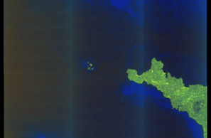
SAR coverage thumbnail
VIIRS Thermal Anomaly
Status: ✗ No detections
No VIIRS thermal/light detections in corridor
Show Raw Evidence JSON
{
    "gap_minutes": 361.69999999999998863131622783839702606201171875,
    "last_seen": {
        "ts": "2026-07-17T16:26:15+00:00",
        "lat": 50.04496000000000321961124427616596221923828125,
        "lon": -2.687265000000000014779288903810083866119384765625,
        "sog": 14.5,
        "zone_id": "discovered_110"
    },
    "next_seen": {
        "ts": "2026-07-17T22:27:58+00:00",
        "lat": 49.57465669999999846595528651960194110870361328125,
        "lon": -4.3360500000000001818989403545856475830078125,
        "zone_ids": [
            "discovered_100"
        ]
    },
    "gap_enrichment": {
        "status": "done",
        "corridor": {
            "start": {
                "lat": 50.04496000000000321961124427616596221923828125,
                "lon": -2.687265000000000014779288903810083866119384765625,
                "ts": "2026-07-17T16:26:15+00:00"
            },
            "end": {
                "lat": 49.57465669999999846595528651960194110870361328125,
                "lon": -4.3360500000000001818989403545856475830078125,
                "ts": "2026-07-17T22:27:58+00:00"
            },
            "bbox": {
                "min_lat": 49.39447700000000196496330318041145801544189453125,
                "min_lon": -4.61525799999999986056309353443793952465057373046875,
                "max_lat": 50.22514000000000322643245453946292400360107421875,
                "max_lon": -2.408056999999999892025925873895175755023956298828125
            },
            "buffer_km": 20
        },
        "sar": {
            "status": "snapshot",
            "scene_id": "S1D_IW_GRDH_1SDV_20260717T181312_20260717T181337_003717_006A7D_68F4_COG",
            "scene_time": "2026-07-17T18:13:12.497172Z",
            "platform": "sentinel-1d",
            "assets": {
                "preview_url": "https:\/\/fleetleaks.com\/wp-content\/uploads\/fleetleaks-evidence\/sar-imagery\/2026\/07\/event_965082_thumbnail_20260717223015.png",
                "stored_path": "\/home\/fleetleaks\/public_html\/wp-content\/uploads\/fleetleaks-evidence\/sar-imagery\/2026\/07\/event_965082_thumbnail_20260717223015.png",
                "source": "copernicus_dataspace"
            },
            "notes": "SAR snapshot available for review"
        },
        "viirs": {
            "status": "not_found",
            "notes": "No VIIRS thermal\/light detections in corridor"
        },
        "searched_at": "2026-07-17T22:30:12.109449+00:00"
    }
}- Zone: Unknown Maritime Surveillance Zone
- Duration: 1h 26m
- Data Points: 24 AIS positions
- Period: 2026-07-17T15:00:06+00:00 to 2026-07-17T16:26:15+00:00
Show Raw Evidence JSON
{
    "zone_id": "discovered_110",
    "zone_name": "Unknown Maritime Surveillance Zone",
    "dwell_minutes": 86.2000000000000028421709430404007434844970703125,
    "points_in_zone": 24,
    "first_point": {
        "ts": "2026-07-17T15:00:06+00:00",
        "lat": 50.1469749999999976353137753903865814208984375,
        "lon": -2.1433116999999999308101905626244843006134033203125
    },
    "last_point": {
        "ts": "2026-07-17T16:26:15+00:00",
        "lat": 50.04496000000000321961124427616596221923828125,
        "lon": -2.687265000000000014779288903810083866119384765625
    }
}- Zone: Unknown Maritime Surveillance Zone
- Duration: 1h 37m
- Data Points: 27 AIS positions
- Period: 2026-07-17T14:48:39+00:00 to 2026-07-17T16:26:15+00:00
Show Raw Evidence JSON
{
    "zone_id": "discovered_110",
    "zone_name": "Unknown Maritime Surveillance Zone",
    "dwell_minutes": 97.599999999999994315658113919198513031005859375,
    "points_in_zone": 27,
    "first_point": {
        "ts": "2026-07-17T14:48:39+00:00",
        "lat": 50.1603199999999986857801559381186962127685546875,
        "lon": -2.07203829999999999955662133288569748401641845703125
    },
    "last_point": {
        "ts": "2026-07-17T16:26:15+00:00",
        "lat": 50.04496000000000321961124427616596221923828125,
        "lon": -2.687265000000000014779288903810083866119384765625
    }
}- Zone: Malacca Strait Sanctioned Vessel Zone
- Duration: 1h 37m
- Data Points: 39 AIS positions
- Period: 2026-07-17T12:01:53+00:00 to 2026-07-17T13:39:43+00:00
Show Raw Evidence JSON
{
    "zone_id": "discovered_131",
    "zone_name": "Malacca Strait Sanctioned Vessel Zone",
    "dwell_minutes": 97.7999999999999971578290569595992565155029296875,
    "points_in_zone": 39,
    "first_point": {
        "ts": "2026-07-17T12:01:53+00:00",
        "lat": 50.310384999999996580299921333789825439453125,
        "lon": -1.2044132999999999089624225234729237854480743408203125
    },
    "last_point": {
        "ts": "2026-07-17T13:39:43+00:00",
        "lat": 50.22782169999999979381755110807716846466064453125,
        "lon": -1.668768299999999982219378580339252948760986328125
    }
}- Zone: Malacca Strait Sanctioned Vessel Zone
- Duration: 2h 39m
- Data Points: 55 AIS positions
- Period: 2026-07-17T11:00:44+00:00 to 2026-07-17T13:39:43+00:00
Show Raw Evidence JSON
{
    "zone_id": "discovered_131",
    "zone_name": "Malacca Strait Sanctioned Vessel Zone",
    "dwell_minutes": 159,
    "points_in_zone": 55,
    "first_point": {
        "ts": "2026-07-17T11:00:44+00:00",
        "lat": 50.3521233000000023594111553393304347991943359375,
        "lon": -0.97277829999999998467075101871159859001636505126953125
    },
    "last_point": {
        "ts": "2026-07-17T13:39:43+00:00",
        "lat": 50.22782169999999979381755110807716846466064453125,
        "lon": -1.668768299999999982219378580339252948760986328125
    }
}- Zone: Malacca Strait Sanctioned Vessel Zone
- Duration: 3h 34m
- Data Points: 66 AIS positions
- Period: 2026-07-17T10:05:33+00:00 to 2026-07-17T13:39:43+00:00
Show Raw Evidence JSON
{
    "zone_id": "discovered_131",
    "zone_name": "Malacca Strait Sanctioned Vessel Zone",
    "dwell_minutes": 214.19999999999998863131622783839702606201171875,
    "points_in_zone": 66,
    "first_point": {
        "ts": "2026-07-17T10:05:33+00:00",
        "lat": 50.38891499999999723513610661029815673828125,
        "lon": -0.77547500000000002540190280342358164489269256591796875
    },
    "last_point": {
        "ts": "2026-07-17T13:39:43+00:00",
        "lat": 50.22782169999999979381755110807716846466064453125,
        "lon": -1.668768299999999982219378580339252948760986328125
    }
}- Zone: Malacca Strait Sanctioned Vessel Zone
- Duration: 4h 39m
- Data Points: 77 AIS positions
- Period: 2026-07-17T09:00:14+00:00 to 2026-07-17T13:39:43+00:00
Show Raw Evidence JSON
{
    "zone_id": "discovered_131",
    "zone_name": "Malacca Strait Sanctioned Vessel Zone",
    "dwell_minutes": 279.5,
    "points_in_zone": 77,
    "first_point": {
        "ts": "2026-07-17T09:00:14+00:00",
        "lat": 50.429446699999999736974132247269153594970703125,
        "lon": -0.5126583000000000112095221993513405323028564453125
    },
    "last_point": {
        "ts": "2026-07-17T13:39:43+00:00",
        "lat": 50.22782169999999979381755110807716846466064453125,
        "lon": -1.668768299999999982219378580339252948760986328125
    }
}- Zone: Malacca Strait Sanctioned Vessel Zone
- Duration: 5h 37m
- Data Points: 100 AIS positions
- Period: 2026-07-17T08:02:43+00:00 to 2026-07-17T13:39:43+00:00
Show Raw Evidence JSON
{
    "zone_id": "discovered_131",
    "zone_name": "Malacca Strait Sanctioned Vessel Zone",
    "dwell_minutes": 337,
    "points_in_zone": 100,
    "first_point": {
        "ts": "2026-07-17T08:02:43+00:00",
        "lat": 50.48484330000000142035787575878202915191650390625,
        "lon": -0.2465566999999999897585922781217959709465503692626953125
    },
    "last_point": {
        "ts": "2026-07-17T13:39:43+00:00",
        "lat": 50.22782169999999979381755110807716846466064453125,
        "lon": -1.668768299999999982219378580339252948760986328125
    }
}- Zone: Malacca Strait Sanctioned Vessel Zone
- Duration: 6h 39m
- Data Points: 123 AIS positions
- Period: 2026-07-17T07:00:12+00:00 to 2026-07-17T13:39:43+00:00
Show Raw Evidence JSON
{
    "zone_id": "discovered_131",
    "zone_name": "Malacca Strait Sanctioned Vessel Zone",
    "dwell_minutes": 399.5,
    "points_in_zone": 123,
    "first_point": {
        "ts": "2026-07-17T07:00:12+00:00",
        "lat": 50.54587500000000233058017329312860965728759765625,
        "lon": 0.09066169999999999784545678949143621139228343963623046875
    },
    "last_point": {
        "ts": "2026-07-17T13:39:43+00:00",
        "lat": 50.22782169999999979381755110807716846466064453125,
        "lon": -1.668768299999999982219378580339252948760986328125
    }
}- Zone: Malacca Strait Sanctioned Vessel Zone
- Duration: 6h 35m
- Data Points: 120 AIS positions
- Period: 2026-07-17T06:52:04+00:00 to 2026-07-17T13:27:42+00:00
Show Raw Evidence JSON
{
    "zone_id": "discovered_131",
    "zone_name": "Malacca Strait Sanctioned Vessel Zone",
    "dwell_minutes": 395.6000000000000227373675443232059478759765625,
    "points_in_zone": 120,
    "first_point": {
        "ts": "2026-07-17T06:52:04+00:00",
        "lat": 50.55423329999999992878656485117971897125244140625,
        "lon": 0.1370183000000000095308649861181038431823253631591796875
    },
    "last_point": {
        "ts": "2026-07-17T13:27:42+00:00",
        "lat": 50.238861700000001064836396835744380950927734375,
        "lon": -1.6050883000000000233598029808490537106990814208984375
    }
}- Zone: English Channel Monitoring Zone
- Duration: 1h 29m
- Data Points: 29 AIS positions
- Period: 2026-07-17T05:04:02+00:00 to 2026-07-17T06:33:35+00:00
Show Raw Evidence JSON
{
    "zone_id": "discovered_143",
    "zone_name": "English Channel Monitoring Zone",
    "dwell_minutes": 89.5,
    "points_in_zone": 29,
    "first_point": {
        "ts": "2026-07-17T05:04:02+00:00",
        "lat": 50.69427170000000160143827088177204132080078125,
        "lon": 0.73954830000000004730509317596442997455596923828125
    },
    "last_point": {
        "ts": "2026-07-17T06:33:35+00:00",
        "lat": 50.57296170000000046229615691117942333221435546875,
        "lon": 0.2426133000000000039531045104013173840939998626708984375
    }
}- Zone: English Channel Monitoring Zone
- Duration: 2h 32m
- Data Points: 49 AIS positions
- Period: 2026-07-17T04:01:00+00:00 to 2026-07-17T06:33:35+00:00
Show Raw Evidence JSON
{
    "zone_id": "discovered_143",
    "zone_name": "English Channel Monitoring Zone",
    "dwell_minutes": 152.599999999999994315658113919198513031005859375,
    "points_in_zone": 49,
    "first_point": {
        "ts": "2026-07-17T04:01:00+00:00",
        "lat": 50.82028170000000244499460677616298198699951171875,
        "lon": 1.0229882999999999615425849697203375399112701416015625
    },
    "last_point": {
        "ts": "2026-07-17T06:33:35+00:00",
        "lat": 50.57296170000000046229615691117942333221435546875,
        "lon": 0.2426133000000000039531045104013173840939998626708984375
    }
}- Zone: English Channel Monitoring Zone
- Duration: 2h 47m
- Data Points: 57 AIS positions
- Period: 2026-07-17T03:45:59+00:00 to 2026-07-17T06:33:35+00:00
Show Raw Evidence JSON
{
    "zone_id": "discovered_143",
    "zone_name": "English Channel Monitoring Zone",
    "dwell_minutes": 167.599999999999994315658113919198513031005859375,
    "points_in_zone": 57,
    "first_point": {
        "ts": "2026-07-17T03:45:59+00:00",
        "lat": 50.8490632999999974117599776946008205413818359375,
        "lon": 1.0852299999999999169375541896442882716655731201171875
    },
    "last_point": {
        "ts": "2026-07-17T06:33:35+00:00",
        "lat": 50.57296170000000046229615691117942333221435546875,
        "lon": 0.2426133000000000039531045104013173840939998626708984375
    }
}- Zone: English Channel Surveillance Zone
- Duration: 1h 27m
- Data Points: 12 AIS positions
- Period: 2026-07-17T01:00:10+00:00 to 2026-07-17T02:27:51+00:00
Show Raw Evidence JSON
{
    "zone_id": "discovered_004",
    "zone_name": "English Channel Surveillance Zone",
    "dwell_minutes": 87.7000000000000028421709430404007434844970703125,
    "points_in_zone": 12,
    "first_point": {
        "ts": "2026-07-17T01:00:10+00:00",
        "lat": 51.14886169999999765423126518726348876953125,
        "lon": 1.6163917000000000978587877398240379989147186279296875
    },
    "last_point": {
        "ts": "2026-07-17T02:27:51+00:00",
        "lat": 51.01072169999999772471710457466542720794677734375,
        "lon": 1.34211830000000009732730177347548305988311767578125
    }
}- Zone: English Channel Surveillance Zone
- Duration: 2h 23m
- Data Points: 27 AIS positions
- Period: 2026-07-17T00:04:03+00:00 to 2026-07-17T02:27:51+00:00
Show Raw Evidence JSON
{
    "zone_id": "discovered_004",
    "zone_name": "English Channel Surveillance Zone",
    "dwell_minutes": 143.80000000000001136868377216160297393798828125,
    "points_in_zone": 27,
    "first_point": {
        "ts": "2026-07-17T00:04:03+00:00",
        "lat": 51.2644566999999966583345667459070682525634765625,
        "lon": 1.7938300000000000355981910615810193121433258056640625
    },
    "last_point": {
        "ts": "2026-07-17T02:27:51+00:00",
        "lat": 51.01072169999999772471710457466542720794677734375,
        "lon": 1.34211830000000009732730177347548305988311767578125
    }
}- Zone: English Channel Surveillance Zone
- Duration: 3h 11m
- Data Points: 30 AIS positions
- Period: 2026-07-16T23:16:01+00:00 to 2026-07-17T02:27:51+00:00
Show Raw Evidence JSON
{
    "zone_id": "discovered_004",
    "zone_name": "English Channel Surveillance Zone",
    "dwell_minutes": 191.80000000000001136868377216160297393798828125,
    "points_in_zone": 30,
    "first_point": {
        "ts": "2026-07-16T23:16:01+00:00",
        "lat": 51.4169083000000028960130293853580951690673828125,
        "lon": 1.907505000000000006110667527536861598491668701171875
    },
    "last_point": {
        "ts": "2026-07-17T02:27:51+00:00",
        "lat": 51.01072169999999772471710457466542720794677734375,
        "lon": 1.34211830000000009732730177347548305988311767578125
    }
}- Zone: English Channel Surveillance Zone
- Duration: 4h 8m
- Data Points: 38 AIS positions
- Period: 2026-07-16T22:19:30+00:00 to 2026-07-17T02:27:51+00:00
Show Raw Evidence JSON
{
    "zone_id": "discovered_004",
    "zone_name": "English Channel Surveillance Zone",
    "dwell_minutes": 248.30000000000001136868377216160297393798828125,
    "points_in_zone": 38,
    "first_point": {
        "ts": "2026-07-16T22:19:30+00:00",
        "lat": 51.50817169999999833862602827139198780059814453125,
        "lon": 1.785085000000000032827074392116628587245941162109375
    },
    "last_point": {
        "ts": "2026-07-17T02:27:51+00:00",
        "lat": 51.01072169999999772471710457466542720794677734375,
        "lon": 1.34211830000000009732730177347548305988311767578125
    }
}- Zone: English Channel Surveillance Zone
- Duration: 6h 29m
- Data Points: 36 AIS positions
- Period: 2026-07-16T19:49:28+00:00 to 2026-07-17T02:19:11+00:00
Show Raw Evidence JSON
{
    "zone_id": "discovered_004",
    "zone_name": "English Channel Surveillance Zone",
    "dwell_minutes": 389.69999999999998863131622783839702606201171875,
    "points_in_zone": 36,
    "first_point": {
        "ts": "2026-07-16T19:49:28+00:00",
        "lat": 51.51185000000000258069121628068387508392333984375,
        "lon": 1.7851850000000000218136619878350757062435150146484375
    },
    "last_point": {
        "ts": "2026-07-17T02:19:11+00:00",
        "lat": 51.026105000000001155058271251618862152099609375,
        "lon": 1.3671667000000000680159928378998301923274993896484375
    }
}- Zone: English Channel Surveillance Zone
- Duration: 6h 13m
- Data Points: 30 AIS positions
- Period: 2026-07-16T18:46:30+00:00 to 2026-07-17T01:00:10+00:00
Show Raw Evidence JSON
{
    "zone_id": "discovered_004",
    "zone_name": "English Channel Surveillance Zone",
    "dwell_minutes": 373.69999999999998863131622783839702606201171875,
    "points_in_zone": 30,
    "first_point": {
        "ts": "2026-07-16T18:46:30+00:00",
        "lat": 51.51345500000000043883119360543787479400634765625,
        "lon": 1.787199999999999899813474257825873792171478271484375
    },
    "last_point": {
        "ts": "2026-07-17T01:00:10+00:00",
        "lat": 51.14886169999999765423126518726348876953125,
        "lon": 1.6163917000000000978587877398240379989147186279296875
    }
}- Zone: English Channel Surveillance Zone
- Duration: 6h 29m
- Data Points: 24 AIS positions
- Period: 2026-07-16T17:58:28+00:00 to 2026-07-17T00:28:01+00:00
Show Raw Evidence JSON
{
    "zone_id": "discovered_004",
    "zone_name": "English Channel Surveillance Zone",
    "dwell_minutes": 389.6000000000000227373675443232059478759765625,
    "points_in_zone": 24,
    "first_point": {
        "ts": "2026-07-16T17:58:28+00:00",
        "lat": 51.5153217000000012149030226282775402069091796875,
        "lon": 1.78718500000000002359001882723532617092132568359375
    },
    "last_point": {
        "ts": "2026-07-17T00:28:01+00:00",
        "lat": 51.2052733000000017682395991869270801544189453125,
        "lon": 1.726141699999999890025037529994733631610870361328125
    }
}- Duration: 5h 17m
- Radius: 674 meters
- Data Points: 11 AIS positions
- Centroid: 51.5141, 1.7870
- Zone: English Channel Surveillance Zone
Show Raw Evidence JSON
{
    "radius_m": 674.299999999999954525264911353588104248046875,
    "duration_minutes": 317.3999999999999772626324556767940521240234375,
    "points": 11,
    "centroid": {
        "lat": 51.51411424545454309509295853786170482635498046875,
        "lon": 1.7869953090909087567439428312354721128940582275390625
    },
    "bbox": {
        "min_lat": 51.50817169999999833862602827139198780059814453125,
        "min_lon": 1.785085000000000032827074392116628587245941162109375,
        "max_lat": 51.51669170000000264053596765734255313873291015625,
        "max_lon": 1.7913349999999998996003114370978437364101409912109375
    },
    "zone_id": "discovered_004"
}- Minimum Distance: 21 meters
- Average Distance: 24 meters
- Duration: 51 minutes
- Period: 2026-07-16T16:34:30+00:00 to 2026-07-16T17:25:29+00:00
- Vessel A Avg Speed: 0.0 knots
- Vessel B Avg Speed: 0.0 knots
- Zone: English Channel Surveillance Zone
Confidence Analysis
High-confidence STS candidate. Two tankers (PRAGUE and NORTHERN OSPREY) maintained close proximity (min 21m, avg 24m) for 51 minutes. Both vessels were slow-moving (avg speeds 0.0 and 0.0 knots). The stable separation distance suggests deliberate parallel positioning typical of cargo transfer. Event occurred in English Channel Surveillance Zone, a known STS activity area.
View scoring breakdown
| Factor | Score | Detail |
|---|---|---|
| Distance Tightness | 25/25 | Min distance 21m, avg 24m |
| Duration | 10/25 | Duration 51 minutes |
| Speed Stability | 20/20 | both nearly stationary; very stable speeds |
| Distance Consistency | 15/15 | Distance variance ±2m |
| Isolation | 5/10 | Isolation data not available |
| Context | 5/5 | In monitored zone: English Channel Surveillance Zone |
Show Raw Evidence JSON
{
    "vessel_a": {
        "mmsi": 636023238,
        "imo": 9421324,
        "name": "PRAGUE",
        "flag": "Liberia"
    },
    "vessel_b": {
        "mmsi": 352005487,
        "imo": 9283459,
        "name": "NORTHERN OSPREY",
        "flag": "Panama"
    },
    "min_distance_m": 21.10000000000000142108547152020037174224853515625,
    "avg_distance_m": 24.199999999999999289457264239899814128875732421875,
    "distance_consistency_m": 2.100000000000000088817841970012523233890533447265625,
    "duration_minutes": 51,
    "overlap_duration_s": 3059,
    "speed_a_avg": 0,
    "speed_a_std": 0,
    "speed_b_avg": 0,
    "speed_b_std": 0,
    "speed_summary": {
        "vessel_a": {
            "avg_sog": 0,
            "max_sog": 0
        },
        "vessel_b": {
            "avg_sog": 0,
            "max_sog": 0
        }
    },
    "time_window": {
        "start": "2026-07-16T16:34:30+00:00",
        "end": "2026-07-16T17:25:29+00:00"
    },
    "points_count": {
        "vessel_a": 5,
        "vessel_b": 5
    },
    "zone_id": "discovered_004",
    "zone_name": "English Channel Surveillance Zone",
    "score": {
        "value": 80,
        "components": {
            "distance_tightness": {
                "score": 25,
                "max": 25,
                "detail": "Min distance 21m, avg 24m"
            },
            "duration": {
                "score": 10,
                "max": 25,
                "detail": "Duration 51 minutes"
            },
            "speed_stability": {
                "score": 20,
                "max": 20,
                "detail": "both nearly stationary; very stable speeds"
            },
            "distance_consistency": {
                "score": 15,
                "max": 15,
                "detail": "Distance variance \u00b12m"
            },
            "isolation": {
                "score": 5,
                "max": 10,
                "detail": "Isolation data not available"
            },
            "context": {
                "score": 5,
                "max": 5,
                "detail": "In monitored zone: English Channel Surveillance Zone"
            }
        },
        "summary": "High-confidence STS candidate. Two tankers (PRAGUE and NORTHERN OSPREY) maintained close proximity (min 21m, avg 24m) for 51 minutes. Both vessels were slow-moving (avg speeds 0.0 and 0.0 knots). The stable separation distance suggests deliberate parallel positioning typical of cargo transfer. Event occurred in English Channel Surveillance Zone, a known STS activity area."
    }
}- Zone: English Channel Surveillance Zone
- Duration: 6h 29m
- Data Points: 19 AIS positions
- Period: 2026-07-16T16:46:29+00:00 to 2026-07-16T23:16:01+00:00
Show Raw Evidence JSON
{
    "zone_id": "discovered_004",
    "zone_name": "English Channel Surveillance Zone",
    "dwell_minutes": 389.5,
    "points_in_zone": 19,
    "first_point": {
        "ts": "2026-07-16T16:46:29+00:00",
        "lat": 51.51599329999999810070221428759396076202392578125,
        "lon": 1.787116699999999891446123001514934003353118896484375
    },
    "last_point": {
        "ts": "2026-07-16T23:16:01+00:00",
        "lat": 51.4169083000000028960130293853580951690673828125,
        "lon": 1.907505000000000006110667527536861598491668701171875
    }
}- Duration: 6h 17m
- Radius: 731 meters
- Data Points: 15 AIS positions
- Centroid: 51.5146, 1.7870
- Zone: English Channel Surveillance Zone
Show Raw Evidence JSON
{
    "radius_m": 730.8999999999999772626324556767940521240234375,
    "duration_minutes": 377.30000000000001136868377216160297393798828125,
    "points": 15,
    "centroid": {
        "lat": 51.51462666666667900017273495905101299285888671875,
        "lon": 1.7870446733333331668092114341561682522296905517578125
    },
    "bbox": {
        "min_lat": 51.50817169999999833862602827139198780059814453125,
        "min_lon": 1.785085000000000032827074392116628587245941162109375,
        "max_lat": 51.51669170000000264053596765734255313873291015625,
        "max_lon": 1.7913349999999998996003114370978437364101409912109375
    },
    "zone_id": "discovered_004"
}- Minimum Distance: 21 meters
- Average Distance: 47 meters
- Duration: 1h 43m
- Period: 2026-07-16T15:33:10+00:00 to 2026-07-16T17:17:06+00:00
- Vessel A Avg Speed: 0.2 knots
- Vessel B Avg Speed: 0.0 knots
- Zone: English Channel Surveillance Zone
Confidence Analysis
High-confidence STS candidate. Two tankers (NORTHERN OSPREY and PRAGUE) maintained close proximity (min 21m, avg 47m) for 104 minutes. Both vessels were slow-moving (avg speeds 0.2 and 0.0 knots). The stable separation distance suggests deliberate parallel positioning typical of cargo transfer. Event occurred in English Channel Surveillance Zone, a known STS activity area.
View scoring breakdown
| Factor | Score | Detail |
|---|---|---|
| Distance Tightness | 25/25 | Min distance 21m, avg 47m |
| Duration | 20/25 | Duration 104 minutes |
| Speed Stability | 17/20 | both nearly stationary; stable speeds |
| Distance Consistency | 12/15 | Distance variance ±50m |
| Isolation | 5/10 | Isolation data not available |
| Context | 5/5 | In monitored zone: English Channel Surveillance Zone |
Show Raw Evidence JSON
{
    "vessel_a": {
        "mmsi": 352005487,
        "imo": 9283459,
        "name": "NORTHERN OSPREY",
        "flag": "Panama"
    },
    "vessel_b": {
        "mmsi": 636023238,
        "imo": 9421324,
        "name": "PRAGUE",
        "flag": "Liberia"
    },
    "min_distance_m": 21.10000000000000142108547152020037174224853515625,
    "avg_distance_m": 46.7000000000000028421709430404007434844970703125,
    "distance_consistency_m": 49.7999999999999971578290569595992565155029296875,
    "duration_minutes": 103.900000000000005684341886080801486968994140625,
    "overlap_duration_s": 6236,
    "speed_a_avg": 0.1700000000000000122124532708767219446599483489990234375,
    "speed_a_std": 0.38000000000000000444089209850062616169452667236328125,
    "speed_b_avg": 0,
    "speed_b_std": 0,
    "speed_summary": {
        "vessel_a": {
            "avg_sog": 0.1700000000000000122124532708767219446599483489990234375,
            "max_sog": 1.399999999999999911182158029987476766109466552734375
        },
        "vessel_b": {
            "avg_sog": 0,
            "max_sog": 0
        }
    },
    "time_window": {
        "start": "2026-07-16T15:33:10+00:00",
        "end": "2026-07-16T17:17:06+00:00"
    },
    "points_count": {
        "vessel_a": 20,
        "vessel_b": 20
    },
    "zone_id": "discovered_004",
    "zone_name": "English Channel Surveillance Zone",
    "score": {
        "value": 84,
        "components": {
            "distance_tightness": {
                "score": 25,
                "max": 25,
                "detail": "Min distance 21m, avg 47m"
            },
            "duration": {
                "score": 20,
                "max": 25,
                "detail": "Duration 104 minutes"
            },
            "speed_stability": {
                "score": 17,
                "max": 20,
                "detail": "both nearly stationary; stable speeds"
            },
            "distance_consistency": {
                "score": 12,
                "max": 15,
                "detail": "Distance variance \u00b150m"
            },
            "isolation": {
                "score": 5,
                "max": 10,
                "detail": "Isolation data not available"
            },
            "context": {
                "score": 5,
                "max": 5,
                "detail": "In monitored zone: English Channel Surveillance Zone"
            }
        },
        "summary": "High-confidence STS candidate. Two tankers (NORTHERN OSPREY and PRAGUE) maintained close proximity (min 21m, avg 47m) for 104 minutes. Both vessels were slow-moving (avg speeds 0.2 and 0.0 knots). The stable separation distance suggests deliberate parallel positioning typical of cargo transfer. Event occurred in English Channel Surveillance Zone, a known STS activity area."
    }
}- Zone: English Channel Surveillance Zone
- Duration: 6h 30m
- Data Points: 15 AIS positions
- Period: 2026-07-16T15:49:29+00:00 to 2026-07-16T22:19:30+00:00
Show Raw Evidence JSON
{
    "zone_id": "discovered_004",
    "zone_name": "English Channel Surveillance Zone",
    "dwell_minutes": 390,
    "points_in_zone": 15,
    "first_point": {
        "ts": "2026-07-16T15:49:29+00:00",
        "lat": 51.5161616999999978361302055418491363525390625,
        "lon": 1.7872616999999999531922867390676401555538177490234375
    },
    "last_point": {
        "ts": "2026-07-16T22:19:30+00:00",
        "lat": 51.50817169999999833862602827139198780059814453125,
        "lon": 1.785085000000000032827074392116628587245941162109375
    }
}- Duration: 6h 30m
- Radius: 724 meters
- Data Points: 15 AIS positions
- Centroid: 51.5146, 1.7868
- Zone: English Channel Surveillance Zone
Show Raw Evidence JSON
{
    "radius_m": 723.799999999999954525264911353588104248046875,
    "duration_minutes": 390,
    "points": 15,
    "centroid": {
        "lat": 51.5145913333333425043747411109507083892822265625,
        "lon": 1.7867731199999996594129925142624415457248687744140625
    },
    "bbox": {
        "min_lat": 51.50817169999999833862602827139198780059814453125,
        "min_lon": 1.785085000000000032827074392116628587245941162109375,
        "max_lat": 51.5161616999999978361302055418491363525390625,
        "max_lon": 1.787290000000000045332626541494391858577728271484375
    },
    "zone_id": "discovered_004"
}- Zone: English Channel Surveillance Zone
- Duration: 5h 30m
- Data Points: 21 AIS positions
- Period: 2026-07-16T14:19:29+00:00 to 2026-07-16T19:49:28+00:00
Show Raw Evidence JSON
{
    "zone_id": "discovered_004",
    "zone_name": "English Channel Surveillance Zone",
    "dwell_minutes": 330,
    "points_in_zone": 21,
    "first_point": {
        "ts": "2026-07-16T14:19:29+00:00",
        "lat": 51.51436170000000203117451746948063373565673828125,
        "lon": 1.7893367000000000022197355065145529806613922119140625
    },
    "last_point": {
        "ts": "2026-07-16T19:49:28+00:00",
        "lat": 51.51185000000000258069121628068387508392333984375,
        "lon": 1.7851850000000000218136619878350757062435150146484375
    }
}- Duration: 5h 30m
- Radius: 395 meters
- Data Points: 21 AIS positions
- Centroid: 51.5151, 1.7875
- Zone: English Channel Surveillance Zone
Show Raw Evidence JSON
{
    "radius_m": 394.5,
    "duration_minutes": 330,
    "points": 21,
    "centroid": {
        "lat": 51.51509380952381178531140903942286968231201171875,
        "lon": 1.787479771428571506675098135019652545452117919921875
    },
    "bbox": {
        "min_lat": 51.51182829999999768233465147204697132110595703125,
        "min_lon": 1.7851850000000000218136619878350757062435150146484375,
        "max_lat": 51.5161616999999978361302055418491363525390625,
        "max_lon": 1.7898549999999999737809730504523031413555145263671875
    },
    "zone_id": "discovered_004"
}- Zone: English Channel Surveillance Zone
- Duration: 6h 24m
- Data Points: 23 AIS positions
- Period: 2026-07-16T13:25:30+00:00 to 2026-07-16T19:49:28+00:00
Show Raw Evidence JSON
{
    "zone_id": "discovered_004",
    "zone_name": "English Channel Surveillance Zone",
    "dwell_minutes": 384,
    "points_in_zone": 23,
    "first_point": {
        "ts": "2026-07-16T13:25:30+00:00",
        "lat": 51.51179330000000078371158451773226261138916015625,
        "lon": 1.7854167000000000786741338743013329803943634033203125
    },
    "last_point": {
        "ts": "2026-07-16T19:49:28+00:00",
        "lat": 51.51185000000000258069121628068387508392333984375,
        "lon": 1.7851850000000000218136619878350757062435150146484375
    }
}- Duration: 6h 24m
- Radius: 368 meters
- Data Points: 23 AIS positions
- Centroid: 51.5149, 1.7873
- Zone: English Channel Surveillance Zone
Show Raw Evidence JSON
{
    "radius_m": 368,
    "duration_minutes": 384,
    "points": 23,
    "centroid": {
        "lat": 51.51488166521739486825026688165962696075439453125,
        "lon": 1.7873045739130433151586885287542827427387237548828125
    },
    "bbox": {
        "min_lat": 51.51179330000000078371158451773226261138916015625,
        "min_lon": 1.7851850000000000218136619878350757062435150146484375,
        "max_lat": 51.5161616999999978361302055418491363525390625,
        "max_lon": 1.7898549999999999737809730504523031413555145263671875
    },
    "zone_id": "discovered_004"
}- Zone: English Channel Surveillance Zone
- Duration: 6h 30m
- Data Points: 23 AIS positions
- Period: 2026-07-16T12:58:30+00:00 to 2026-07-16T19:28:28+00:00
Show Raw Evidence JSON
{
    "zone_id": "discovered_004",
    "zone_name": "English Channel Surveillance Zone",
    "dwell_minutes": 390,
    "points_in_zone": 23,
    "first_point": {
        "ts": "2026-07-16T12:58:30+00:00",
        "lat": 51.51120329999999825076884008012712001800537109375,
        "lon": 1.786481699999999950279061522451229393482208251953125
    },
    "last_point": {
        "ts": "2026-07-16T19:28:28+00:00",
        "lat": 51.51182829999999768233465147204697132110595703125,
        "lon": 1.785334999999999894271240918897092342376708984375
    }
}- Duration: 6h 30m
- Radius: 411 meters
- Data Points: 23 AIS positions
- Centroid: 51.5149, 1.7874
- Zone: English Channel Surveillance Zone
Show Raw Evidence JSON
{
    "radius_m": 410.69999999999998863131622783839702606201171875,
    "duration_minutes": 390,
    "points": 23,
    "centroid": {
        "lat": 51.51485354782607828383333981037139892578125,
        "lon": 1.78736095217391266487538814544677734375
    },
    "bbox": {
        "min_lat": 51.51120329999999825076884008012712001800537109375,
        "min_lon": 1.785334999999999894271240918897092342376708984375,
        "max_lat": 51.5161616999999978361302055418491363525390625,
        "max_lon": 1.7898549999999999737809730504523031413555145263671875
    },
    "zone_id": "discovered_004"
}- Zone: English Channel Surveillance Zone
- Duration: 6h 36m
- Data Points: 24 AIS positions
- Period: 2026-07-16T11:31:29+00:00 to 2026-07-16T18:07:29+00:00
Show Raw Evidence JSON
{
    "zone_id": "discovered_004",
    "zone_name": "English Channel Surveillance Zone",
    "dwell_minutes": 396,
    "points_in_zone": 24,
    "first_point": {
        "ts": "2026-07-16T11:31:29+00:00",
        "lat": 51.51117330000000293921402771957218647003173828125,
        "lon": 1.7864983000000000945561851040110923349857330322265625
    },
    "last_point": {
        "ts": "2026-07-16T18:07:29+00:00",
        "lat": 51.51519669999999706533344578929245471954345703125,
        "lon": 1.787290000000000045332626541494391858577728271484375
    }
}- Duration: 6h 36m
- Radius: 385 meters
- Data Points: 24 AIS positions
- Centroid: 51.5146, 1.7873
- Zone: English Channel Surveillance Zone
Show Raw Evidence JSON
{
    "radius_m": 384.69999999999998863131622783839702606201171875,
    "duration_minutes": 396,
    "points": 24,
    "centroid": {
        "lat": 51.51459659166666682494906126521527767181396484375,
        "lon": 1.7872791041666664657583396547124721109867095947265625
    },
    "bbox": {
        "min_lat": 51.51117330000000293921402771957218647003173828125,
        "min_lon": 1.7854167000000000786741338743013329803943634033203125,
        "max_lat": 51.5161616999999978361302055418491363525390625,
        "max_lon": 1.7898549999999999737809730504523031413555145263671875
    },
    "zone_id": "discovered_004"
}- Zone: English Channel Surveillance Zone
- Duration: 6h 36m
- Data Points: 21 AIS positions
- Period: 2026-07-16T10:10:31+00:00 to 2026-07-16T16:46:29+00:00
Show Raw Evidence JSON
{
    "zone_id": "discovered_004",
    "zone_name": "English Channel Surveillance Zone",
    "dwell_minutes": 396,
    "points_in_zone": 21,
    "first_point": {
        "ts": "2026-07-16T10:10:31+00:00",
        "lat": 51.5110882999999972753357724286615848541259765625,
        "lon": 1.7869582999999999994855670593096874654293060302734375
    },
    "last_point": {
        "ts": "2026-07-16T16:46:29+00:00",
        "lat": 51.51599329999999810070221428759396076202392578125,
        "lon": 1.787116699999999891446123001514934003353118896484375
    }
}- Duration: 6h 36m
- Radius: 308 meters
- Data Points: 21 AIS positions
- Centroid: 51.5138, 1.7872
- Zone: English Channel Surveillance Zone
Show Raw Evidence JSON
{
    "radius_m": 308.19999999999998863131622783839702606201171875,
    "duration_minutes": 396,
    "points": 21,
    "centroid": {
        "lat": 51.51383197619048814885900355875492095947265625,
        "lon": 1.7872103999999999768277803013916127383708953857421875
    },
    "bbox": {
        "min_lat": 51.5110882999999972753357724286615848541259765625,
        "min_lon": 1.7854167000000000786741338743013329803943634033203125,
        "max_lat": 51.5161616999999978361302055418491363525390625,
        "max_lon": 1.7898549999999999737809730504523031413555145263671875
    },
    "zone_id": "discovered_004"
}- Zone: English Channel Surveillance Zone
- Duration: 6h 39m
- Data Points: 20 AIS positions
- Period: 2026-07-16T09:10:29+00:00 to 2026-07-16T15:49:29+00:00
Show Raw Evidence JSON
{
    "zone_id": "discovered_004",
    "zone_name": "English Channel Surveillance Zone",
    "dwell_minutes": 399,
    "points_in_zone": 20,
    "first_point": {
        "ts": "2026-07-16T09:10:29+00:00",
        "lat": 51.51107830000000120662662084214389324188232421875,
        "lon": 1.7866633000000000652818243906949646770954132080078125
    },
    "last_point": {
        "ts": "2026-07-16T15:49:29+00:00",
        "lat": 51.5161616999999978361302055418491363525390625,
        "lon": 1.7872616999999999531922867390676401555538177490234375
    }
}- Duration: 6h 39m
- Radius: 353 meters
- Data Points: 20 AIS positions
- Centroid: 51.5130, 1.7871
- Zone: English Channel Surveillance Zone
Show Raw Evidence JSON
{
    "radius_m": 352.80000000000001136868377216160297393798828125,
    "duration_minutes": 399,
    "points": 20,
    "centroid": {
        "lat": 51.5129919950000072503826231695711612701416015625,
        "lon": 1.787134164999999885736770011135376989841461181640625
    },
    "bbox": {
        "min_lat": 51.51107830000000120662662084214389324188232421875,
        "min_lon": 1.7854167000000000786741338743013329803943634033203125,
        "max_lat": 51.5161616999999978361302055418491363525390625,
        "max_lon": 1.7898549999999999737809730504523031413555145263671875
    },
    "zone_id": "discovered_004"
}- Zone: English Channel Surveillance Zone
- Duration: 6h 27m
- Data Points: 20 AIS positions
- Period: 2026-07-16T08:40:28+00:00 to 2026-07-16T15:07:30+00:00
Show Raw Evidence JSON
{
    "zone_id": "discovered_004",
    "zone_name": "English Channel Surveillance Zone",
    "dwell_minutes": 387,
    "points_in_zone": 20,
    "first_point": {
        "ts": "2026-07-16T08:40:28+00:00",
        "lat": 51.511110000000002173692337237298488616943359375,
        "lon": 1.786704999999999987636556397774256765842437744140625
    },
    "last_point": {
        "ts": "2026-07-16T15:07:30+00:00",
        "lat": 51.515933300000000372165231965482234954833984375,
        "lon": 1.787409999999999943298689686344005167484283447265625
    }
}- Duration: 6h 27m
- Radius: 394 meters
- Data Points: 20 AIS positions
- Centroid: 51.5125, 1.7871
- Zone: English Channel Surveillance Zone
Show Raw Evidence JSON
{
    "radius_m": 394,
    "duration_minutes": 387,
    "points": 20,
    "centroid": {
        "lat": 51.51249424500000628768248134292662143707275390625,
        "lon": 1.7870799150000002963878387163276784121990203857421875
    },
    "bbox": {
        "min_lat": 51.51107830000000120662662084214389324188232421875,
        "min_lon": 1.7854167000000000786741338743013329803943634033203125,
        "max_lat": 51.5159383000000019592334865592420101165771484375,
        "max_lon": 1.7898549999999999737809730504523031413555145263671875
    },
    "zone_id": "discovered_004"
}- Zone: English Channel Surveillance Zone
- Duration: 6h 26m
- Data Points: 17 AIS positions
- Period: 2026-07-16T07:55:42+00:00 to 2026-07-16T14:22:28+00:00
Show Raw Evidence JSON
{
    "zone_id": "discovered_004",
    "zone_name": "English Channel Surveillance Zone",
    "dwell_minutes": 386.80000000000001136868377216160297393798828125,
    "points_in_zone": 17,
    "first_point": {
        "ts": "2026-07-16T07:55:42+00:00",
        "lat": 51.51120999999999838792064110748469829559326171875,
        "lon": 1.78630170000000010332996680517680943012237548828125
    },
    "last_point": {
        "ts": "2026-07-16T14:22:28+00:00",
        "lat": 51.5143417000000027883288566954433917999267578125,
        "lon": 1.7894149999999999778310666442848742008209228515625
    }
}- Duration: 6h 26m
- Radius: 347 meters
- Data Points: 17 AIS positions
- Centroid: 51.5117, 1.7867
- Zone: English Channel Surveillance Zone
Show Raw Evidence JSON
{
    "radius_m": 346.80000000000001136868377216160297393798828125,
    "duration_minutes": 386.80000000000001136868377216160297393798828125,
    "points": 17,
    "centroid": {
        "lat": 51.51174156470589338141508051194250583648681640625,
        "lon": 1.7866610764705885827652309671975672245025634765625
    },
    "bbox": {
        "min_lat": 51.51107830000000120662662084214389324188232421875,
        "min_lon": 1.7854167000000000786741338743013329803943634033203125,
        "max_lat": 51.51436170000000203117451746948063373565673828125,
        "max_lon": 1.7894149999999999778310666442848742008209228515625
    },
    "zone_id": "discovered_004"
}- Zone: English Channel Surveillance Zone
- Duration: 6h 6m
- Data Points: 9 AIS positions
- Period: 2026-07-16T04:22:28+00:00 to 2026-07-16T10:28:28+00:00
Show Raw Evidence JSON
{
    "zone_id": "discovered_004",
    "zone_name": "English Channel Surveillance Zone",
    "dwell_minutes": 366,
    "points_in_zone": 9,
    "first_point": {
        "ts": "2026-07-16T04:22:28+00:00",
        "lat": 51.5144133000000010724761523306369781494140625,
        "lon": 1.789214999999999999857891452847979962825775146484375
    },
    "last_point": {
        "ts": "2026-07-16T10:28:28+00:00",
        "lat": 51.51111670000000231084413826465606689453125,
        "lon": 1.7863317000000000778214825913892127573490142822265625
    }
}- Zone: English Channel Surveillance Zone
- Duration: 6h 33m
- Data Points: 10 AIS positions
- Period: 2026-07-16T03:55:27+00:00 to 2026-07-16T10:28:28+00:00
Show Raw Evidence JSON
{
    "zone_id": "discovered_004",
    "zone_name": "English Channel Surveillance Zone",
    "dwell_minutes": 393,
    "points_in_zone": 10,
    "first_point": {
        "ts": "2026-07-16T03:55:27+00:00",
        "lat": 51.51449670000000224945324589498341083526611328125,
        "lon": 1.7893499999999999960920149533194489777088165283203125
    },
    "last_point": {
        "ts": "2026-07-16T10:28:28+00:00",
        "lat": 51.51111670000000231084413826465606689453125,
        "lon": 1.7863317000000000778214825913892127573490142822265625
    }
}- Duration: 6h 33m
- Radius: 336 meters
- Data Points: 10 AIS positions
- Centroid: 51.5118, 1.7871
- Zone: English Channel Surveillance Zone
Show Raw Evidence JSON
{
    "radius_m": 335.5,
    "duration_minutes": 393,
    "points": 10,
    "centroid": {
        "lat": 51.511812340000005860929377377033233642578125,
        "lon": 1.7871469999999998190531869113328866660594940185546875
    },
    "bbox": {
        "min_lat": 51.51107830000000120662662084214389324188232421875,
        "min_lon": 1.78630170000000010332996680517680943012237548828125,
        "max_lat": 51.51449670000000224945324589498341083526611328125,
        "max_lon": 1.7893499999999999960920149533194489777088165283203125
    },
    "zone_id": "discovered_004"
}- Zone: English Channel Surveillance Zone
- Duration: 6h 30m
- Data Points: 13 AIS positions
- Period: 2026-07-16T02:40:30+00:00 to 2026-07-16T09:10:29+00:00
Show Raw Evidence JSON
{
    "zone_id": "discovered_004",
    "zone_name": "English Channel Surveillance Zone",
    "dwell_minutes": 390,
    "points_in_zone": 13,
    "first_point": {
        "ts": "2026-07-16T02:40:30+00:00",
        "lat": 51.51454170000000232221282203681766986846923828125,
        "lon": 1.789316700000000093240259957383386790752410888671875
    },
    "last_point": {
        "ts": "2026-07-16T09:10:29+00:00",
        "lat": 51.51107830000000120662662084214389324188232421875,
        "lon": 1.7866633000000000652818243906949646770954132080078125
    }
}- Duration: 6h 30m
- Radius: 296 meters
- Data Points: 13 AIS positions
- Centroid: 51.5135, 1.7885
- Zone: English Channel Surveillance Zone
Show Raw Evidence JSON
{
    "radius_m": 296.3999999999999772626324556767940521240234375,
    "duration_minutes": 390,
    "points": 13,
    "centroid": {
        "lat": 51.5134833307692332482474739663302898406982421875,
        "lon": 1.7885009076923077397935912813409231603145599365234375
    },
    "bbox": {
        "min_lat": 51.51107830000000120662662084214389324188232421875,
        "min_lon": 1.78630170000000010332996680517680943012237548828125,
        "max_lat": 51.51455829999999735946403234265744686126708984375,
        "max_lon": 1.7894216999999998929382627466111443936824798583984375
    },
    "zone_id": "discovered_004"
}- Zone: English Channel Surveillance Zone
- Duration: 6h 21m
- Data Points: 14 AIS positions
- Period: 2026-07-16T01:34:30+00:00 to 2026-07-16T07:55:42+00:00
Show Raw Evidence JSON
{
    "zone_id": "discovered_004",
    "zone_name": "English Channel Surveillance Zone",
    "dwell_minutes": 381.19999999999998863131622783839702606201171875,
    "points_in_zone": 14,
    "first_point": {
        "ts": "2026-07-16T01:34:30+00:00",
        "lat": 51.51449000000000211230144486762583255767822265625,
        "lon": 1.78844329999999995806092556449584662914276123046875
    },
    "last_point": {
        "ts": "2026-07-16T07:55:42+00:00",
        "lat": 51.51120999999999838792064110748469829559326171875,
        "lon": 1.78630170000000010332996680517680943012237548828125
    }
}- Duration: 6h 21m
- Radius: 389 meters
- Data Points: 14 AIS positions
- Centroid: 51.5143, 1.7890
- Zone: English Channel Surveillance Zone
Show Raw Evidence JSON
{
    "radius_m": 389.1000000000000227373675443232059478759765625,
    "duration_minutes": 381.19999999999998863131622783839702606201171875,
    "points": 14,
    "centroid": {
        "lat": 51.51428499999999388592186733148992061614990234375,
        "lon": 1.788970364285713987584358619642443954944610595703125
    },
    "bbox": {
        "min_lat": 51.51120999999999838792064110748469829559326171875,
        "min_lon": 1.78630170000000010332996680517680943012237548828125,
        "max_lat": 51.51455829999999735946403234265744686126708984375,
        "max_lon": 1.7894216999999998929382627466111443936824798583984375
    },
    "zone_id": "discovered_004"
}- Zone: English Channel Surveillance Zone
- Duration: 4h 12m
- Data Points: 17 AIS positions
- Period: 2026-07-16T00:10:29+00:00 to 2026-07-16T04:22:28+00:00
Show Raw Evidence JSON
{
    "zone_id": "discovered_004",
    "zone_name": "English Channel Surveillance Zone",
    "dwell_minutes": 252,
    "points_in_zone": 17,
    "first_point": {
        "ts": "2026-07-16T00:10:29+00:00",
        "lat": 51.51167170000000083973645814694464206695556640625,
        "lon": 1.7850349999999999273114781317417509853839874267578125
    },
    "last_point": {
        "ts": "2026-07-16T04:22:28+00:00",
        "lat": 51.5144133000000010724761523306369781494140625,
        "lon": 1.789214999999999999857891452847979962825775146484375
    }
}- Duration: 4h 12m
- Radius: 335 meters
- Data Points: 17 AIS positions
- Centroid: 51.5140, 1.7881
- Zone: English Channel Surveillance Zone
Show Raw Evidence JSON
{
    "radius_m": 335.19999999999998863131622783839702606201171875,
    "duration_minutes": 252,
    "points": 17,
    "centroid": {
        "lat": 51.513985200000007580456440337002277374267578125,
        "lon": 1.7881271647058820661868594470433890819549560546875
    },
    "bbox": {
        "min_lat": 51.51167170000000083973645814694464206695556640625,
        "min_lon": 1.78442670000000003227569322916679084300994873046875,
        "max_lat": 51.51455829999999735946403234265744686126708984375,
        "max_lon": 1.7894216999999998929382627466111443936824798583984375
    },
    "zone_id": "discovered_004"
}- Zone: English Channel Surveillance Zone
- Duration: 4h 42m
- Data Points: 18 AIS positions
- Period: 2026-07-15T23:40:29+00:00 to 2026-07-16T04:22:28+00:00
Show Raw Evidence JSON
{
    "zone_id": "discovered_004",
    "zone_name": "English Channel Surveillance Zone",
    "dwell_minutes": 282,
    "points_in_zone": 18,
    "first_point": {
        "ts": "2026-07-15T23:40:29+00:00",
        "lat": 51.511431700000002820161171257495880126953125,
        "lon": 1.78562829999999994612380760372616350650787353515625
    },
    "last_point": {
        "ts": "2026-07-16T04:22:28+00:00",
        "lat": 51.5144133000000010724761523306369781494140625,
        "lon": 1.789214999999999999857891452847979962825775146484375
    }
}- Duration: 4h 42m
- Radius: 317 meters
- Data Points: 18 AIS positions
- Centroid: 51.5138, 1.7880
- Zone: English Channel Surveillance Zone
Show Raw Evidence JSON
{
    "radius_m": 316.8999999999999772626324556767940521240234375,
    "duration_minutes": 282,
    "points": 18,
    "centroid": {
        "lat": 51.51384333888889699437640956602990627288818359375,
        "lon": 1.7879883388888886397438682251959107816219329833984375
    },
    "bbox": {
        "min_lat": 51.511431700000002820161171257495880126953125,
        "min_lon": 1.78442670000000003227569322916679084300994873046875,
        "max_lat": 51.51455829999999735946403234265744686126708984375,
        "max_lon": 1.7894216999999998929382627466111443936824798583984375
    },
    "zone_id": "discovered_004"
}- Zone: English Channel Surveillance Zone
- Duration: 6h 21m
- Data Points: 19 AIS positions
- Period: 2026-07-15T22:01:30+00:00 to 2026-07-16T04:22:28+00:00
Show Raw Evidence JSON
{
    "zone_id": "discovered_004",
    "zone_name": "English Channel Surveillance Zone",
    "dwell_minutes": 381,
    "points_in_zone": 19,
    "first_point": {
        "ts": "2026-07-15T22:01:30+00:00",
        "lat": 51.5112333000000006677510100416839122772216796875,
        "lon": 1.7860300000000000064659388954169116914272308349609375
    },
    "last_point": {
        "ts": "2026-07-16T04:22:28+00:00",
        "lat": 51.5144133000000010724761523306369781494140625,
        "lon": 1.789214999999999999857891452847979962825775146484375
    }
}- Duration: 6h 21m
- Radius: 304 meters
- Data Points: 19 AIS positions
- Centroid: 51.5137, 1.7879
- Zone: English Channel Surveillance Zone
Show Raw Evidence JSON
{
    "radius_m": 303.80000000000001136868377216160297393798828125,
    "duration_minutes": 381,
    "points": 19,
    "centroid": {
        "lat": 51.51370596842105697987790335901081562042236328125,
        "lon": 1.78788526842105266467797264340333640575408935546875
    },
    "bbox": {
        "min_lat": 51.5112333000000006677510100416839122772216796875,
        "min_lon": 1.78442670000000003227569322916679084300994873046875,
        "max_lat": 51.51455829999999735946403234265744686126708984375,
        "max_lon": 1.7894216999999998929382627466111443936824798583984375
    },
    "zone_id": "discovered_004"
}- Zone: English Channel Surveillance Zone
- Duration: 6h 12m
- Data Points: 19 AIS positions
- Period: 2026-07-15T21:43:29+00:00 to 2026-07-16T03:55:27+00:00
Show Raw Evidence JSON
{
    "zone_id": "discovered_004",
    "zone_name": "English Channel Surveillance Zone",
    "dwell_minutes": 372,
    "points_in_zone": 19,
    "first_point": {
        "ts": "2026-07-15T21:43:29+00:00",
        "lat": 51.51123830000000225481926463544368743896484375,
        "lon": 1.78572329999999990235437508090399205684661865234375
    },
    "last_point": {
        "ts": "2026-07-16T03:55:27+00:00",
        "lat": 51.51449670000000224945324589498341083526611328125,
        "lon": 1.7893499999999999960920149533194489777088165283203125
    }
}- Duration: 6h 12m
- Radius: 291 meters
- Data Points: 19 AIS positions
- Centroid: 51.5135, 1.7877
- Zone: English Channel Surveillance Zone
Show Raw Evidence JSON
{
    "radius_m": 290.5,
    "duration_minutes": 372,
    "points": 19,
    "centroid": {
        "lat": 51.51353886315789765149020240642130374908447265625,
        "lon": 1.7877014947368419228723723790608346462249755859375
    },
    "bbox": {
        "min_lat": 51.5112333000000006677510100416839122772216796875,
        "min_lon": 1.78442670000000003227569322916679084300994873046875,
        "max_lat": 51.51455829999999735946403234265744686126708984375,
        "max_lon": 1.7894216999999998929382627466111443936824798583984375
    },
    "zone_id": "discovered_004"
}- Zone: English Channel Surveillance Zone
- Duration: 6h 36m
- Data Points: 14 AIS positions
- Period: 2026-07-15T20:13:29+00:00 to 2026-07-16T02:49:29+00:00
Show Raw Evidence JSON
{
    "zone_id": "discovered_004",
    "zone_name": "English Channel Surveillance Zone",
    "dwell_minutes": 396,
    "points_in_zone": 14,
    "first_point": {
        "ts": "2026-07-15T20:13:29+00:00",
        "lat": 51.51121169999999693800418754108250141143798828125,
        "lon": 1.7858750000000001012523398458142764866352081298828125
    },
    "last_point": {
        "ts": "2026-07-16T02:49:29+00:00",
        "lat": 51.51452669999999756100805825553834438323974609375,
        "lon": 1.78933330000000001547277861391194164752960205078125
    }
}- Duration: 6h 36m
- Radius: 247 meters
- Data Points: 14 AIS positions
- Centroid: 51.5129, 1.7868
- Zone: English Channel Surveillance Zone
Show Raw Evidence JSON
{
    "radius_m": 247,
    "duration_minutes": 396,
    "points": 14,
    "centroid": {
        "lat": 51.51294453571428988425395800732076168060302734375,
        "lon": 1.7868463071428575261734295054338872432708740234375
    },
    "bbox": {
        "min_lat": 51.51121169999999693800418754108250141143798828125,
        "min_lon": 1.78442670000000003227569322916679084300994873046875,
        "max_lat": 51.5145483000000012907548807561397552490234375,
        "max_lon": 1.78933330000000001547277861391194164752960205078125
    },
    "zone_id": "discovered_004"
}- Zone: English Channel Surveillance Zone
- Duration: 6h 33m
- Data Points: 13 AIS positions
- Period: 2026-07-15T19:16:30+00:00 to 2026-07-16T01:49:28+00:00
Show Raw Evidence JSON
{
    "zone_id": "discovered_004",
    "zone_name": "English Channel Surveillance Zone",
    "dwell_minutes": 393,
    "points_in_zone": 13,
    "first_point": {
        "ts": "2026-07-15T19:16:30+00:00",
        "lat": 51.511151699999999209467205218970775604248046875,
        "lon": 1.7864082999999999490370328203425742685794830322265625
    },
    "last_point": {
        "ts": "2026-07-16T01:49:28+00:00",
        "lat": 51.5145483000000012907548807561397552490234375,
        "lon": 1.788803300000000096048324849107302725315093994140625
    }
}- Duration: 6h 33m
- Radius: 308 meters
- Data Points: 13 AIS positions
- Centroid: 51.5123, 1.7862
- Zone: English Channel Surveillance Zone
Show Raw Evidence JSON
{
    "radius_m": 307.69999999999998863131622783839702606201171875,
    "duration_minutes": 393,
    "points": 13,
    "centroid": {
        "lat": 51.5123042384615388300517224706709384918212890625,
        "lon": 1.786213330769231166783583830692805349826812744140625
    },
    "bbox": {
        "min_lat": 51.511151699999999209467205218970775604248046875,
        "min_lon": 1.78442670000000003227569322916679084300994873046875,
        "max_lat": 51.5145483000000012907548807561397552490234375,
        "max_lon": 1.788803300000000096048324849107302725315093994140625
    },
    "zone_id": "discovered_004"
}- Zone: English Channel Surveillance Zone
- Duration: 6h 36m
- Data Points: 15 AIS positions
- Period: 2026-07-15T18:13:31+00:00 to 2026-07-16T00:49:30+00:00
Show Raw Evidence JSON
{
    "zone_id": "discovered_004",
    "zone_name": "English Channel Surveillance Zone",
    "dwell_minutes": 396,
    "points_in_zone": 15,
    "first_point": {
        "ts": "2026-07-15T18:13:31+00:00",
        "lat": 51.51154170000000220852598431520164012908935546875,
        "lon": 1.787314999999999987068122209166176617145538330078125
    },
    "last_point": {
        "ts": "2026-07-16T00:49:30+00:00",
        "lat": 51.5130750000000006139089236967265605926513671875,
        "lon": 1.784626700000000010248868420603685081005096435546875
    }
}- Duration: 6h 36m
- Radius: 194 meters
- Data Points: 15 AIS positions
- Centroid: 51.5115, 1.7859
- Zone: English Channel Surveillance Zone
Show Raw Evidence JSON
{
    "radius_m": 193.69999999999998863131622783839702606201171875,
    "duration_minutes": 396,
    "points": 15,
    "centroid": {
        "lat": 51.511512226666667402241728268563747406005859375,
        "lon": 1.785857553333333402889593344298191368579864501953125
    },
    "bbox": {
        "min_lat": 51.511106699999999136707629077136516571044921875,
        "min_lon": 1.78442670000000003227569322916679084300994873046875,
        "max_lat": 51.5130750000000006139089236967265605926513671875,
        "max_lon": 1.787314999999999987068122209166176617145538330078125
    },
    "zone_id": "discovered_004"
}- Duration: 6h 28m
- Radius: 567 meters
- Data Points: 16 AIS positions
- Centroid: 51.5116, 1.7871
- Zone: English Channel Surveillance Zone
Show Raw Evidence JSON
{
    "radius_m": 567.299999999999954525264911353588104248046875,
    "duration_minutes": 388.80000000000001136868377216160297393798828125,
    "points": 16,
    "centroid": {
        "lat": 51.5116370875000058049408835358917713165283203125,
        "lon": 1.7870966624999999883272039369330741465091705322265625
    },
    "bbox": {
        "min_lat": 51.511106699999999136707629077136516571044921875,
        "min_lon": 1.78479000000000009862333172350190579891204833984375,
        "max_lat": 51.51346170000000057598299463279545307159423828125,
        "max_lon": 1.7947267000000000081172402133233845233917236328125
    },
    "zone_id": "discovered_004"
}- Zone: English Channel Surveillance Zone
- Duration: 6h 28m
- Data Points: 16 AIS positions
- Period: 2026-07-15T17:53:39+00:00 to 2026-07-16T00:22:29+00:00
Show Raw Evidence JSON
{
    "zone_id": "discovered_004",
    "zone_name": "English Channel Surveillance Zone",
    "dwell_minutes": 388.80000000000001136868377216160297393798828125,
    "points_in_zone": 16,
    "first_point": {
        "ts": "2026-07-15T17:53:39+00:00",
        "lat": 51.51346170000000057598299463279545307159423828125,
        "lon": 1.7947267000000000081172402133233845233917236328125
    },
    "last_point": {
        "ts": "2026-07-16T00:22:29+00:00",
        "lat": 51.5119116999999988593117450363934040069580078125,
        "lon": 1.78479000000000009862333172350190579891204833984375
    }
}- Zone: English Channel Surveillance Zone
- Duration: 5h 57m
- Data Points: 39 AIS positions
- Period: 2026-07-15T16:03:49+00:00 to 2026-07-15T22:01:30+00:00
Show Raw Evidence JSON
{
    "zone_id": "discovered_004",
    "zone_name": "English Channel Surveillance Zone",
    "dwell_minutes": 357.69999999999998863131622783839702606201171875,
    "points_in_zone": 39,
    "first_point": {
        "ts": "2026-07-15T16:03:49+00:00",
        "lat": 51.6082099999999996953192749060690402984619140625,
        "lon": 2.16252669999999991290451362146995961666107177734375
    },
    "last_point": {
        "ts": "2026-07-15T22:01:30+00:00",
        "lat": 51.5112333000000006677510100416839122772216796875,
        "lon": 1.7860300000000000064659388954169116914272308349609375
    }
}- Zone: English Channel Surveillance Zone
- Duration: 6h 19m
- Data Points: 45 AIS positions
- Period: 2026-07-15T15:42:00+00:00 to 2026-07-15T22:01:30+00:00
Show Raw Evidence JSON
{
    "zone_id": "discovered_004",
    "zone_name": "English Channel Surveillance Zone",
    "dwell_minutes": 379.5,
    "points_in_zone": 45,
    "first_point": {
        "ts": "2026-07-15T15:42:00+00:00",
        "lat": 51.654009999999999536157702095806598663330078125,
        "lon": 2.23518829999999990576498021255247294902801513671875
    },
    "last_point": {
        "ts": "2026-07-15T22:01:30+00:00",
        "lat": 51.5112333000000006677510100416839122772216796875,
        "lon": 1.7860300000000000064659388954169116914272308349609375
    }
}- Zone: English Channel Surveillance Zone
- Duration: 6h 11m
- Data Points: 74 AIS positions
- Period: 2026-07-15T14:01:50+00:00 to 2026-07-15T20:13:29+00:00
Show Raw Evidence JSON
{
    "zone_id": "discovered_004",
    "zone_name": "English Channel Surveillance Zone",
    "dwell_minutes": 371.6000000000000227373675443232059478759765625,
    "points_in_zone": 74,
    "first_point": {
        "ts": "2026-07-15T14:01:50+00:00",
        "lat": 51.86880169999999878882590564899146556854248046875,
        "lon": 2.54044999999999987494447850622236728668212890625
    },
    "last_point": {
        "ts": "2026-07-15T20:13:29+00:00",
        "lat": 51.51121169999999693800418754108250141143798828125,
        "lon": 1.7858750000000001012523398458142764866352081298828125
    }
}- Zone: English Channel Surveillance Zone
- Duration: 6h 28m
- Data Points: 78 AIS positions
- Period: 2026-07-15T13:45:20+00:00 to 2026-07-15T20:13:29+00:00
Show Raw Evidence JSON
{
    "zone_id": "discovered_004",
    "zone_name": "English Channel Surveillance Zone",
    "dwell_minutes": 388.1000000000000227373675443232059478759765625,
    "points_in_zone": 78,
    "first_point": {
        "ts": "2026-07-15T13:45:20+00:00",
        "lat": 51.9054167000000035159246181137859821319580078125,
        "lon": 2.586566700000000107451114672585390508174896240234375
    },
    "last_point": {
        "ts": "2026-07-15T20:13:29+00:00",
        "lat": 51.51121169999999693800418754108250141143798828125,
        "lon": 1.7858750000000001012523398458142764866352081298828125
    }
}- Zone: English Channel Surveillance Zone
- Duration: 6h 34m
- Data Points: 96 AIS positions
- Period: 2026-07-15T12:41:52+00:00 to 2026-07-15T19:16:30+00:00
Show Raw Evidence JSON
{
    "zone_id": "discovered_004",
    "zone_name": "English Channel Surveillance Zone",
    "dwell_minutes": 394.6000000000000227373675443232059478759765625,
    "points_in_zone": 96,
    "first_point": {
        "ts": "2026-07-15T12:41:52+00:00",
        "lat": 52.1037366999999989047864801250398159027099609375,
        "lon": 2.60738000000000003097966327914036810398101806640625
    },
    "last_point": {
        "ts": "2026-07-15T19:16:30+00:00",
        "lat": 51.511151699999999209467205218970775604248046875,
        "lon": 1.7864082999999999490370328203425742685794830322265625
    }
}- Zone: English Channel Surveillance Zone
- Duration: 6h 30m
- Data Points: 108 AIS positions
- Period: 2026-07-15T11:43:28+00:00 to 2026-07-15T18:13:31+00:00
Show Raw Evidence JSON
{
    "zone_id": "discovered_004",
    "zone_name": "English Channel Surveillance Zone",
    "dwell_minutes": 390.1000000000000227373675443232059478759765625,
    "points_in_zone": 108,
    "first_point": {
        "ts": "2026-07-15T11:43:28+00:00",
        "lat": 52.29091329999999970823409967124462127685546875,
        "lon": 2.721678300000000216840589928324334323406219482421875
    },
    "last_point": {
        "ts": "2026-07-15T18:13:31+00:00",
        "lat": 51.51154170000000220852598431520164012908935546875,
        "lon": 1.787314999999999987068122209166176617145538330078125
    }
}- Zone: English Channel Surveillance Zone
- Duration: 6h 32m
- Data Points: 110 AIS positions
- Period: 2026-07-15T10:51:10+00:00 to 2026-07-15T17:23:20+00:00
Show Raw Evidence JSON
{
    "zone_id": "discovered_004",
    "zone_name": "English Channel Surveillance Zone",
    "dwell_minutes": 392.19999999999998863131622783839702606201171875,
    "points_in_zone": 110,
    "first_point": {
        "ts": "2026-07-15T10:51:10+00:00",
        "lat": 52.4648116999999984955138643272221088409423828125,
        "lon": 2.865085000000000103881347968126647174358367919921875
    },
    "last_point": {
        "ts": "2026-07-15T17:23:20+00:00",
        "lat": 51.51900169999999690162439947016537189483642578125,
        "lon": 1.86062670000000007775042831781320273876190185546875
    }
}- Zone: English Channel Surveillance Zone
- Duration: 6h 37m
- Data Points: 106 AIS positions
- Period: 2026-07-15T09:52:43+00:00 to 2026-07-15T16:29:50+00:00
Show Raw Evidence JSON
{
    "zone_id": "discovered_004",
    "zone_name": "English Channel Surveillance Zone",
    "dwell_minutes": 397.1000000000000227373675443232059478759765625,
    "points_in_zone": 106,
    "first_point": {
        "ts": "2026-07-15T09:52:43+00:00",
        "lat": 52.6628467000000028974682209081947803497314453125,
        "lon": 3.031824999999999992184029906638897955417633056640625
    },
    "last_point": {
        "ts": "2026-07-15T16:29:50+00:00",
        "lat": 51.5628133000000019592334865592420101165771484375,
        "lon": 2.061764999999999847801746000186540186405181884765625
    }
}- Zone: English Channel Surveillance Zone
- Duration: 6h 37m
- Data Points: 108 AIS positions
- Period: 2026-07-15T08:51:09+00:00 to 2026-07-15T15:28:39+00:00
Show Raw Evidence JSON
{
    "zone_id": "discovered_004",
    "zone_name": "English Channel Surveillance Zone",
    "dwell_minutes": 397.5,
    "points_in_zone": 108,
    "first_point": {
        "ts": "2026-07-15T08:51:09+00:00",
        "lat": 52.8692649999999986221155268140137195587158203125,
        "lon": 3.2105917000000001593207343830727040767669677734375
    },
    "last_point": {
        "ts": "2026-07-15T15:28:39+00:00",
        "lat": 51.68317329999999998335624695755541324615478515625,
        "lon": 2.27645169999999996690576153923757374286651611328125
    }
}- Zone: Central Atlantic Monitoring Zone
- Duration: 1h 59m
- Data Points: 39 AIS positions
- Period: 2026-07-15T04:02:59+00:00 to 2026-07-15T06:02:49+00:00
Show Raw Evidence JSON
{
    "zone_id": "discovered_113",
    "zone_name": "Central Atlantic Monitoring Zone",
    "dwell_minutes": 119.7999999999999971578290569595992565155029296875,
    "points_in_zone": 39,
    "first_point": {
        "ts": "2026-07-15T04:02:59+00:00",
        "lat": 53.77741499999999774672687635757029056549072265625,
        "lon": 3.799196699999999982111376084503717720508575439453125
    },
    "last_point": {
        "ts": "2026-07-15T06:02:49+00:00",
        "lat": 53.43944830000000223435563384555280208587646484375,
        "lon": 3.518334999999999990194510246510617434978485107421875
    }
}- Zone: Central Atlantic Monitoring Zone
- Duration: 2h 37m
- Data Points: 49 AIS positions
- Period: 2026-07-15T03:25:50+00:00 to 2026-07-15T06:02:49+00:00
Show Raw Evidence JSON
{
    "zone_id": "discovered_113",
    "zone_name": "Central Atlantic Monitoring Zone",
    "dwell_minutes": 157,
    "points_in_zone": 49,
    "first_point": {
        "ts": "2026-07-15T03:25:50+00:00",
        "lat": 53.854136699999997972554410807788372039794921875,
        "lon": 3.9705799999999999982946974341757595539093017578125
    },
    "last_point": {
        "ts": "2026-07-15T06:02:49+00:00",
        "lat": 53.43944830000000223435563384555280208587646484375,
        "lon": 3.518334999999999990194510246510617434978485107421875
    }
}- Zone: North Sea Surveillance Zone
- Duration: 1h 3m
- Data Points: 18 AIS positions
- Period: 2026-07-15T03:03:08+00:00 to 2026-07-15T04:06:59+00:00
Show Raw Evidence JSON
{
    "zone_id": "discovered_126",
    "zone_name": "North Sea Surveillance Zone",
    "dwell_minutes": 63.89999999999999857891452847979962825775146484375,
    "points_in_zone": 18,
    "first_point": {
        "ts": "2026-07-15T03:03:08+00:00",
        "lat": 53.9016917000000006510163075290620326995849609375,
        "lon": 4.07747830000000011096972230006940662860870361328125
    },
    "last_point": {
        "ts": "2026-07-15T04:06:59+00:00",
        "lat": 53.76922830000000175232344190590083599090576171875,
        "lon": 3.78112329999999996488213582779280841350555419921875
    }
}- Zone: North Sea Surveillance Zone
- Duration: 2h 6m
- Data Points: 41 AIS positions
- Period: 2026-07-15T02:00:48+00:00 to 2026-07-15T04:06:59+00:00
Show Raw Evidence JSON
{
    "zone_id": "discovered_126",
    "zone_name": "North Sea Surveillance Zone",
    "dwell_minutes": 126.2000000000000028421709430404007434844970703125,
    "points_in_zone": 41,
    "first_point": {
        "ts": "2026-07-15T02:00:48+00:00",
        "lat": 54.037278299999996988844941370189189910888671875,
        "lon": 4.3792083000000001646867531235329806804656982421875
    },
    "last_point": {
        "ts": "2026-07-15T04:06:59+00:00",
        "lat": 53.76922830000000175232344190590083599090576171875,
        "lon": 3.78112329999999996488213582779280841350555419921875
    }
}- Zone: North Sea Surveillance Zone
- Duration: 2h 59m
- Data Points: 54 AIS positions
- Period: 2026-07-15T01:07:10+00:00 to 2026-07-15T04:06:59+00:00
Show Raw Evidence JSON
{
    "zone_id": "discovered_126",
    "zone_name": "North Sea Surveillance Zone",
    "dwell_minutes": 179.80000000000001136868377216160297393798828125,
    "points_in_zone": 54,
    "first_point": {
        "ts": "2026-07-15T01:07:10+00:00",
        "lat": 54.19831169999999787023625685833394527435302734375,
        "lon": 4.54293830000000031787976695341058075428009033203125
    },
    "last_point": {
        "ts": "2026-07-15T04:06:59+00:00",
        "lat": 53.76922830000000175232344190590083599090576171875,
        "lon": 3.78112329999999996488213582779280841350555419921875
    }
}- Zone: North Sea Surveillance Zone
- Duration: 4h 7m
- Data Points: 61 AIS positions
- Period: 2026-07-15T00:00:00+00:00 to 2026-07-15T04:06:59+00:00
Show Raw Evidence JSON
{
    "zone_id": "discovered_126",
    "zone_name": "North Sea Surveillance Zone",
    "dwell_minutes": 247,
    "points_in_zone": 61,
    "first_point": {
        "ts": "2026-07-15T00:00:00+00:00",
        "lat": 54.4033232999999967205440043471753597259521484375,
        "lon": 4.73862999999999967570829539909027516841888427734375
    },
    "last_point": {
        "ts": "2026-07-15T04:06:59+00:00",
        "lat": 53.76922830000000175232344190590083599090576171875,
        "lon": 3.78112329999999996488213582779280841350555419921875
    }
}- Zone: North Sea Surveillance Zone
- Duration: 5h 5m
- Data Points: 66 AIS positions
- Period: 2026-07-14T23:01:48+00:00 to 2026-07-15T04:06:59+00:00
Show Raw Evidence JSON
{
    "zone_id": "discovered_126",
    "zone_name": "North Sea Surveillance Zone",
    "dwell_minutes": 305.19999999999998863131622783839702606201171875,
    "points_in_zone": 66,
    "first_point": {
        "ts": "2026-07-14T23:01:48+00:00",
        "lat": 54.57864829999999756182660348713397979736328125,
        "lon": 4.90485500000000040898839870351366698741912841796875
    },
    "last_point": {
        "ts": "2026-07-15T04:06:59+00:00",
        "lat": 53.76922830000000175232344190590083599090576171875,
        "lon": 3.78112329999999996488213582779280841350555419921875
    }
}- Zone: North Sea Surveillance Zone
- Duration: 5h 59m
- Data Points: 77 AIS positions
- Period: 2026-07-14T22:07:19+00:00 to 2026-07-15T04:06:59+00:00
Show Raw Evidence JSON
{
    "zone_id": "discovered_126",
    "zone_name": "North Sea Surveillance Zone",
    "dwell_minutes": 359.69999999999998863131622783839702606201171875,
    "points_in_zone": 77,
    "first_point": {
        "ts": "2026-07-14T22:07:19+00:00",
        "lat": 54.74047999999999802867023390717804431915283203125,
        "lon": 5.06476330000000007913740773801691830158233642578125
    },
    "last_point": {
        "ts": "2026-07-15T04:06:59+00:00",
        "lat": 53.76922830000000175232344190590083599090576171875,
        "lon": 3.78112329999999996488213582779280841350555419921875
    }
}- Zone: North Sea Surveillance Zone
- Duration: 6h 21m
- Data Points: 81 AIS positions
- Period: 2026-07-14T21:45:20+00:00 to 2026-07-15T04:06:59+00:00
Show Raw Evidence JSON
{
    "zone_id": "discovered_126",
    "zone_name": "North Sea Surveillance Zone",
    "dwell_minutes": 381.6000000000000227373675443232059478759765625,
    "points_in_zone": 81,
    "first_point": {
        "ts": "2026-07-14T21:45:20+00:00",
        "lat": 54.80611669999999691071934648789465427398681640625,
        "lon": 5.12619500000000005712763595511205494403839111328125
    },
    "last_point": {
        "ts": "2026-07-15T04:06:59+00:00",
        "lat": 53.76922830000000175232344190590083599090576171875,
        "lon": 3.78112329999999996488213582779280841350555419921875
    }
}- Zone: Northwest Iberian Sea Monitoring Zone
- Duration: 1h 51m
- Data Points: 22 AIS positions
- Period: 2026-07-14T21:05:41+00:00 to 2026-07-14T22:56:59+00:00
Show Raw Evidence JSON
{
    "zone_id": "discovered_073",
    "zone_name": "Northwest Iberian Sea Monitoring Zone",
    "dwell_minutes": 111.2999999999999971578290569595992565155029296875,
    "points_in_zone": 22,
    "first_point": {
        "ts": "2026-07-14T21:05:41+00:00",
        "lat": 54.9251383000000004130924935452640056610107421875,
        "lon": 5.23276170000000018234231902169995009899139404296875
    },
    "last_point": {
        "ts": "2026-07-14T22:56:59+00:00",
        "lat": 54.59304829999999952860889607109129428863525390625,
        "lon": 4.9193332999999999088913682498969137668609619140625
    }
}- Zone: Northwest Iberian Sea Monitoring Zone
- Duration: 2h 18m
- Data Points: 27 AIS positions
- Period: 2026-07-14T20:38:21+00:00 to 2026-07-14T22:56:59+00:00
Show Raw Evidence JSON
{
    "zone_id": "discovered_073",
    "zone_name": "Northwest Iberian Sea Monitoring Zone",
    "dwell_minutes": 138.599999999999994315658113919198513031005859375,
    "points_in_zone": 27,
    "first_point": {
        "ts": "2026-07-14T20:38:21+00:00",
        "lat": 55.00701169999999962101355777122080326080322265625,
        "lon": 5.3055266999999997068471202510409057140350341796875
    },
    "last_point": {
        "ts": "2026-07-14T22:56:59+00:00",
        "lat": 54.59304829999999952860889607109129428863525390625,
        "lon": 4.9193332999999999088913682498969137668609619140625
    }
}- Zone: Central Baltic Sea Monitoring Zone
- Duration: 1h 33m
- Data Points: 14 AIS positions
- Period: 2026-07-14T19:09:01+00:00 to 2026-07-14T20:42:39+00:00
Show Raw Evidence JSON
{
    "zone_id": "discovered_148",
    "zone_name": "Central Baltic Sea Monitoring Zone",
    "dwell_minutes": 93.599999999999994315658113919198513031005859375,
    "points_in_zone": 14,
    "first_point": {
        "ts": "2026-07-14T19:09:01+00:00",
        "lat": 55.27060829999999924666553852148354053497314453125,
        "lon": 5.56421670000000023748043531668372452259063720703125
    },
    "last_point": {
        "ts": "2026-07-14T20:42:39+00:00",
        "lat": 54.99407500000000226236807066015899181365966796875,
        "lon": 5.29403500000000004632738637155853211879730224609375
    }
}- Zone: Central Baltic Sea Monitoring Zone
- Duration: 2h 42m
- Data Points: 27 AIS positions
- Period: 2026-07-14T18:00:09+00:00 to 2026-07-14T20:42:39+00:00
Show Raw Evidence JSON
{
    "zone_id": "discovered_148",
    "zone_name": "Central Baltic Sea Monitoring Zone",
    "dwell_minutes": 162.5,
    "points_in_zone": 27,
    "first_point": {
        "ts": "2026-07-14T18:00:09+00:00",
        "lat": 55.46899330000000105655999504961073398590087890625,
        "lon": 5.785083300000000150475898408330976963043212890625
    },
    "last_point": {
        "ts": "2026-07-14T20:42:39+00:00",
        "lat": 54.99407500000000226236807066015899181365966796875,
        "lon": 5.29403500000000004632738637155853211879730224609375
    }
}- Zone: Central Baltic Sea Monitoring Zone
- Duration: 3h 39m
- Data Points: 36 AIS positions
- Period: 2026-07-14T17:03:40+00:00 to 2026-07-14T20:42:39+00:00
Show Raw Evidence JSON
{
    "zone_id": "discovered_148",
    "zone_name": "Central Baltic Sea Monitoring Zone",
    "dwell_minutes": 219,
    "points_in_zone": 36,
    "first_point": {
        "ts": "2026-07-14T17:03:40+00:00",
        "lat": 55.63218669999999832498360774479806423187255859375,
        "lon": 5.97016670000000004847606760449707508087158203125
    },
    "last_point": {
        "ts": "2026-07-14T20:42:39+00:00",
        "lat": 54.99407500000000226236807066015899181365966796875,
        "lon": 5.29403500000000004632738637155853211879730224609375
    }
}- Zone: North Sea Surveillance Zone
- Duration: 1h 58m
- Data Points: 23 AIS positions
- Period: 2026-07-14T14:00:39+00:00 to 2026-07-14T15:58:38+00:00
Show Raw Evidence JSON
{
    "zone_id": "discovered_139",
    "zone_name": "North Sea Surveillance Zone",
    "dwell_minutes": 118,
    "points_in_zone": 23,
    "first_point": {
        "ts": "2026-07-14T14:00:39+00:00",
        "lat": 56.15982999999999947249307297170162200927734375,
        "lon": 6.57646499999999978314235704601742327213287353515625
    },
    "last_point": {
        "ts": "2026-07-14T15:58:38+00:00",
        "lat": 55.8207282999999989669959177263081073760986328125,
        "lon": 6.18569670000000026988118406734429299831390380859375
    }
}- Zone: North Sea Surveillance Zone
- Duration: 2h 4m
- Data Points: 27 AIS positions
- Period: 2026-07-14T13:54:29+00:00 to 2026-07-14T15:58:38+00:00
Show Raw Evidence JSON
{
    "zone_id": "discovered_139",
    "zone_name": "North Sea Surveillance Zone",
    "dwell_minutes": 124.2000000000000028421709430404007434844970703125,
    "points_in_zone": 27,
    "first_point": {
        "ts": "2026-07-14T13:54:29+00:00",
        "lat": 56.17793830000000099289536592550575733184814453125,
        "lon": 6.59561669999999988789340932271443307399749755859375
    },
    "last_point": {
        "ts": "2026-07-14T15:58:38+00:00",
        "lat": 55.8207282999999989669959177263081073760986328125,
        "lon": 6.18569670000000026988118406734429299831390380859375
    }
}- Zone: North Sea Surveillance Zone
- Duration: 1h 54m
- Data Points: 42 AIS positions
- Period: 2026-07-14T13:00:39+00:00 to 2026-07-14T14:55:19+00:00
Show Raw Evidence JSON
{
    "zone_id": "discovered_116",
    "zone_name": "North Sea Surveillance Zone",
    "dwell_minutes": 114.7000000000000028421709430404007434844970703125,
    "points_in_zone": 42,
    "first_point": {
        "ts": "2026-07-14T13:00:39+00:00",
        "lat": 56.31011670000000179925336851738393306732177734375,
        "lon": 6.82514670000000034377762858639471232891082763671875
    },
    "last_point": {
        "ts": "2026-07-14T14:55:19+00:00",
        "lat": 56.0041183000000017955244402401149272918701171875,
        "lon": 6.39316170000000028039721655659377574920654296875
    }
}Recent Position Data
| Time (UTC) | Lat | Lon | Speed | Course | Zone |
|---|---|---|---|---|---|
| Jul 22 20:44 | 35.7352 | -4.9384 | 5.3 kn | 184.6° | Southern Öresund Surveillance Zone |
| Jul 22 20:42 | 35.7382 | -4.9380 | 5.3 kn | 184.6° | Southern Öresund Surveillance Zone |
| Jul 22 20:40 | 35.7412 | -4.9378 | 5.2 kn | 182.4° | Southern Öresund Surveillance Zone |
| Jul 22 20:38 | 35.7447 | -4.9376 | 5.3 kn | 185.9° | Southern Öresund Surveillance Zone |
| Jul 22 20:35 | 35.7479 | -4.9370 | 5.4 kn | 191.1° | Southern Öresund Surveillance Zone |
| Jul 22 20:33 | 35.7509 | -4.9361 | 5.5 kn | 195.8° | Southern Öresund Surveillance Zone |
| Jul 22 20:31 | 35.7538 | -4.9350 | 5.5 kn | 199.6° | Southern Öresund Surveillance Zone |
| Jul 22 20:28 | 35.7584 | -4.9326 | 5.6 kn | 207.7° | Southern Öresund Surveillance Zone |
| Jul 22 20:25 | 35.7628 | -4.9295 | 5.6 kn | 211.2° | Southern Öresund Surveillance Zone |
| Jul 22 20:23 | 35.7659 | -4.9271 | 5.6 kn | 213.3° | Southern Öresund Surveillance Zone |
| Jul 22 20:20 | 35.7689 | -4.9246 | 5.6 kn | 214.1° | Southern Öresund Surveillance Zone |
| Jul 22 20:18 | 35.7716 | -4.9225 | 5.5 kn | 212.0° | Southern Öresund Surveillance Zone |
| Jul 22 20:16 | 35.7744 | -4.9203 | 5.4 kn | 212.0° | Southern Öresund Surveillance Zone |
| Jul 22 20:14 | 35.7776 | -4.9179 | 5.4 kn | 210.6° | Southern Öresund Surveillance Zone |
| Jul 22 20:12 | 35.7803 | -4.9161 | 5.4 kn | 209.7° | Southern Öresund Surveillance Zone |
| Jul 22 20:10 | 35.7829 | -4.9142 | 5.3 kn | 209.3° | Southern Öresund Surveillance Zone |
| Jul 22 20:08 | 35.7855 | -4.9125 | 5.1 kn | 206.9° | Southern Öresund Surveillance Zone |
| Jul 22 20:06 | 35.7883 | -4.9110 | 5.0 kn | 197.0° | Southern Öresund Surveillance Zone |
| Jul 22 20:04 | 35.7911 | -4.9103 | 5.0 kn | 185.8° | Southern Öresund Surveillance Zone |
| Jul 22 20:02 | 35.7934 | -4.9102 | 4.9 kn | 179.3° | Southern Öresund Surveillance Zone |
Showing 20 of 100 recent positions.
Data Source
Vessel observed through FleetLeaks' AIS monitoring system in zones of interest. Identity and position data derived from AIS broadcasts and public maritime databases.
Disclaimer: AIS data can be spoofed or falsified. Vessel identities should be independently verified before making compliance decisions.