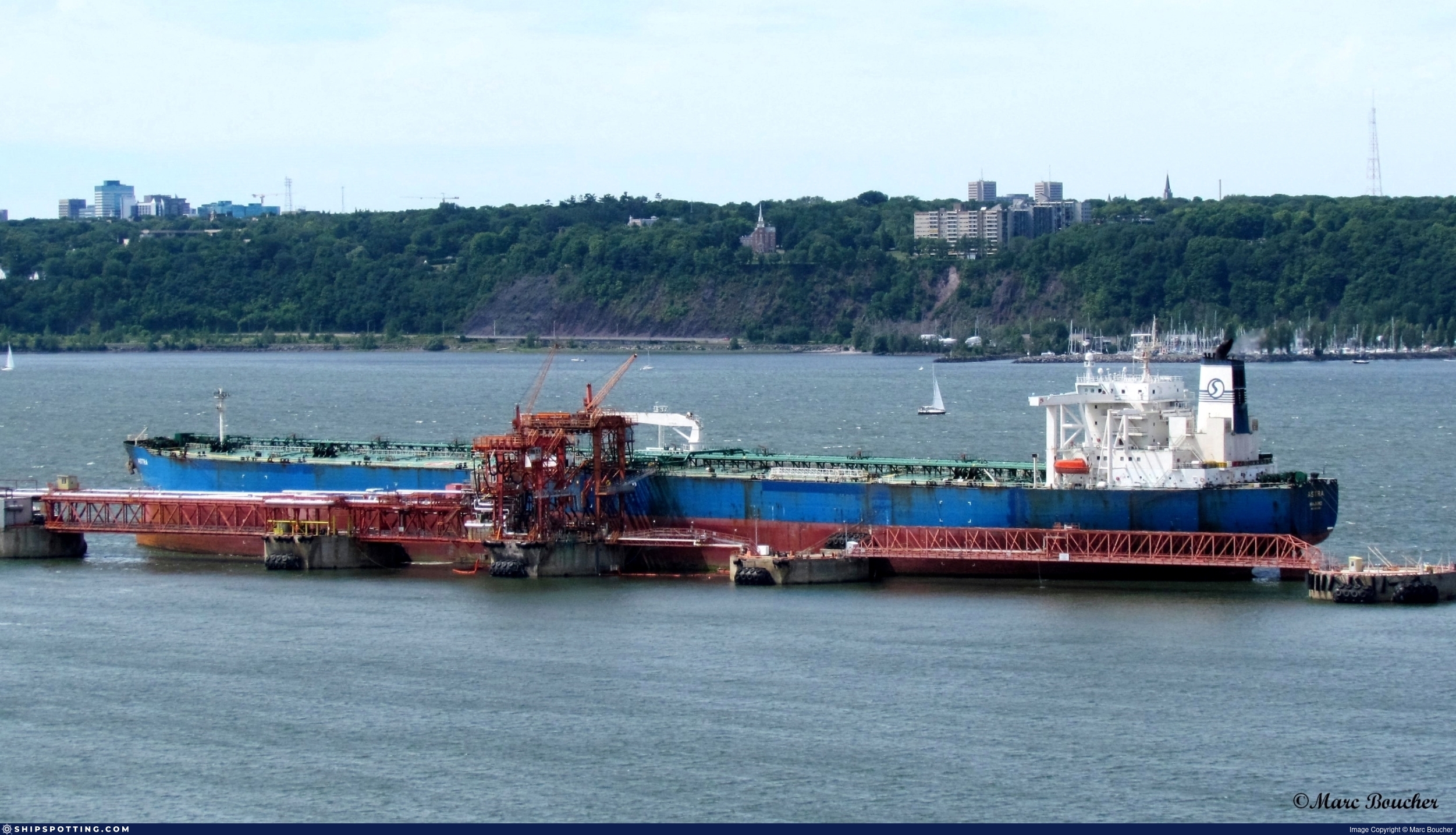
IMO 9253909
Vessel information
Sanctioned by
Company & Ownership
Management & Operations
Classification & Safety
Port State Control (PSC) Inspections
Survey Renewal & Certificates
| Code | Type | Issuer | Issued | Expires |
|---|---|---|---|---|
| 533 | Maritime Labour Certificate | RINA Services S.p.A. (RINA) (186) | 29/04/2024 | 29/04/2029 |
| 510 | Safety Management Certificate | RINA Services S.p.A. (RINA) (186) | 29/04/2024 | 29/04/2029 |
Programs & Notes
SEMA (Canada) — vessel designations | The Russia (Sanctions) (EU Exit) Regulations 2019
DateDesignated: 2025-05-20 | Shipping sanctions: (see “Other information”) | Shipping sanctions: a specified ship is prohibited from being provided with access to or having its master or pilot cause it to enter a port in the UK, may have its registration on the UK Ship Register terminated, and a master or pilot of a specified ship may be given a port barring direction, a detention direction, and a port entry direction or a movement direction. | IMO 9253909 (“JAMES II”) is involved in activity whose object or effect is to destabilise Ukraine or undermine or threaten the territorial integrity, sovereignty or independence of Ukraine or to obtain a benefit from or support the Government of Russia. Namely, IMO 9253909 is involved in carrying oil or oil products that originated in Russia from Russia to a third country.
Vessel Changes
AIS Events
50 events detected • 1 zone • Last: Jun 21, 2026
- Duration: 1h 38m
- Radius: 348 meters
- Data Points: 26 AIS positions
- Centroid: 41.4307, 29.5947
- Zone: Istanbul Black Sea Surveillance Zone
Show Raw Evidence JSON
{
    "radius_m": 347.6000000000000227373675443232059478759765625,
    "duration_minutes": 98.7000000000000028421709430404007434844970703125,
    "points": 26,
    "centroid": {
        "lat": 41.43066012692307964471183368004858493804931640625,
        "lon": 29.594738915384613875403374549932777881622314453125
    },
    "bbox": {
        "min_lat": 41.4297882999999984576788847334682941436767578125,
        "min_lon": 29.591419999999999390638549812138080596923828125,
        "max_lat": 41.4324299999999965393726597540080547332763671875,
        "max_lon": 29.598168300000001096350388252176344394683837890625
    },
    "zone_id": "discovered_024"
}- Zone: Istanbul Black Sea Surveillance Zone
- Duration: 1h 53m
- Data Points: 30 AIS positions
- Period: 2026-06-21T15:05:14+00:00 to 2026-06-21T16:59:04+00:00
Show Raw Evidence JSON
{
    "zone_id": "discovered_024",
    "zone_name": "Istanbul Black Sea Surveillance Zone",
    "dwell_minutes": 113.7999999999999971578290569595992565155029296875,
    "points_in_zone": 30,
    "first_point": {
        "ts": "2026-06-21T15:05:14+00:00",
        "lat": 41.433193299999999226201907731592655181884765625,
        "lon": 29.59919670000000024856490199454128742218017578125
    },
    "last_point": {
        "ts": "2026-06-21T16:59:04+00:00",
        "lat": 41.42992170000000129448380903340876102447509765625,
        "lon": 29.591419999999999390638549812138080596923828125
    }
}- Zone: Istanbul Black Sea Surveillance Zone
- Duration: 2h 57m
- Data Points: 48 AIS positions
- Period: 2026-06-21T14:01:14+00:00 to 2026-06-21T16:59:04+00:00
Show Raw Evidence JSON
{
    "zone_id": "discovered_024",
    "zone_name": "Istanbul Black Sea Surveillance Zone",
    "dwell_minutes": 177.80000000000001136868377216160297393798828125,
    "points_in_zone": 48,
    "first_point": {
        "ts": "2026-06-21T14:01:14+00:00",
        "lat": 41.43743829999999661595211364328861236572265625,
        "lon": 29.602759999999999962483343551866710186004638671875
    },
    "last_point": {
        "ts": "2026-06-21T16:59:04+00:00",
        "lat": 41.42992170000000129448380903340876102447509765625,
        "lon": 29.591419999999999390638549812138080596923828125
    }
}- Duration: 2h 45m
- Radius: 591 meters
- Data Points: 46 AIS positions
- Centroid: 41.4323, 29.5972
- Zone: Istanbul Black Sea Surveillance Zone
Show Raw Evidence JSON
{
    "radius_m": 590.799999999999954525264911353588104248046875,
    "duration_minutes": 165.80000000000001136868377216160297393798828125,
    "points": 46,
    "centroid": {
        "lat": 41.4323311913043568210923695005476474761962890625,
        "lon": 29.597222321739142358865137794055044651031494140625
    },
    "bbox": {
        "min_lat": 41.4297882999999984576788847334682941436767578125,
        "min_lon": 29.591419999999999390638549812138080596923828125,
        "max_lat": 41.43626830000000182963049155659973621368408203125,
        "max_lon": 29.601974999999999482724888366647064685821533203125
    },
    "zone_id": "discovered_024"
}- Duration: 3h 58m
- Radius: 1,005 meters
- Data Points: 63 AIS positions
- Centroid: 41.4345, 29.5987
- Zone: Istanbul Black Sea Surveillance Zone
Show Raw Evidence JSON
{
    "radius_m": 1004.5,
    "duration_minutes": 238.80000000000001136868377216160297393798828125,
    "points": 63,
    "centroid": {
        "lat": 41.4345048904761910080196685157716274261474609375,
        "lon": 29.598749950793649787783579085953533649444580078125
    },
    "bbox": {
        "min_lat": 41.4297882999999984576788847334682941436767578125,
        "min_lon": 29.591419999999999390638549812138080596923828125,
        "max_lat": 41.44303330000000329391696141101419925689697265625,
        "max_lon": 29.603329999999999699866748414933681488037109375
    },
    "zone_id": "discovered_024"
}- Zone: Istanbul Black Sea Surveillance Zone
- Duration: 3h 58m
- Data Points: 63 AIS positions
- Period: 2026-06-21T13:00:15+00:00 to 2026-06-21T16:59:04+00:00
Show Raw Evidence JSON
{
    "zone_id": "discovered_024",
    "zone_name": "Istanbul Black Sea Surveillance Zone",
    "dwell_minutes": 238.80000000000001136868377216160297393798828125,
    "points_in_zone": 63,
    "first_point": {
        "ts": "2026-06-21T13:00:15+00:00",
        "lat": 41.44303330000000329391696141101419925689697265625,
        "lon": 29.602751699999998891144059598445892333984375
    },
    "last_point": {
        "ts": "2026-06-21T16:59:04+00:00",
        "lat": 41.42992170000000129448380903340876102447509765625,
        "lon": 29.591419999999999390638549812138080596923828125
    }
}- Zone: Istanbul Black Sea Surveillance Zone
- Duration: 4h 48m
- Data Points: 77 AIS positions
- Period: 2026-06-21T12:10:34+00:00 to 2026-06-21T16:59:04+00:00
Show Raw Evidence JSON
{
    "zone_id": "discovered_024",
    "zone_name": "Istanbul Black Sea Surveillance Zone",
    "dwell_minutes": 288.5,
    "points_in_zone": 77,
    "first_point": {
        "ts": "2026-06-21T12:10:34+00:00",
        "lat": 41.4477217000000024427208700217306613922119140625,
        "lon": 29.603269999999998418616087292321026325225830078125
    },
    "last_point": {
        "ts": "2026-06-21T16:59:04+00:00",
        "lat": 41.42992170000000129448380903340876102447509765625,
        "lon": 29.591419999999999390638549812138080596923828125
    }
}- Duration: 4h 48m
- Radius: 1,288 meters
- Data Points: 77 AIS positions
- Centroid: 41.4365, 29.5996
- Zone: Istanbul Black Sea Surveillance Zone
Show Raw Evidence JSON
{
    "radius_m": 1287.700000000000045474735088646411895751953125,
    "duration_minutes": 288.5,
    "points": 77,
    "centroid": {
        "lat": 41.43646781038959403531407588161528110504150390625,
        "lon": 29.599563812987017996647409745492041110992431640625
    },
    "bbox": {
        "min_lat": 41.4297882999999984576788847334682941436767578125,
        "min_lon": 29.591419999999999390638549812138080596923828125,
        "max_lat": 41.4477217000000024427208700217306613922119140625,
        "max_lon": 29.603468299999999402416506200097501277923583984375
    },
    "zone_id": "discovered_024"
}- Duration: 5h 38m
- Radius: 1,575 meters
- Data Points: 86 AIS positions
- Centroid: 41.4379, 29.5998
- Zone: Istanbul Black Sea Surveillance Zone
Show Raw Evidence JSON
{
    "radius_m": 1575.09999999999990905052982270717620849609375,
    "duration_minutes": 338.30000000000001136868377216160297393798828125,
    "points": 86,
    "centroid": {
        "lat": 41.43793204883719027975530480034649372100830078125,
        "lon": 29.599818588372098560057565919123589992523193359375
    },
    "bbox": {
        "min_lat": 41.4297882999999984576788847334682941436767578125,
        "min_lon": 29.591419999999999390638549812138080596923828125,
        "max_lat": 41.45207500000000067075234255753457546234130859375,
        "max_lon": 29.603468299999999402416506200097501277923583984375
    },
    "zone_id": "discovered_024"
}- Zone: Istanbul Black Sea Surveillance Zone
- Duration: 5h 58m
- Data Points: 91 AIS positions
- Period: 2026-06-21T11:00:44+00:00 to 2026-06-21T16:59:04+00:00
Show Raw Evidence JSON
{
    "zone_id": "discovered_024",
    "zone_name": "Istanbul Black Sea Surveillance Zone",
    "dwell_minutes": 358.30000000000001136868377216160297393798828125,
    "points_in_zone": 91,
    "first_point": {
        "ts": "2026-06-21T11:00:44+00:00",
        "lat": 41.45366829999999680467226426117122173309326171875,
        "lon": 29.600415000000001697344487183727324008941650390625
    },
    "last_point": {
        "ts": "2026-06-21T16:59:04+00:00",
        "lat": 41.42992170000000129448380903340876102447509765625,
        "lon": 29.591419999999999390638549812138080596923828125
    }
}- Zone: Istanbul Black Sea Surveillance Zone
- Duration: 6h 37m
- Data Points: 101 AIS positions
- Period: 2026-06-21T10:21:14+00:00 to 2026-06-21T16:59:04+00:00
Show Raw Evidence JSON
{
    "zone_id": "discovered_024",
    "zone_name": "Istanbul Black Sea Surveillance Zone",
    "dwell_minutes": 397.80000000000001136868377216160297393798828125,
    "points_in_zone": 101,
    "first_point": {
        "ts": "2026-06-21T10:21:14+00:00",
        "lat": 41.4576100000000025147528504021465778350830078125,
        "lon": 29.598673300000001518128556199371814727783203125
    },
    "last_point": {
        "ts": "2026-06-21T16:59:04+00:00",
        "lat": 41.42992170000000129448380903340876102447509765625,
        "lon": 29.591419999999999390638549812138080596923828125
    }
}- Duration: 4h 52m
- Radius: 1,421 meters
- Data Points: 74 AIS positions
- Centroid: 41.4411, 29.6014
- Zone: Istanbul Black Sea Surveillance Zone
Show Raw Evidence JSON
{
    "radius_m": 1420.90000000000009094947017729282379150390625,
    "duration_minutes": 292.80000000000001136868377216160297393798828125,
    "points": 74,
    "centroid": {
        "lat": 41.44105909189187997299086418934166431427001953125,
        "lon": 29.60139304324325593142930301837623119354248046875
    },
    "bbox": {
        "min_lat": 41.4311950000000024374458007514476776123046875,
        "min_lon": 29.596256700000001416128725395537912845611572265625,
        "max_lat": 41.45383000000000350837581208907067775726318359375,
        "max_lon": 29.603468299999999402416506200097501277923583984375
    },
    "zone_id": "discovered_024"
}- Duration: 3h 49m
- Radius: 1,368 meters
- Data Points: 58 AIS positions
- Centroid: 41.4498, 29.6013
- Zone: Istanbul Black Sea Surveillance Zone
Show Raw Evidence JSON
{
    "radius_m": 1367.59999999999990905052982270717620849609375,
    "duration_minutes": 229.69999999999998863131622783839702606201171875,
    "points": 58,
    "centroid": {
        "lat": 41.44979792586206457372099976055324077606201171875,
        "lon": 29.6012798620689636663882993161678314208984375
    },
    "bbox": {
        "min_lat": 41.43957000000000334694050252437591552734375,
        "min_lon": 29.595908300000001389662429573945701122283935546875,
        "max_lat": 41.46143000000000000682121026329696178436279296875,
        "max_lon": 29.603468299999999402416506200097501277923583984375
    },
    "zone_id": "discovered_024"
}- Zone: Istanbul Black Sea Surveillance Zone
- Duration: 6h 36m
- Data Points: 100 AIS positions
- Period: 2026-06-21T09:52:35+00:00 to 2026-06-21T16:28:54+00:00
Show Raw Evidence JSON
{
    "zone_id": "discovered_024",
    "zone_name": "Istanbul Black Sea Surveillance Zone",
    "dwell_minutes": 396.30000000000001136868377216160297393798828125,
    "points_in_zone": 100,
    "first_point": {
        "ts": "2026-06-21T09:52:35+00:00",
        "lat": 41.46143000000000000682121026329696178436279296875,
        "lon": 29.595908300000001389662429573945701122283935546875
    },
    "last_point": {
        "ts": "2026-06-21T16:28:54+00:00",
        "lat": 41.42997170000000295431163976900279521942138671875,
        "lon": 29.593521700000000151931089931167662143707275390625
    }
}- Zone: Istanbul Black Sea Surveillance Zone
- Duration: 6h 31m
- Data Points: 101 AIS positions
- Period: 2026-06-21T08:53:35+00:00 to 2026-06-21T15:24:34+00:00
Show Raw Evidence JSON
{
    "zone_id": "discovered_024",
    "zone_name": "Istanbul Black Sea Surveillance Zone",
    "dwell_minutes": 391,
    "points_in_zone": 101,
    "first_point": {
        "ts": "2026-06-21T08:53:35+00:00",
        "lat": 41.4685750000000012960299500264227390289306640625,
        "lon": 29.585384999999998711928128614090383052825927734375
    },
    "last_point": {
        "ts": "2026-06-21T15:24:34+00:00",
        "lat": 41.43226829999999694109646952711045742034912109375,
        "lon": 29.5979099999999988312993082217872142791748046875
    }
}- Duration: 3 hours
- Radius: 1,434 meters
- Data Points: 46 AIS positions
- Centroid: 41.4579, 29.5972
- Zone: Istanbul Black Sea Surveillance Zone
Show Raw Evidence JSON
{
    "radius_m": 1434.40000000000009094947017729282379150390625,
    "duration_minutes": 180.19999999999998863131622783839702606201171875,
    "points": 46,
    "centroid": {
        "lat": 41.4579170260869460662433994002640247344970703125,
        "lon": 29.59723322826086899794972850941121578216552734375
    },
    "bbox": {
        "min_lat": 41.448745000000002391971065662801265716552734375,
        "min_lon": 29.586446699999999765395841677673161029815673828125,
        "max_lat": 41.46796499999999952024154481478035449981689453125,
        "max_lon": 29.602843299999999970850694808177649974822998046875
    },
    "zone_id": "discovered_024"
}- Duration: 1h 57m
- Radius: 1,100 meters
- Data Points: 32 AIS positions
- Centroid: 41.4672, 29.5865
- Zone: Istanbul Black Sea Surveillance Zone
Show Raw Evidence JSON
{
    "radius_m": 1100.40000000000009094947017729282379150390625,
    "duration_minutes": 117.2000000000000028421709430404007434844970703125,
    "points": 32,
    "centroid": {
        "lat": 41.4672033843750114101567305624485015869140625,
        "lon": 29.586533959375000080171957961283624172210693359375
    },
    "bbox": {
        "min_lat": 41.46089829999999665233190171420574188232421875,
        "min_lon": 29.574985000000001633679858059622347354888916015625,
        "max_lat": 41.4719683000000003403329174034297466278076171875,
        "max_lon": 29.5963966999999996687620296142995357513427734375
    },
    "zone_id": "discovered_024"
}- Zone: Istanbul Black Sea Surveillance Zone
- Duration: 6h 38m
- Data Points: 101 AIS positions
- Period: 2026-06-21T07:51:35+00:00 to 2026-06-21T14:29:54+00:00
Show Raw Evidence JSON
{
    "zone_id": "discovered_024",
    "zone_name": "Istanbul Black Sea Surveillance Zone",
    "dwell_minutes": 398.30000000000001136868377216160297393798828125,
    "points_in_zone": 101,
    "first_point": {
        "ts": "2026-06-21T07:51:35+00:00",
        "lat": 41.47223670000000339541657012887299060821533203125,
        "lon": 29.573415000000000674162947689183056354522705078125
    },
    "last_point": {
        "ts": "2026-06-21T14:29:54+00:00",
        "lat": 41.43515000000000014779288903810083866119384765625,
        "lon": 29.60106499999999840611053514294326305389404296875
    }
}- Duration: 2h 7m
- Radius: 1,159 meters
- Data Points: 36 AIS positions
- Centroid: 41.4720, 29.5723
- Zone: Istanbul Black Sea Surveillance Zone
Show Raw Evidence JSON
{
    "radius_m": 1159.299999999999954525264911353588104248046875,
    "duration_minutes": 127.7999999999999971578290569595992565155029296875,
    "points": 36,
    "centroid": {
        "lat": 41.47203064444445175240616663359105587005615234375,
        "lon": 29.572289861111112685421176138333976268768310546875
    },
    "bbox": {
        "min_lat": 41.4685750000000012960299500264227390289306640625,
        "min_lon": 29.56019669999999877063601161353290081024169921875,
        "max_lat": 41.47378830000000249356162385083734989166259765625,
        "max_lon": 29.585384999999998711928128614090383052825927734375
    },
    "zone_id": "discovered_024"
}- Zone: Istanbul Black Sea Surveillance Zone
- Duration: 6h 38m
- Data Points: 103 AIS positions
- Period: 2026-06-21T06:51:05+00:00 to 2026-06-21T13:29:04+00:00
Show Raw Evidence JSON
{
    "zone_id": "discovered_024",
    "zone_name": "Istanbul Black Sea Surveillance Zone",
    "dwell_minutes": 398,
    "points_in_zone": 103,
    "first_point": {
        "ts": "2026-06-21T06:51:05+00:00",
        "lat": 41.4736649999999968940755934454500675201416015625,
        "lon": 29.561205000000001064108801074326038360595703125
    },
    "last_point": {
        "ts": "2026-06-21T13:29:04+00:00",
        "lat": 41.44081829999999655456122127361595630645751953125,
        "lon": 29.6030200000000007776179700158536434173583984375
    }
}- Zone: Istanbul Black Sea Surveillance Zone
- Duration: 6h 32m
- Data Points: 100 AIS positions
- Period: 2026-06-21T05:52:35+00:00 to 2026-06-21T12:24:44+00:00
Show Raw Evidence JSON
{
    "zone_id": "discovered_024",
    "zone_name": "Istanbul Black Sea Surveillance Zone",
    "dwell_minutes": 392.1000000000000227373675443232059478759765625,
    "points_in_zone": 100,
    "first_point": {
        "ts": "2026-06-21T05:52:35+00:00",
        "lat": 41.47491000000000127556631923653185367584228515625,
        "lon": 29.55039670000000029403963708318769931793212890625
    },
    "last_point": {
        "ts": "2026-06-21T12:24:44+00:00",
        "lat": 41.44628329999999749588823760859668254852294921875,
        "lon": 29.603453300000001746639100019820034503936767578125
    }
}- Duration: 2h 14m
- Radius: 1,144 meters
- Data Points: 37 AIS positions
- Centroid: 41.4734, 29.5630
- Zone: Istanbul Black Sea Surveillance Zone
Show Raw Evidence JSON
{
    "radius_m": 1143.799999999999954525264911353588104248046875,
    "duration_minutes": 134.69999999999998863131622783839702606201171875,
    "points": 37,
    "centroid": {
        "lat": 41.47344895945946774418189306743443012237548828125,
        "lon": 29.562995897297302150263931252993643283843994140625
    },
    "bbox": {
        "min_lat": 41.4717167000000017651473172008991241455078125,
        "min_lon": 29.55039670000000029403963708318769931793212890625,
        "max_lat": 41.47491000000000127556631923653185367584228515625,
        "max_lon": 29.576493299999999209148882073350250720977783203125
    },
    "zone_id": "discovered_024"
}- Duration: 3h 1m
- Radius: 1,735 meters
- Data Points: 37 AIS positions
- Centroid: 41.4737, 29.5606
- Zone: Istanbul Black Sea Surveillance Zone
Show Raw Evidence JSON
{
    "radius_m": 1735.299999999999954525264911353588104248046875,
    "duration_minutes": 181.30000000000001136868377216160297393798828125,
    "points": 37,
    "centroid": {
        "lat": 41.47372143783784537163228378631174564361572265625,
        "lon": 29.56060468378378658371730125509202480316162109375
    },
    "bbox": {
        "min_lat": 41.47211329999999662732079741545021533966064453125,
        "min_lon": 29.539963300000000145928424899466335773468017578125,
        "max_lat": 41.47549000000000063437255448661744594573974609375,
        "max_lon": 29.574214999999998809698809054680168628692626953125
    },
    "zone_id": "discovered_024"
}- Zone: Istanbul Black Sea Surveillance Zone
- Duration: 6h 30m
- Data Points: 91 AIS positions
- Period: 2026-06-21T04:54:14+00:00 to 2026-06-21T11:24:45+00:00
Show Raw Evidence JSON
{
    "zone_id": "discovered_024",
    "zone_name": "Istanbul Black Sea Surveillance Zone",
    "dwell_minutes": 390.5,
    "points_in_zone": 91,
    "first_point": {
        "ts": "2026-06-21T04:54:14+00:00",
        "lat": 41.47549000000000063437255448661744594573974609375,
        "lon": 29.539963300000000145928424899466335773468017578125
    },
    "last_point": {
        "ts": "2026-06-21T11:24:45+00:00",
        "lat": 41.45174829999999843721525394357740879058837890625,
        "lon": 29.60137329999999877827576710842549800872802734375
    }
}- Duration: 1h 52m
- Radius: 757 meters
- Data Points: 40 AIS positions
- Centroid: 41.4747, 29.5310
- Zone: Istanbul Black Sea Surveillance Zone
Show Raw Evidence JSON
{
    "radius_m": 757,
    "duration_minutes": 112.7000000000000028421709430404007434844970703125,
    "points": 40,
    "centroid": {
        "lat": 41.47467099499998965939084882847964763641357421875,
        "lon": 29.530965752499998444591255974955856800079345703125
    },
    "bbox": {
        "min_lat": 41.47319829999999996061887941323220729827880859375,
        "min_lon": 29.523481700000001382022674079053103923797607421875,
        "max_lat": 41.47554670000000243135218624956905841827392578125,
        "max_lon": 29.539963300000000145928424899466335773468017578125
    },
    "zone_id": "discovered_024"
}- Zone: Istanbul Black Sea Surveillance Zone
- Duration: 6h 38m
- Data Points: 99 AIS positions
- Period: 2026-06-21T03:51:14+00:00 to 2026-06-21T10:29:34+00:00
Show Raw Evidence JSON
{
    "zone_id": "discovered_024",
    "zone_name": "Istanbul Black Sea Surveillance Zone",
    "dwell_minutes": 398.30000000000001136868377216160297393798828125,
    "points_in_zone": 99,
    "first_point": {
        "ts": "2026-06-21T03:51:14+00:00",
        "lat": 41.474705000000000154614099301397800445556640625,
        "lon": 29.529998299999999034071151982061564922332763671875
    },
    "last_point": {
        "ts": "2026-06-21T10:29:34+00:00",
        "lat": 41.45663669999999711990312789566814899444580078125,
        "lon": 29.599166700000001384296410833485424518585205078125
    }
}- Duration: 2h 48m
- Radius: 1,008 meters
- Data Points: 55 AIS positions
- Centroid: 41.4739, 29.5281
- Zone: Istanbul Black Sea Surveillance Zone
Show Raw Evidence JSON
{
    "radius_m": 1007.6000000000000227373675443232059478759765625,
    "duration_minutes": 168,
    "points": 55,
    "centroid": {
        "lat": 41.47387102363635591473212116397917270660400390625,
        "lon": 29.52809424363636736643456970341503620147705078125
    },
    "bbox": {
        "min_lat": 41.46998330000000265727067016996443271636962890625,
        "min_lon": 29.5180332999999990306605468504130840301513671875,
        "max_lat": 41.47554670000000243135218624956905841827392578125,
        "max_lon": 29.539963300000000145928424899466335773468017578125
    },
    "zone_id": "discovered_024"
}- Zone: Istanbul Black Sea Surveillance Zone
- Duration: 6h 32m
- Data Points: 101 AIS positions
- Period: 2026-06-21T02:54:25+00:00 to 2026-06-21T09:26:35+00:00
Show Raw Evidence JSON
{
    "zone_id": "discovered_024",
    "zone_name": "Istanbul Black Sea Surveillance Zone",
    "dwell_minutes": 392.19999999999998863131622783839702606201171875,
    "points_in_zone": 101,
    "first_point": {
        "ts": "2026-06-21T02:54:25+00:00",
        "lat": 41.4728750000000019326762412674725055694580078125,
        "lon": 29.522600000000000619593265582807362079620361328125
    },
    "last_point": {
        "ts": "2026-06-21T09:26:35+00:00",
        "lat": 41.464636699999999791543814353644847869873046875,
        "lon": 29.591789999999999594137989333830773830413818359375
    }
}- Duration: 3h 22m
- Radius: 1,156 meters
- Data Points: 64 AIS positions
- Centroid: 41.4731, 29.5265
- Zone: Istanbul Black Sea Surveillance Zone
Show Raw Evidence JSON
{
    "radius_m": 1156,
    "duration_minutes": 202.19999999999998863131622783839702606201171875,
    "points": 64,
    "centroid": {
        "lat": 41.4731252281249993529854691587388515472412109375,
        "lon": 29.526485367187500941099642659537494182586669921875
    },
    "bbox": {
        "min_lat": 41.467618299999998043858795426785945892333984375,
        "min_lon": 29.5158516999999989138814271427690982818603515625,
        "max_lat": 41.47554670000000243135218624956905841827392578125,
        "max_lon": 29.539963300000000145928424899466335773468017578125
    },
    "zone_id": "discovered_024"
}- Zone: Istanbul Black Sea Surveillance Zone
- Duration: 6h 36m
- Data Points: 104 AIS positions
- Period: 2026-06-21T01:53:14+00:00 to 2026-06-21T08:29:45+00:00
Show Raw Evidence JSON
{
    "zone_id": "discovered_024",
    "zone_name": "Istanbul Black Sea Surveillance Zone",
    "dwell_minutes": 396.5,
    "points_in_zone": 104,
    "first_point": {
        "ts": "2026-06-21T01:53:14+00:00",
        "lat": 41.46908499999999975216269376687705516815185546875,
        "lon": 29.517083299999999468354872078634798526763916015625
    },
    "last_point": {
        "ts": "2026-06-21T08:29:45+00:00",
        "lat": 41.4705383000000011861629900522530078887939453125,
        "lon": 29.580923299999998477005647146143019199371337890625
    }
}- Duration: 3h 57m
- Radius: 1,155 meters
- Data Points: 68 AIS positions
- Centroid: 41.4716, 29.5230
- Zone: Istanbul Black Sea Surveillance Zone
Show Raw Evidence JSON
{
    "radius_m": 1155,
    "duration_minutes": 237.5,
    "points": 68,
    "centroid": {
        "lat": 41.47158825441175622472655959427356719970703125,
        "lon": 29.523032282352939859038087888620793819427490234375
    },
    "bbox": {
        "min_lat": 41.464398299999999153442331589758396148681640625,
        "min_lon": 29.51352669999999989158823154866695404052734375,
        "max_lat": 41.47549500000000222144080908037722110748291015625,
        "max_lon": 29.53584670000000045320120989345014095306396484375
    },
    "zone_id": "discovered_024"
}- Zone: Istanbul Black Sea Surveillance Zone
- Duration: 6h 36m
- Data Points: 101 AIS positions
- Period: 2026-06-21T00:32:23+00:00 to 2026-06-21T07:09:04+00:00
Show Raw Evidence JSON
{
    "zone_id": "discovered_024",
    "zone_name": "Istanbul Black Sea Surveillance Zone",
    "dwell_minutes": 396.69999999999998863131622783839702606201171875,
    "points_in_zone": 101,
    "first_point": {
        "ts": "2026-06-21T00:32:23+00:00",
        "lat": 41.464398299999999153442331589758396148681640625,
        "lon": 29.51352669999999989158823154866695404052734375
    },
    "last_point": {
        "ts": "2026-06-21T07:09:04+00:00",
        "lat": 41.4732800000000025875124265439808368682861328125,
        "lon": 29.56471499999999963392838253639638423919677734375
    }
}- Duration: 5h 10m
- Radius: 1,173 meters
- Data Points: 69 AIS positions
- Centroid: 41.4712, 29.5222
- Zone: Istanbul Black Sea Surveillance Zone
Show Raw Evidence JSON
{
    "radius_m": 1172.700000000000045474735088646411895751953125,
    "duration_minutes": 310.5,
    "points": 69,
    "centroid": {
        "lat": 41.47116574347825235236086882650852203369140625,
        "lon": 29.522221789855070284147586789913475513458251953125
    },
    "bbox": {
        "min_lat": 41.4642683000000005222318577580153942108154296875,
        "min_lon": 29.5115617000000014513716450892388820648193359375,
        "max_lat": 41.4754582999999996673068380914628505706787109375,
        "max_lon": 29.535048299999999699139152653515338897705078125
    },
    "zone_id": "discovered_024"
}- Zone: Istanbul Black Sea Surveillance Zone
- Duration: 6h 34m
- Data Points: 81 AIS positions
- Period: 2026-06-20T23:14:36+00:00 to 2026-06-21T05:49:14+00:00
Show Raw Evidence JSON
{
    "zone_id": "discovered_024",
    "zone_name": "Istanbul Black Sea Surveillance Zone",
    "dwell_minutes": 394.6000000000000227373675443232059478759765625,
    "points_in_zone": 81,
    "first_point": {
        "ts": "2026-06-20T23:14:36+00:00",
        "lat": 41.46480170000000242680471274070441722869873046875,
        "lon": 29.5115617000000014513716450892388820648193359375
    },
    "last_point": {
        "ts": "2026-06-21T05:49:14+00:00",
        "lat": 41.4749766999999991412551025860011577606201171875,
        "lon": 29.54981169999999934816514723934233188629150390625
    }
}- Duration: 5h 38m
- Radius: 1,172 meters
- Data Points: 72 AIS positions
- Centroid: 41.4705, 29.5208
- Zone: Istanbul Black Sea Surveillance Zone
Show Raw Evidence JSON
{
    "radius_m": 1172.200000000000045474735088646411895751953125,
    "duration_minutes": 338.80000000000001136868377216160297393798828125,
    "points": 72,
    "centroid": {
        "lat": 41.47046858194443785805560764856636524200439453125,
        "lon": 29.5207547486111110401907353661954402923583984375
    },
    "bbox": {
        "min_lat": 41.4642683000000005222318577580153942108154296875,
        "min_lon": 29.50965670000000073969204095192253589630126953125,
        "max_lat": 41.47531330000000338031895807944238185882568359375,
        "max_lon": 29.5332216999999985773683874867856502532958984375
    },
    "zone_id": "discovered_024"
}- Zone: Istanbul Black Sea Surveillance Zone
- Duration: 6h 19m
- Data Points: 85 AIS positions
- Period: 2026-06-20T22:34:45+00:00 to 2026-06-21T04:54:14+00:00
Show Raw Evidence JSON
{
    "zone_id": "discovered_024",
    "zone_name": "Istanbul Black Sea Surveillance Zone",
    "dwell_minutes": 379.5,
    "points_in_zone": 85,
    "first_point": {
        "ts": "2026-06-20T22:34:45+00:00",
        "lat": 41.46450829999999854180714464746415615081787109375,
        "lon": 29.50965670000000073969204095192253589630126953125
    },
    "last_point": {
        "ts": "2026-06-21T04:54:14+00:00",
        "lat": 41.47549000000000063437255448661744594573974609375,
        "lon": 29.539963300000000145928424899466335773468017578125
    }
}- Duration: 6h 33m
- Radius: 1,367 meters
- Data Points: 72 AIS positions
- Centroid: 41.4701, 29.5201
- Zone: Istanbul Black Sea Surveillance Zone
Show Raw Evidence JSON
{
    "radius_m": 1367,
    "duration_minutes": 393.3999999999999772626324556767940521240234375,
    "points": 72,
    "centroid": {
        "lat": 41.47007443888887934235754073597490787506103515625,
        "lon": 29.52008639166666625897050835192203521728515625
    },
    "bbox": {
        "min_lat": 41.461008300000003146124072372913360595703125,
        "min_lon": 29.50898670000000123536665341816842555999755859375,
        "max_lat": 41.4751083000000022593667381443083286285400390625,
        "max_lon": 29.532178300000001769376467564143240451812744140625
    },
    "zone_id": "discovered_024"
}- Zone: Istanbul Black Sea Surveillance Zone
- Duration: 6h 33m
- Data Points: 72 AIS positions
- Period: 2026-06-20T21:33:08+00:00 to 2026-06-21T04:06:35+00:00
Show Raw Evidence JSON
{
    "zone_id": "discovered_024",
    "zone_name": "Istanbul Black Sea Surveillance Zone",
    "dwell_minutes": 393.3999999999999772626324556767940521240234375,
    "points_in_zone": 72,
    "first_point": {
        "ts": "2026-06-20T21:33:08+00:00",
        "lat": 41.461008300000003146124072372913360595703125,
        "lon": 29.50901999999999958390617393888533115386962890625
    },
    "last_point": {
        "ts": "2026-06-21T04:06:35+00:00",
        "lat": 41.4751083000000022593667381443083286285400390625,
        "lon": 29.532178300000001769376467564143240451812744140625
    }
}- Duration: 6h 35m
- Radius: 830 meters
- Data Points: 48 AIS positions
- Centroid: 41.4662, 29.5144
- Zone: Istanbul Black Sea Surveillance Zone
Show Raw Evidence JSON
{
    "radius_m": 829.5,
    "duration_minutes": 395.19999999999998863131622783839702606201171875,
    "points": 48,
    "centroid": {
        "lat": 41.46622714583332225402045878581702709197998046875,
        "lon": 29.514436289583333206110182800330221652984619140625
    },
    "bbox": {
        "min_lat": 41.4600132999999999583451426587998867034912109375,
        "min_lon": 29.50898670000000123536665341816842555999755859375,
        "max_lat": 41.47203830000000124300640891306102275848388671875,
        "max_lon": 29.520675000000000665068000671453773975372314453125
    },
    "zone_id": "discovered_024"
}- Zone: Istanbul Black Sea Surveillance Zone
- Duration: 6h 35m
- Data Points: 48 AIS positions
- Period: 2026-06-20T20:01:59+00:00 to 2026-06-21T02:37:14+00:00
Show Raw Evidence JSON
{
    "zone_id": "discovered_024",
    "zone_name": "Istanbul Black Sea Surveillance Zone",
    "dwell_minutes": 395.19999999999998863131622783839702606201171875,
    "points_in_zone": 48,
    "first_point": {
        "ts": "2026-06-20T20:01:59+00:00",
        "lat": 41.462046700000001919761416502296924591064453125,
        "lon": 29.513805000000001399484972353093326091766357421875
    },
    "last_point": {
        "ts": "2026-06-21T02:37:14+00:00",
        "lat": 41.47203830000000124300640891306102275848388671875,
        "lon": 29.520675000000000665068000671453773975372314453125
    }
}- Duration: 6h 33m
- Radius: 801 meters
- Data Points: 47 AIS positions
- Centroid: 41.4657, 29.5140
- Zone: Istanbul Black Sea Surveillance Zone
Show Raw Evidence JSON
{
    "radius_m": 800.5,
    "duration_minutes": 393.19999999999998863131622783839702606201171875,
    "points": 47,
    "centroid": {
        "lat": 41.46569517234041057918147998861968517303466796875,
        "lon": 29.514038410638303133737281314097344875335693359375
    },
    "bbox": {
        "min_lat": 41.4600132999999999583451426587998867034912109375,
        "min_lon": 29.50898670000000123536665341816842555999755859375,
        "max_lat": 41.471468299999997952909325249493122100830078125,
        "max_lon": 29.519774999999999209876477834768593311309814453125
    },
    "zone_id": "discovered_024"
}- Zone: Istanbul Black Sea Surveillance Zone
- Duration: 6h 33m
- Data Points: 47 AIS positions
- Period: 2026-06-20T19:54:30+00:00 to 2026-06-21T02:27:45+00:00
Show Raw Evidence JSON
{
    "zone_id": "discovered_024",
    "zone_name": "Istanbul Black Sea Surveillance Zone",
    "dwell_minutes": 393.19999999999998863131622783839702606201171875,
    "points_in_zone": 47,
    "first_point": {
        "ts": "2026-06-20T19:54:30+00:00",
        "lat": 41.46223169999999669244061806239187717437744140625,
        "lon": 29.5140616999999991776348906569182872772216796875
    },
    "last_point": {
        "ts": "2026-06-21T02:27:45+00:00",
        "lat": 41.471468299999997952909325249493122100830078125,
        "lon": 29.519774999999999209876477834768593311309814453125
    }
}- Zone: Istanbul Black Sea Surveillance Zone
- Duration: 6h 38m
- Data Points: 50 AIS positions
- Period: 2026-06-20T18:51:09+00:00 to 2026-06-21T01:29:55+00:00
Show Raw Evidence JSON
{
    "zone_id": "discovered_024",
    "zone_name": "Istanbul Black Sea Surveillance Zone",
    "dwell_minutes": 398.80000000000001136868377216160297393798828125,
    "points_in_zone": 50,
    "first_point": {
        "ts": "2026-06-20T18:51:09+00:00",
        "lat": 41.4647932999999966341420076787471771240234375,
        "lon": 29.5157999999999987039700499735772609710693359375
    },
    "last_point": {
        "ts": "2026-06-21T01:29:55+00:00",
        "lat": 41.46744670000000354548319592140614986419677734375,
        "lon": 29.51573499999999938836481305770576000213623046875
    }
}- Duration: 6h 38m
- Radius: 510 meters
- Data Points: 50 AIS positions
- Centroid: 41.4638, 29.5133
- Zone: Istanbul Black Sea Surveillance Zone
Show Raw Evidence JSON
{
    "radius_m": 509.6000000000000227373675443232059478759765625,
    "duration_minutes": 398.80000000000001136868377216160297393798828125,
    "points": 50,
    "centroid": {
        "lat": 41.46377489800000404329693992622196674346923828125,
        "lon": 29.51331030000000765767254051752388477325439453125
    },
    "bbox": {
        "min_lat": 41.4600132999999999583451426587998867034912109375,
        "min_lon": 29.50898670000000123536665341816842555999755859375,
        "max_lat": 41.46744670000000354548319592140614986419677734375,
        "max_lon": 29.5157999999999987039700499735772609710693359375
    },
    "zone_id": "discovered_024"
}- Duration: 6h 39m
- Radius: 611 meters
- Data Points: 56 AIS positions
- Centroid: 41.4642, 29.5141
- Zone: Istanbul Black Sea Surveillance Zone
Show Raw Evidence JSON
{
    "radius_m": 610.700000000000045474735088646411895751953125,
    "duration_minutes": 399.1000000000000227373675443232059478759765625,
    "points": 56,
    "centroid": {
        "lat": 41.46422038571427748365749721415340900421142578125,
        "lon": 29.514107082142846394390289788134396076202392578125
    },
    "bbox": {
        "min_lat": 41.4600132999999999583451426587998867034912109375,
        "min_lon": 29.50898670000000123536665341816842555999755859375,
        "max_lat": 41.4691516999999976178514771163463592529296875,
        "max_lon": 29.517341699999999349302015616558492183685302734375
    },
    "zone_id": "discovered_024"
}- Zone: Istanbul Black Sea Surveillance Zone
- Duration: 6h 39m
- Data Points: 56 AIS positions
- Period: 2026-06-20T17:50:20+00:00 to 2026-06-21T00:29:23+00:00
Show Raw Evidence JSON
{
    "zone_id": "discovered_024",
    "zone_name": "Istanbul Black Sea Surveillance Zone",
    "dwell_minutes": 399.1000000000000227373675443232059478759765625,
    "points_in_zone": 56,
    "first_point": {
        "ts": "2026-06-20T17:50:20+00:00",
        "lat": 41.4691516999999976178514771163463592529296875,
        "lon": 29.517341699999999349302015616558492183685302734375
    },
    "last_point": {
        "ts": "2026-06-21T00:29:23+00:00",
        "lat": 41.46433499999999838792064110748469829559326171875,
        "lon": 29.513470000000001647322278586216270923614501953125
    }
}- Zone: Istanbul Black Sea Surveillance Zone
- Duration: 6h 31m
- Data Points: 71 AIS positions
- Period: 2026-06-20T16:42:40+00:00 to 2026-06-20T23:14:36+00:00
Show Raw Evidence JSON
{
    "zone_id": "discovered_024",
    "zone_name": "Istanbul Black Sea Surveillance Zone",
    "dwell_minutes": 391.8999999999999772626324556767940521240234375,
    "points_in_zone": 71,
    "first_point": {
        "ts": "2026-06-20T16:42:40+00:00",
        "lat": 41.476799999999997226041159592568874359130859375,
        "lon": 29.516813299999999031797415227629244327545166015625
    },
    "last_point": {
        "ts": "2026-06-20T23:14:36+00:00",
        "lat": 41.46480170000000242680471274070441722869873046875,
        "lon": 29.5115617000000014513716450892388820648193359375
    }
}- Duration: 6h 31m
- Radius: 1,171 meters
- Data Points: 71 AIS positions
- Centroid: 41.4664, 29.5149
- Zone: Istanbul Black Sea Surveillance Zone
Show Raw Evidence JSON
{
    "radius_m": 1170.799999999999954525264911353588104248046875,
    "duration_minutes": 391.8999999999999772626324556767940521240234375,
    "points": 71,
    "centroid": {
        "lat": 41.466360823943659852375276386737823486328125,
        "lon": 29.51486673521126391506186337210237979888916015625
    },
    "bbox": {
        "min_lat": 41.4600132999999999583451426587998867034912109375,
        "min_lon": 29.50898670000000123536665341816842555999755859375,
        "max_lat": 41.476799999999997226041159592568874359130859375,
        "max_lon": 29.517438299999998463363226619549095630645751953125
    },
    "zone_id": "discovered_024"
}- Duration: 5h 45m
- Radius: 1,609 meters
- Data Points: 77 AIS positions
- Centroid: 41.4688, 29.5155
- Zone: Istanbul Black Sea Surveillance Zone
Show Raw Evidence JSON
{
    "radius_m": 1608.59999999999990905052982270717620849609375,
    "duration_minutes": 345.6000000000000227373675443232059478759765625,
    "points": 77,
    "centroid": {
        "lat": 41.4687684883116816081383149139583110809326171875,
        "lon": 29.515451859740256423947357689030468463897705078125
    },
    "bbox": {
        "min_lat": 41.4600132999999999583451426587998867034912109375,
        "min_lon": 29.50898670000000123536665341816842555999755859375,
        "max_lat": 41.4832516999999967310941428877413272857666015625,
        "max_lon": 29.517438299999998463363226619549095630645751953125
    },
    "zone_id": "discovered_024"
}- Zone: Istanbul Black Sea Surveillance Zone
- Duration: 6h 34m
- Data Points: 94 AIS positions
- Period: 2026-06-20T15:01:39+00:00 to 2026-06-20T21:35:47+00:00
Show Raw Evidence JSON
{
    "zone_id": "discovered_024",
    "zone_name": "Istanbul Black Sea Surveillance Zone",
    "dwell_minutes": 394.1000000000000227373675443232059478759765625,
    "points_in_zone": 94,
    "first_point": {
        "ts": "2026-06-20T15:01:39+00:00",
        "lat": 41.48924170000000088975866674445569515228271484375,
        "lon": 29.51444670000000058962541515938937664031982421875
    },
    "last_point": {
        "ts": "2026-06-20T21:35:47+00:00",
        "lat": 41.461150000000003501554601825773715972900390625,
        "lon": 29.50898670000000123536665341816842555999755859375
    }
}Source snapshot
| Sanctioner | As of | Entity ID |
|---|---|---|
| 🇬🇧 UK | 2025-09-29 | 9253909 |
We mirror official lists; always verify at the source.
Sanctioned on the same day
- Bronco · IMO 8808525 🇨🇦 CA🇪🇺 EU🇳🇿 NZ🇬🇧 UK
- CETUS · IMO 9418482 🇨🇦 CA🇪🇺 EU🇬🇧 UK
- FURIA · IMO 9257802 🇨🇦 CA🇪🇺 EU🇳🇿 NZ🇬🇧 UK
- KUBERA · IMO 9292577 🇨🇦 CA🇪🇺 EU🇬🇧 UK
- MATARI · IMO 9253313 🇨🇦 CA🇪🇺 EU🇬🇧 UK
- PIERRE · IMO 9266877 🇨🇦 CA🇪🇺 EU🇬🇧 UK
- Ragnar · IMO 9384095 🇨🇦 CA🇪🇺 EU🇳🇿 NZ🇬🇧 UK
- VEXIA · IMO 9387255 🇨🇦 CA🇪🇺 EU🇳🇿 NZ🇬🇧 UK