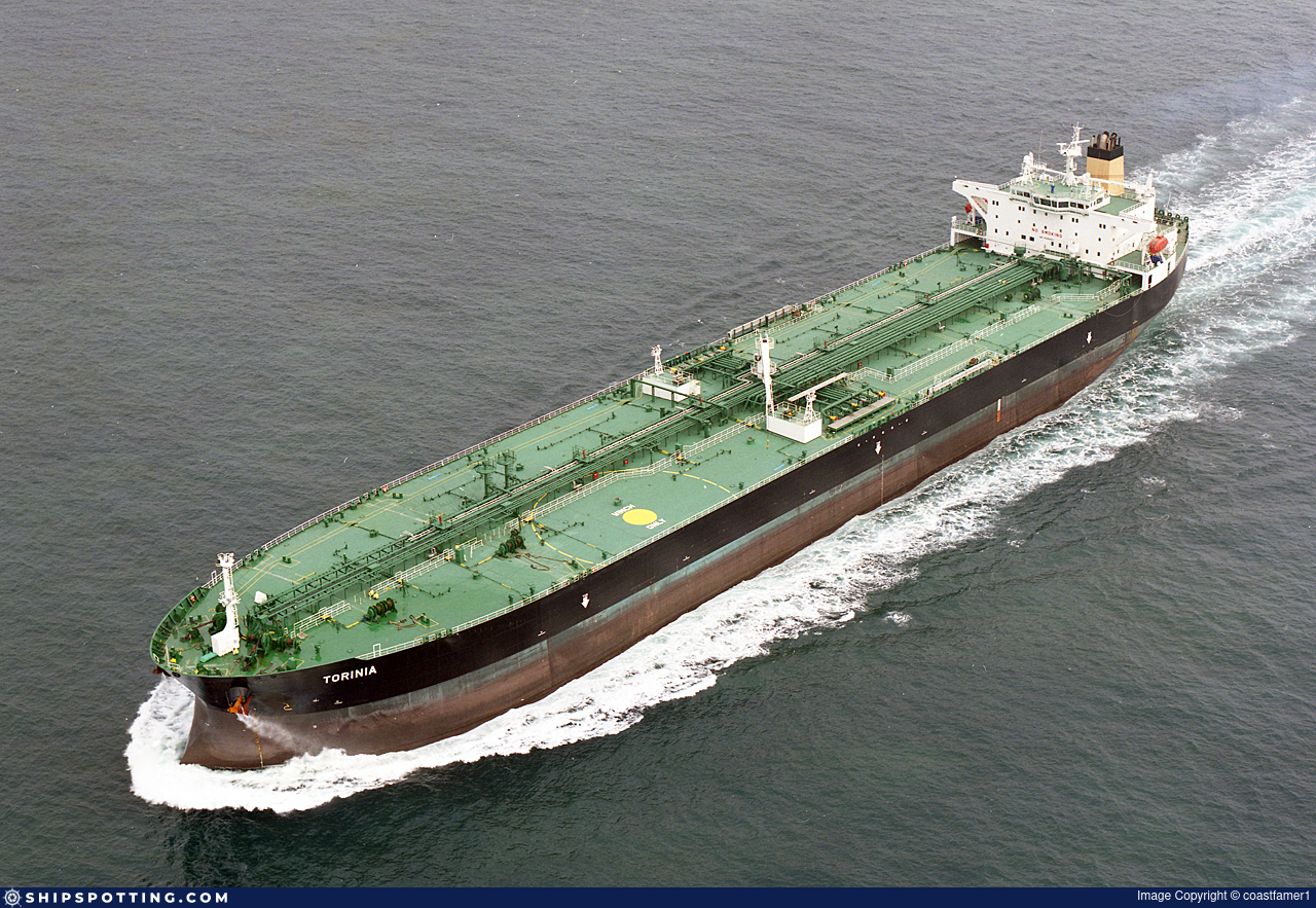
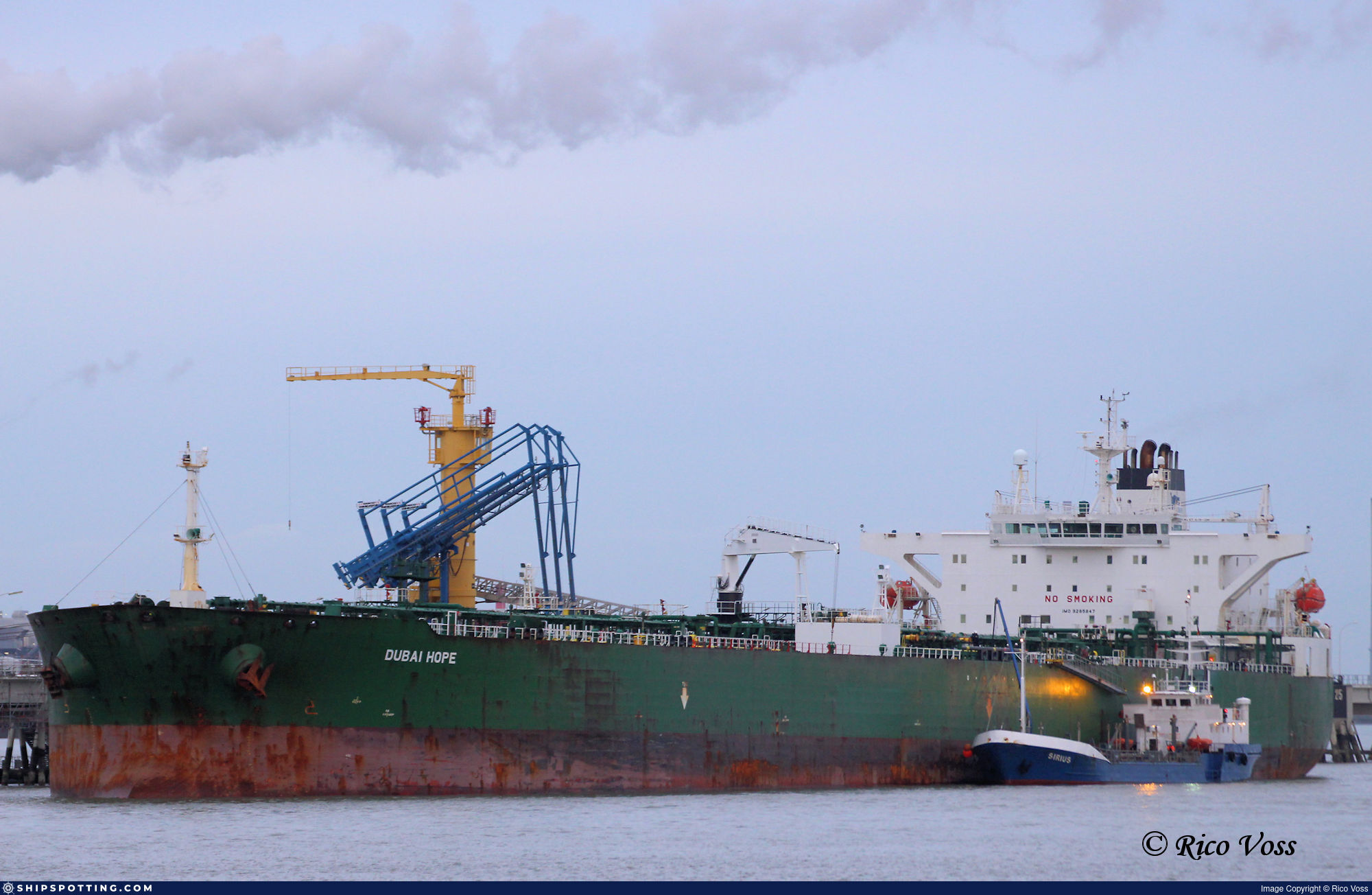
IMO 9285847
Vessel information
Sanctioned by
Company & Ownership
Management & Operations
Classification & Safety
Port State Control (PSC) Inspections
Survey Renewal & Certificates
| Code | Type | Issuer | Issued | Expires |
|---|---|---|---|---|
| 509 | Document of Compliance | DNV | 14/04/2022 | 17/04/2027 |
| 509 | Document of Compliance | DNV | 19/05/2023 | 28/11/2026 |
Programs & Notes
EU Russia Sanctions – Shadow Fleet | SEMA (Canada) — vessel designations | UKRAINE-EO13662] [RUSSIA-EO14024 | The Russia (Sanctions) (EU Exit) Regulations 2019
DateOfListing: 2025-07-20 || Secondary sanctions risk: See Section 11 of Executive Order 14024.; alt. Secondary sanctions risk: Ukraine-/Russia-Related Sanctions Regulations, 31 CFR 589.201 and/or 589.209; Vessel Registration Identification IMO 9285847; MMSI 352003720; Linked To: SINO SHIP MANAGEMENT COMPANY LIMITED. || DateDesignated: 2025-09-12 | Shipping sanctions: (see “Other information”) | Shipping sanctions: a specified ship is prohibited from being provided with access to or having its master or pilot cause it to enter a port in the UK, may have its registration on the UK Ship Register terminated, and a master or pilot of a specified ship may be given a port barring direction, a detention direction, and a port entry direction or a movement direction. | IMO 9285847 (SIRIUS 1) is, has been or is likely to be involved in activity whose object or effect is to destabilise Ukraine or undermine or threaten the territorial integrity, sovereignty or independence of Ukraine or to obtain a benefit from or support the Government of Russia. Namely, SIRIUS 1 is involved in carrying oil or oil products that originated in Russia from Russia to a third country.
Vessel Changes
 🔄 Owner
AIS Events
50 events detected • 1 zone • Last: May 19, 2026
- Zone: discovered_018
- Duration: 1h 7m
- Data Points: 36 AIS positions
- Period: 2026-05-19T04:00:44+00:00 to 2026-05-19T05:07:47+00:00
Show Raw Evidence JSON
{
    "zone_id": "discovered_018",
    "zone_name": "Eastern Mediterranean Sanctioned Vessel Zone",
    "dwell_minutes": 67,
    "points_in_zone": 36,
    "first_point": {
        "ts": "2026-05-19T04:00:44+00:00",
        "lat": 31.297464999999998980229065637104213237762451171875,
        "lon": 32.36593330000000179325070348568260669708251953125
    },
    "last_point": {
        "ts": "2026-05-19T05:07:47+00:00",
        "lat": 31.15030829999999895107976044528186321258544921875,
        "lon": 32.32274170000000168556653079576790332794189453125
    }
}- Zone: discovered_018
- Duration: 2h 7m
- Data Points: 67 AIS positions
- Period: 2026-05-19T03:00:04+00:00 to 2026-05-19T05:07:47+00:00
Show Raw Evidence JSON
{
    "zone_id": "discovered_018",
    "zone_name": "Eastern Mediterranean Sanctioned Vessel Zone",
    "dwell_minutes": 127.7000000000000028421709430404007434844970703125,
    "points_in_zone": 67,
    "first_point": {
        "ts": "2026-05-19T03:00:04+00:00",
        "lat": 31.423004999999999853343979339115321636199951171875,
        "lon": 32.406481700000000500949681736528873443603515625
    },
    "last_point": {
        "ts": "2026-05-19T05:07:47+00:00",
        "lat": 31.15030829999999895107976044528186321258544921875,
        "lon": 32.32274170000000168556653079576790332794189453125
    }
}- Zone: discovered_018
- Duration: 2h 54m
- Data Points: 83 AIS positions
- Period: 2026-05-19T02:12:54+00:00 to 2026-05-19T05:07:47+00:00
Show Raw Evidence JSON
{
    "zone_id": "discovered_018",
    "zone_name": "Eastern Mediterranean Sanctioned Vessel Zone",
    "dwell_minutes": 174.900000000000005684341886080801486968994140625,
    "points_in_zone": 83,
    "first_point": {
        "ts": "2026-05-19T02:12:54+00:00",
        "lat": 31.429266699999999445935827679932117462158203125,
        "lon": 32.3353417000000007419657777063548564910888671875
    },
    "last_point": {
        "ts": "2026-05-19T05:07:47+00:00",
        "lat": 31.15030829999999895107976044528186321258544921875,
        "lon": 32.32274170000000168556653079576790332794189453125
    }
}- Zone: discovered_018
- Duration: 3h 47m
- Data Points: 91 AIS positions
- Period: 2026-05-19T01:20:30+00:00 to 2026-05-19T05:07:47+00:00
Show Raw Evidence JSON
{
    "zone_id": "discovered_018",
    "zone_name": "Eastern Mediterranean Sanctioned Vessel Zone",
    "dwell_minutes": 227.30000000000001136868377216160297393798828125,
    "points_in_zone": 91,
    "first_point": {
        "ts": "2026-05-19T01:20:30+00:00",
        "lat": 31.424248299999998579323801095597445964813232421875,
        "lon": 32.3269082999999994854078977368772029876708984375
    },
    "last_point": {
        "ts": "2026-05-19T05:07:47+00:00",
        "lat": 31.15030829999999895107976044528186321258544921875,
        "lon": 32.32274170000000168556653079576790332794189453125
    }
}- Duration: 2h 10m
- Radius: 990 meters
- Data Points: 21 AIS positions
- Centroid: 31.4237, 32.3272
- Zone: discovered_018
Show Raw Evidence JSON
{
    "radius_m": 989.8999999999999772626324556767940521240234375,
    "duration_minutes": 130.400000000000005684341886080801486968994140625,
    "points": 21,
    "centroid": {
        "lat": 31.42370063333333263244639965705573558807373046875,
        "lon": 32.32720079047618355616577900946140289306640625
    },
    "bbox": {
        "min_lat": 31.423113300000000691625245963223278522491455078125,
        "min_lon": 32.3258000000000009777068044058978557586669921875,
        "max_lat": 31.429266699999999445935827679932117462158203125,
        "max_lon": 32.3353417000000007419657777063548564910888671875
    },
    "zone_id": "discovered_018"
}- Zone: discovered_018
- Duration: 5h 5m
- Data Points: 103 AIS positions
- Period: 2026-05-19T00:02:30+00:00 to 2026-05-19T05:07:47+00:00
Show Raw Evidence JSON
{
    "zone_id": "discovered_018",
    "zone_name": "Eastern Mediterranean Sanctioned Vessel Zone",
    "dwell_minutes": 305.30000000000001136868377216160297393798828125,
    "points_in_zone": 103,
    "first_point": {
        "ts": "2026-05-19T00:02:30+00:00",
        "lat": 31.423128299999998347402652143500745296478271484375,
        "lon": 32.32683670000000120126060210168361663818359375
    },
    "last_point": {
        "ts": "2026-05-19T05:07:47+00:00",
        "lat": 31.15030829999999895107976044528186321258544921875,
        "lon": 32.32274170000000168556653079576790332794189453125
    }
}- Duration: 2h 28m
- Radius: 999 meters
- Data Points: 24 AIS positions
- Centroid: 31.4236, 32.3271
- Zone: discovered_018
Show Raw Evidence JSON
{
    "radius_m": 998.700000000000045474735088646411895751953125,
    "duration_minutes": 148.30000000000001136868377216160297393798828125,
    "points": 24,
    "centroid": {
        "lat": 31.423630624999997706936483155004680156707763671875,
        "lon": 32.32714756666666033879664610140025615692138671875
    },
    "bbox": {
        "min_lat": 31.42310499999999962028596200980246067047119140625,
        "min_lon": 32.3258000000000009777068044058978557586669921875,
        "max_lat": 31.429266699999999445935827679932117462158203125,
        "max_lon": 32.3353417000000007419657777063548564910888671875
    },
    "zone_id": "discovered_018"
}- Zone: discovered_018
- Duration: 5h 23m
- Data Points: 106 AIS positions
- Period: 2026-05-18T23:44:34+00:00 to 2026-05-19T05:07:47+00:00
Show Raw Evidence JSON
{
    "zone_id": "discovered_018",
    "zone_name": "Eastern Mediterranean Sanctioned Vessel Zone",
    "dwell_minutes": 323.19999999999998863131622783839702606201171875,
    "points_in_zone": 106,
    "first_point": {
        "ts": "2026-05-18T23:44:34+00:00",
        "lat": 31.423140000000000071622707764618098735809326171875,
        "lon": 32.3267517000000026428097044117748737335205078125
    },
    "last_point": {
        "ts": "2026-05-19T05:07:47+00:00",
        "lat": 31.15030829999999895107976044528186321258544921875,
        "lon": 32.32274170000000168556653079576790332794189453125
    }
}- Duration: 3h 42m
- Radius: 1,003 meters
- Data Points: 26 AIS positions
- Centroid: 31.4236, 32.3271
- Zone: discovered_018
Show Raw Evidence JSON
{
    "radius_m": 1003.3999999999999772626324556767940521240234375,
    "duration_minutes": 222.69999999999998863131622783839702606201171875,
    "points": 26,
    "centroid": {
        "lat": 31.423601407692306253238712088204920291900634765625,
        "lon": 32.3271125615384562479448504745960235595703125
    },
    "bbox": {
        "min_lat": 31.42310499999999962028596200980246067047119140625,
        "min_lon": 32.3258000000000009777068044058978557586669921875,
        "max_lat": 31.429266699999999445935827679932117462158203125,
        "max_lon": 32.3353417000000007419657777063548564910888671875
    },
    "zone_id": "discovered_018"
}- Zone: discovered_018
- Duration: 6h 37m
- Data Points: 108 AIS positions
- Period: 2026-05-18T22:30:14+00:00 to 2026-05-19T05:07:47+00:00
Show Raw Evidence JSON
{
    "zone_id": "discovered_018",
    "zone_name": "Eastern Mediterranean Sanctioned Vessel Zone",
    "dwell_minutes": 397.6000000000000227373675443232059478759765625,
    "points_in_zone": 108,
    "first_point": {
        "ts": "2026-05-18T22:30:14+00:00",
        "lat": 31.4232583000000005313268047757446765899658203125,
        "lon": 32.32671330000000153859218698926270008087158203125
    },
    "last_point": {
        "ts": "2026-05-19T05:07:47+00:00",
        "lat": 31.15030829999999895107976044528186321258544921875,
        "lon": 32.32274170000000168556653079576790332794189453125
    }
}- Duration: 5h 11m
- Radius: 1,004 meters
- Data Points: 28 AIS positions
- Centroid: 31.4236, 32.3271
- Zone: discovered_018
Show Raw Evidence JSON
{
    "radius_m": 1004.3999999999999772626324556767940521240234375,
    "duration_minutes": 311,
    "points": 28,
    "centroid": {
        "lat": 31.42356814999999414794729091227054595947265625,
        "lon": 32.3271298785714265022761537693440914154052734375
    },
    "bbox": {
        "min_lat": 31.4230783000000002402885002084076404571533203125,
        "min_lon": 32.3258000000000009777068044058978557586669921875,
        "max_lat": 31.429266699999999445935827679932117462158203125,
        "max_lon": 32.3353417000000007419657777063548564910888671875
    },
    "zone_id": "discovered_018"
}- Zone: discovered_018
- Duration: 6h 30m
- Data Points: 73 AIS positions
- Period: 2026-05-18T21:28:55+00:00 to 2026-05-19T03:59:35+00:00
Show Raw Evidence JSON
{
    "zone_id": "discovered_018",
    "zone_name": "Eastern Mediterranean Sanctioned Vessel Zone",
    "dwell_minutes": 390.69999999999998863131622783839702606201171875,
    "points_in_zone": 73,
    "first_point": {
        "ts": "2026-05-18T21:28:55+00:00",
        "lat": 31.4230783000000002402885002084076404571533203125,
        "lon": 32.3270882999999997764462023042142391204833984375
    },
    "last_point": {
        "ts": "2026-05-19T03:59:35+00:00",
        "lat": 31.300156699999998721750671393238008022308349609375,
        "lon": 32.36684000000000338559402734972536563873291015625
    }
}- Duration: 5h 59m
- Radius: 1,002 meters
- Data Points: 32 AIS positions
- Centroid: 31.4235, 32.3272
- Zone: discovered_018
Show Raw Evidence JSON
{
    "radius_m": 1001.799999999999954525264911353588104248046875,
    "duration_minutes": 359,
    "points": 32,
    "centroid": {
        "lat": 31.4235193187499959321939968504011631011962890625,
        "lon": 32.3272113000000018701030057854950428009033203125
    },
    "bbox": {
        "min_lat": 31.4230783000000002402885002084076404571533203125,
        "min_lon": 32.3258000000000009777068044058978557586669921875,
        "max_lat": 31.429266699999999445935827679932117462158203125,
        "max_lon": 32.3353417000000007419657777063548564910888671875
    },
    "zone_id": "discovered_018"
}- Zone: discovered_018
- Duration: 6h 33m
- Data Points: 61 AIS positions
- Period: 2026-05-18T20:55:53+00:00 to 2026-05-19T03:28:57+00:00
Show Raw Evidence JSON
{
    "zone_id": "discovered_018",
    "zone_name": "Eastern Mediterranean Sanctioned Vessel Zone",
    "dwell_minutes": 393.1000000000000227373675443232059478759765625,
    "points_in_zone": 61,
    "first_point": {
        "ts": "2026-05-18T20:55:53+00:00",
        "lat": 31.423100000000001585931386216543614864349365234375,
        "lon": 32.32761169999999850688254809938371181488037109375
    },
    "last_point": {
        "ts": "2026-05-19T03:28:57+00:00",
        "lat": 31.3625933000000003403329174034297466278076171875,
        "lon": 32.384821700000003374952939338982105255126953125
    }
}- Zone: discovered_018
- Duration: 6h 35m
- Data Points: 34 AIS positions
- Period: 2026-05-18T19:43:56+00:00 to 2026-05-19T02:19:23+00:00
Show Raw Evidence JSON
{
    "zone_id": "discovered_018",
    "zone_name": "Eastern Mediterranean Sanctioned Vessel Zone",
    "dwell_minutes": 395.3999999999999772626324556767940521240234375,
    "points_in_zone": 34,
    "first_point": {
        "ts": "2026-05-18T19:43:56+00:00",
        "lat": 31.425779999999999603232936351560056209564208984375,
        "lon": 32.3292866999999972676960169337689876556396484375
    },
    "last_point": {
        "ts": "2026-05-19T02:19:23+00:00",
        "lat": 31.4327033000000000129148247651755809783935546875,
        "lon": 32.33769670000000218124114326201379299163818359375
    }
}- Duration: 6h 29m
- Radius: 992 meters
- Data Points: 33 AIS positions
- Centroid: 31.4236, 32.3273
- Zone: discovered_018
Show Raw Evidence JSON
{
    "radius_m": 992.3999999999999772626324556767940521240234375,
    "duration_minutes": 389,
    "points": 33,
    "centroid": {
        "lat": 31.423587824242428467869103769771754741668701171875,
        "lon": 32.327274190909093931622919626533985137939453125
    },
    "bbox": {
        "min_lat": 31.4230783000000002402885002084076404571533203125,
        "min_lon": 32.3258000000000009777068044058978557586669921875,
        "max_lat": 31.429266699999999445935827679932117462158203125,
        "max_lon": 32.3353417000000007419657777063548564910888671875
    },
    "zone_id": "discovered_018"
}- Zone: discovered_018
- Duration: 6h 34m
- Data Points: 32 AIS positions
- Period: 2026-05-18T18:54:37+00:00 to 2026-05-19T01:29:30+00:00
Show Raw Evidence JSON
{
    "zone_id": "discovered_018",
    "zone_name": "Eastern Mediterranean Sanctioned Vessel Zone",
    "dwell_minutes": 394.8999999999999772626324556767940521240234375,
    "points_in_zone": 32,
    "first_point": {
        "ts": "2026-05-18T18:54:37+00:00",
        "lat": 31.446719999999999117790139280259609222412109375,
        "lon": 32.333089999999998553903424181044101715087890625
    },
    "last_point": {
        "ts": "2026-05-19T01:29:30+00:00",
        "lat": 31.423925000000000551381162949837744235992431640625,
        "lon": 32.3267383000000023685061023570597171783447265625
    }
}- Zone: discovered_018
- Duration: 6h 39m
- Data Points: 34 AIS positions
- Period: 2026-05-18T17:50:26+00:00 to 2026-05-19T00:29:30+00:00
Show Raw Evidence JSON
{
    "zone_id": "discovered_018",
    "zone_name": "Eastern Mediterranean Sanctioned Vessel Zone",
    "dwell_minutes": 399.1000000000000227373675443232059478759765625,
    "points_in_zone": 34,
    "first_point": {
        "ts": "2026-05-18T17:50:26+00:00",
        "lat": 31.527931699999999892725099925883114337921142578125,
        "lon": 32.39134500000000116415321826934814453125
    },
    "last_point": {
        "ts": "2026-05-19T00:29:30+00:00",
        "lat": 31.423216700000001111448000301606953144073486328125,
        "lon": 32.3270983000000029505827114917337894439697265625
    }
}- Duration: 1h 56m
- Radius: 1,003 meters
- Data Points: 22 AIS positions
- Centroid: 31.5257, 32.3928
- Zone: discovered_018
Show Raw Evidence JSON
{
    "radius_m": 1003.3999999999999772626324556767940521240234375,
    "duration_minutes": 116.2000000000000028421709430404007434844970703125,
    "points": 22,
    "centroid": {
        "lat": 31.52569870909091065414031618274748325347900390625,
        "lon": 32.3927614454545391708961687982082366943359375
    },
    "bbox": {
        "min_lat": 31.52266829999999941946953185833990573883056640625,
        "min_lon": 32.38280670000000327490852214395999908447265625,
        "max_lat": 31.527931699999999892725099925883114337921142578125,
        "max_lon": 32.39429169999999658102751709520816802978515625
    },
    "zone_id": "discovered_018"
}- Zone: discovered_018
- Duration: 6h 22m
- Data Points: 39 AIS positions
- Period: 2026-05-18T16:30:48+00:00 to 2026-05-18T22:53:30+00:00
Show Raw Evidence JSON
{
    "zone_id": "discovered_018",
    "zone_name": "Eastern Mediterranean Sanctioned Vessel Zone",
    "dwell_minutes": 382.69999999999998863131622783839702606201171875,
    "points_in_zone": 39,
    "first_point": {
        "ts": "2026-05-18T16:30:48+00:00",
        "lat": 31.525503300000000450609149993397295475006103515625,
        "lon": 32.39410670000000180834831553511321544647216796875
    },
    "last_point": {
        "ts": "2026-05-18T22:53:30+00:00",
        "lat": 31.423243299999999322835719794966280460357666015625,
        "lon": 32.32667169999999856599970371462404727935791015625
    }
}- Duration: 2h 45m
- Radius: 1,038 meters
- Data Points: 30 AIS positions
- Centroid: 31.5256, 32.3932
- Zone: discovered_018
Show Raw Evidence JSON
{
    "radius_m": 1037.5,
    "duration_minutes": 165.19999999999998863131622783839702606201171875,
    "points": 30,
    "centroid": {
        "lat": 31.525639386666671981629406218416988849639892578125,
        "lon": 32.39316489333334203593040001578629016876220703125
    },
    "bbox": {
        "min_lat": 31.52266829999999941946953185833990573883056640625,
        "min_lon": 32.38280670000000327490852214395999908447265625,
        "max_lat": 31.527931699999999892725099925883114337921142578125,
        "max_lon": 32.3944800000000014961187844164669513702392578125
    },
    "zone_id": "discovered_018"
}- Zone: discovered_018
- Duration: 6h 11m
- Data Points: 49 AIS positions
- Period: 2026-05-18T15:17:42+00:00 to 2026-05-18T21:28:55+00:00
Show Raw Evidence JSON
{
    "zone_id": "discovered_018",
    "zone_name": "Eastern Mediterranean Sanctioned Vessel Zone",
    "dwell_minutes": 371.19999999999998863131622783839702606201171875,
    "points_in_zone": 49,
    "first_point": {
        "ts": "2026-05-18T15:17:42+00:00",
        "lat": 31.524654999999999205329004325903952121734619140625,
        "lon": 32.3944800000000014961187844164669513702392578125
    },
    "last_point": {
        "ts": "2026-05-18T21:28:55+00:00",
        "lat": 31.4230783000000002402885002084076404571533203125,
        "lon": 32.3270882999999997764462023042142391204833984375
    }
}- Duration: 4h 1m
- Radius: 1,054 meters
- Data Points: 36 AIS positions
- Centroid: 31.5256, 32.3934
- Zone: discovered_018
Show Raw Evidence JSON
{
    "radius_m": 1054.200000000000045474735088646411895751953125,
    "duration_minutes": 241.599999999999994315658113919198513031005859375,
    "points": 36,
    "centroid": {
        "lat": 31.52563296111110702213409240357577800750732421875,
        "lon": 32.393352686111114735467708669602870941162109375
    },
    "bbox": {
        "min_lat": 31.52266829999999941946953185833990573883056640625,
        "min_lon": 32.38280670000000327490852214395999908447265625,
        "max_lat": 31.527931699999999892725099925883114337921142578125,
        "max_lon": 32.3944800000000014961187844164669513702392578125
    },
    "zone_id": "discovered_018"
}- Zone: discovered_018
- Duration: 6h 32m
- Data Points: 51 AIS positions
- Period: 2026-05-18T14:55:58+00:00 to 2026-05-18T21:28:55+00:00
Show Raw Evidence JSON
{
    "zone_id": "discovered_018",
    "zone_name": "Eastern Mediterranean Sanctioned Vessel Zone",
    "dwell_minutes": 392.8999999999999772626324556767940521240234375,
    "points_in_zone": 51,
    "first_point": {
        "ts": "2026-05-18T14:55:58+00:00",
        "lat": 31.525536699999999967758412822149693965911865234375,
        "lon": 32.39424170000000202662704396061599254608154296875
    },
    "last_point": {
        "ts": "2026-05-18T21:28:55+00:00",
        "lat": 31.4230783000000002402885002084076404571533203125,
        "lon": 32.3270882999999997764462023042142391204833984375
    }
}- Duration: 4h 46m
- Radius: 1,068 meters
- Data Points: 42 AIS positions
- Centroid: 31.5257, 32.3935
- Zone: discovered_018
Show Raw Evidence JSON
{
    "radius_m": 1067.90000000000009094947017729282379150390625,
    "duration_minutes": 286.30000000000001136868377216160297393798828125,
    "points": 42,
    "centroid": {
        "lat": 31.525672461904758137052340316586196422576904296875,
        "lon": 32.3934895214285774045492871664464473724365234375
    },
    "bbox": {
        "min_lat": 31.52266829999999941946953185833990573883056640625,
        "min_lon": 32.38280670000000327490852214395999908447265625,
        "max_lat": 31.527931699999999892725099925883114337921142578125,
        "max_lon": 32.3944800000000014961187844164669513702392578125
    },
    "zone_id": "discovered_018"
}- Zone: discovered_018
- Duration: 6h 30m
- Data Points: 52 AIS positions
- Period: 2026-05-18T13:55:22+00:00 to 2026-05-18T20:25:53+00:00
Show Raw Evidence JSON
{
    "zone_id": "discovered_018",
    "zone_name": "Eastern Mediterranean Sanctioned Vessel Zone",
    "dwell_minutes": 390.5,
    "points_in_zone": 52,
    "first_point": {
        "ts": "2026-05-18T13:55:22+00:00",
        "lat": 31.525890000000000412683220929466187953948974609375,
        "lon": 32.39430329999999713663783040829002857208251953125
    },
    "last_point": {
        "ts": "2026-05-18T20:25:53+00:00",
        "lat": 31.423133299999999934470906737260520458221435546875,
        "lon": 32.32760329999999981964720063842833042144775390625
    }
}- Duration: 1h 39m
- Radius: 90 meters
- Data Points: 21 AIS positions
- Centroid: 31.5261, 32.3943
- Zone: discovered_018
Show Raw Evidence JSON
{
    "radius_m": 90.2999999999999971578290569595992565155029296875,
    "duration_minutes": 99.5,
    "points": 21,
    "centroid": {
        "lat": 31.526059609523809257325410726480185985565185546875,
        "lon": 32.39430181904761951727778068743646144866943359375
    },
    "bbox": {
        "min_lat": 31.525430000000000063664629124104976654052734375,
        "min_lon": 32.3936982999999969479176797904074192047119140625,
        "max_lat": 31.52633829999999903748175711371004581451416015625,
        "max_lon": 32.39459000000000088448359747417271137237548828125
    },
    "zone_id": "discovered_018"
}- Zone: discovered_018
- Duration: 1h 39m
- Data Points: 21 AIS positions
- Period: 2026-05-18T11:01:16+00:00 to 2026-05-18T12:40:48+00:00
Show Raw Evidence JSON
{
    "zone_id": "discovered_018",
    "zone_name": "Eastern Mediterranean Sanctioned Vessel Zone",
    "dwell_minutes": 99.5,
    "points_in_zone": 21,
    "first_point": {
        "ts": "2026-05-18T11:01:16+00:00",
        "lat": 31.525670000000001635953594814054667949676513671875,
        "lon": 32.39396330000000290283423964865505695343017578125
    },
    "last_point": {
        "ts": "2026-05-18T12:40:48+00:00",
        "lat": 31.526071699999999253805071930401027202606201171875,
        "lon": 32.39449330000000060181264416314661502838134765625
    }
}- Duration: 2h 38m
- Radius: 824 meters
- Data Points: 37 AIS positions
- Centroid: 31.5248, 32.3953
- Zone: discovered_018
Show Raw Evidence JSON
{
    "radius_m": 823.8999999999999772626324556767940521240234375,
    "duration_minutes": 158.30000000000001136868377216160297393798828125,
    "points": 37,
    "centroid": {
        "lat": 31.524817978378383287463293527252972126007080078125,
        "lon": 32.39531044594594533236886491067707538604736328125
    },
    "bbox": {
        "min_lat": 31.519086699999999012788975960575044155120849609375,
        "min_lon": 32.39290170000000301797626889310777187347412109375,
        "max_lat": 31.52639500000000083446138887666165828704833984375,
        "max_lon": 32.4008917000000025154804461635649204254150390625
    },
    "zone_id": "discovered_018"
}- Zone: discovered_018
- Duration: 2h 38m
- Data Points: 37 AIS positions
- Period: 2026-05-18T10:02:29+00:00 to 2026-05-18T12:40:48+00:00
Show Raw Evidence JSON
{
    "zone_id": "discovered_018",
    "zone_name": "Eastern Mediterranean Sanctioned Vessel Zone",
    "dwell_minutes": 158.30000000000001136868377216160297393798828125,
    "points_in_zone": 37,
    "first_point": {
        "ts": "2026-05-18T10:02:29+00:00",
        "lat": 31.519086699999999012788975960575044155120849609375,
        "lon": 32.400831699999997681516106240451335906982421875
    },
    "last_point": {
        "ts": "2026-05-18T12:40:48+00:00",
        "lat": 31.526071699999999253805071930401027202606201171875,
        "lon": 32.39449330000000060181264416314661502838134765625
    }
}- Duration: 2h 45m
- Radius: 782 meters
- Data Points: 39 AIS positions
- Centroid: 31.5245, 32.3956
- Zone: discovered_018
Show Raw Evidence JSON
{
    "radius_m": 781.8999999999999772626324556767940521240234375,
    "duration_minutes": 165.69999999999998863131622783839702606201171875,
    "points": 39,
    "centroid": {
        "lat": 31.5245238948717911853236728347837924957275390625,
        "lon": 32.39558969743590211010086932219564914703369140625
    },
    "bbox": {
        "min_lat": 31.5190750000000008412825991399586200714111328125,
        "min_lon": 32.39290170000000301797626889310777187347412109375,
        "max_lat": 31.52639500000000083446138887666165828704833984375,
        "max_lon": 32.4008917000000025154804461635649204254150390625
    },
    "zone_id": "discovered_018"
}- Zone: discovered_018
- Duration: 2h 45m
- Data Points: 39 AIS positions
- Period: 2026-05-18T09:55:08+00:00 to 2026-05-18T12:40:48+00:00
Show Raw Evidence JSON
{
    "zone_id": "discovered_018",
    "zone_name": "Eastern Mediterranean Sanctioned Vessel Zone",
    "dwell_minutes": 165.69999999999998863131622783839702606201171875,
    "points_in_zone": 39,
    "first_point": {
        "ts": "2026-05-18T09:55:08+00:00",
        "lat": 31.5190750000000008412825991399586200714111328125,
        "lon": 32.40077000000000140289557748474180698394775390625
    },
    "last_point": {
        "ts": "2026-05-18T12:40:48+00:00",
        "lat": 31.526071699999999253805071930401027202606201171875,
        "lon": 32.39449330000000060181264416314661502838134765625
    }
}- Minimum Distance: 62 meters
- Average Distance: 67 meters
- Duration: 42 minutes
- Period: 2026-05-18T09:07:03+00:00 to 2026-05-18T09:49:44+00:00
- Vessel A Avg Speed: 0.0 knots
- Vessel B Avg Speed: 0.0 knots
- Zone: discovered_018
Confidence Analysis
Moderate-confidence STS candidate. Two tankers (SIRIUS 1 and XD LEO) maintained close proximity (min 62m, avg 67m) for 43 minutes. Both vessels were slow-moving (avg speeds 0.0 and 0.0 knots). The stable separation distance suggests deliberate parallel positioning typical of cargo transfer. Event occurred in Eastern Mediterranean Sanctioned Vessel Zone, a known STS activity area.
View scoring breakdown
| Factor | Score | Detail |
|---|---|---|
| Distance Tightness | 25/25 | Min distance 62m, avg 67m |
| Duration | 5/25 | Duration 43 minutes |
| Speed Stability | 20/20 | both nearly stationary; very stable speeds |
| Distance Consistency | 15/15 | Distance variance ±7m |
| Isolation | 5/10 | Isolation data not available |
| Context | 5/5 | In monitored zone: Eastern Mediterranean Sanctioned Vessel Zone |
🛰️ Satellite Corroboration
No satellite imagery for this time/location
No Sentinel-1 scenes covering AOI and time window
Show Raw Evidence JSON
{
    "vessel_a": {
        "mmsi": 649136000,
        "imo": 9285847,
        "name": "SIRIUS 1",
        "flag": "Mali"
    },
    "vessel_b": {
        "mmsi": 273272770,
        "imo": 9312872,
        "name": "XD LEO",
        "flag": "RUSSIA"
    },
    "min_distance_m": 62.10000000000000142108547152020037174224853515625,
    "avg_distance_m": 67,
    "distance_consistency_m": 6.5999999999999996447286321199499070644378662109375,
    "duration_minutes": 42.7000000000000028421709430404007434844970703125,
    "overlap_duration_s": 2561,
    "speed_a_avg": 0.01000000000000000020816681711721685132943093776702880859375,
    "speed_a_std": 0.0299999999999999988897769753748434595763683319091796875,
    "speed_b_avg": 0,
    "speed_b_std": 0,
    "speed_summary": {
        "vessel_a": {
            "avg_sog": 0.01000000000000000020816681711721685132943093776702880859375,
            "max_sog": 0.1000000000000000055511151231257827021181583404541015625
        },
        "vessel_b": {
            "avg_sog": 0,
            "max_sog": 0
        }
    },
    "time_window": {
        "start": "2026-05-18T09:07:03+00:00",
        "end": "2026-05-18T09:49:44+00:00"
    },
    "points_count": {
        "vessel_a": 13,
        "vessel_b": 13
    },
    "zone_id": "discovered_018",
    "zone_name": "Eastern Mediterranean Sanctioned Vessel Zone",
    "score": {
        "value": 75,
        "components": {
            "distance_tightness": {
                "score": 25,
                "max": 25,
                "detail": "Min distance 62m, avg 67m"
            },
            "duration": {
                "score": 5,
                "max": 25,
                "detail": "Duration 43 minutes"
            },
            "speed_stability": {
                "score": 20,
                "max": 20,
                "detail": "both nearly stationary; very stable speeds"
            },
            "distance_consistency": {
                "score": 15,
                "max": 15,
                "detail": "Distance variance \u00b17m"
            },
            "isolation": {
                "score": 5,
                "max": 10,
                "detail": "Isolation data not available"
            },
            "context": {
                "score": 5,
                "max": 5,
                "detail": "In monitored zone: Eastern Mediterranean Sanctioned Vessel Zone"
            }
        },
        "summary": "Moderate-confidence STS candidate. Two tankers (SIRIUS 1 and XD LEO) maintained close proximity (min 62m, avg 67m) for 43 minutes. Both vessels were slow-moving (avg speeds 0.0 and 0.0 knots). The stable separation distance suggests deliberate parallel positioning typical of cargo transfer. Event occurred in Eastern Mediterranean Sanctioned Vessel Zone, a known STS activity area."
    },
    "sar": {
        "status": "not_found",
        "centroid": {
            "lat": 31.518937399999998660860001109540462493896484375,
            "lon": 32.4005326999999994086465449072420597076416015625
        },
        "time_window": {
            "start_ts": "2026-05-18T09:07:03+00:00",
            "end_ts": "2026-05-18T09:49:44+00:00"
        },
        "searched_at": "2026-05-18T15:45:04.830484+00:00",
        "notes": "No Sentinel-1 scenes covering AOI and time window"
    }
}- Minimum Distance: 47 meters
- Average Distance: 64 meters
- Duration: 1h 15m
- Period: 2026-05-18T08:34:03+00:00 to 2026-05-18T09:49:44+00:00
- Vessel A Avg Speed: 0.0 knots
- Vessel B Avg Speed: 0.0 knots
- Zone: discovered_018
Confidence Analysis
High-confidence STS candidate. Two tankers (SIRIUS 1 and XD LEO) maintained close proximity (min 47m, avg 64m) for 76 minutes. Both vessels were slow-moving (avg speeds 0.0 and 0.0 knots). The stable separation distance suggests deliberate parallel positioning typical of cargo transfer. Event occurred in Eastern Mediterranean Sanctioned Vessel Zone, a known STS activity area.
View scoring breakdown
| Factor | Score | Detail |
|---|---|---|
| Distance Tightness | 25/25 | Min distance 47m, avg 64m |
| Duration | 15/25 | Duration 76 minutes |
| Speed Stability | 20/20 | both nearly stationary; very stable speeds |
| Distance Consistency | 15/15 | Distance variance ±7m |
| Isolation | 5/10 | Isolation data not available |
| Context | 5/5 | In monitored zone: Eastern Mediterranean Sanctioned Vessel Zone |
Show Raw Evidence JSON
{
    "vessel_a": {
        "mmsi": 649136000,
        "imo": 9285847,
        "name": "SIRIUS 1",
        "flag": "Mali"
    },
    "vessel_b": {
        "mmsi": 273272770,
        "imo": 9312872,
        "name": "XD LEO",
        "flag": "RUSSIA"
    },
    "min_distance_m": 46.7000000000000028421709430404007434844970703125,
    "avg_distance_m": 64.099999999999994315658113919198513031005859375,
    "distance_consistency_m": 7,
    "duration_minutes": 75.7000000000000028421709430404007434844970703125,
    "overlap_duration_s": 4541,
    "speed_a_avg": 0,
    "speed_a_std": 0.0200000000000000004163336342344337026588618755340576171875,
    "speed_b_avg": 0,
    "speed_b_std": 0,
    "speed_summary": {
        "vessel_a": {
            "avg_sog": 0,
            "max_sog": 0.1000000000000000055511151231257827021181583404541015625
        },
        "vessel_b": {
            "avg_sog": 0,
            "max_sog": 0
        }
    },
    "time_window": {
        "start": "2026-05-18T08:34:03+00:00",
        "end": "2026-05-18T09:49:44+00:00"
    },
    "points_count": {
        "vessel_a": 24,
        "vessel_b": 24
    },
    "zone_id": "discovered_018",
    "zone_name": "Eastern Mediterranean Sanctioned Vessel Zone",
    "score": {
        "value": 85,
        "components": {
            "distance_tightness": {
                "score": 25,
                "max": 25,
                "detail": "Min distance 47m, avg 64m"
            },
            "duration": {
                "score": 15,
                "max": 25,
                "detail": "Duration 76 minutes"
            },
            "speed_stability": {
                "score": 20,
                "max": 20,
                "detail": "both nearly stationary; very stable speeds"
            },
            "distance_consistency": {
                "score": 15,
                "max": 15,
                "detail": "Distance variance \u00b17m"
            },
            "isolation": {
                "score": 5,
                "max": 10,
                "detail": "Isolation data not available"
            },
            "context": {
                "score": 5,
                "max": 5,
                "detail": "In monitored zone: Eastern Mediterranean Sanctioned Vessel Zone"
            }
        },
        "summary": "High-confidence STS candidate. Two tankers (SIRIUS 1 and XD LEO) maintained close proximity (min 47m, avg 64m) for 76 minutes. Both vessels were slow-moving (avg speeds 0.0 and 0.0 knots). The stable separation distance suggests deliberate parallel positioning typical of cargo transfer. Event occurred in Eastern Mediterranean Sanctioned Vessel Zone, a known STS activity area."
    }
}- Duration: 1h 47m
- Radius: 85 meters
- Data Points: 30 AIS positions
- Centroid: 31.5191, 32.4008
- Zone: discovered_018
Show Raw Evidence JSON
{
    "radius_m": 85,
    "duration_minutes": 107.400000000000005684341886080801486968994140625,
    "points": 30,
    "centroid": {
        "lat": 31.519073156666660651126221637241542339324951171875,
        "lon": 32.40081744000000441019437857903540134429931640625
    },
    "bbox": {
        "min_lat": 31.518315000000001191438059322535991668701171875,
        "min_lon": 32.40034829999999743677108199335634708404541015625,
        "max_lat": 31.51950000000000073896444519050419330596923828125,
        "max_lon": 32.40095500000000328100213664583861827850341796875
    },
    "zone_id": "discovered_018"
}- Zone: discovered_018
- Duration: 1h 47m
- Data Points: 30 AIS positions
- Period: 2026-05-18T08:02:22+00:00 to 2026-05-18T09:49:44+00:00
Show Raw Evidence JSON
{
    "zone_id": "discovered_018",
    "zone_name": "Eastern Mediterranean Sanctioned Vessel Zone",
    "dwell_minutes": 107.400000000000005684341886080801486968994140625,
    "points_in_zone": 30,
    "first_point": {
        "ts": "2026-05-18T08:02:22+00:00",
        "lat": 31.518981700000001211492417496629059314727783203125,
        "lon": 32.4007782999999989215211826376616954803466796875
    },
    "last_point": {
        "ts": "2026-05-18T09:49:44+00:00",
        "lat": 31.519033300000000252794052357785403728485107421875,
        "lon": 32.4007916999999991958247846923768520355224609375
    }
}- Duration: 2h 49m
- Radius: 81 meters
- Data Points: 45 AIS positions
- Centroid: 31.5190, 32.4008
- Zone: discovered_018
Show Raw Evidence JSON
{
    "radius_m": 81.2000000000000028421709430404007434844970703125,
    "duration_minutes": 169.19999999999998863131622783839702606201171875,
    "points": 45,
    "centroid": {
        "lat": 31.51903169555556161185450037010014057159423828125,
        "lon": 32.40077147999999596095221932046115398406982421875
    },
    "bbox": {
        "min_lat": 31.518315000000001191438059322535991668701171875,
        "min_lon": 32.40034829999999743677108199335634708404541015625,
        "max_lat": 31.51950000000000073896444519050419330596923828125,
        "max_lon": 32.40095500000000328100213664583861827850341796875
    },
    "zone_id": "discovered_018"
}- Zone: discovered_018
- Duration: 2h 49m
- Data Points: 45 AIS positions
- Period: 2026-05-18T07:00:35+00:00 to 2026-05-18T09:49:44+00:00
Show Raw Evidence JSON
{
    "zone_id": "discovered_018",
    "zone_name": "Eastern Mediterranean Sanctioned Vessel Zone",
    "dwell_minutes": 169.19999999999998863131622783839702606201171875,
    "points_in_zone": 45,
    "first_point": {
        "ts": "2026-05-18T07:00:35+00:00",
        "lat": 31.518986699999999245846993289887905120849609375,
        "lon": 32.40071499999999815599949215538799762725830078125
    },
    "last_point": {
        "ts": "2026-05-18T09:49:44+00:00",
        "lat": 31.519033300000000252794052357785403728485107421875,
        "lon": 32.4007916999999991958247846923768520355224609375
    }
}- Minimum Distance: 47 meters
- Average Distance: 63 meters
- Duration: 30 minutes
- Period: 2026-05-18T07:00:35+00:00 to 2026-05-18T07:30:52+00:00
- Vessel A Avg Speed: 0.0 knots
- Vessel B Avg Speed: 0.0 knots
- Zone: discovered_018
Confidence Analysis
Moderate-confidence STS candidate. Two tankers (SIRIUS 1 and XD LEO) maintained close proximity (min 47m, avg 63m) for 30 minutes. Both vessels were slow-moving (avg speeds 0.0 and 0.0 knots). The stable separation distance suggests deliberate parallel positioning typical of cargo transfer. Event occurred in Eastern Mediterranean Sanctioned Vessel Zone, a known STS activity area.
View scoring breakdown
| Factor | Score | Detail |
|---|---|---|
| Distance Tightness | 25/25 | Min distance 47m, avg 63m |
| Duration | 5/25 | Duration 30 minutes |
| Speed Stability | 20/20 | both nearly stationary; very stable speeds |
| Distance Consistency | 15/15 | Distance variance ±6m |
| Isolation | 5/10 | Isolation data not available |
| Context | 5/5 | In monitored zone: Eastern Mediterranean Sanctioned Vessel Zone |
🛰️ Satellite Corroboration
No satellite imagery for this time/location
No Sentinel-1 scenes covering AOI and time window
Show Raw Evidence JSON
{
    "vessel_a": {
        "mmsi": 649136000,
        "imo": 9285847,
        "name": "SIRIUS 1",
        "flag": "Mali"
    },
    "vessel_b": {
        "mmsi": 273272770,
        "imo": 9312872,
        "name": "XD LEO",
        "flag": "RUSSIA"
    },
    "min_distance_m": 47.2999999999999971578290569595992565155029296875,
    "avg_distance_m": 62.60000000000000142108547152020037174224853515625,
    "distance_consistency_m": 5.79999999999999982236431605997495353221893310546875,
    "duration_minutes": 30.300000000000000710542735760100185871124267578125,
    "overlap_duration_s": 1817,
    "speed_a_avg": 0,
    "speed_a_std": 0,
    "speed_b_avg": 0,
    "speed_b_std": 0,
    "speed_summary": {
        "vessel_a": {
            "avg_sog": 0,
            "max_sog": 0
        },
        "vessel_b": {
            "avg_sog": 0,
            "max_sog": 0
        }
    },
    "time_window": {
        "start": "2026-05-18T07:00:35+00:00",
        "end": "2026-05-18T07:30:52+00:00"
    },
    "points_count": {
        "vessel_a": 10,
        "vessel_b": 10
    },
    "zone_id": "discovered_018",
    "zone_name": "Eastern Mediterranean Sanctioned Vessel Zone",
    "score": {
        "value": 75,
        "components": {
            "distance_tightness": {
                "score": 25,
                "max": 25,
                "detail": "Min distance 47m, avg 63m"
            },
            "duration": {
                "score": 5,
                "max": 25,
                "detail": "Duration 30 minutes"
            },
            "speed_stability": {
                "score": 20,
                "max": 20,
                "detail": "both nearly stationary; very stable speeds"
            },
            "distance_consistency": {
                "score": 15,
                "max": 15,
                "detail": "Distance variance \u00b16m"
            },
            "isolation": {
                "score": 5,
                "max": 10,
                "detail": "Isolation data not available"
            },
            "context": {
                "score": 5,
                "max": 5,
                "detail": "In monitored zone: Eastern Mediterranean Sanctioned Vessel Zone"
            }
        },
        "summary": "Moderate-confidence STS candidate. Two tankers (SIRIUS 1 and XD LEO) maintained close proximity (min 47m, avg 63m) for 30 minutes. Both vessels were slow-moving (avg speeds 0.0 and 0.0 knots). The stable separation distance suggests deliberate parallel positioning typical of cargo transfer. Event occurred in Eastern Mediterranean Sanctioned Vessel Zone, a known STS activity area."
    },
    "sar": {
        "status": "not_found",
        "centroid": {
            "lat": 31.5188437999999990779542713426053524017333984375,
            "lon": 32.40036010000000032960087992250919342041015625
        },
        "time_window": {
            "start_ts": "2026-05-18T07:00:35+00:00",
            "end_ts": "2026-05-18T07:30:52+00:00"
        },
        "searched_at": "2026-05-18T09:00:11.913271+00:00",
        "notes": "No Sentinel-1 scenes covering AOI and time window"
    }
}- Duration: 3h 48m
- Radius: 87 meters
- Data Points: 66 AIS positions
- Centroid: 31.5191, 32.4008
- Zone: discovered_018
Show Raw Evidence JSON
{
    "radius_m": 86.599999999999994315658113919198513031005859375,
    "duration_minutes": 228.400000000000005684341886080801486968994140625,
    "points": 66,
    "centroid": {
        "lat": 31.519086912121213828186228056438267230987548828125,
        "lon": 32.40081106212121397902592434547841548919677734375
    },
    "bbox": {
        "min_lat": 31.518315000000001191438059322535991668701171875,
        "min_lon": 32.40034829999999743677108199335634708404541015625,
        "max_lat": 31.51950000000000073896444519050419330596923828125,
        "max_lon": 32.4011933000000027504938771016895771026611328125
    },
    "zone_id": "discovered_018"
}- Zone: discovered_018
- Duration: 3h 48m
- Data Points: 66 AIS positions
- Period: 2026-05-18T06:01:22+00:00 to 2026-05-18T09:49:44+00:00
Show Raw Evidence JSON
{
    "zone_id": "discovered_018",
    "zone_name": "Eastern Mediterranean Sanctioned Vessel Zone",
    "dwell_minutes": 228.400000000000005684341886080801486968994140625,
    "points_in_zone": 66,
    "first_point": {
        "ts": "2026-05-18T06:01:22+00:00",
        "lat": 31.51941670000000073059709393419325351715087890625,
        "lon": 32.401066700000001219450496137142181396484375
    },
    "last_point": {
        "ts": "2026-05-18T09:49:44+00:00",
        "lat": 31.519033300000000252794052357785403728485107421875,
        "lon": 32.4007916999999991958247846923768520355224609375
    }
}- Duration: 4h 49m
- Radius: 93 meters
- Data Points: 80 AIS positions
- Centroid: 31.5191, 32.4009
- Zone: discovered_018
Show Raw Evidence JSON
{
    "radius_m": 92.5,
    "duration_minutes": 289.6000000000000227373675443232059478759765625,
    "points": 80,
    "centroid": {
        "lat": 31.51914568124999505016603507101535797119140625,
        "lon": 32.40085852374999575431502307765185832977294921875
    },
    "bbox": {
        "min_lat": 31.518315000000001191438059322535991668701171875,
        "min_lon": 32.40034829999999743677108199335634708404541015625,
        "max_lat": 31.5195250000000015688783605583012104034423828125,
        "max_lon": 32.4012000000000028876456781290471553802490234375
    },
    "zone_id": "discovered_018"
}- Zone: discovered_018
- Duration: 4h 49m
- Data Points: 80 AIS positions
- Period: 2026-05-18T05:00:05+00:00 to 2026-05-18T09:49:44+00:00
Show Raw Evidence JSON
{
    "zone_id": "discovered_018",
    "zone_name": "Eastern Mediterranean Sanctioned Vessel Zone",
    "dwell_minutes": 289.6000000000000227373675443232059478759765625,
    "points_in_zone": 80,
    "first_point": {
        "ts": "2026-05-18T05:00:05+00:00",
        "lat": 31.519256699999999682404450140893459320068359375,
        "lon": 32.4009367000000025882400223053991794586181640625
    },
    "last_point": {
        "ts": "2026-05-18T09:49:44+00:00",
        "lat": 31.519033300000000252794052357785403728485107421875,
        "lon": 32.4007916999999991958247846923768520355224609375
    }
}- Minimum Distance: 54 meters
- Average Distance: 63 meters
- Duration: 2h 25m
- Period: 2026-05-18T04:01:49+00:00 to 2026-05-18T06:27:39+00:00
- Vessel A Avg Speed: 0.0 knots
- Vessel B Avg Speed: 0.0 knots
- Zone: discovered_018
Confidence Analysis
High-confidence STS candidate. Two tankers (XD LEO and SIRIUS 1) maintained close proximity (min 54m, avg 63m) for 146 minutes. Both vessels were slow-moving (avg speeds 0.0 and 0.0 knots). The stable separation distance suggests deliberate parallel positioning typical of cargo transfer. Event occurred in Eastern Mediterranean Sanctioned Vessel Zone, a known STS activity area.
View scoring breakdown
| Factor | Score | Detail |
|---|---|---|
| Distance Tightness | 25/25 | Min distance 54m, avg 63m |
| Duration | 25/25 | Duration 146 minutes |
| Speed Stability | 20/20 | both nearly stationary; very stable speeds |
| Distance Consistency | 15/15 | Distance variance ±5m |
| Isolation | 5/10 | Isolation data not available |
| Context | 5/5 | In monitored zone: Eastern Mediterranean Sanctioned Vessel Zone |
🛰️ Satellite Corroboration
No satellite imagery for this time/location
No Sentinel-1 scenes covering AOI and time window
Show Raw Evidence JSON
{
    "vessel_a": {
        "mmsi": 273272770,
        "imo": 9312872,
        "name": "XD LEO",
        "flag": "RUSSIA"
    },
    "vessel_b": {
        "mmsi": 649136000,
        "imo": 9285847,
        "name": "SIRIUS 1",
        "flag": "Mali"
    },
    "min_distance_m": 53.5,
    "avg_distance_m": 63.2999999999999971578290569595992565155029296875,
    "distance_consistency_m": 4.70000000000000017763568394002504646778106689453125,
    "duration_minutes": 145.80000000000001136868377216160297393798828125,
    "overlap_duration_s": 8750,
    "speed_a_avg": 0,
    "speed_a_std": 0,
    "speed_b_avg": 0,
    "speed_b_std": 0,
    "speed_summary": {
        "vessel_a": {
            "avg_sog": 0,
            "max_sog": 0
        },
        "vessel_b": {
            "avg_sog": 0,
            "max_sog": 0
        }
    },
    "time_window": {
        "start": "2026-05-18T04:01:49+00:00",
        "end": "2026-05-18T06:27:39+00:00"
    },
    "points_count": {
        "vessel_a": 11,
        "vessel_b": 11
    },
    "zone_id": "discovered_018",
    "zone_name": "Eastern Mediterranean Sanctioned Vessel Zone",
    "score": {
        "value": 95,
        "components": {
            "distance_tightness": {
                "score": 25,
                "max": 25,
                "detail": "Min distance 54m, avg 63m"
            },
            "duration": {
                "score": 25,
                "max": 25,
                "detail": "Duration 146 minutes"
            },
            "speed_stability": {
                "score": 20,
                "max": 20,
                "detail": "both nearly stationary; very stable speeds"
            },
            "distance_consistency": {
                "score": 15,
                "max": 15,
                "detail": "Distance variance \u00b15m"
            },
            "isolation": {
                "score": 5,
                "max": 10,
                "detail": "Isolation data not available"
            },
            "context": {
                "score": 5,
                "max": 5,
                "detail": "In monitored zone: Eastern Mediterranean Sanctioned Vessel Zone"
            }
        },
        "summary": "High-confidence STS candidate. Two tankers (XD LEO and SIRIUS 1) maintained close proximity (min 54m, avg 63m) for 146 minutes. Both vessels were slow-moving (avg speeds 0.0 and 0.0 knots). The stable separation distance suggests deliberate parallel positioning typical of cargo transfer. Event occurred in Eastern Mediterranean Sanctioned Vessel Zone, a known STS activity area."
    },
    "sar": {
        "status": "not_found",
        "centroid": {
            "lat": 31.5189802000000014459146768786013126373291015625,
            "lon": 32.40056080000000093832568381913006305694580078125
        },
        "time_window": {
            "start_ts": "2026-05-18T04:01:49+00:00",
            "end_ts": "2026-05-18T06:27:39+00:00"
        },
        "searched_at": "2026-05-18T07:15:04.166443+00:00",
        "notes": "No Sentinel-1 scenes covering AOI and time window"
    }
}- Duration: 5h 49m
- Radius: 90 meters
- Data Points: 98 AIS positions
- Centroid: 31.5191, 32.4009
- Zone: discovered_018
Show Raw Evidence JSON
{
    "radius_m": 90,
    "duration_minutes": 349.5,
    "points": 98,
    "centroid": {
        "lat": 31.519122035714278950990774319507181644439697265625,
        "lon": 32.400850597959191645713872276246547698974609375
    },
    "bbox": {
        "min_lat": 31.518315000000001191438059322535991668701171875,
        "min_lon": 32.40034829999999743677108199335634708404541015625,
        "max_lat": 31.5195250000000015688783605583012104034423828125,
        "max_lon": 32.4012000000000028876456781290471553802490234375
    },
    "zone_id": "discovered_018"
}- Zone: discovered_018
- Duration: 5h 49m
- Data Points: 98 AIS positions
- Period: 2026-05-18T04:00:13+00:00 to 2026-05-18T09:49:44+00:00
Show Raw Evidence JSON
{
    "zone_id": "discovered_018",
    "zone_name": "Eastern Mediterranean Sanctioned Vessel Zone",
    "dwell_minutes": 349.5,
    "points_in_zone": 98,
    "first_point": {
        "ts": "2026-05-18T04:00:13+00:00",
        "lat": 31.51893499999999903593561612069606781005859375,
        "lon": 32.4007950000000022328094928525388240814208984375
    },
    "last_point": {
        "ts": "2026-05-18T09:49:44+00:00",
        "lat": 31.519033300000000252794052357785403728485107421875,
        "lon": 32.4007916999999991958247846923768520355224609375
    }
}- Minimum Distance: 59 meters
- Average Distance: 65 meters
- Duration: 1h 17m
- Period: 2026-05-18T03:52:13+00:00 to 2026-05-18T05:09:43+00:00
- Vessel A Avg Speed: 0.0 knots
- Vessel B Avg Speed: 0.0 knots
- Zone: discovered_018
Confidence Analysis
High-confidence STS candidate. Two tankers (SIRIUS 1 and XD LEO) maintained close proximity (min 58m, avg 65m) for 78 minutes. Both vessels were slow-moving (avg speeds 0.0 and 0.0 knots). The stable separation distance suggests deliberate parallel positioning typical of cargo transfer. Event occurred in Eastern Mediterranean Sanctioned Vessel Zone, a known STS activity area.
View scoring breakdown
| Factor | Score | Detail |
|---|---|---|
| Distance Tightness | 25/25 | Min distance 58m, avg 65m |
| Duration | 15/25 | Duration 78 minutes |
| Speed Stability | 20/20 | both nearly stationary; very stable speeds |
| Distance Consistency | 15/15 | Distance variance ±4m |
| Isolation | 5/10 | Isolation data not available |
| Context | 5/5 | In monitored zone: Eastern Mediterranean Sanctioned Vessel Zone |
Show Raw Evidence JSON
{
    "vessel_a": {
        "mmsi": 649136000,
        "imo": 9285847,
        "name": "SIRIUS 1",
        "flag": "Mali"
    },
    "vessel_b": {
        "mmsi": 273272770,
        "imo": 9312872,
        "name": "XD LEO",
        "flag": "RUSSIA"
    },
    "min_distance_m": 58.5,
    "avg_distance_m": 64.599999999999994315658113919198513031005859375,
    "distance_consistency_m": 3.899999999999999911182158029987476766109466552734375,
    "duration_minutes": 77.5,
    "overlap_duration_s": 4650,
    "speed_a_avg": 0.01000000000000000020816681711721685132943093776702880859375,
    "speed_a_std": 0.0299999999999999988897769753748434595763683319091796875,
    "speed_b_avg": 0,
    "speed_b_std": 0,
    "speed_summary": {
        "vessel_a": {
            "avg_sog": 0.01000000000000000020816681711721685132943093776702880859375,
            "max_sog": 0.1000000000000000055511151231257827021181583404541015625
        },
        "vessel_b": {
            "avg_sog": 0,
            "max_sog": 0
        }
    },
    "time_window": {
        "start": "2026-05-18T03:52:13+00:00",
        "end": "2026-05-18T05:09:43+00:00"
    },
    "points_count": {
        "vessel_a": 23,
        "vessel_b": 23
    },
    "zone_id": "discovered_018",
    "zone_name": "Eastern Mediterranean Sanctioned Vessel Zone",
    "score": {
        "value": 85,
        "components": {
            "distance_tightness": {
                "score": 25,
                "max": 25,
                "detail": "Min distance 58m, avg 65m"
            },
            "duration": {
                "score": 15,
                "max": 25,
                "detail": "Duration 78 minutes"
            },
            "speed_stability": {
                "score": 20,
                "max": 20,
                "detail": "both nearly stationary; very stable speeds"
            },
            "distance_consistency": {
                "score": 15,
                "max": 15,
                "detail": "Distance variance \u00b14m"
            },
            "isolation": {
                "score": 5,
                "max": 10,
                "detail": "Isolation data not available"
            },
            "context": {
                "score": 5,
                "max": 5,
                "detail": "In monitored zone: Eastern Mediterranean Sanctioned Vessel Zone"
            }
        },
        "summary": "High-confidence STS candidate. Two tankers (SIRIUS 1 and XD LEO) maintained close proximity (min 58m, avg 65m) for 78 minutes. Both vessels were slow-moving (avg speeds 0.0 and 0.0 knots). The stable separation distance suggests deliberate parallel positioning typical of cargo transfer. Event occurred in Eastern Mediterranean Sanctioned Vessel Zone, a known STS activity area."
    }
}- Duration: 6h 13m
- Radius: 88 meters
- Data Points: 104 AIS positions
- Centroid: 31.5191, 32.4008
- Zone: discovered_018
Show Raw Evidence JSON
{
    "radius_m": 88.2000000000000028421709430404007434844970703125,
    "duration_minutes": 373.5,
    "points": 104,
    "centroid": {
        "lat": 31.51910549134614569766199565492570400238037109375,
        "lon": 32.400840275961542147342697717249393463134765625
    },
    "bbox": {
        "min_lat": 31.518315000000001191438059322535991668701171875,
        "min_lon": 32.40034829999999743677108199335634708404541015625,
        "max_lat": 31.5195250000000015688783605583012104034423828125,
        "max_lon": 32.4012000000000028876456781290471553802490234375
    },
    "zone_id": "discovered_018"
}- Zone: discovered_018
- Duration: 6h 13m
- Data Points: 104 AIS positions
- Period: 2026-05-18T03:36:12+00:00 to 2026-05-18T09:49:44+00:00
Show Raw Evidence JSON
{
    "zone_id": "discovered_018",
    "zone_name": "Eastern Mediterranean Sanctioned Vessel Zone",
    "dwell_minutes": 373.5,
    "points_in_zone": 104,
    "first_point": {
        "ts": "2026-05-18T03:36:12+00:00",
        "lat": 31.518750000000000710542735760100185871124267578125,
        "lon": 32.400606699999997317718225531280040740966796875
    },
    "last_point": {
        "ts": "2026-05-18T09:49:44+00:00",
        "lat": 31.519033300000000252794052357785403728485107421875,
        "lon": 32.4007916999999991958247846923768520355224609375
    }
}- Duration: 6h 34m
- Radius: 197 meters
- Data Points: 60 AIS positions
- Centroid: 31.5192, 32.4009
- Zone: discovered_018
Show Raw Evidence JSON
{
    "radius_m": 197.099999999999994315658113919198513031005859375,
    "duration_minutes": 394.80000000000001136868377216160297393798828125,
    "points": 60,
    "centroid": {
        "lat": 31.519191579999986885241014533676207065582275390625,
        "lon": 32.4008876466666748683564946986734867095947265625
    },
    "bbox": {
        "min_lat": 31.518750000000000710542735760100185871124267578125,
        "min_lon": 32.40058669999999807487256475724279880523681640625,
        "max_lat": 31.520949999999999135980033315718173980712890625,
        "max_lon": 32.4012000000000028876456781290471553802490234375
    },
    "zone_id": "discovered_018"
}Source snapshot
| Sanctioner | As of | Entity ID |
|---|---|---|
| 🇬🇧 UK | 2025-09-29 | 9285847 |
| 🇺🇸 US | 2025-09-29 | 9285847 |
We mirror official lists; always verify at the source.
Sanctioned on the same day
- Akademik Gubkin · IMO 9842190 🇨🇦 CA🇪🇺 EU🇬🇧 UK🇺🇸 US
- ALEKSEY CHIRIKOV · IMO 9613551 🇺🇸 US
- ALEXANDER BEGGROV · IMO 9876373 🇺🇸 US
- ALEXEY BOGOLYUBOV · IMO 9876361 🇺🇸 US
- ALMOND · IMO 9385142 🇨🇦 CA🇪🇺 EU🇬🇧 UK🇺🇸 US
- Amell · IMO 9257993 🇨🇦 CA🇬🇧 UK🇺🇸 US
- APPLE · IMO 9271327 🇨🇦 CA🇪🇺 EU🇬🇧 UK🇺🇸 US
- Apus · IMO 9280885 🇨🇦 CA🇪🇺 EU🇳🇿 NZ🇬🇧 UK🇺🇸 US