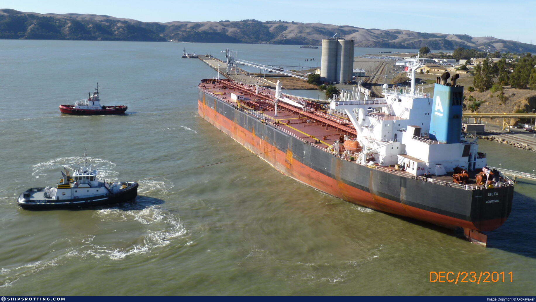
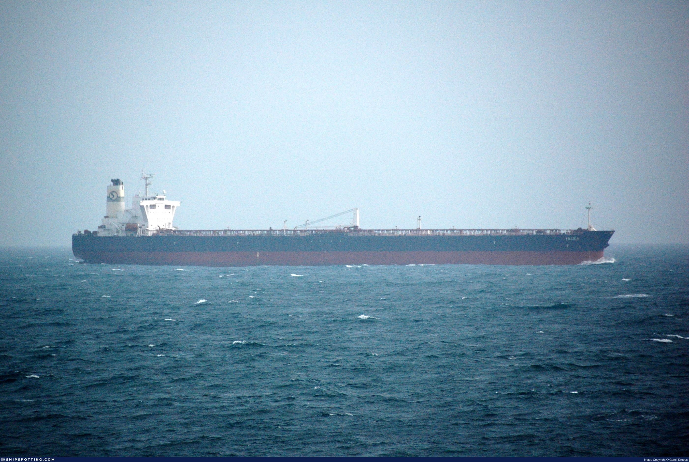
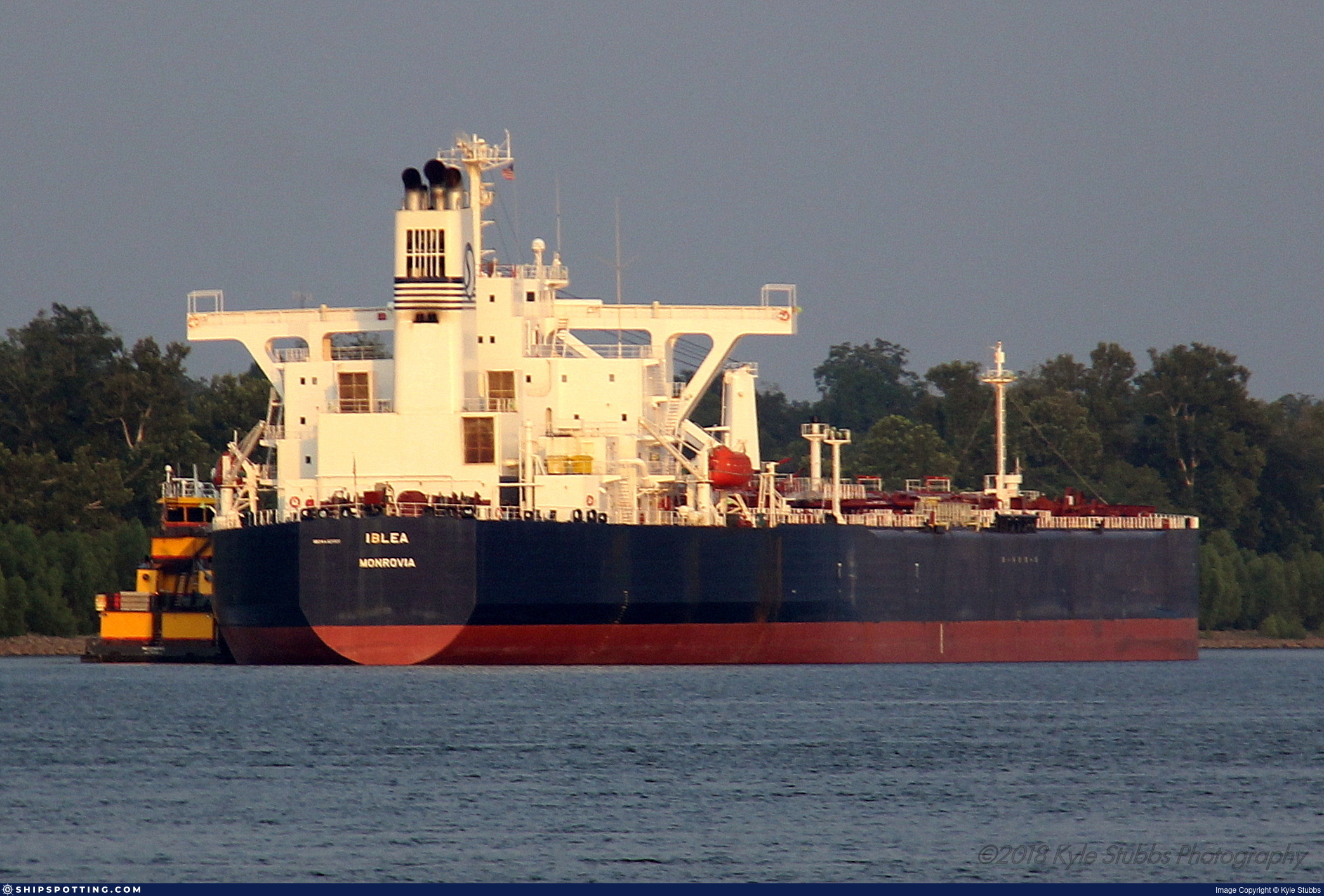
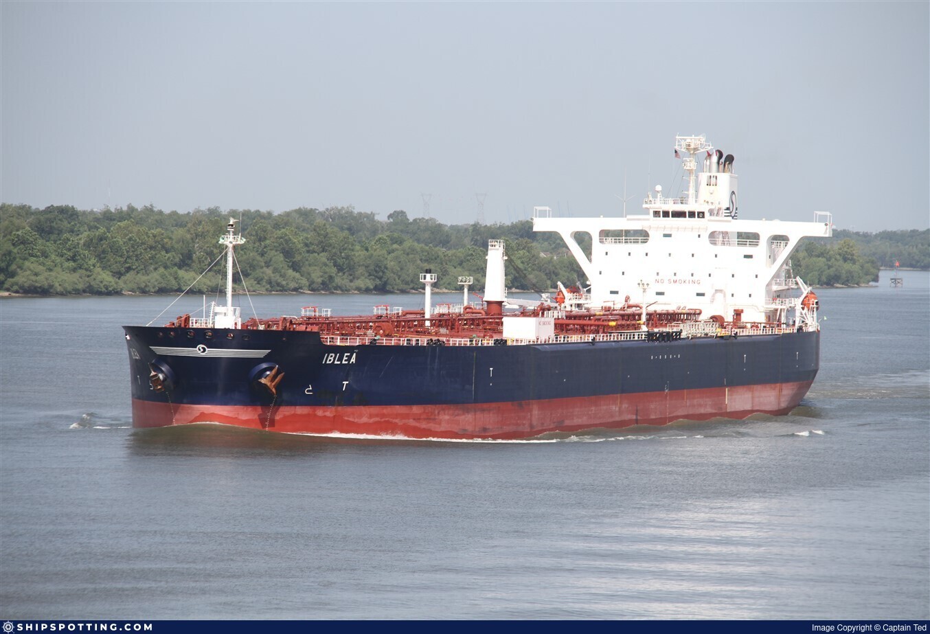
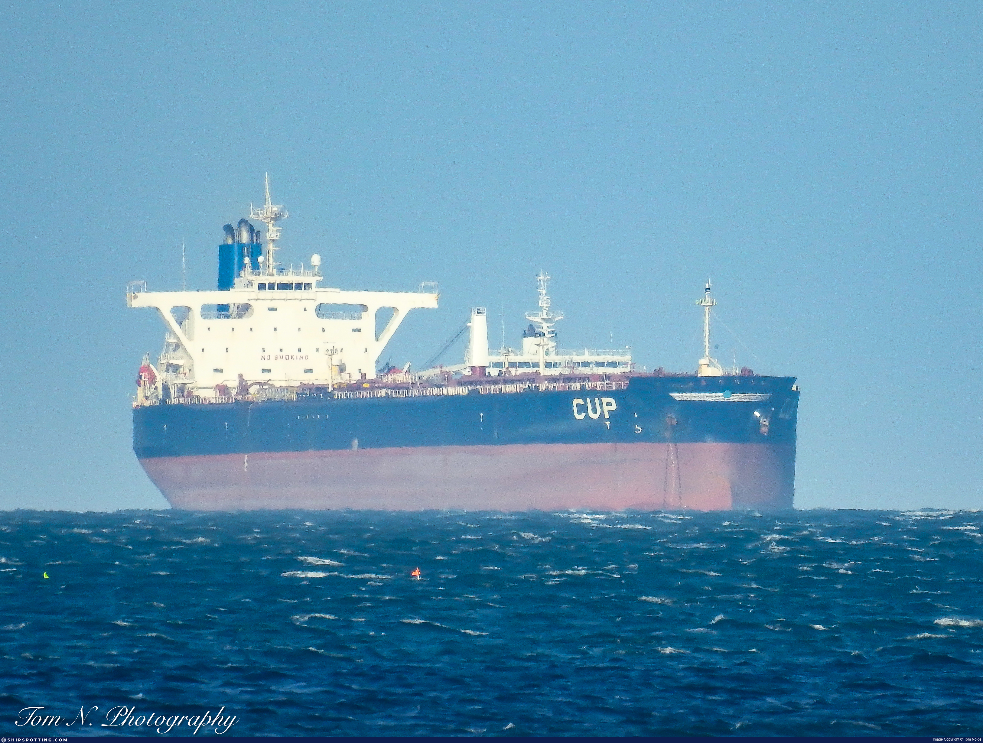
IMO 9271327
Vessel information
Sanctioned by
Company & Ownership
Management & Operations
Classification & Safety
Port State Control (PSC) Inspections
Survey Renewal & Certificates
| Code | Type | Issuer | Issued | Expires |
|---|---|---|---|---|
| 503 | Cargo Ship Safety Radio | American Bureau of Shipping (101) | 27/03/2023 | 26/03/2028 |
| 506 | International Air Pollution Prevention | American Bureau of Shipping (101) | 30/12/2022 | 26/03/2028 |
Programs & Notes
EU Russia Sanctions – Shadow Fleet | SEMA (Canada) — vessel designations | UKRAINE-EO13662] [RUSSIA-EO14024 | The Russia (Sanctions) (EU Exit) Regulations 2019
DateOfListing: 2025-05-21 || Secondary sanctions risk: See Section 11 of Executive Order 14024.; alt. Secondary sanctions risk: Ukraine-/Russia-Related Sanctions Regulations, 31 CFR 589.201 and/or 589.209; Vessel Registration Identification IMO 9271327; MMSI 304768000; Linked To: BLUEJOURNEY SHIPPING LIMITED. || DateDesignated: 2025-07-21 | Shipping sanctions: (see “Other information”) | Shipping sanctions: a specified ship is prohibited from being provided with access to or having its master or pilot cause it to enter a port in the UK, may have its registration on the UK Ship Register terminated, and a master or pilot of a specified ship may be given a port barring direction, a detention direction, and a port entry direction or a movement direction. | IMO 9271327 (“View”) is, has been or is likely to be involved in activity whose object or effect is to destabilise Ukraine or undermine or threaten the territorial integrity, sovereignty or independence of Ukraine or to obtain a benefit from or support the Government of Russia. Namely, 9271327 is involved in carrying oil or oil products that originated in Russia from Russia to a third country.
Vessel Changes
 🔄 Owner
AIS Events
50 events detected • 4 zones • Last: Jun 7, 2026
- Zone: English Channel Surveillance Zone
- Duration: 1h 6m
- Data Points: 9 AIS positions
- Period: 2026-06-07T06:20:06+00:00 to 2026-06-07T07:26:55+00:00
Show Raw Evidence JSON
{
    "zone_id": "discovered_077",
    "zone_name": "English Channel Surveillance Zone",
    "dwell_minutes": 66.7999999999999971578290569595992565155029296875,
    "points_in_zone": 9,
    "first_point": {
        "ts": "2026-06-07T06:20:06+00:00",
        "lat": -34.768716699999998809289536438882350921630859375,
        "lon": 18.199549999999998561861502821557223796844482421875
    },
    "last_point": {
        "ts": "2026-06-07T07:26:55+00:00",
        "lat": -34.89283329999999949677658150903880596160888671875,
        "lon": 18.3372667000000006964910426177084445953369140625
    }
}- Zone: English Channel Surveillance Zone
- Duration: 2h 15m
- Data Points: 14 AIS positions
- Period: 2026-06-07T05:11:06+00:00 to 2026-06-07T07:26:55+00:00
Show Raw Evidence JSON
{
    "zone_id": "discovered_077",
    "zone_name": "English Channel Surveillance Zone",
    "dwell_minutes": 135.80000000000001136868377216160297393798828125,
    "points_in_zone": 14,
    "first_point": {
        "ts": "2026-06-07T05:11:06+00:00",
        "lat": -34.648366699999996853875927627086639404296875,
        "lon": 18.061716700000001623038770048879086971282958984375
    },
    "last_point": {
        "ts": "2026-06-07T07:26:55+00:00",
        "lat": -34.89283329999999949677658150903880596160888671875,
        "lon": 18.3372667000000006964910426177084445953369140625
    }
}- Zone: English Channel Surveillance Zone
- Duration: 3h 3m
- Data Points: 23 AIS positions
- Period: 2026-06-07T04:23:16+00:00 to 2026-06-07T07:26:55+00:00
Show Raw Evidence JSON
{
    "zone_id": "discovered_077",
    "zone_name": "English Channel Surveillance Zone",
    "dwell_minutes": 183.69999999999998863131622783839702606201171875,
    "points_in_zone": 23,
    "first_point": {
        "ts": "2026-06-07T04:23:16+00:00",
        "lat": -34.5637167000000005145921022631227970123291015625,
        "lon": 17.957633300000001241869540535844862461090087890625
    },
    "last_point": {
        "ts": "2026-06-07T07:26:55+00:00",
        "lat": -34.89283329999999949677658150903880596160888671875,
        "lon": 18.3372667000000006964910426177084445953369140625
    }
}- Zone: Eastern Mediterranean Surveillance Zone
- Duration: 1h 47m
- Data Points: 22 AIS positions
- Period: 2026-06-07T03:02:45+00:00 to 2026-06-07T04:50:25+00:00
Show Raw Evidence JSON
{
    "zone_id": "discovered_207",
    "zone_name": "Eastern Mediterranean Surveillance Zone",
    "dwell_minutes": 107.7000000000000028421709430404007434844970703125,
    "points_in_zone": 22,
    "first_point": {
        "ts": "2026-06-07T03:02:45+00:00",
        "lat": -34.410633300000000645013642497360706329345703125,
        "lon": 17.78960000000000007958078640513122081756591796875
    },
    "last_point": {
        "ts": "2026-06-07T04:50:25+00:00",
        "lat": -34.61106670000000207210177904926240444183349609375,
        "lon": 18.018416699999999508463588426820933818817138671875
    }
}- Zone: Eastern Mediterranean Surveillance Zone
- Duration: 2h 32m
- Data Points: 27 AIS positions
- Period: 2026-06-07T02:17:45+00:00 to 2026-06-07T04:50:25+00:00
Show Raw Evidence JSON
{
    "zone_id": "discovered_207",
    "zone_name": "Eastern Mediterranean Surveillance Zone",
    "dwell_minutes": 152.69999999999998863131622783839702606201171875,
    "points_in_zone": 27,
    "first_point": {
        "ts": "2026-06-07T02:17:45+00:00",
        "lat": -34.33051669999999688798197894357144832611083984375,
        "lon": 17.698433300000001366925062029622495174407958984375
    },
    "last_point": {
        "ts": "2026-06-07T04:50:25+00:00",
        "lat": -34.61106670000000207210177904926240444183349609375,
        "lon": 18.018416699999999508463588426820933818817138671875
    }
}- Duration: 3h 52m
- Radius: 244 meters
- Data Points: 14 AIS positions
- Centroid: 31.5894, 32.2782
- Zone: Central Atlantic Surveillance Zone
Show Raw Evidence JSON
{
    "radius_m": 244,
    "duration_minutes": 232.80000000000001136868377216160297393798828125,
    "points": 14,
    "centroid": {
        "lat": 31.58939523571428509285397012718021869659423828125,
        "lon": 32.278163085714282942717545665800571441650390625
    },
    "bbox": {
        "min_lat": 31.587599999999998345856511150486767292022705078125,
        "min_lon": 32.27763329999999797337295603938400745391845703125,
        "max_lat": 31.590316699999998917292032274417579174041748046875,
        "max_lon": 32.27969999999999828332875040359795093536376953125
    },
    "zone_id": "discovered_014"
}- Zone: Central Atlantic Surveillance Zone
- Duration: 3h 52m
- Data Points: 14 AIS positions
- Period: 2026-03-18T13:07:16+00:00 to 2026-03-18T17:00:07+00:00
Show Raw Evidence JSON
{
    "zone_id": "discovered_014",
    "zone_name": "Western Pomerania Monitoring Zone",
    "dwell_minutes": 232.80000000000001136868377216160297393798828125,
    "points_in_zone": 14,
    "first_point": {
        "ts": "2026-03-18T13:07:16+00:00",
        "lat": 31.590116699999999383408066933043301105499267578125,
        "lon": 32.27785000000000081854523159563541412353515625
    },
    "last_point": {
        "ts": "2026-03-18T17:00:07+00:00",
        "lat": 31.587599999999998345856511150486767292022705078125,
        "lon": 32.27964999999999662350091966800391674041748046875
    }
}- Duration: 4h 58m
- Radius: 273 meters
- Data Points: 30 AIS positions
- Centroid: 31.5896, 32.2780
- Zone: Central Atlantic Surveillance Zone
Show Raw Evidence JSON
{
    "radius_m": 273.3999999999999772626324556767940521240234375,
    "duration_minutes": 298.5,
    "points": 30,
    "centroid": {
        "lat": 31.58961110666665916824058513157069683074951171875,
        "lon": 32.27798277000000126690792967565357685089111328125
    },
    "bbox": {
        "min_lat": 31.587599999999998345856511150486767292022705078125,
        "min_lon": 32.27733330000000222526068682782351970672607421875,
        "max_lat": 31.591049999999999187139110290445387363433837890625,
        "max_lon": 32.27969999999999828332875040359795093536376953125
    },
    "zone_id": "discovered_014"
}- Zone: Central Atlantic Surveillance Zone
- Duration: 4h 58m
- Data Points: 30 AIS positions
- Period: 2026-03-18T12:01:35+00:00 to 2026-03-18T17:00:07+00:00
Show Raw Evidence JSON
{
    "zone_id": "discovered_014",
    "zone_name": "Western Pomerania Monitoring Zone",
    "dwell_minutes": 298.5,
    "points_in_zone": 30,
    "first_point": {
        "ts": "2026-03-18T12:01:35+00:00",
        "lat": 31.589466699999999121928340173326432704925537109375,
        "lon": 32.2778332999999975072569213807582855224609375
    },
    "last_point": {
        "ts": "2026-03-18T17:00:07+00:00",
        "lat": 31.587599999999998345856511150486767292022705078125,
        "lon": 32.27964999999999662350091966800391674041748046875
    }
}- Duration: 5h 58m
- Radius: 276 meters
- Data Points: 40 AIS positions
- Centroid: 31.5896, 32.2779
- Zone: Central Atlantic Surveillance Zone
Show Raw Evidence JSON
{
    "radius_m": 276.19999999999998863131622783839702606201171875,
    "duration_minutes": 358.5,
    "points": 40,
    "centroid": {
        "lat": 31.58961082750000315400029649026691913604736328125,
        "lon": 32.27793207749999737643520347774028778076171875
    },
    "bbox": {
        "min_lat": 31.587599999999998345856511150486767292022705078125,
        "min_lon": 32.27733330000000222526068682782351970672607421875,
        "max_lat": 31.591049999999999187139110290445387363433837890625,
        "max_lon": 32.27969999999999828332875040359795093536376953125
    },
    "zone_id": "discovered_014"
}- Zone: Central Atlantic Surveillance Zone
- Duration: 5h 58m
- Data Points: 40 AIS positions
- Period: 2026-03-18T11:01:35+00:00 to 2026-03-18T17:00:07+00:00
Show Raw Evidence JSON
{
    "zone_id": "discovered_014",
    "zone_name": "Western Pomerania Monitoring Zone",
    "dwell_minutes": 358.5,
    "points_in_zone": 40,
    "first_point": {
        "ts": "2026-03-18T11:01:35+00:00",
        "lat": 31.589983300000000099316821433603763580322265625,
        "lon": 32.2777166999999991503500496037304401397705078125
    },
    "last_point": {
        "ts": "2026-03-18T17:00:07+00:00",
        "lat": 31.587599999999998345856511150486767292022705078125,
        "lon": 32.27964999999999662350091966800391674041748046875
    }
}- Duration: 6h 28m
- Radius: 271 meters
- Data Points: 45 AIS positions
- Centroid: 31.5895, 32.2779
- Zone: Central Atlantic Surveillance Zone
Show Raw Evidence JSON
{
    "radius_m": 270.80000000000001136868377216160297393798828125,
    "duration_minutes": 388.5,
    "points": 45,
    "centroid": {
        "lat": 31.589548513333330248542551998980343341827392578125,
        "lon": 32.27792999555554587232109042815864086151123046875
    },
    "bbox": {
        "min_lat": 31.587599999999998345856511150486767292022705078125,
        "min_lon": 32.27733330000000222526068682782351970672607421875,
        "max_lat": 31.591049999999999187139110290445387363433837890625,
        "max_lon": 32.27969999999999828332875040359795093536376953125
    },
    "zone_id": "discovered_014"
}- Zone: Central Atlantic Surveillance Zone
- Duration: 6h 28m
- Data Points: 45 AIS positions
- Period: 2026-03-18T10:31:35+00:00 to 2026-03-18T17:00:07+00:00
Show Raw Evidence JSON
{
    "zone_id": "discovered_014",
    "zone_name": "Western Pomerania Monitoring Zone",
    "dwell_minutes": 388.5,
    "points_in_zone": 45,
    "first_point": {
        "ts": "2026-03-18T10:31:35+00:00",
        "lat": 31.589033300000000537011146661825478076934814453125,
        "lon": 32.27796670000000034406184568069875240325927734375
    },
    "last_point": {
        "ts": "2026-03-18T17:00:07+00:00",
        "lat": 31.587599999999998345856511150486767292022705078125,
        "lon": 32.27964999999999662350091966800391674041748046875
    }
}- Duration: 4h 41m
- Radius: 188 meters
- Data Points: 64 AIS positions
- Centroid: 31.5894, 32.2779
- Zone: Central Atlantic Surveillance Zone
Show Raw Evidence JSON
{
    "radius_m": 187.900000000000005684341886080801486968994140625,
    "duration_minutes": 281.69999999999998863131622783839702606201171875,
    "points": 64,
    "centroid": {
        "lat": 31.589425514062487110322763328440487384796142578125,
        "lon": 32.2778981765624877198206377215683460235595703125
    },
    "bbox": {
        "min_lat": 31.5885999999999995679900166578590869903564453125,
        "min_lon": 32.27733330000000222526068682782351970672607421875,
        "max_lat": 31.591049999999999187139110290445387363433837890625,
        "max_lon": 32.2782499999999998863131622783839702606201171875
    },
    "zone_id": "discovered_014"
}- Zone: Central Atlantic Surveillance Zone
- Duration: 4h 41m
- Data Points: 64 AIS positions
- Period: 2026-03-18T09:04:36+00:00 to 2026-03-18T13:46:16+00:00
Show Raw Evidence JSON
{
    "zone_id": "discovered_014",
    "zone_name": "Western Pomerania Monitoring Zone",
    "dwell_minutes": 281.69999999999998863131622783839702606201171875,
    "points_in_zone": 64,
    "first_point": {
        "ts": "2026-03-18T09:04:36+00:00",
        "lat": 31.58873330000000123618519864976406097412109375,
        "lon": 32.2781666999999998779458110220730304718017578125
    },
    "last_point": {
        "ts": "2026-03-18T13:46:16+00:00",
        "lat": 31.589716700000000315640136250294744968414306640625,
        "lon": 32.27778330000000295285644824616611003875732421875
    }
}- Duration: 5h 45m
- Radius: 256 meters
- Data Points: 71 AIS positions
- Centroid: 31.5894, 32.2779
- Zone: Central Atlantic Surveillance Zone
Show Raw Evidence JSON
{
    "radius_m": 255.69999999999998863131622783839702606201171875,
    "duration_minutes": 345.5,
    "points": 71,
    "centroid": {
        "lat": 31.5894058619718265390474698506295680999755859375,
        "lon": 32.27794178169013861179337254725396633148193359375
    },
    "bbox": {
        "min_lat": 31.5885999999999995679900166578590869903564453125,
        "min_lon": 32.27733330000000222526068682782351970672607421875,
        "max_lat": 31.59126669999999847959770704619586467742919921875,
        "max_lon": 32.279533299999997097984305582940578460693359375
    },
    "zone_id": "discovered_014"
}- Zone: Central Atlantic Surveillance Zone
- Duration: 5h 45m
- Data Points: 71 AIS positions
- Period: 2026-03-18T08:00:45+00:00 to 2026-03-18T13:46:16+00:00
Show Raw Evidence JSON
{
    "zone_id": "discovered_014",
    "zone_name": "Western Pomerania Monitoring Zone",
    "dwell_minutes": 345.5,
    "points_in_zone": 71,
    "first_point": {
        "ts": "2026-03-18T08:00:45+00:00",
        "lat": 31.589033300000000537011146661825478076934814453125,
        "lon": 32.27808329999999870096871745772659778594970703125
    },
    "last_point": {
        "ts": "2026-03-18T13:46:16+00:00",
        "lat": 31.589716700000000315640136250294744968414306640625,
        "lon": 32.27778330000000295285644824616611003875732421875
    }
}- Duration: 6h 27m
- Radius: 260 meters
- Data Points: 78 AIS positions
- Centroid: 31.5893, 32.2780
- Zone: Central Atlantic Surveillance Zone
Show Raw Evidence JSON
{
    "radius_m": 260.30000000000001136868377216160297393798828125,
    "duration_minutes": 387.5,
    "points": 78,
    "centroid": {
        "lat": 31.589341446153856196588094462640583515167236328125,
        "lon": 32.277963885897435147853684611618518829345703125
    },
    "bbox": {
        "min_lat": 31.588249999999998607336237910203635692596435546875,
        "min_lon": 32.27733330000000222526068682782351970672607421875,
        "max_lat": 31.59126669999999847959770704619586467742919921875,
        "max_lon": 32.279533299999997097984305582940578460693359375
    },
    "zone_id": "discovered_014"
}- Zone: Central Atlantic Surveillance Zone
- Duration: 6h 27m
- Data Points: 78 AIS positions
- Period: 2026-03-18T07:18:45+00:00 to 2026-03-18T13:46:16+00:00
Show Raw Evidence JSON
{
    "zone_id": "discovered_014",
    "zone_name": "Western Pomerania Monitoring Zone",
    "dwell_minutes": 387.5,
    "points_in_zone": 78,
    "first_point": {
        "ts": "2026-03-18T07:18:45+00:00",
        "lat": 31.588783299999999343299350584857165813446044921875,
        "lon": 32.27810000000000201225702767260372638702392578125
    },
    "last_point": {
        "ts": "2026-03-18T13:46:16+00:00",
        "lat": 31.589716700000000315640136250294744968414306640625,
        "lon": 32.27778330000000295285644824616611003875732421875
    }
}- Duration: 6h 33m
- Radius: 284 meters
- Data Points: 17 AIS positions
- Centroid: 31.5890, 32.2782
- Zone: Central Atlantic Surveillance Zone
Show Raw Evidence JSON
{
    "radius_m": 284,
    "duration_minutes": 393.30000000000001136868377216160297393798828125,
    "points": 17,
    "centroid": {
        "lat": 31.588953911764708237797094625420868396759033203125,
        "lon": 32.27824705294117535459008649922907352447509765625
    },
    "bbox": {
        "min_lat": 31.588249999999998607336237910203635692596435546875,
        "min_lon": 32.27791669999999868423401494510471820831298828125,
        "max_lat": 31.59126669999999847959770704619586467742919921875,
        "max_lon": 32.279533299999997097984305582940578460693359375
    },
    "zone_id": "discovered_014"
}- Zone: Central Atlantic Surveillance Zone
- Duration: 6h 33m
- Data Points: 17 AIS positions
- Period: 2026-03-18T02:34:16+00:00 to 2026-03-18T09:07:35+00:00
Show Raw Evidence JSON
{
    "zone_id": "discovered_014",
    "zone_name": "Western Pomerania Monitoring Zone",
    "dwell_minutes": 393.30000000000001136868377216160297393798828125,
    "points_in_zone": 17,
    "first_point": {
        "ts": "2026-03-18T02:34:16+00:00",
        "lat": 31.58933329999999983783709467388689517974853515625,
        "lon": 32.27811669999999821811798028647899627685546875
    },
    "last_point": {
        "ts": "2026-03-18T09:07:35+00:00",
        "lat": 31.588750000000000994759830064140260219573974609375,
        "lon": 32.278216700000001537773641757667064666748046875
    }
}- Duration: 6h 23m
- Radius: 264 meters
- Data Points: 25 AIS positions
- Centroid: 31.5892, 32.2781
- Zone: Central Atlantic Surveillance Zone
Show Raw Evidence JSON
{
    "radius_m": 263.6000000000000227373675443232059478759765625,
    "duration_minutes": 383.3999999999999772626324556767940521240234375,
    "points": 25,
    "centroid": {
        "lat": 31.589219596000003065228156629018485546112060546875,
        "lon": 32.27812092399999954750455799512565135955810546875
    },
    "bbox": {
        "min_lat": 31.588249999999998607336237910203635692596435546875,
        "min_lon": 32.27756000000000113914211397059261798858642578125,
        "max_lat": 31.59126669999999847959770704619586467742919921875,
        "max_lon": 32.279533299999997097984305582940578460693359375
    },
    "zone_id": "discovered_014"
}- Zone: Central Atlantic Surveillance Zone
- Duration: 6h 23m
- Data Points: 25 AIS positions
- Period: 2026-03-18T01:50:23+00:00 to 2026-03-18T08:13:45+00:00
Show Raw Evidence JSON
{
    "zone_id": "discovered_014",
    "zone_name": "Western Pomerania Monitoring Zone",
    "dwell_minutes": 383.3999999999999772626324556767940521240234375,
    "points_in_zone": 25,
    "first_point": {
        "ts": "2026-03-18T01:50:23+00:00",
        "lat": 31.590253300000000535874278284609317779541015625,
        "lon": 32.277888300000000754153006710112094879150390625
    },
    "last_point": {
        "ts": "2026-03-18T08:13:45+00:00",
        "lat": 31.588750000000000994759830064140260219573974609375,
        "lon": 32.2780666999999965582901495508849620819091796875
    }
}- Duration: 4h 33m
- Radius: 104 meters
- Data Points: 12 AIS positions
- Centroid: 31.5896, 32.2780
- Zone: Central Atlantic Surveillance Zone
Show Raw Evidence JSON
{
    "radius_m": 103.7000000000000028421709430404007434844970703125,
    "duration_minutes": 273.3999999999999772626324556767940521240234375,
    "points": 12,
    "centroid": {
        "lat": 31.589633891666668574771392741240561008453369140625,
        "lon": 32.27797138333333037962802336551249027252197265625
    },
    "bbox": {
        "min_lat": 31.58898500000000097998054116033017635345458984375,
        "min_lon": 32.27756000000000113914211397059261798858642578125,
        "max_lat": 31.590516699999998451175997615791857242584228515625,
        "max_lon": 32.2783332999999998946805135346949100494384765625
    },
    "zone_id": "discovered_014"
}- Zone: Central Atlantic Surveillance Zone
- Duration: 4h 33m
- Data Points: 12 AIS positions
- Period: 2026-03-17T22:00:54+00:00 to 2026-03-18T02:34:16+00:00
Show Raw Evidence JSON
{
    "zone_id": "discovered_014",
    "zone_name": "Western Pomerania Monitoring Zone",
    "dwell_minutes": 273.3999999999999772626324556767940521240234375,
    "points_in_zone": 12,
    "first_point": {
        "ts": "2026-03-17T22:00:54+00:00",
        "lat": 31.590516699999998451175997615791857242584228515625,
        "lon": 32.2783332999999998946805135346949100494384765625
    },
    "last_point": {
        "ts": "2026-03-18T02:34:16+00:00",
        "lat": 31.58933329999999983783709467388689517974853515625,
        "lon": 32.27811669999999821811798028647899627685546875
    }
}- Duration: 5h 9m
- Radius: 96 meters
- Data Points: 15 AIS positions
- Centroid: 31.5897, 32.2781
- Zone: Central Atlantic Surveillance Zone
Show Raw Evidence JSON
{
    "radius_m": 96.400000000000005684341886080801486968994140625,
    "duration_minutes": 309.5,
    "points": 15,
    "centroid": {
        "lat": 31.589669446666665209022539784200489521026611328125,
        "lon": 32.27810600000000107456799014471471309661865234375
    },
    "bbox": {
        "min_lat": 31.58898500000000097998054116033017635345458984375,
        "min_lon": 32.27756000000000113914211397059261798858642578125,
        "max_lat": 31.590516699999998451175997615791857242584228515625,
        "max_lon": 32.2786617000000006783011485822498798370361328125
    },
    "zone_id": "discovered_014"
}- Zone: Central Atlantic Surveillance Zone
- Duration: 5h 9m
- Data Points: 15 AIS positions
- Period: 2026-03-17T21:24:44+00:00 to 2026-03-18T02:34:16+00:00
Show Raw Evidence JSON
{
    "zone_id": "discovered_014",
    "zone_name": "Western Pomerania Monitoring Zone",
    "dwell_minutes": 309.5,
    "points_in_zone": 15,
    "first_point": {
        "ts": "2026-03-17T21:24:44+00:00",
        "lat": 31.589659999999998518660504487343132495880126953125,
        "lon": 32.27862999999999971123543218709528446197509765625
    },
    "last_point": {
        "ts": "2026-03-18T02:34:16+00:00",
        "lat": 31.58933329999999983783709467388689517974853515625,
        "lon": 32.27811669999999821811798028647899627685546875
    }
}- Duration: 6h 8m
- Radius: 102 meters
- Data Points: 19 AIS positions
- Centroid: 31.5896, 32.2782
- Zone: Central Atlantic Surveillance Zone
Show Raw Evidence JSON
{
    "radius_m": 102,
    "duration_minutes": 368.19999999999998863131622783839702606201171875,
    "points": 19,
    "centroid": {
        "lat": 31.589604821052628125244154944084584712982177734375,
        "lon": 32.27818894736842736392645747400820255279541015625
    },
    "bbox": {
        "min_lat": 31.58898500000000097998054116033017635345458984375,
        "min_lon": 32.27756000000000113914211397059261798858642578125,
        "max_lat": 31.590516699999998451175997615791857242584228515625,
        "max_lon": 32.2786617000000006783011485822498798370361328125
    },
    "zone_id": "discovered_014"
}- Zone: Central Atlantic Surveillance Zone
- Duration: 6h 8m
- Data Points: 19 AIS positions
- Period: 2026-03-17T20:26:01+00:00 to 2026-03-18T02:34:16+00:00
Show Raw Evidence JSON
{
    "zone_id": "discovered_014",
    "zone_name": "Western Pomerania Monitoring Zone",
    "dwell_minutes": 368.19999999999998863131622783839702606201171875,
    "points_in_zone": 19,
    "first_point": {
        "ts": "2026-03-17T20:26:01+00:00",
        "lat": 31.589683300000000798490873421542346477508544921875,
        "lon": 32.278383300000001554508344270288944244384765625
    },
    "last_point": {
        "ts": "2026-03-18T02:34:16+00:00",
        "lat": 31.58933329999999983783709467388689517974853515625,
        "lon": 32.27811669999999821811798028647899627685546875
    }
}- Duration: 3h 58m
- Radius: 132 meters
- Data Points: 10 AIS positions
- Centroid: 31.5894, 32.2787
- Zone: Central Atlantic Surveillance Zone
Show Raw Evidence JSON
{
    "radius_m": 132.19999999999998863131622783839702606201171875,
    "duration_minutes": 238.099999999999994315658113919198513031005859375,
    "points": 10,
    "centroid": {
        "lat": 31.589438499999999976353137753903865814208984375,
        "lon": 32.27867332999999661069523426704108715057373046875
    },
    "bbox": {
        "min_lat": 31.58836670000000168556653079576790332794189453125,
        "min_lon": 32.2783332999999998946805135346949100494384765625,
        "max_lat": 31.590516699999998451175997615791857242584228515625,
        "max_lon": 32.279283300000003009699867106974124908447265625
    },
    "zone_id": "discovered_014"
}- Zone: Central Atlantic Surveillance Zone
- Duration: 3h 58m
- Data Points: 10 AIS positions
- Period: 2026-03-17T18:02:46+00:00 to 2026-03-17T22:00:54+00:00
Show Raw Evidence JSON
{
    "zone_id": "discovered_014",
    "zone_name": "Western Pomerania Monitoring Zone",
    "dwell_minutes": 238.099999999999994315658113919198513031005859375,
    "points_in_zone": 10,
    "first_point": {
        "ts": "2026-03-17T18:02:46+00:00",
        "lat": 31.588616699999999326564648072235286235809326171875,
        "lon": 32.2791832999999996900442056357860565185546875
    },
    "last_point": {
        "ts": "2026-03-17T22:00:54+00:00",
        "lat": 31.590516699999998451175997615791857242584228515625,
        "lon": 32.2783332999999998946805135346949100494384765625
    }
}- Duration: 2 hours
- Radius: 42 meters
- Data Points: 13 AIS positions
- Centroid: 31.6120, 32.2964
- Zone: Baltic Sea Surveillance Zone
Show Raw Evidence JSON
{
    "radius_m": 42.10000000000000142108547152020037174224853515625,
    "duration_minutes": 120.099999999999994315658113919198513031005859375,
    "points": 13,
    "centroid": {
        "lat": 31.611980776923072511408463469706475734710693359375,
        "lon": 32.296419238461538725459831766784191131591796875
    },
    "bbox": {
        "min_lat": 31.611733300000000923546394915319979190826416015625,
        "min_lon": 32.296116699999998900239006616175174713134765625,
        "max_lat": 31.612333299999999525198290939442813396453857421875,
        "max_lon": 32.2966167000000012876625987701117992401123046875
    },
    "zone_id": "discovered_015"
}- Zone: Baltic Sea Surveillance Zone
- Duration: 2 hours
- Data Points: 13 AIS positions
- Period: 2026-02-16T17:00:52+00:00 to 2026-02-16T19:00:56+00:00
Show Raw Evidence JSON
{
    "zone_id": "discovered_015",
    "zone_name": "Delta of the Nile Monitoring Zone",
    "dwell_minutes": 120.099999999999994315658113919198513031005859375,
    "points_in_zone": 13,
    "first_point": {
        "ts": "2026-02-16T17:00:52+00:00",
        "lat": 31.611733300000000923546394915319979190826416015625,
        "lon": 32.296116699999998900239006616175174713134765625
    },
    "last_point": {
        "ts": "2026-02-16T19:00:56+00:00",
        "lat": 31.612333299999999525198290939442813396453857421875,
        "lon": 32.29658330000000177051333594135940074920654296875
    }
}- Duration: 2h 57m
- Radius: 57 meters
- Data Points: 26 AIS positions
- Centroid: 31.6119, 32.2963
- Zone: Baltic Sea Surveillance Zone
Show Raw Evidence JSON
{
    "radius_m": 56.5,
    "duration_minutes": 177.099999999999994315658113919198513031005859375,
    "points": 26,
    "centroid": {
        "lat": 31.611873719230775492405882687307894229888916015625,
        "lon": 32.2963250038461495705632842145860195159912109375
    },
    "bbox": {
        "min_lat": 31.61163330000000115660441224463284015655517578125,
        "min_lon": 32.29605000000000103455022326670587062835693359375,
        "max_lat": 31.612333299999999525198290939442813396453857421875,
        "max_lon": 32.2966167000000012876625987701117992401123046875
    },
    "zone_id": "discovered_015"
}- Zone: Baltic Sea Surveillance Zone
- Duration: 2h 57m
- Data Points: 26 AIS positions
- Period: 2026-02-16T16:03:52+00:00 to 2026-02-16T19:00:56+00:00
Show Raw Evidence JSON
{
    "zone_id": "discovered_015",
    "zone_name": "Delta of the Nile Monitoring Zone",
    "dwell_minutes": 177.099999999999994315658113919198513031005859375,
    "points_in_zone": 26,
    "first_point": {
        "ts": "2026-02-16T16:03:52+00:00",
        "lat": 31.6117832999999990306605468504130840301513671875,
        "lon": 32.296300000000002228262019343674182891845703125
    },
    "last_point": {
        "ts": "2026-02-16T19:00:56+00:00",
        "lat": 31.612333299999999525198290939442813396453857421875,
        "lon": 32.29658330000000177051333594135940074920654296875
    }
}- Duration: 3h 51m
- Radius: 64 meters
- Data Points: 40 AIS positions
- Centroid: 31.6118, 32.2963
- Zone: Baltic Sea Surveillance Zone
Show Raw Evidence JSON
{
    "radius_m": 64.2999999999999971578290569595992565155029296875,
    "duration_minutes": 231.099999999999994315658113919198513031005859375,
    "points": 40,
    "centroid": {
        "lat": 31.611830417500005552255970542319118976593017578125,
        "lon": 32.29626166499999584402758046053349971771240234375
    },
    "bbox": {
        "min_lat": 31.61146670000000113986970973201096057891845703125,
        "min_lon": 32.29573330000000197514964384026825428009033203125,
        "max_lat": 31.612333299999999525198290939442813396453857421875,
        "max_lon": 32.2966167000000012876625987701117992401123046875
    },
    "zone_id": "discovered_015"
}- Zone: Baltic Sea Surveillance Zone
- Duration: 3h 51m
- Data Points: 40 AIS positions
- Period: 2026-02-16T15:09:52+00:00 to 2026-02-16T19:00:56+00:00
Show Raw Evidence JSON
{
    "zone_id": "discovered_015",
    "zone_name": "Delta of the Nile Monitoring Zone",
    "dwell_minutes": 231.099999999999994315658113919198513031005859375,
    "points_in_zone": 40,
    "first_point": {
        "ts": "2026-02-16T15:09:52+00:00",
        "lat": 31.612049999999999982946974341757595539093017578125,
        "lon": 32.29655000000000342197381542064249515533447265625
    },
    "last_point": {
        "ts": "2026-02-16T19:00:56+00:00",
        "lat": 31.612333299999999525198290939442813396453857421875,
        "lon": 32.29658330000000177051333594135940074920654296875
    }
}- Duration: 4h 12m
- Radius: 231 meters
- Data Points: 41 AIS positions
- Centroid: 31.6118, 32.2962
- Zone: Baltic Sea Surveillance Zone
Show Raw Evidence JSON
{
    "radius_m": 231.099999999999994315658113919198513031005859375,
    "duration_minutes": 252,
    "points": 41,
    "centroid": {
        "lat": 31.61181829268292631240910850465297698974609375,
        "lon": 32.29620243658536793418534216471016407012939453125
    },
    "bbox": {
        "min_lat": 31.6113332999999983030647854320704936981201171875,
        "min_lon": 32.2938333000000028505382942967116832733154296875,
        "max_lat": 31.612333299999999525198290939442813396453857421875,
        "max_lon": 32.2966167000000012876625987701117992401123046875
    },
    "zone_id": "discovered_015"
}- Zone: Baltic Sea Surveillance Zone
- Duration: 4h 12m
- Data Points: 41 AIS positions
- Period: 2026-02-16T14:48:54+00:00 to 2026-02-16T19:00:56+00:00
Show Raw Evidence JSON
{
    "zone_id": "discovered_015",
    "zone_name": "Delta of the Nile Monitoring Zone",
    "dwell_minutes": 252,
    "points_in_zone": 41,
    "first_point": {
        "ts": "2026-02-16T14:48:54+00:00",
        "lat": 31.6113332999999983030647854320704936981201171875,
        "lon": 32.2938333000000028505382942967116832733154296875
    },
    "last_point": {
        "ts": "2026-02-16T19:00:56+00:00",
        "lat": 31.612333299999999525198290939442813396453857421875,
        "lon": 32.29658330000000177051333594135940074920654296875
    }
}- Duration: 6h 39m
- Radius: 502 meters
- Data Points: 11 AIS positions
- Centroid: 31.6121, 32.2956
- Zone: Baltic Sea Surveillance Zone
Show Raw Evidence JSON
{
    "radius_m": 502.19999999999998863131622783839702606201171875,
    "duration_minutes": 399,
    "points": 11,
    "centroid": {
        "lat": 31.61209392727272415868355892598628997802734375,
        "lon": 32.29560908181817779905031784437596797943115234375
    },
    "bbox": {
        "min_lat": 31.6113332999999983030647854320704936981201171875,
        "min_lon": 32.29135000000000133013600134290754795074462890625,
        "max_lat": 31.61478329999999914434738457202911376953125,
        "max_lon": 32.29655000000000342197381542064249515533447265625
    },
    "zone_id": "discovered_015"
}- Zone: Baltic Sea Surveillance Zone
- Duration: 6h 39m
- Data Points: 11 AIS positions
- Period: 2026-02-16T09:00:53+00:00 to 2026-02-16T15:39:52+00:00
Show Raw Evidence JSON
{
    "zone_id": "discovered_015",
    "zone_name": "Delta of the Nile Monitoring Zone",
    "dwell_minutes": 399,
    "points_in_zone": 11,
    "first_point": {
        "ts": "2026-02-16T09:00:53+00:00",
        "lat": 31.61478329999999914434738457202911376953125,
        "lon": 32.29135000000000133013600134290754795074462890625
    },
    "last_point": {
        "ts": "2026-02-16T15:39:52+00:00",
        "lat": 31.611599999999999255351212923415005207061767578125,
        "lon": 32.29605000000000103455022326670587062835693359375
    }
}- Duration: 6h 39m
- Radius: 471 meters
- Data Points: 10 AIS positions
- Centroid: 31.6142, 32.2923
- Zone: Baltic Sea Surveillance Zone
Show Raw Evidence JSON
{
    "radius_m": 470.6000000000000227373675443232059478759765625,
    "duration_minutes": 399,
    "points": 10,
    "centroid": {
        "lat": 31.61422166999999916470187599770724773406982421875,
        "lon": 32.29228832000000437574271927587687969207763671875
    },
    "bbox": {
        "min_lat": 31.6113332999999983030647854320704936981201171875,
        "min_lon": 32.29135000000000133013600134290754795074462890625,
        "max_lat": 31.614916699999998428438630071468651294708251953125,
        "max_lon": 32.29655000000000342197381542064249515533447265625
    },
    "zone_id": "discovered_015"
}- Zone: Baltic Sea Surveillance Zone
- Duration: 6h 36m
- Data Points: 9 AIS positions
- Period: 2026-02-16T08:51:54+00:00 to 2026-02-16T15:27:52+00:00
Show Raw Evidence JSON
{
    "zone_id": "discovered_015",
    "zone_name": "Delta of the Nile Monitoring Zone",
    "dwell_minutes": 396,
    "points_in_zone": 9,
    "first_point": {
        "ts": "2026-02-16T08:51:54+00:00",
        "lat": 31.614916699999998428438630071468651294708251953125,
        "lon": 32.29156669999999706988091929815709590911865234375
    },
    "last_point": {
        "ts": "2026-02-16T15:27:52+00:00",
        "lat": 31.61189999999999855617716093547642230987548828125,
        "lon": 32.2962500000000005684341886080801486968994140625
    }
}- Duration: 1h 39m
- Radius: 30 meters
- Data Points: 20 AIS positions
- Centroid: 31.6149, 32.2916
- Zone: Baltic Sea Surveillance Zone
Show Raw Evidence JSON
{
    "radius_m": 29.60000000000000142108547152020037174224853515625,
    "duration_minutes": 99,
    "points": 20,
    "centroid": {
        "lat": 31.61490500999999397890860564075410366058349609375,
        "lon": 32.29162748499999224804923869669437408447265625
    },
    "bbox": {
        "min_lat": 31.614766700000000554382495465688407421112060546875,
        "min_lon": 32.29135000000000133013600134290754795074462890625,
        "max_lat": 31.615083299999998445173332584090530872344970703125,
        "max_lon": 32.29189999999999827196006663143634796142578125
    },
    "zone_id": "discovered_015"
}- Zone: Baltic Sea Surveillance Zone
- Duration: 1h 39m
- Data Points: 20 AIS positions
- Period: 2026-02-16T07:21:52+00:00 to 2026-02-16T09:00:53+00:00
Show Raw Evidence JSON
{
    "zone_id": "discovered_015",
    "zone_name": "Delta of the Nile Monitoring Zone",
    "dwell_minutes": 99,
    "points_in_zone": 20,
    "first_point": {
        "ts": "2026-02-16T07:21:52+00:00",
        "lat": 31.614999999999998436805981327779591083526611328125,
        "lon": 32.29164999999999707824827055446803569793701171875
    },
    "last_point": {
        "ts": "2026-02-16T09:00:53+00:00",
        "lat": 31.61478329999999914434738457202911376953125,
        "lon": 32.29135000000000133013600134290754795074462890625
    }
}- Duration: 2h 57m
- Radius: 134 meters
- Data Points: 23 AIS positions
- Centroid: 31.6148, 32.2915
- Zone: Baltic Sea Surveillance Zone
Show Raw Evidence JSON
{
    "radius_m": 133.599999999999994315658113919198513031005859375,
    "duration_minutes": 177,
    "points": 23,
    "centroid": {
        "lat": 31.614798560869569854503424721769988536834716796875,
        "lon": 32.29152099999999592228050460107624530792236328125
    },
    "bbox": {
        "min_lat": 31.613800000000001233502189279533922672271728515625,
        "min_lon": 32.29073329999999941719579510390758514404296875,
        "max_lat": 31.615083299999998445173332584090530872344970703125,
        "max_lon": 32.29189999999999827196006663143634796142578125
    },
    "zone_id": "discovered_015"
}- Zone: Baltic Sea Surveillance Zone
- Duration: 2h 57m
- Data Points: 23 AIS positions
- Period: 2026-02-16T06:03:52+00:00 to 2026-02-16T09:00:53+00:00
Show Raw Evidence JSON
{
    "zone_id": "discovered_015",
    "zone_name": "Delta of the Nile Monitoring Zone",
    "dwell_minutes": 177,
    "points_in_zone": 23,
    "first_point": {
        "ts": "2026-02-16T06:03:52+00:00",
        "lat": 31.613800000000001233502189279533922672271728515625,
        "lon": 32.29073329999999941719579510390758514404296875
    },
    "last_point": {
        "ts": "2026-02-16T09:00:53+00:00",
        "lat": 31.61478329999999914434738457202911376953125,
        "lon": 32.29135000000000133013600134290754795074462890625
    }
}- Duration: 4 hours
- Radius: 131 meters
- Data Points: 31 AIS positions
- Centroid: 31.6145, 32.2913
- Zone: Baltic Sea Surveillance Zone
Show Raw Evidence JSON
{
    "radius_m": 131.30000000000001136868377216160297393798828125,
    "duration_minutes": 240,
    "points": 31,
    "centroid": {
        "lat": 31.6145274290322646493223146535456180572509765625,
        "lon": 32.29127149354838621775343199260532855987548828125
    },
    "bbox": {
        "min_lat": 31.613516700000001691250872681848704814910888671875,
        "min_lon": 32.29048329999999822348399902693927288055419921875,
        "max_lat": 31.615083299999998445173332584090530872344970703125,
        "max_lon": 32.29189999999999827196006663143634796142578125
    },
    "zone_id": "discovered_015"
}- Zone: Baltic Sea Surveillance Zone
- Duration: 4 hours
- Data Points: 31 AIS positions
- Period: 2026-02-16T05:00:52+00:00 to 2026-02-16T09:00:53+00:00
Show Raw Evidence JSON
{
    "zone_id": "discovered_015",
    "zone_name": "Delta of the Nile Monitoring Zone",
    "dwell_minutes": 240,
    "points_in_zone": 31,
    "first_point": {
        "ts": "2026-02-16T05:00:52+00:00",
        "lat": 31.613800000000001233502189279533922672271728515625,
        "lon": 32.29056669999999940046109259128570556640625
    },
    "last_point": {
        "ts": "2026-02-16T09:00:53+00:00",
        "lat": 31.61478329999999914434738457202911376953125,
        "lon": 32.29135000000000133013600134290754795074462890625
    }
}- Duration: 5 hours
- Radius: 125 meters
- Data Points: 37 AIS positions
- Centroid: 31.6144, 32.2912
- Zone: Baltic Sea Surveillance Zone
Show Raw Evidence JSON
{
    "radius_m": 124.7999999999999971578290569595992565155029296875,
    "duration_minutes": 300,
    "points": 37,
    "centroid": {
        "lat": 31.614383791891896180459298193454742431640625,
        "lon": 32.29115269459459369727483135648071765899658203125
    },
    "bbox": {
        "min_lat": 31.613383299999998854445948381908237934112548828125,
        "min_lon": 32.29048329999999822348399902693927288055419921875,
        "max_lat": 31.615083299999998445173332584090530872344970703125,
        "max_lon": 32.29189999999999827196006663143634796142578125
    },
    "zone_id": "discovered_015"
}Source snapshot
| Sanctioner | As of | Entity ID |
|---|---|---|
| 🇬🇧 UK | 2025-09-29 | 9271327 |
| 🇺🇸 US | 2025-09-29 | 9271327 |
We mirror official lists; always verify at the source.
Sanctioned on the same day
- Akademik Gubkin · IMO 9842190 🇨🇦 CA🇪🇺 EU🇬🇧 UK🇺🇸 US
- ALEKSEY CHIRIKOV · IMO 9613551 🇺🇸 US
- ALEXANDER BEGGROV · IMO 9876373 🇺🇸 US
- ALEXEY BOGOLYUBOV · IMO 9876361 🇺🇸 US
- ALMOND · IMO 9385142 🇨🇦 CA🇪🇺 EU🇬🇧 UK🇺🇸 US
- Amell · IMO 9257993 🇨🇦 CA🇬🇧 UK🇺🇸 US
- Apus · IMO 9280885 🇨🇦 CA🇪🇺 EU🇳🇿 NZ🇬🇧 UK🇺🇸 US
- Aquatica · IMO 9299769 🇨🇦 CA🇪🇺 EU🇬🇧 UK🇺🇸 US