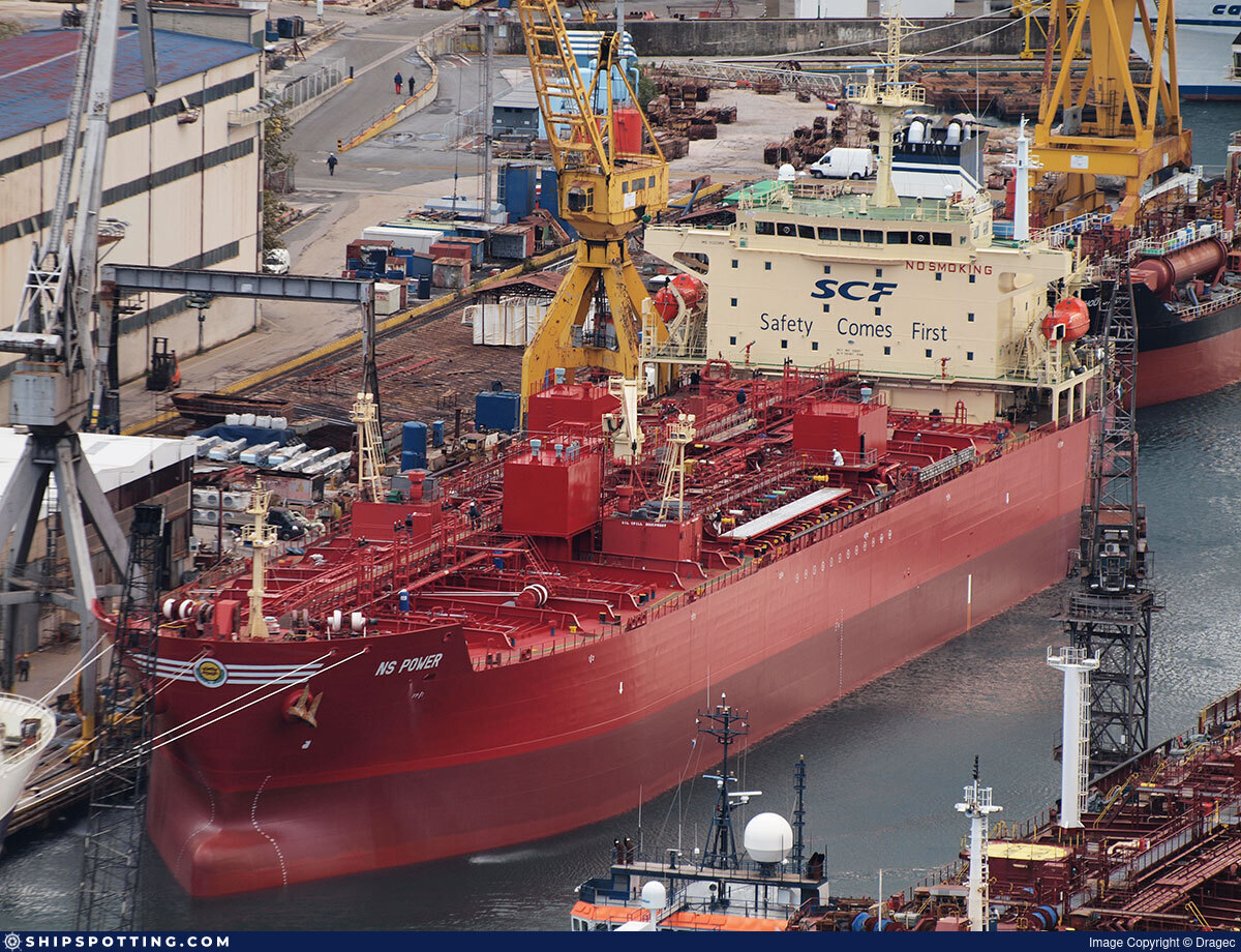
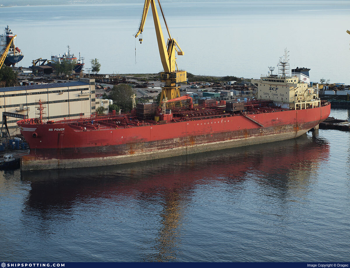
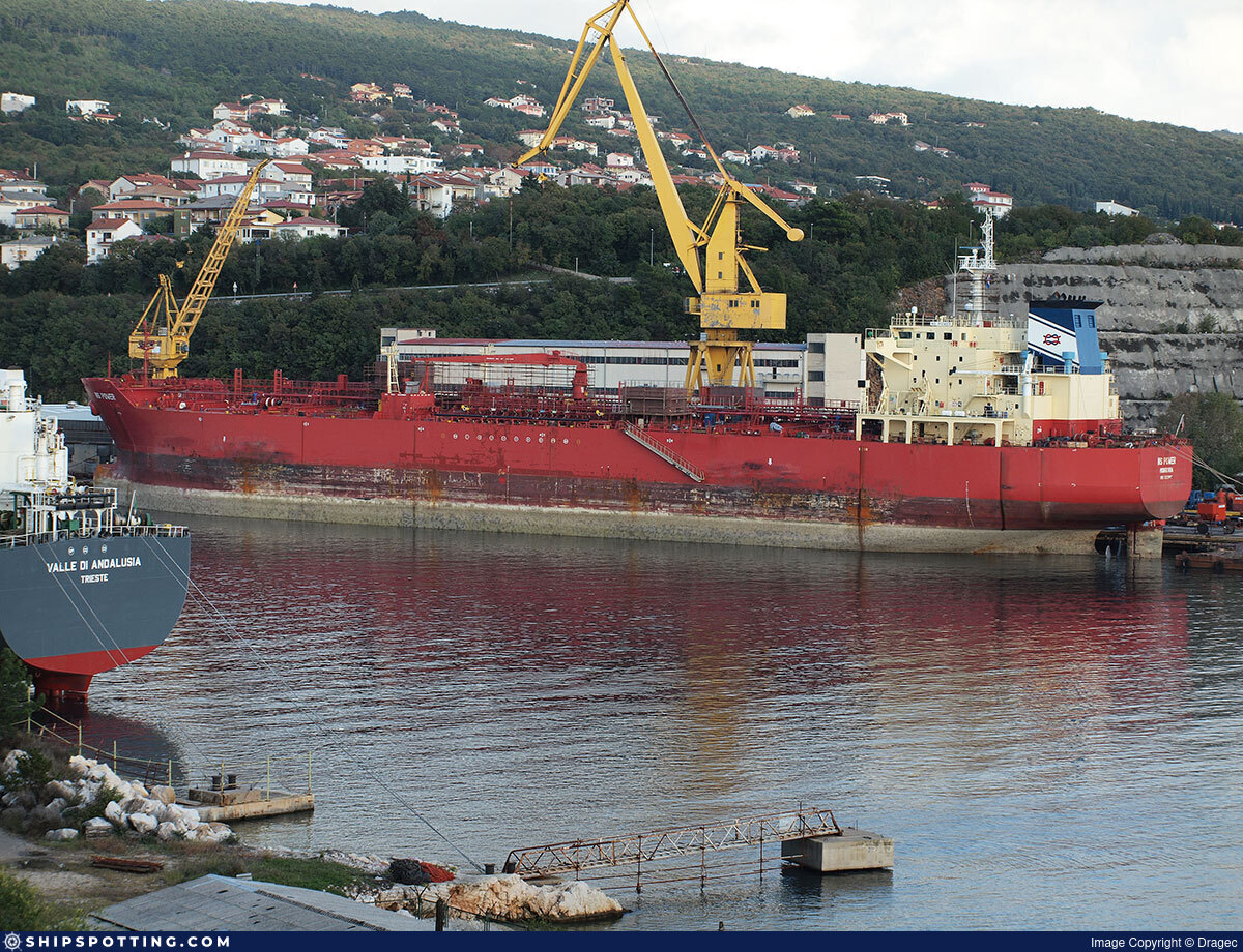
Hyperion

IMO 9322968

Vessel information

Vessel Name Hyperion View name history 📜
IMO Number 9322968
MMSI 620800024
Vessel Type Oil Tanker
Flag 🇷🇺 Russia View flag history 📜
Call Sign D6A4024
Gross Tonnage 25,467 GT
Year Built 2006

Sanctioned by

Company & Ownership

🏢
Rhona Marine Inc
IMO Company: 0068640
Address C/O: Thunder Shipmanagement LLC-FZ 6th Floor, Meydan Grandstand, Al Meydan Road, Nad Al Sheba, Dubai, United Arab Emirates.
Status Active
Fleet 1.0 owner, 0.0 operator, 0.0 manager, 0.0 beneficial

Management & Operations

ISM Manager
NEW FLEET LTD
Kab 21, pom 7-H, Liter A, ul Vasi Alekseyeva 14, St Petersburg, 198188, Russia.
Commercial Manager
NEW FLEET LTD
6th Floor, Meydan Grandstand, Al Meydan Road, Nad Al Sheba, Dubai, United Arab Emirates.
Registered Owner
RHONA MARINE INC
Kab 21, pom 7-H, Liter A, ul Vasi Alekseyeva 14, St Petersburg, 198188, Russia.

Classification & Safety

Current Classification
Russian Maritime Register of Shipping Delivered

Port State Control (PSC) Inspections

⚠️
Risk Level
LOW
Last 36 Months
3
Inspections
Last Inspection
📍 Vanimo
📅 2024-08-12

Survey Renewal & Certificates

Code Type Issuer Issued Expires
509 Document of Compliance Indian Register of Shipping (IRS) (150) 24/05/2024 06/05/2029
509 Document of Compliance Indian Register of Shipping (150) 26/09/2023 17/09/2028

Programs & Notes

SEMA (Canada) — vessel designations | UKRAINE-EO13662] [RUSSIA-EO14024 | The Russia (Sanctions) (EU Exit) Regulations 2019 | Added in EU Sanctions Package 17 | (Council Decision (CFSP) 2025/931, Annex XVI to Decision 2014/512/CFSP) | Press Release | Official Journal

DateOfListing: 2025-05-21 || Secondary sanctions risk: See Section 11 of Executive Order 14024.; alt. Secondary sanctions risk: Ukraine-/Russia-Related Sanctions Regulations, 31 CFR 589.201 and/or 589.209; Vessel Registration Identification IMO 9322968; MMSI 314958000; Linked To: FORNAX SHIP MANAGEMENT FZCO. || DateDesignated: 2025-07-21 | Shipping sanctions: (see “Other information”) | Shipping sanctions: a specified ship is prohibited from being provided with access to or having its master or pilot cause it to enter a port in the UK, may have its registration on the UK Ship Register terminated, and a master or pilot of a specified ship may be given a port barring direction, a detention direction, and a port entry direction or a movement direction. | IMO 9322968 (“Hyperion”) is, has been or is likely to be involved in activity whose object or effect is to destabilise Ukraine or undermine or threaten the territorial integrity, sovereignty or independence of Ukraine or to obtain a benefit from or support the Government of Russia. Namely, 9322968 is involved in carrying oil or oil products that originated in Russia from Russia to a third country.

Vessel Changes

5 changes

AIS Events

50 events detected • 2 zones • Last: Jun 4, 2026

Loiter Eastern Mediterranean Monitoring Zone Jun 4, 2026 11:08 UTC 75.0%
  • Duration: 6h 38m
  • Radius: 73 meters
  • Data Points: 23 AIS positions
  • Centroid: 31.5848, 32.2877
  • Zone: Eastern Mediterranean Monitoring Zone
Show Raw Evidence JSON
{
    "radius_m": 72.599999999999994315658113919198513031005859375,
    "duration_minutes": 398.6000000000000227373675443232059478759765625,
    "points": 23,
    "centroid": {
        "lat": 31.584825804347826050388903240673243999481201171875,
        "lon": 32.2876974739130417901833425275981426239013671875
    },
    "bbox": {
        "min_lat": 31.584528299999998779412635485641658306121826171875,
        "min_lon": 32.28703829999999896926965448074042797088623046875,
        "max_lat": 31.585163300000001385114956065081059932708740234375,
        "max_lon": 32.28836170000000294066921924240887165069580078125
    },
    "zone_id": "discovered_020"
}

Methodology: 2026.01.18

Zone Dwell Eastern Mediterranean Monitoring Zone Jun 4, 2026 11:08 UTC 80.0%
  • Zone: Eastern Mediterranean Monitoring Zone
  • Duration: 6h 38m
  • Data Points: 23 AIS positions
  • Period: 2026-06-04T11:20:25+00:00 to 2026-06-04T17:59:01+00:00
Show Raw Evidence JSON
{
    "zone_id": "discovered_020",
    "zone_name": "Eastern Mediterranean Monitoring Zone",
    "dwell_minutes": 398.6000000000000227373675443232059478759765625,
    "points_in_zone": 23,
    "first_point": {
        "ts": "2026-06-04T11:20:25+00:00",
        "lat": 31.584755000000001246007741428911685943603515625,
        "lon": 32.28808670000000091704350779764354228973388671875
    },
    "last_point": {
        "ts": "2026-06-04T17:59:01+00:00",
        "lat": 31.585139999999999105284587130881845951080322265625,
        "lon": 32.28703829999999896926965448074042797088623046875
    }
}

Methodology: 2026.01.18

Loiter Eastern Mediterranean Monitoring Zone Jun 4, 2026 10:26 UTC 75.0%
  • Duration: 5h 56m
  • Radius: 71 meters
  • Data Points: 19 AIS positions
  • Centroid: 31.5847, 32.2879
  • Zone: Eastern Mediterranean Monitoring Zone
Show Raw Evidence JSON
{
    "radius_m": 70.5,
    "duration_minutes": 356.6000000000000227373675443232059478759765625,
    "points": 19,
    "centroid": {
        "lat": 31.584733257894743729821129818446934223175048828125,
        "lon": 32.28792904736841506974087678827345371246337890625
    },
    "bbox": {
        "min_lat": 31.584528299999998779412635485641658306121826171875,
        "min_lon": 32.287295000000000300133251585066318511962890625,
        "max_lat": 31.5850650000000001682565198279917240142822265625,
        "max_lon": 32.28836170000000294066921924240887165069580078125
    },
    "zone_id": "discovered_020"
}

Methodology: 2026.01.18

Zone Dwell Eastern Mediterranean Monitoring Zone Jun 4, 2026 10:26 UTC 80.0%
  • Zone: Eastern Mediterranean Monitoring Zone
  • Duration: 5h 56m
  • Data Points: 19 AIS positions
  • Period: 2026-06-04T10:26:22+00:00 to 2026-06-04T16:22:55+00:00
Show Raw Evidence JSON
{
    "zone_id": "discovered_020",
    "zone_name": "Eastern Mediterranean Monitoring Zone",
    "dwell_minutes": 356.6000000000000227373675443232059478759765625,
    "points_in_zone": 19,
    "first_point": {
        "ts": "2026-06-04T10:26:22+00:00",
        "lat": 31.58494999999999919282345217652618885040283203125,
        "lon": 32.288053300000001399894244968891143798828125
    },
    "last_point": {
        "ts": "2026-06-04T16:22:55+00:00",
        "lat": 31.58482670000000069876477937214076519012451171875,
        "lon": 32.287471699999997554186847992241382598876953125
    }
}

Methodology: 2026.01.18

Loiter Eastern Mediterranean Monitoring Zone Jun 4, 2026 09:31 UTC 75.0%
  • Duration: 6h 26m
  • Radius: 69 meters
  • Data Points: 20 AIS positions
  • Centroid: 31.5847, 32.2879
  • Zone: Eastern Mediterranean Monitoring Zone
Show Raw Evidence JSON
{
    "radius_m": 69.400000000000005684341886080801486968994140625,
    "duration_minutes": 386.6000000000000227373675443232059478759765625,
    "points": 20,
    "centroid": {
        "lat": 31.58474118000000174788510776124894618988037109375,
        "lon": 32.2879206799999991517324815504252910614013671875
    },
    "bbox": {
        "min_lat": 31.584528299999998779412635485641658306121826171875,
        "min_lon": 32.287295000000000300133251585066318511962890625,
        "max_lat": 31.5850650000000001682565198279917240142822265625,
        "max_lon": 32.28836170000000294066921924240887165069580078125
    },
    "zone_id": "discovered_020"
}

Methodology: 2026.01.18

Zone Dwell Eastern Mediterranean Monitoring Zone Jun 4, 2026 09:31 UTC 80.0%
  • Zone: Eastern Mediterranean Monitoring Zone
  • Duration: 6h 26m
  • Data Points: 20 AIS positions
  • Period: 2026-06-04T09:56:22+00:00 to 2026-06-04T16:22:55+00:00
Show Raw Evidence JSON
{
    "zone_id": "discovered_020",
    "zone_name": "Eastern Mediterranean Monitoring Zone",
    "dwell_minutes": 386.6000000000000227373675443232059478759765625,
    "points_in_zone": 20,
    "first_point": {
        "ts": "2026-06-04T09:56:22+00:00",
        "lat": 31.5848917000000000143700162880122661590576171875,
        "lon": 32.28776169999999723358996561728417873382568359375
    },
    "last_point": {
        "ts": "2026-06-04T16:22:55+00:00",
        "lat": 31.58482670000000069876477937214076519012451171875,
        "lon": 32.287471699999997554186847992241382598876953125
    }
}

Methodology: 2026.01.18

Loiter Eastern Mediterranean Monitoring Zone Jun 4, 2026 07:44 UTC 75.0%
  • Duration: 5h 50m
  • Radius: 70 meters
  • Data Points: 20 AIS positions
  • Centroid: 31.5848, 32.2879
  • Zone: Eastern Mediterranean Monitoring Zone
Show Raw Evidence JSON
{
    "radius_m": 70.2000000000000028421709430404007434844970703125,
    "duration_minutes": 350.80000000000001136868377216160297393798828125,
    "points": 20,
    "centroid": {
        "lat": 31.584752930000007609123713336884975433349609375,
        "lon": 32.28793817500000074005583883263170719146728515625
    },
    "bbox": {
        "min_lat": 31.584528299999998779412635485641658306121826171875,
        "min_lon": 32.287295000000000300133251585066318511962890625,
        "max_lat": 31.5850650000000001682565198279917240142822265625,
        "max_lon": 32.28836170000000294066921924240887165069580078125
    },
    "zone_id": "discovered_020"
}

Methodology: 2026.01.18

Zone Dwell Eastern Mediterranean Monitoring Zone Jun 4, 2026 07:44 UTC 80.0%
  • Zone: Eastern Mediterranean Monitoring Zone
  • Duration: 5h 50m
  • Data Points: 20 AIS positions
  • Period: 2026-06-04T07:44:09+00:00 to 2026-06-04T13:34:58+00:00
Show Raw Evidence JSON
{
    "zone_id": "discovered_020",
    "zone_name": "Eastern Mediterranean Monitoring Zone",
    "dwell_minutes": 350.80000000000001136868377216160297393798828125,
    "points_in_zone": 20,
    "first_point": {
        "ts": "2026-06-04T07:44:09+00:00",
        "lat": 31.584901699999999635792846675030887126922607421875,
        "lon": 32.2876600000000024692781153135001659393310546875
    },
    "last_point": {
        "ts": "2026-06-04T13:34:58+00:00",
        "lat": 31.584676699999999271994965965859591960906982421875,
        "lon": 32.2880167000000000143700162880122661590576171875
    }
}

Methodology: 2026.01.18

Zone Dwell Eastern Mediterranean Monitoring Zone Jun 4, 2026 04:07 UTC 80.0%
  • Zone: Eastern Mediterranean Monitoring Zone
  • Duration: 6h 19m
  • Data Points: 5 AIS positions
  • Period: 2026-06-04T04:07:19+00:00 to 2026-06-04T10:26:22+00:00
Show Raw Evidence JSON
{
    "zone_id": "discovered_020",
    "zone_name": "Eastern Mediterranean Monitoring Zone",
    "dwell_minutes": 379.1000000000000227373675443232059478759765625,
    "points_in_zone": 5,
    "first_point": {
        "ts": "2026-06-04T04:07:19+00:00",
        "lat": 31.586600000000000676436684443615376949310302734375,
        "lon": 32.2865699999999975489117787219583988189697265625
    },
    "last_point": {
        "ts": "2026-06-04T10:26:22+00:00",
        "lat": 31.58494999999999919282345217652618885040283203125,
        "lon": 32.288053300000001399894244968891143798828125
    }
}

Methodology: 2026.01.18

Zone Dwell Eastern Mediterranean Monitoring Zone Jun 3, 2026 18:19 UTC 80.0%
  • Zone: Eastern Mediterranean Monitoring Zone
  • Duration: 1h 10m
  • Data Points: 11 AIS positions
  • Period: 2026-06-03T18:19:54+00:00 to 2026-06-03T19:30:28+00:00
Show Raw Evidence JSON
{
    "zone_id": "discovered_020",
    "zone_name": "Eastern Mediterranean Monitoring Zone",
    "dwell_minutes": 70.599999999999994315658113919198513031005859375,
    "points_in_zone": 11,
    "first_point": {
        "ts": "2026-06-03T18:19:54+00:00",
        "lat": 31.585609999999999075726009323261678218841552734375,
        "lon": 32.28674500000000335830918629653751850128173828125
    },
    "last_point": {
        "ts": "2026-06-03T19:30:28+00:00",
        "lat": 31.585878300000000962199919740669429302215576171875,
        "lon": 32.28654329999999816891431692056357860565185546875
    }
}

Methodology: 2026.01.18

Loiter Eastern Mediterranean Monitoring Zone Jun 3, 2026 17:10 UTC 75.0%
  • Duration: 2h 19m
  • Radius: 23 meters
  • Data Points: 14 AIS positions
  • Centroid: 31.5858, 32.2866
  • Zone: Eastern Mediterranean Monitoring Zone
Show Raw Evidence JSON
{
    "radius_m": 23,
    "duration_minutes": 139.599999999999994315658113919198513031005859375,
    "points": 14,
    "centroid": {
        "lat": 31.58575607857142841794484411366283893585205078125,
        "lon": 32.28664999285714287680093548260629177093505859375
    },
    "bbox": {
        "min_lat": 31.585609999999999075726009323261678218841552734375,
        "min_lon": 32.28645329999999802339516463689506053924560546875,
        "max_lat": 31.58589500000000072077455115504562854766845703125,
        "max_lon": 32.286793299999999362626112997531890869140625
    },
    "zone_id": "discovered_020"
}

Methodology: 2026.01.18

Zone Dwell Eastern Mediterranean Monitoring Zone Jun 3, 2026 17:10 UTC 80.0%
  • Zone: Eastern Mediterranean Monitoring Zone
  • Duration: 2h 19m
  • Data Points: 14 AIS positions
  • Period: 2026-06-03T17:10:54+00:00 to 2026-06-03T19:30:28+00:00
Show Raw Evidence JSON
{
    "zone_id": "discovered_020",
    "zone_name": "Eastern Mediterranean Monitoring Zone",
    "dwell_minutes": 139.599999999999994315658113919198513031005859375,
    "points_in_zone": 14,
    "first_point": {
        "ts": "2026-06-03T17:10:54+00:00",
        "lat": 31.585654999999999148485585465095937252044677734375,
        "lon": 32.286793299999999362626112997531890869140625
    },
    "last_point": {
        "ts": "2026-06-03T19:30:28+00:00",
        "lat": 31.585878300000000962199919740669429302215576171875,
        "lon": 32.28654329999999816891431692056357860565185546875
    }
}

Methodology: 2026.01.18

Loiter Eastern Mediterranean Monitoring Zone Jun 3, 2026 16:04 UTC 75.0%
  • Duration: 3h 25m
  • Radius: 93 meters
  • Data Points: 18 AIS positions
  • Centroid: 31.5857, 32.2867
  • Zone: Eastern Mediterranean Monitoring Zone
Show Raw Evidence JSON
{
    "radius_m": 92.900000000000005684341886080801486968994140625,
    "duration_minutes": 205.599999999999994315658113919198513031005859375,
    "points": 18,
    "centroid": {
        "lat": 31.585656861111107929218633216805756092071533203125,
        "lon": 32.28670907222221586607702192850410938262939453125
    },
    "bbox": {
        "min_lat": 31.585036699999999854071575100533664226531982421875,
        "min_lon": 32.28645329999999802339516463689506053924560546875,
        "max_lat": 31.58589500000000072077455115504562854766845703125,
        "max_lon": 32.28736669999999975289028952829539775848388671875
    },
    "zone_id": "discovered_020"
}

Methodology: 2026.01.18

Zone Dwell Eastern Mediterranean Monitoring Zone Jun 3, 2026 16:04 UTC 80.0%
  • Zone: Eastern Mediterranean Monitoring Zone
  • Duration: 3h 25m
  • Data Points: 18 AIS positions
  • Period: 2026-06-03T16:04:50+00:00 to 2026-06-03T19:30:28+00:00
Show Raw Evidence JSON
{
    "zone_id": "discovered_020",
    "zone_name": "Eastern Mediterranean Monitoring Zone",
    "dwell_minutes": 205.599999999999994315658113919198513031005859375,
    "points_in_zone": 18,
    "first_point": {
        "ts": "2026-06-03T16:04:50+00:00",
        "lat": 31.585413299999999026113073341548442840576171875,
        "lon": 32.28671669999999949141056276857852935791015625
    },
    "last_point": {
        "ts": "2026-06-03T19:30:28+00:00",
        "lat": 31.585878300000000962199919740669429302215576171875,
        "lon": 32.28654329999999816891431692056357860565185546875
    }
}

Methodology: 2026.01.18

Loiter Eastern Mediterranean Monitoring Zone Jun 3, 2026 15:48 UTC 75.0%
  • Duration: 3h 41m
  • Radius: 86 meters
  • Data Points: 22 AIS positions
  • Centroid: 31.5856, 32.2867
  • Zone: Eastern Mediterranean Monitoring Zone
Show Raw Evidence JSON
{
    "radius_m": 85.900000000000005684341886080801486968994140625,
    "duration_minutes": 221.5,
    "points": 22,
    "centroid": {
        "lat": 31.5855874272727277229932951740920543670654296875,
        "lon": 32.2867307545454451656041783280670642852783203125
    },
    "bbox": {
        "min_lat": 31.585036699999999854071575100533664226531982421875,
        "min_lon": 32.28645329999999802339516463689506053924560546875,
        "max_lat": 31.58589500000000072077455115504562854766845703125,
        "max_lon": 32.28736669999999975289028952829539775848388671875
    },
    "zone_id": "discovered_020"
}

Methodology: 2026.01.18

Zone Dwell Eastern Mediterranean Monitoring Zone Jun 3, 2026 15:48 UTC 80.0%
  • Zone: Eastern Mediterranean Monitoring Zone
  • Duration: 3h 41m
  • Data Points: 22 AIS positions
  • Period: 2026-06-03T15:48:58+00:00 to 2026-06-03T19:30:28+00:00
Show Raw Evidence JSON
{
    "zone_id": "discovered_020",
    "zone_name": "Eastern Mediterranean Monitoring Zone",
    "dwell_minutes": 221.5,
    "points_in_zone": 22,
    "first_point": {
        "ts": "2026-06-03T15:48:58+00:00",
        "lat": 31.585278299999998807834344916045665740966796875,
        "lon": 32.286889999999999645297066308557987213134765625
    },
    "last_point": {
        "ts": "2026-06-03T19:30:28+00:00",
        "lat": 31.585878300000000962199919740669429302215576171875,
        "lon": 32.28654329999999816891431692056357860565185546875
    }
}

Methodology: 2026.01.18

Sts🛰️✗ Eastern Mediterranean Surveillance Zone Jun 3, 2026 14:23 UTC 70/100
Vessel A: IMO 9328144 (AHINOS) Liberia
Vessel B: Hyperion (HYPERION) Russia
  • Minimum Distance: 198 meters
  • Average Distance: 269 meters
  • Duration: 1h 22m
  • Period: 2026-06-03T14:23:43+00:00 to 2026-06-03T15:45:41+00:00
  • Vessel A Avg Speed: 0.1 knots
  • Vessel B Avg Speed: 0.0 knots
  • Zone: Eastern Mediterranean Surveillance Zone

Confidence Analysis

Score: 70/100

Moderate-confidence STS candidate. Two tankers (AHINOS and HYPERION) maintained close proximity (min 198m, avg 269m) for 82 minutes. Both vessels were slow-moving (avg speeds 0.1 and 0.0 knots). Event occurred in Eastern Mediterranean Surveillance Zone, a known STS activity area.

View scoring breakdown
FactorScoreDetail
Distance Tightness20/25Min distance 198m, avg 269m
Duration15/25Duration 82 minutes
Speed Stability20/20both nearly stationary; very stable speeds
Distance Consistency5/15Distance variance ±101m
Isolation5/10Isolation data not available
Context5/5In monitored zone: Eastern Mediterranean Surveillance Zone

🛰️ Satellite Corroboration

SAR Not Available

No satellite imagery for this time/location

No Sentinel-1 scenes covering AOI and time window

Searched: 2026-06-04T04:30:09.570981+00:00

Show Raw Evidence JSON
{
    "vessel_a": {
        "mmsi": 636024537,
        "imo": 9328144,
        "name": "AHINOS",
        "flag": "Liberia"
    },
    "vessel_b": {
        "mmsi": 273278750,
        "imo": 9322968,
        "name": "HYPERION",
        "flag": "Russia"
    },
    "min_distance_m": 198.400000000000005684341886080801486968994140625,
    "avg_distance_m": 269.30000000000001136868377216160297393798828125,
    "distance_consistency_m": 101.2000000000000028421709430404007434844970703125,
    "duration_minutes": 82,
    "overlap_duration_s": 4918,
    "speed_a_avg": 0.070000000000000006661338147750939242541790008544921875,
    "speed_a_std": 0.059999999999999997779553950749686919152736663818359375,
    "speed_b_avg": 0,
    "speed_b_std": 0,
    "speed_summary": {
        "vessel_a": {
            "avg_sog": 0.070000000000000006661338147750939242541790008544921875,
            "max_sog": 0.1000000000000000055511151231257827021181583404541015625
        },
        "vessel_b": {
            "avg_sog": 0,
            "max_sog": 0
        }
    },
    "time_window": {
        "start": "2026-06-03T14:23:43+00:00",
        "end": "2026-06-03T15:45:41+00:00"
    },
    "points_count": {
        "vessel_a": 3,
        "vessel_b": 3
    },
    "zone_id": "discovered_138",
    "zone_name": "Eastern Mediterranean Surveillance Zone",
    "score": {
        "value": 70,
        "components": {
            "distance_tightness": {
                "score": 20,
                "max": 25,
                "detail": "Min distance 198m, avg 269m"
            },
            "duration": {
                "score": 15,
                "max": 25,
                "detail": "Duration 82 minutes"
            },
            "speed_stability": {
                "score": 20,
                "max": 20,
                "detail": "both nearly stationary; very stable speeds"
            },
            "distance_consistency": {
                "score": 5,
                "max": 15,
                "detail": "Distance variance \u00b1101m"
            },
            "isolation": {
                "score": 5,
                "max": 10,
                "detail": "Isolation data not available"
            },
            "context": {
                "score": 5,
                "max": 5,
                "detail": "In monitored zone: Eastern Mediterranean Surveillance Zone"
            }
        },
        "summary": "Moderate-confidence STS candidate. Two tankers (AHINOS and HYPERION) maintained close proximity (min 198m, avg 269m) for 82 minutes. Both vessels were slow-moving (avg speeds 0.1 and 0.0 knots). Event occurred in Eastern Mediterranean Surveillance Zone, a known STS activity area."
    },
    "sar": {
        "status": "not_found",
        "centroid": {
            "lat": 31.717342999999999619831214658915996551513671875,
            "lon": 35.9986253000000004931280273012816905975341796875
        },
        "time_window": {
            "start_ts": "2026-06-03T14:23:43+00:00",
            "end_ts": "2026-06-03T15:45:41+00:00"
        },
        "searched_at": "2026-06-04T04:30:09.570981+00:00",
        "notes": "No Sentinel-1 scenes covering AOI and time window"
    }
}

Methodology: 2026.01.18

Sts🛰️✗ Eastern Mediterranean Surveillance Zone Jun 3, 2026 13:58 UTC 62/100
Vessel A: IMO 9135793 (SEAGAS MAJOR) LIBERIA
Vessel B: Hyperion (HYPERION) Russia
  • Minimum Distance: 6 meters
  • Average Distance: 61 meters
  • Duration: 32 minutes
  • Period: 2026-06-03T13:58:01+00:00 to 2026-06-03T14:30:01+00:00
  • Vessel A Avg Speed: 0.2 knots
  • Vessel B Avg Speed: 0.3 knots
  • Zone: Eastern Mediterranean Surveillance Zone

Confidence Analysis

Score: 62/100

Moderate-confidence STS candidate. Two tankers (SEAGAS MAJOR and HYPERION) maintained close proximity (min 6m, avg 61m) for 32 minutes. Both vessels were slow-moving (avg speeds 0.2 and 0.3 knots). Moderate distance variation observed during the encounter. Event occurred in Eastern Mediterranean Surveillance Zone, a known STS activity area.

View scoring breakdown
FactorScoreDetail
Distance Tightness25/25Min distance 6m, avg 61m
Duration5/25Duration 32 minutes
Speed Stability14/20both nearly stationary; somewhat variable speeds
Distance Consistency8/15Distance variance ±91m
Isolation5/10Isolation data not available
Context5/5In monitored zone: Eastern Mediterranean Surveillance Zone

🛰️ Satellite Corroboration

SAR Not Available

No satellite imagery for this time/location

No Sentinel-1 scenes covering AOI and time window

Searched: 2026-06-03T23:30:15.968309+00:00

Show Raw Evidence JSON
{
    "vessel_a": {
        "mmsi": 636016188,
        "imo": 9135793,
        "name": "SEAGAS MAJOR",
        "flag": "LIBERIA"
    },
    "vessel_b": {
        "mmsi": 273278750,
        "imo": 9322968,
        "name": "HYPERION",
        "flag": "Russia"
    },
    "min_distance_m": 5.5,
    "avg_distance_m": 60.89999999999999857891452847979962825775146484375,
    "distance_consistency_m": 90.900000000000005684341886080801486968994140625,
    "duration_minutes": 32,
    "overlap_duration_s": 1920,
    "speed_a_avg": 0.1700000000000000122124532708767219446599483489990234375,
    "speed_a_std": 0.289999999999999980015985556747182272374629974365234375,
    "speed_b_avg": 0.330000000000000015543122344752191565930843353271484375,
    "speed_b_std": 0.57999999999999996003197111349436454474925994873046875,
    "speed_summary": {
        "vessel_a": {
            "avg_sog": 0.1700000000000000122124532708767219446599483489990234375,
            "max_sog": 0.5
        },
        "vessel_b": {
            "avg_sog": 0.330000000000000015543122344752191565930843353271484375,
            "max_sog": 1
        }
    },
    "time_window": {
        "start": "2026-06-03T13:58:01+00:00",
        "end": "2026-06-03T14:30:01+00:00"
    },
    "points_count": {
        "vessel_a": 3,
        "vessel_b": 3
    },
    "zone_id": "discovered_138",
    "zone_name": "Eastern Mediterranean Surveillance Zone",
    "score": {
        "value": 62,
        "components": {
            "distance_tightness": {
                "score": 25,
                "max": 25,
                "detail": "Min distance 6m, avg 61m"
            },
            "duration": {
                "score": 5,
                "max": 25,
                "detail": "Duration 32 minutes"
            },
            "speed_stability": {
                "score": 14,
                "max": 20,
                "detail": "both nearly stationary; somewhat variable speeds"
            },
            "distance_consistency": {
                "score": 8,
                "max": 15,
                "detail": "Distance variance \u00b191m"
            },
            "isolation": {
                "score": 5,
                "max": 10,
                "detail": "Isolation data not available"
            },
            "context": {
                "score": 5,
                "max": 5,
                "detail": "In monitored zone: Eastern Mediterranean Surveillance Zone"
            }
        },
        "summary": "Moderate-confidence STS candidate. Two tankers (SEAGAS MAJOR and HYPERION) maintained close proximity (min 6m, avg 61m) for 32 minutes. Both vessels were slow-moving (avg speeds 0.2 and 0.3 knots). Moderate distance variation observed during the encounter. Event occurred in Eastern Mediterranean Surveillance Zone, a known STS activity area."
    },
    "sar": {
        "status": "not_found",
        "centroid": {
            "lat": 31.717273399999999838883013580925762653350830078125,
            "lon": 35.99962839999999886231307755224406719207763671875
        },
        "time_window": {
            "start_ts": "2026-06-03T13:58:01+00:00",
            "end_ts": "2026-06-03T14:30:01+00:00"
        },
        "searched_at": "2026-06-03T23:30:15.968309+00:00",
        "notes": "No Sentinel-1 scenes covering AOI and time window"
    }
}

Methodology: 2026.01.18

Sts🛰️✗ Eastern Mediterranean Surveillance Zone Jun 3, 2026 13:56 UTC 67/100
Vessel A: DORIN (DORIN) CAMEROON
Vessel B: Hyperion (HYPERION) Russia
  • Minimum Distance: 9 meters
  • Average Distance: 17 meters
  • Duration: 38 minutes
  • Period: 2026-06-03T13:56:37+00:00 to 2026-06-03T14:35:09+00:00
  • Vessel A Avg Speed: 0.0 knots
  • Vessel B Avg Speed: 0.7 knots
  • Zone: Eastern Mediterranean Surveillance Zone

Confidence Analysis

Score: 67/100

Moderate-confidence STS candidate. Two tankers (DORIN and HYPERION) maintained close proximity (min 9m, avg 17m) for 38 minutes. Both vessels were slow-moving (avg speeds 0.0 and 0.7 knots). The stable separation distance suggests deliberate parallel positioning typical of cargo transfer. Event occurred in Eastern Mediterranean Surveillance Zone, a known STS activity area.

View scoring breakdown
FactorScoreDetail
Distance Tightness25/25Min distance 9m, avg 17m
Duration5/25Duration 38 minutes
Speed Stability12/20both very slow; somewhat variable speeds
Distance Consistency15/15Distance variance ±11m
Isolation5/10Isolation data not available
Context5/5In monitored zone: Eastern Mediterranean Surveillance Zone

🛰️ Satellite Corroboration

SAR Not Available

No satellite imagery for this time/location

No Sentinel-1 scenes covering AOI and time window

Searched: 2026-06-04T00:15:09.635888+00:00

Show Raw Evidence JSON
{
    "vessel_a": {
        "mmsi": 613414203,
        "imo": 9290828,
        "name": "DORIN",
        "flag": "CAMEROON"
    },
    "vessel_b": {
        "mmsi": 273278750,
        "imo": 9322968,
        "name": "HYPERION",
        "flag": "Russia"
    },
    "min_distance_m": 8.5999999999999996447286321199499070644378662109375,
    "avg_distance_m": 17.10000000000000142108547152020037174224853515625,
    "distance_consistency_m": 10.5999999999999996447286321199499070644378662109375,
    "duration_minutes": 38.5,
    "overlap_duration_s": 2312,
    "speed_a_avg": 0,
    "speed_a_std": 0,
    "speed_b_avg": 0.67000000000000003996802888650563545525074005126953125,
    "speed_b_std": 0.57999999999999996003197111349436454474925994873046875,
    "speed_summary": {
        "vessel_a": {
            "avg_sog": 0,
            "max_sog": 0
        },
        "vessel_b": {
            "avg_sog": 0.67000000000000003996802888650563545525074005126953125,
            "max_sog": 1
        }
    },
    "time_window": {
        "start": "2026-06-03T13:56:37+00:00",
        "end": "2026-06-03T14:35:09+00:00"
    },
    "points_count": {
        "vessel_a": 3,
        "vessel_b": 3
    },
    "zone_id": "discovered_138",
    "zone_name": "Eastern Mediterranean Surveillance Zone",
    "score": {
        "value": 67,
        "components": {
            "distance_tightness": {
                "score": 25,
                "max": 25,
                "detail": "Min distance 9m, avg 17m"
            },
            "duration": {
                "score": 5,
                "max": 25,
                "detail": "Duration 38 minutes"
            },
            "speed_stability": {
                "score": 12,
                "max": 20,
                "detail": "both very slow; somewhat variable speeds"
            },
            "distance_consistency": {
                "score": 15,
                "max": 15,
                "detail": "Distance variance \u00b111m"
            },
            "isolation": {
                "score": 5,
                "max": 10,
                "detail": "Isolation data not available"
            },
            "context": {
                "score": 5,
                "max": 5,
                "detail": "In monitored zone: Eastern Mediterranean Surveillance Zone"
            }
        },
        "summary": "Moderate-confidence STS candidate. Two tankers (DORIN and HYPERION) maintained close proximity (min 9m, avg 17m) for 38 minutes. Both vessels were slow-moving (avg speeds 0.0 and 0.7 knots). The stable separation distance suggests deliberate parallel positioning typical of cargo transfer. Event occurred in Eastern Mediterranean Surveillance Zone, a known STS activity area."
    },
    "sar": {
        "status": "not_found",
        "centroid": {
            "lat": 31.717108899999999493957147933542728424072265625,
            "lon": 35.99938670000000229265424422919750213623046875
        },
        "time_window": {
            "start_ts": "2026-06-03T13:56:37+00:00",
            "end_ts": "2026-06-03T14:35:09+00:00"
        },
        "searched_at": "2026-06-04T00:15:09.635888+00:00",
        "notes": "No Sentinel-1 scenes covering AOI and time window"
    }
}

Methodology: 2026.01.18

Sts🛰️✗ Eastern Mediterranean Surveillance Zone Jun 3, 2026 13:52 UTC 69/100
Vessel A: IMO 9724714 (ASTROLIGHT) Marshall Is
Vessel B: Hyperion (HYPERION) Russia
  • Minimum Distance: 4 meters
  • Average Distance: 8 meters
  • Duration: 36 minutes
  • Period: 2026-06-03T13:52:54+00:00 to 2026-06-03T14:29:23+00:00
  • Vessel A Avg Speed: 0.0 knots
  • Vessel B Avg Speed: 0.5 knots
  • Zone: Eastern Mediterranean Surveillance Zone

Confidence Analysis

Score: 69/100

Moderate-confidence STS candidate. Two tankers (ASTROLIGHT and HYPERION) maintained close proximity (min 4m, avg 8m) for 36 minutes. Both vessels were slow-moving (avg speeds 0.0 and 0.5 knots). The stable separation distance suggests deliberate parallel positioning typical of cargo transfer. Event occurred in Eastern Mediterranean Surveillance Zone, a known STS activity area.

View scoring breakdown
FactorScoreDetail
Distance Tightness25/25Min distance 4m, avg 8m
Duration5/25Duration 36 minutes
Speed Stability14/20both nearly stationary; somewhat variable speeds
Distance Consistency15/15Distance variance ±4m
Isolation5/10Isolation data not available
Context5/5In monitored zone: Eastern Mediterranean Surveillance Zone

🛰️ Satellite Corroboration

SAR Not Available

No satellite imagery for this time/location

No Sentinel-1 scenes covering AOI and time window

Searched: 2026-06-04T02:30:06.992705+00:00

Show Raw Evidence JSON
{
    "vessel_a": {
        "mmsi": 538011848,
        "imo": 9724714,
        "name": "ASTROLIGHT",
        "flag": "Marshall Is"
    },
    "vessel_b": {
        "mmsi": 273278750,
        "imo": 9322968,
        "name": "HYPERION",
        "flag": "Russia"
    },
    "min_distance_m": 4.0999999999999996447286321199499070644378662109375,
    "avg_distance_m": 8.4000000000000003552713678800500929355621337890625,
    "distance_consistency_m": 3.899999999999999911182158029987476766109466552734375,
    "duration_minutes": 36.5,
    "overlap_duration_s": 2189,
    "speed_a_avg": 0,
    "speed_a_std": 0,
    "speed_b_avg": 0.5,
    "speed_b_std": 0.5300000000000000266453525910037569701671600341796875,
    "speed_summary": {
        "vessel_a": {
            "avg_sog": 0,
            "max_sog": 0
        },
        "vessel_b": {
            "avg_sog": 0.5,
            "max_sog": 1
        }
    },
    "time_window": {
        "start": "2026-06-03T13:52:54+00:00",
        "end": "2026-06-03T14:29:23+00:00"
    },
    "points_count": {
        "vessel_a": 8,
        "vessel_b": 8
    },
    "zone_id": "discovered_138",
    "zone_name": "Eastern Mediterranean Surveillance Zone",
    "score": {
        "value": 69,
        "components": {
            "distance_tightness": {
                "score": 25,
                "max": 25,
                "detail": "Min distance 4m, avg 8m"
            },
            "duration": {
                "score": 5,
                "max": 25,
                "detail": "Duration 36 minutes"
            },
            "speed_stability": {
                "score": 14,
                "max": 20,
                "detail": "both nearly stationary; somewhat variable speeds"
            },
            "distance_consistency": {
                "score": 15,
                "max": 15,
                "detail": "Distance variance \u00b14m"
            },
            "isolation": {
                "score": 5,
                "max": 10,
                "detail": "Isolation data not available"
            },
            "context": {
                "score": 5,
                "max": 5,
                "detail": "In monitored zone: Eastern Mediterranean Surveillance Zone"
            }
        },
        "summary": "Moderate-confidence STS candidate. Two tankers (ASTROLIGHT and HYPERION) maintained close proximity (min 4m, avg 8m) for 36 minutes. Both vessels were slow-moving (avg speeds 0.0 and 0.5 knots). The stable separation distance suggests deliberate parallel positioning typical of cargo transfer. Event occurred in Eastern Mediterranean Surveillance Zone, a known STS activity area."
    },
    "sar": {
        "status": "not_found",
        "centroid": {
            "lat": 31.717125599999999252531779347918927669525146484375,
            "lon": 35.99938279999999934943843982182443141937255859375
        },
        "time_window": {
            "start_ts": "2026-06-03T13:52:54+00:00",
            "end_ts": "2026-06-03T14:29:23+00:00"
        },
        "searched_at": "2026-06-04T02:30:06.992705+00:00",
        "notes": "No Sentinel-1 scenes covering AOI and time window"
    }
}

Methodology: 2026.01.18

Sts🛰️✗ Eastern Mediterranean Surveillance Zone Jun 3, 2026 13:52 UTC 66/100
Vessel A: JASPER (JASPER) CAMEROON
Vessel B: Hyperion (HYPERION) Russia
  • Minimum Distance: 6 meters
  • Average Distance: 18 meters
  • Duration: 42 minutes
  • Period: 2026-06-03T13:52:22+00:00 to 2026-06-03T14:35:03+00:00
  • Vessel A Avg Speed: 0.0 knots
  • Vessel B Avg Speed: 0.5 knots
  • Zone: Eastern Mediterranean Surveillance Zone

Confidence Analysis

Score: 66/100

Moderate-confidence STS candidate. Two tankers (JASPER and HYPERION) maintained close proximity (min 6m, avg 18m) for 43 minutes. Both vessels were slow-moving (avg speeds 0.0 and 0.5 knots). The stable separation distance suggests deliberate parallel positioning typical of cargo transfer. Event occurred in Eastern Mediterranean Surveillance Zone, a known STS activity area.

View scoring breakdown
FactorScoreDetail
Distance Tightness25/25Min distance 6m, avg 18m
Duration5/25Duration 43 minutes
Speed Stability14/20both nearly stationary; somewhat variable speeds
Distance Consistency12/15Distance variance ±30m
Isolation5/10Isolation data not available
Context5/5In monitored zone: Eastern Mediterranean Surveillance Zone

🛰️ Satellite Corroboration

SAR Not Available

No satellite imagery for this time/location

No Sentinel-1 scenes covering AOI and time window

Searched: 2026-06-03T21:45:11.870691+00:00

Show Raw Evidence JSON
{
    "vessel_a": {
        "mmsi": 613472020,
        "imo": 9299886,
        "name": "JASPER",
        "flag": "CAMEROON"
    },
    "vessel_b": {
        "mmsi": 273278750,
        "imo": 9322968,
        "name": "HYPERION",
        "flag": "Russia"
    },
    "min_distance_m": 5.70000000000000017763568394002504646778106689453125,
    "avg_distance_m": 18.39999999999999857891452847979962825775146484375,
    "distance_consistency_m": 30.10000000000000142108547152020037174224853515625,
    "duration_minutes": 42.7000000000000028421709430404007434844970703125,
    "overlap_duration_s": 2561,
    "speed_a_avg": 0.01000000000000000020816681711721685132943093776702880859375,
    "speed_a_std": 0.0299999999999999988897769753748434595763683319091796875,
    "speed_b_avg": 0.450000000000000011102230246251565404236316680908203125,
    "speed_b_std": 0.520000000000000017763568394002504646778106689453125,
    "speed_summary": {
        "vessel_a": {
            "avg_sog": 0.01000000000000000020816681711721685132943093776702880859375,
            "max_sog": 0.1000000000000000055511151231257827021181583404541015625
        },
        "vessel_b": {
            "avg_sog": 0.450000000000000011102230246251565404236316680908203125,
            "max_sog": 1
        }
    },
    "time_window": {
        "start": "2026-06-03T13:52:22+00:00",
        "end": "2026-06-03T14:35:03+00:00"
    },
    "points_count": {
        "vessel_a": 11,
        "vessel_b": 11
    },
    "zone_id": "discovered_138",
    "zone_name": "Eastern Mediterranean Surveillance Zone",
    "score": {
        "value": 66,
        "components": {
            "distance_tightness": {
                "score": 25,
                "max": 25,
                "detail": "Min distance 6m, avg 18m"
            },
            "duration": {
                "score": 5,
                "max": 25,
                "detail": "Duration 43 minutes"
            },
            "speed_stability": {
                "score": 14,
                "max": 20,
                "detail": "both nearly stationary; somewhat variable speeds"
            },
            "distance_consistency": {
                "score": 12,
                "max": 15,
                "detail": "Distance variance \u00b130m"
            },
            "isolation": {
                "score": 5,
                "max": 10,
                "detail": "Isolation data not available"
            },
            "context": {
                "score": 5,
                "max": 5,
                "detail": "In monitored zone: Eastern Mediterranean Surveillance Zone"
            }
        },
        "summary": "Moderate-confidence STS candidate. Two tankers (JASPER and HYPERION) maintained close proximity (min 6m, avg 18m) for 43 minutes. Both vessels were slow-moving (avg speeds 0.0 and 0.5 knots). The stable separation distance suggests deliberate parallel positioning typical of cargo transfer. Event occurred in Eastern Mediterranean Surveillance Zone, a known STS activity area."
    },
    "sar": {
        "status": "not_found",
        "centroid": {
            "lat": 31.7170856999999983827365213073790073394775390625,
            "lon": 35.99941299999999699821273679845035076141357421875
        },
        "time_window": {
            "start_ts": "2026-06-03T13:52:22+00:00",
            "end_ts": "2026-06-03T14:35:03+00:00"
        },
        "searched_at": "2026-06-03T21:45:11.870691+00:00",
        "notes": "No Sentinel-1 scenes covering AOI and time window"
    }
}

Methodology: 2026.01.18

Sts🛰️✗ Eastern Mediterranean Surveillance Zone Jun 3, 2026 13:22 UTC 70/100
Vessel A: IMO 9895226 (NISSOS ANTIMILOS) MARSHALL ISLANDS
Vessel B: Hyperion (HYPERION) Russia
  • Minimum Distance: 6 meters
  • Average Distance: 14 meters
  • Duration: 43 minutes
  • Period: 2026-06-03T13:51:57+00:00 to 2026-06-03T14:35:09+00:00
  • Vessel A Avg Speed: 0.0 knots
  • Vessel B Avg Speed: 0.8 knots
  • Zone: Eastern Mediterranean Surveillance Zone

Confidence Analysis

Score: 70/100

Moderate-confidence STS candidate. Two tankers (NISSOS ANTIMILOS and HYPERION) maintained close proximity (min 6m, avg 14m) for 43 minutes. Both vessels were slow-moving (avg speeds 0.0 and 0.8 knots). The stable separation distance suggests deliberate parallel positioning typical of cargo transfer. Event occurred in Eastern Mediterranean Surveillance Zone, a known STS activity area.

View scoring breakdown
FactorScoreDetail
Distance Tightness25/25Min distance 6m, avg 14m
Duration5/25Duration 43 minutes
Speed Stability15/20both very slow; stable speeds
Distance Consistency15/15Distance variance ±8m
Isolation5/10Isolation data not available
Context5/5In monitored zone: Eastern Mediterranean Surveillance Zone

🛰️ Satellite Corroboration

SAR Not Available

No satellite imagery for this time/location

No Sentinel-1 scenes covering AOI and time window

Searched: 2026-06-03T22:30:04.314171+00:00

Show Raw Evidence JSON
{
    "vessel_a": {
        "mmsi": 538008919,
        "imo": 9895226,
        "name": "NISSOS ANTIMILOS",
        "flag": "MARSHALL ISLANDS"
    },
    "vessel_b": {
        "mmsi": 273278750,
        "imo": 9322968,
        "name": "HYPERION",
        "flag": "Russia"
    },
    "min_distance_m": 5.70000000000000017763568394002504646778106689453125,
    "avg_distance_m": 13.699999999999999289457264239899814128875732421875,
    "distance_consistency_m": 7.79999999999999982236431605997495353221893310546875,
    "duration_minutes": 43.2000000000000028421709430404007434844970703125,
    "overlap_duration_s": 2592,
    "speed_a_avg": 0,
    "speed_a_std": 0,
    "speed_b_avg": 0.82999999999999996003197111349436454474925994873046875,
    "speed_b_std": 0.409999999999999975575093458246556110680103302001953125,
    "speed_summary": {
        "vessel_a": {
            "avg_sog": 0,
            "max_sog": 0
        },
        "vessel_b": {
            "avg_sog": 0.82999999999999996003197111349436454474925994873046875,
            "max_sog": 1
        }
    },
    "time_window": {
        "start": "2026-06-03T13:51:57+00:00",
        "end": "2026-06-03T14:35:09+00:00"
    },
    "points_count": {
        "vessel_a": 6,
        "vessel_b": 6
    },
    "zone_id": "discovered_138",
    "zone_name": "Eastern Mediterranean Surveillance Zone",
    "score": {
        "value": 70,
        "components": {
            "distance_tightness": {
                "score": 25,
                "max": 25,
                "detail": "Min distance 6m, avg 14m"
            },
            "duration": {
                "score": 5,
                "max": 25,
                "detail": "Duration 43 minutes"
            },
            "speed_stability": {
                "score": 15,
                "max": 20,
                "detail": "both very slow; stable speeds"
            },
            "distance_consistency": {
                "score": 15,
                "max": 15,
                "detail": "Distance variance \u00b18m"
            },
            "isolation": {
                "score": 5,
                "max": 10,
                "detail": "Isolation data not available"
            },
            "context": {
                "score": 5,
                "max": 5,
                "detail": "In monitored zone: Eastern Mediterranean Surveillance Zone"
            }
        },
        "summary": "Moderate-confidence STS candidate. Two tankers (NISSOS ANTIMILOS and HYPERION) maintained close proximity (min 6m, avg 14m) for 43 minutes. Both vessels were slow-moving (avg speeds 0.0 and 0.8 knots). The stable separation distance suggests deliberate parallel positioning typical of cargo transfer. Event occurred in Eastern Mediterranean Surveillance Zone, a known STS activity area."
    },
    "sar": {
        "status": "not_found",
        "centroid": {
            "lat": 31.717129199999998689918356831185519695281982421875,
            "lon": 35.99937919999999991205186233855783939361572265625
        },
        "time_window": {
            "start_ts": "2026-06-03T13:22:46+00:00",
            "end_ts": "2026-06-03T14:35:09+00:00"
        },
        "searched_at": "2026-06-03T22:30:04.314171+00:00",
        "notes": "No Sentinel-1 scenes covering AOI and time window"
    }
}

Methodology: 2026.01.18

Sts🛰️✗ Eastern Mediterranean Surveillance Zone Jun 3, 2026 13:22 UTC 82/100
Vessel A: Hyperion (HYPERION) Russia
Vessel B: Georgy Maslov (GEORGY MASLOV) RUSSIA
  • Minimum Distance: 5 meters
  • Average Distance: 11 meters
  • Duration: 1h 6m
  • Period: 2026-06-03T13:22:46+00:00 to 2026-06-03T14:29:09+00:00
  • Vessel A Avg Speed: 0.3 knots
  • Vessel B Avg Speed: 0.3 knots
  • Zone: Eastern Mediterranean Surveillance Zone

Confidence Analysis

Score: 82/100

High-confidence STS candidate. Two tankers (HYPERION and GEORGY MASLOV) maintained close proximity (min 5m, avg 11m) for 66 minutes. Both vessels were slow-moving (avg speeds 0.2 and 0.3 knots). The stable separation distance suggests deliberate parallel positioning typical of cargo transfer. Event occurred in Eastern Mediterranean Surveillance Zone, a known STS activity area.

View scoring breakdown
FactorScoreDetail
Distance Tightness25/25Min distance 5m, avg 11m
Duration15/25Duration 66 minutes
Speed Stability17/20both nearly stationary; stable speeds
Distance Consistency15/15Distance variance ±6m
Isolation5/10Isolation data not available
Context5/5In monitored zone: Eastern Mediterranean Surveillance Zone

🛰️ Satellite Corroboration

SAR Not Available

No satellite imagery for this time/location

No Sentinel-1 scenes covering AOI and time window

Searched: 2026-06-03T22:30:01.568538+00:00

Show Raw Evidence JSON
{
    "vessel_a": {
        "mmsi": 273278750,
        "imo": 9322968,
        "name": "HYPERION",
        "flag": "Russia"
    },
    "vessel_b": {
        "mmsi": 273259730,
        "imo": 9610793,
        "name": "GEORGY MASLOV",
        "flag": "RUSSIA"
    },
    "min_distance_m": 4.9000000000000003552713678800500929355621337890625,
    "avg_distance_m": 10.5999999999999996447286321199499070644378662109375,
    "distance_consistency_m": 5.79999999999999982236431605997495353221893310546875,
    "duration_minutes": 66.400000000000005684341886080801486968994140625,
    "overlap_duration_s": 3983,
    "speed_a_avg": 0.25,
    "speed_a_std": 0.5,
    "speed_b_avg": 0.330000000000000015543122344752191565930843353271484375,
    "speed_b_std": 0.2800000000000000266453525910037569701671600341796875,
    "speed_summary": {
        "vessel_a": {
            "avg_sog": 0.25,
            "max_sog": 1
        },
        "vessel_b": {
            "avg_sog": 0.330000000000000015543122344752191565930843353271484375,
            "max_sog": 0.59999999999999997779553950749686919152736663818359375
        }
    },
    "time_window": {
        "start": "2026-06-03T13:22:46+00:00",
        "end": "2026-06-03T14:29:09+00:00"
    },
    "points_count": {
        "vessel_a": 4,
        "vessel_b": 4
    },
    "zone_id": "discovered_138",
    "zone_name": "Eastern Mediterranean Surveillance Zone",
    "score": {
        "value": 82,
        "components": {
            "distance_tightness": {
                "score": 25,
                "max": 25,
                "detail": "Min distance 5m, avg 11m"
            },
            "duration": {
                "score": 15,
                "max": 25,
                "detail": "Duration 66 minutes"
            },
            "speed_stability": {
                "score": 17,
                "max": 20,
                "detail": "both nearly stationary; stable speeds"
            },
            "distance_consistency": {
                "score": 15,
                "max": 15,
                "detail": "Distance variance \u00b16m"
            },
            "isolation": {
                "score": 5,
                "max": 10,
                "detail": "Isolation data not available"
            },
            "context": {
                "score": 5,
                "max": 5,
                "detail": "In monitored zone: Eastern Mediterranean Surveillance Zone"
            }
        },
        "summary": "High-confidence STS candidate. Two tankers (HYPERION and GEORGY MASLOV) maintained close proximity (min 5m, avg 11m) for 66 minutes. Both vessels were slow-moving (avg speeds 0.2 and 0.3 knots). The stable separation distance suggests deliberate parallel positioning typical of cargo transfer. Event occurred in Eastern Mediterranean Surveillance Zone, a known STS activity area."
    },
    "sar": {
        "status": "not_found",
        "centroid": {
            "lat": 31.717088600000000297995939035899937152862548828125,
            "lon": 35.99939140000000037389327189885079860687255859375
        },
        "time_window": {
            "start_ts": "2026-06-03T13:22:46+00:00",
            "end_ts": "2026-06-03T14:29:09+00:00"
        },
        "searched_at": "2026-06-03T22:30:01.568538+00:00",
        "notes": "No Sentinel-1 scenes covering AOI and time window"
    }
}

Methodology: 2026.01.18

Sts🛰️✗ Eastern Mediterranean Surveillance Zone Jun 3, 2026 13:22 UTC 82/100
Vessel A: Hyperion (HYPERION) Russia
Vessel B: IMO 9956939 (TRANS FJORD) Panama
  • Minimum Distance: 5 meters
  • Average Distance: 8 meters
  • Duration: 1h 6m
  • Period: 2026-06-03T13:22:46+00:00 to 2026-06-03T14:29:09+00:00
  • Vessel A Avg Speed: 0.3 knots
  • Vessel B Avg Speed: 0.0 knots
  • Zone: Eastern Mediterranean Surveillance Zone

Confidence Analysis

Score: 82/100

High-confidence STS candidate. Two tankers (HYPERION and TRANS FJORD) maintained close proximity (min 5m, avg 8m) for 66 minutes. Both vessels were slow-moving (avg speeds 0.2 and 0.0 knots). The stable separation distance suggests deliberate parallel positioning typical of cargo transfer. Event occurred in Eastern Mediterranean Surveillance Zone, a known STS activity area.

View scoring breakdown
FactorScoreDetail
Distance Tightness25/25Min distance 5m, avg 8m
Duration15/25Duration 66 minutes
Speed Stability17/20both nearly stationary; stable speeds
Distance Consistency15/15Distance variance ±3m
Isolation5/10Isolation data not available
Context5/5In monitored zone: Eastern Mediterranean Surveillance Zone

🛰️ Satellite Corroboration

SAR Not Available

No satellite imagery for this time/location

No Sentinel-1 scenes covering AOI and time window

Searched: 2026-06-03T20:30:09.494760+00:00

Show Raw Evidence JSON
{
    "vessel_a": {
        "mmsi": 273278750,
        "imo": 9322968,
        "name": "HYPERION",
        "flag": "Russia"
    },
    "vessel_b": {
        "mmsi": 352003272,
        "imo": 9956939,
        "name": "TRANS FJORD",
        "flag": "Panama"
    },
    "min_distance_m": 5.0999999999999996447286321199499070644378662109375,
    "avg_distance_m": 7.5999999999999996447286321199499070644378662109375,
    "distance_consistency_m": 3.399999999999999911182158029987476766109466552734375,
    "duration_minutes": 66.400000000000005684341886080801486968994140625,
    "overlap_duration_s": 3983,
    "speed_a_avg": 0.25,
    "speed_a_std": 0.5,
    "speed_b_avg": 0,
    "speed_b_std": 0,
    "speed_summary": {
        "vessel_a": {
            "avg_sog": 0.25,
            "max_sog": 1
        },
        "vessel_b": {
            "avg_sog": 0,
            "max_sog": 0
        }
    },
    "time_window": {
        "start": "2026-06-03T13:22:46+00:00",
        "end": "2026-06-03T14:29:09+00:00"
    },
    "points_count": {
        "vessel_a": 4,
        "vessel_b": 4
    },
    "zone_id": "discovered_138",
    "zone_name": "Eastern Mediterranean Surveillance Zone",
    "score": {
        "value": 82,
        "components": {
            "distance_tightness": {
                "score": 25,
                "max": 25,
                "detail": "Min distance 5m, avg 8m"
            },
            "duration": {
                "score": 15,
                "max": 25,
                "detail": "Duration 66 minutes"
            },
            "speed_stability": {
                "score": 17,
                "max": 20,
                "detail": "both nearly stationary; stable speeds"
            },
            "distance_consistency": {
                "score": 15,
                "max": 15,
                "detail": "Distance variance \u00b13m"
            },
            "isolation": {
                "score": 5,
                "max": 10,
                "detail": "Isolation data not available"
            },
            "context": {
                "score": 5,
                "max": 5,
                "detail": "In monitored zone: Eastern Mediterranean Surveillance Zone"
            }
        },
        "summary": "High-confidence STS candidate. Two tankers (HYPERION and TRANS FJORD) maintained close proximity (min 5m, avg 8m) for 66 minutes. Both vessels were slow-moving (avg speeds 0.2 and 0.0 knots). The stable separation distance suggests deliberate parallel positioning typical of cargo transfer. Event occurred in Eastern Mediterranean Surveillance Zone, a known STS activity area."
    },
    "sar": {
        "status": "not_found",
        "centroid": {
            "lat": 31.717109199999999447072696057148277759552001953125,
            "lon": 35.9993903000000017300408217124640941619873046875
        },
        "time_window": {
            "start_ts": "2026-06-03T13:22:46+00:00",
            "end_ts": "2026-06-03T14:29:09+00:00"
        },
        "searched_at": "2026-06-03T20:30:09.494760+00:00",
        "notes": "No Sentinel-1 scenes covering AOI and time window"
    }
}

Methodology: 2026.01.18

Sts🛰️✗ Eastern Mediterranean Surveillance Zone Jun 3, 2026 13:22 UTC 75/100
Vessel A: Hyperion (HYPERION) Russia
Vessel B: IMO 9611541 (THALIA) Liberia
  • Minimum Distance: 5 meters
  • Average Distance: 70 meters
  • Duration: 1h 6m
  • Period: 2026-06-03T13:22:46+00:00 to 2026-06-03T14:29:09+00:00
  • Vessel A Avg Speed: 0.3 knots
  • Vessel B Avg Speed: 0.0 knots
  • Zone: Eastern Mediterranean Surveillance Zone

Confidence Analysis

Score: 75/100

Moderate-confidence STS candidate. Two tankers (HYPERION and THALIA) maintained close proximity (min 5m, avg 70m) for 66 minutes. Both vessels were slow-moving (avg speeds 0.2 and 0.0 knots). Moderate distance variation observed during the encounter. Event occurred in Eastern Mediterranean Surveillance Zone, a known STS activity area.

View scoring breakdown
FactorScoreDetail
Distance Tightness25/25Min distance 5m, avg 70m
Duration15/25Duration 66 minutes
Speed Stability17/20both nearly stationary; stable speeds
Distance Consistency8/15Distance variance ±69m
Isolation5/10Isolation data not available
Context5/5In monitored zone: Eastern Mediterranean Surveillance Zone

🛰️ Satellite Corroboration

SAR Not Available

No satellite imagery for this time/location

No Sentinel-1 scenes covering AOI and time window

Searched: 2026-06-03T20:30:07.044337+00:00

Show Raw Evidence JSON
{
    "vessel_a": {
        "mmsi": 273278750,
        "imo": 9322968,
        "name": "HYPERION",
        "flag": "Russia"
    },
    "vessel_b": {
        "mmsi": 636015372,
        "imo": 9611541,
        "name": "THALIA",
        "flag": "Liberia"
    },
    "min_distance_m": 4.9000000000000003552713678800500929355621337890625,
    "avg_distance_m": 70.099999999999994315658113919198513031005859375,
    "distance_consistency_m": 68.900000000000005684341886080801486968994140625,
    "duration_minutes": 66.400000000000005684341886080801486968994140625,
    "overlap_duration_s": 3983,
    "speed_a_avg": 0.25,
    "speed_a_std": 0.5,
    "speed_b_avg": 0,
    "speed_b_std": 0,
    "speed_summary": {
        "vessel_a": {
            "avg_sog": 0.25,
            "max_sog": 1
        },
        "vessel_b": {
            "avg_sog": 0,
            "max_sog": 0
        }
    },
    "time_window": {
        "start": "2026-06-03T13:22:46+00:00",
        "end": "2026-06-03T14:29:09+00:00"
    },
    "points_count": {
        "vessel_a": 4,
        "vessel_b": 4
    },
    "zone_id": "discovered_138",
    "zone_name": "Eastern Mediterranean Surveillance Zone",
    "score": {
        "value": 75,
        "components": {
            "distance_tightness": {
                "score": 25,
                "max": 25,
                "detail": "Min distance 5m, avg 70m"
            },
            "duration": {
                "score": 15,
                "max": 25,
                "detail": "Duration 66 minutes"
            },
            "speed_stability": {
                "score": 17,
                "max": 20,
                "detail": "both nearly stationary; stable speeds"
            },
            "distance_consistency": {
                "score": 8,
                "max": 15,
                "detail": "Distance variance \u00b169m"
            },
            "isolation": {
                "score": 5,
                "max": 10,
                "detail": "Isolation data not available"
            },
            "context": {
                "score": 5,
                "max": 5,
                "detail": "In monitored zone: Eastern Mediterranean Surveillance Zone"
            }
        },
        "summary": "Moderate-confidence STS candidate. Two tankers (HYPERION and THALIA) maintained close proximity (min 5m, avg 70m) for 66 minutes. Both vessels were slow-moving (avg speeds 0.2 and 0.0 knots). Moderate distance variation observed during the encounter. Event occurred in Eastern Mediterranean Surveillance Zone, a known STS activity area."
    },
    "sar": {
        "status": "not_found",
        "centroid": {
            "lat": 31.716951699999999192414179560728371143341064453125,
            "lon": 35.99949749999999681904228054918348789215087890625
        },
        "time_window": {
            "start_ts": "2026-06-03T13:22:46+00:00",
            "end_ts": "2026-06-03T14:29:09+00:00"
        },
        "searched_at": "2026-06-03T20:30:07.044337+00:00",
        "notes": "No Sentinel-1 scenes covering AOI and time window"
    }
}

Methodology: 2026.01.18

Sts🛰️✗ Eastern Mediterranean Surveillance Zone Jun 3, 2026 13:22 UTC 82/100
Vessel A: Hyperion (HYPERION) Russia
Vessel B: IMO 9260263 (HAWK III) PANAMA
  • Minimum Distance: 55 meters
  • Average Distance: 69 meters
  • Duration: 1h 6m
  • Period: 2026-06-03T13:22:46+00:00 to 2026-06-03T14:29:09+00:00
  • Vessel A Avg Speed: 0.3 knots
  • Vessel B Avg Speed: 0.1 knots
  • Zone: Eastern Mediterranean Surveillance Zone

Confidence Analysis

Score: 82/100

High-confidence STS candidate. Two tankers (HYPERION and HAWK III) maintained close proximity (min 55m, avg 69m) for 66 minutes. Both vessels were slow-moving (avg speeds 0.2 and 0.1 knots). The stable separation distance suggests deliberate parallel positioning typical of cargo transfer. Event occurred in Eastern Mediterranean Surveillance Zone, a known STS activity area.

View scoring breakdown
FactorScoreDetail
Distance Tightness25/25Min distance 55m, avg 69m
Duration15/25Duration 66 minutes
Speed Stability17/20both nearly stationary; stable speeds
Distance Consistency15/15Distance variance ±14m
Isolation5/10Isolation data not available
Context5/5In monitored zone: Eastern Mediterranean Surveillance Zone

🛰️ Satellite Corroboration

SAR Not Available

No satellite imagery for this time/location

No Sentinel-1 scenes covering AOI and time window

Searched: 2026-06-03T19:45:06.908012+00:00

Show Raw Evidence JSON
{
    "vessel_a": {
        "mmsi": 273278750,
        "imo": 9322968,
        "name": "HYPERION",
        "flag": "Russia"
    },
    "vessel_b": {
        "mmsi": 374125000,
        "imo": 9260263,
        "name": "HAWK III",
        "flag": "PANAMA"
    },
    "min_distance_m": 55.39999999999999857891452847979962825775146484375,
    "avg_distance_m": 69,
    "distance_consistency_m": 14.4000000000000003552713678800500929355621337890625,
    "duration_minutes": 66.400000000000005684341886080801486968994140625,
    "overlap_duration_s": 3983,
    "speed_a_avg": 0.25,
    "speed_a_std": 0.5,
    "speed_b_avg": 0.11999999999999999555910790149937383830547332763671875,
    "speed_b_std": 0.1000000000000000055511151231257827021181583404541015625,
    "speed_summary": {
        "vessel_a": {
            "avg_sog": 0.25,
            "max_sog": 1
        },
        "vessel_b": {
            "avg_sog": 0.11999999999999999555910790149937383830547332763671875,
            "max_sog": 0.200000000000000011102230246251565404236316680908203125
        }
    },
    "time_window": {
        "start": "2026-06-03T13:22:46+00:00",
        "end": "2026-06-03T14:29:09+00:00"
    },
    "points_count": {
        "vessel_a": 4,
        "vessel_b": 4
    },
    "zone_id": "discovered_138",
    "zone_name": "Eastern Mediterranean Surveillance Zone",
    "score": {
        "value": 82,
        "components": {
            "distance_tightness": {
                "score": 25,
                "max": 25,
                "detail": "Min distance 55m, avg 69m"
            },
            "duration": {
                "score": 15,
                "max": 25,
                "detail": "Duration 66 minutes"
            },
            "speed_stability": {
                "score": 17,
                "max": 20,
                "detail": "both nearly stationary; stable speeds"
            },
            "distance_consistency": {
                "score": 15,
                "max": 15,
                "detail": "Distance variance \u00b114m"
            },
            "isolation": {
                "score": 5,
                "max": 10,
                "detail": "Isolation data not available"
            },
            "context": {
                "score": 5,
                "max": 5,
                "detail": "In monitored zone: Eastern Mediterranean Surveillance Zone"
            }
        },
        "summary": "High-confidence STS candidate. Two tankers (HYPERION and HAWK III) maintained close proximity (min 55m, avg 69m) for 66 minutes. Both vessels were slow-moving (avg speeds 0.2 and 0.1 knots). The stable separation distance suggests deliberate parallel positioning typical of cargo transfer. Event occurred in Eastern Mediterranean Surveillance Zone, a known STS activity area."
    },
    "sar": {
        "status": "not_found",
        "centroid": {
            "lat": 31.7167433999999985871909302659332752227783203125,
            "lon": 35.99955539999999842848410480655729770660400390625
        },
        "time_window": {
            "start_ts": "2026-06-03T13:22:46+00:00",
            "end_ts": "2026-06-03T14:29:09+00:00"
        },
        "searched_at": "2026-06-03T19:45:06.908012+00:00",
        "notes": "No Sentinel-1 scenes covering AOI and time window"
    }
}

Methodology: 2026.01.18

Sts🛰️✗ Eastern Mediterranean Surveillance Zone Jun 3, 2026 13:22 UTC 82/100
Vessel A: Hyperion (HYPERION) Russia
Vessel B: IMO 9310305 (SAMBA) Marshall Is
  • Minimum Distance: 9 meters
  • Average Distance: 10 meters
  • Duration: 1h 6m
  • Period: 2026-06-03T13:22:46+00:00 to 2026-06-03T14:29:09+00:00
  • Vessel A Avg Speed: 0.3 knots
  • Vessel B Avg Speed: 0.0 knots
  • Zone: Eastern Mediterranean Surveillance Zone

Confidence Analysis

Score: 82/100

High-confidence STS candidate. Two tankers (HYPERION and SAMBA) maintained close proximity (min 9m, avg 10m) for 66 minutes. Both vessels were slow-moving (avg speeds 0.2 and 0.0 knots). The stable separation distance suggests deliberate parallel positioning typical of cargo transfer. Event occurred in Eastern Mediterranean Surveillance Zone, a known STS activity area.

View scoring breakdown
FactorScoreDetail
Distance Tightness25/25Min distance 9m, avg 10m
Duration15/25Duration 66 minutes
Speed Stability17/20both nearly stationary; stable speeds
Distance Consistency15/15Distance variance ±1m
Isolation5/10Isolation data not available
Context5/5In monitored zone: Eastern Mediterranean Surveillance Zone

🛰️ Satellite Corroboration

SAR Not Available

No satellite imagery for this time/location

No Sentinel-1 scenes covering AOI and time window

Searched: 2026-06-03T19:45:02.044158+00:00

Show Raw Evidence JSON
{
    "vessel_a": {
        "mmsi": 273278750,
        "imo": 9322968,
        "name": "HYPERION",
        "flag": "Russia"
    },
    "vessel_b": {
        "mmsi": 538011921,
        "imo": 9310305,
        "name": "SAMBA",
        "flag": "Marshall Is"
    },
    "min_distance_m": 8.9000000000000003552713678800500929355621337890625,
    "avg_distance_m": 9.800000000000000710542735760100185871124267578125,
    "distance_consistency_m": 0.8000000000000000444089209850062616169452667236328125,
    "duration_minutes": 66.400000000000005684341886080801486968994140625,
    "overlap_duration_s": 3983,
    "speed_a_avg": 0.25,
    "speed_a_std": 0.5,
    "speed_b_avg": 0,
    "speed_b_std": 0,
    "speed_summary": {
        "vessel_a": {
            "avg_sog": 0.25,
            "max_sog": 1
        },
        "vessel_b": {
            "avg_sog": 0,
            "max_sog": 0
        }
    },
    "time_window": {
        "start": "2026-06-03T13:22:46+00:00",
        "end": "2026-06-03T14:29:09+00:00"
    },
    "points_count": {
        "vessel_a": 4,
        "vessel_b": 4
    },
    "zone_id": "discovered_138",
    "zone_name": "Eastern Mediterranean Surveillance Zone",
    "score": {
        "value": 82,
        "components": {
            "distance_tightness": {
                "score": 25,
                "max": 25,
                "detail": "Min distance 9m, avg 10m"
            },
            "duration": {
                "score": 15,
                "max": 25,
                "detail": "Duration 66 minutes"
            },
            "speed_stability": {
                "score": 17,
                "max": 20,
                "detail": "both nearly stationary; stable speeds"
            },
            "distance_consistency": {
                "score": 15,
                "max": 15,
                "detail": "Distance variance \u00b11m"
            },
            "isolation": {
                "score": 5,
                "max": 10,
                "detail": "Isolation data not available"
            },
            "context": {
                "score": 5,
                "max": 5,
                "detail": "In monitored zone: Eastern Mediterranean Surveillance Zone"
            }
        },
        "summary": "High-confidence STS candidate. Two tankers (HYPERION and SAMBA) maintained close proximity (min 9m, avg 10m) for 66 minutes. Both vessels were slow-moving (avg speeds 0.2 and 0.0 knots). The stable separation distance suggests deliberate parallel positioning typical of cargo transfer. Event occurred in Eastern Mediterranean Surveillance Zone, a known STS activity area."
    },
    "sar": {
        "status": "not_found",
        "centroid": {
            "lat": 31.71710879999999832534740562550723552703857421875,
            "lon": 35.99937419999999832498360774479806423187255859375
        },
        "time_window": {
            "start_ts": "2026-06-03T13:22:46+00:00",
            "end_ts": "2026-06-03T14:29:09+00:00"
        },
        "searched_at": "2026-06-03T19:45:02.044158+00:00",
        "notes": "No Sentinel-1 scenes covering AOI and time window"
    }
}

Methodology: 2026.01.18

Sts🛰️✗ Eastern Mediterranean Surveillance Zone Jun 3, 2026 13:17 UTC 85/100
Vessel A: Denver (DENVER) SIERRA LEONE
Vessel B: Hyperion (HYPERION) Russia
  • Minimum Distance: 6 meters
  • Average Distance: 7 meters
  • Duration: 1h 19m
  • Period: 2026-06-03T13:17:35+00:00 to 2026-06-03T14:37:12+00:00
  • Vessel A Avg Speed: 0.0 knots
  • Vessel B Avg Speed: 0.0 knots
  • Zone: Eastern Mediterranean Surveillance Zone

Confidence Analysis

Score: 85/100

High-confidence STS candidate. Two tankers (DENVER and HYPERION) maintained close proximity (min 6m, avg 7m) for 80 minutes. Both vessels were slow-moving (avg speeds 0.0 and 0.0 knots). The stable separation distance suggests deliberate parallel positioning typical of cargo transfer. Event occurred in Eastern Mediterranean Surveillance Zone, a known STS activity area.

View scoring breakdown
FactorScoreDetail
Distance Tightness25/25Min distance 6m, avg 7m
Duration15/25Duration 80 minutes
Speed Stability20/20both nearly stationary; very stable speeds
Distance Consistency15/15Distance variance ±2m
Isolation5/10Isolation data not available
Context5/5In monitored zone: Eastern Mediterranean Surveillance Zone

🛰️ Satellite Corroboration

SAR Not Available

No satellite imagery for this time/location

No Sentinel-1 scenes covering AOI and time window

Searched: 2026-06-04T00:45:01.828503+00:00

Show Raw Evidence JSON
{
    "vessel_a": {
        "mmsi": 667001964,
        "imo": 9382712,
        "name": "DENVER",
        "flag": "SIERRA LEONE"
    },
    "vessel_b": {
        "mmsi": 273278750,
        "imo": 9322968,
        "name": "HYPERION",
        "flag": "Russia"
    },
    "min_distance_m": 6.0999999999999996447286321199499070644378662109375,
    "avg_distance_m": 7,
    "distance_consistency_m": 1.6999999999999999555910790149937383830547332763671875,
    "duration_minutes": 79.599999999999994315658113919198513031005859375,
    "overlap_duration_s": 4777,
    "speed_a_avg": 0,
    "speed_a_std": 0,
    "speed_b_avg": 0,
    "speed_b_std": 0,
    "speed_summary": {
        "vessel_a": {
            "avg_sog": 0,
            "max_sog": 0
        },
        "vessel_b": {
            "avg_sog": 0,
            "max_sog": 0
        }
    },
    "time_window": {
        "start": "2026-06-03T13:17:35+00:00",
        "end": "2026-06-03T14:37:12+00:00"
    },
    "points_count": {
        "vessel_a": 4,
        "vessel_b": 4
    },
    "zone_id": "discovered_138",
    "zone_name": "Eastern Mediterranean Surveillance Zone",
    "score": {
        "value": 85,
        "components": {
            "distance_tightness": {
                "score": 25,
                "max": 25,
                "detail": "Min distance 6m, avg 7m"
            },
            "duration": {
                "score": 15,
                "max": 25,
                "detail": "Duration 80 minutes"
            },
            "speed_stability": {
                "score": 20,
                "max": 20,
                "detail": "both nearly stationary; very stable speeds"
            },
            "distance_consistency": {
                "score": 15,
                "max": 15,
                "detail": "Distance variance \u00b12m"
            },
            "isolation": {
                "score": 5,
                "max": 10,
                "detail": "Isolation data not available"
            },
            "context": {
                "score": 5,
                "max": 5,
                "detail": "In monitored zone: Eastern Mediterranean Surveillance Zone"
            }
        },
        "summary": "High-confidence STS candidate. Two tankers (DENVER and HYPERION) maintained close proximity (min 6m, avg 7m) for 80 minutes. Both vessels were slow-moving (avg speeds 0.0 and 0.0 knots). The stable separation distance suggests deliberate parallel positioning typical of cargo transfer. Event occurred in Eastern Mediterranean Surveillance Zone, a known STS activity area."
    },
    "sar": {
        "status": "not_found",
        "centroid": {
            "lat": 31.717095000000000482032191939651966094970703125,
            "lon": 35.99940169999999994843165040947496891021728515625
        },
        "time_window": {
            "start_ts": "2026-06-03T13:17:35+00:00",
            "end_ts": "2026-06-03T14:37:12+00:00"
        },
        "searched_at": "2026-06-04T00:45:01.828503+00:00",
        "notes": "No Sentinel-1 scenes covering AOI and time window"
    }
}

Methodology: 2026.01.18

Sts🛰️✗ Eastern Mediterranean Surveillance Zone Jun 3, 2026 12:36 UTC 80/100
Vessel A: IMO 9895226 (NISSOS ANTIMILOS) MARSHALL ISLANDS
Vessel B: Hyperion (HYPERION) Russia
  • Minimum Distance: 6 meters
  • Average Distance: 10 meters
  • Duration: 55 minutes
  • Period: 2026-06-03T12:36:36+00:00 to 2026-06-03T13:31:37+00:00
  • Vessel A Avg Speed: 0.0 knots
  • Vessel B Avg Speed: 0.0 knots
  • Zone: Eastern Mediterranean Surveillance Zone

Confidence Analysis

Score: 80/100

High-confidence STS candidate. Two tankers (NISSOS ANTIMILOS and HYPERION) maintained close proximity (min 6m, avg 10m) for 55 minutes. Both vessels were slow-moving (avg speeds 0.0 and 0.0 knots). The stable separation distance suggests deliberate parallel positioning typical of cargo transfer. Event occurred in Eastern Mediterranean Surveillance Zone, a known STS activity area.

View scoring breakdown
FactorScoreDetail
Distance Tightness25/25Min distance 6m, avg 10m
Duration10/25Duration 55 minutes
Speed Stability20/20both nearly stationary; very stable speeds
Distance Consistency15/15Distance variance ±5m
Isolation5/10Isolation data not available
Context5/5In monitored zone: Eastern Mediterranean Surveillance Zone

🛰️ Satellite Corroboration

SAR Not Available

No satellite imagery for this time/location

No Sentinel-1 scenes covering AOI and time window

Searched: 2026-06-03T18:30:09.156537+00:00

Show Raw Evidence JSON
{
    "vessel_a": {
        "mmsi": 538008919,
        "imo": 9895226,
        "name": "NISSOS ANTIMILOS",
        "flag": "MARSHALL ISLANDS"
    },
    "vessel_b": {
        "mmsi": 273278750,
        "imo": 9322968,
        "name": "HYPERION",
        "flag": "Russia"
    },
    "min_distance_m": 6,
    "avg_distance_m": 10,
    "distance_consistency_m": 4.9000000000000003552713678800500929355621337890625,
    "duration_minutes": 55,
    "overlap_duration_s": 3301,
    "speed_a_avg": 0,
    "speed_a_std": 0,
    "speed_b_avg": 0,
    "speed_b_std": 0,
    "speed_summary": {
        "vessel_a": {
            "avg_sog": 0,
            "max_sog": 0
        },
        "vessel_b": {
            "avg_sog": 0,
            "max_sog": 0
        }
    },
    "time_window": {
        "start": "2026-06-03T12:36:36+00:00",
        "end": "2026-06-03T13:31:37+00:00"
    },
    "points_count": {
        "vessel_a": 3,
        "vessel_b": 3
    },
    "zone_id": "discovered_138",
    "zone_name": "Eastern Mediterranean Surveillance Zone",
    "score": {
        "value": 80,
        "components": {
            "distance_tightness": {
                "score": 25,
                "max": 25,
                "detail": "Min distance 6m, avg 10m"
            },
            "duration": {
                "score": 10,
                "max": 25,
                "detail": "Duration 55 minutes"
            },
            "speed_stability": {
                "score": 20,
                "max": 20,
                "detail": "both nearly stationary; very stable speeds"
            },
            "distance_consistency": {
                "score": 15,
                "max": 15,
                "detail": "Distance variance \u00b15m"
            },
            "isolation": {
                "score": 5,
                "max": 10,
                "detail": "Isolation data not available"
            },
            "context": {
                "score": 5,
                "max": 5,
                "detail": "In monitored zone: Eastern Mediterranean Surveillance Zone"
            }
        },
        "summary": "High-confidence STS candidate. Two tankers (NISSOS ANTIMILOS and HYPERION) maintained close proximity (min 6m, avg 10m) for 55 minutes. Both vessels were slow-moving (avg speeds 0.0 and 0.0 knots). The stable separation distance suggests deliberate parallel positioning typical of cargo transfer. Event occurred in Eastern Mediterranean Surveillance Zone, a known STS activity area."
    },
    "sar": {
        "status": "not_found",
        "centroid": {
            "lat": 31.717105600000000009686118573881685733795166015625,
            "lon": 35.9993807999999972935256664641201496124267578125
        },
        "time_window": {
            "start_ts": "2026-06-03T12:36:36+00:00",
            "end_ts": "2026-06-03T13:31:37+00:00"
        },
        "searched_at": "2026-06-03T18:30:09.156537+00:00",
        "notes": "No Sentinel-1 scenes covering AOI and time window"
    }
}

Methodology: 2026.01.18

Sts🛰️✗ Eastern Mediterranean Surveillance Zone Jun 3, 2026 12:04 UTC 82/100
Vessel A: IMO 9328144 (AHINOS) Liberia
Vessel B: Hyperion (HYPERION) Russia
  • Minimum Distance: 48 meters
  • Average Distance: 120 meters
  • Duration: 1h 25m
  • Period: 2026-06-03T12:04:25+00:00 to 2026-06-03T13:30:12+00:00
  • Vessel A Avg Speed: 0.0 knots
  • Vessel B Avg Speed: 0.0 knots
  • Zone: Eastern Mediterranean Surveillance Zone

Confidence Analysis

Score: 82/100

High-confidence STS candidate. Two tankers (AHINOS and HYPERION) maintained close proximity (min 48m, avg 120m) for 86 minutes. Both vessels were slow-moving (avg speeds 0.0 and 0.0 knots). The stable separation distance suggests deliberate parallel positioning typical of cargo transfer. Event occurred in Eastern Mediterranean Surveillance Zone, a known STS activity area.

View scoring breakdown
FactorScoreDetail
Distance Tightness25/25Min distance 48m, avg 120m
Duration15/25Duration 86 minutes
Speed Stability20/20both nearly stationary; very stable speeds
Distance Consistency12/15Distance variance ±41m
Isolation5/10Isolation data not available
Context5/5In monitored zone: Eastern Mediterranean Surveillance Zone

🛰️ Satellite Corroboration

SAR Not Available

No satellite imagery for this time/location

No Sentinel-1 scenes covering AOI and time window

Searched: 2026-06-04T05:15:05.168949+00:00

Show Raw Evidence JSON
{
    "vessel_a": {
        "mmsi": 636024537,
        "imo": 9328144,
        "name": "AHINOS",
        "flag": "Liberia"
    },
    "vessel_b": {
        "mmsi": 273278750,
        "imo": 9322968,
        "name": "HYPERION",
        "flag": "Russia"
    },
    "min_distance_m": 48.39999999999999857891452847979962825775146484375,
    "avg_distance_m": 119.5,
    "distance_consistency_m": 41.2999999999999971578290569595992565155029296875,
    "duration_minutes": 85.7999999999999971578290569595992565155029296875,
    "overlap_duration_s": 5147,
    "speed_a_avg": 0.0200000000000000004163336342344337026588618755340576171875,
    "speed_a_std": 0.040000000000000000832667268468867405317723751068115234375,
    "speed_b_avg": 0,
    "speed_b_std": 0,
    "speed_summary": {
        "vessel_a": {
            "avg_sog": 0.0200000000000000004163336342344337026588618755340576171875,
            "max_sog": 0.1000000000000000055511151231257827021181583404541015625
        },
        "vessel_b": {
            "avg_sog": 0,
            "max_sog": 0
        }
    },
    "time_window": {
        "start": "2026-06-03T12:04:25+00:00",
        "end": "2026-06-03T13:30:12+00:00"
    },
    "points_count": {
        "vessel_a": 5,
        "vessel_b": 5
    },
    "zone_id": "discovered_138",
    "zone_name": "Eastern Mediterranean Surveillance Zone",
    "score": {
        "value": 82,
        "components": {
            "distance_tightness": {
                "score": 25,
                "max": 25,
                "detail": "Min distance 48m, avg 120m"
            },
            "duration": {
                "score": 15,
                "max": 25,
                "detail": "Duration 86 minutes"
            },
            "speed_stability": {
                "score": 20,
                "max": 20,
                "detail": "both nearly stationary; very stable speeds"
            },
            "distance_consistency": {
                "score": 12,
                "max": 15,
                "detail": "Distance variance \u00b141m"
            },
            "isolation": {
                "score": 5,
                "max": 10,
                "detail": "Isolation data not available"
            },
            "context": {
                "score": 5,
                "max": 5,
                "detail": "In monitored zone: Eastern Mediterranean Surveillance Zone"
            }
        },
        "summary": "High-confidence STS candidate. Two tankers (AHINOS and HYPERION) maintained close proximity (min 48m, avg 120m) for 86 minutes. Both vessels were slow-moving (avg speeds 0.0 and 0.0 knots). The stable separation distance suggests deliberate parallel positioning typical of cargo transfer. Event occurred in Eastern Mediterranean Surveillance Zone, a known STS activity area."
    },
    "sar": {
        "status": "not_found",
        "centroid": {
            "lat": 31.717608500000000759655449655838310718536376953125,
            "lon": 35.9992433000000033871401683427393436431884765625
        },
        "time_window": {
            "start_ts": "2026-06-03T12:04:25+00:00",
            "end_ts": "2026-06-03T13:30:12+00:00"
        },
        "searched_at": "2026-06-04T05:15:05.168949+00:00",
        "notes": "No Sentinel-1 scenes covering AOI and time window"
    }
}

Methodology: 2026.01.18

Sts🛰️✗ Eastern Mediterranean Surveillance Zone Jun 3, 2026 11:58 UTC 87/100
Vessel A: IMO 9328144 (AHINOS) Liberia
Vessel B: Hyperion (HYPERION) Russia
  • Minimum Distance: 48 meters
  • Average Distance: 126 meters
  • Duration: 1h 31m
  • Period: 2026-06-03T11:58:25+00:00 to 2026-06-03T13:30:12+00:00
  • Vessel A Avg Speed: 0.0 knots
  • Vessel B Avg Speed: 0.0 knots
  • Zone: Eastern Mediterranean Surveillance Zone

Confidence Analysis

Score: 87/100

High-confidence STS candidate. Two tankers (AHINOS and HYPERION) maintained close proximity (min 48m, avg 126m) for 92 minutes. Both vessels were slow-moving (avg speeds 0.0 and 0.0 knots). The stable separation distance suggests deliberate parallel positioning typical of cargo transfer. Event occurred in Eastern Mediterranean Surveillance Zone, a known STS activity area.

View scoring breakdown
FactorScoreDetail
Distance Tightness25/25Min distance 48m, avg 126m
Duration20/25Duration 92 minutes
Speed Stability20/20both nearly stationary; very stable speeds
Distance Consistency12/15Distance variance ±38m
Isolation5/10Isolation data not available
Context5/5In monitored zone: Eastern Mediterranean Surveillance Zone

🛰️ Satellite Corroboration

SAR Not Available

No satellite imagery for this time/location

No Sentinel-1 scenes covering AOI and time window

Searched: 2026-06-04T04:30:07.184461+00:00

Show Raw Evidence JSON
{
    "vessel_a": {
        "mmsi": 636024537,
        "imo": 9328144,
        "name": "AHINOS",
        "flag": "Liberia"
    },
    "vessel_b": {
        "mmsi": 273278750,
        "imo": 9322968,
        "name": "HYPERION",
        "flag": "Russia"
    },
    "min_distance_m": 48.39999999999999857891452847979962825775146484375,
    "avg_distance_m": 125.599999999999994315658113919198513031005859375,
    "distance_consistency_m": 37.5,
    "duration_minutes": 91.7999999999999971578290569595992565155029296875,
    "overlap_duration_s": 5507,
    "speed_a_avg": 0.01000000000000000020816681711721685132943093776702880859375,
    "speed_a_std": 0.040000000000000000832667268468867405317723751068115234375,
    "speed_b_avg": 0,
    "speed_b_std": 0,
    "speed_summary": {
        "vessel_a": {
            "avg_sog": 0.01000000000000000020816681711721685132943093776702880859375,
            "max_sog": 0.1000000000000000055511151231257827021181583404541015625
        },
        "vessel_b": {
            "avg_sog": 0,
            "max_sog": 0
        }
    },
    "time_window": {
        "start": "2026-06-03T11:58:25+00:00",
        "end": "2026-06-03T13:30:12+00:00"
    },
    "points_count": {
        "vessel_a": 7,
        "vessel_b": 7
    },
    "zone_id": "discovered_138",
    "zone_name": "Eastern Mediterranean Surveillance Zone",
    "score": {
        "value": 87,
        "components": {
            "distance_tightness": {
                "score": 25,
                "max": 25,
                "detail": "Min distance 48m, avg 126m"
            },
            "duration": {
                "score": 20,
                "max": 25,
                "detail": "Duration 92 minutes"
            },
            "speed_stability": {
                "score": 20,
                "max": 20,
                "detail": "both nearly stationary; very stable speeds"
            },
            "distance_consistency": {
                "score": 12,
                "max": 15,
                "detail": "Distance variance \u00b138m"
            },
            "isolation": {
                "score": 5,
                "max": 10,
                "detail": "Isolation data not available"
            },
            "context": {
                "score": 5,
                "max": 5,
                "detail": "In monitored zone: Eastern Mediterranean Surveillance Zone"
            }
        },
        "summary": "High-confidence STS candidate. Two tankers (AHINOS and HYPERION) maintained close proximity (min 48m, avg 126m) for 92 minutes. Both vessels were slow-moving (avg speeds 0.0 and 0.0 knots). The stable separation distance suggests deliberate parallel positioning typical of cargo transfer. Event occurred in Eastern Mediterranean Surveillance Zone, a known STS activity area."
    },
    "sar": {
        "status": "not_found",
        "centroid": {
            "lat": 31.71761839999999921246853773482143878936767578125,
            "lon": 35.99915740000000141662894748151302337646484375
        },
        "time_window": {
            "start_ts": "2026-06-03T11:58:25+00:00",
            "end_ts": "2026-06-03T13:30:12+00:00"
        },
        "searched_at": "2026-06-04T04:30:07.184461+00:00",
        "notes": "No Sentinel-1 scenes covering AOI and time window"
    }
}

Methodology: 2026.01.18

Sts🛰️✗ Eastern Mediterranean Surveillance Zone Jun 3, 2026 11:49 UTC 95/100
Vessel A: AKAR WEST (AKAR WEST) CAMEROON
Vessel B: Hyperion (HYPERION) Russia
  • Minimum Distance: 3 meters
  • Average Distance: 8 meters
  • Duration: 2h 43m
  • Period: 2026-06-03T11:49:11+00:00 to 2026-06-03T14:33:08+00:00
  • Vessel A Avg Speed: 0.0 knots
  • Vessel B Avg Speed: 0.0 knots
  • Zone: Eastern Mediterranean Surveillance Zone

Confidence Analysis

Score: 95/100

High-confidence STS candidate. Two tankers (AKAR WEST and HYPERION) maintained close proximity (min 2m, avg 8m) for 164 minutes. Both vessels were slow-moving (avg speeds 0.0 and 0.0 knots). The stable separation distance suggests deliberate parallel positioning typical of cargo transfer. Event occurred in Eastern Mediterranean Surveillance Zone, a known STS activity area.

View scoring breakdown
FactorScoreDetail
Distance Tightness25/25Min distance 2m, avg 8m
Duration25/25Duration 164 minutes
Speed Stability20/20both nearly stationary; very stable speeds
Distance Consistency15/15Distance variance ±6m
Isolation5/10Isolation data not available
Context5/5In monitored zone: Eastern Mediterranean Surveillance Zone

🛰️ Satellite Corroboration

SAR Not Available

No satellite imagery for this time/location

No Sentinel-1 scenes covering AOI and time window

Searched: 2026-06-04T04:30:12.417023+00:00

Show Raw Evidence JSON
{
    "vessel_a": {
        "mmsi": 613612000,
        "imo": 9258167,
        "name": "AKAR WEST",
        "flag": "CAMEROON"
    },
    "vessel_b": {
        "mmsi": 273278750,
        "imo": 9322968,
        "name": "HYPERION",
        "flag": "Russia"
    },
    "min_distance_m": 2.5,
    "avg_distance_m": 8,
    "distance_consistency_m": 5.9000000000000003552713678800500929355621337890625,
    "duration_minutes": 163.900000000000005684341886080801486968994140625,
    "overlap_duration_s": 9837,
    "speed_a_avg": 0.0299999999999999988897769753748434595763683319091796875,
    "speed_a_std": 0.059999999999999997779553950749686919152736663818359375,
    "speed_b_avg": 0,
    "speed_b_std": 0,
    "speed_summary": {
        "vessel_a": {
            "avg_sog": 0.0299999999999999988897769753748434595763683319091796875,
            "max_sog": 0.1000000000000000055511151231257827021181583404541015625
        },
        "vessel_b": {
            "avg_sog": 0,
            "max_sog": 0
        }
    },
    "time_window": {
        "start": "2026-06-03T11:49:11+00:00",
        "end": "2026-06-03T14:33:08+00:00"
    },
    "points_count": {
        "vessel_a": 3,
        "vessel_b": 3
    },
    "zone_id": "discovered_138",
    "zone_name": "Eastern Mediterranean Surveillance Zone",
    "score": {
        "value": 95,
        "components": {
            "distance_tightness": {
                "score": 25,
                "max": 25,
                "detail": "Min distance 2m, avg 8m"
            },
            "duration": {
                "score": 25,
                "max": 25,
                "detail": "Duration 164 minutes"
            },
            "speed_stability": {
                "score": 20,
                "max": 20,
                "detail": "both nearly stationary; very stable speeds"
            },
            "distance_consistency": {
                "score": 15,
                "max": 15,
                "detail": "Distance variance \u00b16m"
            },
            "isolation": {
                "score": 5,
                "max": 10,
                "detail": "Isolation data not available"
            },
            "context": {
                "score": 5,
                "max": 5,
                "detail": "In monitored zone: Eastern Mediterranean Surveillance Zone"
            }
        },
        "summary": "High-confidence STS candidate. Two tankers (AKAR WEST and HYPERION) maintained close proximity (min 2m, avg 8m) for 164 minutes. Both vessels were slow-moving (avg speeds 0.0 and 0.0 knots). The stable separation distance suggests deliberate parallel positioning typical of cargo transfer. Event occurred in Eastern Mediterranean Surveillance Zone, a known STS activity area."
    },
    "sar": {
        "status": "not_found",
        "centroid": {
            "lat": 31.71710279999999926303644315339624881744384765625,
            "lon": 35.9993668999999982816007104702293872833251953125
        },
        "time_window": {
            "start_ts": "2026-06-03T11:49:11+00:00",
            "end_ts": "2026-06-03T14:33:08+00:00"
        },
        "searched_at": "2026-06-04T04:30:12.417023+00:00",
        "notes": "No Sentinel-1 scenes covering AOI and time window"
    }
}

Methodology: 2026.01.18

Sts🛰️✗ Eastern Mediterranean Surveillance Zone Jun 3, 2026 11:43 UTC 68/100
Vessel A: ATMOS (ATMOS) CAMEROON
Vessel B: Hyperion (HYPERION) Russia
  • Minimum Distance: 60 meters
  • Average Distance: 154 meters
  • Duration: 30 minutes
  • Period: 2026-06-03T11:43:49+00:00 to 2026-06-03T12:14:19+00:00
  • Vessel A Avg Speed: 0.0 knots
  • Vessel B Avg Speed: 0.0 knots
  • Zone: Eastern Mediterranean Surveillance Zone

Confidence Analysis

Score: 68/100

Moderate-confidence STS candidate. Two tankers (ATMOS and HYPERION) maintained close proximity (min 60m, avg 154m) for 30 minutes. Both vessels were slow-moving (avg speeds 0.0 and 0.0 knots). Moderate distance variation observed during the encounter. Event occurred in Eastern Mediterranean Surveillance Zone, a known STS activity area.

View scoring breakdown
FactorScoreDetail
Distance Tightness25/25Min distance 60m, avg 154m
Duration5/25Duration 30 minutes
Speed Stability20/20both nearly stationary; very stable speeds
Distance Consistency8/15Distance variance ±95m
Isolation5/10Isolation data not available
Context5/5In monitored zone: Eastern Mediterranean Surveillance Zone

🛰️ Satellite Corroboration

SAR Not Available

No satellite imagery for this time/location

No Sentinel-1 scenes covering AOI and time window

Searched: 2026-06-04T03:30:10.180217+00:00

Show Raw Evidence JSON
{
    "vessel_a": {
        "mmsi": 613009690,
        "imo": 9337418,
        "name": "ATMOS",
        "flag": "CAMEROON"
    },
    "vessel_b": {
        "mmsi": 273278750,
        "imo": 9322968,
        "name": "HYPERION",
        "flag": "Russia"
    },
    "min_distance_m": 60.10000000000000142108547152020037174224853515625,
    "avg_distance_m": 154.30000000000001136868377216160297393798828125,
    "distance_consistency_m": 95,
    "duration_minutes": 30.5,
    "overlap_duration_s": 1830,
    "speed_a_avg": 0.0299999999999999988897769753748434595763683319091796875,
    "speed_a_std": 0.05000000000000000277555756156289135105907917022705078125,
    "speed_b_avg": 0,
    "speed_b_std": 0,
    "speed_summary": {
        "vessel_a": {
            "avg_sog": 0.0299999999999999988897769753748434595763683319091796875,
            "max_sog": 0.1000000000000000055511151231257827021181583404541015625
        },
        "vessel_b": {
            "avg_sog": 0,
            "max_sog": 0
        }
    },
    "time_window": {
        "start": "2026-06-03T11:43:49+00:00",
        "end": "2026-06-03T12:14:19+00:00"
    },
    "points_count": {
        "vessel_a": 8,
        "vessel_b": 8
    },
    "zone_id": "discovered_138",
    "zone_name": "Eastern Mediterranean Surveillance Zone",
    "score": {
        "value": 68,
        "components": {
            "distance_tightness": {
                "score": 25,
                "max": 25,
                "detail": "Min distance 60m, avg 154m"
            },
            "duration": {
                "score": 5,
                "max": 25,
                "detail": "Duration 30 minutes"
            },
            "speed_stability": {
                "score": 20,
                "max": 20,
                "detail": "both nearly stationary; very stable speeds"
            },
            "distance_consistency": {
                "score": 8,
                "max": 15,
                "detail": "Distance variance \u00b195m"
            },
            "isolation": {
                "score": 5,
                "max": 10,
                "detail": "Isolation data not available"
            },
            "context": {
                "score": 5,
                "max": 5,
                "detail": "In monitored zone: Eastern Mediterranean Surveillance Zone"
            }
        },
        "summary": "Moderate-confidence STS candidate. Two tankers (ATMOS and HYPERION) maintained close proximity (min 60m, avg 154m) for 30 minutes. Both vessels were slow-moving (avg speeds 0.0 and 0.0 knots). Moderate distance variation observed during the encounter. Event occurred in Eastern Mediterranean Surveillance Zone, a known STS activity area."
    },
    "sar": {
        "status": "not_found",
        "centroid": {
            "lat": 31.71779000000000081627149484120309352874755859375,
            "lon": 35.99916600000000244108377955853939056396484375
        },
        "time_window": {
            "start_ts": "2026-06-03T11:43:49+00:00",
            "end_ts": "2026-06-03T12:14:19+00:00"
        },
        "searched_at": "2026-06-04T03:30:10.180217+00:00",
        "notes": "No Sentinel-1 scenes covering AOI and time window"
    }
}

Methodology: 2026.01.18

Sts🛰️✗ Eastern Mediterranean Surveillance Zone Jun 3, 2026 11:43 UTC 75/100
Vessel A: Almond (ALMOND) RUSSIA
Vessel B: Hyperion (HYPERION) Russia
  • Minimum Distance: 3 meters
  • Average Distance: 5 meters
  • Duration: 31 minutes
  • Period: 2026-06-03T11:43:23+00:00 to 2026-06-03T12:14:31+00:00
  • Vessel A Avg Speed: 0.2 knots
  • Vessel B Avg Speed: 0.0 knots
  • Zone: Eastern Mediterranean Surveillance Zone

Confidence Analysis

Score: 75/100

Moderate-confidence STS candidate. Two tankers (ALMOND and HYPERION) maintained close proximity (min 3m, avg 5m) for 31 minutes. Both vessels were slow-moving (avg speeds 0.2 and 0.0 knots). The stable separation distance suggests deliberate parallel positioning typical of cargo transfer. Event occurred in Eastern Mediterranean Surveillance Zone, a known STS activity area.

View scoring breakdown
FactorScoreDetail
Distance Tightness25/25Min distance 3m, avg 5m
Duration5/25Duration 31 minutes
Speed Stability20/20both nearly stationary; very stable speeds
Distance Consistency15/15Distance variance ±2m
Isolation5/10Isolation data not available
Context5/5In monitored zone: Eastern Mediterranean Surveillance Zone

🛰️ Satellite Corroboration

SAR Not Available

No satellite imagery for this time/location

No Sentinel-1 scenes covering AOI and time window

Searched: 2026-06-03T17:30:01.275803+00:00

Show Raw Evidence JSON
{
    "vessel_a": {
        "mmsi": 273276930,
        "imo": 9385142,
        "name": "ALMOND",
        "flag": "RUSSIA"
    },
    "vessel_b": {
        "mmsi": 273278750,
        "imo": 9322968,
        "name": "HYPERION",
        "flag": "Russia"
    },
    "min_distance_m": 3,
    "avg_distance_m": 4.79999999999999982236431605997495353221893310546875,
    "distance_consistency_m": 1.5,
    "duration_minutes": 31.10000000000000142108547152020037174224853515625,
    "overlap_duration_s": 1868,
    "speed_a_avg": 0.1700000000000000122124532708767219446599483489990234375,
    "speed_a_std": 0.1700000000000000122124532708767219446599483489990234375,
    "speed_b_avg": 0,
    "speed_b_std": 0,
    "speed_summary": {
        "vessel_a": {
            "avg_sog": 0.1700000000000000122124532708767219446599483489990234375,
            "max_sog": 0.40000000000000002220446049250313080847263336181640625
        },
        "vessel_b": {
            "avg_sog": 0,
            "max_sog": 0
        }
    },
    "time_window": {
        "start": "2026-06-03T11:43:23+00:00",
        "end": "2026-06-03T12:14:31+00:00"
    },
    "points_count": {
        "vessel_a": 4,
        "vessel_b": 4
    },
    "zone_id": "discovered_138",
    "zone_name": "Eastern Mediterranean Surveillance Zone",
    "score": {
        "value": 75,
        "components": {
            "distance_tightness": {
                "score": 25,
                "max": 25,
                "detail": "Min distance 3m, avg 5m"
            },
            "duration": {
                "score": 5,
                "max": 25,
                "detail": "Duration 31 minutes"
            },
            "speed_stability": {
                "score": 20,
                "max": 20,
                "detail": "both nearly stationary; very stable speeds"
            },
            "distance_consistency": {
                "score": 15,
                "max": 15,
                "detail": "Distance variance \u00b12m"
            },
            "isolation": {
                "score": 5,
                "max": 10,
                "detail": "Isolation data not available"
            },
            "context": {
                "score": 5,
                "max": 5,
                "detail": "In monitored zone: Eastern Mediterranean Surveillance Zone"
            }
        },
        "summary": "Moderate-confidence STS candidate. Two tankers (ALMOND and HYPERION) maintained close proximity (min 3m, avg 5m) for 31 minutes. Both vessels were slow-moving (avg speeds 0.2 and 0.0 knots). The stable separation distance suggests deliberate parallel positioning typical of cargo transfer. Event occurred in Eastern Mediterranean Surveillance Zone, a known STS activity area."
    },
    "sar": {
        "status": "not_found",
        "centroid": {
            "lat": 31.717100200000000853606252348981797695159912109375,
            "lon": 35.99937129999999996243786881677806377410888671875
        },
        "time_window": {
            "start_ts": "2026-06-03T11:43:23+00:00",
            "end_ts": "2026-06-03T12:14:31+00:00"
        },
        "searched_at": "2026-06-03T17:30:01.275803+00:00",
        "notes": "No Sentinel-1 scenes covering AOI and time window"
    }
}

Methodology: 2026.01.18

Sts🛰️✗ Eastern Mediterranean Surveillance Zone Jun 3, 2026 11:28 UTC 75/100
Vessel A: Hyperion (HYPERION) Russia
Vessel B: HORAE (HORAE) Panama
  • Minimum Distance: 3 meters
  • Average Distance: 5 meters
  • Duration: 30 minutes
  • Period: 2026-06-03T11:28:49+00:00 to 2026-06-03T11:59:41+00:00
  • Vessel A Avg Speed: 0.0 knots
  • Vessel B Avg Speed: 0.0 knots
  • Zone: Eastern Mediterranean Surveillance Zone

Confidence Analysis

Score: 75/100

Moderate-confidence STS candidate. Two tankers (HYPERION and HORAE) maintained close proximity (min 3m, avg 5m) for 31 minutes. Both vessels were slow-moving (avg speeds 0.0 and 0.0 knots). The stable separation distance suggests deliberate parallel positioning typical of cargo transfer. Event occurred in Eastern Mediterranean Surveillance Zone, a known STS activity area.

View scoring breakdown
FactorScoreDetail
Distance Tightness25/25Min distance 3m, avg 5m
Duration5/25Duration 31 minutes
Speed Stability20/20both nearly stationary; very stable speeds
Distance Consistency15/15Distance variance ±4m
Isolation5/10Isolation data not available
Context5/5In monitored zone: Eastern Mediterranean Surveillance Zone

🛰️ Satellite Corroboration

SAR Not Available

No satellite imagery for this time/location

No Sentinel-1 scenes covering AOI and time window

Searched: 2026-06-03T16:30:01.678688+00:00

Show Raw Evidence JSON
{
    "vessel_a": {
        "mmsi": 273278750,
        "imo": 9322968,
        "name": "HYPERION",
        "flag": "Russia"
    },
    "vessel_b": {
        "mmsi": 352179000,
        "imo": 9413004,
        "name": "HORAE",
        "flag": "Panama"
    },
    "min_distance_m": 2.600000000000000088817841970012523233890533447265625,
    "avg_distance_m": 5,
    "distance_consistency_m": 4.5,
    "duration_minutes": 30.89999999999999857891452847979962825775146484375,
    "overlap_duration_s": 1852,
    "speed_a_avg": 0,
    "speed_a_std": 0,
    "speed_b_avg": 0,
    "speed_b_std": 0,
    "speed_summary": {
        "vessel_a": {
            "avg_sog": 0,
            "max_sog": 0
        },
        "vessel_b": {
            "avg_sog": 0,
            "max_sog": 0
        }
    },
    "time_window": {
        "start": "2026-06-03T11:28:49+00:00",
        "end": "2026-06-03T11:59:41+00:00"
    },
    "points_count": {
        "vessel_a": 4,
        "vessel_b": 4
    },
    "zone_id": "discovered_138",
    "zone_name": "Eastern Mediterranean Surveillance Zone",
    "score": {
        "value": 75,
        "components": {
            "distance_tightness": {
                "score": 25,
                "max": 25,
                "detail": "Min distance 3m, avg 5m"
            },
            "duration": {
                "score": 5,
                "max": 25,
                "detail": "Duration 31 minutes"
            },
            "speed_stability": {
                "score": 20,
                "max": 20,
                "detail": "both nearly stationary; very stable speeds"
            },
            "distance_consistency": {
                "score": 15,
                "max": 15,
                "detail": "Distance variance \u00b14m"
            },
            "isolation": {
                "score": 5,
                "max": 10,
                "detail": "Isolation data not available"
            },
            "context": {
                "score": 5,
                "max": 5,
                "detail": "In monitored zone: Eastern Mediterranean Surveillance Zone"
            }
        },
        "summary": "Moderate-confidence STS candidate. Two tankers (HYPERION and HORAE) maintained close proximity (min 3m, avg 5m) for 31 minutes. Both vessels were slow-moving (avg speeds 0.0 and 0.0 knots). The stable separation distance suggests deliberate parallel positioning typical of cargo transfer. Event occurred in Eastern Mediterranean Surveillance Zone, a known STS activity area."
    },
    "sar": {
        "status": "not_found",
        "centroid": {
            "lat": 31.717112300000000146837919601239264011383056640625,
            "lon": 35.99935479999999898836904321797192096710205078125
        },
        "time_window": {
            "start_ts": "2026-06-03T11:28:49+00:00",
            "end_ts": "2026-06-03T11:59:41+00:00"
        },
        "searched_at": "2026-06-03T16:30:01.678688+00:00",
        "notes": "No Sentinel-1 scenes covering AOI and time window"
    }
}

Methodology: 2026.01.18

Sts🛰️✗ Eastern Mediterranean Surveillance Zone Jun 3, 2026 11:28 UTC 75/100
Vessel A: Hyperion (HYPERION) Russia
Vessel B: IMO 9354521 (ANHONA) BELIZE
  • Minimum Distance: 3 meters
  • Average Distance: 5 meters
  • Duration: 30 minutes
  • Period: 2026-06-03T11:28:49+00:00 to 2026-06-03T11:59:41+00:00
  • Vessel A Avg Speed: 0.0 knots
  • Vessel B Avg Speed: 0.0 knots
  • Zone: Eastern Mediterranean Surveillance Zone

Confidence Analysis

Score: 75/100

Moderate-confidence STS candidate. Two tankers (HYPERION and ANHONA) maintained close proximity (min 3m, avg 5m) for 31 minutes. Both vessels were slow-moving (avg speeds 0.0 and 0.0 knots). The stable separation distance suggests deliberate parallel positioning typical of cargo transfer. Event occurred in Eastern Mediterranean Surveillance Zone, a known STS activity area.

View scoring breakdown
FactorScoreDetail
Distance Tightness25/25Min distance 3m, avg 5m
Duration5/25Duration 31 minutes
Speed Stability20/20both nearly stationary; very stable speeds
Distance Consistency15/15Distance variance ±5m
Isolation5/10Isolation data not available
Context5/5In monitored zone: Eastern Mediterranean Surveillance Zone

🛰️ Satellite Corroboration

SAR Not Available

No satellite imagery for this time/location

No Sentinel-1 scenes covering AOI and time window

Searched: 2026-06-03T15:45:11.653779+00:00

Show Raw Evidence JSON
{
    "vessel_a": {
        "mmsi": 273278750,
        "imo": 9322968,
        "name": "HYPERION",
        "flag": "Russia"
    },
    "vessel_b": {
        "mmsi": 312171000,
        "imo": 9354521,
        "name": "ANHONA",
        "flag": "BELIZE"
    },
    "min_distance_m": 2.600000000000000088817841970012523233890533447265625,
    "avg_distance_m": 5.29999999999999982236431605997495353221893310546875,
    "distance_consistency_m": 4.79999999999999982236431605997495353221893310546875,
    "duration_minutes": 30.89999999999999857891452847979962825775146484375,
    "overlap_duration_s": 1852,
    "speed_a_avg": 0,
    "speed_a_std": 0,
    "speed_b_avg": 0,
    "speed_b_std": 0,
    "speed_summary": {
        "vessel_a": {
            "avg_sog": 0,
            "max_sog": 0
        },
        "vessel_b": {
            "avg_sog": 0,
            "max_sog": 0
        }
    },
    "time_window": {
        "start": "2026-06-03T11:28:49+00:00",
        "end": "2026-06-03T11:59:41+00:00"
    },
    "points_count": {
        "vessel_a": 4,
        "vessel_b": 4
    },
    "zone_id": "discovered_138",
    "zone_name": "Eastern Mediterranean Surveillance Zone",
    "score": {
        "value": 75,
        "components": {
            "distance_tightness": {
                "score": 25,
                "max": 25,
                "detail": "Min distance 3m, avg 5m"
            },
            "duration": {
                "score": 5,
                "max": 25,
                "detail": "Duration 31 minutes"
            },
            "speed_stability": {
                "score": 20,
                "max": 20,
                "detail": "both nearly stationary; very stable speeds"
            },
            "distance_consistency": {
                "score": 15,
                "max": 15,
                "detail": "Distance variance \u00b15m"
            },
            "isolation": {
                "score": 5,
                "max": 10,
                "detail": "Isolation data not available"
            },
            "context": {
                "score": 5,
                "max": 5,
                "detail": "In monitored zone: Eastern Mediterranean Surveillance Zone"
            }
        },
        "summary": "Moderate-confidence STS candidate. Two tankers (HYPERION and ANHONA) maintained close proximity (min 3m, avg 5m) for 31 minutes. Both vessels were slow-moving (avg speeds 0.0 and 0.0 knots). The stable separation distance suggests deliberate parallel positioning typical of cargo transfer. Event occurred in Eastern Mediterranean Surveillance Zone, a known STS activity area."
    },
    "sar": {
        "status": "not_found",
        "centroid": {
            "lat": 31.717110399999999259534888551570475101470947265625,
            "lon": 35.99935479999999898836904321797192096710205078125
        },
        "time_window": {
            "start_ts": "2026-06-03T11:28:49+00:00",
            "end_ts": "2026-06-03T11:59:41+00:00"
        },
        "searched_at": "2026-06-03T15:45:11.653779+00:00",
        "notes": "No Sentinel-1 scenes covering AOI and time window"
    }
}

Methodology: 2026.01.18

Sts Eastern Mediterranean Surveillance Zone Jun 3, 2026 11:28 UTC 80/100
Vessel A: IMO 9010955 (PIERO A) COMOROS
Vessel B: Hyperion (HYPERION) Russia
  • Minimum Distance: 3 meters
  • Average Distance: 6 meters
  • Duration: 52 minutes
  • Period: 2026-06-03T11:23:07+00:00 to 2026-06-03T12:15:15+00:00
  • Vessel A Avg Speed: 0.0 knots
  • Vessel B Avg Speed: 0.0 knots
  • Zone: Eastern Mediterranean Surveillance Zone

Confidence Analysis

Score: 80/100

High-confidence STS candidate. Two tankers (PIERO A and HYPERION) maintained close proximity (min 3m, avg 6m) for 52 minutes. Both vessels were slow-moving (avg speeds 0.0 and 0.0 knots). The stable separation distance suggests deliberate parallel positioning typical of cargo transfer. Event occurred in Eastern Mediterranean Surveillance Zone, a known STS activity area.

View scoring breakdown
FactorScoreDetail
Distance Tightness25/25Min distance 3m, avg 6m
Duration10/25Duration 52 minutes
Speed Stability20/20both nearly stationary; very stable speeds
Distance Consistency15/15Distance variance ±3m
Isolation5/10Isolation data not available
Context5/5In monitored zone: Eastern Mediterranean Surveillance Zone
Show Raw Evidence JSON
{
    "vessel_a": {
        "mmsi": 620800105,
        "imo": 9010955,
        "name": "PIERO A",
        "flag": "COMOROS"
    },
    "vessel_b": {
        "mmsi": 273278750,
        "imo": 9322968,
        "name": "HYPERION",
        "flag": "Russia"
    },
    "min_distance_m": 2.600000000000000088817841970012523233890533447265625,
    "avg_distance_m": 6,
    "distance_consistency_m": 3.29999999999999982236431605997495353221893310546875,
    "duration_minutes": 52.10000000000000142108547152020037174224853515625,
    "overlap_duration_s": 3128,
    "speed_a_avg": 0,
    "speed_a_std": 0,
    "speed_b_avg": 0,
    "speed_b_std": 0,
    "speed_summary": {
        "vessel_a": {
            "avg_sog": 0,
            "max_sog": 0
        },
        "vessel_b": {
            "avg_sog": 0,
            "max_sog": 0
        }
    },
    "time_window": {
        "start": "2026-06-03T11:23:07+00:00",
        "end": "2026-06-03T12:15:15+00:00"
    },
    "points_count": {
        "vessel_a": 6,
        "vessel_b": 6
    },
    "zone_id": "discovered_138",
    "zone_name": "Eastern Mediterranean Surveillance Zone",
    "score": {
        "value": 80,
        "components": {
            "distance_tightness": {
                "score": 25,
                "max": 25,
                "detail": "Min distance 3m, avg 6m"
            },
            "duration": {
                "score": 10,
                "max": 25,
                "detail": "Duration 52 minutes"
            },
            "speed_stability": {
                "score": 20,
                "max": 20,
                "detail": "both nearly stationary; very stable speeds"
            },
            "distance_consistency": {
                "score": 15,
                "max": 15,
                "detail": "Distance variance \u00b13m"
            },
            "isolation": {
                "score": 5,
                "max": 10,
                "detail": "Isolation data not available"
            },
            "context": {
                "score": 5,
                "max": 5,
                "detail": "In monitored zone: Eastern Mediterranean Surveillance Zone"
            }
        },
        "summary": "High-confidence STS candidate. Two tankers (PIERO A and HYPERION) maintained close proximity (min 3m, avg 6m) for 52 minutes. Both vessels were slow-moving (avg speeds 0.0 and 0.0 knots). The stable separation distance suggests deliberate parallel positioning typical of cargo transfer. Event occurred in Eastern Mediterranean Surveillance Zone, a known STS activity area."
    }
}

Methodology: 2026.01.18

Sts Eastern Mediterranean Surveillance Zone Jun 3, 2026 11:28 UTC 72/100
Vessel A: IMO 9724714 (ASTROLIGHT) Marshall Is
Vessel B: Hyperion (HYPERION) Russia
  • Minimum Distance: 2 meters
  • Average Distance: 5 meters
  • Duration: 42 minutes
  • Period: 2026-06-03T11:35:48+00:00 to 2026-06-03T12:17:46+00:00
  • Vessel A Avg Speed: 0.1 knots
  • Vessel B Avg Speed: 0.0 knots
  • Zone: Eastern Mediterranean Surveillance Zone

Confidence Analysis

Score: 72/100

Moderate-confidence STS candidate. Two tankers (ASTROLIGHT and HYPERION) maintained close proximity (min 2m, avg 5m) for 42 minutes. Both vessels were slow-moving (avg speeds 0.1 and 0.0 knots). The stable separation distance suggests deliberate parallel positioning typical of cargo transfer. Event occurred in Eastern Mediterranean Surveillance Zone, a known STS activity area.

View scoring breakdown
FactorScoreDetail
Distance Tightness25/25Min distance 2m, avg 5m
Duration5/25Duration 42 minutes
Speed Stability17/20both nearly stationary; stable speeds
Distance Consistency15/15Distance variance ±4m
Isolation5/10Isolation data not available
Context5/5In monitored zone: Eastern Mediterranean Surveillance Zone
Show Raw Evidence JSON
{
    "vessel_a": {
        "mmsi": 538011848,
        "imo": 9724714,
        "name": "ASTROLIGHT",
        "flag": "Marshall Is"
    },
    "vessel_b": {
        "mmsi": 273278750,
        "imo": 9322968,
        "name": "HYPERION",
        "flag": "Russia"
    },
    "min_distance_m": 2.100000000000000088817841970012523233890533447265625,
    "avg_distance_m": 4.70000000000000017763568394002504646778106689453125,
    "distance_consistency_m": 3.899999999999999911182158029987476766109466552734375,
    "duration_minutes": 42,
    "overlap_duration_s": 2518,
    "speed_a_avg": 0.0899999999999999966693309261245303787291049957275390625,
    "speed_a_std": 0.35999999999999998667732370449812151491641998291015625,
    "speed_b_avg": 0,
    "speed_b_std": 0,
    "speed_summary": {
        "vessel_a": {
            "avg_sog": 0.0899999999999999966693309261245303787291049957275390625,
            "max_sog": 1.399999999999999911182158029987476766109466552734375
        },
        "vessel_b": {
            "avg_sog": 0,
            "max_sog": 0
        }
    },
    "time_window": {
        "start": "2026-06-03T11:35:48+00:00",
        "end": "2026-06-03T12:17:46+00:00"
    },
    "points_count": {
        "vessel_a": 15,
        "vessel_b": 15
    },
    "zone_id": "discovered_138",
    "zone_name": "Eastern Mediterranean Surveillance Zone",
    "score": {
        "value": 72,
        "components": {
            "distance_tightness": {
                "score": 25,
                "max": 25,
                "detail": "Min distance 2m, avg 5m"
            },
            "duration": {
                "score": 5,
                "max": 25,
                "detail": "Duration 42 minutes"
            },
            "speed_stability": {
                "score": 17,
                "max": 20,
                "detail": "both nearly stationary; stable speeds"
            },
            "distance_consistency": {
                "score": 15,
                "max": 15,
                "detail": "Distance variance \u00b14m"
            },
            "isolation": {
                "score": 5,
                "max": 10,
                "detail": "Isolation data not available"
            },
            "context": {
                "score": 5,
                "max": 5,
                "detail": "In monitored zone: Eastern Mediterranean Surveillance Zone"
            }
        },
        "summary": "Moderate-confidence STS candidate. Two tankers (ASTROLIGHT and HYPERION) maintained close proximity (min 2m, avg 5m) for 42 minutes. Both vessels were slow-moving (avg speeds 0.1 and 0.0 knots). The stable separation distance suggests deliberate parallel positioning typical of cargo transfer. Event occurred in Eastern Mediterranean Surveillance Zone, a known STS activity area."
    }
}

Methodology: 2026.01.18

Sts🛰️✗ Eastern Mediterranean Surveillance Zone Jun 3, 2026 11:28 UTC 72/100
Vessel A: Hyperion (HYPERION) Russia
Vessel B: Georgy Maslov (GEORGY MASLOV) RUSSIA
  • Minimum Distance: 1 meters
  • Average Distance: 6 meters
  • Duration: 44 minutes
  • Period: 2026-06-03T11:28:49+00:00 to 2026-06-03T12:13:06+00:00
  • Vessel A Avg Speed: 0.0 knots
  • Vessel B Avg Speed: 0.3 knots
  • Zone: Eastern Mediterranean Surveillance Zone

Confidence Analysis

Score: 72/100

Moderate-confidence STS candidate. Two tankers (HYPERION and GEORGY MASLOV) maintained close proximity (min 1m, avg 6m) for 44 minutes. Both vessels were slow-moving (avg speeds 0.0 and 0.3 knots). The stable separation distance suggests deliberate parallel positioning typical of cargo transfer. Event occurred in Eastern Mediterranean Surveillance Zone, a known STS activity area.

View scoring breakdown
FactorScoreDetail
Distance Tightness25/25Min distance 1m, avg 6m
Duration5/25Duration 44 minutes
Speed Stability17/20both nearly stationary; stable speeds
Distance Consistency15/15Distance variance ±6m
Isolation5/10Isolation data not available
Context5/5In monitored zone: Eastern Mediterranean Surveillance Zone

🛰️ Satellite Corroboration

SAR Not Available

No satellite imagery for this time/location

No Sentinel-1 scenes covering AOI and time window

Searched: 2026-06-03T14:00:02.510206+00:00

Show Raw Evidence JSON
{
    "vessel_a": {
        "mmsi": 273278750,
        "imo": 9322968,
        "name": "HYPERION",
        "flag": "Russia"
    },
    "vessel_b": {
        "mmsi": 273259730,
        "imo": 9610793,
        "name": "GEORGY MASLOV",
        "flag": "RUSSIA"
    },
    "min_distance_m": 1.3000000000000000444089209850062616169452667236328125,
    "avg_distance_m": 6.4000000000000003552713678800500929355621337890625,
    "distance_consistency_m": 5.5,
    "duration_minutes": 44.2999999999999971578290569595992565155029296875,
    "overlap_duration_s": 2657,
    "speed_a_avg": 0,
    "speed_a_std": 0,
    "speed_b_avg": 0.320000000000000006661338147750939242541790008544921875,
    "speed_b_std": 0.320000000000000006661338147750939242541790008544921875,
    "speed_summary": {
        "vessel_a": {
            "avg_sog": 0,
            "max_sog": 0
        },
        "vessel_b": {
            "avg_sog": 0.320000000000000006661338147750939242541790008544921875,
            "max_sog": 0.6999999999999999555910790149937383830547332763671875
        }
    },
    "time_window": {
        "start": "2026-06-03T11:28:49+00:00",
        "end": "2026-06-03T12:13:06+00:00"
    },
    "points_count": {
        "vessel_a": 6,
        "vessel_b": 6
    },
    "zone_id": "discovered_138",
    "zone_name": "Eastern Mediterranean Surveillance Zone",
    "score": {
        "value": 72,
        "components": {
            "distance_tightness": {
                "score": 25,
                "max": 25,
                "detail": "Min distance 1m, avg 6m"
            },
            "duration": {
                "score": 5,
                "max": 25,
                "detail": "Duration 44 minutes"
            },
            "speed_stability": {
                "score": 17,
                "max": 20,
                "detail": "both nearly stationary; stable speeds"
            },
            "distance_consistency": {
                "score": 15,
                "max": 15,
                "detail": "Distance variance \u00b16m"
            },
            "isolation": {
                "score": 5,
                "max": 10,
                "detail": "Isolation data not available"
            },
            "context": {
                "score": 5,
                "max": 5,
                "detail": "In monitored zone: Eastern Mediterranean Surveillance Zone"
            }
        },
        "summary": "Moderate-confidence STS candidate. Two tankers (HYPERION and GEORGY MASLOV) maintained close proximity (min 1m, avg 6m) for 44 minutes. Both vessels were slow-moving (avg speeds 0.0 and 0.3 knots). The stable separation distance suggests deliberate parallel positioning typical of cargo transfer. Event occurred in Eastern Mediterranean Surveillance Zone, a known STS activity area."
    },
    "sar": {
        "status": "not_found",
        "centroid": {
            "lat": 31.7171057999999987941919243894517421722412109375,
            "lon": 35.9993424999999973579178913496434688568115234375
        },
        "time_window": {
            "start_ts": "2026-06-03T11:28:49+00:00",
            "end_ts": "2026-06-03T12:13:06+00:00"
        },
        "searched_at": "2026-06-03T14:00:02.510206+00:00",
        "notes": "No Sentinel-1 scenes covering AOI and time window"
    }
}

Methodology: 2026.01.18

Sts Eastern Mediterranean Surveillance Zone Jun 3, 2026 11:28 UTC 75/100
Vessel A: IMO 9592264 (NISSOS SERIFOS) MARSHALL ISLANDS
Vessel B: Hyperion (HYPERION) Russia
  • Minimum Distance: 1 meters
  • Average Distance: 4 meters
  • Duration: 39 minutes
  • Period: 2026-06-03T11:57:21+00:00 to 2026-06-03T12:36:49+00:00
  • Vessel A Avg Speed: 0.0 knots
  • Vessel B Avg Speed: 0.0 knots
  • Zone: Eastern Mediterranean Surveillance Zone

Confidence Analysis

Score: 75/100

Moderate-confidence STS candidate. Two tankers (NISSOS SERIFOS and HYPERION) maintained close proximity (min 1m, avg 4m) for 40 minutes. Both vessels were slow-moving (avg speeds 0.0 and 0.0 knots). The stable separation distance suggests deliberate parallel positioning typical of cargo transfer. Event occurred in Eastern Mediterranean Surveillance Zone, a known STS activity area.

View scoring breakdown
FactorScoreDetail
Distance Tightness25/25Min distance 1m, avg 4m
Duration5/25Duration 40 minutes
Speed Stability20/20both nearly stationary; very stable speeds
Distance Consistency15/15Distance variance ±5m
Isolation5/10Isolation data not available
Context5/5In monitored zone: Eastern Mediterranean Surveillance Zone
Show Raw Evidence JSON
{
    "vessel_a": {
        "mmsi": 538010371,
        "imo": 9592264,
        "name": "NISSOS SERIFOS",
        "flag": "MARSHALL ISLANDS"
    },
    "vessel_b": {
        "mmsi": 273278750,
        "imo": 9322968,
        "name": "HYPERION",
        "flag": "Russia"
    },
    "min_distance_m": 0.8000000000000000444089209850062616169452667236328125,
    "avg_distance_m": 4,
    "distance_consistency_m": 5.20000000000000017763568394002504646778106689453125,
    "duration_minutes": 39.5,
    "overlap_duration_s": 2368,
    "speed_a_avg": 0.0299999999999999988897769753748434595763683319091796875,
    "speed_a_std": 0.05000000000000000277555756156289135105907917022705078125,
    "speed_b_avg": 0,
    "speed_b_std": 0,
    "speed_summary": {
        "vessel_a": {
            "avg_sog": 0.0299999999999999988897769753748434595763683319091796875,
            "max_sog": 0.1000000000000000055511151231257827021181583404541015625
        },
        "vessel_b": {
            "avg_sog": 0,
            "max_sog": 0
        }
    },
    "time_window": {
        "start": "2026-06-03T11:57:21+00:00",
        "end": "2026-06-03T12:36:49+00:00"
    },
    "points_count": {
        "vessel_a": 4,
        "vessel_b": 4
    },
    "zone_id": "discovered_138",
    "zone_name": "Eastern Mediterranean Surveillance Zone",
    "score": {
        "value": 75,
        "components": {
            "distance_tightness": {
                "score": 25,
                "max": 25,
                "detail": "Min distance 1m, avg 4m"
            },
            "duration": {
                "score": 5,
                "max": 25,
                "detail": "Duration 40 minutes"
            },
            "speed_stability": {
                "score": 20,
                "max": 20,
                "detail": "both nearly stationary; very stable speeds"
            },
            "distance_consistency": {
                "score": 15,
                "max": 15,
                "detail": "Distance variance \u00b15m"
            },
            "isolation": {
                "score": 5,
                "max": 10,
                "detail": "Isolation data not available"
            },
            "context": {
                "score": 5,
                "max": 5,
                "detail": "In monitored zone: Eastern Mediterranean Surveillance Zone"
            }
        },
        "summary": "Moderate-confidence STS candidate. Two tankers (NISSOS SERIFOS and HYPERION) maintained close proximity (min 1m, avg 4m) for 40 minutes. Both vessels were slow-moving (avg speeds 0.0 and 0.0 knots). The stable separation distance suggests deliberate parallel positioning typical of cargo transfer. Event occurred in Eastern Mediterranean Surveillance Zone, a known STS activity area."
    }
}

Methodology: 2026.01.18

Sts🛰️✗ Eastern Mediterranean Surveillance Zone Jun 3, 2026 11:25 UTC 80/100
Vessel A: IMO 9282510 (ILAN) Liberia
Vessel B: Hyperion (HYPERION) Russia
  • Minimum Distance: 2 meters
  • Average Distance: 4 meters
  • Duration: 54 minutes
  • Period: 2026-06-03T11:25:25+00:00 to 2026-06-03T12:19:54+00:00
  • Vessel A Avg Speed: 0.0 knots
  • Vessel B Avg Speed: 0.0 knots
  • Zone: Eastern Mediterranean Surveillance Zone

Confidence Analysis

Score: 80/100

High-confidence STS candidate. Two tankers (ILAN and HYPERION) maintained close proximity (min 2m, avg 4m) for 54 minutes. Both vessels were slow-moving (avg speeds 0.0 and 0.0 knots). The stable separation distance suggests deliberate parallel positioning typical of cargo transfer. Event occurred in Eastern Mediterranean Surveillance Zone, a known STS activity area.

View scoring breakdown
FactorScoreDetail
Distance Tightness25/25Min distance 2m, avg 4m
Duration10/25Duration 54 minutes
Speed Stability20/20both nearly stationary; very stable speeds
Distance Consistency15/15Distance variance ±3m
Isolation5/10Isolation data not available
Context5/5In monitored zone: Eastern Mediterranean Surveillance Zone

🛰️ Satellite Corroboration

SAR Not Available

No satellite imagery for this time/location

No Sentinel-1 scenes covering AOI and time window

Searched: 2026-06-03T13:45:04.337030+00:00

Show Raw Evidence JSON
{
    "vessel_a": {
        "mmsi": 636025684,
        "imo": 9282510,
        "name": "ILAN",
        "flag": "Liberia"
    },
    "vessel_b": {
        "mmsi": 273278750,
        "imo": 9322968,
        "name": "HYPERION",
        "flag": "Russia"
    },
    "min_distance_m": 1.5,
    "avg_distance_m": 3.899999999999999911182158029987476766109466552734375,
    "distance_consistency_m": 3,
    "duration_minutes": 54.5,
    "overlap_duration_s": 3269,
    "speed_a_avg": 0.0299999999999999988897769753748434595763683319091796875,
    "speed_a_std": 0.059999999999999997779553950749686919152736663818359375,
    "speed_b_avg": 0,
    "speed_b_std": 0,
    "speed_summary": {
        "vessel_a": {
            "avg_sog": 0.0299999999999999988897769753748434595763683319091796875,
            "max_sog": 0.200000000000000011102230246251565404236316680908203125
        },
        "vessel_b": {
            "avg_sog": 0,
            "max_sog": 0
        }
    },
    "time_window": {
        "start": "2026-06-03T11:25:25+00:00",
        "end": "2026-06-03T12:19:54+00:00"
    },
    "points_count": {
        "vessel_a": 14,
        "vessel_b": 14
    },
    "zone_id": "discovered_138",
    "zone_name": "Eastern Mediterranean Surveillance Zone",
    "score": {
        "value": 80,
        "components": {
            "distance_tightness": {
                "score": 25,
                "max": 25,
                "detail": "Min distance 2m, avg 4m"
            },
            "duration": {
                "score": 10,
                "max": 25,
                "detail": "Duration 54 minutes"
            },
            "speed_stability": {
                "score": 20,
                "max": 20,
                "detail": "both nearly stationary; very stable speeds"
            },
            "distance_consistency": {
                "score": 15,
                "max": 15,
                "detail": "Distance variance \u00b13m"
            },
            "isolation": {
                "score": 5,
                "max": 10,
                "detail": "Isolation data not available"
            },
            "context": {
                "score": 5,
                "max": 5,
                "detail": "In monitored zone: Eastern Mediterranean Surveillance Zone"
            }
        },
        "summary": "High-confidence STS candidate. Two tankers (ILAN and HYPERION) maintained close proximity (min 2m, avg 4m) for 54 minutes. Both vessels were slow-moving (avg speeds 0.0 and 0.0 knots). The stable separation distance suggests deliberate parallel positioning typical of cargo transfer. Event occurred in Eastern Mediterranean Surveillance Zone, a known STS activity area."
    },
    "sar": {
        "status": "not_found",
        "centroid": {
            "lat": 31.71710589999999996280166669748723506927490234375,
            "lon": 35.9993702000000013185854186303913593292236328125
        },
        "time_window": {
            "start_ts": "2026-06-03T11:25:25+00:00",
            "end_ts": "2026-06-03T12:19:54+00:00"
        },
        "searched_at": "2026-06-03T13:45:04.337030+00:00",
        "notes": "No Sentinel-1 scenes covering AOI and time window"
    }
}

Methodology: 2026.01.18

Sts🛰️✗ Eastern Mediterranean Surveillance Zone Jun 3, 2026 11:24 UTC 80/100
Vessel A: IMO 9286059 (MILANO) LIBERIA
Vessel B: Hyperion (HYPERION) Russia
  • Minimum Distance: 1 meters
  • Average Distance: 4 meters
  • Duration: 50 minutes
  • Period: 2026-06-03T11:24:44+00:00 to 2026-06-03T12:15:08+00:00
  • Vessel A Avg Speed: 0.0 knots
  • Vessel B Avg Speed: 0.0 knots
  • Zone: Eastern Mediterranean Surveillance Zone

Confidence Analysis

Score: 80/100

High-confidence STS candidate. Two tankers (MILANO and HYPERION) maintained close proximity (min 1m, avg 4m) for 50 minutes. Both vessels were slow-moving (avg speeds 0.0 and 0.0 knots). The stable separation distance suggests deliberate parallel positioning typical of cargo transfer. Event occurred in Eastern Mediterranean Surveillance Zone, a known STS activity area.

View scoring breakdown
FactorScoreDetail
Distance Tightness25/25Min distance 1m, avg 4m
Duration10/25Duration 50 minutes
Speed Stability20/20both nearly stationary; very stable speeds
Distance Consistency15/15Distance variance ±4m
Isolation5/10Isolation data not available
Context5/5In monitored zone: Eastern Mediterranean Surveillance Zone

🛰️ Satellite Corroboration

SAR Not Available

No satellite imagery for this time/location

No Sentinel-1 scenes covering AOI and time window

Searched: 2026-06-03T13:00:11.400473+00:00

Show Raw Evidence JSON
{
    "vessel_a": {
        "mmsi": 636022825,
        "imo": 9286059,
        "name": "MILANO",
        "flag": "LIBERIA"
    },
    "vessel_b": {
        "mmsi": 273278750,
        "imo": 9322968,
        "name": "HYPERION",
        "flag": "Russia"
    },
    "min_distance_m": 1.100000000000000088817841970012523233890533447265625,
    "avg_distance_m": 4.29999999999999982236431605997495353221893310546875,
    "distance_consistency_m": 3.5,
    "duration_minutes": 50.39999999999999857891452847979962825775146484375,
    "overlap_duration_s": 3024,
    "speed_a_avg": 0,
    "speed_a_std": 0,
    "speed_b_avg": 0,
    "speed_b_std": 0,
    "speed_summary": {
        "vessel_a": {
            "avg_sog": 0,
            "max_sog": 0
        },
        "vessel_b": {
            "avg_sog": 0,
            "max_sog": 0
        }
    },
    "time_window": {
        "start": "2026-06-03T11:24:44+00:00",
        "end": "2026-06-03T12:15:08+00:00"
    },
    "points_count": {
        "vessel_a": 13,
        "vessel_b": 13
    },
    "zone_id": "discovered_138",
    "zone_name": "Eastern Mediterranean Surveillance Zone",
    "score": {
        "value": 80,
        "components": {
            "distance_tightness": {
                "score": 25,
                "max": 25,
                "detail": "Min distance 1m, avg 4m"
            },
            "duration": {
                "score": 10,
                "max": 25,
                "detail": "Duration 50 minutes"
            },
            "speed_stability": {
                "score": 20,
                "max": 20,
                "detail": "both nearly stationary; very stable speeds"
            },
            "distance_consistency": {
                "score": 15,
                "max": 15,
                "detail": "Distance variance \u00b14m"
            },
            "isolation": {
                "score": 5,
                "max": 10,
                "detail": "Isolation data not available"
            },
            "context": {
                "score": 5,
                "max": 5,
                "detail": "In monitored zone: Eastern Mediterranean Surveillance Zone"
            }
        },
        "summary": "High-confidence STS candidate. Two tankers (MILANO and HYPERION) maintained close proximity (min 1m, avg 4m) for 50 minutes. Both vessels were slow-moving (avg speeds 0.0 and 0.0 knots). The stable separation distance suggests deliberate parallel positioning typical of cargo transfer. Event occurred in Eastern Mediterranean Surveillance Zone, a known STS activity area."
    },
    "sar": {
        "status": "not_found",
        "centroid": {
            "lat": 31.717113200000000006184563972055912017822265625,
            "lon": 35.99935339999999683868736610747873783111572265625
        },
        "time_window": {
            "start_ts": "2026-06-03T11:24:44+00:00",
            "end_ts": "2026-06-03T12:15:08+00:00"
        },
        "searched_at": "2026-06-03T13:00:11.400473+00:00",
        "notes": "No Sentinel-1 scenes covering AOI and time window"
    }
}

Methodology: 2026.01.18

Sts🛰️✗ Eastern Mediterranean Surveillance Zone Jun 3, 2026 11:24 UTC 80/100
Vessel A: IMO 9611541 (THALIA) Liberia
Vessel B: Hyperion (HYPERION) Russia
  • Minimum Distance: 2 meters
  • Average Distance: 3 meters
  • Duration: 53 minutes
  • Period: 2026-06-03T11:24:37+00:00 to 2026-06-03T12:18:06+00:00
  • Vessel A Avg Speed: 0.0 knots
  • Vessel B Avg Speed: 0.0 knots
  • Zone: Eastern Mediterranean Surveillance Zone

Confidence Analysis

Score: 80/100

High-confidence STS candidate. Two tankers (THALIA and HYPERION) maintained close proximity (min 2m, avg 3m) for 54 minutes. Both vessels were slow-moving (avg speeds 0.0 and 0.0 knots). The stable separation distance suggests deliberate parallel positioning typical of cargo transfer. Event occurred in Eastern Mediterranean Surveillance Zone, a known STS activity area.

View scoring breakdown
FactorScoreDetail
Distance Tightness25/25Min distance 2m, avg 3m
Duration10/25Duration 54 minutes
Speed Stability20/20both nearly stationary; very stable speeds
Distance Consistency15/15Distance variance ±2m
Isolation5/10Isolation data not available
Context5/5In monitored zone: Eastern Mediterranean Surveillance Zone

🛰️ Satellite Corroboration

SAR Not Available

No satellite imagery for this time/location

No Sentinel-1 scenes covering AOI and time window

Searched: 2026-06-03T12:30:12.052176+00:00

Show Raw Evidence JSON
{
    "vessel_a": {
        "mmsi": 636015372,
        "imo": 9611541,
        "name": "THALIA",
        "flag": "Liberia"
    },
    "vessel_b": {
        "mmsi": 273278750,
        "imo": 9322968,
        "name": "HYPERION",
        "flag": "Russia"
    },
    "min_distance_m": 1.8000000000000000444089209850062616169452667236328125,
    "avg_distance_m": 3.29999999999999982236431605997495353221893310546875,
    "distance_consistency_m": 2.5,
    "duration_minutes": 53.5,
    "overlap_duration_s": 3209,
    "speed_a_avg": 0,
    "speed_a_std": 0,
    "speed_b_avg": 0,
    "speed_b_std": 0,
    "speed_summary": {
        "vessel_a": {
            "avg_sog": 0,
            "max_sog": 0
        },
        "vessel_b": {
            "avg_sog": 0,
            "max_sog": 0
        }
    },
    "time_window": {
        "start": "2026-06-03T11:24:37+00:00",
        "end": "2026-06-03T12:18:06+00:00"
    },
    "points_count": {
        "vessel_a": 15,
        "vessel_b": 15
    },
    "zone_id": "discovered_138",
    "zone_name": "Eastern Mediterranean Surveillance Zone",
    "score": {
        "value": 80,
        "components": {
            "distance_tightness": {
                "score": 25,
                "max": 25,
                "detail": "Min distance 2m, avg 3m"
            },
            "duration": {
                "score": 10,
                "max": 25,
                "detail": "Duration 54 minutes"
            },
            "speed_stability": {
                "score": 20,
                "max": 20,
                "detail": "both nearly stationary; very stable speeds"
            },
            "distance_consistency": {
                "score": 15,
                "max": 15,
                "detail": "Distance variance \u00b12m"
            },
            "isolation": {
                "score": 5,
                "max": 10,
                "detail": "Isolation data not available"
            },
            "context": {
                "score": 5,
                "max": 5,
                "detail": "In monitored zone: Eastern Mediterranean Surveillance Zone"
            }
        },
        "summary": "High-confidence STS candidate. Two tankers (THALIA and HYPERION) maintained close proximity (min 2m, avg 3m) for 54 minutes. Both vessels were slow-moving (avg speeds 0.0 and 0.0 knots). The stable separation distance suggests deliberate parallel positioning typical of cargo transfer. Event occurred in Eastern Mediterranean Surveillance Zone, a known STS activity area."
    },
    "sar": {
        "status": "not_found",
        "centroid": {
            "lat": 31.717107999999999634610503562726080417633056640625,
            "lon": 35.9993678000000016936610336415469646453857421875
        },
        "time_window": {
            "start_ts": "2026-06-03T11:24:37+00:00",
            "end_ts": "2026-06-03T12:18:06+00:00"
        },
        "searched_at": "2026-06-03T12:30:12.052176+00:00",
        "notes": "No Sentinel-1 scenes covering AOI and time window"
    }
}

Methodology: 2026.01.18

Sts🛰️✗ Eastern Mediterranean Surveillance Zone Jun 3, 2026 11:23 UTC 75/100
Vessel A: Hyperion (HYPERION) Russia
Vessel B: IMO 9956939 (TRANS FJORD) Panama
  • Minimum Distance: 2 meters
  • Average Distance: 5 meters
  • Duration: 44 minutes
  • Period: 2026-06-03T11:28:49+00:00 to 2026-06-03T12:13:06+00:00
  • Vessel A Avg Speed: 0.0 knots
  • Vessel B Avg Speed: 0.0 knots
  • Zone: Eastern Mediterranean Surveillance Zone

Confidence Analysis

Score: 75/100

Moderate-confidence STS candidate. Two tankers (HYPERION and TRANS FJORD) maintained close proximity (min 2m, avg 5m) for 44 minutes. Both vessels were slow-moving (avg speeds 0.0 and 0.0 knots). The stable separation distance suggests deliberate parallel positioning typical of cargo transfer. Event occurred in Eastern Mediterranean Surveillance Zone, a known STS activity area.

View scoring breakdown
FactorScoreDetail
Distance Tightness25/25Min distance 2m, avg 5m
Duration5/25Duration 44 minutes
Speed Stability20/20both nearly stationary; very stable speeds
Distance Consistency15/15Distance variance ±4m
Isolation5/10Isolation data not available
Context5/5In monitored zone: Eastern Mediterranean Surveillance Zone

🛰️ Satellite Corroboration

SAR Not Available

No satellite imagery for this time/location

No Sentinel-1 scenes covering AOI and time window

Searched: 2026-06-03T12:45:04.661695+00:00

Show Raw Evidence JSON
{
    "vessel_a": {
        "mmsi": 273278750,
        "imo": 9322968,
        "name": "HYPERION",
        "flag": "Russia"
    },
    "vessel_b": {
        "mmsi": 352003272,
        "imo": 9956939,
        "name": "TRANS FJORD",
        "flag": "Panama"
    },
    "min_distance_m": 2.399999999999999911182158029987476766109466552734375,
    "avg_distance_m": 4.5999999999999996447286321199499070644378662109375,
    "distance_consistency_m": 3.70000000000000017763568394002504646778106689453125,
    "duration_minutes": 44.2999999999999971578290569595992565155029296875,
    "overlap_duration_s": 2657,
    "speed_a_avg": 0,
    "speed_a_std": 0,
    "speed_b_avg": 0,
    "speed_b_std": 0,
    "speed_summary": {
        "vessel_a": {
            "avg_sog": 0,
            "max_sog": 0
        },
        "vessel_b": {
            "avg_sog": 0,
            "max_sog": 0
        }
    },
    "time_window": {
        "start": "2026-06-03T11:28:49+00:00",
        "end": "2026-06-03T12:13:06+00:00"
    },
    "points_count": {
        "vessel_a": 6,
        "vessel_b": 6
    },
    "zone_id": "discovered_138",
    "zone_name": "Eastern Mediterranean Surveillance Zone",
    "score": {
        "value": 75,
        "components": {
            "distance_tightness": {
                "score": 25,
                "max": 25,
                "detail": "Min distance 2m, avg 5m"
            },
            "duration": {
                "score": 5,
                "max": 25,
                "detail": "Duration 44 minutes"
            },
            "speed_stability": {
                "score": 20,
                "max": 20,
                "detail": "both nearly stationary; very stable speeds"
            },
            "distance_consistency": {
                "score": 15,
                "max": 15,
                "detail": "Distance variance \u00b14m"
            },
            "isolation": {
                "score": 5,
                "max": 10,
                "detail": "Isolation data not available"
            },
            "context": {
                "score": 5,
                "max": 5,
                "detail": "In monitored zone: Eastern Mediterranean Surveillance Zone"
            }
        },
        "summary": "Moderate-confidence STS candidate. Two tankers (HYPERION and TRANS FJORD) maintained close proximity (min 2m, avg 5m) for 44 minutes. Both vessels were slow-moving (avg speeds 0.0 and 0.0 knots). The stable separation distance suggests deliberate parallel positioning typical of cargo transfer. Event occurred in Eastern Mediterranean Surveillance Zone, a known STS activity area."
    },
    "sar": {
        "status": "not_found",
        "centroid": {
            "lat": 31.717108499999998372231857501901686191558837890625,
            "lon": 35.9993505999999996447513694874942302703857421875
        },
        "time_window": {
            "start_ts": "2026-06-03T11:23:14+00:00",
            "end_ts": "2026-06-03T12:13:06+00:00"
        },
        "searched_at": "2026-06-03T12:45:04.661695+00:00",
        "notes": "No Sentinel-1 scenes covering AOI and time window"
    }
}

Methodology: 2026.01.18

Sts🛰️✗ Eastern Mediterranean Surveillance Zone Jun 3, 2026 10:47 UTC 85/100
Vessel A: IMO 9895226 (NISSOS ANTIMILOS) MARSHALL ISLANDS
Vessel B: Hyperion (HYPERION) Russia
  • Minimum Distance: 1 meters
  • Average Distance: 5 meters
  • Duration: 1h 9m
  • Period: 2026-06-03T10:47:02+00:00 to 2026-06-03T11:56:51+00:00
  • Vessel A Avg Speed: 0.0 knots
  • Vessel B Avg Speed: 0.0 knots
  • Zone: Eastern Mediterranean Surveillance Zone

Confidence Analysis

Score: 85/100

High-confidence STS candidate. Two tankers (NISSOS ANTIMILOS and HYPERION) maintained close proximity (min 1m, avg 5m) for 70 minutes. Both vessels were slow-moving (avg speeds 0.0 and 0.0 knots). The stable separation distance suggests deliberate parallel positioning typical of cargo transfer. Event occurred in Eastern Mediterranean Surveillance Zone, a known STS activity area.

View scoring breakdown
FactorScoreDetail
Distance Tightness25/25Min distance 1m, avg 5m
Duration15/25Duration 70 minutes
Speed Stability20/20both nearly stationary; very stable speeds
Distance Consistency15/15Distance variance ±3m
Isolation5/10Isolation data not available
Context5/5In monitored zone: Eastern Mediterranean Surveillance Zone

🛰️ Satellite Corroboration

SAR Not Available

No satellite imagery for this time/location

No Sentinel-1 scenes covering AOI and time window

Searched: 2026-06-04T03:00:07.757186+00:00

Show Raw Evidence JSON
{
    "vessel_a": {
        "mmsi": 538008919,
        "imo": 9895226,
        "name": "NISSOS ANTIMILOS",
        "flag": "MARSHALL ISLANDS"
    },
    "vessel_b": {
        "mmsi": 273278750,
        "imo": 9322968,
        "name": "HYPERION",
        "flag": "Russia"
    },
    "min_distance_m": 1,
    "avg_distance_m": 4.5999999999999996447286321199499070644378662109375,
    "distance_consistency_m": 3.100000000000000088817841970012523233890533447265625,
    "duration_minutes": 69.7999999999999971578290569595992565155029296875,
    "overlap_duration_s": 4189,
    "speed_a_avg": 0.0299999999999999988897769753748434595763683319091796875,
    "speed_a_std": 0.08000000000000000166533453693773481063544750213623046875,
    "speed_b_avg": 0,
    "speed_b_std": 0,
    "speed_summary": {
        "vessel_a": {
            "avg_sog": 0.0299999999999999988897769753748434595763683319091796875,
            "max_sog": 0.200000000000000011102230246251565404236316680908203125
        },
        "vessel_b": {
            "avg_sog": 0,
            "max_sog": 0
        }
    },
    "time_window": {
        "start": "2026-06-03T10:47:02+00:00",
        "end": "2026-06-03T11:56:51+00:00"
    },
    "points_count": {
        "vessel_a": 7,
        "vessel_b": 7
    },
    "zone_id": "discovered_138",
    "zone_name": "Eastern Mediterranean Surveillance Zone",
    "score": {
        "value": 85,
        "components": {
            "distance_tightness": {
                "score": 25,
                "max": 25,
                "detail": "Min distance 1m, avg 5m"
            },
            "duration": {
                "score": 15,
                "max": 25,
                "detail": "Duration 70 minutes"
            },
            "speed_stability": {
                "score": 20,
                "max": 20,
                "detail": "both nearly stationary; very stable speeds"
            },
            "distance_consistency": {
                "score": 15,
                "max": 15,
                "detail": "Distance variance \u00b13m"
            },
            "isolation": {
                "score": 5,
                "max": 10,
                "detail": "Isolation data not available"
            },
            "context": {
                "score": 5,
                "max": 5,
                "detail": "In monitored zone: Eastern Mediterranean Surveillance Zone"
            }
        },
        "summary": "High-confidence STS candidate. Two tankers (NISSOS ANTIMILOS and HYPERION) maintained close proximity (min 1m, avg 5m) for 70 minutes. Both vessels were slow-moving (avg speeds 0.0 and 0.0 knots). The stable separation distance suggests deliberate parallel positioning typical of cargo transfer. Event occurred in Eastern Mediterranean Surveillance Zone, a known STS activity area."
    },
    "sar": {
        "status": "not_found",
        "centroid": {
            "lat": 31.717102499999999309920895029790699481964111328125,
            "lon": 35.99936319999999767560439067892730236053466796875
        },
        "time_window": {
            "start_ts": "2026-06-03T10:47:02+00:00",
            "end_ts": "2026-06-03T11:56:51+00:00"
        },
        "searched_at": "2026-06-04T03:00:07.757186+00:00",
        "notes": "No Sentinel-1 scenes covering AOI and time window"
    }
}

Methodology: 2026.01.18

Sts🛰️✗ Eastern Mediterranean Surveillance Zone Jun 3, 2026 10:00 UTC 95/100
Vessel A: IMO 9592264 (NISSOS SERIFOS) MARSHALL ISLANDS
Vessel B: Hyperion (HYPERION) Russia
  • Minimum Distance: 1 meters
  • Average Distance: 7 meters
  • Duration: 2h 36m
  • Period: 2026-06-03T10:00:49+00:00 to 2026-06-03T12:36:49+00:00
  • Vessel A Avg Speed: 0.0 knots
  • Vessel B Avg Speed: 0.0 knots
  • Zone: Eastern Mediterranean Surveillance Zone

Confidence Analysis

Score: 95/100

High-confidence STS candidate. Two tankers (NISSOS SERIFOS and HYPERION) maintained close proximity (min 1m, avg 7m) for 156 minutes. Both vessels were slow-moving (avg speeds 0.0 and 0.0 knots). The stable separation distance suggests deliberate parallel positioning typical of cargo transfer. Event occurred in Eastern Mediterranean Surveillance Zone, a known STS activity area.

View scoring breakdown
FactorScoreDetail
Distance Tightness25/25Min distance 1m, avg 7m
Duration25/25Duration 156 minutes
Speed Stability20/20both nearly stationary; very stable speeds
Distance Consistency15/15Distance variance ±11m
Isolation5/10Isolation data not available
Context5/5In monitored zone: Eastern Mediterranean Surveillance Zone

🛰️ Satellite Corroboration

SAR Not Available

No satellite imagery for this time/location

No Sentinel-1 scenes covering AOI and time window

Searched: 2026-06-04T03:00:02.153314+00:00

Show Raw Evidence JSON
{
    "vessel_a": {
        "mmsi": 538010371,
        "imo": 9592264,
        "name": "NISSOS SERIFOS",
        "flag": "MARSHALL ISLANDS"
    },
    "vessel_b": {
        "mmsi": 273278750,
        "imo": 9322968,
        "name": "HYPERION",
        "flag": "Russia"
    },
    "min_distance_m": 0.8000000000000000444089209850062616169452667236328125,
    "avg_distance_m": 7,
    "distance_consistency_m": 11.0999999999999996447286321199499070644378662109375,
    "duration_minutes": 156,
    "overlap_duration_s": 9360,
    "speed_a_avg": 0.040000000000000000832667268468867405317723751068115234375,
    "speed_a_std": 0.070000000000000006661338147750939242541790008544921875,
    "speed_b_avg": 0,
    "speed_b_std": 0,
    "speed_summary": {
        "vessel_a": {
            "avg_sog": 0.040000000000000000832667268468867405317723751068115234375,
            "max_sog": 0.200000000000000011102230246251565404236316680908203125
        },
        "vessel_b": {
            "avg_sog": 0,
            "max_sog": 0
        }
    },
    "time_window": {
        "start": "2026-06-03T10:00:49+00:00",
        "end": "2026-06-03T12:36:49+00:00"
    },
    "points_count": {
        "vessel_a": 11,
        "vessel_b": 11
    },
    "zone_id": "discovered_138",
    "zone_name": "Eastern Mediterranean Surveillance Zone",
    "score": {
        "value": 95,
        "components": {
            "distance_tightness": {
                "score": 25,
                "max": 25,
                "detail": "Min distance 1m, avg 7m"
            },
            "duration": {
                "score": 25,
                "max": 25,
                "detail": "Duration 156 minutes"
            },
            "speed_stability": {
                "score": 20,
                "max": 20,
                "detail": "both nearly stationary; very stable speeds"
            },
            "distance_consistency": {
                "score": 15,
                "max": 15,
                "detail": "Distance variance \u00b111m"
            },
            "isolation": {
                "score": 5,
                "max": 10,
                "detail": "Isolation data not available"
            },
            "context": {
                "score": 5,
                "max": 5,
                "detail": "In monitored zone: Eastern Mediterranean Surveillance Zone"
            }
        },
        "summary": "High-confidence STS candidate. Two tankers (NISSOS SERIFOS and HYPERION) maintained close proximity (min 1m, avg 7m) for 156 minutes. Both vessels were slow-moving (avg speeds 0.0 and 0.0 knots). The stable separation distance suggests deliberate parallel positioning typical of cargo transfer. Event occurred in Eastern Mediterranean Surveillance Zone, a known STS activity area."
    },
    "sar": {
        "status": "not_found",
        "centroid": {
            "lat": 31.717104599999998981729731895029544830322265625,
            "lon": 35.9993730999999996811311575584113597869873046875
        },
        "time_window": {
            "start_ts": "2026-06-03T10:00:49+00:00",
            "end_ts": "2026-06-03T12:36:49+00:00"
        },
        "searched_at": "2026-06-04T03:00:02.153314+00:00",
        "notes": "No Sentinel-1 scenes covering AOI and time window"
    }
}

Methodology: 2026.01.18

Sts Eastern Mediterranean Surveillance Zone Jun 3, 2026 09:58 UTC 80/100
Vessel A: IMO 9956939 (TRANS FJORD) Panama
Vessel B: Hyperion (HYPERION) Russia
  • Minimum Distance: 7 meters
  • Average Distance: 8 meters
  • Duration: 57 minutes
  • Period: 2026-06-03T09:58:45+00:00 to 2026-06-03T10:56:30+00:00
  • Vessel A Avg Speed: 0.2 knots
  • Vessel B Avg Speed: 0.0 knots
  • Zone: Eastern Mediterranean Surveillance Zone

Confidence Analysis

Score: 80/100

High-confidence STS candidate. Two tankers (TRANS FJORD and HYPERION) maintained close proximity (min 7m, avg 8m) for 58 minutes. Both vessels were slow-moving (avg speeds 0.1 and 0.0 knots). The stable separation distance suggests deliberate parallel positioning typical of cargo transfer. Event occurred in Eastern Mediterranean Surveillance Zone, a known STS activity area.

View scoring breakdown
FactorScoreDetail
Distance Tightness25/25Min distance 7m, avg 8m
Duration10/25Duration 58 minutes
Speed Stability20/20both nearly stationary; very stable speeds
Distance Consistency15/15Distance variance ±1m
Isolation5/10Isolation data not available
Context5/5In monitored zone: Eastern Mediterranean Surveillance Zone
Show Raw Evidence JSON
{
    "vessel_a": {
        "mmsi": 352003272,
        "imo": 9956939,
        "name": "TRANS FJORD",
        "flag": "Panama"
    },
    "vessel_b": {
        "mmsi": 273278750,
        "imo": 9322968,
        "name": "HYPERION",
        "flag": "Russia"
    },
    "min_distance_m": 6.79999999999999982236431605997495353221893310546875,
    "avg_distance_m": 7.5999999999999996447286321199499070644378662109375,
    "distance_consistency_m": 1.399999999999999911182158029987476766109466552734375,
    "duration_minutes": 57.7999999999999971578290569595992565155029296875,
    "overlap_duration_s": 3465,
    "speed_a_avg": 0.1499999999999999944488848768742172978818416595458984375,
    "speed_a_std": 0.299999999999999988897769753748434595763683319091796875,
    "speed_b_avg": 0,
    "speed_b_std": 0,
    "speed_summary": {
        "vessel_a": {
            "avg_sog": 0.1499999999999999944488848768742172978818416595458984375,
            "max_sog": 0.59999999999999997779553950749686919152736663818359375
        },
        "vessel_b": {
            "avg_sog": 0,
            "max_sog": 0
        }
    },
    "time_window": {
        "start": "2026-06-03T09:58:45+00:00",
        "end": "2026-06-03T10:56:30+00:00"
    },
    "points_count": {
        "vessel_a": 4,
        "vessel_b": 4
    },
    "zone_id": "discovered_138",
    "zone_name": "Eastern Mediterranean Surveillance Zone",
    "score": {
        "value": 80,
        "components": {
            "distance_tightness": {
                "score": 25,
                "max": 25,
                "detail": "Min distance 7m, avg 8m"
            },
            "duration": {
                "score": 10,
                "max": 25,
                "detail": "Duration 58 minutes"
            },
            "speed_stability": {
                "score": 20,
                "max": 20,
                "detail": "both nearly stationary; very stable speeds"
            },
            "distance_consistency": {
                "score": 15,
                "max": 15,
                "detail": "Distance variance \u00b11m"
            },
            "isolation": {
                "score": 5,
                "max": 10,
                "detail": "Isolation data not available"
            },
            "context": {
                "score": 5,
                "max": 5,
                "detail": "In monitored zone: Eastern Mediterranean Surveillance Zone"
            }
        },
        "summary": "High-confidence STS candidate. Two tankers (TRANS FJORD and HYPERION) maintained close proximity (min 7m, avg 8m) for 58 minutes. Both vessels were slow-moving (avg speeds 0.1 and 0.0 knots). The stable separation distance suggests deliberate parallel positioning typical of cargo transfer. Event occurred in Eastern Mediterranean Surveillance Zone, a known STS activity area."
    }
}

Methodology: 2026.01.18

Sts🛰️✗ Eastern Mediterranean Surveillance Zone Jun 3, 2026 09:56 UTC 71/100
Vessel A: IMO 9282510 (ILAN) Liberia
Vessel B: Hyperion (HYPERION) Russia
  • Minimum Distance: 10 meters
  • Average Distance: 36 meters
  • Duration: 52 minutes
  • Period: 2026-06-03T09:56:15+00:00 to 2026-06-03T10:48:46+00:00
  • Vessel A Avg Speed: 0.5 knots
  • Vessel B Avg Speed: 0.0 knots
  • Zone: Eastern Mediterranean Surveillance Zone

Confidence Analysis

Score: 71/100

Moderate-confidence STS candidate. Two tankers (ILAN and HYPERION) maintained close proximity (min 10m, avg 36m) for 52 minutes. Both vessels were slow-moving (avg speeds 0.5 and 0.0 knots). The stable separation distance suggests deliberate parallel positioning typical of cargo transfer. Event occurred in Eastern Mediterranean Surveillance Zone, a known STS activity area.

View scoring breakdown
FactorScoreDetail
Distance Tightness25/25Min distance 10m, avg 36m
Duration10/25Duration 52 minutes
Speed Stability14/20both nearly stationary; somewhat variable speeds
Distance Consistency12/15Distance variance ±37m
Isolation5/10Isolation data not available
Context5/5In monitored zone: Eastern Mediterranean Surveillance Zone

🛰️ Satellite Corroboration

SAR Not Available

No satellite imagery for this time/location

No Sentinel-1 scenes covering AOI and time window

Searched: 2026-06-03T12:00:13.625441+00:00

Show Raw Evidence JSON
{
    "vessel_a": {
        "mmsi": 636025684,
        "imo": 9282510,
        "name": "ILAN",
        "flag": "Liberia"
    },
    "vessel_b": {
        "mmsi": 273278750,
        "imo": 9322968,
        "name": "HYPERION",
        "flag": "Russia"
    },
    "min_distance_m": 9.699999999999999289457264239899814128875732421875,
    "avg_distance_m": 35.7000000000000028421709430404007434844970703125,
    "distance_consistency_m": 36.7999999999999971578290569595992565155029296875,
    "duration_minutes": 52.5,
    "overlap_duration_s": 3151,
    "speed_a_avg": 0.450000000000000011102230246251565404236316680908203125,
    "speed_a_std": 0.64000000000000001332267629550187848508358001708984375,
    "speed_b_avg": 0,
    "speed_b_std": 0,
    "speed_summary": {
        "vessel_a": {
            "avg_sog": 0.450000000000000011102230246251565404236316680908203125,
            "max_sog": 0.90000000000000002220446049250313080847263336181640625
        },
        "vessel_b": {
            "avg_sog": 0,
            "max_sog": 0
        }
    },
    "time_window": {
        "start": "2026-06-03T09:56:15+00:00",
        "end": "2026-06-03T10:48:46+00:00"
    },
    "points_count": {
        "vessel_a": 2,
        "vessel_b": 2
    },
    "zone_id": "discovered_138",
    "zone_name": "Eastern Mediterranean Surveillance Zone",
    "score": {
        "value": 71,
        "components": {
            "distance_tightness": {
                "score": 25,
                "max": 25,
                "detail": "Min distance 10m, avg 36m"
            },
            "duration": {
                "score": 10,
                "max": 25,
                "detail": "Duration 52 minutes"
            },
            "speed_stability": {
                "score": 14,
                "max": 20,
                "detail": "both nearly stationary; somewhat variable speeds"
            },
            "distance_consistency": {
                "score": 12,
                "max": 15,
                "detail": "Distance variance \u00b137m"
            },
            "isolation": {
                "score": 5,
                "max": 10,
                "detail": "Isolation data not available"
            },
            "context": {
                "score": 5,
                "max": 5,
                "detail": "In monitored zone: Eastern Mediterranean Surveillance Zone"
            }
        },
        "summary": "Moderate-confidence STS candidate. Two tankers (ILAN and HYPERION) maintained close proximity (min 10m, avg 36m) for 52 minutes. Both vessels were slow-moving (avg speeds 0.5 and 0.0 knots). The stable separation distance suggests deliberate parallel positioning typical of cargo transfer. Event occurred in Eastern Mediterranean Surveillance Zone, a known STS activity area."
    },
    "sar": {
        "status": "not_found",
        "centroid": {
            "lat": 31.7169813000000004876710590906441211700439453125,
            "lon": 35.9993795999999974810634739696979522705078125
        },
        "time_window": {
            "start_ts": "2026-06-03T09:56:15+00:00",
            "end_ts": "2026-06-03T10:48:46+00:00"
        },
        "searched_at": "2026-06-03T12:00:13.625441+00:00",
        "notes": "No Sentinel-1 scenes covering AOI and time window"
    }
}

Methodology: 2026.01.18

Sts Eastern Mediterranean Surveillance Zone Jun 3, 2026 09:55 UTC 95/100
Vessel A: IMO 9895226 (NISSOS ANTIMILOS) MARSHALL ISLANDS
Vessel B: Hyperion (HYPERION) Russia
  • Minimum Distance: 1 meters
  • Average Distance: 5 meters
  • Duration: 2h 1m
  • Period: 2026-06-03T09:55:29+00:00 to 2026-06-03T11:56:51+00:00
  • Vessel A Avg Speed: 0.0 knots
  • Vessel B Avg Speed: 0.0 knots
  • Zone: Eastern Mediterranean Surveillance Zone

Confidence Analysis

Score: 95/100

High-confidence STS candidate. Two tankers (NISSOS ANTIMILOS and HYPERION) maintained close proximity (min 1m, avg 5m) for 121 minutes. Both vessels were slow-moving (avg speeds 0.0 and 0.0 knots). The stable separation distance suggests deliberate parallel positioning typical of cargo transfer. Event occurred in Eastern Mediterranean Surveillance Zone, a known STS activity area.

View scoring breakdown
FactorScoreDetail
Distance Tightness25/25Min distance 1m, avg 5m
Duration25/25Duration 121 minutes
Speed Stability20/20both nearly stationary; very stable speeds
Distance Consistency15/15Distance variance ±3m
Isolation5/10Isolation data not available
Context5/5In monitored zone: Eastern Mediterranean Surveillance Zone
Show Raw Evidence JSON
{
    "vessel_a": {
        "mmsi": 538008919,
        "imo": 9895226,
        "name": "NISSOS ANTIMILOS",
        "flag": "MARSHALL ISLANDS"
    },
    "vessel_b": {
        "mmsi": 273278750,
        "imo": 9322968,
        "name": "HYPERION",
        "flag": "Russia"
    },
    "min_distance_m": 1,
    "avg_distance_m": 4.79999999999999982236431605997495353221893310546875,
    "distance_consistency_m": 2.79999999999999982236431605997495353221893310546875,
    "duration_minutes": 121.400000000000005684341886080801486968994140625,
    "overlap_duration_s": 7282,
    "speed_a_avg": 0.0200000000000000004163336342344337026588618755340576171875,
    "speed_a_std": 0.070000000000000006661338147750939242541790008544921875,
    "speed_b_avg": 0,
    "speed_b_std": 0,
    "speed_summary": {
        "vessel_a": {
            "avg_sog": 0.0200000000000000004163336342344337026588618755340576171875,
            "max_sog": 0.200000000000000011102230246251565404236316680908203125
        },
        "vessel_b": {
            "avg_sog": 0,
            "max_sog": 0
        }
    },
    "time_window": {
        "start": "2026-06-03T09:55:29+00:00",
        "end": "2026-06-03T11:56:51+00:00"
    },
    "points_count": {
        "vessel_a": 9,
        "vessel_b": 9
    },
    "zone_id": "discovered_138",
    "zone_name": "Eastern Mediterranean Surveillance Zone",
    "score": {
        "value": 95,
        "components": {
            "distance_tightness": {
                "score": 25,
                "max": 25,
                "detail": "Min distance 1m, avg 5m"
            },
            "duration": {
                "score": 25,
                "max": 25,
                "detail": "Duration 121 minutes"
            },
            "speed_stability": {
                "score": 20,
                "max": 20,
                "detail": "both nearly stationary; very stable speeds"
            },
            "distance_consistency": {
                "score": 15,
                "max": 15,
                "detail": "Distance variance \u00b13m"
            },
            "isolation": {
                "score": 5,
                "max": 10,
                "detail": "Isolation data not available"
            },
            "context": {
                "score": 5,
                "max": 5,
                "detail": "In monitored zone: Eastern Mediterranean Surveillance Zone"
            }
        },
        "summary": "High-confidence STS candidate. Two tankers (NISSOS ANTIMILOS and HYPERION) maintained close proximity (min 1m, avg 5m) for 121 minutes. Both vessels were slow-moving (avg speeds 0.0 and 0.0 knots). The stable separation distance suggests deliberate parallel positioning typical of cargo transfer. Event occurred in Eastern Mediterranean Surveillance Zone, a known STS activity area."
    }
}

Methodology: 2026.01.18

Zone Dwell Eastern Mediterranean Monitoring Zone Jun 3, 2026 08:12 UTC 80.0%
  • Zone: Eastern Mediterranean Monitoring Zone
  • Duration: 1h 36m
  • Data Points: 8 AIS positions
  • Period: 2026-06-03T08:12:47+00:00 to 2026-06-03T09:49:26+00:00
Show Raw Evidence JSON
{
    "zone_id": "discovered_020",
    "zone_name": "Eastern Mediterranean Monitoring Zone",
    "dwell_minutes": 96.7000000000000028421709430404007434844970703125,
    "points_in_zone": 8,
    "first_point": {
        "ts": "2026-06-03T08:12:47+00:00",
        "lat": 31.585660000000000735553840058855712413787841796875,
        "lon": 32.28690329999999875099092605523765087127685546875
    },
    "last_point": {
        "ts": "2026-06-03T09:49:26+00:00",
        "lat": 31.584125000000000227373675443232059478759765625,
        "lon": 32.2835017000000021880623535253107547760009765625
    }
}

Methodology: 2026.01.18

Source snapshot

SanctionerAs ofEntity ID
🇬🇧 UK2025-09-299322968
🇺🇸 US2025-09-299322968

We mirror official lists; always verify at the source.

Sanctioned on the same day

  • Akademik Gubkin · IMO 9842190 🇨🇦 CA🇪🇺 EU🇬🇧 UK🇺🇸 US
  • ALEKSEY CHIRIKOV · IMO 9613551 🇺🇸 US
  • ALEXANDER BEGGROV · IMO 9876373 🇺🇸 US
  • ALEXEY BOGOLYUBOV · IMO 9876361 🇺🇸 US
  • Almond · IMO 9385142 🇨🇦 CA🇪🇺 EU🇬🇧 UK🇺🇸 US
  • Amell · IMO 9257993 🇨🇦 CA🇬🇧 UK🇺🇸 US
  • APPLE · IMO 9271327 🇨🇦 CA🇪🇺 EU🇬🇧 UK🇺🇸 US
  • Apus · IMO 9280885 🇨🇦 CA🇪🇺 EU🇳🇿 NZ🇬🇧 UK🇺🇸 US