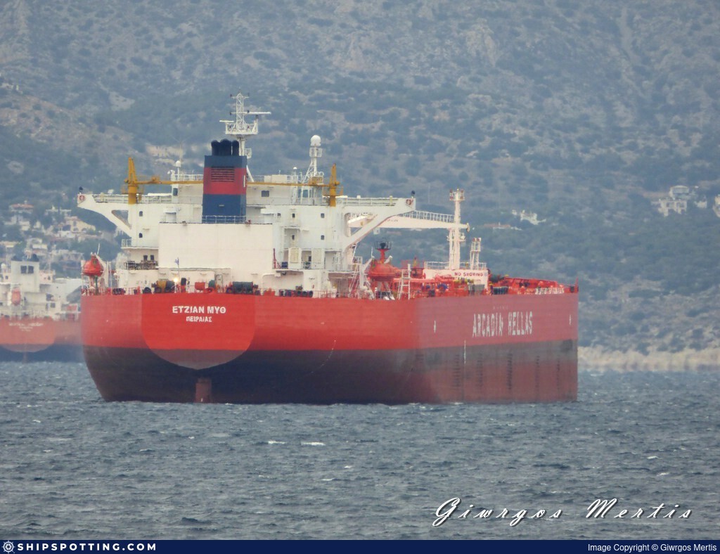
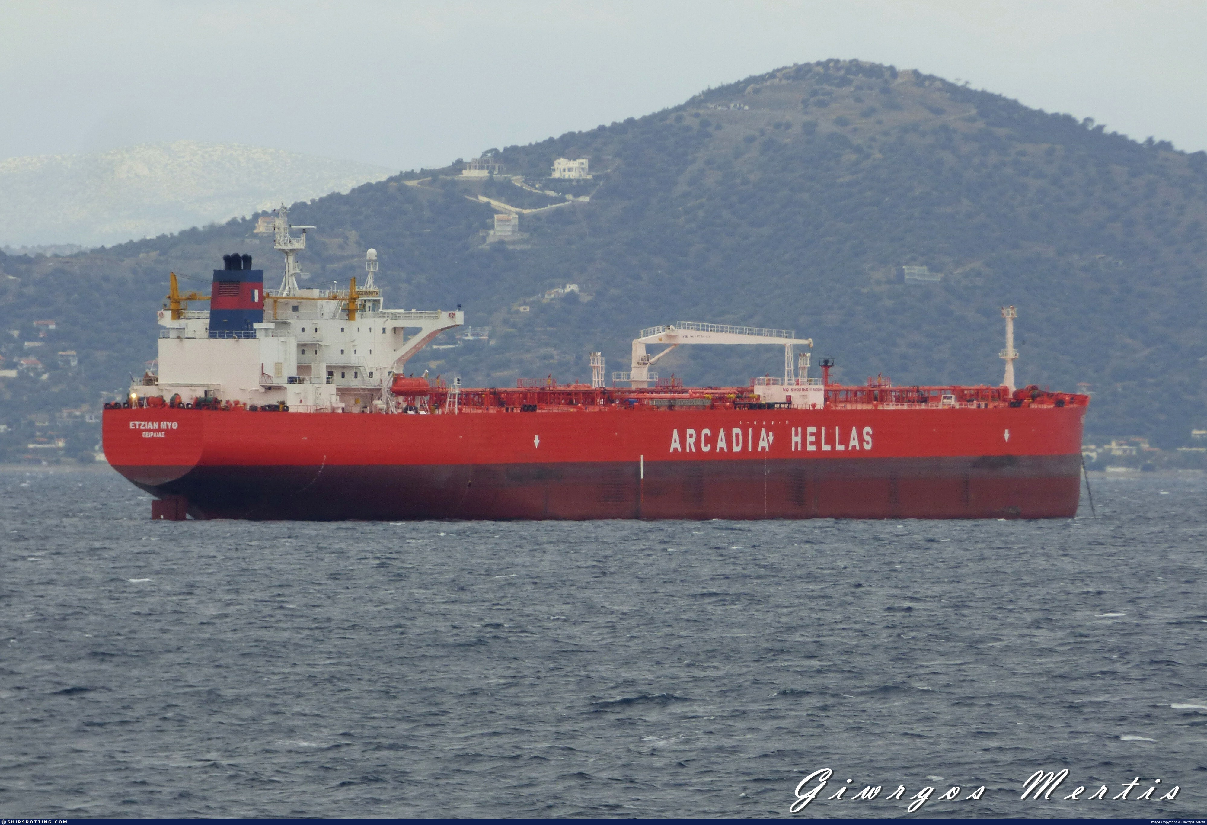
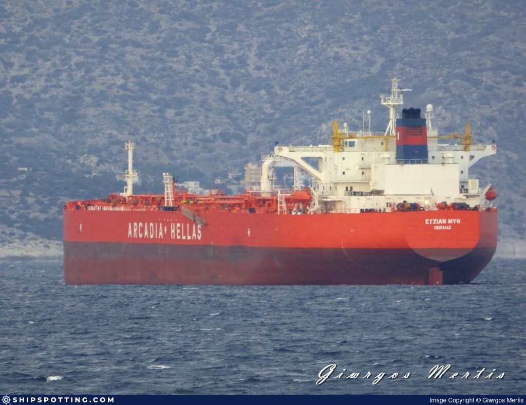
IMO 9348479
Vessel information
Sanctioned by
Company & Ownership
Management & Operations
Classification & Safety
Port State Control (PSC) Inspections
Survey Renewal & Certificates
| Code | Type | Issuer | Issued | Expires |
|---|---|---|---|---|
| 501 | Cargo Ship Safety Construction | DNV GL AS (278) | 22.07.2016 | 28.08.2021 |
| 502 | Cargo Ship Safety Equipment | DNV GL AS (278) | 22.07.2016 | 28.08.2021 |
Programs & Notes
AU vessel designations (DFAT) | SEMA (Canada) — vessel designations | The Russia (Sanctions) (EU Exit) Regulations 2019 | Added in EU Sanctions Package 17 | (Council Decision (CFSP) 2025/931, Annex XVI to Decision 2014/512/CFSP) | Press Release | Official Journal
DateOfListing: 2025-05-21 || DateDesignated: 2025-05-09 | Shipping sanctions: (see “Other information”) | Shipping sanctions: a specified ship is prohibited from being provided with access to or having its master or pilot cause it to enter a port in the UK, may have its registration on the UK Ship Register terminated, and a master or pilot of a specified ship may be given a port barring direction, a detention direction, and a port entry direction or a movement direction. | IMO 9348479 (“LUCKY FAIRY”) is involved in activity whose object or effect is to destabilise Ukraine or undermine or threaten the territorial integrity, sovereignty or independence of Ukraine or to obtain a benefit from or support the Government of Russia. Namely, LUCKY FAIRY is involved in carrying oil or oil products that originated in Russia from Russia to a third country.
Vessel Changes
AIS Events
49 events detected • 4 zones • Last: Jun 17, 2026
- Zone: discovered_020
- Duration: 2h 40m
- Data Points: 20 AIS positions
- Period: 2026-06-17T02:11:56+00:00 to 2026-06-17T04:52:09+00:00
Show Raw Evidence JSON
{
    "zone_id": "discovered_020",
    "zone_name": "Eastern Mediterranean Monitoring Zone",
    "dwell_minutes": 160.19999999999998863131622783839702606201171875,
    "points_in_zone": 20,
    "first_point": {
        "ts": "2026-06-17T02:11:56+00:00",
        "lat": 31.4053167000000001962689566425979137420654296875,
        "lon": 32.37529669999999981655491865240037441253662109375
    },
    "last_point": {
        "ts": "2026-06-17T04:52:09+00:00",
        "lat": 31.012389999999999901092451182194054126739501953125,
        "lon": 32.31127500000000196678229258395731449127197265625
    }
}- Zone: discovered_020
- Duration: 3h 18m
- Data Points: 22 AIS positions
- Period: 2026-06-17T01:33:17+00:00 to 2026-06-17T04:52:09+00:00
Show Raw Evidence JSON
{
    "zone_id": "discovered_020",
    "zone_name": "Eastern Mediterranean Monitoring Zone",
    "dwell_minutes": 198.900000000000005684341886080801486968994140625,
    "points_in_zone": 22,
    "first_point": {
        "ts": "2026-06-17T01:33:17+00:00",
        "lat": 31.41033829999999937854227027855813503265380859375,
        "lon": 32.316045000000002573870006017386913299560546875
    },
    "last_point": {
        "ts": "2026-06-17T04:52:09+00:00",
        "lat": 31.012389999999999901092451182194054126739501953125,
        "lon": 32.31127500000000196678229258395731449127197265625
    }
}- Zone: discovered_020
- Duration: 6h 29m
- Data Points: 22 AIS positions
- Period: 2026-06-16T22:17:53+00:00 to 2026-06-17T04:47:47+00:00
Show Raw Evidence JSON
{
    "zone_id": "discovered_020",
    "zone_name": "Eastern Mediterranean Monitoring Zone",
    "dwell_minutes": 389.8999999999999772626324556767940521240234375,
    "points_in_zone": 22,
    "first_point": {
        "ts": "2026-06-16T22:17:53+00:00",
        "lat": 31.404896699999998332941686385311186313629150390625,
        "lon": 32.31041669999999754736563772894442081451416015625
    },
    "last_point": {
        "ts": "2026-06-17T04:47:47+00:00",
        "lat": 31.02424500000000051613824325613677501678466796875,
        "lon": 32.31074170000000123081917990930378437042236328125
    }
}- Zone: discovered_020
- Duration: 6h 27m
- Data Points: 14 AIS positions
- Period: 2026-06-16T21:59:53+00:00 to 2026-06-17T04:27:26+00:00
Show Raw Evidence JSON
{
    "zone_id": "discovered_020",
    "zone_name": "Eastern Mediterranean Monitoring Zone",
    "dwell_minutes": 387.6000000000000227373675443232059478759765625,
    "points_in_zone": 14,
    "first_point": {
        "ts": "2026-06-16T21:59:53+00:00",
        "lat": 31.40501499999999879264578339643776416778564453125,
        "lon": 32.31065000000000253521648119203746318817138671875
    },
    "last_point": {
        "ts": "2026-06-17T04:27:26+00:00",
        "lat": 31.075434999999998808561940677464008331298828125,
        "lon": 32.30915329999999840993041289038956165313720703125
    }
}- Duration: 5h 21m
- Radius: 699 meters
- Data Points: 11 AIS positions
- Centroid: 31.4056, 32.3113
- Zone: discovered_020
Show Raw Evidence JSON
{
    "radius_m": 698.5,
    "duration_minutes": 321.3999999999999772626324556767940521240234375,
    "points": 11,
    "centroid": {
        "lat": 31.4055646909090881990778143517673015594482421875,
        "lon": 32.3112518363636382900949683971703052520751953125
    },
    "bbox": {
        "min_lat": 31.404896699999998332941686385311186313629150390625,
        "min_lon": 32.31041669999999754736563772894442081451416015625,
        "max_lat": 31.41033829999999937854227027855813503265380859375,
        "max_lon": 32.316045000000002573870006017386913299560546875
    },
    "zone_id": "discovered_020"
}- Zone: discovered_020
- Duration: 6h 3m
- Data Points: 14 AIS positions
- Period: 2026-06-16T20:11:54+00:00 to 2026-06-17T02:15:45+00:00
Show Raw Evidence JSON
{
    "zone_id": "discovered_020",
    "zone_name": "Eastern Mediterranean Monitoring Zone",
    "dwell_minutes": 363.8999999999999772626324556767940521240234375,
    "points_in_zone": 14,
    "first_point": {
        "ts": "2026-06-16T20:11:54+00:00",
        "lat": 31.405073300000001523812898085452616214752197265625,
        "lon": 32.31083000000000282625478575937449932098388671875
    },
    "last_point": {
        "ts": "2026-06-17T02:15:45+00:00",
        "lat": 31.4035133000000001857188181020319461822509765625,
        "lon": 32.38292830000000321888364851474761962890625
    }
}- Duration: 6 hours
- Radius: 707 meters
- Data Points: 12 AIS positions
- Centroid: 31.4055, 32.3112
- Zone: discovered_020
Show Raw Evidence JSON
{
    "radius_m": 706.5,
    "duration_minutes": 360.3999999999999772626324556767940521240234375,
    "points": 12,
    "centroid": {
        "lat": 31.405511941666663489058919367380440235137939453125,
        "lon": 32.31119404166667408162538777105510234832763671875
    },
    "bbox": {
        "min_lat": 31.404896699999998332941686385311186313629150390625,
        "min_lon": 32.31041669999999754736563772894442081451416015625,
        "max_lat": 31.41033829999999937854227027855813503265380859375,
        "max_lon": 32.316045000000002573870006017386913299560546875
    },
    "zone_id": "discovered_020"
}- Zone: discovered_020
- Duration: 6h 15m
- Data Points: 13 AIS positions
- Period: 2026-06-16T19:32:54+00:00 to 2026-06-17T01:47:58+00:00
Show Raw Evidence JSON
{
    "zone_id": "discovered_020",
    "zone_name": "Eastern Mediterranean Monitoring Zone",
    "dwell_minutes": 375.1000000000000227373675443232059478759765625,
    "points_in_zone": 13,
    "first_point": {
        "ts": "2026-06-16T19:32:54+00:00",
        "lat": 31.40493169999999878427843214012682437896728515625,
        "lon": 32.310558299999996734186424873769283294677734375
    },
    "last_point": {
        "ts": "2026-06-17T01:47:58+00:00",
        "lat": 31.41002830000000045629349187947809696197509765625,
        "lon": 32.3331883000000033234755392186343669891357421875
    }
}- Duration: 3h 57m
- Radius: 33 meters
- Data Points: 14 AIS positions
- Centroid: 31.4050, 32.3107
- Zone: discovered_020
Show Raw Evidence JSON
{
    "radius_m": 32.5,
    "duration_minutes": 237,
    "points": 14,
    "centroid": {
        "lat": 31.405038221428572597915263031609356403350830078125,
        "lon": 32.31071620714285330677739693783223628997802734375
    },
    "bbox": {
        "min_lat": 31.40489170000000029858711059205234050750732421875,
        "min_lon": 32.31041669999999754736563772894442081451416015625,
        "max_lat": 31.40519330000000053360054153017699718475341796875,
        "max_lon": 32.31095169999999683341229683719575405120849609375
    },
    "zone_id": "discovered_020"
}- Zone: discovered_020
- Duration: 3h 57m
- Data Points: 14 AIS positions
- Period: 2026-06-16T18:20:54+00:00 to 2026-06-16T22:17:53+00:00
Show Raw Evidence JSON
{
    "zone_id": "discovered_020",
    "zone_name": "Eastern Mediterranean Monitoring Zone",
    "dwell_minutes": 237,
    "points_in_zone": 14,
    "first_point": {
        "ts": "2026-06-16T18:20:54+00:00",
        "lat": 31.40489170000000029858711059205234050750732421875,
        "lon": 32.31056170000000093978087534196674823760986328125
    },
    "last_point": {
        "ts": "2026-06-16T22:17:53+00:00",
        "lat": 31.404896699999998332941686385311186313629150390625,
        "lon": 32.31041669999999754736563772894442081451416015625
    }
}- Duration: 5h 3m
- Radius: 33 meters
- Data Points: 20 AIS positions
- Centroid: 31.4050, 32.3107
- Zone: discovered_020
Show Raw Evidence JSON
{
    "radius_m": 33.10000000000000142108547152020037174224853515625,
    "duration_minutes": 303,
    "points": 20,
    "centroid": {
        "lat": 31.40500167500000117115632747299969196319580078125,
        "lon": 32.3106845900000081428515841253101825714111328125
    },
    "bbox": {
        "min_lat": 31.40489170000000029858711059205234050750732421875,
        "min_lon": 32.31041669999999754736563772894442081451416015625,
        "max_lat": 31.40519330000000053360054153017699718475341796875,
        "max_lon": 32.31095169999999683341229683719575405120849609375
    },
    "zone_id": "discovered_020"
}- Zone: discovered_020
- Duration: 5h 3m
- Data Points: 20 AIS positions
- Period: 2026-06-16T17:14:53+00:00 to 2026-06-16T22:17:53+00:00
Show Raw Evidence JSON
{
    "zone_id": "discovered_020",
    "zone_name": "Eastern Mediterranean Monitoring Zone",
    "dwell_minutes": 303,
    "points_in_zone": 20,
    "first_point": {
        "ts": "2026-06-16T17:14:53+00:00",
        "lat": 31.404908299999998888551999698393046855926513671875,
        "lon": 32.31060999999999694409780204296112060546875
    },
    "last_point": {
        "ts": "2026-06-16T22:17:53+00:00",
        "lat": 31.404896699999998332941686385311186313629150390625,
        "lon": 32.31041669999999754736563772894442081451416015625
    }
}- Duration: 6h 39m
- Radius: 32 meters
- Data Points: 23 AIS positions
- Centroid: 31.4050, 32.3107
- Zone: discovered_020
Show Raw Evidence JSON
{
    "radius_m": 31.89999999999999857891452847979962825775146484375,
    "duration_minutes": 399,
    "points": 23,
    "centroid": {
        "lat": 31.40499978695652316673658788204193115234375,
        "lon": 32.31070377391305470382576459087431430816650390625
    },
    "bbox": {
        "min_lat": 31.40489170000000029858711059205234050750732421875,
        "min_lon": 32.310558299999996734186424873769283294677734375,
        "max_lat": 31.40519330000000053360054153017699718475341796875,
        "max_lon": 32.31095169999999683341229683719575405120849609375
    },
    "zone_id": "discovered_020"
}- Zone: discovered_020
- Duration: 6h 39m
- Data Points: 23 AIS positions
- Period: 2026-06-16T15:20:52+00:00 to 2026-06-16T21:59:53+00:00
Show Raw Evidence JSON
{
    "zone_id": "discovered_020",
    "zone_name": "Eastern Mediterranean Monitoring Zone",
    "dwell_minutes": 399,
    "points_in_zone": 23,
    "first_point": {
        "ts": "2026-06-16T15:20:52+00:00",
        "lat": 31.40491829999999850997483008541166782379150390625,
        "lon": 32.3106216999999986683178576640784740447998046875
    },
    "last_point": {
        "ts": "2026-06-16T21:59:53+00:00",
        "lat": 31.40501499999999879264578339643776416778564453125,
        "lon": 32.31065000000000253521648119203746318817138671875
    }
}- Duration: 6h 30m
- Radius: 63 meters
- Data Points: 22 AIS positions
- Centroid: 31.4050, 32.3107
- Zone: discovered_020
Show Raw Evidence JSON
{
    "radius_m": 63.10000000000000142108547152020037174224853515625,
    "duration_minutes": 390,
    "points": 22,
    "centroid": {
        "lat": 31.404970309090909807991920388303697109222412109375,
        "lon": 32.31066522727272882775650941766798496246337890625
    },
    "bbox": {
        "min_lat": 31.404675000000001006128513836301863193511962890625,
        "min_lon": 32.31009829999999993788151186890900135040283203125,
        "max_lat": 31.40519330000000053360054153017699718475341796875,
        "max_lon": 32.31095169999999683341229683719575405120849609375
    },
    "zone_id": "discovered_020"
}- Zone: discovered_020
- Duration: 6h 30m
- Data Points: 22 AIS positions
- Period: 2026-06-16T14:59:52+00:00 to 2026-06-16T21:29:53+00:00
Show Raw Evidence JSON
{
    "zone_id": "discovered_020",
    "zone_name": "Eastern Mediterranean Monitoring Zone",
    "dwell_minutes": 390,
    "points_in_zone": 22,
    "first_point": {
        "ts": "2026-06-16T14:59:52+00:00",
        "lat": 31.404675000000001006128513836301863193511962890625,
        "lon": 32.31009829999999993788151186890900135040283203125
    },
    "last_point": {
        "ts": "2026-06-16T21:29:53+00:00",
        "lat": 31.405113300000000009504219633527100086212158203125,
        "lon": 32.3107667000000020607330952771008014678955078125
    }
}- Zone: discovered_020
- Duration: 6h 35m
- Data Points: 27 AIS positions
- Period: 2026-06-16T13:42:07+00:00 to 2026-06-16T20:17:53+00:00
Show Raw Evidence JSON
{
    "zone_id": "discovered_020",
    "zone_name": "Eastern Mediterranean Monitoring Zone",
    "dwell_minutes": 395.80000000000001136868377216160297393798828125,
    "points_in_zone": 27,
    "first_point": {
        "ts": "2026-06-16T13:42:07+00:00",
        "lat": 31.439126699999999203782863332889974117279052734375,
        "lon": 32.2874182999999987941919243894517421722412109375
    },
    "last_point": {
        "ts": "2026-06-16T20:17:53+00:00",
        "lat": 31.405081700000000211048245546407997608184814453125,
        "lon": 32.31087500000000289901436190120875835418701171875
    }
}- Zone: Southeast Aegean Monitoring Zone
- Duration: 2h 1m
- Data Points: 3 AIS positions
- Period: 2026-06-15T07:13:36+00:00 to 2026-06-15T09:15:15+00:00
Show Raw Evidence JSON
{
    "zone_id": "discovered_075",
    "zone_name": "Southeast Aegean Monitoring Zone",
    "dwell_minutes": 121.7000000000000028421709430404007434844970703125,
    "points_in_zone": 3,
    "first_point": {
        "ts": "2026-06-15T07:13:36+00:00",
        "lat": 36.18126670000000189020283869467675685882568359375,
        "lon": 27.135400000000000630961949354968965053558349609375
    },
    "last_point": {
        "ts": "2026-06-15T09:15:15+00:00",
        "lat": 35.86181669999999854780980967916548252105712890625,
        "lon": 27.512750000000000483169060316868126392364501953125
    }
}- Zone: Northeast Aegean Monitoring Zone
- Duration: 1h 15m
- Data Points: 19 AIS positions
- Period: 2026-06-15T04:00:35+00:00 to 2026-06-15T05:15:37+00:00
Show Raw Evidence JSON
{
    "zone_id": "discovered_107",
    "zone_name": "Northeast Aegean Monitoring Zone",
    "dwell_minutes": 75,
    "points_in_zone": 19,
    "first_point": {
        "ts": "2026-06-15T04:00:35+00:00",
        "lat": 36.67046669999999863875927985645830631256103515625,
        "lon": 26.545100000000001472244548494927585124969482421875
    },
    "last_point": {
        "ts": "2026-06-15T05:15:37+00:00",
        "lat": 36.483783299999998916973709128797054290771484375,
        "lon": 26.776133300000001469243215979076921939849853515625
    }
}- Zone: Northeast Aegean Monitoring Zone
- Duration: 2h 1m
- Data Points: 39 AIS positions
- Period: 2026-06-15T03:14:26+00:00 to 2026-06-15T05:15:37+00:00
Show Raw Evidence JSON
{
    "zone_id": "discovered_107",
    "zone_name": "Northeast Aegean Monitoring Zone",
    "dwell_minutes": 121.2000000000000028421709430404007434844970703125,
    "points_in_zone": 39,
    "first_point": {
        "ts": "2026-06-15T03:14:26+00:00",
        "lat": 36.784300000000001773514668457210063934326171875,
        "lon": 26.394966700000001225134838023222982883453369140625
    },
    "last_point": {
        "ts": "2026-06-15T05:15:37+00:00",
        "lat": 36.483783299999998916973709128797054290771484375,
        "lon": 26.776133300000001469243215979076921939849853515625
    }
}- Zone: Northeast Aegean Monitoring Zone
- Duration: 2h 48m
- Data Points: 43 AIS positions
- Period: 2026-06-15T02:27:17+00:00 to 2026-06-15T05:15:37+00:00
Show Raw Evidence JSON
{
    "zone_id": "discovered_107",
    "zone_name": "Northeast Aegean Monitoring Zone",
    "dwell_minutes": 168.30000000000001136868377216160297393798828125,
    "points_in_zone": 43,
    "first_point": {
        "ts": "2026-06-15T02:27:17+00:00",
        "lat": 36.91723329999999947403921396471560001373291015625,
        "lon": 26.25668329999999883739292272366583347320556640625
    },
    "last_point": {
        "ts": "2026-06-15T05:15:37+00:00",
        "lat": 36.483783299999998916973709128797054290771484375,
        "lon": 26.776133300000001469243215979076921939849853515625
    }
}- Zone: Bosphorus/Dardanelles Approach
- Duration: 2h 1m
- Data Points: 17 AIS positions
- Period: 2026-06-13T07:00:52+00:00 to 2026-06-13T09:02:43+00:00
Show Raw Evidence JSON
{
    "zone_id": "osint_bosphorus",
    "zone_name": "Bosphorus\/Dardanelles Approach",
    "dwell_minutes": 121.7999999999999971578290569595992565155029296875,
    "points_in_zone": 17,
    "first_point": {
        "ts": "2026-06-13T07:00:52+00:00",
        "lat": 40.95703329999999908750396571122109889984130859375,
        "lon": 28.95821670000000125355654745362699031829833984375
    },
    "last_point": {
        "ts": "2026-06-13T09:02:43+00:00",
        "lat": 40.898449999999996862243278883397579193115234375,
        "lon": 28.6422333000000008951246854849159717559814453125
    }
}- Zone: Bosphorus/Dardanelles Approach
- Duration: 2h 11m
- Data Points: 19 AIS positions
- Period: 2026-06-13T06:51:23+00:00 to 2026-06-13T09:02:43+00:00
Show Raw Evidence JSON
{
    "zone_id": "osint_bosphorus",
    "zone_name": "Bosphorus\/Dardanelles Approach",
    "dwell_minutes": 131.30000000000001136868377216160297393798828125,
    "points_in_zone": 19,
    "first_point": {
        "ts": "2026-06-13T06:51:23+00:00",
        "lat": 40.973399999999998044586391188204288482666015625,
        "lon": 28.980650000000000687805368215776979923248291015625
    },
    "last_point": {
        "ts": "2026-06-13T09:02:43+00:00",
        "lat": 40.898449999999996862243278883397579193115234375,
        "lon": 28.6422333000000008951246854849159717559814453125
    }
}- Zone: Bosphorus/Dardanelles Approach
- Duration: 1h 18m
- Data Points: 16 AIS positions
- Period: 2026-06-01T01:18:39+00:00 to 2026-06-01T02:36:51+00:00
Show Raw Evidence JSON
{
    "zone_id": "osint_bosphorus",
    "zone_name": "Bosphorus\/Dardanelles Approach",
    "dwell_minutes": 78.2000000000000028421709430404007434844970703125,
    "points_in_zone": 16,
    "first_point": {
        "ts": "2026-06-01T01:18:39+00:00",
        "lat": 40.84479999999999932924765744246542453765869140625,
        "lon": 28.859950000000001324451659456826746463775634765625
    },
    "last_point": {
        "ts": "2026-06-01T02:36:51+00:00",
        "lat": 41.01278330000000238442225963808596134185791015625,
        "lon": 28.99756670000000013942553778178989887237548828125
    }
}- Zone: Bosphorus/Dardanelles Approach
- Duration: 2h 9m
- Data Points: 18 AIS positions
- Period: 2026-06-01T00:27:11+00:00 to 2026-06-01T02:36:51+00:00
Show Raw Evidence JSON
{
    "zone_id": "osint_bosphorus",
    "zone_name": "Bosphorus\/Dardanelles Approach",
    "dwell_minutes": 129.69999999999998863131622783839702606201171875,
    "points_in_zone": 18,
    "first_point": {
        "ts": "2026-06-01T00:27:11+00:00",
        "lat": 40.82478329999999999699866748414933681488037109375,
        "lon": 28.8303666999999990139258443377912044525146484375
    },
    "last_point": {
        "ts": "2026-06-01T02:36:51+00:00",
        "lat": 41.01278330000000238442225963808596134185791015625,
        "lon": 28.99756670000000013942553778178989887237548828125
    }
}- Zone: Bosphorus/Dardanelles Approach
- Duration: 1h 59m
- Data Points: 28 AIS positions
- Period: 2026-05-31T15:08:09+00:00 to 2026-05-31T17:07:31+00:00
Show Raw Evidence JSON
{
    "zone_id": "osint_bosphorus",
    "zone_name": "Bosphorus\/Dardanelles Approach",
    "dwell_minutes": 119.400000000000005684341886080801486968994140625,
    "points_in_zone": 28,
    "first_point": {
        "ts": "2026-05-31T15:08:09+00:00",
        "lat": 40.9491833000000013953467714600265026092529296875,
        "lon": 28.726866699999998644443621742539107799530029296875
    },
    "last_point": {
        "ts": "2026-05-31T17:07:31+00:00",
        "lat": 40.87565000000000026147972675971686840057373046875,
        "lon": 28.74660000000000081854523159563541412353515625
    }
}- Duration: 2h 18m
- Radius: 964 meters
- Data Points: 17 AIS positions
- Centroid: 40.9488, 28.7282
- Zone: Bosphorus/Dardanelles Approach
Show Raw Evidence JSON
{
    "radius_m": 963.700000000000045474735088646411895751953125,
    "duration_minutes": 138.5,
    "points": 17,
    "centroid": {
        "lat": 40.9487960823529419940314255654811859130859375,
        "lon": 28.728205876470585877768826321698725223541259765625
    },
    "bbox": {
        "min_lat": 40.94468330000000122481651487760245800018310546875,
        "min_lon": 28.726683300000001253238224308006465435028076171875,
        "max_lat": 40.94933329999999926940290606580674648284912109375,
        "max_lon": 28.73828329999999908750396571122109889984130859375
    },
    "zone_id": "osint_bosphorus"
}- Zone: Bosphorus/Dardanelles Approach
- Duration: 2h 53m
- Data Points: 32 AIS positions
- Period: 2026-05-31T14:14:09+00:00 to 2026-05-31T17:07:31+00:00
Show Raw Evidence JSON
{
    "zone_id": "osint_bosphorus",
    "zone_name": "Bosphorus\/Dardanelles Approach",
    "dwell_minutes": 173.400000000000005684341886080801486968994140625,
    "points_in_zone": 32,
    "first_point": {
        "ts": "2026-05-31T14:14:09+00:00",
        "lat": 40.94886670000000350455593434162437915802001953125,
        "lon": 28.726983300000000554064172320067882537841796875
    },
    "last_point": {
        "ts": "2026-05-31T17:07:31+00:00",
        "lat": 40.87565000000000026147972675971686840057373046875,
        "lon": 28.74660000000000081854523159563541412353515625
    }
}- Duration: 3h 24m
- Radius: 972 meters
- Data Points: 23 AIS positions
- Centroid: 40.9487, 28.7280
- Zone: Bosphorus/Dardanelles Approach
Show Raw Evidence JSON
{
    "radius_m": 972.1000000000000227373675443232059478759765625,
    "duration_minutes": 204.5,
    "points": 23,
    "centroid": {
        "lat": 40.94869493043477604032887029461562633514404296875,
        "lon": 28.728021734782604568181341164745390415191650390625
    },
    "bbox": {
        "min_lat": 40.94468330000000122481651487760245800018310546875,
        "min_lon": 28.726683300000001253238224308006465435028076171875,
        "max_lat": 40.94933329999999926940290606580674648284912109375,
        "max_lon": 28.73828329999999908750396571122109889984130859375
    },
    "zone_id": "osint_bosphorus"
}- Zone: Bosphorus/Dardanelles Approach
- Duration: 3h 59m
- Data Points: 38 AIS positions
- Period: 2026-05-31T13:08:09+00:00 to 2026-05-31T17:07:31+00:00
Show Raw Evidence JSON
{
    "zone_id": "osint_bosphorus",
    "zone_name": "Bosphorus\/Dardanelles Approach",
    "dwell_minutes": 239.400000000000005684341886080801486968994140625,
    "points_in_zone": 38,
    "first_point": {
        "ts": "2026-05-31T13:08:09+00:00",
        "lat": 40.9483833000000032598109100945293903350830078125,
        "lon": 28.7277500000000003410605131648480892181396484375
    },
    "last_point": {
        "ts": "2026-05-31T17:07:31+00:00",
        "lat": 40.87565000000000026147972675971686840057373046875,
        "lon": 28.74660000000000081854523159563541412353515625
    }
}- Duration: 4h 27m
- Radius: 961 meters
- Data Points: 30 AIS positions
- Centroid: 40.9485, 28.7281
- Zone: Bosphorus/Dardanelles Approach
Show Raw Evidence JSON
{
    "radius_m": 960.700000000000045474735088646411895751953125,
    "duration_minutes": 267.5,
    "points": 30,
    "centroid": {
        "lat": 40.9485161099999999123610905371606349945068359375,
        "lon": 28.728054443333331136045671883039176464080810546875
    },
    "bbox": {
        "min_lat": 40.94468330000000122481651487760245800018310546875,
        "min_lon": 28.726683300000001253238224308006465435028076171875,
        "max_lat": 40.94933329999999926940290606580674648284912109375,
        "max_lon": 28.73828329999999908750396571122109889984130859375
    },
    "zone_id": "osint_bosphorus"
}- Zone: Bosphorus/Dardanelles Approach
- Duration: 5h 2m
- Data Points: 45 AIS positions
- Period: 2026-05-31T12:05:09+00:00 to 2026-05-31T17:07:31+00:00
Show Raw Evidence JSON
{
    "zone_id": "osint_bosphorus",
    "zone_name": "Bosphorus\/Dardanelles Approach",
    "dwell_minutes": 302.3999999999999772626324556767940521240234375,
    "points_in_zone": 45,
    "first_point": {
        "ts": "2026-05-31T12:05:09+00:00",
        "lat": 40.94768330000000133850335259921848773956298828125,
        "lon": 28.728699999999999903366187936626374721527099609375
    },
    "last_point": {
        "ts": "2026-05-31T17:07:31+00:00",
        "lat": 40.87565000000000026147972675971686840057373046875,
        "lon": 28.74660000000000081854523159563541412353515625
    }
}- Duration: 5h 30m
- Radius: 942 meters
- Data Points: 35 AIS positions
- Centroid: 40.9484, 28.7282
- Zone: Bosphorus/Dardanelles Approach
Show Raw Evidence JSON
{
    "radius_m": 942.299999999999954525264911353588104248046875,
    "duration_minutes": 330.5,
    "points": 35,
    "centroid": {
        "lat": 40.94839428857142848983130534179508686065673828125,
        "lon": 28.728219999999996758788256556726992130279541015625
    },
    "bbox": {
        "min_lat": 40.94468330000000122481651487760245800018310546875,
        "min_lon": 28.726683300000001253238224308006465435028076171875,
        "max_lat": 40.94933329999999926940290606580674648284912109375,
        "max_lon": 28.73828329999999908750396571122109889984130859375
    },
    "zone_id": "osint_bosphorus"
}- Zone: Bosphorus/Dardanelles Approach
- Duration: 6h 5m
- Data Points: 50 AIS positions
- Period: 2026-05-31T11:02:09+00:00 to 2026-05-31T17:07:31+00:00
Show Raw Evidence JSON
{
    "zone_id": "osint_bosphorus",
    "zone_name": "Bosphorus\/Dardanelles Approach",
    "dwell_minutes": 365.3999999999999772626324556767940521240234375,
    "points_in_zone": 50,
    "first_point": {
        "ts": "2026-05-31T11:02:09+00:00",
        "lat": 40.947616699999997535996953956782817840576171875,
        "lon": 28.729800000000000892441676114685833454132080078125
    },
    "last_point": {
        "ts": "2026-05-31T17:07:31+00:00",
        "lat": 40.87565000000000026147972675971686840057373046875,
        "lon": 28.74660000000000081854523159563541412353515625
    }
}- Duration: 6h 27m
- Radius: 910 meters
- Data Points: 42 AIS positions
- Centroid: 40.9483, 28.7286
- Zone: Bosphorus/Dardanelles Approach
Show Raw Evidence JSON
{
    "radius_m": 909.700000000000045474735088646411895751953125,
    "duration_minutes": 387.5,
    "points": 42,
    "centroid": {
        "lat": 40.94829841428571626238408498466014862060546875,
        "lon": 28.728588888095242026565756532363593578338623046875
    },
    "bbox": {
        "min_lat": 40.94468330000000122481651487760245800018310546875,
        "min_lon": 28.726683300000001253238224308006465435028076171875,
        "max_lat": 40.94933329999999926940290606580674648284912109375,
        "max_lon": 28.73828329999999908750396571122109889984130859375
    },
    "zone_id": "osint_bosphorus"
}- Zone: Bosphorus/Dardanelles Approach
- Duration: 6h 32m
- Data Points: 53 AIS positions
- Period: 2026-05-31T10:35:09+00:00 to 2026-05-31T17:07:31+00:00
Show Raw Evidence JSON
{
    "zone_id": "osint_bosphorus",
    "zone_name": "Bosphorus\/Dardanelles Approach",
    "dwell_minutes": 392.3999999999999772626324556767940521240234375,
    "points_in_zone": 53,
    "first_point": {
        "ts": "2026-05-31T10:35:09+00:00",
        "lat": 40.9477499999999992041921359486877918243408203125,
        "lon": 28.73010000000000019326762412674725055694580078125
    },
    "last_point": {
        "ts": "2026-05-31T17:07:31+00:00",
        "lat": 40.87565000000000026147972675971686840057373046875,
        "lon": 28.74660000000000081854523159563541412353515625
    }
}- Duration: 6h 12m
- Radius: 303 meters
- Data Points: 40 AIS positions
- Centroid: 40.9484, 28.7282
- Zone: Bosphorus/Dardanelles Approach
Show Raw Evidence JSON
{
    "radius_m": 302.80000000000001136868377216160297393798828125,
    "duration_minutes": 372,
    "points": 40,
    "centroid": {
        "lat": 40.9484016674999935503365122713148593902587890625,
        "lon": 28.7282083325000030527007766067981719970703125
    },
    "bbox": {
        "min_lat": 40.94758329999999801884769112803041934967041015625,
        "min_lon": 28.726683300000001253238224308006465435028076171875,
        "max_lat": 40.94933329999999926940290606580674648284912109375,
        "max_lon": 28.731783300000000025420376914553344249725341796875
    },
    "zone_id": "osint_bosphorus"
}- Zone: Bosphorus/Dardanelles Approach
- Duration: 6h 12m
- Data Points: 40 AIS positions
- Period: 2026-05-31T09:47:09+00:00 to 2026-05-31T15:59:10+00:00
Show Raw Evidence JSON
{
    "zone_id": "osint_bosphorus",
    "zone_name": "Bosphorus\/Dardanelles Approach",
    "dwell_minutes": 372,
    "points_in_zone": 40,
    "first_point": {
        "ts": "2026-05-31T09:47:09+00:00",
        "lat": 40.948700000000002319211489520967006683349609375,
        "lon": 28.731783300000000025420376914553344249725341796875
    },
    "last_point": {
        "ts": "2026-05-31T15:59:10+00:00",
        "lat": 40.94933329999999926940290606580674648284912109375,
        "lon": 28.726816700000000537329469807446002960205078125
    }
}- Duration: 6h 36m
- Radius: 406 meters
- Data Points: 23 AIS positions
- Centroid: 40.9481, 28.7293
- Zone: Bosphorus/Dardanelles Approach
Show Raw Evidence JSON
{
    "radius_m": 405.6000000000000227373675443232059478759765625,
    "duration_minutes": 396,
    "points": 23,
    "centroid": {
        "lat": 40.94807101304348151415979373268783092498779296875,
        "lon": 28.72928768260869247797018033452332019805908203125
    },
    "bbox": {
        "min_lat": 40.94758329999999801884769112803041934967041015625,
        "min_lon": 28.72749999999999914734871708787977695465087890625,
        "max_lat": 40.951633299999997461782186292111873626708984375,
        "max_lon": 28.731783300000000025420376914553344249725341796875
    },
    "zone_id": "osint_bosphorus"
}- Zone: Bosphorus/Dardanelles Approach
- Duration: 6h 36m
- Data Points: 23 AIS positions
- Period: 2026-05-31T06:41:09+00:00 to 2026-05-31T13:17:09+00:00
Show Raw Evidence JSON
{
    "zone_id": "osint_bosphorus",
    "zone_name": "Bosphorus\/Dardanelles Approach",
    "dwell_minutes": 396,
    "points_in_zone": 23,
    "first_point": {
        "ts": "2026-05-31T06:41:09+00:00",
        "lat": 40.951633299999997461782186292111873626708984375,
        "lon": 28.7303500000000013869794202037155628204345703125
    },
    "last_point": {
        "ts": "2026-05-31T13:17:09+00:00",
        "lat": 40.94836670000000111713234218768775463104248046875,
        "lon": 28.72749999999999914734871708787977695465087890625
    }
}- Duration: 6h 30m
- Radius: 385 meters
- Data Points: 16 AIS positions
- Centroid: 40.9483, 28.7300
- Zone: Bosphorus/Dardanelles Approach
Show Raw Evidence JSON
{
    "radius_m": 385,
    "duration_minutes": 390,
    "points": 16,
    "centroid": {
        "lat": 40.94830208750000366535459761507809162139892578125,
        "lon": 28.7299843750000007958078640513122081756591796875
    },
    "bbox": {
        "min_lat": 40.94758329999999801884769112803041934967041015625,
        "min_lon": 28.728699999999999903366187936626374721527099609375,
        "max_lat": 40.95176670000000029858711059205234050750732421875,
        "max_lon": 28.731783300000000025420376914553344249725341796875
    },
    "zone_id": "osint_bosphorus"
}- Zone: Bosphorus/Dardanelles Approach
- Duration: 6h 30m
- Data Points: 16 AIS positions
- Period: 2026-05-31T05:35:09+00:00 to 2026-05-31T12:05:09+00:00
Show Raw Evidence JSON
{
    "zone_id": "osint_bosphorus",
    "zone_name": "Bosphorus\/Dardanelles Approach",
    "dwell_minutes": 390,
    "points_in_zone": 16,
    "first_point": {
        "ts": "2026-05-31T05:35:09+00:00",
        "lat": 40.95176670000000029858711059205234050750732421875,
        "lon": 28.7298167000000006510163075290620326995849609375
    },
    "last_point": {
        "ts": "2026-05-31T12:05:09+00:00",
        "lat": 40.94768330000000133850335259921848773956298828125,
        "lon": 28.728699999999999903366187936626374721527099609375
    }
}- Duration: 6h 15m
- Radius: 236 meters
- Data Points: 19 AIS positions
- Centroid: 40.9497, 28.7301
- Zone: Bosphorus/Dardanelles Approach
Show Raw Evidence JSON
{
    "radius_m": 236.099999999999994315658113919198513031005859375,
    "duration_minutes": 375,
    "points": 19,
    "centroid": {
        "lat": 40.94970175263157585732187726534903049468994140625,
        "lon": 28.7301228105263106726852129213511943817138671875
    },
    "bbox": {
        "min_lat": 40.94758329999999801884769112803041934967041015625,
        "min_lon": 28.729633299999999707097231294028460979461669921875,
        "max_lat": 40.95179999999999864712663111276924610137939453125,
        "max_lon": 28.731783300000000025420376914553344249725341796875
    },
    "zone_id": "osint_bosphorus"
}- Zone: Bosphorus/Dardanelles Approach
- Duration: 6h 15m
- Data Points: 19 AIS positions
- Period: 2026-05-31T04:50:09+00:00 to 2026-05-31T11:05:09+00:00
Show Raw Evidence JSON
{
    "zone_id": "osint_bosphorus",
    "zone_name": "Bosphorus\/Dardanelles Approach",
    "dwell_minutes": 375,
    "points_in_zone": 19,
    "first_point": {
        "ts": "2026-05-31T04:50:09+00:00",
        "lat": 40.95176670000000029858711059205234050750732421875,
        "lon": 28.729666699999999224246494122780859470367431640625
    },
    "last_point": {
        "ts": "2026-05-31T11:05:09+00:00",
        "lat": 40.94765000000000298996383207850158214569091796875,
        "lon": 28.729766699999998991188476793467998504638671875
    }
}- Duration: 6h 30m
- Radius: 353 meters
- Data Points: 12 AIS positions
- Centroid: 40.9512, 28.7301
- Zone: Bosphorus/Dardanelles Approach
Show Raw Evidence JSON
{
    "radius_m": 352.80000000000001136868377216160297393798828125,
    "duration_minutes": 390,
    "points": 12,
    "centroid": {
        "lat": 40.9511680583333372851484455168247222900390625,
        "lon": 28.730118058333335540055486490018665790557861328125
    },
    "bbox": {
        "min_lat": 40.9481166999999999234205461107194423675537109375,
        "min_lon": 28.729633299999999707097231294028460979461669921875,
        "max_lat": 40.95179999999999864712663111276924610137939453125,
        "max_lon": 28.731783300000000025420376914553344249725341796875
    },
    "zone_id": "osint_bosphorus"
}- Zone: Bosphorus/Dardanelles Approach
- Duration: 6h 30m
- Data Points: 12 AIS positions
- Period: 2026-05-31T03:35:09+00:00 to 2026-05-31T10:05:09+00:00
Show Raw Evidence JSON
{
    "zone_id": "osint_bosphorus",
    "zone_name": "Bosphorus\/Dardanelles Approach",
    "dwell_minutes": 390,
    "points_in_zone": 12,
    "first_point": {
        "ts": "2026-05-31T03:35:09+00:00",
        "lat": 40.95156670000000076470314525067806243896484375,
        "lon": 28.730399999999999494093572138808667659759521484375
    },
    "last_point": {
        "ts": "2026-05-31T10:05:09+00:00",
        "lat": 40.9481166999999999234205461107194423675537109375,
        "lon": 28.731283300000001190710463561117649078369140625
    }
}- Zone: Bosphorus/Dardanelles Approach
- Duration: 6h 35m
- Data Points: 7 AIS positions
- Period: 2026-05-30T21:00:05+00:00 to 2026-05-31T03:35:09+00:00
Show Raw Evidence JSON
{
    "zone_id": "osint_bosphorus",
    "zone_name": "Bosphorus\/Dardanelles Approach",
    "dwell_minutes": 395.1000000000000227373675443232059478759765625,
    "points_in_zone": 7,
    "first_point": {
        "ts": "2026-05-30T21:00:05+00:00",
        "lat": 40.94154999999999944293449516408145427703857421875,
        "lon": 28.738433300000000514273779117502272129058837890625
    },
    "last_point": {
        "ts": "2026-05-31T03:35:09+00:00",
        "lat": 40.95156670000000076470314525067806243896484375,
        "lon": 28.730399999999999494093572138808667659759521484375
    }
}- Zone: Bosphorus/Dardanelles Approach
- Duration: 1h 58m
- Data Points: 17 AIS positions
- Period: 2026-05-30T20:00:22+00:00 to 2026-05-30T21:59:09+00:00
Show Raw Evidence JSON
{
    "zone_id": "osint_bosphorus",
    "zone_name": "Bosphorus\/Dardanelles Approach",
    "dwell_minutes": 118.7999999999999971578290569595992565155029296875,
    "points_in_zone": 17,
    "first_point": {
        "ts": "2026-05-30T20:00:22+00:00",
        "lat": 40.851349999999996498445398174226284027099609375,
        "lon": 28.733766700000000327008820022456347942352294921875
    },
    "last_point": {
        "ts": "2026-05-30T21:59:09+00:00",
        "lat": 40.94866669999999686524461139924824237823486328125,
        "lon": 28.7316833000000002584783942438662052154541015625
    }
}- Zone: Bosphorus/Dardanelles Approach
- Duration: 2h 50m
- Data Points: 38 AIS positions
- Period: 2026-05-30T19:08:23+00:00 to 2026-05-30T21:59:09+00:00
Show Raw Evidence JSON
{
    "zone_id": "osint_bosphorus",
    "zone_name": "Bosphorus\/Dardanelles Approach",
    "dwell_minutes": 170.80000000000001136868377216160297393798828125,
    "points_in_zone": 38,
    "first_point": {
        "ts": "2026-05-30T19:08:23+00:00",
        "lat": 40.8155167000000034249751479364931583404541015625,
        "lon": 28.5142333000000007814378477632999420166015625
    },
    "last_point": {
        "ts": "2026-05-30T21:59:09+00:00",
        "lat": 40.94866669999999686524461139924824237823486328125,
        "lon": 28.7316833000000002584783942438662052154541015625
    }
}Source snapshot
| Sanctioner | As of | Entity ID |
|---|---|---|
| 🇬🇧 UK | 2025-09-29 | 9348479 |
We mirror official lists; always verify at the source.
Sanctioned on the same day
- ADHARA · IMO 9353125 🇦🇺 AU🇨🇦 CA🇪🇺 EU🇬🇧 UK
- AKAR WEST · IMO 9258167 🇦🇺 AU🇨🇦 CA🇪🇺 EU🇳🇿 NZ🇬🇧 UK
- ATLANTICOS · IMO 9282986 🇦🇺 AU🇨🇦 CA🇪🇺 EU🇳🇿 NZ🇬🇧 UK
- BELOMOR · IMO 9384435 🇦🇺 AU🇨🇦 CA🇪🇺 EU🇳🇿 NZ🇬🇧 UK
- Blue · IMO 9236353 🇦🇺 AU🇨🇦 CA🇪🇺 EU🇳🇿 NZ🇬🇧 UK
- Blue Talu · IMO 9334557 🇦🇺 AU🇨🇦 CA🇪🇺 EU🇬🇧 UK
- C VIKING · IMO 9261657 🇦🇺 AU🇨🇦 CA🇪🇺 EU🇳🇿 NZ🇬🇧 UK
- CAVELA · IMO 9259733 🇦🇺 AU🇨🇦 CA🇪🇺 EU🇬🇧 UK