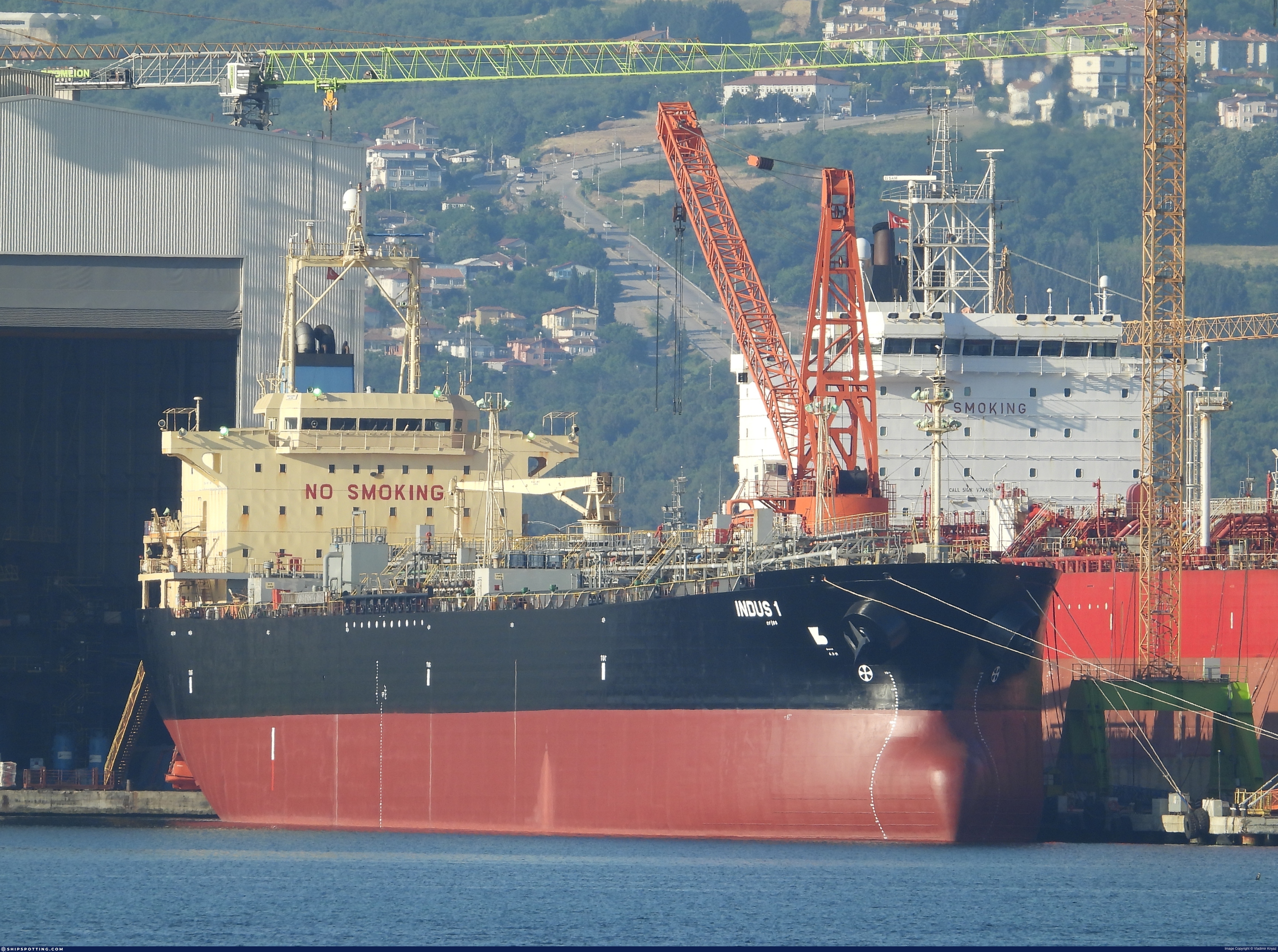
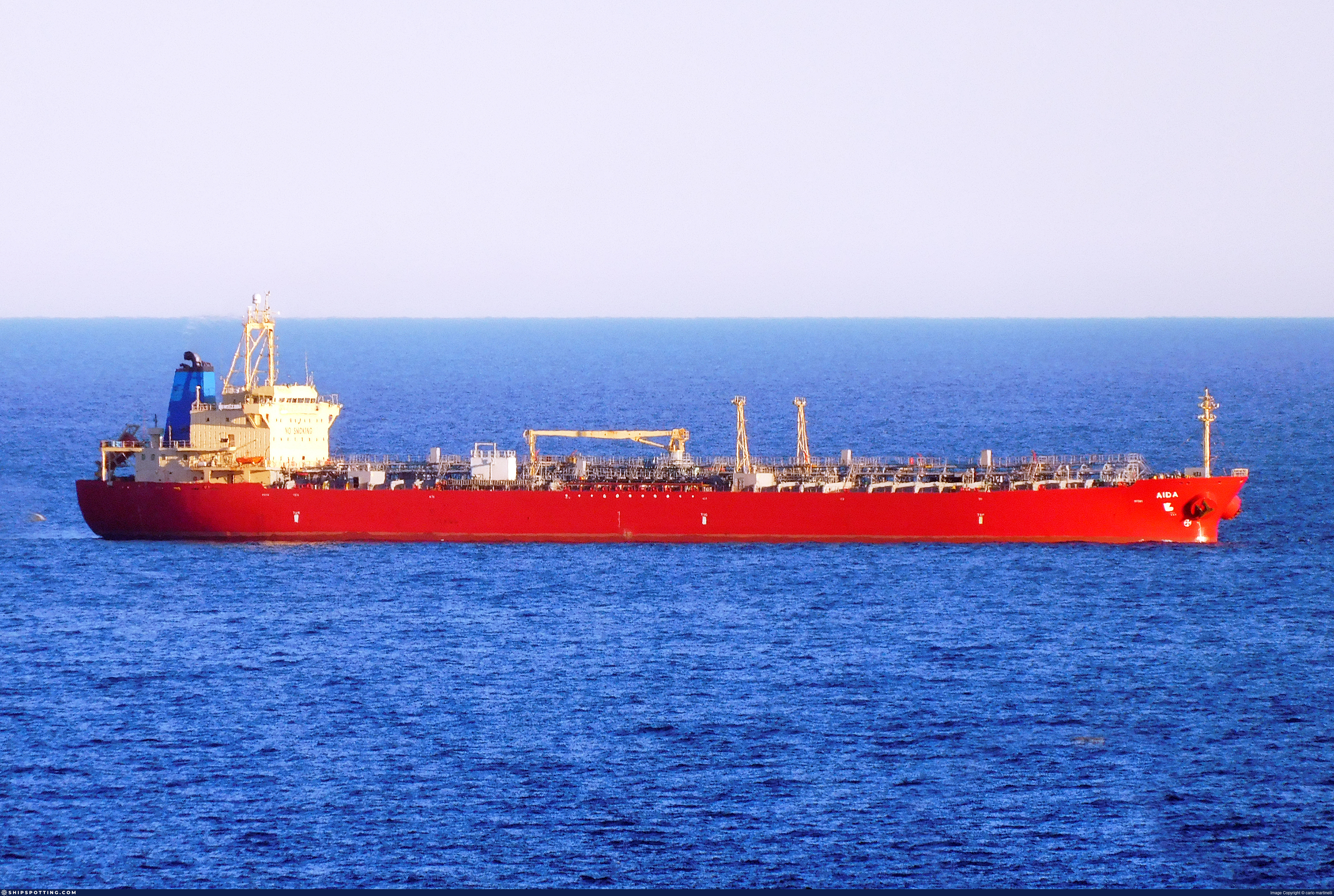
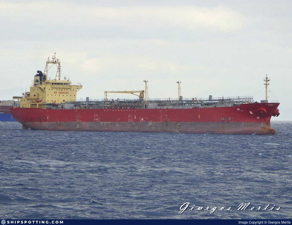
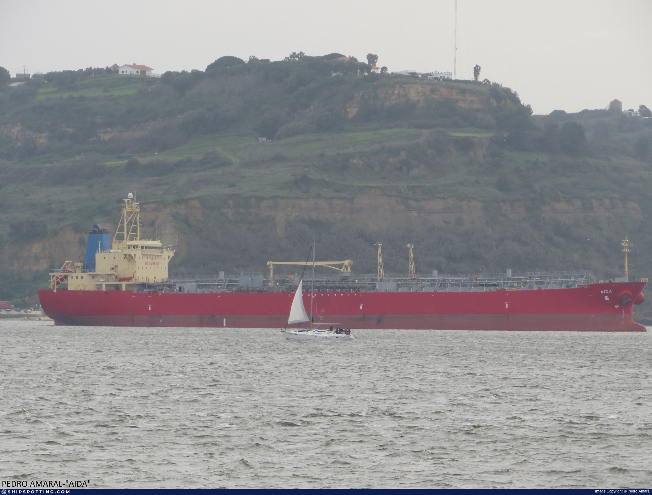
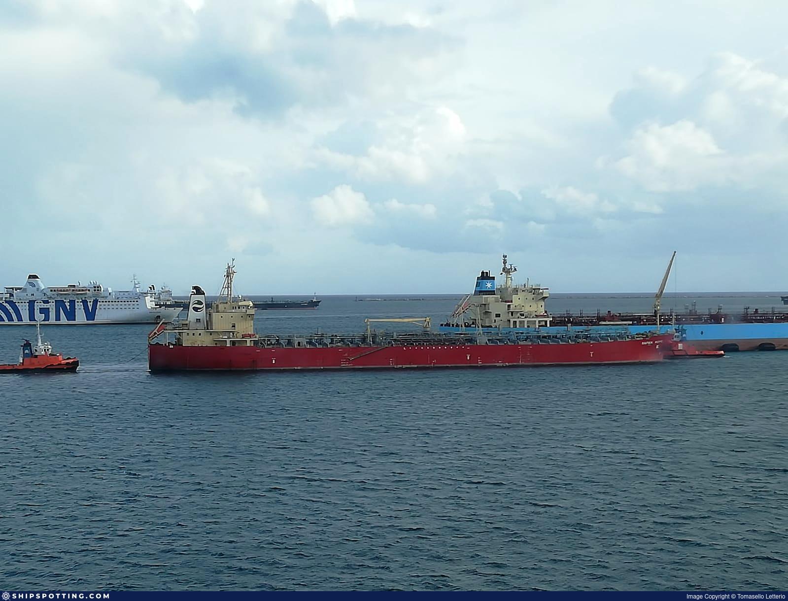
INDUS 1

IMO 9360415

Vessel information

Vessel Name INDUS 1 View name history 📜
IMO Number 9360415
MMSI 511101776
Vessel Type Chemical/Products Tanker | Transporteur de produits chimiques
Flag 🇬🇶 Equatorial Guinea View flag history 📜
Call Sign T8A5264
Gross Tonnage 22,535 GT
Year Built 2007

Sanctioned by

Company & Ownership

🏢
Tigwa Shipping Inc
IMO Company: 6474855
Address 3rd Floor, Standard Chartered Tower, Bank Street, Cybercity, Ebene, Mauritius.
Status Active
Fleet 1.0 owner, 1.0 operator, 1.0 manager, 0.0 beneficial

Management & Operations

ISM Manager
TULUVAI SHIPPING PVT LTD
Office 5, Pruthvi Plaza, Indralok Phase-III, Mira Bhayandar Road, Bhayandar (E), Thane, Maharashtra, 401105, India.
Commercial Manager
TIGWA SHIPPING INC
3rd Floor, Standard Chartered Tower, Bank Street, Cybercity, Ebene, Mauritius.
Registered Owner
TIGWA SHIPPING INC
3rd Floor, Standard Chartered Tower, Bank Street, Cybercity, Ebene, Mauritius.

Classification & Safety

Current Classification
Russian Maritime Register of Shipping Delivered

Port State Control (PSC) Inspections

⚠️
Risk Level
LOW
Last 36 Months
5
Inspections
Last Inspection
📍 Novorossiisk
📅 2026-03-07

Survey Renewal & Certificates

Code Type Issuer Issued Expires
509 Document of Compliance Indian Register of Shipping (150) 23/11/2023 16/11/2028
509 Document of Compliance American Bureau of Shipping (101) 02/08/2022 01/08/2027

Programs & Notes

EU Russia Sanctions – Shadow Fleet | AU vessel designations (DFAT) | SEMA (Canada) — vessel designations | The Russia (Sanctions) (EU Exit) Regulations 2019

DateDesignated: 2025-05-09 | Shipping sanctions: (see “Other information”) | Shipping sanctions: a specified ship is prohibited from being provided with access to or having its master or pilot cause it to enter a port in the UK, may have its registration on the UK Ship Register terminated, and a master or pilot of a specified ship may be given a port barring direction, a detention direction, and a port entry direction or a movement direction. | IMO 9360415 (“INDUS 1”) is involved in activity whose object or effect is to destabilise Ukraine or undermine or threaten the territorial integrity, sovereignty or independence of Ukraine or to obtain a benefit from or support the Government of Russia. Namely, INDUS 1 is involved in carrying oil or oil products that originated in Russia from Russia to a third country.

Vessel Changes

11 changes

AIS Events

50 events detected • 3 zones • Last: May 19, 2026

Zone Dwell Brest Approaches Monitoring Zone May 19, 2026 17:34 UTC 80.0%
  • Zone: Brest Approaches Monitoring Zone
  • Duration: 1h 7m
  • Data Points: 4 AIS positions
  • Period: 2026-05-19T17:34:08+00:00 to 2026-05-19T18:41:18+00:00
Show Raw Evidence JSON
{
    "zone_id": "discovered_057",
    "zone_name": "Brest Approaches Monitoring Zone",
    "dwell_minutes": 67.2000000000000028421709430404007434844970703125,
    "points_in_zone": 4,
    "first_point": {
        "ts": "2026-05-19T17:34:08+00:00",
        "lat": 32.46481330000000298241502605378627777099609375,
        "lon": 30.176429999999999864712663111276924610137939453125
    },
    "last_point": {
        "ts": "2026-05-19T18:41:18+00:00",
        "lat": 32.51260330000000209338395507074892520904541015625,
        "lon": 29.953546700000000413410816690884530544281005859375
    }
}

Methodology: 2026.01.18

Zone Dwell Brest Approaches Monitoring Zone May 19, 2026 16:11 UTC 80.0%
  • Zone: Brest Approaches Monitoring Zone
  • Duration: 2h 29m
  • Data Points: 5 AIS positions
  • Period: 2026-05-19T16:11:47+00:00 to 2026-05-19T18:41:18+00:00
Show Raw Evidence JSON
{
    "zone_id": "discovered_057",
    "zone_name": "Brest Approaches Monitoring Zone",
    "dwell_minutes": 149.5,
    "points_in_zone": 5,
    "first_point": {
        "ts": "2026-05-19T16:11:47+00:00",
        "lat": 32.411439999999998917701304890215396881103515625,
        "lon": 30.456923299999999699139152653515338897705078125
    },
    "last_point": {
        "ts": "2026-05-19T18:41:18+00:00",
        "lat": 32.51260330000000209338395507074892520904541015625,
        "lon": 29.953546700000000413410816690884530544281005859375
    }
}

Methodology: 2026.01.18

Zone Dwell Brest Approaches Monitoring Zone May 19, 2026 15:21 UTC 80.0%
  • Zone: Brest Approaches Monitoring Zone
  • Duration: 3h 20m
  • Data Points: 24 AIS positions
  • Period: 2026-05-19T15:21:09+00:00 to 2026-05-19T18:41:18+00:00
Show Raw Evidence JSON
{
    "zone_id": "discovered_057",
    "zone_name": "Brest Approaches Monitoring Zone",
    "dwell_minutes": 200.19999999999998863131622783839702606201171875,
    "points_in_zone": 24,
    "first_point": {
        "ts": "2026-05-19T15:21:09+00:00",
        "lat": 32.3771966999999989411662681959569454193115234375,
        "lon": 30.628086700000000774934960645623505115509033203125
    },
    "last_point": {
        "ts": "2026-05-19T18:41:18+00:00",
        "lat": 32.51260330000000209338395507074892520904541015625,
        "lon": 29.953546700000000413410816690884530544281005859375
    }
}

Methodology: 2026.01.18

Zone Dwell discovered_051 May 19, 2026 14:01 UTC 80.0%
  • Zone: discovered_051
  • Duration: 1h 37m
  • Data Points: 57 AIS positions
  • Period: 2026-05-19T14:01:18+00:00 to 2026-05-19T15:39:07+00:00
Show Raw Evidence JSON
{
    "zone_id": "discovered_051",
    "zone_name": "Northern Baltic Surveillance Zone",
    "dwell_minutes": 97.7999999999999971578290569595992565155029296875,
    "points_in_zone": 57,
    "first_point": {
        "ts": "2026-05-19T14:01:18+00:00",
        "lat": 32.32938829999999796882548253051936626434326171875,
        "lon": 30.894375000000000142108547152020037174224853515625
    },
    "last_point": {
        "ts": "2026-05-19T15:39:07+00:00",
        "lat": 32.38956499999999749661583337001502513885498046875,
        "lon": 30.56771499999999974761522025801241397857666015625
    }
}

Methodology: 2026.01.18

Zone Dwell discovered_051 May 19, 2026 13:07 UTC 80.0%
  • Zone: discovered_051
  • Duration: 2h 31m
  • Data Points: 89 AIS positions
  • Period: 2026-05-19T13:07:37+00:00 to 2026-05-19T15:39:07+00:00
Show Raw Evidence JSON
{
    "zone_id": "discovered_051",
    "zone_name": "Northern Baltic Surveillance Zone",
    "dwell_minutes": 151.5,
    "points_in_zone": 89,
    "first_point": {
        "ts": "2026-05-19T13:07:37+00:00",
        "lat": 32.29072169999999886158548179082572460174560546875,
        "lon": 31.065131699999998460270944633521139621734619140625
    },
    "last_point": {
        "ts": "2026-05-19T15:39:07+00:00",
        "lat": 32.38956499999999749661583337001502513885498046875,
        "lon": 30.56771499999999974761522025801241397857666015625
    }
}

Methodology: 2026.01.18

Zone Dwell Eastern Mediterranean Sanctioned Vessel Zone May 19, 2026 12:04 UTC 80.0%
  • Zone: Eastern Mediterranean Sanctioned Vessel Zone
  • Duration: 1h 46m
  • Data Points: 36 AIS positions
  • Period: 2026-05-19T12:04:40+00:00 to 2026-05-19T13:51:07+00:00
Show Raw Evidence JSON
{
    "zone_id": "discovered_018",
    "zone_name": "Eastern Mediterranean Sanctioned Vessel Zone",
    "dwell_minutes": 106.5,
    "points_in_zone": 36,
    "first_point": {
        "ts": "2026-05-19T12:04:40+00:00",
        "lat": 32.22379829999999856227077543735504150390625,
        "lon": 31.250456700000000864747562445700168609619140625
    },
    "last_point": {
        "ts": "2026-05-19T13:51:07+00:00",
        "lat": 32.32311829999999730489435023628175258636474609375,
        "lon": 30.927466700000000088266460807062685489654541015625
    }
}

Methodology: 2026.01.18

Zone Dwell discovered_051 May 19, 2026 12:04 UTC 80.0%
  • Zone: discovered_051
  • Duration: 3h 34m
  • Data Points: 99 AIS positions
  • Period: 2026-05-19T12:04:40+00:00 to 2026-05-19T15:39:07+00:00
Show Raw Evidence JSON
{
    "zone_id": "discovered_051",
    "zone_name": "Northern Baltic Surveillance Zone",
    "dwell_minutes": 214.400000000000005684341886080801486968994140625,
    "points_in_zone": 99,
    "first_point": {
        "ts": "2026-05-19T12:04:40+00:00",
        "lat": 32.22379829999999856227077543735504150390625,
        "lon": 31.250456700000000864747562445700168609619140625
    },
    "last_point": {
        "ts": "2026-05-19T15:39:07+00:00",
        "lat": 32.38956499999999749661583337001502513885498046875,
        "lon": 30.56771499999999974761522025801241397857666015625
    }
}

Methodology: 2026.01.18

Zone Dwell Eastern Mediterranean Sanctioned Vessel Zone May 19, 2026 11:16 UTC 80.0%
  • Zone: Eastern Mediterranean Sanctioned Vessel Zone
  • Duration: 2h 34m
  • Data Points: 46 AIS positions
  • Period: 2026-05-19T11:16:27+00:00 to 2026-05-19T13:51:07+00:00
Show Raw Evidence JSON
{
    "zone_id": "discovered_018",
    "zone_name": "Eastern Mediterranean Sanctioned Vessel Zone",
    "dwell_minutes": 154.69999999999998863131622783839702606201171875,
    "points_in_zone": 46,
    "first_point": {
        "ts": "2026-05-19T11:16:27+00:00",
        "lat": 32.14166329999999760502760182134807109832763671875,
        "lon": 31.371461700000001115995473810471594333648681640625
    },
    "last_point": {
        "ts": "2026-05-19T13:51:07+00:00",
        "lat": 32.32311829999999730489435023628175258636474609375,
        "lon": 30.927466700000000088266460807062685489654541015625
    }
}

Methodology: 2026.01.18

Zone Dwell Eastern Mediterranean Sanctioned Vessel Zone May 19, 2026 10:00 UTC 80.0%
  • Zone: Eastern Mediterranean Sanctioned Vessel Zone
  • Duration: 3h 50m
  • Data Points: 63 AIS positions
  • Period: 2026-05-19T10:00:58+00:00 to 2026-05-19T13:51:07+00:00
Show Raw Evidence JSON
{
    "zone_id": "discovered_018",
    "zone_name": "Eastern Mediterranean Sanctioned Vessel Zone",
    "dwell_minutes": 230.19999999999998863131622783839702606201171875,
    "points_in_zone": 63,
    "first_point": {
        "ts": "2026-05-19T10:00:58+00:00",
        "lat": 32.00983169999999944366209092549979686737060546875,
        "lon": 31.5769532999999995581674738787114620208740234375
    },
    "last_point": {
        "ts": "2026-05-19T13:51:07+00:00",
        "lat": 32.32311829999999730489435023628175258636474609375,
        "lon": 30.927466700000000088266460807062685489654541015625
    }
}

Methodology: 2026.01.18

Ais Gap🛰️✗ Eastern Mediterranean Sanctioned Vessel Zone May 19, 2026 05:40 UTC 70.0%
  • Gap Duration: 4h 20m
  • Last Seen: 2026-05-19T05:40:59+00:00 at 31.5655, 32.2490 (Zone: Eastern Mediterranean Sanctioned Vessel Zone)
  • Next Seen: 2026-05-19T10:00:58+00:00 at 32.0098, 31.5770

🛰️ Gap Corroboration

No Imagery

These are snapshots that may corroborate presence during the gap. They do not reconstruct a continuous route.

SAR Imagery (Sentinel-1)

Status: ✗ No SAR coverage

No Sentinel-1 scenes covering corridor and time window

VIIRS Thermal Anomaly

Status: ✗ No detections

No VIIRS thermal/light detections in corridor

Searched: 2026-05-19T10:15:09.211623+00:00

Show Raw Evidence JSON
{
    "gap_minutes": 260,
    "last_seen": {
        "ts": "2026-05-19T05:40:59+00:00",
        "lat": 31.56544999999999845385900698602199554443359375,
        "lon": 32.2490183000000030233422876335680484771728515625,
        "sog": 10,
        "zone_id": "discovered_018"
    },
    "next_seen": {
        "ts": "2026-05-19T10:00:58+00:00",
        "lat": 32.00983169999999944366209092549979686737060546875,
        "lon": 31.5769532999999995581674738787114620208740234375,
        "zone_ids": [
            "discovered_018"
        ]
    },
    "gap_enrichment": {
        "status": "not_found",
        "corridor": {
            "start": {
                "lat": 31.56544999999999845385900698602199554443359375,
                "lon": 32.2490183000000030233422876335680484771728515625,
                "ts": "2026-05-19T05:40:59+00:00"
            },
            "end": {
                "lat": 32.00983169999999944366209092549979686737060546875,
                "lon": 31.5769532999999995581674738787114620208740234375,
                "ts": "2026-05-19T10:00:58+00:00"
            },
            "bbox": {
                "min_lat": 31.38526999999999844703779672272503376007080078125,
                "min_lon": 31.36497800000000069076122599653899669647216796875,
                "max_lat": 32.19001200000000295631252811290323734283447265625,
                "max_lon": 32.460993000000001984517439268529415130615234375
            },
            "buffer_km": 20
        },
        "sar": {
            "status": "not_found",
            "notes": "No Sentinel-1 scenes covering corridor and time window"
        },
        "viirs": {
            "status": "not_found",
            "notes": "No VIIRS thermal\/light detections in corridor"
        },
        "searched_at": "2026-05-19T10:15:09.211623+00:00"
    }
}

Methodology: 2026.01.18

Zone Dwell Eastern Mediterranean Sanctioned Vessel Zone May 19, 2026 05:17 UTC 80.0%
  • Zone: Eastern Mediterranean Sanctioned Vessel Zone
  • Duration: 6h 35m
  • Data Points: 35 AIS positions
  • Period: 2026-05-19T05:40:59+00:00 to 2026-05-19T12:16:19+00:00
Show Raw Evidence JSON
{
    "zone_id": "discovered_018",
    "zone_name": "Eastern Mediterranean Sanctioned Vessel Zone",
    "dwell_minutes": 395.30000000000001136868377216160297393798828125,
    "points_in_zone": 35,
    "first_point": {
        "ts": "2026-05-19T05:40:59+00:00",
        "lat": 31.56544999999999845385900698602199554443359375,
        "lon": 32.2490183000000030233422876335680484771728515625
    },
    "last_point": {
        "ts": "2026-05-19T12:16:19+00:00",
        "lat": 32.240645000000000663931132294237613677978515625,
        "lon": 31.21914170000000154914232552982866764068603515625
    }
}

Methodology: 2026.01.18

Zone Dwell Eastern Mediterranean Sanctioned Vessel Zone May 19, 2026 04:04 UTC 80.0%
  • Zone: Eastern Mediterranean Sanctioned Vessel Zone
  • Duration: 6h 26m
  • Data Points: 24 AIS positions
  • Period: 2026-05-19T04:16:53+00:00 to 2026-05-19T10:43:40+00:00
Show Raw Evidence JSON
{
    "zone_id": "discovered_018",
    "zone_name": "Eastern Mediterranean Sanctioned Vessel Zone",
    "dwell_minutes": 386.80000000000001136868377216160297393798828125,
    "points_in_zone": 24,
    "first_point": {
        "ts": "2026-05-19T04:16:53+00:00",
        "lat": 31.536880000000000023874235921539366245269775390625,
        "lon": 32.35809330000000016980266082100570201873779296875
    },
    "last_point": {
        "ts": "2026-05-19T10:43:40+00:00",
        "lat": 32.08601999999999776491677039302885532379150390625,
        "lon": 31.460049999999998959765434847213327884674072265625
    }
}

Methodology: 2026.01.18

Loiter Eastern Mediterranean Sanctioned Vessel Zone May 19, 2026 03:01 UTC 75.0%
  • Duration: 1h 33m
  • Radius: 44 meters
  • Data Points: 17 AIS positions
  • Centroid: 31.5367, 32.3579
  • Zone: Eastern Mediterranean Sanctioned Vessel Zone
Show Raw Evidence JSON
{
    "radius_m": 44.39999999999999857891452847979962825775146484375,
    "duration_minutes": 93,
    "points": 17,
    "centroid": {
        "lat": 31.5366952941176492686281562782824039459228515625,
        "lon": 32.3578712705882338696028455160558223724365234375
    },
    "bbox": {
        "min_lat": 31.536403299999999916281012701801955699920654296875,
        "min_lon": 32.357613299999997025224729441106319427490234375,
        "max_lat": 31.537016699999998792236510780639946460723876953125,
        "max_lon": 32.358166699999998172643245197832584381103515625
    },
    "zone_id": "discovered_018"
}

Methodology: 2026.01.18

Zone Dwell Eastern Mediterranean Sanctioned Vessel Zone May 19, 2026 03:01 UTC 80.0%
  • Zone: Eastern Mediterranean Sanctioned Vessel Zone
  • Duration: 6h 32m
  • Data Points: 23 AIS positions
  • Period: 2026-05-19T03:55:55+00:00 to 2026-05-19T10:28:00+00:00
Show Raw Evidence JSON
{
    "zone_id": "discovered_018",
    "zone_name": "Eastern Mediterranean Sanctioned Vessel Zone",
    "dwell_minutes": 392.1000000000000227373675443232059478759765625,
    "points_in_zone": 23,
    "first_point": {
        "ts": "2026-05-19T03:55:55+00:00",
        "lat": 31.53659999999999996589394868351519107818603515625,
        "lon": 32.35779169999999993478922988288104534149169921875
    },
    "last_point": {
        "ts": "2026-05-19T10:28:00+00:00",
        "lat": 32.05870999999999781948645249940454959869384765625,
        "lon": 31.50333669999999841593307792209088802337646484375
    }
}

Methodology: 2026.01.18

Loiter Eastern Mediterranean Sanctioned Vessel Zone May 19, 2026 02:25 UTC 75.0%
  • Duration: 2h 9m
  • Radius: 54 meters
  • Data Points: 23 AIS positions
  • Centroid: 31.5366, 32.3578
  • Zone: Eastern Mediterranean Sanctioned Vessel Zone
Show Raw Evidence JSON
{
    "radius_m": 54.2999999999999971578290569595992565155029296875,
    "duration_minutes": 129.099999999999994315658113919198513031005859375,
    "points": 23,
    "centroid": {
        "lat": 31.5366242043478308687554090283811092376708984375,
        "lon": 32.357808478260864148978726007044315338134765625
    },
    "bbox": {
        "min_lat": 31.536353299999998256453181966207921504974365234375,
        "min_lon": 32.35759329999999778237906866706907749176025390625,
        "max_lat": 31.537016699999998792236510780639946460723876953125,
        "max_lon": 32.358166699999998172643245197832584381103515625
    },
    "zone_id": "discovered_018"
}

Methodology: 2026.01.18

Zone Dwell Eastern Mediterranean Sanctioned Vessel Zone May 19, 2026 02:25 UTC 80.0%
  • Zone: Eastern Mediterranean Sanctioned Vessel Zone
  • Duration: 3h 15m
  • Data Points: 26 AIS positions
  • Period: 2026-05-19T02:25:55+00:00 to 2026-05-19T05:40:59+00:00
Show Raw Evidence JSON
{
    "zone_id": "discovered_018",
    "zone_name": "Eastern Mediterranean Sanctioned Vessel Zone",
    "dwell_minutes": 195.099999999999994315658113919198513031005859375,
    "points_in_zone": 26,
    "first_point": {
        "ts": "2026-05-19T02:25:55+00:00",
        "lat": 31.536456699999998676275936304591596126556396484375,
        "lon": 32.3576316999999988865965860895812511444091796875
    },
    "last_point": {
        "ts": "2026-05-19T05:40:59+00:00",
        "lat": 31.56544999999999845385900698602199554443359375,
        "lon": 32.2490183000000030233422876335680484771728515625
    }
}

Methodology: 2026.01.18

Loiter Eastern Mediterranean Sanctioned Vessel Zone May 19, 2026 01:04 UTC 75.0%
  • Duration: 3h 30m
  • Radius: 117 meters
  • Data Points: 24 AIS positions
  • Centroid: 31.5366, 32.3578
  • Zone: Eastern Mediterranean Sanctioned Vessel Zone
Show Raw Evidence JSON
{
    "radius_m": 116.599999999999994315658113919198513031005859375,
    "duration_minutes": 210.099999999999994315658113919198513031005859375,
    "points": 24,
    "centroid": {
        "lat": 31.536603195833333046493862639181315898895263671875,
        "lon": 32.357761041666663004434667527675628662109375
    },
    "bbox": {
        "min_lat": 31.536120000000000374029696104116737842559814453125,
        "min_lon": 32.35667000000000115278453449718654155731201171875,
        "max_lat": 31.537016699999998792236510780639946460723876953125,
        "max_lon": 32.358166699999998172643245197832584381103515625
    },
    "zone_id": "discovered_018"
}

Methodology: 2026.01.18

Zone Dwell Eastern Mediterranean Sanctioned Vessel Zone May 19, 2026 01:04 UTC 80.0%
  • Zone: Eastern Mediterranean Sanctioned Vessel Zone
  • Duration: 4h 36m
  • Data Points: 27 AIS positions
  • Period: 2026-05-19T01:04:55+00:00 to 2026-05-19T05:40:59+00:00
Show Raw Evidence JSON
{
    "zone_id": "discovered_018",
    "zone_name": "Eastern Mediterranean Sanctioned Vessel Zone",
    "dwell_minutes": 276.1000000000000227373675443232059478759765625,
    "points_in_zone": 27,
    "first_point": {
        "ts": "2026-05-19T01:04:55+00:00",
        "lat": 31.536120000000000374029696104116737842559814453125,
        "lon": 32.35667000000000115278453449718654155731201171875
    },
    "last_point": {
        "ts": "2026-05-19T05:40:59+00:00",
        "lat": 31.56544999999999845385900698602199554443359375,
        "lon": 32.2490183000000030233422876335680484771728515625
    }
}

Methodology: 2026.01.18

Loiter Eastern Mediterranean Sanctioned Vessel Zone May 19, 2026 00:04 UTC 75.0%
  • Duration: 4h 30m
  • Radius: 124 meters
  • Data Points: 33 AIS positions
  • Centroid: 31.5365, 32.3574
  • Zone: Eastern Mediterranean Sanctioned Vessel Zone
Show Raw Evidence JSON
{
    "radius_m": 124,
    "duration_minutes": 270.1000000000000227373675443232059478759765625,
    "points": 33,
    "centroid": {
        "lat": 31.53647631515151061876167659647762775421142578125,
        "lon": 32.35738520000000306708898278884589672088623046875
    },
    "bbox": {
        "min_lat": 31.536079999999998335624695755541324615478515625,
        "min_lon": 32.35615500000000110958353616297245025634765625,
        "max_lat": 31.537016699999998792236510780639946460723876953125,
        "max_lon": 32.358166699999998172643245197832584381103515625
    },
    "zone_id": "discovered_018"
}

Methodology: 2026.01.18

Zone Dwell Eastern Mediterranean Sanctioned Vessel Zone May 19, 2026 00:04 UTC 80.0%
  • Zone: Eastern Mediterranean Sanctioned Vessel Zone
  • Duration: 5h 36m
  • Data Points: 36 AIS positions
  • Period: 2026-05-19T00:04:51+00:00 to 2026-05-19T05:40:59+00:00
Show Raw Evidence JSON
{
    "zone_id": "discovered_018",
    "zone_name": "Eastern Mediterranean Sanctioned Vessel Zone",
    "dwell_minutes": 336.1000000000000227373675443232059478759765625,
    "points_in_zone": 36,
    "first_point": {
        "ts": "2026-05-19T00:04:51+00:00",
        "lat": 31.536101699999999681267581763677299022674560546875,
        "lon": 32.35615500000000110958353616297245025634765625
    },
    "last_point": {
        "ts": "2026-05-19T05:40:59+00:00",
        "lat": 31.56544999999999845385900698602199554443359375,
        "lon": 32.2490183000000030233422876335680484771728515625
    }
}

Methodology: 2026.01.18

Loiter Eastern Mediterranean Sanctioned Vessel Zone May 18, 2026 23:19 UTC 75.0%
  • Duration: 5h 15m
  • Radius: 109 meters
  • Data Points: 38 AIS positions
  • Centroid: 31.5364, 32.3572
  • Zone: Eastern Mediterranean Sanctioned Vessel Zone
Show Raw Evidence JSON
{
    "radius_m": 108.599999999999994315658113919198513031005859375,
    "duration_minutes": 315,
    "points": 38,
    "centroid": {
        "lat": 31.53643399210526609977023326791822910308837890625,
        "lon": 32.357230657894746173042221926152706146240234375
    },
    "bbox": {
        "min_lat": 31.536063299999998577050064341165125370025634765625,
        "min_lon": 32.3561499999999995225152815692126750946044921875,
        "max_lat": 31.537016699999998792236510780639946460723876953125,
        "max_lon": 32.358166699999998172643245197832584381103515625
    },
    "zone_id": "discovered_018"
}

Methodology: 2026.01.18

Zone Dwell Eastern Mediterranean Sanctioned Vessel Zone May 18, 2026 23:19 UTC 80.0%
  • Zone: Eastern Mediterranean Sanctioned Vessel Zone
  • Duration: 6h 21m
  • Data Points: 41 AIS positions
  • Period: 2026-05-18T23:19:56+00:00 to 2026-05-19T05:40:59+00:00
Show Raw Evidence JSON
{
    "zone_id": "discovered_018",
    "zone_name": "Eastern Mediterranean Sanctioned Vessel Zone",
    "dwell_minutes": 381.1000000000000227373675443232059478759765625,
    "points_in_zone": 41,
    "first_point": {
        "ts": "2026-05-18T23:19:56+00:00",
        "lat": 31.5362650000000002137312549166381359100341796875,
        "lon": 32.356296700000001465014065615832805633544921875
    },
    "last_point": {
        "ts": "2026-05-19T05:40:59+00:00",
        "lat": 31.56544999999999845385900698602199554443359375,
        "lon": 32.2490183000000030233422876335680484771728515625
    }
}

Methodology: 2026.01.18

Loiter Eastern Mediterranean Sanctioned Vessel Zone May 18, 2026 22:10 UTC 75.0%
  • Duration: 6h 24m
  • Radius: 125 meters
  • Data Points: 39 AIS positions
  • Centroid: 31.5364, 32.3572
  • Zone: Eastern Mediterranean Sanctioned Vessel Zone
Show Raw Evidence JSON
{
    "radius_m": 125.2999999999999971578290569595992565155029296875,
    "duration_minutes": 384.1000000000000227373675443232059478759765625,
    "points": 39,
    "centroid": {
        "lat": 31.53643350512820830999771715141832828521728515625,
        "lon": 32.35719594102564400373012176714837551116943359375
    },
    "bbox": {
        "min_lat": 31.536063299999998577050064341165125370025634765625,
        "min_lon": 32.35587670000000315440047415904700756072998046875,
        "max_lat": 31.537016699999998792236510780639946460723876953125,
        "max_lon": 32.358166699999998172643245197832584381103515625
    },
    "zone_id": "discovered_018"
}

Methodology: 2026.01.18

Zone Dwell Eastern Mediterranean Sanctioned Vessel Zone May 18, 2026 22:10 UTC 80.0%
  • Zone: Eastern Mediterranean Sanctioned Vessel Zone
  • Duration: 6h 24m
  • Data Points: 39 AIS positions
  • Period: 2026-05-18T22:10:54+00:00 to 2026-05-19T04:34:58+00:00
Show Raw Evidence JSON
{
    "zone_id": "discovered_018",
    "zone_name": "Eastern Mediterranean Sanctioned Vessel Zone",
    "dwell_minutes": 384.1000000000000227373675443232059478759765625,
    "points_in_zone": 39,
    "first_point": {
        "ts": "2026-05-18T22:10:54+00:00",
        "lat": 31.536415000000001640501068322919309139251708984375,
        "lon": 32.35587670000000315440047415904700756072998046875
    },
    "last_point": {
        "ts": "2026-05-19T04:34:58+00:00",
        "lat": 31.537003299999998517932908725924789905548095703125,
        "lon": 32.35806170000000037134668673388659954071044921875
    }
}

Methodology: 2026.01.18

Loiter Eastern Mediterranean Sanctioned Vessel Zone May 18, 2026 21:13 UTC 75.0%
  • Duration: 6h 33m
  • Radius: 104 meters
  • Data Points: 33 AIS positions
  • Centroid: 31.5363, 32.3570
  • Zone: Eastern Mediterranean Sanctioned Vessel Zone
Show Raw Evidence JSON
{
    "radius_m": 103.5,
    "duration_minutes": 393.1000000000000227373675443232059478759765625,
    "points": 33,
    "centroid": {
        "lat": 31.5363258575757612334200530312955379486083984375,
        "lon": 32.3569617151515132036365685053169727325439453125
    },
    "bbox": {
        "min_lat": 31.536063299999998577050064341165125370025634765625,
        "min_lon": 32.35587670000000315440047415904700756072998046875,
        "max_lat": 31.53671669999999949141056276857852935791015625,
        "max_lon": 32.357883299999997461782186292111873626708984375
    },
    "zone_id": "discovered_018"
}

Methodology: 2026.01.18

Zone Dwell Eastern Mediterranean Sanctioned Vessel Zone May 18, 2026 21:13 UTC 80.0%
  • Zone: Eastern Mediterranean Sanctioned Vessel Zone
  • Duration: 6h 33m
  • Data Points: 33 AIS positions
  • Period: 2026-05-18T21:13:53+00:00 to 2026-05-19T03:46:57+00:00
Show Raw Evidence JSON
{
    "zone_id": "discovered_018",
    "zone_name": "Eastern Mediterranean Sanctioned Vessel Zone",
    "dwell_minutes": 393.1000000000000227373675443232059478759765625,
    "points_in_zone": 33,
    "first_point": {
        "ts": "2026-05-18T21:13:53+00:00",
        "lat": 31.536173300000001518128556199371814727783203125,
        "lon": 32.35656999999999783312887302599847316741943359375
    },
    "last_point": {
        "ts": "2026-05-19T03:46:57+00:00",
        "lat": 31.53663329999999831443346920423209667205810546875,
        "lon": 32.35778330000000124755388242192566394805908203125
    }
}

Methodology: 2026.01.18

Zone Dwell Eastern Mediterranean Sanctioned Vessel Zone May 18, 2026 20:22 UTC 80.0%
  • Zone: Eastern Mediterranean Sanctioned Vessel Zone
  • Duration: 6h 26m
  • Data Points: 31 AIS positions
  • Period: 2026-05-18T20:59:01+00:00 to 2026-05-19T03:25:56+00:00
Show Raw Evidence JSON
{
    "zone_id": "discovered_018",
    "zone_name": "Eastern Mediterranean Sanctioned Vessel Zone",
    "dwell_minutes": 386.8999999999999772626324556767940521240234375,
    "points_in_zone": 31,
    "first_point": {
        "ts": "2026-05-18T20:59:01+00:00",
        "lat": 31.536068300000000164118318934924900531768798828125,
        "lon": 32.35667169999999970286808093078434467315673828125
    },
    "last_point": {
        "ts": "2026-05-19T03:25:56+00:00",
        "lat": 31.53669000000000011141310096718370914459228515625,
        "lon": 32.35782669999999683341229683719575405120849609375
    }
}

Methodology: 2026.01.18

Loiter Eastern Mediterranean Sanctioned Vessel Zone May 18, 2026 20:22 UTC 75.0%
  • Duration: 6h 26m
  • Radius: 103 meters
  • Data Points: 31 AIS positions
  • Centroid: 31.5363, 32.3569
  • Zone: Eastern Mediterranean Sanctioned Vessel Zone
Show Raw Evidence JSON
{
    "radius_m": 102.7999999999999971578290569595992565155029296875,
    "duration_minutes": 386.8999999999999772626324556767940521240234375,
    "points": 31,
    "centroid": {
        "lat": 31.536286235483874662577363778837025165557861328125,
        "lon": 32.3568715064516112533965497277677059173583984375
    },
    "bbox": {
        "min_lat": 31.536063299999998577050064341165125370025634765625,
        "min_lon": 32.35587670000000315440047415904700756072998046875,
        "max_lat": 31.53669000000000011141310096718370914459228515625,
        "max_lon": 32.357883299999997461782186292111873626708984375
    },
    "zone_id": "discovered_018"
}

Methodology: 2026.01.18

Loiter Eastern Mediterranean Sanctioned Vessel Zone May 18, 2026 19:47 UTC 75.0%
  • Duration: 5h 17m
  • Radius: 1,057 meters
  • Data Points: 23 AIS positions
  • Centroid: 31.5365, 32.3568
  • Zone: Eastern Mediterranean Sanctioned Vessel Zone
Show Raw Evidence JSON
{
    "radius_m": 1056.700000000000045474735088646411895751953125,
    "duration_minutes": 317.3999999999999772626324556767940521240234375,
    "points": 23,
    "centroid": {
        "lat": 31.536493113043480462920342688448727130889892578125,
        "lon": 32.35676413478261537193247932009398937225341796875
    },
    "bbox": {
        "min_lat": 31.536063299999998577050064341165125370025634765625,
        "min_lon": 32.35587670000000315440047415904700756072998046875,
        "max_lat": 31.54372000000000042518877307884395122528076171875,
        "max_lon": 32.364018299999997907434590160846710205078125
    },
    "zone_id": "discovered_018"
}

Methodology: 2026.01.18

Zone Dwell Eastern Mediterranean Sanctioned Vessel Zone May 18, 2026 19:04 UTC 80.0%
  • Zone: Eastern Mediterranean Sanctioned Vessel Zone
  • Duration: 6 hours
  • Data Points: 28 AIS positions
  • Period: 2026-05-18T19:04:05+00:00 to 2026-05-19T01:04:55+00:00
Show Raw Evidence JSON
{
    "zone_id": "discovered_018",
    "zone_name": "Eastern Mediterranean Sanctioned Vessel Zone",
    "dwell_minutes": 360.80000000000001136868377216160297393798828125,
    "points_in_zone": 28,
    "first_point": {
        "ts": "2026-05-18T19:04:05+00:00",
        "lat": 31.5449432999999999083229340612888336181640625,
        "lon": 32.3741050000000001318767317570745944976806640625
    },
    "last_point": {
        "ts": "2026-05-19T01:04:55+00:00",
        "lat": 31.536120000000000374029696104116737842559814453125,
        "lon": 32.35667000000000115278453449718654155731201171875
    }
}

Methodology: 2026.01.18

Loiter Eastern Mediterranean Sanctioned Vessel Zone May 18, 2026 18:03 UTC 75.0%
  • Duration: 1h 44m
  • Radius: 939 meters
  • Data Points: 23 AIS positions
  • Centroid: 31.5452, 32.3738
  • Zone: Eastern Mediterranean Sanctioned Vessel Zone
Show Raw Evidence JSON
{
    "radius_m": 939.3999999999999772626324556767940521240234375,
    "duration_minutes": 104.2000000000000028421709430404007434844970703125,
    "points": 23,
    "centroid": {
        "lat": 31.54518521739129965908432495780289173126220703125,
        "lon": 32.37376196086955815189867280423641204833984375
    },
    "bbox": {
        "min_lat": 31.54372000000000042518877307884395122528076171875,
        "min_lon": 32.364018299999997907434590160846710205078125,
        "max_lat": 31.549376699999999829060470801778137683868408203125,
        "max_lon": 32.37467170000000038498910726048052310943603515625
    },
    "zone_id": "discovered_018"
}

Methodology: 2026.01.18

Zone Dwell Eastern Mediterranean Sanctioned Vessel Zone May 18, 2026 18:03 UTC 80.0%
  • Zone: Eastern Mediterranean Sanctioned Vessel Zone
  • Duration: 6h 30m
  • Data Points: 36 AIS positions
  • Period: 2026-05-18T18:34:13+00:00 to 2026-05-19T01:04:55+00:00
Show Raw Evidence JSON
{
    "zone_id": "discovered_018",
    "zone_name": "Eastern Mediterranean Sanctioned Vessel Zone",
    "dwell_minutes": 390.69999999999998863131622783839702606201171875,
    "points_in_zone": 36,
    "first_point": {
        "ts": "2026-05-18T18:34:13+00:00",
        "lat": 31.5449382999999983212546794675290584564208984375,
        "lon": 32.3743283000000019455910660326480865478515625
    },
    "last_point": {
        "ts": "2026-05-19T01:04:55+00:00",
        "lat": 31.536120000000000374029696104116737842559814453125,
        "lon": 32.35667000000000115278453449718654155731201171875
    }
}

Methodology: 2026.01.18

Sts Eastern Mediterranean Sanctioned Vessel Zone May 18, 2026 18:03 UTC 85/100
Vessel A: OPAL (OPAL) CAMEROON
Vessel B: INDUS 1 (INDUS 1) EQUATORIAL GUINEA
  • Minimum Distance: 20 meters
  • Average Distance: 50 meters
  • Duration: 1h 21m
  • Period: 2026-05-18T18:12:58+00:00 to 2026-05-18T19:34:01+00:00
  • Vessel A Avg Speed: 0.0 knots
  • Vessel B Avg Speed: 0.0 knots
  • Zone: Eastern Mediterranean Sanctioned Vessel Zone

Confidence Analysis

Score: 85/100

High-confidence STS candidate. Two tankers (OPAL and INDUS 1) maintained close proximity (min 20m, avg 50m) for 81 minutes. Both vessels were slow-moving (avg speeds 0.0 and 0.0 knots). The stable separation distance suggests deliberate parallel positioning typical of cargo transfer. Event occurred in Eastern Mediterranean Sanctioned Vessel Zone, a known STS activity area.

View scoring breakdown
FactorScoreDetail
Distance Tightness25/25Min distance 20m, avg 50m
Duration15/25Duration 81 minutes
Speed Stability20/20both nearly stationary; very stable speeds
Distance Consistency15/15Distance variance ±7m
Isolation5/10Isolation data not available
Context5/5In monitored zone: Eastern Mediterranean Sanctioned Vessel Zone
Show Raw Evidence JSON
{
    "vessel_a": {
        "mmsi": 613407500,
        "imo": 9286023,
        "name": "OPAL",
        "flag": "CAMEROON"
    },
    "vessel_b": {
        "mmsi": 631010099,
        "imo": 9360415,
        "name": "INDUS 1",
        "flag": "EQUATORIAL GUINEA"
    },
    "min_distance_m": 19.800000000000000710542735760100185871124267578125,
    "avg_distance_m": 49.7999999999999971578290569595992565155029296875,
    "distance_consistency_m": 7.0999999999999996447286321199499070644378662109375,
    "duration_minutes": 81,
    "overlap_duration_s": 4863,
    "speed_a_avg": 0.0299999999999999988897769753748434595763683319091796875,
    "speed_a_std": 0.05000000000000000277555756156289135105907917022705078125,
    "speed_b_avg": 0.0200000000000000004163336342344337026588618755340576171875,
    "speed_b_std": 0.040000000000000000832667268468867405317723751068115234375,
    "speed_summary": {
        "vessel_a": {
            "avg_sog": 0.0299999999999999988897769753748434595763683319091796875,
            "max_sog": 0.1000000000000000055511151231257827021181583404541015625
        },
        "vessel_b": {
            "avg_sog": 0.0200000000000000004163336342344337026588618755340576171875,
            "max_sog": 0.1000000000000000055511151231257827021181583404541015625
        }
    },
    "time_window": {
        "start": "2026-05-18T18:12:58+00:00",
        "end": "2026-05-18T19:34:01+00:00"
    },
    "points_count": {
        "vessel_a": 21,
        "vessel_b": 21
    },
    "zone_id": "discovered_018",
    "zone_name": "Eastern Mediterranean Sanctioned Vessel Zone",
    "score": {
        "value": 85,
        "components": {
            "distance_tightness": {
                "score": 25,
                "max": 25,
                "detail": "Min distance 20m, avg 50m"
            },
            "duration": {
                "score": 15,
                "max": 25,
                "detail": "Duration 81 minutes"
            },
            "speed_stability": {
                "score": 20,
                "max": 20,
                "detail": "both nearly stationary; very stable speeds"
            },
            "distance_consistency": {
                "score": 15,
                "max": 15,
                "detail": "Distance variance \u00b17m"
            },
            "isolation": {
                "score": 5,
                "max": 10,
                "detail": "Isolation data not available"
            },
            "context": {
                "score": 5,
                "max": 5,
                "detail": "In monitored zone: Eastern Mediterranean Sanctioned Vessel Zone"
            }
        },
        "summary": "High-confidence STS candidate. Two tankers (OPAL and INDUS 1) maintained close proximity (min 20m, avg 50m) for 81 minutes. Both vessels were slow-moving (avg speeds 0.0 and 0.0 knots). The stable separation distance suggests deliberate parallel positioning typical of cargo transfer. Event occurred in Eastern Mediterranean Sanctioned Vessel Zone, a known STS activity area."
    }
}

Methodology: 2026.01.18

Sts🛰️✗ Eastern Mediterranean Sanctioned Vessel Zone May 18, 2026 17:03 UTC 95/100
Vessel A: OPAL (OPAL) CAMEROON
Vessel B: INDUS 1 (INDUS 1) EQUATORIAL GUINEA
  • Minimum Distance: 20 meters
  • Average Distance: 50 meters
  • Duration: 2h 30m
  • Period: 2026-05-18T17:03:08+00:00 to 2026-05-18T19:34:01+00:00
  • Vessel A Avg Speed: 0.0 knots
  • Vessel B Avg Speed: 0.0 knots
  • Zone: Eastern Mediterranean Sanctioned Vessel Zone

Confidence Analysis

Score: 95/100

High-confidence STS candidate. Two tankers (OPAL and INDUS 1) maintained close proximity (min 20m, avg 50m) for 151 minutes. Both vessels were slow-moving (avg speeds 0.0 and 0.0 knots). The stable separation distance suggests deliberate parallel positioning typical of cargo transfer. Event occurred in Eastern Mediterranean Sanctioned Vessel Zone, a known STS activity area.

View scoring breakdown
FactorScoreDetail
Distance Tightness25/25Min distance 20m, avg 50m
Duration25/25Duration 151 minutes
Speed Stability20/20both nearly stationary; very stable speeds
Distance Consistency15/15Distance variance ±6m
Isolation5/10Isolation data not available
Context5/5In monitored zone: Eastern Mediterranean Sanctioned Vessel Zone

🛰️ Satellite Corroboration

SAR Not Available

No satellite imagery for this time/location

No Sentinel-1 scenes covering AOI and time window

Searched: 2026-05-18T23:45:12.776436+00:00

Show Raw Evidence JSON
{
    "vessel_a": {
        "mmsi": 613407500,
        "imo": 9286023,
        "name": "OPAL",
        "flag": "CAMEROON"
    },
    "vessel_b": {
        "mmsi": 631010099,
        "imo": 9360415,
        "name": "INDUS 1",
        "flag": "EQUATORIAL GUINEA"
    },
    "min_distance_m": 19.800000000000000710542735760100185871124267578125,
    "avg_distance_m": 50,
    "distance_consistency_m": 5.9000000000000003552713678800500929355621337890625,
    "duration_minutes": 150.900000000000005684341886080801486968994140625,
    "overlap_duration_s": 9053,
    "speed_a_avg": 0.0200000000000000004163336342344337026588618755340576171875,
    "speed_a_std": 0.040000000000000000832667268468867405317723751068115234375,
    "speed_b_avg": 0.0200000000000000004163336342344337026588618755340576171875,
    "speed_b_std": 0.040000000000000000832667268468867405317723751068115234375,
    "speed_summary": {
        "vessel_a": {
            "avg_sog": 0.0200000000000000004163336342344337026588618755340576171875,
            "max_sog": 0.1000000000000000055511151231257827021181583404541015625
        },
        "vessel_b": {
            "avg_sog": 0.0200000000000000004163336342344337026588618755340576171875,
            "max_sog": 0.1000000000000000055511151231257827021181583404541015625
        }
    },
    "time_window": {
        "start": "2026-05-18T17:03:08+00:00",
        "end": "2026-05-18T19:34:01+00:00"
    },
    "points_count": {
        "vessel_a": 32,
        "vessel_b": 32
    },
    "zone_id": "discovered_018",
    "zone_name": "Eastern Mediterranean Sanctioned Vessel Zone",
    "score": {
        "value": 95,
        "components": {
            "distance_tightness": {
                "score": 25,
                "max": 25,
                "detail": "Min distance 20m, avg 50m"
            },
            "duration": {
                "score": 25,
                "max": 25,
                "detail": "Duration 151 minutes"
            },
            "speed_stability": {
                "score": 20,
                "max": 20,
                "detail": "both nearly stationary; very stable speeds"
            },
            "distance_consistency": {
                "score": 15,
                "max": 15,
                "detail": "Distance variance \u00b16m"
            },
            "isolation": {
                "score": 5,
                "max": 10,
                "detail": "Isolation data not available"
            },
            "context": {
                "score": 5,
                "max": 5,
                "detail": "In monitored zone: Eastern Mediterranean Sanctioned Vessel Zone"
            }
        },
        "summary": "High-confidence STS candidate. Two tankers (OPAL and INDUS 1) maintained close proximity (min 20m, avg 50m) for 151 minutes. Both vessels were slow-moving (avg speeds 0.0 and 0.0 knots). The stable separation distance suggests deliberate parallel positioning typical of cargo transfer. Event occurred in Eastern Mediterranean Sanctioned Vessel Zone, a known STS activity area."
    },
    "sar": {
        "status": "not_found",
        "centroid": {
            "lat": 31.5448166999999983772795530967414379119873046875,
            "lon": 32.37410349999999681358531233854591846466064453125
        },
        "time_window": {
            "start_ts": "2026-05-18T17:03:08+00:00",
            "end_ts": "2026-05-18T19:34:01+00:00"
        },
        "searched_at": "2026-05-18T23:45:12.776436+00:00",
        "notes": "No Sentinel-1 scenes covering AOI and time window"
    }
}

Methodology: 2026.01.18

Loiter Eastern Mediterranean Sanctioned Vessel Zone May 18, 2026 17:01 UTC 75.0%
  • Duration: 2h 46m
  • Radius: 962 meters
  • Data Points: 33 AIS positions
  • Centroid: 31.5451, 32.3740
  • Zone: Eastern Mediterranean Sanctioned Vessel Zone
Show Raw Evidence JSON
{
    "radius_m": 962,
    "duration_minutes": 166.30000000000001136868377216160297393798828125,
    "points": 33,
    "centroid": {
        "lat": 31.545142624242426876435274607501924037933349609375,
        "lon": 32.374012066666665532466140575706958770751953125
    },
    "bbox": {
        "min_lat": 31.54372000000000042518877307884395122528076171875,
        "min_lon": 32.364018299999997907434590160846710205078125,
        "max_lat": 31.549376699999999829060470801778137683868408203125,
        "max_lon": 32.3746900000000010777512216009199619293212890625
    },
    "zone_id": "discovered_018"
}

Methodology: 2026.01.18

Zone Dwell Eastern Mediterranean Sanctioned Vessel Zone May 18, 2026 17:01 UTC 80.0%
  • Zone: Eastern Mediterranean Sanctioned Vessel Zone
  • Duration: 6h 27m
  • Data Points: 38 AIS positions
  • Period: 2026-05-18T17:42:55+00:00 to 2026-05-19T00:10:52+00:00
Show Raw Evidence JSON
{
    "zone_id": "discovered_018",
    "zone_name": "Eastern Mediterranean Sanctioned Vessel Zone",
    "dwell_minutes": 387.8999999999999772626324556767940521240234375,
    "points_in_zone": 38,
    "first_point": {
        "ts": "2026-05-18T17:42:55+00:00",
        "lat": 31.54496329999999915116859483532607555389404296875,
        "lon": 32.37443329999999974688762449659407138824462890625
    },
    "last_point": {
        "ts": "2026-05-19T00:10:52+00:00",
        "lat": 31.536186699999998239718479453586041927337646484375,
        "lon": 32.35625329999999877372829359956085681915283203125
    }
}

Methodology: 2026.01.18

Sts🛰️✗ Eastern Mediterranean Sanctioned Vessel Zone May 18, 2026 16:05 UTC 95/100
Vessel A: OPAL (OPAL) CAMEROON
Vessel B: INDUS 1 (INDUS 1) EQUATORIAL GUINEA
  • Minimum Distance: 20 meters
  • Average Distance: 50 meters
  • Duration: 3h 28m
  • Period: 2026-05-18T16:05:08+00:00 to 2026-05-18T19:34:01+00:00
  • Vessel A Avg Speed: 0.0 knots
  • Vessel B Avg Speed: 0.0 knots
  • Zone: Eastern Mediterranean Sanctioned Vessel Zone

Confidence Analysis

Score: 95/100

High-confidence STS candidate. Two tankers (OPAL and INDUS 1) maintained close proximity (min 20m, avg 50m) for 209 minutes. Both vessels were slow-moving (avg speeds 0.0 and 0.0 knots). The stable separation distance suggests deliberate parallel positioning typical of cargo transfer. Event occurred in Eastern Mediterranean Sanctioned Vessel Zone, a known STS activity area.

View scoring breakdown
FactorScoreDetail
Distance Tightness25/25Min distance 20m, avg 50m
Duration25/25Duration 209 minutes
Speed Stability20/20both nearly stationary; very stable speeds
Distance Consistency15/15Distance variance ±5m
Isolation5/10Isolation data not available
Context5/5In monitored zone: Eastern Mediterranean Sanctioned Vessel Zone

🛰️ Satellite Corroboration

SAR Not Available

No satellite imagery for this time/location

No Sentinel-1 scenes covering AOI and time window

Searched: 2026-05-18T22:45:01.252608+00:00

Show Raw Evidence JSON
{
    "vessel_a": {
        "mmsi": 613407500,
        "imo": 9286023,
        "name": "OPAL",
        "flag": "CAMEROON"
    },
    "vessel_b": {
        "mmsi": 631010099,
        "imo": 9360415,
        "name": "INDUS 1",
        "flag": "EQUATORIAL GUINEA"
    },
    "min_distance_m": 19.800000000000000710542735760100185871124267578125,
    "avg_distance_m": 50.10000000000000142108547152020037174224853515625,
    "distance_consistency_m": 4.79999999999999982236431605997495353221893310546875,
    "duration_minutes": 208.900000000000005684341886080801486968994140625,
    "overlap_duration_s": 12533,
    "speed_a_avg": 0.0200000000000000004163336342344337026588618755340576171875,
    "speed_a_std": 0.040000000000000000832667268468867405317723751068115234375,
    "speed_b_avg": 0.01000000000000000020816681711721685132943093776702880859375,
    "speed_b_std": 0.0299999999999999988897769753748434595763683319091796875,
    "speed_summary": {
        "vessel_a": {
            "avg_sog": 0.0200000000000000004163336342344337026588618755340576171875,
            "max_sog": 0.1000000000000000055511151231257827021181583404541015625
        },
        "vessel_b": {
            "avg_sog": 0.01000000000000000020816681711721685132943093776702880859375,
            "max_sog": 0.1000000000000000055511151231257827021181583404541015625
        }
    },
    "time_window": {
        "start": "2026-05-18T16:05:08+00:00",
        "end": "2026-05-18T19:34:01+00:00"
    },
    "points_count": {
        "vessel_a": 50,
        "vessel_b": 50
    },
    "zone_id": "discovered_018",
    "zone_name": "Eastern Mediterranean Sanctioned Vessel Zone",
    "score": {
        "value": 95,
        "components": {
            "distance_tightness": {
                "score": 25,
                "max": 25,
                "detail": "Min distance 20m, avg 50m"
            },
            "duration": {
                "score": 25,
                "max": 25,
                "detail": "Duration 209 minutes"
            },
            "speed_stability": {
                "score": 20,
                "max": 20,
                "detail": "both nearly stationary; very stable speeds"
            },
            "distance_consistency": {
                "score": 15,
                "max": 15,
                "detail": "Distance variance \u00b15m"
            },
            "isolation": {
                "score": 5,
                "max": 10,
                "detail": "Isolation data not available"
            },
            "context": {
                "score": 5,
                "max": 5,
                "detail": "In monitored zone: Eastern Mediterranean Sanctioned Vessel Zone"
            }
        },
        "summary": "High-confidence STS candidate. Two tankers (OPAL and INDUS 1) maintained close proximity (min 20m, avg 50m) for 209 minutes. Both vessels were slow-moving (avg speeds 0.0 and 0.0 knots). The stable separation distance suggests deliberate parallel positioning typical of cargo transfer. Event occurred in Eastern Mediterranean Sanctioned Vessel Zone, a known STS activity area."
    },
    "sar": {
        "status": "not_found",
        "centroid": {
            "lat": 31.544890200000001101443558582104742527008056640625,
            "lon": 32.3742864000000025725967134349048137664794921875
        },
        "time_window": {
            "start_ts": "2026-05-18T16:05:08+00:00",
            "end_ts": "2026-05-18T19:34:01+00:00"
        },
        "searched_at": "2026-05-18T22:45:01.252608+00:00",
        "notes": "No Sentinel-1 scenes covering AOI and time window"
    }
}

Methodology: 2026.01.18

Loiter Eastern Mediterranean Sanctioned Vessel Zone May 18, 2026 16:03 UTC 75.0%
  • Duration: 3h 44m
  • Radius: 990 meters
  • Data Points: 53 AIS positions
  • Centroid: 31.5452, 32.3743
  • Zone: Eastern Mediterranean Sanctioned Vessel Zone
Show Raw Evidence JSON
{
    "radius_m": 989.6000000000000227373675443232059478759765625,
    "duration_minutes": 224.19999999999998863131622783839702606201171875,
    "points": 53,
    "centroid": {
        "lat": 31.545162984905655179090899764560163021087646484375,
        "lon": 32.37430273018868120971092139370739459991455078125
    },
    "bbox": {
        "min_lat": 31.54372000000000042518877307884395122528076171875,
        "min_lon": 32.364018299999997907434590160846710205078125,
        "max_lat": 31.549376699999999829060470801778137683868408203125,
        "max_lon": 32.3749217000000015787009033374488353729248046875
    },
    "zone_id": "discovered_018"
}

Methodology: 2026.01.18

Zone Dwell Eastern Mediterranean Sanctioned Vessel Zone May 18, 2026 16:03 UTC 80.0%
  • Zone: Eastern Mediterranean Sanctioned Vessel Zone
  • Duration: 6h 37m
  • Data Points: 45 AIS positions
  • Period: 2026-05-18T16:51:53+00:00 to 2026-05-18T23:28:53+00:00
Show Raw Evidence JSON
{
    "zone_id": "discovered_018",
    "zone_name": "Eastern Mediterranean Sanctioned Vessel Zone",
    "dwell_minutes": 397,
    "points_in_zone": 45,
    "first_point": {
        "ts": "2026-05-18T16:51:53+00:00",
        "lat": 31.545094999999999885176293901167809963226318359375,
        "lon": 32.3746517000000011421434464864432811737060546875
    },
    "last_point": {
        "ts": "2026-05-18T23:28:53+00:00",
        "lat": 31.536063299999998577050064341165125370025634765625,
        "lon": 32.356251700000001392254489473998546600341796875
    }
}

Methodology: 2026.01.18

Sts Eastern Mediterranean Sanctioned Vessel Zone May 18, 2026 15:04 UTC 95/100
Vessel A: OPAL (OPAL) CAMEROON
Vessel B: INDUS 1 (INDUS 1) EQUATORIAL GUINEA
  • Minimum Distance: 20 meters
  • Average Distance: 50 meters
  • Duration: 4h 17m
  • Period: 2026-05-18T15:16:19+00:00 to 2026-05-18T19:34:01+00:00
  • Vessel A Avg Speed: 0.0 knots
  • Vessel B Avg Speed: 0.0 knots
  • Zone: Eastern Mediterranean Sanctioned Vessel Zone

Confidence Analysis

Score: 95/100

High-confidence STS candidate. Two tankers (OPAL and INDUS 1) maintained close proximity (min 20m, avg 50m) for 258 minutes. Both vessels were slow-moving (avg speeds 0.0 and 0.0 knots). The stable separation distance suggests deliberate parallel positioning typical of cargo transfer. Event occurred in Eastern Mediterranean Sanctioned Vessel Zone, a known STS activity area.

View scoring breakdown
FactorScoreDetail
Distance Tightness25/25Min distance 20m, avg 50m
Duration25/25Duration 258 minutes
Speed Stability20/20both nearly stationary; very stable speeds
Distance Consistency15/15Distance variance ±4m
Isolation5/10Isolation data not available
Context5/5In monitored zone: Eastern Mediterranean Sanctioned Vessel Zone
Show Raw Evidence JSON
{
    "vessel_a": {
        "mmsi": 613407500,
        "imo": 9286023,
        "name": "OPAL",
        "flag": "CAMEROON"
    },
    "vessel_b": {
        "mmsi": 631010099,
        "imo": 9360415,
        "name": "INDUS 1",
        "flag": "EQUATORIAL GUINEA"
    },
    "min_distance_m": 19.800000000000000710542735760100185871124267578125,
    "avg_distance_m": 50.2999999999999971578290569595992565155029296875,
    "distance_consistency_m": 4.29999999999999982236431605997495353221893310546875,
    "duration_minutes": 257.69999999999998863131622783839702606201171875,
    "overlap_duration_s": 15462,
    "speed_a_avg": 0.01000000000000000020816681711721685132943093776702880859375,
    "speed_a_std": 0.0299999999999999988897769753748434595763683319091796875,
    "speed_b_avg": 0.01000000000000000020816681711721685132943093776702880859375,
    "speed_b_std": 0.0299999999999999988897769753748434595763683319091796875,
    "speed_summary": {
        "vessel_a": {
            "avg_sog": 0.01000000000000000020816681711721685132943093776702880859375,
            "max_sog": 0.1000000000000000055511151231257827021181583404541015625
        },
        "vessel_b": {
            "avg_sog": 0.01000000000000000020816681711721685132943093776702880859375,
            "max_sog": 0.1000000000000000055511151231257827021181583404541015625
        }
    },
    "time_window": {
        "start": "2026-05-18T15:16:19+00:00",
        "end": "2026-05-18T19:34:01+00:00"
    },
    "points_count": {
        "vessel_a": 66,
        "vessel_b": 66
    },
    "zone_id": "discovered_018",
    "zone_name": "Eastern Mediterranean Sanctioned Vessel Zone",
    "score": {
        "value": 95,
        "components": {
            "distance_tightness": {
                "score": 25,
                "max": 25,
                "detail": "Min distance 20m, avg 50m"
            },
            "duration": {
                "score": 25,
                "max": 25,
                "detail": "Duration 258 minutes"
            },
            "speed_stability": {
                "score": 20,
                "max": 20,
                "detail": "both nearly stationary; very stable speeds"
            },
            "distance_consistency": {
                "score": 15,
                "max": 15,
                "detail": "Distance variance \u00b14m"
            },
            "isolation": {
                "score": 5,
                "max": 10,
                "detail": "Isolation data not available"
            },
            "context": {
                "score": 5,
                "max": 5,
                "detail": "In monitored zone: Eastern Mediterranean Sanctioned Vessel Zone"
            }
        },
        "summary": "High-confidence STS candidate. Two tankers (OPAL and INDUS 1) maintained close proximity (min 20m, avg 50m) for 258 minutes. Both vessels were slow-moving (avg speeds 0.0 and 0.0 knots). The stable separation distance suggests deliberate parallel positioning typical of cargo transfer. Event occurred in Eastern Mediterranean Sanctioned Vessel Zone, a known STS activity area."
    }
}

Methodology: 2026.01.18

Loiter Eastern Mediterranean Sanctioned Vessel Zone May 18, 2026 15:02 UTC 75.0%
  • Duration: 4h 45m
  • Radius: 1,005 meters
  • Data Points: 69 AIS positions
  • Centroid: 31.5452, 32.3745
  • Zone: Eastern Mediterranean Sanctioned Vessel Zone
Show Raw Evidence JSON
{
    "radius_m": 1005.200000000000045474735088646411895751953125,
    "duration_minutes": 285.30000000000001136868377216160297393798828125,
    "points": 69,
    "centroid": {
        "lat": 31.54520598985507007228079601190984249114990234375,
        "lon": 32.374460815942029512370936572551727294921875
    },
    "bbox": {
        "min_lat": 31.54372000000000042518877307884395122528076171875,
        "min_lon": 32.364018299999997907434590160846710205078125,
        "max_lat": 31.549376699999999829060470801778137683868408203125,
        "max_lon": 32.37505829999999917845343588851392269134521484375
    },
    "zone_id": "discovered_018"
}

Methodology: 2026.01.18

Zone Dwell Eastern Mediterranean Sanctioned Vessel Zone May 18, 2026 15:02 UTC 80.0%
  • Zone: Eastern Mediterranean Sanctioned Vessel Zone
  • Duration: 6h 29m
  • Data Points: 65 AIS positions
  • Period: 2026-05-18T15:41:03+00:00 to 2026-05-18T22:10:54+00:00
Show Raw Evidence JSON
{
    "zone_id": "discovered_018",
    "zone_name": "Eastern Mediterranean Sanctioned Vessel Zone",
    "dwell_minutes": 389.8999999999999772626324556767940521240234375,
    "points_in_zone": 65,
    "first_point": {
        "ts": "2026-05-18T15:41:03+00:00",
        "lat": 31.54531670000000076470314525067806243896484375,
        "lon": 32.37492830000000054724296205677092075347900390625
    },
    "last_point": {
        "ts": "2026-05-18T22:10:54+00:00",
        "lat": 31.536415000000001640501068322919309139251708984375,
        "lon": 32.35587670000000315440047415904700756072998046875
    }
}

Methodology: 2026.01.18

Sts Eastern Mediterranean Sanctioned Vessel Zone May 18, 2026 14:05 UTC 95/100
Vessel A: OPAL (OPAL) CAMEROON
Vessel B: INDUS 1 (INDUS 1) EQUATORIAL GUINEA
  • Minimum Distance: 20 meters
  • Average Distance: 50 meters
  • Duration: 4h 59m
  • Period: 2026-05-18T14:34:09+00:00 to 2026-05-18T19:34:01+00:00
  • Vessel A Avg Speed: 0.0 knots
  • Vessel B Avg Speed: 0.0 knots
  • Zone: Eastern Mediterranean Sanctioned Vessel Zone

Confidence Analysis

Score: 95/100

High-confidence STS candidate. Two tankers (OPAL and INDUS 1) maintained close proximity (min 20m, avg 50m) for 300 minutes. Both vessels were slow-moving (avg speeds 0.0 and 0.0 knots). The stable separation distance suggests deliberate parallel positioning typical of cargo transfer. Event occurred in Eastern Mediterranean Sanctioned Vessel Zone, a known STS activity area.

View scoring breakdown
FactorScoreDetail
Distance Tightness25/25Min distance 20m, avg 50m
Duration25/25Duration 300 minutes
Speed Stability20/20both nearly stationary; very stable speeds
Distance Consistency15/15Distance variance ±4m
Isolation5/10Isolation data not available
Context5/5In monitored zone: Eastern Mediterranean Sanctioned Vessel Zone
Show Raw Evidence JSON
{
    "vessel_a": {
        "mmsi": 613407500,
        "imo": 9286023,
        "name": "OPAL",
        "flag": "CAMEROON"
    },
    "vessel_b": {
        "mmsi": 631010099,
        "imo": 9360415,
        "name": "INDUS 1",
        "flag": "EQUATORIAL GUINEA"
    },
    "min_distance_m": 19.800000000000000710542735760100185871124267578125,
    "avg_distance_m": 50.2000000000000028421709430404007434844970703125,
    "distance_consistency_m": 4,
    "duration_minutes": 299.8999999999999772626324556767940521240234375,
    "overlap_duration_s": 17992,
    "speed_a_avg": 0.01000000000000000020816681711721685132943093776702880859375,
    "speed_a_std": 0.0299999999999999988897769753748434595763683319091796875,
    "speed_b_avg": 0.01000000000000000020816681711721685132943093776702880859375,
    "speed_b_std": 0.0299999999999999988897769753748434595763683319091796875,
    "speed_summary": {
        "vessel_a": {
            "avg_sog": 0.01000000000000000020816681711721685132943093776702880859375,
            "max_sog": 0.1000000000000000055511151231257827021181583404541015625
        },
        "vessel_b": {
            "avg_sog": 0.01000000000000000020816681711721685132943093776702880859375,
            "max_sog": 0.1000000000000000055511151231257827021181583404541015625
        }
    },
    "time_window": {
        "start": "2026-05-18T14:34:09+00:00",
        "end": "2026-05-18T19:34:01+00:00"
    },
    "points_count": {
        "vessel_a": 78,
        "vessel_b": 78
    },
    "zone_id": "discovered_018",
    "zone_name": "Eastern Mediterranean Sanctioned Vessel Zone",
    "score": {
        "value": 95,
        "components": {
            "distance_tightness": {
                "score": 25,
                "max": 25,
                "detail": "Min distance 20m, avg 50m"
            },
            "duration": {
                "score": 25,
                "max": 25,
                "detail": "Duration 300 minutes"
            },
            "speed_stability": {
                "score": 20,
                "max": 20,
                "detail": "both nearly stationary; very stable speeds"
            },
            "distance_consistency": {
                "score": 15,
                "max": 15,
                "detail": "Distance variance \u00b14m"
            },
            "isolation": {
                "score": 5,
                "max": 10,
                "detail": "Isolation data not available"
            },
            "context": {
                "score": 5,
                "max": 5,
                "detail": "In monitored zone: Eastern Mediterranean Sanctioned Vessel Zone"
            }
        },
        "summary": "High-confidence STS candidate. Two tankers (OPAL and INDUS 1) maintained close proximity (min 20m, avg 50m) for 300 minutes. Both vessels were slow-moving (avg speeds 0.0 and 0.0 knots). The stable separation distance suggests deliberate parallel positioning typical of cargo transfer. Event occurred in Eastern Mediterranean Sanctioned Vessel Zone, a known STS activity area."
    }
}

Methodology: 2026.01.18

Loiter Eastern Mediterranean Sanctioned Vessel Zone May 18, 2026 14:00 UTC 75.0%
  • Duration: 5h 46m
  • Radius: 1,018 meters
  • Data Points: 89 AIS positions
  • Centroid: 31.5452, 32.3746
  • Zone: Eastern Mediterranean Sanctioned Vessel Zone
Show Raw Evidence JSON
{
    "radius_m": 1018,
    "duration_minutes": 346.80000000000001136868377216160297393798828125,
    "points": 89,
    "centroid": {
        "lat": 31.545243839325852519550608121789991855621337890625,
        "lon": 32.374589977528074768997612409293651580810546875
    },
    "bbox": {
        "min_lat": 31.54372000000000042518877307884395122528076171875,
        "min_lon": 32.364018299999997907434590160846710205078125,
        "max_lat": 31.549376699999999829060470801778137683868408203125,
        "max_lon": 32.3750933000000031825038604438304901123046875
    },
    "zone_id": "discovered_018"
}

Methodology: 2026.01.18

Zone Dwell Eastern Mediterranean Sanctioned Vessel Zone May 18, 2026 14:00 UTC 80.0%
  • Zone: Eastern Mediterranean Sanctioned Vessel Zone
  • Duration: 6h 38m
  • Data Points: 82 AIS positions
  • Period: 2026-05-18T14:41:42+00:00 to 2026-05-18T21:19:53+00:00
Show Raw Evidence JSON
{
    "zone_id": "discovered_018",
    "zone_name": "Eastern Mediterranean Sanctioned Vessel Zone",
    "dwell_minutes": 398.19999999999998863131622783839702606201171875,
    "points_in_zone": 82,
    "first_point": {
        "ts": "2026-05-18T14:41:42+00:00",
        "lat": 31.54532499999999828332875040359795093536376953125,
        "lon": 32.37498000000000075715433922596275806427001953125
    },
    "last_point": {
        "ts": "2026-05-18T21:19:53+00:00",
        "lat": 31.53613500000000158252078108489513397216796875,
        "lon": 32.3565167000000002417436917312443256378173828125
    }
}

Methodology: 2026.01.18

Sts🛰️✗ Eastern Mediterranean Sanctioned Vessel Zone May 18, 2026 13:07 UTC 95/100
Vessel A: OPAL (OPAL) CAMEROON
Vessel B: INDUS 1 (INDUS 1) EQUATORIAL GUINEA
  • Minimum Distance: 20 meters
  • Average Distance: 51 meters
  • Duration: 6h 26m
  • Period: 2026-05-18T13:07:50+00:00 to 2026-05-18T19:34:01+00:00
  • Vessel A Avg Speed: 0.0 knots
  • Vessel B Avg Speed: 0.0 knots
  • Zone: Eastern Mediterranean Sanctioned Vessel Zone

Confidence Analysis

Score: 95/100

High-confidence STS candidate. Two tankers (OPAL and INDUS 1) maintained close proximity (min 20m, avg 51m) for 386 minutes. Both vessels were slow-moving (avg speeds 0.0 and 0.0 knots). The stable separation distance suggests deliberate parallel positioning typical of cargo transfer. Event occurred in Eastern Mediterranean Sanctioned Vessel Zone, a known STS activity area.

View scoring breakdown
FactorScoreDetail
Distance Tightness25/25Min distance 20m, avg 51m
Duration25/25Duration 386 minutes
Speed Stability20/20both nearly stationary; very stable speeds
Distance Consistency15/15Distance variance ±4m
Isolation5/10Isolation data not available
Context5/5In monitored zone: Eastern Mediterranean Sanctioned Vessel Zone

🛰️ Satellite Corroboration

SAR Not Available

No satellite imagery for this time/location

No Sentinel-1 scenes covering AOI and time window

Searched: 2026-05-18T20:15:01.649417+00:00

Show Raw Evidence JSON
{
    "vessel_a": {
        "mmsi": 613407500,
        "imo": 9286023,
        "name": "OPAL",
        "flag": "CAMEROON"
    },
    "vessel_b": {
        "mmsi": 631010099,
        "imo": 9360415,
        "name": "INDUS 1",
        "flag": "EQUATORIAL GUINEA"
    },
    "min_distance_m": 19.800000000000000710542735760100185871124267578125,
    "avg_distance_m": 50.60000000000000142108547152020037174224853515625,
    "distance_consistency_m": 3.79999999999999982236431605997495353221893310546875,
    "duration_minutes": 386.19999999999998863131622783839702606201171875,
    "overlap_duration_s": 23171,
    "speed_a_avg": 0.01000000000000000020816681711721685132943093776702880859375,
    "speed_a_std": 0.0299999999999999988897769753748434595763683319091796875,
    "speed_b_avg": 0.01000000000000000020816681711721685132943093776702880859375,
    "speed_b_std": 0.0299999999999999988897769753748434595763683319091796875,
    "speed_summary": {
        "vessel_a": {
            "avg_sog": 0.01000000000000000020816681711721685132943093776702880859375,
            "max_sog": 0.1000000000000000055511151231257827021181583404541015625
        },
        "vessel_b": {
            "avg_sog": 0.01000000000000000020816681711721685132943093776702880859375,
            "max_sog": 0.1000000000000000055511151231257827021181583404541015625
        }
    },
    "time_window": {
        "start": "2026-05-18T13:07:50+00:00",
        "end": "2026-05-18T19:34:01+00:00"
    },
    "points_count": {
        "vessel_a": 101,
        "vessel_b": 101
    },
    "zone_id": "discovered_018",
    "zone_name": "Eastern Mediterranean Sanctioned Vessel Zone",
    "score": {
        "value": 95,
        "components": {
            "distance_tightness": {
                "score": 25,
                "max": 25,
                "detail": "Min distance 20m, avg 51m"
            },
            "duration": {
                "score": 25,
                "max": 25,
                "detail": "Duration 386 minutes"
            },
            "speed_stability": {
                "score": 20,
                "max": 20,
                "detail": "both nearly stationary; very stable speeds"
            },
            "distance_consistency": {
                "score": 15,
                "max": 15,
                "detail": "Distance variance \u00b14m"
            },
            "isolation": {
                "score": 5,
                "max": 10,
                "detail": "Isolation data not available"
            },
            "context": {
                "score": 5,
                "max": 5,
                "detail": "In monitored zone: Eastern Mediterranean Sanctioned Vessel Zone"
            }
        },
        "summary": "High-confidence STS candidate. Two tankers (OPAL and INDUS 1) maintained close proximity (min 20m, avg 51m) for 386 minutes. Both vessels were slow-moving (avg speeds 0.0 and 0.0 knots). The stable separation distance suggests deliberate parallel positioning typical of cargo transfer. Event occurred in Eastern Mediterranean Sanctioned Vessel Zone, a known STS activity area."
    },
    "sar": {
        "status": "not_found",
        "centroid": {
            "lat": 31.545053400000000465297489427030086517333984375,
            "lon": 32.37460659999999990077412803657352924346923828125
        },
        "time_window": {
            "start_ts": "2026-05-18T13:07:50+00:00",
            "end_ts": "2026-05-18T19:34:01+00:00"
        },
        "searched_at": "2026-05-18T20:15:01.649417+00:00",
        "notes": "No Sentinel-1 scenes covering AOI and time window"
    }
}

Methodology: 2026.01.18

Loiter Eastern Mediterranean Sanctioned Vessel Zone May 18, 2026 13:03 UTC 75.0%
  • Duration: 6h 28m
  • Radius: 1,026 meters
  • Data Points: 103 AIS positions
  • Centroid: 31.5453, 32.3747
  • Zone: Eastern Mediterranean Sanctioned Vessel Zone
Show Raw Evidence JSON
{
    "radius_m": 1025.90000000000009094947017729282379150390625,
    "duration_minutes": 388.5,
    "points": 103,
    "centroid": {
        "lat": 31.545281779611656247652717866003513336181640625,
        "lon": 32.3746673941747502567523042671382427215576171875
    },
    "bbox": {
        "min_lat": 31.54372000000000042518877307884395122528076171875,
        "min_lon": 32.364018299999997907434590160846710205078125,
        "max_lat": 31.549376699999999829060470801778137683868408203125,
        "max_lon": 32.37520169999999808396751177497208118438720703125
    },
    "zone_id": "discovered_018"
}

Methodology: 2026.01.18

Zone Dwell Eastern Mediterranean Sanctioned Vessel Zone May 18, 2026 13:03 UTC 80.0%
  • Zone: Eastern Mediterranean Sanctioned Vessel Zone
  • Duration: 6h 30m
  • Data Points: 94 AIS positions
  • Period: 2026-05-18T13:52:34+00:00 to 2026-05-18T20:22:53+00:00
Show Raw Evidence JSON
{
    "zone_id": "discovered_018",
    "zone_name": "Eastern Mediterranean Sanctioned Vessel Zone",
    "dwell_minutes": 390.30000000000001136868377216160297393798828125,
    "points_in_zone": 94,
    "first_point": {
        "ts": "2026-05-18T13:52:34+00:00",
        "lat": 31.545521699999998332941686385311186313629150390625,
        "lon": 32.37516500000000263526089838705956935882568359375
    },
    "last_point": {
        "ts": "2026-05-18T20:22:53+00:00",
        "lat": 31.53633500000000111640474642626941204071044921875,
        "lon": 32.35710000000000263753463514149188995361328125
    }
}

Methodology: 2026.01.18

Sts Eastern Mediterranean Sanctioned Vessel Zone May 18, 2026 12:03 UTC 95/100
Vessel A: OPAL (OPAL) CAMEROON
Vessel B: INDUS 1 (INDUS 1) EQUATORIAL GUINEA
  • Minimum Distance: 46 meters
  • Average Distance: 51 meters
  • Duration: 6h 10m
  • Period: 2026-05-18T12:56:48+00:00 to 2026-05-18T19:07:19+00:00
  • Vessel A Avg Speed: 0.0 knots
  • Vessel B Avg Speed: 0.0 knots
  • Zone: Eastern Mediterranean Sanctioned Vessel Zone

Confidence Analysis

Score: 95/100

High-confidence STS candidate. Two tankers (OPAL and INDUS 1) maintained close proximity (min 46m, avg 51m) for 370 minutes. Both vessels were slow-moving (avg speeds 0.0 and 0.0 knots). The stable separation distance suggests deliberate parallel positioning typical of cargo transfer. Event occurred in Eastern Mediterranean Sanctioned Vessel Zone, a known STS activity area.

View scoring breakdown
FactorScoreDetail
Distance Tightness25/25Min distance 46m, avg 51m
Duration25/25Duration 370 minutes
Speed Stability20/20both nearly stationary; very stable speeds
Distance Consistency15/15Distance variance ±2m
Isolation5/10Isolation data not available
Context5/5In monitored zone: Eastern Mediterranean Sanctioned Vessel Zone
Show Raw Evidence JSON
{
    "vessel_a": {
        "mmsi": 613407500,
        "imo": 9286023,
        "name": "OPAL",
        "flag": "CAMEROON"
    },
    "vessel_b": {
        "mmsi": 631010099,
        "imo": 9360415,
        "name": "INDUS 1",
        "flag": "EQUATORIAL GUINEA"
    },
    "min_distance_m": 46.2000000000000028421709430404007434844970703125,
    "avg_distance_m": 50.89999999999999857891452847979962825775146484375,
    "distance_consistency_m": 2.20000000000000017763568394002504646778106689453125,
    "duration_minutes": 370.5,
    "overlap_duration_s": 22231,
    "speed_a_avg": 0.01000000000000000020816681711721685132943093776702880859375,
    "speed_a_std": 0.0299999999999999988897769753748434595763683319091796875,
    "speed_b_avg": 0.01000000000000000020816681711721685132943093776702880859375,
    "speed_b_std": 0.0299999999999999988897769753748434595763683319091796875,
    "speed_summary": {
        "vessel_a": {
            "avg_sog": 0.01000000000000000020816681711721685132943093776702880859375,
            "max_sog": 0.1000000000000000055511151231257827021181583404541015625
        },
        "vessel_b": {
            "avg_sog": 0.01000000000000000020816681711721685132943093776702880859375,
            "max_sog": 0.1000000000000000055511151231257827021181583404541015625
        }
    },
    "time_window": {
        "start": "2026-05-18T12:56:48+00:00",
        "end": "2026-05-18T19:07:19+00:00"
    },
    "points_count": {
        "vessel_a": 103,
        "vessel_b": 103
    },
    "zone_id": "discovered_018",
    "zone_name": "Eastern Mediterranean Sanctioned Vessel Zone",
    "score": {
        "value": 95,
        "components": {
            "distance_tightness": {
                "score": 25,
                "max": 25,
                "detail": "Min distance 46m, avg 51m"
            },
            "duration": {
                "score": 25,
                "max": 25,
                "detail": "Duration 370 minutes"
            },
            "speed_stability": {
                "score": 20,
                "max": 20,
                "detail": "both nearly stationary; very stable speeds"
            },
            "distance_consistency": {
                "score": 15,
                "max": 15,
                "detail": "Distance variance \u00b12m"
            },
            "isolation": {
                "score": 5,
                "max": 10,
                "detail": "Isolation data not available"
            },
            "context": {
                "score": 5,
                "max": 5,
                "detail": "In monitored zone: Eastern Mediterranean Sanctioned Vessel Zone"
            }
        },
        "summary": "High-confidence STS candidate. Two tankers (OPAL and INDUS 1) maintained close proximity (min 46m, avg 51m) for 370 minutes. Both vessels were slow-moving (avg speeds 0.0 and 0.0 knots). The stable separation distance suggests deliberate parallel positioning typical of cargo transfer. Event occurred in Eastern Mediterranean Sanctioned Vessel Zone, a known STS activity area."
    }
}

Methodology: 2026.01.18

Loiter Eastern Mediterranean Sanctioned Vessel Zone May 18, 2026 12:01 UTC 75.0%
  • Duration: 6h 31m
  • Radius: 102 meters
  • Data Points: 105 AIS positions
  • Centroid: 31.5453, 32.3748
  • Zone: Eastern Mediterranean Sanctioned Vessel Zone
Show Raw Evidence JSON
{
    "radius_m": 101.7999999999999971578290569595992565155029296875,
    "duration_minutes": 391.8999999999999772626324556767940521240234375,
    "points": 105,
    "centroid": {
        "lat": 31.545253555238101483837453997693955898284912109375,
        "lon": 32.37480755523808539919627946801483631134033203125
    },
    "bbox": {
        "min_lat": 31.5447716999999983045199769549071788787841796875,
        "min_lon": 32.37389499999999742385625722818076610565185546875,
        "max_lat": 31.545809999999999462261257576756179332733154296875,
        "max_lon": 32.37529330000000271638782578520476818084716796875
    },
    "zone_id": "discovered_018"
}

Methodology: 2026.01.18

Source snapshot

SanctionerAs ofEntity ID
🇬🇧 UK2025-09-299360415

We mirror official lists; always verify at the source.

Sanctioned on the same day

  • ADHARA · IMO 9353125 🇦🇺 AU🇨🇦 CA🇪🇺 EU🇬🇧 UK
  • AKAR WEST · IMO 9258167 🇦🇺 AU🇨🇦 CA🇪🇺 EU🇳🇿 NZ🇬🇧 UK
  • ATLANTICOS · IMO 9282986 🇦🇺 AU🇨🇦 CA🇪🇺 EU🇳🇿 NZ🇬🇧 UK
  • BELOMOR · IMO 9384435 🇦🇺 AU🇨🇦 CA🇪🇺 EU🇳🇿 NZ🇬🇧 UK
  • Blue · IMO 9236353 🇦🇺 AU🇨🇦 CA🇪🇺 EU🇳🇿 NZ🇬🇧 UK
  • Blue Talu · IMO 9334557 🇦🇺 AU🇨🇦 CA🇪🇺 EU🇬🇧 UK
  • C Viking · IMO 9261657 🇦🇺 AU🇨🇦 CA🇪🇺 EU🇳🇿 NZ🇬🇧 UK
  • CELERIX · IMO 9222560 🇦🇺 AU🇨🇦 CA🇪🇺 EU🇬🇧 UK