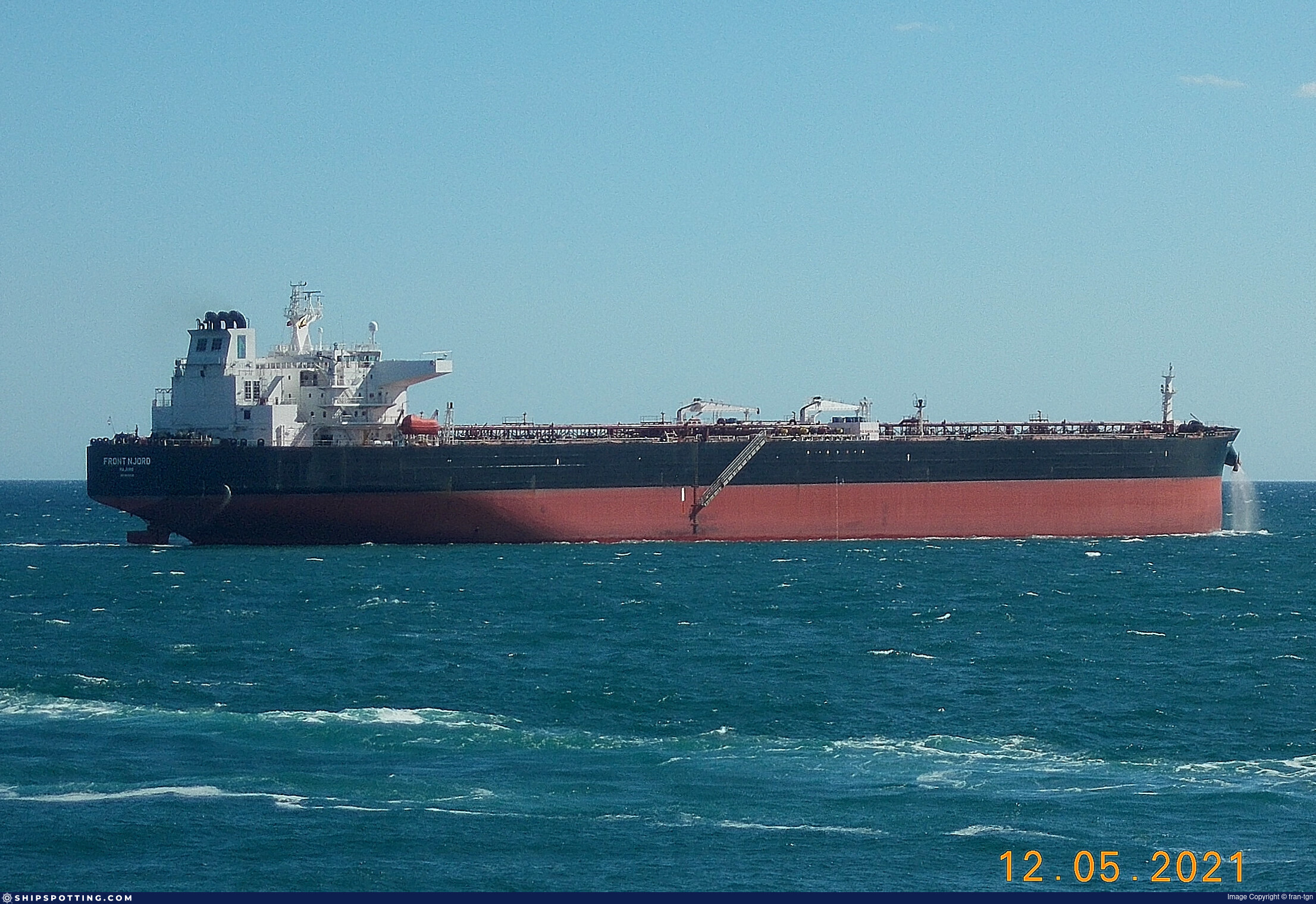
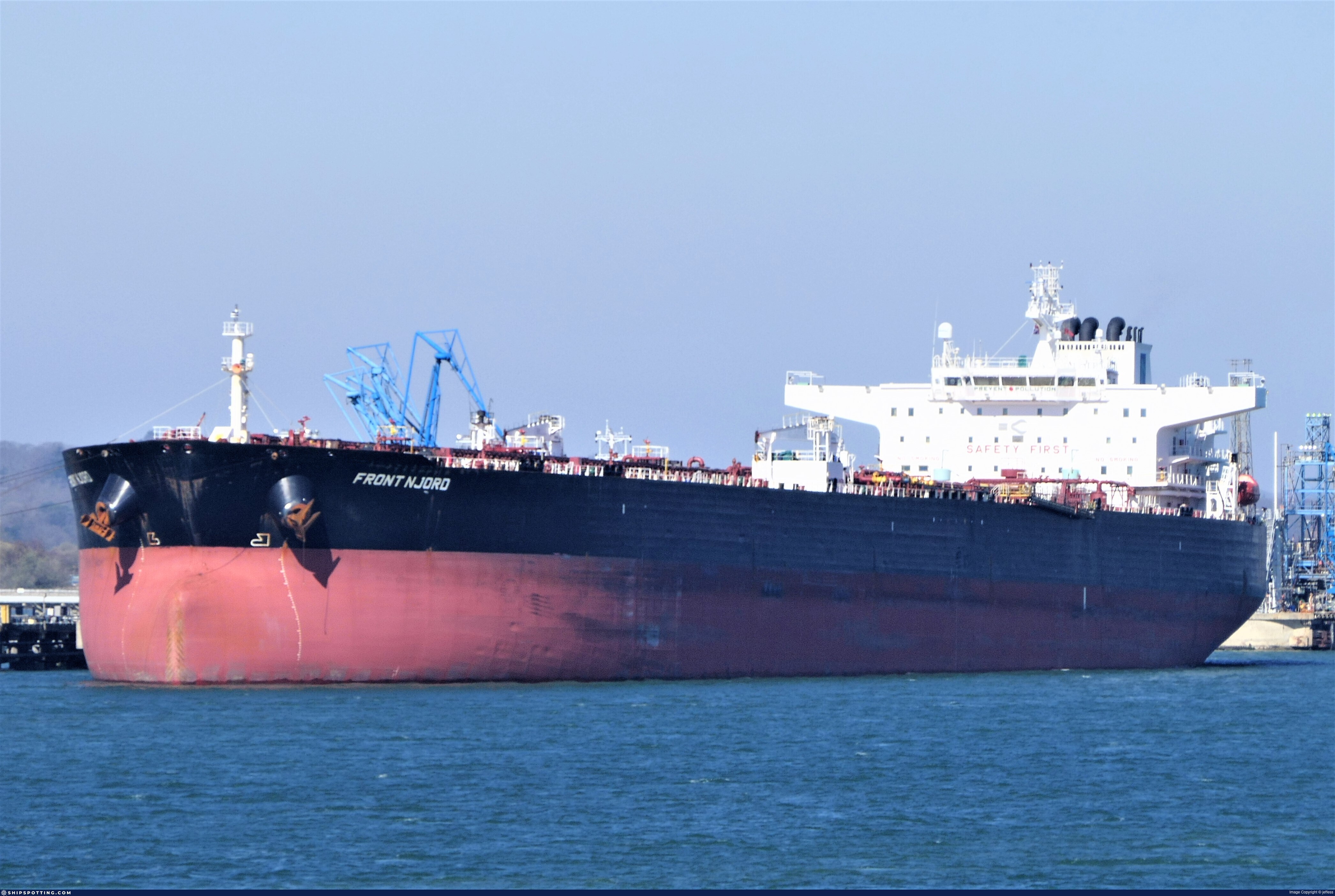
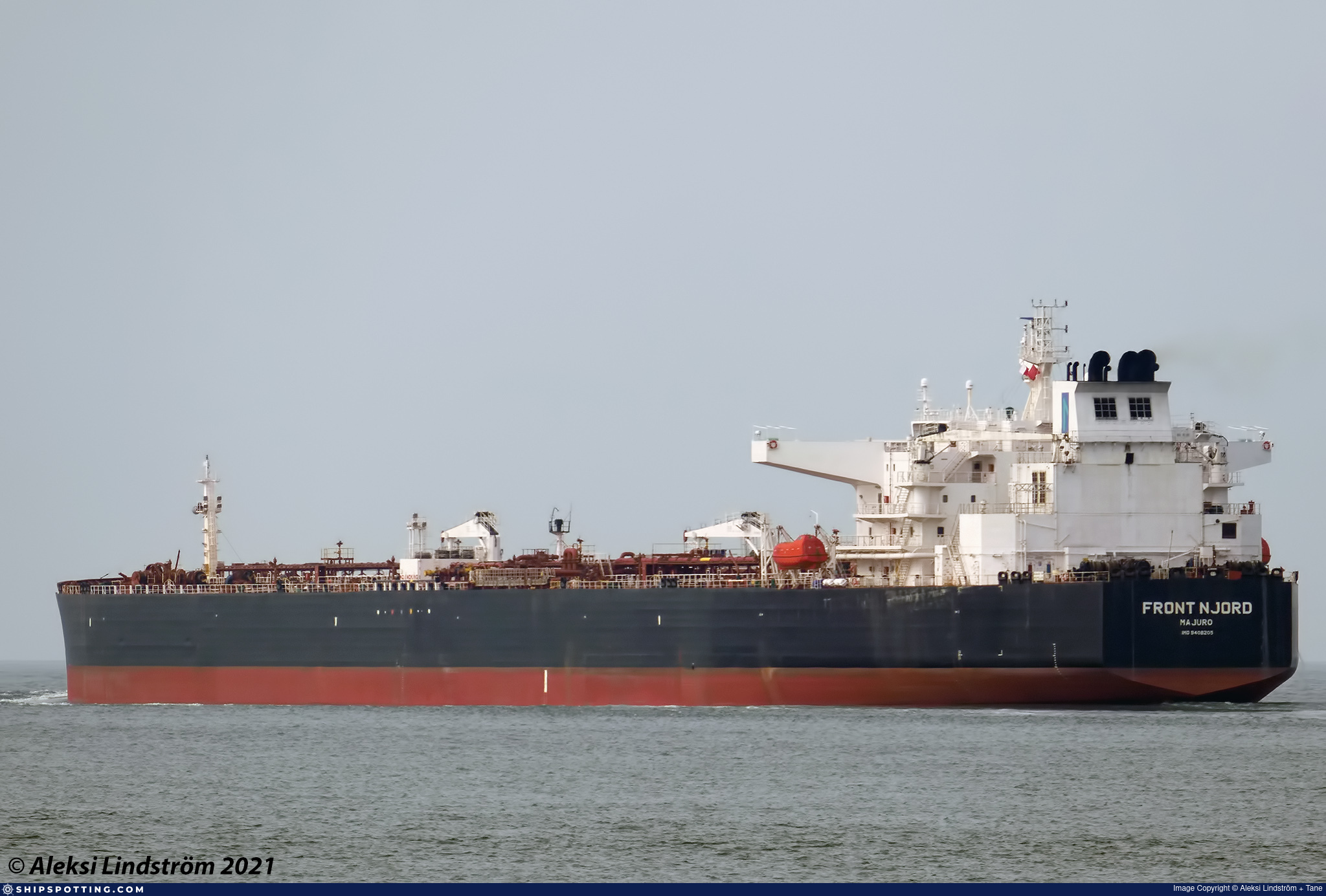
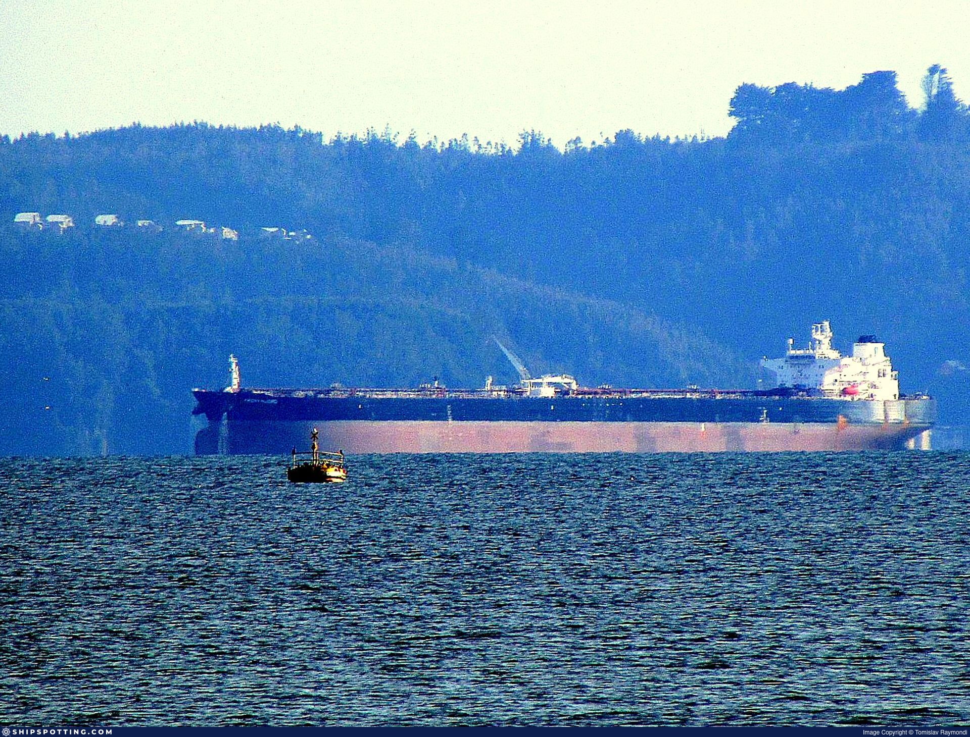
IMO 9408205
Vessel information
Sanctioned by
Company & Ownership
Management & Operations
Classification & Safety
Port State Control (PSC) Inspections
Survey Renewal & Certificates
| Code | Type | Issuer | Issued | Expires |
|---|---|---|---|---|
| 528 | International Ballast Water Management | DNV | 23/03/2021 | 08/12/2025 |
| 502 | Cargo Ship Safety Equipment | DNVGL | 24/11/2020 | 08/12/2025 |
Programs & Notes
AU vessel designations (DFAT) | SEMA (Canada) — vessel designations | The Russia (Sanctions) (EU Exit) Regulations 2019 | Added in EU Sanctions Package 17 | (Council Decision (CFSP) 2025/931, Annex XVI to Decision 2014/512/CFSP) | Press Release | Official Journal
DateOfListing: 2025-05-21 || DateDesignated: 2024-12-17 | Shipping sanctions: (see “Other information”) | Shipping sanctions: a specified ship is prohibited from being provided with access to or having its master or pilot cause it to enter a port in the UK, may have its registration on the UK Ship Register terminated, and a master or pilot of a specified ship may be given a port barring direction, a detention direction, and a port entry direction or a movement direction. | IMO 9408205 (“FAST KATHY”) is involved in activity whose object or effect is to destabilise Ukraine or undermine or threaten the territorial integrity, sovereignty or independence of Ukraine or to obtain a benefit from or support the Government of Russia. Namely, FAST KATHY is involved in carrying oil or oil products that originated in Russia from Russia to a third country.
Vessel Changes
 🔄 Owner
AIS Events
46 events detected • 14 zones • Last: Jul 17, 2026
- Zone: Bosphorus/Dardanelles Approach
- Duration: 1h 41m
- Data Points: 3 AIS positions
- Period: 2026-07-17T12:00:57+00:00 to 2026-07-17T13:42:18+00:00
Show Raw Evidence JSON
{
    "zone_id": "osint_bosphorus",
    "zone_name": "Bosphorus\/Dardanelles Approach",
    "dwell_minutes": 101.2999999999999971578290569595992565155029296875,
    "points_in_zone": 3,
    "first_point": {
        "ts": "2026-07-17T12:00:57+00:00",
        "lat": 41.2149433000000016136254998855292797088623046875,
        "lon": 29.127853300000001723901732475496828556060791015625
    },
    "last_point": {
        "ts": "2026-07-17T13:42:18+00:00",
        "lat": 41.448021699999998190833139233291149139404296875,
        "lon": 29.477458299999998558860170305706560611724853515625
    }
}- Zone: Northern Baltic Sea Surveillance Zone
- Duration: 1h 41m
- Data Points: 3 AIS positions
- Period: 2026-07-17T12:00:57+00:00 to 2026-07-17T13:42:18+00:00
Show Raw Evidence JSON
{
    "zone_id": "discovered_031",
    "zone_name": "Northern Baltic Sea Surveillance Zone",
    "dwell_minutes": 101.2999999999999971578290569595992565155029296875,
    "points_in_zone": 3,
    "first_point": {
        "ts": "2026-07-17T12:00:57+00:00",
        "lat": 41.2149433000000016136254998855292797088623046875,
        "lon": 29.127853300000001723901732475496828556060791015625
    },
    "last_point": {
        "ts": "2026-07-17T13:42:18+00:00",
        "lat": 41.448021699999998190833139233291149139404296875,
        "lon": 29.477458299999998558860170305706560611724853515625
    }
}- Zone: Bosphorus/Dardanelles Approach
- Duration: 1h 45m
- Data Points: 5 AIS positions
- Period: 2026-07-17T11:56:47+00:00 to 2026-07-17T13:42:18+00:00
Show Raw Evidence JSON
{
    "zone_id": "osint_bosphorus",
    "zone_name": "Bosphorus\/Dardanelles Approach",
    "dwell_minutes": 105.5,
    "points_in_zone": 5,
    "first_point": {
        "ts": "2026-07-17T11:56:47+00:00",
        "lat": 41.2075549999999992678567650727927684783935546875,
        "lon": 29.12051170000000155368979903869330883026123046875
    },
    "last_point": {
        "ts": "2026-07-17T13:42:18+00:00",
        "lat": 41.448021699999998190833139233291149139404296875,
        "lon": 29.477458299999998558860170305706560611724853515625
    }
}- Zone: Northern Baltic Sea Surveillance Zone
- Duration: 1h 45m
- Data Points: 5 AIS positions
- Period: 2026-07-17T11:56:47+00:00 to 2026-07-17T13:42:18+00:00
Show Raw Evidence JSON
{
    "zone_id": "discovered_031",
    "zone_name": "Northern Baltic Sea Surveillance Zone",
    "dwell_minutes": 105.5,
    "points_in_zone": 5,
    "first_point": {
        "ts": "2026-07-17T11:56:47+00:00",
        "lat": 41.2075549999999992678567650727927684783935546875,
        "lon": 29.12051170000000155368979903869330883026123046875
    },
    "last_point": {
        "ts": "2026-07-17T13:42:18+00:00",
        "lat": 41.448021699999998190833139233291149139404296875,
        "lon": 29.477458299999998558860170305706560611724853515625
    }
}- Zone: Bosphorus/Dardanelles Approach
- Duration: 2h 4m
- Data Points: 12 AIS positions
- Period: 2026-07-16T12:21:39+00:00 to 2026-07-16T14:26:29+00:00
Show Raw Evidence JSON
{
    "zone_id": "osint_bosphorus",
    "zone_name": "Bosphorus\/Dardanelles Approach",
    "dwell_minutes": 124.7999999999999971578290569595992565155029296875,
    "points_in_zone": 12,
    "first_point": {
        "ts": "2026-07-16T12:21:39+00:00",
        "lat": 40.8053866999999996778569766320288181304931640625,
        "lon": 28.865758299999999536566974711604416370391845703125
    },
    "last_point": {
        "ts": "2026-07-16T14:26:29+00:00",
        "lat": 40.78271000000000157115209731273353099822998046875,
        "lon": 28.860099999999999198507794062606990337371826171875
    }
}- Duration: 1h 35m
- Radius: 1,082 meters
- Data Points: 11 AIS positions
- Centroid: 40.8076, 28.8690
- Zone: Bosphorus/Dardanelles Approach
Show Raw Evidence JSON
{
    "radius_m": 1082.299999999999954525264911353588104248046875,
    "duration_minutes": 95.2000000000000028421709430404007434844970703125,
    "points": 11,
    "centroid": {
        "lat": 40.807640163636364150079316459596157073974609375,
        "lon": 28.868997881818184936264515272341668605804443359375
    },
    "bbox": {
        "min_lat": 40.7993282999999991034201229922473430633544921875,
        "min_lon": 28.862300000000001176658770418725907802581787109375,
        "max_lat": 40.81221169999999887068042880855500698089599609375,
        "max_lon": 28.874043300000000300542524200864136219024658203125
    },
    "zone_id": "osint_bosphorus"
}- Zone: Bosphorus/Dardanelles Approach
- Duration: 3h 25m
- Data Points: 22 AIS positions
- Period: 2026-07-16T11:01:09+00:00 to 2026-07-16T14:26:29+00:00
Show Raw Evidence JSON
{
    "zone_id": "osint_bosphorus",
    "zone_name": "Bosphorus\/Dardanelles Approach",
    "dwell_minutes": 205.30000000000001136868377216160297393798828125,
    "points_in_zone": 22,
    "first_point": {
        "ts": "2026-07-16T11:01:09+00:00",
        "lat": 40.814293300000002773231244646012783050537109375,
        "lon": 28.877050000000000551381162949837744235992431640625
    },
    "last_point": {
        "ts": "2026-07-16T14:26:29+00:00",
        "lat": 40.78271000000000157115209731273353099822998046875,
        "lon": 28.860099999999999198507794062606990337371826171875
    }
}- Zone: Bosphorus/Dardanelles Approach
- Duration: 3h 35m
- Data Points: 24 AIS positions
- Period: 2026-07-16T10:51:28+00:00 to 2026-07-16T14:26:29+00:00
Show Raw Evidence JSON
{
    "zone_id": "osint_bosphorus",
    "zone_name": "Bosphorus\/Dardanelles Approach",
    "dwell_minutes": 215,
    "points_in_zone": 24,
    "first_point": {
        "ts": "2026-07-16T10:51:28+00:00",
        "lat": 40.8151950000000027785063139162957668304443359375,
        "lon": 28.878483299999999189822119660675525665283203125
    },
    "last_point": {
        "ts": "2026-07-16T14:26:29+00:00",
        "lat": 40.78271000000000157115209731273353099822998046875,
        "lon": 28.860099999999999198507794062606990337371826171875
    }
}- Duration: 1h 39m
- Radius: 1,019 meters
- Data Points: 14 AIS positions
- Centroid: 40.8110, 28.8727
- Zone: Bosphorus/Dardanelles Approach
Show Raw Evidence JSON
{
    "radius_m": 1018.700000000000045474735088646411895751953125,
    "duration_minutes": 99.2999999999999971578290569595992565155029296875,
    "points": 14,
    "centroid": {
        "lat": 40.8109645285714321971681783907115459442138671875,
        "lon": 28.872680007142857760982224135659635066986083984375
    },
    "bbox": {
        "min_lat": 40.80406669999999991205186233855783939361572265625,
        "min_lon": 28.864721700000000481622919323854148387908935546875,
        "max_lat": 40.8151950000000027785063139162957668304443359375,
        "max_lon": 28.878483299999999189822119660675525665283203125
    },
    "zone_id": "osint_bosphorus"
}- Zone: Bosphorus/Dardanelles Approach
- Duration: 6h 37m
- Data Points: 20 AIS positions
- Period: 2026-07-16T07:22:38+00:00 to 2026-07-16T13:59:38+00:00
Show Raw Evidence JSON
{
    "zone_id": "osint_bosphorus",
    "zone_name": "Bosphorus\/Dardanelles Approach",
    "dwell_minutes": 397,
    "points_in_zone": 20,
    "first_point": {
        "ts": "2026-07-16T07:22:38+00:00",
        "lat": 40.72404000000000223735696636140346527099609375,
        "lon": 28.719035000000001645048541831783950328826904296875
    },
    "last_point": {
        "ts": "2026-07-16T13:59:38+00:00",
        "lat": 40.78741169999999982564986567012965679168701171875,
        "lon": 28.860434999999998950670487829484045505523681640625
    }
}- Zone: Bosphorus/Dardanelles Approach
- Duration: 3h 21m
- Data Points: 3 AIS positions
- Period: 2026-07-16T04:01:28+00:00 to 2026-07-16T07:22:38+00:00
Show Raw Evidence JSON
{
    "zone_id": "osint_bosphorus",
    "zone_name": "Bosphorus\/Dardanelles Approach",
    "dwell_minutes": 201.19999999999998863131622783839702606201171875,
    "points_in_zone": 3,
    "first_point": {
        "ts": "2026-07-16T04:01:28+00:00",
        "lat": 40.6765232999999994945028447546064853668212890625,
        "lon": 28.578973300000001245280145667493343353271484375
    },
    "last_point": {
        "ts": "2026-07-16T07:22:38+00:00",
        "lat": 40.72404000000000223735696636140346527099609375,
        "lon": 28.719035000000001645048541831783950328826904296875
    }
}- Zone: Bosphorus/Dardanelles Approach
- Duration: 5h 56m
- Data Points: 4 AIS positions
- Period: 2026-07-16T01:26:19+00:00 to 2026-07-16T07:22:38+00:00
Show Raw Evidence JSON
{
    "zone_id": "osint_bosphorus",
    "zone_name": "Bosphorus\/Dardanelles Approach",
    "dwell_minutes": 356.30000000000001136868377216160297393798828125,
    "points_in_zone": 4,
    "first_point": {
        "ts": "2026-07-16T01:26:19+00:00",
        "lat": 40.7161483000000004039975465275347232818603515625,
        "lon": 28.591049999999999187139110290445387363433837890625
    },
    "last_point": {
        "ts": "2026-07-16T07:22:38+00:00",
        "lat": 40.72404000000000223735696636140346527099609375,
        "lon": 28.719035000000001645048541831783950328826904296875
    }
}- Zone: Bosphorus/Dardanelles Approach
- Duration: 4h 43m
- Data Points: 3 AIS positions
- Period: 2026-07-15T23:18:09+00:00 to 2026-07-16T04:01:28+00:00
Show Raw Evidence JSON
{
    "zone_id": "osint_bosphorus",
    "zone_name": "Bosphorus\/Dardanelles Approach",
    "dwell_minutes": 283.30000000000001136868377216160297393798828125,
    "points_in_zone": 3,
    "first_point": {
        "ts": "2026-07-15T23:18:09+00:00",
        "lat": 40.744810000000001082298695109784603118896484375,
        "lon": 28.603346699999999458441379829309880733489990234375
    },
    "last_point": {
        "ts": "2026-07-16T04:01:28+00:00",
        "lat": 40.6765232999999994945028447546064853668212890625,
        "lon": 28.578973300000001245280145667493343353271484375
    }
}- Zone: Bosphorus/Dardanelles Approach
- Duration: 4h 25m
- Data Points: 4 AIS positions
- Period: 2026-07-15T21:00:29+00:00 to 2026-07-16T01:26:19+00:00
Show Raw Evidence JSON
{
    "zone_id": "osint_bosphorus",
    "zone_name": "Bosphorus\/Dardanelles Approach",
    "dwell_minutes": 265.80000000000001136868377216160297393798828125,
    "points_in_zone": 4,
    "first_point": {
        "ts": "2026-07-15T21:00:29+00:00",
        "lat": 40.7972816999999992049197317101061344146728515625,
        "lon": 28.62712499999999948840923025272786617279052734375
    },
    "last_point": {
        "ts": "2026-07-16T01:26:19+00:00",
        "lat": 40.7161483000000004039975465275347232818603515625,
        "lon": 28.591049999999999187139110290445387363433837890625
    }
}- Zone: Bosphorus/Dardanelles Approach
- Duration: 4h 53m
- Data Points: 12 AIS positions
- Period: 2026-07-15T20:32:50+00:00 to 2026-07-16T01:26:19+00:00
Show Raw Evidence JSON
{
    "zone_id": "osint_bosphorus",
    "zone_name": "Bosphorus\/Dardanelles Approach",
    "dwell_minutes": 293.5,
    "points_in_zone": 12,
    "first_point": {
        "ts": "2026-07-15T20:32:50+00:00",
        "lat": 40.804838300000000117506715469062328338623046875,
        "lon": 28.507709999999999439523890032432973384857177734375
    },
    "last_point": {
        "ts": "2026-07-16T01:26:19+00:00",
        "lat": 40.7161483000000004039975465275347232818603515625,
        "lon": 28.591049999999999187139110290445387363433837890625
    }
}- Zone: Central Aegean Monitoring Zone
- Duration: 1h 4m
- Data Points: 23 AIS positions
- Period: 2026-07-13T05:27:25+00:00 to 2026-07-13T06:31:59+00:00
Show Raw Evidence JSON
{
    "zone_id": "discovered_114",
    "zone_name": "Central Aegean Monitoring Zone",
    "dwell_minutes": 64.599999999999994315658113919198513031005859375,
    "points_in_zone": 23,
    "first_point": {
        "ts": "2026-07-13T05:27:25+00:00",
        "lat": 37.4620850000000018553691916167736053466796875,
        "lon": 25.88231830000000144309524330310523509979248046875
    },
    "last_point": {
        "ts": "2026-07-13T06:31:59+00:00",
        "lat": 37.7101049999999986539478413760662078857421875,
        "lon": 25.8583883000000014362740330398082733154296875
    }
}- Zone: Central Aegean Monitoring Zone
- Duration: 2h 30m
- Data Points: 32 AIS positions
- Period: 2026-07-13T04:01:36+00:00 to 2026-07-13T06:31:59+00:00
Show Raw Evidence JSON
{
    "zone_id": "discovered_114",
    "zone_name": "Central Aegean Monitoring Zone",
    "dwell_minutes": 150.400000000000005684341886080801486968994140625,
    "points_in_zone": 32,
    "first_point": {
        "ts": "2026-07-13T04:01:36+00:00",
        "lat": 37.1804766999999998233761289156973361968994140625,
        "lon": 26.073016700000000156478563440032303333282470703125
    },
    "last_point": {
        "ts": "2026-07-13T06:31:59+00:00",
        "lat": 37.7101049999999986539478413760662078857421875,
        "lon": 25.8583883000000014362740330398082733154296875
    }
}- Zone: Central Aegean Monitoring Zone
- Duration: 3h 12m
- Data Points: 48 AIS positions
- Period: 2026-07-13T03:19:29+00:00 to 2026-07-13T06:31:59+00:00
Show Raw Evidence JSON
{
    "zone_id": "discovered_114",
    "zone_name": "Central Aegean Monitoring Zone",
    "dwell_minutes": 192.5,
    "points_in_zone": 48,
    "first_point": {
        "ts": "2026-07-13T03:19:29+00:00",
        "lat": 37.04489170000000086702129920013248920440673828125,
        "lon": 26.183008300000000900809027370996773242950439453125
    },
    "last_point": {
        "ts": "2026-07-13T06:31:59+00:00",
        "lat": 37.7101049999999986539478413760662078857421875,
        "lon": 25.8583883000000014362740330398082733154296875
    }
}- Zone: North Sea Surveillance Zone
- Duration: 1h 21m
- Data Points: 31 AIS positions
- Period: 2026-07-13T03:09:09+00:00 to 2026-07-13T04:30:34+00:00
Show Raw Evidence JSON
{
    "zone_id": "discovered_123",
    "zone_name": "North Sea Surveillance Zone",
    "dwell_minutes": 81.400000000000005684341886080801486968994140625,
    "points_in_zone": 31,
    "first_point": {
        "ts": "2026-07-13T03:09:09+00:00",
        "lat": 37.00973830000000219797584577463567256927490234375,
        "lon": 26.20175830000000161135176313109695911407470703125
    },
    "last_point": {
        "ts": "2026-07-13T04:30:34+00:00",
        "lat": 37.277434999999996989572537131607532501220703125,
        "lon": 26.007038300000001385114956065081059932708740234375
    }
}- Zone: North Sea Surveillance Zone
- Duration: 3h 30m
- Data Points: 35 AIS positions
- Period: 2026-07-13T01:00:29+00:00 to 2026-07-13T04:30:34+00:00
Show Raw Evidence JSON
{
    "zone_id": "discovered_123",
    "zone_name": "North Sea Surveillance Zone",
    "dwell_minutes": 210.099999999999994315658113919198513031005859375,
    "points_in_zone": 35,
    "first_point": {
        "ts": "2026-07-13T01:00:29+00:00",
        "lat": 36.6493583000000029414877644740045070648193359375,
        "lon": 26.552098300000000818954504211433231830596923828125
    },
    "last_point": {
        "ts": "2026-07-13T04:30:34+00:00",
        "lat": 37.277434999999996989572537131607532501220703125,
        "lon": 26.007038300000001385114956065081059932708740234375
    }
}- Zone: North Sea Surveillance Zone
- Duration: 4h 8m
- Data Points: 48 AIS positions
- Period: 2026-07-13T00:21:59+00:00 to 2026-07-13T04:30:34+00:00
Show Raw Evidence JSON
{
    "zone_id": "discovered_123",
    "zone_name": "North Sea Surveillance Zone",
    "dwell_minutes": 248.599999999999994315658113919198513031005859375,
    "points_in_zone": 48,
    "first_point": {
        "ts": "2026-07-13T00:21:59+00:00",
        "lat": 36.54138999999999981582732289098203182220458984375,
        "lon": 26.664198299999998909015630488283932209014892578125
    },
    "last_point": {
        "ts": "2026-07-13T04:30:34+00:00",
        "lat": 37.277434999999996989572537131607532501220703125,
        "lon": 26.007038300000001385114956065081059932708740234375
    }
}- Zone: Black Sea Sanctioned Vessel Monitoring Zone
- Duration: 2h 54m
- Data Points: 9 AIS positions
- Period: 2026-07-11T13:07:42+00:00 to 2026-07-11T16:02:21+00:00
Show Raw Evidence JSON
{
    "zone_id": "discovered_025",
    "zone_name": "Black Sea Sanctioned Vessel Monitoring Zone",
    "dwell_minutes": 174.69999999999998863131622783839702606201171875,
    "points_in_zone": 9,
    "first_point": {
        "ts": "2026-07-11T13:07:42+00:00",
        "lat": 31.5644367000000016787453205324709415435791015625,
        "lon": 32.25285670000000237678250414319336414337158203125
    },
    "last_point": {
        "ts": "2026-07-11T16:02:21+00:00",
        "lat": 31.56360169999999953915903461165726184844970703125,
        "lon": 32.252043299999996861515683121979236602783203125
    }
}- Zone: discovered_020
- Duration: 1h 35m
- Data Points: 29 AIS positions
- Period: 2026-06-05T11:04:29+00:00 to 2026-06-05T12:40:21+00:00
Show Raw Evidence JSON
{
    "zone_id": "discovered_020",
    "zone_name": "Eastern Mediterranean Monitoring Zone",
    "dwell_minutes": 95.900000000000005684341886080801486968994140625,
    "points_in_zone": 29,
    "first_point": {
        "ts": "2026-06-05T11:04:29+00:00",
        "lat": 31.735678300000000007230482879094779491424560546875,
        "lon": 31.960808300000000059526428231038153171539306640625
    },
    "last_point": {
        "ts": "2026-06-05T12:40:21+00:00",
        "lat": 31.531446700000000049612935981713235378265380859375,
        "lon": 32.20319829999999683423084206879138946533203125
    }
}- Zone: discovered_020
- Duration: 2h 40m
- Data Points: 40 AIS positions
- Period: 2026-06-05T10:00:23+00:00 to 2026-06-05T12:40:21+00:00
Show Raw Evidence JSON
{
    "zone_id": "discovered_020",
    "zone_name": "Eastern Mediterranean Monitoring Zone",
    "dwell_minutes": 160,
    "points_in_zone": 40,
    "first_point": {
        "ts": "2026-06-05T10:00:23+00:00",
        "lat": 31.876039999999999707824827055446803569793701171875,
        "lon": 31.76480000000000103455022326670587062835693359375
    },
    "last_point": {
        "ts": "2026-06-05T12:40:21+00:00",
        "lat": 31.531446700000000049612935981713235378265380859375,
        "lon": 32.20319829999999683423084206879138946533203125
    }
}- Zone: discovered_020
- Duration: 3h 29m
- Data Points: 51 AIS positions
- Period: 2026-06-05T09:11:23+00:00 to 2026-06-05T12:40:21+00:00
Show Raw Evidence JSON
{
    "zone_id": "discovered_020",
    "zone_name": "Eastern Mediterranean Monitoring Zone",
    "dwell_minutes": 209,
    "points_in_zone": 51,
    "first_point": {
        "ts": "2026-06-05T09:11:23+00:00",
        "lat": 31.997441699999999542569639743305742740631103515625,
        "lon": 31.6252199999999987767296261154115200042724609375
    },
    "last_point": {
        "ts": "2026-06-05T12:40:21+00:00",
        "lat": 31.531446700000000049612935981713235378265380859375,
        "lon": 32.20319829999999683423084206879138946533203125
    }
}- Zone: discovered_020
- Duration: 4h 26m
- Data Points: 63 AIS positions
- Period: 2026-06-05T08:13:53+00:00 to 2026-06-05T12:40:21+00:00
Show Raw Evidence JSON
{
    "zone_id": "discovered_020",
    "zone_name": "Eastern Mediterranean Monitoring Zone",
    "dwell_minutes": 266.5,
    "points_in_zone": 63,
    "first_point": {
        "ts": "2026-06-05T08:13:53+00:00",
        "lat": 32.14471999999999951569407130591571331024169921875,
        "lon": 31.473196699999999026431396487168967723846435546875
    },
    "last_point": {
        "ts": "2026-06-05T12:40:21+00:00",
        "lat": 31.531446700000000049612935981713235378265380859375,
        "lon": 32.20319829999999683423084206879138946533203125
    }
}- Zone: discovered_020
- Duration: 5h 38m
- Data Points: 86 AIS positions
- Period: 2026-06-05T07:01:44+00:00 to 2026-06-05T12:40:21+00:00
Show Raw Evidence JSON
{
    "zone_id": "discovered_020",
    "zone_name": "Eastern Mediterranean Monitoring Zone",
    "dwell_minutes": 338.6000000000000227373675443232059478759765625,
    "points_in_zone": 86,
    "first_point": {
        "ts": "2026-06-05T07:01:44+00:00",
        "lat": 32.32940500000000128011379274539649486541748046875,
        "lon": 31.277601700000001727630660752765834331512451171875
    },
    "last_point": {
        "ts": "2026-06-05T12:40:21+00:00",
        "lat": 31.531446700000000049612935981713235378265380859375,
        "lon": 32.20319829999999683423084206879138946533203125
    }
}- Zone: discovered_020
- Duration: 6h 19m
- Data Points: 105 AIS positions
- Period: 2026-06-05T06:21:22+00:00 to 2026-06-05T12:40:21+00:00
Show Raw Evidence JSON
{
    "zone_id": "discovered_020",
    "zone_name": "Eastern Mediterranean Monitoring Zone",
    "dwell_minutes": 379,
    "points_in_zone": 105,
    "first_point": {
        "ts": "2026-06-05T06:21:22+00:00",
        "lat": 32.43253829999999737765392637811601161956787109375,
        "lon": 31.16049170000000145819285535253584384918212890625
    },
    "last_point": {
        "ts": "2026-06-05T12:40:21+00:00",
        "lat": 31.531446700000000049612935981713235378265380859375,
        "lon": 32.20319829999999683423084206879138946533203125
    }
}- Zone: Brest Approaches Monitoring Zone
- Duration: 1h 5m
- Data Points: 25 AIS positions
- Period: 2026-06-05T06:00:32+00:00 to 2026-06-05T07:06:05+00:00
Show Raw Evidence JSON
{
    "zone_id": "discovered_057",
    "zone_name": "Brest Approaches Monitoring Zone",
    "dwell_minutes": 65.5,
    "points_in_zone": 25,
    "first_point": {
        "ts": "2026-06-05T06:00:32+00:00",
        "lat": 32.486958299999997734630596823990345001220703125,
        "lon": 31.099548299999998590692484867759048938751220703125
    },
    "last_point": {
        "ts": "2026-06-05T07:06:05+00:00",
        "lat": 32.31834330000000221616573981009423732757568359375,
        "lon": 31.289808300000000684804035699926316738128662109375
    }
}- Zone: discovered_020
- Duration: 6h 34m
- Data Points: 111 AIS positions
- Period: 2026-06-05T05:51:02+00:00 to 2026-06-05T12:25:30+00:00
Show Raw Evidence JSON
{
    "zone_id": "discovered_020",
    "zone_name": "Eastern Mediterranean Monitoring Zone",
    "dwell_minutes": 394.5,
    "points_in_zone": 111,
    "first_point": {
        "ts": "2026-06-05T05:51:02+00:00",
        "lat": 32.51168499999999994543031789362430572509765625,
        "lon": 31.072371700000001482067091274075210094451904296875
    },
    "last_point": {
        "ts": "2026-06-05T12:25:30+00:00",
        "lat": 31.56309329999999846450009499676525592803955078125,
        "lon": 32.16588999999999742840373073704540729522705078125
    }
}- Zone: Brest Approaches Monitoring Zone
- Duration: 1h 26m
- Data Points: 37 AIS positions
- Period: 2026-06-05T05:39:13+00:00 to 2026-06-05T07:06:05+00:00
Show Raw Evidence JSON
{
    "zone_id": "discovered_057",
    "zone_name": "Brest Approaches Monitoring Zone",
    "dwell_minutes": 86.900000000000005684341886080801486968994140625,
    "points_in_zone": 37,
    "first_point": {
        "ts": "2026-06-05T05:39:13+00:00",
        "lat": 32.5428050000000013142198440618813037872314453125,
        "lon": 31.0399867000000000416548573412001132965087890625
    },
    "last_point": {
        "ts": "2026-06-05T07:06:05+00:00",
        "lat": 32.31834330000000221616573981009423732757568359375,
        "lon": 31.289808300000000684804035699926316738128662109375
    }
}- Zone: Black Sea Sanctioned Vessel Monitoring Zone
- Duration: 2h 29m
- Data Points: 33 AIS positions
- Period: 2026-06-05T04:07:29+00:00 to 2026-06-05T06:37:24+00:00
Show Raw Evidence JSON
{
    "zone_id": "discovered_145",
    "zone_name": "Black Sea Sanctioned Vessel Monitoring Zone",
    "dwell_minutes": 149.900000000000005684341886080801486968994140625,
    "points_in_zone": 33,
    "first_point": {
        "ts": "2026-06-05T04:07:29+00:00",
        "lat": 32.76953329999999908750396571122109889984130859375,
        "lon": 30.78453999999999979308995534665882587432861328125
    },
    "last_point": {
        "ts": "2026-06-05T06:37:24+00:00",
        "lat": 32.390978300000000444924808107316493988037109375,
        "lon": 31.20770830000000017889760783873498439788818359375
    }
}- Zone: Black Sea Sanctioned Vessel Monitoring Zone
- Duration: 3h 7m
- Data Points: 35 AIS positions
- Period: 2026-06-05T03:29:48+00:00 to 2026-06-05T06:37:24+00:00
Show Raw Evidence JSON
{
    "zone_id": "discovered_145",
    "zone_name": "Black Sea Sanctioned Vessel Monitoring Zone",
    "dwell_minutes": 187.599999999999994315658113919198513031005859375,
    "points_in_zone": 35,
    "first_point": {
        "ts": "2026-06-05T03:29:48+00:00",
        "lat": 32.86648670000000294066921924240887165069580078125,
        "lon": 30.68793670000000162190190167166292667388916015625
    },
    "last_point": {
        "ts": "2026-06-05T06:37:24+00:00",
        "lat": 32.390978300000000444924808107316493988037109375,
        "lon": 31.20770830000000017889760783873498439788818359375
    }
}- Zone: Strait of Malacca Sanctions Monitoring Zone
- Duration: 3h 8m
- Data Points: 5 AIS positions
- Period: 2026-06-05T01:01:09+00:00 to 2026-06-05T04:09:39+00:00
Show Raw Evidence JSON
{
    "zone_id": "discovered_158",
    "zone_name": "Strait of Malacca Sanctions Monitoring Zone",
    "dwell_minutes": 188.5,
    "points_in_zone": 5,
    "first_point": {
        "ts": "2026-06-05T01:01:09+00:00",
        "lat": 33.24809330000000073823684942908585071563720703125,
        "lon": 30.271106700000000699901647749356925487518310546875
    },
    "last_point": {
        "ts": "2026-06-05T04:09:39+00:00",
        "lat": 32.76419829999999677738742320798337459564208984375,
        "lon": 30.790344999999998520934241241775453090667724609375
    }
}- Gap Duration: 4h 6m
- Last Seen: 2026-06-04T04:09:47+00:00 at 36.4658, 26.7369 (Zone: Northeast Aegean Monitoring Zone)
- Next Seen: 2026-06-04T08:15:49+00:00 at 35.8466, 27.4084
🛰️ Gap Corroboration
These are snapshots that may corroborate presence during the gap. They do not reconstruct a continuous route.
SAR Imagery (Sentinel-1)
Status: ✗ No SAR coverage
No Sentinel-1 scenes covering corridor and time window
VIIRS Thermal Anomaly
Status: ✗ No detections
No VIIRS thermal/light detections in corridor
Show Raw Evidence JSON
{
    "gap_minutes": 246,
    "last_seen": {
        "ts": "2026-06-04T04:09:47+00:00",
        "lat": 36.46583170000000251320670940913259983062744140625,
        "lon": 26.736876699999999829060470801778137683868408203125,
        "sog": 12,
        "zone_id": "discovered_107"
    },
    "next_seen": {
        "ts": "2026-06-04T08:15:49+00:00",
        "lat": 35.84658830000000051541064749471843242645263671875,
        "lon": 27.408366699999998417069946299307048320770263671875,
        "zone_ids": [
            "discovered_075"
        ]
    },
    "gap_enrichment": {
        "status": "not_found",
        "corridor": {
            "start": {
                "lat": 36.46583170000000251320670940913259983062744140625,
                "lon": 26.736876699999999829060470801778137683868408203125,
                "ts": "2026-06-04T04:09:47+00:00"
            },
            "end": {
                "lat": 35.84658830000000051541064749471843242645263671875,
                "lon": 27.408366699999998417069946299307048320770263671875,
                "ts": "2026-06-04T08:15:49+00:00"
            },
            "bbox": {
                "min_lat": 35.66640799999999700276021030731499195098876953125,
                "min_lon": 26.513718999999998260364009183831512928009033203125,
                "max_lat": 36.6460119999999989204297889955341815948486328125,
                "max_lon": 27.631524999999999891997504164464771747589111328125
            },
            "buffer_km": 20
        },
        "sar": {
            "status": "not_found",
            "notes": "No Sentinel-1 scenes covering corridor and time window"
        },
        "viirs": {
            "status": "not_found",
            "notes": "No VIIRS thermal\/light detections in corridor"
        },
        "searched_at": "2026-06-04T08:30:01.873437+00:00"
    }
}- Gap Duration: 4h 37m
- Last Seen: 2026-06-03T23:27:49+00:00 at 37.2373, 26.0046 (Zone: Northeast Aegean Monitoring Zone)
- Next Seen: 2026-06-04T04:05:29+00:00 at 36.4768, 26.7252
🛰️ Gap Corroboration
These are snapshots that may corroborate presence during the gap. They do not reconstruct a continuous route.
SAR Imagery (Sentinel-1)
Status: ✗ No SAR coverage
No Sentinel-1 scenes covering corridor and time window
VIIRS Thermal Anomaly
Status: ✗ No detections
No VIIRS thermal/light detections in corridor
Show Raw Evidence JSON
{
    "gap_minutes": 277.69999999999998863131622783839702606201171875,
    "last_seen": {
        "ts": "2026-06-03T23:27:49+00:00",
        "lat": 37.2373199999999968667907523922622203826904296875,
        "lon": 26.004556699999998414796209544874727725982666015625,
        "sog": 12.300000000000000710542735760100185871124267578125,
        "zone_id": "discovered_107"
    },
    "next_seen": {
        "ts": "2026-06-04T04:05:29+00:00",
        "lat": 36.47681829999999791880327393300831317901611328125,
        "lon": 26.72522169999999874789864406920969486236572265625,
        "zone_ids": [
            "discovered_107"
        ]
    },
    "gap_enrichment": {
        "status": "not_found",
        "corridor": {
            "start": {
                "lat": 37.2373199999999968667907523922622203826904296875,
                "lon": 26.004556699999998414796209544874727725982666015625,
                "ts": "2026-06-03T23:27:49+00:00"
            },
            "end": {
                "lat": 36.47681829999999791880327393300831317901611328125,
                "lon": 26.72522169999999874789864406920969486236572265625,
                "ts": "2026-06-04T04:05:29+00:00"
            },
            "bbox": {
                "min_lat": 36.296638000000001511580194346606731414794921875,
                "min_lon": 25.779368999999999090277924551628530025482177734375,
                "max_lat": 37.41749999999999687361196265555918216705322265625,
                "max_lon": 26.95040900000000050340531743131577968597412109375
            },
            "buffer_km": 20
        },
        "sar": {
            "status": "not_found",
            "notes": "No Sentinel-1 scenes covering corridor and time window"
        },
        "viirs": {
            "status": "not_found",
            "notes": "No VIIRS thermal\/light detections in corridor"
        },
        "searched_at": "2026-06-04T04:15:09.750702+00:00"
    }
}- Gap Duration: 4h 37m
- Last Seen: 2026-06-03T23:27:49+00:00 at 37.2373, 26.0046 (Zone: discovered_098)
- Next Seen: 2026-06-04T04:05:29+00:00 at 36.4768, 26.7252
🛰️ Gap Corroboration
These are snapshots that may corroborate presence during the gap. They do not reconstruct a continuous route.
SAR Imagery (Sentinel-1)
Status: ✗ No SAR coverage
No Sentinel-1 scenes covering corridor and time window
VIIRS Thermal Anomaly
Status: ✗ No detections
No VIIRS thermal/light detections in corridor
Show Raw Evidence JSON
{
    "gap_minutes": 277.69999999999998863131622783839702606201171875,
    "last_seen": {
        "ts": "2026-06-03T23:27:49+00:00",
        "lat": 37.2373199999999968667907523922622203826904296875,
        "lon": 26.004556699999998414796209544874727725982666015625,
        "sog": 12.300000000000000710542735760100185871124267578125,
        "zone_id": "discovered_098"
    },
    "next_seen": {
        "ts": "2026-06-04T04:05:29+00:00",
        "lat": 36.47681829999999791880327393300831317901611328125,
        "lon": 26.72522169999999874789864406920969486236572265625,
        "zone_ids": [
            "discovered_107"
        ]
    },
    "gap_enrichment": {
        "status": "not_found",
        "corridor": {
            "start": {
                "lat": 37.2373199999999968667907523922622203826904296875,
                "lon": 26.004556699999998414796209544874727725982666015625,
                "ts": "2026-06-03T23:27:49+00:00"
            },
            "end": {
                "lat": 36.47681829999999791880327393300831317901611328125,
                "lon": 26.72522169999999874789864406920969486236572265625,
                "ts": "2026-06-04T04:05:29+00:00"
            },
            "bbox": {
                "min_lat": 36.296638000000001511580194346606731414794921875,
                "min_lon": 25.779368999999999090277924551628530025482177734375,
                "max_lat": 37.41749999999999687361196265555918216705322265625,
                "max_lon": 26.95040900000000050340531743131577968597412109375
            },
            "buffer_km": 20
        },
        "sar": {
            "status": "not_found",
            "notes": "No Sentinel-1 scenes covering corridor and time window"
        },
        "viirs": {
            "status": "not_found",
            "notes": "No VIIRS thermal\/light detections in corridor"
        },
        "searched_at": "2026-06-04T04:15:01.912300+00:00"
    }
}- Zone: Northeast Aegean Monitoring Zone
- Duration: 4h 45m
- Data Points: 5 AIS positions
- Period: 2026-06-03T23:23:59+00:00 to 2026-06-04T04:09:47+00:00
Show Raw Evidence JSON
{
    "zone_id": "discovered_107",
    "zone_name": "Northeast Aegean Monitoring Zone",
    "dwell_minutes": 285.80000000000001136868377216160297393798828125,
    "points_in_zone": 5,
    "first_point": {
        "ts": "2026-06-03T23:23:59+00:00",
        "lat": 37.24935169999999828860381967388093471527099609375,
        "lon": 25.997691700000000736281435820274055004119873046875
    },
    "last_point": {
        "ts": "2026-06-04T04:09:47+00:00",
        "lat": 36.46583170000000251320670940913259983062744140625,
        "lon": 26.736876699999999829060470801778137683868408203125
    }
}- Zone: Bosphorus/Dardanelles Approach
- Duration: 1h 4m
- Data Points: 4 AIS positions
- Period: 2026-06-02T09:58:52+00:00 to 2026-06-02T11:03:03+00:00
Show Raw Evidence JSON
{
    "zone_id": "osint_bosphorus",
    "zone_name": "Bosphorus\/Dardanelles Approach",
    "dwell_minutes": 64.2000000000000028421709430404007434844970703125,
    "points_in_zone": 4,
    "first_point": {
        "ts": "2026-06-02T09:58:52+00:00",
        "lat": 40.95407999999999759666025056503713130950927734375,
        "lon": 28.936151699999999920009940979070961475372314453125
    },
    "last_point": {
        "ts": "2026-06-02T11:03:03+00:00",
        "lat": 40.91806170000000264508344116620719432830810546875,
        "lon": 28.864824999999999732835931354202330112457275390625
    }
}- Zone: Bosphorus/Dardanelles Approach
- Duration: 6h 19m
- Data Points: 2 AIS positions
- Period: 2026-06-02T03:39:52+00:00 to 2026-06-02T09:58:52+00:00
Show Raw Evidence JSON
{
    "zone_id": "osint_bosphorus",
    "zone_name": "Bosphorus\/Dardanelles Approach",
    "dwell_minutes": 379,
    "points_in_zone": 2,
    "first_point": {
        "ts": "2026-06-02T03:39:52+00:00",
        "lat": 41.42383499999999685314833186566829681396484375,
        "lon": 29.38114829999999955134626361541450023651123046875
    },
    "last_point": {
        "ts": "2026-06-02T09:58:52+00:00",
        "lat": 40.95407999999999759666025056503713130950927734375,
        "lon": 28.936151699999999920009940979070961475372314453125
    }
}- Zone: discovered_102
- Duration: 1h 10m
- Data Points: 13 AIS positions
- Period: 2026-05-15T06:47:21+00:00 to 2026-05-15T07:57:32+00:00
Show Raw Evidence JSON
{
    "zone_id": "discovered_102",
    "zone_name": "Alboran Sea Surveillance Zone",
    "dwell_minutes": 70.2000000000000028421709430404007434844970703125,
    "points_in_zone": 13,
    "first_point": {
        "ts": "2026-05-15T06:47:21+00:00",
        "lat": 37.62372500000000030695446184836328029632568359375,
        "lon": 24.4562083000000001220541889779269695281982421875
    },
    "last_point": {
        "ts": "2026-05-15T07:57:32+00:00",
        "lat": 37.85881169999999684705471736378967761993408203125,
        "lon": 24.579003300000000109548636828549206256866455078125
    }
}- Zone: discovered_102
- Duration: 2h 21m
- Data Points: 14 AIS positions
- Period: 2026-05-15T05:35:52+00:00 to 2026-05-15T07:57:32+00:00
Show Raw Evidence JSON
{
    "zone_id": "discovered_102",
    "zone_name": "Alboran Sea Surveillance Zone",
    "dwell_minutes": 141.69999999999998863131622783839702606201171875,
    "points_in_zone": 14,
    "first_point": {
        "ts": "2026-05-15T05:35:52+00:00",
        "lat": 37.42887999999999948386175674386322498321533203125,
        "lon": 24.2988967000000002371962182223796844482421875
    },
    "last_point": {
        "ts": "2026-05-15T07:57:32+00:00",
        "lat": 37.85881169999999684705471736378967761993408203125,
        "lon": 24.579003300000000109548636828549206256866455078125
    }
}- Zone: discovered_027
- Duration: 1h 25m
- Data Points: 4 AIS positions
- Period: 2026-05-15T04:10:52+00:00 to 2026-05-15T05:35:52+00:00
Show Raw Evidence JSON
{
    "zone_id": "discovered_027",
    "zone_name": "Baltic Sea Sanctioned Vessel Zone",
    "dwell_minutes": 85,
    "points_in_zone": 4,
    "first_point": {
        "ts": "2026-05-15T04:10:52+00:00",
        "lat": 37.14173670000000271329554379917681217193603515625,
        "lon": 24.15940499999999957481122692115604877471923828125
    },
    "last_point": {
        "ts": "2026-05-15T05:35:52+00:00",
        "lat": 37.42887999999999948386175674386322498321533203125,
        "lon": 24.2988967000000002371962182223796844482421875
    }
}- Zone: discovered_018
- Duration: 1h 43m
- Data Points: 15 AIS positions
- Period: 2026-05-08T19:43:02+00:00 to 2026-05-08T21:26:01+00:00
Show Raw Evidence JSON
{
    "zone_id": "discovered_018",
    "zone_name": "Eastern Mediterranean Sanctioned Vessel Zone",
    "dwell_minutes": 103,
    "points_in_zone": 15,
    "first_point": {
        "ts": "2026-05-08T19:43:02+00:00",
        "lat": 31.931129999999999569126885035075247287750244140625,
        "lon": 31.686640000000000583213477511890232563018798828125
    },
    "last_point": {
        "ts": "2026-05-08T21:26:01+00:00",
        "lat": 32.1074966999999986683178576640784740447998046875,
        "lon": 31.443290000000001072066879714839160442352294921875
    }
}- Zone: discovered_018
- Duration: 4h 22m
- Data Points: 23 AIS positions
- Period: 2026-05-08T17:04:03+00:00 to 2026-05-08T21:26:01+00:00
Show Raw Evidence JSON
{
    "zone_id": "discovered_018",
    "zone_name": "Eastern Mediterranean Sanctioned Vessel Zone",
    "dwell_minutes": 262,
    "points_in_zone": 23,
    "first_point": {
        "ts": "2026-05-08T17:04:03+00:00",
        "lat": 31.674099999999999255351212923415005207061767578125,
        "lon": 32.08007330000000223435563384555280208587646484375
    },
    "last_point": {
        "ts": "2026-05-08T21:26:01+00:00",
        "lat": 32.1074966999999986683178576640784740447998046875,
        "lon": 31.443290000000001072066879714839160442352294921875
    }
}- Zone: discovered_018
- Duration: 5h 4m
- Data Points: 26 AIS positions
- Period: 2026-05-08T16:21:33+00:00 to 2026-05-08T21:26:01+00:00
Show Raw Evidence JSON
{
    "zone_id": "discovered_018",
    "zone_name": "Eastern Mediterranean Sanctioned Vessel Zone",
    "dwell_minutes": 304.5,
    "points_in_zone": 26,
    "first_point": {
        "ts": "2026-05-08T16:21:33+00:00",
        "lat": 31.592825000000001267608240596018731594085693359375,
        "lon": 32.17147829999999686378941987641155719757080078125
    },
    "last_point": {
        "ts": "2026-05-08T21:26:01+00:00",
        "lat": 32.1074966999999986683178576640784740447998046875,
        "lon": 31.443290000000001072066879714839160442352294921875
    }
}Source snapshot
| Sanctioner | As of | Entity ID |
|---|---|---|
| 🇬🇧 UK | 2025-09-29 | 9408205 |
We mirror official lists; always verify at the source.
Sanctioned on the same day
- ALTIS · IMO 9265756 🇦🇺 AU🇨🇦 CA🇳🇿 NZ🇬🇧 UK
- AMBER 6 · IMO 9235713 🇨🇦 CA🇪🇺 EU🇬🇧 UK🇺🇸 US
- AQUA TITAN · IMO 9332781 🇦🇺 AU🇨🇦 CA🇪🇺 EU🇳🇿 NZ🇬🇧 UK
- Ascendant · IMO 9248801 🇦🇺 AU🇨🇦 CA🇪🇺 EU🇳🇿 NZ🇬🇧 UK
- BENEDICT · IMO 9293155 🇦🇺 AU🇨🇦 CA🇪🇺 EU🇳🇿 NZ🇬🇧 UK
- CHARIOT TIDE · IMO 9323376 🇦🇺 AU🇨🇦 CA🇪🇺 EU🇳🇿 NZ🇬🇧 UK
- Christophe de Margerie · IMO 9737187 🇨🇦 CA🇪🇺 EU🇬🇧 UK🇺🇸 US
- DASHAN · IMO 9299666 🇦🇺 AU🇨🇦 CA🇪🇺 EU🇳🇿 NZ🇬🇧 UK