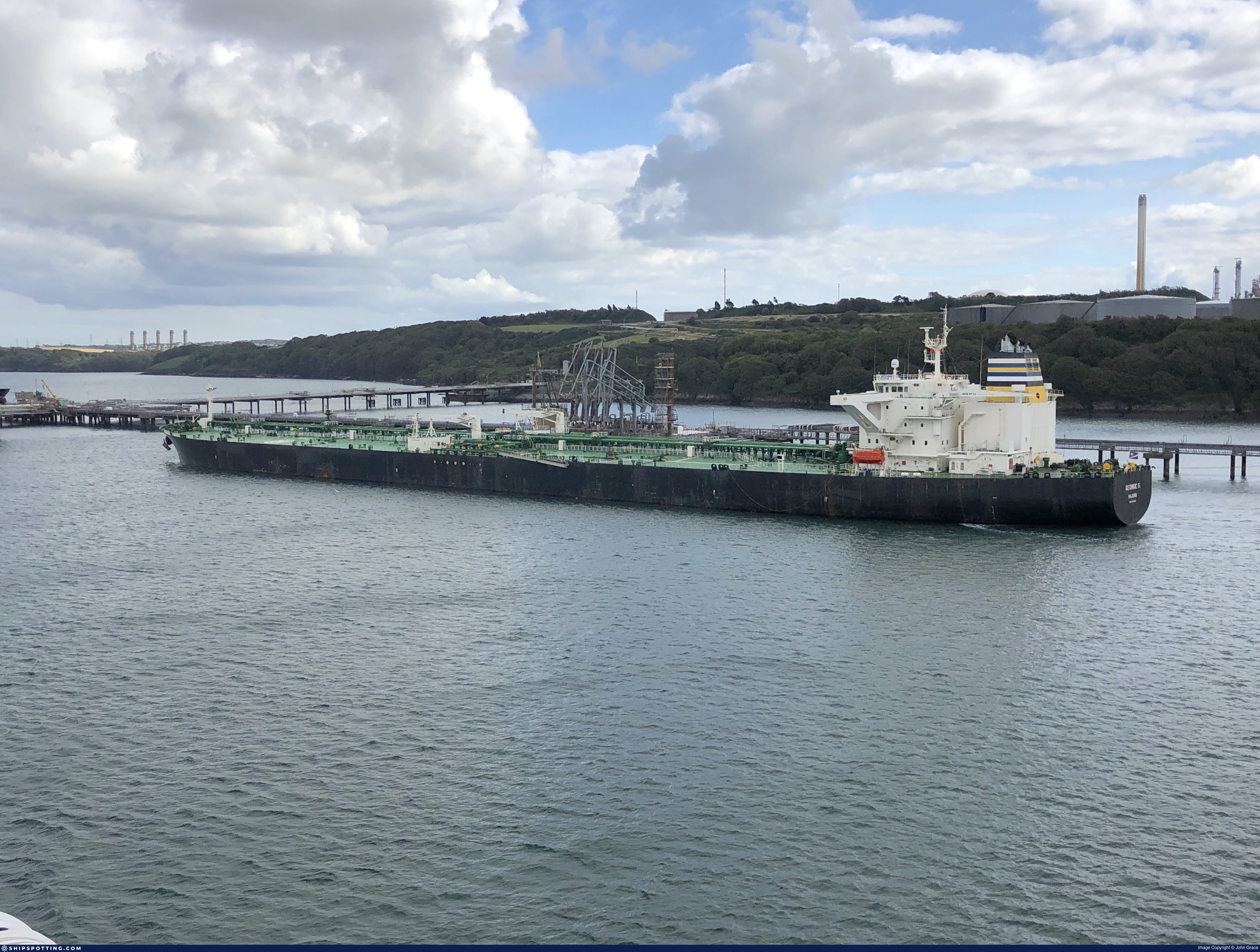
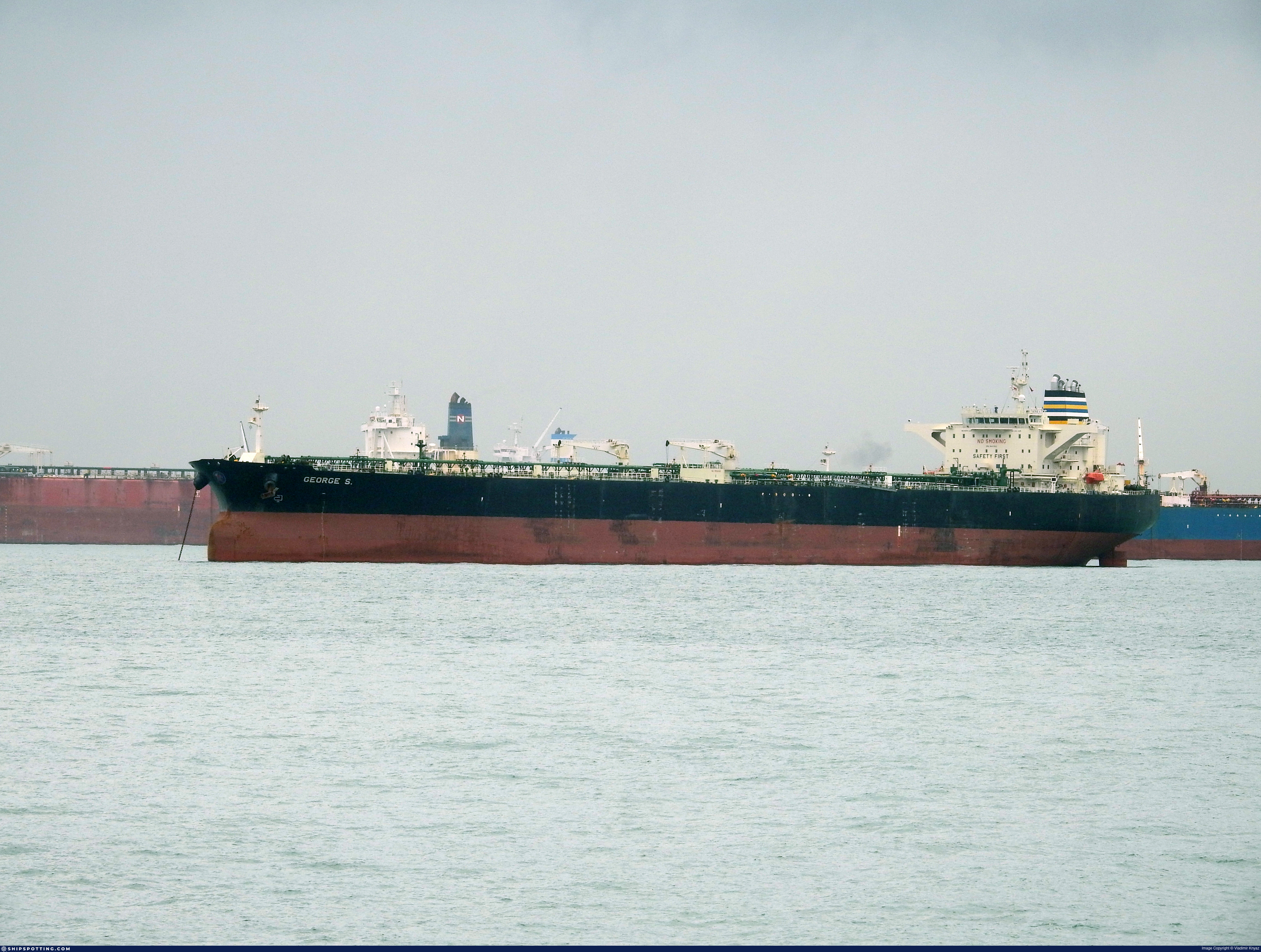
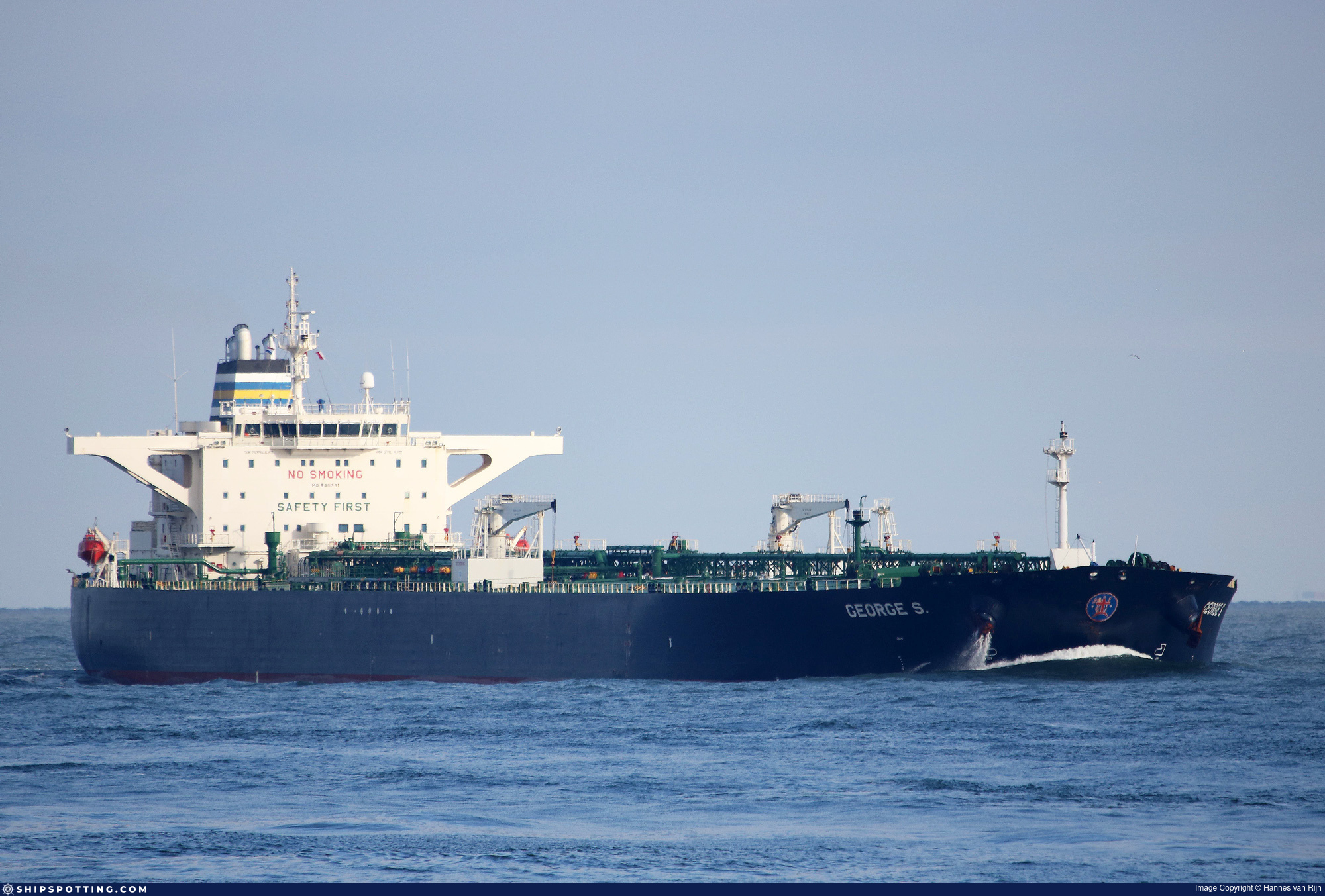
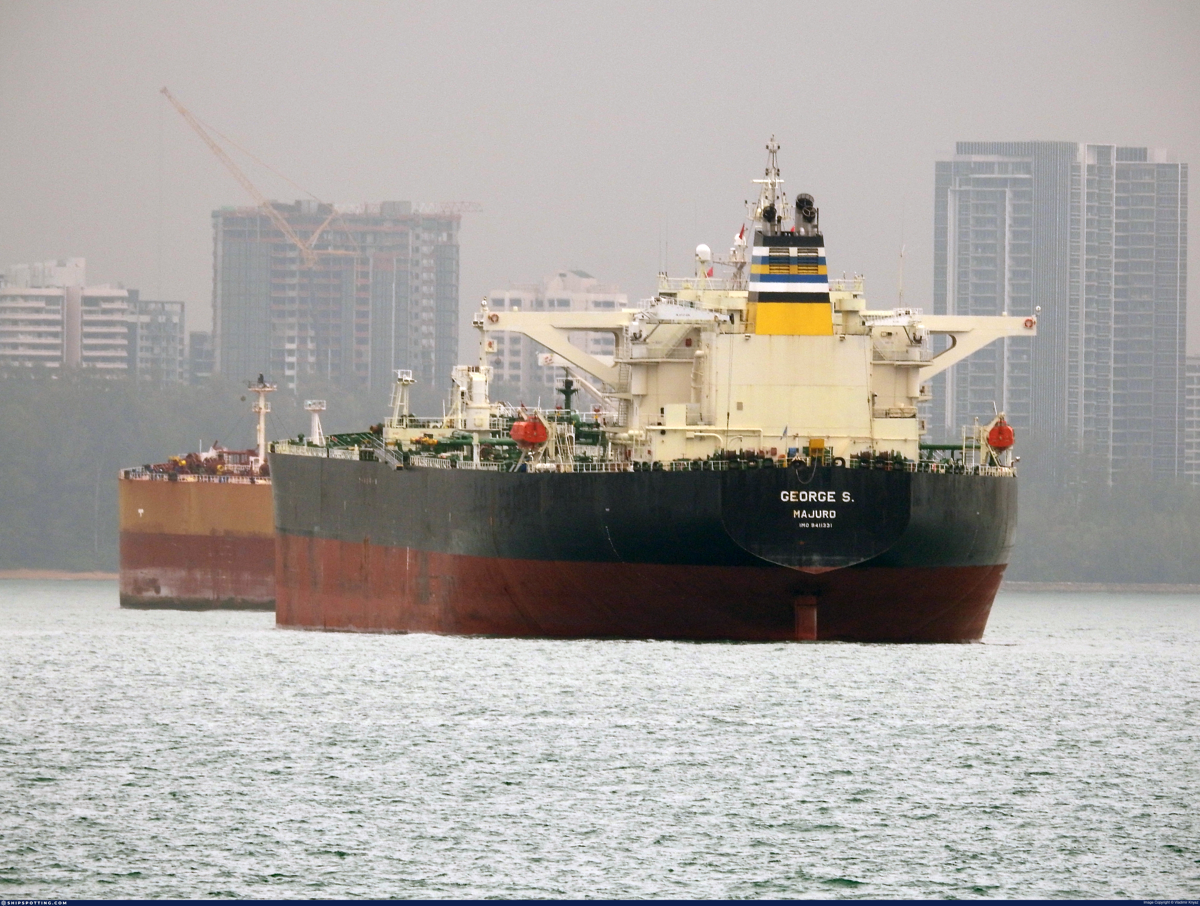
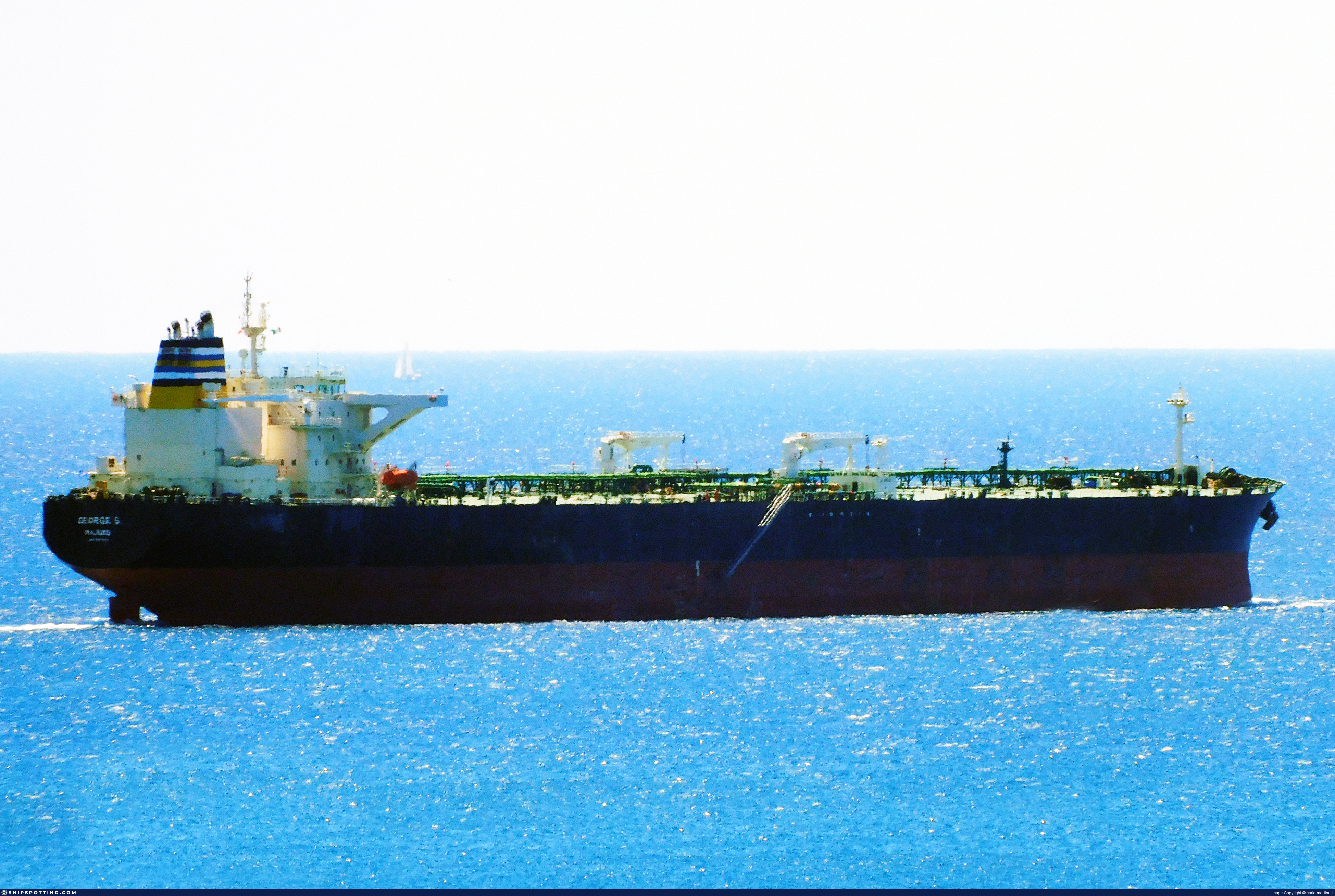
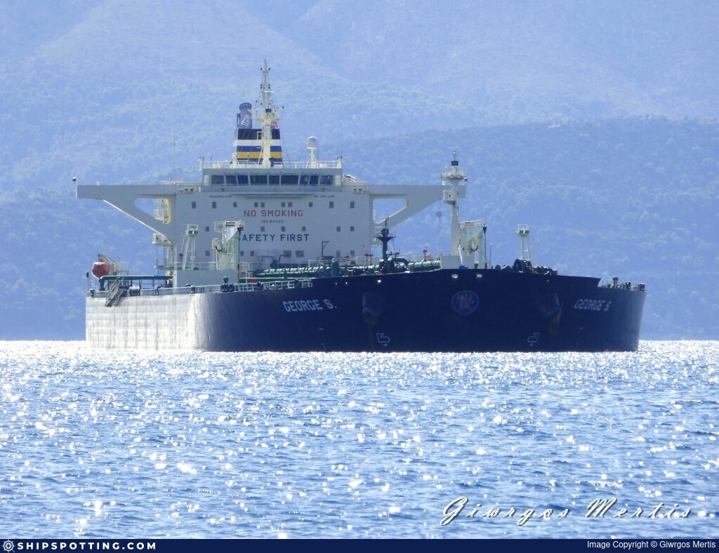
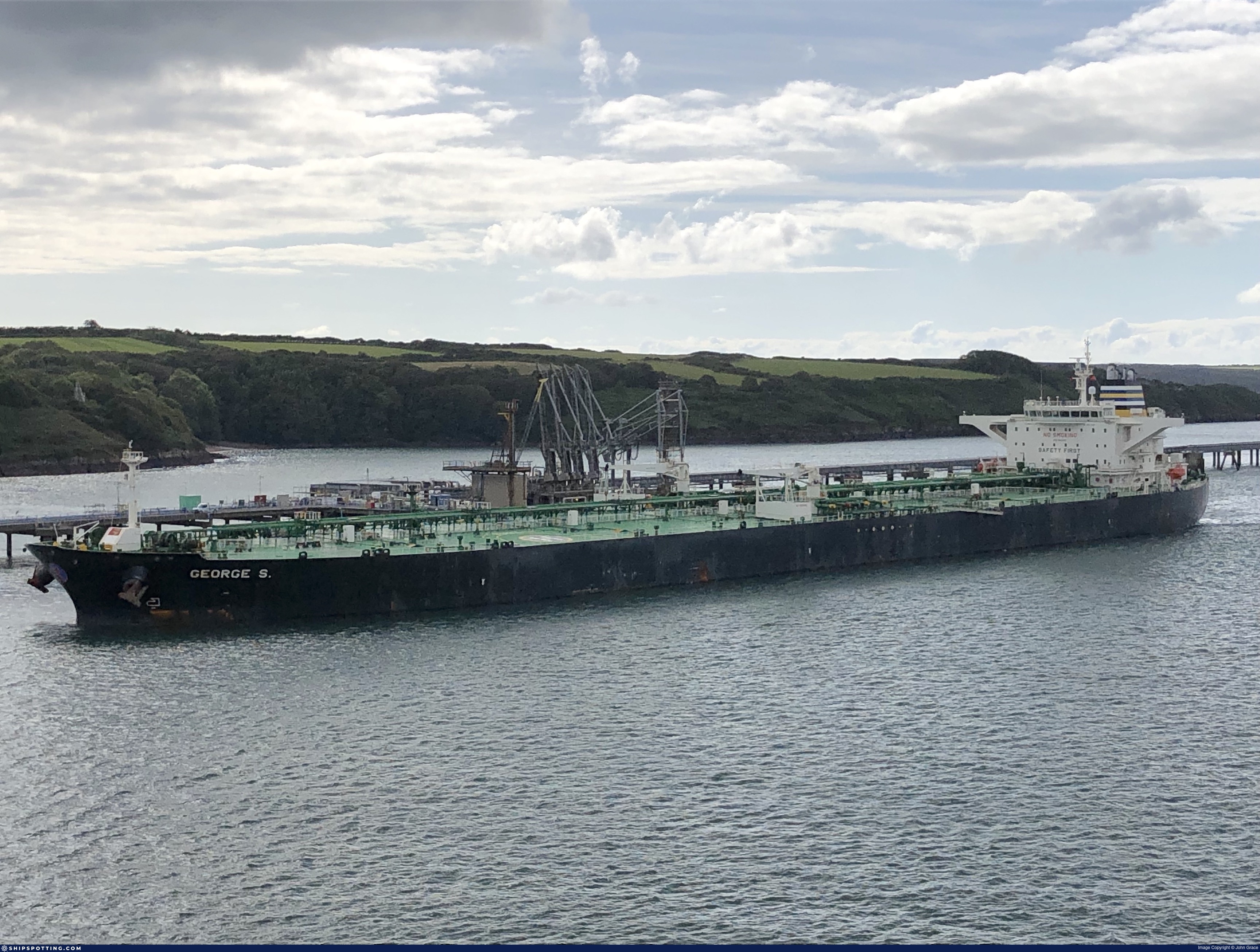
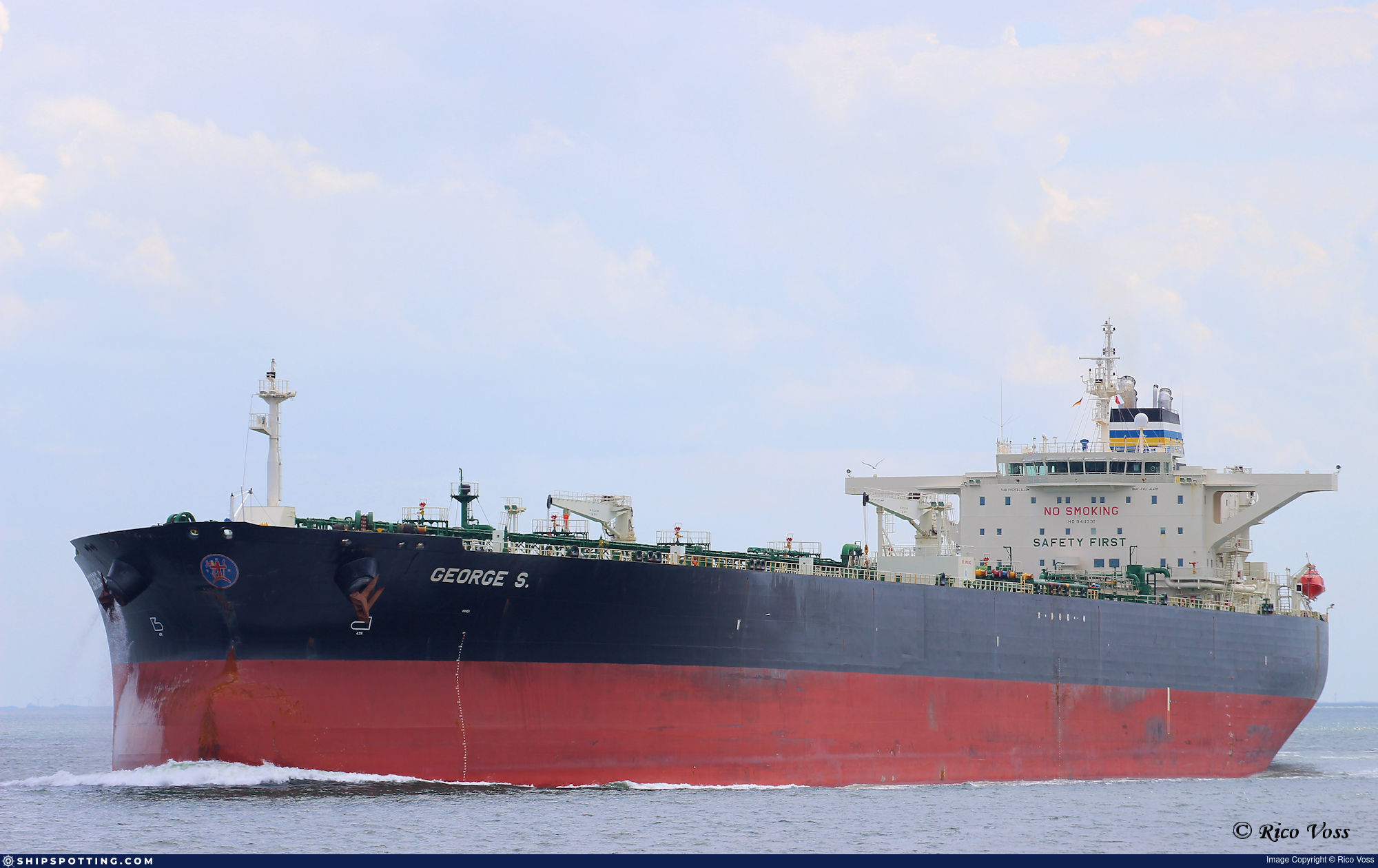
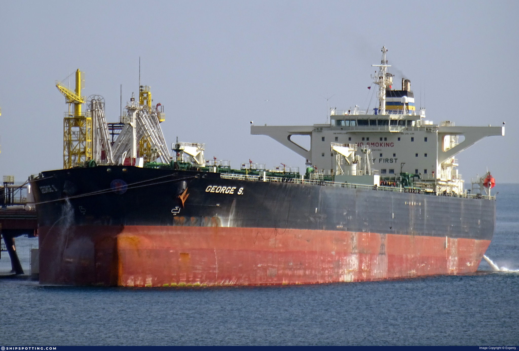
IMO 9411331
Vessel information
Sanctioned by
Company & Ownership
Management & Operations
Classification & Safety
Port State Control (PSC) Inspections
Programs & Notes
EU Russia Sanctions – Shadow Fleet | SEMA (Canada) — vessel designations | UKRAINE-EO13662] [RUSSIA-EO14024 | The Russia (Sanctions) (EU Exit) Regulations 2019
DateOfListing: 2025-05-21 || Secondary sanctions risk: See Section 11 of Executive Order 14024.; alt. Secondary sanctions risk: Ukraine-/Russia-Related Sanctions Regulations, 31 CFR 589.201 and/or 589.209; Vessel Registration Identification IMO 9411331; MMSI 352002456; Linked To: PROMINENT SHIPMANAGEMENT LIMITED. || DateDesignated: 2025-07-21 | Shipping sanctions: (see “Other information”) | Shipping sanctions: a specified ship is prohibited from being provided with access to or having its master or pilot cause it to enter a port in the UK, may have its registration on the UK Ship Register terminated, and a master or pilot of a specified ship may be given a port barring direction, a detention direction, and a port entry direction or a movement direction. | IMO 9411331 (“Canara”) is, has been or is likely to be involved in activity whose object or effect is to destabilise Ukraine or undermine or threaten the territorial integrity, sovereignty or independence of Ukraine or to obtain a benefit from or support the Government of Russia. Namely, 9411331 is involved in carrying oil or oil products that originated in Russia from Russia to a third country.
Vessel Changes
 🔄 Owner
AIS Events
50 events detected • 20 zones • Last: Jul 19, 2026
- Zone: Eastern Mediterranean Surveillance Zone
- Duration: 1h 20m
- Data Points: 31 AIS positions
- Period: 2026-07-19T11:01:36+00:00 to 2026-07-19T12:22:26+00:00
Show Raw Evidence JSON
{
    "zone_id": "discovered_041",
    "zone_name": "Eastern Mediterranean Surveillance Zone",
    "dwell_minutes": 80.7999999999999971578290569595992565155029296875,
    "points_in_zone": 31,
    "first_point": {
        "ts": "2026-07-19T11:01:36+00:00",
        "lat": 34.3762600000000020372681319713592529296875,
        "lon": 33.7167232999999981757355271838605403900146484375
    },
    "last_point": {
        "ts": "2026-07-19T12:22:26+00:00",
        "lat": 34.509788299999996752376318909227848052978515625,
        "lon": 34.01945330000000211612132261507213115692138671875
    }
}- Zone: Eastern Mediterranean Surveillance Zone
- Duration: 2h 21m
- Data Points: 53 AIS positions
- Period: 2026-07-19T10:01:28+00:00 to 2026-07-19T12:22:26+00:00
Show Raw Evidence JSON
{
    "zone_id": "discovered_041",
    "zone_name": "Eastern Mediterranean Surveillance Zone",
    "dwell_minutes": 141,
    "points_in_zone": 53,
    "first_point": {
        "ts": "2026-07-19T10:01:28+00:00",
        "lat": 34.27237000000000222144080908037722110748291015625,
        "lon": 33.47917170000000197660483536310493946075439453125
    },
    "last_point": {
        "ts": "2026-07-19T12:22:26+00:00",
        "lat": 34.509788299999996752376318909227848052978515625,
        "lon": 34.01945330000000211612132261507213115692138671875
    }
}- Zone: Eastern Mediterranean Surveillance Zone
- Duration: 2h 45m
- Data Points: 59 AIS positions
- Period: 2026-07-19T09:37:07+00:00 to 2026-07-19T12:22:26+00:00
Show Raw Evidence JSON
{
    "zone_id": "discovered_041",
    "zone_name": "Eastern Mediterranean Surveillance Zone",
    "dwell_minutes": 165.30000000000001136868377216160297393798828125,
    "points_in_zone": 59,
    "first_point": {
        "ts": "2026-07-19T09:37:07+00:00",
        "lat": 34.23179329999999964684320730157196521759033203125,
        "lon": 33.38424169999999691071934648789465427398681640625
    },
    "last_point": {
        "ts": "2026-07-19T12:22:26+00:00",
        "lat": 34.509788299999996752376318909227848052978515625,
        "lon": 34.01945330000000211612132261507213115692138671875
    }
}- Zone: Central Mediterranean Sanctions Monitoring Zone
- Duration: 2h 15m
- Data Points: 14 AIS positions
- Period: 2026-07-16T15:12:26+00:00 to 2026-07-16T17:27:26+00:00
Show Raw Evidence JSON
{
    "zone_id": "discovered_091",
    "zone_name": "Central Mediterranean Sanctions Monitoring Zone",
    "dwell_minutes": 135,
    "points_in_zone": 14,
    "first_point": {
        "ts": "2026-07-16T15:12:26+00:00",
        "lat": 35.90126500000000220325091504491865634918212890625,
        "lon": 17.15541329999999931033016764558851718902587890625
    },
    "last_point": {
        "ts": "2026-07-16T17:27:26+00:00",
        "lat": 35.79116669999999800211298861540853977203369140625,
        "lon": 17.724039999999998684643287560902535915374755859375
    }
}- Zone: Black Sea Sanctioned Vessel Monitoring Zone
- Duration: 1h 2m
- Data Points: 17 AIS positions
- Period: 2026-07-16T12:24:43+00:00 to 2026-07-16T13:27:36+00:00
Show Raw Evidence JSON
{
    "zone_id": "discovered_162",
    "zone_name": "Black Sea Sanctioned Vessel Monitoring Zone",
    "dwell_minutes": 62.89999999999999857891452847979962825775146484375,
    "points_in_zone": 17,
    "first_point": {
        "ts": "2026-07-16T12:24:43+00:00",
        "lat": 36.04729830000000134759829961694777011871337890625,
        "lon": 16.469211699999998899102138238959014415740966796875
    },
    "last_point": {
        "ts": "2026-07-16T13:27:36+00:00",
        "lat": 35.99302829999999886467776377685368061065673828125,
        "lon": 16.72552830000000056998032960109412670135498046875
    }
}- Zone: Northern Baltic Sea Surveillance Zone
- Duration: 1h 15m
- Data Points: 21 AIS positions
- Period: 2026-07-16T09:06:28+00:00 to 2026-07-16T10:22:24+00:00
Show Raw Evidence JSON
{
    "zone_id": "discovered_039",
    "zone_name": "Northern Baltic Sea Surveillance Zone",
    "dwell_minutes": 75.900000000000005684341886080801486968994140625,
    "points_in_zone": 21,
    "first_point": {
        "ts": "2026-07-16T09:06:28+00:00",
        "lat": 36.20642670000000151731001096777617931365966796875,
        "lon": 15.6473616999999993737446857267059385776519775390625
    },
    "last_point": {
        "ts": "2026-07-16T10:22:24+00:00",
        "lat": 36.152438300000000026557245291769504547119140625,
        "lon": 15.9668749999999999289457264239899814128875732421875
    }
}- Zone: Northern Baltic Sea Surveillance Zone
- Duration: 1h 48m
- Data Points: 29 AIS positions
- Period: 2026-07-16T08:33:40+00:00 to 2026-07-16T10:22:24+00:00
Show Raw Evidence JSON
{
    "zone_id": "discovered_039",
    "zone_name": "Northern Baltic Sea Surveillance Zone",
    "dwell_minutes": 108.7000000000000028421709430404007434844970703125,
    "points_in_zone": 29,
    "first_point": {
        "ts": "2026-07-16T08:33:40+00:00",
        "lat": 36.229056700000001001171767711639404296875,
        "lon": 15.5088983000000002476781446603126823902130126953125
    },
    "last_point": {
        "ts": "2026-07-16T10:22:24+00:00",
        "lat": 36.152438300000000026557245291769504547119140625,
        "lon": 15.9668749999999999289457264239899814128875732421875
    }
}- Zone: Central Mediterranean Sanctions Monitoring Zone
- Duration: 2h 1m
- Data Points: 8 AIS positions
- Period: 2026-07-15T15:23:26+00:00 to 2026-07-15T17:24:35+00:00
Show Raw Evidence JSON
{
    "zone_id": "discovered_016",
    "zone_name": "Central Mediterranean Sanctions Monitoring Zone",
    "dwell_minutes": 121.2000000000000028421709430404007434844970703125,
    "points_in_zone": 8,
    "first_point": {
        "ts": "2026-07-15T15:23:26+00:00",
        "lat": 37.328491700000000719228410162031650543212890625,
        "lon": 11.2737832999999998406792656169272959232330322265625
    },
    "last_point": {
        "ts": "2026-07-15T17:24:35+00:00",
        "lat": 37.1465917000000018788341549225151538848876953125,
        "lon": 11.730091699999999121928340173326432704925537109375
    }
}- Zone: Central Mediterranean Sanctions Monitoring Zone
- Duration: 4h 11m
- Data Points: 18 AIS positions
- Period: 2026-07-15T13:12:46+00:00 to 2026-07-15T17:24:35+00:00
Show Raw Evidence JSON
{
    "zone_id": "discovered_016",
    "zone_name": "Central Mediterranean Sanctions Monitoring Zone",
    "dwell_minutes": 251.80000000000001136868377216160297393798828125,
    "points_in_zone": 18,
    "first_point": {
        "ts": "2026-07-15T13:12:46+00:00",
        "lat": 37.47652329999999665233190171420574188232421875,
        "lon": 10.72883829999999960591594572179019451141357421875
    },
    "last_point": {
        "ts": "2026-07-15T17:24:35+00:00",
        "lat": 37.1465917000000018788341549225151538848876953125,
        "lon": 11.730091699999999121928340173326432704925537109375
    }
}- Zone: Central Mediterranean Sanctions Monitoring Zone
- Duration: 5h 40m
- Data Points: 19 AIS positions
- Period: 2026-07-15T11:44:24+00:00 to 2026-07-15T17:24:35+00:00
Show Raw Evidence JSON
{
    "zone_id": "discovered_016",
    "zone_name": "Central Mediterranean Sanctions Monitoring Zone",
    "dwell_minutes": 340.19999999999998863131622783839702606201171875,
    "points_in_zone": 19,
    "first_point": {
        "ts": "2026-07-15T11:44:24+00:00",
        "lat": 37.548726700000003120294422842562198638916015625,
        "lon": 10.35407670000000024401742848567664623260498046875
    },
    "last_point": {
        "ts": "2026-07-15T17:24:35+00:00",
        "lat": 37.1465917000000018788341549225151538848876953125,
        "lon": 11.730091699999999121928340173326432704925537109375
    }
}- Zone: Strait of Malacca Sanctions Monitoring Zone
- Duration: 1h 24m
- Data Points: 5 AIS positions
- Period: 2026-07-15T08:36:03+00:00 to 2026-07-15T10:00:21+00:00
Show Raw Evidence JSON
{
    "zone_id": "discovered_158",
    "zone_name": "Strait of Malacca Sanctions Monitoring Zone",
    "dwell_minutes": 84.2999999999999971578290569595992565155029296875,
    "points_in_zone": 5,
    "first_point": {
        "ts": "2026-07-15T08:36:03+00:00",
        "lat": 37.58764330000000342124621965922415256500244140625,
        "lon": 9.5073282999999992881612342898733913898468017578125
    },
    "last_point": {
        "ts": "2026-07-15T10:00:21+00:00",
        "lat": 37.57428999999999774672687635757029056549072265625,
        "lon": 9.8871783000000004193452696199528872966766357421875
    }
}- Zone: Alboran Sea Surveillance Zone
- Duration: 1h 56m
- Data Points: 56 AIS positions
- Period: 2026-07-15T03:00:09+00:00 to 2026-07-15T04:57:04+00:00
Show Raw Evidence JSON
{
    "zone_id": "discovered_103",
    "zone_name": "Alboran Sea Surveillance Zone",
    "dwell_minutes": 116.900000000000005684341886080801486968994140625,
    "points_in_zone": 56,
    "first_point": {
        "ts": "2026-07-15T03:00:09+00:00",
        "lat": 37.618971700000003011155058629810810089111328125,
        "lon": 8.0511067000000000604131855652667582035064697265625
    },
    "last_point": {
        "ts": "2026-07-15T04:57:04+00:00",
        "lat": 37.6279667000000017651473172008991241455078125,
        "lon": 8.5522033000000003966079020756296813488006591796875
    }
}- Zone: Alboran Sea Surveillance Zone
- Duration: 2h 12m
- Data Points: 59 AIS positions
- Period: 2026-07-15T02:44:51+00:00 to 2026-07-15T04:57:04+00:00
Show Raw Evidence JSON
{
    "zone_id": "discovered_103",
    "zone_name": "Alboran Sea Surveillance Zone",
    "dwell_minutes": 132.19999999999998863131622783839702606201171875,
    "points_in_zone": 59,
    "first_point": {
        "ts": "2026-07-15T02:44:51+00:00",
        "lat": 37.62144500000000135742084239609539508819580078125,
        "lon": 7.9874083000000002385831976425834000110626220703125
    },
    "last_point": {
        "ts": "2026-07-15T04:57:04+00:00",
        "lat": 37.6279667000000017651473172008991241455078125,
        "lon": 8.5522033000000003966079020756296813488006591796875
    }
}- Zone: Central Iberian Sea Monitoring Zone
- Duration: 1h 12m
- Data Points: 19 AIS positions
- Period: 2026-07-14T15:04:55+00:00 to 2026-07-14T16:17:15+00:00
Show Raw Evidence JSON
{
    "zone_id": "discovered_204",
    "zone_name": "Central Iberian Sea Monitoring Zone",
    "dwell_minutes": 72.2999999999999971578290569595992565155029296875,
    "points_in_zone": 19,
    "first_point": {
        "ts": "2026-07-14T15:04:55+00:00",
        "lat": 37.51686169999999975743776303716003894805908203125,
        "lon": 4.9914050000000003137756721116602420806884765625
    },
    "last_point": {
        "ts": "2026-07-14T16:17:15+00:00",
        "lat": 37.562579999999996971382643096148967742919921875,
        "lon": 5.294998299999999602505340590141713619232177734375
    }
}- Zone: English Channel Surveillance Zone
- Duration: 1h 2m
- Data Points: 11 AIS positions
- Period: 2026-07-14T14:03:56+00:00 to 2026-07-14T15:06:35+00:00
Show Raw Evidence JSON
{
    "zone_id": "discovered_077",
    "zone_name": "English Channel Surveillance Zone",
    "dwell_minutes": 62.60000000000000142108547152020037174224853515625,
    "points_in_zone": 11,
    "first_point": {
        "ts": "2026-07-14T14:03:56+00:00",
        "lat": 37.48729829999999907386154518462717533111572265625,
        "lon": 4.7507833000000001533180693513713777065277099609375
    },
    "last_point": {
        "ts": "2026-07-14T15:06:35+00:00",
        "lat": 37.51779330000000101108525996096432209014892578125,
        "lon": 4.99818500000000032201796784647740423679351806640625
    }
}- Zone: Central Iberian Sea Monitoring Zone
- Duration: 2h 13m
- Data Points: 28 AIS positions
- Period: 2026-07-14T14:03:56+00:00 to 2026-07-14T16:17:15+00:00
Show Raw Evidence JSON
{
    "zone_id": "discovered_204",
    "zone_name": "Central Iberian Sea Monitoring Zone",
    "dwell_minutes": 133.30000000000001136868377216160297393798828125,
    "points_in_zone": 28,
    "first_point": {
        "ts": "2026-07-14T14:03:56+00:00",
        "lat": 37.48729829999999907386154518462717533111572265625,
        "lon": 4.7507833000000001533180693513713777065277099609375
    },
    "last_point": {
        "ts": "2026-07-14T16:17:15+00:00",
        "lat": 37.562579999999996971382643096148967742919921875,
        "lon": 5.294998299999999602505340590141713619232177734375
    }
}- Zone: English Channel Surveillance Zone
- Duration: 1h 56m
- Data Points: 25 AIS positions
- Period: 2026-07-14T13:09:46+00:00 to 2026-07-14T15:06:35+00:00
Show Raw Evidence JSON
{
    "zone_id": "discovered_077",
    "zone_name": "English Channel Surveillance Zone",
    "dwell_minutes": 116.7999999999999971578290569595992565155029296875,
    "points_in_zone": 25,
    "first_point": {
        "ts": "2026-07-14T13:09:46+00:00",
        "lat": 37.456715000000002646629582159221172332763671875,
        "lon": 4.54521170000000029887132768635638058185577392578125
    },
    "last_point": {
        "ts": "2026-07-14T15:06:35+00:00",
        "lat": 37.51779330000000101108525996096432209014892578125,
        "lon": 4.99818500000000032201796784647740423679351806640625
    }
}- Zone: English Channel Surveillance Zone
- Duration: 2h 53m
- Data Points: 31 AIS positions
- Period: 2026-07-14T12:13:27+00:00 to 2026-07-14T15:06:35+00:00
Show Raw Evidence JSON
{
    "zone_id": "discovered_077",
    "zone_name": "English Channel Surveillance Zone",
    "dwell_minutes": 173.099999999999994315658113919198513031005859375,
    "points_in_zone": 31,
    "first_point": {
        "ts": "2026-07-14T12:13:27+00:00",
        "lat": 37.41554169999999857054717722348868846893310546875,
        "lon": 4.32787499999999969446662362315692007541656494140625
    },
    "last_point": {
        "ts": "2026-07-14T15:06:35+00:00",
        "lat": 37.51779330000000101108525996096432209014892578125,
        "lon": 4.99818500000000032201796784647740423679351806640625
    }
}- Zone: Alboran Sea Monitoring Zone
- Duration: 1h 7m
- Data Points: 11 AIS positions
- Period: 2026-07-14T12:13:27+00:00 to 2026-07-14T13:20:36+00:00
Show Raw Evidence JSON
{
    "zone_id": "discovered_135",
    "zone_name": "Alboran Sea Monitoring Zone",
    "dwell_minutes": 67.2000000000000028421709430404007434844970703125,
    "points_in_zone": 11,
    "first_point": {
        "ts": "2026-07-14T12:13:27+00:00",
        "lat": 37.41554169999999857054717722348868846893310546875,
        "lon": 4.32787499999999969446662362315692007541656494140625
    },
    "last_point": {
        "ts": "2026-07-14T13:20:36+00:00",
        "lat": 37.46945170000000047139110392890870571136474609375,
        "lon": 4.58354329999999965394863465917296707630157470703125
    }
}- Zone: Black Sea Sanctioned Vessel Monitoring Zone
- Duration: 1h 28m
- Data Points: 10 AIS positions
- Period: 2026-07-14T04:01:15+00:00 to 2026-07-14T05:29:14+00:00
Show Raw Evidence JSON
{
    "zone_id": "discovered_033",
    "zone_name": "Black Sea Sanctioned Vessel Monitoring Zone",
    "dwell_minutes": 88,
    "points_in_zone": 10,
    "first_point": {
        "ts": "2026-07-14T04:01:15+00:00",
        "lat": 37.1007450000000034151526051573455333709716796875,
        "lon": 2.295223299999999966303221299313008785247802734375
    },
    "last_point": {
        "ts": "2026-07-14T05:29:14+00:00",
        "lat": 37.19793829999999701385604566894471645355224609375,
        "lon": 2.644371700000000213748307942296378314495086669921875
    }
}- Zone: Black Sea Sanctioned Vessel Monitoring Zone
- Duration: 1h 43m
- Data Points: 11 AIS positions
- Period: 2026-07-14T03:46:17+00:00 to 2026-07-14T05:29:14+00:00
Show Raw Evidence JSON
{
    "zone_id": "discovered_033",
    "zone_name": "Black Sea Sanctioned Vessel Monitoring Zone",
    "dwell_minutes": 103,
    "points_in_zone": 11,
    "first_point": {
        "ts": "2026-07-14T03:46:17+00:00",
        "lat": 37.080188300000003209788701497018337249755859375,
        "lon": 2.234353299999999986624743542051874101161956787109375
    },
    "last_point": {
        "ts": "2026-07-14T05:29:14+00:00",
        "lat": 37.19793829999999701385604566894471645355224609375,
        "lon": 2.644371700000000213748307942296378314495086669921875
    }
}- Zone: Black Sea Sanctioned Vessel Monitoring Zone
- Duration: 2h 42m
- Data Points: 13 AIS positions
- Period: 2026-07-14T02:46:39+00:00 to 2026-07-14T05:29:14+00:00
Show Raw Evidence JSON
{
    "zone_id": "discovered_033",
    "zone_name": "Black Sea Sanctioned Vessel Monitoring Zone",
    "dwell_minutes": 162.599999999999994315658113919198513031005859375,
    "points_in_zone": 13,
    "first_point": {
        "ts": "2026-07-14T02:46:39+00:00",
        "lat": 37.03301669999999745641616755165159702301025390625,
        "lon": 1.974236700000000066523853092803619801998138427734375
    },
    "last_point": {
        "ts": "2026-07-14T05:29:14+00:00",
        "lat": 37.19793829999999701385604566894471645355224609375,
        "lon": 2.644371700000000213748307942296378314495086669921875
    }
}- Zone: Western Approaches Monitoring Zone
- Duration: 1h 44m
- Data Points: 8 AIS positions
- Period: 2026-07-14T01:08:03+00:00 to 2026-07-14T02:52:19+00:00
Show Raw Evidence JSON
{
    "zone_id": "discovered_080",
    "zone_name": "Western Approaches Monitoring Zone",
    "dwell_minutes": 104.2999999999999971578290569595992565155029296875,
    "points_in_zone": 8,
    "first_point": {
        "ts": "2026-07-14T01:08:03+00:00",
        "lat": 37.0029267000000032794559956528246402740478515625,
        "lon": 1.50819670000000005671836333931423723697662353515625
    },
    "last_point": {
        "ts": "2026-07-14T02:52:19+00:00",
        "lat": 37.03391169999999732453943579457700252532958984375,
        "lon": 2.000286700000000195132088265381753444671630859375
    }
}- Zone: Western Approaches Monitoring Zone
- Duration: 2h 21m
- Data Points: 13 AIS positions
- Period: 2026-07-14T00:30:43+00:00 to 2026-07-14T02:52:19+00:00
Show Raw Evidence JSON
{
    "zone_id": "discovered_080",
    "zone_name": "Western Approaches Monitoring Zone",
    "dwell_minutes": 141.599999999999994315658113919198513031005859375,
    "points_in_zone": 13,
    "first_point": {
        "ts": "2026-07-14T00:30:43+00:00",
        "lat": 36.979991699999999354986357502639293670654296875,
        "lon": 1.3363300000000000178346226675785146653652191162109375
    },
    "last_point": {
        "ts": "2026-07-14T02:52:19+00:00",
        "lat": 37.03391169999999732453943579457700252532958984375,
        "lon": 2.000286700000000195132088265381753444671630859375
    }
}- Gap Duration: 5h 46m
- Last Seen: 2026-07-13T07:32:53+00:00 at 36.1199, -2.8650 (Zone: Norwegian Sea Sanctions Monitoring Zone)
- Next Seen: 2026-07-13T13:19:06+00:00 at 36.1202, -1.3880
🛰️ Gap Corroboration
These are snapshots that may corroborate presence during the gap. They do not reconstruct a continuous route.
SAR Imagery (Sentinel-1)
Status: ✓ Snapshot available
SAR snapshot available for review
Scene: S1D_IW_GRDH_1SDV_20260713T060205_20260713T060230_003651_00683D_A723_COG • Time: 2026-07-13T06:02:05.290832Z
SAR coverage thumbnail
VIIRS Thermal Anomaly
Status: ✗ No detections
No VIIRS thermal/light detections in corridor
Show Raw Evidence JSON
{
    "gap_minutes": 346.19999999999998863131622783839702606201171875,
    "last_seen": {
        "ts": "2026-07-13T07:32:53+00:00",
        "lat": 36.1198617000000012922100722789764404296875,
        "lon": -2.8649716999999998989778760005719959735870361328125,
        "sog": 12.9000000000000003552713678800500929355621337890625,
        "zone_id": "discovered_129"
    },
    "next_seen": {
        "ts": "2026-07-13T13:19:06+00:00",
        "lat": 36.120215000000001737134880386292934417724609375,
        "lon": -1.3880467000000000776793740442371927201747894287109375,
        "zone_ids": [
            "discovered_082"
        ]
    },
    "gap_enrichment": {
        "status": "done",
        "corridor": {
            "start": {
                "lat": 36.1198617000000012922100722789764404296875,
                "lon": -2.8649716999999998989778760005719959735870361328125,
                "ts": "2026-07-13T07:32:53+00:00"
            },
            "end": {
                "lat": 36.120215000000001737134880386292934417724609375,
                "lon": -1.3880467000000000776793740442371927201747894287109375,
                "ts": "2026-07-13T13:19:06+00:00"
            },
            "bbox": {
                "min_lat": 35.93968199999999768579073133878409862518310546875,
                "min_lon": -3.088026999999999855361920708674006164073944091796875,
                "max_lat": 36.30039500000000174395609064958989620208740234375,
                "max_lon": -1.1649920000000000275264255833462812006473541259765625
            },
            "buffer_km": 20
        },
        "sar": {
            "status": "snapshot",
            "scene_id": "S1D_IW_GRDH_1SDV_20260713T060205_20260713T060230_003651_00683D_A723_COG",
            "scene_time": "2026-07-13T06:02:05.290832Z",
            "platform": "sentinel-1d",
            "assets": {
                "preview_url": "https:\/\/fleetleaks.com\/wp-content\/uploads\/fleetleaks-evidence\/sar-imagery\/2026\/07\/event_918461_thumbnail_20260713133006.png",
                "stored_path": "\/home\/fleetleaks\/public_html\/wp-content\/uploads\/fleetleaks-evidence\/sar-imagery\/2026\/07\/event_918461_thumbnail_20260713133006.png",
                "source": "copernicus_dataspace"
            },
            "notes": "SAR snapshot available for review"
        },
        "viirs": {
            "status": "not_found",
            "notes": "No VIIRS thermal\/light detections in corridor"
        },
        "searched_at": "2026-07-13T13:30:01.582599+00:00"
    }
}- Zone: Southern Öresund Surveillance Zone
- Duration: 1h 32m
- Data Points: 23 AIS positions
- Period: 2026-07-13T03:02:07+00:00 to 2026-07-13T04:34:49+00:00
Show Raw Evidence JSON
{
    "zone_id": "discovered_003",
    "zone_name": "Southern \u00d6resund Surveillance Zone",
    "dwell_minutes": 92.7000000000000028421709430404007434844970703125,
    "points_in_zone": 23,
    "first_point": {
        "ts": "2026-07-13T03:02:07+00:00",
        "lat": 36.06973669999999998481143848039209842681884765625,
        "lon": -4.08761829999999992679704519105143845081329345703125
    },
    "last_point": {
        "ts": "2026-07-13T04:34:49+00:00",
        "lat": 36.11043169999999946639945846982300281524658203125,
        "lon": -3.655928299999999797620375829865224659442901611328125
    }
}- Zone: Southern Öresund Surveillance Zone
- Duration: 2h 33m
- Data Points: 41 AIS positions
- Period: 2026-07-13T02:01:32+00:00 to 2026-07-13T04:34:49+00:00
Show Raw Evidence JSON
{
    "zone_id": "discovered_003",
    "zone_name": "Southern \u00d6resund Surveillance Zone",
    "dwell_minutes": 153.30000000000001136868377216160297393798828125,
    "points_in_zone": 41,
    "first_point": {
        "ts": "2026-07-13T02:01:32+00:00",
        "lat": 36.0575299999999998590283212251961231231689453125,
        "lon": -4.37488000000000010203393685515038669109344482421875
    },
    "last_point": {
        "ts": "2026-07-13T04:34:49+00:00",
        "lat": 36.11043169999999946639945846982300281524658203125,
        "lon": -3.655928299999999797620375829865224659442901611328125
    }
}- Zone: Southern Öresund Surveillance Zone
- Duration: 3h 25m
- Data Points: 53 AIS positions
- Period: 2026-07-13T01:09:15+00:00 to 2026-07-13T04:34:49+00:00
Show Raw Evidence JSON
{
    "zone_id": "discovered_003",
    "zone_name": "Southern \u00d6resund Surveillance Zone",
    "dwell_minutes": 205.599999999999994315658113919198513031005859375,
    "points_in_zone": 53,
    "first_point": {
        "ts": "2026-07-13T01:09:15+00:00",
        "lat": 36.03449669999999827041392563842236995697021484375,
        "lon": -4.6202766999999997921122485422529280185699462890625
    },
    "last_point": {
        "ts": "2026-07-13T04:34:49+00:00",
        "lat": 36.11043169999999946639945846982300281524658203125,
        "lon": -3.655928299999999797620375829865224659442901611328125
    }
}- Zone: Southern Öresund Surveillance Zone
- Duration: 4h 33m
- Data Points: 73 AIS positions
- Period: 2026-07-13T00:01:44+00:00 to 2026-07-13T04:34:49+00:00
Show Raw Evidence JSON
{
    "zone_id": "discovered_003",
    "zone_name": "Southern \u00d6resund Surveillance Zone",
    "dwell_minutes": 273.1000000000000227373675443232059478759765625,
    "points_in_zone": 73,
    "first_point": {
        "ts": "2026-07-13T00:01:44+00:00",
        "lat": 36.00658829999999710480551584623754024505615234375,
        "lon": -4.9290649999999995856114765047095715999603271484375
    },
    "last_point": {
        "ts": "2026-07-13T04:34:49+00:00",
        "lat": 36.11043169999999946639945846982300281524658203125,
        "lon": -3.655928299999999797620375829865224659442901611328125
    }
}- Zone: Southern Öresund Surveillance Zone
- Duration: 5h 10m
- Data Points: 79 AIS positions
- Period: 2026-07-12T23:24:41+00:00 to 2026-07-13T04:34:49+00:00
Show Raw Evidence JSON
{
    "zone_id": "discovered_003",
    "zone_name": "Southern \u00d6resund Surveillance Zone",
    "dwell_minutes": 310.1000000000000227373675443232059478759765625,
    "points_in_zone": 79,
    "first_point": {
        "ts": "2026-07-12T23:24:41+00:00",
        "lat": 35.98684999999999689634933019988238811492919921875,
        "lon": -5.09857169999999992882067090249620378017425537109375
    },
    "last_point": {
        "ts": "2026-07-13T04:34:49+00:00",
        "lat": 36.11043169999999946639945846982300281524658203125,
        "lon": -3.655928299999999797620375829865224659442901611328125
    }
}- Zone: Norwegian Sea Surveillance Zone
- Duration: 1h 25m
- Data Points: 7 AIS positions
- Period: 2026-07-04T15:09:48+00:00 to 2026-07-04T16:35:27+00:00
Show Raw Evidence JSON
{
    "zone_id": "discovered_085",
    "zone_name": "Norwegian Sea Surveillance Zone",
    "dwell_minutes": 85.7000000000000028421709430404007434844970703125,
    "points_in_zone": 7,
    "first_point": {
        "ts": "2026-07-04T15:09:48+00:00",
        "lat": 67.6909883000000007768903742544353008270263671875,
        "lon": 9.27720670000000069421730586327612400054931640625
    },
    "last_point": {
        "ts": "2026-07-04T16:35:27+00:00",
        "lat": 67.4499866999999966310497256927192211151123046875,
        "lon": 8.95692999999999983629095368087291717529296875
    }
}- Zone: Norwegian Sea Surveillance Zone
- Duration: 2h 34m
- Data Points: 12 AIS positions
- Period: 2026-07-04T14:00:38+00:00 to 2026-07-04T16:35:27+00:00
Show Raw Evidence JSON
{
    "zone_id": "discovered_085",
    "zone_name": "Norwegian Sea Surveillance Zone",
    "dwell_minutes": 154.80000000000001136868377216160297393798828125,
    "points_in_zone": 12,
    "first_point": {
        "ts": "2026-07-04T14:00:38+00:00",
        "lat": 67.8843732999999929234036244451999664306640625,
        "lon": 9.537806700000000859063220559619367122650146484375
    },
    "last_point": {
        "ts": "2026-07-04T16:35:27+00:00",
        "lat": 67.4499866999999966310497256927192211151123046875,
        "lon": 8.95692999999999983629095368087291717529296875
    }
}- Zone: Norwegian Sea Surveillance Zone
- Duration: 3h 6m
- Data Points: 19 AIS positions
- Period: 2026-07-04T13:28:47+00:00 to 2026-07-04T16:35:27+00:00
Show Raw Evidence JSON
{
    "zone_id": "discovered_085",
    "zone_name": "Norwegian Sea Surveillance Zone",
    "dwell_minutes": 186.69999999999998863131622783839702606201171875,
    "points_in_zone": 19,
    "first_point": {
        "ts": "2026-07-04T13:28:47+00:00",
        "lat": 67.9755750000000062982508097775280475616455078125,
        "lon": 9.6609882999999996400219970382750034332275390625
    },
    "last_point": {
        "ts": "2026-07-04T16:35:27+00:00",
        "lat": 67.4499866999999966310497256927192211151123046875,
        "lon": 8.95692999999999983629095368087291717529296875
    }
}- Zone: Brittany Coast Surveillance Zone
- Duration: 1h 19m
- Data Points: 16 AIS positions
- Period: 2026-06-20T11:10:31+00:00 to 2026-06-20T12:30:21+00:00
Show Raw Evidence JSON
{
    "zone_id": "discovered_070",
    "zone_name": "Brittany Coast Surveillance Zone",
    "dwell_minutes": 79.7999999999999971578290569595992565155029296875,
    "points_in_zone": 16,
    "first_point": {
        "ts": "2026-06-20T11:10:31+00:00",
        "lat": 67.6060782999999929643308860249817371368408203125,
        "lon": 9.402615000000000833324520499445497989654541015625
    },
    "last_point": {
        "ts": "2026-06-20T12:30:21+00:00",
        "lat": 67.839730000000002974047674797475337982177734375,
        "lon": 9.6993217000000004901494321529753506183624267578125
    }
}- Zone: Brittany Coast Surveillance Zone
- Duration: 2h 13m
- Data Points: 20 AIS positions
- Period: 2026-06-20T10:16:33+00:00 to 2026-06-20T12:30:21+00:00
Show Raw Evidence JSON
{
    "zone_id": "discovered_070",
    "zone_name": "Brittany Coast Surveillance Zone",
    "dwell_minutes": 133.80000000000001136868377216160297393798828125,
    "points_in_zone": 20,
    "first_point": {
        "ts": "2026-06-20T10:16:33+00:00",
        "lat": 67.4478232999999960384229780174791812896728515625,
        "lon": 9.18729330000000032896423363126814365386962890625
    },
    "last_point": {
        "ts": "2026-06-20T12:30:21+00:00",
        "lat": 67.839730000000002974047674797475337982177734375,
        "lon": 9.6993217000000004901494321529753506183624267578125
    }
}- Zone: Brittany Coast Surveillance Zone
- Duration: 3h 28m
- Data Points: 28 AIS positions
- Period: 2026-06-20T09:01:31+00:00 to 2026-06-20T12:30:21+00:00
Show Raw Evidence JSON
{
    "zone_id": "discovered_070",
    "zone_name": "Brittany Coast Surveillance Zone",
    "dwell_minutes": 208.80000000000001136868377216160297393798828125,
    "points_in_zone": 28,
    "first_point": {
        "ts": "2026-06-20T09:01:31+00:00",
        "lat": 67.216485000000005811671144329011440277099609375,
        "lon": 8.9408049999999992252242009271867573261260986328125
    },
    "last_point": {
        "ts": "2026-06-20T12:30:21+00:00",
        "lat": 67.839730000000002974047674797475337982177734375,
        "lon": 9.6993217000000004901494321529753506183624267578125
    }
}- Zone: Brittany Coast Surveillance Zone
- Duration: 3h 54m
- Data Points: 30 AIS positions
- Period: 2026-06-20T08:35:51+00:00 to 2026-06-20T12:30:21+00:00
Show Raw Evidence JSON
{
    "zone_id": "discovered_070",
    "zone_name": "Brittany Coast Surveillance Zone",
    "dwell_minutes": 234.5,
    "points_in_zone": 30,
    "first_point": {
        "ts": "2026-06-20T08:35:51+00:00",
        "lat": 67.1376517000000063717379816807806491851806640625,
        "lon": 8.8546867000000002434489942970685660839080810546875
    },
    "last_point": {
        "ts": "2026-06-20T12:30:21+00:00",
        "lat": 67.839730000000002974047674797475337982177734375,
        "lon": 9.6993217000000004901494321529753506183624267578125
    }
}- Zone: Brittany Coast Surveillance Zone
- Duration: 4h 41m
- Data Points: 32 AIS positions
- Period: 2026-06-20T07:48:52+00:00 to 2026-06-20T12:30:21+00:00
Show Raw Evidence JSON
{
    "zone_id": "discovered_070",
    "zone_name": "Brittany Coast Surveillance Zone",
    "dwell_minutes": 281.5,
    "points_in_zone": 32,
    "first_point": {
        "ts": "2026-06-20T07:48:52+00:00",
        "lat": 66.9952250000000049112713895738124847412109375,
        "lon": 8.67834500000000019781509763561189174652099609375
    },
    "last_point": {
        "ts": "2026-06-20T12:30:21+00:00",
        "lat": 67.839730000000002974047674797475337982177734375,
        "lon": 9.6993217000000004901494321529753506183624267578125
    }
}- Zone: Strait of Gibraltar Surveillance Zone
- Duration: 1h 37m
- Data Points: 25 AIS positions
- Period: 2026-06-10T15:14:29+00:00 to 2026-06-10T16:52:19+00:00
Show Raw Evidence JSON
{
    "zone_id": "discovered_001",
    "zone_name": "Strait of Gibraltar Surveillance Zone",
    "dwell_minutes": 97.7999999999999971578290569595992565155029296875,
    "points_in_zone": 25,
    "first_point": {
        "ts": "2026-06-10T15:14:29+00:00",
        "lat": 36.162069999999999936335370875895023345947265625,
        "lon": -4.535669999999999646433934685774147510528564453125
    },
    "last_point": {
        "ts": "2026-06-10T16:52:19+00:00",
        "lat": 36.1233383000000003448803909122943878173828125,
        "lon": -4.88992330000000041678731577121652662754058837890625
    }
}- Zone: Strait of Gibraltar Surveillance Zone
- Duration: 2h 51m
- Data Points: 36 AIS positions
- Period: 2026-06-10T14:00:32+00:00 to 2026-06-10T16:52:19+00:00
Show Raw Evidence JSON
{
    "zone_id": "discovered_001",
    "zone_name": "Strait of Gibraltar Surveillance Zone",
    "dwell_minutes": 171.80000000000001136868377216160297393798828125,
    "points_in_zone": 36,
    "first_point": {
        "ts": "2026-06-10T14:00:32+00:00",
        "lat": 36.16787500000000221689333557151257991790771484375,
        "lon": -4.2744900000000001227817847393453121185302734375
    },
    "last_point": {
        "ts": "2026-06-10T16:52:19+00:00",
        "lat": 36.1233383000000003448803909122943878173828125,
        "lon": -4.88992330000000041678731577121652662754058837890625
    }
}- Zone: Strait of Gibraltar Surveillance Zone
- Duration: 3h 18m
- Data Points: 44 AIS positions
- Period: 2026-06-10T13:34:03+00:00 to 2026-06-10T16:52:19+00:00
Show Raw Evidence JSON
{
    "zone_id": "discovered_001",
    "zone_name": "Strait of Gibraltar Surveillance Zone",
    "dwell_minutes": 198.30000000000001136868377216160297393798828125,
    "points_in_zone": 44,
    "first_point": {
        "ts": "2026-06-10T13:34:03+00:00",
        "lat": 36.17022999999999655074134352616965770721435546875,
        "lon": -4.17091670000000025453346097492612898349761962890625
    },
    "last_point": {
        "ts": "2026-06-10T16:52:19+00:00",
        "lat": 36.1233383000000003448803909122943878173828125,
        "lon": -4.88992330000000041678731577121652662754058837890625
    }
}- Zone: Strait of Gibraltar Surveillance Zone
- Duration: 4h 13m
- Data Points: 54 AIS positions
- Period: 2026-06-10T12:38:44+00:00 to 2026-06-10T16:52:19+00:00
Show Raw Evidence JSON
{
    "zone_id": "discovered_001",
    "zone_name": "Strait of Gibraltar Surveillance Zone",
    "dwell_minutes": 253.599999999999994315658113919198513031005859375,
    "points_in_zone": 54,
    "first_point": {
        "ts": "2026-06-10T12:38:44+00:00",
        "lat": 36.17825500000000005229594535194337368011474609375,
        "lon": -3.961774999999999824495944267255254089832305908203125
    },
    "last_point": {
        "ts": "2026-06-10T16:52:19+00:00",
        "lat": 36.1233383000000003448803909122943878173828125,
        "lon": -4.88992330000000041678731577121652662754058837890625
    }
}- Zone: Strait of Gibraltar Surveillance Zone
- Duration: 4h 53m
- Data Points: 55 AIS positions
- Period: 2026-06-10T11:58:24+00:00 to 2026-06-10T16:52:19+00:00
Show Raw Evidence JSON
{
    "zone_id": "discovered_001",
    "zone_name": "Strait of Gibraltar Surveillance Zone",
    "dwell_minutes": 293.8999999999999772626324556767940521240234375,
    "points_in_zone": 55,
    "first_point": {
        "ts": "2026-06-10T11:58:24+00:00",
        "lat": 36.171508299999999280771589837968349456787109375,
        "lon": -3.803920000000000189999127542250789701938629150390625
    },
    "last_point": {
        "ts": "2026-06-10T16:52:19+00:00",
        "lat": 36.1233383000000003448803909122943878173828125,
        "lon": -4.88992330000000041678731577121652662754058837890625
    }
}- Zone: discovered_104
- Duration: 1h 24m
- Data Points: 12 AIS positions
- Period: 2026-06-07T21:20:33+00:00 to 2026-06-07T22:44:45+00:00
Show Raw Evidence JSON
{
    "zone_id": "discovered_104",
    "zone_name": "Eastern Mediterranean Surveillance Zone",
    "dwell_minutes": 84.2000000000000028421709430404007434844970703125,
    "points_in_zone": 12,
    "first_point": {
        "ts": "2026-06-07T21:20:33+00:00",
        "lat": 37.34049999999999869260136620141565799713134765625,
        "lon": 11.461691699999999372039383160881698131561279296875
    },
    "last_point": {
        "ts": "2026-06-07T22:44:45+00:00",
        "lat": 37.49325499999999777855919091962277889251708984375,
        "lon": 11.09847500000000053432813729159533977508544921875
    }
}- Zone: discovered_104
- Duration: 1h 56m
- Data Points: 14 AIS positions
- Period: 2026-06-07T20:48:44+00:00 to 2026-06-07T22:44:45+00:00
Show Raw Evidence JSON
{
    "zone_id": "discovered_104",
    "zone_name": "Eastern Mediterranean Surveillance Zone",
    "dwell_minutes": 116,
    "points_in_zone": 14,
    "first_point": {
        "ts": "2026-06-07T20:48:44+00:00",
        "lat": 37.29157500000000169393388205207884311676025390625,
        "lon": 11.60564169999999961646608426235616207122802734375
    },
    "last_point": {
        "ts": "2026-06-07T22:44:45+00:00",
        "lat": 37.49325499999999777855919091962277889251708984375,
        "lon": 11.09847500000000053432813729159533977508544921875
    }
}- Zone: Black Sea Sanctioned Vessel Monitoring Zone
- Duration: 1h 44m
- Data Points: 12 AIS positions
- Period: 2026-06-07T08:00:05+00:00 to 2026-06-07T09:44:13+00:00
Show Raw Evidence JSON
{
    "zone_id": "discovered_025",
    "zone_name": "Black Sea Sanctioned Vessel Monitoring Zone",
    "dwell_minutes": 104.099999999999994315658113919198513031005859375,
    "points_in_zone": 12,
    "first_point": {
        "ts": "2026-06-07T08:00:05+00:00",
        "lat": 36.30240830000000329391696141101419925689697265625,
        "lon": 14.9683167000000008073357093962840735912322998046875
    },
    "last_point": {
        "ts": "2026-06-07T09:44:13+00:00",
        "lat": 36.40402830000000022891981643624603748321533203125,
        "lon": 14.4882550000000005496758603840135037899017333984375
    }
}- Zone: Black Sea Sanctioned Vessel Monitoring Zone
- Duration: 2h 36m
- Data Points: 26 AIS positions
- Period: 2026-06-07T07:08:04+00:00 to 2026-06-07T09:44:13+00:00
Show Raw Evidence JSON
{
    "zone_id": "discovered_025",
    "zone_name": "Black Sea Sanctioned Vessel Monitoring Zone",
    "dwell_minutes": 156.19999999999998863131622783839702606201171875,
    "points_in_zone": 26,
    "first_point": {
        "ts": "2026-06-07T07:08:04+00:00",
        "lat": 36.2453450000000003683453542180359363555908203125,
        "lon": 15.20499170000000077607182902283966541290283203125
    },
    "last_point": {
        "ts": "2026-06-07T09:44:13+00:00",
        "lat": 36.40402830000000022891981643624603748321533203125,
        "lon": 14.4882550000000005496758603840135037899017333984375
    }
}- Zone: Black Sea Sanctioned Vessel Monitoring Zone
- Duration: 3h 31m
- Data Points: 36 AIS positions
- Period: 2026-06-07T06:13:05+00:00 to 2026-06-07T09:44:13+00:00
Show Raw Evidence JSON
{
    "zone_id": "discovered_025",
    "zone_name": "Black Sea Sanctioned Vessel Monitoring Zone",
    "dwell_minutes": 211.099999999999994315658113919198513031005859375,
    "points_in_zone": 36,
    "first_point": {
        "ts": "2026-06-07T06:13:05+00:00",
        "lat": 36.187506700000000137151801027357578277587890625,
        "lon": 15.4574400000000000687805368215776979923248291015625
    },
    "last_point": {
        "ts": "2026-06-07T09:44:13+00:00",
        "lat": 36.40402830000000022891981643624603748321533203125,
        "lon": 14.4882550000000005496758603840135037899017333984375
    }
}- Zone: North Atlantic Surveillance Zone
- Duration: 1h 33m
- Data Points: 25 AIS positions
- Period: 2026-06-06T22:02:06+00:00 to 2026-06-06T23:35:08+00:00
Show Raw Evidence JSON
{
    "zone_id": "discovered_227",
    "zone_name": "Discovered Hotspot discovered_227",
    "dwell_minutes": 93,
    "points_in_zone": 25,
    "first_point": {
        "ts": "2026-06-06T22:02:06+00:00",
        "lat": 35.6577266999999977770130499266088008880615234375,
        "lon": 17.68406329999999826441126060672104358673095703125
    },
    "last_point": {
        "ts": "2026-06-06T23:35:08+00:00",
        "lat": 35.74848670000000083746272139251232147216796875,
        "lon": 17.2733750000000014779288903810083866119384765625
    }
}- Zone: North Atlantic Surveillance Zone
- Duration: 1h 36m
- Data Points: 26 AIS positions
- Period: 2026-06-06T21:58:46+00:00 to 2026-06-06T23:35:08+00:00
Show Raw Evidence JSON
{
    "zone_id": "discovered_227",
    "zone_name": "Discovered Hotspot discovered_227",
    "dwell_minutes": 96.400000000000005684341886080801486968994140625,
    "points_in_zone": 26,
    "first_point": {
        "ts": "2026-06-06T21:58:46+00:00",
        "lat": 35.6546000000000020691004465334117412567138671875,
        "lon": 17.698370000000000601403371547348797321319580078125
    },
    "last_point": {
        "ts": "2026-06-06T23:35:08+00:00",
        "lat": 35.74848670000000083746272139251232147216796875,
        "lon": 17.2733750000000014779288903810083866119384765625
    }
}Source snapshot
| Sanctioner | As of | Entity ID |
|---|---|---|
| 🇬🇧 UK | 2025-09-29 | 9411331 |
| 🇺🇸 US | 2025-09-29 | 9411331 |
We mirror official lists; always verify at the source.
Sanctioned on the same day
- Akademik Gubkin · IMO 9842190 🇨🇦 CA🇪🇺 EU🇬🇧 UK🇺🇸 US
- ALEKSEY CHIRIKOV · IMO 9613551 🇺🇸 US
- ALEXANDER BEGGROV · IMO 9876373 🇺🇸 US
- ALEXEY BOGOLYUBOV · IMO 9876361 🇺🇸 US
- ALMOND · IMO 9385142 🇨🇦 CA🇪🇺 EU🇬🇧 UK🇺🇸 US
- Amell · IMO 9257993 🇨🇦 CA🇬🇧 UK🇺🇸 US
- APPLE · IMO 9271327 🇨🇦 CA🇪🇺 EU🇬🇧 UK🇺🇸 US
- Apus · IMO 9280885 🇨🇦 CA🇪🇺 EU🇳🇿 NZ🇬🇧 UK🇺🇸 US