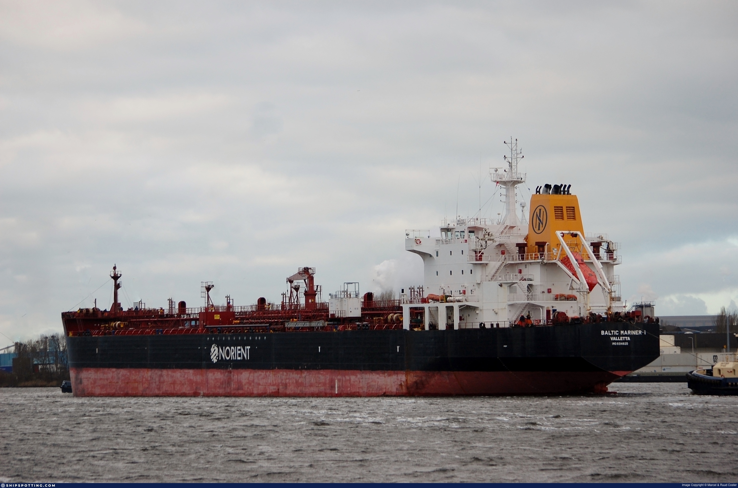
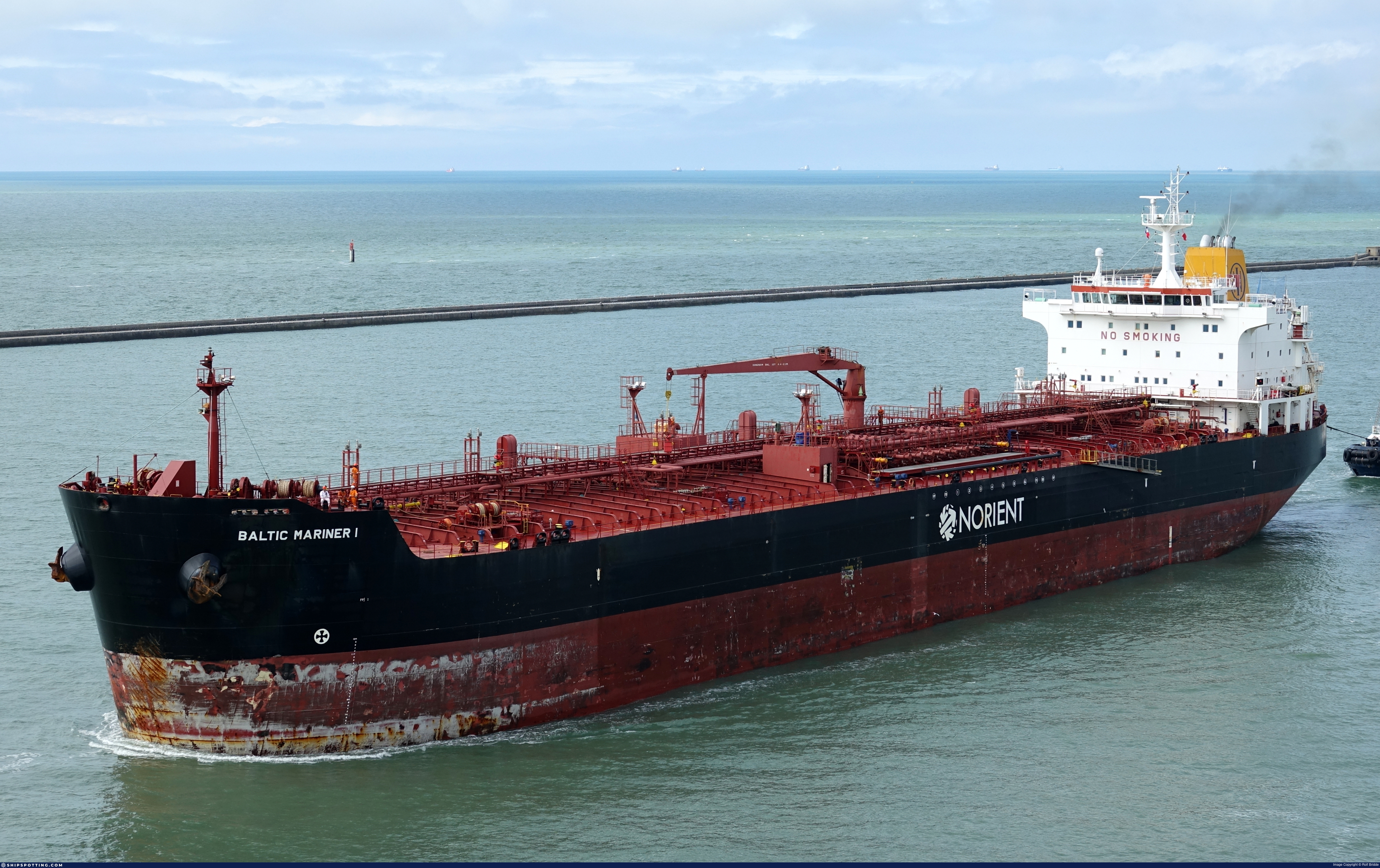
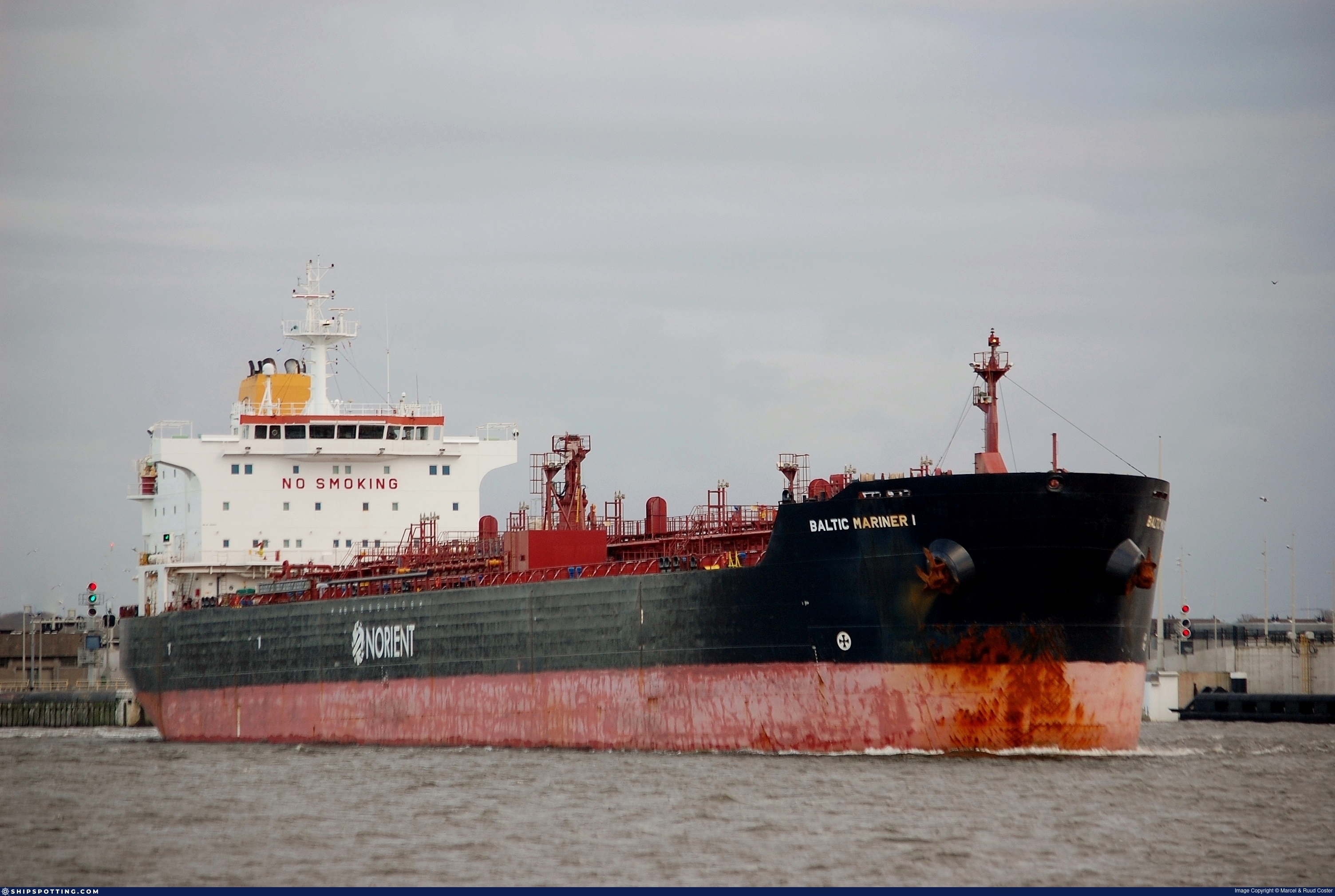
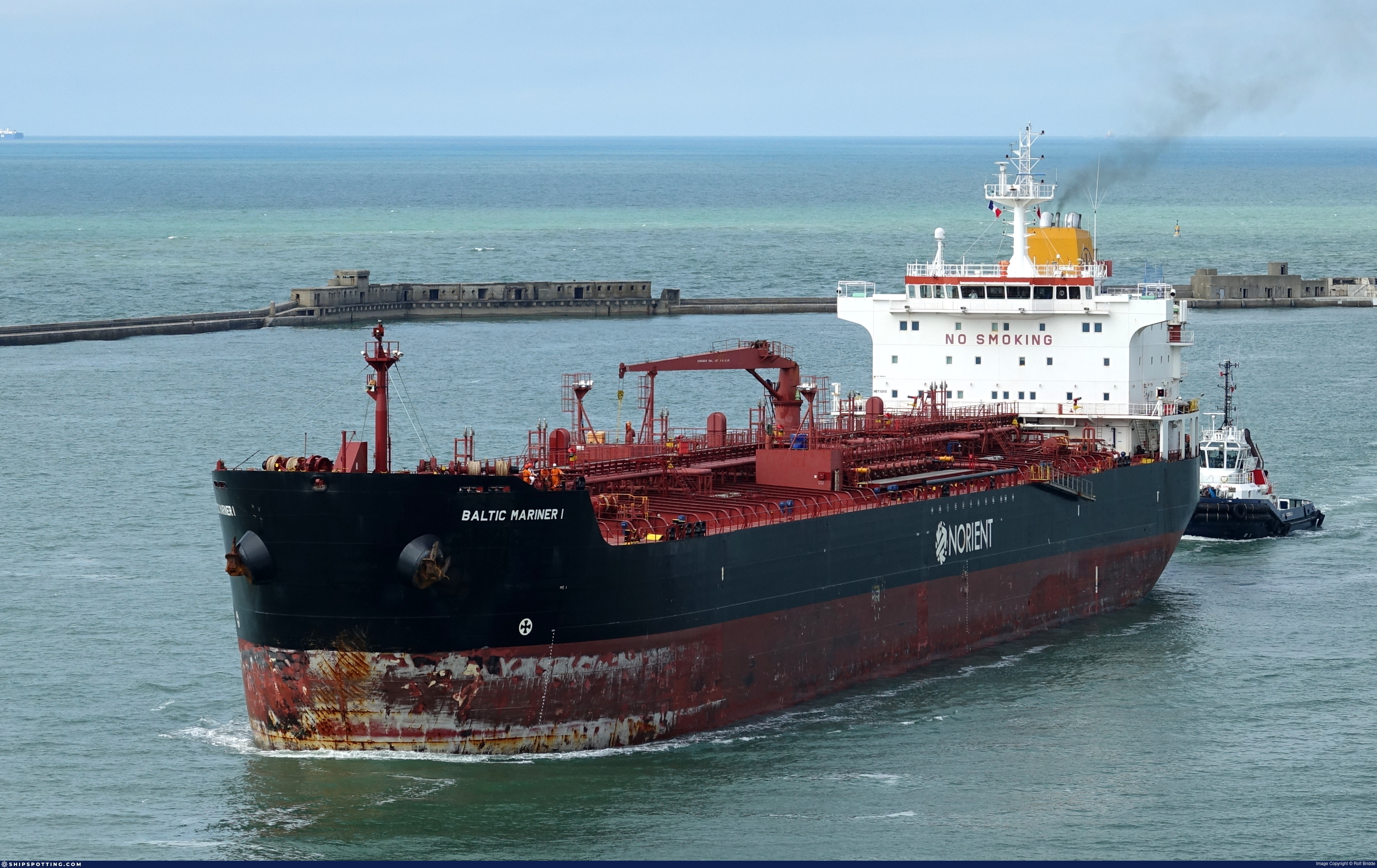
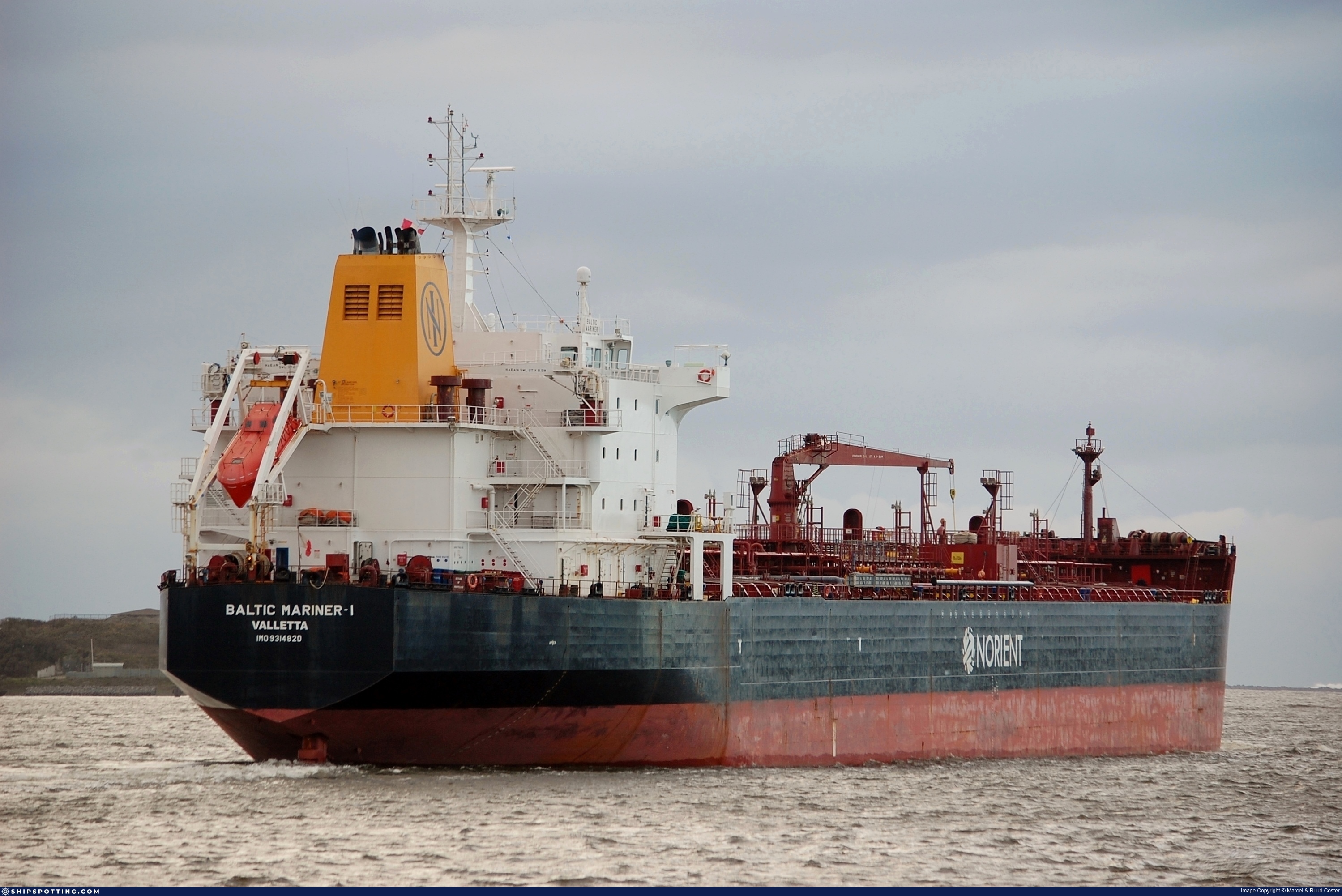
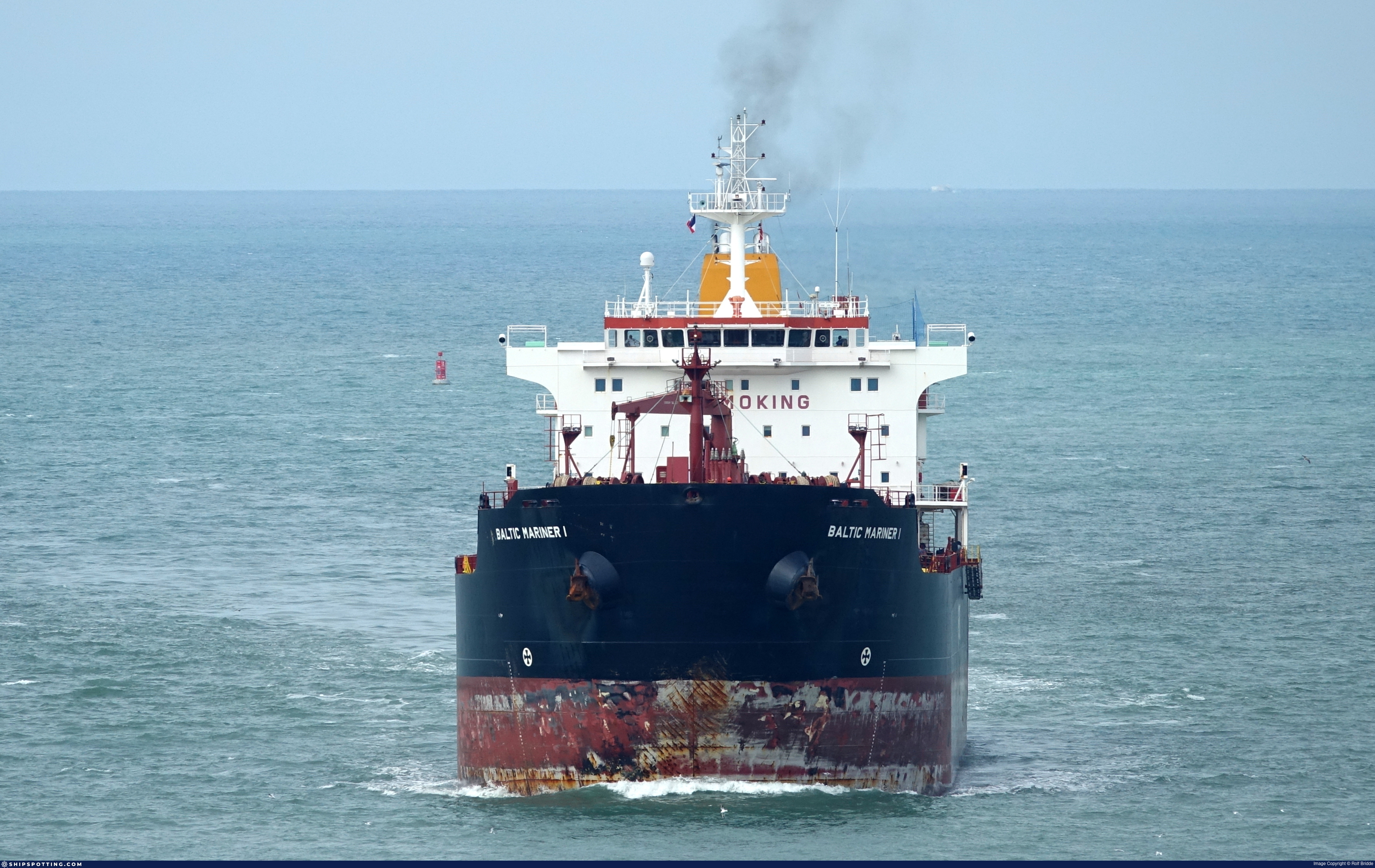
IMO 9314820
Vessel information
Sanctioned by
Company & Ownership
Management & Operations
Classification & Safety
Port State Control (PSC) Inspections
Survey Renewal & Certificates
| Code | Type | Issuer | Issued | Expires |
|---|---|---|---|---|
| 505 | International Oil Pollution Prevention (IOPP) | RINA Services S.p.A. (186) | 11/03/2025 | 10/02/2030 |
| 507 | International Sewage Pollution Prevention | RINA Services S.p.A. (186) | 11/03/2025 | 10/02/2030 |
Programs & Notes
EU Russia Sanctions – Shadow Fleet | SEMA (Canada) — vessel designations | Russia Sanctions Act 2022 (NZ) | The Russia (Sanctions) (EU Exit) Regulations 2019
Vessel Changes
 🔄 Owner
 🔄 Owner
AIS Events
50 events detected • 5 zones • Last: May 22, 2026
- Zone: Bosphorus/Dardanelles Approach
- Duration: 2h 47m
- Data Points: 7 AIS positions
- Period: 2026-05-22T13:41:10+00:00 to 2026-05-22T16:28:50+00:00
Show Raw Evidence JSON
{
    "zone_id": "osint_bosphorus",
    "zone_name": "Bosphorus\/Dardanelles Approach",
    "dwell_minutes": 167.69999999999998863131622783839702606201171875,
    "points_in_zone": 7,
    "first_point": {
        "ts": "2026-05-22T13:41:10+00:00",
        "lat": 40.942603300000001809166860766708850860595703125,
        "lon": 28.7655816999999984773239702917635440826416015625
    },
    "last_point": {
        "ts": "2026-05-22T16:28:50+00:00",
        "lat": 40.93831329999999724122972111217677593231201171875,
        "lon": 28.758868299999999607052814099006354808807373046875
    }
}- Zone: Bosphorus/Dardanelles Approach
- Duration: 4h 11m
- Data Points: 9 AIS positions
- Period: 2026-05-22T12:17:12+00:00 to 2026-05-22T16:28:50+00:00
Show Raw Evidence JSON
{
    "zone_id": "osint_bosphorus",
    "zone_name": "Bosphorus\/Dardanelles Approach",
    "dwell_minutes": 251.599999999999994315658113919198513031005859375,
    "points_in_zone": 9,
    "first_point": {
        "ts": "2026-05-22T12:17:12+00:00",
        "lat": 40.94373329999999810979716130532324314117431640625,
        "lon": 28.766323299999999818510332261212170124053955078125
    },
    "last_point": {
        "ts": "2026-05-22T16:28:50+00:00",
        "lat": 40.93831329999999724122972111217677593231201171875,
        "lon": 28.758868299999999607052814099006354808807373046875
    }
}- Duration: 5h 17m
- Radius: 694 meters
- Data Points: 16 AIS positions
- Centroid: 40.9427, 28.7648
- Zone: Bosphorus/Dardanelles Approach
Show Raw Evidence JSON
{
    "radius_m": 693.700000000000045474735088646411895751953125,
    "duration_minutes": 317.69999999999998863131622783839702606201171875,
    "points": 16,
    "centroid": {
        "lat": 40.94265134374999348665369325317442417144775390625,
        "lon": 28.764794681250005936590241617523133754730224609375
    },
    "bbox": {
        "min_lat": 40.93831329999999724122972111217677593231201171875,
        "min_lon": 28.758868299999999607052814099006354808807373046875,
        "max_lat": 40.94374330000000128393367049284279346466064453125,
        "max_lon": 28.766375000000000028421709430404007434844970703125
    },
    "zone_id": "osint_bosphorus"
}- Zone: Bosphorus/Dardanelles Approach
- Duration: 5h 17m
- Data Points: 16 AIS positions
- Period: 2026-05-22T11:11:09+00:00 to 2026-05-22T16:28:50+00:00
Show Raw Evidence JSON
{
    "zone_id": "osint_bosphorus",
    "zone_name": "Bosphorus\/Dardanelles Approach",
    "dwell_minutes": 317.69999999999998863131622783839702606201171875,
    "points_in_zone": 16,
    "first_point": {
        "ts": "2026-05-22T11:11:09+00:00",
        "lat": 40.9433633000000014590114005841314792633056640625,
        "lon": 28.766220000000000567297320230863988399505615234375
    },
    "last_point": {
        "ts": "2026-05-22T16:28:50+00:00",
        "lat": 40.93831329999999724122972111217677593231201171875,
        "lon": 28.758868299999999607052814099006354808807373046875
    }
}- Duration: 5h 50m
- Radius: 709 meters
- Data Points: 18 AIS positions
- Centroid: 40.9427, 28.7649
- Zone: Bosphorus/Dardanelles Approach
Show Raw Evidence JSON
{
    "radius_m": 709.1000000000000227373675443232059478759765625,
    "duration_minutes": 350.6000000000000227373675443232059478759765625,
    "points": 18,
    "centroid": {
        "lat": 40.9427409166666649298349511809647083282470703125,
        "lon": 28.7649349000000000842192093841731548309326171875
    },
    "bbox": {
        "min_lat": 40.93831329999999724122972111217677593231201171875,
        "min_lon": 28.758868299999999607052814099006354808807373046875,
        "max_lat": 40.94374330000000128393367049284279346466064453125,
        "max_lon": 28.766375000000000028421709430404007434844970703125
    },
    "zone_id": "osint_bosphorus"
}- Zone: Bosphorus/Dardanelles Approach
- Duration: 5h 50m
- Data Points: 18 AIS positions
- Period: 2026-05-22T10:38:11+00:00 to 2026-05-22T16:28:50+00:00
Show Raw Evidence JSON
{
    "zone_id": "osint_bosphorus",
    "zone_name": "Bosphorus\/Dardanelles Approach",
    "dwell_minutes": 350.6000000000000227373675443232059478759765625,
    "points_in_zone": 18,
    "first_point": {
        "ts": "2026-05-22T10:38:11+00:00",
        "lat": 40.94339500000000242607711697928607463836669921875,
        "lon": 28.76617329999999839174051885493099689483642578125
    },
    "last_point": {
        "ts": "2026-05-22T16:28:50+00:00",
        "lat": 40.93831329999999724122972111217677593231201171875,
        "lon": 28.758868299999999607052814099006354808807373046875
    }
}- Duration: 6h 36m
- Radius: 234 meters
- Data Points: 16 AIS positions
- Centroid: 40.9433, 28.7658
- Zone: Bosphorus/Dardanelles Approach
Show Raw Evidence JSON
{
    "radius_m": 234.19999999999998863131622783839702606201171875,
    "duration_minutes": 396,
    "points": 16,
    "centroid": {
        "lat": 40.94332082499999359015419031493365764617919921875,
        "lon": 28.765780206250003203649612260051071643829345703125
    },
    "bbox": {
        "min_lat": 40.942333300000001372609403915703296661376953125,
        "min_lon": 28.763181700000000518002707394771277904510498046875,
        "max_lat": 40.94374330000000128393367049284279346466064453125,
        "max_lon": 28.766375000000000028421709430404007434844970703125
    },
    "zone_id": "osint_bosphorus"
}- Zone: Bosphorus/Dardanelles Approach
- Duration: 6h 36m
- Data Points: 16 AIS positions
- Period: 2026-05-22T09:41:09+00:00 to 2026-05-22T16:17:09+00:00
Show Raw Evidence JSON
{
    "zone_id": "osint_bosphorus",
    "zone_name": "Bosphorus\/Dardanelles Approach",
    "dwell_minutes": 396,
    "points_in_zone": 16,
    "first_point": {
        "ts": "2026-05-22T09:41:09+00:00",
        "lat": 40.9435016999999987774572218768298625946044921875,
        "lon": 28.765956700000000267891664407216012477874755859375
    },
    "last_point": {
        "ts": "2026-05-22T16:17:09+00:00",
        "lat": 40.94256829999999780511643621139228343963623046875,
        "lon": 28.763181700000000518002707394771277904510498046875
    }
}- Duration: 5h 42m
- Radius: 113 meters
- Data Points: 23 AIS positions
- Centroid: 40.9435, 28.7661
- Zone: Bosphorus/Dardanelles Approach
Show Raw Evidence JSON
{
    "radius_m": 113.099999999999994315658113919198513031005859375,
    "duration_minutes": 342,
    "points": 23,
    "centroid": {
        "lat": 40.9434629000000001042280928231775760650634765625,
        "lon": 28.7660943434782581107356236316263675689697265625
    },
    "bbox": {
        "min_lat": 40.942554999999998699422576464712619781494140625,
        "min_lon": 28.765485000000001747366695781238377094268798828125,
        "max_lat": 40.94374330000000128393367049284279346466064453125,
        "max_lon": 28.766375000000000028421709430404007434844970703125
    },
    "zone_id": "osint_bosphorus"
}- Zone: Bosphorus/Dardanelles Approach
- Duration: 5h 42m
- Data Points: 23 AIS positions
- Period: 2026-05-22T08:02:11+00:00 to 2026-05-22T13:44:12+00:00
Show Raw Evidence JSON
{
    "zone_id": "osint_bosphorus",
    "zone_name": "Bosphorus\/Dardanelles Approach",
    "dwell_minutes": 342,
    "points_in_zone": 23,
    "first_point": {
        "ts": "2026-05-22T08:02:11+00:00",
        "lat": 40.94351499999999788315108162350952625274658203125,
        "lon": 28.76614000000000004320099833421409130096435546875
    },
    "last_point": {
        "ts": "2026-05-22T13:44:12+00:00",
        "lat": 40.942554999999998699422576464712619781494140625,
        "lon": 28.765485000000001747366695781238377094268798828125
    }
}- Duration: 6h 30m
- Radius: 117 meters
- Data Points: 32 AIS positions
- Centroid: 40.9435, 28.7661
- Zone: Bosphorus/Dardanelles Approach
Show Raw Evidence JSON
{
    "radius_m": 116.7999999999999971578290569595992565155029296875,
    "duration_minutes": 390,
    "points": 32,
    "centroid": {
        "lat": 40.9434887999999972407749737612903118133544921875,
        "lon": 28.766123640624993385017660330049693584442138671875
    },
    "bbox": {
        "min_lat": 40.942554999999998699422576464712619781494140625,
        "min_lon": 28.765485000000001747366695781238377094268798828125,
        "max_lat": 40.94374330000000128393367049284279346466064453125,
        "max_lon": 28.766375000000000028421709430404007434844970703125
    },
    "zone_id": "osint_bosphorus"
}- Zone: Bosphorus/Dardanelles Approach
- Duration: 6h 30m
- Data Points: 32 AIS positions
- Period: 2026-05-22T07:14:13+00:00 to 2026-05-22T13:44:12+00:00
Show Raw Evidence JSON
{
    "zone_id": "osint_bosphorus",
    "zone_name": "Bosphorus\/Dardanelles Approach",
    "dwell_minutes": 390,
    "points_in_zone": 32,
    "first_point": {
        "ts": "2026-05-22T07:14:13+00:00",
        "lat": 40.94366000000000127556631923653185367584228515625,
        "lon": 28.766098299999999454712451552040874958038330078125
    },
    "last_point": {
        "ts": "2026-05-22T13:44:12+00:00",
        "lat": 40.942554999999998699422576464712619781494140625,
        "lon": 28.765485000000001747366695781238377094268798828125
    }
}- Duration: 5h 30m
- Radius: 27 meters
- Data Points: 31 AIS positions
- Centroid: 40.9436, 28.7662
- Zone: Bosphorus/Dardanelles Approach
Show Raw Evidence JSON
{
    "radius_m": 27.199999999999999289457264239899814128875732421875,
    "duration_minutes": 330,
    "points": 31,
    "centroid": {
        "lat": 40.943552741935491212643682956695556640625,
        "lon": 28.766171767741926856842837878502905368804931640625
    },
    "bbox": {
        "min_lat": 40.9433633000000014590114005841314792633056640625,
        "min_lon": 28.765940000000000509317032992839813232421875,
        "max_lat": 40.94374330000000128393367049284279346466064453125,
        "max_lon": 28.76643500000000130967237055301666259765625
    },
    "zone_id": "osint_bosphorus"
}- Zone: Bosphorus/Dardanelles Approach
- Duration: 5h 30m
- Data Points: 31 AIS positions
- Period: 2026-05-22T06:53:11+00:00 to 2026-05-22T12:23:09+00:00
Show Raw Evidence JSON
{
    "zone_id": "osint_bosphorus",
    "zone_name": "Bosphorus\/Dardanelles Approach",
    "dwell_minutes": 330,
    "points_in_zone": 31,
    "first_point": {
        "ts": "2026-05-22T06:53:11+00:00",
        "lat": 40.94365169999999665151335648261010646820068359375,
        "lon": 28.76643500000000130967237055301666259765625
    },
    "last_point": {
        "ts": "2026-05-22T12:23:09+00:00",
        "lat": 40.94374330000000128393367049284279346466064453125,
        "lon": 28.766375000000000028421709430404007434844970703125
    }
}- Duration: 6h 33m
- Radius: 78 meters
- Data Points: 22 AIS positions
- Centroid: 40.9436, 28.7662
- Zone: Bosphorus/Dardanelles Approach
Show Raw Evidence JSON
{
    "radius_m": 77.599999999999994315658113919198513031005859375,
    "duration_minutes": 393,
    "points": 22,
    "centroid": {
        "lat": 40.94355325909091192215782939456403255462646484375,
        "lon": 28.76616863181817507211235351860523223876953125
    },
    "bbox": {
        "min_lat": 40.94339500000000242607711697928607463836669921875,
        "min_lon": 28.765956700000000267891664407216012477874755859375,
        "max_lat": 40.944213300000001254375092685222625732421875,
        "max_lon": 28.766470000000001761009116307832300662994384765625
    },
    "zone_id": "osint_bosphorus"
}- Zone: Bosphorus/Dardanelles Approach
- Duration: 6h 33m
- Data Points: 22 AIS positions
- Period: 2026-05-22T04:05:11+00:00 to 2026-05-22T10:38:11+00:00
Show Raw Evidence JSON
{
    "zone_id": "osint_bosphorus",
    "zone_name": "Bosphorus\/Dardanelles Approach",
    "dwell_minutes": 393,
    "points_in_zone": 22,
    "first_point": {
        "ts": "2026-05-22T04:05:11+00:00",
        "lat": 40.944213300000001254375092685222625732421875,
        "lon": 28.766470000000001761009116307832300662994384765625
    },
    "last_point": {
        "ts": "2026-05-22T10:38:11+00:00",
        "lat": 40.94339500000000242607711697928607463836669921875,
        "lon": 28.76617329999999839174051885493099689483642578125
    }
}- Zone: Bosphorus/Dardanelles Approach
- Duration: 6h 27m
- Data Points: 7 AIS positions
- Period: 2026-05-22T00:59:13+00:00 to 2026-05-22T07:26:12+00:00
Show Raw Evidence JSON
{
    "zone_id": "osint_bosphorus",
    "zone_name": "Bosphorus\/Dardanelles Approach",
    "dwell_minutes": 387,
    "points_in_zone": 7,
    "first_point": {
        "ts": "2026-05-22T00:59:13+00:00",
        "lat": 40.944400000000001682565198279917240142822265625,
        "lon": 28.7667000000000001591615728102624416351318359375
    },
    "last_point": {
        "ts": "2026-05-22T07:26:12+00:00",
        "lat": 40.94355500000000347426976077258586883544921875,
        "lon": 28.76622830000000163863660418428480625152587890625
    }
}- Zone: Bosphorus/Dardanelles Approach
- Duration: 4h 27m
- Data Points: 6 AIS positions
- Period: 2026-05-21T23:38:10+00:00 to 2026-05-22T04:05:11+00:00
Show Raw Evidence JSON
{
    "zone_id": "osint_bosphorus",
    "zone_name": "Bosphorus\/Dardanelles Approach",
    "dwell_minutes": 267,
    "points_in_zone": 6,
    "first_point": {
        "ts": "2026-05-21T23:38:10+00:00",
        "lat": 40.9444783000000001038642949424684047698974609375,
        "lon": 28.766784999999998717612470500171184539794921875
    },
    "last_point": {
        "ts": "2026-05-22T04:05:11+00:00",
        "lat": 40.944213300000001254375092685222625732421875,
        "lon": 28.766470000000001761009116307832300662994384765625
    }
}- Zone: Bosphorus/Dardanelles Approach
- Duration: 5h 36m
- Data Points: 7 AIS positions
- Period: 2026-05-21T22:29:10+00:00 to 2026-05-22T04:05:11+00:00
Show Raw Evidence JSON
{
    "zone_id": "osint_bosphorus",
    "zone_name": "Bosphorus\/Dardanelles Approach",
    "dwell_minutes": 336,
    "points_in_zone": 7,
    "first_point": {
        "ts": "2026-05-21T22:29:10+00:00",
        "lat": 40.94445499999999782403392600826919078826904296875,
        "lon": 28.766838299999999861711330595426261425018310546875
    },
    "last_point": {
        "ts": "2026-05-22T04:05:11+00:00",
        "lat": 40.944213300000001254375092685222625732421875,
        "lon": 28.766470000000001761009116307832300662994384765625
    }
}- Zone: discovered_104
- Duration: 4h 5m
- Data Points: 6 AIS positions
- Period: 2026-05-12T08:11:45+00:00 to 2026-05-12T12:17:03+00:00
Show Raw Evidence JSON
{
    "zone_id": "discovered_104",
    "zone_name": "Eastern Mediterranean Surveillance Zone",
    "dwell_minutes": 245.30000000000001136868377216160297393798828125,
    "points_in_zone": 6,
    "first_point": {
        "ts": "2026-05-12T08:11:45+00:00",
        "lat": 31.71711499999999972487785271368920803070068359375,
        "lon": 35.9993733000000020183506421744823455810546875
    },
    "last_point": {
        "ts": "2026-05-12T12:17:03+00:00",
        "lat": 31.71697999999999950659912428818643093109130859375,
        "lon": 35.9995033000000006495611160062253475189208984375
    }
}- Minimum Distance: 3 meters
- Average Distance: 5 meters
- Duration: 1h 29m
- Period: 2026-05-11T12:07:07+00:00 to 2026-05-11T13:36:08+00:00
- Vessel A Avg Speed: 0.0 knots
- Vessel B Avg Speed: 0.2 knots
- Zone: discovered_104
Confidence Analysis
High-confidence STS candidate. Two tankers (OSAR and TRITONEA) maintained close proximity (min 2m, avg 5m) for 89 minutes. Both vessels were slow-moving (avg speeds 0.0 and 0.2 knots). The stable separation distance suggests deliberate parallel positioning typical of cargo transfer. Event occurred in Eastern Mediterranean Surveillance Zone, a known STS activity area.
View scoring breakdown
| Factor | Score | Detail |
|---|---|---|
| Distance Tightness | 25/25 | Min distance 2m, avg 5m |
| Duration | 15/25 | Duration 89 minutes |
| Speed Stability | 20/20 | both nearly stationary; very stable speeds |
| Distance Consistency | 15/15 | Distance variance ±2m |
| Isolation | 5/10 | Isolation data not available |
| Context | 5/5 | In monitored zone: Eastern Mediterranean Surveillance Zone |
🛰️ Satellite Corroboration
No satellite imagery for this time/location
No Sentinel-1 scenes covering AOI and time window
Show Raw Evidence JSON
{
    "vessel_a": {
        "mmsi": 667001665,
        "imo": 9314820,
        "name": "OSAR",
        "flag": "SIERRA LEONE"
    },
    "vessel_b": {
        "mmsi": 352001697,
        "imo": 9243318,
        "name": "TRITONEA",
        "flag": "Panama"
    },
    "min_distance_m": 2.5,
    "avg_distance_m": 5,
    "distance_consistency_m": 1.899999999999999911182158029987476766109466552734375,
    "duration_minutes": 89,
    "overlap_duration_s": 5341,
    "speed_a_avg": 0.01000000000000000020816681711721685132943093776702880859375,
    "speed_a_std": 0.0299999999999999988897769753748434595763683319091796875,
    "speed_b_avg": 0.1700000000000000122124532708767219446599483489990234375,
    "speed_b_std": 0.1600000000000000033306690738754696212708950042724609375,
    "speed_summary": {
        "vessel_a": {
            "avg_sog": 0.01000000000000000020816681711721685132943093776702880859375,
            "max_sog": 0.1000000000000000055511151231257827021181583404541015625
        },
        "vessel_b": {
            "avg_sog": 0.1700000000000000122124532708767219446599483489990234375,
            "max_sog": 0.299999999999999988897769753748434595763683319091796875
        }
    },
    "time_window": {
        "start": "2026-05-11T12:07:07+00:00",
        "end": "2026-05-11T13:36:08+00:00"
    },
    "points_count": {
        "vessel_a": 9,
        "vessel_b": 9
    },
    "zone_id": "discovered_104",
    "zone_name": "Eastern Mediterranean Surveillance Zone",
    "score": {
        "value": 85,
        "components": {
            "distance_tightness": {
                "score": 25,
                "max": 25,
                "detail": "Min distance 2m, avg 5m"
            },
            "duration": {
                "score": 15,
                "max": 25,
                "detail": "Duration 89 minutes"
            },
            "speed_stability": {
                "score": 20,
                "max": 20,
                "detail": "both nearly stationary; very stable speeds"
            },
            "distance_consistency": {
                "score": 15,
                "max": 15,
                "detail": "Distance variance \u00b12m"
            },
            "isolation": {
                "score": 5,
                "max": 10,
                "detail": "Isolation data not available"
            },
            "context": {
                "score": 5,
                "max": 5,
                "detail": "In monitored zone: Eastern Mediterranean Surveillance Zone"
            }
        },
        "summary": "High-confidence STS candidate. Two tankers (OSAR and TRITONEA) maintained close proximity (min 2m, avg 5m) for 89 minutes. Both vessels were slow-moving (avg speeds 0.0 and 0.2 knots). The stable separation distance suggests deliberate parallel positioning typical of cargo transfer. Event occurred in Eastern Mediterranean Surveillance Zone, a known STS activity area."
    },
    "sar": {
        "status": "not_found",
        "centroid": {
            "lat": 31.7171009999999995443431544117629528045654296875,
            "lon": 35.9993515999999971199940773658454418182373046875
        },
        "time_window": {
            "start_ts": "2026-05-11T12:07:07+00:00",
            "end_ts": "2026-05-11T13:36:08+00:00"
        },
        "searched_at": "2026-05-11T19:45:07.493953+00:00",
        "notes": "No Sentinel-1 scenes covering AOI and time window"
    }
}- Minimum Distance: 0 meters
- Average Distance: 2 meters
- Duration: 1h 31m
- Period: 2026-05-11T12:07:07+00:00 to 2026-05-11T13:38:19+00:00
- Vessel A Avg Speed: 0.0 knots
- Vessel B Avg Speed: 0.0 knots
- Zone: discovered_104
Confidence Analysis
High-confidence STS candidate. Two tankers (OSAR and THALIA) maintained close proximity (min 0m, avg 2m) for 91 minutes. Both vessels were slow-moving (avg speeds 0.0 and 0.0 knots). The stable separation distance suggests deliberate parallel positioning typical of cargo transfer. Event occurred in Eastern Mediterranean Surveillance Zone, a known STS activity area.
View scoring breakdown
| Factor | Score | Detail |
|---|---|---|
| Distance Tightness | 25/25 | Min distance 0m, avg 2m |
| Duration | 20/25 | Duration 91 minutes |
| Speed Stability | 20/20 | both nearly stationary; very stable speeds |
| Distance Consistency | 15/15 | Distance variance ±1m |
| Isolation | 5/10 | Isolation data not available |
| Context | 5/5 | In monitored zone: Eastern Mediterranean Surveillance Zone |
🛰️ Satellite Corroboration
No satellite imagery for this time/location
No Sentinel-1 scenes covering AOI and time window
Show Raw Evidence JSON
{
    "vessel_a": {
        "mmsi": 667001665,
        "imo": 9314820,
        "name": "OSAR",
        "flag": "SIERRA LEONE"
    },
    "vessel_b": {
        "mmsi": 636015372,
        "imo": 9611541,
        "name": "THALIA",
        "flag": "Liberia"
    },
    "min_distance_m": 0.40000000000000002220446049250313080847263336181640625,
    "avg_distance_m": 1.5,
    "distance_consistency_m": 1,
    "duration_minutes": 91.2000000000000028421709430404007434844970703125,
    "overlap_duration_s": 5472,
    "speed_a_avg": 0.01000000000000000020816681711721685132943093776702880859375,
    "speed_a_std": 0.0299999999999999988897769753748434595763683319091796875,
    "speed_b_avg": 0,
    "speed_b_std": 0,
    "speed_summary": {
        "vessel_a": {
            "avg_sog": 0.01000000000000000020816681711721685132943093776702880859375,
            "max_sog": 0.1000000000000000055511151231257827021181583404541015625
        },
        "vessel_b": {
            "avg_sog": 0,
            "max_sog": 0
        }
    },
    "time_window": {
        "start": "2026-05-11T12:07:07+00:00",
        "end": "2026-05-11T13:38:19+00:00"
    },
    "points_count": {
        "vessel_a": 10,
        "vessel_b": 10
    },
    "zone_id": "discovered_104",
    "zone_name": "Eastern Mediterranean Surveillance Zone",
    "score": {
        "value": 90,
        "components": {
            "distance_tightness": {
                "score": 25,
                "max": 25,
                "detail": "Min distance 0m, avg 2m"
            },
            "duration": {
                "score": 20,
                "max": 25,
                "detail": "Duration 91 minutes"
            },
            "speed_stability": {
                "score": 20,
                "max": 20,
                "detail": "both nearly stationary; very stable speeds"
            },
            "distance_consistency": {
                "score": 15,
                "max": 15,
                "detail": "Distance variance \u00b11m"
            },
            "isolation": {
                "score": 5,
                "max": 10,
                "detail": "Isolation data not available"
            },
            "context": {
                "score": 5,
                "max": 5,
                "detail": "In monitored zone: Eastern Mediterranean Surveillance Zone"
            }
        },
        "summary": "High-confidence STS candidate. Two tankers (OSAR and THALIA) maintained close proximity (min 0m, avg 2m) for 91 minutes. Both vessels were slow-moving (avg speeds 0.0 and 0.0 knots). The stable separation distance suggests deliberate parallel positioning typical of cargo transfer. Event occurred in Eastern Mediterranean Surveillance Zone, a known STS activity area."
    },
    "sar": {
        "status": "not_found",
        "centroid": {
            "lat": 31.717089800000000110458131530322134494781494140625,
            "lon": 35.999368099999998094062902964651584625244140625
        },
        "time_window": {
            "start_ts": "2026-05-11T12:07:07+00:00",
            "end_ts": "2026-05-11T13:38:19+00:00"
        },
        "searched_at": "2026-05-11T19:45:04.797283+00:00",
        "notes": "No Sentinel-1 scenes covering AOI and time window"
    }
}- Duration: 1h 31m
- Radius: 3 meters
- Data Points: 10 AIS positions
- Centroid: 31.7171, 35.9994
- Zone: discovered_104
Show Raw Evidence JSON
{
    "radius_m": 3,
    "duration_minutes": 91.2000000000000028421709430404007434844970703125,
    "points": 10,
    "centroid": {
        "lat": 31.717088319999998446974132093600928783416748046875,
        "lon": 35.9993658300000021199593902565538883209228515625
    },
    "bbox": {
        "min_lat": 31.71706329999999951496647554449737071990966796875,
        "min_lon": 35.99934669999999670153556508012115955352783203125,
        "max_lat": 31.71710829999999958772605168633162975311279296875,
        "max_lon": 35.99937829999999649999153916724026203155517578125
    },
    "zone_id": "discovered_104"
}- Zone: discovered_104
- Duration: 1h 36m
- Data Points: 12 AIS positions
- Period: 2026-05-11T12:02:03+00:00 to 2026-05-11T13:38:19+00:00
Show Raw Evidence JSON
{
    "zone_id": "discovered_104",
    "zone_name": "Eastern Mediterranean Surveillance Zone",
    "dwell_minutes": 96.2999999999999971578290569595992565155029296875,
    "points_in_zone": 12,
    "first_point": {
        "ts": "2026-05-11T12:02:03+00:00",
        "lat": 31.717123300000000796217136667110025882720947265625,
        "lon": 35.999331699999999045758158899843692779541015625
    },
    "last_point": {
        "ts": "2026-05-11T13:38:19+00:00",
        "lat": 31.717099999999998516386767732910811901092529296875,
        "lon": 35.9993716999999975314494804479181766510009765625
    }
}- Minimum Distance: 0 meters
- Average Distance: 2 meters
- Duration: 1h 45m
- Period: 2026-05-11T11:48:24+00:00 to 2026-05-11T13:33:26+00:00
- Vessel A Avg Speed: 0.0 knots
- Vessel B Avg Speed: 0.0 knots
- Zone: discovered_104
Confidence Analysis
High-confidence STS candidate. Two tankers (THALIA and OSAR) maintained close proximity (min 0m, avg 2m) for 105 minutes. Both vessels were slow-moving (avg speeds 0.0 and 0.0 knots). The stable separation distance suggests deliberate parallel positioning typical of cargo transfer. Event occurred in Eastern Mediterranean Surveillance Zone, a known STS activity area.
View scoring breakdown
| Factor | Score | Detail |
|---|---|---|
| Distance Tightness | 25/25 | Min distance 0m, avg 2m |
| Duration | 20/25 | Duration 105 minutes |
| Speed Stability | 20/20 | both nearly stationary; very stable speeds |
| Distance Consistency | 15/15 | Distance variance ±1m |
| Isolation | 5/10 | Isolation data not available |
| Context | 5/5 | In monitored zone: Eastern Mediterranean Surveillance Zone |
🛰️ Satellite Corroboration
No satellite imagery for this time/location
No Sentinel-1 scenes covering AOI and time window
Show Raw Evidence JSON
{
    "vessel_a": {
        "mmsi": 636015372,
        "imo": 9611541,
        "name": "THALIA",
        "flag": "Liberia"
    },
    "vessel_b": {
        "mmsi": 667001665,
        "imo": 9314820,
        "name": "OSAR",
        "flag": "SIERRA LEONE"
    },
    "min_distance_m": 0.40000000000000002220446049250313080847263336181640625,
    "avg_distance_m": 2.100000000000000088817841970012523233890533447265625,
    "distance_consistency_m": 1.100000000000000088817841970012523233890533447265625,
    "duration_minutes": 105,
    "overlap_duration_s": 6302,
    "speed_a_avg": 0,
    "speed_a_std": 0,
    "speed_b_avg": 0.0200000000000000004163336342344337026588618755340576171875,
    "speed_b_std": 0.040000000000000000832667268468867405317723751068115234375,
    "speed_summary": {
        "vessel_a": {
            "avg_sog": 0,
            "max_sog": 0
        },
        "vessel_b": {
            "avg_sog": 0.0200000000000000004163336342344337026588618755340576171875,
            "max_sog": 0.1000000000000000055511151231257827021181583404541015625
        }
    },
    "time_window": {
        "start": "2026-05-11T11:48:24+00:00",
        "end": "2026-05-11T13:33:26+00:00"
    },
    "points_count": {
        "vessel_a": 12,
        "vessel_b": 12
    },
    "zone_id": "discovered_104",
    "zone_name": "Eastern Mediterranean Surveillance Zone",
    "score": {
        "value": 90,
        "components": {
            "distance_tightness": {
                "score": 25,
                "max": 25,
                "detail": "Min distance 0m, avg 2m"
            },
            "duration": {
                "score": 20,
                "max": 25,
                "detail": "Duration 105 minutes"
            },
            "speed_stability": {
                "score": 20,
                "max": 20,
                "detail": "both nearly stationary; very stable speeds"
            },
            "distance_consistency": {
                "score": 15,
                "max": 15,
                "detail": "Distance variance \u00b11m"
            },
            "isolation": {
                "score": 5,
                "max": 10,
                "detail": "Isolation data not available"
            },
            "context": {
                "score": 5,
                "max": 5,
                "detail": "In monitored zone: Eastern Mediterranean Surveillance Zone"
            }
        },
        "summary": "High-confidence STS candidate. Two tankers (THALIA and OSAR) maintained close proximity (min 0m, avg 2m) for 105 minutes. Both vessels were slow-moving (avg speeds 0.0 and 0.0 knots). The stable separation distance suggests deliberate parallel positioning typical of cargo transfer. Event occurred in Eastern Mediterranean Surveillance Zone, a known STS activity area."
    },
    "sar": {
        "status": "not_found",
        "centroid": {
            "lat": 31.7170851999999996451151673682034015655517578125,
            "lon": 35.99937030000000248719516093842685222625732421875
        },
        "time_window": {
            "start_ts": "2026-05-11T11:48:24+00:00",
            "end_ts": "2026-05-11T13:33:26+00:00"
        },
        "searched_at": "2026-05-11T13:45:13.045779+00:00",
        "notes": "No Sentinel-1 scenes covering AOI and time window"
    }
}- Zone: discovered_104
- Duration: 1h 50m
- Data Points: 17 AIS positions
- Period: 2026-05-11T11:47:25+00:00 to 2026-05-11T13:38:19+00:00
Show Raw Evidence JSON
{
    "zone_id": "discovered_104",
    "zone_name": "Eastern Mediterranean Surveillance Zone",
    "dwell_minutes": 110.900000000000005684341886080801486968994140625,
    "points_in_zone": 17,
    "first_point": {
        "ts": "2026-05-11T11:47:25+00:00",
        "lat": 31.717086699999999410692907986231148242950439453125,
        "lon": 35.9993750000000005684341886080801486968994140625
    },
    "last_point": {
        "ts": "2026-05-11T13:38:19+00:00",
        "lat": 31.717099999999998516386767732910811901092529296875,
        "lon": 35.9993716999999975314494804479181766510009765625
    }
}- Zone: North Atlantic Surveillance Zone
- Duration: 2h 4m
- Data Points: 9 AIS positions
- Period: 2026-05-06T06:08:47+00:00 to 2026-05-06T08:12:55+00:00
Show Raw Evidence JSON
{
    "zone_id": "discovered_163",
    "zone_name": "Eastern Mediterranean Surveillance Zone",
    "dwell_minutes": 124.099999999999994315658113919198513031005859375,
    "points_in_zone": 9,
    "first_point": {
        "ts": "2026-05-06T06:08:47+00:00",
        "lat": 35.51423170000000339996404363773763179779052734375,
        "lon": 32.334828299999998080238583497703075408935546875
    },
    "last_point": {
        "ts": "2026-05-06T08:12:55+00:00",
        "lat": 35.51224330000000151130734593607485294342041015625,
        "lon": 32.3442900000000008731149137020111083984375
    }
}- Duration: 3h 34m
- Radius: 840 meters
- Data Points: 13 AIS positions
- Centroid: 35.5132, 32.3351
- Zone: North Atlantic Surveillance Zone
Show Raw Evidence JSON
{
    "radius_m": 839.6000000000000227373675443232059478759765625,
    "duration_minutes": 214.19999999999998863131622783839702606201171875,
    "points": 13,
    "centroid": {
        "lat": 35.51318256923077143483169493265450000762939453125,
        "lon": 32.335105900000002066008164547383785247802734375
    },
    "bbox": {
        "min_lat": 35.51224330000000151130734593607485294342041015625,
        "min_lon": 32.32706999999999908368408796377480030059814453125,
        "max_lat": 35.51423170000000339996404363773763179779052734375,
        "max_lon": 32.3442900000000008731149137020111083984375
    },
    "zone_id": "discovered_163"
}- Zone: North Atlantic Surveillance Zone
- Duration: 3h 34m
- Data Points: 13 AIS positions
- Period: 2026-05-06T04:38:46+00:00 to 2026-05-06T08:12:55+00:00
Show Raw Evidence JSON
{
    "zone_id": "discovered_163",
    "zone_name": "Eastern Mediterranean Surveillance Zone",
    "dwell_minutes": 214.19999999999998863131622783839702606201171875,
    "points_in_zone": 13,
    "first_point": {
        "ts": "2026-05-06T04:38:46+00:00",
        "lat": 35.5123583000000024867404135875403881072998046875,
        "lon": 32.32706999999999908368408796377480030059814453125
    },
    "last_point": {
        "ts": "2026-05-06T08:12:55+00:00",
        "lat": 35.51224330000000151130734593607485294342041015625,
        "lon": 32.3442900000000008731149137020111083984375
    }
}- Gap Duration: 6h 36m
- Last Seen: 2026-05-05T22:02:03+00:00 at 35.5102, 32.3224 (Zone: North Atlantic Surveillance Zone)
- Next Seen: 2026-05-06T04:38:46+00:00 at 35.5124, 32.3271
🛰️ Gap Corroboration
These are snapshots that may corroborate presence during the gap. They do not reconstruct a continuous route.
SAR Imagery (Sentinel-1)
Status: ✓ Snapshot available
SAR snapshot available for review
Scene: S1D_IW_GRDH_1SDV_20260506T035030_20260506T035055_002658_004730_2837_COG • Time: 2026-05-06T03:50:30.278795Z
SAR coverage thumbnail
VIIRS Thermal Anomaly
Status: ✗ No detections
No VIIRS thermal/light detections in corridor
Show Raw Evidence JSON
{
    "gap_minutes": 396.69999999999998863131622783839702606201171875,
    "last_seen": {
        "ts": "2026-05-05T22:02:03+00:00",
        "lat": 35.51019000000000147565515362657606601715087890625,
        "lon": 32.32235670000000027357600629329681396484375,
        "sog": 6.5,
        "zone_id": "discovered_163"
    },
    "next_seen": {
        "ts": "2026-05-06T04:38:46+00:00",
        "lat": 35.5123583000000024867404135875403881072998046875,
        "lon": 32.32706999999999908368408796377480030059814453125,
        "zone_ids": [
            "discovered_163"
        ]
    },
    "gap_enrichment": {
        "status": "done",
        "corridor": {
            "start": {
                "lat": 35.51019000000000147565515362657606601715087890625,
                "lon": 32.32235670000000027357600629329681396484375,
                "ts": "2026-05-05T22:02:03+00:00"
            },
            "end": {
                "lat": 35.5123583000000024867404135875403881072998046875,
                "lon": 32.32706999999999908368408796377480030059814453125,
                "ts": "2026-05-06T04:38:46+00:00"
            },
            "bbox": {
                "min_lat": 35.3300100000000014688339433632791042327880859375,
                "min_lon": 32.1010050000000006775735528208315372467041015625,
                "max_lat": 35.6925379999999989877323969267308712005615234375,
                "max_lon": 32.54842099999999760484570288099348545074462890625
            },
            "buffer_km": 20
        },
        "sar": {
            "status": "snapshot",
            "scene_id": "S1D_IW_GRDH_1SDV_20260506T035030_20260506T035055_002658_004730_2837_COG",
            "scene_time": "2026-05-06T03:50:30.278795Z",
            "platform": "sentinel-1d",
            "assets": {
                "preview_url": "https:\/\/fleetleaks.com\/wp-content\/uploads\/fleetleaks-evidence\/sar-imagery\/2026\/05\/event_489837_thumbnail_20260506044506.png",
                "stored_path": "\/home\/fleetleaks\/public_html\/wp-content\/uploads\/fleetleaks-evidence\/sar-imagery\/2026\/05\/event_489837_thumbnail_20260506044506.png",
                "source": "copernicus_dataspace"
            },
            "notes": "SAR snapshot available for review"
        },
        "viirs": {
            "status": "not_found",
            "notes": "No VIIRS thermal\/light detections in corridor"
        },
        "searched_at": "2026-05-06T04:45:01.783619+00:00"
    }
}- Zone: North Atlantic Surveillance Zone
- Duration: 6h 38m
- Data Points: 3 AIS positions
- Period: 2026-05-05T22:00:13+00:00 to 2026-05-06T04:38:46+00:00
Show Raw Evidence JSON
{
    "zone_id": "discovered_163",
    "zone_name": "Eastern Mediterranean Surveillance Zone",
    "dwell_minutes": 398.6000000000000227373675443232059478759765625,
    "points_in_zone": 3,
    "first_point": {
        "ts": "2026-05-05T22:00:13+00:00",
        "lat": 35.5107799999999969031705404631793498992919921875,
        "lon": 32.32652829999999966048562782816588878631591796875
    },
    "last_point": {
        "ts": "2026-05-06T04:38:46+00:00",
        "lat": 35.5123583000000024867404135875403881072998046875,
        "lon": 32.32706999999999908368408796377480030059814453125
    }
}- Zone: North Atlantic Surveillance Zone
- Duration: 1h 58m
- Data Points: 18 AIS positions
- Period: 2026-05-05T20:03:58+00:00 to 2026-05-05T22:02:03+00:00
Show Raw Evidence JSON
{
    "zone_id": "discovered_163",
    "zone_name": "Eastern Mediterranean Surveillance Zone",
    "dwell_minutes": 118.099999999999994315658113919198513031005859375,
    "points_in_zone": 18,
    "first_point": {
        "ts": "2026-05-05T20:03:58+00:00",
        "lat": 35.5576817000000033885953598655760288238525390625,
        "lon": 32.59799170000000145819285535253584384918212890625
    },
    "last_point": {
        "ts": "2026-05-05T22:02:03+00:00",
        "lat": 35.51019000000000147565515362657606601715087890625,
        "lon": 32.32235670000000027357600629329681396484375
    }
}- Zone: North Atlantic Surveillance Zone
- Duration: 5h 1m
- Data Points: 22 AIS positions
- Period: 2026-05-05T17:01:03+00:00 to 2026-05-05T22:02:03+00:00
Show Raw Evidence JSON
{
    "zone_id": "discovered_163",
    "zone_name": "Eastern Mediterranean Surveillance Zone",
    "dwell_minutes": 301,
    "points_in_zone": 22,
    "first_point": {
        "ts": "2026-05-05T17:01:03+00:00",
        "lat": 35.54654169999999879792085266672074794769287109375,
        "lon": 32.5790233000000029051079764030873775482177734375
    },
    "last_point": {
        "ts": "2026-05-05T22:02:03+00:00",
        "lat": 35.51019000000000147565515362657606601715087890625,
        "lon": 32.32235670000000027357600629329681396484375
    }
}- Zone: North Atlantic Surveillance Zone
- Duration: 3h 3m
- Data Points: 9 AIS positions
- Period: 2026-05-05T06:19:46+00:00 to 2026-05-05T09:23:27+00:00
Show Raw Evidence JSON
{
    "zone_id": "discovered_163",
    "zone_name": "Eastern Mediterranean Surveillance Zone",
    "dwell_minutes": 183.69999999999998863131622783839702606201171875,
    "points_in_zone": 9,
    "first_point": {
        "ts": "2026-05-05T06:19:46+00:00",
        "lat": 35.49851670000000325444489135406911373138427734375,
        "lon": 32.3895499999999998408384271897375583648681640625
    },
    "last_point": {
        "ts": "2026-05-05T09:23:27+00:00",
        "lat": 35.53032999999999930196281638927757740020751953125,
        "lon": 32.4393299999999982219378580339252948760986328125
    }
}- Zone: North Atlantic Surveillance Zone
- Duration: 3h 28m
- Data Points: 10 AIS positions
- Period: 2026-05-05T05:55:16+00:00 to 2026-05-05T09:23:27+00:00
Show Raw Evidence JSON
{
    "zone_id": "discovered_163",
    "zone_name": "Eastern Mediterranean Surveillance Zone",
    "dwell_minutes": 208.19999999999998863131622783839702606201171875,
    "points_in_zone": 10,
    "first_point": {
        "ts": "2026-05-05T05:55:16+00:00",
        "lat": 35.4938183000000009315044735558331012725830078125,
        "lon": 32.38541500000000183945303433574736118316650390625
    },
    "last_point": {
        "ts": "2026-05-05T09:23:27+00:00",
        "lat": 35.53032999999999930196281638927757740020751953125,
        "lon": 32.4393299999999982219378580339252948760986328125
    }
}- Zone: North Atlantic Surveillance Zone
- Duration: 6h 28m
- Data Points: 12 AIS positions
- Period: 2026-05-05T02:55:17+00:00 to 2026-05-05T09:23:27+00:00
Show Raw Evidence JSON
{
    "zone_id": "discovered_163",
    "zone_name": "Eastern Mediterranean Surveillance Zone",
    "dwell_minutes": 388.19999999999998863131622783839702606201171875,
    "points_in_zone": 12,
    "first_point": {
        "ts": "2026-05-05T02:55:17+00:00",
        "lat": 35.4858516999999977770130499266088008880615234375,
        "lon": 32.35702330000000159770934260450303554534912109375
    },
    "last_point": {
        "ts": "2026-05-05T09:23:27+00:00",
        "lat": 35.53032999999999930196281638927757740020751953125,
        "lon": 32.4393299999999982219378580339252948760986328125
    }
}- Zone: North Atlantic Surveillance Zone
- Duration: 5h 13m
- Data Points: 15 AIS positions
- Period: 2026-05-05T01:43:59+00:00 to 2026-05-05T06:57:52+00:00
Show Raw Evidence JSON
{
    "zone_id": "discovered_163",
    "zone_name": "Eastern Mediterranean Surveillance Zone",
    "dwell_minutes": 313.8999999999999772626324556767940521240234375,
    "points_in_zone": 15,
    "first_point": {
        "ts": "2026-05-05T01:43:59+00:00",
        "lat": 35.49119999999999919282345217652618885040283203125,
        "lon": 32.35180170000000288155206362716853618621826171875
    },
    "last_point": {
        "ts": "2026-05-05T06:57:52+00:00",
        "lat": 35.50563170000000212667146115563809871673583984375,
        "lon": 32.3971982999999994490281096659600734710693359375
    }
}- Zone: North Atlantic Surveillance Zone
- Duration: 6h 24m
- Data Points: 15 AIS positions
- Period: 2026-05-05T00:18:59+00:00 to 2026-05-05T06:43:22+00:00
Show Raw Evidence JSON
{
    "zone_id": "discovered_163",
    "zone_name": "Eastern Mediterranean Surveillance Zone",
    "dwell_minutes": 384.3999999999999772626324556767940521240234375,
    "points_in_zone": 15,
    "first_point": {
        "ts": "2026-05-05T00:18:59+00:00",
        "lat": 35.49370830000000154313966049812734127044677734375,
        "lon": 32.33933999999999997498889570124447345733642578125
    },
    "last_point": {
        "ts": "2026-05-05T06:43:22+00:00",
        "lat": 35.50292499999999762394509161822497844696044921875,
        "lon": 32.394198299999999335341271944344043731689453125
    }
}- Gap Duration: 5h 32m
- Last Seen: 2026-05-04T18:46:59+00:00 at 35.5203, 32.3151 (Zone: North Atlantic Surveillance Zone)
- Next Seen: 2026-05-05T00:18:59+00:00 at 35.4937, 32.3393
🛰️ Gap Corroboration
These are snapshots that may corroborate presence during the gap. They do not reconstruct a continuous route.
SAR Imagery (Sentinel-1)
Status: ✓ Snapshot available
SAR snapshot available for review
Scene: S1C_IW_GRDH_1SDV_20260504T154913_20260504T154938_007506_00F3D6_3D3B_COG • Time: 2026-05-04T15:49:13.851062Z
SAR coverage thumbnail
VIIRS Thermal Anomaly
Status: ✗ No detections
No VIIRS thermal/light detections in corridor
Show Raw Evidence JSON
{
    "gap_minutes": 332,
    "last_seen": {
        "ts": "2026-05-04T18:46:59+00:00",
        "lat": 35.5202967000000029429429559968411922454833984375,
        "lon": 32.31508170000000035315679269842803478240966796875,
        "sog": 5.0999999999999996447286321199499070644378662109375,
        "zone_id": "discovered_163"
    },
    "next_seen": {
        "ts": "2026-05-05T00:18:59+00:00",
        "lat": 35.49370830000000154313966049812734127044677734375,
        "lon": 32.33933999999999997498889570124447345733642578125,
        "zone_ids": [
            "discovered_163"
        ]
    },
    "gap_enrichment": {
        "status": "done",
        "corridor": {
            "start": {
                "lat": 35.5202967000000029429429559968411922454833984375,
                "lon": 32.31508170000000035315679269842803478240966796875,
                "ts": "2026-05-04T18:46:59+00:00"
            },
            "end": {
                "lat": 35.49370830000000154313966049812734127044677734375,
                "lon": 32.33933999999999997498889570124447345733642578125,
                "ts": "2026-05-05T00:18:59+00:00"
            },
            "bbox": {
                "min_lat": 35.31352799999999803048922331072390079498291015625,
                "min_lon": 32.09374199999999888177626417018473148345947265625,
                "max_lat": 35.70047699999999935016603558324277400970458984375,
                "max_lon": 32.56067900000000037152858567424118518829345703125
            },
            "buffer_km": 20
        },
        "sar": {
            "status": "snapshot",
            "scene_id": "S1C_IW_GRDH_1SDV_20260504T154913_20260504T154938_007506_00F3D6_3D3B_COG",
            "scene_time": "2026-05-04T15:49:13.851062Z",
            "platform": "sentinel-1c",
            "assets": {
                "preview_url": "https:\/\/fleetleaks.com\/wp-content\/uploads\/fleetleaks-evidence\/sar-imagery\/2026\/05\/event_485125_thumbnail_20260505003008.png",
                "stored_path": "\/home\/fleetleaks\/public_html\/wp-content\/uploads\/fleetleaks-evidence\/sar-imagery\/2026\/05\/event_485125_thumbnail_20260505003008.png",
                "source": "copernicus_dataspace"
            },
            "notes": "SAR snapshot available for review"
        },
        "viirs": {
            "status": "not_found",
            "notes": "No VIIRS thermal\/light detections in corridor"
        },
        "searched_at": "2026-05-05T00:30:01.773267+00:00"
    }
}- Zone: North Atlantic Surveillance Zone
- Duration: 6h 13m
- Data Points: 12 AIS positions
- Period: 2026-05-04T18:05:11+00:00 to 2026-05-05T00:18:59+00:00
Show Raw Evidence JSON
{
    "zone_id": "discovered_163",
    "zone_name": "Eastern Mediterranean Surveillance Zone",
    "dwell_minutes": 373.80000000000001136868377216160297393798828125,
    "points_in_zone": 12,
    "first_point": {
        "ts": "2026-05-04T18:05:11+00:00",
        "lat": 35.5350533000000012862074072472751140594482421875,
        "lon": 32.38568169999999923902578302659094333648681640625
    },
    "last_point": {
        "ts": "2026-05-05T00:18:59+00:00",
        "lat": 35.49370830000000154313966049812734127044677734375,
        "lon": 32.33933999999999997498889570124447345733642578125
    }
}- Zone: North Atlantic Surveillance Zone
- Duration: 6h 37m
- Data Points: 17 AIS positions
- Period: 2026-05-04T17:41:37+00:00 to 2026-05-05T00:18:59+00:00
Show Raw Evidence JSON
{
    "zone_id": "discovered_163",
    "zone_name": "Eastern Mediterranean Surveillance Zone",
    "dwell_minutes": 397.3999999999999772626324556767940521240234375,
    "points_in_zone": 17,
    "first_point": {
        "ts": "2026-05-04T17:41:37+00:00",
        "lat": 35.54531329999999655910869478248059749603271484375,
        "lon": 32.4248017000000032794559956528246402740478515625
    },
    "last_point": {
        "ts": "2026-05-05T00:18:59+00:00",
        "lat": 35.49370830000000154313966049812734127044677734375,
        "lon": 32.33933999999999997498889570124447345733642578125
    }
}- Zone: North Atlantic Surveillance Zone
- Duration: 2h 45m
- Data Points: 27 AIS positions
- Period: 2026-05-04T16:01:31+00:00 to 2026-05-04T18:46:59+00:00
Show Raw Evidence JSON
{
    "zone_id": "discovered_163",
    "zone_name": "Eastern Mediterranean Surveillance Zone",
    "dwell_minutes": 165.5,
    "points_in_zone": 27,
    "first_point": {
        "ts": "2026-05-04T16:01:31+00:00",
        "lat": 35.58088169999999905712684267200529575347900390625,
        "lon": 32.59526170000000178106347448192536830902099609375
    },
    "last_point": {
        "ts": "2026-05-04T18:46:59+00:00",
        "lat": 35.5202967000000029429429559968411922454833984375,
        "lon": 32.31508170000000035315679269842803478240966796875
    }
}- Zone: North Atlantic Surveillance Zone
- Duration: 4h 13m
- Data Points: 28 AIS positions
- Period: 2026-05-04T14:33:03+00:00 to 2026-05-04T18:46:59+00:00
Show Raw Evidence JSON
{
    "zone_id": "discovered_163",
    "zone_name": "Eastern Mediterranean Surveillance Zone",
    "dwell_minutes": 253.900000000000005684341886080801486968994140625,
    "points_in_zone": 28,
    "first_point": {
        "ts": "2026-05-04T14:33:03+00:00",
        "lat": 35.54887670000000099435055744834244251251220703125,
        "lon": 32.5839399999999983492671162821352481842041015625
    },
    "last_point": {
        "ts": "2026-05-04T18:46:59+00:00",
        "lat": 35.5202967000000029429429559968411922454833984375,
        "lon": 32.31508170000000035315679269842803478240966796875
    }
}- Zone: North Atlantic Surveillance Zone
- Duration: 5h 44m
- Data Points: 38 AIS positions
- Period: 2026-05-04T13:02:18+00:00 to 2026-05-04T18:46:59+00:00
Show Raw Evidence JSON
{
    "zone_id": "discovered_163",
    "zone_name": "Eastern Mediterranean Surveillance Zone",
    "dwell_minutes": 344.69999999999998863131622783839702606201171875,
    "points_in_zone": 38,
    "first_point": {
        "ts": "2026-05-04T13:02:18+00:00",
        "lat": 35.4882199999999983219822752289474010467529296875,
        "lon": 32.34910500000000155296220327727496623992919921875
    },
    "last_point": {
        "ts": "2026-05-04T18:46:59+00:00",
        "lat": 35.5202967000000029429429559968411922454833984375,
        "lon": 32.31508170000000035315679269842803478240966796875
    }
}- Zone: North Atlantic Surveillance Zone
- Duration: 5h 47m
- Data Points: 39 AIS positions
- Period: 2026-05-04T12:59:43+00:00 to 2026-05-04T18:46:59+00:00
Show Raw Evidence JSON
{
    "zone_id": "discovered_163",
    "zone_name": "Eastern Mediterranean Surveillance Zone",
    "dwell_minutes": 347.30000000000001136868377216160297393798828125,
    "points_in_zone": 39,
    "first_point": {
        "ts": "2026-05-04T12:59:43+00:00",
        "lat": 35.48738329999999763231244287453591823577880859375,
        "lon": 32.34229669999999856599970371462404727935791015625
    },
    "last_point": {
        "ts": "2026-05-04T18:46:59+00:00",
        "lat": 35.5202967000000029429429559968411922454833984375,
        "lon": 32.31508170000000035315679269842803478240966796875
    }
}- Zone: Southeast Aegean Monitoring Zone
- Duration: 1h 4m
- Data Points: 15 AIS positions
- Period: 2026-04-28T20:00:09+00:00 to 2026-04-28T21:04:39+00:00
Show Raw Evidence JSON
{
    "zone_id": "discovered_083",
    "zone_name": "Southeast Aegean Monitoring Zone",
    "dwell_minutes": 64.5,
    "points_in_zone": 15,
    "first_point": {
        "ts": "2026-04-28T20:00:09+00:00",
        "lat": 36.85216170000000346362867276184260845184326171875,
        "lon": 26.668378300000000535874278284609317779541015625
    },
    "last_point": {
        "ts": "2026-04-28T21:04:39+00:00",
        "lat": 36.64161500000000160071067512035369873046875,
        "lon": 26.75302669999999949368429952301084995269775390625
    }
}- Zone: Southeast Aegean Monitoring Zone
- Duration: 2h 4m
- Data Points: 47 AIS positions
- Period: 2026-04-28T19:00:29+00:00 to 2026-04-28T21:04:39+00:00
Show Raw Evidence JSON
{
    "zone_id": "discovered_083",
    "zone_name": "Southeast Aegean Monitoring Zone",
    "dwell_minutes": 124.2000000000000028421709430404007434844970703125,
    "points_in_zone": 47,
    "first_point": {
        "ts": "2026-04-28T19:00:29+00:00",
        "lat": 37.0460532999999969661075738258659839630126953125,
        "lon": 26.591509999999999536157702095806598663330078125
    },
    "last_point": {
        "ts": "2026-04-28T21:04:39+00:00",
        "lat": 36.64161500000000160071067512035369873046875,
        "lon": 26.75302669999999949368429952301084995269775390625
    }
}- Zone: Southeast Aegean Monitoring Zone
- Duration: 2h 26m
- Data Points: 51 AIS positions
- Period: 2026-04-28T18:38:30+00:00 to 2026-04-28T21:04:39+00:00
Show Raw Evidence JSON
{
    "zone_id": "discovered_083",
    "zone_name": "Southeast Aegean Monitoring Zone",
    "dwell_minutes": 146.19999999999998863131622783839702606201171875,
    "points_in_zone": 51,
    "first_point": {
        "ts": "2026-04-28T18:38:30+00:00",
        "lat": 37.10580999999999818328433320857584476470947265625,
        "lon": 26.539448300000000102727426565252244472503662109375
    },
    "last_point": {
        "ts": "2026-04-28T21:04:39+00:00",
        "lat": 36.64161500000000160071067512035369873046875,
        "lon": 26.75302669999999949368429952301084995269775390625
    }
}- Zone: discovered_179
- Duration: 1h 2m
- Data Points: 26 AIS positions
- Period: 2026-04-20T17:00:25+00:00 to 2026-04-20T18:03:02+00:00
Show Raw Evidence JSON
{
    "zone_id": "discovered_179",
    "zone_name": "Northern Scotland Surveillance Zone",
    "dwell_minutes": 62.60000000000000142108547152020037174224853515625,
    "points_in_zone": 26,
    "first_point": {
        "ts": "2026-04-20T17:00:25+00:00",
        "lat": 41.96916999999999831061359145678579807281494140625,
        "lon": 30.1477450000000004592948243953287601470947265625
    },
    "last_point": {
        "ts": "2026-04-20T18:03:02+00:00",
        "lat": 42.02962169999999986202965374104678630828857421875,
        "lon": 30.427776699999999010515239206142723560333251953125
    }
}- Zone: discovered_179
- Duration: 1h 43m
- Data Points: 51 AIS positions
- Period: 2026-04-20T16:19:24+00:00 to 2026-04-20T18:03:02+00:00
Show Raw Evidence JSON
{
    "zone_id": "discovered_179",
    "zone_name": "Northern Scotland Surveillance Zone",
    "dwell_minutes": 103.599999999999994315658113919198513031005859375,
    "points_in_zone": 51,
    "first_point": {
        "ts": "2026-04-20T16:19:24+00:00",
        "lat": 41.92826170000000018944774637930095195770263671875,
        "lon": 29.96343329999999838264557183720171451568603515625
    },
    "last_point": {
        "ts": "2026-04-20T18:03:02+00:00",
        "lat": 42.02962169999999986202965374104678630828857421875,
        "lon": 30.427776699999999010515239206142723560333251953125
    }
}Sanctioned on the same day
- Aditya · IMO 9323314 🇨🇦 CA🇪🇺 EU🇬🇧 UK
- Aleksey Savrasov · IMO 9645061 🇨🇦 CA🇪🇺 EU
- ALTURA · IMO 9292199 🇨🇦 CA🇪🇺 EU🇬🇧 UK
- Anabar · IMO 9194012 🇨🇦 CA
- Apate · IMO 9433016 🇨🇦 CA🇪🇺 EU🇬🇧 UK
- Armada Leader · IMO 9260483 🇨🇦 CA🇪🇺 EU
- Aura 1 · IMO 9472634 🇨🇦 CA🇪🇺 EU🇬🇧 UK
- Bergen T · IMO 8918540 🇨🇦 CA🇪🇺 EU