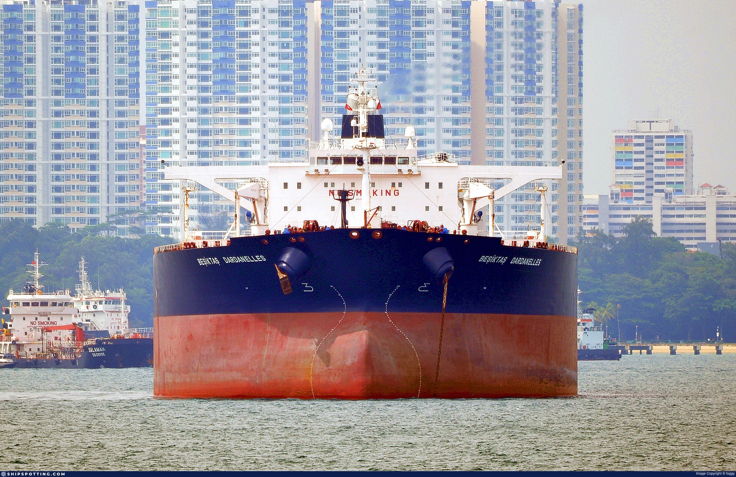
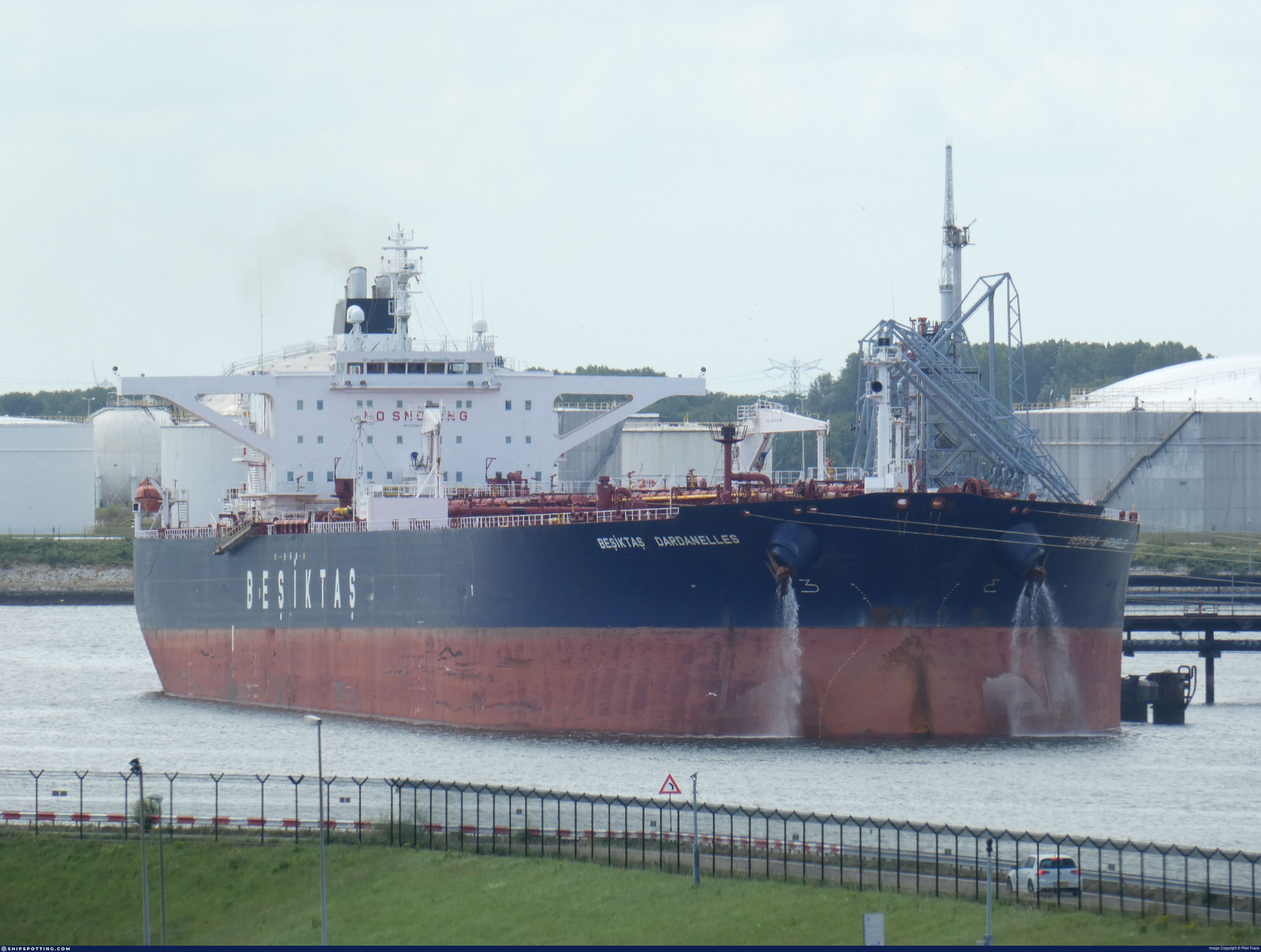
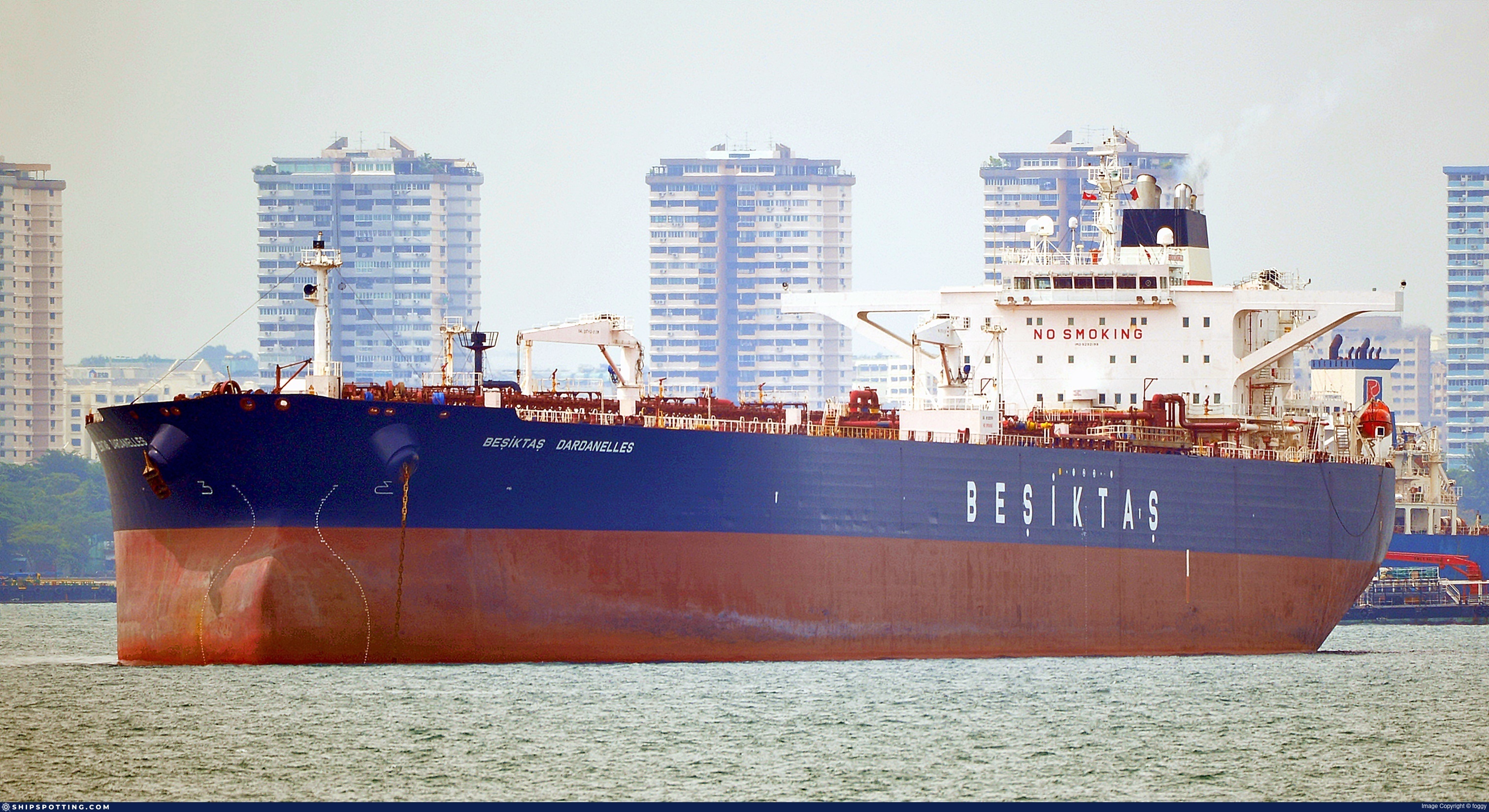
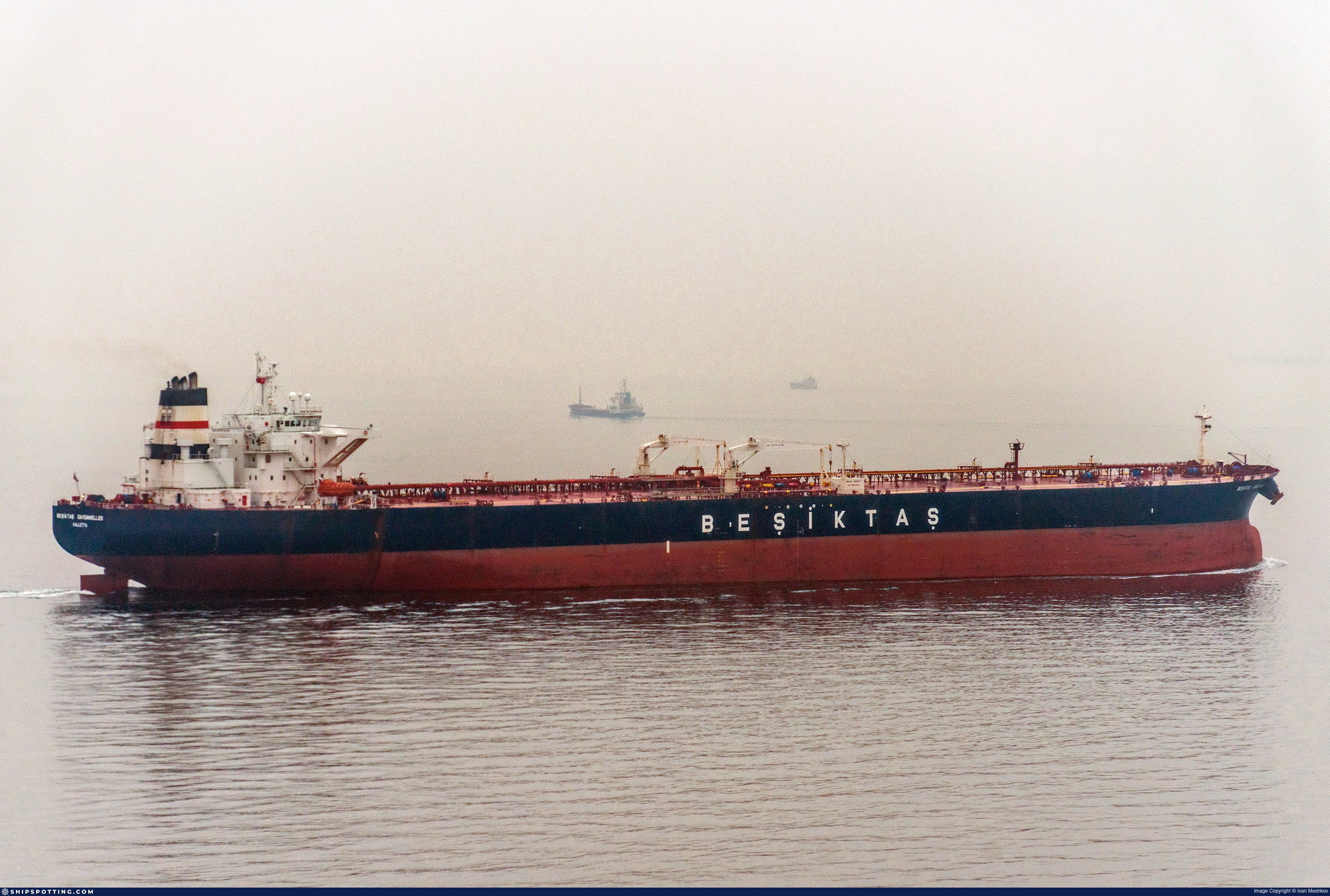
IMO 9292199
Vessel information
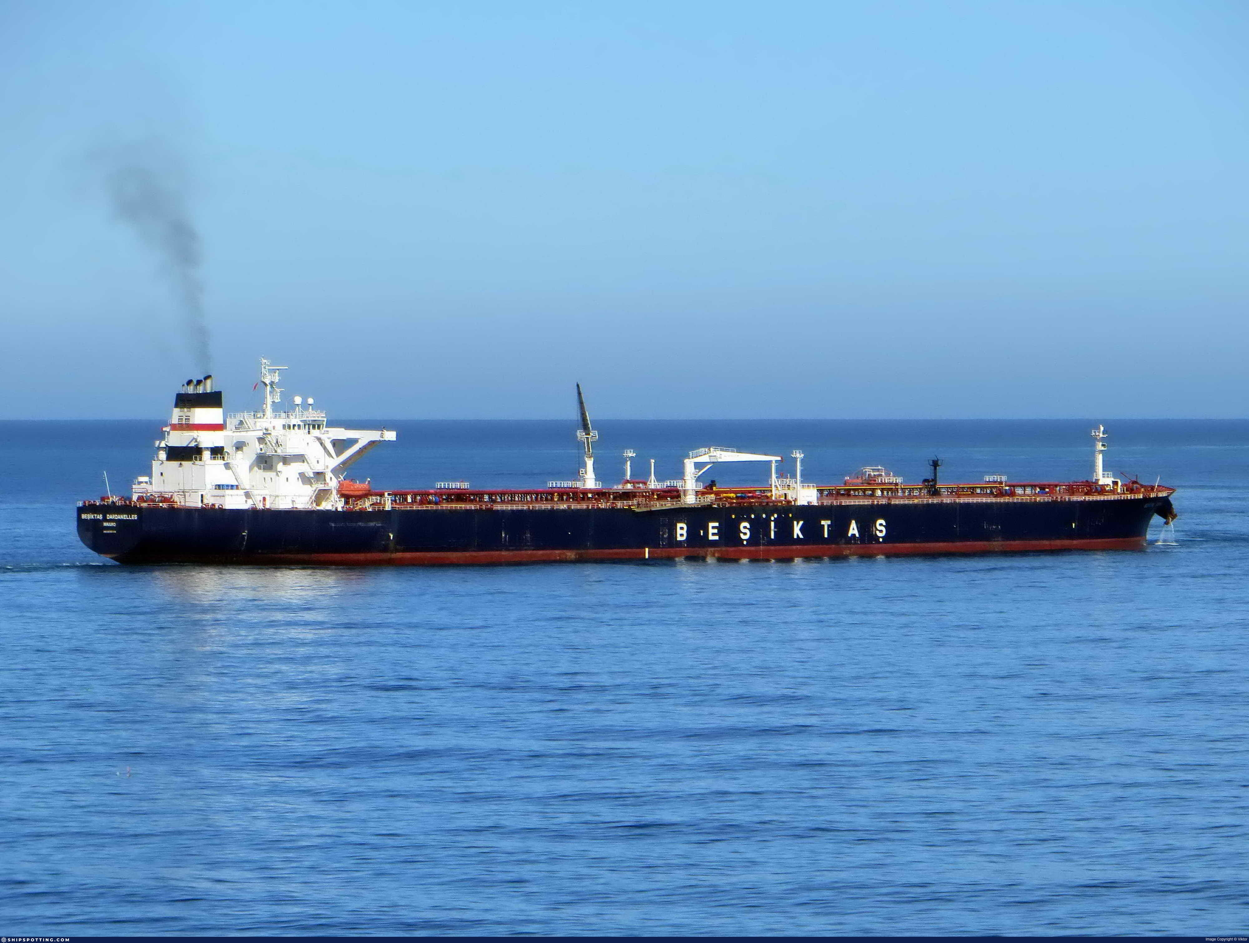
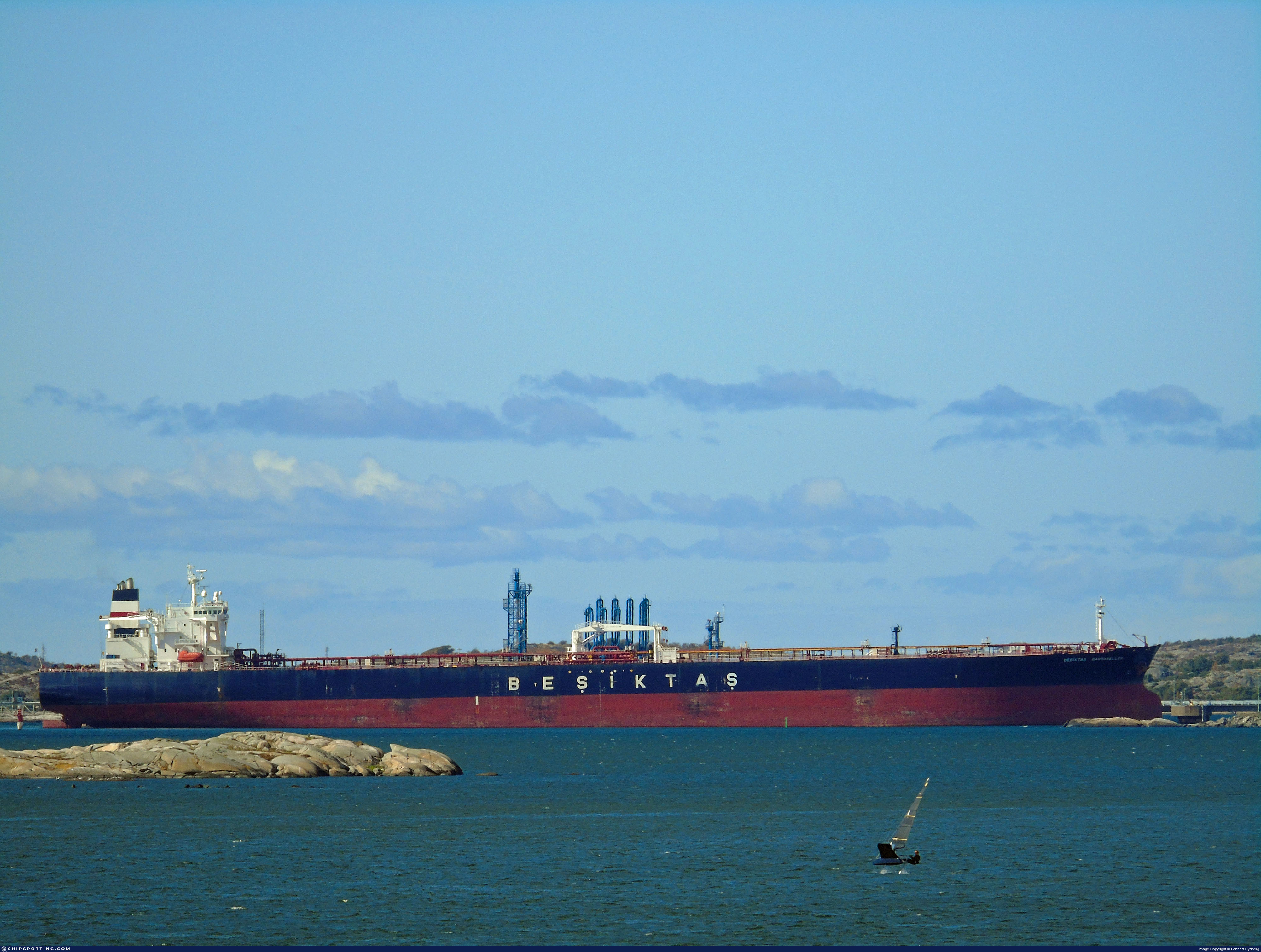
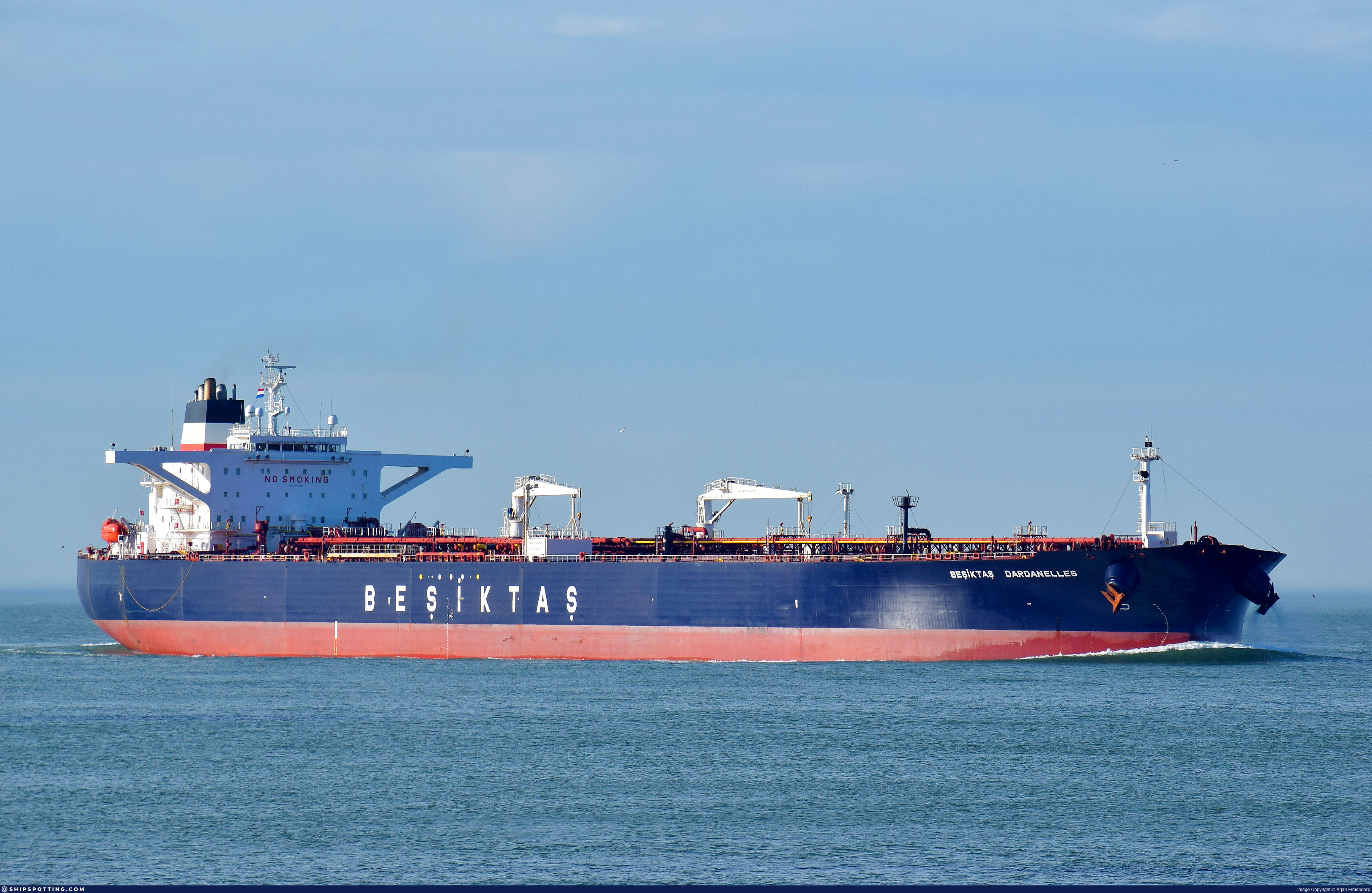
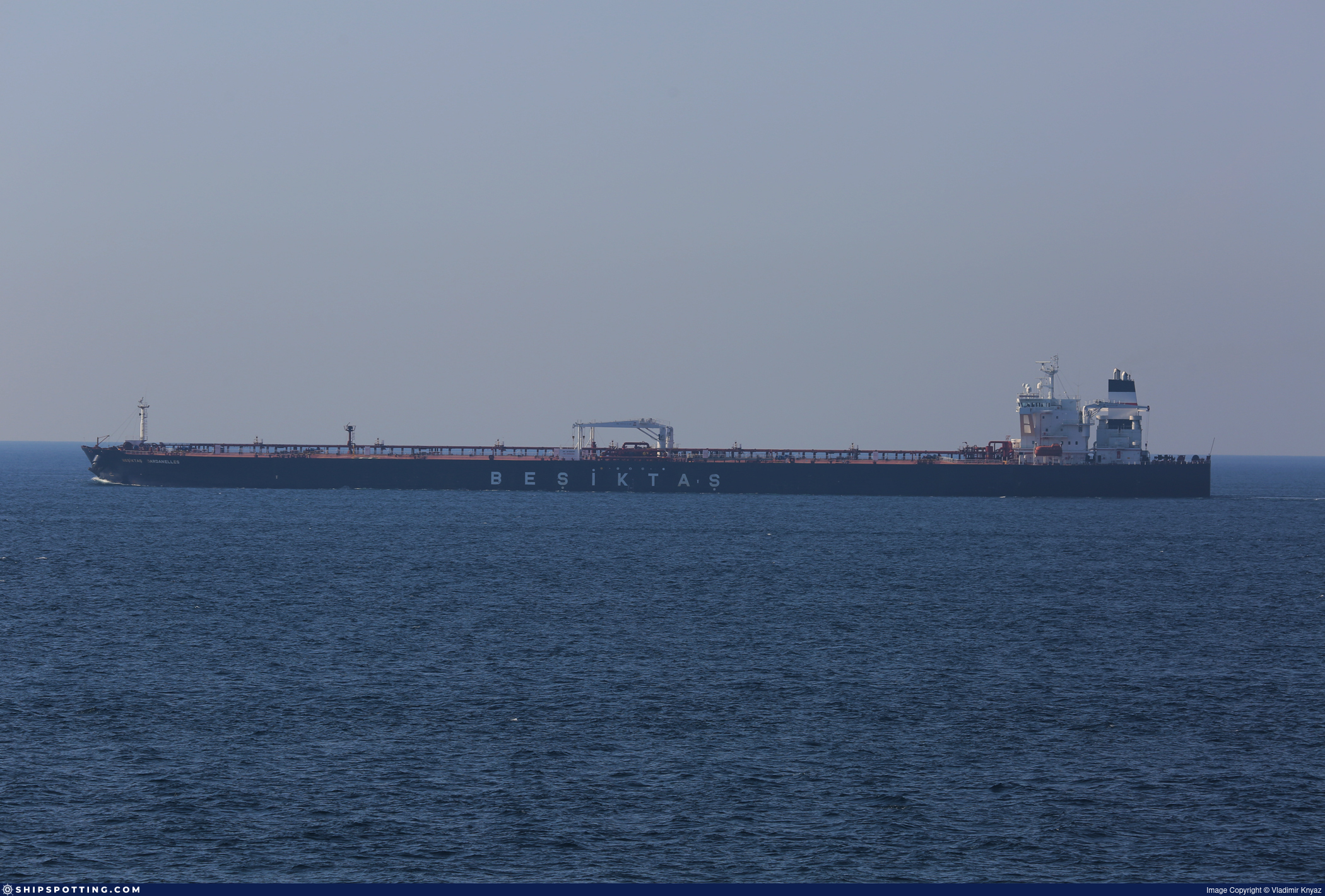
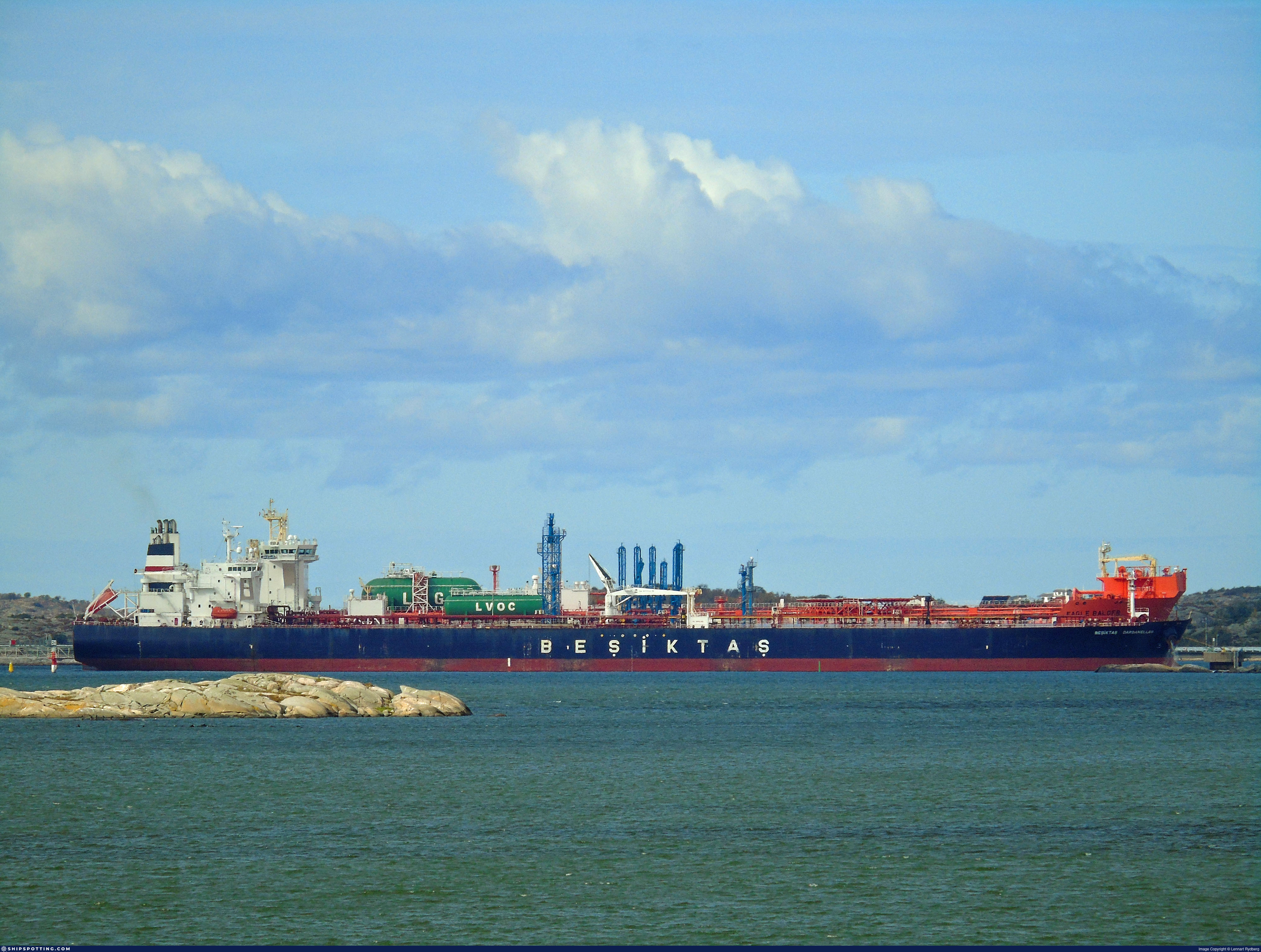
Vessel Name
ALTURA View name history 📜
IMO Number
9292199
MMSI
352003627
Vessel Type
Oil Tanker | Pétrolier
Flag
🇸🇱 Sierra Leone View flag history 📜
Call Sign
3E5250
Gross Tonnage
84,491 GT
Year Built
2005
Sanctioned by
Company & Ownership
Kayseri Shipping SA
IMO Company: 6490926
Address
C/O: Bow Maritime Gemi Isletmeciligi AS IC Kapi 391, Blok C1, Metropol Istanbul Sitesi, Ertugrul Gazi Sokak, Ataturk Mah, 2B, 34758, Istanbul, Turkey.
Status
Active
Fleet
1.0 owner, 0.0 operator, 0.0 manager, 0.0 beneficial
Management & Operations
ISM Manager
PERGAMON DENIZCILIK ISLETMELER
Ic Kapi 2, Barbaros Hayrettin Caddesi, Postane Mah, 38A, Tuzla, Istanbul, Turkey.
Commercial Manager
PERGAMON DENIZCILIK ISLETMELER
Classification & Safety
Current Classification
Russian Maritime Register of Shipping
Delivered
Port State Control (PSC) Inspections
Risk Level
LOW
Last 36 Months
5
Inspections
Last Inspection
📍 Kocaeli
📅 2025-10-20
Survey Renewal & Certificates
| Code | Type | Issuer | Issued | Expires |
|---|---|---|---|---|
| 509 | Document of Compliance | Bureau Veritas (115) | 10/01/2023 | 15/01/2028 |
| 510 | Safety Management Certificate | Liberia (LR) | 28/08/2023 | 27/11/2027 |
Programs & Notes
EU Russia Sanctions – Shadow Fleet | SEMA (Canada) — vessel designations | The Russia (Sanctions) (EU Exit) Regulations 2019
Vessel Changes
 🔄 Owner
KAYSERI (now ALTURA)
IMO 9292199
DARDANELLES SHIPPING LTD
→
KAYSERI SHIPPING SA
May 16, 2024
 🔄 Owner
BESIKTAS DARDANELLES (now ALTURA)
IMO 9292199
WINDS TANKER CO LTD-MAI
→
DARDANELLES SHIPPING LTD
Aug 28, 2023
 🔄 Owner
BESIKTAS DARDANELLES (now ALTURA)
IMO 9292199
WINDS TANKER CO LTD
→
WINDS TANKER CO LTD-MAI
Jun 9, 2022
 🔄 Owner
BESIKTAS DARDANELLES (now ALTURA)
IMO 9292199
BESIKTAS LIKID TASIMACILIK
→
WINDS TANKER CO LTD
Aug 16, 2018
AIS Events
50 events detected • 2 zones • Last: Jul 17, 2026
Zone Dwell
Bosphorus/Dardanelles Approach
Jul 17, 2026 22:40 UTC
80.0%
- Zone: Bosphorus/Dardanelles Approach
- Duration: 1h 36m
- Data Points: 5 AIS positions
- Period: 2026-07-17T22:40:43+00:00 to 2026-07-18T00:16:42+00:00
Show Raw Evidence JSON
{
    "zone_id": "osint_bosphorus",
    "zone_name": "Bosphorus\/Dardanelles Approach",
    "dwell_minutes": 96,
    "points_in_zone": 5,
    "first_point": {
        "ts": "2026-07-17T22:40:43+00:00",
        "lat": 40.71259669999999886158548179082572460174560546875,
        "lon": 29.46444999999999936335370875895023345947265625
    },
    "last_point": {
        "ts": "2026-07-18T00:16:42+00:00",
        "lat": 40.71251829999999927167664282023906707763671875,
        "lon": 29.464478299999999677538653486408293247222900390625
    }
}
Zone Dwell
Bosphorus/Dardanelles Approach
Jul 10, 2026 09:15 UTC
80.0%
- Zone: Bosphorus/Dardanelles Approach
- Duration: 1h 17m
- Data Points: 6 AIS positions
- Period: 2026-07-10T09:15:23+00:00 to 2026-07-10T10:32:33+00:00
Show Raw Evidence JSON
{
    "zone_id": "osint_bosphorus",
    "zone_name": "Bosphorus\/Dardanelles Approach",
    "dwell_minutes": 77.2000000000000028421709430404007434844970703125,
    "points_in_zone": 6,
    "first_point": {
        "ts": "2026-07-10T09:15:23+00:00",
        "lat": 40.95112830000000059271769714541733264923095703125,
        "lon": 28.959706700000001688977135927416384220123291015625
    },
    "last_point": {
        "ts": "2026-07-10T10:32:33+00:00",
        "lat": 40.85679499999999819692675373516976833343505859375,
        "lon": 28.975878300000001530634108348749577999114990234375
    }
}
Zone Dwell
Bosphorus/Dardanelles Approach
Jul 10, 2026 08:55 UTC
80.0%
- Zone: Bosphorus/Dardanelles Approach
- Duration: 1h 36m
- Data Points: 8 AIS positions
- Period: 2026-07-10T08:55:43+00:00 to 2026-07-10T10:32:33+00:00
Show Raw Evidence JSON
{
    "zone_id": "osint_bosphorus",
    "zone_name": "Bosphorus\/Dardanelles Approach",
    "dwell_minutes": 96.7999999999999971578290569595992565155029296875,
    "points_in_zone": 8,
    "first_point": {
        "ts": "2026-07-10T08:55:43+00:00",
        "lat": 40.9727783000000016500052879564464092254638671875,
        "lon": 28.985389999999998877910911687649786472320556640625
    },
    "last_point": {
        "ts": "2026-07-10T10:32:33+00:00",
        "lat": 40.85679499999999819692675373516976833343505859375,
        "lon": 28.975878300000001530634108348749577999114990234375
    }
}
Zone Dwell
Bosphorus/Dardanelles Approach
Jul 8, 2026 23:01 UTC
80.0%
- Zone: Bosphorus/Dardanelles Approach
- Duration: 1h 9m
- Data Points: 9 AIS positions
- Period: 2026-07-08T23:01:34+00:00 to 2026-07-09T00:10:34+00:00
Show Raw Evidence JSON
{
    "zone_id": "osint_bosphorus",
    "zone_name": "Bosphorus\/Dardanelles Approach",
    "dwell_minutes": 69,
    "points_in_zone": 9,
    "first_point": {
        "ts": "2026-07-08T23:01:34+00:00",
        "lat": 41.392553300000002991509973071515560150146484375,
        "lon": 28.883803300000000291447577183134853839874267578125
    },
    "last_point": {
        "ts": "2026-07-09T00:10:34+00:00",
        "lat": 41.39336999999999733290678705088794231414794921875,
        "lon": 28.88286000000000086629370343871414661407470703125
    }
}
Zone Dwell
Northern Baltic Sea Surveillance Zone
Jul 8, 2026 23:01 UTC
80.0%
- Zone: Northern Baltic Sea Surveillance Zone
- Duration: 1h 9m
- Data Points: 9 AIS positions
- Period: 2026-07-08T23:01:34+00:00 to 2026-07-09T00:10:34+00:00
Show Raw Evidence JSON
{
    "zone_id": "discovered_031",
    "zone_name": "Northern Baltic Sea Surveillance Zone",
    "dwell_minutes": 69,
    "points_in_zone": 9,
    "first_point": {
        "ts": "2026-07-08T23:01:34+00:00",
        "lat": 41.392553300000002991509973071515560150146484375,
        "lon": 28.883803300000000291447577183134853839874267578125
    },
    "last_point": {
        "ts": "2026-07-09T00:10:34+00:00",
        "lat": 41.39336999999999733290678705088794231414794921875,
        "lon": 28.88286000000000086629370343871414661407470703125
    }
}
Loiter
Northern Baltic Sea Surveillance Zone
Jul 8, 2026 22:13 UTC
75.0%
- Duration: 1h 57m
- Radius: 73 meters
- Data Points: 12 AIS positions
- Centroid: 41.3930, 28.8832
- Zone: Northern Baltic Sea Surveillance Zone
Show Raw Evidence JSON
{
    "radius_m": 73.2000000000000028421709430404007434844970703125,
    "duration_minutes": 117,
    "points": 12,
    "centroid": {
        "lat": 41.39302028333333538512306404300034046173095703125,
        "lon": 28.883222775000003679224391817115247249603271484375
    },
    "bbox": {
        "min_lat": 41.3925382999999982303052092902362346649169921875,
        "min_lon": 28.882780000000000342197381542064249515533447265625,
        "max_lat": 41.39356670000000093523340183310210704803466796875,
        "max_lon": 28.88385170000000101708792499266564846038818359375
    },
    "zone_id": "discovered_031"
}
Loiter
Bosphorus/Dardanelles Approach
Jul 8, 2026 22:13 UTC
75.0%
- Duration: 1h 57m
- Radius: 73 meters
- Data Points: 12 AIS positions
- Centroid: 41.3930, 28.8832
- Zone: Bosphorus/Dardanelles Approach
Show Raw Evidence JSON
{
    "radius_m": 73.2000000000000028421709430404007434844970703125,
    "duration_minutes": 117,
    "points": 12,
    "centroid": {
        "lat": 41.39302028333333538512306404300034046173095703125,
        "lon": 28.883222775000003679224391817115247249603271484375
    },
    "bbox": {
        "min_lat": 41.3925382999999982303052092902362346649169921875,
        "min_lon": 28.882780000000000342197381542064249515533447265625,
        "max_lat": 41.39356670000000093523340183310210704803466796875,
        "max_lon": 28.88385170000000101708792499266564846038818359375
    },
    "zone_id": "osint_bosphorus"
}
Zone Dwell
Bosphorus/Dardanelles Approach
Jul 8, 2026 22:13 UTC
80.0%
- Zone: Bosphorus/Dardanelles Approach
- Duration: 1h 57m
- Data Points: 12 AIS positions
- Period: 2026-07-08T22:13:34+00:00 to 2026-07-09T00:10:34+00:00
Show Raw Evidence JSON
{
    "zone_id": "osint_bosphorus",
    "zone_name": "Bosphorus\/Dardanelles Approach",
    "dwell_minutes": 117,
    "points_in_zone": 12,
    "first_point": {
        "ts": "2026-07-08T22:13:34+00:00",
        "lat": 41.393401699999998299972503446042537689208984375,
        "lon": 28.8827916999999985137037583626806735992431640625
    },
    "last_point": {
        "ts": "2026-07-09T00:10:34+00:00",
        "lat": 41.39336999999999733290678705088794231414794921875,
        "lon": 28.88286000000000086629370343871414661407470703125
    }
}
Zone Dwell
Northern Baltic Sea Surveillance Zone
Jul 8, 2026 22:13 UTC
80.0%
- Zone: Northern Baltic Sea Surveillance Zone
- Duration: 1h 57m
- Data Points: 12 AIS positions
- Period: 2026-07-08T22:13:34+00:00 to 2026-07-09T00:10:34+00:00
Show Raw Evidence JSON
{
    "zone_id": "discovered_031",
    "zone_name": "Northern Baltic Sea Surveillance Zone",
    "dwell_minutes": 117,
    "points_in_zone": 12,
    "first_point": {
        "ts": "2026-07-08T22:13:34+00:00",
        "lat": 41.393401699999998299972503446042537689208984375,
        "lon": 28.8827916999999985137037583626806735992431640625
    },
    "last_point": {
        "ts": "2026-07-09T00:10:34+00:00",
        "lat": 41.39336999999999733290678705088794231414794921875,
        "lon": 28.88286000000000086629370343871414661407470703125
    }
}
Loiter
Northern Baltic Sea Surveillance Zone
Jul 8, 2026 21:07 UTC
75.0%
- Duration: 3h 3m
- Radius: 181 meters
- Data Points: 16 AIS positions
- Centroid: 41.3934, 28.8832
- Zone: Northern Baltic Sea Surveillance Zone
Show Raw Evidence JSON
{
    "radius_m": 181.400000000000005684341886080801486968994140625,
    "duration_minutes": 183,
    "points": 16,
    "centroid": {
        "lat": 41.3934285499999958801708999089896678924560546875,
        "lon": 28.883153537500003693594408105127513408660888671875
    },
    "bbox": {
        "min_lat": 41.3925382999999982303052092902362346649169921875,
        "min_lon": 28.882780000000000342197381542064249515533447265625,
        "max_lat": 41.39505669999999781794031150639057159423828125,
        "max_lon": 28.88385170000000101708792499266564846038818359375
    },
    "zone_id": "discovered_031"
}
Loiter
Bosphorus/Dardanelles Approach
Jul 8, 2026 21:07 UTC
75.0%
- Duration: 3h 3m
- Radius: 181 meters
- Data Points: 16 AIS positions
- Centroid: 41.3934, 28.8832
- Zone: Bosphorus/Dardanelles Approach
Show Raw Evidence JSON
{
    "radius_m": 181.400000000000005684341886080801486968994140625,
    "duration_minutes": 183,
    "points": 16,
    "centroid": {
        "lat": 41.3934285499999958801708999089896678924560546875,
        "lon": 28.883153537500003693594408105127513408660888671875
    },
    "bbox": {
        "min_lat": 41.3925382999999982303052092902362346649169921875,
        "min_lon": 28.882780000000000342197381542064249515533447265625,
        "max_lat": 41.39505669999999781794031150639057159423828125,
        "max_lon": 28.88385170000000101708792499266564846038818359375
    },
    "zone_id": "osint_bosphorus"
}
Zone Dwell
Northern Baltic Sea Surveillance Zone
Jul 8, 2026 21:07 UTC
80.0%
- Zone: Northern Baltic Sea Surveillance Zone
- Duration: 3h 3m
- Data Points: 16 AIS positions
- Period: 2026-07-08T21:07:34+00:00 to 2026-07-09T00:10:34+00:00
Show Raw Evidence JSON
{
    "zone_id": "discovered_031",
    "zone_name": "Northern Baltic Sea Surveillance Zone",
    "dwell_minutes": 183,
    "points_in_zone": 16,
    "first_point": {
        "ts": "2026-07-08T21:07:34+00:00",
        "lat": 41.39504000000000161207935889251530170440673828125,
        "lon": 28.88294499999999942474460112862288951873779296875
    },
    "last_point": {
        "ts": "2026-07-09T00:10:34+00:00",
        "lat": 41.39336999999999733290678705088794231414794921875,
        "lon": 28.88286000000000086629370343871414661407470703125
    }
}
Zone Dwell
Bosphorus/Dardanelles Approach
Jul 8, 2026 21:07 UTC
80.0%
- Zone: Bosphorus/Dardanelles Approach
- Duration: 3h 3m
- Data Points: 16 AIS positions
- Period: 2026-07-08T21:07:34+00:00 to 2026-07-09T00:10:34+00:00
Show Raw Evidence JSON
{
    "zone_id": "osint_bosphorus",
    "zone_name": "Bosphorus\/Dardanelles Approach",
    "dwell_minutes": 183,
    "points_in_zone": 16,
    "first_point": {
        "ts": "2026-07-08T21:07:34+00:00",
        "lat": 41.39504000000000161207935889251530170440673828125,
        "lon": 28.88294499999999942474460112862288951873779296875
    },
    "last_point": {
        "ts": "2026-07-09T00:10:34+00:00",
        "lat": 41.39336999999999733290678705088794231414794921875,
        "lon": 28.88286000000000086629370343871414661407470703125
    }
}
Loiter
Northern Baltic Sea Surveillance Zone
Jul 8, 2026 20:34 UTC
75.0%
- Duration: 3h 36m
- Radius: 164 meters
- Data Points: 20 AIS positions
- Centroid: 41.3938, 28.8831
- Zone: Northern Baltic Sea Surveillance Zone
Show Raw Evidence JSON
{
    "radius_m": 164.400000000000005684341886080801486968994140625,
    "duration_minutes": 216,
    "points": 20,
    "centroid": {
        "lat": 41.393791509999999789215507917106151580810546875,
        "lon": 28.883120414999996938831827719695866107940673828125
    },
    "bbox": {
        "min_lat": 41.3925382999999982303052092902362346649169921875,
        "min_lon": 28.882780000000000342197381542064249515533447265625,
        "max_lat": 41.39526670000000052596078603528439998626708984375,
        "max_lon": 28.88385170000000101708792499266564846038818359375
    },
    "zone_id": "discovered_031"
}
Loiter
Bosphorus/Dardanelles Approach
Jul 8, 2026 20:34 UTC
75.0%
- Duration: 3h 36m
- Radius: 164 meters
- Data Points: 20 AIS positions
- Centroid: 41.3938, 28.8831
- Zone: Bosphorus/Dardanelles Approach
Show Raw Evidence JSON
{
    "radius_m": 164.400000000000005684341886080801486968994140625,
    "duration_minutes": 216,
    "points": 20,
    "centroid": {
        "lat": 41.393791509999999789215507917106151580810546875,
        "lon": 28.883120414999996938831827719695866107940673828125
    },
    "bbox": {
        "min_lat": 41.3925382999999982303052092902362346649169921875,
        "min_lon": 28.882780000000000342197381542064249515533447265625,
        "max_lat": 41.39526670000000052596078603528439998626708984375,
        "max_lon": 28.88385170000000101708792499266564846038818359375
    },
    "zone_id": "osint_bosphorus"
}
Zone Dwell
Bosphorus/Dardanelles Approach
Jul 8, 2026 20:34 UTC
80.0%
- Zone: Bosphorus/Dardanelles Approach
- Duration: 3h 36m
- Data Points: 20 AIS positions
- Period: 2026-07-08T20:34:34+00:00 to 2026-07-09T00:10:34+00:00
Show Raw Evidence JSON
{
    "zone_id": "osint_bosphorus",
    "zone_name": "Bosphorus\/Dardanelles Approach",
    "dwell_minutes": 216,
    "points_in_zone": 20,
    "first_point": {
        "ts": "2026-07-08T20:34:34+00:00",
        "lat": 41.39526670000000052596078603528439998626708984375,
        "lon": 28.88295670000000114896465674974024295806884765625
    },
    "last_point": {
        "ts": "2026-07-09T00:10:34+00:00",
        "lat": 41.39336999999999733290678705088794231414794921875,
        "lon": 28.88286000000000086629370343871414661407470703125
    }
}
Zone Dwell
Northern Baltic Sea Surveillance Zone
Jul 8, 2026 20:34 UTC
80.0%
- Zone: Northern Baltic Sea Surveillance Zone
- Duration: 3h 36m
- Data Points: 20 AIS positions
- Period: 2026-07-08T20:34:34+00:00 to 2026-07-09T00:10:34+00:00
Show Raw Evidence JSON
{
    "zone_id": "discovered_031",
    "zone_name": "Northern Baltic Sea Surveillance Zone",
    "dwell_minutes": 216,
    "points_in_zone": 20,
    "first_point": {
        "ts": "2026-07-08T20:34:34+00:00",
        "lat": 41.39526670000000052596078603528439998626708984375,
        "lon": 28.88295670000000114896465674974024295806884765625
    },
    "last_point": {
        "ts": "2026-07-09T00:10:34+00:00",
        "lat": 41.39336999999999733290678705088794231414794921875,
        "lon": 28.88286000000000086629370343871414661407470703125
    }
}
Loiter
Northern Baltic Sea Surveillance Zone
Jul 8, 2026 18:04 UTC
75.0%
- Duration: 6h 6m
- Radius: 161 meters
- Data Points: 21 AIS positions
- Centroid: 41.3939, 28.8831
- Zone: Northern Baltic Sea Surveillance Zone
Show Raw Evidence JSON
{
    "radius_m": 161.19999999999998863131622783839702606201171875,
    "duration_minutes": 366.3999999999999772626324556767940521240234375,
    "points": 21,
    "centroid": {
        "lat": 41.39386286666666592282126657664775848388671875,
        "lon": 28.883102695238097368246599216945469379425048828125
    },
    "bbox": {
        "min_lat": 41.3925382999999982303052092902362346649169921875,
        "min_lon": 28.882748299999999375131665146909654140472412109375,
        "max_lat": 41.3952900000000028057911549694836139678955078125,
        "max_lon": 28.88385170000000101708792499266564846038818359375
    },
    "zone_id": "discovered_031"
}
Loiter
Bosphorus/Dardanelles Approach
Jul 8, 2026 18:04 UTC
75.0%
- Duration: 6h 6m
- Radius: 161 meters
- Data Points: 21 AIS positions
- Centroid: 41.3939, 28.8831
- Zone: Bosphorus/Dardanelles Approach
Show Raw Evidence JSON
{
    "radius_m": 161.19999999999998863131622783839702606201171875,
    "duration_minutes": 366.3999999999999772626324556767940521240234375,
    "points": 21,
    "centroid": {
        "lat": 41.39386286666666592282126657664775848388671875,
        "lon": 28.883102695238097368246599216945469379425048828125
    },
    "bbox": {
        "min_lat": 41.3925382999999982303052092902362346649169921875,
        "min_lon": 28.882748299999999375131665146909654140472412109375,
        "max_lat": 41.3952900000000028057911549694836139678955078125,
        "max_lon": 28.88385170000000101708792499266564846038818359375
    },
    "zone_id": "osint_bosphorus"
}
Zone Dwell
Northern Baltic Sea Surveillance Zone
Jul 8, 2026 18:04 UTC
80.0%
- Zone: Northern Baltic Sea Surveillance Zone
- Duration: 6h 6m
- Data Points: 21 AIS positions
- Period: 2026-07-08T18:04:08+00:00 to 2026-07-09T00:10:34+00:00
Show Raw Evidence JSON
{
    "zone_id": "discovered_031",
    "zone_name": "Northern Baltic Sea Surveillance Zone",
    "dwell_minutes": 366.3999999999999772626324556767940521240234375,
    "points_in_zone": 21,
    "first_point": {
        "ts": "2026-07-08T18:04:08+00:00",
        "lat": 41.3952900000000028057911549694836139678955078125,
        "lon": 28.882748299999999375131665146909654140472412109375
    },
    "last_point": {
        "ts": "2026-07-09T00:10:34+00:00",
        "lat": 41.39336999999999733290678705088794231414794921875,
        "lon": 28.88286000000000086629370343871414661407470703125
    }
}
Zone Dwell
Bosphorus/Dardanelles Approach
Jul 8, 2026 18:04 UTC
80.0%
- Zone: Bosphorus/Dardanelles Approach
- Duration: 6h 6m
- Data Points: 21 AIS positions
- Period: 2026-07-08T18:04:08+00:00 to 2026-07-09T00:10:34+00:00
Show Raw Evidence JSON
{
    "zone_id": "osint_bosphorus",
    "zone_name": "Bosphorus\/Dardanelles Approach",
    "dwell_minutes": 366.3999999999999772626324556767940521240234375,
    "points_in_zone": 21,
    "first_point": {
        "ts": "2026-07-08T18:04:08+00:00",
        "lat": 41.3952900000000028057911549694836139678955078125,
        "lon": 28.882748299999999375131665146909654140472412109375
    },
    "last_point": {
        "ts": "2026-07-09T00:10:34+00:00",
        "lat": 41.39336999999999733290678705088794231414794921875,
        "lon": 28.88286000000000086629370343871414661407470703125
    }
}
Loiter
Northern Baltic Sea Surveillance Zone
Jul 8, 2026 17:04 UTC
75.0%
- Duration: 6h 18m
- Radius: 165 meters
- Data Points: 22 AIS positions
- Centroid: 41.3939, 28.8831
- Zone: Northern Baltic Sea Surveillance Zone
Show Raw Evidence JSON
{
    "radius_m": 164.599999999999994315658113919198513031005859375,
    "duration_minutes": 378.3999999999999772626324556767940521240234375,
    "points": 22,
    "centroid": {
        "lat": 41.39392864545454386870915186591446399688720703125,
        "lon": 28.88309007272727058079908601939678192138671875
    },
    "bbox": {
        "min_lat": 41.3925382999999982303052092902362346649169921875,
        "min_lon": 28.882748299999999375131665146909654140472412109375,
        "max_lat": 41.39531000000000204863681574352085590362548828125,
        "max_lon": 28.88385170000000101708792499266564846038818359375
    },
    "zone_id": "discovered_031"
}
Loiter
Bosphorus/Dardanelles Approach
Jul 8, 2026 17:04 UTC
75.0%
- Duration: 6h 18m
- Radius: 165 meters
- Data Points: 22 AIS positions
- Centroid: 41.3939, 28.8831
- Zone: Bosphorus/Dardanelles Approach
Show Raw Evidence JSON
{
    "radius_m": 164.599999999999994315658113919198513031005859375,
    "duration_minutes": 378.3999999999999772626324556767940521240234375,
    "points": 22,
    "centroid": {
        "lat": 41.39392864545454386870915186591446399688720703125,
        "lon": 28.88309007272727058079908601939678192138671875
    },
    "bbox": {
        "min_lat": 41.3925382999999982303052092902362346649169921875,
        "min_lon": 28.882748299999999375131665146909654140472412109375,
        "max_lat": 41.39531000000000204863681574352085590362548828125,
        "max_lon": 28.88385170000000101708792499266564846038818359375
    },
    "zone_id": "osint_bosphorus"
}
Zone Dwell
Northern Baltic Sea Surveillance Zone
Jul 8, 2026 17:04 UTC
80.0%
- Zone: Northern Baltic Sea Surveillance Zone
- Duration: 6h 18m
- Data Points: 22 AIS positions
- Period: 2026-07-08T17:52:08+00:00 to 2026-07-09T00:10:34+00:00
Show Raw Evidence JSON
{
    "zone_id": "discovered_031",
    "zone_name": "Northern Baltic Sea Surveillance Zone",
    "dwell_minutes": 378.3999999999999772626324556767940521240234375,
    "points_in_zone": 22,
    "first_point": {
        "ts": "2026-07-08T17:52:08+00:00",
        "lat": 41.39531000000000204863681574352085590362548828125,
        "lon": 28.882825000000000414956957683898508548736572265625
    },
    "last_point": {
        "ts": "2026-07-09T00:10:34+00:00",
        "lat": 41.39336999999999733290678705088794231414794921875,
        "lon": 28.88286000000000086629370343871414661407470703125
    }
}
Zone Dwell
Bosphorus/Dardanelles Approach
Jul 8, 2026 17:04 UTC
80.0%
- Zone: Bosphorus/Dardanelles Approach
- Duration: 6h 18m
- Data Points: 22 AIS positions
- Period: 2026-07-08T17:52:08+00:00 to 2026-07-09T00:10:34+00:00
Show Raw Evidence JSON
{
    "zone_id": "osint_bosphorus",
    "zone_name": "Bosphorus\/Dardanelles Approach",
    "dwell_minutes": 378.3999999999999772626324556767940521240234375,
    "points_in_zone": 22,
    "first_point": {
        "ts": "2026-07-08T17:52:08+00:00",
        "lat": 41.39531000000000204863681574352085590362548828125,
        "lon": 28.882825000000000414956957683898508548736572265625
    },
    "last_point": {
        "ts": "2026-07-09T00:10:34+00:00",
        "lat": 41.39336999999999733290678705088794231414794921875,
        "lon": 28.88286000000000086629370343871414661407470703125
    }
}
Loiter
Northern Baltic Sea Surveillance Zone
Jul 8, 2026 16:46 UTC
75.0%
- Duration: 6h 33m
- Radius: 215 meters
- Data Points: 25 AIS positions
- Centroid: 41.3944, 28.8831
- Zone: Northern Baltic Sea Surveillance Zone
Show Raw Evidence JSON
{
    "radius_m": 215.099999999999994315658113919198513031005859375,
    "duration_minutes": 393.8999999999999772626324556767940521240234375,
    "points": 25,
    "centroid": {
        "lat": 41.39440347600000080774407251738011837005615234375,
        "lon": 28.883054468000008085937224677763879299163818359375
    },
    "bbox": {
        "min_lat": 41.3925382999999982303052092902362346649169921875,
        "min_lon": 28.8826949999999982310328050516545772552490234375,
        "max_lat": 41.395471700000001646913005970418453216552734375,
        "max_lon": 28.88385170000000101708792499266564846038818359375
    },
    "zone_id": "discovered_031"
}
Loiter
Bosphorus/Dardanelles Approach
Jul 8, 2026 16:46 UTC
75.0%
- Duration: 6h 33m
- Radius: 215 meters
- Data Points: 25 AIS positions
- Centroid: 41.3944, 28.8831
- Zone: Bosphorus/Dardanelles Approach
Show Raw Evidence JSON
{
    "radius_m": 215.099999999999994315658113919198513031005859375,
    "duration_minutes": 393.8999999999999772626324556767940521240234375,
    "points": 25,
    "centroid": {
        "lat": 41.39440347600000080774407251738011837005615234375,
        "lon": 28.883054468000008085937224677763879299163818359375
    },
    "bbox": {
        "min_lat": 41.3925382999999982303052092902362346649169921875,
        "min_lon": 28.8826949999999982310328050516545772552490234375,
        "max_lat": 41.395471700000001646913005970418453216552734375,
        "max_lon": 28.88385170000000101708792499266564846038818359375
    },
    "zone_id": "osint_bosphorus"
}
Zone Dwell
Northern Baltic Sea Surveillance Zone
Jul 8, 2026 16:46 UTC
80.0%
- Zone: Northern Baltic Sea Surveillance Zone
- Duration: 6h 33m
- Data Points: 25 AIS positions
- Period: 2026-07-08T16:54:42+00:00 to 2026-07-08T23:28:34+00:00
Show Raw Evidence JSON
{
    "zone_id": "discovered_031",
    "zone_name": "Northern Baltic Sea Surveillance Zone",
    "dwell_minutes": 393.8999999999999772626324556767940521240234375,
    "points_in_zone": 25,
    "first_point": {
        "ts": "2026-07-08T16:54:42+00:00",
        "lat": 41.3954250000000030240698833949863910675048828125,
        "lon": 28.882870000000000487716533825732767581939697265625
    },
    "last_point": {
        "ts": "2026-07-08T23:28:34+00:00",
        "lat": 41.3930849999999992405719240196049213409423828125,
        "lon": 28.8830932999999987487171893008053302764892578125
    }
}
Zone Dwell
Bosphorus/Dardanelles Approach
Jul 8, 2026 16:46 UTC
80.0%
- Zone: Bosphorus/Dardanelles Approach
- Duration: 6h 33m
- Data Points: 25 AIS positions
- Period: 2026-07-08T16:54:42+00:00 to 2026-07-08T23:28:34+00:00
Show Raw Evidence JSON
{
    "zone_id": "osint_bosphorus",
    "zone_name": "Bosphorus\/Dardanelles Approach",
    "dwell_minutes": 393.8999999999999772626324556767940521240234375,
    "points_in_zone": 25,
    "first_point": {
        "ts": "2026-07-08T16:54:42+00:00",
        "lat": 41.3954250000000030240698833949863910675048828125,
        "lon": 28.882870000000000487716533825732767581939697265625
    },
    "last_point": {
        "ts": "2026-07-08T23:28:34+00:00",
        "lat": 41.3930849999999992405719240196049213409423828125,
        "lon": 28.8830932999999987487171893008053302764892578125
    }
}
Loiter
Northern Baltic Sea Surveillance Zone
Jul 8, 2026 15:04 UTC
75.0%
- Duration: 6h 14m
- Radius: 34 meters
- Data Points: 21 AIS positions
- Centroid: 41.3953, 28.8829
- Zone: Northern Baltic Sea Surveillance Zone
Show Raw Evidence JSON
{
    "radius_m": 33.7999999999999971578290569595992565155029296875,
    "duration_minutes": 374.8999999999999772626324556767940521240234375,
    "points": 21,
    "centroid": {
        "lat": 41.3953387380952477769824326969683170318603515625,
        "lon": 28.882870076190471309018903411924839019775390625
    },
    "bbox": {
        "min_lat": 41.39504000000000161207935889251530170440673828125,
        "min_lon": 28.8826949999999982310328050516545772552490234375,
        "max_lat": 41.39558000000000248519427259452641010284423828125,
        "max_lon": 28.883011700000000843147063278593122959136962890625
    },
    "zone_id": "discovered_031"
}
Loiter
Bosphorus/Dardanelles Approach
Jul 8, 2026 15:04 UTC
75.0%
- Duration: 6h 14m
- Radius: 34 meters
- Data Points: 21 AIS positions
- Centroid: 41.3953, 28.8829
- Zone: Bosphorus/Dardanelles Approach
Show Raw Evidence JSON
{
    "radius_m": 33.7999999999999971578290569595992565155029296875,
    "duration_minutes": 374.8999999999999772626324556767940521240234375,
    "points": 21,
    "centroid": {
        "lat": 41.3953387380952477769824326969683170318603515625,
        "lon": 28.882870076190471309018903411924839019775390625
    },
    "bbox": {
        "min_lat": 41.39504000000000161207935889251530170440673828125,
        "min_lon": 28.8826949999999982310328050516545772552490234375,
        "max_lat": 41.39558000000000248519427259452641010284423828125,
        "max_lon": 28.883011700000000843147063278593122959136962890625
    },
    "zone_id": "osint_bosphorus"
}
Zone Dwell
Northern Baltic Sea Surveillance Zone
Jul 8, 2026 15:04 UTC
80.0%
- Zone: Northern Baltic Sea Surveillance Zone
- Duration: 6h 14m
- Data Points: 21 AIS positions
- Period: 2026-07-08T15:04:43+00:00 to 2026-07-08T21:19:34+00:00
Show Raw Evidence JSON
{
    "zone_id": "discovered_031",
    "zone_name": "Northern Baltic Sea Surveillance Zone",
    "dwell_minutes": 374.8999999999999772626324556767940521240234375,
    "points_in_zone": 21,
    "first_point": {
        "ts": "2026-07-08T15:04:43+00:00",
        "lat": 41.39558000000000248519427259452641010284423828125,
        "lon": 28.88298999999999949750417727045714855194091796875
    },
    "last_point": {
        "ts": "2026-07-08T21:19:34+00:00",
        "lat": 41.39505669999999781794031150639057159423828125,
        "lon": 28.882985000000001463149601477198302745819091796875
    }
}
Zone Dwell
Bosphorus/Dardanelles Approach
Jul 8, 2026 15:04 UTC
80.0%
- Zone: Bosphorus/Dardanelles Approach
- Duration: 6h 14m
- Data Points: 21 AIS positions
- Period: 2026-07-08T15:04:43+00:00 to 2026-07-08T21:19:34+00:00
Show Raw Evidence JSON
{
    "zone_id": "osint_bosphorus",
    "zone_name": "Bosphorus\/Dardanelles Approach",
    "dwell_minutes": 374.8999999999999772626324556767940521240234375,
    "points_in_zone": 21,
    "first_point": {
        "ts": "2026-07-08T15:04:43+00:00",
        "lat": 41.39558000000000248519427259452641010284423828125,
        "lon": 28.88298999999999949750417727045714855194091796875
    },
    "last_point": {
        "ts": "2026-07-08T21:19:34+00:00",
        "lat": 41.39505669999999781794031150639057159423828125,
        "lon": 28.882985000000001463149601477198302745819091796875
    }
}
Loiter
Northern Baltic Sea Surveillance Zone
Jul 8, 2026 14:10 UTC
75.0%
- Duration: 6h 32m
- Radius: 37 meters
- Data Points: 21 AIS positions
- Centroid: 41.3954, 28.8829
- Zone: Northern Baltic Sea Surveillance Zone
Show Raw Evidence JSON
{
    "radius_m": 36.60000000000000142108547152020037174224853515625,
    "duration_minutes": 392.8999999999999772626324556767940521240234375,
    "points": 21,
    "centroid": {
        "lat": 41.39536516666667154140668571926653385162353515625,
        "lon": 28.882870790476186328987751039676368236541748046875
    },
    "bbox": {
        "min_lat": 41.39504000000000161207935889251530170440673828125,
        "min_lon": 28.8826949999999982310328050516545772552490234375,
        "max_lat": 41.3956117000000034522599889896810054779052734375,
        "max_lon": 28.883011700000000843147063278593122959136962890625
    },
    "zone_id": "discovered_031"
}
Loiter
Bosphorus/Dardanelles Approach
Jul 8, 2026 14:10 UTC
75.0%
- Duration: 6h 32m
- Radius: 37 meters
- Data Points: 21 AIS positions
- Centroid: 41.3954, 28.8829
- Zone: Bosphorus/Dardanelles Approach
Show Raw Evidence JSON
{
    "radius_m": 36.60000000000000142108547152020037174224853515625,
    "duration_minutes": 392.8999999999999772626324556767940521240234375,
    "points": 21,
    "centroid": {
        "lat": 41.39536516666667154140668571926653385162353515625,
        "lon": 28.882870790476186328987751039676368236541748046875
    },
    "bbox": {
        "min_lat": 41.39504000000000161207935889251530170440673828125,
        "min_lon": 28.8826949999999982310328050516545772552490234375,
        "max_lat": 41.3956117000000034522599889896810054779052734375,
        "max_lon": 28.883011700000000843147063278593122959136962890625
    },
    "zone_id": "osint_bosphorus"
}
Zone Dwell
Northern Baltic Sea Surveillance Zone
Jul 8, 2026 14:10 UTC
80.0%
- Zone: Northern Baltic Sea Surveillance Zone
- Duration: 6h 32m
- Data Points: 21 AIS positions
- Period: 2026-07-08T14:34:43+00:00 to 2026-07-08T21:07:34+00:00
Show Raw Evidence JSON
{
    "zone_id": "discovered_031",
    "zone_name": "Northern Baltic Sea Surveillance Zone",
    "dwell_minutes": 392.8999999999999772626324556767940521240234375,
    "points_in_zone": 21,
    "first_point": {
        "ts": "2026-07-08T14:34:43+00:00",
        "lat": 41.3956117000000034522599889896810054779052734375,
        "lon": 28.882999999999999118927007657475769519805908203125
    },
    "last_point": {
        "ts": "2026-07-08T21:07:34+00:00",
        "lat": 41.39504000000000161207935889251530170440673828125,
        "lon": 28.88294499999999942474460112862288951873779296875
    }
}
Zone Dwell
Bosphorus/Dardanelles Approach
Jul 8, 2026 14:10 UTC
80.0%
- Zone: Bosphorus/Dardanelles Approach
- Duration: 6h 32m
- Data Points: 21 AIS positions
- Period: 2026-07-08T14:34:43+00:00 to 2026-07-08T21:07:34+00:00
Show Raw Evidence JSON
{
    "zone_id": "osint_bosphorus",
    "zone_name": "Bosphorus\/Dardanelles Approach",
    "dwell_minutes": 392.8999999999999772626324556767940521240234375,
    "points_in_zone": 21,
    "first_point": {
        "ts": "2026-07-08T14:34:43+00:00",
        "lat": 41.3956117000000034522599889896810054779052734375,
        "lon": 28.882999999999999118927007657475769519805908203125
    },
    "last_point": {
        "ts": "2026-07-08T21:07:34+00:00",
        "lat": 41.39504000000000161207935889251530170440673828125,
        "lon": 28.88294499999999942474460112862288951873779296875
    }
}
Loiter
Northern Baltic Sea Surveillance Zone
Jul 8, 2026 13:06 UTC
75.0%
- Duration: 4h 57m
- Radius: 26 meters
- Data Points: 27 AIS positions
- Centroid: 41.3955, 28.8829
- Zone: Northern Baltic Sea Surveillance Zone
Show Raw Evidence JSON
{
    "radius_m": 25.89999999999999857891452847979962825775146484375,
    "duration_minutes": 297.3999999999999772626324556767940521240234375,
    "points": 27,
    "centroid": {
        "lat": 41.3954745111111179767249268479645252227783203125,
        "lon": 28.88290616666666466016977210529148578643798828125
    },
    "bbox": {
        "min_lat": 41.39526169999999893889253144152462482452392578125,
        "min_lon": 28.8826949999999982310328050516545772552490234375,
        "max_lat": 41.39564829999999773235686006955802440643310546875,
        "max_lon": 28.883070000000000021600499167107045650482177734375
    },
    "zone_id": "discovered_031"
}
Loiter
Bosphorus/Dardanelles Approach
Jul 8, 2026 13:06 UTC
75.0%
- Duration: 4h 57m
- Radius: 26 meters
- Data Points: 27 AIS positions
- Centroid: 41.3955, 28.8829
- Zone: Bosphorus/Dardanelles Approach
Show Raw Evidence JSON
{
    "radius_m": 25.89999999999999857891452847979962825775146484375,
    "duration_minutes": 297.3999999999999772626324556767940521240234375,
    "points": 27,
    "centroid": {
        "lat": 41.3954745111111179767249268479645252227783203125,
        "lon": 28.88290616666666466016977210529148578643798828125
    },
    "bbox": {
        "min_lat": 41.39526169999999893889253144152462482452392578125,
        "min_lon": 28.8826949999999982310328050516545772552490234375,
        "max_lat": 41.39564829999999773235686006955802440643310546875,
        "max_lon": 28.883070000000000021600499167107045650482177734375
    },
    "zone_id": "osint_bosphorus"
}
Zone Dwell
Northern Baltic Sea Surveillance Zone
Jul 8, 2026 13:06 UTC
80.0%
- Zone: Northern Baltic Sea Surveillance Zone
- Duration: 4h 57m
- Data Points: 27 AIS positions
- Period: 2026-07-08T13:06:41+00:00 to 2026-07-08T18:04:08+00:00
Show Raw Evidence JSON
{
    "zone_id": "discovered_031",
    "zone_name": "Northern Baltic Sea Surveillance Zone",
    "dwell_minutes": 297.3999999999999772626324556767940521240234375,
    "points_in_zone": 27,
    "first_point": {
        "ts": "2026-07-08T13:06:41+00:00",
        "lat": 41.3954949999999968213160173036158084869384765625,
        "lon": 28.8829649999999986675902619026601314544677734375
    },
    "last_point": {
        "ts": "2026-07-08T18:04:08+00:00",
        "lat": 41.3952900000000028057911549694836139678955078125,
        "lon": 28.882748299999999375131665146909654140472412109375
    }
}
Zone Dwell
Bosphorus/Dardanelles Approach
Jul 8, 2026 13:06 UTC
80.0%
- Zone: Bosphorus/Dardanelles Approach
- Duration: 4h 57m
- Data Points: 27 AIS positions
- Period: 2026-07-08T13:06:41+00:00 to 2026-07-08T18:04:08+00:00
Show Raw Evidence JSON
{
    "zone_id": "osint_bosphorus",
    "zone_name": "Bosphorus\/Dardanelles Approach",
    "dwell_minutes": 297.3999999999999772626324556767940521240234375,
    "points_in_zone": 27,
    "first_point": {
        "ts": "2026-07-08T13:06:41+00:00",
        "lat": 41.3954949999999968213160173036158084869384765625,
        "lon": 28.8829649999999986675902619026601314544677734375
    },
    "last_point": {
        "ts": "2026-07-08T18:04:08+00:00",
        "lat": 41.3952900000000028057911549694836139678955078125,
        "lon": 28.882748299999999375131665146909654140472412109375
    }
}
Loiter
Northern Baltic Sea Surveillance Zone
Jul 8, 2026 12:09 UTC
75.0%
- Duration: 5h 54m
- Radius: 26 meters
- Data Points: 29 AIS positions
- Centroid: 41.3955, 28.8829
- Zone: Northern Baltic Sea Surveillance Zone
Show Raw Evidence JSON
{
    "radius_m": 25.800000000000000710542735760100185871124267578125,
    "duration_minutes": 354.5,
    "points": 29,
    "centroid": {
        "lat": 41.395471903448282091630971990525722503662109375,
        "lon": 28.882909820689661728465580381453037261962890625
    },
    "bbox": {
        "min_lat": 41.39526169999999893889253144152462482452392578125,
        "min_lon": 28.8826949999999982310328050516545772552490234375,
        "max_lat": 41.39564829999999773235686006955802440643310546875,
        "max_lon": 28.883070000000000021600499167107045650482177734375
    },
    "zone_id": "discovered_031"
}
Loiter
Bosphorus/Dardanelles Approach
Jul 8, 2026 12:09 UTC
75.0%
- Duration: 5h 54m
- Radius: 26 meters
- Data Points: 29 AIS positions
- Centroid: 41.3955, 28.8829
- Zone: Bosphorus/Dardanelles Approach
Show Raw Evidence JSON
{
    "radius_m": 25.800000000000000710542735760100185871124267578125,
    "duration_minutes": 354.5,
    "points": 29,
    "centroid": {
        "lat": 41.395471903448282091630971990525722503662109375,
        "lon": 28.882909820689661728465580381453037261962890625
    },
    "bbox": {
        "min_lat": 41.39526169999999893889253144152462482452392578125,
        "min_lon": 28.8826949999999982310328050516545772552490234375,
        "max_lat": 41.39564829999999773235686006955802440643310546875,
        "max_lon": 28.883070000000000021600499167107045650482177734375
    },
    "zone_id": "osint_bosphorus"
}
Zone Dwell
Bosphorus/Dardanelles Approach
Jul 8, 2026 12:09 UTC
80.0%
- Zone: Bosphorus/Dardanelles Approach
- Duration: 5h 54m
- Data Points: 29 AIS positions
- Period: 2026-07-08T12:09:39+00:00 to 2026-07-08T18:04:08+00:00
Show Raw Evidence JSON
{
    "zone_id": "osint_bosphorus",
    "zone_name": "Bosphorus\/Dardanelles Approach",
    "dwell_minutes": 354.5,
    "points_in_zone": 29,
    "first_point": {
        "ts": "2026-07-08T12:09:39+00:00",
        "lat": 41.39545170000000240406734519638121128082275390625,
        "lon": 28.882960000000000633235686109401285648345947265625
    },
    "last_point": {
        "ts": "2026-07-08T18:04:08+00:00",
        "lat": 41.3952900000000028057911549694836139678955078125,
        "lon": 28.882748299999999375131665146909654140472412109375
    }
}
Zone Dwell
Northern Baltic Sea Surveillance Zone
Jul 8, 2026 12:09 UTC
80.0%
- Zone: Northern Baltic Sea Surveillance Zone
- Duration: 5h 54m
- Data Points: 29 AIS positions
- Period: 2026-07-08T12:09:39+00:00 to 2026-07-08T18:04:08+00:00
Show Raw Evidence JSON
{
    "zone_id": "discovered_031",
    "zone_name": "Northern Baltic Sea Surveillance Zone",
    "dwell_minutes": 354.5,
    "points_in_zone": 29,
    "first_point": {
        "ts": "2026-07-08T12:09:39+00:00",
        "lat": 41.39545170000000240406734519638121128082275390625,
        "lon": 28.882960000000000633235686109401285648345947265625
    },
    "last_point": {
        "ts": "2026-07-08T18:04:08+00:00",
        "lat": 41.3952900000000028057911549694836139678955078125,
        "lon": 28.882748299999999375131665146909654140472412109375
    }
}
Loiter
Northern Baltic Sea Surveillance Zone
Jul 8, 2026 11:29 UTC
75.0%
- Duration: 6h 30m
- Radius: 25 meters
- Data Points: 31 AIS positions
- Centroid: 41.3955, 28.8829
- Zone: Northern Baltic Sea Surveillance Zone
Show Raw Evidence JSON
{
    "radius_m": 24.89999999999999857891452847979962825775146484375,
    "duration_minutes": 390.5,
    "points": 31,
    "centroid": {
        "lat": 41.39546479354839192410508985631167888641357421875,
        "lon": 28.882904993548390137902970309369266033172607421875
    },
    "bbox": {
        "min_lat": 41.39526169999999893889253144152462482452392578125,
        "min_lon": 28.8826949999999982310328050516545772552490234375,
        "max_lat": 41.39564829999999773235686006955802440643310546875,
        "max_lon": 28.883070000000000021600499167107045650482177734375
    },
    "zone_id": "discovered_031"
}
Loiter
Bosphorus/Dardanelles Approach
Jul 8, 2026 11:29 UTC
75.0%
- Duration: 6h 30m
- Radius: 25 meters
- Data Points: 31 AIS positions
- Centroid: 41.3955, 28.8829
- Zone: Bosphorus/Dardanelles Approach
Show Raw Evidence JSON
{
    "radius_m": 24.89999999999999857891452847979962825775146484375,
    "duration_minutes": 390.5,
    "points": 31,
    "centroid": {
        "lat": 41.39546479354839192410508985631167888641357421875,
        "lon": 28.882904993548390137902970309369266033172607421875
    },
    "bbox": {
        "min_lat": 41.39526169999999893889253144152462482452392578125,
        "min_lon": 28.8826949999999982310328050516545772552490234375,
        "max_lat": 41.39564829999999773235686006955802440643310546875,
        "max_lon": 28.883070000000000021600499167107045650482177734375
    },
    "zone_id": "osint_bosphorus"
}
Zone Dwell
Northern Baltic Sea Surveillance Zone
Jul 8, 2026 11:29 UTC
80.0%
- Zone: Northern Baltic Sea Surveillance Zone
- Duration: 6h 30m
- Data Points: 31 AIS positions
- Period: 2026-07-08T11:33:39+00:00 to 2026-07-08T18:04:08+00:00
Show Raw Evidence JSON
{
    "zone_id": "discovered_031",
    "zone_name": "Northern Baltic Sea Surveillance Zone",
    "dwell_minutes": 390.5,
    "points_in_zone": 31,
    "first_point": {
        "ts": "2026-07-08T11:33:39+00:00",
        "lat": 41.39530669999999901165210758335888385772705078125,
        "lon": 28.8827916999999985137037583626806735992431640625
    },
    "last_point": {
        "ts": "2026-07-08T18:04:08+00:00",
        "lat": 41.3952900000000028057911549694836139678955078125,
        "lon": 28.882748299999999375131665146909654140472412109375
    }
}
Zone Dwell
Bosphorus/Dardanelles Approach
Jul 8, 2026 11:29 UTC
80.0%
- Zone: Bosphorus/Dardanelles Approach
- Duration: 6h 30m
- Data Points: 31 AIS positions
- Period: 2026-07-08T11:33:39+00:00 to 2026-07-08T18:04:08+00:00
Show Raw Evidence JSON
{
    "zone_id": "osint_bosphorus",
    "zone_name": "Bosphorus\/Dardanelles Approach",
    "dwell_minutes": 390.5,
    "points_in_zone": 31,
    "first_point": {
        "ts": "2026-07-08T11:33:39+00:00",
        "lat": 41.39530669999999901165210758335888385772705078125,
        "lon": 28.8827916999999985137037583626806735992431640625
    },
    "last_point": {
        "ts": "2026-07-08T18:04:08+00:00",
        "lat": 41.3952900000000028057911549694836139678955078125,
        "lon": 28.882748299999999375131665146909654140472412109375
    }
}
Loiter
Northern Baltic Sea Surveillance Zone
Jul 8, 2026 10:10 UTC
75.0%
- Duration: 6h 32m
- Radius: 48 meters
- Data Points: 28 AIS positions
- Centroid: 41.3955, 28.8829
- Zone: Northern Baltic Sea Surveillance Zone
Show Raw Evidence JSON
{
    "radius_m": 47.7999999999999971578290569595992565155029296875,
    "duration_minutes": 392.80000000000001136868377216160297393798828125,
    "points": 28,
    "centroid": {
        "lat": 41.39547197142857015705885714851319789886474609375,
        "lon": 28.882908325000006044547262717969715595245361328125
    },
    "bbox": {
        "min_lat": 41.39508670000000023492248146794736385345458984375,
        "min_lon": 28.8826533000000011952579370699822902679443359375,
        "max_lat": 41.39564829999999773235686006955802440643310546875,
        "max_lon": 28.883070000000000021600499167107045650482177734375
    },
    "zone_id": "discovered_031"
}Sanctioned on the same day
- Aditya · IMO 9323314 🇨🇦 CA🇪🇺 EU🇬🇧 UK
- Aleksey Savrasov · IMO 9645061 🇨🇦 CA🇪🇺 EU
- Anabar · IMO 9194012 🇨🇦 CA
- Apate · IMO 9433016 🇨🇦 CA🇪🇺 EU🇬🇧 UK
- Armada Leader · IMO 9260483 🇨🇦 CA🇪🇺 EU
- Aura 1 · IMO 9472634 🇨🇦 CA🇪🇺 EU🇬🇧 UK
- Bergen T · IMO 8918540 🇨🇦 CA🇪🇺 EU
- Birthe Theresi · IMO 9083184 🇨🇦 CA🇪🇺 EU