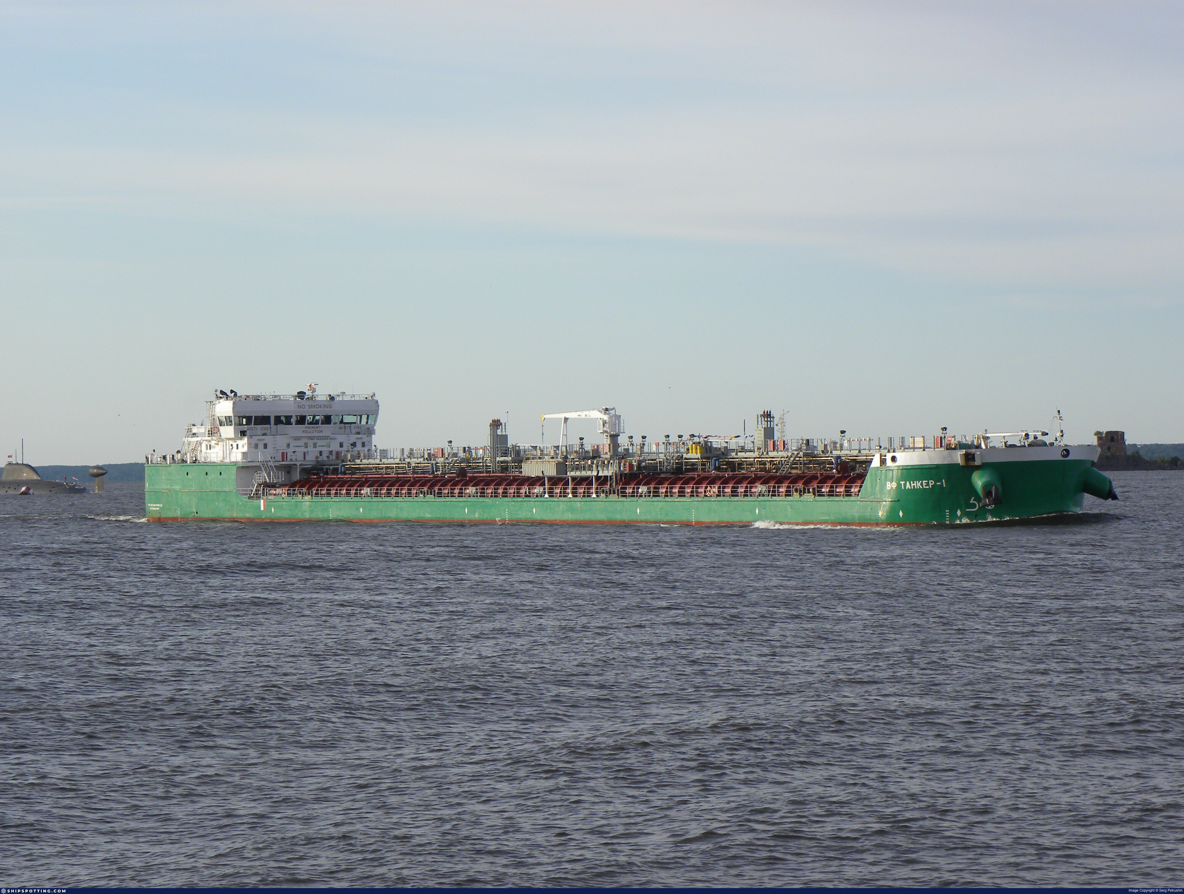
IMO 9640499
Vessel information
Vessel Name
Ivan Kramskoy View name history 📜
IMO Number
9640499
MMSI
273351450
Vessel Type
Oil Products Tanker | Navire-citerne pour produits pétroliers
Flag
🇷🇺 Russia
Call Sign
UBFI2
Gross Tonnage
5,075 GT
Year Built
2012
Sanctioned by
Company & Ownership
JSC 'Ilya Muromets'
IMO Company: 6405655
Address
Kom 1, Pom 2N, Dom 15, pereulok Kolobovskiy 1-y Moscow, 127473, Russia.
Status
Active
Fleet
11.0 owner, 11.0 operator, 11.0 manager, 0.0 beneficial
Management & Operations
ISM Manager
ILYA MUROMETS JSC
Kom 1, Pom 2N, Dom 15, pereulok Kolobovskiy 1-y Moscow, 127473, Russia.
Commercial Manager
ILYA MUROMETS JSC
Classification & Safety
Current Classification
Russian Maritime Register of Shipping
Delivered
Port State Control (PSC) Inspections
Risk Level
LOW
Last 36 Months
3
Inspections
Last Inspection
📍 Kocaeli
📅 2025-09-25
Survey Renewal & Certificates
| Code | Type | Issuer | Issued | Expires |
|---|---|---|---|---|
| 510 | Safety Management Certificate | Russian Maritime Register of Shipping (191) | 20/12/2023 | 20/12/2028 |
| 509 | Document of Compliance | Russian Maritime Register of Shipping (191) | 25/03/2023 | 24/11/2028 |
Programs & Notes
EU Russia Sanctions – Shadow Fleet | SEMA (Canada) — vessel designations
Vessel Changes
 🔄 Owner
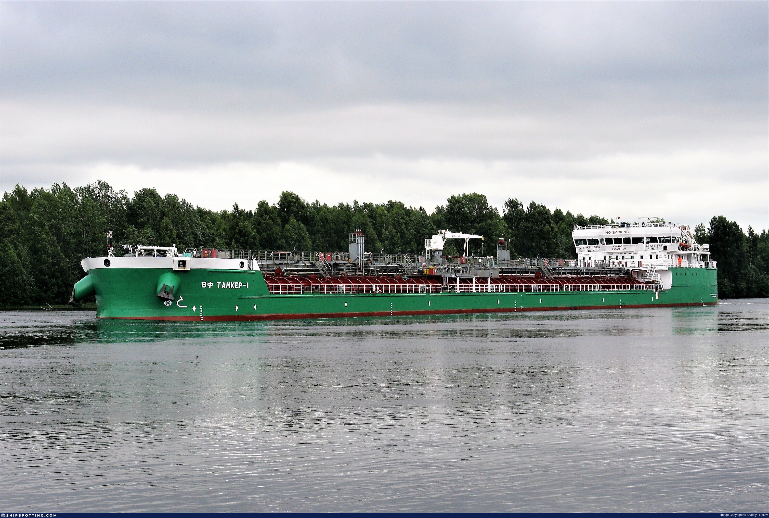
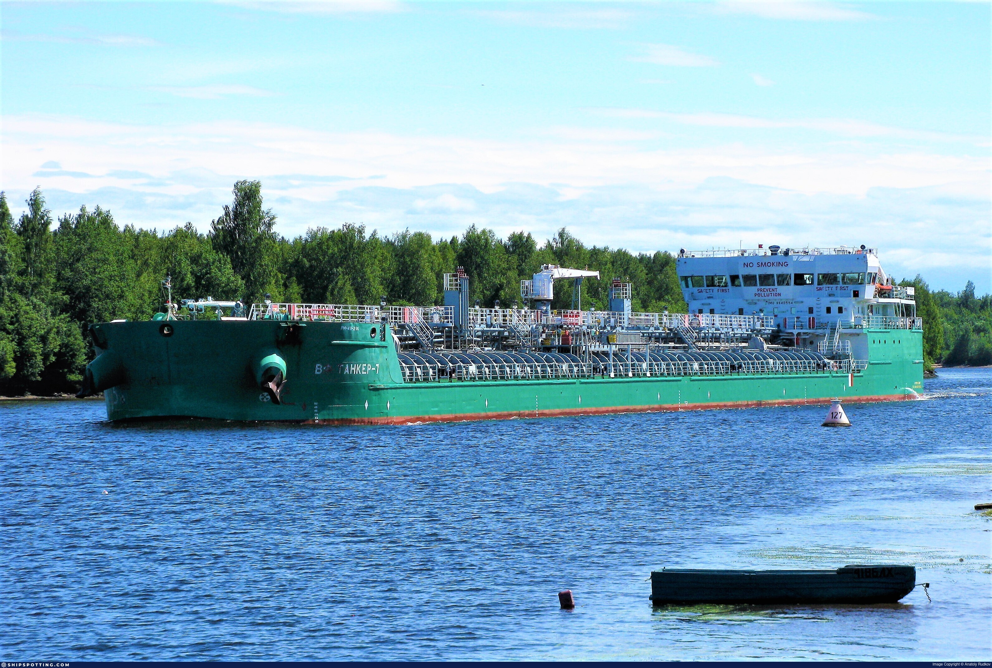
VF TANKER-1 (now IVAN KRAMSKOY)
IMO 9640499
VOLGA SHIPPING JOINT STOCK
→
ILYA MUROMETS JSC
Jun 6, 2023
 🔄 Owner
VF TANKER-1 (now IVAN KRAMSKOY)
IMO 9640499
VEB-LEASING OJSC
→
VOLGA SHIPPING JOINT STOCK
Sep 19, 2019
AIS Events
23 events detected • 2 zones • Last: Apr 20, 2026
Zone Dwell
Bosphorus/Dardanelles Approach
Apr 20, 2026 19:10 UTC
80.0%
- Zone: Bosphorus/Dardanelles Approach
- Duration: 1h 14m
- Data Points: 19 AIS positions
- Period: 2026-04-20T19:10:04+00:00 to 2026-04-20T20:24:22+00:00
Show Raw Evidence JSON
{
    "zone_id": "osint_bosphorus",
    "zone_name": "Bosphorus\/Dardanelles Approach",
    "dwell_minutes": 74.2999999999999971578290569595992565155029296875,
    "points_in_zone": 19,
    "first_point": {
        "ts": "2026-04-20T19:10:04+00:00",
        "lat": 40.9616266999999965037204674445092678070068359375,
        "lon": 28.948060000000001679154593148268759250640869140625
    },
    "last_point": {
        "ts": "2026-04-20T20:24:22+00:00",
        "lat": 40.91203329999999738220139988698065280914306640625,
        "lon": 28.733386700000000502086550113745033740997314453125
    }
}
Zone Dwell
Bosphorus/Dardanelles Approach
Apr 20, 2026 15:01 UTC
80.0%
- Zone: Bosphorus/Dardanelles Approach
- Duration: 5h 22m
- Data Points: 36 AIS positions
- Period: 2026-04-20T15:01:58+00:00 to 2026-04-20T20:24:22+00:00
Show Raw Evidence JSON
{
    "zone_id": "osint_bosphorus",
    "zone_name": "Bosphorus\/Dardanelles Approach",
    "dwell_minutes": 322.3999999999999772626324556767940521240234375,
    "points_in_zone": 36,
    "first_point": {
        "ts": "2026-04-20T15:01:58+00:00",
        "lat": 41.42280670000000242225723923183977603912353515625,
        "lon": 29.389738300000001203216015710495412349700927734375
    },
    "last_point": {
        "ts": "2026-04-20T20:24:22+00:00",
        "lat": 40.91203329999999738220139988698065280914306640625,
        "lon": 28.733386700000000502086550113745033740997314453125
    }
}
Zone Dwell
Bosphorus/Dardanelles Approach
Apr 20, 2026 14:00 UTC
80.0%
- Zone: Bosphorus/Dardanelles Approach
- Duration: 6h 23m
- Data Points: 57 AIS positions
- Period: 2026-04-20T14:00:48+00:00 to 2026-04-20T20:24:22+00:00
Show Raw Evidence JSON
{
    "zone_id": "osint_bosphorus",
    "zone_name": "Bosphorus\/Dardanelles Approach",
    "dwell_minutes": 383.6000000000000227373675443232059478759765625,
    "points_in_zone": 57,
    "first_point": {
        "ts": "2026-04-20T14:00:48+00:00",
        "lat": 41.41031670000000275422280537895858287811279296875,
        "lon": 29.38724330000000151130734593607485294342041015625
    },
    "last_point": {
        "ts": "2026-04-20T20:24:22+00:00",
        "lat": 40.91203329999999738220139988698065280914306640625,
        "lon": 28.733386700000000502086550113745033740997314453125
    }
}
Zone Dwell
discovered_020
Apr 20, 2026 14:00 UTC
80.0%
- Zone: discovered_020
- Duration: 1h 51m
- Data Points: 38 AIS positions
- Period: 2026-04-20T14:00:48+00:00 to 2026-04-20T15:51:52+00:00
Show Raw Evidence JSON
{
    "zone_id": "discovered_020",
    "zone_name": "Black Sea Sanctioned Vessel Monitoring Zone",
    "dwell_minutes": 111.099999999999994315658113919198513031005859375,
    "points_in_zone": 38,
    "first_point": {
        "ts": "2026-04-20T14:00:48+00:00",
        "lat": 41.41031670000000275422280537895858287811279296875,
        "lon": 29.38724330000000151130734593607485294342041015625
    },
    "last_point": {
        "ts": "2026-04-20T15:51:52+00:00",
        "lat": 41.37287830000000354857547790743410587310791015625,
        "lon": 29.2845267000000006873960955999791622161865234375
    }
}
Zone Dwell
Bosphorus/Dardanelles Approach
Apr 20, 2026 13:14 UTC
80.0%
- Zone: Bosphorus/Dardanelles Approach
- Duration: 6h 32m
- Data Points: 60 AIS positions
- Period: 2026-04-20T13:52:03+00:00 to 2026-04-20T20:24:22+00:00
Show Raw Evidence JSON
{
    "zone_id": "osint_bosphorus",
    "zone_name": "Bosphorus\/Dardanelles Approach",
    "dwell_minutes": 392.30000000000001136868377216160297393798828125,
    "points_in_zone": 60,
    "first_point": {
        "ts": "2026-04-20T13:52:03+00:00",
        "lat": 41.4089450000000027785063139162957668304443359375,
        "lon": 29.386958299999999866258804104290902614593505859375
    },
    "last_point": {
        "ts": "2026-04-20T20:24:22+00:00",
        "lat": 40.91203329999999738220139988698065280914306640625,
        "lon": 28.733386700000000502086550113745033740997314453125
    }
}
Zone Dwell
discovered_020
Apr 20, 2026 13:14 UTC
80.0%
- Zone: discovered_020
- Duration: 2h 37m
- Data Points: 50 AIS positions
- Period: 2026-04-20T13:14:11+00:00 to 2026-04-20T15:51:52+00:00
Show Raw Evidence JSON
{
    "zone_id": "discovered_020",
    "zone_name": "Black Sea Sanctioned Vessel Monitoring Zone",
    "dwell_minutes": 157.69999999999998863131622783839702606201171875,
    "points_in_zone": 50,
    "first_point": {
        "ts": "2026-04-20T13:14:11+00:00",
        "lat": 41.4057499999999976125764078460633754730224609375,
        "lon": 29.38578499999999849023879505693912506103515625
    },
    "last_point": {
        "ts": "2026-04-20T15:51:52+00:00",
        "lat": 41.37287830000000354857547790743410587310791015625,
        "lon": 29.2845267000000006873960955999791622161865234375
    }
}
Loiter
discovered_020
Apr 20, 2026 13:14 UTC
75.0%
- Duration: 2h 1m
- Radius: 1,118 meters
- Data Points: 39 AIS positions
- Centroid: 41.4138, 29.3875
- Zone: discovered_020
Show Raw Evidence JSON
{
    "radius_m": 1117.799999999999954525264911353588104248046875,
    "duration_minutes": 121.7999999999999971578290569595992565155029296875,
    "points": 39,
    "centroid": {
        "lat": 41.4138450051282092090332298539578914642333984375,
        "lon": 29.387479397435900096979821682907640933990478515625
    },
    "bbox": {
        "min_lat": 41.4057499999999976125764078460633754730224609375,
        "min_lon": 29.374236700000000865884430822916328907012939453125,
        "max_lat": 41.42300329999999775054675410501658916473388671875,
        "max_lon": 29.391336700000000092813934315927326679229736328125
    },
    "zone_id": "discovered_020"
}
Loiter
Bosphorus/Dardanelles Approach
Apr 20, 2026 13:14 UTC
75.0%
- Duration: 2h 1m
- Radius: 1,118 meters
- Data Points: 39 AIS positions
- Centroid: 41.4138, 29.3875
- Zone: Bosphorus/Dardanelles Approach
Show Raw Evidence JSON
{
    "radius_m": 1117.799999999999954525264911353588104248046875,
    "duration_minutes": 121.7999999999999971578290569595992565155029296875,
    "points": 39,
    "centroid": {
        "lat": 41.4138450051282092090332298539578914642333984375,
        "lon": 29.387479397435900096979821682907640933990478515625
    },
    "bbox": {
        "min_lat": 41.4057499999999976125764078460633754730224609375,
        "min_lon": 29.374236700000000865884430822916328907012939453125,
        "max_lat": 41.42300329999999775054675410501658916473388671875,
        "max_lon": 29.391336700000000092813934315927326679229736328125
    },
    "zone_id": "osint_bosphorus"
}
Loiter
discovered_020
Apr 20, 2026 10:03 UTC
75.0%
- Duration: 4h 45m
- Radius: 1,698 meters
- Data Points: 40 AIS positions
- Centroid: 41.4135, 29.3873
- Zone: discovered_020
Show Raw Evidence JSON
{
    "radius_m": 1698.40000000000009094947017729282379150390625,
    "duration_minutes": 285.30000000000001136868377216160297393798828125,
    "points": 40,
    "centroid": {
        "lat": 41.41346796250000039663063944317400455474853515625,
        "lon": 29.38733637000000697980794939212501049041748046875
    },
    "bbox": {
        "min_lat": 41.3987632999999988214767654426395893096923828125,
        "min_lon": 29.374236700000000865884430822916328907012939453125,
        "max_lat": 41.42300329999999775054675410501658916473388671875,
        "max_lon": 29.391336700000000092813934315927326679229736328125
    },
    "zone_id": "discovered_020"
}
Loiter
Bosphorus/Dardanelles Approach
Apr 20, 2026 10:03 UTC
75.0%
- Duration: 4h 45m
- Radius: 1,698 meters
- Data Points: 40 AIS positions
- Centroid: 41.4135, 29.3873
- Zone: Bosphorus/Dardanelles Approach
Show Raw Evidence JSON
{
    "radius_m": 1698.40000000000009094947017729282379150390625,
    "duration_minutes": 285.30000000000001136868377216160297393798828125,
    "points": 40,
    "centroid": {
        "lat": 41.41346796250000039663063944317400455474853515625,
        "lon": 29.38733637000000697980794939212501049041748046875
    },
    "bbox": {
        "min_lat": 41.3987632999999988214767654426395893096923828125,
        "min_lon": 29.374236700000000865884430822916328907012939453125,
        "max_lat": 41.42300329999999775054675410501658916473388671875,
        "max_lon": 29.391336700000000092813934315927326679229736328125
    },
    "zone_id": "osint_bosphorus"
}
Zone Dwell
discovered_020
Apr 20, 2026 10:03 UTC
80.0%
- Zone: discovered_020
- Duration: 5h 48m
- Data Points: 58 AIS positions
- Period: 2026-04-20T10:03:05+00:00 to 2026-04-20T15:51:52+00:00
Show Raw Evidence JSON
{
    "zone_id": "discovered_020",
    "zone_name": "Black Sea Sanctioned Vessel Monitoring Zone",
    "dwell_minutes": 348.80000000000001136868377216160297393798828125,
    "points_in_zone": 58,
    "first_point": {
        "ts": "2026-04-20T10:03:05+00:00",
        "lat": 41.396760000000000445652403868734836578369140625,
        "lon": 29.381621700000000174668457475490868091583251953125
    },
    "last_point": {
        "ts": "2026-04-20T15:51:52+00:00",
        "lat": 41.37287830000000354857547790743410587310791015625,
        "lon": 29.2845267000000006873960955999791622161865234375
    }
}
Zone Dwell
Bosphorus/Dardanelles Approach
Apr 20, 2026 10:03 UTC
80.0%
- Zone: Bosphorus/Dardanelles Approach
- Duration: 5h 48m
- Data Points: 58 AIS positions
- Period: 2026-04-20T10:03:05+00:00 to 2026-04-20T15:51:52+00:00
Show Raw Evidence JSON
{
    "zone_id": "osint_bosphorus",
    "zone_name": "Bosphorus\/Dardanelles Approach",
    "dwell_minutes": 348.80000000000001136868377216160297393798828125,
    "points_in_zone": 58,
    "first_point": {
        "ts": "2026-04-20T10:03:05+00:00",
        "lat": 41.396760000000000445652403868734836578369140625,
        "lon": 29.381621700000000174668457475490868091583251953125
    },
    "last_point": {
        "ts": "2026-04-20T15:51:52+00:00",
        "lat": 41.37287830000000354857547790743410587310791015625,
        "lon": 29.2845267000000006873960955999791622161865234375
    }
}
Loiter
discovered_020
Apr 20, 2026 09:22 UTC
75.0%
- Duration: 4h 42m
- Radius: 1,213 meters
- Data Points: 36 AIS positions
- Centroid: 41.4064, 29.3857
- Zone: discovered_020
Show Raw Evidence JSON
{
    "radius_m": 1213.09999999999990905052982270717620849609375,
    "duration_minutes": 282.1000000000000227373675443232059478759765625,
    "points": 36,
    "centroid": {
        "lat": 41.406447269444441872110473923385143280029296875,
        "lon": 29.385657166666664608101200428791344165802001953125
    },
    "bbox": {
        "min_lat": 41.396129999999999427018337883055210113525390625,
        "min_lon": 29.380894999999998873363438178785145282745361328125,
        "max_lat": 41.416456699999997681516106240451335906982421875,
        "max_lon": 29.389205000000000467252903035841882228851318359375
    },
    "zone_id": "discovered_020"
}
Loiter
Bosphorus/Dardanelles Approach
Apr 20, 2026 09:22 UTC
75.0%
- Duration: 4h 42m
- Radius: 1,213 meters
- Data Points: 36 AIS positions
- Centroid: 41.4064, 29.3857
- Zone: Bosphorus/Dardanelles Approach
Show Raw Evidence JSON
{
    "radius_m": 1213.09999999999990905052982270717620849609375,
    "duration_minutes": 282.1000000000000227373675443232059478759765625,
    "points": 36,
    "centroid": {
        "lat": 41.406447269444441872110473923385143280029296875,
        "lon": 29.385657166666664608101200428791344165802001953125
    },
    "bbox": {
        "min_lat": 41.396129999999999427018337883055210113525390625,
        "min_lon": 29.380894999999998873363438178785145282745361328125,
        "max_lat": 41.416456699999997681516106240451335906982421875,
        "max_lon": 29.389205000000000467252903035841882228851318359375
    },
    "zone_id": "osint_bosphorus"
}
Zone Dwell
discovered_020
Apr 20, 2026 09:00 UTC
80.0%
- Zone: discovered_020
- Duration: 6h 29m
- Data Points: 66 AIS positions
- Period: 2026-04-20T09:22:27+00:00 to 2026-04-20T15:51:52+00:00
Show Raw Evidence JSON
{
    "zone_id": "discovered_020",
    "zone_name": "Black Sea Sanctioned Vessel Monitoring Zone",
    "dwell_minutes": 389.3999999999999772626324556767940521240234375,
    "points_in_zone": 66,
    "first_point": {
        "ts": "2026-04-20T09:22:27+00:00",
        "lat": 41.3935833000000030779119697399437427520751953125,
        "lon": 29.374391700000000327008820022456347942352294921875
    },
    "last_point": {
        "ts": "2026-04-20T15:51:52+00:00",
        "lat": 41.37287830000000354857547790743410587310791015625,
        "lon": 29.2845267000000006873960955999791622161865234375
    }
}
Zone Dwell
Bosphorus/Dardanelles Approach
Apr 20, 2026 09:00 UTC
80.0%
- Zone: Bosphorus/Dardanelles Approach
- Duration: 6h 29m
- Data Points: 66 AIS positions
- Period: 2026-04-20T09:22:27+00:00 to 2026-04-20T15:51:52+00:00
Show Raw Evidence JSON
{
    "zone_id": "osint_bosphorus",
    "zone_name": "Bosphorus\/Dardanelles Approach",
    "dwell_minutes": 389.3999999999999772626324556767940521240234375,
    "points_in_zone": 66,
    "first_point": {
        "ts": "2026-04-20T09:22:27+00:00",
        "lat": 41.3935833000000030779119697399437427520751953125,
        "lon": 29.374391700000000327008820022456347942352294921875
    },
    "last_point": {
        "ts": "2026-04-20T15:51:52+00:00",
        "lat": 41.37287830000000354857547790743410587310791015625,
        "lon": 29.2845267000000006873960955999791622161865234375
    }
}
Zone Dwell
Bosphorus/Dardanelles Approach
Apr 20, 2026 08:00 UTC
80.0%
- Zone: Bosphorus/Dardanelles Approach
- Duration: 6h 36m
- Data Points: 71 AIS positions
- Period: 2026-04-20T08:52:13+00:00 to 2026-04-20T15:28:19+00:00
Show Raw Evidence JSON
{
    "zone_id": "osint_bosphorus",
    "zone_name": "Bosphorus\/Dardanelles Approach",
    "dwell_minutes": 396.1000000000000227373675443232059478759765625,
    "points_in_zone": 71,
    "first_point": {
        "ts": "2026-04-20T08:52:13+00:00",
        "lat": 41.3855932999999964749804348684847354888916015625,
        "lon": 29.418076700000000300860847346484661102294921875
    },
    "last_point": {
        "ts": "2026-04-20T15:28:19+00:00",
        "lat": 41.40141330000000152722350321710109710693359375,
        "lon": 29.344114999999998616431184927932918071746826171875
    }
}
Zone Dwell
discovered_020
Apr 20, 2026 08:00 UTC
80.0%
- Zone: discovered_020
- Duration: 6h 36m
- Data Points: 71 AIS positions
- Period: 2026-04-20T08:52:13+00:00 to 2026-04-20T15:28:19+00:00
Show Raw Evidence JSON
{
    "zone_id": "discovered_020",
    "zone_name": "Black Sea Sanctioned Vessel Monitoring Zone",
    "dwell_minutes": 396.1000000000000227373675443232059478759765625,
    "points_in_zone": 71,
    "first_point": {
        "ts": "2026-04-20T08:52:13+00:00",
        "lat": 41.3855932999999964749804348684847354888916015625,
        "lon": 29.418076700000000300860847346484661102294921875
    },
    "last_point": {
        "ts": "2026-04-20T15:28:19+00:00",
        "lat": 41.40141330000000152722350321710109710693359375,
        "lon": 29.344114999999998616431184927932918071746826171875
    }
}
Zone Dwell
discovered_020
Apr 20, 2026 07:17 UTC
80.0%
- Zone: discovered_020
- Duration: 6h 32m
- Data Points: 69 AIS positions
- Period: 2026-04-20T07:55:49+00:00 to 2026-04-20T14:28:05+00:00
Show Raw Evidence JSON
{
    "zone_id": "discovered_020",
    "zone_name": "Black Sea Sanctioned Vessel Monitoring Zone",
    "dwell_minutes": 392.30000000000001136868377216160297393798828125,
    "points_in_zone": 69,
    "first_point": {
        "ts": "2026-04-20T07:55:49+00:00",
        "lat": 41.35897829999999686378941987641155719757080078125,
        "lon": 29.462824999999998709654391859658062458038330078125
    },
    "last_point": {
        "ts": "2026-04-20T14:28:05+00:00",
        "lat": 41.41548329999999822348399902693927288055419921875,
        "lon": 29.388909999999999200781530817039310932159423828125
    }
}
Zone Dwell
Bosphorus/Dardanelles Approach
Apr 20, 2026 07:17 UTC
80.0%
- Zone: Bosphorus/Dardanelles Approach
- Duration: 6h 32m
- Data Points: 69 AIS positions
- Period: 2026-04-20T07:55:49+00:00 to 2026-04-20T14:28:05+00:00
Show Raw Evidence JSON
{
    "zone_id": "osint_bosphorus",
    "zone_name": "Bosphorus\/Dardanelles Approach",
    "dwell_minutes": 392.30000000000001136868377216160297393798828125,
    "points_in_zone": 69,
    "first_point": {
        "ts": "2026-04-20T07:55:49+00:00",
        "lat": 41.35897829999999686378941987641155719757080078125,
        "lon": 29.462824999999998709654391859658062458038330078125
    },
    "last_point": {
        "ts": "2026-04-20T14:28:05+00:00",
        "lat": 41.41548329999999822348399902693927288055419921875,
        "lon": 29.388909999999999200781530817039310932159423828125
    }
}
Zone Dwell
discovered_020
Apr 20, 2026 03:02 UTC
80.0%
- Zone: discovered_020
- Duration: 6h 33m
- Data Points: 38 AIS positions
- Period: 2026-04-20T03:12:32+00:00 to 2026-04-20T09:45:41+00:00
Show Raw Evidence JSON
{
    "zone_id": "discovered_020",
    "zone_name": "Black Sea Sanctioned Vessel Monitoring Zone",
    "dwell_minutes": 393.1000000000000227373675443232059478759765625,
    "points_in_zone": 38,
    "first_point": {
        "ts": "2026-04-20T03:12:32+00:00",
        "lat": 41.33955499999999716465026722289621829986572265625,
        "lon": 29.516279999999998295834302552975714206695556640625
    },
    "last_point": {
        "ts": "2026-04-20T09:45:41+00:00",
        "lat": 41.39587499999999664623828721232712268829345703125,
        "lon": 29.38042169999999941865098662674427032470703125
    }
}
Zone Dwell
discovered_020
Apr 20, 2026 02:01 UTC
80.0%
- Zone: discovered_020
- Duration: 6h 32m
- Data Points: 43 AIS positions
- Period: 2026-04-20T02:52:07+00:00 to 2026-04-20T09:24:32+00:00
Show Raw Evidence JSON
{
    "zone_id": "discovered_020",
    "zone_name": "Black Sea Sanctioned Vessel Monitoring Zone",
    "dwell_minutes": 392.3999999999999772626324556767940521240234375,
    "points_in_zone": 43,
    "first_point": {
        "ts": "2026-04-20T02:52:07+00:00",
        "lat": 41.34241329999999692290657549165189266204833984375,
        "lon": 29.515390000000000014779288903810083866119384765625
    },
    "last_point": {
        "ts": "2026-04-20T09:24:32+00:00",
        "lat": 41.39428000000000196223481907509267330169677734375,
        "lon": 29.37519329999999939673216431401669979095458984375
    }
}
Zone Dwell
discovered_020
Apr 20, 2026 01:44 UTC
80.0%
- Zone: discovered_020
- Duration: 6h 38m
- Data Points: 41 AIS positions
- Period: 2026-04-20T01:50:18+00:00 to 2026-04-20T08:28:17+00:00
Show Raw Evidence JSON
{
    "zone_id": "discovered_020",
    "zone_name": "Black Sea Sanctioned Vessel Monitoring Zone",
    "dwell_minutes": 398,
    "points_in_zone": 41,
    "first_point": {
        "ts": "2026-04-20T01:50:18+00:00",
        "lat": 41.35229170000000209483914659358561038970947265625,
        "lon": 29.508769999999998390194377861917018890380859375
    },
    "last_point": {
        "ts": "2026-04-20T08:28:17+00:00",
        "lat": 41.36751670000000302707121591083705425262451171875,
        "lon": 29.45990499999999912006387603469192981719970703125
    }
}Sanctioned on the same day
- Aditya · IMO 9323314 🇨🇦 CA🇪🇺 EU🇬🇧 UK
- Aleksey Savrasov · IMO 9645061 🇨🇦 CA🇪🇺 EU
- ALTURA · IMO 9292199 🇨🇦 CA🇪🇺 EU🇬🇧 UK
- Anabar · IMO 9194012 🇨🇦 CA
- Apate · IMO 9433016 🇨🇦 CA🇪🇺 EU🇬🇧 UK
- Armada Leader · IMO 9260483 🇨🇦 CA🇪🇺 EU
- Aura 1 · IMO 9472634 🇨🇦 CA🇪🇺 EU🇬🇧 UK
- Bergen T · IMO 8918540 🇨🇦 CA🇪🇺 EU