IMO 9611541
Vessel information
Detected Events (100)
- Zone: Central Mediterranean Surveillance Zone
- Duration: 1h 58m
- Data Points: 6 AIS positions
- Period: 2026-07-19T19:15:54+00:00 to 2026-07-19T21:14:14+00:00
Show Raw Evidence JSON
{
    "zone_id": "discovered_130",
    "zone_name": "Central Mediterranean Surveillance Zone",
    "dwell_minutes": 118.2999999999999971578290569595992565155029296875,
    "points_in_zone": 6,
    "first_point": {
        "ts": "2026-07-19T19:15:54+00:00",
        "lat": 31.717078300000000723457560525275766849517822265625,
        "lon": 35.99935669999999987567207426764070987701416015625
    },
    "last_point": {
        "ts": "2026-07-19T21:14:14+00:00",
        "lat": 31.717110000000001690523276920430362224578857421875,
        "lon": 35.9993733000000020183506421744823455810546875
    }
}- Minimum Distance: 2 meters
- Average Distance: 25 meters
- Duration: 6h 4m
- Period: 2026-07-19T15:02:35+00:00 to 2026-07-19T21:06:35+00:00
- Vessel A Avg Speed: 0.0 knots
- Vessel B Avg Speed: 0.1 knots
- Zone: Central Mediterranean Surveillance Zone
Confidence Analysis
High-confidence STS candidate. Two tankers (NISSOS TINOS and THALIA) maintained close proximity (min 2m, avg 25m) for 364 minutes. Both vessels were slow-moving (avg speeds 0.0 and 0.1 knots). The stable separation distance suggests deliberate parallel positioning typical of cargo transfer. Event occurred in Central Mediterranean Surveillance Zone, a known STS activity area.
View scoring breakdown
| Factor | Score | Detail |
|---|---|---|
| Distance Tightness | 25/25 | Min distance 2m, avg 25m |
| Duration | 25/25 | Duration 364 minutes |
| Speed Stability | 20/20 | both nearly stationary; very stable speeds |
| Distance Consistency | 15/15 | Distance variance ±24m |
| Isolation | 5/10 | Isolation data not available |
| Context | 5/5 | In monitored zone: Central Mediterranean Surveillance Zone |
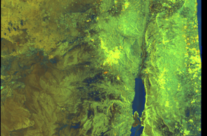
🛰️ Satellite Corroboration
Satellite imagery available but requires review
Preview available for manual review
Show Raw Evidence JSON
{
    "vessel_a": {
        "mmsi": 538008916,
        "imo": 9886782,
        "name": "NISSOS TINOS",
        "flag": "Marshall Is"
    },
    "vessel_b": {
        "mmsi": 636015372,
        "imo": 9611541,
        "name": "THALIA",
        "flag": "Liberia"
    },
    "min_distance_m": 1.899999999999999911182158029987476766109466552734375,
    "avg_distance_m": 25,
    "distance_consistency_m": 24.199999999999999289457264239899814128875732421875,
    "duration_minutes": 364,
    "overlap_duration_s": 21840,
    "speed_a_avg": 0,
    "speed_a_std": 0,
    "speed_b_avg": 0.070000000000000006661338147750939242541790008544921875,
    "speed_b_std": 0.11999999999999999555910790149937383830547332763671875,
    "speed_summary": {
        "vessel_a": {
            "avg_sog": 0,
            "max_sog": 0
        },
        "vessel_b": {
            "avg_sog": 0.070000000000000006661338147750939242541790008544921875,
            "max_sog": 0.200000000000000011102230246251565404236316680908203125
        }
    },
    "time_window": {
        "start": "2026-07-19T15:02:35+00:00",
        "end": "2026-07-19T21:06:35+00:00"
    },
    "points_count": {
        "vessel_a": 3,
        "vessel_b": 3
    },
    "zone_id": "discovered_130",
    "zone_name": "Central Mediterranean Surveillance Zone",
    "score": {
        "value": 95,
        "components": {
            "distance_tightness": {
                "score": 25,
                "max": 25,
                "detail": "Min distance 2m, avg 25m"
            },
            "duration": {
                "score": 25,
                "max": 25,
                "detail": "Duration 364 minutes"
            },
            "speed_stability": {
                "score": 20,
                "max": 20,
                "detail": "both nearly stationary; very stable speeds"
            },
            "distance_consistency": {
                "score": 15,
                "max": 15,
                "detail": "Distance variance \u00b124m"
            },
            "isolation": {
                "score": 5,
                "max": 10,
                "detail": "Isolation data not available"
            },
            "context": {
                "score": 5,
                "max": 5,
                "detail": "In monitored zone: Central Mediterranean Surveillance Zone"
            }
        },
        "summary": "High-confidence STS candidate. Two tankers (NISSOS TINOS and THALIA) maintained close proximity (min 2m, avg 25m) for 364 minutes. Both vessels were slow-moving (avg speeds 0.0 and 0.1 knots). The stable separation distance suggests deliberate parallel positioning typical of cargo transfer. Event occurred in Central Mediterranean Surveillance Zone, a known STS activity area."
    },
    "sar": {
        "status": "inconclusive",
        "centroid": {
            "lat": 31.71714060000000046102286432869732379913330078125,
            "lon": 35.99942089999999694782673032023012638092041015625
        },
        "time_window": {
            "start_ts": "2026-07-19T15:02:35+00:00",
            "end_ts": "2026-07-19T21:06:35+00:00"
        },
        "searched_at": "2026-07-19T21:30:16.737997+00:00",
        "scene_id": "S1D_IW_GRDH_1SDV_20260719T033516_20260719T033541_003737_006B33_34C4_COG",
        "scene_datetime": "2026-07-19T03:35:16.170469Z",
        "platform": "sentinel-1d",
        "bbox": {
            "min_lon": 34.4996799999999979036147124134004116058349609375,
            "min_lat": 30.834323999999998733301254105754196643829345703125,
            "max_lon": 37.523899000000000114596332423388957977294921875,
            "max_lat": 32.7538449999999983219822752289474010467529296875
        },
        "assets": {
            "preview_url": "https:\/\/fleetleaks.com\/wp-content\/uploads\/fleetleaks-evidence\/sar-imagery\/2026\/07\/event_988680_thumbnail_20260719213020.png",
            "stored_path": "\/home\/fleetleaks\/public_html\/wp-content\/uploads\/fleetleaks-evidence\/sar-imagery\/2026\/07\/event_988680_thumbnail_20260719213020.png",
            "source": "copernicus_dataspace"
        },
        "notes": "Preview available for manual review"
    }
}- Zone: Central Mediterranean Surveillance Zone
- Duration: 6h 12m
- Data Points: 8 AIS positions
- Period: 2026-07-19T15:01:33+00:00 to 2026-07-19T21:14:14+00:00
Show Raw Evidence JSON
{
    "zone_id": "discovered_130",
    "zone_name": "Central Mediterranean Surveillance Zone",
    "dwell_minutes": 372.69999999999998863131622783839702606201171875,
    "points_in_zone": 8,
    "first_point": {
        "ts": "2026-07-19T15:01:33+00:00",
        "lat": 31.71698669999999964375092531554400920867919921875,
        "lon": 35.99921669999999807032509124837815761566162109375
    },
    "last_point": {
        "ts": "2026-07-19T21:14:14+00:00",
        "lat": 31.717110000000001690523276920430362224578857421875,
        "lon": 35.9993733000000020183506421744823455810546875
    }
}- Minimum Distance: 5 meters
- Average Distance: 17 meters
- Duration: 1h 55m
- Period: 2026-07-19T13:14:04+00:00 to 2026-07-19T15:09:26+00:00
- Vessel A Avg Speed: 0.0 knots
- Vessel B Avg Speed: 0.1 knots
- Zone: Central Mediterranean Surveillance Zone
Confidence Analysis
High-confidence STS candidate. Two tankers (NISSOS TINOS and THALIA) maintained close proximity (min 5m, avg 17m) for 115 minutes. Both vessels were slow-moving (avg speeds 0.0 and 0.1 knots). The stable separation distance suggests deliberate parallel positioning typical of cargo transfer. Event occurred in Central Mediterranean Surveillance Zone, a known STS activity area.
View scoring breakdown
| Factor | Score | Detail |
|---|---|---|
| Distance Tightness | 25/25 | Min distance 5m, avg 17m |
| Duration | 20/25 | Duration 115 minutes |
| Speed Stability | 20/20 | both nearly stationary; very stable speeds |
| Distance Consistency | 15/15 | Distance variance ±8m |
| Isolation | 5/10 | Isolation data not available |
| Context | 5/5 | In monitored zone: Central Mediterranean Surveillance Zone |
Show Raw Evidence JSON
{
    "vessel_a": {
        "mmsi": 538008916,
        "imo": 9886782,
        "name": "NISSOS TINOS",
        "flag": "Marshall Is"
    },
    "vessel_b": {
        "mmsi": 636015372,
        "imo": 9611541,
        "name": "THALIA",
        "flag": "Liberia"
    },
    "min_distance_m": 4.70000000000000017763568394002504646778106689453125,
    "avg_distance_m": 16.699999999999999289457264239899814128875732421875,
    "distance_consistency_m": 8.4000000000000003552713678800500929355621337890625,
    "duration_minutes": 115.400000000000005684341886080801486968994140625,
    "overlap_duration_s": 6922,
    "speed_a_avg": 0,
    "speed_a_std": 0,
    "speed_b_avg": 0.13000000000000000444089209850062616169452667236328125,
    "speed_b_std": 0.1000000000000000055511151231257827021181583404541015625,
    "speed_summary": {
        "vessel_a": {
            "avg_sog": 0,
            "max_sog": 0
        },
        "vessel_b": {
            "avg_sog": 0.13000000000000000444089209850062616169452667236328125,
            "max_sog": 0.200000000000000011102230246251565404236316680908203125
        }
    },
    "time_window": {
        "start": "2026-07-19T13:14:04+00:00",
        "end": "2026-07-19T15:09:26+00:00"
    },
    "points_count": {
        "vessel_a": 6,
        "vessel_b": 6
    },
    "zone_id": "discovered_130",
    "zone_name": "Central Mediterranean Surveillance Zone",
    "score": {
        "value": 90,
        "components": {
            "distance_tightness": {
                "score": 25,
                "max": 25,
                "detail": "Min distance 5m, avg 17m"
            },
            "duration": {
                "score": 20,
                "max": 25,
                "detail": "Duration 115 minutes"
            },
            "speed_stability": {
                "score": 20,
                "max": 20,
                "detail": "both nearly stationary; very stable speeds"
            },
            "distance_consistency": {
                "score": 15,
                "max": 15,
                "detail": "Distance variance \u00b18m"
            },
            "isolation": {
                "score": 5,
                "max": 10,
                "detail": "Isolation data not available"
            },
            "context": {
                "score": 5,
                "max": 5,
                "detail": "In monitored zone: Central Mediterranean Surveillance Zone"
            }
        },
        "summary": "High-confidence STS candidate. Two tankers (NISSOS TINOS and THALIA) maintained close proximity (min 5m, avg 17m) for 115 minutes. Both vessels were slow-moving (avg speeds 0.0 and 0.1 knots). The stable separation distance suggests deliberate parallel positioning typical of cargo transfer. Event occurred in Central Mediterranean Surveillance Zone, a known STS activity area."
    }
}- Zone: Central Mediterranean Surveillance Zone
- Duration: 6h 3m
- Data Points: 4 AIS positions
- Period: 2026-07-19T13:12:19+00:00 to 2026-07-19T19:15:54+00:00
Show Raw Evidence JSON
{
    "zone_id": "discovered_130",
    "zone_name": "Central Mediterranean Surveillance Zone",
    "dwell_minutes": 363.6000000000000227373675443232059478759765625,
    "points_in_zone": 4,
    "first_point": {
        "ts": "2026-07-19T13:12:19+00:00",
        "lat": 31.717065000000001617763700778596103191375732421875,
        "lon": 35.9993649999999973942976794205605983734130859375
    },
    "last_point": {
        "ts": "2026-07-19T19:15:54+00:00",
        "lat": 31.717078300000000723457560525275766849517822265625,
        "lon": 35.99935669999999987567207426764070987701416015625
    }
}- Minimum Distance: 0 meters
- Average Distance: 7 meters
- Duration: 1h 3m
- Period: 2026-07-14T20:22:22+00:00 to 2026-07-14T21:25:32+00:00
- Vessel A Avg Speed: 0.0 knots
- Vessel B Avg Speed: 0.0 knots
- Zone: Central Mediterranean Surveillance Zone
Confidence Analysis
High-confidence STS candidate. Two tankers (THALIA and PHOENIX II) maintained close proximity (min 0m, avg 7m) for 63 minutes. Both vessels were slow-moving (avg speeds 0.0 and 0.0 knots). The stable separation distance suggests deliberate parallel positioning typical of cargo transfer. Event occurred in Central Mediterranean Surveillance Zone, a known STS activity area.
View scoring breakdown
| Factor | Score | Detail |
|---|---|---|
| Distance Tightness | 25/25 | Min distance 0m, avg 7m |
| Duration | 15/25 | Duration 63 minutes |
| Speed Stability | 20/20 | both nearly stationary; very stable speeds |
| Distance Consistency | 15/15 | Distance variance ±14m |
| Isolation | 5/10 | Isolation data not available |
| Context | 5/5 | In monitored zone: Central Mediterranean Surveillance Zone |
Show Raw Evidence JSON
{
    "vessel_a": {
        "mmsi": 636015372,
        "imo": 9611541,
        "name": "THALIA",
        "flag": "Liberia"
    },
    "vessel_b": {
        "mmsi": 352001874,
        "imo": 9349203,
        "name": "PHOENIX II",
        "flag": "PANAMA"
    },
    "min_distance_m": 0.200000000000000011102230246251565404236316680908203125,
    "avg_distance_m": 6.9000000000000003552713678800500929355621337890625,
    "distance_consistency_m": 14.300000000000000710542735760100185871124267578125,
    "duration_minutes": 63.2000000000000028421709430404007434844970703125,
    "overlap_duration_s": 3790,
    "speed_a_avg": 0,
    "speed_a_std": 0,
    "speed_b_avg": 0.040000000000000000832667268468867405317723751068115234375,
    "speed_b_std": 0.08000000000000000166533453693773481063544750213623046875,
    "speed_summary": {
        "vessel_a": {
            "avg_sog": 0,
            "max_sog": 0
        },
        "vessel_b": {
            "avg_sog": 0.040000000000000000832667268468867405317723751068115234375,
            "max_sog": 0.200000000000000011102230246251565404236316680908203125
        }
    },
    "time_window": {
        "start": "2026-07-14T20:22:22+00:00",
        "end": "2026-07-14T21:25:32+00:00"
    },
    "points_count": {
        "vessel_a": 11,
        "vessel_b": 11
    },
    "zone_id": "discovered_130",
    "zone_name": "Central Mediterranean Surveillance Zone",
    "score": {
        "value": 85,
        "components": {
            "distance_tightness": {
                "score": 25,
                "max": 25,
                "detail": "Min distance 0m, avg 7m"
            },
            "duration": {
                "score": 15,
                "max": 25,
                "detail": "Duration 63 minutes"
            },
            "speed_stability": {
                "score": 20,
                "max": 20,
                "detail": "both nearly stationary; very stable speeds"
            },
            "distance_consistency": {
                "score": 15,
                "max": 15,
                "detail": "Distance variance \u00b114m"
            },
            "isolation": {
                "score": 5,
                "max": 10,
                "detail": "Isolation data not available"
            },
            "context": {
                "score": 5,
                "max": 5,
                "detail": "In monitored zone: Central Mediterranean Surveillance Zone"
            }
        },
        "summary": "High-confidence STS candidate. Two tankers (THALIA and PHOENIX II) maintained close proximity (min 0m, avg 7m) for 63 minutes. Both vessels were slow-moving (avg speeds 0.0 and 0.0 knots). The stable separation distance suggests deliberate parallel positioning typical of cargo transfer. Event occurred in Central Mediterranean Surveillance Zone, a known STS activity area."
    }
}- Minimum Distance: 0 meters
- Average Distance: 1 meters
- Duration: 1h 7m
- Period: 2026-07-14T20:18:01+00:00 to 2026-07-14T21:25:32+00:00
- Vessel A Avg Speed: 0.0 knots
- Vessel B Avg Speed: 0.0 knots
- Zone: Central Mediterranean Surveillance Zone
Confidence Analysis
High-confidence STS candidate. Two tankers (THALIA and DELPHI) maintained close proximity (min 0m, avg 1m) for 68 minutes. Both vessels were slow-moving (avg speeds 0.0 and 0.0 knots). The stable separation distance suggests deliberate parallel positioning typical of cargo transfer. Event occurred in Central Mediterranean Surveillance Zone, a known STS activity area.
View scoring breakdown
| Factor | Score | Detail |
|---|---|---|
| Distance Tightness | 25/25 | Min distance 0m, avg 1m |
| Duration | 15/25 | Duration 68 minutes |
| Speed Stability | 20/20 | both nearly stationary; very stable speeds |
| Distance Consistency | 15/15 | Distance variance ±0m |
| Isolation | 5/10 | Isolation data not available |
| Context | 5/5 | In monitored zone: Central Mediterranean Surveillance Zone |
🛰️ Satellite Corroboration
No satellite imagery for this time/location
No Sentinel-1 scenes covering AOI and time window
Show Raw Evidence JSON
{
    "vessel_a": {
        "mmsi": 636015372,
        "imo": 9611541,
        "name": "THALIA",
        "flag": "Liberia"
    },
    "vessel_b": {
        "mmsi": 636014336,
        "imo": 9283796,
        "name": "DELPHI",
        "flag": "Liberia"
    },
    "min_distance_m": 0.200000000000000011102230246251565404236316680908203125,
    "avg_distance_m": 0.8000000000000000444089209850062616169452667236328125,
    "distance_consistency_m": 0.40000000000000002220446049250313080847263336181640625,
    "duration_minutes": 67.5,
    "overlap_duration_s": 4051,
    "speed_a_avg": 0,
    "speed_a_std": 0,
    "speed_b_avg": 0,
    "speed_b_std": 0,
    "speed_summary": {
        "vessel_a": {
            "avg_sog": 0,
            "max_sog": 0
        },
        "vessel_b": {
            "avg_sog": 0,
            "max_sog": 0
        }
    },
    "time_window": {
        "start": "2026-07-14T20:18:01+00:00",
        "end": "2026-07-14T21:25:32+00:00"
    },
    "points_count": {
        "vessel_a": 13,
        "vessel_b": 13
    },
    "zone_id": "discovered_130",
    "zone_name": "Central Mediterranean Surveillance Zone",
    "score": {
        "value": 85,
        "components": {
            "distance_tightness": {
                "score": 25,
                "max": 25,
                "detail": "Min distance 0m, avg 1m"
            },
            "duration": {
                "score": 15,
                "max": 25,
                "detail": "Duration 68 minutes"
            },
            "speed_stability": {
                "score": 20,
                "max": 20,
                "detail": "both nearly stationary; very stable speeds"
            },
            "distance_consistency": {
                "score": 15,
                "max": 15,
                "detail": "Distance variance \u00b10m"
            },
            "isolation": {
                "score": 5,
                "max": 10,
                "detail": "Isolation data not available"
            },
            "context": {
                "score": 5,
                "max": 5,
                "detail": "In monitored zone: Central Mediterranean Surveillance Zone"
            }
        },
        "summary": "High-confidence STS candidate. Two tankers (THALIA and DELPHI) maintained close proximity (min 0m, avg 1m) for 68 minutes. Both vessels were slow-moving (avg speeds 0.0 and 0.0 knots). The stable separation distance suggests deliberate parallel positioning typical of cargo transfer. Event occurred in Central Mediterranean Surveillance Zone, a known STS activity area."
    },
    "sar": {
        "status": "not_found",
        "centroid": {
            "lat": 31.717084400000000954378265305422246456146240234375,
            "lon": 35.99936939999999907513483776710927486419677734375
        },
        "time_window": {
            "start_ts": "2026-07-14T20:18:01+00:00",
            "end_ts": "2026-07-14T21:25:32+00:00"
        },
        "searched_at": "2026-07-14T22:15:04.561832+00:00",
        "notes": "No Sentinel-1 scenes covering AOI and time window"
    }
}- Minimum Distance: 0 meters
- Average Distance: 4 meters
- Duration: 1h 7m
- Period: 2026-07-14T20:18:01+00:00 to 2026-07-14T21:25:32+00:00
- Vessel A Avg Speed: 0.0 knots
- Vessel B Avg Speed: 0.0 knots
- Zone: Central Mediterranean Surveillance Zone
Confidence Analysis
High-confidence STS candidate. Two tankers (THALIA and VENTUS MARIA) maintained close proximity (min 0m, avg 4m) for 68 minutes. Both vessels were slow-moving (avg speeds 0.0 and 0.0 knots). The stable separation distance suggests deliberate parallel positioning typical of cargo transfer. Event occurred in Central Mediterranean Surveillance Zone, a known STS activity area.
View scoring breakdown
| Factor | Score | Detail |
|---|---|---|
| Distance Tightness | 25/25 | Min distance 0m, avg 4m |
| Duration | 15/25 | Duration 68 minutes |
| Speed Stability | 20/20 | both nearly stationary; very stable speeds |
| Distance Consistency | 15/15 | Distance variance ±9m |
| Isolation | 5/10 | Isolation data not available |
| Context | 5/5 | In monitored zone: Central Mediterranean Surveillance Zone |
🛰️ Satellite Corroboration
No satellite imagery for this time/location
No Sentinel-1 scenes covering AOI and time window
Show Raw Evidence JSON
{
    "vessel_a": {
        "mmsi": 636015372,
        "imo": 9611541,
        "name": "THALIA",
        "flag": "Liberia"
    },
    "vessel_b": {
        "mmsi": 636026664,
        "imo": 9389497,
        "name": "VENTUS MARIA",
        "flag": "LIBERIA"
    },
    "min_distance_m": 0.200000000000000011102230246251565404236316680908203125,
    "avg_distance_m": 3.5,
    "distance_consistency_m": 8.5999999999999996447286321199499070644378662109375,
    "duration_minutes": 67.5,
    "overlap_duration_s": 4051,
    "speed_a_avg": 0,
    "speed_a_std": 0,
    "speed_b_avg": 0,
    "speed_b_std": 0,
    "speed_summary": {
        "vessel_a": {
            "avg_sog": 0,
            "max_sog": 0
        },
        "vessel_b": {
            "avg_sog": 0,
            "max_sog": 0
        }
    },
    "time_window": {
        "start": "2026-07-14T20:18:01+00:00",
        "end": "2026-07-14T21:25:32+00:00"
    },
    "points_count": {
        "vessel_a": 13,
        "vessel_b": 13
    },
    "zone_id": "discovered_130",
    "zone_name": "Central Mediterranean Surveillance Zone",
    "score": {
        "value": 85,
        "components": {
            "distance_tightness": {
                "score": 25,
                "max": 25,
                "detail": "Min distance 0m, avg 4m"
            },
            "duration": {
                "score": 15,
                "max": 25,
                "detail": "Duration 68 minutes"
            },
            "speed_stability": {
                "score": 20,
                "max": 20,
                "detail": "both nearly stationary; very stable speeds"
            },
            "distance_consistency": {
                "score": 15,
                "max": 15,
                "detail": "Distance variance \u00b19m"
            },
            "isolation": {
                "score": 5,
                "max": 10,
                "detail": "Isolation data not available"
            },
            "context": {
                "score": 5,
                "max": 5,
                "detail": "In monitored zone: Central Mediterranean Surveillance Zone"
            }
        },
        "summary": "High-confidence STS candidate. Two tankers (THALIA and VENTUS MARIA) maintained close proximity (min 0m, avg 4m) for 68 minutes. Both vessels were slow-moving (avg speeds 0.0 and 0.0 knots). The stable separation distance suggests deliberate parallel positioning typical of cargo transfer. Event occurred in Central Mediterranean Surveillance Zone, a known STS activity area."
    },
    "sar": {
        "status": "not_found",
        "centroid": {
            "lat": 31.717068499999999886540535953827202320098876953125,
            "lon": 35.99936459999999982528606778942048549652099609375
        },
        "time_window": {
            "start_ts": "2026-07-14T20:18:01+00:00",
            "end_ts": "2026-07-14T21:25:32+00:00"
        },
        "searched_at": "2026-07-14T22:15:07.171389+00:00",
        "notes": "No Sentinel-1 scenes covering AOI and time window"
    }
}- Minimum Distance: 0 meters
- Average Distance: 21 meters
- Duration: 1h 7m
- Period: 2026-07-14T20:18:01+00:00 to 2026-07-14T21:25:32+00:00
- Vessel A Avg Speed: 0.0 knots
- Vessel B Avg Speed: 0.0 knots
- Zone: Central Mediterranean Surveillance Zone
Confidence Analysis
High-confidence STS candidate. Two tankers (THALIA and E PIONEER) maintained close proximity (min 0m, avg 21m) for 68 minutes. Both vessels were slow-moving (avg speeds 0.0 and 0.0 knots). The stable separation distance suggests deliberate parallel positioning typical of cargo transfer. Event occurred in Central Mediterranean Surveillance Zone, a known STS activity area.
View scoring breakdown
| Factor | Score | Detail |
|---|---|---|
| Distance Tightness | 25/25 | Min distance 0m, avg 21m |
| Duration | 15/25 | Duration 68 minutes |
| Speed Stability | 20/20 | both nearly stationary; very stable speeds |
| Distance Consistency | 15/15 | Distance variance ±27m |
| Isolation | 5/10 | Isolation data not available |
| Context | 5/5 | In monitored zone: Central Mediterranean Surveillance Zone |
Show Raw Evidence JSON
{
    "vessel_a": {
        "mmsi": 636015372,
        "imo": 9611541,
        "name": "THALIA",
        "flag": "Liberia"
    },
    "vessel_b": {
        "mmsi": 636019539,
        "imo": 9278686,
        "name": "E PIONEER",
        "flag": "Liberia"
    },
    "min_distance_m": 0.200000000000000011102230246251565404236316680908203125,
    "avg_distance_m": 20.60000000000000142108547152020037174224853515625,
    "distance_consistency_m": 27,
    "duration_minutes": 67.5,
    "overlap_duration_s": 4051,
    "speed_a_avg": 0,
    "speed_a_std": 0,
    "speed_b_avg": 0,
    "speed_b_std": 0,
    "speed_summary": {
        "vessel_a": {
            "avg_sog": 0,
            "max_sog": 0
        },
        "vessel_b": {
            "avg_sog": 0,
            "max_sog": 0
        }
    },
    "time_window": {
        "start": "2026-07-14T20:18:01+00:00",
        "end": "2026-07-14T21:25:32+00:00"
    },
    "points_count": {
        "vessel_a": 13,
        "vessel_b": 13
    },
    "zone_id": "discovered_130",
    "zone_name": "Central Mediterranean Surveillance Zone",
    "score": {
        "value": 85,
        "components": {
            "distance_tightness": {
                "score": 25,
                "max": 25,
                "detail": "Min distance 0m, avg 21m"
            },
            "duration": {
                "score": 15,
                "max": 25,
                "detail": "Duration 68 minutes"
            },
            "speed_stability": {
                "score": 20,
                "max": 20,
                "detail": "both nearly stationary; very stable speeds"
            },
            "distance_consistency": {
                "score": 15,
                "max": 15,
                "detail": "Distance variance \u00b127m"
            },
            "isolation": {
                "score": 5,
                "max": 10,
                "detail": "Isolation data not available"
            },
            "context": {
                "score": 5,
                "max": 5,
                "detail": "In monitored zone: Central Mediterranean Surveillance Zone"
            }
        },
        "summary": "High-confidence STS candidate. Two tankers (THALIA and E PIONEER) maintained close proximity (min 0m, avg 21m) for 68 minutes. Both vessels were slow-moving (avg speeds 0.0 and 0.0 knots). The stable separation distance suggests deliberate parallel positioning typical of cargo transfer. Event occurred in Central Mediterranean Surveillance Zone, a known STS activity area."
    }
}- Minimum Distance: 1 meters
- Average Distance: 13 meters
- Duration: 1h 2m
- Period: 2026-07-14T20:15:32+00:00 to 2026-07-14T21:17:34+00:00
- Vessel A Avg Speed: 0.0 knots
- Vessel B Avg Speed: 0.0 knots
- Zone: Central Mediterranean Surveillance Zone
Confidence Analysis
High-confidence STS candidate. Two tankers (TRITONEA and THALIA) maintained close proximity (min 1m, avg 13m) for 62 minutes. Both vessels were slow-moving (avg speeds 0.0 and 0.0 knots). The stable separation distance suggests deliberate parallel positioning typical of cargo transfer. Event occurred in Central Mediterranean Surveillance Zone, a known STS activity area.
View scoring breakdown
| Factor | Score | Detail |
|---|---|---|
| Distance Tightness | 25/25 | Min distance 1m, avg 13m |
| Duration | 15/25 | Duration 62 minutes |
| Speed Stability | 20/20 | both nearly stationary; very stable speeds |
| Distance Consistency | 15/15 | Distance variance ±18m |
| Isolation | 5/10 | Isolation data not available |
| Context | 5/5 | In monitored zone: Central Mediterranean Surveillance Zone |
🛰️ Satellite Corroboration
No satellite imagery for this time/location
No Sentinel-1 scenes covering AOI and time window
Show Raw Evidence JSON
{
    "vessel_a": {
        "mmsi": 538012718,
        "imo": 9243318,
        "name": "TRITONEA",
        "flag": "MARSHALL ISLANDS"
    },
    "vessel_b": {
        "mmsi": 636015372,
        "imo": 9611541,
        "name": "THALIA",
        "flag": "Liberia"
    },
    "min_distance_m": 0.8000000000000000444089209850062616169452667236328125,
    "avg_distance_m": 12.800000000000000710542735760100185871124267578125,
    "distance_consistency_m": 17.699999999999999289457264239899814128875732421875,
    "duration_minutes": 62,
    "overlap_duration_s": 3722,
    "speed_a_avg": 0,
    "speed_a_std": 0,
    "speed_b_avg": 0,
    "speed_b_std": 0,
    "speed_summary": {
        "vessel_a": {
            "avg_sog": 0,
            "max_sog": 0
        },
        "vessel_b": {
            "avg_sog": 0,
            "max_sog": 0
        }
    },
    "time_window": {
        "start": "2026-07-14T20:15:32+00:00",
        "end": "2026-07-14T21:17:34+00:00"
    },
    "points_count": {
        "vessel_a": 5,
        "vessel_b": 5
    },
    "zone_id": "discovered_130",
    "zone_name": "Central Mediterranean Surveillance Zone",
    "score": {
        "value": 85,
        "components": {
            "distance_tightness": {
                "score": 25,
                "max": 25,
                "detail": "Min distance 1m, avg 13m"
            },
            "duration": {
                "score": 15,
                "max": 25,
                "detail": "Duration 62 minutes"
            },
            "speed_stability": {
                "score": 20,
                "max": 20,
                "detail": "both nearly stationary; very stable speeds"
            },
            "distance_consistency": {
                "score": 15,
                "max": 15,
                "detail": "Distance variance \u00b118m"
            },
            "isolation": {
                "score": 5,
                "max": 10,
                "detail": "Isolation data not available"
            },
            "context": {
                "score": 5,
                "max": 5,
                "detail": "In monitored zone: Central Mediterranean Surveillance Zone"
            }
        },
        "summary": "High-confidence STS candidate. Two tankers (TRITONEA and THALIA) maintained close proximity (min 1m, avg 13m) for 62 minutes. Both vessels were slow-moving (avg speeds 0.0 and 0.0 knots). The stable separation distance suggests deliberate parallel positioning typical of cargo transfer. Event occurred in Central Mediterranean Surveillance Zone, a known STS activity area."
    },
    "sar": {
        "status": "not_found",
        "centroid": {
            "lat": 31.717046499999998587782101822085678577423095703125,
            "lon": 35.99939100000000280488166026771068572998046875
        },
        "time_window": {
            "start_ts": "2026-07-14T20:15:32+00:00",
            "end_ts": "2026-07-14T21:17:34+00:00"
        },
        "searched_at": "2026-07-14T22:30:05.358709+00:00",
        "notes": "No Sentinel-1 scenes covering AOI and time window"
    }
}- Minimum Distance: 1 meters
- Average Distance: 2 meters
- Duration: 1h 3m
- Period: 2026-07-14T20:22:22+00:00 to 2026-07-14T21:25:32+00:00
- Vessel A Avg Speed: 0.0 knots
- Vessel B Avg Speed: 0.1 knots
- Zone: Central Mediterranean Surveillance Zone
Confidence Analysis
High-confidence STS candidate. Two tankers (THALIA and ROSE I) maintained close proximity (min 1m, avg 2m) for 63 minutes. Both vessels were slow-moving (avg speeds 0.0 and 0.1 knots). The stable separation distance suggests deliberate parallel positioning typical of cargo transfer. Event occurred in Central Mediterranean Surveillance Zone, a known STS activity area.
View scoring breakdown
| Factor | Score | Detail |
|---|---|---|
| Distance Tightness | 25/25 | Min distance 1m, avg 2m |
| Duration | 15/25 | Duration 63 minutes |
| Speed Stability | 20/20 | both nearly stationary; very stable speeds |
| Distance Consistency | 15/15 | Distance variance ±2m |
| Isolation | 5/10 | Isolation data not available |
| Context | 5/5 | In monitored zone: Central Mediterranean Surveillance Zone |
Show Raw Evidence JSON
{
    "vessel_a": {
        "mmsi": 636015372,
        "imo": 9611541,
        "name": "THALIA",
        "flag": "Liberia"
    },
    "vessel_b": {
        "mmsi": 636022191,
        "imo": 9376945,
        "name": "ROSE I",
        "flag": "Liberia"
    },
    "min_distance_m": 0.8000000000000000444089209850062616169452667236328125,
    "avg_distance_m": 2.100000000000000088817841970012523233890533447265625,
    "distance_consistency_m": 1.600000000000000088817841970012523233890533447265625,
    "duration_minutes": 63.2000000000000028421709430404007434844970703125,
    "overlap_duration_s": 3790,
    "speed_a_avg": 0,
    "speed_a_std": 0,
    "speed_b_avg": 0.05000000000000000277555756156289135105907917022705078125,
    "speed_b_std": 0.11999999999999999555910790149937383830547332763671875,
    "speed_summary": {
        "vessel_a": {
            "avg_sog": 0,
            "max_sog": 0
        },
        "vessel_b": {
            "avg_sog": 0.05000000000000000277555756156289135105907917022705078125,
            "max_sog": 0.40000000000000002220446049250313080847263336181640625
        }
    },
    "time_window": {
        "start": "2026-07-14T20:22:22+00:00",
        "end": "2026-07-14T21:25:32+00:00"
    },
    "points_count": {
        "vessel_a": 11,
        "vessel_b": 11
    },
    "zone_id": "discovered_130",
    "zone_name": "Central Mediterranean Surveillance Zone",
    "score": {
        "value": 85,
        "components": {
            "distance_tightness": {
                "score": 25,
                "max": 25,
                "detail": "Min distance 1m, avg 2m"
            },
            "duration": {
                "score": 15,
                "max": 25,
                "detail": "Duration 63 minutes"
            },
            "speed_stability": {
                "score": 20,
                "max": 20,
                "detail": "both nearly stationary; very stable speeds"
            },
            "distance_consistency": {
                "score": 15,
                "max": 15,
                "detail": "Distance variance \u00b12m"
            },
            "isolation": {
                "score": 5,
                "max": 10,
                "detail": "Isolation data not available"
            },
            "context": {
                "score": 5,
                "max": 5,
                "detail": "In monitored zone: Central Mediterranean Surveillance Zone"
            }
        },
        "summary": "High-confidence STS candidate. Two tankers (THALIA and ROSE I) maintained close proximity (min 1m, avg 2m) for 63 minutes. Both vessels were slow-moving (avg speeds 0.0 and 0.1 knots). The stable separation distance suggests deliberate parallel positioning typical of cargo transfer. Event occurred in Central Mediterranean Surveillance Zone, a known STS activity area."
    }
}- Zone: Central Mediterranean Surveillance Zone
- Duration: 1h 12m
- Data Points: 14 AIS positions
- Period: 2026-07-14T20:12:51+00:00 to 2026-07-14T21:25:32+00:00
Show Raw Evidence JSON
{
    "zone_id": "discovered_130",
    "zone_name": "Central Mediterranean Surveillance Zone",
    "dwell_minutes": 72.7000000000000028421709430404007434844970703125,
    "points_in_zone": 14,
    "first_point": {
        "ts": "2026-07-14T20:12:51+00:00",
        "lat": 31.717073299999999136389305931515991687774658203125,
        "lon": 35.99936670000000304980858345516026020050048828125
    },
    "last_point": {
        "ts": "2026-07-14T21:25:32+00:00",
        "lat": 31.717103300000001553371475893072783946990966796875,
        "lon": 35.9993716999999975314494804479181766510009765625
    }
}- Zone: Central Mediterranean Surveillance Zone
- Duration: 1h 23m
- Data Points: 3 AIS positions
- Period: 2026-07-05T18:01:36+00:00 to 2026-07-05T19:24:57+00:00
Show Raw Evidence JSON
{
    "zone_id": "discovered_130",
    "zone_name": "Central Mediterranean Surveillance Zone",
    "dwell_minutes": 83.2999999999999971578290569595992565155029296875,
    "points_in_zone": 3,
    "first_point": {
        "ts": "2026-07-05T18:01:36+00:00",
        "lat": 31.717091700000000997761162579990923404693603515625,
        "lon": 35.9993683000000004312823875807225704193115234375
    },
    "last_point": {
        "ts": "2026-07-05T19:24:57+00:00",
        "lat": 31.717103300000001553371475893072783946990966796875,
        "lon": 35.9993683000000004312823875807225704193115234375
    }
}- Zone: Central Mediterranean Surveillance Zone
- Duration: 2h 16m
- Data Points: 5 AIS positions
- Period: 2026-07-05T17:08:26+00:00 to 2026-07-05T19:24:57+00:00
Show Raw Evidence JSON
{
    "zone_id": "discovered_130",
    "zone_name": "Central Mediterranean Surveillance Zone",
    "dwell_minutes": 136.5,
    "points_in_zone": 5,
    "first_point": {
        "ts": "2026-07-05T17:08:26+00:00",
        "lat": 31.717095000000000482032191939651966094970703125,
        "lon": 35.99934999999999973852027324028313159942626953125
    },
    "last_point": {
        "ts": "2026-07-05T19:24:57+00:00",
        "lat": 31.717103300000001553371475893072783946990966796875,
        "lon": 35.9993683000000004312823875807225704193115234375
    }
}- Zone: Central Mediterranean Surveillance Zone
- Duration: 3h 21m
- Data Points: 6 AIS positions
- Period: 2026-07-05T16:03:57+00:00 to 2026-07-05T19:24:57+00:00
Show Raw Evidence JSON
{
    "zone_id": "discovered_130",
    "zone_name": "Central Mediterranean Surveillance Zone",
    "dwell_minutes": 201,
    "points_in_zone": 6,
    "first_point": {
        "ts": "2026-07-05T16:03:57+00:00",
        "lat": 31.71710829999999958772605168633162975311279296875,
        "lon": 35.99939169999999677429514122195541858673095703125
    },
    "last_point": {
        "ts": "2026-07-05T19:24:57+00:00",
        "lat": 31.717103300000001553371475893072783946990966796875,
        "lon": 35.9993683000000004312823875807225704193115234375
    }
}- Zone: Central Mediterranean Surveillance Zone
- Duration: 3h 32m
- Data Points: 8 AIS positions
- Period: 2026-07-05T15:52:56+00:00 to 2026-07-05T19:24:57+00:00
Show Raw Evidence JSON
{
    "zone_id": "discovered_130",
    "zone_name": "Central Mediterranean Surveillance Zone",
    "dwell_minutes": 212,
    "points_in_zone": 8,
    "first_point": {
        "ts": "2026-07-05T15:52:56+00:00",
        "lat": 31.71710170000000061918399296700954437255859375,
        "lon": 35.9993716999999975314494804479181766510009765625
    },
    "last_point": {
        "ts": "2026-07-05T19:24:57+00:00",
        "lat": 31.717103300000001553371475893072783946990966796875,
        "lon": 35.9993683000000004312823875807225704193115234375
    }
}- Zone: Central Mediterranean Surveillance Zone
- Duration: 6h 2m
- Data Points: 6 AIS positions
- Period: 2026-07-05T10:01:06+00:00 to 2026-07-05T16:03:57+00:00
Show Raw Evidence JSON
{
    "zone_id": "discovered_130",
    "zone_name": "Central Mediterranean Surveillance Zone",
    "dwell_minutes": 362.8999999999999772626324556767940521240234375,
    "points_in_zone": 6,
    "first_point": {
        "ts": "2026-07-05T10:01:06+00:00",
        "lat": 31.717098299999999966303221299313008785247802734375,
        "lon": 35.99935169999999828860381967388093471527099609375
    },
    "last_point": {
        "ts": "2026-07-05T16:03:57+00:00",
        "lat": 31.71710829999999958772605168633162975311279296875,
        "lon": 35.99939169999999677429514122195541858673095703125
    }
}- Zone: Central Mediterranean Surveillance Zone
- Duration: 6h 6m
- Data Points: 7 AIS positions
- Period: 2026-07-05T09:57:27+00:00 to 2026-07-05T16:03:57+00:00
Show Raw Evidence JSON
{
    "zone_id": "discovered_130",
    "zone_name": "Central Mediterranean Surveillance Zone",
    "dwell_minutes": 366.5,
    "points_in_zone": 7,
    "first_point": {
        "ts": "2026-07-05T09:57:27+00:00",
        "lat": 31.717098299999999966303221299313008785247802734375,
        "lon": 35.99934830000000118843672680668532848358154296875
    },
    "last_point": {
        "ts": "2026-07-05T16:03:57+00:00",
        "lat": 31.71710829999999958772605168633162975311279296875,
        "lon": 35.99939169999999677429514122195541858673095703125
    }
}- Zone: Central Mediterranean Surveillance Zone
- Duration: 2h 22m
- Data Points: 2 AIS positions
- Period: 2026-07-04T13:11:18+00:00 to 2026-07-04T15:33:26+00:00
Show Raw Evidence JSON
{
    "zone_id": "discovered_130",
    "zone_name": "Central Mediterranean Surveillance Zone",
    "dwell_minutes": 142.099999999999994315658113919198513031005859375,
    "points_in_zone": 2,
    "first_point": {
        "ts": "2026-07-04T13:11:18+00:00",
        "lat": 31.717111700000000240606823354028165340423583984375,
        "lon": 35.99934830000000118843672680668532848358154296875
    },
    "last_point": {
        "ts": "2026-07-04T15:33:26+00:00",
        "lat": 31.717111700000000240606823354028165340423583984375,
        "lon": 35.99936670000000304980858345516026020050048828125
    }
}- Zone: Central Mediterranean Surveillance Zone
- Duration: 3h 54m
- Data Points: 3 AIS positions
- Period: 2026-07-04T11:38:47+00:00 to 2026-07-04T15:33:26+00:00
Show Raw Evidence JSON
{
    "zone_id": "discovered_130",
    "zone_name": "Central Mediterranean Surveillance Zone",
    "dwell_minutes": 234.69999999999998863131622783839702606201171875,
    "points_in_zone": 3,
    "first_point": {
        "ts": "2026-07-04T11:38:47+00:00",
        "lat": 31.717086699999999410692907986231148242950439453125,
        "lon": 35.9993683000000004312823875807225704193115234375
    },
    "last_point": {
        "ts": "2026-07-04T15:33:26+00:00",
        "lat": 31.717111700000000240606823354028165340423583984375,
        "lon": 35.99936670000000304980858345516026020050048828125
    }
}- Zone: Central Mediterranean Surveillance Zone
- Duration: 3h 27m
- Data Points: 8 AIS positions
- Period: 2026-07-01T09:09:05+00:00 to 2026-07-01T12:36:46+00:00
Show Raw Evidence JSON
{
    "zone_id": "discovered_130",
    "zone_name": "Central Mediterranean Surveillance Zone",
    "dwell_minutes": 207.69999999999998863131622783839702606201171875,
    "points_in_zone": 8,
    "first_point": {
        "ts": "2026-07-01T09:09:05+00:00",
        "lat": 31.717098299999999966303221299313008785247802734375,
        "lon": 35.9993750000000005684341886080801486968994140625
    },
    "last_point": {
        "ts": "2026-07-01T12:36:46+00:00",
        "lat": 31.71710170000000061918399296700954437255859375,
        "lon": 35.99936000000000291265678242780268192291259765625
    }
}- Zone: Eastern Mediterranean Surveillance Zone
- Duration: 1h 55m
- Data Points: 4 AIS positions
- Period: 2026-06-20T01:10:59+00:00 to 2026-06-20T03:05:59+00:00
Show Raw Evidence JSON
{
    "zone_id": "discovered_138",
    "zone_name": "Eastern Mediterranean Surveillance Zone",
    "dwell_minutes": 115,
    "points_in_zone": 4,
    "first_point": {
        "ts": "2026-06-20T01:10:59+00:00",
        "lat": 31.717040000000000787849785410799086093902587890625,
        "lon": 35.999318299999998771454556845128536224365234375
    },
    "last_point": {
        "ts": "2026-06-20T03:05:59+00:00",
        "lat": 31.71710829999999958772605168633162975311279296875,
        "lon": 35.99936000000000291265678242780268192291259765625
    }
}- Zone: Eastern Mediterranean Surveillance Zone
- Duration: 1h 18m
- Data Points: 9 AIS positions
- Period: 2026-06-19T12:50:49+00:00 to 2026-06-19T14:09:08+00:00
Show Raw Evidence JSON
{
    "zone_id": "discovered_138",
    "zone_name": "Eastern Mediterranean Surveillance Zone",
    "dwell_minutes": 78.2999999999999971578290569595992565155029296875,
    "points_in_zone": 9,
    "first_point": {
        "ts": "2026-06-19T12:50:49+00:00",
        "lat": 31.7170966999999990321157383732497692108154296875,
        "lon": 35.99938329999999808705979376100003719329833984375
    },
    "last_point": {
        "ts": "2026-06-19T14:09:08+00:00",
        "lat": 31.71711330000000117479430628009140491485595703125,
        "lon": 35.99934669999999670153556508012115955352783203125
    }
}- Zone: Eastern Mediterranean Surveillance Zone
- Duration: 3h 42m
- Data Points: 10 AIS positions
- Period: 2026-06-19T10:26:29+00:00 to 2026-06-19T14:09:08+00:00
Show Raw Evidence JSON
{
    "zone_id": "discovered_138",
    "zone_name": "Eastern Mediterranean Surveillance Zone",
    "dwell_minutes": 222.69999999999998863131622783839702606201171875,
    "points_in_zone": 10,
    "first_point": {
        "ts": "2026-06-19T10:26:29+00:00",
        "lat": 31.717091700000000997761162579990923404693603515625,
        "lon": 35.99936999999999898136593401432037353515625
    },
    "last_point": {
        "ts": "2026-06-19T14:09:08+00:00",
        "lat": 31.71711330000000117479430628009140491485595703125,
        "lon": 35.99934669999999670153556508012115955352783203125
    }
}- Duration: 3h 42m
- Radius: 4 meters
- Data Points: 10 AIS positions
- Centroid: 31.7171, 35.9994
- Zone: Eastern Mediterranean Surveillance Zone
Show Raw Evidence JSON
{
    "radius_m": 3.70000000000000017763568394002504646778106689453125,
    "duration_minutes": 222.69999999999998863131622783839702606201171875,
    "points": 10,
    "centroid": {
        "lat": 31.71710399999999907549863564781844615936279296875,
        "lon": 35.9993648300000046447166823782026767730712890625
    },
    "bbox": {
        "min_lat": 31.717085000000000860609361552633345127105712890625,
        "min_lon": 35.99934669999999670153556508012115955352783203125,
        "max_lat": 31.717118299999999209148882073350250720977783203125,
        "max_lon": 35.99939669999999836136339581571519374847412109375
    },
    "zone_id": "discovered_138"
}- Zone: Eastern Mediterranean Surveillance Zone
- Duration: 4h 23m
- Data Points: 2 AIS positions
- Period: 2026-06-19T06:02:39+00:00 to 2026-06-19T10:26:29+00:00
Show Raw Evidence JSON
{
    "zone_id": "discovered_138",
    "zone_name": "Eastern Mediterranean Surveillance Zone",
    "dwell_minutes": 263.80000000000001136868377216160297393798828125,
    "points_in_zone": 2,
    "first_point": {
        "ts": "2026-06-19T06:02:39+00:00",
        "lat": 31.71710170000000061918399296700954437255859375,
        "lon": 35.99937829999999649999153916724026203155517578125
    },
    "last_point": {
        "ts": "2026-06-19T10:26:29+00:00",
        "lat": 31.717091700000000997761162579990923404693603515625,
        "lon": 35.99936999999999898136593401432037353515625
    }
}- Zone: Eastern Mediterranean Surveillance Zone
- Duration: 5h 36m
- Data Points: 3 AIS positions
- Period: 2026-06-19T00:25:49+00:00 to 2026-06-19T06:02:39+00:00
Show Raw Evidence JSON
{
    "zone_id": "discovered_138",
    "zone_name": "Eastern Mediterranean Surveillance Zone",
    "dwell_minutes": 336.80000000000001136868377216160297393798828125,
    "points_in_zone": 3,
    "first_point": {
        "ts": "2026-06-19T00:25:49+00:00",
        "lat": 31.71710829999999958772605168633162975311279296875,
        "lon": 35.99934999999999973852027324028313159942626953125
    },
    "last_point": {
        "ts": "2026-06-19T06:02:39+00:00",
        "lat": 31.71710170000000061918399296700954437255859375,
        "lon": 35.99937829999999649999153916724026203155517578125
    }
}- Zone: Eastern Mediterranean Surveillance Zone
- Duration: 2h 33m
- Data Points: 3 AIS positions
- Period: 2026-06-18T21:56:49+00:00 to 2026-06-19T00:29:59+00:00
Show Raw Evidence JSON
{
    "zone_id": "discovered_138",
    "zone_name": "Eastern Mediterranean Surveillance Zone",
    "dwell_minutes": 153.19999999999998863131622783839702606201171875,
    "points_in_zone": 3,
    "first_point": {
        "ts": "2026-06-18T21:56:49+00:00",
        "lat": 31.71706830000000110203473013825714588165283203125,
        "lon": 35.99936670000000304980858345516026020050048828125
    },
    "last_point": {
        "ts": "2026-06-19T00:29:59+00:00",
        "lat": 31.71710170000000061918399296700954437255859375,
        "lon": 35.99934999999999973852027324028313159942626953125
    }
}- Minimum Distance: 0 meters
- Average Distance: 4 meters
- Duration: 46 minutes
- Period: 2026-06-18T13:13:19+00:00 to 2026-06-18T13:59:49+00:00
- Vessel A Avg Speed: 0.0 knots
- Vessel B Avg Speed: 0.0 knots
- Zone: Eastern Mediterranean Surveillance Zone
Confidence Analysis
High-confidence STS candidate. Two tankers (THALIA and AMBELOS) maintained close proximity (min 0m, avg 4m) for 46 minutes. Both vessels were slow-moving (avg speeds 0.0 and 0.0 knots). The stable separation distance suggests deliberate parallel positioning typical of cargo transfer. Event occurred in Eastern Mediterranean Surveillance Zone, a known STS activity area.
View scoring breakdown
| Factor | Score | Detail |
|---|---|---|
| Distance Tightness | 25/25 | Min distance 0m, avg 4m |
| Duration | 10/25 | Duration 46 minutes |
| Speed Stability | 20/20 | both nearly stationary; very stable speeds |
| Distance Consistency | 15/15 | Distance variance ±6m |
| Isolation | 5/10 | Isolation data not available |
| Context | 5/5 | In monitored zone: Eastern Mediterranean Surveillance Zone |
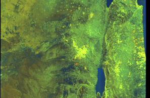
🛰️ Satellite Corroboration
Satellite imagery available but requires review
Preview available for manual review

Show Raw Evidence JSON
{
    "vessel_a": {
        "mmsi": 636015372,
        "imo": 9611541,
        "name": "THALIA",
        "flag": "Liberia"
    },
    "vessel_b": {
        "mmsi": 311000695,
        "imo": 9801524,
        "name": "AMBELOS",
        "flag": "BAHAMAS"
    },
    "min_distance_m": 0.200000000000000011102230246251565404236316680908203125,
    "avg_distance_m": 3.5,
    "distance_consistency_m": 6,
    "duration_minutes": 46.5,
    "overlap_duration_s": 2790,
    "speed_a_avg": 0,
    "speed_a_std": 0,
    "speed_b_avg": 0.040000000000000000832667268468867405317723751068115234375,
    "speed_b_std": 0.13000000000000000444089209850062616169452667236328125,
    "speed_summary": {
        "vessel_a": {
            "avg_sog": 0,
            "max_sog": 0
        },
        "vessel_b": {
            "avg_sog": 0.040000000000000000832667268468867405317723751068115234375,
            "max_sog": 0.5
        }
    },
    "time_window": {
        "start": "2026-06-18T13:13:19+00:00",
        "end": "2026-06-18T13:59:49+00:00"
    },
    "points_count": {
        "vessel_a": 14,
        "vessel_b": 14
    },
    "zone_id": "discovered_138",
    "zone_name": "Eastern Mediterranean Surveillance Zone",
    "score": {
        "value": 80,
        "components": {
            "distance_tightness": {
                "score": 25,
                "max": 25,
                "detail": "Min distance 0m, avg 4m"
            },
            "duration": {
                "score": 10,
                "max": 25,
                "detail": "Duration 46 minutes"
            },
            "speed_stability": {
                "score": 20,
                "max": 20,
                "detail": "both nearly stationary; very stable speeds"
            },
            "distance_consistency": {
                "score": 15,
                "max": 15,
                "detail": "Distance variance \u00b16m"
            },
            "isolation": {
                "score": 5,
                "max": 10,
                "detail": "Isolation data not available"
            },
            "context": {
                "score": 5,
                "max": 5,
                "detail": "In monitored zone: Eastern Mediterranean Surveillance Zone"
            }
        },
        "summary": "High-confidence STS candidate. Two tankers (THALIA and AMBELOS) maintained close proximity (min 0m, avg 4m) for 46 minutes. Both vessels were slow-moving (avg speeds 0.0 and 0.0 knots). The stable separation distance suggests deliberate parallel positioning typical of cargo transfer. Event occurred in Eastern Mediterranean Surveillance Zone, a known STS activity area."
    },
    "sar": {
        "status": "inconclusive",
        "centroid": {
            "lat": 31.717117900000001640137270442210137844085693359375,
            "lon": 35.99935130000000071959220804274082183837890625
        },
        "time_window": {
            "start_ts": "2026-06-18T13:13:19+00:00",
            "end_ts": "2026-06-18T13:59:49+00:00"
        },
        "searched_at": "2026-06-18T20:00:02.266031+00:00",
        "scene_id": "S1A_IW_GRDH_1SDV_20260618T033552_20260618T033617_065018_0831CC_4251_COG",
        "scene_datetime": "2026-06-18T03:35:52.733690Z",
        "platform": "sentinel-1a",
        "bbox": {
            "min_lon": 34.53284500000000178943082573823630809783935546875,
            "min_lat": 31.016262000000001108901415136642754077911376953125,
            "max_lon": 37.56213000000000334921423927880823612213134765625,
            "max_lat": 32.9353219999999993206074577756226062774658203125
        },
        "assets": {
            "preview_url": "https:\/\/fleetleaks.com\/wp-content\/uploads\/fleetleaks-evidence\/sar-imagery\/2026\/06\/event_789820_thumbnail_20260618200006.png",
            "stored_path": "\/home\/fleetleaks\/public_html\/wp-content\/uploads\/fleetleaks-evidence\/sar-imagery\/2026\/06\/event_789820_thumbnail_20260618200006.png",
            "source": "copernicus_dataspace"
        },
        "notes": "Preview available for manual review"
    }
}- Minimum Distance: 0 meters
- Average Distance: 4 meters
- Duration: 1h 18m
- Period: 2026-06-18T12:41:29+00:00 to 2026-06-18T13:59:49+00:00
- Vessel A Avg Speed: 0.0 knots
- Vessel B Avg Speed: 0.2 knots
- Zone: Eastern Mediterranean Surveillance Zone
Confidence Analysis
Moderate-confidence STS candidate. Two tankers (THALIA and AMBELOS) maintained close proximity (min 0m, avg 4m) for 78 minutes. Both vessels were slow-moving (avg speeds 0.0 and 0.2 knots). The stable separation distance suggests deliberate parallel positioning typical of cargo transfer. Event occurred in Eastern Mediterranean Surveillance Zone, a known STS activity area.
View scoring breakdown
| Factor | Score | Detail |
|---|---|---|
| Distance Tightness | 25/25 | Min distance 0m, avg 4m |
| Duration | 15/25 | Duration 78 minutes |
| Speed Stability | 14/20 | both nearly stationary; somewhat variable speeds |
| Distance Consistency | 15/15 | Distance variance ±5m |
| Isolation | 5/10 | Isolation data not available |
| Context | 5/5 | In monitored zone: Eastern Mediterranean Surveillance Zone |
Show Raw Evidence JSON
{
    "vessel_a": {
        "mmsi": 636015372,
        "imo": 9611541,
        "name": "THALIA",
        "flag": "Liberia"
    },
    "vessel_b": {
        "mmsi": 311000695,
        "imo": 9801524,
        "name": "AMBELOS",
        "flag": "BAHAMAS"
    },
    "min_distance_m": 0.200000000000000011102230246251565404236316680908203125,
    "avg_distance_m": 3.70000000000000017763568394002504646778106689453125,
    "distance_consistency_m": 5.20000000000000017763568394002504646778106689453125,
    "duration_minutes": 78.2999999999999971578290569595992565155029296875,
    "overlap_duration_s": 4700,
    "speed_a_avg": 0,
    "speed_a_std": 0,
    "speed_b_avg": 0.200000000000000011102230246251565404236316680908203125,
    "speed_b_std": 0.560000000000000053290705182007513940334320068359375,
    "speed_summary": {
        "vessel_a": {
            "avg_sog": 0,
            "max_sog": 0
        },
        "vessel_b": {
            "avg_sog": 0.200000000000000011102230246251565404236316680908203125,
            "max_sog": 1.899999999999999911182158029987476766109466552734375
        }
    },
    "time_window": {
        "start": "2026-06-18T12:41:29+00:00",
        "end": "2026-06-18T13:59:49+00:00"
    },
    "points_count": {
        "vessel_a": 22,
        "vessel_b": 22
    },
    "zone_id": "discovered_138",
    "zone_name": "Eastern Mediterranean Surveillance Zone",
    "score": {
        "value": 79,
        "components": {
            "distance_tightness": {
                "score": 25,
                "max": 25,
                "detail": "Min distance 0m, avg 4m"
            },
            "duration": {
                "score": 15,
                "max": 25,
                "detail": "Duration 78 minutes"
            },
            "speed_stability": {
                "score": 14,
                "max": 20,
                "detail": "both nearly stationary; somewhat variable speeds"
            },
            "distance_consistency": {
                "score": 15,
                "max": 15,
                "detail": "Distance variance \u00b15m"
            },
            "isolation": {
                "score": 5,
                "max": 10,
                "detail": "Isolation data not available"
            },
            "context": {
                "score": 5,
                "max": 5,
                "detail": "In monitored zone: Eastern Mediterranean Surveillance Zone"
            }
        },
        "summary": "Moderate-confidence STS candidate. Two tankers (THALIA and AMBELOS) maintained close proximity (min 0m, avg 4m) for 78 minutes. Both vessels were slow-moving (avg speeds 0.0 and 0.2 knots). The stable separation distance suggests deliberate parallel positioning typical of cargo transfer. Event occurred in Eastern Mediterranean Surveillance Zone, a known STS activity area."
    }
}- Minimum Distance: 1 meters
- Average Distance: 3 meters
- Duration: 1h 32m
- Period: 2026-06-18T12:16:53+00:00 to 2026-06-18T13:49:48+00:00
- Vessel A Avg Speed: 0.0 knots
- Vessel B Avg Speed: 0.0 knots
- Zone: Eastern Mediterranean Surveillance Zone
Confidence Analysis
High-confidence STS candidate. Two tankers (HELENE MAERSK and THALIA) maintained close proximity (min 1m, avg 3m) for 93 minutes. Both vessels were slow-moving (avg speeds 0.0 and 0.0 knots). The stable separation distance suggests deliberate parallel positioning typical of cargo transfer. Event occurred in Eastern Mediterranean Surveillance Zone, a known STS activity area.
View scoring breakdown
| Factor | Score | Detail |
|---|---|---|
| Distance Tightness | 25/25 | Min distance 1m, avg 3m |
| Duration | 20/25 | Duration 93 minutes |
| Speed Stability | 20/20 | both nearly stationary; very stable speeds |
| Distance Consistency | 15/15 | Distance variance ±2m |
| Isolation | 5/10 | Isolation data not available |
| Context | 5/5 | In monitored zone: Eastern Mediterranean Surveillance Zone |
🛰️ Satellite Corroboration
Satellite imagery available but requires review
Preview available for manual review
Show Raw Evidence JSON
{
    "vessel_a": {
        "mmsi": 563096300,
        "imo": 9389514,
        "name": "HELENE MAERSK",
        "flag": "SINGAPORE"
    },
    "vessel_b": {
        "mmsi": 636015372,
        "imo": 9611541,
        "name": "THALIA",
        "flag": "Liberia"
    },
    "min_distance_m": 0.59999999999999997779553950749686919152736663818359375,
    "avg_distance_m": 2.70000000000000017763568394002504646778106689453125,
    "distance_consistency_m": 1.899999999999999911182158029987476766109466552734375,
    "duration_minutes": 92.900000000000005684341886080801486968994140625,
    "overlap_duration_s": 5575,
    "speed_a_avg": 0.0299999999999999988897769753748434595763683319091796875,
    "speed_a_std": 0.05000000000000000277555756156289135105907917022705078125,
    "speed_b_avg": 0,
    "speed_b_std": 0,
    "speed_summary": {
        "vessel_a": {
            "avg_sog": 0.0299999999999999988897769753748434595763683319091796875,
            "max_sog": 0.1000000000000000055511151231257827021181583404541015625
        },
        "vessel_b": {
            "avg_sog": 0,
            "max_sog": 0
        }
    },
    "time_window": {
        "start": "2026-06-18T12:16:53+00:00",
        "end": "2026-06-18T13:49:48+00:00"
    },
    "points_count": {
        "vessel_a": 7,
        "vessel_b": 7
    },
    "zone_id": "discovered_138",
    "zone_name": "Eastern Mediterranean Surveillance Zone",
    "score": {
        "value": 90,
        "components": {
            "distance_tightness": {
                "score": 25,
                "max": 25,
                "detail": "Min distance 1m, avg 3m"
            },
            "duration": {
                "score": 20,
                "max": 25,
                "detail": "Duration 93 minutes"
            },
            "speed_stability": {
                "score": 20,
                "max": 20,
                "detail": "both nearly stationary; very stable speeds"
            },
            "distance_consistency": {
                "score": 15,
                "max": 15,
                "detail": "Distance variance \u00b12m"
            },
            "isolation": {
                "score": 5,
                "max": 10,
                "detail": "Isolation data not available"
            },
            "context": {
                "score": 5,
                "max": 5,
                "detail": "In monitored zone: Eastern Mediterranean Surveillance Zone"
            }
        },
        "summary": "High-confidence STS candidate. Two tankers (HELENE MAERSK and THALIA) maintained close proximity (min 1m, avg 3m) for 93 minutes. Both vessels were slow-moving (avg speeds 0.0 and 0.0 knots). The stable separation distance suggests deliberate parallel positioning typical of cargo transfer. Event occurred in Eastern Mediterranean Surveillance Zone, a known STS activity area."
    },
    "sar": {
        "status": "inconclusive",
        "centroid": {
            "lat": 31.717092699999998473003870458342134952545166015625,
            "lon": 35.999358499999999594365363009274005889892578125
        },
        "time_window": {
            "start_ts": "2026-06-18T12:16:53+00:00",
            "end_ts": "2026-06-18T13:49:48+00:00"
        },
        "searched_at": "2026-06-18T16:45:08.275758+00:00",
        "scene_id": "S1A_IW_GRDH_1SDV_20260618T033552_20260618T033617_065018_0831CC_4251_COG",
        "scene_datetime": "2026-06-18T03:35:52.733690Z",
        "platform": "sentinel-1a",
        "bbox": {
            "min_lon": 34.53284500000000178943082573823630809783935546875,
            "min_lat": 31.016262000000001108901415136642754077911376953125,
            "max_lon": 37.56213000000000334921423927880823612213134765625,
            "max_lat": 32.9353219999999993206074577756226062774658203125
        },
        "assets": {
            "preview_url": "https:\/\/fleetleaks.com\/wp-content\/uploads\/fleetleaks-evidence\/sar-imagery\/2026\/06\/event_788550_thumbnail_20260618164512.png",
            "stored_path": "\/home\/fleetleaks\/public_html\/wp-content\/uploads\/fleetleaks-evidence\/sar-imagery\/2026\/06\/event_788550_thumbnail_20260618164512.png",
            "source": "copernicus_dataspace"
        },
        "notes": "Preview available for manual review"
    }
}- Zone: Eastern Mediterranean Surveillance Zone
- Duration: 1h 45m
- Data Points: 27 AIS positions
- Period: 2026-06-18T12:14:49+00:00 to 2026-06-18T13:59:49+00:00
Show Raw Evidence JSON
{
    "zone_id": "discovered_138",
    "zone_name": "Eastern Mediterranean Surveillance Zone",
    "dwell_minutes": 105,
    "points_in_zone": 27,
    "first_point": {
        "ts": "2026-06-18T12:14:49+00:00",
        "lat": 31.717098299999999966303221299313008785247802734375,
        "lon": 35.9993649999999973942976794205605983734130859375
    },
    "last_point": {
        "ts": "2026-06-18T13:59:49+00:00",
        "lat": 31.71711330000000117479430628009140491485595703125,
        "lon": 35.99935500000000132558852783404290676116943359375
    }
}- Duration: 1h 45m
- Radius: 31 meters
- Data Points: 27 AIS positions
- Centroid: 31.7171, 35.9994
- Zone: Eastern Mediterranean Surveillance Zone
Show Raw Evidence JSON
{
    "radius_m": 30.699999999999999289457264239899814128875732421875,
    "duration_minutes": 105,
    "points": 27,
    "centroid": {
        "lat": 31.717086788888895654281441238708794116973876953125,
        "lon": 35.99936926296297912131194607354700565338134765625
    },
    "bbox": {
        "min_lat": 31.716816699999998974135451135225594043731689453125,
        "min_lon": 35.99935169999999828860381967388093471527099609375,
        "max_lat": 31.71711499999999972487785271368920803070068359375,
        "max_lon": 35.99943830000000133395587909035384654998779296875
    },
    "zone_id": "discovered_138"
}- Minimum Distance: 0 meters
- Average Distance: 17 meters
- Duration: 4h 8m
- Period: 2026-06-18T09:43:00+00:00 to 2026-06-18T13:51:51+00:00
- Vessel A Avg Speed: 0.2 knots
- Vessel B Avg Speed: 0.0 knots
- Zone: Eastern Mediterranean Surveillance Zone
Confidence Analysis
High-confidence STS candidate. Two tankers (AMBELOS and THALIA) maintained close proximity (min 0m, avg 17m) for 249 minutes. Both vessels were slow-moving (avg speeds 0.2 and 0.0 knots). The stable separation distance suggests deliberate parallel positioning typical of cargo transfer. Event occurred in Eastern Mediterranean Surveillance Zone, a known STS activity area.
View scoring breakdown
| Factor | Score | Detail |
|---|---|---|
| Distance Tightness | 25/25 | Min distance 0m, avg 17m |
| Duration | 25/25 | Duration 249 minutes |
| Speed Stability | 14/20 | both nearly stationary; somewhat variable speeds |
| Distance Consistency | 15/15 | Distance variance ±29m |
| Isolation | 5/10 | Isolation data not available |
| Context | 5/5 | In monitored zone: Eastern Mediterranean Surveillance Zone |
🛰️ Satellite Corroboration
Satellite imagery available but requires review
Preview available for manual review

Show Raw Evidence JSON
{
    "vessel_a": {
        "mmsi": 311000695,
        "imo": 9801524,
        "name": "AMBELOS",
        "flag": "BAHAMAS"
    },
    "vessel_b": {
        "mmsi": 636015372,
        "imo": 9611541,
        "name": "THALIA",
        "flag": "Liberia"
    },
    "min_distance_m": 0.200000000000000011102230246251565404236316680908203125,
    "avg_distance_m": 17.10000000000000142108547152020037174224853515625,
    "distance_consistency_m": 28.89999999999999857891452847979962825775146484375,
    "duration_minutes": 248.80000000000001136868377216160297393798828125,
    "overlap_duration_s": 14931,
    "speed_a_avg": 0.2300000000000000099920072216264088638126850128173828125,
    "speed_a_std": 0.56999999999999995115018691649311222136020660400390625,
    "speed_b_avg": 0,
    "speed_b_std": 0,
    "speed_summary": {
        "vessel_a": {
            "avg_sog": 0.2300000000000000099920072216264088638126850128173828125,
            "max_sog": 1.899999999999999911182158029987476766109466552734375
        },
        "vessel_b": {
            "avg_sog": 0,
            "max_sog": 0
        }
    },
    "time_window": {
        "start": "2026-06-18T09:43:00+00:00",
        "end": "2026-06-18T13:51:51+00:00"
    },
    "points_count": {
        "vessel_a": 11,
        "vessel_b": 11
    },
    "zone_id": "discovered_138",
    "zone_name": "Eastern Mediterranean Surveillance Zone",
    "score": {
        "value": 89,
        "components": {
            "distance_tightness": {
                "score": 25,
                "max": 25,
                "detail": "Min distance 0m, avg 17m"
            },
            "duration": {
                "score": 25,
                "max": 25,
                "detail": "Duration 249 minutes"
            },
            "speed_stability": {
                "score": 14,
                "max": 20,
                "detail": "both nearly stationary; somewhat variable speeds"
            },
            "distance_consistency": {
                "score": 15,
                "max": 15,
                "detail": "Distance variance \u00b129m"
            },
            "isolation": {
                "score": 5,
                "max": 10,
                "detail": "Isolation data not available"
            },
            "context": {
                "score": 5,
                "max": 5,
                "detail": "In monitored zone: Eastern Mediterranean Surveillance Zone"
            }
        },
        "summary": "High-confidence STS candidate. Two tankers (AMBELOS and THALIA) maintained close proximity (min 0m, avg 17m) for 249 minutes. Both vessels were slow-moving (avg speeds 0.2 and 0.0 knots). The stable separation distance suggests deliberate parallel positioning typical of cargo transfer. Event occurred in Eastern Mediterranean Surveillance Zone, a known STS activity area."
    },
    "sar": {
        "status": "inconclusive",
        "centroid": {
            "lat": 31.717040600000000694080881658010184764862060546875,
            "lon": 35.999368599999996831684256903827190399169921875
        },
        "time_window": {
            "start_ts": "2026-06-18T09:43:00+00:00",
            "end_ts": "2026-06-18T13:51:51+00:00"
        },
        "searched_at": "2026-06-18T15:30:01.442181+00:00",
        "scene_id": "S1A_IW_GRDH_1SDV_20260618T033552_20260618T033617_065018_0831CC_4251_COG",
        "scene_datetime": "2026-06-18T03:35:52.733690Z",
        "platform": "sentinel-1a",
        "bbox": {
            "min_lon": 34.53284500000000178943082573823630809783935546875,
            "min_lat": 31.016262000000001108901415136642754077911376953125,
            "max_lon": 37.56213000000000334921423927880823612213134765625,
            "max_lat": 32.9353219999999993206074577756226062774658203125
        },
        "assets": {
            "preview_url": "https:\/\/fleetleaks.com\/wp-content\/uploads\/fleetleaks-evidence\/sar-imagery\/2026\/06\/event_788090_thumbnail_20260618153005.png",
            "stored_path": "\/home\/fleetleaks\/public_html\/wp-content\/uploads\/fleetleaks-evidence\/sar-imagery\/2026\/06\/event_788090_thumbnail_20260618153005.png",
            "source": "copernicus_dataspace"
        },
        "notes": "Preview available for manual review"
    }
}- Zone: Eastern Mediterranean Surveillance Zone
- Duration: 4h 20m
- Data Points: 29 AIS positions
- Period: 2026-06-18T09:38:59+00:00 to 2026-06-18T13:59:49+00:00
Show Raw Evidence JSON
{
    "zone_id": "discovered_138",
    "zone_name": "Eastern Mediterranean Surveillance Zone",
    "dwell_minutes": 260.80000000000001136868377216160297393798828125,
    "points_in_zone": 29,
    "first_point": {
        "ts": "2026-06-18T09:38:59+00:00",
        "lat": 31.71708170000000137633833219297230243682861328125,
        "lon": 35.999380000000002155502443201839923858642578125
    },
    "last_point": {
        "ts": "2026-06-18T13:59:49+00:00",
        "lat": 31.71711330000000117479430628009140491485595703125,
        "lon": 35.99935500000000132558852783404290676116943359375
    }
}- Duration: 4h 20m
- Radius: 75 meters
- Data Points: 29 AIS positions
- Centroid: 31.7171, 35.9994
- Zone: Eastern Mediterranean Surveillance Zone
Show Raw Evidence JSON
{
    "radius_m": 75.400000000000005684341886080801486968994140625,
    "duration_minutes": 260.80000000000001136868377216160297393798828125,
    "points": 29,
    "centroid": {
        "lat": 31.717062413793112085613756789825856685638427734375,
        "lon": 35.9993719000000140795236802659928798675537109375
    },
    "bbox": {
        "min_lat": 31.716384999999998939301804057322442531585693359375,
        "min_lon": 35.99935169999999828860381967388093471527099609375,
        "max_lat": 31.71711499999999972487785271368920803070068359375,
        "max_lon": 35.99943830000000133395587909035384654998779296875
    },
    "zone_id": "discovered_138"
}- Minimum Distance: 1 meters
- Average Distance: 45 meters
- Duration: 1h 5m
- Period: 2026-06-18T08:35:29+00:00 to 2026-06-18T09:41:09+00:00
- Vessel A Avg Speed: 0.0 knots
- Vessel B Avg Speed: 0.0 knots
- Zone: Eastern Mediterranean Surveillance Zone
Confidence Analysis
High-confidence STS candidate. Two tankers (THALIA and ATLAS) maintained close proximity (min 1m, avg 45m) for 66 minutes. Both vessels were slow-moving (avg speeds 0.0 and 0.0 knots). The stable separation distance suggests deliberate parallel positioning typical of cargo transfer. Event occurred in Eastern Mediterranean Surveillance Zone, a known STS activity area.
View scoring breakdown
| Factor | Score | Detail |
|---|---|---|
| Distance Tightness | 25/25 | Min distance 1m, avg 45m |
| Duration | 15/25 | Duration 66 minutes |
| Speed Stability | 20/20 | both nearly stationary; very stable speeds |
| Distance Consistency | 12/15 | Distance variance ±47m |
| Isolation | 5/10 | Isolation data not available |
| Context | 5/5 | In monitored zone: Eastern Mediterranean Surveillance Zone |
🛰️ Satellite Corroboration
Satellite imagery available but requires review
Preview available for manual review

Show Raw Evidence JSON
{
    "vessel_a": {
        "mmsi": 636015372,
        "imo": 9611541,
        "name": "THALIA",
        "flag": "Liberia"
    },
    "vessel_b": {
        "mmsi": 311000134,
        "imo": 9538177,
        "name": "ATLAS",
        "flag": "BAHAMAS"
    },
    "min_distance_m": 1.3000000000000000444089209850062616169452667236328125,
    "avg_distance_m": 45.2000000000000028421709430404007434844970703125,
    "distance_consistency_m": 47.2000000000000028421709430404007434844970703125,
    "duration_minutes": 65.7000000000000028421709430404007434844970703125,
    "overlap_duration_s": 3940,
    "speed_a_avg": 0,
    "speed_a_std": 0,
    "speed_b_avg": 0,
    "speed_b_std": 0,
    "speed_summary": {
        "vessel_a": {
            "avg_sog": 0,
            "max_sog": 0
        },
        "vessel_b": {
            "avg_sog": 0,
            "max_sog": 0
        }
    },
    "time_window": {
        "start": "2026-06-18T08:35:29+00:00",
        "end": "2026-06-18T09:41:09+00:00"
    },
    "points_count": {
        "vessel_a": 4,
        "vessel_b": 4
    },
    "zone_id": "discovered_138",
    "zone_name": "Eastern Mediterranean Surveillance Zone",
    "score": {
        "value": 82,
        "components": {
            "distance_tightness": {
                "score": 25,
                "max": 25,
                "detail": "Min distance 1m, avg 45m"
            },
            "duration": {
                "score": 15,
                "max": 25,
                "detail": "Duration 66 minutes"
            },
            "speed_stability": {
                "score": 20,
                "max": 20,
                "detail": "both nearly stationary; very stable speeds"
            },
            "distance_consistency": {
                "score": 12,
                "max": 15,
                "detail": "Distance variance \u00b147m"
            },
            "isolation": {
                "score": 5,
                "max": 10,
                "detail": "Isolation data not available"
            },
            "context": {
                "score": 5,
                "max": 5,
                "detail": "In monitored zone: Eastern Mediterranean Surveillance Zone"
            }
        },
        "summary": "High-confidence STS candidate. Two tankers (THALIA and ATLAS) maintained close proximity (min 1m, avg 45m) for 66 minutes. Both vessels were slow-moving (avg speeds 0.0 and 0.0 knots). The stable separation distance suggests deliberate parallel positioning typical of cargo transfer. Event occurred in Eastern Mediterranean Surveillance Zone, a known STS activity area."
    },
    "sar": {
        "status": "inconclusive",
        "centroid": {
            "lat": 31.716937900000001349098965874873101711273193359375,
            "lon": 35.9994729000000006635673344135284423828125
        },
        "time_window": {
            "start_ts": "2026-06-18T08:35:29+00:00",
            "end_ts": "2026-06-18T09:41:09+00:00"
        },
        "searched_at": "2026-06-18T12:30:01.743235+00:00",
        "scene_id": "S1A_IW_GRDH_1SDV_20260618T033552_20260618T033617_065018_0831CC_4251_COG",
        "scene_datetime": "2026-06-18T03:35:52.733690Z",
        "platform": "sentinel-1a",
        "bbox": {
            "min_lon": 34.53284500000000178943082573823630809783935546875,
            "min_lat": 31.016262000000001108901415136642754077911376953125,
            "max_lon": 37.56213000000000334921423927880823612213134765625,
            "max_lat": 32.9353219999999993206074577756226062774658203125
        },
        "assets": {
            "preview_url": "https:\/\/fleetleaks.com\/wp-content\/uploads\/fleetleaks-evidence\/sar-imagery\/2026\/06\/event_786756_thumbnail_20260618123006.png",
            "stored_path": "\/home\/fleetleaks\/public_html\/wp-content\/uploads\/fleetleaks-evidence\/sar-imagery\/2026\/06\/event_786756_thumbnail_20260618123006.png",
            "source": "copernicus_dataspace"
        },
        "notes": "Preview available for manual review"
    }
}- Minimum Distance: 0 meters
- Average Distance: 15 meters
- Duration: 5h 13m
- Period: 2026-06-18T08:38:27+00:00 to 2026-06-18T13:51:51+00:00
- Vessel A Avg Speed: 0.2 knots
- Vessel B Avg Speed: 0.0 knots
- Zone: Eastern Mediterranean Surveillance Zone
Confidence Analysis
High-confidence STS candidate. Two tankers (AMBELOS and THALIA) maintained close proximity (min 0m, avg 15m) for 313 minutes. Both vessels were slow-moving (avg speeds 0.2 and 0.0 knots). The stable separation distance suggests deliberate parallel positioning typical of cargo transfer. Event occurred in Eastern Mediterranean Surveillance Zone, a known STS activity area.
View scoring breakdown
| Factor | Score | Detail |
|---|---|---|
| Distance Tightness | 25/25 | Min distance 0m, avg 15m |
| Duration | 25/25 | Duration 313 minutes |
| Speed Stability | 14/20 | both nearly stationary; somewhat variable speeds |
| Distance Consistency | 15/15 | Distance variance ±26m |
| Isolation | 5/10 | Isolation data not available |
| Context | 5/5 | In monitored zone: Eastern Mediterranean Surveillance Zone |
Show Raw Evidence JSON
{
    "vessel_a": {
        "mmsi": 311000695,
        "imo": 9801524,
        "name": "AMBELOS",
        "flag": "BAHAMAS"
    },
    "vessel_b": {
        "mmsi": 636015372,
        "imo": 9611541,
        "name": "THALIA",
        "flag": "Liberia"
    },
    "min_distance_m": 0.200000000000000011102230246251565404236316680908203125,
    "avg_distance_m": 14.5999999999999996447286321199499070644378662109375,
    "distance_consistency_m": 25.800000000000000710542735760100185871124267578125,
    "duration_minutes": 313.3999999999999772626324556767940521240234375,
    "overlap_duration_s": 18804,
    "speed_a_avg": 0.179999999999999993338661852249060757458209991455078125,
    "speed_a_std": 0.5100000000000000088817841970012523233890533447265625,
    "speed_b_avg": 0,
    "speed_b_std": 0,
    "speed_summary": {
        "vessel_a": {
            "avg_sog": 0.179999999999999993338661852249060757458209991455078125,
            "max_sog": 1.899999999999999911182158029987476766109466552734375
        },
        "vessel_b": {
            "avg_sog": 0,
            "max_sog": 0
        }
    },
    "time_window": {
        "start": "2026-06-18T08:38:27+00:00",
        "end": "2026-06-18T13:51:51+00:00"
    },
    "points_count": {
        "vessel_a": 14,
        "vessel_b": 14
    },
    "zone_id": "discovered_138",
    "zone_name": "Eastern Mediterranean Surveillance Zone",
    "score": {
        "value": 89,
        "components": {
            "distance_tightness": {
                "score": 25,
                "max": 25,
                "detail": "Min distance 0m, avg 15m"
            },
            "duration": {
                "score": 25,
                "max": 25,
                "detail": "Duration 313 minutes"
            },
            "speed_stability": {
                "score": 14,
                "max": 20,
                "detail": "both nearly stationary; somewhat variable speeds"
            },
            "distance_consistency": {
                "score": 15,
                "max": 15,
                "detail": "Distance variance \u00b126m"
            },
            "isolation": {
                "score": 5,
                "max": 10,
                "detail": "Isolation data not available"
            },
            "context": {
                "score": 5,
                "max": 5,
                "detail": "In monitored zone: Eastern Mediterranean Surveillance Zone"
            }
        },
        "summary": "High-confidence STS candidate. Two tankers (AMBELOS and THALIA) maintained close proximity (min 0m, avg 15m) for 313 minutes. Both vessels were slow-moving (avg speeds 0.2 and 0.0 knots). The stable separation distance suggests deliberate parallel positioning typical of cargo transfer. Event occurred in Eastern Mediterranean Surveillance Zone, a known STS activity area."
    }
}- Zone: Eastern Mediterranean Surveillance Zone
- Duration: 5h 42m
- Data Points: 34 AIS positions
- Period: 2026-06-18T08:16:59+00:00 to 2026-06-18T13:59:49+00:00
Show Raw Evidence JSON
{
    "zone_id": "discovered_138",
    "zone_name": "Eastern Mediterranean Surveillance Zone",
    "dwell_minutes": 342.80000000000001136868377216160297393798828125,
    "points_in_zone": 34,
    "first_point": {
        "ts": "2026-06-18T08:16:59+00:00",
        "lat": 31.7170382999999986850525601767003536224365234375,
        "lon": 35.9991567000000003417881089262664318084716796875
    },
    "last_point": {
        "ts": "2026-06-18T13:59:49+00:00",
        "lat": 31.71711330000000117479430628009140491485595703125,
        "lon": 35.99935500000000132558852783404290676116943359375
    }
}- Duration: 5h 42m
- Radius: 87 meters
- Data Points: 34 AIS positions
- Centroid: 31.7170, 35.9994
- Zone: Eastern Mediterranean Surveillance Zone
Show Raw Evidence JSON
{
    "radius_m": 87.099999999999994315658113919198513031005859375,
    "duration_minutes": 342.80000000000001136868377216160297393798828125,
    "points": 34,
    "centroid": {
        "lat": 31.7170458323529373956262134015560150146484375,
        "lon": 35.99940034705883107335466775111854076385498046875
    },
    "bbox": {
        "min_lat": 31.716384999999998939301804057322442531585693359375,
        "min_lon": 35.9991567000000003417881089262664318084716796875,
        "max_lat": 31.717195000000000248974174610339105129241943359375,
        "max_lon": 36.00010329999999925121301203034818172454833984375
    },
    "zone_id": "discovered_138"
}- Zone: Eastern Mediterranean Surveillance Zone
- Duration: 6h 37m
- Data Points: 10 AIS positions
- Period: 2026-06-18T05:40:38+00:00 to 2026-06-18T12:17:58+00:00
Show Raw Evidence JSON
{
    "zone_id": "discovered_138",
    "zone_name": "Eastern Mediterranean Surveillance Zone",
    "dwell_minutes": 397.30000000000001136868377216160297393798828125,
    "points_in_zone": 10,
    "first_point": {
        "ts": "2026-06-18T05:40:38+00:00",
        "lat": 31.7170966999999990321157383732497692108154296875,
        "lon": 35.99936000000000291265678242780268192291259765625
    },
    "last_point": {
        "ts": "2026-06-18T12:17:58+00:00",
        "lat": 31.717095000000000482032191939651966094970703125,
        "lon": 35.99936670000000304980858345516026020050048828125
    }
}- Duration: 6h 37m
- Radius: 75 meters
- Data Points: 10 AIS positions
- Centroid: 31.7170, 35.9995
- Zone: Eastern Mediterranean Surveillance Zone
Show Raw Evidence JSON
{
    "radius_m": 75.099999999999994315658113919198513031005859375,
    "duration_minutes": 397.30000000000001136868377216160297393798828125,
    "points": 10,
    "centroid": {
        "lat": 31.71695049999999582723830826580524444580078125,
        "lon": 35.99947334000000154219378600828349590301513671875
    },
    "bbox": {
        "min_lat": 31.716384999999998939301804057322442531585693359375,
        "min_lon": 35.9991567000000003417881089262664318084716796875,
        "max_lat": 31.717195000000000248974174610339105129241943359375,
        "max_lon": 36.00010329999999925121301203034818172454833984375
    },
    "zone_id": "discovered_138"
}- Zone: Eastern Mediterranean Surveillance Zone
- Duration: 5h 2m
- Data Points: 16 AIS positions
- Period: 2026-06-18T04:38:18+00:00 to 2026-06-18T09:41:09+00:00
Show Raw Evidence JSON
{
    "zone_id": "discovered_138",
    "zone_name": "Eastern Mediterranean Surveillance Zone",
    "dwell_minutes": 302.8999999999999772626324556767940521240234375,
    "points_in_zone": 16,
    "first_point": {
        "ts": "2026-06-18T04:38:18+00:00",
        "lat": 31.717103300000001553371475893072783946990966796875,
        "lon": 35.9993733000000020183506421744823455810546875
    },
    "last_point": {
        "ts": "2026-06-18T09:41:09+00:00",
        "lat": 31.716384999999998939301804057322442531585693359375,
        "lon": 35.99943499999999829697117093019187450408935546875
    }
}- Duration: 5h 2m
- Radius: 82 meters
- Data Points: 16 AIS positions
- Centroid: 31.7170, 35.9994
- Zone: Eastern Mediterranean Surveillance Zone
Show Raw Evidence JSON
{
    "radius_m": 81.7000000000000028421709430404007434844970703125,
    "duration_minutes": 302.8999999999999772626324556767940521240234375,
    "points": 16,
    "centroid": {
        "lat": 31.717007393749998556131686200387775897979736328125,
        "lon": 35.99943719374999773208401165902614593505859375
    },
    "bbox": {
        "min_lat": 31.716384999999998939301804057322442531585693359375,
        "min_lon": 35.9991567000000003417881089262664318084716796875,
        "max_lat": 31.717195000000000248974174610339105129241943359375,
        "max_lon": 36.00010329999999925121301203034818172454833984375
    },
    "zone_id": "discovered_138"
}- Zone: Eastern Mediterranean Surveillance Zone
- Duration: 6h 33m
- Data Points: 12 AIS positions
- Period: 2026-06-18T01:43:29+00:00 to 2026-06-18T08:16:59+00:00
Show Raw Evidence JSON
{
    "zone_id": "discovered_138",
    "zone_name": "Eastern Mediterranean Surveillance Zone",
    "dwell_minutes": 393.5,
    "points_in_zone": 12,
    "first_point": {
        "ts": "2026-06-18T01:43:29+00:00",
        "lat": 31.717095000000000482032191939651966094970703125,
        "lon": 35.9993649999999973942976794205605983734130859375
    },
    "last_point": {
        "ts": "2026-06-18T08:16:59+00:00",
        "lat": 31.7170382999999986850525601767003536224365234375,
        "lon": 35.9991567000000003417881089262664318084716796875
    }
}- Duration: 6h 33m
- Radius: 20 meters
- Data Points: 12 AIS positions
- Centroid: 31.7171, 35.9994
- Zone: Eastern Mediterranean Surveillance Zone
Show Raw Evidence JSON
{
    "radius_m": 19.60000000000000142108547152020037174224853515625,
    "duration_minutes": 393.5,
    "points": 12,
    "centroid": {
        "lat": 31.7170947166666650218758150003850460052490234375,
        "lon": 35.99935320000000871232259669341146945953369140625
    },
    "bbox": {
        "min_lat": 31.7170382999999986850525601767003536224365234375,
        "min_lon": 35.9991567000000003417881089262664318084716796875,
        "max_lat": 31.717106699999998653538568760268390178680419921875,
        "max_lon": 35.99938670000000229265424422919750213623046875
    },
    "zone_id": "discovered_138"
}- Zone: Eastern Mediterranean Surveillance Zone
- Duration: 2 hours
- Data Points: 7 AIS positions
- Period: 2026-06-17T14:16:00+00:00 to 2026-06-17T16:16:42+00:00
Show Raw Evidence JSON
{
    "zone_id": "discovered_138",
    "zone_name": "Eastern Mediterranean Surveillance Zone",
    "dwell_minutes": 120.7000000000000028421709430404007434844970703125,
    "points_in_zone": 7,
    "first_point": {
        "ts": "2026-06-17T14:16:00+00:00",
        "lat": 31.717123300000000796217136667110025882720947265625,
        "lon": 35.99936170000000146274032886140048503875732421875
    },
    "last_point": {
        "ts": "2026-06-17T16:16:42+00:00",
        "lat": 31.717110000000001690523276920430362224578857421875,
        "lon": 35.9993582999999972571458783932030200958251953125
    }
}- Zone: Eastern Mediterranean Surveillance Zone
- Duration: 6h 28m
- Data Points: 9 AIS positions
- Period: 2026-06-17T08:13:24+00:00 to 2026-06-17T14:41:41+00:00
Show Raw Evidence JSON
{
    "zone_id": "discovered_138",
    "zone_name": "Eastern Mediterranean Surveillance Zone",
    "dwell_minutes": 388.30000000000001136868377216160297393798828125,
    "points_in_zone": 9,
    "first_point": {
        "ts": "2026-06-17T08:13:24+00:00",
        "lat": 31.7171282999999988305717124603688716888427734375,
        "lon": 35.99936170000000146274032886140048503875732421875
    },
    "last_point": {
        "ts": "2026-06-17T14:41:41+00:00",
        "lat": 31.7170966999999990321157383732497692108154296875,
        "lon": 35.99936670000000304980858345516026020050048828125
    }
}- Duration: 6h 35m
- Radius: 3 meters
- Data Points: 10 AIS positions
- Centroid: 31.7171, 35.9994
- Zone: Eastern Mediterranean Surveillance Zone
Show Raw Evidence JSON
{
    "radius_m": 3,
    "duration_minutes": 395.3999999999999772626324556767940521240234375,
    "points": 10,
    "centroid": {
        "lat": 31.717113000000001221678758156485855579376220703125,
        "lon": 35.9993598500000047124558477662503719329833984375
    },
    "bbox": {
        "min_lat": 31.717098299999999966303221299313008785247802734375,
        "min_lon": 35.99933829999999801430021761916577816009521484375,
        "max_lat": 31.7171282999999988305717124603688716888427734375,
        "max_lon": 35.99938670000000229265424422919750213623046875
    },
    "zone_id": "discovered_138"
}- Zone: Eastern Mediterranean Surveillance Zone
- Duration: 6h 25m
- Data Points: 9 AIS positions
- Period: 2026-06-17T07:59:25+00:00 to 2026-06-17T14:24:40+00:00
Show Raw Evidence JSON
{
    "zone_id": "discovered_138",
    "zone_name": "Eastern Mediterranean Surveillance Zone",
    "dwell_minutes": 385.19999999999998863131622783839702606201171875,
    "points_in_zone": 9,
    "first_point": {
        "ts": "2026-06-17T07:59:25+00:00",
        "lat": 31.717099999999998516386767732910811901092529296875,
        "lon": 35.99938329999999808705979376100003719329833984375
    },
    "last_point": {
        "ts": "2026-06-17T14:24:40+00:00",
        "lat": 31.717110000000001690523276920430362224578857421875,
        "lon": 35.99934669999999670153556508012115955352783203125
    }
}- Minimum Distance: 1 meters
- Average Distance: 1 meters
- Duration: 1h 30m
- Period: 2026-06-17T06:47:45+00:00 to 2026-06-17T08:18:38+00:00
- Vessel A Avg Speed: 0.0 knots
- Vessel B Avg Speed: 0.0 knots
- Zone: Eastern Mediterranean Surveillance Zone
Confidence Analysis
High-confidence STS candidate. Two tankers (THALIA and BLUE ROSE) maintained close proximity (min 1m, avg 1m) for 91 minutes. Both vessels were slow-moving (avg speeds 0.0 and 0.0 knots). The stable separation distance suggests deliberate parallel positioning typical of cargo transfer. Event occurred in Eastern Mediterranean Surveillance Zone, a known STS activity area.
View scoring breakdown
| Factor | Score | Detail |
|---|---|---|
| Distance Tightness | 25/25 | Min distance 1m, avg 1m |
| Duration | 20/25 | Duration 91 minutes |
| Speed Stability | 20/20 | both nearly stationary; very stable speeds |
| Distance Consistency | 15/15 | Distance variance ±1m |
| Isolation | 5/10 | Isolation data not available |
| Context | 5/5 | In monitored zone: Eastern Mediterranean Surveillance Zone |
🛰️ Satellite Corroboration
No satellite imagery for this time/location
No Sentinel-1 scenes covering AOI and time window
Show Raw Evidence JSON
{
    "vessel_a": {
        "mmsi": 636015372,
        "imo": 9611541,
        "name": "THALIA",
        "flag": "Liberia"
    },
    "vessel_b": {
        "mmsi": 538002561,
        "imo": 9335915,
        "name": "BLUE ROSE",
        "flag": "MARSHALL ISLANDS"
    },
    "min_distance_m": 0.59999999999999997779553950749686919152736663818359375,
    "avg_distance_m": 1.399999999999999911182158029987476766109466552734375,
    "distance_consistency_m": 0.8000000000000000444089209850062616169452667236328125,
    "duration_minutes": 90.900000000000005684341886080801486968994140625,
    "overlap_duration_s": 5453,
    "speed_a_avg": 0,
    "speed_a_std": 0,
    "speed_b_avg": 0,
    "speed_b_std": 0,
    "speed_summary": {
        "vessel_a": {
            "avg_sog": 0,
            "max_sog": 0
        },
        "vessel_b": {
            "avg_sog": 0,
            "max_sog": 0
        }
    },
    "time_window": {
        "start": "2026-06-17T06:47:45+00:00",
        "end": "2026-06-17T08:18:38+00:00"
    },
    "points_count": {
        "vessel_a": 8,
        "vessel_b": 8
    },
    "zone_id": "discovered_138",
    "zone_name": "Eastern Mediterranean Surveillance Zone",
    "score": {
        "value": 90,
        "components": {
            "distance_tightness": {
                "score": 25,
                "max": 25,
                "detail": "Min distance 1m, avg 1m"
            },
            "duration": {
                "score": 20,
                "max": 25,
                "detail": "Duration 91 minutes"
            },
            "speed_stability": {
                "score": 20,
                "max": 20,
                "detail": "both nearly stationary; very stable speeds"
            },
            "distance_consistency": {
                "score": 15,
                "max": 15,
                "detail": "Distance variance \u00b11m"
            },
            "isolation": {
                "score": 5,
                "max": 10,
                "detail": "Isolation data not available"
            },
            "context": {
                "score": 5,
                "max": 5,
                "detail": "In monitored zone: Eastern Mediterranean Surveillance Zone"
            }
        },
        "summary": "High-confidence STS candidate. Two tankers (THALIA and BLUE ROSE) maintained close proximity (min 1m, avg 1m) for 91 minutes. Both vessels were slow-moving (avg speeds 0.0 and 0.0 knots). The stable separation distance suggests deliberate parallel positioning typical of cargo transfer. Event occurred in Eastern Mediterranean Surveillance Zone, a known STS activity area."
    },
    "sar": {
        "status": "not_found",
        "centroid": {
            "lat": 31.717110399999999259534888551570475101470947265625,
            "lon": 35.99937429999999949359335005283355712890625
        },
        "time_window": {
            "start_ts": "2026-06-17T06:47:45+00:00",
            "end_ts": "2026-06-17T08:18:38+00:00"
        },
        "searched_at": "2026-06-17T13:30:07.333508+00:00",
        "notes": "No Sentinel-1 scenes covering AOI and time window"
    }
}- Zone: Eastern Mediterranean Surveillance Zone
- Duration: 1h 49m
- Data Points: 14 AIS positions
- Period: 2026-06-17T06:29:32+00:00 to 2026-06-17T08:18:38+00:00
Show Raw Evidence JSON
{
    "zone_id": "discovered_138",
    "zone_name": "Eastern Mediterranean Surveillance Zone",
    "dwell_minutes": 109.099999999999994315658113919198513031005859375,
    "points_in_zone": 14,
    "first_point": {
        "ts": "2026-06-17T06:29:32+00:00",
        "lat": 31.7170832999999987578121363185346126556396484375,
        "lon": 35.99936000000000291265678242780268192291259765625
    },
    "last_point": {
        "ts": "2026-06-17T08:18:38+00:00",
        "lat": 31.71711499999999972487785271368920803070068359375,
        "lon": 35.99935169999999828860381967388093471527099609375
    }
}- Duration: 1h 49m
- Radius: 4 meters
- Data Points: 14 AIS positions
- Centroid: 31.7171, 35.9994
- Zone: Eastern Mediterranean Surveillance Zone
Show Raw Evidence JSON
{
    "radius_m": 3.79999999999999982236431605997495353221893310546875,
    "duration_minutes": 109.099999999999994315658113919198513031005859375,
    "points": 14,
    "centroid": {
        "lat": 31.71710607142856730433777556754648685455322265625,
        "lon": 35.99936655714285649310113512910902500152587890625
    },
    "bbox": {
        "min_lat": 31.717071700000001754915501805953681468963623046875,
        "min_lon": 35.99935169999999828860381967388093471527099609375,
        "max_lat": 31.7171282999999988305717124603688716888427734375,
        "max_lon": 35.99938670000000229265424422919750213623046875
    },
    "zone_id": "discovered_138"
}- Minimum Distance: 2 meters
- Average Distance: 5 meters
- Duration: 38 minutes
- Period: 2026-06-16T14:14:21+00:00 to 2026-06-16T14:52:41+00:00
- Vessel A Avg Speed: 0.0 knots
- Vessel B Avg Speed: 0.0 knots
- Zone: Eastern Mediterranean Surveillance Zone
Confidence Analysis
Moderate-confidence STS candidate. Two tankers (THALIA and E PIONEER) maintained close proximity (min 2m, avg 4m) for 38 minutes. Both vessels were slow-moving (avg speeds 0.0 and 0.0 knots). The stable separation distance suggests deliberate parallel positioning typical of cargo transfer. Event occurred in Eastern Mediterranean Surveillance Zone, a known STS activity area.
View scoring breakdown
| Factor | Score | Detail |
|---|---|---|
| Distance Tightness | 25/25 | Min distance 2m, avg 4m |
| Duration | 5/25 | Duration 38 minutes |
| Speed Stability | 20/20 | both nearly stationary; very stable speeds |
| Distance Consistency | 15/15 | Distance variance ±3m |
| Isolation | 5/10 | Isolation data not available |
| Context | 5/5 | In monitored zone: Eastern Mediterranean Surveillance Zone |
Show Raw Evidence JSON
{
    "vessel_a": {
        "mmsi": 636015372,
        "imo": 9611541,
        "name": "THALIA",
        "flag": "Liberia"
    },
    "vessel_b": {
        "mmsi": 636019539,
        "imo": 9278686,
        "name": "E PIONEER",
        "flag": "Liberia"
    },
    "min_distance_m": 1.8000000000000000444089209850062616169452667236328125,
    "avg_distance_m": 4.5,
    "distance_consistency_m": 2.79999999999999982236431605997495353221893310546875,
    "duration_minutes": 38.2999999999999971578290569595992565155029296875,
    "overlap_duration_s": 2300,
    "speed_a_avg": 0,
    "speed_a_std": 0,
    "speed_b_avg": 0.0200000000000000004163336342344337026588618755340576171875,
    "speed_b_std": 0.040000000000000000832667268468867405317723751068115234375,
    "speed_summary": {
        "vessel_a": {
            "avg_sog": 0,
            "max_sog": 0
        },
        "vessel_b": {
            "avg_sog": 0.0200000000000000004163336342344337026588618755340576171875,
            "max_sog": 0.1000000000000000055511151231257827021181583404541015625
        }
    },
    "time_window": {
        "start": "2026-06-16T14:14:21+00:00",
        "end": "2026-06-16T14:52:41+00:00"
    },
    "points_count": {
        "vessel_a": 12,
        "vessel_b": 12
    },
    "zone_id": "discovered_138",
    "zone_name": "Eastern Mediterranean Surveillance Zone",
    "score": {
        "value": 75,
        "components": {
            "distance_tightness": {
                "score": 25,
                "max": 25,
                "detail": "Min distance 2m, avg 4m"
            },
            "duration": {
                "score": 5,
                "max": 25,
                "detail": "Duration 38 minutes"
            },
            "speed_stability": {
                "score": 20,
                "max": 20,
                "detail": "both nearly stationary; very stable speeds"
            },
            "distance_consistency": {
                "score": 15,
                "max": 15,
                "detail": "Distance variance \u00b13m"
            },
            "isolation": {
                "score": 5,
                "max": 10,
                "detail": "Isolation data not available"
            },
            "context": {
                "score": 5,
                "max": 5,
                "detail": "In monitored zone: Eastern Mediterranean Surveillance Zone"
            }
        },
        "summary": "Moderate-confidence STS candidate. Two tankers (THALIA and E PIONEER) maintained close proximity (min 2m, avg 4m) for 38 minutes. Both vessels were slow-moving (avg speeds 0.0 and 0.0 knots). The stable separation distance suggests deliberate parallel positioning typical of cargo transfer. Event occurred in Eastern Mediterranean Surveillance Zone, a known STS activity area."
    }
}- Minimum Distance: 0 meters
- Average Distance: 2 meters
- Duration: 43 minutes
- Period: 2026-06-16T14:09:21+00:00 to 2026-06-16T14:52:41+00:00
- Vessel A Avg Speed: 0.0 knots
- Vessel B Avg Speed: 0.0 knots
- Zone: Eastern Mediterranean Surveillance Zone
Confidence Analysis
Moderate-confidence STS candidate. Two tankers (THALIA and BRONX) maintained close proximity (min 0m, avg 2m) for 43 minutes. Both vessels were slow-moving (avg speeds 0.0 and 0.0 knots). The stable separation distance suggests deliberate parallel positioning typical of cargo transfer. Event occurred in Eastern Mediterranean Surveillance Zone, a known STS activity area.
View scoring breakdown
| Factor | Score | Detail |
|---|---|---|
| Distance Tightness | 25/25 | Min distance 0m, avg 2m |
| Duration | 5/25 | Duration 43 minutes |
| Speed Stability | 20/20 | both nearly stationary; very stable speeds |
| Distance Consistency | 15/15 | Distance variance ±1m |
| Isolation | 5/10 | Isolation data not available |
| Context | 5/5 | In monitored zone: Eastern Mediterranean Surveillance Zone |
Show Raw Evidence JSON
{
    "vessel_a": {
        "mmsi": 636015372,
        "imo": 9611541,
        "name": "THALIA",
        "flag": "Liberia"
    },
    "vessel_b": {
        "mmsi": 636022962,
        "imo": 9391414,
        "name": "BRONX",
        "flag": "Liberia"
    },
    "min_distance_m": 0.200000000000000011102230246251565404236316680908203125,
    "avg_distance_m": 1.5,
    "distance_consistency_m": 1.1999999999999999555910790149937383830547332763671875,
    "duration_minutes": 43.2999999999999971578290569595992565155029296875,
    "overlap_duration_s": 2600,
    "speed_a_avg": 0,
    "speed_a_std": 0,
    "speed_b_avg": 0,
    "speed_b_std": 0,
    "speed_summary": {
        "vessel_a": {
            "avg_sog": 0,
            "max_sog": 0
        },
        "vessel_b": {
            "avg_sog": 0,
            "max_sog": 0
        }
    },
    "time_window": {
        "start": "2026-06-16T14:09:21+00:00",
        "end": "2026-06-16T14:52:41+00:00"
    },
    "points_count": {
        "vessel_a": 14,
        "vessel_b": 14
    },
    "zone_id": "discovered_138",
    "zone_name": "Eastern Mediterranean Surveillance Zone",
    "score": {
        "value": 75,
        "components": {
            "distance_tightness": {
                "score": 25,
                "max": 25,
                "detail": "Min distance 0m, avg 2m"
            },
            "duration": {
                "score": 5,
                "max": 25,
                "detail": "Duration 43 minutes"
            },
            "speed_stability": {
                "score": 20,
                "max": 20,
                "detail": "both nearly stationary; very stable speeds"
            },
            "distance_consistency": {
                "score": 15,
                "max": 15,
                "detail": "Distance variance \u00b11m"
            },
            "isolation": {
                "score": 5,
                "max": 10,
                "detail": "Isolation data not available"
            },
            "context": {
                "score": 5,
                "max": 5,
                "detail": "In monitored zone: Eastern Mediterranean Surveillance Zone"
            }
        },
        "summary": "Moderate-confidence STS candidate. Two tankers (THALIA and BRONX) maintained close proximity (min 0m, avg 2m) for 43 minutes. Both vessels were slow-moving (avg speeds 0.0 and 0.0 knots). The stable separation distance suggests deliberate parallel positioning typical of cargo transfer. Event occurred in Eastern Mediterranean Surveillance Zone, a known STS activity area."
    }
}- Minimum Distance: 0 meters
- Average Distance: 1 meters
- Duration: 39 minutes
- Period: 2026-06-16T14:13:15+00:00 to 2026-06-16T14:52:16+00:00
- Vessel A Avg Speed: 0.0 knots
- Vessel B Avg Speed: 0.0 knots
- Zone: Eastern Mediterranean Surveillance Zone
Confidence Analysis
Moderate-confidence STS candidate. Two tankers (DELPHI and THALIA) maintained close proximity (min 0m, avg 1m) for 39 minutes. Both vessels were slow-moving (avg speeds 0.0 and 0.0 knots). The stable separation distance suggests deliberate parallel positioning typical of cargo transfer. Event occurred in Eastern Mediterranean Surveillance Zone, a known STS activity area.
View scoring breakdown
| Factor | Score | Detail |
|---|---|---|
| Distance Tightness | 25/25 | Min distance 0m, avg 1m |
| Duration | 5/25 | Duration 39 minutes |
| Speed Stability | 20/20 | both nearly stationary; very stable speeds |
| Distance Consistency | 15/15 | Distance variance ±1m |
| Isolation | 5/10 | Isolation data not available |
| Context | 5/5 | In monitored zone: Eastern Mediterranean Surveillance Zone |
Show Raw Evidence JSON
{
    "vessel_a": {
        "mmsi": 636014336,
        "imo": 9283796,
        "name": "DELPHI",
        "flag": "Liberia"
    },
    "vessel_b": {
        "mmsi": 636015372,
        "imo": 9611541,
        "name": "THALIA",
        "flag": "Liberia"
    },
    "min_distance_m": 0.299999999999999988897769753748434595763683319091796875,
    "avg_distance_m": 1.1999999999999999555910790149937383830547332763671875,
    "distance_consistency_m": 0.8000000000000000444089209850062616169452667236328125,
    "duration_minutes": 39,
    "overlap_duration_s": 2341,
    "speed_a_avg": 0,
    "speed_a_std": 0,
    "speed_b_avg": 0,
    "speed_b_std": 0,
    "speed_summary": {
        "vessel_a": {
            "avg_sog": 0,
            "max_sog": 0
        },
        "vessel_b": {
            "avg_sog": 0,
            "max_sog": 0
        }
    },
    "time_window": {
        "start": "2026-06-16T14:13:15+00:00",
        "end": "2026-06-16T14:52:16+00:00"
    },
    "points_count": {
        "vessel_a": 14,
        "vessel_b": 14
    },
    "zone_id": "discovered_138",
    "zone_name": "Eastern Mediterranean Surveillance Zone",
    "score": {
        "value": 75,
        "components": {
            "distance_tightness": {
                "score": 25,
                "max": 25,
                "detail": "Min distance 0m, avg 1m"
            },
            "duration": {
                "score": 5,
                "max": 25,
                "detail": "Duration 39 minutes"
            },
            "speed_stability": {
                "score": 20,
                "max": 20,
                "detail": "both nearly stationary; very stable speeds"
            },
            "distance_consistency": {
                "score": 15,
                "max": 15,
                "detail": "Distance variance \u00b11m"
            },
            "isolation": {
                "score": 5,
                "max": 10,
                "detail": "Isolation data not available"
            },
            "context": {
                "score": 5,
                "max": 5,
                "detail": "In monitored zone: Eastern Mediterranean Surveillance Zone"
            }
        },
        "summary": "Moderate-confidence STS candidate. Two tankers (DELPHI and THALIA) maintained close proximity (min 0m, avg 1m) for 39 minutes. Both vessels were slow-moving (avg speeds 0.0 and 0.0 knots). The stable separation distance suggests deliberate parallel positioning typical of cargo transfer. Event occurred in Eastern Mediterranean Surveillance Zone, a known STS activity area."
    }
}- Minimum Distance: 1 meters
- Average Distance: 7 meters
- Duration: 40 minutes
- Period: 2026-06-16T14:09:21+00:00 to 2026-06-16T14:49:40+00:00
- Vessel A Avg Speed: 0.0 knots
- Vessel B Avg Speed: 0.2 knots
- Zone: Eastern Mediterranean Surveillance Zone
Confidence Analysis
Moderate-confidence STS candidate. Two tankers (THALIA and SEACHARM) maintained close proximity (min 1m, avg 7m) for 40 minutes. Both vessels were slow-moving (avg speeds 0.0 and 0.2 knots). The stable separation distance suggests deliberate parallel positioning typical of cargo transfer. Event occurred in Eastern Mediterranean Surveillance Zone, a known STS activity area.
View scoring breakdown
| Factor | Score | Detail |
|---|---|---|
| Distance Tightness | 25/25 | Min distance 1m, avg 7m |
| Duration | 5/25 | Duration 40 minutes |
| Speed Stability | 17/20 | both nearly stationary; stable speeds |
| Distance Consistency | 15/15 | Distance variance ±8m |
| Isolation | 5/10 | Isolation data not available |
| Context | 5/5 | In monitored zone: Eastern Mediterranean Surveillance Zone |
🛰️ Satellite Corroboration
No satellite imagery for this time/location
No Sentinel-1 scenes covering AOI and time window
Show Raw Evidence JSON
{
    "vessel_a": {
        "mmsi": 636015372,
        "imo": 9611541,
        "name": "THALIA",
        "flag": "Liberia"
    },
    "vessel_b": {
        "mmsi": 538007825,
        "imo": 9773765,
        "name": "SEACHARM",
        "flag": "Marshall Is"
    },
    "min_distance_m": 1.1999999999999999555910790149937383830547332763671875,
    "avg_distance_m": 7.4000000000000003552713678800500929355621337890625,
    "distance_consistency_m": 7.9000000000000003552713678800500929355621337890625,
    "duration_minutes": 40.2999999999999971578290569595992565155029296875,
    "overlap_duration_s": 2419,
    "speed_a_avg": 0,
    "speed_a_std": 0,
    "speed_b_avg": 0.190000000000000002220446049250313080847263336181640625,
    "speed_b_std": 0.36999999999999999555910790149937383830547332763671875,
    "speed_summary": {
        "vessel_a": {
            "avg_sog": 0,
            "max_sog": 0
        },
        "vessel_b": {
            "avg_sog": 0.190000000000000002220446049250313080847263336181640625,
            "max_sog": 1
        }
    },
    "time_window": {
        "start": "2026-06-16T14:09:21+00:00",
        "end": "2026-06-16T14:49:40+00:00"
    },
    "points_count": {
        "vessel_a": 13,
        "vessel_b": 13
    },
    "zone_id": "discovered_138",
    "zone_name": "Eastern Mediterranean Surveillance Zone",
    "score": {
        "value": 72,
        "components": {
            "distance_tightness": {
                "score": 25,
                "max": 25,
                "detail": "Min distance 1m, avg 7m"
            },
            "duration": {
                "score": 5,
                "max": 25,
                "detail": "Duration 40 minutes"
            },
            "speed_stability": {
                "score": 17,
                "max": 20,
                "detail": "both nearly stationary; stable speeds"
            },
            "distance_consistency": {
                "score": 15,
                "max": 15,
                "detail": "Distance variance \u00b18m"
            },
            "isolation": {
                "score": 5,
                "max": 10,
                "detail": "Isolation data not available"
            },
            "context": {
                "score": 5,
                "max": 5,
                "detail": "In monitored zone: Eastern Mediterranean Surveillance Zone"
            }
        },
        "summary": "Moderate-confidence STS candidate. Two tankers (THALIA and SEACHARM) maintained close proximity (min 1m, avg 7m) for 40 minutes. Both vessels were slow-moving (avg speeds 0.0 and 0.2 knots). The stable separation distance suggests deliberate parallel positioning typical of cargo transfer. Event occurred in Eastern Mediterranean Surveillance Zone, a known STS activity area."
    },
    "sar": {
        "status": "not_found",
        "centroid": {
            "lat": 31.717097200000001322450771112926304340362548828125,
            "lon": 35.999358499999999594365363009274005889892578125
        },
        "time_window": {
            "start_ts": "2026-06-16T14:09:21+00:00",
            "end_ts": "2026-06-16T14:49:40+00:00"
        },
        "searched_at": "2026-06-16T20:30:08.929881+00:00",
        "notes": "No Sentinel-1 scenes covering AOI and time window"
    }
}- Minimum Distance: 1 meters
- Average Distance: 3 meters
- Duration: 45 minutes
- Period: 2026-06-16T14:06:03+00:00 to 2026-06-16T14:51:04+00:00
- Vessel A Avg Speed: 0.2 knots
- Vessel B Avg Speed: 0.0 knots
- Zone: Eastern Mediterranean Surveillance Zone
Confidence Analysis
Moderate-confidence STS candidate. Two tankers (BLUE ROSE and THALIA) maintained close proximity (min 1m, avg 3m) for 45 minutes. Both vessels were slow-moving (avg speeds 0.2 and 0.0 knots). The stable separation distance suggests deliberate parallel positioning typical of cargo transfer. Event occurred in Eastern Mediterranean Surveillance Zone, a known STS activity area.
View scoring breakdown
| Factor | Score | Detail |
|---|---|---|
| Distance Tightness | 25/25 | Min distance 1m, avg 3m |
| Duration | 10/25 | Duration 45 minutes |
| Speed Stability | 14/20 | both nearly stationary; somewhat variable speeds |
| Distance Consistency | 15/15 | Distance variance ±1m |
| Isolation | 5/10 | Isolation data not available |
| Context | 5/5 | In monitored zone: Eastern Mediterranean Surveillance Zone |
Show Raw Evidence JSON
{
    "vessel_a": {
        "mmsi": 538002561,
        "imo": 9335915,
        "name": "BLUE ROSE",
        "flag": "MARSHALL ISLANDS"
    },
    "vessel_b": {
        "mmsi": 636015372,
        "imo": 9611541,
        "name": "THALIA",
        "flag": "Liberia"
    },
    "min_distance_m": 1,
    "avg_distance_m": 2.600000000000000088817841970012523233890533447265625,
    "distance_consistency_m": 1.3000000000000000444089209850062616169452667236328125,
    "duration_minutes": 45,
    "overlap_duration_s": 2701,
    "speed_a_avg": 0.200000000000000011102230246251565404236316680908203125,
    "speed_a_std": 0.5300000000000000266453525910037569701671600341796875,
    "speed_b_avg": 0,
    "speed_b_std": 0,
    "speed_summary": {
        "vessel_a": {
            "avg_sog": 0.200000000000000011102230246251565404236316680908203125,
            "max_sog": 1.399999999999999911182158029987476766109466552734375
        },
        "vessel_b": {
            "avg_sog": 0,
            "max_sog": 0
        }
    },
    "time_window": {
        "start": "2026-06-16T14:06:03+00:00",
        "end": "2026-06-16T14:51:04+00:00"
    },
    "points_count": {
        "vessel_a": 7,
        "vessel_b": 7
    },
    "zone_id": "discovered_138",
    "zone_name": "Eastern Mediterranean Surveillance Zone",
    "score": {
        "value": 74,
        "components": {
            "distance_tightness": {
                "score": 25,
                "max": 25,
                "detail": "Min distance 1m, avg 3m"
            },
            "duration": {
                "score": 10,
                "max": 25,
                "detail": "Duration 45 minutes"
            },
            "speed_stability": {
                "score": 14,
                "max": 20,
                "detail": "both nearly stationary; somewhat variable speeds"
            },
            "distance_consistency": {
                "score": 15,
                "max": 15,
                "detail": "Distance variance \u00b11m"
            },
            "isolation": {
                "score": 5,
                "max": 10,
                "detail": "Isolation data not available"
            },
            "context": {
                "score": 5,
                "max": 5,
                "detail": "In monitored zone: Eastern Mediterranean Surveillance Zone"
            }
        },
        "summary": "Moderate-confidence STS candidate. Two tankers (BLUE ROSE and THALIA) maintained close proximity (min 1m, avg 3m) for 45 minutes. Both vessels were slow-moving (avg speeds 0.2 and 0.0 knots). The stable separation distance suggests deliberate parallel positioning typical of cargo transfer. Event occurred in Eastern Mediterranean Surveillance Zone, a known STS activity area."
    }
}- Minimum Distance: 0 meters
- Average Distance: 1 meters
- Duration: 43 minutes
- Period: 2026-06-16T14:02:11+00:00 to 2026-06-16T14:45:21+00:00
- Vessel A Avg Speed: 0.0 knots
- Vessel B Avg Speed: 0.0 knots
- Zone: Eastern Mediterranean Surveillance Zone
Confidence Analysis
Moderate-confidence STS candidate. Two tankers (THALIA and DANIA J) maintained close proximity (min 0m, avg 1m) for 43 minutes. Both vessels were slow-moving (avg speeds 0.0 and 0.0 knots). The stable separation distance suggests deliberate parallel positioning typical of cargo transfer. Event occurred in Eastern Mediterranean Surveillance Zone, a known STS activity area.
View scoring breakdown
| Factor | Score | Detail |
|---|---|---|
| Distance Tightness | 25/25 | Min distance 0m, avg 1m |
| Duration | 5/25 | Duration 43 minutes |
| Speed Stability | 20/20 | both nearly stationary; very stable speeds |
| Distance Consistency | 15/15 | Distance variance ±1m |
| Isolation | 5/10 | Isolation data not available |
| Context | 5/5 | In monitored zone: Eastern Mediterranean Surveillance Zone |
🛰️ Satellite Corroboration
No satellite imagery for this time/location
No Sentinel-1 scenes covering AOI and time window
Show Raw Evidence JSON
{
    "vessel_a": {
        "mmsi": 636015372,
        "imo": 9611541,
        "name": "THALIA",
        "flag": "Liberia"
    },
    "vessel_b": {
        "mmsi": 511101540,
        "imo": 9143893,
        "name": "DANIA J",
        "flag": "PALAU"
    },
    "min_distance_m": 0.40000000000000002220446049250313080847263336181640625,
    "avg_distance_m": 1.100000000000000088817841970012523233890533447265625,
    "distance_consistency_m": 0.59999999999999997779553950749686919152736663818359375,
    "duration_minutes": 43.2000000000000028421709430404007434844970703125,
    "overlap_duration_s": 2590,
    "speed_a_avg": 0,
    "speed_a_std": 0,
    "speed_b_avg": 0,
    "speed_b_std": 0,
    "speed_summary": {
        "vessel_a": {
            "avg_sog": 0,
            "max_sog": 0
        },
        "vessel_b": {
            "avg_sog": 0,
            "max_sog": 0
        }
    },
    "time_window": {
        "start": "2026-06-16T14:02:11+00:00",
        "end": "2026-06-16T14:45:21+00:00"
    },
    "points_count": {
        "vessel_a": 13,
        "vessel_b": 13
    },
    "zone_id": "discovered_138",
    "zone_name": "Eastern Mediterranean Surveillance Zone",
    "score": {
        "value": 75,
        "components": {
            "distance_tightness": {
                "score": 25,
                "max": 25,
                "detail": "Min distance 0m, avg 1m"
            },
            "duration": {
                "score": 5,
                "max": 25,
                "detail": "Duration 43 minutes"
            },
            "speed_stability": {
                "score": 20,
                "max": 20,
                "detail": "both nearly stationary; very stable speeds"
            },
            "distance_consistency": {
                "score": 15,
                "max": 15,
                "detail": "Distance variance \u00b11m"
            },
            "isolation": {
                "score": 5,
                "max": 10,
                "detail": "Isolation data not available"
            },
            "context": {
                "score": 5,
                "max": 5,
                "detail": "In monitored zone: Eastern Mediterranean Surveillance Zone"
            }
        },
        "summary": "Moderate-confidence STS candidate. Two tankers (THALIA and DANIA J) maintained close proximity (min 0m, avg 1m) for 43 minutes. Both vessels were slow-moving (avg speeds 0.0 and 0.0 knots). The stable separation distance suggests deliberate parallel positioning typical of cargo transfer. Event occurred in Eastern Mediterranean Surveillance Zone, a known STS activity area."
    },
    "sar": {
        "status": "not_found",
        "centroid": {
            "lat": 31.71710709999999977526385919190943241119384765625,
            "lon": 35.99935669999999987567207426764070987701416015625
        },
        "time_window": {
            "start_ts": "2026-06-16T14:02:11+00:00",
            "end_ts": "2026-06-16T14:45:21+00:00"
        },
        "searched_at": "2026-06-16T15:15:06.649847+00:00",
        "notes": "No Sentinel-1 scenes covering AOI and time window"
    }
}- Minimum Distance: 20 meters
- Average Distance: 62 meters
- Duration: 31 minutes
- Period: 2026-06-16T14:02:11+00:00 to 2026-06-16T14:33:21+00:00
- Vessel A Avg Speed: 0.0 knots
- Vessel B Avg Speed: 0.2 knots
- Zone: Eastern Mediterranean Surveillance Zone
Confidence Analysis
Moderate-confidence STS candidate. Two tankers (THALIA and GINGA CARACAL) maintained close proximity (min 20m, avg 62m) for 31 minutes. Both vessels were slow-moving (avg speeds 0.0 and 0.2 knots). The stable separation distance suggests deliberate parallel positioning typical of cargo transfer. Event occurred in Eastern Mediterranean Surveillance Zone, a known STS activity area.
View scoring breakdown
| Factor | Score | Detail |
|---|---|---|
| Distance Tightness | 25/25 | Min distance 20m, avg 62m |
| Duration | 5/25 | Duration 31 minutes |
| Speed Stability | 20/20 | both nearly stationary; very stable speeds |
| Distance Consistency | 12/15 | Distance variance ±45m |
| Isolation | 5/10 | Isolation data not available |
| Context | 5/5 | In monitored zone: Eastern Mediterranean Surveillance Zone |
🛰️ Satellite Corroboration
No satellite imagery for this time/location
No Sentinel-1 scenes covering AOI and time window
Show Raw Evidence JSON
{
    "vessel_a": {
        "mmsi": 636015372,
        "imo": 9611541,
        "name": "THALIA",
        "flag": "Liberia"
    },
    "vessel_b": {
        "mmsi": 354283000,
        "imo": 9426300,
        "name": "GINGA CARACAL",
        "flag": "PANAMA"
    },
    "min_distance_m": 19.800000000000000710542735760100185871124267578125,
    "avg_distance_m": 62,
    "distance_consistency_m": 45.10000000000000142108547152020037174224853515625,
    "duration_minutes": 31.199999999999999289457264239899814128875732421875,
    "overlap_duration_s": 1870,
    "speed_a_avg": 0,
    "speed_a_std": 0,
    "speed_b_avg": 0.2300000000000000099920072216264088638126850128173828125,
    "speed_b_std": 0.13000000000000000444089209850062616169452667236328125,
    "speed_summary": {
        "vessel_a": {
            "avg_sog": 0,
            "max_sog": 0
        },
        "vessel_b": {
            "avg_sog": 0.2300000000000000099920072216264088638126850128173828125,
            "max_sog": 0.40000000000000002220446049250313080847263336181640625
        }
    },
    "time_window": {
        "start": "2026-06-16T14:02:11+00:00",
        "end": "2026-06-16T14:33:21+00:00"
    },
    "points_count": {
        "vessel_a": 9,
        "vessel_b": 9
    },
    "zone_id": "discovered_138",
    "zone_name": "Eastern Mediterranean Surveillance Zone",
    "score": {
        "value": 72,
        "components": {
            "distance_tightness": {
                "score": 25,
                "max": 25,
                "detail": "Min distance 20m, avg 62m"
            },
            "duration": {
                "score": 5,
                "max": 25,
                "detail": "Duration 31 minutes"
            },
            "speed_stability": {
                "score": 20,
                "max": 20,
                "detail": "both nearly stationary; very stable speeds"
            },
            "distance_consistency": {
                "score": 12,
                "max": 15,
                "detail": "Distance variance \u00b145m"
            },
            "isolation": {
                "score": 5,
                "max": 10,
                "detail": "Isolation data not available"
            },
            "context": {
                "score": 5,
                "max": 5,
                "detail": "In monitored zone: Eastern Mediterranean Surveillance Zone"
            }
        },
        "summary": "Moderate-confidence STS candidate. Two tankers (THALIA and GINGA CARACAL) maintained close proximity (min 20m, avg 62m) for 31 minutes. Both vessels were slow-moving (avg speeds 0.0 and 0.2 knots). The stable separation distance suggests deliberate parallel positioning typical of cargo transfer. Event occurred in Eastern Mediterranean Surveillance Zone, a known STS activity area."
    },
    "sar": {
        "status": "not_found",
        "centroid": {
            "lat": 31.7170531000000011090378393419086933135986328125,
            "lon": 35.99963960000000184891177923418581485748291015625
        },
        "time_window": {
            "start_ts": "2026-06-16T14:02:11+00:00",
            "end_ts": "2026-06-16T14:33:21+00:00"
        },
        "searched_at": "2026-06-16T15:30:09.889233+00:00",
        "notes": "No Sentinel-1 scenes covering AOI and time window"
    }
}- Minimum Distance: 1 meters
- Average Distance: 7 meters
- Duration: 50 minutes
- Period: 2026-06-16T13:58:51+00:00 to 2026-06-16T14:49:40+00:00
- Vessel A Avg Speed: 0.0 knots
- Vessel B Avg Speed: 0.2 knots
- Zone: Eastern Mediterranean Surveillance Zone
Confidence Analysis
Moderate-confidence STS candidate. Two tankers (THALIA and SEACHARM) maintained close proximity (min 1m, avg 7m) for 51 minutes. Both vessels were slow-moving (avg speeds 0.0 and 0.1 knots). The stable separation distance suggests deliberate parallel positioning typical of cargo transfer. Event occurred in Eastern Mediterranean Surveillance Zone, a known STS activity area.
View scoring breakdown
| Factor | Score | Detail |
|---|---|---|
| Distance Tightness | 25/25 | Min distance 1m, avg 7m |
| Duration | 10/25 | Duration 51 minutes |
| Speed Stability | 17/20 | both nearly stationary; stable speeds |
| Distance Consistency | 15/15 | Distance variance ±8m |
| Isolation | 5/10 | Isolation data not available |
| Context | 5/5 | In monitored zone: Eastern Mediterranean Surveillance Zone |
🛰️ Satellite Corroboration
No satellite imagery for this time/location
No Sentinel-1 scenes covering AOI and time window
Show Raw Evidence JSON
{
    "vessel_a": {
        "mmsi": 636015372,
        "imo": 9611541,
        "name": "THALIA",
        "flag": "Liberia"
    },
    "vessel_b": {
        "mmsi": 538007825,
        "imo": 9773765,
        "name": "SEACHARM",
        "flag": "Marshall Is"
    },
    "min_distance_m": 1,
    "avg_distance_m": 6.70000000000000017763568394002504646778106689453125,
    "distance_consistency_m": 7.5999999999999996447286321199499070644378662109375,
    "duration_minutes": 50.7999999999999971578290569595992565155029296875,
    "overlap_duration_s": 3049,
    "speed_a_avg": 0,
    "speed_a_std": 0,
    "speed_b_avg": 0.1499999999999999944488848768742172978818416595458984375,
    "speed_b_std": 0.34999999999999997779553950749686919152736663818359375,
    "speed_summary": {
        "vessel_a": {
            "avg_sog": 0,
            "max_sog": 0
        },
        "vessel_b": {
            "avg_sog": 0.1499999999999999944488848768742172978818416595458984375,
            "max_sog": 1
        }
    },
    "time_window": {
        "start": "2026-06-16T13:58:51+00:00",
        "end": "2026-06-16T14:49:40+00:00"
    },
    "points_count": {
        "vessel_a": 15,
        "vessel_b": 15
    },
    "zone_id": "discovered_138",
    "zone_name": "Eastern Mediterranean Surveillance Zone",
    "score": {
        "value": 77,
        "components": {
            "distance_tightness": {
                "score": 25,
                "max": 25,
                "detail": "Min distance 1m, avg 7m"
            },
            "duration": {
                "score": 10,
                "max": 25,
                "detail": "Duration 51 minutes"
            },
            "speed_stability": {
                "score": 17,
                "max": 20,
                "detail": "both nearly stationary; stable speeds"
            },
            "distance_consistency": {
                "score": 15,
                "max": 15,
                "detail": "Distance variance \u00b18m"
            },
            "isolation": {
                "score": 5,
                "max": 10,
                "detail": "Isolation data not available"
            },
            "context": {
                "score": 5,
                "max": 5,
                "detail": "In monitored zone: Eastern Mediterranean Surveillance Zone"
            }
        },
        "summary": "Moderate-confidence STS candidate. Two tankers (THALIA and SEACHARM) maintained close proximity (min 1m, avg 7m) for 51 minutes. Both vessels were slow-moving (avg speeds 0.0 and 0.1 knots). The stable separation distance suggests deliberate parallel positioning typical of cargo transfer. Event occurred in Eastern Mediterranean Surveillance Zone, a known STS activity area."
    },
    "sar": {
        "status": "not_found",
        "centroid": {
            "lat": 31.7171100999999993064193404279649257659912109375,
            "lon": 35.999344600000000582440407015383243560791015625
        },
        "time_window": {
            "start_ts": "2026-06-16T13:58:51+00:00",
            "end_ts": "2026-06-16T14:49:40+00:00"
        },
        "searched_at": "2026-06-16T15:00:02.149187+00:00",
        "notes": "No Sentinel-1 scenes covering AOI and time window"
    }
}- Minimum Distance: 0 meters
- Average Distance: 1 meters
- Duration: 1h 36m
- Period: 2026-06-16T13:15:42+00:00 to 2026-06-16T14:52:11+00:00
- Vessel A Avg Speed: 0.0 knots
- Vessel B Avg Speed: 0.0 knots
- Zone: Eastern Mediterranean Surveillance Zone
Confidence Analysis
High-confidence STS candidate. Two tankers (PHOENIX II and THALIA) maintained close proximity (min 0m, avg 1m) for 96 minutes. Both vessels were slow-moving (avg speeds 0.0 and 0.0 knots). The stable separation distance suggests deliberate parallel positioning typical of cargo transfer. Event occurred in Eastern Mediterranean Surveillance Zone, a known STS activity area.
View scoring breakdown
| Factor | Score | Detail |
|---|---|---|
| Distance Tightness | 25/25 | Min distance 0m, avg 1m |
| Duration | 20/25 | Duration 96 minutes |
| Speed Stability | 20/20 | both nearly stationary; very stable speeds |
| Distance Consistency | 15/15 | Distance variance ±1m |
| Isolation | 5/10 | Isolation data not available |
| Context | 5/5 | In monitored zone: Eastern Mediterranean Surveillance Zone |
🛰️ Satellite Corroboration
No satellite imagery for this time/location
No Sentinel-1 scenes covering AOI and time window
Show Raw Evidence JSON
{
    "vessel_a": {
        "mmsi": 352001874,
        "imo": 9349203,
        "name": "PHOENIX II",
        "flag": "PANAMA"
    },
    "vessel_b": {
        "mmsi": 636015372,
        "imo": 9611541,
        "name": "THALIA",
        "flag": "Liberia"
    },
    "min_distance_m": 0.40000000000000002220446049250313080847263336181640625,
    "avg_distance_m": 1.3000000000000000444089209850062616169452667236328125,
    "distance_consistency_m": 1,
    "duration_minutes": 96.5,
    "overlap_duration_s": 5789,
    "speed_a_avg": 0,
    "speed_a_std": 0,
    "speed_b_avg": 0,
    "speed_b_std": 0,
    "speed_summary": {
        "vessel_a": {
            "avg_sog": 0,
            "max_sog": 0
        },
        "vessel_b": {
            "avg_sog": 0,
            "max_sog": 0
        }
    },
    "time_window": {
        "start": "2026-06-16T13:15:42+00:00",
        "end": "2026-06-16T14:52:11+00:00"
    },
    "points_count": {
        "vessel_a": 8,
        "vessel_b": 8
    },
    "zone_id": "discovered_138",
    "zone_name": "Eastern Mediterranean Surveillance Zone",
    "score": {
        "value": 90,
        "components": {
            "distance_tightness": {
                "score": 25,
                "max": 25,
                "detail": "Min distance 0m, avg 1m"
            },
            "duration": {
                "score": 20,
                "max": 25,
                "detail": "Duration 96 minutes"
            },
            "speed_stability": {
                "score": 20,
                "max": 20,
                "detail": "both nearly stationary; very stable speeds"
            },
            "distance_consistency": {
                "score": 15,
                "max": 15,
                "detail": "Distance variance \u00b11m"
            },
            "isolation": {
                "score": 5,
                "max": 10,
                "detail": "Isolation data not available"
            },
            "context": {
                "score": 5,
                "max": 5,
                "detail": "In monitored zone: Eastern Mediterranean Surveillance Zone"
            }
        },
        "summary": "High-confidence STS candidate. Two tankers (PHOENIX II and THALIA) maintained close proximity (min 0m, avg 1m) for 96 minutes. Both vessels were slow-moving (avg speeds 0.0 and 0.0 knots). The stable separation distance suggests deliberate parallel positioning typical of cargo transfer. Event occurred in Eastern Mediterranean Surveillance Zone, a known STS activity area."
    },
    "sar": {
        "status": "not_found",
        "centroid": {
            "lat": 31.7171009999999995443431544117629528045654296875,
            "lon": 35.99936100000000038789949030615389347076416015625
        },
        "time_window": {
            "start_ts": "2026-06-16T13:15:42+00:00",
            "end_ts": "2026-06-16T14:52:11+00:00"
        },
        "searched_at": "2026-06-16T20:15:07.363316+00:00",
        "notes": "No Sentinel-1 scenes covering AOI and time window"
    }
}- Minimum Distance: 0 meters
- Average Distance: 37 meters
- Duration: 1h 33m
- Period: 2026-06-16T13:14:38+00:00 to 2026-06-16T14:47:38+00:00
- Vessel A Avg Speed: 0.0 knots
- Vessel B Avg Speed: 0.0 knots
- Zone: Eastern Mediterranean Surveillance Zone
Confidence Analysis
High-confidence STS candidate. Two tankers (DANIA J and THALIA) maintained close proximity (min 0m, avg 37m) for 93 minutes. Both vessels were slow-moving (avg speeds 0.0 and 0.0 knots). Event occurred in Eastern Mediterranean Surveillance Zone, a known STS activity area.
View scoring breakdown
| Factor | Score | Detail |
|---|---|---|
| Distance Tightness | 25/25 | Min distance 0m, avg 37m |
| Duration | 20/25 | Duration 93 minutes |
| Speed Stability | 20/20 | both nearly stationary; very stable speeds |
| Distance Consistency | 5/15 | Distance variance ±115m |
| Isolation | 5/10 | Isolation data not available |
| Context | 5/5 | In monitored zone: Eastern Mediterranean Surveillance Zone |
🛰️ Satellite Corroboration
No satellite imagery for this time/location
No Sentinel-1 scenes covering AOI and time window
Show Raw Evidence JSON
{
    "vessel_a": {
        "mmsi": 511101540,
        "imo": 9143893,
        "name": "DANIA J",
        "flag": "PALAU"
    },
    "vessel_b": {
        "mmsi": 636015372,
        "imo": 9611541,
        "name": "THALIA",
        "flag": "Liberia"
    },
    "min_distance_m": 0.40000000000000002220446049250313080847263336181640625,
    "avg_distance_m": 37.2999999999999971578290569595992565155029296875,
    "distance_consistency_m": 114.599999999999994315658113919198513031005859375,
    "duration_minutes": 93,
    "overlap_duration_s": 5580,
    "speed_a_avg": 0.01000000000000000020816681711721685132943093776702880859375,
    "speed_a_std": 0.0299999999999999988897769753748434595763683319091796875,
    "speed_b_avg": 0,
    "speed_b_std": 0,
    "speed_summary": {
        "vessel_a": {
            "avg_sog": 0.01000000000000000020816681711721685132943093776702880859375,
            "max_sog": 0.1000000000000000055511151231257827021181583404541015625
        },
        "vessel_b": {
            "avg_sog": 0,
            "max_sog": 0
        }
    },
    "time_window": {
        "start": "2026-06-16T13:14:38+00:00",
        "end": "2026-06-16T14:47:38+00:00"
    },
    "points_count": {
        "vessel_a": 10,
        "vessel_b": 10
    },
    "zone_id": "discovered_138",
    "zone_name": "Eastern Mediterranean Surveillance Zone",
    "score": {
        "value": 80,
        "components": {
            "distance_tightness": {
                "score": 25,
                "max": 25,
                "detail": "Min distance 0m, avg 37m"
            },
            "duration": {
                "score": 20,
                "max": 25,
                "detail": "Duration 93 minutes"
            },
            "speed_stability": {
                "score": 20,
                "max": 20,
                "detail": "both nearly stationary; very stable speeds"
            },
            "distance_consistency": {
                "score": 5,
                "max": 15,
                "detail": "Distance variance \u00b1115m"
            },
            "isolation": {
                "score": 5,
                "max": 10,
                "detail": "Isolation data not available"
            },
            "context": {
                "score": 5,
                "max": 5,
                "detail": "In monitored zone: Eastern Mediterranean Surveillance Zone"
            }
        },
        "summary": "High-confidence STS candidate. Two tankers (DANIA J and THALIA) maintained close proximity (min 0m, avg 37m) for 93 minutes. Both vessels were slow-moving (avg speeds 0.0 and 0.0 knots). Event occurred in Eastern Mediterranean Surveillance Zone, a known STS activity area."
    },
    "sar": {
        "status": "not_found",
        "centroid": {
            "lat": 31.7171972000000010893927537836134433746337890625,
            "lon": 35.99920569999999742094587418250739574432373046875
        },
        "time_window": {
            "start_ts": "2026-06-16T13:14:38+00:00",
            "end_ts": "2026-06-16T14:47:38+00:00"
        },
        "searched_at": "2026-06-16T19:45:03.998677+00:00",
        "notes": "No Sentinel-1 scenes covering AOI and time window"
    }
}- Minimum Distance: 0 meters
- Average Distance: 1 meters
- Duration: 1h 48m
- Period: 2026-06-16T13:03:35+00:00 to 2026-06-16T14:52:16+00:00
- Vessel A Avg Speed: 0.0 knots
- Vessel B Avg Speed: 0.0 knots
- Zone: Eastern Mediterranean Surveillance Zone
Confidence Analysis
High-confidence STS candidate. Two tankers (DELPHI and THALIA) maintained close proximity (min 0m, avg 1m) for 109 minutes. Both vessels were slow-moving (avg speeds 0.0 and 0.0 knots). The stable separation distance suggests deliberate parallel positioning typical of cargo transfer. Event occurred in Eastern Mediterranean Surveillance Zone, a known STS activity area.
View scoring breakdown
| Factor | Score | Detail |
|---|---|---|
| Distance Tightness | 25/25 | Min distance 0m, avg 1m |
| Duration | 20/25 | Duration 109 minutes |
| Speed Stability | 20/20 | both nearly stationary; very stable speeds |
| Distance Consistency | 15/15 | Distance variance ±1m |
| Isolation | 5/10 | Isolation data not available |
| Context | 5/5 | In monitored zone: Eastern Mediterranean Surveillance Zone |
🛰️ Satellite Corroboration
No satellite imagery for this time/location
No Sentinel-1 scenes covering AOI and time window
Show Raw Evidence JSON
{
    "vessel_a": {
        "mmsi": 636014336,
        "imo": 9283796,
        "name": "DELPHI",
        "flag": "Liberia"
    },
    "vessel_b": {
        "mmsi": 636015372,
        "imo": 9611541,
        "name": "THALIA",
        "flag": "Liberia"
    },
    "min_distance_m": 0.299999999999999988897769753748434595763683319091796875,
    "avg_distance_m": 1.3000000000000000444089209850062616169452667236328125,
    "distance_consistency_m": 0.6999999999999999555910790149937383830547332763671875,
    "duration_minutes": 108.7000000000000028421709430404007434844970703125,
    "overlap_duration_s": 6521,
    "speed_a_avg": 0,
    "speed_a_std": 0,
    "speed_b_avg": 0,
    "speed_b_std": 0,
    "speed_summary": {
        "vessel_a": {
            "avg_sog": 0,
            "max_sog": 0
        },
        "vessel_b": {
            "avg_sog": 0,
            "max_sog": 0
        }
    },
    "time_window": {
        "start": "2026-06-16T13:03:35+00:00",
        "end": "2026-06-16T14:52:16+00:00"
    },
    "points_count": {
        "vessel_a": 21,
        "vessel_b": 21
    },
    "zone_id": "discovered_138",
    "zone_name": "Eastern Mediterranean Surveillance Zone",
    "score": {
        "value": 90,
        "components": {
            "distance_tightness": {
                "score": 25,
                "max": 25,
                "detail": "Min distance 0m, avg 1m"
            },
            "duration": {
                "score": 20,
                "max": 25,
                "detail": "Duration 109 minutes"
            },
            "speed_stability": {
                "score": 20,
                "max": 20,
                "detail": "both nearly stationary; very stable speeds"
            },
            "distance_consistency": {
                "score": 15,
                "max": 15,
                "detail": "Distance variance \u00b11m"
            },
            "isolation": {
                "score": 5,
                "max": 10,
                "detail": "Isolation data not available"
            },
            "context": {
                "score": 5,
                "max": 5,
                "detail": "In monitored zone: Eastern Mediterranean Surveillance Zone"
            }
        },
        "summary": "High-confidence STS candidate. Two tankers (DELPHI and THALIA) maintained close proximity (min 0m, avg 1m) for 109 minutes. Both vessels were slow-moving (avg speeds 0.0 and 0.0 knots). The stable separation distance suggests deliberate parallel positioning typical of cargo transfer. Event occurred in Eastern Mediterranean Surveillance Zone, a known STS activity area."
    },
    "sar": {
        "status": "not_found",
        "centroid": {
            "lat": 31.7171029000000004316461854614317417144775390625,
            "lon": 35.999359499999997069608070887625217437744140625
        },
        "time_window": {
            "start_ts": "2026-06-16T13:03:35+00:00",
            "end_ts": "2026-06-16T14:52:16+00:00"
        },
        "searched_at": "2026-06-16T19:45:06.477081+00:00",
        "notes": "No Sentinel-1 scenes covering AOI and time window"
    }
}- Zone: Eastern Mediterranean Surveillance Zone
- Duration: 1h 51m
- Data Points: 24 AIS positions
- Period: 2026-06-16T13:01:41+00:00 to 2026-06-16T14:52:41+00:00
Show Raw Evidence JSON
{
    "zone_id": "discovered_138",
    "zone_name": "Eastern Mediterranean Surveillance Zone",
    "dwell_minutes": 111,
    "points_in_zone": 24,
    "first_point": {
        "ts": "2026-06-16T13:01:41+00:00",
        "lat": 31.717085000000000860609361552633345127105712890625,
        "lon": 35.99938329999999808705979376100003719329833984375
    },
    "last_point": {
        "ts": "2026-06-16T14:52:41+00:00",
        "lat": 31.7170899999999988949639373458921909332275390625,
        "lon": 35.999363299999998844214132986962795257568359375
    }
}- Duration: 1h 51m
- Radius: 3 meters
- Data Points: 24 AIS positions
- Centroid: 31.7171, 35.9994
- Zone: Eastern Mediterranean Surveillance Zone
Show Raw Evidence JSON
{
    "radius_m": 3,
    "duration_minutes": 111,
    "points": 24,
    "centroid": {
        "lat": 31.717102774999997194527168176136910915374755859375,
        "lon": 35.9993600708333332249821978621184825897216796875
    },
    "bbox": {
        "min_lat": 31.71708170000000137633833219297230243682861328125,
        "min_lon": 35.9993367000000006328264134936034679412841796875,
        "max_lat": 31.717118299999999209148882073350250720977783203125,
        "max_lon": 35.99938329999999808705979376100003719329833984375
    },
    "zone_id": "discovered_138"
}- Minimum Distance: 0 meters
- Average Distance: 2 meters
- Duration: 34 minutes
- Period: 2026-06-16T12:49:41+00:00 to 2026-06-16T13:24:00+00:00
- Vessel A Avg Speed: 0.0 knots
- Vessel B Avg Speed: 0.0 knots
- Zone: Eastern Mediterranean Surveillance Zone
Confidence Analysis
Moderate-confidence STS candidate. Two tankers (THALIA and PHOENIX II) maintained close proximity (min 0m, avg 2m) for 34 minutes. Both vessels were slow-moving (avg speeds 0.0 and 0.0 knots). The stable separation distance suggests deliberate parallel positioning typical of cargo transfer. Event occurred in Eastern Mediterranean Surveillance Zone, a known STS activity area.
View scoring breakdown
| Factor | Score | Detail |
|---|---|---|
| Distance Tightness | 25/25 | Min distance 0m, avg 2m |
| Duration | 5/25 | Duration 34 minutes |
| Speed Stability | 20/20 | both nearly stationary; very stable speeds |
| Distance Consistency | 15/15 | Distance variance ±1m |
| Isolation | 5/10 | Isolation data not available |
| Context | 5/5 | In monitored zone: Eastern Mediterranean Surveillance Zone |
Show Raw Evidence JSON
{
    "vessel_a": {
        "mmsi": 636015372,
        "imo": 9611541,
        "name": "THALIA",
        "flag": "Liberia"
    },
    "vessel_b": {
        "mmsi": 352001874,
        "imo": 9349203,
        "name": "PHOENIX II",
        "flag": "PANAMA"
    },
    "min_distance_m": 0.40000000000000002220446049250313080847263336181640625,
    "avg_distance_m": 1.8000000000000000444089209850062616169452667236328125,
    "distance_consistency_m": 1.1999999999999999555910790149937383830547332763671875,
    "duration_minutes": 34.2999999999999971578290569595992565155029296875,
    "overlap_duration_s": 2059,
    "speed_a_avg": 0,
    "speed_a_std": 0,
    "speed_b_avg": 0,
    "speed_b_std": 0,
    "speed_summary": {
        "vessel_a": {
            "avg_sog": 0,
            "max_sog": 0
        },
        "vessel_b": {
            "avg_sog": 0,
            "max_sog": 0
        }
    },
    "time_window": {
        "start": "2026-06-16T12:49:41+00:00",
        "end": "2026-06-16T13:24:00+00:00"
    },
    "points_count": {
        "vessel_a": 11,
        "vessel_b": 11
    },
    "zone_id": "discovered_138",
    "zone_name": "Eastern Mediterranean Surveillance Zone",
    "score": {
        "value": 75,
        "components": {
            "distance_tightness": {
                "score": 25,
                "max": 25,
                "detail": "Min distance 0m, avg 2m"
            },
            "duration": {
                "score": 5,
                "max": 25,
                "detail": "Duration 34 minutes"
            },
            "speed_stability": {
                "score": 20,
                "max": 20,
                "detail": "both nearly stationary; very stable speeds"
            },
            "distance_consistency": {
                "score": 15,
                "max": 15,
                "detail": "Distance variance \u00b11m"
            },
            "isolation": {
                "score": 5,
                "max": 10,
                "detail": "Isolation data not available"
            },
            "context": {
                "score": 5,
                "max": 5,
                "detail": "In monitored zone: Eastern Mediterranean Surveillance Zone"
            }
        },
        "summary": "Moderate-confidence STS candidate. Two tankers (THALIA and PHOENIX II) maintained close proximity (min 0m, avg 2m) for 34 minutes. Both vessels were slow-moving (avg speeds 0.0 and 0.0 knots). The stable separation distance suggests deliberate parallel positioning typical of cargo transfer. Event occurred in Eastern Mediterranean Surveillance Zone, a known STS activity area."
    }
}- Minimum Distance: 1 meters
- Average Distance: 5 meters
- Duration: 47 minutes
- Period: 2026-06-16T12:22:40+00:00 to 2026-06-16T13:09:41+00:00
- Vessel A Avg Speed: 0.0 knots
- Vessel B Avg Speed: 0.1 knots
- Zone: Eastern Mediterranean Surveillance Zone
Confidence Analysis
High-confidence STS candidate. Two tankers (THALIA and SEAGAS MAJOR) maintained close proximity (min 0m, avg 5m) for 47 minutes. Both vessels were slow-moving (avg speeds 0.0 and 0.1 knots). The stable separation distance suggests deliberate parallel positioning typical of cargo transfer. Event occurred in Eastern Mediterranean Surveillance Zone, a known STS activity area.
View scoring breakdown
| Factor | Score | Detail |
|---|---|---|
| Distance Tightness | 25/25 | Min distance 0m, avg 5m |
| Duration | 10/25 | Duration 47 minutes |
| Speed Stability | 20/20 | both nearly stationary; very stable speeds |
| Distance Consistency | 15/15 | Distance variance ±6m |
| Isolation | 5/10 | Isolation data not available |
| Context | 5/5 | In monitored zone: Eastern Mediterranean Surveillance Zone |
Show Raw Evidence JSON
{
    "vessel_a": {
        "mmsi": 636015372,
        "imo": 9611541,
        "name": "THALIA",
        "flag": "Liberia"
    },
    "vessel_b": {
        "mmsi": 636016188,
        "imo": 9135793,
        "name": "SEAGAS MAJOR",
        "flag": "LIBERIA"
    },
    "min_distance_m": 0.5,
    "avg_distance_m": 5.0999999999999996447286321199499070644378662109375,
    "distance_consistency_m": 6.20000000000000017763568394002504646778106689453125,
    "duration_minutes": 47,
    "overlap_duration_s": 2821,
    "speed_a_avg": 0,
    "speed_a_std": 0,
    "speed_b_avg": 0.11999999999999999555910790149937383830547332763671875,
    "speed_b_std": 0.11000000000000000055511151231257827021181583404541015625,
    "speed_summary": {
        "vessel_a": {
            "avg_sog": 0,
            "max_sog": 0
        },
        "vessel_b": {
            "avg_sog": 0.11999999999999999555910790149937383830547332763671875,
            "max_sog": 0.299999999999999988897769753748434595763683319091796875
        }
    },
    "time_window": {
        "start": "2026-06-16T12:22:40+00:00",
        "end": "2026-06-16T13:09:41+00:00"
    },
    "points_count": {
        "vessel_a": 15,
        "vessel_b": 15
    },
    "zone_id": "discovered_138",
    "zone_name": "Eastern Mediterranean Surveillance Zone",
    "score": {
        "value": 80,
        "components": {
            "distance_tightness": {
                "score": 25,
                "max": 25,
                "detail": "Min distance 0m, avg 5m"
            },
            "duration": {
                "score": 10,
                "max": 25,
                "detail": "Duration 47 minutes"
            },
            "speed_stability": {
                "score": 20,
                "max": 20,
                "detail": "both nearly stationary; very stable speeds"
            },
            "distance_consistency": {
                "score": 15,
                "max": 15,
                "detail": "Distance variance \u00b16m"
            },
            "isolation": {
                "score": 5,
                "max": 10,
                "detail": "Isolation data not available"
            },
            "context": {
                "score": 5,
                "max": 5,
                "detail": "In monitored zone: Eastern Mediterranean Surveillance Zone"
            }
        },
        "summary": "High-confidence STS candidate. Two tankers (THALIA and SEAGAS MAJOR) maintained close proximity (min 0m, avg 5m) for 47 minutes. Both vessels were slow-moving (avg speeds 0.0 and 0.1 knots). The stable separation distance suggests deliberate parallel positioning typical of cargo transfer. Event occurred in Eastern Mediterranean Surveillance Zone, a known STS activity area."
    }
}- Minimum Distance: 1 meters
- Average Distance: 3 meters
- Duration: 43 minutes
- Period: 2026-06-16T12:37:21+00:00 to 2026-06-16T13:21:00+00:00
- Vessel A Avg Speed: 0.0 knots
- Vessel B Avg Speed: 0.1 knots
- Zone: Eastern Mediterranean Surveillance Zone
Confidence Analysis
Moderate-confidence STS candidate. Two tankers (THALIA and BLUE ROSE) maintained close proximity (min 1m, avg 3m) for 44 minutes. Both vessels were slow-moving (avg speeds 0.0 and 0.1 knots). The stable separation distance suggests deliberate parallel positioning typical of cargo transfer. Event occurred in Eastern Mediterranean Surveillance Zone, a known STS activity area.
View scoring breakdown
| Factor | Score | Detail |
|---|---|---|
| Distance Tightness | 25/25 | Min distance 1m, avg 3m |
| Duration | 5/25 | Duration 44 minutes |
| Speed Stability | 20/20 | both nearly stationary; very stable speeds |
| Distance Consistency | 15/15 | Distance variance ±2m |
| Isolation | 5/10 | Isolation data not available |
| Context | 5/5 | In monitored zone: Eastern Mediterranean Surveillance Zone |
Show Raw Evidence JSON
{
    "vessel_a": {
        "mmsi": 636015372,
        "imo": 9611541,
        "name": "THALIA",
        "flag": "Liberia"
    },
    "vessel_b": {
        "mmsi": 538002561,
        "imo": 9335915,
        "name": "BLUE ROSE",
        "flag": "MARSHALL ISLANDS"
    },
    "min_distance_m": 1.1999999999999999555910790149937383830547332763671875,
    "avg_distance_m": 3.100000000000000088817841970012523233890533447265625,
    "distance_consistency_m": 2,
    "duration_minutes": 43.60000000000000142108547152020037174224853515625,
    "overlap_duration_s": 2619,
    "speed_a_avg": 0,
    "speed_a_std": 0,
    "speed_b_avg": 0.05000000000000000277555756156289135105907917022705078125,
    "speed_b_std": 0.08000000000000000166533453693773481063544750213623046875,
    "speed_summary": {
        "vessel_a": {
            "avg_sog": 0,
            "max_sog": 0
        },
        "vessel_b": {
            "avg_sog": 0.05000000000000000277555756156289135105907917022705078125,
            "max_sog": 0.200000000000000011102230246251565404236316680908203125
        }
    },
    "time_window": {
        "start": "2026-06-16T12:37:21+00:00",
        "end": "2026-06-16T13:21:00+00:00"
    },
    "points_count": {
        "vessel_a": 14,
        "vessel_b": 14
    },
    "zone_id": "discovered_138",
    "zone_name": "Eastern Mediterranean Surveillance Zone",
    "score": {
        "value": 75,
        "components": {
            "distance_tightness": {
                "score": 25,
                "max": 25,
                "detail": "Min distance 1m, avg 3m"
            },
            "duration": {
                "score": 5,
                "max": 25,
                "detail": "Duration 44 minutes"
            },
            "speed_stability": {
                "score": 20,
                "max": 20,
                "detail": "both nearly stationary; very stable speeds"
            },
            "distance_consistency": {
                "score": 15,
                "max": 15,
                "detail": "Distance variance \u00b12m"
            },
            "isolation": {
                "score": 5,
                "max": 10,
                "detail": "Isolation data not available"
            },
            "context": {
                "score": 5,
                "max": 5,
                "detail": "In monitored zone: Eastern Mediterranean Surveillance Zone"
            }
        },
        "summary": "Moderate-confidence STS candidate. Two tankers (THALIA and BLUE ROSE) maintained close proximity (min 1m, avg 3m) for 44 minutes. Both vessels were slow-moving (avg speeds 0.0 and 0.1 knots). The stable separation distance suggests deliberate parallel positioning typical of cargo transfer. Event occurred in Eastern Mediterranean Surveillance Zone, a known STS activity area."
    }
}- Minimum Distance: 0 meters
- Average Distance: 1 meters
- Duration: 1h 58m
- Period: 2026-06-16T12:53:55+00:00 to 2026-06-16T14:52:16+00:00
- Vessel A Avg Speed: 0.0 knots
- Vessel B Avg Speed: 0.0 knots
- Zone: Eastern Mediterranean Surveillance Zone
Confidence Analysis
High-confidence STS candidate. Two tankers (DELPHI and THALIA) maintained close proximity (min 0m, avg 1m) for 118 minutes. Both vessels were slow-moving (avg speeds 0.0 and 0.0 knots). The stable separation distance suggests deliberate parallel positioning typical of cargo transfer. Event occurred in Eastern Mediterranean Surveillance Zone, a known STS activity area.
View scoring breakdown
| Factor | Score | Detail |
|---|---|---|
| Distance Tightness | 25/25 | Min distance 0m, avg 1m |
| Duration | 20/25 | Duration 118 minutes |
| Speed Stability | 20/20 | both nearly stationary; very stable speeds |
| Distance Consistency | 15/15 | Distance variance ±1m |
| Isolation | 5/10 | Isolation data not available |
| Context | 5/5 | In monitored zone: Eastern Mediterranean Surveillance Zone |
Show Raw Evidence JSON
{
    "vessel_a": {
        "mmsi": 636014336,
        "imo": 9283796,
        "name": "DELPHI",
        "flag": "Liberia"
    },
    "vessel_b": {
        "mmsi": 636015372,
        "imo": 9611541,
        "name": "THALIA",
        "flag": "Liberia"
    },
    "min_distance_m": 0.200000000000000011102230246251565404236316680908203125,
    "avg_distance_m": 1.1999999999999999555910790149937383830547332763671875,
    "distance_consistency_m": 0.6999999999999999555910790149937383830547332763671875,
    "duration_minutes": 118.2999999999999971578290569595992565155029296875,
    "overlap_duration_s": 7101,
    "speed_a_avg": 0,
    "speed_a_std": 0,
    "speed_b_avg": 0,
    "speed_b_std": 0,
    "speed_summary": {
        "vessel_a": {
            "avg_sog": 0,
            "max_sog": 0
        },
        "vessel_b": {
            "avg_sog": 0,
            "max_sog": 0
        }
    },
    "time_window": {
        "start": "2026-06-16T12:53:55+00:00",
        "end": "2026-06-16T14:52:16+00:00"
    },
    "points_count": {
        "vessel_a": 24,
        "vessel_b": 24
    },
    "zone_id": "discovered_138",
    "zone_name": "Eastern Mediterranean Surveillance Zone",
    "score": {
        "value": 90,
        "components": {
            "distance_tightness": {
                "score": 25,
                "max": 25,
                "detail": "Min distance 0m, avg 1m"
            },
            "duration": {
                "score": 20,
                "max": 25,
                "detail": "Duration 118 minutes"
            },
            "speed_stability": {
                "score": 20,
                "max": 20,
                "detail": "both nearly stationary; very stable speeds"
            },
            "distance_consistency": {
                "score": 15,
                "max": 15,
                "detail": "Distance variance \u00b11m"
            },
            "isolation": {
                "score": 5,
                "max": 10,
                "detail": "Isolation data not available"
            },
            "context": {
                "score": 5,
                "max": 5,
                "detail": "In monitored zone: Eastern Mediterranean Surveillance Zone"
            }
        },
        "summary": "High-confidence STS candidate. Two tankers (DELPHI and THALIA) maintained close proximity (min 0m, avg 1m) for 118 minutes. Both vessels were slow-moving (avg speeds 0.0 and 0.0 knots). The stable separation distance suggests deliberate parallel positioning typical of cargo transfer. Event occurred in Eastern Mediterranean Surveillance Zone, a known STS activity area."
    }
}- Minimum Distance: 0 meters
- Average Distance: 1 meters
- Duration: 1h 11m
- Period: 2026-06-16T12:13:21+00:00 to 2026-06-16T13:25:11+00:00
- Vessel A Avg Speed: 0.0 knots
- Vessel B Avg Speed: 0.0 knots
- Zone: Eastern Mediterranean Surveillance Zone
Confidence Analysis
High-confidence STS candidate. Two tankers (BRONX and THALIA) maintained close proximity (min 0m, avg 1m) for 72 minutes. Both vessels were slow-moving (avg speeds 0.0 and 0.0 knots). The stable separation distance suggests deliberate parallel positioning typical of cargo transfer. Event occurred in Eastern Mediterranean Surveillance Zone, a known STS activity area.
View scoring breakdown
| Factor | Score | Detail |
|---|---|---|
| Distance Tightness | 25/25 | Min distance 0m, avg 1m |
| Duration | 15/25 | Duration 72 minutes |
| Speed Stability | 20/20 | both nearly stationary; very stable speeds |
| Distance Consistency | 15/15 | Distance variance ±1m |
| Isolation | 5/10 | Isolation data not available |
| Context | 5/5 | In monitored zone: Eastern Mediterranean Surveillance Zone |
Show Raw Evidence JSON
{
    "vessel_a": {
        "mmsi": 636022962,
        "imo": 9391414,
        "name": "BRONX",
        "flag": "Liberia"
    },
    "vessel_b": {
        "mmsi": 636015372,
        "imo": 9611541,
        "name": "THALIA",
        "flag": "Liberia"
    },
    "min_distance_m": 0.200000000000000011102230246251565404236316680908203125,
    "avg_distance_m": 0.8000000000000000444089209850062616169452667236328125,
    "distance_consistency_m": 0.59999999999999997779553950749686919152736663818359375,
    "duration_minutes": 71.7999999999999971578290569595992565155029296875,
    "overlap_duration_s": 4310,
    "speed_a_avg": 0,
    "speed_a_std": 0,
    "speed_b_avg": 0,
    "speed_b_std": 0,
    "speed_summary": {
        "vessel_a": {
            "avg_sog": 0,
            "max_sog": 0
        },
        "vessel_b": {
            "avg_sog": 0,
            "max_sog": 0
        }
    },
    "time_window": {
        "start": "2026-06-16T12:13:21+00:00",
        "end": "2026-06-16T13:25:11+00:00"
    },
    "points_count": {
        "vessel_a": 11,
        "vessel_b": 11
    },
    "zone_id": "discovered_138",
    "zone_name": "Eastern Mediterranean Surveillance Zone",
    "score": {
        "value": 85,
        "components": {
            "distance_tightness": {
                "score": 25,
                "max": 25,
                "detail": "Min distance 0m, avg 1m"
            },
            "duration": {
                "score": 15,
                "max": 25,
                "detail": "Duration 72 minutes"
            },
            "speed_stability": {
                "score": 20,
                "max": 20,
                "detail": "both nearly stationary; very stable speeds"
            },
            "distance_consistency": {
                "score": 15,
                "max": 15,
                "detail": "Distance variance \u00b11m"
            },
            "isolation": {
                "score": 5,
                "max": 10,
                "detail": "Isolation data not available"
            },
            "context": {
                "score": 5,
                "max": 5,
                "detail": "In monitored zone: Eastern Mediterranean Surveillance Zone"
            }
        },
        "summary": "High-confidence STS candidate. Two tankers (BRONX and THALIA) maintained close proximity (min 0m, avg 1m) for 72 minutes. Both vessels were slow-moving (avg speeds 0.0 and 0.0 knots). The stable separation distance suggests deliberate parallel positioning typical of cargo transfer. Event occurred in Eastern Mediterranean Surveillance Zone, a known STS activity area."
    }
}- Zone: Eastern Mediterranean Surveillance Zone
- Duration: 2h 42m
- Data Points: 39 AIS positions
- Period: 2026-06-16T12:10:31+00:00 to 2026-06-16T14:52:41+00:00
Show Raw Evidence JSON
{
    "zone_id": "discovered_138",
    "zone_name": "Eastern Mediterranean Surveillance Zone",
    "dwell_minutes": 162.19999999999998863131622783839702606201171875,
    "points_in_zone": 39,
    "first_point": {
        "ts": "2026-06-16T12:10:31+00:00",
        "lat": 31.71710829999999958772605168633162975311279296875,
        "lon": 35.9993582999999972571458783932030200958251953125
    },
    "last_point": {
        "ts": "2026-06-16T14:52:41+00:00",
        "lat": 31.7170899999999988949639373458921909332275390625,
        "lon": 35.999363299999998844214132986962795257568359375
    }
}- Duration: 2h 42m
- Radius: 3 meters
- Data Points: 39 AIS positions
- Centroid: 31.7171, 35.9994
- Zone: Eastern Mediterranean Surveillance Zone
Show Raw Evidence JSON
{
    "radius_m": 2.79999999999999982236431605997495353221893310546875,
    "duration_minutes": 162.19999999999998863131622783839702606201171875,
    "points": 39,
    "centroid": {
        "lat": 31.717100512820518787293622153811156749725341796875,
        "lon": 35.99935996410255256705568172037601470947265625
    },
    "bbox": {
        "min_lat": 31.71708170000000137633833219297230243682861328125,
        "min_lon": 35.9993367000000006328264134936034679412841796875,
        "max_lat": 31.717118299999999209148882073350250720977783203125,
        "max_lon": 35.99938329999999808705979376100003719329833984375
    },
    "zone_id": "discovered_138"
}- Zone: Eastern Mediterranean Surveillance Zone
- Duration: 3h 24m
- Data Points: 19 AIS positions
- Period: 2026-06-14T19:02:19+00:00 to 2026-06-14T22:27:09+00:00
Show Raw Evidence JSON
{
    "zone_id": "discovered_138",
    "zone_name": "Eastern Mediterranean Surveillance Zone",
    "dwell_minutes": 204.80000000000001136868377216160297393798828125,
    "points_in_zone": 19,
    "first_point": {
        "ts": "2026-06-14T19:02:19+00:00",
        "lat": 31.71707500000000123918653116561472415924072265625,
        "lon": 35.9993649999999973942976794205605983734130859375
    },
    "last_point": {
        "ts": "2026-06-14T22:27:09+00:00",
        "lat": 31.717086699999999410692907986231148242950439453125,
        "lon": 35.9993649999999973942976794205605983734130859375
    }
}- Duration: 3h 24m
- Radius: 6 meters
- Data Points: 19 AIS positions
- Centroid: 31.7171, 35.9994
- Zone: Eastern Mediterranean Surveillance Zone
Show Raw Evidence JSON
{
    "radius_m": 5.70000000000000017763568394002504646778106689453125,
    "duration_minutes": 204.80000000000001136868377216160297393798828125,
    "points": 19,
    "centroid": {
        "lat": 31.71708860000000385070961783640086650848388671875,
        "lon": 35.999362368421060409673373214900493621826171875
    },
    "bbox": {
        "min_lat": 31.71706999999999965211827657185494899749755859375,
        "min_lon": 35.99931670000000138998075271956622600555419921875,
        "max_lat": 31.71712169999999986202965374104678630828857421875,
        "max_lon": 35.9993683000000004312823875807225704193115234375
    },
    "zone_id": "discovered_138"
}- Minimum Distance: 1 meters
- Average Distance: 27 meters
- Duration: 45 minutes
- Period: 2026-06-14T18:12:39+00:00 to 2026-06-14T18:58:18+00:00
- Vessel A Avg Speed: 0.0 knots
- Vessel B Avg Speed: 0.8 knots
- Zone: Eastern Mediterranean Surveillance Zone
Confidence Analysis
Moderate-confidence STS candidate. Two tankers (THALIA and MILANO) maintained close proximity (min 1m, avg 27m) for 46 minutes. Both vessels were slow-moving (avg speeds 0.0 and 0.8 knots). The stable separation distance suggests deliberate parallel positioning typical of cargo transfer. Event occurred in Eastern Mediterranean Surveillance Zone, a known STS activity area.
View scoring breakdown
| Factor | Score | Detail |
|---|---|---|
| Distance Tightness | 25/25 | Min distance 1m, avg 27m |
| Duration | 10/25 | Duration 46 minutes |
| Speed Stability | 12/20 | both very slow; somewhat variable speeds |
| Distance Consistency | 12/15 | Distance variance ±48m |
| Isolation | 5/10 | Isolation data not available |
| Context | 5/5 | In monitored zone: Eastern Mediterranean Surveillance Zone |
Show Raw Evidence JSON
{
    "vessel_a": {
        "mmsi": 636015372,
        "imo": 9611541,
        "name": "THALIA",
        "flag": "Liberia"
    },
    "vessel_b": {
        "mmsi": 636022825,
        "imo": 9286059,
        "name": "MILANO",
        "flag": "LIBERIA"
    },
    "min_distance_m": 1.1999999999999999555910790149937383830547332763671875,
    "avg_distance_m": 26.699999999999999289457264239899814128875732421875,
    "distance_consistency_m": 48,
    "duration_minutes": 45.60000000000000142108547152020037174224853515625,
    "overlap_duration_s": 2739,
    "speed_a_avg": 0,
    "speed_a_std": 0,
    "speed_b_avg": 0.7800000000000000266453525910037569701671600341796875,
    "speed_b_std": 0.89000000000000001332267629550187848508358001708984375,
    "speed_summary": {
        "vessel_a": {
            "avg_sog": 0,
            "max_sog": 0
        },
        "vessel_b": {
            "avg_sog": 0.7800000000000000266453525910037569701671600341796875,
            "max_sog": 1.8000000000000000444089209850062616169452667236328125
        }
    },
    "time_window": {
        "start": "2026-06-14T18:12:39+00:00",
        "end": "2026-06-14T18:58:18+00:00"
    },
    "points_count": {
        "vessel_a": 13,
        "vessel_b": 13
    },
    "zone_id": "discovered_138",
    "zone_name": "Eastern Mediterranean Surveillance Zone",
    "score": {
        "value": 69,
        "components": {
            "distance_tightness": {
                "score": 25,
                "max": 25,
                "detail": "Min distance 1m, avg 27m"
            },
            "duration": {
                "score": 10,
                "max": 25,
                "detail": "Duration 46 minutes"
            },
            "speed_stability": {
                "score": 12,
                "max": 20,
                "detail": "both very slow; somewhat variable speeds"
            },
            "distance_consistency": {
                "score": 12,
                "max": 15,
                "detail": "Distance variance \u00b148m"
            },
            "isolation": {
                "score": 5,
                "max": 10,
                "detail": "Isolation data not available"
            },
            "context": {
                "score": 5,
                "max": 5,
                "detail": "In monitored zone: Eastern Mediterranean Surveillance Zone"
            }
        },
        "summary": "Moderate-confidence STS candidate. Two tankers (THALIA and MILANO) maintained close proximity (min 1m, avg 27m) for 46 minutes. Both vessels were slow-moving (avg speeds 0.0 and 0.8 knots). The stable separation distance suggests deliberate parallel positioning typical of cargo transfer. Event occurred in Eastern Mediterranean Surveillance Zone, a known STS activity area."
    }
}- Zone: Eastern Mediterranean Surveillance Zone
- Duration: 4h 25m
- Data Points: 36 AIS positions
- Period: 2026-06-14T18:01:39+00:00 to 2026-06-14T22:27:09+00:00
Show Raw Evidence JSON
{
    "zone_id": "discovered_138",
    "zone_name": "Eastern Mediterranean Surveillance Zone",
    "dwell_minutes": 265.5,
    "points_in_zone": 36,
    "first_point": {
        "ts": "2026-06-14T18:01:39+00:00",
        "lat": 31.71711330000000117479430628009140491485595703125,
        "lon": 35.999363299999998844214132986962795257568359375
    },
    "last_point": {
        "ts": "2026-06-14T22:27:09+00:00",
        "lat": 31.717086699999999410692907986231148242950439453125,
        "lon": 35.9993649999999973942976794205605983734130859375
    }
}- Duration: 4h 25m
- Radius: 5 meters
- Data Points: 36 AIS positions
- Centroid: 31.7171, 35.9994
- Zone: Eastern Mediterranean Surveillance Zone
Show Raw Evidence JSON
{
    "radius_m": 5.29999999999999982236431605997495353221893310546875,
    "duration_minutes": 265.5,
    "points": 36,
    "centroid": {
        "lat": 31.7170921805555536820975248701870441436767578125,
        "lon": 35.99936036944443884522115695290267467498779296875
    },
    "bbox": {
        "min_lat": 31.71706999999999965211827657185494899749755859375,
        "min_lon": 35.99931670000000138998075271956622600555419921875,
        "max_lat": 31.71712169999999986202965374104678630828857421875,
        "max_lon": 35.9993683000000004312823875807225704193115234375
    },
    "zone_id": "discovered_138"
}- Zone: Eastern Mediterranean Surveillance Zone
- Duration: 5h 22m
- Data Points: 42 AIS positions
- Period: 2026-06-14T17:04:49+00:00 to 2026-06-14T22:27:09+00:00
Show Raw Evidence JSON
{
    "zone_id": "discovered_138",
    "zone_name": "Eastern Mediterranean Surveillance Zone",
    "dwell_minutes": 322.30000000000001136868377216160297393798828125,
    "points_in_zone": 42,
    "first_point": {
        "ts": "2026-06-14T17:04:49+00:00",
        "lat": 31.717099999999998516386767732910811901092529296875,
        "lon": 35.9993750000000005684341886080801486968994140625
    },
    "last_point": {
        "ts": "2026-06-14T22:27:09+00:00",
        "lat": 31.717086699999999410692907986231148242950439453125,
        "lon": 35.9993649999999973942976794205605983734130859375
    }
}- Duration: 5h 22m
- Radius: 5 meters
- Data Points: 42 AIS positions
- Centroid: 31.7171, 35.9994
- Zone: Eastern Mediterranean Surveillance Zone
Show Raw Evidence JSON
{
    "radius_m": 5.4000000000000003552713678800500929355621337890625,
    "duration_minutes": 322.30000000000001136868377216160297393798828125,
    "points": 42,
    "centroid": {
        "lat": 31.71709317857142451657637138850986957550048828125,
        "lon": 35.999362459523808865924365818500518798828125
    },
    "bbox": {
        "min_lat": 31.71706999999999965211827657185494899749755859375,
        "min_lon": 35.99931670000000138998075271956622600555419921875,
        "max_lat": 31.71712169999999986202965374104678630828857421875,
        "max_lon": 35.9993817000000007055859896354377269744873046875
    },
    "zone_id": "discovered_138"
}- Zone: Eastern Mediterranean Surveillance Zone
- Duration: 6h 26m
- Data Points: 59 AIS positions
- Period: 2026-06-14T16:00:19+00:00 to 2026-06-14T22:27:09+00:00
Show Raw Evidence JSON
{
    "zone_id": "discovered_138",
    "zone_name": "Eastern Mediterranean Surveillance Zone",
    "dwell_minutes": 386.80000000000001136868377216160297393798828125,
    "points_in_zone": 59,
    "first_point": {
        "ts": "2026-06-14T16:00:19+00:00",
        "lat": 31.717095000000000482032191939651966094970703125,
        "lon": 35.9993582999999972571458783932030200958251953125
    },
    "last_point": {
        "ts": "2026-06-14T22:27:09+00:00",
        "lat": 31.717086699999999410692907986231148242950439453125,
        "lon": 35.9993649999999973942976794205605983734130859375
    }
}- Duration: 6h 26m
- Radius: 5 meters
- Data Points: 59 AIS positions
- Centroid: 31.7171, 35.9994
- Zone: Eastern Mediterranean Surveillance Zone
Show Raw Evidence JSON
{
    "radius_m": 5,
    "duration_minutes": 386.80000000000001136868377216160297393798828125,
    "points": 59,
    "centroid": {
        "lat": 31.717099494915249380255772848613560199737548828125,
        "lon": 35.99936262542370712935735355131328105926513671875
    },
    "bbox": {
        "min_lat": 31.71706999999999965211827657185494899749755859375,
        "min_lon": 35.99931670000000138998075271956622600555419921875,
        "max_lat": 31.7171333000000004176399670541286468505859375,
        "max_lon": 35.9993817000000007055859896354377269744873046875
    },
    "zone_id": "discovered_138"
}- Minimum Distance: 1 meters
- Average Distance: 2 meters
- Duration: 58 minutes
- Period: 2026-06-14T15:39:45+00:00 to 2026-06-14T16:38:11+00:00
- Vessel A Avg Speed: 0.0 knots
- Vessel B Avg Speed: 0.0 knots
- Zone: Eastern Mediterranean Surveillance Zone
Confidence Analysis
High-confidence STS candidate. Two tankers (IONIAN SEA and THALIA) maintained close proximity (min 0m, avg 2m) for 58 minutes. Both vessels were slow-moving (avg speeds 0.0 and 0.0 knots). The stable separation distance suggests deliberate parallel positioning typical of cargo transfer. Event occurred in Eastern Mediterranean Surveillance Zone, a known STS activity area.
View scoring breakdown
| Factor | Score | Detail |
|---|---|---|
| Distance Tightness | 25/25 | Min distance 0m, avg 2m |
| Duration | 10/25 | Duration 58 minutes |
| Speed Stability | 20/20 | both nearly stationary; very stable speeds |
| Distance Consistency | 15/15 | Distance variance ±1m |
| Isolation | 5/10 | Isolation data not available |
| Context | 5/5 | In monitored zone: Eastern Mediterranean Surveillance Zone |
🛰️ Satellite Corroboration
No satellite imagery for this time/location
No Sentinel-1 scenes covering AOI and time window
Show Raw Evidence JSON
{
    "vessel_a": {
        "mmsi": 636025668,
        "imo": 9322384,
        "name": "IONIAN SEA",
        "flag": "LIBERIA"
    },
    "vessel_b": {
        "mmsi": 636015372,
        "imo": 9611541,
        "name": "THALIA",
        "flag": "Liberia"
    },
    "min_distance_m": 0.5,
    "avg_distance_m": 2,
    "distance_consistency_m": 1,
    "duration_minutes": 58.39999999999999857891452847979962825775146484375,
    "overlap_duration_s": 3506,
    "speed_a_avg": 0.01000000000000000020816681711721685132943093776702880859375,
    "speed_a_std": 0.0299999999999999988897769753748434595763683319091796875,
    "speed_b_avg": 0,
    "speed_b_std": 0,
    "speed_summary": {
        "vessel_a": {
            "avg_sog": 0.01000000000000000020816681711721685132943093776702880859375,
            "max_sog": 0.1000000000000000055511151231257827021181583404541015625
        },
        "vessel_b": {
            "avg_sog": 0,
            "max_sog": 0
        }
    },
    "time_window": {
        "start": "2026-06-14T15:39:45+00:00",
        "end": "2026-06-14T16:38:11+00:00"
    },
    "points_count": {
        "vessel_a": 9,
        "vessel_b": 9
    },
    "zone_id": "discovered_138",
    "zone_name": "Eastern Mediterranean Surveillance Zone",
    "score": {
        "value": 80,
        "components": {
            "distance_tightness": {
                "score": 25,
                "max": 25,
                "detail": "Min distance 0m, avg 2m"
            },
            "duration": {
                "score": 10,
                "max": 25,
                "detail": "Duration 58 minutes"
            },
            "speed_stability": {
                "score": 20,
                "max": 20,
                "detail": "both nearly stationary; very stable speeds"
            },
            "distance_consistency": {
                "score": 15,
                "max": 15,
                "detail": "Distance variance \u00b11m"
            },
            "isolation": {
                "score": 5,
                "max": 10,
                "detail": "Isolation data not available"
            },
            "context": {
                "score": 5,
                "max": 5,
                "detail": "In monitored zone: Eastern Mediterranean Surveillance Zone"
            }
        },
        "summary": "High-confidence STS candidate. Two tankers (IONIAN SEA and THALIA) maintained close proximity (min 0m, avg 2m) for 58 minutes. Both vessels were slow-moving (avg speeds 0.0 and 0.0 knots). The stable separation distance suggests deliberate parallel positioning typical of cargo transfer. Event occurred in Eastern Mediterranean Surveillance Zone, a known STS activity area."
    },
    "sar": {
        "status": "not_found",
        "centroid": {
            "lat": 31.717110399999999259534888551570475101470947265625,
            "lon": 35.99935239999999936344465822912752628326416015625
        },
        "time_window": {
            "start_ts": "2026-06-14T15:39:45+00:00",
            "end_ts": "2026-06-14T16:38:11+00:00"
        },
        "searched_at": "2026-06-14T16:45:06.851031+00:00",
        "notes": "No Sentinel-1 scenes covering AOI and time window"
    }
}- Zone: Eastern Mediterranean Surveillance Zone
- Duration: 6h 36m
- Data Points: 62 AIS positions
- Period: 2026-06-14T15:51:09+00:00 to 2026-06-14T22:27:09+00:00
Show Raw Evidence JSON
{
    "zone_id": "discovered_138",
    "zone_name": "Eastern Mediterranean Surveillance Zone",
    "dwell_minutes": 396,
    "points_in_zone": 62,
    "first_point": {
        "ts": "2026-06-14T15:51:09+00:00",
        "lat": 31.717103300000001553371475893072783946990966796875,
        "lon": 35.99935669999999987567207426764070987701416015625
    },
    "last_point": {
        "ts": "2026-06-14T22:27:09+00:00",
        "lat": 31.717086699999999410692907986231148242950439453125,
        "lon": 35.9993649999999973942976794205605983734130859375
    }
}- Duration: 6h 36m
- Radius: 5 meters
- Data Points: 62 AIS positions
- Centroid: 31.7171, 35.9994
- Zone: Eastern Mediterranean Surveillance Zone
Show Raw Evidence JSON
{
    "radius_m": 5,
    "duration_minutes": 396,
    "points": 62,
    "centroid": {
        "lat": 31.717099545161293150385972694493830204010009765625,
        "lon": 35.9993625258064326999374316073954105377197265625
    },
    "bbox": {
        "min_lat": 31.71706999999999965211827657185494899749755859375,
        "min_lon": 35.99931670000000138998075271956622600555419921875,
        "max_lat": 31.7171333000000004176399670541286468505859375,
        "max_lon": 35.9993817000000007055859896354377269744873046875
    },
    "zone_id": "discovered_138"
}- Zone: Eastern Mediterranean Surveillance Zone
- Duration: 5h 42m
- Data Points: 74 AIS positions
- Period: 2026-06-14T14:00:59+00:00 to 2026-06-14T19:43:49+00:00
Show Raw Evidence JSON
{
    "zone_id": "discovered_138",
    "zone_name": "Eastern Mediterranean Surveillance Zone",
    "dwell_minutes": 342.80000000000001136868377216160297393798828125,
    "points_in_zone": 74,
    "first_point": {
        "ts": "2026-06-14T14:00:59+00:00",
        "lat": 31.717098299999999966303221299313008785247802734375,
        "lon": 35.99936670000000304980858345516026020050048828125
    },
    "last_point": {
        "ts": "2026-06-14T19:43:49+00:00",
        "lat": 31.71712169999999986202965374104678630828857421875,
        "lon": 35.99931670000000138998075271956622600555419921875
    }
}- Duration: 5h 42m
- Radius: 5 meters
- Data Points: 74 AIS positions
- Centroid: 31.7171, 35.9994
- Zone: Eastern Mediterranean Surveillance Zone
Show Raw Evidence JSON
{
    "radius_m": 4.79999999999999982236431605997495353221893310546875,
    "duration_minutes": 342.80000000000001136868377216160297393798828125,
    "points": 74,
    "centroid": {
        "lat": 31.717102433783793458133004605770111083984375,
        "lon": 35.99936227162161372916671098209917545318603515625
    },
    "bbox": {
        "min_lat": 31.71706999999999965211827657185494899749755859375,
        "min_lon": 35.99931670000000138998075271956622600555419921875,
        "max_lat": 31.7171333000000004176399670541286468505859375,
        "max_lon": 35.9993817000000007055859896354377269744873046875
    },
    "zone_id": "discovered_138"
}- Zone: Eastern Mediterranean Surveillance Zone
- Duration: 6h 29m
- Data Points: 68 AIS positions
- Period: 2026-06-14T12:48:37+00:00 to 2026-06-14T19:18:29+00:00
Show Raw Evidence JSON
{
    "zone_id": "discovered_138",
    "zone_name": "Eastern Mediterranean Surveillance Zone",
    "dwell_minutes": 389.8999999999999772626324556767940521240234375,
    "points_in_zone": 68,
    "first_point": {
        "ts": "2026-06-14T12:48:37+00:00",
        "lat": 31.71737329999999843721525394357740879058837890625,
        "lon": 35.99918000000000262161847786046564579010009765625
    },
    "last_point": {
        "ts": "2026-06-14T19:18:29+00:00",
        "lat": 31.7170899999999988949639373458921909332275390625,
        "lon": 35.999363299999998844214132986962795257568359375
    }
}- Duration: 6h 29m
- Radius: 34 meters
- Data Points: 68 AIS positions
- Centroid: 31.7171, 35.9994
- Zone: Eastern Mediterranean Surveillance Zone
Show Raw Evidence JSON
{
    "radius_m": 34.10000000000000142108547152020037174224853515625,
    "duration_minutes": 389.8999999999999772626324556767940521240234375,
    "points": 68,
    "centroid": {
        "lat": 31.717106617647065291976105072535574436187744140625,
        "lon": 35.9993599220588293974287807941436767578125
    },
    "bbox": {
        "min_lat": 31.71706999999999965211827657185494899749755859375,
        "min_lon": 35.99918000000000262161847786046564579010009765625,
        "max_lat": 31.71737329999999843721525394357740879058837890625,
        "max_lon": 35.9993817000000007055859896354377269744873046875
    },
    "zone_id": "discovered_138"
}- Zone: Eastern Mediterranean Surveillance Zone
- Duration: 6h 38m
- Data Points: 56 AIS positions
- Period: 2026-06-14T11:30:19+00:00 to 2026-06-14T18:08:59+00:00
Show Raw Evidence JSON
{
    "zone_id": "discovered_138",
    "zone_name": "Eastern Mediterranean Surveillance Zone",
    "dwell_minutes": 398.69999999999998863131622783839702606201171875,
    "points_in_zone": 56,
    "first_point": {
        "ts": "2026-06-14T11:30:19+00:00",
        "lat": 31.717099999999998516386767732910811901092529296875,
        "lon": 35.99936000000000291265678242780268192291259765625
    },
    "last_point": {
        "ts": "2026-06-14T18:08:59+00:00",
        "lat": 31.71710170000000061918399296700954437255859375,
        "lon": 35.99935669999999987567207426764070987701416015625
    }
}- Duration: 6h 38m
- Radius: 34 meters
- Data Points: 56 AIS positions
- Centroid: 31.7171, 35.9994
- Zone: Eastern Mediterranean Surveillance Zone
Show Raw Evidence JSON
{
    "radius_m": 33.7000000000000028421709430404007434844970703125,
    "duration_minutes": 398.69999999999998863131622783839702606201171875,
    "points": 56,
    "centroid": {
        "lat": 31.71711172500000230911609833128750324249267578125,
        "lon": 35.9993613053571408499919925816357135772705078125
    },
    "bbox": {
        "min_lat": 31.7170832999999987578121363185346126556396484375,
        "min_lon": 35.99918000000000262161847786046564579010009765625,
        "max_lat": 31.71737329999999843721525394357740879058837890625,
        "max_lon": 35.99938499999999663714334019459784030914306640625
    },
    "zone_id": "discovered_138"
}- Zone: Eastern Mediterranean Surveillance Zone
- Duration: 1h 25m
- Data Points: 9 AIS positions
- Period: 2026-06-13T15:18:39+00:00 to 2026-06-13T16:44:19+00:00
Show Raw Evidence JSON
{
    "zone_id": "discovered_138",
    "zone_name": "Eastern Mediterranean Surveillance Zone",
    "dwell_minutes": 85.7000000000000028421709430404007434844970703125,
    "points_in_zone": 9,
    "first_point": {
        "ts": "2026-06-13T15:18:39+00:00",
        "lat": 31.717106699999998653538568760268390178680419921875,
        "lon": 35.9993683000000004312823875807225704193115234375
    },
    "last_point": {
        "ts": "2026-06-13T16:44:19+00:00",
        "lat": 31.71712169999999986202965374104678630828857421875,
        "lon": 35.99934999999999973852027324028313159942626953125
    }
}- Zone: Eastern Mediterranean Surveillance Zone
- Duration: 2h 17m
- Data Points: 13 AIS positions
- Period: 2026-06-13T14:26:49+00:00 to 2026-06-13T16:44:19+00:00
Show Raw Evidence JSON
{
    "zone_id": "discovered_138",
    "zone_name": "Eastern Mediterranean Surveillance Zone",
    "dwell_minutes": 137.5,
    "points_in_zone": 13,
    "first_point": {
        "ts": "2026-06-13T14:26:49+00:00",
        "lat": 31.71711499999999972487785271368920803070068359375,
        "lon": 35.99936170000000146274032886140048503875732421875
    },
    "last_point": {
        "ts": "2026-06-13T16:44:19+00:00",
        "lat": 31.71712169999999986202965374104678630828857421875,
        "lon": 35.99934999999999973852027324028313159942626953125
    }
}- Duration: 2h 17m
- Radius: 2 meters
- Data Points: 13 AIS positions
- Centroid: 31.7171, 35.9994
- Zone: Eastern Mediterranean Surveillance Zone
Show Raw Evidence JSON
{
    "radius_m": 2.20000000000000017763568394002504646778106689453125,
    "duration_minutes": 137.5,
    "points": 13,
    "centroid": {
        "lat": 31.717114738461535949909375631250441074371337890625,
        "lon": 35.99936280769230023679483565501868724822998046875
    },
    "bbox": {
        "min_lat": 31.717106699999998653538568760268390178680419921875,
        "min_lon": 35.99934999999999973852027324028313159942626953125,
        "max_lat": 31.717130000000000933368937694467604160308837890625,
        "max_lon": 35.99937829999999649999153916724026203155517578125
    },
    "zone_id": "discovered_138"
}- Zone: Eastern Mediterranean Surveillance Zone
- Duration: 5h 2m
- Data Points: 14 AIS positions
- Period: 2026-06-13T11:41:28+00:00 to 2026-06-13T16:44:19+00:00
Show Raw Evidence JSON
{
    "zone_id": "discovered_138",
    "zone_name": "Eastern Mediterranean Surveillance Zone",
    "dwell_minutes": 302.8999999999999772626324556767940521240234375,
    "points_in_zone": 14,
    "first_point": {
        "ts": "2026-06-13T11:41:28+00:00",
        "lat": 31.717103300000001553371475893072783946990966796875,
        "lon": 35.999363299999998844214132986962795257568359375
    },
    "last_point": {
        "ts": "2026-06-13T16:44:19+00:00",
        "lat": 31.71712169999999986202965374104678630828857421875,
        "lon": 35.99934999999999973852027324028313159942626953125
    }
}- Duration: 5h 2m
- Radius: 2 meters
- Data Points: 14 AIS positions
- Centroid: 31.7171, 35.9994
- Zone: Eastern Mediterranean Surveillance Zone
Show Raw Evidence JSON
{
    "radius_m": 2.29999999999999982236431605997495353221893310546875,
    "duration_minutes": 302.8999999999999772626324556767940521240234375,
    "points": 14,
    "centroid": {
        "lat": 31.717113921428566669646897935308516025543212890625,
        "lon": 35.9993628428571383892631274648010730743408203125
    },
    "bbox": {
        "min_lat": 31.717103300000001553371475893072783946990966796875,
        "min_lon": 35.99934999999999973852027324028313159942626953125,
        "max_lat": 31.717130000000000933368937694467604160308837890625,
        "max_lon": 35.99937829999999649999153916724026203155517578125
    },
    "zone_id": "discovered_138"
}- Zone: Eastern Mediterranean Surveillance Zone
- Duration: 6h 30m
- Data Points: 11 AIS positions
- Period: 2026-06-13T08:02:49+00:00 to 2026-06-13T14:33:19+00:00
Show Raw Evidence JSON
{
    "zone_id": "discovered_138",
    "zone_name": "Eastern Mediterranean Surveillance Zone",
    "dwell_minutes": 390.5,
    "points_in_zone": 11,
    "first_point": {
        "ts": "2026-06-13T08:02:49+00:00",
        "lat": 31.71711669999999827496139914728701114654541015625,
        "lon": 35.99936170000000146274032886140048503875732421875
    },
    "last_point": {
        "ts": "2026-06-13T14:33:19+00:00",
        "lat": 31.717110000000001690523276920430362224578857421875,
        "lon": 35.99935330000000277550498140044510364532470703125
    }
}- Duration: 6h 30m
- Radius: 3 meters
- Data Points: 11 AIS positions
- Centroid: 31.7171, 35.9994
- Zone: Eastern Mediterranean Surveillance Zone
Show Raw Evidence JSON
{
    "radius_m": 2.600000000000000088817841970012523233890533447265625,
    "duration_minutes": 390.5,
    "points": 11,
    "centroid": {
        "lat": 31.7171104636363594408976496197283267974853515625,
        "lon": 35.9993680363636343599864630959928035736083984375
    },
    "bbox": {
        "min_lat": 31.7170966999999990321157383732497692108154296875,
        "min_lon": 35.99935330000000277550498140044510364532470703125,
        "max_lat": 31.717118299999999209148882073350250720977783203125,
        "max_lon": 35.99938999999999822421159478835761547088623046875
    },
    "zone_id": "discovered_138"
}- Zone: Eastern Mediterranean Surveillance Zone
- Duration: 6h 30m
- Data Points: 10 AIS positions
- Period: 2026-06-13T07:59:09+00:00 to 2026-06-13T14:29:18+00:00
Show Raw Evidence JSON
{
    "zone_id": "discovered_138",
    "zone_name": "Eastern Mediterranean Surveillance Zone",
    "dwell_minutes": 390.1000000000000227373675443232059478759765625,
    "points_in_zone": 10,
    "first_point": {
        "ts": "2026-06-13T07:59:09+00:00",
        "lat": 31.717105000000000103455022326670587062835693359375,
        "lon": 35.999363299999998844214132986962795257568359375
    },
    "last_point": {
        "ts": "2026-06-13T14:29:18+00:00",
        "lat": 31.71711499999999972487785271368920803070068359375,
        "lon": 35.999363299999998844214132986962795257568359375
    }
}- Duration: 6h 30m
- Radius: 2 meters
- Data Points: 10 AIS positions
- Centroid: 31.7171, 35.9994
- Zone: Eastern Mediterranean Surveillance Zone
Show Raw Evidence JSON
{
    "radius_m": 2.399999999999999911182158029987476766109466552734375,
    "duration_minutes": 390.1000000000000227373675443232059478759765625,
    "points": 10,
    "centroid": {
        "lat": 31.717109179999994239551597274839878082275390625,
        "lon": 35.9993693400000012161399354226887226104736328125
    },
    "bbox": {
        "min_lat": 31.7170966999999990321157383732497692108154296875,
        "min_lon": 35.99936170000000146274032886140048503875732421875,
        "max_lat": 31.71711669999999827496139914728701114654541015625,
        "max_lon": 35.99938999999999822421159478835761547088623046875
    },
    "zone_id": "discovered_138"
}Recent Position Data
| Time (UTC) | Lat | Lon | Speed | Course | Zone |
|---|---|---|---|---|---|
| Jul 19 21:14 | 31.7171 | 35.9994 | 0.0 kn | 203.3° | Central Mediterranean Surveillance Zone |
| Jul 19 21:11 | 31.7171 | 35.9994 | 0.0 kn | 213.1° | Central Mediterranean Surveillance Zone |
| Jul 19 21:05 | 31.7171 | 35.9994 | 0.0 kn | 235.3° | Central Mediterranean Surveillance Zone |
| Jul 19 21:02 | 31.7171 | 35.9994 | 0.0 kn | 254.9° | Central Mediterranean Surveillance Zone |
| Jul 19 20:59 | 31.7171 | 35.9994 | 0.0 kn | 283.7° | Central Mediterranean Surveillance Zone |
| Jul 19 19:15 | 31.7171 | 35.9994 | 0.0 kn | 322.3° | Central Mediterranean Surveillance Zone |
| Jul 19 15:10 | 31.7174 | 35.9998 | 0.0 kn | 49.1° | Central Mediterranean Surveillance Zone |
| Jul 19 15:01 | 31.7170 | 35.9992 | 0.2 kn | 95.9° | Central Mediterranean Surveillance Zone |
| Jul 19 13:12 | 31.7171 | 35.9994 | 0.0 kn | 291.8° | Central Mediterranean Surveillance Zone |
| Jul 17 03:00 | 31.7171 | 35.9994 | 0.0 kn | 71.3° | Central Mediterranean Surveillance Zone |
| Jul 17 02:57 | 31.7171 | 35.9994 | 0.0 kn | 93.6° | Central Mediterranean Surveillance Zone |
| Jul 17 02:55 | 31.7171 | 35.9994 | 0.0 kn | 91.6° | Central Mediterranean Surveillance Zone |
| Jul 15 16:19 | 31.7154 | 35.9991 | 77.5 kn | 269.4° | Central Mediterranean Surveillance Zone |
| Jul 15 16:16 | 31.7166 | 35.9984 | 77.0 kn | 12.1° | Central Mediterranean Surveillance Zone |
| Jul 15 16:13 | 31.7157 | 36.0002 | 77.1 kn | 206.9° | Central Mediterranean Surveillance Zone |
| Jul 15 16:10 | 31.7170 | 35.9990 | 77.4 kn | 57.6° | Central Mediterranean Surveillance Zone |
| Jul 15 16:07 | 31.7161 | 35.9984 | 77.0 kn | 340.9° | Central Mediterranean Surveillance Zone |
| Jul 15 16:05 | 31.7171 | 35.9991 | 77.4 kn | 65.9° | Central Mediterranean Surveillance Zone |
| Jul 15 16:01 | 31.7153 | 35.9992 | 77.5 kn | 266.1° | Central Mediterranean Surveillance Zone |
| Jul 14 21:25 | 31.7171 | 35.9994 | 0.0 kn | 206.7° | Eastern Mediterranean Surveillance Zone |
Showing 20 of 100 recent positions.
Data Source
Vessel observed through FleetLeaks' AIS monitoring system in zones of interest. Identity and position data derived from AIS broadcasts and public maritime databases.
Disclaimer: AIS data can be spoofed or falsified. Vessel identities should be independently verified before making compliance decisions.