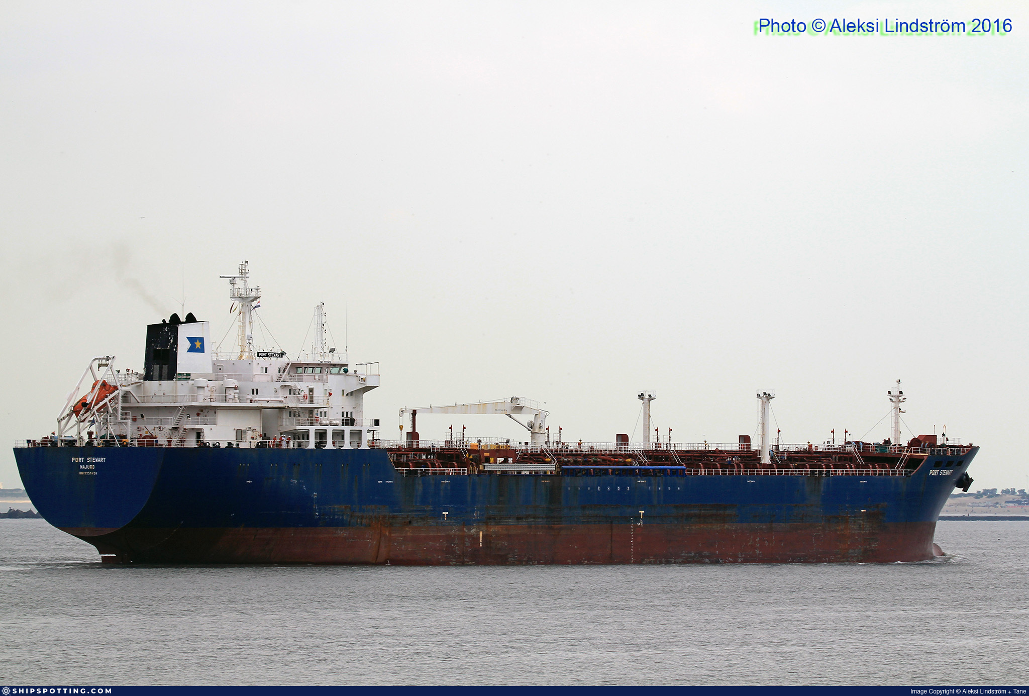
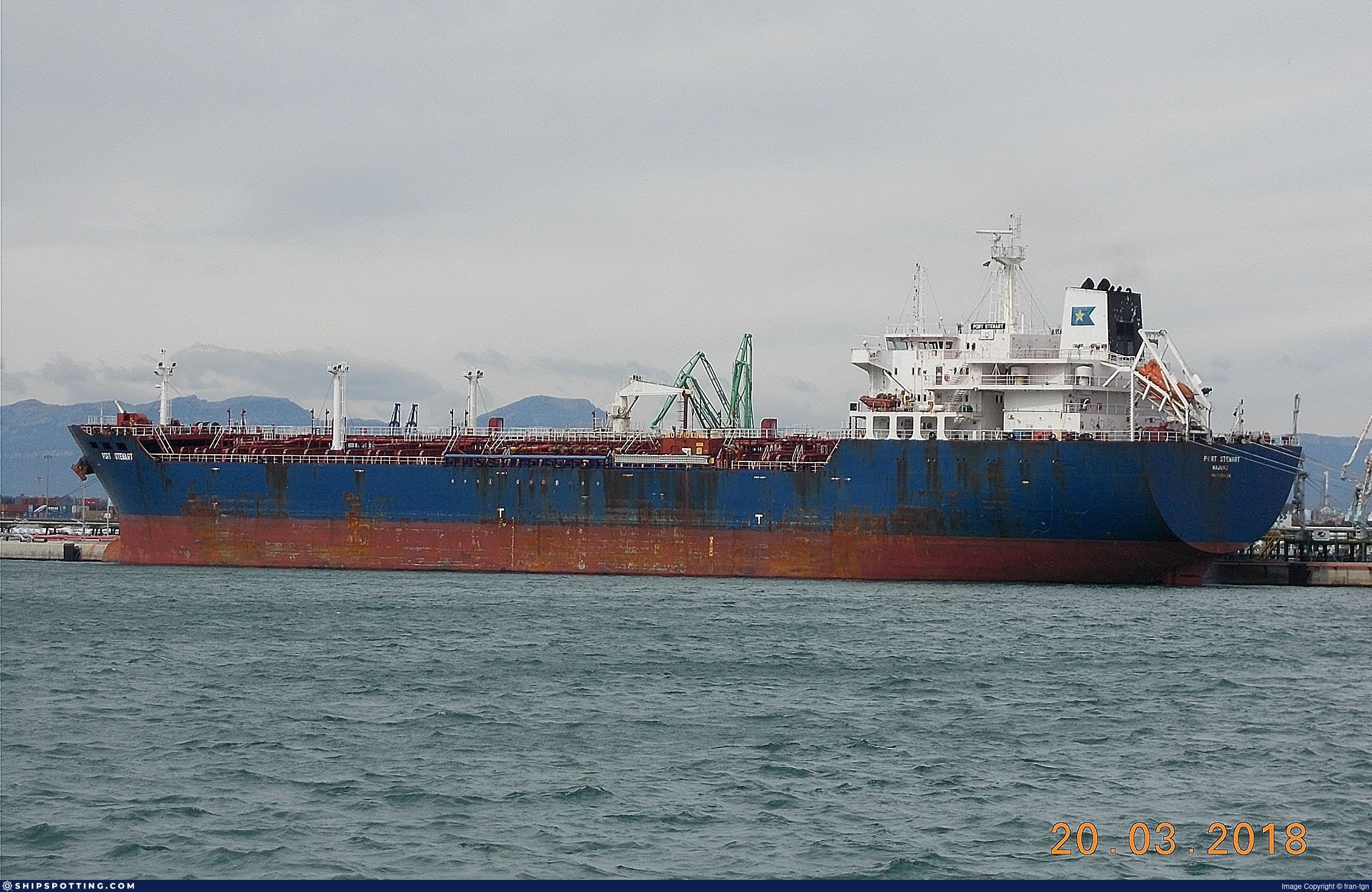
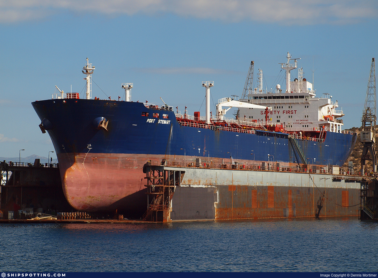
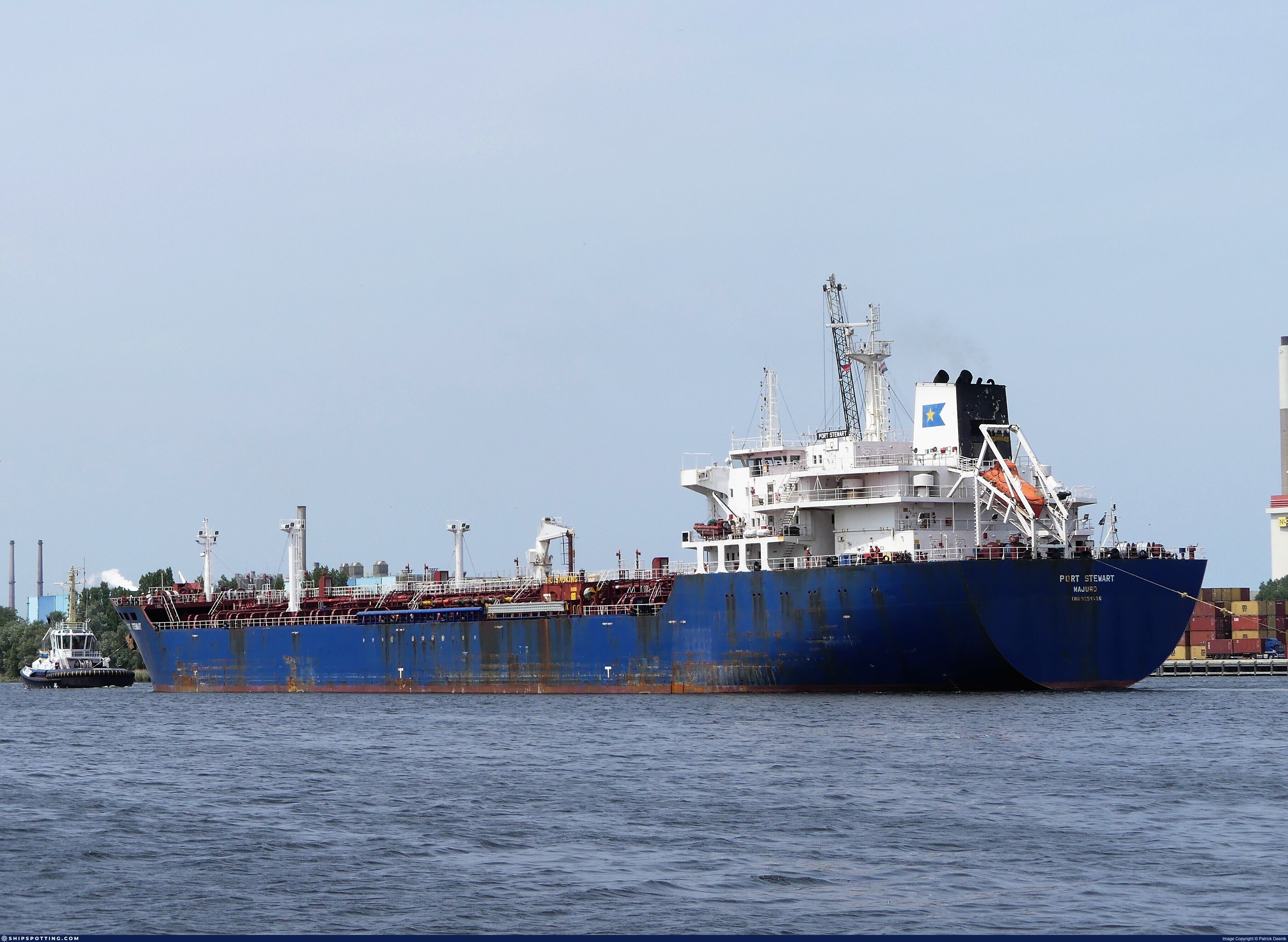
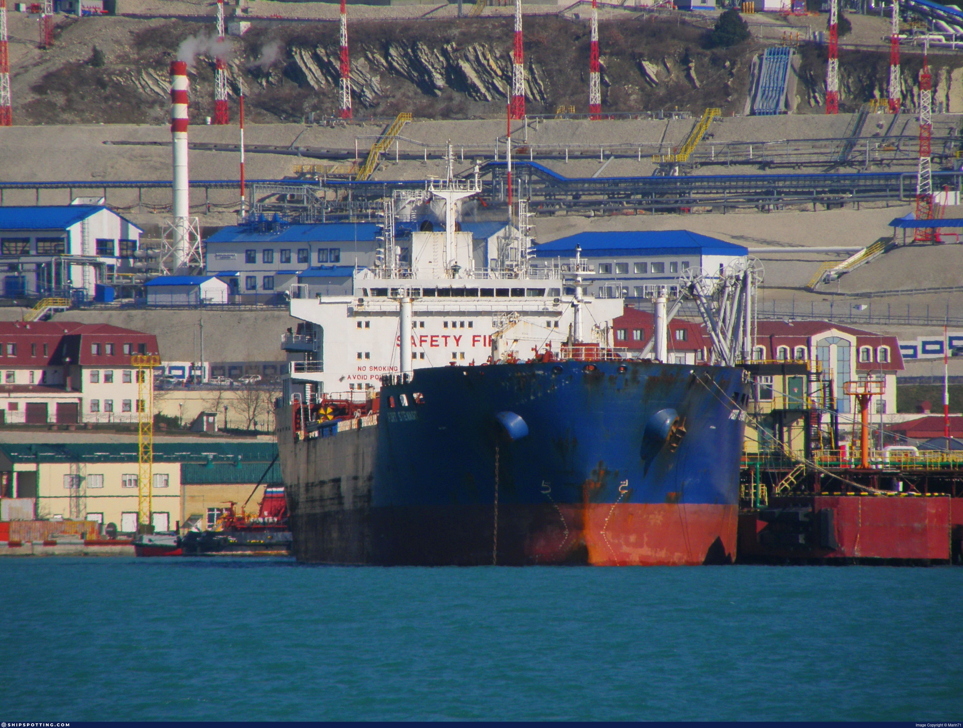
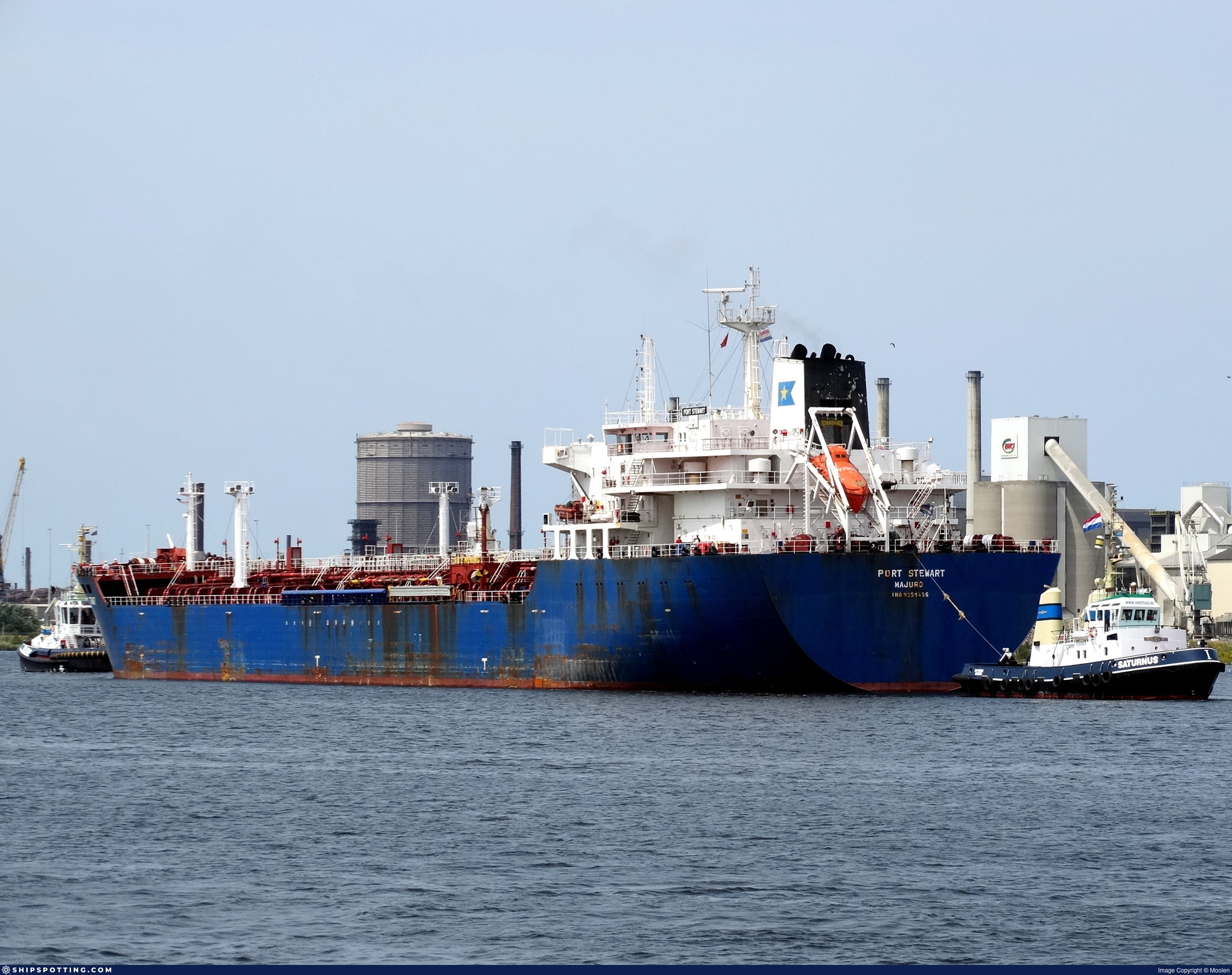
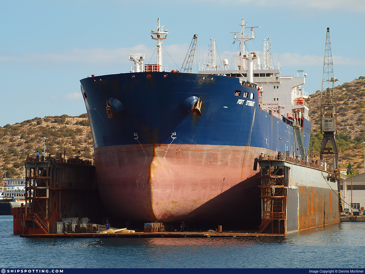
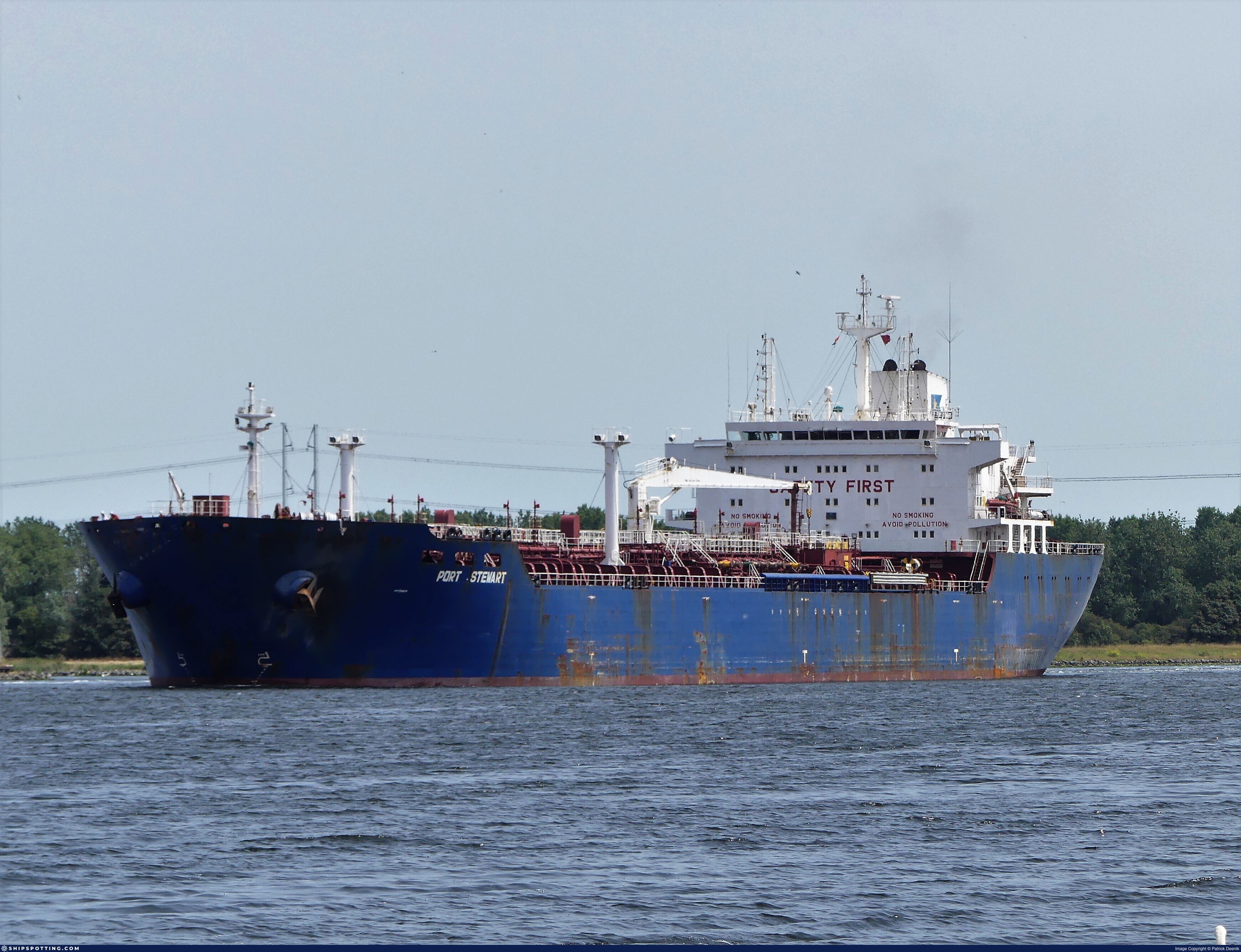
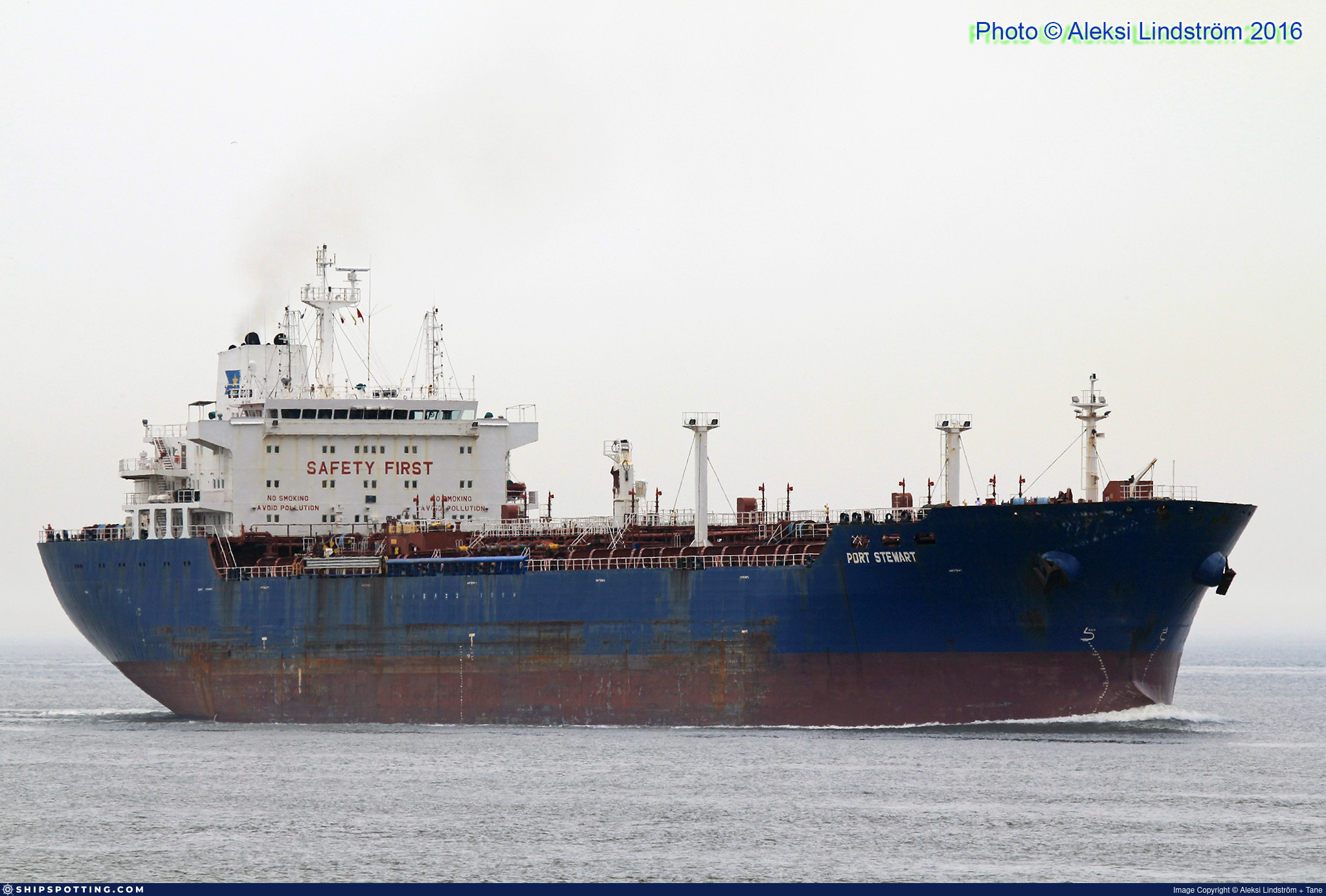
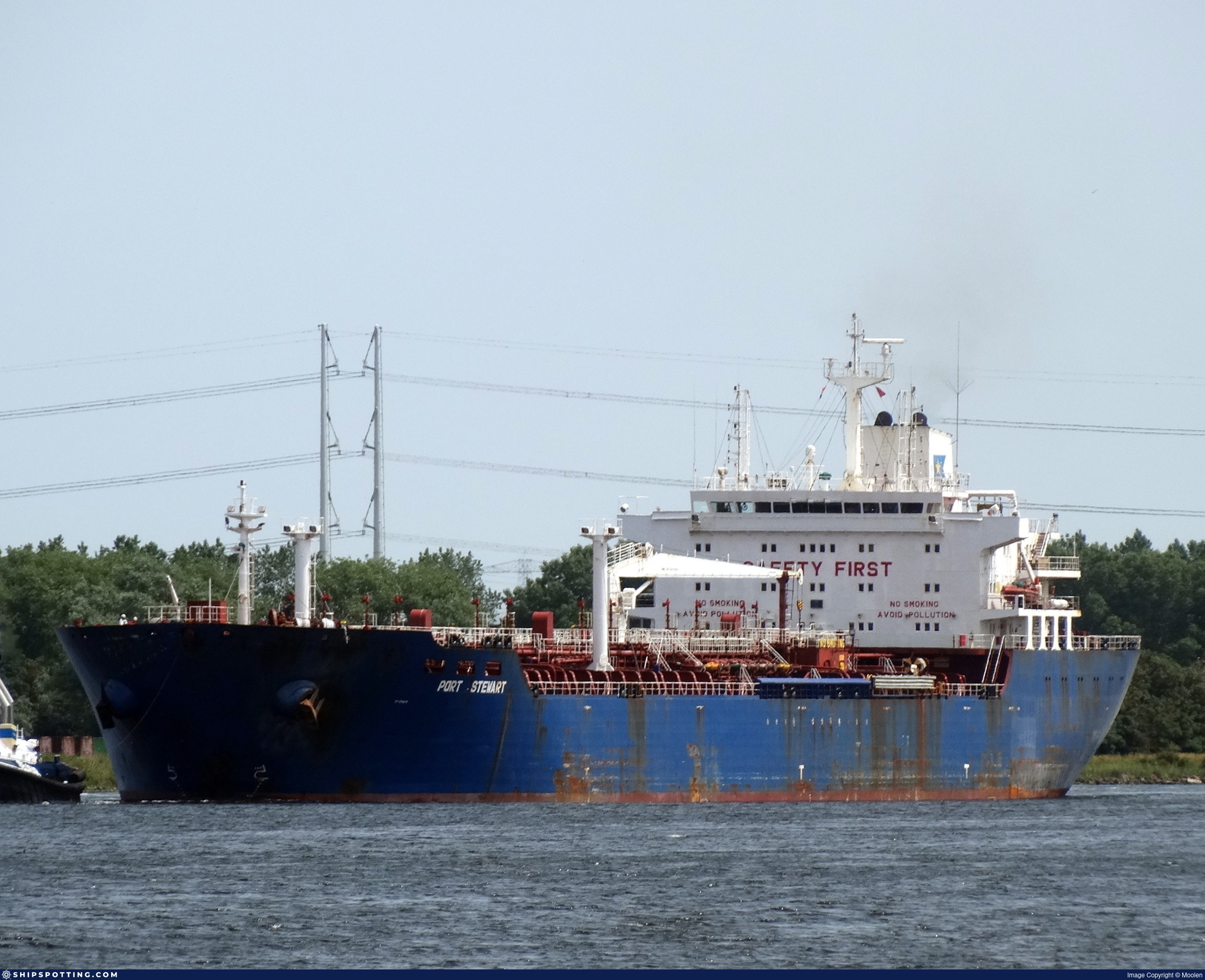
IMO 9251456
Vessel information
Sanctioned by
Company & Ownership
Management & Operations
Classification & Safety
Port State Control (PSC) Inspections
Survey Renewal & Certificates
| Code | Type | Issuer | Issued | Expires |
|---|---|---|---|---|
| 533 | Maritime Labour Certificate | Bureau Veritas (115) | 09/03/2025 | 30/01/2030 |
| 510 | Safety Management Certificate | Bureau Veritas (115) | 09/03/2025 | 30/01/2030 |
Programs & Notes
EU Russia Sanctions – Shadow Fleet | AU vessel designations (DFAT) | SEMA (Canada) — vessel designations | The Russia (Sanctions) (EU Exit) Regulations 2019
DateOfListing: 2025-05-21 || DateDesignated: 2025-05-09 | Shipping sanctions: (see “Other information”) | Shipping sanctions: a specified ship is prohibited from being provided with access to or having its master or pilot cause it to enter a port in the UK, may have its registration on the UK Ship Register terminated, and a master or pilot of a specified ship may be given a port barring direction, a detention direction, and a port entry direction or a movement direction. | IMO 9251456 (“DAPHNE I”) is involved in activity whose object or effect is to destabilise Ukraine or undermine or threaten the territorial integrity, sovereignty or independence of Ukraine or to obtain a benefit from or support the Government of Russia. Namely, DAPHNE I is involved in carrying oil or oil products that originated in Russia from Russia to a third country.
Vessel Changes
 🔄 Owner
 🔄 Owner
AIS Events
50 events detected • 2 zones • Last: Jul 18, 2026
- Duration: 6h 24m
- Radius: 28 meters
- Data Points: 26 AIS positions
- Centroid: 31.5403, 32.2920
- Zone: Western Black Sea Surveillance Zone
Show Raw Evidence JSON
{
    "radius_m": 27.800000000000000710542735760100185871124267578125,
    "duration_minutes": 384,
    "points": 26,
    "centroid": {
        "lat": 31.540346157692308537434655590914189815521240234375,
        "lon": 32.2920198769230779589634039439260959625244140625
    },
    "bbox": {
        "min_lat": 31.540199999999998681232682429254055023193359375,
        "min_lon": 32.29175000000000039790393202565610408782958984375,
        "max_lat": 31.54053329999999988331182976253330707550048828125,
        "max_lon": 32.29214999999999946567186270840466022491455078125
    },
    "zone_id": "discovered_156"
}- Duration: 6h 24m
- Radius: 28 meters
- Data Points: 26 AIS positions
- Centroid: 31.5403, 32.2920
- Zone: Black Sea Sanctioned Vessel Monitoring Zone
Show Raw Evidence JSON
{
    "radius_m": 27.800000000000000710542735760100185871124267578125,
    "duration_minutes": 384,
    "points": 26,
    "centroid": {
        "lat": 31.540346157692308537434655590914189815521240234375,
        "lon": 32.2920198769230779589634039439260959625244140625
    },
    "bbox": {
        "min_lat": 31.540199999999998681232682429254055023193359375,
        "min_lon": 32.29175000000000039790393202565610408782958984375,
        "max_lat": 31.54053329999999988331182976253330707550048828125,
        "max_lon": 32.29214999999999946567186270840466022491455078125
    },
    "zone_id": "discovered_025"
}- Zone: Western Black Sea Surveillance Zone
- Duration: 6h 24m
- Data Points: 26 AIS positions
- Period: 2026-07-18T23:03:51+00:00 to 2026-07-19T05:27:51+00:00
Show Raw Evidence JSON
{
    "zone_id": "discovered_156",
    "zone_name": "Western Black Sea Surveillance Zone",
    "dwell_minutes": 384,
    "points_in_zone": 26,
    "first_point": {
        "ts": "2026-07-18T23:03:51+00:00",
        "lat": 31.5402500000000003410605131648480892181396484375,
        "lon": 32.29175000000000039790393202565610408782958984375
    },
    "last_point": {
        "ts": "2026-07-19T05:27:51+00:00",
        "lat": 31.540383299999998456542016356252133846282958984375,
        "lon": 32.2920332999999999401552486233413219451904296875
    }
}- Zone: Black Sea Sanctioned Vessel Monitoring Zone
- Duration: 6h 24m
- Data Points: 26 AIS positions
- Period: 2026-07-18T23:03:51+00:00 to 2026-07-19T05:27:51+00:00
Show Raw Evidence JSON
{
    "zone_id": "discovered_025",
    "zone_name": "Black Sea Sanctioned Vessel Monitoring Zone",
    "dwell_minutes": 384,
    "points_in_zone": 26,
    "first_point": {
        "ts": "2026-07-18T23:03:51+00:00",
        "lat": 31.5402500000000003410605131648480892181396484375,
        "lon": 32.29175000000000039790393202565610408782958984375
    },
    "last_point": {
        "ts": "2026-07-19T05:27:51+00:00",
        "lat": 31.540383299999998456542016356252133846282958984375,
        "lon": 32.2920332999999999401552486233413219451904296875
    }
}- Duration: 6h 30m
- Radius: 55 meters
- Data Points: 25 AIS positions
- Centroid: 31.5403, 32.2920
- Zone: Western Black Sea Surveillance Zone
Show Raw Evidence JSON
{
    "radius_m": 54.60000000000000142108547152020037174224853515625,
    "duration_minutes": 390,
    "points": 25,
    "centroid": {
        "lat": 31.540324004000002133807356585748493671417236328125,
        "lon": 32.29200000800000225353869609534740447998046875
    },
    "bbox": {
        "min_lat": 31.539933300000001281659933738410472869873046875,
        "min_lon": 32.29164999999999707824827055446803569793701171875,
        "max_lat": 31.54053329999999988331182976253330707550048828125,
        "max_lon": 32.29214999999999946567186270840466022491455078125
    },
    "zone_id": "discovered_156"
}- Duration: 6h 30m
- Radius: 55 meters
- Data Points: 25 AIS positions
- Centroid: 31.5403, 32.2920
- Zone: Black Sea Sanctioned Vessel Monitoring Zone
Show Raw Evidence JSON
{
    "radius_m": 54.60000000000000142108547152020037174224853515625,
    "duration_minutes": 390,
    "points": 25,
    "centroid": {
        "lat": 31.540324004000002133807356585748493671417236328125,
        "lon": 32.29200000800000225353869609534740447998046875
    },
    "bbox": {
        "min_lat": 31.539933300000001281659933738410472869873046875,
        "min_lon": 32.29164999999999707824827055446803569793701171875,
        "max_lat": 31.54053329999999988331182976253330707550048828125,
        "max_lon": 32.29214999999999946567186270840466022491455078125
    },
    "zone_id": "discovered_025"
}- Zone: Western Black Sea Surveillance Zone
- Duration: 6h 30m
- Data Points: 25 AIS positions
- Period: 2026-07-18T22:33:50+00:00 to 2026-07-19T05:03:51+00:00
Show Raw Evidence JSON
{
    "zone_id": "discovered_156",
    "zone_name": "Western Black Sea Surveillance Zone",
    "dwell_minutes": 390,
    "points_in_zone": 25,
    "first_point": {
        "ts": "2026-07-18T22:33:50+00:00",
        "lat": 31.539933300000001281659933738410472869873046875,
        "lon": 32.29164999999999707824827055446803569793701171875
    },
    "last_point": {
        "ts": "2026-07-19T05:03:51+00:00",
        "lat": 31.540383299999998456542016356252133846282958984375,
        "lon": 32.292000000000001591615728102624416351318359375
    }
}- Zone: Black Sea Sanctioned Vessel Monitoring Zone
- Duration: 6h 30m
- Data Points: 25 AIS positions
- Period: 2026-07-18T22:33:50+00:00 to 2026-07-19T05:03:51+00:00
Show Raw Evidence JSON
{
    "zone_id": "discovered_025",
    "zone_name": "Black Sea Sanctioned Vessel Monitoring Zone",
    "dwell_minutes": 390,
    "points_in_zone": 25,
    "first_point": {
        "ts": "2026-07-18T22:33:50+00:00",
        "lat": 31.539933300000001281659933738410472869873046875,
        "lon": 32.29164999999999707824827055446803569793701171875
    },
    "last_point": {
        "ts": "2026-07-19T05:03:51+00:00",
        "lat": 31.540383299999998456542016356252133846282958984375,
        "lon": 32.292000000000001591615728102624416351318359375
    }
}- Duration: 6h 30m
- Radius: 64 meters
- Data Points: 27 AIS positions
- Centroid: 31.5402, 32.2919
- Zone: Western Black Sea Surveillance Zone
Show Raw Evidence JSON
{
    "radius_m": 64,
    "duration_minutes": 390,
    "points": 27,
    "centroid": {
        "lat": 31.54022037037037051732113468460738658905029296875,
        "lon": 32.29190000740739918683175346814095973968505859375
    },
    "bbox": {
        "min_lat": 31.539766700000001264925231225788593292236328125,
        "min_lon": 32.29144999999999754436430521309375762939453125,
        "max_lat": 31.54053329999999988331182976253330707550048828125,
        "max_lon": 32.29214999999999946567186270840466022491455078125
    },
    "zone_id": "discovered_156"
}- Duration: 6h 30m
- Radius: 64 meters
- Data Points: 27 AIS positions
- Centroid: 31.5402, 32.2919
- Zone: Black Sea Sanctioned Vessel Monitoring Zone
Show Raw Evidence JSON
{
    "radius_m": 64,
    "duration_minutes": 390,
    "points": 27,
    "centroid": {
        "lat": 31.54022037037037051732113468460738658905029296875,
        "lon": 32.29190000740739918683175346814095973968505859375
    },
    "bbox": {
        "min_lat": 31.539766700000001264925231225788593292236328125,
        "min_lon": 32.29144999999999754436430521309375762939453125,
        "max_lat": 31.54053329999999988331182976253330707550048828125,
        "max_lon": 32.29214999999999946567186270840466022491455078125
    },
    "zone_id": "discovered_025"
}- Zone: Western Black Sea Surveillance Zone
- Duration: 6h 30m
- Data Points: 27 AIS positions
- Period: 2026-07-18T21:36:50+00:00 to 2026-07-19T04:06:52+00:00
Show Raw Evidence JSON
{
    "zone_id": "discovered_156",
    "zone_name": "Western Black Sea Surveillance Zone",
    "dwell_minutes": 390,
    "points_in_zone": 27,
    "first_point": {
        "ts": "2026-07-18T21:36:50+00:00",
        "lat": 31.539833300000001514717951067723333835601806640625,
        "lon": 32.29144999999999754436430521309375762939453125
    },
    "last_point": {
        "ts": "2026-07-19T04:06:52+00:00",
        "lat": 31.540516700000001293346940656192600727081298828125,
        "lon": 32.29209999999999780584403197281062602996826171875
    }
}- Zone: Black Sea Sanctioned Vessel Monitoring Zone
- Duration: 6h 30m
- Data Points: 27 AIS positions
- Period: 2026-07-18T21:36:50+00:00 to 2026-07-19T04:06:52+00:00
Show Raw Evidence JSON
{
    "zone_id": "discovered_025",
    "zone_name": "Black Sea Sanctioned Vessel Monitoring Zone",
    "dwell_minutes": 390,
    "points_in_zone": 27,
    "first_point": {
        "ts": "2026-07-18T21:36:50+00:00",
        "lat": 31.539833300000001514717951067723333835601806640625,
        "lon": 32.29144999999999754436430521309375762939453125
    },
    "last_point": {
        "ts": "2026-07-19T04:06:52+00:00",
        "lat": 31.540516700000001293346940656192600727081298828125,
        "lon": 32.29209999999999780584403197281062602996826171875
    }
}- Duration: 6h 24m
- Radius: 47 meters
- Data Points: 25 AIS positions
- Centroid: 31.5401, 32.2918
- Zone: Western Black Sea Surveillance Zone
Show Raw Evidence JSON
{
    "radius_m": 46.60000000000000142108547152020037174224853515625,
    "duration_minutes": 384,
    "points": 25,
    "centroid": {
        "lat": 31.5400773319999956356696202419698238372802734375,
        "lon": 32.29175067199999915601438260637223720550537109375
    },
    "bbox": {
        "min_lat": 31.539766700000001264925231225788593292236328125,
        "min_lon": 32.29138329999999967867552186362445354461669921875,
        "max_lat": 31.540383299999998456542016356252133846282958984375,
        "max_lon": 32.2920500000000032514435588382184505462646484375
    },
    "zone_id": "discovered_156"
}- Duration: 6h 24m
- Radius: 47 meters
- Data Points: 25 AIS positions
- Centroid: 31.5401, 32.2918
- Zone: Black Sea Sanctioned Vessel Monitoring Zone
Show Raw Evidence JSON
{
    "radius_m": 46.60000000000000142108547152020037174224853515625,
    "duration_minutes": 384,
    "points": 25,
    "centroid": {
        "lat": 31.5400773319999956356696202419698238372802734375,
        "lon": 32.29175067199999915601438260637223720550537109375
    },
    "bbox": {
        "min_lat": 31.539766700000001264925231225788593292236328125,
        "min_lon": 32.29138329999999967867552186362445354461669921875,
        "max_lat": 31.540383299999998456542016356252133846282958984375,
        "max_lon": 32.2920500000000032514435588382184505462646484375
    },
    "zone_id": "discovered_025"
}- Zone: Western Black Sea Surveillance Zone
- Duration: 6h 24m
- Data Points: 25 AIS positions
- Period: 2026-07-18T20:42:50+00:00 to 2026-07-19T03:06:52+00:00
Show Raw Evidence JSON
{
    "zone_id": "discovered_156",
    "zone_name": "Western Black Sea Surveillance Zone",
    "dwell_minutes": 384,
    "points_in_zone": 25,
    "first_point": {
        "ts": "2026-07-18T20:42:50+00:00",
        "lat": 31.539783299999999854890120332129299640655517578125,
        "lon": 32.29140000000000298996383207850158214569091796875
    },
    "last_point": {
        "ts": "2026-07-19T03:06:52+00:00",
        "lat": 31.540266700000000099635144579224288463592529296875,
        "lon": 32.29201669999999779747668071649968624114990234375
    }
}- Zone: Black Sea Sanctioned Vessel Monitoring Zone
- Duration: 6h 24m
- Data Points: 25 AIS positions
- Period: 2026-07-18T20:42:50+00:00 to 2026-07-19T03:06:52+00:00
Show Raw Evidence JSON
{
    "zone_id": "discovered_025",
    "zone_name": "Black Sea Sanctioned Vessel Monitoring Zone",
    "dwell_minutes": 384,
    "points_in_zone": 25,
    "first_point": {
        "ts": "2026-07-18T20:42:50+00:00",
        "lat": 31.539783299999999854890120332129299640655517578125,
        "lon": 32.29140000000000298996383207850158214569091796875
    },
    "last_point": {
        "ts": "2026-07-19T03:06:52+00:00",
        "lat": 31.540266700000000099635144579224288463592529296875,
        "lon": 32.29201669999999779747668071649968624114990234375
    }
}- Duration: 6h 15m
- Radius: 58 meters
- Data Points: 31 AIS positions
- Centroid: 31.5400, 32.2916
- Zone: Western Black Sea Surveillance Zone
Show Raw Evidence JSON
{
    "radius_m": 58.39999999999999857891452847979962825775146484375,
    "duration_minutes": 375,
    "points": 31,
    "centroid": {
        "lat": 31.53998817096773876755833043716847896575927734375,
        "lon": 32.29164354838709272144114947877824306488037109375
    },
    "bbox": {
        "min_lat": 31.539699999999999846522769075818359851837158203125,
        "min_lon": 32.29133329999999801884769112803041934967041015625,
        "max_lat": 31.540383299999998456542016356252133846282958984375,
        "max_lon": 32.2920500000000032514435588382184505462646484375
    },
    "zone_id": "discovered_156"
}- Duration: 6h 15m
- Radius: 58 meters
- Data Points: 31 AIS positions
- Centroid: 31.5400, 32.2916
- Zone: Black Sea Sanctioned Vessel Monitoring Zone
Show Raw Evidence JSON
{
    "radius_m": 58.39999999999999857891452847979962825775146484375,
    "duration_minutes": 375,
    "points": 31,
    "centroid": {
        "lat": 31.53998817096773876755833043716847896575927734375,
        "lon": 32.29164354838709272144114947877824306488037109375
    },
    "bbox": {
        "min_lat": 31.539699999999999846522769075818359851837158203125,
        "min_lon": 32.29133329999999801884769112803041934967041015625,
        "max_lat": 31.540383299999998456542016356252133846282958984375,
        "max_lon": 32.2920500000000032514435588382184505462646484375
    },
    "zone_id": "discovered_025"
}- Zone: Western Black Sea Surveillance Zone
- Duration: 6h 15m
- Data Points: 31 AIS positions
- Period: 2026-07-18T19:45:50+00:00 to 2026-07-19T02:00:52+00:00
Show Raw Evidence JSON
{
    "zone_id": "discovered_156",
    "zone_name": "Western Black Sea Surveillance Zone",
    "dwell_minutes": 375,
    "points_in_zone": 31,
    "first_point": {
        "ts": "2026-07-18T19:45:50+00:00",
        "lat": 31.539750000000001506350599811412394046783447265625,
        "lon": 32.29140000000000298996383207850158214569091796875
    },
    "last_point": {
        "ts": "2026-07-19T02:00:52+00:00",
        "lat": 31.540199999999998681232682429254055023193359375,
        "lon": 32.2919667000000032430762075819075107574462890625
    }
}- Zone: Black Sea Sanctioned Vessel Monitoring Zone
- Duration: 6h 15m
- Data Points: 31 AIS positions
- Period: 2026-07-18T19:45:50+00:00 to 2026-07-19T02:00:52+00:00
Show Raw Evidence JSON
{
    "zone_id": "discovered_025",
    "zone_name": "Black Sea Sanctioned Vessel Monitoring Zone",
    "dwell_minutes": 375,
    "points_in_zone": 31,
    "first_point": {
        "ts": "2026-07-18T19:45:50+00:00",
        "lat": 31.539750000000001506350599811412394046783447265625,
        "lon": 32.29140000000000298996383207850158214569091796875
    },
    "last_point": {
        "ts": "2026-07-19T02:00:52+00:00",
        "lat": 31.540199999999998681232682429254055023193359375,
        "lon": 32.2919667000000032430762075819075107574462890625
    }
}- Duration: 6h 31m
- Radius: 64 meters
- Data Points: 29 AIS positions
- Centroid: 31.5400, 32.2916
- Zone: Western Black Sea Surveillance Zone
Show Raw Evidence JSON
{
    "radius_m": 64.2999999999999971578290569595992565155029296875,
    "duration_minutes": 391.8999999999999772626324556767940521240234375,
    "points": 29,
    "centroid": {
        "lat": 31.53995286896552130428972304798662662506103515625,
        "lon": 32.29159597586205876496023847721517086029052734375
    },
    "bbox": {
        "min_lat": 31.539699999999999846522769075818359851837158203125,
        "min_lon": 32.29131670000000298159648082219064235687255859375,
        "max_lat": 31.540383299999998456542016356252133846282958984375,
        "max_lon": 32.2920500000000032514435588382184505462646484375
    },
    "zone_id": "discovered_156"
}- Duration: 6h 31m
- Radius: 64 meters
- Data Points: 29 AIS positions
- Centroid: 31.5400, 32.2916
- Zone: Black Sea Sanctioned Vessel Monitoring Zone
Show Raw Evidence JSON
{
    "radius_m": 64.2999999999999971578290569595992565155029296875,
    "duration_minutes": 391.8999999999999772626324556767940521240234375,
    "points": 29,
    "centroid": {
        "lat": 31.53995286896552130428972304798662662506103515625,
        "lon": 32.29159597586205876496023847721517086029052734375
    },
    "bbox": {
        "min_lat": 31.539699999999999846522769075818359851837158203125,
        "min_lon": 32.29131670000000298159648082219064235687255859375,
        "max_lat": 31.540383299999998456542016356252133846282958984375,
        "max_lon": 32.2920500000000032514435588382184505462646484375
    },
    "zone_id": "discovered_025"
}- Zone: Black Sea Sanctioned Vessel Monitoring Zone
- Duration: 6h 31m
- Data Points: 29 AIS positions
- Period: 2026-07-18T18:40:57+00:00 to 2026-07-19T01:12:52+00:00
Show Raw Evidence JSON
{
    "zone_id": "discovered_025",
    "zone_name": "Black Sea Sanctioned Vessel Monitoring Zone",
    "dwell_minutes": 391.8999999999999772626324556767940521240234375,
    "points_in_zone": 29,
    "first_point": {
        "ts": "2026-07-18T18:40:57+00:00",
        "lat": 31.53973330000000174777596839703619480133056640625,
        "lon": 32.29131670000000298159648082219064235687255859375
    },
    "last_point": {
        "ts": "2026-07-19T01:12:52+00:00",
        "lat": 31.540216699999998439807313843630254268646240234375,
        "lon": 32.2919667000000032430762075819075107574462890625
    }
}- Zone: Western Black Sea Surveillance Zone
- Duration: 6h 31m
- Data Points: 29 AIS positions
- Period: 2026-07-18T18:40:57+00:00 to 2026-07-19T01:12:52+00:00
Show Raw Evidence JSON
{
    "zone_id": "discovered_156",
    "zone_name": "Western Black Sea Surveillance Zone",
    "dwell_minutes": 391.8999999999999772626324556767940521240234375,
    "points_in_zone": 29,
    "first_point": {
        "ts": "2026-07-18T18:40:57+00:00",
        "lat": 31.53973330000000174777596839703619480133056640625,
        "lon": 32.29131670000000298159648082219064235687255859375
    },
    "last_point": {
        "ts": "2026-07-19T01:12:52+00:00",
        "lat": 31.540216699999998439807313843630254268646240234375,
        "lon": 32.2919667000000032430762075819075107574462890625
    }
}- Duration: 6h 31m
- Radius: 71 meters
- Data Points: 29 AIS positions
- Centroid: 31.5399, 32.2915
- Zone: Western Black Sea Surveillance Zone
Show Raw Evidence JSON
{
    "radius_m": 70.599999999999994315658113919198513031005859375,
    "duration_minutes": 391.6000000000000227373675443232059478759765625,
    "points": 29,
    "centroid": {
        "lat": 31.53991378620690255729641648940742015838623046875,
        "lon": 32.291548272413791664803284220397472381591796875
    },
    "bbox": {
        "min_lat": 31.539699999999999846522769075818359851837158203125,
        "min_lon": 32.29124999999999801048033987171947956085205078125,
        "max_lat": 31.540383299999998456542016356252133846282958984375,
        "max_lon": 32.2920500000000032514435588382184505462646484375
    },
    "zone_id": "discovered_156"
}- Duration: 6h 31m
- Radius: 71 meters
- Data Points: 29 AIS positions
- Centroid: 31.5399, 32.2915
- Zone: Black Sea Sanctioned Vessel Monitoring Zone
Show Raw Evidence JSON
{
    "radius_m": 70.599999999999994315658113919198513031005859375,
    "duration_minutes": 391.6000000000000227373675443232059478759765625,
    "points": 29,
    "centroid": {
        "lat": 31.53991378620690255729641648940742015838623046875,
        "lon": 32.291548272413791664803284220397472381591796875
    },
    "bbox": {
        "min_lat": 31.539699999999999846522769075818359851837158203125,
        "min_lon": 32.29124999999999801048033987171947956085205078125,
        "max_lat": 31.540383299999998456542016356252133846282958984375,
        "max_lon": 32.2920500000000032514435588382184505462646484375
    },
    "zone_id": "discovered_025"
}- Zone: Black Sea Sanctioned Vessel Monitoring Zone
- Duration: 6h 31m
- Data Points: 29 AIS positions
- Period: 2026-07-18T17:35:12+00:00 to 2026-07-19T00:06:51+00:00
Show Raw Evidence JSON
{
    "zone_id": "discovered_025",
    "zone_name": "Black Sea Sanctioned Vessel Monitoring Zone",
    "dwell_minutes": 391.6000000000000227373675443232059478759765625,
    "points_in_zone": 29,
    "first_point": {
        "ts": "2026-07-18T17:35:12+00:00",
        "lat": 31.539699999999999846522769075818359851837158203125,
        "lon": 32.29124999999999801048033987171947956085205078125
    },
    "last_point": {
        "ts": "2026-07-19T00:06:51+00:00",
        "lat": 31.540383299999998456542016356252133846282958984375,
        "lon": 32.2920500000000032514435588382184505462646484375
    }
}- Zone: Western Black Sea Surveillance Zone
- Duration: 6h 31m
- Data Points: 29 AIS positions
- Period: 2026-07-18T17:35:12+00:00 to 2026-07-19T00:06:51+00:00
Show Raw Evidence JSON
{
    "zone_id": "discovered_156",
    "zone_name": "Western Black Sea Surveillance Zone",
    "dwell_minutes": 391.6000000000000227373675443232059478759765625,
    "points_in_zone": 29,
    "first_point": {
        "ts": "2026-07-18T17:35:12+00:00",
        "lat": 31.539699999999999846522769075818359851837158203125,
        "lon": 32.29124999999999801048033987171947956085205078125
    },
    "last_point": {
        "ts": "2026-07-19T00:06:51+00:00",
        "lat": 31.540383299999998456542016356252133846282958984375,
        "lon": 32.2920500000000032514435588382184505462646484375
    }
}- Duration: 6h 31m
- Radius: 58 meters
- Data Points: 32 AIS positions
- Centroid: 31.5398, 32.2914
- Zone: Western Black Sea Surveillance Zone
Show Raw Evidence JSON
{
    "radius_m": 58,
    "duration_minutes": 391.69999999999998863131622783839702606201171875,
    "points": 32,
    "centroid": {
        "lat": 31.5398088500000000067302607931196689605712890625,
        "lon": 32.29142239374999689971446059644222259521484375
    },
    "bbox": {
        "min_lat": 31.539699999999999846522769075818359851837158203125,
        "min_lon": 32.29124999999999801048033987171947956085205078125,
        "max_lat": 31.5402500000000003410605131648480892181396484375,
        "max_lon": 32.29175000000000039790393202565610408782958984375
    },
    "zone_id": "discovered_156"
}- Duration: 6h 31m
- Radius: 58 meters
- Data Points: 32 AIS positions
- Centroid: 31.5398, 32.2914
- Zone: Black Sea Sanctioned Vessel Monitoring Zone
Show Raw Evidence JSON
{
    "radius_m": 58,
    "duration_minutes": 391.69999999999998863131622783839702606201171875,
    "points": 32,
    "centroid": {
        "lat": 31.5398088500000000067302607931196689605712890625,
        "lon": 32.29142239374999689971446059644222259521484375
    },
    "bbox": {
        "min_lat": 31.539699999999999846522769075818359851837158203125,
        "min_lon": 32.29124999999999801048033987171947956085205078125,
        "max_lat": 31.5402500000000003410605131648480892181396484375,
        "max_lon": 32.29175000000000039790393202565610408782958984375
    },
    "zone_id": "discovered_025"
}- Zone: Black Sea Sanctioned Vessel Monitoring Zone
- Duration: 6h 31m
- Data Points: 32 AIS positions
- Period: 2026-07-18T16:32:10+00:00 to 2026-07-18T23:03:51+00:00
Show Raw Evidence JSON
{
    "zone_id": "discovered_025",
    "zone_name": "Black Sea Sanctioned Vessel Monitoring Zone",
    "dwell_minutes": 391.69999999999998863131622783839702606201171875,
    "points_in_zone": 32,
    "first_point": {
        "ts": "2026-07-18T16:32:10+00:00",
        "lat": 31.5397166999999996050974004901945590972900390625,
        "lon": 32.29126670000000132176865008659660816192626953125
    },
    "last_point": {
        "ts": "2026-07-18T23:03:51+00:00",
        "lat": 31.5402500000000003410605131648480892181396484375,
        "lon": 32.29175000000000039790393202565610408782958984375
    }
}- Zone: Western Black Sea Surveillance Zone
- Duration: 6h 31m
- Data Points: 32 AIS positions
- Period: 2026-07-18T16:32:10+00:00 to 2026-07-18T23:03:51+00:00
Show Raw Evidence JSON
{
    "zone_id": "discovered_156",
    "zone_name": "Western Black Sea Surveillance Zone",
    "dwell_minutes": 391.69999999999998863131622783839702606201171875,
    "points_in_zone": 32,
    "first_point": {
        "ts": "2026-07-18T16:32:10+00:00",
        "lat": 31.5397166999999996050974004901945590972900390625,
        "lon": 32.29126670000000132176865008659660816192626953125
    },
    "last_point": {
        "ts": "2026-07-18T23:03:51+00:00",
        "lat": 31.5402500000000003410605131648480892181396484375,
        "lon": 32.29175000000000039790393202565610408782958984375
    }
}- Duration: 6h 32m
- Radius: 39 meters
- Data Points: 35 AIS positions
- Centroid: 31.5398, 32.2914
- Zone: Western Black Sea Surveillance Zone
Show Raw Evidence JSON
{
    "radius_m": 39,
    "duration_minutes": 392.69999999999998863131622783839702606201171875,
    "points": 35,
    "centroid": {
        "lat": 31.539782377142852709539511124603450298309326171875,
        "lon": 32.29138428571426544522182666696608066558837890625
    },
    "bbox": {
        "min_lat": 31.539699999999999846522769075818359851837158203125,
        "min_lon": 32.291100000000000136424205265939235687255859375,
        "max_lat": 31.54005000000000080717654782347381114959716796875,
        "max_lon": 32.29166670000000038953658076934516429901123046875
    },
    "zone_id": "discovered_156"
}- Duration: 6h 32m
- Radius: 39 meters
- Data Points: 35 AIS positions
- Centroid: 31.5398, 32.2914
- Zone: Black Sea Sanctioned Vessel Monitoring Zone
Show Raw Evidence JSON
{
    "radius_m": 39,
    "duration_minutes": 392.69999999999998863131622783839702606201171875,
    "points": 35,
    "centroid": {
        "lat": 31.539782377142852709539511124603450298309326171875,
        "lon": 32.29138428571426544522182666696608066558837890625
    },
    "bbox": {
        "min_lat": 31.539699999999999846522769075818359851837158203125,
        "min_lon": 32.291100000000000136424205265939235687255859375,
        "max_lat": 31.54005000000000080717654782347381114959716796875,
        "max_lon": 32.29166670000000038953658076934516429901123046875
    },
    "zone_id": "discovered_025"
}- Zone: Black Sea Sanctioned Vessel Monitoring Zone
- Duration: 6h 32m
- Data Points: 35 AIS positions
- Period: 2026-07-18T15:52:11+00:00 to 2026-07-18T22:24:51+00:00
Show Raw Evidence JSON
{
    "zone_id": "discovered_025",
    "zone_name": "Black Sea Sanctioned Vessel Monitoring Zone",
    "dwell_minutes": 392.69999999999998863131622783839702606201171875,
    "points_in_zone": 35,
    "first_point": {
        "ts": "2026-07-18T15:52:11+00:00",
        "lat": 31.53973330000000174777596839703619480133056640625,
        "lon": 32.29135000000000133013600134290754795074462890625
    },
    "last_point": {
        "ts": "2026-07-18T22:24:51+00:00",
        "lat": 31.54005000000000080717654782347381114959716796875,
        "lon": 32.29164999999999707824827055446803569793701171875
    }
}- Zone: Western Black Sea Surveillance Zone
- Duration: 6h 32m
- Data Points: 35 AIS positions
- Period: 2026-07-18T15:52:11+00:00 to 2026-07-18T22:24:51+00:00
Show Raw Evidence JSON
{
    "zone_id": "discovered_156",
    "zone_name": "Western Black Sea Surveillance Zone",
    "dwell_minutes": 392.69999999999998863131622783839702606201171875,
    "points_in_zone": 35,
    "first_point": {
        "ts": "2026-07-18T15:52:11+00:00",
        "lat": 31.53973330000000174777596839703619480133056640625,
        "lon": 32.29135000000000133013600134290754795074462890625
    },
    "last_point": {
        "ts": "2026-07-18T22:24:51+00:00",
        "lat": 31.54005000000000080717654782347381114959716796875,
        "lon": 32.29164999999999707824827055446803569793701171875
    }
}- Duration: 6h 20m
- Radius: 23 meters
- Data Points: 32 AIS positions
- Centroid: 31.5398, 32.2913
- Zone: Western Black Sea Surveillance Zone
Show Raw Evidence JSON
{
    "radius_m": 23.199999999999999289457264239899814128875732421875,
    "duration_minutes": 380.6000000000000227373675443232059478759765625,
    "points": 32,
    "centroid": {
        "lat": 31.53975155937499863512130104936659336090087890625,
        "lon": 32.29134322812499391375240520574152469635009765625
    },
    "bbox": {
        "min_lat": 31.53968330000000008794813766144216060638427734375,
        "min_lon": 32.291100000000000136424205265939235687255859375,
        "max_lat": 31.539833300000001514717951067723333835601806640625,
        "max_lon": 32.29144999999999754436430521309375762939453125
    },
    "zone_id": "discovered_156"
}- Duration: 6h 20m
- Radius: 23 meters
- Data Points: 32 AIS positions
- Centroid: 31.5398, 32.2913
- Zone: Black Sea Sanctioned Vessel Monitoring Zone
Show Raw Evidence JSON
{
    "radius_m": 23.199999999999999289457264239899814128875732421875,
    "duration_minutes": 380.6000000000000227373675443232059478759765625,
    "points": 32,
    "centroid": {
        "lat": 31.53975155937499863512130104936659336090087890625,
        "lon": 32.29134322812499391375240520574152469635009765625
    },
    "bbox": {
        "min_lat": 31.53968330000000008794813766144216060638427734375,
        "min_lon": 32.291100000000000136424205265939235687255859375,
        "max_lat": 31.539833300000001514717951067723333835601806640625,
        "max_lon": 32.29144999999999754436430521309375762939453125
    },
    "zone_id": "discovered_025"
}- Zone: Western Black Sea Surveillance Zone
- Duration: 6h 20m
- Data Points: 32 AIS positions
- Period: 2026-07-18T14:22:11+00:00 to 2026-07-18T20:42:50+00:00
Show Raw Evidence JSON
{
    "zone_id": "discovered_156",
    "zone_name": "Western Black Sea Surveillance Zone",
    "dwell_minutes": 380.6000000000000227373675443232059478759765625,
    "points_in_zone": 32,
    "first_point": {
        "ts": "2026-07-18T14:22:11+00:00",
        "lat": 31.539766700000001264925231225788593292236328125,
        "lon": 32.291283300000003464447217993438243865966796875
    },
    "last_point": {
        "ts": "2026-07-18T20:42:50+00:00",
        "lat": 31.539783299999999854890120332129299640655517578125,
        "lon": 32.29140000000000298996383207850158214569091796875
    }
}- Zone: Black Sea Sanctioned Vessel Monitoring Zone
- Duration: 6h 20m
- Data Points: 32 AIS positions
- Period: 2026-07-18T14:22:11+00:00 to 2026-07-18T20:42:50+00:00
Show Raw Evidence JSON
{
    "zone_id": "discovered_025",
    "zone_name": "Black Sea Sanctioned Vessel Monitoring Zone",
    "dwell_minutes": 380.6000000000000227373675443232059478759765625,
    "points_in_zone": 32,
    "first_point": {
        "ts": "2026-07-18T14:22:11+00:00",
        "lat": 31.539766700000001264925231225788593292236328125,
        "lon": 32.291283300000003464447217993438243865966796875
    },
    "last_point": {
        "ts": "2026-07-18T20:42:50+00:00",
        "lat": 31.539783299999999854890120332129299640655517578125,
        "lon": 32.29140000000000298996383207850158214569091796875
    }
}- Duration: 6h 26m
- Radius: 25 meters
- Data Points: 31 AIS positions
- Centroid: 31.5398, 32.2913
- Zone: Western Black Sea Surveillance Zone
Show Raw Evidence JSON
{
    "radius_m": 24.89999999999999857891452847979962825775146484375,
    "duration_minutes": 386.6000000000000227373675443232059478759765625,
    "points": 31,
    "centroid": {
        "lat": 31.53975268709677237666255678050220012664794921875,
        "lon": 32.29134730967741262475101393647491931915283203125
    },
    "bbox": {
        "min_lat": 31.53968330000000008794813766144216060638427734375,
        "min_lon": 32.291100000000000136424205265939235687255859375,
        "max_lat": 31.5398500000000012732925824820995330810546875,
        "max_lon": 32.2915832999999992125594872049987316131591796875
    },
    "zone_id": "discovered_156"
}- Duration: 6h 26m
- Radius: 25 meters
- Data Points: 31 AIS positions
- Centroid: 31.5398, 32.2913
- Zone: Black Sea Sanctioned Vessel Monitoring Zone
Show Raw Evidence JSON
{
    "radius_m": 24.89999999999999857891452847979962825775146484375,
    "duration_minutes": 386.6000000000000227373675443232059478759765625,
    "points": 31,
    "centroid": {
        "lat": 31.53975268709677237666255678050220012664794921875,
        "lon": 32.29134730967741262475101393647491931915283203125
    },
    "bbox": {
        "min_lat": 31.53968330000000008794813766144216060638427734375,
        "min_lon": 32.291100000000000136424205265939235687255859375,
        "max_lat": 31.5398500000000012732925824820995330810546875,
        "max_lon": 32.2915832999999992125594872049987316131591796875
    },
    "zone_id": "discovered_025"
}- Zone: Black Sea Sanctioned Vessel Monitoring Zone
- Duration: 6h 26m
- Data Points: 31 AIS positions
- Period: 2026-07-18T13:49:12+00:00 to 2026-07-18T20:15:51+00:00
Show Raw Evidence JSON
{
    "zone_id": "discovered_025",
    "zone_name": "Black Sea Sanctioned Vessel Monitoring Zone",
    "dwell_minutes": 386.6000000000000227373675443232059478759765625,
    "points_in_zone": 31,
    "first_point": {
        "ts": "2026-07-18T13:49:12+00:00",
        "lat": 31.5398500000000012732925824820995330810546875,
        "lon": 32.2915832999999992125594872049987316131591796875
    },
    "last_point": {
        "ts": "2026-07-18T20:15:51+00:00",
        "lat": 31.539766700000001264925231225788593292236328125,
        "lon": 32.29140000000000298996383207850158214569091796875
    }
}- Zone: Western Black Sea Surveillance Zone
- Duration: 6h 26m
- Data Points: 31 AIS positions
- Period: 2026-07-18T13:49:12+00:00 to 2026-07-18T20:15:51+00:00
Show Raw Evidence JSON
{
    "zone_id": "discovered_156",
    "zone_name": "Western Black Sea Surveillance Zone",
    "dwell_minutes": 386.6000000000000227373675443232059478759765625,
    "points_in_zone": 31,
    "first_point": {
        "ts": "2026-07-18T13:49:12+00:00",
        "lat": 31.5398500000000012732925824820995330810546875,
        "lon": 32.2915832999999992125594872049987316131591796875
    },
    "last_point": {
        "ts": "2026-07-18T20:15:51+00:00",
        "lat": 31.539766700000001264925231225788593292236328125,
        "lon": 32.29140000000000298996383207850158214569091796875
    }
}- Duration: 6h 30m
- Radius: 42 meters
- Data Points: 30 AIS positions
- Centroid: 31.5398, 32.2914
- Zone: Western Black Sea Surveillance Zone
Show Raw Evidence JSON
{
    "radius_m": 42.2000000000000028421709430404007434844970703125,
    "duration_minutes": 390.80000000000001136868377216160297393798828125,
    "points": 30,
    "centroid": {
        "lat": 31.539779443333333830423725885339081287384033203125,
        "lon": 32.29140277666667913081255392171442508697509765625
    },
    "bbox": {
        "min_lat": 31.53968330000000008794813766144216060638427734375,
        "min_lon": 32.291100000000000136424205265939235687255859375,
        "max_lat": 31.540016699999998905923348502255976200103759765625,
        "max_lon": 32.29175000000000039790393202565610408782958984375
    },
    "zone_id": "discovered_156"
}- Duration: 6h 30m
- Radius: 42 meters
- Data Points: 30 AIS positions
- Centroid: 31.5398, 32.2914
- Zone: Black Sea Sanctioned Vessel Monitoring Zone
Show Raw Evidence JSON
{
    "radius_m": 42.2000000000000028421709430404007434844970703125,
    "duration_minutes": 390.80000000000001136868377216160297393798828125,
    "points": 30,
    "centroid": {
        "lat": 31.539779443333333830423725885339081287384033203125,
        "lon": 32.29140277666667913081255392171442508697509765625
    },
    "bbox": {
        "min_lat": 31.53968330000000008794813766144216060638427734375,
        "min_lon": 32.291100000000000136424205265939235687255859375,
        "max_lat": 31.540016699999998905923348502255976200103759765625,
        "max_lon": 32.29175000000000039790393202565610408782958984375
    },
    "zone_id": "discovered_025"
}- Zone: Black Sea Sanctioned Vessel Monitoring Zone
- Duration: 6h 30m
- Data Points: 30 AIS positions
- Period: 2026-07-18T12:10:12+00:00 to 2026-07-18T18:40:57+00:00
Show Raw Evidence JSON
{
    "zone_id": "discovered_025",
    "zone_name": "Black Sea Sanctioned Vessel Monitoring Zone",
    "dwell_minutes": 390.80000000000001136868377216160297393798828125,
    "points_in_zone": 30,
    "first_point": {
        "ts": "2026-07-18T12:10:12+00:00",
        "lat": 31.540016699999998905923348502255976200103759765625,
        "lon": 32.29175000000000039790393202565610408782958984375
    },
    "last_point": {
        "ts": "2026-07-18T18:40:57+00:00",
        "lat": 31.53973330000000174777596839703619480133056640625,
        "lon": 32.29131670000000298159648082219064235687255859375
    }
}- Zone: Western Black Sea Surveillance Zone
- Duration: 6h 30m
- Data Points: 30 AIS positions
- Period: 2026-07-18T12:10:12+00:00 to 2026-07-18T18:40:57+00:00
Show Raw Evidence JSON
{
    "zone_id": "discovered_156",
    "zone_name": "Western Black Sea Surveillance Zone",
    "dwell_minutes": 390.80000000000001136868377216160297393798828125,
    "points_in_zone": 30,
    "first_point": {
        "ts": "2026-07-18T12:10:12+00:00",
        "lat": 31.540016699999998905923348502255976200103759765625,
        "lon": 32.29175000000000039790393202565610408782958984375
    },
    "last_point": {
        "ts": "2026-07-18T18:40:57+00:00",
        "lat": 31.53973330000000174777596839703619480133056640625,
        "lon": 32.29131670000000298159648082219064235687255859375
    }
}- Duration: 6h 7m
- Radius: 59 meters
- Data Points: 30 AIS positions
- Centroid: 31.5398, 32.2914
- Zone: Western Black Sea Surveillance Zone
Show Raw Evidence JSON
{
    "radius_m": 58.60000000000000142108547152020037174224853515625,
    "duration_minutes": 367,
    "points": 30,
    "centroid": {
        "lat": 31.539802223333328612397963297553360462188720703125,
        "lon": 32.291437773333342420301050879061222076416015625
    },
    "bbox": {
        "min_lat": 31.53968330000000008794813766144216060638427734375,
        "min_lon": 32.291100000000000136424205265939235687255859375,
        "max_lat": 31.540116699999998672865331172943115234375,
        "max_lon": 32.2919332999999966204995871521532535552978515625
    },
    "zone_id": "discovered_156"
}- Duration: 6h 7m
- Radius: 59 meters
- Data Points: 30 AIS positions
- Centroid: 31.5398, 32.2914
- Zone: Black Sea Sanctioned Vessel Monitoring Zone
Show Raw Evidence JSON
{
    "radius_m": 58.60000000000000142108547152020037174224853515625,
    "duration_minutes": 367,
    "points": 30,
    "centroid": {
        "lat": 31.539802223333328612397963297553360462188720703125,
        "lon": 32.291437773333342420301050879061222076416015625
    },
    "bbox": {
        "min_lat": 31.53968330000000008794813766144216060638427734375,
        "min_lon": 32.291100000000000136424205265939235687255859375,
        "max_lat": 31.540116699999998672865331172943115234375,
        "max_lon": 32.2919332999999966204995871521532535552978515625
    },
    "zone_id": "discovered_025"
}Source snapshot
| Sanctioner | As of | Entity ID |
|---|---|---|
| 🇬🇧 UK | 2025-09-29 | 9251456 |
We mirror official lists; always verify at the source.
Sanctioned on the same day
- AGATE · IMO 9310707 🇨🇦 CA🇪🇺 EU🇬🇧 UK
- AKTROS · IMO 9257814 🇨🇦 CA🇪🇺 EU🇬🇧 UK
- AQUA LIVE · IMO 9282792 🇦🇺 AU🇨🇦 CA🇪🇺 EU🇬🇧 UK
- ARABESCA · IMO 9288734 🇦🇺 AU🇨🇦 CA🇪🇺 EU🇬🇧 UK
- ARLAN · IMO 9227443 🇦🇺 AU🇨🇦 CA🇪🇺 EU🇬🇧 UK
- BARENTS · IMO 9384447 🇦🇺 AU🇨🇦 CA🇪🇺 EU🇳🇿 NZ🇬🇧 UK
- BEAST · IMO 9290921 🇦🇺 AU🇨🇦 CA🇪🇺 EU🇬🇧 UK
- Berra · IMO 9308821 🇨🇦 CA🇪🇺 EU🇬🇧 UK