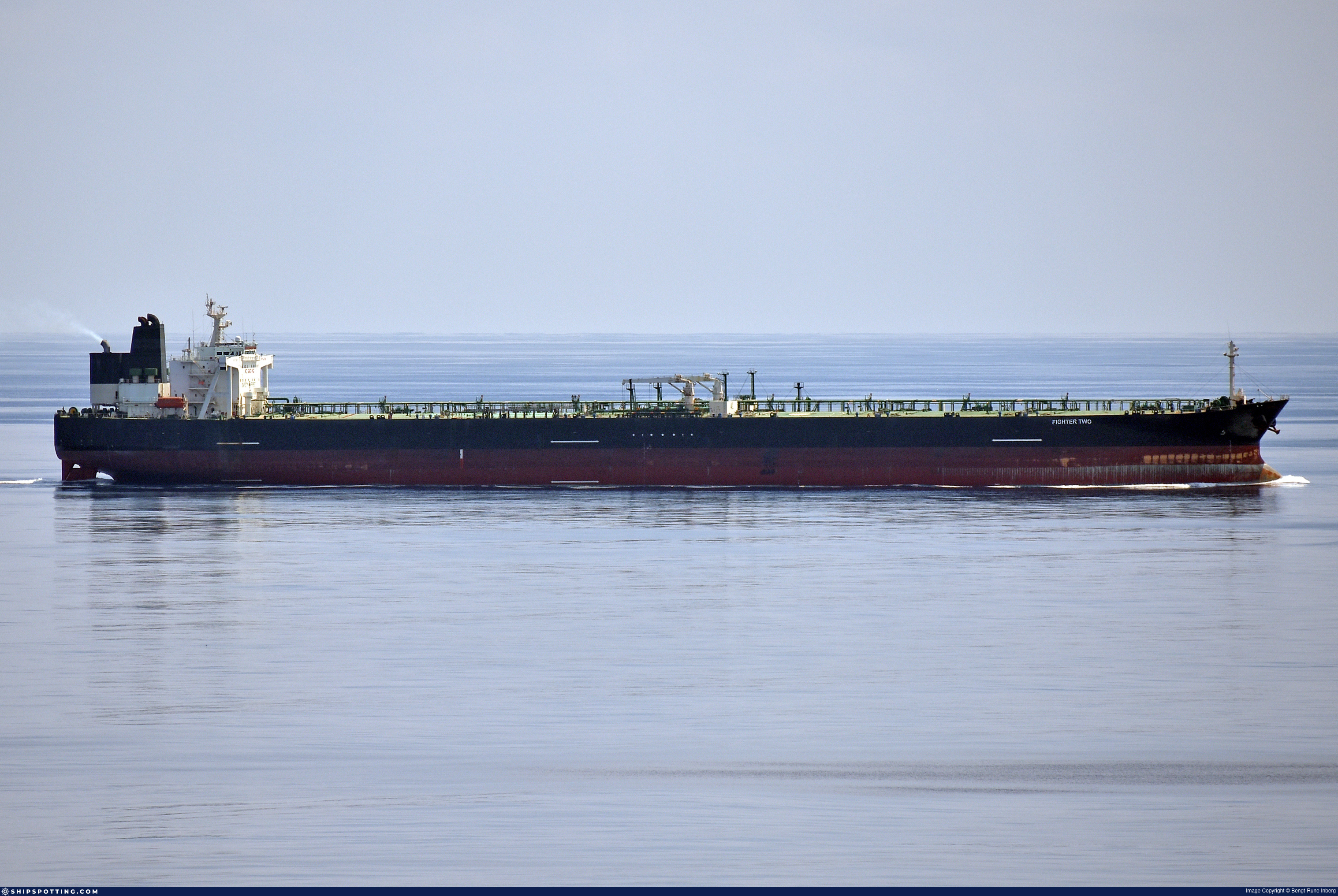
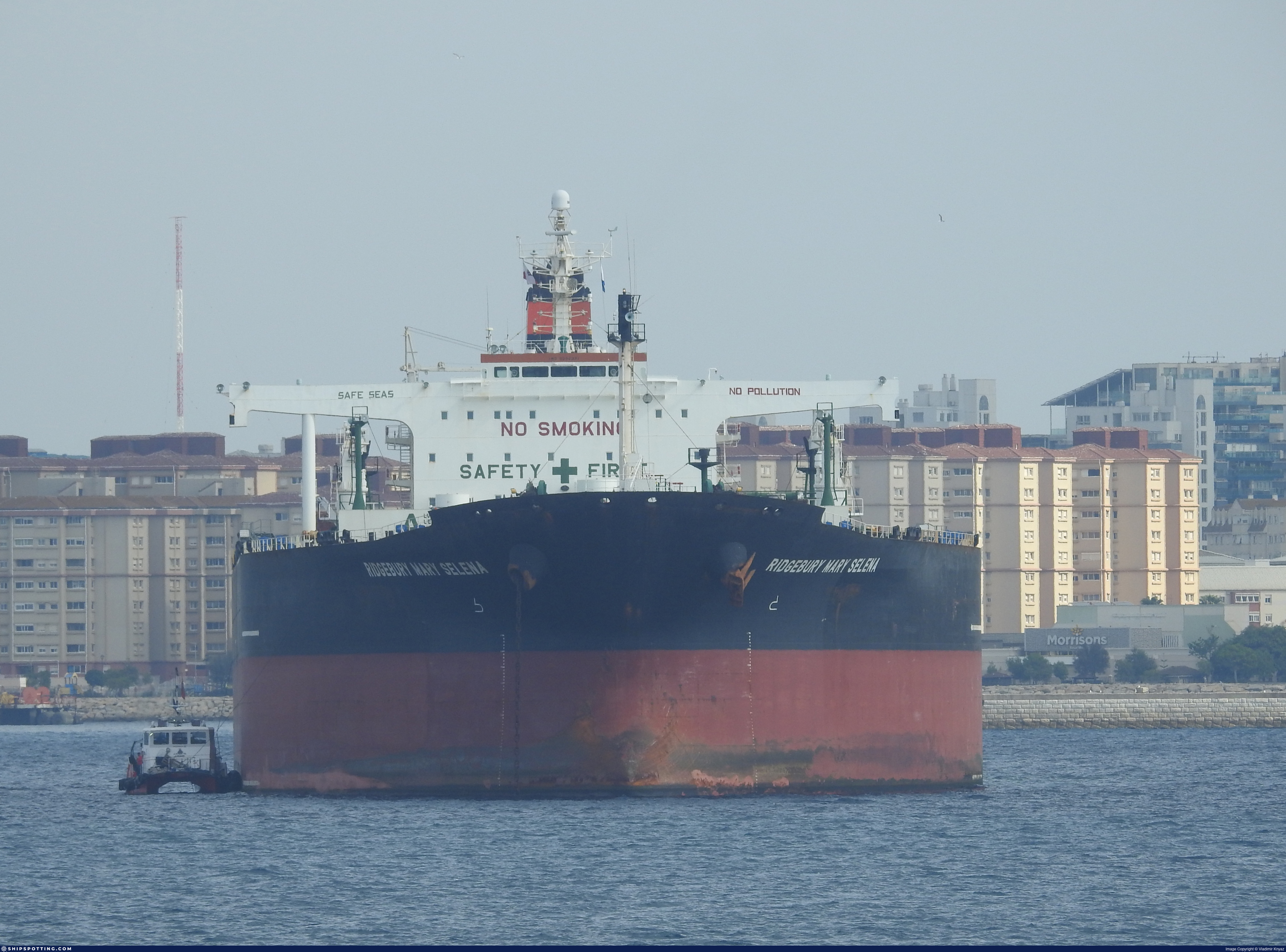
IMO 9296391
Vessel information
Sanctioned by
Company & Ownership
Management & Operations
Classification & Safety
Port State Control (PSC) Inspections
Survey Renewal & Certificates
| Code | Type | Issuer | Issued | Expires |
|---|---|---|---|---|
| 502 | Cargo Ship Safety Equipment | LR | 31/01/2022 | 18/09/2026 |
| 507 | International Sewage Pollution Prevention | LR | 31/01/2022 | 18/09/2026 |
Programs & Notes
SEMA (Canada) — vessel designations | The Russia (Sanctions) (EU Exit) Regulations 2019 | Added in EU Sanctions Package 15 | (Council Decision (CFSP) 2024/3187, Annex XVI to Decision 2014/512/CFSP) | Press Release | Official Journal
DateOfListing: 2024-12-17 || DateDesignated: 2024-07-31 | Shipping sanctions: (see “Other information”) | Shipping sanctions: a specified ship is prohibited from being provided with access to or having its master or pilot cause it to enter a port in the UK, may have its registration on the UK Ship Register terminated, and a master or pilot of a specified ship may be given a port barring direction, a detention direction, and a port entry direction or a movement direction. | FIGHTER TWO (IMO 9296391) is involved in activity whose object or effect is to destabilise Ukraine or undermine or threaten the territorial integrity, sovereignty or independence of Ukraine or to obtain a benefit from or support the Government of Russia. Namely, FIGHTER TWO is involved in carrying oil or oil related products that originated in Russia from Russia to a third country.
Vessel Changes
 🔄 Owner
 🔄 Owner
 🔄 Owner
🔄 Owner
🔄 Owner
 🔄 Owner
 🔄 Owner
🏴 Flag
🔄 Owner
🏴 Flag
 ✏️ Name
AIS Events
21 events detected • 5 zones • Last: Feb 27, 2026
- Zone: Southern Öresund Monitoring Zone
- Duration: 1h 15m
- Data Points: 10 AIS positions
- Period: 2026-02-27T16:28:25+00:00 to 2026-02-27T17:43:36+00:00
Show Raw Evidence JSON
{
    "zone_id": "discovered_061",
    "zone_name": "Southern \u00d6resund Monitoring Zone",
    "dwell_minutes": 75.2000000000000028421709430404007434844970703125,
    "points_in_zone": 10,
    "first_point": {
        "ts": "2026-02-27T16:28:25+00:00",
        "lat": 35.950119999999998299244907684624195098876953125,
        "lon": 27.523271699999998674002199550159275531768798828125
    },
    "last_point": {
        "ts": "2026-02-27T17:43:36+00:00",
        "lat": 35.7749299999999976762410369701683521270751953125,
        "lon": 27.6986950000000007321432349272072315216064453125
    }
}- Gap Duration: 4h 3m
- Last Seen: 2026-02-27T12:24:56+00:00 at 36.3945, 26.8520 (Zone: Southern Kattegat Surveillance Zone)
- Next Seen: 2026-02-27T16:28:25+00:00 at 35.9501, 27.5233
🛰️ Gap Corroboration
These are snapshots that may corroborate presence during the gap. They do not reconstruct a continuous route.
SAR Imagery (Sentinel-1)
Status: ✗ No SAR coverage
No Sentinel-1 scenes covering corridor and time window
VIIRS Thermal Anomaly
Status: ✗ No detections
No VIIRS thermal/light detections in corridor
Show Raw Evidence JSON
{
    "gap_minutes": 243.5,
    "last_seen": {
        "ts": "2026-02-27T12:24:56+00:00",
        "lat": 36.39453499999999763758751214481890201568603515625,
        "lon": 26.85200999999999993406163412146270275115966796875,
        "sog": 10.5999999999999996447286321199499070644378662109375,
        "zone_id": "discovered_084"
    },
    "next_seen": {
        "ts": "2026-02-27T16:28:25+00:00",
        "lat": 35.950119999999998299244907684624195098876953125,
        "lon": 27.523271699999998674002199550159275531768798828125,
        "zone_ids": [
            "discovered_061"
        ]
    },
    "gap_enrichment": {
        "status": "not_found",
        "corridor": {
            "start": {
                "lat": 36.39453499999999763758751214481890201568603515625,
                "lon": 26.85200999999999993406163412146270275115966796875,
                "ts": "2026-02-27T12:24:56+00:00"
            },
            "end": {
                "lat": 35.950119999999998299244907684624195098876953125,
                "lon": 27.523271699999998674002199550159275531768798828125,
                "ts": "2026-02-27T16:28:25+00:00"
            },
            "bbox": {
                "min_lat": 35.76993999999999829242369742132723331451416015625,
                "min_lon": 26.628806000000000864247340359725058078765869140625,
                "max_lat": 36.574714999999997644408722408115863800048828125,
                "max_lon": 27.746475000000000221689333557151257991790771484375
            },
            "buffer_km": 20
        },
        "sar": {
            "status": "not_found",
            "notes": "No Sentinel-1 scenes covering corridor and time window"
        },
        "viirs": {
            "status": "not_found",
            "notes": "No VIIRS thermal\/light detections in corridor"
        },
        "searched_at": "2026-02-27T16:45:01.618826+00:00"
    }
}- Zone: Dodecanese Sea Monitoring Zone
- Duration: 1h 32m
- Data Points: 14 AIS positions
- Period: 2026-02-27T10:21:56+00:00 to 2026-02-27T11:54:16+00:00
Show Raw Evidence JSON
{
    "zone_id": "discovered_069",
    "zone_name": "Dodecanese Sea Monitoring Zone",
    "dwell_minutes": 92.2999999999999971578290569595992565155029296875,
    "points_in_zone": 14,
    "first_point": {
        "ts": "2026-02-27T10:21:56+00:00",
        "lat": 36.69795169999999728815964772365987300872802734375,
        "lon": 26.729793300000000755289875087328255176544189453125
    },
    "last_point": {
        "ts": "2026-02-27T11:54:16+00:00",
        "lat": 36.4589349999999967621988616883754730224609375,
        "lon": 26.7752483000000012225427781231701374053955078125
    }
}- Zone: Southern Kattegat Surveillance Zone
- Duration: 2h 3m
- Data Points: 18 AIS positions
- Period: 2026-02-27T10:21:56+00:00 to 2026-02-27T12:24:56+00:00
Show Raw Evidence JSON
{
    "zone_id": "discovered_084",
    "zone_name": "Norwegian Sea Surveillance Zone",
    "dwell_minutes": 123,
    "points_in_zone": 18,
    "first_point": {
        "ts": "2026-02-27T10:21:56+00:00",
        "lat": 36.69795169999999728815964772365987300872802734375,
        "lon": 26.729793300000000755289875087328255176544189453125
    },
    "last_point": {
        "ts": "2026-02-27T12:24:56+00:00",
        "lat": 36.39453499999999763758751214481890201568603515625,
        "lon": 26.85200999999999993406163412146270275115966796875
    }
}- Zone: Dodecanese Sea Monitoring Zone
- Duration: 2h 53m
- Data Points: 47 AIS positions
- Period: 2026-02-27T09:00:46+00:00 to 2026-02-27T11:54:16+00:00
Show Raw Evidence JSON
{
    "zone_id": "discovered_069",
    "zone_name": "Dodecanese Sea Monitoring Zone",
    "dwell_minutes": 173.5,
    "points_in_zone": 47,
    "first_point": {
        "ts": "2026-02-27T09:00:46+00:00",
        "lat": 36.93297830000000203654053620994091033935546875,
        "lon": 26.659836699999999609644873999059200286865234375
    },
    "last_point": {
        "ts": "2026-02-27T11:54:16+00:00",
        "lat": 36.4589349999999967621988616883754730224609375,
        "lon": 26.7752483000000012225427781231701374053955078125
    }
}- Zone: Dodecanese Sea Monitoring Zone
- Duration: 3h 53m
- Data Points: 105 AIS positions
- Period: 2026-02-27T08:00:36+00:00 to 2026-02-27T11:54:16+00:00
Show Raw Evidence JSON
{
    "zone_id": "discovered_069",
    "zone_name": "Dodecanese Sea Monitoring Zone",
    "dwell_minutes": 233.69999999999998863131622783839702606201171875,
    "points_in_zone": 105,
    "first_point": {
        "ts": "2026-02-27T08:00:36+00:00",
        "lat": 37.09041169999999709716576035134494304656982421875,
        "lon": 26.56396670000000170830389834009110927581787109375
    },
    "last_point": {
        "ts": "2026-02-27T11:54:16+00:00",
        "lat": 36.4589349999999967621988616883754730224609375,
        "lon": 26.7752483000000012225427781231701374053955078125
    }
}- Zone: Dodecanese Sea Monitoring Zone
- Duration: 4h 23m
- Data Points: 120 AIS positions
- Period: 2026-02-27T07:30:56+00:00 to 2026-02-27T11:54:16+00:00
Show Raw Evidence JSON
{
    "zone_id": "discovered_069",
    "zone_name": "Dodecanese Sea Monitoring Zone",
    "dwell_minutes": 263.30000000000001136868377216160297393798828125,
    "points_in_zone": 120,
    "first_point": {
        "ts": "2026-02-27T07:30:56+00:00",
        "lat": 37.14073830000000242534952121786773204803466796875,
        "lon": 26.474876699999999374313119915314018726348876953125
    },
    "last_point": {
        "ts": "2026-02-27T11:54:16+00:00",
        "lat": 36.4589349999999967621988616883754730224609375,
        "lon": 26.7752483000000012225427781231701374053955078125
    }
}- Zone: Bosphorus/Dardanelles Approach
- Duration: 1h 10m
- Data Points: 38 AIS positions
- Period: 2026-02-24T13:48:24+00:00 to 2026-02-24T14:59:03+00:00
Show Raw Evidence JSON
{
    "zone_id": "osint_bosphorus",
    "zone_name": "Bosphorus\/Dardanelles Approach",
    "dwell_minutes": 70.7000000000000028421709430404007434844970703125,
    "points_in_zone": 38,
    "first_point": {
        "ts": "2026-02-24T13:48:24+00:00",
        "lat": 40.97977829999999954679879010654985904693603515625,
        "lon": 28.984188299999999571809894405305385589599609375
    },
    "last_point": {
        "ts": "2026-02-24T14:59:03+00:00",
        "lat": 40.92928330000000158861439558677375316619873046875,
        "lon": 28.805826700000000784029907663352787494659423828125
    }
}- Zone: Novorossiysk/Sheskharis Terminal
- Duration: 6h 22m
- Data Points: 2 AIS positions
- Period: 2026-02-17T11:07:01+00:00 to 2026-02-17T17:29:55+00:00
Show Raw Evidence JSON
{
    "zone_id": "russia_novorossiysk",
    "zone_name": "Novorossiysk\/Sheskharis Terminal",
    "dwell_minutes": 382.8999999999999772626324556767940521240234375,
    "points_in_zone": 2,
    "first_point": {
        "ts": "2026-02-17T11:07:01+00:00",
        "lat": 44.70381499999999874717104830779135227203369140625,
        "lon": 37.83760000000000189857018995098769664764404296875
    },
    "last_point": {
        "ts": "2026-02-17T17:29:55+00:00",
        "lat": 44.698593299999998862404027022421360015869140625,
        "lon": 37.8501499999999992951416061259806156158447265625
    }
}- Zone: Bosphorus/Dardanelles Approach
- Duration: 1h 24m
- Data Points: 61 AIS positions
- Period: 2026-02-12T05:00:53+00:00 to 2026-02-12T06:25:04+00:00
Show Raw Evidence JSON
{
    "zone_id": "osint_bosphorus",
    "zone_name": "Bosphorus\/Dardanelles Approach",
    "dwell_minutes": 84.2000000000000028421709430404007434844970703125,
    "points_in_zone": 61,
    "first_point": {
        "ts": "2026-02-12T05:00:53+00:00",
        "lat": 40.8411483000000004039975465275347232818603515625,
        "lon": 28.9328833000000003039531293325126171112060546875
    },
    "last_point": {
        "ts": "2026-02-12T06:25:04+00:00",
        "lat": 41.00474669999999832725734449923038482666015625,
        "lon": 28.995791700000001611670086276717483997344970703125
    }
}- Zone: Bosphorus/Dardanelles Approach
- Duration: 2h 24m
- Data Points: 76 AIS positions
- Period: 2026-02-12T04:01:02+00:00 to 2026-02-12T06:25:04+00:00
Show Raw Evidence JSON
{
    "zone_id": "osint_bosphorus",
    "zone_name": "Bosphorus\/Dardanelles Approach",
    "dwell_minutes": 144,
    "points_in_zone": 76,
    "first_point": {
        "ts": "2026-02-12T04:01:02+00:00",
        "lat": 40.822491700000000491854734718799591064453125,
        "lon": 28.939163300000000589307092013768851757049560546875
    },
    "last_point": {
        "ts": "2026-02-12T06:25:04+00:00",
        "lat": 41.00474669999999832725734449923038482666015625,
        "lon": 28.995791700000001611670086276717483997344970703125
    }
}- Duration: 1h 40m
- Radius: 940 meters
- Data Points: 22 AIS positions
- Centroid: 40.8221, 28.9404
- Zone: Bosphorus/Dardanelles Approach
Show Raw Evidence JSON
{
    "radius_m": 939.8999999999999772626324556767940521240234375,
    "duration_minutes": 100.7000000000000028421709430404007434844970703125,
    "points": 22,
    "centroid": {
        "lat": 40.82213424999999773490344523452222347259521484375,
        "lon": 28.940438722727275688839654321782290935516357421875
    },
    "bbox": {
        "min_lat": 40.81560499999999791498339618556201457977294921875,
        "min_lon": 28.938436700000000456611815025098621845245361328125,
        "max_lat": 40.82984330000000028348949854262173175811767578125,
        "max_lon": 28.945036699999999285637386492453515529632568359375
    },
    "zone_id": "osint_bosphorus"
}- Zone: Bosphorus/Dardanelles Approach
- Duration: 3h 23m
- Data Points: 86 AIS positions
- Period: 2026-02-12T03:01:13+00:00 to 2026-02-12T06:25:04+00:00
Show Raw Evidence JSON
{
    "zone_id": "osint_bosphorus",
    "zone_name": "Bosphorus\/Dardanelles Approach",
    "dwell_minutes": 203.80000000000001136868377216160297393798828125,
    "points_in_zone": 86,
    "first_point": {
        "ts": "2026-02-12T03:01:13+00:00",
        "lat": 40.81560499999999791498339618556201457977294921875,
        "lon": 28.944128299999999143210516194812953472137451171875
    },
    "last_point": {
        "ts": "2026-02-12T06:25:04+00:00",
        "lat": 41.00474669999999832725734449923038482666015625,
        "lon": 28.995791700000001611670086276717483997344970703125
    }
}- Duration: 1h 58m
- Radius: 1,103 meters
- Data Points: 29 AIS positions
- Centroid: 40.8203, 28.9415
- Zone: Bosphorus/Dardanelles Approach
Show Raw Evidence JSON
{
    "radius_m": 1102.59999999999990905052982270717620849609375,
    "duration_minutes": 118.2000000000000028421709430404007434844970703125,
    "points": 29,
    "centroid": {
        "lat": 40.820286158620689320741803385317325592041015625,
        "lon": 28.941492534482758713920702575705945491790771484375
    },
    "bbox": {
        "min_lat": 40.81387169999999997571649146266281604766845703125,
        "min_lon": 28.938436700000000456611815025098621845245361328125,
        "max_lat": 40.82984330000000028348949854262173175811767578125,
        "max_lon": 28.94508499999999884266799199394881725311279296875
    },
    "zone_id": "osint_bosphorus"
}- Zone: Bosphorus/Dardanelles Approach
- Duration: 4h 10m
- Data Points: 105 AIS positions
- Period: 2026-02-12T02:14:44+00:00 to 2026-02-12T06:25:04+00:00
Show Raw Evidence JSON
{
    "zone_id": "osint_bosphorus",
    "zone_name": "Bosphorus\/Dardanelles Approach",
    "dwell_minutes": 250.30000000000001136868377216160297393798828125,
    "points_in_zone": 105,
    "first_point": {
        "ts": "2026-02-12T02:14:44+00:00",
        "lat": 40.81099669999999690617187297903001308441162109375,
        "lon": 28.946883299999999650253812433220446109771728515625
    },
    "last_point": {
        "ts": "2026-02-12T06:25:04+00:00",
        "lat": 41.00474669999999832725734449923038482666015625,
        "lon": 28.995791700000001611670086276717483997344970703125
    }
}- Duration: 3h 15m
- Radius: 1,386 meters
- Data Points: 44 AIS positions
- Centroid: 40.8161, 28.9436
- Zone: Bosphorus/Dardanelles Approach
Show Raw Evidence JSON
{
    "radius_m": 1385.700000000000045474735088646411895751953125,
    "duration_minutes": 195,
    "points": 44,
    "centroid": {
        "lat": 40.816096752272727599120116792619228363037109375,
        "lon": 28.9435975363636401880285120569169521331787109375
    },
    "bbox": {
        "min_lat": 40.80489829999999784604369779117405414581298828125,
        "min_lon": 28.938436700000000456611815025098621845245361328125,
        "max_lat": 40.82524500000000244881448452360928058624267578125,
        "max_lon": 28.950843299999998947669155313633382320404052734375
    },
    "zone_id": "osint_bosphorus"
}- Zone: Bosphorus/Dardanelles Approach
- Duration: 5h 19m
- Data Points: 110 AIS positions
- Period: 2026-02-12T01:06:02+00:00 to 2026-02-12T06:25:04+00:00
Show Raw Evidence JSON
{
    "zone_id": "osint_bosphorus",
    "zone_name": "Bosphorus\/Dardanelles Approach",
    "dwell_minutes": 319,
    "points_in_zone": 110,
    "first_point": {
        "ts": "2026-02-12T01:06:02+00:00",
        "lat": 40.80489829999999784604369779117405414581298828125,
        "lon": 28.950843299999998947669155313633382320404052734375
    },
    "last_point": {
        "ts": "2026-02-12T06:25:04+00:00",
        "lat": 41.00474669999999832725734449923038482666015625,
        "lon": 28.995791700000001611670086276717483997344970703125
    }
}- Zone: Bosphorus/Dardanelles Approach
- Duration: 5h 49m
- Data Points: 112 AIS positions
- Period: 2026-02-12T00:36:02+00:00 to 2026-02-12T06:25:04+00:00
Show Raw Evidence JSON
{
    "zone_id": "osint_bosphorus",
    "zone_name": "Bosphorus\/Dardanelles Approach",
    "dwell_minutes": 349,
    "points_in_zone": 112,
    "first_point": {
        "ts": "2026-02-12T00:36:02+00:00",
        "lat": 40.802081700000002228989615105092525482177734375,
        "lon": 28.953013299999998508837961708195507526397705078125
    },
    "last_point": {
        "ts": "2026-02-12T06:25:04+00:00",
        "lat": 41.00474669999999832725734449923038482666015625,
        "lon": 28.995791700000001611670086276717483997344970703125
    }
}- Duration: 3h 40m
- Radius: 1,659 meters
- Data Points: 45 AIS positions
- Centroid: 40.8158, 28.9438
- Zone: Bosphorus/Dardanelles Approach
Show Raw Evidence JSON
{
    "radius_m": 1659.40000000000009094947017729282379150390625,
    "duration_minutes": 220.5,
    "points": 45,
    "centroid": {
        "lat": 40.81579334222221433492450159974396228790283203125,
        "lon": 28.943798331111111110658384859561920166015625
    },
    "bbox": {
        "min_lat": 40.80244330000000019254002836532890796661376953125,
        "min_lon": 28.938436700000000456611815025098621845245361328125,
        "max_lat": 40.82524500000000244881448452360928058624267578125,
        "max_lon": 28.952633299999998683915691799484193325042724609375
    },
    "zone_id": "osint_bosphorus"
}- Zone: Bosphorus/Dardanelles Approach
- Duration: 6h 30m
- Data Points: 52 AIS positions
- Period: 2026-02-11T22:28:22+00:00 to 2026-02-12T04:58:42+00:00
Show Raw Evidence JSON
{
    "zone_id": "osint_bosphorus",
    "zone_name": "Bosphorus\/Dardanelles Approach",
    "dwell_minutes": 390.30000000000001136868377216160297393798828125,
    "points_in_zone": 52,
    "first_point": {
        "ts": "2026-02-11T22:28:22+00:00",
        "lat": 40.79742829999999997880877344869077205657958984375,
        "lon": 28.97187170000000122627170640043914318084716796875
    },
    "last_point": {
        "ts": "2026-02-12T04:58:42+00:00",
        "lat": 40.83979000000000070258465711958706378936767578125,
        "lon": 28.936370000000000146656020660884678363800048828125
    }
}- Zone: Bosphorus/Dardanelles Approach
- Duration: 6h 30m
- Data Points: 39 AIS positions
- Period: 2026-02-11T21:28:02+00:00 to 2026-02-12T03:58:34+00:00
Show Raw Evidence JSON
{
    "zone_id": "osint_bosphorus",
    "zone_name": "Bosphorus\/Dardanelles Approach",
    "dwell_minutes": 390.5,
    "points_in_zone": 39,
    "first_point": {
        "ts": "2026-02-11T21:28:02+00:00",
        "lat": 40.771621699999997190388967283070087432861328125,
        "lon": 29.01452499999999901092451182194054126739501953125
    },
    "last_point": {
        "ts": "2026-02-12T03:58:34+00:00",
        "lat": 40.8221582999999981211658450774848461151123046875,
        "lon": 28.939319999999998600515027646906673908233642578125
    }
}Source snapshot
| Sanctioner | As of | Entity ID |
|---|---|---|
| 🇬🇧 UK | 2025-09-29 | 9296391 |
We mirror official lists; always verify at the source.
Sanctioned on the same day
- AMAZON · IMO 9292204 🇨🇦 CA🇪🇺 EU🇳🇿 NZ🇬🇧 UK
- CAVALIER · IMO 9306794 🇨🇦 CA🇪🇺 EU🇳🇿 NZ🇬🇧 UK
- Galaxy · IMO 9826902 🇨🇦 CA🇪🇺 EU🇳🇿 NZ🇬🇧 UK🇺🇸 US
- JASMINE · IMO 9354313 🇨🇦 CA🇪🇺 EU🇳🇿 NZ🇬🇧 UK🇺🇸 US
- JUNDAR · IMO 9286657 🇨🇦 CA🇪🇺 EU🇳🇿 NZ🇬🇧 UK
- LEVEL · IMO 9339325 🇨🇦 CA🇪🇺 EU🇳🇿 NZ🇬🇧 UK🇺🇸 US
- NORELIA · IMO 9288899 🇨🇦 CA🇪🇺 EU🇳🇿 NZ🇬🇧 UK
- PHOTON · IMO 9333424 🇨🇦 CA🇪🇺 EU🇳🇿 NZ🇬🇧 UK