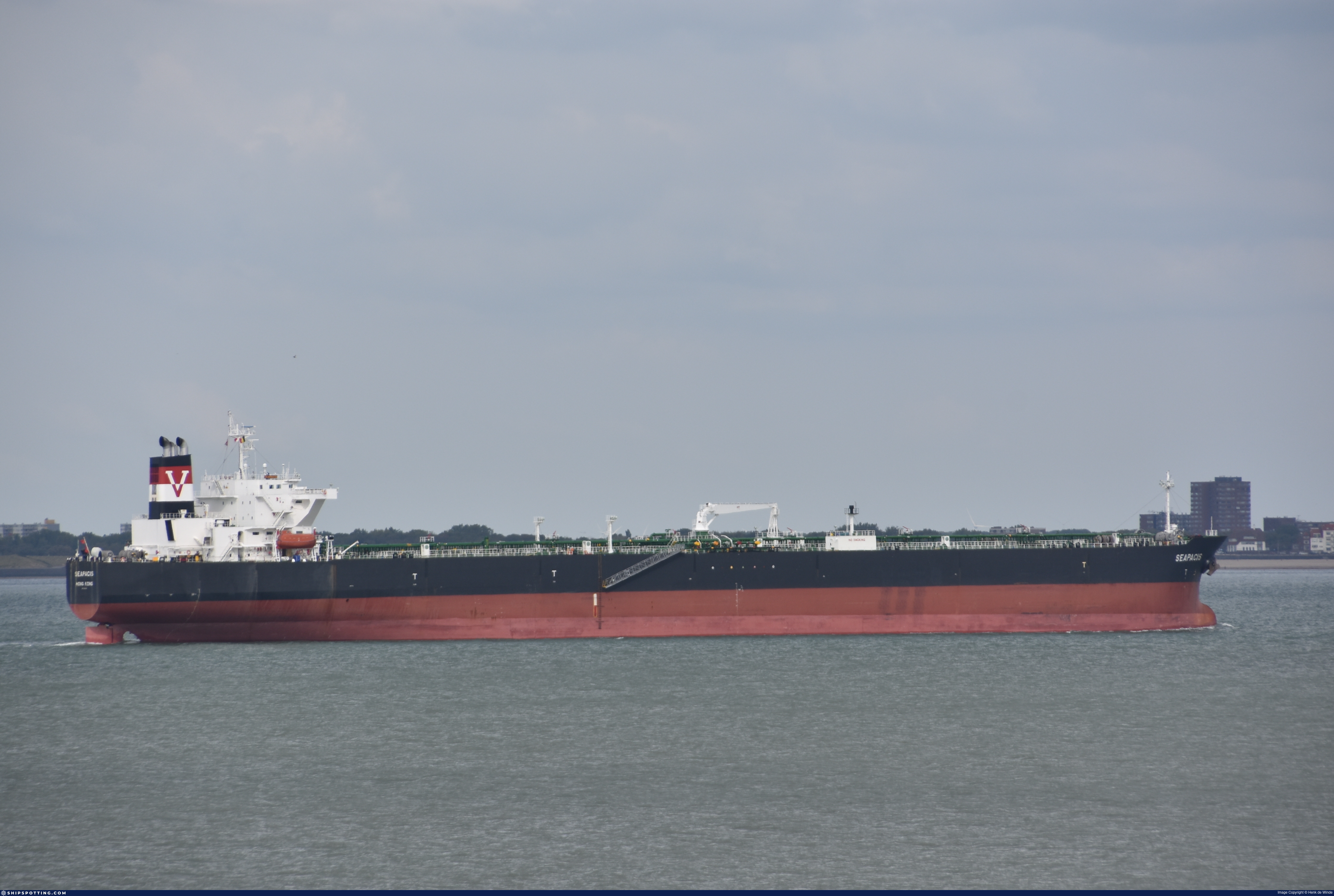
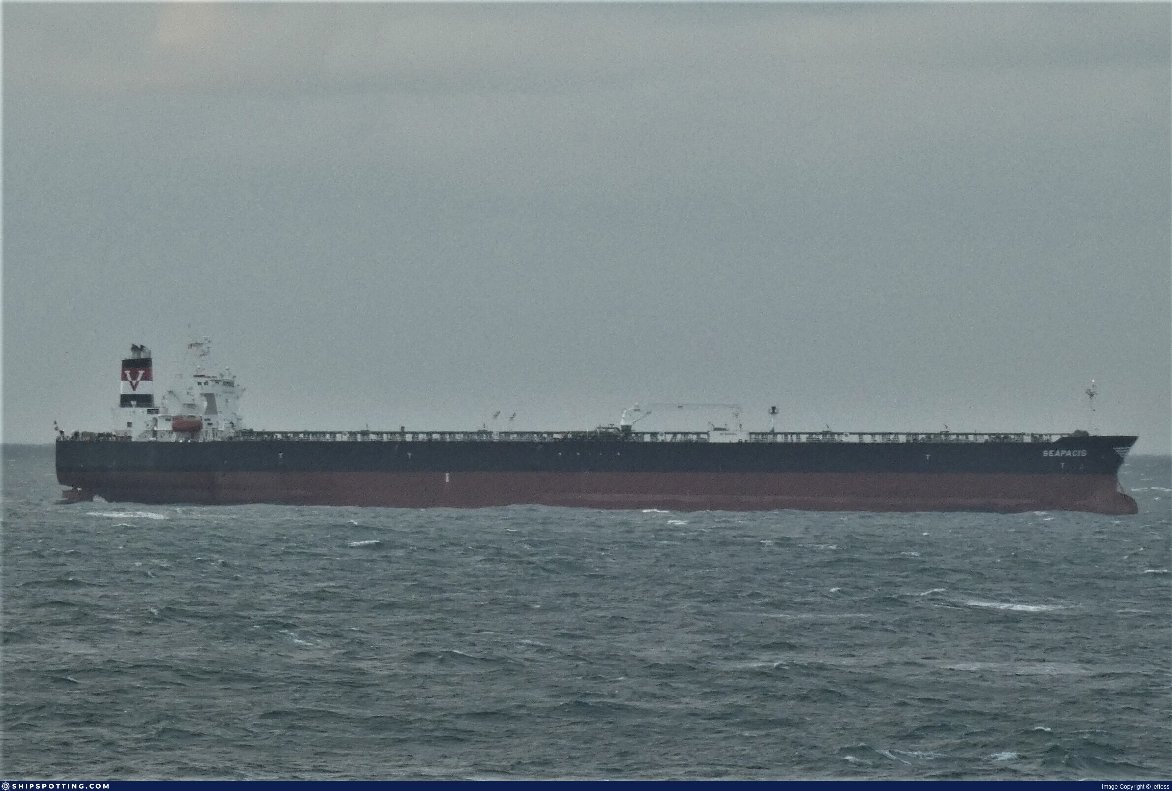
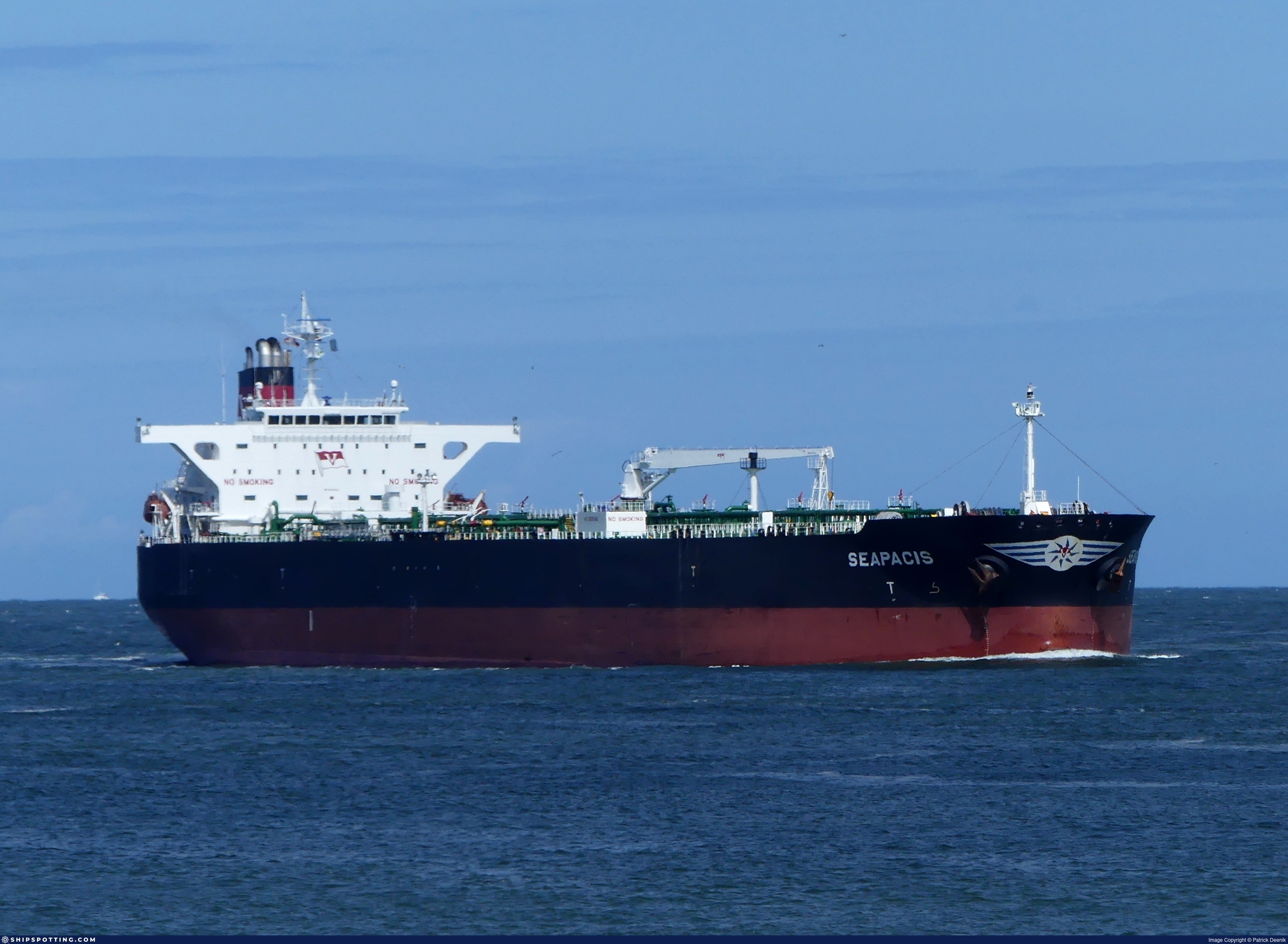
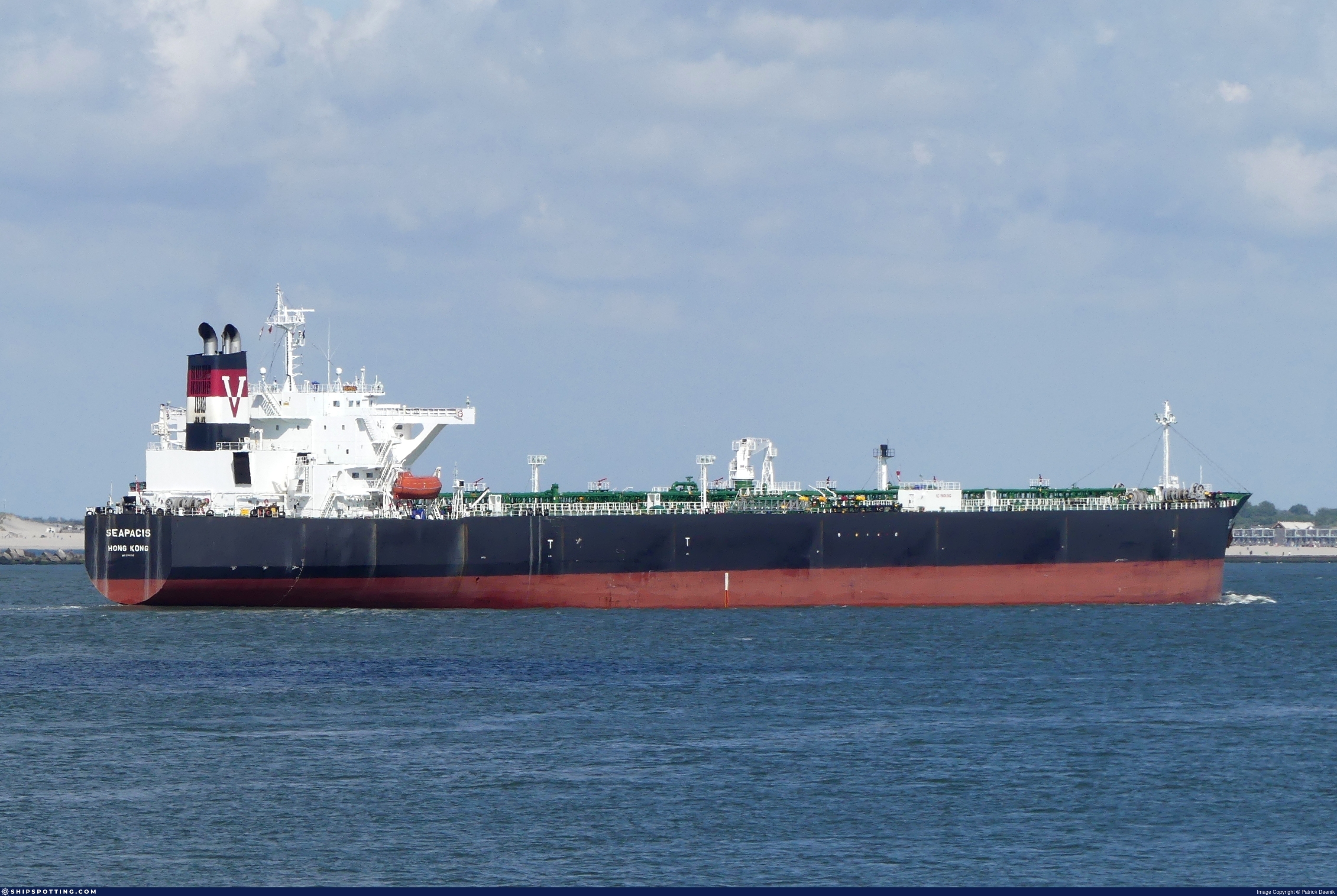
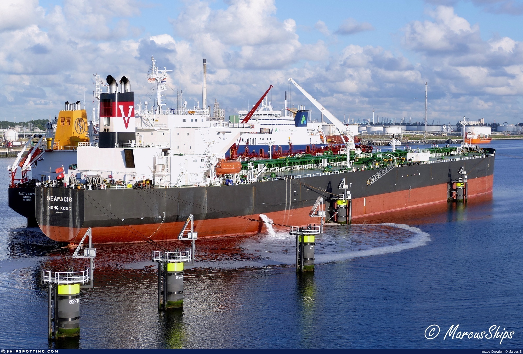
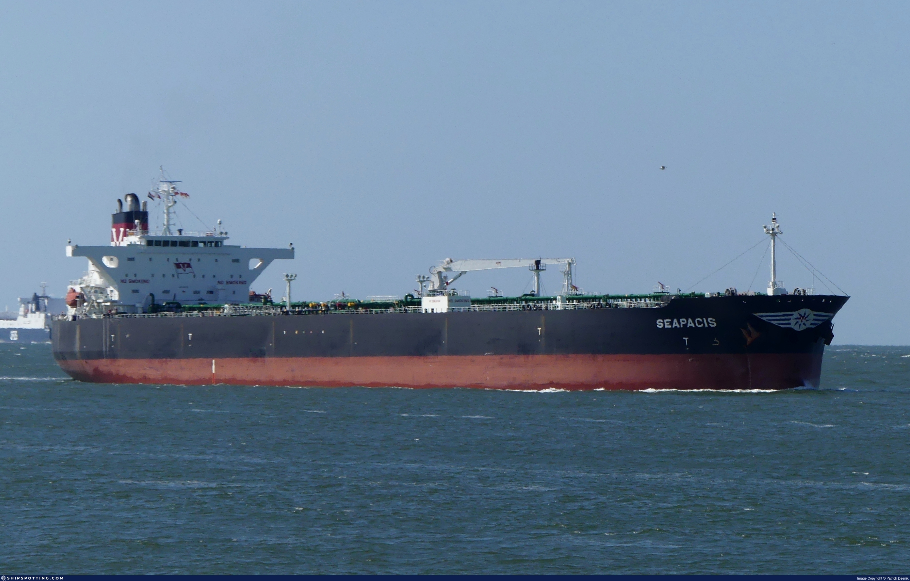
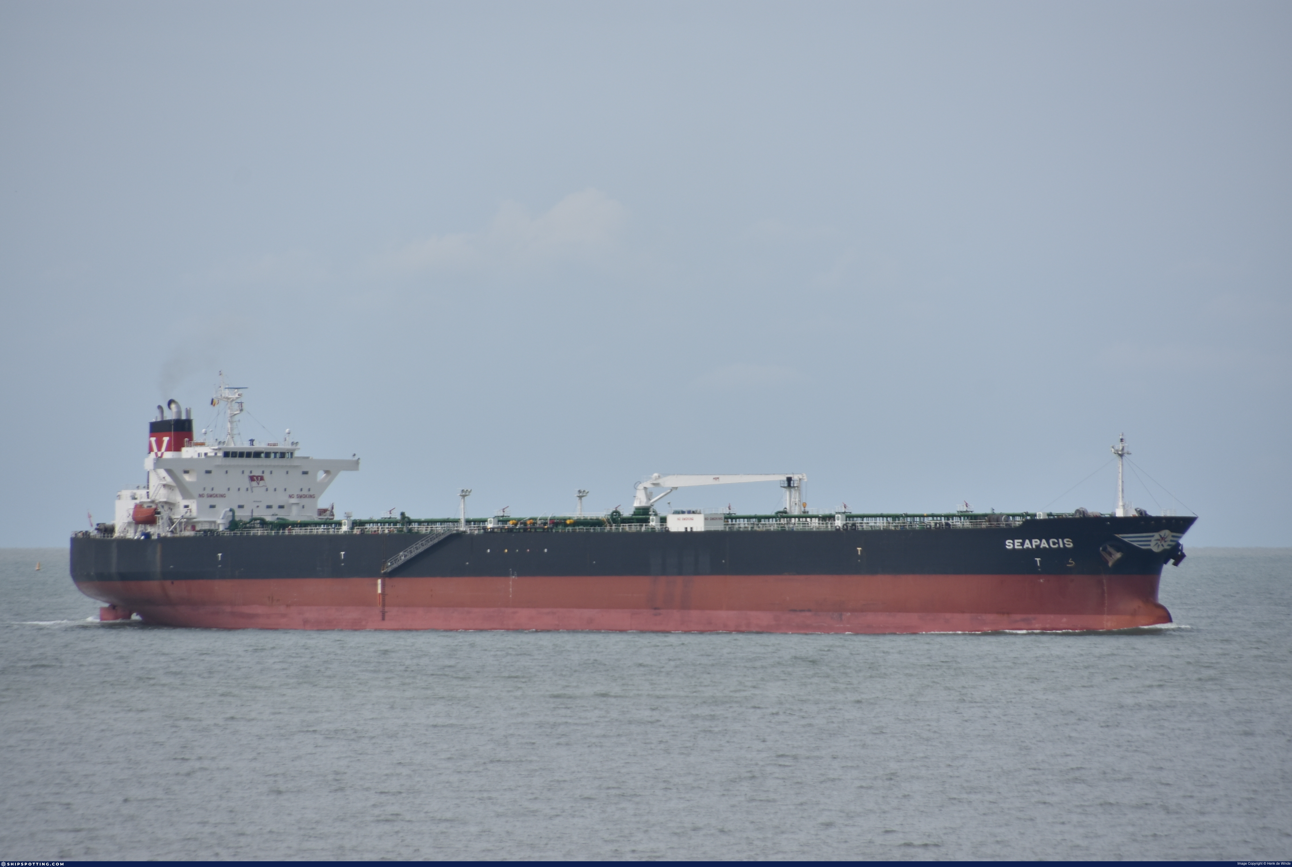
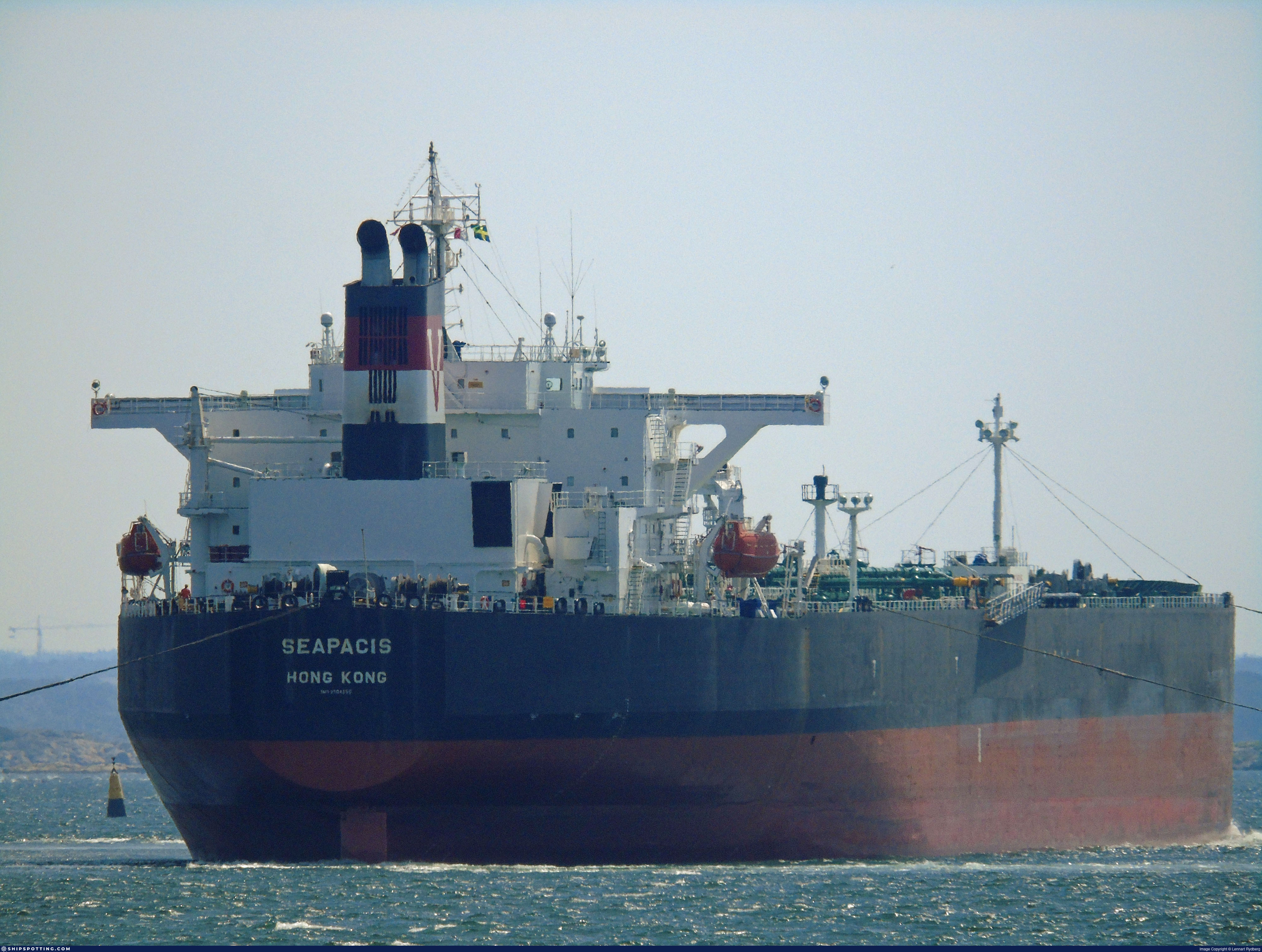
IMO 9304356
Vessel information
Sanctioned by
Company & Ownership
Management & Operations
Classification & Safety
Port State Control (PSC) Inspections
Survey Renewal & Certificates
| Code | Type | Issuer | Issued | Expires |
|---|---|---|---|---|
| 510 | Safety Management Certificate | Bureau Veritas (115) | 19/04/2023 | 18/01/2028 |
| 533 | Maritime Labour Certificate | Bureau Veritas (115) | 19/04/2023 | 18/01/2028 |
Programs & Notes
EU Russia Sanctions – Shadow Fleet | SEMA (Canada) — vessel designations | The Russia (Sanctions) (EU Exit) Regulations 2019
DateOfListing: 2025-05-21 || DateDesignated: 2025-06-17 | Shipping sanctions: (see “Other information”) | Shipping sanctions: a specified ship is prohibited from being provided with access to or having its master or pilot cause it to enter a port in the UK, may have its registration on the UK Ship Register terminated, and a master or pilot of a specified ship may be given a port barring direction, a detention direction, and a port entry direction or a movement direction. | IMO 9304356 (“YODAN”) is involved in activity whose object or effect is to destabilise Ukraine or undermine or threaten the territorial integrity, sovereignty or independence of Ukraine or to obtain a benefit from or support the Government of Russia. Namely, YODAN is involved in carrying oil or oil products that originated in Russia from Russia to a third country.
Vessel Changes
AIS Events
50 events detected • 4 zones • Last: Jun 15, 2026
- Zone: discovered_020
- Duration: 1h 21m
- Data Points: 3 AIS positions
- Period: 2026-06-15T17:10:27+00:00 to 2026-06-15T18:31:34+00:00
Show Raw Evidence JSON
{
    "zone_id": "discovered_020",
    "zone_name": "Eastern Mediterranean Monitoring Zone",
    "dwell_minutes": 81.099999999999994315658113919198513031005859375,
    "points_in_zone": 3,
    "first_point": {
        "ts": "2026-06-15T17:10:27+00:00",
        "lat": 31.45803169999999937544998829253017902374267578125,
        "lon": 32.3270466999999968038537190295755863189697265625
    },
    "last_point": {
        "ts": "2026-06-15T18:31:34+00:00",
        "lat": 31.457898300000000091358742793090641498565673828125,
        "lon": 32.32696829999999721394488005898892879486083984375
    }
}- Zone: discovered_098
- Duration: 2h 26m
- Data Points: 4 AIS positions
- Period: 2026-06-13T01:17:39+00:00 to 2026-06-13T03:44:13+00:00
Show Raw Evidence JSON
{
    "zone_id": "discovered_098",
    "zone_name": "Eastern Gulf of Finland Monitoring Zone",
    "dwell_minutes": 146.599999999999994315658113919198513031005859375,
    "points_in_zone": 4,
    "first_point": {
        "ts": "2026-06-13T01:17:39+00:00",
        "lat": 37.4710333000000019865183276124298572540283203125,
        "lon": 25.80330169999999867513906792737543582916259765625
    },
    "last_point": {
        "ts": "2026-06-13T03:44:13+00:00",
        "lat": 37.120018299999998134808265604078769683837890625,
        "lon": 26.064628299999998972680259612388908863067626953125
    }
}- Zone: Bosphorus/Dardanelles Approach
- Duration: 1h 23m
- Data Points: 13 AIS positions
- Period: 2026-06-11T05:33:05+00:00 to 2026-06-11T06:56:06+00:00
Show Raw Evidence JSON
{
    "zone_id": "osint_bosphorus",
    "zone_name": "Bosphorus\/Dardanelles Approach",
    "dwell_minutes": 83,
    "points_in_zone": 13,
    "first_point": {
        "ts": "2026-06-11T05:33:05+00:00",
        "lat": 40.9208066999999999779902282170951366424560546875,
        "lon": 28.827773300000000489262674818746745586395263671875
    },
    "last_point": {
        "ts": "2026-06-11T06:56:06+00:00",
        "lat": 40.88249830000000173413354787044227123260498046875,
        "lon": 28.552208300000000207319317269138991832733154296875
    }
}- Zone: Bosphorus/Dardanelles Approach
- Duration: 2h 25m
- Data Points: 21 AIS positions
- Period: 2026-06-11T04:30:57+00:00 to 2026-06-11T06:56:06+00:00
Show Raw Evidence JSON
{
    "zone_id": "osint_bosphorus",
    "zone_name": "Bosphorus\/Dardanelles Approach",
    "dwell_minutes": 145.19999999999998863131622783839702606201171875,
    "points_in_zone": 21,
    "first_point": {
        "ts": "2026-06-11T04:30:57+00:00",
        "lat": 40.96098330000000231621015700511634349822998046875,
        "lon": 28.946386700000001468424670747481286525726318359375
    },
    "last_point": {
        "ts": "2026-06-11T06:56:06+00:00",
        "lat": 40.88249830000000173413354787044227123260498046875,
        "lon": 28.552208300000000207319317269138991832733154296875
    }
}- Zone: Bosphorus/Dardanelles Approach
- Duration: 5h 47m
- Data Points: 31 AIS positions
- Period: 2026-06-11T01:08:55+00:00 to 2026-06-11T06:56:06+00:00
Show Raw Evidence JSON
{
    "zone_id": "osint_bosphorus",
    "zone_name": "Bosphorus\/Dardanelles Approach",
    "dwell_minutes": 347.19999999999998863131622783839702606201171875,
    "points_in_zone": 31,
    "first_point": {
        "ts": "2026-06-11T01:08:55+00:00",
        "lat": 41.3833316999999993868186720646917819976806640625,
        "lon": 29.172858300000001463558874092996120452880859375
    },
    "last_point": {
        "ts": "2026-06-11T06:56:06+00:00",
        "lat": 40.88249830000000173413354787044227123260498046875,
        "lon": 28.552208300000000207319317269138991832733154296875
    }
}- Zone: Bosphorus/Dardanelles Approach
- Duration: 6h 24m
- Data Points: 33 AIS positions
- Period: 2026-06-11T00:05:07+00:00 to 2026-06-11T06:29:06+00:00
Show Raw Evidence JSON
{
    "zone_id": "osint_bosphorus",
    "zone_name": "Bosphorus\/Dardanelles Approach",
    "dwell_minutes": 384,
    "points_in_zone": 33,
    "first_point": {
        "ts": "2026-06-11T00:05:07+00:00",
        "lat": 41.48502169999999722449501859955489635467529296875,
        "lon": 29.231739999999998502744347206316888332366943359375
    },
    "last_point": {
        "ts": "2026-06-11T06:29:06+00:00",
        "lat": 40.89375170000000281333996099419891834259033203125,
        "lon": 28.64234499999999883357304497621953487396240234375
    }
}- Zone: Istanbul Black Sea Surveillance Zone
- Duration: 1h 25m
- Data Points: 13 AIS positions
- Period: 2026-06-11T00:05:07+00:00 to 2026-06-11T01:30:35+00:00
Show Raw Evidence JSON
{
    "zone_id": "discovered_024",
    "zone_name": "Istanbul Black Sea Surveillance Zone",
    "dwell_minutes": 85.5,
    "points_in_zone": 13,
    "first_point": {
        "ts": "2026-06-11T00:05:07+00:00",
        "lat": 41.48502169999999722449501859955489635467529296875,
        "lon": 29.231739999999998502744347206316888332366943359375
    },
    "last_point": {
        "ts": "2026-06-11T01:30:35+00:00",
        "lat": 41.33334169999999829769876669161021709442138671875,
        "lon": 29.147318299999998458815753110684454441070556640625
    }
}- Zone: Bosphorus/Dardanelles Approach
- Duration: 6h 34m
- Data Points: 29 AIS positions
- Period: 2026-06-10T23:32:56+00:00 to 2026-06-11T06:07:26+00:00
Show Raw Evidence JSON
{
    "zone_id": "osint_bosphorus",
    "zone_name": "Bosphorus\/Dardanelles Approach",
    "dwell_minutes": 394.5,
    "points_in_zone": 29,
    "first_point": {
        "ts": "2026-06-10T23:32:56+00:00",
        "lat": 41.4828933000000006359186954796314239501953125,
        "lon": 29.229626700000000738555172574706375598907470703125
    },
    "last_point": {
        "ts": "2026-06-11T06:07:26+00:00",
        "lat": 40.90319000000000215777617995627224445343017578125,
        "lon": 28.715488300000000521094989380799233913421630859375
    }
}- Zone: Istanbul Black Sea Surveillance Zone
- Duration: 2h 30m
- Data Points: 21 AIS positions
- Period: 2026-06-10T23:00:25+00:00 to 2026-06-11T01:30:35+00:00
Show Raw Evidence JSON
{
    "zone_id": "discovered_024",
    "zone_name": "Istanbul Black Sea Surveillance Zone",
    "dwell_minutes": 150.19999999999998863131622783839702606201171875,
    "points_in_zone": 21,
    "first_point": {
        "ts": "2026-06-10T23:00:25+00:00",
        "lat": 41.48408500000000032059688237495720386505126953125,
        "lon": 29.227311700000001337684807367622852325439453125
    },
    "last_point": {
        "ts": "2026-06-11T01:30:35+00:00",
        "lat": 41.33334169999999829769876669161021709442138671875,
        "lon": 29.147318299999998458815753110684454441070556640625
    }
}- Zone: Bosphorus/Dardanelles Approach
- Duration: 6h 6m
- Data Points: 30 AIS positions
- Period: 2026-06-10T22:53:46+00:00 to 2026-06-11T04:59:46+00:00
Show Raw Evidence JSON
{
    "zone_id": "osint_bosphorus",
    "zone_name": "Bosphorus\/Dardanelles Approach",
    "dwell_minutes": 366,
    "points_in_zone": 30,
    "first_point": {
        "ts": "2026-06-10T22:53:46+00:00",
        "lat": 41.48421830000000198879206436686217784881591796875,
        "lon": 29.22683669999999978017513058148324489593505859375
    },
    "last_point": {
        "ts": "2026-06-11T04:59:46+00:00",
        "lat": 40.94580500000000000682121026329696178436279296875,
        "lon": 28.904550000000000409272615797817707061767578125
    }
}- Zone: Istanbul Black Sea Surveillance Zone
- Duration: 2h 36m
- Data Points: 22 AIS positions
- Period: 2026-06-10T22:53:46+00:00 to 2026-06-11T01:30:35+00:00
Show Raw Evidence JSON
{
    "zone_id": "discovered_024",
    "zone_name": "Istanbul Black Sea Surveillance Zone",
    "dwell_minutes": 156.80000000000001136868377216160297393798828125,
    "points_in_zone": 22,
    "first_point": {
        "ts": "2026-06-10T22:53:46+00:00",
        "lat": 41.48421830000000198879206436686217784881591796875,
        "lon": 29.22683669999999978017513058148324489593505859375
    },
    "last_point": {
        "ts": "2026-06-11T01:30:35+00:00",
        "lat": 41.33334169999999829769876669161021709442138671875,
        "lon": 29.147318299999998458815753110684454441070556640625
    }
}- Duration: 3h 3m
- Radius: 492 meters
- Data Points: 20 AIS positions
- Centroid: 41.4843, 29.2259
- Zone: Istanbul Black Sea Surveillance Zone
Show Raw Evidence JSON
{
    "radius_m": 491.8999999999999772626324556767940521240234375,
    "duration_minutes": 183.400000000000005684341886080801486968994140625,
    "points": 20,
    "centroid": {
        "lat": 41.48433583499998889010385028086602687835693359375,
        "lon": 29.22592067499999757274053990840911865234375
    },
    "bbox": {
        "min_lat": 41.4828933000000006359186954796314239501953125,
        "min_lon": 29.221123299999998579323801095597445964813232421875,
        "max_lat": 41.4858832999999975754690240137279033660888671875,
        "max_lon": 29.231739999999998502744347206316888332366943359375
    },
    "zone_id": "discovered_024"
}- Duration: 3h 3m
- Radius: 492 meters
- Data Points: 20 AIS positions
- Centroid: 41.4843, 29.2259
- Zone: Bosphorus/Dardanelles Approach
Show Raw Evidence JSON
{
    "radius_m": 491.8999999999999772626324556767940521240234375,
    "duration_minutes": 183.400000000000005684341886080801486968994140625,
    "points": 20,
    "centroid": {
        "lat": 41.48433583499998889010385028086602687835693359375,
        "lon": 29.22592067499999757274053990840911865234375
    },
    "bbox": {
        "min_lat": 41.4828933000000006359186954796314239501953125,
        "min_lon": 29.221123299999998579323801095597445964813232421875,
        "max_lat": 41.4858832999999975754690240137279033660888671875,
        "max_lon": 29.231739999999998502744347206316888332366943359375
    },
    "zone_id": "osint_bosphorus"
}- Zone: Istanbul Black Sea Surveillance Zone
- Duration: 4h 21m
- Data Points: 30 AIS positions
- Period: 2026-06-10T21:09:29+00:00 to 2026-06-11T01:30:35+00:00
Show Raw Evidence JSON
{
    "zone_id": "discovered_024",
    "zone_name": "Istanbul Black Sea Surveillance Zone",
    "dwell_minutes": 261.1000000000000227373675443232059478759765625,
    "points_in_zone": 30,
    "first_point": {
        "ts": "2026-06-10T21:09:29+00:00",
        "lat": 41.48403830000000169775375979952514171600341796875,
        "lon": 29.221123299999998579323801095597445964813232421875
    },
    "last_point": {
        "ts": "2026-06-11T01:30:35+00:00",
        "lat": 41.33334169999999829769876669161021709442138671875,
        "lon": 29.147318299999998458815753110684454441070556640625
    }
}- Zone: Bosphorus/Dardanelles Approach
- Duration: 4h 21m
- Data Points: 30 AIS positions
- Period: 2026-06-10T21:09:29+00:00 to 2026-06-11T01:30:35+00:00
Show Raw Evidence JSON
{
    "zone_id": "osint_bosphorus",
    "zone_name": "Bosphorus\/Dardanelles Approach",
    "dwell_minutes": 261.1000000000000227373675443232059478759765625,
    "points_in_zone": 30,
    "first_point": {
        "ts": "2026-06-10T21:09:29+00:00",
        "lat": 41.48403830000000169775375979952514171600341796875,
        "lon": 29.221123299999998579323801095597445964813232421875
    },
    "last_point": {
        "ts": "2026-06-11T01:30:35+00:00",
        "lat": 41.33334169999999829769876669161021709442138671875,
        "lon": 29.147318299999998458815753110684454441070556640625
    }
}- Duration: 4h 8m
- Radius: 636 meters
- Data Points: 22 AIS positions
- Centroid: 41.4841, 29.2254
- Zone: Istanbul Black Sea Surveillance Zone
Show Raw Evidence JSON
{
    "radius_m": 636.1000000000000227373675443232059478759765625,
    "duration_minutes": 248.900000000000005684341886080801486968994140625,
    "points": 22,
    "centroid": {
        "lat": 41.48414045454544663016349659301340579986572265625,
        "lon": 29.225381750000000380396159016527235507965087890625
    },
    "bbox": {
        "min_lat": 41.480743300000000317595549859106540679931640625,
        "min_lon": 29.219249999999998834709913353435695171356201171875,
        "max_lat": 41.4858832999999975754690240137279033660888671875,
        "max_lon": 29.231739999999998502744347206316888332366943359375
    },
    "zone_id": "discovered_024"
}- Duration: 4h 8m
- Radius: 636 meters
- Data Points: 22 AIS positions
- Centroid: 41.4841, 29.2254
- Zone: Bosphorus/Dardanelles Approach
Show Raw Evidence JSON
{
    "radius_m": 636.1000000000000227373675443232059478759765625,
    "duration_minutes": 248.900000000000005684341886080801486968994140625,
    "points": 22,
    "centroid": {
        "lat": 41.48414045454544663016349659301340579986572265625,
        "lon": 29.225381750000000380396159016527235507965087890625
    },
    "bbox": {
        "min_lat": 41.480743300000000317595549859106540679931640625,
        "min_lon": 29.219249999999998834709913353435695171356201171875,
        "max_lat": 41.4858832999999975754690240137279033660888671875,
        "max_lon": 29.231739999999998502744347206316888332366943359375
    },
    "zone_id": "osint_bosphorus"
}- Zone: Istanbul Black Sea Surveillance Zone
- Duration: 5h 26m
- Data Points: 32 AIS positions
- Period: 2026-06-10T20:03:58+00:00 to 2026-06-11T01:30:35+00:00
Show Raw Evidence JSON
{
    "zone_id": "discovered_024",
    "zone_name": "Istanbul Black Sea Surveillance Zone",
    "dwell_minutes": 326.6000000000000227373675443232059478759765625,
    "points_in_zone": 32,
    "first_point": {
        "ts": "2026-06-10T20:03:58+00:00",
        "lat": 41.480743300000000317595549859106540679931640625,
        "lon": 29.219249999999998834709913353435695171356201171875
    },
    "last_point": {
        "ts": "2026-06-11T01:30:35+00:00",
        "lat": 41.33334169999999829769876669161021709442138671875,
        "lon": 29.147318299999998458815753110684454441070556640625
    }
}- Zone: Bosphorus/Dardanelles Approach
- Duration: 5h 26m
- Data Points: 32 AIS positions
- Period: 2026-06-10T20:03:58+00:00 to 2026-06-11T01:30:35+00:00
Show Raw Evidence JSON
{
    "zone_id": "osint_bosphorus",
    "zone_name": "Bosphorus\/Dardanelles Approach",
    "dwell_minutes": 326.6000000000000227373675443232059478759765625,
    "points_in_zone": 32,
    "first_point": {
        "ts": "2026-06-10T20:03:58+00:00",
        "lat": 41.480743300000000317595549859106540679931640625,
        "lon": 29.219249999999998834709913353435695171356201171875
    },
    "last_point": {
        "ts": "2026-06-11T01:30:35+00:00",
        "lat": 41.33334169999999829769876669161021709442138671875,
        "lon": 29.147318299999998458815753110684454441070556640625
    }
}- Duration: 4h 22m
- Radius: 628 meters
- Data Points: 25 AIS positions
- Centroid: 41.4837, 29.2246
- Zone: Istanbul Black Sea Surveillance Zone
Show Raw Evidence JSON
{
    "radius_m": 628.1000000000000227373675443232059478759765625,
    "duration_minutes": 262.1000000000000227373675443232059478759765625,
    "points": 25,
    "centroid": {
        "lat": 41.48366493600000382002690457738935947418212890625,
        "lon": 29.2246171400000065432323026470839977264404296875
    },
    "bbox": {
        "min_lat": 41.47996669999999852507244213484227657318115234375,
        "min_lon": 29.2189283000000017409547581337392330169677734375,
        "max_lat": 41.4858832999999975754690240137279033660888671875,
        "max_lon": 29.231739999999998502744347206316888332366943359375
    },
    "zone_id": "discovered_024"
}- Duration: 4h 22m
- Radius: 628 meters
- Data Points: 25 AIS positions
- Centroid: 41.4837, 29.2246
- Zone: Bosphorus/Dardanelles Approach
Show Raw Evidence JSON
{
    "radius_m": 628.1000000000000227373675443232059478759765625,
    "duration_minutes": 262.1000000000000227373675443232059478759765625,
    "points": 25,
    "centroid": {
        "lat": 41.48366493600000382002690457738935947418212890625,
        "lon": 29.2246171400000065432323026470839977264404296875
    },
    "bbox": {
        "min_lat": 41.47996669999999852507244213484227657318115234375,
        "min_lon": 29.2189283000000017409547581337392330169677734375,
        "max_lat": 41.4858832999999975754690240137279033660888671875,
        "max_lon": 29.231739999999998502744347206316888332366943359375
    },
    "zone_id": "osint_bosphorus"
}- Zone: Bosphorus/Dardanelles Approach
- Duration: 5h 39m
- Data Points: 35 AIS positions
- Period: 2026-06-10T19:50:47+00:00 to 2026-06-11T01:30:35+00:00
Show Raw Evidence JSON
{
    "zone_id": "osint_bosphorus",
    "zone_name": "Bosphorus\/Dardanelles Approach",
    "dwell_minutes": 339.80000000000001136868377216160297393798828125,
    "points_in_zone": 35,
    "first_point": {
        "ts": "2026-06-10T19:50:47+00:00",
        "lat": 41.47996669999999852507244213484227657318115234375,
        "lon": 29.2189283000000017409547581337392330169677734375
    },
    "last_point": {
        "ts": "2026-06-11T01:30:35+00:00",
        "lat": 41.33334169999999829769876669161021709442138671875,
        "lon": 29.147318299999998458815753110684454441070556640625
    }
}- Zone: Istanbul Black Sea Surveillance Zone
- Duration: 5h 39m
- Data Points: 35 AIS positions
- Period: 2026-06-10T19:50:47+00:00 to 2026-06-11T01:30:35+00:00
Show Raw Evidence JSON
{
    "zone_id": "discovered_024",
    "zone_name": "Istanbul Black Sea Surveillance Zone",
    "dwell_minutes": 339.80000000000001136868377216160297393798828125,
    "points_in_zone": 35,
    "first_point": {
        "ts": "2026-06-10T19:50:47+00:00",
        "lat": 41.47996669999999852507244213484227657318115234375,
        "lon": 29.2189283000000017409547581337392330169677734375
    },
    "last_point": {
        "ts": "2026-06-11T01:30:35+00:00",
        "lat": 41.33334169999999829769876669161021709442138671875,
        "lon": 29.147318299999998458815753110684454441070556640625
    }
}- Duration: 6h 31m
- Radius: 805 meters
- Data Points: 27 AIS positions
- Centroid: 41.4819, 29.2232
- Zone: Istanbul Black Sea Surveillance Zone
Show Raw Evidence JSON
{
    "radius_m": 804.700000000000045474735088646411895751953125,
    "duration_minutes": 391.80000000000001136868377216160297393798828125,
    "points": 27,
    "centroid": {
        "lat": 41.481918644444448318608920089900493621826171875,
        "lon": 29.223186548148152752446549129672348499298095703125
    },
    "bbox": {
        "min_lat": 41.47503669999999686979208490811288356781005859375,
        "min_lon": 29.2189283000000017409547581337392330169677734375,
        "max_lat": 41.4850016999999979816493578255176544189453125,
        "max_lon": 29.229626700000000738555172574706375598907470703125
    },
    "zone_id": "discovered_024"
}- Duration: 6h 31m
- Radius: 805 meters
- Data Points: 27 AIS positions
- Centroid: 41.4819, 29.2232
- Zone: Bosphorus/Dardanelles Approach
Show Raw Evidence JSON
{
    "radius_m": 804.700000000000045474735088646411895751953125,
    "duration_minutes": 391.80000000000001136868377216160297393798828125,
    "points": 27,
    "centroid": {
        "lat": 41.481918644444448318608920089900493621826171875,
        "lon": 29.223186548148152752446549129672348499298095703125
    },
    "bbox": {
        "min_lat": 41.47503669999999686979208490811288356781005859375,
        "min_lon": 29.2189283000000017409547581337392330169677734375,
        "max_lat": 41.4850016999999979816493578255176544189453125,
        "max_lon": 29.229626700000000738555172574706375598907470703125
    },
    "zone_id": "osint_bosphorus"
}- Zone: Istanbul Black Sea Surveillance Zone
- Duration: 6h 31m
- Data Points: 27 AIS positions
- Period: 2026-06-10T17:01:08+00:00 to 2026-06-10T23:32:56+00:00
Show Raw Evidence JSON
{
    "zone_id": "discovered_024",
    "zone_name": "Istanbul Black Sea Surveillance Zone",
    "dwell_minutes": 391.80000000000001136868377216160297393798828125,
    "points_in_zone": 27,
    "first_point": {
        "ts": "2026-06-10T17:01:08+00:00",
        "lat": 41.4758082999999970752469380386173725128173828125,
        "lon": 29.220224999999999226929503493010997772216796875
    },
    "last_point": {
        "ts": "2026-06-10T23:32:56+00:00",
        "lat": 41.4828933000000006359186954796314239501953125,
        "lon": 29.229626700000000738555172574706375598907470703125
    }
}- Zone: Bosphorus/Dardanelles Approach
- Duration: 6h 31m
- Data Points: 27 AIS positions
- Period: 2026-06-10T17:01:08+00:00 to 2026-06-10T23:32:56+00:00
Show Raw Evidence JSON
{
    "zone_id": "osint_bosphorus",
    "zone_name": "Bosphorus\/Dardanelles Approach",
    "dwell_minutes": 391.80000000000001136868377216160297393798828125,
    "points_in_zone": 27,
    "first_point": {
        "ts": "2026-06-10T17:01:08+00:00",
        "lat": 41.4758082999999970752469380386173725128173828125,
        "lon": 29.220224999999999226929503493010997772216796875
    },
    "last_point": {
        "ts": "2026-06-10T23:32:56+00:00",
        "lat": 41.4828933000000006359186954796314239501953125,
        "lon": 29.229626700000000738555172574706375598907470703125
    }
}- Duration: 6h 34m
- Radius: 680 meters
- Data Points: 32 AIS positions
- Centroid: 41.4809, 29.2226
- Zone: Istanbul Black Sea Surveillance Zone
Show Raw Evidence JSON
{
    "radius_m": 680,
    "duration_minutes": 394.1000000000000227373675443232059478759765625,
    "points": 32,
    "centroid": {
        "lat": 41.480881306249983708767103962600231170654296875,
        "lon": 29.22259745000000208392521017231047153472900390625
    },
    "bbox": {
        "min_lat": 41.47503669999999686979208490811288356781005859375,
        "min_lon": 29.2189283000000017409547581337392330169677734375,
        "max_lat": 41.4850016999999979816493578255176544189453125,
        "max_lon": 29.228506700000000506634023622609674930572509765625
    },
    "zone_id": "discovered_024"
}- Duration: 6h 34m
- Radius: 680 meters
- Data Points: 32 AIS positions
- Centroid: 41.4809, 29.2226
- Zone: Bosphorus/Dardanelles Approach
Show Raw Evidence JSON
{
    "radius_m": 680,
    "duration_minutes": 394.1000000000000227373675443232059478759765625,
    "points": 32,
    "centroid": {
        "lat": 41.480881306249983708767103962600231170654296875,
        "lon": 29.22259745000000208392521017231047153472900390625
    },
    "bbox": {
        "min_lat": 41.47503669999999686979208490811288356781005859375,
        "min_lon": 29.2189283000000017409547581337392330169677734375,
        "max_lat": 41.4850016999999979816493578255176544189453125,
        "max_lon": 29.228506700000000506634023622609674930572509765625
    },
    "zone_id": "osint_bosphorus"
}- Zone: Bosphorus/Dardanelles Approach
- Duration: 6h 34m
- Data Points: 32 AIS positions
- Period: 2026-06-10T16:42:59+00:00 to 2026-06-10T23:17:07+00:00
Show Raw Evidence JSON
{
    "zone_id": "osint_bosphorus",
    "zone_name": "Bosphorus\/Dardanelles Approach",
    "dwell_minutes": 394.1000000000000227373675443232059478759765625,
    "points_in_zone": 32,
    "first_point": {
        "ts": "2026-06-10T16:42:59+00:00",
        "lat": 41.476906700000000682848622091114521026611328125,
        "lon": 29.22189829999999943765942589379847049713134765625
    },
    "last_point": {
        "ts": "2026-06-10T23:17:07+00:00",
        "lat": 41.4834867000000002690285327844321727752685546875,
        "lon": 29.228506700000000506634023622609674930572509765625
    }
}- Zone: Istanbul Black Sea Surveillance Zone
- Duration: 6h 34m
- Data Points: 32 AIS positions
- Period: 2026-06-10T16:42:59+00:00 to 2026-06-10T23:17:07+00:00
Show Raw Evidence JSON
{
    "zone_id": "discovered_024",
    "zone_name": "Istanbul Black Sea Surveillance Zone",
    "dwell_minutes": 394.1000000000000227373675443232059478759765625,
    "points_in_zone": 32,
    "first_point": {
        "ts": "2026-06-10T16:42:59+00:00",
        "lat": 41.476906700000000682848622091114521026611328125,
        "lon": 29.22189829999999943765942589379847049713134765625
    },
    "last_point": {
        "ts": "2026-06-10T23:17:07+00:00",
        "lat": 41.4834867000000002690285327844321727752685546875,
        "lon": 29.228506700000000506634023622609674930572509765625
    }
}- Zone: Istanbul Black Sea Surveillance Zone
- Duration: 6h 20m
- Data Points: 43 AIS positions
- Period: 2026-06-10T15:34:47+00:00 to 2026-06-10T21:54:59+00:00
Show Raw Evidence JSON
{
    "zone_id": "discovered_024",
    "zone_name": "Istanbul Black Sea Surveillance Zone",
    "dwell_minutes": 380.19999999999998863131622783839702606201171875,
    "points_in_zone": 43,
    "first_point": {
        "ts": "2026-06-10T15:34:47+00:00",
        "lat": 41.470048300000001972875907085835933685302734375,
        "lon": 29.22218670000000173558873939327895641326904296875
    },
    "last_point": {
        "ts": "2026-06-10T21:54:59+00:00",
        "lat": 41.4850016999999979816493578255176544189453125,
        "lon": 29.223371700000001283115125261247158050537109375
    }
}- Zone: Bosphorus/Dardanelles Approach
- Duration: 6h 20m
- Data Points: 43 AIS positions
- Period: 2026-06-10T15:34:47+00:00 to 2026-06-10T21:54:59+00:00
Show Raw Evidence JSON
{
    "zone_id": "osint_bosphorus",
    "zone_name": "Bosphorus\/Dardanelles Approach",
    "dwell_minutes": 380.19999999999998863131622783839702606201171875,
    "points_in_zone": 43,
    "first_point": {
        "ts": "2026-06-10T15:34:47+00:00",
        "lat": 41.470048300000001972875907085835933685302734375,
        "lon": 29.22218670000000173558873939327895641326904296875
    },
    "last_point": {
        "ts": "2026-06-10T21:54:59+00:00",
        "lat": 41.4850016999999979816493578255176544189453125,
        "lon": 29.223371700000001283115125261247158050537109375
    }
}- Duration: 6h 20m
- Radius: 885 meters
- Data Points: 43 AIS positions
- Centroid: 41.4780, 29.2221
- Zone: Istanbul Black Sea Surveillance Zone
Show Raw Evidence JSON
{
    "radius_m": 884.799999999999954525264911353588104248046875,
    "duration_minutes": 380.19999999999998863131622783839702606201171875,
    "points": 43,
    "centroid": {
        "lat": 41.478014455813962513275328092277050018310546875,
        "lon": 29.22207643488371076045950758270919322967529296875
    },
    "bbox": {
        "min_lat": 41.470048300000001972875907085835933685302734375,
        "min_lon": 29.2189283000000017409547581337392330169677734375,
        "max_lat": 41.4850016999999979816493578255176544189453125,
        "max_lon": 29.224418299999999959482011036016047000885009765625
    },
    "zone_id": "discovered_024"
}- Duration: 6h 20m
- Radius: 885 meters
- Data Points: 43 AIS positions
- Centroid: 41.4780, 29.2221
- Zone: Bosphorus/Dardanelles Approach
Show Raw Evidence JSON
{
    "radius_m": 884.799999999999954525264911353588104248046875,
    "duration_minutes": 380.19999999999998863131622783839702606201171875,
    "points": 43,
    "centroid": {
        "lat": 41.478014455813962513275328092277050018310546875,
        "lon": 29.22207643488371076045950758270919322967529296875
    },
    "bbox": {
        "min_lat": 41.470048300000001972875907085835933685302734375,
        "min_lon": 29.2189283000000017409547581337392330169677734375,
        "max_lat": 41.4850016999999979816493578255176544189453125,
        "max_lon": 29.224418299999999959482011036016047000885009765625
    },
    "zone_id": "osint_bosphorus"
}- Zone: Istanbul Black Sea Surveillance Zone
- Duration: 6h 37m
- Data Points: 44 AIS positions
- Period: 2026-06-10T14:50:58+00:00 to 2026-06-10T21:28:37+00:00
Show Raw Evidence JSON
{
    "zone_id": "discovered_024",
    "zone_name": "Istanbul Black Sea Surveillance Zone",
    "dwell_minutes": 397.6000000000000227373675443232059478759765625,
    "points_in_zone": 44,
    "first_point": {
        "ts": "2026-06-10T14:50:58+00:00",
        "lat": 41.43269500000000249428921961225569248199462890625,
        "lon": 29.31144330000000053360054153017699718475341796875
    },
    "last_point": {
        "ts": "2026-06-10T21:28:37+00:00",
        "lat": 41.48456999999999794681571074761450290679931640625,
        "lon": 29.221983300000001548824002384208142757415771484375
    }
}- Zone: Bosphorus/Dardanelles Approach
- Duration: 6h 37m
- Data Points: 44 AIS positions
- Period: 2026-06-10T14:50:58+00:00 to 2026-06-10T21:28:37+00:00
Show Raw Evidence JSON
{
    "zone_id": "osint_bosphorus",
    "zone_name": "Bosphorus\/Dardanelles Approach",
    "dwell_minutes": 397.6000000000000227373675443232059478759765625,
    "points_in_zone": 44,
    "first_point": {
        "ts": "2026-06-10T14:50:58+00:00",
        "lat": 41.43269500000000249428921961225569248199462890625,
        "lon": 29.31144330000000053360054153017699718475341796875
    },
    "last_point": {
        "ts": "2026-06-10T21:28:37+00:00",
        "lat": 41.48456999999999794681571074761450290679931640625,
        "lon": 29.221983300000001548824002384208142757415771484375
    }
}- Zone: Istanbul Black Sea Surveillance Zone
- Duration: 6h 31m
- Data Points: 69 AIS positions
- Period: 2026-06-10T13:32:37+00:00 to 2026-06-10T20:03:58+00:00
Show Raw Evidence JSON
{
    "zone_id": "discovered_024",
    "zone_name": "Istanbul Black Sea Surveillance Zone",
    "dwell_minutes": 391.3999999999999772626324556767940521240234375,
    "points_in_zone": 69,
    "first_point": {
        "ts": "2026-06-10T13:32:37+00:00",
        "lat": 41.44202169999999796345946379005908966064453125,
        "lon": 29.59605330000000122936398838646709918975830078125
    },
    "last_point": {
        "ts": "2026-06-10T20:03:58+00:00",
        "lat": 41.480743300000000317595549859106540679931640625,
        "lon": 29.219249999999998834709913353435695171356201171875
    }
}- Zone: discovered_020
- Duration: 1h 53m
- Data Points: 35 AIS positions
- Period: 2026-04-16T12:19:28+00:00 to 2026-04-16T14:13:07+00:00
Show Raw Evidence JSON
{
    "zone_id": "discovered_020",
    "zone_name": "Black Sea Sanctioned Vessel Monitoring Zone",
    "dwell_minutes": 113.7000000000000028421709430404007434844970703125,
    "points_in_zone": 35,
    "first_point": {
        "ts": "2026-04-16T12:19:28+00:00",
        "lat": 41.1135866999999990412106853909790515899658203125,
        "lon": 29.077246699999999890451363171450793743133544921875
    },
    "last_point": {
        "ts": "2026-04-16T14:13:07+00:00",
        "lat": 41.31539500000000231239027925767004489898681640625,
        "lon": 29.274840000000001083435563487000763416290283203125
    }
}- Zone: Bosphorus/Dardanelles Approach
- Duration: 1h 53m
- Data Points: 35 AIS positions
- Period: 2026-04-16T12:19:28+00:00 to 2026-04-16T14:13:07+00:00
Show Raw Evidence JSON
{
    "zone_id": "osint_bosphorus",
    "zone_name": "Bosphorus\/Dardanelles Approach",
    "dwell_minutes": 113.7000000000000028421709430404007434844970703125,
    "points_in_zone": 35,
    "first_point": {
        "ts": "2026-04-16T12:19:28+00:00",
        "lat": 41.1135866999999990412106853909790515899658203125,
        "lon": 29.077246699999999890451363171450793743133544921875
    },
    "last_point": {
        "ts": "2026-04-16T14:13:07+00:00",
        "lat": 41.31539500000000231239027925767004489898681640625,
        "lon": 29.274840000000001083435563487000763416290283203125
    }
}- Zone: Bosphorus/Dardanelles Approach
- Duration: 2h 58m
- Data Points: 36 AIS positions
- Period: 2026-04-16T11:15:03+00:00 to 2026-04-16T14:13:07+00:00
Show Raw Evidence JSON
{
    "zone_id": "osint_bosphorus",
    "zone_name": "Bosphorus\/Dardanelles Approach",
    "dwell_minutes": 178.099999999999994315658113919198513031005859375,
    "points_in_zone": 36,
    "first_point": {
        "ts": "2026-04-16T11:15:03+00:00",
        "lat": 41.0234717000000017605998436920344829559326171875,
        "lon": 28.999093299999998407656676135957241058349609375
    },
    "last_point": {
        "ts": "2026-04-16T14:13:07+00:00",
        "lat": 41.31539500000000231239027925767004489898681640625,
        "lon": 29.274840000000001083435563487000763416290283203125
    }
}- Zone: discovered_020
- Duration: 2h 58m
- Data Points: 36 AIS positions
- Period: 2026-04-16T11:15:03+00:00 to 2026-04-16T14:13:07+00:00
Show Raw Evidence JSON
{
    "zone_id": "discovered_020",
    "zone_name": "Black Sea Sanctioned Vessel Monitoring Zone",
    "dwell_minutes": 178.099999999999994315658113919198513031005859375,
    "points_in_zone": 36,
    "first_point": {
        "ts": "2026-04-16T11:15:03+00:00",
        "lat": 41.0234717000000017605998436920344829559326171875,
        "lon": 28.999093299999998407656676135957241058349609375
    },
    "last_point": {
        "ts": "2026-04-16T14:13:07+00:00",
        "lat": 41.31539500000000231239027925767004489898681640625,
        "lon": 29.274840000000001083435563487000763416290283203125
    }
}- Zone: Bosphorus/Dardanelles Approach
- Duration: 4h 10m
- Data Points: 60 AIS positions
- Period: 2026-04-16T10:02:57+00:00 to 2026-04-16T14:13:07+00:00
Show Raw Evidence JSON
{
    "zone_id": "osint_bosphorus",
    "zone_name": "Bosphorus\/Dardanelles Approach",
    "dwell_minutes": 250.19999999999998863131622783839702606201171875,
    "points_in_zone": 60,
    "first_point": {
        "ts": "2026-04-16T10:02:57+00:00",
        "lat": 40.8743582999999972571458783932030200958251953125,
        "lon": 28.942513300000001663647708483040332794189453125
    },
    "last_point": {
        "ts": "2026-04-16T14:13:07+00:00",
        "lat": 41.31539500000000231239027925767004489898681640625,
        "lon": 29.274840000000001083435563487000763416290283203125
    }
}- Zone: Bosphorus/Dardanelles Approach
- Duration: 5h 10m
- Data Points: 88 AIS positions
- Period: 2026-04-16T09:02:36+00:00 to 2026-04-16T14:13:07+00:00
Show Raw Evidence JSON
{
    "zone_id": "osint_bosphorus",
    "zone_name": "Bosphorus\/Dardanelles Approach",
    "dwell_minutes": 310.5,
    "points_in_zone": 88,
    "first_point": {
        "ts": "2026-04-16T09:02:36+00:00",
        "lat": 40.7362083000000012589225661940872669219970703125,
        "lon": 28.921251699999999118517735041677951812744140625
    },
    "last_point": {
        "ts": "2026-04-16T14:13:07+00:00",
        "lat": 41.31539500000000231239027925767004489898681640625,
        "lon": 29.274840000000001083435563487000763416290283203125
    }
}- Zone: Bosphorus/Dardanelles Approach
- Duration: 5h 41m
- Data Points: 100 AIS positions
- Period: 2026-04-16T08:31:57+00:00 to 2026-04-16T14:13:07+00:00
Show Raw Evidence JSON
{
    "zone_id": "osint_bosphorus",
    "zone_name": "Bosphorus\/Dardanelles Approach",
    "dwell_minutes": 341.19999999999998863131622783839702606201171875,
    "points_in_zone": 100,
    "first_point": {
        "ts": "2026-04-16T08:31:57+00:00",
        "lat": 40.737016699999998081693775020539760589599609375,
        "lon": 28.915019999999998390194377861917018890380859375
    },
    "last_point": {
        "ts": "2026-04-16T14:13:07+00:00",
        "lat": 41.31539500000000231239027925767004489898681640625,
        "lon": 29.274840000000001083435563487000763416290283203125
    }
}- Duration: 1h 40m
- Radius: 900 meters
- Data Points: 19 AIS positions
- Centroid: 40.7379, 28.9162
- Zone: Bosphorus/Dardanelles Approach
Show Raw Evidence JSON
{
    "radius_m": 900,
    "duration_minutes": 100.5,
    "points": 19,
    "centroid": {
        "lat": 40.737928168421063901405432261526584625244140625,
        "lon": 28.91624701578947309599243453703820705413818359375
    },
    "bbox": {
        "min_lat": 40.7336566999999973859303281642496585845947265625,
        "min_lon": 28.912220000000001363105184282176196575164794921875,
        "max_lat": 40.7454316999999974768797983415424823760986328125,
        "max_lon": 28.923403300000000371028363588266074657440185546875
    },
    "zone_id": "osint_bosphorus"
}- Zone: Bosphorus/Dardanelles Approach
- Duration: 6h 33m
- Data Points: 101 AIS positions
- Period: 2026-04-16T07:40:08+00:00 to 2026-04-16T14:13:07+00:00
Show Raw Evidence JSON
{
    "zone_id": "osint_bosphorus",
    "zone_name": "Bosphorus\/Dardanelles Approach",
    "dwell_minutes": 393,
    "points_in_zone": 101,
    "first_point": {
        "ts": "2026-04-16T07:40:08+00:00",
        "lat": 40.74367829999999912615749053657054901123046875,
        "lon": 28.912433300000000002683009370230138301849365234375
    },
    "last_point": {
        "ts": "2026-04-16T14:13:07+00:00",
        "lat": 41.31539500000000231239027925767004489898681640625,
        "lon": 29.274840000000001083435563487000763416290283203125
    }
}- Duration: 2h 48m
- Radius: 1,412 meters
- Data Points: 20 AIS positions
- Centroid: 40.7386, 28.9162
- Zone: Bosphorus/Dardanelles Approach
Show Raw Evidence JSON
{
    "radius_m": 1412.09999999999990905052982270717620849609375,
    "duration_minutes": 168.80000000000001136868377216160297393798828125,
    "points": 20,
    "centroid": {
        "lat": 40.7385974250000089114109869115054607391357421875,
        "lon": 28.91624466500000067981090978719294071197509765625
    },
    "bbox": {
        "min_lat": 40.7336566999999973859303281642496585845947265625,
        "min_lon": 28.912220000000001363105184282176196575164794921875,
        "max_lat": 40.75131329999999962865331326611340045928955078125,
        "max_lon": 28.923403300000000371028363588266074657440185546875
    },
    "zone_id": "osint_bosphorus"
}- Zone: Bosphorus/Dardanelles Approach
- Duration: 6h 3m
- Data Points: 72 AIS positions
- Period: 2026-04-16T06:16:27+00:00 to 2026-04-16T12:19:28+00:00
Show Raw Evidence JSON
{
    "zone_id": "osint_bosphorus",
    "zone_name": "Bosphorus\/Dardanelles Approach",
    "dwell_minutes": 363,
    "points_in_zone": 72,
    "first_point": {
        "ts": "2026-04-16T06:16:27+00:00",
        "lat": 40.75131329999999962865331326611340045928955078125,
        "lon": 28.916199999999999903366187936626374721527099609375
    },
    "last_point": {
        "ts": "2026-04-16T12:19:28+00:00",
        "lat": 41.1135866999999990412106853909790515899658203125,
        "lon": 29.077246699999999890451363171450793743133544921875
    }
}- Duration: 4h 4m
- Radius: 1,412 meters
- Data Points: 23 AIS positions
- Centroid: 40.7403, 28.9174
- Zone: Bosphorus/Dardanelles Approach
Show Raw Evidence JSON
{
    "radius_m": 1411.799999999999954525264911353588104248046875,
    "duration_minutes": 244.30000000000001136868377216160297393798828125,
    "points": 23,
    "centroid": {
        "lat": 40.74025558695652904361850232817232608795166015625,
        "lon": 28.917387317391305856517647043801844120025634765625
    },
    "bbox": {
        "min_lat": 40.7336566999999973859303281642496585845947265625,
        "min_lon": 28.912220000000001363105184282176196575164794921875,
        "max_lat": 40.75132500000000135287336888723075389862060546875,
        "max_lon": 28.9256783000000012862074072472751140594482421875
    },
    "zone_id": "osint_bosphorus"
}Source snapshot
| Sanctioner | As of | Entity ID |
|---|---|---|
| 🇬🇧 UK | 2025-09-29 | 9304356 |
We mirror official lists; always verify at the source.
Sanctioned on the same day
- AGATE · IMO 9310707 🇨🇦 CA🇪🇺 EU🇬🇧 UK
- AKTROS · IMO 9257814 🇨🇦 CA🇪🇺 EU🇬🇧 UK
- AQUA LIVE · IMO 9282792 🇦🇺 AU🇨🇦 CA🇪🇺 EU🇬🇧 UK
- ARABESCA · IMO 9288734 🇦🇺 AU🇨🇦 CA🇪🇺 EU🇬🇧 UK
- ARLAN · IMO 9227443 🇦🇺 AU🇨🇦 CA🇪🇺 EU🇬🇧 UK
- BARENTS · IMO 9384447 🇦🇺 AU🇨🇦 CA🇪🇺 EU🇳🇿 NZ🇬🇧 UK
- BEAST · IMO 9290921 🇦🇺 AU🇨🇦 CA🇪🇺 EU🇬🇧 UK
- Berra · IMO 9308821 🇨🇦 CA🇪🇺 EU🇬🇧 UK