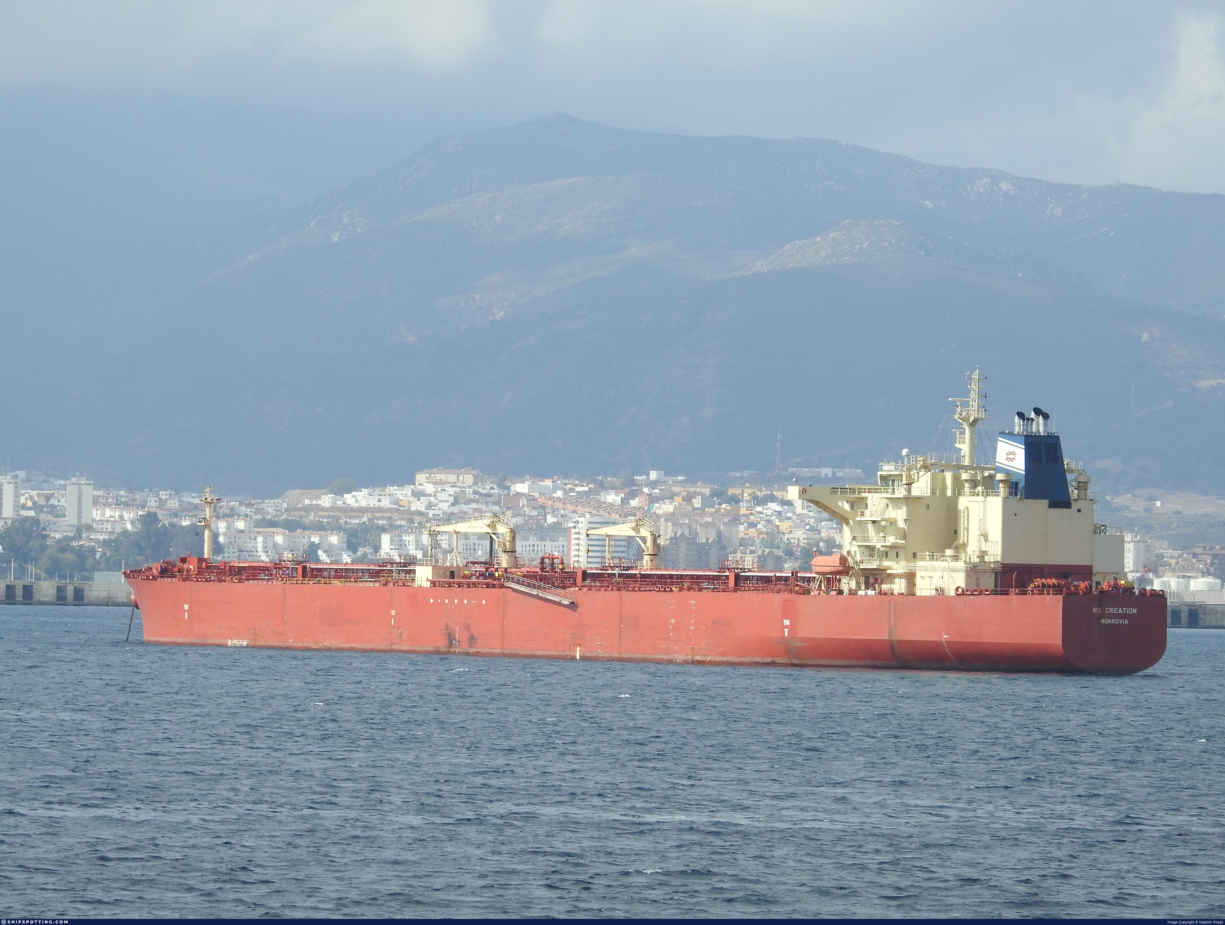
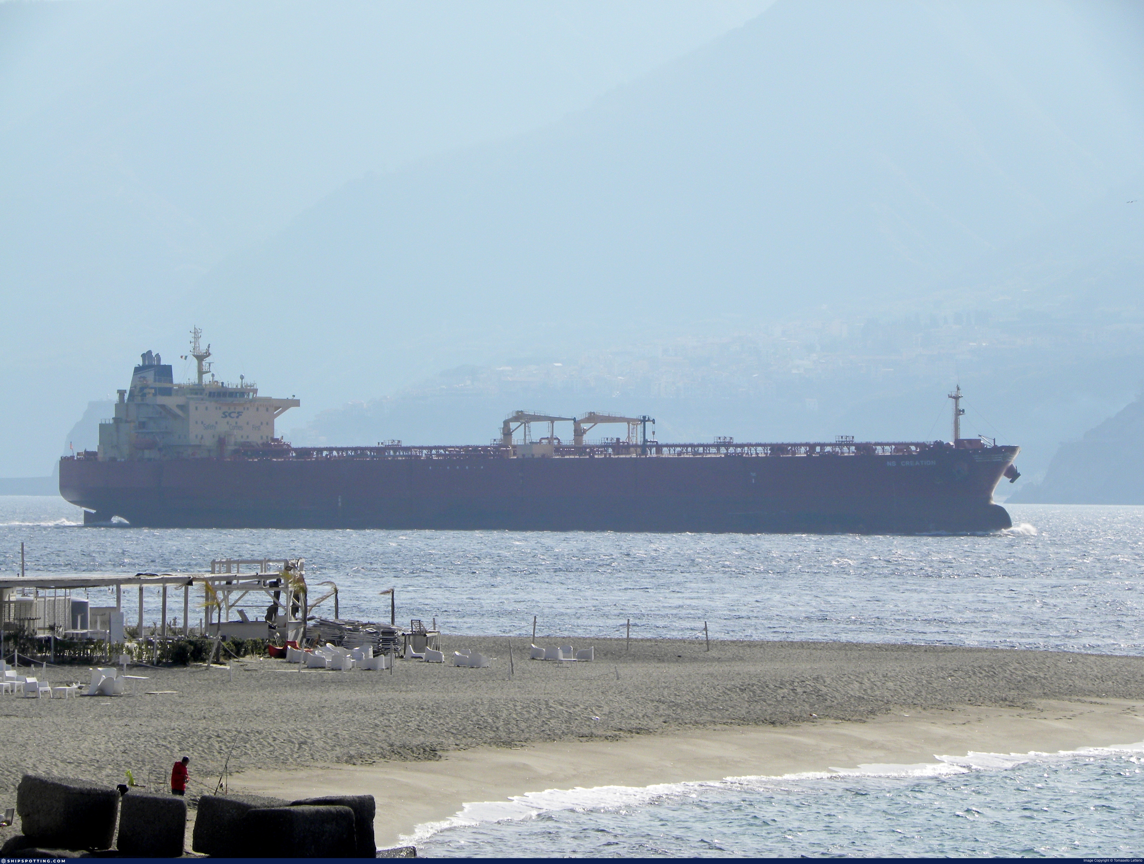
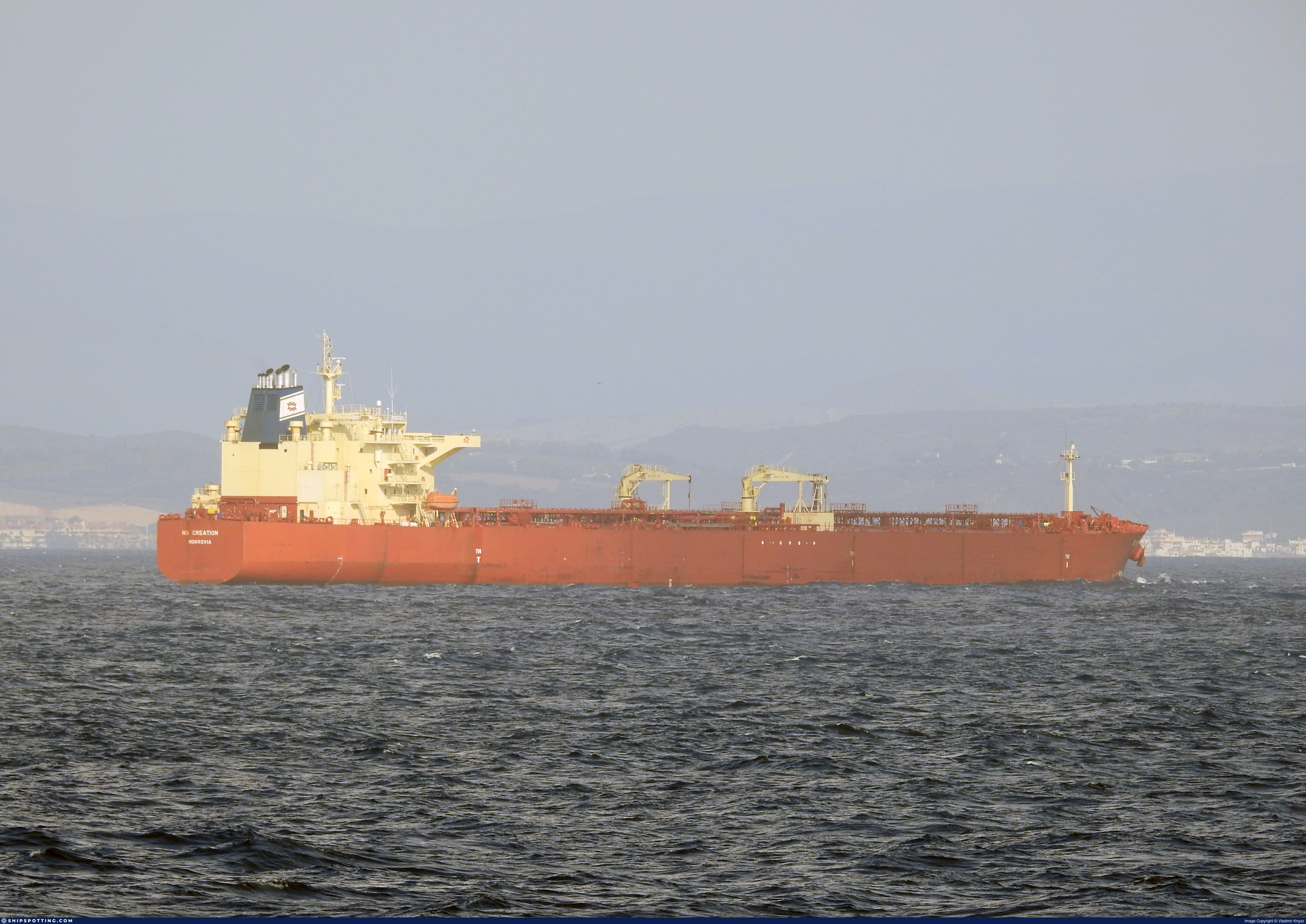
IMO 9312896
Vessel information
Sanctioned by
Company & Ownership
Management & Operations
Classification & Safety
Port State Control (PSC) Inspections
Survey Renewal & Certificates
| Code | Type | Issuer | Issued | Expires |
|---|---|---|---|---|
| 509 | Document of Compliance | Indian Register of Shipping (150) | 25/07/2022 | 28/01/2026 |
Programs & Notes
SEMA (Canada) — vessel designations | RUSSIA-EO14024 | The Russia (Sanctions) (EU Exit) Regulations 2019 | Added in EU Sanctions Package 14 | (Council Decision (CFSP) 2024/1744, Annex XLII (new listing framework)) | Press Release | Official Journal
DateOfListing: 2024-06-25 || Secondary sanctions risk: See Section 11 of Executive Order 14024.; Vessel Registration Identification IMO 9312896; MMSI 626390000; Linked To: JOINT STOCK COMPANY SOVCOMFLOT. || DateDesignated: 2024-11-25 | Shipping sanctions: (see “Other information”) | Shipping sanctions: a specified ship is prohibited from being provided with access to or having its master or pilot cause it to enter a port in the UK, may have its registration on the UK Ship Register terminated, and a master or pilot of a specified ship may be given a port barring direction, a detention direction, and a port entry direction or a movement direction. | IMO 9312896 (“KRASNOYARSK”) is involved in activity whose object or effect is to destabilise Ukraine or undermine or threaten the territorial integrity, sovereignty or independence of Ukraine or to obtain a benefit from or support the Government of Russia. Namely, KRASNOYARSK has been involved in carrying oil or oil products that originated in Russia from Russia to a third country.
Vessel Changes
AIS Events
50 events detected • 17 zones • Last: Jun 18, 2026
- Zone: discovered_063
- Duration: 1h 20m
- Data Points: 18 AIS positions
- Period: 2026-06-18T19:15:46+00:00 to 2026-06-18T20:35:46+00:00
Show Raw Evidence JSON
{
    "zone_id": "discovered_063",
    "zone_name": "Skagerrak Monitoring Zone",
    "dwell_minutes": 80,
    "points_in_zone": 18,
    "first_point": {
        "ts": "2026-06-18T19:15:46+00:00",
        "lat": 36.9945000000000021600499167107045650482177734375,
        "lon": 1.7237682999999999200468892013304866850376129150390625
    },
    "last_point": {
        "ts": "2026-06-18T20:35:46+00:00",
        "lat": 37.06667999999999807414496899582445621490478515625,
        "lon": 2.05944169999999981968130668974481523036956787109375
    }
}- Zone: Gulf of Oman Sanctioned Vessel Monitoring Zone
- Duration: 1h 48m
- Data Points: 27 AIS positions
- Period: 2026-06-18T19:15:46+00:00 to 2026-06-18T21:04:27+00:00
Show Raw Evidence JSON
{
    "zone_id": "discovered_032",
    "zone_name": "Gulf of Oman Sanctioned Vessel Monitoring Zone",
    "dwell_minutes": 108.7000000000000028421709430404007434844970703125,
    "points_in_zone": 27,
    "first_point": {
        "ts": "2026-06-18T19:15:46+00:00",
        "lat": 36.9945000000000021600499167107045650482177734375,
        "lon": 1.7237682999999999200468892013304866850376129150390625
    },
    "last_point": {
        "ts": "2026-06-18T21:04:27+00:00",
        "lat": 37.08799330000000082918631960637867450714111328125,
        "lon": 2.17948830000000004503135642153210937976837158203125
    }
}- Zone: discovered_111
- Duration: 1h 11m
- Data Points: 5 AIS positions
- Period: 2026-06-18T15:03:26+00:00 to 2026-06-18T16:15:07+00:00
Show Raw Evidence JSON
{
    "zone_id": "discovered_111",
    "zone_name": "Northern Baltic Sea Surveillance Zone",
    "dwell_minutes": 71.7000000000000028421709430404007434844970703125,
    "points_in_zone": 5,
    "first_point": {
        "ts": "2026-06-18T15:03:26+00:00",
        "lat": 36.77218330000000179325070348568260669708251953125,
        "lon": 0.7063582999999999945117679089889861643314361572265625
    },
    "last_point": {
        "ts": "2026-06-18T16:15:07+00:00",
        "lat": 36.81850670000000036452547647058963775634765625,
        "lon": 0.98051999999999994717114759623655118048191070556640625
    }
}- Zone: discovered_111
- Duration: 2h 14m
- Data Points: 28 AIS positions
- Period: 2026-06-18T14:00:26+00:00 to 2026-06-18T16:15:07+00:00
Show Raw Evidence JSON
{
    "zone_id": "discovered_111",
    "zone_name": "Northern Baltic Sea Surveillance Zone",
    "dwell_minutes": 134.69999999999998863131622783839702606201171875,
    "points_in_zone": 28,
    "first_point": {
        "ts": "2026-06-18T14:00:26+00:00",
        "lat": 36.75217169999999811125235282815992832183837890625,
        "lon": 0.460229999999999972448705420902115292847156524658203125
    },
    "last_point": {
        "ts": "2026-06-18T16:15:07+00:00",
        "lat": 36.81850670000000036452547647058963775634765625,
        "lon": 0.98051999999999994717114759623655118048191070556640625
    }
}- Zone: discovered_111
- Duration: 3h 3m
- Data Points: 48 AIS positions
- Period: 2026-06-18T13:11:46+00:00 to 2026-06-18T16:15:07+00:00
Show Raw Evidence JSON
{
    "zone_id": "discovered_111",
    "zone_name": "Northern Baltic Sea Surveillance Zone",
    "dwell_minutes": 183.30000000000001136868377216160297393798828125,
    "points_in_zone": 48,
    "first_point": {
        "ts": "2026-06-18T13:11:46+00:00",
        "lat": 36.71779169999999936635504127480089664459228515625,
        "lon": 0.26786670000000001312656650043209083378314971923828125
    },
    "last_point": {
        "ts": "2026-06-18T16:15:07+00:00",
        "lat": 36.81850670000000036452547647058963775634765625,
        "lon": 0.98051999999999994717114759623655118048191070556640625
    }
}- Zone: discovered_111
- Duration: 4h 56m
- Data Points: 50 AIS positions
- Period: 2026-06-18T11:18:47+00:00 to 2026-06-18T16:15:07+00:00
Show Raw Evidence JSON
{
    "zone_id": "discovered_111",
    "zone_name": "Northern Baltic Sea Surveillance Zone",
    "dwell_minutes": 296.30000000000001136868377216160297393798828125,
    "points_in_zone": 50,
    "first_point": {
        "ts": "2026-06-18T11:18:47+00:00",
        "lat": 36.62181170000000207664925255812704563140869140625,
        "lon": -0.1931267000000000122472698649289668537676334381103515625
    },
    "last_point": {
        "ts": "2026-06-18T16:15:07+00:00",
        "lat": 36.81850670000000036452547647058963775634765625,
        "lon": 0.98051999999999994717114759623655118048191070556640625
    }
}- Zone: Atlantic Midway Monitoring Zone
- Duration: 1h 13m
- Data Points: 7 AIS positions
- Period: 2026-06-18T10:12:06+00:00 to 2026-06-18T11:25:06+00:00
Show Raw Evidence JSON
{
    "zone_id": "discovered_079",
    "zone_name": "Atlantic Midway Monitoring Zone",
    "dwell_minutes": 73,
    "points_in_zone": 7,
    "first_point": {
        "ts": "2026-06-18T10:12:06+00:00",
        "lat": 36.56659669999999806577761773951351642608642578125,
        "lon": -0.4700699999999999878497192185022868216037750244140625
    },
    "last_point": {
        "ts": "2026-06-18T11:25:06+00:00",
        "lat": 36.62717500000000114823706098832190036773681640625,
        "lon": -0.1670516999999999974146902559368754737079143524169921875
    }
}- Zone: Strait of Gibraltar Surveillance Zone
- Duration: 1h 19m
- Data Points: 25 AIS positions
- Period: 2026-06-17T16:03:04+00:00 to 2026-06-17T17:22:46+00:00
Show Raw Evidence JSON
{
    "zone_id": "discovered_001",
    "zone_name": "Strait of Gibraltar Surveillance Zone",
    "dwell_minutes": 79.7000000000000028421709430404007434844970703125,
    "points_in_zone": 25,
    "first_point": {
        "ts": "2026-06-17T16:03:04+00:00",
        "lat": 36.03690830000000033805918064899742603302001953125,
        "lon": -4.99080830000000030821638574707321822643280029296875
    },
    "last_point": {
        "ts": "2026-06-17T17:22:46+00:00",
        "lat": 36.06638170000000087611624621786177158355712890625,
        "lon": -4.6085849999999997095301296212710440158843994140625
    }
}- Zone: Strait of Gibraltar Surveillance Zone
- Duration: 1h 49m
- Data Points: 36 AIS positions
- Period: 2026-06-17T15:32:58+00:00 to 2026-06-17T17:22:46+00:00
Show Raw Evidence JSON
{
    "zone_id": "discovered_001",
    "zone_name": "Strait of Gibraltar Surveillance Zone",
    "dwell_minutes": 109.7999999999999971578290569595992565155029296875,
    "points_in_zone": 36,
    "first_point": {
        "ts": "2026-06-17T15:32:58+00:00",
        "lat": 36.01099169999999816127456142567098140716552734375,
        "lon": -5.1418917000000003980630935984663665294647216796875
    },
    "last_point": {
        "ts": "2026-06-17T17:22:46+00:00",
        "lat": 36.06638170000000087611624621786177158355712890625,
        "lon": -4.6085849999999997095301296212710440158843994140625
    }
}- Zone: Ceuta/Gibraltar STS Zone
- Duration: 1h 5m
- Data Points: 23 AIS positions
- Period: 2026-06-17T14:15:51+00:00 to 2026-06-17T15:20:52+00:00
Show Raw Evidence JSON
{
    "zone_id": "osint_ceuta",
    "zone_name": "Ceuta\/Gibraltar STS Zone",
    "dwell_minutes": 65,
    "points_in_zone": 23,
    "first_point": {
        "ts": "2026-06-17T14:15:51+00:00",
        "lat": 35.93986170000000157642716658301651477813720703125,
        "lon": -5.49129999999999984794385454733856022357940673828125
    },
    "last_point": {
        "ts": "2026-06-17T15:20:52+00:00",
        "lat": 35.99813000000000329237082041800022125244140625,
        "lon": -5.2011500000000001620037437533028423786163330078125
    }
}- Zone: discovered_011
- Duration: 2h 46m
- Data Points: 20 AIS positions
- Period: 2026-06-17T03:02:21+00:00 to 2026-06-17T05:49:02+00:00
Show Raw Evidence JSON
{
    "zone_id": "discovered_011",
    "zone_name": "Atlantic Iberian Monitoring Zone",
    "dwell_minutes": 166.69999999999998863131622783839702606201171875,
    "points_in_zone": 20,
    "first_point": {
        "ts": "2026-06-17T03:02:21+00:00",
        "lat": 36.267290000000002692104317247867584228515625,
        "lon": -8.20707829999999916026354185305535793304443359375
    },
    "last_point": {
        "ts": "2026-06-17T05:49:02+00:00",
        "lat": 36.13354170000000209483914659358561038970947265625,
        "lon": -7.546926700000000209911377169191837310791015625
    }
}- Zone: discovered_011
- Duration: 2h 52m
- Data Points: 21 AIS positions
- Period: 2026-06-17T02:56:50+00:00 to 2026-06-17T05:49:02+00:00
Show Raw Evidence JSON
{
    "zone_id": "discovered_011",
    "zone_name": "Atlantic Iberian Monitoring Zone",
    "dwell_minutes": 172.19999999999998863131622783839702606201171875,
    "points_in_zone": 21,
    "first_point": {
        "ts": "2026-06-17T02:56:50+00:00",
        "lat": 36.2716716999999988502167980186641216278076171875,
        "lon": -8.2290167000000007391236067633144557476043701171875
    },
    "last_point": {
        "ts": "2026-06-17T05:49:02+00:00",
        "lat": 36.13354170000000209483914659358561038970947265625,
        "lon": -7.546926700000000209911377169191837310791015625
    }
}- Zone: discovered_011
- Duration: 4h 7m
- Data Points: 22 AIS positions
- Period: 2026-06-17T01:41:41+00:00 to 2026-06-17T05:49:02+00:00
Show Raw Evidence JSON
{
    "zone_id": "discovered_011",
    "zone_name": "Atlantic Iberian Monitoring Zone",
    "dwell_minutes": 247.30000000000001136868377216160297393798828125,
    "points_in_zone": 22,
    "first_point": {
        "ts": "2026-06-17T01:41:41+00:00",
        "lat": 36.3289333000000027595888241194188594818115234375,
        "lon": -8.5296967000000005754145604441873729228973388671875
    },
    "last_point": {
        "ts": "2026-06-17T05:49:02+00:00",
        "lat": 36.13354170000000209483914659358561038970947265625,
        "lon": -7.546926700000000209911377169191837310791015625
    }
}- Zone: discovered_011
- Duration: 6h 17m
- Data Points: 26 AIS positions
- Period: 2026-06-16T23:31:50+00:00 to 2026-06-17T05:49:02+00:00
Show Raw Evidence JSON
{
    "zone_id": "discovered_011",
    "zone_name": "Atlantic Iberian Monitoring Zone",
    "dwell_minutes": 377.19999999999998863131622783839702606201171875,
    "points_in_zone": 26,
    "first_point": {
        "ts": "2026-06-16T23:31:50+00:00",
        "lat": 36.4341016999999993686287780292332172393798828125,
        "lon": -9.04609669999999965739334584213793277740478515625
    },
    "last_point": {
        "ts": "2026-06-17T05:49:02+00:00",
        "lat": 36.13354170000000209483914659358561038970947265625,
        "lon": -7.546926700000000209911377169191837310791015625
    }
}- Gap Duration: 4h 6m
- Last Seen: 2026-06-16T08:07:40+00:00 at 39.2964, -10.1944 (Zone: discovered_012)
- Next Seen: 2026-06-16T12:14:09+00:00 at 38.4407, -10.1268
🛰️ Gap Corroboration
These are snapshots that may corroborate presence during the gap. They do not reconstruct a continuous route.
SAR Imagery (Sentinel-1)
Status: ✗ No SAR coverage
No Sentinel-1 scenes covering corridor and time window
VIIRS Thermal Anomaly
Status: ✗ No detections
No VIIRS thermal/light detections in corridor
Show Raw Evidence JSON
{
    "gap_minutes": 246.5,
    "last_seen": {
        "ts": "2026-06-16T08:07:40+00:00",
        "lat": 39.29637170000000168101905728690326213836669921875,
        "lon": -10.19437500000000085265128291212022304534912109375,
        "sog": 12.5999999999999996447286321199499070644378662109375,
        "zone_id": "discovered_012"
    },
    "next_seen": {
        "ts": "2026-06-16T12:14:09+00:00",
        "lat": 38.4407082999999971661964082159101963043212890625,
        "lon": -10.126773299999999977671905071474611759185791015625,
        "zone_ids": [
            "discovered_113"
        ]
    },
    "gap_enrichment": {
        "status": "not_found",
        "corridor": {
            "start": {
                "lat": 39.29637170000000168101905728690326213836669921875,
                "lon": -10.19437500000000085265128291212022304534912109375,
                "ts": "2026-06-16T08:07:40+00:00"
            },
            "end": {
                "lat": 38.4407082999999971661964082159101963043212890625,
                "lon": -10.126773299999999977671905071474611759185791015625,
                "ts": "2026-06-16T12:14:09+00:00"
            },
            "bbox": {
                "min_lat": 38.26052800000000075897332862950861454010009765625,
                "min_lon": -10.425793999999999783767634653486311435699462890625,
                "max_lat": 39.476551999999998088242136873304843902587890625,
                "max_lon": -9.8953539999999993170831658062525093555450439453125
            },
            "buffer_km": 20
        },
        "sar": {
            "status": "not_found",
            "notes": "No Sentinel-1 scenes covering corridor and time window"
        },
        "viirs": {
            "status": "not_found",
            "notes": "No VIIRS thermal\/light detections in corridor"
        },
        "searched_at": "2026-06-16T12:30:01.365879+00:00"
    }
}- Zone: discovered_012
- Duration: 3h 4m
- Data Points: 3 AIS positions
- Period: 2026-06-16T05:03:31+00:00 to 2026-06-16T08:07:40+00:00
Show Raw Evidence JSON
{
    "zone_id": "discovered_012",
    "zone_name": "Central Atlantic Monitoring Zone",
    "dwell_minutes": 184.19999999999998863131622783839702606201171875,
    "points_in_zone": 3,
    "first_point": {
        "ts": "2026-06-16T05:03:31+00:00",
        "lat": 39.93837669999999917536115390248596668243408203125,
        "lon": -10.19836169999999953006408759392797946929931640625
    },
    "last_point": {
        "ts": "2026-06-16T08:07:40+00:00",
        "lat": 39.29637170000000168101905728690326213836669921875,
        "lon": -10.19437500000000085265128291212022304534912109375
    }
}- Zone: Central Atlantic Monitoring Zone
- Duration: 1h 37m
- Data Points: 6 AIS positions
- Period: 2026-06-14T13:11:20+00:00 to 2026-06-14T14:48:20+00:00
Show Raw Evidence JSON
{
    "zone_id": "discovered_059",
    "zone_name": "Central Atlantic Monitoring Zone",
    "dwell_minutes": 97,
    "points_in_zone": 6,
    "first_point": {
        "ts": "2026-06-14T13:11:20+00:00",
        "lat": 48.11912829999999985375325195491313934326171875,
        "lon": -6.43674169999999978841742631630040705204010009765625
    },
    "last_point": {
        "ts": "2026-06-14T14:48:20+00:00",
        "lat": 47.83771829999999880556060816161334514617919921875,
        "lon": -6.657173300000000182308212970383465290069580078125
    }
}- Zone: Brittany Channel Monitoring Zone
- Duration: 1h 11m
- Data Points: 2 AIS positions
- Period: 2026-06-14T12:00:11+00:00 to 2026-06-14T13:11:20+00:00
Show Raw Evidence JSON
{
    "zone_id": "discovered_081",
    "zone_name": "Brittany Channel Monitoring Zone",
    "dwell_minutes": 71.2000000000000028421709430404007434844970703125,
    "points_in_zone": 2,
    "first_point": {
        "ts": "2026-06-14T12:00:11+00:00",
        "lat": 48.32322500000000076170181273482739925384521484375,
        "lon": -6.27356330000000017577121980139054358005523681640625
    },
    "last_point": {
        "ts": "2026-06-14T13:11:20+00:00",
        "lat": 48.11912829999999985375325195491313934326171875,
        "lon": -6.43674169999999978841742631630040705204010009765625
    }
}- Zone: Brittany Channel Monitoring Zone
- Duration: 2h 7m
- Data Points: 30 AIS positions
- Period: 2026-06-14T11:04:20+00:00 to 2026-06-14T13:11:20+00:00
Show Raw Evidence JSON
{
    "zone_id": "discovered_081",
    "zone_name": "Brittany Channel Monitoring Zone",
    "dwell_minutes": 127,
    "points_in_zone": 30,
    "first_point": {
        "ts": "2026-06-14T11:04:20+00:00",
        "lat": 48.49089500000000185764292837120592594146728515625,
        "lon": -6.13267000000000006565414878423325717449188232421875
    },
    "last_point": {
        "ts": "2026-06-14T13:11:20+00:00",
        "lat": 48.11912829999999985375325195491313934326171875,
        "lon": -6.43674169999999978841742631630040705204010009765625
    }
}- Zone: Brittany Channel Monitoring Zone
- Duration: 3h 11m
- Data Points: 50 AIS positions
- Period: 2026-06-14T10:00:11+00:00 to 2026-06-14T13:11:20+00:00
Show Raw Evidence JSON
{
    "zone_id": "discovered_081",
    "zone_name": "Brittany Channel Monitoring Zone",
    "dwell_minutes": 191.19999999999998863131622783839702606201171875,
    "points_in_zone": 50,
    "first_point": {
        "ts": "2026-06-14T10:00:11+00:00",
        "lat": 48.7017799999999994042809703387320041656494140625,
        "lon": -5.96742330000000009704308467917144298553466796875
    },
    "last_point": {
        "ts": "2026-06-14T13:11:20+00:00",
        "lat": 48.11912829999999985375325195491313934326171875,
        "lon": -6.43674169999999978841742631630040705204010009765625
    }
}- Zone: Brittany Channel Monitoring Zone
- Duration: 4h 11m
- Data Points: 80 AIS positions
- Period: 2026-06-14T09:00:09+00:00 to 2026-06-14T13:11:20+00:00
Show Raw Evidence JSON
{
    "zone_id": "discovered_081",
    "zone_name": "Brittany Channel Monitoring Zone",
    "dwell_minutes": 251.19999999999998863131622783839702606201171875,
    "points_in_zone": 80,
    "first_point": {
        "ts": "2026-06-14T09:00:09+00:00",
        "lat": 48.9070999999999997953636921010911464691162109375,
        "lon": -5.79576500000000027768010113504715263843536376953125
    },
    "last_point": {
        "ts": "2026-06-14T13:11:20+00:00",
        "lat": 48.11912829999999985375325195491313934326171875,
        "lon": -6.43674169999999978841742631630040705204010009765625
    }
}- Zone: Brittany Channel Monitoring Zone
- Duration: 5h 10m
- Data Points: 124 AIS positions
- Period: 2026-06-14T08:00:32+00:00 to 2026-06-14T13:11:20+00:00
Show Raw Evidence JSON
{
    "zone_id": "discovered_081",
    "zone_name": "Brittany Channel Monitoring Zone",
    "dwell_minutes": 310.80000000000001136868377216160297393798828125,
    "points_in_zone": 124,
    "first_point": {
        "ts": "2026-06-14T08:00:32+00:00",
        "lat": 49.02589830000000148402250488288700580596923828125,
        "lon": -5.48864169999999962357151161995716392993927001953125
    },
    "last_point": {
        "ts": "2026-06-14T13:11:20+00:00",
        "lat": 48.11912829999999985375325195491313934326171875,
        "lon": -6.43674169999999978841742631630040705204010009765625
    }
}- Zone: Brittany Channel Monitoring Zone
- Duration: 6h 9m
- Data Points: 169 AIS positions
- Period: 2026-06-14T07:01:41+00:00 to 2026-06-14T13:11:20+00:00
Show Raw Evidence JSON
{
    "zone_id": "discovered_081",
    "zone_name": "Brittany Channel Monitoring Zone",
    "dwell_minutes": 369.6000000000000227373675443232059478759765625,
    "points_in_zone": 169,
    "first_point": {
        "ts": "2026-06-14T07:01:41+00:00",
        "lat": 49.12198000000000064346750150434672832489013671875,
        "lon": -5.2218166999999997557324604713357985019683837890625
    },
    "last_point": {
        "ts": "2026-06-14T13:11:20+00:00",
        "lat": 48.11912829999999985375325195491313934326171875,
        "lon": -6.43674169999999978841742631630040705204010009765625
    }
}- Zone: Brittany Channel Monitoring Zone
- Duration: 6h 31m
- Data Points: 182 AIS positions
- Period: 2026-06-14T06:40:12+00:00 to 2026-06-14T13:11:20+00:00
Show Raw Evidence JSON
{
    "zone_id": "discovered_081",
    "zone_name": "Brittany Channel Monitoring Zone",
    "dwell_minutes": 391.1000000000000227373675443232059478759765625,
    "points_in_zone": 182,
    "first_point": {
        "ts": "2026-06-14T06:40:12+00:00",
        "lat": 49.1547632999999990488504408858716487884521484375,
        "lon": -5.131228300000000075442585512064397335052490234375
    },
    "last_point": {
        "ts": "2026-06-14T13:11:20+00:00",
        "lat": 48.11912829999999985375325195491313934326171875,
        "lon": -6.43674169999999978841742631630040705204010009765625
    }
}- Zone: Northwest Iberian Sea Monitoring Zone
- Duration: 1h 14m
- Data Points: 53 AIS positions
- Period: 2026-06-14T05:01:53+00:00 to 2026-06-14T06:16:43+00:00
Show Raw Evidence JSON
{
    "zone_id": "discovered_087",
    "zone_name": "Northwest Iberian Sea Monitoring Zone",
    "dwell_minutes": 74.7999999999999971578290569595992565155029296875,
    "points_in_zone": 53,
    "first_point": {
        "ts": "2026-06-14T05:01:53+00:00",
        "lat": 49.314515000000000100044417195022106170654296875,
        "lon": -4.685468300000000141380951390601694583892822265625
    },
    "last_point": {
        "ts": "2026-06-14T06:16:43+00:00",
        "lat": 49.19114830000000182508301804773509502410888671875,
        "lon": -5.0305783000000001692342266323976218700408935546875
    }
}- Zone: Northwest Iberian Sea Monitoring Zone
- Duration: 2h 15m
- Data Points: 92 AIS positions
- Period: 2026-06-14T04:01:12+00:00 to 2026-06-14T06:16:43+00:00
Show Raw Evidence JSON
{
    "zone_id": "discovered_087",
    "zone_name": "Northwest Iberian Sea Monitoring Zone",
    "dwell_minutes": 135.5,
    "points_in_zone": 92,
    "first_point": {
        "ts": "2026-06-14T04:01:12+00:00",
        "lat": 49.41487829999999803476384840905666351318359375,
        "lon": -4.42036829999999980600478011183440685272216796875
    },
    "last_point": {
        "ts": "2026-06-14T06:16:43+00:00",
        "lat": 49.19114830000000182508301804773509502410888671875,
        "lon": -5.0305783000000001692342266323976218700408935546875
    }
}- Zone: Northwest Iberian Sea Monitoring Zone
- Duration: 3h 15m
- Data Points: 133 AIS positions
- Period: 2026-06-14T03:01:22+00:00 to 2026-06-14T06:16:43+00:00
Show Raw Evidence JSON
{
    "zone_id": "discovered_087",
    "zone_name": "Northwest Iberian Sea Monitoring Zone",
    "dwell_minutes": 195.30000000000001136868377216160297393798828125,
    "points_in_zone": 133,
    "first_point": {
        "ts": "2026-06-14T03:01:22+00:00",
        "lat": 49.51734330000000028348949854262173175811767578125,
        "lon": -4.16535999999999972942532622255384922027587890625
    },
    "last_point": {
        "ts": "2026-06-14T06:16:43+00:00",
        "lat": 49.19114830000000182508301804773509502410888671875,
        "lon": -5.0305783000000001692342266323976218700408935546875
    }
}- Zone: Northwest Iberian Sea Monitoring Zone
- Duration: 4h 14m
- Data Points: 175 AIS positions
- Period: 2026-06-14T02:02:11+00:00 to 2026-06-14T06:16:43+00:00
Show Raw Evidence JSON
{
    "zone_id": "discovered_087",
    "zone_name": "Northwest Iberian Sea Monitoring Zone",
    "dwell_minutes": 254.5,
    "points_in_zone": 175,
    "first_point": {
        "ts": "2026-06-14T02:02:11+00:00",
        "lat": 49.62869669999999899800968705676496028900146484375,
        "lon": -3.90440170000000019712160792551003396511077880859375
    },
    "last_point": {
        "ts": "2026-06-14T06:16:43+00:00",
        "lat": 49.19114830000000182508301804773509502410888671875,
        "lon": -5.0305783000000001692342266323976218700408935546875
    }
}- Zone: Northwest Iberian Sea Monitoring Zone
- Duration: 5h 15m
- Data Points: 212 AIS positions
- Period: 2026-06-14T01:01:24+00:00 to 2026-06-14T06:16:43+00:00
Show Raw Evidence JSON
{
    "zone_id": "discovered_087",
    "zone_name": "Northwest Iberian Sea Monitoring Zone",
    "dwell_minutes": 315.30000000000001136868377216160297393798828125,
    "points_in_zone": 212,
    "first_point": {
        "ts": "2026-06-14T01:01:24+00:00",
        "lat": 49.7503133000000019592334865592420101165771484375,
        "lon": -3.605928299999999975256059769890271127223968505859375
    },
    "last_point": {
        "ts": "2026-06-14T06:16:43+00:00",
        "lat": 49.19114830000000182508301804773509502410888671875,
        "lon": -5.0305783000000001692342266323976218700408935546875
    }
}- Zone: Northwest Iberian Sea Monitoring Zone
- Duration: 6h 16m
- Data Points: 231 AIS positions
- Period: 2026-06-14T00:00:42+00:00 to 2026-06-14T06:16:43+00:00
Show Raw Evidence JSON
{
    "zone_id": "discovered_087",
    "zone_name": "Northwest Iberian Sea Monitoring Zone",
    "dwell_minutes": 376,
    "points_in_zone": 231,
    "first_point": {
        "ts": "2026-06-14T00:00:42+00:00",
        "lat": 49.876208300000001827356754802167415618896484375,
        "lon": -3.27389829999999992793391356826759874820709228515625
    },
    "last_point": {
        "ts": "2026-06-14T06:16:43+00:00",
        "lat": 49.19114830000000182508301804773509502410888671875,
        "lon": -5.0305783000000001692342266323976218700408935546875
    }
}- Zone: Northwest Iberian Sea Monitoring Zone
- Duration: 6h 35m
- Data Points: 239 AIS positions
- Period: 2026-06-13T23:41:00+00:00 to 2026-06-14T06:16:43+00:00
Show Raw Evidence JSON
{
    "zone_id": "discovered_087",
    "zone_name": "Northwest Iberian Sea Monitoring Zone",
    "dwell_minutes": 395.69999999999998863131622783839702606201171875,
    "points_in_zone": 239,
    "first_point": {
        "ts": "2026-06-13T23:41:00+00:00",
        "lat": 49.912221700000003465902409516274929046630859375,
        "lon": -3.158148300000000130438593259896151721477508544921875
    },
    "last_point": {
        "ts": "2026-06-14T06:16:43+00:00",
        "lat": 49.19114830000000182508301804773509502410888671875,
        "lon": -5.0305783000000001692342266323976218700408935546875
    }
}- Zone: English Channel Surveillance Zone
- Duration: 1h 28m
- Data Points: 43 AIS positions
- Period: 2026-06-13T22:02:08+00:00 to 2026-06-13T23:30:12+00:00
Show Raw Evidence JSON
{
    "zone_id": "discovered_095",
    "zone_name": "English Channel Surveillance Zone",
    "dwell_minutes": 88.099999999999994315658113919198513031005859375,
    "points_in_zone": 43,
    "first_point": {
        "ts": "2026-06-13T22:02:08+00:00",
        "lat": 50.05301829999999796427800902165472507476806640625,
        "lon": -2.569076700000000101908881333656609058380126953125
    },
    "last_point": {
        "ts": "2026-06-13T23:30:12+00:00",
        "lat": 49.93404670000000322716005030088126659393310546875,
        "lon": -3.095648300000000130438593259896151721477508544921875
    }
}- Zone: English Channel Surveillance Zone
- Duration: 2h 8m
- Data Points: 49 AIS positions
- Period: 2026-06-13T21:21:38+00:00 to 2026-06-13T23:30:12+00:00
Show Raw Evidence JSON
{
    "zone_id": "discovered_095",
    "zone_name": "English Channel Surveillance Zone",
    "dwell_minutes": 128.599999999999994315658113919198513031005859375,
    "points_in_zone": 49,
    "first_point": {
        "ts": "2026-06-13T21:21:38+00:00",
        "lat": 50.08998170000000271784301730804145336151123046875,
        "lon": -2.340225000000000221689333557151257991790771484375
    },
    "last_point": {
        "ts": "2026-06-13T23:30:12+00:00",
        "lat": 49.93404670000000322716005030088126659393310546875,
        "lon": -3.095648300000000130438593259896151721477508544921875
    }
}- Zone: English Channel Surveillance Zone
- Duration: 2h 50m
- Data Points: 52 AIS positions
- Period: 2026-06-13T20:40:04+00:00 to 2026-06-13T23:30:12+00:00
Show Raw Evidence JSON
{
    "zone_id": "discovered_095",
    "zone_name": "English Channel Surveillance Zone",
    "dwell_minutes": 170.099999999999994315658113919198513031005859375,
    "points_in_zone": 52,
    "first_point": {
        "ts": "2026-06-13T20:40:04+00:00",
        "lat": 50.12786330000000134532456286251544952392578125,
        "lon": -2.124761700000000086419049694086425006389617919921875
    },
    "last_point": {
        "ts": "2026-06-13T23:30:12+00:00",
        "lat": 49.93404670000000322716005030088126659393310546875,
        "lon": -3.095648300000000130438593259896151721477508544921875
    }
}- Zone: discovered_124
- Duration: 1h 59m
- Data Points: 55 AIS positions
- Period: 2026-06-13T17:01:59+00:00 to 2026-06-13T19:01:28+00:00
Show Raw Evidence JSON
{
    "zone_id": "discovered_124",
    "zone_name": "English Channel Surveillance Zone",
    "dwell_minutes": 119.5,
    "points_in_zone": 55,
    "first_point": {
        "ts": "2026-06-13T17:01:59+00:00",
        "lat": 50.2840350000000029240254661999642848968505859375,
        "lon": -1.1989616999999999080728230183012783527374267578125
    },
    "last_point": {
        "ts": "2026-06-13T19:01:28+00:00",
        "lat": 50.2005300000000005411493475548923015594482421875,
        "lon": -1.6845366999999999979564790919539518654346466064453125
    }
}- Zone: discovered_124
- Duration: 2h 59m
- Data Points: 85 AIS positions
- Period: 2026-06-13T16:01:59+00:00 to 2026-06-13T19:01:28+00:00
Show Raw Evidence JSON
{
    "zone_id": "discovered_124",
    "zone_name": "English Channel Surveillance Zone",
    "dwell_minutes": 179.5,
    "points_in_zone": 85,
    "first_point": {
        "ts": "2026-06-13T16:01:59+00:00",
        "lat": 50.34071000000000140062184073030948638916015625,
        "lon": -0.91439000000000003609557097661308944225311279296875
    },
    "last_point": {
        "ts": "2026-06-13T19:01:28+00:00",
        "lat": 50.2005300000000005411493475548923015594482421875,
        "lon": -1.6845366999999999979564790919539518654346466064453125
    }
}- Zone: discovered_124
- Duration: 4 hours
- Data Points: 110 AIS positions
- Period: 2026-06-13T15:01:09+00:00 to 2026-06-13T19:01:28+00:00
Show Raw Evidence JSON
{
    "zone_id": "discovered_124",
    "zone_name": "English Channel Surveillance Zone",
    "dwell_minutes": 240.30000000000001136868377216160297393798828125,
    "points_in_zone": 110,
    "first_point": {
        "ts": "2026-06-13T15:01:09+00:00",
        "lat": 50.39712670000000116488081403076648712158203125,
        "lon": -0.58051500000000000323296944770845584571361541748046875
    },
    "last_point": {
        "ts": "2026-06-13T19:01:28+00:00",
        "lat": 50.2005300000000005411493475548923015594482421875,
        "lon": -1.6845366999999999979564790919539518654346466064453125
    }
}- Zone: discovered_124
- Duration: 5 hours
- Data Points: 134 AIS positions
- Period: 2026-06-13T14:00:49+00:00 to 2026-06-13T19:01:28+00:00
Show Raw Evidence JSON
{
    "zone_id": "discovered_124",
    "zone_name": "English Channel Surveillance Zone",
    "dwell_minutes": 300.6000000000000227373675443232059478759765625,
    "points_in_zone": 134,
    "first_point": {
        "ts": "2026-06-13T14:00:49+00:00",
        "lat": 50.45644829999999814162947586737573146820068359375,
        "lon": -0.23044670000000000431583657700684852898120880126953125
    },
    "last_point": {
        "ts": "2026-06-13T19:01:28+00:00",
        "lat": 50.2005300000000005411493475548923015594482421875,
        "lon": -1.6845366999999999979564790919539518654346466064453125
    }
}- Zone: discovered_124
- Duration: 5h 57m
- Data Points: 161 AIS positions
- Period: 2026-06-13T13:03:59+00:00 to 2026-06-13T19:01:28+00:00
Show Raw Evidence JSON
{
    "zone_id": "discovered_124",
    "zone_name": "English Channel Surveillance Zone",
    "dwell_minutes": 357.5,
    "points_in_zone": 161,
    "first_point": {
        "ts": "2026-06-13T13:03:59+00:00",
        "lat": 50.51200330000000349173205904662609100341796875,
        "lon": 0.10230329999999999979198861410623067058622837066650390625
    },
    "last_point": {
        "ts": "2026-06-13T19:01:28+00:00",
        "lat": 50.2005300000000005411493475548923015594482421875,
        "lon": -1.6845366999999999979564790919539518654346466064453125
    }
}- Zone: discovered_124
- Duration: 6h 31m
- Data Points: 176 AIS positions
- Period: 2026-06-13T12:30:19+00:00 to 2026-06-13T19:01:28+00:00
Show Raw Evidence JSON
{
    "zone_id": "discovered_124",
    "zone_name": "English Channel Surveillance Zone",
    "dwell_minutes": 391.1000000000000227373675443232059478759765625,
    "points_in_zone": 176,
    "first_point": {
        "ts": "2026-06-13T12:30:19+00:00",
        "lat": 50.54457000000000022055246517993509769439697265625,
        "lon": 0.297461699999999995558397358763613738119602203369140625
    },
    "last_point": {
        "ts": "2026-06-13T19:01:28+00:00",
        "lat": 50.2005300000000005411493475548923015594482421875,
        "lon": -1.6845366999999999979564790919539518654346466064453125
    }
}- Zone: discovered_132
- Duration: 1h 41m
- Data Points: 31 AIS positions
- Period: 2026-06-13T11:00:49+00:00 to 2026-06-13T12:42:08+00:00
Show Raw Evidence JSON
{
    "zone_id": "discovered_132",
    "zone_name": "English Channel Surveillance Zone",
    "dwell_minutes": 101.2999999999999971578290569595992565155029296875,
    "points_in_zone": 31,
    "first_point": {
        "ts": "2026-06-13T11:00:49+00:00",
        "lat": 50.66130170000000276786522590555250644683837890625,
        "lon": 0.76627670000000003280860028098686598241329193115234375
    },
    "last_point": {
        "ts": "2026-06-13T12:42:08+00:00",
        "lat": 50.533203299999996715996530838310718536376953125,
        "lon": 0.229093299999999999716493448431720025837421417236328125
    }
}- Zone: discovered_132
- Duration: 2h 40m
- Data Points: 57 AIS positions
- Period: 2026-06-13T10:02:08+00:00 to 2026-06-13T12:42:08+00:00
Show Raw Evidence JSON
{
    "zone_id": "discovered_132",
    "zone_name": "English Channel Surveillance Zone",
    "dwell_minutes": 160,
    "points_in_zone": 57,
    "first_point": {
        "ts": "2026-06-13T10:02:08+00:00",
        "lat": 50.77379330000000123845893540419638156890869140625,
        "lon": 1.0102816999999999492132474188110791146755218505859375
    },
    "last_point": {
        "ts": "2026-06-13T12:42:08+00:00",
        "lat": 50.533203299999996715996530838310718536376953125,
        "lon": 0.229093299999999999716493448431720025837421417236328125
    }
}- Zone: discovered_132
- Duration: 3h 2m
- Data Points: 67 AIS positions
- Period: 2026-06-13T09:39:38+00:00 to 2026-06-13T12:42:08+00:00
Show Raw Evidence JSON
{
    "zone_id": "discovered_132",
    "zone_name": "English Channel Surveillance Zone",
    "dwell_minutes": 182.5,
    "points_in_zone": 67,
    "first_point": {
        "ts": "2026-06-13T09:39:38+00:00",
        "lat": 50.81468499999999721694621257483959197998046875,
        "lon": 1.0983650000000000357402996087330393493175506591796875
    },
    "last_point": {
        "ts": "2026-06-13T12:42:08+00:00",
        "lat": 50.533203299999996715996530838310718536376953125,
        "lon": 0.229093299999999999716493448431720025837421417236328125
    }
}- Zone: Archipelago Sea Sanction Zone
- Duration: 1h 2m
- Data Points: 27 AIS positions
- Period: 2026-06-13T07:00:05+00:00 to 2026-06-13T08:02:48+00:00
Show Raw Evidence JSON
{
    "zone_id": "discovered_002",
    "zone_name": "Archipelago Sea Sanction Zone",
    "dwell_minutes": 62.7000000000000028421709430404007434844970703125,
    "points_in_zone": 27,
    "first_point": {
        "ts": "2026-06-13T07:00:05+00:00",
        "lat": 51.16816330000000334621290676295757293701171875,
        "lon": 1.699156700000000075334583016228862106800079345703125
    },
    "last_point": {
        "ts": "2026-06-13T08:02:48+00:00",
        "lat": 51.01462000000000074351191869936883449554443359375,
        "lon": 1.4382099999999999884181534071103669703006744384765625
    }
}- Zone: Archipelago Sea Sanction Zone
- Duration: 1h 57m
- Data Points: 45 AIS positions
- Period: 2026-06-13T06:05:31+00:00 to 2026-06-13T08:02:48+00:00
Show Raw Evidence JSON
{
    "zone_id": "discovered_002",
    "zone_name": "Archipelago Sea Sanction Zone",
    "dwell_minutes": 117.2999999999999971578290569595992565155029296875,
    "points_in_zone": 45,
    "first_point": {
        "ts": "2026-06-13T06:05:31+00:00",
        "lat": 51.3501449999999977080733515322208404541015625,
        "lon": 1.8877600000000001045918907038867473602294921875
    },
    "last_point": {
        "ts": "2026-06-13T08:02:48+00:00",
        "lat": 51.01462000000000074351191869936883449554443359375,
        "lon": 1.4382099999999999884181534071103669703006744384765625
    }
}- Zone: Archipelago Sea Sanction Zone
- Duration: 2h 18m
- Data Points: 49 AIS positions
- Period: 2026-06-13T05:43:54+00:00 to 2026-06-13T08:02:48+00:00
Show Raw Evidence JSON
{
    "zone_id": "discovered_002",
    "zone_name": "Archipelago Sea Sanction Zone",
    "dwell_minutes": 138.900000000000005684341886080801486968994140625,
    "points_in_zone": 49,
    "first_point": {
        "ts": "2026-06-13T05:43:54+00:00",
        "lat": 51.4278182999999984303940436802804470062255859375,
        "lon": 1.955035000000000078301809480763040482997894287109375
    },
    "last_point": {
        "ts": "2026-06-13T08:02:48+00:00",
        "lat": 51.01462000000000074351191869936883449554443359375,
        "lon": 1.4382099999999999884181534071103669703006744384765625
    }
}- Zone: Archipelago Sea Sanction Zone
- Duration: 5h 47m
- Data Points: 55 AIS positions
- Period: 2026-06-13T02:15:37+00:00 to 2026-06-13T08:02:48+00:00
Show Raw Evidence JSON
{
    "zone_id": "discovered_002",
    "zone_name": "Archipelago Sea Sanction Zone",
    "dwell_minutes": 347.19999999999998863131622783839702606201171875,
    "points_in_zone": 55,
    "first_point": {
        "ts": "2026-06-13T02:15:37+00:00",
        "lat": 52.0477216999999967583789839409291744232177734375,
        "lon": 2.61773170000000021673258743248879909515380859375
    },
    "last_point": {
        "ts": "2026-06-13T08:02:48+00:00",
        "lat": 51.01462000000000074351191869936883449554443359375,
        "lon": 1.4382099999999999884181534071103669703006744384765625
    }
}- Zone: Central Black Sea Monitoring Zone
- Duration: 1h 17m
- Data Points: 13 AIS positions
- Period: 2026-06-11T17:38:26+00:00 to 2026-06-11T18:55:57+00:00
Show Raw Evidence JSON
{
    "zone_id": "discovered_040",
    "zone_name": "Central Black Sea Monitoring Zone",
    "dwell_minutes": 77.5,
    "points_in_zone": 13,
    "first_point": {
        "ts": "2026-06-11T17:38:26+00:00",
        "lat": 58.84073000000000064346750150434672832489013671875,
        "lon": 4.00813329999999989894376994925551116466522216796875
    },
    "last_point": {
        "ts": "2026-06-11T18:55:57+00:00",
        "lat": 58.57568830000000303925844491459429264068603515625,
        "lon": 3.97003500000000020264678823878057301044464111328125
    }
}- Zone: Southern Baltic Surveillance Zone
- Duration: 1h 19m
- Data Points: 15 AIS positions
- Period: 2026-06-10T16:10:07+00:00 to 2026-06-10T17:29:47+00:00
Show Raw Evidence JSON
{
    "zone_id": "discovered_093",
    "zone_name": "Southern Baltic Surveillance Zone",
    "dwell_minutes": 79.7000000000000028421709430404007434844970703125,
    "points_in_zone": 15,
    "first_point": {
        "ts": "2026-06-10T16:10:07+00:00",
        "lat": 63.65175330000000286645445157773792743682861328125,
        "lon": 4.75512829999999997454551703413017094135284423828125
    },
    "last_point": {
        "ts": "2026-06-10T17:29:47+00:00",
        "lat": 63.4497683000000023412212613038718700408935546875,
        "lon": 4.52662829999999960506329443887807428836822509765625
    }
}- Zone: Southern Baltic Surveillance Zone
- Duration: 1h 36m
- Data Points: 17 AIS positions
- Period: 2026-06-10T15:53:06+00:00 to 2026-06-10T17:29:47+00:00
Show Raw Evidence JSON
{
    "zone_id": "discovered_093",
    "zone_name": "Southern Baltic Surveillance Zone",
    "dwell_minutes": 96.7000000000000028421709430404007434844970703125,
    "points_in_zone": 17,
    "first_point": {
        "ts": "2026-06-10T15:53:06+00:00",
        "lat": 63.69432330000000064273990574292838573455810546875,
        "lon": 4.803876699999999999590727384202182292938232421875
    },
    "last_point": {
        "ts": "2026-06-10T17:29:47+00:00",
        "lat": 63.4497683000000023412212613038718700408935546875,
        "lon": 4.52662829999999960506329443887807428836822509765625
    }
}Source snapshot
| Sanctioner | As of | Entity ID |
|---|---|---|
| 🇬🇧 UK | 2025-09-29 | 9312896 |
| 🇺🇸 US | 2025-09-29 | 9312896 |
We mirror official lists; always verify at the source.
Sanctioned on the same day
- AKADEMIK ALEKSANDR KARPINSKIY · IMO 8227238 🇺🇸 US
- AKADEMIK LAZAREV · IMO 8408985 🇺🇸 US
- AKADEMIK PRIMAKOV · IMO 9187514 🇺🇸 US
- ALEKSANDR SOKOLOV · IMO 9889198 🇺🇸 US
- Alireza 1 · IMO 6703769 🇨🇦 CA🇺🇸 US
- Anatoly Kolodkin · IMO 9610808 🇨🇦 CA🇪🇺 EU🇬🇧 UK🇺🇸 US
- Antarktika · IMO 9413559 🇨🇦 CA🇪🇺 EU🇳🇿 NZ🇬🇧 UK🇺🇸 US
- BALTIYSKIY-111 · IMO 7612448 🇨🇦 CA🇬🇧 UK🇺🇸 US