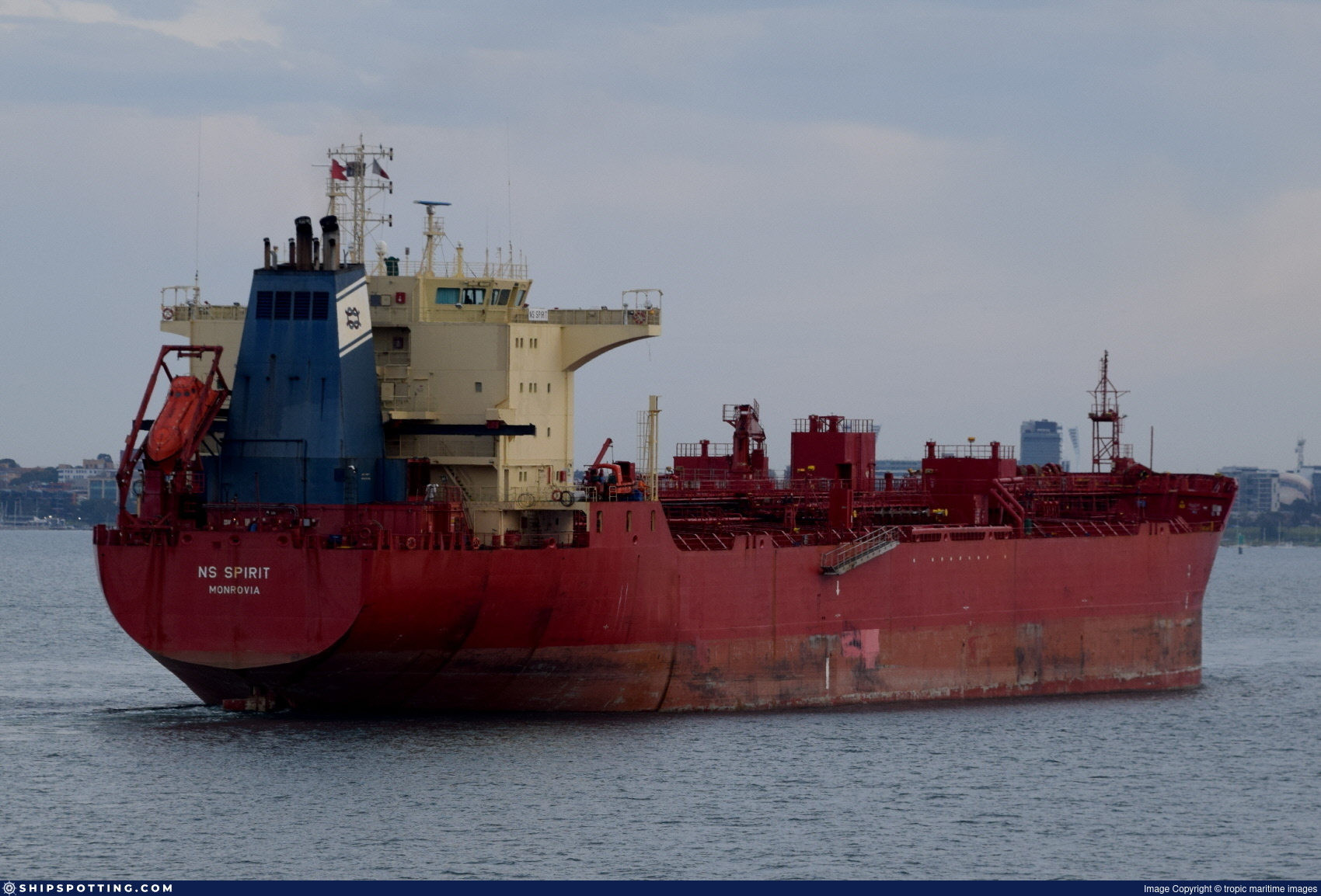
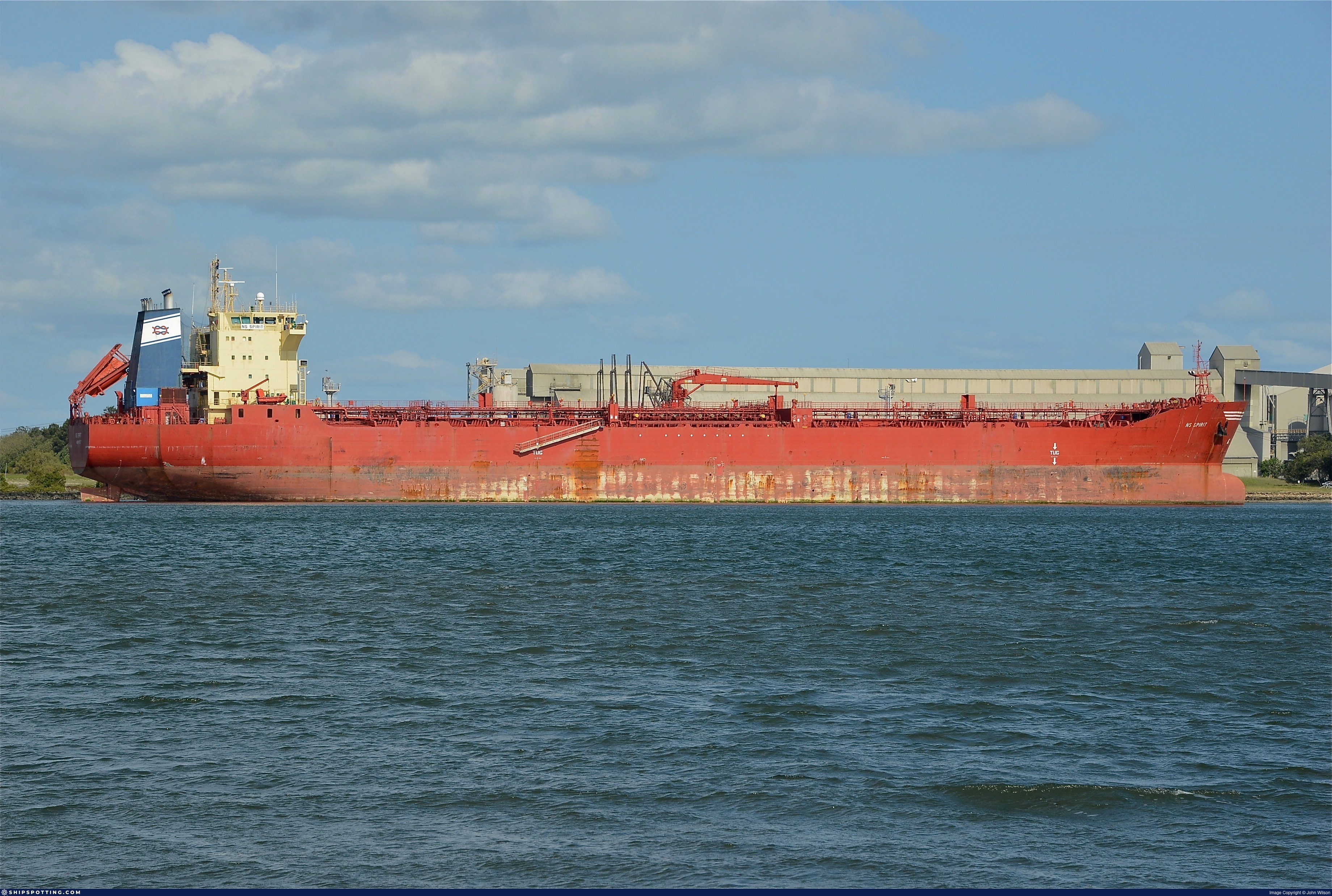
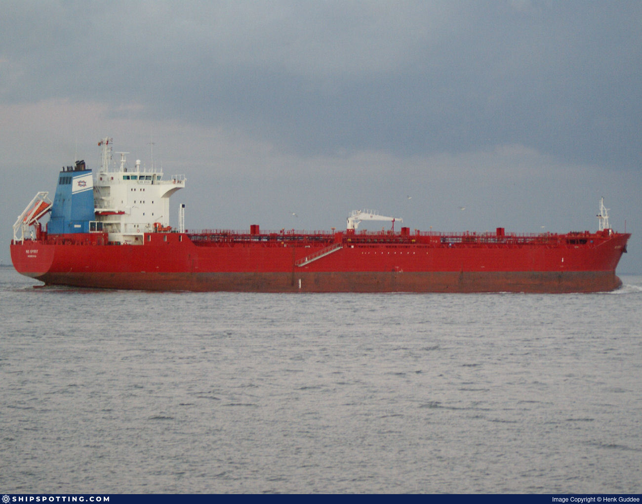
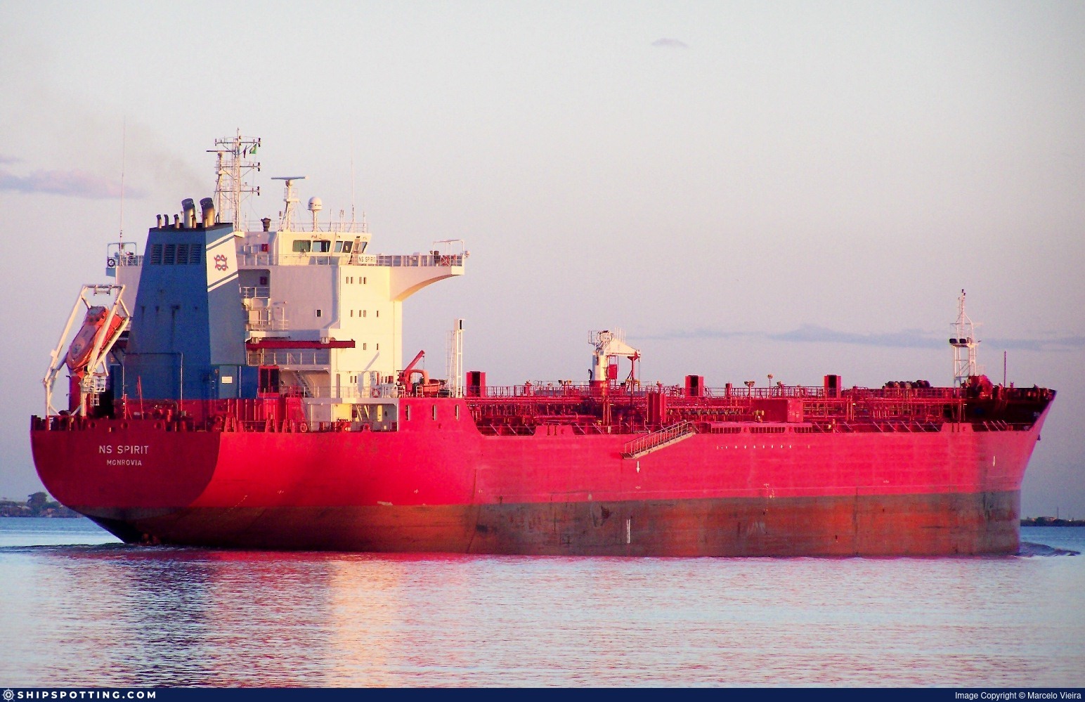
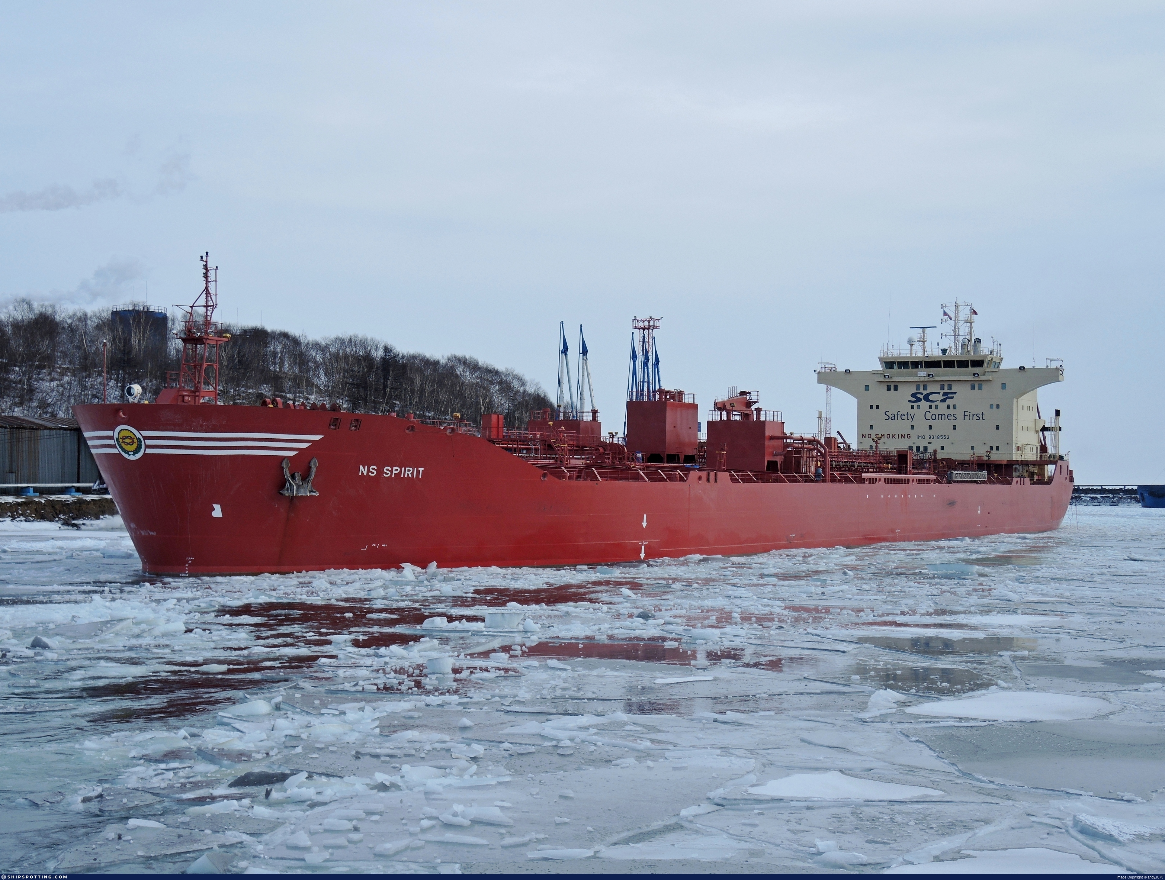
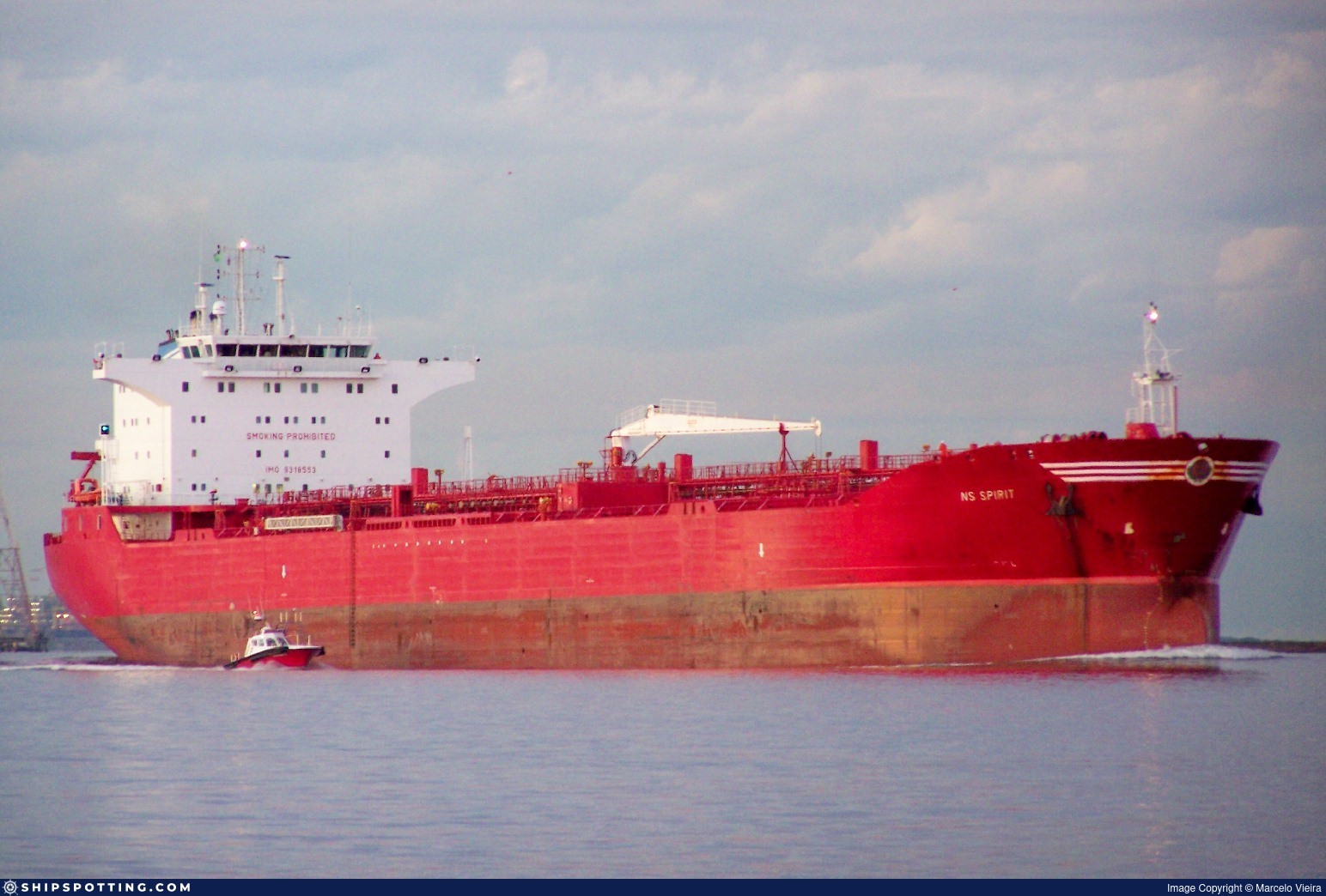
IMO 9318553
Vessel information
Sanctioned by
Company & Ownership
Management & Operations
Classification & Safety
Port State Control (PSC) Inspections
Survey Renewal & Certificates
| Code | Type | Issuer | Issued | Expires |
|---|---|---|---|---|
| 510 | Safety Management Certificate | Liberia (LR) | 20/07/2022 | 23/01/2027 |
| 510 | Safety Management Certificate | Liberia (LR) | 20/04/2022 | 23/01/2027 |
Programs & Notes
SEMA (Canada) — vessel designations | UKRAINE-EO13662] [RUSSIA-EO14024 | The Russia (Sanctions) (EU Exit) Regulations 2019 | Added in EU Sanctions Package 14 | (Council Decision (CFSP) 2024/1744, Annex XLII (new listing framework)) | Press Release | Official Journal
DateOfListing: 2024-06-25 || Secondary sanctions risk: See Section 11 of Executive Order 14024.; alt. Secondary sanctions risk: Ukraine-/Russia-Related Sanctions Regulations, 31 CFR 589.201 and/or 589.209; Vessel Registration Identification IMO 9318553; MMSI 314894000; Linked To: JOINT STOCK COMPANY SOVCOMFLOT. || DateDesignated: 2025-07-21 | Shipping sanctions: (see “Other information”) | Shipping sanctions: a specified ship is prohibited from being provided with access to or having its master or pilot cause it to enter a port in the UK, may have its registration on the UK Ship Register terminated, and a master or pilot of a specified ship may be given a port barring direction, a detention direction, and a port entry direction or a movement direction. | IMO 9318553 (“Saga”) is, has been or is likely to be involved in activity whose object or effect is to destabilise Ukraine or undermine or threaten the territorial integrity, sovereignty or independence of Ukraine or to obtain a benefit from or support the Government of Russia. Namely, 9318553 is involved in carrying oil or oil products that originated in Russia from Russia to a third country.
Vessel Changes
AIS Events
50 events detected • 6 zones • Last: May 26, 2026
- Gap Duration: 4h 7m
- Last Seen: 2026-05-26T08:46:07+00:00 at 67.7930, 9.6752 (Zone: Southern Öresund Monitoring Zone)
- Next Seen: 2026-05-26T12:53:48+00:00 at 68.4046, 10.9222
🛰️ Gap Corroboration
These are snapshots that may corroborate presence during the gap. They do not reconstruct a continuous route.
SAR Imagery (Sentinel-1)
Status: ✓ Snapshot available
SAR snapshot available for review
Scene: S1D_IW_GRDH_1SDV_20260526T055317_20260526T055342_002951_0050F7_6B0D_COG • Time: 2026-05-26T05:53:17.127068Z
SAR coverage thumbnail
VIIRS Thermal Anomaly
Status: ✗ No detections
No VIIRS thermal/light detections in corridor
Show Raw Evidence JSON
{
    "gap_minutes": 247.69999999999998863131622783839702606201171875,
    "last_seen": {
        "ts": "2026-05-26T08:46:07+00:00",
        "lat": 67.7930132999999983667294145561754703521728515625,
        "lon": 9.6751599999999999823785401531495153903961181640625,
        "sog": 12,
        "zone_id": "discovered_061"
    },
    "next_seen": {
        "ts": "2026-05-26T12:53:48+00:00",
        "lat": 68.40462170000000696745701134204864501953125,
        "lon": 10.922245000000000203499439521692693233489990234375,
        "zone_ids": [
            "discovered_215"
        ]
    },
    "gap_enrichment": {
        "status": "done",
        "corridor": {
            "start": {
                "lat": 67.7930132999999983667294145561754703521728515625,
                "lon": 9.6751599999999999823785401531495153903961181640625,
                "ts": "2026-05-26T08:46:07+00:00"
            },
            "end": {
                "lat": 68.40462170000000696745701134204864501953125,
                "lon": 10.922245000000000203499439521692693233489990234375,
                "ts": "2026-05-26T12:53:48+00:00"
            },
            "bbox": {
                "min_lat": 67.612832999999994854078977368772029876708984375,
                "min_lon": 9.1921119999999998384510035975836217403411865234375,
                "max_lat": 68.584801999999996269252733327448368072509765625,
                "max_lon": 11.405293000000000347426976077258586883544921875
            },
            "buffer_km": 20
        },
        "sar": {
            "status": "snapshot",
            "scene_id": "S1D_IW_GRDH_1SDV_20260526T055317_20260526T055342_002951_0050F7_6B0D_COG",
            "scene_time": "2026-05-26T05:53:17.127068Z",
            "platform": "sentinel-1d",
            "assets": {
                "preview_url": "https:\/\/fleetleaks.com\/wp-content\/uploads\/fleetleaks-evidence\/sar-imagery\/2026\/05\/event_618043_thumbnail_20260526131507.png",
                "stored_path": "\/home\/fleetleaks\/public_html\/wp-content\/uploads\/fleetleaks-evidence\/sar-imagery\/2026\/05\/event_618043_thumbnail_20260526131507.png",
                "source": "copernicus_dataspace"
            },
            "notes": "SAR snapshot available for review"
        },
        "viirs": {
            "status": "not_found",
            "notes": "No VIIRS thermal\/light detections in corridor"
        },
        "searched_at": "2026-05-26T13:15:01.976753+00:00"
    }
}- Zone: Southern Öresund Monitoring Zone
- Duration: 1h 36m
- Data Points: 18 AIS positions
- Period: 2026-05-26T07:09:48+00:00 to 2026-05-26T08:46:07+00:00
Show Raw Evidence JSON
{
    "zone_id": "discovered_061",
    "zone_name": "Southern \u00d6resund Monitoring Zone",
    "dwell_minutes": 96.2999999999999971578290569595992565155029296875,
    "points_in_zone": 18,
    "first_point": {
        "ts": "2026-05-26T07:09:48+00:00",
        "lat": 67.5319917000000060625097830779850482940673828125,
        "lon": 9.29469830000000030167939257808029651641845703125
    },
    "last_point": {
        "ts": "2026-05-26T08:46:07+00:00",
        "lat": 67.7930132999999983667294145561754703521728515625,
        "lon": 9.6751599999999999823785401531495153903961181640625
    }
}- Zone: Southern Öresund Monitoring Zone
- Duration: 2h 45m
- Data Points: 33 AIS positions
- Period: 2026-05-26T06:00:49+00:00 to 2026-05-26T08:46:07+00:00
Show Raw Evidence JSON
{
    "zone_id": "discovered_061",
    "zone_name": "Southern \u00d6resund Monitoring Zone",
    "dwell_minutes": 165.30000000000001136868377216160297393798828125,
    "points_in_zone": 33,
    "first_point": {
        "ts": "2026-05-26T06:00:49+00:00",
        "lat": 67.3545299999999969031705404631793498992919921875,
        "lon": 9.0268867000000003741888576769270002841949462890625
    },
    "last_point": {
        "ts": "2026-05-26T08:46:07+00:00",
        "lat": 67.7930132999999983667294145561754703521728515625,
        "lon": 9.6751599999999999823785401531495153903961181640625
    }
}- Zone: Southern Öresund Monitoring Zone
- Duration: 3h 20m
- Data Points: 38 AIS positions
- Period: 2026-05-26T05:25:49+00:00 to 2026-05-26T08:46:07+00:00
Show Raw Evidence JSON
{
    "zone_id": "discovered_061",
    "zone_name": "Southern \u00d6resund Monitoring Zone",
    "dwell_minutes": 200.30000000000001136868377216160297393798828125,
    "points_in_zone": 38,
    "first_point": {
        "ts": "2026-05-26T05:25:49+00:00",
        "lat": 67.2554333000000070796886575408279895782470703125,
        "lon": 8.876078299999999643432602169923484325408935546875
    },
    "last_point": {
        "ts": "2026-05-26T08:46:07+00:00",
        "lat": 67.7930132999999983667294145561754703521728515625,
        "lon": 9.6751599999999999823785401531495153903961181640625
    }
}- Zone: Central Baltic Monitoring Zone
- Duration: 1h 15m
- Data Points: 15 AIS positions
- Period: 2026-05-18T20:59:58+00:00 to 2026-05-18T22:15:28+00:00
Show Raw Evidence JSON
{
    "zone_id": "discovered_067",
    "zone_name": "Central Baltic Monitoring Zone",
    "dwell_minutes": 75.5,
    "points_in_zone": 15,
    "first_point": {
        "ts": "2026-05-18T20:59:58+00:00",
        "lat": 37.9587250000000011596057447604835033416748046875,
        "lon": -10.078431699999999437977749039418995380401611328125
    },
    "last_point": {
        "ts": "2026-05-18T22:15:28+00:00",
        "lat": 38.1994049999999987221599440090358257293701171875,
        "lon": -10.1526917000000000967929736361838877201080322265625
    }
}- Zone: Strait of Gibraltar Surveillance Zone
- Duration: 3h 34m
- Data Points: 13 AIS positions
- Period: 2026-05-17T12:02:17+00:00 to 2026-05-17T15:36:36+00:00
Show Raw Evidence JSON
{
    "zone_id": "discovered_001",
    "zone_name": "Strait of Gibraltar Surveillance Zone",
    "dwell_minutes": 214.30000000000001136868377216160297393798828125,
    "points_in_zone": 13,
    "first_point": {
        "ts": "2026-05-17T12:02:17+00:00",
        "lat": 36.14535500000000212139639188535511493682861328125,
        "lon": -3.833961700000000138999212140333838760852813720703125
    },
    "last_point": {
        "ts": "2026-05-17T15:36:36+00:00",
        "lat": 36.08181669999999741094143246300518512725830078125,
        "lon": -4.6573016999999996556880432763136923313140869140625
    }
}- Zone: Strait of Gibraltar Surveillance Zone
- Duration: 4h 25m
- Data Points: 46 AIS positions
- Period: 2026-05-17T11:11:38+00:00 to 2026-05-17T15:36:36+00:00
Show Raw Evidence JSON
{
    "zone_id": "discovered_001",
    "zone_name": "Strait of Gibraltar Surveillance Zone",
    "dwell_minutes": 265,
    "points_in_zone": 46,
    "first_point": {
        "ts": "2026-05-17T11:11:38+00:00",
        "lat": 36.16664829999999852816472412087023258209228515625,
        "lon": -3.6217766999999998489556674030609428882598876953125
    },
    "last_point": {
        "ts": "2026-05-17T15:36:36+00:00",
        "lat": 36.08181669999999741094143246300518512725830078125,
        "lon": -4.6573016999999996556880432763136923313140869140625
    }
}- Zone: discovered_027
- Duration: 2 hours
- Data Points: 19 AIS positions
- Period: 2026-05-09T16:06:38+00:00 to 2026-05-09T18:06:57+00:00
Show Raw Evidence JSON
{
    "zone_id": "discovered_027",
    "zone_name": "Baltic Sea Sanctioned Vessel Zone",
    "dwell_minutes": 120.2999999999999971578290569595992565155029296875,
    "points_in_zone": 19,
    "first_point": {
        "ts": "2026-05-09T16:06:38+00:00",
        "lat": 37.4676582999999965295501169748604297637939453125,
        "lon": 24.338796699999999617602952639572322368621826171875
    },
    "last_point": {
        "ts": "2026-05-09T18:06:57+00:00",
        "lat": 37.1396399999999999863575794734060764312744140625,
        "lon": 24.17212500000000119371179607696831226348876953125
    }
}- Zone: discovered_102
- Duration: 1h 17m
- Data Points: 22 AIS positions
- Period: 2026-05-09T15:08:07+00:00 to 2026-05-09T16:25:58+00:00
Show Raw Evidence JSON
{
    "zone_id": "discovered_102",
    "zone_name": "Alboran Sea Surveillance Zone",
    "dwell_minutes": 77.7999999999999971578290569595992565155029296875,
    "points_in_zone": 22,
    "first_point": {
        "ts": "2026-05-09T15:08:07+00:00",
        "lat": 37.62596500000000077079675975255668163299560546875,
        "lon": 24.466969999999999885176293901167809963226318359375
    },
    "last_point": {
        "ts": "2026-05-09T16:25:58+00:00",
        "lat": 37.40953499999999820602170075289905071258544921875,
        "lon": 24.29082329999999956271494738757610321044921875
    }
}- Zone: discovered_102
- Duration: 2h 25m
- Data Points: 44 AIS positions
- Period: 2026-05-09T14:00:47+00:00 to 2026-05-09T16:25:58+00:00
Show Raw Evidence JSON
{
    "zone_id": "discovered_102",
    "zone_name": "Alboran Sea Surveillance Zone",
    "dwell_minutes": 145.19999999999998863131622783839702606201171875,
    "points_in_zone": 44,
    "first_point": {
        "ts": "2026-05-09T14:00:47+00:00",
        "lat": 37.81234330000000198879206436686217784881591796875,
        "lon": 24.56360829999999850770109333097934722900390625
    },
    "last_point": {
        "ts": "2026-05-09T16:25:58+00:00",
        "lat": 37.40953499999999820602170075289905071258544921875,
        "lon": 24.29082329999999956271494738757610321044921875
    }
}- Zone: discovered_102
- Duration: 2h 52m
- Data Points: 50 AIS positions
- Period: 2026-05-09T13:33:57+00:00 to 2026-05-09T16:25:58+00:00
Show Raw Evidence JSON
{
    "zone_id": "discovered_102",
    "zone_name": "Alboran Sea Surveillance Zone",
    "dwell_minutes": 172,
    "points_in_zone": 50,
    "first_point": {
        "ts": "2026-05-09T13:33:57+00:00",
        "lat": 37.8924032999999980120264808647334575653076171875,
        "lon": 24.59369170000000082154656411148607730865478515625
    },
    "last_point": {
        "ts": "2026-05-09T16:25:58+00:00",
        "lat": 37.40953499999999820602170075289905071258544921875,
        "lon": 24.29082329999999956271494738757610321044921875
    }
}- Zone: Bosphorus/Dardanelles Approach
- Duration: 2h 36m
- Data Points: 6 AIS positions
- Period: 2026-05-06T03:06:03+00:00 to 2026-05-06T05:42:12+00:00
Show Raw Evidence JSON
{
    "zone_id": "osint_bosphorus",
    "zone_name": "Bosphorus\/Dardanelles Approach",
    "dwell_minutes": 156.19999999999998863131622783839702606201171875,
    "points_in_zone": 6,
    "first_point": {
        "ts": "2026-05-06T03:06:03+00:00",
        "lat": 40.75583830000000062909748521633446216583251953125,
        "lon": 28.7519266999999985046088113449513912200927734375
    },
    "last_point": {
        "ts": "2026-05-06T05:42:12+00:00",
        "lat": 40.94555170000000288155206362716853618621826171875,
        "lon": 28.7635666999999983772795530967414379119873046875
    }
}- Zone: Bosphorus/Dardanelles Approach
- Duration: 3h 26m
- Data Points: 13 AIS positions
- Period: 2026-05-06T02:15:22+00:00 to 2026-05-06T05:42:12+00:00
Show Raw Evidence JSON
{
    "zone_id": "osint_bosphorus",
    "zone_name": "Bosphorus\/Dardanelles Approach",
    "dwell_minutes": 206.80000000000001136868377216160297393798828125,
    "points_in_zone": 13,
    "first_point": {
        "ts": "2026-05-06T02:15:22+00:00",
        "lat": 40.7767233000000004494722816161811351776123046875,
        "lon": 28.760523299999999125020622159354388713836669921875
    },
    "last_point": {
        "ts": "2026-05-06T05:42:12+00:00",
        "lat": 40.94555170000000288155206362716853618621826171875,
        "lon": 28.7635666999999983772795530967414379119873046875
    }
}- Zone: Bosphorus/Dardanelles Approach
- Duration: 4h 46m
- Data Points: 14 AIS positions
- Period: 2026-05-06T00:55:53+00:00 to 2026-05-06T05:42:12+00:00
Show Raw Evidence JSON
{
    "zone_id": "osint_bosphorus",
    "zone_name": "Bosphorus\/Dardanelles Approach",
    "dwell_minutes": 286.30000000000001136868377216160297393798828125,
    "points_in_zone": 14,
    "first_point": {
        "ts": "2026-05-06T00:55:53+00:00",
        "lat": 40.7486717000000027155692805536091327667236328125,
        "lon": 28.879020000000000578666004003025591373443603515625
    },
    "last_point": {
        "ts": "2026-05-06T05:42:12+00:00",
        "lat": 40.94555170000000288155206362716853618621826171875,
        "lon": 28.7635666999999983772795530967414379119873046875
    }
}- Zone: Bosphorus/Dardanelles Approach
- Duration: 5h 55m
- Data Points: 17 AIS positions
- Period: 2026-05-05T23:46:43+00:00 to 2026-05-06T05:42:12+00:00
Show Raw Evidence JSON
{
    "zone_id": "osint_bosphorus",
    "zone_name": "Bosphorus\/Dardanelles Approach",
    "dwell_minutes": 355.5,
    "points_in_zone": 17,
    "first_point": {
        "ts": "2026-05-05T23:46:43+00:00",
        "lat": 40.72929830000000350764821632765233516693115234375,
        "lon": 29.00914829999999966503310133703052997589111328125
    },
    "last_point": {
        "ts": "2026-05-06T05:42:12+00:00",
        "lat": 40.94555170000000288155206362716853618621826171875,
        "lon": 28.7635666999999983772795530967414379119873046875
    }
}- Zone: Bosphorus/Dardanelles Approach
- Duration: 1h 7m
- Data Points: 6 AIS positions
- Period: 2026-05-02T15:05:30+00:00 to 2026-05-02T16:12:33+00:00
Show Raw Evidence JSON
{
    "zone_id": "osint_bosphorus",
    "zone_name": "Bosphorus\/Dardanelles Approach",
    "dwell_minutes": 67,
    "points_in_zone": 6,
    "first_point": {
        "ts": "2026-05-02T15:05:30+00:00",
        "lat": 40.9582817000000005691617843694984912872314453125,
        "lon": 28.750113299999998872635842417366802692413330078125
    },
    "last_point": {
        "ts": "2026-05-02T16:12:33+00:00",
        "lat": 40.95428170000000278605511994101107120513916015625,
        "lon": 28.75029669999999981655491865240037441253662109375
    }
}- Duration: 1h 49m
- Radius: 410 meters
- Data Points: 11 AIS positions
- Centroid: 40.9580, 28.7505
- Zone: Bosphorus/Dardanelles Approach
Show Raw Evidence JSON
{
    "radius_m": 409.69999999999998863131622783839702606201171875,
    "duration_minutes": 109.099999999999994315658113919198513031005859375,
    "points": 11,
    "centroid": {
        "lat": 40.95796910000000679019649396650493144989013671875,
        "lon": 28.750467127272724354725141893140971660614013671875
    },
    "bbox": {
        "min_lat": 40.95428170000000278605511994101107120513916015625,
        "min_lon": 28.749901699999998783141563762910664081573486328125,
        "max_lat": 40.9595233000000007450580596923828125,
        "max_lon": 28.751176699999998476187101914547383785247802734375
    },
    "zone_id": "osint_bosphorus"
}- Zone: Bosphorus/Dardanelles Approach
- Duration: 1h 49m
- Data Points: 11 AIS positions
- Period: 2026-05-02T14:23:27+00:00 to 2026-05-02T16:12:33+00:00
Show Raw Evidence JSON
{
    "zone_id": "osint_bosphorus",
    "zone_name": "Bosphorus\/Dardanelles Approach",
    "dwell_minutes": 109.099999999999994315658113919198513031005859375,
    "points_in_zone": 11,
    "first_point": {
        "ts": "2026-05-02T14:23:27+00:00",
        "lat": 40.9576966999999996232872945256531238555908203125,
        "lon": 28.751176699999998476187101914547383785247802734375
    },
    "last_point": {
        "ts": "2026-05-02T16:12:33+00:00",
        "lat": 40.95428170000000278605511994101107120513916015625,
        "lon": 28.75029669999999981655491865240037441253662109375
    }
}- Duration: 2h 55m
- Radius: 404 meters
- Data Points: 15 AIS positions
- Centroid: 40.9579, 28.7507
- Zone: Bosphorus/Dardanelles Approach
Show Raw Evidence JSON
{
    "radius_m": 403.69999999999998863131622783839702606201171875,
    "duration_minutes": 175.099999999999994315658113919198513031005859375,
    "points": 15,
    "centroid": {
        "lat": 40.95790711333334144228501827456057071685791015625,
        "lon": 28.750652673333330966443099896423518657684326171875
    },
    "bbox": {
        "min_lat": 40.95428170000000278605511994101107120513916015625,
        "min_lon": 28.749901699999998783141563762910664081573486328125,
        "max_lat": 40.9595233000000007450580596923828125,
        "max_lon": 28.751384999999999081410351209342479705810546875
    },
    "zone_id": "osint_bosphorus"
}- Zone: Bosphorus/Dardanelles Approach
- Duration: 2h 55m
- Data Points: 15 AIS positions
- Period: 2026-05-02T13:17:29+00:00 to 2026-05-02T16:12:33+00:00
Show Raw Evidence JSON
{
    "zone_id": "osint_bosphorus",
    "zone_name": "Bosphorus\/Dardanelles Approach",
    "dwell_minutes": 175.099999999999994315658113919198513031005859375,
    "points_in_zone": 15,
    "first_point": {
        "ts": "2026-05-02T13:17:29+00:00",
        "lat": 40.95781000000000204863681574352085590362548828125,
        "lon": 28.751131699999998403427525772713124752044677734375
    },
    "last_point": {
        "ts": "2026-05-02T16:12:33+00:00",
        "lat": 40.95428170000000278605511994101107120513916015625,
        "lon": 28.75029669999999981655491865240037441253662109375
    }
}- Duration: 5h 34m
- Radius: 403 meters
- Data Points: 16 AIS positions
- Centroid: 40.9579, 28.7507
- Zone: Bosphorus/Dardanelles Approach
Show Raw Evidence JSON
{
    "radius_m": 402.69999999999998863131622783839702606201171875,
    "duration_minutes": 334.19999999999998863131622783839702606201171875,
    "points": 16,
    "centroid": {
        "lat": 40.95789448125000120626282296143472194671630859375,
        "lon": 28.750712506250000188856574823148548603057861328125
    },
    "bbox": {
        "min_lat": 40.95428170000000278605511994101107120513916015625,
        "min_lon": 28.749901699999998783141563762910664081573486328125,
        "max_lat": 40.9595233000000007450580596923828125,
        "max_lon": 28.751609999999999445208231918513774871826171875
    },
    "zone_id": "osint_bosphorus"
}- Zone: Bosphorus/Dardanelles Approach
- Duration: 5h 34m
- Data Points: 16 AIS positions
- Period: 2026-05-02T10:38:23+00:00 to 2026-05-02T16:12:33+00:00
Show Raw Evidence JSON
{
    "zone_id": "osint_bosphorus",
    "zone_name": "Bosphorus\/Dardanelles Approach",
    "dwell_minutes": 334.19999999999998863131622783839702606201171875,
    "points_in_zone": 16,
    "first_point": {
        "ts": "2026-05-02T10:38:23+00:00",
        "lat": 40.95770499999999714191289967857301235198974609375,
        "lon": 28.751609999999999445208231918513774871826171875
    },
    "last_point": {
        "ts": "2026-05-02T16:12:33+00:00",
        "lat": 40.95428170000000278605511994101107120513916015625,
        "lon": 28.75029669999999981655491865240037441253662109375
    }
}- Duration: 6h 22m
- Radius: 404 meters
- Data Points: 17 AIS positions
- Centroid: 40.9579, 28.7507
- Zone: Bosphorus/Dardanelles Approach
Show Raw Evidence JSON
{
    "radius_m": 404.30000000000001136868377216160297393798828125,
    "duration_minutes": 382.1000000000000227373675443232059478759765625,
    "points": 17,
    "centroid": {
        "lat": 40.9579077470588259757278137840330600738525390625,
        "lon": 28.7507222588235293869729503057897090911865234375
    },
    "bbox": {
        "min_lat": 40.95428170000000278605511994101107120513916015625,
        "min_lon": 28.749901699999998783141563762910664081573486328125,
        "max_lat": 40.9595233000000007450580596923828125,
        "max_lon": 28.751609999999999445208231918513774871826171875
    },
    "zone_id": "osint_bosphorus"
}- Zone: Bosphorus/Dardanelles Approach
- Duration: 6h 22m
- Data Points: 17 AIS positions
- Period: 2026-05-02T09:50:25+00:00 to 2026-05-02T16:12:33+00:00
Show Raw Evidence JSON
{
    "zone_id": "osint_bosphorus",
    "zone_name": "Bosphorus\/Dardanelles Approach",
    "dwell_minutes": 382.1000000000000227373675443232059478759765625,
    "points_in_zone": 17,
    "first_point": {
        "ts": "2026-05-02T09:50:25+00:00",
        "lat": 40.95812000000000097088559414260089397430419921875,
        "lon": 28.750878300000000109548636828549206256866455078125
    },
    "last_point": {
        "ts": "2026-05-02T16:12:33+00:00",
        "lat": 40.95428170000000278605511994101107120513916015625,
        "lon": 28.75029669999999981655491865240037441253662109375
    }
}- Duration: 6h 27m
- Radius: 88 meters
- Data Points: 20 AIS positions
- Centroid: 40.9580, 28.7507
- Zone: Bosphorus/Dardanelles Approach
Show Raw Evidence JSON
{
    "radius_m": 87.599999999999994315658113919198513031005859375,
    "duration_minutes": 387.1000000000000227373675443232059478759765625,
    "points": 20,
    "centroid": {
        "lat": 40.9580217599999940603083814494311809539794921875,
        "lon": 28.750656914999996871529219788499176502227783203125
    },
    "bbox": {
        "min_lat": 40.95759000000000327190718962810933589935302734375,
        "min_lon": 28.749901699999998783141563762910664081573486328125,
        "max_lat": 40.95845669999999927313183434307575225830078125,
        "max_lon": 28.751609999999999445208231918513774871826171875
    },
    "zone_id": "osint_bosphorus"
}- Zone: Bosphorus/Dardanelles Approach
- Duration: 6h 27m
- Data Points: 20 AIS positions
- Period: 2026-05-02T08:38:25+00:00 to 2026-05-02T15:05:30+00:00
Show Raw Evidence JSON
{
    "zone_id": "osint_bosphorus",
    "zone_name": "Bosphorus\/Dardanelles Approach",
    "dwell_minutes": 387.1000000000000227373675443232059478759765625,
    "points_in_zone": 20,
    "first_point": {
        "ts": "2026-05-02T08:38:25+00:00",
        "lat": 40.9580117000000001326043275184929370880126953125,
        "lon": 28.750613300000001260059434571303427219390869140625
    },
    "last_point": {
        "ts": "2026-05-02T15:05:30+00:00",
        "lat": 40.9582817000000005691617843694984912872314453125,
        "lon": 28.750113299999998872635842417366802692413330078125
    }
}- Duration: 6h 33m
- Radius: 102 meters
- Data Points: 22 AIS positions
- Centroid: 40.9581, 28.7505
- Zone: Bosphorus/Dardanelles Approach
Show Raw Evidence JSON
{
    "radius_m": 101.7000000000000028421709430404007434844970703125,
    "duration_minutes": 393.1000000000000227373675443232059478759765625,
    "points": 22,
    "centroid": {
        "lat": 40.958144022727282163032214157283306121826171875,
        "lon": 28.750549845454543174128048121929168701171875
    },
    "bbox": {
        "min_lat": 40.95759000000000327190718962810933589935302734375,
        "min_lon": 28.749714999999998354951458168216049671173095703125,
        "max_lat": 40.95877999999999730107447248883545398712158203125,
        "max_lon": 28.751609999999999445208231918513774871826171875
    },
    "zone_id": "osint_bosphorus"
}- Zone: Bosphorus/Dardanelles Approach
- Duration: 6h 33m
- Data Points: 22 AIS positions
- Period: 2026-05-02T07:50:20+00:00 to 2026-05-02T14:23:27+00:00
Show Raw Evidence JSON
{
    "zone_id": "osint_bosphorus",
    "zone_name": "Bosphorus\/Dardanelles Approach",
    "dwell_minutes": 393.1000000000000227373675443232059478759765625,
    "points_in_zone": 22,
    "first_point": {
        "ts": "2026-05-02T07:50:20+00:00",
        "lat": 40.95877999999999730107447248883545398712158203125,
        "lon": 28.749714999999998354951458168216049671173095703125
    },
    "last_point": {
        "ts": "2026-05-02T14:23:27+00:00",
        "lat": 40.9576966999999996232872945256531238555908203125,
        "lon": 28.751176699999998476187101914547383785247802734375
    }
}- Duration: 6h 27m
- Radius: 115 meters
- Data Points: 24 AIS positions
- Centroid: 40.9582, 28.7504
- Zone: Bosphorus/Dardanelles Approach
Show Raw Evidence JSON
{
    "radius_m": 115.2999999999999971578290569595992565155029296875,
    "duration_minutes": 387.1000000000000227373675443232059478759765625,
    "points": 24,
    "centroid": {
        "lat": 40.95823062916667112176583032123744487762451171875,
        "lon": 28.750428674999998435168890864588320255279541015625
    },
    "bbox": {
        "min_lat": 40.95770499999999714191289967857301235198974609375,
        "min_lon": 28.749714999999998354951458168216049671173095703125,
        "max_lat": 40.95877999999999730107447248883545398712158203125,
        "max_lon": 28.751609999999999445208231918513774871826171875
    },
    "zone_id": "osint_bosphorus"
}- Zone: Bosphorus/Dardanelles Approach
- Duration: 6h 27m
- Data Points: 24 AIS positions
- Period: 2026-05-02T06:59:22+00:00 to 2026-05-02T13:26:30+00:00
Show Raw Evidence JSON
{
    "zone_id": "osint_bosphorus",
    "zone_name": "Bosphorus\/Dardanelles Approach",
    "dwell_minutes": 387.1000000000000227373675443232059478759765625,
    "points_in_zone": 24,
    "first_point": {
        "ts": "2026-05-02T06:59:22+00:00",
        "lat": 40.95780330000000191148501471616327762603759765625,
        "lon": 28.751283300000000764384822105057537555694580078125
    },
    "last_point": {
        "ts": "2026-05-02T13:26:30+00:00",
        "lat": 40.9577833000000026686393539421260356903076171875,
        "lon": 28.751080000000001746229827404022216796875
    }
}- Duration: 5h 30m
- Radius: 116 meters
- Data Points: 36 AIS positions
- Centroid: 40.9582, 28.7504
- Zone: Bosphorus/Dardanelles Approach
Show Raw Evidence JSON
{
    "radius_m": 115.7000000000000028421709430404007434844970703125,
    "duration_minutes": 330,
    "points": 36,
    "centroid": {
        "lat": 40.9582215361111110496494802646338939666748046875,
        "lon": 28.750416380555552819942022324539721012115478515625
    },
    "bbox": {
        "min_lat": 40.95770499999999714191289967857301235198974609375,
        "min_lon": 28.749714999999998354951458168216049671173095703125,
        "max_lat": 40.95877999999999730107447248883545398712158203125,
        "max_lon": 28.751609999999999445208231918513774871826171875
    },
    "zone_id": "osint_bosphorus"
}- Zone: Bosphorus/Dardanelles Approach
- Duration: 5h 30m
- Data Points: 36 AIS positions
- Period: 2026-05-02T05:08:24+00:00 to 2026-05-02T10:38:23+00:00
Show Raw Evidence JSON
{
    "zone_id": "osint_bosphorus",
    "zone_name": "Bosphorus\/Dardanelles Approach",
    "dwell_minutes": 330,
    "points_in_zone": 36,
    "first_point": {
        "ts": "2026-05-02T05:08:24+00:00",
        "lat": 40.95816669999999959372871671803295612335205078125,
        "lon": 28.75050329999999831898094271309673786163330078125
    },
    "last_point": {
        "ts": "2026-05-02T10:38:23+00:00",
        "lat": 40.95770499999999714191289967857301235198974609375,
        "lon": 28.751609999999999445208231918513774871826171875
    }
}- Duration: 6h 33m
- Radius: 110 meters
- Data Points: 39 AIS positions
- Centroid: 40.9582, 28.7505
- Zone: Bosphorus/Dardanelles Approach
Show Raw Evidence JSON
{
    "radius_m": 110.2999999999999971578290569595992565155029296875,
    "duration_minutes": 393.1000000000000227373675443232059478759765625,
    "points": 39,
    "centroid": {
        "lat": 40.95820137692307838506167172454297542572021484375,
        "lon": 28.750474607692314776841158163733780384063720703125
    },
    "bbox": {
        "min_lat": 40.95770499999999714191289967857301235198974609375,
        "min_lon": 28.749714999999998354951458168216049671173095703125,
        "max_lat": 40.95877999999999730107447248883545398712158203125,
        "max_lon": 28.751609999999999445208231918513774871826171875
    },
    "zone_id": "osint_bosphorus"
}- Zone: Bosphorus/Dardanelles Approach
- Duration: 6h 33m
- Data Points: 39 AIS positions
- Period: 2026-05-02T04:05:19+00:00 to 2026-05-02T10:38:23+00:00
Show Raw Evidence JSON
{
    "zone_id": "osint_bosphorus",
    "zone_name": "Bosphorus\/Dardanelles Approach",
    "dwell_minutes": 393.1000000000000227373675443232059478759765625,
    "points_in_zone": 39,
    "first_point": {
        "ts": "2026-05-02T04:05:19+00:00",
        "lat": 40.957926700000001574153429828584194183349609375,
        "lon": 28.75127330000000114296199171803891658782958984375
    },
    "last_point": {
        "ts": "2026-05-02T10:38:23+00:00",
        "lat": 40.95770499999999714191289967857301235198974609375,
        "lon": 28.751609999999999445208231918513774871826171875
    }
}- Duration: 6h 24m
- Radius: 101 meters
- Data Points: 47 AIS positions
- Centroid: 40.9582, 28.7506
- Zone: Bosphorus/Dardanelles Approach
Show Raw Evidence JSON
{
    "radius_m": 100.7999999999999971578290569595992565155029296875,
    "duration_minutes": 384,
    "points": 47,
    "centroid": {
        "lat": 40.95816539361702979249457712285220623016357421875,
        "lon": 28.75059569999999808942447998560965061187744140625
    },
    "bbox": {
        "min_lat": 40.95780330000000191148501471616327762603759765625,
        "min_lon": 28.749714999999998354951458168216049671173095703125,
        "max_lat": 40.95877999999999730107447248883545398712158203125,
        "max_lon": 28.75132669999999990295691532082855701446533203125
    },
    "zone_id": "osint_bosphorus"
}- Zone: Bosphorus/Dardanelles Approach
- Duration: 6h 24m
- Data Points: 47 AIS positions
- Period: 2026-05-02T03:26:24+00:00 to 2026-05-02T09:50:25+00:00
Show Raw Evidence JSON
{
    "zone_id": "osint_bosphorus",
    "zone_name": "Bosphorus\/Dardanelles Approach",
    "dwell_minutes": 384,
    "points_in_zone": 47,
    "first_point": {
        "ts": "2026-05-02T03:26:24+00:00",
        "lat": 40.9579982999999998583007254637777805328369140625,
        "lon": 28.751208299999998274643076001666486263275146484375
    },
    "last_point": {
        "ts": "2026-05-02T09:50:25+00:00",
        "lat": 40.95812000000000097088559414260089397430419921875,
        "lon": 28.750878300000000109548636828549206256866455078125
    }
}- Duration: 6h 39m
- Radius: 108 meters
- Data Points: 52 AIS positions
- Centroid: 40.9581, 28.7507
- Zone: Bosphorus/Dardanelles Approach
Show Raw Evidence JSON
{
    "radius_m": 108,
    "duration_minutes": 399,
    "points": 52,
    "centroid": {
        "lat": 40.9581382711538566354647628031671047210693359375,
        "lon": 28.75067925384615108441721531562507152557373046875
    },
    "bbox": {
        "min_lat": 40.95780330000000191148501471616327762603759765625,
        "min_lon": 28.749714999999998354951458168216049671173095703125,
        "max_lat": 40.95877999999999730107447248883545398712158203125,
        "max_lon": 28.75145669999999853416738915257155895233154296875
    },
    "zone_id": "osint_bosphorus"
}- Zone: Bosphorus/Dardanelles Approach
- Duration: 6h 39m
- Data Points: 52 AIS positions
- Period: 2026-05-02T02:50:23+00:00 to 2026-05-02T09:29:24+00:00
Show Raw Evidence JSON
{
    "zone_id": "osint_bosphorus",
    "zone_name": "Bosphorus\/Dardanelles Approach",
    "dwell_minutes": 399,
    "points_in_zone": 52,
    "first_point": {
        "ts": "2026-05-02T02:50:23+00:00",
        "lat": 40.95792829999999895562723395414650440216064453125,
        "lon": 28.751438300000000225509211304597556591033935546875
    },
    "last_point": {
        "ts": "2026-05-02T09:29:24+00:00",
        "lat": 40.9582817000000005691617843694984912872314453125,
        "lon": 28.75046999999999997044142219237983226776123046875
    }
}- Duration: 6h 33m
- Radius: 120 meters
- Data Points: 57 AIS positions
- Centroid: 40.9581, 28.7508
- Zone: Bosphorus/Dardanelles Approach
Show Raw Evidence JSON
{
    "radius_m": 120.099999999999994315658113919198513031005859375,
    "duration_minutes": 393.1000000000000227373675443232059478759765625,
    "points": 57,
    "centroid": {
        "lat": 40.95809666315789598911578650586307048797607421875,
        "lon": 28.750820226315791927618192858062684535980224609375
    },
    "bbox": {
        "min_lat": 40.95780330000000191148501471616327762603759765625,
        "min_lon": 28.749714999999998354951458168216049671173095703125,
        "max_lat": 40.95877999999999730107447248883545398712158203125,
        "max_lon": 28.75145669999999853416738915257155895233154296875
    },
    "zone_id": "osint_bosphorus"
}- Zone: Bosphorus/Dardanelles Approach
- Duration: 6h 33m
- Data Points: 57 AIS positions
- Period: 2026-05-02T01:50:20+00:00 to 2026-05-02T08:23:26+00:00
Show Raw Evidence JSON
{
    "zone_id": "osint_bosphorus",
    "zone_name": "Bosphorus\/Dardanelles Approach",
    "dwell_minutes": 393.1000000000000227373675443232059478759765625,
    "points_in_zone": 57,
    "first_point": {
        "ts": "2026-05-02T01:50:20+00:00",
        "lat": 40.957948299999998198472894728183746337890625,
        "lon": 28.7512167000000005145921022631227970123291015625
    },
    "last_point": {
        "ts": "2026-05-02T08:23:26+00:00",
        "lat": 40.95830500000000284899215330369770526885986328125,
        "lon": 28.7503549999999989950083545409142971038818359375
    }
}- Duration: 6h 33m
- Radius: 72 meters
- Data Points: 61 AIS positions
- Centroid: 40.9580, 28.7511
- Zone: Bosphorus/Dardanelles Approach
Show Raw Evidence JSON
{
    "radius_m": 71.900000000000005684341886080801486968994140625,
    "duration_minutes": 393,
    "points": 61,
    "centroid": {
        "lat": 40.95799190819673896157837589271366596221923828125,
        "lon": 28.751051550819671120962084387429058551788330078125
    },
    "bbox": {
        "min_lat": 40.95780330000000191148501471616327762603759765625,
        "min_lon": 28.7502649999999988494892022572457790374755859375,
        "max_lat": 40.9582649999999972578734741546213626861572265625,
        "max_lon": 28.75145669999999853416738915257155895233154296875
    },
    "zone_id": "osint_bosphorus"
}- Zone: Bosphorus/Dardanelles Approach
- Duration: 6h 33m
- Data Points: 61 AIS positions
- Period: 2026-05-02T00:50:21+00:00 to 2026-05-02T07:23:22+00:00
Show Raw Evidence JSON
{
    "zone_id": "osint_bosphorus",
    "zone_name": "Bosphorus\/Dardanelles Approach",
    "dwell_minutes": 393,
    "points_in_zone": 61,
    "first_point": {
        "ts": "2026-05-02T00:50:21+00:00",
        "lat": 40.9578982999999965386450639925897121429443359375,
        "lon": 28.75135829999999970141288940794765949249267578125
    },
    "last_point": {
        "ts": "2026-05-02T07:23:22+00:00",
        "lat": 40.9581749999999971123543218709528446197509765625,
        "lon": 28.75038500000000141199052450247108936309814453125
    }
}- Duration: 6h 33m
- Radius: 72 meters
- Data Points: 64 AIS positions
- Centroid: 40.9580, 28.7512
- Zone: Bosphorus/Dardanelles Approach
Show Raw Evidence JSON
{
    "radius_m": 72,
    "duration_minutes": 393.1000000000000227373675443232059478759765625,
    "points": 64,
    "centroid": {
        "lat": 40.9579820015625273299519903957843780517578125,
        "lon": 28.751179421874990538299243780784308910369873046875
    },
    "bbox": {
        "min_lat": 40.95783829999999881010808167047798633575439453125,
        "min_lon": 28.750353300000000444924808107316493988037109375,
        "max_lat": 40.958241700000002083470462821424007415771484375,
        "max_lon": 28.75191170000000084883140516467392444610595703125
    },
    "zone_id": "osint_bosphorus"
}- Zone: Bosphorus/Dardanelles Approach
- Duration: 6h 33m
- Data Points: 64 AIS positions
- Period: 2026-05-01T23:41:22+00:00 to 2026-05-02T06:14:26+00:00
Show Raw Evidence JSON
{
    "zone_id": "osint_bosphorus",
    "zone_name": "Bosphorus\/Dardanelles Approach",
    "dwell_minutes": 393.1000000000000227373675443232059478759765625,
    "points_in_zone": 64,
    "first_point": {
        "ts": "2026-05-01T23:41:22+00:00",
        "lat": 40.95797999999999916553861112333834171295166015625,
        "lon": 28.751638299999999759393176645971834659576416015625
    },
    "last_point": {
        "ts": "2026-05-02T06:14:26+00:00",
        "lat": 40.95802499999999923829818726517260074615478515625,
        "lon": 28.75061170000000032587195164524018764495849609375
    }
}- Duration: 6h 33m
- Radius: 109 meters
- Data Points: 60 AIS positions
- Centroid: 40.9580, 28.7513
- Zone: Bosphorus/Dardanelles Approach
Show Raw Evidence JSON
{
    "radius_m": 108.900000000000005684341886080801486968994140625,
    "duration_minutes": 393.1000000000000227373675443232059478759765625,
    "points": 60,
    "centroid": {
        "lat": 40.95796107499999294532244675792753696441650390625,
        "lon": 28.751321941666663661862912704236805438995361328125
    },
    "bbox": {
        "min_lat": 40.95783829999999881010808167047798633575439453125,
        "min_lon": 28.750164999999999082547219586558640003204345703125,
        "max_lat": 40.9583999999999974761522025801241397857666015625,
        "max_lon": 28.75191170000000084883140516467392444610595703125
    },
    "zone_id": "osint_bosphorus"
}- Zone: Bosphorus/Dardanelles Approach
- Duration: 6h 33m
- Data Points: 60 AIS positions
- Period: 2026-05-01T21:26:22+00:00 to 2026-05-02T03:59:27+00:00
Show Raw Evidence JSON
{
    "zone_id": "osint_bosphorus",
    "zone_name": "Bosphorus\/Dardanelles Approach",
    "dwell_minutes": 393.1000000000000227373675443232059478759765625,
    "points_in_zone": 60,
    "first_point": {
        "ts": "2026-05-01T21:26:22+00:00",
        "lat": 40.9583999999999974761522025801241397857666015625,
        "lon": 28.750164999999999082547219586558640003204345703125
    },
    "last_point": {
        "ts": "2026-05-02T03:59:27+00:00",
        "lat": 40.95792829999999895562723395414650440216064453125,
        "lon": 28.751213299999999861711330595426261425018310546875
    }
}- Duration: 6h 36m
- Radius: 145 meters
- Data Points: 56 AIS positions
- Centroid: 40.9580, 28.7512
- Zone: Bosphorus/Dardanelles Approach
Show Raw Evidence JSON
{
    "radius_m": 145.30000000000001136868377216160297393798828125,
    "duration_minutes": 396.1000000000000227373675443232059478759765625,
    "points": 56,
    "centroid": {
        "lat": 40.95801171964286169213664834387600421905517578125,
        "lon": 28.751232467857136043676291592419147491455078125
    },
    "bbox": {
        "min_lat": 40.95783829999999881010808167047798633575439453125,
        "min_lon": 28.749766699999998564862835337407886981964111328125,
        "max_lat": 40.95870330000000336667653755284845829010009765625,
        "max_lon": 28.75191170000000084883140516467392444610595703125
    },
    "zone_id": "osint_bosphorus"
}- Zone: Bosphorus/Dardanelles Approach
- Duration: 6h 36m
- Data Points: 56 AIS positions
- Period: 2026-05-01T20:50:17+00:00 to 2026-05-02T03:26:24+00:00
Show Raw Evidence JSON
{
    "zone_id": "osint_bosphorus",
    "zone_name": "Bosphorus\/Dardanelles Approach",
    "dwell_minutes": 396.1000000000000227373675443232059478759765625,
    "points_in_zone": 56,
    "first_point": {
        "ts": "2026-05-01T20:50:17+00:00",
        "lat": 40.9586316999999979771018843166530132293701171875,
        "lon": 28.749903299999999717329046688973903656005859375
    },
    "last_point": {
        "ts": "2026-05-02T03:26:24+00:00",
        "lat": 40.9579982999999998583007254637777805328369140625,
        "lon": 28.751208299999998274643076001666486263275146484375
    }
}- Duration: 6h 33m
- Radius: 217 meters
- Data Points: 49 AIS positions
- Centroid: 40.9581, 28.7511
- Zone: Bosphorus/Dardanelles Approach
Show Raw Evidence JSON
{
    "radius_m": 216.599999999999994315658113919198513031005859375,
    "duration_minutes": 393,
    "points": 49,
    "centroid": {
        "lat": 40.95811370408164719947308185510337352752685546875,
        "lon": 28.751063744897948026846279390156269073486328125
    },
    "bbox": {
        "min_lat": 40.95783829999999881010808167047798633575439453125,
        "min_lon": 28.74890669999999914807631284929811954498291015625,
        "max_lat": 40.95917670000000043728505261242389678955078125,
        "max_lon": 28.75191170000000084883140516467392444610595703125
    },
    "zone_id": "osint_bosphorus"
}- Zone: Bosphorus/Dardanelles Approach
- Duration: 6h 33m
- Data Points: 49 AIS positions
- Period: 2026-05-01T19:44:24+00:00 to 2026-05-02T02:17:23+00:00
Show Raw Evidence JSON
{
    "zone_id": "osint_bosphorus",
    "zone_name": "Bosphorus\/Dardanelles Approach",
    "dwell_minutes": 393,
    "points_in_zone": 49,
    "first_point": {
        "ts": "2026-05-01T19:44:24+00:00",
        "lat": 40.95917670000000043728505261242389678955078125,
        "lon": 28.74890669999999914807631284929811954498291015625
    },
    "last_point": {
        "ts": "2026-05-02T02:17:23+00:00",
        "lat": 40.957958300000001372609403915703296661376953125,
        "lon": 28.751251700000000965928848017938435077667236328125
    }
}Source snapshot
| Sanctioner | As of | Entity ID |
|---|---|---|
| 🇬🇧 UK | 2025-09-29 | 9318553 |
| 🇺🇸 US | 2025-09-29 | 9318553 |
We mirror official lists; always verify at the source.
Sanctioned on the same day
- BODHI · IMO 9144782 🇨🇦 CA🇪🇺 EU🇳🇿 NZ🇬🇧 UK
- DHEZI · IMO 9289520 🇨🇦 CA🇪🇺 EU🇬🇧 UK
- JUN MA · IMO 9353113 🇦🇺 AU🇨🇦 CA🇪🇺 EU🇳🇿 NZ🇬🇧 UK
- LAVENDER · IMO 9339337 🇨🇦 CA🇪🇺 EU🇳🇿 NZ🇬🇧 UK🇺🇸 US
- MAYLO · IMO 9331153 🇨🇦 CA🇪🇺 EU🇬🇧 UK
- OSANA · IMO 9394935 🇨🇦 CA🇪🇺 EU🇳🇿 NZ🇬🇧 UK
- QASR · IMO 9402471 🇨🇦 CA🇪🇺 EU🇬🇧 UK
- RIZVEL · IMO 9331141 🇨🇦 CA🇪🇺 EU🇳🇿 NZ🇬🇧 UK