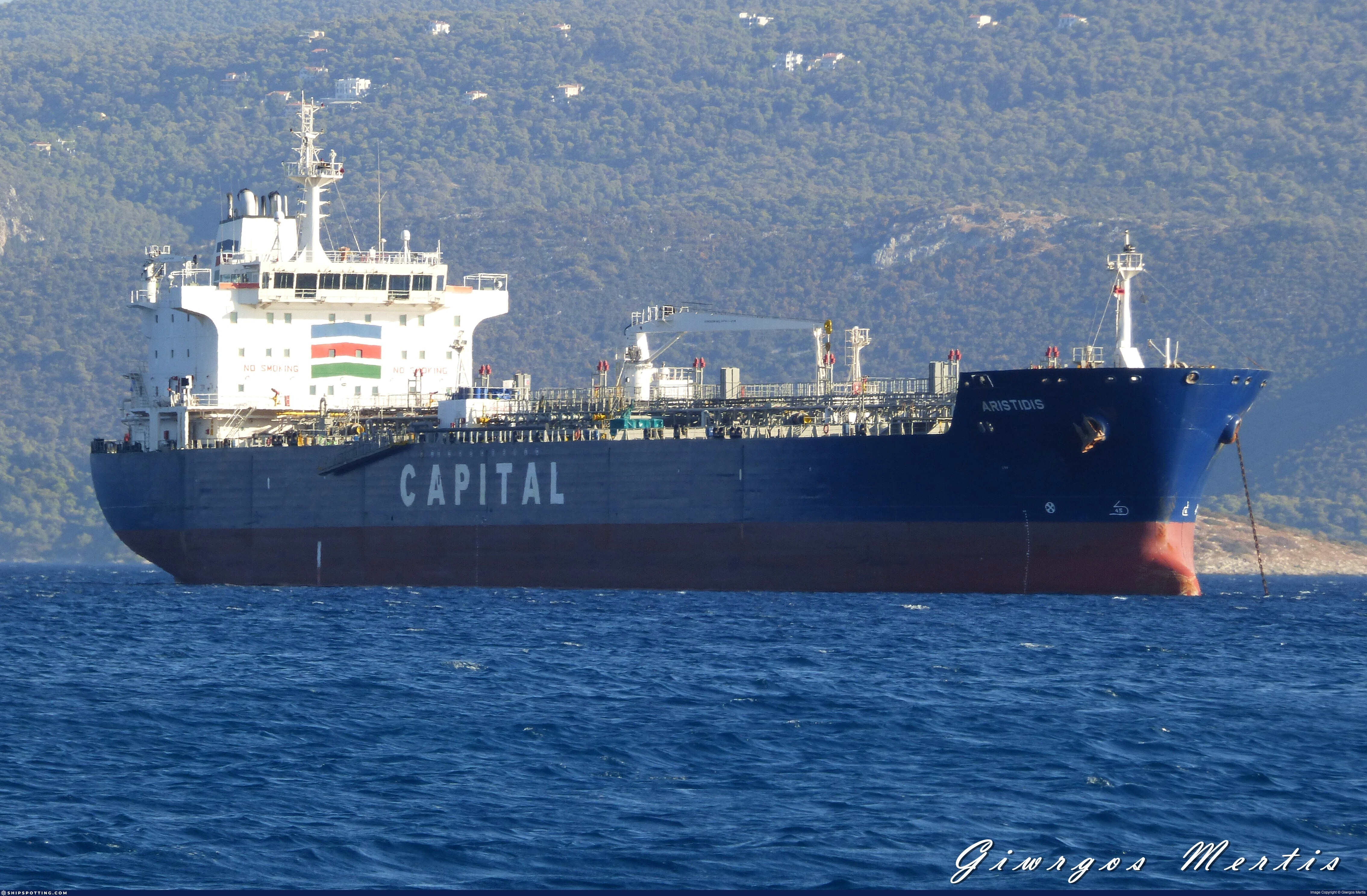
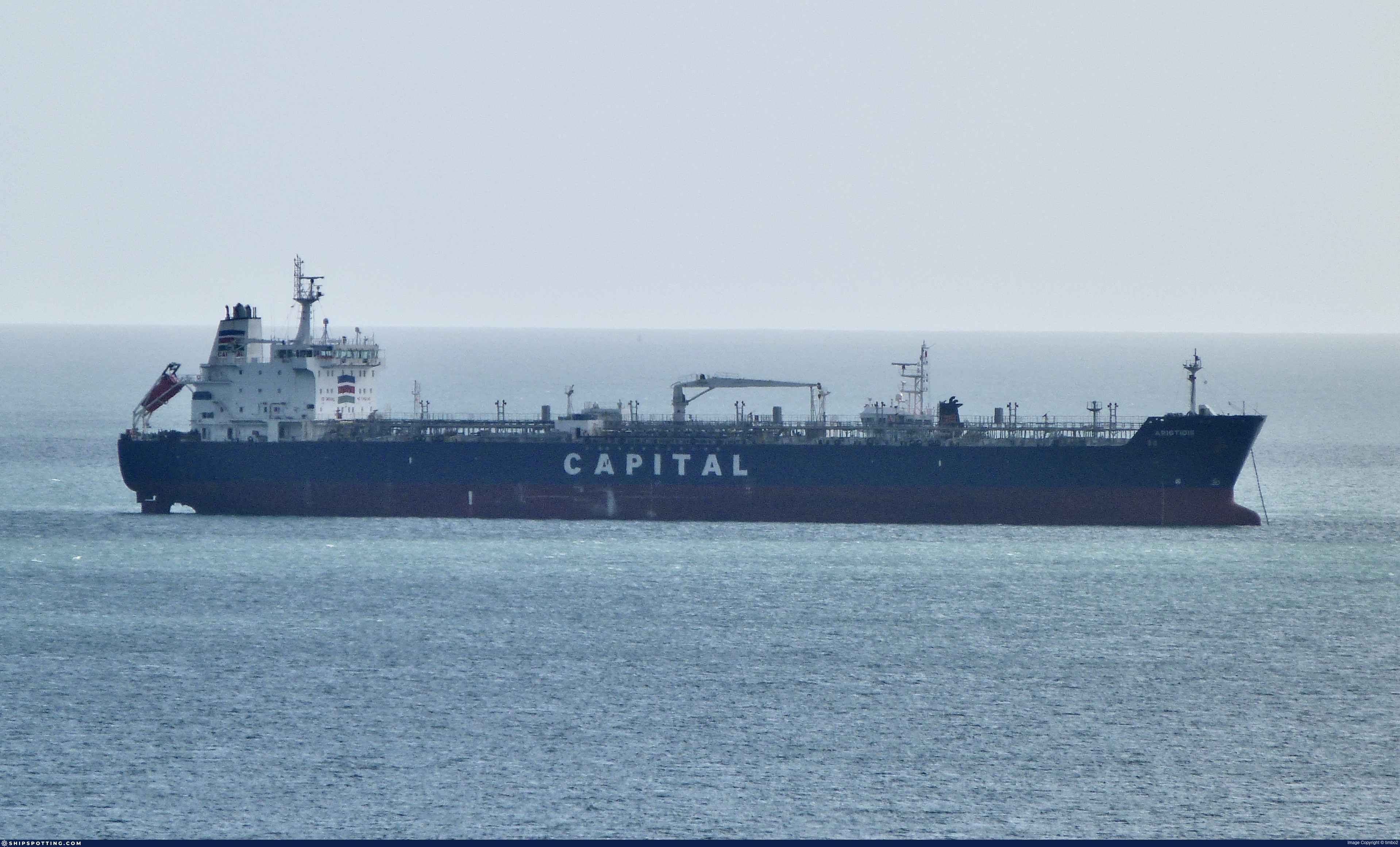
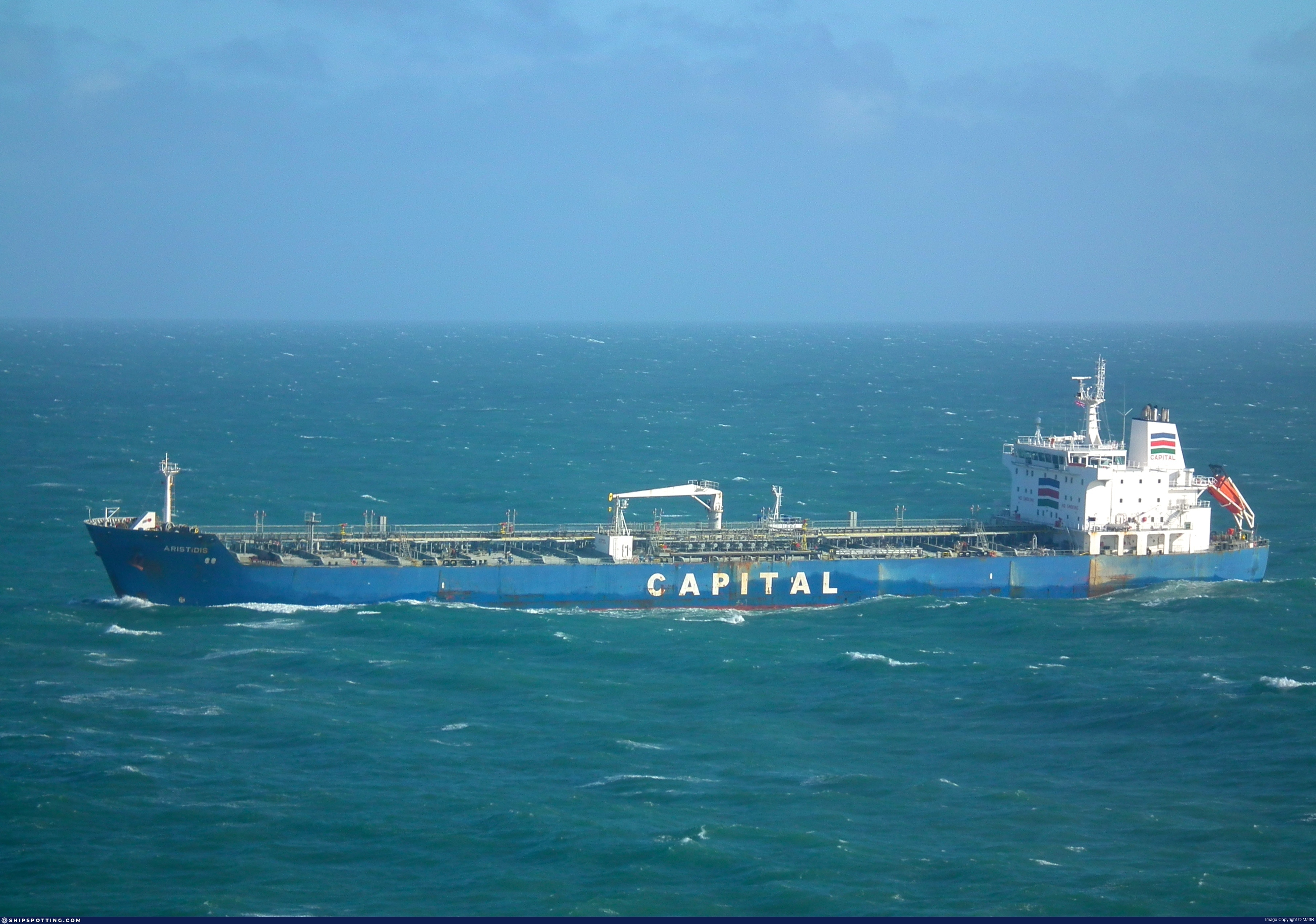
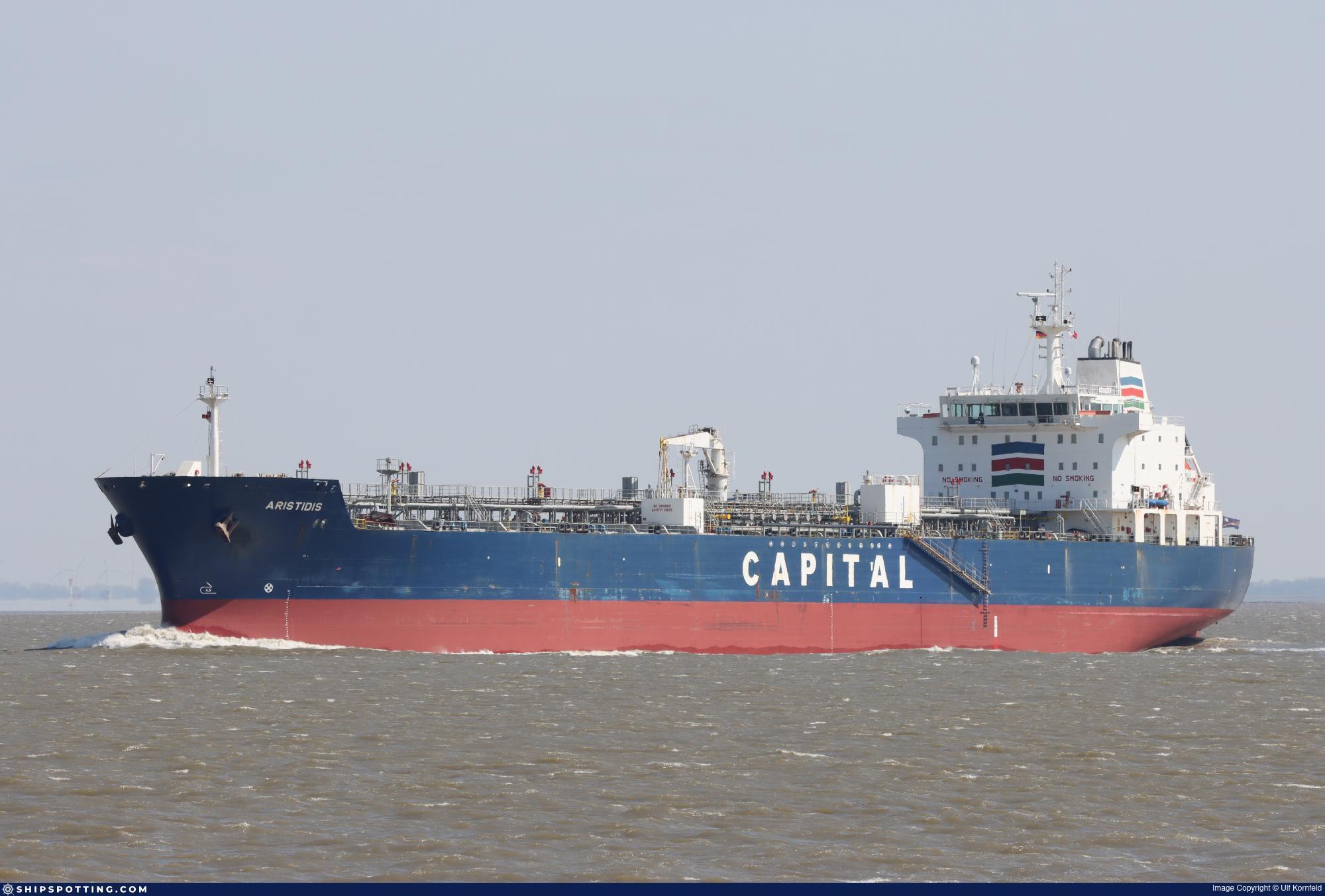
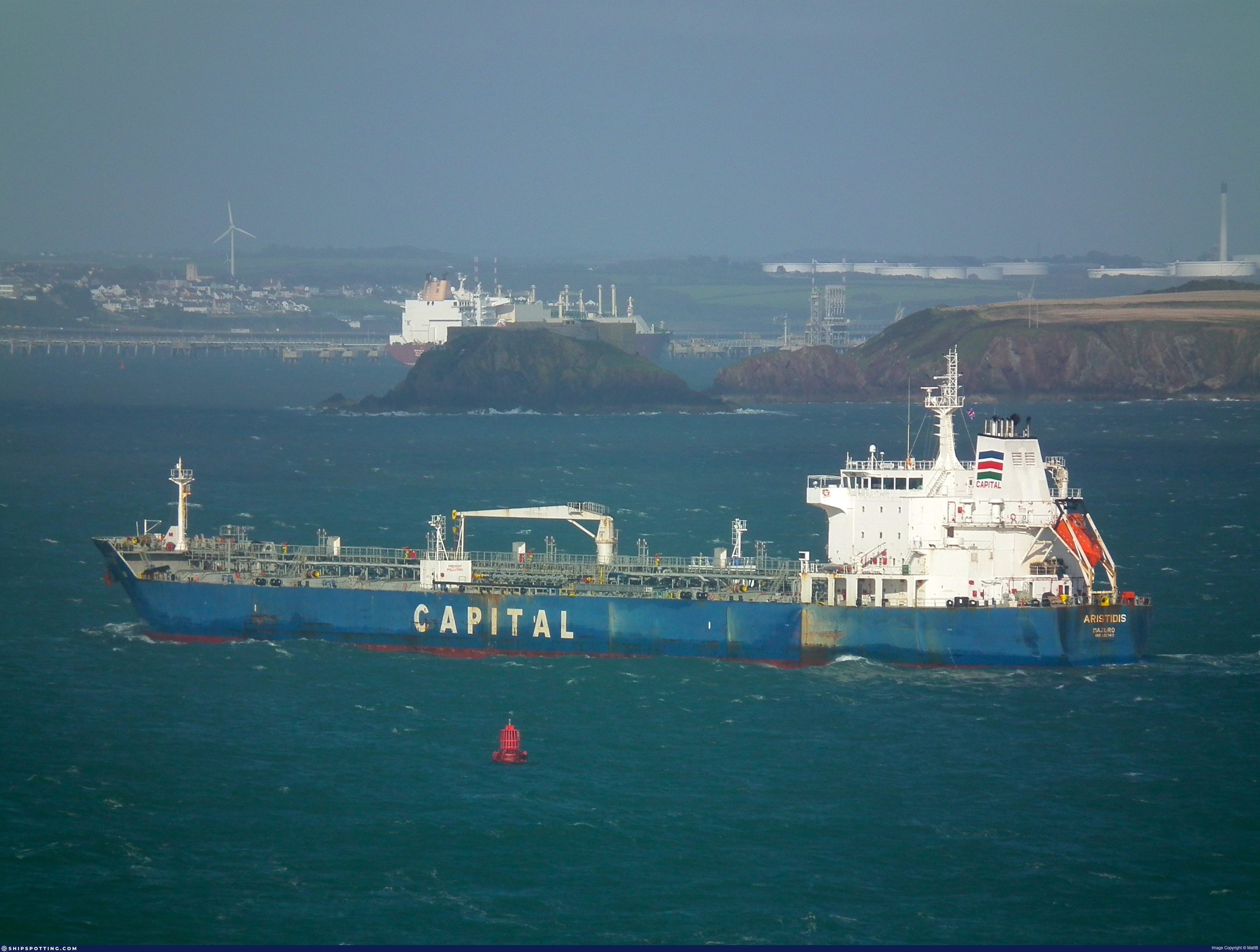
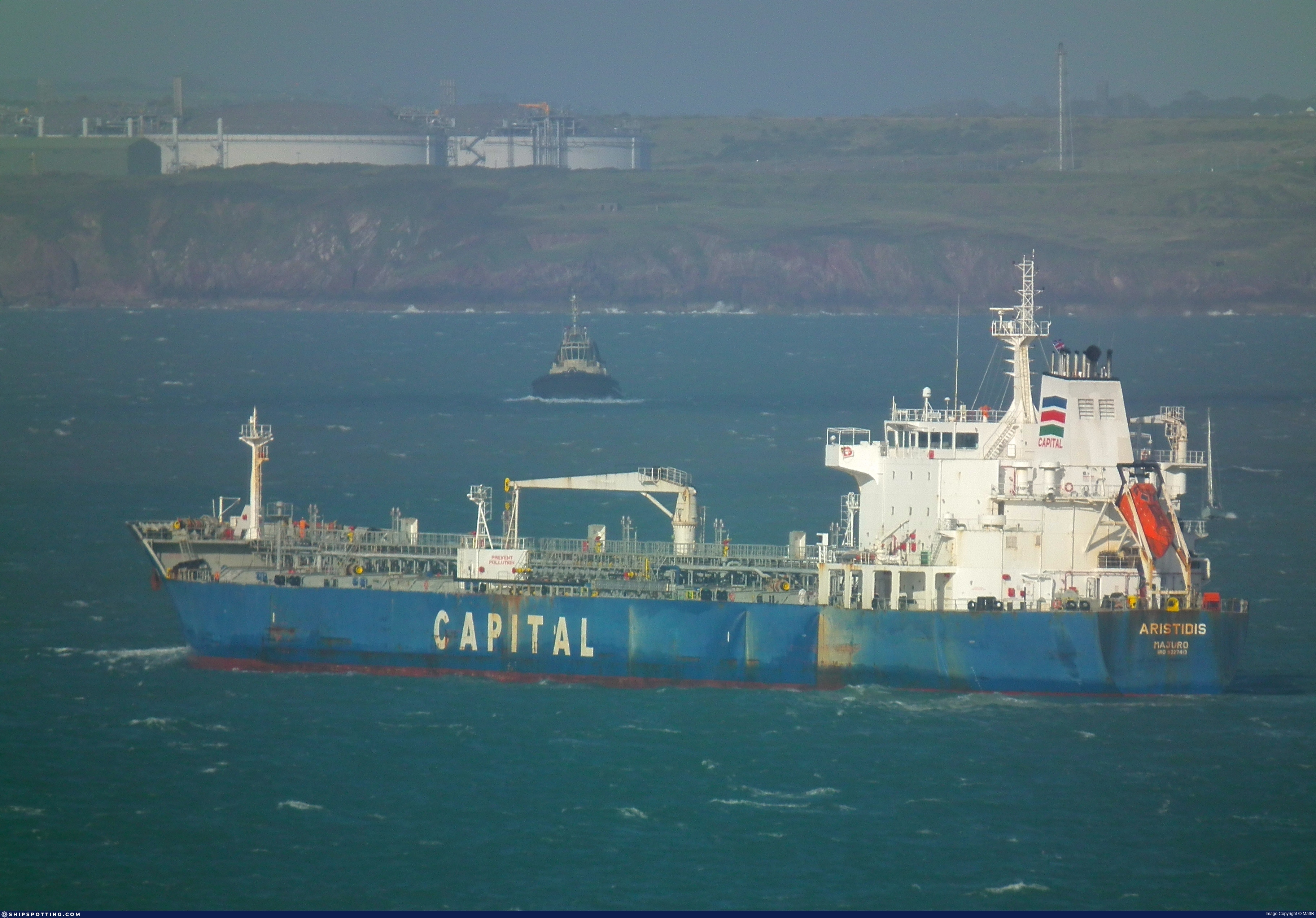
IMO 9327413
Vessel information
Sanctioned by
Company & Ownership
Management & Operations
Classification & Safety
Port State Control (PSC) Inspections
Survey Renewal & Certificates
| Code | Type | Issuer | Issued | Expires |
|---|---|---|---|---|
| 510 | Safety Management Certificate | Marshall Islands (MH) | 16/08/2023 | 16/07/2028 |
| 510 | Safety Management Certificate | Marshall Islands (MH) | 29/04/2021 | 30/03/2026 |
Programs & Notes
SEMA (Canada) — vessel designations | RUSSIA-EO14024 | The Russia (Sanctions) (EU Exit) Regulations 2019
Secondary sanctions risk: See Section 11 of Executive Order 14024.; Vessel Registration Identification IMO 9327413; MMSI 636022549; Linked To: HENNESEA HOLDINGS LIMITED. || DateDesignated: 2025-09-12 | Shipping sanctions: (see “Other information”) | Shipping sanctions: a specified ship is prohibited from being provided with access to or having its master or pilot cause it to enter a port in the UK, may have its registration on the UK Ship Register terminated, and a master or pilot of a specified ship may be given a port barring direction, a detention direction, and a port entry direction or a movement direction. | IMO 9327413 (KAROL) is, has been or is likely to be involved in activity whose object or effect is to destabilise Ukraine or undermine or threaten the territorial integrity, sovereignty or independence of Ukraine or to obtain a benefit from or support the Government of Russia. Namely, KAROL is involved in carrying oil or oil products that originated in Russia from Russia to a third country.
Vessel Changes
AIS Events
13 events detected • 3 zones • Last: Jan 22, 2026
- Zone: Istanbul Black Sea Surveillance Zone
- Duration: 1h 1m
- Data Points: 25 AIS positions
- Period: 2026-01-22T21:03:28+00:00 to 2026-01-22T22:05:18+00:00
Show Raw Evidence JSON
{
    "zone_id": "discovered_024",
    "zone_name": "Northern Barents Sea Surveillance Zone",
    "dwell_minutes": 61.7999999999999971578290569595992565155029296875,
    "points_in_zone": 25,
    "first_point": {
        "ts": "2026-01-22T21:03:28+00:00",
        "lat": 70.2856833000000023048414732329547405242919921875,
        "lon": 33.389583299999998189377947710454463958740234375
    },
    "last_point": {
        "ts": "2026-01-22T22:05:18+00:00",
        "lat": 70.3224500000000034560798667371273040771484375,
        "lon": 33.35326669999999893434505793265998363494873046875
    }
}- Duration: 1h 45m
- Radius: 989 meters
- Data Points: 38 AIS positions
- Centroid: 70.2883, 33.3880
- Zone: Istanbul Black Sea Surveillance Zone
Show Raw Evidence JSON
{
    "radius_m": 989.1000000000000227373675443232059478759765625,
    "duration_minutes": 105,
    "points": 38,
    "centroid": {
        "lat": 70.288318865789477740690927021205425262451171875,
        "lon": 33.387966226315796802737168036401271820068359375
    },
    "bbox": {
        "min_lat": 70.2829167000000012421878636814653873443603515625,
        "min_lon": 33.3784167000000024927430786192417144775390625,
        "max_lat": 70.297183300000000372165231965482234954833984375,
        "max_lon": 33.4024332999999984394889906980097293853759765625
    },
    "zone_id": "discovered_024"
}- Zone: Istanbul Black Sea Surveillance Zone
- Duration: 2h 3m
- Data Points: 46 AIS positions
- Period: 2026-01-22T20:02:07+00:00 to 2026-01-22T22:05:18+00:00
Show Raw Evidence JSON
{
    "zone_id": "discovered_024",
    "zone_name": "Northern Barents Sea Surveillance Zone",
    "dwell_minutes": 123.2000000000000028421709430404007434844970703125,
    "points_in_zone": 46,
    "first_point": {
        "ts": "2026-01-22T20:02:07+00:00",
        "lat": 70.2936667000000028338035917840898036956787109375,
        "lon": 33.3784167000000024927430786192417144775390625
    },
    "last_point": {
        "ts": "2026-01-22T22:05:18+00:00",
        "lat": 70.3224500000000034560798667371273040771484375,
        "lon": 33.35326669999999893434505793265998363494873046875
    }
}- Duration: 2h 37m
- Radius: 1,361 meters
- Data Points: 46 AIS positions
- Centroid: 70.2902, 33.3855
- Zone: Istanbul Black Sea Surveillance Zone
Show Raw Evidence JSON
{
    "radius_m": 1360.59999999999990905052982270717620849609375,
    "duration_minutes": 157.69999999999998863131622783839702606201171875,
    "points": 46,
    "centroid": {
        "lat": 70.2902047152173707900146837346255779266357421875,
        "lon": 33.38550797173912343396295909769833087921142578125
    },
    "bbox": {
        "min_lat": 70.2829167000000012421878636814653873443603515625,
        "min_lon": 33.36956670000000002573870006017386913299560546875,
        "max_lat": 70.301150000000006912159733474254608154296875,
        "max_lon": 33.4024332999999984394889906980097293853759765625
    },
    "zone_id": "discovered_024"
}- Zone: Istanbul Black Sea Surveillance Zone
- Duration: 2h 53m
- Data Points: 53 AIS positions
- Period: 2026-01-22T19:11:28+00:00 to 2026-01-22T22:05:18+00:00
Show Raw Evidence JSON
{
    "zone_id": "discovered_024",
    "zone_name": "Northern Barents Sea Surveillance Zone",
    "dwell_minutes": 173.80000000000001136868377216160297393798828125,
    "points_in_zone": 53,
    "first_point": {
        "ts": "2026-01-22T19:11:28+00:00",
        "lat": 70.301150000000006912159733474254608154296875,
        "lon": 33.36956670000000002573870006017386913299560546875
    },
    "last_point": {
        "ts": "2026-01-22T22:05:18+00:00",
        "lat": 70.3224500000000034560798667371273040771484375,
        "lon": 33.35326669999999893434505793265998363494873046875
    }
}- Duration: 3h 11m
- Radius: 1,828 meters
- Data Points: 51 AIS positions
- Centroid: 70.2917, 33.3835
- Zone: Istanbul Black Sea Surveillance Zone
Show Raw Evidence JSON
{
    "radius_m": 1828,
    "duration_minutes": 191,
    "points": 51,
    "centroid": {
        "lat": 70.2917114450980307083227671682834625244140625,
        "lon": 33.38347254705882249936621519736945629119873046875
    },
    "bbox": {
        "min_lat": 70.2829167000000012421878636814653873443603515625,
        "min_lon": 33.36363329999999649544406565837562084197998046875,
        "max_lat": 70.30666669999999385254341177642345428466796875,
        "max_lon": 33.4024332999999984394889906980097293853759765625
    },
    "zone_id": "discovered_024"
}- Zone: Istanbul Black Sea Surveillance Zone
- Duration: 3h 27m
- Data Points: 58 AIS positions
- Period: 2026-01-22T18:38:08+00:00 to 2026-01-22T22:05:18+00:00
Show Raw Evidence JSON
{
    "zone_id": "discovered_024",
    "zone_name": "Northern Barents Sea Surveillance Zone",
    "dwell_minutes": 207.19999999999998863131622783839702606201171875,
    "points_in_zone": 58,
    "first_point": {
        "ts": "2026-01-22T18:38:08+00:00",
        "lat": 70.30666669999999385254341177642345428466796875,
        "lon": 33.36363329999999649544406565837562084197998046875
    },
    "last_point": {
        "ts": "2026-01-22T22:05:18+00:00",
        "lat": 70.3224500000000034560798667371273040771484375,
        "lon": 33.35326669999999893434505793265998363494873046875
    }
}- Duration: 3h 37m
- Radius: 2,827 meters
- Data Points: 44 AIS positions
- Centroid: 70.2925, 33.3807
- Zone: Istanbul Black Sea Surveillance Zone
Show Raw Evidence JSON
{
    "radius_m": 2827.1999999999998181010596454143524169921875,
    "duration_minutes": 217.69999999999998863131622783839702606201171875,
    "points": 44,
    "centroid": {
        "lat": 70.2924587181818196768290363252162933349609375,
        "lon": 33.380694695454536713441484607756137847900390625
    },
    "bbox": {
        "min_lat": 70.2829167000000012421878636814653873443603515625,
        "min_lon": 33.35251670000000245863702730275690555572509765625,
        "max_lat": 70.3159500000000008412825991399586200714111328125,
        "max_lon": 33.3935833000000030779119697399437427520751953125
    },
    "zone_id": "discovered_024"
}- Zone: Istanbul Black Sea Surveillance Zone
- Duration: 4h 15m
- Data Points: 59 AIS positions
- Period: 2026-01-22T17:50:07+00:00 to 2026-01-22T22:05:18+00:00
Show Raw Evidence JSON
{
    "zone_id": "discovered_024",
    "zone_name": "Northern Barents Sea Surveillance Zone",
    "dwell_minutes": 255.19999999999998863131622783839702606201171875,
    "points_in_zone": 59,
    "first_point": {
        "ts": "2026-01-22T17:50:07+00:00",
        "lat": 70.3159500000000008412825991399586200714111328125,
        "lon": 33.35251670000000245863702730275690555572509765625
    },
    "last_point": {
        "ts": "2026-01-22T22:05:18+00:00",
        "lat": 70.3224500000000034560798667371273040771484375,
        "lon": 33.35326669999999893434505793265998363494873046875
    }
}- Zone: Murmansk/Kola Bay Terminal
- Duration: 2h 27m
- Data Points: 18 AIS positions
- Period: 2026-01-21T01:13:23+00:00 to 2026-01-21T03:40:58+00:00
Show Raw Evidence JSON
{
    "zone_id": "russia_murmansk",
    "zone_name": "Murmansk\/Kola Bay Terminal",
    "dwell_minutes": 147.599999999999994315658113919198513031005859375,
    "points_in_zone": 18,
    "first_point": {
        "ts": "2026-01-21T01:13:23+00:00",
        "lat": 69.2660666999999961035427986644208431243896484375,
        "lon": 33.60603329999999999699866748414933681488037109375
    },
    "last_point": {
        "ts": "2026-01-21T03:40:58+00:00",
        "lat": 69.97669999999999390638549812138080596923828125,
        "lon": 33.57063329999999723440851084887981414794921875
    }
}- Zone: Murmansk/Kola Bay Terminal
- Duration: 3h 13m
- Data Points: 24 AIS positions
- Period: 2026-01-21T00:27:29+00:00 to 2026-01-21T03:40:58+00:00
Show Raw Evidence JSON
{
    "zone_id": "russia_murmansk",
    "zone_name": "Murmansk\/Kola Bay Terminal",
    "dwell_minutes": 193.5,
    "points_in_zone": 24,
    "first_point": {
        "ts": "2026-01-21T00:27:29+00:00",
        "lat": 69.6124717000000003963577910326421260833740234375,
        "lon": 33.9051266999999967310941428877413272857666015625
    },
    "last_point": {
        "ts": "2026-01-21T03:40:58+00:00",
        "lat": 69.97669999999999390638549812138080596923828125,
        "lon": 33.57063329999999723440851084887981414794921875
    }
}- Zone: Kildin Strait LNG STS Zone
- Duration: 1h 6m
- Data Points: 3 AIS positions
- Period: 2026-01-20T23:21:20+00:00 to 2026-01-21T00:27:29+00:00
Show Raw Evidence JSON
{
    "zone_id": "russia_murmansk_sts",
    "zone_name": "Kildin Strait LNG STS Zone",
    "dwell_minutes": 66.2000000000000028421709430404007434844970703125,
    "points_in_zone": 3,
    "first_point": {
        "ts": "2026-01-20T23:21:20+00:00",
        "lat": 69.2066832999999945741365081630647182464599609375,
        "lon": 33.48810499999999734654920757748186588287353515625
    },
    "last_point": {
        "ts": "2026-01-21T00:27:29+00:00",
        "lat": 69.6124717000000003963577910326421260833740234375,
        "lon": 33.9051266999999967310941428877413272857666015625
    }
}- Zone: Murmansk/Kola Bay Terminal
- Duration: 4h 19m
- Data Points: 26 AIS positions
- Period: 2026-01-20T23:21:20+00:00 to 2026-01-21T03:40:58+00:00
Show Raw Evidence JSON
{
    "zone_id": "russia_murmansk",
    "zone_name": "Murmansk\/Kola Bay Terminal",
    "dwell_minutes": 259.6000000000000227373675443232059478759765625,
    "points_in_zone": 26,
    "first_point": {
        "ts": "2026-01-20T23:21:20+00:00",
        "lat": 69.2066832999999945741365081630647182464599609375,
        "lon": 33.48810499999999734654920757748186588287353515625
    },
    "last_point": {
        "ts": "2026-01-21T03:40:58+00:00",
        "lat": 69.97669999999999390638549812138080596923828125,
        "lon": 33.57063329999999723440851084887981414794921875
    }
}Source snapshot
| Sanctioner | As of | Entity ID |
|---|---|---|
| 🇬🇧 UK | 2025-09-29 | 9327413 |
| 🇺🇸 US | 2025-09-29 | 9327413 |
We mirror official lists; always verify at the source.
Sanctioned on the same day
- ADMIRAL · IMO 9274446 🇨🇦 CA🇬🇧 UK🇺🇸 US
- AKCENT · IMO 9381732 🇨🇦 CA🇪🇺 EU🇬🇧 UK🇺🇸 US
- AKHILL · IMO 9410870 🇨🇦 CA🇬🇧 UK🇺🇸 US
- AKKORD · IMO 9259599 🇨🇦 CA🇬🇧 UK🇺🇸 US
- AKSEL · IMO 9410894 🇨🇦 CA🇬🇧 UK🇺🇸 US
- AKVILON · IMO 9249087 🇨🇦 CA🇬🇧 UK🇺🇸 US
- ALGORITM · IMO 9299745 🇨🇦 CA🇬🇧 UK🇺🇸 US
- ALYSSUM · IMO 9314818 🇨🇦 CA🇬🇧 UK🇺🇸 US