
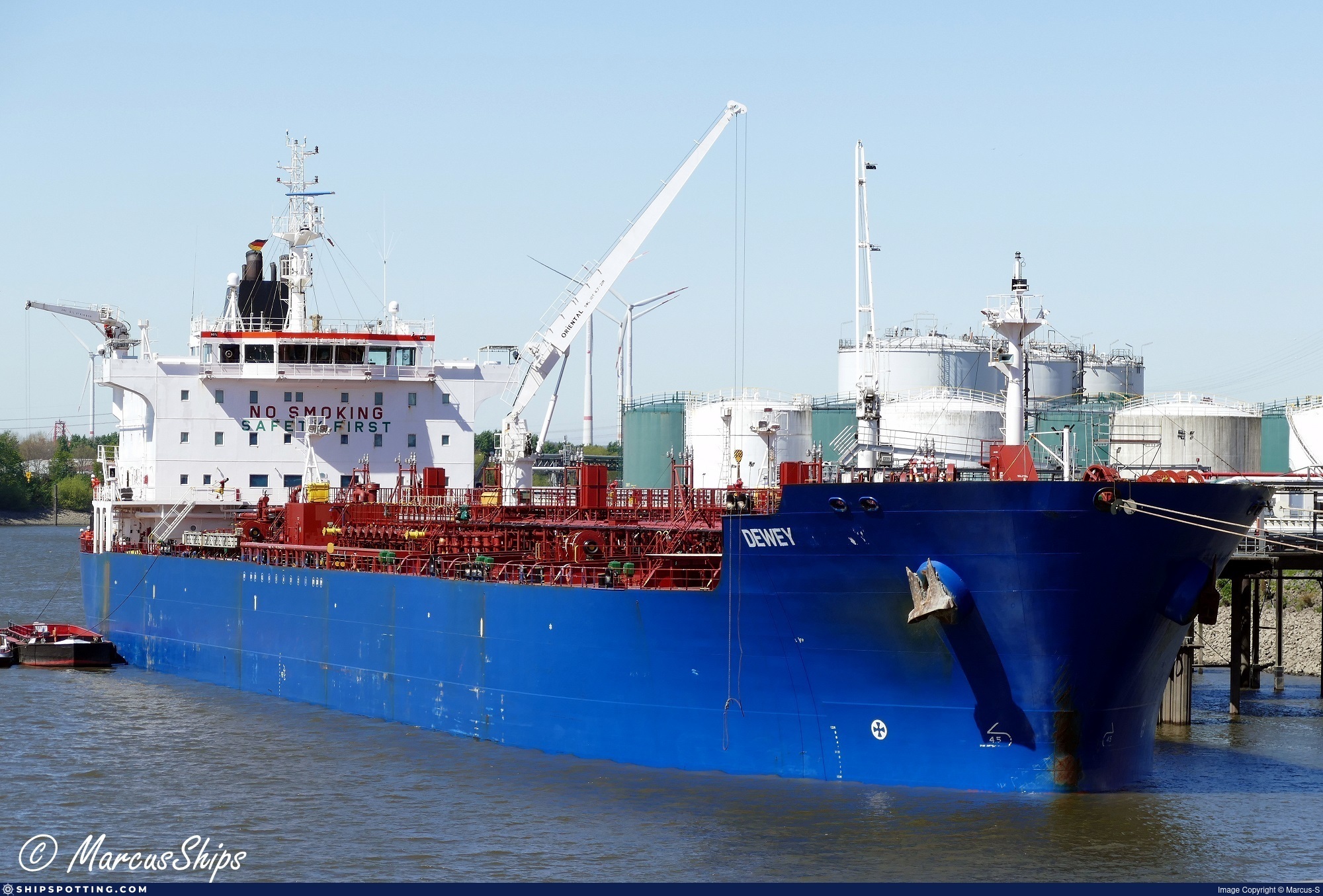
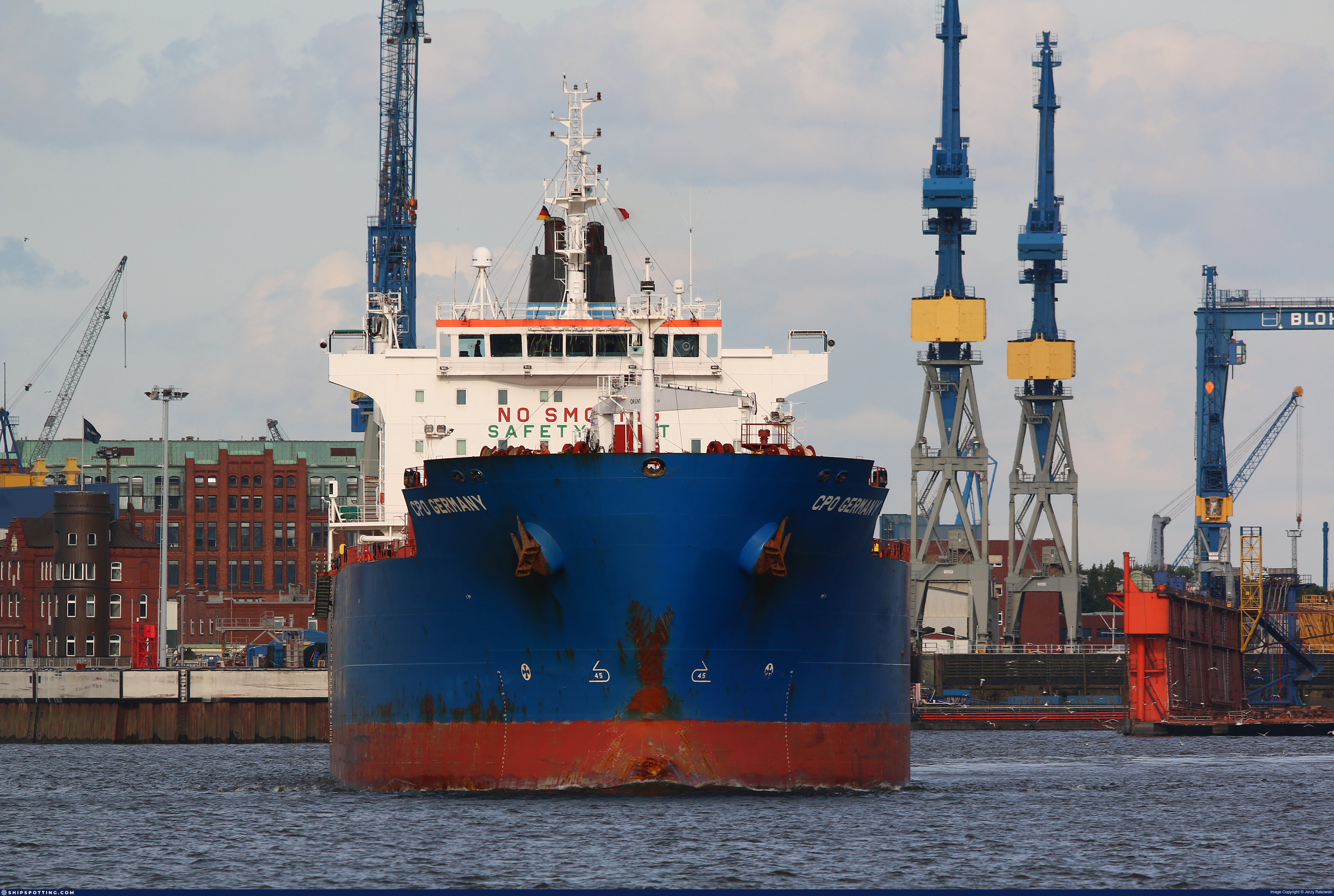
IMO 9353096
Vessel information
Sanctioned by
Company & Ownership
Management & Operations
Classification & Safety
Port State Control (PSC) Inspections
Programs & Notes
SEMA (Canada) — vessel designations | The Russia (Sanctions) (EU Exit) Regulations 2019 | Added in EU Sanctions Package 16 | (Council Decision (CFSP) 2025/394, Annex XVI to Decision 2014/512/CFSP) | Press Release | Official Journal
DateOfListing: 2025-02-25 || DateDesignated: 2024-11-25 | Shipping sanctions: (see “Other information”) | Shipping sanctions: where shipping sanctions apply, a specified ship is prohibited from entering a port in the UK, may be given a movement or a port entry direction, can be detained, and will be refused permission to register on the UK Ship Register or have its existing registration terminated. | GURU (IMO 9353096) is involved in activity whose object or effect is to destabilise Ukraine or undermine or threaten the territorial integrity, sovereignty or independence of Ukraine or to obtain a benefit from or support the Government of Russia. Namely, GURU is involved in carrying oil or oil products that originated in Russia from Russia to a third country.
Vessel Changes


AIS Events
50 events detected • 2 zones • Last: Oct 19, 2026
- Zone: Bosphorus/Dardanelles Approach
- Duration: 1h 1m
- Data Points: 2 AIS positions
- Period: 2026-10-19T00:15:33+00:00 to 2026-10-19T01:17:27+00:00
Show Raw Evidence JSON
{
    "zone_id": "osint_bosphorus",
    "zone_name": "Bosphorus\/Dardanelles Approach",
    "dwell_minutes": 61.89999999999999857891452847979962825775146484375,
    "points_in_zone": 2,
    "first_point": {
        "ts": "2026-10-19T00:15:33+00:00",
        "lat": 40.96327670000000154004737851209938526153564453125,
        "lon": 28.764853299999998625935404561460018157958984375
    },
    "last_point": {
        "ts": "2026-10-19T01:17:27+00:00",
        "lat": 40.96349670000000031677700462751090526580810546875,
        "lon": 28.764690000000001646185410209000110626220703125
    }
}- Zone: Gulf of Oman Sanctioned Vessel Monitoring Zone
- Duration: 1h 1m
- Data Points: 2 AIS positions
- Period: 2026-10-19T00:15:33+00:00 to 2026-10-19T01:17:27+00:00
Show Raw Evidence JSON
{
    "zone_id": "discovered_030",
    "zone_name": "Gulf of Oman Sanctioned Vessel Monitoring Zone",
    "dwell_minutes": 61.89999999999999857891452847979962825775146484375,
    "points_in_zone": 2,
    "first_point": {
        "ts": "2026-10-19T00:15:33+00:00",
        "lat": 40.96327670000000154004737851209938526153564453125,
        "lon": 28.764853299999998625935404561460018157958984375
    },
    "last_point": {
        "ts": "2026-10-19T01:17:27+00:00",
        "lat": 40.96349670000000031677700462751090526580810546875,
        "lon": 28.764690000000001646185410209000110626220703125
    }
}- Zone: Bosphorus/Dardanelles Approach
- Duration: 1h 43m
- Data Points: 3 AIS positions
- Period: 2026-10-18T23:33:31+00:00 to 2026-10-19T01:17:27+00:00
Show Raw Evidence JSON
{
    "zone_id": "osint_bosphorus",
    "zone_name": "Bosphorus\/Dardanelles Approach",
    "dwell_minutes": 103.900000000000005684341886080801486968994140625,
    "points_in_zone": 3,
    "first_point": {
        "ts": "2026-10-18T23:33:31+00:00",
        "lat": 40.96264000000000038426151149906218051910400390625,
        "lon": 28.764920000000000044337866711430251598358154296875
    },
    "last_point": {
        "ts": "2026-10-19T01:17:27+00:00",
        "lat": 40.96349670000000031677700462751090526580810546875,
        "lon": 28.764690000000001646185410209000110626220703125
    }
}- Zone: Gulf of Oman Sanctioned Vessel Monitoring Zone
- Duration: 1h 43m
- Data Points: 3 AIS positions
- Period: 2026-10-18T23:33:31+00:00 to 2026-10-19T01:17:27+00:00
Show Raw Evidence JSON
{
    "zone_id": "discovered_030",
    "zone_name": "Gulf of Oman Sanctioned Vessel Monitoring Zone",
    "dwell_minutes": 103.900000000000005684341886080801486968994140625,
    "points_in_zone": 3,
    "first_point": {
        "ts": "2026-10-18T23:33:31+00:00",
        "lat": 40.96264000000000038426151149906218051910400390625,
        "lon": 28.764920000000000044337866711430251598358154296875
    },
    "last_point": {
        "ts": "2026-10-19T01:17:27+00:00",
        "lat": 40.96349670000000031677700462751090526580810546875,
        "lon": 28.764690000000001646185410209000110626220703125
    }
}- Zone: Bosphorus/Dardanelles Approach
- Duration: 3h 11m
- Data Points: 4 AIS positions
- Period: 2026-10-18T22:05:31+00:00 to 2026-10-19T01:17:27+00:00
Show Raw Evidence JSON
{
    "zone_id": "osint_bosphorus",
    "zone_name": "Bosphorus\/Dardanelles Approach",
    "dwell_minutes": 191.900000000000005684341886080801486968994140625,
    "points_in_zone": 4,
    "first_point": {
        "ts": "2026-10-18T22:05:31+00:00",
        "lat": 40.96331500000000147565515362657606601715087890625,
        "lon": 28.764796700000001550279193907044827938079833984375
    },
    "last_point": {
        "ts": "2026-10-19T01:17:27+00:00",
        "lat": 40.96349670000000031677700462751090526580810546875,
        "lon": 28.764690000000001646185410209000110626220703125
    }
}- Zone: Gulf of Oman Sanctioned Vessel Monitoring Zone
- Duration: 3h 11m
- Data Points: 4 AIS positions
- Period: 2026-10-18T22:05:31+00:00 to 2026-10-19T01:17:27+00:00
Show Raw Evidence JSON
{
    "zone_id": "discovered_030",
    "zone_name": "Gulf of Oman Sanctioned Vessel Monitoring Zone",
    "dwell_minutes": 191.900000000000005684341886080801486968994140625,
    "points_in_zone": 4,
    "first_point": {
        "ts": "2026-10-18T22:05:31+00:00",
        "lat": 40.96331500000000147565515362657606601715087890625,
        "lon": 28.764796700000001550279193907044827938079833984375
    },
    "last_point": {
        "ts": "2026-10-19T01:17:27+00:00",
        "lat": 40.96349670000000031677700462751090526580810546875,
        "lon": 28.764690000000001646185410209000110626220703125
    }
}- Zone: Bosphorus/Dardanelles Approach
- Duration: 4h 11m
- Data Points: 7 AIS positions
- Period: 2026-10-18T21:05:31+00:00 to 2026-10-19T01:17:27+00:00
Show Raw Evidence JSON
{
    "zone_id": "osint_bosphorus",
    "zone_name": "Bosphorus\/Dardanelles Approach",
    "dwell_minutes": 251.900000000000005684341886080801486968994140625,
    "points_in_zone": 7,
    "first_point": {
        "ts": "2026-10-18T21:05:31+00:00",
        "lat": 40.96323830000000043582986108958721160888671875,
        "lon": 28.764841700000001623038770048879086971282958984375
    },
    "last_point": {
        "ts": "2026-10-19T01:17:27+00:00",
        "lat": 40.96349670000000031677700462751090526580810546875,
        "lon": 28.764690000000001646185410209000110626220703125
    }
}- Zone: Gulf of Oman Sanctioned Vessel Monitoring Zone
- Duration: 4h 11m
- Data Points: 7 AIS positions
- Period: 2026-10-18T21:05:31+00:00 to 2026-10-19T01:17:27+00:00
Show Raw Evidence JSON
{
    "zone_id": "discovered_030",
    "zone_name": "Gulf of Oman Sanctioned Vessel Monitoring Zone",
    "dwell_minutes": 251.900000000000005684341886080801486968994140625,
    "points_in_zone": 7,
    "first_point": {
        "ts": "2026-10-18T21:05:31+00:00",
        "lat": 40.96323830000000043582986108958721160888671875,
        "lon": 28.764841700000001623038770048879086971282958984375
    },
    "last_point": {
        "ts": "2026-10-19T01:17:27+00:00",
        "lat": 40.96349670000000031677700462751090526580810546875,
        "lon": 28.764690000000001646185410209000110626220703125
    }
}- Zone: Gulf of Oman Sanctioned Vessel Monitoring Zone
- Duration: 4h 35m
- Data Points: 8 AIS positions
- Period: 2026-10-18T20:41:32+00:00 to 2026-10-19T01:17:27+00:00
Show Raw Evidence JSON
{
    "zone_id": "discovered_030",
    "zone_name": "Gulf of Oman Sanctioned Vessel Monitoring Zone",
    "dwell_minutes": 275.8999999999999772626324556767940521240234375,
    "points_in_zone": 8,
    "first_point": {
        "ts": "2026-10-18T20:41:32+00:00",
        "lat": 40.963421699999997827035258524119853973388671875,
        "lon": 28.764751700000001477519617765210568904876708984375
    },
    "last_point": {
        "ts": "2026-10-19T01:17:27+00:00",
        "lat": 40.96349670000000031677700462751090526580810546875,
        "lon": 28.764690000000001646185410209000110626220703125
    }
}- Zone: Bosphorus/Dardanelles Approach
- Duration: 4h 35m
- Data Points: 8 AIS positions
- Period: 2026-10-18T20:41:32+00:00 to 2026-10-19T01:17:27+00:00
Show Raw Evidence JSON
{
    "zone_id": "osint_bosphorus",
    "zone_name": "Bosphorus\/Dardanelles Approach",
    "dwell_minutes": 275.8999999999999772626324556767940521240234375,
    "points_in_zone": 8,
    "first_point": {
        "ts": "2026-10-18T20:41:32+00:00",
        "lat": 40.963421699999997827035258524119853973388671875,
        "lon": 28.764751700000001477519617765210568904876708984375
    },
    "last_point": {
        "ts": "2026-10-19T01:17:27+00:00",
        "lat": 40.96349670000000031677700462751090526580810546875,
        "lon": 28.764690000000001646185410209000110626220703125
    }
}- Zone: Gulf of Oman Sanctioned Vessel Monitoring Zone
- Duration: 6h 30m
- Data Points: 7 AIS positions
- Period: 2026-10-18T17:03:32+00:00 to 2026-10-18T23:33:31+00:00
Show Raw Evidence JSON
{
    "zone_id": "discovered_030",
    "zone_name": "Gulf of Oman Sanctioned Vessel Monitoring Zone",
    "dwell_minutes": 390,
    "points_in_zone": 7,
    "first_point": {
        "ts": "2026-10-18T17:03:32+00:00",
        "lat": 40.96312999999999959754859446547925472259521484375,
        "lon": 28.76479330000000089739842223934829235076904296875
    },
    "last_point": {
        "ts": "2026-10-18T23:33:31+00:00",
        "lat": 40.96264000000000038426151149906218051910400390625,
        "lon": 28.764920000000000044337866711430251598358154296875
    }
}- Zone: Bosphorus/Dardanelles Approach
- Duration: 6h 30m
- Data Points: 7 AIS positions
- Period: 2026-10-18T17:03:32+00:00 to 2026-10-18T23:33:31+00:00
Show Raw Evidence JSON
{
    "zone_id": "osint_bosphorus",
    "zone_name": "Bosphorus\/Dardanelles Approach",
    "dwell_minutes": 390,
    "points_in_zone": 7,
    "first_point": {
        "ts": "2026-10-18T17:03:32+00:00",
        "lat": 40.96312999999999959754859446547925472259521484375,
        "lon": 28.76479330000000089739842223934829235076904296875
    },
    "last_point": {
        "ts": "2026-10-18T23:33:31+00:00",
        "lat": 40.96264000000000038426151149906218051910400390625,
        "lon": 28.764920000000000044337866711430251598358154296875
    }
}- Zone: Gulf of Oman Sanctioned Vessel Monitoring Zone
- Duration: 5h 54m
- Data Points: 7 AIS positions
- Period: 2026-10-18T16:11:33+00:00 to 2026-10-18T22:05:31+00:00
Show Raw Evidence JSON
{
    "zone_id": "discovered_030",
    "zone_name": "Gulf of Oman Sanctioned Vessel Monitoring Zone",
    "dwell_minutes": 354,
    "points_in_zone": 7,
    "first_point": {
        "ts": "2026-10-18T16:11:33+00:00",
        "lat": 40.96349330000000321660991176031529903411865234375,
        "lon": 28.764821699999998827479430474340915679931640625
    },
    "last_point": {
        "ts": "2026-10-18T22:05:31+00:00",
        "lat": 40.96331500000000147565515362657606601715087890625,
        "lon": 28.764796700000001550279193907044827938079833984375
    }
}- Zone: Bosphorus/Dardanelles Approach
- Duration: 5h 54m
- Data Points: 7 AIS positions
- Period: 2026-10-18T16:11:33+00:00 to 2026-10-18T22:05:31+00:00
Show Raw Evidence JSON
{
    "zone_id": "osint_bosphorus",
    "zone_name": "Bosphorus\/Dardanelles Approach",
    "dwell_minutes": 354,
    "points_in_zone": 7,
    "first_point": {
        "ts": "2026-10-18T16:11:33+00:00",
        "lat": 40.96349330000000321660991176031529903411865234375,
        "lon": 28.764821699999998827479430474340915679931640625
    },
    "last_point": {
        "ts": "2026-10-18T22:05:31+00:00",
        "lat": 40.96331500000000147565515362657606601715087890625,
        "lon": 28.764796700000001550279193907044827938079833984375
    }
}- Zone: Bosphorus/Dardanelles Approach
- Duration: 4h 22m
- Data Points: 3 AIS positions
- Period: 2026-10-18T12:41:31+00:00 to 2026-10-18T17:03:32+00:00
Show Raw Evidence JSON
{
    "zone_id": "osint_bosphorus",
    "zone_name": "Bosphorus\/Dardanelles Approach",
    "dwell_minutes": 262,
    "points_in_zone": 3,
    "first_point": {
        "ts": "2026-10-18T12:41:31+00:00",
        "lat": 40.96291169999999937090251478366553783416748046875,
        "lon": 28.7647300000000001318767317570745944976806640625
    },
    "last_point": {
        "ts": "2026-10-18T17:03:32+00:00",
        "lat": 40.96312999999999959754859446547925472259521484375,
        "lon": 28.76479330000000089739842223934829235076904296875
    }
}- Zone: Gulf of Oman Sanctioned Vessel Monitoring Zone
- Duration: 4h 22m
- Data Points: 3 AIS positions
- Period: 2026-10-18T12:41:31+00:00 to 2026-10-18T17:03:32+00:00
Show Raw Evidence JSON
{
    "zone_id": "discovered_030",
    "zone_name": "Gulf of Oman Sanctioned Vessel Monitoring Zone",
    "dwell_minutes": 262,
    "points_in_zone": 3,
    "first_point": {
        "ts": "2026-10-18T12:41:31+00:00",
        "lat": 40.96291169999999937090251478366553783416748046875,
        "lon": 28.7647300000000001318767317570745944976806640625
    },
    "last_point": {
        "ts": "2026-10-18T17:03:32+00:00",
        "lat": 40.96312999999999959754859446547925472259521484375,
        "lon": 28.76479330000000089739842223934829235076904296875
    }
}- Zone: Gulf of Oman Sanctioned Vessel Monitoring Zone
- Duration: 5h 46m
- Data Points: 4 AIS positions
- Period: 2026-10-18T11:17:31+00:00 to 2026-10-18T17:03:32+00:00
Show Raw Evidence JSON
{
    "zone_id": "discovered_030",
    "zone_name": "Gulf of Oman Sanctioned Vessel Monitoring Zone",
    "dwell_minutes": 346,
    "points_in_zone": 4,
    "first_point": {
        "ts": "2026-10-18T11:17:31+00:00",
        "lat": 40.96285999999999916099113761447370052337646484375,
        "lon": 28.7645933000000013635144568979740142822265625
    },
    "last_point": {
        "ts": "2026-10-18T17:03:32+00:00",
        "lat": 40.96312999999999959754859446547925472259521484375,
        "lon": 28.76479330000000089739842223934829235076904296875
    }
}- Zone: Bosphorus/Dardanelles Approach
- Duration: 5h 46m
- Data Points: 4 AIS positions
- Period: 2026-10-18T11:17:31+00:00 to 2026-10-18T17:03:32+00:00
Show Raw Evidence JSON
{
    "zone_id": "osint_bosphorus",
    "zone_name": "Bosphorus\/Dardanelles Approach",
    "dwell_minutes": 346,
    "points_in_zone": 4,
    "first_point": {
        "ts": "2026-10-18T11:17:31+00:00",
        "lat": 40.96285999999999916099113761447370052337646484375,
        "lon": 28.7645933000000013635144568979740142822265625
    },
    "last_point": {
        "ts": "2026-10-18T17:03:32+00:00",
        "lat": 40.96312999999999959754859446547925472259521484375,
        "lon": 28.76479330000000089739842223934829235076904296875
    }
}- Zone: Bosphorus/Dardanelles Approach
- Duration: 5h 58m
- Data Points: 4 AIS positions
- Period: 2026-10-18T10:12:38+00:00 to 2026-10-18T16:11:33+00:00
Show Raw Evidence JSON
{
    "zone_id": "osint_bosphorus",
    "zone_name": "Bosphorus\/Dardanelles Approach",
    "dwell_minutes": 358.8999999999999772626324556767940521240234375,
    "points_in_zone": 4,
    "first_point": {
        "ts": "2026-10-18T10:12:38+00:00",
        "lat": 40.9623950000000007776179700158536434173583984375,
        "lon": 28.764701699999999817691787029616534709930419921875
    },
    "last_point": {
        "ts": "2026-10-18T16:11:33+00:00",
        "lat": 40.96349330000000321660991176031529903411865234375,
        "lon": 28.764821699999998827479430474340915679931640625
    }
}- Zone: Gulf of Oman Sanctioned Vessel Monitoring Zone
- Duration: 5h 58m
- Data Points: 4 AIS positions
- Period: 2026-10-18T10:12:38+00:00 to 2026-10-18T16:11:33+00:00
Show Raw Evidence JSON
{
    "zone_id": "discovered_030",
    "zone_name": "Gulf of Oman Sanctioned Vessel Monitoring Zone",
    "dwell_minutes": 358.8999999999999772626324556767940521240234375,
    "points_in_zone": 4,
    "first_point": {
        "ts": "2026-10-18T10:12:38+00:00",
        "lat": 40.9623950000000007776179700158536434173583984375,
        "lon": 28.764701699999999817691787029616534709930419921875
    },
    "last_point": {
        "ts": "2026-10-18T16:11:33+00:00",
        "lat": 40.96349330000000321660991176031529903411865234375,
        "lon": 28.764821699999998827479430474340915679931640625
    }
}- Zone: Gulf of Oman Sanctioned Vessel Monitoring Zone
- Duration: 3h 16m
- Data Points: 5 AIS positions
- Period: 2026-10-18T09:24:37+00:00 to 2026-10-18T12:41:31+00:00
Show Raw Evidence JSON
{
    "zone_id": "discovered_030",
    "zone_name": "Gulf of Oman Sanctioned Vessel Monitoring Zone",
    "dwell_minutes": 196.900000000000005684341886080801486968994140625,
    "points_in_zone": 5,
    "first_point": {
        "ts": "2026-10-18T09:24:37+00:00",
        "lat": 40.96268830000000349400579580105841159820556640625,
        "lon": 28.764733299999999616147761116735637187957763671875
    },
    "last_point": {
        "ts": "2026-10-18T12:41:31+00:00",
        "lat": 40.96291169999999937090251478366553783416748046875,
        "lon": 28.7647300000000001318767317570745944976806640625
    }
}- Zone: Bosphorus/Dardanelles Approach
- Duration: 3h 16m
- Data Points: 5 AIS positions
- Period: 2026-10-18T09:24:37+00:00 to 2026-10-18T12:41:31+00:00
Show Raw Evidence JSON
{
    "zone_id": "osint_bosphorus",
    "zone_name": "Bosphorus\/Dardanelles Approach",
    "dwell_minutes": 196.900000000000005684341886080801486968994140625,
    "points_in_zone": 5,
    "first_point": {
        "ts": "2026-10-18T09:24:37+00:00",
        "lat": 40.96268830000000349400579580105841159820556640625,
        "lon": 28.764733299999999616147761116735637187957763671875
    },
    "last_point": {
        "ts": "2026-10-18T12:41:31+00:00",
        "lat": 40.96291169999999937090251478366553783416748046875,
        "lon": 28.7647300000000001318767317570745944976806640625
    }
}- Zone: Bosphorus/Dardanelles Approach
- Duration: 4h 40m
- Data Points: 7 AIS positions
- Period: 2026-10-18T08:00:39+00:00 to 2026-10-18T12:41:31+00:00
Show Raw Evidence JSON
{
    "zone_id": "osint_bosphorus",
    "zone_name": "Bosphorus\/Dardanelles Approach",
    "dwell_minutes": 280.8999999999999772626324556767940521240234375,
    "points_in_zone": 7,
    "first_point": {
        "ts": "2026-10-18T08:00:39+00:00",
        "lat": 40.96259500000000031150193535722792148590087890625,
        "lon": 28.764700000000001267608240596018731594085693359375
    },
    "last_point": {
        "ts": "2026-10-18T12:41:31+00:00",
        "lat": 40.96291169999999937090251478366553783416748046875,
        "lon": 28.7647300000000001318767317570745944976806640625
    }
}- Zone: Gulf of Oman Sanctioned Vessel Monitoring Zone
- Duration: 4h 40m
- Data Points: 7 AIS positions
- Period: 2026-10-18T08:00:39+00:00 to 2026-10-18T12:41:31+00:00
Show Raw Evidence JSON
{
    "zone_id": "discovered_030",
    "zone_name": "Gulf of Oman Sanctioned Vessel Monitoring Zone",
    "dwell_minutes": 280.8999999999999772626324556767940521240234375,
    "points_in_zone": 7,
    "first_point": {
        "ts": "2026-10-18T08:00:39+00:00",
        "lat": 40.96259500000000031150193535722792148590087890625,
        "lon": 28.764700000000001267608240596018731594085693359375
    },
    "last_point": {
        "ts": "2026-10-18T12:41:31+00:00",
        "lat": 40.96291169999999937090251478366553783416748046875,
        "lon": 28.7647300000000001318767317570745944976806640625
    }
}- Zone: Bosphorus/Dardanelles Approach
- Duration: 5h 22m
- Data Points: 9 AIS positions
- Period: 2026-10-18T07:18:37+00:00 to 2026-10-18T12:41:31+00:00
Show Raw Evidence JSON
{
    "zone_id": "osint_bosphorus",
    "zone_name": "Bosphorus\/Dardanelles Approach",
    "dwell_minutes": 322.8999999999999772626324556767940521240234375,
    "points_in_zone": 9,
    "first_point": {
        "ts": "2026-10-18T07:18:37+00:00",
        "lat": 40.96218999999999965666575008071959018707275390625,
        "lon": 28.76479499999999944748196867294609546661376953125
    },
    "last_point": {
        "ts": "2026-10-18T12:41:31+00:00",
        "lat": 40.96291169999999937090251478366553783416748046875,
        "lon": 28.7647300000000001318767317570745944976806640625
    }
}- Zone: Gulf of Oman Sanctioned Vessel Monitoring Zone
- Duration: 5h 22m
- Data Points: 9 AIS positions
- Period: 2026-10-18T07:18:37+00:00 to 2026-10-18T12:41:31+00:00
Show Raw Evidence JSON
{
    "zone_id": "discovered_030",
    "zone_name": "Gulf of Oman Sanctioned Vessel Monitoring Zone",
    "dwell_minutes": 322.8999999999999772626324556767940521240234375,
    "points_in_zone": 9,
    "first_point": {
        "ts": "2026-10-18T07:18:37+00:00",
        "lat": 40.96218999999999965666575008071959018707275390625,
        "lon": 28.76479499999999944748196867294609546661376953125
    },
    "last_point": {
        "ts": "2026-10-18T12:41:31+00:00",
        "lat": 40.96291169999999937090251478366553783416748046875,
        "lon": 28.7647300000000001318767317570745944976806640625
    }
}- Duration: 5h 46m
- Radius: 41 meters
- Data Points: 10 AIS positions
- Centroid: 40.9626, 28.7647
- Zone: Gulf of Oman Sanctioned Vessel Monitoring Zone
Show Raw Evidence JSON
{
    "radius_m": 40.89999999999999857891452847979962825775146484375,
    "duration_minutes": 346.8999999999999772626324556767940521240234375,
    "points": 10,
    "centroid": {
        "lat": 40.9625548300000019708022591657936573028564453125,
        "lon": 28.764724339999997226868799771182239055633544921875
    },
    "bbox": {
        "min_lat": 40.96218999999999965666575008071959018707275390625,
        "min_lon": 28.7645933000000013635144568979740142822265625,
        "max_lat": 40.96291169999999937090251478366553783416748046875,
        "max_lon": 28.76479499999999944748196867294609546661376953125
    },
    "zone_id": "discovered_030"
}- Duration: 5h 46m
- Radius: 41 meters
- Data Points: 10 AIS positions
- Centroid: 40.9626, 28.7647
- Zone: Bosphorus/Dardanelles Approach
Show Raw Evidence JSON
{
    "radius_m": 40.89999999999999857891452847979962825775146484375,
    "duration_minutes": 346.8999999999999772626324556767940521240234375,
    "points": 10,
    "centroid": {
        "lat": 40.9625548300000019708022591657936573028564453125,
        "lon": 28.764724339999997226868799771182239055633544921875
    },
    "bbox": {
        "min_lat": 40.96218999999999965666575008071959018707275390625,
        "min_lon": 28.7645933000000013635144568979740142822265625,
        "max_lat": 40.96291169999999937090251478366553783416748046875,
        "max_lon": 28.76479499999999944748196867294609546661376953125
    },
    "zone_id": "osint_bosphorus"
}- Zone: Bosphorus/Dardanelles Approach
- Duration: 5h 46m
- Data Points: 10 AIS positions
- Period: 2026-10-18T06:54:40+00:00 to 2026-10-18T12:41:31+00:00
Show Raw Evidence JSON
{
    "zone_id": "osint_bosphorus",
    "zone_name": "Bosphorus\/Dardanelles Approach",
    "dwell_minutes": 346.8999999999999772626324556767940521240234375,
    "points_in_zone": 10,
    "first_point": {
        "ts": "2026-10-18T06:54:40+00:00",
        "lat": 40.962258300000002009255695156753063201904296875,
        "lon": 28.76471169999999943911461741663515567779541015625
    },
    "last_point": {
        "ts": "2026-10-18T12:41:31+00:00",
        "lat": 40.96291169999999937090251478366553783416748046875,
        "lon": 28.7647300000000001318767317570745944976806640625
    }
}- Zone: Gulf of Oman Sanctioned Vessel Monitoring Zone
- Duration: 5h 46m
- Data Points: 10 AIS positions
- Period: 2026-10-18T06:54:40+00:00 to 2026-10-18T12:41:31+00:00
Show Raw Evidence JSON
{
    "zone_id": "discovered_030",
    "zone_name": "Gulf of Oman Sanctioned Vessel Monitoring Zone",
    "dwell_minutes": 346.8999999999999772626324556767940521240234375,
    "points_in_zone": 10,
    "first_point": {
        "ts": "2026-10-18T06:54:40+00:00",
        "lat": 40.962258300000002009255695156753063201904296875,
        "lon": 28.76471169999999943911461741663515567779541015625
    },
    "last_point": {
        "ts": "2026-10-18T12:41:31+00:00",
        "lat": 40.96291169999999937090251478366553783416748046875,
        "lon": 28.7647300000000001318767317570745944976806640625
    }
}- Zone: Bosphorus/Dardanelles Approach
- Duration: 6h 11m
- Data Points: 8 AIS positions
- Period: 2026-10-18T03:24:45+00:00 to 2026-10-18T09:36:36+00:00
Show Raw Evidence JSON
{
    "zone_id": "osint_bosphorus",
    "zone_name": "Bosphorus\/Dardanelles Approach",
    "dwell_minutes": 371.8999999999999772626324556767940521240234375,
    "points_in_zone": 8,
    "first_point": {
        "ts": "2026-10-18T03:24:45+00:00",
        "lat": 40.961856699999998454586602747440338134765625,
        "lon": 28.76475669999999951187419355846941471099853515625
    },
    "last_point": {
        "ts": "2026-10-18T09:36:36+00:00",
        "lat": 40.96255000000000023874235921539366245269775390625,
        "lon": 28.764745000000001340367816737852990627288818359375
    }
}- Zone: Gulf of Oman Sanctioned Vessel Monitoring Zone
- Duration: 6h 11m
- Data Points: 8 AIS positions
- Period: 2026-10-18T03:24:45+00:00 to 2026-10-18T09:36:36+00:00
Show Raw Evidence JSON
{
    "zone_id": "discovered_030",
    "zone_name": "Gulf of Oman Sanctioned Vessel Monitoring Zone",
    "dwell_minutes": 371.8999999999999772626324556767940521240234375,
    "points_in_zone": 8,
    "first_point": {
        "ts": "2026-10-18T03:24:45+00:00",
        "lat": 40.961856699999998454586602747440338134765625,
        "lon": 28.76475669999999951187419355846941471099853515625
    },
    "last_point": {
        "ts": "2026-10-18T09:36:36+00:00",
        "lat": 40.96255000000000023874235921539366245269775390625,
        "lon": 28.764745000000001340367816737852990627288818359375
    }
}- Zone: Bosphorus/Dardanelles Approach
- Duration: 5h 58m
- Data Points: 7 AIS positions
- Period: 2026-10-18T02:07:45+00:00 to 2026-10-18T08:06:37+00:00
Show Raw Evidence JSON
{
    "zone_id": "osint_bosphorus",
    "zone_name": "Bosphorus\/Dardanelles Approach",
    "dwell_minutes": 358.8999999999999772626324556767940521240234375,
    "points_in_zone": 7,
    "first_point": {
        "ts": "2026-10-18T02:07:45+00:00",
        "lat": 40.9620283000000000583895598538219928741455078125,
        "lon": 28.764769999999998617568053305149078369140625
    },
    "last_point": {
        "ts": "2026-10-18T08:06:37+00:00",
        "lat": 40.9624450000000024374458007514476776123046875,
        "lon": 28.76475669999999951187419355846941471099853515625
    }
}- Zone: Gulf of Oman Sanctioned Vessel Monitoring Zone
- Duration: 5h 58m
- Data Points: 7 AIS positions
- Period: 2026-10-18T02:07:45+00:00 to 2026-10-18T08:06:37+00:00
Show Raw Evidence JSON
{
    "zone_id": "discovered_030",
    "zone_name": "Gulf of Oman Sanctioned Vessel Monitoring Zone",
    "dwell_minutes": 358.8999999999999772626324556767940521240234375,
    "points_in_zone": 7,
    "first_point": {
        "ts": "2026-10-18T02:07:45+00:00",
        "lat": 40.9620283000000000583895598538219928741455078125,
        "lon": 28.764769999999998617568053305149078369140625
    },
    "last_point": {
        "ts": "2026-10-18T08:06:37+00:00",
        "lat": 40.9624450000000024374458007514476776123046875,
        "lon": 28.76475669999999951187419355846941471099853515625
    }
}- Zone: Gulf of Oman Sanctioned Vessel Monitoring Zone
- Duration: 6h 29m
- Data Points: 5 AIS positions
- Period: 2026-10-18T00:48:48+00:00 to 2026-10-18T07:18:37+00:00
Show Raw Evidence JSON
{
    "zone_id": "discovered_030",
    "zone_name": "Gulf of Oman Sanctioned Vessel Monitoring Zone",
    "dwell_minutes": 389.80000000000001136868377216160297393798828125,
    "points_in_zone": 5,
    "first_point": {
        "ts": "2026-10-18T00:48:48+00:00",
        "lat": 40.96219500000000124373400467447936534881591796875,
        "lon": 28.764791699999999963210939313285052776336669921875
    },
    "last_point": {
        "ts": "2026-10-18T07:18:37+00:00",
        "lat": 40.96218999999999965666575008071959018707275390625,
        "lon": 28.76479499999999944748196867294609546661376953125
    }
}- Zone: Bosphorus/Dardanelles Approach
- Duration: 6h 29m
- Data Points: 5 AIS positions
- Period: 2026-10-18T00:48:48+00:00 to 2026-10-18T07:18:37+00:00
Show Raw Evidence JSON
{
    "zone_id": "osint_bosphorus",
    "zone_name": "Bosphorus\/Dardanelles Approach",
    "dwell_minutes": 389.80000000000001136868377216160297393798828125,
    "points_in_zone": 5,
    "first_point": {
        "ts": "2026-10-18T00:48:48+00:00",
        "lat": 40.96219500000000124373400467447936534881591796875,
        "lon": 28.764791699999999963210939313285052776336669921875
    },
    "last_point": {
        "ts": "2026-10-18T07:18:37+00:00",
        "lat": 40.96218999999999965666575008071959018707275390625,
        "lon": 28.76479499999999944748196867294609546661376953125
    }
}- Zone: Gulf of Oman Sanctioned Vessel Monitoring Zone
- Duration: 4h 23m
- Data Points: 7 AIS positions
- Period: 2026-10-17T23:00:49+00:00 to 2026-10-18T03:24:45+00:00
Show Raw Evidence JSON
{
    "zone_id": "discovered_030",
    "zone_name": "Gulf of Oman Sanctioned Vessel Monitoring Zone",
    "dwell_minutes": 263.8999999999999772626324556767940521240234375,
    "points_in_zone": 7,
    "first_point": {
        "ts": "2026-10-17T23:00:49+00:00",
        "lat": 40.96186829999999901019691606052219867706298828125,
        "lon": 28.764758300000000446061676484532654285430908203125
    },
    "last_point": {
        "ts": "2026-10-18T03:24:45+00:00",
        "lat": 40.961856699999998454586602747440338134765625,
        "lon": 28.76475669999999951187419355846941471099853515625
    }
}- Zone: Bosphorus/Dardanelles Approach
- Duration: 4h 23m
- Data Points: 7 AIS positions
- Period: 2026-10-17T23:00:49+00:00 to 2026-10-18T03:24:45+00:00
Show Raw Evidence JSON
{
    "zone_id": "osint_bosphorus",
    "zone_name": "Bosphorus\/Dardanelles Approach",
    "dwell_minutes": 263.8999999999999772626324556767940521240234375,
    "points_in_zone": 7,
    "first_point": {
        "ts": "2026-10-17T23:00:49+00:00",
        "lat": 40.96186829999999901019691606052219867706298828125,
        "lon": 28.764758300000000446061676484532654285430908203125
    },
    "last_point": {
        "ts": "2026-10-18T03:24:45+00:00",
        "lat": 40.961856699999998454586602747440338134765625,
        "lon": 28.76475669999999951187419355846941471099853515625
    }
}- Duration: 5h 11m
- Radius: 41 meters
- Data Points: 11 AIS positions
- Centroid: 40.9619, 28.7647
- Zone: Gulf of Oman Sanctioned Vessel Monitoring Zone
Show Raw Evidence JSON
{
    "radius_m": 40.5,
    "duration_minutes": 311.8999999999999772626324556767940521240234375,
    "points": 11,
    "centroid": {
        "lat": 40.96190923636363123705450561828911304473876953125,
        "lon": 28.7647437909090939456291380338370800018310546875
    },
    "bbox": {
        "min_lat": 40.9615567000000027064743335358798503875732421875,
        "min_lon": 28.76462000000000074351191869936883449554443359375,
        "max_lat": 40.96222499999999655528881703503429889678955078125,
        "max_lon": 28.764855000000000728732629795558750629425048828125
    },
    "zone_id": "discovered_030"
}- Duration: 5h 11m
- Radius: 41 meters
- Data Points: 11 AIS positions
- Centroid: 40.9619, 28.7647
- Zone: Bosphorus/Dardanelles Approach
Show Raw Evidence JSON
{
    "radius_m": 40.5,
    "duration_minutes": 311.8999999999999772626324556767940521240234375,
    "points": 11,
    "centroid": {
        "lat": 40.96190923636363123705450561828911304473876953125,
        "lon": 28.7647437909090939456291380338370800018310546875
    },
    "bbox": {
        "min_lat": 40.9615567000000027064743335358798503875732421875,
        "min_lon": 28.76462000000000074351191869936883449554443359375,
        "max_lat": 40.96222499999999655528881703503429889678955078125,
        "max_lon": 28.764855000000000728732629795558750629425048828125
    },
    "zone_id": "osint_bosphorus"
}- Zone: Bosphorus/Dardanelles Approach
- Duration: 5h 11m
- Data Points: 11 AIS positions
- Period: 2026-10-17T22:12:50+00:00 to 2026-10-18T03:24:45+00:00
Show Raw Evidence JSON
{
    "zone_id": "osint_bosphorus",
    "zone_name": "Bosphorus\/Dardanelles Approach",
    "dwell_minutes": 311.8999999999999772626324556767940521240234375,
    "points_in_zone": 11,
    "first_point": {
        "ts": "2026-10-17T22:12:50+00:00",
        "lat": 40.9615567000000027064743335358798503875732421875,
        "lon": 28.76462000000000074351191869936883449554443359375
    },
    "last_point": {
        "ts": "2026-10-18T03:24:45+00:00",
        "lat": 40.961856699999998454586602747440338134765625,
        "lon": 28.76475669999999951187419355846941471099853515625
    }
}- Zone: Gulf of Oman Sanctioned Vessel Monitoring Zone
- Duration: 5h 11m
- Data Points: 11 AIS positions
- Period: 2026-10-17T22:12:50+00:00 to 2026-10-18T03:24:45+00:00
Show Raw Evidence JSON
{
    "zone_id": "discovered_030",
    "zone_name": "Gulf of Oman Sanctioned Vessel Monitoring Zone",
    "dwell_minutes": 311.8999999999999772626324556767940521240234375,
    "points_in_zone": 11,
    "first_point": {
        "ts": "2026-10-17T22:12:50+00:00",
        "lat": 40.9615567000000027064743335358798503875732421875,
        "lon": 28.76462000000000074351191869936883449554443359375
    },
    "last_point": {
        "ts": "2026-10-18T03:24:45+00:00",
        "lat": 40.961856699999998454586602747440338134765625,
        "lon": 28.76475669999999951187419355846941471099853515625
    }
}- Duration: 6h 4m
- Radius: 47 meters
- Data Points: 14 AIS positions
- Centroid: 40.9618, 28.7647
- Zone: Gulf of Oman Sanctioned Vessel Monitoring Zone
Show Raw Evidence JSON
{
    "radius_m": 46.7999999999999971578290569595992565155029296875,
    "duration_minutes": 364.8999999999999772626324556767940521240234375,
    "points": 14,
    "centroid": {
        "lat": 40.9618216571428632732931873761117458343505859375,
        "lon": 28.764695950000003676905180327594280242919921875
    },
    "bbox": {
        "min_lat": 40.96143500000000159388946485705673694610595703125,
        "min_lon": 28.764513300000000839418135001324117183685302734375,
        "max_lat": 40.96222499999999655528881703503429889678955078125,
        "max_lon": 28.764855000000000728732629795558750629425048828125
    },
    "zone_id": "discovered_030"
}- Duration: 6h 4m
- Radius: 47 meters
- Data Points: 14 AIS positions
- Centroid: 40.9618, 28.7647
- Zone: Bosphorus/Dardanelles Approach
Show Raw Evidence JSON
{
    "radius_m": 46.7999999999999971578290569595992565155029296875,
    "duration_minutes": 364.8999999999999772626324556767940521240234375,
    "points": 14,
    "centroid": {
        "lat": 40.9618216571428632732931873761117458343505859375,
        "lon": 28.764695950000003676905180327594280242919921875
    },
    "bbox": {
        "min_lat": 40.96143500000000159388946485705673694610595703125,
        "min_lon": 28.764513300000000839418135001324117183685302734375,
        "max_lat": 40.96222499999999655528881703503429889678955078125,
        "max_lon": 28.764855000000000728732629795558750629425048828125
    },
    "zone_id": "osint_bosphorus"
}- Zone: Bosphorus/Dardanelles Approach
- Duration: 6h 4m
- Data Points: 14 AIS positions
- Period: 2026-10-17T21:19:50+00:00 to 2026-10-18T03:24:45+00:00
Show Raw Evidence JSON
{
    "zone_id": "osint_bosphorus",
    "zone_name": "Bosphorus\/Dardanelles Approach",
    "dwell_minutes": 364.8999999999999772626324556767940521240234375,
    "points_in_zone": 14,
    "first_point": {
        "ts": "2026-10-17T21:19:50+00:00",
        "lat": 40.96151830000000160225681611336767673492431640625,
        "lon": 28.764513300000000839418135001324117183685302734375
    },
    "last_point": {
        "ts": "2026-10-18T03:24:45+00:00",
        "lat": 40.961856699999998454586602747440338134765625,
        "lon": 28.76475669999999951187419355846941471099853515625
    }
}- Zone: Gulf of Oman Sanctioned Vessel Monitoring Zone
- Duration: 6h 4m
- Data Points: 14 AIS positions
- Period: 2026-10-17T21:19:50+00:00 to 2026-10-18T03:24:45+00:00
Show Raw Evidence JSON
{
    "zone_id": "discovered_030",
    "zone_name": "Gulf of Oman Sanctioned Vessel Monitoring Zone",
    "dwell_minutes": 364.8999999999999772626324556767940521240234375,
    "points_in_zone": 14,
    "first_point": {
        "ts": "2026-10-17T21:19:50+00:00",
        "lat": 40.96151830000000160225681611336767673492431640625,
        "lon": 28.764513300000000839418135001324117183685302734375
    },
    "last_point": {
        "ts": "2026-10-18T03:24:45+00:00",
        "lat": 40.961856699999998454586602747440338134765625,
        "lon": 28.76475669999999951187419355846941471099853515625
    }
}- Duration: 6h 6m
- Radius: 60 meters
- Data Points: 19 AIS positions
- Centroid: 40.9617, 28.7646
- Zone: Gulf of Oman Sanctioned Vessel Monitoring Zone
Show Raw Evidence JSON
{
    "radius_m": 60,
    "duration_minutes": 366.8999999999999772626324556767940521240234375,
    "points": 19,
    "centroid": {
        "lat": 40.9617181526315761175283114425837993621826171875,
        "lon": 28.764631926315786358827608637511730194091796875
    },
    "bbox": {
        "min_lat": 40.96120669999999819310687598772346973419189453125,
        "min_lon": 28.7643766999999996869519236497581005096435546875,
        "max_lat": 40.96222499999999655528881703503429889678955078125,
        "max_lon": 28.764855000000000728732629795558750629425048828125
    },
    "zone_id": "discovered_030"
}- Duration: 6h 6m
- Radius: 60 meters
- Data Points: 19 AIS positions
- Centroid: 40.9617, 28.7646
- Zone: Bosphorus/Dardanelles Approach
Show Raw Evidence JSON
{
    "radius_m": 60,
    "duration_minutes": 366.8999999999999772626324556767940521240234375,
    "points": 19,
    "centroid": {
        "lat": 40.9617181526315761175283114425837993621826171875,
        "lon": 28.764631926315786358827608637511730194091796875
    },
    "bbox": {
        "min_lat": 40.96120669999999819310687598772346973419189453125,
        "min_lon": 28.7643766999999996869519236497581005096435546875,
        "max_lat": 40.96222499999999655528881703503429889678955078125,
        "max_lon": 28.764855000000000728732629795558750629425048828125
    },
    "zone_id": "osint_bosphorus"
}- Zone: Bosphorus/Dardanelles Approach
- Duration: 6h 6m
- Data Points: 19 AIS positions
- Period: 2026-10-17T20:00:52+00:00 to 2026-10-18T02:07:45+00:00
Show Raw Evidence JSON
{
    "zone_id": "osint_bosphorus",
    "zone_name": "Bosphorus\/Dardanelles Approach",
    "dwell_minutes": 366.8999999999999772626324556767940521240234375,
    "points_in_zone": 19,
    "first_point": {
        "ts": "2026-10-17T20:00:52+00:00",
        "lat": 40.96120669999999819310687598772346973419189453125,
        "lon": 28.76440170000000051686583901755511760711669921875
    },
    "last_point": {
        "ts": "2026-10-18T02:07:45+00:00",
        "lat": 40.9620283000000000583895598538219928741455078125,
        "lon": 28.764769999999998617568053305149078369140625
    }
}- Zone: Gulf of Oman Sanctioned Vessel Monitoring Zone
- Duration: 6h 6m
- Data Points: 19 AIS positions
- Period: 2026-10-17T20:00:52+00:00 to 2026-10-18T02:07:45+00:00
Show Raw Evidence JSON
{
    "zone_id": "discovered_030",
    "zone_name": "Gulf of Oman Sanctioned Vessel Monitoring Zone",
    "dwell_minutes": 366.8999999999999772626324556767940521240234375,
    "points_in_zone": 19,
    "first_point": {
        "ts": "2026-10-17T20:00:52+00:00",
        "lat": 40.96120669999999819310687598772346973419189453125,
        "lon": 28.76440170000000051686583901755511760711669921875
    },
    "last_point": {
        "ts": "2026-10-18T02:07:45+00:00",
        "lat": 40.9620283000000000583895598538219928741455078125,
        "lon": 28.764769999999998617568053305149078369140625
    }
}Source snapshot
| Sanctioner | As of | Entity ID |
|---|---|---|
| 🇬🇧 UK | 2025-09-29 | 9353096 |
We mirror official lists; always verify at the source.