IMO 9380570
Vessel information
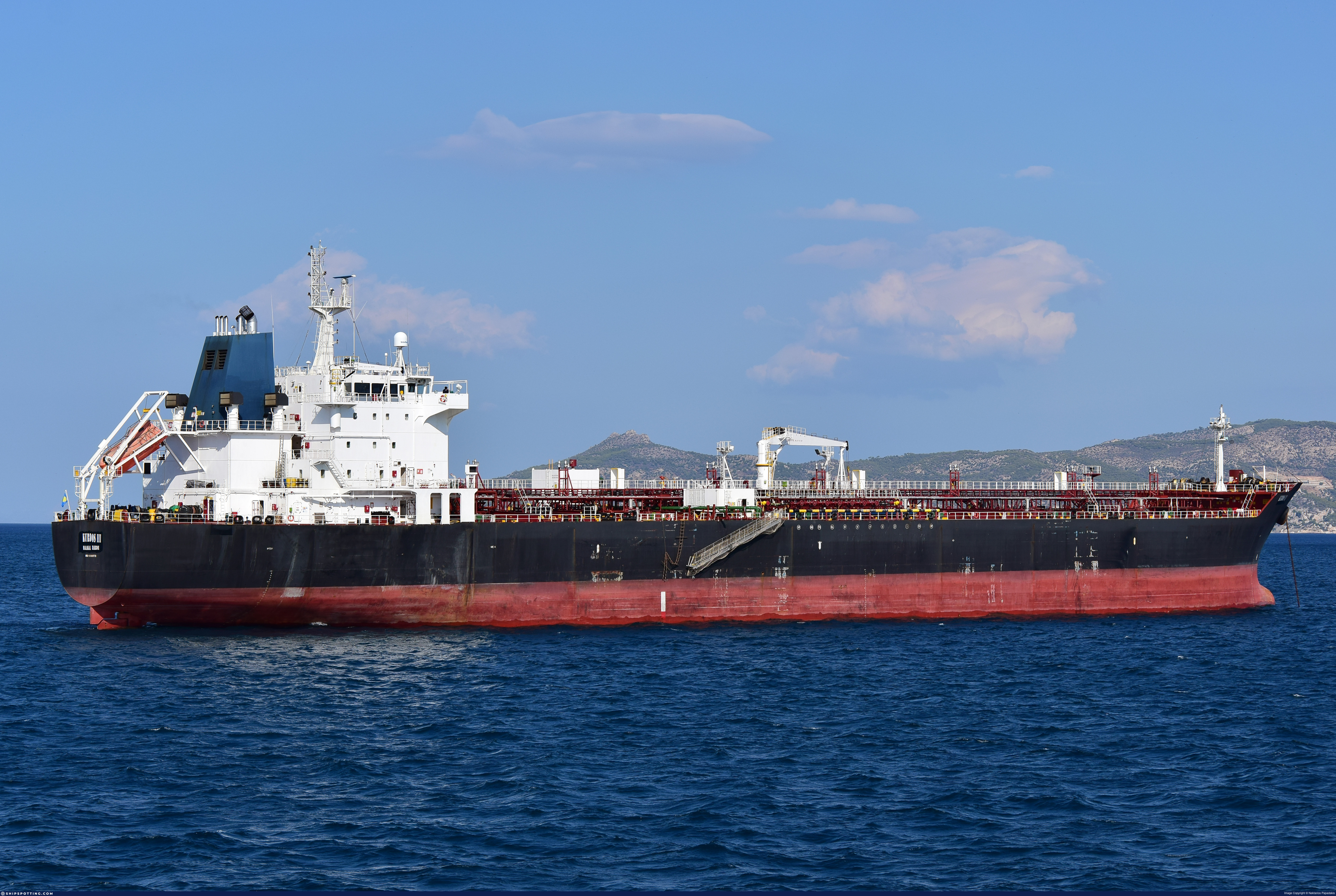
Vessel Name
BINARY STAR View name history 📜
IMO Number
9380570
MMSI
511101819
Vessel Type
Chemical/
Products Tanker| Transporteur de
produits
chimiques
Flag
🇳🇮 Nicaragua View flag history 📜
Sanctioned by
Management & Operations
ISM Manager
UNKNOWN
Unknown
Commercial Manager
KURDOS SHIPPING INC
Classification & Safety
Current Classification
DNV (IACS)
Delivered
Port State Control (PSC) Inspections
Risk Level
LOW
Last 36 Months
8
Inspections
Last Inspection
📍 Novorossiisk
📅 2025-03-03
Programs & Notes
EU Russia Sanctions – Shadow Fleet | SEMA (Canada) — vessel designations | The Russia (Sanctions) (EU Exit) Regulations 2019
Vessel Changes
AIS Events
50 events detected • 2 zones • Last: Apr 28, 2026
Loiter
Gulf of Oman Sanctioned Vessel Monitoring Zone
Apr 28, 2026 20:05 UTC
75.0%
- Duration: 2h 9m
- Radius: 94 meters
- Data Points: 19 AIS positions
- Centroid: 25.4380, 55.0763
- Zone: Gulf of Oman Sanctioned Vessel Monitoring Zone
Show Raw Evidence JSON
{
    "radius_m": 93.599999999999994315658113919198513031005859375,
    "duration_minutes": 129,
    "points": 19,
    "centroid": {
        "lat": 25.438045973684214828836047672666609287261962890625,
        "lon": 55.07628720000000299705789075233042240142822265625
    },
    "bbox": {
        "min_lat": 25.43735170000000067602741182781755924224853515625,
        "min_lon": 55.07608499999999907004166743718087673187255859375,
        "max_lat": 25.43854999999999932924765744246542453765869140625,
        "max_lon": 55.07682170000000354548319592140614986419677734375
    },
    "zone_id": "discovered_044"
}
Zone Dwell
Gulf of Oman Sanctioned Vessel Monitoring Zone
Apr 28, 2026 20:05 UTC
80.0%
- Zone: Gulf of Oman Sanctioned Vessel Monitoring Zone
- Duration: 2h 9m
- Data Points: 19 AIS positions
- Period: 2026-04-28T20:05:26+00:00 to 2026-04-28T22:14:25+00:00
Show Raw Evidence JSON
{
    "zone_id": "discovered_044",
    "zone_name": "Brittany Coast Surveillance Zone",
    "dwell_minutes": 129,
    "points_in_zone": 19,
    "first_point": {
        "ts": "2026-04-28T20:05:26+00:00",
        "lat": 25.43735170000000067602741182781755924224853515625,
        "lon": 55.07681670000000195841494132764637470245361328125
    },
    "last_point": {
        "ts": "2026-04-28T22:14:25+00:00",
        "lat": 25.43854999999999932924765744246542453765869140625,
        "lon": 55.0761116999999984500391292385756969451904296875
    }
}
Loiter
Gulf of Oman Sanctioned Vessel Monitoring Zone
Apr 28, 2026 19:20 UTC
75.0%
- Duration: 2h 54m
- Radius: 113 meters
- Data Points: 27 AIS positions
- Centroid: 25.4378, 55.0765
- Zone: Gulf of Oman Sanctioned Vessel Monitoring Zone
Show Raw Evidence JSON
{
    "radius_m": 113,
    "duration_minutes": 174,
    "points": 27,
    "centroid": {
        "lat": 25.437784022222221125275609665550291538238525390625,
        "lon": 55.07654099259259083964934688992798328399658203125
    },
    "bbox": {
        "min_lat": 25.437046699999999788133209221996366977691650390625,
        "min_lon": 55.07608499999999907004166743718087673187255859375,
        "max_lat": 25.43854999999999932924765744246542453765869140625,
        "max_lon": 55.0773166999999972404111758805811405181884765625
    },
    "zone_id": "discovered_044"
}
Zone Dwell
Gulf of Oman Sanctioned Vessel Monitoring Zone
Apr 28, 2026 19:20 UTC
80.0%
- Zone: Gulf of Oman Sanctioned Vessel Monitoring Zone
- Duration: 2h 54m
- Data Points: 27 AIS positions
- Period: 2026-04-28T19:20:27+00:00 to 2026-04-28T22:14:25+00:00
Show Raw Evidence JSON
{
    "zone_id": "discovered_044",
    "zone_name": "Brittany Coast Surveillance Zone",
    "dwell_minutes": 174,
    "points_in_zone": 27,
    "first_point": {
        "ts": "2026-04-28T19:20:27+00:00",
        "lat": 25.437056699999999409556039609014987945556640625,
        "lon": 55.07731499999999869032762944698333740234375
    },
    "last_point": {
        "ts": "2026-04-28T22:14:25+00:00",
        "lat": 25.43854999999999932924765744246542453765869140625,
        "lon": 55.0761116999999984500391292385756969451904296875
    }
}
Loiter
Gulf of Oman Sanctioned Vessel Monitoring Zone
Apr 28, 2026 18:05 UTC
75.0%
- Duration: 4h 8m
- Radius: 182 meters
- Data Points: 31 AIS positions
- Centroid: 25.4377, 55.0767
- Zone: Gulf of Oman Sanctioned Vessel Monitoring Zone
Show Raw Evidence JSON
{
    "radius_m": 182.19999999999998863131622783839702606201171875,
    "duration_minutes": 248.900000000000005684341886080801486968994140625,
    "points": 31,
    "centroid": {
        "lat": 25.43767156774193693991037434898316860198974609375,
        "lon": 55.076707422580653883414925076067447662353515625
    },
    "bbox": {
        "min_lat": 25.436801700000000181489667738787829875946044921875,
        "min_lon": 55.07608499999999907004166743718087673187255859375,
        "max_lat": 25.43854999999999932924765744246542453765869140625,
        "max_lon": 55.07824500000000256250132224522531032562255859375
    },
    "zone_id": "discovered_044"
}
Zone Dwell
Gulf of Oman Sanctioned Vessel Monitoring Zone
Apr 28, 2026 18:05 UTC
80.0%
- Zone: Gulf of Oman Sanctioned Vessel Monitoring Zone
- Duration: 4h 8m
- Data Points: 31 AIS positions
- Period: 2026-04-28T18:05:28+00:00 to 2026-04-28T22:14:25+00:00
Show Raw Evidence JSON
{
    "zone_id": "discovered_044",
    "zone_name": "Brittany Coast Surveillance Zone",
    "dwell_minutes": 248.900000000000005684341886080801486968994140625,
    "points_in_zone": 31,
    "first_point": {
        "ts": "2026-04-28T18:05:28+00:00",
        "lat": 25.436801700000000181489667738787829875946044921875,
        "lon": 55.07824500000000256250132224522531032562255859375
    },
    "last_point": {
        "ts": "2026-04-28T22:14:25+00:00",
        "lat": 25.43854999999999932924765744246542453765869140625,
        "lon": 55.0761116999999984500391292385756969451904296875
    }
}
Loiter
Gulf of Oman Sanctioned Vessel Monitoring Zone
Apr 28, 2026 17:14 UTC
75.0%
- Duration: 5 hours
- Radius: 221 meters
- Data Points: 34 AIS positions
- Centroid: 25.4376, 55.0769
- Zone: Gulf of Oman Sanctioned Vessel Monitoring Zone
Show Raw Evidence JSON
{
    "radius_m": 221.30000000000001136868377216160297393798828125,
    "duration_minutes": 300,
    "points": 34,
    "centroid": {
        "lat": 25.43759888235293686875593266449868679046630859375,
        "lon": 55.0768890705882512293101171962916851043701171875
    },
    "bbox": {
        "min_lat": 25.436801700000000181489667738787829875946044921875,
        "min_lon": 55.07608499999999907004166743718087673187255859375,
        "max_lat": 25.43854999999999932924765744246542453765869140625,
        "max_lon": 55.078928300000001172520569525659084320068359375
    },
    "zone_id": "discovered_044"
}
Zone Dwell
Gulf of Oman Sanctioned Vessel Monitoring Zone
Apr 28, 2026 17:14 UTC
80.0%
- Zone: Gulf of Oman Sanctioned Vessel Monitoring Zone
- Duration: 5 hours
- Data Points: 34 AIS positions
- Period: 2026-04-28T17:14:23+00:00 to 2026-04-28T22:14:25+00:00
Show Raw Evidence JSON
{
    "zone_id": "discovered_044",
    "zone_name": "Brittany Coast Surveillance Zone",
    "dwell_minutes": 300,
    "points_in_zone": 34,
    "first_point": {
        "ts": "2026-04-28T17:14:23+00:00",
        "lat": 25.4368367000000006328264134936034679412841796875,
        "lon": 55.07869500000000329009708366356790065765380859375
    },
    "last_point": {
        "ts": "2026-04-28T22:14:25+00:00",
        "lat": 25.43854999999999932924765744246542453765869140625,
        "lon": 55.0761116999999984500391292385756969451904296875
    }
}
Loiter
Gulf of Oman Sanctioned Vessel Monitoring Zone
Apr 28, 2026 16:05 UTC
75.0%
- Duration: 6h 9m
- Radius: 238 meters
- Data Points: 40 AIS positions
- Centroid: 25.4375, 55.0772
- Zone: Gulf of Oman Sanctioned Vessel Monitoring Zone
Show Raw Evidence JSON
{
    "radius_m": 237.599999999999994315658113919198513031005859375,
    "duration_minutes": 369,
    "points": 40,
    "centroid": {
        "lat": 25.4375256324999980961365508846938610076904296875,
        "lon": 55.07724112750003087057848460972309112548828125
    },
    "bbox": {
        "min_lat": 25.436801700000000181489667738787829875946044921875,
        "min_lon": 55.07608499999999907004166743718087673187255859375,
        "max_lat": 25.43854999999999932924765744246542453765869140625,
        "max_lon": 55.07959000000000315822035190649330615997314453125
    },
    "zone_id": "discovered_044"
}
Zone Dwell
Gulf of Oman Sanctioned Vessel Monitoring Zone
Apr 28, 2026 16:05 UTC
80.0%
- Zone: Gulf of Oman Sanctioned Vessel Monitoring Zone
- Duration: 6h 9m
- Data Points: 40 AIS positions
- Period: 2026-04-28T16:05:23+00:00 to 2026-04-28T22:14:25+00:00
Show Raw Evidence JSON
{
    "zone_id": "discovered_044",
    "zone_name": "Brittany Coast Surveillance Zone",
    "dwell_minutes": 369,
    "points_in_zone": 40,
    "first_point": {
        "ts": "2026-04-28T16:05:23+00:00",
        "lat": 25.437298299999998363318809424526989459991455078125,
        "lon": 55.07959000000000315822035190649330615997314453125
    },
    "last_point": {
        "ts": "2026-04-28T22:14:25+00:00",
        "lat": 25.43854999999999932924765744246542453765869140625,
        "lon": 55.0761116999999984500391292385756969451904296875
    }
}
Loiter
Gulf of Oman Sanctioned Vessel Monitoring Zone
Apr 28, 2026 15:53 UTC
75.0%
- Duration: 6h 21m
- Radius: 238 meters
- Data Points: 42 AIS positions
- Centroid: 25.4375, 55.0774
- Zone: Gulf of Oman Sanctioned Vessel Monitoring Zone
Show Raw Evidence JSON
{
    "radius_m": 237.900000000000005684341886080801486968994140625,
    "duration_minutes": 381,
    "points": 42,
    "centroid": {
        "lat": 25.43751917380952676239758147858083248138427734375,
        "lon": 55.0773583357143223793173092417418956756591796875
    },
    "bbox": {
        "min_lat": 25.436801700000000181489667738787829875946044921875,
        "min_lon": 55.07608499999999907004166743718087673187255859375,
        "max_lat": 25.43854999999999932924765744246542453765869140625,
        "max_lon": 55.07972170000000033951437217183411121368408203125
    },
    "zone_id": "discovered_044"
}
Zone Dwell
Gulf of Oman Sanctioned Vessel Monitoring Zone
Apr 28, 2026 15:53 UTC
80.0%
- Zone: Gulf of Oman Sanctioned Vessel Monitoring Zone
- Duration: 6h 21m
- Data Points: 42 AIS positions
- Period: 2026-04-28T15:53:23+00:00 to 2026-04-28T22:14:25+00:00
Show Raw Evidence JSON
{
    "zone_id": "discovered_044",
    "zone_name": "Brittany Coast Surveillance Zone",
    "dwell_minutes": 381,
    "points_in_zone": 42,
    "first_point": {
        "ts": "2026-04-28T15:53:23+00:00",
        "lat": 25.437438300000000168665792443789541721343994140625,
        "lon": 55.07972170000000033951437217183411121368408203125
    },
    "last_point": {
        "ts": "2026-04-28T22:14:25+00:00",
        "lat": 25.43854999999999932924765744246542453765869140625,
        "lon": 55.0761116999999984500391292385756969451904296875
    }
}
Loiter
Gulf of Oman Sanctioned Vessel Monitoring Zone
Apr 28, 2026 14:59 UTC
75.0%
- Duration: 6h 27m
- Radius: 258 meters
- Data Points: 32 AIS positions
- Centroid: 25.4372, 55.0779
- Zone: Gulf of Oman Sanctioned Vessel Monitoring Zone
Show Raw Evidence JSON
{
    "radius_m": 258.19999999999998863131622783839702606201171875,
    "duration_minutes": 387.1000000000000227373675443232059478759765625,
    "points": 32,
    "centroid": {
        "lat": 25.437242296875002267597665195353329181671142578125,
        "lon": 55.07787776250001599009920028038322925567626953125
    },
    "bbox": {
        "min_lat": 25.436801700000000181489667738787829875946044921875,
        "min_lon": 55.076126700000003211243893019855022430419921875,
        "max_lat": 25.4381249999999994315658113919198513031005859375,
        "max_lon": 55.08025330000000252539393841288983821868896484375
    },
    "zone_id": "discovered_044"
}
Zone Dwell
Gulf of Oman Sanctioned Vessel Monitoring Zone
Apr 28, 2026 14:59 UTC
80.0%
- Zone: Gulf of Oman Sanctioned Vessel Monitoring Zone
- Duration: 6h 27m
- Data Points: 32 AIS positions
- Period: 2026-04-28T14:59:22+00:00 to 2026-04-28T21:26:26+00:00
Show Raw Evidence JSON
{
    "zone_id": "discovered_044",
    "zone_name": "Brittany Coast Surveillance Zone",
    "dwell_minutes": 387.1000000000000227373675443232059478759765625,
    "points_in_zone": 32,
    "first_point": {
        "ts": "2026-04-28T14:59:22+00:00",
        "lat": 25.4381249999999994315658113919198513031005859375,
        "lon": 55.08025330000000252539393841288983821868896484375
    },
    "last_point": {
        "ts": "2026-04-28T21:26:26+00:00",
        "lat": 25.43810500000000018872015061788260936737060546875,
        "lon": 55.076126700000003211243893019855022430419921875
    }
}
Loiter
Central Black Sea Monitoring Zone
Feb 6, 2026 15:05 UTC
75.0%
- Duration: 1h 33m
- Radius: 912 meters
- Data Points: 11 AIS positions
- Centroid: 25.4040, 55.0803
- Zone: Central Black Sea Monitoring Zone
Show Raw Evidence JSON
{
    "radius_m": 911.5,
    "duration_minutes": 93.2999999999999971578290569595992565155029296875,
    "points": 11,
    "centroid": {
        "lat": 25.403979072727278065713107935152947902679443359375,
        "lon": 55.08034668181819171195456874556839466094970703125
    },
    "bbox": {
        "min_lat": 25.40299830000000014251781976781785488128662109375,
        "min_lon": 55.07936169999999975743776303716003894805908203125,
        "max_lat": 25.410180000000000433146851719357073307037353515625,
        "max_lon": 55.08630169999999992569428286515176296234130859375
    },
    "zone_id": "discovered_040"
}
Zone Dwell
Central Black Sea Monitoring Zone
Feb 6, 2026 15:05 UTC
80.0%
- Zone: Central Black Sea Monitoring Zone
- Duration: 1h 33m
- Data Points: 11 AIS positions
- Period: 2026-02-06T15:05:40+00:00 to 2026-02-06T16:38:59+00:00
Show Raw Evidence JSON
{
    "zone_id": "discovered_040",
    "zone_name": "Gulf of Oman Sanctioned Vessel Monitoring Zone",
    "dwell_minutes": 93.2999999999999971578290569595992565155029296875,
    "points_in_zone": 11,
    "first_point": {
        "ts": "2026-02-06T15:05:40+00:00",
        "lat": 25.40317329999999884648786974139511585235595703125,
        "lon": 55.07936169999999975743776303716003894805908203125
    },
    "last_point": {
        "ts": "2026-02-06T16:38:59+00:00",
        "lat": 25.410180000000000433146851719357073307037353515625,
        "lon": 55.08630169999999992569428286515176296234130859375
    }
}
Loiter
Central Black Sea Monitoring Zone
Feb 6, 2026 14:02 UTC
75.0%
- Duration: 2h 36m
- Radius: 981 meters
- Data Points: 18 AIS positions
- Centroid: 25.4035, 55.0798
- Zone: Central Black Sea Monitoring Zone
Show Raw Evidence JSON
{
    "radius_m": 981.200000000000045474735088646411895751953125,
    "duration_minutes": 156.30000000000001136868377216160297393798828125,
    "points": 18,
    "centroid": {
        "lat": 25.40354553888888489154851413331925868988037109375,
        "lon": 55.07984139444443627553482656367123126983642578125
    },
    "bbox": {
        "min_lat": 25.402750000000001051603248924948275089263916015625,
        "min_lon": 55.078924999999998135535861365497112274169921875,
        "max_lat": 25.410180000000000433146851719357073307037353515625,
        "max_lon": 55.08630169999999992569428286515176296234130859375
    },
    "zone_id": "discovered_040"
}
Zone Dwell
Central Black Sea Monitoring Zone
Feb 6, 2026 14:02 UTC
80.0%
- Zone: Central Black Sea Monitoring Zone
- Duration: 2h 36m
- Data Points: 18 AIS positions
- Period: 2026-02-06T14:02:41+00:00 to 2026-02-06T16:38:59+00:00
Show Raw Evidence JSON
{
    "zone_id": "discovered_040",
    "zone_name": "Gulf of Oman Sanctioned Vessel Monitoring Zone",
    "dwell_minutes": 156.30000000000001136868377216160297393798828125,
    "points_in_zone": 18,
    "first_point": {
        "ts": "2026-02-06T14:02:41+00:00",
        "lat": 25.402750000000001051603248924948275089263916015625,
        "lon": 55.078924999999998135535861365497112274169921875
    },
    "last_point": {
        "ts": "2026-02-06T16:38:59+00:00",
        "lat": 25.410180000000000433146851719357073307037353515625,
        "lon": 55.08630169999999992569428286515176296234130859375
    }
}
Loiter
Central Black Sea Monitoring Zone
Feb 6, 2026 13:56 UTC
75.0%
- Duration: 2h 42m
- Radius: 995 meters
- Data Points: 20 AIS positions
- Centroid: 25.4035, 55.0797
- Zone: Central Black Sea Monitoring Zone
Show Raw Evidence JSON
{
    "radius_m": 994.6000000000000227373675443232059478759765625,
    "duration_minutes": 162.30000000000001136868377216160297393798828125,
    "points": 20,
    "centroid": {
        "lat": 25.40346248499999859404852031730115413665771484375,
        "lon": 55.0797437549999955308521748520433902740478515625
    },
    "bbox": {
        "min_lat": 25.402705000000000978843672783114016056060791015625,
        "min_lon": 55.07884829999999709571056882850825786590576171875,
        "max_lat": 25.410180000000000433146851719357073307037353515625,
        "max_lon": 55.08630169999999992569428286515176296234130859375
    },
    "zone_id": "discovered_040"
}
Zone Dwell
Central Black Sea Monitoring Zone
Feb 6, 2026 13:56 UTC
80.0%
- Zone: Central Black Sea Monitoring Zone
- Duration: 2h 42m
- Data Points: 20 AIS positions
- Period: 2026-02-06T13:56:40+00:00 to 2026-02-06T16:38:59+00:00
Show Raw Evidence JSON
{
    "zone_id": "discovered_040",
    "zone_name": "Gulf of Oman Sanctioned Vessel Monitoring Zone",
    "dwell_minutes": 162.30000000000001136868377216160297393798828125,
    "points_in_zone": 20,
    "first_point": {
        "ts": "2026-02-06T13:56:40+00:00",
        "lat": 25.402705000000000978843672783114016056060791015625,
        "lon": 55.07884829999999709571056882850825786590576171875
    },
    "last_point": {
        "ts": "2026-02-06T16:38:59+00:00",
        "lat": 25.410180000000000433146851719357073307037353515625,
        "lon": 55.08630169999999992569428286515176296234130859375
    }
}
Loiter
Central Black Sea Monitoring Zone
Feb 6, 2026 10:44 UTC
75.0%
- Duration: 5h 54m
- Radius: 1,013 meters
- Data Points: 22 AIS positions
- Centroid: 25.4033, 55.0797
- Zone: Central Black Sea Monitoring Zone
Show Raw Evidence JSON
{
    "radius_m": 1012.8999999999999772626324556767940521240234375,
    "duration_minutes": 354.19999999999998863131622783839702606201171875,
    "points": 22,
    "centroid": {
        "lat": 25.403307713636362308307070634327828884124755859375,
        "lon": 55.07966167272727631143425242044031620025634765625
    },
    "bbox": {
        "min_lat": 25.40175500000000141653799801133573055267333984375,
        "min_lon": 55.0788399999999995770849636755883693695068359375,
        "max_lat": 25.410180000000000433146851719357073307037353515625,
        "max_lon": 55.08630169999999992569428286515176296234130859375
    },
    "zone_id": "discovered_040"
}
Zone Dwell
Central Black Sea Monitoring Zone
Feb 6, 2026 10:44 UTC
80.0%
- Zone: Central Black Sea Monitoring Zone
- Duration: 5h 54m
- Data Points: 22 AIS positions
- Period: 2026-02-06T10:44:44+00:00 to 2026-02-06T16:38:59+00:00
Show Raw Evidence JSON
{
    "zone_id": "discovered_040",
    "zone_name": "Gulf of Oman Sanctioned Vessel Monitoring Zone",
    "dwell_minutes": 354.19999999999998863131622783839702606201171875,
    "points_in_zone": 22,
    "first_point": {
        "ts": "2026-02-06T10:44:44+00:00",
        "lat": 25.401765000000001037960828398354351520538330078125,
        "lon": 55.0788399999999995770849636755883693695068359375
    },
    "last_point": {
        "ts": "2026-02-06T16:38:59+00:00",
        "lat": 25.410180000000000433146851719357073307037353515625,
        "lon": 55.08630169999999992569428286515176296234130859375
    }
}
Loiter
Central Black Sea Monitoring Zone
Feb 6, 2026 08:32 UTC
75.0%
- Duration: 6h 33m
- Radius: 103 meters
- Data Points: 13 AIS positions
- Centroid: 25.4027, 55.0790
- Zone: Central Black Sea Monitoring Zone
Show Raw Evidence JSON
{
    "radius_m": 103.099999999999994315658113919198513031005859375,
    "duration_minutes": 393,
    "points": 13,
    "centroid": {
        "lat": 25.402672553846155523160632583312690258026123046875,
        "lon": 55.079010515384624113721656613051891326904296875
    },
    "bbox": {
        "min_lat": 25.40175500000000141653799801133573055267333984375,
        "min_lon": 55.0788399999999995770849636755883693695068359375,
        "max_lat": 25.40317329999999884648786974139511585235595703125,
        "max_lon": 55.07936169999999975743776303716003894805908203125
    },
    "zone_id": "discovered_040"
}
Zone Dwell
Central Black Sea Monitoring Zone
Feb 6, 2026 08:32 UTC
80.0%
- Zone: Central Black Sea Monitoring Zone
- Duration: 6h 33m
- Data Points: 13 AIS positions
- Period: 2026-02-06T08:32:38+00:00 to 2026-02-06T15:05:40+00:00
Show Raw Evidence JSON
{
    "zone_id": "discovered_040",
    "zone_name": "Gulf of Oman Sanctioned Vessel Monitoring Zone",
    "dwell_minutes": 393,
    "points_in_zone": 13,
    "first_point": {
        "ts": "2026-02-06T08:32:38+00:00",
        "lat": 25.402570000000000760564944357611238956451416015625,
        "lon": 55.079031700000001592343323864042758941650390625
    },
    "last_point": {
        "ts": "2026-02-06T15:05:40+00:00",
        "lat": 25.40317329999999884648786974139511585235595703125,
        "lon": 55.07936169999999975743776303716003894805908203125
    }
}
Zone Dwell
Central Black Sea Monitoring Zone
Feb 4, 2026 22:14 UTC
80.0%
- Zone: Central Black Sea Monitoring Zone
- Duration: 1h 15m
- Data Points: 2 AIS positions
- Period: 2026-02-04T22:14:29+00:00 to 2026-02-04T23:29:27+00:00
Show Raw Evidence JSON
{
    "zone_id": "discovered_040",
    "zone_name": "Gulf of Oman Sanctioned Vessel Monitoring Zone",
    "dwell_minutes": 75,
    "points_in_zone": 2,
    "first_point": {
        "ts": "2026-02-04T22:14:29+00:00",
        "lat": 25.40182829999999825076884008012712001800537109375,
        "lon": 55.0780467000000015787009033374488353729248046875
    },
    "last_point": {
        "ts": "2026-02-04T23:29:27+00:00",
        "lat": 25.40192329999999998335624695755541324615478515625,
        "lon": 55.078045000000003028617356903851032257080078125
    }
}
Zone Dwell
Central Black Sea Monitoring Zone
Feb 4, 2026 21:14 UTC
80.0%
- Zone: Central Black Sea Monitoring Zone
- Duration: 2h 14m
- Data Points: 4 AIS positions
- Period: 2026-02-04T21:14:33+00:00 to 2026-02-04T23:29:27+00:00
Show Raw Evidence JSON
{
    "zone_id": "discovered_040",
    "zone_name": "Gulf of Oman Sanctioned Vessel Monitoring Zone",
    "dwell_minutes": 134.900000000000005684341886080801486968994140625,
    "points_in_zone": 4,
    "first_point": {
        "ts": "2026-02-04T21:14:33+00:00",
        "lat": 25.40197330000000164318407769314944744110107421875,
        "lon": 55.0781199999999984129317454062402248382568359375
    },
    "last_point": {
        "ts": "2026-02-04T23:29:27+00:00",
        "lat": 25.40192329999999998335624695755541324615478515625,
        "lon": 55.078045000000003028617356903851032257080078125
    }
}
Zone Dwell
Central Black Sea Monitoring Zone
Feb 4, 2026 20:23 UTC
80.0%
- Zone: Central Black Sea Monitoring Zone
- Duration: 3h 6m
- Data Points: 5 AIS positions
- Period: 2026-02-04T20:23:29+00:00 to 2026-02-04T23:29:27+00:00
Show Raw Evidence JSON
{
    "zone_id": "discovered_040",
    "zone_name": "Gulf of Oman Sanctioned Vessel Monitoring Zone",
    "dwell_minutes": 186,
    "points_in_zone": 5,
    "first_point": {
        "ts": "2026-02-04T20:23:29+00:00",
        "lat": 25.401965000000000571844793739728629589080810546875,
        "lon": 55.078170000000000072759576141834259033203125
    },
    "last_point": {
        "ts": "2026-02-04T23:29:27+00:00",
        "lat": 25.40192329999999998335624695755541324615478515625,
        "lon": 55.078045000000003028617356903851032257080078125
    }
}
Loiter
Central Black Sea Monitoring Zone
Feb 4, 2026 19:02 UTC
75.0%
- Duration: 4h 26m
- Radius: 112 meters
- Data Points: 14 AIS positions
- Centroid: 25.4028, 55.0784
- Zone: Central Black Sea Monitoring Zone
Show Raw Evidence JSON
{
    "radius_m": 111.900000000000005684341886080801486968994140625,
    "duration_minutes": 266.8999999999999772626324556767940521240234375,
    "points": 14,
    "centroid": {
        "lat": 25.402792500000000330828697769902646541595458984375,
        "lon": 55.07837809285714314455617568455636501312255859375
    },
    "bbox": {
        "min_lat": 25.40182829999999825076884008012712001800537109375,
        "min_lon": 55.078045000000003028617356903851032257080078125,
        "max_lat": 25.403580000000001604121280252002179622650146484375,
        "max_lon": 55.0788050000000026784618967212736606597900390625
    },
    "zone_id": "discovered_040"
}
Zone Dwell
Central Black Sea Monitoring Zone
Feb 4, 2026 19:02 UTC
80.0%
- Zone: Central Black Sea Monitoring Zone
- Duration: 4h 26m
- Data Points: 14 AIS positions
- Period: 2026-02-04T19:02:30+00:00 to 2026-02-04T23:29:27+00:00
Show Raw Evidence JSON
{
    "zone_id": "discovered_040",
    "zone_name": "Gulf of Oman Sanctioned Vessel Monitoring Zone",
    "dwell_minutes": 266.8999999999999772626324556767940521240234375,
    "points_in_zone": 14,
    "first_point": {
        "ts": "2026-02-04T19:02:30+00:00",
        "lat": 25.403580000000001604121280252002179622650146484375,
        "lon": 55.0788050000000026784618967212736606597900390625
    },
    "last_point": {
        "ts": "2026-02-04T23:29:27+00:00",
        "lat": 25.40192329999999998335624695755541324615478515625,
        "lon": 55.078045000000003028617356903851032257080078125
    }
}
Loiter
Central Black Sea Monitoring Zone
Feb 4, 2026 18:17 UTC
75.0%
- Duration: 5h 12m
- Radius: 127 meters
- Data Points: 16 AIS positions
- Centroid: 25.4029, 55.0785
- Zone: Central Black Sea Monitoring Zone
Show Raw Evidence JSON
{
    "radius_m": 127.2999999999999971578290569595992565155029296875,
    "duration_minutes": 312,
    "points": 16,
    "centroid": {
        "lat": 25.402909793750001909984348458237946033477783203125,
        "lon": 55.07847573125000195659595192410051822662353515625
    },
    "bbox": {
        "min_lat": 25.40182829999999825076884008012712001800537109375,
        "min_lon": 55.078045000000003028617356903851032257080078125,
        "max_lat": 25.403736699999999615329215885140001773834228515625,
        "max_lon": 55.0791717000000033976903068833053112030029296875
    },
    "zone_id": "discovered_040"
}
Zone Dwell
Central Black Sea Monitoring Zone
Feb 4, 2026 18:17 UTC
80.0%
- Zone: Central Black Sea Monitoring Zone
- Duration: 5h 12m
- Data Points: 16 AIS positions
- Period: 2026-02-04T18:17:25+00:00 to 2026-02-04T23:29:27+00:00
Show Raw Evidence JSON
{
    "zone_id": "discovered_040",
    "zone_name": "Gulf of Oman Sanctioned Vessel Monitoring Zone",
    "dwell_minutes": 312,
    "points_in_zone": 16,
    "first_point": {
        "ts": "2026-02-04T18:17:25+00:00",
        "lat": 25.40372500000000144382283906452357769012451171875,
        "lon": 55.0791717000000033976903068833053112030029296875
    },
    "last_point": {
        "ts": "2026-02-04T23:29:27+00:00",
        "lat": 25.40192329999999998335624695755541324615478515625,
        "lon": 55.078045000000003028617356903851032257080078125
    }
}
Loiter
Central Black Sea Monitoring Zone
Feb 4, 2026 17:05 UTC
75.0%
- Duration: 6h 24m
- Radius: 137 meters
- Data Points: 21 AIS positions
- Centroid: 25.4030, 55.0785
- Zone: Central Black Sea Monitoring Zone
Show Raw Evidence JSON
{
    "radius_m": 137.400000000000005684341886080801486968994140625,
    "duration_minutes": 384,
    "points": 21,
    "centroid": {
        "lat": 25.403002938095237794868808123283088207244873046875,
        "lon": 55.0784855571428551002099993638694286346435546875
    },
    "bbox": {
        "min_lat": 25.40182829999999825076884008012712001800537109375,
        "min_lon": 55.078045000000003028617356903851032257080078125,
        "max_lat": 25.403736699999999615329215885140001773834228515625,
        "max_lon": 55.0791717000000033976903068833053112030029296875
    },
    "zone_id": "discovered_040"
}
Zone Dwell
Central Black Sea Monitoring Zone
Feb 4, 2026 17:05 UTC
80.0%
- Zone: Central Black Sea Monitoring Zone
- Duration: 6h 24m
- Data Points: 21 AIS positions
- Period: 2026-02-04T17:05:28+00:00 to 2026-02-04T23:29:27+00:00
Show Raw Evidence JSON
{
    "zone_id": "discovered_040",
    "zone_name": "Gulf of Oman Sanctioned Vessel Monitoring Zone",
    "dwell_minutes": 384,
    "points_in_zone": 21,
    "first_point": {
        "ts": "2026-02-04T17:05:28+00:00",
        "lat": 25.403348300000001103171598515473306179046630859375,
        "lon": 55.07869329999999763458617962896823883056640625
    },
    "last_point": {
        "ts": "2026-02-04T23:29:27+00:00",
        "lat": 25.40192329999999998335624695755541324615478515625,
        "lon": 55.078045000000003028617356903851032257080078125
    }
}
Loiter
Central Black Sea Monitoring Zone
Feb 4, 2026 16:23 UTC
75.0%
- Duration: 6h 39m
- Radius: 142 meters
- Data Points: 23 AIS positions
- Centroid: 25.4030, 55.0785
- Zone: Central Black Sea Monitoring Zone
Show Raw Evidence JSON
{
    "radius_m": 141.900000000000005684341886080801486968994140625,
    "duration_minutes": 399.1000000000000227373675443232059478759765625,
    "points": 23,
    "centroid": {
        "lat": 25.403037826086961814553433214314281940460205078125,
        "lon": 55.078510582608686263483832590281963348388671875
    },
    "bbox": {
        "min_lat": 25.40182829999999825076884008012712001800537109375,
        "min_lon": 55.078045000000003028617356903851032257080078125,
        "max_lat": 25.403736699999999615329215885140001773834228515625,
        "max_lon": 55.0791717000000033976903068833053112030029296875
    },
    "zone_id": "discovered_040"
}
Zone Dwell
Central Black Sea Monitoring Zone
Feb 4, 2026 16:23 UTC
80.0%
- Zone: Central Black Sea Monitoring Zone
- Duration: 6h 39m
- Data Points: 23 AIS positions
- Period: 2026-02-04T16:50:23+00:00 to 2026-02-04T23:29:27+00:00
Show Raw Evidence JSON
{
    "zone_id": "discovered_040",
    "zone_name": "Gulf of Oman Sanctioned Vessel Monitoring Zone",
    "dwell_minutes": 399.1000000000000227373675443232059478759765625,
    "points_in_zone": 23,
    "first_point": {
        "ts": "2026-02-04T16:50:23+00:00",
        "lat": 25.403408299999998831708580837585031986236572265625,
        "lon": 55.0787966999999980544089339673519134521484375
    },
    "last_point": {
        "ts": "2026-02-04T23:29:27+00:00",
        "lat": 25.40192329999999998335624695755541324615478515625,
        "lon": 55.078045000000003028617356903851032257080078125
    }
}
Loiter
Central Black Sea Monitoring Zone
Feb 4, 2026 15:02 UTC
75.0%
- Duration: 6h 30m
- Radius: 165 meters
- Data Points: 29 AIS positions
- Centroid: 25.4032, 55.0786
- Zone: Central Black Sea Monitoring Zone
Show Raw Evidence JSON
{
    "radius_m": 164.5,
    "duration_minutes": 390.1000000000000227373675443232059478759765625,
    "points": 29,
    "centroid": {
        "lat": 25.403210117241382448582953657023608684539794921875,
        "lon": 55.078646610344804912529070861637592315673828125
    },
    "bbox": {
        "min_lat": 25.40182829999999825076884008012712001800537109375,
        "min_lon": 55.0780467000000015787009033374488353729248046875,
        "max_lat": 25.403870000000001283524397877044975757598876953125,
        "max_lon": 55.0792282999999969206328387372195720672607421875
    },
    "zone_id": "discovered_040"
}
Zone Dwell
Central Black Sea Monitoring Zone
Feb 4, 2026 15:02 UTC
80.0%
- Zone: Central Black Sea Monitoring Zone
- Duration: 6h 30m
- Data Points: 29 AIS positions
- Period: 2026-02-04T15:44:26+00:00 to 2026-02-04T22:14:29+00:00
Show Raw Evidence JSON
{
    "zone_id": "discovered_040",
    "zone_name": "Gulf of Oman Sanctioned Vessel Monitoring Zone",
    "dwell_minutes": 390.1000000000000227373675443232059478759765625,
    "points_in_zone": 29,
    "first_point": {
        "ts": "2026-02-04T15:44:26+00:00",
        "lat": 25.403870000000001283524397877044975757598876953125,
        "lon": 55.0792282999999969206328387372195720672607421875
    },
    "last_point": {
        "ts": "2026-02-04T22:14:29+00:00",
        "lat": 25.40182829999999825076884008012712001800537109375,
        "lon": 55.0780467000000015787009033374488353729248046875
    }
}
Loiter
Central Black Sea Monitoring Zone
Feb 4, 2026 14:14 UTC
75.0%
- Duration: 6h 27m
- Radius: 174 meters
- Data Points: 34 AIS positions
- Centroid: 25.4034, 55.0788
- Zone: Central Black Sea Monitoring Zone
Show Raw Evidence JSON
{
    "radius_m": 173.5,
    "duration_minutes": 387,
    "points": 34,
    "centroid": {
        "lat": 25.403375199999999267674866132438182830810546875,
        "lon": 55.07883514411762604368050233460962772369384765625
    },
    "bbox": {
        "min_lat": 25.401965000000000571844793739728629589080810546875,
        "min_lon": 55.078073299999999790088622830808162689208984375,
        "max_lat": 25.40394330000000167046891874633729457855224609375,
        "max_lon": 55.0796433000000007496055332012474536895751953125
    },
    "zone_id": "discovered_040"
}
Zone Dwell
Central Black Sea Monitoring Zone
Feb 4, 2026 14:14 UTC
80.0%
- Zone: Central Black Sea Monitoring Zone
- Duration: 6h 27m
- Data Points: 34 AIS positions
- Period: 2026-02-04T14:53:24+00:00 to 2026-02-04T21:20:25+00:00
Show Raw Evidence JSON
{
    "zone_id": "discovered_040",
    "zone_name": "Gulf of Oman Sanctioned Vessel Monitoring Zone",
    "dwell_minutes": 387,
    "points_in_zone": 34,
    "first_point": {
        "ts": "2026-02-04T14:53:24+00:00",
        "lat": 25.403870000000001283524397877044975757598876953125,
        "lon": 55.07959670000000329537215293385088443756103515625
    },
    "last_point": {
        "ts": "2026-02-04T21:20:25+00:00",
        "lat": 25.40196999999999860619936953298747539520263671875,
        "lon": 55.078073299999999790088622830808162689208984375
    }
}
Loiter
Central Black Sea Monitoring Zone
Feb 4, 2026 13:41 UTC
75.0%
- Duration: 6h 27m
- Radius: 192 meters
- Data Points: 39 AIS positions
- Centroid: 25.4035, 55.0790
- Zone: Central Black Sea Monitoring Zone
Show Raw Evidence JSON
{
    "radius_m": 191.900000000000005684341886080801486968994140625,
    "duration_minutes": 387.1000000000000227373675443232059478759765625,
    "points": 39,
    "centroid": {
        "lat": 25.40353436410256193767054355703294277191162109375,
        "lon": 55.07897632307690827246915432624518871307373046875
    },
    "bbox": {
        "min_lat": 25.401965000000000571844793739728629589080810546875,
        "min_lon": 55.0781649999999984856913215480744838714599609375,
        "max_lat": 25.40394330000000167046891874633729457855224609375,
        "max_lon": 55.0796433000000007496055332012474536895751953125
    },
    "zone_id": "discovered_040"
}
Zone Dwell
Central Black Sea Monitoring Zone
Feb 4, 2026 13:41 UTC
80.0%
- Zone: Central Black Sea Monitoring Zone
- Duration: 6h 27m
- Data Points: 39 AIS positions
- Period: 2026-02-04T13:56:26+00:00 to 2026-02-04T20:23:29+00:00
Show Raw Evidence JSON
{
    "zone_id": "discovered_040",
    "zone_name": "Gulf of Oman Sanctioned Vessel Monitoring Zone",
    "dwell_minutes": 387.1000000000000227373675443232059478759765625,
    "points_in_zone": 39,
    "first_point": {
        "ts": "2026-02-04T13:56:26+00:00",
        "lat": 25.4037450000000006866684998385608196258544921875,
        "lon": 55.079205000000001746229827404022216796875
    },
    "last_point": {
        "ts": "2026-02-04T20:23:29+00:00",
        "lat": 25.401965000000000571844793739728629589080810546875,
        "lon": 55.078170000000000072759576141834259033203125
    }
}
Loiter
Central Black Sea Monitoring Zone
Feb 4, 2026 12:17 UTC
75.0%
- Duration: 6h 39m
- Radius: 119 meters
- Data Points: 42 AIS positions
- Centroid: 25.4035, 55.0790
- Zone: Central Black Sea Monitoring Zone
Show Raw Evidence JSON
{
    "radius_m": 119.400000000000005684341886080801486968994140625,
    "duration_minutes": 399.1000000000000227373675443232059478759765625,
    "points": 42,
    "centroid": {
        "lat": 25.403544447619051283027147292159497737884521484375,
        "lon": 55.0789722214285717427628696896135807037353515625
    },
    "bbox": {
        "min_lat": 25.402631700000000591899151913821697235107421875,
        "min_lon": 55.0783066999999988411218510009348392486572265625,
        "max_lat": 25.40394330000000167046891874633729457855224609375,
        "max_lon": 55.0796433000000007496055332012474536895751953125
    },
    "zone_id": "discovered_040"
}
Zone Dwell
Central Black Sea Monitoring Zone
Feb 4, 2026 12:17 UTC
80.0%
- Zone: Central Black Sea Monitoring Zone
- Duration: 6h 39m
- Data Points: 42 AIS positions
- Period: 2026-02-04T12:50:23+00:00 to 2026-02-04T19:29:29+00:00
Show Raw Evidence JSON
{
    "zone_id": "discovered_040",
    "zone_name": "Gulf of Oman Sanctioned Vessel Monitoring Zone",
    "dwell_minutes": 399.1000000000000227373675443232059478759765625,
    "points_in_zone": 42,
    "first_point": {
        "ts": "2026-02-04T12:50:23+00:00",
        "lat": 25.402631700000000591899151913821697235107421875,
        "lon": 55.07834170000000284517227555625140666961669921875
    },
    "last_point": {
        "ts": "2026-02-04T19:29:29+00:00",
        "lat": 25.40308329999999870096871745772659778594970703125,
        "lon": 55.0783066999999988411218510009348392486572265625
    }
}
Loiter
Central Black Sea Monitoring Zone
Feb 4, 2026 11:05 UTC
75.0%
- Duration: 6h 33m
- Radius: 115 meters
- Data Points: 37 AIS positions
- Centroid: 25.4035, 55.0790
- Zone: Central Black Sea Monitoring Zone
Show Raw Evidence JSON
{
    "radius_m": 115.099999999999994315658113919198513031005859375,
    "duration_minutes": 393,
    "points": 37,
    "centroid": {
        "lat": 25.403501575675679902133197174407541751861572265625,
        "lon": 55.07896752162161391197514603845775127410888671875
    },
    "bbox": {
        "min_lat": 25.402631700000000591899151913821697235107421875,
        "min_lon": 55.078170000000000072759576141834259033203125,
        "max_lat": 25.40394330000000167046891874633729457855224609375,
        "max_lon": 55.0796433000000007496055332012474536895751953125
    },
    "zone_id": "discovered_040"
}
Zone Dwell
Central Black Sea Monitoring Zone
Feb 4, 2026 11:05 UTC
80.0%
- Zone: Central Black Sea Monitoring Zone
- Duration: 6h 33m
- Data Points: 37 AIS positions
- Period: 2026-02-04T11:44:27+00:00 to 2026-02-04T18:17:25+00:00
Show Raw Evidence JSON
{
    "zone_id": "discovered_040",
    "zone_name": "Gulf of Oman Sanctioned Vessel Monitoring Zone",
    "dwell_minutes": 393,
    "points_in_zone": 37,
    "first_point": {
        "ts": "2026-02-04T11:44:27+00:00",
        "lat": 25.4027932999999990215655998326838016510009765625,
        "lon": 55.078170000000000072759576141834259033203125
    },
    "last_point": {
        "ts": "2026-02-04T18:17:25+00:00",
        "lat": 25.40372500000000144382283906452357769012451171875,
        "lon": 55.0791717000000033976903068833053112030029296875
    }
}
Loiter
Central Black Sea Monitoring Zone
Feb 4, 2026 10:26 UTC
75.0%
- Duration: 6h 33m
- Radius: 119 meters
- Data Points: 45 AIS positions
- Centroid: 25.4033, 55.0788
- Zone: Central Black Sea Monitoring Zone
Show Raw Evidence JSON
{
    "radius_m": 119,
    "duration_minutes": 393.1000000000000227373675443232059478759765625,
    "points": 45,
    "centroid": {
        "lat": 25.403265035555552486812302959151566028594970703125,
        "lon": 55.07877106888887652758057811297476291656494140625
    },
    "bbox": {
        "min_lat": 25.40242669999999947094693197868764400482177734375,
        "min_lon": 55.0780316999999968174961395561695098876953125,
        "max_lat": 25.40394330000000167046891874633729457855224609375,
        "max_lon": 55.0796433000000007496055332012474536895751953125
    },
    "zone_id": "discovered_040"
}
Zone Dwell
Central Black Sea Monitoring Zone
Feb 4, 2026 10:26 UTC
80.0%
- Zone: Central Black Sea Monitoring Zone
- Duration: 6h 33m
- Data Points: 45 AIS positions
- Period: 2026-02-04T10:53:27+00:00 to 2026-02-04T17:26:30+00:00
Show Raw Evidence JSON
{
    "zone_id": "discovered_040",
    "zone_name": "Gulf of Oman Sanctioned Vessel Monitoring Zone",
    "dwell_minutes": 393.1000000000000227373675443232059478759765625,
    "points_in_zone": 45,
    "first_point": {
        "ts": "2026-02-04T10:53:27+00:00",
        "lat": 25.402429999999998955217961338348686695098876953125,
        "lon": 55.07804329999999737310645286925137042999267578125
    },
    "last_point": {
        "ts": "2026-02-04T17:26:30+00:00",
        "lat": 25.40325169999999843639670871198177337646484375,
        "lon": 55.0783966999999989866410032846033573150634765625
    }
}
Loiter
Central Black Sea Monitoring Zone
Feb 4, 2026 09:14 UTC
75.0%
- Duration: 6h 30m
- Radius: 129 meters
- Data Points: 44 AIS positions
- Centroid: 25.4031, 55.0787
- Zone: Central Black Sea Monitoring Zone
Show Raw Evidence JSON
{
    "radius_m": 129.400000000000005684341886080801486968994140625,
    "duration_minutes": 390.30000000000001136868377216160297393798828125,
    "points": 44,
    "centroid": {
        "lat": 25.403104845454539173488228698261082172393798828125,
        "lon": 55.07873987727271725134414737112820148468017578125
    },
    "bbox": {
        "min_lat": 25.40235500000000001818989403545856475830078125,
        "min_lon": 55.07800670000000309300958178937435150146484375,
        "max_lat": 25.40394330000000167046891874633729457855224609375,
        "max_lon": 55.0796433000000007496055332012474536895751953125
    },
    "zone_id": "discovered_040"
}
Zone Dwell
Central Black Sea Monitoring Zone
Feb 4, 2026 09:02 UTC
80.0%
- Zone: Central Black Sea Monitoring Zone
- Duration: 6h 30m
- Data Points: 44 AIS positions
- Period: 2026-02-04T09:20:05+00:00 to 2026-02-04T15:50:23+00:00
Show Raw Evidence JSON
{
    "zone_id": "discovered_040",
    "zone_name": "Gulf of Oman Sanctioned Vessel Monitoring Zone",
    "dwell_minutes": 390.30000000000001136868377216160297393798828125,
    "points_in_zone": 44,
    "first_point": {
        "ts": "2026-02-04T09:20:05+00:00",
        "lat": 25.40298500000000103682396002113819122314453125,
        "lon": 55.07952829999999977417246554978191852569580078125
    },
    "last_point": {
        "ts": "2026-02-04T15:50:23+00:00",
        "lat": 25.403768299999999413785189972259104251861572265625,
        "lon": 55.079198300000001609078026376664638519287109375
    }
}
Zone Dwell
Central Black Sea Monitoring Zone
Feb 4, 2026 08:56 UTC
80.0%
- Zone: Central Black Sea Monitoring Zone
- Duration: 6h 17m
- Data Points: 46 AIS positions
- Period: 2026-02-04T08:56:54+00:00 to 2026-02-04T15:14:23+00:00
Show Raw Evidence JSON
{
    "zone_id": "discovered_040",
    "zone_name": "Gulf of Oman Sanctioned Vessel Monitoring Zone",
    "dwell_minutes": 377.5,
    "points_in_zone": 46,
    "first_point": {
        "ts": "2026-02-04T08:56:54+00:00",
        "lat": 25.41069329999999837355062481947243213653564453125,
        "lon": 55.06147829999999743222360848449170589447021484375
    },
    "last_point": {
        "ts": "2026-02-04T15:14:23+00:00",
        "lat": 25.40390500000000173486114363186061382293701171875,
        "lon": 55.0795882999999975027094478718936443328857421875
    }
}Sanctioned on the same day
- AETHER · IMO 9328170 🇨🇦 CA🇪🇺 EU🇬🇧 UK
- ATMOS · IMO 9337418 🇨🇦 CA🇪🇺 EU🇬🇧 UK
- BHILVA · IMO 9439383 🇨🇦 CA🇪🇺 EU🇬🇧 UK
- CAPELLA MB · IMO 9343986 🇨🇦 CA🇪🇺 EU
- DOVE · IMO 9297541 🇨🇦 CA🇪🇺 EU🇬🇧 UK
- ELBUS · IMO 9290385 🇨🇦 CA🇪🇺 EU🇬🇧 UK
- GLOBAL STAR · IMO 9198082 🇪🇺 EU🇬🇧 UK
- HE BO · IMO 9408554 🇨🇦 CA🇪🇺 EU🇬🇧 UK