IMO 9383869
Vessel information
Vessel Name
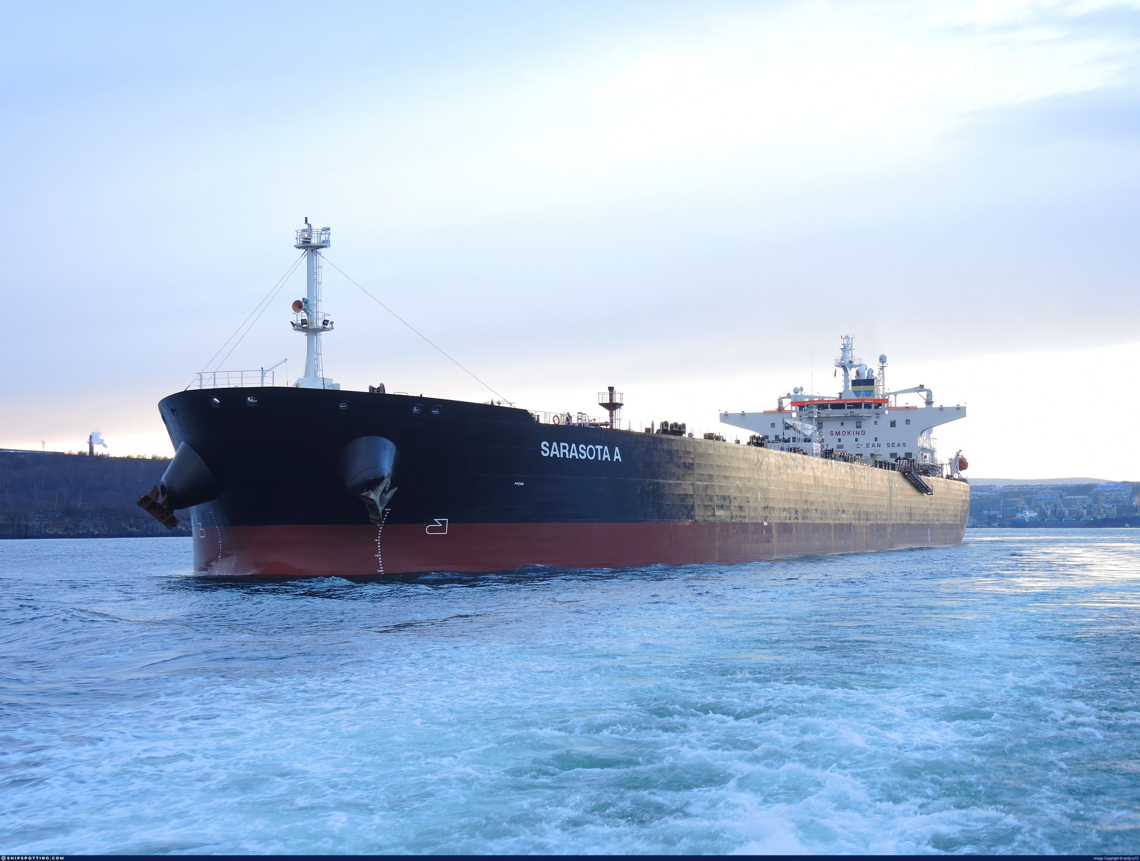
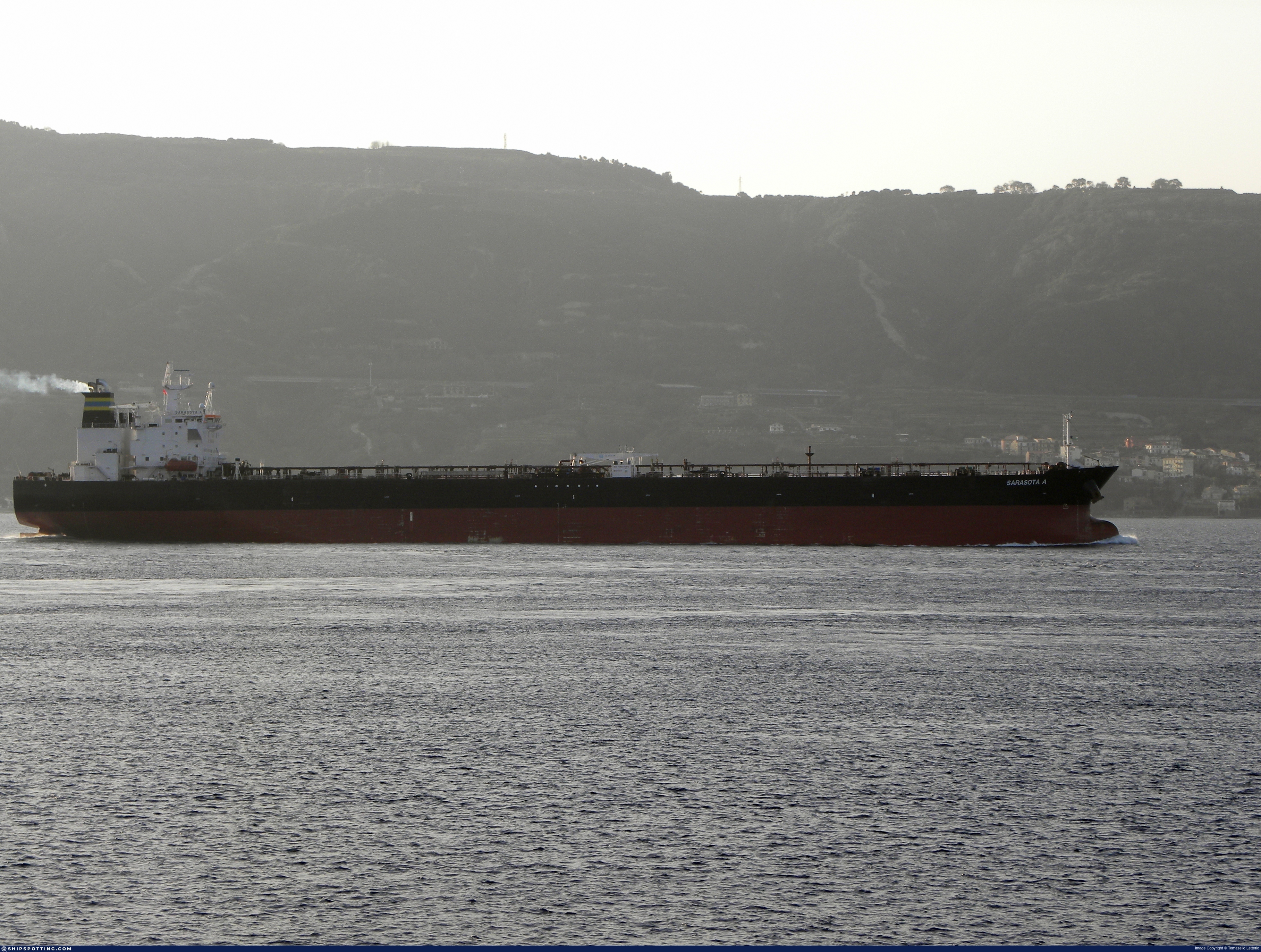
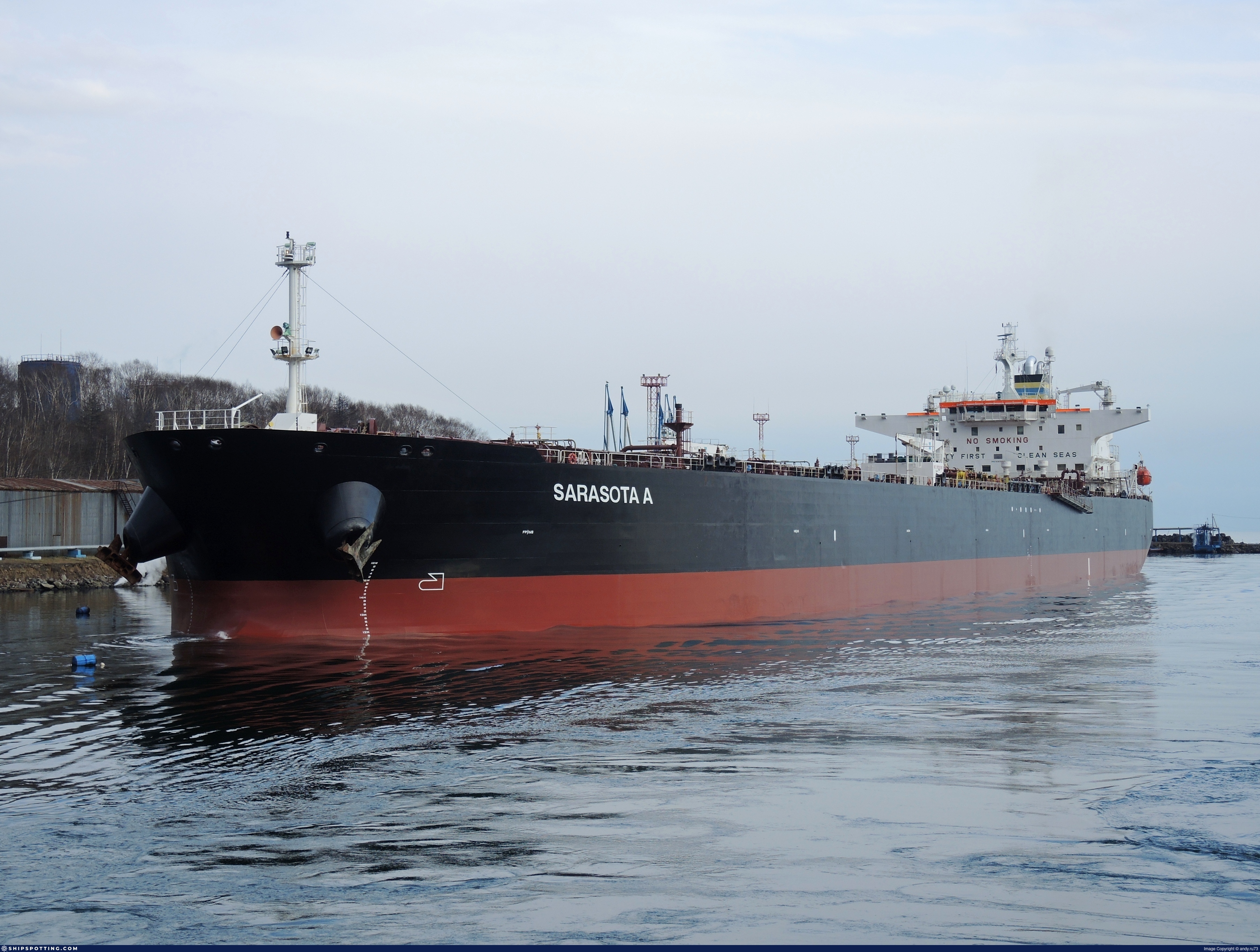
Saraswati
IMO Number
9383869
MMSI
629009744
Vessel Type
Crude Oil Tanker | Pétrolier de brut
Flag
🇨🇲 Cameroon
Call Sign
C5J846
Gross Tonnage
58,418 GT
Year Built
2008
Sanctioned by
Company & Ownership
Rang Shipping Ltd
IMO Company: 0190285
Address
Suite 108, Premier Building, PO Box 343, Victoria, Mahe Island, Seychelles.
Status
Active
Fleet
1.0 owner, 1.0 operator, 1.0 manager, 0.0 beneficial
Management & Operations
ISM Manager
SAGARVANI SHIPPING PVT LTD
Desk 306, Iqrah Enclave, Silanthi Kuttai, 40/44B, Kolathur Main Road, Tiruvallur, Ambattur, Chennai, 600099, India.
Commercial Manager
RANG SHIPPING LTD
Suite 108, Premier Building, PO Box 343, Victoria, Mahe Island, Seychelles.
Registered Owner
RANG SHIPPING LTD
Suite 108, Premier Building, PO Box 343, Victoria, Mahe Island, Seychelles.
Classification & Safety
Current Classification
Russian Maritime Register of Shipping
Delivered
Port State Control (PSC) Inspections
Risk Level
LOW
Last 36 Months
2
Inspections
Last Inspection
📍 Dongjiakou
📅 2026-02-26
Survey Renewal & Certificates
| Code | Type | Issuer | Issued | Expires |
|---|---|---|---|---|
| 512 | Minimum Safe Manning Document | Malta | 17/05/2022 | 02/07/2027 |
| 509 | Document of Compliance | DNV AS (DNV) (128) | 17/11/2021 | 31/12/2026 |
Programs & Notes
EU Russia Sanctions – Shadow Fleet | SEMA (Canada) — vessel designations | The Russia (Sanctions) (EU Exit) Regulations 2019
DateOfListing: 2025-07-20
Vessel Changes


AIS Events
50 events detected • 9 zones • Last: Jul 17, 2026
Zone Dwell
Ust-Luga Terminal Complex
Jul 17, 2026 04:11 UTC
80.0%
- Zone: Ust-Luga Terminal Complex
- Duration: 4h 24m
- Data Points: 2 AIS positions
- Period: 2026-07-17T04:11:07+00:00 to 2026-07-17T08:35:48+00:00
Show Raw Evidence JSON
{
    "zone_id": "russia_ust_luga",
    "zone_name": "Ust-Luga Terminal Complex",
    "dwell_minutes": 264.69999999999998863131622783839702606201171875,
    "points_in_zone": 2,
    "first_point": {
        "ts": "2026-07-17T04:11:07+00:00",
        "lat": 59.92445000000000021600499167107045650482177734375,
        "lon": 28.646351700000000306545189232565462589263916015625
    },
    "last_point": {
        "ts": "2026-07-17T08:35:48+00:00",
        "lat": 59.92537999999999698275132686831057071685791015625,
        "lon": 28.645296699999999390229277196340262889862060546875
    }
}
Ais Gap🛰️✓
Ust-Luga Terminal Complex
Jul 17, 2026 04:11 UTC
70.0%
- Gap Duration: 4h 24m
- Last Seen: 2026-07-17T04:11:07+00:00 at 59.9245, 28.6464 (Zone: Ust-Luga Terminal Complex)
- Next Seen: 2026-07-17T08:35:48+00:00 at 59.9254, 28.6453
🛰️ Gap Corroboration
Imagery Available
These are snapshots that may corroborate presence during the gap. They do not reconstruct a continuous route.
SAR Imagery (Sentinel-1)
Status: ✓ Snapshot available
SAR snapshot available for review
Scene: S1C_IW_GRDH_1SDV_20260717T043251_20260717T043316_008578_010FD0_A8FC_COG • Time: 2026-07-17T04:32:51.861527Z
SAR coverage thumbnail
VIIRS Thermal Anomaly
Status: ✗ No detections
No VIIRS thermal/light detections in corridor
Show Raw Evidence JSON
{
    "gap_minutes": 264.69999999999998863131622783839702606201171875,
    "last_seen": {
        "ts": "2026-07-17T04:11:07+00:00",
        "lat": 59.92445000000000021600499167107045650482177734375,
        "lon": 28.646351700000000306545189232565462589263916015625,
        "sog": 2.20000000000000017763568394002504646778106689453125,
        "zone_id": "russia_ust_luga"
    },
    "next_seen": {
        "ts": "2026-07-17T08:35:48+00:00",
        "lat": 59.92537999999999698275132686831057071685791015625,
        "lon": 28.645296699999999390229277196340262889862060546875,
        "zone_ids": [
            "russia_ust_luga"
        ]
    },
    "gap_enrichment": {
        "status": "done",
        "corridor": {
            "start": {
                "lat": 59.92445000000000021600499167107045650482177734375,
                "lon": 28.646351700000000306545189232565462589263916015625,
                "ts": "2026-07-17T04:11:07+00:00"
            },
            "end": {
                "lat": 59.92537999999999698275132686831057071685791015625,
                "lon": 28.645296699999999390229277196340262889862060546875,
                "ts": "2026-07-17T08:35:48+00:00"
            },
            "bbox": {
                "min_lat": 59.744270000000000209183781407773494720458984375,
                "min_lon": 28.285751999999998673729351139627397060394287109375,
                "max_lat": 60.105559999999996989572537131607532501220703125,
                "max_lon": 29.00589599999999990131982485763728618621826171875
            },
            "buffer_km": 20
        },
        "sar": {
            "status": "snapshot",
            "scene_id": "S1C_IW_GRDH_1SDV_20260717T043251_20260717T043316_008578_010FD0_A8FC_COG",
            "scene_time": "2026-07-17T04:32:51.861527Z",
            "platform": "sentinel-1c",
            "assets": {
                "preview_url": "https:\/\/fleetleaks.com\/wp-content\/uploads\/fleetleaks-evidence\/sar-imagery\/2026\/07\/event_958122_thumbnail_20260717084513.png",
                "stored_path": "\/home\/fleetleaks\/public_html\/wp-content\/uploads\/fleetleaks-evidence\/sar-imagery\/2026\/07\/event_958122_thumbnail_20260717084513.png",
                "source": "copernicus_dataspace"
            },
            "notes": "SAR snapshot available for review"
        },
        "viirs": {
            "status": "not_found",
            "notes": "No VIIRS thermal\/light detections in corridor"
        },
        "searched_at": "2026-07-17T08:45:02.037682+00:00"
    }
}
Zone Dwell
Ust-Luga Terminal Complex
Jul 17, 2026 02:00 UTC
80.0%
- Zone: Ust-Luga Terminal Complex
- Duration: 6h 35m
- Data Points: 3 AIS positions
- Period: 2026-07-17T02:00:08+00:00 to 2026-07-17T08:35:48+00:00
Show Raw Evidence JSON
{
    "zone_id": "russia_ust_luga",
    "zone_name": "Ust-Luga Terminal Complex",
    "dwell_minutes": 395.69999999999998863131622783839702606201171875,
    "points_in_zone": 3,
    "first_point": {
        "ts": "2026-07-17T02:00:08+00:00",
        "lat": 59.9245599999999996043698047287762165069580078125,
        "lon": 28.64642669999999924357325653545558452606201171875
    },
    "last_point": {
        "ts": "2026-07-17T08:35:48+00:00",
        "lat": 59.92537999999999698275132686831057071685791015625,
        "lon": 28.645296699999999390229277196340262889862060546875
    }
}
Zone Dwell
Ust-Luga Terminal Complex
Jul 17, 2026 01:05 UTC
80.0%
- Zone: Ust-Luga Terminal Complex
- Duration: 3h 5m
- Data Points: 6 AIS positions
- Period: 2026-07-17T01:05:40+00:00 to 2026-07-17T04:11:07+00:00
Show Raw Evidence JSON
{
    "zone_id": "russia_ust_luga",
    "zone_name": "Ust-Luga Terminal Complex",
    "dwell_minutes": 185.400000000000005684341886080801486968994140625,
    "points_in_zone": 6,
    "first_point": {
        "ts": "2026-07-17T01:05:40+00:00",
        "lat": 59.92472000000000065256244852207601070404052734375,
        "lon": 28.6460383000000007314156391657888889312744140625
    },
    "last_point": {
        "ts": "2026-07-17T04:11:07+00:00",
        "lat": 59.92445000000000021600499167107045650482177734375,
        "lon": 28.646351700000000306545189232565462589263916015625
    }
}
Zone Dwell
Ust-Luga Terminal Complex
Jul 17, 2026 00:59 UTC
80.0%
- Zone: Ust-Luga Terminal Complex
- Duration: 3h 11m
- Data Points: 7 AIS positions
- Period: 2026-07-17T00:59:59+00:00 to 2026-07-17T04:11:07+00:00
Show Raw Evidence JSON
{
    "zone_id": "russia_ust_luga",
    "zone_name": "Ust-Luga Terminal Complex",
    "dwell_minutes": 191.099999999999994315658113919198513031005859375,
    "points_in_zone": 7,
    "first_point": {
        "ts": "2026-07-17T00:59:59+00:00",
        "lat": 59.92557169999999899800968705676496028900146484375,
        "lon": 28.646399999999999863575794734060764312744140625
    },
    "last_point": {
        "ts": "2026-07-17T04:11:07+00:00",
        "lat": 59.92445000000000021600499167107045650482177734375,
        "lon": 28.646351700000000306545189232565462589263916015625
    }
}
Zone Dwell
Ust-Luga Terminal Complex
Jul 8, 2026 05:15 UTC
80.0%
- Zone: Ust-Luga Terminal Complex
- Duration: 1h 48m
- Data Points: 3 AIS positions
- Period: 2026-07-08T05:15:15+00:00 to 2026-07-08T07:03:35+00:00
Show Raw Evidence JSON
{
    "zone_id": "russia_ust_luga",
    "zone_name": "Ust-Luga Terminal Complex",
    "dwell_minutes": 108.2999999999999971578290569595992565155029296875,
    "points_in_zone": 3,
    "first_point": {
        "ts": "2026-07-08T05:15:15+00:00",
        "lat": 59.980788300000000390355126000940799713134765625,
        "lon": 28.638598300000001728449205984361469745635986328125
    },
    "last_point": {
        "ts": "2026-07-08T07:03:35+00:00",
        "lat": 59.98448669999999793844835949130356311798095703125,
        "lon": 28.641324999999998368593878694809973239898681640625
    }
}
Zone Dwell
Baltic Exit/Tallinn Approach
Jul 2, 2026 11:09 UTC
80.0%
- Zone: Baltic Exit/Tallinn Approach
- Duration: 1h 23m
- Data Points: 9 AIS positions
- Period: 2026-07-02T11:09:22+00:00 to 2026-07-02T12:32:39+00:00
Show Raw Evidence JSON
{
    "zone_id": "russia_baltic_transit",
    "zone_name": "Baltic Exit\/Tallinn Approach",
    "dwell_minutes": 83.2999999999999971578290569595992565155029296875,
    "points_in_zone": 9,
    "first_point": {
        "ts": "2026-07-02T11:09:22+00:00",
        "lat": 59.88929329999999850997483008541166782379150390625,
        "lon": 26.073786699999999427745933644473552703857421875
    },
    "last_point": {
        "ts": "2026-07-02T12:32:39+00:00",
        "lat": 59.9052999999999968849806464277207851409912109375,
        "lon": 26.1440683000000007041307981126010417938232421875
    }
}
Loiter
Baltic Exit/Tallinn Approach
Jul 2, 2026 10:01 UTC
75.0%
- Duration: 2h 20m
- Radius: 875 meters
- Data Points: 14 AIS positions
- Centroid: 59.8903, 26.0765
- Zone: Baltic Exit/Tallinn Approach
Show Raw Evidence JSON
{
    "radius_m": 874.5,
    "duration_minutes": 140,
    "points": 14,
    "centroid": {
        "lat": 59.890330228571428961004130542278289794921875,
        "lon": 26.076474649999994426252669654786586761474609375
    },
    "bbox": {
        "min_lat": 59.88929329999999850997483008541166782379150390625,
        "min_lon": 26.07359999999999899955582804977893829345703125,
        "max_lat": 59.89534830000000198424459085799753665924072265625,
        "max_lon": 26.088486700000000695354174240492284297943115234375
    },
    "zone_id": "russia_baltic_transit"
}
Zone Dwell
Baltic Exit/Tallinn Approach
Jul 2, 2026 10:01 UTC
80.0%
- Zone: Baltic Exit/Tallinn Approach
- Duration: 2h 31m
- Data Points: 16 AIS positions
- Period: 2026-07-02T10:01:21+00:00 to 2026-07-02T12:32:39+00:00
Show Raw Evidence JSON
{
    "zone_id": "russia_baltic_transit",
    "zone_name": "Baltic Exit\/Tallinn Approach",
    "dwell_minutes": 151.30000000000001136868377216160297393798828125,
    "points_in_zone": 16,
    "first_point": {
        "ts": "2026-07-02T10:01:21+00:00",
        "lat": 59.89015169999999699257386964745819568634033203125,
        "lon": 26.079448299999999250076143653132021427154541015625
    },
    "last_point": {
        "ts": "2026-07-02T12:32:39+00:00",
        "lat": 59.9052999999999968849806464277207851409912109375,
        "lon": 26.1440683000000007041307981126010417938232421875
    }
}
Loiter
Baltic Exit/Tallinn Approach
Jul 2, 2026 09:50 UTC
75.0%
- Duration: 2h 30m
- Radius: 961 meters
- Data Points: 17 AIS positions
- Centroid: 59.8890, 26.0768
- Zone: Baltic Exit/Tallinn Approach
Show Raw Evidence JSON
{
    "radius_m": 960.8999999999999772626324556767940521240234375,
    "duration_minutes": 150.80000000000001136868377216160297393798828125,
    "points": 17,
    "centroid": {
        "lat": 59.88902744117647358734757290221750736236572265625,
        "lon": 26.076808047058822381814024993218481540679931640625
    },
    "bbox": {
        "min_lat": 59.880688300000002755041350610554218292236328125,
        "min_lon": 26.07359999999999899955582804977893829345703125,
        "max_lat": 59.89534830000000198424459085799753665924072265625,
        "max_lon": 26.088486700000000695354174240492284297943115234375
    },
    "zone_id": "russia_baltic_transit"
}
Zone Dwell
Baltic Exit/Tallinn Approach
Jul 2, 2026 09:23 UTC
80.0%
- Zone: Baltic Exit/Tallinn Approach
- Duration: 3h 9m
- Data Points: 24 AIS positions
- Period: 2026-07-02T09:23:02+00:00 to 2026-07-02T12:32:39+00:00
Show Raw Evidence JSON
{
    "zone_id": "russia_baltic_transit",
    "zone_name": "Baltic Exit\/Tallinn Approach",
    "dwell_minutes": 189.599999999999994315658113919198513031005859375,
    "points_in_zone": 24,
    "first_point": {
        "ts": "2026-07-02T09:23:02+00:00",
        "lat": 59.876806700000003047534846700727939605712890625,
        "lon": 25.980681700000001654871084610931575298309326171875
    },
    "last_point": {
        "ts": "2026-07-02T12:32:39+00:00",
        "lat": 59.9052999999999968849806464277207851409912109375,
        "lon": 26.1440683000000007041307981126010417938232421875
    }
}
Zone Dwell
Baltic Exit/Tallinn Approach
Jul 2, 2026 08:00 UTC
80.0%
- Zone: Baltic Exit/Tallinn Approach
- Duration: 4h 32m
- Data Points: 39 AIS positions
- Period: 2026-07-02T08:00:23+00:00 to 2026-07-02T12:32:39+00:00
Show Raw Evidence JSON
{
    "zone_id": "russia_baltic_transit",
    "zone_name": "Baltic Exit\/Tallinn Approach",
    "dwell_minutes": 272.30000000000001136868377216160297393798828125,
    "points_in_zone": 39,
    "first_point": {
        "ts": "2026-07-02T08:00:23+00:00",
        "lat": 59.8386117000000012922100722789764404296875,
        "lon": 25.49849830000000139307303470559418201446533203125
    },
    "last_point": {
        "ts": "2026-07-02T12:32:39+00:00",
        "lat": 59.9052999999999968849806464277207851409912109375,
        "lon": 26.1440683000000007041307981126010417938232421875
    }
}
Zone Dwell
Baltic Exit/Tallinn Approach
Jul 2, 2026 07:02 UTC
80.0%
- Zone: Baltic Exit/Tallinn Approach
- Duration: 5h 30m
- Data Points: 59 AIS positions
- Period: 2026-07-02T07:02:22+00:00 to 2026-07-02T12:32:39+00:00
Show Raw Evidence JSON
{
    "zone_id": "russia_baltic_transit",
    "zone_name": "Baltic Exit\/Tallinn Approach",
    "dwell_minutes": 330.30000000000001136868377216160297393798828125,
    "points_in_zone": 59,
    "first_point": {
        "ts": "2026-07-02T07:02:22+00:00",
        "lat": 59.816253299999999626379576511681079864501953125,
        "lon": 25.298138300000001521539161331020295619964599609375
    },
    "last_point": {
        "ts": "2026-07-02T12:32:39+00:00",
        "lat": 59.9052999999999968849806464277207851409912109375,
        "lon": 26.1440683000000007041307981126010417938232421875
    }
}
Zone Dwell
Baltic Exit/Tallinn Approach
Jul 2, 2026 06:01 UTC
80.0%
- Zone: Baltic Exit/Tallinn Approach
- Duration: 6h 31m
- Data Points: 73 AIS positions
- Period: 2026-07-02T06:01:11+00:00 to 2026-07-02T12:32:39+00:00
Show Raw Evidence JSON
{
    "zone_id": "russia_baltic_transit",
    "zone_name": "Baltic Exit\/Tallinn Approach",
    "dwell_minutes": 391.5,
    "points_in_zone": 73,
    "first_point": {
        "ts": "2026-07-02T06:01:11+00:00",
        "lat": 59.7961566999999973859303281642496585845947265625,
        "lon": 25.1096016999999989138814271427690982818603515625
    },
    "last_point": {
        "ts": "2026-07-02T12:32:39+00:00",
        "lat": 59.9052999999999968849806464277207851409912109375,
        "lon": 26.1440683000000007041307981126010417938232421875
    }
}
Zone Dwell
Baltic Exit/Tallinn Approach
Jul 2, 2026 05:03 UTC
80.0%
- Zone: Baltic Exit/Tallinn Approach
- Duration: 6h 35m
- Data Points: 74 AIS positions
- Period: 2026-07-02T05:51:32+00:00 to 2026-07-02T12:27:09+00:00
Show Raw Evidence JSON
{
    "zone_id": "russia_baltic_transit",
    "zone_name": "Baltic Exit\/Tallinn Approach",
    "dwell_minutes": 395.6000000000000227373675443232059478759765625,
    "points_in_zone": 74,
    "first_point": {
        "ts": "2026-07-02T05:51:32+00:00",
        "lat": 59.7934867000000025427652872167527675628662109375,
        "lon": 25.0795667000000008783899829722940921783447265625
    },
    "last_point": {
        "ts": "2026-07-02T12:27:09+00:00",
        "lat": 59.9000316999999995459802448749542236328125,
        "lon": 26.11539499999999947021933621726930141448974609375
    }
}
Zone Dwell
Baltic Exit/Tallinn Approach
Jul 2, 2026 04:16 UTC
80.0%
- Zone: Baltic Exit/Tallinn Approach
- Duration: 6h 37m
- Data Points: 92 AIS positions
- Period: 2026-07-02T04:32:21+00:00 to 2026-07-02T11:09:22+00:00
Show Raw Evidence JSON
{
    "zone_id": "russia_baltic_transit",
    "zone_name": "Baltic Exit\/Tallinn Approach",
    "dwell_minutes": 397,
    "points_in_zone": 92,
    "first_point": {
        "ts": "2026-07-02T04:32:21+00:00",
        "lat": 59.77103170000000176287358044646680355072021484375,
        "lon": 24.8490800000000007230482879094779491424560546875
    },
    "last_point": {
        "ts": "2026-07-02T11:09:22+00:00",
        "lat": 59.88929329999999850997483008541166782379150390625,
        "lon": 26.073786699999999427745933644473552703857421875
    }
}
Zone Dwell
Archipelago Sea Monitoring Zone
Jul 1, 2026 19:02 UTC
80.0%
- Zone: Archipelago Sea Monitoring Zone
- Duration: 1h 41m
- Data Points: 28 AIS positions
- Period: 2026-07-01T19:02:42+00:00 to 2026-07-01T20:43:41+00:00
Show Raw Evidence JSON
{
    "zone_id": "discovered_008",
    "zone_name": "Archipelago Sea Monitoring Zone",
    "dwell_minutes": 101,
    "points_in_zone": 28,
    "first_point": {
        "ts": "2026-07-01T19:02:42+00:00",
        "lat": 59.52811669999999821811798028647899627685546875,
        "lon": 23.2636932999999999083229340612888336181640625
    },
    "last_point": {
        "ts": "2026-07-01T20:43:41+00:00",
        "lat": 59.5808449999999965029928716830909252166748046875,
        "lon": 23.569976700000001557100404170341789722442626953125
    }
}
Zone Dwell
Archipelago Sea Monitoring Zone
Jul 1, 2026 18:01 UTC
80.0%
- Zone: Archipelago Sea Monitoring Zone
- Duration: 2h 41m
- Data Points: 43 AIS positions
- Period: 2026-07-01T18:01:52+00:00 to 2026-07-01T20:43:41+00:00
Show Raw Evidence JSON
{
    "zone_id": "discovered_008",
    "zone_name": "Archipelago Sea Monitoring Zone",
    "dwell_minutes": 161.80000000000001136868377216160297393798828125,
    "points_in_zone": 43,
    "first_point": {
        "ts": "2026-07-01T18:01:52+00:00",
        "lat": 59.4950333000000028960130293853580951690673828125,
        "lon": 23.070094999999998464090822380967438220977783203125
    },
    "last_point": {
        "ts": "2026-07-01T20:43:41+00:00",
        "lat": 59.5808449999999965029928716830909252166748046875,
        "lon": 23.569976700000001557100404170341789722442626953125
    }
}
Zone Dwell
Archipelago Sea Monitoring Zone
Jul 1, 2026 17:01 UTC
80.0%
- Zone: Archipelago Sea Monitoring Zone
- Duration: 3h 42m
- Data Points: 67 AIS positions
- Period: 2026-07-01T17:01:41+00:00 to 2026-07-01T20:43:41+00:00
Show Raw Evidence JSON
{
    "zone_id": "discovered_008",
    "zone_name": "Archipelago Sea Monitoring Zone",
    "dwell_minutes": 222,
    "points_in_zone": 67,
    "first_point": {
        "ts": "2026-07-01T17:01:41+00:00",
        "lat": 59.46334829999999982419467414729297161102294921875,
        "lon": 22.876594999999998236717146937735378742218017578125
    },
    "last_point": {
        "ts": "2026-07-01T20:43:41+00:00",
        "lat": 59.5808449999999965029928716830909252166748046875,
        "lon": 23.569976700000001557100404170341789722442626953125
    }
}
Zone Dwell
Archipelago Sea Monitoring Zone
Jul 1, 2026 16:02 UTC
80.0%
- Zone: Archipelago Sea Monitoring Zone
- Duration: 4h 41m
- Data Points: 81 AIS positions
- Period: 2026-07-01T16:02:33+00:00 to 2026-07-01T20:43:41+00:00
Show Raw Evidence JSON
{
    "zone_id": "discovered_008",
    "zone_name": "Archipelago Sea Monitoring Zone",
    "dwell_minutes": 281.1000000000000227373675443232059478759765625,
    "points_in_zone": 81,
    "first_point": {
        "ts": "2026-07-01T16:02:33+00:00",
        "lat": 59.42951330000000353948053088970482349395751953125,
        "lon": 22.689931699999998926386979292146861553192138671875
    },
    "last_point": {
        "ts": "2026-07-01T20:43:41+00:00",
        "lat": 59.5808449999999965029928716830909252166748046875,
        "lon": 23.569976700000001557100404170341789722442626953125
    }
}
Zone Dwell
Archipelago Sea Monitoring Zone
Jul 1, 2026 15:37 UTC
80.0%
- Zone: Archipelago Sea Monitoring Zone
- Duration: 5h 6m
- Data Points: 87 AIS positions
- Period: 2026-07-01T15:37:31+00:00 to 2026-07-01T20:43:41+00:00
Show Raw Evidence JSON
{
    "zone_id": "discovered_008",
    "zone_name": "Archipelago Sea Monitoring Zone",
    "dwell_minutes": 306.19999999999998863131622783839702606201171875,
    "points_in_zone": 87,
    "first_point": {
        "ts": "2026-07-01T15:37:31+00:00",
        "lat": 59.41137169999999656511135981418192386627197265625,
        "lon": 22.6129667000000011967131285928189754486083984375
    },
    "last_point": {
        "ts": "2026-07-01T20:43:41+00:00",
        "lat": 59.5808449999999965029928716830909252166748046875,
        "lon": 23.569976700000001557100404170341789722442626953125
    }
}
Zone Dwell
Archipelago Sea Monitoring Zone
Jul 1, 2026 14:04 UTC
80.0%
- Zone: Archipelago Sea Monitoring Zone
- Duration: 6h 33m
- Data Points: 94 AIS positions
- Period: 2026-07-01T14:10:03+00:00 to 2026-07-01T20:43:41+00:00
Show Raw Evidence JSON
{
    "zone_id": "discovered_008",
    "zone_name": "Archipelago Sea Monitoring Zone",
    "dwell_minutes": 393.6000000000000227373675443232059478759765625,
    "points_in_zone": 94,
    "first_point": {
        "ts": "2026-07-01T14:10:03+00:00",
        "lat": 59.32341170000000118989191832952201366424560546875,
        "lon": 22.376678299999998245084498194046318531036376953125
    },
    "last_point": {
        "ts": "2026-07-01T20:43:41+00:00",
        "lat": 59.5808449999999965029928716830909252166748046875,
        "lon": 23.569976700000001557100404170341789722442626953125
    }
}
Zone Dwell
Archipelago Sea Monitoring Zone
Jul 1, 2026 13:02 UTC
80.0%
- Zone: Archipelago Sea Monitoring Zone
- Duration: 6h 36m
- Data Points: 96 AIS positions
- Period: 2026-07-01T13:52:42+00:00 to 2026-07-01T20:29:33+00:00
Show Raw Evidence JSON
{
    "zone_id": "discovered_008",
    "zone_name": "Archipelago Sea Monitoring Zone",
    "dwell_minutes": 396.8999999999999772626324556767940521240234375,
    "points_in_zone": 96,
    "first_point": {
        "ts": "2026-07-01T13:52:42+00:00",
        "lat": 59.3053967000000028519934858195483684539794921875,
        "lon": 22.330645000000000521822585142217576503753662109375
    },
    "last_point": {
        "ts": "2026-07-01T20:29:33+00:00",
        "lat": 59.57343829999999940127963782288134098052978515625,
        "lon": 23.528203300000001263470039702951908111572265625
    }
}
Zone Dwell
Archipelago Sea Monitoring Zone
Jul 1, 2026 12:05 UTC
80.0%
- Zone: Archipelago Sea Monitoring Zone
- Duration: 6h 36m
- Data Points: 91 AIS positions
- Period: 2026-07-01T12:50:12+00:00 to 2026-07-01T19:26:22+00:00
Show Raw Evidence JSON
{
    "zone_id": "discovered_008",
    "zone_name": "Archipelago Sea Monitoring Zone",
    "dwell_minutes": 396.19999999999998863131622783839702606201171875,
    "points_in_zone": 91,
    "first_point": {
        "ts": "2026-07-01T12:50:12+00:00",
        "lat": 59.2421700000000015506884665228426456451416015625,
        "lon": 22.164371700000000231511876336298882961273193359375
    },
    "last_point": {
        "ts": "2026-07-01T19:26:22+00:00",
        "lat": 59.541148300000003246168489567935466766357421875,
        "lon": 23.337855000000001126636561821214854717254638671875
    }
}
Zone Dwell
Archipelago Sea Monitoring Zone
Jul 1, 2026 11:01 UTC
80.0%
- Zone: Archipelago Sea Monitoring Zone
- Duration: 6h 37m
- Data Points: 94 AIS positions
- Period: 2026-07-01T11:51:52+00:00 to 2026-07-01T18:29:03+00:00
Show Raw Evidence JSON
{
    "zone_id": "discovered_008",
    "zone_name": "Archipelago Sea Monitoring Zone",
    "dwell_minutes": 397.19999999999998863131622783839702606201171875,
    "points_in_zone": 94,
    "first_point": {
        "ts": "2026-07-01T11:51:52+00:00",
        "lat": 59.18528669999999891615516389720141887664794921875,
        "lon": 22.005925000000001290345608140341937541961669921875
    },
    "last_point": {
        "ts": "2026-07-01T18:29:03+00:00",
        "lat": 59.50943170000000037589416024275124073028564453125,
        "lon": 23.156821699999998287466951296664774417877197265625
    }
}
Zone Dwell
Archipelago Sea Monitoring Zone
Jul 1, 2026 10:01 UTC
80.0%
- Zone: Archipelago Sea Monitoring Zone
- Duration: 6h 27m
- Data Points: 85 AIS positions
- Period: 2026-07-01T10:59:11+00:00 to 2026-07-01T17:27:03+00:00
Show Raw Evidence JSON
{
    "zone_id": "discovered_008",
    "zone_name": "Archipelago Sea Monitoring Zone",
    "dwell_minutes": 387.8999999999999772626324556767940521240234375,
    "points_in_zone": 85,
    "first_point": {
        "ts": "2026-07-01T10:59:11+00:00",
        "lat": 59.13178169999999767014742246828973293304443359375,
        "lon": 21.872440000000000992486093309707939624786376953125
    },
    "last_point": {
        "ts": "2026-07-01T17:27:03+00:00",
        "lat": 59.47682999999999964302332955412566661834716796875,
        "lon": 22.957648299999998897646946716122329235076904296875
    }
}
Zone Dwell
Archipelago Sea Monitoring Zone
Jul 1, 2026 09:01 UTC
80.0%
- Zone: Archipelago Sea Monitoring Zone
- Duration: 6h 27m
- Data Points: 77 AIS positions
- Period: 2026-07-01T09:54:02+00:00 to 2026-07-01T16:21:51+00:00
Show Raw Evidence JSON
{
    "zone_id": "discovered_008",
    "zone_name": "Archipelago Sea Monitoring Zone",
    "dwell_minutes": 387.80000000000001136868377216160297393798828125,
    "points_in_zone": 77,
    "first_point": {
        "ts": "2026-07-01T09:54:02+00:00",
        "lat": 59.060481699999996862970874644815921783447265625,
        "lon": 21.723703300000000382397047360427677631378173828125
    },
    "last_point": {
        "ts": "2026-07-01T16:21:51+00:00",
        "lat": 59.44047499999999928377292235381901264190673828125,
        "lon": 22.751020000000000464979166281409561634063720703125
    }
}
Zone Dwell
Archipelago Sea Monitoring Zone
Jul 1, 2026 08:42 UTC
80.0%
- Zone: Archipelago Sea Monitoring Zone
- Duration: 6h 12m
- Data Points: 87 AIS positions
- Period: 2026-07-01T08:42:22+00:00 to 2026-07-01T14:55:12+00:00
Show Raw Evidence JSON
{
    "zone_id": "discovered_008",
    "zone_name": "Archipelago Sea Monitoring Zone",
    "dwell_minutes": 372.80000000000001136868377216160297393798828125,
    "points_in_zone": 87,
    "first_point": {
        "ts": "2026-07-01T08:42:22+00:00",
        "lat": 58.96487830000000229802026296965777873992919921875,
        "lon": 21.5915150000000011232259566895663738250732421875
    },
    "last_point": {
        "ts": "2026-07-01T14:55:12+00:00",
        "lat": 59.369658299999997552731656469404697418212890625,
        "lon": 22.497403299999998438352122320793569087982177734375
    }
}
Zone Dwell
Norwegian Sea Surveillance Zone
Jun 21, 2026 07:00 UTC
80.0%
- Zone: Norwegian Sea Surveillance Zone
- Duration: 1h 29m
- Data Points: 8 AIS positions
- Period: 2026-06-21T07:00:52+00:00 to 2026-06-21T08:30:31+00:00
Show Raw Evidence JSON
{
    "zone_id": "discovered_108",
    "zone_name": "Norwegian Sea Surveillance Zone",
    "dwell_minutes": 89.7000000000000028421709430404007434844970703125,
    "points_in_zone": 8,
    "first_point": {
        "ts": "2026-06-21T07:00:52+00:00",
        "lat": 36.6437717000000020561856217682361602783203125,
        "lon": -10.0430399999999995230837157578207552433013916015625
    },
    "last_point": {
        "ts": "2026-06-21T08:30:31+00:00",
        "lat": 36.94091499999999683723217458464205265045166015625,
        "lon": -10.096225000000000449063009000383317470550537109375
    }
}
Zone Dwell
Norwegian Sea Surveillance Zone
Jun 21, 2026 06:02 UTC
80.0%
- Zone: Norwegian Sea Surveillance Zone
- Duration: 2h 28m
- Data Points: 26 AIS positions
- Period: 2026-06-21T06:02:02+00:00 to 2026-06-21T08:30:31+00:00
Show Raw Evidence JSON
{
    "zone_id": "discovered_108",
    "zone_name": "Norwegian Sea Surveillance Zone",
    "dwell_minutes": 148.5,
    "points_in_zone": 26,
    "first_point": {
        "ts": "2026-06-21T06:02:02+00:00",
        "lat": 36.45084669999999960054992698132991790771484375,
        "lon": -10.0022517000000004117055141250602900981903076171875
    },
    "last_point": {
        "ts": "2026-06-21T08:30:31+00:00",
        "lat": 36.94091499999999683723217458464205265045166015625,
        "lon": -10.096225000000000449063009000383317470550537109375
    }
}
Zone Dwell
Norwegian Sea Surveillance Zone
Jun 21, 2026 05:06 UTC
80.0%
- Zone: Norwegian Sea Surveillance Zone
- Duration: 3h 24m
- Data Points: 34 AIS positions
- Period: 2026-06-21T05:06:22+00:00 to 2026-06-21T08:30:31+00:00
Show Raw Evidence JSON
{
    "zone_id": "discovered_108",
    "zone_name": "Norwegian Sea Surveillance Zone",
    "dwell_minutes": 204.19999999999998863131622783839702606201171875,
    "points_in_zone": 34,
    "first_point": {
        "ts": "2026-06-21T05:06:22+00:00",
        "lat": 36.31931329999999746860339655540883541107177734375,
        "lon": -9.8788649999999993411847754032351076602935791015625
    },
    "last_point": {
        "ts": "2026-06-21T08:30:31+00:00",
        "lat": 36.94091499999999683723217458464205265045166015625,
        "lon": -10.096225000000000449063009000383317470550537109375
    }
}
Zone Dwell
Norwegian Sea Surveillance Zone
Jun 21, 2026 04:09 UTC
80.0%
- Zone: Norwegian Sea Surveillance Zone
- Duration: 4h 21m
- Data Points: 39 AIS positions
- Period: 2026-06-21T04:09:01+00:00 to 2026-06-21T08:30:31+00:00
Show Raw Evidence JSON
{
    "zone_id": "discovered_108",
    "zone_name": "Norwegian Sea Surveillance Zone",
    "dwell_minutes": 261.5,
    "points_in_zone": 39,
    "first_point": {
        "ts": "2026-06-21T04:09:01+00:00",
        "lat": 36.24078829999999840083546587266027927398681640625,
        "lon": -9.6595583000000004858520696870982646942138671875
    },
    "last_point": {
        "ts": "2026-06-21T08:30:31+00:00",
        "lat": 36.94091499999999683723217458464205265045166015625,
        "lon": -10.096225000000000449063009000383317470550537109375
    }
}
Zone Dwell
Norwegian Sea Surveillance Zone
Jun 21, 2026 03:00 UTC
80.0%
- Zone: Norwegian Sea Surveillance Zone
- Duration: 5h 30m
- Data Points: 61 AIS positions
- Period: 2026-06-21T03:00:31+00:00 to 2026-06-21T08:30:31+00:00
Show Raw Evidence JSON
{
    "zone_id": "discovered_108",
    "zone_name": "Norwegian Sea Surveillance Zone",
    "dwell_minutes": 330,
    "points_in_zone": 61,
    "first_point": {
        "ts": "2026-06-21T03:00:31+00:00",
        "lat": 36.1490000000000009094947017729282379150390625,
        "lon": -9.4005250000000000198951966012828052043914794921875
    },
    "last_point": {
        "ts": "2026-06-21T08:30:31+00:00",
        "lat": 36.94091499999999683723217458464205265045166015625,
        "lon": -10.096225000000000449063009000383317470550537109375
    }
}
Zone Dwell
Norwegian Sea Surveillance Zone
Jun 21, 2026 02:30 UTC
80.0%
- Zone: Norwegian Sea Surveillance Zone
- Duration: 6 hours
- Data Points: 79 AIS positions
- Period: 2026-06-21T02:30:05+00:00 to 2026-06-21T08:30:31+00:00
Show Raw Evidence JSON
{
    "zone_id": "discovered_108",
    "zone_name": "Norwegian Sea Surveillance Zone",
    "dwell_minutes": 360.3999999999999772626324556767940521240234375,
    "points_in_zone": 79,
    "first_point": {
        "ts": "2026-06-21T02:30:05+00:00",
        "lat": 36.10935829999999668871168978512287139892578125,
        "lon": -9.2858532999999994217432686127722263336181640625
    },
    "last_point": {
        "ts": "2026-06-21T08:30:31+00:00",
        "lat": 36.94091499999999683723217458464205265045166015625,
        "lon": -10.096225000000000449063009000383317470550537109375
    }
}
Zone Dwell
discovered_011
Jun 21, 2026 02:02 UTC
80.0%
- Zone: discovered_011
- Duration: 1h 16m
- Data Points: 39 AIS positions
- Period: 2026-06-21T02:02:33+00:00 to 2026-06-21T03:18:42+00:00
Show Raw Evidence JSON
{
    "zone_id": "discovered_011",
    "zone_name": "Atlantic Iberian Monitoring Zone",
    "dwell_minutes": 76.2000000000000028421709430404007434844970703125,
    "points_in_zone": 39,
    "first_point": {
        "ts": "2026-06-21T02:02:33+00:00",
        "lat": 36.073336699999998700150172226130962371826171875,
        "lon": -9.1813666999999998807879819651134312152862548828125
    },
    "last_point": {
        "ts": "2026-06-21T03:18:42+00:00",
        "lat": 36.17369999999999663486960344016551971435546875,
        "lon": -9.46940000000000026147972675971686840057373046875
    }
}
Zone Dwell
discovered_011
Jun 21, 2026 01:02 UTC
80.0%
- Zone: discovered_011
- Duration: 2h 16m
- Data Points: 68 AIS positions
- Period: 2026-06-21T01:02:03+00:00 to 2026-06-21T03:18:42+00:00
Show Raw Evidence JSON
{
    "zone_id": "discovered_011",
    "zone_name": "Atlantic Iberian Monitoring Zone",
    "dwell_minutes": 136.69999999999998863131622783839702606201171875,
    "points_in_zone": 68,
    "first_point": {
        "ts": "2026-06-21T01:02:03+00:00",
        "lat": 36.011858300000000099316821433603763580322265625,
        "lon": -8.945701700000000755608198232948780059814453125
    },
    "last_point": {
        "ts": "2026-06-21T03:18:42+00:00",
        "lat": 36.17369999999999663486960344016551971435546875,
        "lon": -9.46940000000000026147972675971686840057373046875
    }
}
Zone Dwell
discovered_011
Jun 21, 2026 00:02 UTC
80.0%
- Zone: discovered_011
- Duration: 3h 16m
- Data Points: 101 AIS positions
- Period: 2026-06-21T00:02:02+00:00 to 2026-06-21T03:18:42+00:00
Show Raw Evidence JSON
{
    "zone_id": "discovered_011",
    "zone_name": "Atlantic Iberian Monitoring Zone",
    "dwell_minutes": 196.69999999999998863131622783839702606201171875,
    "points_in_zone": 101,
    "first_point": {
        "ts": "2026-06-21T00:02:02+00:00",
        "lat": 36.00526500000000140744305099360644817352294921875,
        "lon": -8.692203299999999188685251283459365367889404296875
    },
    "last_point": {
        "ts": "2026-06-21T03:18:42+00:00",
        "lat": 36.17369999999999663486960344016551971435546875,
        "lon": -9.46940000000000026147972675971686840057373046875
    }
}
Zone Dwell
discovered_011
Jun 20, 2026 23:01 UTC
80.0%
- Zone: discovered_011
- Duration: 4h 17m
- Data Points: 136 AIS positions
- Period: 2026-06-20T23:01:11+00:00 to 2026-06-21T03:18:42+00:00
Show Raw Evidence JSON
{
    "zone_id": "discovered_011",
    "zone_name": "Atlantic Iberian Monitoring Zone",
    "dwell_minutes": 257.5,
    "points_in_zone": 136,
    "first_point": {
        "ts": "2026-06-20T23:01:11+00:00",
        "lat": 35.998386699999997517807059921324253082275390625,
        "lon": -8.4284133000000007740482033113949000835418701171875
    },
    "last_point": {
        "ts": "2026-06-21T03:18:42+00:00",
        "lat": 36.17369999999999663486960344016551971435546875,
        "lon": -9.46940000000000026147972675971686840057373046875
    }
}
Zone Dwell
discovered_011
Jun 20, 2026 22:01 UTC
80.0%
- Zone: discovered_011
- Duration: 5h 16m
- Data Points: 165 AIS positions
- Period: 2026-06-20T22:01:52+00:00 to 2026-06-21T03:18:42+00:00
Show Raw Evidence JSON
{
    "zone_id": "discovered_011",
    "zone_name": "Atlantic Iberian Monitoring Zone",
    "dwell_minutes": 316.80000000000001136868377216160297393798828125,
    "points_in_zone": 165,
    "first_point": {
        "ts": "2026-06-20T22:01:52+00:00",
        "lat": 35.98822169999999687206582166254520416259765625,
        "lon": -8.1782149999999997902477844036184251308441162109375
    },
    "last_point": {
        "ts": "2026-06-21T03:18:42+00:00",
        "lat": 36.17369999999999663486960344016551971435546875,
        "lon": -9.46940000000000026147972675971686840057373046875
    }
}
Zone Dwell
discovered_011
Jun 20, 2026 21:02 UTC
80.0%
- Zone: discovered_011
- Duration: 6h 16m
- Data Points: 194 AIS positions
- Period: 2026-06-20T21:02:02+00:00 to 2026-06-21T03:18:42+00:00
Show Raw Evidence JSON
{
    "zone_id": "discovered_011",
    "zone_name": "Atlantic Iberian Monitoring Zone",
    "dwell_minutes": 376.69999999999998863131622783839702606201171875,
    "points_in_zone": 194,
    "first_point": {
        "ts": "2026-06-20T21:02:02+00:00",
        "lat": 35.982671699999997372287907637655735015869140625,
        "lon": -7.9234150000000003188915798091329634189605712890625
    },
    "last_point": {
        "ts": "2026-06-21T03:18:42+00:00",
        "lat": 36.17369999999999663486960344016551971435546875,
        "lon": -9.46940000000000026147972675971686840057373046875
    }
}
Zone Dwell
discovered_011
Jun 20, 2026 20:14 UTC
80.0%
- Zone: discovered_011
- Duration: 6h 37m
- Data Points: 204 AIS positions
- Period: 2026-06-20T20:40:52+00:00 to 2026-06-21T03:18:42+00:00
Show Raw Evidence JSON
{
    "zone_id": "discovered_011",
    "zone_name": "Atlantic Iberian Monitoring Zone",
    "dwell_minutes": 397.80000000000001136868377216160297393798828125,
    "points_in_zone": 204,
    "first_point": {
        "ts": "2026-06-20T20:40:52+00:00",
        "lat": 35.98009330000000005611582309938967227935791015625,
        "lon": -7.834038299999999566125552519224584102630615234375
    },
    "last_point": {
        "ts": "2026-06-21T03:18:42+00:00",
        "lat": 36.17369999999999663486960344016551971435546875,
        "lon": -9.46940000000000026147972675971686840057373046875
    }
}
Zone Dwell
Strait of Gibraltar Surveillance Zone
Jun 20, 2026 08:35 UTC
80.0%
- Zone: Strait of Gibraltar Surveillance Zone
- Duration: 1h 18m
- Data Points: 30 AIS positions
- Period: 2026-06-20T08:35:12+00:00 to 2026-06-20T09:53:12+00:00
Show Raw Evidence JSON
{
    "zone_id": "discovered_001",
    "zone_name": "Strait of Gibraltar Surveillance Zone",
    "dwell_minutes": 78,
    "points_in_zone": 30,
    "first_point": {
        "ts": "2026-06-20T08:35:12+00:00",
        "lat": 36.072468299999997043414623476564884185791015625,
        "lon": -4.7319817000000004014736987301148474216461181640625
    },
    "last_point": {
        "ts": "2026-06-20T09:53:12+00:00",
        "lat": 36.0659117000000009056748240254819393157958984375,
        "lon": -5.0464450000000002916067387559451162815093994140625
    }
}
Zone Dwell
Strait of Gibraltar Surveillance Zone
Jun 20, 2026 06:01 UTC
80.0%
- Zone: Strait of Gibraltar Surveillance Zone
- Duration: 3h 51m
- Data Points: 47 AIS positions
- Period: 2026-06-20T06:01:42+00:00 to 2026-06-20T09:53:12+00:00
Show Raw Evidence JSON
{
    "zone_id": "discovered_001",
    "zone_name": "Strait of Gibraltar Surveillance Zone",
    "dwell_minutes": 231.5,
    "points_in_zone": 47,
    "first_point": {
        "ts": "2026-06-20T06:01:42+00:00",
        "lat": 36.07098500000000029785951483063399791717529296875,
        "lon": -4.156156700000000370209818356670439243316650390625
    },
    "last_point": {
        "ts": "2026-06-20T09:53:12+00:00",
        "lat": 36.0659117000000009056748240254819393157958984375,
        "lon": -5.0464450000000002916067387559451162815093994140625
    }
}
Zone Dwell
Strait of Gibraltar Surveillance Zone
Jun 20, 2026 05:01 UTC
80.0%
- Zone: Strait of Gibraltar Surveillance Zone
- Duration: 4h 52m
- Data Points: 75 AIS positions
- Period: 2026-06-20T05:01:12+00:00 to 2026-06-20T09:53:12+00:00
Show Raw Evidence JSON
{
    "zone_id": "discovered_001",
    "zone_name": "Strait of Gibraltar Surveillance Zone",
    "dwell_minutes": 292,
    "points_in_zone": 75,
    "first_point": {
        "ts": "2026-06-20T05:01:12+00:00",
        "lat": 36.07854830000000134759829961694777011871337890625,
        "lon": -3.941143299999999793925553603912703692913055419921875
    },
    "last_point": {
        "ts": "2026-06-20T09:53:12+00:00",
        "lat": 36.0659117000000009056748240254819393157958984375,
        "lon": -5.0464450000000002916067387559451162815093994140625
    }
}
Zone Dwell
Strait of Gibraltar Surveillance Zone
Jun 20, 2026 04:34 UTC
80.0%
- Zone: Strait of Gibraltar Surveillance Zone
- Duration: 5h 19m
- Data Points: 89 AIS positions
- Period: 2026-06-20T04:34:01+00:00 to 2026-06-20T09:53:12+00:00
Show Raw Evidence JSON
{
    "zone_id": "discovered_001",
    "zone_name": "Strait of Gibraltar Surveillance Zone",
    "dwell_minutes": 319.19999999999998863131622783839702606201171875,
    "points_in_zone": 89,
    "first_point": {
        "ts": "2026-06-20T04:34:01+00:00",
        "lat": 36.07792330000000191603248822502791881561279296875,
        "lon": -3.84522500000000011510792319313623011112213134765625
    },
    "last_point": {
        "ts": "2026-06-20T09:53:12+00:00",
        "lat": 36.0659117000000009056748240254819393157958984375,
        "lon": -5.0464450000000002916067387559451162815093994140625
    }
}
Zone Dwell
discovered_144
Jun 19, 2026 15:17 UTC
80.0%
- Zone: discovered_144
- Duration: 1h 24m
- Data Points: 7 AIS positions
- Period: 2026-06-19T15:17:09+00:00 to 2026-06-19T16:41:10+00:00
Show Raw Evidence JSON
{
    "zone_id": "discovered_144",
    "zone_name": "Alboran Sea Surveillance Zone",
    "dwell_minutes": 84,
    "points_in_zone": 7,
    "first_point": {
        "ts": "2026-06-19T15:17:09+00:00",
        "lat": 36.686565000000001646185410209000110626220703125,
        "lon": -0.51821499999999998120614463914535008370876312255859375
    },
    "last_point": {
        "ts": "2026-06-19T16:41:10+00:00",
        "lat": 36.57387829999999695473889005370438098907470703125,
        "lon": -0.89043170000000004815632337340502999722957611083984375
    }
}
Zone Dwell
Atlantic Midway Monitoring Zone
Jun 19, 2026 14:00 UTC
80.0%
- Zone: Atlantic Midway Monitoring Zone
- Duration: 1h 20m
- Data Points: 25 AIS positions
- Period: 2026-06-19T14:00:43+00:00 to 2026-06-19T15:20:44+00:00
Show Raw Evidence JSON
{
    "zone_id": "discovered_079",
    "zone_name": "Atlantic Midway Monitoring Zone",
    "dwell_minutes": 80,
    "points_in_zone": 25,
    "first_point": {
        "ts": "2026-06-19T14:00:43+00:00",
        "lat": 36.7937782999999996036422089673578739166259765625,
        "lon": -0.173936699999999999644018089384189806878566741943359375
    },
    "last_point": {
        "ts": "2026-06-19T15:20:44+00:00",
        "lat": 36.68192830000000270729287876747548580169677734375,
        "lon": -0.534240000000000048174797484534792602062225341796875
    }
}
Zone Dwell
Atlantic Midway Monitoring Zone
Jun 19, 2026 13:04 UTC
80.0%
- Zone: Atlantic Midway Monitoring Zone
- Duration: 2h 16m
- Data Points: 40 AIS positions
- Period: 2026-06-19T13:04:11+00:00 to 2026-06-19T15:20:44+00:00
Show Raw Evidence JSON
{
    "zone_id": "discovered_079",
    "zone_name": "Atlantic Midway Monitoring Zone",
    "dwell_minutes": 136.599999999999994315658113919198513031005859375,
    "points_in_zone": 40,
    "first_point": {
        "ts": "2026-06-19T13:04:11+00:00",
        "lat": 36.8765716999999995096004568040370941162109375,
        "lon": 0.0637500000000000011102230246251565404236316680908203125
    },
    "last_point": {
        "ts": "2026-06-19T15:20:44+00:00",
        "lat": 36.68192830000000270729287876747548580169677734375,
        "lon": -0.534240000000000048174797484534792602062225341796875
    }
}
Zone Dwell
discovered_111
Jun 19, 2026 13:01 UTC
80.0%
- Zone: discovered_111
- Duration: 1h 25m
- Data Points: 24 AIS positions
- Period: 2026-06-19T13:01:31+00:00 to 2026-06-19T14:26:42+00:00
Show Raw Evidence JSON
{
    "zone_id": "discovered_111",
    "zone_name": "Northern Baltic Sea Surveillance Zone",
    "dwell_minutes": 85.2000000000000028421709430404007434844970703125,
    "points_in_zone": 24,
    "first_point": {
        "ts": "2026-06-19T13:01:31+00:00",
        "lat": 36.8807182999999980665961629711091518402099609375,
        "lon": 0.07477000000000000312638803734444081783294677734375
    },
    "last_point": {
        "ts": "2026-06-19T14:26:42+00:00",
        "lat": 36.7554932999999977027982822619378566741943359375,
        "lon": -0.287735000000000018527401834944612346589565277099609375
    }
}
Zone Dwell
discovered_111
Jun 19, 2026 12:02 UTC
80.0%
- Zone: discovered_111
- Duration: 2h 24m
- Data Points: 46 AIS positions
- Period: 2026-06-19T12:02:32+00:00 to 2026-06-19T14:26:42+00:00
Show Raw Evidence JSON
{
    "zone_id": "discovered_111",
    "zone_name": "Northern Baltic Sea Surveillance Zone",
    "dwell_minutes": 144.19999999999998863131622783839702606201171875,
    "points_in_zone": 46,
    "first_point": {
        "ts": "2026-06-19T12:02:32+00:00",
        "lat": 36.956400000000002137312549166381359100341796875,
        "lon": 0.338143299999999979998932531088939867913722991943359375
    },
    "last_point": {
        "ts": "2026-06-19T14:26:42+00:00",
        "lat": 36.7554932999999977027982822619378566741943359375,
        "lon": -0.287735000000000018527401834944612346589565277099609375
    }
}