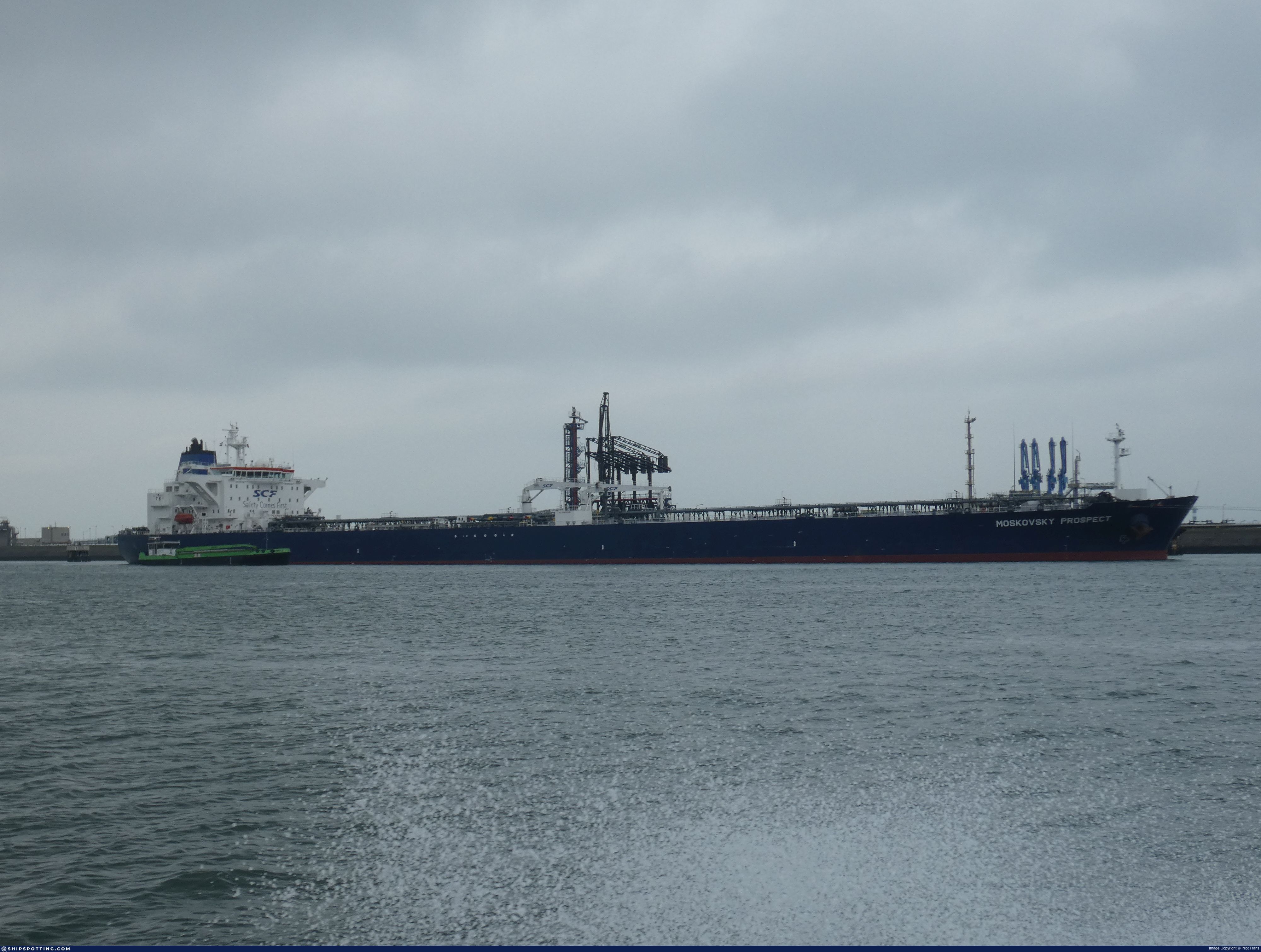
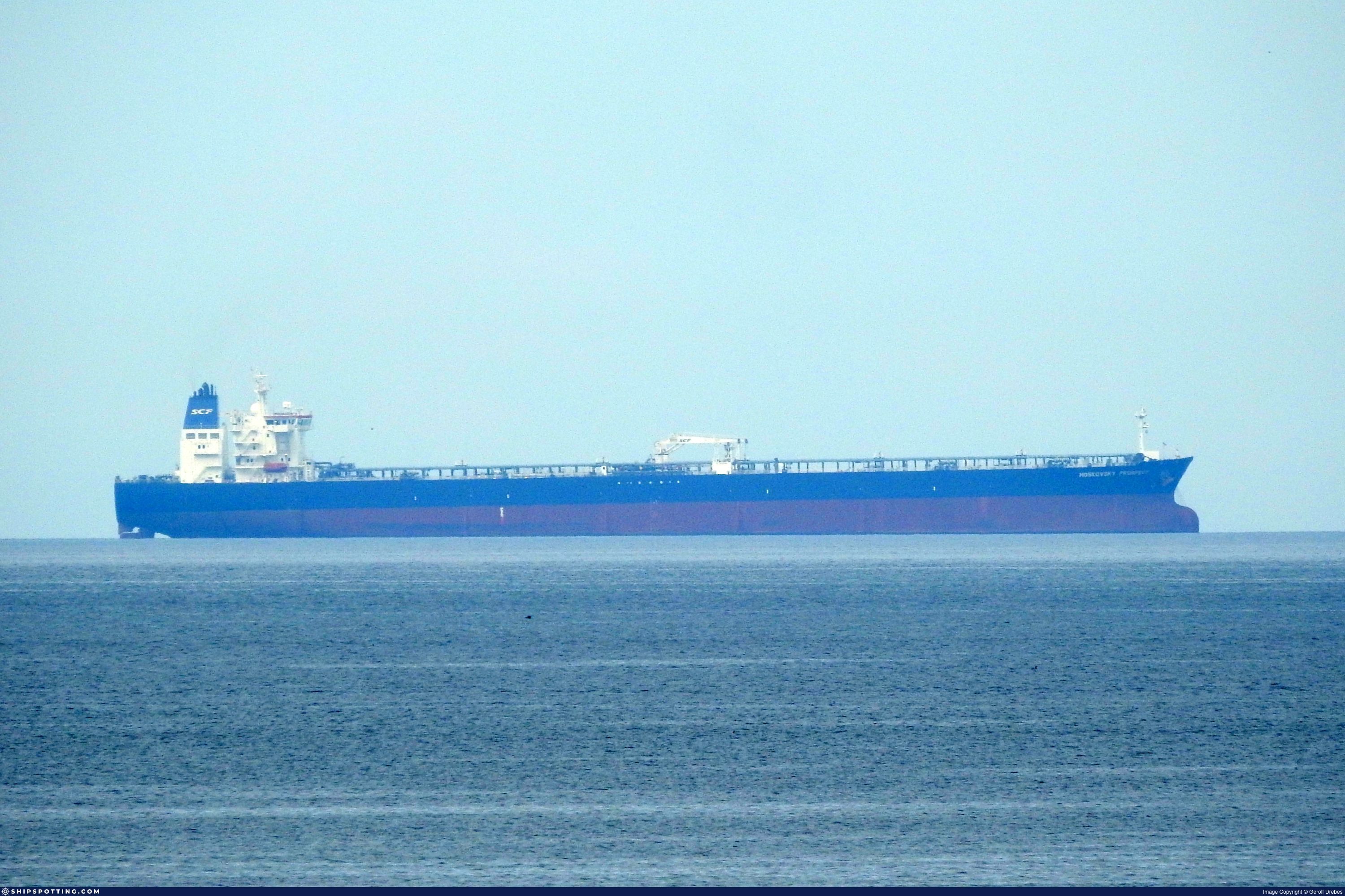
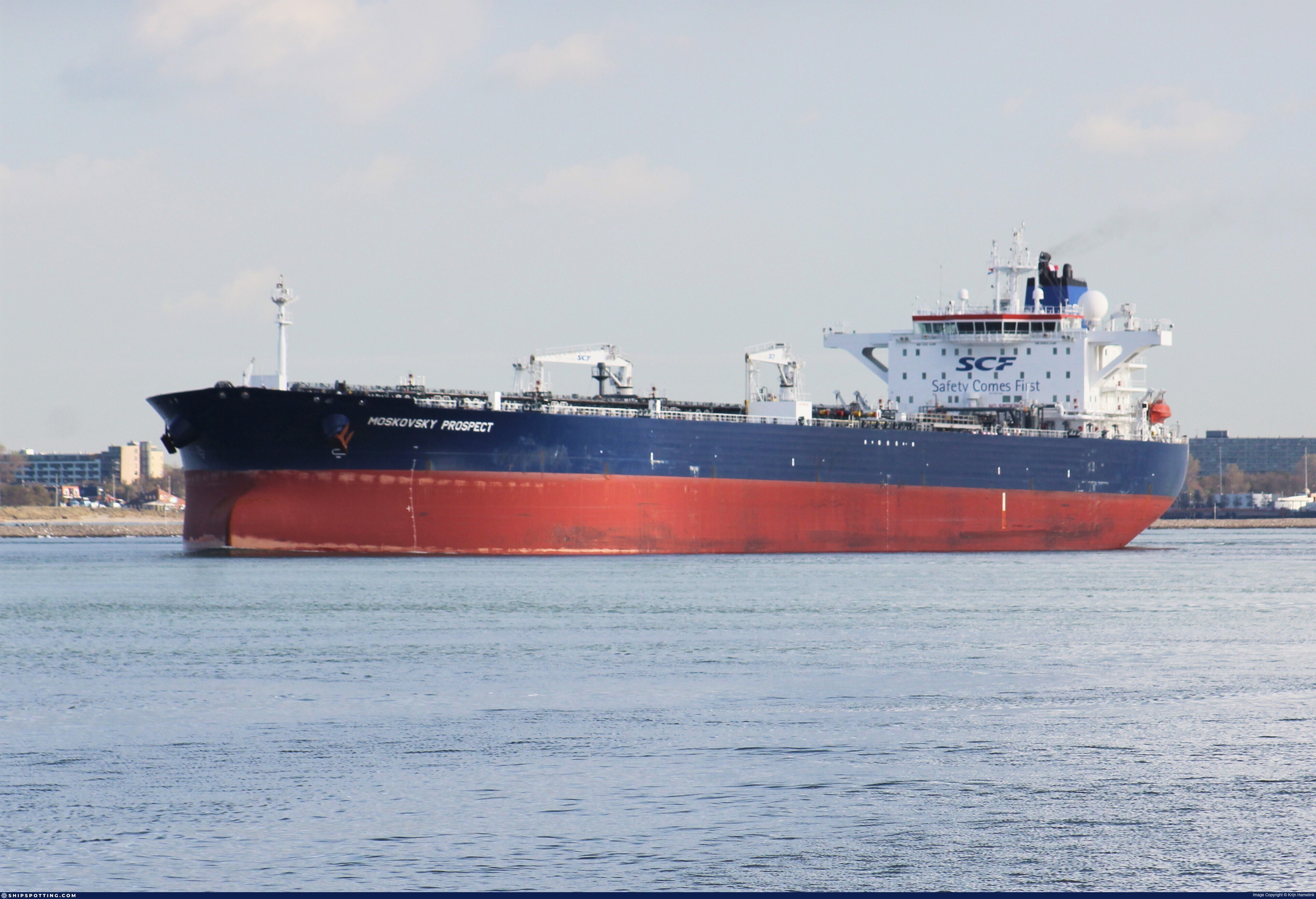
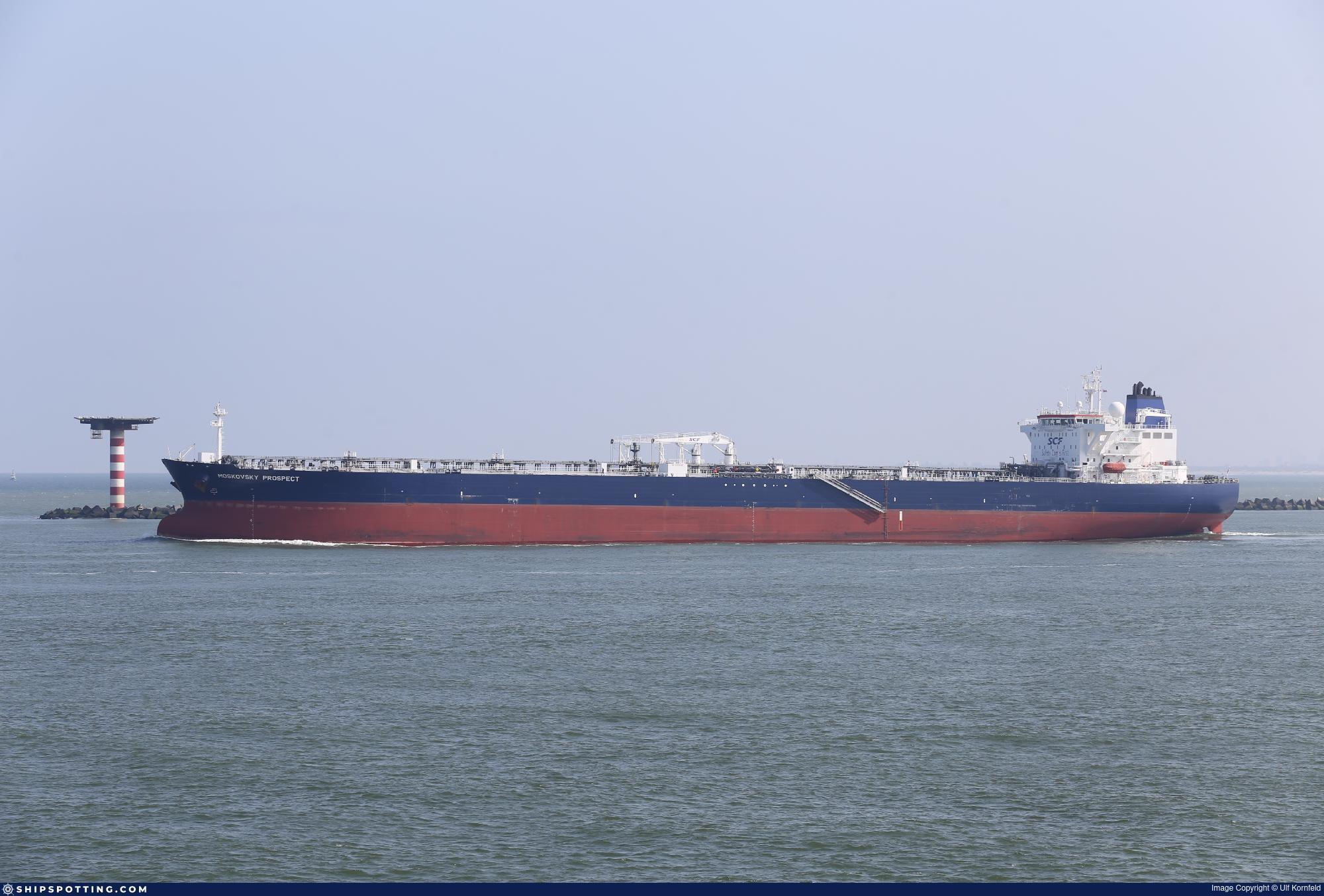
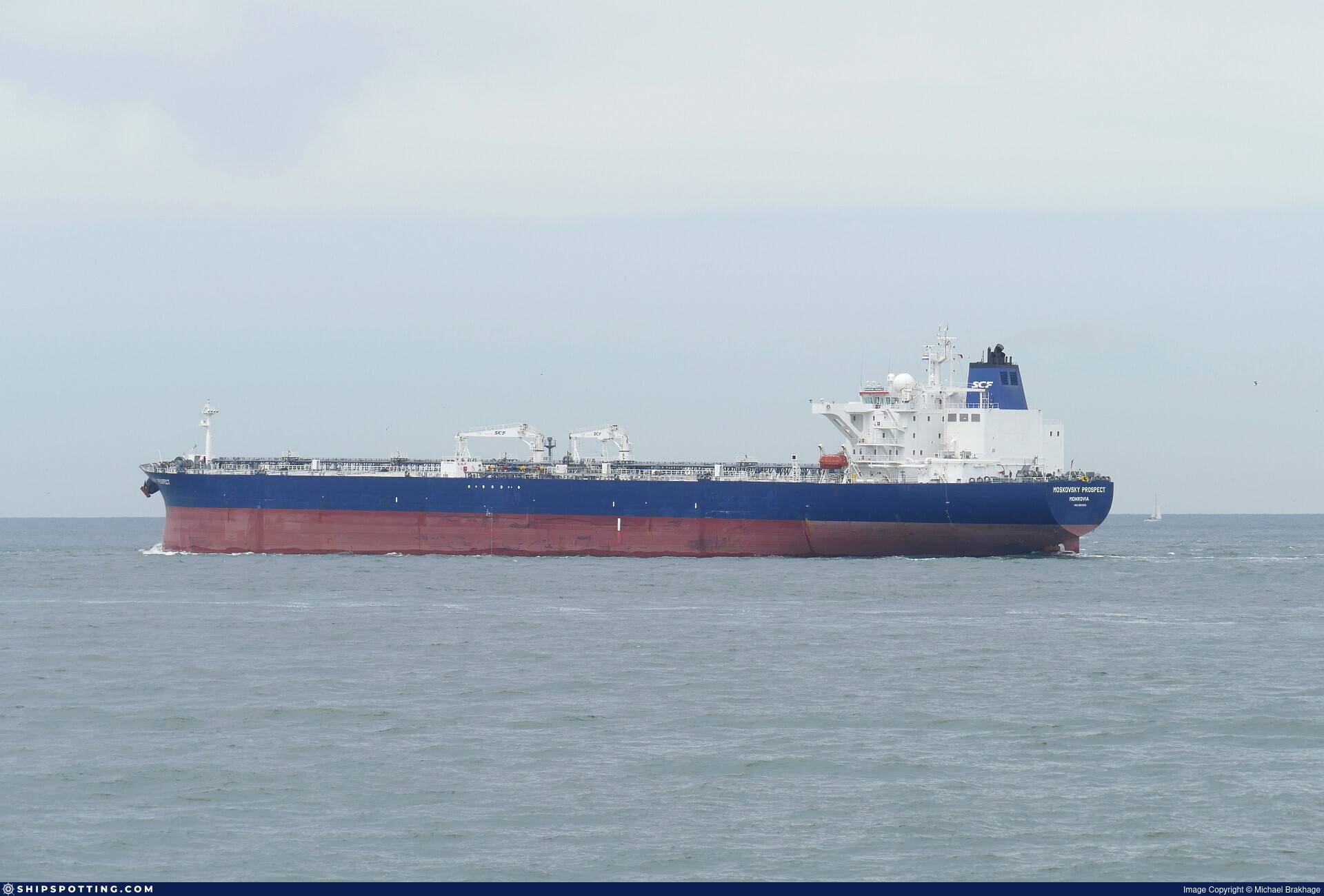
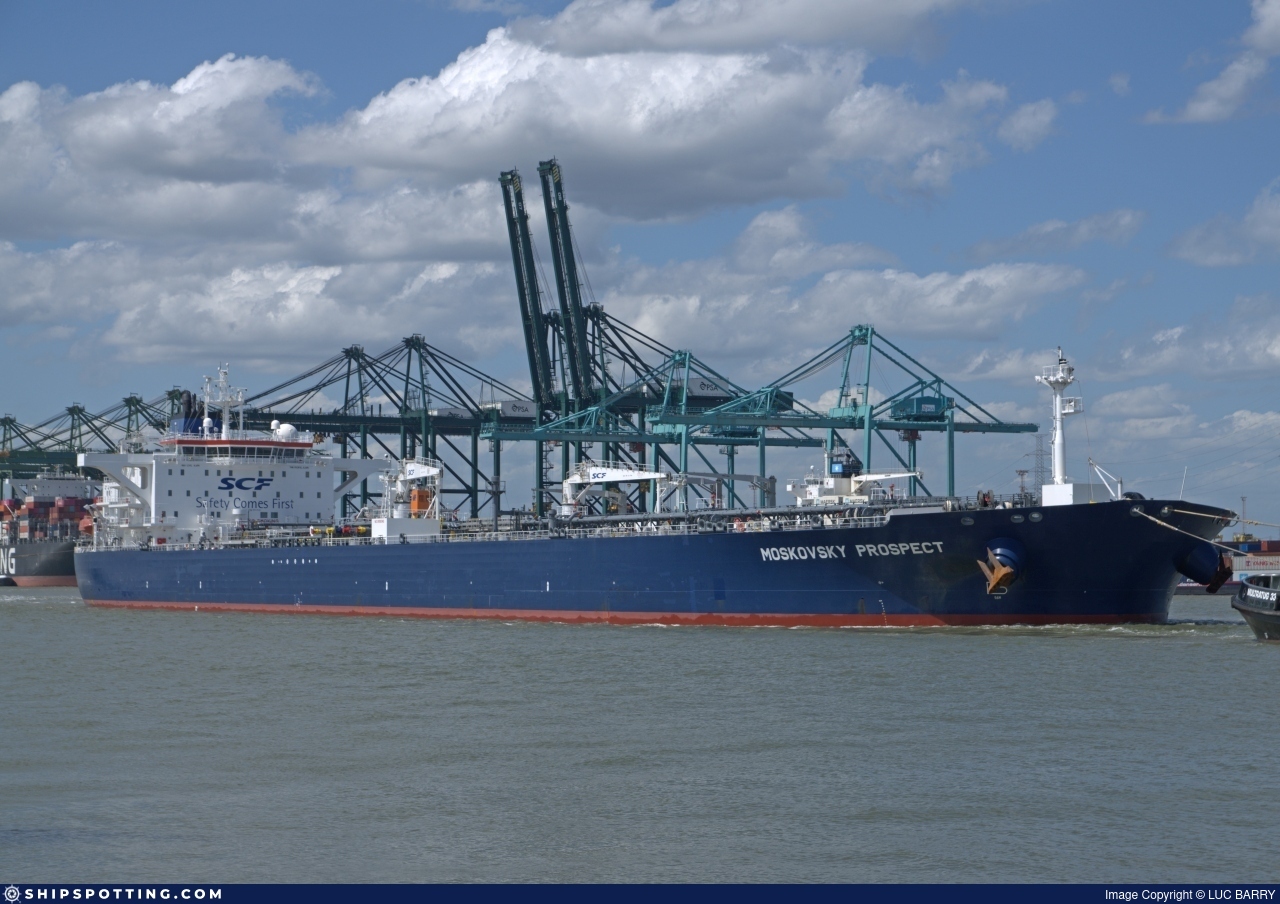
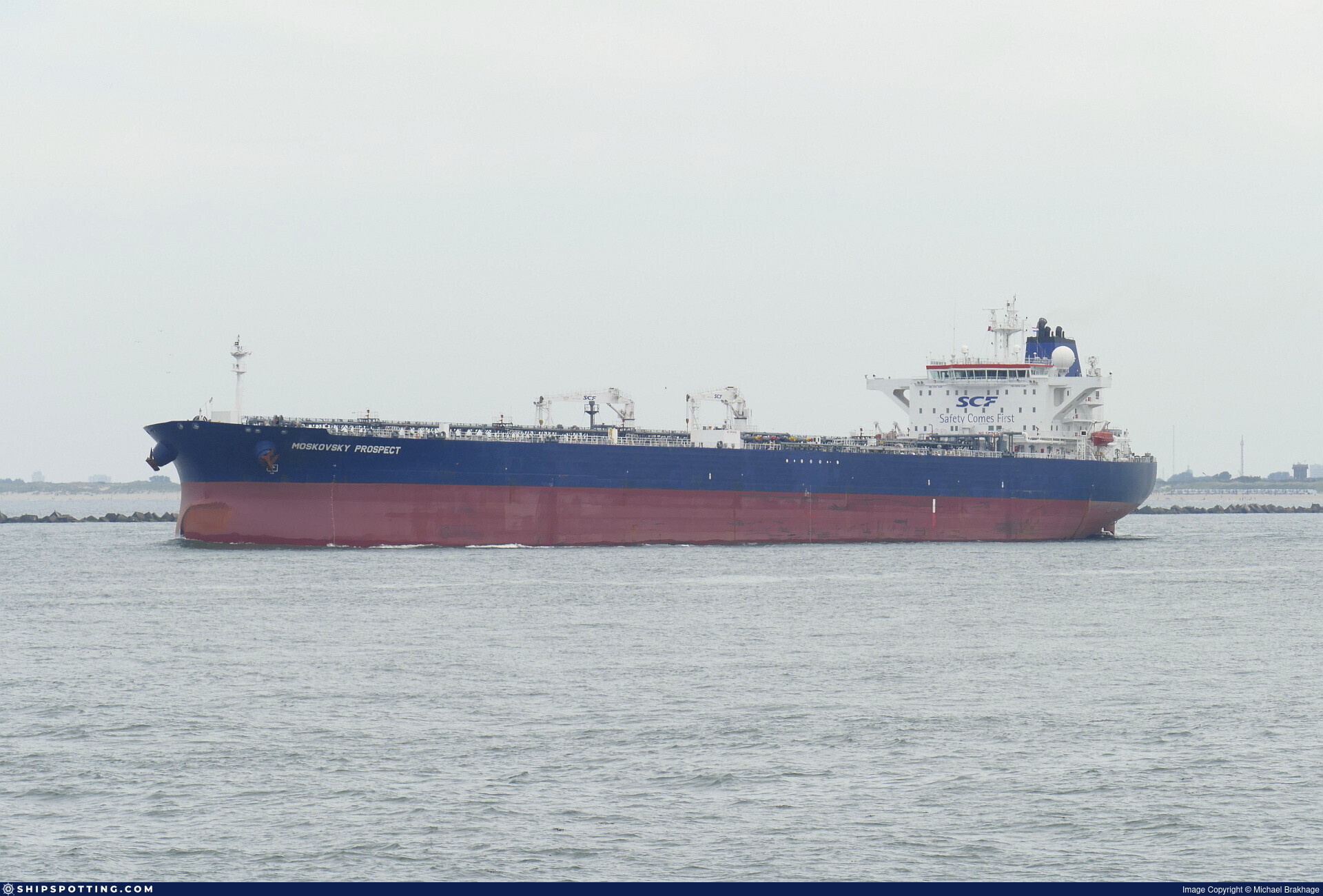
IMO 9511521
Vessel information
Sanctioned by
Company & Ownership
Management & Operations
Classification & Safety
Port State Control (PSC) Inspections
Programs & Notes
EU Russia Sanctions – Shadow Fleet | SEMA (Canada) — vessel designations | UKRAINE-EO13662] [RUSSIA-EO14024 | The Russia (Sanctions) (EU Exit) Regulations 2019
DateOfListing: 2024-12-17 || Secondary sanctions risk: See Section 11 of Executive Order 14024.; alt. Secondary sanctions risk: Ukraine-/Russia-Related Sanctions Regulations, 31 CFR 589.201 and/or 589.209; Vessel Registration Identification IMO 9511521; MMSI 626368000; Linked To: JOINT STOCK COMPANY SOVCOMFLOT. || DateDesignated: 2024-10-17 | Shipping sanctions: (see “Other information”) | Shipping sanctions: a specified ship is prohibited from being provided with access to or having its master or pilot cause it to enter a port in the UK, may have its registration on the UK Ship Register terminated, and a master or pilot of a specified ship may be given a port barring direction, a detention direction, and a port entry direction or a movement direction. | MOSKOVSKY PROSPECT (IMO 9511521) is involved in activity whose object or effect is to destabilise Ukraine or undermine or threaten the territorial integrity, sovereignty or independence of Ukraine or to obtain a benefit from or support the Government of Russia. Namely, MOSKOVSKY PROSPECT is involved in carrying oil or oil products that originated in Russia from Russia to a third country.
Vessel Changes
 🔄 Owner
AIS Events
50 events detected • 12 zones • Last: Jul 8, 2026
- Zone: Ust-Luga Terminal Complex
- Duration: 2h 48m
- Data Points: 2 AIS positions
- Period: 2026-07-08T04:09:07+00:00 to 2026-07-08T06:57:17+00:00
Show Raw Evidence JSON
{
    "zone_id": "russia_ust_luga",
    "zone_name": "Ust-Luga Terminal Complex",
    "dwell_minutes": 168.19999999999998863131622783839702606201171875,
    "points_in_zone": 2,
    "first_point": {
        "ts": "2026-07-08T04:09:07+00:00",
        "lat": 59.92397330000000010841176845133304595947265625,
        "lon": 28.630533299999999741203282610513269901275634765625
    },
    "last_point": {
        "ts": "2026-07-08T06:57:17+00:00",
        "lat": 59.92283830000000222071321331895887851715087890625,
        "lon": 28.63034499999999837882569408975541591644287109375
    }
}- Zone: Ust-Luga Terminal Complex
- Duration: 1h 33m
- Data Points: 6 AIS positions
- Period: 2026-06-18T15:10:24+00:00 to 2026-06-18T16:44:06+00:00
Show Raw Evidence JSON
{
    "zone_id": "russia_ust_luga",
    "zone_name": "Ust-Luga Terminal Complex",
    "dwell_minutes": 93.7000000000000028421709430404007434844970703125,
    "points_in_zone": 6,
    "first_point": {
        "ts": "2026-06-18T15:10:24+00:00",
        "lat": 59.92309329999999789606590638868510723114013671875,
        "lon": 28.63218330000000122481651487760245800018310546875
    },
    "last_point": {
        "ts": "2026-06-18T16:44:06+00:00",
        "lat": 59.922809999999998353814589790999889373779296875,
        "lon": 28.632031699999998863859218545258045196533203125
    }
}- Zone: Ust-Luga Terminal Complex
- Duration: 1h 5m
- Data Points: 16 AIS positions
- Period: 2026-05-04T07:00:13+00:00 to 2026-05-04T08:06:02+00:00
Show Raw Evidence JSON
{
    "zone_id": "russia_ust_luga",
    "zone_name": "Ust-Luga Terminal Complex",
    "dwell_minutes": 65.7999999999999971578290569595992565155029296875,
    "points_in_zone": 16,
    "first_point": {
        "ts": "2026-05-04T07:00:13+00:00",
        "lat": 59.86836670000000282243490801192820072174072265625,
        "lon": 28.405480000000000728732629795558750629425048828125
    },
    "last_point": {
        "ts": "2026-05-04T08:06:02+00:00",
        "lat": 59.868376699999998891144059598445892333984375,
        "lon": 28.405936700000001593480192241258919239044189453125
    }
}- Zone: Ust-Luga Terminal Complex
- Duration: 1h 4m
- Data Points: 19 AIS positions
- Period: 2026-05-03T16:01:37+00:00 to 2026-05-03T17:06:29+00:00
Show Raw Evidence JSON
{
    "zone_id": "russia_ust_luga",
    "zone_name": "Ust-Luga Terminal Complex",
    "dwell_minutes": 64.900000000000005684341886080801486968994140625,
    "points_in_zone": 19,
    "first_point": {
        "ts": "2026-05-03T16:01:37+00:00",
        "lat": 59.86736330000000094742063083685934543609619140625,
        "lon": 28.409566699999999173087417148053646087646484375
    },
    "last_point": {
        "ts": "2026-05-03T17:06:29+00:00",
        "lat": 59.867244999999996935002855025231838226318359375,
        "lon": 28.409490000000001685975803411565721035003662109375
    }
}- Duration: 2h 4m
- Radius: 86 meters
- Data Points: 35 AIS positions
- Centroid: 59.8673, 28.4093
- Zone: Ust-Luga Terminal Complex
Show Raw Evidence JSON
{
    "radius_m": 85.5,
    "duration_minutes": 124.900000000000005684341886080801486968994140625,
    "points": 35,
    "centroid": {
        "lat": 59.86731928285713166815185104496777057647705078125,
        "lon": 28.40933571142857516633739578537642955780029296875
    },
    "bbox": {
        "min_lat": 59.866635000000002264641807414591312408447265625,
        "min_lon": 28.40859499999999826513885636813938617706298828125,
        "max_lat": 59.8679249999999996134647517465054988861083984375,
        "max_lon": 28.410026699999999522106008953414857387542724609375
    },
    "zone_id": "russia_ust_luga"
}- Zone: Ust-Luga Terminal Complex
- Duration: 2h 4m
- Data Points: 35 AIS positions
- Period: 2026-05-03T15:01:37+00:00 to 2026-05-03T17:06:29+00:00
Show Raw Evidence JSON
{
    "zone_id": "russia_ust_luga",
    "zone_name": "Ust-Luga Terminal Complex",
    "dwell_minutes": 124.900000000000005684341886080801486968994140625,
    "points_in_zone": 35,
    "first_point": {
        "ts": "2026-05-03T15:01:37+00:00",
        "lat": 59.86777670000000028949216357432305812835693359375,
        "lon": 28.40859499999999826513885636813938617706298828125
    },
    "last_point": {
        "ts": "2026-05-03T17:06:29+00:00",
        "lat": 59.867244999999996935002855025231838226318359375,
        "lon": 28.409490000000001685975803411565721035003662109375
    }
}- Duration: 3h 4m
- Radius: 99 meters
- Data Points: 48 AIS positions
- Centroid: 59.8674, 28.4092
- Zone: Ust-Luga Terminal Complex
Show Raw Evidence JSON
{
    "radius_m": 98.7999999999999971578290569595992565155029296875,
    "duration_minutes": 184.900000000000005684341886080801486968994140625,
    "points": 48,
    "centroid": {
        "lat": 59.86741958333333712971580098383128643035888671875,
        "lon": 28.409206283333322318185309995897114276885986328125
    },
    "bbox": {
        "min_lat": 59.866635000000002264641807414591312408447265625,
        "min_lon": 28.4084849999999988767740433104336261749267578125,
        "max_lat": 59.868054999999998244675225578248500823974609375,
        "max_lon": 28.410026699999999522106008953414857387542724609375
    },
    "zone_id": "russia_ust_luga"
}- Zone: Ust-Luga Terminal Complex
- Duration: 3h 4m
- Data Points: 48 AIS positions
- Period: 2026-05-03T14:01:37+00:00 to 2026-05-03T17:06:29+00:00
Show Raw Evidence JSON
{
    "zone_id": "russia_ust_luga",
    "zone_name": "Ust-Luga Terminal Complex",
    "dwell_minutes": 184.900000000000005684341886080801486968994140625,
    "points_in_zone": 48,
    "first_point": {
        "ts": "2026-05-03T14:01:37+00:00",
        "lat": 59.86773170000000021673258743248879909515380859375,
        "lon": 28.40882500000000021600499167107045650482177734375
    },
    "last_point": {
        "ts": "2026-05-03T17:06:29+00:00",
        "lat": 59.867244999999996935002855025231838226318359375,
        "lon": 28.409490000000001685975803411565721035003662109375
    }
}- Duration: 3h 55m
- Radius: 100 meters
- Data Points: 56 AIS positions
- Centroid: 59.8674, 28.4092
- Zone: Ust-Luga Terminal Complex
Show Raw Evidence JSON
{
    "radius_m": 100.400000000000005684341886080801486968994140625,
    "duration_minutes": 235.900000000000005684341886080801486968994140625,
    "points": 56,
    "centroid": {
        "lat": 59.86743348214285020958413952030241489410400390625,
        "lon": 28.409196100000002616070560179650783538818359375
    },
    "bbox": {
        "min_lat": 59.866635000000002264641807414591312408447265625,
        "min_lon": 28.4084849999999988767740433104336261749267578125,
        "max_lat": 59.868054999999998244675225578248500823974609375,
        "max_lon": 28.410026699999999522106008953414857387542724609375
    },
    "zone_id": "russia_ust_luga"
}- Zone: Ust-Luga Terminal Complex
- Duration: 3h 55m
- Data Points: 56 AIS positions
- Period: 2026-05-03T13:10:37+00:00 to 2026-05-03T17:06:29+00:00
Show Raw Evidence JSON
{
    "zone_id": "russia_ust_luga",
    "zone_name": "Ust-Luga Terminal Complex",
    "dwell_minutes": 235.900000000000005684341886080801486968994140625,
    "points_in_zone": 56,
    "first_point": {
        "ts": "2026-05-03T13:10:37+00:00",
        "lat": 59.867289999999997007762431167066097259521484375,
        "lon": 28.40963169999999848869265406392514705657958984375
    },
    "last_point": {
        "ts": "2026-05-03T17:06:29+00:00",
        "lat": 59.867244999999996935002855025231838226318359375,
        "lon": 28.409490000000001685975803411565721035003662109375
    }
}- Duration: 5h 4m
- Radius: 95 meters
- Data Points: 69 AIS positions
- Centroid: 59.8673, 28.4093
- Zone: Ust-Luga Terminal Complex
Show Raw Evidence JSON
{
    "radius_m": 95.099999999999994315658113919198513031005859375,
    "duration_minutes": 304.8999999999999772626324556767940521240234375,
    "points": 69,
    "centroid": {
        "lat": 59.86729615942028459585344535298645496368408203125,
        "lon": 28.40933415217390489715398871339857578277587890625
    },
    "bbox": {
        "min_lat": 59.86650999999999811507223057560622692108154296875,
        "min_lon": 28.4084849999999988767740433104336261749267578125,
        "max_lat": 59.868054999999998244675225578248500823974609375,
        "max_lon": 28.41005499999999983629095368087291717529296875
    },
    "zone_id": "russia_ust_luga"
}- Zone: Ust-Luga Terminal Complex
- Duration: 5h 4m
- Data Points: 69 AIS positions
- Period: 2026-05-03T12:01:37+00:00 to 2026-05-03T17:06:29+00:00
Show Raw Evidence JSON
{
    "zone_id": "russia_ust_luga",
    "zone_name": "Ust-Luga Terminal Complex",
    "dwell_minutes": 304.8999999999999772626324556767940521240234375,
    "points_in_zone": 69,
    "first_point": {
        "ts": "2026-05-03T12:01:37+00:00",
        "lat": 59.86664329999999978326741256751120090484619140625,
        "lon": 28.409974999999999312194631784223020076751708984375
    },
    "last_point": {
        "ts": "2026-05-03T17:06:29+00:00",
        "lat": 59.867244999999996935002855025231838226318359375,
        "lon": 28.409490000000001685975803411565721035003662109375
    }
}- Duration: 5h 58m
- Radius: 104 meters
- Data Points: 81 AIS positions
- Centroid: 59.8672, 28.4094
- Zone: Ust-Luga Terminal Complex
Show Raw Evidence JSON
{
    "radius_m": 103.7999999999999971578290569595992565155029296875,
    "duration_minutes": 358.8999999999999772626324556767940521240234375,
    "points": 81,
    "centroid": {
        "lat": 59.86722932222222226528174360282719135284423828125,
        "lon": 28.409421728395056305771504412405192852020263671875
    },
    "bbox": {
        "min_lat": 59.86650999999999811507223057560622692108154296875,
        "min_lon": 28.4084849999999988767740433104336261749267578125,
        "max_lat": 59.868054999999998244675225578248500823974609375,
        "max_lon": 28.41005499999999983629095368087291717529296875
    },
    "zone_id": "russia_ust_luga"
}- Zone: Ust-Luga Terminal Complex
- Duration: 5h 58m
- Data Points: 81 AIS positions
- Period: 2026-05-03T11:07:37+00:00 to 2026-05-03T17:06:29+00:00
Show Raw Evidence JSON
{
    "zone_id": "russia_ust_luga",
    "zone_name": "Ust-Luga Terminal Complex",
    "dwell_minutes": 358.8999999999999772626324556767940521240234375,
    "points_in_zone": 81,
    "first_point": {
        "ts": "2026-05-03T11:07:37+00:00",
        "lat": 59.86696500000000042973624658770859241485595703125,
        "lon": 28.409911699999998546672941301949322223663330078125
    },
    "last_point": {
        "ts": "2026-05-03T17:06:29+00:00",
        "lat": 59.867244999999996935002855025231838226318359375,
        "lon": 28.409490000000001685975803411565721035003662109375
    }
}- Duration: 6h 34m
- Radius: 106 meters
- Data Points: 87 AIS positions
- Centroid: 59.8672, 28.4095
- Zone: Ust-Luga Terminal Complex
Show Raw Evidence JSON
{
    "radius_m": 106.2000000000000028421709430404007434844970703125,
    "duration_minutes": 394.8999999999999772626324556767940521240234375,
    "points": 87,
    "centroid": {
        "lat": 59.867212836781618534587323665618896484375,
        "lon": 28.409451686206896425801460281945765018463134765625
    },
    "bbox": {
        "min_lat": 59.86650999999999811507223057560622692108154296875,
        "min_lon": 28.4084849999999988767740433104336261749267578125,
        "max_lat": 59.868054999999998244675225578248500823974609375,
        "max_lon": 28.41005499999999983629095368087291717529296875
    },
    "zone_id": "russia_ust_luga"
}- Zone: Ust-Luga Terminal Complex
- Duration: 6h 34m
- Data Points: 87 AIS positions
- Period: 2026-05-03T10:31:37+00:00 to 2026-05-03T17:06:29+00:00
Show Raw Evidence JSON
{
    "zone_id": "russia_ust_luga",
    "zone_name": "Ust-Luga Terminal Complex",
    "dwell_minutes": 394.8999999999999772626324556767940521240234375,
    "points_in_zone": 87,
    "first_point": {
        "ts": "2026-05-03T10:31:37+00:00",
        "lat": 59.86705829999999650681274943053722381591796875,
        "lon": 28.40976669999999870697138248942792415618896484375
    },
    "last_point": {
        "ts": "2026-05-03T17:06:29+00:00",
        "lat": 59.867244999999996935002855025231838226318359375,
        "lon": 28.409490000000001685975803411565721035003662109375
    }
}- Duration: 6h 33m
- Radius: 104 meters
- Data Points: 87 AIS positions
- Centroid: 59.8672, 28.4095
- Zone: Ust-Luga Terminal Complex
Show Raw Evidence JSON
{
    "radius_m": 104,
    "duration_minutes": 393,
    "points": 87,
    "centroid": {
        "lat": 59.8672367459770242703598341904580593109130859375,
        "lon": 28.409457165517249421782253193669021129608154296875
    },
    "bbox": {
        "min_lat": 59.86650999999999811507223057560622692108154296875,
        "min_lon": 28.4084849999999988767740433104336261749267578125,
        "max_lat": 59.868054999999998244675225578248500823974609375,
        "max_lon": 28.41005499999999983629095368087291717529296875
    },
    "zone_id": "russia_ust_luga"
}- Zone: Ust-Luga Terminal Complex
- Duration: 6h 33m
- Data Points: 87 AIS positions
- Period: 2026-05-03T09:55:37+00:00 to 2026-05-03T16:28:37+00:00
Show Raw Evidence JSON
{
    "zone_id": "russia_ust_luga",
    "zone_name": "Ust-Luga Terminal Complex",
    "dwell_minutes": 393,
    "points_in_zone": 87,
    "first_point": {
        "ts": "2026-05-03T09:55:37+00:00",
        "lat": 59.8674299999999988131094141863286495208740234375,
        "lon": 28.409601699999999624424162902869284152984619140625
    },
    "last_point": {
        "ts": "2026-05-03T16:28:37+00:00",
        "lat": 59.866635000000002264641807414591312408447265625,
        "lon": 28.410026699999999522106008953414857387542724609375
    }
}- Duration: 6h 36m
- Radius: 105 meters
- Data Points: 83 AIS positions
- Centroid: 59.8672, 28.4095
- Zone: Ust-Luga Terminal Complex
Show Raw Evidence JSON
{
    "radius_m": 104.599999999999994315658113919198513031005859375,
    "duration_minutes": 396,
    "points": 83,
    "centroid": {
        "lat": 59.8672389795180919236372574232518672943115234375,
        "lon": 28.4094897192771185245874221436679363250732421875
    },
    "bbox": {
        "min_lat": 59.86650999999999811507223057560622692108154296875,
        "min_lon": 28.4084849999999988767740433104336261749267578125,
        "max_lat": 59.868054999999998244675225578248500823974609375,
        "max_lon": 28.41005499999999983629095368087291717529296875
    },
    "zone_id": "russia_ust_luga"
}- Zone: Ust-Luga Terminal Complex
- Duration: 6h 36m
- Data Points: 83 AIS positions
- Period: 2026-05-03T08:52:37+00:00 to 2026-05-03T15:28:37+00:00
Show Raw Evidence JSON
{
    "zone_id": "russia_ust_luga",
    "zone_name": "Ust-Luga Terminal Complex",
    "dwell_minutes": 396,
    "points_in_zone": 83,
    "first_point": {
        "ts": "2026-05-03T08:52:37+00:00",
        "lat": 59.86723500000000086629370343871414661407470703125,
        "lon": 28.40966329999999828714862815104424953460693359375
    },
    "last_point": {
        "ts": "2026-05-03T15:28:37+00:00",
        "lat": 59.86771499999999690544427721761167049407958984375,
        "lon": 28.4088832999999993944584275595843791961669921875
    }
}- Duration: 6h 33m
- Radius: 104 meters
- Data Points: 76 AIS positions
- Centroid: 59.8671, 28.4097
- Zone: Ust-Luga Terminal Complex
Show Raw Evidence JSON
{
    "radius_m": 103.900000000000005684341886080801486968994140625,
    "duration_minutes": 393,
    "points": 76,
    "centroid": {
        "lat": 59.8670963842105408048155368305742740631103515625,
        "lon": 28.409694867105269366902575711719691753387451171875
    },
    "bbox": {
        "min_lat": 59.86650999999999811507223057560622692108154296875,
        "min_lon": 28.408743300000001141825123340822756290435791015625,
        "max_lat": 59.86790669999999892070263740606606006622314453125,
        "max_lon": 28.41005499999999983629095368087291717529296875
    },
    "zone_id": "russia_ust_luga"
}- Zone: Ust-Luga Terminal Complex
- Duration: 6h 33m
- Data Points: 76 AIS positions
- Period: 2026-05-03T07:55:37+00:00 to 2026-05-03T14:28:37+00:00
Show Raw Evidence JSON
{
    "zone_id": "russia_ust_luga",
    "zone_name": "Ust-Luga Terminal Complex",
    "dwell_minutes": 393,
    "points_in_zone": 76,
    "first_point": {
        "ts": "2026-05-03T07:55:37+00:00",
        "lat": 59.8669849999999996725819073617458343505859375,
        "lon": 28.409915000000001583657649462111294269561767578125
    },
    "last_point": {
        "ts": "2026-05-03T14:28:37+00:00",
        "lat": 59.86750169999999826586645212955772876739501953125,
        "lon": 28.408743300000001141825123340822756290435791015625
    }
}- Zone: Baltic Exit/Tallinn Approach
- Duration: 1h 37m
- Data Points: 61 AIS positions
- Period: 2026-04-18T10:00:36+00:00 to 2026-04-18T11:38:25+00:00
Show Raw Evidence JSON
{
    "zone_id": "russia_baltic_transit",
    "zone_name": "Baltic Exit\/Tallinn Approach",
    "dwell_minutes": 97.7999999999999971578290569595992565155029296875,
    "points_in_zone": 61,
    "first_point": {
        "ts": "2026-04-18T10:00:36+00:00",
        "lat": 59.89055830000000213431121665053069591522216796875,
        "lon": 25.90585829999999845085767447017133235931396484375
    },
    "last_point": {
        "ts": "2026-04-18T11:38:25+00:00",
        "lat": 59.96514499999999969759301166050136089324951171875,
        "lon": 26.4777050000000002683009370230138301849365234375
    }
}- Zone: Baltic Exit/Tallinn Approach
- Duration: 2h 37m
- Data Points: 104 AIS positions
- Period: 2026-04-18T09:00:36+00:00 to 2026-04-18T11:38:25+00:00
Show Raw Evidence JSON
{
    "zone_id": "russia_baltic_transit",
    "zone_name": "Baltic Exit\/Tallinn Approach",
    "dwell_minutes": 157.80000000000001136868377216160297393798828125,
    "points_in_zone": 104,
    "first_point": {
        "ts": "2026-04-18T09:00:36+00:00",
        "lat": 59.84024500000000301724867313168942928314208984375,
        "lon": 25.56495170000000172194631886668503284454345703125
    },
    "last_point": {
        "ts": "2026-04-18T11:38:25+00:00",
        "lat": 59.96514499999999969759301166050136089324951171875,
        "lon": 26.4777050000000002683009370230138301849365234375
    }
}- Zone: Baltic Exit/Tallinn Approach
- Duration: 3h 37m
- Data Points: 138 AIS positions
- Period: 2026-04-18T08:00:45+00:00 to 2026-04-18T11:38:25+00:00
Show Raw Evidence JSON
{
    "zone_id": "russia_baltic_transit",
    "zone_name": "Baltic Exit\/Tallinn Approach",
    "dwell_minutes": 217.69999999999998863131622783839702606201171875,
    "points_in_zone": 138,
    "first_point": {
        "ts": "2026-04-18T08:00:45+00:00",
        "lat": 59.80799499999999824240148882381618022918701171875,
        "lon": 25.22131830000000007885319064371287822723388671875
    },
    "last_point": {
        "ts": "2026-04-18T11:38:25+00:00",
        "lat": 59.96514499999999969759301166050136089324951171875,
        "lon": 26.4777050000000002683009370230138301849365234375
    }
}- Zone: Baltic Exit/Tallinn Approach
- Duration: 4h 38m
- Data Points: 180 AIS positions
- Period: 2026-04-18T07:00:24+00:00 to 2026-04-18T11:38:25+00:00
Show Raw Evidence JSON
{
    "zone_id": "russia_baltic_transit",
    "zone_name": "Baltic Exit\/Tallinn Approach",
    "dwell_minutes": 278,
    "points_in_zone": 180,
    "first_point": {
        "ts": "2026-04-18T07:00:24+00:00",
        "lat": 59.76753500000000229874785873107612133026123046875,
        "lon": 24.871003300000001701164364931173622608184814453125
    },
    "last_point": {
        "ts": "2026-04-18T11:38:25+00:00",
        "lat": 59.96514499999999969759301166050136089324951171875,
        "lon": 26.4777050000000002683009370230138301849365234375
    }
}- Zone: Baltic Exit/Tallinn Approach
- Duration: 4h 49m
- Data Points: 189 AIS positions
- Period: 2026-04-18T06:49:05+00:00 to 2026-04-18T11:38:25+00:00
Show Raw Evidence JSON
{
    "zone_id": "russia_baltic_transit",
    "zone_name": "Baltic Exit\/Tallinn Approach",
    "dwell_minutes": 289.30000000000001136868377216160297393798828125,
    "points_in_zone": 189,
    "first_point": {
        "ts": "2026-04-18T06:49:05+00:00",
        "lat": 59.76019670000000161280695465393364429473876953125,
        "lon": 24.807088300000000202771843760274350643157958984375
    },
    "last_point": {
        "ts": "2026-04-18T11:38:25+00:00",
        "lat": 59.96514499999999969759301166050136089324951171875,
        "lon": 26.4777050000000002683009370230138301849365234375
    }
}- Zone: discovered_111
- Duration: 1h 25m
- Data Points: 56 AIS positions
- Period: 2026-04-18T05:10:24+00:00 to 2026-04-18T06:35:36+00:00
Show Raw Evidence JSON
{
    "zone_id": "discovered_111",
    "zone_name": "Northern Baltic Sea Surveillance Zone",
    "dwell_minutes": 85.2000000000000028421709430404007434844970703125,
    "points_in_zone": 56,
    "first_point": {
        "ts": "2026-04-18T05:10:24+00:00",
        "lat": 59.69566999999999978854248183779418468475341796875,
        "lon": 24.202758299999999280771589837968349456787109375
    },
    "last_point": {
        "ts": "2026-04-18T06:35:36+00:00",
        "lat": 59.75144829999999984693204169161617755889892578125,
        "lon": 24.732299999999998618704921682365238666534423828125
    }
}- Zone: Central Russian Monitoring Zone
- Duration: 1h 14m
- Data Points: 38 AIS positions
- Period: 2026-04-18T04:00:46+00:00 to 2026-04-18T05:15:05+00:00
Show Raw Evidence JSON
{
    "zone_id": "discovered_100",
    "zone_name": "Tallinn Offshore Monitoring Zone",
    "dwell_minutes": 74.2999999999999971578290569595992565155029296875,
    "points_in_zone": 38,
    "first_point": {
        "ts": "2026-04-18T04:00:46+00:00",
        "lat": 59.62864330000000023801476345397531986236572265625,
        "lon": 23.82085000000000007958078640513122081756591796875
    },
    "last_point": {
        "ts": "2026-04-18T05:15:05+00:00",
        "lat": 59.70073330000000311201802105642855167388916015625,
        "lon": 24.233425000000000437694325228221714496612548828125
    }
}- Zone: Central Russian Monitoring Zone
- Duration: 2h 14m
- Data Points: 77 AIS positions
- Period: 2026-04-18T03:00:46+00:00 to 2026-04-18T05:15:05+00:00
Show Raw Evidence JSON
{
    "zone_id": "discovered_100",
    "zone_name": "Tallinn Offshore Monitoring Zone",
    "dwell_minutes": 134.30000000000001136868377216160297393798828125,
    "points_in_zone": 77,
    "first_point": {
        "ts": "2026-04-18T03:00:46+00:00",
        "lat": 59.5718217000000009875293471850454807281494140625,
        "lon": 23.487725000000001074340616469271481037139892578125
    },
    "last_point": {
        "ts": "2026-04-18T05:15:05+00:00",
        "lat": 59.70073330000000311201802105642855167388916015625,
        "lon": 24.233425000000000437694325228221714496612548828125
    }
}- Zone: Central Russian Monitoring Zone
- Duration: 2h 46m
- Data Points: 98 AIS positions
- Period: 2026-04-18T02:28:36+00:00 to 2026-04-18T05:15:05+00:00
Show Raw Evidence JSON
{
    "zone_id": "discovered_100",
    "zone_name": "Tallinn Offshore Monitoring Zone",
    "dwell_minutes": 166.5,
    "points_in_zone": 98,
    "first_point": {
        "ts": "2026-04-18T02:28:36+00:00",
        "lat": 59.54095829999999978099367581307888031005859375,
        "lon": 23.31081999999999965211827657185494899749755859375
    },
    "last_point": {
        "ts": "2026-04-18T05:15:05+00:00",
        "lat": 59.70073330000000311201802105642855167388916015625,
        "lon": 24.233425000000000437694325228221714496612548828125
    }
}- Zone: Archipelago Sea Monitoring Zone
- Duration: 1h 16m
- Data Points: 56 AIS positions
- Period: 2026-04-18T01:00:45+00:00 to 2026-04-18T02:17:06+00:00
Show Raw Evidence JSON
{
    "zone_id": "discovered_005",
    "zone_name": "Archipelago Sea Monitoring Zone",
    "dwell_minutes": 76.2999999999999971578290569595992565155029296875,
    "points_in_zone": 56,
    "first_point": {
        "ts": "2026-04-18T01:00:45+00:00",
        "lat": 59.46229670000000311347321257926523685455322265625,
        "lon": 22.83374669999999895253495196811854839324951171875
    },
    "last_point": {
        "ts": "2026-04-18T02:17:06+00:00",
        "lat": 59.53109169999999750189090264029800891876220703125,
        "lon": 23.248838299999999179590304265730082988739013671875
    }
}- Zone: Archipelago Sea Monitoring Zone
- Duration: 1h 59m
- Data Points: 71 AIS positions
- Period: 2026-04-18T00:17:44+00:00 to 2026-04-18T02:17:06+00:00
Show Raw Evidence JSON
{
    "zone_id": "discovered_005",
    "zone_name": "Archipelago Sea Monitoring Zone",
    "dwell_minutes": 119.400000000000005684341886080801486968994140625,
    "points_in_zone": 71,
    "first_point": {
        "ts": "2026-04-18T00:17:44+00:00",
        "lat": 59.41977669999999989158823154866695404052734375,
        "lon": 22.606010000000001269881977350451052188873291015625
    },
    "last_point": {
        "ts": "2026-04-18T02:17:06+00:00",
        "lat": 59.53109169999999750189090264029800891876220703125,
        "lon": 23.248838299999999179590304265730082988739013671875
    }
}- Zone: Eastern Mediterranean Monitoring Zone
- Duration: 1h 18m
- Data Points: 6 AIS positions
- Period: 2026-04-15T20:00:34+00:00 to 2026-04-15T21:18:53+00:00
Show Raw Evidence JSON
{
    "zone_id": "discovered_090",
    "zone_name": "Eastern Mediterranean Monitoring Zone",
    "dwell_minutes": 78.2999999999999971578290569595992565155029296875,
    "points_in_zone": 6,
    "first_point": {
        "ts": "2026-04-15T20:00:34+00:00",
        "lat": 54.40806669999999911624399828724563121795654296875,
        "lon": 12.02599670000000031677700462751090526580810546875
    },
    "last_point": {
        "ts": "2026-04-15T21:18:53+00:00",
        "lat": 54.55527330000000318932507070712745189666748046875,
        "lon": 12.2610332999999993575102053000591695308685302734375
    }
}- Zone: Eastern Mediterranean Monitoring Zone
- Duration: 1h 38m
- Data Points: 22 AIS positions
- Period: 2026-04-15T19:40:23+00:00 to 2026-04-15T21:18:53+00:00
Show Raw Evidence JSON
{
    "zone_id": "discovered_090",
    "zone_name": "Eastern Mediterranean Monitoring Zone",
    "dwell_minutes": 98.5,
    "points_in_zone": 22,
    "first_point": {
        "ts": "2026-04-15T19:40:23+00:00",
        "lat": 54.41100999999999743295120424591004848480224609375,
        "lon": 11.9021066999999991509184837923385202884674072265625
    },
    "last_point": {
        "ts": "2026-04-15T21:18:53+00:00",
        "lat": 54.55527330000000318932507070712745189666748046875,
        "lon": 12.2610332999999993575102053000591695308685302734375
    }
}- Gap Duration: 5h 28m
- Last Seen: 2026-04-15T14:12:14+00:00 at 55.0142, 11.0186 (Zone: Brest Channel Surveillance Zone)
- Next Seen: 2026-04-15T19:40:23+00:00 at 54.4110, 11.9021
🛰️ Gap Corroboration
These are snapshots that may corroborate presence during the gap. They do not reconstruct a continuous route.
SAR Imagery (Sentinel-1)
Status: ✓ Snapshot available
SAR snapshot available for review
Scene: S1A_IW_GRDH_1SDV_20260415T165307_20260415T165332_064093_0810C1_B8BD_COG • Time: 2026-04-15T16:53:07.769751Z
SAR coverage thumbnail
VIIRS Thermal Anomaly
Status: ✗ No detections
No VIIRS thermal/light detections in corridor
Show Raw Evidence JSON
{
    "gap_minutes": 328.1000000000000227373675443232059478759765625,
    "last_seen": {
        "ts": "2026-04-15T14:12:14+00:00",
        "lat": 55.01417169999999856599970371462404727935791015625,
        "lon": 11.0185650000000006087930159992538392543792724609375,
        "sog": 11,
        "zone_id": "discovered_065"
    },
    "next_seen": {
        "ts": "2026-04-15T19:40:23+00:00",
        "lat": 54.41100999999999743295120424591004848480224609375,
        "lon": 11.9021066999999991509184837923385202884674072265625,
        "zone_ids": [
            "discovered_090"
        ]
    },
    "gap_enrichment": {
        "status": "done",
        "corridor": {
            "start": {
                "lat": 55.01417169999999856599970371462404727935791015625,
                "lon": 11.0185650000000006087930159992538392543792724609375,
                "ts": "2026-04-15T14:12:14+00:00"
            },
            "end": {
                "lat": 54.41100999999999743295120424591004848480224609375,
                "lon": 11.9021066999999991509184837923385202884674072265625,
                "ts": "2026-04-15T19:40:23+00:00"
            },
            "bbox": {
                "min_lat": 54.230829999999997426129993982613086700439453125,
                "min_lon": 10.706661000000000427689883508719503879547119140625,
                "max_lat": 55.19435200000000207865014090202748775482177734375,
                "max_lon": 12.214010999999999285137164406478404998779296875
            },
            "buffer_km": 20
        },
        "sar": {
            "status": "snapshot",
            "scene_id": "S1A_IW_GRDH_1SDV_20260415T165307_20260415T165332_064093_0810C1_B8BD_COG",
            "scene_time": "2026-04-15T16:53:07.769751Z",
            "platform": "sentinel-1a",
            "assets": {
                "preview_url": "https:\/\/fleetleaks.com\/wp-content\/uploads\/fleetleaks-evidence\/sar-imagery\/2026\/04\/event_364830_thumbnail_20260415200011.png",
                "stored_path": "\/home\/fleetleaks\/public_html\/wp-content\/uploads\/fleetleaks-evidence\/sar-imagery\/2026\/04\/event_364830_thumbnail_20260415200011.png",
                "source": "copernicus_dataspace"
            },
            "notes": "SAR snapshot available for review"
        },
        "viirs": {
            "status": "not_found",
            "notes": "No VIIRS thermal\/light detections in corridor"
        },
        "searched_at": "2026-04-15T20:00:07.690467+00:00"
    }
}- Zone: Brest Channel Surveillance Zone
- Duration: 1h 46m
- Data Points: 24 AIS positions
- Period: 2026-04-15T12:25:44+00:00 to 2026-04-15T14:12:14+00:00
Show Raw Evidence JSON
{
    "zone_id": "discovered_065",
    "zone_name": "Brest Channel Surveillance Zone",
    "dwell_minutes": 106.5,
    "points_in_zone": 24,
    "first_point": {
        "ts": "2026-04-15T12:25:44+00:00",
        "lat": 55.3549567000000024563632905483245849609375,
        "lon": 11.032308300000000400586941395886242389678955078125
    },
    "last_point": {
        "ts": "2026-04-15T14:12:14+00:00",
        "lat": 55.01417169999999856599970371462404727935791015625,
        "lon": 11.0185650000000006087930159992538392543792724609375
    }
}- Zone: Norwegian Sea Surveillance Zone
- Duration: 1h 35m
- Data Points: 26 AIS positions
- Period: 2026-04-15T11:00:05+00:00 to 2026-04-15T12:35:52+00:00
Show Raw Evidence JSON
{
    "zone_id": "discovered_085",
    "zone_name": "Northern Skagerrak Surveillance Zone",
    "dwell_minutes": 95.7999999999999971578290569595992565155029296875,
    "points_in_zone": 26,
    "first_point": {
        "ts": "2026-04-15T11:00:05+00:00",
        "lat": 55.60712500000000346744855050928890705108642578125,
        "lon": 10.790748300000000625686880084685981273651123046875
    },
    "last_point": {
        "ts": "2026-04-15T12:35:52+00:00",
        "lat": 55.3198282999999975118043948896229267120361328125,
        "lon": 11.0317416999999995397274688002653419971466064453125
    }
}- Zone: Norwegian Sea Surveillance Zone
- Duration: 1h 40m
- Data Points: 30 AIS positions
- Period: 2026-04-15T10:55:53+00:00 to 2026-04-15T12:35:52+00:00
Show Raw Evidence JSON
{
    "zone_id": "discovered_085",
    "zone_name": "Northern Skagerrak Surveillance Zone",
    "dwell_minutes": 100,
    "points_in_zone": 30,
    "first_point": {
        "ts": "2026-04-15T10:55:53+00:00",
        "lat": 55.6193200000000018690116121433675289154052734375,
        "lon": 10.7808433000000007950802682898938655853271484375
    },
    "last_point": {
        "ts": "2026-04-15T12:35:52+00:00",
        "lat": 55.3198282999999975118043948896229267120361328125,
        "lon": 11.0317416999999995397274688002653419971466064453125
    }
}- Zone: Norwegian Sea Surveillance Zone
- Duration: 3h 7m
- Data Points: 50 AIS positions
- Period: 2026-04-15T09:28:42+00:00 to 2026-04-15T12:35:52+00:00
Show Raw Evidence JSON
{
    "zone_id": "discovered_085",
    "zone_name": "Northern Skagerrak Surveillance Zone",
    "dwell_minutes": 187.19999999999998863131622783839702606201171875,
    "points_in_zone": 50,
    "first_point": {
        "ts": "2026-04-15T09:28:42+00:00",
        "lat": 55.88872669999999942547219689004123210906982421875,
        "lon": 10.9016932999999998088469510548748075962066650390625
    },
    "last_point": {
        "ts": "2026-04-15T12:35:52+00:00",
        "lat": 55.3198282999999975118043948896229267120361328125,
        "lon": 11.0317416999999995397274688002653419971466064453125
    }
}- Zone: Norwegian Sea Surveillance Zone
- Duration: 4h 34m
- Data Points: 57 AIS positions
- Period: 2026-04-15T08:01:43+00:00 to 2026-04-15T12:35:52+00:00
Show Raw Evidence JSON
{
    "zone_id": "discovered_085",
    "zone_name": "Northern Skagerrak Surveillance Zone",
    "dwell_minutes": 274.1000000000000227373675443232059478759765625,
    "points_in_zone": 57,
    "first_point": {
        "ts": "2026-04-15T08:01:43+00:00",
        "lat": 56.12578500000000047975845518521964550018310546875,
        "lon": 11.182719999999999771489456179551780223846435546875
    },
    "last_point": {
        "ts": "2026-04-15T12:35:52+00:00",
        "lat": 55.3198282999999975118043948896229267120361328125,
        "lon": 11.0317416999999995397274688002653419971466064453125
    }
}- Zone: Norwegian Sea Surveillance Zone
- Duration: 4h 41m
- Data Points: 59 AIS positions
- Period: 2026-04-15T07:54:32+00:00 to 2026-04-15T12:35:52+00:00
Show Raw Evidence JSON
{
    "zone_id": "discovered_085",
    "zone_name": "Northern Skagerrak Surveillance Zone",
    "dwell_minutes": 281.30000000000001136868377216160297393798828125,
    "points_in_zone": 59,
    "first_point": {
        "ts": "2026-04-15T07:54:32+00:00",
        "lat": 56.13991829999999794154064147733151912689208984375,
        "lon": 11.2081333000000000765794538892805576324462890625
    },
    "last_point": {
        "ts": "2026-04-15T12:35:52+00:00",
        "lat": 55.3198282999999975118043948896229267120361328125,
        "lon": 11.0317416999999995397274688002653419971466064453125
    }
}- Gap Duration: 5h 21m
- Last Seen: 2026-04-15T02:33:32+00:00 at 56.9764, 11.7314 (Zone: discovered_064)
- Next Seen: 2026-04-15T07:54:32+00:00 at 56.1399, 11.2081
🛰️ Gap Corroboration
These are snapshots that may corroborate presence during the gap. They do not reconstruct a continuous route.
SAR Imagery (Sentinel-1)
Status: ✓ Snapshot available
SAR snapshot available for review
Scene: S1A_IW_GRDH_1SDV_20260415T054030_20260415T054055_064086_08107A_23C1_COG • Time: 2026-04-15T05:40:30.261359Z
SAR coverage thumbnail
VIIRS Thermal Anomaly
Status: ✗ No detections
No VIIRS thermal/light detections in corridor
Show Raw Evidence JSON
{
    "gap_minutes": 321,
    "last_seen": {
        "ts": "2026-04-15T02:33:32+00:00",
        "lat": 56.97638330000000195241227629594504833221435546875,
        "lon": 11.7314083000000000112095221993513405323028564453125,
        "sog": 10.5,
        "zone_id": "discovered_064"
    },
    "next_seen": {
        "ts": "2026-04-15T07:54:32+00:00",
        "lat": 56.13991829999999794154064147733151912689208984375,
        "lon": 11.2081333000000000765794538892805576324462890625,
        "zone_ids": [
            "discovered_085"
        ]
    },
    "gap_enrichment": {
        "status": "done",
        "corridor": {
            "start": {
                "lat": 56.97638330000000195241227629594504833221435546875,
                "lon": 11.7314083000000000112095221993513405323028564453125,
                "ts": "2026-04-15T02:33:32+00:00"
            },
            "end": {
                "lat": 56.13991829999999794154064147733151912689208984375,
                "lon": 11.2081333000000000765794538892805576324462890625,
                "ts": "2026-04-15T07:54:32+00:00"
            },
            "bbox": {
                "min_lat": 55.9597380000000015343175618909299373626708984375,
                "min_lon": 10.8811809999999997700115272891707718372344970703125,
                "max_lat": 57.15656299999999845340425963513553142547607421875,
                "max_lon": 12.05836000000000041154635255225002765655517578125
            },
            "buffer_km": 20
        },
        "sar": {
            "status": "snapshot",
            "scene_id": "S1A_IW_GRDH_1SDV_20260415T054030_20260415T054055_064086_08107A_23C1_COG",
            "scene_time": "2026-04-15T05:40:30.261359Z",
            "platform": "sentinel-1a",
            "assets": {
                "preview_url": "https:\/\/fleetleaks.com\/wp-content\/uploads\/fleetleaks-evidence\/sar-imagery\/2026\/04\/event_362204_thumbnail_20260415080023.png",
                "stored_path": "\/home\/fleetleaks\/public_html\/wp-content\/uploads\/fleetleaks-evidence\/sar-imagery\/2026\/04\/event_362204_thumbnail_20260415080023.png",
                "source": "copernicus_dataspace"
            },
            "notes": "SAR snapshot available for review"
        },
        "viirs": {
            "status": "not_found",
            "notes": "No VIIRS thermal\/light detections in corridor"
        },
        "searched_at": "2026-04-15T08:00:18.374947+00:00"
    }
}- Zone: Danish Straits/Skagerrak
- Duration: 2h 21m
- Data Points: 62 AIS positions
- Period: 2026-04-15T00:00:54+00:00 to 2026-04-15T02:21:54+00:00
Show Raw Evidence JSON
{
    "zone_id": "osint_danish_straits",
    "zone_name": "Danish Straits\/Skagerrak",
    "dwell_minutes": 141,
    "points_in_zone": 62,
    "first_point": {
        "ts": "2026-04-15T00:00:54+00:00",
        "lat": 57.3858350000000001500666257925331592559814453125,
        "lon": 11.4736633000000001203488864121027290821075439453125
    },
    "last_point": {
        "ts": "2026-04-15T02:21:54+00:00",
        "lat": 57.00847830000000016070771380327641963958740234375,
        "lon": 11.7125450000000004280309440218843519687652587890625
    }
}- Zone: Danish Straits/Skagerrak
- Duration: 4h 11m
- Data Points: 100 AIS positions
- Period: 2026-04-14T22:10:23+00:00 to 2026-04-15T02:21:54+00:00
Show Raw Evidence JSON
{
    "zone_id": "osint_danish_straits",
    "zone_name": "Danish Straits\/Skagerrak",
    "dwell_minutes": 251.5,
    "points_in_zone": 100,
    "first_point": {
        "ts": "2026-04-14T22:10:23+00:00",
        "lat": 57.63110999999999961573848850093781948089599609375,
        "lon": 11.1295599999999996754240783047862350940704345703125
    },
    "last_point": {
        "ts": "2026-04-15T02:21:54+00:00",
        "lat": 57.00847830000000016070771380327641963958740234375,
        "lon": 11.7125450000000004280309440218843519687652587890625
    }
}- Zone: Danish Straits/Skagerrak
- Duration: 5h 21m
- Data Points: 106 AIS positions
- Period: 2026-04-14T21:00:55+00:00 to 2026-04-15T02:21:54+00:00
Show Raw Evidence JSON
{
    "zone_id": "osint_danish_straits",
    "zone_name": "Danish Straits\/Skagerrak",
    "dwell_minutes": 321,
    "points_in_zone": 106,
    "first_point": {
        "ts": "2026-04-14T21:00:55+00:00",
        "lat": 57.76971329999999937854227027855813503265380859375,
        "lon": 10.8829016999999996784254108206368982791900634765625
    },
    "last_point": {
        "ts": "2026-04-15T02:21:54+00:00",
        "lat": 57.00847830000000016070771380327641963958740234375,
        "lon": 11.7125450000000004280309440218843519687652587890625
    }
}- Zone: Danish Straits/Skagerrak
- Duration: 5h 39m
- Data Points: 119 AIS positions
- Period: 2026-04-14T20:42:24+00:00 to 2026-04-15T02:21:54+00:00
Show Raw Evidence JSON
{
    "zone_id": "osint_danish_straits",
    "zone_name": "Danish Straits\/Skagerrak",
    "dwell_minutes": 339.5,
    "points_in_zone": 119,
    "first_point": {
        "ts": "2026-04-14T20:42:24+00:00",
        "lat": 57.78763500000000163936419994570314884185791015625,
        "lon": 10.798320000000000362661012331955134868621826171875
    },
    "last_point": {
        "ts": "2026-04-15T02:21:54+00:00",
        "lat": 57.00847830000000016070771380327641963958740234375,
        "lon": 11.7125450000000004280309440218843519687652587890625
    }
}- Zone: Danish Straits/Skagerrak
- Duration: 6h 33m
- Data Points: 112 AIS positions
- Period: 2026-04-14T19:34:15+00:00 to 2026-04-15T02:08:12+00:00
Show Raw Evidence JSON
{
    "zone_id": "osint_danish_straits",
    "zone_name": "Danish Straits\/Skagerrak",
    "dwell_minutes": 393.8999999999999772626324556767940521240234375,
    "points_in_zone": 112,
    "first_point": {
        "ts": "2026-04-14T19:34:15+00:00",
        "lat": 57.8075400000000030331648304127156734466552734375,
        "lon": 10.450643299999999413785189972259104251861572265625
    },
    "last_point": {
        "ts": "2026-04-15T02:08:12+00:00",
        "lat": 57.0463749999999976125764078460633754730224609375,
        "lon": 11.6901883000000008649976734886877238750457763671875
    }
}- Gap Duration: 4h 21m
- Last Seen: 2026-04-14T15:12:55+00:00 at 57.6325, 9.1496 (Zone: discovered_096)
- Next Seen: 2026-04-14T19:34:15+00:00 at 57.8075, 10.4506
🛰️ Gap Corroboration
These are snapshots that may corroborate presence during the gap. They do not reconstruct a continuous route.
SAR Imagery (Sentinel-1)
Status: ✓ Snapshot available
SAR snapshot available for review
Scene: S1C_IW_GRDH_1SDV_20260414T170100_20260414T170125_007215_00E9F0_36E6_COG • Time: 2026-04-14T17:01:00.067305Z
SAR coverage thumbnail
VIIRS Thermal Anomaly
Status: ✗ No detections
No VIIRS thermal/light detections in corridor
Show Raw Evidence JSON
{
    "gap_minutes": 261.30000000000001136868377216160297393798828125,
    "last_seen": {
        "ts": "2026-04-14T15:12:55+00:00",
        "lat": 57.6324632999999977300831233151257038116455078125,
        "lon": 9.1496133000000003931972969439812004566192626953125,
        "sog": 10.5999999999999996447286321199499070644378662109375,
        "zone_id": "discovered_096"
    },
    "next_seen": {
        "ts": "2026-04-14T19:34:15+00:00",
        "lat": 57.8075400000000030331648304127156734466552734375,
        "lon": 10.450643299999999413785189972259104251861572265625,
        "zone_ids": [
            "osint_danish_straits"
        ]
    },
    "gap_enrichment": {
        "status": "done",
        "corridor": {
            "start": {
                "lat": 57.6324632999999977300831233151257038116455078125,
                "lon": 9.1496133000000003931972969439812004566192626953125,
                "ts": "2026-04-14T15:12:55+00:00"
            },
            "end": {
                "lat": 57.8075400000000030331648304127156734466552734375,
                "lon": 10.450643299999999413785189972259104251861572265625,
                "ts": "2026-04-14T19:34:15+00:00"
            },
            "bbox": {
                "min_lat": 57.45228300000000132286004372872412204742431640625,
                "min_lon": 8.8122330000000008709548637853004038333892822265625,
                "max_lat": 57.98772000000000303998604067601263523101806640625,
                "max_lon": 10.7880230000000008061533662839792668819427490234375
            },
            "buffer_km": 20
        },
        "sar": {
            "status": "snapshot",
            "scene_id": "S1C_IW_GRDH_1SDV_20260414T170100_20260414T170125_007215_00E9F0_36E6_COG",
            "scene_time": "2026-04-14T17:01:00.067305Z",
            "platform": "sentinel-1c",
            "assets": {
                "preview_url": "https:\/\/fleetleaks.com\/wp-content\/uploads\/fleetleaks-evidence\/sar-imagery\/2026\/04\/event_360210_thumbnail_20260414194523.png",
                "stored_path": "\/home\/fleetleaks\/public_html\/wp-content\/uploads\/fleetleaks-evidence\/sar-imagery\/2026\/04\/event_360210_thumbnail_20260414194523.png",
                "source": "copernicus_dataspace"
            },
            "notes": "SAR snapshot available for review"
        },
        "viirs": {
            "status": "not_found",
            "notes": "No VIIRS thermal\/light detections in corridor"
        },
        "searched_at": "2026-04-14T19:45:19.961680+00:00"
    }
}- Zone: English Channel Surveillance Zone
- Duration: 1h 25m
- Data Points: 27 AIS positions
- Period: 2026-04-13T11:00:35+00:00 to 2026-04-13T12:25:44+00:00
Show Raw Evidence JSON
{
    "zone_id": "discovered_095",
    "zone_name": "English Channel Surveillance Zone",
    "dwell_minutes": 85.2000000000000028421709430404007434844970703125,
    "points_in_zone": 27,
    "first_point": {
        "ts": "2026-04-13T11:00:35+00:00",
        "lat": 53.74457000000000306272340822033584117889404296875,
        "lon": 4.28178999999999998493649400188587605953216552734375
    },
    "last_point": {
        "ts": "2026-04-13T12:25:44+00:00",
        "lat": 53.90420000000000300133251585066318511962890625,
        "lon": 4.5798033000000000214413375942967832088470458984375
    }
}Source snapshot
| Sanctioner | As of | Entity ID |
|---|---|---|
| 🇬🇧 UK | 2025-09-29 | 9511521 |
| 🇺🇸 US | 2025-09-29 | 9511521 |
We mirror official lists; always verify at the source.
Sanctioned on the same day
- AMULET · IMO 9413547 🇨🇦 CA🇪🇺 EU🇳🇿 NZ🇬🇧 UK
- ARCADIA · IMO 9413573 🇨🇦 CA🇪🇺 EU🇳🇿 NZ🇬🇧 UK🇺🇸 US
- AURO · IMO 9288708 🇨🇦 CA🇪🇺 EU🇬🇧 UK
- AZORIN · IMO 9285859 🇨🇦 CA🇪🇺 EU🇳🇿 NZ🇬🇧 UK
- BARQ · IMO 9321691 🇨🇦 CA🇪🇺 EU🇳🇿 NZ🇬🇧 UK
- BOBCAT · IMO 9422457 🇨🇦 CA🇪🇺 EU🇳🇿 NZ🇬🇧 UK
- BOND · IMO 9412335 🇨🇦 CA🇪🇺 EU🇬🇧 UK🇺🇸 US
- CELT · IMO 9299692 🇨🇦 CA🇪🇺 EU🇳🇿 NZ🇬🇧 UK🇺🇸 US