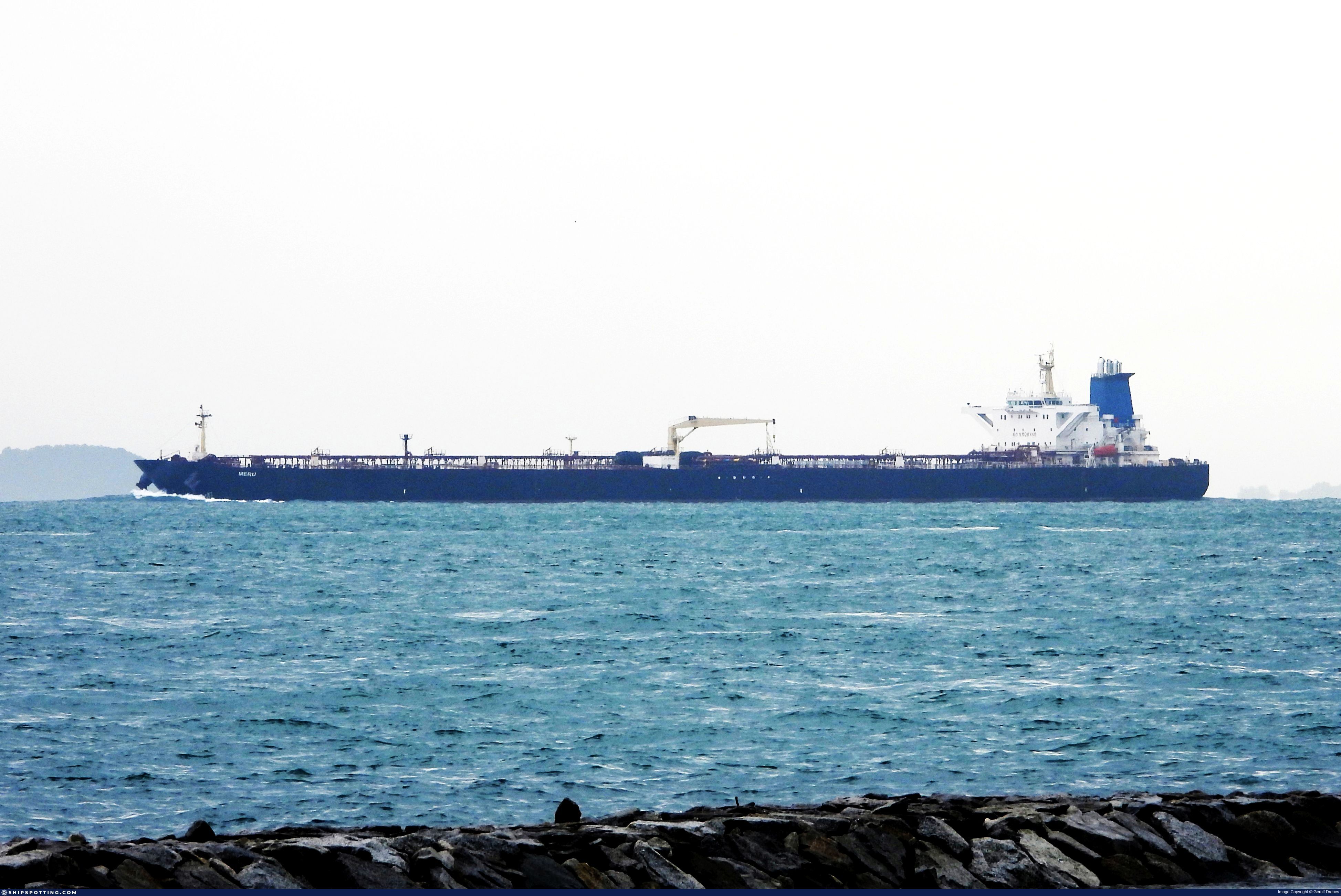
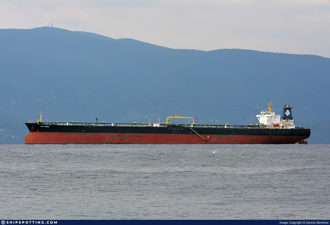
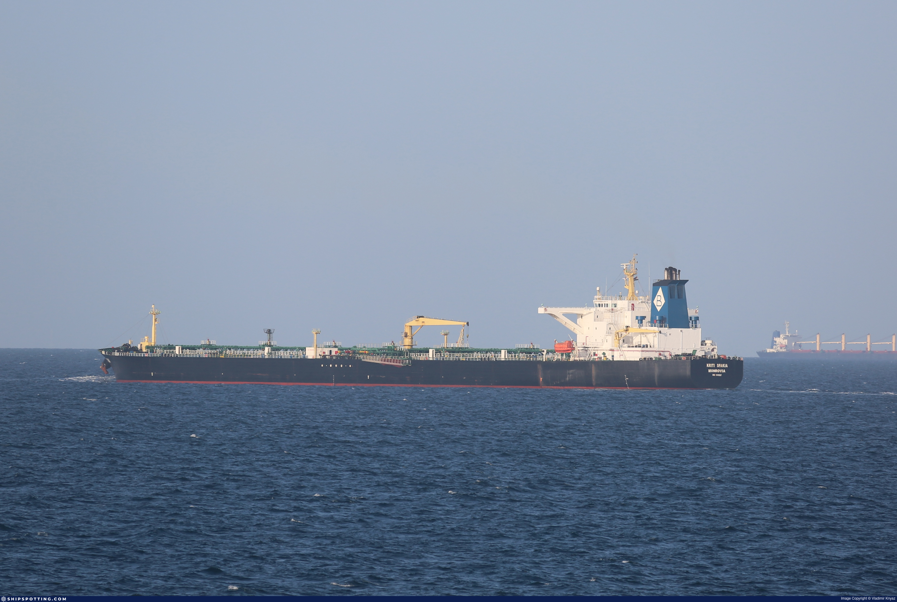
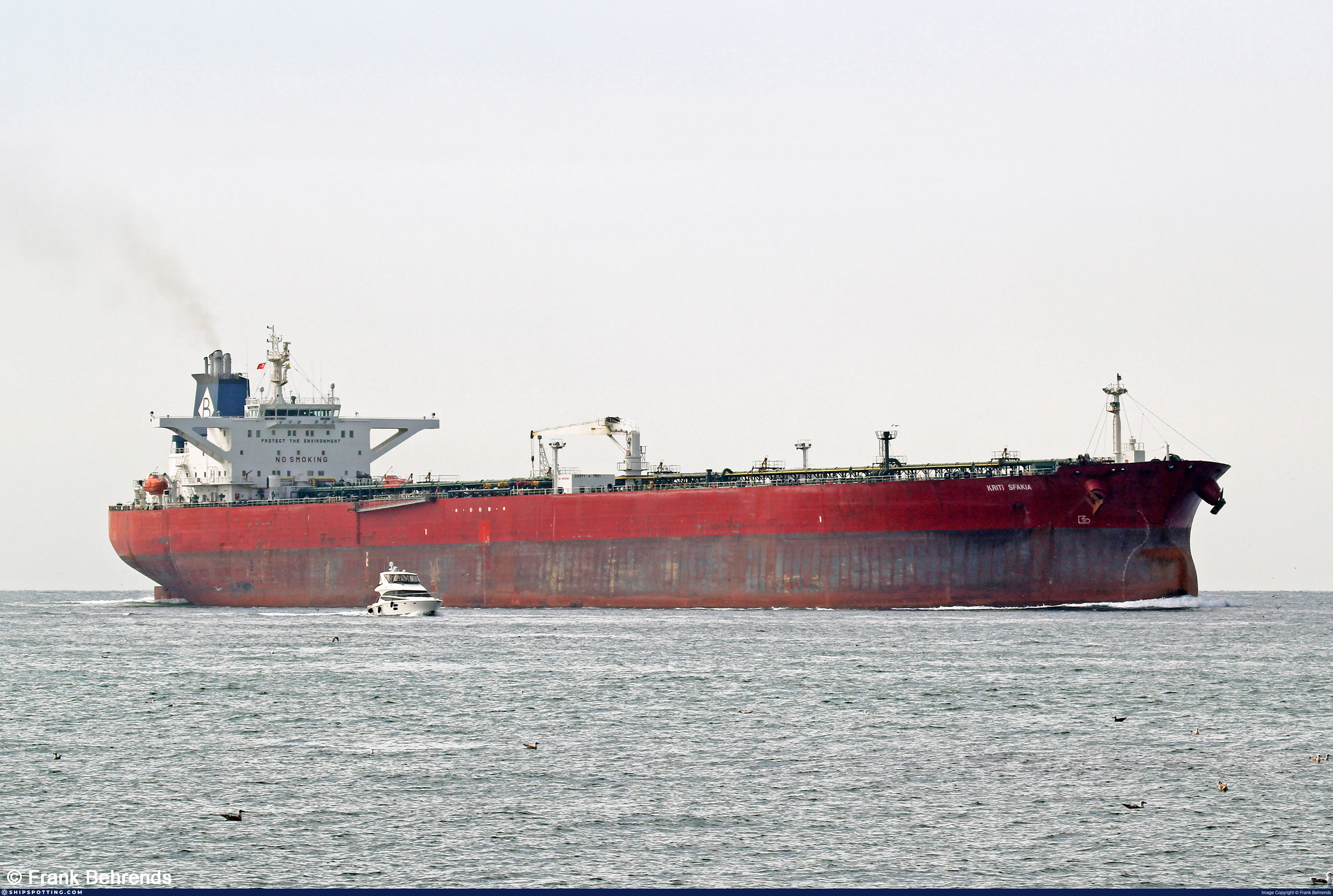
IMO 9187227
Vessel information
Sanctioned by
Company & Ownership
Management & Operations
Classification & Safety
Port State Control (PSC) Inspections
Programs & Notes
EU Russia Sanctions – Shadow Fleet | SEMA (Canada) — vessel designations | UKRAINE-EO13662] [RUSSIA-EO14024 | The Russia (Sanctions) (EU Exit) Regulations 2019
DateOfListing: 2025-05-21 || Secondary sanctions risk: See Section 11 of Executive Order 14024.; alt. Secondary sanctions risk: Ukraine-/Russia-Related Sanctions Regulations, 31 CFR 589.201 and/or 589.209; Vessel Registration Identification IMO 9187227; MMSI 667002333; Linked To: HARMONY GROVE CORPORATION. || DateDesignated: 2025-07-21 | Shipping sanctions: (see “Other information”) | Shipping sanctions: a specified ship is prohibited from being provided with access to or having its master or pilot cause it to enter a port in the UK, may have its registration on the UK Ship Register terminated, and a master or pilot of a specified ship may be given a port barring direction, a detention direction, and a port entry direction or a movement direction. | IMO 9187227 (“Meru”) is, has been or is likely to be involved in activity whose object or effect is to destabilise Ukraine or undermine or threaten the territorial integrity, sovereignty or independence of Ukraine or to obtain a benefit from or support the Government of Russia. Namely, 9187227 is involved in carrying oil or oil products that originated in Russia from Russia to a third country.
Vessel Changes
 🔄 Owner
AIS Events
50 events detected • 4 zones • Last: Jul 19, 2026
- Duration: 3 hours
- Radius: 50 meters
- Data Points: 11 AIS positions
- Centroid: 31.5460, 32.4007
- Zone: Western Black Sea Surveillance Zone
Show Raw Evidence JSON
{
    "radius_m": 49.7000000000000028421709430404007434844970703125,
    "duration_minutes": 180,
    "points": 11,
    "centroid": {
        "lat": 31.545987263636359188012647791765630245208740234375,
        "lon": 32.4006995545454543616870068944990634918212890625
    },
    "bbox": {
        "min_lat": 31.54572830000000038808138924650847911834716796875,
        "min_lon": 32.40027330000000205245669349096715450286865234375,
        "max_lat": 31.546318299999999368310454883612692356109619140625,
        "max_lon": 32.4010516999999964582457323558628559112548828125
    },
    "zone_id": "discovered_156"
}- Zone: Western Black Sea Surveillance Zone
- Duration: 3 hours
- Data Points: 11 AIS positions
- Period: 2026-07-19T10:59:23+00:00 to 2026-07-19T13:59:22+00:00
Show Raw Evidence JSON
{
    "zone_id": "discovered_156",
    "zone_name": "Western Black Sea Surveillance Zone",
    "dwell_minutes": 180,
    "points_in_zone": 11,
    "first_point": {
        "ts": "2026-07-19T10:59:23+00:00",
        "lat": 31.546318299999999368310454883612692356109619140625,
        "lon": 32.4010516999999964582457323558628559112548828125
    },
    "last_point": {
        "ts": "2026-07-19T13:59:22+00:00",
        "lat": 31.5457549999999997680788510479032993316650390625,
        "lon": 32.40028829999999970823409967124462127685546875
    }
}- Duration: 6h 15m
- Radius: 113 meters
- Data Points: 13 AIS positions
- Centroid: 31.5461, 32.4008
- Zone: Western Black Sea Surveillance Zone
Show Raw Evidence JSON
{
    "radius_m": 113.2000000000000028421709430404007434844970703125,
    "duration_minutes": 375,
    "points": 13,
    "centroid": {
        "lat": 31.546133576923072183717522420920431613922119140625,
        "lon": 32.40083116153845566032032365910708904266357421875
    },
    "bbox": {
        "min_lat": 31.54572830000000038808138924650847911834716796875,
        "min_lon": 32.40027330000000205245669349096715450286865234375,
        "max_lat": 31.546948300000000386944520869292318820953369140625,
        "max_lon": 32.40158000000000271256794803775846958160400390625
    },
    "zone_id": "discovered_156"
}- Zone: Western Black Sea Surveillance Zone
- Duration: 6h 15m
- Data Points: 13 AIS positions
- Period: 2026-07-19T07:44:24+00:00 to 2026-07-19T13:59:22+00:00
Show Raw Evidence JSON
{
    "zone_id": "discovered_156",
    "zone_name": "Western Black Sea Surveillance Zone",
    "dwell_minutes": 375,
    "points_in_zone": 13,
    "first_point": {
        "ts": "2026-07-19T07:44:24+00:00",
        "lat": 31.546928300000001144098860095255076885223388671875,
        "lon": 32.40158000000000271256794803775846958160400390625
    },
    "last_point": {
        "ts": "2026-07-19T13:59:22+00:00",
        "lat": 31.5457549999999997680788510479032993316650390625,
        "lon": 32.40028829999999970823409967124462127685546875
    }
}- Duration: 6h 32m
- Radius: 122 meters
- Data Points: 12 AIS positions
- Centroid: 31.5463, 32.4010
- Zone: Western Black Sea Surveillance Zone
Show Raw Evidence JSON
{
    "radius_m": 121.599999999999994315658113919198513031005859375,
    "duration_minutes": 392.8999999999999772626324556767940521240234375,
    "points": 12,
    "centroid": {
        "lat": 31.546288458333332727079323376528918743133544921875,
        "lon": 32.400993483333337508156546391546726226806640625
    },
    "bbox": {
        "min_lat": 31.54572830000000038808138924650847911834716796875,
        "min_lon": 32.4003416999999984682290232740342617034912109375,
        "max_lat": 31.54721500000000133923094836063683032989501953125,
        "max_lon": 32.4016783000000003767127054743468761444091796875
    },
    "zone_id": "discovered_156"
}- Zone: Western Black Sea Surveillance Zone
- Duration: 6h 32m
- Data Points: 12 AIS positions
- Period: 2026-07-19T06:50:25+00:00 to 2026-07-19T13:23:22+00:00
Show Raw Evidence JSON
{
    "zone_id": "discovered_156",
    "zone_name": "Western Black Sea Surveillance Zone",
    "dwell_minutes": 392.8999999999999772626324556767940521240234375,
    "points_in_zone": 12,
    "first_point": {
        "ts": "2026-07-19T06:50:25+00:00",
        "lat": 31.54721500000000133923094836063683032989501953125,
        "lon": 32.4016783000000003767127054743468761444091796875
    },
    "last_point": {
        "ts": "2026-07-19T13:23:22+00:00",
        "lat": 31.54572830000000038808138924650847911834716796875,
        "lon": 32.4003416999999984682290232740342617034912109375
    }
}- Duration: 6h 38m
- Radius: 104 meters
- Data Points: 14 AIS positions
- Centroid: 31.5469, 32.4014
- Zone: Western Black Sea Surveillance Zone
Show Raw Evidence JSON
{
    "radius_m": 104.099999999999994315658113919198513031005859375,
    "duration_minutes": 398.8999999999999772626324556767940521240234375,
    "points": 14,
    "centroid": {
        "lat": 31.54687439285714134484805981628596782684326171875,
        "lon": 32.4013885785714279563762829639017581939697265625
    },
    "bbox": {
        "min_lat": 31.546058299999998553175828419625759124755859375,
        "min_lon": 32.4008467000000024427208700217306613922119140625,
        "max_lat": 31.54773829999999890105755184777081012725830078125,
        "max_lon": 32.4017817000000007965354598127305507659912109375
    },
    "zone_id": "discovered_156"
}- Zone: Western Black Sea Surveillance Zone
- Duration: 6h 38m
- Data Points: 14 AIS positions
- Period: 2026-07-19T05:20:25+00:00 to 2026-07-19T11:59:22+00:00
Show Raw Evidence JSON
{
    "zone_id": "discovered_156",
    "zone_name": "Western Black Sea Surveillance Zone",
    "dwell_minutes": 398.8999999999999772626324556767940521240234375,
    "points_in_zone": 14,
    "first_point": {
        "ts": "2026-07-19T05:20:25+00:00",
        "lat": 31.54773829999999890105755184777081012725830078125,
        "lon": 32.4017817000000007965354598127305507659912109375
    },
    "last_point": {
        "ts": "2026-07-19T11:59:22+00:00",
        "lat": 31.546058299999998553175828419625759124755859375,
        "lon": 32.4008467000000024427208700217306613922119140625
    }
}- Duration: 6h 39m
- Radius: 127 meters
- Data Points: 13 AIS positions
- Centroid: 31.5471, 32.4015
- Zone: Western Black Sea Surveillance Zone
Show Raw Evidence JSON
{
    "radius_m": 126.7000000000000028421709430404007434844970703125,
    "duration_minutes": 399.1000000000000227373675443232059478759765625,
    "points": 13,
    "centroid": {
        "lat": 31.54707716923076787907120888121426105499267578125,
        "lon": 32.4014982076923132581214304082095623016357421875
    },
    "bbox": {
        "min_lat": 31.546073299999999761666913400404155254364013671875,
        "min_lon": 32.40086000000000154841472976841032505035400390625,
        "max_lat": 31.5479066999999986364855431020259857177734375,
        "max_lon": 32.4017817000000007965354598127305507659912109375
    },
    "zone_id": "discovered_156"
}- Zone: Western Black Sea Surveillance Zone
- Duration: 6h 39m
- Data Points: 13 AIS positions
- Period: 2026-07-19T04:50:23+00:00 to 2026-07-19T11:29:26+00:00
Show Raw Evidence JSON
{
    "zone_id": "discovered_156",
    "zone_name": "Western Black Sea Surveillance Zone",
    "dwell_minutes": 399.1000000000000227373675443232059478759765625,
    "points_in_zone": 13,
    "first_point": {
        "ts": "2026-07-19T04:50:23+00:00",
        "lat": 31.5479066999999986364855431020259857177734375,
        "lon": 32.40174499999999824240148882381618022918701171875
    },
    "last_point": {
        "ts": "2026-07-19T11:29:26+00:00",
        "lat": 31.546073299999999761666913400404155254364013671875,
        "lon": 32.40086000000000154841472976841032505035400390625
    }
}- Duration: 4h 24m
- Radius: 84 meters
- Data Points: 15 AIS positions
- Centroid: 31.5476, 32.4017
- Zone: Western Black Sea Surveillance Zone
Show Raw Evidence JSON
{
    "radius_m": 83.599999999999994315658113919198513031005859375,
    "duration_minutes": 264.1000000000000227373675443232059478759765625,
    "points": 15,
    "centroid": {
        "lat": 31.54761411333333143147683585993945598602294921875,
        "lon": 32.4016522266666697760228998959064483642578125
    },
    "bbox": {
        "min_lat": 31.546928300000001144098860095255076885223388671875,
        "min_lon": 32.40153000000000105274011730216443538665771484375,
        "max_lat": 31.548366699999998985504134907387197017669677734375,
        "max_lon": 32.4017817000000007965354598127305507659912109375
    },
    "zone_id": "discovered_156"
}- Zone: Western Black Sea Surveillance Zone
- Duration: 4h 24m
- Data Points: 15 AIS positions
- Period: 2026-07-19T03:26:22+00:00 to 2026-07-19T07:50:25+00:00
Show Raw Evidence JSON
{
    "zone_id": "discovered_156",
    "zone_name": "Western Black Sea Surveillance Zone",
    "dwell_minutes": 264.1000000000000227373675443232059478759765625,
    "points_in_zone": 15,
    "first_point": {
        "ts": "2026-07-19T03:26:22+00:00",
        "lat": 31.548145000000001658690962358377873897552490234375,
        "lon": 32.4016017000000005054971552453935146331787109375
    },
    "last_point": {
        "ts": "2026-07-19T07:50:25+00:00",
        "lat": 31.546948300000000386944520869292318820953369140625,
        "lon": 32.40153000000000105274011730216443538665771484375
    }
}- Zone: Western Black Sea Surveillance Zone
- Duration: 1h 6m
- Data Points: 3 AIS positions
- Period: 2026-07-18T18:14:23+00:00 to 2026-07-18T19:20:21+00:00
Show Raw Evidence JSON
{
    "zone_id": "discovered_156",
    "zone_name": "Western Black Sea Surveillance Zone",
    "dwell_minutes": 66,
    "points_in_zone": 3,
    "first_point": {
        "ts": "2026-07-18T18:14:23+00:00",
        "lat": 31.54628170000000153549990500323474407196044921875,
        "lon": 32.4009817000000026609995984472334384918212890625
    },
    "last_point": {
        "ts": "2026-07-18T19:20:21+00:00",
        "lat": 31.5469599999999985584508976899087429046630859375,
        "lon": 32.401448299999998425846570171415805816650390625
    }
}- Zone: Western Black Sea Surveillance Zone
- Duration: 1h 51m
- Data Points: 4 AIS positions
- Period: 2026-07-18T17:29:20+00:00 to 2026-07-18T19:20:21+00:00
Show Raw Evidence JSON
{
    "zone_id": "discovered_156",
    "zone_name": "Western Black Sea Surveillance Zone",
    "dwell_minutes": 111,
    "points_in_zone": 4,
    "first_point": {
        "ts": "2026-07-18T17:29:20+00:00",
        "lat": 31.546201700000001011403583106584846973419189453125,
        "lon": 32.40099330000000321660991176031529903411865234375
    },
    "last_point": {
        "ts": "2026-07-18T19:20:21+00:00",
        "lat": 31.5469599999999985584508976899087429046630859375,
        "lon": 32.401448299999998425846570171415805816650390625
    }
}- Zone: Western Black Sea Surveillance Zone
- Duration: 3h 18m
- Data Points: 5 AIS positions
- Period: 2026-07-18T16:02:23+00:00 to 2026-07-18T19:20:21+00:00
Show Raw Evidence JSON
{
    "zone_id": "discovered_156",
    "zone_name": "Western Black Sea Surveillance Zone",
    "dwell_minutes": 198,
    "points_in_zone": 5,
    "first_point": {
        "ts": "2026-07-18T16:02:23+00:00",
        "lat": 31.546510000000001383568815072067081928253173828125,
        "lon": 32.40098669999999714264049543999135494232177734375
    },
    "last_point": {
        "ts": "2026-07-18T19:20:21+00:00",
        "lat": 31.5469599999999985584508976899087429046630859375,
        "lon": 32.401448299999998425846570171415805816650390625
    }
}- Zone: Western Black Sea Surveillance Zone
- Duration: 3h 20m
- Data Points: 6 AIS positions
- Period: 2026-07-18T15:59:45+00:00 to 2026-07-18T19:20:21+00:00
Show Raw Evidence JSON
{
    "zone_id": "discovered_156",
    "zone_name": "Western Black Sea Surveillance Zone",
    "dwell_minutes": 200.599999999999994315658113919198513031005859375,
    "points_in_zone": 6,
    "first_point": {
        "ts": "2026-07-18T15:59:45+00:00",
        "lat": 31.54648830000000003792592906393110752105712890625,
        "lon": 32.40107830000000177506080945022404193878173828125
    },
    "last_point": {
        "ts": "2026-07-18T19:20:21+00:00",
        "lat": 31.5469599999999985584508976899087429046630859375,
        "lon": 32.401448299999998425846570171415805816650390625
    }
}- Zone: Western Black Sea Surveillance Zone
- Duration: 6h 17m
- Data Points: 7 AIS positions
- Period: 2026-07-18T13:02:57+00:00 to 2026-07-18T19:20:21+00:00
Show Raw Evidence JSON
{
    "zone_id": "discovered_156",
    "zone_name": "Western Black Sea Surveillance Zone",
    "dwell_minutes": 377.3999999999999772626324556767940521240234375,
    "points_in_zone": 7,
    "first_point": {
        "ts": "2026-07-18T13:02:57+00:00",
        "lat": 31.546634999999998427711034310050308704376220703125,
        "lon": 32.40120830000000040627128328196704387664794921875
    },
    "last_point": {
        "ts": "2026-07-18T19:20:21+00:00",
        "lat": 31.5469599999999985584508976899087429046630859375,
        "lon": 32.401448299999998425846570171415805816650390625
    }
}- Zone: Western Black Sea Surveillance Zone
- Duration: 6h 24m
- Data Points: 5 AIS positions
- Period: 2026-07-18T11:05:08+00:00 to 2026-07-18T17:29:20+00:00
Show Raw Evidence JSON
{
    "zone_id": "discovered_156",
    "zone_name": "Western Black Sea Surveillance Zone",
    "dwell_minutes": 384.19999999999998863131622783839702606201171875,
    "points_in_zone": 5,
    "first_point": {
        "ts": "2026-07-18T11:05:08+00:00",
        "lat": 31.5471399999999988494892022572457790374755859375,
        "lon": 32.4014600000000001500666257925331592559814453125
    },
    "last_point": {
        "ts": "2026-07-18T17:29:20+00:00",
        "lat": 31.546201700000001011403583106584846973419189453125,
        "lon": 32.40099330000000321660991176031529903411865234375
    }
}- Duration: 5h 24m
- Radius: 1,108 meters
- Data Points: 11 AIS positions
- Centroid: 31.5443, 32.4008
- Zone: Western Black Sea Surveillance Zone
Show Raw Evidence JSON
{
    "radius_m": 1108.200000000000045474735088646411895751953125,
    "duration_minutes": 324.69999999999998863131622783839702606201171875,
    "points": 11,
    "centroid": {
        "lat": 31.544265736363637842032403568737208843231201171875,
        "lon": 32.40079483636363733012331067584455013275146484375
    },
    "bbox": {
        "min_lat": 31.534363299999998986322680138982832431793212890625,
        "min_lon": 32.3992099999999965120878187008202075958251953125,
        "max_lat": 31.547143299999998333760231616906821727752685546875,
        "max_lon": 32.40219330000000041991370380856096744537353515625
    },
    "zone_id": "discovered_156"
}- Zone: Western Black Sea Surveillance Zone
- Duration: 6h 36m
- Data Points: 8 AIS positions
- Period: 2026-07-18T10:52:58+00:00 to 2026-07-18T17:29:20+00:00
Show Raw Evidence JSON
{
    "zone_id": "discovered_156",
    "zone_name": "Western Black Sea Surveillance Zone",
    "dwell_minutes": 396.3999999999999772626324556767940521240234375,
    "points_in_zone": 8,
    "first_point": {
        "ts": "2026-07-18T10:52:58+00:00",
        "lat": 31.547143299999998333760231616906821727752685546875,
        "lon": 32.39991500000000002046363078989088535308837890625
    },
    "last_point": {
        "ts": "2026-07-18T17:29:20+00:00",
        "lat": 31.546201700000001011403583106584846973419189453125,
        "lon": 32.40099330000000321660991176031529903411865234375
    }
}- Zone: Western Black Sea Surveillance Zone
- Duration: 6h 15m
- Data Points: 20 AIS positions
- Period: 2026-07-18T09:46:45+00:00 to 2026-07-18T16:02:23+00:00
Show Raw Evidence JSON
{
    "zone_id": "discovered_156",
    "zone_name": "Western Black Sea Surveillance Zone",
    "dwell_minutes": 375.6000000000000227373675443232059478759765625,
    "points_in_zone": 20,
    "first_point": {
        "ts": "2026-07-18T09:46:45+00:00",
        "lat": 31.49258999999999986130205797962844371795654296875,
        "lon": 32.38803169999999909123289398849010467529296875
    },
    "last_point": {
        "ts": "2026-07-18T16:02:23+00:00",
        "lat": 31.546510000000001383568815072067081928253173828125,
        "lon": 32.40098669999999714264049543999135494232177734375
    }
}- Zone: Western Black Sea Surveillance Zone
- Duration: 4h 27m
- Data Points: 19 AIS positions
- Period: 2026-07-18T08:35:09+00:00 to 2026-07-18T13:02:57+00:00
Show Raw Evidence JSON
{
    "zone_id": "discovered_156",
    "zone_name": "Western Black Sea Surveillance Zone",
    "dwell_minutes": 267.80000000000001136868377216160297393798828125,
    "points_in_zone": 19,
    "first_point": {
        "ts": "2026-07-18T08:35:09+00:00",
        "lat": 31.492716699999999008241502451710402965545654296875,
        "lon": 32.38804329999999964684320730157196521759033203125
    },
    "last_point": {
        "ts": "2026-07-18T13:02:57+00:00",
        "lat": 31.546634999999998427711034310050308704376220703125,
        "lon": 32.40120830000000040627128328196704387664794921875
    }
}- Zone: Western Black Sea Surveillance Zone
- Duration: 6h 30m
- Data Points: 13 AIS positions
- Period: 2026-07-18T04:08:07+00:00 to 2026-07-18T10:38:59+00:00
Show Raw Evidence JSON
{
    "zone_id": "discovered_156",
    "zone_name": "Western Black Sea Surveillance Zone",
    "dwell_minutes": 390.8999999999999772626324556767940521240234375,
    "points_in_zone": 13,
    "first_point": {
        "ts": "2026-07-18T04:08:07+00:00",
        "lat": 31.49356999999999828787622391246259212493896484375,
        "lon": 32.38808499999999668261807528324425220489501953125
    },
    "last_point": {
        "ts": "2026-07-18T10:38:59+00:00",
        "lat": 31.5364383000000003676177584566175937652587890625,
        "lon": 32.400523300000003246168489567935466766357421875
    }
}- Zone: Western Black Sea Surveillance Zone
- Duration: 6h 33m
- Data Points: 11 AIS positions
- Period: 2026-07-18T03:56:09+00:00 to 2026-07-18T10:29:39+00:00
Show Raw Evidence JSON
{
    "zone_id": "discovered_156",
    "zone_name": "Western Black Sea Surveillance Zone",
    "dwell_minutes": 393.5,
    "points_in_zone": 11,
    "first_point": {
        "ts": "2026-07-18T03:56:09+00:00",
        "lat": 31.4936967000000009875293471850454807281494140625,
        "lon": 32.38808000000000220097717829048633575439453125
    },
    "last_point": {
        "ts": "2026-07-18T10:29:39+00:00",
        "lat": 31.515621700000000515728970640338957309722900390625,
        "lon": 32.3908933000000018864739104174077510833740234375
    }
}- Zone: Western Black Sea Surveillance Zone
- Duration: 6h 9m
- Data Points: 6 AIS positions
- Period: 2026-07-18T02:26:06+00:00 to 2026-07-18T08:35:09+00:00
Show Raw Evidence JSON
{
    "zone_id": "discovered_156",
    "zone_name": "Western Black Sea Surveillance Zone",
    "dwell_minutes": 369.1000000000000227373675443232059478759765625,
    "points_in_zone": 6,
    "first_point": {
        "ts": "2026-07-18T02:26:06+00:00",
        "lat": 31.4937816999999995459802448749542236328125,
        "lon": 32.38799829999999957408363115973770618438720703125
    },
    "last_point": {
        "ts": "2026-07-18T08:35:09+00:00",
        "lat": 31.492716699999999008241502451710402965545654296875,
        "lon": 32.38804329999999964684320730157196521759033203125
    }
}- Zone: Western Black Sea Surveillance Zone
- Duration: 4h 6m
- Data Points: 7 AIS positions
- Period: 2026-07-18T00:02:09+00:00 to 2026-07-18T04:08:07+00:00
Show Raw Evidence JSON
{
    "zone_id": "discovered_156",
    "zone_name": "Western Black Sea Surveillance Zone",
    "dwell_minutes": 246,
    "points_in_zone": 7,
    "first_point": {
        "ts": "2026-07-18T00:02:09+00:00",
        "lat": 31.492631700000000449790604761801660060882568359375,
        "lon": 32.387934999999998808561940677464008331298828125
    },
    "last_point": {
        "ts": "2026-07-18T04:08:07+00:00",
        "lat": 31.49356999999999828787622391246259212493896484375,
        "lon": 32.38808499999999668261807528324425220489501953125
    }
}- Zone: Western Black Sea Surveillance Zone
- Duration: 4h 41m
- Data Points: 8 AIS positions
- Period: 2026-07-17T23:26:10+00:00 to 2026-07-18T04:08:07+00:00
Show Raw Evidence JSON
{
    "zone_id": "discovered_156",
    "zone_name": "Western Black Sea Surveillance Zone",
    "dwell_minutes": 281.8999999999999772626324556767940521240234375,
    "points_in_zone": 8,
    "first_point": {
        "ts": "2026-07-17T23:26:10+00:00",
        "lat": 31.4923782999999986031980370171368122100830078125,
        "lon": 32.3878567000000003872628440149128437042236328125
    },
    "last_point": {
        "ts": "2026-07-18T04:08:07+00:00",
        "lat": 31.49356999999999828787622391246259212493896484375,
        "lon": 32.38808499999999668261807528324425220489501953125
    }
}- Zone: Western Black Sea Surveillance Zone
- Duration: 6h 12m
- Data Points: 2 AIS positions
- Period: 2026-07-17T17:14:07+00:00 to 2026-07-17T23:26:10+00:00
Show Raw Evidence JSON
{
    "zone_id": "discovered_156",
    "zone_name": "Western Black Sea Surveillance Zone",
    "dwell_minutes": 372.1000000000000227373675443232059478759765625,
    "points_in_zone": 2,
    "first_point": {
        "ts": "2026-07-17T17:14:07+00:00",
        "lat": 31.49164999999999992041921359486877918243408203125,
        "lon": 32.38733830000000324389475281350314617156982421875
    },
    "last_point": {
        "ts": "2026-07-17T23:26:10+00:00",
        "lat": 31.4923782999999986031980370171368122100830078125,
        "lon": 32.3878567000000003872628440149128437042236328125
    }
}- Zone: Western Black Sea Surveillance Zone
- Duration: 6h 33m
- Data Points: 3 AIS positions
- Period: 2026-07-17T16:53:03+00:00 to 2026-07-17T23:26:10+00:00
Show Raw Evidence JSON
{
    "zone_id": "discovered_156",
    "zone_name": "Western Black Sea Surveillance Zone",
    "dwell_minutes": 393.1000000000000227373675443232059478759765625,
    "points_in_zone": 3,
    "first_point": {
        "ts": "2026-07-17T16:53:03+00:00",
        "lat": 31.49200499999999891542756813578307628631591796875,
        "lon": 32.38763329999999740493876743130385875701904296875
    },
    "last_point": {
        "ts": "2026-07-17T23:26:10+00:00",
        "lat": 31.4923782999999986031980370171368122100830078125,
        "lon": 32.3878567000000003872628440149128437042236328125
    }
}- Zone: Western Black Sea Surveillance Zone
- Duration: 1h 28m
- Data Points: 20 AIS positions
- Period: 2026-07-17T15:46:10+00:00 to 2026-07-17T17:14:07+00:00
Show Raw Evidence JSON
{
    "zone_id": "discovered_156",
    "zone_name": "Western Black Sea Surveillance Zone",
    "dwell_minutes": 88,
    "points_in_zone": 20,
    "first_point": {
        "ts": "2026-07-17T15:46:10+00:00",
        "lat": 31.38437330000000002883098204620182514190673828125,
        "lon": 32.3917349999999970577846397645771503448486328125
    },
    "last_point": {
        "ts": "2026-07-17T17:14:07+00:00",
        "lat": 31.49164999999999992041921359486877918243408203125,
        "lon": 32.38733830000000324389475281350314617156982421875
    }
}- Zone: Black Sea Sanctioned Vessel Monitoring Zone
- Duration: 1h 18m
- Data Points: 20 AIS positions
- Period: 2026-07-17T13:03:12+00:00 to 2026-07-17T14:21:50+00:00
Show Raw Evidence JSON
{
    "zone_id": "discovered_025",
    "zone_name": "Black Sea Sanctioned Vessel Monitoring Zone",
    "dwell_minutes": 78.599999999999994315658113919198513031005859375,
    "points_in_zone": 20,
    "first_point": {
        "ts": "2026-07-17T13:03:12+00:00",
        "lat": 30.962495000000000544559952686540782451629638671875,
        "lon": 32.3126333000000016681951819919049739837646484375
    },
    "last_point": {
        "ts": "2026-07-17T14:21:50+00:00",
        "lat": 31.162620000000000430873114964924752712249755859375,
        "lon": 32.32658330000000290738171315751969814300537109375
    }
}- Zone: Black Sea Sanctioned Vessel Monitoring Zone
- Duration: 2h 14m
- Data Points: 33 AIS positions
- Period: 2026-07-17T12:07:01+00:00 to 2026-07-17T14:21:50+00:00
Show Raw Evidence JSON
{
    "zone_id": "discovered_025",
    "zone_name": "Black Sea Sanctioned Vessel Monitoring Zone",
    "dwell_minutes": 134.80000000000001136868377216160297393798828125,
    "points_in_zone": 33,
    "first_point": {
        "ts": "2026-07-17T12:07:01+00:00",
        "lat": 30.820341700000000173531589098274707794189453125,
        "lon": 32.31763000000000118916432256810367107391357421875
    },
    "last_point": {
        "ts": "2026-07-17T14:21:50+00:00",
        "lat": 31.162620000000000430873114964924752712249755859375,
        "lon": 32.32658330000000290738171315751969814300537109375
    }
}- Zone: Port Said/Suez Approach
- Duration: 1h 7m
- Data Points: 18 AIS positions
- Period: 2026-07-17T12:07:01+00:00 to 2026-07-17T13:14:02+00:00
Show Raw Evidence JSON
{
    "zone_id": "osint_port_said",
    "zone_name": "Port Said\/Suez Approach",
    "dwell_minutes": 67,
    "points_in_zone": 18,
    "first_point": {
        "ts": "2026-07-17T12:07:01+00:00",
        "lat": 30.820341700000000173531589098274707794189453125,
        "lon": 32.31763000000000118916432256810367107391357421875
    },
    "last_point": {
        "ts": "2026-07-17T13:14:02+00:00",
        "lat": 30.99074170000000094660208560526371002197265625,
        "lon": 32.31185669999999987567207426764070987701416015625
    }
}- Zone: Black Sea Sanctioned Vessel Monitoring Zone
- Duration: 2h 31m
- Data Points: 34 AIS positions
- Period: 2026-07-17T11:50:42+00:00 to 2026-07-17T14:21:50+00:00
Show Raw Evidence JSON
{
    "zone_id": "discovered_025",
    "zone_name": "Black Sea Sanctioned Vessel Monitoring Zone",
    "dwell_minutes": 151.099999999999994315658113919198513031005859375,
    "points_in_zone": 34,
    "first_point": {
        "ts": "2026-07-17T11:50:42+00:00",
        "lat": 30.777273300000000944010025705210864543914794921875,
        "lon": 32.32656329999999655910869478248059749603271484375
    },
    "last_point": {
        "ts": "2026-07-17T14:21:50+00:00",
        "lat": 31.162620000000000430873114964924752712249755859375,
        "lon": 32.32658330000000290738171315751969814300537109375
    }
}- Zone: Port Said/Suez Approach
- Duration: 1h 35m
- Data Points: 21 AIS positions
- Period: 2026-07-17T11:38:51+00:00 to 2026-07-17T13:14:02+00:00
Show Raw Evidence JSON
{
    "zone_id": "osint_port_said",
    "zone_name": "Port Said\/Suez Approach",
    "dwell_minutes": 95.2000000000000028421709430404007434844970703125,
    "points_in_zone": 21,
    "first_point": {
        "ts": "2026-07-17T11:38:51+00:00",
        "lat": 30.745581699999998903649611747823655605316162109375,
        "lon": 32.3356399999999979399945004843175411224365234375
    },
    "last_point": {
        "ts": "2026-07-17T13:14:02+00:00",
        "lat": 30.99074170000000094660208560526371002197265625,
        "lon": 32.31185669999999987567207426764070987701416015625
    }
}- Zone: discovered_020
- Duration: 1h 17m
- Data Points: 22 AIS positions
- Period: 2026-06-02T22:03:19+00:00 to 2026-06-02T23:20:51+00:00
Show Raw Evidence JSON
{
    "zone_id": "discovered_020",
    "zone_name": "Eastern Mediterranean Monitoring Zone",
    "dwell_minutes": 77.5,
    "points_in_zone": 22,
    "first_point": {
        "ts": "2026-06-02T22:03:19+00:00",
        "lat": 31.475313299999999827605279278941452503204345703125,
        "lon": 32.321588300000001936496119014918804168701171875
    },
    "last_point": {
        "ts": "2026-06-02T23:20:51+00:00",
        "lat": 31.4751049999999992223820299841463565826416015625,
        "lon": 32.3215933000000035235643736086785793304443359375
    }
}- Duration: 3h 19m
- Radius: 137 meters
- Data Points: 27 AIS positions
- Centroid: 31.4749, 32.3216
- Zone: discovered_020
Show Raw Evidence JSON
{
    "radius_m": 137.400000000000005684341886080801486968994140625,
    "duration_minutes": 199.900000000000005684341886080801486968994140625,
    "points": 27,
    "centroid": {
        "lat": 31.47490598518518112314268364571034908294677734375,
        "lon": 32.32157166296295969232232891954481601715087890625
    },
    "bbox": {
        "min_lat": 31.473678299999999552483131992630660533905029296875,
        "min_lon": 32.32148500000000268528310698457062244415283203125,
        "max_lat": 31.475313299999999827605279278941452503204345703125,
        "max_lon": 32.3217700000000007776179700158536434173583984375
    },
    "zone_id": "discovered_020"
}- Zone: discovered_020
- Duration: 3h 19m
- Data Points: 27 AIS positions
- Period: 2026-06-02T20:00:59+00:00 to 2026-06-02T23:20:51+00:00
Show Raw Evidence JSON
{
    "zone_id": "discovered_020",
    "zone_name": "Eastern Mediterranean Monitoring Zone",
    "dwell_minutes": 199.900000000000005684341886080801486968994140625,
    "points_in_zone": 27,
    "first_point": {
        "ts": "2026-06-02T20:00:59+00:00",
        "lat": 31.473678299999999552483131992630660533905029296875,
        "lon": 32.3217700000000007776179700158536434173583984375
    },
    "last_point": {
        "ts": "2026-06-02T23:20:51+00:00",
        "lat": 31.4751049999999992223820299841463565826416015625,
        "lon": 32.3215933000000035235643736086785793304443359375
    }
}- Duration: 4h 17m
- Radius: 190 meters
- Data Points: 43 AIS positions
- Centroid: 31.4742, 32.3219
- Zone: discovered_020
Show Raw Evidence JSON
{
    "radius_m": 190.099999999999994315658113919198513031005859375,
    "duration_minutes": 257.6000000000000227373675443232059478759765625,
    "points": 43,
    "centroid": {
        "lat": 31.47422468837208953118533827364444732666015625,
        "lon": 32.32188155116278949208208359777927398681640625
    },
    "bbox": {
        "min_lat": 31.472746699999998298835635068826377391815185546875,
        "min_lon": 32.32148500000000268528310698457062244415283203125,
        "max_lat": 31.475313299999999827605279278941452503204345703125,
        "max_lon": 32.3228950000000025966073735617101192474365234375
    },
    "zone_id": "discovered_020"
}- Zone: discovered_020
- Duration: 4h 17m
- Data Points: 43 AIS positions
- Period: 2026-06-02T19:03:12+00:00 to 2026-06-02T23:20:51+00:00
Show Raw Evidence JSON
{
    "zone_id": "discovered_020",
    "zone_name": "Eastern Mediterranean Monitoring Zone",
    "dwell_minutes": 257.6000000000000227373675443232059478759765625,
    "points_in_zone": 43,
    "first_point": {
        "ts": "2026-06-02T19:03:12+00:00",
        "lat": 31.472746699999998298835635068826377391815185546875,
        "lon": 32.3228950000000025966073735617101192474365234375
    },
    "last_point": {
        "ts": "2026-06-02T23:20:51+00:00",
        "lat": 31.4751049999999992223820299841463565826416015625,
        "lon": 32.3215933000000035235643736086785793304443359375
    }
}- Duration: 5h 20m
- Radius: 185 meters
- Data Points: 62 AIS positions
- Centroid: 31.4737, 32.3223
- Zone: discovered_020
Show Raw Evidence JSON
{
    "radius_m": 185.19999999999998863131622783839702606201171875,
    "duration_minutes": 320.5,
    "points": 62,
    "centroid": {
        "lat": 31.47374381451613345461737480945885181427001953125,
        "lon": 32.32225381612904158146193367429077625274658203125
    },
    "bbox": {
        "min_lat": 31.472596700000000424779500463046133518218994140625,
        "min_lon": 32.32148500000000268528310698457062244415283203125,
        "max_lat": 31.475313299999999827605279278941452503204345703125,
        "max_lon": 32.32319830000000138170435093343257904052734375
    },
    "zone_id": "discovered_020"
}- Zone: discovered_020
- Duration: 5h 20m
- Data Points: 62 AIS positions
- Period: 2026-06-02T18:00:21+00:00 to 2026-06-02T23:20:51+00:00
Show Raw Evidence JSON
{
    "zone_id": "discovered_020",
    "zone_name": "Eastern Mediterranean Monitoring Zone",
    "dwell_minutes": 320.5,
    "points_in_zone": 62,
    "first_point": {
        "ts": "2026-06-02T18:00:21+00:00",
        "lat": 31.472603299999999393321559182368218898773193359375,
        "lon": 32.32319830000000138170435093343257904052734375
    },
    "last_point": {
        "ts": "2026-06-02T23:20:51+00:00",
        "lat": 31.4751049999999992223820299841463565826416015625,
        "lon": 32.3215933000000035235643736086785793304443359375
    }
}- Duration: 6h 19m
- Radius: 222 meters
- Data Points: 79 AIS positions
- Centroid: 31.4735, 32.3225
- Zone: discovered_020
Show Raw Evidence JSON
{
    "radius_m": 221.80000000000001136868377216160297393798828125,
    "duration_minutes": 379.5,
    "points": 79,
    "centroid": {
        "lat": 31.473480673417707720318503561429679393768310546875,
        "lon": 32.3225194721519102358797681517899036407470703125
    },
    "bbox": {
        "min_lat": 31.47243830000000031077433959580957889556884765625,
        "min_lon": 32.32148500000000268528310698457062244415283203125,
        "max_lat": 31.475313299999999827605279278941452503204345703125,
        "max_lon": 32.32371499999999997498889570124447345733642578125
    },
    "zone_id": "discovered_020"
}- Zone: discovered_020
- Duration: 6h 19m
- Data Points: 79 AIS positions
- Period: 2026-06-02T17:01:21+00:00 to 2026-06-02T23:20:51+00:00
Show Raw Evidence JSON
{
    "zone_id": "discovered_020",
    "zone_name": "Eastern Mediterranean Monitoring Zone",
    "dwell_minutes": 379.5,
    "points_in_zone": 79,
    "first_point": {
        "ts": "2026-06-02T17:01:21+00:00",
        "lat": 31.47243830000000031077433959580957889556884765625,
        "lon": 32.32371499999999997498889570124447345733642578125
    },
    "last_point": {
        "ts": "2026-06-02T23:20:51+00:00",
        "lat": 31.4751049999999992223820299841463565826416015625,
        "lon": 32.3215933000000035235643736086785793304443359375
    }
}- Duration: 6h 29m
- Radius: 229 meters
- Data Points: 83 AIS positions
- Centroid: 31.4734, 32.3226
- Zone: discovered_020
Show Raw Evidence JSON
{
    "radius_m": 228.900000000000005684341886080801486968994140625,
    "duration_minutes": 389.5,
    "points": 83,
    "centroid": {
        "lat": 31.4734329710843354632743285037577152252197265625,
        "lon": 32.32257728915664074520464055240154266357421875
    },
    "bbox": {
        "min_lat": 31.47243830000000031077433959580957889556884765625,
        "min_lon": 32.32148500000000268528310698457062244415283203125,
        "max_lat": 31.475313299999999827605279278941452503204345703125,
        "max_lon": 32.32377170000000177196852746419608592987060546875
    },
    "zone_id": "discovered_020"
}- Zone: discovered_020
- Duration: 6h 29m
- Data Points: 83 AIS positions
- Period: 2026-06-02T16:51:21+00:00 to 2026-06-02T23:20:51+00:00
Show Raw Evidence JSON
{
    "zone_id": "discovered_020",
    "zone_name": "Eastern Mediterranean Monitoring Zone",
    "dwell_minutes": 389.5,
    "points_in_zone": 83,
    "first_point": {
        "ts": "2026-06-02T16:51:21+00:00",
        "lat": 31.472500000000000142108547152020037174224853515625,
        "lon": 32.3236916999999976951585267670452594757080078125
    },
    "last_point": {
        "ts": "2026-06-02T23:20:51+00:00",
        "lat": 31.4751049999999992223820299841463565826416015625,
        "lon": 32.3215933000000035235643736086785793304443359375
    }
}- Duration: 6h 34m
- Radius: 289 meters
- Data Points: 83 AIS positions
- Centroid: 31.4730, 32.3229
- Zone: discovered_020
Show Raw Evidence JSON
{
    "radius_m": 289.19999999999998863131622783839702606201171875,
    "duration_minutes": 394.6000000000000227373675443232059478759765625,
    "points": 83,
    "centroid": {
        "lat": 31.47296831566264785351449972949922084808349609375,
        "lon": 32.32291221204818754131338209845125675201416015625
    },
    "bbox": {
        "min_lat": 31.47243830000000031077433959580957889556884765625,
        "min_lon": 32.32151499999999799683791934512555599212646484375,
        "max_lat": 31.475313299999999827605279278941452503204345703125,
        "max_lon": 32.32377170000000177196852746419608592987060546875
    },
    "zone_id": "discovered_020"
}- Zone: discovered_020
- Duration: 6h 34m
- Data Points: 83 AIS positions
- Period: 2026-06-02T15:55:19+00:00 to 2026-06-02T22:29:53+00:00
Show Raw Evidence JSON
{
    "zone_id": "discovered_020",
    "zone_name": "Eastern Mediterranean Monitoring Zone",
    "dwell_minutes": 394.6000000000000227373675443232059478759765625,
    "points_in_zone": 83,
    "first_point": {
        "ts": "2026-06-02T15:55:19+00:00",
        "lat": 31.47271669999999943456714390777051448822021484375,
        "lon": 32.32290669999999721540007158182561397552490234375
    },
    "last_point": {
        "ts": "2026-06-02T22:29:53+00:00",
        "lat": 31.47518170000000026220732252113521099090576171875,
        "lon": 32.3215416999999973768353811465203762054443359375
    }
}- Duration: 5h 24m
- Radius: 2,297 meters
- Data Points: 85 AIS positions
- Centroid: 31.4727, 32.3219
- Zone: discovered_020
Show Raw Evidence JSON
{
    "radius_m": 2296.8000000000001818989403545856475830078125,
    "duration_minutes": 324.6000000000000227373675443232059478759765625,
    "points": 85,
    "centroid": {
        "lat": 31.47273390235293533123694942332804203033447265625,
        "lon": 32.32186761176469502743202610872685909271240234375
    },
    "bbox": {
        "min_lat": 31.469738299999999497913449886254966259002685546875,
        "min_lon": 32.298488300000002482192940078675746917724609375,
        "max_lat": 31.47798829999999981055225362069904804229736328125,
        "max_lon": 32.32377170000000177196852746419608592987060546875
    },
    "zone_id": "discovered_020"
}- Zone: discovered_020
- Duration: 6h 13m
- Data Points: 99 AIS positions
- Period: 2026-06-02T14:01:01+00:00 to 2026-06-02T20:14:10+00:00
Show Raw Evidence JSON
{
    "zone_id": "discovered_020",
    "zone_name": "Eastern Mediterranean Monitoring Zone",
    "dwell_minutes": 373.1000000000000227373675443232059478759765625,
    "points_in_zone": 99,
    "first_point": {
        "ts": "2026-06-02T14:01:01+00:00",
        "lat": 31.510735000000000383124643121846020221710205078125,
        "lon": 32.218604999999996607584762386977672576904296875
    },
    "last_point": {
        "ts": "2026-06-02T20:14:10+00:00",
        "lat": 31.473973300000000818954504211433231830596923828125,
        "lon": 32.32165499999999980218490236438810825347900390625
    }
}Source snapshot
| Sanctioner | As of | Entity ID |
|---|---|---|
| 🇬🇧 UK | 2025-09-29 | 9187227 |
| 🇺🇸 US | 2025-09-29 | 9187227 |
We mirror official lists; always verify at the source.
Sanctioned on the same day
- Akademik Gubkin · IMO 9842190 🇨🇦 CA🇪🇺 EU🇬🇧 UK🇺🇸 US
- ALEKSEY CHIRIKOV · IMO 9613551 🇺🇸 US
- ALEXANDER BEGGROV · IMO 9876373 🇺🇸 US
- ALEXEY BOGOLYUBOV · IMO 9876361 🇺🇸 US
- ALMOND · IMO 9385142 🇨🇦 CA🇪🇺 EU🇬🇧 UK🇺🇸 US
- Amell · IMO 9257993 🇨🇦 CA🇬🇧 UK🇺🇸 US
- APPLE · IMO 9271327 🇨🇦 CA🇪🇺 EU🇬🇧 UK🇺🇸 US
- Apus · IMO 9280885 🇨🇦 CA🇪🇺 EU🇳🇿 NZ🇬🇧 UK🇺🇸 US