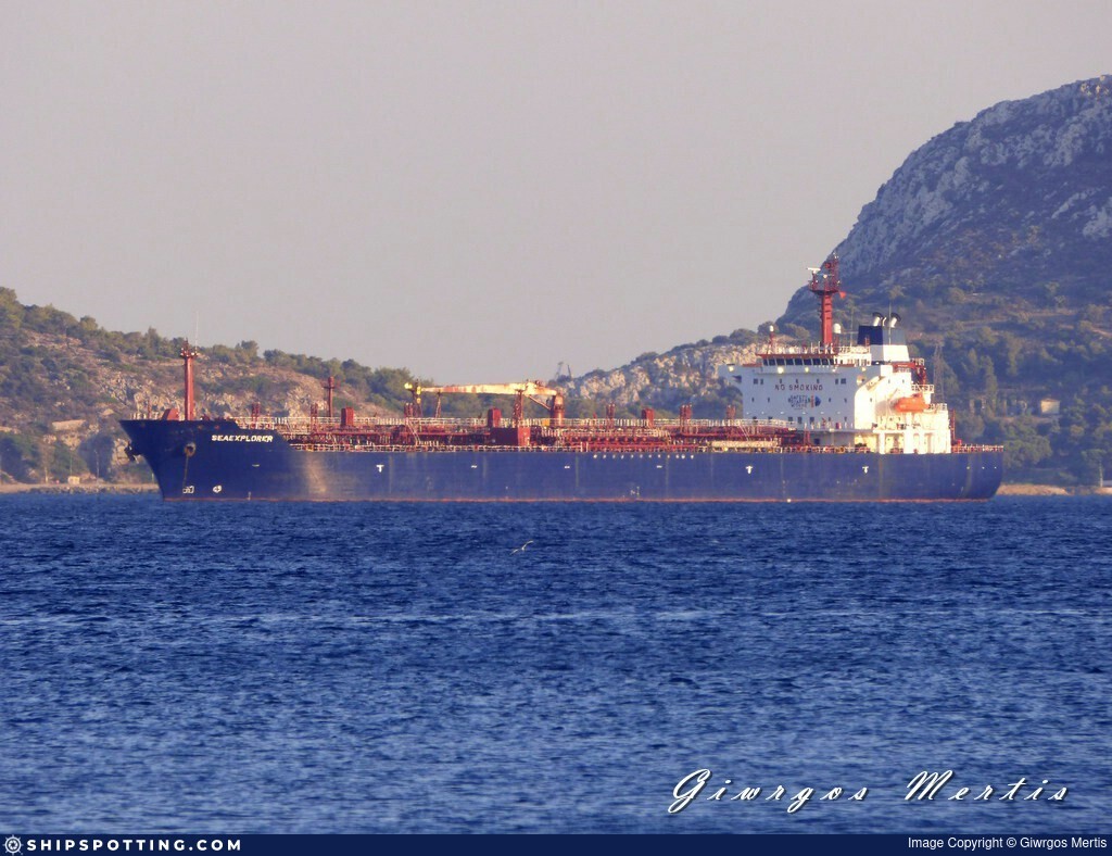
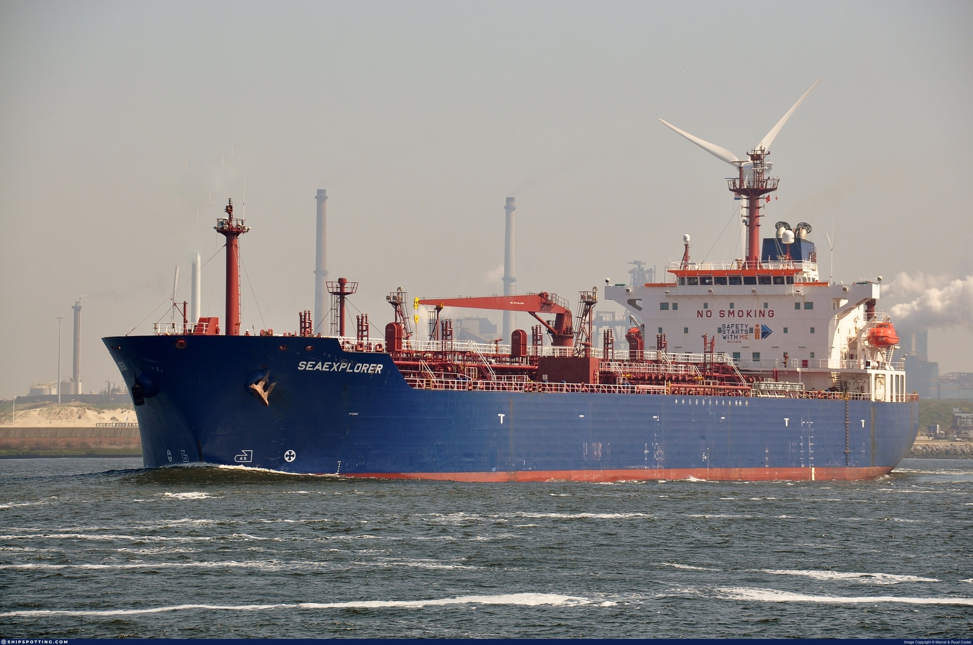
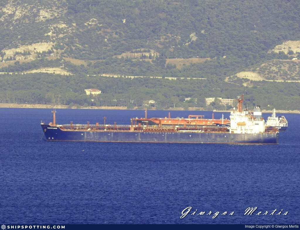
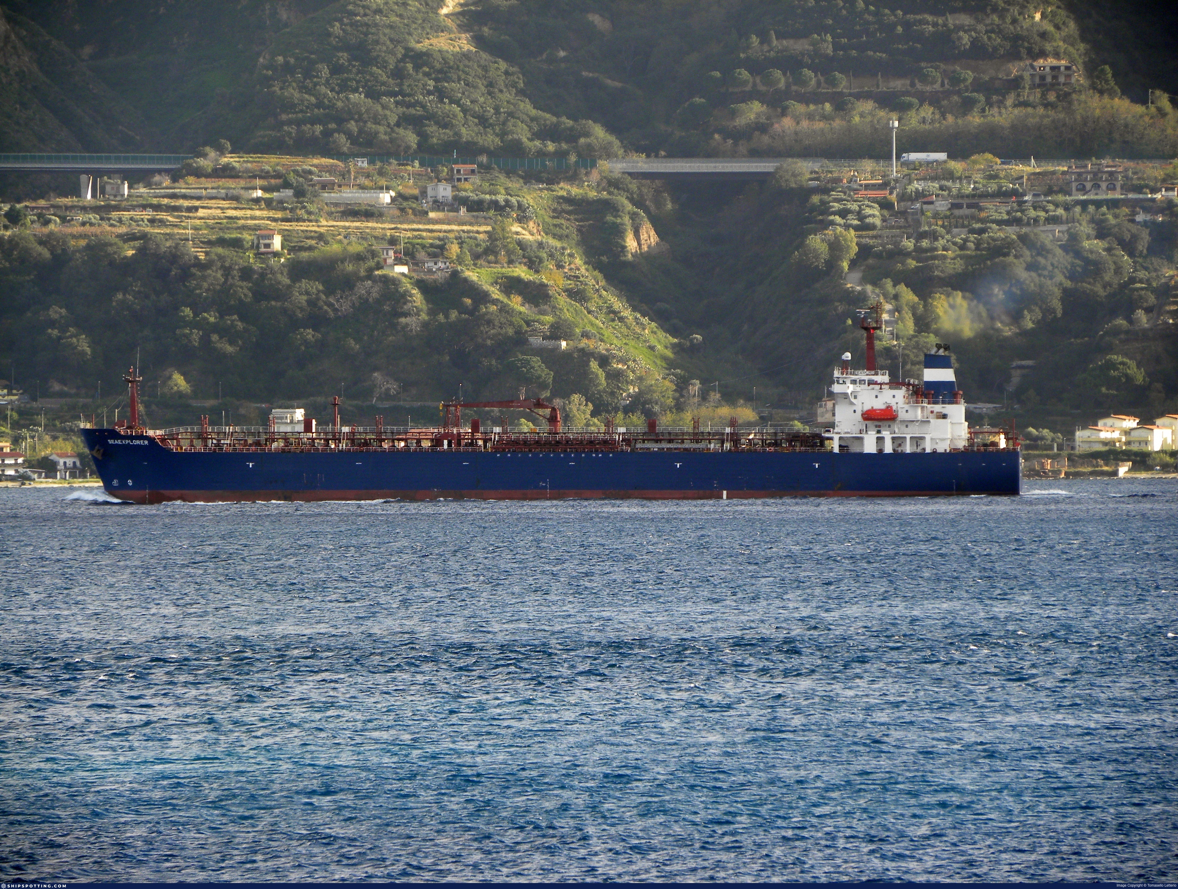
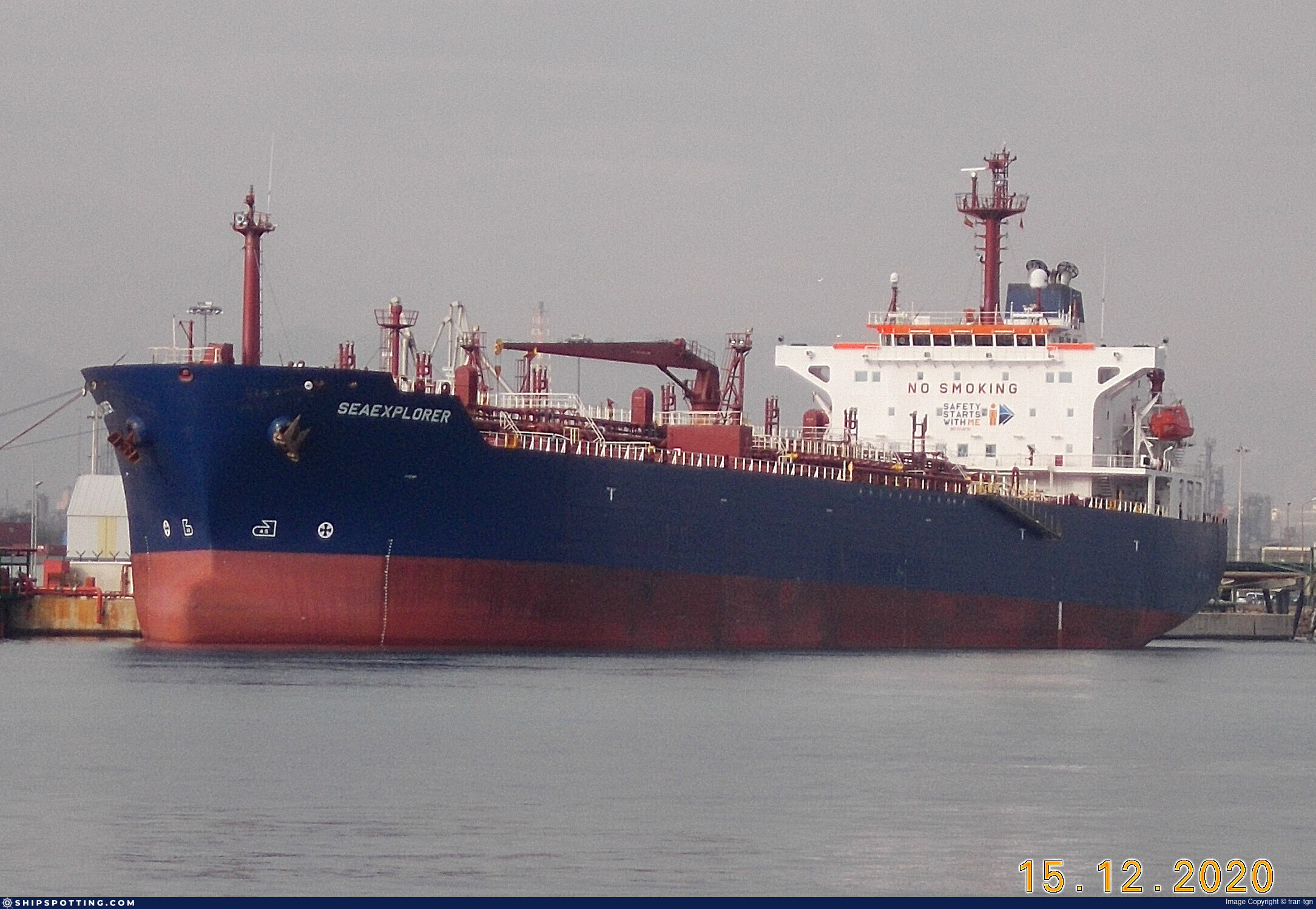
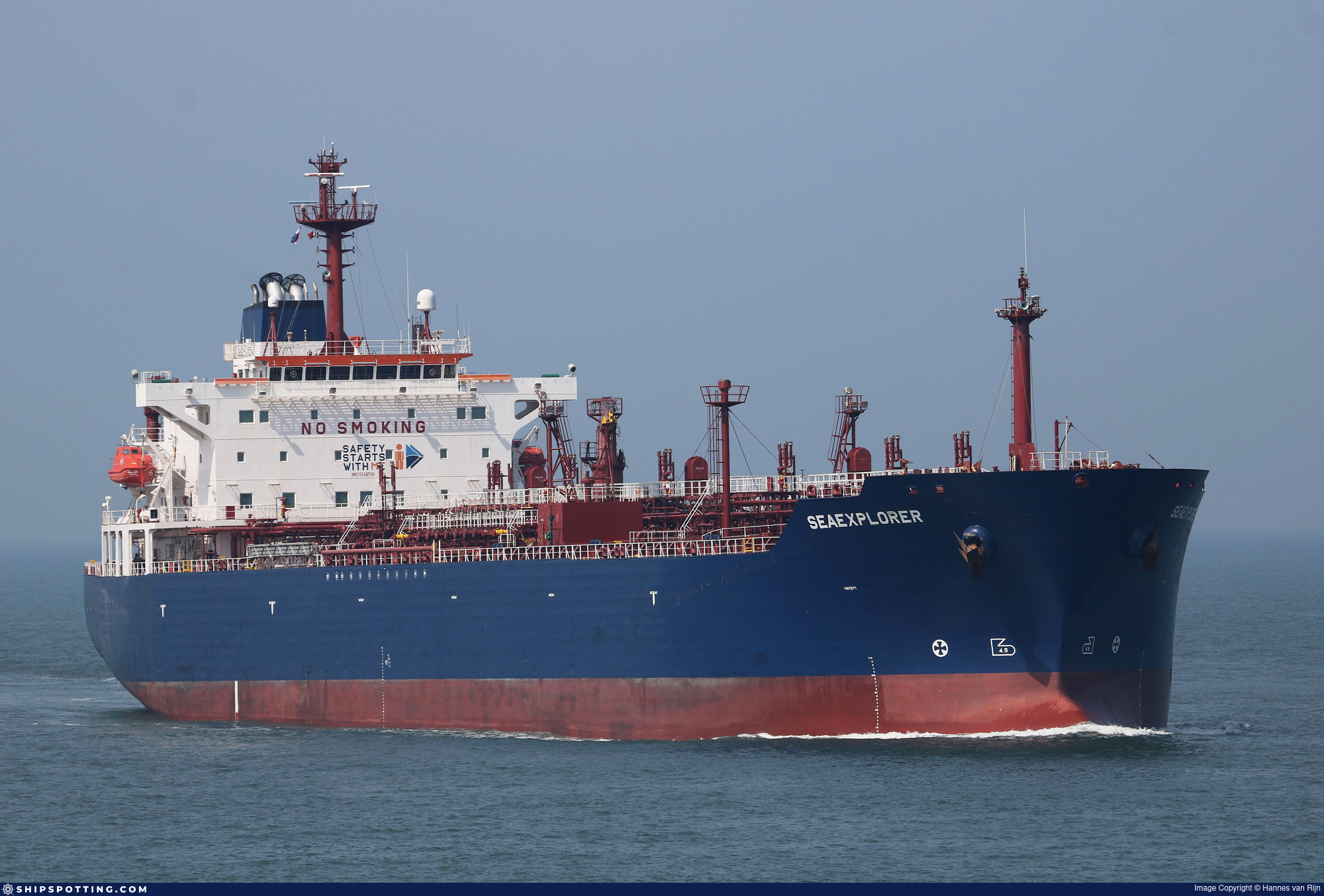
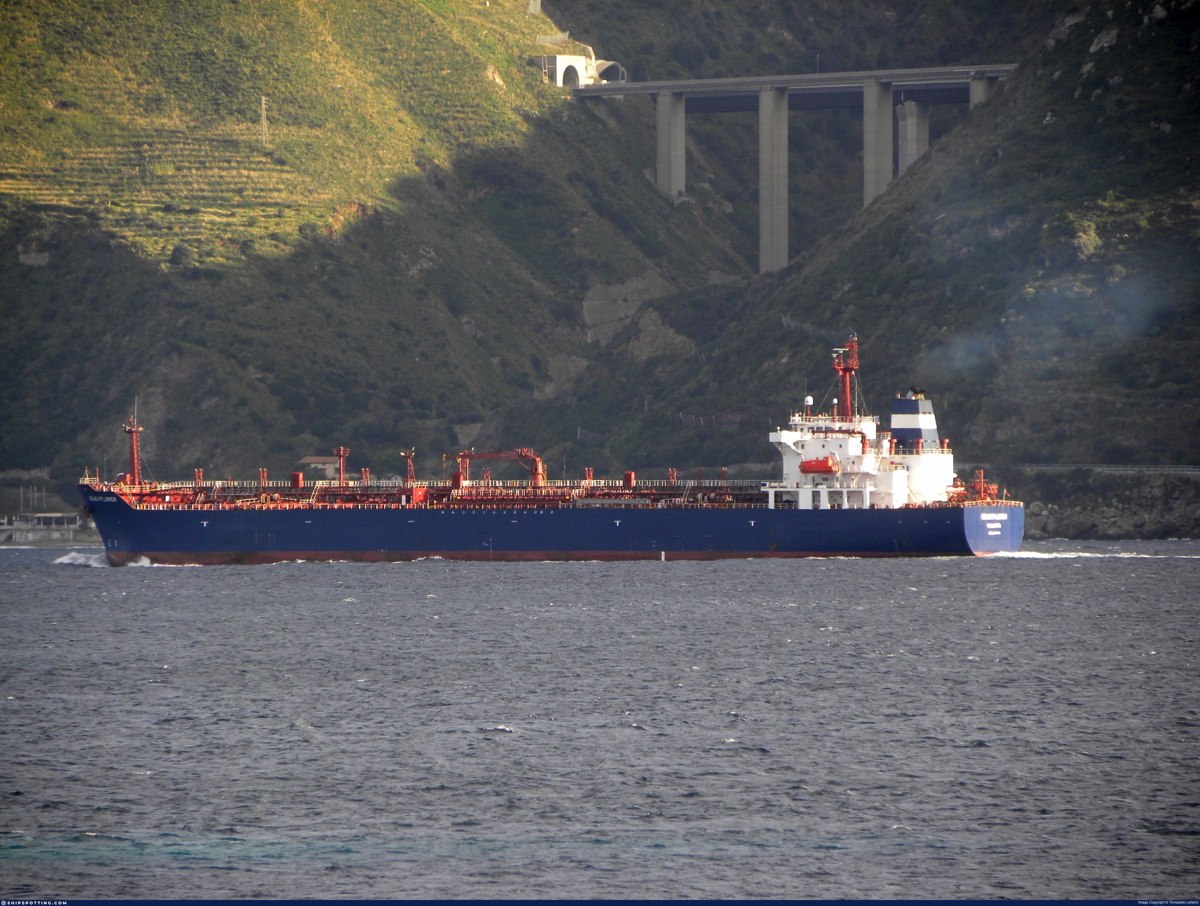
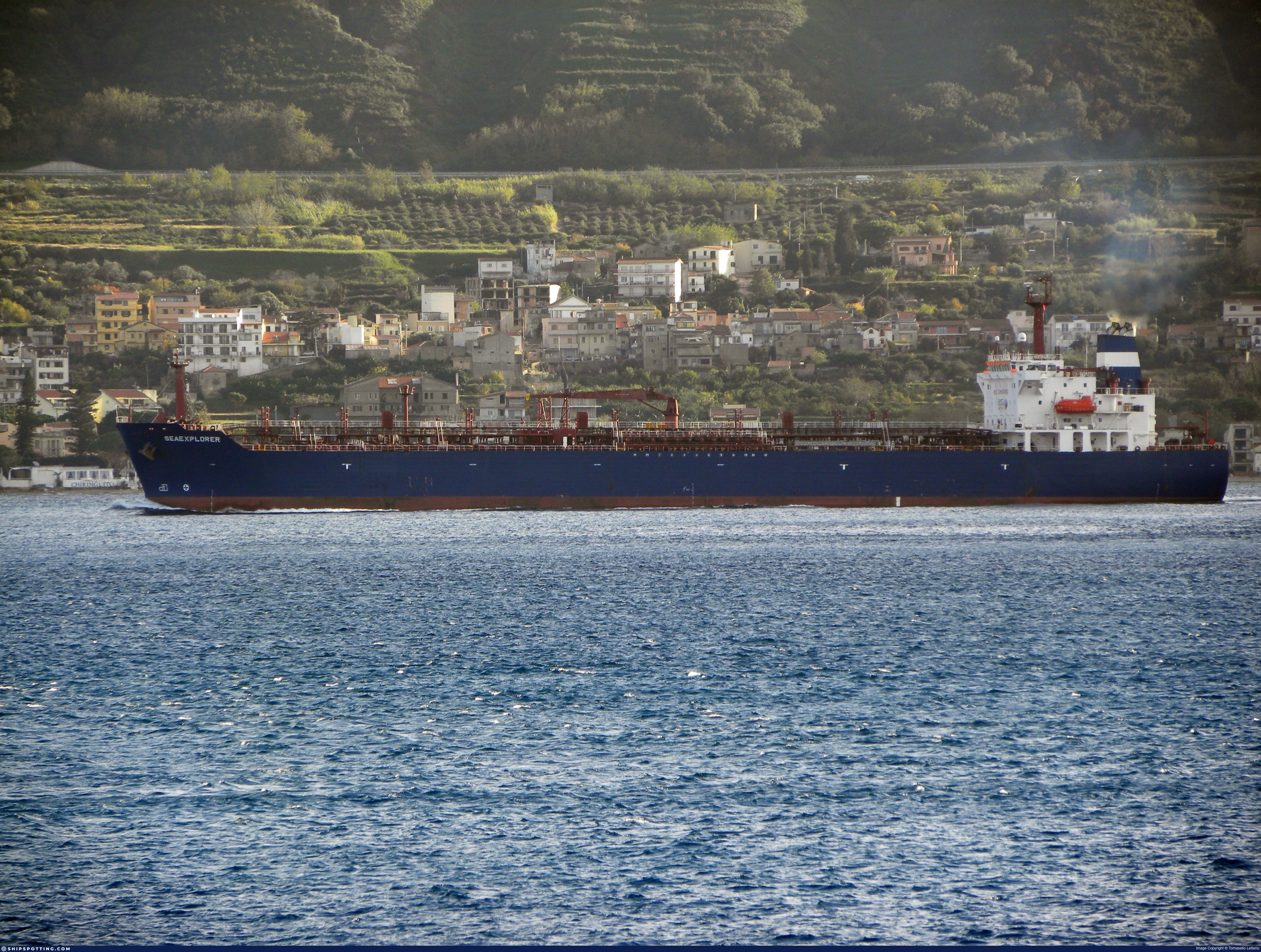
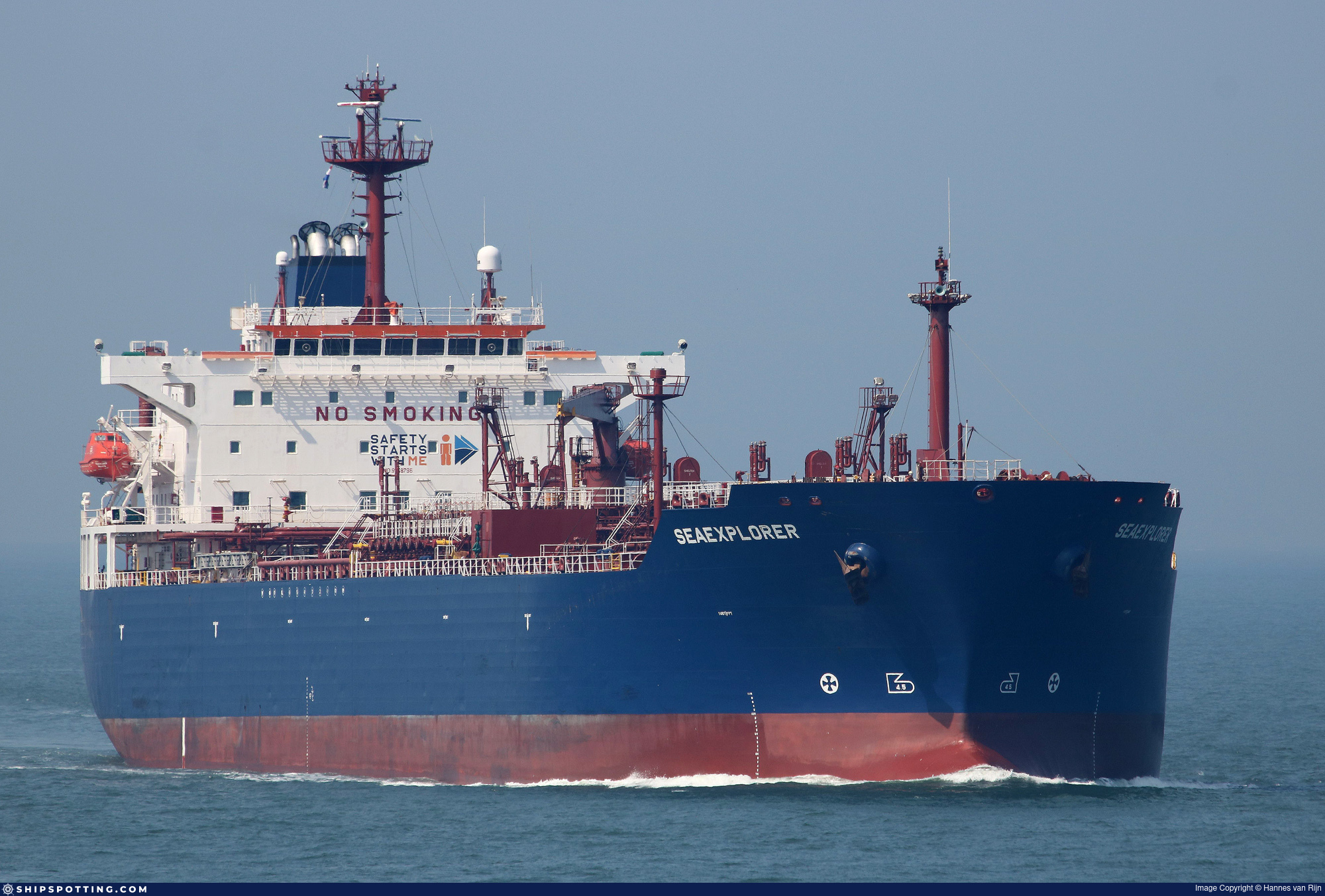
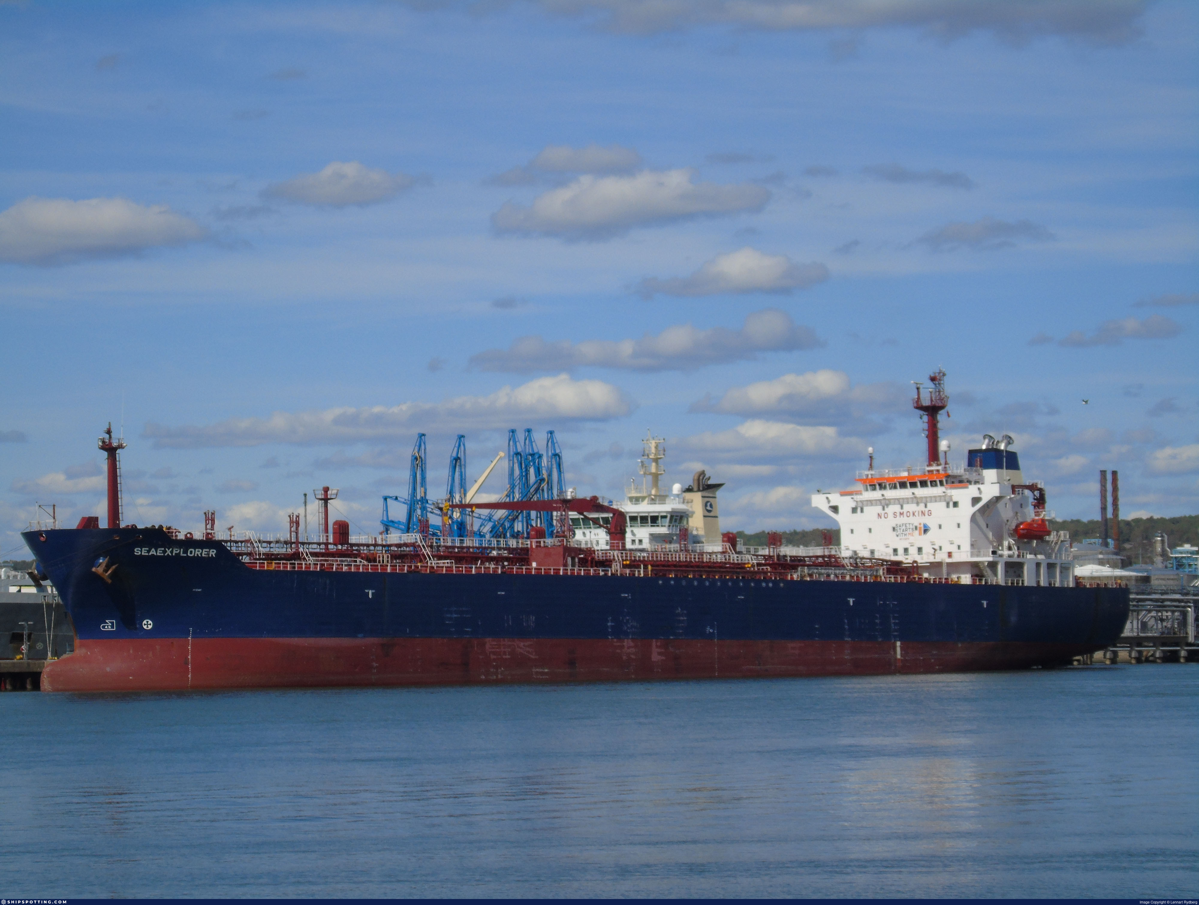
IMO 9248796
Vessel information
Sanctioned by
Company & Ownership
Management & Operations
Classification & Safety
Port State Control (PSC) Inspections
Survey Renewal & Certificates
| Code | Type | Issuer | Issued | Expires |
|---|---|---|---|---|
| 533 | Maritime Labour Certificate | American Bureau of Shipping (101) | 16/02/2023 | 19/02/2028 |
| 510 | Safety Management Certificate | American Bureau of Shipping (101) | 16/02/2023 | 19/02/2028 |
Programs & Notes
EU Russia Sanctions – Shadow Fleet | AU vessel designations (DFAT) | SEMA (Canada) — vessel designations | The Russia (Sanctions) (EU Exit) Regulations 2019
DateDesignated: 2025-05-09 | Shipping sanctions: (see “Other information”) | Shipping sanctions: a specified ship is prohibited from being provided with access to or having its master or pilot cause it to enter a port in the UK, may have its registration on the UK Ship Register terminated, and a master or pilot of a specified ship may be given a port barring direction, a detention direction, and a port entry direction or a movement direction. | IMO 9248796 (“SPRIT”) is involved in activity whose object or effect is to destabilise Ukraine or undermine or threaten the territorial integrity, sovereignty or independence of Ukraine or to obtain a benefit from or support the Government of Russia. Namely, SPRIT is involved in carrying oil or oil products that originated in Russia from Russia to a third country.
Vessel Changes
 🔄 Owner
 🔄 Owner
 🔄 Owner
AIS Events
39 events detected • 6 zones • Last: Jul 19, 2026
- Zone: Western Black Sea Surveillance Zone
- Duration: 2h 36m
- Data Points: 7 AIS positions
- Period: 2026-07-19T01:31:08+00:00 to 2026-07-19T04:07:06+00:00
Show Raw Evidence JSON
{
    "zone_id": "discovered_156",
    "zone_name": "Western Black Sea Surveillance Zone",
    "dwell_minutes": 156,
    "points_in_zone": 7,
    "first_point": {
        "ts": "2026-07-19T01:31:08+00:00",
        "lat": 31.50902500000000117097442853264510631561279296875,
        "lon": 32.335876700000000028012436814606189727783203125
    },
    "last_point": {
        "ts": "2026-07-19T04:07:06+00:00",
        "lat": 31.509060000000001622311174287460744380950927734375,
        "lon": 32.335863299999999753708834759891033172607421875
    }
}- Zone: Western Black Sea Surveillance Zone
- Duration: 4h 39m
- Data Points: 8 AIS positions
- Period: 2026-07-18T23:28:07+00:00 to 2026-07-19T04:07:06+00:00
Show Raw Evidence JSON
{
    "zone_id": "discovered_156",
    "zone_name": "Western Black Sea Surveillance Zone",
    "dwell_minutes": 279,
    "points_in_zone": 8,
    "first_point": {
        "ts": "2026-07-18T23:28:07+00:00",
        "lat": 31.5090383000000002766682882793247699737548828125,
        "lon": 32.3358300000000014051693142391741275787353515625
    },
    "last_point": {
        "ts": "2026-07-19T04:07:06+00:00",
        "lat": 31.509060000000001622311174287460744380950927734375,
        "lon": 32.335863299999999753708834759891033172607421875
    }
}- Zone: Western Black Sea Surveillance Zone
- Duration: 5h 24m
- Data Points: 10 AIS positions
- Period: 2026-07-18T22:43:04+00:00 to 2026-07-19T04:07:06+00:00
Show Raw Evidence JSON
{
    "zone_id": "discovered_156",
    "zone_name": "Western Black Sea Surveillance Zone",
    "dwell_minutes": 324,
    "points_in_zone": 10,
    "first_point": {
        "ts": "2026-07-18T22:43:04+00:00",
        "lat": 31.50894170000000116260707727633416652679443359375,
        "lon": 32.335686699999996562837623059749603271484375
    },
    "last_point": {
        "ts": "2026-07-19T04:07:06+00:00",
        "lat": 31.509060000000001622311174287460744380950927734375,
        "lon": 32.335863299999999753708834759891033172607421875
    }
}- Duration: 5h 24m
- Radius: 21 meters
- Data Points: 10 AIS positions
- Centroid: 31.5091, 32.3358
- Zone: Western Black Sea Surveillance Zone
Show Raw Evidence JSON
{
    "radius_m": 20.89999999999999857891452847979962825775146484375,
    "duration_minutes": 324,
    "points": 10,
    "centroid": {
        "lat": 31.50905816999999586869307677261531352996826171875,
        "lon": 32.3358433300000029930743039585649967193603515625
    },
    "bbox": {
        "min_lat": 31.50894170000000116260707727633416652679443359375,
        "min_lon": 32.335686699999996562837623059749603271484375,
        "max_lat": 31.509236699999998876364770694635808467864990234375,
        "max_lon": 32.3359149999999999636202119290828704833984375
    },
    "zone_id": "discovered_156"
}- Zone: Western Black Sea Surveillance Zone
- Duration: 6h 29m
- Data Points: 11 AIS positions
- Period: 2026-07-18T21:38:00+00:00 to 2026-07-19T04:07:06+00:00
Show Raw Evidence JSON
{
    "zone_id": "discovered_156",
    "zone_name": "Western Black Sea Surveillance Zone",
    "dwell_minutes": 389.1000000000000227373675443232059478759765625,
    "points_in_zone": 11,
    "first_point": {
        "ts": "2026-07-18T21:38:00+00:00",
        "lat": 31.504831700000000438421920989640057086944580078125,
        "lon": 32.32120330000000052450559451244771480560302734375
    },
    "last_point": {
        "ts": "2026-07-19T04:07:06+00:00",
        "lat": 31.509060000000001622311174287460744380950927734375,
        "lon": 32.335863299999999753708834759891033172607421875
    }
}- Zone: discovered_265
- Duration: 1h 18m
- Data Points: 19 AIS positions
- Period: 2026-06-12T04:07:06+00:00 to 2026-06-12T05:25:13+00:00
Show Raw Evidence JSON
{
    "zone_id": "discovered_265",
    "zone_name": "Discovered Hotspot discovered_265",
    "dwell_minutes": 78.099999999999994315658113919198513031005859375,
    "points_in_zone": 19,
    "first_point": {
        "ts": "2026-06-12T04:07:06+00:00",
        "lat": -3.1888149999999999550936990999616682529449462890625,
        "lon": -58.35317669999999878882590564899146556854248046875
    },
    "last_point": {
        "ts": "2026-06-12T05:25:13+00:00",
        "lat": -3.00967669999999998253770172595977783203125,
        "lon": -58.16120500000000248519427259452641010284423828125
    }
}- Zone: Discovered Hotspot discovered_276
- Duration: 1h 13m
- Data Points: 16 AIS positions
- Period: 2026-06-05T22:02:15+00:00 to 2026-06-05T23:15:32+00:00
Show Raw Evidence JSON
{
    "zone_id": "discovered_276",
    "zone_name": "Discovered Hotspot discovered_276",
    "dwell_minutes": 73.2999999999999971578290569595992565155029296875,
    "points_in_zone": 16,
    "first_point": {
        "ts": "2026-06-05T22:02:15+00:00",
        "lat": -3.29109329999999999927240423858165740966796875,
        "lon": -58.56659669999999806577761773951351642608642578125
    },
    "last_point": {
        "ts": "2026-06-05T23:15:32+00:00",
        "lat": -3.370988300000000048584070100332610309123992919921875,
        "lon": -58.674921699999998736529960297048091888427734375
    }
}- Zone: Discovered Hotspot discovered_276
- Duration: 1h 18m
- Data Points: 18 AIS positions
- Period: 2026-06-05T21:57:05+00:00 to 2026-06-05T23:15:32+00:00
Show Raw Evidence JSON
{
    "zone_id": "discovered_276",
    "zone_name": "Discovered Hotspot discovered_276",
    "dwell_minutes": 78.5,
    "points_in_zone": 18,
    "first_point": {
        "ts": "2026-06-05T21:57:05+00:00",
        "lat": -3.282193299999999869243083594483323395252227783203125,
        "lon": -58.5654382999999967296389513649046421051025390625
    },
    "last_point": {
        "ts": "2026-06-05T23:15:32+00:00",
        "lat": -3.370988300000000048584070100332610309123992919921875,
        "lon": -58.674921699999998736529960297048091888427734375
    }
}- Zone: discovered_265
- Duration: 1h 56m
- Data Points: 12 AIS positions
- Period: 2026-06-05T17:00:45+00:00 to 2026-06-05T18:57:05+00:00
Show Raw Evidence JSON
{
    "zone_id": "discovered_265",
    "zone_name": "Discovered Hotspot discovered_265",
    "dwell_minutes": 116.2999999999999971578290569595992565155029296875,
    "points_in_zone": 12,
    "first_point": {
        "ts": "2026-06-05T17:00:45+00:00",
        "lat": -3.181663299999999861000787859666161239147186279296875,
        "lon": -58.1911582999999978937921696342527866363525390625
    },
    "last_point": {
        "ts": "2026-06-05T18:57:05+00:00",
        "lat": -3.187293299999999884875023781205527484416961669921875,
        "lon": -58.36034500000000235786501434631645679473876953125
    }
}- Zone: discovered_265
- Duration: 2h 6m
- Data Points: 16 AIS positions
- Period: 2026-06-05T16:50:15+00:00 to 2026-06-05T18:57:05+00:00
Show Raw Evidence JSON
{
    "zone_id": "discovered_265",
    "zone_name": "Discovered Hotspot discovered_265",
    "dwell_minutes": 126.7999999999999971578290569595992565155029296875,
    "points_in_zone": 16,
    "first_point": {
        "ts": "2026-06-05T16:50:15+00:00",
        "lat": -3.166261700000000178789605342899449169635772705078125,
        "lon": -58.18195999999999656893123756162822246551513671875
    },
    "last_point": {
        "ts": "2026-06-05T18:57:05+00:00",
        "lat": -3.187293299999999884875023781205527484416961669921875,
        "lon": -58.36034500000000235786501434631645679473876953125
    }
}- Zone: discovered_018
- Duration: 1h 43m
- Data Points: 20 AIS positions
- Period: 2026-05-12T08:00:12+00:00 to 2026-05-12T09:43:43+00:00
Show Raw Evidence JSON
{
    "zone_id": "discovered_018",
    "zone_name": "Eastern Mediterranean Sanctioned Vessel Zone",
    "dwell_minutes": 103.5,
    "points_in_zone": 20,
    "first_point": {
        "ts": "2026-05-12T08:00:12+00:00",
        "lat": 31.835145000000000692352841724641621112823486328125,
        "lon": 31.4611416999999988775016390718519687652587890625
    },
    "last_point": {
        "ts": "2026-05-12T09:43:43+00:00",
        "lat": 31.902590000000000003410605131648480892181396484375,
        "lon": 31.0978582999999986213879310525953769683837890625
    }
}- Zone: discovered_018
- Duration: 2h 41m
- Data Points: 56 AIS positions
- Period: 2026-05-12T07:01:52+00:00 to 2026-05-12T09:43:43+00:00
Show Raw Evidence JSON
{
    "zone_id": "discovered_018",
    "zone_name": "Eastern Mediterranean Sanctioned Vessel Zone",
    "dwell_minutes": 161.80000000000001136868377216160297393798828125,
    "points_in_zone": 56,
    "first_point": {
        "ts": "2026-05-12T07:01:52+00:00",
        "lat": 31.808061699999999660803950973786413669586181640625,
        "lon": 31.671376699999999715373633080162107944488525390625
    },
    "last_point": {
        "ts": "2026-05-12T09:43:43+00:00",
        "lat": 31.902590000000000003410605131648480892181396484375,
        "lon": 31.0978582999999986213879310525953769683837890625
    }
}- Zone: discovered_018
- Duration: 3h 43m
- Data Points: 97 AIS positions
- Period: 2026-05-12T06:00:28+00:00 to 2026-05-12T09:43:43+00:00
Show Raw Evidence JSON
{
    "zone_id": "discovered_018",
    "zone_name": "Eastern Mediterranean Sanctioned Vessel Zone",
    "dwell_minutes": 223.19999999999998863131622783839702606201171875,
    "points_in_zone": 97,
    "first_point": {
        "ts": "2026-05-12T06:00:28+00:00",
        "lat": 31.780493299999999834426489542238414287567138671875,
        "lon": 31.89352170000000086247382569126784801483154296875
    },
    "last_point": {
        "ts": "2026-05-12T09:43:43+00:00",
        "lat": 31.902590000000000003410605131648480892181396484375,
        "lon": 31.0978582999999986213879310525953769683837890625
    }
}- Zone: discovered_018
- Duration: 4h 33m
- Data Points: 127 AIS positions
- Period: 2026-05-12T05:10:17+00:00 to 2026-05-12T09:43:43+00:00
Show Raw Evidence JSON
{
    "zone_id": "discovered_018",
    "zone_name": "Eastern Mediterranean Sanctioned Vessel Zone",
    "dwell_minutes": 273.3999999999999772626324556767940521240234375,
    "points_in_zone": 127,
    "first_point": {
        "ts": "2026-05-12T05:10:17+00:00",
        "lat": 31.70118000000000080262907431460916996002197265625,
        "lon": 32.04608499999999793317329022102057933807373046875
    },
    "last_point": {
        "ts": "2026-05-12T09:43:43+00:00",
        "lat": 31.902590000000000003410605131648480892181396484375,
        "lon": 31.0978582999999986213879310525953769683837890625
    }
}- Zone: discovered_018
- Duration: 5h 47m
- Data Points: 128 AIS positions
- Period: 2026-05-12T03:56:09+00:00 to 2026-05-12T09:43:43+00:00
Show Raw Evidence JSON
{
    "zone_id": "discovered_018",
    "zone_name": "Eastern Mediterranean Sanctioned Vessel Zone",
    "dwell_minutes": 347.6000000000000227373675443232059478759765625,
    "points_in_zone": 128,
    "first_point": {
        "ts": "2026-05-12T03:56:09+00:00",
        "lat": 31.557203300000001178204911411739885807037353515625,
        "lon": 32.25207000000000334694050252437591552734375
    },
    "last_point": {
        "ts": "2026-05-12T09:43:43+00:00",
        "lat": 31.902590000000000003410605131648480892181396484375,
        "lon": 31.0978582999999986213879310525953769683837890625
    }
}- Minimum Distance: 42 meters
- Average Distance: 43 meters
- Duration: 36 minutes
- Period: 2026-05-10T22:14:14+00:00 to 2026-05-10T22:50:14+00:00
- Vessel A Avg Speed: 0.0 knots
- Vessel B Avg Speed: 0.0 knots
- Zone: discovered_018
Confidence Analysis
Moderate-confidence STS candidate. Two tankers (OPAL and IRON WAVE) maintained close proximity (min 42m, avg 43m) for 36 minutes. Both vessels were slow-moving (avg speeds 0.0 and 0.0 knots). The stable separation distance suggests deliberate parallel positioning typical of cargo transfer. Event occurred in Eastern Mediterranean Sanctioned Vessel Zone, a known STS activity area.
View scoring breakdown
| Factor | Score | Detail |
|---|---|---|
| Distance Tightness | 25/25 | Min distance 42m, avg 43m |
| Duration | 5/25 | Duration 36 minutes |
| Speed Stability | 20/20 | both nearly stationary; very stable speeds |
| Distance Consistency | 15/15 | Distance variance ±1m |
| Isolation | 5/10 | Isolation data not available |
| Context | 5/5 | In monitored zone: Eastern Mediterranean Sanctioned Vessel Zone |
🛰️ Satellite Corroboration
No satellite imagery for this time/location
No Sentinel-1 scenes covering AOI and time window
Show Raw Evidence JSON
{
    "vessel_a": {
        "mmsi": 613407500,
        "imo": 9286023,
        "name": "OPAL",
        "flag": "CAMEROON"
    },
    "vessel_b": {
        "mmsi": 613271330,
        "imo": 9248796,
        "name": "IRON WAVE",
        "flag": "CAMEROON"
    },
    "min_distance_m": 42.39999999999999857891452847979962825775146484375,
    "avg_distance_m": 43.39999999999999857891452847979962825775146484375,
    "distance_consistency_m": 1.1999999999999999555910790149937383830547332763671875,
    "duration_minutes": 36,
    "overlap_duration_s": 2160,
    "speed_a_avg": 0,
    "speed_a_std": 0,
    "speed_b_avg": 0.0299999999999999988897769753748434595763683319091796875,
    "speed_b_std": 0.05000000000000000277555756156289135105907917022705078125,
    "speed_summary": {
        "vessel_a": {
            "avg_sog": 0,
            "max_sog": 0
        },
        "vessel_b": {
            "avg_sog": 0.0299999999999999988897769753748434595763683319091796875,
            "max_sog": 0.1000000000000000055511151231257827021181583404541015625
        }
    },
    "time_window": {
        "start": "2026-05-10T22:14:14+00:00",
        "end": "2026-05-10T22:50:14+00:00"
    },
    "points_count": {
        "vessel_a": 4,
        "vessel_b": 4
    },
    "zone_id": "discovered_018",
    "zone_name": "Eastern Mediterranean Sanctioned Vessel Zone",
    "score": {
        "value": 75,
        "components": {
            "distance_tightness": {
                "score": 25,
                "max": 25,
                "detail": "Min distance 42m, avg 43m"
            },
            "duration": {
                "score": 5,
                "max": 25,
                "detail": "Duration 36 minutes"
            },
            "speed_stability": {
                "score": 20,
                "max": 20,
                "detail": "both nearly stationary; very stable speeds"
            },
            "distance_consistency": {
                "score": 15,
                "max": 15,
                "detail": "Distance variance \u00b11m"
            },
            "isolation": {
                "score": 5,
                "max": 10,
                "detail": "Isolation data not available"
            },
            "context": {
                "score": 5,
                "max": 5,
                "detail": "In monitored zone: Eastern Mediterranean Sanctioned Vessel Zone"
            }
        },
        "summary": "Moderate-confidence STS candidate. Two tankers (OPAL and IRON WAVE) maintained close proximity (min 42m, avg 43m) for 36 minutes. Both vessels were slow-moving (avg speeds 0.0 and 0.0 knots). The stable separation distance suggests deliberate parallel positioning typical of cargo transfer. Event occurred in Eastern Mediterranean Sanctioned Vessel Zone, a known STS activity area."
    },
    "sar": {
        "status": "not_found",
        "centroid": {
            "lat": 31.546735600000001653597792028449475765228271484375,
            "lon": 32.3763971999999995432517607696354389190673828125
        },
        "time_window": {
            "start_ts": "2026-05-10T22:14:14+00:00",
            "end_ts": "2026-05-10T22:50:14+00:00"
        },
        "searched_at": "2026-05-10T23:00:09.160830+00:00",
        "notes": "No Sentinel-1 scenes covering AOI and time window"
    }
}- Duration: 1h 47m
- Radius: 16 meters
- Data Points: 21 AIS positions
- Centroid: 31.5467, 32.3767
- Zone: discovered_018
Show Raw Evidence JSON
{
    "radius_m": 16.300000000000000710542735760100185871124267578125,
    "duration_minutes": 107,
    "points": 21,
    "centroid": {
        "lat": 31.54667031904761387295366148464381694793701171875,
        "lon": 32.376664190476191151901730336248874664306640625
    },
    "bbox": {
        "min_lat": 31.546575000000000699174051987938582897186279296875,
        "min_lon": 32.376575000000002546585164964199066162109375,
        "max_lat": 31.5467799999999982674125931225717067718505859375,
        "max_lon": 32.376800000000002910383045673370361328125
    },
    "zone_id": "discovered_018"
}- Zone: discovered_018
- Duration: 1h 47m
- Data Points: 21 AIS positions
- Period: 2026-05-10T21:08:07+00:00 to 2026-05-10T22:55:07+00:00
Show Raw Evidence JSON
{
    "zone_id": "discovered_018",
    "zone_name": "Eastern Mediterranean Sanctioned Vessel Zone",
    "dwell_minutes": 107,
    "points_in_zone": 21,
    "first_point": {
        "ts": "2026-05-10T21:08:07+00:00",
        "lat": 31.54662499999999880628820392303168773651123046875,
        "lon": 32.37675829999999876918082009069621562957763671875
    },
    "last_point": {
        "ts": "2026-05-10T22:55:07+00:00",
        "lat": 31.5467416999999983318048180080950260162353515625,
        "lon": 32.37658830000000165227902471087872982025146484375
    }
}- Minimum Distance: 42 meters
- Average Distance: 43 meters
- Duration: 55 minutes
- Period: 2026-05-10T21:26:46+00:00 to 2026-05-10T22:22:28+00:00
- Vessel A Avg Speed: 0.1 knots
- Vessel B Avg Speed: 0.0 knots
- Zone: discovered_018
Confidence Analysis
High-confidence STS candidate. Two tankers (IRON WAVE and OPAL) maintained close proximity (min 42m, avg 43m) for 56 minutes. Both vessels were slow-moving (avg speeds 0.1 and 0.0 knots). The stable separation distance suggests deliberate parallel positioning typical of cargo transfer. Event occurred in Eastern Mediterranean Sanctioned Vessel Zone, a known STS activity area.
View scoring breakdown
| Factor | Score | Detail |
|---|---|---|
| Distance Tightness | 25/25 | Min distance 42m, avg 43m |
| Duration | 10/25 | Duration 56 minutes |
| Speed Stability | 20/20 | both nearly stationary; very stable speeds |
| Distance Consistency | 15/15 | Distance variance ±2m |
| Isolation | 5/10 | Isolation data not available |
| Context | 5/5 | In monitored zone: Eastern Mediterranean Sanctioned Vessel Zone |
Show Raw Evidence JSON
{
    "vessel_a": {
        "mmsi": 613271330,
        "imo": 9248796,
        "name": "IRON WAVE",
        "flag": "CAMEROON"
    },
    "vessel_b": {
        "mmsi": 613407500,
        "imo": 9286023,
        "name": "OPAL",
        "flag": "CAMEROON"
    },
    "min_distance_m": 41.7000000000000028421709430404007434844970703125,
    "avg_distance_m": 43.39999999999999857891452847979962825775146484375,
    "distance_consistency_m": 1.5,
    "duration_minutes": 55.7000000000000028421709430404007434844970703125,
    "overlap_duration_s": 3342,
    "speed_a_avg": 0.1000000000000000055511151231257827021181583404541015625,
    "speed_a_std": 0,
    "speed_b_avg": 0,
    "speed_b_std": 0,
    "speed_summary": {
        "vessel_a": {
            "avg_sog": 0.1000000000000000055511151231257827021181583404541015625,
            "max_sog": 0.1000000000000000055511151231257827021181583404541015625
        },
        "vessel_b": {
            "avg_sog": 0,
            "max_sog": 0
        }
    },
    "time_window": {
        "start": "2026-05-10T21:26:46+00:00",
        "end": "2026-05-10T22:22:28+00:00"
    },
    "points_count": {
        "vessel_a": 6,
        "vessel_b": 6
    },
    "zone_id": "discovered_018",
    "zone_name": "Eastern Mediterranean Sanctioned Vessel Zone",
    "score": {
        "value": 80,
        "components": {
            "distance_tightness": {
                "score": 25,
                "max": 25,
                "detail": "Min distance 42m, avg 43m"
            },
            "duration": {
                "score": 10,
                "max": 25,
                "detail": "Duration 56 minutes"
            },
            "speed_stability": {
                "score": 20,
                "max": 20,
                "detail": "both nearly stationary; very stable speeds"
            },
            "distance_consistency": {
                "score": 15,
                "max": 15,
                "detail": "Distance variance \u00b12m"
            },
            "isolation": {
                "score": 5,
                "max": 10,
                "detail": "Isolation data not available"
            },
            "context": {
                "score": 5,
                "max": 5,
                "detail": "In monitored zone: Eastern Mediterranean Sanctioned Vessel Zone"
            }
        },
        "summary": "High-confidence STS candidate. Two tankers (IRON WAVE and OPAL) maintained close proximity (min 42m, avg 43m) for 56 minutes. Both vessels were slow-moving (avg speeds 0.1 and 0.0 knots). The stable separation distance suggests deliberate parallel positioning typical of cargo transfer. Event occurred in Eastern Mediterranean Sanctioned Vessel Zone, a known STS activity area."
    }
}- Duration: 1h 56m
- Radius: 16 meters
- Data Points: 22 AIS positions
- Centroid: 31.5467, 32.3767
- Zone: discovered_018
Show Raw Evidence JSON
{
    "radius_m": 15.9000000000000003552713678800500929355621337890625,
    "duration_minutes": 116.2999999999999971578290569595992565155029296875,
    "points": 22,
    "centroid": {
        "lat": 31.5466665909090835384631645865738391876220703125,
        "lon": 32.37666680454545797829268849454820156097412109375
    },
    "bbox": {
        "min_lat": 31.546575000000000699174051987938582897186279296875,
        "min_lon": 32.376575000000002546585164964199066162109375,
        "max_lat": 31.5467799999999982674125931225717067718505859375,
        "max_lon": 32.376800000000002910383045673370361328125
    },
    "zone_id": "discovered_018"
}- Zone: discovered_018
- Duration: 1h 56m
- Data Points: 22 AIS positions
- Period: 2026-05-10T20:58:48+00:00 to 2026-05-10T22:55:07+00:00
Show Raw Evidence JSON
{
    "zone_id": "discovered_018",
    "zone_name": "Eastern Mediterranean Sanctioned Vessel Zone",
    "dwell_minutes": 116.2999999999999971578290569595992565155029296875,
    "points_in_zone": 22,
    "first_point": {
        "ts": "2026-05-10T20:58:48+00:00",
        "lat": 31.546588299999999804867911734618246555328369140625,
        "lon": 32.37672169999999738365659140981733798980712890625
    },
    "last_point": {
        "ts": "2026-05-10T22:55:07+00:00",
        "lat": 31.5467416999999983318048180080950260162353515625,
        "lon": 32.37658830000000165227902471087872982025146484375
    }
}- Zone: discovered_018
- Duration: 2h 9m
- Data Points: 7 AIS positions
- Period: 2026-05-09T11:19:19+00:00 to 2026-05-09T13:28:28+00:00
Show Raw Evidence JSON
{
    "zone_id": "discovered_018",
    "zone_name": "Eastern Mediterranean Sanctioned Vessel Zone",
    "dwell_minutes": 129.19999999999998863131622783839702606201171875,
    "points_in_zone": 7,
    "first_point": {
        "ts": "2026-05-09T11:19:19+00:00",
        "lat": 31.531408299999998945395418559201061725616455078125,
        "lon": 32.359904999999997698978404514491558074951171875
    },
    "last_point": {
        "ts": "2026-05-09T13:28:28+00:00",
        "lat": 31.59718670000000173558873939327895641326904296875,
        "lon": 32.48743329999999929214027361012995243072509765625
    }
}- Zone: Bosphorus/Dardanelles Approach
- Duration: 1h 42m
- Data Points: 3 AIS positions
- Period: 2026-04-16T10:02:32+00:00 to 2026-04-16T11:44:37+00:00
Show Raw Evidence JSON
{
    "zone_id": "osint_bosphorus",
    "zone_name": "Bosphorus\/Dardanelles Approach",
    "dwell_minutes": 102.099999999999994315658113919198513031005859375,
    "points_in_zone": 3,
    "first_point": {
        "ts": "2026-04-16T10:02:32+00:00",
        "lat": 41.2706017000000002781234798021614551544189453125,
        "lon": 28.972518300000000834870661492459475994110107421875
    },
    "last_point": {
        "ts": "2026-04-16T11:44:37+00:00",
        "lat": 41.27051829999999910114638623781502246856689453125,
        "lon": 28.97250999999999976353137753903865814208984375
    }
}- Zone: discovered_020
- Duration: 1h 42m
- Data Points: 3 AIS positions
- Period: 2026-04-16T10:02:32+00:00 to 2026-04-16T11:44:37+00:00
Show Raw Evidence JSON
{
    "zone_id": "discovered_020",
    "zone_name": "Black Sea Sanctioned Vessel Monitoring Zone",
    "dwell_minutes": 102.099999999999994315658113919198513031005859375,
    "points_in_zone": 3,
    "first_point": {
        "ts": "2026-04-16T10:02:32+00:00",
        "lat": 41.2706017000000002781234798021614551544189453125,
        "lon": 28.972518300000000834870661492459475994110107421875
    },
    "last_point": {
        "ts": "2026-04-16T11:44:37+00:00",
        "lat": 41.27051829999999910114638623781502246856689453125,
        "lon": 28.97250999999999976353137753903865814208984375
    }
}- Zone: discovered_020
- Duration: 2h 38m
- Data Points: 7 AIS positions
- Period: 2026-04-16T09:05:40+00:00 to 2026-04-16T11:44:37+00:00
Show Raw Evidence JSON
{
    "zone_id": "discovered_020",
    "zone_name": "Black Sea Sanctioned Vessel Monitoring Zone",
    "dwell_minutes": 158.900000000000005684341886080801486968994140625,
    "points_in_zone": 7,
    "first_point": {
        "ts": "2026-04-16T09:05:40+00:00",
        "lat": 41.27072170000000284062480204738676548004150390625,
        "lon": 28.972493300000000004956746124662458896636962890625
    },
    "last_point": {
        "ts": "2026-04-16T11:44:37+00:00",
        "lat": 41.27051829999999910114638623781502246856689453125,
        "lon": 28.97250999999999976353137753903865814208984375
    }
}- Zone: Bosphorus/Dardanelles Approach
- Duration: 2h 38m
- Data Points: 7 AIS positions
- Period: 2026-04-16T09:05:40+00:00 to 2026-04-16T11:44:37+00:00
Show Raw Evidence JSON
{
    "zone_id": "osint_bosphorus",
    "zone_name": "Bosphorus\/Dardanelles Approach",
    "dwell_minutes": 158.900000000000005684341886080801486968994140625,
    "points_in_zone": 7,
    "first_point": {
        "ts": "2026-04-16T09:05:40+00:00",
        "lat": 41.27072170000000284062480204738676548004150390625,
        "lon": 28.972493300000000004956746124662458896636962890625
    },
    "last_point": {
        "ts": "2026-04-16T11:44:37+00:00",
        "lat": 41.27051829999999910114638623781502246856689453125,
        "lon": 28.97250999999999976353137753903865814208984375
    }
}- Zone: discovered_020
- Duration: 2h 51m
- Data Points: 9 AIS positions
- Period: 2026-04-16T08:53:38+00:00 to 2026-04-16T11:44:37+00:00
Show Raw Evidence JSON
{
    "zone_id": "discovered_020",
    "zone_name": "Black Sea Sanctioned Vessel Monitoring Zone",
    "dwell_minutes": 171,
    "points_in_zone": 9,
    "first_point": {
        "ts": "2026-04-16T08:53:38+00:00",
        "lat": 41.27071500000000270347300102002918720245361328125,
        "lon": 28.972458299999999553620000369846820831298828125
    },
    "last_point": {
        "ts": "2026-04-16T11:44:37+00:00",
        "lat": 41.27051829999999910114638623781502246856689453125,
        "lon": 28.97250999999999976353137753903865814208984375
    }
}- Zone: Bosphorus/Dardanelles Approach
- Duration: 2h 51m
- Data Points: 9 AIS positions
- Period: 2026-04-16T08:53:38+00:00 to 2026-04-16T11:44:37+00:00
Show Raw Evidence JSON
{
    "zone_id": "osint_bosphorus",
    "zone_name": "Bosphorus\/Dardanelles Approach",
    "dwell_minutes": 171,
    "points_in_zone": 9,
    "first_point": {
        "ts": "2026-04-16T08:53:38+00:00",
        "lat": 41.27071500000000270347300102002918720245361328125,
        "lon": 28.972458299999999553620000369846820831298828125
    },
    "last_point": {
        "ts": "2026-04-16T11:44:37+00:00",
        "lat": 41.27051829999999910114638623781502246856689453125,
        "lon": 28.97250999999999976353137753903865814208984375
    }
}- Zone: Bosphorus/Dardanelles Approach
- Duration: 4h 55m
- Data Points: 8 AIS positions
- Period: 2026-04-16T05:06:35+00:00 to 2026-04-16T10:02:32+00:00
Show Raw Evidence JSON
{
    "zone_id": "osint_bosphorus",
    "zone_name": "Bosphorus\/Dardanelles Approach",
    "dwell_minutes": 295.8999999999999772626324556767940521240234375,
    "points_in_zone": 8,
    "first_point": {
        "ts": "2026-04-16T05:06:35+00:00",
        "lat": 41.2704566999999968857082421891391277313232421875,
        "lon": 28.97252830000000045629349187947809696197509765625
    },
    "last_point": {
        "ts": "2026-04-16T10:02:32+00:00",
        "lat": 41.2706017000000002781234798021614551544189453125,
        "lon": 28.972518300000000834870661492459475994110107421875
    }
}- Zone: discovered_020
- Duration: 4h 55m
- Data Points: 8 AIS positions
- Period: 2026-04-16T05:06:35+00:00 to 2026-04-16T10:02:32+00:00
Show Raw Evidence JSON
{
    "zone_id": "discovered_020",
    "zone_name": "Black Sea Sanctioned Vessel Monitoring Zone",
    "dwell_minutes": 295.8999999999999772626324556767940521240234375,
    "points_in_zone": 8,
    "first_point": {
        "ts": "2026-04-16T05:06:35+00:00",
        "lat": 41.2704566999999968857082421891391277313232421875,
        "lon": 28.97252830000000045629349187947809696197509765625
    },
    "last_point": {
        "ts": "2026-04-16T10:02:32+00:00",
        "lat": 41.2706017000000002781234798021614551544189453125,
        "lon": 28.972518300000000834870661492459475994110107421875
    }
}- Duration: 5h 45m
- Radius: 20 meters
- Data Points: 10 AIS positions
- Centroid: 41.2706, 28.9725
- Zone: discovered_020
Show Raw Evidence JSON
{
    "radius_m": 19.800000000000000710542735760100185871124267578125,
    "duration_minutes": 345.8999999999999772626324556767940521240234375,
    "points": 10,
    "centroid": {
        "lat": 41.270634499999999889041646383702754974365234375,
        "lon": 28.97250849000000272326360573060810565948486328125
    },
    "bbox": {
        "min_lat": 41.2704566999999968857082421891391277313232421875,
        "min_lon": 28.972458299999999553620000369846820831298828125,
        "max_lat": 41.27078829999999953770384308882057666778564453125,
        "max_lon": 28.972539999999998627799868700094521045684814453125
    },
    "zone_id": "discovered_020"
}- Duration: 5h 45m
- Radius: 20 meters
- Data Points: 10 AIS positions
- Centroid: 41.2706, 28.9725
- Zone: Bosphorus/Dardanelles Approach
Show Raw Evidence JSON
{
    "radius_m": 19.800000000000000710542735760100185871124267578125,
    "duration_minutes": 345.8999999999999772626324556767940521240234375,
    "points": 10,
    "centroid": {
        "lat": 41.270634499999999889041646383702754974365234375,
        "lon": 28.97250849000000272326360573060810565948486328125
    },
    "bbox": {
        "min_lat": 41.2704566999999968857082421891391277313232421875,
        "min_lon": 28.972458299999999553620000369846820831298828125,
        "max_lat": 41.27078829999999953770384308882057666778564453125,
        "max_lon": 28.972539999999998627799868700094521045684814453125
    },
    "zone_id": "osint_bosphorus"
}- Zone: Bosphorus/Dardanelles Approach
- Duration: 5h 45m
- Data Points: 10 AIS positions
- Period: 2026-04-16T04:16:36+00:00 to 2026-04-16T10:02:32+00:00
Show Raw Evidence JSON
{
    "zone_id": "osint_bosphorus",
    "zone_name": "Bosphorus\/Dardanelles Approach",
    "dwell_minutes": 345.8999999999999772626324556767940521240234375,
    "points_in_zone": 10,
    "first_point": {
        "ts": "2026-04-16T04:16:36+00:00",
        "lat": 41.270503300000001445368980057537555694580078125,
        "lon": 28.972539999999998627799868700094521045684814453125
    },
    "last_point": {
        "ts": "2026-04-16T10:02:32+00:00",
        "lat": 41.2706017000000002781234798021614551544189453125,
        "lon": 28.972518300000000834870661492459475994110107421875
    }
}- Zone: discovered_020
- Duration: 5h 45m
- Data Points: 10 AIS positions
- Period: 2026-04-16T04:16:36+00:00 to 2026-04-16T10:02:32+00:00
Show Raw Evidence JSON
{
    "zone_id": "discovered_020",
    "zone_name": "Black Sea Sanctioned Vessel Monitoring Zone",
    "dwell_minutes": 345.8999999999999772626324556767940521240234375,
    "points_in_zone": 10,
    "first_point": {
        "ts": "2026-04-16T04:16:36+00:00",
        "lat": 41.270503300000001445368980057537555694580078125,
        "lon": 28.972539999999998627799868700094521045684814453125
    },
    "last_point": {
        "ts": "2026-04-16T10:02:32+00:00",
        "lat": 41.2706017000000002781234798021614551544189453125,
        "lon": 28.972518300000000834870661492459475994110107421875
    }
}- Duration: 6h 33m
- Radius: 22 meters
- Data Points: 12 AIS positions
- Centroid: 41.2706, 28.9725
- Zone: discovered_020
Show Raw Evidence JSON
{
    "radius_m": 22.39999999999999857891452847979962825775146484375,
    "duration_minutes": 393.3999999999999772626324556767940521240234375,
    "points": 12,
    "centroid": {
        "lat": 41.27058860833333397977185086347162723541259765625,
        "lon": 28.9725231916666672304927487857639789581298828125
    },
    "bbox": {
        "min_lat": 41.270448299999998198472894728183746337890625,
        "min_lon": 28.972458299999999553620000369846820831298828125,
        "max_lat": 41.27078829999999953770384308882057666778564453125,
        "max_lon": 28.972561699999999973442754708230495452880859375
    },
    "zone_id": "discovered_020"
}- Duration: 6h 33m
- Radius: 22 meters
- Data Points: 12 AIS positions
- Centroid: 41.2706, 28.9725
- Zone: Bosphorus/Dardanelles Approach
Show Raw Evidence JSON
{
    "radius_m": 22.39999999999999857891452847979962825775146484375,
    "duration_minutes": 393.3999999999999772626324556767940521240234375,
    "points": 12,
    "centroid": {
        "lat": 41.27058860833333397977185086347162723541259765625,
        "lon": 28.9725231916666672304927487857639789581298828125
    },
    "bbox": {
        "min_lat": 41.270448299999998198472894728183746337890625,
        "min_lon": 28.972458299999999553620000369846820831298828125,
        "max_lat": 41.27078829999999953770384308882057666778564453125,
        "max_lon": 28.972561699999999973442754708230495452880859375
    },
    "zone_id": "osint_bosphorus"
}- Zone: discovered_020
- Duration: 6h 33m
- Data Points: 12 AIS positions
- Period: 2026-04-16T02:41:15+00:00 to 2026-04-16T09:14:38+00:00
Show Raw Evidence JSON
{
    "zone_id": "discovered_020",
    "zone_name": "Black Sea Sanctioned Vessel Monitoring Zone",
    "dwell_minutes": 393.3999999999999772626324556767940521240234375,
    "points_in_zone": 12,
    "first_point": {
        "ts": "2026-04-16T02:41:15+00:00",
        "lat": 41.2705466999999970312273944728076457977294921875,
        "lon": 28.972551700000000352019924321211874485015869140625
    },
    "last_point": {
        "ts": "2026-04-16T09:14:38+00:00",
        "lat": 41.27078829999999953770384308882057666778564453125,
        "lon": 28.972481699999999449346432811580598354339599609375
    }
}- Zone: Bosphorus/Dardanelles Approach
- Duration: 6h 33m
- Data Points: 12 AIS positions
- Period: 2026-04-16T02:41:15+00:00 to 2026-04-16T09:14:38+00:00
Show Raw Evidence JSON
{
    "zone_id": "osint_bosphorus",
    "zone_name": "Bosphorus\/Dardanelles Approach",
    "dwell_minutes": 393.3999999999999772626324556767940521240234375,
    "points_in_zone": 12,
    "first_point": {
        "ts": "2026-04-16T02:41:15+00:00",
        "lat": 41.2705466999999970312273944728076457977294921875,
        "lon": 28.972551700000000352019924321211874485015869140625
    },
    "last_point": {
        "ts": "2026-04-16T09:14:38+00:00",
        "lat": 41.27078829999999953770384308882057666778564453125,
        "lon": 28.972481699999999449346432811580598354339599609375
    }
}- Zone: Bosphorus/Dardanelles Approach
- Duration: 1h 7m
- Data Points: 21 AIS positions
- Period: 2026-02-27T22:30:39+00:00 to 2026-02-27T23:37:49+00:00
Show Raw Evidence JSON
{
    "zone_id": "osint_bosphorus",
    "zone_name": "Bosphorus\/Dardanelles Approach",
    "dwell_minutes": 67.2000000000000028421709430404007434844970703125,
    "points_in_zone": 21,
    "first_point": {
        "ts": "2026-02-27T22:30:39+00:00",
        "lat": 40.9418399999999991223376127891242504119873046875,
        "lon": 28.889128299999999427427610498853027820587158203125
    },
    "last_point": {
        "ts": "2026-02-27T23:37:49+00:00",
        "lat": 40.930076700000000755608198232948780059814453125,
        "lon": 28.857086699999999979127096594311296939849853515625
    }
}Source snapshot
| Sanctioner | As of | Entity ID |
|---|---|---|
| 🇬🇧 UK | 2025-09-29 | 9248796 |
We mirror official lists; always verify at the source.
Sanctioned on the same day
- ADHARA · IMO 9353125 🇦🇺 AU🇨🇦 CA🇪🇺 EU🇬🇧 UK
- AKAR WEST · IMO 9258167 🇦🇺 AU🇨🇦 CA🇪🇺 EU🇳🇿 NZ🇬🇧 UK
- ATLANTICOS · IMO 9282986 🇦🇺 AU🇨🇦 CA🇪🇺 EU🇳🇿 NZ🇬🇧 UK
- BELOMOR · IMO 9384435 🇦🇺 AU🇨🇦 CA🇪🇺 EU🇳🇿 NZ🇬🇧 UK
- Blue · IMO 9236353 🇦🇺 AU🇨🇦 CA🇪🇺 EU🇳🇿 NZ🇬🇧 UK
- Blue Talu · IMO 9334557 🇦🇺 AU🇨🇦 CA🇪🇺 EU🇬🇧 UK
- C Viking · IMO 9261657 🇦🇺 AU🇨🇦 CA🇪🇺 EU🇳🇿 NZ🇬🇧 UK
- CAVELA · IMO 9259733 🇦🇺 AU🇨🇦 CA🇪🇺 EU🇬🇧 UK