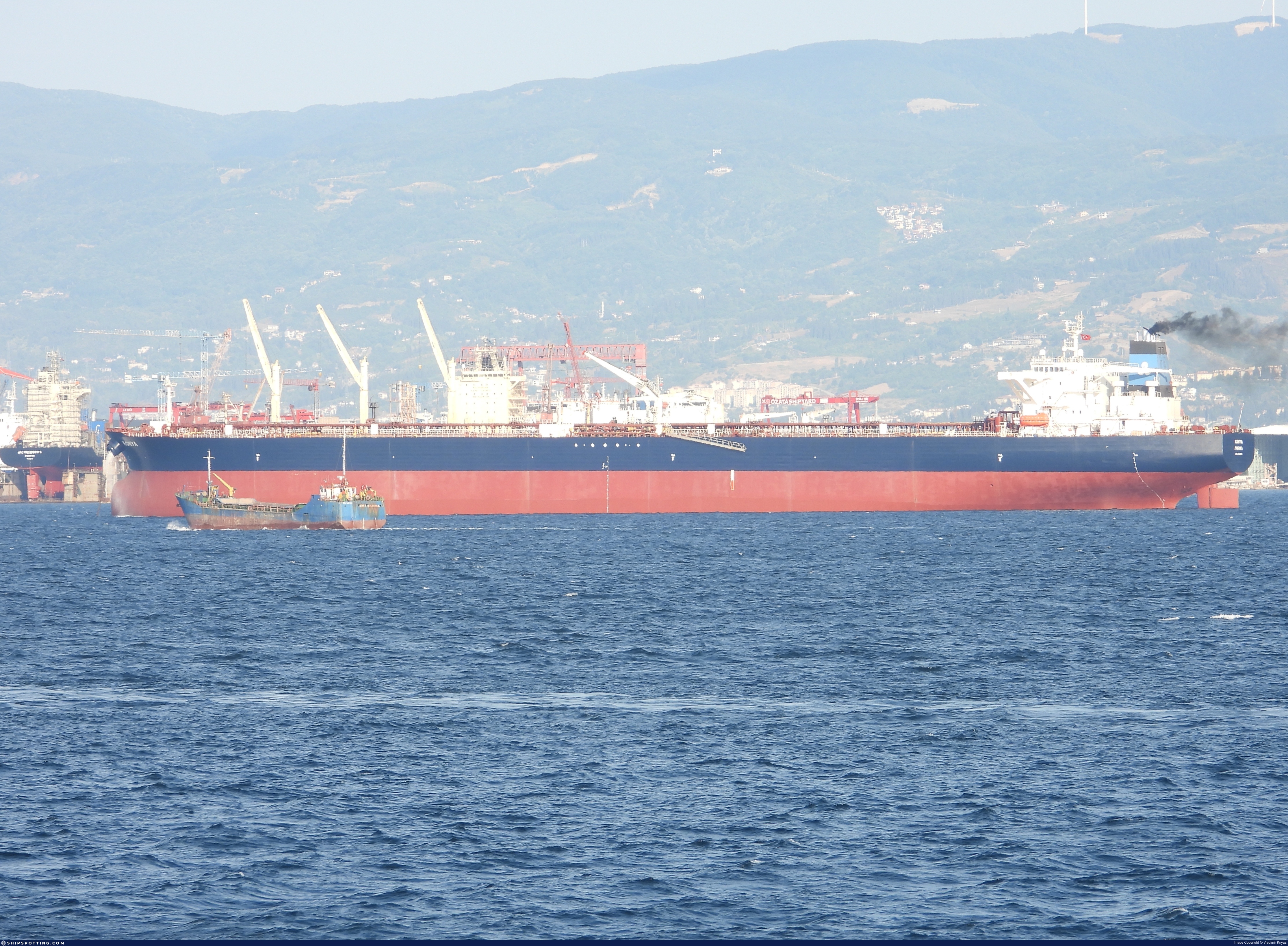
IMO 9290373
Vessel information
Sanctioned by
Company & Ownership
Management & Operations
Classification & Safety
Port State Control (PSC) Inspections
Survey Renewal & Certificates
| Code | Type | Issuer | Issued | Expires |
|---|---|---|---|---|
| 509 | Document of Compliance | Bureau Veritas (115) | 10/01/2023 | 15/01/2028 |
| 510 | Safety Management Certificate | Bureau Veritas (115) | 23/09/2022 | 22/09/2027 |
Programs & Notes
EU Russia Sanctions – Shadow Fleet | SEMA (Canada) — vessel designations | The Russia (Sanctions) (EU Exit) Regulations 2019
Vessel Changes
 🔄 Owner
AIS Events
50 events detected • 2 zones • Last: Jun 15, 2026
- Zone: Bosphorus/Dardanelles Approach
- Duration: 1h 30m
- Data Points: 14 AIS positions
- Period: 2026-06-15T11:03:39+00:00 to 2026-06-15T12:33:57+00:00
Show Raw Evidence JSON
{
    "zone_id": "osint_bosphorus",
    "zone_name": "Bosphorus\/Dardanelles Approach",
    "dwell_minutes": 90.2999999999999971578290569595992565155029296875,
    "points_in_zone": 14,
    "first_point": {
        "ts": "2026-06-15T11:03:39+00:00",
        "lat": 40.9421166999999996960468706674873828887939453125,
        "lon": 28.90896670000000057143552112393081188201904296875
    },
    "last_point": {
        "ts": "2026-06-15T12:33:57+00:00",
        "lat": 40.88170000000000214868123293854296207427978515625,
        "lon": 28.596620000000001482476363889873027801513671875
    }
}- Zone: Bosphorus/Dardanelles Approach
- Duration: 2h 27m
- Data Points: 25 AIS positions
- Period: 2026-06-15T10:06:59+00:00 to 2026-06-15T12:33:57+00:00
Show Raw Evidence JSON
{
    "zone_id": "osint_bosphorus",
    "zone_name": "Bosphorus\/Dardanelles Approach",
    "dwell_minutes": 147,
    "points_in_zone": 25,
    "first_point": {
        "ts": "2026-06-15T10:06:59+00:00",
        "lat": 40.95962999999999709643816458992660045623779296875,
        "lon": 28.946916699999999167403075261972844600677490234375
    },
    "last_point": {
        "ts": "2026-06-15T12:33:57+00:00",
        "lat": 40.88170000000000214868123293854296207427978515625,
        "lon": 28.596620000000001482476363889873027801513671875
    }
}- Minimum Distance: 39 meters
- Average Distance: 48 meters
- Duration: 32 minutes
- Period: 2026-06-14T17:13:14+00:00 to 2026-06-14T17:45:23+00:00
- Vessel A Avg Speed: 0.0 knots
- Vessel B Avg Speed: 0.1 knots
- Zone: Bosphorus/Dardanelles Approach
Confidence Analysis
Moderate-confidence STS candidate. Two tankers (ALTURA and VELORA) maintained close proximity (min 39m, avg 48m) for 32 minutes. Both vessels were slow-moving (avg speeds 0.0 and 0.1 knots). The stable separation distance suggests deliberate parallel positioning typical of cargo transfer. Event occurred in Bosphorus/Dardanelles Approach, a known STS activity area.
View scoring breakdown
| Factor | Score | Detail |
|---|---|---|
| Distance Tightness | 25/25 | Min distance 39m, avg 48m |
| Duration | 5/25 | Duration 32 minutes |
| Speed Stability | 20/20 | both nearly stationary; very stable speeds |
| Distance Consistency | 15/15 | Distance variance ±4m |
| Isolation | 5/10 | Isolation data not available |
| Context | 5/5 | In monitored zone: Bosphorus/Dardanelles Approach |
🛰️ Satellite Corroboration
No satellite imagery for this time/location
No Sentinel-1 scenes covering AOI and time window
Show Raw Evidence JSON
{
    "vessel_a": {
        "mmsi": 667001275,
        "imo": 9292199,
        "name": "ALTURA",
        "flag": "Sierra Leone"
    },
    "vessel_b": {
        "mmsi": 667001274,
        "imo": 9290373,
        "name": "VELORA",
        "flag": "Sierra Leone"
    },
    "min_distance_m": 39.10000000000000142108547152020037174224853515625,
    "avg_distance_m": 47.7999999999999971578290569595992565155029296875,
    "distance_consistency_m": 4.29999999999999982236431605997495353221893310546875,
    "duration_minutes": 32.10000000000000142108547152020037174224853515625,
    "overlap_duration_s": 1929,
    "speed_a_avg": 0.0200000000000000004163336342344337026588618755340576171875,
    "speed_a_std": 0.040000000000000000832667268468867405317723751068115234375,
    "speed_b_avg": 0.14000000000000001332267629550187848508358001708984375,
    "speed_b_std": 0.299999999999999988897769753748434595763683319091796875,
    "speed_summary": {
        "vessel_a": {
            "avg_sog": 0.0200000000000000004163336342344337026588618755340576171875,
            "max_sog": 0.1000000000000000055511151231257827021181583404541015625
        },
        "vessel_b": {
            "avg_sog": 0.14000000000000001332267629550187848508358001708984375,
            "max_sog": 0.6999999999999999555910790149937383830547332763671875
        }
    },
    "time_window": {
        "start": "2026-06-14T17:13:14+00:00",
        "end": "2026-06-14T17:45:23+00:00"
    },
    "points_count": {
        "vessel_a": 10,
        "vessel_b": 10
    },
    "zone_id": "osint_bosphorus",
    "zone_name": "Bosphorus\/Dardanelles Approach",
    "score": {
        "value": 75,
        "components": {
            "distance_tightness": {
                "score": 25,
                "max": 25,
                "detail": "Min distance 39m, avg 48m"
            },
            "duration": {
                "score": 5,
                "max": 25,
                "detail": "Duration 32 minutes"
            },
            "speed_stability": {
                "score": 20,
                "max": 20,
                "detail": "both nearly stationary; very stable speeds"
            },
            "distance_consistency": {
                "score": 15,
                "max": 15,
                "detail": "Distance variance \u00b14m"
            },
            "isolation": {
                "score": 5,
                "max": 10,
                "detail": "Isolation data not available"
            },
            "context": {
                "score": 5,
                "max": 5,
                "detail": "In monitored zone: Bosphorus\/Dardanelles Approach"
            }
        },
        "summary": "Moderate-confidence STS candidate. Two tankers (ALTURA and VELORA) maintained close proximity (min 39m, avg 48m) for 32 minutes. Both vessels were slow-moving (avg speeds 0.0 and 0.1 knots). The stable separation distance suggests deliberate parallel positioning typical of cargo transfer. Event occurred in Bosphorus\/Dardanelles Approach, a known STS activity area."
    },
    "sar": {
        "status": "not_found",
        "centroid": {
            "lat": 41.46754750000000200316208065487444400787353515625,
            "lon": 28.712597099999999983310772222466766834259033203125
        },
        "time_window": {
            "start_ts": "2026-06-14T17:13:14+00:00",
            "end_ts": "2026-06-14T17:45:23+00:00"
        },
        "searched_at": "2026-06-14T18:00:01.447274+00:00",
        "notes": "No Sentinel-1 scenes covering AOI and time window"
    }
}- Minimum Distance: 38 meters
- Average Distance: 42 meters
- Duration: 53 minutes
- Period: 2026-06-11T12:36:57+00:00 to 2026-06-11T13:30:42+00:00
- Vessel A Avg Speed: 0.0 knots
- Vessel B Avg Speed: 0.1 knots
- Zone: Bosphorus/Dardanelles Approach
Confidence Analysis
High-confidence STS candidate. Two tankers (VELORA and ALTURA) maintained close proximity (min 38m, avg 42m) for 54 minutes. Both vessels were slow-moving (avg speeds 0.0 and 0.1 knots). The stable separation distance suggests deliberate parallel positioning typical of cargo transfer. Event occurred in Bosphorus/Dardanelles Approach, a known STS activity area.
View scoring breakdown
| Factor | Score | Detail |
|---|---|---|
| Distance Tightness | 25/25 | Min distance 38m, avg 42m |
| Duration | 10/25 | Duration 54 minutes |
| Speed Stability | 20/20 | both nearly stationary; very stable speeds |
| Distance Consistency | 15/15 | Distance variance ±6m |
| Isolation | 5/10 | Isolation data not available |
| Context | 5/5 | In monitored zone: Bosphorus/Dardanelles Approach |
🛰️ Satellite Corroboration
No satellite imagery for this time/location
No Sentinel-1 scenes covering AOI and time window
Show Raw Evidence JSON
{
    "vessel_a": {
        "mmsi": 667001274,
        "imo": 9290373,
        "name": "VELORA",
        "flag": "Sierra Leone"
    },
    "vessel_b": {
        "mmsi": 667001275,
        "imo": 9292199,
        "name": "ALTURA",
        "flag": "Sierra Leone"
    },
    "min_distance_m": 37.7000000000000028421709430404007434844970703125,
    "avg_distance_m": 41.60000000000000142108547152020037174224853515625,
    "distance_consistency_m": 5.5999999999999996447286321199499070644378662109375,
    "duration_minutes": 53.7999999999999971578290569595992565155029296875,
    "overlap_duration_s": 3225,
    "speed_a_avg": 0,
    "speed_a_std": 0,
    "speed_b_avg": 0.1000000000000000055511151231257827021181583404541015625,
    "speed_b_std": 0,
    "speed_summary": {
        "vessel_a": {
            "avg_sog": 0,
            "max_sog": 0
        },
        "vessel_b": {
            "avg_sog": 0.1000000000000000055511151231257827021181583404541015625,
            "max_sog": 0.1000000000000000055511151231257827021181583404541015625
        }
    },
    "time_window": {
        "start": "2026-06-11T12:36:57+00:00",
        "end": "2026-06-11T13:30:42+00:00"
    },
    "points_count": {
        "vessel_a": 2,
        "vessel_b": 2
    },
    "zone_id": "osint_bosphorus",
    "zone_name": "Bosphorus\/Dardanelles Approach",
    "score": {
        "value": 80,
        "components": {
            "distance_tightness": {
                "score": 25,
                "max": 25,
                "detail": "Min distance 38m, avg 42m"
            },
            "duration": {
                "score": 10,
                "max": 25,
                "detail": "Duration 54 minutes"
            },
            "speed_stability": {
                "score": 20,
                "max": 20,
                "detail": "both nearly stationary; very stable speeds"
            },
            "distance_consistency": {
                "score": 15,
                "max": 15,
                "detail": "Distance variance \u00b16m"
            },
            "isolation": {
                "score": 5,
                "max": 10,
                "detail": "Isolation data not available"
            },
            "context": {
                "score": 5,
                "max": 5,
                "detail": "In monitored zone: Bosphorus\/Dardanelles Approach"
            }
        },
        "summary": "High-confidence STS candidate. Two tankers (VELORA and ALTURA) maintained close proximity (min 38m, avg 42m) for 54 minutes. Both vessels were slow-moving (avg speeds 0.0 and 0.1 knots). The stable separation distance suggests deliberate parallel positioning typical of cargo transfer. Event occurred in Bosphorus\/Dardanelles Approach, a known STS activity area."
    },
    "sar": {
        "status": "not_found",
        "centroid": {
            "lat": 41.4630058999999988600393407978117465972900390625,
            "lon": 28.710319999999999396322891698218882083892822265625
        },
        "time_window": {
            "start_ts": "2026-06-11T12:36:57+00:00",
            "end_ts": "2026-06-11T13:30:42+00:00"
        },
        "searched_at": "2026-06-11T19:15:01.282868+00:00",
        "notes": "No Sentinel-1 scenes covering AOI and time window"
    }
}- Zone: Bosphorus/Dardanelles Approach
- Duration: 1h 17m
- Data Points: 5 AIS positions
- Period: 2026-06-10T16:27:49+00:00 to 2026-06-10T17:44:50+00:00
Show Raw Evidence JSON
{
    "zone_id": "osint_bosphorus",
    "zone_name": "Bosphorus\/Dardanelles Approach",
    "dwell_minutes": 77,
    "points_in_zone": 5,
    "first_point": {
        "ts": "2026-06-10T16:27:49+00:00",
        "lat": 41.461676699999998163548298180103302001953125,
        "lon": 28.711233299999999957208274281583726406097412109375
    },
    "last_point": {
        "ts": "2026-06-10T17:44:50+00:00",
        "lat": 41.4632332999999988487616064958274364471435546875,
        "lon": 28.71008330000000086101863416843116283416748046875
    }
}- Zone: Bosphorus/Dardanelles Approach
- Duration: 2h 22m
- Data Points: 6 AIS positions
- Period: 2026-06-09T09:09:47+00:00 to 2026-06-09T11:31:45+00:00
Show Raw Evidence JSON
{
    "zone_id": "osint_bosphorus",
    "zone_name": "Bosphorus\/Dardanelles Approach",
    "dwell_minutes": 142,
    "points_in_zone": 6,
    "first_point": {
        "ts": "2026-06-09T09:09:47+00:00",
        "lat": 41.4617367000000029975126381032168865203857421875,
        "lon": 28.71121670000000136724338517524302005767822265625
    },
    "last_point": {
        "ts": "2026-06-09T11:31:45+00:00",
        "lat": 41.461856699999998454586602747440338134765625,
        "lon": 28.711283300000001617036105017177760601043701171875
    }
}- Minimum Distance: 45 meters
- Average Distance: 48 meters
- Duration: 2h 2m
- Period: 2026-06-09T09:29:36+00:00 to 2026-06-09T11:31:45+00:00
- Vessel A Avg Speed: 0.0 knots
- Vessel B Avg Speed: 0.0 knots
- Zone: Bosphorus/Dardanelles Approach
Confidence Analysis
High-confidence STS candidate. Two tankers (VELORA and ALTURA) maintained close proximity (min 45m, avg 48m) for 122 minutes. Both vessels were slow-moving (avg speeds 0.0 and 0.0 knots). The stable separation distance suggests deliberate parallel positioning typical of cargo transfer. Event occurred in Bosphorus/Dardanelles Approach, a known STS activity area.
View scoring breakdown
| Factor | Score | Detail |
|---|---|---|
| Distance Tightness | 25/25 | Min distance 45m, avg 48m |
| Duration | 25/25 | Duration 122 minutes |
| Speed Stability | 20/20 | both nearly stationary; very stable speeds |
| Distance Consistency | 15/15 | Distance variance ±3m |
| Isolation | 5/10 | Isolation data not available |
| Context | 5/5 | In monitored zone: Bosphorus/Dardanelles Approach |
Show Raw Evidence JSON
{
    "vessel_a": {
        "mmsi": 667001274,
        "imo": 9290373,
        "name": "VELORA",
        "flag": "Sierra Leone"
    },
    "vessel_b": {
        "mmsi": 667001275,
        "imo": 9292199,
        "name": "ALTURA",
        "flag": "Sierra Leone"
    },
    "min_distance_m": 45.2999999999999971578290569595992565155029296875,
    "avg_distance_m": 48.2000000000000028421709430404007434844970703125,
    "distance_consistency_m": 2.79999999999999982236431605997495353221893310546875,
    "duration_minutes": 122.2000000000000028421709430404007434844970703125,
    "overlap_duration_s": 7329,
    "speed_a_avg": 0,
    "speed_a_std": 0,
    "speed_b_avg": 0,
    "speed_b_std": 0,
    "speed_summary": {
        "vessel_a": {
            "avg_sog": 0,
            "max_sog": 0
        },
        "vessel_b": {
            "avg_sog": 0,
            "max_sog": 0
        }
    },
    "time_window": {
        "start": "2026-06-09T09:29:36+00:00",
        "end": "2026-06-09T11:31:45+00:00"
    },
    "points_count": {
        "vessel_a": 4,
        "vessel_b": 4
    },
    "zone_id": "osint_bosphorus",
    "zone_name": "Bosphorus\/Dardanelles Approach",
    "score": {
        "value": 95,
        "components": {
            "distance_tightness": {
                "score": 25,
                "max": 25,
                "detail": "Min distance 45m, avg 48m"
            },
            "duration": {
                "score": 25,
                "max": 25,
                "detail": "Duration 122 minutes"
            },
            "speed_stability": {
                "score": 20,
                "max": 20,
                "detail": "both nearly stationary; very stable speeds"
            },
            "distance_consistency": {
                "score": 15,
                "max": 15,
                "detail": "Distance variance \u00b13m"
            },
            "isolation": {
                "score": 5,
                "max": 10,
                "detail": "Isolation data not available"
            },
            "context": {
                "score": 5,
                "max": 5,
                "detail": "In monitored zone: Bosphorus\/Dardanelles Approach"
            }
        },
        "summary": "High-confidence STS candidate. Two tankers (VELORA and ALTURA) maintained close proximity (min 45m, avg 48m) for 122 minutes. Both vessels were slow-moving (avg speeds 0.0 and 0.0 knots). The stable separation distance suggests deliberate parallel positioning typical of cargo transfer. Event occurred in Bosphorus\/Dardanelles Approach, a known STS activity area."
    }
}- Minimum Distance: 45 meters
- Average Distance: 49 meters
- Duration: 4h 41m
- Period: 2026-06-09T06:49:50+00:00 to 2026-06-09T11:31:45+00:00
- Vessel A Avg Speed: 0.0 knots
- Vessel B Avg Speed: 0.0 knots
- Zone: Bosphorus/Dardanelles Approach
Confidence Analysis
High-confidence STS candidate. Two tankers (VELORA and ALTURA) maintained close proximity (min 45m, avg 49m) for 282 minutes. Both vessels were slow-moving (avg speeds 0.0 and 0.0 knots). The stable separation distance suggests deliberate parallel positioning typical of cargo transfer. Event occurred in Bosphorus/Dardanelles Approach, a known STS activity area.
View scoring breakdown
| Factor | Score | Detail |
|---|---|---|
| Distance Tightness | 25/25 | Min distance 45m, avg 49m |
| Duration | 25/25 | Duration 282 minutes |
| Speed Stability | 20/20 | both nearly stationary; very stable speeds |
| Distance Consistency | 15/15 | Distance variance ±3m |
| Isolation | 5/10 | Isolation data not available |
| Context | 5/5 | In monitored zone: Bosphorus/Dardanelles Approach |
🛰️ Satellite Corroboration
Satellite imagery available but requires review
Preview available for manual review

Show Raw Evidence JSON
{
    "vessel_a": {
        "mmsi": 667001274,
        "imo": 9290373,
        "name": "VELORA",
        "flag": "Sierra Leone"
    },
    "vessel_b": {
        "mmsi": 667001275,
        "imo": 9292199,
        "name": "ALTURA",
        "flag": "Sierra Leone"
    },
    "min_distance_m": 45.2999999999999971578290569595992565155029296875,
    "avg_distance_m": 48.60000000000000142108547152020037174224853515625,
    "distance_consistency_m": 2.79999999999999982236431605997495353221893310546875,
    "duration_minutes": 281.8999999999999772626324556767940521240234375,
    "overlap_duration_s": 16915,
    "speed_a_avg": 0,
    "speed_a_std": 0,
    "speed_b_avg": 0,
    "speed_b_std": 0,
    "speed_summary": {
        "vessel_a": {
            "avg_sog": 0,
            "max_sog": 0
        },
        "vessel_b": {
            "avg_sog": 0,
            "max_sog": 0
        }
    },
    "time_window": {
        "start": "2026-06-09T06:49:50+00:00",
        "end": "2026-06-09T11:31:45+00:00"
    },
    "points_count": {
        "vessel_a": 7,
        "vessel_b": 7
    },
    "zone_id": "osint_bosphorus",
    "zone_name": "Bosphorus\/Dardanelles Approach",
    "score": {
        "value": 95,
        "components": {
            "distance_tightness": {
                "score": 25,
                "max": 25,
                "detail": "Min distance 45m, avg 49m"
            },
            "duration": {
                "score": 25,
                "max": 25,
                "detail": "Duration 282 minutes"
            },
            "speed_stability": {
                "score": 20,
                "max": 20,
                "detail": "both nearly stationary; very stable speeds"
            },
            "distance_consistency": {
                "score": 15,
                "max": 15,
                "detail": "Distance variance \u00b13m"
            },
            "isolation": {
                "score": 5,
                "max": 10,
                "detail": "Isolation data not available"
            },
            "context": {
                "score": 5,
                "max": 5,
                "detail": "In monitored zone: Bosphorus\/Dardanelles Approach"
            }
        },
        "summary": "High-confidence STS candidate. Two tankers (VELORA and ALTURA) maintained close proximity (min 45m, avg 49m) for 282 minutes. Both vessels were slow-moving (avg speeds 0.0 and 0.0 knots). The stable separation distance suggests deliberate parallel positioning typical of cargo transfer. Event occurred in Bosphorus\/Dardanelles Approach, a known STS activity area."
    },
    "sar": {
        "status": "inconclusive",
        "centroid": {
            "lat": 41.46179810000000287573129753582179546356201171875,
            "lon": 28.71123910000000023501343093812465667724609375
        },
        "time_window": {
            "start_ts": "2026-06-09T06:49:50+00:00",
            "end_ts": "2026-06-09T11:31:45+00:00"
        },
        "searched_at": "2026-06-09T13:00:12.220039+00:00",
        "scene_id": "S1D_IW_GRDH_1SDV_20260609T040522_20260609T040547_003154_0057B6_9317_COG",
        "scene_datetime": "2026-06-09T04:05:22.864988Z",
        "platform": "sentinel-1d",
        "bbox": {
            "min_lon": 28.295874000000001302623786614276468753814697265625,
            "min_lat": 40.7805790000000030204319045878946781158447265625,
            "max_lon": 31.7423399999999986675902619026601314544677734375,
            "max_lat": 42.6836890000000011013980838470160961151123046875
        },
        "assets": {
            "preview_url": "https:\/\/fleetleaks.com\/wp-content\/uploads\/fleetleaks-evidence\/sar-imagery\/2026\/06\/event_712673_thumbnail_20260609130016.png",
            "stored_path": "\/home\/fleetleaks\/public_html\/wp-content\/uploads\/fleetleaks-evidence\/sar-imagery\/2026\/06\/event_712673_thumbnail_20260609130016.png",
            "source": "copernicus_dataspace"
        },
        "notes": "Preview available for manual review"
    }
}- Duration: 5h 28m
- Radius: 115 meters
- Data Points: 10 AIS positions
- Centroid: 41.4616, 28.7116
- Zone: Bosphorus/Dardanelles Approach
Show Raw Evidence JSON
{
    "radius_m": 115.2999999999999971578290569595992565155029296875,
    "duration_minutes": 328,
    "points": 10,
    "centroid": {
        "lat": 41.4615883400000058145451475866138935089111328125,
        "lon": 28.71158168000000188158082892186939716339111328125
    },
    "bbox": {
        "min_lat": 41.4611000000000018417267710901796817779541015625,
        "min_lon": 28.71116669999999970741555443964898586273193359375,
        "max_lat": 41.461856699999998454586602747440338134765625,
        "max_lon": 28.7128000000000014324541552923619747161865234375
    },
    "zone_id": "osint_bosphorus"
}- Zone: Bosphorus/Dardanelles Approach
- Duration: 5h 28m
- Data Points: 10 AIS positions
- Period: 2026-06-09T06:03:43+00:00 to 2026-06-09T11:31:45+00:00
Show Raw Evidence JSON
{
    "zone_id": "osint_bosphorus",
    "zone_name": "Bosphorus\/Dardanelles Approach",
    "dwell_minutes": 328,
    "points_in_zone": 10,
    "first_point": {
        "ts": "2026-06-09T06:03:43+00:00",
        "lat": 41.4615466999999995323378243483603000640869140625,
        "lon": 28.7115000000000009094947017729282379150390625
    },
    "last_point": {
        "ts": "2026-06-09T11:31:45+00:00",
        "lat": 41.461856699999998454586602747440338134765625,
        "lon": 28.711283300000001617036105017177760601043701171875
    }
}- Duration: 5h 52m
- Radius: 129 meters
- Data Points: 12 AIS positions
- Centroid: 41.4617, 28.7115
- Zone: Bosphorus/Dardanelles Approach
Show Raw Evidence JSON
{
    "radius_m": 128.80000000000001136868377216160297393798828125,
    "duration_minutes": 352.1000000000000227373675443232059478759765625,
    "points": 12,
    "centroid": {
        "lat": 41.46168000000000830596036394126713275909423828125,
        "lon": 28.711465008333334480994381010532379150390625
    },
    "bbox": {
        "min_lat": 41.4611000000000018417267710901796817779541015625,
        "min_lon": 28.710750000000000881072992342524230480194091796875,
        "max_lat": 41.46253329999999692745404900051653385162353515625,
        "max_lon": 28.7128000000000014324541552923619747161865234375
    },
    "zone_id": "osint_bosphorus"
}- Zone: Bosphorus/Dardanelles Approach
- Duration: 5h 52m
- Data Points: 12 AIS positions
- Period: 2026-06-09T05:39:39+00:00 to 2026-06-09T11:31:45+00:00
Show Raw Evidence JSON
{
    "zone_id": "osint_bosphorus",
    "zone_name": "Bosphorus\/Dardanelles Approach",
    "dwell_minutes": 352.1000000000000227373675443232059478759765625,
    "points_in_zone": 12,
    "first_point": {
        "ts": "2026-06-09T05:39:39+00:00",
        "lat": 41.46253329999999692745404900051653385162353515625,
        "lon": 28.710750000000000881072992342524230480194091796875
    },
    "last_point": {
        "ts": "2026-06-09T11:31:45+00:00",
        "lat": 41.461856699999998454586602747440338134765625,
        "lon": 28.711283300000001617036105017177760601043701171875
    }
}- Minimum Distance: 28 meters
- Average Distance: 56 meters
- Duration: 58 minutes
- Period: 2026-06-09T05:31:38+00:00 to 2026-06-09T06:29:58+00:00
- Vessel A Avg Speed: 0.2 knots
- Vessel B Avg Speed: 0.1 knots
- Zone: Bosphorus/Dardanelles Approach
Confidence Analysis
High-confidence STS candidate. Two tankers (ALTURA and VELORA) maintained close proximity (min 28m, avg 56m) for 58 minutes. Both vessels were slow-moving (avg speeds 0.2 and 0.1 knots). The stable separation distance suggests deliberate parallel positioning typical of cargo transfer. Event occurred in Bosphorus/Dardanelles Approach, a known STS activity area.
View scoring breakdown
| Factor | Score | Detail |
|---|---|---|
| Distance Tightness | 25/25 | Min distance 28m, avg 56m |
| Duration | 10/25 | Duration 58 minutes |
| Speed Stability | 20/20 | both nearly stationary; very stable speeds |
| Distance Consistency | 15/15 | Distance variance ±21m |
| Isolation | 5/10 | Isolation data not available |
| Context | 5/5 | In monitored zone: Bosphorus/Dardanelles Approach |
Show Raw Evidence JSON
{
    "vessel_a": {
        "mmsi": 667001275,
        "imo": 9292199,
        "name": "ALTURA",
        "flag": "Sierra Leone"
    },
    "vessel_b": {
        "mmsi": 667001274,
        "imo": 9290373,
        "name": "VELORA",
        "flag": "Sierra Leone"
    },
    "min_distance_m": 27.60000000000000142108547152020037174224853515625,
    "avg_distance_m": 55.60000000000000142108547152020037174224853515625,
    "distance_consistency_m": 21.39999999999999857891452847979962825775146484375,
    "duration_minutes": 58.2999999999999971578290569595992565155029296875,
    "overlap_duration_s": 3500,
    "speed_a_avg": 0.1700000000000000122124532708767219446599483489990234375,
    "speed_a_std": 0.08000000000000000166533453693773481063544750213623046875,
    "speed_b_avg": 0.1000000000000000055511151231257827021181583404541015625,
    "speed_b_std": 0.08000000000000000166533453693773481063544750213623046875,
    "speed_summary": {
        "vessel_a": {
            "avg_sog": 0.1700000000000000122124532708767219446599483489990234375,
            "max_sog": 0.299999999999999988897769753748434595763683319091796875
        },
        "vessel_b": {
            "avg_sog": 0.1000000000000000055511151231257827021181583404541015625,
            "max_sog": 0.200000000000000011102230246251565404236316680908203125
        }
    },
    "time_window": {
        "start": "2026-06-09T05:31:38+00:00",
        "end": "2026-06-09T06:29:58+00:00"
    },
    "points_count": {
        "vessel_a": 21,
        "vessel_b": 21
    },
    "zone_id": "osint_bosphorus",
    "zone_name": "Bosphorus\/Dardanelles Approach",
    "score": {
        "value": 80,
        "components": {
            "distance_tightness": {
                "score": 25,
                "max": 25,
                "detail": "Min distance 28m, avg 56m"
            },
            "duration": {
                "score": 10,
                "max": 25,
                "detail": "Duration 58 minutes"
            },
            "speed_stability": {
                "score": 20,
                "max": 20,
                "detail": "both nearly stationary; very stable speeds"
            },
            "distance_consistency": {
                "score": 15,
                "max": 15,
                "detail": "Distance variance \u00b121m"
            },
            "isolation": {
                "score": 5,
                "max": 10,
                "detail": "Isolation data not available"
            },
            "context": {
                "score": 5,
                "max": 5,
                "detail": "In monitored zone: Bosphorus\/Dardanelles Approach"
            }
        },
        "summary": "High-confidence STS candidate. Two tankers (ALTURA and VELORA) maintained close proximity (min 28m, avg 56m) for 58 minutes. Both vessels were slow-moving (avg speeds 0.2 and 0.1 knots). The stable separation distance suggests deliberate parallel positioning typical of cargo transfer. Event occurred in Bosphorus\/Dardanelles Approach, a known STS activity area."
    }
}- Duration: 5h 32m
- Radius: 236 meters
- Data Points: 17 AIS positions
- Centroid: 41.4627, 28.7115
- Zone: Bosphorus/Dardanelles Approach
Show Raw Evidence JSON
{
    "radius_m": 236.099999999999994315658113919198513031005859375,
    "duration_minutes": 332.19999999999998863131622783839702606201171875,
    "points": 17,
    "centroid": {
        "lat": 41.46271725294116805571320583112537860870361328125,
        "lon": 28.711536088235295238746402901597321033477783203125
    },
    "bbox": {
        "min_lat": 41.4611000000000018417267710901796817779541015625,
        "min_lon": 28.710750000000000881072992342524230480194091796875,
        "max_lat": 41.46480999999999994543031789362430572509765625,
        "max_lon": 28.7128000000000014324541552923619747161865234375
    },
    "zone_id": "osint_bosphorus"
}- Zone: Bosphorus/Dardanelles Approach
- Duration: 5h 32m
- Data Points: 17 AIS positions
- Period: 2026-06-09T04:16:38+00:00 to 2026-06-09T09:48:52+00:00
Show Raw Evidence JSON
{
    "zone_id": "osint_bosphorus",
    "zone_name": "Bosphorus\/Dardanelles Approach",
    "dwell_minutes": 332.19999999999998863131622783839702606201171875,
    "points_in_zone": 17,
    "first_point": {
        "ts": "2026-06-09T04:16:38+00:00",
        "lat": 41.4647700000000014597389963455498218536376953125,
        "lon": 28.7122667000000006964910426177084445953369140625
    },
    "last_point": {
        "ts": "2026-06-09T09:48:52+00:00",
        "lat": 41.461766699999998309067450463771820068359375,
        "lon": 28.71130000000000137561073643155395984649658203125
    }
}- Minimum Distance: 42 meters
- Average Distance: 49 meters
- Duration: 2h 33m
- Period: 2026-06-09T04:16:38+00:00 to 2026-06-09T06:49:50+00:00
- Vessel A Avg Speed: 0.1 knots
- Vessel B Avg Speed: 0.1 knots
- Zone: Bosphorus/Dardanelles Approach
Confidence Analysis
High-confidence STS candidate. Two tankers (VELORA and ALTURA) maintained close proximity (min 42m, avg 49m) for 153 minutes. Both vessels were slow-moving (avg speeds 0.1 and 0.1 knots). The stable separation distance suggests deliberate parallel positioning typical of cargo transfer. Event occurred in Bosphorus/Dardanelles Approach, a known STS activity area.
View scoring breakdown
| Factor | Score | Detail |
|---|---|---|
| Distance Tightness | 25/25 | Min distance 42m, avg 49m |
| Duration | 25/25 | Duration 153 minutes |
| Speed Stability | 20/20 | both nearly stationary; very stable speeds |
| Distance Consistency | 15/15 | Distance variance ±4m |
| Isolation | 5/10 | Isolation data not available |
| Context | 5/5 | In monitored zone: Bosphorus/Dardanelles Approach |
Show Raw Evidence JSON
{
    "vessel_a": {
        "mmsi": 667001274,
        "imo": 9290373,
        "name": "VELORA",
        "flag": "Sierra Leone"
    },
    "vessel_b": {
        "mmsi": 667001275,
        "imo": 9292199,
        "name": "ALTURA",
        "flag": "Sierra Leone"
    },
    "min_distance_m": 41.7000000000000028421709430404007434844970703125,
    "avg_distance_m": 48.7000000000000028421709430404007434844970703125,
    "distance_consistency_m": 4.5,
    "duration_minutes": 153.19999999999998863131622783839702606201171875,
    "overlap_duration_s": 9192,
    "speed_a_avg": 0.059999999999999997779553950749686919152736663818359375,
    "speed_a_std": 0.08000000000000000166533453693773481063544750213623046875,
    "speed_b_avg": 0.11999999999999999555910790149937383830547332763671875,
    "speed_b_std": 0.070000000000000006661338147750939242541790008544921875,
    "speed_summary": {
        "vessel_a": {
            "avg_sog": 0.059999999999999997779553950749686919152736663818359375,
            "max_sog": 0.200000000000000011102230246251565404236316680908203125
        },
        "vessel_b": {
            "avg_sog": 0.11999999999999999555910790149937383830547332763671875,
            "max_sog": 0.299999999999999988897769753748434595763683319091796875
        }
    },
    "time_window": {
        "start": "2026-06-09T04:16:38+00:00",
        "end": "2026-06-09T06:49:50+00:00"
    },
    "points_count": {
        "vessel_a": 12,
        "vessel_b": 12
    },
    "zone_id": "osint_bosphorus",
    "zone_name": "Bosphorus\/Dardanelles Approach",
    "score": {
        "value": 95,
        "components": {
            "distance_tightness": {
                "score": 25,
                "max": 25,
                "detail": "Min distance 42m, avg 49m"
            },
            "duration": {
                "score": 25,
                "max": 25,
                "detail": "Duration 153 minutes"
            },
            "speed_stability": {
                "score": 20,
                "max": 20,
                "detail": "both nearly stationary; very stable speeds"
            },
            "distance_consistency": {
                "score": 15,
                "max": 15,
                "detail": "Distance variance \u00b14m"
            },
            "isolation": {
                "score": 5,
                "max": 10,
                "detail": "Isolation data not available"
            },
            "context": {
                "score": 5,
                "max": 5,
                "detail": "In monitored zone: Bosphorus\/Dardanelles Approach"
            }
        },
        "summary": "High-confidence STS candidate. Two tankers (VELORA and ALTURA) maintained close proximity (min 42m, avg 49m) for 153 minutes. Both vessels were slow-moving (avg speeds 0.1 and 0.1 knots). The stable separation distance suggests deliberate parallel positioning typical of cargo transfer. Event occurred in Bosphorus\/Dardanelles Approach, a known STS activity area."
    }
}- Minimum Distance: 42 meters
- Average Distance: 49 meters
- Duration: 5h 57m
- Period: 2026-06-09T00:52:33+00:00 to 2026-06-09T06:49:50+00:00
- Vessel A Avg Speed: 0.1 knots
- Vessel B Avg Speed: 0.1 knots
- Zone: Bosphorus/Dardanelles Approach
Confidence Analysis
High-confidence STS candidate. Two tankers (VELORA and ALTURA) maintained close proximity (min 42m, avg 49m) for 357 minutes. Both vessels were slow-moving (avg speeds 0.1 and 0.1 knots). The stable separation distance suggests deliberate parallel positioning typical of cargo transfer. Event occurred in Bosphorus/Dardanelles Approach, a known STS activity area.
View scoring breakdown
| Factor | Score | Detail |
|---|---|---|
| Distance Tightness | 25/25 | Min distance 42m, avg 49m |
| Duration | 25/25 | Duration 357 minutes |
| Speed Stability | 20/20 | both nearly stationary; very stable speeds |
| Distance Consistency | 15/15 | Distance variance ±4m |
| Isolation | 5/10 | Isolation data not available |
| Context | 5/5 | In monitored zone: Bosphorus/Dardanelles Approach |
🛰️ Satellite Corroboration
Satellite imagery available but requires review
Preview available for manual review
Show Raw Evidence JSON
{
    "vessel_a": {
        "mmsi": 667001274,
        "imo": 9290373,
        "name": "VELORA",
        "flag": "Sierra Leone"
    },
    "vessel_b": {
        "mmsi": 667001275,
        "imo": 9292199,
        "name": "ALTURA",
        "flag": "Sierra Leone"
    },
    "min_distance_m": 41.7000000000000028421709430404007434844970703125,
    "avg_distance_m": 48.7000000000000028421709430404007434844970703125,
    "distance_consistency_m": 4.29999999999999982236431605997495353221893310546875,
    "duration_minutes": 357.30000000000001136868377216160297393798828125,
    "overlap_duration_s": 21437,
    "speed_a_avg": 0.059999999999999997779553950749686919152736663818359375,
    "speed_a_std": 0.08000000000000000166533453693773481063544750213623046875,
    "speed_b_avg": 0.11999999999999999555910790149937383830547332763671875,
    "speed_b_std": 0.070000000000000006661338147750939242541790008544921875,
    "speed_summary": {
        "vessel_a": {
            "avg_sog": 0.059999999999999997779553950749686919152736663818359375,
            "max_sog": 0.200000000000000011102230246251565404236316680908203125
        },
        "vessel_b": {
            "avg_sog": 0.11999999999999999555910790149937383830547332763671875,
            "max_sog": 0.299999999999999988897769753748434595763683319091796875
        }
    },
    "time_window": {
        "start": "2026-06-09T00:52:33+00:00",
        "end": "2026-06-09T06:49:50+00:00"
    },
    "points_count": {
        "vessel_a": 13,
        "vessel_b": 13
    },
    "zone_id": "osint_bosphorus",
    "zone_name": "Bosphorus\/Dardanelles Approach",
    "score": {
        "value": 95,
        "components": {
            "distance_tightness": {
                "score": 25,
                "max": 25,
                "detail": "Min distance 42m, avg 49m"
            },
            "duration": {
                "score": 25,
                "max": 25,
                "detail": "Duration 357 minutes"
            },
            "speed_stability": {
                "score": 20,
                "max": 20,
                "detail": "both nearly stationary; very stable speeds"
            },
            "distance_consistency": {
                "score": 15,
                "max": 15,
                "detail": "Distance variance \u00b14m"
            },
            "isolation": {
                "score": 5,
                "max": 10,
                "detail": "Isolation data not available"
            },
            "context": {
                "score": 5,
                "max": 5,
                "detail": "In monitored zone: Bosphorus\/Dardanelles Approach"
            }
        },
        "summary": "High-confidence STS candidate. Two tankers (VELORA and ALTURA) maintained close proximity (min 42m, avg 49m) for 357 minutes. Both vessels were slow-moving (avg speeds 0.1 and 0.1 knots). The stable separation distance suggests deliberate parallel positioning typical of cargo transfer. Event occurred in Bosphorus\/Dardanelles Approach, a known STS activity area."
    },
    "sar": {
        "status": "inconclusive",
        "centroid": {
            "lat": 41.46345939999999785641193739138543605804443359375,
            "lon": 28.7116079999999982419467414729297161102294921875
        },
        "time_window": {
            "start_ts": "2026-06-09T00:52:33+00:00",
            "end_ts": "2026-06-09T06:49:50+00:00"
        },
        "searched_at": "2026-06-09T08:00:07.374533+00:00",
        "scene_id": "S1D_IW_GRDH_1SDV_20260609T040522_20260609T040547_003154_0057B6_9317_COG",
        "scene_datetime": "2026-06-09T04:05:22.864988Z",
        "platform": "sentinel-1d",
        "bbox": {
            "min_lon": 28.295874000000001302623786614276468753814697265625,
            "min_lat": 40.7805790000000030204319045878946781158447265625,
            "max_lon": 31.7423399999999986675902619026601314544677734375,
            "max_lat": 42.6836890000000011013980838470160961151123046875
        },
        "assets": {
            "preview_url": "https:\/\/fleetleaks.com\/wp-content\/uploads\/fleetleaks-evidence\/sar-imagery\/2026\/06\/event_710432_thumbnail_20260609080011.png",
            "stored_path": "\/home\/fleetleaks\/public_html\/wp-content\/uploads\/fleetleaks-evidence\/sar-imagery\/2026\/06\/event_710432_thumbnail_20260609080011.png",
            "source": "copernicus_dataspace"
        },
        "notes": "Preview available for manual review"
    }
}- Duration: 6h 9m
- Radius: 281 meters
- Data Points: 14 AIS positions
- Centroid: 41.4635, 28.7116
- Zone: Bosphorus/Dardanelles Approach
Show Raw Evidence JSON
{
    "radius_m": 281.3999999999999772626324556767940521240234375,
    "duration_minutes": 369.19999999999998863131622783839702606201171875,
    "points": 14,
    "centroid": {
        "lat": 41.4634607071428575864047161303460597991943359375,
        "lon": 28.711575957142859039095128537155687808990478515625
    },
    "bbox": {
        "min_lat": 41.4611000000000018417267710901796817779541015625,
        "min_lon": 28.710750000000000881072992342524230480194091796875,
        "max_lat": 41.46560000000000201225702767260372638702392578125,
        "max_lon": 28.7128000000000014324541552923619747161865234375
    },
    "zone_id": "osint_bosphorus"
}- Zone: Bosphorus/Dardanelles Approach
- Duration: 6h 9m
- Data Points: 14 AIS positions
- Period: 2026-06-09T00:40:38+00:00 to 2026-06-09T06:49:50+00:00
Show Raw Evidence JSON
{
    "zone_id": "osint_bosphorus",
    "zone_name": "Bosphorus\/Dardanelles Approach",
    "dwell_minutes": 369.19999999999998863131622783839702606201171875,
    "points_in_zone": 14,
    "first_point": {
        "ts": "2026-06-09T00:40:38+00:00",
        "lat": 41.46541330000000158406692207790911197662353515625,
        "lon": 28.710983299999998763496478204615414142608642578125
    },
    "last_point": {
        "ts": "2026-06-09T06:49:50+00:00",
        "lat": 41.4611000000000018417267710901796817779541015625,
        "lon": 28.7128000000000014324541552923619747161865234375
    }
}- Zone: Bosphorus/Dardanelles Approach
- Duration: 5h 51m
- Data Points: 5 AIS positions
- Period: 2026-06-08T19:01:17+00:00 to 2026-06-09T00:52:33+00:00
Show Raw Evidence JSON
{
    "zone_id": "osint_bosphorus",
    "zone_name": "Bosphorus\/Dardanelles Approach",
    "dwell_minutes": 351.30000000000001136868377216160297393798828125,
    "points_in_zone": 5,
    "first_point": {
        "ts": "2026-06-08T19:01:17+00:00",
        "lat": 41.46276999999999901547198533080518245697021484375,
        "lon": 28.710846700000001163743945653550326824188232421875
    },
    "last_point": {
        "ts": "2026-06-09T00:52:33+00:00",
        "lat": 41.46560000000000201225702767260372638702392578125,
        "lon": 28.71116669999999970741555443964898586273193359375
    }
}- Zone: Bosphorus/Dardanelles Approach
- Duration: 6h 25m
- Data Points: 5 AIS positions
- Period: 2026-06-08T18:15:38+00:00 to 2026-06-09T00:40:38+00:00
Show Raw Evidence JSON
{
    "zone_id": "osint_bosphorus",
    "zone_name": "Bosphorus\/Dardanelles Approach",
    "dwell_minutes": 385,
    "points_in_zone": 5,
    "first_point": {
        "ts": "2026-06-08T18:15:38+00:00",
        "lat": 41.46211000000000268528310698457062244415283203125,
        "lon": 28.7117266999999998233761289156973361968994140625
    },
    "last_point": {
        "ts": "2026-06-09T00:40:38+00:00",
        "lat": 41.46541330000000158406692207790911197662353515625,
        "lon": 28.710983299999998763496478204615414142608642578125
    }
}- Zone: Bosphorus/Dardanelles Approach
- Duration: 1h 9m
- Data Points: 4 AIS positions
- Period: 2026-06-07T16:39:16+00:00 to 2026-06-07T17:48:38+00:00
Show Raw Evidence JSON
{
    "zone_id": "osint_bosphorus",
    "zone_name": "Bosphorus\/Dardanelles Approach",
    "dwell_minutes": 69.400000000000005684341886080801486968994140625,
    "points_in_zone": 4,
    "first_point": {
        "ts": "2026-06-07T16:39:16+00:00",
        "lat": 41.4623466999999976678736857138574123382568359375,
        "lon": 28.711766699999998309067450463771820068359375
    },
    "last_point": {
        "ts": "2026-06-07T17:48:38+00:00",
        "lat": 41.4627933000000012953023542650043964385986328125,
        "lon": 28.711290000000001754187906044535338878631591796875
    }
}- Zone: Bosphorus/Dardanelles Approach
- Duration: 6h 35m
- Data Points: 3 AIS positions
- Period: 2026-06-07T11:04:19+00:00 to 2026-06-07T17:39:56+00:00
Show Raw Evidence JSON
{
    "zone_id": "osint_bosphorus",
    "zone_name": "Bosphorus\/Dardanelles Approach",
    "dwell_minutes": 395.6000000000000227373675443232059478759765625,
    "points_in_zone": 3,
    "first_point": {
        "ts": "2026-06-07T11:04:19+00:00",
        "lat": 41.46098669999999941637724987231194972991943359375,
        "lon": 28.7141333000000003039531293325126171112060546875
    },
    "last_point": {
        "ts": "2026-06-07T17:39:56+00:00",
        "lat": 41.4630700000000018690116121433675289154052734375,
        "lon": 28.711583300000000917862053029239177703857421875
    }
}- Zone: Bosphorus/Dardanelles Approach
- Duration: 6h 11m
- Data Points: 3 AIS positions
- Period: 2026-06-07T10:28:14+00:00 to 2026-06-07T16:39:16+00:00
Show Raw Evidence JSON
{
    "zone_id": "osint_bosphorus",
    "zone_name": "Bosphorus\/Dardanelles Approach",
    "dwell_minutes": 371,
    "points_in_zone": 3,
    "first_point": {
        "ts": "2026-06-07T10:28:14+00:00",
        "lat": 41.4609200000000015506884665228426456451416015625,
        "lon": 28.714633299999999138663042685948312282562255859375
    },
    "last_point": {
        "ts": "2026-06-07T16:39:16+00:00",
        "lat": 41.4623466999999976678736857138574123382568359375,
        "lon": 28.711766699999998309067450463771820068359375
    }
}- Zone: Bosphorus/Dardanelles Approach
- Duration: 1h 33m
- Data Points: 5 AIS positions
- Period: 2026-06-07T09:31:11+00:00 to 2026-06-07T11:04:19+00:00
Show Raw Evidence JSON
{
    "zone_id": "osint_bosphorus",
    "zone_name": "Bosphorus\/Dardanelles Approach",
    "dwell_minutes": 93.099999999999994315658113919198513031005859375,
    "points_in_zone": 5,
    "first_point": {
        "ts": "2026-06-07T09:31:11+00:00",
        "lat": 41.460863299999999753708834759891033172607421875,
        "lon": 28.71509999999999962483343551866710186004638671875
    },
    "last_point": {
        "ts": "2026-06-07T11:04:19+00:00",
        "lat": 41.46098669999999941637724987231194972991943359375,
        "lon": 28.7141333000000003039531293325126171112060546875
    }
}- Minimum Distance: 35 meters
- Average Distance: 44 meters
- Duration: 3h 27m
- Period: 2026-06-06T22:10:13+00:00 to 2026-06-07T01:37:24+00:00
- Vessel A Avg Speed: 0.0 knots
- Vessel B Avg Speed: 0.1 knots
- Zone: Bosphorus/Dardanelles Approach
Confidence Analysis
High-confidence STS candidate. Two tankers (VELORA and ALTURA) maintained close proximity (min 34m, avg 44m) for 207 minutes. Both vessels were slow-moving (avg speeds 0.0 and 0.1 knots). The stable separation distance suggests deliberate parallel positioning typical of cargo transfer. Event occurred in Bosphorus/Dardanelles Approach, a known STS activity area.
View scoring breakdown
| Factor | Score | Detail |
|---|---|---|
| Distance Tightness | 25/25 | Min distance 34m, avg 44m |
| Duration | 25/25 | Duration 207 minutes |
| Speed Stability | 20/20 | both nearly stationary; very stable speeds |
| Distance Consistency | 15/15 | Distance variance ±5m |
| Isolation | 5/10 | Isolation data not available |
| Context | 5/5 | In monitored zone: Bosphorus/Dardanelles Approach |
Show Raw Evidence JSON
{
    "vessel_a": {
        "mmsi": 667001274,
        "imo": 9290373,
        "name": "VELORA",
        "flag": "Sierra Leone"
    },
    "vessel_b": {
        "mmsi": 667001275,
        "imo": 9292199,
        "name": "ALTURA",
        "flag": "Sierra Leone"
    },
    "min_distance_m": 34.5,
    "avg_distance_m": 44.10000000000000142108547152020037174224853515625,
    "distance_consistency_m": 5.4000000000000003552713678800500929355621337890625,
    "duration_minutes": 207.19999999999998863131622783839702606201171875,
    "overlap_duration_s": 12431,
    "speed_a_avg": 0.040000000000000000832667268468867405317723751068115234375,
    "speed_a_std": 0.05000000000000000277555756156289135105907917022705078125,
    "speed_b_avg": 0.1000000000000000055511151231257827021181583404541015625,
    "speed_b_std": 0.05000000000000000277555756156289135105907917022705078125,
    "speed_summary": {
        "vessel_a": {
            "avg_sog": 0.040000000000000000832667268468867405317723751068115234375,
            "max_sog": 0.1000000000000000055511151231257827021181583404541015625
        },
        "vessel_b": {
            "avg_sog": 0.1000000000000000055511151231257827021181583404541015625,
            "max_sog": 0.200000000000000011102230246251565404236316680908203125
        }
    },
    "time_window": {
        "start": "2026-06-06T22:10:13+00:00",
        "end": "2026-06-07T01:37:24+00:00"
    },
    "points_count": {
        "vessel_a": 8,
        "vessel_b": 8
    },
    "zone_id": "osint_bosphorus",
    "zone_name": "Bosphorus\/Dardanelles Approach",
    "score": {
        "value": 95,
        "components": {
            "distance_tightness": {
                "score": 25,
                "max": 25,
                "detail": "Min distance 34m, avg 44m"
            },
            "duration": {
                "score": 25,
                "max": 25,
                "detail": "Duration 207 minutes"
            },
            "speed_stability": {
                "score": 20,
                "max": 20,
                "detail": "both nearly stationary; very stable speeds"
            },
            "distance_consistency": {
                "score": 15,
                "max": 15,
                "detail": "Distance variance \u00b15m"
            },
            "isolation": {
                "score": 5,
                "max": 10,
                "detail": "Isolation data not available"
            },
            "context": {
                "score": 5,
                "max": 5,
                "detail": "In monitored zone: Bosphorus\/Dardanelles Approach"
            }
        },
        "summary": "High-confidence STS candidate. Two tankers (VELORA and ALTURA) maintained close proximity (min 34m, avg 44m) for 207 minutes. Both vessels were slow-moving (avg speeds 0.0 and 0.1 knots). The stable separation distance suggests deliberate parallel positioning typical of cargo transfer. Event occurred in Bosphorus\/Dardanelles Approach, a known STS activity area."
    }
}- Zone: Bosphorus/Dardanelles Approach
- Duration: 3h 31m
- Data Points: 9 AIS positions
- Period: 2026-06-06T22:06:22+00:00 to 2026-06-07T01:37:24+00:00
Show Raw Evidence JSON
{
    "zone_id": "osint_bosphorus",
    "zone_name": "Bosphorus\/Dardanelles Approach",
    "dwell_minutes": 211,
    "points_in_zone": 9,
    "first_point": {
        "ts": "2026-06-06T22:06:22+00:00",
        "lat": 41.46264670000000052141331252641975879669189453125,
        "lon": 28.711909999999999598685462842695415019989013671875
    },
    "last_point": {
        "ts": "2026-06-07T01:37:24+00:00",
        "lat": 41.46469669999999752008079667575657367706298828125,
        "lon": 28.717226700000001216039891005493700504302978515625
    }
}- Minimum Distance: 35 meters
- Average Distance: 45 meters
- Duration: 5h 19m
- Period: 2026-06-06T20:17:42+00:00 to 2026-06-07T01:37:24+00:00
- Vessel A Avg Speed: 0.0 knots
- Vessel B Avg Speed: 0.1 knots
- Zone: Bosphorus/Dardanelles Approach
Confidence Analysis
High-confidence STS candidate. Two tankers (VELORA and ALTURA) maintained close proximity (min 34m, avg 45m) for 320 minutes. Both vessels were slow-moving (avg speeds 0.0 and 0.1 knots). The stable separation distance suggests deliberate parallel positioning typical of cargo transfer. Event occurred in Bosphorus/Dardanelles Approach, a known STS activity area.
View scoring breakdown
| Factor | Score | Detail |
|---|---|---|
| Distance Tightness | 25/25 | Min distance 34m, avg 45m |
| Duration | 25/25 | Duration 320 minutes |
| Speed Stability | 20/20 | both nearly stationary; very stable speeds |
| Distance Consistency | 15/15 | Distance variance ±6m |
| Isolation | 5/10 | Isolation data not available |
| Context | 5/5 | In monitored zone: Bosphorus/Dardanelles Approach |
Show Raw Evidence JSON
{
    "vessel_a": {
        "mmsi": 667001274,
        "imo": 9290373,
        "name": "VELORA",
        "flag": "Sierra Leone"
    },
    "vessel_b": {
        "mmsi": 667001275,
        "imo": 9292199,
        "name": "ALTURA",
        "flag": "Sierra Leone"
    },
    "min_distance_m": 34.5,
    "avg_distance_m": 45.10000000000000142108547152020037174224853515625,
    "distance_consistency_m": 5.5,
    "duration_minutes": 319.69999999999998863131622783839702606201171875,
    "overlap_duration_s": 19182,
    "speed_a_avg": 0.040000000000000000832667268468867405317723751068115234375,
    "speed_a_std": 0.05000000000000000277555756156289135105907917022705078125,
    "speed_b_avg": 0.0899999999999999966693309261245303787291049957275390625,
    "speed_b_std": 0.05000000000000000277555756156289135105907917022705078125,
    "speed_summary": {
        "vessel_a": {
            "avg_sog": 0.040000000000000000832667268468867405317723751068115234375,
            "max_sog": 0.1000000000000000055511151231257827021181583404541015625
        },
        "vessel_b": {
            "avg_sog": 0.0899999999999999966693309261245303787291049957275390625,
            "max_sog": 0.200000000000000011102230246251565404236316680908203125
        }
    },
    "time_window": {
        "start": "2026-06-06T20:17:42+00:00",
        "end": "2026-06-07T01:37:24+00:00"
    },
    "points_count": {
        "vessel_a": 11,
        "vessel_b": 11
    },
    "zone_id": "osint_bosphorus",
    "zone_name": "Bosphorus\/Dardanelles Approach",
    "score": {
        "value": 95,
        "components": {
            "distance_tightness": {
                "score": 25,
                "max": 25,
                "detail": "Min distance 34m, avg 45m"
            },
            "duration": {
                "score": 25,
                "max": 25,
                "detail": "Duration 320 minutes"
            },
            "speed_stability": {
                "score": 20,
                "max": 20,
                "detail": "both nearly stationary; very stable speeds"
            },
            "distance_consistency": {
                "score": 15,
                "max": 15,
                "detail": "Distance variance \u00b16m"
            },
            "isolation": {
                "score": 5,
                "max": 10,
                "detail": "Isolation data not available"
            },
            "context": {
                "score": 5,
                "max": 5,
                "detail": "In monitored zone: Bosphorus\/Dardanelles Approach"
            }
        },
        "summary": "High-confidence STS candidate. Two tankers (VELORA and ALTURA) maintained close proximity (min 34m, avg 45m) for 320 minutes. Both vessels were slow-moving (avg speeds 0.0 and 0.1 knots). The stable separation distance suggests deliberate parallel positioning typical of cargo transfer. Event occurred in Bosphorus\/Dardanelles Approach, a known STS activity area."
    }
}- Duration: 5h 31m
- Radius: 385 meters
- Data Points: 13 AIS positions
- Centroid: 41.4630, 28.7132
- Zone: Bosphorus/Dardanelles Approach
Show Raw Evidence JSON
{
    "radius_m": 385.19999999999998863131622783839702606201171875,
    "duration_minutes": 331.6000000000000227373675443232059478759765625,
    "points": 13,
    "centroid": {
        "lat": 41.46299513076923659582462278194725513458251953125,
        "lon": 28.713209238461541161768764141015708446502685546875
    },
    "bbox": {
        "min_lat": 41.4616299999999995407051756046712398529052734375,
        "min_lon": 28.71170670000000058053046814166009426116943359375,
        "max_lat": 41.464893299999999953797669149935245513916015625,
        "max_lon": 28.717226700000001216039891005493700504302978515625
    },
    "zone_id": "osint_bosphorus"
}- Zone: Bosphorus/Dardanelles Approach
- Duration: 5h 31m
- Data Points: 13 AIS positions
- Period: 2026-06-06T20:05:45+00:00 to 2026-06-07T01:37:24+00:00
Show Raw Evidence JSON
{
    "zone_id": "osint_bosphorus",
    "zone_name": "Bosphorus\/Dardanelles Approach",
    "dwell_minutes": 331.6000000000000227373675443232059478759765625,
    "points_in_zone": 13,
    "first_point": {
        "ts": "2026-06-06T20:05:45+00:00",
        "lat": 41.4616299999999995407051756046712398529052734375,
        "lon": 28.712700000000001665512172621674835681915283203125
    },
    "last_point": {
        "ts": "2026-06-07T01:37:24+00:00",
        "lat": 41.46469669999999752008079667575657367706298828125,
        "lon": 28.717226700000001216039891005493700504302978515625
    }
}- Duration: 5h 44m
- Radius: 400 meters
- Data Points: 15 AIS positions
- Centroid: 41.4628, 28.7132
- Zone: Bosphorus/Dardanelles Approach
Show Raw Evidence JSON
{
    "radius_m": 400.19999999999998863131622783839702606201171875,
    "duration_minutes": 344.80000000000001136868377216160297393798828125,
    "points": 15,
    "centroid": {
        "lat": 41.462790226666669468613690696656703948974609375,
        "lon": 28.71316112000000231319063459523022174835205078125
    },
    "bbox": {
        "min_lat": 41.4614100000000007639755494892597198486328125,
        "min_lon": 28.71170670000000058053046814166009426116943359375,
        "max_lat": 41.464893299999999953797669149935245513916015625,
        "max_lon": 28.717226700000001216039891005493700504302978515625
    },
    "zone_id": "osint_bosphorus"
}- Zone: Bosphorus/Dardanelles Approach
- Duration: 5h 44m
- Data Points: 15 AIS positions
- Period: 2026-06-06T19:52:38+00:00 to 2026-06-07T01:37:24+00:00
Show Raw Evidence JSON
{
    "zone_id": "osint_bosphorus",
    "zone_name": "Bosphorus\/Dardanelles Approach",
    "dwell_minutes": 344.80000000000001136868377216160297393798828125,
    "points_in_zone": 15,
    "first_point": {
        "ts": "2026-06-06T19:52:38+00:00",
        "lat": 41.4614100000000007639755494892597198486328125,
        "lon": 28.7128799999999984038367983885109424591064453125
    },
    "last_point": {
        "ts": "2026-06-07T01:37:24+00:00",
        "lat": 41.46469669999999752008079667575657367706298828125,
        "lon": 28.717226700000001216039891005493700504302978515625
    }
}- Minimum Distance: 35 meters
- Average Distance: 46 meters
- Duration: 5h 40m
- Period: 2026-06-06T19:56:42+00:00 to 2026-06-07T01:37:24+00:00
- Vessel A Avg Speed: 0.0 knots
- Vessel B Avg Speed: 0.1 knots
- Zone: Bosphorus/Dardanelles Approach
Confidence Analysis
High-confidence STS candidate. Two tankers (VELORA and ALTURA) maintained close proximity (min 34m, avg 46m) for 341 minutes. Both vessels were slow-moving (avg speeds 0.0 and 0.1 knots). The stable separation distance suggests deliberate parallel positioning typical of cargo transfer. Event occurred in Bosphorus/Dardanelles Approach, a known STS activity area.
View scoring breakdown
| Factor | Score | Detail |
|---|---|---|
| Distance Tightness | 25/25 | Min distance 34m, avg 46m |
| Duration | 25/25 | Duration 341 minutes |
| Speed Stability | 20/20 | both nearly stationary; very stable speeds |
| Distance Consistency | 15/15 | Distance variance ±5m |
| Isolation | 5/10 | Isolation data not available |
| Context | 5/5 | In monitored zone: Bosphorus/Dardanelles Approach |
Show Raw Evidence JSON
{
    "vessel_a": {
        "mmsi": 667001274,
        "imo": 9290373,
        "name": "VELORA",
        "flag": "Sierra Leone"
    },
    "vessel_b": {
        "mmsi": 667001275,
        "imo": 9292199,
        "name": "ALTURA",
        "flag": "Sierra Leone"
    },
    "min_distance_m": 34.5,
    "avg_distance_m": 45.7999999999999971578290569595992565155029296875,
    "distance_consistency_m": 5,
    "duration_minutes": 340.69999999999998863131622783839702606201171875,
    "overlap_duration_s": 20442,
    "speed_a_avg": 0.040000000000000000832667268468867405317723751068115234375,
    "speed_a_std": 0.05000000000000000277555756156289135105907917022705078125,
    "speed_b_avg": 0.0899999999999999966693309261245303787291049957275390625,
    "speed_b_std": 0.05000000000000000277555756156289135105907917022705078125,
    "speed_summary": {
        "vessel_a": {
            "avg_sog": 0.040000000000000000832667268468867405317723751068115234375,
            "max_sog": 0.1000000000000000055511151231257827021181583404541015625
        },
        "vessel_b": {
            "avg_sog": 0.0899999999999999966693309261245303787291049957275390625,
            "max_sog": 0.200000000000000011102230246251565404236316680908203125
        }
    },
    "time_window": {
        "start": "2026-06-06T19:56:42+00:00",
        "end": "2026-06-07T01:37:24+00:00"
    },
    "points_count": {
        "vessel_a": 14,
        "vessel_b": 14
    },
    "zone_id": "osint_bosphorus",
    "zone_name": "Bosphorus\/Dardanelles Approach",
    "score": {
        "value": 95,
        "components": {
            "distance_tightness": {
                "score": 25,
                "max": 25,
                "detail": "Min distance 34m, avg 46m"
            },
            "duration": {
                "score": 25,
                "max": 25,
                "detail": "Duration 341 minutes"
            },
            "speed_stability": {
                "score": 20,
                "max": 20,
                "detail": "both nearly stationary; very stable speeds"
            },
            "distance_consistency": {
                "score": 15,
                "max": 15,
                "detail": "Distance variance \u00b15m"
            },
            "isolation": {
                "score": 5,
                "max": 10,
                "detail": "Isolation data not available"
            },
            "context": {
                "score": 5,
                "max": 5,
                "detail": "In monitored zone: Bosphorus\/Dardanelles Approach"
            }
        },
        "summary": "High-confidence STS candidate. Two tankers (VELORA and ALTURA) maintained close proximity (min 34m, avg 46m) for 341 minutes. Both vessels were slow-moving (avg speeds 0.0 and 0.1 knots). The stable separation distance suggests deliberate parallel positioning typical of cargo transfer. Event occurred in Bosphorus\/Dardanelles Approach, a known STS activity area."
    }
}- Minimum Distance: 40 meters
- Average Distance: 49 meters
- Duration: 4h 17m
- Period: 2026-06-06T18:25:29+00:00 to 2026-06-06T22:43:21+00:00
- Vessel A Avg Speed: 0.0 knots
- Vessel B Avg Speed: 0.1 knots
- Zone: Bosphorus/Dardanelles Approach
Confidence Analysis
High-confidence STS candidate. Two tankers (VELORA and ALTURA) maintained close proximity (min 40m, avg 49m) for 258 minutes. Both vessels were slow-moving (avg speeds 0.0 and 0.1 knots). The stable separation distance suggests deliberate parallel positioning typical of cargo transfer. Event occurred in Bosphorus/Dardanelles Approach, a known STS activity area.
View scoring breakdown
| Factor | Score | Detail |
|---|---|---|
| Distance Tightness | 25/25 | Min distance 40m, avg 49m |
| Duration | 25/25 | Duration 258 minutes |
| Speed Stability | 20/20 | both nearly stationary; very stable speeds |
| Distance Consistency | 15/15 | Distance variance ±5m |
| Isolation | 5/10 | Isolation data not available |
| Context | 5/5 | In monitored zone: Bosphorus/Dardanelles Approach |
Show Raw Evidence JSON
{
    "vessel_a": {
        "mmsi": 667001274,
        "imo": 9290373,
        "name": "VELORA",
        "flag": "Sierra Leone"
    },
    "vessel_b": {
        "mmsi": 667001275,
        "imo": 9292199,
        "name": "ALTURA",
        "flag": "Sierra Leone"
    },
    "min_distance_m": 39.60000000000000142108547152020037174224853515625,
    "avg_distance_m": 48.7000000000000028421709430404007434844970703125,
    "distance_consistency_m": 5.29999999999999982236431605997495353221893310546875,
    "duration_minutes": 257.8999999999999772626324556767940521240234375,
    "overlap_duration_s": 15472,
    "speed_a_avg": 0.01000000000000000020816681711721685132943093776702880859375,
    "speed_a_std": 0.040000000000000000832667268468867405317723751068115234375,
    "speed_b_avg": 0.0899999999999999966693309261245303787291049957275390625,
    "speed_b_std": 0.040000000000000000832667268468867405317723751068115234375,
    "speed_summary": {
        "vessel_a": {
            "avg_sog": 0.01000000000000000020816681711721685132943093776702880859375,
            "max_sog": 0.1000000000000000055511151231257827021181583404541015625
        },
        "vessel_b": {
            "avg_sog": 0.0899999999999999966693309261245303787291049957275390625,
            "max_sog": 0.1000000000000000055511151231257827021181583404541015625
        }
    },
    "time_window": {
        "start": "2026-06-06T18:25:29+00:00",
        "end": "2026-06-06T22:43:21+00:00"
    },
    "points_count": {
        "vessel_a": 15,
        "vessel_b": 15
    },
    "zone_id": "osint_bosphorus",
    "zone_name": "Bosphorus\/Dardanelles Approach",
    "score": {
        "value": 95,
        "components": {
            "distance_tightness": {
                "score": 25,
                "max": 25,
                "detail": "Min distance 40m, avg 49m"
            },
            "duration": {
                "score": 25,
                "max": 25,
                "detail": "Duration 258 minutes"
            },
            "speed_stability": {
                "score": 20,
                "max": 20,
                "detail": "both nearly stationary; very stable speeds"
            },
            "distance_consistency": {
                "score": 15,
                "max": 15,
                "detail": "Distance variance \u00b15m"
            },
            "isolation": {
                "score": 5,
                "max": 10,
                "detail": "Isolation data not available"
            },
            "context": {
                "score": 5,
                "max": 5,
                "detail": "In monitored zone: Bosphorus\/Dardanelles Approach"
            }
        },
        "summary": "High-confidence STS candidate. Two tankers (VELORA and ALTURA) maintained close proximity (min 40m, avg 49m) for 258 minutes. Both vessels were slow-moving (avg speeds 0.0 and 0.1 knots). The stable separation distance suggests deliberate parallel positioning typical of cargo transfer. Event occurred in Bosphorus\/Dardanelles Approach, a known STS activity area."
    }
}- Duration: 6h 37m
- Radius: 444 meters
- Data Points: 14 AIS positions
- Centroid: 41.4624, 28.7127
- Zone: Bosphorus/Dardanelles Approach
Show Raw Evidence JSON
{
    "radius_m": 443.5,
    "duration_minutes": 397.69999999999998863131622783839702606201171875,
    "points": 14,
    "centroid": {
        "lat": 41.4623952357142826485869591124355792999267578125,
        "lon": 28.712710964285715675714527606032788753509521484375
    },
    "bbox": {
        "min_lat": 41.46112329999999701612978242337703704833984375,
        "min_lon": 28.71170670000000058053046814166009426116943359375,
        "max_lat": 41.464893299999999953797669149935245513916015625,
        "max_lon": 28.716853300000000359659679816104471683502197265625
    },
    "zone_id": "osint_bosphorus"
}- Zone: Bosphorus/Dardanelles Approach
- Duration: 6h 37m
- Data Points: 14 AIS positions
- Period: 2026-06-06T18:50:39+00:00 to 2026-06-07T01:28:19+00:00
Show Raw Evidence JSON
{
    "zone_id": "osint_bosphorus",
    "zone_name": "Bosphorus\/Dardanelles Approach",
    "dwell_minutes": 397.69999999999998863131622783839702606201171875,
    "points_in_zone": 14,
    "first_point": {
        "ts": "2026-06-06T18:50:39+00:00",
        "lat": 41.46112329999999701612978242337703704833984375,
        "lon": 28.7148667000000017424099496565759181976318359375
    },
    "last_point": {
        "ts": "2026-06-07T01:28:19+00:00",
        "lat": 41.464893299999999953797669149935245513916015625,
        "lon": 28.716853300000000359659679816104471683502197265625
    }
}- Duration: 6h 32m
- Radius: 270 meters
- Data Points: 21 AIS positions
- Centroid: 41.4618, 28.7138
- Zone: Bosphorus/Dardanelles Approach
Show Raw Evidence JSON
{
    "radius_m": 270.1000000000000227373675443232059478759765625,
    "duration_minutes": 392,
    "points": 21,
    "centroid": {
        "lat": 41.461846347619058406053227372467517852783203125,
        "lon": 28.713840166666667386152766994200646877288818359375
    },
    "bbox": {
        "min_lat": 41.46103670000000107620508060790598392486572265625,
        "min_lon": 28.71170670000000058053046814166009426116943359375,
        "max_lat": 41.4631499999999988403942552395164966583251953125,
        "max_lon": 28.71703000000000116642695502378046512603759765625
    },
    "zone_id": "osint_bosphorus"
}- Zone: Bosphorus/Dardanelles Approach
- Duration: 6h 32m
- Data Points: 21 AIS positions
- Period: 2026-06-06T16:11:22+00:00 to 2026-06-06T22:43:21+00:00
Show Raw Evidence JSON
{
    "zone_id": "osint_bosphorus",
    "zone_name": "Bosphorus\/Dardanelles Approach",
    "dwell_minutes": 392,
    "points_in_zone": 21,
    "first_point": {
        "ts": "2026-06-06T16:11:22+00:00",
        "lat": 41.4614499999999992496668710373342037200927734375,
        "lon": 28.71703000000000116642695502378046512603759765625
    },
    "last_point": {
        "ts": "2026-06-06T22:43:21+00:00",
        "lat": 41.4631499999999988403942552395164966583251953125,
        "lon": 28.71170670000000058053046814166009426116943359375
    }
}- Duration: 6h 22m
- Radius: 275 meters
- Data Points: 21 AIS positions
- Centroid: 41.4615, 28.7148
- Zone: Bosphorus/Dardanelles Approach
Show Raw Evidence JSON
{
    "radius_m": 275.30000000000001136868377216160297393798828125,
    "duration_minutes": 382.30000000000001136868377216160297393798828125,
    "points": 21,
    "centroid": {
        "lat": 41.4615392047619053528251242823898792266845703125,
        "lon": 28.71484444761905052700967644341289997100830078125
    },
    "bbox": {
        "min_lat": 41.46103670000000107620508060790598392486572265625,
        "min_lon": 28.711909999999999598685462842695415019989013671875,
        "max_lat": 41.46269670000000218124114326201379299163818359375,
        "max_lon": 28.71707669999999978927007759921252727508544921875
    },
    "zone_id": "osint_bosphorus"
}- Zone: Bosphorus/Dardanelles Approach
- Duration: 6h 22m
- Data Points: 21 AIS positions
- Period: 2026-06-06T15:47:55+00:00 to 2026-06-06T22:10:13+00:00
Show Raw Evidence JSON
{
    "zone_id": "osint_bosphorus",
    "zone_name": "Bosphorus\/Dardanelles Approach",
    "dwell_minutes": 382.30000000000001136868377216160297393798828125,
    "points_in_zone": 21,
    "first_point": {
        "ts": "2026-06-06T15:47:55+00:00",
        "lat": 41.4613532999999989669959177263081073760986328125,
        "lon": 28.71697329999999936944732326082885265350341796875
    },
    "last_point": {
        "ts": "2026-06-06T22:10:13+00:00",
        "lat": 41.46269670000000218124114326201379299163818359375,
        "lon": 28.711929999999998841531123616732656955718994140625
    }
}- Zone: Istanbul Black Sea Surveillance Zone
- Duration: 1h 29m
- Data Points: 10 AIS positions
- Period: 2026-06-06T15:00:29+00:00 to 2026-06-06T16:29:32+00:00
Show Raw Evidence JSON
{
    "zone_id": "discovered_024",
    "zone_name": "Istanbul Black Sea Surveillance Zone",
    "dwell_minutes": 89,
    "points_in_zone": 10,
    "first_point": {
        "ts": "2026-06-06T15:00:29+00:00",
        "lat": 41.46206000000000102545527624897658824920654296875,
        "lon": 28.71782999999999930196281638927757740020751953125
    },
    "last_point": {
        "ts": "2026-06-06T16:29:32+00:00",
        "lat": 41.4614499999999992496668710373342037200927734375,
        "lon": 28.716936700000001536636773380450904369354248046875
    }
}- Duration: 5h 7m
- Radius: 181 meters
- Data Points: 15 AIS positions
- Centroid: 41.4616, 28.7170
- Zone: Istanbul Black Sea Surveillance Zone
Show Raw Evidence JSON
{
    "radius_m": 180.80000000000001136868377216160297393798828125,
    "duration_minutes": 307.19999999999998863131622783839702606201171875,
    "points": 15,
    "centroid": {
        "lat": 41.46163222000000558864485356025397777557373046875,
        "lon": 28.716971553333333844193475670181214809417724609375
    },
    "bbox": {
        "min_lat": 41.46103670000000107620508060790598392486572265625,
        "min_lon": 28.715289999999999537294570473022758960723876953125,
        "max_lat": 41.4629632999999984122041496448218822479248046875,
        "max_lon": 28.718216699999999264036887325346469879150390625
    },
    "zone_id": "discovered_024"
}- Duration: 6h 35m
- Radius: 279 meters
- Data Points: 21 AIS positions
- Centroid: 41.4615, 28.7157
- Zone: Bosphorus/Dardanelles Approach
Show Raw Evidence JSON
{
    "radius_m": 279.19999999999998863131622783839702606201171875,
    "duration_minutes": 395.30000000000001136868377216160297393798828125,
    "points": 21,
    "centroid": {
        "lat": 41.46151967619048406277215690352022647857666015625,
        "lon": 28.7156977809523823452764190733432769775390625
    },
    "bbox": {
        "min_lat": 41.46103670000000107620508060790598392486572265625,
        "min_lon": 28.71237670000000008485585567541420459747314453125,
        "max_lat": 41.4629632999999984122041496448218822479248046875,
        "max_lon": 28.718216699999999264036887325346469879150390625
    },
    "zone_id": "osint_bosphorus"
}- Zone: Bosphorus/Dardanelles Approach
- Duration: 6h 35m
- Data Points: 21 AIS positions
- Period: 2026-06-06T13:42:22+00:00 to 2026-06-06T20:17:42+00:00
Show Raw Evidence JSON
{
    "zone_id": "osint_bosphorus",
    "zone_name": "Bosphorus\/Dardanelles Approach",
    "dwell_minutes": 395.30000000000001136868377216160297393798828125,
    "points_in_zone": 21,
    "first_point": {
        "ts": "2026-06-06T13:42:22+00:00",
        "lat": 41.4629632999999984122041496448218822479248046875,
        "lon": 28.718216699999999264036887325346469879150390625
    },
    "last_point": {
        "ts": "2026-06-06T20:17:42+00:00",
        "lat": 41.4617999999999966576069709844887256622314453125,
        "lon": 28.71237670000000008485585567541420459747314453125
    }
}- Zone: Istanbul Black Sea Surveillance Zone
- Duration: 3h 11m
- Data Points: 12 AIS positions
- Period: 2026-06-06T13:18:18+00:00 to 2026-06-06T16:29:32+00:00
Show Raw Evidence JSON
{
    "zone_id": "discovered_024",
    "zone_name": "Istanbul Black Sea Surveillance Zone",
    "dwell_minutes": 191.19999999999998863131622783839702606201171875,
    "points_in_zone": 12,
    "first_point": {
        "ts": "2026-06-06T13:18:18+00:00",
        "lat": 41.46286669999999929814293864183127880096435546875,
        "lon": 28.71813999999999822421159478835761547088623046875
    },
    "last_point": {
        "ts": "2026-06-06T16:29:32+00:00",
        "lat": 41.4614499999999992496668710373342037200927734375,
        "lon": 28.716936700000001536636773380450904369354248046875
    }
}- Duration: 5h 17m
- Radius: 137 meters
- Data Points: 14 AIS positions
- Centroid: 41.4619, 28.7174
- Zone: Istanbul Black Sea Surveillance Zone
Show Raw Evidence JSON
{
    "radius_m": 137,
    "duration_minutes": 317.8999999999999772626324556767940521240234375,
    "points": 14,
    "centroid": {
        "lat": 41.46188452142856561977168894372880458831787109375,
        "lon": 28.71742094999999750370989204384386539459228515625
    },
    "bbox": {
        "min_lat": 41.4613532999999989669959177263081073760986328125,
        "min_lon": 28.716936700000001536636773380450904369354248046875,
        "max_lat": 41.4629632999999984122041496448218822479248046875,
        "max_lon": 28.718216699999999264036887325346469879150390625
    },
    "zone_id": "discovered_024"
}- Duration: 5h 17m
- Radius: 137 meters
- Data Points: 14 AIS positions
- Centroid: 41.4619, 28.7174
- Zone: Bosphorus/Dardanelles Approach
Show Raw Evidence JSON
{
    "radius_m": 137,
    "duration_minutes": 317.8999999999999772626324556767940521240234375,
    "points": 14,
    "centroid": {
        "lat": 41.46188452142856561977168894372880458831787109375,
        "lon": 28.71742094999999750370989204384386539459228515625
    },
    "bbox": {
        "min_lat": 41.4613532999999989669959177263081073760986328125,
        "min_lon": 28.716936700000001536636773380450904369354248046875,
        "max_lat": 41.4629632999999984122041496448218822479248046875,
        "max_lon": 28.718216699999999264036887325346469879150390625
    },
    "zone_id": "osint_bosphorus"
}- Zone: Bosphorus/Dardanelles Approach
- Duration: 5h 17m
- Data Points: 14 AIS positions
- Period: 2026-06-06T11:11:38+00:00 to 2026-06-06T16:29:32+00:00
Show Raw Evidence JSON
{
    "zone_id": "osint_bosphorus",
    "zone_name": "Bosphorus\/Dardanelles Approach",
    "dwell_minutes": 317.8999999999999772626324556767940521240234375,
    "points_in_zone": 14,
    "first_point": {
        "ts": "2026-06-06T11:11:38+00:00",
        "lat": 41.46258999999999872443368076346814632415771484375,
        "lon": 28.71796330000000097015799838118255138397216796875
    },
    "last_point": {
        "ts": "2026-06-06T16:29:32+00:00",
        "lat": 41.4614499999999992496668710373342037200927734375,
        "lon": 28.716936700000001536636773380450904369354248046875
    }
}- Zone: Istanbul Black Sea Surveillance Zone
- Duration: 5h 17m
- Data Points: 14 AIS positions
- Period: 2026-06-06T11:11:38+00:00 to 2026-06-06T16:29:32+00:00
Show Raw Evidence JSON
{
    "zone_id": "discovered_024",
    "zone_name": "Istanbul Black Sea Surveillance Zone",
    "dwell_minutes": 317.8999999999999772626324556767940521240234375,
    "points_in_zone": 14,
    "first_point": {
        "ts": "2026-06-06T11:11:38+00:00",
        "lat": 41.46258999999999872443368076346814632415771484375,
        "lon": 28.71796330000000097015799838118255138397216796875
    },
    "last_point": {
        "ts": "2026-06-06T16:29:32+00:00",
        "lat": 41.4614499999999992496668710373342037200927734375,
        "lon": 28.716936700000001536636773380450904369354248046875
    }
}- Duration: 5h 31m
- Radius: 129 meters
- Data Points: 15 AIS positions
- Centroid: 41.4619, 28.7175
- Zone: Istanbul Black Sea Surveillance Zone
Show Raw Evidence JSON
{
    "radius_m": 129.099999999999994315658113919198513031005859375,
    "duration_minutes": 331.1000000000000227373675443232059478759765625,
    "points": 15,
    "centroid": {
        "lat": 41.46194933333334375902268220670521259307861328125,
        "lon": 28.71746177333333349679378443397581577301025390625
    },
    "bbox": {
        "min_lat": 41.4613532999999989669959177263081073760986328125,
        "min_lon": 28.716936700000001536636773380450904369354248046875,
        "max_lat": 41.4629632999999984122041496448218822479248046875,
        "max_lon": 28.718216699999999264036887325346469879150390625
    },
    "zone_id": "discovered_024"
}Sanctioned on the same day
- Aditya · IMO 9323314 🇨🇦 CA🇪🇺 EU🇬🇧 UK
- Aleksey Savrasov · IMO 9645061 🇨🇦 CA🇪🇺 EU
- ALTURA · IMO 9292199 🇨🇦 CA🇪🇺 EU🇬🇧 UK
- Anabar · IMO 9194012 🇨🇦 CA
- Apate · IMO 9433016 🇨🇦 CA🇪🇺 EU🇬🇧 UK
- Armada Leader · IMO 9260483 🇨🇦 CA🇪🇺 EU
- Aura 1 · IMO 9472634 🇨🇦 CA🇪🇺 EU🇬🇧 UK
- Bergen T · IMO 8918540 🇨🇦 CA🇪🇺 EU