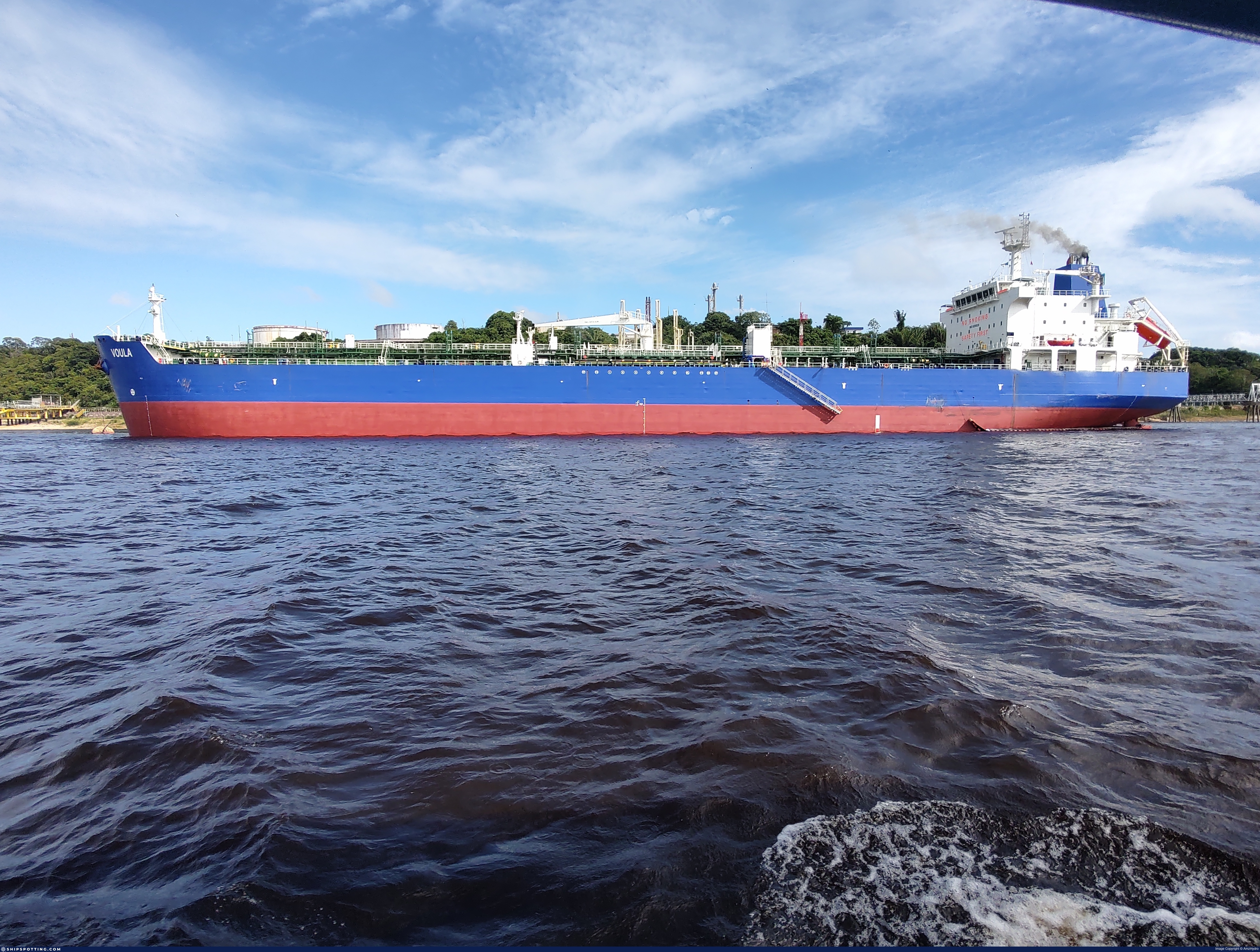
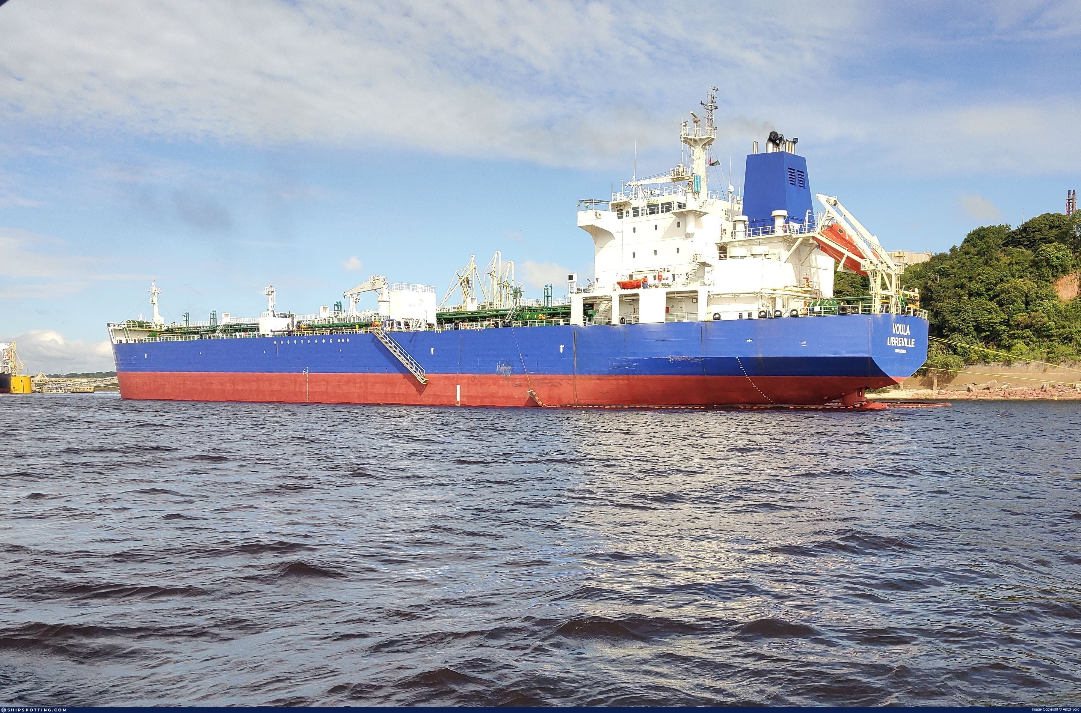
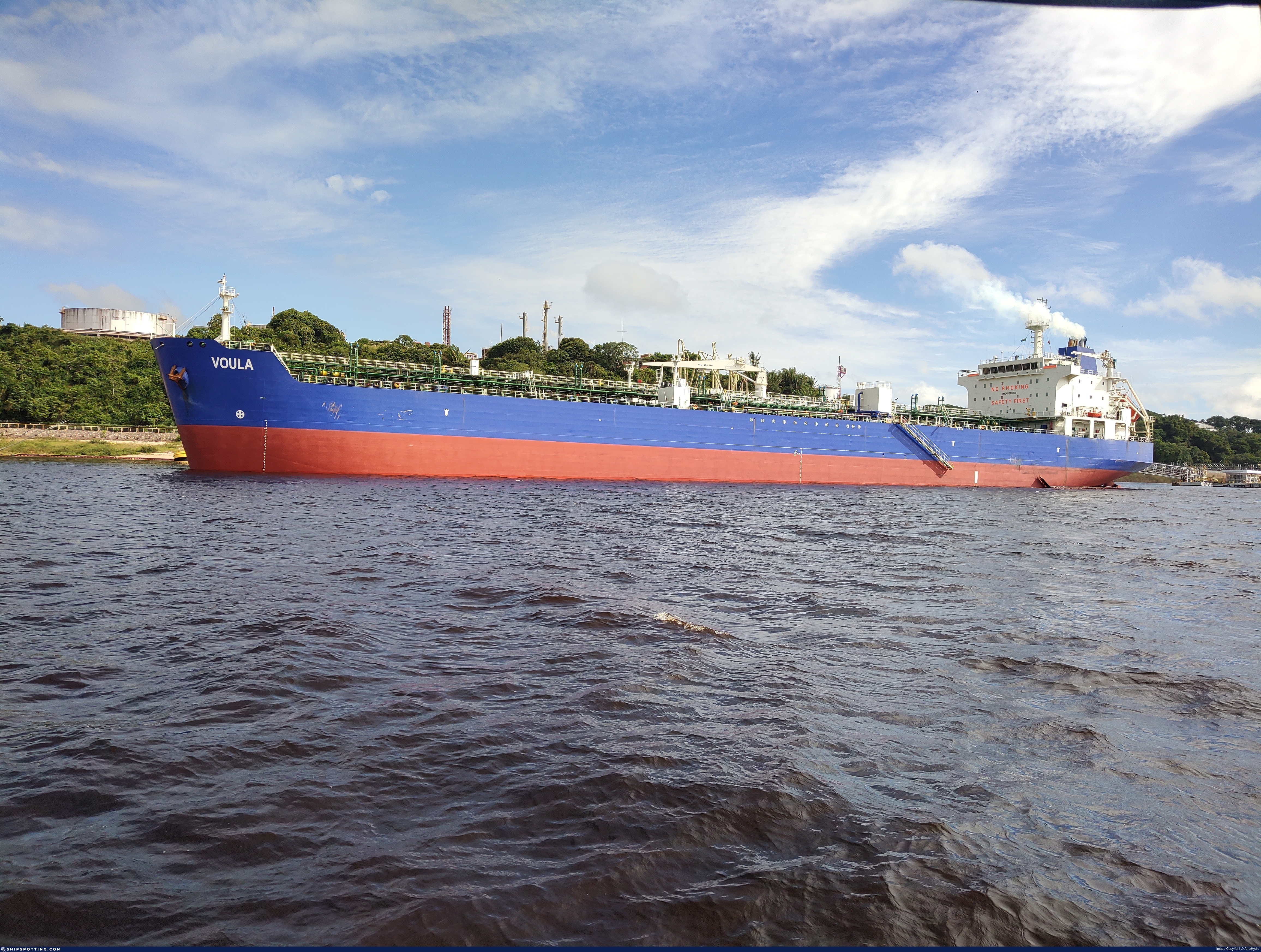
IMO 9290828
Vessel information
Sanctioned by
Company & Ownership
Management & Operations
Port State Control (PSC) Inspections
Survey Renewal & Certificates
| Code | Type | Issuer | Issued | Expires |
|---|---|---|---|---|
| 509 | Document of Compliance | Indian Register of Shipping (150) | 29/11/2023 | 22/11/2028 |
| 512 | Minimum Safe Manning Document | Gabon (GA) | 13/12/2023 | 23/02/2028 |
Programs & Notes
AU vessel designations (DFAT) | SEMA (Canada) — vessel designations | The Russia (Sanctions) (EU Exit) Regulations 2019 | Added in EU Sanctions Package 18 | (Council Decision (CFSP) 2025/1495, Annex XVI to Decision 2014/512/CFSP) | Press Release | Official Journal
DateOfListing: 2025-07-20 || DateDesignated: 2025-05-09 | Shipping sanctions: (see “Other information”) | Shipping sanctions: a specified ship is prohibited from being provided with access to or having its master or pilot cause it to enter a port in the UK, may have its registration on the UK Ship Register terminated, and a master or pilot of a specified ship may be given a port barring direction, a detention direction, and a port entry direction or a movement direction. | IMO 9290828 (“E MEI SHAN”) is involved in activity whose object or effect is to destabilise Ukraine or undermine or threaten the territorial integrity, sovereignty or independence of Ukraine or to obtain a benefit from or support the Government of Russia. Namely, IMO 9290828 is involved in carrying oil or oil products that originated in Russia from Russia to a third country.
Vessel Changes
 🔄 Owner

 🔄 Owner
AIS Events
50 events detected • 2 zones • Last: Jul 16, 2026
- Zone: Western Black Sea Surveillance Zone
- Duration: 1h 3m
- Data Points: 12 AIS positions
- Period: 2026-07-16T09:12:35+00:00 to 2026-07-16T10:16:06+00:00
Show Raw Evidence JSON
{
    "zone_id": "discovered_156",
    "zone_name": "Western Black Sea Surveillance Zone",
    "dwell_minutes": 63.5,
    "points_in_zone": 12,
    "first_point": {
        "ts": "2026-07-16T09:12:35+00:00",
        "lat": 31.7140883000000002311935531906783580780029296875,
        "lon": 32.632125000000002046363078989088535308837890625
    },
    "last_point": {
        "ts": "2026-07-16T10:16:06+00:00",
        "lat": 31.876954999999998818793756072409451007843017578125,
        "lon": 32.7760966999999965310053084976971149444580078125
    }
}- Zone: Western Black Sea Surveillance Zone
- Duration: 2h 15m
- Data Points: 26 AIS positions
- Period: 2026-07-16T08:00:33+00:00 to 2026-07-16T10:16:06+00:00
Show Raw Evidence JSON
{
    "zone_id": "discovered_156",
    "zone_name": "Western Black Sea Surveillance Zone",
    "dwell_minutes": 135.599999999999994315658113919198513031005859375,
    "points_in_zone": 26,
    "first_point": {
        "ts": "2026-07-16T08:00:33+00:00",
        "lat": 31.58731999999999828787622391246259212493896484375,
        "lon": 32.38340670000000187656041816808283329010009765625
    },
    "last_point": {
        "ts": "2026-07-16T10:16:06+00:00",
        "lat": 31.876954999999998818793756072409451007843017578125,
        "lon": 32.7760966999999965310053084976971149444580078125
    }
}- Zone: Western Black Sea Surveillance Zone
- Duration: 2h 57m
- Data Points: 28 AIS positions
- Period: 2026-07-16T07:19:03+00:00 to 2026-07-16T10:16:06+00:00
Show Raw Evidence JSON
{
    "zone_id": "discovered_156",
    "zone_name": "Western Black Sea Surveillance Zone",
    "dwell_minutes": 177.099999999999994315658113919198513031005859375,
    "points_in_zone": 28,
    "first_point": {
        "ts": "2026-07-16T07:19:03+00:00",
        "lat": 31.54157670000000024401742848567664623260498046875,
        "lon": 32.2742099999999965120878187008202075958251953125
    },
    "last_point": {
        "ts": "2026-07-16T10:16:06+00:00",
        "lat": 31.876954999999998818793756072409451007843017578125,
        "lon": 32.7760966999999965310053084976971149444580078125
    }
}- Zone: Western Black Sea Surveillance Zone
- Duration: 6h 25m
- Data Points: 27 AIS positions
- Period: 2026-07-16T03:35:01+00:00 to 2026-07-16T10:00:18+00:00
Show Raw Evidence JSON
{
    "zone_id": "discovered_156",
    "zone_name": "Western Black Sea Surveillance Zone",
    "dwell_minutes": 385.30000000000001136868377216160297393798828125,
    "points_in_zone": 27,
    "first_point": {
        "ts": "2026-07-16T03:35:01+00:00",
        "lat": 31.538868300000000743921191315166652202606201171875,
        "lon": 32.27867169999999674701030016876757144927978515625
    },
    "last_point": {
        "ts": "2026-07-16T10:00:18+00:00",
        "lat": 31.824418300000001380567482556216418743133544921875,
        "lon": 32.75850669999999809078872203826904296875
    }
}- Zone: Black Sea Sanctioned Vessel Monitoring Zone
- Duration: 3h 44m
- Data Points: 2 AIS positions
- Period: 2026-07-16T03:35:01+00:00 to 2026-07-16T07:19:03+00:00
Show Raw Evidence JSON
{
    "zone_id": "discovered_025",
    "zone_name": "Black Sea Sanctioned Vessel Monitoring Zone",
    "dwell_minutes": 224,
    "points_in_zone": 2,
    "first_point": {
        "ts": "2026-07-16T03:35:01+00:00",
        "lat": 31.538868300000000743921191315166652202606201171875,
        "lon": 32.27867169999999674701030016876757144927978515625
    },
    "last_point": {
        "ts": "2026-07-16T07:19:03+00:00",
        "lat": 31.54157670000000024401742848567664623260498046875,
        "lon": 32.2742099999999965120878187008202075958251953125
    }
}- Gap Duration: 4h 53m
- Last Seen: 2026-07-15T22:41:44+00:00 at 31.5366, 32.2719 (Zone: Western Black Sea Surveillance Zone)
- Next Seen: 2026-07-16T03:35:01+00:00 at 31.5389, 32.2787
🛰️ Gap Corroboration
These are snapshots that may corroborate presence during the gap. They do not reconstruct a continuous route.
SAR Imagery (Sentinel-1)
Status: ✗ No SAR coverage
No Sentinel-1 scenes covering corridor and time window
VIIRS Thermal Anomaly
Status: ✗ No detections
No VIIRS thermal/light detections in corridor
Show Raw Evidence JSON
{
    "gap_minutes": 293.30000000000001136868377216160297393798828125,
    "last_seen": {
        "ts": "2026-07-15T22:41:44+00:00",
        "lat": 31.5365733000000005858964868821203708648681640625,
        "lon": 32.2718966999999992140146787278354167938232421875,
        "sog": 3.70000000000000017763568394002504646778106689453125,
        "zone_id": "discovered_156"
    },
    "next_seen": {
        "ts": "2026-07-16T03:35:01+00:00",
        "lat": 31.538868300000000743921191315166652202606201171875,
        "lon": 32.27867169999999674701030016876757144927978515625,
        "zone_ids": [
            "discovered_025",
            "discovered_156"
        ]
    },
    "gap_enrichment": {
        "status": "not_found",
        "corridor": {
            "start": {
                "lat": 31.5365733000000005858964868821203708648681640625,
                "lon": 32.2718966999999992140146787278354167938232421875,
                "ts": "2026-07-15T22:41:44+00:00"
            },
            "end": {
                "lat": 31.538868300000000743921191315166652202606201171875,
                "lon": 32.27867169999999674701030016876757144927978515625,
                "ts": "2026-07-16T03:35:01+00:00"
            },
            "bbox": {
                "min_lat": 31.356393000000000625959728495217859745025634765625,
                "min_lon": 32.0604909999999989622665452770888805389404296875,
                "max_lat": 31.7190480000000007976268534548580646514892578125,
                "max_lon": 32.4900769999999994297468219883739948272705078125
            },
            "buffer_km": 20
        },
        "sar": {
            "status": "not_found",
            "notes": "No Sentinel-1 scenes covering corridor and time window"
        },
        "viirs": {
            "status": "not_found",
            "notes": "No VIIRS thermal\/light detections in corridor"
        },
        "searched_at": "2026-07-16T03:45:04.747936+00:00"
    }
}- Gap Duration: 4h 53m
- Last Seen: 2026-07-15T22:41:44+00:00 at 31.5366, 32.2719 (Zone: Black Sea Sanctioned Vessel Monitoring Zone)
- Next Seen: 2026-07-16T03:35:01+00:00 at 31.5389, 32.2787
🛰️ Gap Corroboration
These are snapshots that may corroborate presence during the gap. They do not reconstruct a continuous route.
SAR Imagery (Sentinel-1)
Status: ✗ No SAR coverage
No Sentinel-1 scenes covering corridor and time window
VIIRS Thermal Anomaly
Status: ✗ No detections
No VIIRS thermal/light detections in corridor
Show Raw Evidence JSON
{
    "gap_minutes": 293.30000000000001136868377216160297393798828125,
    "last_seen": {
        "ts": "2026-07-15T22:41:44+00:00",
        "lat": 31.5365733000000005858964868821203708648681640625,
        "lon": 32.2718966999999992140146787278354167938232421875,
        "sog": 3.70000000000000017763568394002504646778106689453125,
        "zone_id": "discovered_025"
    },
    "next_seen": {
        "ts": "2026-07-16T03:35:01+00:00",
        "lat": 31.538868300000000743921191315166652202606201171875,
        "lon": 32.27867169999999674701030016876757144927978515625,
        "zone_ids": [
            "discovered_025",
            "discovered_156"
        ]
    },
    "gap_enrichment": {
        "status": "not_found",
        "corridor": {
            "start": {
                "lat": 31.5365733000000005858964868821203708648681640625,
                "lon": 32.2718966999999992140146787278354167938232421875,
                "ts": "2026-07-15T22:41:44+00:00"
            },
            "end": {
                "lat": 31.538868300000000743921191315166652202606201171875,
                "lon": 32.27867169999999674701030016876757144927978515625,
                "ts": "2026-07-16T03:35:01+00:00"
            },
            "bbox": {
                "min_lat": 31.356393000000000625959728495217859745025634765625,
                "min_lon": 32.0604909999999989622665452770888805389404296875,
                "max_lat": 31.7190480000000007976268534548580646514892578125,
                "max_lon": 32.4900769999999994297468219883739948272705078125
            },
            "buffer_km": 20
        },
        "sar": {
            "status": "not_found",
            "notes": "No Sentinel-1 scenes covering corridor and time window"
        },
        "viirs": {
            "status": "not_found",
            "notes": "No VIIRS thermal\/light detections in corridor"
        },
        "searched_at": "2026-07-16T03:45:02.118299+00:00"
    }
}- Zone: Western Black Sea Surveillance Zone
- Duration: 4h 56m
- Data Points: 3 AIS positions
- Period: 2026-07-15T22:38:35+00:00 to 2026-07-16T03:35:01+00:00
Show Raw Evidence JSON
{
    "zone_id": "discovered_156",
    "zone_name": "Western Black Sea Surveillance Zone",
    "dwell_minutes": 296.3999999999999772626324556767940521240234375,
    "points_in_zone": 3,
    "first_point": {
        "ts": "2026-07-15T22:38:35+00:00",
        "lat": 31.534825000000001438138497178442776203155517578125,
        "lon": 32.2682683000000025685949367471039295196533203125
    },
    "last_point": {
        "ts": "2026-07-16T03:35:01+00:00",
        "lat": 31.538868300000000743921191315166652202606201171875,
        "lon": 32.27867169999999674701030016876757144927978515625
    }
}- Zone: Black Sea Sanctioned Vessel Monitoring Zone
- Duration: 5h 14m
- Data Points: 9 AIS positions
- Period: 2026-07-15T22:20:23+00:00 to 2026-07-16T03:35:01+00:00
Show Raw Evidence JSON
{
    "zone_id": "discovered_025",
    "zone_name": "Black Sea Sanctioned Vessel Monitoring Zone",
    "dwell_minutes": 314.6000000000000227373675443232059478759765625,
    "points_in_zone": 9,
    "first_point": {
        "ts": "2026-07-15T22:20:23+00:00",
        "lat": 31.5320032999999995126927387900650501251220703125,
        "lon": 32.24288829999999705933078075759112834930419921875
    },
    "last_point": {
        "ts": "2026-07-16T03:35:01+00:00",
        "lat": 31.538868300000000743921191315166652202606201171875,
        "lon": 32.27867169999999674701030016876757144927978515625
    }
}- Zone: Black Sea Sanctioned Vessel Monitoring Zone
- Duration: 5h 37m
- Data Points: 10 AIS positions
- Period: 2026-07-15T21:57:14+00:00 to 2026-07-16T03:35:01+00:00
Show Raw Evidence JSON
{
    "zone_id": "discovered_025",
    "zone_name": "Black Sea Sanctioned Vessel Monitoring Zone",
    "dwell_minutes": 337.80000000000001136868377216160297393798828125,
    "points_in_zone": 10,
    "first_point": {
        "ts": "2026-07-15T21:57:14+00:00",
        "lat": 31.523603300000001325997800449840724468231201171875,
        "lon": 32.2568399999999968486008583568036556243896484375
    },
    "last_point": {
        "ts": "2026-07-16T03:35:01+00:00",
        "lat": 31.538868300000000743921191315166652202606201171875,
        "lon": 32.27867169999999674701030016876757144927978515625
    }
}- Zone: Black Sea Sanctioned Vessel Monitoring Zone
- Duration: 4h 39m
- Data Points: 14 AIS positions
- Period: 2026-07-15T18:02:35+00:00 to 2026-07-15T22:41:44+00:00
Show Raw Evidence JSON
{
    "zone_id": "discovered_025",
    "zone_name": "Black Sea Sanctioned Vessel Monitoring Zone",
    "dwell_minutes": 279.1000000000000227373675443232059478759765625,
    "points_in_zone": 14,
    "first_point": {
        "ts": "2026-07-15T18:02:35+00:00",
        "lat": 31.523353300000000132286004372872412204742431640625,
        "lon": 32.2566599999999965575625537894666194915771484375
    },
    "last_point": {
        "ts": "2026-07-15T22:41:44+00:00",
        "lat": 31.5365733000000005858964868821203708648681640625,
        "lon": 32.2718966999999992140146787278354167938232421875
    }
}- Duration: 4h 56m
- Radius: 34 meters
- Data Points: 16 AIS positions
- Centroid: 31.5233, 32.2567
- Zone: Black Sea Sanctioned Vessel Monitoring Zone
Show Raw Evidence JSON
{
    "radius_m": 33.7999999999999971578290569595992565155029296875,
    "duration_minutes": 296,
    "points": 16,
    "centroid": {
        "lat": 31.523340937499998659632183262147009372711181640625,
        "lon": 32.2566592687499991143340594135224819183349609375
    },
    "bbox": {
        "min_lat": 31.523193299999999084093360579572618007659912109375,
        "min_lon": 32.256491699999997990744304843246936798095703125,
        "max_lat": 31.523603300000001325997800449840724468231201171875,
        "max_lon": 32.2568399999999968486008583568036556243896484375
    },
    "zone_id": "discovered_025"
}- Zone: Black Sea Sanctioned Vessel Monitoring Zone
- Duration: 5h 40m
- Data Points: 24 AIS positions
- Period: 2026-07-15T17:01:14+00:00 to 2026-07-15T22:41:44+00:00
Show Raw Evidence JSON
{
    "zone_id": "discovered_025",
    "zone_name": "Black Sea Sanctioned Vessel Monitoring Zone",
    "dwell_minutes": 340.5,
    "points_in_zone": 24,
    "first_point": {
        "ts": "2026-07-15T17:01:14+00:00",
        "lat": 31.523236700000001775379132595844566822052001953125,
        "lon": 32.2566666999999966947143548168241977691650390625
    },
    "last_point": {
        "ts": "2026-07-15T22:41:44+00:00",
        "lat": 31.5365733000000005858964868821203708648681640625,
        "lon": 32.2718966999999992140146787278354167938232421875
    }
}- Minimum Distance: 14 meters
- Average Distance: 39 meters
- Duration: 1h 25m
- Period: 2026-07-15T16:02:16+00:00 to 2026-07-15T17:27:26+00:00
- Vessel A Avg Speed: 0.0 knots
- Vessel B Avg Speed: 0.1 knots
- Zone: Black Sea Sanctioned Vessel Monitoring Zone
Confidence Analysis
High-confidence STS candidate. Two tankers (SAVITRI and DORIN) maintained close proximity (min 14m, avg 39m) for 85 minutes. Both vessels were slow-moving (avg speeds 0.0 and 0.1 knots). The stable separation distance suggests deliberate parallel positioning typical of cargo transfer. Event occurred in Black Sea Sanctioned Vessel Monitoring Zone, a known STS activity area.
View scoring breakdown
| Factor | Score | Detail |
|---|---|---|
| Distance Tightness | 25/25 | Min distance 14m, avg 39m |
| Duration | 15/25 | Duration 85 minutes |
| Speed Stability | 20/20 | both nearly stationary; very stable speeds |
| Distance Consistency | 15/15 | Distance variance ±12m |
| Isolation | 5/10 | Isolation data not available |
| Context | 5/5 | In monitored zone: Black Sea Sanctioned Vessel Monitoring Zone |
🛰️ Satellite Corroboration
No satellite imagery for this time/location
No Sentinel-1 scenes covering AOI and time window
Show Raw Evidence JSON
{
    "vessel_a": {
        "mmsi": 667002039,
        "imo": 9289752,
        "name": "SAVITRI",
        "flag": "SIERRA LEONE"
    },
    "vessel_b": {
        "mmsi": 613414203,
        "imo": 9290828,
        "name": "DORIN",
        "flag": "CAMEROON"
    },
    "min_distance_m": 13.5,
    "avg_distance_m": 38.60000000000000142108547152020037174224853515625,
    "distance_consistency_m": 11.699999999999999289457264239899814128875732421875,
    "duration_minutes": 85.2000000000000028421709430404007434844970703125,
    "overlap_duration_s": 5110,
    "speed_a_avg": 0,
    "speed_a_std": 0,
    "speed_b_avg": 0.11000000000000000055511151231257827021181583404541015625,
    "speed_b_std": 0.13000000000000000444089209850062616169452667236328125,
    "speed_summary": {
        "vessel_a": {
            "avg_sog": 0,
            "max_sog": 0
        },
        "vessel_b": {
            "avg_sog": 0.11000000000000000055511151231257827021181583404541015625,
            "max_sog": 0.40000000000000002220446049250313080847263336181640625
        }
    },
    "time_window": {
        "start": "2026-07-15T16:02:16+00:00",
        "end": "2026-07-15T17:27:26+00:00"
    },
    "points_count": {
        "vessel_a": 19,
        "vessel_b": 19
    },
    "zone_id": "discovered_025",
    "zone_name": "Black Sea Sanctioned Vessel Monitoring Zone",
    "score": {
        "value": 85,
        "components": {
            "distance_tightness": {
                "score": 25,
                "max": 25,
                "detail": "Min distance 14m, avg 39m"
            },
            "duration": {
                "score": 15,
                "max": 25,
                "detail": "Duration 85 minutes"
            },
            "speed_stability": {
                "score": 20,
                "max": 20,
                "detail": "both nearly stationary; very stable speeds"
            },
            "distance_consistency": {
                "score": 15,
                "max": 15,
                "detail": "Distance variance \u00b112m"
            },
            "isolation": {
                "score": 5,
                "max": 10,
                "detail": "Isolation data not available"
            },
            "context": {
                "score": 5,
                "max": 5,
                "detail": "In monitored zone: Black Sea Sanctioned Vessel Monitoring Zone"
            }
        },
        "summary": "High-confidence STS candidate. Two tankers (SAVITRI and DORIN) maintained close proximity (min 14m, avg 39m) for 85 minutes. Both vessels were slow-moving (avg speeds 0.0 and 0.1 knots). The stable separation distance suggests deliberate parallel positioning typical of cargo transfer. Event occurred in Black Sea Sanctioned Vessel Monitoring Zone, a known STS activity area."
    },
    "sar": {
        "status": "not_found",
        "centroid": {
            "lat": 31.523040800000000416503098676912486553192138671875,
            "lon": 32.25640409999999747014953754842281341552734375
        },
        "time_window": {
            "start_ts": "2026-07-15T16:02:16+00:00",
            "end_ts": "2026-07-15T17:27:26+00:00"
        },
        "searched_at": "2026-07-15T22:30:11.861598+00:00",
        "notes": "No Sentinel-1 scenes covering AOI and time window"
    }
}- Duration: 5h 56m
- Radius: 46 meters
- Data Points: 29 AIS positions
- Centroid: 31.5232, 32.2566
- Zone: Black Sea Sanctioned Vessel Monitoring Zone
Show Raw Evidence JSON
{
    "radius_m": 46.2000000000000028421709430404007434844970703125,
    "duration_minutes": 356.30000000000001136868377216160297393798828125,
    "points": 29,
    "centroid": {
        "lat": 31.523243741379314286632506991736590862274169921875,
        "lon": 32.256594134482753588599734939634799957275390625
    },
    "bbox": {
        "min_lat": 31.523005000000001274429450859315693378448486328125,
        "min_lon": 32.2563999999999992951416061259806156158447265625,
        "max_lat": 31.523603300000001325997800449840724468231201171875,
        "max_lon": 32.2568399999999968486008583568036556243896484375
    },
    "zone_id": "discovered_025"
}- Zone: Black Sea Sanctioned Vessel Monitoring Zone
- Duration: 6h 28m
- Data Points: 35 AIS positions
- Period: 2026-07-15T16:13:23+00:00 to 2026-07-15T22:41:44+00:00
Show Raw Evidence JSON
{
    "zone_id": "discovered_025",
    "zone_name": "Black Sea Sanctioned Vessel Monitoring Zone",
    "dwell_minutes": 388.3999999999999772626324556767940521240234375,
    "points_in_zone": 35,
    "first_point": {
        "ts": "2026-07-15T16:13:23+00:00",
        "lat": 31.52315829999999863275661482475697994232177734375,
        "lon": 32.256585000000001173248165287077426910400390625
    },
    "last_point": {
        "ts": "2026-07-15T22:41:44+00:00",
        "lat": 31.5365733000000005858964868821203708648681640625,
        "lon": 32.2718966999999992140146787278354167938232421875
    }
}- Minimum Distance: 14 meters
- Average Distance: 39 meters
- Duration: 2h 3m
- Period: 2026-07-15T15:23:36+00:00 to 2026-07-15T17:27:26+00:00
- Vessel A Avg Speed: 0.0 knots
- Vessel B Avg Speed: 0.1 knots
- Zone: Black Sea Sanctioned Vessel Monitoring Zone
Confidence Analysis
High-confidence STS candidate. Two tankers (SAVITRI and DORIN) maintained close proximity (min 14m, avg 39m) for 124 minutes. Both vessels were slow-moving (avg speeds 0.0 and 0.1 knots). The stable separation distance suggests deliberate parallel positioning typical of cargo transfer. Event occurred in Black Sea Sanctioned Vessel Monitoring Zone, a known STS activity area.
View scoring breakdown
| Factor | Score | Detail |
|---|---|---|
| Distance Tightness | 25/25 | Min distance 14m, avg 39m |
| Duration | 25/25 | Duration 124 minutes |
| Speed Stability | 20/20 | both nearly stationary; very stable speeds |
| Distance Consistency | 15/15 | Distance variance ±10m |
| Isolation | 5/10 | Isolation data not available |
| Context | 5/5 | In monitored zone: Black Sea Sanctioned Vessel Monitoring Zone |
Show Raw Evidence JSON
{
    "vessel_a": {
        "mmsi": 667002039,
        "imo": 9289752,
        "name": "SAVITRI",
        "flag": "SIERRA LEONE"
    },
    "vessel_b": {
        "mmsi": 613414203,
        "imo": 9290828,
        "name": "DORIN",
        "flag": "CAMEROON"
    },
    "min_distance_m": 13.5,
    "avg_distance_m": 38.7999999999999971578290569595992565155029296875,
    "distance_consistency_m": 10.199999999999999289457264239899814128875732421875,
    "duration_minutes": 123.7999999999999971578290569595992565155029296875,
    "overlap_duration_s": 7430,
    "speed_a_avg": 0,
    "speed_a_std": 0,
    "speed_b_avg": 0.11999999999999999555910790149937383830547332763671875,
    "speed_b_std": 0.13000000000000000444089209850062616169452667236328125,
    "speed_summary": {
        "vessel_a": {
            "avg_sog": 0,
            "max_sog": 0
        },
        "vessel_b": {
            "avg_sog": 0.11999999999999999555910790149937383830547332763671875,
            "max_sog": 0.40000000000000002220446049250313080847263336181640625
        }
    },
    "time_window": {
        "start": "2026-07-15T15:23:36+00:00",
        "end": "2026-07-15T17:27:26+00:00"
    },
    "points_count": {
        "vessel_a": 28,
        "vessel_b": 28
    },
    "zone_id": "discovered_025",
    "zone_name": "Black Sea Sanctioned Vessel Monitoring Zone",
    "score": {
        "value": 95,
        "components": {
            "distance_tightness": {
                "score": 25,
                "max": 25,
                "detail": "Min distance 14m, avg 39m"
            },
            "duration": {
                "score": 25,
                "max": 25,
                "detail": "Duration 124 minutes"
            },
            "speed_stability": {
                "score": 20,
                "max": 20,
                "detail": "both nearly stationary; very stable speeds"
            },
            "distance_consistency": {
                "score": 15,
                "max": 15,
                "detail": "Distance variance \u00b110m"
            },
            "isolation": {
                "score": 5,
                "max": 10,
                "detail": "Isolation data not available"
            },
            "context": {
                "score": 5,
                "max": 5,
                "detail": "In monitored zone: Black Sea Sanctioned Vessel Monitoring Zone"
            }
        },
        "summary": "High-confidence STS candidate. Two tankers (SAVITRI and DORIN) maintained close proximity (min 14m, avg 39m) for 124 minutes. Both vessels were slow-moving (avg speeds 0.0 and 0.1 knots). The stable separation distance suggests deliberate parallel positioning typical of cargo transfer. Event occurred in Black Sea Sanctioned Vessel Monitoring Zone, a known STS activity area."
    }
}- Duration: 6h 35m
- Radius: 48 meters
- Data Points: 38 AIS positions
- Centroid: 31.5232, 32.2566
- Zone: Black Sea Sanctioned Vessel Monitoring Zone
Show Raw Evidence JSON
{
    "radius_m": 48.39999999999999857891452847979962825775146484375,
    "duration_minutes": 395,
    "points": 38,
    "centroid": {
        "lat": 31.5232327657894728645260329358279705047607421875,
        "lon": 32.25657091842104051693240762688219547271728515625
    },
    "bbox": {
        "min_lat": 31.523005000000001274429450859315693378448486328125,
        "min_lon": 32.25634500000000315367287839762866497039794921875,
        "max_lat": 31.523603300000001325997800449840724468231201171875,
        "max_lon": 32.2568399999999968486008583568036556243896484375
    },
    "zone_id": "discovered_025"
}- Zone: Black Sea Sanctioned Vessel Monitoring Zone
- Duration: 6h 36m
- Data Points: 36 AIS positions
- Period: 2026-07-15T15:51:54+00:00 to 2026-07-15T22:28:33+00:00
Show Raw Evidence JSON
{
    "zone_id": "discovered_025",
    "zone_name": "Black Sea Sanctioned Vessel Monitoring Zone",
    "dwell_minutes": 396.6000000000000227373675443232059478759765625,
    "points_in_zone": 36,
    "first_point": {
        "ts": "2026-07-15T15:51:54+00:00",
        "lat": 31.52317000000000035697667044587433338165283203125,
        "lon": 32.25644170000000343634383170865476131439208984375
    },
    "last_point": {
        "ts": "2026-07-15T22:28:33+00:00",
        "lat": 31.538385000000001667785909376107156276702880859375,
        "lon": 32.2498233000000027459464035928249359130859375
    }
}- Minimum Distance: 14 meters
- Average Distance: 41 meters
- Duration: 2h 29m
- Period: 2026-07-15T14:56:24+00:00 to 2026-07-15T17:26:13+00:00
- Vessel A Avg Speed: 0.1 knots
- Vessel B Avg Speed: 0.0 knots
- Zone: Black Sea Sanctioned Vessel Monitoring Zone
Confidence Analysis
High-confidence STS candidate. Two tankers (DORIN and SAVITRI) maintained close proximity (min 14m, avg 41m) for 150 minutes. Both vessels were slow-moving (avg speeds 0.1 and 0.0 knots). The stable separation distance suggests deliberate parallel positioning typical of cargo transfer. Event occurred in Black Sea Sanctioned Vessel Monitoring Zone, a known STS activity area.
View scoring breakdown
| Factor | Score | Detail |
|---|---|---|
| Distance Tightness | 25/25 | Min distance 14m, avg 41m |
| Duration | 25/25 | Duration 150 minutes |
| Speed Stability | 20/20 | both nearly stationary; very stable speeds |
| Distance Consistency | 15/15 | Distance variance ±9m |
| Isolation | 5/10 | Isolation data not available |
| Context | 5/5 | In monitored zone: Black Sea Sanctioned Vessel Monitoring Zone |
Show Raw Evidence JSON
{
    "vessel_a": {
        "mmsi": 613414203,
        "imo": 9290828,
        "name": "DORIN",
        "flag": "CAMEROON"
    },
    "vessel_b": {
        "mmsi": 667002039,
        "imo": 9289752,
        "name": "SAVITRI",
        "flag": "SIERRA LEONE"
    },
    "min_distance_m": 13.5,
    "avg_distance_m": 41.10000000000000142108547152020037174224853515625,
    "distance_consistency_m": 8.5999999999999996447286321199499070644378662109375,
    "duration_minutes": 149.80000000000001136868377216160297393798828125,
    "overlap_duration_s": 8989,
    "speed_a_avg": 0.1000000000000000055511151231257827021181583404541015625,
    "speed_a_std": 0.11000000000000000055511151231257827021181583404541015625,
    "speed_b_avg": 0,
    "speed_b_std": 0,
    "speed_summary": {
        "vessel_a": {
            "avg_sog": 0.1000000000000000055511151231257827021181583404541015625,
            "max_sog": 0.40000000000000002220446049250313080847263336181640625
        },
        "vessel_b": {
            "avg_sog": 0,
            "max_sog": 0
        }
    },
    "time_window": {
        "start": "2026-07-15T14:56:24+00:00",
        "end": "2026-07-15T17:26:13+00:00"
    },
    "points_count": {
        "vessel_a": 35,
        "vessel_b": 35
    },
    "zone_id": "discovered_025",
    "zone_name": "Black Sea Sanctioned Vessel Monitoring Zone",
    "score": {
        "value": 95,
        "components": {
            "distance_tightness": {
                "score": 25,
                "max": 25,
                "detail": "Min distance 14m, avg 41m"
            },
            "duration": {
                "score": 25,
                "max": 25,
                "detail": "Duration 150 minutes"
            },
            "speed_stability": {
                "score": 20,
                "max": 20,
                "detail": "both nearly stationary; very stable speeds"
            },
            "distance_consistency": {
                "score": 15,
                "max": 15,
                "detail": "Distance variance \u00b19m"
            },
            "isolation": {
                "score": 5,
                "max": 10,
                "detail": "Isolation data not available"
            },
            "context": {
                "score": 5,
                "max": 5,
                "detail": "In monitored zone: Black Sea Sanctioned Vessel Monitoring Zone"
            }
        },
        "summary": "High-confidence STS candidate. Two tankers (DORIN and SAVITRI) maintained close proximity (min 14m, avg 41m) for 150 minutes. Both vessels were slow-moving (avg speeds 0.1 and 0.0 knots). The stable separation distance suggests deliberate parallel positioning typical of cargo transfer. Event occurred in Black Sea Sanctioned Vessel Monitoring Zone, a known STS activity area."
    }
}- Duration: 4h 43m
- Radius: 33 meters
- Data Points: 54 AIS positions
- Centroid: 31.5232, 32.2566
- Zone: Black Sea Sanctioned Vessel Monitoring Zone
Show Raw Evidence JSON
{
    "radius_m": 32.7000000000000028421709430404007434844970703125,
    "duration_minutes": 283.8999999999999772626324556767940521240234375,
    "points": 54,
    "centroid": {
        "lat": 31.5232043240740722467307932674884796142578125,
        "lon": 32.25655018148147945566961425356566905975341796875
    },
    "bbox": {
        "min_lat": 31.523005000000001274429450859315693378448486328125,
        "min_lon": 32.2562599999999974897946231067180633544921875,
        "max_lat": 31.52343499999999920646587270312011241912841796875,
        "max_lon": 32.2568150000000031241143005900084972381591796875
    },
    "zone_id": "discovered_025"
}- Zone: Black Sea Sanctioned Vessel Monitoring Zone
- Duration: 4h 43m
- Data Points: 54 AIS positions
- Period: 2026-07-15T14:02:25+00:00 to 2026-07-15T18:46:18+00:00
Show Raw Evidence JSON
{
    "zone_id": "discovered_025",
    "zone_name": "Black Sea Sanctioned Vessel Monitoring Zone",
    "dwell_minutes": 283.8999999999999772626324556767940521240234375,
    "points_in_zone": 54,
    "first_point": {
        "ts": "2026-07-15T14:02:25+00:00",
        "lat": 31.523146700000001629859980312176048755645751953125,
        "lon": 32.25651169999999723358996561728417873382568359375
    },
    "last_point": {
        "ts": "2026-07-15T18:46:18+00:00",
        "lat": 31.52339500000000072077455115504562854766845703125,
        "lon": 32.256581699999998136263457126915454864501953125
    }
}- Minimum Distance: 14 meters
- Average Distance: 39 meters
- Duration: 3h 40m
- Period: 2026-07-15T13:46:58+00:00 to 2026-07-15T17:27:26+00:00
- Vessel A Avg Speed: 0.0 knots
- Vessel B Avg Speed: 0.1 knots
- Zone: Black Sea Sanctioned Vessel Monitoring Zone
Confidence Analysis
High-confidence STS candidate. Two tankers (SAVITRI and DORIN) maintained close proximity (min 14m, avg 39m) for 220 minutes. Both vessels were slow-moving (avg speeds 0.0 and 0.1 knots). The stable separation distance suggests deliberate parallel positioning typical of cargo transfer. Event occurred in Black Sea Sanctioned Vessel Monitoring Zone, a known STS activity area.
View scoring breakdown
| Factor | Score | Detail |
|---|---|---|
| Distance Tightness | 25/25 | Min distance 14m, avg 39m |
| Duration | 25/25 | Duration 220 minutes |
| Speed Stability | 20/20 | both nearly stationary; very stable speeds |
| Distance Consistency | 15/15 | Distance variance ±9m |
| Isolation | 5/10 | Isolation data not available |
| Context | 5/5 | In monitored zone: Black Sea Sanctioned Vessel Monitoring Zone |
Show Raw Evidence JSON
{
    "vessel_a": {
        "mmsi": 667002039,
        "imo": 9289752,
        "name": "SAVITRI",
        "flag": "SIERRA LEONE"
    },
    "vessel_b": {
        "mmsi": 613414203,
        "imo": 9290828,
        "name": "DORIN",
        "flag": "CAMEROON"
    },
    "min_distance_m": 13.5,
    "avg_distance_m": 38.7999999999999971578290569595992565155029296875,
    "distance_consistency_m": 9.300000000000000710542735760100185871124267578125,
    "duration_minutes": 220.5,
    "overlap_duration_s": 13228,
    "speed_a_avg": 0,
    "speed_a_std": 0,
    "speed_b_avg": 0.11000000000000000055511151231257827021181583404541015625,
    "speed_b_std": 0.13000000000000000444089209850062616169452667236328125,
    "speed_summary": {
        "vessel_a": {
            "avg_sog": 0,
            "max_sog": 0
        },
        "vessel_b": {
            "avg_sog": 0.11000000000000000055511151231257827021181583404541015625,
            "max_sog": 0.40000000000000002220446049250313080847263336181640625
        }
    },
    "time_window": {
        "start": "2026-07-15T13:46:58+00:00",
        "end": "2026-07-15T17:27:26+00:00"
    },
    "points_count": {
        "vessel_a": 34,
        "vessel_b": 34
    },
    "zone_id": "discovered_025",
    "zone_name": "Black Sea Sanctioned Vessel Monitoring Zone",
    "score": {
        "value": 95,
        "components": {
            "distance_tightness": {
                "score": 25,
                "max": 25,
                "detail": "Min distance 14m, avg 39m"
            },
            "duration": {
                "score": 25,
                "max": 25,
                "detail": "Duration 220 minutes"
            },
            "speed_stability": {
                "score": 20,
                "max": 20,
                "detail": "both nearly stationary; very stable speeds"
            },
            "distance_consistency": {
                "score": 15,
                "max": 15,
                "detail": "Distance variance \u00b19m"
            },
            "isolation": {
                "score": 5,
                "max": 10,
                "detail": "Isolation data not available"
            },
            "context": {
                "score": 5,
                "max": 5,
                "detail": "In monitored zone: Black Sea Sanctioned Vessel Monitoring Zone"
            }
        },
        "summary": "High-confidence STS candidate. Two tankers (SAVITRI and DORIN) maintained close proximity (min 14m, avg 39m) for 220 minutes. Both vessels were slow-moving (avg speeds 0.0 and 0.1 knots). The stable separation distance suggests deliberate parallel positioning typical of cargo transfer. Event occurred in Black Sea Sanctioned Vessel Monitoring Zone, a known STS activity area."
    }
}- Duration: 5h 44m
- Radius: 33 meters
- Data Points: 67 AIS positions
- Centroid: 31.5232, 32.2566
- Zone: Black Sea Sanctioned Vessel Monitoring Zone
Show Raw Evidence JSON
{
    "radius_m": 32.60000000000000142108547152020037174224853515625,
    "duration_minutes": 344.5,
    "points": 67,
    "centroid": {
        "lat": 31.52320015074627690410125069320201873779296875,
        "lon": 32.25655698656715486549728666432201862335205078125
    },
    "bbox": {
        "min_lat": 31.523005000000001274429450859315693378448486328125,
        "min_lon": 32.2562599999999974897946231067180633544921875,
        "max_lat": 31.52343499999999920646587270312011241912841796875,
        "max_lon": 32.2568150000000031241143005900084972381591796875
    },
    "zone_id": "discovered_025"
}- Zone: Black Sea Sanctioned Vessel Monitoring Zone
- Duration: 5h 44m
- Data Points: 67 AIS positions
- Period: 2026-07-15T13:01:47+00:00 to 2026-07-15T18:46:18+00:00
Show Raw Evidence JSON
{
    "zone_id": "discovered_025",
    "zone_name": "Black Sea Sanctioned Vessel Monitoring Zone",
    "dwell_minutes": 344.5,
    "points_in_zone": 67,
    "first_point": {
        "ts": "2026-07-15T13:01:47+00:00",
        "lat": 31.5231449999999995270627550780773162841796875,
        "lon": 32.25663999999999731471689301542937755584716796875
    },
    "last_point": {
        "ts": "2026-07-15T18:46:18+00:00",
        "lat": 31.52339500000000072077455115504562854766845703125,
        "lon": 32.256581699999998136263457126915454864501953125
    }
}- Minimum Distance: 35 meters
- Average Distance: 42 meters
- Duration: 1h 38m
- Period: 2026-07-15T12:24:28+00:00 to 2026-07-15T14:02:25+00:00
- Vessel A Avg Speed: 0.1 knots
- Vessel B Avg Speed: 0.0 knots
- Zone: Black Sea Sanctioned Vessel Monitoring Zone
Confidence Analysis
High-confidence STS candidate. Two tankers (DORIN and SAVITRI) maintained close proximity (min 35m, avg 42m) for 98 minutes. Both vessels were slow-moving (avg speeds 0.1 and 0.0 knots). The stable separation distance suggests deliberate parallel positioning typical of cargo transfer. Event occurred in Black Sea Sanctioned Vessel Monitoring Zone, a known STS activity area.
View scoring breakdown
| Factor | Score | Detail |
|---|---|---|
| Distance Tightness | 25/25 | Min distance 35m, avg 42m |
| Duration | 20/25 | Duration 98 minutes |
| Speed Stability | 20/20 | both nearly stationary; very stable speeds |
| Distance Consistency | 15/15 | Distance variance ±5m |
| Isolation | 5/10 | Isolation data not available |
| Context | 5/5 | In monitored zone: Black Sea Sanctioned Vessel Monitoring Zone |
Show Raw Evidence JSON
{
    "vessel_a": {
        "mmsi": 613414203,
        "imo": 9290828,
        "name": "DORIN",
        "flag": "CAMEROON"
    },
    "vessel_b": {
        "mmsi": 667002039,
        "imo": 9289752,
        "name": "SAVITRI",
        "flag": "SIERRA LEONE"
    },
    "min_distance_m": 35.10000000000000142108547152020037174224853515625,
    "avg_distance_m": 42.39999999999999857891452847979962825775146484375,
    "distance_consistency_m": 4.79999999999999982236431605997495353221893310546875,
    "duration_minutes": 98,
    "overlap_duration_s": 5877,
    "speed_a_avg": 0.0899999999999999966693309261245303787291049957275390625,
    "speed_a_std": 0.070000000000000006661338147750939242541790008544921875,
    "speed_b_avg": 0.0200000000000000004163336342344337026588618755340576171875,
    "speed_b_std": 0.040000000000000000832667268468867405317723751068115234375,
    "speed_summary": {
        "vessel_a": {
            "avg_sog": 0.0899999999999999966693309261245303787291049957275390625,
            "max_sog": 0.299999999999999988897769753748434595763683319091796875
        },
        "vessel_b": {
            "avg_sog": 0.0200000000000000004163336342344337026588618755340576171875,
            "max_sog": 0.1000000000000000055511151231257827021181583404541015625
        }
    },
    "time_window": {
        "start": "2026-07-15T12:24:28+00:00",
        "end": "2026-07-15T14:02:25+00:00"
    },
    "points_count": {
        "vessel_a": 25,
        "vessel_b": 25
    },
    "zone_id": "discovered_025",
    "zone_name": "Black Sea Sanctioned Vessel Monitoring Zone",
    "score": {
        "value": 90,
        "components": {
            "distance_tightness": {
                "score": 25,
                "max": 25,
                "detail": "Min distance 35m, avg 42m"
            },
            "duration": {
                "score": 20,
                "max": 25,
                "detail": "Duration 98 minutes"
            },
            "speed_stability": {
                "score": 20,
                "max": 20,
                "detail": "both nearly stationary; very stable speeds"
            },
            "distance_consistency": {
                "score": 15,
                "max": 15,
                "detail": "Distance variance \u00b15m"
            },
            "isolation": {
                "score": 5,
                "max": 10,
                "detail": "Isolation data not available"
            },
            "context": {
                "score": 5,
                "max": 5,
                "detail": "In monitored zone: Black Sea Sanctioned Vessel Monitoring Zone"
            }
        },
        "summary": "High-confidence STS candidate. Two tankers (DORIN and SAVITRI) maintained close proximity (min 35m, avg 42m) for 98 minutes. Both vessels were slow-moving (avg speeds 0.1 and 0.0 knots). The stable separation distance suggests deliberate parallel positioning typical of cargo transfer. Event occurred in Black Sea Sanctioned Vessel Monitoring Zone, a known STS activity area."
    }
}- Duration: 6h 35m
- Radius: 31 meters
- Data Points: 81 AIS positions
- Centroid: 31.5232, 32.2566
- Zone: Black Sea Sanctioned Vessel Monitoring Zone
Show Raw Evidence JSON
{
    "radius_m": 31,
    "duration_minutes": 395,
    "points": 81,
    "centroid": {
        "lat": 31.52320866419751865805665147490799427032470703125,
        "lon": 32.25657314444445233903024927712976932525634765625
    },
    "bbox": {
        "min_lat": 31.523005000000001274429450859315693378448486328125,
        "min_lon": 32.2562599999999974897946231067180633544921875,
        "max_lat": 31.52343499999999920646587270312011241912841796875,
        "max_lon": 32.2568150000000031241143005900084972381591796875
    },
    "zone_id": "discovered_025"
}- Zone: Black Sea Sanctioned Vessel Monitoring Zone
- Duration: 6h 35m
- Data Points: 81 AIS positions
- Period: 2026-07-15T12:11:17+00:00 to 2026-07-15T18:46:18+00:00
Show Raw Evidence JSON
{
    "zone_id": "discovered_025",
    "zone_name": "Black Sea Sanctioned Vessel Monitoring Zone",
    "dwell_minutes": 395,
    "points_in_zone": 81,
    "first_point": {
        "ts": "2026-07-15T12:11:17+00:00",
        "lat": 31.523198300000000671161615173332393169403076171875,
        "lon": 32.25665670000000062600520323030650615692138671875
    },
    "last_point": {
        "ts": "2026-07-15T18:46:18+00:00",
        "lat": 31.52339500000000072077455115504562854766845703125,
        "lon": 32.256581699999998136263457126915454864501953125
    }
}- Duration: 6h 36m
- Radius: 31 meters
- Data Points: 85 AIS positions
- Centroid: 31.5232, 32.2566
- Zone: Black Sea Sanctioned Vessel Monitoring Zone
Show Raw Evidence JSON
{
    "radius_m": 31.300000000000000710542735760100185871124267578125,
    "duration_minutes": 396.6000000000000227373675443232059478759765625,
    "points": 85,
    "centroid": {
        "lat": 31.523209237647048297503715730272233486175537109375,
        "lon": 32.25657734941177068321849219501018524169921875
    },
    "bbox": {
        "min_lat": 31.523005000000001274429450859315693378448486328125,
        "min_lon": 32.2562599999999974897946231067180633544921875,
        "max_lat": 31.52343499999999920646587270312011241912841796875,
        "max_lon": 32.2568150000000031241143005900084972381591796875
    },
    "zone_id": "discovered_025"
}- Zone: Black Sea Sanctioned Vessel Monitoring Zone
- Duration: 6h 36m
- Data Points: 85 AIS positions
- Period: 2026-07-15T11:51:37+00:00 to 2026-07-15T18:28:14+00:00
Show Raw Evidence JSON
{
    "zone_id": "discovered_025",
    "zone_name": "Black Sea Sanctioned Vessel Monitoring Zone",
    "dwell_minutes": 396.6000000000000227373675443232059478759765625,
    "points_in_zone": 85,
    "first_point": {
        "ts": "2026-07-15T11:51:37+00:00",
        "lat": 31.523256700000001018224793369881808757781982421875,
        "lon": 32.25670170000000069876477937214076519012451171875
    },
    "last_point": {
        "ts": "2026-07-15T18:28:14+00:00",
        "lat": 31.523376700000000028012436814606189727783203125,
        "lon": 32.2567099999999982173903845250606536865234375
    }
}- Zone: Black Sea Sanctioned Vessel Monitoring Zone
- Duration: 2h 10m
- Data Points: 4 AIS positions
- Period: 2026-07-14T23:46:47+00:00 to 2026-07-15T01:56:47+00:00
Show Raw Evidence JSON
{
    "zone_id": "discovered_025",
    "zone_name": "Black Sea Sanctioned Vessel Monitoring Zone",
    "dwell_minutes": 130,
    "points_in_zone": 4,
    "first_point": {
        "ts": "2026-07-14T23:46:47+00:00",
        "lat": 31.5235033000000015590558177791535854339599609375,
        "lon": 32.25701670000000120808181236498057842254638671875
    },
    "last_point": {
        "ts": "2026-07-15T01:56:47+00:00",
        "lat": 31.52383329999999972415025695227086544036865234375,
        "lon": 32.25700830000000252084646490402519702911376953125
    }
}- Zone: Black Sea Sanctioned Vessel Monitoring Zone
- Duration: 3h 54m
- Data Points: 8 AIS positions
- Period: 2026-07-14T22:02:28+00:00 to 2026-07-15T01:56:47+00:00
Show Raw Evidence JSON
{
    "zone_id": "discovered_025",
    "zone_name": "Black Sea Sanctioned Vessel Monitoring Zone",
    "dwell_minutes": 234.30000000000001136868377216160297393798828125,
    "points_in_zone": 8,
    "first_point": {
        "ts": "2026-07-14T22:02:28+00:00",
        "lat": 31.5235832999999985304384608753025531768798828125,
        "lon": 32.2569117000000034067852539010345935821533203125
    },
    "last_point": {
        "ts": "2026-07-15T01:56:47+00:00",
        "lat": 31.52383329999999972415025695227086544036865234375,
        "lon": 32.25700830000000252084646490402519702911376953125
    }
}- Duration: 4h 56m
- Radius: 37 meters
- Data Points: 14 AIS positions
- Centroid: 31.5235, 32.2569
- Zone: Black Sea Sanctioned Vessel Monitoring Zone
Show Raw Evidence JSON
{
    "radius_m": 37.2000000000000028421709430404007434844970703125,
    "duration_minutes": 296.5,
    "points": 14,
    "centroid": {
        "lat": 31.523546657142855309530204976908862590789794921875,
        "lon": 32.2569273785714329960683244280517101287841796875
    },
    "bbox": {
        "min_lat": 31.523251699999999431156538776122033596038818359375,
        "min_lon": 32.256675000000001318767317570745944976806640625,
        "max_lat": 31.52383329999999972415025695227086544036865234375,
        "max_lon": 32.25708499999999645524439984001219272613525390625
    },
    "zone_id": "discovered_025"
}- Zone: Black Sea Sanctioned Vessel Monitoring Zone
- Duration: 4h 56m
- Data Points: 14 AIS positions
- Period: 2026-07-14T21:00:17+00:00 to 2026-07-15T01:56:47+00:00
Show Raw Evidence JSON
{
    "zone_id": "discovered_025",
    "zone_name": "Black Sea Sanctioned Vessel Monitoring Zone",
    "dwell_minutes": 296.5,
    "points_in_zone": 14,
    "first_point": {
        "ts": "2026-07-14T21:00:17+00:00",
        "lat": 31.523308300000000059526428231038153171539306640625,
        "lon": 32.256675000000001318767317570745944976806640625
    },
    "last_point": {
        "ts": "2026-07-15T01:56:47+00:00",
        "lat": 31.52383329999999972415025695227086544036865234375,
        "lon": 32.25700830000000252084646490402519702911376953125
    }
}- Duration: 5h 55m
- Radius: 47 meters
- Data Points: 21 AIS positions
- Centroid: 31.5234, 32.2568
- Zone: Black Sea Sanctioned Vessel Monitoring Zone
Show Raw Evidence JSON
{
    "radius_m": 46.5,
    "duration_minutes": 355.3999999999999772626324556767940521240234375,
    "points": 21,
    "centroid": {
        "lat": 31.5234415761904784858415951021015644073486328125,
        "lon": 32.25683397142856989603387773968279361724853515625
    },
    "bbox": {
        "min_lat": 31.5231500000000011141310096718370914459228515625,
        "min_lon": 32.25647500000000178488335222937166690826416015625,
        "max_lat": 31.52383329999999972415025695227086544036865234375,
        "max_lon": 32.25708499999999645524439984001219272613525390625
    },
    "zone_id": "discovered_025"
}- Zone: Black Sea Sanctioned Vessel Monitoring Zone
- Duration: 5h 55m
- Data Points: 21 AIS positions
- Period: 2026-07-14T20:01:26+00:00 to 2026-07-15T01:56:47+00:00
Show Raw Evidence JSON
{
    "zone_id": "discovered_025",
    "zone_name": "Black Sea Sanctioned Vessel Monitoring Zone",
    "dwell_minutes": 355.3999999999999772626324556767940521240234375,
    "points_in_zone": 21,
    "first_point": {
        "ts": "2026-07-14T20:01:26+00:00",
        "lat": 31.523263299999999986766852089203894138336181640625,
        "lon": 32.25678169999999767014742246828973293304443359375
    },
    "last_point": {
        "ts": "2026-07-15T01:56:47+00:00",
        "lat": 31.52383329999999972415025695227086544036865234375,
        "lon": 32.25700830000000252084646490402519702911376953125
    }
}- Duration: 6h 26m
- Radius: 50 meters
- Data Points: 26 AIS positions
- Centroid: 31.5234, 32.2568
- Zone: Black Sea Sanctioned Vessel Monitoring Zone
Show Raw Evidence JSON
{
    "radius_m": 50,
    "duration_minutes": 386.5,
    "points": 26,
    "centroid": {
        "lat": 31.5234147384615397413654136471450328826904296875,
        "lon": 32.25681314230769913820040528662502765655517578125
    },
    "bbox": {
        "min_lat": 31.5231500000000011141310096718370914459228515625,
        "min_lon": 32.25647500000000178488335222937166690826416015625,
        "max_lat": 31.52383329999999972415025695227086544036865234375,
        "max_lon": 32.25708499999999645524439984001219272613525390625
    },
    "zone_id": "discovered_025"
}- Zone: Black Sea Sanctioned Vessel Monitoring Zone
- Duration: 6h 26m
- Data Points: 26 AIS positions
- Period: 2026-07-14T19:30:15+00:00 to 2026-07-15T01:56:47+00:00
Show Raw Evidence JSON
{
    "zone_id": "discovered_025",
    "zone_name": "Black Sea Sanctioned Vessel Monitoring Zone",
    "dwell_minutes": 386.5,
    "points_in_zone": 26,
    "first_point": {
        "ts": "2026-07-14T19:30:15+00:00",
        "lat": 31.523228299999999535430106334388256072998046875,
        "lon": 32.25664669999999745186869404278695583343505859375
    },
    "last_point": {
        "ts": "2026-07-15T01:56:47+00:00",
        "lat": 31.52383329999999972415025695227086544036865234375,
        "lon": 32.25700830000000252084646490402519702911376953125
    }
}- Duration: 5h 39m
- Radius: 38 meters
- Data Points: 33 AIS positions
- Centroid: 31.5234, 32.2568
- Zone: Black Sea Sanctioned Vessel Monitoring Zone
Show Raw Evidence JSON
{
    "radius_m": 37.7000000000000028421709430404007434844970703125,
    "duration_minutes": 339.69999999999998863131622783839702606201171875,
    "points": 33,
    "centroid": {
        "lat": 31.52335783030303417717732372693717479705810546875,
        "lon": 32.256762375757574545787065289914608001708984375
    },
    "bbox": {
        "min_lat": 31.5231500000000011141310096718370914459228515625,
        "min_lon": 32.25647500000000178488335222937166690826416015625,
        "max_lat": 31.52367170000000129448380903340876102447509765625,
        "max_lon": 32.25701670000000120808181236498057842254638671875
    },
    "zone_id": "discovered_025"
}- Zone: Black Sea Sanctioned Vessel Monitoring Zone
- Duration: 5h 39m
- Data Points: 33 AIS positions
- Period: 2026-07-14T18:07:05+00:00 to 2026-07-14T23:46:47+00:00
Show Raw Evidence JSON
{
    "zone_id": "discovered_025",
    "zone_name": "Black Sea Sanctioned Vessel Monitoring Zone",
    "dwell_minutes": 339.69999999999998863131622783839702606201171875,
    "points_in_zone": 33,
    "first_point": {
        "ts": "2026-07-14T18:07:05+00:00",
        "lat": 31.523346700000001163743945653550326824188232421875,
        "lon": 32.2567183000000028414433472789824008941650390625
    },
    "last_point": {
        "ts": "2026-07-14T23:46:47+00:00",
        "lat": 31.5235033000000015590558177791535854339599609375,
        "lon": 32.25701670000000120808181236498057842254638671875
    }
}- Duration: 6h 29m
- Radius: 38 meters
- Data Points: 40 AIS positions
- Centroid: 31.5234, 32.2568
- Zone: Black Sea Sanctioned Vessel Monitoring Zone
Show Raw Evidence JSON
{
    "radius_m": 38,
    "duration_minutes": 389,
    "points": 40,
    "centroid": {
        "lat": 31.523354792499986842813086695969104766845703125,
        "lon": 32.2567631699999992633820511400699615478515625
    },
    "bbox": {
        "min_lat": 31.5231500000000011141310096718370914459228515625,
        "min_lon": 32.25647500000000178488335222937166690826416015625,
        "max_lat": 31.52367170000000129448380903340876102447509765625,
        "max_lon": 32.25701670000000120808181236498057842254638671875
    },
    "zone_id": "discovered_025"
}- Zone: Black Sea Sanctioned Vessel Monitoring Zone
- Duration: 6h 29m
- Data Points: 40 AIS positions
- Period: 2026-07-14T17:17:46+00:00 to 2026-07-14T23:46:47+00:00
Show Raw Evidence JSON
{
    "zone_id": "discovered_025",
    "zone_name": "Black Sea Sanctioned Vessel Monitoring Zone",
    "dwell_minutes": 389,
    "points_in_zone": 40,
    "first_point": {
        "ts": "2026-07-14T17:17:46+00:00",
        "lat": 31.52335169999999919809852144680917263031005859375,
        "lon": 32.25669669999999911169652477838099002838134765625
    },
    "last_point": {
        "ts": "2026-07-14T23:46:47+00:00",
        "lat": 31.5235033000000015590558177791535854339599609375,
        "lon": 32.25701670000000120808181236498057842254638671875
    }
}- Minimum Distance: 35 meters
- Average Distance: 45 meters
- Duration: 39 minutes
- Period: 2026-07-14T16:51:24+00:00 to 2026-07-14T17:30:25+00:00
- Vessel A Avg Speed: 0.1 knots
- Vessel B Avg Speed: 0.0 knots
- Zone: Black Sea Sanctioned Vessel Monitoring Zone
Confidence Analysis
Moderate-confidence STS candidate. Two tankers (DORIN and SAVITRI) maintained close proximity (min 35m, avg 45m) for 39 minutes. Both vessels were slow-moving (avg speeds 0.1 and 0.0 knots). The stable separation distance suggests deliberate parallel positioning typical of cargo transfer. Event occurred in Black Sea Sanctioned Vessel Monitoring Zone, a known STS activity area.
View scoring breakdown
| Factor | Score | Detail |
|---|---|---|
| Distance Tightness | 25/25 | Min distance 35m, avg 45m |
| Duration | 5/25 | Duration 39 minutes |
| Speed Stability | 20/20 | both nearly stationary; very stable speeds |
| Distance Consistency | 15/15 | Distance variance ±7m |
| Isolation | 5/10 | Isolation data not available |
| Context | 5/5 | In monitored zone: Black Sea Sanctioned Vessel Monitoring Zone |
🛰️ Satellite Corroboration
No satellite imagery for this time/location
No Sentinel-1 scenes covering AOI and time window
Show Raw Evidence JSON
{
    "vessel_a": {
        "mmsi": 613414203,
        "imo": 9290828,
        "name": "DORIN",
        "flag": "CAMEROON"
    },
    "vessel_b": {
        "mmsi": 667002039,
        "imo": 9289752,
        "name": "SAVITRI",
        "flag": "SIERRA LEONE"
    },
    "min_distance_m": 35.2999999999999971578290569595992565155029296875,
    "avg_distance_m": 44.89999999999999857891452847979962825775146484375,
    "distance_consistency_m": 7.4000000000000003552713678800500929355621337890625,
    "duration_minutes": 39,
    "overlap_duration_s": 2341,
    "speed_a_avg": 0.059999999999999997779553950749686919152736663818359375,
    "speed_a_std": 0.05000000000000000277555756156289135105907917022705078125,
    "speed_b_avg": 0,
    "speed_b_std": 0,
    "speed_summary": {
        "vessel_a": {
            "avg_sog": 0.059999999999999997779553950749686919152736663818359375,
            "max_sog": 0.1000000000000000055511151231257827021181583404541015625
        },
        "vessel_b": {
            "avg_sog": 0,
            "max_sog": 0
        }
    },
    "time_window": {
        "start": "2026-07-14T16:51:24+00:00",
        "end": "2026-07-14T17:30:25+00:00"
    },
    "points_count": {
        "vessel_a": 8,
        "vessel_b": 8
    },
    "zone_id": "discovered_025",
    "zone_name": "Black Sea Sanctioned Vessel Monitoring Zone",
    "score": {
        "value": 75,
        "components": {
            "distance_tightness": {
                "score": 25,
                "max": 25,
                "detail": "Min distance 35m, avg 45m"
            },
            "duration": {
                "score": 5,
                "max": 25,
                "detail": "Duration 39 minutes"
            },
            "speed_stability": {
                "score": 20,
                "max": 20,
                "detail": "both nearly stationary; very stable speeds"
            },
            "distance_consistency": {
                "score": 15,
                "max": 15,
                "detail": "Distance variance \u00b17m"
            },
            "isolation": {
                "score": 5,
                "max": 10,
                "detail": "Isolation data not available"
            },
            "context": {
                "score": 5,
                "max": 5,
                "detail": "In monitored zone: Black Sea Sanctioned Vessel Monitoring Zone"
            }
        },
        "summary": "Moderate-confidence STS candidate. Two tankers (DORIN and SAVITRI) maintained close proximity (min 35m, avg 45m) for 39 minutes. Both vessels were slow-moving (avg speeds 0.1 and 0.0 knots). The stable separation distance suggests deliberate parallel positioning typical of cargo transfer. Event occurred in Black Sea Sanctioned Vessel Monitoring Zone, a known STS activity area."
    },
    "sar": {
        "status": "not_found",
        "centroid": {
            "lat": 31.52322819999999836682036402635276317596435546875,
            "lon": 32.2566532000000023572283680550754070281982421875
        },
        "time_window": {
            "start_ts": "2026-07-14T16:51:24+00:00",
            "end_ts": "2026-07-14T17:30:25+00:00"
        },
        "searched_at": "2026-07-14T20:30:02.198939+00:00",
        "notes": "No Sentinel-1 scenes covering AOI and time window"
    }
}- Duration: 6h 31m
- Radius: 39 meters
- Data Points: 52 AIS positions
- Centroid: 31.5233, 32.2568
- Zone: Black Sea Sanctioned Vessel Monitoring Zone
Show Raw Evidence JSON
{
    "radius_m": 38.7000000000000028421709430404007434844970703125,
    "duration_minutes": 391.8999999999999772626324556767940521240234375,
    "points": 52,
    "centroid": {
        "lat": 31.5233486249999970141288940794765949249267578125,
        "lon": 32.2567613423076835488245706073939800262451171875
    },
    "bbox": {
        "min_lat": 31.52307330000000007430571713484823703765869140625,
        "min_lon": 32.25647500000000178488335222937166690826416015625,
        "max_lat": 31.52367170000000129448380903340876102447509765625,
        "max_lon": 32.25699829999999934670995571650564670562744140625
    },
    "zone_id": "discovered_025"
}- Zone: Black Sea Sanctioned Vessel Monitoring Zone
- Duration: 6h 31m
- Data Points: 52 AIS positions
- Period: 2026-07-14T16:02:55+00:00 to 2026-07-14T22:34:48+00:00
Show Raw Evidence JSON
{
    "zone_id": "discovered_025",
    "zone_name": "Black Sea Sanctioned Vessel Monitoring Zone",
    "dwell_minutes": 391.8999999999999772626324556767940521240234375,
    "points_in_zone": 52,
    "first_point": {
        "ts": "2026-07-14T16:02:55+00:00",
        "lat": 31.5234099999999983765519573353230953216552734375,
        "lon": 32.25681829999999905567165114916861057281494140625
    },
    "last_point": {
        "ts": "2026-07-14T22:34:48+00:00",
        "lat": 31.52351829999999921483322395943105220794677734375,
        "lon": 32.2569749999999970668795867823064327239990234375
    }
}- Minimum Distance: 32 meters
- Average Distance: 47 meters
- Duration: 5h 2m
- Period: 2026-07-14T15:08:07+00:00 to 2026-07-14T20:10:57+00:00
- Vessel A Avg Speed: 0.0 knots
- Vessel B Avg Speed: 0.1 knots
- Zone: Black Sea Sanctioned Vessel Monitoring Zone
Confidence Analysis
High-confidence STS candidate. Two tankers (SAVITRI and DORIN) maintained close proximity (min 32m, avg 47m) for 303 minutes. Both vessels were slow-moving (avg speeds 0.0 and 0.1 knots). The stable separation distance suggests deliberate parallel positioning typical of cargo transfer. Event occurred in Black Sea Sanctioned Vessel Monitoring Zone, a known STS activity area.
View scoring breakdown
| Factor | Score | Detail |
|---|---|---|
| Distance Tightness | 25/25 | Min distance 32m, avg 47m |
| Duration | 25/25 | Duration 303 minutes |
| Speed Stability | 20/20 | both nearly stationary; very stable speeds |
| Distance Consistency | 15/15 | Distance variance ±9m |
| Isolation | 5/10 | Isolation data not available |
| Context | 5/5 | In monitored zone: Black Sea Sanctioned Vessel Monitoring Zone |
🛰️ Satellite Corroboration
No satellite imagery for this time/location
No Sentinel-1 scenes covering AOI and time window
Show Raw Evidence JSON
{
    "vessel_a": {
        "mmsi": 667002039,
        "imo": 9289752,
        "name": "SAVITRI",
        "flag": "SIERRA LEONE"
    },
    "vessel_b": {
        "mmsi": 613414203,
        "imo": 9290828,
        "name": "DORIN",
        "flag": "CAMEROON"
    },
    "min_distance_m": 32.10000000000000142108547152020037174224853515625,
    "avg_distance_m": 46.60000000000000142108547152020037174224853515625,
    "distance_consistency_m": 9.199999999999999289457264239899814128875732421875,
    "duration_minutes": 302.80000000000001136868377216160297393798828125,
    "overlap_duration_s": 18170,
    "speed_a_avg": 0,
    "speed_a_std": 0,
    "speed_b_avg": 0.1000000000000000055511151231257827021181583404541015625,
    "speed_b_std": 0.070000000000000006661338147750939242541790008544921875,
    "speed_summary": {
        "vessel_a": {
            "avg_sog": 0,
            "max_sog": 0
        },
        "vessel_b": {
            "avg_sog": 0.1000000000000000055511151231257827021181583404541015625,
            "max_sog": 0.200000000000000011102230246251565404236316680908203125
        }
    },
    "time_window": {
        "start": "2026-07-14T15:08:07+00:00",
        "end": "2026-07-14T20:10:57+00:00"
    },
    "points_count": {
        "vessel_a": 5,
        "vessel_b": 5
    },
    "zone_id": "discovered_025",
    "zone_name": "Black Sea Sanctioned Vessel Monitoring Zone",
    "score": {
        "value": 95,
        "components": {
            "distance_tightness": {
                "score": 25,
                "max": 25,
                "detail": "Min distance 32m, avg 47m"
            },
            "duration": {
                "score": 25,
                "max": 25,
                "detail": "Duration 303 minutes"
            },
            "speed_stability": {
                "score": 20,
                "max": 20,
                "detail": "both nearly stationary; very stable speeds"
            },
            "distance_consistency": {
                "score": 15,
                "max": 15,
                "detail": "Distance variance \u00b19m"
            },
            "isolation": {
                "score": 5,
                "max": 10,
                "detail": "Isolation data not available"
            },
            "context": {
                "score": 5,
                "max": 5,
                "detail": "In monitored zone: Black Sea Sanctioned Vessel Monitoring Zone"
            }
        },
        "summary": "High-confidence STS candidate. Two tankers (SAVITRI and DORIN) maintained close proximity (min 32m, avg 47m) for 303 minutes. Both vessels were slow-moving (avg speeds 0.0 and 0.1 knots). The stable separation distance suggests deliberate parallel positioning typical of cargo transfer. Event occurred in Black Sea Sanctioned Vessel Monitoring Zone, a known STS activity area."
    },
    "sar": {
        "status": "not_found",
        "centroid": {
            "lat": 31.523205000000000808313416200689971446990966796875,
            "lon": 32.2565922000000000480213202536106109619140625
        },
        "time_window": {
            "start_ts": "2026-07-14T15:08:07+00:00",
            "end_ts": "2026-07-14T20:10:57+00:00"
        },
        "searched_at": "2026-07-14T22:45:07.167489+00:00",
        "notes": "No Sentinel-1 scenes covering AOI and time window"
    }
}- Duration: 6h 37m
- Radius: 39 meters
- Data Points: 54 AIS positions
- Centroid: 31.5233, 32.2568
- Zone: Black Sea Sanctioned Vessel Monitoring Zone
Show Raw Evidence JSON
{
    "radius_m": 39,
    "duration_minutes": 397.19999999999998863131622783839702606201171875,
    "points": 54,
    "centroid": {
        "lat": 31.523347812962956737692366004921495914459228515625,
        "lon": 32.25675552037035487273897160775959491729736328125
    },
    "bbox": {
        "min_lat": 31.52307330000000007430571713484823703765869140625,
        "min_lon": 32.25647500000000178488335222937166690826416015625,
        "max_lat": 31.52367170000000129448380903340876102447509765625,
        "max_lon": 32.25699829999999934670995571650564670562744140625
    },
    "zone_id": "discovered_025"
}- Zone: Black Sea Sanctioned Vessel Monitoring Zone
- Duration: 6h 37m
- Data Points: 54 AIS positions
- Period: 2026-07-14T15:52:36+00:00 to 2026-07-14T22:29:48+00:00
Show Raw Evidence JSON
{
    "zone_id": "discovered_025",
    "zone_name": "Black Sea Sanctioned Vessel Monitoring Zone",
    "dwell_minutes": 397.19999999999998863131622783839702606201171875,
    "points_in_zone": 54,
    "first_point": {
        "ts": "2026-07-14T15:52:36+00:00",
        "lat": 31.52340170000000085792635218240320682525634765625,
        "lon": 32.25677329999999898291207500733435153961181640625
    },
    "last_point": {
        "ts": "2026-07-14T22:29:48+00:00",
        "lat": 31.5235933000000017045749700628221035003662109375,
        "lon": 32.25699829999999934670995571650564670562744140625
    }
}- Minimum Distance: 32 meters
- Average Distance: 46 meters
- Duration: 5h 16m
- Period: 2026-07-14T14:54:48+00:00 to 2026-07-14T20:10:57+00:00
- Vessel A Avg Speed: 0.0 knots
- Vessel B Avg Speed: 0.1 knots
- Zone: Black Sea Sanctioned Vessel Monitoring Zone
Confidence Analysis
High-confidence STS candidate. Two tankers (SAVITRI and DORIN) maintained close proximity (min 32m, avg 46m) for 316 minutes. Both vessels were slow-moving (avg speeds 0.0 and 0.1 knots). The stable separation distance suggests deliberate parallel positioning typical of cargo transfer. Event occurred in Black Sea Sanctioned Vessel Monitoring Zone, a known STS activity area.
View scoring breakdown
| Factor | Score | Detail |
|---|---|---|
| Distance Tightness | 25/25 | Min distance 32m, avg 46m |
| Duration | 25/25 | Duration 316 minutes |
| Speed Stability | 20/20 | both nearly stationary; very stable speeds |
| Distance Consistency | 15/15 | Distance variance ±8m |
| Isolation | 5/10 | Isolation data not available |
| Context | 5/5 | In monitored zone: Black Sea Sanctioned Vessel Monitoring Zone |
Show Raw Evidence JSON
{
    "vessel_a": {
        "mmsi": 667002039,
        "imo": 9289752,
        "name": "SAVITRI",
        "flag": "SIERRA LEONE"
    },
    "vessel_b": {
        "mmsi": 613414203,
        "imo": 9290828,
        "name": "DORIN",
        "flag": "CAMEROON"
    },
    "min_distance_m": 32.10000000000000142108547152020037174224853515625,
    "avg_distance_m": 46.39999999999999857891452847979962825775146484375,
    "distance_consistency_m": 7.5999999999999996447286321199499070644378662109375,
    "duration_minutes": 316.1000000000000227373675443232059478759765625,
    "overlap_duration_s": 18969,
    "speed_a_avg": 0,
    "speed_a_std": 0,
    "speed_b_avg": 0.1000000000000000055511151231257827021181583404541015625,
    "speed_b_std": 0.05000000000000000277555756156289135105907917022705078125,
    "speed_summary": {
        "vessel_a": {
            "avg_sog": 0,
            "max_sog": 0
        },
        "vessel_b": {
            "avg_sog": 0.1000000000000000055511151231257827021181583404541015625,
            "max_sog": 0.200000000000000011102230246251565404236316680908203125
        }
    },
    "time_window": {
        "start": "2026-07-14T14:54:48+00:00",
        "end": "2026-07-14T20:10:57+00:00"
    },
    "points_count": {
        "vessel_a": 8,
        "vessel_b": 8
    },
    "zone_id": "discovered_025",
    "zone_name": "Black Sea Sanctioned Vessel Monitoring Zone",
    "score": {
        "value": 95,
        "components": {
            "distance_tightness": {
                "score": 25,
                "max": 25,
                "detail": "Min distance 32m, avg 46m"
            },
            "duration": {
                "score": 25,
                "max": 25,
                "detail": "Duration 316 minutes"
            },
            "speed_stability": {
                "score": 20,
                "max": 20,
                "detail": "both nearly stationary; very stable speeds"
            },
            "distance_consistency": {
                "score": 15,
                "max": 15,
                "detail": "Distance variance \u00b18m"
            },
            "isolation": {
                "score": 5,
                "max": 10,
                "detail": "Isolation data not available"
            },
            "context": {
                "score": 5,
                "max": 5,
                "detail": "In monitored zone: Black Sea Sanctioned Vessel Monitoring Zone"
            }
        },
        "summary": "High-confidence STS candidate. Two tankers (SAVITRI and DORIN) maintained close proximity (min 32m, avg 46m) for 316 minutes. Both vessels were slow-moving (avg speeds 0.0 and 0.1 knots). The stable separation distance suggests deliberate parallel positioning typical of cargo transfer. Event occurred in Black Sea Sanctioned Vessel Monitoring Zone, a known STS activity area."
    }
}- Duration: 6h 36m
- Radius: 29 meters
- Data Points: 63 AIS positions
- Centroid: 31.5233, 32.2567
- Zone: Black Sea Sanctioned Vessel Monitoring Zone
Show Raw Evidence JSON
{
    "radius_m": 29.10000000000000142108547152020037174224853515625,
    "duration_minutes": 396,
    "points": 63,
    "centroid": {
        "lat": 31.52333138095239206677433685399591922760009765625,
        "lon": 32.2567337301587286901849438436329364776611328125
    },
    "bbox": {
        "min_lat": 31.52307330000000007430571713484823703765869140625,
        "min_lon": 32.25647500000000178488335222937166690826416015625,
        "max_lat": 31.52349170000000100344550446607172489166259765625,
        "max_lon": 32.25690670000000181971699930727481842041015625
    },
    "zone_id": "discovered_025"
}Source snapshot
| Sanctioner | As of | Entity ID |
|---|---|---|
| 🇬🇧 UK | 2025-09-29 | 9290828 |
We mirror official lists; always verify at the source.
Sanctioned on the same day
- ADHARA · IMO 9353125 🇦🇺 AU🇨🇦 CA🇪🇺 EU🇬🇧 UK
- AKAR WEST · IMO 9258167 🇦🇺 AU🇨🇦 CA🇪🇺 EU🇳🇿 NZ🇬🇧 UK
- ATLANTICOS · IMO 9282986 🇦🇺 AU🇨🇦 CA🇪🇺 EU🇳🇿 NZ🇬🇧 UK
- BELOMOR · IMO 9384435 🇦🇺 AU🇨🇦 CA🇪🇺 EU🇳🇿 NZ🇬🇧 UK
- Blue · IMO 9236353 🇦🇺 AU🇨🇦 CA🇪🇺 EU🇳🇿 NZ🇬🇧 UK
- Blue Talu · IMO 9334557 🇦🇺 AU🇨🇦 CA🇪🇺 EU🇬🇧 UK
- C VIKING · IMO 9261657 🇦🇺 AU🇨🇦 CA🇪🇺 EU🇳🇿 NZ🇬🇧 UK
- CAVELA · IMO 9259733 🇦🇺 AU🇨🇦 CA🇪🇺 EU🇬🇧 UK