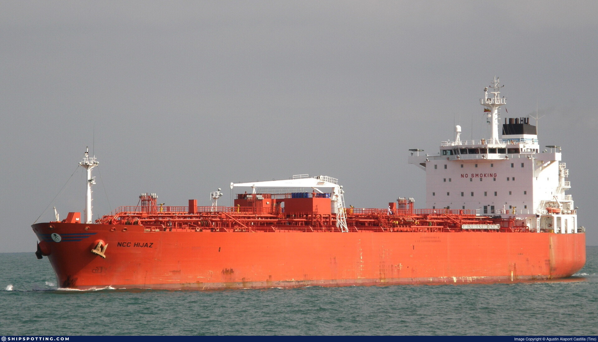
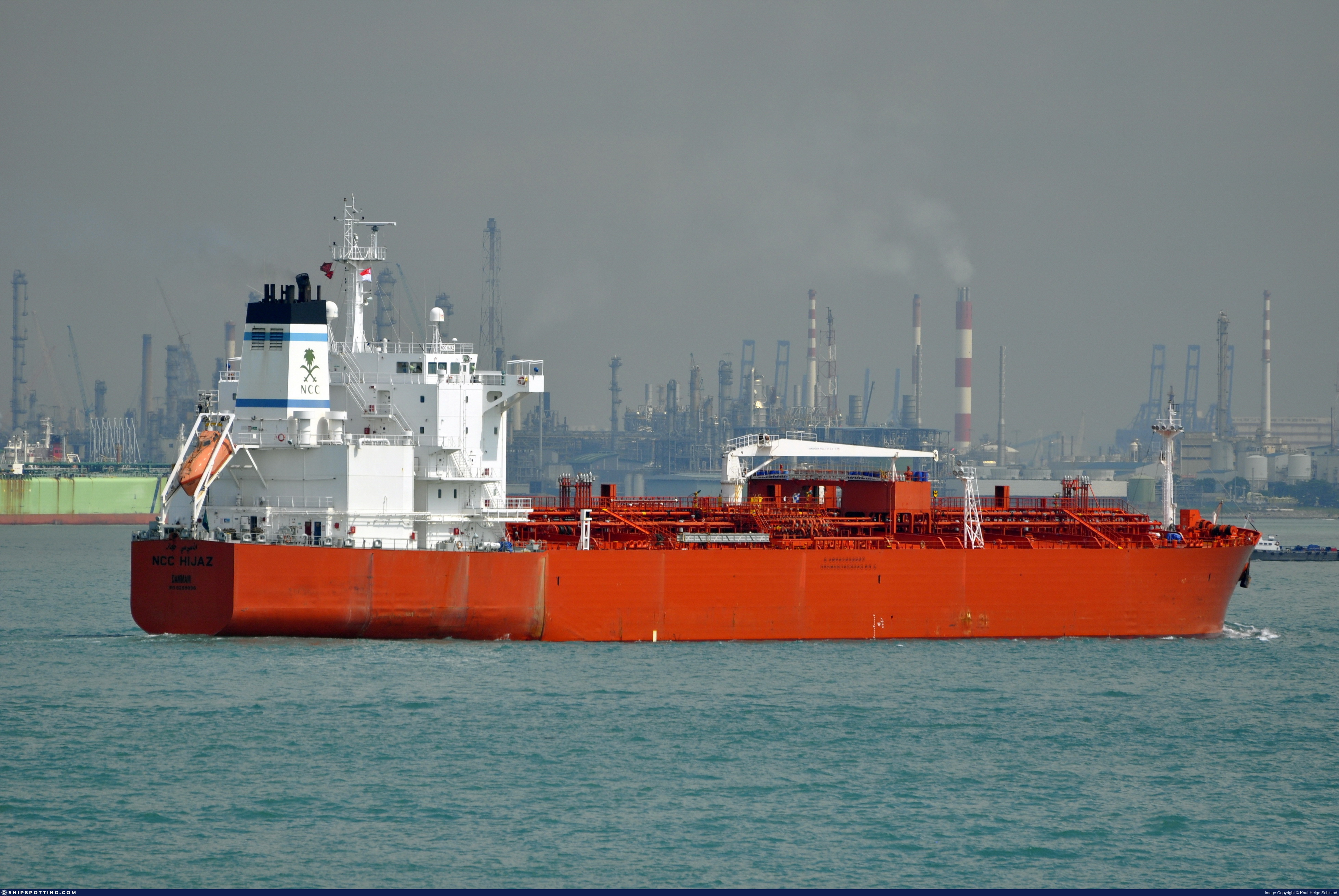
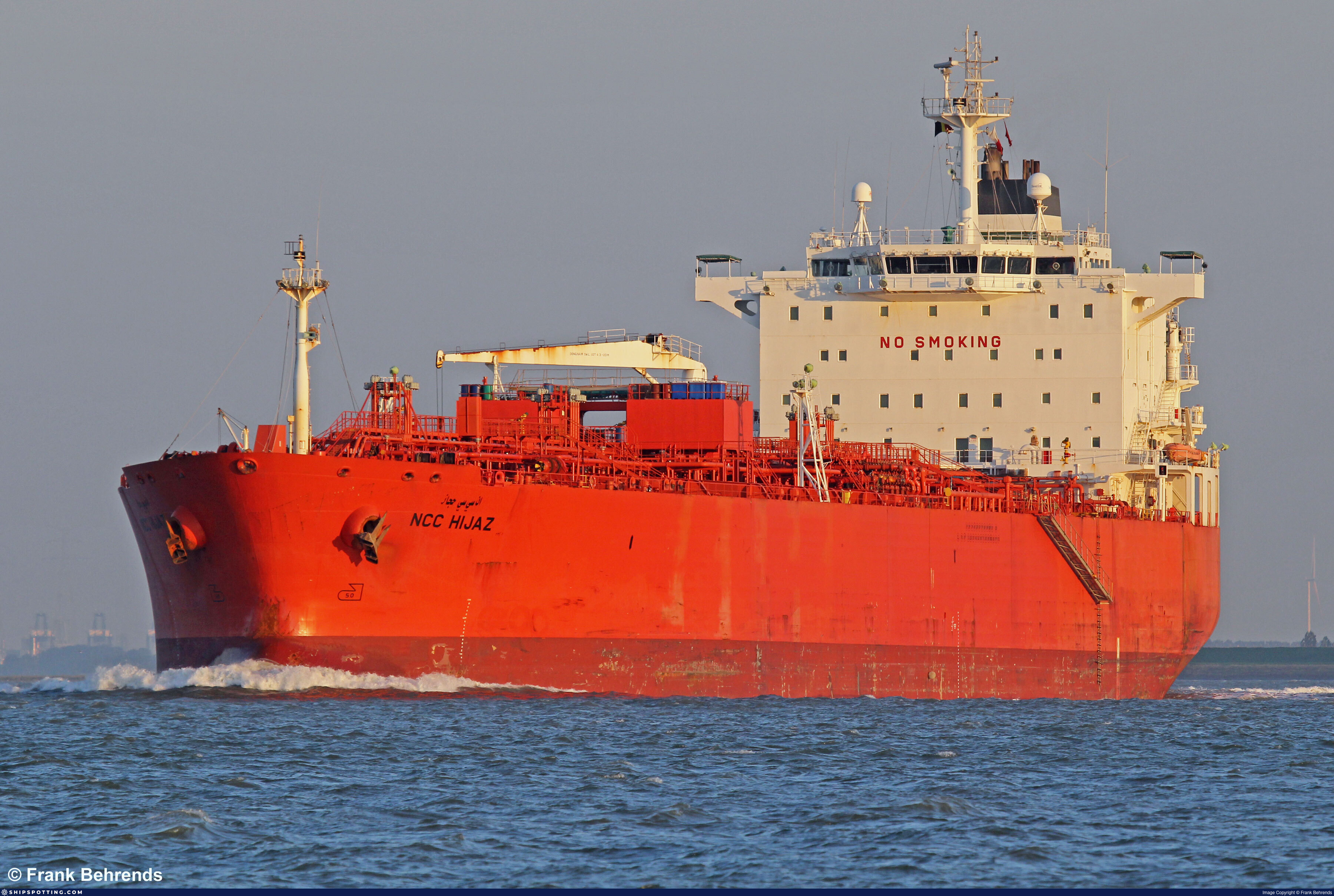
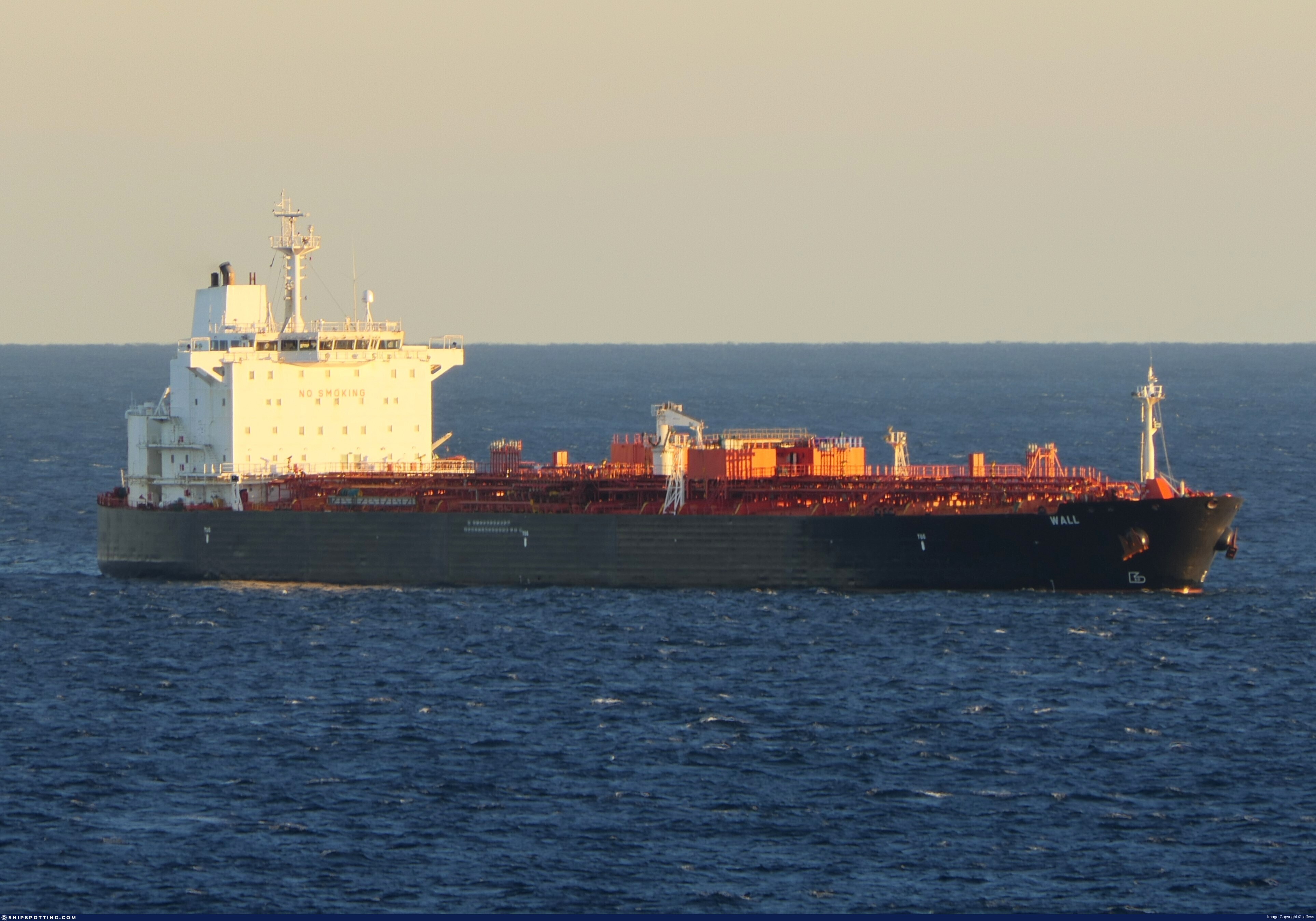
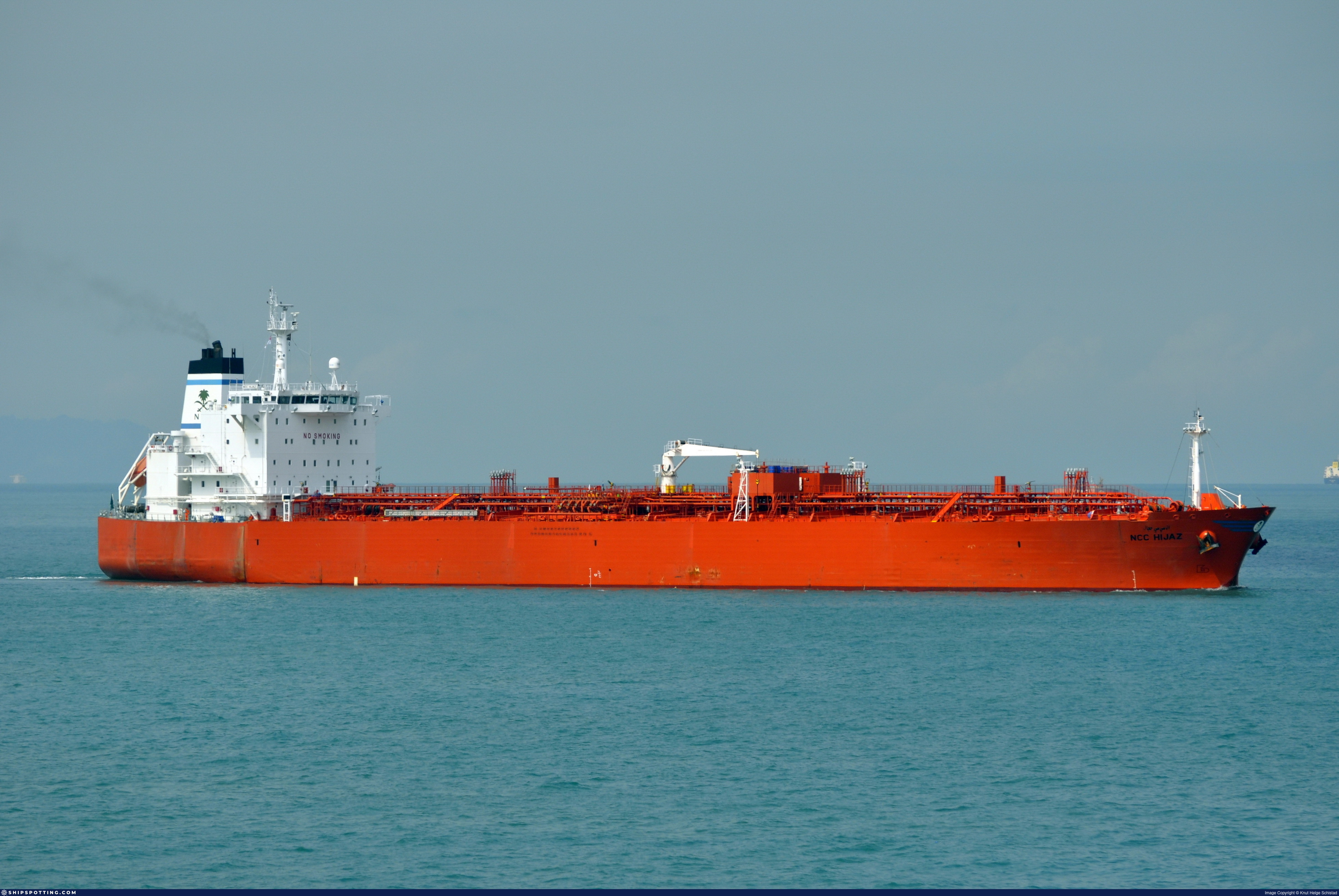
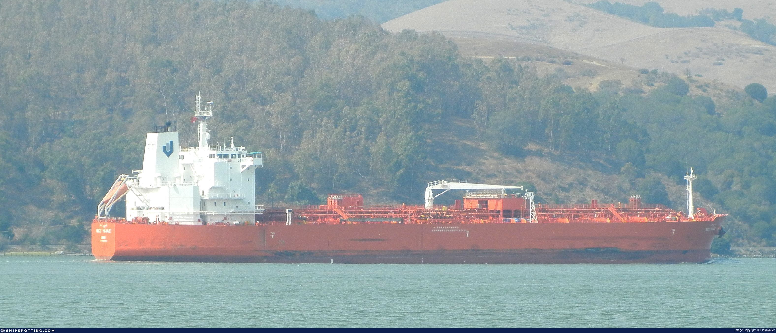
IMO 9299886
Vessel information
Sanctioned by
Company & Ownership
Management & Operations
Classification & Safety
Port State Control (PSC) Inspections
Survey Renewal & Certificates
| Code | Type | Issuer | Issued | Expires |
|---|---|---|---|---|
| 509 | Document of Compliance | American Bureau of Shipping (101) | 06/04/2023 | 05/04/2028 |
| 509 | Document of Compliance | DNV AS (DNV) (128) | 12/10/2021 | 19/10/2026 |
Programs & Notes
EU Russia Sanctions – Shadow Fleet | SEMA (Canada) — vessel designations | The Russia (Sanctions) (EU Exit) Regulations 2019
DateOfListing: 2025-05-21 || DateDesignated: 2025-07-21 | Shipping sanctions: (see “Other information”) | Shipping sanctions: a specified ship is prohibited from being provided with access to or having its master or pilot cause it to enter a port in the UK, may have its registration on the UK Ship Register terminated, and a master or pilot of a specified ship may be given a port barring direction, a detention direction, and a port entry direction or a movement direction. | IMO 9299886 (“Wall”) is, has been or is likely to be involved in activity whose object or effect is to destabilise Ukraine or undermine or threaten the territorial integrity, sovereignty or independence of Ukraine or to obtain a benefit from or support the Government of Russia. Namely, 9299886 is involved in carrying oil or oil products that originated in Russia from Russia to a third country.
Vessel Changes
AIS Events
50 events detected • 2 zones • Last: Jun 3, 2026
- Zone: Eastern Mediterranean Monitoring Zone
- Duration: 2h 6m
- Data Points: 2 AIS positions
- Period: 2026-06-03T23:10:11+00:00 to 2026-06-04T01:16:09+00:00
Show Raw Evidence JSON
{
"zone_id": "discovered_020",
"zone_name": "Eastern Mediterranean Monitoring Zone",
"dwell_minutes": 126,
"points_in_zone": 2,
"first_point": {
"ts": "2026-06-03T23:10:11+00:00",
"lat": 31.63322000000000144837031257338821887969970703125,
"lon": 32.27412170000000202207957045175135135650634765625
},
"last_point": {
"ts": "2026-06-04T01:16:09+00:00",
"lat": 31.633739999999999525925886700861155986785888671875,
"lon": 32.27456000000000102545527624897658824920654296875
}
}- Zone: Eastern Mediterranean Monitoring Zone
- Duration: 6h 11m
- Data Points: 4 AIS positions
- Period: 2026-06-03T19:04:45+00:00 to 2026-06-04T01:16:09+00:00
Show Raw Evidence JSON
{
"zone_id": "discovered_020",
"zone_name": "Eastern Mediterranean Monitoring Zone",
"dwell_minutes": 371.3999999999999772626324556767940521240234375,
"points_in_zone": 4,
"first_point": {
"ts": "2026-06-03T19:04:45+00:00",
"lat": 31.632175000000000153477230924181640148162841796875,
"lon": 32.27413169999999809078872203826904296875
},
"last_point": {
"ts": "2026-06-04T01:16:09+00:00",
"lat": 31.633739999999999525925886700861155986785888671875,
"lon": 32.27456000000000102545527624897658824920654296875
}
}- Duration: 4h 53m
- Radius: 120 meters
- Data Points: 11 AIS positions
- Centroid: 31.6321, 32.2742
- Zone: Eastern Mediterranean Monitoring Zone
Show Raw Evidence JSON
{
"radius_m": 120,
"duration_minutes": 293.5,
"points": 11,
"centroid": {
"lat": 31.63213833636363148116288357414305210113525390625,
"lon": 32.2741589545454559129211702384054660797119140625
},
"bbox": {
"min_lat": 31.631910000000001303988028666935861110687255859375,
"min_lon": 32.27411000000000029785951483063399791717529296875,
"max_lat": 31.63322000000000144837031257338821887969970703125,
"max_lon": 32.27422169999999823630787432193756103515625
},
"zone_id": "discovered_020"
}- Zone: Eastern Mediterranean Monitoring Zone
- Duration: 6h 29m
- Data Points: 7 AIS positions
- Period: 2026-06-03T18:46:45+00:00 to 2026-06-04T01:16:09+00:00
Show Raw Evidence JSON
{
"zone_id": "discovered_020",
"zone_name": "Eastern Mediterranean Monitoring Zone",
"dwell_minutes": 389.3999999999999772626324556767940521240234375,
"points_in_zone": 7,
"first_point": {
"ts": "2026-06-03T18:46:45+00:00",
"lat": 31.631988299999999725287125329487025737762451171875,
"lon": 32.2741682999999994763129507191479206085205078125
},
"last_point": {
"ts": "2026-06-04T01:16:09+00:00",
"lat": 31.633739999999999525925886700861155986785888671875,
"lon": 32.27456000000000102545527624897658824920654296875
}
}- Duration: 6h 8m
- Radius: 126 meters
- Data Points: 19 AIS positions
- Centroid: 31.6321, 32.2742
- Zone: Eastern Mediterranean Monitoring Zone
Show Raw Evidence JSON
{
"radius_m": 125.7000000000000028421709430404007434844970703125,
"duration_minutes": 368.5,
"points": 19,
"centroid": {
"lat": 31.632087278947370379000858520157635211944580078125,
"lon": 32.2741650052631570133598870597779750823974609375
},
"bbox": {
"min_lat": 31.631851699999998572820913977921009063720703125,
"min_lon": 32.27411000000000029785951483063399791717529296875,
"max_lat": 31.63322000000000144837031257338821887969970703125,
"max_lon": 32.27425329999999803476384840905666351318359375
},
"zone_id": "discovered_020"
}- Zone: Eastern Mediterranean Monitoring Zone
- Duration: 6h 8m
- Data Points: 19 AIS positions
- Period: 2026-06-03T17:01:42+00:00 to 2026-06-03T23:10:11+00:00
Show Raw Evidence JSON
{
"zone_id": "discovered_020",
"zone_name": "Eastern Mediterranean Monitoring Zone",
"dwell_minutes": 368.5,
"points_in_zone": 19,
"first_point": {
"ts": "2026-06-03T17:01:42+00:00",
"lat": 31.631851699999998572820913977921009063720703125,
"lon": 32.27423830000000037898644222877919673919677734375
},
"last_point": {
"ts": "2026-06-03T23:10:11+00:00",
"lat": 31.63322000000000144837031257338821887969970703125,
"lon": 32.27412170000000202207957045175135135650634765625
}
}- Duration: 6h 29m
- Radius: 127 meters
- Data Points: 20 AIS positions
- Centroid: 31.6321, 32.2742
- Zone: Eastern Mediterranean Monitoring Zone
Show Raw Evidence JSON
{
"radius_m": 126.900000000000005684341886080801486968994140625,
"duration_minutes": 389.5,
"points": 20,
"centroid": {
"lat": 31.632076000000001414491634932346642017364501953125,
"lon": 32.2741711700000024620749172754585742950439453125
},
"bbox": {
"min_lat": 31.631851699999998572820913977921009063720703125,
"min_lon": 32.27411000000000029785951483063399791717529296875,
"max_lat": 31.63322000000000144837031257338821887969970703125,
"max_lon": 32.27428830000000203881427296437323093414306640625
},
"zone_id": "discovered_020"
}- Zone: Eastern Mediterranean Monitoring Zone
- Duration: 6h 29m
- Data Points: 20 AIS positions
- Period: 2026-06-03T16:40:43+00:00 to 2026-06-03T23:10:11+00:00
Show Raw Evidence JSON
{
"zone_id": "discovered_020",
"zone_name": "Eastern Mediterranean Monitoring Zone",
"dwell_minutes": 389.5,
"points_in_zone": 20,
"first_point": {
"ts": "2026-06-03T16:40:43+00:00",
"lat": 31.63186170000000174695742316544055938720703125,
"lon": 32.27428830000000203881427296437323093414306640625
},
"last_point": {
"ts": "2026-06-03T23:10:11+00:00",
"lat": 31.63322000000000144837031257338821887969970703125,
"lon": 32.27412170000000202207957045175135135650634765625
}
}- Duration: 3h 51m
- Radius: 49 meters
- Data Points: 30 AIS positions
- Centroid: 31.6319, 32.2743
- Zone: Eastern Mediterranean Monitoring Zone
Show Raw Evidence JSON
{
"radius_m": 49.10000000000000142108547152020037174224853515625,
"duration_minutes": 231.099999999999994315658113919198513031005859375,
"points": 30,
"centroid": {
"lat": 31.631891726666662378875116701237857341766357421875,
"lon": 32.27426983666666870931294397450983524322509765625
},
"bbox": {
"min_lat": 31.63151669999999882065822021104395389556884765625,
"min_lon": 32.27411000000000029785951483063399791717529296875,
"max_lat": 31.632175000000000153477230924181640148162841796875,
"max_lon": 32.27460500000000109821485239081084728240966796875
},
"zone_id": "discovered_020"
}- Zone: Eastern Mediterranean Monitoring Zone
- Duration: 3h 51m
- Data Points: 30 AIS positions
- Period: 2026-06-03T15:16:39+00:00 to 2026-06-03T19:07:43+00:00
Show Raw Evidence JSON
{
"zone_id": "discovered_020",
"zone_name": "Eastern Mediterranean Monitoring Zone",
"dwell_minutes": 231.099999999999994315658113919198513031005859375,
"points_in_zone": 30,
"first_point": {
"ts": "2026-06-03T15:16:39+00:00",
"lat": 31.631523300000001341913957730866968631744384765625,
"lon": 32.2745316999999971585566527210175991058349609375
},
"last_point": {
"ts": "2026-06-03T19:07:43+00:00",
"lat": 31.632173300000001603393684490583837032318115234375,
"lon": 32.27412170000000202207957045175135135650634765625
}
}- Duration: 4h 27m
- Radius: 66 meters
- Data Points: 33 AIS positions
- Centroid: 31.6318, 32.2743
- Zone: Eastern Mediterranean Monitoring Zone
Show Raw Evidence JSON
{
"radius_m": 65.7999999999999971578290569595992565155029296875,
"duration_minutes": 267.19999999999998863131622783839702606201171875,
"points": 33,
"centroid": {
"lat": 31.6318443969696971862504142336547374725341796875,
"lon": 32.27431000606060962354604271240532398223876953125
},
"bbox": {
"min_lat": 31.631351699999999738111000624485313892364501953125,
"min_lon": 32.27411000000000029785951483063399791717529296875,
"max_lat": 31.632175000000000153477230924181640148162841796875,
"max_lon": 32.2747217000000006237314664758741855621337890625
},
"zone_id": "discovered_020"
}- Zone: Eastern Mediterranean Monitoring Zone
- Duration: 4h 27m
- Data Points: 33 AIS positions
- Period: 2026-06-03T14:40:29+00:00 to 2026-06-03T19:07:43+00:00
Show Raw Evidence JSON
{
"zone_id": "discovered_020",
"zone_name": "Eastern Mediterranean Monitoring Zone",
"dwell_minutes": 267.19999999999998863131622783839702606201171875,
"points_in_zone": 33,
"first_point": {
"ts": "2026-06-03T14:40:29+00:00",
"lat": 31.631383299999999536566974711604416370391845703125,
"lon": 32.2747217000000006237314664758741855621337890625
},
"last_point": {
"ts": "2026-06-03T19:07:43+00:00",
"lat": 31.632173300000001603393684490583837032318115234375,
"lon": 32.27412170000000202207957045175135135650634765625
}
}- Minimum Distance: 1 meters
- Average Distance: 26 meters
- Duration: 30 minutes
- Period: 2026-06-03T14:03:19+00:00 to 2026-06-03T14:33:19+00:00
- Vessel A Avg Speed: 0.0 knots
- Vessel B Avg Speed: 0.0 knots
- Zone: Eastern Mediterranean Surveillance Zone
Confidence Analysis
Moderate-confidence STS candidate. Two tankers (TRANS FJORD and JASPER) maintained close proximity (min 1m, avg 26m) for 30 minutes. Both vessels were slow-moving (avg speeds 0.0 and 0.0 knots). The stable separation distance suggests deliberate parallel positioning typical of cargo transfer. Event occurred in Eastern Mediterranean Surveillance Zone, a known STS activity area.
View scoring breakdown
| Factor | Score | Detail |
|---|---|---|
| Distance Tightness | 25/25 | Min distance 1m, avg 26m |
| Duration | 5/25 | Duration 30 minutes |
| Speed Stability | 20/20 | both nearly stationary; very stable speeds |
| Distance Consistency | 12/15 | Distance variance ±48m |
| Isolation | 5/10 | Isolation data not available |
| Context | 5/5 | In monitored zone: Eastern Mediterranean Surveillance Zone |
🛰️ Satellite Corroboration
Satellite imagery search queued
Show Raw Evidence JSON
{
"vessel_a": {
"mmsi": 352003272,
"imo": 9956939,
"name": "TRANS FJORD",
"flag": "Panama"
},
"vessel_b": {
"mmsi": 613472020,
"imo": 9299886,
"name": "JASPER",
"flag": "CAMEROON"
},
"min_distance_m": 1.100000000000000088817841970012523233890533447265625,
"avg_distance_m": 26.199999999999999289457264239899814128875732421875,
"distance_consistency_m": 48.39999999999999857891452847979962825775146484375,
"duration_minutes": 30,
"overlap_duration_s": 1800,
"speed_a_avg": 0,
"speed_a_std": 0,
"speed_b_avg": 0.0299999999999999988897769753748434595763683319091796875,
"speed_b_std": 0.05000000000000000277555756156289135105907917022705078125,
"speed_summary": {
"vessel_a": {
"avg_sog": 0,
"max_sog": 0
},
"vessel_b": {
"avg_sog": 0.0299999999999999988897769753748434595763683319091796875,
"max_sog": 0.1000000000000000055511151231257827021181583404541015625
}
},
"time_window": {
"start": "2026-06-03T14:03:19+00:00",
"end": "2026-06-03T14:33:19+00:00"
},
"points_count": {
"vessel_a": 4,
"vessel_b": 4
},
"zone_id": "discovered_138",
"zone_name": "Eastern Mediterranean Surveillance Zone",
"score": {
"value": 72,
"components": {
"distance_tightness": {
"score": 25,
"max": 25,
"detail": "Min distance 1m, avg 26m"
},
"duration": {
"score": 5,
"max": 25,
"detail": "Duration 30 minutes"
},
"speed_stability": {
"score": 20,
"max": 20,
"detail": "both nearly stationary; very stable speeds"
},
"distance_consistency": {
"score": 12,
"max": 15,
"detail": "Distance variance \u00b148m"
},
"isolation": {
"score": 5,
"max": 10,
"detail": "Isolation data not available"
},
"context": {
"score": 5,
"max": 5,
"detail": "In monitored zone: Eastern Mediterranean Surveillance Zone"
}
},
"summary": "Moderate-confidence STS candidate. Two tankers (TRANS FJORD and JASPER) maintained close proximity (min 1m, avg 26m) for 30 minutes. Both vessels were slow-moving (avg speeds 0.0 and 0.0 knots). The stable separation distance suggests deliberate parallel positioning typical of cargo transfer. Event occurred in Eastern Mediterranean Surveillance Zone, a known STS activity area."
},
"sar": {
"status": "pending"
}
}- Minimum Distance: 2 meters
- Average Distance: 23 meters
- Duration: 34 minutes
- Period: 2026-06-03T14:00:26+00:00 to 2026-06-03T14:35:03+00:00
- Vessel A Avg Speed: 0.0 knots
- Vessel B Avg Speed: 0.0 knots
- Zone: Eastern Mediterranean Surveillance Zone
Confidence Analysis
Moderate-confidence STS candidate. Two tankers (JASPER and HORAE) maintained close proximity (min 2m, avg 23m) for 35 minutes. Both vessels were slow-moving (avg speeds 0.0 and 0.0 knots). The stable separation distance suggests deliberate parallel positioning typical of cargo transfer. Event occurred in Eastern Mediterranean Surveillance Zone, a known STS activity area.
View scoring breakdown
| Factor | Score | Detail |
|---|---|---|
| Distance Tightness | 25/25 | Min distance 2m, avg 23m |
| Duration | 5/25 | Duration 35 minutes |
| Speed Stability | 20/20 | both nearly stationary; very stable speeds |
| Distance Consistency | 15/15 | Distance variance ±25m |
| Isolation | 5/10 | Isolation data not available |
| Context | 5/5 | In monitored zone: Eastern Mediterranean Surveillance Zone |
🛰️ Satellite Corroboration
Satellite imagery search queued
Show Raw Evidence JSON
{
"vessel_a": {
"mmsi": 613472020,
"imo": 9299886,
"name": "JASPER",
"flag": "CAMEROON"
},
"vessel_b": {
"mmsi": 352179000,
"imo": 9413004,
"name": "HORAE",
"flag": "Panama"
},
"min_distance_m": 1.5,
"avg_distance_m": 23.199999999999999289457264239899814128875732421875,
"distance_consistency_m": 25.199999999999999289457264239899814128875732421875,
"duration_minutes": 34.60000000000000142108547152020037174224853515625,
"overlap_duration_s": 2077,
"speed_a_avg": 0.01000000000000000020816681711721685132943093776702880859375,
"speed_a_std": 0.040000000000000000832667268468867405317723751068115234375,
"speed_b_avg": 0,
"speed_b_std": 0,
"speed_summary": {
"vessel_a": {
"avg_sog": 0.01000000000000000020816681711721685132943093776702880859375,
"max_sog": 0.1000000000000000055511151231257827021181583404541015625
},
"vessel_b": {
"avg_sog": 0,
"max_sog": 0
}
},
"time_window": {
"start": "2026-06-03T14:00:26+00:00",
"end": "2026-06-03T14:35:03+00:00"
},
"points_count": {
"vessel_a": 8,
"vessel_b": 8
},
"zone_id": "discovered_138",
"zone_name": "Eastern Mediterranean Surveillance Zone",
"score": {
"value": 75,
"components": {
"distance_tightness": {
"score": 25,
"max": 25,
"detail": "Min distance 2m, avg 23m"
},
"duration": {
"score": 5,
"max": 25,
"detail": "Duration 35 minutes"
},
"speed_stability": {
"score": 20,
"max": 20,
"detail": "both nearly stationary; very stable speeds"
},
"distance_consistency": {
"score": 15,
"max": 15,
"detail": "Distance variance \u00b125m"
},
"isolation": {
"score": 5,
"max": 10,
"detail": "Isolation data not available"
},
"context": {
"score": 5,
"max": 5,
"detail": "In monitored zone: Eastern Mediterranean Surveillance Zone"
}
},
"summary": "Moderate-confidence STS candidate. Two tankers (JASPER and HORAE) maintained close proximity (min 2m, avg 23m) for 35 minutes. Both vessels were slow-moving (avg speeds 0.0 and 0.0 knots). The stable separation distance suggests deliberate parallel positioning typical of cargo transfer. Event occurred in Eastern Mediterranean Surveillance Zone, a known STS activity area."
},
"sar": {
"status": "pending"
}
}- Minimum Distance: 4 meters
- Average Distance: 10 meters
- Duration: 38 minutes
- Period: 2026-06-03T13:56:37+00:00 to 2026-06-03T14:35:09+00:00
- Vessel A Avg Speed: 0.0 knots
- Vessel B Avg Speed: 0.0 knots
- Zone: Eastern Mediterranean Surveillance Zone
Confidence Analysis
Moderate-confidence STS candidate. Two tankers (DORIN and JASPER) maintained close proximity (min 4m, avg 10m) for 38 minutes. Both vessels were slow-moving (avg speeds 0.0 and 0.0 knots). The stable separation distance suggests deliberate parallel positioning typical of cargo transfer. Event occurred in Eastern Mediterranean Surveillance Zone, a known STS activity area.
View scoring breakdown
| Factor | Score | Detail |
|---|---|---|
| Distance Tightness | 25/25 | Min distance 4m, avg 10m |
| Duration | 5/25 | Duration 38 minutes |
| Speed Stability | 20/20 | both nearly stationary; very stable speeds |
| Distance Consistency | 15/15 | Distance variance ±6m |
| Isolation | 5/10 | Isolation data not available |
| Context | 5/5 | In monitored zone: Eastern Mediterranean Surveillance Zone |
🛰️ Satellite Corroboration
No satellite imagery for this time/location
No Sentinel-1 scenes covering AOI and time window
Show Raw Evidence JSON
{
"vessel_a": {
"mmsi": 613414203,
"imo": 9290828,
"name": "DORIN",
"flag": "CAMEROON"
},
"vessel_b": {
"mmsi": 613472020,
"imo": 9299886,
"name": "JASPER",
"flag": "CAMEROON"
},
"min_distance_m": 3.600000000000000088817841970012523233890533447265625,
"avg_distance_m": 9.5,
"distance_consistency_m": 6.29999999999999982236431605997495353221893310546875,
"duration_minutes": 38.5,
"overlap_duration_s": 2312,
"speed_a_avg": 0,
"speed_a_std": 0,
"speed_b_avg": 0,
"speed_b_std": 0,
"speed_summary": {
"vessel_a": {
"avg_sog": 0,
"max_sog": 0
},
"vessel_b": {
"avg_sog": 0,
"max_sog": 0
}
},
"time_window": {
"start": "2026-06-03T13:56:37+00:00",
"end": "2026-06-03T14:35:09+00:00"
},
"points_count": {
"vessel_a": 3,
"vessel_b": 3
},
"zone_id": "discovered_138",
"zone_name": "Eastern Mediterranean Surveillance Zone",
"score": {
"value": 75,
"components": {
"distance_tightness": {
"score": 25,
"max": 25,
"detail": "Min distance 4m, avg 10m"
},
"duration": {
"score": 5,
"max": 25,
"detail": "Duration 38 minutes"
},
"speed_stability": {
"score": 20,
"max": 20,
"detail": "both nearly stationary; very stable speeds"
},
"distance_consistency": {
"score": 15,
"max": 15,
"detail": "Distance variance \u00b16m"
},
"isolation": {
"score": 5,
"max": 10,
"detail": "Isolation data not available"
},
"context": {
"score": 5,
"max": 5,
"detail": "In monitored zone: Eastern Mediterranean Surveillance Zone"
}
},
"summary": "Moderate-confidence STS candidate. Two tankers (DORIN and JASPER) maintained close proximity (min 4m, avg 10m) for 38 minutes. Both vessels were slow-moving (avg speeds 0.0 and 0.0 knots). The stable separation distance suggests deliberate parallel positioning typical of cargo transfer. Event occurred in Eastern Mediterranean Surveillance Zone, a known STS activity area."
},
"sar": {
"status": "not_found",
"centroid": {
"lat": 31.7170607999999987214323482476174831390380859375,
"lon": 35.9993754999999993060555425472557544708251953125
},
"time_window": {
"start_ts": "2026-06-03T13:56:37+00:00",
"end_ts": "2026-06-03T14:35:09+00:00"
},
"searched_at": "2026-06-04T01:45:09.509705+00:00",
"notes": "No Sentinel-1 scenes covering AOI and time window"
}
}- Minimum Distance: 0 meters
- Average Distance: 12 meters
- Duration: 42 minutes
- Period: 2026-06-03T13:52:22+00:00 to 2026-06-03T14:35:03+00:00
- Vessel A Avg Speed: 0.0 knots
- Vessel B Avg Speed: 0.1 knots
- Zone: Eastern Mediterranean Surveillance Zone
Confidence Analysis
Moderate-confidence STS candidate. Two tankers (JASPER and ANHONA) maintained close proximity (min 0m, avg 12m) for 43 minutes. Both vessels were slow-moving (avg speeds 0.0 and 0.1 knots). The stable separation distance suggests deliberate parallel positioning typical of cargo transfer. Event occurred in Eastern Mediterranean Surveillance Zone, a known STS activity area.
View scoring breakdown
| Factor | Score | Detail |
|---|---|---|
| Distance Tightness | 25/25 | Min distance 0m, avg 12m |
| Duration | 5/25 | Duration 43 minutes |
| Speed Stability | 20/20 | both nearly stationary; very stable speeds |
| Distance Consistency | 15/15 | Distance variance ±29m |
| Isolation | 5/10 | Isolation data not available |
| Context | 5/5 | In monitored zone: Eastern Mediterranean Surveillance Zone |
🛰️ Satellite Corroboration
No satellite imagery for this time/location
No Sentinel-1 scenes covering AOI and time window
Show Raw Evidence JSON
{
"vessel_a": {
"mmsi": 613472020,
"imo": 9299886,
"name": "JASPER",
"flag": "CAMEROON"
},
"vessel_b": {
"mmsi": 312171000,
"imo": 9354521,
"name": "ANHONA",
"flag": "BELIZE"
},
"min_distance_m": 0.200000000000000011102230246251565404236316680908203125,
"avg_distance_m": 12.4000000000000003552713678800500929355621337890625,
"distance_consistency_m": 29.199999999999999289457264239899814128875732421875,
"duration_minutes": 42.7000000000000028421709430404007434844970703125,
"overlap_duration_s": 2561,
"speed_a_avg": 0.01000000000000000020816681711721685132943093776702880859375,
"speed_a_std": 0.0299999999999999988897769753748434595763683319091796875,
"speed_b_avg": 0.05000000000000000277555756156289135105907917022705078125,
"speed_b_std": 0.05000000000000000277555756156289135105907917022705078125,
"speed_summary": {
"vessel_a": {
"avg_sog": 0.01000000000000000020816681711721685132943093776702880859375,
"max_sog": 0.1000000000000000055511151231257827021181583404541015625
},
"vessel_b": {
"avg_sog": 0.05000000000000000277555756156289135105907917022705078125,
"max_sog": 0.1000000000000000055511151231257827021181583404541015625
}
},
"time_window": {
"start": "2026-06-03T13:52:22+00:00",
"end": "2026-06-03T14:35:03+00:00"
},
"points_count": {
"vessel_a": 11,
"vessel_b": 11
},
"zone_id": "discovered_138",
"zone_name": "Eastern Mediterranean Surveillance Zone",
"score": {
"value": 75,
"components": {
"distance_tightness": {
"score": 25,
"max": 25,
"detail": "Min distance 0m, avg 12m"
},
"duration": {
"score": 5,
"max": 25,
"detail": "Duration 43 minutes"
},
"speed_stability": {
"score": 20,
"max": 20,
"detail": "both nearly stationary; very stable speeds"
},
"distance_consistency": {
"score": 15,
"max": 15,
"detail": "Distance variance \u00b129m"
},
"isolation": {
"score": 5,
"max": 10,
"detail": "Isolation data not available"
},
"context": {
"score": 5,
"max": 5,
"detail": "In monitored zone: Eastern Mediterranean Surveillance Zone"
}
},
"summary": "Moderate-confidence STS candidate. Two tankers (JASPER and ANHONA) maintained close proximity (min 0m, avg 12m) for 43 minutes. Both vessels were slow-moving (avg speeds 0.0 and 0.1 knots). The stable separation distance suggests deliberate parallel positioning typical of cargo transfer. Event occurred in Eastern Mediterranean Surveillance Zone, a known STS activity area."
},
"sar": {
"status": "not_found",
"centroid": {
"lat": 31.7170981000000011817974154837429523468017578125,
"lon": 35.999363299999998844214132986962795257568359375
},
"time_window": {
"start_ts": "2026-06-03T13:53:33+00:00",
"end_ts": "2026-06-03T14:35:03+00:00"
},
"searched_at": "2026-06-03T21:45:09.482656+00:00",
"notes": "No Sentinel-1 scenes covering AOI and time window"
}
}- Minimum Distance: 1 meters
- Average Distance: 17 meters
- Duration: 38 minutes
- Period: 2026-06-03T13:58:31+00:00 to 2026-06-03T14:36:58+00:00
- Vessel A Avg Speed: 0.1 knots
- Vessel B Avg Speed: 0.0 knots
- Zone: Eastern Mediterranean Surveillance Zone
Confidence Analysis
Moderate-confidence STS candidate. Two tankers (HORAE and JASPER) maintained close proximity (min 1m, avg 17m) for 38 minutes. Both vessels were slow-moving (avg speeds 0.1 and 0.0 knots). The stable separation distance suggests deliberate parallel positioning typical of cargo transfer. Event occurred in Eastern Mediterranean Surveillance Zone, a known STS activity area.
View scoring breakdown
| Factor | Score | Detail |
|---|---|---|
| Distance Tightness | 25/25 | Min distance 1m, avg 17m |
| Duration | 5/25 | Duration 38 minutes |
| Speed Stability | 20/20 | both nearly stationary; very stable speeds |
| Distance Consistency | 15/15 | Distance variance ±11m |
| Isolation | 5/10 | Isolation data not available |
| Context | 5/5 | In monitored zone: Eastern Mediterranean Surveillance Zone |
🛰️ Satellite Corroboration
No satellite imagery for this time/location
No Sentinel-1 scenes covering AOI and time window
Show Raw Evidence JSON
{
"vessel_a": {
"mmsi": 352179000,
"imo": 9413004,
"name": "HORAE",
"flag": "Panama"
},
"vessel_b": {
"mmsi": 613472020,
"imo": 9299886,
"name": "JASPER",
"flag": "CAMEROON"
},
"min_distance_m": 1.3000000000000000444089209850062616169452667236328125,
"avg_distance_m": 17.10000000000000142108547152020037174224853515625,
"distance_consistency_m": 11.4000000000000003552713678800500929355621337890625,
"duration_minutes": 38.5,
"overlap_duration_s": 2307,
"speed_a_avg": 0.1000000000000000055511151231257827021181583404541015625,
"speed_a_std": 0.2800000000000000266453525910037569701671600341796875,
"speed_b_avg": 0,
"speed_b_std": 0,
"speed_summary": {
"vessel_a": {
"avg_sog": 0.1000000000000000055511151231257827021181583404541015625,
"max_sog": 0.8000000000000000444089209850062616169452667236328125
},
"vessel_b": {
"avg_sog": 0,
"max_sog": 0
}
},
"time_window": {
"start": "2026-06-03T13:58:31+00:00",
"end": "2026-06-03T14:36:58+00:00"
},
"points_count": {
"vessel_a": 8,
"vessel_b": 8
},
"zone_id": "discovered_138",
"zone_name": "Eastern Mediterranean Surveillance Zone",
"score": {
"value": 75,
"components": {
"distance_tightness": {
"score": 25,
"max": 25,
"detail": "Min distance 1m, avg 17m"
},
"duration": {
"score": 5,
"max": 25,
"detail": "Duration 38 minutes"
},
"speed_stability": {
"score": 20,
"max": 20,
"detail": "both nearly stationary; very stable speeds"
},
"distance_consistency": {
"score": 15,
"max": 15,
"detail": "Distance variance \u00b111m"
},
"isolation": {
"score": 5,
"max": 10,
"detail": "Isolation data not available"
},
"context": {
"score": 5,
"max": 5,
"detail": "In monitored zone: Eastern Mediterranean Surveillance Zone"
}
},
"summary": "Moderate-confidence STS candidate. Two tankers (HORAE and JASPER) maintained close proximity (min 1m, avg 17m) for 38 minutes. Both vessels were slow-moving (avg speeds 0.1 and 0.0 knots). The stable separation distance suggests deliberate parallel positioning typical of cargo transfer. Event occurred in Eastern Mediterranean Surveillance Zone, a known STS activity area."
},
"sar": {
"status": "not_found",
"centroid": {
"lat": 31.717037000000001256694304174743592739105224609375,
"lon": 35.99943259999999867204678594134747982025146484375
},
"time_window": {
"start_ts": "2026-06-03T13:52:22+00:00",
"end_ts": "2026-06-03T14:36:58+00:00"
},
"searched_at": "2026-06-04T00:15:07.183094+00:00",
"notes": "No Sentinel-1 scenes covering AOI and time window"
}
}- Minimum Distance: 18 meters
- Average Distance: 105 meters
- Duration: 47 minutes
- Period: 2026-06-03T13:48:45+00:00 to 2026-06-03T14:36:24+00:00
- Vessel A Avg Speed: 0.4 knots
- Vessel B Avg Speed: 0.0 knots
- Zone: Eastern Mediterranean Surveillance Zone
Confidence Analysis
Moderate-confidence STS candidate. Two tankers (HAWK III and JASPER) maintained close proximity (min 18m, avg 105m) for 48 minutes. Both vessels were slow-moving (avg speeds 0.3 and 0.0 knots). Moderate distance variation observed during the encounter. Event occurred in Eastern Mediterranean Surveillance Zone, a known STS activity area.
View scoring breakdown
| Factor | Score | Detail |
|---|---|---|
| Distance Tightness | 25/25 | Min distance 18m, avg 105m |
| Duration | 10/25 | Duration 48 minutes |
| Speed Stability | 14/20 | both nearly stationary; somewhat variable speeds |
| Distance Consistency | 8/15 | Distance variance ±92m |
| Isolation | 5/10 | Isolation data not available |
| Context | 5/5 | In monitored zone: Eastern Mediterranean Surveillance Zone |
🛰️ Satellite Corroboration
No satellite imagery for this time/location
No Sentinel-1 scenes covering AOI and time window
Show Raw Evidence JSON
{
"vessel_a": {
"mmsi": 374125000,
"imo": 9260263,
"name": "HAWK III",
"flag": "PANAMA"
},
"vessel_b": {
"mmsi": 613472020,
"imo": 9299886,
"name": "JASPER",
"flag": "CAMEROON"
},
"min_distance_m": 17.60000000000000142108547152020037174224853515625,
"avg_distance_m": 105.2999999999999971578290569595992565155029296875,
"distance_consistency_m": 91.5,
"duration_minutes": 47.60000000000000142108547152020037174224853515625,
"overlap_duration_s": 2859,
"speed_a_avg": 0.34999999999999997779553950749686919152736663818359375,
"speed_a_std": 0.60999999999999998667732370449812151491641998291015625,
"speed_b_avg": 0.01000000000000000020816681711721685132943093776702880859375,
"speed_b_std": 0.0299999999999999988897769753748434595763683319091796875,
"speed_summary": {
"vessel_a": {
"avg_sog": 0.34999999999999997779553950749686919152736663818359375,
"max_sog": 2
},
"vessel_b": {
"avg_sog": 0.01000000000000000020816681711721685132943093776702880859375,
"max_sog": 0.1000000000000000055511151231257827021181583404541015625
}
},
"time_window": {
"start": "2026-06-03T13:48:45+00:00",
"end": "2026-06-03T14:36:24+00:00"
},
"points_count": {
"vessel_a": 11,
"vessel_b": 11
},
"zone_id": "discovered_138",
"zone_name": "Eastern Mediterranean Surveillance Zone",
"score": {
"value": 67,
"components": {
"distance_tightness": {
"score": 25,
"max": 25,
"detail": "Min distance 18m, avg 105m"
},
"duration": {
"score": 10,
"max": 25,
"detail": "Duration 48 minutes"
},
"speed_stability": {
"score": 14,
"max": 20,
"detail": "both nearly stationary; somewhat variable speeds"
},
"distance_consistency": {
"score": 8,
"max": 15,
"detail": "Distance variance \u00b192m"
},
"isolation": {
"score": 5,
"max": 10,
"detail": "Isolation data not available"
},
"context": {
"score": 5,
"max": 5,
"detail": "In monitored zone: Eastern Mediterranean Surveillance Zone"
}
},
"summary": "Moderate-confidence STS candidate. Two tankers (HAWK III and JASPER) maintained close proximity (min 18m, avg 105m) for 48 minutes. Both vessels were slow-moving (avg speeds 0.3 and 0.0 knots). Moderate distance variation observed during the encounter. Event occurred in Eastern Mediterranean Surveillance Zone, a known STS activity area."
},
"sar": {
"status": "not_found",
"centroid": {
"lat": 31.716719499999999953843143885023891925811767578125,
"lon": 35.99954139999999824794940650463104248046875
},
"time_window": {
"start_ts": "2026-06-03T13:52:22+00:00",
"end_ts": "2026-06-03T14:36:24+00:00"
},
"searched_at": "2026-06-03T23:00:09.666528+00:00",
"notes": "No Sentinel-1 scenes covering AOI and time window"
}
}- Minimum Distance: 1 meters
- Average Distance: 11 meters
- Duration: 42 minutes
- Period: 2026-06-03T13:52:22+00:00 to 2026-06-03T14:35:03+00:00
- Vessel A Avg Speed: 0.0 knots
- Vessel B Avg Speed: 0.0 knots
- Zone: Eastern Mediterranean Surveillance Zone
Confidence Analysis
Moderate-confidence STS candidate. Two tankers (JASPER and GAZ SERENITY) maintained close proximity (min 1m, avg 11m) for 43 minutes. Both vessels were slow-moving (avg speeds 0.0 and 0.0 knots). The stable separation distance suggests deliberate parallel positioning typical of cargo transfer. Event occurred in Eastern Mediterranean Surveillance Zone, a known STS activity area.
View scoring breakdown
| Factor | Score | Detail |
|---|---|---|
| Distance Tightness | 25/25 | Min distance 1m, avg 11m |
| Duration | 5/25 | Duration 43 minutes |
| Speed Stability | 20/20 | both nearly stationary; very stable speeds |
| Distance Consistency | 15/15 | Distance variance ±28m |
| Isolation | 5/10 | Isolation data not available |
| Context | 5/5 | In monitored zone: Eastern Mediterranean Surveillance Zone |
🛰️ Satellite Corroboration
No satellite imagery for this time/location
No Sentinel-1 scenes covering AOI and time window
Show Raw Evidence JSON
{
"vessel_a": {
"mmsi": 613472020,
"imo": 9299886,
"name": "JASPER",
"flag": "CAMEROON"
},
"vessel_b": {
"mmsi": 372961000,
"imo": 9448499,
"name": "GAZ SERENITY",
"flag": "PANAMA"
},
"min_distance_m": 0.6999999999999999555910790149937383830547332763671875,
"avg_distance_m": 11.4000000000000003552713678800500929355621337890625,
"distance_consistency_m": 28.5,
"duration_minutes": 42.7000000000000028421709430404007434844970703125,
"overlap_duration_s": 2561,
"speed_a_avg": 0.01000000000000000020816681711721685132943093776702880859375,
"speed_a_std": 0.0299999999999999988897769753748434595763683319091796875,
"speed_b_avg": 0,
"speed_b_std": 0,
"speed_summary": {
"vessel_a": {
"avg_sog": 0.01000000000000000020816681711721685132943093776702880859375,
"max_sog": 0.1000000000000000055511151231257827021181583404541015625
},
"vessel_b": {
"avg_sog": 0,
"max_sog": 0
}
},
"time_window": {
"start": "2026-06-03T13:52:22+00:00",
"end": "2026-06-03T14:35:03+00:00"
},
"points_count": {
"vessel_a": 11,
"vessel_b": 11
},
"zone_id": "discovered_138",
"zone_name": "Eastern Mediterranean Surveillance Zone",
"score": {
"value": 75,
"components": {
"distance_tightness": {
"score": 25,
"max": 25,
"detail": "Min distance 1m, avg 11m"
},
"duration": {
"score": 5,
"max": 25,
"detail": "Duration 43 minutes"
},
"speed_stability": {
"score": 20,
"max": 20,
"detail": "both nearly stationary; very stable speeds"
},
"distance_consistency": {
"score": 15,
"max": 15,
"detail": "Distance variance \u00b128m"
},
"isolation": {
"score": 5,
"max": 10,
"detail": "Isolation data not available"
},
"context": {
"score": 5,
"max": 5,
"detail": "In monitored zone: Eastern Mediterranean Surveillance Zone"
}
},
"summary": "Moderate-confidence STS candidate. Two tankers (JASPER and GAZ SERENITY) maintained close proximity (min 1m, avg 11m) for 43 minutes. Both vessels were slow-moving (avg speeds 0.0 and 0.0 knots). The stable separation distance suggests deliberate parallel positioning typical of cargo transfer. Event occurred in Eastern Mediterranean Surveillance Zone, a known STS activity area."
},
"sar": {
"status": "not_found",
"centroid": {
"lat": 31.717049800000001624766809982247650623321533203125,
"lon": 35.99941059999999737328835180960595607757568359375
},
"time_window": {
"start_ts": "2026-06-03T13:52:22+00:00",
"end_ts": "2026-06-03T14:35:03+00:00"
},
"searched_at": "2026-06-03T23:00:07.147025+00:00",
"notes": "No Sentinel-1 scenes covering AOI and time window"
}
}- Minimum Distance: 2 meters
- Average Distance: 26 meters
- Duration: 46 minutes
- Period: 2026-06-03T13:50:25+00:00 to 2026-06-03T14:36:36+00:00
- Vessel A Avg Speed: 0.1 knots
- Vessel B Avg Speed: 0.0 knots
- Zone: Eastern Mediterranean Surveillance Zone
Confidence Analysis
Moderate-confidence STS candidate. Two tankers (SAMBA and JASPER) maintained close proximity (min 2m, avg 26m) for 46 minutes. Both vessels were slow-moving (avg speeds 0.1 and 0.0 knots). The stable separation distance suggests deliberate parallel positioning typical of cargo transfer. Event occurred in Eastern Mediterranean Surveillance Zone, a known STS activity area.
View scoring breakdown
| Factor | Score | Detail |
|---|---|---|
| Distance Tightness | 25/25 | Min distance 2m, avg 26m |
| Duration | 10/25 | Duration 46 minutes |
| Speed Stability | 20/20 | both nearly stationary; very stable speeds |
| Distance Consistency | 12/15 | Distance variance ±38m |
| Isolation | 5/10 | Isolation data not available |
| Context | 5/5 | In monitored zone: Eastern Mediterranean Surveillance Zone |
🛰️ Satellite Corroboration
No satellite imagery for this time/location
No Sentinel-1 scenes covering AOI and time window
Show Raw Evidence JSON
{
"vessel_a": {
"mmsi": 538011921,
"imo": 9310305,
"name": "SAMBA",
"flag": "Marshall Is"
},
"vessel_b": {
"mmsi": 613472020,
"imo": 9299886,
"name": "JASPER",
"flag": "CAMEROON"
},
"min_distance_m": 2.100000000000000088817841970012523233890533447265625,
"avg_distance_m": 26.39999999999999857891452847979962825775146484375,
"distance_consistency_m": 38.10000000000000142108547152020037174224853515625,
"duration_minutes": 46.2000000000000028421709430404007434844970703125,
"overlap_duration_s": 2771,
"speed_a_avg": 0.11999999999999999555910790149937383830547332763671875,
"speed_a_std": 0.2200000000000000011102230246251565404236316680908203125,
"speed_b_avg": 0.0200000000000000004163336342344337026588618755340576171875,
"speed_b_std": 0.040000000000000000832667268468867405317723751068115234375,
"speed_summary": {
"vessel_a": {
"avg_sog": 0.11999999999999999555910790149937383830547332763671875,
"max_sog": 0.59999999999999997779553950749686919152736663818359375
},
"vessel_b": {
"avg_sog": 0.0200000000000000004163336342344337026588618755340576171875,
"max_sog": 0.1000000000000000055511151231257827021181583404541015625
}
},
"time_window": {
"start": "2026-06-03T13:50:25+00:00",
"end": "2026-06-03T14:36:36+00:00"
},
"points_count": {
"vessel_a": 13,
"vessel_b": 13
},
"zone_id": "discovered_138",
"zone_name": "Eastern Mediterranean Surveillance Zone",
"score": {
"value": 77,
"components": {
"distance_tightness": {
"score": 25,
"max": 25,
"detail": "Min distance 2m, avg 26m"
},
"duration": {
"score": 10,
"max": 25,
"detail": "Duration 46 minutes"
},
"speed_stability": {
"score": 20,
"max": 20,
"detail": "both nearly stationary; very stable speeds"
},
"distance_consistency": {
"score": 12,
"max": 15,
"detail": "Distance variance \u00b138m"
},
"isolation": {
"score": 5,
"max": 10,
"detail": "Isolation data not available"
},
"context": {
"score": 5,
"max": 5,
"detail": "In monitored zone: Eastern Mediterranean Surveillance Zone"
}
},
"summary": "Moderate-confidence STS candidate. Two tankers (SAMBA and JASPER) maintained close proximity (min 2m, avg 26m) for 46 minutes. Both vessels were slow-moving (avg speeds 0.1 and 0.0 knots). The stable separation distance suggests deliberate parallel positioning typical of cargo transfer. Event occurred in Eastern Mediterranean Surveillance Zone, a known STS activity area."
},
"sar": {
"status": "not_found",
"centroid": {
"lat": 31.71706379999999825258782948367297649383544921875,
"lon": 35.9993874000000033674950827844440937042236328125
},
"time_window": {
"start_ts": "2026-06-03T13:52:22+00:00",
"end_ts": "2026-06-03T14:36:36+00:00"
},
"searched_at": "2026-06-03T23:00:04.399887+00:00",
"notes": "No Sentinel-1 scenes covering AOI and time window"
}
}- Minimum Distance: 10 meters
- Average Distance: 160 meters
- Duration: 45 minutes
- Period: 2026-06-03T13:50:45+00:00 to 2026-06-03T14:36:23+00:00
- Vessel A Avg Speed: 0.1 knots
- Vessel B Avg Speed: 0.0 knots
- Zone: Eastern Mediterranean Surveillance Zone
Confidence Analysis
Moderate-confidence STS candidate. Two tankers (ATMOS and JASPER) maintained close proximity (min 10m, avg 160m) for 46 minutes. Both vessels were slow-moving (avg speeds 0.1 and 0.0 knots). Event occurred in Eastern Mediterranean Surveillance Zone, a known STS activity area.
View scoring breakdown
| Factor | Score | Detail |
|---|---|---|
| Distance Tightness | 25/25 | Min distance 10m, avg 160m |
| Duration | 10/25 | Duration 46 minutes |
| Speed Stability | 20/20 | both nearly stationary; very stable speeds |
| Distance Consistency | 5/15 | Distance variance ±135m |
| Isolation | 5/10 | Isolation data not available |
| Context | 5/5 | In monitored zone: Eastern Mediterranean Surveillance Zone |
🛰️ Satellite Corroboration
No satellite imagery for this time/location
No Sentinel-1 scenes covering AOI and time window
Show Raw Evidence JSON
{
"vessel_a": {
"mmsi": 613009690,
"imo": 9337418,
"name": "ATMOS",
"flag": "CAMEROON"
},
"vessel_b": {
"mmsi": 613472020,
"imo": 9299886,
"name": "JASPER",
"flag": "CAMEROON"
},
"min_distance_m": 9.5999999999999996447286321199499070644378662109375,
"avg_distance_m": 160.19999999999998863131622783839702606201171875,
"distance_consistency_m": 135.19999999999998863131622783839702606201171875,
"duration_minutes": 45.60000000000000142108547152020037174224853515625,
"overlap_duration_s": 2738,
"speed_a_avg": 0.08000000000000000166533453693773481063544750213623046875,
"speed_a_std": 0.059999999999999997779553950749686919152736663818359375,
"speed_b_avg": 0,
"speed_b_std": 0,
"speed_summary": {
"vessel_a": {
"avg_sog": 0.08000000000000000166533453693773481063544750213623046875,
"max_sog": 0.200000000000000011102230246251565404236316680908203125
},
"vessel_b": {
"avg_sog": 0,
"max_sog": 0
}
},
"time_window": {
"start": "2026-06-03T13:50:45+00:00",
"end": "2026-06-03T14:36:23+00:00"
},
"points_count": {
"vessel_a": 10,
"vessel_b": 10
},
"zone_id": "discovered_138",
"zone_name": "Eastern Mediterranean Surveillance Zone",
"score": {
"value": 70,
"components": {
"distance_tightness": {
"score": 25,
"max": 25,
"detail": "Min distance 10m, avg 160m"
},
"duration": {
"score": 10,
"max": 25,
"detail": "Duration 46 minutes"
},
"speed_stability": {
"score": 20,
"max": 20,
"detail": "both nearly stationary; very stable speeds"
},
"distance_consistency": {
"score": 5,
"max": 15,
"detail": "Distance variance \u00b1135m"
},
"isolation": {
"score": 5,
"max": 10,
"detail": "Isolation data not available"
},
"context": {
"score": 5,
"max": 5,
"detail": "In monitored zone: Eastern Mediterranean Surveillance Zone"
}
},
"summary": "Moderate-confidence STS candidate. Two tankers (ATMOS and JASPER) maintained close proximity (min 10m, avg 160m) for 46 minutes. Both vessels were slow-moving (avg speeds 0.1 and 0.0 knots). Event occurred in Eastern Mediterranean Surveillance Zone, a known STS activity area."
},
"sar": {
"status": "not_found",
"centroid": {
"lat": 31.71677319999999866695361561141908168792724609375,
"lon": 35.99998740000000196914697880856692790985107421875
},
"time_window": {
"start_ts": "2026-06-03T13:52:22+00:00",
"end_ts": "2026-06-03T14:36:23+00:00"
},
"searched_at": "2026-06-03T22:15:01.360696+00:00",
"notes": "No Sentinel-1 scenes covering AOI and time window"
}
}- Minimum Distance: 1 meters
- Average Distance: 12 meters
- Duration: 42 minutes
- Period: 2026-06-03T13:52:22+00:00 to 2026-06-03T14:35:03+00:00
- Vessel A Avg Speed: 0.0 knots
- Vessel B Avg Speed: 0.0 knots
- Zone: Eastern Mediterranean Surveillance Zone
Confidence Analysis
Moderate-confidence STS candidate. Two tankers (JASPER and TRANS FJORD) maintained close proximity (min 1m, avg 12m) for 43 minutes. Both vessels were slow-moving (avg speeds 0.0 and 0.0 knots). The stable separation distance suggests deliberate parallel positioning typical of cargo transfer. Event occurred in Eastern Mediterranean Surveillance Zone, a known STS activity area.
View scoring breakdown
| Factor | Score | Detail |
|---|---|---|
| Distance Tightness | 25/25 | Min distance 1m, avg 12m |
| Duration | 5/25 | Duration 43 minutes |
| Speed Stability | 20/20 | both nearly stationary; very stable speeds |
| Distance Consistency | 15/15 | Distance variance ±29m |
| Isolation | 5/10 | Isolation data not available |
| Context | 5/5 | In monitored zone: Eastern Mediterranean Surveillance Zone |
🛰️ Satellite Corroboration
No satellite imagery for this time/location
No Sentinel-1 scenes covering AOI and time window
Show Raw Evidence JSON
{
"vessel_a": {
"mmsi": 613472020,
"imo": 9299886,
"name": "JASPER",
"flag": "CAMEROON"
},
"vessel_b": {
"mmsi": 352003272,
"imo": 9956939,
"name": "TRANS FJORD",
"flag": "Panama"
},
"min_distance_m": 1.100000000000000088817841970012523233890533447265625,
"avg_distance_m": 11.5,
"distance_consistency_m": 28.699999999999999289457264239899814128875732421875,
"duration_minutes": 42.7000000000000028421709430404007434844970703125,
"overlap_duration_s": 2561,
"speed_a_avg": 0.01000000000000000020816681711721685132943093776702880859375,
"speed_a_std": 0.0299999999999999988897769753748434595763683319091796875,
"speed_b_avg": 0,
"speed_b_std": 0,
"speed_summary": {
"vessel_a": {
"avg_sog": 0.01000000000000000020816681711721685132943093776702880859375,
"max_sog": 0.1000000000000000055511151231257827021181583404541015625
},
"vessel_b": {
"avg_sog": 0,
"max_sog": 0
}
},
"time_window": {
"start": "2026-06-03T13:52:22+00:00",
"end": "2026-06-03T14:35:03+00:00"
},
"points_count": {
"vessel_a": 11,
"vessel_b": 11
},
"zone_id": "discovered_138",
"zone_name": "Eastern Mediterranean Surveillance Zone",
"score": {
"value": 75,
"components": {
"distance_tightness": {
"score": 25,
"max": 25,
"detail": "Min distance 1m, avg 12m"
},
"duration": {
"score": 5,
"max": 25,
"detail": "Duration 43 minutes"
},
"speed_stability": {
"score": 20,
"max": 20,
"detail": "both nearly stationary; very stable speeds"
},
"distance_consistency": {
"score": 15,
"max": 15,
"detail": "Distance variance \u00b129m"
},
"isolation": {
"score": 5,
"max": 10,
"detail": "Isolation data not available"
},
"context": {
"score": 5,
"max": 5,
"detail": "In monitored zone: Eastern Mediterranean Surveillance Zone"
}
},
"summary": "Moderate-confidence STS candidate. Two tankers (JASPER and TRANS FJORD) maintained close proximity (min 1m, avg 12m) for 43 minutes. Both vessels were slow-moving (avg speeds 0.0 and 0.0 knots). The stable separation distance suggests deliberate parallel positioning typical of cargo transfer. Event occurred in Eastern Mediterranean Surveillance Zone, a known STS activity area."
},
"sar": {
"status": "not_found",
"centroid": {
"lat": 31.717054300000000921500031836330890655517578125,
"lon": 35.99941050000000331010596710257232189178466796875
},
"time_window": {
"start_ts": "2026-06-03T13:52:22+00:00",
"end_ts": "2026-06-03T14:35:03+00:00"
},
"searched_at": "2026-06-03T22:00:12.514399+00:00",
"notes": "No Sentinel-1 scenes covering AOI and time window"
}
}- Minimum Distance: 4 meters
- Average Distance: 101 meters
- Duration: 47 minutes
- Period: 2026-06-03T13:48:26+00:00 to 2026-06-03T14:35:57+00:00
- Vessel A Avg Speed: 0.0 knots
- Vessel B Avg Speed: 0.0 knots
- Zone: Eastern Mediterranean Surveillance Zone
Confidence Analysis
Moderate-confidence STS candidate. Two tankers (THALIA and JASPER) maintained close proximity (min 4m, avg 100m) for 48 minutes. Both vessels were slow-moving (avg speeds 0.0 and 0.0 knots). Moderate distance variation observed during the encounter. Event occurred in Eastern Mediterranean Surveillance Zone, a known STS activity area.
View scoring breakdown
| Factor | Score | Detail |
|---|---|---|
| Distance Tightness | 25/25 | Min distance 4m, avg 100m |
| Duration | 10/25 | Duration 48 minutes |
| Speed Stability | 20/20 | both nearly stationary; very stable speeds |
| Distance Consistency | 8/15 | Distance variance ±91m |
| Isolation | 5/10 | Isolation data not available |
| Context | 5/5 | In monitored zone: Eastern Mediterranean Surveillance Zone |
🛰️ Satellite Corroboration
No satellite imagery for this time/location
No Sentinel-1 scenes covering AOI and time window
Show Raw Evidence JSON
{
"vessel_a": {
"mmsi": 636015372,
"imo": 9611541,
"name": "THALIA",
"flag": "Liberia"
},
"vessel_b": {
"mmsi": 613472020,
"imo": 9299886,
"name": "JASPER",
"flag": "CAMEROON"
},
"min_distance_m": 4.0999999999999996447286321199499070644378662109375,
"avg_distance_m": 100.5,
"distance_consistency_m": 91.400000000000005684341886080801486968994140625,
"duration_minutes": 47.5,
"overlap_duration_s": 2851,
"speed_a_avg": 0.01000000000000000020816681711721685132943093776702880859375,
"speed_a_std": 0.0299999999999999988897769753748434595763683319091796875,
"speed_b_avg": 0.01000000000000000020816681711721685132943093776702880859375,
"speed_b_std": 0.040000000000000000832667268468867405317723751068115234375,
"speed_summary": {
"vessel_a": {
"avg_sog": 0.01000000000000000020816681711721685132943093776702880859375,
"max_sog": 0.1000000000000000055511151231257827021181583404541015625
},
"vessel_b": {
"avg_sog": 0.01000000000000000020816681711721685132943093776702880859375,
"max_sog": 0.1000000000000000055511151231257827021181583404541015625
}
},
"time_window": {
"start": "2026-06-03T13:48:26+00:00",
"end": "2026-06-03T14:35:57+00:00"
},
"points_count": {
"vessel_a": 15,
"vessel_b": 15
},
"zone_id": "discovered_138",
"zone_name": "Eastern Mediterranean Surveillance Zone",
"score": {
"value": 73,
"components": {
"distance_tightness": {
"score": 25,
"max": 25,
"detail": "Min distance 4m, avg 100m"
},
"duration": {
"score": 10,
"max": 25,
"detail": "Duration 48 minutes"
},
"speed_stability": {
"score": 20,
"max": 20,
"detail": "both nearly stationary; very stable speeds"
},
"distance_consistency": {
"score": 8,
"max": 15,
"detail": "Distance variance \u00b191m"
},
"isolation": {
"score": 5,
"max": 10,
"detail": "Isolation data not available"
},
"context": {
"score": 5,
"max": 5,
"detail": "In monitored zone: Eastern Mediterranean Surveillance Zone"
}
},
"summary": "Moderate-confidence STS candidate. Two tankers (THALIA and JASPER) maintained close proximity (min 4m, avg 100m) for 48 minutes. Both vessels were slow-moving (avg speeds 0.0 and 0.0 knots). Moderate distance variation observed during the encounter. Event occurred in Eastern Mediterranean Surveillance Zone, a known STS activity area."
},
"sar": {
"status": "not_found",
"centroid": {
"lat": 31.71710600000000113141140900552272796630859375,
"lon": 35.9994094999999987294359016232192516326904296875
},
"time_window": {
"start_ts": "2026-06-03T13:52:22+00:00",
"end_ts": "2026-06-03T14:35:57+00:00"
},
"searched_at": "2026-06-03T22:00:09.660004+00:00",
"notes": "No Sentinel-1 scenes covering AOI and time window"
}
}- Minimum Distance: 1 meters
- Average Distance: 12 meters
- Duration: 42 minutes
- Period: 2026-06-03T13:52:22+00:00 to 2026-06-03T14:35:03+00:00
- Vessel A Avg Speed: 0.0 knots
- Vessel B Avg Speed: 0.0 knots
- Zone: Eastern Mediterranean Surveillance Zone
Confidence Analysis
Moderate-confidence STS candidate. Two tankers (JASPER and ASTROLIGHT) maintained close proximity (min 1m, avg 12m) for 43 minutes. Both vessels were slow-moving (avg speeds 0.0 and 0.0 knots). The stable separation distance suggests deliberate parallel positioning typical of cargo transfer. Event occurred in Eastern Mediterranean Surveillance Zone, a known STS activity area.
View scoring breakdown
| Factor | Score | Detail |
|---|---|---|
| Distance Tightness | 25/25 | Min distance 1m, avg 12m |
| Duration | 5/25 | Duration 43 minutes |
| Speed Stability | 20/20 | both nearly stationary; very stable speeds |
| Distance Consistency | 15/15 | Distance variance ±29m |
| Isolation | 5/10 | Isolation data not available |
| Context | 5/5 | In monitored zone: Eastern Mediterranean Surveillance Zone |
🛰️ Satellite Corroboration
No satellite imagery for this time/location
No Sentinel-1 scenes covering AOI and time window
Show Raw Evidence JSON
{
"vessel_a": {
"mmsi": 613472020,
"imo": 9299886,
"name": "JASPER",
"flag": "CAMEROON"
},
"vessel_b": {
"mmsi": 538011848,
"imo": 9724714,
"name": "ASTROLIGHT",
"flag": "Marshall Is"
},
"min_distance_m": 0.6999999999999999555910790149937383830547332763671875,
"avg_distance_m": 12,
"distance_consistency_m": 28.89999999999999857891452847979962825775146484375,
"duration_minutes": 42.7000000000000028421709430404007434844970703125,
"overlap_duration_s": 2561,
"speed_a_avg": 0.01000000000000000020816681711721685132943093776702880859375,
"speed_a_std": 0.0299999999999999988897769753748434595763683319091796875,
"speed_b_avg": 0,
"speed_b_std": 0,
"speed_summary": {
"vessel_a": {
"avg_sog": 0.01000000000000000020816681711721685132943093776702880859375,
"max_sog": 0.1000000000000000055511151231257827021181583404541015625
},
"vessel_b": {
"avg_sog": 0,
"max_sog": 0
}
},
"time_window": {
"start": "2026-06-03T13:52:22+00:00",
"end": "2026-06-03T14:35:03+00:00"
},
"points_count": {
"vessel_a": 11,
"vessel_b": 11
},
"zone_id": "discovered_138",
"zone_name": "Eastern Mediterranean Surveillance Zone",
"score": {
"value": 75,
"components": {
"distance_tightness": {
"score": 25,
"max": 25,
"detail": "Min distance 1m, avg 12m"
},
"duration": {
"score": 5,
"max": 25,
"detail": "Duration 43 minutes"
},
"speed_stability": {
"score": 20,
"max": 20,
"detail": "both nearly stationary; very stable speeds"
},
"distance_consistency": {
"score": 15,
"max": 15,
"detail": "Distance variance \u00b129m"
},
"isolation": {
"score": 5,
"max": 10,
"detail": "Isolation data not available"
},
"context": {
"score": 5,
"max": 5,
"detail": "In monitored zone: Eastern Mediterranean Surveillance Zone"
}
},
"summary": "Moderate-confidence STS candidate. Two tankers (JASPER and ASTROLIGHT) maintained close proximity (min 1m, avg 12m) for 43 minutes. Both vessels were slow-moving (avg speeds 0.0 and 0.0 knots). The stable separation distance suggests deliberate parallel positioning typical of cargo transfer. Event occurred in Eastern Mediterranean Surveillance Zone, a known STS activity area."
},
"sar": {
"status": "not_found",
"centroid": {
"lat": 31.717061699999998580778992618434131145477294921875,
"lon": 35.99940529999999938581822789274156093597412109375
},
"time_window": {
"start_ts": "2026-06-03T13:52:22+00:00",
"end_ts": "2026-06-03T14:35:03+00:00"
},
"searched_at": "2026-06-03T22:00:07.204181+00:00",
"notes": "No Sentinel-1 scenes covering AOI and time window"
}
}- Minimum Distance: 3 meters
- Average Distance: 5 meters
- Duration: 41 minutes
- Period: 2026-06-03T13:55:10+00:00 to 2026-06-03T14:36:52+00:00
- Vessel A Avg Speed: 0.3 knots
- Vessel B Avg Speed: 0.0 knots
- Zone: Eastern Mediterranean Surveillance Zone
Confidence Analysis
Moderate-confidence STS candidate. Two tankers (GEORGY MASLOV and JASPER) maintained close proximity (min 3m, avg 4m) for 42 minutes. Both vessels were slow-moving (avg speeds 0.3 and 0.0 knots). The stable separation distance suggests deliberate parallel positioning typical of cargo transfer. Event occurred in Eastern Mediterranean Surveillance Zone, a known STS activity area.
View scoring breakdown
| Factor | Score | Detail |
|---|---|---|
| Distance Tightness | 25/25 | Min distance 3m, avg 4m |
| Duration | 5/25 | Duration 42 minutes |
| Speed Stability | 14/20 | both nearly stationary; somewhat variable speeds |
| Distance Consistency | 15/15 | Distance variance ±1m |
| Isolation | 5/10 | Isolation data not available |
| Context | 5/5 | In monitored zone: Eastern Mediterranean Surveillance Zone |
🛰️ Satellite Corroboration
No satellite imagery for this time/location
No Sentinel-1 scenes covering AOI and time window
Show Raw Evidence JSON
{
"vessel_a": {
"mmsi": 273259730,
"imo": 9610793,
"name": "GEORGY MASLOV",
"flag": "RUSSIA"
},
"vessel_b": {
"mmsi": 613472020,
"imo": 9299886,
"name": "JASPER",
"flag": "CAMEROON"
},
"min_distance_m": 2.70000000000000017763568394002504646778106689453125,
"avg_distance_m": 4.5,
"distance_consistency_m": 1.399999999999999911182158029987476766109466552734375,
"duration_minutes": 41.7000000000000028421709430404007434844970703125,
"overlap_duration_s": 2502,
"speed_a_avg": 0.289999999999999980015985556747182272374629974365234375,
"speed_a_std": 0.520000000000000017763568394002504646778106689453125,
"speed_b_avg": 0,
"speed_b_std": 0,
"speed_summary": {
"vessel_a": {
"avg_sog": 0.289999999999999980015985556747182272374629974365234375,
"max_sog": 1.600000000000000088817841970012523233890533447265625
},
"vessel_b": {
"avg_sog": 0,
"max_sog": 0
}
},
"time_window": {
"start": "2026-06-03T13:55:10+00:00",
"end": "2026-06-03T14:36:52+00:00"
},
"points_count": {
"vessel_a": 9,
"vessel_b": 9
},
"zone_id": "discovered_138",
"zone_name": "Eastern Mediterranean Surveillance Zone",
"score": {
"value": 69,
"components": {
"distance_tightness": {
"score": 25,
"max": 25,
"detail": "Min distance 3m, avg 4m"
},
"duration": {
"score": 5,
"max": 25,
"detail": "Duration 42 minutes"
},
"speed_stability": {
"score": 14,
"max": 20,
"detail": "both nearly stationary; somewhat variable speeds"
},
"distance_consistency": {
"score": 15,
"max": 15,
"detail": "Distance variance \u00b11m"
},
"isolation": {
"score": 5,
"max": 10,
"detail": "Isolation data not available"
},
"context": {
"score": 5,
"max": 5,
"detail": "In monitored zone: Eastern Mediterranean Surveillance Zone"
}
},
"summary": "Moderate-confidence STS candidate. Two tankers (GEORGY MASLOV and JASPER) maintained close proximity (min 3m, avg 4m) for 42 minutes. Both vessels were slow-moving (avg speeds 0.3 and 0.0 knots). The stable separation distance suggests deliberate parallel positioning typical of cargo transfer. Event occurred in Eastern Mediterranean Surveillance Zone, a known STS activity area."
},
"sar": {
"status": "not_found",
"centroid": {
"lat": 31.717036799999998919474819558672606945037841796875,
"lon": 35.99941749999999984765963745303452014923095703125
},
"time_window": {
"start_ts": "2026-06-03T13:52:22+00:00",
"end_ts": "2026-06-03T14:36:52+00:00"
},
"searched_at": "2026-06-03T22:00:04.695996+00:00",
"notes": "No Sentinel-1 scenes covering AOI and time window"
}
}- Minimum Distance: 1 meters
- Average Distance: 19 meters
- Duration: 36 minutes
- Period: 2026-06-03T13:52:22+00:00 to 2026-06-03T14:29:03+00:00
- Vessel A Avg Speed: 0.0 knots
- Vessel B Avg Speed: 0.2 knots
- Zone: Eastern Mediterranean Surveillance Zone
Confidence Analysis
Moderate-confidence STS candidate. Two tankers (JASPER and SINO STAR) maintained close proximity (min 0m, avg 19m) for 37 minutes. Both vessels were slow-moving (avg speeds 0.0 and 0.2 knots). The stable separation distance suggests deliberate parallel positioning typical of cargo transfer. Event occurred in Eastern Mediterranean Surveillance Zone, a known STS activity area.
View scoring breakdown
| Factor | Score | Detail |
|---|---|---|
| Distance Tightness | 25/25 | Min distance 0m, avg 19m |
| Duration | 5/25 | Duration 37 minutes |
| Speed Stability | 17/20 | both nearly stationary; stable speeds |
| Distance Consistency | 12/15 | Distance variance ±32m |
| Isolation | 5/10 | Isolation data not available |
| Context | 5/5 | In monitored zone: Eastern Mediterranean Surveillance Zone |
🛰️ Satellite Corroboration
No satellite imagery for this time/location
No Sentinel-1 scenes covering AOI and time window
Show Raw Evidence JSON
{
"vessel_a": {
"mmsi": 613472020,
"imo": 9299886,
"name": "JASPER",
"flag": "CAMEROON"
},
"vessel_b": {
"mmsi": 667002309,
"imo": 9263693,
"name": "SINO STAR",
"flag": "SIERRA LEONE"
},
"min_distance_m": 0.5,
"avg_distance_m": 19.199999999999999289457264239899814128875732421875,
"distance_consistency_m": 31.89999999999999857891452847979962825775146484375,
"duration_minutes": 36.7000000000000028421709430404007434844970703125,
"overlap_duration_s": 2201,
"speed_a_avg": 0.01000000000000000020816681711721685132943093776702880859375,
"speed_a_std": 0.0299999999999999988897769753748434595763683319091796875,
"speed_b_avg": 0.1700000000000000122124532708767219446599483489990234375,
"speed_b_std": 0.5,
"speed_summary": {
"vessel_a": {
"avg_sog": 0.01000000000000000020816681711721685132943093776702880859375,
"max_sog": 0.1000000000000000055511151231257827021181583404541015625
},
"vessel_b": {
"avg_sog": 0.1700000000000000122124532708767219446599483489990234375,
"max_sog": 1.600000000000000088817841970012523233890533447265625
}
},
"time_window": {
"start": "2026-06-03T13:52:22+00:00",
"end": "2026-06-03T14:29:03+00:00"
},
"points_count": {
"vessel_a": 10,
"vessel_b": 10
},
"zone_id": "discovered_138",
"zone_name": "Eastern Mediterranean Surveillance Zone",
"score": {
"value": 69,
"components": {
"distance_tightness": {
"score": 25,
"max": 25,
"detail": "Min distance 0m, avg 19m"
},
"duration": {
"score": 5,
"max": 25,
"detail": "Duration 37 minutes"
},
"speed_stability": {
"score": 17,
"max": 20,
"detail": "both nearly stationary; stable speeds"
},
"distance_consistency": {
"score": 12,
"max": 15,
"detail": "Distance variance \u00b132m"
},
"isolation": {
"score": 5,
"max": 10,
"detail": "Isolation data not available"
},
"context": {
"score": 5,
"max": 5,
"detail": "In monitored zone: Eastern Mediterranean Surveillance Zone"
}
},
"summary": "Moderate-confidence STS candidate. Two tankers (JASPER and SINO STAR) maintained close proximity (min 0m, avg 19m) for 37 minutes. Both vessels were slow-moving (avg speeds 0.0 and 0.2 knots). The stable separation distance suggests deliberate parallel positioning typical of cargo transfer. Event occurred in Eastern Mediterranean Surveillance Zone, a known STS activity area."
},
"sar": {
"status": "not_found",
"centroid": {
"lat": 31.717087400000000485533746541477739810943603515625,
"lon": 35.99942039999999821020537638105452060699462890625
},
"time_window": {
"start_ts": "2026-06-03T13:52:22+00:00",
"end_ts": "2026-06-03T14:29:03+00:00"
},
"searched_at": "2026-06-03T22:00:01.957448+00:00",
"notes": "No Sentinel-1 scenes covering AOI and time window"
}
}- Minimum Distance: 6 meters
- Average Distance: 18 meters
- Duration: 42 minutes
- Period: 2026-06-03T13:52:22+00:00 to 2026-06-03T14:35:03+00:00
- Vessel A Avg Speed: 0.0 knots
- Vessel B Avg Speed: 0.5 knots
- Zone: Eastern Mediterranean Surveillance Zone
Confidence Analysis
Moderate-confidence STS candidate. Two tankers (JASPER and HYPERION) maintained close proximity (min 6m, avg 18m) for 43 minutes. Both vessels were slow-moving (avg speeds 0.0 and 0.5 knots). The stable separation distance suggests deliberate parallel positioning typical of cargo transfer. Event occurred in Eastern Mediterranean Surveillance Zone, a known STS activity area.
View scoring breakdown
| Factor | Score | Detail |
|---|---|---|
| Distance Tightness | 25/25 | Min distance 6m, avg 18m |
| Duration | 5/25 | Duration 43 minutes |
| Speed Stability | 14/20 | both nearly stationary; somewhat variable speeds |
| Distance Consistency | 12/15 | Distance variance ±30m |
| Isolation | 5/10 | Isolation data not available |
| Context | 5/5 | In monitored zone: Eastern Mediterranean Surveillance Zone |
🛰️ Satellite Corroboration
No satellite imagery for this time/location
No Sentinel-1 scenes covering AOI and time window
Show Raw Evidence JSON
{
"vessel_a": {
"mmsi": 613472020,
"imo": 9299886,
"name": "JASPER",
"flag": "CAMEROON"
},
"vessel_b": {
"mmsi": 273278750,
"imo": 9322968,
"name": "HYPERION",
"flag": "Russia"
},
"min_distance_m": 5.70000000000000017763568394002504646778106689453125,
"avg_distance_m": 18.39999999999999857891452847979962825775146484375,
"distance_consistency_m": 30.10000000000000142108547152020037174224853515625,
"duration_minutes": 42.7000000000000028421709430404007434844970703125,
"overlap_duration_s": 2561,
"speed_a_avg": 0.01000000000000000020816681711721685132943093776702880859375,
"speed_a_std": 0.0299999999999999988897769753748434595763683319091796875,
"speed_b_avg": 0.450000000000000011102230246251565404236316680908203125,
"speed_b_std": 0.520000000000000017763568394002504646778106689453125,
"speed_summary": {
"vessel_a": {
"avg_sog": 0.01000000000000000020816681711721685132943093776702880859375,
"max_sog": 0.1000000000000000055511151231257827021181583404541015625
},
"vessel_b": {
"avg_sog": 0.450000000000000011102230246251565404236316680908203125,
"max_sog": 1
}
},
"time_window": {
"start": "2026-06-03T13:52:22+00:00",
"end": "2026-06-03T14:35:03+00:00"
},
"points_count": {
"vessel_a": 11,
"vessel_b": 11
},
"zone_id": "discovered_138",
"zone_name": "Eastern Mediterranean Surveillance Zone",
"score": {
"value": 66,
"components": {
"distance_tightness": {
"score": 25,
"max": 25,
"detail": "Min distance 6m, avg 18m"
},
"duration": {
"score": 5,
"max": 25,
"detail": "Duration 43 minutes"
},
"speed_stability": {
"score": 14,
"max": 20,
"detail": "both nearly stationary; somewhat variable speeds"
},
"distance_consistency": {
"score": 12,
"max": 15,
"detail": "Distance variance \u00b130m"
},
"isolation": {
"score": 5,
"max": 10,
"detail": "Isolation data not available"
},
"context": {
"score": 5,
"max": 5,
"detail": "In monitored zone: Eastern Mediterranean Surveillance Zone"
}
},
"summary": "Moderate-confidence STS candidate. Two tankers (JASPER and HYPERION) maintained close proximity (min 6m, avg 18m) for 43 minutes. Both vessels were slow-moving (avg speeds 0.0 and 0.5 knots). The stable separation distance suggests deliberate parallel positioning typical of cargo transfer. Event occurred in Eastern Mediterranean Surveillance Zone, a known STS activity area."
},
"sar": {
"status": "not_found",
"centroid": {
"lat": 31.7170856999999983827365213073790073394775390625,
"lon": 35.99941299999999699821273679845035076141357421875
},
"time_window": {
"start_ts": "2026-06-03T13:52:22+00:00",
"end_ts": "2026-06-03T14:35:03+00:00"
},
"searched_at": "2026-06-03T21:45:11.870691+00:00",
"notes": "No Sentinel-1 scenes covering AOI and time window"
}
}- Minimum Distance: 1 meters
- Average Distance: 45 meters
- Duration: 38 minutes
- Period: 2026-06-03T13:51:15+00:00 to 2026-06-03T14:30:01+00:00
- Vessel A Avg Speed: 0.2 knots
- Vessel B Avg Speed: 0.0 knots
- Zone: Eastern Mediterranean Surveillance Zone
Confidence Analysis
Moderate-confidence STS candidate. Two tankers (SEAGAS MAJOR and JASPER) maintained close proximity (min 1m, avg 45m) for 39 minutes. Both vessels were slow-moving (avg speeds 0.1 and 0.0 knots). Moderate distance variation observed during the encounter. Event occurred in Eastern Mediterranean Surveillance Zone, a known STS activity area.
View scoring breakdown
| Factor | Score | Detail |
|---|---|---|
| Distance Tightness | 25/25 | Min distance 1m, avg 45m |
| Duration | 5/25 | Duration 39 minutes |
| Speed Stability | 20/20 | both nearly stationary; very stable speeds |
| Distance Consistency | 8/15 | Distance variance ±84m |
| Isolation | 5/10 | Isolation data not available |
| Context | 5/5 | In monitored zone: Eastern Mediterranean Surveillance Zone |
🛰️ Satellite Corroboration
No satellite imagery for this time/location
No Sentinel-1 scenes covering AOI and time window
Show Raw Evidence JSON
{
"vessel_a": {
"mmsi": 636016188,
"imo": 9135793,
"name": "SEAGAS MAJOR",
"flag": "LIBERIA"
},
"vessel_b": {
"mmsi": 613472020,
"imo": 9299886,
"name": "JASPER",
"flag": "CAMEROON"
},
"min_distance_m": 1.3000000000000000444089209850062616169452667236328125,
"avg_distance_m": 45.2000000000000028421709430404007434844970703125,
"distance_consistency_m": 84.2000000000000028421709430404007434844970703125,
"duration_minutes": 38.7999999999999971578290569595992565155029296875,
"overlap_duration_s": 2326,
"speed_a_avg": 0.1499999999999999944488848768742172978818416595458984375,
"speed_a_std": 0.2399999999999999911182158029987476766109466552734375,
"speed_b_avg": 0,
"speed_b_std": 0,
"speed_summary": {
"vessel_a": {
"avg_sog": 0.1499999999999999944488848768742172978818416595458984375,
"max_sog": 0.5
},
"vessel_b": {
"avg_sog": 0,
"max_sog": 0
}
},
"time_window": {
"start": "2026-06-03T13:51:15+00:00",
"end": "2026-06-03T14:30:01+00:00"
},
"points_count": {
"vessel_a": 4,
"vessel_b": 4
},
"zone_id": "discovered_138",
"zone_name": "Eastern Mediterranean Surveillance Zone",
"score": {
"value": 68,
"components": {
"distance_tightness": {
"score": 25,
"max": 25,
"detail": "Min distance 1m, avg 45m"
},
"duration": {
"score": 5,
"max": 25,
"detail": "Duration 39 minutes"
},
"speed_stability": {
"score": 20,
"max": 20,
"detail": "both nearly stationary; very stable speeds"
},
"distance_consistency": {
"score": 8,
"max": 15,
"detail": "Distance variance \u00b184m"
},
"isolation": {
"score": 5,
"max": 10,
"detail": "Isolation data not available"
},
"context": {
"score": 5,
"max": 5,
"detail": "In monitored zone: Eastern Mediterranean Surveillance Zone"
}
},
"summary": "Moderate-confidence STS candidate. Two tankers (SEAGAS MAJOR and JASPER) maintained close proximity (min 1m, avg 45m) for 39 minutes. Both vessels were slow-moving (avg speeds 0.1 and 0.0 knots). Moderate distance variation observed during the encounter. Event occurred in Eastern Mediterranean Surveillance Zone, a known STS activity area."
},
"sar": {
"status": "not_found",
"centroid": {
"lat": 31.71708890000000025111148715950548648834228515625,
"lon": 35.999363299999998844214132986962795257568359375
},
"time_window": {
"start_ts": "2026-06-03T13:51:15+00:00",
"end_ts": "2026-06-03T14:30:01+00:00"
},
"searched_at": "2026-06-03T22:45:06.709548+00:00",
"notes": "No Sentinel-1 scenes covering AOI and time window"
}
}- Minimum Distance: 1 meters
- Average Distance: 30 meters
- Duration: 45 minutes
- Period: 2026-06-03T13:49:48+00:00 to 2026-06-03T14:35:09+00:00
- Vessel A Avg Speed: 0.0 knots
- Vessel B Avg Speed: 0.0 knots
- Zone: Eastern Mediterranean Surveillance Zone
Confidence Analysis
Moderate-confidence STS candidate. Two tankers (NISSOS ANTIMILOS and JASPER) maintained close proximity (min 1m, avg 30m) for 45 minutes. Both vessels were slow-moving (avg speeds 0.0 and 0.0 knots). The stable separation distance suggests deliberate parallel positioning typical of cargo transfer. Event occurred in Eastern Mediterranean Surveillance Zone, a known STS activity area.
View scoring breakdown
| Factor | Score | Detail |
|---|---|---|
| Distance Tightness | 25/25 | Min distance 1m, avg 30m |
| Duration | 10/25 | Duration 45 minutes |
| Speed Stability | 20/20 | both nearly stationary; very stable speeds |
| Distance Consistency | 12/15 | Distance variance ±42m |
| Isolation | 5/10 | Isolation data not available |
| Context | 5/5 | In monitored zone: Eastern Mediterranean Surveillance Zone |
🛰️ Satellite Corroboration
Satellite imagery search queued
Show Raw Evidence JSON
{
"vessel_a": {
"mmsi": 538008919,
"imo": 9895226,
"name": "NISSOS ANTIMILOS",
"flag": "MARSHALL ISLANDS"
},
"vessel_b": {
"mmsi": 613472020,
"imo": 9299886,
"name": "JASPER",
"flag": "CAMEROON"
},
"min_distance_m": 0.90000000000000002220446049250313080847263336181640625,
"avg_distance_m": 30.199999999999999289457264239899814128875732421875,
"distance_consistency_m": 41.7999999999999971578290569595992565155029296875,
"duration_minutes": 45.39999999999999857891452847979962825775146484375,
"overlap_duration_s": 2721,
"speed_a_avg": 0,
"speed_a_std": 0,
"speed_b_avg": 0.0299999999999999988897769753748434595763683319091796875,
"speed_b_std": 0.05000000000000000277555756156289135105907917022705078125,
"speed_summary": {
"vessel_a": {
"avg_sog": 0,
"max_sog": 0
},
"vessel_b": {
"avg_sog": 0.0299999999999999988897769753748434595763683319091796875,
"max_sog": 0.1000000000000000055511151231257827021181583404541015625
}
},
"time_window": {
"start": "2026-06-03T13:49:48+00:00",
"end": "2026-06-03T14:35:09+00:00"
},
"points_count": {
"vessel_a": 7,
"vessel_b": 7
},
"zone_id": "discovered_138",
"zone_name": "Eastern Mediterranean Surveillance Zone",
"score": {
"value": 77,
"components": {
"distance_tightness": {
"score": 25,
"max": 25,
"detail": "Min distance 1m, avg 30m"
},
"duration": {
"score": 10,
"max": 25,
"detail": "Duration 45 minutes"
},
"speed_stability": {
"score": 20,
"max": 20,
"detail": "both nearly stationary; very stable speeds"
},
"distance_consistency": {
"score": 12,
"max": 15,
"detail": "Distance variance \u00b142m"
},
"isolation": {
"score": 5,
"max": 10,
"detail": "Isolation data not available"
},
"context": {
"score": 5,
"max": 5,
"detail": "In monitored zone: Eastern Mediterranean Surveillance Zone"
}
},
"summary": "Moderate-confidence STS candidate. Two tankers (NISSOS ANTIMILOS and JASPER) maintained close proximity (min 1m, avg 30m) for 45 minutes. Both vessels were slow-moving (avg speeds 0.0 and 0.0 knots). The stable separation distance suggests deliberate parallel positioning typical of cargo transfer. Event occurred in Eastern Mediterranean Surveillance Zone, a known STS activity area."
},
"sar": {
"status": "pending"
}
}- Minimum Distance: 1 meters
- Average Distance: 4 meters
- Duration: 48 minutes
- Period: 2026-06-03T13:48:57+00:00 to 2026-06-03T14:37:03+00:00
- Vessel A Avg Speed: 0.1 knots
- Vessel B Avg Speed: 0.0 knots
- Zone: Eastern Mediterranean Surveillance Zone
Confidence Analysis
High-confidence STS candidate. Two tankers (PIERO A and JASPER) maintained close proximity (min 1m, avg 4m) for 48 minutes. Both vessels were slow-moving (avg speeds 0.1 and 0.0 knots). The stable separation distance suggests deliberate parallel positioning typical of cargo transfer. Event occurred in Eastern Mediterranean Surveillance Zone, a known STS activity area.
View scoring breakdown
| Factor | Score | Detail |
|---|---|---|
| Distance Tightness | 25/25 | Min distance 1m, avg 4m |
| Duration | 10/25 | Duration 48 minutes |
| Speed Stability | 20/20 | both nearly stationary; very stable speeds |
| Distance Consistency | 15/15 | Distance variance ±3m |
| Isolation | 5/10 | Isolation data not available |
| Context | 5/5 | In monitored zone: Eastern Mediterranean Surveillance Zone |
🛰️ Satellite Corroboration
Satellite imagery search queued
Show Raw Evidence JSON
{
"vessel_a": {
"mmsi": 620800105,
"imo": 9010955,
"name": "PIERO A",
"flag": "COMOROS"
},
"vessel_b": {
"mmsi": 613472020,
"imo": 9299886,
"name": "JASPER",
"flag": "CAMEROON"
},
"min_distance_m": 0.59999999999999997779553950749686919152736663818359375,
"avg_distance_m": 3.70000000000000017763568394002504646778106689453125,
"distance_consistency_m": 2.79999999999999982236431605997495353221893310546875,
"duration_minutes": 48.10000000000000142108547152020037174224853515625,
"overlap_duration_s": 2886,
"speed_a_avg": 0.08000000000000000166533453693773481063544750213623046875,
"speed_a_std": 0.14000000000000001332267629550187848508358001708984375,
"speed_b_avg": 0,
"speed_b_std": 0,
"speed_summary": {
"vessel_a": {
"avg_sog": 0.08000000000000000166533453693773481063544750213623046875,
"max_sog": 0.40000000000000002220446049250313080847263336181640625
},
"vessel_b": {
"avg_sog": 0,
"max_sog": 0
}
},
"time_window": {
"start": "2026-06-03T13:48:57+00:00",
"end": "2026-06-03T14:37:03+00:00"
},
"points_count": {
"vessel_a": 9,
"vessel_b": 9
},
"zone_id": "discovered_138",
"zone_name": "Eastern Mediterranean Surveillance Zone",
"score": {
"value": 80,
"components": {
"distance_tightness": {
"score": 25,
"max": 25,
"detail": "Min distance 1m, avg 4m"
},
"duration": {
"score": 10,
"max": 25,
"detail": "Duration 48 minutes"
},
"speed_stability": {
"score": 20,
"max": 20,
"detail": "both nearly stationary; very stable speeds"
},
"distance_consistency": {
"score": 15,
"max": 15,
"detail": "Distance variance \u00b13m"
},
"isolation": {
"score": 5,
"max": 10,
"detail": "Isolation data not available"
},
"context": {
"score": 5,
"max": 5,
"detail": "In monitored zone: Eastern Mediterranean Surveillance Zone"
}
},
"summary": "High-confidence STS candidate. Two tankers (PIERO A and JASPER) maintained close proximity (min 1m, avg 4m) for 48 minutes. Both vessels were slow-moving (avg speeds 0.1 and 0.0 knots). The stable separation distance suggests deliberate parallel positioning typical of cargo transfer. Event occurred in Eastern Mediterranean Surveillance Zone, a known STS activity area."
},
"sar": {
"status": "pending"
}
}- Zone: Eastern Mediterranean Monitoring Zone
- Duration: 1h 19m
- Data Points: 16 AIS positions
- Period: 2026-06-03T12:24:37+00:00 to 2026-06-03T13:44:13+00:00
Show Raw Evidence JSON
{
"zone_id": "discovered_020",
"zone_name": "Eastern Mediterranean Monitoring Zone",
"dwell_minutes": 79.599999999999994315658113919198513031005859375,
"points_in_zone": 16,
"first_point": {
"ts": "2026-06-03T12:24:37+00:00",
"lat": 31.63143000000000171212377608753740787506103515625,
"lon": 32.2749000000000023646862246096134185791015625
},
"last_point": {
"ts": "2026-06-03T13:44:13+00:00",
"lat": 31.631326699999998908197085256688296794891357421875,
"lon": 32.27478500000000138925315695814788341522216796875
}
}- Minimum Distance: 2 meters
- Average Distance: 5 meters
- Duration: 2h 43m
- Period: 2026-06-03T11:49:11+00:00 to 2026-06-03T14:33:08+00:00
- Vessel A Avg Speed: 0.0 knots
- Vessel B Avg Speed: 0.0 knots
- Zone: Eastern Mediterranean Surveillance Zone
Confidence Analysis
High-confidence STS candidate. Two tankers (AKAR WEST and JASPER) maintained close proximity (min 2m, avg 5m) for 164 minutes. Both vessels were slow-moving (avg speeds 0.0 and 0.0 knots). The stable separation distance suggests deliberate parallel positioning typical of cargo transfer. Event occurred in Eastern Mediterranean Surveillance Zone, a known STS activity area.
View scoring breakdown
| Factor | Score | Detail |
|---|---|---|
| Distance Tightness | 25/25 | Min distance 2m, avg 5m |
| Duration | 25/25 | Duration 164 minutes |
| Speed Stability | 20/20 | both nearly stationary; very stable speeds |
| Distance Consistency | 15/15 | Distance variance ±5m |
| Isolation | 5/10 | Isolation data not available |
| Context | 5/5 | In monitored zone: Eastern Mediterranean Surveillance Zone |
🛰️ Satellite Corroboration
Satellite imagery search queued
Show Raw Evidence JSON
{
"vessel_a": {
"mmsi": 613612000,
"imo": 9258167,
"name": "AKAR WEST",
"flag": "CAMEROON"
},
"vessel_b": {
"mmsi": 613472020,
"imo": 9299886,
"name": "JASPER",
"flag": "CAMEROON"
},
"min_distance_m": 1.5,
"avg_distance_m": 5.0999999999999996447286321199499070644378662109375,
"distance_consistency_m": 4.5999999999999996447286321199499070644378662109375,
"duration_minutes": 163.900000000000005684341886080801486968994140625,
"overlap_duration_s": 9837,
"speed_a_avg": 0.0299999999999999988897769753748434595763683319091796875,
"speed_a_std": 0.059999999999999997779553950749686919152736663818359375,
"speed_b_avg": 0,
"speed_b_std": 0,
"speed_summary": {
"vessel_a": {
"avg_sog": 0.0299999999999999988897769753748434595763683319091796875,
"max_sog": 0.1000000000000000055511151231257827021181583404541015625
},
"vessel_b": {
"avg_sog": 0,
"max_sog": 0
}
},
"time_window": {
"start": "2026-06-03T11:49:11+00:00",
"end": "2026-06-03T14:33:08+00:00"
},
"points_count": {
"vessel_a": 3,
"vessel_b": 3
},
"zone_id": "discovered_138",
"zone_name": "Eastern Mediterranean Surveillance Zone",
"score": {
"value": 95,
"components": {
"distance_tightness": {
"score": 25,
"max": 25,
"detail": "Min distance 2m, avg 5m"
},
"duration": {
"score": 25,
"max": 25,
"detail": "Duration 164 minutes"
},
"speed_stability": {
"score": 20,
"max": 20,
"detail": "both nearly stationary; very stable speeds"
},
"distance_consistency": {
"score": 15,
"max": 15,
"detail": "Distance variance \u00b15m"
},
"isolation": {
"score": 5,
"max": 10,
"detail": "Isolation data not available"
},
"context": {
"score": 5,
"max": 5,
"detail": "In monitored zone: Eastern Mediterranean Surveillance Zone"
}
},
"summary": "High-confidence STS candidate. Two tankers (AKAR WEST and JASPER) maintained close proximity (min 2m, avg 5m) for 164 minutes. Both vessels were slow-moving (avg speeds 0.0 and 0.0 knots). The stable separation distance suggests deliberate parallel positioning typical of cargo transfer. Event occurred in Eastern Mediterranean Surveillance Zone, a known STS activity area."
},
"sar": {
"status": "pending"
}
}- Zone: Eastern Mediterranean Monitoring Zone
- Duration: 1h 27m
- Data Points: 12 AIS positions
- Period: 2026-06-03T10:01:05+00:00 to 2026-06-03T11:28:38+00:00
Show Raw Evidence JSON
{
"zone_id": "discovered_020",
"zone_name": "Eastern Mediterranean Monitoring Zone",
"dwell_minutes": 87.5,
"points_in_zone": 12,
"first_point": {
"ts": "2026-06-03T10:01:05+00:00",
"lat": 31.631821699999999708552422816865146160125732421875,
"lon": 32.2745383000000032325260690413415431976318359375
},
"last_point": {
"ts": "2026-06-03T11:28:38+00:00",
"lat": 31.631783299999998604334905394352972507476806640625,
"lon": 32.2745383000000032325260690413415431976318359375
}
}- Duration: 2h 27m
- Radius: 29 meters
- Data Points: 21 AIS positions
- Centroid: 31.6319, 32.2745
- Zone: Eastern Mediterranean Monitoring Zone
Show Raw Evidence JSON
{
"radius_m": 29.10000000000000142108547152020037174224853515625,
"duration_minutes": 147.599999999999994315658113919198513031005859375,
"points": 21,
"centroid": {
"lat": 31.631859276190485985580380656756460666656494140625,
"lon": 32.2745278523809560056179179809987545013427734375
},
"bbox": {
"min_lat": 31.631736700000001150101525126956403255462646484375,
"min_lon": 32.2743583000000029414877644740045070648193359375,
"max_lat": 31.632098299999999113651938387192785739898681640625,
"max_lon": 32.27460669999999964829839882440865039825439453125
},
"zone_id": "discovered_020"
}- Zone: Eastern Mediterranean Monitoring Zone
- Duration: 2h 27m
- Data Points: 21 AIS positions
- Period: 2026-06-03T09:01:05+00:00 to 2026-06-03T11:28:38+00:00
Show Raw Evidence JSON
{
"zone_id": "discovered_020",
"zone_name": "Eastern Mediterranean Monitoring Zone",
"dwell_minutes": 147.599999999999994315658113919198513031005859375,
"points_in_zone": 21,
"first_point": {
"ts": "2026-06-03T09:01:05+00:00",
"lat": 31.632098299999999113651938387192785739898681640625,
"lon": 32.2743999999999999772626324556767940521240234375
},
"last_point": {
"ts": "2026-06-03T11:28:38+00:00",
"lat": 31.631783299999998604334905394352972507476806640625,
"lon": 32.2745383000000032325260690413415431976318359375
}
}- Duration: 3h 27m
- Radius: 68 meters
- Data Points: 29 AIS positions
- Centroid: 31.6320, 32.2745
- Zone: Eastern Mediterranean Monitoring Zone
Show Raw Evidence JSON
{
"radius_m": 68.2000000000000028421709430404007434844970703125,
"duration_minutes": 207.599999999999994315658113919198513031005859375,
"points": 29,
"centroid": {
"lat": 31.632002458620689822055283002555370330810546875,
"lon": 32.27447309655173057763022370636463165283203125
},
"bbox": {
"min_lat": 31.631736700000001150101525126956403255462646484375,
"min_lon": 32.2742716999999998961357050575315952301025390625,
"max_lat": 31.632593299999999914007275947369635105133056640625,
"max_lon": 32.27460669999999964829839882440865039825439453125
},
"zone_id": "discovered_020"
}- Zone: Eastern Mediterranean Monitoring Zone
- Duration: 3h 27m
- Data Points: 29 AIS positions
- Period: 2026-06-03T08:01:04+00:00 to 2026-06-03T11:28:38+00:00
Show Raw Evidence JSON
{
"zone_id": "discovered_020",
"zone_name": "Eastern Mediterranean Monitoring Zone",
"dwell_minutes": 207.599999999999994315658113919198513031005859375,
"points_in_zone": 29,
"first_point": {
"ts": "2026-06-03T08:01:04+00:00",
"lat": 31.632593299999999914007275947369635105133056640625,
"lon": 32.2742716999999998961357050575315952301025390625
},
"last_point": {
"ts": "2026-06-03T11:28:38+00:00",
"lat": 31.631783299999998604334905394352972507476806640625,
"lon": 32.2745383000000032325260690413415431976318359375
}
}- Duration: 4 hours
- Radius: 99 meters
- Data Points: 33 AIS positions
- Centroid: 31.6321, 32.2745
- Zone: Eastern Mediterranean Monitoring Zone
Show Raw Evidence JSON
{
"radius_m": 99.099999999999994315658113919198513031005859375,
"duration_minutes": 240.599999999999994315658113919198513031005859375,
"points": 33,
"centroid": {
"lat": 31.632097060606060523468840983696281909942626953125,
"lon": 32.2744531242424272932112216949462890625
},
"bbox": {
"min_lat": 31.631736700000001150101525126956403255462646484375,
"min_lon": 32.2742716999999998961357050575315952301025390625,
"max_lat": 31.632985000000001463149601477198302745819091796875,
"max_lon": 32.27460669999999964829839882440865039825439453125
},
"zone_id": "discovered_020"
}- Zone: Eastern Mediterranean Monitoring Zone
- Duration: 4 hours
- Data Points: 33 AIS positions
- Period: 2026-06-03T07:28:05+00:00 to 2026-06-03T11:28:38+00:00
Show Raw Evidence JSON
{
"zone_id": "discovered_020",
"zone_name": "Eastern Mediterranean Monitoring Zone",
"dwell_minutes": 240.599999999999994315658113919198513031005859375,
"points_in_zone": 33,
"first_point": {
"ts": "2026-06-03T07:28:05+00:00",
"lat": 31.632985000000001463149601477198302745819091796875,
"lon": 32.27433330000000211157384910620748996734619140625
},
"last_point": {
"ts": "2026-06-03T11:28:38+00:00",
"lat": 31.631783299999998604334905394352972507476806640625,
"lon": 32.2745383000000032325260690413415431976318359375
}
}- Minimum Distance: 1 meters
- Average Distance: 13 meters
- Duration: 53 minutes
- Period: 2026-06-03T06:08:00+00:00 to 2026-06-03T07:00:57+00:00
- Vessel A Avg Speed: 0.0 knots
- Vessel B Avg Speed: 0.5 knots
- Zone: Eastern Mediterranean Surveillance Zone
Confidence Analysis
Moderate-confidence STS candidate. Two tankers (JASPER and SEAGAS MAJOR) maintained close proximity (min 1m, avg 13m) for 53 minutes. Both vessels were slow-moving (avg speeds 0.0 and 0.5 knots). The stable separation distance suggests deliberate parallel positioning typical of cargo transfer. Event occurred in Eastern Mediterranean Surveillance Zone, a known STS activity area.
View scoring breakdown
| Factor | Score | Detail |
|---|---|---|
| Distance Tightness | 25/25 | Min distance 1m, avg 13m |
| Duration | 10/25 | Duration 53 minutes |
| Speed Stability | 15/20 | both very slow; stable speeds |
| Distance Consistency | 15/15 | Distance variance ±21m |
| Isolation | 5/10 | Isolation data not available |
| Context | 5/5 | In monitored zone: Eastern Mediterranean Surveillance Zone |
🛰️ Satellite Corroboration
No satellite imagery for this time/location
No Sentinel-1 scenes covering AOI and time window
Show Raw Evidence JSON
{
"vessel_a": {
"mmsi": 613472020,
"imo": 9299886,
"name": "JASPER",
"flag": "CAMEROON"
},
"vessel_b": {
"mmsi": 636016188,
"imo": 9135793,
"name": "SEAGAS MAJOR",
"flag": "LIBERIA"
},
"min_distance_m": 0.90000000000000002220446049250313080847263336181640625,
"avg_distance_m": 13.0999999999999996447286321199499070644378662109375,
"distance_consistency_m": 20.800000000000000710542735760100185871124267578125,
"duration_minutes": 53,
"overlap_duration_s": 3177,
"speed_a_avg": 0,
"speed_a_std": 0,
"speed_b_avg": 0.5300000000000000266453525910037569701671600341796875,
"speed_b_std": 0.460000000000000019984014443252817727625370025634765625,
"speed_summary": {
"vessel_a": {
"avg_sog": 0,
"max_sog": 0
},
"vessel_b": {
"avg_sog": 0.5300000000000000266453525910037569701671600341796875,
"max_sog": 0.8000000000000000444089209850062616169452667236328125
}
},
"time_window": {
"start": "2026-06-03T06:08:00+00:00",
"end": "2026-06-03T07:00:57+00:00"
},
"points_count": {
"vessel_a": 3,
"vessel_b": 3
},
"zone_id": "discovered_138",
"zone_name": "Eastern Mediterranean Surveillance Zone",
"score": {
"value": 75,
"components": {
"distance_tightness": {
"score": 25,
"max": 25,
"detail": "Min distance 1m, avg 13m"
},
"duration": {
"score": 10,
"max": 25,
"detail": "Duration 53 minutes"
},
"speed_stability": {
"score": 15,
"max": 20,
"detail": "both very slow; stable speeds"
},
"distance_consistency": {
"score": 15,
"max": 15,
"detail": "Distance variance \u00b121m"
},
"isolation": {
"score": 5,
"max": 10,
"detail": "Isolation data not available"
},
"context": {
"score": 5,
"max": 5,
"detail": "In monitored zone: Eastern Mediterranean Surveillance Zone"
}
},
"summary": "Moderate-confidence STS candidate. Two tankers (JASPER and SEAGAS MAJOR) maintained close proximity (min 1m, avg 13m) for 53 minutes. Both vessels were slow-moving (avg speeds 0.0 and 0.5 knots). The stable separation distance suggests deliberate parallel positioning typical of cargo transfer. Event occurred in Eastern Mediterranean Surveillance Zone, a known STS activity area."
},
"sar": {
"status": "not_found",
"centroid": {
"lat": 31.717149400000000269983502221293747425079345703125,
"lon": 35.9994097000000010666553862392902374267578125
},
"time_window": {
"start_ts": "2026-06-03T06:08:00+00:00",
"end_ts": "2026-06-03T07:00:57+00:00"
},
"searched_at": "2026-06-03T11:45:04.920126+00:00",
"notes": "No Sentinel-1 scenes covering AOI and time window"
}
}- Minimum Distance: 1 meters
- Average Distance: 1 meters
- Duration: 50 minutes
- Period: 2026-06-03T06:08:00+00:00 to 2026-06-03T06:58:38+00:00
- Vessel A Avg Speed: 0.0 knots
- Vessel B Avg Speed: 0.0 knots
- Zone: Eastern Mediterranean Surveillance Zone
Confidence Analysis
High-confidence STS candidate. Two tankers (JASPER and DORIN) maintained close proximity (min 1m, avg 1m) for 51 minutes. Both vessels were slow-moving (avg speeds 0.0 and 0.0 knots). The stable separation distance suggests deliberate parallel positioning typical of cargo transfer. Event occurred in Eastern Mediterranean Surveillance Zone, a known STS activity area.
View scoring breakdown
| Factor | Score | Detail |
|---|---|---|
| Distance Tightness | 25/25 | Min distance 1m, avg 1m |
| Duration | 10/25 | Duration 51 minutes |
| Speed Stability | 20/20 | both nearly stationary; very stable speeds |
| Distance Consistency | 15/15 | Distance variance ±0m |
| Isolation | 5/10 | Isolation data not available |
| Context | 5/5 | In monitored zone: Eastern Mediterranean Surveillance Zone |
🛰️ Satellite Corroboration
No satellite imagery for this time/location
No Sentinel-1 scenes covering AOI and time window
Show Raw Evidence JSON
{
"vessel_a": {
"mmsi": 613472020,
"imo": 9299886,
"name": "JASPER",
"flag": "CAMEROON"
},
"vessel_b": {
"mmsi": 613414203,
"imo": 9290828,
"name": "DORIN",
"flag": "CAMEROON"
},
"min_distance_m": 1.1999999999999999555910790149937383830547332763671875,
"avg_distance_m": 1.3000000000000000444089209850062616169452667236328125,
"distance_consistency_m": 0.200000000000000011102230246251565404236316680908203125,
"duration_minutes": 50.60000000000000142108547152020037174224853515625,
"overlap_duration_s": 3038,
"speed_a_avg": 0,
"speed_a_std": 0,
"speed_b_avg": 0,
"speed_b_std": 0,
"speed_summary": {
"vessel_a": {
"avg_sog": 0,
"max_sog": 0
},
"vessel_b": {
"avg_sog": 0,
"max_sog": 0
}
},
"time_window": {
"start": "2026-06-03T06:08:00+00:00",
"end": "2026-06-03T06:58:38+00:00"
},
"points_count": {
"vessel_a": 2,
"vessel_b": 2
},
"zone_id": "discovered_138",
"zone_name": "Eastern Mediterranean Surveillance Zone",
"score": {
"value": 80,
"components": {
"distance_tightness": {
"score": 25,
"max": 25,
"detail": "Min distance 1m, avg 1m"
},
"duration": {
"score": 10,
"max": 25,
"detail": "Duration 51 minutes"
},
"speed_stability": {
"score": 20,
"max": 20,
"detail": "both nearly stationary; very stable speeds"
},
"distance_consistency": {
"score": 15,
"max": 15,
"detail": "Distance variance \u00b10m"
},
"isolation": {
"score": 5,
"max": 10,
"detail": "Isolation data not available"
},
"context": {
"score": 5,
"max": 5,
"detail": "In monitored zone: Eastern Mediterranean Surveillance Zone"
}
},
"summary": "High-confidence STS candidate. Two tankers (JASPER and DORIN) maintained close proximity (min 1m, avg 1m) for 51 minutes. Both vessels were slow-moving (avg speeds 0.0 and 0.0 knots). The stable separation distance suggests deliberate parallel positioning typical of cargo transfer. Event occurred in Eastern Mediterranean Surveillance Zone, a known STS activity area."
},
"sar": {
"status": "not_found",
"centroid": {
"lat": 31.71710170000000061918399296700954437255859375,
"lon": 35.99936249999999660076355212368071079254150390625
},
"time_window": {
"start_ts": "2026-06-03T06:08:00+00:00",
"end_ts": "2026-06-03T06:58:38+00:00"
},
"searched_at": "2026-06-03T11:30:07.144776+00:00",
"notes": "No Sentinel-1 scenes covering AOI and time window"
}
}- Minimum Distance: 13 meters
- Average Distance: 37 meters
- Duration: 53 minutes
- Period: 2026-06-03T06:08:00+00:00 to 2026-06-03T07:00:57+00:00
- Vessel A Avg Speed: 0.0 knots
- Vessel B Avg Speed: 0.0 knots
- Zone: Eastern Mediterranean Surveillance Zone
Confidence Analysis
Moderate-confidence STS candidate. Two tankers (JASPER and BEAST) maintained close proximity (min 13m, avg 37m) for 53 minutes. Both vessels were slow-moving (avg speeds 0.0 and 0.0 knots). The stable separation distance suggests deliberate parallel positioning typical of cargo transfer. Event occurred in Eastern Mediterranean Surveillance Zone, a known STS activity area.
View scoring breakdown
| Factor | Score | Detail |
|---|---|---|
| Distance Tightness | 25/25 | Min distance 13m, avg 37m |
| Duration | 10/25 | Duration 53 minutes |
| Speed Stability | 20/20 | both nearly stationary; very stable speeds |
| Distance Consistency | 12/15 | Distance variance ±42m |
| Isolation | 5/10 | Isolation data not available |
| Context | 5/5 | In monitored zone: Eastern Mediterranean Surveillance Zone |
🛰️ Satellite Corroboration
No satellite imagery for this time/location
No Sentinel-1 scenes covering AOI and time window
Show Raw Evidence JSON
{
"vessel_a": {
"mmsi": 613472020,
"imo": 9299886,
"name": "JASPER",
"flag": "CAMEROON"
},
"vessel_b": {
"mmsi": 667001236,
"imo": 9290921,
"name": "BEAST",
"flag": "SIERRA LEONE"
},
"min_distance_m": 12.9000000000000003552713678800500929355621337890625,
"avg_distance_m": 37.39999999999999857891452847979962825775146484375,
"distance_consistency_m": 42.39999999999999857891452847979962825775146484375,
"duration_minutes": 53,
"overlap_duration_s": 3177,
"speed_a_avg": 0,
"speed_a_std": 0,
"speed_b_avg": 0,
"speed_b_std": 0,
"speed_summary": {
"vessel_a": {
"avg_sog": 0,
"max_sog": 0
},
"vessel_b": {
"avg_sog": 0,
"max_sog": 0
}
},
"time_window": {
"start": "2026-06-03T06:08:00+00:00",
"end": "2026-06-03T07:00:57+00:00"
},
"points_count": {
"vessel_a": 3,
"vessel_b": 3
},
"zone_id": "discovered_138",
"zone_name": "Eastern Mediterranean Surveillance Zone",
"score": {
"value": 77,
"components": {
"distance_tightness": {
"score": 25,
"max": 25,
"detail": "Min distance 13m, avg 37m"
},
"duration": {
"score": 10,
"max": 25,
"detail": "Duration 53 minutes"
},
"speed_stability": {
"score": 20,
"max": 20,
"detail": "both nearly stationary; very stable speeds"
},
"distance_consistency": {
"score": 12,
"max": 15,
"detail": "Distance variance \u00b142m"
},
"isolation": {
"score": 5,
"max": 10,
"detail": "Isolation data not available"
},
"context": {
"score": 5,
"max": 5,
"detail": "In monitored zone: Eastern Mediterranean Surveillance Zone"
}
},
"summary": "Moderate-confidence STS candidate. Two tankers (JASPER and BEAST) maintained close proximity (min 13m, avg 37m) for 53 minutes. Both vessels were slow-moving (avg speeds 0.0 and 0.0 knots). The stable separation distance suggests deliberate parallel positioning typical of cargo transfer. Event occurred in Eastern Mediterranean Surveillance Zone, a known STS activity area."
},
"sar": {
"status": "not_found",
"centroid": {
"lat": 31.71726029999999951769495964981615543365478515625,
"lon": 35.99942200000000269710653810761868953704833984375
},
"time_window": {
"start_ts": "2026-06-03T06:08:00+00:00",
"end_ts": "2026-06-03T07:00:57+00:00"
},
"searched_at": "2026-06-03T10:00:18.152452+00:00",
"notes": "No Sentinel-1 scenes covering AOI and time window"
}
}- Minimum Distance: 0 meters
- Average Distance: 1 meters
- Duration: 53 minutes
- Period: 2026-06-03T06:08:00+00:00 to 2026-06-03T07:00:57+00:00
- Vessel A Avg Speed: 0.0 knots
- Vessel B Avg Speed: 0.0 knots
- Zone: Eastern Mediterranean Surveillance Zone
Confidence Analysis
High-confidence STS candidate. Two tankers (JASPER and ILAN) maintained close proximity (min 0m, avg 1m) for 53 minutes. Both vessels were slow-moving (avg speeds 0.0 and 0.0 knots). The stable separation distance suggests deliberate parallel positioning typical of cargo transfer. Event occurred in Eastern Mediterranean Surveillance Zone, a known STS activity area.
View scoring breakdown
| Factor | Score | Detail |
|---|---|---|
| Distance Tightness | 25/25 | Min distance 0m, avg 1m |
| Duration | 10/25 | Duration 53 minutes |
| Speed Stability | 20/20 | both nearly stationary; very stable speeds |
| Distance Consistency | 15/15 | Distance variance ±0m |
| Isolation | 5/10 | Isolation data not available |
| Context | 5/5 | In monitored zone: Eastern Mediterranean Surveillance Zone |
🛰️ Satellite Corroboration
No satellite imagery for this time/location
No Sentinel-1 scenes covering AOI and time window
Show Raw Evidence JSON
{
"vessel_a": {
"mmsi": 613472020,
"imo": 9299886,
"name": "JASPER",
"flag": "CAMEROON"
},
"vessel_b": {
"mmsi": 636025684,
"imo": 9282510,
"name": "ILAN",
"flag": "Liberia"
},
"min_distance_m": 0.299999999999999988897769753748434595763683319091796875,
"avg_distance_m": 0.8000000000000000444089209850062616169452667236328125,
"distance_consistency_m": 0.5,
"duration_minutes": 53,
"overlap_duration_s": 3177,
"speed_a_avg": 0,
"speed_a_std": 0,
"speed_b_avg": 0,
"speed_b_std": 0,
"speed_summary": {
"vessel_a": {
"avg_sog": 0,
"max_sog": 0
},
"vessel_b": {
"avg_sog": 0,
"max_sog": 0
}
},
"time_window": {
"start": "2026-06-03T06:08:00+00:00",
"end": "2026-06-03T07:00:57+00:00"
},
"points_count": {
"vessel_a": 3,
"vessel_b": 3
},
"zone_id": "discovered_138",
"zone_name": "Eastern Mediterranean Surveillance Zone",
"score": {
"value": 80,
"components": {
"distance_tightness": {
"score": 25,
"max": 25,
"detail": "Min distance 0m, avg 1m"
},
"duration": {
"score": 10,
"max": 25,
"detail": "Duration 53 minutes"
},
"speed_stability": {
"score": 20,
"max": 20,
"detail": "both nearly stationary; very stable speeds"
},
"distance_consistency": {
"score": 15,
"max": 15,
"detail": "Distance variance \u00b10m"
},
"isolation": {
"score": 5,
"max": 10,
"detail": "Isolation data not available"
},
"context": {
"score": 5,
"max": 5,
"detail": "In monitored zone: Eastern Mediterranean Surveillance Zone"
}
},
"summary": "High-confidence STS candidate. Two tankers (JASPER and ILAN) maintained close proximity (min 0m, avg 1m) for 53 minutes. Both vessels were slow-moving (avg speeds 0.0 and 0.0 knots). The stable separation distance suggests deliberate parallel positioning typical of cargo transfer. Event occurred in Eastern Mediterranean Surveillance Zone, a known STS activity area."
},
"sar": {
"status": "not_found",
"centroid": {
"lat": 31.717109199999999447072696057148277759552001953125,
"lon": 35.99936000000000291265678242780268192291259765625
},
"time_window": {
"start_ts": "2026-06-03T06:08:00+00:00",
"end_ts": "2026-06-03T07:00:57+00:00"
},
"searched_at": "2026-06-03T08:15:01.989802+00:00",
"notes": "No Sentinel-1 scenes covering AOI and time window"
}
}- Minimum Distance: 1 meters
- Average Distance: 1 meters
- Duration: 53 minutes
- Period: 2026-06-03T06:08:00+00:00 to 2026-06-03T07:00:57+00:00
- Vessel A Avg Speed: 0.0 knots
- Vessel B Avg Speed: 0.0 knots
- Zone: Eastern Mediterranean Surveillance Zone
Confidence Analysis
High-confidence STS candidate. Two tankers (JASPER and NISSOS ANTIMILOS) maintained close proximity (min 1m, avg 1m) for 53 minutes. Both vessels were slow-moving (avg speeds 0.0 and 0.0 knots). The stable separation distance suggests deliberate parallel positioning typical of cargo transfer. Event occurred in Eastern Mediterranean Surveillance Zone, a known STS activity area.
View scoring breakdown
| Factor | Score | Detail |
|---|---|---|
| Distance Tightness | 25/25 | Min distance 1m, avg 1m |
| Duration | 10/25 | Duration 53 minutes |
| Speed Stability | 20/20 | both nearly stationary; very stable speeds |
| Distance Consistency | 15/15 | Distance variance ±0m |
| Isolation | 5/10 | Isolation data not available |
| Context | 5/5 | In monitored zone: Eastern Mediterranean Surveillance Zone |
🛰️ Satellite Corroboration
No satellite imagery for this time/location
No Sentinel-1 scenes covering AOI and time window
Show Raw Evidence JSON
{
"vessel_a": {
"mmsi": 613472020,
"imo": 9299886,
"name": "JASPER",
"flag": "CAMEROON"
},
"vessel_b": {
"mmsi": 538008919,
"imo": 9895226,
"name": "NISSOS ANTIMILOS",
"flag": "MARSHALL ISLANDS"
},
"min_distance_m": 0.6999999999999999555910790149937383830547332763671875,
"avg_distance_m": 1,
"distance_consistency_m": 0.200000000000000011102230246251565404236316680908203125,
"duration_minutes": 53,
"overlap_duration_s": 3177,
"speed_a_avg": 0,
"speed_a_std": 0,
"speed_b_avg": 0,
"speed_b_std": 0,
"speed_summary": {
"vessel_a": {
"avg_sog": 0,
"max_sog": 0
},
"vessel_b": {
"avg_sog": 0,
"max_sog": 0
}
},
"time_window": {
"start": "2026-06-03T06:08:00+00:00",
"end": "2026-06-03T07:00:57+00:00"
},
"points_count": {
"vessel_a": 3,
"vessel_b": 3
},
"zone_id": "discovered_138",
"zone_name": "Eastern Mediterranean Surveillance Zone",
"score": {
"value": 80,
"components": {
"distance_tightness": {
"score": 25,
"max": 25,
"detail": "Min distance 1m, avg 1m"
},
"duration": {
"score": 10,
"max": 25,
"detail": "Duration 53 minutes"
},
"speed_stability": {
"score": 20,
"max": 20,
"detail": "both nearly stationary; very stable speeds"
},
"distance_consistency": {
"score": 15,
"max": 15,
"detail": "Distance variance \u00b10m"
},
"isolation": {
"score": 5,
"max": 10,
"detail": "Isolation data not available"
},
"context": {
"score": 5,
"max": 5,
"detail": "In monitored zone: Eastern Mediterranean Surveillance Zone"
}
},
"summary": "High-confidence STS candidate. Two tankers (JASPER and NISSOS ANTIMILOS) maintained close proximity (min 1m, avg 1m) for 53 minutes. Both vessels were slow-moving (avg speeds 0.0 and 0.0 knots). The stable separation distance suggests deliberate parallel positioning typical of cargo transfer. Event occurred in Eastern Mediterranean Surveillance Zone, a known STS activity area."
},
"sar": {
"status": "not_found",
"centroid": {
"lat": 31.717105600000000009686118573881685733795166015625,
"lon": 35.99936220000000020036168280057609081268310546875
},
"time_window": {
"start_ts": "2026-06-03T06:08:00+00:00",
"end_ts": "2026-06-03T07:00:57+00:00"
},
"searched_at": "2026-06-03T08:00:14.798216+00:00",
"notes": "No Sentinel-1 scenes covering AOI and time window"
}
}- Minimum Distance: 1 meters
- Average Distance: 31 meters
- Duration: 53 minutes
- Period: 2026-06-03T06:08:00+00:00 to 2026-06-03T07:00:57+00:00
- Vessel A Avg Speed: 0.0 knots
- Vessel B Avg Speed: 0.0 knots
- Zone: Eastern Mediterranean Surveillance Zone
Confidence Analysis
Moderate-confidence STS candidate. Two tankers (JASPER and THALIA) maintained close proximity (min 1m, avg 31m) for 53 minutes. Both vessels were slow-moving (avg speeds 0.0 and 0.0 knots). Moderate distance variation observed during the encounter. Event occurred in Eastern Mediterranean Surveillance Zone, a known STS activity area.
View scoring breakdown
| Factor | Score | Detail |
|---|---|---|
| Distance Tightness | 25/25 | Min distance 1m, avg 31m |
| Duration | 10/25 | Duration 53 minutes |
| Speed Stability | 20/20 | both nearly stationary; very stable speeds |
| Distance Consistency | 8/15 | Distance variance ±52m |
| Isolation | 5/10 | Isolation data not available |
| Context | 5/5 | In monitored zone: Eastern Mediterranean Surveillance Zone |
🛰️ Satellite Corroboration
No satellite imagery for this time/location
No Sentinel-1 scenes covering AOI and time window
Show Raw Evidence JSON
{
"vessel_a": {
"mmsi": 613472020,
"imo": 9299886,
"name": "JASPER",
"flag": "CAMEROON"
},
"vessel_b": {
"mmsi": 636015372,
"imo": 9611541,
"name": "THALIA",
"flag": "Liberia"
},
"min_distance_m": 0.59999999999999997779553950749686919152736663818359375,
"avg_distance_m": 31,
"distance_consistency_m": 52.2000000000000028421709430404007434844970703125,
"duration_minutes": 53,
"overlap_duration_s": 3177,
"speed_a_avg": 0,
"speed_a_std": 0,
"speed_b_avg": 0,
"speed_b_std": 0,
"speed_summary": {
"vessel_a": {
"avg_sog": 0,
"max_sog": 0
},
"vessel_b": {
"avg_sog": 0,
"max_sog": 0
}
},
"time_window": {
"start": "2026-06-03T06:08:00+00:00",
"end": "2026-06-03T07:00:57+00:00"
},
"points_count": {
"vessel_a": 3,
"vessel_b": 3
},
"zone_id": "discovered_138",
"zone_name": "Eastern Mediterranean Surveillance Zone",
"score": {
"value": 73,
"components": {
"distance_tightness": {
"score": 25,
"max": 25,
"detail": "Min distance 1m, avg 31m"
},
"duration": {
"score": 10,
"max": 25,
"detail": "Duration 53 minutes"
},
"speed_stability": {
"score": 20,
"max": 20,
"detail": "both nearly stationary; very stable speeds"
},
"distance_consistency": {
"score": 8,
"max": 15,
"detail": "Distance variance \u00b152m"
},
"isolation": {
"score": 5,
"max": 10,
"detail": "Isolation data not available"
},
"context": {
"score": 5,
"max": 5,
"detail": "In monitored zone: Eastern Mediterranean Surveillance Zone"
}
},
"summary": "Moderate-confidence STS candidate. Two tankers (JASPER and THALIA) maintained close proximity (min 1m, avg 31m) for 53 minutes. Both vessels were slow-moving (avg speeds 0.0 and 0.0 knots). Moderate distance variation observed during the encounter. Event occurred in Eastern Mediterranean Surveillance Zone, a known STS activity area."
},
"sar": {
"status": "not_found",
"centroid": {
"lat": 31.716906699999999119654603418894112110137939453125,
"lon": 35.999431299999997690974851138889789581298828125
},
"time_window": {
"start_ts": "2026-06-03T06:08:00+00:00",
"end_ts": "2026-06-03T07:00:57+00:00"
},
"searched_at": "2026-06-03T08:00:07.146931+00:00",
"notes": "No Sentinel-1 scenes covering AOI and time window"
}
}- Minimum Distance: 1 meters
- Average Distance: 1 meters
- Duration: 53 minutes
- Period: 2026-06-03T06:08:00+00:00 to 2026-06-03T07:00:57+00:00
- Vessel A Avg Speed: 0.0 knots
- Vessel B Avg Speed: 0.0 knots
- Zone: Eastern Mediterranean Surveillance Zone
Confidence Analysis
High-confidence STS candidate. Two tankers (JASPER and TRANS FJORD) maintained close proximity (min 1m, avg 1m) for 53 minutes. Both vessels were slow-moving (avg speeds 0.0 and 0.0 knots). The stable separation distance suggests deliberate parallel positioning typical of cargo transfer. Event occurred in Eastern Mediterranean Surveillance Zone, a known STS activity area.
View scoring breakdown
| Factor | Score | Detail |
|---|---|---|
| Distance Tightness | 25/25 | Min distance 1m, avg 1m |
| Duration | 10/25 | Duration 53 minutes |
| Speed Stability | 20/20 | both nearly stationary; very stable speeds |
| Distance Consistency | 15/15 | Distance variance ±0m |
| Isolation | 5/10 | Isolation data not available |
| Context | 5/5 | In monitored zone: Eastern Mediterranean Surveillance Zone |
🛰️ Satellite Corroboration
No satellite imagery for this time/location
No Sentinel-1 scenes covering AOI and time window
Show Raw Evidence JSON
{
"vessel_a": {
"mmsi": 613472020,
"imo": 9299886,
"name": "JASPER",
"flag": "CAMEROON"
},
"vessel_b": {
"mmsi": 352003272,
"imo": 9956939,
"name": "TRANS FJORD",
"flag": "Panama"
},
"min_distance_m": 0.59999999999999997779553950749686919152736663818359375,
"avg_distance_m": 0.8000000000000000444089209850062616169452667236328125,
"distance_consistency_m": 0.200000000000000011102230246251565404236316680908203125,
"duration_minutes": 53,
"overlap_duration_s": 3177,
"speed_a_avg": 0,
"speed_a_std": 0,
"speed_b_avg": 0,
"speed_b_std": 0,
"speed_summary": {
"vessel_a": {
"avg_sog": 0,
"max_sog": 0
},
"vessel_b": {
"avg_sog": 0,
"max_sog": 0
}
},
"time_window": {
"start": "2026-06-03T06:08:00+00:00",
"end": "2026-06-03T07:00:57+00:00"
},
"points_count": {
"vessel_a": 3,
"vessel_b": 3
},
"zone_id": "discovered_138",
"zone_name": "Eastern Mediterranean Surveillance Zone",
"score": {
"value": 80,
"components": {
"distance_tightness": {
"score": 25,
"max": 25,
"detail": "Min distance 1m, avg 1m"
},
"duration": {
"score": 10,
"max": 25,
"detail": "Duration 53 minutes"
},
"speed_stability": {
"score": 20,
"max": 20,
"detail": "both nearly stationary; very stable speeds"
},
"distance_consistency": {
"score": 15,
"max": 15,
"detail": "Distance variance \u00b10m"
},
"isolation": {
"score": 5,
"max": 10,
"detail": "Isolation data not available"
},
"context": {
"score": 5,
"max": 5,
"detail": "In monitored zone: Eastern Mediterranean Surveillance Zone"
}
},
"summary": "High-confidence STS candidate. Two tankers (JASPER and TRANS FJORD) maintained close proximity (min 1m, avg 1m) for 53 minutes. Both vessels were slow-moving (avg speeds 0.0 and 0.0 knots). The stable separation distance suggests deliberate parallel positioning typical of cargo transfer. Event occurred in Eastern Mediterranean Surveillance Zone, a known STS activity area."
},
"sar": {
"status": "not_found",
"centroid": {
"lat": 31.71710660000000103764250525273382663726806640625,
"lon": 35.99936170000000146274032886140048503875732421875
},
"time_window": {
"start_ts": "2026-06-03T06:08:00+00:00",
"end_ts": "2026-06-03T07:00:57+00:00"
},
"searched_at": "2026-06-03T08:00:12.316811+00:00",
"notes": "No Sentinel-1 scenes covering AOI and time window"
}
}- Zone: Eastern Mediterranean Monitoring Zone
- Duration: 1h 16m
- Data Points: 7 AIS positions
- Period: 2026-06-03T03:55:08+00:00 to 2026-06-03T05:11:40+00:00
Show Raw Evidence JSON
{
"zone_id": "discovered_020",
"zone_name": "Eastern Mediterranean Monitoring Zone",
"dwell_minutes": 76.5,
"points_in_zone": 7,
"first_point": {
"ts": "2026-06-03T03:55:08+00:00",
"lat": 31.633211700000000377031028619967401027679443359375,
"lon": 32.2744050000000015643308870494365692138671875
},
"last_point": {
"ts": "2026-06-03T05:11:40+00:00",
"lat": 31.633098300000000335785443894565105438232421875,
"lon": 32.27432830000000052450559451244771480560302734375
}
}- Zone: Eastern Mediterranean Monitoring Zone
- Duration: 6h 3m
- Data Points: 2 AIS positions
- Period: 2026-06-02T21:52:10+00:00 to 2026-06-03T03:55:08+00:00
Show Raw Evidence JSON
{
"zone_id": "discovered_020",
"zone_name": "Eastern Mediterranean Monitoring Zone",
"dwell_minutes": 363,
"points_in_zone": 2,
"first_point": {
"ts": "2026-06-02T21:52:10+00:00",
"lat": 31.6328800000000001091393642127513885498046875,
"lon": 32.274308300000001281659933738410472869873046875
},
"last_point": {
"ts": "2026-06-03T03:55:08+00:00",
"lat": 31.633211700000000377031028619967401027679443359375,
"lon": 32.2744050000000015643308870494365692138671875
}
}- Zone: Eastern Mediterranean Monitoring Zone
- Duration: 1h 42m
- Data Points: 7 AIS positions
- Period: 2026-06-02T20:10:12+00:00 to 2026-06-02T21:52:10+00:00
Show Raw Evidence JSON
{
"zone_id": "discovered_020",
"zone_name": "Eastern Mediterranean Monitoring Zone",
"dwell_minutes": 102,
"points_in_zone": 7,
"first_point": {
"ts": "2026-06-02T20:10:12+00:00",
"lat": 31.6321599999999989449861459434032440185546875,
"lon": 32.2743966999999969402779242955148220062255859375
},
"last_point": {
"ts": "2026-06-02T21:52:10+00:00",
"lat": 31.6328800000000001091393642127513885498046875,
"lon": 32.274308300000001281659933738410472869873046875
}
}- Duration: 2h 48m
- Radius: 81 meters
- Data Points: 16 AIS positions
- Centroid: 31.6322, 32.2745
- Zone: Eastern Mediterranean Monitoring Zone
Show Raw Evidence JSON
{
"radius_m": 80.599999999999994315658113919198513031005859375,
"duration_minutes": 168,
"points": 16,
"centroid": {
"lat": 31.632165937500001717808117973618209362030029296875,
"lon": 32.2744664625000012847522157244384288787841796875
},
"bbox": {
"min_lat": 31.631758300000001327134668827056884765625,
"min_lon": 32.274308300000001281659933738410472869873046875,
"max_lat": 31.6328800000000001091393642127513885498046875,
"max_lon": 32.27470670000000296795406029559671878814697265625
},
"zone_id": "discovered_020"
}Source snapshot
| Sanctioner | As of | Entity ID |
|---|---|---|
| 🇬🇧 UK | 2025-09-29 | 9299886 |
We mirror official lists; always verify at the source.
Sanctioned on the same day
- Arno Babajanyan · IMO 9163764 🇨🇦 CA🇪🇺 EU🇬🇧 UK
- Avior · IMO 9164512 🇨🇦 CA🇪🇺 EU🇬🇧 UK
- Cindy · IMO 9270517 🇨🇦 CA🇪🇺 EU🇬🇧 UK
- CROCO · IMO 9327360 🇨🇦 CA🇪🇺 EU🇬🇧 UK
- ESTELLA · IMO 9308170 🇨🇦 CA🇪🇺 EU🇬🇧 UK
- Immanuel · IMO 9056571 🇨🇦 CA🇪🇺 EU🇬🇧 UK
- Kord Atlantic · IMO 9299161 🇨🇦 CA🇪🇺 EU🇬🇧 UK
- Nimbus Spb · IMO 8821761 🇨🇦 CA🇪🇺 EU🇬🇧 UK
