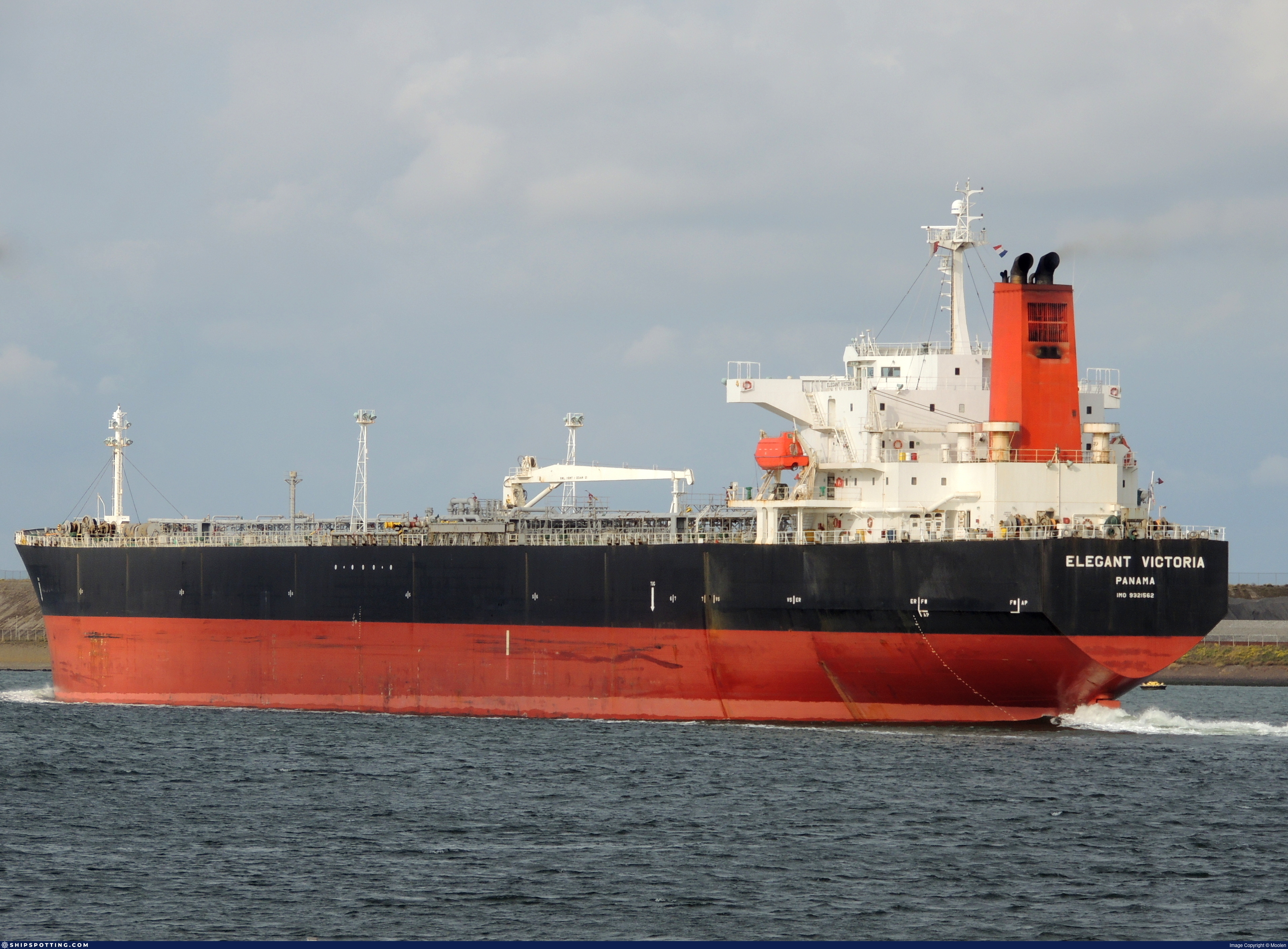
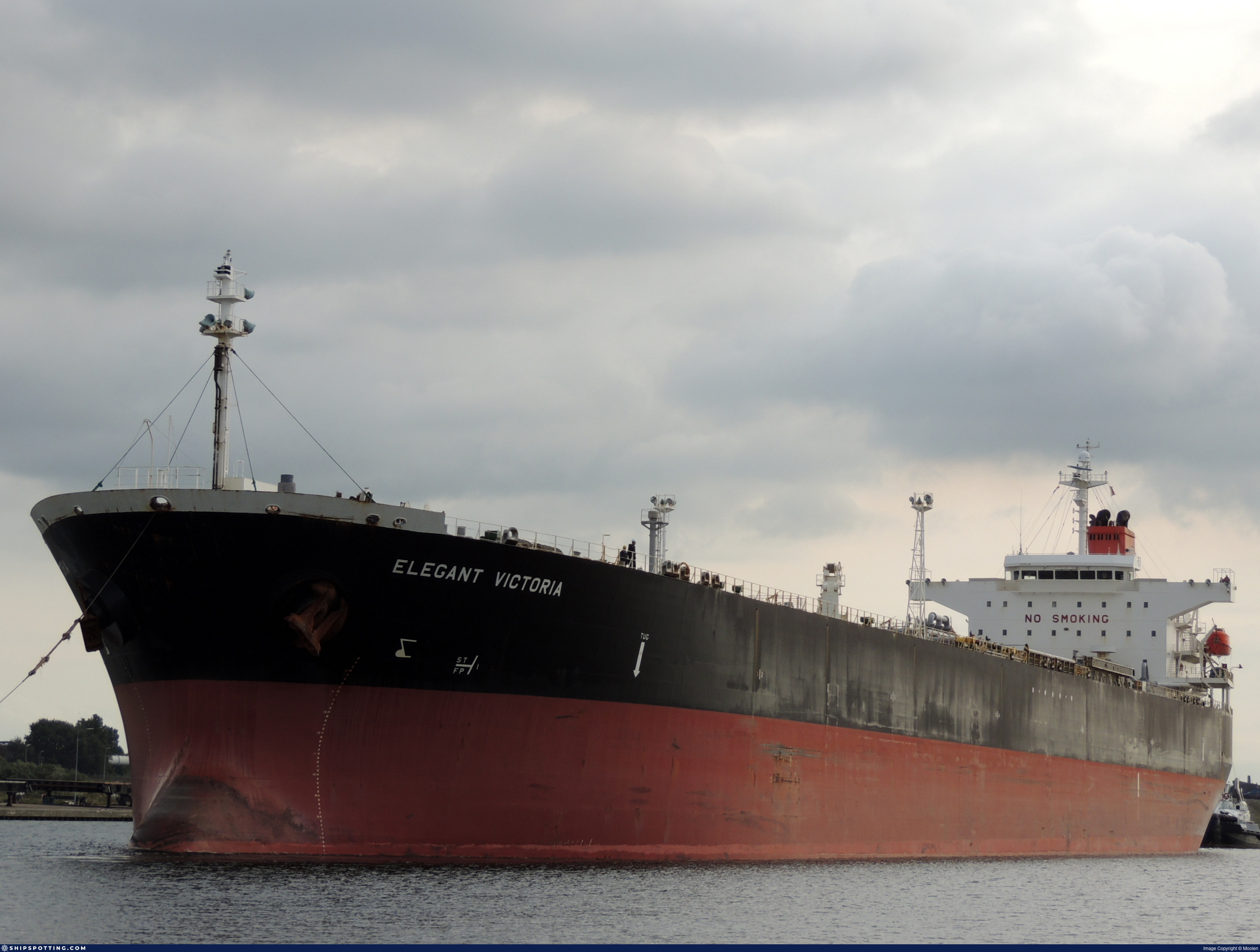
IMO 9321562
Vessel information
Sanctioned by
Company & Ownership
Management & Operations
Classification & Safety
Port State Control (PSC) Inspections
Survey Renewal & Certificates
| Code | Type | Issuer | Issued | Expires |
|---|---|---|---|---|
| 501 | Cargo Ship Safety Construction | DNV GL AS (278) | 14/12/2021 | 22/01/2027 |
| 502 | Cargo Ship Safety Equipment | DNV GL AS (278) | 14/12/2021 | 22/01/2027 |
Programs & Notes
EU Russia Sanctions – Shadow Fleet | SEMA (Canada) — vessel designations | The Russia (Sanctions) (EU Exit) Regulations 2019
Vessel Changes
 🔄 Owner
AIS Events
11 events detected • 3 zones • Last: Jun 2, 2026
- Zone: Port Said/Suez Approach
- Duration: 2h 12m
- Data Points: 5 AIS positions
- Period: 2026-06-02T04:12:08+00:00 to 2026-06-02T06:24:09+00:00
Show Raw Evidence JSON
{
    "zone_id": "osint_port_said",
    "zone_name": "Port Said\/Suez Approach",
    "dwell_minutes": 132,
    "points_in_zone": 5,
    "first_point": {
        "ts": "2026-06-02T04:12:08+00:00",
        "lat": 29.756126699999999374313119915314018726348876953125,
        "lon": 32.6010433000000006131813279353082180023193359375
    },
    "last_point": {
        "ts": "2026-06-02T06:24:09+00:00",
        "lat": 29.7563549999999992223820299841463565826416015625,
        "lon": 32.60183500000000123009158414788544178009033203125
    }
}- Zone: Port Said/Suez Approach
- Duration: 3h 18m
- Data Points: 8 AIS positions
- Period: 2026-06-02T03:06:10+00:00 to 2026-06-02T06:24:09+00:00
Show Raw Evidence JSON
{
    "zone_id": "osint_port_said",
    "zone_name": "Port Said\/Suez Approach",
    "dwell_minutes": 198,
    "points_in_zone": 8,
    "first_point": {
        "ts": "2026-06-02T03:06:10+00:00",
        "lat": 29.756118300000000687077772454358637332916259765625,
        "lon": 32.6007182999999969297277857549488544464111328125
    },
    "last_point": {
        "ts": "2026-06-02T06:24:09+00:00",
        "lat": 29.7563549999999992223820299841463565826416015625,
        "lon": 32.60183500000000123009158414788544178009033203125
    }
}- Zone: Port Said/Suez Approach
- Duration: 3h 45m
- Data Points: 9 AIS positions
- Period: 2026-06-02T02:39:11+00:00 to 2026-06-02T06:24:09+00:00
Show Raw Evidence JSON
{
    "zone_id": "osint_port_said",
    "zone_name": "Port Said\/Suez Approach",
    "dwell_minutes": 225,
    "points_in_zone": 9,
    "first_point": {
        "ts": "2026-06-02T02:39:11+00:00",
        "lat": 29.7562199999999990041033015586435794830322265625,
        "lon": 32.600093299999997498161974363029003143310546875
    },
    "last_point": {
        "ts": "2026-06-02T06:24:09+00:00",
        "lat": 29.7563549999999992223820299841463565826416015625,
        "lon": 32.60183500000000123009158414788544178009033203125
    }
}- Duration: 5h 57m
- Radius: 110 meters
- Data Points: 13 AIS positions
- Centroid: 29.7563, 32.6007
- Zone: Port Said/Suez Approach
Show Raw Evidence JSON
{
    "radius_m": 109.5,
    "duration_minutes": 357.1000000000000227373675443232059478759765625,
    "points": 13,
    "centroid": {
        "lat": 29.75626897692307437637282419018447399139404296875,
        "lon": 32.6007076846153864835287095047533512115478515625
    },
    "bbox": {
        "min_lat": 29.756118300000000687077772454358637332916259765625,
        "min_lon": 32.5996999999999985675458447076380252838134765625,
        "max_lat": 29.756428299999999609326550853438675403594970703125,
        "max_lon": 32.60183500000000123009158414788544178009033203125
    },
    "zone_id": "osint_port_said"
}- Zone: Port Said/Suez Approach
- Duration: 5h 57m
- Data Points: 13 AIS positions
- Period: 2026-06-02T00:27:06+00:00 to 2026-06-02T06:24:09+00:00
Show Raw Evidence JSON
{
    "zone_id": "osint_port_said",
    "zone_name": "Port Said\/Suez Approach",
    "dwell_minutes": 357.1000000000000227373675443232059478759765625,
    "points_in_zone": 13,
    "first_point": {
        "ts": "2026-06-02T00:27:06+00:00",
        "lat": 29.75641170000000101936166174709796905517578125,
        "lon": 32.5997066999999987046976457349956035614013671875
    },
    "last_point": {
        "ts": "2026-06-02T06:24:09+00:00",
        "lat": 29.7563549999999992223820299841463565826416015625,
        "lon": 32.60183500000000123009158414788544178009033203125
    }
}- Duration: 6h 27m
- Radius: 97 meters
- Data Points: 12 AIS positions
- Centroid: 29.7563, 32.6006
- Zone: Port Said/Suez Approach
Show Raw Evidence JSON
{
    "radius_m": 96.599999999999994315658113919198513031005859375,
    "duration_minutes": 387,
    "points": 12,
    "centroid": {
        "lat": 29.756252499999998661905920016579329967498779296875,
        "lon": 32.60060734999999709771145717240869998931884765625
    },
    "bbox": {
        "min_lat": 29.756118300000000687077772454358637332916259765625,
        "min_lon": 32.5996999999999985675458447076380252838134765625,
        "max_lat": 29.756428299999999609326550853438675403594970703125,
        "max_lon": 32.60160499999999927922544884495437145233154296875
    },
    "zone_id": "osint_port_said"
}- Zone: Port Said/Suez Approach
- Duration: 6h 27m
- Data Points: 12 AIS positions
- Period: 2026-06-01T23:39:06+00:00 to 2026-06-02T06:06:07+00:00
Show Raw Evidence JSON
{
    "zone_id": "osint_port_said",
    "zone_name": "Port Said\/Suez Approach",
    "dwell_minutes": 387,
    "points_in_zone": 12,
    "first_point": {
        "ts": "2026-06-01T23:39:06+00:00",
        "lat": 29.756164999999999309920895029790699481964111328125,
        "lon": 32.60159329999999755500539322383701801300048828125
    },
    "last_point": {
        "ts": "2026-06-02T06:06:07+00:00",
        "lat": 29.756298300000000978116077021695673465728759765625,
        "lon": 32.60160499999999927922544884495437145233154296875
    }
}- Gap Duration: 5h 3m
- Last Seen: 2026-03-21T10:49:58+00:00 at 36.4591, 26.7772 (Zone: Southern Kattegat Surveillance Zone)
- Next Seen: 2026-03-21T15:52:58+00:00 at 35.9535, 27.5283
🛰️ Gap Corroboration
These are snapshots that may corroborate presence during the gap. They do not reconstruct a continuous route.
SAR Imagery (Sentinel-1)
Status: ✗ No SAR coverage
No Sentinel-1 scenes covering corridor and time window
VIIRS Thermal Anomaly
Status: ✗ No detections
No VIIRS thermal/light detections in corridor
Show Raw Evidence JSON
{
    "gap_minutes": 303,
    "last_seen": {
        "ts": "2026-03-21T10:49:58+00:00",
        "lat": 36.459076699999997117629391141235828399658203125,
        "lon": 26.777211699999998728571881656534969806671142578125,
        "sog": 9.5,
        "zone_id": "discovered_084"
    },
    "next_seen": {
        "ts": "2026-03-21T15:52:58+00:00",
        "lat": 35.95349329999999810070221428759396076202392578125,
        "lon": 27.5282882999999998219209373928606510162353515625,
        "zone_ids": [
            "discovered_078"
        ]
    },
    "gap_enrichment": {
        "status": "not_found",
        "corridor": {
            "start": {
                "lat": 36.459076699999997117629391141235828399658203125,
                "lon": 26.777211699999998728571881656534969806671142578125,
                "ts": "2026-03-21T10:49:58+00:00"
            },
            "end": {
                "lat": 35.95349329999999810070221428759396076202392578125,
                "lon": 27.5282882999999998219209373928606510162353515625,
                "ts": "2026-03-21T15:52:58+00:00"
            },
            "bbox": {
                "min_lat": 35.773313000000001693479134701192378997802734375,
                "min_lon": 26.553910999999999376086634583771228790283203125,
                "max_lat": 36.6392570000000006302798283286392688751220703125,
                "max_lon": 27.751588999999999174406184465624392032623291015625
            },
            "buffer_km": 20
        },
        "sar": {
            "status": "not_found",
            "notes": "No Sentinel-1 scenes covering corridor and time window"
        },
        "viirs": {
            "status": "not_found",
            "notes": "No VIIRS thermal\/light detections in corridor"
        },
        "searched_at": "2026-03-21T16:15:04.400452+00:00"
    }
}- Zone: Southern Kattegat Surveillance Zone
- Duration: 2h 28m
- Data Points: 9 AIS positions
- Period: 2026-03-21T08:21:38+00:00 to 2026-03-21T10:49:58+00:00
Show Raw Evidence JSON
{
    "zone_id": "discovered_084",
    "zone_name": "Norwegian Sea Surveillance Zone",
    "dwell_minutes": 148.30000000000001136868377216160297393798828125,
    "points_in_zone": 9,
    "first_point": {
        "ts": "2026-03-21T08:21:38+00:00",
        "lat": 36.7264966999999984409441822208464145660400390625,
        "lon": 26.413219999999999032525010989047586917877197265625
    },
    "last_point": {
        "ts": "2026-03-21T10:49:58+00:00",
        "lat": 36.459076699999997117629391141235828399658203125,
        "lon": 26.777211699999998728571881656534969806671142578125
    }
}- Zone: Southern Kattegat Surveillance Zone
- Duration: 4h 6m
- Data Points: 11 AIS positions
- Period: 2026-03-21T06:43:17+00:00 to 2026-03-21T10:49:58+00:00
Show Raw Evidence JSON
{
    "zone_id": "discovered_084",
    "zone_name": "Norwegian Sea Surveillance Zone",
    "dwell_minutes": 246.69999999999998863131622783839702606201171875,
    "points_in_zone": 11,
    "first_point": {
        "ts": "2026-03-21T06:43:17+00:00",
        "lat": 36.9347666999999972858859109692275524139404296875,
        "lon": 26.2186200000000013687895261682569980621337890625
    },
    "last_point": {
        "ts": "2026-03-21T10:49:58+00:00",
        "lat": 36.459076699999997117629391141235828399658203125,
        "lon": 26.777211699999998728571881656534969806671142578125
    }
}- Gap Duration: 4h 10m
- Last Seen: 2026-03-21T02:32:37+00:00 at 37.4656, 25.7818 (Zone: Northwest Iberian Sea Monitoring Zone)
- Next Seen: 2026-03-21T06:43:17+00:00 at 36.9348, 26.2186
🛰️ Gap Corroboration
These are snapshots that may corroborate presence during the gap. They do not reconstruct a continuous route.
SAR Imagery (Sentinel-1)
Status: ✓ Snapshot available
SAR snapshot available for review
Scene: S1C_IW_GRDH_1SDV_20260321T041443_20260321T041508_006857_00DDD8_6A01_COG • Time: 2026-03-21T04:14:43.702983Z
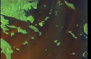
SAR coverage thumbnail
VIIRS Thermal Anomaly
Status: ✗ No detections
No VIIRS thermal/light detections in corridor
Show Raw Evidence JSON
{
    "gap_minutes": 250.69999999999998863131622783839702606201171875,
    "last_seen": {
        "ts": "2026-03-21T02:32:37+00:00",
        "lat": 37.4656250000000028421709430404007434844970703125,
        "lon": 25.78181000000000011596057447604835033416748046875,
        "sog": 9.5,
        "zone_id": "discovered_087"
    },
    "next_seen": {
        "ts": "2026-03-21T06:43:17+00:00",
        "lat": 36.9347666999999972858859109692275524139404296875,
        "lon": 26.2186200000000013687895261682569980621337890625,
        "zone_ids": [
            "discovered_084"
        ]
    },
    "gap_enrichment": {
        "status": "done",
        "corridor": {
            "start": {
                "lat": 37.4656250000000028421709430404007434844970703125,
                "lon": 25.78181000000000011596057447604835033416748046875,
                "ts": "2026-03-21T02:32:37+00:00"
            },
            "end": {
                "lat": 36.9347666999999972858859109692275524139404296875,
                "lon": 26.2186200000000013687895261682569980621337890625,
                "ts": "2026-03-21T06:43:17+00:00"
            },
            "bbox": {
                "min_lat": 36.7545870000000007848939276300370693206787109375,
                "min_lon": 25.555603000000001401303961756639182567596435546875,
                "max_lat": 37.64580500000000284899215330369770526885986328125,
                "max_lon": 26.444827000000000083446138887666165828704833984375
            },
            "buffer_km": 20
        },
        "sar": {
            "status": "snapshot",
            "scene_id": "S1C_IW_GRDH_1SDV_20260321T041443_20260321T041508_006857_00DDD8_6A01_COG",
            "scene_time": "2026-03-21T04:14:43.702983Z",
            "platform": "sentinel-1c",
            "assets": {
                "preview_url": "https:\/\/fleetleaks.com\/wp-content\/uploads\/fleetleaks-evidence\/sar-imagery\/2026\/03\/event_247577_thumbnail_20260321070006.png",
                "stored_path": "\/home\/fleetleaks\/public_html\/wp-content\/uploads\/fleetleaks-evidence\/sar-imagery\/2026\/03\/event_247577_thumbnail_20260321070006.png",
                "source": "copernicus_dataspace"
            },
            "notes": "SAR snapshot available for review"
        },
        "viirs": {
            "status": "not_found",
            "notes": "No VIIRS thermal\/light detections in corridor"
        },
        "searched_at": "2026-03-21T07:00:01.395955+00:00"
    }
}Sanctioned on the same day
- Aditya · IMO 9323314 🇨🇦 CA🇪🇺 EU🇬🇧 UK
- Aleksey Savrasov · IMO 9645061 🇨🇦 CA🇪🇺 EU
- ALTURA · IMO 9292199 🇨🇦 CA🇪🇺 EU🇬🇧 UK
- Anabar · IMO 9194012 🇨🇦 CA
- Apate · IMO 9433016 🇨🇦 CA🇪🇺 EU🇬🇧 UK
- Armada Leader · IMO 9260483 🇨🇦 CA🇪🇺 EU
- Aura 1 · IMO 9472634 🇨🇦 CA🇪🇺 EU🇬🇧 UK
- Bergen T · IMO 8918540 🇨🇦 CA🇪🇺 EU