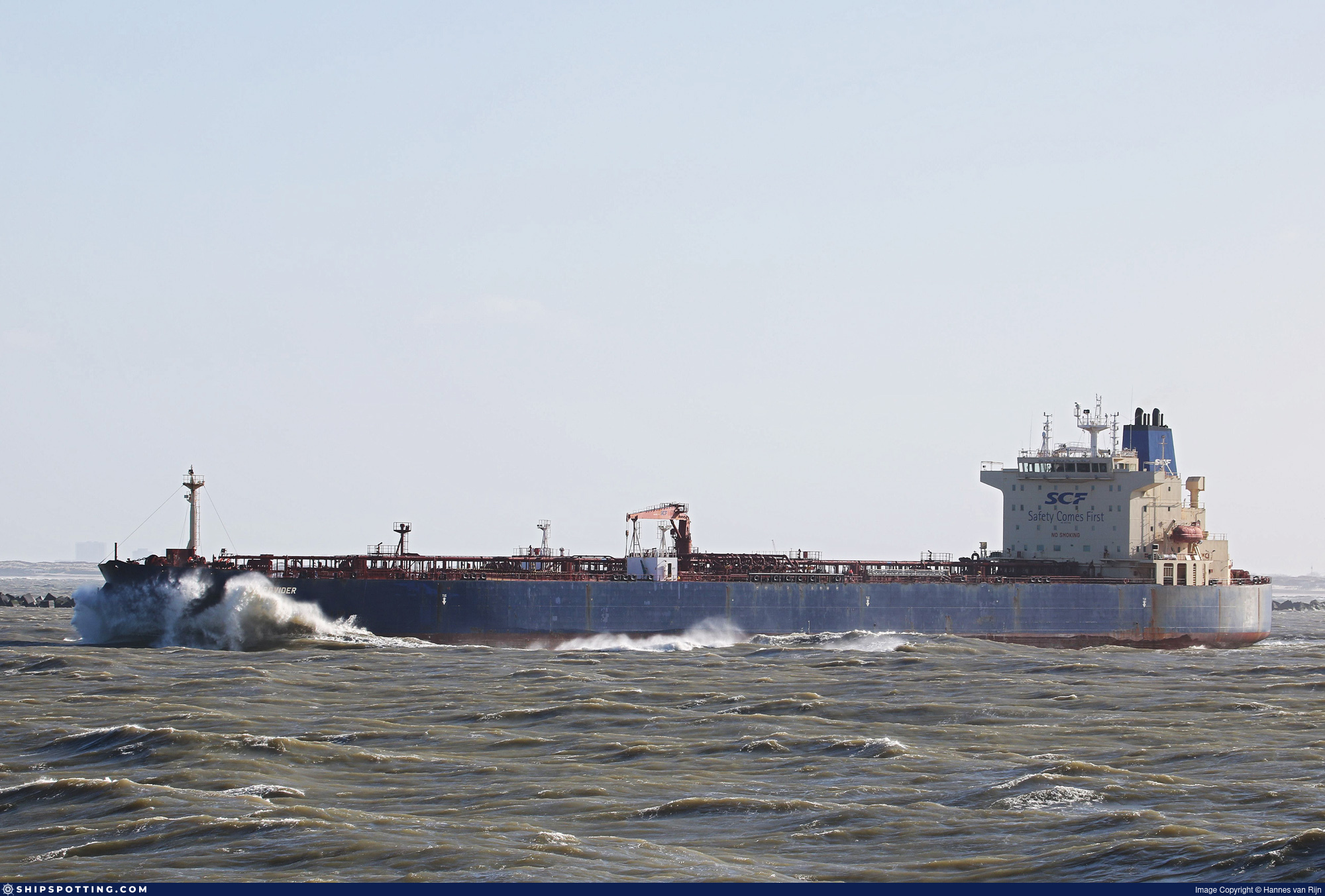
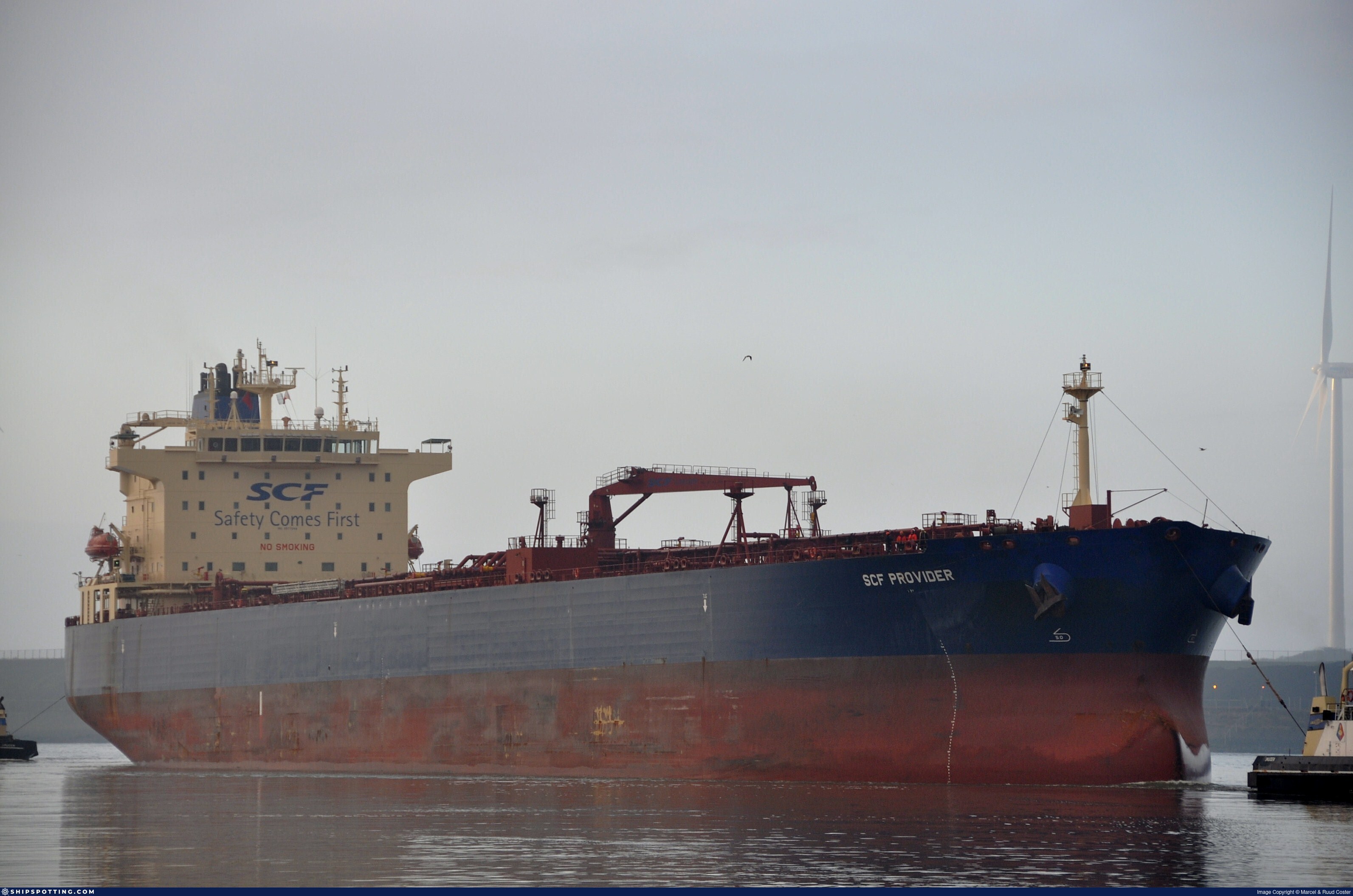
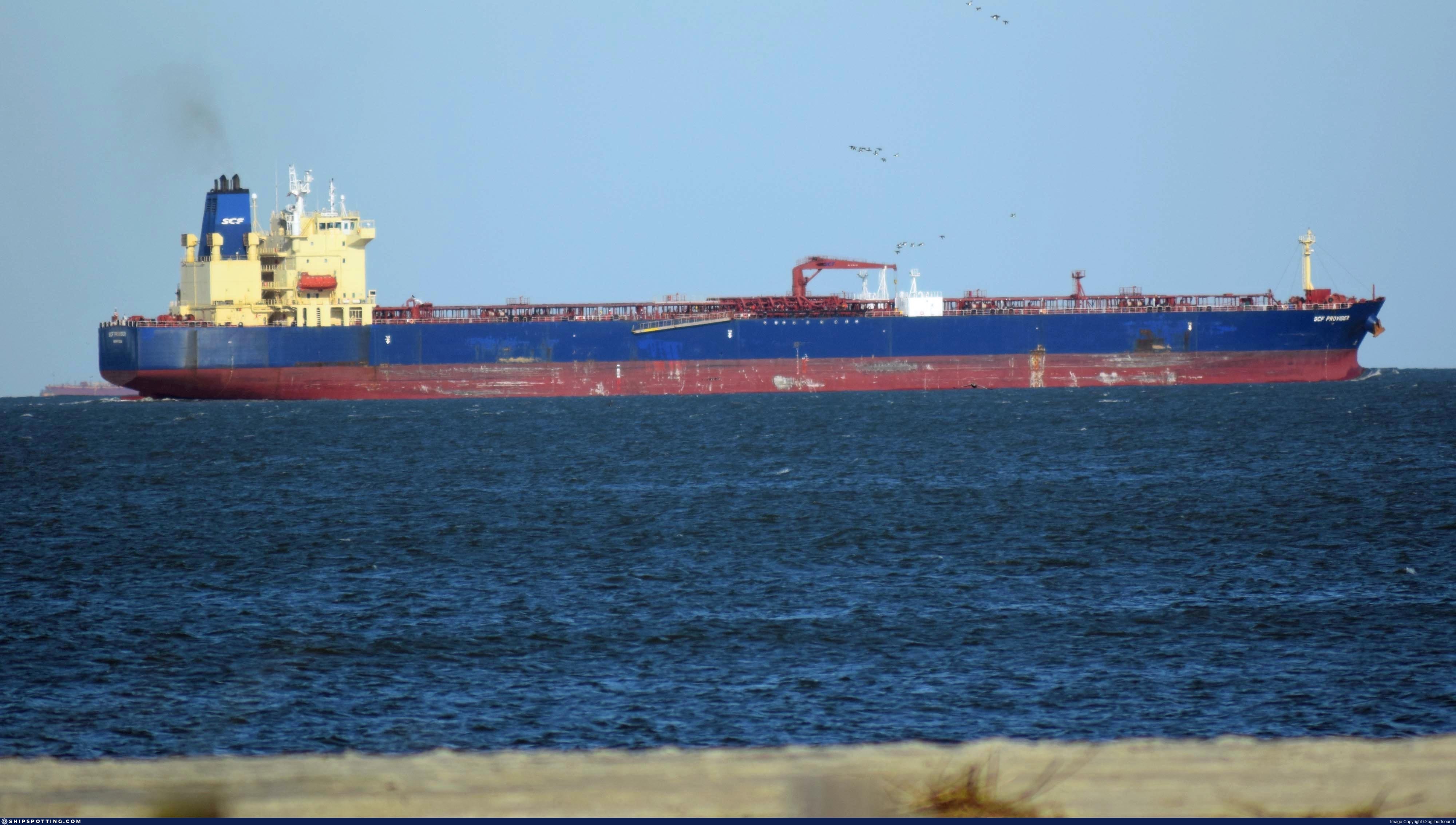
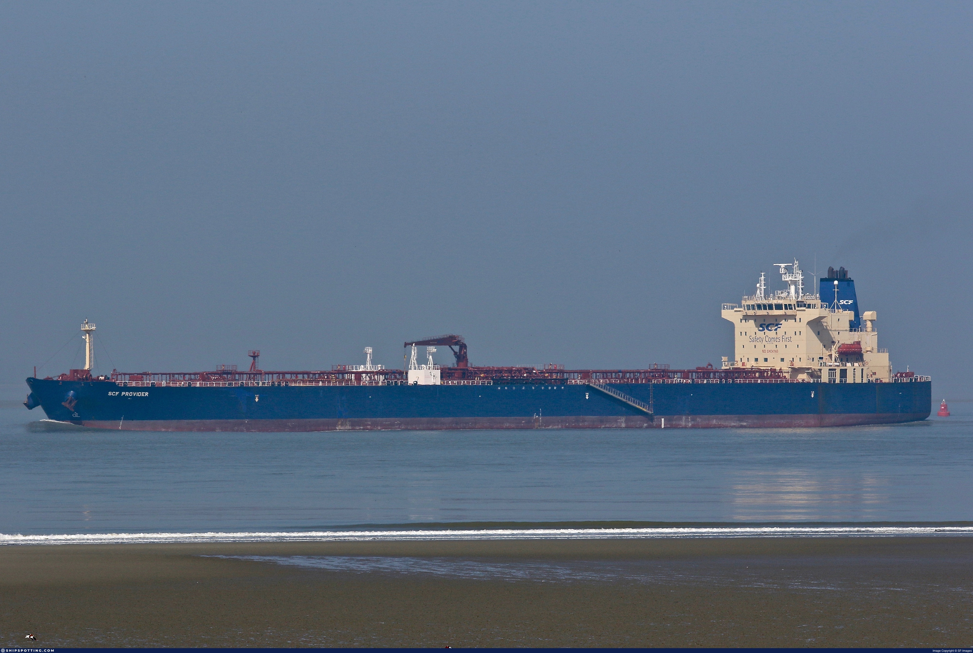
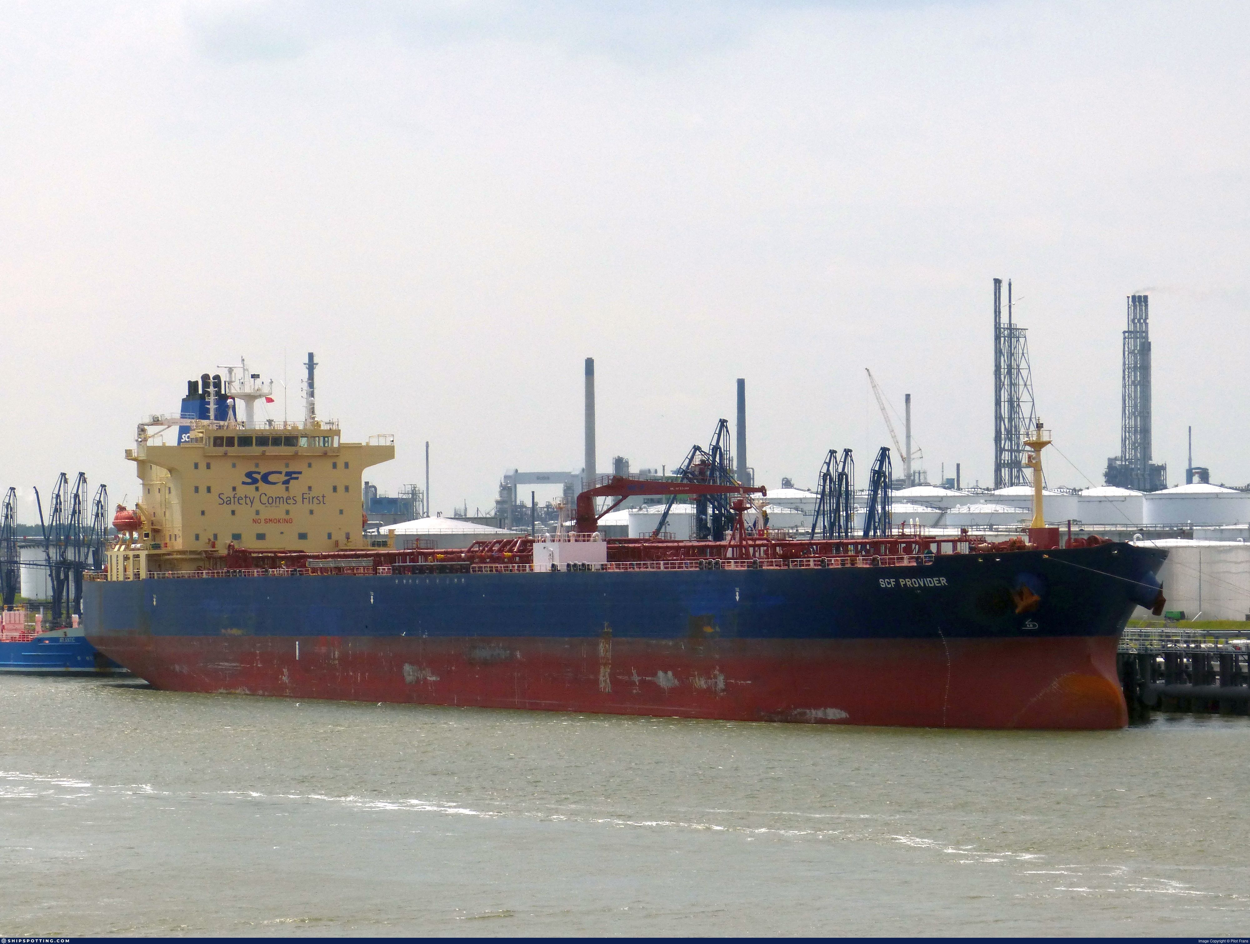
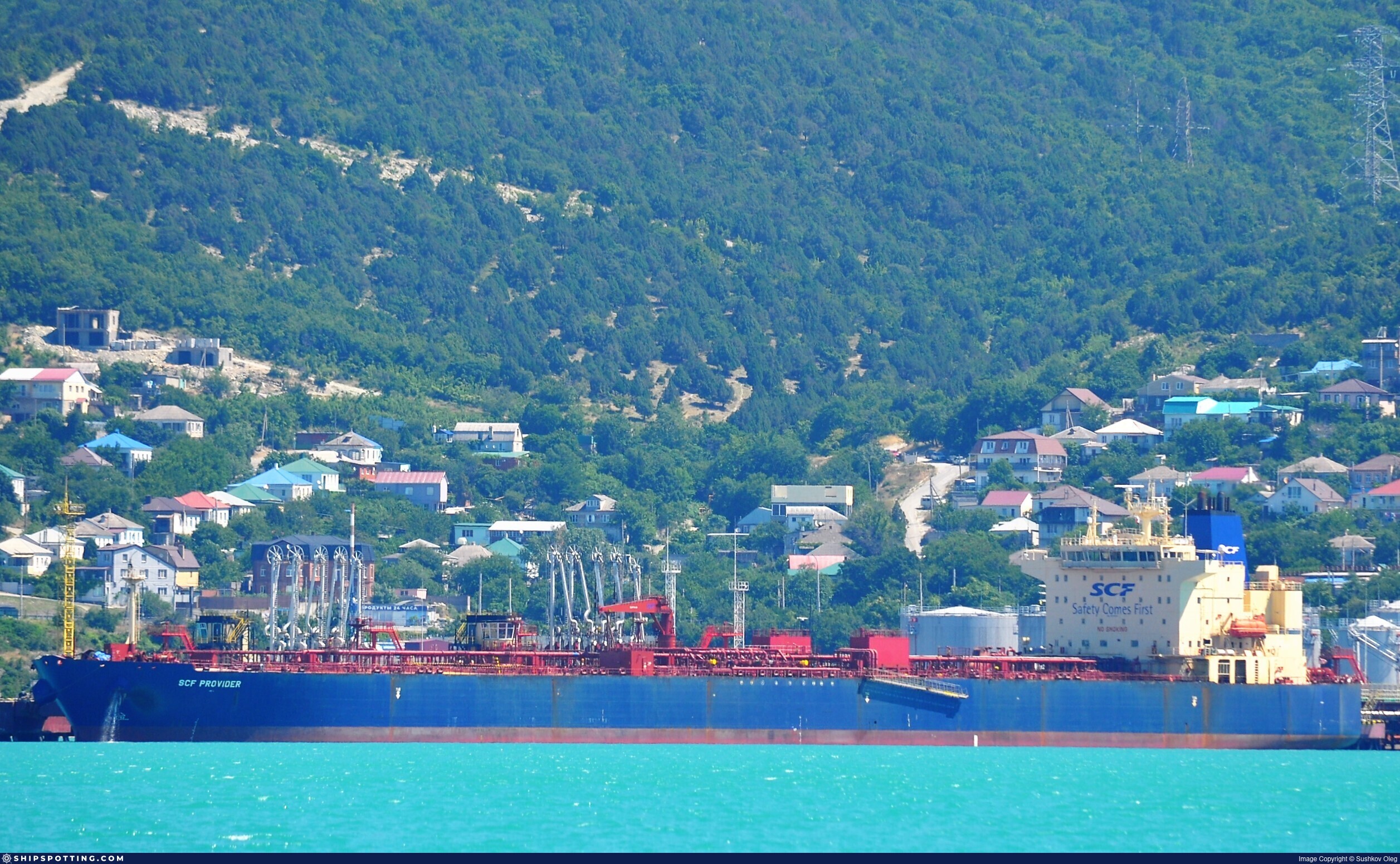
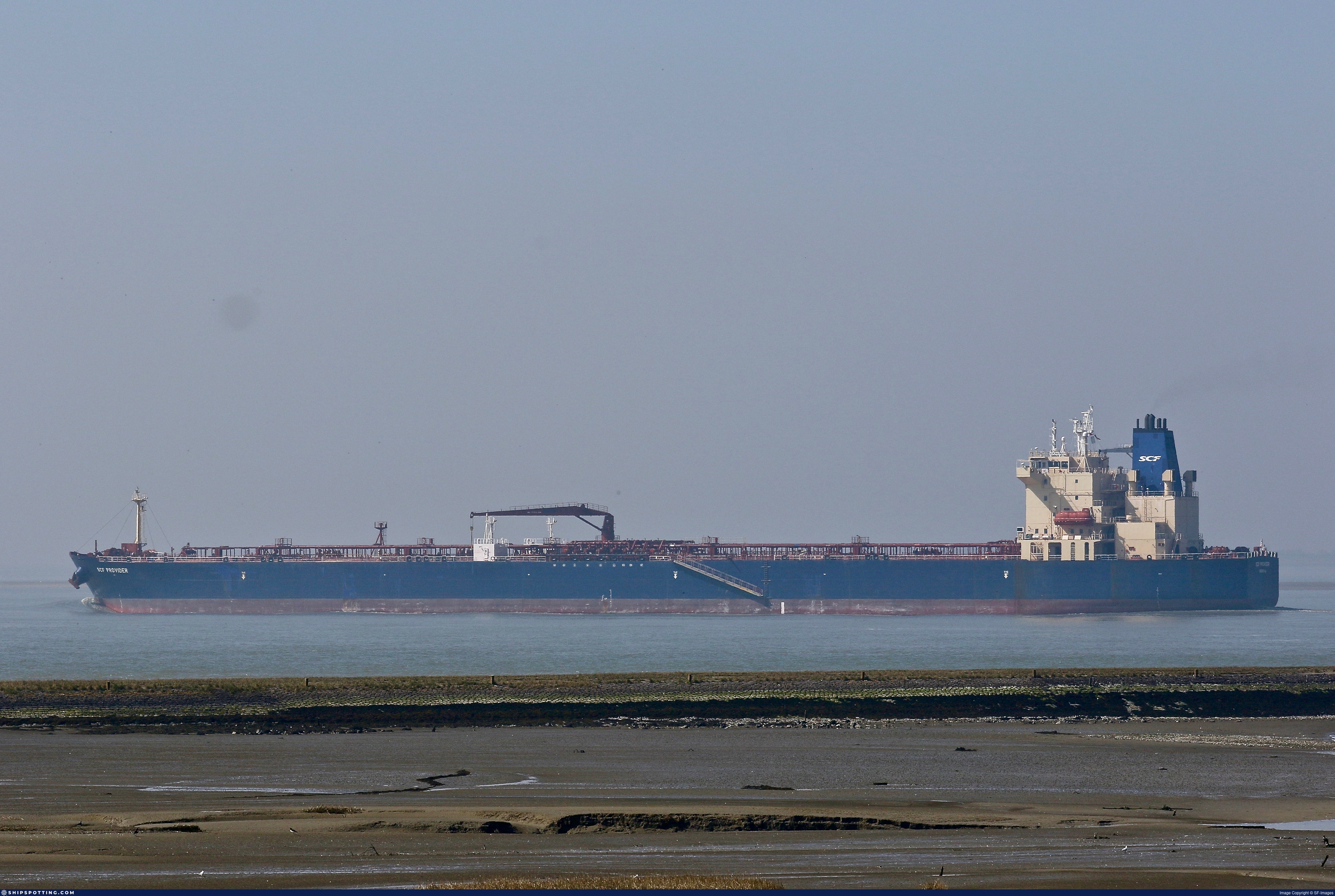
IMO 9577094
Vessel information
Sanctioned by
Company & Ownership
Management & Operations
Port State Control (PSC) Inspections
Survey Renewal & Certificates
| Code | Type | Issuer | Issued | Expires |
|---|---|---|---|---|
| 510 | Safety Management Certificate | Liberia (LR) | 20/04/2022 | 31/08/2026 |
| 509 | Document of Compliance | Indian Register of Shipping (150) | 02/06/2022 | 28/01/2026 |
Programs & Notes
SEMA (Canada) — vessel designations | UKRAINE-EO13662] [RUSSIA-EO14024 | The Russia (Sanctions) (EU Exit) Regulations 2019 | Added in EU Sanctions Package 15 | (Council Decision (CFSP) 2024/3187, Annex XVI to Decision 2014/512/CFSP) | Press Release | Official Journal
DateOfListing: 2024-12-17 || Secondary sanctions risk: See Section 11 of Executive Order 14024.; alt. Secondary sanctions risk: Ukraine-/Russia-Related Sanctions Regulations, 31 CFR 589.201 and/or 589.209; Vessel Registration Identification IMO 9577094; MMSI 314976000; Linked To: JOINT STOCK COMPANY SOVCOMFLOT. || DateDesignated: 2025-07-21 | Shipping sanctions: (see “Other information”) | Shipping sanctions: a specified ship is prohibited from being provided with access to or having its master or pilot cause it to enter a port in the UK, may have its registration on the UK Ship Register terminated, and a master or pilot of a specified ship may be given a port barring direction, a detention direction, and a port entry direction or a movement direction. | IMO 9577094 (“Pathfinder”) is, has been or is likely to be involved in activity whose object or effect is to destabilise Ukraine or undermine or threaten the territorial integrity, sovereignty or independence of Ukraine or to obtain a benefit from or support the Government of Russia. Namely, 9577094 is involved in carrying oil or oil products that originated in Russia from Russia to a third country.
Vessel Changes
 🔄 Owner
AIS Events
50 events detected • 13 zones • Last: Jul 14, 2026
- Zone: Western Mediterranean Surveillance Zone
- Duration: 1h 51m
- Data Points: 9 AIS positions
- Period: 2026-07-14T19:01:03+00:00 to 2026-07-14T20:52:44+00:00
Show Raw Evidence JSON
{
    "zone_id": "discovered_013",
    "zone_name": "Western Mediterranean Surveillance Zone",
    "dwell_minutes": 111.7000000000000028421709430404007434844970703125,
    "points_in_zone": 9,
    "first_point": {
        "ts": "2026-07-14T19:01:03+00:00",
        "lat": 35.97005329999999645451680407859385013580322265625,
        "lon": -8.1210167000000001991111275856383144855499267578125
    },
    "last_point": {
        "ts": "2026-07-14T20:52:44+00:00",
        "lat": 35.9774833000000029414877644740045070648193359375,
        "lon": -8.602714999999999889723767410032451152801513671875
    }
}- Zone: Western Mediterranean Surveillance Zone
- Duration: 2h 38m
- Data Points: 15 AIS positions
- Period: 2026-07-14T18:14:24+00:00 to 2026-07-14T20:52:44+00:00
Show Raw Evidence JSON
{
    "zone_id": "discovered_013",
    "zone_name": "Western Mediterranean Surveillance Zone",
    "dwell_minutes": 158.30000000000001136868377216160297393798828125,
    "points_in_zone": 15,
    "first_point": {
        "ts": "2026-07-14T18:14:24+00:00",
        "lat": 35.96642669999999952779035083949565887451171875,
        "lon": -7.91908169999999955734892864711582660675048828125
    },
    "last_point": {
        "ts": "2026-07-14T20:52:44+00:00",
        "lat": 35.9774833000000029414877644740045070648193359375,
        "lon": -8.602714999999999889723767410032451152801513671875
    }
}- Zone: Ceuta/Gibraltar STS Zone
- Duration: 1h 19m
- Data Points: 25 AIS positions
- Period: 2026-07-14T06:34:24+00:00 to 2026-07-14T07:54:04+00:00
Show Raw Evidence JSON
{
    "zone_id": "osint_ceuta",
    "zone_name": "Ceuta\/Gibraltar STS Zone",
    "dwell_minutes": 79.7000000000000028421709430404007434844970703125,
    "points_in_zone": 25,
    "first_point": {
        "ts": "2026-07-14T06:34:24+00:00",
        "lat": 36.06477170000000143090801429934799671173095703125,
        "lon": -5.21545170000000002374918040004558861255645751953125
    },
    "last_point": {
        "ts": "2026-07-14T07:54:04+00:00",
        "lat": 35.9907333000000022593667381443083286285400390625,
        "lon": -5.49040329999999965338020047056488692760467529296875
    }
}- Zone: Southern Öresund Surveillance Zone
- Duration: 1h 11m
- Data Points: 17 AIS positions
- Period: 2026-07-14T05:02:43+00:00 to 2026-07-14T06:14:32+00:00
Show Raw Evidence JSON
{
    "zone_id": "discovered_003",
    "zone_name": "Southern \u00d6resund Surveillance Zone",
    "dwell_minutes": 71.7999999999999971578290569595992565155029296875,
    "points_in_zone": 17,
    "first_point": {
        "ts": "2026-07-14T05:02:43+00:00",
        "lat": 36.1220517000000000962245394475758075714111328125,
        "lon": -4.88352499999999967172925607883371412754058837890625
    },
    "last_point": {
        "ts": "2026-07-14T06:14:32+00:00",
        "lat": 36.08227500000000276259015663526952266693115234375,
        "lon": -5.142823299999999875353751122020184993743896484375
    }
}- Zone: Southern Öresund Surveillance Zone
- Duration: 2h 13m
- Data Points: 31 AIS positions
- Period: 2026-07-14T04:01:13+00:00 to 2026-07-14T06:14:32+00:00
Show Raw Evidence JSON
{
    "zone_id": "discovered_003",
    "zone_name": "Southern \u00d6resund Surveillance Zone",
    "dwell_minutes": 133.30000000000001136868377216160297393798828125,
    "points_in_zone": 31,
    "first_point": {
        "ts": "2026-07-14T04:01:13+00:00",
        "lat": 36.148674999999997226041159592568874359130859375,
        "lon": -4.65224499999999974164666127762757241725921630859375
    },
    "last_point": {
        "ts": "2026-07-14T06:14:32+00:00",
        "lat": 36.08227500000000276259015663526952266693115234375,
        "lon": -5.142823299999999875353751122020184993743896484375
    }
}- Zone: Southern Öresund Surveillance Zone
- Duration: 3h 13m
- Data Points: 52 AIS positions
- Period: 2026-07-14T03:01:24+00:00 to 2026-07-14T06:14:32+00:00
Show Raw Evidence JSON
{
    "zone_id": "discovered_003",
    "zone_name": "Southern \u00d6resund Surveillance Zone",
    "dwell_minutes": 193.099999999999994315658113919198513031005859375,
    "points_in_zone": 52,
    "first_point": {
        "ts": "2026-07-14T03:01:24+00:00",
        "lat": 36.15729999999999932924765744246542453765869140625,
        "lon": -4.4303717000000002457227310515008866786956787109375
    },
    "last_point": {
        "ts": "2026-07-14T06:14:32+00:00",
        "lat": 36.08227500000000276259015663526952266693115234375,
        "lon": -5.142823299999999875353751122020184993743896484375
    }
}- Zone: Southern Öresund Surveillance Zone
- Duration: 4h 9m
- Data Points: 74 AIS positions
- Period: 2026-07-14T02:04:54+00:00 to 2026-07-14T06:14:32+00:00
Show Raw Evidence JSON
{
    "zone_id": "discovered_003",
    "zone_name": "Southern \u00d6resund Surveillance Zone",
    "dwell_minutes": 249.599999999999994315658113919198513031005859375,
    "points_in_zone": 74,
    "first_point": {
        "ts": "2026-07-14T02:04:54+00:00",
        "lat": 36.16665669999999721540007158182561397552490234375,
        "lon": -4.22562499999999996447286321199499070644378662109375
    },
    "last_point": {
        "ts": "2026-07-14T06:14:32+00:00",
        "lat": 36.08227500000000276259015663526952266693115234375,
        "lon": -5.142823299999999875353751122020184993743896484375
    }
}- Zone: Southern Öresund Surveillance Zone
- Duration: 5h 9m
- Data Points: 91 AIS positions
- Period: 2026-07-14T01:05:24+00:00 to 2026-07-14T06:14:32+00:00
Show Raw Evidence JSON
{
    "zone_id": "discovered_003",
    "zone_name": "Southern \u00d6resund Surveillance Zone",
    "dwell_minutes": 309.1000000000000227373675443232059478759765625,
    "points_in_zone": 91,
    "first_point": {
        "ts": "2026-07-14T01:05:24+00:00",
        "lat": 36.1838417000000021062078303657472133636474609375,
        "lon": -4.01350169999999994985273588099516928195953369140625
    },
    "last_point": {
        "ts": "2026-07-14T06:14:32+00:00",
        "lat": 36.08227500000000276259015663526952266693115234375,
        "lon": -5.142823299999999875353751122020184993743896484375
    }
}- Zone: Southern Öresund Surveillance Zone
- Duration: 6h 9m
- Data Points: 107 AIS positions
- Period: 2026-07-14T00:05:13+00:00 to 2026-07-14T06:14:32+00:00
Show Raw Evidence JSON
{
    "zone_id": "discovered_003",
    "zone_name": "Southern \u00d6resund Surveillance Zone",
    "dwell_minutes": 369.30000000000001136868377216160297393798828125,
    "points_in_zone": 107,
    "first_point": {
        "ts": "2026-07-14T00:05:13+00:00",
        "lat": 36.20730329999999952406142256222665309906005859375,
        "lon": -3.794639999999999790958327139378525316715240478515625
    },
    "last_point": {
        "ts": "2026-07-14T06:14:32+00:00",
        "lat": 36.08227500000000276259015663526952266693115234375,
        "lon": -5.142823299999999875353751122020184993743896484375
    }
}- Zone: Southern Öresund Surveillance Zone
- Duration: 6h 30m
- Data Points: 113 AIS positions
- Period: 2026-07-13T23:43:44+00:00 to 2026-07-14T06:14:32+00:00
Show Raw Evidence JSON
{
    "zone_id": "discovered_003",
    "zone_name": "Southern \u00d6resund Surveillance Zone",
    "dwell_minutes": 390.80000000000001136868377216160297393798828125,
    "points_in_zone": 113,
    "first_point": {
        "ts": "2026-07-13T23:43:44+00:00",
        "lat": 36.21493000000000250793164013884961605072021484375,
        "lon": -3.71243329999999982504732543020509183406829833984375
    },
    "last_point": {
        "ts": "2026-07-14T06:14:32+00:00",
        "lat": 36.08227500000000276259015663526952266693115234375,
        "lon": -5.142823299999999875353751122020184993743896484375
    }
}- Zone: Southern Öresund Surveillance Zone
- Duration: 6h 28m
- Data Points: 110 AIS positions
- Period: 2026-07-13T22:59:03+00:00 to 2026-07-14T05:27:44+00:00
Show Raw Evidence JSON
{
    "zone_id": "discovered_003",
    "zone_name": "Southern \u00d6resund Surveillance Zone",
    "dwell_minutes": 388.69999999999998863131622783839702606201171875,
    "points_in_zone": 110,
    "first_point": {
        "ts": "2026-07-13T22:59:03+00:00",
        "lat": 36.1655250000000023646862246096134185791015625,
        "lon": -3.547831700000000143546685649198479950428009033203125
    },
    "last_point": {
        "ts": "2026-07-14T05:27:44+00:00",
        "lat": 36.11024830000000207519406103529036045074462890625,
        "lon": -4.9798533000000002601836968096904456615447998046875
    }
}- Zone: Southern Öresund Surveillance Zone
- Duration: 6h 38m
- Data Points: 99 AIS positions
- Period: 2026-07-13T21:41:03+00:00 to 2026-07-14T04:19:14+00:00
Show Raw Evidence JSON
{
    "zone_id": "discovered_003",
    "zone_name": "Southern \u00d6resund Surveillance Zone",
    "dwell_minutes": 398.19999999999998863131622783839702606201171875,
    "points_in_zone": 99,
    "first_point": {
        "ts": "2026-07-13T21:41:03+00:00",
        "lat": 36.143581699999998591010808013379573822021484375,
        "lon": -3.245243299999999830873775863437913358211517333984375
    },
    "last_point": {
        "ts": "2026-07-14T04:19:14+00:00",
        "lat": 36.14583830000000119753167382441461086273193359375,
        "lon": -4.719023299999999920828486210666596889495849609375
    }
}- Zone: Black Sea Sanctioned Vessel Monitoring Zone
- Duration: 1h 8m
- Data Points: 3 AIS positions
- Period: 2026-07-12T20:31:23+00:00 to 2026-07-12T21:39:25+00:00
Show Raw Evidence JSON
{
    "zone_id": "discovered_033",
    "zone_name": "Black Sea Sanctioned Vessel Monitoring Zone",
    "dwell_minutes": 68,
    "points_in_zone": 3,
    "first_point": {
        "ts": "2026-07-12T20:31:23+00:00",
        "lat": 37.42628669999999857509465073235332965850830078125,
        "lon": 2.692848300000000083542772699729539453983306884765625
    },
    "last_point": {
        "ts": "2026-07-12T21:39:25+00:00",
        "lat": 37.4086716999999993049641489051282405853271484375,
        "lon": 2.384485000000000187725390787818469107151031494140625
    }
}- Zone: Mediterranean Sea Surveillance Zone
- Duration: 1 hours
- Data Points: 15 AIS positions
- Period: 2026-07-12T18:04:43+00:00 to 2026-07-12T19:04:45+00:00
Show Raw Evidence JSON
{
    "zone_id": "discovered_152",
    "zone_name": "Mediterranean Sea Surveillance Zone",
    "dwell_minutes": 60,
    "points_in_zone": 15,
    "first_point": {
        "ts": "2026-07-12T18:04:43+00:00",
        "lat": 37.45749330000000298923623631708323955535888671875,
        "lon": 3.356538299999999974687625581282190978527069091796875
    },
    "last_point": {
        "ts": "2026-07-12T19:04:45+00:00",
        "lat": 37.44414330000000035170160117559134960174560546875,
        "lon": 3.0848867000000002036586010945029556751251220703125
    }
}- Zone: Mediterranean Sea Surveillance Zone
- Duration: 1h 52m
- Data Points: 20 AIS positions
- Period: 2026-07-12T17:12:03+00:00 to 2026-07-12T19:04:45+00:00
Show Raw Evidence JSON
{
    "zone_id": "discovered_152",
    "zone_name": "Mediterranean Sea Surveillance Zone",
    "dwell_minutes": 112.7000000000000028421709430404007434844970703125,
    "points_in_zone": 20,
    "first_point": {
        "ts": "2026-07-12T17:12:03+00:00",
        "lat": 37.47206829999999655456122127361595630645751953125,
        "lon": 3.588071699999999975005948726902715861797332763671875
    },
    "last_point": {
        "ts": "2026-07-12T19:04:45+00:00",
        "lat": 37.44414330000000035170160117559134960174560546875,
        "lon": 3.0848867000000002036586010945029556751251220703125
    }
}- Zone: Alboran Sea Monitoring Zone
- Duration: 1h 35m
- Data Points: 5 AIS positions
- Period: 2026-07-12T15:37:14+00:00 to 2026-07-12T17:13:03+00:00
Show Raw Evidence JSON
{
    "zone_id": "discovered_135",
    "zone_name": "Alboran Sea Monitoring Zone",
    "dwell_minutes": 95.7999999999999971578290569595992565155029296875,
    "points_in_zone": 5,
    "first_point": {
        "ts": "2026-07-12T15:37:14+00:00",
        "lat": 37.4982882999999986850525601767003536224365234375,
        "lon": 3.982435000000000169251279658055864274501800537109375
    },
    "last_point": {
        "ts": "2026-07-12T17:13:03+00:00",
        "lat": 37.47188330000000178188201971352100372314453125,
        "lon": 3.583790000000000031121771826292388141155242919921875
    }
}- Zone: English Channel Surveillance Zone
- Duration: 1h 3m
- Data Points: 6 AIS positions
- Period: 2026-07-12T11:39:44+00:00 to 2026-07-12T12:43:04+00:00
Show Raw Evidence JSON
{
    "zone_id": "discovered_077",
    "zone_name": "English Channel Surveillance Zone",
    "dwell_minutes": 63.2999999999999971578290569595992565155029296875,
    "points_in_zone": 6,
    "first_point": {
        "ts": "2026-07-12T11:39:44+00:00",
        "lat": 37.57007329999999711844793637283146381378173828125,
        "lon": 5.0038482999999995826101439888589084148406982421875
    },
    "last_point": {
        "ts": "2026-07-12T12:43:04+00:00",
        "lat": 37.5493967000000026246198103763163089752197265625,
        "lon": 4.73434329999999992111270330497063696384429931640625
    }
}- Zone: Central Iberian Sea Monitoring Zone
- Duration: 1h 30m
- Data Points: 11 AIS positions
- Period: 2026-07-12T11:02:24+00:00 to 2026-07-12T12:32:43+00:00
Show Raw Evidence JSON
{
    "zone_id": "discovered_204",
    "zone_name": "Central Iberian Sea Monitoring Zone",
    "dwell_minutes": 90.2999999999999971578290569595992565155029296875,
    "points_in_zone": 11,
    "first_point": {
        "ts": "2026-07-12T11:02:24+00:00",
        "lat": 37.58611499999999949750417727045714855194091796875,
        "lon": 5.1563832999999998918383425916545093059539794921875
    },
    "last_point": {
        "ts": "2026-07-12T12:32:43+00:00",
        "lat": 37.5519833000000033962351153604686260223388671875,
        "lon": 4.77959499999999959385377223952673375606536865234375
    }
}- Zone: Alboran Sea Surveillance Zone
- Duration: 1h 6m
- Data Points: 10 AIS positions
- Period: 2026-07-11T23:01:14+00:00 to 2026-07-12T00:07:53+00:00
Show Raw Evidence JSON
{
    "zone_id": "discovered_103",
    "zone_name": "Alboran Sea Surveillance Zone",
    "dwell_minutes": 66.7000000000000028421709430404007434844970703125,
    "points_in_zone": 10,
    "first_point": {
        "ts": "2026-07-11T23:01:14+00:00",
        "lat": 37.73326670000000149229890666902065277099609375,
        "lon": 8.287491700000000349746187566779553890228271484375
    },
    "last_point": {
        "ts": "2026-07-12T00:07:53+00:00",
        "lat": 37.7222067000000009784344001673161983489990234375,
        "lon": 7.99786999999999981270093485363759100437164306640625
    }
}- Zone: Alboran Sea Surveillance Zone
- Duration: 2h 7m
- Data Points: 34 AIS positions
- Period: 2026-07-11T22:00:54+00:00 to 2026-07-12T00:07:53+00:00
Show Raw Evidence JSON
{
    "zone_id": "discovered_103",
    "zone_name": "Alboran Sea Surveillance Zone",
    "dwell_minutes": 127,
    "points_in_zone": 34,
    "first_point": {
        "ts": "2026-07-11T22:00:54+00:00",
        "lat": 37.74873670000000203117451746948063373565673828125,
        "lon": 8.540234999999999132569428184069693088531494140625
    },
    "last_point": {
        "ts": "2026-07-12T00:07:53+00:00",
        "lat": 37.7222067000000009784344001673161983489990234375,
        "lon": 7.99786999999999981270093485363759100437164306640625
    }
}- Gap Duration: 5h 50m
- Last Seen: 2026-07-11T16:10:53+00:00 at 37.6706, 9.9678 (Zone: Strait of Malacca Sanctions Monitoring Zone)
- Next Seen: 2026-07-11T22:00:54+00:00 at 37.7487, 8.5402
🛰️ Gap Corroboration
These are snapshots that may corroborate presence during the gap. They do not reconstruct a continuous route.
SAR Imagery (Sentinel-1)
Status: ✓ Snapshot available
SAR snapshot available for review
Scene: S1D_IW_GRDH_1SDV_20260711T172039_20260711T172104_003629_006776_3B93_COG • Time: 2026-07-11T17:20:39.089246Z
SAR coverage thumbnail
VIIRS Thermal Anomaly
Status: ✗ No detections
No VIIRS thermal/light detections in corridor
Show Raw Evidence JSON
{
    "gap_minutes": 350,
    "last_seen": {
        "ts": "2026-07-11T16:10:53+00:00",
        "lat": 37.6705917000000027883288566954433917999267578125,
        "lon": 9.967793300000000300542524200864136219024658203125,
        "sog": 11.300000000000000710542735760100185871124267578125,
        "zone_id": "discovered_158"
    },
    "next_seen": {
        "ts": "2026-07-11T22:00:54+00:00",
        "lat": 37.74873670000000203117451746948063373565673828125,
        "lon": 8.540234999999999132569428184069693088531494140625,
        "zone_ids": [
            "discovered_103"
        ]
    },
    "gap_enrichment": {
        "status": "done",
        "corridor": {
            "start": {
                "lat": 37.6705917000000027883288566954433917999267578125,
                "lon": 9.967793300000000300542524200864136219024658203125,
                "ts": "2026-07-11T16:10:53+00:00"
            },
            "end": {
                "lat": 37.74873670000000203117451746948063373565673828125,
                "lon": 8.540234999999999132569428184069693088531494140625,
                "ts": "2026-07-11T22:00:54+00:00"
            },
            "bbox": {
                "min_lat": 37.49041199999999918190951575525104999542236328125,
                "min_lon": 8.312481999999999260353433783166110515594482421875,
                "max_lat": 37.9289169999999984383975970558822154998779296875,
                "max_lon": 10.19554600000000021964297047816216945648193359375
            },
            "buffer_km": 20
        },
        "sar": {
            "status": "snapshot",
            "scene_id": "S1D_IW_GRDH_1SDV_20260711T172039_20260711T172104_003629_006776_3B93_COG",
            "scene_time": "2026-07-11T17:20:39.089246Z",
            "platform": "sentinel-1d",
            "assets": {
                "preview_url": "https:\/\/fleetleaks.com\/wp-content\/uploads\/fleetleaks-evidence\/sar-imagery\/2026\/07\/event_903539_thumbnail_20260711221509.png",
                "stored_path": "\/home\/fleetleaks\/public_html\/wp-content\/uploads\/fleetleaks-evidence\/sar-imagery\/2026\/07\/event_903539_thumbnail_20260711221509.png",
                "source": "copernicus_dataspace"
            },
            "notes": "SAR snapshot available for review"
        },
        "viirs": {
            "status": "not_found",
            "notes": "No VIIRS thermal\/light detections in corridor"
        },
        "searched_at": "2026-07-11T22:15:05.191372+00:00"
    }
}- Zone: Central Mediterranean Sanctions Monitoring Zone
- Duration: 4h 21m
- Data Points: 16 AIS positions
- Period: 2026-07-11T11:16:04+00:00 to 2026-07-11T15:37:03+00:00
Show Raw Evidence JSON
{
    "zone_id": "discovered_016",
    "zone_name": "Central Mediterranean Sanctions Monitoring Zone",
    "dwell_minutes": 261,
    "points_in_zone": 16,
    "first_point": {
        "ts": "2026-07-11T11:16:04+00:00",
        "lat": 37.51077670000000097161318990401923656463623046875,
        "lon": 11.119768300000000493810148327611386775970458984375
    },
    "last_point": {
        "ts": "2026-07-11T15:37:03+00:00",
        "lat": 37.67150000000000176214598468504846096038818359375,
        "lon": 10.101591700000000173531589098274707794189453125
    }
}- Zone: Western Black Sea Surveillance Zone
- Duration: 2h 41m
- Data Points: 5 AIS positions
- Period: 2026-07-04T18:16:14+00:00 to 2026-07-04T20:58:10+00:00
Show Raw Evidence JSON
{
    "zone_id": "discovered_156",
    "zone_name": "Western Black Sea Surveillance Zone",
    "dwell_minutes": 161.900000000000005684341886080801486968994140625,
    "points_in_zone": 5,
    "first_point": {
        "ts": "2026-07-04T18:16:14+00:00",
        "lat": 31.5079582999999985304384608753025531768798828125,
        "lon": 32.3372667000000006964910426177084445953369140625
    },
    "last_point": {
        "ts": "2026-07-04T20:58:10+00:00",
        "lat": 31.5080150000000003274180926382541656494140625,
        "lon": 32.33729329999999890787876211106777191162109375
    }
}- Zone: Western Black Sea Surveillance Zone
- Duration: 5h 56m
- Data Points: 7 AIS positions
- Period: 2026-07-04T15:01:59+00:00 to 2026-07-04T20:58:10+00:00
Show Raw Evidence JSON
{
    "zone_id": "discovered_156",
    "zone_name": "Western Black Sea Surveillance Zone",
    "dwell_minutes": 356.19999999999998863131622783839702606201171875,
    "points_in_zone": 7,
    "first_point": {
        "ts": "2026-07-04T15:01:59+00:00",
        "lat": 31.587181699999998585326466127298772335052490234375,
        "lon": 32.271039999999999281499185599386692047119140625
    },
    "last_point": {
        "ts": "2026-07-04T20:58:10+00:00",
        "lat": 31.5080150000000003274180926382541656494140625,
        "lon": 32.33729329999999890787876211106777191162109375
    }
}- Zone: Western Black Sea Surveillance Zone
- Duration: 5h 59m
- Data Points: 8 AIS positions
- Period: 2026-07-04T14:58:57+00:00 to 2026-07-04T20:58:10+00:00
Show Raw Evidence JSON
{
    "zone_id": "discovered_156",
    "zone_name": "Western Black Sea Surveillance Zone",
    "dwell_minutes": 359.19999999999998863131622783839702606201171875,
    "points_in_zone": 8,
    "first_point": {
        "ts": "2026-07-04T14:58:57+00:00",
        "lat": 31.58664329999999864639903535135090351104736328125,
        "lon": 32.27083329999999961046341923065483570098876953125
    },
    "last_point": {
        "ts": "2026-07-04T20:58:10+00:00",
        "lat": 31.5080150000000003274180926382541656494140625,
        "lon": 32.33729329999999890787876211106777191162109375
    }
}- Zone: Western Black Sea Surveillance Zone
- Duration: 4h 3m
- Data Points: 6 AIS positions
- Period: 2026-07-04T11:02:02+00:00 to 2026-07-04T15:05:02+00:00
Show Raw Evidence JSON
{
    "zone_id": "discovered_156",
    "zone_name": "Western Black Sea Surveillance Zone",
    "dwell_minutes": 243,
    "points_in_zone": 6,
    "first_point": {
        "ts": "2026-07-04T11:02:02+00:00",
        "lat": 31.587206699999999415240381495095789432525634765625,
        "lon": 32.27078829999999953770384308882057666778564453125
    },
    "last_point": {
        "ts": "2026-07-04T15:05:02+00:00",
        "lat": 31.587623300000000625686880084685981273651123046875,
        "lon": 32.271358300000002827800926752388477325439453125
    }
}- Zone: Black Sea Sanctioned Vessel Monitoring Zone
- Duration: 4h 3m
- Data Points: 6 AIS positions
- Period: 2026-07-04T11:02:02+00:00 to 2026-07-04T15:05:02+00:00
Show Raw Evidence JSON
{
    "zone_id": "discovered_025",
    "zone_name": "Black Sea Sanctioned Vessel Monitoring Zone",
    "dwell_minutes": 243,
    "points_in_zone": 6,
    "first_point": {
        "ts": "2026-07-04T11:02:02+00:00",
        "lat": 31.587206699999999415240381495095789432525634765625,
        "lon": 32.27078829999999953770384308882057666778564453125
    },
    "last_point": {
        "ts": "2026-07-04T15:05:02+00:00",
        "lat": 31.587623300000000625686880084685981273651123046875,
        "lon": 32.271358300000002827800926752388477325439453125
    }
}- Zone: Black Sea Sanctioned Vessel Monitoring Zone
- Duration: 6 hours
- Data Points: 9 AIS positions
- Period: 2026-07-04T09:04:59+00:00 to 2026-07-04T15:05:02+00:00
Show Raw Evidence JSON
{
    "zone_id": "discovered_025",
    "zone_name": "Black Sea Sanctioned Vessel Monitoring Zone",
    "dwell_minutes": 360.1000000000000227373675443232059478759765625,
    "points_in_zone": 9,
    "first_point": {
        "ts": "2026-07-04T09:04:59+00:00",
        "lat": 31.58773000000000052978066378273069858551025390625,
        "lon": 32.27079499999999967485564411617815494537353515625
    },
    "last_point": {
        "ts": "2026-07-04T15:05:02+00:00",
        "lat": 31.587623300000000625686880084685981273651123046875,
        "lon": 32.271358300000002827800926752388477325439453125
    }
}- Zone: Western Black Sea Surveillance Zone
- Duration: 6 hours
- Data Points: 9 AIS positions
- Period: 2026-07-04T09:04:59+00:00 to 2026-07-04T15:05:02+00:00
Show Raw Evidence JSON
{
    "zone_id": "discovered_156",
    "zone_name": "Western Black Sea Surveillance Zone",
    "dwell_minutes": 360.1000000000000227373675443232059478759765625,
    "points_in_zone": 9,
    "first_point": {
        "ts": "2026-07-04T09:04:59+00:00",
        "lat": 31.58773000000000052978066378273069858551025390625,
        "lon": 32.27079499999999967485564411617815494537353515625
    },
    "last_point": {
        "ts": "2026-07-04T15:05:02+00:00",
        "lat": 31.587623300000000625686880084685981273651123046875,
        "lon": 32.271358300000002827800926752388477325439453125
    }
}- Duration: 6h 14m
- Radius: 89 meters
- Data Points: 11 AIS positions
- Centroid: 31.5874, 32.2709
- Zone: Western Black Sea Surveillance Zone
Show Raw Evidence JSON
{
    "radius_m": 89,
    "duration_minutes": 374.8999999999999772626324556767940521240234375,
    "points": 11,
    "centroid": {
        "lat": 31.5874445454545451639205566607415676116943359375,
        "lon": 32.27089529999999939491317491047084331512451171875
    },
    "bbox": {
        "min_lat": 31.58664329999999864639903535135090351104736328125,
        "min_lon": 32.2707233000000002220986061729490756988525390625,
        "max_lat": 31.5882332999999988487616064958274364471435546875,
        "max_lon": 32.271358300000002827800926752388477325439453125
    },
    "zone_id": "discovered_156"
}- Duration: 6h 14m
- Radius: 89 meters
- Data Points: 11 AIS positions
- Centroid: 31.5874, 32.2709
- Zone: Black Sea Sanctioned Vessel Monitoring Zone
Show Raw Evidence JSON
{
    "radius_m": 89,
    "duration_minutes": 374.8999999999999772626324556767940521240234375,
    "points": 11,
    "centroid": {
        "lat": 31.5874445454545451639205566607415676116943359375,
        "lon": 32.27089529999999939491317491047084331512451171875
    },
    "bbox": {
        "min_lat": 31.58664329999999864639903535135090351104736328125,
        "min_lon": 32.2707233000000002220986061729490756988525390625,
        "max_lat": 31.5882332999999988487616064958274364471435546875,
        "max_lon": 32.271358300000002827800926752388477325439453125
    },
    "zone_id": "discovered_025"
}- Zone: Black Sea Sanctioned Vessel Monitoring Zone
- Duration: 6h 14m
- Data Points: 11 AIS positions
- Period: 2026-07-04T08:50:06+00:00 to 2026-07-04T15:05:02+00:00
Show Raw Evidence JSON
{
    "zone_id": "discovered_025",
    "zone_name": "Black Sea Sanctioned Vessel Monitoring Zone",
    "dwell_minutes": 374.8999999999999772626324556767940521240234375,
    "points_in_zone": 11,
    "first_point": {
        "ts": "2026-07-04T08:50:06+00:00",
        "lat": 31.58776999999999901547198533080518245697021484375,
        "lon": 32.2708267000000006419213605113327503204345703125
    },
    "last_point": {
        "ts": "2026-07-04T15:05:02+00:00",
        "lat": 31.587623300000000625686880084685981273651123046875,
        "lon": 32.271358300000002827800926752388477325439453125
    }
}- Zone: Western Black Sea Surveillance Zone
- Duration: 6h 14m
- Data Points: 11 AIS positions
- Period: 2026-07-04T08:50:06+00:00 to 2026-07-04T15:05:02+00:00
Show Raw Evidence JSON
{
    "zone_id": "discovered_156",
    "zone_name": "Western Black Sea Surveillance Zone",
    "dwell_minutes": 374.8999999999999772626324556767940521240234375,
    "points_in_zone": 11,
    "first_point": {
        "ts": "2026-07-04T08:50:06+00:00",
        "lat": 31.58776999999999901547198533080518245697021484375,
        "lon": 32.2708267000000006419213605113327503204345703125
    },
    "last_point": {
        "ts": "2026-07-04T15:05:02+00:00",
        "lat": 31.587623300000000625686880084685981273651123046875,
        "lon": 32.271358300000002827800926752388477325439453125
    }
}- Duration: 5h 6m
- Radius: 69 meters
- Data Points: 10 AIS positions
- Centroid: 31.5876, 32.2708
- Zone: Western Black Sea Surveillance Zone
Show Raw Evidence JSON
{
    "radius_m": 69,
    "duration_minutes": 306,
    "points": 10,
    "centroid": {
        "lat": 31.58762066999999973404555930756032466888427734375,
        "lon": 32.2708358400000037136123864911496639251708984375
    },
    "bbox": {
        "min_lat": 31.587206699999999415240381495095789432525634765625,
        "min_lon": 32.2707233000000002220986061729490756988525390625,
        "max_lat": 31.5882332999999988487616064958274364471435546875,
        "max_lon": 32.27096499999999679175743949599564075469970703125
    },
    "zone_id": "discovered_156"
}- Duration: 5h 6m
- Radius: 69 meters
- Data Points: 10 AIS positions
- Centroid: 31.5876, 32.2708
- Zone: Black Sea Sanctioned Vessel Monitoring Zone
Show Raw Evidence JSON
{
    "radius_m": 69,
    "duration_minutes": 306,
    "points": 10,
    "centroid": {
        "lat": 31.58762066999999973404555930756032466888427734375,
        "lon": 32.2708358400000037136123864911496639251708984375
    },
    "bbox": {
        "min_lat": 31.587206699999999415240381495095789432525634765625,
        "min_lon": 32.2707233000000002220986061729490756988525390625,
        "max_lat": 31.5882332999999988487616064958274364471435546875,
        "max_lon": 32.27096499999999679175743949599564075469970703125
    },
    "zone_id": "discovered_025"
}- Zone: Black Sea Sanctioned Vessel Monitoring Zone
- Duration: 5h 6m
- Data Points: 10 AIS positions
- Period: 2026-07-04T06:10:58+00:00 to 2026-07-04T11:16:58+00:00
Show Raw Evidence JSON
{
    "zone_id": "discovered_025",
    "zone_name": "Black Sea Sanctioned Vessel Monitoring Zone",
    "dwell_minutes": 306,
    "points_in_zone": 10,
    "first_point": {
        "ts": "2026-07-04T06:10:58+00:00",
        "lat": 31.588101699999999283363649738021194934844970703125,
        "lon": 32.270876700000002301749191246926784515380859375
    },
    "last_point": {
        "ts": "2026-07-04T11:16:58+00:00",
        "lat": 31.58728500000000138925315695814788341522216796875,
        "lon": 32.27084169999999829769876669161021709442138671875
    }
}- Zone: Western Black Sea Surveillance Zone
- Duration: 5h 6m
- Data Points: 10 AIS positions
- Period: 2026-07-04T06:10:58+00:00 to 2026-07-04T11:16:58+00:00
Show Raw Evidence JSON
{
    "zone_id": "discovered_156",
    "zone_name": "Western Black Sea Surveillance Zone",
    "dwell_minutes": 306,
    "points_in_zone": 10,
    "first_point": {
        "ts": "2026-07-04T06:10:58+00:00",
        "lat": 31.588101699999999283363649738021194934844970703125,
        "lon": 32.270876700000002301749191246926784515380859375
    },
    "last_point": {
        "ts": "2026-07-04T11:16:58+00:00",
        "lat": 31.58728500000000138925315695814788341522216796875,
        "lon": 32.27084169999999829769876669161021709442138671875
    }
}- Zone: Black Sea Sanctioned Vessel Monitoring Zone
- Duration: 6h 9m
- Data Points: 6 AIS positions
- Period: 2026-07-03T16:25:57+00:00 to 2026-07-03T22:35:00+00:00
Show Raw Evidence JSON
{
    "zone_id": "discovered_025",
    "zone_name": "Black Sea Sanctioned Vessel Monitoring Zone",
    "dwell_minutes": 369.1000000000000227373675443232059478759765625,
    "points_in_zone": 6,
    "first_point": {
        "ts": "2026-07-03T16:25:57+00:00",
        "lat": 31.586580000000001433591023669578135013580322265625,
        "lon": 32.27091999999999671899786335416138172149658203125
    },
    "last_point": {
        "ts": "2026-07-03T22:35:00+00:00",
        "lat": 31.586690000000000821955836727283895015716552734375,
        "lon": 32.27089670000000154459485202096402645111083984375
    }
}- Zone: Western Black Sea Surveillance Zone
- Duration: 6h 9m
- Data Points: 6 AIS positions
- Period: 2026-07-03T16:25:57+00:00 to 2026-07-03T22:35:00+00:00
Show Raw Evidence JSON
{
    "zone_id": "discovered_156",
    "zone_name": "Western Black Sea Surveillance Zone",
    "dwell_minutes": 369.1000000000000227373675443232059478759765625,
    "points_in_zone": 6,
    "first_point": {
        "ts": "2026-07-03T16:25:57+00:00",
        "lat": 31.586580000000001433591023669578135013580322265625,
        "lon": 32.27091999999999671899786335416138172149658203125
    },
    "last_point": {
        "ts": "2026-07-03T22:35:00+00:00",
        "lat": 31.586690000000000821955836727283895015716552734375,
        "lon": 32.27089670000000154459485202096402645111083984375
    }
}- Zone: Western Black Sea Surveillance Zone
- Duration: 1h 24m
- Data Points: 4 AIS positions
- Period: 2026-07-03T15:01:57+00:00 to 2026-07-03T16:25:57+00:00
Show Raw Evidence JSON
{
    "zone_id": "discovered_156",
    "zone_name": "Western Black Sea Surveillance Zone",
    "dwell_minutes": 84,
    "points_in_zone": 4,
    "first_point": {
        "ts": "2026-07-03T15:01:57+00:00",
        "lat": 31.586439999999999628244040650315582752227783203125,
        "lon": 32.27079169999999663787093595601618289947509765625
    },
    "last_point": {
        "ts": "2026-07-03T16:25:57+00:00",
        "lat": 31.586580000000001433591023669578135013580322265625,
        "lon": 32.27091999999999671899786335416138172149658203125
    }
}- Zone: Black Sea Sanctioned Vessel Monitoring Zone
- Duration: 1h 24m
- Data Points: 4 AIS positions
- Period: 2026-07-03T15:01:57+00:00 to 2026-07-03T16:25:57+00:00
Show Raw Evidence JSON
{
    "zone_id": "discovered_025",
    "zone_name": "Black Sea Sanctioned Vessel Monitoring Zone",
    "dwell_minutes": 84,
    "points_in_zone": 4,
    "first_point": {
        "ts": "2026-07-03T15:01:57+00:00",
        "lat": 31.586439999999999628244040650315582752227783203125,
        "lon": 32.27079169999999663787093595601618289947509765625
    },
    "last_point": {
        "ts": "2026-07-03T16:25:57+00:00",
        "lat": 31.586580000000001433591023669578135013580322265625,
        "lon": 32.27091999999999671899786335416138172149658203125
    }
}- Zone: Black Sea Sanctioned Vessel Monitoring Zone
- Duration: 2h 21m
- Data Points: 8 AIS positions
- Period: 2026-07-03T14:04:58+00:00 to 2026-07-03T16:25:57+00:00
Show Raw Evidence JSON
{
    "zone_id": "discovered_025",
    "zone_name": "Black Sea Sanctioned Vessel Monitoring Zone",
    "dwell_minutes": 141,
    "points_in_zone": 8,
    "first_point": {
        "ts": "2026-07-03T14:04:58+00:00",
        "lat": 31.586298299999999272813511197455227375030517578125,
        "lon": 32.2706333000000000765794538892805576324462890625
    },
    "last_point": {
        "ts": "2026-07-03T16:25:57+00:00",
        "lat": 31.586580000000001433591023669578135013580322265625,
        "lon": 32.27091999999999671899786335416138172149658203125
    }
}- Zone: Western Black Sea Surveillance Zone
- Duration: 2h 21m
- Data Points: 8 AIS positions
- Period: 2026-07-03T14:04:58+00:00 to 2026-07-03T16:25:57+00:00
Show Raw Evidence JSON
{
    "zone_id": "discovered_156",
    "zone_name": "Western Black Sea Surveillance Zone",
    "dwell_minutes": 141,
    "points_in_zone": 8,
    "first_point": {
        "ts": "2026-07-03T14:04:58+00:00",
        "lat": 31.586298299999999272813511197455227375030517578125,
        "lon": 32.2706333000000000765794538892805576324462890625
    },
    "last_point": {
        "ts": "2026-07-03T16:25:57+00:00",
        "lat": 31.586580000000001433591023669578135013580322265625,
        "lon": 32.27091999999999671899786335416138172149658203125
    }
}- Zone: Western Black Sea Surveillance Zone
- Duration: 4h 18m
- Data Points: 9 AIS positions
- Period: 2026-07-03T12:07:55+00:00 to 2026-07-03T16:25:57+00:00
Show Raw Evidence JSON
{
    "zone_id": "discovered_156",
    "zone_name": "Western Black Sea Surveillance Zone",
    "dwell_minutes": 258,
    "points_in_zone": 9,
    "first_point": {
        "ts": "2026-07-03T12:07:55+00:00",
        "lat": 31.58661670000000043501131585799157619476318359375,
        "lon": 32.27088499999999982037479639984667301177978515625
    },
    "last_point": {
        "ts": "2026-07-03T16:25:57+00:00",
        "lat": 31.586580000000001433591023669578135013580322265625,
        "lon": 32.27091999999999671899786335416138172149658203125
    }
}- Zone: Black Sea Sanctioned Vessel Monitoring Zone
- Duration: 4h 18m
- Data Points: 9 AIS positions
- Period: 2026-07-03T12:07:55+00:00 to 2026-07-03T16:25:57+00:00
Show Raw Evidence JSON
{
    "zone_id": "discovered_025",
    "zone_name": "Black Sea Sanctioned Vessel Monitoring Zone",
    "dwell_minutes": 258,
    "points_in_zone": 9,
    "first_point": {
        "ts": "2026-07-03T12:07:55+00:00",
        "lat": 31.58661670000000043501131585799157619476318359375,
        "lon": 32.27088499999999982037479639984667301177978515625
    },
    "last_point": {
        "ts": "2026-07-03T16:25:57+00:00",
        "lat": 31.586580000000001433591023669578135013580322265625,
        "lon": 32.27091999999999671899786335416138172149658203125
    }
}- Duration: 5h 14m
- Radius: 34 meters
- Data Points: 13 AIS positions
- Centroid: 31.5865, 32.2708
- Zone: Western Black Sea Surveillance Zone
Show Raw Evidence JSON
{
    "radius_m": 34.2999999999999971578290569595992565155029296875,
    "duration_minutes": 314.8999999999999772626324556767940521240234375,
    "points": 13,
    "centroid": {
        "lat": 31.58654963076923394282857771031558513641357421875,
        "lon": 32.2708434615384618382449843920767307281494140625
    },
    "bbox": {
        "min_lat": 31.586298299999999272813511197455227375030517578125,
        "min_lon": 32.2706232999999969024429447017610073089599609375,
        "max_lat": 31.586781699999999517558535444550216197967529296875,
        "max_lon": 32.27100169999999934589141048491001129150390625
    },
    "zone_id": "discovered_156"
}- Duration: 5h 14m
- Radius: 34 meters
- Data Points: 13 AIS positions
- Centroid: 31.5865, 32.2708
- Zone: Black Sea Sanctioned Vessel Monitoring Zone
Show Raw Evidence JSON
{
    "radius_m": 34.2999999999999971578290569595992565155029296875,
    "duration_minutes": 314.8999999999999772626324556767940521240234375,
    "points": 13,
    "centroid": {
        "lat": 31.58654963076923394282857771031558513641357421875,
        "lon": 32.2708434615384618382449843920767307281494140625
    },
    "bbox": {
        "min_lat": 31.586298299999999272813511197455227375030517578125,
        "min_lon": 32.2706232999999969024429447017610073089599609375,
        "max_lat": 31.586781699999999517558535444550216197967529296875,
        "max_lon": 32.27100169999999934589141048491001129150390625
    },
    "zone_id": "discovered_025"
}- Zone: Western Black Sea Surveillance Zone
- Duration: 5h 14m
- Data Points: 13 AIS positions
- Period: 2026-07-03T11:11:00+00:00 to 2026-07-03T16:25:57+00:00
Show Raw Evidence JSON
{
    "zone_id": "discovered_156",
    "zone_name": "Western Black Sea Surveillance Zone",
    "dwell_minutes": 314.8999999999999772626324556767940521240234375,
    "points_in_zone": 13,
    "first_point": {
        "ts": "2026-07-03T11:11:00+00:00",
        "lat": 31.58672169999999823630787432193756103515625,
        "lon": 32.270994999999999208739609457552433013916015625
    },
    "last_point": {
        "ts": "2026-07-03T16:25:57+00:00",
        "lat": 31.586580000000001433591023669578135013580322265625,
        "lon": 32.27091999999999671899786335416138172149658203125
    }
}- Zone: Black Sea Sanctioned Vessel Monitoring Zone
- Duration: 5h 14m
- Data Points: 13 AIS positions
- Period: 2026-07-03T11:11:00+00:00 to 2026-07-03T16:25:57+00:00
Show Raw Evidence JSON
{
    "zone_id": "discovered_025",
    "zone_name": "Black Sea Sanctioned Vessel Monitoring Zone",
    "dwell_minutes": 314.8999999999999772626324556767940521240234375,
    "points_in_zone": 13,
    "first_point": {
        "ts": "2026-07-03T11:11:00+00:00",
        "lat": 31.58672169999999823630787432193756103515625,
        "lon": 32.270994999999999208739609457552433013916015625
    },
    "last_point": {
        "ts": "2026-07-03T16:25:57+00:00",
        "lat": 31.586580000000001433591023669578135013580322265625,
        "lon": 32.27091999999999671899786335416138172149658203125
    }
}- Zone: Black Sea Sanctioned Vessel Monitoring Zone
- Duration: 5h 41m
- Data Points: 8 AIS positions
- Period: 2026-07-03T06:25:58+00:00 to 2026-07-03T12:07:55+00:00
Show Raw Evidence JSON
{
    "zone_id": "discovered_025",
    "zone_name": "Black Sea Sanctioned Vessel Monitoring Zone",
    "dwell_minutes": 341.8999999999999772626324556767940521240234375,
    "points_in_zone": 8,
    "first_point": {
        "ts": "2026-07-03T06:25:58+00:00",
        "lat": 31.5867250000000012732925824820995330810546875,
        "lon": 32.270966700000002447268343530595302581787109375
    },
    "last_point": {
        "ts": "2026-07-03T12:07:55+00:00",
        "lat": 31.58661670000000043501131585799157619476318359375,
        "lon": 32.27088499999999982037479639984667301177978515625
    }
}Source snapshot
| Sanctioner | As of | Entity ID |
|---|---|---|
| 🇬🇧 UK | 2025-09-29 | 9577094 |
| 🇺🇸 US | 2025-09-29 | 9577094 |
We mirror official lists; always verify at the source.
Sanctioned on the same day
- ALTIS · IMO 9265756 🇦🇺 AU🇨🇦 CA🇳🇿 NZ🇬🇧 UK
- AMBER 6 · IMO 9235713 🇨🇦 CA🇪🇺 EU🇬🇧 UK🇺🇸 US
- AQUA TITAN · IMO 9332781 🇦🇺 AU🇨🇦 CA🇪🇺 EU🇳🇿 NZ🇬🇧 UK
- Ascendant · IMO 9248801 🇦🇺 AU🇨🇦 CA🇪🇺 EU🇳🇿 NZ🇬🇧 UK
- BENEDICT · IMO 9293155 🇦🇺 AU🇨🇦 CA🇪🇺 EU🇳🇿 NZ🇬🇧 UK
- CHARIOT TIDE · IMO 9323376 🇦🇺 AU🇨🇦 CA🇪🇺 EU🇳🇿 NZ🇬🇧 UK
- Christophe de Margerie · IMO 9737187 🇨🇦 CA🇪🇺 EU🇬🇧 UK🇺🇸 US
- DASHAN · IMO 9299666 🇦🇺 AU🇨🇦 CA🇪🇺 EU🇳🇿 NZ🇬🇧 UK