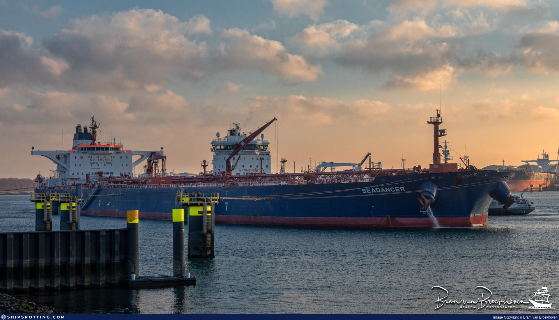
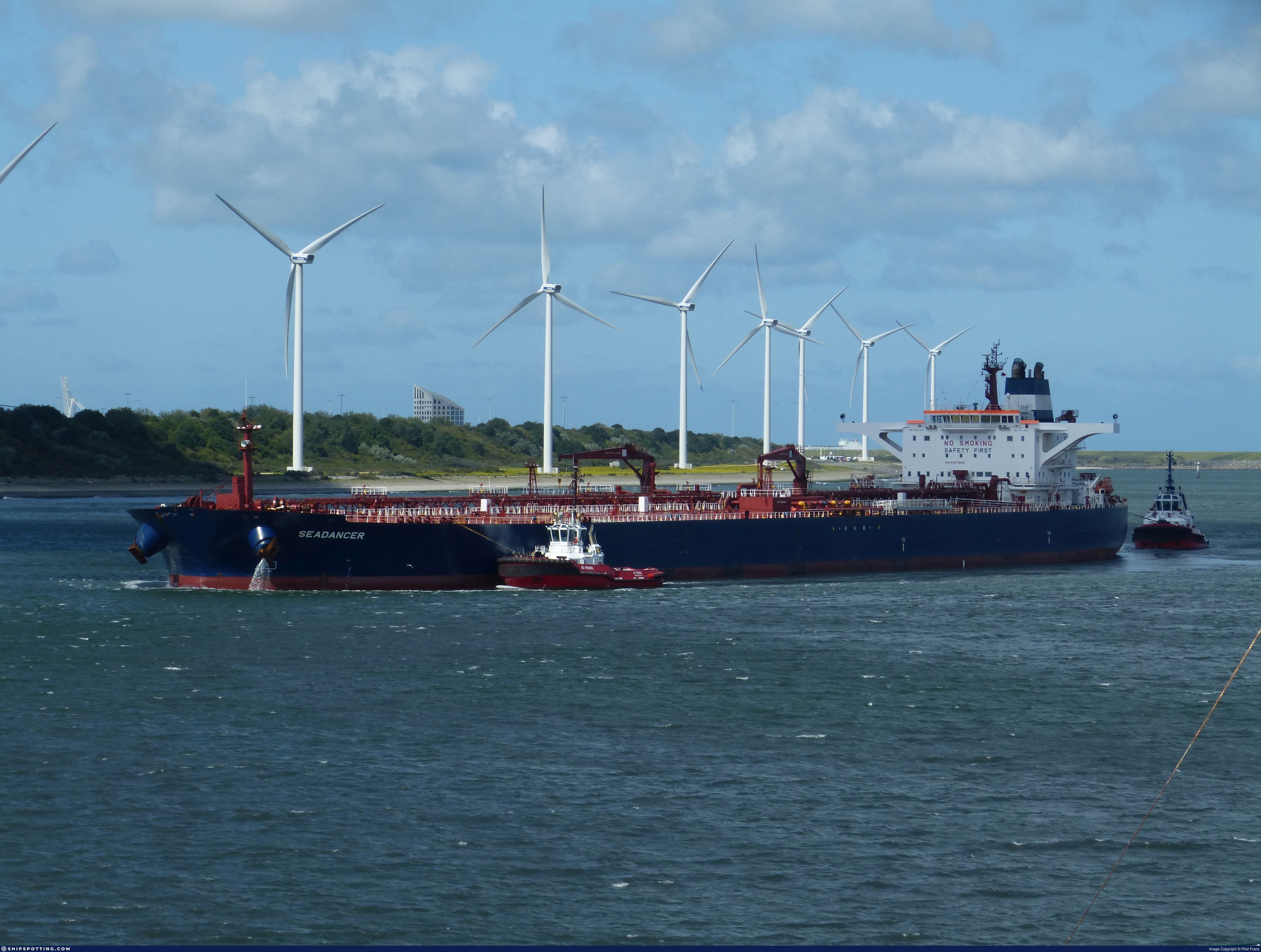
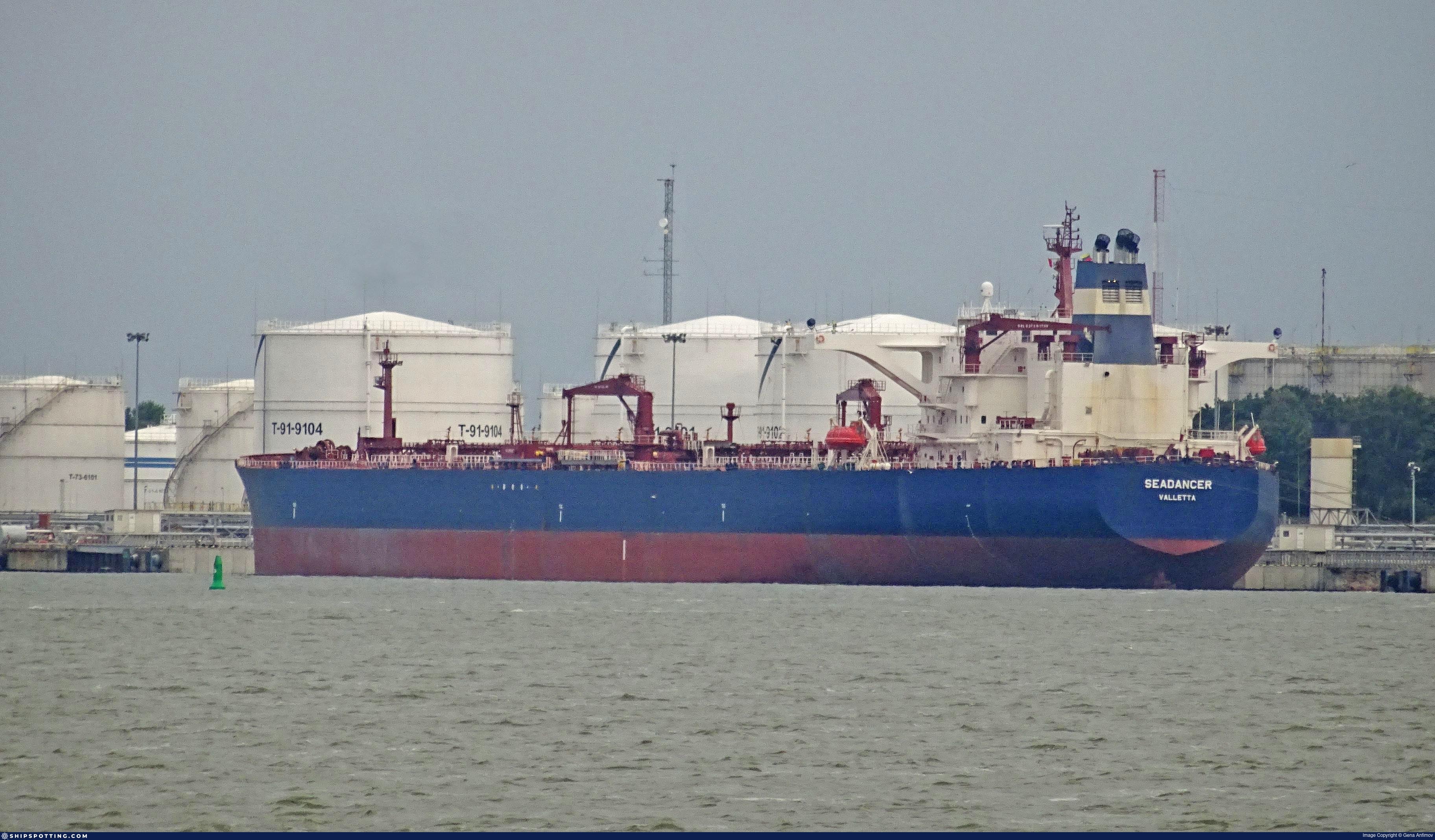
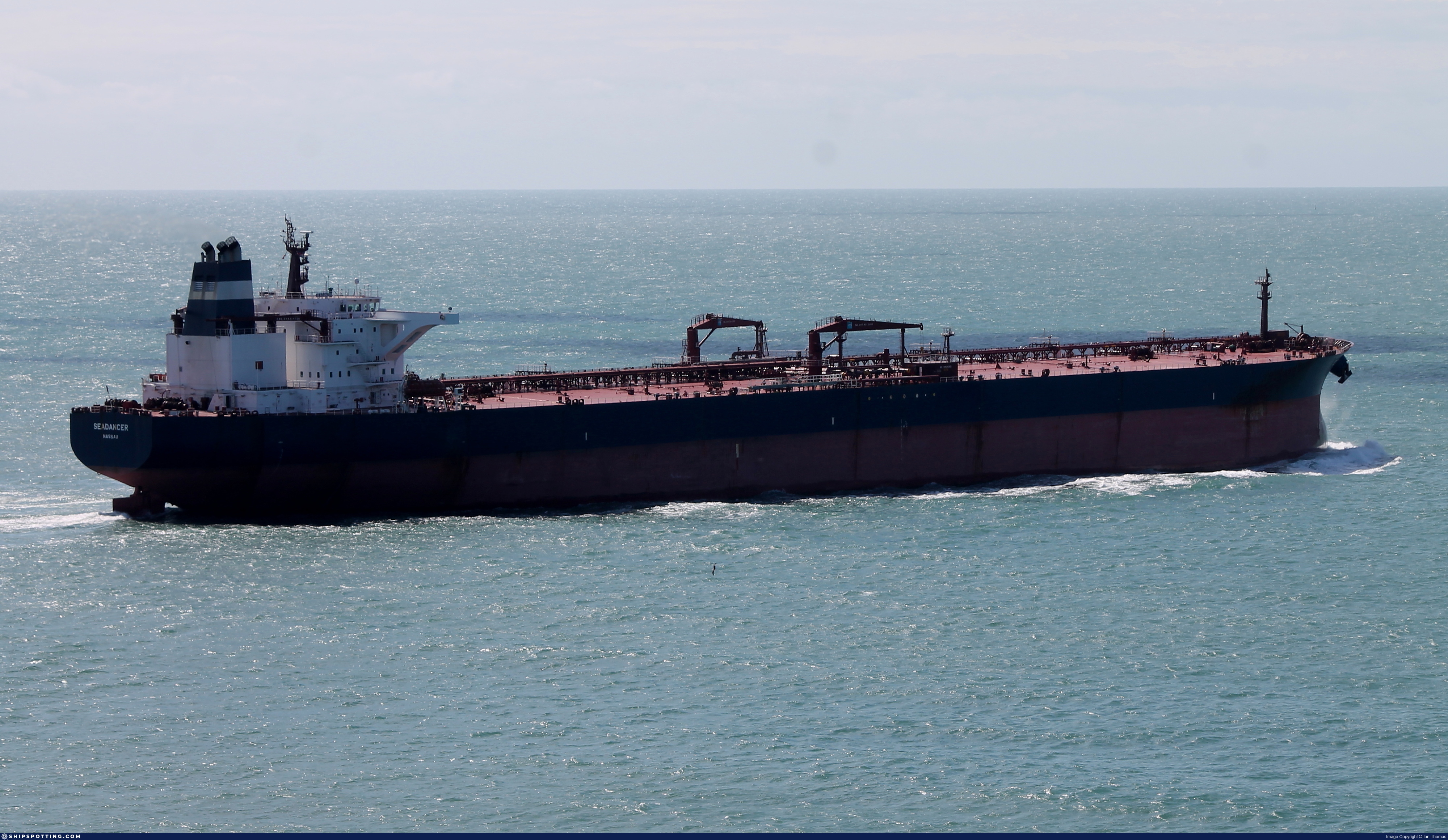
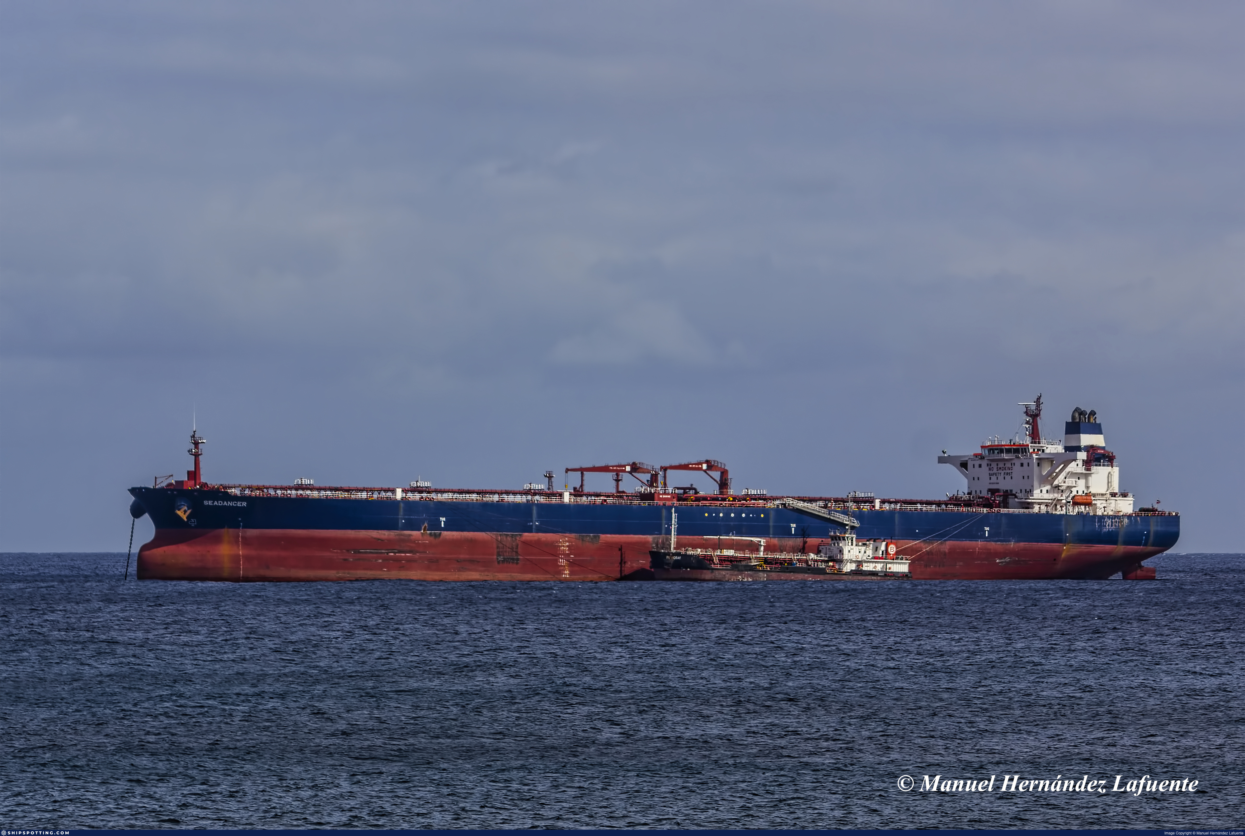
IMO 9297888
Vessel information
Sanctioned by
Company & Ownership
Management & Operations
Classification & Safety
Port State Control (PSC) Inspections
Survey Renewal & Certificates
| Code | Type | Issuer | Issued | Expires |
|---|---|---|---|---|
| 533 | Maritime Labour Certificate | Bureau Veritas (115) | 25/07/2024 | 21/04/2029 |
| 510 | Safety Management Certificate | Bureau Veritas (115) | 25/07/2024 | 21/04/2029 |
Programs & Notes
AU vessel designations (DFAT) | SEMA (Canada) — vessel designations | The Russia (Sanctions) (EU Exit) Regulations 2019 | Added in EU Sanctions Package 18 | (Council Decision (CFSP) 2025/1495, Annex XVI to Decision 2014/512/CFSP) | Press Release | Official Journal
DateOfListing: 2025-07-20 || DateDesignated: 2025-05-09 | Shipping sanctions: (see “Other information”) | Shipping sanctions: a specified ship is prohibited from being provided with access to or having its master or pilot cause it to enter a port in the UK, may have its registration on the UK Ship Register terminated, and a master or pilot of a specified ship may be given a port barring direction, a detention direction, and a port entry direction or a movement direction. | IMO 9297888 (“CORDELIA MOON”) is involved in activity whose object or effect is to destabilise Ukraine or undermine or threaten the territorial integrity, sovereignty or independence of Ukraine or to obtain a benefit from or support the Government of Russia. Namely, CORDELIA MOON is involved in carrying oil or oil products that originated in Russia from Russia to a third country.
Vessel Changes
 🔄 Owner
AIS Events
50 events detected • 11 zones • Last: Jun 5, 2026
- Zone: Eastern Mediterranean Monitoring Zone
- Duration: 1h 26m
- Data Points: 31 AIS positions
- Period: 2026-06-05T02:04:59+00:00 to 2026-06-05T03:31:14+00:00
Show Raw Evidence JSON
{
    "zone_id": "discovered_020",
    "zone_name": "Eastern Mediterranean Monitoring Zone",
    "dwell_minutes": 86.2000000000000028421709430404007434844970703125,
    "points_in_zone": 31,
    "first_point": {
        "ts": "2026-06-05T02:04:59+00:00",
        "lat": 31.473568300000000164118318934924900531768798828125,
        "lon": 32.27067670000000276786522590555250644683837890625
    },
    "last_point": {
        "ts": "2026-06-05T03:31:14+00:00",
        "lat": 31.45470830000000006521077011711895465850830078125,
        "lon": 32.4078932999999977937477524392306804656982421875
    }
}- Zone: Eastern Mediterranean Monitoring Zone
- Duration: 3h 26m
- Data Points: 33 AIS positions
- Period: 2026-06-05T00:05:03+00:00 to 2026-06-05T03:31:14+00:00
Show Raw Evidence JSON
{
    "zone_id": "discovered_020",
    "zone_name": "Eastern Mediterranean Monitoring Zone",
    "dwell_minutes": 206.19999999999998863131622783839702606201171875,
    "points_in_zone": 33,
    "first_point": {
        "ts": "2026-06-05T00:05:03+00:00",
        "lat": 31.473253299999999654801285942085087299346923828125,
        "lon": 32.2695982999999984031092026270925998687744140625
    },
    "last_point": {
        "ts": "2026-06-05T03:31:14+00:00",
        "lat": 31.45470830000000006521077011711895465850830078125,
        "lon": 32.4078932999999977937477524392306804656982421875
    }
}- Duration: 3h 6m
- Radius: 1,061 meters
- Data Points: 17 AIS positions
- Centroid: 31.4736, 32.2716
- Zone: Eastern Mediterranean Monitoring Zone
Show Raw Evidence JSON
{
    "radius_m": 1061.40000000000009094947017729282379150390625,
    "duration_minutes": 186.19999999999998863131622783839702606201171875,
    "points": 17,
    "centroid": {
        "lat": 31.473558917647064703260184614919126033782958984375,
        "lon": 32.27159922352941379131152643822133541107177734375
    },
    "bbox": {
        "min_lat": 31.472995000000000942463884712196886539459228515625,
        "min_lon": 32.26950000000000073896444519050419330596923828125,
        "max_lat": 31.475231699999998369321474456228315830230712890625,
        "max_lon": 32.2825966999999991458025760948657989501953125
    },
    "zone_id": "discovered_020"
}- Zone: Eastern Mediterranean Monitoring Zone
- Duration: 4h 17m
- Data Points: 42 AIS positions
- Period: 2026-06-04T23:14:00+00:00 to 2026-06-05T03:31:14+00:00
Show Raw Evidence JSON
{
    "zone_id": "discovered_020",
    "zone_name": "Eastern Mediterranean Monitoring Zone",
    "dwell_minutes": 257.19999999999998863131622783839702606201171875,
    "points_in_zone": 42,
    "first_point": {
        "ts": "2026-06-04T23:14:00+00:00",
        "lat": 31.472995000000000942463884712196886539459228515625,
        "lon": 32.2695250000000015688783605583012104034423828125
    },
    "last_point": {
        "ts": "2026-06-05T03:31:14+00:00",
        "lat": 31.45470830000000006521077011711895465850830078125,
        "lon": 32.4078932999999977937477524392306804656982421875
    }
}- Duration: 5h 19m
- Radius: 1,095 meters
- Data Points: 20 AIS positions
- Centroid: 31.4733, 32.2713
- Zone: Eastern Mediterranean Monitoring Zone
Show Raw Evidence JSON
{
    "radius_m": 1094.700000000000045474735088646411895751953125,
    "duration_minutes": 319,
    "points": 20,
    "centroid": {
        "lat": 31.47327400000000352520146407186985015869140625,
        "lon": 32.27130592500000005884430720470845699310302734375
    },
    "bbox": {
        "min_lat": 31.47164670000000086247382569126784801483154296875,
        "min_lon": 32.26950000000000073896444519050419330596923828125,
        "max_lat": 31.475231699999998369321474456228315830230712890625,
        "max_lon": 32.2825966999999991458025760948657989501953125
    },
    "zone_id": "discovered_020"
}- Zone: Eastern Mediterranean Monitoring Zone
- Duration: 6h 30m
- Data Points: 45 AIS positions
- Period: 2026-06-04T21:01:15+00:00 to 2026-06-05T03:31:14+00:00
Show Raw Evidence JSON
{
    "zone_id": "discovered_020",
    "zone_name": "Eastern Mediterranean Monitoring Zone",
    "dwell_minutes": 390,
    "points_in_zone": 45,
    "first_point": {
        "ts": "2026-06-04T21:01:15+00:00",
        "lat": 31.47164670000000086247382569126784801483154296875,
        "lon": 32.26968169999999958008629619143903255462646484375
    },
    "last_point": {
        "ts": "2026-06-05T03:31:14+00:00",
        "lat": 31.45470830000000006521077011711895465850830078125,
        "lon": 32.4078932999999977937477524392306804656982421875
    }
}- Duration: 5h 29m
- Radius: 1,111 meters
- Data Points: 22 AIS positions
- Centroid: 31.4731, 32.2712
- Zone: Eastern Mediterranean Monitoring Zone
Show Raw Evidence JSON
{
    "radius_m": 1111.40000000000009094947017729282379150390625,
    "duration_minutes": 329.69999999999998863131622783839702606201171875,
    "points": 22,
    "centroid": {
        "lat": 31.473127272727278835873221396468579769134521484375,
        "lon": 32.2711619045454511933712637983262538909912109375
    },
    "bbox": {
        "min_lat": 31.471644999999998759676600457169115543365478515625,
        "min_lon": 32.26950000000000073896444519050419330596923828125,
        "max_lat": 31.475231699999998369321474456228315830230712890625,
        "max_lon": 32.2825966999999991458025760948657989501953125
    },
    "zone_id": "discovered_020"
}- Zone: Eastern Mediterranean Monitoring Zone
- Duration: 6h 39m
- Data Points: 46 AIS positions
- Period: 2026-06-04T20:50:31+00:00 to 2026-06-05T03:29:45+00:00
Show Raw Evidence JSON
{
    "zone_id": "discovered_020",
    "zone_name": "Eastern Mediterranean Monitoring Zone",
    "dwell_minutes": 399.19999999999998863131622783839702606201171875,
    "points_in_zone": 46,
    "first_point": {
        "ts": "2026-06-04T20:50:31+00:00",
        "lat": 31.471675000000001176658770418725907802581787109375,
        "lon": 32.2697117000000019970684661529958248138427734375
    },
    "last_point": {
        "ts": "2026-06-05T03:29:45+00:00",
        "lat": 31.457433300000001707985575194470584392547607421875,
        "lon": 32.4074949999999972760633681900799274444580078125
    }
}- Minimum Distance: 1 meters
- Average Distance: 2 meters
- Duration: 31 minutes
- Period: 2026-06-04T20:09:43+00:00 to 2026-06-04T20:40:59+00:00
- Vessel A Avg Speed: 0.2 knots
- Vessel B Avg Speed: 0.0 knots
- Zone: Eastern Mediterranean Surveillance Zone
Confidence Analysis
Moderate-confidence STS candidate. Two tankers (GEORGY MASLOV and WALRUS) maintained close proximity (min 1m, avg 2m) for 31 minutes. Both vessels were slow-moving (avg speeds 0.1 and 0.0 knots). The stable separation distance suggests deliberate parallel positioning typical of cargo transfer. Event occurred in Eastern Mediterranean Surveillance Zone, a known STS activity area.
View scoring breakdown
| Factor | Score | Detail |
|---|---|---|
| Distance Tightness | 25/25 | Min distance 1m, avg 2m |
| Duration | 5/25 | Duration 31 minutes |
| Speed Stability | 17/20 | both nearly stationary; stable speeds |
| Distance Consistency | 15/15 | Distance variance ±0m |
| Isolation | 5/10 | Isolation data not available |
| Context | 5/5 | In monitored zone: Eastern Mediterranean Surveillance Zone |
🛰️ Satellite Corroboration
No satellite imagery for this time/location
No Sentinel-1 scenes covering AOI and time window
Show Raw Evidence JSON
{
    "vessel_a": {
        "mmsi": 273259730,
        "imo": 9610793,
        "name": "GEORGY MASLOV",
        "flag": "RUSSIA"
    },
    "vessel_b": {
        "mmsi": 613419901,
        "imo": 9297888,
        "name": "WALRUS",
        "flag": "Cameroon"
    },
    "min_distance_m": 1.399999999999999911182158029987476766109466552734375,
    "avg_distance_m": 1.8000000000000000444089209850062616169452667236328125,
    "distance_consistency_m": 0.40000000000000002220446049250313080847263336181640625,
    "duration_minutes": 31.300000000000000710542735760100185871124267578125,
    "overlap_duration_s": 1876,
    "speed_a_avg": 0.1499999999999999944488848768742172978818416595458984375,
    "speed_a_std": 0.36999999999999999555910790149937383830547332763671875,
    "speed_b_avg": 0,
    "speed_b_std": 0,
    "speed_summary": {
        "vessel_a": {
            "avg_sog": 0.1499999999999999944488848768742172978818416595458984375,
            "max_sog": 0.90000000000000002220446049250313080847263336181640625
        },
        "vessel_b": {
            "avg_sog": 0,
            "max_sog": 0
        }
    },
    "time_window": {
        "start": "2026-06-04T20:09:43+00:00",
        "end": "2026-06-04T20:40:59+00:00"
    },
    "points_count": {
        "vessel_a": 6,
        "vessel_b": 6
    },
    "zone_id": "discovered_138",
    "zone_name": "Eastern Mediterranean Surveillance Zone",
    "score": {
        "value": 72,
        "components": {
            "distance_tightness": {
                "score": 25,
                "max": 25,
                "detail": "Min distance 1m, avg 2m"
            },
            "duration": {
                "score": 5,
                "max": 25,
                "detail": "Duration 31 minutes"
            },
            "speed_stability": {
                "score": 17,
                "max": 20,
                "detail": "both nearly stationary; stable speeds"
            },
            "distance_consistency": {
                "score": 15,
                "max": 15,
                "detail": "Distance variance \u00b10m"
            },
            "isolation": {
                "score": 5,
                "max": 10,
                "detail": "Isolation data not available"
            },
            "context": {
                "score": 5,
                "max": 5,
                "detail": "In monitored zone: Eastern Mediterranean Surveillance Zone"
            }
        },
        "summary": "Moderate-confidence STS candidate. Two tankers (GEORGY MASLOV and WALRUS) maintained close proximity (min 1m, avg 2m) for 31 minutes. Both vessels were slow-moving (avg speeds 0.1 and 0.0 knots). The stable separation distance suggests deliberate parallel positioning typical of cargo transfer. Event occurred in Eastern Mediterranean Surveillance Zone, a known STS activity area."
    },
    "sar": {
        "status": "not_found",
        "centroid": {
            "lat": 31.71711069999999921265043667517602443695068359375,
            "lon": 35.999358499999999594365363009274005889892578125
        },
        "time_window": {
            "start_ts": "2026-06-04T20:09:43+00:00",
            "end_ts": "2026-06-04T20:40:59+00:00"
        },
        "searched_at": "2026-06-05T01:45:09.423009+00:00",
        "notes": "No Sentinel-1 scenes covering AOI and time window"
    }
}- Minimum Distance: 1 meters
- Average Distance: 2 meters
- Duration: 32 minutes
- Period: 2026-06-04T20:09:12+00:00 to 2026-06-04T20:41:45+00:00
- Vessel A Avg Speed: 0.0 knots
- Vessel B Avg Speed: 0.0 knots
- Zone: Eastern Mediterranean Surveillance Zone
Confidence Analysis
Moderate-confidence STS candidate. Two tankers (OPAL and WALRUS) maintained close proximity (min 1m, avg 2m) for 32 minutes. Both vessels were slow-moving (avg speeds 0.0 and 0.0 knots). The stable separation distance suggests deliberate parallel positioning typical of cargo transfer. Event occurred in Eastern Mediterranean Surveillance Zone, a known STS activity area.
View scoring breakdown
| Factor | Score | Detail |
|---|---|---|
| Distance Tightness | 25/25 | Min distance 1m, avg 2m |
| Duration | 5/25 | Duration 32 minutes |
| Speed Stability | 20/20 | both nearly stationary; very stable speeds |
| Distance Consistency | 15/15 | Distance variance ±0m |
| Isolation | 5/10 | Isolation data not available |
| Context | 5/5 | In monitored zone: Eastern Mediterranean Surveillance Zone |
🛰️ Satellite Corroboration
No satellite imagery for this time/location
No Sentinel-1 scenes covering AOI and time window
Show Raw Evidence JSON
{
    "vessel_a": {
        "mmsi": 613407500,
        "imo": 9286023,
        "name": "OPAL",
        "flag": "CAMEROON"
    },
    "vessel_b": {
        "mmsi": 613419901,
        "imo": 9297888,
        "name": "WALRUS",
        "flag": "Cameroon"
    },
    "min_distance_m": 1.399999999999999911182158029987476766109466552734375,
    "avg_distance_m": 2,
    "distance_consistency_m": 0.299999999999999988897769753748434595763683319091796875,
    "duration_minutes": 32.5,
    "overlap_duration_s": 1953,
    "speed_a_avg": 0.0299999999999999988897769753748434595763683319091796875,
    "speed_a_std": 0.05000000000000000277555756156289135105907917022705078125,
    "speed_b_avg": 0,
    "speed_b_std": 0,
    "speed_summary": {
        "vessel_a": {
            "avg_sog": 0.0299999999999999988897769753748434595763683319091796875,
            "max_sog": 0.1000000000000000055511151231257827021181583404541015625
        },
        "vessel_b": {
            "avg_sog": 0,
            "max_sog": 0
        }
    },
    "time_window": {
        "start": "2026-06-04T20:09:12+00:00",
        "end": "2026-06-04T20:41:45+00:00"
    },
    "points_count": {
        "vessel_a": 9,
        "vessel_b": 9
    },
    "zone_id": "discovered_138",
    "zone_name": "Eastern Mediterranean Surveillance Zone",
    "score": {
        "value": 75,
        "components": {
            "distance_tightness": {
                "score": 25,
                "max": 25,
                "detail": "Min distance 1m, avg 2m"
            },
            "duration": {
                "score": 5,
                "max": 25,
                "detail": "Duration 32 minutes"
            },
            "speed_stability": {
                "score": 20,
                "max": 20,
                "detail": "both nearly stationary; very stable speeds"
            },
            "distance_consistency": {
                "score": 15,
                "max": 15,
                "detail": "Distance variance \u00b10m"
            },
            "isolation": {
                "score": 5,
                "max": 10,
                "detail": "Isolation data not available"
            },
            "context": {
                "score": 5,
                "max": 5,
                "detail": "In monitored zone: Eastern Mediterranean Surveillance Zone"
            }
        },
        "summary": "Moderate-confidence STS candidate. Two tankers (OPAL and WALRUS) maintained close proximity (min 1m, avg 2m) for 32 minutes. Both vessels were slow-moving (avg speeds 0.0 and 0.0 knots). The stable separation distance suggests deliberate parallel positioning typical of cargo transfer. Event occurred in Eastern Mediterranean Surveillance Zone, a known STS activity area."
    },
    "sar": {
        "status": "not_found",
        "centroid": {
            "lat": 31.71710970000000173740772879682481288909912109375,
            "lon": 35.99935990000000174404704011976718902587890625
        },
        "time_window": {
            "start_ts": "2026-06-04T20:09:12+00:00",
            "end_ts": "2026-06-04T20:41:45+00:00"
        },
        "searched_at": "2026-06-05T02:30:01.907622+00:00",
        "notes": "No Sentinel-1 scenes covering AOI and time window"
    }
}- Minimum Distance: 0 meters
- Average Distance: 2 meters
- Duration: 32 minutes
- Period: 2026-06-04T20:08:51+00:00 to 2026-06-04T20:41:13+00:00
- Vessel A Avg Speed: 0.1 knots
- Vessel B Avg Speed: 0.0 knots
- Zone: Eastern Mediterranean Surveillance Zone
Confidence Analysis
Moderate-confidence STS candidate. Two tankers (DORIN and WALRUS) maintained close proximity (min 0m, avg 2m) for 32 minutes. Both vessels were slow-moving (avg speeds 0.1 and 0.0 knots). The stable separation distance suggests deliberate parallel positioning typical of cargo transfer. Event occurred in Eastern Mediterranean Surveillance Zone, a known STS activity area.
View scoring breakdown
| Factor | Score | Detail |
|---|---|---|
| Distance Tightness | 25/25 | Min distance 0m, avg 2m |
| Duration | 5/25 | Duration 32 minutes |
| Speed Stability | 20/20 | both nearly stationary; very stable speeds |
| Distance Consistency | 15/15 | Distance variance ±1m |
| Isolation | 5/10 | Isolation data not available |
| Context | 5/5 | In monitored zone: Eastern Mediterranean Surveillance Zone |
🛰️ Satellite Corroboration
No satellite imagery for this time/location
No Sentinel-1 scenes covering AOI and time window
Show Raw Evidence JSON
{
    "vessel_a": {
        "mmsi": 613414203,
        "imo": 9290828,
        "name": "DORIN",
        "flag": "CAMEROON"
    },
    "vessel_b": {
        "mmsi": 613419901,
        "imo": 9297888,
        "name": "WALRUS",
        "flag": "Cameroon"
    },
    "min_distance_m": 0.200000000000000011102230246251565404236316680908203125,
    "avg_distance_m": 1.8000000000000000444089209850062616169452667236328125,
    "distance_consistency_m": 1,
    "duration_minutes": 32.39999999999999857891452847979962825775146484375,
    "overlap_duration_s": 1942,
    "speed_a_avg": 0.13000000000000000444089209850062616169452667236328125,
    "speed_a_std": 0.13000000000000000444089209850062616169452667236328125,
    "speed_b_avg": 0,
    "speed_b_std": 0,
    "speed_summary": {
        "vessel_a": {
            "avg_sog": 0.13000000000000000444089209850062616169452667236328125,
            "max_sog": 0.40000000000000002220446049250313080847263336181640625
        },
        "vessel_b": {
            "avg_sog": 0,
            "max_sog": 0
        }
    },
    "time_window": {
        "start": "2026-06-04T20:08:51+00:00",
        "end": "2026-06-04T20:41:13+00:00"
    },
    "points_count": {
        "vessel_a": 7,
        "vessel_b": 7
    },
    "zone_id": "discovered_138",
    "zone_name": "Eastern Mediterranean Surveillance Zone",
    "score": {
        "value": 75,
        "components": {
            "distance_tightness": {
                "score": 25,
                "max": 25,
                "detail": "Min distance 0m, avg 2m"
            },
            "duration": {
                "score": 5,
                "max": 25,
                "detail": "Duration 32 minutes"
            },
            "speed_stability": {
                "score": 20,
                "max": 20,
                "detail": "both nearly stationary; very stable speeds"
            },
            "distance_consistency": {
                "score": 15,
                "max": 15,
                "detail": "Distance variance \u00b11m"
            },
            "isolation": {
                "score": 5,
                "max": 10,
                "detail": "Isolation data not available"
            },
            "context": {
                "score": 5,
                "max": 5,
                "detail": "In monitored zone: Eastern Mediterranean Surveillance Zone"
            }
        },
        "summary": "Moderate-confidence STS candidate. Two tankers (DORIN and WALRUS) maintained close proximity (min 0m, avg 2m) for 32 minutes. Both vessels were slow-moving (avg speeds 0.1 and 0.0 knots). The stable separation distance suggests deliberate parallel positioning typical of cargo transfer. Event occurred in Eastern Mediterranean Surveillance Zone, a known STS activity area."
    },
    "sar": {
        "status": "not_found",
        "centroid": {
            "lat": 31.71711379999999991241566021926701068878173828125,
            "lon": 35.99935550000000006320988177321851253509521484375
        },
        "time_window": {
            "start_ts": "2026-06-04T20:08:51+00:00",
            "end_ts": "2026-06-04T20:41:13+00:00"
        },
        "searched_at": "2026-06-04T23:00:06.833235+00:00",
        "notes": "No Sentinel-1 scenes covering AOI and time window"
    }
}- Minimum Distance: 1 meters
- Average Distance: 3 meters
- Duration: 32 minutes
- Period: 2026-06-04T20:07:57+00:00 to 2026-06-04T20:40:51+00:00
- Vessel A Avg Speed: 0.0 knots
- Vessel B Avg Speed: 0.0 knots
- Zone: Eastern Mediterranean Surveillance Zone
Confidence Analysis
Moderate-confidence STS candidate. Two tankers (SILVAR and WALRUS) maintained close proximity (min 1m, avg 3m) for 33 minutes. Both vessels were slow-moving (avg speeds 0.0 and 0.0 knots). The stable separation distance suggests deliberate parallel positioning typical of cargo transfer. Event occurred in Eastern Mediterranean Surveillance Zone, a known STS activity area.
View scoring breakdown
| Factor | Score | Detail |
|---|---|---|
| Distance Tightness | 25/25 | Min distance 1m, avg 3m |
| Duration | 5/25 | Duration 33 minutes |
| Speed Stability | 20/20 | both nearly stationary; very stable speeds |
| Distance Consistency | 15/15 | Distance variance ±1m |
| Isolation | 5/10 | Isolation data not available |
| Context | 5/5 | In monitored zone: Eastern Mediterranean Surveillance Zone |
🛰️ Satellite Corroboration
No satellite imagery for this time/location
No Sentinel-1 scenes covering AOI and time window
Show Raw Evidence JSON
{
    "vessel_a": {
        "mmsi": 613414707,
        "imo": 9291262,
        "name": "SILVAR",
        "flag": "CAMEROON"
    },
    "vessel_b": {
        "mmsi": 613419901,
        "imo": 9297888,
        "name": "WALRUS",
        "flag": "Cameroon"
    },
    "min_distance_m": 1.100000000000000088817841970012523233890533447265625,
    "avg_distance_m": 2.79999999999999982236431605997495353221893310546875,
    "distance_consistency_m": 1.100000000000000088817841970012523233890533447265625,
    "duration_minutes": 32.89999999999999857891452847979962825775146484375,
    "overlap_duration_s": 1974,
    "speed_a_avg": 0,
    "speed_a_std": 0,
    "speed_b_avg": 0,
    "speed_b_std": 0,
    "speed_summary": {
        "vessel_a": {
            "avg_sog": 0,
            "max_sog": 0
        },
        "vessel_b": {
            "avg_sog": 0,
            "max_sog": 0
        }
    },
    "time_window": {
        "start": "2026-06-04T20:07:57+00:00",
        "end": "2026-06-04T20:40:51+00:00"
    },
    "points_count": {
        "vessel_a": 7,
        "vessel_b": 7
    },
    "zone_id": "discovered_138",
    "zone_name": "Eastern Mediterranean Surveillance Zone",
    "score": {
        "value": 75,
        "components": {
            "distance_tightness": {
                "score": 25,
                "max": 25,
                "detail": "Min distance 1m, avg 3m"
            },
            "duration": {
                "score": 5,
                "max": 25,
                "detail": "Duration 33 minutes"
            },
            "speed_stability": {
                "score": 20,
                "max": 20,
                "detail": "both nearly stationary; very stable speeds"
            },
            "distance_consistency": {
                "score": 15,
                "max": 15,
                "detail": "Distance variance \u00b11m"
            },
            "isolation": {
                "score": 5,
                "max": 10,
                "detail": "Isolation data not available"
            },
            "context": {
                "score": 5,
                "max": 5,
                "detail": "In monitored zone: Eastern Mediterranean Surveillance Zone"
            }
        },
        "summary": "Moderate-confidence STS candidate. Two tankers (SILVAR and WALRUS) maintained close proximity (min 1m, avg 3m) for 33 minutes. Both vessels were slow-moving (avg speeds 0.0 and 0.0 knots). The stable separation distance suggests deliberate parallel positioning typical of cargo transfer. Event occurred in Eastern Mediterranean Surveillance Zone, a known STS activity area."
    },
    "sar": {
        "status": "not_found",
        "centroid": {
            "lat": 31.717104899999998934845280018635094165802001953125,
            "lon": 35.9993639999999999190549715422093868255615234375
        },
        "time_window": {
            "start_ts": "2026-06-04T20:07:57+00:00",
            "end_ts": "2026-06-04T20:40:51+00:00"
        },
        "searched_at": "2026-06-05T00:45:01.355755+00:00",
        "notes": "No Sentinel-1 scenes covering AOI and time window"
    }
}- Minimum Distance: 1 meters
- Average Distance: 4 meters
- Duration: 34 minutes
- Period: 2026-06-04T20:07:36+00:00 to 2026-06-04T20:42:28+00:00
- Vessel A Avg Speed: 0.0 knots
- Vessel B Avg Speed: 0.0 knots
- Zone: Eastern Mediterranean Surveillance Zone
Confidence Analysis
Moderate-confidence STS candidate. Two tankers (KEMEROVO and WALRUS) maintained close proximity (min 1m, avg 4m) for 35 minutes. Both vessels were slow-moving (avg speeds 0.0 and 0.0 knots). The stable separation distance suggests deliberate parallel positioning typical of cargo transfer. Event occurred in Eastern Mediterranean Surveillance Zone, a known STS activity area.
View scoring breakdown
| Factor | Score | Detail |
|---|---|---|
| Distance Tightness | 25/25 | Min distance 1m, avg 4m |
| Duration | 5/25 | Duration 35 minutes |
| Speed Stability | 20/20 | both nearly stationary; very stable speeds |
| Distance Consistency | 15/15 | Distance variance ±4m |
| Isolation | 5/10 | Isolation data not available |
| Context | 5/5 | In monitored zone: Eastern Mediterranean Surveillance Zone |
🛰️ Satellite Corroboration
No satellite imagery for this time/location
No Sentinel-1 scenes covering AOI and time window
Show Raw Evidence JSON
{
    "vessel_a": {
        "mmsi": 273250830,
        "imo": 9312884,
        "name": "KEMEROVO",
        "flag": "RUSSIA"
    },
    "vessel_b": {
        "mmsi": 613419901,
        "imo": 9297888,
        "name": "WALRUS",
        "flag": "Cameroon"
    },
    "min_distance_m": 1.1999999999999999555910790149937383830547332763671875,
    "avg_distance_m": 4.0999999999999996447286321199499070644378662109375,
    "distance_consistency_m": 3.5,
    "duration_minutes": 34.89999999999999857891452847979962825775146484375,
    "overlap_duration_s": 2092,
    "speed_a_avg": 0,
    "speed_a_std": 0,
    "speed_b_avg": 0,
    "speed_b_std": 0,
    "speed_summary": {
        "vessel_a": {
            "avg_sog": 0,
            "max_sog": 0
        },
        "vessel_b": {
            "avg_sog": 0,
            "max_sog": 0
        }
    },
    "time_window": {
        "start": "2026-06-04T20:07:36+00:00",
        "end": "2026-06-04T20:42:28+00:00"
    },
    "points_count": {
        "vessel_a": 7,
        "vessel_b": 7
    },
    "zone_id": "discovered_138",
    "zone_name": "Eastern Mediterranean Surveillance Zone",
    "score": {
        "value": 75,
        "components": {
            "distance_tightness": {
                "score": 25,
                "max": 25,
                "detail": "Min distance 1m, avg 4m"
            },
            "duration": {
                "score": 5,
                "max": 25,
                "detail": "Duration 35 minutes"
            },
            "speed_stability": {
                "score": 20,
                "max": 20,
                "detail": "both nearly stationary; very stable speeds"
            },
            "distance_consistency": {
                "score": 15,
                "max": 15,
                "detail": "Distance variance \u00b14m"
            },
            "isolation": {
                "score": 5,
                "max": 10,
                "detail": "Isolation data not available"
            },
            "context": {
                "score": 5,
                "max": 5,
                "detail": "In monitored zone: Eastern Mediterranean Surveillance Zone"
            }
        },
        "summary": "Moderate-confidence STS candidate. Two tankers (KEMEROVO and WALRUS) maintained close proximity (min 1m, avg 4m) for 35 minutes. Both vessels were slow-moving (avg speeds 0.0 and 0.0 knots). The stable separation distance suggests deliberate parallel positioning typical of cargo transfer. Event occurred in Eastern Mediterranean Surveillance Zone, a known STS activity area."
    },
    "sar": {
        "status": "not_found",
        "centroid": {
            "lat": 31.71711990000000014333636499941349029541015625,
            "lon": 35.9993721000000022058884496800601482391357421875
        },
        "time_window": {
            "start_ts": "2026-06-04T20:07:36+00:00",
            "end_ts": "2026-06-04T20:42:28+00:00"
        },
        "searched_at": "2026-06-04T23:45:09.113513+00:00",
        "notes": "No Sentinel-1 scenes covering AOI and time window"
    }
}- Minimum Distance: 1 meters
- Average Distance: 7 meters
- Duration: 30 minutes
- Period: 2026-06-04T20:07:28+00:00 to 2026-06-04T20:38:03+00:00
- Vessel A Avg Speed: 0.2 knots
- Vessel B Avg Speed: 0.0 knots
- Zone: Eastern Mediterranean Surveillance Zone
Confidence Analysis
Moderate-confidence STS candidate. Two tankers (JASPER and WALRUS) maintained close proximity (min 1m, avg 7m) for 31 minutes. Both vessels were slow-moving (avg speeds 0.2 and 0.0 knots). The stable separation distance suggests deliberate parallel positioning typical of cargo transfer. Event occurred in Eastern Mediterranean Surveillance Zone, a known STS activity area.
View scoring breakdown
| Factor | Score | Detail |
|---|---|---|
| Distance Tightness | 25/25 | Min distance 1m, avg 7m |
| Duration | 5/25 | Duration 31 minutes |
| Speed Stability | 14/20 | both nearly stationary; somewhat variable speeds |
| Distance Consistency | 15/15 | Distance variance ±14m |
| Isolation | 5/10 | Isolation data not available |
| Context | 5/5 | In monitored zone: Eastern Mediterranean Surveillance Zone |
🛰️ Satellite Corroboration
No satellite imagery for this time/location
No Sentinel-1 scenes covering AOI and time window
Show Raw Evidence JSON
{
    "vessel_a": {
        "mmsi": 613472020,
        "imo": 9299886,
        "name": "JASPER",
        "flag": "CAMEROON"
    },
    "vessel_b": {
        "mmsi": 613419901,
        "imo": 9297888,
        "name": "WALRUS",
        "flag": "Cameroon"
    },
    "min_distance_m": 1.100000000000000088817841970012523233890533447265625,
    "avg_distance_m": 6.79999999999999982236431605997495353221893310546875,
    "distance_consistency_m": 14.300000000000000710542735760100185871124267578125,
    "duration_minutes": 30.60000000000000142108547152020037174224853515625,
    "overlap_duration_s": 1835,
    "speed_a_avg": 0.179999999999999993338661852249060757458209991455078125,
    "speed_a_std": 0.5300000000000000266453525910037569701671600341796875,
    "speed_b_avg": 0,
    "speed_b_std": 0,
    "speed_summary": {
        "vessel_a": {
            "avg_sog": 0.179999999999999993338661852249060757458209991455078125,
            "max_sog": 1.600000000000000088817841970012523233890533447265625
        },
        "vessel_b": {
            "avg_sog": 0,
            "max_sog": 0
        }
    },
    "time_window": {
        "start": "2026-06-04T20:07:28+00:00",
        "end": "2026-06-04T20:38:03+00:00"
    },
    "points_count": {
        "vessel_a": 9,
        "vessel_b": 9
    },
    "zone_id": "discovered_138",
    "zone_name": "Eastern Mediterranean Surveillance Zone",
    "score": {
        "value": 69,
        "components": {
            "distance_tightness": {
                "score": 25,
                "max": 25,
                "detail": "Min distance 1m, avg 7m"
            },
            "duration": {
                "score": 5,
                "max": 25,
                "detail": "Duration 31 minutes"
            },
            "speed_stability": {
                "score": 14,
                "max": 20,
                "detail": "both nearly stationary; somewhat variable speeds"
            },
            "distance_consistency": {
                "score": 15,
                "max": 15,
                "detail": "Distance variance \u00b114m"
            },
            "isolation": {
                "score": 5,
                "max": 10,
                "detail": "Isolation data not available"
            },
            "context": {
                "score": 5,
                "max": 5,
                "detail": "In monitored zone: Eastern Mediterranean Surveillance Zone"
            }
        },
        "summary": "Moderate-confidence STS candidate. Two tankers (JASPER and WALRUS) maintained close proximity (min 1m, avg 7m) for 31 minutes. Both vessels were slow-moving (avg speeds 0.2 and 0.0 knots). The stable separation distance suggests deliberate parallel positioning typical of cargo transfer. Event occurred in Eastern Mediterranean Surveillance Zone, a known STS activity area."
    },
    "sar": {
        "status": "not_found",
        "centroid": {
            "lat": 31.71713280000000168001861311495304107666015625,
            "lon": 35.999358000000000856744009070098400115966796875
        },
        "time_window": {
            "start_ts": "2026-06-04T20:07:28+00:00",
            "end_ts": "2026-06-04T20:38:03+00:00"
        },
        "searched_at": "2026-06-05T00:45:03.812196+00:00",
        "notes": "No Sentinel-1 scenes covering AOI and time window"
    }
}- Zone: Eastern Mediterranean Monitoring Zone
- Duration: 1h 33m
- Data Points: 7 AIS positions
- Period: 2026-06-04T18:06:59+00:00 to 2026-06-04T19:40:00+00:00
Show Raw Evidence JSON
{
    "zone_id": "discovered_020",
    "zone_name": "Eastern Mediterranean Monitoring Zone",
    "dwell_minutes": 93,
    "points_in_zone": 7,
    "first_point": {
        "ts": "2026-06-04T18:06:59+00:00",
        "lat": 31.47109999999999985220711096189916133880615234375,
        "lon": 32.27004500000000319914761348627507686614990234375
    },
    "last_point": {
        "ts": "2026-06-04T19:40:00+00:00",
        "lat": 31.471393299999999015881257946603000164031982421875,
        "lon": 32.26977670000000131267370306886732578277587890625
    }
}- Duration: 2h 39m
- Radius: 49 meters
- Data Points: 18 AIS positions
- Centroid: 31.4711, 32.2701
- Zone: Eastern Mediterranean Monitoring Zone
Show Raw Evidence JSON
{
    "radius_m": 48.7000000000000028421709430404007434844970703125,
    "duration_minutes": 159,
    "points": 18,
    "centroid": {
        "lat": 31.4710543555555517514221719466149806976318359375,
        "lon": 32.27010297222221879565040580928325653076171875
    },
    "bbox": {
        "min_lat": 31.470883300000000559748514206148684024810791015625,
        "min_lon": 32.26977670000000131267370306886732578277587890625,
        "max_lat": 31.471393299999999015881257946603000164031982421875,
        "max_lon": 32.270323300000001154330675490200519561767578125
    },
    "zone_id": "discovered_020"
}- Zone: Eastern Mediterranean Monitoring Zone
- Duration: 2h 39m
- Data Points: 18 AIS positions
- Period: 2026-06-04T17:01:01+00:00 to 2026-06-04T19:40:00+00:00
Show Raw Evidence JSON
{
    "zone_id": "discovered_020",
    "zone_name": "Eastern Mediterranean Monitoring Zone",
    "dwell_minutes": 159,
    "points_in_zone": 18,
    "first_point": {
        "ts": "2026-06-04T17:01:01+00:00",
        "lat": 31.47097670000000135814843815751373767852783203125,
        "lon": 32.27011499999999699639374739490449428558349609375
    },
    "last_point": {
        "ts": "2026-06-04T19:40:00+00:00",
        "lat": 31.471393299999999015881257946603000164031982421875,
        "lon": 32.26977670000000131267370306886732578277587890625
    }
}- Duration: 3h 6m
- Radius: 133 meters
- Data Points: 23 AIS positions
- Centroid: 31.4712, 32.2700
- Zone: Eastern Mediterranean Monitoring Zone
Show Raw Evidence JSON
{
    "radius_m": 133,
    "duration_minutes": 186,
    "points": 23,
    "centroid": {
        "lat": 31.471205799999996344240571488626301288604736328125,
        "lon": 32.26999986521739316458479152061045169830322265625
    },
    "bbox": {
        "min_lat": 31.470883300000000559748514206148684024810791015625,
        "min_lon": 32.26936169999999748370100860483944416046142578125,
        "max_lat": 31.472273300000001228227120009250938892364501953125,
        "max_lon": 32.270323300000001154330675490200519561767578125
    },
    "zone_id": "discovered_020"
}- Zone: Eastern Mediterranean Monitoring Zone
- Duration: 3h 6m
- Data Points: 23 AIS positions
- Period: 2026-06-04T16:33:59+00:00 to 2026-06-04T19:40:00+00:00
Show Raw Evidence JSON
{
    "zone_id": "discovered_020",
    "zone_name": "Eastern Mediterranean Monitoring Zone",
    "dwell_minutes": 186,
    "points_in_zone": 23,
    "first_point": {
        "ts": "2026-06-04T16:33:59+00:00",
        "lat": 31.472273300000001228227120009250938892364501953125,
        "lon": 32.26936169999999748370100860483944416046142578125
    },
    "last_point": {
        "ts": "2026-06-04T19:40:00+00:00",
        "lat": 31.471393299999999015881257946603000164031982421875,
        "lon": 32.26977670000000131267370306886732578277587890625
    }
}- Duration: 4h 25m
- Radius: 1,332 meters
- Data Points: 31 AIS positions
- Centroid: 31.4735, 32.2693
- Zone: Eastern Mediterranean Monitoring Zone
Show Raw Evidence JSON
{
    "radius_m": 1332.299999999999954525264911353588104248046875,
    "duration_minutes": 265.80000000000001136868377216160297393798828125,
    "points": 31,
    "centroid": {
        "lat": 31.47347161935484649575300863943994045257568359375,
        "lon": 32.26927435806451427424690336920320987701416015625
    },
    "bbox": {
        "min_lat": 31.470883300000000559748514206148684024810791015625,
        "min_lon": 32.26210830000000129302861751057207584381103515625,
        "max_lat": 31.483799999999998675548340543173253536224365234375,
        "max_lon": 32.2724682999999998855855665169656276702880859375
    },
    "zone_id": "discovered_020"
}- Zone: Eastern Mediterranean Monitoring Zone
- Duration: 4h 39m
- Data Points: 34 AIS positions
- Period: 2026-06-04T15:00:05+00:00 to 2026-06-04T19:40:00+00:00
Show Raw Evidence JSON
{
    "zone_id": "discovered_020",
    "zone_name": "Eastern Mediterranean Monitoring Zone",
    "dwell_minutes": 279.8999999999999772626324556767940521240234375,
    "points_in_zone": 34,
    "first_point": {
        "ts": "2026-06-04T15:00:05+00:00",
        "lat": 31.48873999999999995225152815692126750946044921875,
        "lon": 32.2540350000000017871570889838039875030517578125
    },
    "last_point": {
        "ts": "2026-06-04T19:40:00+00:00",
        "lat": 31.471393299999999015881257946603000164031982421875,
        "lon": 32.26977670000000131267370306886732578277587890625
    }
}- Zone: Eastern Mediterranean Monitoring Zone
- Duration: 5h 36m
- Data Points: 53 AIS positions
- Period: 2026-06-04T14:03:31+00:00 to 2026-06-04T19:40:00+00:00
Show Raw Evidence JSON
{
    "zone_id": "discovered_020",
    "zone_name": "Eastern Mediterranean Monitoring Zone",
    "dwell_minutes": 336.5,
    "points_in_zone": 53,
    "first_point": {
        "ts": "2026-06-04T14:03:31+00:00",
        "lat": 31.538933300000000059526428231038153171539306640625,
        "lon": 32.19142169999999936180756776593625545501708984375
    },
    "last_point": {
        "ts": "2026-06-04T19:40:00+00:00",
        "lat": 31.471393299999999015881257946603000164031982421875,
        "lon": 32.26977670000000131267370306886732578277587890625
    }
}- Zone: Eastern Mediterranean Monitoring Zone
- Duration: 6h 33m
- Data Points: 80 AIS positions
- Period: 2026-06-04T13:06:51+00:00 to 2026-06-04T19:40:00+00:00
Show Raw Evidence JSON
{
    "zone_id": "discovered_020",
    "zone_name": "Eastern Mediterranean Monitoring Zone",
    "dwell_minutes": 393.1000000000000227373675443232059478759765625,
    "points_in_zone": 80,
    "first_point": {
        "ts": "2026-06-04T13:06:51+00:00",
        "lat": 31.64961329999999861684045754373073577880859375,
        "lon": 32.06237999999999743749867775477468967437744140625
    },
    "last_point": {
        "ts": "2026-06-04T19:40:00+00:00",
        "lat": 31.471393299999999015881257946603000164031982421875,
        "lon": 32.26977670000000131267370306886732578277587890625
    }
}- Zone: Eastern Mediterranean Monitoring Zone
- Duration: 6h 38m
- Data Points: 103 AIS positions
- Period: 2026-06-04T12:10:33+00:00 to 2026-06-04T18:49:00+00:00
Show Raw Evidence JSON
{
    "zone_id": "discovered_020",
    "zone_name": "Eastern Mediterranean Monitoring Zone",
    "dwell_minutes": 398.3999999999999772626324556767940521240234375,
    "points_in_zone": 103,
    "first_point": {
        "ts": "2026-06-04T12:10:33+00:00",
        "lat": 31.784936699999999376586856669746339321136474609375,
        "lon": 31.895160000000000621867002337239682674407958984375
    },
    "last_point": {
        "ts": "2026-06-04T18:49:00+00:00",
        "lat": 31.471334999999999837427822058089077472686767578125,
        "lon": 32.26990500000000139380063046701252460479736328125
    }
}- Zone: Eastern Mediterranean Monitoring Zone
- Duration: 6h 34m
- Data Points: 106 AIS positions
- Period: 2026-06-04T11:50:30+00:00 to 2026-06-04T18:25:00+00:00
Show Raw Evidence JSON
{
    "zone_id": "discovered_020",
    "zone_name": "Eastern Mediterranean Monitoring Zone",
    "dwell_minutes": 394.5,
    "points_in_zone": 106,
    "first_point": {
        "ts": "2026-06-04T11:50:30+00:00",
        "lat": 31.824329999999999785131876706145703792572021484375,
        "lon": 31.824839999999998241264620446600019931793212890625
    },
    "last_point": {
        "ts": "2026-06-04T18:25:00+00:00",
        "lat": 31.47119670000000013487806427292525768280029296875,
        "lon": 32.27001169999999774518073536455631256103515625
    }
}- Zone: Eastern Mediterranean Monitoring Zone
- Duration: 6h 33m
- Data Points: 133 AIS positions
- Period: 2026-06-04T10:51:52+00:00 to 2026-06-04T17:25:00+00:00
Show Raw Evidence JSON
{
    "zone_id": "discovered_020",
    "zone_name": "Eastern Mediterranean Monitoring Zone",
    "dwell_minutes": 393.1000000000000227373675443232059478759765625,
    "points_in_zone": 133,
    "first_point": {
        "ts": "2026-06-04T10:51:52+00:00",
        "lat": 31.964453299999998847624738118611276149749755859375,
        "lon": 31.644561700000000570298652746714651584625244140625
    },
    "last_point": {
        "ts": "2026-06-04T17:25:00+00:00",
        "lat": 31.4709067000000004554749466478824615478515625,
        "lon": 32.27026000000000038880898500792682170867919921875
    }
}- Zone: Eastern Mediterranean Monitoring Zone
- Duration: 6h 32m
- Data Points: 175 AIS positions
- Period: 2026-06-04T09:10:20+00:00 to 2026-06-04T15:42:52+00:00
Show Raw Evidence JSON
{
    "zone_id": "discovered_020",
    "zone_name": "Eastern Mediterranean Monitoring Zone",
    "dwell_minutes": 392.5,
    "points_in_zone": 175,
    "first_point": {
        "ts": "2026-06-04T09:10:20+00:00",
        "lat": 32.2320117000000010420990292914211750030517578125,
        "lon": 31.36482000000000169848135556094348430633544921875
    },
    "last_point": {
        "ts": "2026-06-04T15:42:52+00:00",
        "lat": 31.475184999999999746478351880796253681182861328125,
        "lon": 32.2724682999999998855855665169656276702880859375
    }
}- Zone: Eastern Mediterranean Monitoring Zone
- Duration: 6h 36m
- Data Points: 179 AIS positions
- Period: 2026-06-04T08:52:53+00:00 to 2026-06-04T15:29:11+00:00
Show Raw Evidence JSON
{
    "zone_id": "discovered_020",
    "zone_name": "Eastern Mediterranean Monitoring Zone",
    "dwell_minutes": 396.30000000000001136868377216160297393798828125,
    "points_in_zone": 179,
    "first_point": {
        "ts": "2026-06-04T08:52:53+00:00",
        "lat": 32.277933300000000826912582851946353912353515625,
        "lon": 31.314424999999999954525264911353588104248046875
    },
    "last_point": {
        "ts": "2026-06-04T15:29:11+00:00",
        "lat": 31.479401700000000374757291865535080432891845703125,
        "lon": 32.26866830000000163636286742985248565673828125
    }
}- Zone: Eastern Mediterranean Monitoring Zone
- Duration: 6h 37m
- Data Points: 180 AIS positions
- Period: 2026-06-04T07:32:42+00:00 to 2026-06-04T14:09:40+00:00
Show Raw Evidence JSON
{
    "zone_id": "discovered_020",
    "zone_name": "Eastern Mediterranean Monitoring Zone",
    "dwell_minutes": 397,
    "points_in_zone": 180,
    "first_point": {
        "ts": "2026-06-04T07:32:42+00:00",
        "lat": 32.4883717000000018515493138693273067474365234375,
        "lon": 31.07630999999999943383954814635217189788818359375
    },
    "last_point": {
        "ts": "2026-06-04T14:09:40+00:00",
        "lat": 31.530241700000001259240889339707791805267333984375,
        "lon": 32.2019599999999996953192749060690402984619140625
    }
}- Zone: Black Sea Sanctioned Vessel Monitoring Zone
- Duration: 1h 1m
- Data Points: 11 AIS positions
- Period: 2026-06-04T07:10:04+00:00 to 2026-06-04T08:11:41+00:00
Show Raw Evidence JSON
{
    "zone_id": "discovered_145",
    "zone_name": "Black Sea Sanctioned Vessel Monitoring Zone",
    "dwell_minutes": 61.60000000000000142108547152020037174224853515625,
    "points_in_zone": 11,
    "first_point": {
        "ts": "2026-06-04T07:10:04+00:00",
        "lat": 32.550285000000002355591277591884136199951171875,
        "lon": 31.011736700000000155341695062816143035888671875
    },
    "last_point": {
        "ts": "2026-06-04T08:11:41+00:00",
        "lat": 32.3846266999999983227098709903657436370849609375,
        "lon": 31.19084170000000000300133251585066318511962890625
    }
}- Zone: Brest Approaches Monitoring Zone
- Duration: 1h 32m
- Data Points: 26 AIS positions
- Period: 2026-06-04T07:10:04+00:00 to 2026-06-04T08:42:52+00:00
Show Raw Evidence JSON
{
    "zone_id": "discovered_057",
    "zone_name": "Brest Approaches Monitoring Zone",
    "dwell_minutes": 92.7999999999999971578290569595992565155029296875,
    "points_in_zone": 26,
    "first_point": {
        "ts": "2026-06-04T07:10:04+00:00",
        "lat": 32.550285000000002355591277591884136199951171875,
        "lon": 31.011736700000000155341695062816143035888671875
    },
    "last_point": {
        "ts": "2026-06-04T08:42:52+00:00",
        "lat": 32.30434670000000352274582837708294391632080078125,
        "lon": 31.28504170000000073059709393419325351715087890625
    }
}- Zone: Black Sea Sanctioned Vessel Monitoring Zone
- Duration: 2h 10m
- Data Points: 29 AIS positions
- Period: 2026-06-04T06:01:11+00:00 to 2026-06-04T08:11:41+00:00
Show Raw Evidence JSON
{
    "zone_id": "discovered_145",
    "zone_name": "Black Sea Sanctioned Vessel Monitoring Zone",
    "dwell_minutes": 130.5,
    "points_in_zone": 29,
    "first_point": {
        "ts": "2026-06-04T06:01:11+00:00",
        "lat": 32.73499000000000336285665980540215969085693359375,
        "lon": 30.82372000000000156205715029500424861907958984375
    },
    "last_point": {
        "ts": "2026-06-04T08:11:41+00:00",
        "lat": 32.3846266999999983227098709903657436370849609375,
        "lon": 31.19084170000000000300133251585066318511962890625
    }
}- Zone: Black Sea Sanctioned Vessel Monitoring Zone
- Duration: 3h 10m
- Data Points: 62 AIS positions
- Period: 2026-06-04T05:00:51+00:00 to 2026-06-04T08:11:41+00:00
Show Raw Evidence JSON
{
    "zone_id": "discovered_145",
    "zone_name": "Black Sea Sanctioned Vessel Monitoring Zone",
    "dwell_minutes": 190.80000000000001136868377216160297393798828125,
    "points_in_zone": 62,
    "first_point": {
        "ts": "2026-06-04T05:00:51+00:00",
        "lat": 32.8907650000000018053469830192625522613525390625,
        "lon": 30.659898299999998272369339247234165668487548828125
    },
    "last_point": {
        "ts": "2026-06-04T08:11:41+00:00",
        "lat": 32.3846266999999983227098709903657436370849609375,
        "lon": 31.19084170000000000300133251585066318511962890625
    }
}- Zone: Black Sea Sanctioned Vessel Monitoring Zone
- Duration: 3h 14m
- Data Points: 64 AIS positions
- Period: 2026-06-04T04:57:32+00:00 to 2026-06-04T08:11:41+00:00
Show Raw Evidence JSON
{
    "zone_id": "discovered_145",
    "zone_name": "Black Sea Sanctioned Vessel Monitoring Zone",
    "dwell_minutes": 194.19999999999998863131622783839702606201171875,
    "points_in_zone": 64,
    "first_point": {
        "ts": "2026-06-04T04:57:32+00:00",
        "lat": 32.89941329999999908295649220235645771026611328125,
        "lon": 30.650541700000001554826667415909469127655029296875
    },
    "last_point": {
        "ts": "2026-06-04T08:11:41+00:00",
        "lat": 32.3846266999999983227098709903657436370849609375,
        "lon": 31.19084170000000000300133251585066318511962890625
    }
}- Zone: Strait of Malacca Sanctions Monitoring Zone
- Duration: 1h 14m
- Data Points: 38 AIS positions
- Period: 2026-06-04T04:38:52+00:00 to 2026-06-04T05:53:10+00:00
Show Raw Evidence JSON
{
    "zone_id": "discovered_158",
    "zone_name": "Strait of Malacca Sanctions Monitoring Zone",
    "dwell_minutes": 74.2999999999999971578290569595992565155029296875,
    "points_in_zone": 38,
    "first_point": {
        "ts": "2026-06-04T04:38:52+00:00",
        "lat": 32.9478016999999994141035131178796291351318359375,
        "lon": 30.596889999999998366320141940377652645111083984375
    },
    "last_point": {
        "ts": "2026-06-04T05:53:10+00:00",
        "lat": 32.7559116999999986319380695931613445281982421875,
        "lon": 30.8022567000000009329596650786697864532470703125
    }
}- Zone: Southeast Aegean Monitoring Zone
- Duration: 1h 58m
- Data Points: 5 AIS positions
- Period: 2026-06-03T08:30:04+00:00 to 2026-06-03T10:28:30+00:00
Show Raw Evidence JSON
{
    "zone_id": "discovered_075",
    "zone_name": "Southeast Aegean Monitoring Zone",
    "dwell_minutes": 118.400000000000005684341886080801486968994140625,
    "points_in_zone": 5,
    "first_point": {
        "ts": "2026-06-03T08:30:04+00:00",
        "lat": 36.1805666999999999688952811993658542633056640625,
        "lon": 27.099671699999998253360899980179965496063232421875
    },
    "last_point": {
        "ts": "2026-06-03T10:28:30+00:00",
        "lat": 35.87384829999999880101313465274870395660400390625,
        "lon": 27.434458299999999297824615496210753917694091796875
    }
}- Zone: Northeast Aegean Monitoring Zone
- Duration: 1h 20m
- Data Points: 43 AIS positions
- Period: 2026-06-03T05:06:30+00:00 to 2026-06-03T06:27:01+00:00
Show Raw Evidence JSON
{
    "zone_id": "discovered_107",
    "zone_name": "Northeast Aegean Monitoring Zone",
    "dwell_minutes": 80.5,
    "points_in_zone": 43,
    "first_point": {
        "ts": "2026-06-03T05:06:30+00:00",
        "lat": 36.78570830000000313475538860075175762176513671875,
        "lon": 26.68770669999999967103576636873185634613037109375
    },
    "last_point": {
        "ts": "2026-06-03T06:27:01+00:00",
        "lat": 36.50481669999999922993083600886166095733642578125,
        "lon": 26.752596700000001561647877679206430912017822265625
    }
}- Zone: Northeast Aegean Monitoring Zone
- Duration: 2h 20m
- Data Points: 78 AIS positions
- Period: 2026-06-03T04:06:32+00:00 to 2026-06-03T06:27:01+00:00
Show Raw Evidence JSON
{
    "zone_id": "discovered_107",
    "zone_name": "Northeast Aegean Monitoring Zone",
    "dwell_minutes": 140.5,
    "points_in_zone": 78,
    "first_point": {
        "ts": "2026-06-03T04:06:32+00:00",
        "lat": 36.9934099999999972396835801191627979278564453125,
        "lon": 26.647201700000000101908881333656609058380126953125
    },
    "last_point": {
        "ts": "2026-06-03T06:27:01+00:00",
        "lat": 36.50481669999999922993083600886166095733642578125,
        "lon": 26.752596700000001561647877679206430912017822265625
    }
}- Zone: Northeast Aegean Monitoring Zone
- Duration: 3h 17m
- Data Points: 93 AIS positions
- Period: 2026-06-03T03:09:50+00:00 to 2026-06-03T06:27:01+00:00
Show Raw Evidence JSON
{
    "zone_id": "discovered_107",
    "zone_name": "Northeast Aegean Monitoring Zone",
    "dwell_minutes": 197.19999999999998863131622783839702606201171875,
    "points_in_zone": 93,
    "first_point": {
        "ts": "2026-06-03T03:09:50+00:00",
        "lat": 37.12163000000000323552740155719220638275146484375,
        "lon": 26.49132829999999927395037957467138767242431640625
    },
    "last_point": {
        "ts": "2026-06-03T06:27:01+00:00",
        "lat": 36.50481669999999922993083600886166095733642578125,
        "lon": 26.752596700000001561647877679206430912017822265625
    }
}- Zone: Northeast Aegean Monitoring Zone
- Duration: 3h 52m
- Data Points: 95 AIS positions
- Period: 2026-06-03T02:34:50+00:00 to 2026-06-03T06:27:01+00:00
Show Raw Evidence JSON
{
    "zone_id": "discovered_107",
    "zone_name": "Northeast Aegean Monitoring Zone",
    "dwell_minutes": 232.19999999999998863131622783839702606201171875,
    "points_in_zone": 95,
    "first_point": {
        "ts": "2026-06-03T02:34:50+00:00",
        "lat": 37.19211169999999810897861607372760772705078125,
        "lon": 26.365829999999998989324012654833495616912841796875
    },
    "last_point": {
        "ts": "2026-06-03T06:27:01+00:00",
        "lat": 36.50481669999999922993083600886166095733642578125,
        "lon": 26.752596700000001561647877679206430912017822265625
    }
}- Zone: Eastern Gulf of Finland Monitoring Zone
- Duration: 1h 22m
- Data Points: 18 AIS positions
- Period: 2026-06-03T00:12:51+00:00 to 2026-06-03T01:35:10+00:00
Show Raw Evidence JSON
{
    "zone_id": "discovered_098",
    "zone_name": "Eastern Gulf of Finland Monitoring Zone",
    "dwell_minutes": 82.2999999999999971578290569595992565155029296875,
    "points_in_zone": 18,
    "first_point": {
        "ts": "2026-06-03T00:12:51+00:00",
        "lat": 37.46945329999999785286490805447101593017578125,
        "lon": 25.84463170000000076242940849624574184417724609375
    },
    "last_point": {
        "ts": "2026-06-03T01:35:10+00:00",
        "lat": 37.30522669999999862966433283872902393341064453125,
        "lon": 26.144381700000000279260348179377615451812744140625
    }
}- Zone: Eastern Gulf of Finland Monitoring Zone
- Duration: 1h 45m
- Data Points: 20 AIS positions
- Period: 2026-06-02T23:50:10+00:00 to 2026-06-03T01:35:10+00:00
Show Raw Evidence JSON
{
    "zone_id": "discovered_098",
    "zone_name": "Eastern Gulf of Finland Monitoring Zone",
    "dwell_minutes": 105,
    "points_in_zone": 20,
    "first_point": {
        "ts": "2026-06-02T23:50:10+00:00",
        "lat": 37.5298216999999993959136190824210643768310546875,
        "lon": 25.783184999999999575948095298372209072113037109375
    },
    "last_point": {
        "ts": "2026-06-03T01:35:10+00:00",
        "lat": 37.30522669999999862966433283872902393341064453125,
        "lon": 26.144381700000000279260348179377615451812744140625
    }
}- Zone: Eastern Gulf of Finland Monitoring Zone
- Duration: 3h 20m
- Data Points: 21 AIS positions
- Period: 2026-06-02T22:14:50+00:00 to 2026-06-03T01:35:10+00:00
Show Raw Evidence JSON
{
    "zone_id": "discovered_098",
    "zone_name": "Eastern Gulf of Finland Monitoring Zone",
    "dwell_minutes": 200.30000000000001136868377216160297393798828125,
    "points_in_zone": 21,
    "first_point": {
        "ts": "2026-06-02T22:14:50+00:00",
        "lat": 37.782994999999999663486960344016551971435546875,
        "lon": 25.507431700000001484340828028507530689239501953125
    },
    "last_point": {
        "ts": "2026-06-03T01:35:10+00:00",
        "lat": 37.30522669999999862966433283872902393341064453125,
        "lon": 26.144381700000000279260348179377615451812744140625
    }
}- Zone: Bosphorus/Dardanelles Approach
- Duration: 1h 12m
- Data Points: 15 AIS positions
- Period: 2026-06-01T09:01:51+00:00 to 2026-06-01T10:14:42+00:00
Show Raw Evidence JSON
{
    "zone_id": "osint_bosphorus",
    "zone_name": "Bosphorus\/Dardanelles Approach",
    "dwell_minutes": 72.7999999999999971578290569595992565155029296875,
    "points_in_zone": 15,
    "first_point": {
        "ts": "2026-06-01T09:01:51+00:00",
        "lat": 40.95413169999999780657162773422896862030029296875,
        "lon": 28.93175670000000110348992166109383106231689453125
    },
    "last_point": {
        "ts": "2026-06-01T10:14:42+00:00",
        "lat": 40.91040000000000276259015663526952266693115234375,
        "lon": 28.720821699999998344310370157472789287567138671875
    }
}- Zone: Bosphorus/Dardanelles Approach
- Duration: 1h 33m
- Data Points: 23 AIS positions
- Period: 2026-06-01T08:40:52+00:00 to 2026-06-01T10:14:42+00:00
Show Raw Evidence JSON
{
    "zone_id": "osint_bosphorus",
    "zone_name": "Bosphorus\/Dardanelles Approach",
    "dwell_minutes": 93.7999999999999971578290569595992565155029296875,
    "points_in_zone": 23,
    "first_point": {
        "ts": "2026-06-01T08:40:52+00:00",
        "lat": 40.97510170000000329082467942498624324798583984375,
        "lon": 28.980090000000000571844793739728629589080810546875
    },
    "last_point": {
        "ts": "2026-06-01T10:14:42+00:00",
        "lat": 40.91040000000000276259015663526952266693115234375,
        "lon": 28.720821699999998344310370157472789287567138671875
    }
}- Zone: Bosphorus/Dardanelles Approach
- Duration: 1 hours
- Data Points: 26 AIS positions
- Period: 2026-05-21T04:28:32+00:00 to 2026-05-21T05:29:22+00:00
Show Raw Evidence JSON
{
    "zone_id": "osint_bosphorus",
    "zone_name": "Bosphorus\/Dardanelles Approach",
    "dwell_minutes": 60.7999999999999971578290569595992565155029296875,
    "points_in_zone": 26,
    "first_point": {
        "ts": "2026-05-21T04:28:32+00:00",
        "lat": 40.87819830000000109748725662939250469207763671875,
        "lon": 29.009113299999999213696355582214891910552978515625
    },
    "last_point": {
        "ts": "2026-05-21T05:29:22+00:00",
        "lat": 41.000533300000000735963112674653530120849609375,
        "lon": 28.994531699999999574401954305358231067657470703125
    }
}- Zone: Central Atlantic Surveillance Zone
- Duration: 1h 29m
- Data Points: 17 AIS positions
- Period: 2026-05-14T03:09:09+00:00 to 2026-05-14T04:38:16+00:00
Show Raw Evidence JSON
{
    "zone_id": "discovered_088",
    "zone_name": "Central Atlantic Surveillance Zone",
    "dwell_minutes": 89.099999999999994315658113919198513031005859375,
    "points_in_zone": 17,
    "first_point": {
        "ts": "2026-05-14T03:09:09+00:00",
        "lat": 37.32540000000000190993887372314929962158203125,
        "lon": 26.137744999999998896100805723108351230621337890625
    },
    "last_point": {
        "ts": "2026-05-14T04:38:16+00:00",
        "lat": 37.54389830000000216614353121258318424224853515625,
        "lon": 25.827658299999999513829607167281210422515869140625
    }
}- Zone: discovered_086
- Duration: 1h 31m
- Data Points: 47 AIS positions
- Period: 2026-05-14T01:00:55+00:00 to 2026-05-14T02:32:42+00:00
Show Raw Evidence JSON
{
    "zone_id": "discovered_086",
    "zone_name": "Eastern Mediterranean Sanctioned Vessel Zone",
    "dwell_minutes": 91.7999999999999971578290569595992565155029296875,
    "points_in_zone": 47,
    "first_point": {
        "ts": "2026-05-14T01:00:55+00:00",
        "lat": 37.023155000000002701199264265596866607666015625,
        "lon": 26.62811669999999963920345180667936801910400390625
    },
    "last_point": {
        "ts": "2026-05-14T02:32:42+00:00",
        "lat": 37.248885000000001355147105641663074493408203125,
        "lon": 26.287780000000001479065758758224546909332275390625
    }
}- Zone: discovered_086
- Duration: 2h 29m
- Data Points: 52 AIS positions
- Period: 2026-05-14T00:02:55+00:00 to 2026-05-14T02:32:42+00:00
Show Raw Evidence JSON
{
    "zone_id": "discovered_086",
    "zone_name": "Eastern Mediterranean Sanctioned Vessel Zone",
    "dwell_minutes": 149.80000000000001136868377216160297393798828125,
    "points_in_zone": 52,
    "first_point": {
        "ts": "2026-05-14T00:02:55+00:00",
        "lat": 36.794201700000002119850250892341136932373046875,
        "lon": 26.67622829999999822803147253580391407012939453125
    },
    "last_point": {
        "ts": "2026-05-14T02:32:42+00:00",
        "lat": 37.248885000000001355147105641663074493408203125,
        "lon": 26.287780000000001479065758758224546909332275390625
    }
}- Zone: discovered_086
- Duration: 3h 5m
- Data Points: 62 AIS positions
- Period: 2026-05-13T23:27:00+00:00 to 2026-05-14T02:32:42+00:00
Show Raw Evidence JSON
{
    "zone_id": "discovered_086",
    "zone_name": "Eastern Mediterranean Sanctioned Vessel Zone",
    "dwell_minutes": 185.69999999999998863131622783839702606201171875,
    "points_in_zone": 62,
    "first_point": {
        "ts": "2026-05-13T23:27:00+00:00",
        "lat": 36.65365669999999909123289398849010467529296875,
        "lon": 26.694261699999998427301761694252490997314453125
    },
    "last_point": {
        "ts": "2026-05-14T02:32:42+00:00",
        "lat": 37.248885000000001355147105641663074493408203125,
        "lon": 26.287780000000001479065758758224546909332275390625
    }
}Source snapshot
| Sanctioner | As of | Entity ID |
|---|---|---|
| 🇬🇧 UK | 2025-09-29 | 9297888 |
We mirror official lists; always verify at the source.
Sanctioned on the same day
- ADHARA · IMO 9353125 🇦🇺 AU🇨🇦 CA🇪🇺 EU🇬🇧 UK
- AKAR WEST · IMO 9258167 🇦🇺 AU🇨🇦 CA🇪🇺 EU🇳🇿 NZ🇬🇧 UK
- ATLANTICOS · IMO 9282986 🇦🇺 AU🇨🇦 CA🇪🇺 EU🇳🇿 NZ🇬🇧 UK
- BELOMOR · IMO 9384435 🇦🇺 AU🇨🇦 CA🇪🇺 EU🇳🇿 NZ🇬🇧 UK
- Blue · IMO 9236353 🇦🇺 AU🇨🇦 CA🇪🇺 EU🇳🇿 NZ🇬🇧 UK
- Blue Talu · IMO 9334557 🇦🇺 AU🇨🇦 CA🇪🇺 EU🇬🇧 UK
- C Viking · IMO 9261657 🇦🇺 AU🇨🇦 CA🇪🇺 EU🇳🇿 NZ🇬🇧 UK
- CELERIX · IMO 9222560 🇦🇺 AU🇨🇦 CA🇪🇺 EU🇬🇧 UK