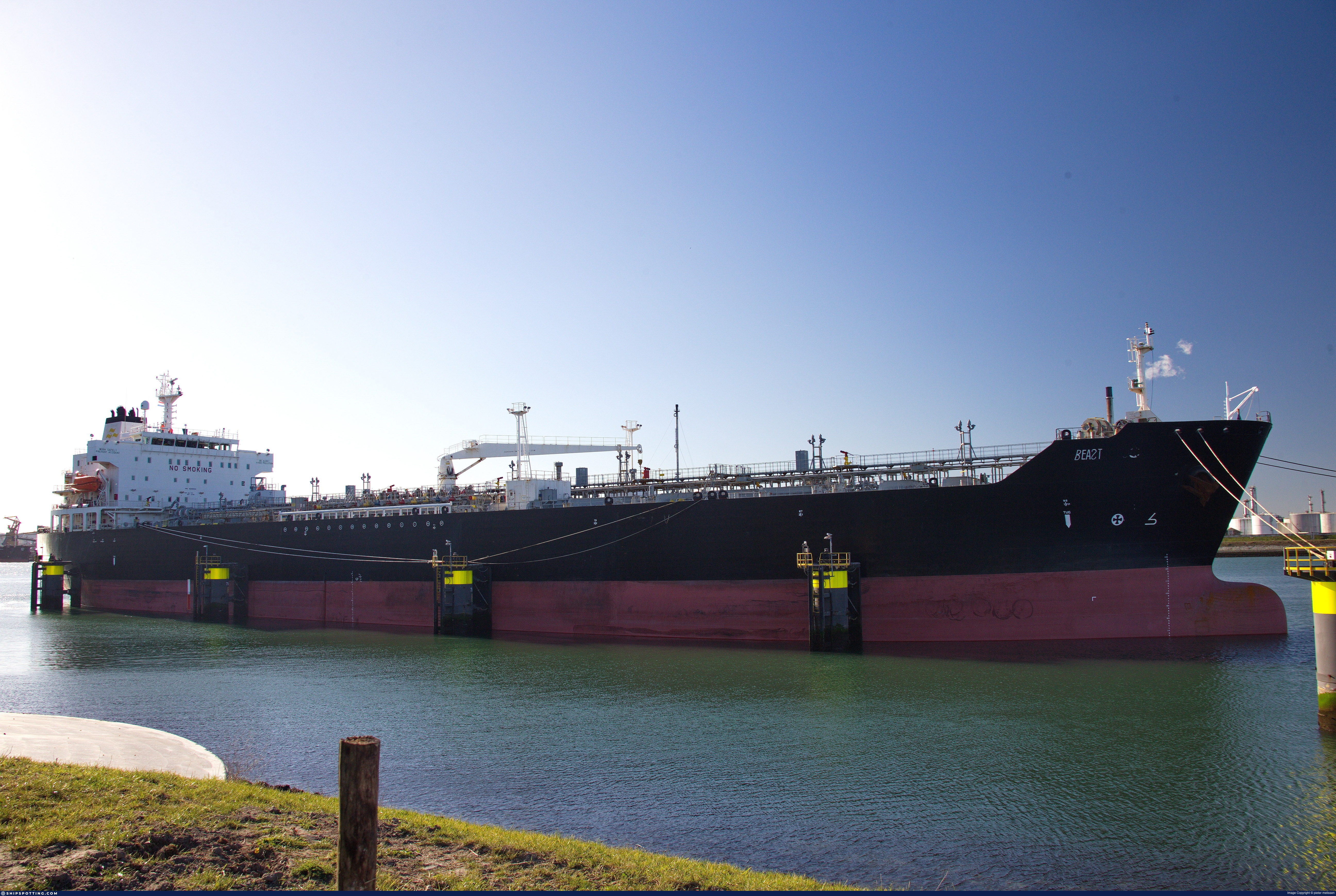
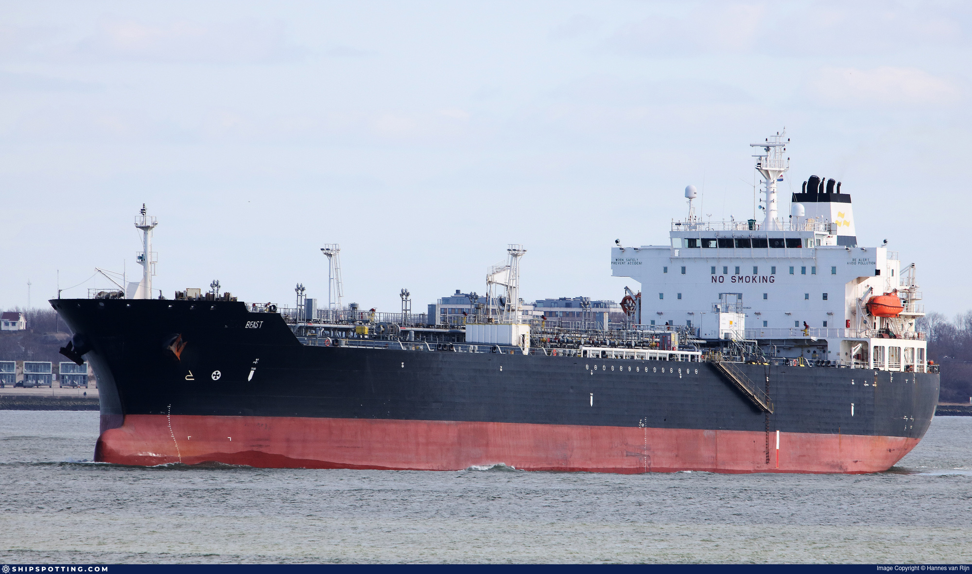
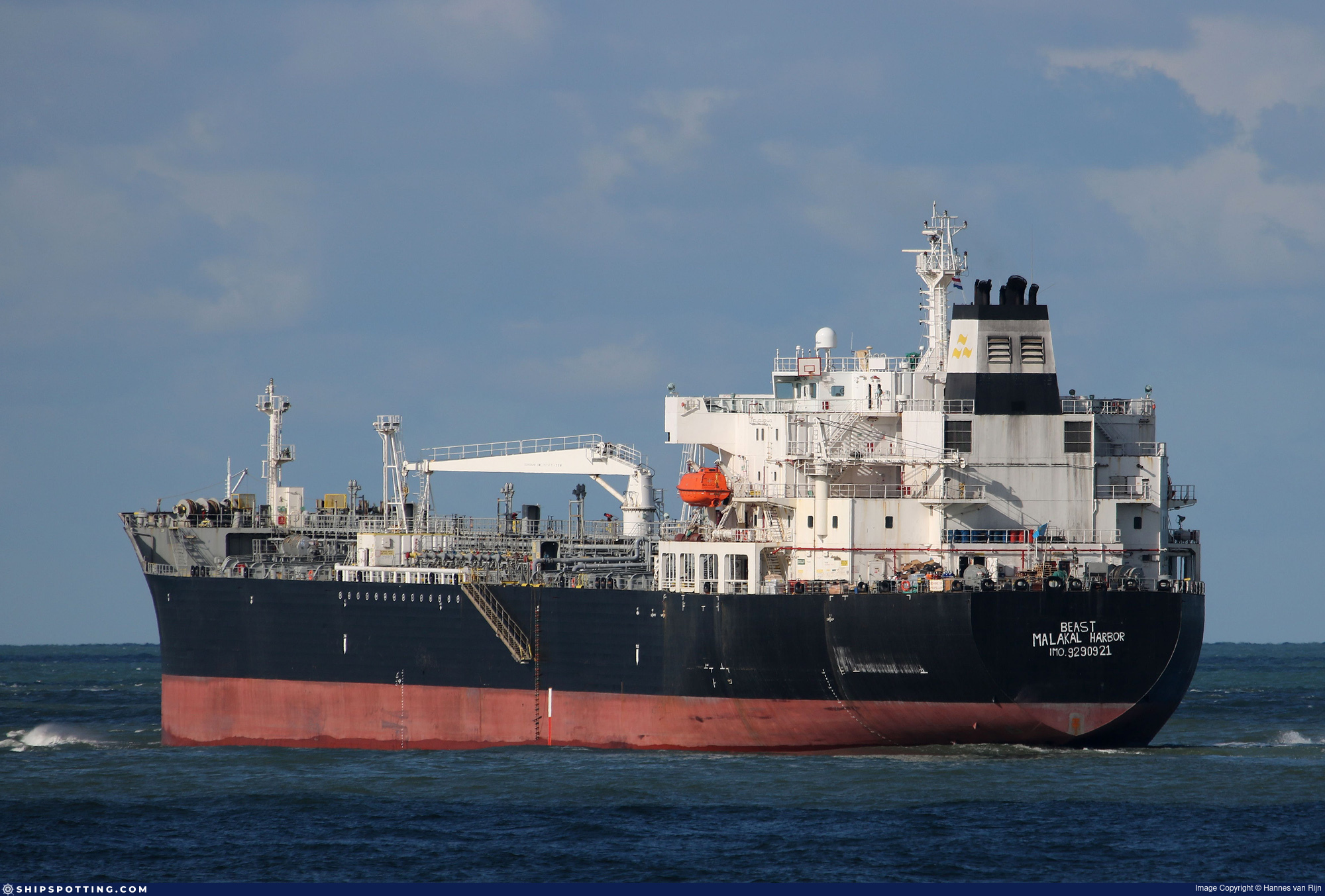
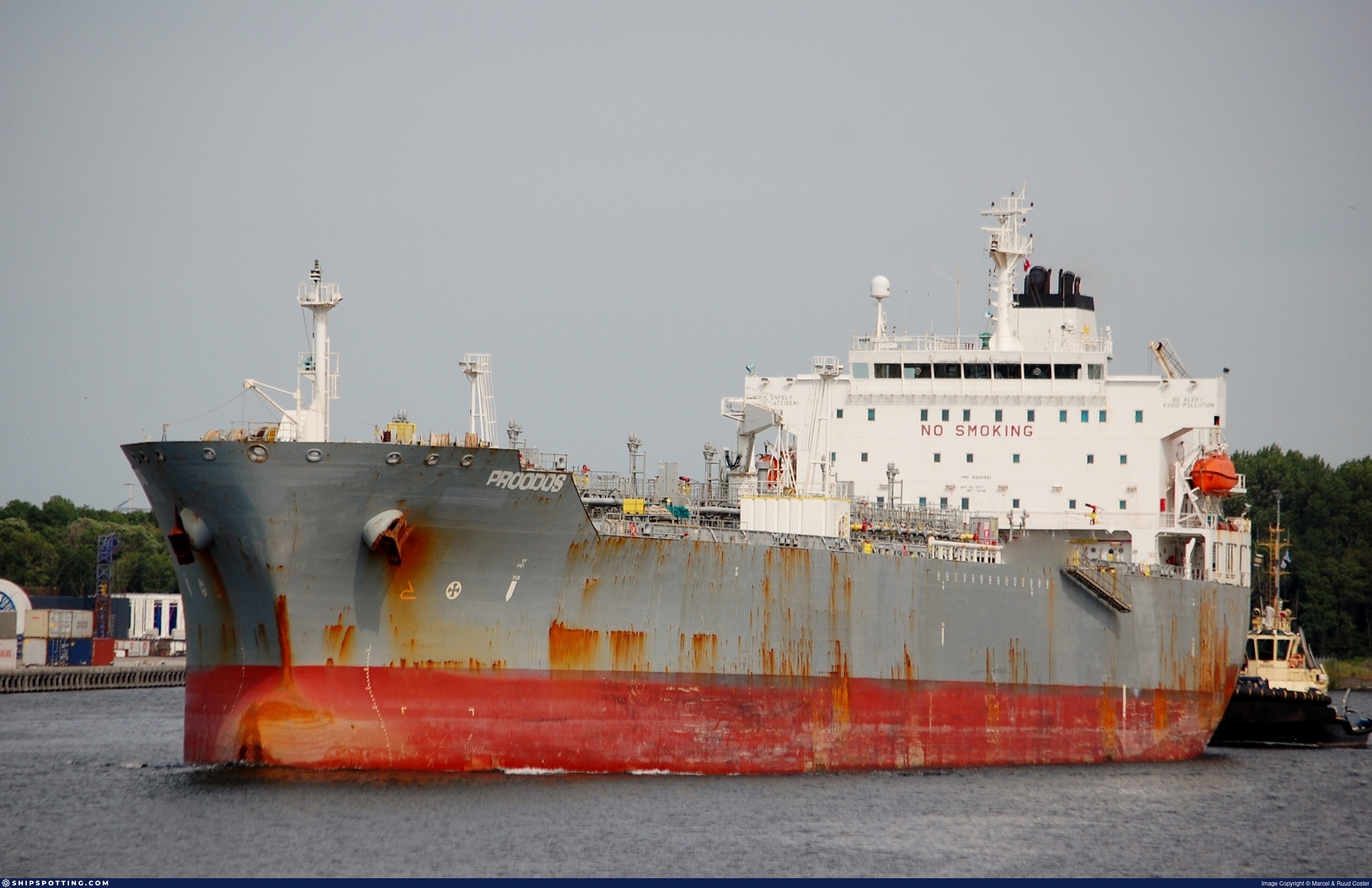
IMO 9290921
Vessel information
Sanctioned by
Company & Ownership
Management & Operations
Classification & Safety
Port State Control (PSC) Inspections
Survey Renewal & Certificates
| Code | Type | Issuer | Issued | Expires |
|---|---|---|---|---|
| 533 | Maritime Labour Certificate | Lloyd`s Register (160) | 03/09/2023 | 02/09/2028 |
| 510 | Safety Management Certificate | Lloyd`s Register (160) | 03/09/2023 | 27/08/2028 |
Programs & Notes
AU vessel designations (DFAT) | SEMA (Canada) — vessel designations | The Russia (Sanctions) (EU Exit) Regulations 2019 | Added in EU Sanctions Package 17 | (Council Decision (CFSP) 2025/931, Annex XVI to Decision 2014/512/CFSP) | Press Release | Official Journal
DateOfListing: 2025-05-21 || DateDesignated: 2025-05-09 | Shipping sanctions: (see “Other information”) | Shipping sanctions: a specified ship is prohibited from being provided with access to or having its master or pilot cause it to enter a port in the UK, may have its registration on the UK Ship Register terminated, and a master or pilot of a specified ship may be given a port barring direction, a detention direction, and a port entry direction or a movement direction. | IMO 9290921 (“BEAST”) is and has been involved in a relevant activity as it is used for an activity whose object or effect is to destabilise Ukraine or undermine or threaten the territorial integrity, sovereignty or independence of Ukraine or to obtain a benefit from or support the Government of Russia. Namely, BEAST is and has been used for carrying oil or oil products that originated in Russia from Russia to a third country.
Vessel Changes
 🔄 Owner
AIS Events
50 events detected • 2 zones • Last: Jun 5, 2026
- Duration: 5h 36m
- Radius: 369 meters
- Data Points: 35 AIS positions
- Centroid: 31.5148, 32.3877
- Zone: Eastern Mediterranean Monitoring Zone
Show Raw Evidence JSON
{
    "radius_m": 368.80000000000001136868377216160297393798828125,
    "duration_minutes": 336.5,
    "points": 35,
    "centroid": {
        "lat": 31.514804288571422574705138686113059520721435546875,
        "lon": 32.38771286571428476008804864250123500823974609375
    },
    "bbox": {
        "min_lat": 31.5115167000000013786120689474046230316162109375,
        "min_lon": 32.38745000000000118234311230480670928955078125,
        "max_lat": 31.51568329999999917845343588851392269134521484375,
        "max_lon": 32.3883000000000009777068044058978557586669921875
    },
    "zone_id": "discovered_020"
}- Zone: Eastern Mediterranean Monitoring Zone
- Duration: 5h 36m
- Data Points: 35 AIS positions
- Period: 2026-06-05T05:42:29+00:00 to 2026-06-05T11:19:01+00:00
Show Raw Evidence JSON
{
    "zone_id": "discovered_020",
    "zone_name": "Eastern Mediterranean Monitoring Zone",
    "dwell_minutes": 336.5,
    "points_in_zone": 35,
    "first_point": {
        "ts": "2026-06-05T05:42:29+00:00",
        "lat": 31.51568329999999917845343588851392269134521484375,
        "lon": 32.38801670000000143545548780821263790130615234375
    },
    "last_point": {
        "ts": "2026-06-05T11:19:01+00:00",
        "lat": 31.514600000000001500666257925331592559814453125,
        "lon": 32.38754999999999739657141617499291896820068359375
    }
}- Duration: 6h 30m
- Radius: 162 meters
- Data Points: 25 AIS positions
- Centroid: 31.5151, 32.3878
- Zone: Eastern Mediterranean Monitoring Zone
Show Raw Evidence JSON
{
    "radius_m": 162,
    "duration_minutes": 390,
    "points": 25,
    "centroid": {
        "lat": 31.515147999999999939291228656657040119171142578125,
        "lon": 32.3877706759999881569456192664802074432373046875
    },
    "bbox": {
        "min_lat": 31.51466669999999936635504127480089664459228515625,
        "min_lon": 32.3875833000000028505382942967116832733154296875,
        "max_lat": 31.516600000000000392219590139575302600860595703125,
        "max_lon": 32.38801670000000143545548780821263790130615234375
    },
    "zone_id": "discovered_020"
}- Zone: Eastern Mediterranean Monitoring Zone
- Duration: 6h 30m
- Data Points: 25 AIS positions
- Period: 2026-06-05T03:30:29+00:00 to 2026-06-05T10:00:28+00:00
Show Raw Evidence JSON
{
    "zone_id": "discovered_020",
    "zone_name": "Eastern Mediterranean Monitoring Zone",
    "dwell_minutes": 390,
    "points_in_zone": 25,
    "first_point": {
        "ts": "2026-06-05T03:30:29+00:00",
        "lat": 31.516600000000000392219590139575302600860595703125,
        "lon": 32.3875833000000028505382942967116832733154296875
    },
    "last_point": {
        "ts": "2026-06-05T10:00:28+00:00",
        "lat": 31.51466669999999936635504127480089664459228515625,
        "lon": 32.38759999999999905639924691058695316314697265625
    }
}- Duration: 6h 36m
- Radius: 106 meters
- Data Points: 23 AIS positions
- Centroid: 31.5157, 32.3878
- Zone: Eastern Mediterranean Monitoring Zone
Show Raw Evidence JSON
{
    "radius_m": 105.5,
    "duration_minutes": 396,
    "points": 23,
    "centroid": {
        "lat": 31.515734043478261128257145173847675323486328125,
        "lon": 32.38777463913043419552195700816810131072998046875
    },
    "bbox": {
        "min_lat": 31.514783300000001275975591852329671382904052734375,
        "min_lon": 32.38756670000000070785972638987004756927490234375,
        "max_lat": 31.516600000000000392219590139575302600860595703125,
        "max_lon": 32.38801670000000143545548780821263790130615234375
    },
    "zone_id": "discovered_020"
}- Zone: Eastern Mediterranean Monitoring Zone
- Duration: 6h 36m
- Data Points: 23 AIS positions
- Period: 2026-06-05T02:51:28+00:00 to 2026-06-05T09:27:29+00:00
Show Raw Evidence JSON
{
    "zone_id": "discovered_020",
    "zone_name": "Eastern Mediterranean Monitoring Zone",
    "dwell_minutes": 396,
    "points_in_zone": 23,
    "first_point": {
        "ts": "2026-06-05T02:51:28+00:00",
        "lat": 31.51650000000000062527760746888816356658935546875,
        "lon": 32.38756670000000070785972638987004756927490234375
    },
    "last_point": {
        "ts": "2026-06-05T09:27:29+00:00",
        "lat": 31.514816700000000793124854681082069873809814453125,
        "lon": 32.3876666999999969220880302600562572479248046875
    }
}- Duration: 6h 33m
- Radius: 198 meters
- Data Points: 20 AIS positions
- Centroid: 31.5166, 32.3874
- Zone: Eastern Mediterranean Monitoring Zone
Show Raw Evidence JSON
{
    "radius_m": 198.19999999999998863131622783839702606201171875,
    "duration_minutes": 393,
    "points": 20,
    "centroid": {
        "lat": 31.516561664999994007985151256434619426727294921875,
        "lon": 32.38740082999999714274963480420410633087158203125
    },
    "bbox": {
        "min_lat": 31.51559999999999917008608463220298290252685546875,
        "min_lon": 32.3853332999999992125594872049987316131591796875,
        "max_lat": 31.516916699999999451620169566012918949127197265625,
        "max_lon": 32.38801670000000143545548780821263790130615234375
    },
    "zone_id": "discovered_020"
}- Zone: Eastern Mediterranean Monitoring Zone
- Duration: 6h 33m
- Data Points: 20 AIS positions
- Period: 2026-06-04T23:24:30+00:00 to 2026-06-05T05:57:28+00:00
Show Raw Evidence JSON
{
    "zone_id": "discovered_020",
    "zone_name": "Eastern Mediterranean Monitoring Zone",
    "dwell_minutes": 393,
    "points_in_zone": 20,
    "first_point": {
        "ts": "2026-06-04T23:24:30+00:00",
        "lat": 31.516799999999999926103555480949580669403076171875,
        "lon": 32.3853332999999992125594872049987316131591796875
    },
    "last_point": {
        "ts": "2026-06-05T05:57:28+00:00",
        "lat": 31.51559999999999917008608463220298290252685546875,
        "lon": 32.38796669999999977562765707261860370635986328125
    }
}- Duration: 5h 33m
- Radius: 225 meters
- Data Points: 26 AIS positions
- Centroid: 31.5162, 32.3866
- Zone: Eastern Mediterranean Monitoring Zone
Show Raw Evidence JSON
{
    "radius_m": 224.69999999999998863131622783839702606201171875,
    "duration_minutes": 333,
    "points": 26,
    "centroid": {
        "lat": 31.516248076923073284660858917050063610076904296875,
        "lon": 32.38661217307691941869052243418991565704345703125
    },
    "bbox": {
        "min_lat": 31.5146332999999998492057784460484981536865234375,
        "min_lon": 32.38470000000000226236807066015899181365966796875,
        "max_lat": 31.516916699999999451620169566012918949127197265625,
        "max_lon": 32.38773330000000072459442890249192714691162109375
    },
    "zone_id": "discovered_020"
}- Zone: Eastern Mediterranean Monitoring Zone
- Duration: 5h 33m
- Data Points: 26 AIS positions
- Period: 2026-06-04T22:09:30+00:00 to 2026-06-05T03:42:29+00:00
Show Raw Evidence JSON
{
    "zone_id": "discovered_020",
    "zone_name": "Eastern Mediterranean Monitoring Zone",
    "dwell_minutes": 333,
    "points_in_zone": 26,
    "first_point": {
        "ts": "2026-06-04T22:09:30+00:00",
        "lat": 31.5146332999999998492057784460484981536865234375,
        "lon": 32.38519999999999754436430521309375762939453125
    },
    "last_point": {
        "ts": "2026-06-05T03:42:29+00:00",
        "lat": 31.51658330000000063364495872519910335540771484375,
        "lon": 32.38761670000000236768755712546408176422119140625
    }
}- Duration: 6h 29m
- Radius: 292 meters
- Data Points: 35 AIS positions
- Centroid: 31.5159, 32.3862
- Zone: Eastern Mediterranean Monitoring Zone
Show Raw Evidence JSON
{
    "radius_m": 292,
    "duration_minutes": 389.6000000000000227373675443232059478759765625,
    "points": 35,
    "centroid": {
        "lat": 31.515866665714288075150761869736015796661376953125,
        "lon": 32.38622665999999838959411135874688625335693359375
    },
    "bbox": {
        "min_lat": 31.514450000000000073896444519050419330596923828125,
        "min_lon": 32.38321669999999841138560441322624683380126953125,
        "max_lat": 31.516916699999999451620169566012918949127197265625,
        "max_lon": 32.38773330000000072459442890249192714691162109375
    },
    "zone_id": "discovered_020"
}- Zone: Eastern Mediterranean Monitoring Zone
- Duration: 6h 29m
- Data Points: 35 AIS positions
- Period: 2026-06-04T21:12:50+00:00 to 2026-06-05T03:42:29+00:00
Show Raw Evidence JSON
{
    "zone_id": "discovered_020",
    "zone_name": "Eastern Mediterranean Monitoring Zone",
    "dwell_minutes": 389.6000000000000227373675443232059478759765625,
    "points_in_zone": 35,
    "first_point": {
        "ts": "2026-06-04T21:12:50+00:00",
        "lat": 31.51451670000000149229890666902065277099609375,
        "lon": 32.38544999999999873807610129006206989288330078125
    },
    "last_point": {
        "ts": "2026-06-05T03:42:29+00:00",
        "lat": 31.51658330000000063364495872519910335540771484375,
        "lon": 32.38761670000000236768755712546408176422119140625
    }
}- Minimum Distance: 78 meters
- Average Distance: 151 meters
- Duration: 30 minutes
- Period: 2026-06-04T20:22:57+00:00 to 2026-06-04T20:52:58+00:00
- Vessel A Avg Speed: 0.1 knots
- Vessel B Avg Speed: 0.6 knots
- Zone: Eastern Mediterranean Surveillance Zone
Confidence Analysis
Low-confidence STS candidate – may warrant review. Two tankers (BEAST and MILANO) maintained close proximity (min 78m, avg 151m) for 30 minutes. Both vessels were slow-moving (avg speeds 0.1 and 0.6 knots). Event occurred in Eastern Mediterranean Surveillance Zone, a known STS activity area.
View scoring breakdown
| Factor | Score | Detail |
|---|---|---|
| Distance Tightness | 25/25 | Min distance 78m, avg 151m |
| Duration | 5/25 | Duration 30 minutes |
| Speed Stability | 12/20 | both very slow; somewhat variable speeds |
| Distance Consistency | 5/15 | Distance variance ±103m |
| Isolation | 5/10 | Isolation data not available |
| Context | 5/5 | In monitored zone: Eastern Mediterranean Surveillance Zone |
🛰️ Satellite Corroboration
No satellite imagery for this time/location
No Sentinel-1 scenes covering AOI and time window
Show Raw Evidence JSON
{
    "vessel_a": {
        "mmsi": 667001236,
        "imo": 9290921,
        "name": "BEAST",
        "flag": "SIERRA LEONE"
    },
    "vessel_b": {
        "mmsi": 636022825,
        "imo": 9286059,
        "name": "MILANO",
        "flag": "LIBERIA"
    },
    "min_distance_m": 77.7000000000000028421709430404007434844970703125,
    "avg_distance_m": 150.80000000000001136868377216160297393798828125,
    "distance_consistency_m": 103.400000000000005684341886080801486968994140625,
    "duration_minutes": 30,
    "overlap_duration_s": 1801,
    "speed_a_avg": 0.1000000000000000055511151231257827021181583404541015625,
    "speed_a_std": 0,
    "speed_b_avg": 0.59999999999999997779553950749686919152736663818359375,
    "speed_b_std": 0.84999999999999997779553950749686919152736663818359375,
    "speed_summary": {
        "vessel_a": {
            "avg_sog": 0.1000000000000000055511151231257827021181583404541015625,
            "max_sog": 0.1000000000000000055511151231257827021181583404541015625
        },
        "vessel_b": {
            "avg_sog": 0.59999999999999997779553950749686919152736663818359375,
            "max_sog": 1.1999999999999999555910790149937383830547332763671875
        }
    },
    "time_window": {
        "start": "2026-06-04T20:22:57+00:00",
        "end": "2026-06-04T20:52:58+00:00"
    },
    "points_count": {
        "vessel_a": 2,
        "vessel_b": 2
    },
    "zone_id": "discovered_138",
    "zone_name": "Eastern Mediterranean Surveillance Zone",
    "score": {
        "value": 57,
        "components": {
            "distance_tightness": {
                "score": 25,
                "max": 25,
                "detail": "Min distance 78m, avg 151m"
            },
            "duration": {
                "score": 5,
                "max": 25,
                "detail": "Duration 30 minutes"
            },
            "speed_stability": {
                "score": 12,
                "max": 20,
                "detail": "both very slow; somewhat variable speeds"
            },
            "distance_consistency": {
                "score": 5,
                "max": 15,
                "detail": "Distance variance \u00b1103m"
            },
            "isolation": {
                "score": 5,
                "max": 10,
                "detail": "Isolation data not available"
            },
            "context": {
                "score": 5,
                "max": 5,
                "detail": "In monitored zone: Eastern Mediterranean Surveillance Zone"
            }
        },
        "summary": "Low-confidence STS candidate - may warrant review. Two tankers (BEAST and MILANO) maintained close proximity (min 78m, avg 151m) for 30 minutes. Both vessels were slow-moving (avg speeds 0.1 and 0.6 knots). Event occurred in Eastern Mediterranean Surveillance Zone, a known STS activity area."
    },
    "sar": {
        "status": "not_found",
        "centroid": {
            "lat": 31.716988300000000577938408241607248783111572265625,
            "lon": 35.99931000000000125282895169220864772796630859375
        },
        "time_window": {
            "start_ts": "2026-06-04T20:22:57+00:00",
            "end_ts": "2026-06-04T20:52:58+00:00"
        },
        "searched_at": "2026-06-05T00:15:04.084361+00:00",
        "notes": "No Sentinel-1 scenes covering AOI and time window"
    }
}- Minimum Distance: 79 meters
- Average Distance: 108 meters
- Duration: 32 minutes
- Period: 2026-06-04T20:22:57+00:00 to 2026-06-04T20:55:08+00:00
- Vessel A Avg Speed: 0.1 knots
- Vessel B Avg Speed: 0.0 knots
- Zone: Eastern Mediterranean Surveillance Zone
Confidence Analysis
Moderate-confidence STS candidate. Two tankers (BEAST and AKAR WEST) maintained close proximity (min 79m, avg 108m) for 32 minutes. Both vessels were slow-moving (avg speeds 0.1 and 0.0 knots). The stable separation distance suggests deliberate parallel positioning typical of cargo transfer. Event occurred in Eastern Mediterranean Surveillance Zone, a known STS activity area.
View scoring breakdown
| Factor | Score | Detail |
|---|---|---|
| Distance Tightness | 25/25 | Min distance 79m, avg 108m |
| Duration | 5/25 | Duration 32 minutes |
| Speed Stability | 20/20 | both nearly stationary; very stable speeds |
| Distance Consistency | 12/15 | Distance variance ±48m |
| Isolation | 5/10 | Isolation data not available |
| Context | 5/5 | In monitored zone: Eastern Mediterranean Surveillance Zone |
🛰️ Satellite Corroboration
No satellite imagery for this time/location
No Sentinel-1 scenes covering AOI and time window
Show Raw Evidence JSON
{
    "vessel_a": {
        "mmsi": 667001236,
        "imo": 9290921,
        "name": "BEAST",
        "flag": "SIERRA LEONE"
    },
    "vessel_b": {
        "mmsi": 613612000,
        "imo": 9258167,
        "name": "AKAR WEST",
        "flag": "CAMEROON"
    },
    "min_distance_m": 78.599999999999994315658113919198513031005859375,
    "avg_distance_m": 108.2000000000000028421709430404007434844970703125,
    "distance_consistency_m": 47.7000000000000028421709430404007434844970703125,
    "duration_minutes": 32.2000000000000028421709430404007434844970703125,
    "overlap_duration_s": 1931,
    "speed_a_avg": 0.1000000000000000055511151231257827021181583404541015625,
    "speed_a_std": 0,
    "speed_b_avg": 0.0299999999999999988897769753748434595763683319091796875,
    "speed_b_std": 0.059999999999999997779553950749686919152736663818359375,
    "speed_summary": {
        "vessel_a": {
            "avg_sog": 0.1000000000000000055511151231257827021181583404541015625,
            "max_sog": 0.1000000000000000055511151231257827021181583404541015625
        },
        "vessel_b": {
            "avg_sog": 0.0299999999999999988897769753748434595763683319091796875,
            "max_sog": 0.1000000000000000055511151231257827021181583404541015625
        }
    },
    "time_window": {
        "start": "2026-06-04T20:22:57+00:00",
        "end": "2026-06-04T20:55:08+00:00"
    },
    "points_count": {
        "vessel_a": 3,
        "vessel_b": 3
    },
    "zone_id": "discovered_138",
    "zone_name": "Eastern Mediterranean Surveillance Zone",
    "score": {
        "value": 72,
        "components": {
            "distance_tightness": {
                "score": 25,
                "max": 25,
                "detail": "Min distance 79m, avg 108m"
            },
            "duration": {
                "score": 5,
                "max": 25,
                "detail": "Duration 32 minutes"
            },
            "speed_stability": {
                "score": 20,
                "max": 20,
                "detail": "both nearly stationary; very stable speeds"
            },
            "distance_consistency": {
                "score": 12,
                "max": 15,
                "detail": "Distance variance \u00b148m"
            },
            "isolation": {
                "score": 5,
                "max": 10,
                "detail": "Isolation data not available"
            },
            "context": {
                "score": 5,
                "max": 5,
                "detail": "In monitored zone: Eastern Mediterranean Surveillance Zone"
            }
        },
        "summary": "Moderate-confidence STS candidate. Two tankers (BEAST and AKAR WEST) maintained close proximity (min 79m, avg 108m) for 32 minutes. Both vessels were slow-moving (avg speeds 0.1 and 0.0 knots). The stable separation distance suggests deliberate parallel positioning typical of cargo transfer. Event occurred in Eastern Mediterranean Surveillance Zone, a known STS activity area."
    },
    "sar": {
        "status": "not_found",
        "centroid": {
            "lat": 31.716986299999998522025634883902966976165771484375,
            "lon": 35.99909579999999920119080343283712863922119140625
        },
        "time_window": {
            "start_ts": "2026-06-04T20:22:57+00:00",
            "end_ts": "2026-06-04T20:55:08+00:00"
        },
        "searched_at": "2026-06-04T23:00:01.620710+00:00",
        "notes": "No Sentinel-1 scenes covering AOI and time window"
    }
}- Minimum Distance: 80 meters
- Average Distance: 143 meters
- Duration: 44 minutes
- Period: 2026-06-04T20:10:57+00:00 to 2026-06-04T20:55:08+00:00
- Vessel A Avg Speed: 0.1 knots
- Vessel B Avg Speed: 0.0 knots
- Zone: Eastern Mediterranean Surveillance Zone
Confidence Analysis
Moderate-confidence STS candidate. Two tankers (BEAST and JASPER) maintained close proximity (min 80m, avg 143m) for 44 minutes. Both vessels were slow-moving (avg speeds 0.1 and 0.0 knots). Moderate distance variation observed during the encounter. Event occurred in Eastern Mediterranean Surveillance Zone, a known STS activity area.
View scoring breakdown
| Factor | Score | Detail |
|---|---|---|
| Distance Tightness | 25/25 | Min distance 80m, avg 143m |
| Duration | 5/25 | Duration 44 minutes |
| Speed Stability | 20/20 | both nearly stationary; very stable speeds |
| Distance Consistency | 8/15 | Distance variance ±56m |
| Isolation | 5/10 | Isolation data not available |
| Context | 5/5 | In monitored zone: Eastern Mediterranean Surveillance Zone |
🛰️ Satellite Corroboration
No satellite imagery for this time/location
No Sentinel-1 scenes covering AOI and time window
Show Raw Evidence JSON
{
    "vessel_a": {
        "mmsi": 667001236,
        "imo": 9290921,
        "name": "BEAST",
        "flag": "SIERRA LEONE"
    },
    "vessel_b": {
        "mmsi": 613472020,
        "imo": 9299886,
        "name": "JASPER",
        "flag": "CAMEROON"
    },
    "min_distance_m": 80.400000000000005684341886080801486968994140625,
    "avg_distance_m": 143.30000000000001136868377216160297393798828125,
    "distance_consistency_m": 55.7999999999999971578290569595992565155029296875,
    "duration_minutes": 44.2000000000000028421709430404007434844970703125,
    "overlap_duration_s": 2651,
    "speed_a_avg": 0.1000000000000000055511151231257827021181583404541015625,
    "speed_a_std": 0,
    "speed_b_avg": 0,
    "speed_b_std": 0,
    "speed_summary": {
        "vessel_a": {
            "avg_sog": 0.1000000000000000055511151231257827021181583404541015625,
            "max_sog": 0.1000000000000000055511151231257827021181583404541015625
        },
        "vessel_b": {
            "avg_sog": 0,
            "max_sog": 0
        }
    },
    "time_window": {
        "start": "2026-06-04T20:10:57+00:00",
        "end": "2026-06-04T20:55:08+00:00"
    },
    "points_count": {
        "vessel_a": 5,
        "vessel_b": 5
    },
    "zone_id": "discovered_138",
    "zone_name": "Eastern Mediterranean Surveillance Zone",
    "score": {
        "value": 68,
        "components": {
            "distance_tightness": {
                "score": 25,
                "max": 25,
                "detail": "Min distance 80m, avg 143m"
            },
            "duration": {
                "score": 5,
                "max": 25,
                "detail": "Duration 44 minutes"
            },
            "speed_stability": {
                "score": 20,
                "max": 20,
                "detail": "both nearly stationary; very stable speeds"
            },
            "distance_consistency": {
                "score": 8,
                "max": 15,
                "detail": "Distance variance \u00b156m"
            },
            "isolation": {
                "score": 5,
                "max": 10,
                "detail": "Isolation data not available"
            },
            "context": {
                "score": 5,
                "max": 5,
                "detail": "In monitored zone: Eastern Mediterranean Surveillance Zone"
            }
        },
        "summary": "Moderate-confidence STS candidate. Two tankers (BEAST and JASPER) maintained close proximity (min 80m, avg 143m) for 44 minutes. Both vessels were slow-moving (avg speeds 0.1 and 0.0 knots). Moderate distance variation observed during the encounter. Event occurred in Eastern Mediterranean Surveillance Zone, a known STS activity area."
    },
    "sar": {
        "status": "not_found",
        "centroid": {
            "lat": 31.716828799999998267367118387483060359954833984375,
            "lon": 35.9990731999999979962012730538845062255859375
        },
        "time_window": {
            "start_ts": "2026-06-04T20:10:57+00:00",
            "end_ts": "2026-06-04T20:55:08+00:00"
        },
        "searched_at": "2026-06-05T00:15:01.667136+00:00",
        "notes": "No Sentinel-1 scenes covering AOI and time window"
    }
}- Minimum Distance: 83 meters
- Average Distance: 144 meters
- Duration: 44 minutes
- Period: 2026-06-04T20:10:57+00:00 to 2026-06-04T20:55:08+00:00
- Vessel A Avg Speed: 0.1 knots
- Vessel B Avg Speed: 0.0 knots
- Zone: Eastern Mediterranean Surveillance Zone
Confidence Analysis
Moderate-confidence STS candidate. Two tankers (BEAST and OPAL) maintained close proximity (min 83m, avg 144m) for 44 minutes. Both vessels were slow-moving (avg speeds 0.1 and 0.0 knots). Moderate distance variation observed during the encounter. Event occurred in Eastern Mediterranean Surveillance Zone, a known STS activity area.
View scoring breakdown
| Factor | Score | Detail |
|---|---|---|
| Distance Tightness | 25/25 | Min distance 83m, avg 144m |
| Duration | 5/25 | Duration 44 minutes |
| Speed Stability | 20/20 | both nearly stationary; very stable speeds |
| Distance Consistency | 8/15 | Distance variance ±54m |
| Isolation | 5/10 | Isolation data not available |
| Context | 5/5 | In monitored zone: Eastern Mediterranean Surveillance Zone |
🛰️ Satellite Corroboration
No satellite imagery for this time/location
No Sentinel-1 scenes covering AOI and time window
Show Raw Evidence JSON
{
    "vessel_a": {
        "mmsi": 667001236,
        "imo": 9290921,
        "name": "BEAST",
        "flag": "SIERRA LEONE"
    },
    "vessel_b": {
        "mmsi": 613407500,
        "imo": 9286023,
        "name": "OPAL",
        "flag": "CAMEROON"
    },
    "min_distance_m": 82.7999999999999971578290569595992565155029296875,
    "avg_distance_m": 143.599999999999994315658113919198513031005859375,
    "distance_consistency_m": 54,
    "duration_minutes": 44.2000000000000028421709430404007434844970703125,
    "overlap_duration_s": 2651,
    "speed_a_avg": 0.1000000000000000055511151231257827021181583404541015625,
    "speed_a_std": 0,
    "speed_b_avg": 0.040000000000000000832667268468867405317723751068115234375,
    "speed_b_std": 0.05000000000000000277555756156289135105907917022705078125,
    "speed_summary": {
        "vessel_a": {
            "avg_sog": 0.1000000000000000055511151231257827021181583404541015625,
            "max_sog": 0.1000000000000000055511151231257827021181583404541015625
        },
        "vessel_b": {
            "avg_sog": 0.040000000000000000832667268468867405317723751068115234375,
            "max_sog": 0.1000000000000000055511151231257827021181583404541015625
        }
    },
    "time_window": {
        "start": "2026-06-04T20:10:57+00:00",
        "end": "2026-06-04T20:55:08+00:00"
    },
    "points_count": {
        "vessel_a": 5,
        "vessel_b": 5
    },
    "zone_id": "discovered_138",
    "zone_name": "Eastern Mediterranean Surveillance Zone",
    "score": {
        "value": 68,
        "components": {
            "distance_tightness": {
                "score": 25,
                "max": 25,
                "detail": "Min distance 83m, avg 144m"
            },
            "duration": {
                "score": 5,
                "max": 25,
                "detail": "Duration 44 minutes"
            },
            "speed_stability": {
                "score": 20,
                "max": 20,
                "detail": "both nearly stationary; very stable speeds"
            },
            "distance_consistency": {
                "score": 8,
                "max": 15,
                "detail": "Distance variance \u00b154m"
            },
            "isolation": {
                "score": 5,
                "max": 10,
                "detail": "Isolation data not available"
            },
            "context": {
                "score": 5,
                "max": 5,
                "detail": "In monitored zone: Eastern Mediterranean Surveillance Zone"
            }
        },
        "summary": "Moderate-confidence STS candidate. Two tankers (BEAST and OPAL) maintained close proximity (min 83m, avg 144m) for 44 minutes. Both vessels were slow-moving (avg speeds 0.1 and 0.0 knots). Moderate distance variation observed during the encounter. Event occurred in Eastern Mediterranean Surveillance Zone, a known STS activity area."
    },
    "sar": {
        "status": "not_found",
        "centroid": {
            "lat": 31.716821700000000561203705728985369205474853515625,
            "lon": 35.99907069999999720266714575700461864471435546875
        },
        "time_window": {
            "start_ts": "2026-06-04T20:10:57+00:00",
            "end_ts": "2026-06-04T20:55:08+00:00"
        },
        "searched_at": "2026-06-04T23:15:11.781135+00:00",
        "notes": "No Sentinel-1 scenes covering AOI and time window"
    }
}- Minimum Distance: 6 meters
- Average Distance: 30 meters
- Duration: 44 minutes
- Period: 2026-06-04T20:10:57+00:00 to 2026-06-04T20:55:08+00:00
- Vessel A Avg Speed: 0.1 knots
- Vessel B Avg Speed: 0.1 knots
- Zone: Eastern Mediterranean Surveillance Zone
Confidence Analysis
Moderate-confidence STS candidate. Two tankers (BEAST and ANDOVER) maintained close proximity (min 6m, avg 30m) for 44 minutes. Both vessels were slow-moving (avg speeds 0.1 and 0.1 knots). The stable separation distance suggests deliberate parallel positioning typical of cargo transfer. Event occurred in Eastern Mediterranean Surveillance Zone, a known STS activity area.
View scoring breakdown
| Factor | Score | Detail |
|---|---|---|
| Distance Tightness | 25/25 | Min distance 6m, avg 30m |
| Duration | 5/25 | Duration 44 minutes |
| Speed Stability | 20/20 | both nearly stationary; very stable speeds |
| Distance Consistency | 15/15 | Distance variance ±23m |
| Isolation | 5/10 | Isolation data not available |
| Context | 5/5 | In monitored zone: Eastern Mediterranean Surveillance Zone |
🛰️ Satellite Corroboration
No satellite imagery for this time/location
No Sentinel-1 scenes covering AOI and time window
Show Raw Evidence JSON
{
    "vessel_a": {
        "mmsi": 667001236,
        "imo": 9290921,
        "name": "BEAST",
        "flag": "SIERRA LEONE"
    },
    "vessel_b": {
        "mmsi": 636025578,
        "imo": 9412074,
        "name": "ANDOVER",
        "flag": "LIBERIA"
    },
    "min_distance_m": 6,
    "avg_distance_m": 30,
    "distance_consistency_m": 23.39999999999999857891452847979962825775146484375,
    "duration_minutes": 44.2000000000000028421709430404007434844970703125,
    "overlap_duration_s": 2651,
    "speed_a_avg": 0.1000000000000000055511151231257827021181583404541015625,
    "speed_a_std": 0,
    "speed_b_avg": 0.1000000000000000055511151231257827021181583404541015625,
    "speed_b_std": 0,
    "speed_summary": {
        "vessel_a": {
            "avg_sog": 0.1000000000000000055511151231257827021181583404541015625,
            "max_sog": 0.1000000000000000055511151231257827021181583404541015625
        },
        "vessel_b": {
            "avg_sog": 0.1000000000000000055511151231257827021181583404541015625,
            "max_sog": 0.1000000000000000055511151231257827021181583404541015625
        }
    },
    "time_window": {
        "start": "2026-06-04T20:10:57+00:00",
        "end": "2026-06-04T20:55:08+00:00"
    },
    "points_count": {
        "vessel_a": 5,
        "vessel_b": 5
    },
    "zone_id": "discovered_138",
    "zone_name": "Eastern Mediterranean Surveillance Zone",
    "score": {
        "value": 75,
        "components": {
            "distance_tightness": {
                "score": 25,
                "max": 25,
                "detail": "Min distance 6m, avg 30m"
            },
            "duration": {
                "score": 5,
                "max": 25,
                "detail": "Duration 44 minutes"
            },
            "speed_stability": {
                "score": 20,
                "max": 20,
                "detail": "both nearly stationary; very stable speeds"
            },
            "distance_consistency": {
                "score": 15,
                "max": 15,
                "detail": "Distance variance \u00b123m"
            },
            "isolation": {
                "score": 5,
                "max": 10,
                "detail": "Isolation data not available"
            },
            "context": {
                "score": 5,
                "max": 5,
                "detail": "In monitored zone: Eastern Mediterranean Surveillance Zone"
            }
        },
        "summary": "Moderate-confidence STS candidate. Two tankers (BEAST and ANDOVER) maintained close proximity (min 6m, avg 30m) for 44 minutes. Both vessels were slow-moving (avg speeds 0.1 and 0.1 knots). The stable separation distance suggests deliberate parallel positioning typical of cargo transfer. Event occurred in Eastern Mediterranean Surveillance Zone, a known STS activity area."
    },
    "sar": {
        "status": "not_found",
        "centroid": {
            "lat": 31.7164700000000010504663805477321147918701171875,
            "lon": 35.9987382999999994126483215950429439544677734375
        },
        "time_window": {
            "start_ts": "2026-06-04T20:10:57+00:00",
            "end_ts": "2026-06-04T20:55:08+00:00"
        },
        "searched_at": "2026-06-04T22:45:11.891893+00:00",
        "notes": "No Sentinel-1 scenes covering AOI and time window"
    }
}- Zone: Eastern Mediterranean Monitoring Zone
- Duration: 1h 57m
- Data Points: 9 AIS positions
- Period: 2026-06-04T18:04:57+00:00 to 2026-06-04T20:01:59+00:00
Show Raw Evidence JSON
{
    "zone_id": "discovered_020",
    "zone_name": "Eastern Mediterranean Monitoring Zone",
    "dwell_minutes": 117,
    "points_in_zone": 9,
    "first_point": {
        "ts": "2026-06-04T18:04:57+00:00",
        "lat": 31.514416700000001725356923998333513736724853515625,
        "lon": 32.3855999999999966121322358958423137664794921875
    },
    "last_point": {
        "ts": "2026-06-04T20:01:59+00:00",
        "lat": 31.5144982999999996309270500205457210540771484375,
        "lon": 32.385463299999997843769961036741733551025390625
    }
}- Duration: 2h 57m
- Radius: 22 meters
- Data Points: 12 AIS positions
- Centroid: 31.5144, 32.3856
- Zone: Eastern Mediterranean Monitoring Zone
Show Raw Evidence JSON
{
    "radius_m": 22.300000000000000710542735760100185871124267578125,
    "duration_minutes": 177,
    "points": 12,
    "centroid": {
        "lat": 31.514413733333331180119785130955278873443603515625,
        "lon": 32.3855608333333293558098375797271728515625
    },
    "bbox": {
        "min_lat": 31.514316699999998405701262527145445346832275390625,
        "min_lon": 32.385463299999997843769961036741733551025390625,
        "max_lat": 31.5144982999999996309270500205457210540771484375,
        "max_lon": 32.38576669999999779747668071649968624114990234375
    },
    "zone_id": "discovered_020"
}- Zone: Eastern Mediterranean Monitoring Zone
- Duration: 2h 57m
- Data Points: 12 AIS positions
- Period: 2026-06-04T17:04:58+00:00 to 2026-06-04T20:01:59+00:00
Show Raw Evidence JSON
{
    "zone_id": "discovered_020",
    "zone_name": "Eastern Mediterranean Monitoring Zone",
    "dwell_minutes": 177,
    "points_in_zone": 12,
    "first_point": {
        "ts": "2026-06-04T17:04:58+00:00",
        "lat": 31.514316699999998405701262527145445346832275390625,
        "lon": 32.38576669999999779747668071649968624114990234375
    },
    "last_point": {
        "ts": "2026-06-04T20:01:59+00:00",
        "lat": 31.5144982999999996309270500205457210540771484375,
        "lon": 32.385463299999997843769961036741733551025390625
    }
}- Duration: 3h 12m
- Radius: 26 meters
- Data Points: 14 AIS positions
- Centroid: 31.5144, 32.3856
- Zone: Eastern Mediterranean Monitoring Zone
Show Raw Evidence JSON
{
    "radius_m": 26.199999999999999289457264239899814128875732421875,
    "duration_minutes": 192,
    "points": 14,
    "centroid": {
        "lat": 31.514397485714287228120156214572489261627197265625,
        "lon": 32.38559857142856657219454064033925533294677734375
    },
    "bbox": {
        "min_lat": 31.51429999999999864712663111276924610137939453125,
        "min_lon": 32.385463299999997843769961036741733551025390625,
        "max_lat": 31.5144982999999996309270500205457210540771484375,
        "max_lon": 32.38584999999999780584403197281062602996826171875
    },
    "zone_id": "discovered_020"
}- Zone: Eastern Mediterranean Monitoring Zone
- Duration: 3h 12m
- Data Points: 14 AIS positions
- Period: 2026-06-04T16:49:59+00:00 to 2026-06-04T20:01:59+00:00
Show Raw Evidence JSON
{
    "zone_id": "discovered_020",
    "zone_name": "Eastern Mediterranean Monitoring Zone",
    "dwell_minutes": 192,
    "points_in_zone": 14,
    "first_point": {
        "ts": "2026-06-04T16:49:59+00:00",
        "lat": 31.51429999999999864712663111276924610137939453125,
        "lon": 32.38584999999999780584403197281062602996826171875
    },
    "last_point": {
        "ts": "2026-06-04T20:01:59+00:00",
        "lat": 31.5144982999999996309270500205457210540771484375,
        "lon": 32.385463299999997843769961036741733551025390625
    }
}- Duration: 4h 48m
- Radius: 33 meters
- Data Points: 20 AIS positions
- Centroid: 31.5144, 32.3857
- Zone: Eastern Mediterranean Monitoring Zone
Show Raw Evidence JSON
{
    "radius_m": 32.89999999999999857891452847979962825775146484375,
    "duration_minutes": 288,
    "points": 20,
    "centroid": {
        "lat": 31.514362410000000380705387215130031108856201171875,
        "lon": 32.38572233500000407957486459054052829742431640625
    },
    "bbox": {
        "min_lat": 31.514250000000000540012479177676141262054443359375,
        "min_lon": 32.385463299999997843769961036741733551025390625,
        "max_lat": 31.5144982999999996309270500205457210540771484375,
        "max_lon": 32.3860499999999973397279973141849040985107421875
    },
    "zone_id": "discovered_020"
}- Zone: Eastern Mediterranean Monitoring Zone
- Duration: 4h 48m
- Data Points: 20 AIS positions
- Period: 2026-06-04T15:13:57+00:00 to 2026-06-04T20:01:59+00:00
Show Raw Evidence JSON
{
    "zone_id": "discovered_020",
    "zone_name": "Eastern Mediterranean Monitoring Zone",
    "dwell_minutes": 288,
    "points_in_zone": 20,
    "first_point": {
        "ts": "2026-06-04T15:13:57+00:00",
        "lat": 31.51426670000000029858711059205234050750732421875,
        "lon": 32.3860499999999973397279973141849040985107421875
    },
    "last_point": {
        "ts": "2026-06-04T20:01:59+00:00",
        "lat": 31.5144982999999996309270500205457210540771484375,
        "lon": 32.385463299999997843769961036741733551025390625
    }
}- Duration: 5h 57m
- Radius: 39 meters
- Data Points: 29 AIS positions
- Centroid: 31.5143, 32.3858
- Zone: Eastern Mediterranean Monitoring Zone
Show Raw Evidence JSON
{
    "radius_m": 39.2000000000000028421709430404007434844970703125,
    "duration_minutes": 357,
    "points": 29,
    "centroid": {
        "lat": 31.514338448275847071045063785277307033538818359375,
        "lon": 32.385831493103438560865470208227634429931640625
    },
    "bbox": {
        "min_lat": 31.514250000000000540012479177676141262054443359375,
        "min_lon": 32.385463299999997843769961036741733551025390625,
        "max_lat": 31.5144982999999996309270500205457210540771484375,
        "max_lon": 32.386183299999999007923179306089878082275390625
    },
    "zone_id": "discovered_020"
}- Zone: Eastern Mediterranean Monitoring Zone
- Duration: 5h 57m
- Data Points: 29 AIS positions
- Period: 2026-06-04T14:04:59+00:00 to 2026-06-04T20:01:59+00:00
Show Raw Evidence JSON
{
    "zone_id": "discovered_020",
    "zone_name": "Eastern Mediterranean Monitoring Zone",
    "dwell_minutes": 357,
    "points_in_zone": 29,
    "first_point": {
        "ts": "2026-06-04T14:04:59+00:00",
        "lat": 31.51426670000000029858711059205234050750732421875,
        "lon": 32.386183299999999007923179306089878082275390625
    },
    "last_point": {
        "ts": "2026-06-04T20:01:59+00:00",
        "lat": 31.5144982999999996309270500205457210540771484375,
        "lon": 32.385463299999997843769961036741733551025390625
    }
}- Duration: 6h 21m
- Radius: 42 meters
- Data Points: 31 AIS positions
- Centroid: 31.5143, 32.3859
- Zone: Eastern Mediterranean Monitoring Zone
Show Raw Evidence JSON
{
    "radius_m": 41.7000000000000028421709430404007434844970703125,
    "duration_minutes": 381,
    "points": 31,
    "centroid": {
        "lat": 31.514333816129020959806439350359141826629638671875,
        "lon": 32.3858584935483833078251336701214313507080078125
    },
    "bbox": {
        "min_lat": 31.514250000000000540012479177676141262054443359375,
        "min_lon": 32.385463299999997843769961036741733551025390625,
        "max_lat": 31.5144982999999996309270500205457210540771484375,
        "max_lon": 32.38624999999999687361196265555918216705322265625
    },
    "zone_id": "discovered_020"
}- Zone: Eastern Mediterranean Monitoring Zone
- Duration: 6h 21m
- Data Points: 31 AIS positions
- Period: 2026-06-04T13:40:57+00:00 to 2026-06-04T20:01:59+00:00
Show Raw Evidence JSON
{
    "zone_id": "discovered_020",
    "zone_name": "Eastern Mediterranean Monitoring Zone",
    "dwell_minutes": 381,
    "points_in_zone": 31,
    "first_point": {
        "ts": "2026-06-04T13:40:57+00:00",
        "lat": 31.514283299999998888551999698393046855926513671875,
        "lon": 32.38624999999999687361196265555918216705322265625
    },
    "last_point": {
        "ts": "2026-06-04T20:01:59+00:00",
        "lat": 31.5144982999999996309270500205457210540771484375,
        "lon": 32.385463299999997843769961036741733551025390625
    }
}- Duration: 6h 24m
- Radius: 42 meters
- Data Points: 35 AIS positions
- Centroid: 31.5143, 32.3859
- Zone: Eastern Mediterranean Monitoring Zone
Show Raw Evidence JSON
{
    "radius_m": 41.7999999999999971578290569595992565155029296875,
    "duration_minutes": 384,
    "points": 35,
    "centroid": {
        "lat": 31.51432142857142792990998714230954647064208984375,
        "lon": 32.3859204771428466074212337844073772430419921875
    },
    "bbox": {
        "min_lat": 31.5142333000000007814378477632999420166015625,
        "min_lon": 32.38550000000000039790393202565610408782958984375,
        "max_lat": 31.51443330000000031532181310467422008514404296875,
        "max_lon": 32.38624999999999687361196265555918216705322265625
    },
    "zone_id": "discovered_020"
}- Zone: Eastern Mediterranean Monitoring Zone
- Duration: 6h 24m
- Data Points: 35 AIS positions
- Period: 2026-06-04T12:52:58+00:00 to 2026-06-04T19:16:57+00:00
Show Raw Evidence JSON
{
    "zone_id": "discovered_020",
    "zone_name": "Eastern Mediterranean Monitoring Zone",
    "dwell_minutes": 384,
    "points_in_zone": 35,
    "first_point": {
        "ts": "2026-06-04T12:52:58+00:00",
        "lat": 31.5142333000000007814378477632999420166015625,
        "lon": 32.38621669999999852507244213484227657318115234375
    },
    "last_point": {
        "ts": "2026-06-04T19:16:57+00:00",
        "lat": 31.51443330000000031532181310467422008514404296875,
        "lon": 32.38550000000000039790393202565610408782958984375
    }
}- Duration: 6h 35m
- Radius: 54 meters
- Data Points: 41 AIS positions
- Centroid: 31.5143, 32.3861
- Zone: Eastern Mediterranean Monitoring Zone
Show Raw Evidence JSON
{
    "radius_m": 53.5,
    "duration_minutes": 395.6000000000000227373675443232059478759765625,
    "points": 41,
    "centroid": {
        "lat": 31.514291873170737545706288074143230915069580078125,
        "lon": 32.38605284878047996244276873767375946044921875
    },
    "bbox": {
        "min_lat": 31.5141832999999991216100170277059078216552734375,
        "min_lon": 32.38550000000000039790393202565610408782958984375,
        "max_lat": 31.51443330000000031532181310467422008514404296875,
        "max_lon": 32.38635000000000019326762412674725055694580078125
    },
    "zone_id": "discovered_020"
}- Zone: Eastern Mediterranean Monitoring Zone
- Duration: 6h 35m
- Data Points: 41 AIS positions
- Period: 2026-06-04T11:53:22+00:00 to 2026-06-04T18:28:58+00:00
Show Raw Evidence JSON
{
    "zone_id": "discovered_020",
    "zone_name": "Eastern Mediterranean Monitoring Zone",
    "dwell_minutes": 395.6000000000000227373675443232059478759765625,
    "points_in_zone": 41,
    "first_point": {
        "ts": "2026-06-04T11:53:22+00:00",
        "lat": 31.51429999999999864712663111276924610137939453125,
        "lon": 32.38635000000000019326762412674725055694580078125
    },
    "last_point": {
        "ts": "2026-06-04T18:28:58+00:00",
        "lat": 31.514416700000001725356923998333513736724853515625,
        "lon": 32.385566699999998263592715375125408172607421875
    }
}- Duration: 6h 27m
- Radius: 42 meters
- Data Points: 47 AIS positions
- Centroid: 31.5143, 32.3862
- Zone: Eastern Mediterranean Monitoring Zone
Show Raw Evidence JSON
{
    "radius_m": 42.2999999999999971578290569595992565155029296875,
    "duration_minutes": 387.3999999999999772626324556767940521240234375,
    "points": 47,
    "centroid": {
        "lat": 31.51427553617022425669347285293042659759521484375,
        "lon": 32.3862092212765873000535066239535808563232421875
    },
    "bbox": {
        "min_lat": 31.5141832999999991216100170277059078216552734375,
        "min_lon": 32.38576669999999779747668071649968624114990234375,
        "max_lat": 31.514366700000000065529093262739479541778564453125,
        "max_lon": 32.3865832999999980756911099888384342193603515625
    },
    "zone_id": "discovered_020"
}- Zone: Eastern Mediterranean Monitoring Zone
- Duration: 6h 27m
- Data Points: 47 AIS positions
- Period: 2026-06-04T10:37:35+00:00 to 2026-06-04T17:04:58+00:00
Show Raw Evidence JSON
{
    "zone_id": "discovered_020",
    "zone_name": "Eastern Mediterranean Monitoring Zone",
    "dwell_minutes": 387.3999999999999772626324556767940521240234375,
    "points_in_zone": 47,
    "first_point": {
        "ts": "2026-06-04T10:37:35+00:00",
        "lat": 31.51429999999999864712663111276924610137939453125,
        "lon": 32.3864166999999980589564074762165546417236328125
    },
    "last_point": {
        "ts": "2026-06-04T17:04:58+00:00",
        "lat": 31.514316699999998405701262527145445346832275390625,
        "lon": 32.38576669999999779747668071649968624114990234375
    }
}- Duration: 6h 33m
- Radius: 42 meters
- Data Points: 55 AIS positions
- Centroid: 31.5143, 32.3863
- Zone: Eastern Mediterranean Monitoring Zone
Show Raw Evidence JSON
{
    "radius_m": 42.2000000000000028421709430404007434844970703125,
    "duration_minutes": 393.30000000000001136868377216160297393798828125,
    "points": 55,
    "centroid": {
        "lat": 31.51427666909091129809894482605159282684326171875,
        "lon": 32.38630606545455492550900089554488658905029296875
    },
    "bbox": {
        "min_lat": 31.5141832999999991216100170277059078216552734375,
        "min_lon": 32.38595000000000112549969344399869441986083984375,
        "max_lat": 31.514366700000000065529093262739479541778564453125,
        "max_lon": 32.38674999999999926103555480949580669403076171875
    },
    "zone_id": "discovered_020"
}- Zone: Eastern Mediterranean Monitoring Zone
- Duration: 6h 33m
- Data Points: 55 AIS positions
- Period: 2026-06-04T09:25:38+00:00 to 2026-06-04T15:58:58+00:00
Show Raw Evidence JSON
{
    "zone_id": "discovered_020",
    "zone_name": "Eastern Mediterranean Monitoring Zone",
    "dwell_minutes": 393.30000000000001136868377216160297393798828125,
    "points_in_zone": 55,
    "first_point": {
        "ts": "2026-06-04T09:25:38+00:00",
        "lat": 31.514283299999998888551999698393046855926513671875,
        "lon": 32.38674999999999926103555480949580669403076171875
    },
    "last_point": {
        "ts": "2026-06-04T15:58:58+00:00",
        "lat": 31.51429999999999864712663111276924610137939453125,
        "lon": 32.3859666999999973313606460578739643096923828125
    }
}- Duration: 6h 30m
- Radius: 36 meters
- Data Points: 58 AIS positions
- Centroid: 31.5143, 32.3864
- Zone: Eastern Mediterranean Monitoring Zone
Show Raw Evidence JSON
{
    "radius_m": 36.39999999999999857891452847979962825775146484375,
    "duration_minutes": 390.3999999999999772626324556767940521240234375,
    "points": 58,
    "centroid": {
        "lat": 31.514278450000002607112037367187440395355224609375,
        "lon": 32.38636753103448739921077503822743892669677734375
    },
    "bbox": {
        "min_lat": 31.5141832999999991216100170277059078216552734375,
        "min_lon": 32.38600000000000278532752417959272861480712890625,
        "max_lat": 31.514366700000000065529093262739479541778564453125,
        "max_lon": 32.38674999999999926103555480949580669403076171875
    },
    "zone_id": "discovered_020"
}- Zone: Eastern Mediterranean Monitoring Zone
- Duration: 6h 30m
- Data Points: 58 AIS positions
- Period: 2026-06-04T08:58:35+00:00 to 2026-06-04T15:28:57+00:00
Show Raw Evidence JSON
{
    "zone_id": "discovered_020",
    "zone_name": "Eastern Mediterranean Monitoring Zone",
    "dwell_minutes": 390.3999999999999772626324556767940521240234375,
    "points_in_zone": 58,
    "first_point": {
        "ts": "2026-06-04T08:58:35+00:00",
        "lat": 31.514333300000000548379830433987081050872802734375,
        "lon": 32.38673330000000305517460219562053680419921875
    },
    "last_point": {
        "ts": "2026-06-04T15:28:57+00:00",
        "lat": 31.514316699999998405701262527145445346832275390625,
        "lon": 32.3860499999999973397279973141849040985107421875
    }
}- Duration: 6h 34m
- Radius: 552 meters
- Data Points: 58 AIS positions
- Centroid: 31.5143, 32.3864
- Zone: Eastern Mediterranean Monitoring Zone
Show Raw Evidence JSON
{
    "radius_m": 552.200000000000045474735088646411895751953125,
    "duration_minutes": 394.30000000000001136868377216160297393798828125,
    "points": 58,
    "centroid": {
        "lat": 31.51429333620689732242681202478706836700439453125,
        "lon": 32.38641192758620235281341592781245708465576171875
    },
    "bbox": {
        "min_lat": 31.5141832999999991216100170277059078216552734375,
        "min_lon": 32.3806000000000011596057447604835033416748046875,
        "max_lat": 31.514616700000001259240889339707791805267333984375,
        "max_lon": 32.38823330000000311201802105642855167388916015625
    },
    "zone_id": "discovered_020"
}- Zone: Eastern Mediterranean Monitoring Zone
- Duration: 6h 34m
- Data Points: 58 AIS positions
- Period: 2026-06-04T07:42:40+00:00 to 2026-06-04T14:16:59+00:00
Show Raw Evidence JSON
{
    "zone_id": "discovered_020",
    "zone_name": "Eastern Mediterranean Monitoring Zone",
    "dwell_minutes": 394.30000000000001136868377216160297393798828125,
    "points_in_zone": 58,
    "first_point": {
        "ts": "2026-06-04T07:42:40+00:00",
        "lat": 31.514616700000001259240889339707791805267333984375,
        "lon": 32.38718329999999667734300601296126842498779296875
    },
    "last_point": {
        "ts": "2026-06-04T14:16:59+00:00",
        "lat": 31.514250000000000540012479177676141262054443359375,
        "lon": 32.3860667000000006510163075290620326995849609375
    }
}- Duration: 6h 34m
- Radius: 559 meters
- Data Points: 52 AIS positions
- Centroid: 31.5143, 32.3865
- Zone: Eastern Mediterranean Monitoring Zone
Show Raw Evidence JSON
{
    "radius_m": 559.200000000000045474735088646411895751953125,
    "duration_minutes": 394.30000000000001136868377216160297393798828125,
    "points": 52,
    "centroid": {
        "lat": 31.5143489750000043159161577932536602020263671875,
        "lon": 32.38648413846153317763310042209923267364501953125
    },
    "bbox": {
        "min_lat": 31.5141832999999991216100170277059078216552734375,
        "min_lon": 32.3806000000000011596057447604835033416748046875,
        "max_lat": 31.51673329999999850770109333097934722900390625,
        "max_lon": 32.38823330000000311201802105642855167388916015625
    },
    "zone_id": "discovered_020"
}- Zone: Eastern Mediterranean Monitoring Zone
- Duration: 6h 34m
- Data Points: 52 AIS positions
- Period: 2026-06-04T06:45:40+00:00 to 2026-06-04T13:19:57+00:00
Show Raw Evidence JSON
{
    "zone_id": "discovered_020",
    "zone_name": "Eastern Mediterranean Monitoring Zone",
    "dwell_minutes": 394.30000000000001136868377216160297393798828125,
    "points_in_zone": 52,
    "first_point": {
        "ts": "2026-06-04T06:45:40+00:00",
        "lat": 31.51673329999999850770109333097934722900390625,
        "lon": 32.38725000000000164845914696343243122100830078125
    },
    "last_point": {
        "ts": "2026-06-04T13:19:57+00:00",
        "lat": 31.51429999999999864712663111276924610137939453125,
        "lon": 32.386200000000002319211489520967006683349609375
    }
}- Duration: 6h 30m
- Radius: 566 meters
- Data Points: 19 AIS positions
- Centroid: 31.5146, 32.3865
- Zone: Eastern Mediterranean Monitoring Zone
Show Raw Evidence JSON
{
    "radius_m": 566.299999999999954525264911353588104248046875,
    "duration_minutes": 390.8999999999999772626324556767940521240234375,
    "points": 19,
    "centroid": {
        "lat": 31.514596315789475511337514035403728485107421875,
        "lon": 32.38654341578946826984974904917180538177490234375
    },
    "bbox": {
        "min_lat": 31.514199999999998880184648442082107067108154296875,
        "min_lon": 32.3806000000000011596057447604835033416748046875,
        "max_lat": 31.51673329999999850770109333097934722900390625,
        "max_lon": 32.38823330000000311201802105642855167388916015625
    },
    "zone_id": "discovered_020"
}- Zone: Eastern Mediterranean Monitoring Zone
- Duration: 6h 30m
- Data Points: 19 AIS positions
- Period: 2026-06-04T02:57:40+00:00 to 2026-06-04T09:28:35+00:00
Show Raw Evidence JSON
{
    "zone_id": "discovered_020",
    "zone_name": "Eastern Mediterranean Monitoring Zone",
    "dwell_minutes": 390.8999999999999772626324556767940521240234375,
    "points_in_zone": 19,
    "first_point": {
        "ts": "2026-06-04T02:57:40+00:00",
        "lat": 31.516483300000000866702976054511964321136474609375,
        "lon": 32.3847667000000001280568540096282958984375
    },
    "last_point": {
        "ts": "2026-06-04T09:28:35+00:00",
        "lat": 31.514283299999998888551999698393046855926513671875,
        "lon": 32.38674999999999926103555480949580669403076171875
    }
}- Zone: Eastern Mediterranean Monitoring Zone
- Duration: 1h 6m
- Data Points: 8 AIS positions
- Period: 2026-06-03T18:07:32+00:00 to 2026-06-03T19:13:31+00:00
Show Raw Evidence JSON
{
    "zone_id": "discovered_020",
    "zone_name": "Eastern Mediterranean Monitoring Zone",
    "dwell_minutes": 66,
    "points_in_zone": 8,
    "first_point": {
        "ts": "2026-06-03T18:07:32+00:00",
        "lat": 31.51506669999999843412297195754945278167724609375,
        "lon": 32.38459999999999894271240918897092342376708984375
    },
    "last_point": {
        "ts": "2026-06-03T19:13:31+00:00",
        "lat": 31.515416699999999394776750705204904079437255859375,
        "lon": 32.3844500000000010686562745831906795501708984375
    }
}- Duration: 2h 10m
- Radius: 32 meters
- Data Points: 19 AIS positions
- Centroid: 31.5152, 32.3846
- Zone: Eastern Mediterranean Monitoring Zone
Show Raw Evidence JSON
{
    "radius_m": 32.10000000000000142108547152020037174224853515625,
    "duration_minutes": 130.80000000000001136868377216160297393798828125,
    "points": 19,
    "centroid": {
        "lat": 31.51515184210526143715469515882432460784912109375,
        "lon": 32.3845864000000034366166801191866397857666015625
    },
    "bbox": {
        "min_lat": 31.515033299999998916973709128797054290771484375,
        "min_lon": 32.3844500000000010686562745831906795501708984375,
        "max_lat": 31.515416699999999394776750705204904079437255859375,
        "max_lon": 32.384666699999996808401192538440227508544921875
    },
    "zone_id": "discovered_020"
}- Zone: Eastern Mediterranean Monitoring Zone
- Duration: 2h 10m
- Data Points: 19 AIS positions
- Period: 2026-06-03T17:02:42+00:00 to 2026-06-03T19:13:31+00:00
Show Raw Evidence JSON
{
    "zone_id": "discovered_020",
    "zone_name": "Eastern Mediterranean Monitoring Zone",
    "dwell_minutes": 130.80000000000001136868377216160297393798828125,
    "points_in_zone": 19,
    "first_point": {
        "ts": "2026-06-03T17:02:42+00:00",
        "lat": 31.5150517000000007783455657772719860076904296875,
        "lon": 32.384624999999999772626324556767940521240234375
    },
    "last_point": {
        "ts": "2026-06-03T19:13:31+00:00",
        "lat": 31.515416699999999394776750705204904079437255859375,
        "lon": 32.3844500000000010686562745831906795501708984375
    }
}- Duration: 2h 16m
- Radius: 33 meters
- Data Points: 20 AIS positions
- Centroid: 31.5151, 32.3846
- Zone: Eastern Mediterranean Monitoring Zone
Show Raw Evidence JSON
{
    "radius_m": 32.60000000000000142108547152020037174224853515625,
    "duration_minutes": 136.099999999999994315658113919198513031005859375,
    "points": 20,
    "centroid": {
        "lat": 31.5151484149999987494084052741527557373046875,
        "lon": 32.38459074500000411944711231626570224761962890625
    },
    "bbox": {
        "min_lat": 31.515033299999998916973709128797054290771484375,
        "min_lon": 32.3844500000000010686562745831906795501708984375,
        "max_lat": 31.515416699999999394776750705204904079437255859375,
        "max_lon": 32.384673300000002882370608858764171600341796875
    },
    "zone_id": "discovered_020"
}- Zone: Eastern Mediterranean Monitoring Zone
- Duration: 2h 16m
- Data Points: 20 AIS positions
- Period: 2026-06-03T16:57:23+00:00 to 2026-06-03T19:13:31+00:00
Show Raw Evidence JSON
{
    "zone_id": "discovered_020",
    "zone_name": "Eastern Mediterranean Monitoring Zone",
    "dwell_minutes": 136.099999999999994315658113919198513031005859375,
    "points_in_zone": 20,
    "first_point": {
        "ts": "2026-06-03T16:57:23+00:00",
        "lat": 31.5150833000000005768015398643910884857177734375,
        "lon": 32.384673300000002882370608858764171600341796875
    },
    "last_point": {
        "ts": "2026-06-03T19:13:31+00:00",
        "lat": 31.515416699999999394776750705204904079437255859375,
        "lon": 32.3844500000000010686562745831906795501708984375
    }
}- Minimum Distance: 26 meters
- Average Distance: 52 meters
- Duration: 2h 22m
- Period: 2026-06-03T14:31:56+00:00 to 2026-06-03T16:54:33+00:00
- Vessel A Avg Speed: 0.0 knots
- Vessel B Avg Speed: 0.1 knots
- Zone: Eastern Mediterranean Surveillance Zone
Confidence Analysis
High-confidence STS candidate. Two tankers (GAZ SERENITY and BEAST) maintained close proximity (min 26m, avg 52m) for 143 minutes. Both vessels were slow-moving (avg speeds 0.0 and 0.1 knots). The stable separation distance suggests deliberate parallel positioning typical of cargo transfer. Event occurred in Eastern Mediterranean Surveillance Zone, a known STS activity area.
View scoring breakdown
| Factor | Score | Detail |
|---|---|---|
| Distance Tightness | 25/25 | Min distance 26m, avg 52m |
| Duration | 25/25 | Duration 143 minutes |
| Speed Stability | 20/20 | both nearly stationary; very stable speeds |
| Distance Consistency | 15/15 | Distance variance ±19m |
| Isolation | 5/10 | Isolation data not available |
| Context | 5/5 | In monitored zone: Eastern Mediterranean Surveillance Zone |
🛰️ Satellite Corroboration
No satellite imagery for this time/location
No Sentinel-1 scenes covering AOI and time window
Show Raw Evidence JSON
{
    "vessel_a": {
        "mmsi": 372961000,
        "imo": 9448499,
        "name": "GAZ SERENITY",
        "flag": "PANAMA"
    },
    "vessel_b": {
        "mmsi": 667001236,
        "imo": 9290921,
        "name": "BEAST",
        "flag": "SIERRA LEONE"
    },
    "min_distance_m": 26.10000000000000142108547152020037174224853515625,
    "avg_distance_m": 51.5,
    "distance_consistency_m": 18.699999999999999289457264239899814128875732421875,
    "duration_minutes": 142.599999999999994315658113919198513031005859375,
    "overlap_duration_s": 8557,
    "speed_a_avg": 0,
    "speed_a_std": 0,
    "speed_b_avg": 0.08000000000000000166533453693773481063544750213623046875,
    "speed_b_std": 0.040000000000000000832667268468867405317723751068115234375,
    "speed_summary": {
        "vessel_a": {
            "avg_sog": 0,
            "max_sog": 0
        },
        "vessel_b": {
            "avg_sog": 0.08000000000000000166533453693773481063544750213623046875,
            "max_sog": 0.1000000000000000055511151231257827021181583404541015625
        }
    },
    "time_window": {
        "start": "2026-06-03T14:31:56+00:00",
        "end": "2026-06-03T16:54:33+00:00"
    },
    "points_count": {
        "vessel_a": 6,
        "vessel_b": 6
    },
    "zone_id": "discovered_138",
    "zone_name": "Eastern Mediterranean Surveillance Zone",
    "score": {
        "value": 95,
        "components": {
            "distance_tightness": {
                "score": 25,
                "max": 25,
                "detail": "Min distance 26m, avg 52m"
            },
            "duration": {
                "score": 25,
                "max": 25,
                "detail": "Duration 143 minutes"
            },
            "speed_stability": {
                "score": 20,
                "max": 20,
                "detail": "both nearly stationary; very stable speeds"
            },
            "distance_consistency": {
                "score": 15,
                "max": 15,
                "detail": "Distance variance \u00b119m"
            },
            "isolation": {
                "score": 5,
                "max": 10,
                "detail": "Isolation data not available"
            },
            "context": {
                "score": 5,
                "max": 5,
                "detail": "In monitored zone: Eastern Mediterranean Surveillance Zone"
            }
        },
        "summary": "High-confidence STS candidate. Two tankers (GAZ SERENITY and BEAST) maintained close proximity (min 26m, avg 52m) for 143 minutes. Both vessels were slow-moving (avg speeds 0.0 and 0.1 knots). The stable separation distance suggests deliberate parallel positioning typical of cargo transfer. Event occurred in Eastern Mediterranean Surveillance Zone, a known STS activity area."
    },
    "sar": {
        "status": "not_found",
        "centroid": {
            "lat": 31.717081300000000254613041761331260204315185546875,
            "lon": 35.99939069999999929905243334360420703887939453125
        },
        "time_window": {
            "start_ts": "2026-06-03T14:31:56+00:00",
            "end_ts": "2026-06-03T16:54:33+00:00"
        },
        "searched_at": "2026-06-04T07:00:12.625802+00:00",
        "notes": "No Sentinel-1 scenes covering AOI and time window"
    }
}Source snapshot
| Sanctioner | As of | Entity ID |
|---|---|---|
| 🇬🇧 UK | 2025-09-29 | 9290921 |
We mirror official lists; always verify at the source.
Sanctioned on the same day
- AGATE · IMO 9310707 🇨🇦 CA🇪🇺 EU🇬🇧 UK
- AKTROS · IMO 9257814 🇨🇦 CA🇪🇺 EU🇬🇧 UK
- AQUA LIVE · IMO 9282792 🇦🇺 AU🇨🇦 CA🇪🇺 EU🇬🇧 UK
- ARABESCA · IMO 9288734 🇦🇺 AU🇨🇦 CA🇪🇺 EU🇬🇧 UK
- ARLAN · IMO 9227443 🇦🇺 AU🇨🇦 CA🇪🇺 EU🇬🇧 UK
- BARENTS · IMO 9384447 🇦🇺 AU🇨🇦 CA🇪🇺 EU🇳🇿 NZ🇬🇧 UK
- Berra · IMO 9308821 🇨🇦 CA🇪🇺 EU🇬🇧 UK
- Blue Ember · IMO 9273442 🇨🇦 CA🇬🇧 UK