IMO 9412074
Vessel information
Detected Events (77)
- Zone: discovered_020
- Duration: 1h 25m
- Data Points: 39 AIS positions
- Period: 2026-06-06T04:31:28+00:00 to 2026-06-06T05:57:19+00:00
Show Raw Evidence JSON
{
    "zone_id": "discovered_020",
    "zone_name": "Eastern Mediterranean Monitoring Zone",
    "dwell_minutes": 85.7999999999999971578290569595992565155029296875,
    "points_in_zone": 39,
    "first_point": {
        "ts": "2026-06-06T04:31:28+00:00",
        "lat": 31.3391333000000003039531293325126171112060546875,
        "lon": 32.3779667000000017651473172008991241455078125
    },
    "last_point": {
        "ts": "2026-06-06T05:57:19+00:00",
        "lat": 31.136849999999999027977537480182945728302001953125,
        "lon": 32.3189832999999993035089573822915554046630859375
    }
}- Zone: discovered_020
- Duration: 2h 54m
- Data Points: 47 AIS positions
- Period: 2026-06-06T03:03:00+00:00 to 2026-06-06T05:57:19+00:00
Show Raw Evidence JSON
{
    "zone_id": "discovered_020",
    "zone_name": "Eastern Mediterranean Monitoring Zone",
    "dwell_minutes": 174.30000000000001136868377216160297393798828125,
    "points_in_zone": 47,
    "first_point": {
        "ts": "2026-06-06T03:03:00+00:00",
        "lat": 31.405533299999998320117811090312898159027099609375,
        "lon": 32.27536669999999929814293864183127880096435546875
    },
    "last_point": {
        "ts": "2026-06-06T05:57:19+00:00",
        "lat": 31.136849999999999027977537480182945728302001953125,
        "lon": 32.3189832999999993035089573822915554046630859375
    }
}- Zone: discovered_020
- Duration: 6h 37m
- Data Points: 15 AIS positions
- Period: 2026-06-05T22:02:18+00:00 to 2026-06-06T04:39:41+00:00
Show Raw Evidence JSON
{
    "zone_id": "discovered_020",
    "zone_name": "Eastern Mediterranean Monitoring Zone",
    "dwell_minutes": 397.3999999999999772626324556767940521240234375,
    "points_in_zone": 15,
    "first_point": {
        "ts": "2026-06-05T22:02:18+00:00",
        "lat": 31.405533299999998320117811090312898159027099609375,
        "lon": 32.2745833000000033052856451831758022308349609375
    },
    "last_point": {
        "ts": "2026-06-06T04:39:41+00:00",
        "lat": 31.32053330000000102018020697869360446929931640625,
        "lon": 32.3720332999999982348526827991008758544921875
    }
}- Zone: discovered_020
- Duration: 6h 36m
- Data Points: 14 AIS positions
- Period: 2026-06-05T21:11:12+00:00 to 2026-06-06T03:47:52+00:00
Show Raw Evidence JSON
{
    "zone_id": "discovered_020",
    "zone_name": "Eastern Mediterranean Monitoring Zone",
    "dwell_minutes": 396.69999999999998863131622783839702606201171875,
    "points_in_zone": 14,
    "first_point": {
        "ts": "2026-06-05T21:11:12+00:00",
        "lat": 31.405216700000000429326973971910774707794189453125,
        "lon": 32.2744500000000016370904631912708282470703125
    },
    "last_point": {
        "ts": "2026-06-06T03:47:52+00:00",
        "lat": 31.40044999999999930651028989814221858978271484375,
        "lon": 32.33453329999999681376721127890050411224365234375
    }
}- Zone: discovered_020
- Duration: 6h 32m
- Data Points: 10 AIS positions
- Period: 2026-06-05T20:41:12+00:00 to 2026-06-06T03:13:22+00:00
Show Raw Evidence JSON
{
    "zone_id": "discovered_020",
    "zone_name": "Eastern Mediterranean Monitoring Zone",
    "dwell_minutes": 392.19999999999998863131622783839702606201171875,
    "points_in_zone": 10,
    "first_point": {
        "ts": "2026-06-05T20:41:12+00:00",
        "lat": 31.405266699999998536441125907003879547119140625,
        "lon": 32.2744832999999999856299837119877338409423828125
    },
    "last_point": {
        "ts": "2026-06-06T03:13:22+00:00",
        "lat": 31.405861699999999103738446137867867946624755859375,
        "lon": 32.2795066999999988865965860895812511444091796875
    }
}- Duration: 6h 32m
- Radius: 423 meters
- Data Points: 10 AIS positions
- Centroid: 31.4054, 32.2751
- Zone: discovered_020
Show Raw Evidence JSON
{
    "radius_m": 422.69999999999998863131622783839702606201171875,
    "duration_minutes": 392.19999999999998863131622783839702606201171875,
    "points": 10,
    "centroid": {
        "lat": 31.40541449999999912279236014001071453094482421875,
        "lon": 32.2750923400000004903631634078919887542724609375
    },
    "bbox": {
        "min_lat": 31.405216700000000429326973971910774707794189453125,
        "min_lon": 32.2744500000000016370904631912708282470703125,
        "max_lat": 31.405861699999999103738446137867867946624755859375,
        "max_lon": 32.2795066999999988865965860895812511444091796875
    },
    "zone_id": "discovered_020"
}- Zone: discovered_020
- Duration: 2h 51m
- Data Points: 15 AIS positions
- Period: 2026-06-05T19:11:12+00:00 to 2026-06-05T22:02:18+00:00
Show Raw Evidence JSON
{
    "zone_id": "discovered_020",
    "zone_name": "Eastern Mediterranean Monitoring Zone",
    "dwell_minutes": 171.099999999999994315658113919198513031005859375,
    "points_in_zone": 15,
    "first_point": {
        "ts": "2026-06-05T19:11:12+00:00",
        "lat": 31.404650000000000176214598468504846096038818359375,
        "lon": 32.27451669999999950277924654074013233184814453125
    },
    "last_point": {
        "ts": "2026-06-05T22:02:18+00:00",
        "lat": 31.405533299999998320117811090312898159027099609375,
        "lon": 32.2745833000000033052856451831758022308349609375
    }
}- Duration: 2h 51m
- Radius: 54 meters
- Data Points: 15 AIS positions
- Centroid: 31.4051, 32.2745
- Zone: discovered_020
Show Raw Evidence JSON
{
    "radius_m": 53.7999999999999971578290569595992565155029296875,
    "duration_minutes": 171.099999999999994315658113919198513031005859375,
    "points": 15,
    "centroid": {
        "lat": 31.405135560000001504477040725760161876678466796875,
        "lon": 32.27451222666666552640890586189925670623779296875
    },
    "bbox": {
        "min_lat": 31.404650000000000176214598468504846096038818359375,
        "min_lon": 32.2744500000000016370904631912708282470703125,
        "max_lat": 31.405533299999998320117811090312898159027099609375,
        "max_lon": 32.2745833000000033052856451831758022308349609375
    },
    "zone_id": "discovered_020"
}- Zone: discovered_020
- Duration: 3h 51m
- Data Points: 21 AIS positions
- Period: 2026-06-05T18:11:13+00:00 to 2026-06-05T22:02:18+00:00
Show Raw Evidence JSON
{
    "zone_id": "discovered_020",
    "zone_name": "Eastern Mediterranean Monitoring Zone",
    "dwell_minutes": 231.099999999999994315658113919198513031005859375,
    "points_in_zone": 21,
    "first_point": {
        "ts": "2026-06-05T18:11:13+00:00",
        "lat": 31.4041832999999996900442056357860565185546875,
        "lon": 32.27465000000000117097442853264510631561279296875
    },
    "last_point": {
        "ts": "2026-06-05T22:02:18+00:00",
        "lat": 31.405533299999998320117811090312898159027099609375,
        "lon": 32.2745833000000033052856451831758022308349609375
    }
}- Duration: 3h 51m
- Radius: 83 meters
- Data Points: 21 AIS positions
- Centroid: 31.4049, 32.2745
- Zone: discovered_020
Show Raw Evidence JSON
{
    "radius_m": 83.099999999999994315658113919198513031005859375,
    "duration_minutes": 231.099999999999994315658113919198513031005859375,
    "points": 21,
    "centroid": {
        "lat": 31.404924604761898621063664904795587062835693359375,
        "lon": 32.27452380952380650569466524757444858551025390625
    },
    "bbox": {
        "min_lat": 31.4041832999999996900442056357860565185546875,
        "min_lon": 32.2744500000000016370904631912708282470703125,
        "max_lat": 31.405533299999998320117811090312898159027099609375,
        "max_lon": 32.27465000000000117097442853264510631561279296875
    },
    "zone_id": "discovered_020"
}- Zone: discovered_020
- Duration: 4h 51m
- Data Points: 26 AIS positions
- Period: 2026-06-05T17:11:12+00:00 to 2026-06-05T22:02:18+00:00
Show Raw Evidence JSON
{
    "zone_id": "discovered_020",
    "zone_name": "Eastern Mediterranean Monitoring Zone",
    "dwell_minutes": 291.1000000000000227373675443232059478759765625,
    "points_in_zone": 26,
    "first_point": {
        "ts": "2026-06-05T17:11:12+00:00",
        "lat": 31.403916699999999906367520452477037906646728515625,
        "lon": 32.27486669999999691071934648789465427398681640625
    },
    "last_point": {
        "ts": "2026-06-05T22:02:18+00:00",
        "lat": 31.405533299999998320117811090312898159027099609375,
        "lon": 32.2745833000000033052856451831758022308349609375
    }
}- Duration: 4h 51m
- Radius: 96 meters
- Data Points: 26 AIS positions
- Centroid: 31.4047, 32.2746
- Zone: discovered_020
Show Raw Evidence JSON
{
    "radius_m": 96.2999999999999971578290569595992565155029296875,
    "duration_minutes": 291.1000000000000227373675443232059478759765625,
    "points": 26,
    "centroid": {
        "lat": 31.404748080769220308638978167437016963958740234375,
        "lon": 32.274574999999998681232682429254055023193359375
    },
    "bbox": {
        "min_lat": 31.403916699999999906367520452477037906646728515625,
        "min_lon": 32.2744500000000016370904631912708282470703125,
        "max_lat": 31.405533299999998320117811090312898159027099609375,
        "max_lon": 32.27486669999999691071934648789465427398681640625
    },
    "zone_id": "discovered_020"
}- Zone: discovered_020
- Duration: 5h 10m
- Data Points: 28 AIS positions
- Period: 2026-06-05T16:51:54+00:00 to 2026-06-05T22:02:18+00:00
Show Raw Evidence JSON
{
    "zone_id": "discovered_020",
    "zone_name": "Eastern Mediterranean Monitoring Zone",
    "dwell_minutes": 310.3999999999999772626324556767940521240234375,
    "points_in_zone": 28,
    "first_point": {
        "ts": "2026-06-05T16:51:54+00:00",
        "lat": 31.40384999999999848796505830250680446624755859375,
        "lon": 32.2749333000000007132257451303303241729736328125
    },
    "last_point": {
        "ts": "2026-06-05T22:02:18+00:00",
        "lat": 31.405533299999998320117811090312898159027099609375,
        "lon": 32.2745833000000033052856451831758022308349609375
    }
}- Duration: 5h 10m
- Radius: 102 meters
- Data Points: 28 AIS positions
- Centroid: 31.4047, 32.2746
- Zone: discovered_020
Show Raw Evidence JSON
{
    "radius_m": 102.099999999999994315658113919198513031005859375,
    "duration_minutes": 310.3999999999999772626324556767940521240234375,
    "points": 28,
    "centroid": {
        "lat": 31.404682742857136901193371159024536609649658203125,
        "lon": 32.27460178571428883742555626668035984039306640625
    },
    "bbox": {
        "min_lat": 31.40381670000000013942553778178989887237548828125,
        "min_lon": 32.2744500000000016370904631912708282470703125,
        "max_lat": 31.405533299999998320117811090312898159027099609375,
        "max_lon": 32.27496670000000023037500795908272266387939453125
    },
    "zone_id": "discovered_020"
}- Minimum Distance: 46 meters
- Average Distance: 60 meters
- Duration: 37 minutes
- Period: 2026-06-05T16:06:09+00:00 to 2026-06-05T16:43:37+00:00
- Vessel A Avg Speed: 0.0 knots
- Vessel B Avg Speed: 0.0 knots
- Zone: Eastern Mediterranean Surveillance Zone
Confidence Analysis
Moderate-confidence STS candidate. Two tankers (HYPERION and ANDOVER) maintained close proximity (min 46m, avg 60m) for 38 minutes. Both vessels were slow-moving (avg speeds 0.0 and 0.0 knots). The stable separation distance suggests deliberate parallel positioning typical of cargo transfer. Event occurred in Eastern Mediterranean Surveillance Zone, a known STS activity area.
View scoring breakdown
| Factor | Score | Detail |
|---|---|---|
| Distance Tightness | 25/25 | Min distance 46m, avg 60m |
| Duration | 5/25 | Duration 38 minutes |
| Speed Stability | 20/20 | both nearly stationary; very stable speeds |
| Distance Consistency | 15/15 | Distance variance ±20m |
| Isolation | 5/10 | Isolation data not available |
| Context | 5/5 | In monitored zone: Eastern Mediterranean Surveillance Zone |
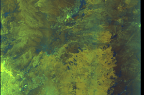
🛰️ Satellite Corroboration
Satellite imagery available but requires review
Preview available for manual review
Show Raw Evidence JSON
{
    "vessel_a": {
        "mmsi": 273278750,
        "imo": 9322968,
        "name": "HYPERION",
        "flag": "Russia"
    },
    "vessel_b": {
        "mmsi": 636025578,
        "imo": 9412074,
        "name": "ANDOVER",
        "flag": "LIBERIA"
    },
    "min_distance_m": 46.10000000000000142108547152020037174224853515625,
    "avg_distance_m": 60.2999999999999971578290569595992565155029296875,
    "distance_consistency_m": 20.10000000000000142108547152020037174224853515625,
    "duration_minutes": 37.5,
    "overlap_duration_s": 2248,
    "speed_a_avg": 0,
    "speed_a_std": 0,
    "speed_b_avg": 0,
    "speed_b_std": 0,
    "speed_summary": {
        "vessel_a": {
            "avg_sog": 0,
            "max_sog": 0
        },
        "vessel_b": {
            "avg_sog": 0,
            "max_sog": 0
        }
    },
    "time_window": {
        "start": "2026-06-05T16:06:09+00:00",
        "end": "2026-06-05T16:43:37+00:00"
    },
    "points_count": {
        "vessel_a": 2,
        "vessel_b": 2
    },
    "zone_id": "discovered_138",
    "zone_name": "Eastern Mediterranean Surveillance Zone",
    "score": {
        "value": 75,
        "components": {
            "distance_tightness": {
                "score": 25,
                "max": 25,
                "detail": "Min distance 46m, avg 60m"
            },
            "duration": {
                "score": 5,
                "max": 25,
                "detail": "Duration 38 minutes"
            },
            "speed_stability": {
                "score": 20,
                "max": 20,
                "detail": "both nearly stationary; very stable speeds"
            },
            "distance_consistency": {
                "score": 15,
                "max": 15,
                "detail": "Distance variance \u00b120m"
            },
            "isolation": {
                "score": 5,
                "max": 10,
                "detail": "Isolation data not available"
            },
            "context": {
                "score": 5,
                "max": 5,
                "detail": "In monitored zone: Eastern Mediterranean Surveillance Zone"
            }
        },
        "summary": "Moderate-confidence STS candidate. Two tankers (HYPERION and ANDOVER) maintained close proximity (min 46m, avg 60m) for 38 minutes. Both vessels were slow-moving (avg speeds 0.0 and 0.0 knots). The stable separation distance suggests deliberate parallel positioning typical of cargo transfer. Event occurred in Eastern Mediterranean Surveillance Zone, a known STS activity area."
    },
    "sar": {
        "status": "inconclusive",
        "centroid": {
            "lat": 31.716861699999999046895027277059853076934814453125,
            "lon": 35.999257900000003473905962891876697540283203125
        },
        "time_window": {
            "start_ts": "2026-06-05T16:06:09+00:00",
            "end_ts": "2026-06-05T16:43:37+00:00"
        },
        "searched_at": "2026-06-05T20:45:11.565710+00:00",
        "scene_id": "S1A_IW_GRDH_1SDV_20260605T153229_20260605T153254_064836_082B70_3862_COG",
        "scene_datetime": "2026-06-05T15:32:29.825574Z",
        "platform": "sentinel-1a",
        "bbox": {
            "min_lon": 35.8118630000000024438122636638581752777099609375,
            "min_lat": 30.863133999999998735574990860186517238616943359375,
            "max_lon": 38.8217240000000032296156859956681728363037109375,
            "max_lat": 32.77985000000000326281224261038005352020263671875
        },
        "assets": {
            "preview_url": "https:\/\/fleetleaks.com\/wp-content\/uploads\/fleetleaks-evidence\/sar-imagery\/2026\/06\/event_680730_thumbnail_20260605204515.png",
            "stored_path": "\/home\/fleetleaks\/public_html\/wp-content\/uploads\/fleetleaks-evidence\/sar-imagery\/2026\/06\/event_680730_thumbnail_20260605204515.png",
            "source": "copernicus_dataspace"
        },
        "notes": "Preview available for manual review"
    }
}- Minimum Distance: 1 meters
- Average Distance: 119 meters
- Duration: 40 minutes
- Period: 2026-06-05T16:06:04+00:00 to 2026-06-05T16:46:44+00:00
- Vessel A Avg Speed: 0.1 knots
- Vessel B Avg Speed: 0.0 knots
- Zone: Eastern Mediterranean Surveillance Zone
Confidence Analysis
Moderate-confidence STS candidate. Two tankers (SAMBA and ANDOVER) maintained close proximity (min 1m, avg 119m) for 41 minutes. Both vessels were slow-moving (avg speeds 0.1 and 0.0 knots). Event occurred in Eastern Mediterranean Surveillance Zone, a known STS activity area.
View scoring breakdown
| Factor | Score | Detail |
|---|---|---|
| Distance Tightness | 25/25 | Min distance 1m, avg 119m |
| Duration | 5/25 | Duration 41 minutes |
| Speed Stability | 20/20 | both nearly stationary; very stable speeds |
| Distance Consistency | 5/15 | Distance variance ±112m |
| Isolation | 5/10 | Isolation data not available |
| Context | 5/5 | In monitored zone: Eastern Mediterranean Surveillance Zone |
🛰️ Satellite Corroboration
Satellite imagery available but requires review
Preview available for manual review

Show Raw Evidence JSON
{
    "vessel_a": {
        "mmsi": 538011921,
        "imo": 9310305,
        "name": "SAMBA",
        "flag": "Marshall Is"
    },
    "vessel_b": {
        "mmsi": 636025578,
        "imo": 9412074,
        "name": "ANDOVER",
        "flag": "LIBERIA"
    },
    "min_distance_m": 1.1999999999999999555910790149937383830547332763671875,
    "avg_distance_m": 118.900000000000005684341886080801486968994140625,
    "distance_consistency_m": 112.5,
    "duration_minutes": 40.7000000000000028421709430404007434844970703125,
    "overlap_duration_s": 2440,
    "speed_a_avg": 0.11000000000000000055511151231257827021181583404541015625,
    "speed_a_std": 0.270000000000000017763568394002504646778106689453125,
    "speed_b_avg": 0,
    "speed_b_std": 0,
    "speed_summary": {
        "vessel_a": {
            "avg_sog": 0.11000000000000000055511151231257827021181583404541015625,
            "max_sog": 1
        },
        "vessel_b": {
            "avg_sog": 0,
            "max_sog": 0
        }
    },
    "time_window": {
        "start": "2026-06-05T16:06:04+00:00",
        "end": "2026-06-05T16:46:44+00:00"
    },
    "points_count": {
        "vessel_a": 13,
        "vessel_b": 13
    },
    "zone_id": "discovered_138",
    "zone_name": "Eastern Mediterranean Surveillance Zone",
    "score": {
        "value": 65,
        "components": {
            "distance_tightness": {
                "score": 25,
                "max": 25,
                "detail": "Min distance 1m, avg 119m"
            },
            "duration": {
                "score": 5,
                "max": 25,
                "detail": "Duration 41 minutes"
            },
            "speed_stability": {
                "score": 20,
                "max": 20,
                "detail": "both nearly stationary; very stable speeds"
            },
            "distance_consistency": {
                "score": 5,
                "max": 15,
                "detail": "Distance variance \u00b1112m"
            },
            "isolation": {
                "score": 5,
                "max": 10,
                "detail": "Isolation data not available"
            },
            "context": {
                "score": 5,
                "max": 5,
                "detail": "In monitored zone: Eastern Mediterranean Surveillance Zone"
            }
        },
        "summary": "Moderate-confidence STS candidate. Two tankers (SAMBA and ANDOVER) maintained close proximity (min 1m, avg 119m) for 41 minutes. Both vessels were slow-moving (avg speeds 0.1 and 0.0 knots). Event occurred in Eastern Mediterranean Surveillance Zone, a known STS activity area."
    },
    "sar": {
        "status": "inconclusive",
        "centroid": {
            "lat": 31.71666189999999829751686775125563144683837890625,
            "lon": 35.99993330000000213431121665053069591522216796875
        },
        "time_window": {
            "start_ts": "2026-06-05T16:03:40+00:00",
            "end_ts": "2026-06-05T16:46:44+00:00"
        },
        "searched_at": "2026-06-05T18:45:21.485113+00:00",
        "scene_id": "S1A_IW_GRDH_1SDV_20260605T153229_20260605T153254_064836_082B70_3862_COG",
        "scene_datetime": "2026-06-05T15:32:29.825574Z",
        "platform": "sentinel-1a",
        "bbox": {
            "min_lon": 35.8118630000000024438122636638581752777099609375,
            "min_lat": 30.863133999999998735574990860186517238616943359375,
            "max_lon": 38.8217240000000032296156859956681728363037109375,
            "max_lat": 32.77985000000000326281224261038005352020263671875
        },
        "assets": {
            "preview_url": "https:\/\/fleetleaks.com\/wp-content\/uploads\/fleetleaks-evidence\/sar-imagery\/2026\/06\/event_680553_thumbnail_20260605184524.png",
            "stored_path": "\/home\/fleetleaks\/public_html\/wp-content\/uploads\/fleetleaks-evidence\/sar-imagery\/2026\/06\/event_680553_thumbnail_20260605184524.png",
            "source": "copernicus_dataspace"
        },
        "notes": "Preview available for manual review"
    }
}- Minimum Distance: 1 meters
- Average Distance: 90 meters
- Duration: 36 minutes
- Period: 2026-06-05T16:03:40+00:00 to 2026-06-05T16:39:42+00:00
- Vessel A Avg Speed: 0.0 knots
- Vessel B Avg Speed: 0.1 knots
- Zone: Eastern Mediterranean Surveillance Zone
Confidence Analysis
Moderate-confidence STS candidate. Two tankers (ANDOVER and BOBCAT) maintained close proximity (min 0m, avg 90m) for 36 minutes. Both vessels were slow-moving (avg speeds 0.0 and 0.1 knots). Moderate distance variation observed during the encounter. Event occurred in Eastern Mediterranean Surveillance Zone, a known STS activity area.
View scoring breakdown
| Factor | Score | Detail |
|---|---|---|
| Distance Tightness | 25/25 | Min distance 0m, avg 90m |
| Duration | 5/25 | Duration 36 minutes |
| Speed Stability | 20/20 | both nearly stationary; very stable speeds |
| Distance Consistency | 8/15 | Distance variance ±64m |
| Isolation | 5/10 | Isolation data not available |
| Context | 5/5 | In monitored zone: Eastern Mediterranean Surveillance Zone |
🛰️ Satellite Corroboration
Satellite imagery available but requires review
Preview available for manual review

Show Raw Evidence JSON
{
    "vessel_a": {
        "mmsi": 636025578,
        "imo": 9412074,
        "name": "ANDOVER",
        "flag": "LIBERIA"
    },
    "vessel_b": {
        "mmsi": 461000234,
        "imo": 9422457,
        "name": "BOBCAT",
        "flag": "Oman"
    },
    "min_distance_m": 0.5,
    "avg_distance_m": 90.2000000000000028421709430404007434844970703125,
    "distance_consistency_m": 63.7999999999999971578290569595992565155029296875,
    "duration_minutes": 36,
    "overlap_duration_s": 2162,
    "speed_a_avg": 0,
    "speed_a_std": 0,
    "speed_b_avg": 0.0899999999999999966693309261245303787291049957275390625,
    "speed_b_std": 0.08000000000000000166533453693773481063544750213623046875,
    "speed_summary": {
        "vessel_a": {
            "avg_sog": 0,
            "max_sog": 0
        },
        "vessel_b": {
            "avg_sog": 0.0899999999999999966693309261245303787291049957275390625,
            "max_sog": 0.200000000000000011102230246251565404236316680908203125
        }
    },
    "time_window": {
        "start": "2026-06-05T16:03:40+00:00",
        "end": "2026-06-05T16:39:42+00:00"
    },
    "points_count": {
        "vessel_a": 8,
        "vessel_b": 8
    },
    "zone_id": "discovered_138",
    "zone_name": "Eastern Mediterranean Surveillance Zone",
    "score": {
        "value": 68,
        "components": {
            "distance_tightness": {
                "score": 25,
                "max": 25,
                "detail": "Min distance 0m, avg 90m"
            },
            "duration": {
                "score": 5,
                "max": 25,
                "detail": "Duration 36 minutes"
            },
            "speed_stability": {
                "score": 20,
                "max": 20,
                "detail": "both nearly stationary; very stable speeds"
            },
            "distance_consistency": {
                "score": 8,
                "max": 15,
                "detail": "Distance variance \u00b164m"
            },
            "isolation": {
                "score": 5,
                "max": 10,
                "detail": "Isolation data not available"
            },
            "context": {
                "score": 5,
                "max": 5,
                "detail": "In monitored zone: Eastern Mediterranean Surveillance Zone"
            }
        },
        "summary": "Moderate-confidence STS candidate. Two tankers (ANDOVER and BOBCAT) maintained close proximity (min 0m, avg 90m) for 36 minutes. Both vessels were slow-moving (avg speeds 0.0 and 0.1 knots). Moderate distance variation observed during the encounter. Event occurred in Eastern Mediterranean Surveillance Zone, a known STS activity area."
    },
    "sar": {
        "status": "inconclusive",
        "centroid": {
            "lat": 31.71688449999999903639036347158253192901611328125,
            "lon": 35.99932770000000203935996978543698787689208984375
        },
        "time_window": {
            "start_ts": "2026-06-05T16:03:40+00:00",
            "end_ts": "2026-06-05T16:39:42+00:00"
        },
        "searched_at": "2026-06-05T19:00:01.852496+00:00",
        "scene_id": "S1A_IW_GRDH_1SDV_20260605T153229_20260605T153254_064836_082B70_3862_COG",
        "scene_datetime": "2026-06-05T15:32:29.825574Z",
        "platform": "sentinel-1a",
        "bbox": {
            "min_lon": 35.8118630000000024438122636638581752777099609375,
            "min_lat": 30.863133999999998735574990860186517238616943359375,
            "max_lon": 38.8217240000000032296156859956681728363037109375,
            "max_lat": 32.77985000000000326281224261038005352020263671875
        },
        "assets": {
            "preview_url": "https:\/\/fleetleaks.com\/wp-content\/uploads\/fleetleaks-evidence\/sar-imagery\/2026\/06\/event_680554_thumbnail_20260605190006.png",
            "stored_path": "\/home\/fleetleaks\/public_html\/wp-content\/uploads\/fleetleaks-evidence\/sar-imagery\/2026\/06\/event_680554_thumbnail_20260605190006.png",
            "source": "copernicus_dataspace"
        },
        "notes": "Preview available for manual review"
    }
}- Minimum Distance: 6 meters
- Average Distance: 88 meters
- Duration: 43 minutes
- Period: 2026-06-05T16:03:40+00:00 to 2026-06-05T16:47:22+00:00
- Vessel A Avg Speed: 0.0 knots
- Vessel B Avg Speed: 0.1 knots
- Zone: Eastern Mediterranean Surveillance Zone
Confidence Analysis
Moderate-confidence STS candidate. Two tankers (ANDOVER and PERSEAS) maintained close proximity (min 6m, avg 88m) for 44 minutes. Both vessels were slow-moving (avg speeds 0.0 and 0.1 knots). Moderate distance variation observed during the encounter. Event occurred in Eastern Mediterranean Surveillance Zone, a known STS activity area.
View scoring breakdown
| Factor | Score | Detail |
|---|---|---|
| Distance Tightness | 25/25 | Min distance 6m, avg 88m |
| Duration | 5/25 | Duration 44 minutes |
| Speed Stability | 20/20 | both nearly stationary; very stable speeds |
| Distance Consistency | 8/15 | Distance variance ±59m |
| Isolation | 5/10 | Isolation data not available |
| Context | 5/5 | In monitored zone: Eastern Mediterranean Surveillance Zone |
🛰️ Satellite Corroboration
Satellite imagery available but requires review
Preview available for manual review

Show Raw Evidence JSON
{
    "vessel_a": {
        "mmsi": 636025578,
        "imo": 9412074,
        "name": "ANDOVER",
        "flag": "LIBERIA"
    },
    "vessel_b": {
        "mmsi": 636026393,
        "imo": 9326811,
        "name": "PERSEAS",
        "flag": "LIBERIA"
    },
    "min_distance_m": 5.79999999999999982236431605997495353221893310546875,
    "avg_distance_m": 87.900000000000005684341886080801486968994140625,
    "distance_consistency_m": 58.89999999999999857891452847979962825775146484375,
    "duration_minutes": 43.7000000000000028421709430404007434844970703125,
    "overlap_duration_s": 2622,
    "speed_a_avg": 0,
    "speed_a_std": 0,
    "speed_b_avg": 0.059999999999999997779553950749686919152736663818359375,
    "speed_b_std": 0.05000000000000000277555756156289135105907917022705078125,
    "speed_summary": {
        "vessel_a": {
            "avg_sog": 0,
            "max_sog": 0
        },
        "vessel_b": {
            "avg_sog": 0.059999999999999997779553950749686919152736663818359375,
            "max_sog": 0.1000000000000000055511151231257827021181583404541015625
        }
    },
    "time_window": {
        "start": "2026-06-05T16:03:40+00:00",
        "end": "2026-06-05T16:47:22+00:00"
    },
    "points_count": {
        "vessel_a": 9,
        "vessel_b": 9
    },
    "zone_id": "discovered_138",
    "zone_name": "Eastern Mediterranean Surveillance Zone",
    "score": {
        "value": 68,
        "components": {
            "distance_tightness": {
                "score": 25,
                "max": 25,
                "detail": "Min distance 6m, avg 88m"
            },
            "duration": {
                "score": 5,
                "max": 25,
                "detail": "Duration 44 minutes"
            },
            "speed_stability": {
                "score": 20,
                "max": 20,
                "detail": "both nearly stationary; very stable speeds"
            },
            "distance_consistency": {
                "score": 8,
                "max": 15,
                "detail": "Distance variance \u00b159m"
            },
            "isolation": {
                "score": 5,
                "max": 10,
                "detail": "Isolation data not available"
            },
            "context": {
                "score": 5,
                "max": 5,
                "detail": "In monitored zone: Eastern Mediterranean Surveillance Zone"
            }
        },
        "summary": "Moderate-confidence STS candidate. Two tankers (ANDOVER and PERSEAS) maintained close proximity (min 6m, avg 88m) for 44 minutes. Both vessels were slow-moving (avg speeds 0.0 and 0.1 knots). Moderate distance variation observed during the encounter. Event occurred in Eastern Mediterranean Surveillance Zone, a known STS activity area."
    },
    "sar": {
        "status": "inconclusive",
        "centroid": {
            "lat": 31.716898900000000338650352205149829387664794921875,
            "lon": 35.99930470000000326535882777534425258636474609375
        },
        "time_window": {
            "start_ts": "2026-06-05T16:03:40+00:00",
            "end_ts": "2026-06-05T16:47:22+00:00"
        },
        "searched_at": "2026-06-05T19:00:07.436801+00:00",
        "scene_id": "S1A_IW_GRDH_1SDV_20260605T153229_20260605T153254_064836_082B70_3862_COG",
        "scene_datetime": "2026-06-05T15:32:29.825574Z",
        "platform": "sentinel-1a",
        "bbox": {
            "min_lon": 35.8118630000000024438122636638581752777099609375,
            "min_lat": 30.863133999999998735574990860186517238616943359375,
            "max_lon": 38.8217240000000032296156859956681728363037109375,
            "max_lat": 32.77985000000000326281224261038005352020263671875
        },
        "assets": {
            "preview_url": "https:\/\/fleetleaks.com\/wp-content\/uploads\/fleetleaks-evidence\/sar-imagery\/2026\/06\/event_680555_thumbnail_20260605190011.png",
            "stored_path": "\/home\/fleetleaks\/public_html\/wp-content\/uploads\/fleetleaks-evidence\/sar-imagery\/2026\/06\/event_680555_thumbnail_20260605190011.png",
            "source": "copernicus_dataspace"
        },
        "notes": "Preview available for manual review"
    }
}- Minimum Distance: 1 meters
- Average Distance: 73 meters
- Duration: 33 minutes
- Period: 2026-06-05T16:12:26+00:00 to 2026-06-05T16:45:25+00:00
- Vessel A Avg Speed: 0.0 knots
- Vessel B Avg Speed: 0.0 knots
- Zone: Eastern Mediterranean Surveillance Zone
Confidence Analysis
Moderate-confidence STS candidate. Two tankers (TRANS FJORD and ANDOVER) maintained close proximity (min 1m, avg 73m) for 33 minutes. Both vessels were slow-moving (avg speeds 0.0 and 0.0 knots). Moderate distance variation observed during the encounter. Event occurred in Eastern Mediterranean Surveillance Zone, a known STS activity area.
View scoring breakdown
| Factor | Score | Detail |
|---|---|---|
| Distance Tightness | 25/25 | Min distance 1m, avg 73m |
| Duration | 5/25 | Duration 33 minutes |
| Speed Stability | 20/20 | both nearly stationary; very stable speeds |
| Distance Consistency | 8/15 | Distance variance ±60m |
| Isolation | 5/10 | Isolation data not available |
| Context | 5/5 | In monitored zone: Eastern Mediterranean Surveillance Zone |
Show Raw Evidence JSON
{
    "vessel_a": {
        "mmsi": 352003272,
        "imo": 9956939,
        "name": "TRANS FJORD",
        "flag": "Panama"
    },
    "vessel_b": {
        "mmsi": 636025578,
        "imo": 9412074,
        "name": "ANDOVER",
        "flag": "LIBERIA"
    },
    "min_distance_m": 0.90000000000000002220446049250313080847263336181640625,
    "avg_distance_m": 72.7999999999999971578290569595992565155029296875,
    "distance_consistency_m": 60.2999999999999971578290569595992565155029296875,
    "duration_minutes": 33,
    "overlap_duration_s": 1979,
    "speed_a_avg": 0,
    "speed_a_std": 0,
    "speed_b_avg": 0,
    "speed_b_std": 0,
    "speed_summary": {
        "vessel_a": {
            "avg_sog": 0,
            "max_sog": 0
        },
        "vessel_b": {
            "avg_sog": 0,
            "max_sog": 0
        }
    },
    "time_window": {
        "start": "2026-06-05T16:12:26+00:00",
        "end": "2026-06-05T16:45:25+00:00"
    },
    "points_count": {
        "vessel_a": 10,
        "vessel_b": 10
    },
    "zone_id": "discovered_138",
    "zone_name": "Eastern Mediterranean Surveillance Zone",
    "score": {
        "value": 68,
        "components": {
            "distance_tightness": {
                "score": 25,
                "max": 25,
                "detail": "Min distance 1m, avg 73m"
            },
            "duration": {
                "score": 5,
                "max": 25,
                "detail": "Duration 33 minutes"
            },
            "speed_stability": {
                "score": 20,
                "max": 20,
                "detail": "both nearly stationary; very stable speeds"
            },
            "distance_consistency": {
                "score": 8,
                "max": 15,
                "detail": "Distance variance \u00b160m"
            },
            "isolation": {
                "score": 5,
                "max": 10,
                "detail": "Isolation data not available"
            },
            "context": {
                "score": 5,
                "max": 5,
                "detail": "In monitored zone: Eastern Mediterranean Surveillance Zone"
            }
        },
        "summary": "Moderate-confidence STS candidate. Two tankers (TRANS FJORD and ANDOVER) maintained close proximity (min 1m, avg 73m) for 33 minutes. Both vessels were slow-moving (avg speeds 0.0 and 0.0 knots). Moderate distance variation observed during the encounter. Event occurred in Eastern Mediterranean Surveillance Zone, a known STS activity area."
    }
}- Minimum Distance: 3 meters
- Average Distance: 86 meters
- Duration: 36 minutes
- Period: 2026-06-05T16:03:40+00:00 to 2026-06-05T16:39:42+00:00
- Vessel A Avg Speed: 0.0 knots
- Vessel B Avg Speed: 0.2 knots
- Zone: Eastern Mediterranean Surveillance Zone
Confidence Analysis
Moderate-confidence STS candidate. Two tankers (ANDOVER and SEAGAS MAJOR) maintained close proximity (min 2m, avg 86m) for 36 minutes. Both vessels were slow-moving (avg speeds 0.0 and 0.2 knots). Moderate distance variation observed during the encounter. Event occurred in Eastern Mediterranean Surveillance Zone, a known STS activity area.
View scoring breakdown
| Factor | Score | Detail |
|---|---|---|
| Distance Tightness | 25/25 | Min distance 2m, avg 86m |
| Duration | 5/25 | Duration 36 minutes |
| Speed Stability | 20/20 | both nearly stationary; very stable speeds |
| Distance Consistency | 8/15 | Distance variance ±61m |
| Isolation | 5/10 | Isolation data not available |
| Context | 5/5 | In monitored zone: Eastern Mediterranean Surveillance Zone |
🛰️ Satellite Corroboration
Satellite imagery available but requires review
Preview available for manual review

Show Raw Evidence JSON
{
    "vessel_a": {
        "mmsi": 636025578,
        "imo": 9412074,
        "name": "ANDOVER",
        "flag": "LIBERIA"
    },
    "vessel_b": {
        "mmsi": 636016188,
        "imo": 9135793,
        "name": "SEAGAS MAJOR",
        "flag": "LIBERIA"
    },
    "min_distance_m": 2.5,
    "avg_distance_m": 85.599999999999994315658113919198513031005859375,
    "distance_consistency_m": 61.2000000000000028421709430404007434844970703125,
    "duration_minutes": 36,
    "overlap_duration_s": 2162,
    "speed_a_avg": 0,
    "speed_a_std": 0,
    "speed_b_avg": 0.2399999999999999911182158029987476766109466552734375,
    "speed_b_std": 0.14000000000000001332267629550187848508358001708984375,
    "speed_summary": {
        "vessel_a": {
            "avg_sog": 0,
            "max_sog": 0
        },
        "vessel_b": {
            "avg_sog": 0.2399999999999999911182158029987476766109466552734375,
            "max_sog": 0.40000000000000002220446049250313080847263336181640625
        }
    },
    "time_window": {
        "start": "2026-06-05T16:03:40+00:00",
        "end": "2026-06-05T16:39:42+00:00"
    },
    "points_count": {
        "vessel_a": 8,
        "vessel_b": 8
    },
    "zone_id": "discovered_138",
    "zone_name": "Eastern Mediterranean Surveillance Zone",
    "score": {
        "value": 68,
        "components": {
            "distance_tightness": {
                "score": 25,
                "max": 25,
                "detail": "Min distance 2m, avg 86m"
            },
            "duration": {
                "score": 5,
                "max": 25,
                "detail": "Duration 36 minutes"
            },
            "speed_stability": {
                "score": 20,
                "max": 20,
                "detail": "both nearly stationary; very stable speeds"
            },
            "distance_consistency": {
                "score": 8,
                "max": 15,
                "detail": "Distance variance \u00b161m"
            },
            "isolation": {
                "score": 5,
                "max": 10,
                "detail": "Isolation data not available"
            },
            "context": {
                "score": 5,
                "max": 5,
                "detail": "In monitored zone: Eastern Mediterranean Surveillance Zone"
            }
        },
        "summary": "Moderate-confidence STS candidate. Two tankers (ANDOVER and SEAGAS MAJOR) maintained close proximity (min 2m, avg 86m) for 36 minutes. Both vessels were slow-moving (avg speeds 0.0 and 0.2 knots). Moderate distance variation observed during the encounter. Event occurred in Eastern Mediterranean Surveillance Zone, a known STS activity area."
    },
    "sar": {
        "status": "inconclusive",
        "centroid": {
            "lat": 31.716869599999998996509020798839628696441650390625,
            "lon": 35.999323599999996758924680761992931365966796875
        },
        "time_window": {
            "start_ts": "2026-06-05T16:03:40+00:00",
            "end_ts": "2026-06-05T16:39:42+00:00"
        },
        "searched_at": "2026-06-05T19:30:11.068712+00:00",
        "scene_id": "S1A_IW_GRDH_1SDV_20260605T153229_20260605T153254_064836_082B70_3862_COG",
        "scene_datetime": "2026-06-05T15:32:29.825574Z",
        "platform": "sentinel-1a",
        "bbox": {
            "min_lon": 35.8118630000000024438122636638581752777099609375,
            "min_lat": 30.863133999999998735574990860186517238616943359375,
            "max_lon": 38.8217240000000032296156859956681728363037109375,
            "max_lat": 32.77985000000000326281224261038005352020263671875
        },
        "assets": {
            "preview_url": "https:\/\/fleetleaks.com\/wp-content\/uploads\/fleetleaks-evidence\/sar-imagery\/2026\/06\/event_680584_thumbnail_20260605193014.png",
            "stored_path": "\/home\/fleetleaks\/public_html\/wp-content\/uploads\/fleetleaks-evidence\/sar-imagery\/2026\/06\/event_680584_thumbnail_20260605193014.png",
            "source": "copernicus_dataspace"
        },
        "notes": "Preview available for manual review"
    }
}- Minimum Distance: 2 meters
- Average Distance: 92 meters
- Duration: 36 minutes
- Period: 2026-06-05T16:03:40+00:00 to 2026-06-05T16:39:42+00:00
- Vessel A Avg Speed: 0.0 knots
- Vessel B Avg Speed: 0.1 knots
- Zone: Eastern Mediterranean Surveillance Zone
Confidence Analysis
Moderate-confidence STS candidate. Two tankers (ANDOVER and MUMBAI) maintained close proximity (min 2m, avg 92m) for 36 minutes. Both vessels were slow-moving (avg speeds 0.0 and 0.1 knots). Moderate distance variation observed during the encounter. Event occurred in Eastern Mediterranean Surveillance Zone, a known STS activity area.
View scoring breakdown
| Factor | Score | Detail |
|---|---|---|
| Distance Tightness | 25/25 | Min distance 2m, avg 92m |
| Duration | 5/25 | Duration 36 minutes |
| Speed Stability | 17/20 | both nearly stationary; stable speeds |
| Distance Consistency | 8/15 | Distance variance ±69m |
| Isolation | 5/10 | Isolation data not available |
| Context | 5/5 | In monitored zone: Eastern Mediterranean Surveillance Zone |
🛰️ Satellite Corroboration
Satellite imagery available but requires review
Preview available for manual review

Show Raw Evidence JSON
{
    "vessel_a": {
        "mmsi": 636025578,
        "imo": 9412074,
        "name": "ANDOVER",
        "flag": "LIBERIA"
    },
    "vessel_b": {
        "mmsi": 352002651,
        "imo": 9242338,
        "name": "MUMBAI",
        "flag": "PANAMA"
    },
    "min_distance_m": 1.5,
    "avg_distance_m": 92.2000000000000028421709430404007434844970703125,
    "distance_consistency_m": 68.7000000000000028421709430404007434844970703125,
    "duration_minutes": 36,
    "overlap_duration_s": 2162,
    "speed_a_avg": 0,
    "speed_a_std": 0,
    "speed_b_avg": 0.11999999999999999555910790149937383830547332763671875,
    "speed_b_std": 0.34999999999999997779553950749686919152736663818359375,
    "speed_summary": {
        "vessel_a": {
            "avg_sog": 0,
            "max_sog": 0
        },
        "vessel_b": {
            "avg_sog": 0.11999999999999999555910790149937383830547332763671875,
            "max_sog": 1
        }
    },
    "time_window": {
        "start": "2026-06-05T16:03:40+00:00",
        "end": "2026-06-05T16:39:42+00:00"
    },
    "points_count": {
        "vessel_a": 8,
        "vessel_b": 8
    },
    "zone_id": "discovered_138",
    "zone_name": "Eastern Mediterranean Surveillance Zone",
    "score": {
        "value": 65,
        "components": {
            "distance_tightness": {
                "score": 25,
                "max": 25,
                "detail": "Min distance 2m, avg 92m"
            },
            "duration": {
                "score": 5,
                "max": 25,
                "detail": "Duration 36 minutes"
            },
            "speed_stability": {
                "score": 17,
                "max": 20,
                "detail": "both nearly stationary; stable speeds"
            },
            "distance_consistency": {
                "score": 8,
                "max": 15,
                "detail": "Distance variance \u00b169m"
            },
            "isolation": {
                "score": 5,
                "max": 10,
                "detail": "Isolation data not available"
            },
            "context": {
                "score": 5,
                "max": 5,
                "detail": "In monitored zone: Eastern Mediterranean Surveillance Zone"
            }
        },
        "summary": "Moderate-confidence STS candidate. Two tankers (ANDOVER and MUMBAI) maintained close proximity (min 2m, avg 92m) for 36 minutes. Both vessels were slow-moving (avg speeds 0.0 and 0.1 knots). Moderate distance variation observed during the encounter. Event occurred in Eastern Mediterranean Surveillance Zone, a known STS activity area."
    },
    "sar": {
        "status": "inconclusive",
        "centroid": {
            "lat": 31.71689190000000024838300305418670177459716796875,
            "lon": 35.99932390000000026475390768609941005706787109375
        },
        "time_window": {
            "start_ts": "2026-06-05T16:03:40+00:00",
            "end_ts": "2026-06-05T16:39:42+00:00"
        },
        "searched_at": "2026-06-05T19:30:15.670401+00:00",
        "scene_id": "S1A_IW_GRDH_1SDV_20260605T153229_20260605T153254_064836_082B70_3862_COG",
        "scene_datetime": "2026-06-05T15:32:29.825574Z",
        "platform": "sentinel-1a",
        "bbox": {
            "min_lon": 35.8118630000000024438122636638581752777099609375,
            "min_lat": 30.863133999999998735574990860186517238616943359375,
            "max_lon": 38.8217240000000032296156859956681728363037109375,
            "max_lat": 32.77985000000000326281224261038005352020263671875
        },
        "assets": {
            "preview_url": "https:\/\/fleetleaks.com\/wp-content\/uploads\/fleetleaks-evidence\/sar-imagery\/2026\/06\/event_680585_thumbnail_20260605193019.png",
            "stored_path": "\/home\/fleetleaks\/public_html\/wp-content\/uploads\/fleetleaks-evidence\/sar-imagery\/2026\/06\/event_680585_thumbnail_20260605193019.png",
            "source": "copernicus_dataspace"
        },
        "notes": "Preview available for manual review"
    }
}- Minimum Distance: 2 meters
- Average Distance: 88 meters
- Duration: 43 minutes
- Period: 2026-06-05T16:03:40+00:00 to 2026-06-05T16:47:22+00:00
- Vessel A Avg Speed: 0.0 knots
- Vessel B Avg Speed: 0.0 knots
- Zone: Eastern Mediterranean Surveillance Zone
Confidence Analysis
Moderate-confidence STS candidate. Two tankers (ANDOVER and GAZ HORIZON) maintained close proximity (min 2m, avg 88m) for 44 minutes. Both vessels were slow-moving (avg speeds 0.0 and 0.0 knots). Moderate distance variation observed during the encounter. Event occurred in Eastern Mediterranean Surveillance Zone, a known STS activity area.
View scoring breakdown
| Factor | Score | Detail |
|---|---|---|
| Distance Tightness | 25/25 | Min distance 2m, avg 88m |
| Duration | 5/25 | Duration 44 minutes |
| Speed Stability | 20/20 | both nearly stationary; very stable speeds |
| Distance Consistency | 8/15 | Distance variance ±59m |
| Isolation | 5/10 | Isolation data not available |
| Context | 5/5 | In monitored zone: Eastern Mediterranean Surveillance Zone |
🛰️ Satellite Corroboration
Satellite imagery available but requires review
Preview available for manual review

Show Raw Evidence JSON
{
    "vessel_a": {
        "mmsi": 636025578,
        "imo": 9412074,
        "name": "ANDOVER",
        "flag": "LIBERIA"
    },
    "vessel_b": {
        "mmsi": 538007915,
        "imo": 9572563,
        "name": "GAZ HORIZON",
        "flag": "Marshall Is"
    },
    "min_distance_m": 1.600000000000000088817841970012523233890533447265625,
    "avg_distance_m": 87.7999999999999971578290569595992565155029296875,
    "distance_consistency_m": 59.10000000000000142108547152020037174224853515625,
    "duration_minutes": 43.7000000000000028421709430404007434844970703125,
    "overlap_duration_s": 2622,
    "speed_a_avg": 0,
    "speed_a_std": 0,
    "speed_b_avg": 0.0200000000000000004163336342344337026588618755340576171875,
    "speed_b_std": 0.040000000000000000832667268468867405317723751068115234375,
    "speed_summary": {
        "vessel_a": {
            "avg_sog": 0,
            "max_sog": 0
        },
        "vessel_b": {
            "avg_sog": 0.0200000000000000004163336342344337026588618755340576171875,
            "max_sog": 0.1000000000000000055511151231257827021181583404541015625
        }
    },
    "time_window": {
        "start": "2026-06-05T16:03:40+00:00",
        "end": "2026-06-05T16:47:22+00:00"
    },
    "points_count": {
        "vessel_a": 9,
        "vessel_b": 9
    },
    "zone_id": "discovered_138",
    "zone_name": "Eastern Mediterranean Surveillance Zone",
    "score": {
        "value": 68,
        "components": {
            "distance_tightness": {
                "score": 25,
                "max": 25,
                "detail": "Min distance 2m, avg 88m"
            },
            "duration": {
                "score": 5,
                "max": 25,
                "detail": "Duration 44 minutes"
            },
            "speed_stability": {
                "score": 20,
                "max": 20,
                "detail": "both nearly stationary; very stable speeds"
            },
            "distance_consistency": {
                "score": 8,
                "max": 15,
                "detail": "Distance variance \u00b159m"
            },
            "isolation": {
                "score": 5,
                "max": 10,
                "detail": "Isolation data not available"
            },
            "context": {
                "score": 5,
                "max": 5,
                "detail": "In monitored zone: Eastern Mediterranean Surveillance Zone"
            }
        },
        "summary": "Moderate-confidence STS candidate. Two tankers (ANDOVER and GAZ HORIZON) maintained close proximity (min 2m, avg 88m) for 44 minutes. Both vessels were slow-moving (avg speeds 0.0 and 0.0 knots). Moderate distance variation observed during the encounter. Event occurred in Eastern Mediterranean Surveillance Zone, a known STS activity area."
    },
    "sar": {
        "status": "inconclusive",
        "centroid": {
            "lat": 31.716885600000001232956492458470165729522705078125,
            "lon": 35.99932150000000063982952269725501537322998046875
        },
        "time_window": {
            "start_ts": "2026-06-05T16:03:40+00:00",
            "end_ts": "2026-06-05T16:47:22+00:00"
        },
        "searched_at": "2026-06-05T19:30:20.169268+00:00",
        "scene_id": "S1A_IW_GRDH_1SDV_20260605T153229_20260605T153254_064836_082B70_3862_COG",
        "scene_datetime": "2026-06-05T15:32:29.825574Z",
        "platform": "sentinel-1a",
        "bbox": {
            "min_lon": 35.8118630000000024438122636638581752777099609375,
            "min_lat": 30.863133999999998735574990860186517238616943359375,
            "max_lon": 38.8217240000000032296156859956681728363037109375,
            "max_lat": 32.77985000000000326281224261038005352020263671875
        },
        "assets": {
            "preview_url": "https:\/\/fleetleaks.com\/wp-content\/uploads\/fleetleaks-evidence\/sar-imagery\/2026\/06\/event_680586_thumbnail_20260605193023.png",
            "stored_path": "\/home\/fleetleaks\/public_html\/wp-content\/uploads\/fleetleaks-evidence\/sar-imagery\/2026\/06\/event_680586_thumbnail_20260605193023.png",
            "source": "copernicus_dataspace"
        },
        "notes": "Preview available for manual review"
    }
}- Minimum Distance: 2 meters
- Average Distance: 93 meters
- Duration: 43 minutes
- Period: 2026-06-05T16:03:50+00:00 to 2026-06-05T16:47:40+00:00
- Vessel A Avg Speed: 0.0 knots
- Vessel B Avg Speed: 0.0 knots
- Zone: Eastern Mediterranean Surveillance Zone
Confidence Analysis
Moderate-confidence STS candidate. Two tankers (BLUE ROSE and ANDOVER) maintained close proximity (min 2m, avg 93m) for 44 minutes. Both vessels were slow-moving (avg speeds 0.0 and 0.0 knots). Moderate distance variation observed during the encounter. Event occurred in Eastern Mediterranean Surveillance Zone, a known STS activity area.
View scoring breakdown
| Factor | Score | Detail |
|---|---|---|
| Distance Tightness | 25/25 | Min distance 2m, avg 93m |
| Duration | 5/25 | Duration 44 minutes |
| Speed Stability | 20/20 | both nearly stationary; very stable speeds |
| Distance Consistency | 8/15 | Distance variance ±57m |
| Isolation | 5/10 | Isolation data not available |
| Context | 5/5 | In monitored zone: Eastern Mediterranean Surveillance Zone |
🛰️ Satellite Corroboration
Satellite imagery available but requires review
Preview available for manual review

Show Raw Evidence JSON
{
    "vessel_a": {
        "mmsi": 538002561,
        "imo": 9335915,
        "name": "BLUE ROSE",
        "flag": "MARSHALL ISLANDS"
    },
    "vessel_b": {
        "mmsi": 636025578,
        "imo": 9412074,
        "name": "ANDOVER",
        "flag": "LIBERIA"
    },
    "min_distance_m": 2.399999999999999911182158029987476766109466552734375,
    "avg_distance_m": 93.2000000000000028421709430404007434844970703125,
    "distance_consistency_m": 57.2999999999999971578290569595992565155029296875,
    "duration_minutes": 43.7999999999999971578290569595992565155029296875,
    "overlap_duration_s": 2630,
    "speed_a_avg": 0.0200000000000000004163336342344337026588618755340576171875,
    "speed_a_std": 0.040000000000000000832667268468867405317723751068115234375,
    "speed_b_avg": 0,
    "speed_b_std": 0,
    "speed_summary": {
        "vessel_a": {
            "avg_sog": 0.0200000000000000004163336342344337026588618755340576171875,
            "max_sog": 0.1000000000000000055511151231257827021181583404541015625
        },
        "vessel_b": {
            "avg_sog": 0,
            "max_sog": 0
        }
    },
    "time_window": {
        "start": "2026-06-05T16:03:50+00:00",
        "end": "2026-06-05T16:47:40+00:00"
    },
    "points_count": {
        "vessel_a": 13,
        "vessel_b": 13
    },
    "zone_id": "discovered_138",
    "zone_name": "Eastern Mediterranean Surveillance Zone",
    "score": {
        "value": 68,
        "components": {
            "distance_tightness": {
                "score": 25,
                "max": 25,
                "detail": "Min distance 2m, avg 93m"
            },
            "duration": {
                "score": 5,
                "max": 25,
                "detail": "Duration 44 minutes"
            },
            "speed_stability": {
                "score": 20,
                "max": 20,
                "detail": "both nearly stationary; very stable speeds"
            },
            "distance_consistency": {
                "score": 8,
                "max": 15,
                "detail": "Distance variance \u00b157m"
            },
            "isolation": {
                "score": 5,
                "max": 10,
                "detail": "Isolation data not available"
            },
            "context": {
                "score": 5,
                "max": 5,
                "detail": "In monitored zone: Eastern Mediterranean Surveillance Zone"
            }
        },
        "summary": "Moderate-confidence STS candidate. Two tankers (BLUE ROSE and ANDOVER) maintained close proximity (min 2m, avg 93m) for 44 minutes. Both vessels were slow-moving (avg speeds 0.0 and 0.0 knots). Moderate distance variation observed during the encounter. Event occurred in Eastern Mediterranean Surveillance Zone, a known STS activity area."
    },
    "sar": {
        "status": "inconclusive",
        "centroid": {
            "lat": 31.716801499999998981138560338877141475677490234375,
            "lon": 35.9993510999999983823727234266698360443115234375
        },
        "time_window": {
            "start_ts": "2026-06-05T16:03:40+00:00",
            "end_ts": "2026-06-05T16:47:40+00:00"
        },
        "searched_at": "2026-06-05T19:45:01.379249+00:00",
        "scene_id": "S1A_IW_GRDH_1SDV_20260605T153229_20260605T153254_064836_082B70_3862_COG",
        "scene_datetime": "2026-06-05T15:32:29.825574Z",
        "platform": "sentinel-1a",
        "bbox": {
            "min_lon": 35.8118630000000024438122636638581752777099609375,
            "min_lat": 30.863133999999998735574990860186517238616943359375,
            "max_lon": 38.8217240000000032296156859956681728363037109375,
            "max_lat": 32.77985000000000326281224261038005352020263671875
        },
        "assets": {
            "preview_url": "https:\/\/fleetleaks.com\/wp-content\/uploads\/fleetleaks-evidence\/sar-imagery\/2026\/06\/event_680587_thumbnail_20260605194506.png",
            "stored_path": "\/home\/fleetleaks\/public_html\/wp-content\/uploads\/fleetleaks-evidence\/sar-imagery\/2026\/06\/event_680587_thumbnail_20260605194506.png",
            "source": "copernicus_dataspace"
        },
        "notes": "Preview available for manual review"
    }
}- Zone: discovered_020
- Duration: 1h 58m
- Data Points: 24 AIS positions
- Period: 2026-06-05T14:00:57+00:00 to 2026-06-05T15:59:21+00:00
Show Raw Evidence JSON
{
    "zone_id": "discovered_020",
    "zone_name": "Eastern Mediterranean Monitoring Zone",
    "dwell_minutes": 118.400000000000005684341886080801486968994140625,
    "points_in_zone": 24,
    "first_point": {
        "ts": "2026-06-05T14:00:57+00:00",
        "lat": 31.404005000000001501803126302547752857208251953125,
        "lon": 32.27488170000000167192411026917397975921630859375
    },
    "last_point": {
        "ts": "2026-06-05T15:59:21+00:00",
        "lat": 31.403921700000001493435775046236813068389892578125,
        "lon": 32.27488670000000325899236486293375492095947265625
    }
}- Duration: 1h 58m
- Radius: 82 meters
- Data Points: 24 AIS positions
- Centroid: 31.4039, 32.2749
- Zone: discovered_020
Show Raw Evidence JSON
{
    "radius_m": 81.900000000000005684341886080801486968994140625,
    "duration_minutes": 118.400000000000005684341886080801486968994140625,
    "points": 24,
    "centroid": {
        "lat": 31.403868474999999449437382281757891178131103515625,
        "lon": 32.27494735833334260632909717969596385955810546875
    },
    "bbox": {
        "min_lat": 31.4031666999999998779458110220730304718017578125,
        "min_lon": 32.2746317000000004782123141922056674957275390625,
        "max_lat": 31.404225000000000278532752417959272861480712890625,
        "max_lon": 32.2752167000000014240868040360510349273681640625
    },
    "zone_id": "discovered_020"
}- Zone: discovered_020
- Duration: 2h 45m
- Data Points: 31 AIS positions
- Period: 2026-06-05T13:14:02+00:00 to 2026-06-05T15:59:21+00:00
Show Raw Evidence JSON
{
    "zone_id": "discovered_020",
    "zone_name": "Eastern Mediterranean Monitoring Zone",
    "dwell_minutes": 165.30000000000001136868377216160297393798828125,
    "points_in_zone": 31,
    "first_point": {
        "ts": "2026-06-05T13:14:02+00:00",
        "lat": 31.404115000000000890167939360253512859344482421875,
        "lon": 32.27477669999999676520019420422613620758056640625
    },
    "last_point": {
        "ts": "2026-06-05T15:59:21+00:00",
        "lat": 31.403921700000001493435775046236813068389892578125,
        "lon": 32.27488670000000325899236486293375492095947265625
    }
}- Duration: 2h 45m
- Radius: 86 meters
- Data Points: 31 AIS positions
- Centroid: 31.4039, 32.2749
- Zone: discovered_020
Show Raw Evidence JSON
{
    "radius_m": 85.5,
    "duration_minutes": 165.30000000000001136868377216160297393798828125,
    "points": 31,
    "centroid": {
        "lat": 31.4038985483870902726266649551689624786376953125,
        "lon": 32.27493408387096707201635581441223621368408203125
    },
    "bbox": {
        "min_lat": 31.4031666999999998779458110220730304718017578125,
        "min_lon": 32.2746317000000004782123141922056674957275390625,
        "max_lat": 31.404225000000000278532752417959272861480712890625,
        "max_lon": 32.2752167000000014240868040360510349273681640625
    },
    "zone_id": "discovered_020"
}- Zone: discovered_020
- Duration: 1h 6m
- Data Points: 6 AIS positions
- Period: 2026-06-05T12:04:57+00:00 to 2026-06-05T13:11:23+00:00
Show Raw Evidence JSON
{
    "zone_id": "discovered_020",
    "zone_name": "Eastern Mediterranean Monitoring Zone",
    "dwell_minutes": 66.400000000000005684341886080801486968994140625,
    "points_in_zone": 6,
    "first_point": {
        "ts": "2026-06-05T12:04:57+00:00",
        "lat": 31.4041950000000014142642612569034099578857421875,
        "lon": 32.27478500000000138925315695814788341522216796875
    },
    "last_point": {
        "ts": "2026-06-05T13:11:23+00:00",
        "lat": 31.404108300000000753016138332895934581756591796875,
        "lon": 32.27472829999999959227352519519627094268798828125
    }
}- Zone: discovered_020
- Duration: 1h 54m
- Data Points: 11 AIS positions
- Period: 2026-06-05T11:16:40+00:00 to 2026-06-05T13:11:23+00:00
Show Raw Evidence JSON
{
    "zone_id": "discovered_020",
    "zone_name": "Eastern Mediterranean Monitoring Zone",
    "dwell_minutes": 114.7000000000000028421709430404007434844970703125,
    "points_in_zone": 11,
    "first_point": {
        "ts": "2026-06-05T11:16:40+00:00",
        "lat": 31.404091699999998610337570426054298877716064453125,
        "lon": 32.274893300000002227534423582255840301513671875
    },
    "last_point": {
        "ts": "2026-06-05T13:11:23+00:00",
        "lat": 31.404108300000000753016138332895934581756591796875,
        "lon": 32.27472829999999959227352519519627094268798828125
    }
}- Duration: 1h 54m
- Radius: 17 meters
- Data Points: 11 AIS positions
- Centroid: 31.4042, 32.2748
- Zone: discovered_020
Show Raw Evidence JSON
{
    "radius_m": 16.699999999999999289457264239899814128875732421875,
    "duration_minutes": 114.7000000000000028421709430404007434844970703125,
    "points": 11,
    "centroid": {
        "lat": 31.4041783363636426429366110824048519134521484375,
        "lon": 32.2747919636363604922735248692333698272705078125
    },
    "bbox": {
        "min_lat": 31.404091699999998610337570426054298877716064453125,
        "min_lon": 32.274668300000001863736542873084545135498046875,
        "max_lat": 31.4042850000000015597834135405719280242919921875,
        "max_lon": 32.27491669999999857054717722348868846893310546875
    },
    "zone_id": "discovered_020"
}- Zone: discovered_020
- Duration: 3 hours
- Data Points: 14 AIS positions
- Period: 2026-06-05T10:10:40+00:00 to 2026-06-05T13:11:23+00:00
Show Raw Evidence JSON
{
    "zone_id": "discovered_020",
    "zone_name": "Eastern Mediterranean Monitoring Zone",
    "dwell_minutes": 180.69999999999998863131622783839702606201171875,
    "points_in_zone": 14,
    "first_point": {
        "ts": "2026-06-05T10:10:40+00:00",
        "lat": 31.4041832999999996900442056357860565185546875,
        "lon": 32.27486669999999691071934648789465427398681640625
    },
    "last_point": {
        "ts": "2026-06-05T13:11:23+00:00",
        "lat": 31.404108300000000753016138332895934581756591796875,
        "lon": 32.27472829999999959227352519519627094268798828125
    }
}- Duration: 3 hours
- Radius: 685 meters
- Data Points: 14 AIS positions
- Centroid: 31.4037, 32.2748
- Zone: discovered_020
Show Raw Evidence JSON
{
    "radius_m": 684.6000000000000227373675443232059478759765625,
    "duration_minutes": 180.69999999999998863131622783839702606201171875,
    "points": 14,
    "centroid": {
        "lat": 31.403692500000001786020220606587827205657958984375,
        "lon": 32.27476154285714216030100942589342594146728515625
    },
    "bbox": {
        "min_lat": 31.397549999999998959765434847213327884674072265625,
        "min_lon": 32.2740332999999992580342222936451435089111328125,
        "max_lat": 31.4042850000000015597834135405719280242919921875,
        "max_lon": 32.27505000000000023874235921539366245269775390625
    },
    "zone_id": "discovered_020"
}- Zone: discovered_020
- Duration: 4h 9m
- Data Points: 18 AIS positions
- Period: 2026-06-05T09:01:38+00:00 to 2026-06-05T13:11:23+00:00
Show Raw Evidence JSON
{
    "zone_id": "discovered_020",
    "zone_name": "Eastern Mediterranean Monitoring Zone",
    "dwell_minutes": 249.80000000000001136868377216160297393798828125,
    "points_in_zone": 18,
    "first_point": {
        "ts": "2026-06-05T09:01:38+00:00",
        "lat": 31.40466669999999993478922988288104534149169921875,
        "lon": 32.27463329999999785968611831776797771453857421875
    },
    "last_point": {
        "ts": "2026-06-05T13:11:23+00:00",
        "lat": 31.404108300000000753016138332895934581756591796875,
        "lon": 32.27472829999999959227352519519627094268798828125
    }
}- Duration: 4h 9m
- Radius: 705 meters
- Data Points: 18 AIS positions
- Centroid: 31.4039, 32.2747
- Zone: discovered_020
Show Raw Evidence JSON
{
    "radius_m": 705.3999999999999772626324556767940521240234375,
    "duration_minutes": 249.80000000000001136868377216160297393798828125,
    "points": 18,
    "centroid": {
        "lat": 31.403883055555549930204506381414830684661865234375,
        "lon": 32.2747413833333354205024079419672489166259765625
    },
    "bbox": {
        "min_lat": 31.397549999999998959765434847213327884674072265625,
        "min_lon": 32.2740332999999992580342222936451435089111328125,
        "max_lat": 31.40466669999999993478922988288104534149169921875,
        "max_lon": 32.27505000000000023874235921539366245269775390625
    },
    "zone_id": "discovered_020"
}- Zone: discovered_020
- Duration: 4h 45m
- Data Points: 23 AIS positions
- Period: 2026-06-05T08:25:42+00:00 to 2026-06-05T13:11:23+00:00
Show Raw Evidence JSON
{
    "zone_id": "discovered_020",
    "zone_name": "Eastern Mediterranean Monitoring Zone",
    "dwell_minutes": 285.69999999999998863131622783839702606201171875,
    "points_in_zone": 23,
    "first_point": {
        "ts": "2026-06-05T08:25:42+00:00",
        "lat": 31.405049999999999243982529151253402233123779296875,
        "lon": 32.27456670000000116260707727633416652679443359375
    },
    "last_point": {
        "ts": "2026-06-05T13:11:23+00:00",
        "lat": 31.404108300000000753016138332895934581756591796875,
        "lon": 32.27472829999999959227352519519627094268798828125
    }
}- Duration: 4h 45m
- Radius: 729 meters
- Data Points: 23 AIS positions
- Centroid: 31.4041, 32.2747
- Zone: discovered_020
Show Raw Evidence JSON
{
    "radius_m": 728.8999999999999772626324556767940521240234375,
    "duration_minutes": 285.69999999999998863131622783839702606201171875,
    "points": 23,
    "centroid": {
        "lat": 31.404099056521726396340454812161624431610107421875,
        "lon": 32.2747055739130388474222854711115360260009765625
    },
    "bbox": {
        "min_lat": 31.397549999999998959765434847213327884674072265625,
        "min_lon": 32.2740332999999992580342222936451435089111328125,
        "max_lat": 31.405049999999999243982529151253402233123779296875,
        "max_lon": 32.27505000000000023874235921539366245269775390625
    },
    "zone_id": "discovered_020"
}- Zone: discovered_020
- Duration: 5h 48m
- Data Points: 25 AIS positions
- Period: 2026-06-05T07:22:42+00:00 to 2026-06-05T13:11:23+00:00
Show Raw Evidence JSON
{
    "zone_id": "discovered_020",
    "zone_name": "Eastern Mediterranean Monitoring Zone",
    "dwell_minutes": 348.69999999999998863131622783839702606201171875,
    "points_in_zone": 25,
    "first_point": {
        "ts": "2026-06-05T07:22:42+00:00",
        "lat": 31.405533299999998320117811090312898159027099609375,
        "lon": 32.274816700000002356318873353302478790283203125
    },
    "last_point": {
        "ts": "2026-06-05T13:11:23+00:00",
        "lat": 31.404108300000000753016138332895934581756591796875,
        "lon": 32.27472829999999959227352519519627094268798828125
    }
}- Duration: 5h 48m
- Radius: 741 meters
- Data Points: 25 AIS positions
- Centroid: 31.4042, 32.2747
- Zone: discovered_020
Show Raw Evidence JSON
{
    "radius_m": 741,
    "duration_minutes": 348.69999999999998863131622783839702606201171875,
    "points": 25,
    "centroid": {
        "lat": 31.404207795999990793234246666543185710906982421875,
        "lon": 32.2747104639999946584794088266789913177490234375
    },
    "bbox": {
        "min_lat": 31.397549999999998959765434847213327884674072265625,
        "min_lon": 32.2740332999999992580342222936451435089111328125,
        "max_lat": 31.405533299999998320117811090312898159027099609375,
        "max_lon": 32.27505000000000023874235921539366245269775390625
    },
    "zone_id": "discovered_020"
}- Duration: 6h 24m
- Radius: 758 meters
- Data Points: 27 AIS positions
- Centroid: 31.4044, 32.2748
- Zone: discovered_020
Show Raw Evidence JSON
{
    "radius_m": 758,
    "duration_minutes": 384.69999999999998863131622783839702606201171875,
    "points": 27,
    "centroid": {
        "lat": 31.40435721851850559005470131523907184600830078125,
        "lon": 32.27476894814814301071237423457205295562744140625
    },
    "bbox": {
        "min_lat": 31.397549999999998959765434847213327884674072265625,
        "min_lon": 32.2740332999999992580342222936451435089111328125,
        "max_lat": 31.406333300000000008367351256310939788818359375,
        "max_lon": 32.27558330000000097470547189004719257354736328125
    },
    "zone_id": "discovered_020"
}- Zone: discovered_020
- Duration: 6h 24m
- Data Points: 27 AIS positions
- Period: 2026-06-05T06:46:42+00:00 to 2026-06-05T13:11:23+00:00
Show Raw Evidence JSON
{
    "zone_id": "discovered_020",
    "zone_name": "Eastern Mediterranean Monitoring Zone",
    "dwell_minutes": 384.69999999999998863131622783839702606201171875,
    "points_in_zone": 27,
    "first_point": {
        "ts": "2026-06-05T06:46:42+00:00",
        "lat": 31.406333300000000008367351256310939788818359375,
        "lon": 32.27558330000000097470547189004719257354736328125
    },
    "last_point": {
        "ts": "2026-06-05T13:11:23+00:00",
        "lat": 31.404108300000000753016138332895934581756591796875,
        "lon": 32.27472829999999959227352519519627094268798828125
    }
}- Zone: discovered_020
- Duration: 6h 28m
- Data Points: 33 AIS positions
- Period: 2026-06-05T05:52:44+00:00 to 2026-06-05T12:21:09+00:00
Show Raw Evidence JSON
{
    "zone_id": "discovered_020",
    "zone_name": "Eastern Mediterranean Monitoring Zone",
    "dwell_minutes": 388.3999999999999772626324556767940521240234375,
    "points_in_zone": 33,
    "first_point": {
        "ts": "2026-06-05T05:52:44+00:00",
        "lat": 31.483033299999998888551999698393046855926513671875,
        "lon": 32.24078329999999681376721127890050411224365234375
    },
    "last_point": {
        "ts": "2026-06-05T12:21:09+00:00",
        "lat": 31.404181699999998755856722709722816944122314453125,
        "lon": 32.27476999999999662804839317686855792999267578125
    }
}- Zone: discovered_020
- Duration: 6h 39m
- Data Points: 59 AIS positions
- Period: 2026-06-05T04:10:36+00:00 to 2026-06-05T10:49:41+00:00
Show Raw Evidence JSON
{
    "zone_id": "discovered_020",
    "zone_name": "Eastern Mediterranean Monitoring Zone",
    "dwell_minutes": 399.1000000000000227373675443232059478759765625,
    "points_in_zone": 59,
    "first_point": {
        "ts": "2026-06-05T04:10:36+00:00",
        "lat": 31.70015000000000071622707764618098735809326171875,
        "lon": 32.0031833000000034417098504491150379180908203125
    },
    "last_point": {
        "ts": "2026-06-05T10:49:41+00:00",
        "lat": 31.403999999999999914734871708787977695465087890625,
        "lon": 32.27505000000000023874235921539366245269775390625
    }
}- Zone: discovered_020
- Duration: 6h 28m
- Data Points: 68 AIS positions
- Period: 2026-06-05T03:42:04+00:00 to 2026-06-05T10:10:40+00:00
Show Raw Evidence JSON
{
    "zone_id": "discovered_020",
    "zone_name": "Eastern Mediterranean Monitoring Zone",
    "dwell_minutes": 388.6000000000000227373675443232059478759765625,
    "points_in_zone": 68,
    "first_point": {
        "ts": "2026-06-05T03:42:04+00:00",
        "lat": 31.7602499999999992041921359486877918243408203125,
        "lon": 31.930583299999998558860170305706560611724853515625
    },
    "last_point": {
        "ts": "2026-06-05T10:10:40+00:00",
        "lat": 31.4041832999999996900442056357860565185546875,
        "lon": 32.27486669999999691071934648789465427398681640625
    }
}- Zone: discovered_020
- Duration: 6h 35m
- Data Points: 86 AIS positions
- Period: 2026-06-05T02:43:45+00:00 to 2026-06-05T09:19:42+00:00
Show Raw Evidence JSON
{
    "zone_id": "discovered_020",
    "zone_name": "Eastern Mediterranean Monitoring Zone",
    "dwell_minutes": 395.8999999999999772626324556767940521240234375,
    "points_in_zone": 86,
    "first_point": {
        "ts": "2026-06-05T02:43:45+00:00",
        "lat": 31.81261669999999952551661408506333827972412109375,
        "lon": 31.81968330000000122481651487760245800018310546875
    },
    "last_point": {
        "ts": "2026-06-05T09:19:42+00:00",
        "lat": 31.40446670000000040090526454150676727294921875,
        "lon": 32.27470000000000283080225926823914051055908203125
    }
}- Zone: discovered_020
- Duration: 6h 34m
- Data Points: 97 AIS positions
- Period: 2026-06-05T01:50:56+00:00 to 2026-06-05T08:25:42+00:00
Show Raw Evidence JSON
{
    "zone_id": "discovered_020",
    "zone_name": "Eastern Mediterranean Monitoring Zone",
    "dwell_minutes": 394.80000000000001136868377216160297393798828125,
    "points_in_zone": 97,
    "first_point": {
        "ts": "2026-06-05T01:50:56+00:00",
        "lat": 31.85733330000000051995812100358307361602783203125,
        "lon": 31.661833300000001401031113346107304096221923828125
    },
    "last_point": {
        "ts": "2026-06-05T08:25:42+00:00",
        "lat": 31.405049999999999243982529151253402233123779296875,
        "lon": 32.27456670000000116260707727633416652679443359375
    }
}- Zone: discovered_020
- Duration: 6h 38m
- Data Points: 115 AIS positions
- Period: 2026-06-05T00:11:05+00:00 to 2026-06-05T06:49:42+00:00
Show Raw Evidence JSON
{
    "zone_id": "discovered_020",
    "zone_name": "Eastern Mediterranean Monitoring Zone",
    "dwell_minutes": 398.6000000000000227373675443232059478759765625,
    "points_in_zone": 115,
    "first_point": {
        "ts": "2026-06-05T00:11:05+00:00",
        "lat": 31.938366699999999553938323515467345714569091796875,
        "lon": 31.345449999999999590727384202182292938232421875
    },
    "last_point": {
        "ts": "2026-06-05T06:49:42+00:00",
        "lat": 31.4061166999999983318048180080950260162353515625,
        "lon": 32.27541670000000095797076937742531299591064453125
    }
}- Zone: discovered_020
- Duration: 6h 27m
- Data Points: 120 AIS positions
- Period: 2026-06-04T23:57:55+00:00 to 2026-06-05T06:25:05+00:00
Show Raw Evidence JSON
{
    "zone_id": "discovered_020",
    "zone_name": "Eastern Mediterranean Monitoring Zone",
    "dwell_minutes": 387.19999999999998863131622783839702606201171875,
    "points_in_zone": 120,
    "first_point": {
        "ts": "2026-06-04T23:57:55+00:00",
        "lat": 31.95023330000000072459442890249192714691162109375,
        "lon": 31.303766700000000611225914326496422290802001953125
    },
    "last_point": {
        "ts": "2026-06-05T06:25:05+00:00",
        "lat": 31.412066700000000452064341516233980655670166015625,
        "lon": 32.27266670000000203799572773277759552001953125
    }
}- Zone: discovered_020
- Duration: 6h 36m
- Data Points: 122 AIS positions
- Period: 2026-06-04T22:51:32+00:00 to 2026-06-05T05:28:05+00:00
Show Raw Evidence JSON
{
    "zone_id": "discovered_020",
    "zone_name": "Eastern Mediterranean Monitoring Zone",
    "dwell_minutes": 396.6000000000000227373675443232059478759765625,
    "points_in_zone": 122,
    "first_point": {
        "ts": "2026-06-04T22:51:32+00:00",
        "lat": 32.00521669999999829769876669161021709442138671875,
        "lon": 31.087299999999999045030563138425350189208984375
    },
    "last_point": {
        "ts": "2026-06-05T05:28:05+00:00",
        "lat": 31.54005000000000080717654782347381114959716796875,
        "lon": 32.1900667000000026973793865181505680084228515625
    }
}- Minimum Distance: 12 meters
- Average Distance: 40 meters
- Duration: 1h 1m
- Period: 2026-06-04T20:52:39+00:00 to 2026-06-04T21:54:10+00:00
- Vessel A Avg Speed: 0.3 knots
- Vessel B Avg Speed: 0.1 knots
- Zone: Eastern Mediterranean Surveillance Zone
Confidence Analysis
High-confidence STS candidate. Two tankers (AHINOS and ANDOVER) maintained close proximity (min 12m, avg 40m) for 62 minutes. Both vessels were slow-moving (avg speeds 0.2 and 0.1 knots). The stable separation distance suggests deliberate parallel positioning typical of cargo transfer. Event occurred in Eastern Mediterranean Surveillance Zone, a known STS activity area.
View scoring breakdown
| Factor | Score | Detail |
|---|---|---|
| Distance Tightness | 25/25 | Min distance 12m, avg 40m |
| Duration | 15/25 | Duration 62 minutes |
| Speed Stability | 17/20 | both nearly stationary; stable speeds |
| Distance Consistency | 15/15 | Distance variance ±25m |
| Isolation | 5/10 | Isolation data not available |
| Context | 5/5 | In monitored zone: Eastern Mediterranean Surveillance Zone |
Show Raw Evidence JSON
{
    "vessel_a": {
        "mmsi": 636024537,
        "imo": 9328144,
        "name": "AHINOS",
        "flag": "Liberia"
    },
    "vessel_b": {
        "mmsi": 636025578,
        "imo": 9412074,
        "name": "ANDOVER",
        "flag": "LIBERIA"
    },
    "min_distance_m": 12.0999999999999996447286321199499070644378662109375,
    "avg_distance_m": 39.60000000000000142108547152020037174224853515625,
    "distance_consistency_m": 25.10000000000000142108547152020037174224853515625,
    "duration_minutes": 61.5,
    "overlap_duration_s": 3691,
    "speed_a_avg": 0.25,
    "speed_a_std": 0.5,
    "speed_b_avg": 0.1000000000000000055511151231257827021181583404541015625,
    "speed_b_std": 0,
    "speed_summary": {
        "vessel_a": {
            "avg_sog": 0.25,
            "max_sog": 1
        },
        "vessel_b": {
            "avg_sog": 0.1000000000000000055511151231257827021181583404541015625,
            "max_sog": 0.1000000000000000055511151231257827021181583404541015625
        }
    },
    "time_window": {
        "start": "2026-06-04T20:52:39+00:00",
        "end": "2026-06-04T21:54:10+00:00"
    },
    "points_count": {
        "vessel_a": 4,
        "vessel_b": 4
    },
    "zone_id": "discovered_138",
    "zone_name": "Eastern Mediterranean Surveillance Zone",
    "score": {
        "value": 82,
        "components": {
            "distance_tightness": {
                "score": 25,
                "max": 25,
                "detail": "Min distance 12m, avg 40m"
            },
            "duration": {
                "score": 15,
                "max": 25,
                "detail": "Duration 62 minutes"
            },
            "speed_stability": {
                "score": 17,
                "max": 20,
                "detail": "both nearly stationary; stable speeds"
            },
            "distance_consistency": {
                "score": 15,
                "max": 15,
                "detail": "Distance variance \u00b125m"
            },
            "isolation": {
                "score": 5,
                "max": 10,
                "detail": "Isolation data not available"
            },
            "context": {
                "score": 5,
                "max": 5,
                "detail": "In monitored zone: Eastern Mediterranean Surveillance Zone"
            }
        },
        "summary": "High-confidence STS candidate. Two tankers (AHINOS and ANDOVER) maintained close proximity (min 12m, avg 40m) for 62 minutes. Both vessels were slow-moving (avg speeds 0.2 and 0.1 knots). The stable separation distance suggests deliberate parallel positioning typical of cargo transfer. Event occurred in Eastern Mediterranean Surveillance Zone, a known STS activity area."
    }
}- Minimum Distance: 118 meters
- Average Distance: 129 meters
- Duration: 1h 25m
- Period: 2026-06-04T20:30:25+00:00 to 2026-06-04T21:55:48+00:00
- Vessel A Avg Speed: 0.0 knots
- Vessel B Avg Speed: 0.1 knots
- Zone: Eastern Mediterranean Surveillance Zone
Confidence Analysis
High-confidence STS candidate. Two tankers (HIGH FREEDOM and ANDOVER) maintained close proximity (min 118m, avg 129m) for 85 minutes. Both vessels were slow-moving (avg speeds 0.0 and 0.1 knots). The stable separation distance suggests deliberate parallel positioning typical of cargo transfer. Event occurred in Eastern Mediterranean Surveillance Zone, a known STS activity area.
View scoring breakdown
| Factor | Score | Detail |
|---|---|---|
| Distance Tightness | 20/25 | Min distance 118m, avg 129m |
| Duration | 15/25 | Duration 85 minutes |
| Speed Stability | 20/20 | both nearly stationary; very stable speeds |
| Distance Consistency | 15/15 | Distance variance ±10m |
| Isolation | 5/10 | Isolation data not available |
| Context | 5/5 | In monitored zone: Eastern Mediterranean Surveillance Zone |
🛰️ Satellite Corroboration
No satellite imagery for this time/location
No Sentinel-1 scenes covering AOI and time window
Show Raw Evidence JSON
{
    "vessel_a": {
        "mmsi": 636022700,
        "imo": 9674713,
        "name": "HIGH FREEDOM",
        "flag": "Liberia"
    },
    "vessel_b": {
        "mmsi": 636025578,
        "imo": 9412074,
        "name": "ANDOVER",
        "flag": "LIBERIA"
    },
    "min_distance_m": 117.7000000000000028421709430404007434844970703125,
    "avg_distance_m": 128.80000000000001136868377216160297393798828125,
    "distance_consistency_m": 9.5999999999999996447286321199499070644378662109375,
    "duration_minutes": 85.400000000000005684341886080801486968994140625,
    "overlap_duration_s": 5123,
    "speed_a_avg": 0,
    "speed_a_std": 0,
    "speed_b_avg": 0.1000000000000000055511151231257827021181583404541015625,
    "speed_b_std": 0,
    "speed_summary": {
        "vessel_a": {
            "avg_sog": 0,
            "max_sog": 0
        },
        "vessel_b": {
            "avg_sog": 0.1000000000000000055511151231257827021181583404541015625,
            "max_sog": 0.1000000000000000055511151231257827021181583404541015625
        }
    },
    "time_window": {
        "start": "2026-06-04T20:30:25+00:00",
        "end": "2026-06-04T21:55:48+00:00"
    },
    "points_count": {
        "vessel_a": 3,
        "vessel_b": 3
    },
    "zone_id": "discovered_138",
    "zone_name": "Eastern Mediterranean Surveillance Zone",
    "score": {
        "value": 80,
        "components": {
            "distance_tightness": {
                "score": 20,
                "max": 25,
                "detail": "Min distance 118m, avg 129m"
            },
            "duration": {
                "score": 15,
                "max": 25,
                "detail": "Duration 85 minutes"
            },
            "speed_stability": {
                "score": 20,
                "max": 20,
                "detail": "both nearly stationary; very stable speeds"
            },
            "distance_consistency": {
                "score": 15,
                "max": 15,
                "detail": "Distance variance \u00b110m"
            },
            "isolation": {
                "score": 5,
                "max": 10,
                "detail": "Isolation data not available"
            },
            "context": {
                "score": 5,
                "max": 5,
                "detail": "In monitored zone: Eastern Mediterranean Surveillance Zone"
            }
        },
        "summary": "High-confidence STS candidate. Two tankers (HIGH FREEDOM and ANDOVER) maintained close proximity (min 118m, avg 129m) for 85 minutes. Both vessels were slow-moving (avg speeds 0.0 and 0.1 knots). The stable separation distance suggests deliberate parallel positioning typical of cargo transfer. Event occurred in Eastern Mediterranean Surveillance Zone, a known STS activity area."
    },
    "sar": {
        "status": "not_found",
        "centroid": {
            "lat": 31.717536400000000185173121280968189239501953125,
            "lon": 35.9994271999999995159669197164475917816162109375
        },
        "time_window": {
            "start_ts": "2026-06-04T20:30:25+00:00",
            "end_ts": "2026-06-04T21:55:48+00:00"
        },
        "searched_at": "2026-06-05T01:15:01.347355+00:00",
        "notes": "No Sentinel-1 scenes covering AOI and time window"
    }
}- Minimum Distance: 51 meters
- Average Distance: 111 meters
- Duration: 1h 17m
- Period: 2026-06-04T20:39:15+00:00 to 2026-06-04T21:56:34+00:00
- Vessel A Avg Speed: 0.0 knots
- Vessel B Avg Speed: 0.1 knots
- Zone: Eastern Mediterranean Surveillance Zone
Confidence Analysis
High-confidence STS candidate. Two tankers (THALIA and ANDOVER) maintained close proximity (min 51m, avg 110m) for 77 minutes. Both vessels were slow-moving (avg speeds 0.0 and 0.1 knots). The stable separation distance suggests deliberate parallel positioning typical of cargo transfer. Event occurred in Eastern Mediterranean Surveillance Zone, a known STS activity area.
View scoring breakdown
| Factor | Score | Detail |
|---|---|---|
| Distance Tightness | 25/25 | Min distance 51m, avg 110m |
| Duration | 15/25 | Duration 77 minutes |
| Speed Stability | 20/20 | both nearly stationary; very stable speeds |
| Distance Consistency | 12/15 | Distance variance ±36m |
| Isolation | 5/10 | Isolation data not available |
| Context | 5/5 | In monitored zone: Eastern Mediterranean Surveillance Zone |
Show Raw Evidence JSON
{
    "vessel_a": {
        "mmsi": 636015372,
        "imo": 9611541,
        "name": "THALIA",
        "flag": "Liberia"
    },
    "vessel_b": {
        "mmsi": 636025578,
        "imo": 9412074,
        "name": "ANDOVER",
        "flag": "LIBERIA"
    },
    "min_distance_m": 50.7000000000000028421709430404007434844970703125,
    "avg_distance_m": 110.5,
    "distance_consistency_m": 35.89999999999999857891452847979962825775146484375,
    "duration_minutes": 77.2999999999999971578290569595992565155029296875,
    "overlap_duration_s": 4639,
    "speed_a_avg": 0,
    "speed_a_std": 0,
    "speed_b_avg": 0.1000000000000000055511151231257827021181583404541015625,
    "speed_b_std": 0,
    "speed_summary": {
        "vessel_a": {
            "avg_sog": 0,
            "max_sog": 0
        },
        "vessel_b": {
            "avg_sog": 0.1000000000000000055511151231257827021181583404541015625,
            "max_sog": 0.1000000000000000055511151231257827021181583404541015625
        }
    },
    "time_window": {
        "start": "2026-06-04T20:39:15+00:00",
        "end": "2026-06-04T21:56:34+00:00"
    },
    "points_count": {
        "vessel_a": 11,
        "vessel_b": 11
    },
    "zone_id": "discovered_138",
    "zone_name": "Eastern Mediterranean Surveillance Zone",
    "score": {
        "value": 82,
        "components": {
            "distance_tightness": {
                "score": 25,
                "max": 25,
                "detail": "Min distance 51m, avg 110m"
            },
            "duration": {
                "score": 15,
                "max": 25,
                "detail": "Duration 77 minutes"
            },
            "speed_stability": {
                "score": 20,
                "max": 20,
                "detail": "both nearly stationary; very stable speeds"
            },
            "distance_consistency": {
                "score": 12,
                "max": 15,
                "detail": "Distance variance \u00b136m"
            },
            "isolation": {
                "score": 5,
                "max": 10,
                "detail": "Isolation data not available"
            },
            "context": {
                "score": 5,
                "max": 5,
                "detail": "In monitored zone: Eastern Mediterranean Surveillance Zone"
            }
        },
        "summary": "High-confidence STS candidate. Two tankers (THALIA and ANDOVER) maintained close proximity (min 51m, avg 110m) for 77 minutes. Both vessels were slow-moving (avg speeds 0.0 and 0.1 knots). The stable separation distance suggests deliberate parallel positioning typical of cargo transfer. Event occurred in Eastern Mediterranean Surveillance Zone, a known STS activity area."
    }
}- Minimum Distance: 29 meters
- Average Distance: 116 meters
- Duration: 36 minutes
- Period: 2026-06-04T20:18:34+00:00 to 2026-06-04T20:55:25+00:00
- Vessel A Avg Speed: 0.1 knots
- Vessel B Avg Speed: 0.1 knots
- Zone: Eastern Mediterranean Surveillance Zone
Confidence Analysis
Moderate-confidence STS candidate. Two tankers (ANDOVER and AKAR WEST) maintained close proximity (min 29m, avg 116m) for 37 minutes. Both vessels were slow-moving (avg speeds 0.1 and 0.1 knots). Moderate distance variation observed during the encounter. Event occurred in Eastern Mediterranean Surveillance Zone, a known STS activity area.
View scoring breakdown
| Factor | Score | Detail |
|---|---|---|
| Distance Tightness | 25/25 | Min distance 29m, avg 116m |
| Duration | 5/25 | Duration 37 minutes |
| Speed Stability | 20/20 | both nearly stationary; very stable speeds |
| Distance Consistency | 8/15 | Distance variance ±74m |
| Isolation | 5/10 | Isolation data not available |
| Context | 5/5 | In monitored zone: Eastern Mediterranean Surveillance Zone |
🛰️ Satellite Corroboration
No satellite imagery for this time/location
No Sentinel-1 scenes covering AOI and time window
Show Raw Evidence JSON
{
    "vessel_a": {
        "mmsi": 636025578,
        "imo": 9412074,
        "name": "ANDOVER",
        "flag": "LIBERIA"
    },
    "vessel_b": {
        "mmsi": 613612000,
        "imo": 9258167,
        "name": "AKAR WEST",
        "flag": "CAMEROON"
    },
    "min_distance_m": 29.300000000000000710542735760100185871124267578125,
    "avg_distance_m": 115.900000000000005684341886080801486968994140625,
    "distance_consistency_m": 73.900000000000005684341886080801486968994140625,
    "duration_minutes": 36.89999999999999857891452847979962825775146484375,
    "overlap_duration_s": 2211,
    "speed_a_avg": 0.1000000000000000055511151231257827021181583404541015625,
    "speed_a_std": 0,
    "speed_b_avg": 0.059999999999999997779553950749686919152736663818359375,
    "speed_b_std": 0.070000000000000006661338147750939242541790008544921875,
    "speed_summary": {
        "vessel_a": {
            "avg_sog": 0.1000000000000000055511151231257827021181583404541015625,
            "max_sog": 0.1000000000000000055511151231257827021181583404541015625
        },
        "vessel_b": {
            "avg_sog": 0.059999999999999997779553950749686919152736663818359375,
            "max_sog": 0.200000000000000011102230246251565404236316680908203125
        }
    },
    "time_window": {
        "start": "2026-06-04T20:18:34+00:00",
        "end": "2026-06-04T20:55:25+00:00"
    },
    "points_count": {
        "vessel_a": 12,
        "vessel_b": 12
    },
    "zone_id": "discovered_138",
    "zone_name": "Eastern Mediterranean Surveillance Zone",
    "score": {
        "value": 68,
        "components": {
            "distance_tightness": {
                "score": 25,
                "max": 25,
                "detail": "Min distance 29m, avg 116m"
            },
            "duration": {
                "score": 5,
                "max": 25,
                "detail": "Duration 37 minutes"
            },
            "speed_stability": {
                "score": 20,
                "max": 20,
                "detail": "both nearly stationary; very stable speeds"
            },
            "distance_consistency": {
                "score": 8,
                "max": 15,
                "detail": "Distance variance \u00b174m"
            },
            "isolation": {
                "score": 5,
                "max": 10,
                "detail": "Isolation data not available"
            },
            "context": {
                "score": 5,
                "max": 5,
                "detail": "In monitored zone: Eastern Mediterranean Surveillance Zone"
            }
        },
        "summary": "Moderate-confidence STS candidate. Two tankers (ANDOVER and AKAR WEST) maintained close proximity (min 29m, avg 116m) for 37 minutes. Both vessels were slow-moving (avg speeds 0.1 and 0.1 knots). Moderate distance variation observed during the encounter. Event occurred in Eastern Mediterranean Surveillance Zone, a known STS activity area."
    },
    "sar": {
        "status": "not_found",
        "centroid": {
            "lat": 31.7168171000000000958607415668666362762451171875,
            "lon": 35.99904870000000300933606922626495361328125
        },
        "time_window": {
            "start_ts": "2026-06-04T20:18:34+00:00",
            "end_ts": "2026-06-04T20:55:25+00:00"
        },
        "searched_at": "2026-06-04T23:00:04.334816+00:00",
        "notes": "No Sentinel-1 scenes covering AOI and time window"
    }
}- Minimum Distance: 2 meters
- Average Distance: 44 meters
- Duration: 32 minutes
- Period: 2026-06-04T20:18:34+00:00 to 2026-06-04T20:51:13+00:00
- Vessel A Avg Speed: 0.1 knots
- Vessel B Avg Speed: 0.1 knots
- Zone: Eastern Mediterranean Surveillance Zone
Confidence Analysis
Moderate-confidence STS candidate. Two tankers (ANDOVER and ATMOS) maintained close proximity (min 2m, avg 44m) for 33 minutes. Both vessels were slow-moving (avg speeds 0.1 and 0.1 knots). Moderate distance variation observed during the encounter. Event occurred in Eastern Mediterranean Surveillance Zone, a known STS activity area.
View scoring breakdown
| Factor | Score | Detail |
|---|---|---|
| Distance Tightness | 25/25 | Min distance 2m, avg 44m |
| Duration | 5/25 | Duration 33 minutes |
| Speed Stability | 20/20 | both nearly stationary; very stable speeds |
| Distance Consistency | 8/15 | Distance variance ±85m |
| Isolation | 5/10 | Isolation data not available |
| Context | 5/5 | In monitored zone: Eastern Mediterranean Surveillance Zone |
🛰️ Satellite Corroboration
No satellite imagery for this time/location
No Sentinel-1 scenes covering AOI and time window
Show Raw Evidence JSON
{
    "vessel_a": {
        "mmsi": 636025578,
        "imo": 9412074,
        "name": "ANDOVER",
        "flag": "LIBERIA"
    },
    "vessel_b": {
        "mmsi": 613009690,
        "imo": 9337418,
        "name": "ATMOS",
        "flag": "CAMEROON"
    },
    "min_distance_m": 1.600000000000000088817841970012523233890533447265625,
    "avg_distance_m": 44,
    "distance_consistency_m": 85.099999999999994315658113919198513031005859375,
    "duration_minutes": 32.60000000000000142108547152020037174224853515625,
    "overlap_duration_s": 1959,
    "speed_a_avg": 0.1000000000000000055511151231257827021181583404541015625,
    "speed_a_std": 0,
    "speed_b_avg": 0.1000000000000000055511151231257827021181583404541015625,
    "speed_b_std": 0,
    "speed_summary": {
        "vessel_a": {
            "avg_sog": 0.1000000000000000055511151231257827021181583404541015625,
            "max_sog": 0.1000000000000000055511151231257827021181583404541015625
        },
        "vessel_b": {
            "avg_sog": 0.1000000000000000055511151231257827021181583404541015625,
            "max_sog": 0.1000000000000000055511151231257827021181583404541015625
        }
    },
    "time_window": {
        "start": "2026-06-04T20:18:34+00:00",
        "end": "2026-06-04T20:51:13+00:00"
    },
    "points_count": {
        "vessel_a": 10,
        "vessel_b": 10
    },
    "zone_id": "discovered_138",
    "zone_name": "Eastern Mediterranean Surveillance Zone",
    "score": {
        "value": 68,
        "components": {
            "distance_tightness": {
                "score": 25,
                "max": 25,
                "detail": "Min distance 2m, avg 44m"
            },
            "duration": {
                "score": 5,
                "max": 25,
                "detail": "Duration 33 minutes"
            },
            "speed_stability": {
                "score": 20,
                "max": 20,
                "detail": "both nearly stationary; very stable speeds"
            },
            "distance_consistency": {
                "score": 8,
                "max": 15,
                "detail": "Distance variance \u00b185m"
            },
            "isolation": {
                "score": 5,
                "max": 10,
                "detail": "Isolation data not available"
            },
            "context": {
                "score": 5,
                "max": 5,
                "detail": "In monitored zone: Eastern Mediterranean Surveillance Zone"
            }
        },
        "summary": "Moderate-confidence STS candidate. Two tankers (ANDOVER and ATMOS) maintained close proximity (min 2m, avg 44m) for 33 minutes. Both vessels were slow-moving (avg speeds 0.1 and 0.1 knots). Moderate distance variation observed during the encounter. Event occurred in Eastern Mediterranean Surveillance Zone, a known STS activity area."
    },
    "sar": {
        "status": "not_found",
        "centroid": {
            "lat": 31.71655080000000026529960450716316699981689453125,
            "lon": 35.9986391999999995050529832951724529266357421875
        },
        "time_window": {
            "start_ts": "2026-06-04T20:18:34+00:00",
            "end_ts": "2026-06-04T20:51:13+00:00"
        },
        "searched_at": "2026-06-05T02:30:09.641764+00:00",
        "notes": "No Sentinel-1 scenes covering AOI and time window"
    }
}- Minimum Distance: 45 meters
- Average Distance: 130 meters
- Duration: 32 minutes
- Period: 2026-06-04T20:18:34+00:00 to 2026-06-04T20:51:13+00:00
- Vessel A Avg Speed: 0.1 knots
- Vessel B Avg Speed: 0.0 knots
- Zone: Eastern Mediterranean Surveillance Zone
Confidence Analysis
Moderate-confidence STS candidate. Two tankers (ANDOVER and EASTERLY AS OLIVIA) maintained close proximity (min 45m, avg 130m) for 33 minutes. Both vessels were slow-moving (avg speeds 0.1 and 0.0 knots). Moderate distance variation observed during the encounter. Event occurred in Eastern Mediterranean Surveillance Zone, a known STS activity area.
View scoring breakdown
| Factor | Score | Detail |
|---|---|---|
| Distance Tightness | 25/25 | Min distance 45m, avg 130m |
| Duration | 5/25 | Duration 33 minutes |
| Speed Stability | 20/20 | both nearly stationary; very stable speeds |
| Distance Consistency | 8/15 | Distance variance ±72m |
| Isolation | 5/10 | Isolation data not available |
| Context | 5/5 | In monitored zone: Eastern Mediterranean Surveillance Zone |
🛰️ Satellite Corroboration
No satellite imagery for this time/location
No Sentinel-1 scenes covering AOI and time window
Show Raw Evidence JSON
{
    "vessel_a": {
        "mmsi": 636025578,
        "imo": 9412074,
        "name": "ANDOVER",
        "flag": "LIBERIA"
    },
    "vessel_b": {
        "mmsi": 538009615,
        "imo": 9340489,
        "name": "EASTERLY AS OLIVIA",
        "flag": "MARSHALL ISLANDS"
    },
    "min_distance_m": 44.89999999999999857891452847979962825775146484375,
    "avg_distance_m": 129.900000000000005684341886080801486968994140625,
    "distance_consistency_m": 72.099999999999994315658113919198513031005859375,
    "duration_minutes": 32.60000000000000142108547152020037174224853515625,
    "overlap_duration_s": 1959,
    "speed_a_avg": 0.1000000000000000055511151231257827021181583404541015625,
    "speed_a_std": 0,
    "speed_b_avg": 0.0200000000000000004163336342344337026588618755340576171875,
    "speed_b_std": 0.040000000000000000832667268468867405317723751068115234375,
    "speed_summary": {
        "vessel_a": {
            "avg_sog": 0.1000000000000000055511151231257827021181583404541015625,
            "max_sog": 0.1000000000000000055511151231257827021181583404541015625
        },
        "vessel_b": {
            "avg_sog": 0.0200000000000000004163336342344337026588618755340576171875,
            "max_sog": 0.1000000000000000055511151231257827021181583404541015625
        }
    },
    "time_window": {
        "start": "2026-06-04T20:18:34+00:00",
        "end": "2026-06-04T20:51:13+00:00"
    },
    "points_count": {
        "vessel_a": 10,
        "vessel_b": 10
    },
    "zone_id": "discovered_138",
    "zone_name": "Eastern Mediterranean Surveillance Zone",
    "score": {
        "value": 68,
        "components": {
            "distance_tightness": {
                "score": 25,
                "max": 25,
                "detail": "Min distance 45m, avg 130m"
            },
            "duration": {
                "score": 5,
                "max": 25,
                "detail": "Duration 33 minutes"
            },
            "speed_stability": {
                "score": 20,
                "max": 20,
                "detail": "both nearly stationary; very stable speeds"
            },
            "distance_consistency": {
                "score": 8,
                "max": 15,
                "detail": "Distance variance \u00b172m"
            },
            "isolation": {
                "score": 5,
                "max": 10,
                "detail": "Isolation data not available"
            },
            "context": {
                "score": 5,
                "max": 5,
                "detail": "In monitored zone: Eastern Mediterranean Surveillance Zone"
            }
        },
        "summary": "Moderate-confidence STS candidate. Two tankers (ANDOVER and EASTERLY AS OLIVIA) maintained close proximity (min 45m, avg 130m) for 33 minutes. Both vessels were slow-moving (avg speeds 0.1 and 0.0 knots). Moderate distance variation observed during the encounter. Event occurred in Eastern Mediterranean Surveillance Zone, a known STS activity area."
    },
    "sar": {
        "status": "not_found",
        "centroid": {
            "lat": 31.716768900000001707439878373406827449798583984375,
            "lon": 35.998970700000000988438841886818408966064453125
        },
        "time_window": {
            "start_ts": "2026-06-04T20:18:34+00:00",
            "end_ts": "2026-06-04T20:51:13+00:00"
        },
        "searched_at": "2026-06-05T02:30:12.095910+00:00",
        "notes": "No Sentinel-1 scenes covering AOI and time window"
    }
}- Minimum Distance: 27 meters
- Average Distance: 133 meters
- Duration: 34 minutes
- Period: 2026-06-04T20:18:34+00:00 to 2026-06-04T20:53:15+00:00
- Vessel A Avg Speed: 0.1 knots
- Vessel B Avg Speed: 0.3 knots
- Zone: Eastern Mediterranean Surveillance Zone
Confidence Analysis
Moderate-confidence STS candidate. Two tankers (ANDOVER and MILANO) maintained close proximity (min 27m, avg 133m) for 35 minutes. Both vessels were slow-moving (avg speeds 0.1 and 0.3 knots). Moderate distance variation observed during the encounter. Event occurred in Eastern Mediterranean Surveillance Zone, a known STS activity area.
View scoring breakdown
| Factor | Score | Detail |
|---|---|---|
| Distance Tightness | 25/25 | Min distance 27m, avg 133m |
| Duration | 5/25 | Duration 35 minutes |
| Speed Stability | 14/20 | both nearly stationary; somewhat variable speeds |
| Distance Consistency | 8/15 | Distance variance ±94m |
| Isolation | 5/10 | Isolation data not available |
| Context | 5/5 | In monitored zone: Eastern Mediterranean Surveillance Zone |
🛰️ Satellite Corroboration
No satellite imagery for this time/location
No Sentinel-1 scenes covering AOI and time window
Show Raw Evidence JSON
{
    "vessel_a": {
        "mmsi": 636025578,
        "imo": 9412074,
        "name": "ANDOVER",
        "flag": "LIBERIA"
    },
    "vessel_b": {
        "mmsi": 636022825,
        "imo": 9286059,
        "name": "MILANO",
        "flag": "LIBERIA"
    },
    "min_distance_m": 27.39999999999999857891452847979962825775146484375,
    "avg_distance_m": 133.099999999999994315658113919198513031005859375,
    "distance_consistency_m": 94.099999999999994315658113919198513031005859375,
    "duration_minutes": 34.7000000000000028421709430404007434844970703125,
    "overlap_duration_s": 2081,
    "speed_a_avg": 0.1000000000000000055511151231257827021181583404541015625,
    "speed_a_std": 0,
    "speed_b_avg": 0.330000000000000015543122344752191565930843353271484375,
    "speed_b_std": 0.560000000000000053290705182007513940334320068359375,
    "speed_summary": {
        "vessel_a": {
            "avg_sog": 0.1000000000000000055511151231257827021181583404541015625,
            "max_sog": 0.1000000000000000055511151231257827021181583404541015625
        },
        "vessel_b": {
            "avg_sog": 0.330000000000000015543122344752191565930843353271484375,
            "max_sog": 1.1999999999999999555910790149937383830547332763671875
        }
    },
    "time_window": {
        "start": "2026-06-04T20:18:34+00:00",
        "end": "2026-06-04T20:53:15+00:00"
    },
    "points_count": {
        "vessel_a": 11,
        "vessel_b": 11
    },
    "zone_id": "discovered_138",
    "zone_name": "Eastern Mediterranean Surveillance Zone",
    "score": {
        "value": 62,
        "components": {
            "distance_tightness": {
                "score": 25,
                "max": 25,
                "detail": "Min distance 27m, avg 133m"
            },
            "duration": {
                "score": 5,
                "max": 25,
                "detail": "Duration 35 minutes"
            },
            "speed_stability": {
                "score": 14,
                "max": 20,
                "detail": "both nearly stationary; somewhat variable speeds"
            },
            "distance_consistency": {
                "score": 8,
                "max": 15,
                "detail": "Distance variance \u00b194m"
            },
            "isolation": {
                "score": 5,
                "max": 10,
                "detail": "Isolation data not available"
            },
            "context": {
                "score": 5,
                "max": 5,
                "detail": "In monitored zone: Eastern Mediterranean Surveillance Zone"
            }
        },
        "summary": "Moderate-confidence STS candidate. Two tankers (ANDOVER and MILANO) maintained close proximity (min 27m, avg 133m) for 35 minutes. Both vessels were slow-moving (avg speeds 0.1 and 0.3 knots). Moderate distance variation observed during the encounter. Event occurred in Eastern Mediterranean Surveillance Zone, a known STS activity area."
    },
    "sar": {
        "status": "not_found",
        "centroid": {
            "lat": 31.716823000000001542275640531443059444427490234375,
            "lon": 35.99915560000000169793565873987972736358642578125
        },
        "time_window": {
            "start_ts": "2026-06-04T20:18:34+00:00",
            "end_ts": "2026-06-04T20:53:15+00:00"
        },
        "searched_at": "2026-06-05T02:45:11.879049+00:00",
        "notes": "No Sentinel-1 scenes covering AOI and time window"
    }
}- Minimum Distance: 48 meters
- Average Distance: 129 meters
- Duration: 32 minutes
- Period: 2026-06-04T20:18:34+00:00 to 2026-06-04T20:51:13+00:00
- Vessel A Avg Speed: 0.1 knots
- Vessel B Avg Speed: 0.0 knots
- Zone: Eastern Mediterranean Surveillance Zone
Confidence Analysis
Moderate-confidence STS candidate. Two tankers (ANDOVER and KLEVER) maintained close proximity (min 48m, avg 129m) for 33 minutes. Both vessels were slow-moving (avg speeds 0.1 and 0.0 knots). Moderate distance variation observed during the encounter. Event occurred in Eastern Mediterranean Surveillance Zone, a known STS activity area.
View scoring breakdown
| Factor | Score | Detail |
|---|---|---|
| Distance Tightness | 25/25 | Min distance 48m, avg 129m |
| Duration | 5/25 | Duration 33 minutes |
| Speed Stability | 20/20 | both nearly stationary; very stable speeds |
| Distance Consistency | 8/15 | Distance variance ±74m |
| Isolation | 5/10 | Isolation data not available |
| Context | 5/5 | In monitored zone: Eastern Mediterranean Surveillance Zone |
🛰️ Satellite Corroboration
No satellite imagery for this time/location
No Sentinel-1 scenes covering AOI and time window
Show Raw Evidence JSON
{
    "vessel_a": {
        "mmsi": 636025578,
        "imo": 9412074,
        "name": "ANDOVER",
        "flag": "LIBERIA"
    },
    "vessel_b": {
        "mmsi": 273277260,
        "imo": 9411331,
        "name": "KLEVER",
        "flag": "Russia"
    },
    "min_distance_m": 47.60000000000000142108547152020037174224853515625,
    "avg_distance_m": 128.599999999999994315658113919198513031005859375,
    "distance_consistency_m": 73.599999999999994315658113919198513031005859375,
    "duration_minutes": 32.60000000000000142108547152020037174224853515625,
    "overlap_duration_s": 1959,
    "speed_a_avg": 0.1000000000000000055511151231257827021181583404541015625,
    "speed_a_std": 0,
    "speed_b_avg": 0,
    "speed_b_std": 0,
    "speed_summary": {
        "vessel_a": {
            "avg_sog": 0.1000000000000000055511151231257827021181583404541015625,
            "max_sog": 0.1000000000000000055511151231257827021181583404541015625
        },
        "vessel_b": {
            "avg_sog": 0,
            "max_sog": 0
        }
    },
    "time_window": {
        "start": "2026-06-04T20:18:34+00:00",
        "end": "2026-06-04T20:51:13+00:00"
    },
    "points_count": {
        "vessel_a": 10,
        "vessel_b": 10
    },
    "zone_id": "discovered_138",
    "zone_name": "Eastern Mediterranean Surveillance Zone",
    "score": {
        "value": 68,
        "components": {
            "distance_tightness": {
                "score": 25,
                "max": 25,
                "detail": "Min distance 48m, avg 129m"
            },
            "duration": {
                "score": 5,
                "max": 25,
                "detail": "Duration 33 minutes"
            },
            "speed_stability": {
                "score": 20,
                "max": 20,
                "detail": "both nearly stationary; very stable speeds"
            },
            "distance_consistency": {
                "score": 8,
                "max": 15,
                "detail": "Distance variance \u00b174m"
            },
            "isolation": {
                "score": 5,
                "max": 10,
                "detail": "Isolation data not available"
            },
            "context": {
                "score": 5,
                "max": 5,
                "detail": "In monitored zone: Eastern Mediterranean Surveillance Zone"
            }
        },
        "summary": "Moderate-confidence STS candidate. Two tankers (ANDOVER and KLEVER) maintained close proximity (min 48m, avg 129m) for 33 minutes. Both vessels were slow-moving (avg speeds 0.1 and 0.0 knots). Moderate distance variation observed during the encounter. Event occurred in Eastern Mediterranean Surveillance Zone, a known STS activity area."
    },
    "sar": {
        "status": "not_found",
        "centroid": {
            "lat": 31.7167744999999996480255504138767719268798828125,
            "lon": 35.99903100000000222280505113303661346435546875
        },
        "time_window": {
            "start_ts": "2026-06-04T20:18:34+00:00",
            "end_ts": "2026-06-04T20:51:13+00:00"
        },
        "searched_at": "2026-06-05T03:00:01.973547+00:00",
        "notes": "No Sentinel-1 scenes covering AOI and time window"
    }
}- Minimum Distance: 31 meters
- Average Distance: 120 meters
- Duration: 36 minutes
- Period: 2026-06-04T20:18:34+00:00 to 2026-06-04T20:55:25+00:00
- Vessel A Avg Speed: 0.1 knots
- Vessel B Avg Speed: 0.4 knots
- Zone: Eastern Mediterranean Surveillance Zone
Confidence Analysis
Moderate-confidence STS candidate. Two tankers (ANDOVER and JASPER) maintained close proximity (min 31m, avg 120m) for 37 minutes. Both vessels were slow-moving (avg speeds 0.1 and 0.4 knots). Moderate distance variation observed during the encounter. Event occurred in Eastern Mediterranean Surveillance Zone, a known STS activity area.
View scoring breakdown
| Factor | Score | Detail |
|---|---|---|
| Distance Tightness | 25/25 | Min distance 31m, avg 120m |
| Duration | 5/25 | Duration 37 minutes |
| Speed Stability | 14/20 | both nearly stationary; somewhat variable speeds |
| Distance Consistency | 8/15 | Distance variance ±69m |
| Isolation | 5/10 | Isolation data not available |
| Context | 5/5 | In monitored zone: Eastern Mediterranean Surveillance Zone |
Show Raw Evidence JSON
{
    "vessel_a": {
        "mmsi": 636025578,
        "imo": 9412074,
        "name": "ANDOVER",
        "flag": "LIBERIA"
    },
    "vessel_b": {
        "mmsi": 613472020,
        "imo": 9299886,
        "name": "JASPER",
        "flag": "CAMEROON"
    },
    "min_distance_m": 31,
    "avg_distance_m": 120.400000000000005684341886080801486968994140625,
    "distance_consistency_m": 69.400000000000005684341886080801486968994140625,
    "duration_minutes": 36.89999999999999857891452847979962825775146484375,
    "overlap_duration_s": 2211,
    "speed_a_avg": 0.1000000000000000055511151231257827021181583404541015625,
    "speed_a_std": 0,
    "speed_b_avg": 0.40000000000000002220446049250313080847263336181640625,
    "speed_b_std": 0.7199999999999999733546474089962430298328399658203125,
    "speed_summary": {
        "vessel_a": {
            "avg_sog": 0.1000000000000000055511151231257827021181583404541015625,
            "max_sog": 0.1000000000000000055511151231257827021181583404541015625
        },
        "vessel_b": {
            "avg_sog": 0.40000000000000002220446049250313080847263336181640625,
            "max_sog": 1.600000000000000088817841970012523233890533447265625
        }
    },
    "time_window": {
        "start": "2026-06-04T20:18:34+00:00",
        "end": "2026-06-04T20:55:25+00:00"
    },
    "points_count": {
        "vessel_a": 12,
        "vessel_b": 12
    },
    "zone_id": "discovered_138",
    "zone_name": "Eastern Mediterranean Surveillance Zone",
    "score": {
        "value": 62,
        "components": {
            "distance_tightness": {
                "score": 25,
                "max": 25,
                "detail": "Min distance 31m, avg 120m"
            },
            "duration": {
                "score": 5,
                "max": 25,
                "detail": "Duration 37 minutes"
            },
            "speed_stability": {
                "score": 14,
                "max": 20,
                "detail": "both nearly stationary; somewhat variable speeds"
            },
            "distance_consistency": {
                "score": 8,
                "max": 15,
                "detail": "Distance variance \u00b169m"
            },
            "isolation": {
                "score": 5,
                "max": 10,
                "detail": "Isolation data not available"
            },
            "context": {
                "score": 5,
                "max": 5,
                "detail": "In monitored zone: Eastern Mediterranean Surveillance Zone"
            }
        },
        "summary": "Moderate-confidence STS candidate. Two tankers (ANDOVER and JASPER) maintained close proximity (min 31m, avg 120m) for 37 minutes. Both vessels were slow-moving (avg speeds 0.1 and 0.4 knots). Moderate distance variation observed during the encounter. Event occurred in Eastern Mediterranean Surveillance Zone, a known STS activity area."
    }
}- Minimum Distance: 6 meters
- Average Distance: 30 meters
- Duration: 44 minutes
- Period: 2026-06-04T20:10:57+00:00 to 2026-06-04T20:55:08+00:00
- Vessel A Avg Speed: 0.1 knots
- Vessel B Avg Speed: 0.1 knots
- Zone: Eastern Mediterranean Surveillance Zone
Confidence Analysis
Moderate-confidence STS candidate. Two tankers (BEAST and ANDOVER) maintained close proximity (min 6m, avg 30m) for 44 minutes. Both vessels were slow-moving (avg speeds 0.1 and 0.1 knots). The stable separation distance suggests deliberate parallel positioning typical of cargo transfer. Event occurred in Eastern Mediterranean Surveillance Zone, a known STS activity area.
View scoring breakdown
| Factor | Score | Detail |
|---|---|---|
| Distance Tightness | 25/25 | Min distance 6m, avg 30m |
| Duration | 5/25 | Duration 44 minutes |
| Speed Stability | 20/20 | both nearly stationary; very stable speeds |
| Distance Consistency | 15/15 | Distance variance ±23m |
| Isolation | 5/10 | Isolation data not available |
| Context | 5/5 | In monitored zone: Eastern Mediterranean Surveillance Zone |
🛰️ Satellite Corroboration
No satellite imagery for this time/location
No Sentinel-1 scenes covering AOI and time window
Show Raw Evidence JSON
{
    "vessel_a": {
        "mmsi": 667001236,
        "imo": 9290921,
        "name": "BEAST",
        "flag": "SIERRA LEONE"
    },
    "vessel_b": {
        "mmsi": 636025578,
        "imo": 9412074,
        "name": "ANDOVER",
        "flag": "LIBERIA"
    },
    "min_distance_m": 6,
    "avg_distance_m": 30,
    "distance_consistency_m": 23.39999999999999857891452847979962825775146484375,
    "duration_minutes": 44.2000000000000028421709430404007434844970703125,
    "overlap_duration_s": 2651,
    "speed_a_avg": 0.1000000000000000055511151231257827021181583404541015625,
    "speed_a_std": 0,
    "speed_b_avg": 0.1000000000000000055511151231257827021181583404541015625,
    "speed_b_std": 0,
    "speed_summary": {
        "vessel_a": {
            "avg_sog": 0.1000000000000000055511151231257827021181583404541015625,
            "max_sog": 0.1000000000000000055511151231257827021181583404541015625
        },
        "vessel_b": {
            "avg_sog": 0.1000000000000000055511151231257827021181583404541015625,
            "max_sog": 0.1000000000000000055511151231257827021181583404541015625
        }
    },
    "time_window": {
        "start": "2026-06-04T20:10:57+00:00",
        "end": "2026-06-04T20:55:08+00:00"
    },
    "points_count": {
        "vessel_a": 5,
        "vessel_b": 5
    },
    "zone_id": "discovered_138",
    "zone_name": "Eastern Mediterranean Surveillance Zone",
    "score": {
        "value": 75,
        "components": {
            "distance_tightness": {
                "score": 25,
                "max": 25,
                "detail": "Min distance 6m, avg 30m"
            },
            "duration": {
                "score": 5,
                "max": 25,
                "detail": "Duration 44 minutes"
            },
            "speed_stability": {
                "score": 20,
                "max": 20,
                "detail": "both nearly stationary; very stable speeds"
            },
            "distance_consistency": {
                "score": 15,
                "max": 15,
                "detail": "Distance variance \u00b123m"
            },
            "isolation": {
                "score": 5,
                "max": 10,
                "detail": "Isolation data not available"
            },
            "context": {
                "score": 5,
                "max": 5,
                "detail": "In monitored zone: Eastern Mediterranean Surveillance Zone"
            }
        },
        "summary": "Moderate-confidence STS candidate. Two tankers (BEAST and ANDOVER) maintained close proximity (min 6m, avg 30m) for 44 minutes. Both vessels were slow-moving (avg speeds 0.1 and 0.1 knots). The stable separation distance suggests deliberate parallel positioning typical of cargo transfer. Event occurred in Eastern Mediterranean Surveillance Zone, a known STS activity area."
    },
    "sar": {
        "status": "not_found",
        "centroid": {
            "lat": 31.7164700000000010504663805477321147918701171875,
            "lon": 35.9987382999999994126483215950429439544677734375
        },
        "time_window": {
            "start_ts": "2026-06-04T20:10:57+00:00",
            "end_ts": "2026-06-04T20:55:08+00:00"
        },
        "searched_at": "2026-06-04T22:45:11.891893+00:00",
        "notes": "No Sentinel-1 scenes covering AOI and time window"
    }
}- Minimum Distance: 46 meters
- Average Distance: 119 meters
- Duration: 30 minutes
- Period: 2026-06-04T20:10:15+00:00 to 2026-06-04T20:40:45+00:00
- Vessel A Avg Speed: 0.0 knots
- Vessel B Avg Speed: 0.1 knots
- Zone: Eastern Mediterranean Surveillance Zone
Confidence Analysis
Moderate-confidence STS candidate. Two tankers (TRANS FJORD and ANDOVER) maintained close proximity (min 46m, avg 119m) for 30 minutes. Both vessels were slow-moving (avg speeds 0.0 and 0.1 knots). Moderate distance variation observed during the encounter. Event occurred in Eastern Mediterranean Surveillance Zone, a known STS activity area.
View scoring breakdown
| Factor | Score | Detail |
|---|---|---|
| Distance Tightness | 25/25 | Min distance 46m, avg 119m |
| Duration | 5/25 | Duration 30 minutes |
| Speed Stability | 20/20 | both nearly stationary; very stable speeds |
| Distance Consistency | 8/15 | Distance variance ±68m |
| Isolation | 5/10 | Isolation data not available |
| Context | 5/5 | In monitored zone: Eastern Mediterranean Surveillance Zone |
🛰️ Satellite Corroboration
No satellite imagery for this time/location
No Sentinel-1 scenes covering AOI and time window
Show Raw Evidence JSON
{
    "vessel_a": {
        "mmsi": 352003272,
        "imo": 9956939,
        "name": "TRANS FJORD",
        "flag": "Panama"
    },
    "vessel_b": {
        "mmsi": 636025578,
        "imo": 9412074,
        "name": "ANDOVER",
        "flag": "LIBERIA"
    },
    "min_distance_m": 45.7999999999999971578290569595992565155029296875,
    "avg_distance_m": 119.400000000000005684341886080801486968994140625,
    "distance_consistency_m": 68,
    "duration_minutes": 30.5,
    "overlap_duration_s": 1830,
    "speed_a_avg": 0,
    "speed_a_std": 0,
    "speed_b_avg": 0.1000000000000000055511151231257827021181583404541015625,
    "speed_b_std": 0,
    "speed_summary": {
        "vessel_a": {
            "avg_sog": 0,
            "max_sog": 0
        },
        "vessel_b": {
            "avg_sog": 0.1000000000000000055511151231257827021181583404541015625,
            "max_sog": 0.1000000000000000055511151231257827021181583404541015625
        }
    },
    "time_window": {
        "start": "2026-06-04T20:10:15+00:00",
        "end": "2026-06-04T20:40:45+00:00"
    },
    "points_count": {
        "vessel_a": 9,
        "vessel_b": 9
    },
    "zone_id": "discovered_138",
    "zone_name": "Eastern Mediterranean Surveillance Zone",
    "score": {
        "value": 68,
        "components": {
            "distance_tightness": {
                "score": 25,
                "max": 25,
                "detail": "Min distance 46m, avg 119m"
            },
            "duration": {
                "score": 5,
                "max": 25,
                "detail": "Duration 30 minutes"
            },
            "speed_stability": {
                "score": 20,
                "max": 20,
                "detail": "both nearly stationary; very stable speeds"
            },
            "distance_consistency": {
                "score": 8,
                "max": 15,
                "detail": "Distance variance \u00b168m"
            },
            "isolation": {
                "score": 5,
                "max": 10,
                "detail": "Isolation data not available"
            },
            "context": {
                "score": 5,
                "max": 5,
                "detail": "In monitored zone: Eastern Mediterranean Surveillance Zone"
            }
        },
        "summary": "Moderate-confidence STS candidate. Two tankers (TRANS FJORD and ANDOVER) maintained close proximity (min 46m, avg 119m) for 30 minutes. Both vessels were slow-moving (avg speeds 0.0 and 0.1 knots). Moderate distance variation observed during the encounter. Event occurred in Eastern Mediterranean Surveillance Zone, a known STS activity area."
    },
    "sar": {
        "status": "not_found",
        "centroid": {
            "lat": 31.7167141999999984136593411676585674285888671875,
            "lon": 35.998972199999997201302903704345226287841796875
        },
        "time_window": {
            "start_ts": "2026-06-04T20:10:15+00:00",
            "end_ts": "2026-06-04T20:40:45+00:00"
        },
        "searched_at": "2026-06-05T03:15:18.620973+00:00",
        "notes": "No Sentinel-1 scenes covering AOI and time window"
    }
}- Minimum Distance: 50 meters
- Average Distance: 139 meters
- Duration: 31 minutes
- Period: 2026-06-04T20:09:43+00:00 to 2026-06-04T20:40:59+00:00
- Vessel A Avg Speed: 0.2 knots
- Vessel B Avg Speed: 0.1 knots
- Zone: Eastern Mediterranean Surveillance Zone
Confidence Analysis
Moderate-confidence STS candidate. Two tankers (GEORGY MASLOV and ANDOVER) maintained close proximity (min 50m, avg 139m) for 31 minutes. Both vessels were slow-moving (avg speeds 0.1 and 0.1 knots). Moderate distance variation observed during the encounter. Event occurred in Eastern Mediterranean Surveillance Zone, a known STS activity area.
View scoring breakdown
| Factor | Score | Detail |
|---|---|---|
| Distance Tightness | 25/25 | Min distance 50m, avg 139m |
| Duration | 5/25 | Duration 31 minutes |
| Speed Stability | 17/20 | both nearly stationary; stable speeds |
| Distance Consistency | 8/15 | Distance variance ±69m |
| Isolation | 5/10 | Isolation data not available |
| Context | 5/5 | In monitored zone: Eastern Mediterranean Surveillance Zone |
🛰️ Satellite Corroboration
No satellite imagery for this time/location
No Sentinel-1 scenes covering AOI and time window
Show Raw Evidence JSON
{
    "vessel_a": {
        "mmsi": 273259730,
        "imo": 9610793,
        "name": "GEORGY MASLOV",
        "flag": "RUSSIA"
    },
    "vessel_b": {
        "mmsi": 636025578,
        "imo": 9412074,
        "name": "ANDOVER",
        "flag": "LIBERIA"
    },
    "min_distance_m": 49.60000000000000142108547152020037174224853515625,
    "avg_distance_m": 139.30000000000001136868377216160297393798828125,
    "distance_consistency_m": 69.400000000000005684341886080801486968994140625,
    "duration_minutes": 31.300000000000000710542735760100185871124267578125,
    "overlap_duration_s": 1876,
    "speed_a_avg": 0.1499999999999999944488848768742172978818416595458984375,
    "speed_a_std": 0.36999999999999999555910790149937383830547332763671875,
    "speed_b_avg": 0.1000000000000000055511151231257827021181583404541015625,
    "speed_b_std": 0,
    "speed_summary": {
        "vessel_a": {
            "avg_sog": 0.1499999999999999944488848768742172978818416595458984375,
            "max_sog": 0.90000000000000002220446049250313080847263336181640625
        },
        "vessel_b": {
            "avg_sog": 0.1000000000000000055511151231257827021181583404541015625,
            "max_sog": 0.1000000000000000055511151231257827021181583404541015625
        }
    },
    "time_window": {
        "start": "2026-06-04T20:09:43+00:00",
        "end": "2026-06-04T20:40:59+00:00"
    },
    "points_count": {
        "vessel_a": 6,
        "vessel_b": 6
    },
    "zone_id": "discovered_138",
    "zone_name": "Eastern Mediterranean Surveillance Zone",
    "score": {
        "value": 65,
        "components": {
            "distance_tightness": {
                "score": 25,
                "max": 25,
                "detail": "Min distance 50m, avg 139m"
            },
            "duration": {
                "score": 5,
                "max": 25,
                "detail": "Duration 31 minutes"
            },
            "speed_stability": {
                "score": 17,
                "max": 20,
                "detail": "both nearly stationary; stable speeds"
            },
            "distance_consistency": {
                "score": 8,
                "max": 15,
                "detail": "Distance variance \u00b169m"
            },
            "isolation": {
                "score": 5,
                "max": 10,
                "detail": "Isolation data not available"
            },
            "context": {
                "score": 5,
                "max": 5,
                "detail": "In monitored zone: Eastern Mediterranean Surveillance Zone"
            }
        },
        "summary": "Moderate-confidence STS candidate. Two tankers (GEORGY MASLOV and ANDOVER) maintained close proximity (min 50m, avg 139m) for 31 minutes. Both vessels were slow-moving (avg speeds 0.1 and 0.1 knots). Moderate distance variation observed during the encounter. Event occurred in Eastern Mediterranean Surveillance Zone, a known STS activity area."
    },
    "sar": {
        "status": "not_found",
        "centroid": {
            "lat": 31.71661710000000056197677622549235820770263671875,
            "lon": 35.9989467999999988023773767054080963134765625
        },
        "time_window": {
            "start_ts": "2026-06-04T20:09:43+00:00",
            "end_ts": "2026-06-04T20:40:59+00:00"
        },
        "searched_at": "2026-06-04T21:45:09.050106+00:00",
        "notes": "No Sentinel-1 scenes covering AOI and time window"
    }
}- Minimum Distance: 47 meters
- Average Distance: 135 meters
- Duration: 32 minutes
- Period: 2026-06-04T20:09:37+00:00 to 2026-06-04T20:42:28+00:00
- Vessel A Avg Speed: 0.0 knots
- Vessel B Avg Speed: 0.1 knots
- Zone: Eastern Mediterranean Surveillance Zone
Confidence Analysis
Moderate-confidence STS candidate. Two tankers (KEMEROVO and ANDOVER) maintained close proximity (min 47m, avg 135m) for 33 minutes. Both vessels were slow-moving (avg speeds 0.0 and 0.1 knots). Moderate distance variation observed during the encounter. Event occurred in Eastern Mediterranean Surveillance Zone, a known STS activity area.
View scoring breakdown
| Factor | Score | Detail |
|---|---|---|
| Distance Tightness | 25/25 | Min distance 47m, avg 135m |
| Duration | 5/25 | Duration 33 minutes |
| Speed Stability | 20/20 | both nearly stationary; very stable speeds |
| Distance Consistency | 8/15 | Distance variance ±68m |
| Isolation | 5/10 | Isolation data not available |
| Context | 5/5 | In monitored zone: Eastern Mediterranean Surveillance Zone |
🛰️ Satellite Corroboration
No satellite imagery for this time/location
No Sentinel-1 scenes covering AOI and time window
Show Raw Evidence JSON
{
    "vessel_a": {
        "mmsi": 273250830,
        "imo": 9312884,
        "name": "KEMEROVO",
        "flag": "RUSSIA"
    },
    "vessel_b": {
        "mmsi": 636025578,
        "imo": 9412074,
        "name": "ANDOVER",
        "flag": "LIBERIA"
    },
    "min_distance_m": 46.7999999999999971578290569595992565155029296875,
    "avg_distance_m": 135,
    "distance_consistency_m": 68,
    "duration_minutes": 32.89999999999999857891452847979962825775146484375,
    "overlap_duration_s": 1971,
    "speed_a_avg": 0,
    "speed_a_std": 0,
    "speed_b_avg": 0.1000000000000000055511151231257827021181583404541015625,
    "speed_b_std": 0,
    "speed_summary": {
        "vessel_a": {
            "avg_sog": 0,
            "max_sog": 0
        },
        "vessel_b": {
            "avg_sog": 0.1000000000000000055511151231257827021181583404541015625,
            "max_sog": 0.1000000000000000055511151231257827021181583404541015625
        }
    },
    "time_window": {
        "start": "2026-06-04T20:09:37+00:00",
        "end": "2026-06-04T20:42:28+00:00"
    },
    "points_count": {
        "vessel_a": 6,
        "vessel_b": 6
    },
    "zone_id": "discovered_138",
    "zone_name": "Eastern Mediterranean Surveillance Zone",
    "score": {
        "value": 68,
        "components": {
            "distance_tightness": {
                "score": 25,
                "max": 25,
                "detail": "Min distance 47m, avg 135m"
            },
            "duration": {
                "score": 5,
                "max": 25,
                "detail": "Duration 33 minutes"
            },
            "speed_stability": {
                "score": 20,
                "max": 20,
                "detail": "both nearly stationary; very stable speeds"
            },
            "distance_consistency": {
                "score": 8,
                "max": 15,
                "detail": "Distance variance \u00b168m"
            },
            "isolation": {
                "score": 5,
                "max": 10,
                "detail": "Isolation data not available"
            },
            "context": {
                "score": 5,
                "max": 5,
                "detail": "In monitored zone: Eastern Mediterranean Surveillance Zone"
            }
        },
        "summary": "Moderate-confidence STS candidate. Two tankers (KEMEROVO and ANDOVER) maintained close proximity (min 47m, avg 135m) for 33 minutes. Both vessels were slow-moving (avg speeds 0.0 and 0.1 knots). Moderate distance variation observed during the encounter. Event occurred in Eastern Mediterranean Surveillance Zone, a known STS activity area."
    },
    "sar": {
        "status": "not_found",
        "centroid": {
            "lat": 31.7166686999999996032784110866487026214599609375,
            "lon": 35.998948200000000952059053815901279449462890625
        },
        "time_window": {
            "start_ts": "2026-06-04T20:09:37+00:00",
            "end_ts": "2026-06-04T20:42:28+00:00"
        },
        "searched_at": "2026-06-04T21:45:04.063019+00:00",
        "notes": "No Sentinel-1 scenes covering AOI and time window"
    }
}- Minimum Distance: 33 meters
- Average Distance: 117 meters
- Duration: 36 minutes
- Period: 2026-06-04T20:18:34+00:00 to 2026-06-04T20:55:25+00:00
- Vessel A Avg Speed: 0.1 knots
- Vessel B Avg Speed: 0.0 knots
- Zone: Eastern Mediterranean Surveillance Zone
Confidence Analysis
Moderate-confidence STS candidate. Two tankers (ANDOVER and OPAL) maintained close proximity (min 33m, avg 117m) for 37 minutes. Both vessels were slow-moving (avg speeds 0.1 and 0.0 knots). Moderate distance variation observed during the encounter. Event occurred in Eastern Mediterranean Surveillance Zone, a known STS activity area.
View scoring breakdown
| Factor | Score | Detail |
|---|---|---|
| Distance Tightness | 25/25 | Min distance 33m, avg 117m |
| Duration | 5/25 | Duration 37 minutes |
| Speed Stability | 20/20 | both nearly stationary; very stable speeds |
| Distance Consistency | 8/15 | Distance variance ±72m |
| Isolation | 5/10 | Isolation data not available |
| Context | 5/5 | In monitored zone: Eastern Mediterranean Surveillance Zone |
Show Raw Evidence JSON
{
    "vessel_a": {
        "mmsi": 636025578,
        "imo": 9412074,
        "name": "ANDOVER",
        "flag": "LIBERIA"
    },
    "vessel_b": {
        "mmsi": 613407500,
        "imo": 9286023,
        "name": "OPAL",
        "flag": "CAMEROON"
    },
    "min_distance_m": 33.10000000000000142108547152020037174224853515625,
    "avg_distance_m": 117.400000000000005684341886080801486968994140625,
    "distance_consistency_m": 72.2999999999999971578290569595992565155029296875,
    "duration_minutes": 36.89999999999999857891452847979962825775146484375,
    "overlap_duration_s": 2211,
    "speed_a_avg": 0.1000000000000000055511151231257827021181583404541015625,
    "speed_a_std": 0,
    "speed_b_avg": 0.01000000000000000020816681711721685132943093776702880859375,
    "speed_b_std": 0.0299999999999999988897769753748434595763683319091796875,
    "speed_summary": {
        "vessel_a": {
            "avg_sog": 0.1000000000000000055511151231257827021181583404541015625,
            "max_sog": 0.1000000000000000055511151231257827021181583404541015625
        },
        "vessel_b": {
            "avg_sog": 0.01000000000000000020816681711721685132943093776702880859375,
            "max_sog": 0.1000000000000000055511151231257827021181583404541015625
        }
    },
    "time_window": {
        "start": "2026-06-04T20:18:34+00:00",
        "end": "2026-06-04T20:55:25+00:00"
    },
    "points_count": {
        "vessel_a": 12,
        "vessel_b": 12
    },
    "zone_id": "discovered_138",
    "zone_name": "Eastern Mediterranean Surveillance Zone",
    "score": {
        "value": 68,
        "components": {
            "distance_tightness": {
                "score": 25,
                "max": 25,
                "detail": "Min distance 33m, avg 117m"
            },
            "duration": {
                "score": 5,
                "max": 25,
                "detail": "Duration 37 minutes"
            },
            "speed_stability": {
                "score": 20,
                "max": 20,
                "detail": "both nearly stationary; very stable speeds"
            },
            "distance_consistency": {
                "score": 8,
                "max": 15,
                "detail": "Distance variance \u00b172m"
            },
            "isolation": {
                "score": 5,
                "max": 10,
                "detail": "Isolation data not available"
            },
            "context": {
                "score": 5,
                "max": 5,
                "detail": "In monitored zone: Eastern Mediterranean Surveillance Zone"
            }
        },
        "summary": "Moderate-confidence STS candidate. Two tankers (ANDOVER and OPAL) maintained close proximity (min 33m, avg 117m) for 37 minutes. Both vessels were slow-moving (avg speeds 0.1 and 0.0 knots). Moderate distance variation observed during the encounter. Event occurred in Eastern Mediterranean Surveillance Zone, a known STS activity area."
    }
}- Minimum Distance: 44 meters
- Average Distance: 143 meters
- Duration: 32 minutes
- Period: 2026-06-04T20:08:51+00:00 to 2026-06-04T20:41:13+00:00
- Vessel A Avg Speed: 0.1 knots
- Vessel B Avg Speed: 0.1 knots
- Zone: Eastern Mediterranean Surveillance Zone
Confidence Analysis
Moderate-confidence STS candidate. Two tankers (DORIN and ANDOVER) maintained close proximity (min 44m, avg 143m) for 32 minutes. Both vessels were slow-moving (avg speeds 0.1 and 0.1 knots). Moderate distance variation observed during the encounter. Event occurred in Eastern Mediterranean Surveillance Zone, a known STS activity area.
View scoring breakdown
| Factor | Score | Detail |
|---|---|---|
| Distance Tightness | 25/25 | Min distance 44m, avg 143m |
| Duration | 5/25 | Duration 32 minutes |
| Speed Stability | 20/20 | both nearly stationary; very stable speeds |
| Distance Consistency | 8/15 | Distance variance ±66m |
| Isolation | 5/10 | Isolation data not available |
| Context | 5/5 | In monitored zone: Eastern Mediterranean Surveillance Zone |
🛰️ Satellite Corroboration
No satellite imagery for this time/location
No Sentinel-1 scenes covering AOI and time window
Show Raw Evidence JSON
{
    "vessel_a": {
        "mmsi": 613414203,
        "imo": 9290828,
        "name": "DORIN",
        "flag": "CAMEROON"
    },
    "vessel_b": {
        "mmsi": 636025578,
        "imo": 9412074,
        "name": "ANDOVER",
        "flag": "LIBERIA"
    },
    "min_distance_m": 44.39999999999999857891452847979962825775146484375,
    "avg_distance_m": 142.900000000000005684341886080801486968994140625,
    "distance_consistency_m": 65.7000000000000028421709430404007434844970703125,
    "duration_minutes": 32.39999999999999857891452847979962825775146484375,
    "overlap_duration_s": 1942,
    "speed_a_avg": 0.13000000000000000444089209850062616169452667236328125,
    "speed_a_std": 0.13000000000000000444089209850062616169452667236328125,
    "speed_b_avg": 0.1000000000000000055511151231257827021181583404541015625,
    "speed_b_std": 0,
    "speed_summary": {
        "vessel_a": {
            "avg_sog": 0.13000000000000000444089209850062616169452667236328125,
            "max_sog": 0.40000000000000002220446049250313080847263336181640625
        },
        "vessel_b": {
            "avg_sog": 0.1000000000000000055511151231257827021181583404541015625,
            "max_sog": 0.1000000000000000055511151231257827021181583404541015625
        }
    },
    "time_window": {
        "start": "2026-06-04T20:08:51+00:00",
        "end": "2026-06-04T20:41:13+00:00"
    },
    "points_count": {
        "vessel_a": 7,
        "vessel_b": 7
    },
    "zone_id": "discovered_138",
    "zone_name": "Eastern Mediterranean Surveillance Zone",
    "score": {
        "value": 68,
        "components": {
            "distance_tightness": {
                "score": 25,
                "max": 25,
                "detail": "Min distance 44m, avg 143m"
            },
            "duration": {
                "score": 5,
                "max": 25,
                "detail": "Duration 32 minutes"
            },
            "speed_stability": {
                "score": 20,
                "max": 20,
                "detail": "both nearly stationary; very stable speeds"
            },
            "distance_consistency": {
                "score": 8,
                "max": 15,
                "detail": "Distance variance \u00b166m"
            },
            "isolation": {
                "score": 5,
                "max": 10,
                "detail": "Isolation data not available"
            },
            "context": {
                "score": 5,
                "max": 5,
                "detail": "In monitored zone: Eastern Mediterranean Surveillance Zone"
            }
        },
        "summary": "Moderate-confidence STS candidate. Two tankers (DORIN and ANDOVER) maintained close proximity (min 44m, avg 143m) for 32 minutes. Both vessels were slow-moving (avg speeds 0.1 and 0.1 knots). Moderate distance variation observed during the encounter. Event occurred in Eastern Mediterranean Surveillance Zone, a known STS activity area."
    },
    "sar": {
        "status": "not_found",
        "centroid": {
            "lat": 31.716597900000000009868017514236271381378173828125,
            "lon": 35.99893039999999899691829341463744640350341796875
        },
        "time_window": {
            "start_ts": "2026-06-04T20:08:51+00:00",
            "end_ts": "2026-06-04T20:41:13+00:00"
        },
        "searched_at": "2026-06-04T21:30:09.116869+00:00",
        "notes": "No Sentinel-1 scenes covering AOI and time window"
    }
}- Zone: Eastern Aegean Monitoring Zone
- Duration: 1h 38m
- Data Points: 48 AIS positions
- Period: 2026-06-04T18:01:06+00:00 to 2026-06-04T19:39:43+00:00
Show Raw Evidence JSON
{
    "zone_id": "discovered_076",
    "zone_name": "Eastern Aegean Monitoring Zone",
    "dwell_minutes": 98.599999999999994315658113919198513031005859375,
    "points_in_zone": 48,
    "first_point": {
        "ts": "2026-06-04T18:01:06+00:00",
        "lat": 32.27871669999999681976987631060183048248291015625,
        "lon": 30.102199999999999846522769075818359851837158203125
    },
    "last_point": {
        "ts": "2026-06-04T19:39:43+00:00",
        "lat": 32.198683299999999007923179306089878082275390625,
        "lon": 30.4361999999999994770405464805662631988525390625
    }
}- Zone: Eastern Aegean Monitoring Zone
- Duration: 2h 23m
- Data Points: 55 AIS positions
- Period: 2026-06-04T17:16:43+00:00 to 2026-06-04T19:39:43+00:00
Show Raw Evidence JSON
{
    "zone_id": "discovered_076",
    "zone_name": "Eastern Aegean Monitoring Zone",
    "dwell_minutes": 143,
    "points_in_zone": 55,
    "first_point": {
        "ts": "2026-06-04T17:16:43+00:00",
        "lat": 32.316333299999996597762219607830047607421875,
        "lon": 29.956733299999999786678017699159681797027587890625
    },
    "last_point": {
        "ts": "2026-06-04T19:39:43+00:00",
        "lat": 32.198683299999999007923179306089878082275390625,
        "lon": 30.4361999999999994770405464805662631988525390625
    }
}- Zone: Malta/Hurd's Bank STS Zone
- Duration: 1h 29m
- Data Points: 30 AIS positions
- Period: 2026-06-01T22:00:33+00:00 to 2026-06-01T23:29:33+00:00
Show Raw Evidence JSON
{
    "zone_id": "osint_malta_hurds_bank",
    "zone_name": "Malta\/Hurd's Bank STS Zone",
    "dwell_minutes": 89,
    "points_in_zone": 30,
    "first_point": {
        "ts": "2026-06-01T22:00:33+00:00",
        "lat": 36.0201167000000026519046514295041561126708984375,
        "lon": 14.5675332999999991301365298568271100521087646484375
    },
    "last_point": {
        "ts": "2026-06-01T23:29:33+00:00",
        "lat": 35.96831670000000258369254879653453826904296875,
        "lon": 14.6806999999999998607336237910203635692596435546875
    }
}- Zone: Black Sea Sanctioned Vessel Monitoring Zone
- Duration: 1h 29m
- Data Points: 30 AIS positions
- Period: 2026-06-01T22:00:33+00:00 to 2026-06-01T23:29:33+00:00
Show Raw Evidence JSON
{
    "zone_id": "discovered_025",
    "zone_name": "Black Sea Sanctioned Vessel Monitoring Zone",
    "dwell_minutes": 89,
    "points_in_zone": 30,
    "first_point": {
        "ts": "2026-06-01T22:00:33+00:00",
        "lat": 36.0201167000000026519046514295041561126708984375,
        "lon": 14.5675332999999991301365298568271100521087646484375
    },
    "last_point": {
        "ts": "2026-06-01T23:29:33+00:00",
        "lat": 35.96831670000000258369254879653453826904296875,
        "lon": 14.6806999999999998607336237910203635692596435546875
    }
}- Zone: Malta/Hurd's Bank STS Zone
- Duration: 1h 55m
- Data Points: 38 AIS positions
- Period: 2026-06-01T21:34:14+00:00 to 2026-06-01T23:29:33+00:00
Show Raw Evidence JSON
{
    "zone_id": "osint_malta_hurds_bank",
    "zone_name": "Malta\/Hurd's Bank STS Zone",
    "dwell_minutes": 115.2999999999999971578290569595992565155029296875,
    "points_in_zone": 38,
    "first_point": {
        "ts": "2026-06-01T21:34:14+00:00",
        "lat": 36.10079999999999955662133288569748401641845703125,
        "lon": 14.5406832999999995337248037685640156269073486328125
    },
    "last_point": {
        "ts": "2026-06-01T23:29:33+00:00",
        "lat": 35.96831670000000258369254879653453826904296875,
        "lon": 14.6806999999999998607336237910203635692596435546875
    }
}- Zone: Black Sea Sanctioned Vessel Monitoring Zone
- Duration: 1h 55m
- Data Points: 38 AIS positions
- Period: 2026-06-01T21:34:14+00:00 to 2026-06-01T23:29:33+00:00
Show Raw Evidence JSON
{
    "zone_id": "discovered_025",
    "zone_name": "Black Sea Sanctioned Vessel Monitoring Zone",
    "dwell_minutes": 115.2999999999999971578290569595992565155029296875,
    "points_in_zone": 38,
    "first_point": {
        "ts": "2026-06-01T21:34:14+00:00",
        "lat": 36.10079999999999955662133288569748401641845703125,
        "lon": 14.5406832999999995337248037685640156269073486328125
    },
    "last_point": {
        "ts": "2026-06-01T23:29:33+00:00",
        "lat": 35.96831670000000258369254879653453826904296875,
        "lon": 14.6806999999999998607336237910203635692596435546875
    }
}- Zone: Black Sea Sanctioned Vessel Monitoring Zone
- Duration: 1h 32m
- Data Points: 28 AIS positions
- Period: 2026-05-30T22:29:45+00:00 to 2026-05-31T00:01:43+00:00
Show Raw Evidence JSON
{
    "zone_id": "discovered_028",
    "zone_name": "Algerian Coast Surveillance Zone",
    "dwell_minutes": 92,
    "points_in_zone": 28,
    "first_point": {
        "ts": "2026-05-30T22:29:45+00:00",
        "lat": 37.0392166999999972176738083362579345703125,
        "lon": 2.787333299999999791651816849480383098125457763671875
    },
    "last_point": {
        "ts": "2026-05-31T00:01:43+00:00",
        "lat": 37.13121670000000307254595099948346614837646484375,
        "lon": 3.172533300000000000551381162949837744235992431640625
    }
}- Zone: discovered_029
- Duration: 1h 7m
- Data Points: 19 AIS positions
- Period: 2026-05-30T21:00:07+00:00 to 2026-05-30T22:07:04+00:00
Show Raw Evidence JSON
{
    "zone_id": "discovered_029",
    "zone_name": "Eastern Mediterranean Sanctions Monitoring Zone",
    "dwell_minutes": 67,
    "points_in_zone": 19,
    "first_point": {
        "ts": "2026-05-30T21:00:07+00:00",
        "lat": 36.9777332999999970297722029499709606170654296875,
        "lon": 2.4084666999999999603687683702446520328521728515625
    },
    "last_point": {
        "ts": "2026-05-30T22:07:04+00:00",
        "lat": 37.02000000000000312638803734444081783294677734375,
        "lon": 2.6898832999999999771034708828665316104888916015625
    }
}- Zone: discovered_029
- Duration: 2h 3m
- Data Points: 52 AIS positions
- Period: 2026-05-30T20:03:34+00:00 to 2026-05-30T22:07:04+00:00
Show Raw Evidence JSON
{
    "zone_id": "discovered_029",
    "zone_name": "Eastern Mediterranean Sanctions Monitoring Zone",
    "dwell_minutes": 123.5,
    "points_in_zone": 52,
    "first_point": {
        "ts": "2026-05-30T20:03:34+00:00",
        "lat": 36.9148500000000012732925824820995330810546875,
        "lon": 2.1753333000000001362650436931289732456207275390625
    },
    "last_point": {
        "ts": "2026-05-30T22:07:04+00:00",
        "lat": 37.02000000000000312638803734444081783294677734375,
        "lon": 2.6898832999999999771034708828665316104888916015625
    }
}- Zone: discovered_029
- Duration: 2h 35m
- Data Points: 60 AIS positions
- Period: 2026-05-30T19:31:34+00:00 to 2026-05-30T22:07:04+00:00
Show Raw Evidence JSON
{
    "zone_id": "discovered_029",
    "zone_name": "Eastern Mediterranean Sanctions Monitoring Zone",
    "dwell_minutes": 155.5,
    "points_in_zone": 60,
    "first_point": {
        "ts": "2026-05-30T19:31:34+00:00",
        "lat": 36.89455000000000239879227592609822750091552734375,
        "lon": 2.041700000000000070343730840249918401241302490234375
    },
    "last_point": {
        "ts": "2026-05-30T22:07:04+00:00",
        "lat": 37.02000000000000312638803734444081783294677734375,
        "lon": 2.6898832999999999771034708828665316104888916015625
    }
}- Zone: discovered_029
- Duration: 3h 46m
- Data Points: 79 AIS positions
- Period: 2026-05-30T18:20:33+00:00 to 2026-05-30T22:07:04+00:00
Show Raw Evidence JSON
{
    "zone_id": "discovered_029",
    "zone_name": "Eastern Mediterranean Sanctions Monitoring Zone",
    "dwell_minutes": 226.5,
    "points_in_zone": 79,
    "first_point": {
        "ts": "2026-05-30T18:20:33+00:00",
        "lat": 36.8366333000000025776898837648332118988037109375,
        "lon": 1.7445166999999999202231037997989915311336517333984375
    },
    "last_point": {
        "ts": "2026-05-30T22:07:04+00:00",
        "lat": 37.02000000000000312638803734444081783294677734375,
        "lon": 2.6898832999999999771034708828665316104888916015625
    }
}- Zone: discovered_055
- Duration: 1h 31m
- Data Points: 26 AIS positions
- Period: 2026-05-30T18:00:34+00:00 to 2026-05-30T19:31:34+00:00
Show Raw Evidence JSON
{
    "zone_id": "discovered_055",
    "zone_name": "Mediterranean Sea Surveillance Zone",
    "dwell_minutes": 91,
    "points_in_zone": 26,
    "first_point": {
        "ts": "2026-05-30T18:00:34+00:00",
        "lat": 36.820598300000000335785443894565105438232421875,
        "lon": 1.6615317000000000557946577828261069953441619873046875
    },
    "last_point": {
        "ts": "2026-05-30T19:31:34+00:00",
        "lat": 36.89455000000000239879227592609822750091552734375,
        "lon": 2.041700000000000070343730840249918401241302490234375
    }
}- Zone: discovered_055
- Duration: 2h 15m
- Data Points: 44 AIS positions
- Period: 2026-05-30T17:15:54+00:00 to 2026-05-30T19:31:34+00:00
Show Raw Evidence JSON
{
    "zone_id": "discovered_055",
    "zone_name": "Mediterranean Sea Surveillance Zone",
    "dwell_minutes": 135.69999999999998863131622783839702606201171875,
    "points_in_zone": 44,
    "first_point": {
        "ts": "2026-05-30T17:15:54+00:00",
        "lat": 36.77501670000000189020283869467675685882568359375,
        "lon": 1.476949999999999985078602549037896096706390380859375
    },
    "last_point": {
        "ts": "2026-05-30T19:31:34+00:00",
        "lat": 36.89455000000000239879227592609822750091552734375,
        "lon": 2.041700000000000070343730840249918401241302490234375
    }
}- Zone: Port Said/Suez Approach
- Duration: 2h 42m
- Data Points: 5 AIS positions
- Period: 2026-05-18T18:12:32+00:00 to 2026-05-18T20:54:31+00:00
Show Raw Evidence JSON
{
    "zone_id": "osint_port_said",
    "zone_name": "Port Said\/Suez Approach",
    "dwell_minutes": 162,
    "points_in_zone": 5,
    "first_point": {
        "ts": "2026-05-18T18:12:32+00:00",
        "lat": 29.783583300000000093632479547522962093353271484375,
        "lon": 32.5809167000000030611772672273218631744384765625
    },
    "last_point": {
        "ts": "2026-05-18T20:54:31+00:00",
        "lat": 29.783750000000001278976924368180334568023681640625,
        "lon": 32.58156670000000332265699398703873157501220703125
    }
}Recent Position Data
| Time (UTC) | Lat | Lon | Speed | Course | Zone |
|---|---|---|---|---|---|
| Jun 6 05:57 | 31.1369 | 32.3190 | 9.5 kn | 194.0° | discovered_020 |
| Jun 6 05:53 | 31.1467 | 32.3219 | 9.6 kn | 194.0° | discovered_020 |
| Jun 6 05:52 | 31.1503 | 32.3229 | 9.8 kn | 193.0° | discovered_020 |
| Jun 6 05:47 | 31.1627 | 32.3265 | 10.2 kn | 193.0° | discovered_020 |
| Jun 6 05:46 | 31.1655 | 32.3272 | 10.2 kn | 193.0° | discovered_020 |
| Jun 6 05:44 | 31.1711 | 32.3287 | 10.1 kn | 194.0° | discovered_020 |
| Jun 6 05:42 | 31.1775 | 32.3307 | 10.1 kn | 194.0° | discovered_020 |
| Jun 6 05:39 | 31.1848 | 32.3328 | 10.0 kn | 193.0° | discovered_020 |
| Jun 6 05:37 | 31.1909 | 32.3346 | 9.9 kn | 194.0° | discovered_020 |
| Jun 6 05:36 | 31.1940 | 32.3355 | 9.8 kn | 194.0° | discovered_020 |
| Jun 6 05:35 | 31.1967 | 32.3363 | 9.6 kn | 194.0° | discovered_020 |
| Jun 6 05:33 | 31.1999 | 32.3373 | 9.5 kn | 194.0° | discovered_020 |
| Jun 6 05:32 | 31.2028 | 32.3381 | 9.2 kn | 194.0° | discovered_020 |
| Jun 6 05:30 | 31.2095 | 32.3400 | 8.0 kn | 197.0° | discovered_020 |
| Jun 6 05:26 | 31.2159 | 32.3424 | 7.0 kn | 186.0° | discovered_020 |
| Jun 6 05:23 | 31.2226 | 32.3439 | 6.1 kn | 192.0° | discovered_020 |
| Jun 6 05:20 | 31.2279 | 32.3455 | 4.9 kn | 194.0° | discovered_020 |
| Jun 6 05:18 | 31.2306 | 32.3463 | 4.9 kn | 194.0° | discovered_020 |
| Jun 6 05:16 | 31.2333 | 32.3472 | 5.3 kn | 194.0° | discovered_020 |
| Jun 6 05:13 | 31.2377 | 32.3485 | 5.8 kn | 194.0° | discovered_020 |
Showing 20 of 100 recent positions.
Data Source
Vessel observed through FleetLeaks' AIS monitoring system in zones of interest. Identity and position data derived from AIS broadcasts and public maritime databases.
Disclaimer: AIS data can be spoofed or falsified. Vessel identities should be independently verified before making compliance decisions.